Democratic Services DEVELOPMENT CONTROL PANEL AGENDA THURSDAY 20 SEPTEMBER PM COUNCIL CHAMBER CIVIC OFFICES CENTRAL MILTON KEYNES THE DEADLI
|
|
|
- Milo Powers
- 5 years ago
- Views:
Transcription

1 Democratic Services DEVELOPMENT CONTROL PANEL AGENDA THURSDAY 20 SEPTEMBER PM COUNCIL CHAMBER CIVIC OFFICES CENTRAL MILTON KEYNES THE DEADLINE FOR REQUESTS TO SPEAK REGARDING PLANNING APPLICATIONS LISTED ON THIS AGENDA IS: 12 NOON ON MONDAY 17 SEPTEMBER 2018 Should you have any enquires about this meeting or wish to speak in objection to any applications on this agenda, please contact Dino Imbimbo (Committee Manager) on Tel: (01908) or Written Representations to be received no later than 12:00 noon WEDNESDAY 19 SEPTEMBER Membership: Councillors Baines, Exon, McLean and Williams 1 Vacancy from the Labour Group Milton Keynes Council Democratic Services Division, Civic Offices 1 Saxon Gate East Milton Keynes MK9 3EJ Tel: Milton Keynes (01908) Fax: (01908) Hays DX Milton Keynes 1 (1)
2 Health and Safety Please take a few moments to familiarise yourself with the nearest available fire exit, indicated by the fire evacuation signs. In the event of an alarm sounding during the meeting you must evacuate the building immediately and follow all instructions provided by the fire evacuation officer who will identify him/herself should the alarm sound. You will be assisted to the nearest designated assembly point until it is safe to return to the building. Mobile Phones Please ensure that your mobile phone is switched to silent or is switched off completely during the meeting. Agenda Agendas and reports for the majority of the Council s public meetings can be accessed via the Internet at: Wi Fi access is available in the Council s meeting rooms. Users of Windows 7 and above can simply click the link to any documents you wish to see. Users of Windows XP will need to right click on the link and select open in browser. Recording of Meetings The proceedings at this meeting may be recorded for the purpose of preparing the minutes of the meeting. In accordance with the Openness of Local Government Bodies Regulations 2014, you can film, photograph, record or use social media at any Council meetings that are open to the public. If you are reporting the proceedings, please respect other members of the public at the meeting who do not want to be filmed. You should also not conduct the reporting so that it disrupts the good order and conduct of the meeting. While you do not need permission, you can contact the Council s staff in advance of the meeting to discuss facilities for reporting the proceedings and a contact is included on the front of the agenda, or you can liaise with staff at the meeting. Guidance from the Department for Communities and local government can be viewed at the following link: 2/140812_Openness_Guide.pdf Comments, Complaints and Compliments Milton Keynes Council welcomes comments, complaints and compliments from members of the public in order to make its services as efficient and effective as possible. We would appreciate any suggestions regarding the usefulness of the paperwork for this meeting, or the conduct of the meeting you have attended. Please your comments to meetings@milton-keynes.gov.uk If you require a response please leave contact details, ideally including an address. A formal complaints / compliments form is available online at (2)
3 AGENDA 1. Welcome and Introductions 2. Apologies 3. Disclosure of Interests Members to declare any disclosable pecuniary interests, or personal interests (including other pecuniary interests), they may have in the business to be transacted, and officers to disclose any interests they may have in any contract to be considered. 4. Planning Applications To consider Planning Applications and receive representations from objectors, of which notice has been given, and replies from applicants in accordance with the Council s Procedure Rules. The deadline for requests to speak in objection to a planning application is noon on Monday 17 SEPTEMBER Tree Preservation Order 18/01806/TPO 77 Milford Avenue, Stony Stratford, Milton Keynes To consider Item 5 (Pages 81 to 87) A LIST OF PLANNING APPLICATIONS TO BE CONSIDERED IS OVERLEAF (3)
4 App Reference Address Ward Town/Parish Council /00482/OUT Blind Pond Lane, Woburn Sands Road, Bow Brickhill Danesborough and Walton Bow Brickhill Parish Council Report Pages Plan(s) Pages Appendices /00720/FUL Winners Chapel, Bletchley, Milton Keynes, Bletchley Park West Bletchley /00798/FUL St Augustines RC Church, Langcliffe Drive, Heelands, Milton Keynes Bradwell Bradwell Parish Council /01456/ADV Xscape Building, 602 Marlborough Gate, Central Milton Keynes, Milton Keynes, Central Milton Keynes Central Milton Keynes Town Council /01535/FUL 13 Roche Gardens, Bletchley, Milton Keynes, Bletchley Park West Bletchley (4)
5 ITEM 4 DEVELOPMENT CONTROL PANEL 19 JULY 2018 DEVELOPMENT CONTROL MAJOR APPLICATIONS Major Applications Major applications are those proposing 10 dwellings or more and for all other types of development those proposing 1000 square metres or more of additional floor space. MINOR APPLICATIONS Minor Applications Minor applications are proposed residential dwellings of less than 10 dwellings or other new commercial, industrial, retail office or warehouse proposals of less than 1000 square metres of new floor space. OTHER APPLICATIONS Other Applications Other applications include most changes of use, all householder development, Listed Buildings and Conservation Area Consent applications and a variety of other types of generally small-scale development proposals (5)
6
7 APP 01 Application Number: 18/00482/OUT Description Erection of 3 detached houses. AT Blind Pond Lane, Woburn Sands Road, Bow Brickhill, FOR Mr Graham Lowery Target: 24 April 2018 Extension of Time: No Ward: Danesborough and Walton Parish: Bow Brickhill Parish Council Report Author/Case Officer: Jeremy Lee Senior Planning Officer Contact Details: jeremy.lee@milton-keynes.gov.uk Team Manager: Nicola Thompson , nicola.thompson@miltonkeynes.gov.uk 1.0 RECOMMENDATION It is recommended that planning permission be granted subject to the conditions set out at the end of this report. 2.0 INTRODUCTION 2.1 The Site The application site lays on the north-eastern edge of Bow Brickhill. Much of it has recently been used as the construction compound for the recently constructed housing development of Blind Pond Lane. Prior to this it was used as pasture land associated with the adjoining agricultural holding known as Blind Pond Farm and this remains its lawful planning use There is an existing vehicular access from Woburn Sands Road which historically has served the agricultural holding, but has also served the construction compound. Planning permission has previously been granted for the re-alignment of the access track serving the agricultural holding. Part of the site is within the boundary of Site BB1 identified in the Adopted Milton Keynes Local Plan for Housing Development, whilst the remainder of the site is within the Open Countryside as identified in the Milton Keynes Local Plan. That part of the site within the Open Countryside in the Local Plan is also identified as being within an area of attractive landscape. There is a significant drop in ground level from the adjoining housing site at Blind Pond Lane to the application site. (6)
8 2.2 The Proposal The application has been submitted in Outline form, with details of the access, layout and scale submitted at this stage, whilst the appearance and landscaping of the development are reserved for later approval. The submitted layout shows 3 detached dwellings located between the access track and the Blind Pond Lane development. One of the houses would have a detached garage and all 3 dwellings would be provided with 2 on plot car parking spaces and the dwellings would share 1 visitor parking space located adjacent to the access road. The layout also includes a refuse collection point and a turning head Although the application does not contain elevations of the proposed dwellings, the application is submitted by a massing drawing to indicate the proposed scale of development. This indicates that the proposed dwellings would be two storey in size with a similar massing to the houses that have been built on Blind Pond Lane. 2.3 Reason for referral to committee The application is reported to Committee at the request of Bow Brickhill Parish Council. 3.0 RELEVANT POLICIES 3.1 National Policy National Planning Policy Framework 11 Presumption in Favour of Sustainable Development Determining Planning Applications Rural housing Section 15 Conserving and enhancing the natural environment 3.2 Local Policy Bow Brickhill Neighbourhood Plan Following a Delegated Decision on the 28 May 2013, the area put forward by Bow Brickhill Parish Council in their Neighbourhood Plan Area Application has been approved as a Neighbourhood Plan Area. However, a formal Neighbourhood Plan has not been made, and as such, no weight can be given to the neighbourhood plan area designation. Core Strategy CSA Presumption in favour of sustainable development CS9 Strategy for the Rural Area CS13 Ensuring High Quality Well Designed Places (7)
9 CS19 The Historic and Natural Environment Adopted Milton Keynes Local Plan S10 Open Countryside D1 Impact upon locality D2A Urban Design D2 Design of Buildings H7 Housing on Unidentified Sites H8 Density BB1 New Housing Sites (Blind Pond Farm) Supplementary Planning Guidance New Residential Development Design Guide SPD Parking Standards SPD 3.3 Human Rights Act 1998 There may be implications under Article 8 and Article 1 of the First Protocol regarding the right of respect for a person's private and family life and home, and to the peaceful enjoyment of possessions. However, these potential issues are in this case amply covered buy consideration of the environmental impact of the application under the policies of the development plan and other relevant policy guidance. 3.4 Equalities Act 2010 Due regard, where relevant, has been had to the Milton Keynes Council's equality duty as contained within the Equalities Act MAIN ISSUES Principle of development Layout Density Access and Parking 5.0 CONSIDERATIONS 5.1 Principle Part of the site is located within identified housing site BB1 and the principle of housing development has already been accepted through the allocation of the site in the Milton Keynes Local Plan. However, part of the site is outside allocated site BB1, and within the Open Countryside. Both national and local Planning Policy state that there should be a presumption in favour of sustainable development, but, equally, there is significant national and local planning policy which seeks to protect the open countryside (8)
10 from ad hoc development. However, at the current time the Council is not able to demonstrate a five year housing land supply and, in those circumstances, paragraph 11. d) of the National Planning Policy Framework advises that applications for housing should be granted permission unless any adverse impacts of doing so would significantly and demonstrably outweigh the benefits when assessed against the policies in the NPPF taken as a whole By virtue of its location, abutting the existing settlement, with good footpath links to local amenities (including the village school) and reasonable public transport links to the wider area and minimal environmental impact, it is considered that the proposal can be considered to be sustainable development. Given this location, largely screened from views from outside the site, and what views are available would see the development in the context of the existing housing development to the south and the agricultural building to the east it is not considered that the proposal would have a significant impact upon the character and appearance of the Open Countryside, particularly given the very small area of open countryside involved. On balance, therefore, it is considered that the principle of the development of the site is acceptable in this case. 5.2 Layout The layout of the site is constrained by the permitted agricultural access and the undeveloped portion of site BB1. Nevertheless, it is considered that the location and orientation of the proposed dwellings reflects the layout and appearance of the adjoining Blind Pond Lane housing site. The proposed dwellings would be sufficiently separated from the neighbouring properties on Blind Pond Lane to avoid any overshadowing or loss of light to those neighbouring dwellings The design and appearance of the proposed houses is a matter reserved for subsequent approval and therefore it is not possible to fully assess the impact of the development upon the amenities of adjoining occupiers. Broadly it is considered that the proposed layout would be adequate to avoid any significant impact upon the amenities of the occupiers of houses in Blind Pond Lane. However, care will need to be taken in the siting and design of first floor windows in south-west elevation of plot 2 to ensure that they do not result in overlooking of no.1 Blind Pond Lane The landscaping strip proposed along the northern side of the access road is considered to be adequate to help key the layout into the pattern of development to the south whilst minimising it's impact on the appearance of the open countryside to the north. 5.3 Density The following table sets out the density as originally set out in the Adopted Local Plan for the development of site BB1 (this envisaged 25 dwellings on the whole of site BB1), the density on the part of BB1 that has already been developed, the density for the proposed site and an overall density for the combined sites. (9)
11 Density set in BB1 Density for existing Blind Pond Lane development Density for proposed development Density for combined sites 27 dws per ha 26.6 dws per ha dws per ha dws per ha It is considered that the density of the proposed development is appropriate for the site considering much of the site includes the access. 5.4 Access and Parking Application has been amended to change the design of the bellmouth junction with Woburn Sands Road, provide a bin collection point off the highway and improved turning head to sever the development along with more minor changes to the access road serving the development. These amendments responded to concerns expressed by the Council s Highway Engineer. It is understood that the 30mph speed limit zone through the village would be increased to include the proposed access as part of the agreement between the developer and the Council as Highway Authority for the development of the access The following table sets out the car parking requirements for car parking as set out in the Council s adopted Parking Standards 2016 and the parking provision included in the proposed development. 3 units in Zone 4 Bedrooms Allocated Unallocated Required Proposed Required Proposed 3 Unknown Unknown 6 Unknown 1 TOTAL REQUIRED =? TOTAL PROPOSED = The proposal does not provide any information on the number of bedrooms proposed: that is a matter reserved for subsequent approval. However, each of the dwellings would be provided with 2 on plot parking spaces and 1 visitor parking space is shown to serve all three dwellings. On that basis a development of one 3 bed dwelling and two 2 bed dwellings would meet the Council s parking standards on this site. As a matter of record, if all 3 houses had 3 bedrooms the proposal would be 1 unallocated space below the standards. 6.0 CONCLUSIONS 6.1 The proposed development would partially intrude into the open countryside however, given the fact that the Council cannot currently demonstrate a 5 year housing land supply and part of the site is within a designated housing site, it is considered that it would have little impact upon the character and appearance of the area. Furthermore it is considered that the proposed layout and massing of the houses is appropriate given the relationship (10)
12 of the site to the adjoining housing. It is therefore recommended that planning permission be granted subject to the conditions below. 7.0 CONDITIONS 1. Application/s for approval of all the reserved matters shall be made to the Local Planning Authority before the expiration of three years from the date of this permission. The development hereby permitted shall be begun no later than the latest of the following dates:- i. The expiration of three years from the date of this permission; or ii. The expiration of two years from the date of the approval of the last of the reserved matters to be approved Reason: To prevent the accumulation of planning permissions; to enable the Local Planning Authority to review the suitability of the development in the light of altered circumstances; and to comply with the requirements of Section 92 of the Town and Country Planning Act Approval of the details of the appearance and landscaping (hereinafter called ''the reserved matters'') shall be obtained in writing from the Local Planning Authority before any development is commenced. Reason: This is outline permission only and these matters have been reserved for the subsequent approval of the Local Planning Authority. 3. Notwithstanding the provisions of the Town and Country Planning (General Permitted Development) Order 2015 (or any Order revoking and/or reenacting that Order) no fences, gates or walls shall be erected within the curtilage of the dwellinghouse(s) hereby permitted other than those shown on the approved plans without the specific grant of planning permission from the Local Planning Authority. Reason: To prevent harm being caused to the amenity of the area and on the amenity of adjoining residential occupiers in accordance with Policy CS13 of the Milton Keynes Core Strategy 2013 and Saved Policy D1 of the Milton Keynes Local Plan No development shall take place above slab level until details of the external materials to be used in the construction of the development have been submitted and approved in writing by the local planning authority. The development shall thereafter be carried out in full accordance with the approved details prior to the first occupation of the development. Reason: To ensure that the development does not detract from the character and appearance of the area in accordance with Policy CS13 of the Milton (11)
13 Keynes Core Strategy 2013 and Saved Policy D2 of the Milton Keynes Local Plan Prior to the commencement of development hereby permitted a construction method statement shall be submitted in writing and be approved by the Local Planning Authority setting out how the developer will mitigate the impact of construction on any reptiles, amphibians and nesting birds. The construction of the development shall thereafter be carried out in accordance with the approved method statement. Reason: To mitigate the impact of the development on habitats and biodiversity in accordance with the requirements of the National Planning Policy Framework. 6. Prior to the commencement of development hereby permitted above slab level, a biodiversity enhancement scheme shall be submitted to and approved in writing by the Local Planning Authority. The scheme shall include details and locations of bird and bat boxes to be incorporated into buildings, hedgehog passes, landscape planting, lighting and other biodiversity enhancement features within the site. The approved scheme shall be implemented in full prior to the occupation of the development and appropriately maintained thereafter. Reason: To achieve compensation for the loss of habitats and biodiversity enhancements in accordance with National Planning Policy Framework. 7. Notwithstanding the approved drawings, no development shall take place above slab level until full details of both hard and soft landscape works have been submitted to and approved in writing by the local planning authority. These details shall include existing trees and/or hedgerows to be retained and/or removed accurately shown with root protection areas; existing and proposed finished levels or contours; means of enclosure; visibility splays; areas of hard surfacing materials; proximity between street lights and tree planting; pedestrian access and circulation areas; civic space / public park furniture, play equipment, bins etc.; proposed and existing functional services above and below ground such as cables, pipelines, substations. Soft landscape works shall include planting plans at a minimum scale of 1:200 with schedules of plants noting species, plant supply sizes and proposed densities; written specifications (including cultivation and other operations associated with tree, plant and grass establishment; and the implementation programme. Development shall be carried out in accordance with the approved details. If within a period of two years from the date of the planting of any tree or shrub, that tree or shrub, or any tree and shrub planted in replacement for it, is removed, uprooted or destroyed, dies, becomes severely damaged or (12)
14 diseased, shall be replaced in the next planting season with trees and shrubs of equivalent size, species and quantity. All hard and soft landscape works shall be carried out prior to the occupation of the building(s) or the completion of the development whichever is the sooner or in accordance with a programme agreed in writing with the Local Planning Authority. Reason: To protect significant trees and hedgerows, safeguarding the character of the area and preserving habitat and to minimise the effect of development on the area in accordance with Policies CS13 and CS19 of the Milton Keynes Core Strategy 2013 and Saved Policy D1 of the Milton Keynes Local Plan No development shall take place until a Sustainable Drainage Strategy and associated detailed design, management and maintenance plan of surface water drainage for the site using SuDS methods has been submitted to and approved in writing by the Local Planning Authority. The approved drainage system shall be implemented in accordance with the approved Sustainable Drainage Strategy prior to the use of the building commencing and maintained thereafter for the lifetime of the development. Reason: To prevent the increased risk of flooding by ensuring the provision of a satisfactory means of surface water disposal is incorporated into the design and the build and that the principles of sustainable drainage are incorporated into this proposal and maintained for the lifetime of the proposal in accordance with Saved Policies S13 and D1 (ii) of the Milton Keynes Local Plan (13)
15 (14)
16 (15)

17 (16)
18
19 Appendix to 18/00482/OUT A1.0 RELEVANT PLANNING HISTORY (A brief outline of previous planning decisions affecting the site this may not include every planning application relating to this site, only those that have a bearing on this particular case) 99/00365/MK Removal of condition 2 of planning permission MK/927/86 relating to agricultural occupancy and construction of vehicular access. Permitted /01200/ANOT Notification for proposed agricultural building. Prior Approval Required and Refused /02431/ANOT Agricultural building. Approved /00754/ANOT Prior notification for proposed agricultural building. Approved /01826/FUL Revised access route. Permitted /02035/OUT Outline application (all matters reserved except access, layout and scale) for 3 x detached houses and revised access layout. Withdrawn Adjoining Site 14/02768/FUL Change-of-Use from industrial (Use Class B2) to residential (Use Class C3), demolition of existing buildings and construction of x 24 dwellings with associated parking, highways and garages (Resubmission of 14/01448/FUL). Permitted /00166/FUL Demolition of existing industrial buildings and construction of x 24 dwellings with associated parking, highways and garages. Permitted A2.0 ADDITIONAL MATTERS (Matters which were also considered in producing the Recommendation) (17)
20 A3.0 CONSULTATIONS AND REPRESENTATIONS (Who has been consulted on the application and the responses received. The following are a brief description of the comments made. The full comments can be read via the Council s web site) A3.1 Highways Development Control No objections subject to conditions regarding access and parking. Lead Local Flood Authority Any discharge to the nearby watercourse will require approval. Councils Countryside Officer No objections. However, opportunities exist to incorporate biodiversity improvements, including bat tubes or boxes, bird boxes and other habitat enhancements. Landscape Architect No objections subject to a condition regarding landscaping details. Parish - Bow Brickhill Whilst some of the proposed site is included in BB1 the majority is not and is outside of the village envelope. It is in an area designated as S10 open countryside and should therefore be refused. The site also sits beneath the Greensand Ridge in an area designated as AAL (Area of Attractive Landscape), one of just two in the borough. The design and access statement refers to BB1 within the core strategy but fails to mention Bow Brickill is a Selected Village within the settlement higherachy (where no new developments will be sought). The 26 properties within the Brickhill Sands development already represents a 12% increase in the size of the village. A further 5 developments have since been approved nearby at Rectory Farm and outline permission for 36 at Tilbrook Pastures. There is also a part-built home on the site (described as Existing Farmhouse ) and another under construction in Station Road. Whilst these 43 permissions may represent different applications the cumulative impact of the permissions outstanding must be considered. The site entrance is outside of the recently extended speed restriction zone and whilst the newly approved 3m wide driveway on the site located within open countryside may be acceptable for the dwelling marked existing farmhouse and one agricultural building, it (18)
21 cannot be regarded as acceptable for four dwellings and traffic in relation to the agricultural building. The most recent traffic count indicated Woburn Sands Road/Station Road carries upwards of vehicles a day. The count did not include the now built Brickhill Pastures development of 26 homes, 5 homes (unbuilt) at Rectory Farm or 36 homes (unbuilt) Tilbrook Pastures or further developments within Woburn Sands/ Wavendon or 1600 unbuilt homes recently approved at nearby Eaton Leys. These will all impact on the safety of vehicles entering or leaving the proposed site. The application has been accompanied by a bleak wildlife survey basing its findings on the land as waste land. In its discussions with the developers of Blind Pond Farm BBPC were always assured the site itself was to be rented to Avant for storage of building materials before being returned to open countryside. No attempt has been made to restore the site and it appears to have been left in a state that would deliberately deter wildlife from returning. The application has not been accompanied by a tree survey or contamination survey. Bow Brickhill has huge problems with its shared 150mm foul and rainwater drain already handling over 4 times its safe working load. The current drainage is over 100 years old and the addition to the system of 3 more alongside the requirements of the 43 permissions in place would increase this to 5 times the safe working load. The site of the proposed 3 new homes is lower than Brickhill Sands and would require homes to install an additional pumping station. Homes within the Brickhill Sands site have already experienced flooding and the occupants of a home within Blind Pond Lane have raised concern over sewage seeping from the drains onto gardens. Bow Brickhill Parish Council request that due to the concerns outlined above, should the Local Planning Authority be minded to recommend approval that the application be determined by the DCC rather than a delegated decision. Ward - Danesborough And Walton - Cllr D Hopkins No comments received. Ward - Danesborough And Walton - Cllr Bramall No comments received Ward - Danesborough And Walton - Cllr V Hopkins No comments received. Local Residents Comments have been received from 18 local residents objecting to the application. Their grounds for objection cover the following issues: 1. The site is in the open countryside and would harm the landscape character of the area. (19)
22 2. Detrimental impact upon the amenities of adjoining properties. 3. Danger to highway users from new access. 4. The cumulative impact of a number of recent housing developments in bow Brickhill on the character of the village. 5. The site currently suffers from flooding. 6. Loss of trees. 7.Overdevelopment 8. Impact on wildlife 9. Loss of view 10. No capacity at the village school. (20)
23 APP 02 Application Number: 18/00720/FUL Description Retrospective change of use from social club (Sui Generis) to a community place of worship (Class D1). Associated works to include an air conditioning unit and screening. AT Winners Chapel, Bletchley, Milton Keynes, MK3 7DF FOR Pastor Yuki Igbinosa Target: 11/06/2018 Extension of Time: 27/09/2018 Ward: Bletchley Park Parish: West Bletchley Report Author/Case Officer: Chris Walton Planning Officer Contact Details: christopher.walton@milton-keynes.gov.uk Team Manager: Nicola Thompson, : nicola.thompson@miltonkeynes.gov.uk 1.0 RECOMMENDATION It is recommended that consent be granted subject to the conditions set out at the end of this report. 2.0 INTRODUCTION The Site 2.1 The application site is located on Porchester Close in Bletchley. The site is adjacent to the Bletchley Activity Centre and is situated south-east of a local centre comprising of a small parade of shops and apartments. Further residential units are located to the east and to the south. The eastern boundary of the application site backs onto several gardens associated with residential properties located on Shenley Road. There is a small public parking area, which serves the aforementioned commercial units, located to the north west. The application site was formally in use as a social club (Sui Generis). Since September 2016, the site has been under the occupation of Winners Chapel International Milton Keynes as a place of worship (D1). (21)
24 The Proposal 2.3 The application seeks retrospective change of use from social club (Sui Generis) to a community place of worship (Class D1). Associated works to include an air conditioning unit and screening. Amendments 2.4 No amendments were sought in the processing of this application; however the applicant was asked to provide clearer copies of several of the plans submitted. Reason for referral to committee 2.5 This application is referred to the Development Control Panel for determination at the request of West Bletchley Parish Council. The Parish Council object to the application on the grounds of parking, noise, levels and frequency of use, the air conditioning units and the CCTV installed on the site. 3.0 RELEVANT POLICIES 3.1 National Planning Policy Framework (2018) Section 8 Promoting healthy and safe communities 3.2 West Bletchley Neighbourhood Plan The application site is located within the designated area of West Bletchley Neighbourhood Plan. The neighbourhood area plan for West Bletchley was approved by Cabinet on 10th December The submitting plan and associated documents and polices are currently being consulted on as per Regulation 16 of the Neighbourhood Planning (General) Regulations, No referendum has been held with respect to the neighbourhood plan. With this in mind, no weight can currently be afforded to the Neighbourhood Plan in respect of the determination of this application. 3.3 Milton Keynes Core Strategy (2013) Policy CS 17 Improving Access to Local Services 3.4 Saved Policies of the Local Plan (2005) Policy D1 - Impact of Development Proposals on Locality Policy C1 Location of Community Facilities Policy C2 - Protection of Community Facilities Policy T15 - Parking Policy LC2 - Local Centres (22)
25 3.5 Supplementary Planning Documents Milton Keynes Parking Standards (2016) 3.5 Human Rights Act 1998 There may be implications under Article 8 and Article 1 of the First Protocol regarding the right of respect for a person's private and family life and home, and to the peaceful enjoyment of possessions. However, these potential issues are in this case amply covered by consideration of the environmental impact of the application under the policies of the development plan and other relevant policy guidance. 4.0 MAIN ISSUES Background Principle of Development Design/Materials Impact on Character and Appearance of the Area Impact on Residential Amenity of Neighbouring Properties Parking and Highways Safety Other Matters 5.0 CONSIDERATIONS 5.1 Background The application site was subject to an enforcement notice, against which an appeal has been lodged. As the supporting documentation accompanying the application outlines, this application is made without prejudice to that appeal. Through working with the applicant, since issuing the enforcement notice, the case officer has gained further evidence from the applicant (parking plan) and the highway authority (highway engineer observations and assessment). 5.2 Principle of Development Section 8 of The National Planning Policy Framework [NPPF] (2018) states that in order to deliver the social, recreational and cultural facilities required by communities, planning policies and decisions should: (23)
26 Plan positively for the provision and use of shared space, community facilities (such as local shops, meeting places, sports venues, cultural buildings, public houses and places of worship) and other local services to enhance the sustainability of communities and residential environments Chapter 14 of the Milton Keynes Local Plan ( ), Community Facilities, identifies Places of Worship as Community Facilities under the category of Non-Residential Institutions. Policy CS17 of the Milton Keynes Core Strategy (2013), Improving access to local services and facilities, states that The Council will increase access to local services and facilities by: 1. Implementing Core Strategy and future Plan:MK policies that protect public open space, leisure, recreation, sport and community facilities, local centres and village shops, pubs and Post Offices. 3. Seeking alternative community uses for community facilities that are no longer required for their current use. Saved Policy C1 of the Milton Keynes Local Plan ( ), Location of Community Facilities, states planning permission will be granted for: (i) Non-residential community facilities within, or adjacent to Central Milton Keynes, town, district and local centres Proposals will need to show that buildings are designed to be adaptable for multi-use Saved Policy C2 of the Milton Keynes Local Plan ( ), Protection of Community Facilities, states: Planning permission will be refused for proposals that involve the loss of an existing community facility or the loss of a site allocated for such a purpose, unless: (i) (ii) There is no longer a need for the facility for any type of community use, or An acceptable alternative facility can be provided elsewhere Where surplus education land is identified, planning permission will be granted for other uses provided it can be demonstrated that: (a) The income from the sale of the land will be reinvested to secure improvements to Milton Keynes schools and; (24)
27 (b) The proposed development will include the provision of facilities for the local community where there is a proven need for such provision locally and it fairly and reasonably relates to the development proposed. The Milton Keynes Local Plan ( ) identifies that that application site is designated as a community facility. The site s previous use as a social club is considered to be community facility. Places of Worship are identified as Community Facilities as per Chapter 14 of the Milton Keynes Local Plan ( ). As such, the proposed use accords with the designated use of the site and would not result in the loss of a community facility. The site is situated in close proximity to the existing local centre and other community facilities within the locality such as the Bletchley Activity Centre and Community Centre. The site also lies within a walkable distance from many residential properties within the area. The internal layout of the site includes the provision of several small meeting / class rooms which could be used for alternative community-related events. Indeed the configuration of the internal layout of the site is not inherently restrictive in terms of accommodating multiple uses. For these reasons it is considered that the principle of the proposed use of the site as a Place of Worship accords with Section 8 of the NPPF, Policy CS17 of the Milton Keynes Core Strategy (2013) and Saved Policies C1 and C2 of the Milton Keynes Local Plan ( ) 5.3 Design/Materials One of the key objectives of Saved Policy D2 of the Milton Keynes Local Plan ( ) is to ensure that works to existing buildings will only be permitted providing the scale of the proposed works does not detract from the character of the original building. The additions to the building include some air conditioning units and a modest, 3.2 metre high timber slat fence that serves as a screen for these units. These additions are located towards the rear of the building. It is observed that the screening does not exceed the highest point of the building. The air conditioning units and screening are located on a stepped portion of the roof which is situated below the building s ridge line. Furthermore, whilst it is acknowledged that there is an absence of timber present on the existing property itself, it is noted that the site is partially enclosed by a timber fence. Considering this, the size of the additions and the overall contribution they make to the external appearance of the building it is not considered that they detract from its appearance or character. For these reasons, it is considered that the development does not detract from the character of the original building. The proposal therefore accords with Saved Policy D2 of the Milton Keynes Local Plan in respect of ensuring that the works would not detract from the character of the original building. (25)
28 5.4 Impact on Character and Appearance of the Area Saved Policies D2A and D2 of the Milton Keynes Local Plan ( ) and Policy CS13 of the Adopted Milton Keynes Core Strategy (2013) require the Council to have particular regard to the design and visual impact of new development and to the context in which it is placed. Saved Policy D2 states: Development proposals for buildings will be refused unless they: i) Are in scale with other buildings in the immediate vicinity in terms of their height and massing, except where a greater scale is necessary to reflect the development's function and importance. (iii) Relate well to and enhance the surrounding environment There are limited changes to the external dimensions of the building. The alterations are restricted to the erection of some air conditioning units located towards the rear of the building. These units have been screened by a 3.2 metre high timber slat fence. The air conditioning units and screening are located on a stepped portion of the roof which is situated below the building s ridge line. The addition of the 3.2 metre high timber slat fence does not exceed the ridge line of the existing building. As such, the air conditioning units and screening are located in a position that significantly limits their visibility from within the context of the car park and the rest of the local centre. Timber fencing features as part of the boundary treatment for the site and also some of the adjacent buildings. As such, it is not considered that the additions to the building have had an adverse impact on either the character or appearance of the area. For these reasons it is considered that the proposed development accords with Saved Policy D2, D2A of the Milton Keynes Local Plan ( ) and Policy CS Impact on Residential Amenity of Neighbouring Properties Saved Policy D1 (iii) and (iv) of the Milton Keynes Local Plan states that: Planning permission will be refused for development that would be harmful for any of the following reasons: (iii) An unacceptable visual intrusion or loss of privacy, sunlight and daylight. (iv) Unacceptable pollution by noise, smell, light or other emission to air, water or land The application site adjoins several residential properties located on Shenley Road. It is observed that the air conditioning and screening that have been implemented would be at least partially visible from these properties, although they are currently obscured by planting within several of the residential gardens. However, the units and screening do not increase the width or indeed the height of the existing building and therefore are not (26)
29 considered to have an unacceptable impact on the amenity of these properties either in terms of creating a visual intrusion or indeed obstructing sunlight and daylight. With reference to noise, it is recognised that the aforementioned residential properties adjoin a Local Centre and therefore it is reasonable to suggest that they would be exposed to some degree of noise associated with the various uses operating within the Centre and also the public car park. The Council s Environmental Health Team were consulted on the proposal and recommended that a condition be attached to any permission restricting the hours of use of the building for church activities. Given the presence of residential properties within the vicinity of the site the Planning Officer considers it necessary to impose this condition, as although these dwellings are situated in close proximity to a Local Centre, it is noted that the opening hours of the other units in the eastern portion of the Centre, closest to the dwellings, do not operate either in the early morning or indeed late at night. A condition was also recommended to control the level of noise being emitted from the building. However, it is considered that adequate mechanisms are in place under Environmental Health legislation to address unacceptable noise levels. As such, this condition is considered to be unnecessary in planning terms. For these reasons it is considered that, subject to the conditions set out in Section 6.0 being implemented, the proposed development would accord with Saved Policy D1 (iii) and (iv) of the Milton Keynes Local Plan ( ). 5.6 Parking and Highways Safety Saved Policy T15 of the Milton Keynes Local Plan states: Development proposals should meet the following vehicle parking requirements: (i) Car parking provision must not exceed the Council s maximum standards. (ii) On-site parking should not be reduced below the maximum standard if it would be likely to result in off-site parking causing problems that cannot be resolved by on-street parking controls (iii) Parking areas should be well designed in terms of safety, circulation and appearance and assist access by pedestrians and cyclists. D1 Unit (106m 2 seated assembly Allocated and 95m 2 ancillary rooms) in Zone 3 Required 1 per 10m 2 seated assembly, 1 per 22m 2 ancillary rooms = 15 spaces total (10.6 for seated assembly and 4.3 for ancillary rooms). TOTAL REQUIRED = 15 TOTAL PROVIDED = 13 Proposed / Existing 13 (27)
30 As the above table indicates, the existing site possesses a parking area that the applicant has been able to evidence can hold 13 spaces. This results in a shortfall of 2 allocated parking spaces within the site. The spaces provided meet the criteria contained within the Milton Keynes Parking Standards (2016) in terms of their dimensions (length, width). However, it is recognised that the configuration and layout of the spaces, due to the constraints of the site, does result in many instances of tandem parking. The access road/lanes between the bays are also not 6 metres wide, as per the requirements of the Parking Standards. However, once again, this is due to the constraints innately associated with the parking area of the existing site. With this in mind, it is noted that the thrust of Saved Policy T15 of the Milton Keynes Local Plan ( ), in respect of car parking areas, relates to new development where the design of car parks has not been predetermined. The proposals contained within this application do not seek to make the existing parking area on the site any less accessible or safe than it previously was by either extending the building or imposing any other structures within its curtilage that may cause harm to the accessibility of the site. The historic use of the site is a material consideration. The site, and the rest of the Local Centre, is served by existing car parking located immediately to the north-west of the application site, with additional parking located further to the north-west beyond the central cluster of units within the Local Centre. These parking areas contain sufficient spaces to absorb the aforementioned lack of on-plot parking contained within the application site. However, it is noted that several of the representations received state objections to the change of use based on the impact that the Chapel has had on parking on Shenley Road. It is noted that Shenley Road runs directly adjacent to, and possesses a direct access to, the All Saints Church, which is located to the north of the application site. The Highway Officer was consulted on the application and undertook a site visit on Sunday the 20 th May 2018, during the Winners Chapel s service, to observe the parking of cars within the locality. The Highway Officer had the following comments to make regarding this site visit: I visited the site yesterday between just after When I arrived the All Saints Church service had already begun. Their car park was full. In addition there was some parking on double yellow lines in the access road to the car park. There were 5 cars parked on Shenley Road. These would appear to be associated with the All Saints Church because at 1020 after the service was over these cars had gone. For the Winners Chapel I did not witness any off-site parking problems. Within the car park itself they seemed well organised with parking marshals assisting people into parking spaces. The parking areas were utilised as efficiently as they could. Cars were parked within their site and the larger parking area on the north east side of the car park. A few cars were parked outside the community centre but some spare parking spaces were available in this area. Minibuses were used to bring some people to the chapel. (28)
31 Based on my observations I cannot see that on highway safety grounds there are reasons to object to the change of use. For the reasons stated above, and specifically the existing layout of the site s parking area; the Highway Officers observations; the availability of parking within the Local Centre and the relatively small shortfall of on-plot parking in the application site, it is considered that the proposed change of use accords with Saved Policy T15 of the Milton Keynes Local Plan ( ). 5.7 Other Matters Several of the representations referenced the CCTV cameras that have erected on the building. It is the Planning Officer s view that these CCTV cameras, due to their size and the fact that they have not been erected on a building that is either in a Conservation Area or classified as a Listed Building, would not require planning permission. However, the applicant is minded that if they wish to obtain formal confirmation of this, they would need to apply for a Certificate of Lawfulness. Furthermore the issues raised in relation to the use of CCTV cameras are not a material planning consideration. 6.0 CONCLUSIONS It is recommended that the proposed works are approved, subject to the conditions set out in section 7 of this report. 7.0 CONDITIONS 1. The use of the building for church activities shall be restricted to the following hours: 09:00-21:00. Reason: To protect the residential amenity of the surrounding residential properties in accordance with Saved Policy D1 (iv) of the Milton Keynes Local Plan ( ). 2. The car parking area shown on the approved drawings shall be constructed, surfaced and permanently marked out as approved. The car parking area so provided shall be maintained as a permanent ancillary to the development and shall be used for no other purpose thereafter. Reason: To ensure adequate parking provision at all times so that the development does not prejudice the free flow of traffic or the safety on the neighbouring highway. (29)
32

33 (30)
34 (31)
35 (32)
36 (33)
37 Appendix to 18/00720/FUL A1.0 RELEVANT PLANNING HISTORY No relevant planning history on the site. A2.0 ADDITIONAL MATTERS None. A3.0 CONSULTATIONS AND REPRESENTATIONS A3.1 A3.2 A3.3 A3.4 Ward Councillor Rankine No response received. Ward Councillor Wales No response received. Ward Councillor Clancey No response received. West Bletchley Parish Council Objected on the following grounds: Parking- Have a detrimental impact on traffic and parking in this area generating additional traffic increasing the parking requirement in this area to an unacceptable level leading to both vehicle obstructions and dispersed parking in adjacent roads. Noise- Create an unacceptable noise nuisance resulting in loss of amenity, having a detrimental impact on the quiet enjoyment of this area by local residents. Levels and frequency of use- It is noted that the proposed building layout incorporates a large auditorium and four classrooms. Use of the 5 areas would be likely to attract visitors from beyond the local vicinity resulting in a disproportionately high use of vehicles further contributing to traffic problems. Air Conditioning- That the ventilation system may cause nuisance and have an adverse impact aesthetically to residents backing on to the site visually. CCTV- Planning permission may be needed to erect CCTV and the local residents feel this is an intrusion to their privacy (34)
38 A3.5 Environmental Health I have reviewed the plans and supporting statements and have the following comments on the above application: The premises has been the subject of noise complaints from local residents and several visits have been made during church services and activities over the past months. Prior to submission of the application the noise assessment was submitted to Environmental Health for review. To verify the contents of the assessment a further visit was carried out on 11 March 2018 by myself and my colleague Gillian Clarke. During the visit activities associated with the chapel were assessed from the gardens of 83 and 89 Shenley Road. The noise sources that were witnessed and are attributable to the church were; noise from the congregation arriving at approximately 09:45-10:15 (car engines, car doors closing and some voices), and a drumming sound that was audible in the gardens of both properties (albeit slightly clearer in the garden of 83 Shenley Road). The drumming sound was heard for 3 short periods (5-10 minutes) between 10:00 and 12:15 (approximately 10:15, 11:00 and 12:10). The drumming heard was subjectively of a lower level than visits made in July and September 2018, works had been carried out subsequent to those visits so it was expected that this would be the case. Before leaving the area it was confirmed that the congregation were leaving at around 12:20 and therefore the service was over. The visit on 11 March confirmed the findings of the acoustic report as representative of the current situation and my professional opinion is the that the noise from the drumming is not sufficient to be a Statutory Nuisance that requires enforcement action. During the Sunday service, noise from music (drumming) at Winners Chapel was barely measurable, and generally below existing background noise levels. I understand that the noise can be present on 1-2 evenings on weekdays however this is again for short periods. In my view this is not sufficient to warrant an objection to this application. Noise from use of the car park is not a matter that Environmental Health are able to control and Winners Chapel are clearly not responsible for all of the use of the car park or enforcement behaviour in the car park therefore I do not consider that this is a matter that is sufficient to object to this application or something that can be controlled by use of conditions. In order to control use of the building to the level currently experienced I would recommend a condition regarding hours of use, in addition I would recommend a condition regarding noise level at the site boundary as suggested by the applicant. The following conditions are therefore recommended: Noise from church activity within the building shall not exceed 50 db LAeq 5 mins. The use of the building for church activities shall be restricted to the (35)
39 following hours: 09:00-21:00 A3.6 Highway Officer I visited the site yesterday [20 th May] between just after When I arrived the All Saints Church service had already begun. Their car park was full. In addition there was some parking on double yellow lines in the access road to the car park. There were 5 cars parked on Shenley Road. These would appear to be associated with the All Saints Church because at 1020 after the service was over these cars had gone. For the Winners chapel I did not witness any off-site parking problems. Within the car park itself they seemed well organised with parking marshals assisting people into parking spaces. The parking areas were utilised as efficiently as they could. Cars were parked within their site and the larger parking area on the north east side of the car park. A few cars were parked outside the community centre but some spare parking spaces were available in this area. Minibuses were used to bring some people to the chapel. Based on my observations I cannot see that on highway safety grounds there are reasons to object to the change of use. A3.7 Neighbour/Third Party Representations Neighbour representations were received from the following properties 89 Shenley Road 83 Shenley Road 85 Shenley Road 81 Shenley Road 77 Shenley Road 87 Shenley Road The representations received objected to the proposal on the grounds of: - Impact on residential amenity (noise) - CCTV cameras (privacy) - Air condition units and screening (noise and visual appearance) - Impact on parking / highway safety (36)
40
41 APP 03 Application Number: 18/00798/FUL Description New residential hub building to accommodate living space for 4 priests and associated support facilities AT St Augustines RC Church, Langcliffe Drive, Heelands, Milton Keynes, MK13 7PL FOR The Diocese of Northampton Target: 24 May 2018 Extension of Time: No Ward: Bradwell Parish: Bradwell Parish Council Report Author/Case Officer: Jeremy Lee Senior Planning Officer Contact Details: jeremy.lee@milton-keynes.gov.uk Team Manager: Nicola Thompson, : nicola.thompson@miltonkeynes.gov.uk 1.0 RECOMMENDATION It is recommended that planning permission be granted subject to the conditions set out at the end of this report. 2.0 INTRODUCTION The Site 2.1 The application site is located to the northwest of the junction of Saxon Street and Leyburn Court. The site consists of the main church building together with a detached, two storey, Presbytery. In front of the church building, facing onto Langcliffe Drive there is a car parking area for 24 vehicles. Between the church building and Leyburn Court is a relatively large area of landscaping including a large hedge/tree screen around the outside of the site. 2.2 To the north of the church is a small area of open space and beyond that is dwellings. To the west are more dwellings and to the south are a large hotel and its associated car park. To the east, on the opposite side of Saxon Street is a large are of open space and the tall CMK mast and the wider Lindford Wood Area. 2.3 To the north-east of the site is the site of the former Suffolk Punch PH which is currently being redeveloped for housing and a community hall. (37)
42 The Proposal 2.4 The main element of the proposal would be a building situated at the rear of the existing church. This building would be roughly U shaped, and would be largely single storey, but with 4 rooms at first floor level contained within individual gables along the Leyburn Court frontage. This building would contain living accommodation for four priests along with office/meeting rooms. The area between the wings of the U would be laid out as a courtyard garden. 2.5 The proposal includes a detached double garage located between the U shaped building and the church, a cycle store, a bin store, two car parking spaces and a driveway connecting the entrance at the front of the church to the garage and parking spaces at the rear. Reason for referral to committee 2.6 The application is reported to Development Control Panel at the request of Ward Councillors Robin Bradburn and Robert Exon. They are concerned that the proposal would conflict with the planning permission given for the development on the Suffolk Punch site. 3.0 RELEVANT POLICIES 3.1 National Planning Policy Framework (2018) Paragraph 11: Presumption in favour of sustainable development Paragraph 47: Determining applications Paragraphs 54-57: Planning Conditions and obligations Section 8: Promoting healthy and safe communities Paragraph 118 d): Making effective use of land Section 12: Achieving well-designed places Section 15: Conserving and enhancing the natural environment The Development Plan 3.2 Neighbourhood Plan There is no Neighbourhood Plan covering the Heelands area. 3.3 Core Strategy (2013) Policy CSA: Presumption in favour of sustainable development Policy CS10: Housing Policy CS13: Ensuring High Quality, Well Designed Places Policy CS19: The Historic and Natural Environment (38)
43 3.4 Saved Policies of the Local Plan (2005) Policy D1: Impact of Development Proposals on Locality Policy D2: Design of Buildings Policy D4: Sustainable Construction Policy C2: Protection of Community Facilities Policy T10: Traffic Policy T15: Parking Provision 3.5 Supplementary Planning Documents Parking Standards (2016) 3.6 Human Rights Act 1998 There may be implications under Article 8 and Article 1 of the First Protocol regarding the right of respect for a person's private and family life and home, and to the peaceful enjoyment of possessions. However, these potential issues are in this case amply covered by consideration of the environmental impact of the application under the policies of the development plan and other relevant policy guidance. 4.0 MAIN ISSUES Principle of development Highway matters and parking Impact on character of the area Design Residential amenity Landscape Ecology Drainage and flood risk Other matters 5.0 CONSIDERATIONS Principle of development 5.1 In the proposals map for the Adopted Milton Keynes Local Plan , the application site is identified for Community Facilities. The community facility in this instance is the existing church. Whilst the proposed building does not in itself provide additional community facilities it would provide additional support for the provision of those services. The development of the site to provide accommodation for priests associated with the church has been previously accepted when the existing Presbytery was granted planning permission (01/00784/FUL) in It is therefore considered that the principle of providing accommodation for priests on the site is acceptable. (39)
44 5.2 The question of whether the proposal would conflict with the planning permission for the development currently under construction on the Suffolk Punch site also impacts upon the principle of the proposed development. Development of the Suffolk Punch Site for 27 dwellings and a community hall was permitted under reference 16/01475/FUL on 4 th April The permission was subject to a number of conditions and a Section 106 Agreement between the Council and the Developer. 5.3 In relation to the current proposal the most important condition attached to planning permission 16/01475/FUL is condition 17 which states: Prior to the occupation of the development hereby permitted, the access road and car parking shown on the approved drawings on the Suffolk Punch site shall be constructed, surfaced and permanently marked out. The car parking so provided shall be maintained as a permanent ancillary to the development and shall be used for no other purpose thereafter. 5.4 In addition the Section 106 requirement includes the provision: The developer and the owners covenant with the Council prior to the occupation of the development to provide the parking spaces in the locations and to the specification shown on Plan 1. Plan 1 shows 20 car parking spaces located on land to the north and east of the church. The driveway serving the car parking spaces follows the same route as the driveway serving the current proposal. However, the parking spaces are on land to the side of this driveway. 5.5 In addition in the Definitions and Interpretations section of the agreement it states: Parking Spaces means the 20 parking spaces to be delivered by the Owners and/or Developer at the location and to the specification as shown shaded purple on Plan1. These spaces shall be allocated on the basis of six (6) to the Community Hall and ten (10) to the Church. The four (4) disabled spaces shall be shared between the Community Hall and the Church. 5.6 On the basis of the Suffolk Punch planning permission and Section 106 agreement, it is considered that there is no conflict between the current proposal and the approved development. Whilst the driveway serving the proposed development would be on the same site as the driveway serving the 20 spaces associated with the Suffolk Punch development, it would not prevent access to those spaces. 5.7 Nevertheless, there is an expectation among the local community that the Suffolk Punch development would provide additional parking facilities on the Church site. This expectation is clearly based on the Proposed Site Layout drawing submitted in support of application 16/01475/FUL which shows 52 car parking spaces to serve the community facility, but shared with church and local community. The 32 spaces not covered by the Section 106 agreement are shown on the land to which the current application relates. (40)
45 However, in his report to the 9 March 2017 Development Control Committee (where it was resolved to approve the application) the Case Officer noted the 52 spaces would be far in excess of the Parking Standards and it would not therefore be reasonable to require this number of spaces to be provided by the applicant. 5.8 It is understandable why, based on the Suffolk Punch Proposed Layout drawing, that there is a belief that there is a conflict between the current proposal and the Suffolk Punch development. However, for the reasons given above, it is considered that there is no conflict between the applications and that no objection to the principle of the development on these grounds can be sustained. Highway matters and parking 5.8 Much of the concerns raised in relation to the impact of the proposal on the approved car parking associated with the Suffolk Punch development is due to problems in the area resulting from on-street parking generated by services at the church. It is clear that the off-street car parking facility provided for the church when it was built is in adequate to serve the current congregation. However, it is not possible to use current proposals to address an existing parking problem and whilst it may be considered preferable for the application site to be developed to provide additional parking spaces to serve the church, the Council has to consider the application currently submitted on its own merits. 5.9 It is considered that given the way the development is to be used it is considered appropriate to calculate the parking requirement on the basis of the building being a four bedroom house. The site is within parking zone 3. On that basis the parking requirement given in the Council s Parking Standards are: Parking Standards Provided Requirement - Zone 4 Plot Type of Allocated Unallocated Allocated Unallocated + Number Houses + tandem Tandem 1 4 bed Totals Site Total 3 spaces required 2 spaces provided 5.10 Although the application does not provide the required unallocated (visitor) space it is considered that the additional parking spaces can be achieved within the current application site by a vehicle parking across the front of the proposed garage. It is therefore considered that adequate parking is provided on the site to serve the development It is not considered that the proposal would have a significant, detrimental, impact upon highway safety or the free flow of vehicles on the highway. (41)
46 Impact on character of the area 5.12 The proposed building would largely be screened from public view by the existing buildings on the site and the tall trees which line the south and west boundaries of the site. Where views of the development are achieved, it is considered that the design of the proposed building is appropriate for the site and reflects the design and appearance of its surroundings. Design 5.13 The existing church building is of a striking, hexagonal, design. However, the adjoining Presbytery is of a more traditional residential design, reflecting the design and appearance of nearby residential properties. It is considered that the proposed development reflects the more traditional scale and appearance of the residential properties whilst acknowledging its ecclesiastical function through the courtyard garden layout, with its surrounding cloister like covered walkway, and circular windows on the north elevation. Residential amenity 5.14 The proposed development is well separated from nearby residential properties and for the most part is relatively low. There would be no overshadowing of other properties from the proposed development and the only potential for overlooking of adjoining properties would come from the first floor French windows with Juliette balconies on the south elevation. However, these windows would look across Leyburn Court towards the car park associated with the hotel. It is not considered that the proposal would have any impact on the residential amenities of adjoining properties. Landscape 5.15 The proposed development would have little impact upon the landscaping seen from public areas. However, it would result in the loss of some trees within the site. Although the submitted drawings show the trees around the southern and eastern boundaries of the site being retained at points the building would come quite close to some of those trees. It is therefore considered appropriate to impose conditions requiring the submission of satisfactory landscaping details and appropriate tree protection measures during construction. Ecology 5.16 It is not considered that the proposal would have a significant impact upon the ecological value of the site. It does contain some trees which will be lost as a result of the development, but the majority of the trees, and the most significant trees and the habitat they provide would be retained. (42)
47 Drainage and flood risk 5.17 Subject to a condition requiring the submission of the details of a Sustainable Drainage Strategy it is considered that the proposal is acceptable in terms of drainage and flood risk. 6.0 CONCLUSIONS 6.1 It is considered that the proposal itself would not have any detrimental impact upon on street car parking, the appearance of the area or the amenities of local residents. Whilst the development does not allow for the additional 32 spaces that may have been provided on the site, the proposal does not prevent the provision of the 20 car parking spaces that were required to be provided as part of the Suffolk Punch development. It is therefore recommended that planning permission be granted subject to the conditions set out below. 7.0 CONDITIONS 1. The development hereby permitted shall begin before the expiration of three years from the date of this permission. Reason: To prevent the accumulation of planning permissions; to enable the Local Planning Authority to review the suitability of the development in the light of altered circumstances; and to comply with section 91 of the Town and Country Planning Act Prior to the occupation of the development hereby permitted the car parking area shown on the approved drawings shall be constructed, surfaced and permanently marked out. The car parking area so provided shall be maintained as a permanent ancillary to the development and shall be used for no other purpose thereafter. Reason: To ensure adequate parking provision at all times so that the development does not prejudice the free flow of traffic or the safety on the neighbouring highway. 3. The development hereby approved shall be carried out in accordance with the materials specified on the approved plans. Reason: To ensure that the new work complements the existing building and to ensure the development does not detract from the character and appearance of the area in accordance with Policy CS13 of the Milton Keynes Core Strategy 2013 and Saved Policies D1 and D2 of the Milton Keynes Local Plan (43)
48 4. No building or use hereby permitted shall be occupied or the use commenced until the vehicular access/driveway has been provided and thereafter retained at the position shown on the approved plans. Arrangement shall be made for surface water drainage to be intercepted and disposed of separately so that it does not discharge from or onto the highway carriageway. Reason: In the interests of highway safety in accordance with Policy CS13 of the Milton Keynes Core Strategy 2013 and Saved Policy D1 of the Milton Keynes Local Plan Notwithstanding the approved drawings, no development shall take place above slab level until full details of both hard and soft landscape works have been submitted to and approved in writing by the local planning authority. These details shall include existing trees and/or hedgerows to be retained and/or removed accurately shown with root protection areas; existing and proposed finished levels or contours; means of enclosure; visibility splays; areas of hard surfacing materials; proximity between street lights and tree planting; pedestrian access and circulation areas; civic space / public park furniture, play equipment, bins etc.; proposed and existing functional services above and below ground such as cables, pipelines, substations. Soft landscape works shall include planting plans at a minimum scale of 1:200 with schedules of plants noting species, plant supply sizes and proposed densities; written specifications (including cultivation and other operations associated with tree, plant and grass establishment; and the implementation programme. Development shall be carried out in accordance with the approved details. If within a period of two years from the date of the planting of any tree or shrub, that tree or shrub, or any tree and shrub planted in replacement for it, is removed, uprooted or destroyed, dies, becomes severely damaged or diseased, shall be replaced in the next planting season with trees and shrubs of equivalent size, species and quantity. All hard and soft landscape works shall be carried out prior to the occupation of the building(s) or the completion of the development whichever is the sooner or in accordance with a programme agreed in writing with the Local Planning Authority. Reason: To protect significant trees and hedgerows, safeguarding the character of the area and preserving habitat and to minimise the effect of development on the area in accordance with Policies CS13 and CS19 of the Milton Keynes Core Strategy 2013 and Saved Policy D1 of the Milton Keynes Local Plan No development shall take place until an assessment of ground conditions to determine the likelihood of any ground, groundwater or gas contamination of (44)
49 the site has been carried out in accordance with the Environment Agency's 'Model Procedures for the Management of Land Contamination'. The results of this survey detailing the nature and extent of any contamination, together with a strategy for any remedial action deemed necessary to bring the site to a condition suitable for its intended use, shall be submitted to and approved by the Local Planning Authority before construction works commence. Any remedial works shall be carried out in accordance with the approved strategy and validated by submission of an appropriate verification report prior to first occupation of the development. Should any unforeseen contamination be encountered the Local Planning Authority shall be informed immediately. Any additional site investigation and remedial work that is required as a result of unforeseen contamination will also be carried out to the written satisfaction of the Local Planning Authority. Reason: To ensure that the site is fit for its proposed purposed and any potential risks to human health, property, and the natural and historical environment, are appropriately investigated and minimised in accordance with Saved Policy D1 (iv) of the Milton Keynes Local Plan All existing trees, woodlands and hedgerows to be retained as shown on the approved plans shall be fully protected in accordance with the latest British Standards (currently BS 5837:2012 'Trees in relation to design, demolition and construction-recommendations') by the time construction begins. All protective measures must be in place prior to the commencement of any building operations (including any structural alterations, construction, rebuilding, demolition and site clearance, removal of any trees or hedgerows, engineering operations, groundworks, vehicle movements or any other operations normally undertaken by a person carrying on a business as a builder). The Root Protection Area (RPA) within the protective fencing must be kept free of all construction, construction plant, machinery, personnel, digging and scraping, service runs, water-logging, changes in level, building materials and all other operations. All protective measures shall be maintained in place and in good order until all work is complete and all equipment, machinery and surplus materials have been removed from the site. Signs informing of the purpose of the fencing and warning of the penalties against destruction or damage to the trees and their root zones shall be installed at minimum intervals of 10 metres and a minimum of two signs per separate stretch of fencing. Reason: To protect significant trees and hedgerows, safeguarding the character of the area and preserving habitat and to minimise the effect of development on the area in accordance with Policies CS13 and CS19 of the (45)
50 Milton Keynes Core Strategy 2013 and Saved Policies D1 and D2A of the Milton Keynes Local Plan No development shall take place until a Sustainable Drainage Strategy and associated detailed design, management and maintenance plan of surface water drainage for the site using SuDS methods has been submitted to and approved in writing by the Local Planning Authority. The approved drainage system shall be implemented in accordance with the approved Sustainable Drainage Strategy prior to the use of the building commencing and maintained thereafter for the lifetime of the development. Reason: To prevent the increased risk of flooding by ensuring the provision of a satisfactory means of surface water disposal is incorporated into the design and the build and that the principles of sustainable drainage are incorporated into this proposal and maintained for the lifetime of the proposal in accordance with Saved Policies S13 and D1 (ii) of the Milton Keynes Local Plan Prior to the occupation of the development hereby permitted, details of the cycle storage and bin storage areas shown in the approved drawings shall be submitted to an be approved by the local planning authority. The cycle storage and bin storage areas shall be provided and permanently retained in accordance with the details so approved. Reason: To ensure that adequate cycle storage and bin storage facilities are provided to serve the development. (46)

51 (47)

52 (48)

53 (49)

54 (50)
55 Appendix to 18/00798/FUL A1.0 RELEVANT PLANNING HISTORY 01/00784/FUL Erection of one dwelling house as presbytery Permitted /02422/FUL Erection of double garage attached to existing dwelling Permitted A2.0 ADDITIONAL MATTERS None. A3.0 CONSULTATIONS AND REPRESENTATIONS A3.1 Ward Councillor Robin Bradburn I object to this application as it appears to have a detrimental effect on a previous decision by Milton Keynes Council for the Suffolk Punch site (16/01475/FUL). I would request that the application is considered by Development Control Committee or Panel. A3.2 A3.3 Ward Councillor Robert Exon There are a number of issues with this application and I would like it to be considered by Development Control Panel. Ward Councillor Marie Bradburn No response received A3.4 Parish Council No comments received A3.5 MKC Highways Officer 1st response The proposals will conflict with the car park as set out under the Suffolk Punch application significantly reducing it from the approved. In the current form then I am unable to approve the application when this conflict is in place. 2nd response As discussed and reluctantly based on the approved conditions / s106 for (51)
56 16/01475/FUL I have no objections subject to the following condition: Prior to the occupation of the development hereby permitted the car parking area shown on the approved drawings shall be constructed, surfaced and permanently marked out. The car parking area so provided shall be maintained as a permanent ancillary to the development and shall be used for no other purpose thereafter. Reason: To ensure adequate parking provision at all times so that the development does not prejudice the free flow of traffic or the safety on the neighbouring highway. Officer comments The Highway Engineer s initial comments reflect his reading of the submitted Site Layout drawing submitted in support of 16/01475/FUL. His amended comments followed his reading of the details of that permission. A3.6 No comments have been received from local residents. (52)
57 APP 04 Description Advertisement consent for 3 Fascia Signs Application Number: 18/01456/ADV AT Xscape Building, 602 Marlborough Gate, Central Milton Keynes, Milton Keynes, MK9 3XS FOR Xscape Target: 28 September 2018 Extension of Time: Yes Ward: Central Milton Keynes Parish: Central Milton Keynes Town Council Report Author/Case Officer: Elizabeth Verdegem Senior Planning Officer Contact Details: elizabeth.verdegem@milton-keynes.gov.uk Team Manager: Nicola Thompson, nicola.thompson@milton-keynes.gov.uk RECOMMENDATION 1.1 It is recommended that permission is granted subject to the standard advertisement conditions set out in this report. 2.0 INTRODUCTION The Site 2.1 The application site is located is located in the south-east grid square of Central Milton Keynes, bounded by Avebury Boulevard, Secklow Gate, Childs Way and Marlborough Street. The proposed adverts are proposed on the south-west elevation of the Xscape building, facing towards Secklow Gate. The Xscape building is surrounded by car parking on all sides, within the grid square, and the building itself contains a number of restaurants, shops and leisure facilities including cinema, bowling alley, indoor sky diving and indoor ski slope. The Proposal 2.2 This proposal seeks Advertisement Consent for three fascia signs. These consist of a dark blue X for the first sign, and below the word xscape for the second sign at the top and centre of the south-west elevation, to be rear illuminated as a maximum (53)
58 of 200cd/m2. The third sign is proposed on the bottom left corner of the elevation with the words make great your escape in white and unilluminated. Reason for referral to committee 2.3 The application is referred to Development Control Panel as a result of an objection and call-in request from Central Milton Keynes Town Council. 3.0 RELEVANT POLICIES 3.1 National Planning Policy Framework (2018) Paragraph 132: determining advertisement applications 3.2 The Town and Country Planning (Control of Advertisements) (England) Regulations 2007 (as amended) The Development Plan 3.3 The CMK Alliance Plan 2026 (2014) Policy CMKAP G9: Design and Height of Buildings 3.4 Core Strategy (2013) Policy CS13: Ensuring High Quality, Well Designed Places 3.5 Saved Policies of the Local Plan (2005) Policy D1: Impact of Development Proposals on Locality Policy D2: Design of Buildings Supplementary Planning Documents 3.6 Milton Keynes Council's Outdoor Advertising Policy (2005) 3.6 Human Rights Act 1998 There may be implications under Article 8 and Article 1 of the First Protocol regarding the right of respect for a person's private and family life and home, and to the peaceful enjoyment of possessions. However, these potential issues are in this case amply covered by consideration of the environmental impact of the application under the policies of the development plan and other relevant policy guidance. 4.0 MAIN ISSUES Principle of development Impact on Public Safety Impact on Amenity (54)
59 5.0 CONSIDERATIONS Principle of development 5.1 The advertisements proposed are of a size and siting which means that they cannot be considered to have deemed consent under The Town and Country Planning (Control of Advertisements) Regulations 2007 (as amended). The signs require Advertisement Consent which is being applied for in this application. Advertising applications must only be assessed against impact on amenity and public safety. 5.2 For clarity, paragraph 132 of the NPPF (2018) states that: The quality and character of places can suffer when advertisements are poorly sited and designed. A separate consent process within the planning system controls the display of advertisements, which should be operated in a way which is simple, efficient and effective. Advertisements should be subject to control only in the interests of amenity and public safety, taking account of cumulative impacts. 5.3 Therefore, an advertisement that is acceptable from an amenity and public safety perspective should be approved. The impact of these factors is considered below. Impact on Public Safety 5.4 The signs are not considered to have any impact on public or highway safety. Although the signs will be visible from the public highway and areas, they are not overly striking that they would be considered distracting, being dark blue and white, and not so brightly lit that they would cause glare or blind drivers, given their position, low level of illumination and given the surrounding lighting in the area. Indeed, the proposed illumination of 200 cd/m2 is low and would ensure that the signs would not have a domineering visual impact from close or distant visual viewpoints. 5.5 Central Milton Keynes (CMK) Town Council have objected to the proposal on the grounds that the scale of the illuminated signs (the blue X and word xscape ) would distract drivers at the closest junctions and along Childs Way. Whilst noted, and with respect, the case officer disagrees with this assessment, as due to the simple design of the X sign and proposal as a whole, it would not require a lengthy visual examination for a driver to be distracted when at the junction. There are many other road, shop and street signs located near to junctions and along roads that do not cause an issue to public safety. 5.6 The Council s Highways Officer has no objection in highway safety terms given that the proposed illuminance is low, and requests the standard illuminance condition be secured. The case officer agrees that this is a reasonable request and a condition can be imposed to secure this. (55)
60 5.7 It is therefore considered that the proposal is acceptable for a public safety perspective. Impact on Amenity 5.8 CMK Town Council have also objected on the grounds of public amenity, considering that the proposal would be visually intrusive, and have a negative impact on the residents of South 10 th Street, and the wider Milton Keynes Area. 5.9 Although the proposal would be visible from public viewpoints, it is not considered that the signs would have a negative impact on amenity of nearby residents. Being visible does not in itself equate to a negative amenity impact and although the Town Council have expressed their concerns over the design, the X sign itself would not cause demonstrable harm from a residential amenity perspective, or on the wider landscape and townscape as a whole. The proposal is in dark colours, with subtle low level illuminance in an area characterised with street lights and illumination from the Xscape building itself and other surrounding buildings and signage. If residents in near proximity and further afield are used to seeing the Xscape building at night then the visual impact of this proposal will not negatively affect residential amenity, through lighting or visual intrusion of the signs themselves. The proposal would not lead to a significant or adverse cumulative impact than what is currently experienced within the locality The Town Council have also commented that they have concerns with the positioning of the proposal, and the method of fixing to the exterior of the building. Given the height and position of the blue X and xscape it is considered that the method of fixing the signs to the building would not have a negative impact on public amenity, a key factor to consider in Advertisement Consent applications. The signs will be vertically fixed between the two columns on the south-west elevation, and it would therefore be difficult to get a side-on view of the sign to be able to see the way it is fixed to the elevation. Even standing at the entrance of the building and looking up, the slope of the elevation is such that the fixings behind the sign would be unlikely to be visible, and certainly not visually intrusive enough to negatively affect public amenity As above, while CMK Town Council has a negative opinion on the white slogan sign, the proposal is not considered to be of a scale or position where it could be considered to have a significant, visually intrusive impact to be having a negative effect on public amenity. The slogan sign is large in order to be easily read but not disproportionate to the building as a whole (nor in terms of the cumulative extent of the proposed signs), but otherwise simple in design and unilluminated, lower down on the building and therefore not likely to be seen from greater distances. Other Matters 5.12 The Town Council and other residents have commented that the Xscape building is already a recognisable feature and question whether the proposal needs additional (56)
61 signage. This is not a material planning consideration in the determination of this application, as the proposal can only be considered on the above criteria and not whether they are considered necessary Policy CMKAP G9 of the CMK Alliance Plan states that advertisements and corporate signage are not encouraged in the CMK skyline, which is considered public domain. However, it stands that the signs can only be assessed on the impact on public safety and amenity, as has been assessed above. The signage is not considered to be in the skyline in any case, as all signs are contained within the backdrop of the main building. 6.0 CONCLUSIONS 6.1 Overall, it is considered that the proposal will not have a negative impact on amenity or public safety, and therefore complies with the criteria for considering adverts in this regard. Given the nature of the site and surroundings, the proposed signage is considered to be acceptable and is not deemed to be inappropriate therefore it can be supported. The proposed advertisement is considered to comply with Milton Keynes Council's Outdoor Advertising Policy, 2005, saved policies D1 (iii), D2 of the Milton Keynes Local Plan, and the advice within the National Planning Policy Framework CONDITIONS 1. This consent shall be restricted to a period of five years from the date of the consent. On or before the expiry of five years the advertisement/s shall be removed and the building (land) reinstated. Reason: This condition is specified by the Town and Country Planning (Control of Advertisements) (England) Regulations i. No advertisement is to be displayed without the permission of the owner of the site or any other person with an interest in the site entitled to grant permission (this includes the highway authority, if the sign is to be placed on highway land); ii. No advertisement shall be sited or displayed so as to:- (a) endanger persons using any highway, railway, waterway, dock, harbour or aerodrome (civil or military); (b) obscure, or hinder the ready interpretation of, official road, rail, waterway or aircraft signs, or otherwise make hazardous the use of these types of transport; or (c) hinder the operation of any device used for the purpose of security or surveillance or for measuring the speed of any vehicle. (57)
62 iii. Any advertisement displayed, and any site used for the display of advertisements, shall be maintained in a condition that does not impair the visual amenity of the site. iv. Any structure or hoarding erected or used principally for the purpose of displaying advertisements shall be maintained in a condition that does not endanger the public. v. Where an advertisement is required under these Regulations to be removed, the site shall be left in a condition that does not endanger the public or impair visual amenity. Reason: These conditions are specified by the Town and Country Planning (Control of Advertisements) (England) Regulations 2007 and to prevent an unsatisfactory form of permanent display in accordance with Policy CS13 of the Milton Keynes Core Strategy 2013 and Saved Policy D1 of the Milton Keynes Local Plan The illumination of the advertisements hereby permitted shall at no time exceed 200 cd/m2. Reason: In the interests of visual and residential amenity and highway safety in accordance with Policy CS13 of the Milton Keynes Core Strategy 2013 and Saved Policy D1 of the Milton Keynes Local Plan (58)

63 (59)

64 (60)

65 (61)

66 (62)
67 Appendix to 18/01456/ADV A1.0 RELEVANT PLANNING HISTORY No relevant planning history on the site. A2.0 ADDITIONAL MATTERS None. A3.0 CONSULTATIONS AND REPRESENTATIONS A3.1 Ward Councillor Cllr Moriah Priestly No response received. A3.2 Ward Councillor Cllr Pauline Wallis No response received. A3.3 Ward Councillor Cllr Paul Williams No response received. A3.4 Central Milton Keynes Town Council Objects to the application on grounds of negative impact on public amenity and on the safety of the public highway. Specific issues raised: Size of the X and the impact on the skyline, impact on residential amenity of the residents of South 10 th Street, visibility from Loughton and Shenley Church End and west of the A5, position of sign protruding from the main façade, unresolved fixing arrangement, and fixings passing through the glazing, unwelcome visual intrusion of the slogan sign; and considers white vinyl of the slogan sign to be poor quality. Officer Response Noted comments addressed in the report A3.5 MKC Highways Officer I have no objections to the adverts. Please add the appropriate luminance condition using the levels as set out in: The Professional Lighting Guide, PLG 05, The Brightness of Illuminated Advertisements (Institution of Lighting Professionals, 2014). Officer Response Noted standard advertisement conditions secured. (63)
68 A3.6 Third party representations Three representations have been received regarding this application. The material planning considerations are summarised below: Considers the sign overbearing. Other comments have also been submitted which are not considered material planning considerations: Consider the sign unnecessary, as the building is well known, Consider that there should be a more restrained approach to signage. Consider that the X has negative and positive social connotations. (64)
69 APP 05 Application Number: 18/01535/FUL Description Erection of a four bedroom detached house with associated parking spaces. AT 13 Roche Gardens, Bletchley, Milton Keynes, MK3 6HR FOR Mr Luciano Pilla Target: Extension of Time: Yes ( ) Ward: Bletchley Park Parish: West Bletchley Report Author/Case Officer: Olivia Farrell Planning Officer Contact Details: olivia.farrell@milton-keynes.gov.uk Team Manager: Nicola Thompson: nicola.thompson@milton-keynes.gov.uk 1.0 RECOMMENDATION It is recommended that planning permission is granted subject to the conditions set out in this report. 2.0 INTRODUCTION The Site 2.1 The application site is located on a prominent corner plot on Roche Gardens in a residential area of Bletchley. The application site currently contains No. 13 Roche Gardens which is a three bedroom semi-detached house with a linked garage and large garden. To the east of the application site is attached neighbouring property, No. 11 Roche Gardens and beyond this there are a number of two storey detached properties including No. 7 and 9 Roche Gardens. To the south of the site, there are a number of other two storey semi-detached properties including No. 18, 20, 22 and 24 Roche Gardens. To the north of the site there are a number of single storey properties including the closest rear property, No. 15 Roche Gardens. (65)
70 The Proposal 2.2 The application seeks planning permission for the erection of a four bedroom detached house to the west of No.13 Roche Gardens. 2.3 During the application amended plans were received which removed the gable frontage, altered the position of the side fence and provided additional highways information including visibility splays. Reason for referral to committee 2.4 This application is referred to the Development Control Panel for determination at the request of West Bletchley Parish Council. The Parish Council have objected to the application on the grounds of overdevelopment, impact on the character of the streetscene, highways safety, visual intrusion, loss of privacy, loss of light and an increased flood risk. 3.0 RELEVANT POLICIES 3.1 National Planning Policy Framework (2018) Paragraphs 11-14: Presumption in favour of sustainable development Section 4: Decision-making Section 5: Delivering a sufficient supply of homes Section 8: Promoting healthy and safe communities Section 12: Achieving well-designed places The Development Plan 3.2 West Bletchley Neighbourhood Plan (Consultation on Submitted Plan) The application site is located within the designated area of West Bletchley Neighbourhood Plan. The neighbourhood area plan for West Bletchley was approved by Cabinet on 10 th December The submitted plan and associated documents and polices are currently being consulted on as per Regulation 16 of the Neighbourhood Planning (General) Regulations, No referendum has been held with respect to the neighbourhood plan. With this in mind, no weight can currently be afforded to the Neighbourhood Plan in respect of the determination of this application. (66)
71 3.3 Core Strategy (2013) Policy CSA: Presumption in favour of sustainable development Policy CS10: Housing Policy CS13: Ensuring High Quality, Well Designed Places 3.4 Saved Policies of the Local Plan (2005) Policy D1: Impact of Development Proposals on Locality Policy D2A: Urban Design Aspects of New Development Policy D2: Design of Buildings Policy T10: Traffic Policy T15: Parking Provision Policy L2: Protection of Public Open Space and Existing Facilities 3.5 Supplementary Planning Documents Milton Keynes Parking Standards (2016) New Residential Development Design Guide (2012) 3.6 Human Rights Act 1998 There may be implications under Article 8 and Article 1 of the First Protocol regarding the right of respect for a person's private and family life and home, and to the peaceful enjoyment of possessions. However, these potential issues are in this case amply covered by consideration of the environmental impact of the application under the policies of the development plan and other relevant policy guidance. 4.0 MAIN ISSUES Principle of development Highway matters and parking Impact on character of the area Design Residential amenity Landscape (67)
72 5.0 CONSIDERATIONS Principle of development 5.1 The application site is located within a residential area of Bletchley, which is within the Milton Keynes boundary. The application site is not in a Conservation Area, a Listed Building, within the setting of a Listed Building or in a flood risk area. 5.2 The application site is located in an area identified as Housing within the Milton Keynes Local Plan Proposal Map. Saved Policy H7 of the Milton Keynes Local Plan relates to housing on unidentified housing sites. This policy allows for the creation of dwellings within settlement boundaries subject to certain criteria. This Policy reads: 'Proposals for new housing on sites within the limits of the development of settlements defined on the Proposals Map will be assessed against the following criteria: - i) Whether the site has been previously developed - ii) Whether any buildings on the site are empty or under-used and suitable for conversation to residential use - iii) The location and accessibility of the site to jobs, shops and services by means other than the car, and the potential for improving such accessibility. - iv) The compatibility of housing development with existing land uses in the surrounding area - v) Where there is sufficient capacity in existing infrastructure, including water supply, drainage and other utilities, and community facilities (such as schools and health facilities) to serve the proposed development - vi) Whether there are any physical and environmental constraints, such as contamination, noise and flood risk, affecting the site 5.3 Residential curtilage is not deemed to be previously developed land for the purposes of the above policy. The application site is located in an existing residential area, well served by local amenities, transport links and services. One additional residential unit in this area is considered unlikely to result in any strain on the existing infrastructure of the area. There are no other known constraints which would preclude the acceptability of the proposal in principle. 5.4 Therefore, as the application site is located within an existing housing area on the Local Plan proposals map, the principle of developing the site for a domestic dwelling is considered to be acceptable and in accordance with Saved Policy H7 subject to the material considerations as detailed below. (68)
73 Highway matters and parking 5.5 Saved Policies D1 (i) and (vi), T10 and T15 of the Milton Keynes Local Plan and CS13 of the Milton Keynes Core Strategy 2013 require that officers assess any additional traffic generation a development may cause and the resulting impact on the surrounding road network/ parking provision. 5.6 The Milton Keynes Parking Standards SPD (2016) details the amount of parking required based on the nature of the proposed development and its location. The application site is located within Accessibility Zone 3 as identified by the Milton Keynes Parking Standards SPD Objections have been received from neighbouring properties in relation the impact of the proposed development on the number of parking spaces available in the area. The proposed site plan illustrates that there will be two on-plot spaces for both the host dwelling and the new dwelling. Therefore the proposal is in accordance with the council s adopted parking standards and will ensure there is no significant adverse impact on the highway. Parking Standards Provided Requirement - Zone 3 Plot Type Allocated Allocated Number 1. No (existing) bedrooms 2. No. 13A (proposed) bedrooms Total 4 4 Site Total 4 spaces required 4 spaces provided 5.8 Objections have also been received from neighbouring properties in relation the impact of the proposed development on the blind bend. The MKC Highways Officer was consulted and concluded that the visibility from the existing access will actually improve the visibility around the corner. The reason for this is that the high frontage landscaping will be removed and controlled by condition. Therefore, the proposed development will improve the visibility around the corner and will reduce the current issues related to the blind bend. (69)
74 5.9 As such, the proposed development is considered to be acceptable in regard to its impact on the local road network and parking provision. Therefore the proposed development is considered to accord with Saved Policies D1, T10 and T15 of the Milton Keynes Local Plan and guidance as set out in the Milton Keynes Parking Standards (2016). Impact on character of the area 5.10 Saved Policies D2 and D2A of the Milton Keynes Local Plan and Core Strategy Policy CS13 seek to ensure that all new buildings are high quality, well designed and relate well to the surrounding area and that proposals reinforce townscape character The application site is located on a prominent corner plot near the end of Roche Gardens. The proposed dwelling will be approximately 8.3 metres in width which will be notably larger than the host dwelling. Whilst this is noted, the local area is characterised by a variety of dwellings of differing scales, designs and styles. For example, No.1 and No. 3 Roche Gardens are both large detached properties which have had two storey side extensions and have a frontage which measures approximately 10 metres wide. Furthermore, while the proposed dwelling is of a considerable size, due to the size of the plot, both the dwelling and the associated amenity space are considered to fit comfortably on site. Therefore, on balance, the proposed development is considered to be in scale with buildings in the immediate vicinity and will therefore not be an inappropriate addition to the streetscene As such, the proposed dwelling is considered to not to significantly detract from the character of the local area and is considered to accord with Saved Policies D2A and D2 of the Milton Keynes Local Plan Design 5.13 Saved Policy D2 also states that development will only be permitted providing the scale of the proposed extension does not detract from the character of the original building The proposed dwelling is detached and will be noticeably larger in scale than the semi-detached host dwelling. Whilst this is noted, the proposed dwelling will have a similar ridge height and will also utilise matching concrete profile tiles to No. 13. In addition to this, the proposed development is designed with weatherboard cladding which will match the colour and materials of the host dwelling. As such, these (70)
75 design features will ensure the new dwelling integrates satisfactorily with the character of the original building For these reasons, it is considered that the development does not detract from the character of the original building or character and appearance of the area. The proposal therefore accords with Saved Policy D2 of the Milton Keynes Local Plan in respect of ensuring that the works would not detract from the character of the original building. Residential amenity 5.16 Policy D1 of the Milton Keynes Local Plan states that development should be refused if it would be harmful by way of creating an unacceptable visual intrusion or loss of privacy, sunlight and daylight Objections have been received from neighbouring properties in regards to loss of sunlight and daylight. However, the surrounding properties will be at a sufficient distance to ensure that they do not experience a loss of sunlight and daylight, the main property that will be impacted in terms of sunlight and daylight will be the host dwelling. The rear of proposed dwelling is designed to be part single storey and part two storey to ensure that the proposed development will not infringe the 45 degree line from No. 13 s closest ground floor window. As such, the proposed single storey element will mitigate the impact on sunlight and daylight to the closest impacted neighbour. Therefore, the proposed development will have a limited impact on the host dwelling and surrounding properties in regards to sunlight, daylight and visual intrusion Objections have also been received in regards to a loss of privacy to neighbouring properties. The proposed front and rear first floor openings will be located well above the recommended 22 metre back-to-back distance and will face onto the frontage of the surrounding properties. As such, the impact on neighbours in regards to privacy is considered to be minimal. It is noted that there are three side elevation openings proposed which will serve bathrooms and therefore it is considered reasonable and necessary to condition that these be obscurely glazed and non-opening below 1.7 metres Overall, therefore, it is considered that the proposed development would not result in an adverse impact on the amenity of neighbouring dwellings and as such would accord with Saved policy D1 (iii) of the Milton Keynes Local Plan (71)
76 Landscaping 5.20 Saved Policy D2 (v) and NE4 of the Milton Keynes Local Plan seek to ensure that developments do not significantly impact the natural landscape of a site Saved Policy D2 (v) states: "development proposals for buildings will be refused unless they... include landscaping and boundary treatments that integrate with those of the surrounding area" The proposed boundary treatments would involve a 1.8 metre fence which will surround the property. This boundary treatment is not considered to be an inappropriate addition when compared to that of surrounding properties. In addition to this, as part of this application some of the trees and hedging in the front garden will be removed. This is considered to be necessary in order to facilitate the required on-plot parking provision and for an appropriate visibility splay to be achieved. Whilst it is noted that there will be an inevitable reduction in the vegetation at the site, the benefits of the proposed access are considered to outweigh the harm. As mentioned in section 5.8 the new access is considered to improve the current situation and reduce the impact of the issues associated with the blind bend. Therefore, it would be inappropriate to condition additional landscaping on the frontage as the new landscaping will improve highways safety As such, the proposed development is considered to comply with Saved Policy D2 (v) of the Milton Keynes Local Plan CONCLUSIONS The proposal is in accordance with the development plan and national policy and is therefore recommended for approval subject to conditions. 7.0 CONDITIONS 1. The development hereby permitted shall begin before the expiration of three years from the date of this permission. Reason: To prevent the accumulation of planning permissions; to enable the Local Planning Authority to review the suitability of the development in the light of altered circumstances; and to comply with section 91 of the Town and Country Planning Act (72)
77 2. The external surfaces of the development hereby permitted shall be constructed only of materials of a type and colour which match those of the existing building No.13 Roche Gardens except where indicated otherwise on the approved drawings. Reason: To ensure that the new work complements the existing building and to ensure the development does not detract from the character and appearance of the area in accordance with Policy CS13 of the Milton Keynes Core Strategy 2013 and Saved Policies D1 and D2 of the Milton Keynes Local Plan Notwithstanding the provisions of the Town and Country Planning (General Permitted Development) Order 2015 (or any order revoking, re-enacting or modifying that Order), the proposed ground floor window on the west-facing side elevation serving a bathroom and the two first floor windows on the west elevation serving a bathroom and en-suite; shall be obscurely glazed to a minimum level 3 within the Pilkington range of Textured Glass or equivalent and be non-opening below 1.7 metres from finished floor level. The window shall thereafter be maintained in this condition at all times and shall not be altered to clear glazing or another opening method without the specific grant of planning permission from the Local Planning Authority. Reason: To preserve the amenity and privacy of the adjoining residential occupiers in accordance with Saved Policy D1 (iii) of the Milton Keynes Local Plan Prior to the initial occupation of the development the means of access shall be altered in accordance with the approved drawing and constructed in accordance with Milton Keynes Council s guide note Residential Vehicle Crossing Details and shall be retained as altered thereafter. Reason: In order to minimise danger, obstruction and inconvenience to users of the highway and of access. 5. Prior to the occupation of the development hereby permitted the car parking area shown on the approved drawings shall be constructed, surfaced and permanently marked out. The car parking area so provided shall be maintained as a permanent ancillary to the development and shall be used for no other purpose thereafter. (73)
78 Reason: To ensure adequate parking provision at all times so that the development does not prejudice the free flow of traffic or the safety on the neighbouring highway. 6. Prior to the first occupation of the development hereby permitted details of bicycle parking shall be submitted to and approved in writing by the Local Planning Authority. The development shall be carried out in accordance with the approved details prior to first occupation of the development, and shall be retained thereafter. Reason: To ensure that adequate parking facilities are provided to serve the development. 7. Prior to the initial occupation of the development the visibility splays shown on the approved drawings shall be provided and the area contained within the splays shall be kept free of any obstruction exceeding 0.6m in height above the nearside channel level of the carriageway thereafter. Reason: To provide adequate intervisibility between the access and the existing public highway for the safety and convenience of users of the highway and of the access. (74)

79 (75)
80 (76)

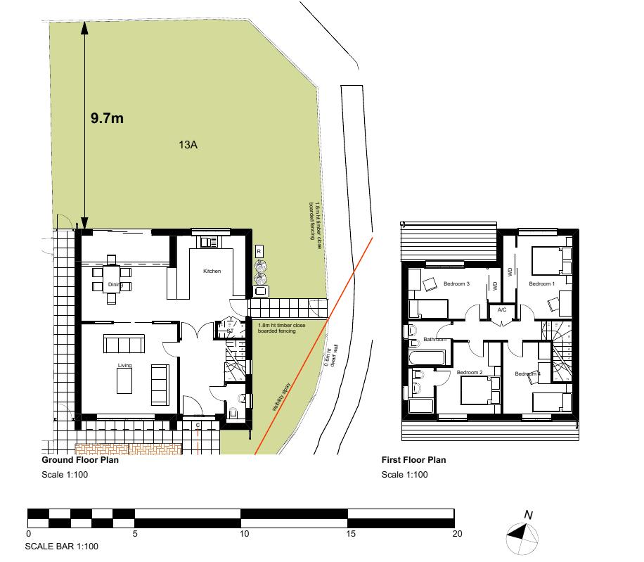
81 (77)
82
83 Appendix to 18/01535/FUL A1.0 RELEVANT PLANNING HISTORY No relevant planning history on the site. A2.0 ADDITIONAL MATTERS None. A3.0 CONSULTATIONS AND REPRESENTATIONS A3.1 A3.2 A3.3 A3.4 Ward Councillor Clancy No response received. Ward Councillor Wales No response received. Ward Councillor Rankine No response received. West Bletchley Council Objection West Bletchley Council strongly objects to this application on the grounds that the proposal: i) Is a significant over development of this site, ii) Is out of character with the surrounding properties and will have a negative impact on the street scene, iii) Would generate additional traffic and increase the parking requirement in this already overburdened cul-de-sac location to an unacceptable level resulting in obstructions and limiting access for refuse collection and emergency vehicles iv) Would be an unacceptable visual intrusion blocking the views currently enjoyed by nearby properties v) Would overlook the neighbouring property s garden resulting in adjacent residents experience a loss of privacy, vi) Would result in neighbouring and other nearby properties experiencing loss of light, (78)
84 vii) Would place a further water disposal burden in an area which is already considered as suffering from poor drainage and is known to experience flooding. This Council requests that this application be referred to the Development Control Committee/Panel for determination and confirms that it will undertake to send a representative to attend to address the Committee/Panel to present this Council s objections A3.5 MKC Highways Officer 1st response: Application needs amending and / or further information required: The submitted plans include 2 car parking spaces for both the host and new dwelling. This is in accordance with the council s adopted parking standards and the scheme for parking is acceptable in terms of layout. Due to the position of the new access serving the dwelling being on a bend there is reduced visibility towards the north. However, an acceptable visibility splay can be created across the landscaped area to the front and side of the dwelling (if the connecting fence is repositioned and landscape and high boundary treatment reduced in height). To maximise visibility this connecting fence should be placed adjacent to the side gate. The splay (measured from a point 2m along the centre line of the access to a point where it meets the nearside carriageway edge) should be provided on a revised plan and areas within the splay to a height not exceeding 1m. Visibility towards the west is acceptable. During the initial response four conditions were also recommended which have been added to section nd response: The visibility splay was not correctly drawn on the plan. I have shown in the attached how it should look. Following this amended plans were received correcting the visibility splay. 3rd response: (79)
85 Visibility from the existing access will if anything be improved by this application as the high frontage landscaping will be removed and controlled by condition. A3.6 Third party objections have been received from eleven addresses and are summarised as follows: - Impact on highway s safety - Flooding - Loss of privacy - Loss of sunlight and daylight - Overdevelopment - Impact on the character of the existing dwelling - Impact on the character of the streetscene/local area - Visual intrusion Additional comments were received and discussed the following which are not material planning considerations: - Current status of the highway, need of repair and double yellow lines - Issues with sewerage pipe - Noise and pollution linked with additional parking spaces - Loss of view - Setting a precedent for future development In addition comments were received regarding neighbour letters not being received following amended plans; however, neighbours were consulted and given a further 14 days to comment on the application. (80)
86
87 ITEM 5 Application Number: 18/01806/TPO Description Tree preservation order for consent to prune four trees back to the boundary fence line to the rear of No. 73, 75, 77 and 79 Milford Avenue. AT 77 Milford Avenue, Stony Stratford, Milton Keynes, MK11 1EZ FOR Mrs Denise Brunning Target: Extension of Time: Ward: Stony Stratford Parish: Stony Stratford Report Author/Case Officer: Olivia Farrell Planning Officer Contact Details: olivia.farrell@milton-keynes.gov.uk Team Manager: Nicola Thompson: nicola.thompson@milton-keynes.gov.uk 1.0 RECOMMENDATION It is recommended that consent be granted subject to the conditions set out at the end of this report. 2.0 INTRODUCTION The Site 2.1 The four trees associated with this application (T1, T2, T3 and T4) are located to the rear of No. 73, 75, 77 and 79 Milford Avenue, in Stony Stratford. The four trees include three Sycamore trees and one White Poplar tree. 2.2 Each of the four trees that form part of this application are under a group tree preservation order which was confirmed on 30 th March 1994 under the reference PS/540/15/164. The Proposal 2.3 This application seeks consent under Regulation 16 of the Town and Country Planning (Tree Preservation) (England) Regulations for consent to prune four trees (T1, T2, T3 and T4) back to the boundary fence line to the rear of No. 73, 75, 77 and 79 Milford Avenue. (81)
88 Reason for referral to committee 2.4 This application is referred to the Development Control Panel for determination as the applicant is a Ward Councillor for Stony Stratford. 3.0 RELEVANT POLICIES 3.1 National Planning Policy Framework (2018) Section 15 Conserving and enhancing the natural environment 3.2 Saved Policies of the Local Plan (2005) Policy D1 - Impact of Development Proposal on Locality 3.3 The Town and Country Planning (Tree Preservation) (England) Regulations Human Rights Act 1998 There may be implications under Article 8 and Article 1 of the First Protocol regarding the right of respect for a person's private and family life and home, and to the peaceful enjoyment of possessions. However, these potential issues are in this case amply covered by consideration of the environmental impact of the application under the policies of the development plan and other relevant policy guidance. 4.0 MAIN ISSUES Impact of the proposed works on the local area and the health of the trees. 5.0 CONSIDERATIONS Impact of the proposed works on the local area and the health of the trees. 5.1 With regards to the impact on the local area, the proposal would be assessed against saved policy D1 of the Milton Keynes Local Plan , the relevant parts of which for this application are as follows: (v) Physical damage to the site and neighbouring property including statutorily protected and other important built and natural features and wildlife habitats. 5.2 The proposed works involve pruning four trees to the rear of No. 73, 75, 77 and 79 Milford Avenue. The works have been justified as the four trees (T1, T2, T3 and T4) are currently significantly overhanging into each of the gardens of No.73, 75, 77 and 79 Milford Avenue and are creating a significant amount of shade to the rear of (82)
89 these gardens. In addition, the trees are also creating a significant loss of sunlight to the greenhouse to the rear of No. 77 Milford Avenue. 5.3 The MKC Arboricultural Officer was consulted and did not object to the application, commenting that the maintenance of the trees has not been routinely undertaken by Milton Keynes Council, and as such the trees have grown unchecked both in height and width. During a site visit the MKC Arboricultural Officer confirmed that the branches of many of the trees are now overhanging the rear gardens to the North West, which are the gardens of numbers 27 to 93 Milford Avenue. As such, the Arboricultural Officer recommended that the application be approved, thus allowing for the reduction in length of the side laterals to the north west of the trees canopies. 5.4 Therefore, while the works would be partially visible from the streetscene, they would not remove the affected trees completely and would preserve them for the future. Therefore the impact of the proposed works on the health of the four trees (T1, T2, T3 and T4) and the local area is considered to be acceptable. It is noted within the application form that the proposed works will be completed outside of nesting season and will be undertaken by a fully qualified arborist. Therefore, to ensure this is the case, it is recommended that an additional condition be placed on the decision notice requiring that the works to the tree shall be carried out by a competent, qualified and experienced tree surgeon. 5.5 The proposed work would not therefore be contrary to saved policy D1 (v) of the Milton Keynes Local Plan , and the case officer considers that the application is acceptable. 6.0 CONCLUSIONS 6.1 It is recommended that the proposed works are approved, subject to the conditions set out in section 7 of this report. 7.0 CONDITIONS 1. The tree works hereby permitted shall be begun before the expiration of two years from the date of this permission. Reason: To prevent the accumulation of tree preservation order permissions; to enable the Local Planning Authority to review the suitability of the works in the light of altered circumstances; and to comply with in part 4 of The Town and Country Planning (Tree Preservation) (England) Regulations The tree works shall be carried out according to the provisions of BS3998:2010 and current arboriculture industry best practice. The Local Authority Arboriculture Officer shall be given a week's notice before the works are carried out so they have (83)
90 an opportunity to attend on site and agree the exact extent of the works with those carrying them out. Reason: To safeguard the appearance of the area. 3. The tree works shall be carried out by a competent, qualified and experienced tree surgeon according to the provisions of BS3998:2010 and current arboricultureindustry best practice. Reason: To safeguard the appearance of the area. (84)


91 (85)
Report Author/Case Officer: Paul Keen Senior Planning Officer (Dev Control) Contact Details:
 Contact Details:") APP 03 Application Number: 17/02060/FUL Description A full planning application for the demolition of an existing bungalow (C3 use class) and associated out buildings and the erection of two, two storey
APP 03 Application Number: 17/02060/FUL Description A full planning application for the demolition of an existing bungalow (C3 use class) and associated out buildings and the erection of two, two storey
Report Author/Case Officer: Joanne Horner Contact Details:
 APP 04 Application Number: 16/00140/FUL Other Two storey side extension to existing dwelling and formation of hard standing to provide parking for number 54 (Resubmission of withdrawn application 15/02852/FUL)
Mr & Mrs Connolly per Pump House Designs Pump House Yard The Green SEDLESCOMBE, East Sussex. TN33 0QA
 AGENDA ITEM NO: 5 (c) Report to: PLANNING COMMITTEE Date: 03 June 2015 Report from: Head of Housing and Planning Services Application Address: Proposal: Application No: Recommendation: Ward: File No: Applicant:
Reference: 16/1447/FUL Received: 7th March 2016 Accepted: 7th March 2016 Ward: East Finchley Expiry 2nd May 2016
 Location 374B Long Lane London N2 8JX Reference: 16/1447/FUL Received: 7th March 2016 Accepted: 7th March 2016 Ward: East Finchley Expiry 2nd May 2016 Applicant: Ms Katrin Hirsig Proposal: Single storey
Application Recommended for Approval Hapton with Park Ward
 Application Recommended for Approval Hapton with Park Ward APP/2017/0036 Outline Planning Application Outline application for the construction of a new 3 bedroom dwelling (with all matters reserved for
SOUTH CAMBRIDGESHIRE DISTRICT COUNCIL. Executive Director (Operational Services) Corporate Manager (Planning and New Communities)
 Corporate Manager (Planning and New Communities)") SOUTH CAMBRIDGESHIRE DISTRICT COUNCIL REPORT TO: Planning Committee 12 January 2011 AUTHOR/S: Executive Director (Operational Services) Corporate Manager (Planning and New Communities) Notes: S/1848/10
SOUTH CAMBRIDGESHIRE DISTRICT COUNCIL REPORT TO: Planning Committee 12 January 2011 AUTHOR/S: Executive Director (Operational Services) Corporate Manager (Planning and New Communities) Notes: S/1848/10
Ground Floor Flat 15 Redbourne Avenue London N3 2BP
 Location Ground Floor Flat 15 Redbourne Avenue London N3 2BP Reference: 17/4160/FUL Received: 28th June 2017 Accepted: 29th June 2017 Ward: West Finchley Expiry 24th August 2017 Applicant: Proposal: Mr
Garages To Rear Of The Willows 1025 High Road London N20 0QE
 Location Garages To Rear Of The Willows 1025 High Road London N20 0QE Reference: 15/03944/FUL Received: 25th June 2015 Accepted: 2nd July 2015 Ward: Totteridge Expiry 27th August 2015 Applicant: Mr Alex
1 The development hereby permitted shall be carried out in accordance with the following approved plans:
 Location The Avenue Tennis Club The Avenue London N3 2LE Reference: 16/6509/FUL Received: 10th October 2016 Accepted: 10th October 2016 Ward: Finchley Church End Expiry 5th December 2016 Applicant: Mrs
PLANNING COMMITTEE REPORT
 PLANNING COMMITTEE REPORT TO: BY: Planning Committee South Head of Development DATE: 19 December 2017 DEVELOPMENT: SITE: WARD: APPLICATION: APPLICANT: Conversion of existing water storage reservoir to
CA//16/00504/FUL. Canterbury City Council Military Road Canterbury Kent CT1 1YW. Crown copyright and database rights 2016 Ordnance Survey
 O Scale 1:1,250 Map Dated: 09/05/2016 CA//16/00504/FUL Crown copyright and database rights 2016 Ordnance Survey 100019614 Canterbury City Council Military Road Canterbury Kent CT1 1YW AGENDA ITEM NO 13
SOUTH CAMBRIDGESHIRE DISTRICT COUNCIL. Planning and New Communities Director
 SOUTH CAMBRIDGESHIRE DISTRICT COUNCIL REPORT TO: Planning Committee 5 June 2013 AUTHOR/S: Planning and New Communities Director S/0747/13/FL HISTON Construction of Car Park at Histon Baptist Church, Station
Derry City and Strabane District Council Planning Committee Report
 Derry City and Strabane District Council Planning Committee Report COMMITTEE DATE: 23 rd March 2016 APPLICATION No: APPLICATION TYPE: PROPOSAL: LOCATION: APPLICANT: LA11/2015/0395/F Residential Development
1 The development hereby permitted shall be carried out in accordance with the following approved plans:
 Location 59 Greenway Close London N20 8ES Reference: 16/00011/HSE Received: 30th December 2015 Accepted: 7th January 2016 Ward: Totteridge Expiry 3rd March 2016 Applicant: Mr Ankit Shah Proposal: Part
Demolition of The Suffolk Punch Public House and clearing of the site including the car park and associated works. Parish: Bradwell Parish Council
 APP 01 Application Number: 15/01914/FUL Demolition of The Suffolk Punch Public House and clearing of the site including the car park and associated works. AT The Suffolk Punch, 1 Langcliffe Drive, Heelands
1 The development hereby permitted shall be carried out in accordance with the following approved plans:
 Location Victoria Park Ballards Lane London N3 Reference: 17/1030/FUL Received: 20th February 2017 Accepted: 20th February 2017 Ward: West Finchley Expiry 17th April 2017 Applicant: Mrs Mia Freedman Proposal:
DONCASTER METROPOLITAN BOROUGH COUNCIL. PLANNING COMMITTEE - 15th October Expiry Date:
 DONCASTER METROPOLITAN BOROUGH COUNCIL PLANNING COMMITTEE - 15th October 2013 Application 3 Application Number: 13/01158/FUL Application Expiry Date: 31st July 2013 Application Type: Full Application Proposal
Parish: Bradwell Parish Council
 APP 02 Application Number: 16/01475/FUL Demolition of existing public house and erection of 27 dwellings, two storey D1 use building for a nursery and associated car parking to east of St Augustines Church
2014/0590 Reg Date 26/06/2014 Chobham
 2014/0590 Reg Date 26/06/2014 Chobham LOCATION: PROPOSAL: TYPE: APPLICANT: OFFICER: ASCOT PARK POLO CLUB, WESTCROFT PARK FARM, WINDLESHAM ROAD, CHOBHAM, WOKING, GU24 8SN Erection of a two storey detached
3 Tretawn Gardens London NW7 4NP
 Location 3 Tretawn Gardens London NW7 4NP Reference: 16/7886/HSE Received: 12th December 2016 Accepted: 19th December 2016 Ward: Mill Hill Expiry 13th February 2017 Applicant: Proposal: Mr Murray Two storey
Ward: West Wittering. Proposal Change of use from public highway pavement to residential garden use.
 Parish: West Wittering Ward: West Wittering WW/17/03295/FUL Proposal Change of use from public highway pavement to residential garden use. Site Izora 1 Watersedge Gardens West Wittering PO20 8RA Map Ref
49 Broughton Avenue London N3 3EN
 Location 49 Broughton Avenue London N3 3EN Reference: 17/3448/RCU Received: 30th May 2017 Accepted: 1st June 2017 Ward: Finchley Church End Expiry 27th July 2017 Applicant: Mr P Atwal Proposal: Erection
PLANNING COMMITTEE DATE: 07/09/2015 REPORT OF THE SENIOR MANAGER PLANNING AND ENVIRONMENT SERVICE CAERNARFON. Number: 4
 Number: 4 Application Number: C15/0034/37/LL Date Registered: 21/05/2015 Application Type: Full - Planning Community: Llanaelhaearn Ward: Llanaelhaearn Proposal: Location: Summary of the Recommendation:
Case Officer: Sarah Kay File No: CHE/14/00515/REM Tel. No: (01246) Plot No: 2/6132 Ctte Date: 15 th September 2014 ITEM 1
 Plot No: 2/6132 Ctte Date: 15 th September 2014 ITEM 1") Case Officer: Sarah Kay File No: CHE/14/00515/REM Tel. No: (01246) 345786 Plot No: 2/6132 Ctte Date: 15 th September 2014 ITEM 1 APPROVAL OF RESERVED MATTERS FROM APPLICATION CHE/12/00234/OUT (1) LAYOUT,
Case Officer: Sarah Kay File No: CHE/14/00515/REM Tel. No: (01246) 345786 Plot No: 2/6132 Ctte Date: 15 th September 2014 ITEM 1 APPROVAL OF RESERVED MATTERS FROM APPLICATION CHE/12/00234/OUT (1) LAYOUT,
SOUTH CAMBRIDGESHIRE DISTRICT COUNCIL. Director of Development Services
 SOUTH CAMBRIDGESHIRE DISTRICT COUNCIL REPORT TO: Development and Conservation Control Committee 5 th April 2006 AUTHOR/S: Director of Development Services S/2290/05/F Haslingfield House (Revised Design)
Land Adj. 63 Sunny Bank Road, Sutton Coldfield, Birmingham, B73 5RJ
 Committee Date: 11/07/2013 Application Number: 2013/03520/PA Accepted: 20/05/2013 Application Type: Full Planning Target Date: 15/07/2013 Ward: Sutton Vesey Land Adj. 63 Sunny Bank Road, Sutton Coldfield,
Schedule of Planning Applications Committee Date: 23 May Reference: 06/17/0726/F Parish: Hemsby Officer: Mr J Beck Expiry Date:
 Schedule of Planning Applications Committee Date: 23 May 2018 Reference: 06/17/0726/F Parish: Hemsby Officer: Mr J Beck Expiry Date: 22-05-2018 Applicant: Proposal: Site: Mr Gillett Change of use to the
CA//17/02777/FUL. Scale 1:1,250. Planning Services Canterbury City Council Military Road Canterbury Kent CT1 1YW
 O CA//17/02777/FUL Scale 1:1,250 Map Dated: 15/03/2018 Planning Services Canterbury City Council Military Road Canterbury Kent CT1 1YW AGENDA ITEM NO 16 PLANNING COMMITTEE APPLICATION NUMBER: SITE LOCATION:
DEVELOPMENT MANAGEMENT REPORT
 ITEM A08-1 DEVELOPMENT MANAGEMENT REPORT TO: BY: DATE: DEVELOPMENT: SITE: WARD: APPLICATION: APPLICANT: Development Management Committee Development Manager Proposed live/work unit in connection with existing
an Inspector appointed by the Secretary of State for Communities and Local Government
 Appeal Decision Site visit made on 14 July 2015 by I Radcliffe BSc(Hons) MCIEH DMS an Inspector appointed by the Secretary of State for Communities and Local Government Decision date: 18 August 2015 Appeal
REFERENCE: B/00601/12 Received: 11 February 2012 Accepted: 21 February 2012 WARD(S): High Barnet Expiry: 17 April 2012
: High Barnet Expiry: 17 April 2012") LOCATION: 37 Kings Road, Barnet, Herts, EN5 4EG REFERENCE: B/00601/12 Received: 11 February 2012 Accepted: 21 February 2012 WARD(S): High Barnet Expiry: 17 April 2012 Final Revisions: APPLICANT: PROPOSAL:
LOCATION: 37 Kings Road, Barnet, Herts, EN5 4EG REFERENCE: B/00601/12 Received: 11 February 2012 Accepted: 21 February 2012 WARD(S): High Barnet Expiry: 17 April 2012 Final Revisions: APPLICANT: PROPOSAL:
PART 1 EAST HAMPSHIRE DISTRICT COUNCIL SECTION 1 SCHEDULE OF APPLICATION RECOMMENDATIONS
 PART 1 EAST HAMPSHIRE DISTRICT COUNCIL PLANNING COMMITTEE REPORT OF THE HEAD OF PLANNING Applications to be determined by the Council as the Local Planning Authority SECTION 1 SCHEDULE OF APPLICATION RECOMMENDATIONS
Site north of Hattersley Road West (east of Fields Farm Road), Hattersley
, Hattersley") Application Number 17/00982/REM Proposal Site Applicant Recommendation Reason for report Application for the approval of reserved matters (means of access, landscaping, layout, scale and appearance) relating
Application Number 17/00982/REM Proposal Site Applicant Recommendation Reason for report Application for the approval of reserved matters (means of access, landscaping, layout, scale and appearance) relating
Town Council. Report Author/Case Officer: Alex Harrison Contact Details:
 Application Number: 09/00330/FUL ERECTION OF TWO STOREY SIDE EXTENSION AT The Pink Punters, 2 Watling Street, Fenny Stratford FOR Mr F McMahon Target: 27th April 2009 Ward: Bletchley And Fenny Stratford
26 September 2014 CONSULTATION EXPIRY : APPLICATION EXPIRY : 22 July 2014 SUMMARY RECOMMENDATION: PERMISSION
 Item No.: 5 The information, recommendations and advice contained in this report are correct as at the date of preparation, which is more than one week in advance of the Committee meeting. Because of the
UTT/17/2075/FUL - (BERDEN) (Referred to Committee by Councillor Janice Loughlin. Reason: In the Public Interest)
 (Referred to Committee by Councillor Janice Loughlin. Reason: In the Public Interest)") UTT/17/2075/FUL - (BERDEN) (Referred to Committee by Councillor Janice Loughlin. Reason: In the Public Interest) PROPOSAL: LOCATION: APPLICANT: Amendments to the design of a scheme for a 49.99MW battery
UTT/17/2075/FUL - (BERDEN) (Referred to Committee by Councillor Janice Loughlin. Reason: In the Public Interest) PROPOSAL: LOCATION: APPLICANT: Amendments to the design of a scheme for a 49.99MW battery
Description Details submitted pursuant to discharge of condition 5 (Design Code) attached to planning permission 13/01729/OUT.
 attached to planning permission 13/01729/OUT.") ITEM 9 Application Number: 18/00266/DISCON Description Details submitted pursuant to discharge of condition 5 (Design Code) attached to planning permission 13/01729/OUT. AT The Point, 602 Midsummer Boulevard,
ITEM 9 Application Number: 18/00266/DISCON Description Details submitted pursuant to discharge of condition 5 (Design Code) attached to planning permission 13/01729/OUT. AT The Point, 602 Midsummer Boulevard,
INTRODUCTION CURRENT APPLICATION
 05/01805/FUL & 05/01807/LBC ERECTION OF A SINGLE DWELLING HOUSE WITH ANCILLARY ACCOMMODATION AT Flamingo Zoological Gardens, Olney Road, Weston Underwood FOR Mr A J Crowther (as amended by letter dated
3 Abbey View Mill Hill London NW7 4PB
 Location 3 Abbey View Mill Hill London NW7 4PB Reference: 15/03203/HSE Received: 26th May 2015 Accepted: 16th June 2015 Ward: Mill Hill Expiry 11th August 2015 Applicant: Proposal: Mr Richard Benson Alterations
Test Valley Borough Council Southern Area Planning Committee 8 January 2019
 ITEM 11 APPLICATION NO. 18/02218/FULLS APPLICATION TYPE FULL APPLICATION - SOUTH REGISTERED 23.08.2018 APPLICANT Rugby Football Union SITE The Trojans Club, Stoneham Lane, Eastleigh, SO50 9HT, CHILWORTH
REFERENCE: B/03745/12 Received: 02 October 2012 Accepted: 05 October 2012 WARD(S): Totteridge Expiry: 30 November 2012.
: Totteridge Expiry: 30 November 2012.") LOCATION: 15A Pyecombe Corner, London, N12 7AJ REFERENCE: B/03745/12 Received: 02 October 2012 Accepted: 05 October 2012 WARD(S): Totteridge Expiry: 30 November 2012 Final Revisions: APPLICANT: PROPOSAL:
LOCATION: 15A Pyecombe Corner, London, N12 7AJ REFERENCE: B/03745/12 Received: 02 October 2012 Accepted: 05 October 2012 WARD(S): Totteridge Expiry: 30 November 2012 Final Revisions: APPLICANT: PROPOSAL:
Planning Committee 04/02/2015 Schedule Item 6. Smith Farm Estate, Old Bridge Close, Northolt, UB5 6UA.
 Planning Committee 04/02/2015 Schedule Item 6 Ref: Address: Ward: Proposal: PP/2014/5145 Smith Farm Estate, Old Bridge Close, Northolt, UB5 6UA. Greenford Broadway Installation of sports pitch, reconstruction
DONCASTER METROPOLITAN BOROUGH COUNCIL. PLANNING COMMITTEE 3 rd May Expiry Date:
 DONCASTER METROPOLITAN BOROUGH COUNCIL PLANNING COMMITTEE 3 rd May 2016 Application 7 Application Number: 16/00741/FUL Application Expiry Date: 3 rd May 2016 Application Type: Full application Proposal
Harrow Lane, St Leonards-on-Sea, East Sussex, TN37 7JZ ERECTION OF 113 DWELLINGS TOGETHER WITH ESTATE ROADS (DETAILED SUBMISSION)
") AGENDA ITEM NO: Report to: PLANNING BOARD Date: 10 September, 2003 Report from: Borough Planning Officer Application Address: Proposal: Application No: Recommendation: Ward: File No: Applicant: Interest:
AGENDA ITEM NO: Report to: PLANNING BOARD Date: 10 September, 2003 Report from: Borough Planning Officer Application Address: Proposal: Application No: Recommendation: Ward: File No: Applicant: Interest:
5 Gratton Terrace London NW2 6QE. Reference: 17/5094/HSE Received: 4th August 2017 Accepted: 7th August 2017 Ward: Childs Hill Expiry 2nd October 2017
 Location 5 Gratton Terrace London NW2 6QE Reference: 17/5094/HSE Received: 4th August 2017 Accepted: 7th August 2017 Ward: Childs Hill Expiry 2nd October 2017 Applicant: WSD (Gratton) Ltd Proposal: The
LONGDEN VILLAGE DEVELOPMENT STATEMENT
 LONGDEN VILLAGE DEVELOPMENT STATEMENT 2017-2027 1 Longden Development Statement 2017-2027 15/01/18 1. Background 1.1 Longden Village Longden village is a very rural and traditional community first mentioned
Tennis Court Rear Of 3-5 Corringway London NW11 7ED
 Location Tennis Court Rear Of 3-5 Corringway London NW11 7ED Reference: 18/4122/FUL Received: 3rd July 2018 Accepted: 3rd July 2018 Ward: Garden Suburb Expiry 28th August 2018 Applicant: Ms Sarah Robinson
Applicant s partner is an employee of the Council COMMITTEE TO DETERMINE
 Item No. 13 APPLICATION NUMBER CB/13/02360/FULL LOCATION Land adj to 2 Sandy Lane, Leighton Buzzard, LU7 3BE PROPOSAL Demolition of existing garages & construction of a new 2 bed bungalow, together with
18 Birkbeck Road London NW7 4AA. Reference: 15/02994/HSE Received: 14th May 2015 Accepted: 26th May 2015 Ward: Mill Hill Expiry 21st July 2015
 Location 18 Birkbeck Road London NW7 4AA Reference: 15/02994/HSE Received: 14th May 2015 Accepted: 26th May 2015 Ward: Mill Hill Expiry 21st July 2015 Applicant: Proposal: Mrs Tania Kallis Single storey
Outline planning permission including means of access (all other matters reserved) for the erection of 14 new dwellings
 for the erection of 14 new dwellings") APP 02 Application Number: 16/01630/OUT Major Outline planning permission including means of access (all other matters reserved) for the erection of 14 new dwellings AT Land East of Castle Road And North
APP 02 Application Number: 16/01630/OUT Major Outline planning permission including means of access (all other matters reserved) for the erection of 14 new dwellings AT Land East of Castle Road And North
Departure from the Development Plan. Town Council objection to a major application. DETERMINE
 Item No. 9 APPLICATION NUMBER CB/17/01642/OUT LOCATION Land rear of 43 to 91 Silver Birch Avenue South of Alder Green and Aspen Gardens, Aspen Gardens, Stotfold PROPOSAL Outline application for up to 95
SOUTH CAMBRIDGESHIRE DISTRICT COUNCIL. Planning and New Communities Director. Linton. Yes
 SOUTH CAMBRIDGESHIRE DISTRICT COUNCIL REPORT TO: Planning Committee 2 July 2014 AUTHOR/S: Planning and New Communities Director Application Number: Parish(es): Proposal: Site address: Applicant(s): Recommendation:
Reference: 15/06961/RCU Received: 13th November 2015 Accepted: 17th November 2015 Ward: Coppetts Expiry 12th January 2016
 Location 91 Manor Drive London N20 0XD Reference: 15/06961/RCU Received: 13th November 2015 Accepted: 17th November 2015 Ward: Coppetts Expiry 12th January 2016 Applicant: Mr Christos Papadopoulos Proposal:
PLANNING COMMITTEE. 14 October 2014
 AGENDA ITEM NO 8 PLANNING COMMITTEE 14 October 2014 APPLICATION NUMBER : CA//14/01744/FUL PROPOSAL : Extension and conversion of roof space of an existing detached bungalow together with enhanced parking
Planning Area Committee 25 June 2018 Addendum to Officers Report RESTRICTION OF PERMITTED DEVELOPMENT RIGHTS - EXTENSIONS
 Planning Area Committee 25 June 2018 Addendum to Officers Report 17/8150/RMA West Hendon Regeneration Area (Phase 6) Pages 11 54 The conditions section shall be changed as follows: RESTRICTION OF PERMITTED
SOUTH CAMBRIDGESHIRE DISTRICT COUNCIL. REPORT TO: Planning Committee 1 April 2015 Planning and New Communities Director
 SOUTH CAMBRIDGESHIRE DISTRICT COUNCIL REPORT TO: Planning Committee 1 April 2015 AUTHOR/S: Planning and New Communities Director Application Number: Parish(es): Proposal: Site address: Applicant(s): Recommendation:
PLANNING COMMITTEE 15 September 2015
 AGENDA ITEM NO 12 PLANNING COMMITTEE 15 September 2015 APPLICATION NUMBER : CA//15/01402/FUL PROPOSAL : Single-storey conservatory to rear. LOCATION OF SITE : 5 Mill Lane, Herne, CT6 7ED APPLICATION TYPE
6B Bertram Road London NW4 3PN
 Location 6B Bertram Road London NW4 3PN Reference: 16/6621/RCU Received: 14th October 2016 Accepted: 19th October 2016 Ward: West Hendon Expiry 14th December 2016 Applicant: Proposal: Ms Kavita Singh Erection
Derry City and Strabane District Council Planning Committee Report
 Derry City and Strabane District Council Planning Committee Report COMMITTEE DATE: 23rd March 2016 APPLICATION No: APPLICATION TYPE: PROPOSAL: LOCATION: APPLICANT: AGENT: LA11/2015/0263/O Outline Planning
SUBJECT TO ATTACHED SCHEDULE OF THIRTY SIX CONDITIONS
 Stratton House 58/60 High West Street Dorchester Dorset DT1 1UZ Duchy of Cornwall Poundbury Farmhouse Poundbury Farm Way Poundbury Dorchester DT1 3RT Tel: (01305) 251010 Fax: (01305) 251481 Minicom: (01305)
Derry City and Strabane District Council Planning Committee Report
 Derry City and Strabane District Council Planning Committee Report COMMITTEE DATE: 29 th November 2017 APPLICATION No: APPLICATION TYPE: PROPOSAL: LOCATION: APPLICANT: AGENT: LA11/2016/0854/O Outline Shared
PARISH / WARD: Peacehaven / Peacehaven East PROPOSAL:
 APPLICATION ITEM LW/16/0802 NUMBER: NUMBER: 7 APPLICANTS NAME(S): Mr J Robison & Ms S Teng PARISH / WARD: Peacehaven / Peacehaven East PROPOSAL: Planning Application for Conversion of existing garage to
Outh SOUTH CAMBRIDGESHIRE DISTRICT COUNCIL. Joint Director for Planning and Economic Development S/0179/18/OL. Histon. Approval.
 Outh SOUTH CAMBRIDGESHIRE DISTRICT COUNCIL REPORT TO: Planning Committee 4 April 2018 AUTHOR/S: Joint Director for Planning and Economic Development Application Number: Parish(es): Proposal: Site address:
SOUTH CAMBRIDGESHIRE DISTRICT COUNCIL. Planning and New Communities Director
 SOUTH CAMBRIDGESHIRE DISTRICT COUNCIL REPORT TO: Planning Committee 9 January 2013 AUTHOR/S: Planning and New Communities Director S/2270/12/FL FEN DRAYTON 850m long flood defence embankment ranging in
2014/0943 Reg Date 06/11/2014 Lightwater
 2014/0943 Reg Date 06/11/2014 Lightwater LOCATION: PROPOSAL: TYPE: APPLICANT: OFFICER: LAND REAR OF 4, 6 & 8 MACDONALD ROAD, LIGHTWATER, GU18 5TN Erection of 2 linked-detached two storey dwellings with
MID SUFFOLK DISTRICT COUNCIL DEVELOPMENT CONTROL COMMITTEE A - 09 November (1) The application site is owned by Mid Suffolk District Council.
 The application site is owned by Mid Suffolk District Council.") MID SUFFOLK DISTRICT COUNCIL DEVELOPMENT CONTROL COMMITTEE A - 09 November 2016 I AGENDA ITEM NO APPLICATION NO PROPOSAL SITE LOCATION SITE AREA (Ha) APPLICANT RECEIVED EXPIRY DATE 1 2776/16 Erection of
MID SUFFOLK DISTRICT COUNCIL DEVELOPMENT CONTROL COMMITTEE A - 09 November 2016 I AGENDA ITEM NO APPLICATION NO PROPOSAL SITE LOCATION SITE AREA (Ha) APPLICANT RECEIVED EXPIRY DATE 1 2776/16 Erection of
Site Address: Site Accessed off Bondfield Close, Bondfield Crescent, Wombwell, Barnsley, S73 8TX
 2017/0155 Applicant: Craig Hawley, Gleeson Regeneration Ltd Description: Residential development of 49 no dwelling houses. Site Address: Site Accessed off Bondfield Close, Bondfield Crescent, Wombwell,
DEVELOPMENT MANAGEMENT REPORT
 ITEM A07-1 DEVELOPMENT MANAGEMENT REPORT TO: BY: Development Management Committee (South) Development Manager DATE: 21 June 2016 DEVELOPMENT: SITE: WARD: APPLICATION: APPLICANT: Outline application for
SOUTH CAMBRIDGESHIRE DISTRICT COUNCIL. Planning and New Communities Director
 SOUTH CAMBRIDGESHIRE DISTRICT COUNCIL REPORT TO: Planning Committee 9 January 2013 AUTHOR/S: Planning and New Communities Director S/2064/12/FL WATERBEACH Demolition of existing 35 no. shared amenity apartments
CHANGE OF USE OF AMENITY LAND TO RESIDENIAL GARDEN LAND WITH BOUNDARY FENCES
 Application Number: 09/01450/FUL Other CHANGE OF USE OF AMENITY LAND TO RESIDENIAL GARDEN LAND WITH BOUNDARY FENCES AT 1 Harlow Crescent, Oxley Park, Milton Keynes FOR Mr And Mrs M Hale Target: 13th October
Reserved Matters application for a site that straddles the boundary between CBC and BBC
 BBC APPLICATION 15/02682/MAR NUMBER CBC APPLICATION CB/15/04294/RM NUMBER LOCATION Wixams Land at former storage depot, Bedford Road, Wilstead Bedfordshire PROPOSAL Reserved Matters Application for Strategic
1. Listed Building and Conservation Area considerations 2. Protection of Known Archaeological Remains 3. Parking
 08/01222/FUL ERECTION OF SINGLE STOREY SIDE EXTENSION TO CHURCH TO PROVIDE FOR PARISH HALL (RESUBMISSION OF 08/00206/FUL) AT St Mary And St Giles Church, Church Street, Stony Stratford FOR Rev R Northing
Mid Suffolk District Council Planning Control Department 131 High Street Needham Market IP6 8DL
 Mid Suffolk District Council Planning Control Department 131 High Street Needham Market IP6 8DL OUTLINE PLANNING PERMISSION Town and Country Planning Act 1990 THE TOWN AND COUNTRY PLANNING (DEVELOPMENT
Site: Essex Police & La Plata House London Road Brentwood Essex CM14 4QJ
 Reference: 16/01805/OUT Ward: Brentwood West Site: Essex Police & La Plata House London Road Brentwood Essex CM14 4QJ Proposal: Outline application for demolition of existing police station buildings,
Reference: 16/1234/HSE Received: 25th February 2016 Accepted: 2nd March 2016 Ward: High Barnet Expiry 27th April 2016
 Location 7 Sunset View Barnet EN5 4LB Reference: 16/1234/HSE Received: 25th February 2016 Accepted: 2nd March 2016 Ward: High Barnet Expiry 27th April 2016 Applicant: Proposal: Mr & Mrs Peter & Anny Woodhams
Statement of Community Involvement LAND OFF SOUTHDOWN ROAD HORNDEAN, HAMPSHIRE
 LAND OFF SOUTHDOWN ROAD HORNDEAN, HAMPSHIRE CONTENTS Page 1. Introduction 3 2. Pre-application Discussions 4 3. The Consultation Process 5 4. Consultation Feedback 7 5. Responses to Consultation Feedback
Derry City and Strabane District Council Planning Committee Report. Amended layout from approval A/2004/0462/F with reduction from 166 units
 Derry City and Strabane District Council Planning Committee Report COMMITTEE DATE: 1 st February 2017 APPLICATION No: APPLICATION TYPE: PROPOSAL: LOCATION: APPLICANT: AGENT: Full Planning application Amended
AT Land North And West of Wavendon Business Park, Ortensia Drive, Wavendon Gate
 APP 02 Application Number: 15/02337/OUT Major Outline application for up to 134 residential units, 75-100 sqm of A1 (retail use) for the provision of a local convenience store with access from Ortensia
2015/1020 Mr Edward Cockburn Caravan storage on hardcore base (Retrospective) Ranah Stones, Whams Road, Hazlehead, Sheffield, S36 4HT
 Ranah Stones, Whams Road, Hazlehead, Sheffield, S36 4HT") 2015/1020 Mr Edward Cockburn Caravan storage on hardcore base (Retrospective) Ranah Stones, Whams Road, Hazlehead, Sheffield, S36 4HT Dunford Parish Council have not commented Councillor Andrew Millner
2015/1020 Mr Edward Cockburn Caravan storage on hardcore base (Retrospective) Ranah Stones, Whams Road, Hazlehead, Sheffield, S36 4HT Dunford Parish Council have not commented Councillor Andrew Millner
DELEGATED DECISION on 1st September 2015
 Application N o : 14/04810/OUT LONDON BOROUGH OF BROMLEY TOWN PLANNING RENEWAL AND RECREATION DEPARTMENT DELEGATED DECISION on 1st September 2015 14/04810/OUT Claire Harris 4 Oaklands Road Bromley BR1
RULE 6 (6) STATEMENT OF CASE
 STATEMENT OF CASE") RULE 6 (6) STATEMENT OF CASE Former Allerthorpe Park Golf Club, Allerthorpe, YO42 4RL Submitted on Behalf of Allerthorpe Parish Council Appeal by Turnwalk Ltd. and Park Leisure 2000 Ltd. Appeal Reference:
RULE 6 (6) STATEMENT OF CASE Former Allerthorpe Park Golf Club, Allerthorpe, YO42 4RL Submitted on Behalf of Allerthorpe Parish Council Appeal by Turnwalk Ltd. and Park Leisure 2000 Ltd. Appeal Reference:
3(iv)(b) TCP/11/16(29)
(b) TCP/11/16(29)") 3(iv)(b) TCP/11/16(29) TCP/11/16(29) Planning Application 09/02229/AML Erection of a dwellinghouse, garage with upper floor accommodation and stables (Approval of Matters Specified by Conditions) at land
3(iv)(b) TCP/11/16(29) TCP/11/16(29) Planning Application 09/02229/AML Erection of a dwellinghouse, garage with upper floor accommodation and stables (Approval of Matters Specified by Conditions) at land
MINUTES OF THE PLANNING COMMITTEE MEETING HELD MONDAY 19 TH JANUARY PM BURBAGE MILLENNIUM HALL
 55 MINUTES OF THE PLANNING COMMITTEE MEETING HELD MONDAY 19 TH JANUARY 2015 7PM BURBAGE MILLENNIUM HALL Present: Cllr Mrs M Lynch (in the chair) Cllrs Mr S Deeming, Mr R Flemming, Mr P Hall, Mr K Lynch,
UTT/17/2050/FUL - (STANSTED MOUNTFITCHET)
") UTT/17/2050/FUL - (STANSTED MOUNTFITCHET) (Referred to the Planning Committee by Cllr Sell. Reason: The loss of trees and introduction of back-land development) PROPOSAL: LOCATION: APPLICANT: AGENT: Erection
UTT/17/2050/FUL - (STANSTED MOUNTFITCHET) (Referred to the Planning Committee by Cllr Sell. Reason: The loss of trees and introduction of back-land development) PROPOSAL: LOCATION: APPLICANT: AGENT: Erection
Brookside Walk Children's Play Area, London, NW4
 LOCATION: Brookside Walk Children's Play Area, London, NW4 REFERENCE: H/05584/13 Received: 26 November 2013 Accepted: 11 December 2013 WARD(S): Hendon Expiry: 05 February 2014 Final Revisions: APPLICANT:
PLANNING COMMITTEE REPORT
 PLANNING COMMITTEE REPORT TO: BY: Planning Committee South Head of Development DATE: 21 August 2018 DEVELOPMENT: SITE: WARD: APPLICATION: APPLICANT: Erection of a new chalet bungalow with associated parking
BLACKHEATH SQUASH CLUB Blackheath Sports Club, Rectory Field, Charlton Road, London, SE7 7EY. Planning, Design and Access Statement
 Planning, Design and Access Statement Revised: 28 th Jan 2016 Peter Pendleton & Associates Ltd Introduction Planning permission will be sought for a refurbishment of existing courts and extension to provide
CHANGE OF USE FROM PADDOCK TO RESIDENTIAL GARDEN LAND AT Yew Tree Cottage, Timpson Lane, Clifton Reynes FOR Iain Morrison
 08/01064/FUL CHANGE OF USE FROM PADDOCK TO RESIDENTIAL GARDEN LAND AT Yew Tree Cottage, Timpson Lane, Clifton Reynes FOR Iain Morrison INTRODUCTION Yew Tree Cottage is a detached dwelling at the northern
St Marys Church Of England High School Downage London NW4 1AB
 Location St Marys Church Of England High School Downage London NW4 1AB Reference: 16/2877/FUL Received: 29th April 2016 Accepted: 10th May 2016 Ward: Hendon Expiry 5th July 2016 Applicant: Proposal: Governors
PLANNING COMMITTEE REPORT
 PLANNING COMMITTEE REPORT TO: BY: Planning Committee South Head of Development DATE: 20 March 2018 DEVELOPMENT: SITE: WARD: APPLICATION: APPLICANT: Proposed erection of 2 no. 3-bedroom dwellings and conversion
37 NAGS HEAD LANE BRENTWOOD ESSEX CM14 5NL
 SITE PLAN ATTACHED 37 NAGS HEAD LANE BRENTWOOD ESSEX CM14 5NL RAISE RIDGE, EXTEND HIPPED ROOF TO GABLE AND ADD SIDE DORMER WITH PART SINGLE PART TWO STOREY REAR EXTENSION INCORPORATING JULIETTE BALCONY
Persimmon Homes Thames Valley Date received: 2 nd April week date(major): 2 nd July 2014 Ward: Nascot
: 2 nd July 2014 Ward: Nascot") PART A Report of: DEVELOPMENT MANAGEMENT SECTION HEAD Date of Committee: 26 th June 2014 Site address: Rounton, 28, Nascot Wood Road Reference Number: 14/00497/REM Description of Development: Reserved
PART A Report of: DEVELOPMENT MANAGEMENT SECTION HEAD Date of Committee: 26 th June 2014 Site address: Rounton, 28, Nascot Wood Road Reference Number: 14/00497/REM Description of Development: Reserved
PART 2 SOUTH DOWNS NATIONAL PARK AUTHORITY SECTION 1 SCHEDULE OF APPLICATION RECOMMENDATIONS
 42 PART 2 SOUTH DOWNS NATIONAL PARK AUTHORITY PLANNING COMMITTEE REPORT OF THE SERVICE MANAGER PLANNING DEVELOPMENT Applications to be determined by the council on behalf of the South Downs National Park
LOCATION: 592 Finchley Road, London, NW11 7RX REFERENCE: F/03977/12 Received: 22 October 2012 Accepted: 29 November 2012 WARD(S): Childs Hill Expiry:
: Childs Hill Expiry:") LOCATION: 592 Finchley Road, London, NW11 7RX REFERENCE: F/03977/12 Received: 22 October 2012 Accepted: 29 November 2012 WARD(S): Childs Hill Expiry: 24 January 2013 Final Revisions: APPLICANT: Mr S Kapoor
LOCATION: 592 Finchley Road, London, NW11 7RX REFERENCE: F/03977/12 Received: 22 October 2012 Accepted: 29 November 2012 WARD(S): Childs Hill Expiry: 24 January 2013 Final Revisions: APPLICANT: Mr S Kapoor
Construction of 9 dwellings and associated infrastructure.
 Application Number 16/00653/FUL Proposal Site Applicant Recommendation Construction of 9 dwellings and associated infrastructure. Land at Grange Road South, Hyde McDermott Developments Ltd Approve REPORT
LAND SOUTH OF ROUNDABOUT AT END OF PRIORY CHASE, RAYLEIGH, ESSEX PROVISION OF A SCOUT BUILDING, ACCESS AND CAR PARKING
 16/00123/FUL LAND SOUTH OF ROUNDABOUT AT END OF PRIORY CHASE, RAYLEIGH, ESSEX PROVISION OF A SCOUT BUILDING, ACCESS AND CAR PARKING APPLICANT: ZONING: PARISH: WARD: MR ANDREW AUSTIN EXISTING RESIDENTIAL
APP/G1630/W/15/
 Appeal Decision Site visit made on 20 October 2015 by William Fieldhouse BA (Hons) MA MRTPI an Inspector appointed by the Secretary of State for Communities and Local Government Decision date: 20 November
Final Revisions: Provision of single storey modular classroom and associated works.
 LOCATION: St Catherines Catholic Primary School, Vale Drive, Barnet, Herts, EN5 2ED REFERENCE: B/01924/12 Received: 17 May 2012 Accepted: 28 May 2012 WARD(S): Underhill Expiry: 23 July 2012 Final Revisions:
EXTRACT FROM THE CUDDINGTON NEIGHBOURHOOD PLAN The Policies
 EXTRACT FROM THE CUDDINGTON NEIGHBOURHOOD PLAN The Policies Environment and Landscape Policy 1 - Landscape Setting Development should respect and wherever possible enhance the landscape setting of Cuddington
Final Revisions: Reason: For the avoidance of doubt and in the interests of proper planning.
 LOCATION: Totteridge Village Hall, Badgers Croft, London, N20 8AH REFERENCE: B/01780/12 Received: 11 May 2012 Accepted: 25 May 2012 WARD(S): Totteridge Expiry: 20 July 2012 Final Revisions: APPLICANT: