Public Document Pack SOLIHULL METROPOLITAN BOROUGH COUNCIL. Cabinet. Thursday 11 August 2016 at 6.00pm. Civic Suite WEBCASTING NOTICE
|
|
|
- Emmeline Hardy
- 5 years ago
- Views:
Transcription
1 Public Document Pack SOLIHULL METROPOLITAN BOROUGH COUNCIL Cabinet Thursday 11 August 2016 at 6.00pm Civic Suite WEBCASTING NOTICE Please note: this meeting may be filmed for live broadcast and recorded content will be available to view on the Council s website. By entering the meeting room and using the public seating area you are consenting to being filmed. If members of the public do not wish to be filmed, make the Clerk aware of this so suitable seating can be found. Further information about webcasting can be found at the following link: Any person taking part in the meeting is reminded not to disclose personal information about any third party.
2 Disclosing Pecuniary Interests - What Must You Do? (a) You must complete a declaration of your disclosable pecuniary interests, including those of your spouse/civil partner (or someone with whom you are living as such) and send it to the Monitoring Officer within 28 days of your election or appointment to the Council. (b) When you attend a meeting of the Council, Cabinet, Scrutiny Board, Committee, Sub- Committee or Joint Committee etc, and a matter arises in which you have a disclosable pecuniary interest, unless you have been granted a dispensation, you must: Declare the interest if you have not already registered it Not participate in any discussion or vote Leave the meeting room until the matter has been dealt with Give written notice of any unregistered interest to the Monitoring Officer within 28 days of the meeting (c) If you are the Leader or a Cabinet Portfolio Holder you may not exercise any of your delegated powers as a single member in relation to a matter in which you have a disclosable pecuniary interest or take any other step except to give written notice of any unregistered interest to the Monitoring Officer within 28 days of your becoming aware of the interest, or arrange for another person or body to deal with the matter. Disclosable Interest Employment, office, trade, profession or vocation Sponsorship Contracts Land Licences Corporate tenancies Securities Description Any employment, office, trade, profession or vocation carried on for profit or gain by you or your partner. Any payment or provision of any other financial benefit (other than from the Council) made or provided within 12 months of your declaration of interests in respect of any expenses incurred by you in carrying out duties as a member, or towards your election expenses. Any contract between you or your partner (or a firm or body corporate in which you or your partner is a partner or a director, or in the securities of which you or your partner has a beneficial interest)) and the Council (a) under which goods or services are to be provided or works are to be executed; and (b) which has not been fully discharged. Any beneficial interest in land which is within the area of the Council and which gives you or your partner a right to occupy the land or receive income. Any licence held by you or your partner (alone or jointly with others) to occupy land in the area of the Council for a month or longer. Any tenancy where (to your knowledge) (a) the landlord is the Council; and (b) the tenant is a body in which you or your partner has a beneficial interest i.e. a firm or body corporate in which you or your partner is a partner or a director, or in the securities of which you or your partner has a beneficial interest. Any beneficial interest held by you or your partner in securities of a body where (a) that body (to your knowledge) has a place of business or land in the area of the Council; and (b) either (i) the total nominal value of the securities exceeds 25,000 or one hundredth of the total issued share capital of that body; or (ii) if the share capital of that body is of more than one class, the total nominal value of the shares of any one class in which you or your partner has a beneficial interest exceeds one hundredth of the total issued share capital of that class. securities means shares, debentures, debenture stock, loan stock, bonds, units of a collective investment scheme within the meaning of the Financial Services and Markets Act 2000 and other securities of any description, other than money deposited with a building society.
3 SOLIHULL METROPOLITAN BOROUGH COUNCIL To: Councillors R Sleigh, I Courts, T Dicicco, K Grinsell, R Hulland, K Meeson, T Richards OBE, J Burn, D Evans and J Windmill NICK PAGE CHIEF EXECUTIVE Council House, Manor Square Solihull, West Midlands. B91 3QB Tel Jane Game Tel: jgame@solihull.gov.uk Date Thursday, 28 July 2016 CABINET - Thursday, 11 August 2016 AGENDA Mayor/Chairman of the meeting to announce: May I remind everyone present that this meeting will be broadcast live via the internet and the record will be archived for future viewing. 6. SOLIHULL TOWN CENTRE MASTERPLAN CONSULTATION (Pages 5-80) This report seeks approval to consult on the draft Solihull Town Centre Masterplan as shown in Appendix A with the Consultation Plan as shown in Appendix B.
4 This page is intentionally left blank
5 Solihull Town Centre Masterplan Draft Masterplan 27th July 2016 Page 5 Agenda Item 6
6 Page 6 Prepared by: Checked by: Drawn: Nichola Panaretos Graduate Urban Designer Checked: Lee Anne Wood Principal Landscape Architect Approved: Richard Green Director Rev Comments Drawn Checked Approved Date - DRAFT NP LW RG 27/05/16 A SMBC Comments NP LW RG 09/06/16 B WSP Transport Text Amendment NP LW RG 17/06/16 C SMBC Comments NP LW RG 04/07/16 D SMBC Final Comments NP LW RG 05/07/16 E SMBC Members comments NP RG RG 08/07/16 F Final Draft NP LW RG 27/06/16 2 Tel Job no Fax Ref PR001 Web This document is confidential and the copyright of AECOM Europe Limited. Any unauthorised reproduction or usage by any person other than the addressee is strictly prohibited.
7 SOLIHULL TOWN CENTRE MASTERPLAN DRAFT MASTERPLAN CONTENTS 01 Introduction 02 Planning Policy Review 03 Spatial Audit Page 7 04 Market Overview 05 Transport 06 Engagement 07 Vision 08 Emerging Concepts 09 Areas of Change 3
8 01 Introduction The Solihull Town Centre Masterplan aims to provide a blueprint for future investment and development which maximises the opportunities for Solihull, capitalises on its existing assets, and sets out a clear vision for Solihull 2036; as a vibrant, sustainable, aspirational and diverse 21st century town. Solihull is already a successful and popular town, and has consistently been named as one of the best places to live within the United Kingdom. With its excellent shopping, cultural facilities, employment opportunities with about 15,000 jobs currently and attractive setting, Solihull has a lot to offer to residents, businesses and visitors. Page 8 UK Central is a prime investment location, which is the West Midland s principal economic gateway and strongest performing economy, centred around Solihull. Incorporating the town centre, Birmingham Airport, Jaguar Land Rover and the National Exhibition Centre, UK Central is also the site of the West Midland s proposed new High Speed Rail Interchange. In June 2013, Solihull Council, the Greater Birmingham and Solihull Local Enterprise Partnership, and Arup published the UK Central Masterplan, showcasing the development potential of the area up to The masterplan outlines how bold measures need to be taken to capitalise on the potential of the already successful gateway site. It is predicted that UK Central could create an additional 100,000 jobs with a town centre range of 4 to 16,000 jobs, and increase the region s revenue up to 19.5 billion annually by It provides significant opportunities to maintain and enhance Solihull s existing economic base on a scale of national significance; positioning the town as part of the engine room of the West Midlands. In order to ensure managed growth and the retention of the character which makes Solihull so popular, the Masterplan will provide a framework for future development, which aims to 4 balance the sometimes conflicting needs for growth and infrastructure investment with quality of place. 1.1 Purpose of this document This document presents AECOMs analysis and emerging masterplanning approach to the Solihull Town Centre Masterplan, which builds upon previous visioning work, established through the Town Centre Study (GVA Grimley, 2009) and draws together the emerging principles from the Solihull Town Centre Access and Movement Study. The work in this report has been underpinned by Cushman and Wakefield s analysis of the market, which reviews the current and potential office, retail, leisure and residential markets within Solihull Town Centre, and has helped to inform the emerging strategy. Figure 1.1 provides a diagrammatic explanation of these separate workstreams and inter-relationships. 1.2 Extent of the Study The study area (figure 1.2) covers the immediate town centre which is bounded by the B4102 Warwick Road to the north, the railway line to the south, Church Hill Road / New Road to the east and Solihull Train Station and Lode Lane to the west. This area encompasses Solihull s retail and commercial core. In addition, two further areas of influence have been identified, one to the north and one to the south. The northern area of influence, beyond the B4102 includes Solihull Hospital, Solihull School and a number of existing commercial buildings. The area to the south includes Tudor Grange Park and Solihull College. These areas, whilst not forming part of the town centre core, are important components of the town and it is important that the masterplan ensures that these important assets are integrated and well connected with the town centre. (C&W) Property Market Review (Cushman & Wakefield) (C&W) and Spatial Review Existing Visioning Work Town Centre Study (GVA Grimley, 2009) Draft Public Realm Framework (Phil Jones Associates, 2014) Solihull Connected Green Paper (SMBC, July 2015) Connecting Solihull now Solihull Connected Opportunities and Constraints Report (SMBC, March 2015) Solihull Connected Technical Notes: Solihull TC Public Transport, Solihull TC Active Travel, Solihull Town Centre Parking Note Solihull Town Centre Car Park Modelling Draft Solihull Town Centre Public Realm Strategy (February 2014) High Speed Rail 2 Growth Strategy Solihull Local Plan GVA Grimley Studies M42 Masterplan West Midlands Movement for Growth and Midlands Connect TP1 Town Centre Masterplan (AECOM) (C&W) TP2 Town Centre Access & Movement Study (WSP) (C&W) TP3 Town Centre Traffic Model Fig 1.1 Diagram illustrating the separate work streams and interrelationships

9 Page 9 Fig 1.2 Extent of the Solihull Town Centre Masterplan Study Area and associated Area of Influence. 5
10 02 Planning Policy Review This section will provide an overview of relevant national and local planning policy which has a significant influence on the Solihull Town Centre Masterplan. Also provided is a brief overview of relevant large scale planning applications which will influence the masterplan, in particular Touchwood II and Mell Square. 2.1 National Planning Policy National Planning Policy Framework The National Planning Policy Framework (NPPF) comprises the core document for planning policies in England and sets out how these policies should be applied. The Framework explains how sustainable development can be achieved and the economic, social and environmental role that planning performs. The document states that pursuing sustainable development involves seeking positive improvements in the quality of the built, natural and historic environment, as well as in people s quality of life. The National Planning Policy Framework introduced the presumption in favour of sustainable development which is described as a golden thread running through plan-making and decision taking. For plan-making this means that development needs should be sought positively, objectively assessed and feature flexibility to adapt to future change. Page 10 The Framework contains 12 Core Planning Principles and policies that should promote competitive town centres, recognising them as the heart of their communities. It is stated that solutions which support reductions in greenhouse gas emissions and reduce congestion should be supported, while the quality of parking in town centres should be convenient, safe and secure. To deliver a wide choice of high quality homes, widen opportunities for home ownership and create sustainable, inclusive and mixed communities, local authorities should plan for a mix of housing reflecting local demand. 6 In relation to design, the National Planning Policy Framework attaches importance to good design, stating that it is indivisible from good planning, and should contribute positively to making places better for people. The Framework states that it is important to plan positively for the achievement of high quality and inclusive design for all development, including individual buildings, public and private spaces and wider area development schemes and that design policies should avoid unnecessary prescription, instead guiding the scale, density, massing, height, landscape, layout, materials and access of new development more generally. To achieve health objectives of the National Planning Policy Framework, the document states that councils should create a shared vision with communities of the facilities they wish to see. Policies should aim to achieve places which promote meetings between different communities through mixed-use developments, strong neighbourhood centres and active street frontages, safe and accessible environments and accessible developments, containing clear, legible routes, and high quality public spaces. It is stated within the National Planning Policy Framework that planning plays a key role in helping places reduce overall greenhouse gas emissions and supporting renewable and low carbon energy and associated infrastructure. In reference to the natural environment and biodiversity, the planning system should contribute to and enhance the natural and local environment. Heritage conservation is also referenced within the framework, in terms of character and the need to preserve local identities. In relation to community engagement, the document states that early and meaningful engagement and collaboration with neighbourhoods, local organisations and businesses is essential. A wide section of the community should be proactively engaged, so that Local Plans, as far as possible, reflect a collective vision and a set of agreed priorities for the sustainable development of the area. 2.2 Local Planning Policy Solihull Local Plan Solihull Metropolitan Borough Council adopted the Local Plan in December The Plan sets out the long-term spatial vision; defining how its settlements will develop and change over the Plan period ( ) through a strategy for promoting, distributing and delivering sustainable development and growth. Solihull Town Centre is identified as a Centre for Growth within the wider borough, meaning that it provides a strategic shopping, employment, cultural and leisure role and key transport hub. The spatial strategy is expressed further in the five distinct areas of the Borough, of which Solihull Town Centre is number one. The town centre is expected to contribute to economic growth by: Focusing strategically important employment, shopping, cultural and leisure activities within the town centre; Facilitating improvements to and protecting future redevelopment opportunities of Mell Square; Pursuing development opportunities at Station Road, Homer Road triangle and Touchwood Extension; Phasing development to manage the impacts on existing retailers and other occupiers, to ensure timely provision of required supporting infrastructure and maintain a balance of vitality and activity across the town centre;
11 Encouraging a vibrant evening economy catering for everyone; Providing for new housing to contribute towards meeting the Borough s local needs; Promoting high quality digital connectivity to meet the future needs of businesses and residents; Integrating opportunities for decentralised heat and energy networks into master planning; Supporting appropriate waste management activities, such as recycling and combined heat and power; Page 11 Improving key gateways and connections between the railway station and bus interchange and the Town Centre; Providing for a better, healthier and safer environment by enhancing the historic core and parkland setting of the towncentre and improving the quality, legibility and connectivity of public spaces; Reinforcing the High Street as a principal pedestrian route with links to both the rail station and adjacent parks; and Increasing the proportion of visitors accessing the town centre by walking, cycling and public transport, thereby helping to reduce congestion. Policy P2 (Town Centres) states that town centres will be the focus for all new developments including retail and other commercial development. Solihull Town Centre will be developed and sustained as a place of quality and distinction and be the principal focus of commercial activity and public transport. It will be shaped and managed to ensure continued economic growth and success. The character and quality of the town will be enhanced through the promotion and careful control of new development which is sensitive to its context but adds a new dimension to interest, activity and economic success. The document provides a Town Centre map which establishes: 1. The extent of the town centre to focus commercial and leisure activity, facilitate effective and efficient patterns of movement and public transport and to provide a clear identity; 2. A public realm framework as a focus for pedestrian movement and activity. New buildings will be required to front onto this network and focus their public activity to that frontage; 3. A pattern of retail frontages to ensure the effective, efficient, convenient vital and successful functioning of the town as a shopping centre; and 4. Opportunity Sites for new development at Touchwood, Mell Square West, Lode Lane and Herbert Road/Station Road: and indicative opportunities elsewhere including Mell Square East, Lode Lane and Homer Road. In total, new development in the Town Centre will provide: 5. About 34,000 sqm of additional comparison retail floorspace by 2021; a further 23,000 sqm 2021 to 2026; and an additional 2,800 sqm of convenience retail floorspace top Up to an additional 35,000 sqm of new office floorspace 7. Residential development, both on freestanding sites and as part of mixed use development or refurbishment schemes, will be encouraged in and around the town centre. Large scale sites additional to the Opportunity Sites will include: a. Monkspath Hall Road b. Station Approach Policy P7 (Accessibility and Ease of Access) states that all new development should be focused in the most accessible locations and seek to enhance existing accessibility levels and promote ease of access. Investment in improvements to local public transport provision, cycling and/or walking measures will be sought in association with development proposals which do not meet the accessibility criteria set out by this policy. Policy P9 (Climate Change) establishes that the Council will take full account of targets for reducing greenhouse gas emissions and increasing generation from renewable/low carbon sources. In locations where decentralised energy and heat or off-gas networks exist, or have the greatest potential, such as Solihull Town Centre, developments of an appropriate scale, density and/or mix will be encouraged. Policy P10 (Natural Environment) The Council recognises the importance of a healthy natural environment and for the economic and social benefits it provides. The full value and benefits of the natural environment will be taken into account in considering proposals, including the health of residents, and the potential for reducing impacts of climate change. In Policy P15 (Securing Quality Design) the council outlines that all development proposals will be expected to achieve good quality, inclusive and sustainable design, which meets key principles including: 7
12 Conserving and enhances local character, distinctiveness and streetscape quality and ensures that the scale, massing, density, layout, materials and landscape of the development respect the surrounding natural, built and historic environment; Integrates the natural environment within the development through the provision of gardens, quality open space and/or improved access to, enhancement or extension of the green infrastructure network; and Creates attractive, safe, active, legible and uncluttered streets and public spaces which are accessible, easily maintained and encourage walking and cycling and reduce crime. Page 12 Heritage protection is discussed in Policy P16 (Conservation of Heritage Assets and Local Distinctiveness). The Policy states that the council considers the historic core of Solihull Town Centre and its adjacent parks alongside four other categories of areas which contribute to the local distinctiveness and character of the Borough. Proposals seeking to modify heritage assets for the mitigation of and adaptation to the effects of climate change will be expected to be sympathetic and conserve the special interest and significance of the heritage asset or its setting. In Policy 18 (Health and Well Being) it is expected that proposals will promote, support and enhance physical and mental health and wellbeing. Support will be given to proposals which encourage social interaction and facilitate movement on foot and by cycle and contribute to the development of a high-quality, safe and convenient walking and cycling network Solihull Local Plan Review In July 2015 the Council resolved to undertake a review of its local plan for 3 reasons. Firstly, the successful legal challenge to the Local Plan 2013 post adoption means that the Plan has no overall housing requirement for the Plan period, making it difficult to demonstrate that the Borough has a five-year housing land supply. Secondly, the examination of the Birmingham Development Plan has made clear that the City Council is unable to meet its own housing need within its boundaries, and that the shortfall will have to be met elsewhere within the Housing Market Area (or other nearby areas) such as Solihull. Finally, the UK Central Masterplan and Prospectus for a Garden City approach to the High Speed 2 Interchange have set out the Council s ambitions for this part of the Borough. The Proposed Local Area Plan for the High Speed 2 Interchange and Adjoining Area highlighted the need to review the Green Belt boundary to enable the Interchange Area to be allocated for development, and the full potential of the High Speed 2 project to be realised. The first stage of the Local Plan Review process, Scope, Issues and Options was published for consultation in November The document highlighted a need for a minimum of 4,000 additional dwellings over and above those planned for and the possibility of accommodating further growth from Birmingham. Seven broad potential options for accommodating growth were suggested. Over 160 representations were received together with more than 240 site submissions for consideration. The Council s response was agreed by the Cabinet Member for Managed Growth in April The next stage will be for the Council to prepare a draft plan for consultation. This will be informed by the emerging evidence base and the outcome from the Scope, Issues and Options consultation. The timetable for the local plan review is as follows: Autumn 2016 Draft Local Plan Spring 2017 Publication of Local Plan Summer 2017 Submission of Local Plan for Examination Winter Adoption Solihull Connected Green Paper June 2015 The Solihull Connected Green Paper set out the strategic direction for the future and establishes policy to guide the transport agenda in the borough for the next 20+ years. It was consulted on July-October 2015 by the public and stakeholders. The document features key objectives such as: 1. Ensure that transport capacity and congestion are not a constraint to growth and that major transport investment helps drive growth effectively; 2. Promote and support sustainable and efficient forms of transport and transport investment; 3. Aim to support people s daily lives and well-being by providing door to door transport choices. Wherever possible these will include the opportunity to walk or cycle/use public transport whilst recognising the constraints to travel choice that exist within parts of the rural area; 4. Identify a prioritised short, medium and long term delivery plan to achieve the overarching vision and objectives whilst recognising and balancing the specific needs of the different parts of the Borough; and 8
13 5. Guide future master planning and land use policies to ensure that the design and location of future development enables and encourages walking, cycling and public transport use. The role and purpose of the document is to provide a longterm strategic vision for how Solihull Metropolitan Borough Council manage the extra travel demand brought about by the predicted economic and population growth; both in the Borough and across the West Midlands. The big catalyst for the need to plan for this growth is the arrival of the High Speed Rail 2 Interchange in This national level infrastructure being located in the Borough presents huge opportunities for housing and job creation. The document explains the need to provide for a growing Borough, enhance its character and secure future funding. Page 13 The transport needs are set out in the document, highlighting the recent announcements on the Solihull Gateway Bus Interchange, SPRINT Corridor and High Speed Rail 2. Solihull Town Centre s identified needs within this document are to provide a comprehensive masterplan for Solihull Town Centre, which takes a detailed look at the land use plans and bring together a staged approach to: Identify the best land use mix and location; Understand car parking needs and develop a strategy for pricing and locations, making the best use of technology; Understand whether moving the railway station could result in an improved land use pattern; Improve the interchange between different modes of transport; Improve accessibility for pedestrians and cyclists into and across the centre Public realm design and the relationship between walking and cycling networks and green space; Businesses in the centre encouraging sustainable transport use, helping to alleviate peak time congestion; and Investigating the possibility of opening the High Street to vehicles in the evening to activate the area. The document sets out a mass transit network of rail, bus, SPRINT and Solihull SPRINT which would better connect the town centre to key locations including Birmingham Airport and High Speed Rail 2, The Jaguar Land Rover Factory and Blythe Valley Business Park. These enhancements sit alongside investment in congestion hot-spots on arterials approaching Solihull Town Centre and other local centres and cycle routes. With specific relation to the Town Centre Masterplan, the document states that the masterplan will help frame what the town wants to be; how it should grow and to what extent, and what will be the key uses and drivers for its vitality. Movement is a critical element of the success of the town, in conjunction with land use. An analysis should be made of how the main attractions within Solihull are interconnected; these include the retail centre, work places, rail and bus stations, Tudor Grange Park and Solihull Hospital. Cycling, public transport penetration and the potential relocation of the rail station are also considerations for the masterplan Solihull Connected Transport Strategy (June 2016) This document presents the approved transport strategy for Solihull following the consultation on the Green Paper. It marks out the Council s vision as to; how transport infrastructure and initiatives will be delivered in the future, how to accommodate growth in travel demand on the network, and how the Council intends to maintain Solihull s character. This document moves forward the initial vision and ideas set out in the Solihull Connected Green Paper to bring about a stronger emphasis on sustainable forms of transport in Solihull: investing in high-quality public and active transport to provide residents and workers with greater opportunities to choose sustainable modes. The strategy sets out the following key objectives: 6. Ensure that major transport investment enables and manages growth to achieve the Council priorities for homes and jobs; 7. Support and enable the integrated delivery of sustainable and efficient forms of transport like masstransit, cycling and walking; 8. Contribute to the council priorities to support people s everyday lives and improve health and wellbeing through the promotion of smarter choices programmes linked to major and local infrastructure investment; 9. Identify a prioritised short, medium and long term delivery plan to achieve the overarching vision and objectives whilst recognising the specific needs of the different parts of the Borough; and 10. Ensure that the objectives of Solihull Connected are embedded in Local Plan and Health and Wellbeing policies to support walking, cycling and public transport use. 9


14 The document also provides a series of Priorities for Action which respond to the needs of the Borough and which provide information on how specifically the council intends to achieve these priorities. The priorities for action are addressed under the following themes: A mass-transit network; Heavy rail; Investing in our roads; A strategic cycle network; Page 14 Creating safer healthier communities; streets not roads; A town centre masterplan; and Technology and innovation. A Delivery Plan is to follow in autumn 2016 which will set out Solihull s transport and investment priorities. The Plan will be informed by a number of technical studies which include the town centre Masterplan and Access and Movement Strategy. 10
15 2.3 Other Relevant Documents Greater Birmingham and Solihull Local Enterprise Partnership Strategic Economic Plan (SEP) The SEP sets out how the Local Enterprise Partnership seeks to address challenges and opportunities in the area s economy and work in partnership with private, public and third sectors to target barriers to growth. The strategy focuses on four programmes of delivery which are growing business, enhancing Birmingham City Centre, UK Central, the Enterprise Belt and the wider Birmingham area and enhancing growth sectors. The document includes reference to the SPRINT connectivity into Solihull Town Centre which is identified as a Local Regeneration Project. Page M42 Economic Gateway Masterplan Report This study revealed an opportunity for growth on a scale of national significance, identifying the area s potential to underpin an economic resurgence. By targeting investment in local infrastructure and committing to deliver an expanded Airport and proposed High Speed Rail 2 station, the benefits for the area and the UK are significant. The area is connected to other major cities with the economic motors of Jaguar Land Rover, the National Exhibition Centre, Solihull Town Centre and the business parks of the M42 corridor nearby. The town centre is listed as one of five geographical locations for growth. The existing and future assets of the town centre are for new developments and connectivity, accessibility improvement. The High Street is seen as a principal pedestrian route, this is linked to a density increase, affordable housing and extension of the town centre. With improved connectivity with the National Exhibition Centre, Airport and High Speed Rail 2 station, there is potential for the town centre to act as a node for wider tourism in the region and to directly benefit from growth at the National Exhibition Centre and Airport. The report describes that Solihull is represented by highstreet chain stores but lacks niche, independent retailers. The document aims to allow the town centre to grow and diversify its mix and character, assuming the continuation of growth trends reflected in previous studies. It also assumes that the extension of the town centre, together with the redevelopment of Mell Square, could serve to maintain and enhance the quality of Solihull s future retail offer, including a review of spatial elements and public realm Connecting Solihull Opportunities and Constraints Report This report examined the potential opportunities and constraints facing Solihull and its transport system and how this might change in the future, looking specifically at: Population growth and the impacts on the future numbers of cars on the roads; How certain areas of the Borough experience social exclusion and transport s role in that; How and why Solihull s residents make decisions when leaving their homes to travel somewhere; and Specifically how the town centre s current operation could affect its viability in the future Solihull Transport Strategy Town Centre Public Transport Assessment This document examined bus and rail accessibility, integration between these modes and location of the rail station. The document recognised the strengths in Solihull s transport system but identified the following needs: Protection from the adverse impacts of traffic congestion on journey times, particularly between Station Road and the rail station and on the approaches to Poplar Road from Warwick Road and Lode Lane; Maintain public transport access to the core of the town centre in the vicinity of Poplar Road and Solihull rail station whilst providing good access to planned new developments; Further investment in infrastructure to improve passenger facilities and increase capacity and operational capabilities; and Improve pedestrian and cycle links between the railway station and the town centre and planned new developments Solihull Station Masterplan In June 2015 Centro submitted a bid to the Department for Transport (DfT) and Network Rail s Station Commercial Project Facility fund (SCPF) for a 3.56 million scheme to regenerate Solihull Station as the gateway between Solihull Town Centre and the National Rail Network. A series of illustrative proposal options were developed to help assist with this aim. The proposals considered interchange and the movements of the various station users including pedestrians, drop off, taxis, buses, and bicycles accommodating them all on the site and connecting into the local environment Solihull Town Centre Public Realm Framework This study seeks to understand the physical and psychological factors that underpin Solihull s potential successes, recognising the need to improve and invest in order to continue to compete and attract visitors. The document details the context study, engagement activities and identifies emerging issues such as key public spaces, 11
16 green spaces, signage, wayfinding and parking. The study identified key streets, connections and gateways which require improvement. Design objectives were then developed which included that the town centre should be legible, distinctive, flexible, attractive, functional, futureproofed, inclusive and safe. Recommended projects (town centre wide and location specific) were then identified with next steps outlined Urban Characterisation Study This study considers the broad physical make-up of the Borough. It identifies a series of typologies and characteristics such as scale and grain, land use and network characteristics. Solihull Town Centre was identified within the Central Urban Core area, having the finest grain of development within the central urban core area. The town centre is described as a compact centre contained between the railway-line to the south and Warwick Road to the north. The centre comprises predominantly retail uses at its core with business uses, hotels and leisure uses at its periphery. To the north of the centre, land use is dominated by Solihull School and Solihull Hospital and to the South-West by Tudor Grange Leisure Centre and Park and Solihull College. The railway station is also located at the periphery, with remaining areas being residential. Page Solihull Council Plan (April 2016 Update) This document sets out the strategy and direction for the Metropolitan Borough Council as a whole. The document focuses on services, supporting the vulnerable, future resilience and economic growth Solihull Town Centre Strategy Direction Paper No.5 Movement and Accessibility This document recognises the need for the town centre to move towards more sustainable transport modes and undertake a shift away from private car use. The document touches upon the issues of road capacity in the town centre and the benefits of moving the rail and bus stations closer to the centres of activity Solihull Town Centre Strategy Direction Paper No. 6 Urban Design Analysis This paper combined key findings of documents and focussed on urban design analysis and opportunities. The document featured a baseline analysis as a first section and emerging opportunities as a second section. The Emerging Opportunities included 6 opportunity sites including Morrisons, Lode Lane, Station Road, Station Quarter, Princes Way, Car Park Site and 4 sites for major improvements including Mell Square, Civic, Library and Police Station and Magistrates Court Solihull Connected Town Centre Active Travel Assessment The Technical Note set out the issues and opportunities for promoting active travel and included including a review of existing barriers, best practice examples and case studies and highlighted opportunities for improved walking and cycling Solihull Town Centre Study In May 2009, consultants were appointed to undertake an assessment to improve Solihull s competitiveness, sustainability and quality of life. The study examined the current position, desired future and methods for reaching future goals and provided a spatial strategy, phasing and implementation. The Spatial Strategy included Urban Design Objectives and principles on issues such as Urban Form, Land Use, Links and Connections, Public Realm and Townscape, Movement and Transport. 2.4 Strategic Planning History Headline strategic planning milestone developments in the town centre include: Mell Square in the 60 s, Poplar Road precinct in the 70s, High Street pedestrianisation in the 80 s, Office developments along Homer Road in the 90 s, and Touchwood at the turn of the Century These have been followed by the prospect of the Touchwood extension and Waitrose which is now open in Homer Road. 12

17 2.5 Relevance to Solihull Town Centre Masterplan Whilst the Solihull Town Centre masterplan is informed by statutory national, regional and local planning policies, including the UK Central Masterplan it also will perform an important function of informing future policy. This section of the evidence base has highlighted a number of areas where policy influence should be considered, including: Solihull is the West Midlands principal international gateway and strongest performing economy. When HS2 is constructed, UK Central will be brought within a 40 minute journey of London, providing significant opportunities for growth and investment; and Page 17 Central to Solihull s economic development and future growth is a commitment to deliver: - A well connected town centre which promotes and encourages sustainable travel, reducing dependency on the car; - A diverse, vibrant town centre with a character that makes Solihull unique; - Managed growth that is resilient to economic change and supports the ambitions of the region; and - A healthier, more attractive and safer town centre which supports the needs of residents, visitors and businesses. 13

18 Page 18 14

19 03 Spatial Audit Page 19 15

20 03 Spatial Audit This section analyses the various urban components of Solihull Town Centre including; heritage, public realm, land use, activities and movement. The section aims to provide an evidence base which informs and underpins development of the Solihull Town Centre Masterplan. 3.1 Heritage Patterns of development over time as recorded in the historical mapping show a number of fixed points (St Alphege Church) and considerable change in the development of the Town Centre over the last two hundred years. Dating back to the 12th Century, Solihull originated as a small, successful market town, which flourished until the 14th Century when it suffered ongoing decline due to poor harvests and competition from other towns. Solihull continued as a quiet village until the 18th Century, when the introduction of turnpike roads and more importantly the railway in the mid-19th Century stimulated new growth. This improved transport network helped to establish Solihull as a successful commuter town, providing an attractive place to live for wealthy professionals working in Birmingham. Page 20 Figure 3.1 opposite illustrates the evolution of the town from a traditional village high street to a significant town; demonstrating visually, how the development of the town s movement networks over time have influenced land use arrangement and created physical barriers for pedestrians and cyclists: Solihull 1789 This image illustrates how the extent of the settlement is largely contained along the High Street and Warwick Road, demonstrating the traditional linear character of its market town origins. The High Street terminates at Malvern Park where St Alphege church forms the eastern edge of town. 16 Solihull 1945 This mapping illustrates how the introduction of the railway in the mid-19th Century now forms the southern edge of town, with Solihull Train Station located just to the west of the town centre and connected via Station Road. The arrival of the railway caused a significant change in the town s character as it opened access for commuters to Birmingham which commenced a period of suburbanisation. Due to the station location, settlement and activity in the town centre has over time shown a gradual shift away from St Alphege Church and further west. New settlement has expanded into Malvern Park, which has also merged with Brueton Park creating a linear green space on the eastern fringe of the town centre. Solihull 1999 Solihull again underwent considerable change over the last 50 years, evolving from a wealthy suburban neighbourhood into a commercial centre. This evolution comes as a result of Solihull s accessible location at the centre of the national motorway and rail network, and its close proximity to Birmingham International Airport. It was over this fifty year period that Solihull s population grew substantially, advancing the town from Solihull Rural District to Solihull Metropolitan Borough created in This image illustrates the impact of the introduction of Lode Lane to the west of the town centre and also the conversion of the Lode Lane and Blossomfield Road junctions into roundabouts. Land to the south of the railway becomes Tudor Grange Park with the town expanding south into the countryside. Interestingly a large area in the heart of the centre is now void due to the construction of the new Touchwood Shopping Centre. In addition, a large area of housing has been removed to the south of Warwick Road and replaced with Mell Square shopping centre, which retains the historic street pattern. The mapping also shows the development of a number of large scale blocks located to the north and south of the town centre, which are poorly integrated and further fragment the previously tight urban grain. View of St Alphege Church from the High Street.


 Figure 3.")
21 Solihull 2013 Lastly, the latest mapping shows Solihull as it is today, following the development of Touchwood which forms the new heart of the town centre. Page 21 Solihull 1789 Solihull 1945 Solihull 1999 Solihull 2013 Solihull School (founded 1560) Figure 3.1: Charting Solihull s historical evolution 17
; War Memorial to the front of the Church of Saint Alphege (Grade II Listed); Page 22 A cluster of 15 listed buildings along the eastern end")
22 3.2 Solihull Conservation Area Solihull Conservation Area is located at the heart of the town centre and roughly follows the High Street and Poplar Road as indicated in Figure 3.2. The conservation area contains all of the listed buildings within the study area which foster the historic character associated with Solihull. These include: The Church of Saint Alphege (Grade I Listed); War Memorial to the front of the Church of Saint Alphege (Grade II Listed); Page 22 A cluster of 15 listed buildings along the eastern end of the High Street (Grade II and Grade II* Listed); The Roman Catholic Church of Saint Augustine of Canterbury, located on the corner of Herbert Road / Station Road (Grade II Listed); and A cluster of 5 listed buildings located to the north of the Warwick Road/Poplar Road junction (Grade II Listed). Other notable listed buildings just outside of the study include: parts of Solihull School (Chatwin Building and Bradford House, Grade II Listed) which front onto Warwick Road, just north of the study area; and The old Grammar School (Grade II* Listed) located at the Park Road/New Road Junction. Figure 3.2: Solihull Town Centre Heritage and Conservation Plan 18


23 3.3 Gateways and key frontages Gateways and frontages are instrumental in helping to determine the character of a place and the ability to navigate through it. They signify the key arrival points into a town and provide key landmarks which aid wayfinding and emphasise the hierarchy of a place. Perhaps surprising for a town of such quality and heritage, Solihull s main gateways are currently characterised by large scale infrastructure such as the Lode Lane/ Princes Way roundabout, Lode Lane / Warwick Road roundabout and Church Hill Road / Princes Way roundabout which dominate in scale compared to the surrounding context. This presents a missed opportunity in terms of creating a front door to Solihull which demonstrates the inherent quality of the town. In addition, key arrival points for pedestrians and cyclists include Solihull Train Station and the underpass which connects Tudor Grange Park and Princes Way. These areas fail to convey the quality and vibrancy associated with Solihull, particularly in terms of the station, which feels extremely remote from the town, and is relatively poor in terms of environmental quality. Page 23 There is a marked contrast between the quality of frontages within the internal town centre (such as the High Street) and the outward facing town centre viewed from the surrounding ring road. Frontages associated with the main High Street are relatively high quality and provide a varied and positive street frontage with numerous café s and a varied built form which reflects the historic nature of the town. Frontages along the ring road are generally of a lower quality and quite often do not overlook the street; this is particularly evident along Princes Way which is characterised by tall vegetation and backs of existing office buildings. This has the resulting effect of creating an insular facing town, which fails to promote itself to people arriving into Solihull, creating a negative perception which is at odds with the town centre core. Figure 3.3: Solihull Town Centre Spatial Appreciation Plan 19
24 3.4 Public Realm and Open Space Public Realm Solihull Town Centre provides a variety of public spaces, which support a range of different functions. Some like the eastern entrance to Touchwood (Manor Walk) accommodate quieter, more reflective uses; whilst others such as Mell Square and Library Square are more geared towards activity and public events. Mell Square is the main public square within the town and is a large formally arranged rectangular space, which incorporates street trees, planters, lighting, bollards, benches and litter bins. To the centre of the square sits a large Costa Coffee Shop, approximately 163sqm in size, which provides a large outdoor seating area. Whilst the space experiences a large volume of footfall, the layout and relatively poor quality of the public realm mean it is currently underutilised and is not representative of Solihull s high quality town centre. In addition, the large volume of street furniture and trees combined with the layout means that the potential uses of the space are restricted despite its large size. Page 24 Library Square provides spaces for seating and events adjacent to the library. Whilst well maintained and overlooked by the library café, this space is relatively underutilised, perhaps due to the shade cast by surrounding buildings and the characterless facades defining the north of the space, which is as a result of the space fronting onto the back walls of Touchwood Shopping Centre. The space provides opportunities to introduce other complementary uses such as an outdoor gallery, which could introduce colour and draw people into the space. Manor Walk Square successfully contrasts modern stainless steel street furniture with a formal layout 20 and heritage style planting (clipped box hedges) and provides a more reflective space than Solihull s other public spaces. Whilst successful the space could be improved through increased seating provision. The High Street is pedestrianised and was formerly the main retail spine through the town centre. Over time however, the retail emphasis has shifted as a consequence of Touchwood Shopping Centre. The positive feel of the High Street is due largely to the vibrant and high quality uses located to either side, which offer a positive café culture and attractive heritage architecture. Whilst the High Street does benefit from a wide range of street furniture, the often contrasting styles (stainless steel, cast iron and wood) and sheer volume of elements give the public realm a rather cluttered feel. In addition, the dated and low quality concrete pavers do little to respond to the historical buildings and conservation area Open Space Solihull town centre benefits from being in close proximity to two large public parks namely Tudor Grange Park; and Malvern and Brueton Park; Tudor Grange Park Located adjacent to the southern edge of the town centre, this Green Flag Park incorporates a children s play area, skate park, outdoor gym, cycle track and pitch and putt course. Located adjacent to the Leisure Centre and Solihull College, the main access to the park from the town centre is via the underpass to Princes Way. Malvern and Brueton Park Located to the east of the town centre is designated as a Green Flag Park and incorporates ornamental and sensory gardens, tennis courts, children s play area, picnic area and walking trails. The park is also a designated nature reserve, characterised by mature woodland. By improving accessibility to these parks and encouraging people to use them, they offer the potential to improve the health and wellbeing of residents and make Solihull Town Centre a more attractive place to live and work. Despite the close proximity of these large green open spaces, there is very little soft landscaping within the town centre itself and access to the parks is at present poorly signposted and visually disconnected. Within the town centre itself there are a number of smaller green spaces including: Jubilee Gardens -Located to the northern edge of Homer Road (adjacent to Solihull Registry Office), this south facing space has the potential to become a popular and well used destination for workers and shoppers. However, the park is relatively underutilised and lacks suitable facilities such as seating, bins and shelter for people to access and use the space through varying weather conditions and changing times of day. In order to improve this space, new user friendly facilities could be introduced and improvements made to the relationship between the park and the buildings immediately surrounding it. Links could also be improved between the park and; Library Square, the Hotel, Tudor Grange Park, and the Council Offices. The setting of St Alphege s Church provides an attractive green edge to the town centre and complements the historic nature of the High Street. At the eastern edge of the Lode Lane/Station Road roundabout is an area of green space consisting of mature trees and vegetation which provides a green buffer between the town centre and the roundabout. Located at a key gateway into the town centre, this space provides little function and has the potential to be greatly improved as an urban park or be consolidated into the surrounding urban fabric to complement nearby land uses and create frontage onto Lode Lane.


25 Page Bus interchange outside Solihull Station: despite its important function as a key gateway into Solihull the current quality of public realm outside the station is relatively poor. The area has poor pedestrian and cyclist connectivity to the town centre and limited wayfinding facilities Figure 3.4: Solihull Town Centre photographic survey plan View looking towards Blossomfield Road roundabout from Station Approach: The approach to the town centre from the five arm roundabout at Blossomfield Road has poor pedestrian and cycle connectivity and doesn t provide a positive gateway into Solihull. 21


26 3 4 5 Page 26 Station Road looking west towards Blossomfield Road Roundabout: Has recently undergone improvements as part of the Solihull Gateway Project, including upgraded public realm and improved pedestrian priority. View of the High Street with local markets: The High Street has an outdated public realm with cluttered and mismatched street furniture. View of Church Square, outside St Alphege Church: An attractive historical setting, although there are limited places to stop and appreciate it. A large amount of street furniture is located at the entrance of the High Street, which can form a barrier to pedestrians View of the western pedestrian and cycle route between the town centre and Malvern and Brueton Park: The park is psychologically disconnected from the centre, however this could be improved visual connection through enhanced wayfinding and public realm to strengthen links with the town centre. Northern entrance into Malvern and Brueton Park: This formal entrance into the park is grand, but some consultees thought that the entrance could be improved through enhanced signage for further emphasis. Frontage along Warwick Road: Photo shows both multi storey and ground level car parking along Warwick Road. This creates a poor frontage to Warwick Road and a negative pedestrian experience. Figure 3.5: Photos of the public realm and open space in and around Solihull Town Centre. An analysis of these spaces is provided, which builds on the findings produced from the Solihull Town Centre Public Realm Framework (2014). 22


27 Page 27 Lode Lane Car Park: A multi-storey car park at the Warwick Road and Lode Lane roundabout, which provides poor frontage onto this important corner. Mell Square: Has a dated and relatively low quality public realm. While it provides seating and performance space, these are not placed in appropriate locations to facilitate activity Jubilee Gardens: Feels isolated from the town centre and is at present somewhat under used and under exploited as a key green space within the town. Monkspath Hall Road Car Park: A ground level car park which doesn t provide frontage or onlooking to Monkspath Hall Road and lacks character and connection with Tudor Grange Park. Railway underpass connecting Tudor Grange Park and Solihull Town Centre: the underpass can present safety concerns particularly in the evening, due to poor lighting and little overlooking. Pedestrian connection to Solihull Train Station on the southern edge of the railway line: A poor quality urban space with limited wayfinding facilities, which can present safety concerns. 23


28 3.5 Use and Activities The historic development patterns described within Section 3.1 have ultimately shaped the land use patterns present within the town centre. This is characterised by large single use areas, which have little interaction between uses and form obvious character areas, as illustrated within Figure 3.6. Whilst this provides positives in reducing potential conflicts between differing land uses, it fails to recognise the potential benefits which complementary mixed land uses can provide, which can include greater promotion of walking and cycling, enhanced vitality and development of an area s unique identity. Page 28 At present, land uses are generally divided as follows: The retail core at the centre of the town, to both sides of the High Street, and extending north towards the B4102. This area encompasses the existing Touchwood Shopping Centre, Mell Square and the High street. The commercial area centred along Homer Road and includes National Grid s Metering Head Quarters, Solihull Immigration Centre, Solihull Police Station, Paragon House and The Holiday Inn Hotel. A commercial area located along the Lode Lane/ Warwick Road junction which includes the Premier Inn Hotel, The Courtyard, plus a number of solicitors practices. A number of civic uses are located throughout the town centre including St Augustine s Catholic Church which provides an attractive frontage onto Station Road and St Alphege s Church which provides a striking terminus to the High Street, and is a key landmark within Solihull. As previously stated within Section 3.2, Solihull Train Station is located on the periphery of the town centre to the west of Lode Lane, which makes it feel isolated from the town due to the existing infrastructure. There are currently very few residential areas within the town centre, and they are generally located on the periphery of the town. A relatively modest residential area is located along New Road and is mainly formed of terraced housing with the exception of a number of apartments located off George Road and Deerhurst Court sheltered apartments at the New Road/Warwick Road junction. The Courtyard commercial development on Warwick Road Entrance of Touchwood Shopping Centre Tudor Grange Park 24


29 6 5 Page 29 St Augustine s Catholic Church Tudor Grange Park 2. St Alphege Church 3. St Augustines Church 4. Mell Square 5. Solihull School 6. Solihull Hospital Commercial buildings along Homer Road Figure 3.6: Solihull Town Centre Existing Land Use Plan 25
.")

30 3.6 Movement There is no doubt that Solihull is currently dominated by the car; with 79% of people arriving by car despite the town centre being the most accessible place in the borough (Solihull Connected Green Paper, 2015). In addition 42% of commuters into the town centre are travelling less than 5km but walking and cycling combined account for just 7% of the current number of trips being generated. Solihull s town centre is defined and bounded by an inner ring road formed from Lode Lane, Warwick Road, New Road and Princes Way. Created originally to alleviate traffic congestion within the centre, the ring road also acts as a barrier to pedestrian and cycle movement, effectively disconnecting the town centre with its surrounding areas. Page 30 The same is also true of Solihull Train Station, which is currently disconnected from the town centre by the ring road and requires people to cross a number of busy roads and major junctions; further compounded by a lack of signage, poor legibility and lack of clear sightlines to the town centre. At present, Solihull suffers from relatively low usage of the train station compared to other modes, despite its frequent services to Birmingham and London. The main bus interchange is located opposite the station entrance on Station Road, and provides connections to the town centre and beyond. Whilst functional, its current layout has led to conflicts between vehicles and pedestrians, which has been further compounded by the poor quality public realm. Overall, the current station environment doesn t feel welcoming and fails to prioritise pedestrians and cyclists with narrow footways and no designated cycle route. Despite the majority of the town centre being just five minutes walk (400m) from the centre of the High Street, the town centre currently has a disconnected and staggered network of pedestrian and cycle routes into and out of the town. This is particularly evident in the poor connections that exist between the north and the south of the town, due largely to the sloping gradient and terracing of buildings. This has led to routes into the town centre often being stopped short at the outer edges, severed by buildings, rail lines and major roads. The few routes that do exist, such as the pedestrian route between the Solihull Immigration Office and the Holiday Inn Hotel are often poor quality, not overlooked and feel unsafe. In comparison, east-west connections for pedestrians are relatively good, due largely to the pedestrianised High Street and Mell Square, which provide a safe vehicle free environment. Furthermore the internal connections provided by Touchwood, are high quality, sheltered from the weather and well integrated with other routes. Provision for cyclists within the town centre is relatively poor, with current cycle routes disconnected, sporadic and mainly limited to main roads, away from key desire lines. In particular, cyclists are prevented from using the main pedestrianised routes such as the High Street, forcing them onto the more hostile main roads, and reducing the incentive to cycle. In addition, there is also a distinct lack of cycle parking throughout the town station and at key destinations, particularly Solihull Train Station. As Solihull continues to grow over time, there is a risk that new development could potentially increase the number of cars and therefore exacerbate congestion. Therefore it is imperative that the masterplan provides opportunities to increase accessibility for sustainable travel and improve the environment to encourage greater pedestrian, cycle and public transport use. Mell Square Warwick Road 26


31 Page 31 Homer Road Solihull Train Station on Station Approach Figure 3.7: Solihull Town Centre Movement and Access Analysis Plan 27
32 3.7 The future of Solihull Train Station Located on the periphery of the town, Solihull Station is currently not representative of Solihulls or the Borough s future ambitions. The Solihull Town Centre Masterplan provides opportunities to evaluate the current offer and investigate opportunities to better integrate and modernise the station in the future. This future proofing of the station is extremely important given the projected increase in the number of passengers using the station in the coming years. At present approximately 1.6 million passengers use Solihull Station each year, or around 2,500 per day. This figure reflects annual growth of 16.5% in the three years since 2011/2012. Applying longer term growth forecasts from Network Rail a 49% passenger volume growth to 2023 and 114% growth to 2043 is predicted. For Solihull this would mean an increase to 3,800 passengers per day in 2023 and 5,500 in The case for a radical change in the station offer is therefore obvious. The table below provides a brief summary of existing issues and potential future opportunities associated with either the refurbishment of the current station, or the potential to relocate the station to a new centralised location. Page Point of analysis Connectivity to the town centre Gateway to the town centre Visitor / passenger experience Connectivity with public transport Existing station The station is currently situated on the periphery of the town centre with poor connectivity to the centre, due largely to the barriers created by major roads and junctions, and also poor existing wayfinding /legibility. The current station does not match the quality of the town centre or the ambitions of the Borough for UK Central in terms of creating a principal gateway between the National Rail Network and Solihull Town Centre. The current station is not particularly welcoming to pedestrians and cyclists and has the feel of a suburban station, with little in the way of facilities. In addition, there is no formally allocated space for pick up and drop off. The current layout of the station and associated transport interchange can generate congestion in and around Station Approach which impacts upon buses, taxis, cars, pedestrians and cyclists. Train Station Location Comparison Existing station with potential refurbishment Whilst refurbishment will not resolve the issue of the stations peripheral location; better signposting and upgrading of key routes and crossings between the station and the town centre could go some way to improving legibility and wayfinding. Refurbishment of the station could vary in terms of scale and potential cost. A refurbished station could deliver a more attractive gateway into the town centre in terms of it s aesthetic appearance and also its scale. Refurbishment of the station could provide opportunities for improving visitor and passenger experience, through improvements to capacity, public realm and station facilities. Refurbishment of the station could look to improve the station environs, however there is little scope to reconfigure the interchange in any significant manner. New station relocated to a more centralised location Relocating the station to a more centralised location provides opportunities to improve connectivity with the town centre, through the use of clear, direct links to Touchwood and the High Street. This could be further supported through the use of signposting and a clear route hierarchy to aid legibility. Relocation could provide opportunity to create a new, bespoke station which responds to its surroundings and acts as an important new landmark within the town centre. A relocated station also provides opportunities to support new mixed use development, helping to put the station at the heart of the town. A relocated station could significantly improve visitor / passenger experience by shortening the distance to the town centre, providing opportunities for new mixed use development around the station and providing new, modern facilities in an attractive setting. A relocated station would offer the opportunity to improve links between Monkspath Hall Road, Homer Road and the High Street. A relocated station would require the re-routing of bus and Sprint public transport network and the creation of a new modern multi-modal interchange facility. Sprint routing options have been considered as part of the TP2 Movement Studies. Associated integrated public transport changes would require significant highway modifications but could greatly improve general town centre connectivity within core developments within a 5 minute walk of sprint and local bus services.
33 3.8 Key Opportunities & Constraints The table to the right provides a summary of the key strengths, weaknesses, opportunities and threats outlined within section 3. Page 33 Strengths Weaknesses Opportunities Threats A high quality town rich in heritage. Frontages associated with the main High Street are relatively high quality and provide a varied and positive street frontage with numerous café s and a varied built form which reflects the historic nature of the town. Solihull town centre benefits from being in close proximity to two large public parks namely Tudor Grange Park; and Malvern and Brueton Park. Existing market reputation and high quality of living. Lack of outward frontage resulting in an insular facing town, which fails to promote itself to people arriving into Solihull. Solihull s main gateways are currently characterised by large scale infrastructure. Key arrival points for pedestrians and cyclists fail to convey the quality and vibrancy associated with Solihull. The train station feels remote from the centre, and has a relatively poor environmental quality. Frontages along the ring road are generally of a lower quality and do not overlook the street. There is very little greenspace within the town centre core and access to parks is at present poorly signposted. The town is characterised by large single use areas, which have little interaction. Train Station has the opportunity to create a front door to Solihull which demonstrates the inherent quality of the town. Build on it s reputation as an affluent town. Build on Solihull Town Centre s existing variety of public spaces, which support a range of different functions. Improve accessibility to surrounding parks to encourage people to use them. Increase the residential offer in the town centre. Recognise the potential benefits which complementary mixed land uses provide. Support the wider Borough ambitions outlined by UK Central. Market considerations for demand and viability. Environmentally and socially responding to a changing demographic; elderly, youth and young families. Responding to the competitive nature of similar towns in the wider context. Responding to climate change and the push for sustainability. Limited residential offer in the town centre. 29

34 Page 34 30

35 04 Market Overview Page 35 31
36 04 Market Overview The Market Baseline Report (Cushman and Wakefield) reviews the current market conditions for office, retail, leisure and residential uses in order to inform the development of the Solihull Town Centre Masterplan. A summary of the key headlines is provided in the section below. This guidance has subsequently steered the Areas of Change (section 9) with more detailed guidance on the type and scale of development. 4.1 Office Market Page 36 Solihull is regarded as a good location for business both in terms of its proximity to a large pool of skilled labour but also the amenable working environment the town presents. This is demonstrated by the notable latent occupier demand for space in the town centre, which underpins the rental premium over out of town that the town centre is developing. Analysis of take up within the town centre illustrates that there is significant pent up demand for space within the town centre, accompanied by relatively low levels of occupier churn. The occupier market is generally characterised by settled, long term occupiers of local, national and international standing such as British Gas, Excocite, NPower, United Utilities, Paragon and National Grid. Solihull Town Centre is a component of what is termed the Birmingham Out-of-Town (OOT) market, which in recent years has been driven by the automotive and transport sectors. The current stock of office space is relatively low, particularly in comparison to Birmingham. This is because, despite recent healthy levels of take up, there has been little development of new out-of-town space. The vast majority of current out-of-town space is located in business parks, however reflecting recent trends amongst corporate 32 occupiers in financial and professional services, there is an increasing preference to strong town centre locations rather than out of town areas. Whilst ostensibly the out of town and town centre office markets are well defined, in the medium to long term, the scale of UK Central growth will serve to cap rental growth in Solihull Town Centre, threatening rental security, a key factor when considering new development. Currently rentals are at a level in Solihull Town Centre that are maintainable over the out-of-town market on the basis of the view businesses take on wider occupancy costs and risk considerations, in particular, the access and appeal to skilled labour. Indeed the masterplan presents the opportunity to guide and give occupiers confidence regarding the overall town centre offer of Solihull. In the longer term supply at UK Central may grow to a point such that threatens the current rental premium over out-of-town, if a defining and appealing overall product (a combined function of a good supply of new Grade A space alongside the well regarded amenity, which can be mutually reinforcing) is not in place. There is pent up demand for office space in Solihull Town Centre, and the development is generally favourable for further office development, which we suggest should initially focus on the Homer Road Triangle area (at least 50,000 sqft) in order to address this demand and assist the overall town centre offer, especially considering the longer term competition likely to emerge from UK Central. 4.2 Retail Market In order to maintain the current success of the High Street, there is a need to keep the retail circuit tight, and therefore an opportunity site should only be developed as retail/ leisure/food and beverage if the site has a quality that can present something unique to the town centre and relates well to the circuit. A gap analysis exercise was carried out to understand which brands for both food and beverage and retail were currently missing from Solihull. This list is contained within Appendix A2. With regards to food and beverage, occupiers have typical requirements of 1,000 to 1,500sqft and their preferred location would likely be as part of a wider food and beverage offer within a retail scheme. On this basis, if there was an actual requirement for the town centre from this group of brands, we would expect the interest to focus on Touchwood or Mell Square, especially in mind of: Touchwood II, expected to accommodate around 110,000 sqft of additional retail and leisure over 21 retail units and 9 catering units; and Whilst the remodelling of Mell Square is not expected to create a large net additional space, there will also be space for new occupiers, with a view especially on improving the food and beverage offer. With retail, occupiers have typical requirements of 5,000sqft or less and again we would expect interest in this market to be focussed around Touchwood, Touchwood II and Mell Square. A health and fitness operator, such as Fitness First (typical requirement in the region of 10,000sqft), would be a welcome presence in the town centre, and would be a complementary occupier in proximity to new office space.

37 4.3 Residential Market The relatively low volume of recent transactions, and indeed marketed homes, combined with the premium prices, reflects a very large pent up demand for homes in and around the town centre. In particular, the popularity of family suburban living, and the acute lack of supply (in terms of homes coming on to the market) within walking distance of the town centre is exemplified by the very low levels of recent transactions and homes being marketed in these areas. When developing options for the Masterplan, a number of factors should be considered in relation to the residential market: Page 37 Older households, many of whom may have downsized are an important market in the town centre, which will have bearing in average apartment size (upwards) and hence achievable densities; A premium is achievable for apartments within easy walking distance of town centre facilities, and whilst apartments further away, sell well, their relatively lower prices reflect their more peripheral positioning; and There is acute pent up demand for family houses at traditional suburban densities in proximity to the town centre, and it is this product that developers would seek to promote on the periphery of the town centre. 33

38 Page 38 34

39 05 Transport Page 39 35
40 05 Transport This chapter summarises the key transport constraints in Solihull Town Centre and discusses the potential opportunities for the implementation of measures that will help to address these and enable the transport network to support the emerging Masterplan. This draws on the work undertaken as part of the Solihull Town Centre Access and Movement Study which has fed into the overarching Masterplan development process. The overarching requirement of the Solihull Town Centre Access and Movement Study has been to support Solihull Metropolitan Borough Council with its strategy of managed growth, including through the promotion of UK Central, bringing together the Borough s economic assets including town centres regional business parks, Jaguar Land Rover, Birmingham International Airport, the National exhibition centre and the High Speed Rail 2. Page 40 The study has input to the development of the Solihull Town Centre Masterplan Framework to generate a number of concept proposals which will aim to support the emerging Masterplan and meet the objectives set out in the overarching Solihull Connected document, these include delivery of: Balanced investment in transport infrastructure that recognises the need to cater for cars and places with appropriate and increasing emphasis on alternatives; such as: Options for game changing public transport schemes that will be competitive, fast, reliable and frequent on key corridors across the Borough; High quality cycling networks to encourage our residents to cycle to work; and Community focused initiatives to encourage healthier transport choices where possible. 36 The Solihull Town Centre Access and Movement Study has also sought to develop concept proposals aligned to the Solihull Connected objectives. 5.1 Identified Constraints and Opportunities Figure 4.1 illustrates the transport network related constraints identified as part of both the development of the Solihull Connected Green Paper and the emerging Masterplan. These constraints are summarised below. In combination they constitute a challenge to achievement of the Solihull Connected policies and also to the delivery of the emerging Masterplan. There are, however, a number of potential opportunities have been identified to help address these issues and to support the emerging Masterplan and these are also summarised below. These potential opportunities are preliminary at this stage and will be subject to further development and amendment as part of the town centre masterplanning process, which will include taking account of the results of traffic modelling which will be completed during the summer of Public Transport Key Constraints Local Bus: Local bus services are subject to delay at several locations, including: Lode Lane approach to Warwick Road, between Station Road and the railway station (including Lode Lane gyratory). Unmitigated traffic congestion may lead to a deterioration on public transport performance and discourage use, reducing the ability of the network to support planned growth and the emerging Masterplan, contrary to Solihull Connected policies. Limited bus stand and layover capacity at some locations, including Station Road/Poplar Road and (in the longer term) the railway station interchange. This may constrain ability to accommodate proposed Sprint services designed to deliver a step change in the quality of public transport access to/from Solihull town centre, reducing the ability of the network to support planned growth and the emerging Masterplan, contrary to Solihull Connected policies. Road widths and alignments between New Road and Homer Road via St Alphege, allied to an environmentally and heritage sensitive public realm. This could constrain ability to operate high frequency Sprint services via this route, particularly if operated using articulated vehicles. Rail: Solihull rail station infrastructure, in particular the capacity of the pedestrian subway imposes constraints on the ability to accommodate growth. The quality of the rail station interchange infrastructure could also be improved to improve the operation of the facility and to encourage access to rail services by walk, cycle and local bus modes. These constraints have been recognised as part of the development of the Solihull Railway Station Masterplan. Potential Opportunities Implement the measures identified in the Solihull Railway Station Masterplan to improve the operation and passenger capacity of the station. Improve the quality of infrastructure at the railway


41 Key Existing Cycle Routes!< Advisory Route Shared Use Signposted Cycle Route Quality of Pedestrian Crossing Point Low Volume, High Severance Medium Volume, No Severance Medium Volume, Medium Severance Medium Volume, Above Average Severance Medium Volume, High Severance High Volume, High Severance Barriers to Pedestrian and Cycle Access!<!< Public Transport Issues Buses Subject to Traffic Related Delay Historic Core & Constrained Road Widths, Reduced Access to Kerb Line John Lewis & Touchwood Vehicle Access Routes Page 41!<!<!<! Limited Kerb Length No Turnback Facility Bus Frequency Car Park Sites Town Centre Traffic Delay Locations Period Where Delay is Encountered! AM!< AM & PM!< PM TITLE: Solihull Connected Town Centre PROJECT Access TITLEStrategy FIGURE No: Ordnance Survey data Crown t and database right Kilometres Figure 4.1: Solihull Town Centre Transport Constraints and Opportunities Plan Combined FIGURE Issues X 37
42 station interchange to encourage local public transport access to rail services and to accommodate Sprint services. Build on the Lode Lane Route Enhancement Scheme and the Gateway Project focus public transport services along the highly accessible (and less trafficked) town centre corridor between Lode Lane, Station Road and the railway station. Phased implementation of the high-quality public transport services linking Solihull Town Centre with key areas across the Borough and wider through a network of Sprint (Bus Rapid Transit) and CityLink routes. Page 42 Support public transport (Sprint, City Link and bus) operations through implementation of systematic measures which enhance the journey time, reliability and passenger accessibility and facilities performance of the network. Improved quality of infrastructure at the railway station interchange to encourage local public transport access to rail services and to accommodate Sprint services. This will improve quality and efficiency of public transport access to the town centre, railway station and associated development opportunities, encouraging increased use of public transport in line with policies and supporting the emerging Masterplan Walking and Cycling Key Constraints Pedestrian and cycle links between the railway station and town centre are adversely affected by a combination of street pattern (making the route less direct), the infrastructure (e.g. the location and layout of pedestrian crossings and narrow footways) and the severance effect of busy roads such as Blossomfield Road. In combination with no clear sight-lines through to the town centre, this leads to the perception that the railway station is remote from the town centre, provides a barrier to pedestrian and cycle movement and discourages use of public transport (in particular rail) to access the town centre. The busy ring-road has a limited number of formal crossing points for pedestrians and cyclists and forms a barrier to movements. In combination with an inactive edge and backs of properties (confused fronts and backs) that discourages through lack of activity and natural surveillance, this discourages use of walk and cycle to access the town centre. Town Centre pedestrianised area restrictions on cyclists, in conjunction with the ring road, and limited cycle routes from the south present a significant barrier to cyclists and results in a disjointed network. In addition, limited quality cycle parking and too little provision at the rail station, discourages use of cycle access to/from/across the town centre. Potential Opportunities New or improved pedestrian and cycle routes, road crossings, signposting/wayfinding and Advanced Stop Lines at junctions to address identified barriers and provide as continuous route as possible to, from and across the town centre and providing access to existing and future developments. Improved route for pedestrians and cyclists between railway station and town centre. Additional high quality cycle parking, including a cycle hub at the railway station. Cycle use permitted through the town centre, including the pedestrianised area. 20mph zones on streets with high place functions. Enhanced public realm in areas of high pedestrian activity, including reallocation of road space and side road entry treatment. In combination, these potential measures could support the emerging Masterplan through improving access to the town centre, railway station and associated development opportunities and encourage increased use of walk, cycle and public transport in line with Solihull Connected s overarching policies Roads and Traffic Key Constraints Traffic congestion and delays at a number of key locations, including: Lode Lane/Warwick Road junction, Lode Lane Gyratory and New Road/Warwick Road/ Hampton Lane Junctions. Increased and unreliable journey times imposes costs on road users and adversely impacts on accessibility to the Town Centre destinations. Traffic congestion can also result in carbon emissions and air quality issues. Accident clusters at some locations, including Lode Lane/Warwick Road Junction. The impact of this is that road safety concerns may adversely impact on the perception of the town centre. Potential Opportunities Changes to junction designs, to improve operational efficiency, for example through use of intelligent traffic signal control systems. 38

43 New or improved facilities which address accident issues, in particular for vulnerable road users and which could include new or improved new or improved pedestrian and cycle routes and road crossings. Improved signage and information systems to inform route choice and choice of travel mode Off-Street Car Parking Key Constraints Car parks perceived as better quality (Touchwood and John Lewis) fill up first. This focuses car park traffic in a constrained area, in particular along Homer Road, close to the town centre. Can lead to peak period congestion. Page 43 Consistent pricing structure across the town centre. This encourages use of central area car parks (Touchwood and John Lewis), focusing car park traffic in a constrained area. Can lead to peak period congestion. are the gateway to town, with long stay parking further out, but supported by improved quality pedestrian links. Consider consolidating parking capacity at fewer sites, focussing traffic and pedestrian access on higher quality routes. Improve utilisation and efficiency of car park operations, providing higher quality pedestrian access to the town centre and focussing traffic on higher capacity routes, potentially releasing some road space for use by public transport and active travel modes. Council-owned car parks are considered as low quality, particularly Mell Square. This encourages use of those perceived as better quality (Touchwood and John Lewis), focusing car park traffic in a constrained area. Monkspath Hall car park has spare capacity, but involves perceived lengthy walk to/from town centre, particularly for people with shopping. This encourages use of central area car parks (Touchwood and John Lewis), focusing car park traffic in a constrained area. Potential Opportunities Review parking tariffs to facilitate better utilisation of parking capacity and increase overall revenues. Consider performance pricing. Explore a general strategy whereby shopper car parks 39

44 Page 44 40

45 06 Engagement Page 45 41


46 06 Engagement This section provides information on the engagement techniques employed to date and the outcomes and key findings from these to help inform the development of the Solihull Town Centre Masterplan. As part of the Solihull Town Centre Masterplan development, two stakeholder engagement events have been held, which gave people the opportunity to ascertain, share and debate key opportunities and constraints. These events helped to confirm an understanding of the key issues and also began to shape the emerging vision and spatial strategy for the town centre. Page 46 The first event was held on the 10th of March 2016 and was attended by Solihull Council Officers and the consultant team (AECOM, Cushman and Wakefield and WSP). The event took the form of an interactive half day event, which provided internal stakeholders with the opportunity to comment and provide feedback on the baseline material prepared by the consultant team, and also generate ideas and suggestions for potential opportunity sites to be explored further. The event included: Express, plus a large number of other local business representative s and community groups. In total over 40 people attended the event representing a broad range of interests. After formal introductions, the consultant team gave a presentation outlining Solihull s existing issues, current property market and potential opportunity areas. Then followed an interactive session, where stakeholders were split into groups and asked to debate and set out their current perceptions of Solihull and a wish list of potential improvements. As part of this, plans were marked up by participants, which started to articulate and demonstrate the potential areas of intervention. A presentation by the consultant team, illustrating the key opportunities and influences for the Town Centre Masterplan, including spatial, market and transport considerations; and A debate to identify future aspirations, priorities and long term ambitions. A second event held on the 14th April 2016 was attended by key members of the Council, consultant team and a broad range of external stakeholders including Local Councillors, IM Properties, John Lewis, National Gird, Touchwood, West Midlands Police, West Midlands Fire Service, Chiltern Railways, Solihull Citizens Advice Bureau, National Solihull Town Centre Masterplan Stakeholder Workshop 42


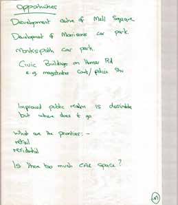


47 Page 47 A selection of material produced during the Solihull Town Centre Masterplan Stakeholders Workshop 43
48 6.1 Outcomes and Key Findings Following the engagement events, all outputs (including plans and flip charts) were collated and analysed. The adjacent diagram visually illustrates the key findings which were then used to develop the draft masterplans vision for Solihull and the potential areas for change. The commentary shown in the graphic to the right was generated on the 14th April 2016 by the opinions expressed from stakeholder focus groups. Page 48 Heritage is highly valued, the High Street needs to embrace the old and incorporate A distinctive & independent retail market Parks surrounding the town centre should provide user friendly facilities & events should be better advertised Create a gateway entrance at Solihull Train Station Experience & Place Improve safety in the town centre Provide a nice public space which can Introduce new evening economy uses including food and beverage the new host crowds Introduce and an iconic attraction There is a lack of wayfinding & signage facilities New and improve existing greenspace in town re co B Need m facilitie young pe children, and yo adult 44
49 Solihull needs to spond to the mpetition of irmingham ore s for ople; teens ung s Page 49 Could Solihull accommodate a highrise building? Residential development opportunity at Mell Square Car Park so not to distract from the High Street A new hotel for Solihull will have a positive influence on building a night time economy Residential development opportunity at Monkspath Hall Road Car Park Opportunity to convert the current Job Centre into a residential development Living & Working The use of technology could reduce the need for office space in the future Every group suggested to Introduce apartment type residential uses in the town centre Lode Lane Car Park is underused. Can it be converted to commercial space? Opportunity for a mixed use, large scale development at the Homer Road Triangle Solihull needs a shift in travel behaviour away from the car and into public transport. Lets improve the existing public transport Need to improve facilities car parking entrances along Homer Road Need to improve access between the High Street and Tudor Grange Park as there is currently poor safety and limited movement The masterplan should consider the location of Solihull Train Station to make best use of this key town centre asset Reduce the amount of cars accessing the town centre and suggested a park and ride scheme Connections Some respondents feel there is a need to alleviate traffic congestion Touchwood car park is overused while Lode Lane Car Park is underused Concerns over the removal of car parking at Monkspath Hall Road Car Park from Homer Road employees Improve cycle and walking infrastructure Improve access between town centre and Malvern Park 45

50 Page 50 46

51 07 Vision Page 51 47


52 07 Vision The creation of a clear vision will help communicate the values and ideas which will drive the future development of Solihull Town Centre. It will also inform the development of aims and objectives for the town centre which respond to current and anticipated needs. The vision presented within this section encapsulates a deliverable set of aspirations for Solihull Town Centre which has been based upon its current success and takes into account stakeholder collaboration and wider economic drivers such as UK Central. Solihull 2036 Page 52 Focus for future investment A 21st century town, nationally best in class and at the forefront of innovation, diversity and sustainability - bringing better living, retail and offices with great connections and public realm meeting the aspirations of local people and businesses and the focus of long term regional investment. A PLACE TO LIVE A PLACE TO WORK 48


53 A unique place that provides aspirational quality of life for the people who live and work in the town Page 53 21st CENTURY TOWN Attractive home for local business Stands apart from its neighbours Modern & diverse 49

54 Page 54 50

55 08 Emerging Concepts Page 55 51


56 08 Emerging Concepts This section explores the concepts which have emerged from the data collection and analysis conducted in sections 1-7 of this report. By gaining a clear understanding of the fundamental issues, opportunities and ambitions for Solihull, three main themes emerge which hold the key to achieving the Solihull 2036 vision: Connections ; Living and Working; and Experience. Page 56 When read together these strategies set out a broad framework for future growth and development, which can then form the basis for future development projects and interventions. 8.1 Connections The overall connection concept will help Solihull Town Centre reconnect its currently disjointed areas - areas which emerged from the analysis undertaken in sections into one cohesive, integrated centre. It will seek to create a network which integrates the town centres various retail, commercial, civic, residential, and cultural precincts. The connection concept will aim to: Deliver a train station which serves as a strong gateway and arrival point into the town centre. The station forms part of the wider town centre influence area with strong links to the centre s major destinations; Maximise opportunities for sustainable travel through improved transport infrastructure that helps to reduce congestion in the town centre. Vehicular movement around the town centre will be focused along the western edge at Lode Lane and Prince s Way, reducing vehicle movement in the east along Church Hill Road and New Road; 52

57 Complement the public realm experience which as a result of softening the northern and eastern edges of the town centre will open Warwick and Church Hill Roads to opportunities for placemaking, green infrastructure, improved permeability, and improved public realm; Improve access between the town centre and surrounding neighbourhoods. Reducing the road barriers surrounding the town centre will improve connections with the residential neighbourhoods and parklands beyond. It will also better enable and encourage residents, visitors, and workers to choose more sustainable means of travel into town; Page 57 Key locations surrounding the town centre will benefit from improved pedestrian, cycle and bus connections including Solihull Hospital, Solihull School, Tudor Grange Leisure Centre, Solihull Train Station; Better integrate key destinations within the town centre by upgrading key connections such as the High Street, Blossomfield roundabout and Lode Lane roundabout; and Set out proposals for the management of town centre car parking to ensure that this supports accessibility to the town centre and economic activity. Figure 8.1: Conceptual connections strategy for Solihull Town Centre 53


58 8.2 Living and Working Diversification is a central aim of the living and working concept for Solihull Town Centre, helping to inform future market and land use considerations. Central to this concept is introducing residential uses and further office uses into the town centre to inject new vitality through a mixed offer of activities, economy, times of use and built form. The living and working concept will: Page 58 Strengthen the centre s retail core to reinforce Solihull as a unique town and retail destination; Encourage residential uses into the town centre, particularly in areas around the eastern and western periphery of the retail core. This will create a mixed use residential and commercial environment which will encourage activity in the town centre beyond retail trading hours and help open the market to evening economy and leisure opportunities; and Promote the development of high quality new office development with positive frontages onto key routes. This will consolidate and build upon the existing office offer, and provide opportunities to improve north-south connections. 54

59 Page 59 Figure 8.2: Concept of the future living and working strategy for Solihull Town Centre 55


60 8.3 Experience The experience of Solihull Town Centre is a crucial component of creating an appealing environment to live, work and enjoy. The experience concept will aim to: Reinforce the retail appeal of Solihull by maintaining a retail core focused around Touchwood Shopping Centre, Mell Square and the High Street which will include widening the retail offer; Page 60 Provide new opportunities to enhance the town centre s evening and leisure offer which can be focused around the High Street and Mell Square; Promote high quality and sustainable urban design which Solihull can be proud of; Create a town centre where people can choose to live, work and spend their leisure time, encouraging people to play an active role in streets. In turn this will encourage activity in the town centre beyond retail trading hours and strengthen the market for evening and leisure opportunities; Build upon the town s existing assets including its heritage, to create a distinctive place to shop, work and live; Encourage green infrastructure into the town centre tracing from Tudor Grange Park and Malvern Park and Brueton Park; and Upgrade key areas of public realm with high movement and activity within the town centre such as the High Street, Blossomfield roundabout and Lode Lane roundabout. 56


61 Page 61 Figure 8.3: Plan illustrating the experience strategy Solihull Town Centre 57

62 Page 62 58

63 09 Areas of Change Page 63 59
64 09 Areas of Change This section explores seven areas of change within Solihull Town Centre which provide practical interventions in order to deliver the emerging concepts outlined in section 8, and informed by section 1 to 7. The emerging concepts that were described in the previous section define an overarching direction for the Solihull Town Centre Masterplan; a strategy for change that can be flexible over time in order to accommodate changes in the market as well as social and economic trends. It is important to maintain this flexibility whilst at the same time demonstrating how intervention in a specific part of town will link to the wider area and can have potential crosscutting benefits such as improvements in the perception branding of Solihull, general health and wellbeing leading to a more sustainable place. Page 64 It is important to recognise that the level of intervention envisaged as part of the Solihull Town Centre Masterplan will be delivered over a broad timeline, areas are likely to overlap and will influence one another as well as forming part of an evolution of the overall town centre offer as highlighted in the Vision section of this document (Section 7). discussions with key stakeholders. In this context, the position of the railway station is significant investment in the station may in the short-term be focused in the present location but that does not mean that a town centre masterplan that considers a 20 year timeframe should not look at a future where the station is relocated, with the potential wider economic and placemaking benefits that this change could generate. Seven areas of change have been considered - incorporating key areas for intervention, setting out the key opportunities and influences associated with each area. The association with the three emerging concepts is confirmed and the ideas are reinforced through a series of precedent images and best practice examples. It is not the intention of the areas of change to be prescriptive in a way that suppresses future creativity or the ability of the town centre to respond to external influences. However, it is important to explore a number of the spatial relationships that are likely to be generated through examination of a particular approach. The Areas of Change section considers a series of physical areas against the key hooks, challenges and influences that are described in the emerging concepts. The definition of the physical boundaries have been derived through the spatial and market analysis of Solihull as well as an appreciation of existing ambition for change that has emerged through 60

65 Solihull Hospital 1. Western Gateway 2. Southern Gateway 3. Business & Commercial Quarter 4. Northern Approach 5. Heart of Solihull (Retail Core) 6. Solihull Living 7. St Alphege s Quarter 4 1 Page 65 Tudor Grange Park 3 Touchwood St Alphege Church 2 Malvern & Brueton Park Figure 9.1 Plan identifying the seven areas of change incorporating key areas for intervention. 61

66 9.1 Car Parking This section of the report considers the impact that the areas of change may have on future car parking provision in Solihull Town Centre. Development will inevitably change the way in which car parking is either integrated or displaced by new intervention but a key emerging recommendation is to ensure short stay shopper parking is retained or replaced as part of the car parking strategy. In this context a number of interventions have been identified which each ensure short stay parking demand is met, these are summarised below: Page 66 Apply time limits on parking to ensure turnover; Performance pricing - adjusting the tariff paid to park based on expected demand to achieve 85-90% occupancy at all times; Reprioritising - reduce the use of town centre parking for long stay users to ensure availability for short stay users. This option recognises that the current context of Solihull offers limited scope or need to promote a Park & Ride system and therefore this intervention is linked to a modal change in long stay parking, away from vehicles and into walking, cycling and public transport; Parking provision by new developments could see a change in local policy which may require new developments to provide a minimum level of parking as part of their schemes to accommodate a reduction in long stay parking; and Future trends - the technology developed in the medium term indicates that parking in our town centres is likely to require less space and the space made available could be used more intensively and intelligently. Further assessment of the impact on and role of car parking will be required, including the use of the Solihull Town Centre Car Park Model to test options. The following key recommendations have been made: Discussion surrounding quantity and proximity of parking capacity in the town centre which can support the emerging masterplan with key stakeholders; Calculate expected loss and replacement in capacity as the masterplan progresses; Consider what options for parking policy choices may be implemented; Output a new set of overall parking demand forecasts broken down by type of user; Establish if there is a shortfall between the overall supply provided and demand at a town wide level; Examine options to provide the capacity required and identify potential locations and management regimes for this capacity; Undertake modelling using the parking allocation model and traffic model; Adjust the location capacity and pricing regimes to reflect the results of modelling; Confirm a strategy and outline plan for parking provision; and Undertake sensitivity and resilience testing to provide comfort that the solution retains some flexibility, scalability and resilience. 62


67 9.2 Western Gateway As discussed within Section 3, the western arrival into the town is currently dominated by roads and a lack of frontages around the Solihull Methodist Church and Homer Road Triangle, with the train station physically and psychologically disconnected from the town centre. Reconfiguration of key junctions here would provide opportunities to enhance key pedestrian and cycle connections from Solihull Train Station into the town centre, and also potentially improve journey times for buses by reprioritising and supporting sustainable travel. Supported by new land mark development fronting onto the street and an improved public realm, the Lode Lane/ Blossomfield Road roundabout could be transformed into a key visual gateway; which represents an important arrival point into Solihull Town Centre for those arriving by public transport and from the west. In the short term, upgrades to Solihull Train Station could look to improve the look and feel of the station, providing new facilities which promote its use and a more fitting representation of Solihull s future aspirations. Longer term, should the station be relocated, there is opportunity to introduce new residential uses within easy walking distance of the town centre. Page 67 Railway Line Potential for landmark building Potential frontage Connections Improved connections Living & Working Potential living and working Experience Improved urban experience and placemaking Association with Emerging Concepts Connections Living & Working Experience Improve pedestrian and cycle connections into and out of the town centre Enhance connection to Solihull College and Tudor Grange Park. Encourage greater use of sustainable travel. Longer term opportunities to diversify the town centre and provide sustainable urban living. Strengthen and enhance key gateway into the town. Promotion of high quality and sustainable new development. Upgrade key route into town improve legibility and wayfinding. Figure 9.2 Broad design principles and precedent image examples. 63


68 9.3 Southern Gateway Cut off from the town by busy roads and the rail line embankment, the south of the town centre feels disconnected to its surroundings, in particular Tudor Grange Park. In addition, large swathes of surface car parking leave large voids in the urban structure at a key arrival point into the town. In the short term, new residential development could provide sustainable new housing within close walking distance of the town centre and also provide a positive edge to Tudor Grange Park. In the long term a relocated Solihull Train Station could be positioned to bridge the rail line and improve accessibility into the town centre, encouraging sustainable travel. The development of a new land mark station could create an attractive new gateway into the town centre which befits Solihull s aspirational vision; which could be further supported by improved public realm and wayfinding. Page 68 The future development of this site is dependent on the decision made regarding the stations future location. This will fundamentally effect the market positioning and opportunity for the site. If the Station remains in its existing location then market interest in the site would be for suburban densities. If the station was to relocate to this site, there would be the opportunity for apartments with lower densities further out. Railway Line Potential for landmark building Potential frontage Connections Improved connections Living & Working Potential living and working Experience Improved urban experience and placemaking Association with Emerging Concepts Connections Living & Working Experience Improved cycle and pedestrian connections into the town from the south. Provision of an accessible, centralised new train station to encourage greater rail usage. 64 Opportunity to diversify the town centre and provide sustainable urban living. Strengthen, support and extend Solihull s business and commercial offer through relocation of the station. Creation of a landmark new station, and attractive southern gateway. Positive frontage onto Tudor Grange Park. Linking the town centre with public parks. Figure 9.3 Broad design principles and precedent image examples.


69 Homer Road Prince s Way Tudor Grange Park Page 69 Potential to create new higher density residential development overlooking Tudor Grange Park Potential to create new connections to Tudor Grange Park Potential multi-storey car park with active frontage onto civic square Monkspath Hall Road Potential mixed use buildings with active frontage onto civic square Potential to create a new station which bridges over the railway line with links to the town centre Potential to create a new civic square overlooked by the train station and mixed use active frontage Potential to scale down residential development to the south to blend with the existing context Figure 9.4 Illustrative layout of a train station at the Southern Gateway. 65
 highlighted the poor quality of existing north- south connections, inadequate cycle provision, weak urban form and the lack of frontage")


70 Railway Line Potential for landmark building Potential frontage Connections Improved connections Living & Working Potential living and working Experience Improved urban experience and placemaking 9.4 Business and Commercial Quarter The spatial audit (Section 3) highlighted the poor quality of existing north- south connections, inadequate cycle provision, weak urban form and the lack of frontage along Princes Road. Through expansion of the current commercial offer and the potential integration of new urban living, there are opportunities to promote Solihull as a place to do business, whilst addressing some of the key urban design issues facing the town. Potential enhancement of Homer Road and north-south connections could provide opportunities to promote walking and cycling, and also introduce green infrastructure into the town linking with Tudor Grange Park. The introduction of landmark buildings could improve the southern aspect of the town by redefining frontage which could support a relocated new train station in the longer term. Page 70 Whilst not the full extent of the office market in the town centre, the environs of Prince s Way and Homer Road is defined by a high concentration of large, single occupier, buildings. A number of well known names including Npower, National Grid, Paragon Financial Services, and HM Immigration Office, occupy these buildings, lend the area a particular character. In particular, the area between Princes Way and Homer Road, is defined by buildings with large massing in terms of surface coverage especially, set back from the road with extensive surface parking areas. These qualities have been important in establishing Solihull Town Centre as an important location within the wider office market outside of Birmingham City Council (defined as out of town market). Any proposed changes to this quarter to address the issues identified will be sensitive to the importance of this area to Solihull Town Centre (Paragon employees at this locationcirca 500+, N Power 500+, National Grid 500+) and the qualities that appeal to occupiers, car parking in particular. 66 Homer Road Potential new station location High Street Touchwood Jubilee Park Association with Emerging Concepts Connections Living & Working Experience Improve north-south connections through the town centre. Enhance provision for cyclists to encourage sustainable travel. Create a more permeable town centre. Strengthen, support and extend Solihull s business and commercial offer. Opportunity to diversify the town centre and provide sustainable urban living. Introduction of green infrastructure linking the town centre with public parks. Improving the look and feel of north south connections. Enhance the southern gateway into the town centre through high quality new development. Figure 9.5 Broad design principles and precedent image examples.

 also recognised the lack of gateway articulation and negative public realm impact caused by the multi- storey car park.")

71 9.5 Northern Approach Heavily dominated by traffic and large scale highway infrastructure, the Lode Lane / Warwick Road roundabout currently acts as a barrier to pedestrian and cycle movement. The distinct lack of direct frontage onto the street and relatively poor quality of surrounding buildings mean that this key arrival point into the town fails to match the attractiveness of the inner town centre. The Lode Lane multi- storey car park was identified in the Solihull Town Centre Study (2009) as an unattractive and outdated site, with recommendations for redevelopment. The Solihull Public Realm Strategy (2014) also recognised the lack of gateway articulation and negative public realm impact caused by the multi- storey car park. This low urban quality and underutilisation brings the site forward as a key area for future change. Page 71 Improvements to the environment of Warwick Road have the potential to enhance connectivity along the northern edge of the town with opportunities to create improved crossing facilities and greater provision for cyclists. A new landmark development fronting onto the roundabout could improve the attractiveness of this important arrival point and deliver attractive new urban living and/or car parking facilities. Lode Lane Warwick High Street Road Railway Line Potential for landmark building Potential frontage Connections Improved connections Living & Working Potential living and working Experience Improved urban experience and placemaking Association with Emerging Concepts Connections Living & Working Experience Enhanced connectivity across Warwick Road. Improved pedestrian and cycle facilities. Opportunity to diversify the town centre and provide sustainable urban living potentially alongside new car parking facilities. Enhance the northern arrival point into the town through high quality new development. Figure 9.6 Broad design principles and precedent image examples. 67


72 9.6 Heart of Solihull (Retail Core) Solihull benefits from a popular and successful retail core centred around Touchwood Shopping Centre and Mell Square. The masterplan will seek to re-establish the High Street as a key component of Solihull s retail heart. Currently there is a distinct lack of quality evening offer and some of the existing public realm is tired and fails to reflect the ambitions of the town. The planned introduction of new mixed use development at Touchwood II and Mell Square will provide further diversity and vitality to the town centre whilst also acting as a catalyst for future redevelopment. Providing a greater variety of food and beverage uses, the proposals will also boost Solihull s evening economy, which could be further supported through the development of new higher density residential uses. There are also opportunities to enhance pedestrian and cycle connections through the town, using new development to reinforce and positively reflect main routes, particularly around St Alphege s Church. Furthermore, an upgraded public realm along the High Street and at Mell Square will more appropriately reflect the historic character and quality of the town centre, and provide the opportunity to create a high quality destination space for residents, visitors and workers. Page 72 A strong emphasis will be placed on enhancing the existing retail core, by encouraging renewal though enhancing connectivity and encouraging mixed uses. Any new notable retail development, aside from that already in the planning process, would be envisaged from reconfiguration of the existing underused sites. 68 Touchwood Warwick Road St Alphege Church Figure 9.7 Broad design principles and visualisations of the planned Touchwood II and Mell Square developments. Association with Emerging Concepts Connections Living & Working Experience Improve provision for cyclists. Enhance connections through the town centre through additional wayfinding measures and a clear route hierarchy. Increase the diversity of uses within the town centre. Grow Solihull s evening economy. Introduce further sustainable urban living to support the town centre. Strengthen the identity and historic character of the town. Create a vibrant and attractive destination. Enhance streets and public realm and develop a clear hierarchy of routes to aid legibility. Railway Line Potential for landmark building Potential frontage Connections Improved connections Living & Working Potential living and working Experience Improved urban experience and placemaking


73 9.7 Solihull Living Elements within the north east of the town centre are underutilised and fail to provide an attractive frontage along Warwick Road. In addition, the existing building formats hinder permeability and there is a lack of positive frontage onto many pedestrian routes. With the opportunities associated with the planned Mell Square and Touchwood II developments, there is an exciting opportunity to further diversify the town and support the wider town centre s envisaged new evening uses through the creation of a new residential quarter. We envisage the quarter may have particular appeal to the retirement market and young professionals. A greater representation of these demographic groups will support the diversification of the evening economy in the town centre, as such groups appreciate and seek an increasingly broad range of good quality and convenient leisure and entertainment options. This would provide new opportunities to consolidate and reconfigure existing car parking provision, and enable increased permeability from Mell Square through to the eastern edge of the town. Page 73 New development would also provide opportunities to improve frontage onto Warwick Road, enhancing the edge of the town and adding further vibrancy and variety into the town centre. Enhanced crossings across Warwick Road could improve pedestrian connectivity with the north of the town, whilst an upgraded public realm will assist in creating an attractive, outward facing Solihull. Railway Line Potential for landmark building Potential frontage Connections Improved connections Living & Working Potential living and working Experience Improved urban experience and placemaking Figure 9.8 Broad design principles and precedent image examples. Association with Emerging Concepts Connections Living & Working Experience Improved north-south connectivity Improved pedestrian and cycle provision. Enhanced permeability within the town centre. Opportunity to diversify the town centre and provide sustainable urban living potentially alongside new car parking facilities. Positive frontage onto Warwick Road. Improved perceptions of the northern edge to pedestrians and cyclists. Enhanced overlooking onto key routes. 69


74 9.8 St Alphege s Quarter High Street Railway Line Potential for landmark building St Alphege s Church is a key landmark and provides an attractive conclusion to the eastern end of the High Street. The quality of the surrounding historic buildings is representative of Solihull s attractive heritage character, however the relatively tired public realm, and heavy traffic disappoint. In addition, the popular and attractive Malvern and Brueton Park is located just a short distance to the east; however the park is not promoted and the connection is not obvious for visitors to follow. Opportunities to provide attractive and sensitive new residential development here could improve frontages onto New Road and further diversify the town centre. Improvements in the public realm could prioritise pedestrians and cyclists, whilst also supporting the areas historic character. In addition, improved wayfinding and the introduction of new green infrastructure could actively link the town centre with Malvern and Brueton Park. Page 74 St Alphege Church New Road Potential frontage Connections Improved connections Living & Working Potential living and working Experience Improved urban experience and placemaking Association with Emerging Concepts Connections Living & Working Experience Improved provision for cyclists. Enhanced pedestrian connections along New Road. Opportunity to diversify the town centre and provide sustainable urban living. Creation of positive frontage onto St Alphege s Church. Linking the town centre with public parks. Improved connectivity to Malvern and Brueton Park. Strengthen the identity and historic character of the town. Figure 9.9 Broad design principles and precedent image examples. 70


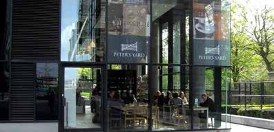
75 Page 75 71
0 9 Areas of Change 59
 09 Areas of Change 59 09 Areas of Change This section explores seven areas of change within Solihull Town Centre which provide practical interventions in order to deliver the emerging concepts outlined
HS2 Interchange Station Design
 Working on behalf of HS2 Interchange Station Design October 2018 www.hs2.org.uk 1 Interchange Station, Solihull Introduction In February 2018, HS2 Ltd appointed Arup to take forward the design of Interchange
WINCHESTER TOWN 3.1 LOCATION, CHARACTERISTICS & SETTING
 WINCHESTER TOWN 3.1 LOCATION, CHARACTERISTICS & SETTING 3.1.1 The area referred to by the City Council, as Winchester Town, consists of the Winchester Wards plus the adjoining built up areas of Badger
INTRODUCTION NORTH HEYBRIDGE GARDEN SUBURB
 INTRODUCTION This event is being hosted by the promoters of the proposed North Heybridge Garden Suburb who are working with Maldon District Council and other key stakeholders on the preparation of a comprehensive
Droitwich Spa 6. Reasoned Justification
 87 Droitwich Spa 6 Reasoned Justification 6.1 Droitwich Spa is identified in the settlement hierarchy (Policy SWDP1) as a main town being the largest settlement in Wychavon District with an estimated population
Appendix A: Retail Planning Assessment
 Rotherham Town Centre Masterplan Appendix A: Retail Planning Assessment 139 Appendix A Rotherham Town Centre Masterplan Retail Planning Background and Policy Context 1. Introduction 1.1 The Masterplan
Great Easton Neighbourhood Plan Statement of Basic Conditions
 Great Easton Neighbourhood Plan 2017-2031 Statement of Basic Conditions OCTOBER 2016 GREAT EASTON PARISH COUNCIL Contents 1.0 Introduction....Page 2 2.0 Summary of Submission Documents and Supporting Evidence..
Cotswolds AONB Landscape Strategy and Guidelines. June 2016
 Cotswolds AONB Landscape Strategy and Guidelines June 2016 Cotswolds AONB Landscape Strategy and Guidelines Introduction The evolution of the landscape of the Cotswolds AONB is a result of the interaction
Welcome to our exhibition
 Welcome to our exhibition housing development A46 Wildmoor Alcester Road Canal Quarter A422 Town Centre housing development Warwickshire-based IM Properties, one of the UK s largest privately owned property
Response to the London Bridge Area Vision and Site Allocations within the New Southwark Plan
 1 Melior Place London SE1 3SZ 020 7407 4701 teamlondonbridge.co.uk info@teamlondonbridge.co.uk 28 April 2017 Response to the London Bridge Area Vision and Site Allocations within the New Southwark Plan
The Proposed Auckland Unitary Plan (notified 30 September 2013)
") 3 Business zones Introduction There are 10 business zones in the Unitary Plan: City Centre Metropolitan Centre Town Centre Local Centre Neighbourhood Centre Mixed Use General Business Business Park Light
3 Business zones Introduction There are 10 business zones in the Unitary Plan: City Centre Metropolitan Centre Town Centre Local Centre Neighbourhood Centre Mixed Use General Business Business Park Light
Former North Works, Lickey Road, Longbridge, Birmingham
 Committee Date: 14/11/2013 Application Number: 2013/06431/PA Accepted: 27/08/2013 Application Type: Full Planning Target Date: 26/11/2013 Ward: Longbridge Former North Works, Lickey Road, Longbridge, Birmingham
2.0 Strategic Context 4
 2.0 Strategic Context 4 2.1 The Area Action Plan is a non-statutory plan, which forms a corporate policy document, expressing particular issues and areas of concern while also providing a vision for the
Our City Centre is a vibrant, creative and welcoming destination, with a modern business, cultural, shopping, leisure and residential offer
 3. Sheffield in 2034 Our City sits at the heart of a strong, distinctive and internationally successful City Region economy which supports innovation and enterprise Our City Centre is a vibrant, creative
GREENFORD HALL & ADJOINING LAND
 GREENFORD HALL & ADJOINING LAND CONTENTS 1. Introduction 1. Introduction 2. Urban Context 2.1 The Site and Surroundings 2.2 Urban Context Map 2.3 Access and Movement 3. Planning Context 3.1 Planning History
Chapter 2: OUTLINE PLANNING APPLICATION PROPOSALS. A New Garden Neighbourhood Matford Barton 17
 Chapter 2: OUTLINE PLANNING APPLICATION PROPOSALS A New Garden Neighbourhood Matford Barton 17 2.1. SUMMARY AND STATUS OF THE PROPOSALS 2.1.1. The parameter plans and associated wording in this chapter
Paignton Neighbourhood Plan (Submission version 2017)
") Paignton Neighbourhood Plan (Submission version 2017) Introduction This brief statement covers the views of the TDA, only in relation to its role as adviser to the Council on delivery of town centre regeneration.
Paignton Neighbourhood Plan (Submission version 2017) Introduction This brief statement covers the views of the TDA, only in relation to its role as adviser to the Council on delivery of town centre regeneration.
WOKING DESIGN SUPPLEMENTARY PLANNING DOCUMENT (SPD)
") Agenda Item No. 5 EECUTIVE - 15 JANUARY 2015 Executive Summary WOKING DESIGN SUPPLEMENTARY PLANNING DOCUMENT (SPD) The report outlines the various responses to the consultation on the Design Supplementary
Agenda Item No. 5 EECUTIVE - 15 JANUARY 2015 Executive Summary WOKING DESIGN SUPPLEMENTARY PLANNING DOCUMENT (SPD) The report outlines the various responses to the consultation on the Design Supplementary
South Worcestershire Development Plan. South Worcestershire Design Guide Supplementary Planning Document
 South Worcestershire Development Plan South Worcestershire Design Guide Supplementary Planning Document Statement of Consultation: Early Engagement Scoping Paper February 2017 1. Introduction 1.1 This
WELCOME GYPSY LANE. Wider Site Location plan. Proposals for the development of LAND OFF FOXLYDIATE LANE WEBHEATH. Proposals for the development of
 WELCOME The developers are preparing an outline planning application for a residential led development and need the community s views in order to develop the proposals further WHAT IS PROPOSED? A high
Description Details submitted pursuant to discharge of condition 5 (Design Code) attached to planning permission 13/01729/OUT.
 attached to planning permission 13/01729/OUT.") ITEM 9 Application Number: 18/00266/DISCON Description Details submitted pursuant to discharge of condition 5 (Design Code) attached to planning permission 13/01729/OUT. AT The Point, 602 Midsummer Boulevard,
ITEM 9 Application Number: 18/00266/DISCON Description Details submitted pursuant to discharge of condition 5 (Design Code) attached to planning permission 13/01729/OUT. AT The Point, 602 Midsummer Boulevard,
Scottish Natural Heritage. Better places for people and nature
 Scottish Natural Heritage Better places for people and nature Contents Summary... 3 SNH approach... 5 Place-making in policy and practice... 6 Developing the contribution of the natural heritage to place-making...
ROCHFORD LOCAL DEVELOPMENT FRAMEWORK: Sustainability Appraisal/ Strategic Environmental Assessment. Rochford Core Strategy Preferred Options Document
 ROCHFORD LOCAL DEVELOPMENT FRAMEWORK: Sustainability Appraisal/ Strategic Environmental Assessment Non Technical Summary Rochford Core Strategy Preferred Options Document October 2008 SUSTAINABILITY APPRAISAL
Sustainability Statement. Whitby Business Park Area Action Plan
 Sustainability Statement Whitby Business Park Area Action Plan November 2014 Contents Page 1. Introduction 1 2. Scoping 3 3. Sustainability Appraisal of Options 6 4. Assessment of Draft Area Action Plan
Cranfield University Masterplan
 Central Bedfordshire Council EXECUTIVE Tuesday, 5 December 2017 Cranfield University Masterplan Report of: Cllr Nigel Young, Executive Member for Regeneration, (nigel.young@centralbedfordshire.gov.uk )
WHITELEY TOWN COUNCIL NORTH WHITELEY DEVELOPMENT SEPTEMBER 2014
 WHITELEY TOWN COUNCIL NORTH WHITELEY DEVELOPMENT SEPTEMBER 2014 Dear Resident This Special Edition of the Whiteley Voice which has been prepared in conjunction with the North Whiteley Consortium is to
Kibworth Harcourt. Introduction. Introduction
 Introduction Introduction Welcome to this public exhibition on the proposals for the delivery of new homes on land at The Kibworths. The purpose of today s exhibition is to give you the opportunity to
OUR GREATER SYDNEY A metropolis of three cities. OVERVIEW. connecting people. DRAFT Greater Sydney Region Plan
 OUR GREATER SYDNEY 2056. A metropolis of three cities. OVERVIEW. connecting people. DRAFT Greater Sydney Region Plan October 2017 This document is an overview of the draft Greater Sydney Region Plan. To
Vision for Mayfair and Belgravia
 Vision for Mayfair and Belgravia Vision for Mayfair and Belgravia Foreword We have a 20 year vision for Mayfair and Belgravia. It summarises our aspirations for the future of this London estate, which
Draft Western District Plan
 Powered by TCPDF (www.tcpdf.org) Draft Western District Plan Submission_id: 31440 Date of Lodgment: 15 Dec 2017 Origin of Submission: Online Organisation name: Goodman Property Services Australia Pty Ltd
Eastbourne Borough Council. Summary Proof of Evidence Of Barry John Cansfield BA (Hons), BTP, MRTPI on behalf of PRLP
, BTP, MRTPI on behalf of PRLP") Eastbourne Borough Council (Arndale Centre and surrounding Land at Terminus Road, Sutton Road and Ashford Road) (Compulsory Purchase Order 2015) Section 226 (1)(a) of the Town and Country Planning Act
Eastbourne Borough Council (Arndale Centre and surrounding Land at Terminus Road, Sutton Road and Ashford Road) (Compulsory Purchase Order 2015) Section 226 (1)(a) of the Town and Country Planning Act
Draft Eastern District Plan
 Draft Eastern District Plan Submission_id: 31238 Date of Lodgment: 13 Dec 2017 Origin of Submission: Online Organisation name: Turrulla Gardens Pty Ltd C/- Mecone Organisation type: Industry First name:
Schedule of Planning Applications Committee Date: 23 May Reference: 06/17/0726/F Parish: Hemsby Officer: Mr J Beck Expiry Date:
 Schedule of Planning Applications Committee Date: 23 May 2018 Reference: 06/17/0726/F Parish: Hemsby Officer: Mr J Beck Expiry Date: 22-05-2018 Applicant: Proposal: Site: Mr Gillett Change of use to the
BLETCHLEY PARK AREA - DEVELOPMENT FRAMEWORK
 ANNEX A To Item 9 REVISED TEXT: additions shown bold and underlined, deletions in (brackets and in italics). BLETCHLEY PARK AREA - DEVELOPMENT FRAMEWORK This framework sets out the key objectives and requirements
Neighbourhood Planning Local Green Spaces
 Neighbourhood Planning Local Green Spaces Introduction... 2 1. Why green space is important... 4 2. Neighbourhood plans and green space... 6 3. Evidence... 8 Statutory designations... 9 Green space audit...
Taking forward the All London Green Grid
 Taking forward the All London Green Grid Foreword Earlier this year, the Mayor published the All London Green Grid Supplementary Planning Guidance to the London Plan which set the vision, and framework,
Sheffield City Centre: shaping the future
 Sheffield City Centre: shaping the future A discussion paper Sheffield Executive Board (SEB) discussed the future of Sheffield City Centre at its March 2013 meeting. The Board agreed that the last decade
Peckham Peckham Area Vision Map
 Area Vision Map PNAAP13 PNAAP8 Sumner Road Surrey Canal Walk Bird in Bush Park Key: NSP Site Allocations PNAAP Allocations Greenspace Low Line Cycle Network Primary Shopping Areas Square Surrey Canal Walk
WELCOME TO THE NEW WILTON PARK
 WELCOME TO THE NEW WILTON PARK VISION HISTORY OF WILTON PARK TOWARDS A PLANNING APPLICATION Our objective is to create a truly outstanding environment at Wilton Park. At the heart of our proposals is a
Making the case for Sustainable Transport Project Potential
 Making the case for Sustainable Transport Project Potential The Structural Investment Fund (SIF) Strategy for Greater Lincolnshire identifies the barriers to growth identified by having poor transport
HS2 Hybrid Bill Petitioning. Summary of SMBC Asks 23/09/13. Background
 Summary of SMBC Asks 23/09/13 Background The Council has a developed a significant number of asks and propositions for consideration by HS2 Ltd and Government throughout further development of the HS2
Colchester Northern Gateway Master Plan Vision Review Draft. July 2016
 Colchester Northern Gateway Master Plan Vision Review Draft July 2016 Contents Introduction 4 Context 8 Purpose of the Report 8 Strategic Position 9 Overview of the Process 11 2012 Master Plan Vision 12
Parish of Repton NEIGHBOURHOOD DEVELOPMENT PLAN
 Parish of Repton NEIGHBOURHOOD DEVELOPMENT PLAN BASIC CONDITIONS STATEMENT December 2018 CEF 4 Legal Requirements This statement has been produced by the NDP Working Group on behalf of Repton Parish Council
Eastern City District Plan
 OUR GREATER SYDNEY 2056 Revised Draft Eastern City District Plan OVERVIEW Bayside Burwood Canada Bay City of Sydney Inner West Randwick Strathfield Waverley Woollahra Snapshot of the Eastern City District
16. Peckham Peckham Area Vision
 16. 16.1. Area Vision 16.1.1. is: A lively town centre providing a range of daytime and night time activities on Rye Lane including a Library, a Leisure Centre and many independent retailers which specialise
UDF PLANS AND GUIDELINES
 UDF PLANS AND GUIDELINES 5 Land Use Land Use Development Plan Plan no. 3 Land Use Development Mixed Use Retail / Leisure Residential Civic and Institutional Proposed Zoning Table Development Edges Plan
Policy and Resources Committee 10 th October Green Infrastructure Supplementary Planning Document (SPD) Summary. Title
 Summary. Title") Policy and Resources Committee 10 th October 2017 Title Report of Wards Status Urgent Key Enclosures Officer Contact Details Green Infrastructure Supplementary Planning Document (SPD) Deputy Chief Executive
Policy and Resources Committee 10 th October 2017 Title Report of Wards Status Urgent Key Enclosures Officer Contact Details Green Infrastructure Supplementary Planning Document (SPD) Deputy Chief Executive
Tāhuhu whakaruruhau ā-taone The sheltering ridge pole
 B2. Tāhuhu whakaruruhau ā-taone - Urban growth and form B2.1. Issues Tāhuhu whakaruruhau ā-taone The sheltering ridge pole Auckland s growing population increases demand for housing, employment, business,
BETTER PUBLIC TRANSPORT PROJECT WATERBEACH TO SCIENCE PARK AND EAST CAMBRIDGE CORRIDORS
 Report To: Greater Cambridge Partnership Joint Assembly 20 th September 2018 Lead Officer: Peter Blake GCP Director of Transport BETTER PUBLIC TRANSPORT PROJECT WATERBEACH TO SCIENCE PARK AND EAST CAMBRIDGE
Ebbsfleet Development Corporation
 Title of Paper Planning and Housing Delivery Report September 2018 Presented by Sub-Committee Mark Pullin, Chief Planning Officer Planning Committee Purpose of Paper and Executive Summary This paper provides
13 THORNHILL YONGE STREET STUDY IMPLEMENTATION CITY OF VAUGHAN OPA 669 AND TOWN OF MARKHAM OPA 154
 13 THORNHILL YONGE STREET STUDY IMPLEMENTATION CITY OF VAUGHAN OPA 669 AND TOWN OF MARKHAM OPA 154 The Planning and Economic Development Committee recommends the adoption of the recommendations contained
intu Bromley Planning Summary Bringing more to Bromley February 2014
 intu Bromley Planning Summary February 2014 Bringing more to Bromley Contents Introduction 1 Description of the Proposals 2 Economic Benefits 4 Planning Policy 6 Cinema and Catering Assessment 7 Design
Valuing Historic Places
 Valuing Historic Places Introduction Historic buildings and places have played an increasingly central role in the delivery of a range of public benefits, including education, economic development, sustainable
Auckland City Council
 Auckland City Council Future planning framework version 3.0 9 September 2010 Find out more: Telephone (09) 379 2020 or visit www.aucklandcity.govt.nz www.itsmybackyard.co.nz Foreword Future planning framework
Newcourt Masterplan. November Exeter Local Development Framework
 Newcourt Masterplan November 2010 Exeter Local Development Framework Background The Exeter Core Strategy Proposed Submission sets out the vision, objectives and strategy for the development of Exeter up
STATEMENT OF OBJECTION TO THE PROPOSED DEVELOPMENT OF LAND AT CHURCH CLIFF DRIVE FILEY
 STATEMENT OF OBJECTION TO THE PROPOSED DEVELOPMENT OF LAND AT CHURCH CLIFF DRIVE FILEY You will be aware that Scarborough borough council have adopted a new local plan that includes land at Church Cliff
Euston Area Plan - Examination: Statement in response to the Inspector s Matters, Issues and Questions
 1 Euston Area Plan - Examination: Statement in response to the Inspector s Matters, Issues and Questions Sydney and London Properties Limited June 2014 2 3 This document is the Statement in response to
Chapter 5 Urban Design and Public Realm
 5.1 Introduction Public realm is all areas of the urban fabric to which the public have access. It is where physical interaction takes place between people. It therefore, includes buildings and their design,
Public Consultation. Land at Monks Farm, North Grove. Welcome
 Welcome Welcome to our public exhibition for development on Land at Monks Farm, orth Grove. Gallagher Estates and Gleeson Strategic Land are preparing an outline planning application for new homes, open
Design Guidance. Introduction, Approach and Design Principles. Mauritius. November Ministry of Housing and Lands. .. a
 sig evelo r D Mauritius s. Utilities.. Individu a s. er itects.to ls chpers.po e Public. T. h rban D Sc U e me Promot e h ners. A Design Guidance o.h Planne rs n w iticians r l useholde National Development
Longbridge Town Centre Phase 2 Planning Application
 Longbridge Town Centre Phase 2 Planning Application Non-Technical Summary of the Environmental Statement December 2013 Introduction A full application for Planning Permission has been submitted to Birmingham
REPORT BACK BROADSHEET 3 May 2016
 Paddington Place REPORT BACK BROADSHEET May 06 Architects and planners should work with the community first and then thinking about developers profits second. - Quote from participant at Paddington Place
Local Development Plan for Glasgow
 Local Development Plan for Glasgow Forbes Barron Head of Planning & Building Control Services Context and Process for LDP NPF 3 Principles An 80% reduction in emissions by 2050. Achieving the aims of the
Enclosures Appendix 1: Draft Golders Green Station Planning Brief. Summary
 Policy and Resources Committee 23 February 2017 Title Report of Wards Status Urgent Key Golders Green Station Draft Planning Brief Cath Shaw Commissioning Director - Growth & Development Interim Deputy
WELLINGTON HOSPITAL DESIGN GUIDE TABLE OF CONTENTS
 WELLINGTON HOSPITAL DESIGN GUIDE TABLE OF CONTENTS 1.0 Introduction Page 2 The Place of Wellington Hospital 2 The Future of the Hospital 2 2.0 The Intention of the Design Guide 3 3.0 Analysis 4 General
1. Creating a liveable, vibrant, safe and inclusive city centre for the benefit of people of all ages to live, work, learn and enjoy.
 City Centre Framework - Summary Bristol City Council has produced a draft City Centre Framework document. The Framework is a planning and transport document that outlines what the city centre could be
ISIS BCC MADE. Warwick Bar Development in Eastside Birmingham. Artist s Brief
 ISIS BCC MADE Warwick Bar Development in Eastside Birmingham Artist s Brief Grand Union Canal towards Warwick Bar and city centre INTRODUCTION A lead artist is being sought to join the masterplanning team
Rochford District Council Allocations Development Plan Document: Discussion and Consultation Document Sustainability Appraisal
 Option SWH1 Balanced Communities Option SWH1 1 To ensure the delivery of high quality sustainable communities where people want to live and work Will it ensure the phasing of infrastructure, including
Place Brief. National Collections Facility (NCF site)
") Place Brief. National Collections Facility (NCF site) Contents 1.0 Purpose 2.0 Location and Proposal 3.0 Vision and Aim 4.0 Placemaking Principles 5.0 Conclusion Plan 1 Location Plan Plan 2 Placemaking
Place Brief. National Collections Facility (NCF site) Contents 1.0 Purpose 2.0 Location and Proposal 3.0 Vision and Aim 4.0 Placemaking Principles 5.0 Conclusion Plan 1 Location Plan Plan 2 Placemaking
Appendix 1 Structure plan guidelines
 Appendix 1 Structure plan guidelines This appendix forms part of the regional policy statement [rps]. 1.1. Introduction Structure plans are an important method for establishing the pattern of land use
elbridge Core Strategy
 C elbridge Core Strategy Celbridge is designated as a Moderate Growth Town in the RPGs. The County Development Plan reinforces this designation in its settlement strategy. Moderate Growth Towns within
SUB AREA 3 CENTRAL STRATFORD AND SOUTHERN QUEEN ELIZABETH OLYMPIC PARK
 191 ADOPTED LOCAL PLAN: THE SUB AREAS SUB AREA 3 CENTRAL STRATFORD AND SOUTHERN QUEEN ELIZABETH OLYMPIC PARK SECTION 12 Vision VISION Central Stratford and Southern Queen Elizabeth Olympic Park will become
CITY CLERK. Parkland Acquisition Strategic Directions Report (All Wards)
") CITY CLERK Clause embodied in Report No. 10 of the, as adopted by the Council of the City of Toronto at its meeting held on November 6, 7 and 8, 2001. 10 Parkland Acquisition Strategic Directions Report
CITY CLERK Clause embodied in Report No. 10 of the, as adopted by the Council of the City of Toronto at its meeting held on November 6, 7 and 8, 2001. 10 Parkland Acquisition Strategic Directions Report
PUBLIC REALM STRATEGY
 CONSULTATION DRAFT PUBLIC REALM STRATEGY Trenchard Street & Frogmore Street City Design Group Place Directorate Public Realm Strategy Trenchard Street & Frogmore Street Contents 1. Introduction 2. Understanding
Ipswich Issues and Options for the Ipswich Local Plan Review, August 2017, Public Consultation
 Ipswich Issues and Options for the Ipswich Local Plan Review, August 2017, Public Consultation Having reviewed the issues and options documents, the Society has made the following response: Part 1 Strategic
Village Enhancement Scheme Barton under Needwood
 Barton Village Enhancement Scheme Village Enhancement Scheme Barton under Needwood Executive summary May 2014 Village enhancement scheme: executive summary 1 Barton Village Enhancement Scheme Executive
Former Temple Cowley Pools, Oxford TEMPLE COWLEY LIBRARY * ELEVATION SHOWN IS INDICATIVE AND SUBJECT TO FINAL DESIGN AND AGREEMENT.
 OPEN SPACE TEMPLE COWLEY LIBRARY library beyond Proposed apartments Proposed apartments Proposed houses Temple Road * ELEVATION SHOWN IS INDICATIVE AND SUBJECT TO FINAL DESIGN AND AGREEMENT. * Welcome
WEST BLACKHALL STREET PUBLIC REALM + TOWN CENTRE CONNECTIONS Public Exhibition 28 th June 2018
 WEST BLACKHALL STREET PUBLIC REALM + TOWN CENTRE CONNECTIONS Public Exhibition 28 th June 2018 Welcome Introduction Design Your Involvement Thank you for coming Engagement We would like to gather to this
DRAFT GREATER SYDNEY REGION PLAN OBJECTIVES, STRATEGIES AND ACTIONS
 Greater Sydney Commission DRAFT GREATER SYDNEY REGION PLAN OBJECTIVES, STRATEGIES AND ACTIONS Issued: 26 OCTOBER 2017 Version: 1 Subject: Greater Sydney Region and District Plans This information note
North District What we heard
 What we heard Vision to 2056 and Priorities Governance and implementation Infrastructure and funding The vision for a metropolis of three cities, and the 30 minute city. Feedback emphasised: That for the
THE TOWN OF WASAGA BEACH
 THE TOWN OF WASAGA BEACH Downtown Development Master Plan Committee of the Whole Presentation January 26 th 2017 Uses within this designation should reflect a dependence on tourism as opposed to the permanent
building activity into new devevelopment
 active design case study essex design guide: building activity into new devevelopment active design principles in action: 1. ACTIVITY FOR ALL 2. WALKABLE COMMUNITIES 3. CONNECTED WALKING & CYCLING ROUTES
4 RESIDENTIAL ZONE. 4.1 Background
 4 RESIDENTIAL ZONE 4.1 Background The residential areas within the City are characterised by mainly lowrise dwellings sited on individual allotments. Past architectural styles, settlement patterns and
Plan Modification to Chapter B2 of the Auckland Unitary Plan(AUP) Operative in part (15 November 2016)
 Operative in part (15 November 2016)") UNITARY PLAN UPDATE REQUEST MEMORANDUM TO FROM Phill Reid Linley Wilkinson DATE 25 September 2018 SUBJECT Plan Modification to Chapter B2 of the Auckland Unitary Plan(AUP) Operative in part (15 November
UNITARY PLAN UPDATE REQUEST MEMORANDUM TO FROM Phill Reid Linley Wilkinson DATE 25 September 2018 SUBJECT Plan Modification to Chapter B2 of the Auckland Unitary Plan(AUP) Operative in part (15 November
The Gwennap Parish Vision Statement
 QUICK GUIDE What is a Neighbourhood Development Plan? Ultimately it is a document used by developers or anyone wishing to submit a planning application that describes the vision, strategy, plans, regeneration,
Western City District What we heard
 What we heard Vision to 2056 and Priorities Governance and implementation Infrastructure and funding The protection of the natural landscape including biodiversity and the Metropolitan Rural Area for food
DUBLIN DOCKLANDS MASTER PLAN AND RELATIONSHIP WITH OTHER PLANS
 .1 National Policy and Programmes.1.1 Sustainable Development A Strategy for Ireland, 1997.1.2 National Climate Change Strategy, 2007-2012.1. National Development Plan 2007-201.1.4 National Spatial Strategy,
10 Proposed Redevelopment, Tewkesbury Road, Cheltenham SCHEME EVOLUTION STARBUCKS
 SCHEME EVOLUTION STARBUCKS The proposed Starbucks Drive Thru alongside the proposed food store provides an appropriate mix of uses, suitable for this location. The proposed store is bespoke, designed specifically
Plano Tomorrow Vision and Policies
 Plano Tomorrow Vision and Policies PLANO TOMORROW PILLARS The Built Environment The Social Environment The Natural Environment The Economic Environment Land Use and Urban Design Transportation Housing
Page 1 of 19 URBAN DESIGN FRAMEWORK FOR BOLTON STREET WATERFORD
 Page 1 of 19 URBAN DESIGN FRAMEWORK FOR BOLTON STREET WATERFORD 1.0 Introduction: The relocation of the City Council stores and depot from Bolton Street creates an exciting opportunity for development
WELCOME. Land North of STEVENAGE. We would like to thank you for attending our public exhibition today.
 WELCOME We would like to thank you for attending our public exhibition today. The purpose of this event is to share our proposals and hear your thoughts on our ideas. Members of the project team are on
Northern Territory Compact Urban Growth Policy
 Northern Territory Compact Urban Growth Policy A Reference Policy Document to clause 2.7 (Reference to Policy) of the NT Planning Scheme May 2015 Table of Contents 1 Policy Setting... 3 1.1 Context for
INTRODUCTION THE VISION HALTON HEALTHY NEW TOWN WELCOME
 WELCOME INTRODUCTION Castlefields Welcome and thank you for visiting this exhibition on the emerging Masterplan. The Slopes Halton Village is one of ten demonstrator sites across the UK chosen to represent
North Somerset Council Local Development Framework
 North Somerset Council Local Development Framework Sites and Policies Development Plan Document Evidence Paper Re-opening Portishead Railway Line and Options for the Location of Portishead Railway Station
97 Lea Bridge Road, Leyton, E10 7QL London Borough of Waltham Forest December 2015
 97 Lea Bridge Road, Leyton, E10 7QL London Borough of Waltham Forest December 2015 Public Realm and Landscape Proposals LEA BRIDGE ROAD, WALTHAMSTOW Public Realm & Landscape Proposals BDP(90)RPT001 December
Chapter 3 Core Strategy
 Chapter 3 Core Strategy 3.0 Introduction The core strategy sets out how the development objectives in the Development Plan are consistent with the National Spatial Strategy and the Regional Planning Guidelines.
Urban Design Manual PLANNING AROUND RAPID TRANSIT STATIONS (PARTS) Introduction. Station Study Areas
 Introduction. Station Study Areas") 111111 PLANNING AROUND RAPID TRANSIT STATIONS (PARTS) Introduction The ION rapid transit system will link Waterloo, Kitchener and Cambridge through a central transit corridor (CTC). There are a number
111111 PLANNING AROUND RAPID TRANSIT STATIONS (PARTS) Introduction The ION rapid transit system will link Waterloo, Kitchener and Cambridge through a central transit corridor (CTC). There are a number
Hackney A Place for Everyone
 October 2016 Introducing Hackney A Place for Everyone Local Plan 2033 (LP33) A New Local Plan For Hackney What is the Local Plan 2033? The Local Plan will set out a vision for what Hackney will be like
Has there been interest in the site from other parties since St. Modwen owned it? No
 Wolverton Works Q&A from November Public Meeting January 2016 1. General Proposals Can you explain the phases and why they have been timed in the way they have? The discount foodstore will be delivered
8.0 Design and Form of Development 43/
 42/ 8.0 Design and Form of Development 43/ Rothwells Farm, Golborne/ Development Statement Figure 7. Site Constraints Key 44/ Site Boundary 360 Bus Route/Stops Existing Trees Underground Water Pipe Sensitive