Corridor Management Plan. Missouri Route. Historic Byway. Vol: I. Jasper Lawrence Greene Webster Laclede Pulaski Phelps Crawford Franklin St.
|
|
|
- Rafe Francis
- 5 years ago
- Views:
Transcription

1 Missouri Route Corridor Management Plan Historic Byway Vol: I Jasper Lawrence Greene Webster Laclede Pulaski Phelps Crawford Franklin St. Louis


2 Prepared by: Prepared for: Missouri Route Corridor Management Plan CMP

3


4 Table of Contents Preface 2 Acknowledgements 2 Definitions 3 Executive Summary 5 i. ii. iii. iv. v. vi. vii. viii. ix. x. xi. xii. Introduction 14 History by Joe Sonderman 28 Public Involvement 44 Intrinsic Resources 50 Corridor Mapping 74 Analysis of Existing Conditions 82 Wayfinding 96 Education 106 Marketing & Promotional Branding 112 Economic Development 122 Toolbox 128 Appendix 214


5

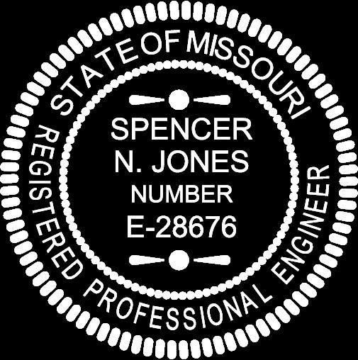
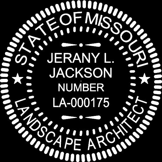
6 Preface Acknowledgements he development of this document, the Missouri Route 66 Corridor Management Plan, has been the undertaking of the Route 66 Association of Missouri, funded by the Federal Highway Administration, and administered by Missouri Department of Transportation. The document was prepared by Great River Associates under the direction of Spencer Jones, P.E. and Jerany Jackson, ASLA, MBA. Great River appreciates the time that many organizations and individuals took to share ideas, discuss their experiences, and review many pieces of this document. Many of the ideas raised by these stakeholders have been incorporated into this document. nical material and thoughtful comments on the many drafts and, most importantly, their considerable practical experience in the creation of this Corridor Management Plan. Great River would like to recognize the following staff for their particular contributions: Ryan Evitts, Keith Belt, Josie Bock, and Malissa D. Nowack. 2 Great River extends special thanks to Glenda, Tommy and Tonya Pike for their extraordinary efforts in supporting and encouraging the production of the document. Also, the Route 66 Association of Missouri should be commended and recognized for their effort and enthusiasm in supporting the production of the document under tight deadlines. Great River Associates had the primary responsibility for developing the content and format of the document. Great River assembled the teams of contributors and reviewers, and provided direction and untiring support as the project came to fruition. Spencer Jones and Jerany Jackson served as the principal writers and editors. They brought to the task both considerable writing skills and a basic understanding of the necessary pieces of a Corridor Management Plan that proved invaluable throughout the process of conceptualizing and creating this document. Great River gratefully acknowledges the important contribution of their team of experts, who served as core technical advisors for this document. These individuals contributed a substantial amount of tech- Route 66 holds many memories for me. I always have wonderful thoughts of family trips to California and to see relatives in Arizona. It was the road of dreams. Route 66

7 Definitions orridor is defined as the road or highway right-of-way and the adjacent area that is visible from and extending along the highway. The distance the corridor extends from the highway can Plans are procedures used to achieve an objective. A plan is a set of intended actions through which one expects to achieve a goal. the executive branch of the American government. These federal agencies are a part of an organizational scheme to divide government labor and expertise among a hierarchy of specialized offices. Legally, according to the Federal Administrative Procedure Act, which governs administrative law, an agency is any governmental authority besides Congress and the courts. Lawrence County: Route 66 Pavement vary, with the topography creating more or less available views. at the end of a corridor, a door opens and you see backward through time, you feel the flow of time, and realize you are only part of a great nameless procession. John Huston ( ) Management is the act of getting people together to accomplish goals and objectives. Management is the art of getting things done through people. Mary Parker Follett ( ) Plans are nothing; planning is everything. Dwight D. Eisenhower ( ) Corridor Management Plan refers to a written document that specifies the actions, procedures, controls, operational practices, and administrative strategies to maintain the archeological, cultural, historic, natural, recreational, and scenic qualities of the scenic byway. Federal Agency refers to the U.S. Forest Service, Bureau of Land Mangement, National Park Service, and the Bureau of Indian Affairs, and their scenic byways programs. Federal Agenices fall under Intrinsic Qualities refers to the archeological, cultural, historic, natural, recreational, and scenic features that are considered representative, unique, irreplaceable, or distinctly characteristic of an area. Local Commitment refers to the assurance provided by communities along the scenic byway that they will undertake actions, such as zoning and/or other protective measures, to preserve the archeological, cultural, historic, natural, recreational, and scenic integrity of the scenic byway and the adjacent area as identified in the corridor management plan. Regional Significance means characteristics that are representative of a geographic area. Scenic Byways are public roads having special archeological, cultural, historic, natural, recreational, and/or scenic qualities that have been recognized as such through legislation or some other official declaration. The terms

8 4 ``road and ``highway are synonymous. They are not meant to define higher or lower functional classifications or wider or narrower cross-sections. Moreover, the term Scenic Byway, refers not only to the road or highway itself but also to the corridor through which it passes. State Scenic Byway refers to a road or highway under State, Federal, or local ownership that has been designated by the State through legislation or some other official declaration for its archeological, cultural, historic, natural, recreational, and/or scenic qualities. An Official Declaration is an action taken by a Governor or that of an individual, board, committee, or political subdivision acting with granted authority on behalf of the State. Jasper County: Residential Section

9 Executive Summary Introduction plied.the grant was administered by Missouri Department of Transportation. Corridor management planning is a process by which communities gain a visitors. The Missouri Route 66 Corridor Management Plan has been developed to preserve, protect and promote the Route 66 corridor as it travels across the State of Missouri. Webstie Banner Created For Project This Corridor Management Plan (CMP) was prepared for the Missouri Route 66 Association in an effort to make application for the Missouri Route 66 to be recognized as a National Scenic Byway. Initiated by the Federal Scenic Byways Program, the National Scenic Byways (NSB) Program was established under the Intermodal Surface Transportation Efficiency Act of 1991 (ISTEA), and reauthorized in 1998 under the Transportation Equity Act for the 21st Century (TEA21) and later in 2005 under the Safe, Accountable, Flexible, Efficient, Transportation Equity Act: A Legacy for Users (SAFETEA-LU). Under these programs, the U.S. Secretary of Transportation recognizes certain roads as National Scenic Byways or All-American Roads based on their archaeological, cultural, historic, natural, recreational, and scenic qualities. The CMP project was funded by a Federal Highway Administration grant for which the Route 66 Association of Missouri ap- thorough understanding of a designated scenic or historic byway. A corridor management plan (CMP) is a required element of a byway and outlines plans to involve the local communities to maintain, improve and promote the byway. Generally, the Missouri Route 66 Corridor Management Plan states the vision, strategies and theme for the byway as well as containing suggestions on ways to maintain, enhance or develop the intrinsic qualities of the roadway corridor. The plan includes an assessment of Missouri Route 66 s cultural and historic resources of interest to byway visitors, the factors influencing past and future byway related economic and infrastructure development and recommendations for improving the efficiency of transportation along this byway to serve byway The CMP develops a ten county corridor management plan for the Missouri Route 66 Byway. The plan identifies measures consistent with those previously implemented by neighboring states along the Route 66 corridor and necessary for National Byway and/or All American Road designation. For this CMP, it was necessary to collect and review data about the history, culture, and natural features of the byway, to develop a comprehensive long-range marketing and promotions plan and to discuss economic programs for the Missouri Route 66 communities to guide long-term economic sustainability. Structure of the document The Corridor Management Plan (CMP)

10 6 document is structured to foster an understanding of the need for the CMP and afford an overview of the process undertaken to create the CMP. The intention is to first reconnect the reader with the history of U.S. Route 66 and Missouri Route 66, then to describe the process and methodology undertaken to develop the CMP. Each important step of the process is discussed in a chapter devoted to the subject matter. From public involvement and intrinsic resources to corridor mapping and wayfinding, the Route is identified and the intrinsic qualities are described and identified.existing conditions, analysis of the corridor, the role of Route 66 in our education system, marketing and promotion as well as economic opportunities in the corridor are also explored. Finally, the CMP contains a toolbox intended to assist the communities and counties in the facilitation of improvements, while also preserving the unique nature of the Byway. The toolbox is broken into five categories: strategies and studies, programs, planning and development, design and funding. The categories are presented in a step by step progression from the beginning of the process through the ultimate execution of concepts through funding and implementation. The toolbox s intended use is for a community to select the level where they need to focus effort. For example, smaller communities with no comprehensive type plans in place would start with a strategy or study in an effort to identify needs and opportunities. A larger community that may be implementing the objectives of a comprehensive plan may be all the way through the design process on a Route 66 project, so funding would be most valuable tool for them. The toolbox gives all the communities in the corridor the opportunity to select tools that best fit the development opportunities that may exist for them. Public Involvement Public involvement is an essential and integral part of any public space plan development process. Done well, it can improve the knowledge base for decisions, clarify the nature and extent of agreements and disagreements (e.g., among participants and between participants and agencies), and yield more widely accepted decisions (National Research Council, 1989, 1996). In the case of Missouri Route 66, public involvement can help leaders better understand the public s view of protection, preservation and promotion issues and help stakeholders better understand critical action plan items. An important part of the information gathering process for the Corridor Management Plan (CMP) was collecting public input through a public meeting process. Meetings were held in each of the ten counties that the Route 66 travels through in the State of Missouri in an Webster County: Old Gas Station

11 effort to communicate about the CMP to stakeholders. These stakeholders were comprised of community leaders, business owners, residents and travelers of the with regard to the significance that Route 66 has for the state, local communities and individuals, and identifying opportunities for the preservation, protection or building. Byway stakeholders seek to maintain, protect, enhance, interpret, and present the intrinsic resources to byway users for their education and enjoyment. Classic Car Show - Courtesy of David J. Eslick Road. The public meetings allowed vital input to be collected with regard to the significance that Route 66 has for the state, local communities and individuals. Additionally, opportunities for the preservation, protection and promotion of the resources associated with Route 66 and the value that they provide to the economy were identified through answers to a five question survey administered to attendees. During the public meetings, it was important to introduce the National Scenic Byway and the All American Road programs and discuss the benefits that could be derived from participating in those programs. A vital part of the public involvement process was collecting input and promotion of the resources associated with Route 66 and the value that they provide to the economy. Intrinsic Resources Intrinsic resources for Missouri Historic Route 66 represent the characteristics of national significance for the Route as it travels through the state. The characteristics contain one-of-a-kind features that do not exist anywhere else. Intrinsic qualities are broken into six categories: archaeological, cultural, historic, natural, recreational, and scenic features. These qualities are considered to be representative, unique, irreplaceable, or distinctly characteristic of a place, view, site Intrinsic qualities are the essence of a scenic byway. Identification of the Intrinsic Resources is the primary method used to establish whether a corridor meets the guidelines established by the National Scenic Byway Program. The National Scenic Byway Program defines and ranks a road s resources and amenities by these intrinsic qualities. The Intrinsic Resources of the Missouri Route 66 Byway are those characteristics which best represent the national significance of the Route 66 roadway. The information gathered for, and presented in the CMP shows that Missouri Route 66 demonstrates that a richness and diversity of resources are found along the Route. Corridor Mapping A key component of the Corridor Management Plan and a requirement of the NSB program is the clear identification and representation of the corridor and where the intrinsic resources are located along the corridor. For the Missouri Route 66 Corridor Management Plan, Geographic Information Systems (GIS) mapping was utilized. GIS, integrates hardware and software technologies used in the collection, management, analysis, and display of geographically ref-
12 8 As some traveler s have experienced, finding Route 66 can be an adventure and a challenge requiring a good sense of dierenced information. The various types of information within a GIS work together to represent the real world on a computer much like traditional maps represent the world on paper. Natural features such as lakes and streams and man-made features such as roads, bridges, cities, historical sites, and counties can all be graphically represented in a GIS. Information about these features is also included in the database structure of a GIS for analysis as well as data management. GIS has helped establish consistency in the mapping and planning process used during the design of the corridor management plan for Missouri Route 66. This robust set of technologies has provided a sound database foundation for the future analysis of the geospatial data, as well as, an aesthetic venue for the graphic representation of this analysis. The Missouri Route 66 corridor maps are included in the individual county folders of the CMP document. The maps show the main driving Route, called the Primary Route, and the Alternate Route alignments that served as Route 66 for a time in history. The individual road segments that comprise Missouri Route 66 were verified and precisely located through real-time, kinematic survey using a Global Positioning System (GPS) unit. The segments of the Primary and Alternate Routes are colorcoded by year to reflect changes in Route 66 through time. Also included on the maps are points of interest along the Corridor that have historical and tourism significance. These points were precisely located through collection by a GPS survey. Since the focus of this document is corridor management, only those points of interest that fall within the primary, secondary, or complimentary corridors, as defined by the CMP, were included in the GIS database and map sets. Geospatial data layers that make up the Route 66 geodatabase include: Missouri Route 66, Missouri highways, county roads, points of interest, National Register of Historic Places sites and districts, Department of Natural Resources public lands, parks, rivers, airports, post offices, cemeteries, churches, bridges, cities and towns, and county boundaries. Analysis of Existing Conditions For the Missouri Route 66 Corridor Management Plan the analysis of the existing conditions is important because it provides information regarding the cross section of the road, bridges and roadside development, as well as design elements which drove the decision-making for why the roadway was planned and constructed. In this section of the CMP, design recommendations for future improvements are given. Additionally, a discussion about multimodal transportation opportunities and connectivity is presented. Information regarding the number of miles, the breakdown of responsibility for operation and maintenance, number of bridges and their condition is included in the Analysis of Existing Conditions chapter. An evaluation of the volume of traffic in different areas and accident data is included as well. Additional consideration was given to the larger recreational vehicles and tour buses, to demonstrate that the Missouri Route 66 can accommodate those users. The goal of the information in this chapter is to evaluate the existing conditions and promote a safe roadway which accommodates the local communities that use the road for traveling from home to work or business, and the tourists who enjoy the numerous resources that Missouri Route 66 has to offer. This analysis is done in an effort to promote a safe and acceptable travel corridor. Wayfinding In order for the Missouri Route 66 Byway to be easily identifiable and for the traveler s of the byway to identify and connect with the resources, it is important to establish a wayfinding plan which provides the directions to and information about the byway. This can be accomplished with a comprehensive wayfinding plan. A successful wayfinding system orients users in space, establishes a clear destination, and directs users through space from one point to the next.

13 All Roads Lead Somewhere rection, several maps and guidebooks, a navigator, and patience to decipher the highway s various alignments. Recently published guides to the highway and publications by state Route 66 associations are available, and have aided in addressing some of these issues. This CMP has provided a consistent database of information regarding the alignments and resources of the corridor. The goal of wayfinding for Missouri Route 66 is to establish a system of presenting this information in a clear and concise method giving travelers the ability to navigate and receive communicative information within the Route 66 corridor environment. Wayfinding is not just about building maps, it s a process of exposing users to information that leads to more decisions. Education In order for the Missouri Route 66 Byway to be successful, it is important to educate the general public of the Route and the benefits which can be derived from its promotion and preservation. It is important for the regulatory agencies to understand the impact to the communities for economic growth and for the historical asset that it is. It is also important for future generations to be educated about its history and how protecting the physical elements as well as Route 66 heritage are important and will be of benefit to their generation. All of these educational components are necessary for the Missouri Route 66 Byway to reach its fullest potential. Education and awareness support the Missouri Route 66 Vision, build a knowledgeable constituency for supporting the corridor s goals and strategies, encourage a sense of stewardship among visitors and stakeholders, and help educate the travelling public. An education strategy increases resource management, and emphasizing our culture, economics, and state history. There are a number of ways for travelers to explore, learn, and gain greater knowledge to encourage the promotion and stewardship of the Route by future generations, the Education chapter discusses strategies to achieve these goals. Marketing & Promotional Branding This chapter fo the CMP discusses target audiences, the visitor experience, wayfinding, as well as, integrated affiliate and content marketing. All of these components should be considered in a marketing and promotions campaign. Ultimately, the chapter focuses on a discussion of a marketing plan for Missouri Route 66. All of the components for a state-wide marketing approach are discussed and identified. It is recognized that in order for Missouri Route 66 to be preserved, protected and recognized, it is important for the businesses to be successful and profitable. It is through these businesses that Missouri Route 66 will be sustainable. Without the businesses and their support, Missouri Route 66 will not
14 10 have the support, financially nor politically, that is required to maintain its integrity and legacy. The advantages that marketing and promotional branding bring to the forefront have always been a key component of Route 66. Economic Development In order for the Missouri Route 66 Byway to be viable, it needs to be sustainable. This sustainability will come in the form of economic growth and opportunity. The needs in many communities out grow the financial ability to meet those needs. The Missouri Route 66 Byway seeks to identify growth potential and an action plan to capitalize on this growth. This is why, in recent years, many regions and states have recognized that scenic byway routes like Missouri Route 66 have value not only for aesthetics and preservation, but also as a way to promote desirable forms of tourism and increase income in regions. There is excellent potential to draw significant additional volumes of visitors to byway attractions and communities. The principal benefit of the corridor management plan project would be to encourage access to future commercial sites, particularly those associated with facilities which would expand the opportunities for goods and services or experience for the traveler s along the Route. Toolbox This toolbox has been developed to provide solutions for the Route 66 communities and counties for the implementation of strategies and studies, programs, planning and development design, and funding that will preserve, protect and promote the Missouri Route 66 Corridor. Because viable communities rely on having a diverse economic base, many of the tools focus on economic development for Missouri Route 66 corridor. The tools described here are accepted standards of practice that have been utilized by numerous communities all across the state and the nation. These tools are intended to help communities grow, attract new businesses, and maintain or create a diverse economy that it is resilient when changes occur in the national and international economies. The tools also recognize that to compete in the world economy, communities must work together as a region rather than in isolation; that is, it takes a region to supply the ingredients a successful business needs; the workforce, the housing, the training and education, the transportation network, and the technology. Because Missouri Route 66 is a linear community, it is imperative entities work together when possible to protect, promote and preserve the corridor, especially with regard to commerce. Conclusion The ultimate intent of this document is to recognize, protect, and promote Missouri s Route 66 as one of America s most outstanding roads. All the information discussed above has been compiled into this corridor management plan in an effort to identify the significance of Missouri Route 66. This plan is a required step in the Missouri Route 66 formal application for the National Scenic Byway Program. This program recognizes two types of byways; National Scenic Byways and All-American Roads. It is the goal of this document to represent that the Missouri Route 66 meets and exceeds the requirements for recognition as an All-American Road. Recognition as such accesses funding opportunities that will highlight and market the intrinsic resources of the Route thereby creating interest and economic growth along the corridor. Like life, the intensity of the experience changed moment-to-moment, excitement building as we discovered the remnants of another time.
15
2011 ASLA Design Awards. Top of the Rockies National Scenic and Historic Byway Merit Award Bluegreen. Planning & Urban Design
 2011 ASLA Design Awards Top of the Rockies National Scenic and Historic Byway Merit Award Bluegreen Planning & Urban Design ASLA Colorado 2011 Design Awards Category 2: Planning Project Fact Sheet Project
Preface. Erie. Scranton. Allentown. Pittsburgh. Harrisburg. Philadelphia
 The Southern Alleghenies Region The Southern Alleghenies Region spans the Laurel Highlands and Allegheny Front in the west across the Appalachians to the east. It is comprised of Blair, Bedford, Cambria,
The John Bartram Association Action Plan to advance the 10 year Strategic Plan
 The John Bartram Association 2013-2015 Action Plan to advance the 10 year Strategic Plan We are poised to take significant leaps with the opportunities that surround us. In the next three years we are
Summary of Action Strategies
 Strategic Action Plan 6 Summary of Action Strategies Action Strategy Categories: 1. Organization and Management 2. Implementation 3. Marketing and Promotion This chapter summarizes all of the action strategies
I. STAFF POLICY RECOMMENDATIONS. The following RMP policy strategies are proposed by staff in support of a Scenic Resource Protection Program:
 Policy Consideration: Scenic Resource Protection Program Status: For Consideration by the Highlands Council at September 14, 2006 Work session Date: September 12, 2006 I. STAFF POLICY RECOMMENDATIONS The
Inspiring Technovation
 1 2 Table of content List of table and figures... Executive summary... 1. Introduction... 2. Material and methods... 3. Results... 3.1 Today s facts about Versailles: a diagnostic approach... 3.1 Vision
FOREST SERVICE MANUAL NATIONAL HEADQUARTERS (WO) WASHINGTON, DC
 WASHINGTON, DC") Page 1 of 11 FOREST SERVICE MANUAL NATIONAL HEADQUARTERS (WO) WASHINGTON, DC FSM 2300 RECREATION, WILDERNESS, AND RELATED RESOURCE MANAGEMENT Amendment No.: 2300-2011-2 Effective Date: October 19, 2011
Page 1 of 11 FOREST SERVICE MANUAL NATIONAL HEADQUARTERS (WO) WASHINGTON, DC FSM 2300 RECREATION, WILDERNESS, AND RELATED RESOURCE MANAGEMENT Amendment No.: 2300-2011-2 Effective Date: October 19, 2011
CHAPTER 2: PLANNING PRINCIPLES
 CHAPTER 2: PLANNING PRINCIPLES 2 Comprehensive Principles The following overarching Principles provide the basis for the goals and policies included in the Mendocino County General Plan. These Principles
Greenway. Two Rivers. Design Guidelines and Signage Plan. Broome County. Tioga County. Prepared For: The Binghamton Metropolitan Transportation Study
 Broome County Two Rivers Greenway Design Guidelines and Signage Plan Tioga County Prepared For: The Binghamton Metropolitan Transportation Study Prepared By: 2012 This project is included in the 2011-2012
CITY OF CHARLOTTESVILLE, VIRGINIA CITY COUNCIL AGENDA
 CITY OF CHARLOTTESVILLE, VIRGINIA CITY COUNCIL AGENDA Agenda Date: December 16, 2013 Action Required: Adoption of Resolution Presenter: Staff Contacts: Title: James E. Tolbert, AICP, Director of NDS James
3. VISION AND GOALS. Vision Statement. Goals, Objectives and Policies
 Vision Statement Queen Creek s interconnected network of parks, trails, open spaces and recreation opportunities provide safe and diverse activities and programs that sustain its unique, small town, equestrian
Comprehensive Plan ADOPTED APRIL 2014
 Comprehensive Plan ADOPTED APRIL 2014 8 8. Outstanding Recreational & Cultural Opportunities We are proud of our community s parks and recreation system. Our community will ensure that the legacy of our
TOWN OF AURORA HERITAGE IMPACT ASSESSMENTS AND CONSERVATION PLANS GUIDE
 PLANNING AND DEVELOPMENT SERVICES Development Planning Division Heritage Planning Section Phone: 905-727-3123 ext. 4226 Fax: 905-726-4736 Email: planning@aurora.ca Town of Aurora 100 John West Way, Box
A BLUEPRINT FOR BROCKTON A CITY-WIDE COMPREHENSIVE PLAN
 A BLUEPRINT FOR BROCKTON A CITY-WIDE COMPREHENSIVE PLAN Public Meeting October 2016 1 Plan Summary and Discussion Public Meeting May 4 2017 City of Brockton Bill Carpenter, Mayor Department of Planning
DRAFT Subject to Modifications
 TREASURE COAST REGIONAL PLANNING COUNCIL M E M O R A N D U M To: Council Members AGENDA ITEM 8 From: Date: Subject: Staff May 19, 2017 Council Meeting Florida Department of Transportation Complete Streets
Creating Complete Roadway Corridors:
 Creating Complete Roadway Corridors: The AASHTO Guide to Transportation Landscape Architecture and Environmental Design NCHRP Project 15-33 Status Report AASHTO Standing Committee on Design Technical Committee
2011 ASLA Design Awards
 2011 ASLA Design Awards Interstate 70 Mountain Corridor Aesthetic Guidance Honor Award Design Workshop, Aspen / THK Associates, Inc. / CH2MHill Planning and Urban Design Project Title: Interstate70 Mountain
Arlington, Virginia is a worldclass
 EXECUTIVE S U M M A RY Arlington maintains a rich variety of stable neighborhoods, quality schools and enlightened land use policies, and received the Environmental Protection Agency s highest award for
CHAPTER 12 IMPLEMENTATION
 CHAPTER 12 IMPLEMENTATION The 2010 Town of Denton Comprehensive Plan is intended to capture a vision of the future of Denton. As such, it provides a basis for a wide variety of public and private actions
Living in Albemarle County s Urban Places
 Living in Albemarle County s Urban Places ALBEMARLE COUNTY, VIRGINIA A Closer Look at Albemarle s Approach to Managing Growth and Creating Quality Urban Environments www.albemarle.org Page 2 Living in
PSRC REVIEW REPORT & CERTIFICATION RECOMMENDATION
 PSRC REVIEW REPORT & CERTIFICATION RECOMMENDATION KITSAP COUNTY COUNTYWIDE PLANNING POLICIES July 2, 2012 BACKGROUND A major emphasis of the Washington State Growth Management Act (GMA) is the need to
The Palisades Interstate Parkway and Henry Hudson Drive designated a New Jersey State Scenic Byway, 2005
 The Palisades Interstate Parkway and Henry Hudson Drive designated a New Jersey State Scenic Byway, 2005 What are scenic byways? How Did Scenic Byways Come About? National Scenic Byways Program Administered
ENGLISH HERITAGE STRATEGY MAKING THE PAST PART OF OUR FUTURE
 ENGLISH HERITAGE STRATEGY 2005 2010 MAKING THE PAST PART OF OUR FUTURE ENGLISH HERITAGE STRATEGY 2005 2010 English Heritage is the Government s statutory adviser on the historic environment. Our role is
10.0 Open Space and Public Realm
 10.0 Open Space and Public Realm 10.0 Open Space and Public Realm The Public Open Space System is comprised of: outdoor spaces available for public use that are either publicly owned (e.g., parks and
STAFF RECOMMENDATION: Adopt the Parks and Recreation Master Plan 2013, or take other action as deemed appropriate.
 Regular 7. CITY COUNCIL AGENDA Meeting Date: 12/02/2013 TITLE: Parks and Recreation Master Plan 2013 Adoption Proposal - Dwight Curtis Responsible Staff: Dwight Curtis Backup Material: Backup material
Workshop on the Management of Historic Urban Landscapes of the XXth century, December 2007 Chandigarh, India
 Workshop on the Management of Historic Urban Landscapes of the XXth century, 18-21 December 2007 Chandigarh, India INTRODUCTION The participants of the International Workshop on the Management of Historic
Comprehensive Plan. Faribault, Minnesota. Hoisington Koegler Group Inc. Claybaugh Preservation Architecture Inc. Howard R. Green Company Bonz/REA
 Comprehensive Plan Faribault, Minnesota Adopted by the Faribault City Council July 8, 2003 prepared for: prepared by: Hoisington Koegler Group Inc. Claybaugh Preservation Architecture Inc. Howard R. Green
20. Appendix J: Summary of Management Resources for Pioneer Park
 20. Appendix J: Summary of Management Resources for Pioneer Park Management resources are the people, funds and tools that are dedicated to the park on an ongoing basis. The tools are not so much hardware
ELK GROVE GENERAL PLAN VISION
 2-1 CHAPTER 2: 2-2 CREATING OUR The Community Vision for Elk Grove, expressed through a Vision Statement and a series of Supporting Principles, is a declaration of the kind of community that Elk Grove
I-70 Corridor Enhancement Plan
 i - Table of Contents Table of Contents Chapter I Overview Chapter II Bridge and Roadway Improvements Chapter III Landscape Enhancements Chapter IV Riparian Corridors Chapter V Showcase Missouri Plan Chapter
MEETING PURPOSE AND OVERVIEW
 MEETING PURPOSE AND OVERVIEW On February 23, 2012, the City of Elk Grove hosted the first of two community workshops related to the Southeast Policy Area. The workshop was held from 6:00 8:30 p.m. in the
1.0 INTRODUCTION 1.1 TH 14 WEST STUDY AREA Project Description Functional Classification Purpose of the Project
 1.0 INTRODUCTION 1.1 TH 14 WEST STUDY AREA 1.1.1 Project Description The Trunk Highway (TH) 14 West Corridor is a two-lane roadway approximately 22 miles in length. Located in Nicollet County, the corridor
CITY OF GENEVA HISTORIC PRESERVATION COMMISSION 22 S. FIRST STREET GENEVA, ILLINOIS 60134
 A GUIDE TO THE LOCAL LANDMARK DESIGNATION PROCESS INTRODUCTION The City of Geneva is a residential community characterized by fine examples of many significant architectural styles dating from the mid-1800s
Town of Peru Comprehensive Plan Executive Summary
 Town of Peru Comprehensive Plan Executive Communities that plan grow by choice, not by chance. A plan makes growth thoughtful, understandable, and predictable. A plan shows that a community is managing
Downtown Streetscape Manual & Built Form Standards
 City of Guelph Downtown Streetscape Manual & Built Form Standards July 2014 Prepared by Brook McIlroy Inc. in association with Unterman McPhail Associates and McCormick Rankin Inc. City of Guelph Downtown
1INTRODUCTION. Purpose of the Truckee Railyard Master Plan
 1INTRODUCTION Purpose of the Truckee Railyard Master Plan The purpose of the Truckee Railyard Master Plan is to capture and describe the Town s vision for the Railyard Area and to guide its future redevelopment.
Route 66 Business Corridor
 Route 66 Business Corridor DOWNTOWN BUSINESS AND CULTURAL DISTRICT SPECIFIC PLAN Draft April 2016 Acknowledgments Text Acknowledgments here etc... LIST NAME List List List Table of Contents 1. Introduction...
Landscape Architecture (LARC)
") Landscape Architecture (LARC) 1 Landscape Architecture (LARC) Courses LARC 0841. Sustainable Design. 3 Credit Hours. What's the big deal about global warming and how should we respond to it? Explore the
Landscape Architecture (LARC) 1 Landscape Architecture (LARC) Courses LARC 0841. Sustainable Design. 3 Credit Hours. What's the big deal about global warming and how should we respond to it? Explore the
Planning Department. Director of Planning. Manager of Planning. Planning Technician/ Sustainability Coordinator. Planner II/ Heritage Coordinator
 Department Director of Manager of Policy Planner Planner II (2) Planner II/ Heritage Coordinator Technician/ Sustainability Coordinator Technician Administrative Clerk March 2017 Department 2018 Business
I-1 COMMENCEMENT. History
 COMMENCEMENT Nature connects us to each other. All of creation has developed from natural processes, and thus by instinct, we are drawn back into them. Whether it be a forest, prairie, beach or community
CONSERVATION PLAN BASED ON THE CONCEPT OF INTEGRITY
 CONSERVATION PLAN BASED ON THE CONCEPT OF INTEGRITY Y. N. Yen a C. F. Cheng a, * a China University of Technology, 56 Sec. 3 Shin Long Rd., 116 Taipei, Taiwan - (alexyen, aabbyy)@ cute.edu.tw KEY WORDS:
SCORP THE 2019 STATEWIDE COMPREHENSIVE OUTDOOR RECREATION PLAN EXECUTIVE SUMMARY
 THE 2019 STATEWIDE COMPREHENSIVE OUTDOOR RECREATION PLAN EXECUTIVE SUMMARY SCORP Statewide Comprehensive Outdoor Recreation Plan 1 December 11, 2018 Dear Fellow Coloradans, It gives me great pleasure to
CHAPTER 4.1 COMMUNITY HERITAGE AND HISTORIC PRESERVATION ELEMENT
 CHAPTER 4.1 COMMUNITY HERITAGE AND HISTORIC PRESERVATION ELEMENT Vision: Retention of the community s heritage and atmosphere through identification, preservation and ongoing support of important traditions,
greenprint midtown SUSTAINABILITY ACTION PLAN 2012
 greenprint midtown SUSTAINABILITY ACTION PLAN 2012 MIDTOWN ALLIANCE SOUTHFACE ENERGY INSTITUTE RENAISSANCE PLANNING GROUP SUSTAINABLE ATLANTA PERKINS+WILL 2 GREENPRINT MIDTOWN 1. Introduction Sustainability
OFFICIAL CONTROLS IMPLEMENTATION LEGAL REQUIREMENTS
 IMPLEMENTATION The objective of the Implementation component of the Comprehensive Plan is to identify the changes that need to be made to the official controls in order to be consistent with the Comprehensive
Streets for People, Place-Making and Prosperity. #TOcompletestreets
 COMPLETE STREETS FOR TORONTO Streets for People, Place-Making and Prosperity COMPLETE STREETS: A NEW APPROACH A Complete Streets design approach considers the needs of all users people who walk, bicycle,
The Corporation of Delta. COUNC~L REPORT Regular Meeting. Burnsview Secondary School/Chalmers Park Memorandum of Understanding
 The Corporation of Delta COUNC~L REPORT Regular Meeting Fa 13 To: Mayor and Council File No.: 14035-20/ChaP From: Parks, Recreation & Culture Department Date: June 19, 2015 Burnsview Secondary School/Chalmers
1 October Dear Citizens of Charlotte and Mecklenburg County,
 1 October 2011 Dear Citizens of Charlotte and Mecklenburg County, As co-chairs of the Center City 2020 Vision Plan Steering Committee, we are proud to present the Center City 2020 Vision Plan, which sets
ATTACHMENT A. Town of Lebanon Village Center Study Proposal Cover Sheet (to be included with Proposal) Contract shall not exceed $48,500.
 Contract shall not exceed $48,500.") ATTACHMENT A Town of Lebanon Village Center Study Proposal Cover Sheet (to be included with Proposal) Contract shall not exceed $48,500. Price to complete the survey as described $ Price to be submitted
ATTACHMENT A Town of Lebanon Village Center Study Proposal Cover Sheet (to be included with Proposal) Contract shall not exceed $48,500. Price to complete the survey as described $ Price to be submitted
SUSTAINABLE MANAGEMENT
 . Sustainable Management.1 The Concept of Sustainable Management The concept of sustainable management recognises there are limits to the use of natural and physical resources and there is a need to balance
Western Sydney Parklands Australia s Largest Urban Park
 Western Sydney Parklands Australia s Largest Urban Park 37 WLA 1 MAGAZINE 21 38 WESTERN SYDNEY PARKLANDS AUSTRALIA S LARGEST URBAN PARK Large urban parks have dual roles to play in meeting the demands
TOWN OF BETHLEHEM MEETING SUMMARY LOCAL WATERFRONT REVITALIZATION PROGRAM UPDATE
 TOWN OF BETHLEHEM LOCAL WATERFRONT REVITALIZATION PROGRAM UPDATE MEETING SUMMARY Purpose: LWRP Update Public Workshop #3 Date and Time: October 24, 2017, 6:00 pm - 8:00 pm Location: Town Hall, 445 Delaware
City of Mahtomedi Park System Plan Public Hearing Draft: September 13, 2006
 Chapter 6: IMPLEMENTATION INTRODUCTION Earlier chapters of this Plan analyzed existing conditions, identified park and recreation needs, and proposed park, trail, and open space recommendations. This chapter
Waco Mammoth Site Special Resource Study
 Waco Mammoth Site Waco, Texas Newsletter #2 August 2007 National Park Service U.S. Department of the Interior Waco Mammoth Site Special Resource Study We are pleased to share with you an update on the
Phase 1 : Understanding the Campus Context. Phase 2 : APPROACHES - Alternates & Preferred Plan
 Introduction MASTER PLAN PURPOSE WHY A CAMPUS MASTER PLAN? The purpose of the Master Plan at the University of Illinois at Chicago is to translate UIC s strategic goals and objectives into a compelling
The Illinois Department of Transportation and Lake County Division of Transportation. Route 173, including the Millburn Bypass
 The Illinois Department of Transportation and Lake County Division of Transportation welcome you to this Public Hearing for U.S. Route 45 from Illinois Route 132 to Illinois Route 173, including the Millburn
6 Growth Management Challenges and Opportunities
 6 Growth Management Challenges and Opportunities The Town has established a goal of attaining a 50% participation rate with respect to employment opportunities versus residential population. The Town s
CHAPTER VI Plan Implementation
 Versailles-Midway CHAPTER VI Plan Implementation While prior sections focused on the tools the Commission needs to help it make the dayto-day decisions associated with subdivision, site plan and rezoning
Authority of the General Plan
 Authority of the General Plan This La Habra Heights General Plan will serve as the blueprint for future planning and development in the City. This General Plan describes the City s vision for the future
In surveys, Dallas residents say what they want to change most
 NEIGHBORHOODS ELEMENT In surveys, Dallas residents say what they want to change most in the city is its appearance they want it to look beautiful, with trees and pedestrian-friendly neighborhoods. The
Report to: Development Services Committee Report Date: September 11, 2017
 ~RKHAM Report to: Development Services Committee Report Date: September 11, 2017 SUBJECT: PREPARED BY: Conceptual Master Plan for the Future Urban Area - Community Structure Plan and Key Policy Direction
1.0 Purpose of a Secondary Plan for the Masonville Transit Village
 Report to Planning and Environment Committee To: Chair and Members Planning & Environment Committee From: John M. Fleming Managing Director, Planning and City Planner Subject: Masonville Transit Village
Stakeholder Recommendations Voting Results
 Stakeholder Recommendations Voting Results Public Input Yes No Abstain Total Count 1. On the matters that are of the highest importance to the community, strengthen the related policy statements through
edmonton.ca/ribbonofgreen #ribbonofgreen
 WHAT IS THE RIBBON OF GREEN? The Ribbon of Green is Edmonton s entire river valley and ravine system. The Ribbon of Green (2018) Project will provide strategic guidance for the southwest and northeast
Statewide Greenways Vision
 Greenways Vision The formation of a greenways vision is based on a thorough analysis of the current state of recreation and open space in a region and the existing pressures that threaten it. Lehigh and
Town of Cobourg Heritage Master Plan. Statutory Public Meeting
 Town of Cobourg Heritage Master Plan Statutory Public Meeting April 25 th 2016 Presentation Overview 1. Introduction 2. Project background and schedule overview 3. Review of strategic direction content
ARLINGTON COUNTY PLANNING COMMISSION SITE PLAN REVIEW COMMITTEE SITE PLAN CHAIR GUIDE
 ARLINGTON COUNTY PLANNING COMMISSION SITE PLAN REVIEW COMMITTEE SITE PLAN CHAIR GUIDE Excerpts from the SPRC Operating Guide, 1/31/04 Revised March 17,2010 1. Site Plan Chair Responsibilities 1 1, The
TABLE OF CONTENTS. Transportation Chapter 1 - Introduction and Purpose of Planning to 1-3. Utilities
 Chapter 1 - Introduction and Purpose of Planning... 1-1 to 1-3 Pennsylvania Municipalities Planning Code (Act 247)...1-1 Previous County Planning Activities...1-1 Objectives of the Plan...1-2 Elements
SALISBURY TOMORROW Our Vision
 SALISBURY TOMORROW Our Vision Salisbury is committed to supporting a high quality of life and sense of community for all residents. These commitments need to be reflected in our community programs, services
Parks Master Plan Implementation: Phase I Waterfront Use and Design REPORT #: September 7, 2016 File #
 0 'O DI Lan-171-14 1 - THE CORPORATION OF THE TOWN OF COBOURG..,. STAFF REPORT TO: FROM: Mayor and Members of Council Dean A. Hustwick, Director of Recreation and Culture DATE OF MEETING: Committee of
EXISTING COMPREHENSIVE PLAN
 EXISTING COMPREHENSIVE PLAN Town Center Land Use Element: V. LAND USE POLICIES Town Center Mercer Island's business district vision as described in "Your Mercer Island Citizen-Designed Downtown" was an
Monitoring for Ecological Integrity and State of the Parks Reporting
 Monitoring for Ecological Integrity and State of the Parks Reporting Donald McLennan 1 and Paul Zorn 1 National Monitoring Biologist Parks Canada, Ecological Integrity Branch 25 Eddy Street Gatineau, Québec,
The transportation system in a community is an
 7 TRANSPORTATION The transportation system in a community is an important factor contributing to the quality of life of the residents. Without a sound transportation system to bring both goods and patrons
Arkansas River Corridor
 Planning for Access Welcome to the Access Project. This project is a recreational planning effort in response to an interest by regional communities along the Arkansas River corridor. The project plan
TABLE OF CONTENTS HISTORIC PRESERVATION ELEMENT I. INTRODUCTION HP. A. Purpose HP B. Assessment and Conclusions...
 TABLE OF CONTENTS HISTORIC PRESERVATION ELEMENT I. INTRODUCTION... 1 - HP A. Purpose... 1 - HP B. Assessment and Conclusions... 1 - HP II. GOAL, OBJECTIVES AND POLICIES... 3 - HP GOAL 1: PROTECTION AND
1 Introduction. Chapter. In this chapter:
 Chapter 1 Introduction In this chapter: 1.1 A Snapshot of the Region 1.2 Towards a Sustainable Region 1.3 The Provincial Context 1.4 Purpose and Organization The Regional Municipality of York Official
Elodie Gonthier (Team leader) Kevin Ramirez Sandra Velasco Krishna Chandran Anna Aghvanyan Sirin Hamsho
 Kevin Ramirez Sandra Velasco Krishna Chandran Anna Aghvanyan Sirin Hamsho") 2 T he nature of today s global economy highlights our interdependence and the need for much better global policies. Inspiring Technovation is pleased to present its report on transforming the city of
2 T he nature of today s global economy highlights our interdependence and the need for much better global policies. Inspiring Technovation is pleased to present its report on transforming the city of
CITY OF VAUGHAN EXTRACT FROM COUNCIL MEETING MINUTES OF NOVEMBER 15, 2016
 Item 11, Report No. 38, of the Committee of the Whole, which was adopted without amendment by the Council of the City of Vaughan on November 15, 2016. Regional Councillor Di Biase declared an interest
Norwich (United Kingdom), 9-10 September 2004
, 9-10 September 2004") THE CONGRESS OF LOCAL AND REGIONAL AUTHORITIES Council of Europe F 67075 Strasbourg Cedex Tel : +33 (0)3 88 41 20 00 Fax : +33 (0)3 88 41 27 51/ 37 47 http://www.coe.int/cplre COLLOQUIES, SEMINARS, FORUMS
THE CONGRESS OF LOCAL AND REGIONAL AUTHORITIES Council of Europe F 67075 Strasbourg Cedex Tel : +33 (0)3 88 41 20 00 Fax : +33 (0)3 88 41 27 51/ 37 47 http://www.coe.int/cplre COLLOQUIES, SEMINARS, FORUMS
ESTABLISH AN EFFICIENT TOWN CENTER
 ESTABLISH AN EFFICIENT TOWN CENTER 4 Overview Lisbon residents are proud of the history of Newent and at the same time recognize its current importance as a centralized location for a variety of municipal
OPEN SPACE CHAPTER 7: OVERVIEW. Preserve open space to protect natural resources, enhance character and provide passive recreation opportunities
 CHAPTER 7: OPEN SPACE OVERVIEW Ridgefield has made tremendous progress permanently preserving areas of town as open space. Open space preservation can serve many important purposes, including: protect
CITY OF COLWICH COMPREHENSIVE PLAN LAND USE LAND USE 1
 LAND USE LAND USE 1 WHAT YOU WILL FIND IN THIS CHAPTER: Discussion of today s conditions and tomorrow s projections Discussion of challenges and opportunities Discussion of the environmental quality goals,
COMMUNITY DESIGN. GOAL: Create livable and attractive communities. Intent
 COMMUNITY DESIGN Intent An attractive, well-designed County will attract quality development, instill civic pride, improve the visual character of the community, and create a strong, positive image for
Master Plan Visioning #1 Section 3 Informal amphitheater at Community Development Services Building. Section 3 MP Visioning #1
 Section 3 Informal amphitheater at Community Development Services Building Section 3 MP Visioning #1 THIS PAGE INTENTIONALLY LEFT BLANK. appendix As with the master planning of any government campus, the
Sherri Ferguson. President/CEO Portland Chamber of Commerce. Tennessee Certified Economic Developer Capstone Project
 Sherri Ferguson President/CEO Portland Chamber of Commerce Tennessee Certified Economic Developer Capstone Project Strategic Plan Development for the North Gateway of Portland, Tennessee The New Gateway
Chelsea Creek Municipal Harbor Plan
 Chelsea Creek Municipal Harbor Plan Public Meeting #1 June 11th, 2018 1 Presentation outline I. Introduction: Why are we doing this plan? II. Evolution of Chelsea Creek III. State of Chelsea Creek IV.
2 Vision. Master Plan
 19 2 Vision Master Plan 20 Chapter 2 MASTER PLAN VISION 2.1 Master Plan Organization Lake Calhoun/Bde Maka Ska and Lake Harriet are places where complex human and natural systems intersect and converge.
SUBJECT: Waterfront Hotel Planning Study Update TO: Planning and Development Committee FROM: Department of City Building. Recommendation: Purpose:
 Page 1 of Report PB-23-18 SUBJECT: Waterfront Hotel Planning Study Update TO: Planning and Development Committee FROM: Department of City Building Report Number: PB-23-18 Wards Affected: 2 File Numbers:
Study Process / Planning Policy Issues
 Memorandum Date: March 13 th, 2009 To: From: Reference: Subject: Murray Thompson, URS Canada Tyler Drygas, Senior Environmental Planner, URS Canada Detroit River International Crossing Study Response to
DRAFT SECTION 4(f) EVALUATION INTERSTATE 73 FEIS: I-95 to I-73/I-74 in North Carolina
 EVALUATION INTERSTATE 73 FEIS: I-95 to I-73/I-74 in North Carolina") DRAFT SECTION 4(f) EVALUATION INTERSTATE 73 FEIS: I-95 to I-73/I-74 in North Carolina 1.0 INTRODUCTION Section 4(f) of the Department of Transportation Act of 1966, 49 U.S.C. 303, requires that prior to
DRAFT SECTION 4(f) EVALUATION INTERSTATE 73 FEIS: I-95 to I-73/I-74 in North Carolina 1.0 INTRODUCTION Section 4(f) of the Department of Transportation Act of 1966, 49 U.S.C. 303, requires that prior to
Annex D: Project Logframe Matrix
 Annex D: Project Logframe Matrix OVERALL OBJECTIVE: Protect the unique ecosystems and biodiversity along the Sava River through supporting Croatia and Bosnia-Herzegovina in a) improving transborder cooperation
Local Growth Planning in North Central Green Line Communities
 2018 April 30 Page 1 of 6 EXECUTIVE SUMMARY This report outlines a high-level scope for local growth planning for north central Green Line communities. The catalyst for this review is the significant investments
Interpretive Planning Toolkit for Trails National Trails Conference May 2011
 Star-Spangled Banner National Historic Historic Trail Trail Star-Spangled Maryland Star-Spangled Banner Scenic Banner Byway Scenic Byway National Park Service Chesapeake Bay Office Chesapeake Bay Gateways
Request for Proposal
 Request for Proposal 10 th Street Corridor Master Plan Department of Planning and Zoning 500 Quartermaster Court Suite 200 Jeffersonville, IN 47130 April 18, 2017 For further information contact: Chad
Report to: Development Services Committee Report Date: April 24, 2017
 SUBJECT: Cornell Rouge National Urban Park Gateway - Report on Design Charrette and Next Steps PREPARED BY: Lilli Duoba, MES, MCIP, RPP, Manager, Natural Heritage (ext. 7925) REVIEWED BY: Marg Wouters,
Arlington County Retail Plan
 Arlington County Retail Plan Draft April 28, 2015 EXECUTIVE SUMMARY Arlington will be a community where retail is convenient, appealing, activating and sustainable; that provides interest and authenticity,
CONSTITUTION As Amended and Restated June, 2018
 CONSTITUTION As Amended and Restated June, 2018 Preamble L Arche USA is a non-profit member corporation and country entity ( Country ) of the International Federation of L Arche Communities ( Federation
9 CITY OF VAUGHAN OFFICIAL PLAN AMENDMENT NO BOCA EAST INVESTMENTS LIMITED
 9 CITY OF VAUGHAN OFFICIAL PLAN AMENDMENT NO. 631 - BOCA EAST INVESTMENTS LIMITED The Planning and Economic Development Committee recommends the adoption of the recommendations contained in the following
A REGIONAL HERITAGE STRATEGIC PLAN for OKANAGAN - SIMILKAMEEN
 A REGIONAL HERITAGE STRATEGIC PLAN for OKANAGAN - SIMILKAMEEN The Regional District of Okanagan-Similkameen is preparing a Regional Heritage Strategic Plan. The Strategic Plan will identify important themes
Issues Requiring Future Study
 Issues Requiring Future Study Transportation planning is an ongoing process that tends to identify new issues as it finds solutions for others. Some issues are so complex that a solution to one problem