2 Application Overview and Description
|
|
|
- Martha Baker
- 5 years ago
- Views:
Transcription
1


2 2 Application Overview and Description Previous Holborn Projects Figure 2-1: Ellison Figure 2-3: Symphony Figure 2-2: Domain 2.1 Rezoning Application Application and Intent Holborn Properties Ltd. is pleased to submit to the City of Vancouver the rezoning application for the 6.2-hectare Little Mountain site between Main Street and Queen Elizabeth Park. The intent of the application is to rezone the property from its current RM-3A Zone to a CD-1 Zone. This requested new zoning consists of a gross floor space ratio (FSR) of 2.5 in multiple 3- to 12-storey residential buildings that contain between 1,350 to 1,450 dwelling units of various sizes, typologies, and price ranges for market housing, plus an additional 234 non-market units as well as a limited allocation of density to support the City of Vancouver s Housing strategy. Complementing the principal residential use will be ground floor retail / commercial uses, as well as two community facilities: a 69-space Daycare and a new Little Mountain Neighbourhood House. The proposed site master plan, developed by Lead Consultant IBI Group and a team of local Consultants, was based on the Policy Statement for Little Mountain approved by City Council on June 27, 2012, with particular regard to its objectives and guiding principles, and being a balanced planning response to a comprehensive public consultation process. The proposed project is also aligned to City of Vancouver public policies such as the City s Regional Context Statement of the Official Development Plan, the City s Greenest Action Plan, and the Rezoning Policy for Sustainable Large Developments. Holborn is confident that the Little Mountain development will contribute positively to the quality of life of the community, improving the livability of the area not only by virtue of its varied, high-quality buildings, but by integrating with its surroundings through an accessible and permeable public realm Document Organization This document constitutes the rezoning application for the Little Mountain site. It contains all pertinent material for the City of Vancouver to make an informed assessment of the site master plan proposal and of its key components. The rezoning application is supplemented with the Design Guidelines, a more specific document for the individual design of all future elements of the plan. The document is organized in seven sections: 1. Executive Summary. The first section corresponds to a comprehensive but brief summary that highlights the key elements of the proposed scheme. 2. Application Overview and Description. The second section describes the past, present, and future of the site, providing a narrative from the history of Little Mountain to the design process to the proposed site master plan, including parcelization, phasing, and overall project statistics. 3. Public Realm. This section focuses on all landscaping and urban design components of the public open space system. It includes the landscape plan, a description of the particular public open spaces of the plan (streets, plazas, and parks), diagrammatic movement networks, and key street cross sections. 4. Semi-Private / Private Open Spaces. As a complement to the previous section, this piece focuses on the transitional open spaces from the public to the private realm, including pedestrian connections, arrival courts, interior courtyards, private patios, and rooftop open spaces. 5. Built Form. The fifth section forms the mirror image of the Public Realm Section, describing the different aspects of the proposed built environment: Building heights, coverage, setbacks, massing, cross sections, shadow studies, view studies, and floor plates. 6. Sustainability Measures. This section describes the specific targets and actions (physical components and operational measures) that are proposed to align the new development with the Greenest City 2020 objectives and make LEED Gold Standard attainable for future buildings. 7. Appendices. The last section includes information and studies developed by specialists that provide further in-depth information on specific topics. Some appendices are submitted as stand-alone documents, while others are part of this document. 14 LITTLE MOUNTAIN REZONING APPLICATION
3 2.1.3 Current and Proposed Zoning Parameters The Little Mountain site is currently zoned RM- 3A, Medium Density Residential and, through this application, is seeking a CD-1 classification. Comparative key parcel, building, land-use, and parking criteria are contained in Table 2-1 below. Table 2-1: Current and Proposed Zoning Parameters The parameters listed for the proposed CD-1 classification correspond to parameters applicable to the whole site; more specific items are contained in the different sections that form this rezoning application and in the Design Guidelines, which may require additional inclusion and wording in the CD-1 By-law. Parameter Current RM-3A Zoning Proposed CD-1 Zoning Parcel Parameters Parcel area Minimum 550 m 2 According to Parcel Plan (Section of this application) Building Parameters Floor Space Ratio (FSR) Maximum 1.0 with the option of increasing it to 1.45 FSR (or even further) if parcel size, parking design conditions, and maximum site coverage ratios are met. Maximum 2.5, based on the gross parcel area of 61, m 2, before subtracting areas to be dedicated to the City. Exclusions from FSR Typical zoning exclusions None, except: (Sections and of the RM-3A District Schedule) Balconies and other unenclosed spaces (up to 12% of residential floor area) Underground building areas Building height Maximum 10.7 m (35 ft.) Maximum 36.6 m (120 ft.) Height exclusions Standard height exclusions (Section of the Zoning By-law) Standard height exclusions (Section of the Zoning By-law) plus enclosed areas of elevators, stairs, and lobbies providing access to roof decks for either private or common use. Building site coverage No restrictions Minimum gross parcel coverage 40% Setbacks Front yard: Minimum 6.1 m According to Setback Plan Side yard: Minimum 2.1 m Rear yard: Minimum 10.7 m (Section of this application) Parameter Current RM-3A Zoning Proposed CD-1 Zoning Outright approved uses Conditional approved uses Market residential parking Market residential visitor parking Non-market residential parking Non-market residential visitor parking Other non-residential uses Loading spaces for residential uses Land Use Parameters One-family dwelling Two-family dwelling Multiple conversion dwelling Multiple dwelling Accessory buildings Community care facilities Cultural and recreational uses such as clubs, community centres, neighbourhood houses, and parks Institutional uses such as churches, hospitals, and schools Parking areas Small scale retail such as farmers markets and neighbourhood grocery stores For all parcels: Multiple dwelling Live-work use Park or playground Swimming pool Urban agriculture In addition, for parcels AA, AB, AC, BC: Seniors supportive or assisted housing Community centre or neighbourhood house Child day care facility Grocery or drug store Retail store Barber shop or beauty salon Beauty and wellness centre Restaurant Office uses Farmers market For all parcels: One-family dwelling Two-family dwelling Freehold rowhouse Bed and breakfast accommodation Fitness centre (class 1) Artist studio (class A) In addition, for parcels AA, AB, AC, BC: Parking Parameters Minimum 0.6 spaces per unit + 1 space per each 200 m 2 Maximum 1.5 spaces per unit 180 m 2 According to Parking By-law Minimum 0.5 spaces per unit Minimum spaces per unit Maximum 0.15 spaces per unit According to Parking By-law According to Parking By-law Neighbourhood public house Laundromat or dry cleaning establishment Minimum 1 space per 100 m 2 or 1.5 spaces per unit, whichever is less Maximum 2 spaces per unit According to Parking By-law Minimum 0.4 spaces per unit Maximum 1 space per unit Minimum spaces per unit Maximum 0.1 spaces per unit According to Parking By-law, except minimum 1 space per 150 m 2 for Neighbourhood House According to Parking By-law Bicycle parking According to Parking By-law According to Parking By-law LITTLE MOUNTAIN REZONING APPLICATION 15

4 LITTLE MOUNTAIN POLICY STATEMENT JUNE Basis for Rezoning The CD-1 rezoning parameters are based on the following rationale:.1 Increased Density The proposed site master plan includes an increased 2.5 gross FSR parameter. This is supported because: It corresponds to the Little Mountain Policy Statement, specifically regarding density (page 23): Accommodate an overall gross density (calculated over the whole site area) of 2.3 to 2.5 gross FSR (approximately 1,500,000 to 1,670,000 square feet, gross). This area includes social housing, commercial floorspace, new community facilities, and all typical floorspace exclusions. It corresponds to overall City policy, particularly to the goal of creat[ing] a compact urban area and the strategy of focus[ing] growth in urban centres and frequent transit development areas, contained in the City s Regional Context Statement of the Official Development Plan, adopted by City Council on September 24, It allows for new buildings connected to a district energy source to be constructed, which would advance the targets of requir[ing] all buildings constructed from 2020 onward to be carbon neutral in operations and reduc[ing] communitybased greenhouse gas emissions, as outlined in the City s Greenest City Action Plan approved by City Council in July A higher density would also advance the target of reduc[ing] average distance driven per resident, also contained in the City s Greenest City Action Plan. Finally, it would provide social and financial benefits in the forms of Community Amenities Contributions (CACs), Development Cost Levies (DCLs), jobs, increased property tax revenues, and delivery of new replacement non-market housing on the site, in addition to the funding of 14 other non market projects elsewhere in Vancouver and British Columbia..2 Increased Height The proposed site master plan also includes an increased building height standard. The 12-storeys height limit in two parcels of the development is supported because: It corresponds to the Little Mountain Policy Statement, specifically regarding height (page 23): Establish a maximum height of 12 storeys (or 120, whichever is the lesser) to preserve regional views from the summit of Queen Elizabeth Park. It allows height to be concentrated in the central portions of the site without impacting the neighbouring lowdensity built environment, ensuring that Little Mountain is integrated in form and character with the surrounding neighbourhoods. It makes the attainment of the FSR benchmark outlined above technically feasible. The two locations selected for 12-storeys buildings do not impact the view lines from the top of Queen Elizabeth Park towards the regional natural environment, particularly the views to Mount Baker. 16 LITTLE MOUNTAIN REZONING APPLICATION
5 .3 Minimum Site Coverage.4 Addition of New Uses.5 Changes in Parking Requirements The proposed site master plan includes a minimum site coverage criterion. The 40% minimum site coverage is supported because: It corresponds to the Little Mountain Policy Statement, specifically regarding coverage (page 30): Establish an efficient building footprint while ensuring livability and site permeability. Massing studies during the policy statement phase indicate that an overall minimum site coverage of 40% is desirable. It corresponds to overall City policy, particularly to the goals of creat[ing] a compact urban area and support[ing] sustainable transportation choices and the strategies of focus[ing] growth in urban centres and frequent transit development areas and coordinat[ing] land use and transportation to encourage transit, multiple-occupancy vehicles, cycling and walking contained in the City s Regional Context Statement of the Official Development Plan. It ensures that no additional height more than reasonably necessary is needed to accommodate the FSR indicated under.1 above. It increases the ability of the buildings to define spatially the public realm of streets and open spaces as well as that of the interior private courtyards. The proposed site master plan includes a variety of new uses, some approved outright, some conditional. The new land use mix is supported because: It corresponds to the Little Mountain Policy Statement, specifically regarding mix of uses (page 13): Little Mountain will be a predominantly residential community containing a range of housing types, building forms, and unit sizes and including both market and social housing. Other uses will be integrated into the development, providing local commercial opportunities and amenities for area residents It corresponds to the Little Mountain Policy Statement, specifically regarding the addition of a Neighbourhood House (page 17): Provide a new Little Mountain Neighbourhood House with a minimum of 12,000 sq. ft. of fully-finished and equipped, flexibly-designed space fully accessible by people with the broadest range of ages, abilities and cultures. It corresponds to the Little Mountain Policy Statement, specifically regarding the addition of a Daycare facility (page 17): Provide a 69-space fully-finished and equipped childcare, designed for infants, toddlers, pre-schoolers, and school-aged children. It corresponds to the Little Mountain Policy Statement, specifically regarding the addition of a local retail (page 16): Approximately 17,000 to 20,000 square feet of commercial floorspace should be located on Main Street and adjacent to the community plaza near Main Street at East 36th Avenue, taking maximum advantage of corner and southern exposure, and drawing people into the plaza The majority of the floorspace should be localserving retail such as a café, a deli, bakery, green grocer/small grocery store, smallscale pharmacy, and so on. It corresponds to overall City policy, particularly to the goals of support[ing] a sustainable economy and develop[ing] complete communities and the strategies of promot[ing] land development patterns that support a diverse regional economy and employment close to where people live, provid[ing] diverse and affordable housing choices, and develop[ing] healthy and complete communities with access to a range of services and amenities, contained in the City s Regional Context Statement of the Official Development Plan. It allows for the provision of a range of housing options for Vancouver s growing and changing population as stated in the MOE for Little Mountain between BC Housing and the City. It increases the desirability, livability, and value of the Riley Park neighbourhood as a whole, through residential-compatible and -supportive land uses scaled to serve the local population. The proposed site master plan includes changed minimum and maximum parking provision figures and would locate most parking underground. These parking standards changes are supported because: They correspond to the Little Mountain Policy Statement, specifically regarding parking strategy (page 45): Develop a parking standard that encourages use of other forms of transportation and minimizes traffic impacts as well as parking impacts on the existing community. This parking standard will be established at the time of rezoning and will reflect current best practices. They correspond to the Little Mountain Policy Statement, specifically regarding underground parking (page 45): Provide primarily underground parking with the exception of temporary on-street parking and some drop-off and convenience spaces near the community plaza/hub. They correspond to overall City policy, particularly to the goal of support[ing] sustainable transportation choices and the strategy of coordinat[ing] land use and transportation to encourage transit, multiple-occupancy vehicles, cycling and walking contained in the City s Regional Context Statement of the Official Development Plan. They would advance the target of mak[ing] the majority of trips by foot, bicycle, and public transit contained in the City s Greenest City Action Plan. They would leave the ground floor for the location of open public and private spaces and residential and other communitysupportive uses that will activate the public realm. LITTLE MOUNTAIN REZONING APPLICATION 17
6 2.2 The Little Mountain Site and Design Process Context Plan / Connectivity to Broader Community The Little Mountain parcel is situated at a central location in Vancouver's Riley Park neighbourhood, an established neighbourhood comprising a mix of single family homes and apartment buildings. Within the neighbourhood, its placement is strategic, as it has the potential to connect with the street grids to the north and south, which are otherwise interrupted by the large extensions of Queen Elizabeth Park, Hillcrest Community Centre, and Mountain View Cemetery. It is also strategic for the east-west connectivity in the neighbourhood, given that Ontario Street is the dividing line between Vancouver s east and west side. Further, in terms of mobility, the site is bordered on two sides by the Ontario Street and 37th Avenue local street bikeways and has frequent transit service on Main Street (Route 3) and local transit service on 33rd Avenue (Route 33). The latter connects the site to the Canada Line s King Edward subway station, just few bus stops away. Community amenities and facilities lie at a short distance of the site, many of these no further than a 10-minute walk away. The major attraction of the area is the large, established, and well-visited Queen Elizabeth Park which is directly across Ontario Street. The nearby Hillcrest Community Centre is also an important, high quality and recently renovated recreational facility in the area, which attracts people from the neighbourhood and beyond. Both areas provide a strong community amenity benefit for the site, easily reachable on foot or on bicycle. Complementing recreational uses, the nearby areas include a wealth of other community-serving facilities, including more than ten schools, two public libraries, four hospitals, and many places of worship. In terms of retail, the site faces Main Street to the east, at a place where street frontage use changes from commercial to residential use. Existing commercial functions are concentrated on the intersection of Main Street and East 33rd Avenue. The other large commercial attractor in the area is Oakridge Mall, about 1 kilometer away at the intersection of 41st Avenue and Cambie Street. Canada Line Future Station at 33rd Ave & Cambie St. Bike Routes Formal Bike Routes Informal Greenways Parks Open Spaces Farmers' Market / Community Gardens Schools Libraries Hospitals Community Centres Recreational Programs Shopping Mall Community Services Places of Worship Events Spaces 18 LITTLE MOUNTAIN REZONING APPLICATION

7 Figure 2-4: Context Plan Inverness St. Glen St. Windsor St. St. Catherines St. Prince Albert St. Fraser St. Carolina St. 24th Ave 23rd Ave W. King Edward Ave E. King Edward Ave E. 23rd Ave E. 24th Ave Prince Edward St. Sophia St. Main St. Ontario St. Manitoba St. Columbia St. Yukon St. Cambie St. Ash St. Heather St. Willow St. Laurel St. Oak St. Osler St. Selkirk St. Elgin St. W. 26th Ave W. 28th Ave W. 29th Ave W. 30th Ave W. 31st Ave E. 26th Ave E. 28th Ave E. 29th Ave Ringwood Ave E. 30th Ave St Georges St. Balkans St. John St. Peveril Ave Talisman Ave Nigel Ave W. 27th Ave E. 27th Ave Devonshire Cr Connaught Dr E. 32nd Ave Aubrey Pl Sophia St. Walden St. Watson St. Quebec St. James St. Ontario St. Midlothian Ave W. 32nd Ave W. 33rd Ave E. 32nd Ave E. 33rd Ave E. 34th Ave E. 35th Ave E. 36th Ave E. 32nd Ave Durward Ave E. 31st Ave E. 33rd Ave E. 35th Ave Sommerville St. St. Catherines St. Prince Albert St. Chester St. Fraser St. McGuigan Ave 1200 M 1000 M 800 M Kersland Dr 600 M 400 M 200 M W. 37th Ave W. 39th Ave SITE Ash Ave Culloden St. Inverness St. Sherbrooke St. Ross St. Elgin St. Windsor St. W. 41st Ave E. 37th Ave Mackie St. E. 38th Ave E. 39th Ave E. 40th Ave Prince Edward St. Sophia St. Main St. Quebec St. Ontario St. Manitoba St. Columbia St. Elizabeth St. Yukon St. Cambie St. Ash St. Manson St. Heather St. Baillie St. Willow St. Oak St. Osler St. Selkirk St. W. 43rd Ave E. 41st Ave W. 42nd Ave W. 43rd Ave Laurel St. Source: PFS Studio LITTLE MOUNTAIN REZONING APPLICATION 19

8 2.2.2 Historical Context Figure 2-5: Site Aerial, courtesy City of Vancouver The site, located on the traditional Musqueam First Nation territory, was originally acquired and assembled by the City of Vancouver in the 1940s for an apartment complex that was never realized. Given the acute housing shortage immediately following World War II, municipal, provincial and federal governments agreed to construct approximately 200 new social housing units, with the Central (now Canada) Mortgage & Housing Corporation (CMHC) as owner and lead developer. Development of the Little Mountain social housing project was delayed until 1953; although originally conceived as a low-income housing development, Little Mountain opened in 1954 as a mixed-income development. Many of the first tenants were veterans and their families. Little Mountain is significant because it was the first large-scale modern social housing project in Vancouver. The site featured thirty-seven buildings, including clusters of three-level walk-up apartment buildings and rowhouses, containing a total of 224 housing units. The buildings were designed by the prominent local architecture firms of Sharp, Thompson, Berwick & Pratt, along with Semmens Simpson. The urban design concept was based on the modernist architecture thinking of the time, namely buildings in a park structures with low site coverage surrounded by large green spaces freed-up from street alignments. Little Mountain serves as a reminder of mid-century best practices in site planning and design; however the site also demonstrates the disconnect of housing projects that were built in isolation from the surrounding urban fabric. For over 50 years, Little Mountain has been home to a vibrant, creative and active community. Residents are an important part of the broader Riley Park community, and were directly involved in the creation of the Little Mountain Neighbourhood House and Riley Park Community Centre. The site, owned by CHMC since its inception as a housing project, was transferred to the Province in 2007 under BC Housing, and in July of that year a Memorandum of Understanding (MOU) was signed between BC Housing and the City of Vancouver regarding the future of the site. The MOU confirmed that: A partner developer was to be selected for the development of the site The existing 224 housing units would be replaced on site by the selected developer The City agreed to accept the 224 units as fulfillment of its affordable housing goal Existing residents would have priority to move back into replacement units once ready The result of the net proceeds of the land sale would be invested for the replacement nonmarket housing on-site as well as non-market housing throughout the City and the Province The existing buildings should be demolished to reduce the risk of fire and vandalism Development Cost Levies (DCL) would be reinvested in the site The first non-market housing is currently under construction in an effort to accelerate the delivery of this new housing. Holborn obtained approval to commence construction of this building in This project is well underway and will be seamlessly integrated with the proposed rezoning plan. 20 LITTLE MOUNTAIN REZONING APPLICATION
, L-shaped site with an approximately 900 metre total frontage along Main Street, 37th Avenue, Ontario Street, and 33rd Avenue.")
9 2.2.3 Existing Site Figure 2-6: Site Aerial Photo, early 2013 The Little Mountain parcel itself is a 6.18 hectare (15.28 acre), L-shaped site with an approximately 900 metre total frontage along Main Street, 37th Avenue, Ontario Street, and 33rd Avenue. On the upper east side, the site abuts the public lane of the northeast quadrant, a series of 2- to 3-storeys single family houses that are intended to change to low-to mid-rise apartment housing with a maximum 6 floors, according to the Little Mountain Adjacent Area Rezoning Policy, approved by City Council on February 13, Across 37th and 33rd Avenues the site fronts 2½-storeys single family houses. On the western edge, across the Ontario Street boundary, the site faces the eastern edge of Queen Elizabeth Park. The site is generally flat, with larger 10- to 20- feet grade changes over the whole site. There are 84 trees within the plot, plus 55 additional trees planted along the sidewalks of the adjacent public streets, not all of them of high significance or in good condition. LITTLE MOUNTAIN REZONING APPLICATION 21
10 2.2.4 Design and Consultation Process The MOU signed between BC Housing and the City of Vancouver set the course of action for the selection of the developer of Little Mountain and the initiation of the planning process. Recognizing the potential that comes from the site s location, understanding City planning policies for a sustainable future, and responding to the needs of the neighbourhood and the market for high-quality and inclusive urban development, Holborn Properties Ltd. engaged James KM Cheng Architects in 2010 to produce initial concepts for the redevelopment of the site into a compact, midheight, mixed-use residential area. The work of the architects was informed and greatly enhanced by a thorough, in-depth, and intensive public consultation process which took place for over two years, ending in the approval of the Little Mountain Policy Statement by the Vancouver City Council in June Based on the guidelines and objectives contained in the Policy Statement, Holborn contracted IBI Group and a series of other local consultants to lead the rezoning effort, whose result is the present document. The key events of the design and consultation process are the following: July 2007 May 2008 May 2009 October 2009 November 2009 December 2009 January May 2010 June 2010 June 2010 Present July 2011 Fall 2011 January 2012 February-June 2012 Spring 2012 Mid-2012 June 2012 October 2012 February 2013 April 2013 July 2013 September 2013 October 2013 February 2014 April 2015 October 2015 City Council approves a planning program for Little Mountain A Memorandum of Understanding (MOU) is signed between the City and the Province BC Housing selects Holborn Properties Ltd. as their private-sector partner for the redevelopment of Little Mountain City Council approves the revised work program and timeline for Little Mountain The site program is scoped and reviewed by the Planning Department Creation of the Community Advisory Group for community feedback on the Little Mountain development Public open house #1: Background information is shared, planning objectives are defined, and community concerns are identified The initial development site plan concepts are prepared by Holborn s original urban design consultant, James KM Cheng Architects Public open house #2: The initial site plan concepts are presented for community feedback The site plan is refined and 3D massing is explored Public open house #3: The 3D massing concepts are presented for community feedback Public feedback is incorporated into the site plan concept Public open house #4: The revised redevelopment concept is presented for community feedback The Community Advisory Group meets seven times to discuss community feedback and important concerns about the redevelopment The Policy Statement is drafted and the redevelopment concept is refined The Policy Statement is refined and the redevelopment concept is further improved The Policy Statement is approved by City Council The City of Vancouver, BC Housing, and Holborn agree to build 50 units of senior non-market housing prior to the rezoning process conclusion City Council approves the rezoning policy for the adjacent area of the site Ground-breaking ceremony for first non-market building in Little Mountain (building BB) Holborn and BC Housing conclude the sales agreement for the Little Mountain property Holborn selects IBI Group as the lead urban design consultant for the Little Mountain rezoning process The Community Advisory Group meets with City staff, Holborn, and IBI Group to get updates on the rezoning process Holborn submits the rezoning application for the Little Mountain redevelopment Holborn revises the application to provide the City of Vancouver with additional non-market housing area to be dedicated in a civic hub The City of Vancouver and Holborn agree on a Community Amenity Strategy and complete the revised rezoning application (this document) 22 LITTLE MOUNTAIN REZONING APPLICATION


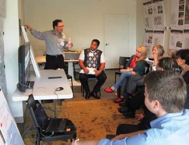
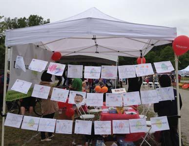
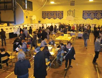
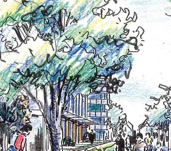
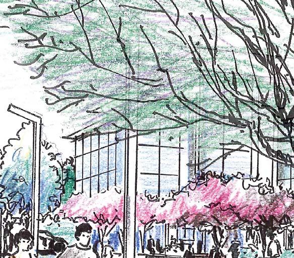
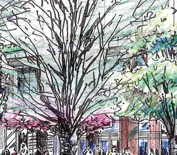
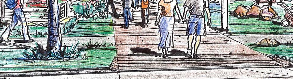
11 Figure 2-7: Artist's drawings from the June 2010 Community Workshop Figure 2-8: Public Consultation Activities LITTLE MOUNTAIN REZONING APPLICATION 23

, it provides new public policy in terms of land use, density, building forms /")


12 2.3 Design Rationale The Little Mountain Policy Statement provides the planning background to guide future development of the 6.18-hectare site. Created through a collaborative process between the City, the community, and the proponent developer (Holborn), it provides new public policy in terms of land use, density, building forms / heights, character, and public benefits, including social housing, transportation, and sustainability. The Policy Statement is grouped in five main sections that make reference to key planning principles, each of which contain a series of more specific guiding principles that condense and articulate the aspirations of the community, the City, and the developer. Based on the principles and aspirations, the proponent s consultants developed seven urban design objectives that spell out the end results that the project as a whole is expected to deliver through a sensitive urban design proposal. To direct this proposal, the consultants further defined twelve specific design strategies which contain design tactics to make the objectives attainable. All four elements key principles, guiding principles, objectives, strategies informed the final site master plan design that is described in detail in the remaining sections of the document. Policy Statement Key Principles The overarching direction COMPLETE COMMUNITY PUBLIC PLACES, OPEN SPACES & MEMORY CIRCULATION AND TRANSPORTATION BUILT FORM, DENSITY & HEIGHT Create a complete community. Provide a balanced mix of uses that makes Little Mountain a socially sustainable and functionally complete community. Create a clear and accessible system of public open space. Provide an interconnected and highly public open space system that is accessible, legible and animated. Design for green mobility. Foster pedestrian, bike, and transit-friendly infrastructure and amenities that reduce motorized vehicle impacts and use. Excel in urban design and built form. Support compact mid-rise development density, massing and height that fits into its urban and natural surroundings. Guiding Principles The aspirations for the site Integration and permeability Public space focus Streets for people Legibility and animation Greenways / bikeways Transitional edges Distinct quadrants Community hub Sustainable public spaces Solar access Opportunities for height Main Street 2012 City Policy Statement for Little Mountain Rezoning Application Design Process SUSTAINABILITY Achieve a high standard of sustainability. Improve the environmental, social, and economic vitality of the site through specific sustainability strategies. Variation Visible green Sequential views Memory and trees Views Integrated social housing 24 LITTLE MOUNTAIN REZONING APPLICATION
13 Objectives Design Strategies The desired end results The design s plan of action Rezoning Application Complete community. Create a diverse and vibrant community, addressing existing needs and new demands for neighbourhood amenities and housing. Contextual integration. Ensure integration of the site with the surrounding natural environment and neighbouring community. Vibrant public realm. Ensure the site is unified by accessible, varied, and interconnected public spaces that maximize solar access and sequential views. Memory. Reflect the spaces, people, and history of the site through landscape, urban, and building design elements. Balanced mobility. Provide safe and permeable multimodal transportation infrastructure, prioritizing walkability, bicycles, and transit access. Permeability. Incorporate multimodal paths through the site that connect to the surrounding street network and other major destinations. Spatial Definition. Conceive buildings as defining elements that reinforce the public realm of streets and open spaces. Small Scale. Break down blocks into smaller buildings, each with varied heights, massing, and architectural punctuation. Housing Mix. Include a variety of housing types and tenures and supporting community uses. Street Orientation. Focus on rich, detailed, and pedestrian-oriented streetfront façades and uses to foster active use of the public realm. Sun Access. Design building orientation and massing to increase sun access to public spaces and dwelling units. Open Space System. Include a public open space system that is interconnected, legible, and accessible. Central Spine. Make the new central street with adjoining linear rain garden the organizing element of the site. Street & Path Network. Include a network of streets and pedestrian mews that increases connectivity and encourages walkability. Site Master Plan on the following page Unity and variety. Foster a unified site design while also maximizing variety, punctuation, and visual interest through the design of buildings and voids. Sustainable design. Increase passive and active sustainable practices through site-wide and building-specific strategies. Height Transition. Transition building height and massing towards the edges to ensure respectful contextual integration. Past References. Retain historical pattern of open spaces, streets, and trees, striving to retain significant trees. Sequential Views. Increase sequential views through building placement and street network design. LITTLE MOUNTAIN REZONING APPLICATION 25
14 2.4 Plan Description Overall Site Master Plan The proposed site master plan is based on a porous block structure that allows for a range of public-to-private open spaces to be distributed throughout the site. While clearly defining the public realm, this structure also breaks down the scale of buildings within each block. The blocks to the west of the site contain generous interior courtyards while the blocks that abut the lane to the northeast are conceived as halves of blocks to be completed when the northeast quadrant not part of the Little Mountain site is developed. The scale of the blocks is similar to the city blocks of the neighbouring single-family areas, which will allow integration of scale to the surrounding urban fabric. All buildings have units facing both sides, eliminating throughout the perception of rear façades. Most buildings are oriented north-south to improve sun access for dwelling units, except the buildings fronting 33rd and 37th Avenues and the main public open spaces, which are turned by 90 degrees as recognition to the single-family houses on the other side of the street or the predominance of the public realm, respectively. The central element that organizes the structure of the plan is the Central Spine, a continuation of James Street to the north, which will include a linear rain garden, a landscaped feature that serves the dual purpose of public amenity and a sustainable stormwater management system. The new street along the Central Spine kinks midway to acknowledge the 1950s social housing s street and building pattern, turning east and aligning at its end with 36th Avenue on Main Street. Ending on the central street are also new connections to 35th Avenue and Quebec Street, as well as various midblock pedestrian mews, all of which break up the block pattern for added permeability. Three major public open spaces also grow from the Central Spine: A plaza near Main Street, which is surrounded by community amenities such as the Neighbourhood House, the Daycare and retail and commercial space; a park at the 35th Avenue axis, which opens up the site to the large public open space of Queen Elizabeth Park; and community garden spaces, located at the car-free Quebec Street extension. Mixed uses and community amenities are concentrated in the southeast quadrant, where the site has a frontage to Main Street, while residential uses will be prevalent to the west and north of the site. A Floor Space Ratio (FSR) of 2.5, consistent with the Council-approved Policy Statement for Little Mountain, is attained. About four fifths of the total buildable area of 1.6 million square feet is devoted to market residential use, while the other fifth corresponds to non-market residential, neighbourhood amenities, and commercial uses. Contextual Integration: Building height transition down to surrounding neighbourhood Sustainable Design: Compact, mid-rise building form Vibrant Public Realm: Naturally landscaped Wedge Park opens up the site to QE Park Memory: Preservation of two significant oak trees Unity and Variety: Different residential typologies enliven the site but integrate within each building Balanced Mobility: Shared vehicular / pedestrian / bicycle arrival courts Balanced Mobility: Easy access to local bikeways Sustainable Design: Appropriate window-to-wall ratios reduce energy consumption and bird collisions Vibrant Public Realm: Individual entrances of ground floor units facing the street Balanced Mobility: Non-vehicular mews / paths encourage walking and cycling Sustainable Design: Community Garden site Sustainable Design: Continuous coniferous tree canopy provides habitat for birds and other small species Contextual Integration: Residential land uses in buildings on 37th, 33rd, and Ontario 26 LITTLE MOUNTAIN REZONING APPLICATION

15 Figure 2-9: Site Plan with examples how design objectives are attained Sustainable Design: North-south alignment improves sunlight for most dwelling Sustainable Design: Linear rain garden along Central Spine reduces rainwater runoff Balanced Mobility: Streets designed to be traffic calmed for all users Unity and Variety: Buildings with different massing and form defining holistically the open spaces Complete Community: 69-space Daycare Complete Community: Neighbourhood House Memory: Preservation of significant trees on historical road alignment Vibrant Public Realm: Community plaza surrounded by Daycare, Neighbourhood House and local retail Sustainable Design: Preservation of large growth trees throughout the site Contextual Integration: Local retail and services near Main Street / Community Plaza Sustainable Design: District energy Facility Balanced Mobility: Underground parking with bike rooms, electric charging stations and car-share spaces Complete Community: Non-market housing N FT Sustainable Design: Possible edible landscaping / orchard LITTLE MOUNTAIN REZONING APPLICATION 27

16 2.4.2 Public and Private Property Figure 2-10: Public and Private Property Plan The site master plan maintains a balance between public and private property. The new central street, the continuation of 35th and 36th Avenues, and the Quebec Street connection are all public lands within standard 66-feet rights of way. In addition, the open spaces of the Community Plaza and the Wedge Park are dedicated to the City, in the recognition that they are true public spaces to be enjoyed by the wider community and not only by the residents of Little Mountain. On 36th Avenue, a plot has been set aside underneath the Community Plaza for underground utilities related to district energy, accessed via the underground parking for Building AB. Parcels in blocks A through E are all privately owned, including the courtyards within blocks C and D. However, a variety of public easements cross all of the parcels in at least one location, connecting the new central street with other public streets or lanes in the adjoining neighbourhood. This not only ensures added permeability of the site to and from its surroundings, but enables pedestrians and bicyclists to pass through portions of the private open space. ONTARI O ST RE ET 33RD AVE. NE W CE NTRA L STRE ET QUEBEC STREET 35TH AVE. MAIN STR TREE T 36TH AVE. Public Lands Private Lands Public Easement Project Boundary 37 TH AVE VE. N FT 28 LITTLE MOUNTAIN REZONING APPLICATION
17 2.4.3 Parcel Plan The site master plan consists of 16 private parcels and two public parcels, in addition to the public street rights-of-way. The private parcels that will be developed with habitable uses range in size from about 1,650 m 2 to 7,700 m 2, with varying Figure 2-11: Parcel Plan North proportions, but always with depths over 30 metres. This dimension and the fact that all parcels are aligned either with a public street, a public lane, a pedestrian mews, or a large private courtyard, allows for the location of 20-metre deep buildings with adequate daylighting on the principal façades, where principal interior spaces would be located. Figure 2-12: Parcel Plan South The private parcels are grouped in blocks, named A through E, and called individually AA through EC, the first letter denoting the block, the second the parcel within the block. The two public parcels, i.e., the plots to be dedicated beyond the public streets, are Parcel AB, which includes the Community Plaza, and the Wedge Park lot. A statutory right-of-way would be provided on Parcel AB for the district energy utility. Site parcels are indicated in Figure 2-11 and Figure The parcel dimensions and gross areas are provided here and in Table 2-2 of Section LITTLE MOUNTAIN REZONING APPLICATION 29

18 2.4.4 Land Use, Buildings, and Heights Figure 2-13: Land Use Plan At ground floor the plan has the most variety of uses, ensuring the activation of the public realm. All non-residential uses of the plan are gathered in the buildings of the southeastern quadrant. This area is near to pedestrian activity and transit on Main Street and serves as the community hub of the development. Amenities here include the Neighbourhood House that supports a wide variety of social functions, a 69-space childcare facility, and local retail and commercial spaces, all anchored by the Community Plaza on 36th Avenue just off from Main Street. The Neighbourhood House becomes a keystone of the public realm, capitalizing upon excellent exposure to the plaza. The Daycare also abuts the plaza, having southern orientation with sun access, outdoor play area adjacent to the plaza that incorporates four existing trees with a drop-off area at the lane. Retail and commercial space is provided along Main Street and around the corner into the plaza, as a way to draw in activity towards this public space. The corner at 36th Avenue and Main Street provides an excellent location for small scale local retail for example a café or a neighbourhood grocery store with opportunities for outdoor seating and great southern exposure. The rest of the plan includes residential uses. Most buildings have walk up townhomes on the ground floor that are directly accessible from the public streets, pedestrian mews, wedge park, or private courtyards. This activates the public realm at street level, which is especially valuable for the contextual integration of the adjacent single-family residential areas along 33rd and 37th Avenues, providing a sense of safety and community. All upper floor uses on the Little Mountain site are residential, comprised of both market or nonmarket units. Most of the non-market seniors and family housing units are located in the buildings in the southeast quadrant, but some will be also included in the northwest quadrant. The market units of different sizes, typologies, and price ranges, many of which suitable for families, will be located on the remaining areas of the site. Building massing tapers off towards the northern and southern edges of the site, as well as towards the northeast quadrant, in recognition of the singlefamily neighbourhoods. Higher buildings with more floor areas are located in the central portions of the site, in adherence to the Policy Statement. ONTARI O ST RE ET 33RD AVE. NEW CENT NTRA L ST RE ET QUEBEC STREET 35TH AVE. MAIN STR TREE T 36TH AVE VE. Retail/Commercial Neighbourhood House (above) Daycare Housing Non-market Seniors Housing Non-market Family Housing Non-market Family (above) Housing Market Project Boundary 37 TH AVE VE. N FT 30 LITTLE MOUNTAIN REZONING APPLICATION
19 Table 2-2: Parcel-Based Development Statistics Figure 2-14: Density, Massing, and Heights Plan Approximate Gross Building Area* by Use m 2 (sq.ft.) Parcel Parcel Area m 2 /(sq. ft.) Market Residential Non-market Residential (Family) Non-market Residential (Senior) Retail / Commercial Neighbourhood House Daycare AA 2,601 (27,995) 9,835 (105,860) RD AVE. AB 3,742 (40,274) 0 3,530 (38,000) 0 0 1,115 (12,000) 764 (8,224) AC 1,944 (20,923) 0 6,242 (67,189) (7,745) 0 0 BA 2,099 (22,594) 6,730 (72,440) BB 1,916 (20,628) 0 0 3,942 (42,431) BC 3,458 (37,223) 0 8,514 (91,640) 0 1,858 (20,000) 0 0 CA 4,548 (48,957) 9,929 (106,880) CB/CC 7,709 (82,983) 24,549 (264,246) CD 4,736 (50,981) 19,515 (210,059) DA 2,181 (23,478) 6,369 (68,560) DB/DC 4,980 (53,609) 15,703 (169,029) ONTA RI O STRE ET NEW CENT NTRA L ST REET ET QUEBEC STREET MAIN STR TREE T DD 3,047 (32,799) 15,400 (165,760) EA 2,195 (23,624) 0 4,667 (50,240) TH AVE. EB 2,554 (27,491) 8,022 (86,348) EC 1,646 (17,717) 7,211 (77,615) SUBTOTAL 49,356 (531,276) 123,263 (1,326,797) 22,953 (247,069) 3,942 (42,431) 2,578 (27,745) 1,115 (12,000) 764 (8,224) TOTAL 154,615 (1,664,266) *Approximate, based on proposed building massing final building and parcel areas may vary, provided overall density of 2.5 FSR is not exceeded. 36TH AVE VE. Up to 6 storeys 7-8 storeys 9-10 storeys 12 storeys Height Transition Downward Project Boundary 37 TH AVE VE. N FT LITTLE MOUNTAIN REZONING APPLICATION 31
20 2.5 Summary Development Statistics Table 2-3 lists summary development statistics for the site as a whole. For detailed information on each building contained in each of the five parcels, please see Section 5.5 Block & Building Studies. Table 2-3: Site-Wide Development Statistics Parameter Dimension Site area 61,846 m 2 (665,706 sq. ft.) Public property 16,222 m 2 (174,616 sq. ft.) 26.2% of the total site area Private property 45,624 m 2 (491,090 sq. ft.) 73.8% of the total site area 44,281 m 2 (476,638 sq. ft.) 71.6% of the total site area 1,343 m 2 (14,452 sq. ft.) 2.2% of the total site area Gross building coverage ratio 40% Gross floor area* by proposed use 123,263 m 2 (1,326,797 sq. ft.) 26,985 m 2 (289,500 sq. ft.) 2,578 m 2 (27,745 sq. ft.) 1,115 m 2 (12,000 sq. ft.) 764 m 2 (8,224 sq. ft.) Total proposed floor area 154,615 m 2 (1,664,266 sq. ft.) Total gross FSR 2.50 *Note: Gross floor areas by use are approximate based on proposed building massing; final areas may vary, provided overall density of 2.5 FSR is not exceeded. 32 LITTLE MOUNTAIN REZONING APPLICATION
21 2.6 Phasing Plan The proposal's phasing begins from the southeast corner near Main Street, and will move westward and then northward. The rationale for this strategy is the following: One building (the non-market building BB) is already complete. While proposed to be built over the next decade, it is difficult to determine exact dates of completion for each stage, given changes in construction sequencing, City approval process, and real estate market conditions. Figure 2-15: Phasing Plan 33RD AVE. As proposed, the retail and commercial space, as well as a large portion of non-market housing units and the community facilities will be delivered in Phase 1. The objective of Phase 2 is to connect the road network and deliver the first market residential units. Phases 1 and 2 will have a completely accessible and connected public realm, experiencing the lowest impacts from the construction of later phases. ONTARI O ST REET ET NEW CE NT RA L ST RE ET QUEBEC STREET MAIN STR TREE T Phases 1 will accelerate the development of the Community Plaza which will anchor the neighbourhood with retail and communitysupporting uses. 35TH AVE. The later phases are proposed in coordination with access and public realm considerations, and to minimize construction impacts. 36TH AVE. 37 TH AVE VE. N FT LITTLE MOUNTAIN REZONING APPLICATION 33


22 2 Application Overview and Description 34 LITTLE MOUNTAIN REZONING APPLICATION
for a context-sensitive design that connects to its surroundings.
 5 Built Form Figure 5-: Parcels and Buildings 33RD AVE. 5. Block and Building Design Concept Block, parcel, and building design in Little Mountain is based largely on the public realm concept, and the
Welcome to the Oakridge Centre Open House
 Welcome to the Oakridge Centre Open House Why is the City hosting this event? This open house is to inform you of a rezoning application submitted to the City of Vancouver to amend the existing CD-1 (Comprehensive
Little Mountain UDP Presentation
 Summary of UDP Evaluation of Dec 2015 Plan Dec 2015 Site Plan Transitional edges work well Central spine and permeability are strong Tree retention is good Establish Big Idea Sameness of built form contributes
Figure 3-1: Public Realm Plan
 3 Public Realm Figure 3-1: Public Realm Plan 3.1 Public Realm Concept The public realm concept for the Little Mountain site integrates a clear and accessible movement network with public spaces for social
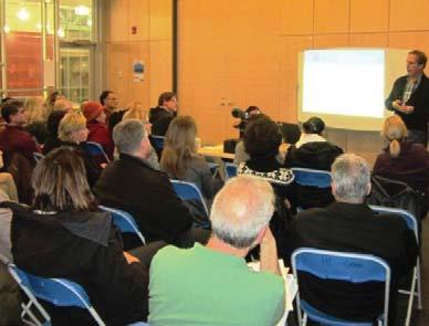
Welcome to the Little Mountain Open House!
 Welcome to the Little Mountain Open House! Why is the City hosting this event? This open house is to get your feedback on a rezoning application submitted by Holborn Properties to the City of Vancouver
Rezoning Frequently Asked Questions
 elcome The City of Vancouver has received an application to rezone 6929-6969 Cambie Street and 515 est 54th Avenue from RS-1 (Single Family) District to CD-1 (Comprehensive Development) District. The proposal
Standing Committee on Policy and Strategic Priorities. Acting General Manager of Planning & Development Services
 POLICY REPORT DEVELOPMENT AND BUILDING Report Date: June 14, 2016 Contact: Susan Haid Contact No.: 604.871.6431 RTS No.: 11457 VanRIMS No.: 08-2000-20 Meeting Date: June 29, 2016 TO: FROM: SUBJECT: Standing
LITTLE MOUNTAIN POLICY STATEMENT
 LITTLE MOUNTAIN POLICY STATEMENT JUNE 2012 Approved by Vancouver City Council on June 27, 2012 CONTENTS 1.0 BACKGROUND...1 1.1 INTRODUCTION...1 1.2 SITE DESCRIPTION...1 1.3 HISTORY...2 1.4 LITTLE MOUNTAIN
11 GUIDING PRINCIPLES:
 11 GUIDING PRINCIPLES: CATEGORIES FIVE GUIDING PRINCIPLE CATEGORIES The Policy Statement will contain a set of Guiding Principles to inform the urban design and sustainability objectives for the site.
[PLANNING RATIONALE] For Site Plan Control and Lifting of Holding Zone By-Law 101 Champagne Avenue. May 23, 2014
![[PLANNING RATIONALE] For Site Plan Control and Lifting of Holding Zone By-Law 101 Champagne Avenue. May 23, 2014](/thumbs/75/71599615.jpg "[PLANNING RATIONALE] For Site Plan Control and Lifting of Holding Zone By-Law 101 Champagne Avenue. May 23, 2014") [PLANNING RATIONALE] For Site Plan Control and Lifting of Holding Zone By-Law 101 Champagne Avenue May 23, 2014 Contents 1.0 Introduction... 2 2.0 Site Context... 2 2.1 Adjacent Uses... 2 Figure 1: Site
[PLANNING RATIONALE] For Site Plan Control and Lifting of Holding Zone By-Law 101 Champagne Avenue May 23, 2014 Contents 1.0 Introduction... 2 2.0 Site Context... 2 2.1 Adjacent Uses... 2 Figure 1: Site
Official Plan Review: Draft Built Form Policies
 PG.30.1 REPORT FOR ACTION Official Plan Review: Draft Built Form Policies Date: May 15, 2018 To: Planning and Growth Management Committee From: Chief Planner and Executive Director, City Planning Division
Town Center (part of the Comprehensive Plan)
") Town Center (part of the Comprehensive Plan) Mercer Island Town Center Looking North (2014) In 1994, a year-long process culminated in a set of design guidelines and code requirements for the Town Center
Town Center (part of the Comprehensive Plan) Mercer Island Town Center Looking North (2014) In 1994, a year-long process culminated in a set of design guidelines and code requirements for the Town Center
ELMVALE ACRES SHOPPING CENTRE MASTER PLAN
 ELMVALE ACRES SHOPPING CENTRE MASTER PLAN Contents 1.0 INTRODUCTION... 2 2.0 LOCATION... 2 3.0 EXISTING CONTEXT... 2 4.0 VISION & GUIDING PRINCIPLES... 2 5.0 LAND USE AND BUILT FORM... 4 5.1 St. Laurent
MOUNT PLEASANT COMMUNITY PLAN
 MOUNT PLEASANT COMMUNITY PLAN What is a Community Plan? A community plan describes what the community should be like in the future: it identifies what is valuable and should be retained, as well as Key
Enhanced Planning Process
 Welcome The City of Vancouver has received an application to rezone 725-747 Southeast Marine Drive from CD-1 (Comprehensive Development) District to a revised CD-1 District By-law. The proposal is for
CONTENTS 8.0 LAND USE 8.1 GENERAL LAND USE 8.2 RESIDENTIAL 8.3 MIXED USE 8.4 COMMERCIAL 8.5 EMPLOYMENT LANDS
 8-2 Land Use 8.0 LAND USE CONTENTS 8.1 GENERAL LAND USE 8.1.1 Uses provided for in all Land Use Designations 8.1.2 Uses prohibited in Hazardous Lands, Hazardous Sites and Special Policy Areas 8.1.3 Uses
DRAFT Northeast Quadrant of Kipling Avenue and Highway 7 DRAFT AUGUST 29, Goals Land Use. The goals of this Plan are to:
 AUGUST 29, 2017 12.15 Northeast Quadrant of Kipling Avenue and Highway 7 12.15.1 Goals 12.15.2 Land Use The goals of this Plan are to: 12.15.2.1 General Provisions: a) Ensure the development of a compact
Cambie Corridor Planning Program Phase Two Draft Plan. Standing Committee on City Services and Budgets May 5, 2011
 Cambie Corridor Planning Program Phase Two Draft Plan Standing Committee on City Services and Budgets May 5, 2011 Cambie Corridor Program Terms of Reference approved July 2009 Land Use Transportation Energy
Urban Design Brief. Watson Parkway North & Watson Road North Guelph, Ontario. Prepared by Coletara Development
 Urban Design Brief Watson Parkway North & Watson Road North Guelph, Ontario Prepared by Coletara Development December, 2013 Urban Design Brief, Coletara Development 1 Introduction This Urban Design Brief
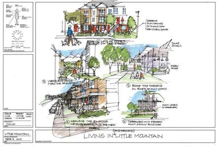
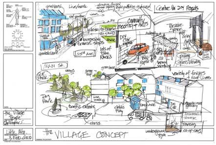
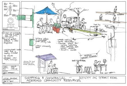
Little Mountain Policy Statement. Presentation on Draft Urban Design Policies April 3, 2012
 Little Mountain Policy Statement Presentation on Draft Urban Design Policies April 3, 2012 OVERVIEW Holborn Concept Site Plan Four Perspectives 1. Context: Place in the city 2. Transition: Relationship
SECTION ONE: INTRODUCTION. introduction
 introduction 1 INTRODUCTION Since it was first established in 1843 as a trading post for the Hudson s Bay Company, Victoria has evolved into a Provincial capital city that is recognized across Canada and
Land Use Amendment in Southwood (Ward 11) at and Elbow Drive SW, LOC
 at and Elbow Drive SW, LOC") 2018 November 15 Page 1 of 10 EXECUTIVE SUMMARY This land use amendment application was submitted by Rick Balbi Architect on 2017 August 31 on behalf of Sable Developments Ltd, and with authorization from
2018 November 15 Page 1 of 10 EXECUTIVE SUMMARY This land use amendment application was submitted by Rick Balbi Architect on 2017 August 31 on behalf of Sable Developments Ltd, and with authorization from
Bloor St. W. Rezoning - Preliminary Report
 STAFF REPORT ACTION REQUIRED 1638-1644 Bloor St. W. Rezoning - Preliminary Report Date: April 1, 2008 To: From: Wards: Reference Number: Toronto and East York Community Council Acting Director, Community
Welcome. Walk Around. Talk to Us. Write Down Your Comments
 Welcome This is an information meeting introducing the applications for proposed redevelopment of the Yorkdale Shopping Centre site at 3401 Dufferin Street and 1 Yorkdale Road over the next 20+ years,
BROADWAY-ARBUTUS POLICIES. Adopted by City Council on July 7, NOTE: To be considered in combination with applicable guidelines
 50 City of Vancouver Land Use and Development Policies and Guidelines Community Services, 453 W. 12th Ave Vancouver, BC V5Y 1V4 F 873.7344 fax 873.7060 planning@city.vancouver.bc.ca BROADWAY-ARBUTUS POLICIES
COMMUNITY HEART HEATHER STREET LANDS
 COMMUNITY HEART PLAZA AT HARVARD, CAMBRIDGE VISUALIZATION OF THE COMMUNITY HEART FROM 33RD AVENUE The concept includes an active mix of uses around open space to support all-day vibrancy. Anchored by the
The Cambie Corridor 2015 Fall workshop series. What we heard WORKSHOP OUTLINE
 The Cambie Corridor 2015 Fall workshop series W 16 AVE Area 5 CAMBIE CORRIDOR Phase 3 What we heard ovember 21, 2015, 9am-noon, 1:30-4:30pm Peretz Centre 89 Participants* WORKSHOP OUTLIE Introductions
Figure 1- Site Plan Concept
 Figure 1- Site Plan Concept Parking will be provided underground on three levels at rate of 1.0 space/ unit; this rate includes all visitors parking. MMM Group has prepared a parking assessment (April,
Regency Developments. Urban Design Brief. Holyrood DC2 Rezoning
 Regency Developments Urban Design Brief Holyrood DC2 Rezoning Stantec Consulting Ltd. 7-31-2017 1. Overview Regency Developments intends to rezone the lands located at 8510 and 8511 93 Avenue, within the
13 THORNHILL YONGE STREET STUDY IMPLEMENTATION CITY OF VAUGHAN OPA 669 AND TOWN OF MARKHAM OPA 154
 13 THORNHILL YONGE STREET STUDY IMPLEMENTATION CITY OF VAUGHAN OPA 669 AND TOWN OF MARKHAM OPA 154 The Planning and Economic Development Committee recommends the adoption of the recommendations contained
(DC1) Direct Development Control Provision DC1 Area 4
 Direct Development Control Provision DC1 Area 4") . General Purpose (DC) Direct Development Control Provision DC Area 4 The purpose of this Provision is to provide for an area of commercial office employment and residential development in support of the
. General Purpose (DC) Direct Development Control Provision DC Area 4 The purpose of this Provision is to provide for an area of commercial office employment and residential development in support of the
URBAN DESIGN BRIEF. 2136&2148 Trafalgar Road. Town of Oakville
 URBAN DESIGN BRIEF 2136&2148 Trafalgar Road Town of Oakville Prepared By: METROPOLITAN CONSULTING INC For 2500674 Ontario Inc November 2016 TABLE OF CONTENTS Page No. 1.0 Introduction/Description of Subject
1296 Kennedy Road - Zoning Amendment Application - Preliminary Report
 STAFF REPORT ACTION REQUIRED 1296 Kennedy Road - Zoning Amendment Application - Preliminary Report Date: January 15, 2016 To: From: Wards: Reference Number: Scarborough Community Council Acting Director,
Highland Village Green Design Guidelines
 Highland Village Green Design Guidelines Publishing Information Title Highland Village Green Design Guidelins Author The City of Calgary Status DRAFT - Proposed document subject to changes Additional Copies
Urban Design Manual PLANNING AROUND RAPID TRANSIT STATIONS (PARTS) Introduction. Station Study Areas
 Introduction. Station Study Areas") 111111 PLANNING AROUND RAPID TRANSIT STATIONS (PARTS) Introduction The ION rapid transit system will link Waterloo, Kitchener and Cambridge through a central transit corridor (CTC). There are a number
111111 PLANNING AROUND RAPID TRANSIT STATIONS (PARTS) Introduction The ION rapid transit system will link Waterloo, Kitchener and Cambridge through a central transit corridor (CTC). There are a number
599 Kennedy Road - Official Plan Amendment and Zoning Amendment Application - Preliminary Report
 STAFF REPORT ACTION REQUIRED 599 Kennedy Road - Official Plan Amendment and Zoning Amendment Application - Preliminary Report Date: March 7, 2017 To: From: Wards: Reference Number: Scarborough Community
PLAN ELEMENTS WORKSHOP. April 5, 2016
 PLAN ELEMENTS WORKSHOP April 5, 2016 needs more housing. But there is no one-size fits-all solution. Every neighborhood has its own character. In some places, density is not only appropriate it is badly
PORT WHITBY COMMUNITY
 PORT WHITBY COMMUNITY SECONDARY PLAN UPDATE COMMUNITY IMPROVEMENT PLAN URBAN DESIGN GUIDELINES September 2015 DRAFT PROPOSED AMENDMENT NUMBER # to the Whitby Official Plan PURPOSE: The intent of this Amendment
Planning and Growth Management Committee. Chief Planner and Executive Director, City Planning Division. Pg12013 (File No NNY 34 OZ)
") 865 York Mills Road Official Plan Amendment Application Preliminary Report STAFF REPORT ACTION REQUIRED Date: February 28, 2012 To: From: Wards: Reference Number: Planning and Growth Management Committee
865 York Mills Road Official Plan Amendment Application Preliminary Report STAFF REPORT ACTION REQUIRED Date: February 28, 2012 To: From: Wards: Reference Number: Planning and Growth Management Committee
Lehigh Acres Land Development Regulations Community Planning Project
 Lehigh Acres Land Development Regulations Planning Effort Summary In July, 2010 Commissioner Frank Mann invited the Lehigh Acres community to start discussing how to achieve their recently adopted community
URBAN DESIGN BRIEF URBAN DESIGN BRIEF 721 FRANKLIN BLVD, CAMBRIDGE August 2018
 URBAN DESIGN BRIEF URBAN DESIGN BRIEF 721 FRANKLIN BLVD, CAMBRIDGE August 2018 DESIGN BRIEF CONTENTS PART A 1.0 INTRODUCTION 2.0 DESCRIPTION & ANALYSIS OF SITE CONTEXT 3.0 DESIGN CONSTRAINTS AND OPPORTUNITIES
178 Carruthers Properties Inc.
 178 Carruthers Properties Inc. Planning Rationale for 178 Carruthers Avenue Site Plan Control Application June 2014 Table of Contents 1.0 Introduction 2.0 Overview of Subject Property 3.0 Current Zoning
Crofton Manor 2803 West 41st Avenue WHAT WE HEARD. Public Consultation: Phase 1
 Crofton Manor 2803 West 41st Avenue WHAT WE HEARD Public Consultation: Phase 1 Background CROFTON MANOR What s Happening The City of Vancouver is undertaking a planning and public engagement process to
2136 & 2148 Trafalgar Road Town of Oakville Region of Halton
 PLANNING JUSTIFICATION REPORT 2136 & 2148 Trafalgar Road Town of Oakville Region of Halton Zoning By-Law Amendment Application 2500674 Ontario Inc. November 2016 Table of Contents Page 1.0 Location/Summary
Planning Board Briefing
 Planning Board Briefing Why Now? The Sector Plan Implementation Chapter States: Before Stage 1 begins, the following must occur: Approval of the Sectional Map Amendment. Approval of the Greater Lyttonsville
Further input invited as Colchester Growth Strategy nears final phase
 IUE 3 / NOVEMBER 2015 Further input invited as Colchester Growth trategy nears final phase trathcona County is seeking public feedback as it enters the final phase of work on a Growth Management trategy
Chapter 2: OUTLINE PLANNING APPLICATION PROPOSALS. A New Garden Neighbourhood Matford Barton 17
 Chapter 2: OUTLINE PLANNING APPLICATION PROPOSALS A New Garden Neighbourhood Matford Barton 17 2.1. SUMMARY AND STATUS OF THE PROPOSALS 2.1.1. The parameter plans and associated wording in this chapter
Complete Neighbourhood Guidelines Review Tool
 Complete Neighbourhood Guidelines Review Tool Prepared By: City of Regina Planning Department October 2014 Page 1 of 14 Community Development Review Checklist for Secondary Plans and Concept Plans The
PSRC REVIEW REPORT & CERTIFICATION RECOMMENDATION
 PSRC REVIEW REPORT & CERTIFICATION RECOMMENDATION KITSAP COUNTY COUNTYWIDE PLANNING POLICIES July 2, 2012 BACKGROUND A major emphasis of the Washington State Growth Management Act (GMA) is the need to
Mark-up of the effect of the proposed Bronte Village Growth Area OPA No.18 on the text of section 24, Bronte Village, of the Livable Oakville Plan
 Mark-up of the effect of the proposed Bronte Village Growth Area OPA No.18 on the text of section 24, Bronte Village, of the Livable Oakville Plan Notes: This document is provided for information purposes
Official Plan Review
 Official Plan Review Summary Report - The Built Environment August 2014 Part 1: Introduction Planning for a healthy, prosperous and sustainable community is an important goal for our municipality. From
1071 King Street West Zoning Amendment Application - Preliminary Report
 STAFF REPORT ACTION REQUIRED 1071 King Street West Zoning Amendment Application - Preliminary Report Date: August 9, 2012 To: From: Wards: Reference Number: Toronto and East York Community Council Director,
Create Policy Options Draft Plan Plan Approval. Public Consultation Events. Phase 2
 Background Grandview-Woodland Community Plan In the spring of 2012, the City of Vancouver embarked on a comprehensive community planning program in the Grandview-Woodland neighbourhood. The process has
1.0 Purpose of a Secondary Plan for the Masonville Transit Village
 Report to Planning and Environment Committee To: Chair and Members Planning & Environment Committee From: John M. Fleming Managing Director, Planning and City Planner Subject: Masonville Transit Village
646 Kingston Road - Official Plan Amendment and Zoning Amendment Applications - Preliminary Report
 STAFF REPORT ACTION REQUIRED 646 Kingston Road - Official Plan Amendment and Zoning Amendment Applications - Preliminary Report Date: December 8, 2014 To: From: Wards: Reference Number: Toronto and East
Derry Green Corporate Business Park
 Town of Milton Derry Green Corporate Business Park Urban Design Guidelines BMI/Pace - June 2010 Draft 3 Prepared by: Brook McIlroy Planning + Urban Design / Pace Architects Suite 300-51 Camden Street Toronto,
Courthouse Square Planning & Urban Design Study. Courthouse Square Working Group #13 October 15, 2014
 Courthouse Square Planning & Urban Design Study Courthouse Square Working Group #13 October 15, 2014 1 Courthouse Square Process Working Group Community Courthouse Square Advisory Groups & Civic Associations
Westwind Developments Ltd. PIONEER LANDS AREA STRUCTURE PLAN - PROPOSED AMENDMENT
 FEBRUARY 2013 TABLE OF CONTENTS 1.0 BACKGROUND... 1 1.1 Amendment... 1 2.0 LOCATION & CONTEXT... 2 2.1 Land Ownership... 2 3.0 POLICY CONTEXT... 3 3.1 Municipal Development Plan... 3 3.2 Capital Region
Uptown Rideau Street Secondary Plan [Amendment #166, January 12, 2016]
![Uptown Rideau Street Secondary Plan [Amendment #166, January 12, 2016]](/thumbs/76/73760497.jpg "Uptown Rideau Street Secondary Plan [Amendment #166, January 12, 2016]") [Amendment #166, January 12, 2016] The policies of this Secondary Plan are in effect, save and except for the property at 560 Rideau Street, for which there remains a site specific appeal to this Secondary
[Amendment #166, January 12, 2016] The policies of this Secondary Plan are in effect, save and except for the property at 560 Rideau Street, for which there remains a site specific appeal to this Secondary
DRAFT. 10% Common Open Space
 % OF CHARLOTTE IS CATEGORIZED AS A. LAND USES : Placeholder map displaying location of Place Type GOALS: Accommodate XX% of future growth. Provide a concentration of primarily commercial and civic activity
The West Vaughan Employment Area Secondary Plan Policies
 Part 2: The West Vaughan Employment Area Secondary Plan Policies 2.1 General Policies It is the policy of Council: 2.1.1. That the West Vaughan Employment Area (the WVEA), identified on Schedule 1, will
30 and 44 Zorra Street - Zoning By-law Amendment Application - Preliminary Report
 STAFF REPORT ACTION REQUIRED 30 and 44 Zorra Street - Zoning By-law Amendment Application - Preliminary Report Date: March 14, 2016 To: From: Wards: Reference Number: Etobicoke York Community Council Director,
Edward R. Sajecki Commissioner of Planning and Building
 Corporate Report Clerk s Files Originator s Files CD.03.POR DATE: TO: FROM: SUBJECT: Chair and Members of Planning and Development Committee Meeting Date: February 27, 2012 Edward R. Sajecki Commissioner
CAMBIE CORRIDOR PLAN
 1 WELCOME TO THE OPEN HOUSE PUBLIC REALM PLAN - CAMBIE CORRIDOR Thank you for coming to the Cambie Corridor Public Realm Open House! Place a dot where you live Please provide us with your comments and
Edward R. Sajecki Commissioner of Planning and Building. Land Use Review- Former Parkway Belt West Lands- Fieldgate Drive and Audubon Boulevard
 Corporate Report Clerk s Files Originator s Files CD.04.FOR DATE: November 15, 2011 TO: FROM: SUBJECT: Chair and Members of Planning and Development Committee Meeting Date: December 5, 2011 Edward R. Sajecki
AWH REPORT OF THE PLANNING AND DEVELOPMENT DEPARTMENT FOR APPLICATION FOR REZONING ORDINANCE TO PLANNED UNIT DEVELOPMENT
 AWH REPORT OF THE PLANNING AND DEVELOPMENT DEPARTMENT FOR APPLICATION FOR REZONING ORDINANCE TO PLANNED UNIT DEVELOPMENT MAY 8, 2014 The Planning and Development Department hereby forwards to the Planning
2900 Steeles Avenue East at Don Mills Road in the Town of Markham
 STAFF REPORT INFORMATION ONLY 2900 Steeles Avenue East at Don Mills Road in the Town of Markham Date: January 23, 2008 To: From: Wards: Reference Number: North York Community Council Director, Community
YONGE STEELES CORRIDOR SECONDARY PLAN. Young + Wright / IBI Group Architects Dillon Consulting Ltd. GHK International (Canada) Ltd.
 Ltd.") PART A: PREAMBLE 1.0 PURPOSE The purpose of this Secondary Plan is to provide a development framework for intensification of the Yonge/ Steeles corridor including the north side of Steeles Avenue West
PART A: PREAMBLE 1.0 PURPOSE The purpose of this Secondary Plan is to provide a development framework for intensification of the Yonge/ Steeles corridor including the north side of Steeles Avenue West
EXISTING COMPREHENSIVE PLAN
 EXISTING COMPREHENSIVE PLAN Town Center Land Use Element: V. LAND USE POLICIES Town Center Mercer Island's business district vision as described in "Your Mercer Island Citizen-Designed Downtown" was an
Clairtrell Area Context Plan
 Clairtrell Area Context Plan March 2005 Urban Development Services City Planning Contents 1. Introduction... 4 2. Development Structure... 6 2.1 Streets... 7 2.1.1 Sheppard Avenue and Bayview Avenue...
5959 Yonge Street Rezoning Application - Preliminary Report
 STAFF REPORT ACTION REQUIRED 5959 Yonge Street Rezoning Application - Preliminary Report Date: February 23, 2011 To: From: Wards: Reference Number: North York Community Council Director, Community Planning,
WELCOME and introduction
 1 WELCOME and introduction Mobility Hub Locations within Burlington STUDY OVERVIEW STUDY OBJECTIVES The City of Burlington is developing four Area Specific Plans, one for each of Burlington s Mobility
*** DRAFT 2 FOR PUBLIC REVIEW ***
 6.7 The area is generally bounded by the Red Hill Valley Parkway to the west, Lake Avenue to the east, the Queen Elizabeth Way (QEW) to the north, and by the properties just south of Queenston Road to
393, 395, 397, 399, 401 and 403 Spring Garden Avenue Official Plan and Zoning By-law Amendment Application Preliminary Report
 STAFF REPORT ACTION REQUIRED 393, 395, 397, 399, 401 and 403 Spring Garden Avenue Official Plan and Zoning By-law Amendment Application Preliminary Report Date: March 29, 2010 To: From: Wards: Reference
Report Date: January 28, 2014 Contact: Matt Shillito Contact No.: RTS No.: VanRIMS No.: Meeting Date: February 4, 2014
 ADMINISTRATIVE REPORT Report Date: January 28, 2014 Contact: Matt Shillito Contact No.: 604.871.6431 RTS No.: 10327 VanRIMS No.: 08-2000-20 Meeting Date: February 4, 2014 TO: FROM: SUBJECT: Vancouver City
ROAD CLOSURE AND LAND USE AMENDMENT SILVER SPRINGS (WARD 1) NORTHEAST OF NOSEHILL DRIVE NW AND SILVER SPRINGS ROAD NW BYLAWS 2C2018 AND 29D2018
 NORTHEAST OF NOSEHILL DRIVE NW AND SILVER SPRINGS ROAD NW BYLAWS 2C2018 AND 29D2018") Page 1 of 19 EXECUTIVE SUMMARY This application proposes redesignating two parcels in the community of Silver Springs from Special Purpose Future Urban Development (S-FUD) District and undesignated road
Page 1 of 19 EXECUTIVE SUMMARY This application proposes redesignating two parcels in the community of Silver Springs from Special Purpose Future Urban Development (S-FUD) District and undesignated road
REQUEST Current Zoning: O-15(CD) (office) Proposed Zoning: TOD-M(CD) (transit oriented development mixed-use, conditional)
 (office) Proposed Zoning: TOD-M(CD) (transit oriented development mixed-use, conditional)") Rezoning Petition 2016-117 Zoning Committee Recommendation January 4, 2017 REQUEST Current Zoning: O-15(CD) (office) Proposed Zoning: TOD-M(CD) (transit oriented development mixed-use, conditional) LOCATION
Rezoning Petition 2016-117 Zoning Committee Recommendation January 4, 2017 REQUEST Current Zoning: O-15(CD) (office) Proposed Zoning: TOD-M(CD) (transit oriented development mixed-use, conditional) LOCATION
PINE CURVE REZONING. Property does not meet criteria for open space preservation and is not a candidate for a park
 PINE CURVE REZONING BACKGROUND Purchased as two parcels in 2001 and 2002 Annexed and Zoned Greater Downtown District Historic Center September 25, 2002 and October 7, 2002 WHAT THE PROJECT IS AND IS NOT
POLICY AMENDMENT AND LAND USE AMENDMENT TUXEDO PARK (WARD 9) CENTRE STREET N AND 26 AVENUE NE BYLAWS 36P2017 AND 234D2017
 CENTRE STREET N AND 26 AVENUE NE BYLAWS 36P2017 AND 234D2017") Page 1 of 11 EXECUTIVE SUMMARY This application proposes to redesignate a single parcel of land in the Community of Tuxedo Park from Commercial Corridor 2 (C-COR2 f1h10) District to Mixed Use Active Frontage
Page 1 of 11 EXECUTIVE SUMMARY This application proposes to redesignate a single parcel of land in the Community of Tuxedo Park from Commercial Corridor 2 (C-COR2 f1h10) District to Mixed Use Active Frontage
East Bayshore Road Neighbourhood
 East Bayshore Road Neighbourhood Northridge Property Management Urban Design Brief 3195 East Bayshore Road City of Owen Sound January 2016 East Bayshore Road Neighbourhood Northridge Property Management
FORMER CANADIAN FORCES BASE (CFB) ROCKCLIFFE SECONDARY PLAN. Official Plan Amendment XX to the Official Plan for the City of Ottawa
 ROCKCLIFFE SECONDARY PLAN. Official Plan Amendment XX to the Official Plan for the City of Ottawa") FORMER CANADIAN FORCES BASE (CFB) ROCKCLIFFE SECONDARY PLAN Official Plan Amendment XX to the Official Plan for the City of Ottawa 1 INDEX THE STATEMENT OF COMPONENTS PART A THE PREAMBLE PAGE Purpose...
FORMER CANADIAN FORCES BASE (CFB) ROCKCLIFFE SECONDARY PLAN Official Plan Amendment XX to the Official Plan for the City of Ottawa 1 INDEX THE STATEMENT OF COMPONENTS PART A THE PREAMBLE PAGE Purpose...
Bel-Air Lexus Automobile Service Station
 Bel-Air Lexus Automobile Service Station Design Brief 443-447 McArthur Avenue Ottawa April 30, 2015 14-1299-MCA Site Details Application: Site Plan Control Legal Description and Municipal Addresses: 443
Agenda. 7 Wright Crescent Urban Design Study. Public Meeting and Urban Design Workshop. 1 INTRODUCTION AND BACKGROUND (City of Kingston)
") Urban Design Study Public Meeting and Urban Design Workshop October 02, 2013 Agenda 1 INTRODUCTION AND BACKGROUND (City of Kingston) 2 URBAN DESIGN STUDY PRESENTATION (Antonio Gomez-Palacio, DIALOG) 3
Urban Design Study Public Meeting and Urban Design Workshop October 02, 2013 Agenda 1 INTRODUCTION AND BACKGROUND (City of Kingston) 2 URBAN DESIGN STUDY PRESENTATION (Antonio Gomez-Palacio, DIALOG) 3
1-17 Anndale Drive, Bales Avenue and Glendora Avenue Zoning Amendment Application Preliminary Report
 STAFF REPORT ACTION REQUIRED 1-17 Anndale Drive, 31-35 Bales Avenue and 22-70 Glendora Avenue Zoning Amendment Application Preliminary Report Date: August 20, 2007 To: From: Wards: Reference Number: North
The Corporation of the TOWN OF MILTON
 Report to: From: Chair & Members of the Administration & Planning Standing Committee W.F. Mann, Director of Planning and Development Date: April 16, 2012 PD 022-12 (Z19/11) Subject: Technical Report Proposed
PINE CURVE REZONING. BACKGROUND Purchased as two parcels in 2001 and 2002
 BACKGROUND Purchased as two parcels in 2001 and 2002 WHAT THE PROJECT IS AND IS NOT A Rezoning establishes the land use standards for Annexed and Zoned Greater Downtown District Historic Center September
URBAN DESIGN BRIEF 181 Burloak Drive, Oakville
 URBAN DESIGN BRIEF 181 Burloak Drive, Oakville February 2017 Our File: 1730B 230-7050 WESTON ROAD / WOODBRIDGE / ONTARIO / L4L 8G7 / T: 905 761 5588/ F: 905 761 5589/WWW.MHBCPLAN.COM TABLE OF CONTENTS
Page 1 of 19 URBAN DESIGN FRAMEWORK FOR BOLTON STREET WATERFORD
 Page 1 of 19 URBAN DESIGN FRAMEWORK FOR BOLTON STREET WATERFORD 1.0 Introduction: The relocation of the City Council stores and depot from Bolton Street creates an exciting opportunity for development
Urban Design Brief to 1557 Gordon Street & 34 Lowes Road West
 Urban Design Brief 1533 to 1557 Gordon Street & 34 Lowes Road West Reid s Heritage Homes Ltd. & 883928 Ontario Ltd. and RHH Property Management Ltd. City of Guelph Zoning By-law Amendment November 2017
Smart Growth Development Checklist
 2004 Smart Growth Development Checklist Smart Growth Development Checklist Corporation of the City of New Westminster Guide and manage growth in a manner which is consistent with the principles of sustainable
LAND USE AMENDMENT DOWNTOWN COMMERCIAL CORE (WARD 7) MACLEOD TRAIL SE AND 5 AVENUE SE BYLAW 254D2017
 MACLEOD TRAIL SE AND 5 AVENUE SE BYLAW 254D2017") Page 1 of 10 EXECUTIVE SUMMARY This Land Use Amendment application seeks to redesignate a full downtown block (currently the YWCA site) from a Direct Control based on the CM-2 District (Land Use Bylaw
Page 1 of 10 EXECUTIVE SUMMARY This Land Use Amendment application seeks to redesignate a full downtown block (currently the YWCA site) from a Direct Control based on the CM-2 District (Land Use Bylaw
3. Endorse the LRT vision in transforming Surrey into Connected-Complete-Livable communities, and more specifically, the official vision statement:
 CORPORATE REPORT NO: R038 COUNCIL DATE: February 20, 2017 REGULAR COUNCIL TO: Mayor & Council DATE: February 16, 2017 FROM: General Manager, Engineering FILE: 8740-01 SUBJECT: Surrey Light Rail Transit
Preliminary Recommendations Tk Takoma/Langley Crossroads Sector Plan
 Preliminary Recommendations Tk Takoma/Langley Crossroads Sector Plan Vision is to achieve a Transit Oriented, pedestrian friendly Community that Celebrates and builds upon the cultural Diversity of the
GO Station Mobility Hubs: Draft Precinct Plans. Committee of the Whole July 12, 2018
 GO Station Mobility Hubs: Draft Precinct Plans Committee of the Whole July 12, 2018 Purpose of this Workshop Present Draft Precinct Plans for the 3 GO Station Mobility Hubs Continue the conversations that
DRAFT. October Wheaton. Design Guidelines
 October 2011 DRAFT Wheaton Design Guidelines 2 Draft - Design Guidelines - Wheaton Sector Plan Contents 04 Section 1: Introduction 06 Section 2: Context 08 Section 3: Design Guidelines 09 Goal 1: Create
Public Open House. Overview of the Downtown Plan Official Plan Amendment April 23, 2018
 Public Open House Overview of the Downtown Plan Official Plan Amendment April 23, 2018 1 A 25-Year Plan for Downtown To ensure growth contributes positively to Toronto s Downtown as a great place to live,
TABLE OF CONTENTS 1.0 INTRODUCTION... 3
 TABLE OF CONTENTS 1.0 INTRODUCTION... 3 1.1. BACKGROUND... 3 1.2. THE PROPOSAL... 5 2.0 EXISTING POLICY FRAMEWORK... 5 2.1. PROVINCIAL POLICY STATEMENT (PPS)... 5 2.2. CITY OF LONDON OFFICIAL PLAN (OP)...
New-Cast Mixed-use Development Proposal King Street West, Newcastle, Ontario
 URBAN DESIGN BRIEF New-Cast Mixed-use Development Proposal King Street West, Newcastle, Ontario TABLE OF CONTENTS: 1.0 Executive Summary 2.0 Creating Vibrant and Sustainable Urban Places: Excerpts from
4.1.3 LAND USE CATEGORIES
 4.1.3 LAND USE CATEGORIES a. City Center District The City Center District incorporates the existing character and mix of uses in downtown Belmont to encourage redevelopment and new development in keeping
ADMINISTRATION RECOMMENDATION(S) 2018 January 25. That Calgary Planning Commission recommend APPROVAL of the proposed Land Use Amendment.
 2018 January 25. That Calgary Planning Commission recommend APPROVAL of the proposed Land Use Amendment.") Page 1 of 9 EXECUTIVE SUMMARY This land use amendment proposes to redesignate a parcel from DC Direct Control District to Multi-Residential Contextual Grade-Oriented (M-CG) District to allow for multi-residential
Page 1 of 9 EXECUTIVE SUMMARY This land use amendment proposes to redesignate a parcel from DC Direct Control District to Multi-Residential Contextual Grade-Oriented (M-CG) District to allow for multi-residential