Proposed Drainage District 88
|
|
|
- Griffin Holland
- 6 years ago
- Views:
Transcription
1 Proposed Drainage District 88 Report to the Dodge County Circuit Court By the: DODGE COUNTY DRAINAGE BOARD Robert Goetsch, Chairman Joseph Roche, Secretary Leonard Laufenberg, Member August 10, 2010 With the Assistance of: DESIGNTECH ENGINEERING, LLC P.O. Box Grove Street Beaver Dam, Wisconsin Phone: (920) Project No. dd88
2 DODGE COUNTY PROPOSED DRAINAGE DISTRICT 88 TOWN OF BURNETT REPORT TO DODGE COUNTY CIRCUIT COURT LIST OF APPENDICES APPENDIX "A" PETITION FOR ORGANIZATION OF DRAINAGE DISTRICT 88 APPENDIX "B1" APPENDIX "B2" APPENDIX "C" APPENDIX "D" APPENDIX "E" APPENDIX "F" APPENDIX "G" APPENDIX "H" PROPOSED DISTRICT MAP REVISIONS ANNOTATED PROPOSED DISTRICT MAP TALLY OF PETITIONERS, NON-PETITIONERS & LANDS BENEFITS CALCULATION WORKSHEET TABULATION OF OWNERS AND BENEFITS CONSTRUCTION COST ESTIMATE NOTICE OF HEARING, AFFIDAVIT OF MAILING HEARING NOTICE, PROOF OF PUBLICATION OF NOTICE MINUTES OF JULY 13, 2010 PUBLIC HEARING
3 Overview This report is prepared in accordance with the requirements of s (2) and s (1-4) stats. to address the sufficiency of the signers of the petition to organize Dodge County Drainage District 88 in accordance with the requirements of s and s It incorporates the results of an examination of the lands and drains within the proposed district and all other lands that will be benefited or damaged by any proposed work. The petition is included herein as Appendix A. Findings & Recommendations The Dodge County Drainage Board finds as follows: a. The petition has the required number of signers and contains all relevant items enumerated in s (1) stats.; b. The lands described in the petition will be improved by drainage; c. No other lands in the vicinity, draining to, from, or through the proposed drains, require drainage at this time; d. The proposed drainage is feasible; e. The public health and public welfare will be promoted by the proposed work; f. The drains proposed in the petition and augmented by board recommendation will best accomplish the drainage prayed for and the area that should be drained; g. The cost of construction will not exceed 75% of the benefits from such work; h. The cumulative effect of such drainage over a period of time will not affect the temperature of the water of lakes or streams, nor lower the water levels of lakes or streams or of the subterranean sources that supply private and public water systems. Accordingly, the board recommends that the Court order the organization of Dodge County Drainage District 88 as petitioned but incorporating the revisions recommended herein. Litigation The Board advises the Court that the Town of Burnett has initiated an enforcement action under s against Dennis Giese to remove an obstruction that he placed in the proposed district ditch. In response, Mr. Giese has filed a suit against the Town of Burnett, the Dodge County Antique Power Club, Inc., and other unnamed John Doe defendants who own lands upstream of his lands. That suit is further detailed in Dodge County Case Number 2009CV Both of these proceedings relate to drainage and the flow of storm water runoff. Both are open and ongoing. All of the litigants except the Town of Burnett own lands that would be included in this proposed Drainage District
4 Dennis Giese owns two parcels that are part of the proposed drainage district. Referring to the recommended District Map in Appendix B1, Parcel , known as Springbrook Farm, is the last downstream parcel in the proposed district. This parcel contains a number of spring fed ponds and runoff from lands upstream currently flows though these ponds. Mr. Giese also owns Parcel which is the site of the obstruction subject to the Town of Burnett s proceedings. Recommended Changes Mindful of the active legal proceedings involving lands included in the petition to organize District 88, the board met twice with Dennis Giese in an attempt to reach a mutually beneficial agreement for an alternative means of routing flow through or around his Springbrook lands. Potential alternatives discussed included an open channel or a closed conduit bypass of Mr. Giese s ponds or redirection of the entire stream to a different drainage basin. However, no agreement could be reached. Without Mr. Giese s cooperation, there is no potential benefit to his lands and consequently, no reason to include them in the proposed district. The board therefore recommends that the Springbrook Farm parcel be removed from the proposed district. With two exceptions, the small residential and recreational parcels in Burnett Corners should also be removed from the proposed district. Benefits for these non-agricultural lands are questionable at best and providing each with an outlet would cost far in excess of any such benefit. The two exceptions are lands owned by Karl & Coleen Schmitz and by Dawn Pittman in the northwest quadrant of the intersection of Highways B and I. These lands are uniquely situated adjacent and/or near to a drain that would serve the Woock Living Trust lands to the North and consequently, the cost of providing them with an outlet would be minimal. Moreover, Schmitz is a petitioner and while Pittman is not, her representative Rita Sieniawski testified at the July 13, 2010 public hearing that Ms. Pittman wanted to be in the proposed district. The board also recommends that the Barsch lands North of County B should be removed from the district. These lands have only 2.0 benefited acres with about $2,000 worth of benefits. It would cost at least $6,000 to provide drainage to the area. Moreover, Barsch could provide such drainage at any time on her own since she owns the land across Highway B. The fact that she has not done so is perhaps indicative that the expense exceeds benefit. Finally, the board recommends that the Glen Schroeder & Lois Berndt lands and the Venhuizen lands South of Swan Road be omitted from the district, at least for the time being. If upon further analyses it is advisable to bring these lands into the district, that can be accomplished under s stats. While it is technically feasible to provide drainage South of Swan Road, doing so requires land acquisition, installation of a district tile main to the land and then careful installation of a private drainage system such that none of the work adversely impacts 7 acres of mapped wetlands. Since neither Mr. Schroeder nor Ms. Berndt attended the public hearing nor communicated with the board in any way, the board is reluctant to recommend that their lands be included in the district until it can be assured that they are aware of these and other issues. The board is particularly concerned that these owners may be under the mistaken impression that they would be able to drain the wetland if they were in a drainage district
5 The proposed main district drain shown on the petition is adequate and sufficient. The board recommends that an additional district drain in the form of a tile line extend across the Meylink lands and serve lands North of County B and West of County I. Additional Lands The proposed district includes all lands that potentially benefit and can be legally drained except the Schroeder & Berndt and Venhuizen lands discussed above. Sufficiency of Petition Signers There are 19 unique owners within the area identified on the map included with the petition. (See Appendix A Petition to Organize Drainage District.) Appendix C is an itemized tally of the lands owned by the petitioners and the non-petitioners. The distribution of ownership is shown in the table below. AS PETITIONED 12 Petitioners acres 87.1% 7 Non-Petitioners acres 12.9% TOTAL acres 100.0% AS RECOMMENDED 10 Petitioners acres 97.8% 2 Non-Petitioners acres 2.2% TOTAL acres 100.0% Under s (a), a valid petition must be signed by the owners of more than one-half of the land. Under s (b), a valid petition must be signed by the majority of the owners who own at least one-third of the land. The petition meets the requirements of both statutory provisions. Environmental Impacts The organization of District 88 is not a matter of establishing drainage where none exists and creating new cropland. It is a matter of improving the existing drainage to improve crop yields, sharing the expenses of maintaining the existing drainage system equitably, and insuring that no individual landowner obstructs the drainage to the detriment of those upstream. Drainage can refer both to surface water runoff management and to subsurface water management. With the exception of the obstruction recently placed in the waterway, surface drainage is not the motivating force behind the organizational effort to establish District 88. Surface drainage exists, has existed for many years and is generally adequate. Rather, the motivating force is improving the subsurface drainage to remove water from the plant root zone. To some extent, subsurface drainage also is in place throughout the district as is evidenced by the tilled acreage. With the exception of a few small wetlands and lands occupied by buildings or used for non-agricultural purposes, all of the lands within the proposed district are currently in - 3 -
6 agricultural production. The primary focus of the organizational effort for this district is therefore not to establish subsurface drainage, but to improve the drainage that exists. Drainage districts that are relatively wide and flat, such as drained marshes, have the ability to significantly attenuate storm runoff peaks. That will not be the case for the proposed District 88 which it is better characterized as narrow with rolling topography. Moreover, it is already partially drained. Consequently, it is likely that there will be no discernable change is storm runoff conditions. Improved drainage conditions may induce some land owners to install subsurface drainage systems, but these will also have no significant impact on major flood events. The reason for this is that while surface drainage facilities typically involve ditches that are perhaps 10 feet to 20 feet wide and culverts in the 3 foot to 4 foot diameter range, subsurface drainage involves small pipes or tile in the 4 inch to 6 inch diameter range. In most cases, these small lines do not function until peak flows have subsided. As the events of June 2008 demonstrated, the environmental damage due to flooding is no less severe in agricultural areas than in urban areas. Heavy rainfall will wash debris, silt, nutrients, and pesticides from fields into drainage ways. In many cases the damage becomes selfperpetuating, for example, when debris blocks culverts and raging floodwaters carve new channels. While some drainage districts are specifically organized to control and prevent flooding, that is not the case with this district. The organization of District 88 and the installation of improvements to reduce subsurface water levels will have inconsequential environmental impacts. Stormwater runoff quantities from routine events will be reduced in theory, but the difference will probably not be noticeable downstream. Runoff quantities from major flood events will remain unchanged. Whatever chemicals or nutrients are in the runoff presently will remain unchanged. The Dodge County Antique Power Club already maintains a grassed waterway through its lands for about 1,400 feet. The Board further is recommending that an additional 1,500 feet of grassed waterway be maintained in the Meylink lands. Together these grassed areas should help reduce erosion and sediment transport during flood events. The subsurface water that is the target of improved drainage is perched above a layer of relatively impervious subsoil. This water is typically 1 foot to 3 feet below the ground surface and in all probability finds its way to the Rock River whether assisted by a subsurface drainage system or not. Its temperature will not be materially impacted by a drainage system. Finally, neither the surface water nor the shallow subsurface water is a relevant factor when considering impacts of drainage on water supply wells in this area and most areas in Dodge County. The sandstone aquifer that supplies a typical residential well in the area is isolated from surface waters by a layer of limestone bedrock. By code, wells must be cased and grouted into the limestone to insure isolation from potentially contaminated surface waters. There is yet another layer of limestone below the sandstone that isolates the much deeper St. Peter sandstone which is the source of water for municipal and other high capacity wells. While a typical - 4 -
7 residential well might extend 80 feet to 200 feet into the shallow sandstone, a high capacity well may extend some 600 feet below the surface into the St. Peter sandstone. Public Health and Welfare Organization of proposed Drainage District 88 will enhance public health and welfare by increasing the efficiency of the production of food, food products, feed, and petroleum substitutes. The export of agricultural commodities and products is one of the few areas where the United States has a trade surplus and maintaining and enhancing this surplus is in the public interest. Further, it is the policy of this country in increase the production of renewable energy sources. One means of accomplishing this goal is to increase the production of agricultural products that can be used as the feedstock for renewable fuels such as bio-diesel and ethanol. Benefits Section 88.35(1)(b) Wis. Stats. requires the board to assess benefits Upon the organization of a drainage district. However, s (1)(g) requires that the board report to the court whether the benefits will exceed the cost of construction by the required amount. Drainage benefits accrue to a tract of land once a suitable drainage outlet is available. Certainly the outlet must be deep enough to allow the installation of lateral tile lines and collector ditches, and it must be of adequate hydraulic capacity, but if these conditions are met, hydric soils can be drained and the lands benefit. On-farm land improvements such as clearing, land leveling, tiling and the like, are not the responsibility of the drainage district, but rather the individual land owner. Moreover, lands benefit and are subject to assessments for district maintenance and improvements even if the owner chooses not to utilize the available outlet. Annual benefits are determined on the basis of potential corn yields based on the best available farming practice, the susceptibility of the land to flooding and the groundwater depth. Corn is used as the basis because it is the common commodity for which data is readily available, and because virtually every farmer has grown corn and is fully aware of the economics and conditions necessary to insure a successful harvest. Data incorporated in Appendix D is from the Soil Conservation Service (now known as the Natural Resource Conservation Service) Soil Survey Interpretations and U.S. Department of Agriculture Cost of Production data. Benefits are calculated for hydric soils found in Dodge, Jefferson, Columbia, Sauk, and Dane Counties on a common basis in order to equitably determine benefits in districts that cross county lines. Benefits of drainage are determined on the following premise: The best soil in the above five county area has a potential of yielding 160 bushels of corn per acre at a 2009 market price of $3.53 per bushel, or a gross return of approximately $ per acre. Estimated operating costs are $ per acre. Deducting these per acre production costs from the gross return yields a net return of $ per acre annually. With good drainage, this yield can be anticipated on an annual basis. Without the drainage, this yield would be obtained perhaps one year of five, if at all. Therefore on a five year basis, the additional net yield would be $ or an average of $ per acre per year. At a 12% return on investment, this - 5 -
8 annual gain would support an investment of $1, This is considered the Base Benefit per acre, which is used to determine the Benefits for a each soil type. The benefits for a given hydric soil type are determined by starting with the above base benefit for the best soil and applying factors for the specific maximum yield, groundwater conditions and flooding potential for the given soil. Benefit per Acre = (Base Benefit) x (Yield Factor) x (Groundwater Factor) x (Flood Factor) The Yield Factor is the ratio of the specific soil s yield to that of the best soil. The Groundwater Factor is an arbitrary number that corresponds to the depth to groundwater for each soil type. The factors are assigned as follows: DEPTH TO GW FACTOR Since the groundwater depth is given as a range, the appropriate factor is assigned to both the minimum and the maximum depth and the two are multiplied together to obtain the final factor. Similarly, the Flood Factor is an arbitrary number corresponding to the frequency and duration of flooding for each soil type. The factors are assigned as follows: FLOOD FREQUENCY FACTOR AND DURATION Frequent-Long 0.95 Frequent-Brief 0.90 Occasional-Brief 0.85 Rare 0.80 None 0.75 While both the Goundwater Factor and the Flood Factor are arbitrary, the relevant consideration is that all owners of the same soil type are treated equitably. Further for all soil types, the benefits are greater for soils with groundwater levels nearer to the surface, and greater for those with frequent long periods of flooding than for those that rarely flood. The actual dollar value of the base benefit is less significant than the relative difference in drainage benefits between the hydric soil types within a drainage district. The intent of the above benefit calculation is to establish an equitable method of assessing the costs of drainage improvements among the property owners in the district. An individual owner's share of improvement costs is based on the relative return the improvement provides to him
9 Consequently, inflation of prices and production costs over time is inconsequential for all practical intents and purposes. Appendix E is a tabulation of all the benefited lands by owner in the proposed district. Total benefits are $185, Costs Construction and organizational costs for the proposed district are itemized in Appendix F. These costs total about $75,140 or about 41% of the benefits, well below the 75% maximum allowable specified in s (1) (d). Note that the costs include land acquisition for a grassed waterway and a tile line in the Meylink lands. Feasibility All of the lands proposed for inclusion in the district are currently cropped, so in a sense the feasibility is self evident. The reason for organizing this district is to enhance and maintain the existing drainage, not to establish drainage where there is none currently. There is adequate pitch available throughout the district, but the culverts at County I and Butternut Road should be lowered, or augmented with a lower culvert, to more evenly distribute the pitch and obtain more thorough drainage
10 Appendix A
11 STATE OF WISCONSIN DODGE COUNTY / IN RE THE MATTER OF: / PETITION TO ORGANIZE / DRAINAGE DISTRICT PURSUANT DRAINAGE DISTRICT 88 / TO SECTION / To: Dodge County Circuit Court The undersigned owners hereby petition the Court, above-named, to form a drainage district to be known as Drainage District 88 in accordance with Chapter 88 of Wisconsin Statutes. That annexed hereto and incorporated herein by reference as Exhibit A is a list of the names and addresses of the owners and mortgagees of all lands within the proposed district so far as known to the petitioners and a description of the lands proposed to be included in the district; That the lands proposed to be included in said district will be improved by drainage; That the public health or welfare will be promoted by the drainage to be provided by said district; That annexed hereto and incorporated herein by reference as Exhibit B is a map of the lands of the area sought to be drained with the proposed district drains and soils shown thereon; That annexed hereto and incorporated herein by reference as Exhibit C, is a description of the quality and character of the soils and subsoils in the proposed district that will be benefited by virtue of improved drainage; That the costs of construction is anticipated not to exceed 75% of the appraised benefits arising from draining said lands; That row crops such as corn and soybeans will be grown on approximately 85% of the lands within the proposed district, and that the remaining 15% is and will be forest, open space/recreational and residential in character; Page 1 of 4
12 That the undersigned understand and acknowledge that in the event the organization of said drainage district is stopped at any time prior to the entry of the order organizing said drainage district, the undersigned shall be obligated to pay all expenses incurred to the date of stoppage in connection with the proceedings to organize said drainage district. Said expenses shall be apportioned amongst the undersigned equally. WHEREFORE, the undersigned petitioners pray that said proposed drain be organized into a drainage district pursuant to Chapter 88 of Wisconsin Statutes; that upon receipt of this Petition by the Court, pursuant to Section 88.29, the Court shall refer this matter to the Dodge County Drainage Board for report thereon and that pursuant to Section 88.32, said Board, within 30 days after the final adjournment of the hearing required pursuant to Section 88.29, shall report to the Court in writing; and that the Court hold a hearing on the Board s report pursuant to Section for the organization of said drainage district. DATED LANDOWNER ADDRESS MORTGAGEE ADDRESS Page 2 of 4
13 DATED LANDOWNER ADDRESS MORTGAGEE ADDRESS Page 3 of 4
14 DATED LANDOWNER ADDRESS MORTGAGEE ADDRESS Page 4 of 4
15 Lands to be Included in Proposed Dodge County Drainage District 88 Exhibit A AG. OWNER DESCRIPTION PACREL ID NUMBER ACREAGE $4, MORTGAGEE Butterbrodt Trust SE-SW S of CTH B Pt. of $144,120 None 713 Hillcrest Drive Beaver Dam, WI Neal J. Stippich SW-SE ,680 None N6008 County Road G N½ SE-SE ,960 Beaver Dam, WI Lorraine C. Kittell S½ SE-SE ,040 None N8076 Butternut Road NW-NW ,680 NE-NE ,360 N½ SE-NE Pt. of ,240 John G. & Ruth B. Meylink Pt. NE-NE, the S½ NW-NE, Pt. of ,520 None W6090 Swan Road the SW-NE & pt. SE-NE Marion Barsch SW-NW ex.e 165 ft ,120 None W6857 County Road B NW-SW S of CTH B & E½ NW-SW Pt. of , N of CTH B SW-SW ,760 NE-NE ,920 NE-NW ,720 Quack Club of Wisconsin, Inc. Pt. SW-NW & pt. SE-NW ,760 * Unknown (Land Contract) Burnett 4-H Club, Inc. (Vendor) 9130 W. North Avenue Wauwatose, WI Woock Living Trust N. 968 ft. of SE-NW & N. 968 ft of ,840 None W6277 Park Drive E. 165 ft. of SW-NW Karl E. & Coleen A. Schmitz E ft. of S 352 ft ,720 * Horicon Bank P.O. Box 276 SE-NW Dawn N. Pittman Lot 2 CSM ,760 * Unknown 2285 Golf Course Road Lot 3 CSM ,640 Barnes, WI Page 1 of 3
16 AG. OWNER DESCRIPTION PACREL ID NUMBER ACREAGE $4, MORTGAGEE Randall O. & Rose Woock Pt. NE-SW ,280 None (Land Contract) Kenneth & Gloria Woock (Vendor) N8214 County Road I Kenneth W. Yerges Parcel A CSM ,320 * Unknown W6713 County Road B Eleanor G. Kirchoff Parcel B CSM ,960 * Unknown N8283 County Road I Charles R. Stickles Pt. NE-SW ,520 * Unknown W6735 County Road B Walter S. & Linda A. Burkhalter Lot 2 CSM ,280 * Unknown W6741 County Road B John & Audrey Ganske Trust N½ SE-SW Pt. of ,520 None N9334 County Road A Beaver Dam, WI Dodge County Antique Pt. W½ NE-SE Pt. of ,240 * None Power Club, Inc. Pt. E½ NW-SE Pt. of ,120 * P.O. Box 416 Fox Lake, WI Dennis L. Giese Pt. NE-SE & NW-SE ,920 Unknown W6500 County Road B Parcel ex. pt. in Pt. of ,800 & ex. pt. in & ex. pt. in S½ SE-NE & ex. pt. in S½ SW-NW Alton A. & Violet J. Hanefeld LE SW-SE ex. CSM ,920 None Gary A. & Ricky L. Hanefeld W½ SE-SE Pt. of ,640 Pamela J. Pitzlin N8140 County Road I Page 2 of 3
17 AG. OWNER DESCRIPTION PACREL ID NUMBER ACREAGE $4, MORTGAGEE Harry, Karen, Alvin J., Renae D., & W½ NE-NE Pt. of ,680 None Jacob Venhuizen W6409 Swan Road Glen Schroeder & Lois A. Berndt NW-NE ex. CSM ,960 None N8054 County Road I N½ SW-NE Pt. of ,400 TOTAL Note: All acreages exclude public road right-of-way * Indicates lands are non-agricultural Page 3 of 3
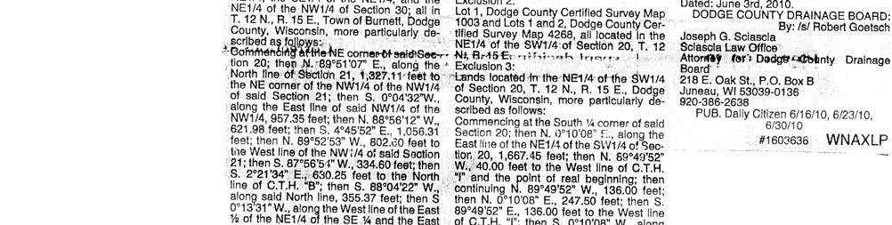
18 Exhibit B DESCRIPTION Lands Proposed to be Included in Drainage District 88 Lands located in the SE¼ of the SW¼, the SW¼ of the SE¼, and the SE¼ of the SE¼ of Section 19; the NE¼ of the NE ¼, the NW¼ of the NE ¼, the SW¼ of the NE ¼, the SE¼ of the NE ¼, the SW¼ of the NW ¼, the SE¼ of the NW ¼, the NE¼ of the SW ¼, the NW¼ of the SW ¼, the SW¼ of the SW ¼, the SE¼ of the SW ¼, the NE¼ of the SE ¼, the NW¼ of the SE ¼, the SW¼ of the SE ¼, and the SE¼ of the SE ¼ of Section 20; the NW¼ of the NW¼ and the SW¼ of the NW¼ of Section 21; the NE¼ of the NE¼, the NW¼ of the NE¼, the SW¼ of the NE¼, and the NW¼ of the NW¼ of Section 29; the NE¼ of the NE¼, the NW¼ of the NE¼, the SE¼ of the NE¼, and the NE¼ of the NW¼ of Section 30; all in T. 12 N., R. 15 E., Town of Burnett, Dodge County, Wisconsin, more particularly described as follows: Commencing at the NE corner of said Section 20; then N '07" E., along the North line of Section 21, 1, feet to the NE corner of the NW¼ of the NW¼ of said Section 21; then S. 0 04'32"W., along the East line of said NW¼ of the NW¼, feet; then N '12" W., feet; then S. 4 45'52" E., 1, feet; then N '53" W., feet to the West line of the NW¼ of said Section 21; then S '54" W., feet; then S. 2 21'34" E., feet to the North line of C.T.H. B ; then S '22" W., along said North line, feet; then S. 0 13'31" W., along the West line of the East ½ of the NE¼ of the SE¼ and the East ½ of the SE¼ of the SE¼ of said Section 20 and their northerly extension, 2, feet to the South line of said SE¼ of the SE¼; then S. 0 08'28" E., along the West line of the NE¼ of the NE¼ of said Section 29, 1, feet to the South line of said NE¼ of the NE¼; then S '37" W., along said South line, feet to the SW corner of said NE¼ of the NE¼; then S. 0 09'45" E., along the East line of the SW¼ of the NE¼ of said Section 29, feet to the South line of the North ½ of said SW¼ of the NE¼; then S '12" W., along said South line, 1, feet more or less to the East line of C.T.H. I ; then Northerly along said East line, 1,327 feet more or less to the South line of Certified Survey Map 346; then N '42" E., along said South line, 208 feet more or less to the SE corner of said Map 346; then N. 0 12'18" W., along the East line of said Map 346, 208 feet more or less to the NE corner of said Map 346; then S '42" W., along the North line of said Map 346, 208 feet more or less to the East line of C.T.H. I ; then North along said East line, 421 feet more or less to the South line of Swan Road; then N '26" E.. along said South line, feet; then N. 0 07'12" W., along the East line of C.T.H. I and its southerly extension, feet to the South line of Certified Survey Map 4339; then N '32" E., along said South line, feet more or less to the East line of said Map 4339; then N. 0 10'08" E., along said East line, feet to the North line of said Map 4339; then S '57" W., along said North line, feet to the East line of C.T.H. I ; then N. 0 02'59" W., along said East line, feet; then S '16" W., along the South line of the North ½ of the SE¼ of the SW¼ of said Section 20 and its easterly extension, 1, feet to the East line of the SW¼ of the SW¼ of Section 20; then S. 0 06'21" E., along said East line, feet to the SE corner of said SW¼ of the SW¼; then S. 0 11'48" E., along the East line of the NW¼ of the NW¼ of Section 29, 1, feet to the SE corner of said NW¼ of the NW¼; then S ' 44" W., along the South line of said NW¼ of the NW¼, 1, feet to the East line of Butternut Road; then S. 0 11'17" E., along said East line, feet; then S '45" W., along the South line of the North ½ of the SE¼ of the NE¼ of Section 30 and its easterly extension, 1, feet to the West line of said SE¼ of Page 1 of 3 Pages
19 the NE¼; then N. 0 07'08" W., along said West line, feet to the NW corner of said SE¼ of the NE¼; then S '55" W., 1, feet to the SE corner of the NE¼ of the NW¼ of Section 30; then N '00" W., along the South line of said NE¼ of the NW¼, 1, feet to the East line of Fir Road; then N. 0 02'54" W., along said East line, 1, feet; then N. 0 10'45" W., continuing along said East line, 1, feet to the southerly line of C.T.H. B ; then N '52" E., along said southerly line, 1, feet to the North line of the SE¼ of the SW¼ of Section 19; then S '16" E., along said North line, feet to the NE corner of said SE¼ of the SW¼; then N '08" E., along the North line of the SW¼ of the SE¼ and the North line of the SE¼ of the SE¼ of said Section 19, 2, feet to the centerline of Butternut Road; then N '02" E., feet to the East line of Butternut Road; then N. 0 22'50" W., along said East line, feet to the southerly line of C.T.H. B ; then N ' 16" E., along said southerly line, feet to the West line of the East ½ of the NW¼ of the SW¼ of Section 20; then N. 0 14'35" W., along said West line, feet to the North line of said NW¼ of the SW¼; then N. 0 37'12" E., along the West line of the East ½ of the SW¼ of the NW¼ of said Section 20; 1, feet to the North line of said SW¼ of the NW¼; then N '43" E., along said North line and along the North line of the SE¼ of the NW¼ of said Section 20, 1, feet to the NE corner of said SE¼ of the NW¼; then N '26" E., along the South line of the NW¼ of the NE¼ of said Section 20, feet to the East line of C.T.H. I ; then N. 0 20'21" E., feet to the North line of the South ½ of the said NW¼ of the NE¼; then N '58" E., along said North line, 1, feet to the East line of said NW¼ of the NE¼; then N. 0 19'34" E., along said East line, feet to the North line of said Section 20; then N '30" E., along said North line, 1, feet to the point of commencement. Excluding therefrom, the following described parcels: Exclusion 1: Lot 1, Dodge County Certified Survey Map 6049 located in the SE¼ of the NW¼ of Section 20, T. 12 N., R. 15 E. Exclusion 2: Lot 1, Dodge County Certified Survey Map 1003 and Lots 1 and 2, Dodge County Certified Survey Map 4268, all located in the NE¼ of the SW¼ of Section 20, T. 12 N., R. 15 E. Exclusion 3: Lands located in the NE¼ of the SW¼ of Section 20, T. 12 N., R. 15 E., Dodge County, Wisconsin, more particularly described as follows: Commencing at the South ¼ corner of said Section 20; then N. 0 10'08" E., along the East line of the NE¼ of the SW¼ of Section 20, 1, feet; then N '52" W., feet to the West line of C.T.H. I and the point of real beginning; then continuing N '52" W., feet; then N. 0 10'08" E., feet; then S '52" E., feet to the West line of C.T.H. I ; then S. 0 10'08" W., along said West line, feet to the point of real beginning. Page 2 of 3 Pages
20 Exclusion 4: Lands located in the NW¼ of the SE¼ of Section 20, T. 12 N., R. 15 E., Dodge County, Wisconsin, more particularly described as follows: Commencing at the SW corner of Lot 1, Dodge County Certified Survey Map 2635; then Northerly along the East line of C.T.H. I, 1,287 feet more or less to the South line of C.T.H. B ; then N '22" E., along said South line, feet; then S. 0 53'53" E., feet; N '05" E., feet to the West line of the East ½ of the NW¼ of the SE¼ of Section 20; then S. 0 11'16" W., along said West line, feet to the South line of said NW¼ of the SE¼; then S '23" W., along said South line, feet to the point of commencement. Page 3 of 3 Pages
21
22 EXHIBIT C DESCRIPTION OF HYDRIC SOILS Ackmore series The Ackmore series consists of deep, poorly drained, moderately slowly permeable soils on flood plains and alluvial fans. These soils formed in silty alluvium or colluvium over an older, buried soil. Slopes are 0 to 3 percent. Ackmore soils are commonly near Elburn and Pella soils on the landscape. Elburn soils have an argillic horizon, are somewhat poorly drained, and do not have older buried soil horizons. Pella soils have a mollic epipedon and do not have older buried soil horizons. Typical pedon of Ackmore silt loam, 0 to 3 percent slopes, 2,650 feet south and 100 feet east of the NW corner of Sec. 13, T. 9 N., R. 15 E. Ap 0 to 10 inches; very dark grayish brown (10YR 3/2) silt loam; weak fine granular structure; friable; mildly alkaline; abrupt smooth boundary. Cl 10 to 14 inches; stratified grayish brown (10YR 5/2), dark gray (10YR 4/1), and brown (10YR 5/3) silt loam; few fine faint and distinct yellowish brown (10YR 5/4) mottles; weak thin platy structure; friable; medium acid; gradual smooth boundary. C2 14 to 26 inches; very dark grayish brown (10YR 3/2) silt loam; few fine prominent dark reddish brown (5YR 3/2) mottles; massive; friable; mildly alkaline; clear smooth boundary. IIAlb 26 to 36 inches; black (10YR 2/1) silty clay loam; moderate medium subangular blocky structure; firm; mildly alkaline; gradual smooth boundary. IIB2b 36 to 60 inches; olive gray (5Y 5/2) silty clay loam; massive; firm; mildly alkaline. The thickness of the A and C horizons ranges from 20 to 36 inches. The Ap or Al horizon has value of 2 or 3 and chroma of 1 or 2. The C horizon has value of 3 to 5 and chroma of 1 to 3 and ranges from medium acid to neutral. The IIAb horizon has hue of 10YR or 5Y and value of 2 or 3. It is silty clay loam or silt loam and ranges from medium acid to mildly alkaline. The IIBb horizon has hue of 10YR, 2.5Y, or 5Y; value of 2 to 5; and chroma of 1 or 2. It is silty clay loam or silt loam and ranges from medium acid to mildly alkaline. AcA Ackmore silt loam, 0 to 3 percent slopes. This is a nearly level and gently sloping, poorly drained soil in concave areas on flood plains or alluvial fans. It is subject to flooding for very brief periods. Areas of this map unit are irregular in shape and range from 5 to 70 acres in size. Typically, the surface layer is very dark grayish brown silt loam about 10 inches thick. The layer below that is multicolored, friable silt loam about 16 inches thick. Below that there is a buried horizon of black, firm silty clay loam that is 10 inches thick. The next layer, to a depth of about 60 inches, is olive gray, firm silty clay loam. Included in mapping are small areas of poorly drained Pella soils and areas where the colluvial deposits are underlain by loamy or sandy soils. Pella soils are in depressions and are underlain by glacial drift. The included soils make up about 5 percent of the map unit. Page C1 of 8
23 Water and air move at a moderately slow rate through this soil. Surface runoff in cultivated areas is slow. The available water capacity is high, and natural fertility is high. The shrink-swell potential is moderate in the upper part of the soil and high in the lower part. This soil is saturated to a depth of 1 to 3 feet for several months during wet seasons. The surface layer is friable and easily tilled throughout a fairly wide range in moisture content. It does, however, have a tendency to crust after heavy rain. Root development is restricted by the water table. Most drained areas of this soil are farmed. The potential is good for row crops if the soil is drained, good for hay and pasture, and fair for trees. The potential is very poor for most engineering uses. If drained, this soil is suited to corn and small grain. It is suited to grasses and legumes for hay and pasture. Returning crop residue to the soil or regularly adding other organic material helps to keep the soil in good condition. If this soil is used as pasture or for hay, overgrazing, grazing when the soil is too wet, or the excessive use of heavy machinery can cause surface compaction, excessive runoff, and poor tilth. A proper stocking rate, pasture rotation, timely deferment of grazing, and restricted use during wet periods help to keep the pasture plants and the soil in good condition. This soil is suited to commercial wood production. Soil wetness generally necessitates planting by hand or machine on prepared ridges if natural regeneration is unreliable. Large, vigorous nursery stock is essential to avoid mortality. Harvest is frequently limited to periods when the soil is frozen. Harvesting by clearcutting or group selection can help reduce the hazard of windthrow. Vegetation that can compete with natural regeneration following harvest can be controlled through the use of suitable herbicides or mechanical removal. This soil is poorly suited to sanitary facilities and building site development because of the high water table and flooding. Capability subclass IIw; woodland suitability subclass 3w. Brookston series The Brookston series consists of deep, very poorly drained, moderately permeable or moderately slowly permeable soils in depressions on ground moraines and along drainageways. These soils formed in silty sediment and in the underlying loamy glacial till. Slopes are 0 to 3 percent. Brookston soils are commonly near Ashippun, Lamartine, and Pella soils on the landscape. Ashippun soils are somewhat poorly drained and are underlain by shaly glacial till. Lamartine soils are more silty in the upper part of the solum than the Brookston soils and are somewhat poorly drained. Pella soils are poorly drained and do not have an argillic horizon. Brookston soils are deeper to free carbonates than the Pella soils. Typical pedon of Brookston silt loam, 0 to 3 percent slopes, 2,250 feet south and 1,600 feet east of the NW corner of Sec. 28, R. 15 E., T. 9 N. Ap 0 to 8 inches; black (10YR 2/1) silt loam; weak fine subangular blocky and granular structure; friable; neutral; abrupt smooth boundary. Al2 8 to 12 inches; very dark gray (10YR 3/1) silt loam; weak fine subangular blocky structure; friable; neutral; clear smooth boundary. Page C2 of 8
24 Blg 12 to 16 inches; grayish brown (2.5Y 5/2) silty clay loam; many fine faint brown (10YR 5/3) and distinct yellowish brown (10YR 5/4) mottles; weak medium subangular blocky structure; firm; neutral; clear wavy boundary. B2ltg 16 to 20 inches; dark grayish brown (2.5Y 4/2) silty clay loam; few fine prominent yellowish brown (10YR 5/6) and common fine prominent light olive brown (2.5Y 5/6) mottles; moderate medium subangular blocky structure; firm; few thin clay films on faces of peds; neutral; gradual wavy boundary. IIB22tg 20 to 30 inches; dark grayish brown (2.5Y 4/2) clay loam; many medium prominent yellowish brown (10YR 5/6) mottles; few thin very dark grayish brown (10YR 3/2) streaks; moderate medium subangular blocky structure; firm; few thin clay films on faces of peds; few fine pebbles; neutral; gradual wavy boundary. IIB3 30 to 36 inches; grayish brown (2.5Y 5/2) loam; many fine and medium prominent yellowish brown (10YR 5/6) and distinct light olive brown (2.5Y 5/4) mottles; weak medium subangular blocky structure; friable; few fine pebbles; neutral; abrupt wavy boundary. IIC 36 to 60 inches; grayish brown (2.5Y 5/2) sandy loam; many medium prominent light olive brown (2.5Y 5/6) mottles; massive; very friable; about 5 percent gravel; common cobblestones and large pebbles; strong effervescence; moderately alkaline. The thickness of the solum and depth to free carbonates range from 24 to 45 inches. Depth to glacial till ranges from 12 to 30 inches. The thickness of the mollic epipedon ranges from 11 to 14 inches. The Ap or Al horizon has value and chroma of 2 or 3. The B and IIB horizons have hue of 10YR, 5Y, or 2.5Y; value of 4 to 6; and chroma of 1 or 2. Content of coarse fragments in the IIB horizon ranges from 0 to 15 percent. The IIC horizon has hue of 10YR or 2.5Y, value of 5 to 7, and chroma of 1 to 5. It is sandy loam, loam, or, less commonly, clay loam. Content of coarse fragments in the IIC horizon ranges from 5 to 15 percent and includes cobblestones and flagstones. BsA Brookston slit loam, 0 to 3 percent slopes. This nearly level and gently sloping, very poorly drained soil is in depressions on ground moraines and along drainageways. It is frequently subject to brief periods of flooding. Areas of this map unit are irregular in shape and range from 2 to 10 acres in size. Typically, the surface layer is black and very dark gray silt loam about 12 inches thick. The subsoil is about 24 inches thick. The upper part of the subsoil is grayish brown and dark grayish brown, mottled, firm silty clay loam; the middle part is dark grayish brown, mottled, firm clay loam; and the lower part is grayish brown, mottled, friable loam. The substratum, to a depth of about 60 inches, is grayish brown sandy loam. In places, the underlying till is gravelly, and in other places, it is channery and flaggy. In some areas, the surface layer is thicker than described in the typical profile. Included in mapping are small areas of poorly drained PeIla soils. They are in depressions between drumlins and on glacial lake plains and are underlain by glacial drift. These inclusions make up about 5 percent of the map unit. Page C3 of 8
25 Water and air move at a moderately slow or moderate rate through this soil. Surface runoff in cultivated areas is slow. The available water capacity is high, and natural fertility is high. The shrink-swell potential is moderate. This soil is saturated to a depth of 1 foot for several months during wet seasons. The surface layer is friable and. easily tilled throughout a fairly wide range in moisture content. It does, however, have a tendency to crust after heavy rain. Root development is restricted by the water table. Most drained areas of this soil are farmed. The potential is fair for row crops, hay, and pasture and poor for trees. The potential is poor for most engineering uses. If drained, this soil is suited to corn, grain, hay, or pasture. If it is not drained, it is suited to permanent pasture. Returning crop residue to the soil or regularly adding other organic material helps to improve fertility. Overgrazing or grazing when the soil is too wet can cause surface compaction and poor tilth. This soil is poorly suited to commercial wood production. Slow growth and poor form make trees barely merchantable. Soil wetness generally necessitates planting by hand or machine on prepared ridges if natural regeneration is unreliable. Large, vigorous nursery stock is essential to avoid mortality. Harvest is frequently limited to periods when the soil is frozen. Harvesting by clearcutting or group selection can help reduce the hazard of windthrow. Vegetation that can compete with natural regeneration following harvest can be controlled through the use of suitable herbicides or mechanical removal. This soil is poorly suited to sanitary facilities and building site development because of the high water table and flooding. Capability subclass IIw; woodland suitability subclass 4w. Elburn series The Elburn series consists of deep, somewhat poorly drained, moderately permeable soils on ground moraines and on foot slopes of drumlins. These soils formed in loess and in the underlying loamy glacial drift. Slopes are 0 to 3 percent. Elburn soils are commonly near Pella, Plano, and Mendota soils. Pella soils are poorly drained and do not have an argillic horizon. Plano soils formed in similar material but are well drained and moderately well drained. Mendota soils are well drained and are underlain by glacial till that contains a large amount of carbonates and dolomite fragments. Typical pedon of Elburn silt loam, 0 to 3 percent slopes, 50 feet north and 2,300 feet east of the SW corner of Sec. 8, T. 10 N., R. 15 E. A1 0 to 18 inches; black (10YR 2/1) silt loam; moderate medium granular structure; friable; mildly alkaline; gradual smooth boundary. B1 18 to 24 inches; dark grayish brown (10YR 4/2) silt loam; few fine faint dark brown (10YR 4/3) mottles; moderate medium subangular blocky structure; friable; medium acid; gradual wavy boundary. B21t 24 to 37 inches; dark brown (10YR 4/3) silty clay loam; common fine prominent yellowish brown (10YR 5/6) and common fine faint grayish brown (10YR 5/2) mottles; moderate medium subangular blocky structure; friable; thin patchy clay films on faces of peds; slightly acid; clear wavy boundary. Page C4 of 8
26 B22t 37 to 45 inches; brown (10YR 5/3) silt loam; common fine prominent yellowish brown (10YR 5/6) and common fine distinct grayish brown (10YR 5/2) mottles; moderate medium subangular blocky structure; friable; thin patchy clay films on faces of peds; slightly acid; clear wavy boundary. IIB3 45 to 48 inches; dark brown (10YR 4/3) sandy loam; common medium prominent yellowish brown (10YR 5/6) mottles; weak coarse subangular blocky structure; friable; mildly alkaline; clear wavy boundary. IIC 48 to 60 inches; yellowish brown (10YR 5/4) sandy loam; massive; friable; many dolomite pebbles; strong effervescence; moderately alkaline. The thickness of the solum and depth to free carbonates range from 40 to 65 inches. The thickness of the bess mantle ranges from 40 to 60 inches. The thickness of the mollic epipedon ranges from 10 to 18 inches. The Al or Ap horizon has value of 2 or 3 and chroma of 1 or 2. The B horizon has value of 4 to 6 and chroma of 2 to 8 and ranges from medium acid to mildly alkaline. The IIB horizon has hue of 10YR or 5Y, value of 4 or 5, and chroma of 2 or 3. It is sandy loam, loam, or, less commonly, clay loam. Reaction ranges from slightly acid to mildly alkaline. The IIC horizon has hue of 10YR, 5Y, or 2.5Y; value of 4 or 5; and chroma of 2 to 4. It is sandy loam, loam, or, less commonly, clay loam and ranges from mildly alkaline to moderately alkaline. Gravel content ranges from 0 to 20 percent. EbA Elburn silt loam, 0 to 3 percent slopes. This nearly level and gently sloping, somewhat poorly drained soil is in concave areas on ground moraines and on foot slopes of drumlins. Areas of this map unit are irregular in shape and range from 5 to 40 acres in size. Typically, the surface layer is black silt loam about 18 inches thick. The subsoil is about 30 inches thick. The upper part of the subsoil is dark grayish brown, friable silt loam; the middle part is dark brown, firm silty clay loam and brown, friable silt loam; and the lower part is dark brown, firm sandy loam. The substratum, to a depth of about 60 inches, is yellowish brown sandy loam. In places, the surface layer is thinner or lighter colored than that of the typical profile. In some areas, this Elburn soil is less than 40 inches thick over glacial till. Included in mapping are small areas of well drained Mendota soils, poorly drained Pella soils, and well drained and moderately well drained Plano soils. These included soils and the Elburn soil formed in similar material. Plano and Mendota soils are generally higher on the landscape than the Elburn soil, and Pella soils are in slight depressions below the Elburn soil. In a few areas the Elburn soil has slope of 4 or 5 percent. Water and air move at a moderate rate through this soil. Surface runoff in cultivated areas is slow. The available water capacity is high, and natural fertility is high. The shrink-swell potential is moderate in the subsoil and low in the substratum. This soil is saturated to a depth of 1 to 3 feet for several months during wet seasons. The surface layer is friable and easily tilled throughout a fairly wide range in moisture content. It does, however, have a tendency to crust after heavy rain. Root development is restricted somewhat by the water table. Most areas of this soil are farmed. The potential is good for row crops, hay, and pasture and poor for trees. The potential is poor for most engineering uses. Page C5 of 8
27 This soil is suited to corn, small grain, and grasses and legumes for hay and pasture. If this soil is used for cultivated crops, artificial drainage is needed in some of the nearly level areas. Yields are generally higher than for most other soils in the county. Returning crop residue to the soil or regularly adding other organic material helps keep the soil in good condition. This soil can be used as pasture or for hay. Overgrazing or grazing when the soil is too wet, however, can cause surface compaction, excessive runoff, and poor tilth. A proper stocking rate, pasture rotation, timely deferment of grazing, and restricted use during wet periods help keep the pasture plants and the soil in good condition. This soil is poorly suited to commercial wood production. Slow growth and poor form make trees barely merchantable. Soil-related forest management problems are minor. This soil is poorly suited to sanitary facilities because of the high water table. The suitability for septic tank absorption fields can be improved by building a filtering mound. This soil is also poorly suited to building site development because of the high water table. If used for this purpose, the soil should be drained. A suitable base material is necessary to protect local roads and streets from damage resulting from the low strength of the soil and frost action in the soil. Capability subclass IIw; woodland suitability subclass 4o. Pella series The Pella series consists of deep, poorly drained, moderately permeable soils in depressions between drumlins and on glacial lake plains. These soils formed in silty material mainly more than 3 feet thick which is underlain by glacial till. Slopes are 0 to 2 percent. Pella soils are commonly near Ackmore, Elburn, and Palms soils on the landscape. Ackmore soils have a lighter colored or thinner surface layer. Elburn soils have an argillic horizon and are somewhat poorly drained. Palms soils have organic layers that are 16 to 51 inches thick over silty clay loam. Typical pedon of Pella silty clay loam, 1,050 feet north and 500 feet west of the SE corner of Sec. 14, T. 10 N., R. 14 E. A1 0 to 9 inches; black (10YR 2/1) silty clay loam; weak fine granular and subangular blocky structure; friable; neutral; gradual wavy boundary. A3 9 to 14 inches; very dark gray (10YR 3/1) silty clay loam; moderate medium subangular blocky structure; friable; neutral; gradual wavy boundary. B2g 14 to 30 inches; olive gray (5Y 4/2) silty clay loam; moderate coarse prismatic structure parting to moderate medium subangular blocky; firm; mildly alkaline; gradual wavy boundary. B3g 30 to 46 inches; grayish brown (2.5Y 5/2) silty clay loam; many medium distinct light yellowish brown (2.5Y 6/4) mottles; weak coarse subangular blocky structure; firm; slight effervescence; mildly alkaline; clear wavy boundary. IIC 46 to 60 inches; light yellowish brown (2.5Y 6/4) gravelly loam; massive; very friable; strong effervescence; moderately alkaline. Page C6 of 8
28 The thickness of the solum and depth to unweathered glacial till range from 30 to 50 inches. The depth to free carbonates ranges from 20 to 40 inches. The thickness of the mollic epipedon ranges from 14 to 18 inches. The A horizon has hue of 10YR or 2.5Y, value of 1 to 3, and chroma of 0 to 2. It is dominantly silty clay loam, but the range includes silt loam. The Bg horizon has hue of 10YR, 2.5Y, or 5Y; value of 4 to 7; and chroma of 1 to 3. It is silty clay loam or silt loam and is mildly alkaline or moderately alkaline. The IIC horizon has hue of 5Y or 2.5Y, value of 4 to 6, and chroma of 2 to 4. It is gravelly loam, sandy loam, or silty clay loam and is mildly alkaline or moderately alkaline. Gravel content ranges from 0 to 20 percent. Content of coarse fragments that are more than 3 inches in diameter ranges from 0 to 5 percent. Ph Pella silty clay loam. This nearly level, poorly drained soil is in depressions between drumlins and on glacial lake plains. It is occasionally subject to brief periods of flooding. Areas of this map unit are irregular in shape and range from 3 to 200 acres in size. Slopes are 0 to 2 percent. Typically, the surface layer is black silty clay loam about 9 inches thick. The subsurface layer is very dark gray silty clay loam about 5 inches thick. The subsoil is about 32 inches thick. The upper part of the subsoil is olive gray, firm silty clay loam; the lower part is grayish brown, mottled, firm silty clay loam. The substratum, to a depth of about 60 inches, is light yellowish brown gravelly loam. In places, the surface layer is silt loam or muck. In some places, there are thin layers of sand or muck in the subsoil and substratum. Included in mapping are small areas of poorly drained Ackmore soils on flood plains and alluvial fans. Unlike Pella soils, Ackmore soils do not overlie glacial drift. The included soils make up about 10 percent of the map unit. Water and air move at a moderate rate through this soil. Surface runoff in cultivated areas is slow or ponded. The available water capacity is high, and natural fertility is high. The shrink-swell potential is moderate in the subsoil and low in the substratum. This soil is saturated to a depth of 2 feet for several months during wet seasons. The surface layer is friable, but it must be tilled at the proper moisture content to prevent crusting and puddling. Root development is restricted by the high water table. Most drained areas of this soil are farmed. The potential is good for row crops, hay, and pasture and poor for trees. The potential is poor for most engineering uses. If drained, this soil is suited to corn, small grain, and grasses and legumes for hay and pasture. Returning crop residue to the soil or regularly adding other organic material help to keep this soil in good condition. If this soil is used as pasture or for hay, overgrazing, grazing when the soil is too wet, or the use of heavy machinery can cause surface compaction, excessive runoff, and poor tilth. A proper stocking rate, pasture rotation, timely deferment of grazing, and restricted use during wet periods help to keep the soil and the pasture plants in good condition. This soil is poorly suited to woodland use. Slow growth and poor form make trees barely merchantable. Because of soil wetness, planting by hand or machine on prepared ridges generally is necessary if natural regeneration is unreliable. Large, vigorous nursery stock is essential to avoid seedling mortality. Harvesting is frequently limited to periods when the soil is frozen. Harvesting by clearcutting or area selection can help reduce the hazard of windthrow. Page C7 of 8
29 Vegetation that can compete with natural regeneration following harvest can be controlled through the use of suitable herbicides or by mechanical removal. This soil is poorly suited to sanitary facilities and building site development because of the high water table and flooding. Capability subclass IIw; woodland suitability subclass 4w. Page C8 of 8
30 Appendix B
31
32
33 Appendix C
34 Petitioners Tally of Petitioners, Non-Petitioners & Lands As Petitioned Appendix C OWNER DESCRIPTION PACREL ID NUMBER ACREAGE Butterbrodt Trust SE-SW S of CTH B Pt. of Hillcrest Drive Beaver Dam, WI Neal J. Stippich SW-SE N6008 County Road G N½ SE-SE Beaver Dam, WI Lorraine C. Kittell S½ SE-SE N8076 Butternut Road NW-NW NE-NE N½ SE-NE Pt. of John G. & Ruth B. Meylink Pt. NE-NE Pt. of W6090 Swan Road S½ NW-NE Pt. of SW-NE Pt. of Pt. SE-NE Pt. of Marion Barsch Pt. SW-NW Pt. of W6857 County Road B Pt. NW-SW Pt. of SW-SW NW-NE NE-NW Woock Living Trust Pt. SW-NW Pt. of W6277 Park Drive Pt. SE-NW Pt. of Karl E. & Coleen A. Schmitz E ft. of S 352 ft P.O. Box 276 SE-NW Randall O. & Rose Woock Pt. NE-SW (Land Contract) Kenneth & Gloria Woock (Vendor) N8214 County Road I John & Audrey Ganske Trust N½ SE-SW Pt. of N9334 County Road A Beaver Dam, WI Dodge County Antique Pt. W½ NE-SE Pt. of Power Club, Inc. Pt. E½ NW-SE Pt. of P.O. Box 416 Fox Lake, WI Alton A. & Violet J. Hanefeld LE SW-SE ex. CSM Gary A. & Ricky L. Hanefeld W½ SE-SE Pt. of Pamela J. Pitzlin N8140 County Road I Page 1 of 4
35 OWNER DESCRIPTION PACREL ID NUMBER ACREAGE Harry, Karen, Alvin J., Renae D., & W½ NE-NE Pt. of Jacob Venhuizen W6409 Swan Road Glen Schroeder & Lois A. Berndt NW-NE ex. CSM N8054 County Road I N½ SW-NE Pt. of Petitioners' Total Non-Petitioners OWNER DESCRIPTION PACREL ID NUMBER ACREAGE Dennis L. Giese Pt. NE-NE Pt. of W6500 County Road B Pt. SE-NE Pt. of Pt. NW-NW Pt. of Pt. SW-NW Pt. of Pt. NE-SE Pt. of Pt. NW-SE Pt. of Quack Club of Wisconsin, Inc. Pt. SW-NW Pt. of (Land Contract) Pt. SE-NW Pt. of Burnett 4-H Club, Inc. (Vendor) 9130 W. North Avenue Wauwatose, WI Dawn N. Pittman Lot 2 CSM Golf Course Road Lot 3 CSM Barnes, WI Kenneth W. Yerges Parcel A CSM W6713 County Road B Eleanor G. Kirchoff Parcel B CSM N8283 County Road I Charles R. Stickles Pt. NE-SW W6735 County Road B Walter S. & Linda A. Burkhalter Lot 2 CSM W6741 County Road B Non-Petitioners' Total Page 2 of 4
36 Petitioners Tally of Petitioners, Non-Petitioners & Lands As Recommended by the Drainage Board OWNER DESCRIPTION PACREL ID NUMBER ACREAGE Butterbrodt Trust SE-SW S of CTH B Pt. of Hillcrest Drive Beaver Dam, WI Neal J. Stippich SW-SE N6008 County Road G N½ SE-SE Beaver Dam, WI Lorraine C. Kittell S½ SE-SE N8076 Butternut Road NW-NW NE-NE N½ SE-NE Pt. of John G. & Ruth B. Meylink Pt. NE-NE Pt. of W6090 Swan Road S½ NW-NE Pt. of SW-NE Pt. of Pt. SE-NE Pt. of Marion Barsch Pt. NW-SW Pt. of W6857 County Road B SW-SW NW-NE NE-NW Woock Living Trust Pt. SW-NW Pt. of W6277 Park Drive Pt. SE-NW Pt. of Karl E. & Coleen A. Schmitz E ft. of S 352 ft P.O. Box 276 SE-NW Randall O. & Rose Woock Pt. NE-SW (Land Contract) Kenneth & Gloria Woock (Vendor) N8214 County Road I John & Audrey Ganske Trust N½ SE-SW Pt. of N9334 County Road A Beaver Dam, WI Dodge County Antique Pt. W½ NE-SE Pt. of Power Club, Inc. Pt. E½ NW-SE Pt. of P.O. Box 416 Fox Lake, WI Alton A. & Violet J. Hanefeld LE SW-SE ex. CSM Gary A. & Ricky L. Hanefeld W½ SE-SE Pt. of Pamela J. Pitzlin N8140 County Road I Petitioners' Total Page 3 of 4
37 Non-Petitioners OWNER DESCRIPTION PACREL ID NUMBER ACREAGE Dennis L. Giese Pt. NE-SE Pt. of W6500 County Road B Pt. NW-SE Pt. of Dawn N. Pittman Lot 2 CSM Golf Course Road Lot 3 CSM Barnes, WI Non-Petitioners' Total Note: All acreages exclude public road right-of-way Page 4 of 4
38 Appendix D
39 DRAINAGE BENEFITS WORKSHEET Corn Price: $3.53 per bushel «INPUT DATA Hydric Soils in Columbia, Dane, Dodge, Jefferson & Sauk Counties Max. Yield: 160 bushels per acre Note: Corn price is market price at harvest. Gross Return: $ per acre Production costs revised 6/7/10 with 2009 Data Soils data revised 2/22/10 with current on-line NRCS data Production Cost: $ per acre «INPUT DATA Net Return: $ per acre Compiled By: Daniel J. Prunuske, P.E. 5 Year Increase: $ per acre DesignTech Engineering, LLC. Annual Increase: $ per acre 910 Grove Street - Beaver Dam, WI Return on Investment: 12.00% per year Base Benefit: $1, per acre (A) GROUNDWATER (B) (C) (AxBxC) BENEFITS SOIL MAX. YIELD DEPTH GROUNDWATER FLOOD FLOOD BENEFIT PER SOIL TYPE DESCRIPTION YIELD FACTOR MIN MAX FACTOR FREQUENCY FACTOR FACTOR ACRE TYPE Columbia County Ad Adrian Muck None $ Ad Ae Alluvial Land, Sandy Occasional-Brief Ae Af Alluvial Land, Sandy, Wet Frequent-Long Af Ag Alluvial Land, Loamy Rare Ag AtA Atterberry Silt Loam None AtA AtB Atterberry Silt Loam None AtB BbA Barry Loam None BbA Bo Boots Muck None Bo CoA Colwood Fine Sandy Loam None CoA GaA Gilford Fine Sandy Loam Rare GaA Gb Granby Variant Fine Sandy Loam None Gb GnA Grellton Fine Sandy Loam None GnA Ho Houghton Muck None , Ho JoA Joy Silt Loam None JoA KbA Kibbie Fine Sandy Loam None KbA MaB Marcellon Loam None MaB Mc Marshan Loam Rare Mc MoA Morocco Loamy Sand None MoA OsA Ossian Silt Loam Rare , OsA Ot Otter Silt Loam Frequent-Brief , Ot Pa Palms Muck None Pa PoA Poygan Silt Loam None PoA TvA Tustin Loamy Fine Sand None TvA Wa Wacousta Mucky Silt Loam None Wa Wb Wallkill Silt Loam Frequent-Long , Wb WcA Wasepi Fine Sandy Loam None WcA YaA Yahara Fine Sandy Loam None YaA Dodge County AcA Ackmore Silt Loam Occasional-Brief $1, AcA Ar Adrian Variant Muck None Ar AsA Ashippun Silt Loam None AsA BsA Brookston Silt Loam None BsA Co Colwood Silty Clay Loam None Co EbA Elburn Silt Loam None , EbA Ev Elvers Silt Loam Frequent-Long , Ev Gb Granby Variant Fine Sandy Loam None Gb Hu,Hw Houghton Muck None , Hu,Hw Ke Keowns Silt Loam None Ke KlA,KlB Kibbie Loam None KlA,KlB LmA,LmB Lamartine Silt Loam None LmA,LmB NxA Nenno Silt Loam None NxA Ot Otter Silt Loam Frequent-Brief , Ot Pa Palms Muck None Pa Ph Pella Silty Clay Loam None , Ph Pk Pella Variant Silt Loam None Pk PtA* Plano Silt Loam None PtA* Sm Sebewa Silt Loam None Sm
40 (A) GROUNDWATER (B) (C) (AxBxC) BENEFITS SOIL MAX. YIELD DEPTH GROUNDWATER FLOOD FLOOD BENEFIT PER SOIL TYPE DESCRIPTION YIELD FACTOR MIN MAX FACTOR FREQUENCY FACTOR FACTOR ACRE TYPE Dane County Ad Adrian Muck None $ Ad Co Colwood Silt Loam None Co DeA Dells Silt Loam Rare DeA DfA Del Rey Silt Loam None DfA EfB,EgA Elburn Silt Loam None , EfB,EgA Ev Elvers Silt Loam Frequent-Long , Ev Gn Granby Loamy Sand None Gn HaA Hayfield Silt Loam None HaA Ho Houghton Muck None , Ho HuA,HuB Huntsville Silt Loam Occasional-Brief , HuA,HuB KcB Kickapoo Fine Sandy Loam Frequent-Brief KcB Mc Marshan Silt Loam Rare Mc MoA Montgomery Silty Clay Loam None , MoA Or Orion Silt Loam Rare Or Os Orion Silt Loam wet Frequent-Brief , Os Ot Otter Silt Loam Frequent-Brief , Ot Pa Palms Muck None Pa RaA Radford Silt Loam Frequent-Brief , RaA SaA Sable Silty Clay Loam None , SaA ShA Salter Sandy Loam wet None ShA TrB Troxel Silt Loam None TrB VrB Virgil Silt Loam None VrB VwA Virgil Silt Loam gravelly substratum None VwA Wa Wacousta Silt Loam None Wa Wt Watseka Loamy Sand None Wt Jefferson County Ad Adrian Muck None $ Ad AzA Aztalan Fine Sandy Loam None AzA BaA Barry Silt Loam None BaA DcA Del Rey Silt Loam None DcA Ed Edwards Muck None Ed Ev Elvers Silt Loam Frequent-Long , Ev Gd Gilford Sandy Loam None Gd Ht Houghton Muck None , Ht Kb Keowns Silt Loam None Kb KdA Kibbie Fine Sandy Loam None KdA LaB Lamartine Silt Loam None LaB MgA,MgB Martinton Silt Loam None MgA,MgB MmA Matherton Silt Loam None MmA MnA Matherton Silt Loam clayet substratum None MnA Mr Milford Silty Clay Loam None Mr Ot Otter Silt Loam Rare , Ot Pa,Pb Palms Muck None Pa,Pb RaA Radford Silt Loam Frequent-Brief , RaA Sm,Sn Sebewa Silt Loam None Sm,Sn TuA Tuscola Silt Loam None TuA VrB Virgil Silt Loam None VrB VwA Virgil Silt Loam gravelly substratum None VwA Wa Wacousta Silty Clay Loam None Wa WmA Wasepi Sandy Loam None WmA Wta Watseka Variant Loamy Sand None Wta WvA,WvB Wauconda Silt Loam None WvA,WvB WyA Whalan Variant Silt Loam Rare WyA YaA Yahara Fine Sandy Loam None YaA
41 (A) GROUNDWATER (B) (C) (AxBxC) BENEFITS SOIL MAX. YIELD DEPTH GROUNDWATER FLOOD FLOOD BENEFIT PER SOIL TYPE DESCRIPTION YIELD FACTOR MIN MAX FACTOR FREQUENCY FACTOR FACTOR ACRE TYPE Sauk County Ad Adrian Muck None $ Ad ArA Arenzville Silt Loam Occasional-Brief ArA AtA Atterberry Silt Loam None AtA BaB Baraboo Silt Loam None BaB ChA Chaseburg Silt Loam Occasional-Brief ChA Co Colwood Loam None Co CuA Curran Silt Loam Rare CuA DeA Dells Silt Loam Rare DeA EmA Eleva Sandy Loam Rare EmA Et Ettrick Silt Loam Frequent-Brief , Et Gr. Granby Loamy Sand None Gr. Gv Granby Variant Rare Gv Ho Houghton Muck None , Ho KlA Kendall Silt Loam None KlA Mc Marshan Loam None Mc MsA Mosel Loam Rare MsA Or Orion Silt Loam Rare Or Os Ossian Silt Loam Rare , Os Pa Palms Muck None Pa RmA Rimer Loamy Sand None RmA Ry Rowley Silt Loam Rare Ry SfA Shiffer Loam Rare SfA ShA Shiffer Sandy Loam Rare ShA Wt Watseka Loamy Sand None Wt
42 Appendix E
43 Proposed Dodge County Drainage District 88 TOWN OF BURNETT Preliminary Benefits Itemization July 22, 2010 Appendix E BENEFITED SOIL SOIL AREA BENEFITS TYPE TOTAL OWNER DESCRIPTION PACREL ID NUMBER TYPE (ACRES) PER ACRE BENEFITS BENEFITS Butterbrodt Trust SE-SW S. of CTH B Pt. of BsA 1.50 $ $1, Hillcrest Drive EbA , , Beaver Dam, WI $11, Neal J. Stippich SW-SE EbA , , N6008 County Road G PtA , Beaver Dam, WI N½ SE-SE EbA , , , Lorraine C. Kittell S½ SE-SE EbA , , N8076 Butternut Road PtA , NW-NW EbA , , PtA NE-NE BsA , PtA , N½ SE-NE Pt. of BsA , PtA , , John G. & Ruth B. Meylink Pt. NE-NE Pt. of EbA W6090 Swan Road S½ NW-NE Pt. of EbA SW-NE Pt. of EbA Pt. SE-NE Pt. of EbA Marion Barsch NW-SW S of CTH B Pt. of EbA , , W6857 County Road B Ph , , SW-SW EbA , , PtA , NW-NE BsA EbA , , PtA , NE-NW EbA , , , Woock Living Trust N. 968 ft. of SE-NW & N. 968 ft of EbA , , W6277 Park Drive E. 165 ft. of SW-NW , Page 1 of 2
44 BENEFITED SOIL SOIL AREA BENEFITS TYPE TOTAL OWNER DESCRIPTION PACREL ID NUMBER TYPE (ACRES) PER ACRE BENEFITS BENEFITS Karl E. & Coleen A. Schmitz E ft. of S 352 ft EbA , , P.O. Box 276 SE-NW , Dawn N. Pittman Lot 2 CSM EbA , Golf Course Road Lot 3 CSM EbA , , Barnes, WI , Randall O. & Rose Woock Pt. NE-SW EbA , , (Land Contract) Ph , , Kenneth & Gloria Woock (Vendor) N8214 County Road I 18, John & Audrey Ganske Trust N½ SE-SW Pt. of EbA , , N9334 County Road A Ph , , Beaver Dam, WI , Dodge County Antique Pt. W½ NE-SE Pt. of EbA , , Power Club, Inc. Pt. E½ NW-SE Pt. of EbA , , P.O. Box 416 Fox Lake, WI , Dennis L. Giese Pt. NE-SE & NW-SE EbA , W6500 County Road B Violet J. Hanefeld LE SW-SE ex. CSM EbA , , Gary A. & Ricky L. Hanefeld Ph , , Pamela J. Pitzlin PtA , N8140 County Road I W½ SE-SE Pt. of EbA , Ph , , PtA , , TOTAL $185, $185, Note: All acreages exclude public road right-of-way Page 2 of 2
45 Appendix F
46 Appendix F Proposed Dodge County Drainage District 88 Construction Cost July 22, 2010 Quantity Unit Item Unit Price Total Price 1,500 LF Construct Grassed Waterway $5.00 $7, AC Land Acquision For Waterway $5, ,500 10,160 LF Clean Ditch ,240 1 EA Replace Butternut Road Culvert 3, ,000 1,320 LF 10" Tile to Woock, Schmitz & Pittman , LF 10" Bore Under C.T.H. "I" , AC Land Acquision For Tile 5, ,000 1 LS Engineering Expenses 10, ,000 1 LS Legal & Administrative Expenses 1, ,800 1 LS 20% Contingencies 12, ,500 TOTAL $75,140
47 Appendix G
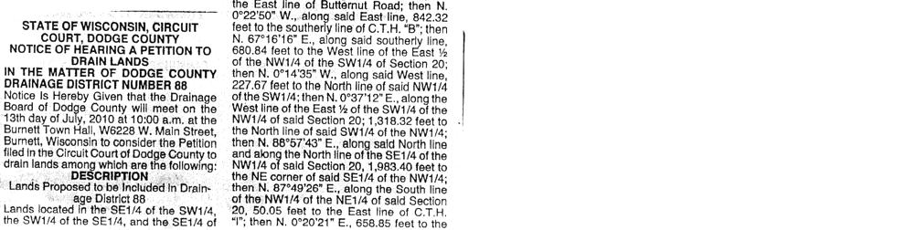
48 STATE OF WISCONSIN CIRCUIT COURT DODGE COUNTY IN THE MATTER OF DODGE COUNTY DRAINAGE DISTRICT NUMBER 88 NOTICE OF HEARING A PETITION TO DRAIN LANDS Notice Is Hereby Given that the Drainage Board of Dodge County will meet on the 13 th day of July, 2010 at 10:00 a.m. at the Burnett Town Hall, W6228 W. Main Street, Burnett, Wisconsin to consider the Petition filed in the Circuit Court of Dodge County to drain lands among which are the following: See Exhibit A attached. The Petition is subject to the inspection of all interested persons. A copy of the petition may be obtained at no cost by downloading from: All objections to the jurisdiction of the Drainage Board or to the sufficiency or legality of the Petition or any report or assessment or to the equity of any assessment or award of damages shall be filed with the Drainage Board in writing before the hearing and the objection shall be set forth clearly and in detail. All persons interested may appear and be heard on the Petition. Dated:, DODGE COUNTY DRAINAGE BOARD: By Robert Goetsch Joseph G. Sciascia Sciascia Law Office Attorney for Dodge County Drainage Board 218 E. Oak St., P.O. Box B Juneau, WI
49 ` DESCRIPTION Lands Proposed to be Included in Drainage District 88 Lands located in the SE¼ of the SW¼, the SW¼ of the SE¼, and the SE¼ of the SE¼ of Section 19; the NE¼ of the NE ¼, the NW¼ of the NE ¼, the SW¼ of the NE ¼, the SE¼ of the NE ¼, the SW¼ of the NW ¼, the SE¼ of the NW ¼, the NE¼ of the SW ¼, the NW¼ of the SW ¼, the SW¼ of the SW ¼, the SE¼ of the SW ¼, the NE¼ of the SE ¼, the NW¼ of the SE ¼, the SW¼ of the SE ¼, and the SE¼ of the SE ¼ of Section 20; the NW¼ of the NW¼ and the SW¼ of the NW¼ of Section 21; the NE¼ of the NE¼, the NW¼ of the NE¼, the SW¼ of the NE¼, and the NW¼ of the NW¼ of Section 29; the NE¼ of the NE¼, the NW¼ of the NE¼, the SE¼ of the NE¼, and the NE¼ of the NW¼ of Section 30; all in T. 12 N., R. 15 E., Town of Burnett, Dodge County, Wisconsin, more particularly described as follows: Commencing at the NE corner of said Section 20; then N '07" E., along the North line of Section 21, 1, feet to the NE corner of the NW¼ of the NW¼ of said Section 21; then S. 0 04'32"W., along the East line of said NW¼ of the NW¼, feet; then N '12" W., feet; then S. 4 45'52" E., 1, feet; then N '53" W., feet to the West line of the NW¼ of said Section 21; then S '54" W., feet; then S. 2 21'34" E., feet to the North line of C.T.H. B ; then S '22" W., along said North line, feet; then S. 0 13'31" W., along the West line of the East ½ of the NE¼ of the SE¼ and the East ½ of the SE¼ of the SE¼ of said Section 20 and their northerly extension, 2, feet to the South line of said SE¼ of the SE¼; then S. 0 08'28" E., along the West line of the NE¼ of the NE¼ of said Section 29, 1, feet to the South line of said NE¼ of the NE¼; then S '37" W., along said South line, feet to the SW corner of said NE¼ of the NE¼; then S. 0 09'45" E., along the East line of the SW¼ of the NE¼ of said Section 29, feet to the South line of the North ½ of said SW¼ of the NE¼; then S '12" W., along said South line, 1, feet more or less to the East line of C.T.H. I ; then Northerly along said East line, 1,327 feet more or less to the South line of Certified Survey Map 346; then N '42" E., along said South line, 208 feet more or less to the SE corner of said Map 346; then N. 0 12'18" W., along the East line of said Map 346, 208 feet more or less to the NE corner of said Map 346; then S '42" W., along the North line of said Map 346, 208 feet more or less to the East line of C.T.H. I ; then North along said East line, 421 feet more or less to the South line of Swan Road; then N '26" E.. along said South line, feet; then N. 0 07'12" W., along the East line of C.T.H. I and its southerly extension, feet to the South line of Certified Survey Map 4339; then N '32" E., along said South line, feet more or less to the East line of said Map 4339; then N. 0 10'08" E., along said East line, feet to the North line of said Map 4339; then S '57" W., along said North line, feet to the East line of C.T.H. I ; then N. 0 02'59" W., along said East line, feet; then S '16" W., along the South line of the North ½ of the SE¼ of the SW¼ of said Section 20 and its easterly extension, 1, feet to the East line of the SW¼ of the SW¼ of Section 20; then S. 0 06'21" E., along said East line, feet to the SE corner of said SW¼ of the SW¼; then S. 0 11'48" E., along the East line of the NW¼ of the NW¼ of Section 29, 1, feet to the SE corner of said NW¼ of the NW¼; then S ' 44" W., along the South line of said NW¼ of the NW¼, 1, feet to the East line of Butternut Road; then S. 0 11'17" E., along said East line, feet; then S '45" W., along the South line of the North ½ of the SE¼ of Page 1 of 3 Pages Exhibit - A
50 ` the NE¼ of Section 30 and its easterly extension, 1, feet to the West line of said SE¼ of the NE¼; then N. 0 07'08" W., along said West line, feet to the NW corner of said SE¼ of the NE¼; then S '55" W., 1, feet to the SE corner of the NE¼ of the NW¼ of Section 30; then N '00" W., along the South line of said NE¼ of the NW¼, 1, feet to the East line of Fir Road; then N. 0 02'54" W., along said East line, 1, feet; then N. 0 10'45" W., continuing along said East line, 1, feet to the southerly line of C.T.H. B ; then N '52" E., along said southerly line, 1, feet to the North line of the SE¼ of the SW¼ of Section 19; then S '16" E., along said North line, feet to the NE corner of said SE¼ of the SW¼; then N '08" E., along the North line of the SW¼ of the SE¼ and the North line of the SE¼ of the SE¼ of said Section 19, 2, feet to the centerline of Butternut Road; then N '02" E., feet to the East line of Butternut Road; then N. 0 22'50" W., along said East line, feet to the southerly line of C.T.H. B ; then N ' 16" E., along said southerly line, feet to the West line of the East ½ of the NW¼ of the SW¼ of Section 20; then N. 0 14'35" W., along said West line, feet to the North line of said NW¼ of the SW¼; then N. 0 37'12" E., along the West line of the East ½ of the SW¼ of the NW¼ of said Section 20; 1, feet to the North line of said SW¼ of the NW¼; then N '43" E., along said North line and along the North line of the SE¼ of the NW¼ of said Section 20, 1, feet to the NE corner of said SE¼ of the NW¼; then N '26" E., along the South line of the NW¼ of the NE¼ of said Section 20, feet to the East line of C.T.H. I ; then N. 0 20'21" E., feet to the North line of the South ½ of the said NW¼ of the NE¼; then N '58" E., along said North line, 1, feet to the East line of said NW¼ of the NE¼; then N. 0 19'34" E., along said East line, feet to the North line of said Section 20; then N '30" E., along said North line, 1, feet to the point of commencement. Excluding therefrom, the following described parcels: Exclusion 1: Lot 1, Dodge County Certified Survey Map 6049 located in the SE¼ of the NW¼ of Section 20, T. 12 N., R. 15 E. Exclusion 2: Lot 1, Dodge County Certified Survey Map 1003 and Lots 1 and 2, Dodge County Certified Survey Map 4268, all located in the NE¼ of the SW¼ of Section 20, T. 12 N., R. 15 E. Exclusion 3: Lands located in the NE¼ of the SW¼ of Section 20, T. 12 N., R. 15 E., Dodge County, Wisconsin, more particularly described as follows: Commencing at the South ¼ corner of said Section 20; then N. 0 10'08" E., along the East line of the NE¼ of the SW¼ of Section 20, 1, feet; then N '52" W., feet to the West line of C.T.H. I and the point of real beginning; then continuing N '52" W., feet; then N. 0 10'08" E., feet; then S '52" E., feet to the West line of C.T.H. I ; then S. 0 10'08" W., along said West line, feet to the point of real beginning. Page 2 of 3 Pages
51 ` Exclusion 4: Lands located in the NW¼ of the SE¼ of Section 20, T. 12 N., R. 15 E., Dodge County, Wisconsin, more particularly described as follows: Commencing at the SW corner of Lot 1, Dodge County Certified Survey Map 2635; then Northerly along the East line of C.T.H. I, 1,287 feet more or less to the South line of C.T.H. B ; then N '22" E., along said South line, feet; then S. 0 53'53" E., feet; N '05" E., feet to the West line of the East ½ of the NW¼ of the SE¼ of Section 20; then S. 0 11'16" W., along said West line, feet to the South line of said NW¼ of the SE¼; then S '23" W., along said South line, feet to the point of commencement. Page 3 of 3 Pages
52 AFFIDAVIT OF MAILING I certify that on June 8, 2010 I served by Mail, Postage Prepaid, Pursuant to Sec Wis. Stats. the Notice of Hearing A Petition To Drain Lands, Drainage District No. 88. Butterbrodt Trust 713 Hillcrest Drive Beaver Dam, WI Neal J. Steppich N6008 County Road G Beaver Dam, WI Lorraine C. Kittell N8076 Butternut Road John G. & Ruth B. Meylink W6090 Swan Road Marion Barsch W6857 County Road B Quack Club of Wisconsin Inc W. North Avenue Wauwatosa, WI Burnett 4-H Club, Inc. Registered Agent, Rose Woock W6255 Main Street Woock Living Trust W6277 Park Drive Karl E. & Coleen A. Schmitz P.O. Box 276 Dawn N. Pittman 2285 Golf Course Road Barnes, WI 54873
53 Randall O. & Rose Woock N8214 Cty. Tk I Kenneth & Gloria Woock W6277 Park Drive Kenneth W. Yerges W6713 County Road B Eleanor G. Kirchoff N8283 County Road I Charles R. Stickles W6735 County Road B Walter S. & Linda A. Burkhalter W6741 County Road B John & Audrey Ganske Trust N9334 County Road A Beaver Dam, WI Dodge County Antique Power Club, Inc. P.O. Box 416 Fox Lake, WI Dennis L. Giese W6500 County Road B Attorney Mark Hazelbaker Hazelbaker & Associates, S.C University Avenue Madison, WI Alton A. & Violet J. Hanefeld LE Gary A. & Ricky L. Hanefeld Pamela J. Pitzlin N8140 County Road I Burnette, WI 53922
54 Harry, Karen, Alvin J. Renae D., & Jacob Venhuizen W6409 Swan Road Glen Schroeder Lois A. Berndt N8054 County Road I Dave Russell Drainage Engineer Dept. of Agriculture, Trade and Consumer Protection P.O. Box 8911 Madison, WI Brian Field Dodge County Highway Commissioner 211 E. Center Street Juneau, WI Harold Johnson Chairman, County Highway Committee B ox 203, 616 North Street Brownsville, WI William Nass Chairman, Land Conservation Committee N1566 Hwy Watertown, WI Arnold Bashynski Chairman Dodge Co. Planning & Development & Parks Committee 244 Williams Street Randolph, WI Secretary, Department of Natural Resources P.O. Box 7921 Madison, WI Joyce Fiacco Dodge County Zoning Administrator 127 E. Oak Street Juneau, WI 53039
55 Robert Goetsch N6485 Highpoint Road Juneau, WI Joseph Roche N3504 Roche Road Columbus, WI Leonard Laufenberg N6426 Cty., Hwy V Iron Ridge, WI Joyce Fiacco Dodge County Zoning Administrator 127 E. Oak Street Juneau, WI SCIASCIA LAW OFFICE By: Subscribed and sworn to before me This day of July, Joseph G. Sciascia Notary Public, State of Wisconsin My Commission is Permanent.
56 Capital Newspapers Proof of Publication Affidavit Ad #: Price: $ Ad ID: Notice-Hrg. a Petition to Drain Lands Retain this portion for your records. Please do not remit payment until you receive your advertising invoice. Mail to: SCIASCIA LAW OFFICE Joseph Sciascia 218 E Oak St PO Box B Juneau, WI STATE OF WISCONSIN Dodge County PDAC ss. Patricia Helms being duly sworn, doth depose and say that he (she) is an authorized representative of Capital Newspapers, publishers of Daily Citizen a newspaper, in the city of Beaver Dam, in said County and State, and that an advertisement of which the annexed is a true copy, taken from said paper, was published therein on June 16th, 2010 June 23rd, 2010 June 30th, 2010 (Signed) (Title) Principal Clerk Subscribed and sworn to before me on Notary Public,, Wisconsin My Commission expires February 17th, 2013


57
Horner-McLaughlin Woods: Soil Types
 Horner-McLaughlin Woods: Soil Types Not present at HMW Adrian Muck Conover Loam 0-4% Slopes Houghton Muck Miami Loam 2-6% Slopes Miami Loam 6-12% Slopes Miami Loam 12-18% Slopes t 0 0.125 0.25 Miles Mary
2014 Iowa FFA Soil Judging CDE Exam
 2014 Iowa FFA Soil Judging CDE Exam 1. Landscape position is one aspect of evaluating the surface features of a certain tract of land. Identifying the correct landscape position will indicate: a. If the
2011 Wisconsin Envirothon Soils and Land Use Exam
 2011 Wisconsin Envirothon Soils and Land Use Exam USE THE OCONTO COUNTY SOIL SURVEY TO ANSWER QUESTIONS 1-4 The Pensaukee River Wetland Complex is a mixture of state (Pensaukee Wildlife Area) and privately
TAXONOMIC CLASS: Loamy-skeletal, mixed, mesic Vitrandic Durochrepts
 ESRM311/SEFS507 Important Soil Series in Seattle Area ALDERWOOD SERIES The Alderwood series consists of moderately deep, moderately well drained soils formed in glacial till. Alderwood soils are on glacially
2016 Iowa FFA Soils Evaluation CDE Exam
 2016 Iowa FFA Soils Evaluation CDE Exam 1. Which of the following is true regarding soil horizons? a. A horizon is darker in color and has more organic matter b. B horizon is darker in color and has more
IOWA FFA STATE SOILS CDE SATURDAY, OCTOBER 13, 2007 AMES, IOWA
 IOWA FFA STATE SOILS CDE SATURDAY, OCTOBER 13, 2007 AMES, IOWA 1. Moderately sloping has what percent slope: a. 9-14% b. 2-5% c. 5-9% d. over 14% 2. Which of the following horizons is the loose underlying
2012 FINAL SOILS AREA 2 Envirothon Questions Answer KEY
 2012 FINAL SOILS AREA 2 Envirothon Questions Answer KEY Questions 1-6 to be answered at the soil pit: 1. Soil scientists categorize soils by drainage classes. What is the drainage class of the soil at
2018 Iowa FFA Soil Judging CDE Exam 1. Landscape positions characterizes the location of the soil on the landscape and identifies potential risks.
 2018 Iowa FFA Soil Judging CDE Exam 1. Landscape positions characterizes the location of the soil on the landscape and identifies potential risks. Which landscape position is considered the floodplain
Iowa FFA Soil Career Development Event 2008
 Iowa FFA Soil Career Development Event 2008 1. In Iowa, corn suitability ratings for soil mapping units specifies a. natural weather conditions b. surface and subsurface drainage installed where needed
2 Older farm homes on the land
 2 Older farm homes on the land LAND RANCHES EXCHANGES This ranch consists of 70 +/_ acres of level farmland. Prime 13700 POWERHOUSE RD POTTER VALLEY agricultural land at an attractive price. This property
DO YOU KNOW YOUR SOILS? (Rev. 10/11)
") DO YOU KNOW YOUR SOILS? (Rev. 10/11) Circle all the correct answers. 1. What is the layer normally present on the surface of the soil in cropped fields? a. O c. Ap e. B g. R b. A d. E f. C 2. Available
DO YOU KNOW YOUR SOILS? (Rev. 10/11) Circle all the correct answers. 1. What is the layer normally present on the surface of the soil in cropped fields? a. O c. Ap e. B g. R b. A d. E f. C 2. Available
Soil Maps for Production Agriculture. Jarrod O. Miller, Extension Agronomist
 Soil Maps for Production Agriculture Jarrod O. Miller, Extension Agronomist Origination of Soil Mapping Originally mapped by Division of Soils Federal Bureau of Soils Soil Conservation Service (SCS) started
1. Position (2 pts.) 2. Parent Material (2 pts.) 3. Slope Characteristics (2 pts.) 4. Surface Stoniness or Rockiness (2 pts.)
 2. Parent Material (2 pts.) 3. Slope Characteristics (2 pts.) 4. Surface Stoniness or Rockiness (2 pts.)") Maryland Envirothon SOILS Exam Guidance Information (revised 2017) Objective: To test students' knowledge and awareness of basic soil science and its application in wise land-use planning and therefore
Maryland Envirothon SOILS Exam Guidance Information (revised 2017) Objective: To test students' knowledge and awareness of basic soil science and its application in wise land-use planning and therefore
Land Capability Classifications
 Land Capability Classifications Unit: Soil Science Problem Area: Basic Principles of Soil Science Student Learning Objectives. Instruction in this lesson should result in students achieving the following
2017 Iowa FFA Soil Judging CDE Exam
 2017 Iowa FFA Soil Judging CDE Exam 1. Landscape positions vary in soil composition and makeup. What landscape position would be characterized by having strata and lenses of different textures in the profile:
Section 1. Judging the soil pit (questions 1-4)
") CONNECTICUT ENVIROTHON 2009 SOILS QUESTIONS Please select the best response to the following questions. There are 25 questions; each question is worth 4 points. Section 1. Judging the soil pit (questions
CONNECTICUT ENVIROTHON 2009 SOILS QUESTIONS Please select the best response to the following questions. There are 25 questions; each question is worth 4 points. Section 1. Judging the soil pit (questions
Pits 1 & 3 Questions. 7. Subsurface: Texture (5 pts) A. Coarse B. Moderately course C. Medium D. Fine E. Very Fine
 A. Coarse B. Moderately course C. Medium D. Fine E. Very Fine") Minnesota Soils Scorecard Questions for Pits 1-4 Scantron # 105481 Use your soils scorecard to fill out the answers on your scantron Bubble in the front side of the sheet for Pit 1 (# 1-45) and Pit 2 (#51-95)
Minnesota Soils Scorecard Questions for Pits 1-4 Scantron # 105481 Use your soils scorecard to fill out the answers on your scantron Bubble in the front side of the sheet for Pit 1 (# 1-45) and Pit 2 (#51-95)
2016 Area 3 Envirothon Muskingum County Soils Test ANSWER KEY
 2016 Area 3 Envirothon Muskingum County Soils Test ANSWER KEY 1. The majority of the bedrock in Muskingum County is. a. sedimentary bedrock b. glacial bedrock c. igneous bedrock d. metamorphic bedrock
Overview of Soil Properties
 Willie Harris apatite@ufl.edu Acknowledgments: Wade Hurt Mike Vepraskas FAESS Soil Scientists Overview of Soil Properties Website to download files of talks: wgharris.ifas.ufl.edu.hsw.htm Meaning of Soil
Overview of Soil Properties
 Willie Harris apatite@ufl.edu Acknowledgments: Wade Hurt Mike Vepraskas FAESS Soil Scientists Overview of Soil Properties Website to download files of talks: wgharris.ifas.ufl.edu.hsw.htm Meaning of Soil
STATE TAX COMMISSION OF MISSOURI ASSESSOR MANUAL
 STATE TAX COMMISSION OF MISSOURI ASSESSOR MANUAL CHAPTER: REVISION DATE: 10/1/2008 Page 1 of 18 7.3 The purpose of this section of the Assessor s Manual is to supplement the State Tax Commission s published
Parent Material & some of Seattle s soils
 Parent Material & some of Seattle s soils ESRM 311/SEFS 507 Week 3 SOILS = f(cl, r, o, p, t) Parent Materials 1) Sedentary a) residual (bedrock weathered in place) b) organic 2) Transported by a) gravity
The Nature of Soil Soil Conservation Sustainable Ag.
 Chapter 6 & 7 The Nature of Soil Soil Conservation Sustainable Ag. Climate Soil Forming Factors Parent material Organisms Topography Time Value of Soil Soil is under appreciated Condition of soil affects
For Sale at $290,000.00
 We are pleased to present Stearns Property 77± Acres Forest Township, Rice County For Sale at $290,000.00 Listing Agent: Charles Wingert Office: 507-345-LAND (5263) Toll Free: 800-730-LAND (5263) Direct:
II We Fall-plow or Spring-plow
 II We Fall-plow or Spring-plow r,n Illinois? an JU L 11 R. S. SMITH, in Soil Physics and Soi' Survey., t lllii'vl\).. THE PROBLEM wl1'eth~ 0 f I-plow or to spring-plow IS an especially difficult one in
Topoclimate Southland Soil Technical Data Sheet No. 8. Sobig
 This Technical Data Sheet describes the typical average properties of the specified soil. It is essentially a summary of information obtained from one or more profiles of this soil that were examined and
Examining soils in the field. Examining soils in the field. Environment Agency thinksoils examining soils in the field
 Examining soils in the field thinksoils Examining soils in the field Environment Agency thinksoils examining soils in the field 31 Examining soils in the field 32 Environment Agency thinksoils examining
Topoclimate Southland Soil Technical Data Sheet No Waiau
 This Technical Data Sheet describes the typical average properties of the specified soil. It is essentially a summary of information obtained from one or more profiles of this soil that were examined and
AGRICULTURAL LAND CLASSIFICATION AND SOIL PHYSICAL CHARACTERISTICS LAND NEAR SHIRE HILL FARM SAFFRON WALDEN ESSEX
 AGRICULTURAL LAND CLASSIFICATION AND SOIL PHYSICAL CHARACTERISTICS LAND NEAR SHIRE HILL FARM SAFFRON WALDEN ESSEX AGRICULTURAL LAND CLASSIFICATION (ALC) AND SOIL PHYSICAL CHARACTERISTICS LAND NEAR SHIRE
Alluvium Bedrock Chemical Weathering Climate Glacial Till Loess Native Vegetation
 1 Alluvium Bedrock Chemical Weathering Climate Glacial Till Loess Native Vegetation Organic Matter Outwash Parent Material Physical Weathering Prairie Soils Timber Soils Topography 2 There are five primary
AGRICULTURAL LAND CLASSIFICATION AND SOIL PHYSICAL CHARACTERISTICS BIRCH PIT, NEAR COLCHESTER ESSEX
 AGRICULTURAL LAND CLASSIFICATION AND SOIL PHYSICAL CHARACTERISTICS BIRCH PIT, NEAR COLCHESTER ESSEX AGRICULTURAL LAND CLASSIFICATION AND SOIL PHYSICAL CHARACTERISTICS SEMI-DETAILED SURVEY BIRCH PIT, NEAR
Unit II Soil Management
 Unit II Soil Management Lesson 2: Using Soil Survey Manuals Soil survey manuals provide useful information for grassland management. Soil scientists evaluate the soil for chemical and physical properties,
ASCE - Philadelphia. Soils & Stormwater Management. Matthew C. Hostrander, CPSS, SEO Soil Scientist. Gilmore & Associates, Inc.
 ASCE - Philadelphia Soils & Stormwater Management Matthew C. Hostrander, CPSS, SEO Soil Scientist Gilmore & Associates, Inc. Course Overview COURSE OUTLINE Soil Science Fundamentals Discuss United States
Soil Horizons cont. Oa- highly decomposed Oi-undecomposed
 Soils Soil Basics Soil Horizons Soil Horizons cont. O Horizon: Or organic layer Organic layer of decomposing plant and animal tissue. Wooded upland areas have thin O horizons Wetlands may have thick O
Erosion and Deposition & Land Use. Erosion & Deposition 2/18/2016. Soil Conservation Safeguarding soil from depletion and/or deterioration
 Soils & Land Use ESRM311- SEFS507 Erosion and Deposition & Land Use Redmond Ridge & Snoqualmie Valley Erosion & Deposition Definitions of erosion and deposition Examples of erosion and deposition Examples
Soil types of lake county
 Soil types of lake county Ad Adrian muck This deep, level, very poorly drained organic soil is in depressional areas on the lake plain. It is subject to frequent flooding. Slope is generally less than
Soil Survey of San Luis Obispo County, California Paso Robles Area
 United States Department of Agriculture Soil Conservation Service In cooperation with University of California Agricultural Experiment Station Soil Survey of San Luis Obispo County, California Paso Robles
Soil Physical Properties
 Soil Physical Properties ESRM 311 SEFS 507 Some examples of mineral soil development eg, Rock Weathering Types of Weathering Physical/Mechanical Chemical Biological Photo by D Vogt CO 2 + H 2 O H 2 CO
STATEMENT OF PHYSICAL CHARACTERISTICS AND AGRICULTURAL LAND CLASSIFICATION
 STATEMENT OF PHYSICAL CHARACTERISTICS AND AGRICULTURAL LAND CLASSIFICATION BIRKWOOD FARM, ALTOFTS WEST YORKSHIRE Proposed Opencast Extraction of Clay and coal ADAS January 1990 Leeds Regional Office File
Land Capability Class
 Guide for Applying Conservation Treatments for Land Evaluation (5/23/2011) LAND TREATMENT After examining and determining the physical features of the soil profile, one can determine the land capability
PROPOSED OPEN CAST COAL SITE SEPTEMBER 1992
 AGRICULTURAL LAND CLASSIFICATION AND STATEMENT OF PHYSICAL CHARACTERISTICS SKIERS SPRING, HOYLAND, SOUTH YORKSHIRE PROPOSED OPEN CAST COAL SITE SEPTEMBER 1992 ADAS LEEDS STATUTORY GROUP Job No. 98/92 MAFF
Preliminary Soil Survey at N Fifikh Site
 Feasibility Study on Water Resources Development in Rural Area in the Kingdom of Morocco Final Report Volume VII Data Book Data Book SO Soil Survey SO2 Preliminary Soil Survey at N Fifikh Site Preliminary
Using Land Capability Classifications
 Lesson C7 2 Using Land Capability Classifications Unit C. Plant and Soil Science Problem Area 7. Soil Erosion and Land Management Lesson 2. Using Land Capability Classifications New Mexico Content Standard:
AGRICULTURAL LAND CLASSIFICATION AND STATEMENT OF PHYSICAL CHARACTERISTICS
 AGRICULTURAL LAND CLASSIFICATION AND STATEMENT OF PHYSICAL CHARACTERISTICS DALE PIT FARM. HATFIELD VOODHOUSE PROPOSED EXTRACTION OF SAND AHD GRAVEL ADAS April 1989 Leeds Regional office File Ref: 2FCS
Unknown 1. Unknown 2 TEXTURE ANALYSIS
 Unknown 1 Unknown 2 TEXTURE ANALYSIS 1 5 8 11 1 22 1 12 10 Parent Material & some of Seattle s soils ESRM 311/SEFS 507 Week 3 SOILS = f(cl, r, o, p, t) Parent Materials 1) Sedentary a) residual (bedrock
Team number Page 1 of Canon Envirothon Soils Station Test. Soils and Climate Change
 Team number Page 1 of 9 2006 Canon Envirothon Soils Station Test Soils and Climate Change There are many kinds of soil on the surface of the earth. The kind of soil that is present at a given location
Soils and Land Use Test
 SOIL PROPERTIES Total Score /50 1) List two of the five main functions of soil. (2 points) Habitat for organisms, Engineering medium, Filters and stores water, Anchor for plants, Cycles nutrients 2) Small
Sam Houston Ranger District West/Central WUI Fuels Reduction Project Soil and Water Resources
 Soil and Water Resources The Sam Houston National Forest has identified specific wildland urban interface (WUI) areas within Compartments 33, 36, 37, 49, 57, and 66 that contain high fuel loadings. This
Soils and the Environment. A Summary of RI Envirothon Study Materials Compiled by Sally Paul
 Soils and the Environment A Summary of RI Envirothon Study Materials Compiled by Sally Paul Why Soils Food and water resources Disposing of waste Support for human structures Growing timber and fibers
PHYSICAL CHAtlACTERISTICS REPORT FOR THE PROPOSED SAND AND GRAVEL SITE AT MANOR FARM, UFFINGTON
 PHYSICAL CHAtlACTERISTICS REPORT FOR THE PROPOSED SAND AND GRAVEL SITE AT MANOR FARM, UFFINGTON Introduction Following the" request for detailed information on the physical characteristics of soil at Manor
Photographs and Descriptions of Representative Pedons by Site
 Photographs and Descriptions of Representative Pedons by Site Site: A Classification: Typic Vitricryand Location: North-central edge of the park; Northwest over Scarface ridge from Lake Eleanor. Dominant
Agricultural Land Classification and Statement of Physical Characteristics Higbfield Farm Whitley Bridge North Yorkshire October 1996
 Agricultural Land Classification and Statement of Physical Characteristics Higbfield Farm Whitley Bridge North Yorkshire October 1996 Resource Planning Team ADAS Reference: 82/96 Leeds Statutory Group
Topoclimate Southland Soil Technical Data Sheet No. 76. Mossburn
 This Technical Data Sheet describes the typical average properties of the specified soil. It is essentially a summary of information obtained from one or more profiles of this soil that were examined and
Soil Interpretations Erosion and Sedimentation Control Planning and Design Workshop
 Soil Interpretations Erosion and Sedimentation Control Planning and Design Workshop Presented by Richard Brooks Presentation prepared by Kristin May Resource Soil Scientists USDA-Natural Resources Conservation
SUMMARY. alcholnie.doc\ih\jk
 SUMMARY A detailed Statement of Physical Characteristics and Agricultural Land Classification survey of ha of land at Stainton ("Holme Hall Quarry Extension") was carried out in September 1994. At the
Learning Objectives Part 1. Chapter 4 Soil Physical Properties. Soil Physical Properties. Color. Physical properties part 1
 Learning Objectives Part 1 Chapter 4 Soil Physical Properties Know what color tells you about a soil Describe the concept of soil texture and its importance Use the textural triangle to determine a soil
AY-362-W. INDIANA SOIL Evaluation Field Book. Don Franzmeier, Gary Steinhardt, Cathy Egler Purdue University Department of Agronomy
 AY-362-W INDIANA SOIL Evaluation Field Book Don Franzmeier, Gary Steinhardt, Cathy Egler Purdue University Department of Agronomy Table of Contents PREFACE 3 CHAPTER 1 Soil Formation, Soil Properties,
Soil Colors, Texture & Structure
 Application Soil Colors, Texture & Structure Limiting conditions Soil color type/depth of system Bedrock type/depth of system Soil texture, structure, percolation rate size and type of system Sara Heger,
MAFF Ministry of Ifinil Agriculture Rsheries and Food
 MAFF Ministry of Ifinil Agriculture Rsheries and Food STATEMENT OF PHYSICAL CHARACTERISTICS AND AGRICULTURAL LAND CLASSIFICATION SHILBOTTLE COLLIERY RECLAMATION SCHEME NORTHUMBERLAND DECEMBER 1994 ADAS
List of Equipment, Tools, Supplies, and Facilities:
 Unit A: Principles of Soil Lesson 4: Formation of Soil Student Learning Objectives: Instruction in this lesson should result in the students achieving the following objectives: 1. Identify 5 factors involved
A GUIDE FOR LAND JUDGING IN MICHIGAN. D. L. Mokma, E. Dersch and D. Kesselring
 A GUIDE FOR LAND JUDGING IN MICHIGAN D. L. Mokma, E. Dersch and D. Kesselring Michigan State University in cooperation with the Michigan Chapter of the Soil and Water Conservation Society The study of
STATEMENT OF PHYSICAL CHARACTERISTICS AND AGRICULTURAL LAND CLASSIFICATION WITTON PARK, COUNTY DURHAM PROPOSED QUARRY EXTENSION DECEMBER 1992

In 1983, the town evacuated and purchased by government for $36 million
 1 2 3 4 5 6 7 8 9 Introduction to Environmental Geology, 5e Chapter 17 Soil and Environment Weathering: summary in haiku form Rocks brought to surface decompose to sediment and that's weathering. Case
SOILS IN URBAN / SUBURBAN LANDSCAPES. Lisa Krall Soil Scientist CT USDA NRCS Tolland, CT
 SOILS IN URBAN / SUBURBAN LANDSCAPES Lisa Krall Soil Scientist CT USDA NRCS Tolland, CT What is Urban Soil? Is This Soil? Is This Soil? active gravel pit pavement and buildings vegetated roadside areas
When planning stormwater management facilities, the following principles shall be applied where possible.
 2.0 Principles When planning stormwater management facilities, the following principles shall be applied where possible. 2.0.1 Drainage is a regional phenomenon that does not respect the boundaries between
APPENDIX A SIMPLIFIED APPROACH TO STORMWATER MANAGEMENT FOR SMALL PROJECTS. In West Sadsbury Township, Chester County, Pennsylvania
 APPENDIX A SIMPLIFIED APPROACH TO STORMWATER MANAGEMENT FOR SMALL PROJECTS In West Sadsbury Township, Chester County, Pennsylvania TABLE OF CONTENTS I. Introduction 3 II. Importance of Stormwater Management
SOIL DATA: Avondale. in Allen, TX. This information was taken from NRCS web soil survey of Collin County, Texas.
 SOIL DATA: Avondale in Allen, TX This information was taken from NRCS web soil survey of Collin County, Texas. United States Department of Agriculture Soil Conservation Service in cooperation with Texas
Area 3 Envirothon Soils Questions Key
 Area 3 Envirothon Soils Questions Key 1. Soil aeration is the exchange of air in soil with air from the atmosphere. When a soil is well aerated, the air within the soil is very similar to the atmosphere
City of Stoughton Erosion Control Permit Application (effective 2/6/2018)
") City of Stoughton Erosion Control Permit Application (effective 2/6/2018) Incomplete applications will not be accepted Project Name: Address of subject property: Landowner Name(s): Applicant Name: Landowner
City of Stoughton Erosion Control Permit Application (effective 2/6/2018) Incomplete applications will not be accepted Project Name: Address of subject property: Landowner Name(s): Applicant Name: Landowner
Topoclimate Southland Soil Technical Data Sheet No. 11. Pukemutu
 This Technical Data Sheet describes the typical average properties of the specified soil. It is essentially a summary of information obtained from one or more profiles of this soil that were examined and
Post Construction BMPs
 Post Construction BMPs Why are Post Construction BMPs important? With increased development brings the increase of impervious cover Parking lots, rooftops, driveways Storm water runoff volume increases
During the field surveys, several species of wading birds and ducks were observed using permanently ponded areas.
 Preliminary Engineering / Environmental Impact Statement Northwest Corridor LRT Line to Irving and DFW Airport During the field surveys, several species of wading birds and ducks were observed using permanently
CHECKLIST BMPs for FIELD NURSERIES REGULATIONS, SITE SELECTION, WATER MANAGEMENT
 CHECKLIST BMPs for FIELD NURSERIES REGULATIONS, SITE SELECTION, WATER MANAGEMENT Regulations For information on the Wetlands Protection Act or the Water Management Act, contact the Massachusetts Department
URBAN SOILS & SEATTLE EXAMPLES
 Class Results - Mystery Soil #1 14 12 10 8 6 4 2 0 Sandy Clay Loam Sandy Loam Silty Loam Class Results - Mystery Soil #2 6 5 4 3 2 1 0 Silty Clay Clay Loam Sandy Sandy Silty Sandy Silty Loamy Loam Clay
SOIL CHARACTERIZATION USING DIAGNOSTIC PROPERTIES
 SOIL CHARACTERIZATION USING DIAGNOSTIC PROPERTIES The following are the characters of the pedologically important properties used in categorizing soils: SOIL CHARACTERIZATION Soil Profile Description:
CORNFORTH EAST QUARRY COUNTY DURHAM
 CORNFORTH EAST QUARRY COUNTY DURHAM AgricuUural Land Classification (ALC) and Statement of Physical Characteristics Report and Map MARCH 1999 Resource Planning Team RPT Job Number: 5/99 Northern Region
Soil resources in upper Basho Valley.
 Soil resources in upper Basho Valley. Åge A. Nyborg, 2007 Norwegian Forest and Landscape Institute. Soil management challenges in Upper Basho Valley Low nutrient content, low organic matter content, deficient
LAND JUDGING AND SOIL EVALUATION
 LAND JUDGING AND SOIL EVALUATION June 1998 W. J. Edmonds, P. J. Thomas, T. W. Simpson, and J. C. Baker Virginia Polytechnic Institute and State University Department of Crop and Soil Environmental Sciences
3. What are the five master horizons? Give distinguishing features of each. 5. List three means by which plant roots come into contact with nutrients.
 Study Questions Exam 1 1. What are the four general components of soil? 2. Define regolith and solum. 3. What are the five master horizons? Give distinguishing features of each. 4. What is meant by an
CB1 Moderately undulating landscape with slight gilgai (few inches) formation: broad ridge tops and upper slopes of moderately shallow grey cracking
 formation: broad ridge tops and upper slopes of moderately shallow grey cracking") CB1 Moderately undulating landscape with slight gilgai (few inches) formation: broad ridge tops and upper slopes of moderately shallow grey cracking clays (Ug5.22 and Ug5.23). Associated are: (i) some
CB1 Moderately undulating landscape with slight gilgai (few inches) formation: broad ridge tops and upper slopes of moderately shallow grey cracking clays (Ug5.22 and Ug5.23). Associated are: (i) some
RAIN GARDEN ILLINOIS URBAN MANUAL PRACTICE STANDARD. (feet) CODE 897 DEFINITION
 CODE 897 DEFINITION") ILLINOIS URBAN MANUAL PRACTICE STANDARD RAIN GARDEN (feet) CODE 897 Source: Kendall County Soil and Water Conservation District DEFINITION Rain gardens are small, shallow, flat bottomed depressions constructed
ILLINOIS URBAN MANUAL PRACTICE STANDARD RAIN GARDEN (feet) CODE 897 Source: Kendall County Soil and Water Conservation District DEFINITION Rain gardens are small, shallow, flat bottomed depressions constructed
SOIL EROSION AND SEDIMENT CONTROL
 SOIL EROSION AND SEDIMENT CONTROL SECTION 1: AUTHORITY, TITLE AND PURPOSE 11. STATUTORY AUTHORIZATION This ordinance is adopted pursuant to the provisions of the Federal Water Pollution Control Act 86
SUBSURFACE DRIP DISPERSAL OF EFFLUENT for LARGE SYSTEMS. Presented by: David Morgan and Rodney Ruskin
 SUBSURFACE DRIP DISPERSAL OF EFFLUENT for LARGE SYSTEMS Presented by: David Morgan and Rodney Ruskin Program Map Making Program Soil Parent material, Relief, Time. Organisms, Color, Texture, Depth, Profile
Field Indicators of Hydric Soils in the United States: For All Soils. Field Indicators. Indicators for all soils regardless of texture
 Field Indicators of Hydric Soils in the United States: For All Soils From Vasilas, L.M., G.W. Hurt, and C.V. Noble. 2010. Field indicators of hydric soils in the United States (Version 7.0), USDA, NRCS,
This definition is from the Soil Science Glossary (Soil Science Society of America).
.") What is Soil? This definition is from the Soil Science Glossary (Soil Science Society of America). soil - (i) The unconsolidated mineral or organic material on the immediate surface of the earth that serves
What is Soil? This definition is from the Soil Science Glossary (Soil Science Society of America). soil - (i) The unconsolidated mineral or organic material on the immediate surface of the earth that serves
September 20, 2016 Soils Investigation for Agricultural Designation Windemere Place, Missoula County, Montana
 September 20, 201 Soils Investigation for Agricultural Designation Windemere Place, Missoula County, Montana The purpose of this report is to compare on-site soils of the proposed subdivision with the
AGRONOMY 255, 251, 270 SOIL DIFFERENCES
 Name AGRONOMY 255, 251, 270 SOIL DIFFERENCES Soils differ strikingly from each other. This week we illustrate the great differences and ask you to learn how they differ and to become skilled in describing
AGRICULTURAL USE & QUALITY OF LAND NEAR MINDALE HOUSE PRESTATYN. Report 762/1
 AGRICULTURAL USE & QUALITY OF LAND NEAR MINDALE HOUSE PRESTATYN Report 762/1 11 th April, 2012 AGRICULTURAL USE & QUALITY OF LAND NEAR MINDALE HOUSE PRESTATYN F W Heaven, BSc, MISoilSci Report 762/1 Ltd
Loam: About 40% sand, 40% silt, 20% clay. Mixture of pore sizes to balance water retention and aeration. Considered the best soil for growing crops.
 Soil Characteristics Soil is formed from a combination of two Primary sources: Weathering of Parent Rock ( ) = material introduced by plants, animals, and decomposers Minor sources: Nutrients incorporated
Topoclimate Southland Soil Technical Data Sheet No. 23. Waikiwi
 This Technical Data Sheet describes the typical average properties of the specified soil. It is essentially a summary of information obtained from one or more profiles of this soil that were examined and
Agricultural Science II Soil Science Soil Structure 50 minutes
 Student Outcome Course Unit Lesson Estimated Time Agricultural Science II Soil Science Soil Structure 50 minutes Explain the importance of soil structure. Learning Objectives 1. Explain the term soil structure
Soil Characterization Protocol
 Soil Characterization Protocol Purpose To characterize the physical and chemical properties for each horizon in a soil profile and prepare samples for further analysis Overview Students identify the horizons
Mature basalt volcanic soils
 MANAGING NORTHLAND SOILS Mature basalt volcanic soils 8.1.2 Soil types in this group Kerikeri friable clay (KE) Kerikeri friable clay with large boulders (KEb) Matarau friable clay (MC, MCH*) Matarau friable
SITE ASSESSMENT AND SEPTIC EVALUATION FOR JASON & JANET THATCHER 201 N. SPRAGUE AVED KINGSTON, PA 18704
 DATE: December 13, 2010 N.H. LICENSED DESIGNER OF SUBSURFACE DISPOSAL SYSTEMS 216 Hill Road Phone & Fax: 934-6206 Franklin, NH 03235 Cell: 393-3085 SITE ASSESSMENT AND SEPTIC EVALUATION FOR JASON & JANET
If you are not able to turn in your notebook see me or Dan ASAP
 Notebook Collection Collecting hard copies now OR Electronic versions using Catalyst drop box Due by 5:30 pm today Use website for link If you are not able to turn in your notebook see me or Dan ASAP URBAN
SMALL PROJECTS SIMPLIFIED APPROACH
 SMALL PROJECT APPLICATION AND STORMWATER MANAGEMENT DESIGN ASSISTANCE MANUAL FOR SMALL PROJECTS IN FULTON TOWNSHIP LANCASTER COUNTY, PENNSYLVANIA SMALL PROJECTS SIMPLIFIED APPROACH Prepared By: Light-Heigel
Land Judging and Homesite Evaluation Guidebook
 Land Judging and Homesite Evaluation Guidebook Kansas State University Agricultural Experiment Station and Cooperative Extension Service INTRODUCTION The study of land and its wise use should be important
Geology & Soils. Appendix B. Geology & Soils
 Appendix B Geology & Soils Geology & Soils A nation that destroys its soils destroys itself. Forests are the lungs of our land, purifying the air and giving fresh strength to our people. Franklin Delano
Urban Conservation Practice Physical Effects ESTABLISHMENT, GROWTH, AND HARVEST NUTRIENT MANAGEMENT
 NOT WELL 800 - Urban Stormwater Wetlands A constructed system of shallow pools that create growing conditions for wetland plants to lessen the impacts of stormwater quality and quantity in urban areas.
Soil Structure, Density, and Porosity. Laboratory #4
 Soil Structure, Density, and Porosity Laboratory #4 Objectives Understand the concept of soil structure and how it differs from soil texture. Understand how soil structure influences other soil properties.