CAMPUS PHYSICAL FRAMEWORK VISION
|
|
|
- Hortense Bates
- 5 years ago
- Views:
Transcription
1 0 UNIVERSITY Area Studies OF OREGON CAMPUS PHYSICAL FRAMEWORK VISION

2 B B UNIVERSITY OF OREGON CAMPUS PHYSICAL FRAMEWORK VISION PURPOSE AND PUBLIC OUTREACH

3 The University of Oregon Campus Physical Framework Vision (UOCPFV) presents a comprehensive physical structure for the campus. This document is a resource to the university s Campus Plan. It provides greater specificity to inform decisions, to accommodate growth and change, and to ensure enhancement of the beauty, legacy, and function of the campus The UOCPFV identifies a campus framework of open spaces and pedestrian connectors. The landscape-centric focus builds on the campus s cultural landscape heritage, first envisioned more than a century ago by Ellis Lawrence, campus architect, and Fred Cuthbert, campus landscape architect, and manifested in bold landscape treatments such as the Old Campus Quadrangle and the Memorial Quadrangle. Recommendations from the UOCPFV may lead to updates to the Campus Plan 15 March 2016 UNIVERSITY OF OREGON CAMPUS PHYSICAL FRAMEWORK VISION FOREWORD
4 D FOREWORD By intent, university campuses are collegial. Each is a community interconnected in its mission to gather, create, and distribute knowledge. The ideal of campus planning and design is to define a physical framework vision for an intellectual, social, and cultural environment that supports an institution s academic, research, and community mission. Properly conceived and nurtured, this vision promotes a strong sense of place a sense of belonging for current and future generations. Physical framework visions do this by addressing the unique character of a campus. They reinforce a shared identity bound by purpose and culture. Early campus planning in the United States produced physical visions that have endured for decades. The best exemplified an institution s mission and setting. The physical character of their plans conveyed the aspirations of the institution and took inspiration from the locale and region. For example, Frederick Law Olmsted s plan for the College of California, now the University of California, Berkeley, established a strong open space system and building areas that created a dominant axial view to the Golden Gate. This plan, devoid of specific buildings, provided a framework for generations of planners and designers. Thoughtful campus leaders are reassessing the values that foster their campus culture and unique sense of place. And many universities are reexamining their campuses, to understand the essential elements of their physical makeup and how to best link their academic mission with the campus physical framework. Beauty is no longer disdained but sought as characterizing a place that is both attractive and useful. In the 21st Century, the physical campus and its beauty is increasingly important to academic life as a way to balance the reliance on digital, remote, and simulated communication. At the same time, the need to lessen environmental impacts requires universities to think differently about physical infrastructure. They are applying greater scrutiny to the need to build, employing innovative strategies to new development, and taking a systematic view of campus energy consumption, carbon emissions, water use, storm-water runoff, and support of ecosystem. Additionally, universities are tying physical framework visions to capital financing strategies. The University of Oregon is housed on a mature 295-acre campus. The university s 2005 Campus Plan (updated in 2011 and amended in 2014) outlines a series of procedures and policies to use as development projects are designed and executed. The Campus Plan sets a framework intended to protect and expand the best parts of the campus environment while allowing the development of new facilities as academic needs are identified and funded. Mature stands of fir trees and views of near and distant wooded hills lend an unique character to the campus. The existing openspace framework is a hallmark of the University of Oregon campus. It consists of interconnecting quadrangles, greens, and courtyards, all reinforced by the placement of buildings. This comprehensive Campus Physical Framework Vision further defines and expands the open spaces, defines where activities are placed on campus, addresses issues of density and capacity, and defines locations for new buildings. Campuses change. It is inevitable. Change within a shared physical vision will enhance the University of Oregon s identity, maximize its resources, and direct its investments to the benefit of current and future generations. UNIVERSITY OF OREGON CAMPUS PHYSICAL FRAMEWORK VISION FOREWORD
5 i TABLE OF CONTENTS Page 1 EXECUTIVE SUMMARY 1 Project Objectives 2 Principles/Values and Campus Themes 2 Process 3 Key Findings 3 MyCampus Survey 4 Analysis and Planning Considerations 5 Campus Framework 6 Guidelines 7 Design Area Recommendations 8 Campus Systems 9 2 CAMPUS FRAMEWORK 11 4 DESIGN AREA RECOMMENDATIONS 51 Campus Landscape 52 Landscape Ecology Strategies and Desired Outcomes 52 North Design Area 54 West Design Area 59 Central Design Area 64 East Design Area 69 5 FOCUS STUDIES 75 Garden Walk in North Design Area 76 Campus Heart 80 Garden Walk in Central Design Area 84 University Street 88 7 FURTHER RECOMMENDATIONS 105 Recommended Changes to the Campus Plan 105 Government Approvals and Outside Coordination 105 Future Studies 105 Recommended Priority Projects 106 Peer-Review Process CONTRIBUTORS 109 Advisory Group to the Framework Vision Project 109 Campus Planning Committee 109 Campus Planning, Design, and Construction 109 InfoGraphics Lab, Department of Geography 110 Campus Physical Framework Vision Consultants GUIDELINES 15 Edges, Corridors, Gateways, and Views 16 Design Areas 20 Coverage 22 Campus Boundary 24 Permissible Building Sites 26 Permissible Uses 27 Program Use Definitions 28 Permissible Building Sites Table 29 Permissible Building Heights 30 Shared Uses 31 Parking Structure Locations 32 Sections 33 6 CAMPUS SYSTEMS 93 Pedestrian Circulation 94 Bicycle Circulation 96 Vehicle Circulation 98 Service Circulation 100 Emergency Circulation 102 Utilities Infrastructure 104 APPENDIX Separate from this document. A Coverage and Capacity B MyCampus Survey C Analysis D Meeting Notes UNIVERSITY OF OREGON CAMPUS PHYSICAL FRAMEWORK VISION TABLE OF CONTENTs

6 ii UNIVERSITY OF OREGON CAMPUS PHYSICAL FRAMEWORK VISION TABLE OF CONTENTS
7 1 1 CALENDAR PROCESSES + PRODUCTS COMMITTEES ENGAGEMENT +OUTREACH FALL TERM WINTER TERM SPRING TERM SUMMER TERM FALL TERM SEP-DEC 14 JAN 15 FEB MAR APR MAY JUN JUL AUG SEP OCT NOV DEC JAN 16 PRINCIPLES/VALUES + PROJECT THEMES Advisory Group Meeting DUE DILIGENCE + ANALYSIS 1/26 Public Open House 2/16 2/17 Advisory Group Meeting CPC Meeting 1/26 CPC PROJECT ELEMENTS Design Concepts Open Space Framework Design Areas Evaluate Space Needs Plan Areas of Use Density Standards Zoning & Land Use Campus Plan Policies 4/8 INITIAL ALTERNATIVES Advisory Group Meeting CPC 5/29 MyCampus Survey Resource Groups, Focus Groups, and Input from other On- and Off-Campus Interested Parties REFINED ALTERNATIVE FINAL RECOMMENDATIONS Campus-scale Recommendations Final Density Analysis Concepts for Four Design Areas Identify High Priority Projects Campus Plan Revisions TBD Advisory Group Meeting CPC Meeting Meeting 4/8 Meeting 5/28 TBD Public Open House 10/30 10/29 11/5 11/9 11/10 PRODUCTS Illustrative Plan Open Space Plan Guidelines Edges/Gateways Campus Zoning Campus Development Sites Campus Systems Design Areas Density Studies Zoning Recommendations Campus Plan Changes EXECUTIVE SUMMARY The University of Oregon Campus Physical Framework Vision (UOCPFV) presents a comprehensive physical structure of the campus. This consultant-prepared document, developed over 14 months, is a resource to the university s Campus Plan. It provides greater specificity to inform decisions to accommodate growth and change, and to ensure the enhancement of the campus s beauty, legacy, and functionality. The fundamental question this study sought to answer was: Can the campus accommodate growth while respecting and enhancing its beauty and culture demonstrated in its landscape and ensemble of buildings? The UOCPFV identifies campus open spaces and pedestrian connectors, the placement and uses of buildings, and support systems. The UOCPFV s landscape-centric focus builds on the campus s cultural landscape heritage first envisioned more than a century ago by Ellis Lawrence and manifested in the campus by bold landscape treatments such as the Old Campus Quadrangle and Memorial Quad. Recommendations from the UOCPFV would require updates to the Campus Plan (and in some cases, City Land Use Code amendments). UNIVERSITY OF OREGON CAMPUS PHYSICAL FRAMEWORK VISION EXECUTIVE SUMMARY
8 2 PROJECT OBJECTIVES Develop campus-wide planning-design concepts and their application to a discrete number of design areas. Evaluate Campus Plan open space typologies, standards, requirements, and needs. Examine existing Campus Plan design areas and recommend changes. Evaluate the application of the four scenarios from the Space Needs Plan to determine whether additional land is needed and/or determine whether changes are needed to the Space Needs Plan. Include building footprints and opportunities for additions to existing buildings. Consider areas of use (e.g., adjacencies and agglomerations of uses within discernible districts or zones). Evaluate the Campus Plan density standards and recommend changes in relation to potential revisions to open space and density standards, design areas, and Space Needs Plan. Determine whether City zoning and/or land use changes are required to meet recommendations and objectives. Recommend changes to the Campus Plan policies and standards to achieve these objectives. PRINCIPLES/VALUES AND CAMPUS THEMES Principles /Values The University of Oregon campus in Eugene supports the University Mission Statement by Being accessible, safe, and welcoming to foster social and academic collaboration a responsibility shared by open space and buildings. Enhancing identity through memorable places embodied by its high-quality open space system, distinctive cultural heritage, architecture, and unique location. Being a residential campus a second home for its students. Integrating ecological care into all aspects of campus life, practices, and operations. Being distinctive in character and, yet, connected and welcoming to its neighbors. Providing an extension of the learning environment in mind, body, and spirit. Campus Themes Applying Principles/Values to the campus s physical environment Open space framework comprised of Connected series of open spaces Quadrangles, courts, axes, and greens Campus access giving priority to Pedestrians first Entire community Campus linkages to Millrace Research Park River Autzen Stadium Complex EWEB, Downtown, Walnut Station, Glenwood Edges that serve as Transitional space between uses Blend the margins Good neighbors to adjacent uses Loose fit long life (growth and flexibility) to Meet space needs Allow flexible use Engage and celebrate the Millrace and Willamette River to Be an educational resource Restore the Millrace and the Willamette River edge Accommodate campus uses Be a functional storm-water system Be a living laboratory UNIVERSITY OF OREGON CAMPUS PHYSICAL FRAMEWORK VISION EXECUTIVE SUMMARY
9 3 PROCESS The 14-month planning process included four work sessions with the Campus Planning Committee and the Advisory Group that the university created for the UOCPFV. The four work sessions addressed Scope, Schedule, Products, Principles, Values and Themes, and Ecological and Sustainable Planning Analysis, Planning Considerations, Framework Refined alternatives Final Recommendations The university conducted an on-line survey and held open houses for the campus community and neighbors as well as five public outreach sessions with interested on-campus groups and campus neighbors. KEY FINDINGS 1. The campus has excess capacity for the projected program needs to accommodate 34,000 full time equivalent (FTE) students. 2. The campus can meet expansion needs by building upon the established and well-functioning campus framework of open spaces and pedestrian connectors. 3. Implementing better tools along with strong leadership will be needed to guide growth and change on the campus. Capacity Findings Infill opportunities exist in the established areas of the campus, achievable without compromising the campus s beauty and function. Land north of the railroad tracks is only needed for playing fields. While the university needs some of the area in North Design Area between the railroad tracks and Franklin Boulevard, a large portion of the land is not needed to meet the 34,000 student enrollment. This may offer a significant opportunity to the university for partnerships or as a land bank for unforeseen future program needs. Only a minor portion of the Walnut Station area (Romania etc.) is needed; it too offers a significant opportunity. Building north of Franklin Boulevard will initially challenge the culture within and among departments; this will be remedied over time as the area develops. Campus Framework Findings Open space and pedestrian connectors are the key elements of the campus framework. The campus framework will create a cohesive campus as the university expands north of Franklin Boulevard connecting to Willamette River and east of Agate Street gracefully transitioning to Villard Street. The university needs to present a positive image along the campus edges and corridors. The university has the opportunity to create pedestrian-first zones on East 13th and 15th avenues between Kincaid and Agate streets while maintaining University Street for auto access. Creating a large heart-of-campus space will generate a shared focal point for the campus community. Safely crossing Franklin Boulevard is a challenge. Implementation Findings The majority of the UOCPFV can be assimilated into the existing Campus Plan, guided and enforced using that policy document. There are minimal funds for the improvements that are not directly associated with building projects; these include changes to East 13th and 15th avenues and the pedestrian bridge across Franklin Boulevard. Moving to structured parking to create pedestrian zones, open space, and building sites is an essential and expensive strategy which also lacks a funding source. Additional analysis is needed to guide implementation, especially in the area of transportation and parking. Working with the City of Eugene it may be possible to create a city park at the river s edge in exchange for city-owned land useful to the university. UNIVERSITY OF OREGON CAMPUS PHYSICAL FRAMEWORK VISION EXECUTIVE SUMMARY


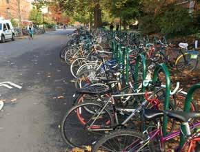
 Biking (4)")
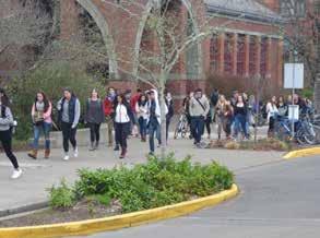
10 MYCAMPUS SURVEY The University of Oregon Graphics Information Lab worked with the consultant team to implement an on-line survey soliciting input from students, faculty, staff, and the public. Using campus maps and written comments, the survey provided valuable information about how people use the campus. Participants located specific areas of campus (interior and exterior) according to specific activities. MyCampus Places addressed the following activities Where you typically enter campus Places where you eat Areas where you study or work Areas where you like to socialize Favorite indoor places Favorite outdoor places (gardens, lawns, courtyards, etc.) (1) Memorable or iconic places (2) Outdoor places that need improvement Areas that are difficult to navigate MyCampus Routes addressed circulation through campus by mode of travel Walking (3) Biking (4) Skateboarding Mobility Assisted (wheelchair, guide dog, cane, etc.) Para-transit/Shuttle Car See Appendix B: MyCampus Survey. UNIVERSITY OF OREGON CAMPUS PHYSICAL FRAMEWORK VISION EXECUTIVE SUMMARY

, the condition-quality of the current designated open spaces, and the watershed patterns")


 based on two integrated systems: improved connections to and within")
11 ANALYSIS AND PLANNING CONSIDERATIONS The qualitative analysis tested past assumptions and brought to light pertinent determinants to form the Campus Framework. The analysis included context and zoning, ownership of large land holdings near the campus, the existing open space pattern), the condition-quality of the current designated open spaces, and the watershed patterns through the campus and surrounding areas. See Appendix C: Miscellaneous Analysis and Studies. Planning Considerations addressed Connectivity - Unifying the campus, physical linkages, community access, moving people, services infrastructure, views in and out. Activity - Campus life, programmable and functional space, gathering areas, day-to-day outdoor classrooms, research lands, social-athletic areas. Identity - Defining character, Oregon landscape, heritage trees, iconic spaces-architecture, campus community. Growth and Unification (1) - Building on the existing desire lines and open space structure and connecting the Eugene Buttes to the Willamette River. Preliminary Framework The analysis of campus character, open space (2), circulation patterns (3), and context led to a preliminary campus framework (4) based on two integrated systems: improved connections to and within the campus and an improved designated open space system. The concept of a garden walk of an unique and intimate character (5) emerged as means to unify the campus off the orthogonal campus grid. UNIVERSITY OF OREGON CAMPUS PHYSICAL FRAMEWORK VISION EXECUTIVE SUMMARY
12 6 CAMPUS FRAMEWORK The Campus Framework is comprised of Designated Open Space (DOS) and Connectors the physical image of the campus. Together, they dictate the arrangement of buildings. They comprise a single system. See Chapter 2: Campus Framework. UNIVERSITY OF OREGON CAMPUS PHYSICAL FRAMEWORK VISION EXECUTIVE SUMMARY
13 7 1 2 GUIDELINES These support the structure and intent of the Campus Framework. They guide campus development from the overall campus to specific building sites. 3 4 X-1 X-2 SW-1 SW-2 W-1 W-2 W-4 W-5 W-7 W-6 W-8 SW-3 SW-4 N-1 W-9 N-2 W-3 W-10 W-12 W-11 N-3 N-5 N-4 N-6 N-7 F-1 F-3 F-2 C-1 C-2 C-3 C-4 C-5 N-8 E-5 E-4 E-7 E-8 E-9 * E-10 N-9 E-6 E-12 NOTE: The facades and massing of all new buildings facing designated open space and connectors will follow the established orthogon grid of the campus as this is the one of the unifying characterist of the campus. WA-1 WA-2 Permissible Building Sites and Guidelines * Permissible Building Sites Regulatory Setback Upper Floor Setback Many Nations' Longhouse Solar Views GE Buildings Removed Graceful Edge 7 Minute Walk Guidelines address Edges, Corridors, Gateways, and Views (1) Design Areas (2) Design Areas Coverage Campus Boundary (3) Permissible Building Sites (4) Permissible Uses Information for each permissible building site scenario, use, gross square feet, height, etc. (5) Shared uses Parking structures Sections address a variety of interface conditions between open space, connectors, public roadways, and permissible building sites (6) See Chapter 3: Guidelines. E-11 University of Oregon Campus Physical Framework Vis University of Oregon Campus Planning Design and Constru Robert Sabbatini AICP FASLA, PLACE, Perkins missible Building Scenario Primary Use Secondary Use No. Floors Footprint (GSF) ding Site 5 Number 6 N023 5 Flexible Use Flexible Use 4 13,200 52,6 N025 1 Student Health/Counseling N/A 2 29,500 59,0 N022 2 Student Union N/A 4 19,000 76,0 N031 4 Academic N/A 4 47, ,4 N032 3 Academic N/A 5 36, ,0 N033 5 Flexible Use Flexible Use 2 23,500 47,0 N034 3 Student Recreation N/A 3 62, ,6 N035 5 Flexible Use Flexible Use 4 17,000 68,0 0 N047 2 On Campus Residence Halls N/A 4 19,400 77,6 1 N048 5 Flexible Use Flexible Use 4 18,000 72,0 2 N049 3 On Campus Residence Halls N/A 4 23,000 92,0 2 N050 5 Flexible Use Flexible Use 4 13,200 52,8 N036 4 Academic N/A 4 3,900 15,6 N038 3 Museums N/A 1 4,400 4,4 N039 4 Academic N/A 3 9,500 28,5 N037 2 Museums N/A 2 11,900 23,8 N040 4 On Campus Residence Halls N/A 4 12,800 51,2 N041 4 On Campus Residence Halls N/A 4 11,300 45,2 N042 3 Academic Support N/A 2 15,700 31,4 N043 3 Administration N/A 1 4,800 4,8 N044 2 Administration N/A 1 7,000 7,0 N045 2 Academic Support N/A 4 10,800 43,2 N046 3 Parking Structure N/A 6 53, ,6 N007 2 Academic N/A 5 22, ,0 UNIVERSITY OF OREGON CAMPUS PHYSICAL FRAMEWORK VISION EXECUTIVE SUMMARY
 Central (2) West (3) East (4) For each design area, recommendations address Primary Uses Open Space Connectors and Circulation Buildings Edges and Corridors Gateways Landscape Ecology")
14 DESIGN AREA RECOMMENDATIONS Describes the application of the Campus Framework and guidelines to further inform planning and design within and contiguous to four of the nine design areas North (1) Central (2) West (3) East (4) For each design area, recommendations address Primary Uses Open Space Connectors and Circulation Buildings Edges and Corridors Gateways Landscape Ecology Strategies Planting Approach See Chapter 4: Design Area Recommendations. UNIVERSITY OF OREGON CAMPUS PHYSICAL FRAMEWORK VISION EXECUTIVE SUMMARY

15 CAMPUS SYSTEMS Identifies existing and proposed campus systems. Pedestrian circulation Bicycle circulation Vehicle circulation Service circulation Emergency circulation Utilities infrastructure Developing the diagrams allowed the project team to test and refine the Campus Framework See Chapter 6: Campus Systems. Further Recommendations Has suggestions for Changes in the Campus Plan Future work and studies Priority projects Peer-review process See Chapter 7: Further Recommendations. Appendix Includes the Coverage and Capacity Model that addresses Coverage for each design area a factor used to monitor and guide the desired character of each design area. Capacity of the campus to accommodate program needs in four growth scenarios. See Appendix A: Coverage and Capacity. UNIVERSITY OF OREGON CAMPUS PHYSICAL FRAMEWORK VISION EXECUTIVE SUMMARY

16 10 UNIVERSITY OF OREGON CAMPUS PHYSICAL FRAMEWORK VISION EXECUTIVE SUMMARY
17 2 CAMPUS FRAMEWORK 11 Designated Open Space (DOS) and Connectors are the primary elements that define the Campus Framework the physical image of the campus. Together, they dictate the arrangement of buildings. They comprise a single integrated system. UNIVERSITY OF OREGON CAMPUS PHYSICAL FRAMEWORK VISION CAMPUS FRAMEWORK
18 12 Changes in Designated Open Space Proposed 1 Designated Open Space (DOS) is shared campus open space. It welcomes the entire campus community, encouraging shared activities and places to spend time. Although DOS serves primarily pedestrians, they are not merely passages. They are no-build zones that direct the siting of buildings The UOCPFV recommends refinement to the boundaries of some existing DOS, the removal of others, and the introduction of new DOS throughout the campus Intent for new DOS 1. Restore river edge 2. Expand Gallery Walk Axis 3. Use new major quadrangle as an anchor for new buildings 4. Restore Millrace and pond 5. Improve DOS on either side to unify campus 6. Create an inviting primary gateway 7. Expand soft edge along Franklin Boulevard 8. Create direct connection to Matthew Knight Arena 9. Soften Villard Street edge and create open space for adjacent student residents 10. Create a major quadrangle as an anchor similar in stature to the Memorial Quadrangle 11. Provide open space for adjacent student residents 12. Soften southern edge of campus; possible location of an additional Urban Farm 13 Align open space with pedestrian connector across Agate Street 14 Develop outdoor rooms for new buildings 15. Soften campus edge 16. Center vew corridor on Beall Concert Hall 17 Preserve large trees UNIVERSITY OF OREGON CAMPUS PHYSICAL FRAMEWORK VISION CAMPUS FRAMEWORK
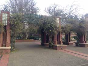
19 13 Connectors Proposed Connectors are integral to the Campus Framework. They provide critical pedestrian connections within the campus and to adjoining neighbors. While the alignments shown are diagrammatic, these 24/7 connections must be established and enhanced. Garden Walks Garden Walks are a subset of connectors. Their design exhibits an added level of detail and intimate scale. They promote places to sit and linger. They share characteristics of a finer grain of design elements with some variations in character by design area to convey unique locations and functions. They orient users on the campus and within design areas. The campus is organized on an orthogonal north-south east-west grid that parallels the city street system. Desire lines of diagonal movement and the interruption by superblocks and large buildings often create a disjointed experience for pedestrians. Garden Walks create a new layer of order to connect these pedestrian flows. They use a series of definable and repeatable elements for identity and orientation. As a Garden Walk goes through the campus, its character relates to the surroundings, for example, echoing the formality of the classical character of the Memorial Quadrangle, the natural forms of the Millrace, or the socially active areas at the Erb Memorial Union. Passing through and along buildings and academic programs, the Garden Walk should relate to the program within adjacent buildings by its physical expression and interpretive signage. A Garden Walk can tell a story through UNIVERSITY OF OREGON CAMPUS PHYSICAL FRAMEWORK VISION CAMPUS FRAMEWORK


 Selected areas At")


20 14 Connectors Critical pedestrian connecttions within and between Design Areas. Connectors are an intergral part of the Campus Framework. Characteristics of Connectors and Garden Walks Garden Walks Subset of connectors with added level of detail and intimate scale; promotes places to sit and linger as desired. Characteristics can vary by Design Area. Used to create orientation within and between Design Areas. Pavement Material Scored concrete or asphalt Specialized paving: scored concrete with paver banding or etching Pavement Width 8 to 20 feet 6 to 16 feet Planting Campus environment Tree groves and specialty gardens Site Lighting Campus standards Campus standards and art installations Rain Gardens (Storm Water) Selected areas At major nodes Art Selected areas At major nodes and building entries Site Furnishings Campus standards Campus standards and possible themed units planting, sculpture or simply enhance campus identity by creating memorable places. Plantings can define a Garden Walk within each design area, possibly using clusters of a themed flowering tree for multi-season interest. Rolling in a verdant swath, the walk will have specialty gardens such as rain gardens for storm-water cleansing, pollinator gardens, and possibly test plots to explore a new idea or inspire a poet. At key points, additional seating clusters can provide opportunities for people to gather or individuals to simply reflect in a beautiful space. Possible Themes Anthropology ethnobotanical garden Fine arts sculpture, rotating display kiosks Geology rock garden Literature poetry boxes Natural sciences pollinator or migratory bird gardens Extensions of the learning environment small-scale gathering spaces or organized outdoor classrooms Connections to community by welcoming neighbors into campus at the edges Physical Form Concrete pavement with edge banding Scale narrow at the corners of the campus 6 to 8-feet; wider at the center of campus 12 to 16-feet Flowing forms Small-canopy trees, multi-stem, flowering, i.e., magnolia, cherry, crab apple, or dogwood Seating campus bench, specialty seat walls, sculpture Art sculptures and etched concrete paths UNIVERSITY OF OREGON CAMPUS PHYSICAL FRAMEWORK VISION CAMPUS FRAMEWORK
21 3 GUIDELINES The guidelines support the structure and intent of the Campus Framework. They provide a layer of specificity with the intent of maintaining and enhancing the campus character while accommodating growth. The guidelines advise campus development on a range of subjects from the overall campus to specific building sites: N-3 N-2 N-1 N-5 N-4 N-8 N-6 W-1 W-12 N-7 F-1 W-2 F-3 W-3 F-2 W-5 W-4 W-7 W-6 C-1 C-2 W-8 N-3 N-2 N-1 N-5 N-4 W-12 C-4 C-4 E-10 E-11 E-12 E-12 E-2 E-3 E-4 E-5 E-6 E-6 E-7 E-7 E-7 E-8 N034 N035 N047 N048 N049 N050 N036 N038 N039 N037 N040 N041 N042 N043 N044 N Student Recreation Flexible Use On Campus Residence Halls Flexible Use On Campus Residence Halls Flexible Use Academic Museums Academic Museums On Campus Residence Halls On Campus Residence Halls Academic Support Administration Administration Academic Support N/A FlexibleN-2 Use N/A Flexible Use N/A Flexible Use W-12 N/A N/A N/A N/A W-3 N/A N/A N/A W-5 N/A W-4 N/A W-7 W-8 N/A N-3 N-5 N-4 N-8 N-6 N-7 F-1 F-3 Edges, Corridors, Gateways, and Views Design Areas Design Area Coverage Campus Boundary Permissible Building Sites Permissible Uses Permissible Building Sites Table Permissible Building Heights Shared Uses Parking Structure Ten-Minute-Walk Radius Sections Appendix A: Coverage and Capacity informed guidelines related to coverage, building sites, uses, building heights, and sections. F-2 C-1 C-2 See Chapter 4: Design Area Recommendations for landscape ecology strategies. N-8 N-6 N-7 F-1 F-3 W-3 F-2 W-4 W-7 W-5 W-8 C-1 C-2 * * UNIVERSITY OF OREGON CAMPUS PHYSICAL FRAMEWORK VISION GUIDELINES 15
22 16 EDGES, CORRIDORS, GATEWAYS, AND VIEWS PROPOSED Edges, corridors, and gateways convey the look and feel of the campus to a large audience, including some who may never set foot on the campus but pass it daily. These elements also set visual boundaries to the campus, and, notably, set a tone for the interface between the campus and its neighbors. Regional views give the campus users a context with the natural setting of hills and buttes, their silhouettes heightened by the cover of evergreen trees, a character iconic to the city and region. Shared considerations include: Further studies to improve sidewalks, plantings, lighting, wayfinding, etc. Protect and enhance historically significant structures and landscapes. Augment tree planting Support critical Garden Walk crossings at public streets to foster a continuous character throughout campus. Encourage all new university, public, and private development on edges and corridors to have active ground-floor uses and transparent facades to visually engage the public and active building entrances to foster pedestrian activity. Enhance gateways to be welcoming entrances into the campus. Several chapters in particular Chapter 3: Guidelines and Chapter 4: Design Area Recommendations provide added detail to the text that follows. UNIVERSITY OF OREGON CAMPUS PHYSICAL FRAMEWORK VISION GUIDELINES

23 17 Characteristics and Considerations Edges Are most visible to the public. Share a public right-of-way; will require coordination with neighbors and the City of Eugene. Announce the presence of the university. Offer aesthetic transitions to adjacent neighborhoods. Convey the university s public role, mission, and history. Encourage positive interaction between the university and community. Define boundaries that contain welcoming gateways. Convey unique features. Have intentional design treatments suited to the site and edge context. Corridors Are high-flow vehicle routes that transect the campus and offer views into the campus. Share a public right-of-way; will require coordination with neighbors and the City of Eugene Convey the university s public role, mission, and history. Encourage positive interaction between the university and community. Gateways Are points of entry into the campus at campus edges and corridors and are open and welcoming. Reinforce the sense of arrival at the campus and a particular design area share a common set of elements and are particular to the location. Are divided as primary and secondary dependent on their prominence of location and volume of users. Regional Views Include views to and from the regional setting: Skinner s Butte Coburg Hills, Hendricks Park, Spencer s Butte, and the taller buildings of downtown Eugene. Connect to near and distant views of tall stands of trees to provide orientation and broaden the visual setting of the campus with this borrowed landscape. Consider these contextual views throughout the campus case by case. A Willamette River Edge Existing Characteristics and Considerations The university community and the public view the north and south sides of this edge as they traverse the Frohnmayer Bridge (informally known as the Autzen Stadium Footbridge) daily and for sporting events at the Autzen Stadium Complex. The edge of the Willamette River is a neglected resource. It is degraded environmentally with considerable fill and invasive, non-native vegetation lining the banks and within the riparian setback area. (City code establishes development setbacks from the top of bank and regulatory standards for development beyond setbacks within the Willamette Greenway; i.e., from the river to the Millrace). The river is home to threatened and endangered fish species and has high ecological research, education, and recreation potential. Large stands of vegetation line the majority of this edge and provide cover for homeless encampments along the riverfront. Access to this edge is limited to two railroad underpasses for bicyclists and pedestrians from the campus core to the Frohnmayer Bridge via the northern terminus of Riverfront Parkway and the Gallery Walk Axis. Willamette River looking west from the Frohnmayer Bridge Proposed Improvements Improve the ecosystem and add opportunities for outdoor classrooms, research, recreation, and minor support buildings. Increase pedestrian and bicyclist access to the university and surrounding community. Provide a third access under the railway to connect pedestrians and bicyclists at the western end of this corridor to the Willamette River waterfront and bicycle path. (Coordinate with the City of Eugene which is considering a similar crossing nearby.) B Franklin Boulevard West Corridor (West of Agate Street) Existing Characteristics and Considerations Franklin Boulevard, a major arterial street and state controlled, is highly visible to a large and diverse public making it important in communicating the beauty and presence of the university. A park-like landscape and a variety of buildings, some in disrepair, dominate the north portion of this corridor. A variety of large university buildings most fronting the interior of the campus and turning their backs to Franklin Boulevard visually dominate the south portion of the corridor. It is heavily devoted to service drives and parking. A concrete retaining wall and narrow sidewalk visually dominate the western segment of the corridor near the Old Campus Quadrangle. Existing paths are not continuous, often broken by parking or service drives a safety concern for pedestrians and bicyclists. The area is not pedestrian or bicyclist friendly because of the number of lanes and the speed of the traffic on Franklin Boulevard. Off-street bicycle and pedestrian paths exist, but do not provide direct street access. Significant historic structures and landscapes along this edge include Dad s Gates, Villard Hall, Condon Oak, and the Old Campus Quadrangle. The western campus edge at Kincaid Street and East 11th Avenue on Franklin Boulevard is undefined. UNIVERSITY OF OREGON CAMPUS PHYSICAL FRAMEWORK VISION GUIDELINES

24 18 Franklin Boulevard looking west between Riverfront Parkway and Onyx Street Proposed Improvements Site buildings and create a unified landscape on both sides of the boulevard using an orthogonal alignment of buildings and shared plantings to visually promote this corridor as part of one contiguous campus. When expanding or replacing existing buildings, introduce a softer edge by establishing a set back and folding back the concrete retaining wall when present. Maintain and enhance selected views into the large open spaces. Evaluate the safety and comfort of drivers, pedestrians, and bicyclists using and crossing this corridor. Functionally and visually improve the Onyx Street crossing as part of a primary gateway. Reorient the Onyx Bridge replacement building to create an open space on Franklin Boulevard and a primary gateway in scale with the importance of the Onyx Street crossing. Consider a general-purpose pedestrian-bicyclist bridge connecting the North Design Area to the Old Campus Quadrangle. It is an opportunity to announce the university s presence over a major public thoroughfare. The bridge connection planned between LISB and the proposed research buildings north of Franklin Boulevard is an internal building connection to link scientific functions; i.e., it is not intended for general use. It is an opportunity to announce the university s presence over a major public thoroughfare. Develop setbacks and open space treatments on both the north and south sides of the corridor to create a campus (park-like) setting for all buildings (new, replacements, and expansions). Select plant materials to allow views into the campus. Orthogonal siting of buildings will promote a varied depth of open space along the corridor. Improve the southern edge of the corridor bounded by Lawrence Hall and Lewis Integrated Sciences Building (LISB) by consolidating the service drives and parking to improve pedestrian access and open space treatments. C Franklin Boulevard (Between Agate and Villard streets) Existing Characteristics and Considerations Franklin Boulevard, a major arterial street and state controlled, is highly visible to a large and diverse public making it important in communicating the beauty and presence of the university. Proposed Improvements Enhance safe connections across Franklin Boulevard; requires coordination with the City of Eugene and the State of Oregon. D Franklin Boulevard East Edge (Off Campus) Existing Characteristics and Considerations Franklin Boulevard, a major arterial street and state controlled, is highly visible to a large and diverse public making it important in communicating the beauty and presence of the university. Large underdeveloped land areas, including the historic Romania Dealership Showroom site, bound this edge. This edge is not contiguous with the campus and is not targeted for a significant amount of university program; as such, edge treatments will likely be guided by its commercial-retail context and the City of Eugene. Proposed Improvements Promote a mixed-use development edge to convey a positive front-door image to Franklin Boulevard Explore design character in relationship to the campus Take into consideration the historic Romania Dealership Showroom. Recognize that the eastern portion of this edge is a primary gateway. E East 15th Avenue (West of Villard Street; Off Campus) Existing Characteristics and Considerations A mix of residential and institutional uses bound this residentialscale local street. The edge is not contiguous with the campus and is not targeted for a significant amount of university program; as such, edge treatments will likely be guided by its residential context to the south and the City of Eugene. Large underdeveloped land including the Romania Showroom and EmX Walnut Station sites bound this edge. The eastern point of this edge terminates at the base of the heavily wooded Hendricks Hill. Proposed Improvements The UOCPFV identifies the majority of the land to the north of this edge for flexible uses, most likely a mixed-use development to include student residences, administration, retail, and parking, given its proximity to the Walnut EmX station and the campus. Separated several blocks from the existing campus, develop this edge to promote quality connections (e.g., walks, wayfinding, plantings, and lighting) in keeping with the university s image. Develop the massing and streetscape to respect the residential neighborhood to the south. F Villard Street Edge Existing Characteristics and Considerations The two-lane Villard Street, with its tree-lined median, conveys an intimate scale in keeping with the residences to the east. The generous plantings of canopy trees creates a soft residential edge. The university identifies this as a Graceful Edge with lowdensity residential zoning and development controls. Proposed Improvements Other than suggesting to enhance the landscape and recognizing that development in this area should be sensitive to the residential area to the east, the UOCPFV does not address this edge. UNIVERSITY OF OREGON CAMPUS PHYSICAL FRAMEWORK VISION GUIDELINES


25 19 G Agate Street Corridor Existing Characteristics and Considerations Agate Street includes tree-lined medians north of East 15th Avenue and striped medians to the south. Parking along the street is limited to the portion south of East 15th Avenue. As the only north-south road that transects the campus, Agate Street offers users a more intimate view of the campus than that offered from Franklin Boulevard, due in part by the level topography, slower vehicle speeds, frequent stops, and the campus users that walk along and cross the street. The public frequents this street often for events at Hayward Field located on its western edge. A constant flow of users from the residence halls cross this street to access the campus core. Agate Street looking south from East 15th Avenue Proposed Improvements Establish a planted median south of East 15th Avenue similar to the median to the north H East 18th Avenue Edge Existing Characteristics and Considerations The open character of this edge allows unencumbered views of active recreation and athletic fields, a positive and unique image for the campus. Sidewalks are approximately six feet wide (narrow compared to other areas of the campus). Tree plantings along this edge are sparse, even with the recent plantings. The intersection of East 18th Avenue and University Street is a primary gateway from the south. Proposed Improvements Maintain the majority of the open views of the recreation and athletic fields. Further study the area to improve sidewalks, crosswalks, plantings, lighting, wayfinding, etc. I Alder Street and 18th Avenue Edge Existing Characteristics and Considerations The majority of Alder Street along this edge is comprised of one lane of one-way (southbound) vehicle traffic and a cycle track (a dedicated bi-directional bicycle lane). Parking lots visually dominate the campus side. Gentle slopes at the northern portion of this edge become significantly steeper as Alder Street approaches East 18th Avenue to the south. Smaller two- and three-story campus buildings set back into the landscape characterize the edge along East 18th Avenue making it relate well to its neighbors. The sidewalks along Alder Street and East 18th Avenue are narrow compared to other areas of the campus. Alder Street looking south from East 17th Avenue The Eugene Pioneer Cemetery greatly contributes to the open space character of this edge. Proposed Improvements Maintain a view corridor to the Beall Concert Hall. New buildings along this edge will likely match those to the east with parking below at ground level. This would require proper treatment of the parking-level facade and open space to present a positive image along Alder Street. An open space at the corner of Alder Street and East 18th Avenue further softens this edge of the campus, preserving an existing stand of mature trees. J Kincaid Street Edge Existing Characteristics and Considerations This edge faces campus-serving retail and Northwest Christian University. It provides access to heavily-used transit stations and is the most urban area bordering the campus. Along this edge, the campus is approaching the maximum desired density, with the exception of the PLC parking lot which is a potential building area. University buildings do not face Kincaid Street but open onto campus connectors and open spaces. The edge is highly porous to pedestrians as demonstrated in the MyCampus Survey. See Appendix B: MyCampus Survey. The southern terminus of Kincaid Street is an abrupt dead-end. Proposed Improvements Aesthetic quality needs improvement because portions of this edge are visually cluttered with car parking, bicycle parking, overgrown vegetation, etc. Improve the gateway at the southern end of this edge to favor pedestrians. UNIVERSITY OF OREGON CAMPUS PHYSICAL FRAMEWORK VISION GUIDELINES
26 20 DESIGN AREAS Existing The campus currently has 11 design areas. UNIVERSITY OF OREGON CAMPUS PHYSICAL FRAMEWORK VISION GUIDELINES
27 21 Design Areas Proposed The purpose of the design areas is to maintain or achieve a desired character a sense of place reflective of each area s cultural significance, geography, location, and primary uses. Analysis of these factors led to defining nine design areas on the campus. Land not contiguous to the campus is dependent on specific context and is therefore, not considered a design area. The chief determinants of each design area s desired character are based on its primary uses and the building heights specific to the intended primary uses all within the context of the framework of open space and connectors. UNIVERSITY OF OREGON CAMPUS PHYSICAL FRAMEWORK VISION GUIDELINES

28 22 COVERAGE Maximum Permissible Existing The maximum coverages reflect the desired character of each design area as currently allowed in the Campus Plan. UNIVERSITY OF OREGON CAMPUS PHYSICAL FRAMEWORK VISION GUIDELINES
29 23 Permissible Coverage Proposed The maximum coverages reflect the desired character of each design area. They are based on analysis from the Coverage and Capacity model developed as part of the UOCPFV. The coverage reflects all permissible building sites and their associated capacities based on reasonable footprints and building heights. See Appendix A: Coverage and Capacity. The differences between the existing and proposed include Reconfiguration of the design areas based on their dominant and potential uses, location, and natural or man-made divisions such a major public streets. The use of infill in already developed areas of the campus such as the West Design Area. The introduction of designated open space such as that envisioned for the North and East design areas. The inclusion of the majority of public streets. While the coverages address all new buildings (permissible building sites), they do not include the modest additional coverage resulting from the expanded footprints of existing buildings or their replacement. See Permissible Building Sites Proposed, later in this chapter. Coverage for off-campus land will be guided by their urban context. UNIVERSITY OF OREGON CAMPUS PHYSICAL FRAMEWORK VISION GUIDELINES

30 24 CAMPUS BOUNDARY Existing UNIVERSITY OF OREGON CAMPUS PHYSICAL FRAMEWORK VISION GUIDELINES
31 25 1 Campus Boundary Proposed The campus boundary is for planning purposes only and includes properties not owned by the university. The proposed campus boundary includes all of the proposed design areas. Major changes from the existing boundary are Inclusion of the railroad tracks (1), Franklin Boulevard (2), the Matthew Knight Arena (3), and the Eugene Pioneer Cemetery (4) Identification of off-campus properties (5) UNIVERSITY OF OREGON CAMPUS PHYSICAL FRAMEWORK VISION GUIDELINES
32 26 PERMISSIBLE BUILDING SITES PROPOSED NOTE: The facades and massing of all new buildings facing designated open space and connectors will follow the established orthogonal grid of the campus as this is the one of the unifying characteristics of the campus. Designated Open Space No building may occur in a Designated Open Space (DOS) although landscape improvements are allowed; exceptions noted below Ideally, the majority of building facade(s) will align with the edge of the DOS X-1 X-2 SW-1 SW-2 W-4 W-5 W-7 W-6 W-8 SW-3 W-10 W-11 UNIVERSITY OF OREGON CAMPUS PHYSICAL FRAMEWORK VISION GUIDELINES W-1 W-2 SW-4 N-1 W-9 N-2 W-3 The permissible building sites (PBS) numbering correspond to the Table of Uses by Permissible Building Site found later in this chapter as well as the Coverage and Capacity Model described in Appendix A. W-12 F-2 C-5 F-1 C-3 C-4 N-3 N-5 N-4 N-6 C-1 N-7 C-2 F-3 N-8 E-5 E-4 E-7 E-8 E-9 * E-10 E-11 N-9 E-6 E-12 WA-1 WA-2 Permissible Building Sites and Guidelines * Permissible Building Sites Regulatory Setback Upper Floor Setback Many Nations' Longhouse Solar Views GE Buildings Removed Graceful Edge 7 Minute Walk University of Oregon Campus Physical Framework Vision University of Oregon Campus Planning Design and Construction Robert Sabbatini AICP FASLA, PLACE, Perkins + Will March Permissible Building Sites Buildings should frame and define adjacent designated open space and adjacent connectors. (See Sections later in this chapter for examples.) Sites available for development The edges are equivalent to setback lines Up to 25 percent of the facade may extend up to 15 feet into a DOS Requires detailed review as part of the site selection process ; e.g. Campus Planning Committee, design review board, etc. Undesignated areas not facing public streets Building expansions into areas not facing public streets or DOS must respect the context of surrounding buildings and include active entrances when adjacent to campus connectors. (See Sections later in this chapter for examples.) Available for extensions of established buildings (kept in place or replaced) Maximum of 2,000 square feet of footprint and up to 15 feet may extend into adjacent land Requires detailed-review; e.g. Campus Planning Committee, design review board, etc. Undesignated areas facing public streets Building expansions facing public streets should frame and activate the street s pedestrian environment. (See Sections later in this chapter for examples.) Available for existing building expansion or replacement Build to city setback and locate active entrances along this frontage
33 27 PERMISSIBLE USES PROPOSED The primary uses per permissible building sites (PBS) reflect the primary uses by design area. W-1 N-1 N-2 W-12 F-1 N-3 N-5 N-4 N-6 N-7 N-8 N-9 Primary uses assigned to the PBS support space needs and growth of the university. Primary uses within the seven-minute walk circle primarily accommodate Academic/Support uses to foster the established academic uses. PBS in this zone support at least one level (preferably the ground floor) of general use classrooms accessible to all departments. The university can assign secondary uses on a case-by-case basis where noted. Flexible Use provides alternative building locations and should reflect the primary and secondary uses of the design areas. X-1 W-2 W-3 F-2 F-3 The following page describes each of the use classifications. X-2 W-4 W-5 W-7 W-6 W-8 C-1 C-2 W-9 C-3 WA-1 WA-2 W-10 W-11 SW-1 SW-2 SW-3 SW-4 C-5 C-4 E-4 E-7 E-8 E-9 E-5 * E-10 E-11 E-6 E-12 Permissible Uses - Proposed Academic/support Research centers/inst. Museums/student union Student rec facilities Outdoor classrooms Administration Residence halls Parking structure Secondary use Flexible Uses Buildings Removed 7 Minute Walk Circle University of Oregon Campus Physical Framework Vision University of Oregon Campus Planning Design and Construction Robert Sabbatini AICP FASLA, PLACE, Perkins + Will March UNIVERSITY OF OREGON CAMPUS PHYSICAL FRAMEWORK VISION GUIDELINES
34 28 PROGRAM USE DEFINITIONS The following program use definitions were established in the University of Oregon Space Needs Plan, September 2012 (SNP). Academic Facilities allocated to schools and colleges; includes department administrative space, department-controlled instructional space, labs, and faculty and staff offices. Academic Support Student academic support space for functions ranging from the enrollment process to various aspects of student life.; includes Enrollment Management, Undergraduate Studies, the Career Center, and other units providing student services. It excludes the Student Union, Student Recreation Facilities, and Student Health/ Counseling. Administration Facilities allocated to administrative offices overseeing administration of the entire institution; includes the president, provost, vice-presidents, and their staff in units that provide university-wide support for the function of the university, except those student services listed under Academic Support. Also includes such non-research service centers as Central Power Station, Printing and Mail Services, Telecommunications, Information Services, etc. Flexible Uses Unassigned use flexible to support various program needs. Assumes use is compatible with the intended uses for the design area. Permissible Building Sites identified as Flexible Use provide alternative locations for program needed by the university. General Use Classrooms Primarily formal instructional space registrar-controlled and joint-controlled classrooms and seminar rooms. Does not include department classrooms, studios, or class laboratories. Research Centers/Institutes Centers and institutes in the portfolio of the Vice President for Research and Innovation; includes core research services such as Animal Care Services, Genomics, Neuroimaging, Histology, Technical Science Administration, etc. Libraries Spaces under the direction of the institutional librarian and within the university library system for general university use and research (not departmental libraries or reading rooms). Includes Knight Library, Price Research Library, A&AA Library, Math Library, Law Library, Archives, and CMET. Museums Museums and art galleries, i.e., the Museum of Natural and Cultural History, Oregon State Museum of Anthropology, and Jordan Schnitzer Museum of Art.) Parking Structures On-campus above-, below-deck, and below-grade parking structures. Recreational Playing Fields Outdoor fields for student recreational and intramural sports and play. Residence Halls On-campus student residence halls (dormitories) owned and managed by the university. Student Health/Counseling Facilities providing clinical health services, therapy, testing, consultation, outreach, and referral services to university students. Student Recreation Facilities providing recreation and fitness activities for students; includes Student Recreation Center and Student Tennis Center. Does not include Recreational Playing Fields. Student Union Student Union administrative offices, meeting rooms, lounges, and student activity areas, such as student-body offices, activity areas for student groups, arts and crafts areas, etc. UNIVERSITY OF OREGON CAMPUS PHYSICAL FRAMEWORK VISION GUIDELINES
35 29 PERMISSIBLE BUILDING SITES TABLE PROPOSED The table provides basic information about primary and secondary uses for each permissible building site. Note that some sites, such as N-2, can accommodate more than one building. See Appendix A: Coverage and Capacity for detail. Permissible Building Site Building Number Scenario Primary Use Secondary Use No. Floors Footprint (GSF) GSF C-1 N023 5 Flexible Use Flexible Use 4 13,200 52,600 C-2 N025 1 Student Health/Counseling N/A 2 29,500 59,000 C-3 N022 2 Student Union N/A 4 19,000 76,000 C-4 N031 4 Academic N/A 4 47, ,400 C-4 N032 3 Academic N/A 5 36, ,000 C-4 N033 5 Flexible Use Flexible Use 2 23,500 47,000 C-4 N034 3 Student Recreation N/A 3 62, ,600 C-4 N035 5 Flexible Use Flexible Use 4 17,000 68,000 E-10 N047 2 On Campus Residence Halls N/A 4 19,400 77,600 E-11 N048 5 Flexible Use Flexible Use 4 18,000 72,000 E-12 N049 3 On Campus Residence Halls N/A 4 23,000 92,000 E-12 N050 5 Flexible Use Flexible Use 4 13,200 52,800 E-2 N036 4 Academic N/A 4 3,900 15,600 E-3 N038 3 Museums N/A 1 4,400 4,400 E-4 N039 4 Academic N/A 3 9,500 28,500 E-5 N037 2 Museums N/A 2 11,900 23,800 E-6 N040 4 On Campus Residence Halls N/A 4 12,800 51,200 E-6 N041 4 On Campus Residence Halls N/A 4 11,300 45,200 E-7 N042 3 Academic Support N/A 2 15,700 31,400 E-7 N043 3 Administration N/A 1 4,800 4,800 E-7 N044 2 Administration N/A 1 7,000 7,000 E-8 N045 2 Academic Support N/A 4 10,800 43,200 E-9 N046 3 Parking Structure N/A 6 53, ,600 F-1 N007 2 Academic N/A 5 22, ,000 F-2 N008 3 Academic N/A 4 14,300 57,200 F-3 N009 4 Academic Support N/A 4 5,100 20,400 N-1 N056 4 Administration N/A 4 21,000 84,000 N-2 N057 5 Flexible Use Flexible Use 2 20,000 40,000 N-2 N058 5 Flexible Use Flexible Use 2 13,800 27,600 N-2 N059 4 Administration N/A 2 8,900 17,800 N-3 N060 5 Flexible Use Flexible Use 5 22, ,500 N-3 N061 5 Flexible Use Flexible Use 5 22, ,000 N-4 N062 2 Academic N/A 4 17,500 70,000 N-4 N063 5 Flexible Use Flexible Use 4 29, ,200 N-5 N064 2 Parking Structure N/A 5 34, ,500 N-6 N065 5 Flexible Use Flexible Use 4 12,100 48,400 N-6 N066 5 Flexible Use Flexible Use 4 10,800 43,200 N-6 N067 2 Research Centers/Institution N/A 5 26, ,000 N-7 N068 1 Research Centers/Institution N/A 5 13,500 67,500 N-7 N069 1 Research Centers/Institution N/A 5 20, ,000 X-2 N-7 N010 N Academic Research Centers/Institution Parking N/A Structure 56 41,400 10, ,400 52,000 N-8 N071 5 Parking Structure N/A 5 1,320,600 37,800 5,529, ,000 Permissible Building Site Building Number Scenario Primary Use Secondary Use No. Floors Footprint (GSF) GSF C-1 N-8 N023 N071 5 Flexible Parking Structure Use Flexible N/A Use 45 13,200 37, ,000 52,600 N-9 N072 4 Research Centers/Institution N/A 5 15,800 79,000 R-1 N073 2 Student Recreation N/A 1 2,400 2,400 R-1 N074 2 Student Recreation N/A 1 2,400 2,400 SW-1 N026 5 Flexible Use Flexible Use 4 19,600 78,400 SW-1 N027 5 Academic N/A 4 5,100 20,400 SW-2 N028 5 Flexible Use Flexible Use 4 15,100 60,400 SW-3 N029 5 Academic N/A 4 24,100 96,400 SW-4 N030 1 Academic N/A 2 5,200 10,400 W-1 N001 5 Parking Structure N/A 6 29, ,400 W-1 N002 3 Administration N/A 4 19,100 76,400 W-2 N004 3 Administration Academic 4 11,300 45,200 W-3 N006 2 Academic N/A 3 14,100 42,300 W-4 N017 1 Academic N/A 4 15,000 60,000 W-5 N019 4 Academic N/A 4 11,600 46,400 W-6 N012 2 Academic N/A 4 8,400 33,600 W-7 N014 2 Museums N/A 3 4,400 13,200 W-7 N018 4 Academic N/A 3 6,400 19,200 W-8 N020 2 Academic N/A 3 9,400 28,200 W-9 N015 3 Museums N/A 3 5,200 15,600 W-10 N016 4 General Use Classrooms Academic 3 14,400 43,200 W-11 N021 3 Academic N/A 3 9,900 29,700 W-12 N005 5 Flexible Use Flexible Use 4 10,000 40,000 WA-1 N051 5 Flexible Use Flexible Use 5 29, ,500 WA-1 N052 5 Flexible Use Flexible Use 5 51, ,000 WA-2 N053 5 Parking Structure N/A 5 47, ,500 WA-2 N054 2 Administration N/A 5 22, ,500 WA-2 N055 2 Administration N/A 5 14,000 70,000 X-1 N003 5 Flexible Use Flexible Use 5 24, ,000 X-2 N010 1 Academic Parking Structure 6 41, ,400 1,320,600 5,529,100 NOTES 1 All proposed buildings with Academic as the primary use within the seven-minute walking circle have a portion of the total GSF assigned to General Use Classrooms. 2 Numbers have been rounded to the nearest 100. UNIVERSITY OF OREGON CAMPUS PHYSICAL FRAMEWORK VISION GUIDELINES
36 30 1 X-1 X-2 SW-1 SW-2 W-1 W-2 W-7 W-6 W-8 SW-3 SW-4 N-1 W-9 N-2 W-3 W-4 W-10 W-12 W-5 W-11 N-3 N-5 N-4 N-6 N-7 F-1 F-3 F-2 C-1 C-2 C-3 C-4 C-5 2 N-8 E-8 E-4 E-7 E-9 1 Use Academic Research Residence Hall Administration Parking NOTE: Parking - 11 feet 4 inches for ADA vehicle level; 10 feet 2 inches for remaining levels WA-1 E-5 Maximum Building Heights Used for Calculating Capacity E-6 * 90' Many Nations Longhouse Solar Access E-10 3 E-11 3 N-9 E-12 Height Per Floor First Floor Upper Floors NOTE: Heights for new buildings, shown in feet, directly relate to the intended primary building use. Expansion of replacement of existing building smay not exceed the maximum height for new buildings within the design area as these heights relate to the intended character of each design area. 75' 60' 45' 30' 13' Height Per Floor * WA NOTE: Heights per fl oor will vary dependent on the use. Refer to the table above and to the diagram: Building by Primary Use - Capacity & Coverage feet feet feet feet feet University of Oregon Campus Physical Framework Vision University of Oregon Campus Planning Design and Construction Robert Sabbatini AICP FASLA, PLACE, Perkins + Will March PERMISSIBLE BUILDING HEIGHTS PROPOSED The proposed building heights allow greater program capacity through new construction on permissible building sites (PBS) and by expansion or replacement of existing buildings while maintaining a variation of heights and intended character within each design area. Heights for new buildings, shown in feet, directly relate to the intended primary building use since floor heights vary by use. Expansion or replacement of existing buildings may not exceed the maximum height for new buildings within the design area because these heights relate to the intended character of each design area. Building height is measured from finished grade. Given that the campus does not have extreme slopes on any single PBS, the measurement equates to the greatest proposed condition. An additional 15 feet is allowed for the required screening of mechanical equipment and the placement of rooftop lighting, in the case of parking structures and roof decks. These elements should be set back to screen views from the ground as well as to screen views from adjacent buildings. See Appendix C: Analysis for zoning and related building heights of off-campus and adjacent properties. Note: 1. Building height located within 50 feet of an abutting residential zone is limited to the height allowed in the abutting residential zone. 2. Walnut Station Special Area Zone allows 90 foot maximum/seven stories, with a 15-foot step back above specified upper floors. 3. Some heights are not in compliance, requiring amendment of current city code. UNIVERSITY OF OREGON CAMPUS PHYSICAL FRAMEWORK VISION GUIDELINES
 and the Ford Alumni Center (2).")
37 31 SHARED USES EXISTING AND PROPOSED 3 Shared uses include university buildings that serve the campus community and those buildings that also serve the public. Examples of campus community buildings include the Knight Library (1) and the Ford Alumni Center (2). Buildings that also serve the public include the Miller Theater Complex (3) and the Erb Memorial Union (EMU) (4). Of particular interest is the permissible building site in the heart of campus (5). Given its prominent location, its future use would be best shared with the campus community UNIVERSITY OF OREGON CAMPUS PHYSICAL FRAMEWORK VISION GUIDELINES
38 32 PARKING STRUCTURE LOCATIONS PROPOSED The UOCPFV locates parking structures at the periphery of the campus to minimize the intrusion of vehicles in the campus and the resulting conflicts with pedestrians and bicyclists. Combined, the parking structures locations provide pedestrian access to the entire campus within a ten-minute walk. NG09 NG01 NG02 NG03 The below-grade parking (1) accessed from University Street provides parking close to the core of the campus, within an easy walk to numerous shared uses including the Schnitzer Museum of Art and the Erb Memorial Union (EMU). The university will need to decide whether the location and ease of access is commensurate with the high cost of parking below grade. Without this structure, there is adequate capacity in the remaining structures to support the program needs identified in the Coverage and Capacity study Scenario 4 (34,000 student FTE). For further detail, see Appendix A: Coverage and Capacity. NG08 NG06 1 NG04 Parking Structure - Ten-minute Walk Radius Structured parking Below grade parking The campus community favors modes of travel other than private vehicles. In 2014, 82 percent of the students and 38 percent of faculty and staff walked, biked, or bused to and from the campus. NG07 NG05 Below deck parking Ten-minute walk radius (2,000 feet) University of Oregon Campus Physical Framework Vision University of Oregon Campus Planning Design and Construction Robert Sabbatini AICP FASLA, PLACE, Perkins + Will March The estimated quantity of parking in the UOCPFV uses current metrics of parking demand per FTE. In addition, this work did not investigate off-campus parking. The UOCPFV recommends that the university undertake a comprehensive transportation and parking master plan to address all modes of travel and all reasonable parking alternatives and to monitor parking demand on a regular basis. UNIVERSITY OF OREGON CAMPUS PHYSICAL FRAMEWORK VISION GUIDELINES
39 33 SECTIONS The sections share a common purpose to create a functional and beautiful experience throughout the campus. They address a variety of interface conditions between open space, connectors, public roadways, and permissible building sites (PBS). Buildings shown in the sections illustrate buildings built up to the edge of the PBS. These buildings can be set back further if desired, although the guidelines encourage positive interface between buildings, open space, and connectors. City setback lines and dimensions within the public rights-of-way are approximate. See discussion of Edges and Corridors in Chapter 3: Guidelines. UNIVERSITY OF OREGON CAMPUS PHYSICAL FRAMEWORK VISION GUIDELINES


40 34 The University acquired proper ty along the south side of the Southern Pacific Railroad (SPRR) tracks (TL 5500) that may be proposed for surface parking in conjunction with future redevelopment of maintenance facilities in the nor th campus area. However, SPRR reser ved easements for above- and below-ground communications and fiber optic facilities that could limit or prohibit the ability to develop the surface parking considered. Section 1 Railroad Intent To locate service and emergency access and surface parking between the proposed buildings and the base of the railroad slope embankment. To create a planted buffer for the lower building stories while allowing views from the upper stories. Existing This area consists of a collection of campus operations structures, dispersed parking, and a railroad bank covered with invasive plants. Response Develop a multi-layered linear landscape to support circulation and services. The setbacks in this corridor can support rain gardens, service yards, and buffer plantings. The plantings can be more refined on the building side of the corridor and informal against the parking and railroad tracks. Preserve distant views from the upper stories and views aligned with the gaps between the buildings. Guidelines Provide a landscape-storm-water zone at building interface Provide a 24-foot-wide service drive Provide parking at the railroad Frame views to the river with native vegetation Screen the railroad with evergreens while allowing views to the river See Chapter 4: Design Area Recommendations. UNIVERSITY OF OREGON CAMPUS PHYSICAL FRAMEWORK VISION GUIDELINES


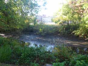
41 35 Section 01 Section 2 Millrace Intent To enhance the Millrace as an unifying landscape element and to increase its ecological value and contribution to the campus. Existing The Millrace is a poorly functioning, artificially augmented drainage system. It has extensive assets including mature trees, a bicycle path, and multiple buildings fronting its southern bank. The Millrace is crossed at three key points in the North Design Area: Onyx Street Bridge, Gallery Walk Axis Bridge, and Riverfront Parkway. Response As a unique ecological asset, the Millrace provides the opportunity to restore habitat, treat campus storm-water, provide a campus landscape asset, and deliver a desirable building setting. Improvements to the waterway s plantings, water source, and overall physical structure will allow it to function as an ecological asset. The permissible building sites offer the opportunity to actively engage the Millrace with improved circulation and access. Guidelines Provide a 12-foot-wide multi-use path along the north bank as a continuous connector Provide a 6-foot-wide walking path along the south bank to link building sites Restore the waterway and water system as a district effort Provide active spaces overlooking the water Complement the Urban Farm Remove invasive species See Chapter 4: Design Area Recommendations and Chapter 5: Focus Studies. UNIVERSITY OF OREGON CAMPUS PHYSICAL FRAMEWORK VISION GUIDELINES


42 36 Section 3 Riverfront Parkway Intent To fully improve the corridor with new university buildings and improved connections. Existing A city-owned street with a planted median and bicycle lanes, the Riverfront Parkway meets current circulation needs of the research park but lacks multiple points of pedestrian access to the west. Response Provide wider sidewalks to accommodate the future increase of pedestrians associated with new development and parking structures. Locate new development along the west side of the corridor at the city setback line to reinforce the corridor. Refresh the current landscape with new large-scale trees in the median. Guidelines Provide 8-foot-wide sidewalks Select street trees with high canopies Locate new buildings at the city setback line See Chapter 4: Design Area Recommendations. UNIVERSITY OF OREGON CAMPUS PHYSICAL FRAMEWORK VISION GUIDELINES


43 37 Section 4 Franklin Boulevard Intent To develop the permissible building sites flanking Franklin Boulevard to present a cohesive campus image to people passing through the corridor. Existing As a state highway, Franklin Boulevard divides the campus fabric in image and function. Typically composed of three lanes of traffic in each direction, a wide, planted median with a bus rapid transit lane and intermittent sidewalks, Franklin Boulevard allows few northsouth crossings. There are no bicycle lanes and buildings are typically set back from the curb with parking facing the street. Response Site buildings to retain the campus orthogonal grid. On the south side, create a multi use path for pedestrians, service, and emergency access. Plant heritage-scaled trees to flow across the boulevard and visually meld the campus lands. Do not plant a regiment of street trees because this would emphasize the boulevard as a dividing element. Guidelines Provide a 20-foot-wide multi-use path along the southern frontage Establish a 20-foot-wide planting area along the south edge Focus plantings to highlight entries Establish campus-scale trees to span Franklin Boulevard and provide visual cohesion Screen service areas from public view See Chapter 4: Design Area Recommendations. UNIVERSITY OF OREGON CAMPUS PHYSICAL FRAMEWORK VISION GUIDELINES


44 38 Section 5 East 13th Street between Kincaid and Agate streets Intent To establish a pedestrian-first street that provides efficient and safe circulation for pedestrians and bicyclists in this most populous area of the campus. To create a campus-defining connector to support student movement. Existing East 13th Avenue between Kincaid and Agate streets, owned by the university, has extensive onstreet bicycle parking west of University Street and limited vehicle parking east of University Street. The street corridor has significant mature street trees and a mix of historic and new buildings. Broad sidewalks serve heavy student circulation. Response Create a shared central corridor for pedestrians and bicyclists. Identify and reinforce north-south connections with plantings, lighting, changes in pavement, and signage. Provide flex space adjacent to the corridor to support service-vehicle parking, storm-water planters, bicycle parking, and temporary installations such as tents, tables, movable outdoor flexible seating, etc. Guidelines Provide a 28-foot-wide central circulation corridor Provide a 10-foot-wide flex space along each side of the circulation corridor Engage the street corridor with building entries and forecourts Define key crossings Expand large-scale street-tree planting with a defined pattern and species selection See Chapter 4: Design Area Recommendations. UNIVERSITY OF OREGON CAMPUS PHYSICAL FRAMEWORK VISION GUIDELINES Section 05


45 39 Section 6 East 15th Avenue between University and Agate streets Intent To establish a pedestrian-first street that provides efficient and safe circulation for pedestrians and bicyclists. To support student movement from the residence halls to the student recreation center and campus core. Existing East 15th Avenue west of Agate Street is owned by the university and has extensive on-street parking. The street corridor has young street trees. Response Create a shared central corridor for pedestrians and bicyclists. Identify and reinforce north-south connections with plantings, lighting, changes in pavement, and signage. Provide flex space adjacent to the corridor to support servicevehicle parking, storm-water planters, bicycle parking, and temporary installations such as tents, tables, movable outdoor flexible seating, etc. Guidelines Provide a 28-foot-wide central circulation corridor Provide a 10-foot-wide flex space along each side of the circulation corridor See Chapter 4: Design Area Recommendations. * * UNIVERSITY OF OREGON CAMPUS PHYSICAL FRAMEWORK VISION GUIDELINES


46 40 Section 7 East 15th Avenue east of Agate Street Intent To improve East 15th Avenue to support pedestrian movement from the residence halls to the campus core while maintaining private vehicle access. To reinforce the street s character to clearly communicate its integration with the campus although it is a public right of way. Existing East 15h Avenue east of Agate Street is a public street with metered on-street parking. Mature street trees line the northern side with a mix of mature and newly planted trees along the southern side. Six-foot-wide sidewalks are too narrow to safely or comfortably accommodate pedestrians. Response Provide wider sidewalks to accommodate current pedestrians and future increases, focusing on the north side where adequate space exists. Maintain and build on the campus character by adding university site furnishings. Consider an enlarged and raised mid-block crossing at the Museum of Natural and Cultural History to facilitate the strong pedestrian diagonal flow. Guidelines Provide a 12-foot-wide sidewalk on north side of East 15th Avenue Provide an 8-foot-wide sidewalk on south side of East 15th Avenue Maintain a strong street tree statement Provide university street furnishings trash and recycling containers and seating Develop a mid-block crossing with stormwater planters See Chapter 4: Design Area Recommendations. UNIVERSITY OF OREGON CAMPUS PHYSICAL FRAMEWORK VISION GUIDELINES


47 41 Section 8 Alder Street Intent To enhance Alder Street to support improved pedestrian circulation and increased campus density while relating to the neighborhood s scale. Existing Alder Street s defining characteristics are southbound one-way vehicle traffic and a two-way bicycle track along the east edge abutting the campus. The southeast corner of campus lacks architectural presence. Response Build out the university in this area to expand toward the street and define the campus edge. Provide a broad planting area to ground the future buildings and allow a smooth transition to the neighborhood scale. Wider sidewalks and continuous plantings to unify this campus edge. Guidelines Provide an 8-foot-wide sidewalk on east side of Alder Street Provide a planting setback with campusscale trees and garden-quality landscape Develop storm-water treatment at the planting setback UNIVERSITY OF OREGON CAMPUS PHYSICAL FRAMEWORK VISION GUIDELINES


48 42 Section 9 University Street Intent To establish University Street as a high quality southern open space and a connector into the central campus for visitors arriving by car as well as pedestrians and bicyclists. To create a linear open space that connects buildings and open spaces to the campus core. Existing University Street is owned by the university. It has extensive on-street parking. The street corridor has few street trees and is overly wide with an awkward scale and lack of definition between the Eugene Pioneer Cemetery to the west and a mix of campus structures to the east. Response Redefine the street corridor by placing an emphasis on the eastern edge with a continuous pedestrian walk alongside a combination of open spaces, buildings, and entry courts. Develop the western portion as a shared vehicle-bicycle street to access on-street and below-grade parking and a drop-off at East 15th Avenue. Guidelines Provide 22-feet-wide paving for travel lanes Provide a 12-foot-wide sidewalk on east side of the street Provide strong tree planting along the pedestrian walk Re-establish the evergreen edge that once defined the boundaries of the cemetery Develop outdoor rooms at intersections of University Street and DOS Integrate storm-water planters and buffer planting at parking See Chapter 4: Design Area Recommendations and Chapter 5: Focus Studies. UNIVERSITY OF OREGON CAMPUS PHYSICAL FRAMEWORK VISION GUIDELINES


49 43 Section 10 East 17th Avenue Intent To develop new buildings with an active street presence. To redefine the street as a high-quality campus landscape setting in the campus. Existing A public street, East 17th Avenue has a typical road section to accommodate two-way traffic and parallel parking. It has intermittent mature street trees. It is a key connection to the Fairmont neighborhood and Agate Street. Response Buildings sited at the city setback line will reinforce the street and define the character of this section of East 17th Avenue. Face entries onto East 17th Avenue for visibility and to bring activity to the street. The street is two-way, provides parking on both sides, and is capable of being redeveloped with green infrastructure. Guidelines Preserve and infill quality street trees to retain character Provide 8-foot-wide planting strips with large-canopy deciduous trees Provide 8-foot-wide sidewalks Maintain on-street parking See Chapter 4: Design Area Recommendations. UNIVERSITY OF OREGON CAMPUS PHYSICAL FRAMEWORK VISION GUIDELINES


50 44 Section 11 Agate Street Intent To enhance Agate Street to better support the role of this community arterial and campus corridor. To clearly communicate its integration with the campus through tree planting, lighting, and generous walks. Existing Agate Street is a public street. Its north-south alignment is a key connection between Franklin Boulevard, the campus, and the neighborhood beyond. Buildings are typically set back from the street edge with a consistent line of mature street trees that define the street edges. Response Reinforce Agate Street s role in the campus by developing strong tree planting along widened walks. Replace the painted median south of East 15th Avenue with a tree-lined median. Guidelines Provide 8-foot-wide planting areas along the corridor Provide 8-foot-wide sidewalks Add a planted median with large-canopy trees south of East 15th Avenue Develop a mid-block crossing at the west end of East 17th Avenue Integrate storm-water planters Maintain on-street parking and bicycle lanes As a shared vehicle-bicycle roadway, design the street with traffic-calming elements See Chapter 4: Design Area Recommendations. UNIVERSITY OF OREGON CAMPUS PHYSICAL FRAMEWORK VISION GUIDELINES


51 45 Section 12 Columbia Street Intent To develop proposed buildings while retaining vehicle and pedestrian connections at a neighborhood street scale. To redevelop the street as a high-quality campus landscape. Existing Columbia Street south of East 17th Avenue has a broad public right-of-way a typical road section with wide parking strips and intermittent mature street trees. The street is two-way, provides parking on one side, and is capable of being developed with green infrastructure. The street is shared with bicycles. Response When adding larger buildings, such as the parking structure, balance them with ample setbacks and dense plantings. Wider sidewalks will support increased pedestrian movement. Guidelines Preserve quality street trees to retain character Provide 8-foot-wide planting strips with large-canopy deciduous trees Provide 8-foot sidewalks to improve connectivity Provide campus-scale trees at the back of the walk on both sides of the street Redevelop the corridor with green infrastructure for buildings and street Maintain on-street parking on one side See Chapter 4: Design Area Recommendations. UNIVERSITY OF OREGON CAMPUS PHYSICAL FRAMEWORK VISION GUIDELINES


52 46 Section 13 East 18th Avenue Intent To improve the campus s appearance and connection to the community along East 18th Avenue. Existing Clinical Services currently has unbuffered parking near the back of the sidewalk. Walks are extremely narrow in this area of the campus. Response New buildings and structured parking at the southwest corner of the campus presents the opportunity for wider walks and generous plantings to form a consistent and attractive campus edge. To create a safer environment and softer appearance, move the walk inward alongside a planting strip that accommodates storm-water flows. Guidelines Provide 8-foot-wide sidewalk on the north side of East 18th Avenue Provide 8-foot-wide planting strip on the north side of East 18th Avenue Integrate a storm-water system Section 13 UNIVERSITY OF OREGON CAMPUS PHYSICAL FRAMEWORK VISION GUIDELINES


53 47 Section 14 Moss Street Intent To retain vehicle and pedestrian connections at a neighborhood street scale while developing a high-quality campus landscape. Existing Moss Street south of East 17th Avenue has a broad public right-of-way a typical road section with wide parking strips and intermittent mature street trees. Moss Street is two-way, provides parking on one side, and is capable of being developed with green infrastructure. Response The southeast campus character with its street and alley grid has the ability to support a vibrant landscape. The walk along the west side, along the future open space and parking will be an extension of the garden walk. Guidelines Preserve quality street trees to retain character Provide 8-foot-wide planting strips with large-canopy deciduous trees Provide 8-foot-wide walks Maintain a strong street tree statement Develop a Garden Walk on the west side Integrate green infrastructure As a shared vehicle-bicycle roadway, design the street with traffic-calming elements See Chapter 4: Design Area Recommendations. UNIVERSITY OF OREGON CAMPUS PHYSICAL FRAMEWORK VISION GUIDELINES


54 48 Section 15 Franklin Bridge Intent To create an uninterrupted campus circulation route across Franklin Boulevard by spanning the corridor with an elegantly designed bridge. To connect the campus core to the north side of Franklin Boulevard to strengthen connections within the campus and to the surrounding community. Bicyclists and pedestrians will gain clear access to the Willamette River, while those in the North Design Area and communities north of the river will have safer and faster connections to the campus core. Existing At-grade crossings along Franklin Boulevard are limited, congested, and sometimes hazardous. The Onyx Street intersection is the primary street crossing for pedestrians, bicyclists, and service vehicles. With an active campus population north of Franklin Boulevard and plans to increase density, a better connection is needed. The ground level at the north end of the Old Campus Quadrangle is approximately ten feet above Franklin Boulevard and is bracketed by mature trees. Response Develop a gracefully curving contemporary bridge to reinforce the campus s beauty and identity while unifying the campus across Franklin Boulevard. The bridge will be constructed without ramps for universal access, engineered to be a dynamic structure, positioned to preserve trees, and safely connected to the existing circulation system. UNIVERSITY OF OREGON CAMPUS PHYSICAL FRAMEWORK VISION GUIDELINES


55 49 Guidelines 400 Streiker Bridge, Princeton University Streiker Bridge, Princeton 100 Establish a strong contemporary university identity with the bridge design Provide 16-foot clearance under the bridge for travel lanes Use a universal design approach: maximum slope 1:20 to prevent the need for handrails and landings Provide a 12-foot-wide passage for pedestrians and bicyclists Develop an overlook at the bridge intersection above the Millrace open space Preserve mature trees See Chapter 4: Design Area Recommendations for additional detail Jarrold Pedestrian Bridge, Norwich, UK Jarrold Ped Bridge Norwich, UK 0.05 Acre Bridge Alignment - Proposed University of Oregon Campus Physical Framework Vision N feet 25 University of Oregon Campus Planning Design and Construction Robert Sabbatini AICP FASLA, PLACE, Perkins + Will November 20, 2015 UNIVERSITY OF OREGON CAMPUS PHYSICAL FRAMEWORK VISION GUIDELINES


56 50 North Design Area East Design Area West Design Area Central Design Area UNIVERSITY OF OREGON CAMPUS PHYSICAL FRAMEWORK VISION GUIDELINES
57 4DESIGN AREA RECOMMENDATIONS 51 The design area recommendations in this chapter describe the application of the Campus Framework and guidelines. The purpose is to further inform the future planning and design within and contiguous to four of the nine design areas North West Central East The recommendations provide an additional layer of content and understanding of the campus framework of open spaces and connectors. The recommendations sometimes include items unique to a design area. While not building-oriented, the recommendations do address the role of buildings in their locales. For each design area, the recommendations address Primary Uses Open Space Connectors and Circulation Buildings Edges and Corridors Gateways Landscape Ecology Strategies Planting Approach For the most part, the discussion avoids repeating detailed information stated elsewhere in the UOCPFV, such as in the circulation diagrams, and detailed studies already prepared by University of Oregon Campus Planning, Design, and Construction, such as those addressing historic and cultural resource and campus trees. Therefore, the recommendations in this chapter must be viewed in context with the entirety of the UOCPFV and other pertinent university planning studies. UNIVERSITY OF OREGON CAMPUS PHYSICAL FRAMEWORK VISION DESIGN AREA RECOMMENDATIONS
58 52 CAMPUS LANDSCAPE The campus landscape defines the university s sense of place. It demonstrates the university s values to its students, faculty, staff, the community, and alumni. As the campus develops, it is critical to perpetuate the strengths of the landscape and to preserve ts notable open spaces. These efforts enhance the campus character. A beloved hallmark of the campus, the University of Oregon s landscape has the ability to demonstrate the university s values and mission. At this institution of higher learning, the landscape has multiple roles it is beautiful, functional, programmable, sustaining, memorable, and connected to the larger Willamette Valley ecology. The existing diversity from ordered to natural landscapes offers space for interaction, inspiration, recreation, and living laboratory. The university must nurture these roles as the campus evolves with new landscape treatments. The university promotes a strong, comprehensive program to operate sustainably. Many elements of the program affect the campus landscape. This program can be expanded by reinforcing the campus connection to the larger ecosystem, managing the grounds as a resilient system, and paying special attention to resources such as water. As the campus grows by infill in established areas and by improvements in the under-developed North and East design areas, the landscape must continue to define campus character. The university can retain horticultural diversity and ecological complexity by integrating the wild character of the Willamette River landscape through variations of order. LANDSCAPE ECOLOGY STRATEGIES AND DESIRED OUTCOMES The campus is part of the larger Willamette Valley ecosystem and, in effect, its own campus ecosystem with definable watersheds, flora, fauna, and micro climates. With growth and expansion, the university must balance its need to improve and expand facilities while limiting its ecological impact factors that are not mutually exclusive. The university will continually evaluate the character of the campus landscape and the spectrum of aesthetics, local habitat, water quality, conservation, and broader issues of climate change. Approaches Connect to nature throughout the core campus biophilic landscapes Link to the broader Willamette Valley Landscape flora and fauna Develop intentional landscapes to support education and communication learning landscapes Intertwine with the existing resources Buttes to Rivers Trail Conduct active research and river restoration Willamette River Integrate food production into the campus fruit trees, apiculture, expansion of the Urban Farm Decentralize the storm-water system rain gardens, flowthrough planters, Millrace corridor In planning and design of campus projects, landscape ecology strategies will be essential in determining the best path forward for the campus as a learning landscape, the operational care of the campus, and the beneficial environmental impacts. These strategies will help shape the physical character of the campus. Based on their place on campus and their relationship to existing character, sites will need different strategies. The university should evaluate projects and strategies based on their potential, and implement with active ecological solutions. Monitoring systems for consideration Salmon Safe Sustainable Sites Landscape Ecology Strategies Matrix To better understand how the UOCPFV principle of Integrating ecological care into all aspects of campus life, practices, and operations, each design area has a matrix of relationships and opportunities for physical landscape strategies and outcomes. The matrix is a tool for the university to use to evaluate the shared and unique opportunities for each design area to better understand the potential for each. The university can also use this tool at a project level. The university could develop a campus landscape program similar to the Oregon Model for Sustainable Development, which focuses on energy and has multiple modes of implementation. In part, the matrix emerges from the University of Oregon Office of Sustainability mission statement: Our mission is to lead the integration of sustainability into the University of Oregon s operations, curriculum, co-curriculum, research, and engagement with the broader community. The matrix for each design area contains seven elements Biodiversity/Habitat Support Diversify the campus landscape for resiliency and to support local and migrating wildlife Water Improve water quality, reduce flooding, and promote conservation Climate Reduce the impacts on climate change and reduce resource consumption Connection to Regional Landscape Establish references to the larger regional landscape in support of the campus s sense of place Education-Research Embrace the campus fabric with landscape components to support learning and research Social-Community Promote interaction with a diverse community Aesthetics Create landscapes that add to the delight and beauty of the campus UNIVERSITY OF OREGON CAMPUS PHYSICAL FRAMEWORK VISION DESIGN AREA RECOMMENDATIONS

59 53 These are starting points for the university to examine and refine. The university can apply the matrix to specific projects or design areas to identify the best strategies for lightening the ecological impact and the best means for achieving sustainability goals. The strategies have a subjective score of 0 to 3. The higher number identifies the better outcome. The matrix allows weighting of the outcomes to reflect specific circumstances. In this way, each strategy evaluates the outcomes in concert with the unique character of a design area or project. Approach to Campus Plantings The campus landscape is diverse, with multiple typologies and characteristics of open spaces and plant materials. While preserving the historic character of the traditional quadrangles, more resilient, contemporary landscapes will be created throughout the campus. Expansive lawns with stately trees and clipped foundation plantings are an appropriate and defining part of campus character. Lawns carpet the beaux-arts quadrangles, provide places for gatherings, and knit together these campus spaces. The campus has over 500 different species represented among the more than 4,000 trees populating the grounds. Within this abundance of canopy there are a series of significant trees which are special both for their heritage quality and their uniqueness. As the campus grows, the university should continue to consider informed preservation and integration of these distinctive trees. Stately trees define the campus skyline, mark boundaries, and organize spaces. When developing new areas, the use of native plant communities can contribute to reinforcing campus identity and a sense of place. Native plantings also require less maintenance and can better support the local ecosystem. Select new campus trees for their resilience, character, durability, scale, and aesthetic appeal. As an example, the Friends of Trees selects trees based on resiliency, availability, and characteristics that include compatibility with Eugene s ecosystem. These preferred trees cover the range of broad canopy trees and majestic conifers to flowering trees and native understory selections. Select specific trees to unify specific campus landscapes, such as the new quadrangles in the East and North design areas and existing open spaces, such as East 13th Avenue and public streets. Avoid monocultures elsewhere to resist disease and pest infestations. Because of the threat of pests, the university should limit use of certain selections of Fraxinus, Betula, and Pinus. Plant selection is critical to support migrating song birds, local bird populations, and especially pollinator insects. Continuing integrated pest management approach for landscape maintenance supports these goals. Together, progressive design, balanced landscape character, maintenance regimes, and sound plant palettes will promote a landscape that builds campus identity and supports the environment. If civilization consists of cooperation with plants, animals, soil, and men, then a university which attempts to define that cooperation must have, for the use of its faculty and students, places which show what the land was, what it is, and what it ought to be. Aldo Leopold UNIVERSITY OF OREGON CAMPUS PHYSICAL FRAMEWORK VISION DESIGN AREA RECOMMENDATIONS
60 54 NORTH DESIGN AREA Primary Uses Research, Academic, and Administration 3 Intent Open Space To allow phased, incremental growth to establish a strong open space system defined by current and future buildings. To honor the Urban Farm (1), enhance the character and ecological value of the Millrace (2), and incorporate storm-water collection systems. Connectors and Circulation To enhance and increase connection to the Millrace (2) and the Willamette River. (3) To resolve vehicle conflicts with pedestrians and bicyclists by Consolidating the majority of surface parking in new parking structures that serve nearby and general campus users Limiting heavy service vehicles to two points of access Enhancing the existing north-south flow of pedestrians and bicyclists and adding a connector at the western edge of the design area Buildings To create ordered form to define open spaces and reflect the campus orthogonal grid. To locate major entrances that promote connectivity within the design area, and to activate adjacent open spaces. UNIVERSITY OF OREGON CAMPUS PHYSICAL FRAMEWORK VISION DESIGN AREA RECOMMENDATIONS

61 55 Edges and Corridors On the Franklin Boulevard corridor (4), to create the effect of driving through the campus rather than by the campus. Accomplish this with swaths of tree plantings that cross the corridor and orthogonal siting of new buildings with transparent facades and active entrances fronting the boulevard. Gateways To establish a primary gateway for pedestrians and bicyclists at Onyx Street. (5) Recommendations Open Space A1 Formal Quadrangles To develop a series of distinctive outdoor rooms framed by buildings with active entrances and formal tree planting patterns. Incorporate rain gardens. A2 Informal Quadrangles To incorporate an informal character as an extension of the Millrace landscape. See Planting Approach at end of this section. A3 Railroad Tracks Create a low, continuous planting to screen the view from lower floors of adjacent buildings while maintaining views of the riverfront and beyond from upper floors. Connectors and Circulation B1 Garden Walk Design a Garden Walk that borrows from the character of the Millrace, the Urban Farm, and the Gallery Walk Axis. This is an extremely important connector as it the major pedestrian and bicyclist circulation route from the north, crossing Franklin Boulevard at Onyx Street. UNIVERSITY OF OREGON CAMPUS PHYSICAL FRAMEWORK VISION DESIGN AREA RECOMMENDATIONS

62 56 B2 Gallery Walk Axis Maintain and enhance the view corridor from Franklin Boulevard. Design an expansive walk with pedestrian-scaled lighting, seating, etc. B3 Onyx Street Intersection Improve pedestrian safety and ease of movement by eliminating private vehicle access to the campus at this point. Reconfigure the intersection to guide pedestrians and bicyclists crossing Franklin Boulevard. B4 Old Campus Quadrangle Pedestrian- Bicyclist Bridge Consider a bridge to allow pedestrians and bicyclists to cross Franklin Boulevard. Bridge and approach paths should have less than five percent (1:20) slopes and must provide universal access. B5 New West Access Establish a new approach for pedestrians, bicycles, and vehicles off of Franklin Boulevard. Vehicles will connect to a new service road paralleling the railroad tracks. The intersection will likely be right-in and right-out only. B6 Pedestrian-Bicycle Access to the Riverfront Establish a new pedestrian-bicyclist route under the railroad tracks to connect to the riverfront and to future development further west along the river. Coordinate with City of Eugene. See Chapter 3: Guidelines, Section 15. Buildings C1 Buildings Near the Railroad Tracks Space buildings to allow light into the quadrangles and to link the buildings with entry courts. UNIVERSITY OF OREGON CAMPUS PHYSICAL FRAMEWORK VISION DESIGN AREA RECOMMENDATIONS
63 57 C2 Buildings North of Millrace Study spacing and heights of buildings to allow light into the quadrangles. C3 Franklin Boulevard Frontage Design buildings fronting Franklin Boulevard to be transparent and visually active, i.e., not back doors. Orthogonally site buildings to reflect campus buildings south of the boulevard.. The varied open space pattern will avoid a wall of buildings along the boulevard and will allow views into the campus. C4 Riverfront Parkway Design buildings fronting Riverfront Parkway to be transparent and visually active, i.e., not back doors. C5 Facilities Management and Services Area Consolidate Facilities Management and Services in this area. If needed, relocate ancillary services such material storage off campus. Locate new buildings to provide physical and visual access to the Millrace. C6 North Restaurant Site Investigate purchasing private property for supportive uses and for an alternative point of vehicle access to university property. C7 Riverfront Research Park Minimum modifications are anticipated because development opportunities are constrained by existing lease agreements, the roadway, and surface parking. Redevelop the eastern end that is currently occupied by the Innovation Center. C8 Parking Structures at the Railroad Underpass Build two parking structures for the North Design Area users, general campus users, and Riverfront Research Park. Connect pedestrian access points in structures to the adjacent connectors. Locate vehicle access on the north side of the parking structure, west of the Riverfront Parkway, to minimize conflicts with pedestrians and bicyclists. Edges and Corridors D1 Franklin Boulevard Corridor Franklin Boulevard, a major state-controlled arterial, physically and perceptually divides the campus. This corridor should be an unifying element to campus land north and south of the boulevard. This can be accomplished through building siting (see C3 above) and setbacks to accommodate informal plantings of heritage-scale trees. Although the UOCPFV does not attempt to balance vehicle-transitbicycle-pedestrian travel on the boulevard (this should be a joint university-city study), there are several ways to use the adjacent land to create the perception that the boulevard passes through the campus, rather than divides it. Site all buildings fronting the boulevard orthogonally to continue the established campus grid. Locate active entrances and design transparent facades facing the boulevard to exhibit activity day and night. Plant random swaths of trees that cross over the boulevard rather than lining both sides with rows of trees that would emphasize the corridor as a division. See Chapter 3: Guidelines-Campus Edges and Corridors and Section 4. Gateways E1 Onyx Street Crossing There are several primary crossings of Franklin Boulevard in this design area. This Onyx Street crossing has the greatest potential to enhance the pedestrian and bicyclist experience because it serves a major stream of pedestrians and bicyclists to and from the North Design Area and beyond the Willamette River to the Autzen Stadium Complex and private sector housing. The design of this primary gateway must address both sides of Franklin Boulevard. Prohibiting private vehicles from entering the campus on Onyx Street on both sides of the boulevard could allow this gateway to become a beautiful and safe environment for pedestrians and bicyclists. E2 Riverfront Gateway Make this pedestrian and bicyclist crossing under the railroad tracks an attractive and safe experience, well lighted by natural and artificial lights. Unique Considerations U1 Millrace Water Garden Develop a simple storm-water treatment system with plantings, bank edge improvements, and natural aeration and filtration systems. Improve water quality and enhance the aesthetics of the storm-water management system. Restore the Millrace water channel to operate effectively in low-flow and high-flow conditions. Improve habitat with restored vegetation, grading modifications, and snags. See Landscape Ecology Strategies on following page. U2 Millrace Pond Enhance and improve the park-like Millrace Pond setting. Improve the pond banks for pedestrian access and habitat improvements. U3 Urban Farm To design open space with plant materials to complement the adjacent Urban Farm. Because of its topography, this open space will likely contain a significant storm-water collection area. U4 Service Access for heavy service vehicles will parallel the railroad tracks with entry points from the Riverfront Parkway and Franklin Boulevard. The service drive heading west off Riverfront Parkway runs between the parking structure and the railroad tracks. Grades allow the drive to go over the north-south connector (B2) avoiding conflicts with pedestrians and bicyclists. UNIVERSITY OF OREGON CAMPUS PHYSICAL FRAMEWORK VISION DESIGN AREA RECOMMENDATIONS
64 58 Landscape Ecology Strategies The North Design Area presents unique opportunities because it has the strongest connection to the natural systems on campus and the greatest amount of land facing significant change. The landscape ecology strategies for the North Design Area address significant new development and make bold landscape statements. One focus is the Millrace as an enhanced habitat, circulation, and storm-water asset. Active intersections bring people to the Millrace. Re-purposing the channel and upstream drainage system can transform the Millrace into a powerful piece of green infrastructure, providing improved water quality and habitat. Secondary spaces build from the corridor and the Garden Walk to preserve mature trees, complement the Urban Farm, and create new research quadrangles. These spaces provide the opportunity to create a living laboratory supporting and connecting with the programs within the buildings. The matrix below identifies and ranks selected strategies for this design area. Planting Approach The planting approach for the North Design Area has two distinct tracks. The first is a native-restoration approach focused on the Millrace corridor. Planting in this area will provide improved habitat, replacing invasive species, and providing water-cooling shade. The Millrace enhancements should improve the range of zones from aquatic through the riparian forest edge to create a more intact and functional habitat. These plants should be selected for their water-quality attributes, habitat production, and longevity. Many native riparian trees are short-lived and their scale in proximity to the Urban Farm and gathering places make them problematic. New plantings should focus on smaller scaled trees with a mix of native and adaptive species. Fruit-bearing understory and pollinator plantings will fit well in this design area. Away from the Millrace the planting can retain natural and loose forms along with the buildings orthogonal order. Groves of flowering trees will flank the Garden Walk, leading from the bustle of Franklin Boulevard to the more tranquil Willamette River. These trees can be cultivars of the Pacific dogwood or possibly serviceberry. Lawn areas should be limited to zones of active student gathering and considered as eco-lawn or meadow plantings to fit the character of the area and reduce ecological impacts. Mature trees in this area are limited and require care and preservation. Ecological Outcomes Bio-diversity / Habitat Support UNIVERSITY OF OREGON CAMPUS PHYSICAL FRAMEWORK VISION DESIGN AREA RECOMMENDATIONS Water Climate Connect to Regional Landscape Education-Social Outcomes Education-Research Social-Community Landscape Ecology Strategies Examples Score Bioswales / Rain Gardens Enhance Millrace Demonstration/Program Garden Possible living machine - research plots Habitat Conservation / Restoration Willamette & Millrace Diversify landscape species Build on riparian corridor Use Native Species Mix of applications at building zones Contiguous Veg/Corridors/patches Willamette & Millrace Increase Pollinators - target plantings Pollinator pathway gardens Increase Pervious Surface - infiltration Remove large parking - storage areas Increase lawn substitutions Consider eco-lawn for typical turf areas Water Management Millrace as a major storm water feature SOURCE: Robert Sabbatini AICP FASLA, PLACE, Perkins+Will, 2016 Landscape Ecology Strategies Matrix North Design Area Aesthetics
 Connectors To make East 13th Avenue a pedestrian-first street.")
65 WEST DESIGN AREA Primary Uses Academic/Support. Intent Open Space To reinforce open space with limited adjustments. To create a multi-purposed campus plaza in the heart of the campus (1) Connectors To make East 13th Avenue a pedestrian-first street. (2) To maintain and enhance the porosity of connections along Kincaid Street. (3) To limit private vehicle access and parking to promote a pedestrian-first environment. Buildings To allow strategic building infill, respecting the landscape and architectural heritage of this design area. To site new buildings to reinforce the strong classical character of the area. Edges and Corridors To establish a front door image along Franklin Boulevard with new and existing building expansions and replacements and by eliminating the existing concrete retaining wall by laying back the landscape. (4) To use tree plantings to emulate and expand on the tree pattern across Franklin Boulevard. Gateways To recognize the importance of Franklin Boulevard s western edge and of Dad s Gate as a primary gateway to be improved to announce the university to all corridor users. (5) UNIVERSITY OF OREGON CAMPUS PHYSICAL FRAMEWORK VISION DESIGN AREA RECOMMENDATIONS

66 60 Recommendations Open Space A1 Dad s Gate Axis Enhance the pedestrian character of the north end of this open space by reducing the vehicle paving (actual area and appearance). A2 Fenton Hall Deady Green When developing an addition to the north side of Fenton Hall, maintain the landscape character of the adjoining open space even though it is not a designated open space. A3 Old Campus Quadrangle At the south end of the quadrangle, consider modifying the existing plantings and raising the lower tree branches to allow better visual connection to the heart of the quadrangle without losing the special character of the mature vegetation. A4 East 13th Avenue Develop East 13th Avenue as an open space primarily serving pedestrians and bicyclists. Landscape enhancements include new and infill tree planting, street lighting, paving treatments, flex spaces areas adaptable for a variety of uses and pedestrian-scale furnishings. Ensure that the design character is unique to the university and its context, not a cookie-cutter solution. A5 Johnson Lane Johnson Lane is an important east-west visual corridor connecting the EMU to Kincaid Street and the PLC lot proposed for development. Trim overhanging branches to improve this view corridor and investigate enhanced lighting and seating. A6 Women s Memorial Quadrangle Use new buildings to reinforce this significant open space. Retain significant trees within the open space as much as possible. UNIVERSITY OF OREGON CAMPUS PHYSICAL FRAMEWORK VISION DESIGN AREA RECOMMENDATIONS

67 61 A7 Gerlinger Field Green Preserve the core of the Gerlinger Field Green as a lawn and outdoor classroom. A8 University Street Change the character of this vehicle-dominated street to favor pedestrians and bicyclists. Narrow the lanes and relocate parking to one side. Provide a wider pedestrian walk flanked by decorative plantings and trees. Allow private vehicle parking up to East 15th Avenue with access to the proposed parking structure and drop off. Manage vehicle access beyond East 15th Avenue. Bicyclists will share this vehicle roadway with access north to meet up with East 13th Avenue. Parking removed from University Street would be relocated to temporary parking lots or parking structures, dependent of the timing of implementation. See Chapter 4: Guidelines, Section 9 and Chapter 5: Focus Studies. Connectors B1 Old Campus Quadrangle Pedestrian Bridge Consider a bridge to allow pedestrians and bicyclists to cross Franklin Boulevard and connect to the campus. The bridge alignment is subject to further study. Its profile should not interfere with the adjacent historic structures. Bridge and approach paths must meet universal access and current accessibility codes. B2 Dads Gate to Lillis Business Complex Improve the pedestrian connection between Dads Gates and Lillis Business Complex. This corridor is part of the proposed garden walk from the EmX stop to the core of the campus via the Old Campus Quadrangle. UNIVERSITY OF OREGON CAMPUS PHYSICAL FRAMEWORK VISION DESIGN AREA RECOMMENDATIONS
68 62 B3 East 12th Avenue Add campus lighting, seating, and sheltered and screened bicycle parking. Consider extending Deady Hall Walk Axis literally or symbolically to meet Kincaid Street. B4 Old Campus Quadrangle and the Garden Walk Extend the Garden Walk through the Old Campus Quadrangle to connect to the northwest corner of campus. Gently introduce the character of the Garden Walk while respecting the historic significance of the quadrangle. B5 North of University Street and East 13th Avenue In conjunction with the design of the Campus Heart (see Chapter 5: Focus Studies), unify the myriad of circulation paths that lead to Friendly, Columbia, Allen, Pacific, and Lawrence halls. Eliminate separate service drive behind Allen Hall. Provide campus lighting, seating, and sheltered and screened bicycle parking. Limb up trees to allow views to Lawrence Hall. B6 East 13th Avenue Develop a beautiful pedestrian-first street. Accommodate bicyclists. Investigate creating a flush plaza (no curbs) promenade with decorative paving, linear storm-water elements, bicycle parking, and custom seating that enhances the existing seating and added trees. Remove existing sidewalks that currently bound the roadway to focus circulation into the center. The current recommendation is to have pedestrians and bicyclists share the 28-foot wide paved connector assuming that the density of the pedestrian flows will calm the bicyclists to safely travel this route together. Circulation patterns are subject to further study in a campus multi-modal transportation plan. B7 Knight Library Eugene Pioneer Cemetery This narrow point along the connector is heavily constrained by the library to the west and the cemetery to the east. Its aesthetics are that of a service/utility drive, not reflecting its importance as a connector for pedestrians and bicyclists. In the near-term, widening the connector is not likely. The area can be enhanced through better lighting, paving, and signage. Consider adding sculptural elements to visually activate the large expanses of the library s blank walls and better demarcate the cemetery boundary. In the longterm, the university should investigate the feasibility of widening this constricted passage in cooperation with the Eugene Pioneer Cemetery. Buildings C1 Franklin Circle Revitalize the area with a possible new visitor center and parking structure to activate the East 11th Avenue street frontage. This new visitor gateway to campus needs a clear, strong pedestrian connection across East 11th Avenue to the campus. Carefully consider views from Franklin Boulevard. The university will need to acquire land from the Oregon Department of Transportation to remove the existing slip lane from Franklin Boulevard to East11th Avenue. Since the land area is limited and oddly shaped, consider holding off development in this area until future disposition of the land to the west along with potential partnerships is better understood. C2 North End of Old Campus Quadrangle Consider a new building that will activate this end of the quadrangle and Franklin Boulevard with entrances on both frontages. Because this is a culturally important area of the campus (a Primary Historic Landscape), pay special attention to existing trees when siting the building in this historic setting. The permissible building area s east and west boundaries align with those of Johnson Hall to the south. As such, it allows the landscape to flow around the building extending to Franklin Boulevard. The resulting building size is characteristic of its historic context. C3 Fenton Hall Expansion When developing an addition to the north side of Fenton Hall, take care to maintain the landscape character of the space between, even though it is not a Designated Open Space. Locate an active building entrance facing the Old Campus Quadrangle. C4 Active Shared-Use Building Given its prominent location in the heart of campus, this site should serve the broadest range of the campus community and should promote activity on the ground floor, inside and outside of the building. Proposed development of the adjacent open space can accommodate the Collier House in the near-term. Future development of a proposed building will require moving Collier House to another location yet to be determined. C5 Women s Memorial Quadrangle Complete the framing of the quadrangle with two buildings.. Their interior facing ends are offset from the east-west ends of Johnson Hall to maintain views and connections north to East 13th Avenue. C6 Knight Library Axis This new building should provide an improved north-south connection and further activate the Knight Library Axis open space. There is also an opportunity to redevelop the Shakespeare Garden located along the south-facing facade of the library into a more engaging space. See Chapter 5: Focus Studies Campus Heart. C7 East 15th Avenue Terminus Use the proposed academic building for visual orientation at the western terminus of East 15th Avenue. Consider offsetting the building to the south to allow a visual connection between Gerlinger Green, Gerlinger Hall, and East 15th Avenue. Enhance the adjacent pedestrian and bicyclist routes. Edges and Corridors D1 Franklin Boulevard Franklin Boulevard, a major state-controlled arterial, physically and perceptually divides the campus. Although the UOCPFV does not balance vehicle-transit-bicycle-pedestrian travel on the boulevard (this should be part of joint university-city study), there are several ways to use the adjacent land to create the perception of the boulevard passing through the campus, rather than dividing it. Future expansion or replacement of buildings along the boulevard offer the opportunity to take advantage of the recommendations below: Site all buildings fronting the boulevard orthogonally to continue the established campus grid. Locate active entrances and design transparent facades facing the boulevard to exhibit activity day and night. Plant random swaths of trees that cross over the boulevard rather than lining both sides with rows of trees that emphasize the corridor as a division. Remove the concrete retaining wall by laying back the landscape, allowing views of the landscape from the boulevard. See North Design Area Recommendations for further discussion. UNIVERSITY OF OREGON CAMPUS PHYSICAL FRAMEWORK VISION DESIGN AREA RECOMMENDATIONS
69 63 D2 Kincaid Edge This edge is one of the most porous edges of the campus affording multiple points of connection to the west. While portions of this edge have a high visual quality commensurate to the campus, other portions do not. Work with the City of Eugene to explore the selective removal of on-street parking spaces and expand sidewalks to add visual quality in these areas. Enhance visual access to campus gateways and improve sight lines at pedestrian crossings. Gateways E1 Franklin Boulevard West In conjunction with a potential visitor center near Dad s Gate, this gateway can be a visual marker for the campus appropriate to the scale of the boulevard. E2 Dads Gate Improve Dads Gate with campus lighting and seating and a reduction in paving. Improve views into campus by selectively raising lower branches of trees. See B2 above for further discussion. West Design Area Unique Items U1 Campus Heart The campus, while having an abundance of green spaces, lacks a place to accommodate a range of student activities. Create a space that is visually active at varying levels of use. This space should be flexible, preserve significant heritage trees, foster social interaction, allow solar access, and address topography for accessibility. The design of this space, as for East 13th Avenue, needs to be unique to the university culture in character and scale. See Chapter 5: Focus Studies Campus Heart. U2 Vehicle Drop Off Incorporate a vehicle drop off and turn around at the intersection of East 15th Avenue and University Street for convenient access to the EMU and the Schnitzer Museum of Art. Landscape Ecology Strategies The West Design Area has the highest concentration of historic buildings and formal open spaces, limiting the strategies to improve ecology in comparison to the other design areas of the campus. The campus grounds in this area have great historic character with grand trees, expansive lawns, and mature foundation plantings. Opportunities to improve campus ecology can be Ecological Outcomes Bio-diversity / Habitat Support Water Climate Connect to Regional Landscape achieved with the redesign of East 13th Avenue and general landscape improvements, some associated with new buildings. East 13th Avenue is envisioned as an improved pedestrian open space and connector. With these improvements, the integration of rain gardens, infill of new resilient trees, and reduction in impervious areas will make an immediate impact. New buildings present opportunities for landscapes with native or naturalized plantings, in addition to green roofs and rain gardens. The matrix below identifies and ranks selected strategies for this design area. Planting Approach Planting in this design area ranges from the formal order of the Memorial Quadrangle and the Deady Hall Walk Axis to the flowing informal forms of the Old Campus Quadrangle. This variety, richness in character, and unique identity define the campus landscape. Heritage trees provide much of this structure. Their preservation is key. Selectively replace poor-quality trees with choices that have the potential to contribute to the campus landscape heritage. Lightly used lawn areas at the Old Campus Quadrangle can be mowed less or become native meadows. Education-Social Outcomes Education-Research Social-Community Landscape Ecology Strategies Examples Score Bioswales / Rain Gardens New development and East 13th Avenue Demonstration/Program Gardens Garden Walk demonstration gardens Diversify landscape species New resilient street and campus trees Use Native Species Old Campus Quadrangle - meadow, understory Increase Pollinators - target plantings Test gardens along the garden walk Target Habitat Resident and migratory birds - food/cover Increase Pervious Surface - infiltration Redevelopment of East 13th Avenue - parking Innovative landscapes-materials Garden Walk - test pervious paving Manage mowing regime - O&M Reduce mowing at peripheral turf Expand Integrated Pest Management O&M of new and existing landscape SOURCE: Robert Sabbatini AICP FASLA, PLACE, Perkins+Will, 2016 Landscape Ecology Strategies Matrix West Design Area Aesthetics UNIVERSITY OF OREGON CAMPUS PHYSICAL FRAMEWORK VISION DESIGN AREA RECOMMENDATIONS
70 CENTRAL DESIGN AREA Primary Uses Student Union Recreation Academic/Support Residence Halls Intent Open Space To transform East 13th and 15th avenues into a significant campus open space. (1) To create a campus heart (2) To renew the Promenade to serve all campus users and the adjacent student residents. (3) To punctuate University Street with a series of outdoor rooms that relate to proposed open space and new buildings. (4) Connectors To claim East 13th and 15th avenues as pedestrian-first streets. (1) To reclaim a significant portion of University Street for pedestrians and bicyclists. (5) Part of this is the Garden Walk. To establish an east-west connector from University Street to Agate Street. (6) To reduce surface parking lots and vehicle access while accommodating visitors and special events. Buildings To replace low-density or obsolete building sites to define open space and improve capacity. To consider a new underground parking garage that is close to core campus functions. (7) Edges and Corridors (8) To maintain tree-lined edges and median. To promote views into the campus. UNIVERSITY OF OREGON CAMPUS PHYSICAL FRAMEWORK VISION DESIGN AREA RECOMMENDATIONS
 Recommendations Open Space A1 East 13th Avenue Develop East 13th Avenue as an open space primarily serving pedestrians and bicyclists.")
71 65 Gateways To physically reinforce the south gateway with formal tree plantings, signage, and potential building. (9) Recommendations Open Space A1 East 13th Avenue Develop East 13th Avenue as an open space primarily serving pedestrians and bicyclists. Landscape enhancements include new and infill tree planting, street lighting, paving treatments, flex spaces areas adaptable for a variety of uses and pedestrian-scale furnishings. Ensure that the design character is unique to the university and its context, not a cookie-cutter solution. See Chapter 3: Guidelines Section 5. A2 Promenade and the Garden Walk Maintain flexibility for a wide variety of campus life activities for both large- and small-scale gatherings and social interaction. Establish open spaces that are primary outdoor gathering areas for the entire campus with specific informal recreation opportunities (basketball, volleyball, etc. ) for nearby student residents. See Chapter 5: Focus Studies Garden Walk in Central Design Area. A3 East 15th Avenue Redesign this street as a pedestrian-first street gracious to pedestrian flows. Accommodate managed vehicular access to off-street parking, move in/out days, and campus festivals and events. Parking removed from both East 13th and 15th avenues would be relocated to temporary parking lots or parking structures, dependent of the timing of implementation. See Chapter 3: Guidelines Section 6. UNIVERSITY OF OREGON CAMPUS PHYSICAL FRAMEWORK VISION DESIGN AREA RECOMMENDATIONS

72 66 A4 Outdoor Rooms along University Street Design new open spaces engaging University Street in a series of outdoor rooms. See Chapter 5: Focus Studies University Street. Connectors B1 East 13th Avenue Develop a beautiful pedestrian-first street. Accommodate bicyclists. Investigate creating a flush plaza (no curbs) promenade with decorative paving, linear storm-water elements, bicycle parking, and custom seating that enhances the existing seating and added trees. Remove existing sidewalks that currently bound the roadway to focus circulation into the center. The current recommendation is to have pedestrians and bicyclists share the 28-foot wide paved connector assuming that the density of the pedestrian flows will calm the bicyclists to safely travel this route together. Circulation patterns are subject to further study in a campus multi-modal transportation plan. See Chapter 3: Guidelines Section 5. B2 Improved Connector With the western expansion of the University Health, Counseling, and Testing building and the relocation of that facility s parking to be adjacent to Carson Hall, improve this connector for pedestrians and bicyclists. Visually and physically design the connector in support of this, downplaying the dominance of the vehicular access and parking. B3 The Promenade Simplify the alignment of this east-west connector to better orient users. See Chapter 5: Focus Studies Garden Walk in Central Design Area. UNIVERSITY OF OREGON CAMPUS PHYSICAL FRAMEWORK VISION DESIGN AREA RECOMMENDATIONS
73 67 B4 East 15th Avenue Develop a beautiful pedestrian-first street. Investigate creating a flush promenade (no curbs) with decorative paving, linear stormwater elements, bicycle parking, and custom seating that enhances the existing seating, and added trees. Remove existing sidewalks to focus circulation into the center. Circulation patterns subject to further study in a campus transportation plan. See Chapter 3: Guidelines Section 6. B5 University Street Develop a beautiful street that emphasizes the pedestrian experience. Accommodate bicyclists mainly from the campus community. Investigate creating a flush plaza (no curbs) promenade with decorative paving, linear storm-water elements, bicycle parking, custom seating, and new trees. Reduce the width of the travel lanes and shift them west to allow a generous area for pedestrians on the west side of the street. Ensure that the design character is unique to the university and its context. Reestablish the coniferous tree planting that once defined the eastern boundary of the cemetery. Circulation patterns are subject to further study in a campus multi-modal transportation plan. See Chapter 5: Focus Studies University Street. B6 East-West Connector Establish a new east-west connector from north of the softball stadium to Agate Street and the East Design Area beyond. Buildings C1 Additions to the EMU Use the additions to activate the adjacent open spaces and connectors. Consider incorporating the loading dock-service area into the southern addition to avoid visual and functional conflicts with pedestrians. Accommodate visitor parking in new parking structure to the south accessed from University Street. See C3 below. C2 Use New Buildings to Activate New Open Spaces Site new buildings to frame open space and to create outdoor rooms. Foster pedestrian activity with active ground floor uses and active entrances. C3 Parking Structure Consider a below-grade parking structure. The location of this structure would provide close-in parking to the center of campus and its associated shared campus and public uses. The university will need to weigh the benefits of its location close to the heart of campus and the higher costs of such structures. This parking is not needed for replacement of parking on East 13th and 15th avenues that can be replaced by surface lots in the East Design Area. Edges and Corridors D1 Agate Street Corridor This segment of Agate Street functions well with its tree-lined edges and median and views into the campus. Gateways E1 University Gateway Reinforce the intersection as the formal southern gateway into the heart of the campus. Unique Items U1 Campus Heart The campus, while having an abundance of green spaces, lacks an urban space to accommodate a range of student activities. Create a space that is visually active at varying levels of use. This space should be flexible, preserve and add significant heritage trees, foster social interaction, allow solar access, and address topography for accessibility. The design of this space, as for East 13th Avenue, needs to match the university culture in character and scale. See Chapter 5: Focus Studies Campus Heart. U2 Vehicle Drop Off Incorporate a vehicle drop off and turn around at the intersection of East 15th Avenue and University Street for convenient pedestrian access to the EMU and the Schnitzer Museum of Art. Vehicular access north of East 15th Avenue will be managed for those needing to access Johnson Hall, EMU, and the Schnitzer Museum of Art. UNIVERSITY OF OREGON CAMPUS PHYSICAL FRAMEWORK VISION DESIGN AREA RECOMMENDATIONS
74 68 Landscape Ecology Strategies With a high density of structures and a mature landscape, the Central Design Area s ecological framework is fairly rigid. The ability to make significant change lies in two main zones the street corridors and the Promenade. Redesigning the streets will reduce private vehicle access, improve bicycling, and increase pervious cover. Storm-water planters, resilient tree plantings, and the possibility of reduced lawn area are key landscape ecology strategies. As University Street, East 13th Avenue, and East 15th Avenue are repurposed as pedestrian-first streets, their ecological improvements will contribute to campus identity and character. As this area is redeveloped, the university should consider how to integrate landscape ecology strategies to contribute to sustainability. The matrix below identifies and ranks selected strategies for this design area. Planting Approach Planting in the Central Design Area focuses on the redevelopment of the Promenade and new resilient street tree plantings. Both will have integrated green infrastructure from storm-water planters and a focus on water quality, avoiding large detention areas. This will promote smaller planters and better integration with the Garden Walk. Along the Garden Walk clusters of cherry or magnolia trees can define seating areas, recreation courts, and gathering spaces near residence halls. There is a history of using magnolias on campus especially in the historic areas. Specialty gardens along the Garden Walk will also promote native plantings and pollinator gardens intended to bring more habitat into the center of campus. Ecological Outcomes Bio-diversity / Habitat Support UNIVERSITY OF OREGON CAMPUS PHYSICAL FRAMEWORK VISION DESIGN AREA RECOMMENDATIONS Water Climate Connect to Regional Landscape Education-Social Outcomes Education-Research Social-Community Landscape Ecology Strategies Examples Score Bioswales / Rain Gardens New development and East 13th Avenue Demonstration/Program Garden Garden Walk demonstration gardens Diversify landscape species New resilient street and campus trees Use Native Species Mix of applications - meadow, understory Increase lawn substitutions Consider eco-lawn for turf areas Target Habitat Resident and migratory birds - food/cover Increase Pervious Surface - infiltration Redevelopment of University Street Innovative landscapes-materials Garden Walk - test pervious paving Manage mowing regime - O&M Reduce mowing at peripheral turf Expand Integrated Pest Management O&M of new and existing landscape SOURCE: Robert Sabbatini AICP FASLA, PLACE, Perkins+Will, 2016 Landscape Ecology Strategies Matrix Central Design Area Aesthetics
 Connectors To reinforce the Garden Walk.")
75 69 EAST DESIGN AREA Primary Uses Residence Halls Academic Support Intent 1 2 Open Space To design new open space areas to share characteristics of established campus open space and address the needs of student residents. 7 To identify future opportunities for expanded open space currently occupied by buildings. (1) Connectors To reinforce the Garden Walk To create a strong connector to and along the Matthew Knight Arena to Villard Street (2) To facilitate connection to a recommended eastwest connector to University Street (3) To balance pedestrian and vehicle needs. Buildings To reinforce open space. To preserve solar access for the Many Nations Longhouse. (4) To develop surface parking lots on permissible building sites in the short-term prior to constructing parking structures. Edges and Corridors To maintain porosity of pedestrian walks along edges. (5) To maintain Graceful Edge polices. (6) Gateways To establish primary and secondary gateways of open space to the adjacent neighborhood and entries to the campus. (7) UNIVERSITY OF OREGON CAMPUS PHYSICAL FRAMEWORK VISION DESIGN AREA RECOMMENDATIONS
76 70 Recommendations Open Space A1 Future Open Space The campus lacks a direct connection of a proper scale to the Mathew Knight Arena. Reclaim a portion of the Bean Hall service area and reserve the area currently occupied by the southern portion of Hamilton Hall for a future designated open space if the building is replaced in the future. Unlike the Promenade west of Agate Street, the expanded open space would be flexible to serve campus functions and those of the student residents. A2 New North Open Space Replace buildings and parking to provide new open space for campus and student residents functions. A3 New Central Open Space Create a large unifying open space to provide a focal point to the design area commensurate with the quadrangles in the established areas of the campus. Use large-scaled trees to provide definition to the open space in addition to buildings. This open space will be flexible to program a variety of uses and will also contain improvements directly related to student residents. Maintain topographic level of open space as it intersects roadways, thus giving preference to the pedestrians and warning to drivers. The open space will provide a significant green statement along Villard Street. Going west, the open space will be adjacent to the planned Many Nations Longhouse Expression Place and Axis. As the open space meets Agate Street, it dips south to facilitate a perpendicular crossing to the proposed connector south of Hayward Field that connects to University Street. UNIVERSITY OF OREGON CAMPUS PHYSICAL FRAMEWORK VISION DESIGN AREA RECOMMENDATIONS

77 71 A4 New South Open Space Program the new open space to serve students in the residence halls that will flank its east and west sides. As in the other new open spaces in the East Design Area, make the space flexible to serve a variety of uses. A5 New Open Space Buffer This open space is unique because its southern boundary borders the back of privately owned residences. One of its primary benefits is that it will buffer neighbors to the south. It is perhaps best suited for campus-neighborhood functions such as an extension of the Urban Farm. The open space s east and west ends also offer significant green statements as they touch Villard Street and Agate Street respectively. Connectors and Circulation B1 Connector to Matthew Knight Arena and Villard Street Create a strong pedestrian route to and along the Matthew Knight Arena to Villard Street. Enhance with lighting and planting. This route, while currently used, is uninviting as it borders the backs of buildings and flows through parking lots. B2 Humpy Lumpy Green Maintain this connector because it accommodates a major flow of students between the residence halls to the campus core. B3 Enhance East 15th Avenue Balance the vehicle and pedestrian roles of this connector with improved sidewalks, a strong tree canopy, and pedestrian-scaled lighting. Consider raising the roadbed to pedestrian walk level near the Museum of Natural and Cultural History to make drivers aware of the strong diagonal flow of students across this street. See Chapter 3: Guidelines Section 7. UNIVERSITY OF OREGON CAMPUS PHYSICAL FRAMEWORK VISION DESIGN AREA RECOMMENDATIONS
78 72 B4 Clear North-South Connection Create a clear, strong pedestrian connection from East 15th Avenue to engage the existing and planned residence halls to the south. B5 New East-West Connector This connector passes through new open space and crosses several streets. It also is part of the Garden Walk. It s adjacency to the residence halls would provide spaces scaled for smaller groups with some areas devoted to passive uses, including outdoor picnic tables and barbecues. Buildings C1 Museum Expansion While the museum will likely maintain its single point of entry, the design of the new facade should be visually engaging to avoid a large expanse of blank facade bordering the open space to the south. C2 New Buildings Locate active entrances on building frontages adjacent to open space and connectors. When facing public streets, build up to the City of Eugene setback lines. C3 Parking Structure As part of the strategy of increasing pedestrian zones in the interior of the campus design areas and the removal of surface parking to free up areas for open space and buildings, this parking structure would provide parking for users and residents in the East Design Area and the overall campus. Located just off of Agate Street provides immediate access to vehicles to the north and south ends of the parking structure. This minimizes their intrusion into the design area. Explore activating the street face on East 17th Avenue by designing the lower levels of the structure to include academic support uses. Proximity to low density residential will require special consideration. See Chapter 3: Guidelines; Section 10. Edges and Corridors D1 Agate Street Extend the planted median north of East 15th Avenue to the south to minimize the visually and environmentally detrimental expanse of asphalt. Strengthen the tree canopy throughout because the street offers the opportunity to visually announce the campus to a broader public audience. Widen sidewalks where possible and increase lighting. D2 Graceful Edge Strengthen the tree canopy, widen sidewalks, and augment lighting along the edge that borders Villard Street. Refer to the University of Oregon 2003 Development Policy for the East Campus Area for more detail. Gateways E1 Villard North Establish a gateway at this intersection because it is an important east-west route through the East Design Area. E2 Agate South Create a gateway that announces the campus when viewed from East 19th Avenue. Unique Considerations U1 Knight Law Building Expansion Due to prior studies to add another wing to the Knight Law building, the permissible building site for the expansion overlaps the proposed DOS. Ideally, any future expansion of this building should not encroach into the DOS, but instead, frame the open space. U2 Maintain Many Nations Longhouse Expression Place Solar Access Set the heights of new buildings south of the Many Nations Longhouse (MNL) Expression Place to respect sunlight requirements on December 21st, Winter Solstice. Building heights in the UOCPFV have accounted for this and will require further study when developing new buildings. U3 Columbia Street Design Columbia Street to improve safe pedestrian access and to serve the Vivian Olum Child Care Center and the Many Nations Longhouse (MNL). Provide a drop-off turn around near MNL and limited parking. Maintain the south view corridor for the MNL. UNIVERSITY OF OREGON CAMPUS PHYSICAL FRAMEWORK VISION DESIGN AREA RECOMMENDATIONS
79 73 Landscape Ecology Approach Much of this area is yet to be improved. It offers the opportunity to incorporate green infrastructure, connect open space, and use landscape strategies to improve campus ecology. A key aspect of this design area is the dense residential street grid, much of it within the public right-of-way, with its expansive pavement and the presence of private vehicles. Redesign of the streets has the ability to improve pedestrian connections, improved character, integrated storm-water gardens, and specialty gardens. The matrix below identifies and ranks selected strategies for this design area. Planting Approach Use resilient trees when replanting the streets and designing new open spaces. Native and naturalized plantings combined with limited lawn zones will blend the character of the new campus plantings into the surrounding neighborhood. The Moss Street Children s Center Care is a good example of this approach. Additionally, the Garden Walk touches Villard Street and East 19th Avenue thus having the potential to be richly planted entries into the campus. The Garden Walk passes through the Museum of Cultural and Natural History s courtyard; a stellar example of a specialty garden along the Garden Walk. The Museum of Natural and Cultural History garden the Many Nations Longhouse (MNL) landscape are distinctive in character, represent each building s use, and present the broader qualities of equity, inclusion and culture. Specifically, future landscape improvements such as the MNL s Walk of the People and development of the Expression Place are unique and exemplify the concept of the Garden Walk s ability to connect people to a building s program through its landscape. East Design Area Ecological Outcomes Bio-diversity / Habitat Support Water Climate Connect to Regional Landscape Education-Social Outcomes Education-Research Social-Community Landscape Ecology Strategies Examples Score Bioswales / Rain Gardens Redevelopment of streets & new buildings Demonstration/Program Garden Continued expansion of Urban Farm Diversify landscape species New resilient street tree plantings Increase Pervious Surface - infiltration Remove large parking area - landscape Use Native Species Mix of applications - trees and shrubs Increase lawn substitutions Consider eco-lawn for in place of turf Green Roofs New buildings - smaller scale Increase Pollinators - target plantings Pollinator pathway Target habitat Resident and migratory bird Shade buildings Plant deciduous trees to shade windows SOURCE: Robert Sabbatini AICP FASLA, PLACE, Perkins+Will, 2016 Landscape Ecology Strategies Matrix East Design Area Aesthetics UNIVERSITY OF OREGON CAMPUS PHYSICAL FRAMEWORK VISION DESIGN AREA RECOMMENDATIONS

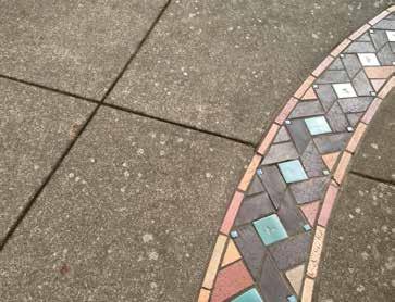
80 74 UNIVERSITY OF OREGON CAMPUS PHYSICAL FRAMEWORK VISION DESIGN AREA RECOMMENDATIONS
81 5FOCUS STUDIES 75 1 Focus studies explore designs of four campus areas to illustrate the application of the campus framework, guidelines, and design area recommendations highlighting outdoor improvements. They display a range of conditions. The university can implement a significant proportion of each focus study because each design is not totally dependent on new building construction. The four focus studies are 1. Garden Walk in North Design Area 2. Campus Heart 3. Garden Walk in the Central Design Area 4. University Street UNIVERSITY OF OREGON CAMPUS PHYSICAL FRAMEWORK VISION FOCUS STUDIES

82 76 GARDEN WALK IN NORTH DESIGN AREA Existing WILKINSON HOUSE FINE ARTS STUDIOS MILLRACE STUDIOS WOODSHOP URBAN FARM GALLERY WALK AXIS ONYX STREET MILLRACE 4 FRANKLIN BOULEVARD Acre N 0 25 feet 50 UNIVERSITY OF OREGON CAMPUS PHYSICAL FRAMEWORK VISION FOCUS STUDIES

83 77 Garden Walk in North Design Area Proposed As the university expands north of Franklin Boulevard, open space proximate to the Millrace should build on and enhance the character and function of the natural systems. To emulate the campus south of the boulevard, buildings should be orthogonally sited to define new quadrangles. 1 3 This arrangement of new buildings (1), mature trees, the flowing Garden Walk, linked quadrangles and informal open space, and the absence of automobiles will work together to support the desired campus character. ONYX STREET FRANK Acre 0.05 LIN BO 25 feet ULEVA RD N 50 GALLERY WALK AXIS URBAN FARM 5 The Garden Walk (2) should build on and integrate with a portion of the Gallery Walk Axis (3), connecting with a new crossing at Onyx Street (4) and the pedestrian bridge that will cross Franklin Boulevard. To allow early implementation before construction of new buildings, the Garden Walk moves smoothly around existing buildings, through a series of gardens connecting to the Millrace, past the Urban Farm (5), and along a water garden (6), styled on the concept of a living machine. The enhancement of the Millrace (7) as green infrastructure to treat storm-water and improve habitat is a key opportunity in the large-scale development of the North Design Area. The water channel needs to be restructured, new drainage connections made, water sources arranged, and invasive vegetation replaced with natives. These actions can produce a supportive landscape that helps define the area as part of the campus while highlighting the unique character of its setting. NOTE: Dashed lines indicate existing buildings to be removed. This particular scheme can be achieved to a large extent without removing the existing buildings UNIVERSITY OF OREGON CAMPUS PHYSICAL FRAMEWORK VISION FOCUS STUDIES

84 78 Garden Walk in North Design Area Section Proposed Large trees and flowing riparian vegetation define the Millrace. The area alongside the Millrace has multiple interconnected paths and walks that circulate through the area. Its informal character contrasts with the quadrangles framed by proposed buildings to the north. Preserve mature trees and plant new heritage trees to complement future development. As new buildings are added, create outdoor spaces at sunny south-facing entries overlooking the Millrace. Garden walk Walk Millrace Riparian woodland Walk / Bike Walk Upper plaza UNIVERSITY OF OREGON CAMPUS PHYSICAL FRAMEWORK VISION FOCUS STUDIES

 Engaging the Millrace with outdoor gathering space will provide a unique character.")

85 79 Garden Walk in North Design Area Circulation and Precedents ONYX STREET URBAN FARM ART WALK Pedestrian Bicycle Emergency FRANKLIN BOULEVARD Building Removed Circulation Garden Walk in North Design Area Focus Study Circulation - Proposed A significant water treatment element can be a defining element within the area; possibly as a research tool. (University of British Columbia) Engaging the Millrace with outdoor gathering space will provide a unique character. (Green-Park Lime Square, Reading, UK) Native and naturalized plantings will reinforce a connection to the river corridor and larger landscape.(tianjin Qiaoyuan Wetland Park, Tianjin City, China) UNIVERSITY OF OREGON CAMPUS PHYSICAL FRAMEWORK VISION FOCUS STUDIES

86 80 FRIENDLY COLUMBIA WILLAMETTE HALL CAMPUS HEART Existing EAST 13TH AVENUE JOHNSON HALL ERB MEMORIAL UNION (EMU) COLLIER HOUSE JOHNSON LANE UNIVERSITY STREET Acre N 0 25 feet 50 UNIVERSITY OF OREGON CAMPUS PHYSICAL FRAMEWORK VISION FOCUS STUDIES

87 81 FRIENDLY COLUMBIA EAST 13TH AVENUE JOHNSON HALL ERB MEMORIAL UNION (EMU) Acre 0.05 JOHNSON LANE 25 feet N UNIVERSITY STREET COLLIER HOUSE 0 WILLAMETTE HALL Campus Heart Proposed Currently the campus lacks a defined heart an urban plaza where the campus community gathers. Specifically, this place needs to be a hard-surfaced, large-scale gathering space at the core of the campus. It should support a range of program needs from large-scale events to the needs of an individual. The space should be flexible and scalable for daily life, events, and gatherings but not feel abandoned during nonpeak hours. Circulation through the space, along East 13th Avenue (1) and University Street (2) will be free of private vehicles and organized to maintain clear, safe connections. Private vehicles will have managed access to parking via Johnson Lane. As part of a multi-modal transportation study, the university will consider the management of private vehicles, pedestrians, and bicyclists. The space should be formed and defined by structures, trees, sculptural lighting, and elements such as a bank of stadium seating. In addition, an iconic glass canopy (3) will provide for programmed uses and shelter from the rain. 2 Initially, the Collier House (4) and its mature trees can be retained and better used for campus activities, perhaps as a coffee house or pub café. In the long-term, the Collier House can be replaced with a new building that has active, shared uses (5) befitting its central location and connection to the academic core. 50 NOTE: Dashed lines indicate existing buildings to be removed. A majority of this scheme can be achieved with Collier House remaining. UNIVERSITY OF OREGON CAMPUS PHYSICAL FRAMEWORK VISION FOCUS STUDIES
88 82 Campus Heart Section Proposed Grade changes provide opportunities to create a diversity of activity zones and seating areas. A new, elevated upper terrace and a bank of stadium steps (1) at the new building (2) can provide a place to see and be seen and be a podium for large events. Glass canopies at the new building and a freestanding structure in the plaza can (3) provide shelter and be illuminated, enhancing the identity of this area Upper terrace Bleachers Plaza Walk Amphitheater EMU UNIVERSITY OF OREGON CAMPUS PHYSICAL FRAMEWORK VISION FOCUS STUDIES


89 83 FRIENDLY COLUMBIA WILLAMETTE Campus Heart Circulation, Scale Comparison, and Precedents 13 TH AVENUE 13 TH AVENUE JOHNSON HALL ERB MEMORIAL UNION (EMU) COLIIER HOUSE Pedestrian JOHNSON LANE UNIVERSITY STREET Bicycle Emergency Managed Vehicular access Circulation Shelter, informal seating, and paving patterns help make this square unique and visually active. (Market square, Renens, Switzerland) COLUMBIA 13 TH AVENUE Memorial Quad 180 COLIIER HOUSE 120 Scale Comparison to the Memorial Quadrangle JOHNSON LANE UNIVERSITY STREET ERB MEMORIAL UNION (EMU) Movable furniture visually activates this plaza on a daily basis. (Manhattan, New York, NY) UNIVERSITY OF OREGON CAMPUS PHYSICAL FRAMEWORK VISION FOCUS STUDIES

90 84 ERB MEMORIAL UNION (EMU) BEECH STREET UNIVERSITY HEALTH, COUNSELING AND TESTING GARDEN WALK IN CENTRAL DESIGN AREA Existing CARSON PROMENADE AGATE ST HAWTHORNE MC CLURE DYMENT MC ALISTER MORTON NORTH LIVING / LEARNING CENTER DECOU WALTON Acre N 0 25 feet 50 UNIVERSITY OF OREGON CAMPUS PHYSICAL FRAMEWORK VISION FOCUS STUDIES
91 85 Garden Walk in Central Design Area Proposed BEECH ST UNIVERSITY HEALTH, ERB MEMORIAL UNION (EMU) COUNSELING AND TESTING An underused space on campus, the Promenade connects the Erb Memorial Union (EMU) to multiple residential halls to the east. Today, the space lacks a cohesive identity and is mainly a cross-through open space. CARSON 3 AGATE ST DYMENT MC CLURE 0.1 Acre 0.05 MORTON 0 25 feet MC ALISTER HAWTHORNE NORTH LIVING / LEARNING CENTER DECOU WALTON Redevelopment of this zone should create a central open space that is a vibrant hub of activity with opportunities for recreation and gathering. As a primary east-west connector and part of the Garden Walk, this open space can be transformed into a swath of garden a green ribbon connecting across Agate Street. The Garden Walk will accommodate a consistent flow of people through the area. It provides places to hang out, learn, and play. This linear garden should dedicate spaces for volleyball (1) and possibly courts for basketball (2) or futsal. Lawn areas (3) can accommodate larger student gatherings and student residents activities. New gardens should be located to treat storm-water, support campus ecology with native pollinator gardens, and tell the story of the adjacent building programs. Groupings of flowering trees, such as cherries, can provide seasonal interest and an appropriate scale among the larger oaks and conifers. Sculpture is already part of this locale and additional art elements can connect the site to the Central Design Area and the entire campus. N 50 UNIVERSITY OF OREGON CAMPUS PHYSICAL FRAMEWORK VISION FOCUS STUDIES


92 86 Garden Walk in Central Design Area Section Proposed Although most of this area is level and defined by the surrounding buildings, the west has enough topography to create interesting spaces. The existing tree plantings should be shaped to fashion outdoor rooms and gathering areas. These spaces can provide intimate seating areas along the Garden Walk or larger recreational lawns for students from the adjacent residence halls. EMU extension Lawn Garden Garden walk Garden Walk Garden Stormwater Lawn UNIVERSITY OF OREGON CAMPUS PHYSICAL FRAMEWORK VISION FOCUS STUDIES


 Provide a range of seating opportunities.")
93 BEECH ST ST BEECH 87 ERB MEMORIAL UNION (EMU) Garden Walk in Central Design Area Circulation and Precedents UNIVERSITY HEALTH, COUNSELING AND TESTING AGATE ST CARSON HAWTHORNE Pedestrian MC CLURE DYMENT MORTON LIVING / LEARNING DECOU MC ALISTER Bicycle WALTON Emergency Managed Vehicular access Circulation Informal recreation will continue to serve the adjacent student residents. The Garden Walk clusters of flowering trees will lend this area multi season interest. (Cherry Walk, Brooklyn Botanic Garden) Provide a range of seating opportunities. (Millennium Park, Chicago, IL) UNIVERSITY OF OREGON CAMPUS PHYSICAL FRAMEWORK VISION FOCUS STUDIES


94 88 ESSLINGER UNIVERSITY STREET Existing UNIVERSITY STREET MC ARTHUR COURT HOWE FIELD Acre N 25 feet 50 UNIVERSITY OF OREGON CAMPUS PHYSICAL FRAMEWORK VISION FOCUS STUDIES
, forming interconnected gathering spaces and forecourts to new buildings.")
95 89 University Street Proposed ESSLINGER The design of University Street should foster a sense of arrival to campus, while being efficient and safe. UNIVERSITY STREET 1 These outdoor rooms should be created where the new open spaces meet (1), forming interconnected gathering spaces and forecourts to new buildings. Designed for daily use and scaled for major events such as softball tournaments, the outdoor rooms should link east to west and be defined by a new array of academic buildings Acre As a linear open space, the mall-like entry should accommodate private vehicles, pedestrians, and bicyclists, have edges defined with trees and buildings, and have outdoor rooms at key points. JANE SANDERS STADIUM Parking spaces (2) along the east side provide general convenience and easy access to the adjacent walks. In an effort to provide parking near the core of campus and the Erb Memorial Union (EMU), the buildings to replace McArthur Court and Esslinger Hall have the option to include below-grade parking that will be accessed from University Street. N 0 25 feet 50 NOTE: Dashed lines indicate existing buildings to be removed. Improvements to University Street can be achieved prior to the construction of new buildings. UNIVERSITY OF OREGON CAMPUS PHYSICAL FRAMEWORK VISION FOCUS STUDIES

 will recall the cultural landscape heritage of the cemetery once defined by such plantings.")
96 90 University Street Section Proposed This connector will welcome daily users as well as visitors. University Street s broad expanse is sufficient to provide a layered multi-modal entry into campus. The available width is enhanced by siting future buildings approximately 30-feet east of McArthur Court s west facade. This shift aligns with the northwest corner of Esslinger Hall, preserving a row of mature trees. Outdoor rooms to the east (1) are bracketed by surface parking. The Eugene Pioneer Cemetery bounds the west side of University Street. A new row of Douglas fir trees (2) will recall the cultural landscape heritage of the cemetery once defined by such plantings. 2 1 Cemetery Travel lane Planting Walk Walk Quad UNIVERSITY OF OREGON CAMPUS PHYSICAL FRAMEWORK VISION FOCUS STUDIES


97 91 ESSLINGER University Street Circulation and Precedents UNIVERSITY ST Pedestrian Bicycle Emergency Managed Vehicular access Building Removed Circulation Creating a shared linear open space formalizes the south campus entry. (Stanford University) Entr y cour ts should intersect University Street and open spaces to create outdoor rooms. (Illinois Institute of Technology) Informal space and seating opportunities can be woven into the new open spaces. (Stanford University) Consider the use of warm and modular paving for the walk. (University of British Columbia) UNIVERSITY OF OREGON CAMPUS PHYSICAL FRAMEWORK VISION FOCUS STUDIES

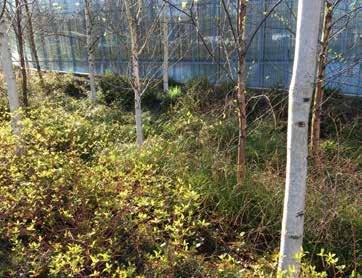
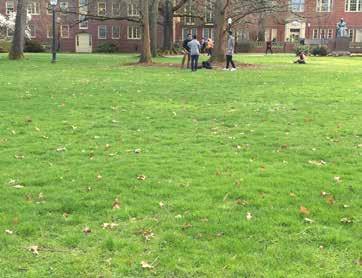

98 92 UNIVERSITY OF OREGON CAMPUS PHYSICAL FRAMEWORK VISION FOCUS STUDIES


99 6CAMPUS SYSTEMS 93 Diagrams identify existing and proposed campus systems Pedestrian circulation Bicycle circulation Vehicle circulation Service circulation Emergency circulation Utilities infrastructure Developing these diagrams allowed the project team to test and refine the Campus Framework. UNIVERSITY OF OREGON CAMPUS PHYSICAL FRAMEWORK VISION SYSTEM DIAGRAMS

100 94 PEDESTRIAN CIRCULATION EXISTING UNIVERSITY OF OREGON CAMPUS PHYSICAL FRAMEWORK VISION SYSTEM DIAGRAMS
101 95 PEDESTRIAN CIRCULATION PROPOSED UNIVERSITY OF OREGON CAMPUS PHYSICAL FRAMEWORK VISION SYSTEM DIAGRAMS

102 96 BICYCLE CIRCULATION EXISTING UNIVERSITY OF OREGON CAMPUS PHYSICAL FRAMEWORK VISION SYSTEM DIAGRAMS

103 97 BICYCLE CIRCULATION PROPOSED UNIVERSITY OF OREGON CAMPUS PHYSICAL FRAMEWORK VISION SYSTEM DIAGRAMS

104 98 VEHICLE CIRCULATION EXISTING UNIVERSITY OF OREGON CAMPUS PHYSICAL FRAMEWORK VISION SYSTEM DIAGRAMS

105 99 VEHICLE CIRCULATION PROPOSED UNIVERSITY OF OREGON CAMPUS PHYSICAL FRAMEWORK VISION SYSTEM DIAGRAMS

106 100 SERVICE CIRCULATION EXISTING UNIVERSITY OF OREGON CAMPUS PHYSICAL FRAMEWORK VISION SYSTEM DIAGRAMS
107 101 SERVICE CIRCULATION PROPOSED For heavy vehicles. UNIVERSITY OF OREGON CAMPUS PHYSICAL FRAMEWORK VISION SYSTEM DIAGRAMS

108 102 EMERGENCY CIRCULATION EXISTING UNIVERSITY OF OREGON CAMPUS PHYSICAL FRAMEWORK VISION SYSTEM DIAGRAMS
109 103 EMERGENCY CIRCULATION PROPOSED UNIVERSITY OF OREGON CAMPUS PHYSICAL FRAMEWORK VISION SYSTEM DIAGRAMS

110 104 UTILITIES INFRASTRUCTURE EXISTING Although there is no proposed diagram, the Campus Framework recognizes those utilities that may influence the UOCPFV. Chapter 7, Further Recommendations includes the recommendation for a campus infrastructure master plan. UNIVERSITY OF OREGON CAMPUS PHYSICAL FRAMEWORK VISION SYSTEM DIAGRAMS
111 7FURTHER RECOMMENDATIONS This chapter contains suggestions for Changes in the Campus Plan Future work and studies Priority projects Peer-review process RECOMMENDED CHANGES TO THE CAMPUS PLAN Based on the prior chapters, the following are suggested changes to the Campus Plan. This will require further assessment and input from the Campus Planning Committee, the campus community, and neighbors. Revise Campus Boundary Revise boundary as shown in Chapter 3 of this document. New Policy Campus Framework Add a new policy before Policy 2 to describe the Campus Framework per Chapter 2 of this document. Existing Policy 2 Open-Space Framework Change policy title to Designated Open Space. Update with revised designated open spaces and add typologies to new ones. Remove text on pathways; now in a new Campus Framework policy. Add diagram and text on Campus Edges, Corridors, Gateways, and Views. New Policy Guidelines Permissible Building Sites, table, and use definitions. Permissible Building Uses. Shared Uses. Existing Policy 3 Densities Revise Design Areas and standards per Chapter 1 of this document. Retain pertinent language from the existing policy. Existing Policy 4 Space Use and Organization No significant changes. Existing Policy 5 Replacement of Displaced Uses No significant changes. Existing Policy 6 Maintenance and Building Service No significant changes. Add service diagram proposed. Existing Policy 7 Architectural Style and Historic Preservation No significant changes. Existing Policy 8 Universal Access No significant changes. Existing Policy 9 Transportation Add circulation diagrams proposed. Revise text. Existing Policy 10 Sustainable Development No significant changes. Existing Policy 11 Patterns Revise text to reference Campus Framework in place of the Open Space Framework. Add diagrams including all transportation (circulation related). Revise height limits and add diagram. Existing Policy 12 Design Area Special Conditions Replace with Chapter 4 of this document. Prepare diagrams and text for design areas not addressed. Add descriptions of existing conditions if desired. Complete remaining design areas. GOVERNMENT APPROVALS AND OUTSIDE COORDINATION City of Eugene Currently, the university cannot build in the North and Riverfront design areas that are zoned Riverfront Park Special Area Zone. The conditional use permit for the entire zone, which was based on a master plan, expired in The university needs to resolve zoning in this area to accommodate university uses and research park uses (including leases by private tenants) south of the railroad tracks and year-round recreational fields (and associated ancillary facilities) north of the railroad tracks. Southern Pacific Railroad Tax Lots The university acquired property from the Southern Pacific Railroad (SPRR) along the south side of the railroad tracks Tax map , Lot The UOCPFV proposes an access road and surface parking within this area. SPRR reserved easements for above- and below-ground communications and fiber optic facilities that must be considered. 105 UNIVERSITY OF OREGON CAMPUS PHYSICAL FRAMEWORK VISION FURTHER RECOMMENDATIONS
112 106 FUTURE STUDIES Review, refine, and incorporate selected items into the Campus Plan. Prepare a dimensioned CAD drawing of the designated open space and permissible building sites. Identify high-priority projects for the next ten years. Tie the UOCPFV into the university s capital investments strategy. Work with the City of Eugene and neighbors in the North, Riverfront, and East design areas to allow intended uses. Study campus gateways to identify treatments, shared elements, etc. Work with City of Eugene on primary gateways and city rightsof-way shared by the university and the city. Engage with the City of Eugene to prepare a multi-modal transportation plan. Prepare studies of shared pedestrian-bicycle use on East 13th and 15th avenues. Prepare a campus infrastructure master plan. Prepare a landscape master plan to identify plant materials, site furnishings, signage, lighting, and maintenance. Coordinate storm-water strategy for the campus and City of Eugene. RECOMMENDED PRIORITY PROJECTS Based on the recommendations in this document, the accompanying diagram and matrix identify high-priority projects suggested for implementation within the next ten years. This is a tool for further discussion and prioritzation. The actual selection of projects and their sequence of implementation may change due to unforeseen factors. In some cases, there may be the need to start project planning sooner in order to achieve the desired results within the ten-year time frame. Examples are the Willamette Riverfront and Millrace enhancements. These require multi-jurisdictional review and coordination and multiple sources of funding. Additional projects may come to light as unforeseen opportunities appear to the university. Criteria used to identify and evaluate the projects and rankings UOCPFV Principles/Values (repeated from Chapter 1) General Impacts. UOCPFV Principles/Values The University of Oregon campus in Eugene supports the University Mission Statement by Principles/Values As discussed in Chapter 1, the University of Oregon campus in Eugene supports the University Mission Statement by Being accessible, safe, and welcoming to foster social and academic collaboration a responsibility shared by open space and buildings. Enhancing identity through memorable places embodied by its high-quality open space system, distinctive cultural heritage, architecture, and unique location. Being a residential campus a second home for its students. Integrating ecological care into all aspects of campus life, practices, and operations. Being distinctive in character and, yet, connected and welcoming to its neighbors. Providing an extension of the learning environment in mind, body, and spirit. Scoring 3 = Highest / 1 = Lowest Project Letterr and Name UOCPFV Principles/Values Accessible Identity Via Welcoming Safe Memorable Places Residential Campus Ecological Care Distinctive and Connected Extension of Learning Environment Weighting Subtotal Score General Impacts High Impact Ease of Implementation Ripple Effect I Garden Walk - Student Union to Agate Street M East Campus Open Space and Garden Walk B Garden Walk - North Campus H Johnson Lane K University Street A Willamette Riverfront C Millrace J East 15th Avenue L Knight Library / Cemetery Connection G Campus Heart F East 13th Avenue E Kincaid Street D Franklin Boulevard Subtotal Score Total Score Ranking High-Priority Project Key Map High-Priority Projects Evaluation, Sorted by Project Ranking UNIVERSITY OF OREGON CAMPUS PHYSICAL FRAMEWORK VISION FURTHER RECOMMENDATIONS
113 107 Projects that score highly as accessible, safe, and welcoming include those at campus edges such as improvements along Kincaid Street. The Garden Walk and the Campus Heart have high visibility and make especially strong contributions to the campus sense of place so they score highly in the identity through memorable places. Projects with high residential campus scores include those that improve the residential experience, such as the Garden Walk between the EMU and Agate Street. The restoration such of the Millrace and river edge score high in ecologic care. Extension of the learning environment scores are high for projects that offer opportunities for learning in their design solution, such as the Garden Walk and the Millrace. General Impacts High impact Strong potential to improve campus outdoor space to benefit the maximum number of users. Ease of implementation Less resources needed, quicker time line, or more simplified approval process to implement. Ripple effect Projects that create the impetus for other improvements. Conversion of East 13th and 15th avenues into pedestrian-first streets are examples of a high-impact projects because they serve a large number of campus users daily. Ease of implementation efforts include Johnson Lane where simple pruning of low hanging branches along with improved lighting and seating can be undertaken with less resources than required by other projects. One example of a ripple effect is the conversion of East 15th Avenue between University and Agate streets into a pedestrian-first street that could be implemented as part of the upcoming Outdoor World Track and Field Championships set for Another example is the construction of the new residence hall in the East Design Area that is creating the impetus to implement adjacent open space. PEER-REVIEW PROCESS PROPOSED The goal of this recommendation is to heighten planning and design expertise in the review and guidance of landscape and architectural projects. This process will help inform the Campus Planning Committee and the user groups formed for each project. Value A peer-review process will bring value to project design in two ways. Most members of a project user group lack the experience to make informed criticism of design proposed by landscape architects and architects and would benefit from professional advice. The user group by definition is concerned with their own project. They may not consider the impacts to their campus neighbors and to their connection to the campus. The process adds depth to the user group involvement by providing awareness of alternative designs. It also adds another opinion on design (beyond that of the Campus Planning Committee) to the president at the point of schematic design review and acceptance. Peer designers present expert opinions from the fields of building design, landscape design, and campus planning. The added time and cost should be minimal. Process There are several moments in the design process for open space or building where critical review and comment can be valuable in the outcome. The intention is to find appropriate points to insert the review team so that no additional time is added to the schedule and no additional preparation by the consultant is needed. Meetings would be either immediately before or after regularly scheduled user-group meetings. Consultant Selection At this stage the peer-review team would evaluate the qualifications of the consultants, narrowing submittals to three to five. Members of the peer-review team who are not local participate by phone or a video conference.. The peer-review team sits on interviews and provides a brief oral summary to the user group before the user group begins deliberations. Design The peer-review team considers early designs of the project in a meeting with the user group chair, selected consultant, and others as appropriate. The meeting(s) is before or after scheduled usergroup meetings. The peer-review team assesses the consultant s presentation of final schematic design and provides comments to the university president. Finally, the peer-review team examines the design during the design development phase in a meeting with the user group chair, consultant, and others as appropriate. Membership The peer-review team should bring expertise on design and campus planning to the process. These experts should be versed in the goals, vision, values, and practices of the campus and the project and as much as possible accept these before they agree to serve. Total membership would be four to five people One or two practicing architects or landscape architects. These can be retired practitioners, or practitioners who have worked on the campus on similar projects but are not competing for this project. These professionals bring design expertise and an off-campus perspective. The Dean of the School of Architecture and Allied Arts or designated representative. This person should bring design expertise and a campus-wide perspective. A professor who is the user-group member for Architecture, Landscape Architecture, or Interior Architecture. This person brings design expertise and intimate knowledge of the project needs. The university architect or planner. This person brings knowledge of how to achieve a greater campus good and how campus-wide visions could be met by this project. Cost to implement The peer-review process results in three additional meetings for the architectural design team and one presentation of the schematic design. A critical assumption is that the peer-review team s recommendations to the president would not result in significant design changes requiring redesign. With the peer-review team included in the early stages of the design, there is less risk. However, it is possible and could result in significant costs and add time to complete a project. Out-of-town peer-reviewers donate their time but are reimbursed for travel costs. UNIVERSITY OF OREGON CAMPUS PHYSICAL FRAMEWORK VISION FURTHER RECOMMENDATIONS

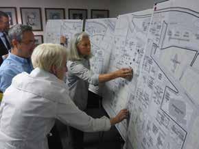
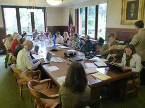
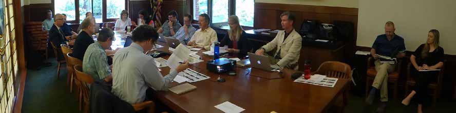
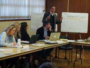


114 108 UNIVERSITY OF OREGON CAMPUS PHYSICAL FRAMEWORK VISION FURTHER RECOMMENDATIONS
115 8CONTRIBUTORS Advisory Group to the Framework Vision Project University of Oregon Frances Bronet, Interim Provost Dean of Architecture & Allied Arts (AAA) Larry Bruton, FAIA, UO Foundation Trustee, Architect (ZGF Architects, LLP) James Chrisman, Student / AIA Student Chapter President M. Boone Hellmann, FAIA, LEED AP BC+C, Retired Campus Architect, University of California San Diego Robin Holmes, Vice President for Division of Student Life W. Andrew Marcus, Interim Tykeson Dean, College of Arts and Sciences Jamie Moffitt, Vice President for Finance and Administration /CFO Ginevra Ralph, Vice Chair, UO Board of Trustees Chris Ramey, AIA, LEED Green Associate, University Architect, Associate Vice President, Campus Planning, Design and Construction, Brad Shelton, Interim Vice President for Research and Innovation Edward Teague, Head, AAA Library, University Senate member/ representative to the Campus Planning Committee (CPC) Rob Thallon, Associate Dean, AAA, Associate Professor, Architecture, Campus Planning Committee chair, Space Advisory Group member Roxi Thoren, Associate Professor, Landscape Architecture and Architecture, Director, The Fuller Center for Productive Landscapes Campus Planning Committee University of Oregon Yvette Alex-Assensoh, Vice President for Equity & Inclusion Margo Barajas, Student* Miriam Bolton, Dean s Office, College of Arts and Sciences L. Jane Brubaker, Campus Operations* Ihab Elzeyadi, Architecture Sue Eveland, VP Enrollment Management Representative* Fritz Gearhart, Music & Dance 5 Hilary Gerdes, Accessible Education Representative Alicia Going, American English Institute Michael Griffel, VP Student Life Representative* Michael Hahn, Human Physiology George Hecht Associate Vice President, Campus Operations Dana Johnston, Representative, College of Arts and Sciences Moira Kiltie, VP Research and Innovation Representative* Richelle Krotts, Classified Staff, Education Studies Kenneth Kato, Geography Peter Keyes, Architecture Graham Kribs, Physics Dean Livelybrooks, Physics* Gregg Lobisser, Assistant Vice President, Capital Projects Student Life, Facilities Services Ron Lovinger, AAA, University Senate Representative* Ben Lucke, Student* Jeff Madsen, Campus Operations Brian McBeth, Student* Josh McCoy, VP Advancement Representative* Jamie Moffitt, Vice President for Finance and Administration Eric Mokube, VP Equity and Inclusion Representative* Peter Obermeyer, Student* Nancy Pierce, Student* Andrzej Proskurowski, Computer & Information Science Chris Ramey, University Architect, Associate Vice President, Campus Planning, Design and Construction Daniel Rosenberg, Clark Honors College* Bitty Roy, Biology* Shannon Sardell, Historic Preservation Brad Shelton, Interim Vice President for Research and Innovation Cathy Soutar, Director of Facilities, College of Arts and Sciences Edward Teague, UO Libraries, University Senate Representative Rob Thallon, AAA, Associate Dean for Administration, Chair Roger Thompson, Vice President for Enrollment Management * New CPC members who came on board for Workshop #4 Campus Planning, Design, and Construction University of Oregon Nick Drummond, Student Emily Eng, Planning Associate Phil Farrington, AICP, Planning Associate Zeta Fernando, Student Dianna Montzka, Student Justin Porter, Accountant Chris Ramey, AIA, University Architect, Associate Vice President Vivian Schoung, Planning Assistant Kelly Stoecklein, Student Christine Thompson, Manager of Campus Planning and Space Management Eleni Tsivitzi, Planning Associate 109 UNIVERSITY OF OREGON CAMPUS PHYSICAL FRAMEWORK VISION CONTRIBUTORS
116 110 InfoGraphics Lab, Department of Geography University of Oregon Blake Andrew, GIS Specialist Jacob Bartruff, Lead Developer Riley Champine, Student Geographer Nicole D Entremont, Student Geographer Brook Eastman, GIS Specialist Kenneth Kato, Associate Director, InfoGraphics Lab Diana Lee, Student Designer Nick Martinelli, Research Assistant Adam Oldenkamp, Student Geographer Consultants Robert Sabbatini AICP FASLA Bonnie Loyd Robert Sabbatini, AICP, FASLA PLACE Simon Bequillard, Project Designer Charles Brucker, ASLA, Principal Jennifer Huang, Project Designer Matthew Noyes, Project Designer Colleen Wolfe, Project Manager Perkins + Will Brodie Bain, FAIA, AICP, Campus Planning Director Jaclynn Treat, AIA, Campus Planner UNIVERSITY OF OREGON CAMPUS PHYSICAL FRAMEWORK VISION CONTRIBUTORS
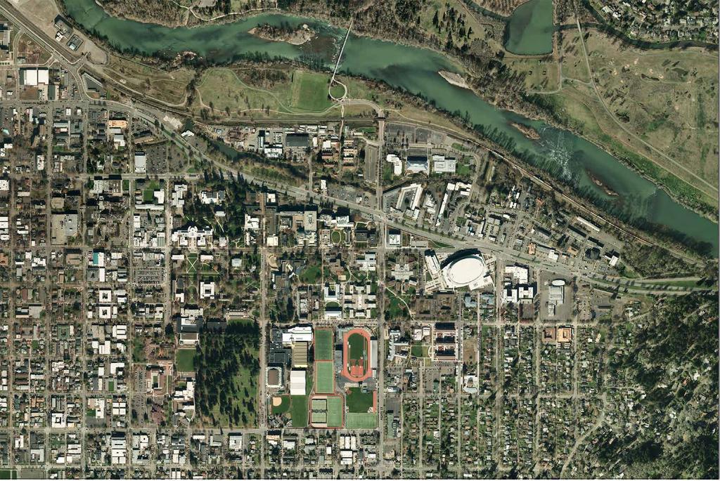
117


118 112 UNIVERSITY OF OREGON CAMPUS PHYSICAL FRAMEWORK VISION CONTRIBUTORS
Policies and Code Intent Sections Related to Town Center
 Policies and Code Intent Sections Related to Town Center The Town Center Vision is scattered throughout the Comprehensive Plan, development code and the 1994 Town Center Plan. What follows are sections
EXISTING COMPREHENSIVE PLAN
 EXISTING COMPREHENSIVE PLAN Town Center Land Use Element: V. LAND USE POLICIES Town Center Mercer Island's business district vision as described in "Your Mercer Island Citizen-Designed Downtown" was an
BELLEVUE COLLEGE Campus Master Plan February 29, 2016 (Space Needs Updated on 04/13/2016) Bellevue College Campus Master Plan April 13, :08 PM
 Bellevue College Campus Master Plan April 13, :08 PM") BELLEVUE COLLEGE Campus Master Plan February 29, 2016 (Space Needs Updated on 04/13/2016) AGENDA / STEERING COMMITTEE MEETING 15:00 PLANNING PROCESS: 15:05 GUIDING PRINCIPLES: 15:10 SPACE NEEDS: 15:30
BELLEVUE COLLEGE Campus Master Plan February 29, 2016 (Space Needs Updated on 04/13/2016) AGENDA / STEERING COMMITTEE MEETING 15:00 PLANNING PROCESS: 15:05 GUIDING PRINCIPLES: 15:10 SPACE NEEDS: 15:30
WESTERN ILLINOIS UNIVERSITY
 WESTERN ILLINOIS UNIVERSITY Quad Cities Riverfront Campus Preliminary Master Plan Presentation 2 February 1, 2006 Achieving Future Flexibility 1. Monitor space needs as the new buildings come on line and
Phase 1 : Understanding the Campus Context. Phase 2 : APPROACHES - Alternates & Preferred Plan
 Introduction MASTER PLAN PURPOSE WHY A CAMPUS MASTER PLAN? The purpose of the Master Plan at the University of Illinois at Chicago is to translate UIC s strategic goals and objectives into a compelling
Foreword to the Third + Edition
 U n i v e r s i t y of Oregon Campus Plan - Third + Edition, 2017 i Foreword to the Third + Edition Third + Edition (November 2017) This third + edition of the 2005 Campus Plan integrates amendments approved
PUBLIC RIGHT-OF-WAY IN THIS CHAPTER PUBLIC REALM
 PUBLIC RIGHT-OF-WAY This section provides design guidelines for improvements in the public right-of-way. The public right-of-way refers to streets, sidewalks, non-vehicular thoroughfares, parks and greenways
Table of Contents. Elm Avenue Improvement Plan City of Waco, Texas. Introduction 1. Existing Context 1 Figure 1 2.
 Table of Contents Introduction 1 Existing Context 1 Figure 1 2 Plan Guidelines 3 Future Urban Form 4 The West-End 4 Main Street 6 The East-End 7 Figure 2 9 Public Improvement Recommendations 7 General
A. Background Summary of Existing Challenges and Potential Possibilities. 1. Summary of Existing Assets and Potential Opportunities
 A. Background 1 A Main Street Master Plan Study was performed and completed in October of 2007. The study was initiated to review current land uses and development patterns along Main Street, from Parrish
City of Farmington. Downtown Plan. Amendment to the 1998 Master Plan Adopted October 11, 2004
 City of Farmington Amendment to the 1998 Master Plan Adopted October 11, 2004 Introduction Planning Background 1 Scope and Components of the Plan Amendment 2 Concept Introduction 3 Plan Concepts 3 Conceptual
FRUITVALE TRANSIT VILLAGE (Phase 2) Residential Project
 Residential Project") FRUITVALE TRANSIT VILLAGE (Phase 2) Residential Project DEVELOPER: SIGNATURE PROPERTIES ARCHITECT: HKIT ARCHITECTS April 23, 2010 TABLE OF CONTENTS 3 Vision 4 Description of Site 5 Guiding Concepts 6
FRUITVALE TRANSIT VILLAGE (Phase 2) Residential Project DEVELOPER: SIGNATURE PROPERTIES ARCHITECT: HKIT ARCHITECTS April 23, 2010 TABLE OF CONTENTS 3 Vision 4 Description of Site 5 Guiding Concepts 6
WESTERN ILLINOIS UNIVERSITY
 WESTERN ILLINOIS UNIVERSITY Quad Cities Riverfront Campus Master Plan March 1, 2006 Preliminary Master Plan Total Site Build Out Western Illinois University Quad Cities Municipal Park Mississippi River
DRAFT. October Wheaton. Design Guidelines
 October 2011 DRAFT Wheaton Design Guidelines 2 Draft - Design Guidelines - Wheaton Sector Plan Contents 04 Section 1: Introduction 06 Section 2: Context 08 Section 3: Design Guidelines 09 Goal 1: Create
Community Design Guidelines. Port Wallace DRAFT
 Community Design Guidelines Port Wallace DRAFT Energy 1 2 3 Nature Movement Connections Built Form DRAFT Layout Energy 1 Nature Community Design Guidelines GREAT COMMUNITIES PROTECT, CELEBRATE, AND CONSERVE
Figure 3-1: Public Realm Plan
 3 Public Realm Figure 3-1: Public Realm Plan 3.1 Public Realm Concept The public realm concept for the Little Mountain site integrates a clear and accessible movement network with public spaces for social
The Vision. Photo provided by The Minervini Group. 46 Vision, Objectives & Strategies
 Vision, Objectives & Strategies The is the public framework and guide for future development of the Grand Traverse Commons. The establishes public polices for infrastructure, the preservation of natural
SUBJECT: Waterfront Hotel Planning Study Update TO: Planning and Development Committee FROM: Department of City Building. Recommendation: Purpose:
 Page 1 of Report PB-23-18 SUBJECT: Waterfront Hotel Planning Study Update TO: Planning and Development Committee FROM: Department of City Building Report Number: PB-23-18 Wards Affected: 2 File Numbers:
38 Queen s University Campus Master Plan Part 1
 38 Queen s University Campus Master Plan Part 1 46 The Campus at the City Scale Chapter 4 The Campus at the City Scale 39 Queen s is an urban University centrally located in Kingston. Decisions made by
11 February CAMPUS MASTER PLAN UPDATE Focus Group - Design Guidelines
 11 February 2016 CAMPUS MASTER PLAN UPDATE Focus Group - Design Guidelines AGENDA Introductions Planning Scope The 2004 Campus Plan Observations Design Guidelines - 2004 Plan SWOT Exercise Analysis Goals
18 May 2016 CAMPUS MASTER PLAN UPATE
 18 May 2016 CAMPUS MASTER PLAN UPATE Council of the Deans ( Over view) AGENDA Engagement & What We Heard Focus Elements: 1. Development Framework Plan 2. Campus Mobility 3. Campus Guidelines 4. Wayfinding
Public input has been an important part of the plan development process.
 Lakewood s Comprehensive Plan recognizes that transportation helps shape the community, and that the way the community provides for the safe and efficient movement of people affects the character of the
There are five comprehensive goals that inform the Urban Design element at FIU. They are:
 3.0 URBAN DESIGN ELEMENT This Comprehensive Master Plan Update reflects the University s commitment to the refinement and extension of the base concepts earlier master planning efforts have created. FIU
section five BEAUTIFICATION PLAN
 section five BEAUTIFICATION PLAN BEAUTIFICATION PLAN Section Five Beautification Plan The goal of the Beautification Plan is to improve the Route 8-Sunnyland Corridor in terms of aesthetics and to create
New-Cast Mixed-use Development Proposal King Street West, Newcastle, Ontario
 URBAN DESIGN BRIEF New-Cast Mixed-use Development Proposal King Street West, Newcastle, Ontario TABLE OF CONTENTS: 1.0 Executive Summary 2.0 Creating Vibrant and Sustainable Urban Places: Excerpts from
CAL POLY MASTER PLAN UPDATE, March 2015
 Some Key Themes in the General Guiding Principles Academic Mission The plan must foremost advance the University s academic mission and student success. Foresight and Adaptability The plan should take
Report to: Development Services Committee Report Date: April 24, 2017
 SUBJECT: Cornell Rouge National Urban Park Gateway - Report on Design Charrette and Next Steps PREPARED BY: Lilli Duoba, MES, MCIP, RPP, Manager, Natural Heritage (ext. 7925) REVIEWED BY: Marg Wouters,
242 neighborhoods NEIGHBORHOOD 4: JORDAN AVENUE CORRIDOR
 NEIGHBORHOOD 4: JORDAN AVENUE CORRIDOR Aerial View of Jordan Avenue Corridor EXISTING CHARACTER The Jordan Avenue Corridor is the portion of North Jordan Avenue that extends north from East Third Street
Pedestrian and Bike Bridge LOGO
 6.2.2 Pedestrian and Bike Bridge The proposed pedestrian and bike crossing re-envisions the existing bridge at Pismo Creek on Cypress Street. The bridge is currently underutilized by vehicular through
A Vibrant Downtown. Chapter 5 Cary Public Art Opportunities 31
 A Vibrant Downtown Cary s vision for Downtown is a unique, vibrant, dynamic, pedestrian friendly location; a regional destination and a place to live, work, and recreate, according to the 2001 Town Center
THE NEIGHBORHOOD TODAY
 THE NEIGHBORHOOD TODAY CORE AREA VISION How are we Good Urbanism A Site s DNA thinking about Elements of great Unique elements urban communities embedded in a place the site and design? ELEMENTS LIKE:
U n i v e r s i t y o f S o u t h C a r o l i n a A i k e n. Land Plan Study
 U n i v e r s i t y o f S o u t h a r o l i n a A i k e n Land Plan Study 06.27.2008 Goals ampus Growth Develop a Land Plan that allows for the orderly expansion of the campus over the next ten years and
INTRODUCTION. Strive to achieve excellence in all areas of operational sustainability.
 1 INTRODUCTION 1 INTRODUCTION A master plan guides the physical development of a campus, presenting long-range strategies for campus growth and transformation. As no single issue can be considered in isolation,
Urban Design 9Identity
 Urban Design 9Identity URBAN DESIGN IDENTITY Urban design is about connecting people to their places through the built environment, nature, and overall urban form. Done well, it creates a memorable space
NEIGHBORHOOD 3: UNIVERSITY EDGE
 NEIGHBORHOOD 3: UNIVERSITY EDGE Aerial View of North Indiana Avenue EXISTING CHARACTER The University Edge neighborhood represents the primary town/gown interface between the campus and the city of Bloomington,
7Page 91 CLEMMONS COMMUNITY COMPASS 7 COMMUNITY CHARACTER
 7 Community Character The beauty of Clemmons won t necessarily be a reflection of our past, but our future. This quote from Comprehensive Plan Steering Committee member Wayne Dodson captures the essence
NEIGHBORHOOD 7: FEE LANE AREA. Aerial View of Briscoe and McNutt Dormitories
 NEIGHBORHOOD 7: FEE LANE AREA Aerial View of Briscoe and McNutt Dormitories Fee Lane Area Map Briscoe Dormitory 278 neighborhoods NEIGHBORHOOD 7: FEE LANE AREA EXISTING CHARACTER The Fee Lane Area neighborhood
Community Design Plan
 Gardena General Plan 2006 Authority While the is not a required element of a General Plan, it is included because improving the community appearance and image is paramount to the overall quality of life
Town Center (part of the Comprehensive Plan)
") Town Center (part of the Comprehensive Plan) Mercer Island Town Center Looking North (2014) In 1994, a year-long process culminated in a set of design guidelines and code requirements for the Town Center
Town Center (part of the Comprehensive Plan) Mercer Island Town Center Looking North (2014) In 1994, a year-long process culminated in a set of design guidelines and code requirements for the Town Center
University of Saskatchewan CAMPUS MASTER PLAN. Senate Meeting Preliminary Presentation. April 21, 2018 DIALOG ECS DA WATT
 University of Saskatchewan CAMPUS MASTER PLAN Senate Meeting Preliminary Presentation April 21, 2018 DIALOG ECS DA WATT project process presentation agenda Stakeholder Engagement Project Control phase1
3.1 community vision. 3.3 required plan elements
 Chapter 3 Community Form 3.1 community vision 3.2 Parks & landscaping concepts 3.3 required plan elements D R A F T 20 Community Form Chapter 3 3.0 Community form 3.1 community vision The Specific Plan
Gold Line Bus Rapid Transit Transit Oriented Development (BRTOD) Helmo Station Area Plan
 Helmo Station Area Plan") Appendix F Gold Line Bus Rapid Transit Transit Oriented Development (BRTOD) Helmo Station Area Plan Introduction and Purpose of the Plan The Gold Line Bus Rapid Transit facility is an eleven-mile dedicated
Appendix F Gold Line Bus Rapid Transit Transit Oriented Development (BRTOD) Helmo Station Area Plan Introduction and Purpose of the Plan The Gold Line Bus Rapid Transit facility is an eleven-mile dedicated
GUIDING PRINCIPLES IN THIS CHAPTER
 GUIDING PRINCIPLES The guiding principles and design concepts in this chapter work together with the Chapel Hill 2020 Comprehensive Plan to support new public places that can be enjoyed by all while also
Courthouse Square Planning & Urban Design Study. Courthouse Square Working Group #13 October 15, 2014
 Courthouse Square Planning & Urban Design Study Courthouse Square Working Group #13 October 15, 2014 1 Courthouse Square Process Working Group Community Courthouse Square Advisory Groups & Civic Associations
A Campus Within Context
 A Campus Within Context A Comprehensive Master Plan for East Carolina University Optimize Valuable Resources Guide Future Development Establish Capital Priorities Create a Sense of Place Sustainable Campus
Mark-up of the effect of the proposed Bronte Village Growth Area OPA No.18 on the text of section 24, Bronte Village, of the Livable Oakville Plan
 Mark-up of the effect of the proposed Bronte Village Growth Area OPA No.18 on the text of section 24, Bronte Village, of the Livable Oakville Plan Notes: This document is provided for information purposes
SECTION II SECTION II STATEMENT OF GOALS, OBJECTIVES, PRINCIPLES, ASSUMPTIONS, POLICIES AND STANDARDS
 STATEMENT OF GOALS, OBJECTIVES, PRINCIPLES, ASSUMPTIONS, POLICIES AND STANDARDS 1 2 STATEMENT OF GOALS, OBJECTIVES, PRINCIPLES, ASSUMPTIONS, POLICIES AND STANDARDS INTRODUCTION The New Jersey Municipal
This is the East Carolina University Comprehensive Facilities Master Plan Final Draft Plan Review. This workbook reviews the campus draft master plan
 This is the East Carolina University Comprehensive Facilities Master Plan Final Draft Plan Review. This workbook reviews the campus draft master plan first presented on campus on June 29 and June 30, 2011.
Overview of the Plan. The Building Blocks of Centers, Neighborhoods and Network INTERNAL DRAFT
 Overview of the Plan 4 East Davidson Ramah Church Rd June Washam Rd Bradford District Park Bradford Shearer Rd Campus District NC 73 Davidson-Concord North Rocky River This Master Plan projects an approximate
CAMPUS MASTER PLAN UPATE
 19 MAY 2016 CAMPUS MASTER PLAN UPATE Metropolitan Planning Organization AGENDA Introductions Planning Scope Observation & Analysis: Mobility Systems Campus Development Plan Mobility Planning Scenarios
CHAPTER 7: VISION AND ACTION STATEMENTS. Noble 2025 Vision Statement
 CHAPTER 7: VISION AND ACTION STATEMENTS This chapter presents the vision, policy and action statements that transform the comprehensive planning study, an analysis of Noble s past, future trends and community
The Five Components of the McLoughlin Area Plan
 The Five Components of the McLoughlin Area Plan This documents contains the complete language of the five components of the McLoughlin Area Plan: The Vision Statement The Values The Guiding Principles
Corridor Vision. 1Pursue Minnehaha-Hiawatha Community Works Project. Mission of Hennepin County Community Works Program
 1Pursue Minnehaha-Hiawatha Community Works Project Minnehaha-Hiawatha Community Works is a project within the Hennepin Community Works (HCW) program. The mission of the HCW program is to enhance how the
The transportation system in a community is an
 7 TRANSPORTATION The transportation system in a community is an important factor contributing to the quality of life of the residents. Without a sound transportation system to bring both goods and patrons
CAMPUS MASTER PLAN UPDATE
 13 April 2016 CAMPUS MASTER PLAN UPDATE Focus Group Landscape AGENDA What We Heard Review of Campus Observations & Analysis Campus Framework & Open Space Network Table-Top Exercise Landscape Guideline
ELMVALE ACRES SHOPPING CENTRE MASTER PLAN
 ELMVALE ACRES SHOPPING CENTRE MASTER PLAN Contents 1.0 INTRODUCTION... 2 2.0 LOCATION... 2 3.0 EXISTING CONTEXT... 2 4.0 VISION & GUIDING PRINCIPLES... 2 5.0 LAND USE AND BUILT FORM... 4 5.1 St. Laurent
Olde Towne Vision Plan
 Olde Towne Vision Plan Introduction In 2016, the City of Bellevue will complete its move of City offices from Olde Towne Bellevue to its new municipal complex on Wall Street. The City intends to sell its
STREETSCAPE MANUAL ONLINE TRAINING SESSION 1: Background
 TRAINING SESSION 1: The Urban Design Streetscape Manual is a reference tool developed to help implement City policy and guide the design, construction and maintenance of streetscape improvements in Toronto.
University of Denver Land Use Plan Update I. Executive Summary
 Executive Summary The task of developing a Land Use Plan for the University of Denver has been an exciting collaborative process that engaged a variety of interested people, including members of the University
Issues Requiring Future Study
 Issues Requiring Future Study Transportation planning is an ongoing process that tends to identify new issues as it finds solutions for others. Some issues are so complex that a solution to one problem
Welcome. Walk Around. Talk to Us. Write Down Your Comments
 Welcome This is an information meeting introducing the applications for proposed redevelopment of the Yorkdale Shopping Centre site at 3401 Dufferin Street and 1 Yorkdale Road over the next 20+ years,
implementation r expression in landscape
 6 ubc okanagan implementation campus plan r expression in landscape 68 6 implementation campus plan sections The Campus Plan supports the academic mission, values and commitments of the University by providing
INSTITUTIONAL USE DESIGN COMPATIBILITY TECHNIQUES
 INSTITUTIONAL USE DESIGN COMPATIBILITY TECHNIQUES INTRODUCTION Community institutions are an important part of the character and vitality of neighborhoods in Forsyth County. Institutional uses include
The West Vaughan Employment Area Secondary Plan Policies
 Part 2: The West Vaughan Employment Area Secondary Plan Policies 2.1 General Policies It is the policy of Council: 2.1.1. That the West Vaughan Employment Area (the WVEA), identified on Schedule 1, will
Midtown Greenway Land Use and Development Plan Executive Summary
 Midtown Greenway Land Use and Development Plan Executive Summary Introduction The Midtown Greenway Land Use and Development Plan sets policy direction for land use and development in the Midtown Greenway
appendix and street interface guidelines
 appendix five: building and street interface guidelines appendix 5 building and street interface guidelines BOULEVARDS Boulevards are generally characterized by higher levels of traffic movement at higher
UTSC SECONDARY PLAN COMMUNITY OPEN HOUSE
 WELCOME TO THE UTSC SECONDARY PLAN COMMUNITY OPEN HOUSE 1 Welcome to the first Community Open House for the UTSC Secondary Plan. Hosted by the University of Toronto Scarborough (UTSC), the following panels
Physical Structure. This historic image from 1882 emphasizes the dramatic topography that distinguishes Cornell s setting at the top of East Hill.
 Physical Structure The natural, agrarian and urban setting for Cornell s campus is a precious resource to protect and enhance. It has also shaped the physical structure of the campus. Buildings, roads
Derry Green Corporate Business Park
 Town of Milton Derry Green Corporate Business Park Urban Design Guidelines BMI/Pace - June 2010 Draft 3 Prepared by: Brook McIlroy Planning + Urban Design / Pace Architects Suite 300-51 Camden Street Toronto,
Creating Complete Roadway Corridors:
 Creating Complete Roadway Corridors: The AASHTO Guide to Transportation Landscape Architecture and Environmental Design NCHRP Project 15-33 Status Report AASHTO Standing Committee on Design Technical Committee
Small Area Plan. South Gateway
 Small Area Plan Adopted May 12, 2008 South Gateway Purpose. The South Gateway Small Area Plan defines the City s expectations for the future of the southern entrance to the City at Interstate 85 and Highway
ACKNOWLEDGEMENTS PROJECT TEAM
 ACKNOWLEDGEMENTS La Trobe University proudly acknowledges the Dja Dja Wurrung people, the traditional custodians of the land upon which the Bendigo Flora Hill campus is located. We recognise that Indigenous
Clairtrell Area Context Plan
 Clairtrell Area Context Plan March 2005 Urban Development Services City Planning Contents 1. Introduction... 4 2. Development Structure... 6 2.1 Streets... 7 2.1.1 Sheppard Avenue and Bayview Avenue...
1.0 Purpose of a Secondary Plan for the Masonville Transit Village
 Report to Planning and Environment Committee To: Chair and Members Planning & Environment Committee From: John M. Fleming Managing Director, Planning and City Planner Subject: Masonville Transit Village
VEHICULAR AND PEDESTRIAN CIRCULATION
 This perspective sketch communicates the intended character and quality of a proposed streetscape design. Locate benches near a major intersection where people tend to gather. Seating and lighting provide
10 February CAMPUS MASTER PLAN UPDATE Focus Group - Landscape & Hensel Park
 10 February 2016 CAMPUS MASTER PLAN UPDATE Focus Group - Landscape & Hensel Park AGENDA Introductions Planning Scope The 2004 Campus Plan & Survey Observations 2004 Landscape Plan SWOT Exercise Analysis
ATTACHMENT A. SILVERDALE DESIGN STANDARDS Amendments to the Waaga Way Town Center Chapter
 ATTACHMENT A SILVERDALE DESIGN STANDARDS Amendments to the Waaga Way Town Center Chapter Chapter 10. Waaga Way Town Center 10.1 Physical Identity Elements & Opportunities The Waaga Way Town Center includes
124 Subarea Visions. Vision Plan. A. Nelessen Associates, INC I Visioning I Planning I Urban Design
 Subareas 124 Subarea Visions The next seven sections describe specific recommendations tailored to each subarea. Each subarea is discussed separately except for certain aspects of 95th Street and Antioch
SECTION TWO: Overall Design Guidelines
 SECTION TWO: Overall Design Guidelines This section provides overall design principles and guidelines for the Gardnerville Mixed-use Overlay. They provide criteria for mixed-use places consisting of residential,
2015 Campus Master Plan Update
 September 15, 2015 2015 Campus Master Plan Update Campus and Community Analysis Summary Presentation A G E N D A 1. Scope & Schedule of the Master Plan 2. Planning Principles & Draft Goals 3. Background
DRAFT Subject to Modifications
 TREASURE COAST REGIONAL PLANNING COUNCIL M E M O R A N D U M To: Council Members AGENDA ITEM 8 From: Date: Subject: Staff May 19, 2017 Council Meeting Florida Department of Transportation Complete Streets
Complete Neighbourhood Guidelines Review Tool
 Complete Neighbourhood Guidelines Review Tool Prepared By: City of Regina Planning Department October 2014 Page 1 of 14 Community Development Review Checklist for Secondary Plans and Concept Plans The
edmonton.ca/ribbonofgreen #ribbonofgreen
 WHAT IS THE RIBBON OF GREEN? The Ribbon of Green is Edmonton s entire river valley and ravine system. The Ribbon of Green (2018) Project will provide strategic guidance for the southwest and northeast
DOWNTOWN GEORGETOWN PLANNING STUDY
 DOWNTOWN GEORGETOWN PLANNING STUDY Community Workshop #3 Thursday, May 4, 08 The Planning Partnership OVERVIEW OF STUDY, PROCESS & MILESTONES We are here PURPOSE OF THE STUDY To develop a clear vision
Technical Appendix L, University Community Plan Town Center
 Technical Appendix L, University Community Plan Town Center Table of Contents L.1 Executive Summary L.2 Merced County University Community Plan, 2004 Findings L.2.1 Visioning L.2.2 UCP Goals, Objectives
MASTER PLAN KICK-OFF Open House #1A, April 28, 2015
 "The beginning is the most important part of the work." Plato, The Republic MASTER PLAN KICK-OFF Open House #1A, April 28, 2015 YOUR CAMPUS PLANNING TEAM Campus Planners Landscape Architects Urban Designers
EXISTING CONDITIONS 41. Existing Conditions
 EXISTING CONDITIONS 41 Existing Conditions The Existing Analysis phase of the planning process involved a study of the existing conditions on the campus in order to identify key planning issues to be addressed
ELK GROVE GENERAL PLAN VISION
 2-1 CHAPTER 2: 2-2 CREATING OUR The Community Vision for Elk Grove, expressed through a Vision Statement and a series of Supporting Principles, is a declaration of the kind of community that Elk Grove
New York Avenue Streetscape and Trail Project Public Meeting #1 Summary
 New York Avenue Streetscape and Trail Project Public Meeting #1 Summary I. King Jordan Student Academic Center (SAC) Gallaudet University, Washington, DC February 23, 2017 Table of Contents 1.0 Introduction...
Town Center. Block 5 Existing multifamily residential units are expected to remain.
 Area Guidelines Germantown s districts should be developed as distinct communities with unique features that are supported through the guidelines. The guidelines not only help distinguish these districts
UNIVERSITY OF KENTUCKY 2012 Campus Plan Update. Ross Tarrant Architects
 UNIVERSITY OF KENTUCKY 2012 Campus Plan Update AGENDA TEAM 1 2 3 4 5 ENGAGEMENT PUBLIC INPUT PROCESS GOALS AND OBJECTIVES PLANNING PROCESS AND SCHEDULE TOPICS AND DISCUSSION Team SASAKI UNIVERSITY OF PENNSYLVANIA
UNCW CAMPUS MASTER PLAN
 UNCW CAMPUS MASTER PLAN JULY 27, 2017 MASTER PLAN FRAMEWORK RECOMMENDATIONS BOARD OF TRUSTEES PRESENTATION UNCW Campus Master Plan Update Board of Trustees Presentation July 27, 2017 The attached Campus
neighborhoods NEIGHBORHOOD 5: EAST OF JORDAN
 NEIGHBORHOOD 5: EAST OF JORDAN East of Jordan Neighborhood EXISTING CHARACTER East of Jordan is defined as the residential neighborhood east of North Jordan Avenue and south of the railroad tracks. This
UO North Campus Conditional Use Permit Project
 UO North Campus Conditional Use Permit Project Project Overview and Background November 2017 Campus Planning, CPFM Project Boundary Previous Conditional Use Permit: 1988 to 2012 Site History Statement
University of the District of Columbia Van Ness Campus Master Plan Community Open House 3. December 8, 2010
 University of the District of Columbia Van Ness Campus Master Plan Open House 3 December 8, 2010 Introductions Sequence of Work: Campus Master Plan BEGIN: INTRODUCE AND START WORK Project Initiation Team
It is about sustainable development. A sustainable education and research center for our city.
 It is about sustainable development A sustainable education and research center for our city. It is about sustainable development It is about building community A new vision Located in the heart of Downtown
11 February CAMPUS MASTER PLAN UPDATE Focus Group - Research Park
 11 February 2016 CAMPUS MASTER PLAN UPDATE Focus Group - Research Park AGENDA Introductions Planning Scope The 2004 Campus Plan Observations SWOT Exercise Analysis Goals and Advice Questions & Discussion
V. Vision and Guiding Principles
 V. Vision and Guiding Principles The Master Plan for the Powers Ferry Corridor seeks a foundation in the desires of the community. At times, various elements of the community offered opposing viewpoints,
WELCOME TO THE CHOUTEAU GREENWAY DESIGN, DEVELOPMENT AND CONSTRUCTION WORKING GROUP!
 WELCOME TO THE CHOUTEAU GREENWAY DESIGN, DEVELOPMENT AND CONSTRUCTION WORKING GROUP! Chouteau Greenway Steering Committee and Working Groups Overview Overview January 9, 2019 Chouteau Greenway will transform
Corridor Identity. Section 9. Introduction. Corridor Guiding Principles
 Corridor Identity An attractive and healthy community is a critical element of a quality place, and the design of quality places is a balance between environmental, economic, and social considerations.
Introduction. Chapter 1. Purpose of the Comprehensive Plan Plan Organization Planning Process & Community Input 1-1
 Chapter 1 Introduction Lakewood 2025: Moving Forward Together Purpose of the Comprehensive Plan Plan Organization Planning Process & Community Input 1-1 Purpose of the Comprehensive Plan The Comprehensive