CAMPUS MASTER PLAN UPDATE
|
|
|
- Roberta Patrick
- 6 years ago
- Views:
Transcription


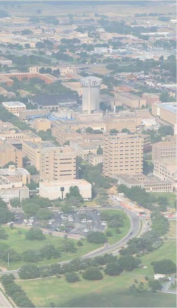
1 13 April 2016 CAMPUS MASTER PLAN UPDATE Focus Group Landscape
2 AGENDA What We Heard Review of Campus Observations & Analysis Campus Framework & Open Space Network Table-Top Exercise Landscape Guideline Approach Guideline Examples

3 WHAT WE HEARD
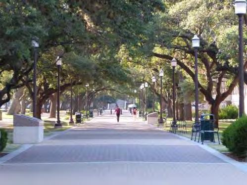
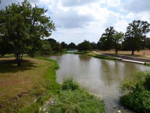
4 listen: What We Heard: Collective Pedestrian Conflict Areas Bizzell Street Academic / Engineering Area (Ross Mall, Ireland St., etc.) University Drive Crossings White Creek Erosion Issues West Campus Remoteness Connection from White Creek Housing to East Campus Connection from West Campus to East Campus West Campus feels remote due to lower population and density Memorial Student Center Works well on multiple levels Design Standards, Signage, Branding, Green/Open Space, etc. Traffic Congestion Points Reed Arena/Parking Lots (100) Bizzell Street (Parking Lots 54) Green Space JK Williams Admin Building East Lawn (formal) All Quads (Cushing, Academic, Architecture) West Campus Green Space is underutilized Spence Park has great potential Simpson Drill Field multifunctional open space Build-to-Line Identify (and Enforce?) Is it still applicable? Campus Policies and Process Campus Policies and Process should align with the CMP Update in order to implement the plan accordingly Campus Branding Multiple opportunities to enhance TAMU branding Arrival points, institutional identity and campus traditions need to be leveraged. Off-Campus Development Will lead to new access points and the need for improved systems to support TAMU users of these developments

5 listen: What We Heard: Landscape Focus Group University Drive pedestrian issues need to be addressed as off-campus areas and academic / engineering area develops.


6 listen: What We Heard: Landscape Focus Group Opportunity for TAMU branding at major entrances and gateways with signage and landscape

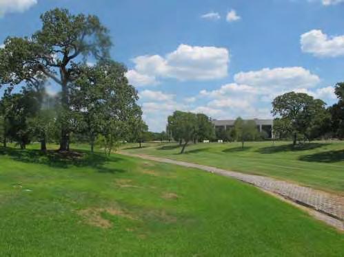
7 listen: What We Heard: Landscape Focus Group Polo fields opportuntity for improved landscaping and need to maintain storm water management

8 listen: What We Heard: Landscape Focus Group Proposed renovation of east lawn at JK Williams an opportunity to beautify the main campus entrance East Quad has potential to become an activated green space and has seen increase activity.

9 listen: What We Heard: Landscape Focus Group Corps Quad is great, but it s greatness isn t connected into the rest of campus.

10 listen: What We Heard: Landscape Focus Group West Campus pedestrian paths (noodles) are not user-friendly or intuitive on how to get from building to building or place to place.
 and increase connectivity by removal of parking area (Lot")
11 listen: What We Heard: Landscape Focus Group Sbisa Hall and North Housing Quad opportunity to better utilize the green space (existing mounds area) and increase connectivity by removal of parking area (Lot 32)
12 How are we solving this?
13 REVIEW OF CAMPUS OBSERVATIONS & ANALYSIS
14 observe: Campus Character Zones


15 observe: Open Green Space


16 observe: Dense, Urban Core

17 observe: Suburban
18 observe: Underdeveloped


19 observe: Open Green Space

20 observe: Use Distribution ACADEMIC HOUSING ATHLETICS & RECREATION RESEARCH VET MED & AGRILIFE PARTNERSHIPS

21 observe: Use Distribution Overlay

22 observe: Expanding the Open Space Network
23 observe: The Approach 1. Utilize the Campus Framework and Open Space Network to identify potential for new and improved green space on campus ongoing as framework develops. 2. Determine the program typology for each open space (existing and proposed). 3. Develop and apply a reference vocabulary to each open space as appropriate to its campus zone, character, use, and site specific details (drainage, shade, etc.). 4. Results in a recommendation for each open space on campus as part of the final CMP Update.
24 CAMPUS FRAMEWORK AND OPEN SPACE NETWORK
25 frame: The 2004 Civic Structure
26 frame: Framework Update
27 frame: Framework Update

28 frame: Framework Update
29 frame: Framework Update
30 frame: Framework Update
31 frame: Open Space Network
32 frame: Expanded Open Space Network
33 frame: Open Space Network Summary Identified the limitations of the 2004 green space network Identified the changing characteristics of the campus and how the civic structure must be expanded to support the new realties Identified the varying and expanded types of open spaces and related programs Identified the need for expanded palettes of materials and methods Identified underutilized or under programmed existing spaces Identified the changing character of the perimeter of campus and its evolving relationships
34 TABLE TOP ACTIVITY
35 exercise: Open Space Network JK Williams East Lawn Historic Core Engineering District Corps of Cadets Spence Park Recreation Athletics West Campus Research Park CVM Hensel Park
36 THE LANDSCAPE GUIDELINES APPROACH
37 approach: Three Solutions Urban Landscape Suburban Landscape Texas Landscape
38 approach: Urban Landscapes Predominately on East Campus Formal Composition: Tree-lined Streets Clearly Legible Quads Complimentary Relationship with Buildings Military Walk - Contributing Architecture Buildings - Non-Contributing
39 approach: Suburban Landscapes Predominately on West Campus Spence Park - Contributing In-formal Composition: Picturesque Naturalistic Curvilinear Paths Rolling Topography Grove Arrangement of Trees Contrasting relationship with isolated buildings West Campus - Non-Contributing
40 approach: Texas Landscapes Resource Efficient Landscape Low level to maintenance required Naturalist Composition White Creek Semi-Contributing Green Reserve System Stormwater Mitigation Wildlife Habitat Restoration Outdoor Education Recreation Opportunities Research Park Non-Contributing


41 approach: Urban, Suburban and Texas Landscapes
42 approach: Define Program for Open Spaces 1. Park 2. Courtyard 3. Quadrangle 4. Garden 5. Formal Civic Space 6. Pocket Park 7. Natural 8. Recreation /Athletics 9. Connector 10. Open Lawns / Fields 11. Showcase Space 12. Others???

43 approach: Define Program for Open Spaces Example: Parks Parks are large tracts of land that often include lawn, grassland or meadow, and woodlands. They are used for ornament, passive recreation, or active recreation. Passive recreation can take place within upland or riparian landscapes. Oftentimes, ornamental or passive recreational parks are naturalistic in their physical form. Within a campus setting, active recreation takes the form of athletic fields often framed by vegetation within a larger park context, typically in upland landscape areas.

44 approach: Define Program for Open Spaces Example: Courtyards Courtyards are enclosed private or semiprivate open spaces within a building or a semiprivate or public open space within a group of buildings. They may be formal or informal; the edge treatments are varied and include spaces that are completely enclosed by architecture, spaces that are enclosed on three sides by architecture, and spaces partially enclosed by architecture with entrances generally at the corners. The spaces are often paved and feature landscape elements in the center or along the edges. Central features might include a fountain, sculpture, or a grove of trees.

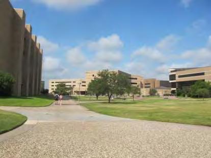
45 approach: Define Program for Open Spaces Example: Quadrangles Quadrangles are typically large, rectangular public spaces defined by buildings and landscape. Buildings form the primary spatial definition, but the landscape design should complement the architectural definition, and usually provides the most memorable aspect of the character of the space. There are three basic landscape types for quadrangles: A central open space defined by building facades and lines of trees, A central open space defined by building facades and containing picturesque groups of trees An open space filled with a continuous or nearly continuous tree canopy throughout.

46 approach: Define Program for Open Spaces Example: Gardens A garden is usually bounded, restricted in size, and infused with meaning. For a space to be defined as a garden it must include the added layer of meaning. Gardens can be organized formally or informally, but typically, they are enclosed and often include a focal point within. Gardens may be situated within a larger park.


47 approach: Define Program for Open Spaces Example: Formal Civic Space Example: Pocket Park


48 approach: Define Program for Open Spaces Example: Natural Example: Athletics / Recreation Example: Connector Example: Open Lawns / Fields

49 approach: Define Design & Elemental Vocabulary 1. Texas Landscape 2. Paved / Hardscape 3. Formal Lawns 4. Connectors: Tree-Lined Walk Streetscape Green Space Link 5. Teaching / Pedagogy 6. Detention / Retention 7. Others???


50 approach: Define Design & Elemental Vocabulary Example: Connectors Tree-Lined Walk Streetscape Green Space Link
51 CAMPUS EXAMPLES


52 scenario: Cushing Quad Program: Formal Quadrangle Connector Design & Elemental Vocabulary: Formal Lawn Paved/Hardscape Connections Current Issues: The space is overly hardscaped, and there are not enough green spaces within the quadrangle for campus users to gather. Intent of Space: The intent of Cushing Quad is to create improved pedestrian paths that move people along through the space. Along these paths, green space should define gathering spaces with seating and planters.


53 scenario: West Campus Quad Program: Formal Quadrangle Design & Elemental Vocabulary: Formal Lawns Paved/Hardscape Connector Current Issues: The space currently feels isolated from the Main Campus. The pedestrian paths are circuitous and do not offer direct pathways from buildings. The large gaps between the buildings lessens its ability to feel like a formal quad. Intent of Space: The intent is to redefine the space to become a formal gathering space. As the building density increases in this area, the quad will become more formal. Pedestrian pathways should be more formalized.

54 scenario: Engineering Quad Program: Quadrangle Showcase Design & Elemental Vocabulary: Formal Lawns Paved/Hardscape Connector Current Issues: This space currently does not exist. Intent of Space: As an addition to the expanded green space network, this space alleviates the density of the district and transforms existing service space into useable green space. It aids in wayfinding within the district, and offers inter-district connectivity. It also provides venues for engineering demonstrations and event.


55 scenario: Corp of Cadets Program: Quadrangle Connector Design & Elemental Vocabulary: Paved/Hardscape Current Issues: The space did not offer adequate surfaces for marching or demonstrations. It also looked worn and did not reflect the identity of the Corps. Intent of Space: This upgraded quadrangle will become a space for cadets to use for demonstration and gathering. It also aesthetically upgrades the district along with the corresponding housing upgrades. The intent is to connect the Quad into the larger campus along Nagle Street.
56 HOMEWORK & NEXT STEPS
57 landscape: Next Steps - Scenario Development Develop and refine open space Program Typologies Develop and refine open space Design & Elemental Vocabularies Correlate Program Typologies along with Design & Elemental Vocabularies to inform open space guidelines Develop refined scenarios for selected specific open spaces of campus Identify a preliminary priority of improvements and hierarchy for implementation Overlay landscape approach with other campus systems to demonstrate an integrated solution
58 landscape: Next Steps - Homework Consider programmatic input for key spaces Consider sustainability overlay to open spaces Consider educational opportunities for specific spaces Consider community threshold opportunities and orientation devices Consider traditions, history or legacy opportunities and their potential integration Consider key devices or strategies for guidelines Joint Focus Group Session: mid-may (TBD)


59 13 April 2016 Thank You
18 May 2016 CAMPUS MASTER PLAN UPATE
 18 May 2016 CAMPUS MASTER PLAN UPATE Council of the Deans ( Over view) AGENDA Engagement & What We Heard Focus Elements: 1. Development Framework Plan 2. Campus Mobility 3. Campus Guidelines 4. Wayfinding
10 February CAMPUS MASTER PLAN UPDATE Focus Group - Landscape & Hensel Park
 10 February 2016 CAMPUS MASTER PLAN UPDATE Focus Group - Landscape & Hensel Park AGENDA Introductions Planning Scope The 2004 Campus Plan & Survey Observations 2004 Landscape Plan SWOT Exercise Analysis
11 February CAMPUS MASTER PLAN UPDATE Focus Group - Design Guidelines
 11 February 2016 CAMPUS MASTER PLAN UPDATE Focus Group - Design Guidelines AGENDA Introductions Planning Scope The 2004 Campus Plan Observations Design Guidelines - 2004 Plan SWOT Exercise Analysis Goals
11 February CAMPUS MASTER PLAN UPDATE Focus Group - Research Park
 11 February 2016 CAMPUS MASTER PLAN UPDATE Focus Group - Research Park AGENDA Introductions Planning Scope The 2004 Campus Plan Observations SWOT Exercise Analysis Goals and Advice Questions & Discussion
NEIGHBORHOOD 7: FEE LANE AREA. Aerial View of Briscoe and McNutt Dormitories
 NEIGHBORHOOD 7: FEE LANE AREA Aerial View of Briscoe and McNutt Dormitories Fee Lane Area Map Briscoe Dormitory 278 neighborhoods NEIGHBORHOOD 7: FEE LANE AREA EXISTING CHARACTER The Fee Lane Area neighborhood
PUBLIC RIGHT-OF-WAY IN THIS CHAPTER PUBLIC REALM
 PUBLIC RIGHT-OF-WAY This section provides design guidelines for improvements in the public right-of-way. The public right-of-way refers to streets, sidewalks, non-vehicular thoroughfares, parks and greenways
 Health Sciences City The available land area, although limited, combined with the unique partnership between the primary institutions and the supporting partnerships of the development interests within
CAMPUS MASTER PLAN UPDATE
 CAMPUS MASTER PLAN UPDATE Preser vation and Adaptive Reuse DISCLAIMER: The following presentation represents in-progress work generated to test various elements of the ongoing campus planning effort along
WESTERN ILLINOIS UNIVERSITY
 WESTERN ILLINOIS UNIVERSITY Quad Cities Riverfront Campus Master Plan March 1, 2006 Preliminary Master Plan Total Site Build Out Western Illinois University Quad Cities Municipal Park Mississippi River
CAMPUS MASTER PLAN. Steering Committee Meeting. July 29, 2014 CAMPUS MASTER PLAN UPDATE
 CAMPUS MASTER PLAN Steering Committee Meeting July 29, 2014 WORKSHOP A R C H I T E C T S, INC L H B, INC PROCESS & SCHEDULE Research Space needs data Athletics/recreational sports Previous master plan
FOCUS GROUP 3 Urban, Architectural & Landscape Design Guidelines
 Meeting Minutes By: Perkins+Will - GK Date: 11/30/2012 Meeting Date: 10/03/2012 Project Name: BT-857 FIU-Campus Master Plan Update 2010-2020 Meeting Time: 8:00am-10:00am Project : 810369.000 Meeting Location:
CAMPUS MASTER PLAN UPATE
 19 MAY 2016 CAMPUS MASTER PLAN UPATE Metropolitan Planning Organization AGENDA Introductions Planning Scope Observation & Analysis: Mobility Systems Campus Development Plan Mobility Planning Scenarios
CAMPUS MASTER PLAN UPDATE
 CAMPUS MASTER PLAN UPDATE Wayf inding and Signage DISCLAIMER: The following presentation represents in-progress work generated to test various elements of the ongoing campus planning effort along with
VEHICULAR AND PEDESTRIAN CIRCULATION
 This perspective sketch communicates the intended character and quality of a proposed streetscape design. Locate benches near a major intersection where people tend to gather. Seating and lighting provide
There are five comprehensive goals that inform the Urban Design element at FIU. They are:
 3.0 URBAN DESIGN ELEMENT This Comprehensive Master Plan Update reflects the University s commitment to the refinement and extension of the base concepts earlier master planning efforts have created. FIU
Proposed Open Space, UNC-Chapel Hill. Polk Place and Surroundings, UNC-Chapel Hill
 Composite McCorkle Place Formal Quad Polk Place Natural Pinetum Proposed Open Space, UNC-Chapel Hill Polk Place and Surroundings, UNC-Chapel Hill Open spaces on a campus are often the physical core around
Community Design Guidelines. Port Wallace DRAFT
 Community Design Guidelines Port Wallace DRAFT Energy 1 2 3 Nature Movement Connections Built Form DRAFT Layout Energy 1 Nature Community Design Guidelines GREAT COMMUNITIES PROTECT, CELEBRATE, AND CONSERVE
CAL POLY MASTER PLAN UPDATE, March 2015
 Some Key Themes in the General Guiding Principles Academic Mission The plan must foremost advance the University s academic mission and student success. Foresight and Adaptability The plan should take
Campus Identity & Design Guidelines
 WSU RFP 7840-GC23215 Exhibit E Campus Identity & Design Branding Specification Washington State University Tri-Cities Campus Campus Identity & Design Guidelines G G L O architecture I interior design I
BELLEVUE COLLEGE Campus Master Plan February 29, 2016 (Space Needs Updated on 04/13/2016) Bellevue College Campus Master Plan April 13, :08 PM
 Bellevue College Campus Master Plan April 13, :08 PM") BELLEVUE COLLEGE Campus Master Plan February 29, 2016 (Space Needs Updated on 04/13/2016) AGENDA / STEERING COMMITTEE MEETING 15:00 PLANNING PROCESS: 15:05 GUIDING PRINCIPLES: 15:10 SPACE NEEDS: 15:30
BELLEVUE COLLEGE Campus Master Plan February 29, 2016 (Space Needs Updated on 04/13/2016) AGENDA / STEERING COMMITTEE MEETING 15:00 PLANNING PROCESS: 15:05 GUIDING PRINCIPLES: 15:10 SPACE NEEDS: 15:30
V. Gateways GATEWAYS / V-1
 V. GATEWAYS / V-1 Many of Chesapeake s gateways are located on highways and call for bold and attractive designs that motorists can understand, appreciate, and enjoy. can also take the form of natural
ATTACHMENT A. SILVERDALE DESIGN STANDARDS Amendments to the Waaga Way Town Center Chapter
 ATTACHMENT A SILVERDALE DESIGN STANDARDS Amendments to the Waaga Way Town Center Chapter Chapter 10. Waaga Way Town Center 10.1 Physical Identity Elements & Opportunities The Waaga Way Town Center includes
University of Saskatchewan CAMPUS MASTER PLAN. Senate Meeting Preliminary Presentation. April 21, 2018 DIALOG ECS DA WATT
 University of Saskatchewan CAMPUS MASTER PLAN Senate Meeting Preliminary Presentation April 21, 2018 DIALOG ECS DA WATT project process presentation agenda Stakeholder Engagement Project Control phase1
Hidden Pointe Landscape Master Plan. June, archi terra
 Hidden Pointe Landscape Master Plan June, 2006 t h e archi terra g r o u p 1 Table of Contents Background Purpose and Goals of the Master Plan Master Plan Process Existing Conditions Entrance Hidden Pointe
WESTERN ILLINOIS UNIVERSITY
 WESTERN ILLINOIS UNIVERSITY Quad Cities Riverfront Campus Preliminary Master Plan Presentation 2 February 1, 2006 Achieving Future Flexibility 1. Monitor space needs as the new buildings come on line and
neighborhoods NEIGHBORHOOD 5: EAST OF JORDAN
 NEIGHBORHOOD 5: EAST OF JORDAN East of Jordan Neighborhood EXISTING CHARACTER East of Jordan is defined as the residential neighborhood east of North Jordan Avenue and south of the railroad tracks. This
NEIGHBORHOOD 3: UNIVERSITY EDGE
 NEIGHBORHOOD 3: UNIVERSITY EDGE Aerial View of North Indiana Avenue EXISTING CHARACTER The University Edge neighborhood represents the primary town/gown interface between the campus and the city of Bloomington,
Phase 1 : Understanding the Campus Context. Phase 2 : APPROACHES - Alternates & Preferred Plan
 Introduction MASTER PLAN PURPOSE WHY A CAMPUS MASTER PLAN? The purpose of the Master Plan at the University of Illinois at Chicago is to translate UIC s strategic goals and objectives into a compelling
CAMPUS MASTER PLAN DRAFT PLAN UPDATE JANUARY
 NEW MEXICO HIGHLANDS UNIVERSITY CAMPUS MASTER PLAN DRAFT PLAN UPDATE JANUARY 27 2010 MASTER PLANNING GOALS TO BALANCE THE STRATEGIC GOALS OF THE UNIVERSITY WITH THE PHYSICAL CAMPUS through the assessment
Preci nct P l ans Figure 56 Campus Aerial Photo, 2008 CAL STATE EAST BAY, HAYWARD CAMPUS MASTER PLAN
 9 Precinct Plans This section contains a detailed discussion of the planning and design concepts for specific areas or precincts of the Cal State East Bay Hayward campus. The Precinct Plans pertain to
EXISTING CONDITIONS 41. Existing Conditions
 EXISTING CONDITIONS 41 Existing Conditions The Existing Analysis phase of the planning process involved a study of the existing conditions on the campus in order to identify key planning issues to be addressed
264 neighborhoods NEIGHBORHOOD 6: WOODLAWN AND TENTH STREET
 NEIGHBORHOOD 6: WOODLAWN AND TENTH STREET Existing Aerial View Looking North EXISTING CHARACTER The area north of East Tenth Street and south of the railroad tracks has been identified for significant
U n i v e r s i t y o f S o u t h C a r o l i n a A i k e n. Land Plan Study
 U n i v e r s i t y o f S o u t h a r o l i n a A i k e n Land Plan Study 06.27.2008 Goals ampus Growth Develop a Land Plan that allows for the orderly expansion of the campus over the next ten years and
City of Farmington. Downtown Plan. Amendment to the 1998 Master Plan Adopted October 11, 2004
 City of Farmington Amendment to the 1998 Master Plan Adopted October 11, 2004 Introduction Planning Background 1 Scope and Components of the Plan Amendment 2 Concept Introduction 3 Plan Concepts 3 Conceptual
C a m p u s I d e n t i t y
 Campus Identity Campus Identity a) Landscape Guidelines i. Materials ii. Components iii. Composition b) Wayfinding i) Entrance Features ii) Vehicular iii) Pedestrian c) Focus Areas i) Green Spine ii) Warriner
INSTITUTIONAL USE DESIGN COMPATIBILITY TECHNIQUES
 INSTITUTIONAL USE DESIGN COMPATIBILITY TECHNIQUES INTRODUCTION Community institutions are an important part of the character and vitality of neighborhoods in Forsyth County. Institutional uses include
EXISTING COMPREHENSIVE PLAN
 EXISTING COMPREHENSIVE PLAN Town Center Land Use Element: V. LAND USE POLICIES Town Center Mercer Island's business district vision as described in "Your Mercer Island Citizen-Designed Downtown" was an
UNIVERSITY TOWN NEIGHBOURHOODS 5.2 ECO-CORRIDOR MELBOURNE CAMPUS MASTER PLAN 2014
 5.2 ECO-CORRIDOR 37 ECO-CORRIDOR EXISTING CONDITIONS & VISION NEIGHBOURHOOD VISION Investment in the Eco-corridor Neighbourhood will signify the University s commitment to supporting local ecology and
CAMPUS LANDSCAPE AND OPEN SPACE
 LANDSCAPE CHARACTER I hope our alumni will always insist upon retention of our precious islands of green and serenity our most important physical asset, transcending even classrooms, libraries, and laboratories
Welcome! to Keller Town Hall
 Welcome! to Keller Town Hall Keller Town Center Planning a New Downtown What is Keller Town Center? A new, growing downtown district planned as an urban village A combination of retail and office spaces,
12 February CAMPUS MASTER PLAN UPDATE Focus Group - Wayfinding & Signage
 12 February 2016 CAMPUS MASTER PLAN UPDATE Focus Group - Wayfinding & Signage AGENDA Introductions Planning Scope The 2004 Campus Plan Observations SWOT Exercise Analysis Goals and Advice Questions & Discussion
4.0 Design Guidelines For The Village Centre. South fields Community Architectural Design Guidelines Town of Caledon
 4.0 Design Guidelines For The Village Centre 4.0 Design Guidelines for the Village Centre The Village Centre is the focal point of the entire South Fields Community and is designed as a traditional commercial
8.0 Built Form Framework
 Figure C-40. RIC and Laboratory Building Internal Pedestrian Node 8.0 Built Form Framework The built form framework defines the desired future character and function of built elements within the campus
2015 Campus Master Plan Update
 September 15, 2015 2015 Campus Master Plan Update Campus and Community Analysis Summary Presentation A G E N D A 1. Scope & Schedule of the Master Plan 2. Planning Principles & Draft Goals 3. Background
The open space system should provide connective elements, relate to natural resources, and enhance the suburban character of the landscape..
 The open space system should provide connective elements, relate to natural resources, and enhance the suburban character of the landscape.. Mixed-use and infill development should maintain or enhance
Part C. Main Campus Plan Frameworks PAGE 59 UNIVERSITY OF REGINA / CAMPUS MASTER PLAN 2011
 Part C Main Campus Plan Frameworks UNIVERSITY OF REGINA / CAMPUS MASTER PLAN 2011 PAGE 59 Figure C-1. Open Space Framework Plan PAGE 60 PREPARED BY / DIALOG Figure C-2. The Dr. Lloyd Barber Academic Green
University of Minnesota. MINNEAPOLIS CAMPUS DEVELOPMENT FRAMEWORK February 11, 2016
 MINNEAPOLIS CAMPUS DEVELOPMENT FRAMEWORK DEVELOPMENT FRAMEWORK of use shape the campus today and may inform the future. Form, meaning how the shape, size, orientation, and arrangement of buildings, spaces,
Planning Board Briefing
 Planning Board Briefing Why Now? The Sector Plan Implementation Chapter States: Before Stage 1 begins, the following must occur: Approval of the Sectional Map Amendment. Approval of the Greater Lyttonsville
EXISTING VEHICULAR & PEDESTRIAN CIRCULATION
 46 EXISTING CONDITIONS EXISTING VEHICULAR & PEDESTRIAN CIRCULATION Vehicular and pedestrian circulation patterns are illustrated on this graphic. Campus entry points and major vehicular circulation routes
FLORIDA ATLANTIC UNIVERSITY. GOALS, OBJECTIVES AND POLICIES 3 Urban Design
 3 URBAN DESIGN ELEMENT Goal 1 To establish and follow conceptual principles for the organization of future development, including buildings and open spaces, on the University's campuses. Objective 1A Protect
Creating a sense of arrival at campus entrances and at the primary entrances to the Campus Core.
 16.0 LANDSCAPE DESIGN GUIDELINES ELEMENT In campus planning, design professionals whose focus is the outdoors must be sensitive to transitions from building to open space, the need for common areas and
II. SINGLE FAMILY RESIDENTIAL
 II. SINGLE FAMILY RESIDENTIAL Castle Rock is made up of numerous individually built houses and subdivision tracts that have been developed during the past century. Some of the tracts are diverse in architectural
Throughout. square. (Crystal City Vision Plan 2050)
") 1: Terms related to the PSMP document 1 public space (see also public realm, civic space) An open space designated on the regulating plan, accessible to all, including Plazas, Mini Parks, and Neighborhoods
1: Terms related to the PSMP document 1 public space (see also public realm, civic space) An open space designated on the regulating plan, accessible to all, including Plazas, Mini Parks, and Neighborhoods
DRAFT. October Wheaton. Design Guidelines
 October 2011 DRAFT Wheaton Design Guidelines 2 Draft - Design Guidelines - Wheaton Sector Plan Contents 04 Section 1: Introduction 06 Section 2: Context 08 Section 3: Design Guidelines 09 Goal 1: Create
09 February CAMPUS MASTER PLAN UPDATE Focus Group Sustainability
 09 February 2016 CAMPUS MASTER PLAN UPDATE Focus Group Sustainability AGENDA Introductions Planning Scope The 2004 Campus Plan and Survey Observations SWOT Exercise Analyze Goals and Advice Questions &
Policies and Code Intent Sections Related to Town Center
 Policies and Code Intent Sections Related to Town Center The Town Center Vision is scattered throughout the Comprehensive Plan, development code and the 1994 Town Center Plan. What follows are sections
North Downtown Specific Plan MEMORANDUM
 North Downtown Specific Plan MEMORANDUM MEETING DATE: November 13, 2017 TO: Members of the North Downtown Specific Plan Advisory Committee FROM: Jeanine Cavalli, Senior Planner SUBJECT: Materials for the
WINDSOR GLEN DESIGN GUIDELINES
 WINDSOR GLEN DESIGN GUIDELINES Adopted by Council, 2006 WINDSOR GLEN REDEVELOPMENT DESIGN GUIDELINES August 2006 1.0 Master Plan Organization For this area of the Coquitlam Town Centre, a mix of high,
UTSC SECONDARY PLAN COMMUNITY OPEN HOUSE
 WELCOME TO THE UTSC SECONDARY PLAN COMMUNITY OPEN HOUSE 1 Welcome to the first Community Open House for the UTSC Secondary Plan. Hosted by the University of Toronto Scarborough (UTSC), the following panels
COMMUNITY DESIGN. GOAL: Create livable and attractive communities. Intent
 COMMUNITY DESIGN Intent An attractive, well-designed County will attract quality development, instill civic pride, improve the visual character of the community, and create a strong, positive image for
University of the District of Columbia Van Ness Campus Master Plan Community Open House 3. December 8, 2010
 University of the District of Columbia Van Ness Campus Master Plan Open House 3 December 8, 2010 Introductions Sequence of Work: Campus Master Plan BEGIN: INTRODUCE AND START WORK Project Initiation Team
Moreno Valley College: Conceptual Master Planning - Site Analysis Lasselle Street, Moreno Valley, CA 92551
 Master Plan Architect School Name Moreno Valley College District Riverside Community College District Architecture and Urban Design 5898 Blackwelder Street Ground Floor Culver City, CA 90232 T: 310.559.5720
CHAPTER 12 DESIGN GUIDELINES FOR PUBLIC IMPROVEMENTS
 CHAPTER 12 DESIGN GUIDELINES FOR PUBLIC IMPROVEMENTS Introduction This chapter provides design guidelines for public sector improvements in the downtown. This includes streetscape design, as well as the
REDMOND CENTRAL CONNECTOR ART & DESIGN MASTER PLAN
 REDMOND CENTRAL CONNECTOR ART & DESIGN MASTER PLAN Redmond Central Connector Master Plan design principles principles make it redmond: past, present, future not just a place with art, a place that is art
C a m p u s I d e n t i t y
 Campus Identity This Week 1) Campus Identity a) Landscape Guidelines i. Materials ii. Components iii. Composition b) Wayfinding i) Refinement c) Focus Areas i) Green Spine ii) Warriner Mall iii) A Street
Long Branch-Wayne Local Park Renovation Project
 Montgomery Parks Long Branch-Wayne Local Park Renovation Project Community Meeting #2 September 20, 2016 Oak View Elementary School 7:00-9:00 PM Welcome / Team Introductions M-NCPPC (Montgomery Parks)
242 neighborhoods NEIGHBORHOOD 4: JORDAN AVENUE CORRIDOR
 NEIGHBORHOOD 4: JORDAN AVENUE CORRIDOR Aerial View of Jordan Avenue Corridor EXISTING CHARACTER The Jordan Avenue Corridor is the portion of North Jordan Avenue that extends north from East Third Street
District Facilities Master Plan
 W o r k s h o p B o a r d District Facilities Master Plan February 29, 2012 BACKGROUND + CONTEXT ANALYSIS OPTIONS RECOMMENDATIONS NEXT STEPS DFMP AGENDA BACKGROUND + CONTEXT ANALYSIS OPTIONS RECOMMENDATIONS
TABLE OF CONTENTS. I. Introduction. A. Background. B. Executive Summary. II. Campus Master Plan Review. A. Plan Overview. B.
 49 TABLE OF CONTENTS I. Introduction A. Background B. Executive Summary II. Campus Master Plan Review A. Plan Overview B. West Precinct C. Central Precinct D. East Precinct III. Design Recommendations
38 Queen s University Campus Master Plan Part 1
 38 Queen s University Campus Master Plan Part 1 46 The Campus at the City Scale Chapter 4 The Campus at the City Scale 39 Queen s is an urban University centrally located in Kingston. Decisions made by
Assessment of the Extent and Quality of the Landscape Features of the Campus.
 Assessment of the Extent and Quality of the Landscape Features of the Campus. 1. In 2012 the University used geographic information systems to create georeferenced layers for all landscape and hardscape
A larger version of this map is located on the last page of this PDF.
 MAP Committee Input McLoughlin Area Draft Vision Map A larger version of this map is located on the last page of this PDF. 1. The map above is intended to portray a vision for the McLoughlin area. It highlights
EXTERlOR DESlGN LANGUAGE. Exterior Design Language PAGE 1 OF 27
 EXTERlOR DESlGN LANGUAGE Exterior Design Language PAGE 1 OF 27 INTRODUCTION EXTERIOR DESIGN LANGUAGE What is this document and who is it for? Exterior Design Language is a supplement to the original Design
implementation10 Village of Greendale Comprehensive Plan: Greendale, Wisconsin. Revisiting a Greenbelt Community
 implementation10 Village of Greendale Comprehensive Plan: 2010 - Village of Greendale Comprehensive Plan: 2010 - Implementation The recommendations of this Plan must be implemented by the Village of Greendale,
A Campus Within Context
 A Campus Within Context A Comprehensive Master Plan for East Carolina University Optimize Valuable Resources Guide Future Development Establish Capital Priorities Create a Sense of Place Sustainable Campus
GATEWAY AREA STRUCTURE PLAN
 CHESTERMERE GATEWAY AREA STRUCTURE PLAN COMMUNITY OPEN HOUSE SEPTEMBER 22 nd, 2015 PLAN AREA ± 512 hectares (± 1,265 acres) GATEWAY LOCATION UNDEVELOPED LANDS PRESENT AGRICULTURAL USE REGIONAL LAND USE
THE LANDMARK PROJECT: ST. GEORGE CAMPUS BEFORE AND AFTER
 THE LANDMARK PROJECT: ST. GEORGE CAMPUS BEFORE AND AFTER The Landmark Project will reimagine the historic core of the St. George campus by creating dynamic, open spaces where students, faculty and the
NEIGHBORHOOD 1: HISTORIC CORE
 NEIGHBORHOOD 1: HISTORIC CORE EXISTING CHARACTER The Historic Core is the most distinguished, coherent, and complete of the Bloomington neighborhoods. Its distinctive blend of architectural styles and
Landscape and Streetscape Design 2.5
 Landscape and Streetscape Design 2.5 2.5.1 Goals 2.5.2 Planting 2.5.3 Sidewalks and Pavement 2.5.4 Furnishings 2.5.5 Walls 2.5.6 Lighting 2.5.7 Stormwater 2.5.8 Street Cross Sections 2.5 LANDSCAPE AND
ELEMENT 16 - LANDSCAPE DESIGN GUIDELINES ELEMENT
 16 ELEMENT 16 - LANDSCAPE DESIGN GUIDELINES ELEMENT Goal 1 To establish an overall landscape character that provides: A pedestrian friendly environment that provides ample tree canopy and shade. An overall
campus master plan VIRGINIA STATE UNIVERSITY
 campus master plan VIRGINIA STATE UNIVERSITY agenda 01 INTRODUCTION & GENERAL OVERVIEW 02 03 04 LAND USE CONCEPT PROGRAM ACCOMMODATION MAXIMIZE EXISTING INFRASTRUCTURE SUMMARY AND NEXT 05 STEPS agenda
APPENDIX C. Architectural and Environmental Design Standards. Environmentally sensitive areas should be protected.
 APPENDIX C Architectural and Environmental Design Standards Environmentally Sensitive Areas Goal A. Environmentally sensitive areas should be protected. Development, such as roads, houses, and other structures,
CAMPUS DESIGN GUIDELINES
 University of Victoria Prepared for the Campus Planning Committee Prepared by Campus Planning Final Report October 2006 CAMPUS DESIGN GUIDELINES I INTRODUCTION The Campus Plan provides an overall vision
CHAPPLES PARK MASTER PLAN
 CHAPPLES PARK MASTER PLAN Presentation of Preliminary Development Options Public Open House #2 Wednesday November 2 nd, 2016 TONIGHT S AGENDA 1. Welcome & Introductions 2. Presentation by Sierra Planning
Urban Design. Campus Design Guide
 2 Urban Design 2.1 2.1. Campus Geometry The geometric configuration of the project shall reflect the prevailing geometry of the precinct (whether buildings or building groups are of a picturesque, classical
TH E U N IVE RSIT Y O F FLO R I DA LANDSCAPE MASTER PLAN REPORT
 TH E U N IVE RSIT Y O F FLO R I DA LANDSCAPE MASTER PLAN REPORT O C T O B E R 2 018 THE UNIVERSITY OF FLORIDA LANDSCAPE MASTER PLAN REPORT OCTOBER 2018 prepared by: CRJA-IBI Group GAI Community Solutions
DRAFT DESIGN GUIDELINES
 IHZ Booklet #7 May 6, 2010 DRAFT DESIGN GUIDELINES CANTERBURY 7 Overview During the recent planning process for the Plan of Conservation and Development community character was identified as an important
Project Consulting Team:
 THE DOWNTOWN CHERRYVILLE LAND USE + STREETSCAPE MASTER PLAN WAS FUNDED THROUGH THE GENEROUS DONATIONS OF THE FOLLOWING: The Community Foundation of Gaston County ElectriCities of North Carolina The Cherryville
Courthouse Square Planning & Urban Design Study. Courthouse Square Working Group #13 October 15, 2014
 Courthouse Square Planning & Urban Design Study Courthouse Square Working Group #13 October 15, 2014 1 Courthouse Square Process Working Group Community Courthouse Square Advisory Groups & Civic Associations
The following principles guide the development of goals and strategies to protect and promote these amenities:
 OPEN SPACE/PARKS/TRAILS/RECREATION GOALS/STRATEGIES Cherry Hills Village is a living environment that offers low density development, open areas, public scenic vistas, public trails and public parks. This
North Oakville East Parks Facilities Distribution Plan. November, 2009
 North Oakville East November, 2009 POLICY CONTEXT 1) Purpose a) The purpose of this document is to be a guide for the location, configuration, design and development of the parks system for the North Oakville
FORMER CANADIAN FORCES BASE (CFB) ROCKCLIFFE SECONDARY PLAN. Official Plan Amendment XX to the Official Plan for the City of Ottawa
 ROCKCLIFFE SECONDARY PLAN. Official Plan Amendment XX to the Official Plan for the City of Ottawa") FORMER CANADIAN FORCES BASE (CFB) ROCKCLIFFE SECONDARY PLAN Official Plan Amendment XX to the Official Plan for the City of Ottawa 1 INDEX THE STATEMENT OF COMPONENTS PART A THE PREAMBLE PAGE Purpose...
FORMER CANADIAN FORCES BASE (CFB) ROCKCLIFFE SECONDARY PLAN Official Plan Amendment XX to the Official Plan for the City of Ottawa 1 INDEX THE STATEMENT OF COMPONENTS PART A THE PREAMBLE PAGE Purpose...
The Vision. Photo provided by The Minervini Group. 46 Vision, Objectives & Strategies
 Vision, Objectives & Strategies The is the public framework and guide for future development of the Grand Traverse Commons. The establishes public polices for infrastructure, the preservation of natural
SECTION II SECTION II STATEMENT OF GOALS, OBJECTIVES, PRINCIPLES, ASSUMPTIONS, POLICIES AND STANDARDS
 STATEMENT OF GOALS, OBJECTIVES, PRINCIPLES, ASSUMPTIONS, POLICIES AND STANDARDS 1 2 STATEMENT OF GOALS, OBJECTIVES, PRINCIPLES, ASSUMPTIONS, POLICIES AND STANDARDS INTRODUCTION The New Jersey Municipal
Bethesda Downtown Plan
 Bethesda Downtown Plan Planning Board Update Connecticut Avenue Location Economic Sustainability Social Environmental Scope Coming Soon! Team Listening, Twitter Outreach We Are Here Engagement Challenge
Table of Contents. Elm Avenue Improvement Plan City of Waco, Texas. Introduction 1. Existing Context 1 Figure 1 2.
 Table of Contents Introduction 1 Existing Context 1 Figure 1 2 Plan Guidelines 3 Future Urban Form 4 The West-End 4 Main Street 6 The East-End 7 Figure 2 9 Public Improvement Recommendations 7 General
REPORT TO BOARD ON PREFERENCES tbp/architecture CCSF Facilities Master Plan, October 23, 2016
 PURPOSE The purpose of this report is to update the Board on the Facilities Master Plan initiative. PROCESS The Board conducted a Study Session about Phase 1 Needs on August 18, 2016. Since that time,
Community Engagement Committee Meeting #1 December 10, :30pm-8:30pm
 Community Engagement Committee Meeting #1 December 10, 2014 6:30pm-8:30pm Welcome and Introductions Dana Murdoch Minneapolis Park and Recreation Board Project Manager Ryan French Walker Art Center Director
3.0 master plan concept
 3.0 master plan concept 3.1 introduction The purpose of the Huron Church Road Master Plan Concept is to provide an overview of the Master Plan design process, identify preliminary streetscape installations
Clairtrell Area Context Plan
 Clairtrell Area Context Plan March 2005 Urban Development Services City Planning Contents 1. Introduction... 4 2. Development Structure... 6 2.1 Streets... 7 2.1.1 Sheppard Avenue and Bayview Avenue...