CAMPUS MASTER PLAN DRAFT PLAN UPDATE JANUARY
|
|
|
- Collin Shanon Summers
- 6 years ago
- Views:
Transcription
1 NEW MEXICO HIGHLANDS UNIVERSITY CAMPUS MASTER PLAN DRAFT PLAN UPDATE JANUARY
2 MASTER PLANNING GOALS TO BALANCE THE STRATEGIC GOALS OF THE UNIVERSITY WITH THE PHYSICAL CAMPUS through the assessment of existing facilities, the maximization of the utilization of campus buildings, the projection of future growth, and the recommendations for phasing offuture future campus development. TO MAKE THE CAMPUS A PEDESTRIAN ORIENTED ENVIRONMENT through the reduction of conflict between pedestrians, bicyclists and vehicles; clarification of campus pedestrian and vehicular corridors; and the activation of campus open spaces and building thresholds. h TO REINFORCE THE IDENTITY OF NEW MEXICO HIGHLANDS UNIVERSITY through the clarification of campus entry points, the development of gateway features and campus signage, the standardization of campus lighting and site furnishings, and the beautification of the campus grounds. TO PROMOTE THE HISTORIC, CULTURAL, ECONOMIC AND SOCIAL ASPIRATIONS OF THE COMMUNITY through the collaboration with civic improvement enterprises and the encouragement ofeconomic vitality to enhance both the University and the community.
3 MASTER PLAN BOUNDARIES


4 MASTER PLAN BOUNDARIES WESTERN CAMPUS EXPANSION DOUGLAS AVENUE PRESENCE NORTH CAMPUS EXPANSION TO MILLS AVENUE EXPANSION OF CONNER HALL PARKING LOT ADDITIONAL PARKING FOR EVENTS
5 CAMPUS REDEVELOPMENT OPPORTUNITIES


6 CAMPUS REDEVELOPMENT OPPORTUNITIES ALL HISTORICALLY SIGNIFICANT CAMPUS BUILDINGS TO REMAIN WITH RENOVATIONS AS NEEDED: - RODGERS HALL - ILFELD AUDITORIUM - DOUGLAS SCHOOL - KENNEDY HALL - TRAMWAY BUILDING BASED ON BUILDING ASSESSMENT REPORT OPPORTUNITIES TO CREATE OR ENHANCE CAMPUS ACADEMIC AND RESIDENTIAL DISTRICTS
7 LAND USE


8 LAND USE RESIDENTIAL AT CAMPUS CORE TWO ACADEMIC DISTRICTS: - CORE CURRICULUM AT SOUTH - ARTS/MEDIA AT WEST MIXED-USE DISTRICTS S AT DOUGLAS/ NATIONAL MAY BE DEVELOPMENT PARTNERSHIP OPPORTUNITIES EXPANDED ATHLETIC DISTRICT NORTH DISTRICT FOR FACILITIES SERVICES

9 RECOMMENDED STREET CLOSURES MORA AVENUE SAN FRANCISCO AVENUE ROSENWALD AVENUE PORTION O OF SULZBACKER STREET EAST-BOUND NATIONAL AVENUE
10 VEHICULAR CIRCULATION AND PARKING

11 VEHICULAR CIRCULATION AND PARKING NATIONAL AVENUE ONE-WAY EXTENSION SO OF 12 TH STREET TO MILLS AVENUE TWO CAMPUS LOOP ROADS (SOUTH CAMPUS AND ATHLETICS) SHARING BACA AVENUE MINIMIZE VEHICULAR USE AT CORE ON-STREET PARKING ON INTERNAL CAMPUS STREETS DEVELOP PARKING DISTRIBUTION STRATEGY SCREEN PARKING LOTS ADJACENT TO RESIDENTIAL NEIGHBORHOODS
12 PEDESTRIAN CIRCULATION
13 PEDESTRIAN CIRCULATION ALIGNED WITH STREET GRID FOR ORIENTATION CONNECTIONS ACROSS CAMPUS AND TO NEIGHBORING COMMERCIAL AREAS IMPROVEMENTS TO GALLINAS RIVER RECREATION TRAIL
14 BICYCLE CIRCULATION


15 BICYCLE CIRCULATION DESIGNATED BICYCLE ROUTES DISMOUNT ZONES AT ACTIVITY AREAS CONNECT CAMPUS TO GALLINAS RIVER RECREATION TRAIL
16 OPEN SPACE CHARACTER

17 OPEN SPACE CHARACTER OPEN SPACE AND LANDSCAPE AS MEANS FOR ENHANCEMENT OF CAMPUS AND IDENTITY DEFINE ENTRANCES, ACTIVITY AREAS, MOVEMENT CORRIDORS RESPECT THE NORTHERN NEW MEXICO CLIMATE
18 OPEN SPACE CHARACTER
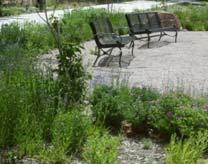
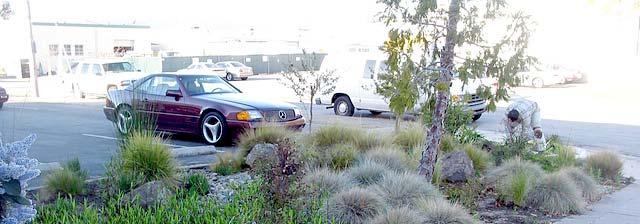
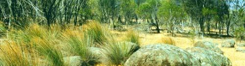
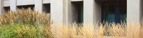
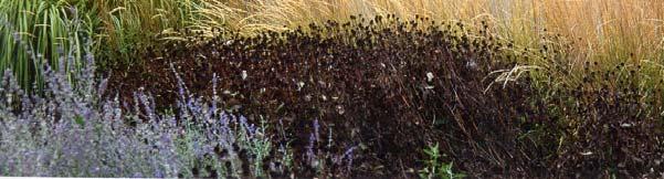
19 LANDSCAPE TYPOLOGIES PROGRAMMED LANDSCAPES: - CAMPUS SPACES WITH A FOCUS ON ACTIVE AND PASSIVE ACTIVITIES WITHIN THE LANDSCAPE CULTIVATED LANDSCAPES: - OUTDOOR SPACES AND CORRIDORS WHOSE VISIBILITY AND/OR CONTEXT COMMAND WELL-DEVELOPED LANDSCAPE EXPRESSION NATURAL LANDSCAPES: - OUTDOOR SPACES THAT SERVE AS A TRANSITION BETWEEN BUILDINGS OR ACTIVE AREAS; TYPICALLY INACTIVE SPACES NATIVE LANDSCAPES: - NATIVE LANDSCAPES THAT SERVE AS A TRANSITION TO NATURAL DRAINAGE AND LANDFORM FEATURES (IE, THE GALLINAS RIVER CORRIDOR)

20 LANDSCAPE TYPOLOGIES: PROGRAMMED LANDSCAPES PROGRAMMED LANDSCAPES INCLUDE CENTRAL PARK AND MELODY PARK JANUARY
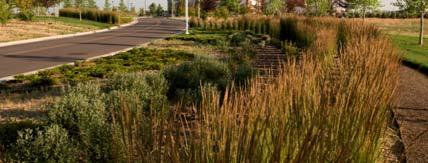
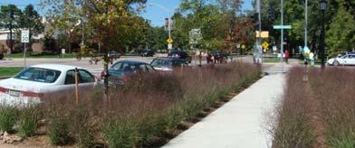


21 LANDSCAPE TYPOLOGIES: CULTIVATED LANDSCAPES INCLUDE CAMPUS ENTRY WAYS, EDGES AND STREETSCAPES, PEDESTRIAN AXES, BUILDING FORECOURTS, SEATING NODES JANUARY


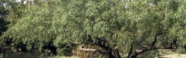


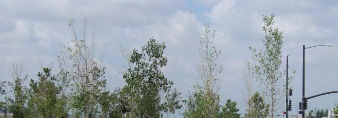
22 LANDSCAPE TYPOLOGIES: NATURAL LANDSCAPES JANUARY


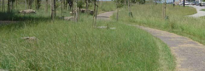
23 LANDSCAPE TYPOLOGIES: NATIVE LANDSCAPES JANUARY
24 MASTER PLAN VIGNETTES
25 MASTER PLAN VIGNETTES CAMPUS ENTRY EXPERIENCE, 8 TH STREET AND NATIONAL AVENUE FUTURE DEVELOPMENT: - POSSIBLE ADDITION TO FELIX MARTINEZ LAND USE: - STUDENT SERVICES, STUDENT LIFE, ADMINISTRATION, LIBRARY FUTURE STUDENT CENTER CIRCULATION: - ACCESS DRIVE TO FELIX MARTINEZ VISITOR PARKING LOT OPEN SPACE: - ALUMNI CENTENNIAL TOWER SIGNATURE OPEN SPACE - BUILDING FORECOURTS TO LIBRARY, STUDENT CENTER, RODGERS DONNELLY LIBRARY RODGERS HALL ADDITIONAL FEATURES: - GATEWAY ARCH OVER NATIONAL AVENUE
26 MASTER PLAN VIGNETTES CAMPUS ENTRY EXPERIENCE, 8 TH STREET AND NATIONAL AVENUE FUTURE DEVELOPMENT: - POSSIBLE ADDITION TO FELIX MARTINEZ LAND USE: - STUDENT SERVICES, STUDENT LIFE, ADMINISTRATION, LIBRARY FUTURE STUDENT CENTER CIRCULATION: - ACCESS DRIVE TO FELIX MARTINEZ VISITOR PARKING LOT OPEN SPACE: - ALUMNI CENTENNIAL TOWER SIGNATURE OPEN SPACE - BUILDING FORECOURTS TO LIBRARY, STUDENT CENTER, RODGERS DONNELLY LIBRARY RODGERS HALL ADDITIONAL FEATURES: - GATEWAY ARCH OVER NATIONAL AVENUE
27 MASTER PLAN VIGNETTES CAMPUS ENTRY EXPERIENCE, 8 TH STREET AND NATIONAL AVENUE FUTURE DEVELOPMENT: - POSSIBLE ADDITION TO FELIX MARTINEZ LAND USE: - STUDENT SERVICES, STUDENT LIFE, ADMINISTRATION, LIBRARY FUTURE STUDENT CENTER CIRCULATION: - ACCESS DRIVE TO FELIX MARTINEZ VISITOR PARKING LOT OPEN SPACE: - ALUMNI CENTENNIAL TOWER SIGNATURE OPEN SPACE - BUILDING FORECOURTS TO LIBRARY, STUDENT CENTER, RODGERS DONNELLY LIBRARY RODGERS HALL ADDITIONAL FEATURES: - GATEWAY ARCH OVER NATIONAL AVENUE
28 MASTER PLAN VIGNETTES CAMPUS ENTRY EXPERIENCE, 8 TH STREET AND NATIONAL AVENUE FUTURE DEVELOPMENT: - POSSIBLE ADDITION TO FELIX MARTINEZ LAND USE: - STUDENT SERVICES, STUDENT LIFE, ADMINISTRATION, LIBRARY FUTURE STUDENT CENTER CIRCULATION: - ACCESS DRIVE TO FELIX MARTINEZ VISITOR PARKING LOT OPEN SPACE: - ALUMNI CENTENNIAL TOWER SIGNATURE OPEN SPACE - BUILDING FORECOURTS TO LIBRARY, STUDENT CENTER, RODGERS DONNELLY LIBRARY RODGERS HALL ADDITIONAL FEATURES: - GATEWAY ARCH OVER NATIONAL AVENUE


29 MASTER PLAN VIGNETTES CAMPUS ENTRY EXPERIENCE, 8 TH STREET AND NATIONAL AVENUE FUTURE DEVELOPMENT: - POSSIBLE ADDITION TO FELIX MARTINEZ LAND USE: - STUDENT SERVICES, STUDENT LIFE, ADMINISTRATION, LIBRARY FUTURE STUDENT CENTER CIRCULATION: - ACCESS DRIVE TO FELIX MARTINEZ VISITOR PARKING LOT OPEN SPACE: - ALUMNI CENTENNIAL TOWER SIGNATURE OPEN SPACE - BUILDING FORECOURTS TO LIBRARY, STUDENT CENTER, RODGERS DONNELLY LIBRARY RODGERS HALL ADDITIONAL FEATURES: - GATEWAY ARCH OVER NATIONAL AVENUE
30 MASTER PLAN VIGNETTES CENTRAL PARK FUTURE DEVELOPMENT: - POSSIBLE REDEVELOPMENT OF CONNER AND ARCHULETA HALLS - POSSIBLE ADDITION TO SHIELDS DONNELLY LIBRARY LAND USE: - LIBRARY, CLASSROOM AND LAB, RESIDENTIAL, STUDENT LIFE CIRCULATION: - REDUCE WIDTH OF WALKWAYS SURROUNDING PARK OPEN SPACE: - CENTRAL PARK AS SOCIAL HUB OF CAMPUS SININGER HALL
31 MASTER PLAN VIGNETTES CENTRAL PARK FUTURE DEVELOPMENT: - POSSIBLE REDEVELOPMENT OF CONNER AND ARCHULETA HALLS - POSSIBLE ADDITION TO SHIELDS DONNELLY LIBRARY LAND USE: - LIBRARY, CLASSROOM AND LAB, RESIDENTIAL, STUDENT LIFE CIRCULATION: - REDUCE WIDTH OF WALKWAYS SURROUNDING PARK OPEN SPACE: - CENTRAL PARK AS SOCIAL HUB OF CAMPUS SININGER HALL
32 MASTER PLAN VIGNETTES CENTRAL PARK FUTURE DEVELOPMENT: - POSSIBLE REDEVELOPMENT OF CONNER AND ARCHULETA HALLS - POSSIBLE ADDITION TO SHIELDS DONNELLY LIBRARY LAND USE: - LIBRARY, CLASSROOM AND LAB, RESIDENTIAL, STUDENT LIFE CIRCULATION: - REDUCE WIDTH OF WALKWAYS SURROUNDING PARK OPEN SPACE: - CENTRAL PARK AS SOCIAL HUB OF CAMPUS SININGER HALL


33 MASTER PLAN VIGNETTES CENTRAL PARK FUTURE DEVELOPMENT: - POSSIBLE REDEVELOPMENT OF CONNER AND ARCHULETA HALLS - POSSIBLE ADDITION TO SHIELDS DONNELLY LIBRARY LAND USE: - LIBRARY, CLASSROOM AND LAB, RESIDENTIAL, STUDENT LIFE CIRCULATION: - REDUCE WIDTH OF WALKWAYS SURROUNDING PARK OPEN SPACE: - CENTRAL PARK AS SOCIAL HUB OF CAMPUS SININGER HALL
34 MASTER PLAN VIGNETTES GALLINAS RIVER CORRIDOR DISTRICT LAND USE: - MIXED-USE, RESIDENTIAL, ACADEMIC, STUDENT LIFE CIRCULATION: - CLOSURE OF STREETS FOR PEDESTRIAN WALKWAYS - CONNECTIONS TO RECREATION TRAIL OPEN SPACE: - ACTIVITY AREA AT RESIDENTIAL NEIGHBORHOOD - OPEN SPACE TRANSITION AT 12 TH /RECREATION TRAIL TEACHER ED. CENTER
35 MASTER PLAN VIGNETTES GALLINAS RIVER CORRIDOR DISTRICT LAND USE: - MIXED-USE, RESIDENTIAL, ACADEMIC, STUDENT LIFE CIRCULATION: - CLOSURE OF STREETS FOR PEDESTRIAN WALKWAYS - CONNECTIONS TO RECREATION TRAIL OPEN SPACE: - ACTIVITY AREA AT RESIDENTIAL NEIGHBORHOOD - OPEN SPACE TRANSITION AT 12 TH /RECREATION TRAIL TEACHER ED. CENTER
36 MASTER PLAN VIGNETTES GALLINAS RIVER CORRIDOR DISTRICT LAND USE: - MIXED-USE, RESIDENTIAL, ACADEMIC, STUDENT LIFE CIRCULATION: - CLOSURE OF STREETS FOR PEDESTRIAN WALKWAYS - CONNECTIONS TO RECREATION TRAIL OPEN SPACE: - ACTIVITY AREA AT RESIDENTIAL NEIGHBORHOOD - OPEN SPACE TRANSITION AT 12 TH /RECREATION TRAIL TEACHER ED. CENTER
37 MASTER PLAN VIGNETTES MELODY PARK NEIGHBORHOOD FUTURE DEVELOPMENT: - MORA AVE. VACATION PROVIDES BUILDING SITE - ADDITION TO EXISTING STUDENT CENTER - REDEVELOPMENT OF FACILITIES SITE LAND USE: - ACADEMIC, STUDENT LIFE, RESIDENTIAL CIRCULATION: - VACATION OF MORA AVE., SULZBACHER ST. - PEDESTRIAN ROUTES SURROUNDING PARK MUSIC BUILDING MELODY HALL OPEN SPACE: - MELODY PARK AS ACTIVE NEIGHBORHOOD PARK TEACHER ED. CENTER
38 MASTER PLAN VIGNETTES MELODY PARK NEIGHBORHOOD FUTURE DEVELOPMENT: - MORA AVE. VACATION PROVIDES BUILDING SITE - ADDITION TO EXISTING STUDENT CENTER - REDEVELOPMENT OF FACILITIES SITE LAND USE: - ACADEMIC, STUDENT LIFE, RESIDENTIAL CIRCULATION: - VACATION OF MORA AVE., SULZBACHER ST. - PEDESTRIAN ROUTES SURROUNDING PARK MUSIC BUILDING MELODY HALL OPEN SPACE: - MELODY PARK AS ACTIVE NEIGHBORHOOD PARK TEACHER ED. CENTER
39 MASTER PLAN VIGNETTES MELODY PARK NEIGHBORHOOD FUTURE DEVELOPMENT: - MORA AVE. VACATION PROVIDES BUILDING SITE - ADDITION TO EXISTING STUDENT CENTER - REDEVELOPMENT OF FACILITIES SITE LAND USE: - ACADEMIC, STUDENT LIFE, RESIDENTIAL CIRCULATION: - VACATION OF MORA AVE., SULZBACHER ST. - PEDESTRIAN ROUTES SURROUNDING PARK MUSIC BUILDING MELODY HALL OPEN SPACE: - MELODY PARK AS ACTIVE NEIGHBORHOOD PARK TEACHER ED. CENTER


40 MASTER PLAN VIGNETTES MELODY PARK NEIGHBORHOOD FUTURE DEVELOPMENT: - MORA AVE. VACATION PROVIDES BUILDING SITE - ADDITION TO EXISTING STUDENT CENTER - REDEVELOPMENT OF FACILITIES SITE LAND USE: - ACADEMIC, STUDENT LIFE, RESIDENTIAL CIRCULATION: - VACATION OF MORA AVE., SULZBACHER ST. - PEDESTRIAN ROUTES SURROUNDING PARK MUSIC BUILDING MELODY HALL OPEN SPACE: - MELODY PARK AS ACTIVE NEIGHBORHOOD PARK TEACHER ED. CENTER
41 MASTER PLAN VIGNETTES ATHLETICS COMPLEX FUTURE DEVELOPMENT: - POTENTIAL ADDITION TO WILSON COMPLEX - EXPANDED STADIUM SEATING - MULTI-PURPOSE PLAYFIELD WILSON COMPLEX LAND USE: - ATHLETICS AND RECREATION OPEN SPACE: - SYNTHETIC TURF FOR PLAYFIELDS ADDITIONAL FEATURES: - POTENTIAL VERTICAL MARKER/TICKET BOOTH
42 MASTER PLAN VIGNETTES ATHLETICS COMPLEX FUTURE DEVELOPMENT: - POTENTIAL ADDITION TO WILSON COMPLEX - EXPANDED STADIUM SEATING - MULTI-PURPOSE PLAYFIELD WILSON COMPLEX LAND USE: - ATHLETICS AND RECREATION OPEN SPACE: - SYNTHETIC TURF FOR PLAYFIELDS ADDITIONAL FEATURES: - POTENTIAL VERTICAL MARKER/TICKET BOOTH
43 MASTER PLAN VIGNETTES ATHLETICS COMPLEX FUTURE DEVELOPMENT: - POTENTIAL ADDITION TO WILSON COMPLEX - EXPANDED STADIUM SEATING - MULTI-PURPOSE PLAYFIELD WILSON COMPLEX LAND USE: - ATHLETICS AND RECREATION OPEN SPACE: - SYNTHETIC TURF FOR PLAYFIELDS ADDITIONAL FEATURES: - POTENTIAL VERTICAL MARKER/TICKET BOOTH


44 MASTER PLAN VIGNETTES ATHLETICS COMPLEX FUTURE DEVELOPMENT: - POTENTIAL ADDITION TO WILSON COMPLEX - EXPANDED STADIUM SEATING - MULTI-PURPOSE PLAYFIELD WILSON COMPLEX LAND USE: - ATHLETICS AND RECREATION OPEN SPACE: - SYNTHETIC TURF FOR PLAYFIELDS ADDITIONAL FEATURES: - POTENTIAL VERTICAL MARKER/TICKET BOOTH
45 MASTER PLAN VIGNETTES NORTH CAMPUS DISTRICT FUTURE DEVELOPMENT: - MILLS AVENUE FRONTAGE LAND USE: - FACILITIES AND PLANT SERVICES, POTENTIAL ADMINISTRATION OPEN SPACE: - CAMPUS EDGE LANDSCAPE ALONG MILLS AVENUE
46 MASTER PLAN VIGNETTES NORTH CAMPUS DISTRICT FUTURE DEVELOPMENT: - MILLS AVENUE FRONTAGE LAND USE: - FACILITIES AND PLANT SERVICES, POTENTIAL ADMINISTRATION OPEN SPACE: - CAMPUS EDGE LANDSCAPE ALONG MILLS AVENUE


47 MASTER PLAN VIGNETTES NORTH CAMPUS DISTRICT FUTURE DEVELOPMENT: - MILLS AVENUE FRONTAGE LAND USE: - FACILITIES AND PLANT SERVICES, POTENTIAL ADMINISTRATION OPEN SPACE: - CAMPUS EDGE LANDSCAPE ALONG MILLS AVENUE


48 CAMPUS STANDARD SITE FURNISHINGS
49 CAMPUS SIGNAGE FAMILY
50 CENTRAL PARK IMPROVEMENTS


51 CENTRAL PARK IMPROVEMENTS REDUCTION IN WIDTH OF PERIMETER SIDEWALKS INTRODUCTION OF UNIT PAVER BANDS AT SIDEWALK PERIMETERS PAVER NODES AND INTERSECTIONS, BUILDING ENTRIES REMOVAL OF SYNTHETIC TURF IRRIGATED TURFGRASS ON NORTHERN 2/3 OF PARK ENHANCED GARDEN AREAS ON SOUTH OF PARK CULTIVATED LANDSCAPES AT PERIMETER AS BASE PLANTING TO BUILDINGS POTENTIAL SHADE STRUCTURE AT CENTRAL PLAZA ADDITIONAL SHADE TREE PLANTING STANDARD LIGHTING, BENCHES, TRASH RECEPTACLES
PUBLIC RIGHT-OF-WAY IN THIS CHAPTER PUBLIC REALM
 PUBLIC RIGHT-OF-WAY This section provides design guidelines for improvements in the public right-of-way. The public right-of-way refers to streets, sidewalks, non-vehicular thoroughfares, parks and greenways
Subcampus Recommendations
 T he campus is is comprised of three major areas. These subcampus areas are known as WestCampus, South Campus, Campus Oakland and Drive East Campus. and Future East growth Campus. requires a Future careful
FLORIN ROAD CORRIDOR Site Plan and Design Review Guidelines Checklist
 FLORIN ROAD CORRIDOR Site Plan and Design Review Guidelines Checklist Applicant s Name: Project Address: Phone: Email: Applicant shall fill out the design guidelines checklist for all guidelines applicable
Preci nct P l ans Figure 56 Campus Aerial Photo, 2008 CAL STATE EAST BAY, HAYWARD CAMPUS MASTER PLAN
 9 Precinct Plans This section contains a detailed discussion of the planning and design concepts for specific areas or precincts of the Cal State East Bay Hayward campus. The Precinct Plans pertain to
This is the East Carolina University Comprehensive Facilities Master Plan Final Draft Plan Review. This workbook reviews the campus draft master plan
 This is the East Carolina University Comprehensive Facilities Master Plan Final Draft Plan Review. This workbook reviews the campus draft master plan first presented on campus on June 29 and June 30, 2011.
theme 4 : Penn connects...
 38TH STREET STREETSCAPE WALNUT STREET STREETSCAPE GENERATIONAL BRIDGE LOCUST WALK RESTORATION SHOEMAKER GREEN 34TH STREET STREETSCAPE LOCUST WALK RESTORATION penn park SPRUCE STREET PLAZA HAMILTON WALK
4.9 Mendocino Avenue Corridor Plan Design Guidelines
 4.9 Mendocino Avenue Corridor Plan Design Guidelines The Mendocino Avenue Corridor Plan addresses the area between College Avenue and Steele Lane. Mendocino Avenue is a busy arterial that runs parallel
Academics Efficient use of space will be used to enhance investments in new pedagogies such as active learning classrooms.
 Goals and Assumptions Physical Planning Goals and Objectives The guiding principles of this Master Plan were developed in consultation with various constituencies that make up the NMSU community and were
Boise State University October 8 - Workshop # 2. MASTER PLAN UPDATE Executive Committee Ayers Saint Gross
 Boise State University October 8 - Workshop # 2 MASTER PLAN UPDATE Executive Committee Ayers Saint Gross WORKSHOP AGENDA 01 WORK SESSION SUMMARY Program clarifications res life, trans, STEM Concept Plan
Rosslyn Plaza PDSP (SP #422) SPRC Staff Presentation
 SPRC Staff Presentation") Rosslyn Plaza PDSP (SP #422) SPRC Staff Presentation ote Guiding Principles included in this document are taken from the latest working draft of the Guiding Principles dated. The illustrations included
Rosslyn Plaza PDSP (SP #422) SPRC Staff Presentation ote Guiding Principles included in this document are taken from the latest working draft of the Guiding Principles dated. The illustrations included
242 neighborhoods NEIGHBORHOOD 4: JORDAN AVENUE CORRIDOR
 NEIGHBORHOOD 4: JORDAN AVENUE CORRIDOR Aerial View of Jordan Avenue Corridor EXISTING CHARACTER The Jordan Avenue Corridor is the portion of North Jordan Avenue that extends north from East Third Street
REPORT TO BOARD ON PREFERENCES tbp/architecture CCSF Facilities Master Plan, October 23, 2016
 PURPOSE The purpose of this report is to update the Board on the Facilities Master Plan initiative. PROCESS The Board conducted a Study Session about Phase 1 Needs on August 18, 2016. Since that time,
Town Center. Block 5 Existing multifamily residential units are expected to remain.
 Area Guidelines Germantown s districts should be developed as distinct communities with unique features that are supported through the guidelines. The guidelines not only help distinguish these districts
Figure Example of out door dining in the public right-of-way.
 Section 2 Core Area Goal 2.2.1 To maintain and enhance the character of existing streets in the Downtown Area. Character Figure 2.2.1 Example of out door dining in the public right-of-way. A. Provide street
Appendix I ARLINGTON COUNTY SECTOR PLANS SUMMARY RECOMMENDATIONS RELATED TO PUBLIC SPACES
 Appendix I ARLINGTON COUNTY SECTOR PLANS SUMMARY RECOMMENDATIONS RELATED TO PUBLIC SPACES The County has developed Sector Plans for various planning areas within Arlington County s Metro corridors. Following
University of the District of Columbia Van Ness Campus Master Plan Community Open House 3. December 8, 2010
 University of the District of Columbia Van Ness Campus Master Plan Open House 3 December 8, 2010 Introductions Sequence of Work: Campus Master Plan BEGIN: INTRODUCE AND START WORK Project Initiation Team
The University District envisions, in its neighborhood
 Envisioning the University District Link Light Rail in Seattle s neighborhoods CIY OF SEALE CONCEP-LEVEL SAION AREA PLANNING RECOMMENDAION RESOLUION # 30165 EXHIBI L Vision 08.2000 he University District
V. Gateways GATEWAYS / V-1
 V. GATEWAYS / V-1 Many of Chesapeake s gateways are located on highways and call for bold and attractive designs that motorists can understand, appreciate, and enjoy. can also take the form of natural
FRUITVALE TRANSIT VILLAGE (Phase 2) Residential Project
 Residential Project") FRUITVALE TRANSIT VILLAGE (Phase 2) Residential Project DEVELOPER: SIGNATURE PROPERTIES ARCHITECT: HKIT ARCHITECTS April 23, 2010 TABLE OF CONTENTS 3 Vision 4 Description of Site 5 Guiding Concepts 6
FRUITVALE TRANSIT VILLAGE (Phase 2) Residential Project DEVELOPER: SIGNATURE PROPERTIES ARCHITECT: HKIT ARCHITECTS April 23, 2010 TABLE OF CONTENTS 3 Vision 4 Description of Site 5 Guiding Concepts 6
U n i v e r s i t y o f S o u t h C a r o l i n a A i k e n. Land Plan Study
 U n i v e r s i t y o f S o u t h a r o l i n a A i k e n Land Plan Study 06.27.2008 Goals ampus Growth Develop a Land Plan that allows for the orderly expansion of the campus over the next ten years and
There are five comprehensive goals that inform the Urban Design element at FIU. They are:
 3.0 URBAN DESIGN ELEMENT This Comprehensive Master Plan Update reflects the University s commitment to the refinement and extension of the base concepts earlier master planning efforts have created. FIU
DRAFT. October Wheaton. Design Guidelines
 October 2011 DRAFT Wheaton Design Guidelines 2 Draft - Design Guidelines - Wheaton Sector Plan Contents 04 Section 1: Introduction 06 Section 2: Context 08 Section 3: Design Guidelines 09 Goal 1: Create
Landscape and Streetscape Design 2.5
 Landscape and Streetscape Design 2.5 2.5.1 Goals 2.5.2 Planting 2.5.3 Sidewalks and Pavement 2.5.4 Furnishings 2.5.5 Walls 2.5.6 Lighting 2.5.7 Stormwater 2.5.8 Street Cross Sections 2.5 LANDSCAPE AND
Seneca Meadows. Block 4 Locate office, technology, and medical development adjacent to I Screen views of garage structures from I-270.
 Seneca Meadows Seneca Meadows has an industrial park in its southern end and a mixed-use employment area planned for the north end. The district benefits from extensive I-270 visibility, stream valley
WEST LOOP DESIGN GUIDELINES CHECKLIST
 WEST LOOP DESIGN GUIDELINES CHECKLIST Section 1.0 General Strategies 1.1 DESIGN EXCELLENCE: ENCOURAGE HIGH QUALITY AND INNOVATIVE DESIGN OF NEW BUILDINGS WITHIN THE WEST LOOP WITHOUT BEING PRESCRIPTIVE
DRAFT. 10% Common Open Space
 % OF CHARLOTTE IS CATEGORIZED AS A. LAND USES : Placeholder map displaying location of Place Type GOALS: Accommodate XX% of future growth. Provide a concentration of primarily commercial and civic activity
Community Design Plan
 Gardena General Plan 2006 Authority While the is not a required element of a General Plan, it is included because improving the community appearance and image is paramount to the overall quality of life
University of Saskatchewan CAMPUS MASTER PLAN. Senate Meeting Preliminary Presentation. April 21, 2018 DIALOG ECS DA WATT
 University of Saskatchewan CAMPUS MASTER PLAN Senate Meeting Preliminary Presentation April 21, 2018 DIALOG ECS DA WATT project process presentation agenda Stakeholder Engagement Project Control phase1
University of Denver Land Use Plan Update I. Executive Summary
 Executive Summary The task of developing a Land Use Plan for the University of Denver has been an exciting collaborative process that engaged a variety of interested people, including members of the University
Phase 1 : Understanding the Campus Context. Phase 2 : APPROACHES - Alternates & Preferred Plan
 Introduction MASTER PLAN PURPOSE WHY A CAMPUS MASTER PLAN? The purpose of the Master Plan at the University of Illinois at Chicago is to translate UIC s strategic goals and objectives into a compelling
Subarea 4 Indian Creek. Vision The combination of park networks and transportation amenities make Subarea 4 the greenest hub in the Corridor.
 indian creek 180 extends south from 101st Street to I-435. The I-435 and Metcalf intersection is one of the primary intersections in the Kansas City Metro Area. The area includes several residential neighborhoods
2013 CAMPUS MASTER PLAN UPDATE
 The University of North Carolina at Greensboro 2013 CAMPUS MASTER PLAN UPDATE Board of Trustees December 6, 2013 MASTER PLAN GOALS 1. Plan for an engaging, collaborative learning environment that aligns
Overview and Update of the Rutgers-New Brunswick Physical Master Plan. January 2015
 Overview and Update of the Rutgers-New Brunswick Physical Master Plan January 2015 Failure To Plan, is Planning For Failure Winston Churchill 2 Good Planning; The Key to Success 3 The university physical
Policies and Code Intent Sections Related to Town Center
 Policies and Code Intent Sections Related to Town Center The Town Center Vision is scattered throughout the Comprehensive Plan, development code and the 1994 Town Center Plan. What follows are sections
C a m p u s I d e n t i t y
 Campus Identity Campus Identity a) Landscape Guidelines i. Materials ii. Components iii. Composition b) Wayfinding i) Entrance Features ii) Vehicular iii) Pedestrian c) Focus Areas i) Green Spine ii) Warriner
Illustrative Development Plan
 Illustrative Development Plan December 7, 005 045 Sansome St., Studio 3 San Francisco, CA 94 Area A - Increase visibility to waterfront and aquatic center from the Embarcadero - Provide streets rather
LANGAN LANDSCAPE ARCHITECTURE + PLANNING FOR COLLEGES & UNIVERSITIES
 LANGAN LANDSCAPE ARCHITECTURE + PLANNING FOR COLLEGES & UNIVERSITIES CONTACT Philadelphia Pennsylvania 1818 Market Street Suite 3300 Philadelphia PA 19103 215.845.8900 215.845.8901 ST. JOSEPH'S UNIVERSITY
EXISTING VEHICULAR & PEDESTRIAN CIRCULATION
 46 EXISTING CONDITIONS EXISTING VEHICULAR & PEDESTRIAN CIRCULATION Vehicular and pedestrian circulation patterns are illustrated on this graphic. Campus entry points and major vehicular circulation routes
EXISTING CONDITIONS 41. Existing Conditions
 EXISTING CONDITIONS 41 Existing Conditions The Existing Analysis phase of the planning process involved a study of the existing conditions on the campus in order to identify key planning issues to be addressed
Lehigh Acres Land Development Regulations Community Planning Project
 Lehigh Acres Land Development Regulations Planning Effort Summary In July, 2010 Commissioner Frank Mann invited the Lehigh Acres community to start discussing how to achieve their recently adopted community
Public input has been an important part of the plan development process.
 Lakewood s Comprehensive Plan recognizes that transportation helps shape the community, and that the way the community provides for the safe and efficient movement of people affects the character of the
UNIVERSITY OF DENVER. APPENDIX G Open Space Typologies
 UNIVERSITY OF DENVER APPENDIX G Open Space Typologies Open Space Typology The range of open space types found on college campuses extends from large, open fields to intimate enclaves. The importance of
EXISTING COMPREHENSIVE PLAN
 EXISTING COMPREHENSIVE PLAN Town Center Land Use Element: V. LAND USE POLICIES Town Center Mercer Island's business district vision as described in "Your Mercer Island Citizen-Designed Downtown" was an
REGIONAL ACTIVITY CENTER
 DRAFT REGIONAL ACTIVITY CENTER 70 EAST BENCH MASTER PLAN DRAFT 06 Introduction The East Bench Regional Activity center is comprised of large educational, research, medical, and employment centers. These
NEIGHBORHOOD 3: UNIVERSITY EDGE
 NEIGHBORHOOD 3: UNIVERSITY EDGE Aerial View of North Indiana Avenue EXISTING CHARACTER The University Edge neighborhood represents the primary town/gown interface between the campus and the city of Bloomington,
CAMPUS MASTER PLAN. Steering Committee Meeting. July 29, 2014 CAMPUS MASTER PLAN UPDATE
 CAMPUS MASTER PLAN Steering Committee Meeting July 29, 2014 WORKSHOP A R C H I T E C T S, INC L H B, INC PROCESS & SCHEDULE Research Space needs data Athletics/recreational sports Previous master plan
Derry Green Corporate Business Park
 Town of Milton Derry Green Corporate Business Park Urban Design Guidelines BMI/Pace - June 2010 Draft 3 Prepared by: Brook McIlroy Planning + Urban Design / Pace Architects Suite 300-51 Camden Street Toronto,
Assessment of the Extent and Quality of the Landscape Features of the Campus.
 Assessment of the Extent and Quality of the Landscape Features of the Campus. 1. In 2012 the University used geographic information systems to create georeferenced layers for all landscape and hardscape
 Health Sciences City The available land area, although limited, combined with the unique partnership between the primary institutions and the supporting partnerships of the development interests within
Moreno Valley College: Conceptual Master Planning - Site Analysis Lasselle Street, Moreno Valley, CA 92551
 Master Plan Architect School Name Moreno Valley College District Riverside Community College District Architecture and Urban Design 5898 Blackwelder Street Ground Floor Culver City, CA 90232 T: 310.559.5720
appendix and street interface guidelines
 appendix five: building and street interface guidelines appendix 5 building and street interface guidelines BOULEVARDS Boulevards are generally characterized by higher levels of traffic movement at higher
North Oakville East Parks Facilities Distribution Plan. November, 2009
 North Oakville East November, 2009 POLICY CONTEXT 1) Purpose a) The purpose of this document is to be a guide for the location, configuration, design and development of the parks system for the North Oakville
THE NEIGHBORHOOD TODAY
 THE NEIGHBORHOOD TODAY CORE AREA VISION How are we Good Urbanism A Site s DNA thinking about Elements of great Unique elements urban communities embedded in a place the site and design? ELEMENTS LIKE:
5. Father Hennepin Blufs Park and Hennepin Island Father Hennepin Bluffs Park Supporting Initiatives (see Figure 36): 7-22
: 7-22") 5. Father Hennepin Blufs Park and Hennepin Island As described in existing conditions portion of Chapter 2, Father Hennepin Blufs Park lies on the upland portion of the park and Hennepin Island spans the
5. Father Hennepin Blufs Park and Hennepin Island As described in existing conditions portion of Chapter 2, Father Hennepin Blufs Park lies on the upland portion of the park and Hennepin Island spans the
CAMPUS MASTER PLAN UPDATE Transportation Element Focus Group Meeting #3
 CAMPUS MASTER PLAN UPDATE 2010-2020 Transportation Element Focus Group Meeting #3 December 2012 5 03 December 2012 1 Campus Master Plan 2010-2020 : Transportation Agenda 1. MMC 2. EC a. Inventory & Analysis
SFMTA PHELAN LOOP AND PUBLIC PLAZA PHELAN OCEAN AVENUE
 SFMTA Municipal Transportation Agency Image: a bus in front of the Palace of the Legion of honor SFMTA PHELAN LOOP AND PUBLIC PLAZA PHELAN AVENUE @ OCEAN AVENUE Community Meeting May 23, 2012 San Francisco,
INSTITUTIONAL USE DESIGN COMPATIBILITY TECHNIQUES
 INSTITUTIONAL USE DESIGN COMPATIBILITY TECHNIQUES INTRODUCTION Community institutions are an important part of the character and vitality of neighborhoods in Forsyth County. Institutional uses include
The Vision. Photo provided by The Minervini Group. 46 Vision, Objectives & Strategies
 Vision, Objectives & Strategies The is the public framework and guide for future development of the Grand Traverse Commons. The establishes public polices for infrastructure, the preservation of natural
Achieving a Vision. Master Plan 2009 Belknap Campus August 10 11, UofL Belknap Campus Master Plan Update
 Achieving a Vision Master Plan 2009 Belknap Campus August 10 11, 2009 Consultant Team The Campus Studio Ann Arbor Michigan Team Leader Campus Planning Site Design JRA Architects Louisville Kentucky Assistant
The University of Vermont #AMPUSª-ASTERª0LAN. & Design Guidelines. May 2006
 The University of Vermont #AMPUSª-ASTERª0LAN & Design Guidelines May 2006 The University of Vermont Campus Master Plan & Design guidelines May 2006 The University of Vermont Campus Master Plan & Design
CHAPTER 6: Community Design and Appearance
 AGLE AREA COMMUNITY Plan CHAPTER 6 CHAPTER 6: Community Design and Appearance Community Design and Appearance How a community is designed and what a community looks like are attributes fundamental to the
CAL POLY MASTER PLAN UPDATE, March 2015
 Some Key Themes in the General Guiding Principles Academic Mission The plan must foremost advance the University s academic mission and student success. Foresight and Adaptability The plan should take
UTSC SECONDARY PLAN COMMUNITY OPEN HOUSE
 WELCOME TO THE UTSC SECONDARY PLAN COMMUNITY OPEN HOUSE 1 Welcome to the first Community Open House for the UTSC Secondary Plan. Hosted by the University of Toronto Scarborough (UTSC), the following panels
Town Center (part of the Comprehensive Plan)
") Town Center (part of the Comprehensive Plan) Mercer Island Town Center Looking North (2014) In 1994, a year-long process culminated in a set of design guidelines and code requirements for the Town Center
Town Center (part of the Comprehensive Plan) Mercer Island Town Center Looking North (2014) In 1994, a year-long process culminated in a set of design guidelines and code requirements for the Town Center
NEIGHBORHOOD 7: FEE LANE AREA. Aerial View of Briscoe and McNutt Dormitories
 NEIGHBORHOOD 7: FEE LANE AREA Aerial View of Briscoe and McNutt Dormitories Fee Lane Area Map Briscoe Dormitory 278 neighborhoods NEIGHBORHOOD 7: FEE LANE AREA EXISTING CHARACTER The Fee Lane Area neighborhood
Charles P. Johnson and Associates. Annapolis Landscape Architects
 Charles P. Johnson and Associates Annapolis Landscape Architects AGENDA Introduction Project Limits and Scope Site Analysis Opportunities & Constraints Program Goals Image Boards Design Alternatives Pros
ELEMENT 16 - LANDSCAPE DESIGN GUIDELINES ELEMENT
 16 ELEMENT 16 - LANDSCAPE DESIGN GUIDELINES ELEMENT Goal 1 To establish an overall landscape character that provides: A pedestrian friendly environment that provides ample tree canopy and shade. An overall
1.0 VISION STATEMENT. December 6, PRINCIPLES
 Vision Statement Lincoln Regional Airport 1.0 VISION STATEMENT 1.1 City LOCATION of AND OVERVIEW The Easton Lincoln Place Land Use Master Plan identifies the principles, goals, policies, and standards
TH E U N IVE RSIT Y O F FLO R I DA LANDSCAPE MASTER PLAN REPORT
 TH E U N IVE RSIT Y O F FLO R I DA LANDSCAPE MASTER PLAN REPORT O C T O B E R 2 018 THE UNIVERSITY OF FLORIDA LANDSCAPE MASTER PLAN REPORT OCTOBER 2018 prepared by: CRJA-IBI Group GAI Community Solutions
6. DOWNTOWN. The Downtown Element focuses on supporting and expanding the vitality and enhancement of Downtown Chico as the City s central core.
 VISION In 2030, Downtown Chico is the heart of the community and the center of cultural activity. Engaging and active at the street level, it is a multi-story, mixed-use hub, with specialty retail, restaurants,
Section4 Design Vision & Implementation Plan
 Section4 Design Vision & Implementation Plan W Woodschurch Rd 4.1 Design Focus Areas The Framework Plan is simply the starting point for directing the design and implementation of a wide range of transportation
Civic Center District
 Civic Center District The Civic Center district is the civic and social heart of Warrenville, containing such public buildings as the City Hall, Warrenville Public Library, Police Station, Park District
VILLAGE OF SKOKIE Design Guidelines for Mixed-Use Districts NX Neighborhood Mixed-Use TX Transit Mixed-Use CX Core Mixed-Use
 VILLAGE OF SKOKIE Design Guidelines for Mixed-Use Districts NX Neighborhood Mixed-Use TX Transit Mixed-Use CX Core Mixed-Use TABLE OF CONTENTS CHAPTER 1 SITE DESIGN Purpose 1 CHAPTER 2 SITE DESIGN Streetscape
A larger version of this map is located on the last page of this PDF.
 MAP Committee Input McLoughlin Area Draft Vision Map A larger version of this map is located on the last page of this PDF. 1. The map above is intended to portray a vision for the McLoughlin area. It highlights
Community Design Guidelines. Port Wallace DRAFT
 Community Design Guidelines Port Wallace DRAFT Energy 1 2 3 Nature Movement Connections Built Form DRAFT Layout Energy 1 Nature Community Design Guidelines GREAT COMMUNITIES PROTECT, CELEBRATE, AND CONSERVE
Ohlone College Measure G Project Scope Revisions
 Scope Revisions Current Title Revised Title Current Scope Revised Scope 6101 Relocated Baseball Field Athletic Fields Create new sustainable baseball field with synthetic turf, bleacher seating and batting
CAMPUS MASTER PLAN UPDATE
 13 April 2016 CAMPUS MASTER PLAN UPDATE Focus Group Landscape AGENDA What We Heard Review of Campus Observations & Analysis Campus Framework & Open Space Network Table-Top Exercise Landscape Guideline
Wadsworth Boulevard S TAT I O N A R E A P L A N
 Wadsworth Boulevard S TAT I O N A R E A P L A N City of Lakewood Adopted November, 2006 The Vision The City of Lakewood s overall vision is to transform the area around the light rail station into a mixed-use
Campus Master Plan Description Section 6 Storm water management and people places at campus buildings. Section 6 Campus MP Description
 Campus Master Plan Description Section 6 Storm water management and people places at campus buildings Section 6 Campus MP Description THIS PAGE INTENTIONALLY LEFT BLANK. appendix The following provides
Clairtrell Area Context Plan
 Clairtrell Area Context Plan March 2005 Urban Development Services City Planning Contents 1. Introduction... 4 2. Development Structure... 6 2.1 Streets... 7 2.1.1 Sheppard Avenue and Bayview Avenue...
Design Principles, Design Guidelines, and Standing Review Committees for The Arboretum at Penn State
 Design Principles, Design Guidelines, and Standing Review Committees for The Arboretum at Penn State This document was prepared at the request of Kim Steiner, Arboretum director, by an Arboretum Design
FUTURE LAND USE ELEMENT
 FUTURE LAND USE ELEMENT GOAL I: To create and sustain a great place to live, play, and prosper Objective 1: The City of Ocala shall incorporate the principles and strategies of the Ocala 2035 Vision into
UCSF Parnassus Heights Re-Envisioning Process
 UCSF Parnassus Heights Re-Envisioning Process Community Working Group Meeting #5 February 27, 2019 Agenda Welcome, Introductions, Agenda Overview, and Review of Last Meeting Summary of Community Ideas
ELMVALE ACRES SHOPPING CENTRE MASTER PLAN
 ELMVALE ACRES SHOPPING CENTRE MASTER PLAN Contents 1.0 INTRODUCTION... 2 2.0 LOCATION... 2 3.0 EXISTING CONTEXT... 2 4.0 VISION & GUIDING PRINCIPLES... 2 5.0 LAND USE AND BUILT FORM... 4 5.1 St. Laurent
PIKE PINE RENAISSANCE: ACT ONE. October 19, 2017
 PIKE PINE RENAISSANCE: ACT ONE October 19, 2017 WATERFRONT SEATTLE PROGRAM PROJECT INTRODUCTION Pike and Pine streets, between First and Melrose avenues Pedestrian and streetscape improvements Budget:
City of Long Beach. creating vibrant and exciting places
 City of Long Beach creating vibrant and exciting places Land Use Element Urban Design Element Overview of the two draft General Plan elements Discuss areas of change Economic goals of the plans Case study
Park Types and Attributes
 02 APPENDIX B APPENDIX B s and s 194 APPENDIX B 04 Size Level of Service Any privately owned park, of any size, is a neighborhood park Primary Service Area - 1/2 mile or within 15 minutes walking distance
VEHICULAR AND PEDESTRIAN CIRCULATION
 This perspective sketch communicates the intended character and quality of a proposed streetscape design. Locate benches near a major intersection where people tend to gather. Seating and lighting provide
Table of Contents. Elm Avenue Improvement Plan City of Waco, Texas. Introduction 1. Existing Context 1 Figure 1 2.
 Table of Contents Introduction 1 Existing Context 1 Figure 1 2 Plan Guidelines 3 Future Urban Form 4 The West-End 4 Main Street 6 The East-End 7 Figure 2 9 Public Improvement Recommendations 7 General
Sheridan Boulevard S TAT I O N A R E A P L A N S H E R I D A N B O U L E VA R D S TAT I O N A R E A P L A N
 Sheridan Boulevard S TAT I O N A R E A P L A N 1 City of Lakewood Adopted November, 2006 S H E R I D A N B O U L E VA R D S TAT I O N A R E A P L A N The Vision The City of Lakewood s overall vision is
chapter DESIGN GUIDELINES NEW RIVER MASTER PLAN REPORT
 chapter DESIGN GUIDELINES NEW RIVER MASTER PLAN REPORT .76 DESIGN GUIDELINES An Overview design guidelines NEW RIVER MASTER PLAN Design Guidelines can transform the image of a city. Specific, design-based
Part C. Main Campus Plan Frameworks PAGE 59 UNIVERSITY OF REGINA / CAMPUS MASTER PLAN 2011
 Part C Main Campus Plan Frameworks UNIVERSITY OF REGINA / CAMPUS MASTER PLAN 2011 PAGE 59 Figure C-1. Open Space Framework Plan PAGE 60 PREPARED BY / DIALOG Figure C-2. The Dr. Lloyd Barber Academic Green
4 LAND USE DESIGNATIONS
 4 LAND USE DESIGNATIONS Chapter 4 describes the land use designations and densities that will implement the development vision for North Burlingame outlined in Chapter 3. Land use densities are described
Master Planning Council Precinct Planning Office of the Architect for the University. September 16, 2009
 Master Planning Council Precinct Planning Office of the Architect for the University David Neuman, Julia Monteith September 16, 2009 2008 Grounds Plan + Long-range plan, 2015, 2025 + Directs projected
PROTECT AND PROMOTE QUALITY OF LIFE AND LIVABILITY FOR THE CITIZENS OF GAINESVILLE THROUGH QUALITY URBAN DESIGN.
 Goals, & Urban Design Element PROTECT AND PROMOTE QUALITY OF LIFE AND LIVABILITY FOR THE CITIZENS OF GAINESVILLE THROUGH QUALITY URBAN DESIGN. GOAL 1 By 2003, the City shall adopt urban design standards
New-Cast Mixed-use Development Proposal King Street West, Newcastle, Ontario
 URBAN DESIGN BRIEF New-Cast Mixed-use Development Proposal King Street West, Newcastle, Ontario TABLE OF CONTENTS: 1.0 Executive Summary 2.0 Creating Vibrant and Sustainable Urban Places: Excerpts from
URBAN DESIGN BRIEF URBAN DESIGN BRIEF 721 FRANKLIN BLVD, CAMBRIDGE August 2018
 URBAN DESIGN BRIEF URBAN DESIGN BRIEF 721 FRANKLIN BLVD, CAMBRIDGE August 2018 DESIGN BRIEF CONTENTS PART A 1.0 INTRODUCTION 2.0 DESCRIPTION & ANALYSIS OF SITE CONTEXT 3.0 DESIGN CONSTRAINTS AND OPPORTUNITIES
CENTRAL CITY NEIGHBORHOOD Site Plan and Design Review Guidelines Checklist
 Applicant s Name: Project Address: NEIGHBORHOOD Phone: Email: Applicant shall fill out the design guidelines checklist for all guidelines applicable to the project. Check the box if meets guideline. Indicate
Hockessin Community Redevelopment Plan
 Hockessin Community Redevelopment Plan 3.1 Introduction The Community Redevelopment Plan for the Village of Hockessin is the result of the people s vision for a distinct village center that serves as the
Illustrative Campus Plan with Proposed Development
 Illustrative Campus Plan with Proposed Development Approved Compiled Plan January 2003 Figure IV-52 89 The supportive relationship and interaction between the campus and the surrounding community is an