TALL BUILDING GUIDELINES
|
|
|
- Byron Wade
- 5 years ago
- Views:
Transcription

1 TALL BUILDING GUIDELINES Urban Design Guidance for the Site Planning and Design of Tall Buildings in Milton May, 2018 A Place of Possibility
2
3 Contents 1.0 INTRODUCTION What is a Tall Building? Preferred Locations for Tall Buildings Purpose of the Tall Building Guidelines Guiding Principles: Opportunities and Challenges TALL BUILDING 7 DESIGN 2.1 Podium Design Tower Design Building Top Design Public and Private Open Space 19
4

5 Credit: Grant Lemons, unsplash.com 1.0 INTRODUCTION High-rise or tall buildings are an important component in the creation of higher density, mixed-use communities that are vibrant, walkable and transit supportive. 1


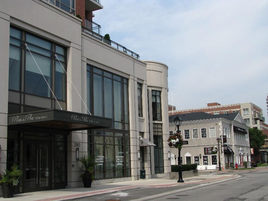
6 1.1 What is a Tall Building? A tall building is substantially taller than other buildings in the community and represents a prominent feature on the skyline. Tall buildings are typically defined as high-rise buildings with height that is greater than the width of the adjacent street right-of-way or the wider of two streets if located at an intersection. In Milton, however, right of way widths include 35.0m Arterials and 47.0m Regional Roads. A building 35m high would be approximately 11 storeys tall and a 47m building would be about 14 or 15 storeys. Yet for Milton, even a building of 9 storeys in height would be considered to be relatively tall. For this reason, the site specific context will be important in determining whether a building should be regarded as low, mid or high-rise. For mid-rise buildings, please refer to the Mid-Rise Design Guidelines companion document. These Tall Building Guidelines may be applied wherever a building appears tall in relation to its context. Credit: SimonP CC-BY-SA-3.0, Wikimedia Commons Credit: ANDREJ NEUHERZ, CC BY-SA 3.0, Wikimedia Commons 2

7 1.2 Preferred Locations for Tall Buildings Higher density mixed use development is generally directed to the Urban Growth Centre. Additional mixed use development at higher densities is planned to occur within Secondary Mixed Use Nodes and Intensification Corridors, located at significant intersections and along major transit routes. Tall buildings are also encouraged at key locations within the urban area, especially at identified gateways and sites adjacent to major open space and institutional uses. Preferred locations will be close to the GO Transit Station and at the intersections of two Arterial Roads. In these strategic and key locations, building up instead of out, makes the best use of land and infrastructure and supports the growth of central and well connected neighbourhoods. LEGEND Urban Growth Centre Major Transit Station Area Secondary Mixed Use Node Intensification Corridor 3


8 1.3 Purpose of the Tall Building Guidelines By clarifying the Town s expectations for the design of tall buildings, it is intended that the guidelines should assist with the interpretation of Official Plan policies and provide a clear design direction for development proposals. These guidelines should be considered by developers preparing proposals for tall buildings in Milton at the outset. They will be used by Town of Milton staff to provide preapplication advice and during the review of development applications for tall buildings. The guidelines will also be a resource for the preparation of Area Specific Plans and design guidance. Implementation of the guidelines should also take into account and have proper regard to other relevant objectives, policies, standards, regulations and best practices as applicable. While these Tall Building Guidelines present a number of key design principles, not all will apply equally in all circumstances. The specific site context must be analysed to inform the application and relevance of particular guidelines and to evaluate the appropriate scale, height, important views and other situational challenges and opportunities. Proposals for tall buildings shall be supported by an Urban Design Brief. The Urban Design Brief shall establish the contextual relationship of the proposed development to adjacent buildings, streets and areas. (For further information see the Town s Development Application Guidelines for Urban Design Briefs.) High rise buildings will often require detailed analysis of the microclimate, social setting, land use patterns, historic and architectural character, transportation, accessibility, community safety and Crime Prevention Through Environmental Design, services and the planned function of the area. This schematic concept is used in Section 2.0 to illustrate the key design principles for tall buildings. It is not intended to represent a real world situation or an actual design response. 4


9 1.4 Guiding Principles: Opportunities and Challenges Some of the opportunities and challenges associated with tall buildings suggest a number of guiding principles and influences for site planning and design:. OPPORTUNITIES INTENSIFICATION Tall buildings can support healthy and sustainable communities by providing a critical mass of people close to jobs and transit. ACTIVE TRANSPORTATION, TRANSIT AND NEW MOBILITY Tall buildings with mixed uses, required parking and amenities, located close to transit & community services can help to reduce dependence on private automobiles. MIXED USE Tall buildings with mixed-uses can encourage sustainable lifestyles by allowing families and individuals to easily live, work, and play in the same locality. LANDMARKS Tall buildings can be iconic landmarks by punctuating the skyline and helping people to orient themselves in the town. Advances in design and construction enable built forms that are leaning, twisting, tapering and bending. SUSTAINABLE DESIGN Appropriately located and well-designed tall buildings can contribute to a sustainable future by using innovative building technologies, such as green roofs and renewable energy. PUBLIC SPACE Tall buildings can free up open space for other uses, such as parks or plazas, by fitting more homes on a smaller building footprint. COMMUNITY BENEFITS Height and density provisions can allow a building that is taller and higher density than originally permitted in exchange for various community benefits, such as public art, improved transit, day care facilities, or affordable housing. CHALLENGES VIEWS AND VISTAS Appropriately located and designed tall buildings can add visual interest to the skyline and frame new or existing views. But the impact in relation to views of the escarpment, historic landmarks, and the skyline must be carefully assessed. TRAFFIC AND PARKING In highly accessible locations, tall buildings can exploit opportunities for active transportation, transit and new mobility and may use flexible and innovative approaches for traffic demand management and parking. However, traffic and parking concerns arising from concentrating a higher number households on a site will need to be addressed in a Traffic Impact Study and Parking Justification Report. TRANSITION TO SURROUNDINGS By definition, tall buildings are usually taller than surrounding buildings and will assert their presence well beyond the boundaries of the actual site. However, tall buildings and the ground areas around them can integrate harmoniously with their surroundings provided that the design is in sympathy with and respects significant features and elements of the established neighbourhood. PEDESTRIAN PERCEPTION AND COMFORT Well separated slender towers stepped back from a podium base with shelter for weather protection, can have a human scale that contributes to pedestrian comfort and allows views of the sun and sky. To address concerns about pedestrian level perception and comfort, proposals will need to include photorealistic street views, 3D modelling, windtesting and sun shadow analysis. 5


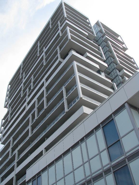
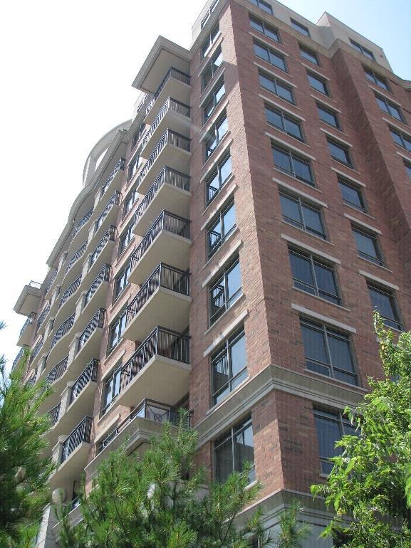
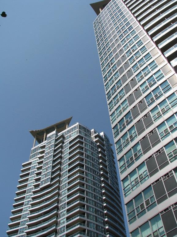
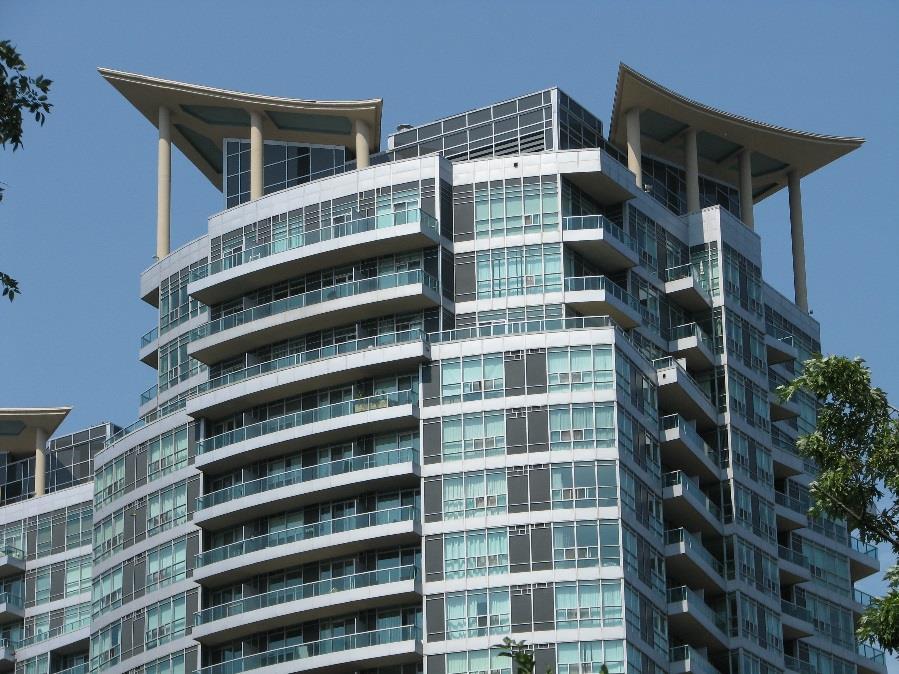
10 Precedent examples of tall building design. 6

11 2.0 TALL BUILDING DESIGN BUILDING TOP TOWER (MIDDLE) PODIUM (BASE) The built form and massing of a tall building has three main components that are integrated in the whole of the design. Depending on the design style, function, use and context there may be significant or subtle differentiation in the character or detailing of each of these segments. 7


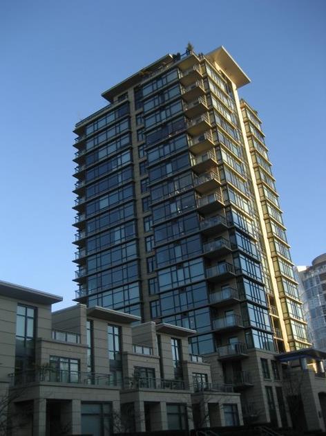
12 Precedent examples of podium design. 8

13 2.1. Podium Design The podium (or building base) is the primary interface between the tall building and the surrounding streets and public spaces. It therefore has the greatest impact on how pedestrians interact with the building and how the building fits within the street level environment. 9
14 PODIUM DESIGN 1 Green roofs on top of the podium. This creates opportunities for communal outdoor amenity space and environmental innovations such as rainwater harvesting. Podium height and setback related to the surrounding context and road hierarchy. This contributes to street edge continuity and enclosure, thereby defining a human scaled and inviting street space. 2 3 Podium façade respects the scale, rhythm and proportions of nearby heritage buildings. This helps to maintain a locally distinctive character at street level. In mixed-use areas, active uses and a high proportion of transparent windows and doors at street level. This helps to enliven the street. Main entries oriented towards intersections, municipal sidewalks and transit stops. This supports pedestrian activity and visibility. Step backs and canopies or colonnades provide weather protection. 10

15 Podium Design Notes 1 Where an area is in transition and there is no stable built form to which the new development will relate, the height of the podium should be proportional to the right of way width. A minimum height to width ratio of 1:3 is required to achieve perceived comfort and sense of enclosure for pedestrians. The maximum podium height will vary by location, but is not normally expected to exceed 4 to 6 storeys in order to achieve a satisfactory human scale. In mixed use areas, the podium should be located at the back edge of the sidewalk with a minimal setback sufficient to accommodate a 3.0m + sidewalk width. Where appropriate, larger setbacks and recessed ground floors may accommodate wider sidewalks with awnings and canopies for pedestrian weather protection, plantings, street furniture, public art and patio dining. In residential streets, the setback will be sufficient to accommodate a landscape privacy zone and sidewalk connections to ground floor suites. 2 3 In mixed use areas, the floor-to-floor height of the ground floor should be a minimum of 4.5m to accommodate internal servicing and loading, and active commercial uses. For residential street fronts, ground floor suites should be raised 0.6m 1.0m above grade to create a privacy separation from the sidewalk, Various forms of shelter such as canopies, recessed entries and colonnades and step backs can all help to provide relief for pedestrians from the impact of downdrafts, gusts, eddies and inclement weather conditions. Wind testing and analysis of tall buildings will be necessary to evaluate the wind impact of the proposed tower and to ensure that the recommended design solutions are adequate. 11

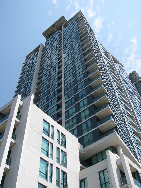
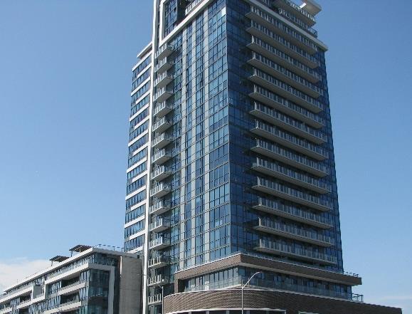

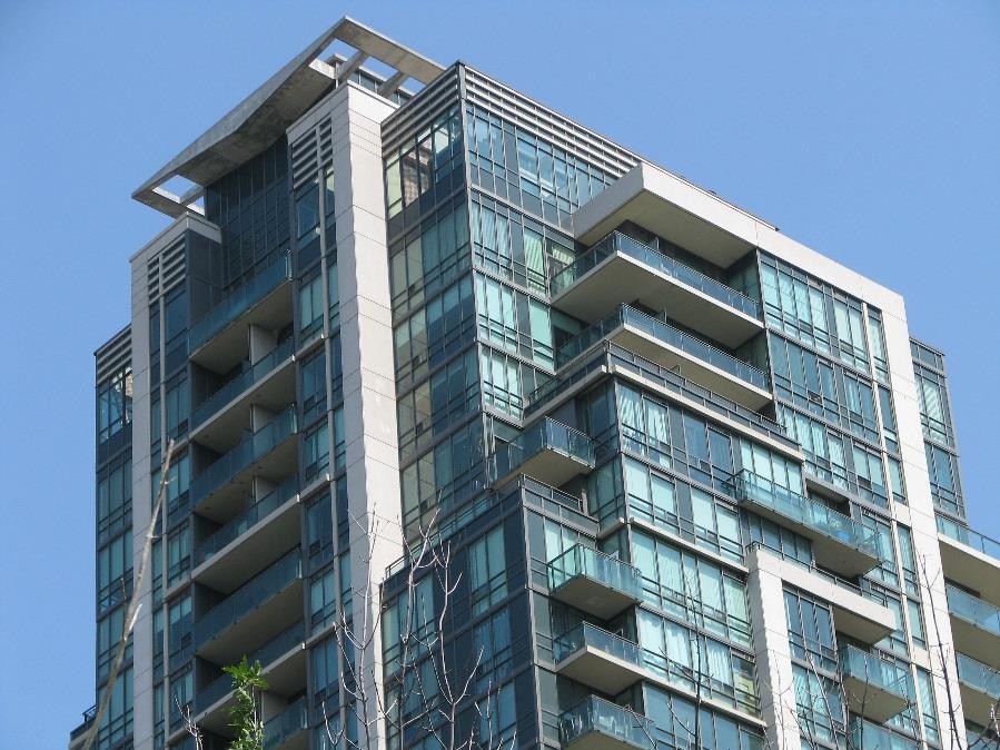
16 Credit: Kyle Pearce, CC-BY-SA-3.0, Wikimedia Commons Credit: Grant Lemons, unsplash.com Credit: Chris Barbalis,unsplash_com Precedent examples of tower design. 12

17 2.2 Tower Design The tower (middle or shaft) is the most visually substantial and physically impactful component of a tall building. It will likely be a prominent and defining feature in the urban landscape. Particular attention will be given to tower design, modelling, and materials to create a unique, identifiable and interesting skyline. 13
18 TOWER DESIGN 1 Heavier materials, such as metal or brick, provide architectural accents and features. Tallest towers located closest to major intersections and/or transit facilities. Slender floorplates and generous separation between towers (25m min.) maximizes views of the sky and minimizes cumulative sun shadow and microclimate impacts. Towers positioned to preserve or frame important views of heritage landmarks or natural features Lighter materials such as glass reduce the perceived mass. Vertical and horizontal articulation. This creates visual interest and reduces the apparent mass. 2 Offset multiple towers in a single development. This creates a generous podium roof for outdoor amenity areas and added benefits for sky views, sun shadow and microclimate. A significant variation in height (at least 5 floors) contributes to a visually interesting skyline. Towers stepped back above the podium. This clearly differentiates between the building base and the tower above and enhances pedestrian perception and comfort. Building heights gradually stepping down towards lowrise areas provide a gentle transition in scale. 3 14

19 Tower Design Notes 1 Slender point towers with compact floorplates are preferred in order to: Maximise views, light and ventilation for the interior spaces: Facilitate views of the sky and sunlight reaching outdoor spaces; Avoid the perception of a canyon effect along streets and sidewalks; Create narrow shadows that track quickly across the ground; and, afford opportunities for views and vistas of landmarks and natural features. Between the 8 th and 15 th storeys, the floorplates (excluding balconies) should be less than 1000sq.m. Above the 15 th storey, the floorplate should be less than 750sq.m or 40 linear metres measured diagonally. 2 3 The orientation of towers needs to balance shadow impacts with the protection of views and vistas of the Escarpment. Generally, a north-south orientation will reduce shadow impacts, but an east west orientation will have least impact on views and vistas. Therefore, the orientation of towers will need to be supported by a sun-shadow impacts study and a visual impacts study. Front, side and rear angular planes will be applied up to and including the 8 th floor of a building in accordance with the Mid-Rise Guidelines companion document. 15


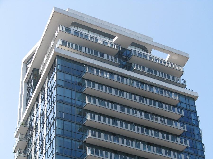
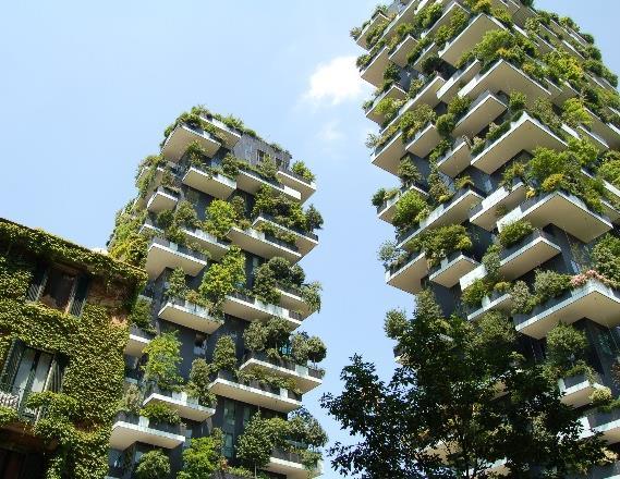
20 Precedent examples of building top design. 16

21 2.3 Building Top Design The top of the building terminates the tower and adds visual interest to the skyline. A unique design assists with wayfinding and orientation in the urban environment. 17
22 BUILDING TOP DESIGN Renewable energy technologies incorporated as part of a comprehensive approach to best practice sustainable design. Mechanical equipment screened from view with materials to match the main building. Step backs and roof overhangs minimise the visual impact. Rooftop mechanical equipment wrapped by suites or other habitable space (i.e. amenity areas). Upper floors terminate the tower with a distinctive crowning feature, integrated with the overall design. Vertical features and accent materials integrate the upper floors with the tower below. Horizontal articulation and lighter materials differentiate the upper floors. 18


23 2.4 Public and Private Open Space Public and private open space includes the municipal sidewalk and boulevards within the right of way, publicly accessible open space such as plazas and parkettes, parking and servicing areas and private open amenity space. These should be seamlessly integrated to maximize pedestrian permeability and accessibility. 19

24 PUBLIC AND PRIVATE OPEN SPACE Publicly accessible private open space, such as parkettes or pocket parks. Parking and service areas within the interior of the site, mostly underground or in the building. Publicly accessible mid-block connections to maximize pedestrian permeability. Direct pedestrian connections to nearby transit and other community facilities. Plazas at corner sites designed to encourage pedestrian activity, public art, sidewalk cafes etc.,. Inviting open spaces, enhanced boulevards and pedestrian amenities at corner sites. 1 20
.")


25 Public And Private Open Space Notes 1 Publicly accessible private open space, public art and other community benefits will be encouraged through height and density bonussing (i.e. Section 37 of the Planning Act). Credit: Mtaylor848, CC Credit: Matt Quinn, unsplash.com 2 Mid-block pedestrian connections with or without vehicle access should be provided where block lengths exceed 90m. The building may bridge over the mid-block accessway, in the form of a breezeway, if preferred to achieve street wall continuity. 3 Surface parking areas should generally be limited to barrier-free parking, visitor parking, drop-off zones and loading/unloading. 21
26
27
28
Highland Village Green Design Guidelines
 Highland Village Green Design Guidelines Publishing Information Title Highland Village Green Design Guidelins Author The City of Calgary Status DRAFT - Proposed document subject to changes Additional Copies
(DC1) Direct Development Control Provision DC1 Area 4
 Direct Development Control Provision DC1 Area 4") . General Purpose (DC) Direct Development Control Provision DC Area 4 The purpose of this Provision is to provide for an area of commercial office employment and residential development in support of the
. General Purpose (DC) Direct Development Control Provision DC Area 4 The purpose of this Provision is to provide for an area of commercial office employment and residential development in support of the
Wide asphalt driveway abutting school property. garage built with incompatible materials, too close to park. incompatible fencing materials
 Wide asphalt driveway abutting school property incompatible fencing materials garage built with incompatible materials, too close to park Lack of plantings as a buffer between private property and open
DRAFT Northeast Quadrant of Kipling Avenue and Highway 7 DRAFT AUGUST 29, Goals Land Use. The goals of this Plan are to:
 AUGUST 29, 2017 12.15 Northeast Quadrant of Kipling Avenue and Highway 7 12.15.1 Goals 12.15.2 Land Use The goals of this Plan are to: 12.15.2.1 General Provisions: a) Ensure the development of a compact
Urban Design Manual PLANNING AROUND RAPID TRANSIT STATIONS (PARTS) Introduction. Station Study Areas
 Introduction. Station Study Areas") 111111 PLANNING AROUND RAPID TRANSIT STATIONS (PARTS) Introduction The ION rapid transit system will link Waterloo, Kitchener and Cambridge through a central transit corridor (CTC). There are a number
111111 PLANNING AROUND RAPID TRANSIT STATIONS (PARTS) Introduction The ION rapid transit system will link Waterloo, Kitchener and Cambridge through a central transit corridor (CTC). There are a number
Urban Design Guidelines Townhouse and Apartment Built Form
 Urban Design Guidelines Townhouse and Apartment Built Form Town of Wasaga Beach Table of Contents 1. Introduction 1.1. Purpose 1.2. Urban Design Principles 1.3. Application of Guidelines 2. Site Design,
Uptown Rideau Street Secondary Plan [Amendment #166, January 12, 2016]
![Uptown Rideau Street Secondary Plan [Amendment #166, January 12, 2016]](/thumbs/76/73760497.jpg "Uptown Rideau Street Secondary Plan [Amendment #166, January 12, 2016]") [Amendment #166, January 12, 2016] The policies of this Secondary Plan are in effect, save and except for the property at 560 Rideau Street, for which there remains a site specific appeal to this Secondary
[Amendment #166, January 12, 2016] The policies of this Secondary Plan are in effect, save and except for the property at 560 Rideau Street, for which there remains a site specific appeal to this Secondary
ELMVALE ACRES SHOPPING CENTRE MASTER PLAN
 ELMVALE ACRES SHOPPING CENTRE MASTER PLAN Contents 1.0 INTRODUCTION... 2 2.0 LOCATION... 2 3.0 EXISTING CONTEXT... 2 4.0 VISION & GUIDING PRINCIPLES... 2 5.0 LAND USE AND BUILT FORM... 4 5.1 St. Laurent
WELCOME and introduction
 1 WELCOME and introduction Mobility Hub Locations within Burlington STUDY OVERVIEW STUDY OBJECTIVES The City of Burlington is developing four Area Specific Plans, one for each of Burlington s Mobility
Prepared for: Jacal Holdings Ltd. Prepared by: Korsiak Urban Planning & KNYMH Inc. Revised: May 2018
 Prepared for: Jacal Holdings Ltd. Prepared by: Korsiak Urban Planning & KNYMH Inc. Revised: May 2018 PART A: DESIGN VISION, GUIDING PRINCIPLES AND OBJECTIVES 1. Preface 3 2. Introduction 3 3. Design Vision
WEST LOOP DESIGN GUIDELINES CHECKLIST
 WEST LOOP DESIGN GUIDELINES CHECKLIST Section 1.0 General Strategies 1.1 DESIGN EXCELLENCE: ENCOURAGE HIGH QUALITY AND INNOVATIVE DESIGN OF NEW BUILDINGS WITHIN THE WEST LOOP WITHOUT BEING PRESCRIPTIVE
Urban Design Brief to 1557 Gordon Street & 34 Lowes Road West
 Urban Design Brief 1533 to 1557 Gordon Street & 34 Lowes Road West Reid s Heritage Homes Ltd. & 883928 Ontario Ltd. and RHH Property Management Ltd. City of Guelph Zoning By-law Amendment November 2017
HIGHLAND VILLAGE GREEN URBAN DESIGN PRINCIPLES/GUIDELINES
 URBAN DESIGN GUIDING PRINCIPLES/GUIDELINES CONTEXT/CHARACTER The City of Calgary s Municipal Development Plan (MDP), Transit-Oriented Development (TOD) Policy Guidelines and Main Street/Corridor policy
Urban Design Direction for Oakville. Endorsed by Council on May 12, 2014 Endorsed by Council , Version - 1.0
 Urban Design Direction for Oakville Endorsed by Council on May 12, 2014 Endorsed by Council 01.30.2014, Version - 1.0 Urban Design Direction for Oakville Livable by Design Manual Urban Design Direction
CONTENTS 8.0 LAND USE 8.1 GENERAL LAND USE 8.2 RESIDENTIAL 8.3 MIXED USE 8.4 COMMERCIAL 8.5 EMPLOYMENT LANDS
 8-2 Land Use 8.0 LAND USE CONTENTS 8.1 GENERAL LAND USE 8.1.1 Uses provided for in all Land Use Designations 8.1.2 Uses prohibited in Hazardous Lands, Hazardous Sites and Special Policy Areas 8.1.3 Uses
SCHEDULE 12 TO THE DESIGN AND DEVELOPMENT OVERLAY GLEN WAVERLEY ACTIVITY CENTRE STRUCTURE PLAN
 DD/MM/YY Proposed C120 SCHEDULE 12 TO THE DESIGN AND DEVELOPMENT OVERLAY Shown on the planning scheme map as DDO12. GLEN WAVERLEY ACTIVITY CENTRE STRUCTURE PLAN 1.0 Design objectives DD/MM/YY Proposed
URBAN DESIGN BRIEF URBAN DESIGN BRIEF 721 FRANKLIN BLVD, CAMBRIDGE August 2018
 URBAN DESIGN BRIEF URBAN DESIGN BRIEF 721 FRANKLIN BLVD, CAMBRIDGE August 2018 DESIGN BRIEF CONTENTS PART A 1.0 INTRODUCTION 2.0 DESCRIPTION & ANALYSIS OF SITE CONTEXT 3.0 DESIGN CONSTRAINTS AND OPPORTUNITIES
Housing and Coach House Guidelines - Ladner
 Housing and Coach House Guidelines - Ladner Policy D.8: Encourage Compatible Housing Design Encourage housing design that is sensitive to existing single family housing neighbourhoods by requiring a design
1354 CARLING AVENUE FORMAL RESUBMISSION HOLLOWAY LODGING
 1354 CARLING AVENUE FORMAL RESUBMISSION HOLLOWAY LODGING DECEMBER, 2017 THE SITE 1354 CARLING AVENUE The subject property is at a key gateway to the Carlington Neighbourhood, and when combined with future
ARCHITECTURAL DESIGN REVIEW For submission with development proposals in the City s Tourist Area
 ARCHITECTURAL DESIGN REVIEW For submission with development proposals in the City s Tourist Area Property Owner: Property Address: Architect: Application Number: Date: Please describe in detail how the
Clairtrell Area Context Plan
 Clairtrell Area Context Plan March 2005 Urban Development Services City Planning Contents 1. Introduction... 4 2. Development Structure... 6 2.1 Streets... 7 2.1.1 Sheppard Avenue and Bayview Avenue...
Yonge Eglinton Centre Urban Design Guidelines
 Yonge Eglinton Centre Urban Design Guidelines City Planning Urban Design January 2009 YONGE EGLINTON CENTRE INTRODUCTION.................................................... 1 GENERAL SITE PLAN OBJECTIVES......................................
Commercial Development Permit Area
 City of Kamloops KAMPLAN Commercial Development Permit Area PURPOSE The purpose of this Development Permit Area (DPA) is to establish objectives and provide guidelines for the form and character of commercial
East Bayshore Road Neighbourhood
 East Bayshore Road Neighbourhood Northridge Property Management Urban Design Brief 3195 East Bayshore Road City of Owen Sound January 2016 East Bayshore Road Neighbourhood Northridge Property Management
QUEEN-RIVER SECONDARY PLAN
 34 QUEEN-RIVER SECONDARY PLAN 34. QUEEN RIVER SECONDARY PLAN 1. INTRODUCTION The Queen-River area is approximately 6.4 hectares and is located at the eastern edge of the Downtown as shown on Map 34-1.
Cit of Kitchener Ur 6 an Design Manual PARTA. Desi n for _--::
 Cit of Kitchener Ur 6 an Design Manual Date PARTA Year ) Desi n for k Nodes Corridors _--:: Section Page 01 of 12 2 INTRODUCTION Purpose & Application Nodes and Corridors have been identified as key intensification
DESIGN GUIDELINES CITY OF OTTAWA
 DESIGN GUIDELINES CITY OF OTTAWA DECEMBER 17, 2015 BASED ON THE ISLES: DOMTAR LANDS REDEVELOPMENT MASTER PLAN DATED APRIL 22, 2014 AND PREPARED BY PERKINS+WILL ZIBI DESIGN GUIDELINES Prepared by FOTENN
URBAN DESIGN BRIEF. 2136&2148 Trafalgar Road. Town of Oakville
 URBAN DESIGN BRIEF 2136&2148 Trafalgar Road Town of Oakville Prepared By: METROPOLITAN CONSULTING INC For 2500674 Ontario Inc November 2016 TABLE OF CONTENTS Page No. 1.0 Introduction/Description of Subject
Official Plan Review: Draft Built Form Policies
 PG.30.1 REPORT FOR ACTION Official Plan Review: Draft Built Form Policies Date: May 15, 2018 To: Planning and Growth Management Committee From: Chief Planner and Executive Director, City Planning Division
lot flankage Y street 16m 6m landscape strip for large site 3m landscape strip for small medium site
 Commercial General Commercial Objectives Create developments compatible with adjacent land uses in scale, function and character Define a consistent and attractive street edge with quality landscaping,
New-Cast Mixed-use Development Proposal King Street West, Newcastle, Ontario
 URBAN DESIGN BRIEF New-Cast Mixed-use Development Proposal King Street West, Newcastle, Ontario TABLE OF CONTENTS: 1.0 Executive Summary 2.0 Creating Vibrant and Sustainable Urban Places: Excerpts from
VILLAGE OF SKOKIE Design Guidelines for Mixed-Use Districts NX Neighborhood Mixed-Use TX Transit Mixed-Use CX Core Mixed-Use
 VILLAGE OF SKOKIE Design Guidelines for Mixed-Use Districts NX Neighborhood Mixed-Use TX Transit Mixed-Use CX Core Mixed-Use TABLE OF CONTENTS CHAPTER 1 SITE DESIGN Purpose 1 CHAPTER 2 SITE DESIGN Streetscape
WELLINGTON STREET WEST COMMUNITY DESIGN PLAN
 36 3.CDP POLICIES 37 Wellington Street West CDP Vision Statement 38 3.1 Introduction 3.1.1 Purpose The development of buildings and public spaces is influenced by a variety of factors over time. City of
Cha p t e r 2: Ge n e r a l De s i g n Gu i d e l i n e s
 Downtown Ann Arbor Design Guidelines Cha p t e r 2: Ge n e r a l De s i g n Gu i d e l i n e s This chapter presents general design guidelines for new site plan or PUD projects in downtown Ann Arbor. The
Revitalization Guidelines for Corridors, Villages and Town Centres
 Revitalization Guidelines for Corridors, Villages and Town Centres July 2017 Updated May, 2018 Publishing Information Title: Prepared by: Revitalization Guidelines for Corridors, Villages and Town Centres
Planning Rationale Zoning By-law Amendment Application October Centrepointe Drive - Ottawa, Ontario
 ZONING BYLAW AMENDMENT OCTOBER 2011 Table of Contents Table of Contents... i 1 Introduction... 1 1.1 Site Location... 1 1.2 Overview of Proposed Development... 1 2 Context... 6 2.1 Community Character...
SCHEDULE 'A' TO BY-LAW as Amended by AMENDMENT NO. 90 TO THE WHITBY OFFICIAL PLAN
 SCHEDULE 'A' TO BY-LAW 6413-10 as Amended by 6553-11 AMENDMENT NO. 90 TO THE WHITBY OFFICIAL PLAN SECTION A: GROWTH PLAN CONFORMITY PURPOSE: LOCATION: BASIS: The purpose of this Amendment is to: conform
Regency Developments. Urban Design Brief. Holyrood DC2 Rezoning
 Regency Developments Urban Design Brief Holyrood DC2 Rezoning Stantec Consulting Ltd. 7-31-2017 1. Overview Regency Developments intends to rezone the lands located at 8510 and 8511 93 Avenue, within the
appendix and street interface guidelines
 appendix five: building and street interface guidelines appendix 5 building and street interface guidelines BOULEVARDS Boulevards are generally characterized by higher levels of traffic movement at higher
Buildings may be set back to create small plazas provided that these setbacks do not substantially disrupt the street wall s continuity.
 6-22 Community Design Street Walls and Street-front Setbacks The siting of buildings will play a critical role in establishing the character and sense of place for the District. Siting buildings at the
*** DRAFT 2 FOR PUBLIC REVIEW ***
 6.7 The area is generally bounded by the Red Hill Valley Parkway to the west, Lake Avenue to the east, the Queen Elizabeth Way (QEW) to the north, and by the properties just south of Queenston Road to
Agenda. 7 Wright Crescent Urban Design Study. Public Meeting and Urban Design Workshop. 1 INTRODUCTION AND BACKGROUND (City of Kingston)
") Urban Design Study Public Meeting and Urban Design Workshop October 02, 2013 Agenda 1 INTRODUCTION AND BACKGROUND (City of Kingston) 2 URBAN DESIGN STUDY PRESENTATION (Antonio Gomez-Palacio, DIALOG) 3
Urban Design Study Public Meeting and Urban Design Workshop October 02, 2013 Agenda 1 INTRODUCTION AND BACKGROUND (City of Kingston) 2 URBAN DESIGN STUDY PRESENTATION (Antonio Gomez-Palacio, DIALOG) 3
City of Kitchener Urban Design Manual. Approved by Kitchener City Council December 11 th, 2017 PART B. Design for. Tall Buildings
 Approved by Kitchener City Council December 11 th, 2017 PART B Design for Tall Buildings Introduction Section Page 01 of 18 2 Make it Kitchener What is a Tall Building? Working With The Guidelines INTRODUCTION
Multi family Residential Development Permit Area
 City of Kamloops KAMPLAN Multi family Residential Development Permit Area PURPOSE The purpose of this Development Permit Area (DPA) is to establish objectives and provide guidelines for the form and character
Urban Design Brief. Watson Parkway North & Watson Road North Guelph, Ontario. Prepared by Coletara Development
 Urban Design Brief Watson Parkway North & Watson Road North Guelph, Ontario Prepared by Coletara Development December, 2013 Urban Design Brief, Coletara Development 1 Introduction This Urban Design Brief
Policies and Code Intent Sections Related to Town Center
 Policies and Code Intent Sections Related to Town Center The Town Center Vision is scattered throughout the Comprehensive Plan, development code and the 1994 Town Center Plan. What follows are sections
Mark-up of the effect of the proposed Bronte Village Growth Area OPA No.18 on the text of section 24, Bronte Village, of the Livable Oakville Plan
 Mark-up of the effect of the proposed Bronte Village Growth Area OPA No.18 on the text of section 24, Bronte Village, of the Livable Oakville Plan Notes: This document is provided for information purposes
CONTENTS 6.1 URBAN DESIGN
 6-2 Urban Design and Sustainable Development 6.0 URBAN DESIGN AND SUSTAINABLE DEVELOPMENT CONTENTS 6.1 URBAN DESIGN 6.1.1 General Policies 6.1.2 The Public Realm 6.1.3 Streets and Blocks 6.1.4 Streetscapes
Urban Design Guidelines for High-Rise Housing
 . Urban Design Guidelines for High-Rise Housing ottawa.ca Draft for Discussion Purposes only Ce document est disponible en français sur ottawa.ca This document is available in French on ottawa.ca Approved
Site Planning. 1.0 Site Context. 2.0 Pedestrian Circulation Systems. Pag e 2-23
 The following photographs from throughout the country illustrate key urban design principles. Photographs are provided to illustrate the overall urban design concepts described in Chapter 1 of the Downtown
BESSARION-LESLIE CONTEXT PLAN
 Development in the Bessarion-Leslie area will be consistent with the following urban design guidelines. They provide a framework for development in the area and are to be read in conjunction with the urban
Mixed Use Centres Development Permit Guidelines
 1 Mixed Use Centres Development Permit Guidelines Area Commercial or Mixed Use development occurring in City Centre, Urban Centre, Neighbourhood Centre, or Institutional Complex land use designations is
Old East Village Dundas Street Corridor Secondary Plan
 Old East Village Dundas Street Corridor Secondary Plan DRAF T February 2019 Contents 1.0 INTRODUCTION 1 1.1 Background 1 1.2 Location 2 1.3 Purpose and Use 3 1.4 Vision and Principles 4 2.0 CHARACTER
WINDSOR GLEN DESIGN GUIDELINES
 WINDSOR GLEN DESIGN GUIDELINES Adopted by Council, 2006 WINDSOR GLEN REDEVELOPMENT DESIGN GUIDELINES August 2006 1.0 Master Plan Organization For this area of the Coquitlam Town Centre, a mix of high,
Workshop 3. City of Burlington Waterfront Hotel Planning Study. September 14, The Planning Partnership
 Workshop 3 City of Burlington Waterfront Hotel Planning Study September 14, 2017 The Planning Partnership The Waterfront Hotel Planning Study 01 The Brant & Lakeshore Planning Study will establish a Strategic
The Baileys Planning District portion of the Comprehensive Plan contains site design recommendations for both the Baileys Crossroads Community
 The Baileys Planning District portion of the Comprehensive Plan contains site design recommendations for both the Baileys Crossroads Community Business Center and the Seven Corners Community Business Center.
Little Mountain UDP Presentation
 Summary of UDP Evaluation of Dec 2015 Plan Dec 2015 Site Plan Transitional edges work well Central spine and permeability are strong Tree retention is good Establish Big Idea Sameness of built form contributes
KEY MAP DEVELOPMENT PERMIT AREA MAP. Sunnymede North Sub-Area Plan
 Richmond Official Community Plan BROADMOOR AREA SUNNYMEDE NORTH SUB-AREA PLAN Bylaw 7100 Schedule 2.6C SUNNYMEDE NORTH SUB-AREA PLAN SUNNYMEDE NORTH SUB-AREA PLAN SUNNYMEDE NORTH SUB-AREA PLAN KEY MAP
401/Keele Provincial Campus Ontario Realty Corp.
 1.0 INTRODUCTION 1.1 Site Location and Description The study area consists of approximately 74 acres (30 ha) located in the Keele Street and Wilson Avenue area. It is bounded by Wilson Avenue to the north,
DRAFT DRAFT DRAFT DRAFT
 # 19 EXPAND GREEN AND OPEN SPACES AND COMMUNITY FACILITIES IN TANDEM WITH NEW DEVELOPMENT The role of Eglinton will change in the coming years, along with the intensity of activity and land uses. As more
FRUITVALE TRANSIT VILLAGE (Phase 2) Residential Project
 Residential Project") FRUITVALE TRANSIT VILLAGE (Phase 2) Residential Project DEVELOPER: SIGNATURE PROPERTIES ARCHITECT: HKIT ARCHITECTS April 23, 2010 TABLE OF CONTENTS 3 Vision 4 Description of Site 5 Guiding Concepts 6
FRUITVALE TRANSIT VILLAGE (Phase 2) Residential Project DEVELOPER: SIGNATURE PROPERTIES ARCHITECT: HKIT ARCHITECTS April 23, 2010 TABLE OF CONTENTS 3 Vision 4 Description of Site 5 Guiding Concepts 6
THE CITY OF VAUGHAN BY-LAW BY-LAW NUMBER A By-law to adopt Amendment Number 1 to the Official Plan of the Vaughan Planning Area.
 THE CITY OF VAUGHAN BY-LAW BY-LAW NUMBER 015-2014 A By-law to adopt Amendment Number 1 to the Official Plan of the Vaughan Planning Area. NOW THEREFORE the Council of the Corporation of the City of Vaughan
Tel: (705) Fax: (705)
 Fax: (705)") 521 and 525 Essa Road City of Barrie Tel: (705) 812-3281 Fax: (705) 812-3438 Email: INFO@IPSCONSULTINGINC.com 1 5 0 D U N L O P S T R E E T E A S T, S U I T E 2 0 1, B A R R I E O N T A R I O L 4 M 1 B
521 and 525 Essa Road City of Barrie Tel: (705) 812-3281 Fax: (705) 812-3438 Email: INFO@IPSCONSULTINGINC.com 1 5 0 D U N L O P S T R E E T E A S T, S U I T E 2 0 1, B A R R I E O N T A R I O L 4 M 1 B
TABLE OF CONTENTS 1.0 INTRODUCTION... 3
 TABLE OF CONTENTS 1.0 INTRODUCTION... 3 1.1. BACKGROUND... 3 1.2. THE PROPOSAL... 5 2.0 EXISTING POLICY FRAMEWORK... 5 2.1. PROVINCIAL POLICY STATEMENT (PPS)... 5 2.2. CITY OF LONDON OFFICIAL PLAN (OP)...
5.1 Site Plan Guidelines
 5. Community Core Guidelines Development of the Community Core will take place by plan of subdivision and site plan approval. It will occur in a phased manner that will reflect the timing of residential
Complete Neighbourhood Guidelines Review Tool
 Complete Neighbourhood Guidelines Review Tool Prepared By: City of Regina Planning Department October 2014 Page 1 of 14 Community Development Review Checklist for Secondary Plans and Concept Plans The
4.0 Design Guidelines For The Village Centre. South fields Community Architectural Design Guidelines Town of Caledon
 4.0 Design Guidelines For The Village Centre 4.0 Design Guidelines for the Village Centre The Village Centre is the focal point of the entire South Fields Community and is designed as a traditional commercial
URBAN DESIGN BRIEF 181 Burloak Drive, Oakville
 URBAN DESIGN BRIEF 181 Burloak Drive, Oakville February 2017 Our File: 1730B 230-7050 WESTON ROAD / WOODBRIDGE / ONTARIO / L4L 8G7 / T: 905 761 5588/ F: 905 761 5589/WWW.MHBCPLAN.COM TABLE OF CONTENTS
HAMILTON SECONDARY PLANS
 B.6.0 HAMILTON SECONDARY PLANS 6.1 Downtown Hamilton Secondary Plan The Downtown Hamilton Secondary Plan area is bounded by Cannon Street East to the north, Victoria Avenue North to the east, Hunter Street
Urban Design Brief Site Redevelopment King St. East Hamilton, Ontario
 Urban Design Brief Site Redevelopment 43-51 King St. East Hamilton, Ontario June 4, 2017 TABLE OF CONTENTS 1.0 INTRODUCTION 1.1 BACKGROUND 1.2 PROPOSED APPLICATIONS 2.0 PROJECT CONTEXT 2.1 SITE LOCATION
Context Plan and Urban Design Guidelines for the lands west of Provost Drive
 Concord Park Place Context Plan and Urban Design Guidelines for the lands west of Provost Drive Amendment to the Bessarion-Leslie Context Plan October 2013 Concord Park Place Urban Design Guidelines The
13. New Construction. Context & Character
 13. New Construction Context & Character While historic districts convey a sense of time and place which is retained through the preservation of historic buildings and relationships, these areas continue
Walnut Creek Transit Village Design Guidelines. Part Three III - 25
 C. General Design Criteria Part Three DRAFT 0/6/ III - 5 Frontage Types Frontage is a semi-public transition zone at the ground level where public and private realms meet. An understanding of various frontage
Derry Green Corporate Business Park
 Town of Milton Derry Green Corporate Business Park Urban Design Guidelines BMI/Pace - June 2010 Draft 3 Prepared by: Brook McIlroy Planning + Urban Design / Pace Architects Suite 300-51 Camden Street Toronto,
Chapter 5 Urban Design and Public Realm
 5.1 Introduction Public realm is all areas of the urban fabric to which the public have access. It is where physical interaction takes place between people. It therefore, includes buildings and their design,
built form design guidelines
 built form design guidelines Derry Green Corporate Business Park 17 built form design guidelines.1 Built Form Design Guidelines Section : Built Form Design Guidelines is intended to be used by both developers
B L A C K D I A M O N D D E S I G N G U I D E L I N E S for Multi-family Development
 B L A C K D I A M O N D D E S I G N G U I D E L I N E S for Multi-family Development Adopted June 18, 2009 This section of the Design and focuses on site planning and design guidance for new multi-family
BROADVIEW PLANNING STUDY Community Consultation Meeting 4. January 2016
 BROADVIEW PLANNING STUDY Community Consultation Meeting 4 January 2016 2 Agenda 6:00 pm Open House and Displays 7:00 pm Introductions, Agenda Review and Welcome 7:10 pm Presentation Broadview Planning
8. Urban Design. 8.0 Preamble. 8.1 Goals
 8. Urban Design 8.0 Preamble A memorable, attractive and liveable city is one where people feel comfortable and are inspired by their surroundings. The physical systems and built form of the city are also
PUBLIC OPEN HOUSE HURONTARIO-MAIN CORRIDOR SECONDARY PLAN
 PUBLIC OPEN HOUSE HURONTARIO-MAIN CORRIDOR SECONDARY PLAN Tuesday, February 28, 2012 6pm 9pm 1 st Floor Atrium, City Hall 2 Wellington Street West, Brampton 1 POLICY FRAMEWORK The 2006 Provincial Growth
City of Vaughan Urban Design Guidelines for Infill Development in Established Low-Rise Residential Neighbourhoods
 City of Vaughan Urban Design Guidelines for Infill Development in Established Low-Rise Residential Neighbourhoods DRAFT - September 2016 Contents 1. Introduction 1 2. Policy Context 3 3. Characteristics
PUBLIC RIGHT-OF-WAY IN THIS CHAPTER PUBLIC REALM
 PUBLIC RIGHT-OF-WAY This section provides design guidelines for improvements in the public right-of-way. The public right-of-way refers to streets, sidewalks, non-vehicular thoroughfares, parks and greenways
Authority: Toronto and East York Community Council Item 26.14, as adopted by City of Toronto Council on October 8, 9, 10 and 11, 2013 CITY OF TORONTO
 Authority: Toronto and East York Community Council Item 26.14, as adopted by City of Toronto Council on October 8, 9, 10 and 11, 2013 CITY OF TORONTO BY-LAW No. 1507-2013 To adopt Amendment No. 183 to
Table of Contents. Elm Avenue Improvement Plan City of Waco, Texas. Introduction 1. Existing Context 1 Figure 1 2.
 Table of Contents Introduction 1 Existing Context 1 Figure 1 2 Plan Guidelines 3 Future Urban Form 4 The West-End 4 Main Street 6 The East-End 7 Figure 2 9 Public Improvement Recommendations 7 General
B. Blocks, Buildings and Street Networks
 B. Blocks, Buildings and Street Networks Figure IV.4 A rational block pattern with connected streets Introduction The single most important element in the physical and functional integration of mixed use
EXISTING COMPREHENSIVE PLAN
 EXISTING COMPREHENSIVE PLAN Town Center Land Use Element: V. LAND USE POLICIES Town Center Mercer Island's business district vision as described in "Your Mercer Island Citizen-Designed Downtown" was an
GO Station Mobility Hubs: Draft Precinct Plans. Committee of the Whole July 12, 2018
 GO Station Mobility Hubs: Draft Precinct Plans Committee of the Whole July 12, 2018 Purpose of this Workshop Present Draft Precinct Plans for the 3 GO Station Mobility Hubs Continue the conversations that
Othello Neighborhood Design Guidelines
 Othello Neighborhood Design Guidelines 1 S ORCAS ST S OTHELLO ST 42ND AVE S 2 Note: Design Review does not apply to all zones. See Citywide Guidelines for details. Additionally, zoning areas on this map
Urban Design Brief Fanshawe Park Road. Competition Toyota
 Urban Design Brief 1300 Fanshawe Park Road Competition Toyota May 2, 2014 TABLE OF CONTENTS Page No. INTRODUCTION... 1 SECTION 1 LAND USE PLANNING CONTEXT... 1 1.1 The Subject Lands... 1 1.2 The Proposal...
The Village. Chapter 3. Mixed Use Development Plan SPECIFIC PLAN
 The Village SPECIFIC PLAN Chapter 3 3.1 INTRODUCTION 3.1.1 Purpose This Chapter describes the development regulations applicable to the Mixed-Use and Transit Center Planning Areas. These form-based regulations
5A Appearance and Compatibility. 5B Mass and Scale. 5C Articulation. 5D Fenestration and Detailing. 5E Active Ground Floors
 5A Appearance and Compatibility 5B Mass and Scale 5C Articulation 5D Fenestration and Detailing 5E Active Ground Floors 5F Sustainable Building Elements 5G Design for Active Living GUIDELINES FOR DEVELOPMENT
FLORIN ROAD CORRIDOR Site Plan and Design Review Guidelines Checklist
 FLORIN ROAD CORRIDOR Site Plan and Design Review Guidelines Checklist Applicant s Name: Project Address: Phone: Email: Applicant shall fill out the design guidelines checklist for all guidelines applicable
YONGE STEELES CORRIDOR SECONDARY PLAN. Young + Wright / IBI Group Architects Dillon Consulting Ltd. GHK International (Canada) Ltd.
 Ltd.") PART A: PREAMBLE 1.0 PURPOSE The purpose of this Secondary Plan is to provide a development framework for intensification of the Yonge/ Steeles corridor including the north side of Steeles Avenue West
PART A: PREAMBLE 1.0 PURPOSE The purpose of this Secondary Plan is to provide a development framework for intensification of the Yonge/ Steeles corridor including the north side of Steeles Avenue West
[PLANNING RATIONALE] For Site Plan Control and Lifting of Holding Zone By-Law 101 Champagne Avenue. May 23, 2014
![[PLANNING RATIONALE] For Site Plan Control and Lifting of Holding Zone By-Law 101 Champagne Avenue. May 23, 2014](/thumbs/75/71599615.jpg "[PLANNING RATIONALE] For Site Plan Control and Lifting of Holding Zone By-Law 101 Champagne Avenue. May 23, 2014") [PLANNING RATIONALE] For Site Plan Control and Lifting of Holding Zone By-Law 101 Champagne Avenue May 23, 2014 Contents 1.0 Introduction... 2 2.0 Site Context... 2 2.1 Adjacent Uses... 2 Figure 1: Site
[PLANNING RATIONALE] For Site Plan Control and Lifting of Holding Zone By-Law 101 Champagne Avenue May 23, 2014 Contents 1.0 Introduction... 2 2.0 Site Context... 2 2.1 Adjacent Uses... 2 Figure 1: Site
Metro. Activity Center Design Guidelines. Recommendations For Developing Focused, Mixed-Use Commercial/Residential Centers
 Metro Activity Center Design Guidelines Recommendations For Developing Focused, Mixed-Use Commercial/Residential Centers Metro Activity Centers What is a MAC? Legacy, the adopted guide for the future growth
1. General Purpose. 3. Uses
 1. General Purpose The purpose of this DC1 Provision is to facilitate the development of a pedestrian friendly Community Commercial Centre that may accommodate a range of commercial, residential, office,
599 Kennedy Road - Official Plan Amendment and Zoning Amendment Application - Preliminary Report
 STAFF REPORT ACTION REQUIRED 599 Kennedy Road - Official Plan Amendment and Zoning Amendment Application - Preliminary Report Date: March 7, 2017 To: From: Wards: Reference Number: Scarborough Community
178 Carruthers Properties Inc.
 178 Carruthers Properties Inc. Planning Rationale for 178 Carruthers Avenue Site Plan Control Application June 2014 Table of Contents 1.0 Introduction 2.0 Overview of Subject Property 3.0 Current Zoning
Public Consultation Summary: Lakeview Place Making Workshop January 30, 2008.
 Page 1 of 11 Public Consultation Summary: Lakeview Place Making Workshop January 30, 2008. 1.0 Introduction: On January 30, 2008 the City of Mississauga, in conjunction with the consulting team of Brook
Urban Design Brief December 23, 2015 Southside Construction Group Official Plan & Zoning By-Law Amendment
 Urban Design Brief Proposed Official Plan & Zoning By-Law Amendment 3244, 3263 and 3274 Wonderland Road South Southside Group December 23, 2015 TABLE OF CONTENTS Page No. INTRODUCTION... 1 SECTION 1 LAND