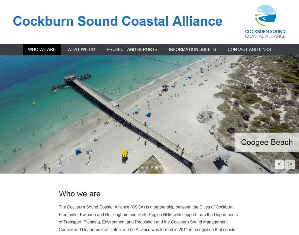
Coastal Climate Change Vulnerability and Flexible Adaptation Planning: the Cockburn Sound Coastal Alliance Experience
|
|
|
- Melanie Patrick
- 5 years ago
- Views:
Transcription
1 Coastal Climate Change Vulnerability and Flexible Adaptation Planning: the Cockburn Sound Coastal Alliance Experience Presentation to Climate Change Forum by Doug Vickery Manager Infrastructure Services, City of Cockburn 21 September 2016
2 Presentation Contents The Place Cockburn Sound & Owen Anchorage The CSCA Formation and Participation The Coastal Vulnerability & Flexible Adaptation Pathways Project The Delivery Process Outcomes So Far Key Follow-up Actions & Lessons Learned

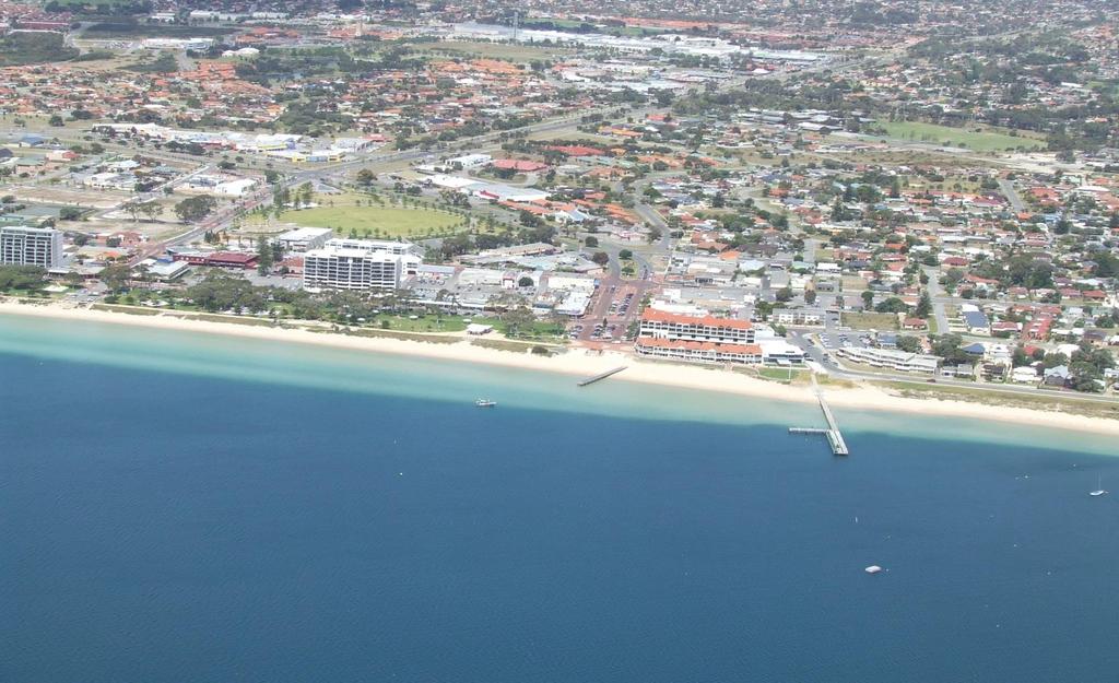
3 CSCA Area of Interest Coastline from Fremantle South Mole to Point Peron & east coast of Garden Island
4 RockinghamBeach CityofRockingham

5 Kwinana Beach - Industrial Strip City of Kwinana

6 Australian Marine Complex City of Cockburn

7 Woodman Point City of Cockburn

8 Port Coogee City of Cockburn Port Coogee Marina City of Cockburn

9 CY O Connor & South Beach Cities of Fremantle & Cockburn
10 Background to CSCA Formation High value Cockburn Sound & Owen Anchorage coastline Significant current and proposed development along the coast. Consensus that climate change poses a threat through coastal inundation and erosion. Lack of knowledge amongst the Councils of Fremantle, Cockburn, Kwinana & Rockingham regarding local specific vulnerability. LG s and other Stakeholders require justifiable information for planning decisions. Agreement to form an Alliance.
11 Background cont February 2010 Agreement to jointly fund a Cockburn Sound Coastal Climate Change Study Brief (completed July 2010) April-May 2011 MOU for the CSCA finalised & signed, themes being to: 1. Build and share knowledge pertaining to the vulnerability of Cockburn Sound and Owen Anchorage coastal zone to the effects of climate change, including sea level rise; 2. Assist in the development of strategies to aid them in addressing the identified vulnerabilities; 3. Enter into partnerships and agreements with other parties in pursuit of the aims in (a) and (b) above.


12 State Government Stakeholders Other Stakeholders
13 The Project Cockburn Sound Coastal Vulnerability & Flexible Adaptation Pathways Project Preparation Phase (project brief & stakeholders identification) Stage 1 Coastal Vulnerability Study Stage 2 Values & Risk Assessment Stage 3 Flexible Adaptation Plan Development & Review Report Stage 4 Monitoring & Implementation
 Stage 1:")

14 Cockburn Sound Coastal Vulnerability & Flexible Adaptation Pathways Project Preparation Phase (project brief & stakeholders identification) Stage 1: Coastal Vulnerability Study Stage 2: Values & Risk Assessment Stage 3: Flexible Adaptation Plan Development & Review Report Stage 4: Monitoring & Implementation

15 Cockburn Sound Coastal Vulnerability & Flexible Adaptation Pathways Project Preparation Phase (project brief & stakeholders identification) Stage 1: Coastal Vulnerability Study Stage 2: Values & Risk Assessment Stage 3: Flexible Adaptation Plan Development & Review Report Stage 4: Monitoring & Implementation Analyzed coastal processes to improve the understanding of existing coastal dynamics Assessed potential changes arising from climate change induced SLR of 0.5m (2070), 0.9m (2110) & 1.5m (2110+) and 1 yr, 10 yr, 100 yr & 500 yr ARI storm events Produced mapping of extent of potential erosion and inundation of vulnerable sections of the coastline based on the SLR & storm event scenarios.
16 Inundation Hazard Projected Levels Present Day +0.5 m SLR +0.9 m SLR +1.5 m SLR 1 year ARI (63% AEP) 1.00 m AHD 1.50 m AHD 1.90 m AHD 2.50 m AHD 10 year ARI (10% AEP) 1.16 m AHD 1.66 m AHD 2.06 m AHD 2.66 m AHD 100 year ARI (1% AEP) 1.34 m AHD 1.84 m AHD 2.24 m AHD 2.84 m AHD 500 year ARI (0.2% AEP) 1.48 m AHD 1.98 m AHD 2.38 m AHD 2.98 m AHD


17 Inundation Hazard Mapping 1 Year ARI Flood Event


18 Erosion & Inundation Hazard Mapping Friday, 28 February :5000 These Coastal Hazards Maps indicate coastal areas that may be susceptible to inundation, erosion and recession currently, or in the future as a result of ongoing sea-level rise and climate change, and should be used as a guide only. This indicative mapping is based on data that was available at the time of the assessment only. The Cockburn Sound Coastal Alliance and its member Local Government Authorities and agencies make no representations, warranties or undertakings about any of the information provided on these maps including, without limitation, their accuracy, their completeness or their quality or fitness for any particular purpose. Metadata: Erosion Scenarios, Event Inundation 1yr ARI, Event Inundation 10yr ARI, Event Inundation 100yr ARI, Event Inundation 500yr ARI
19 Erosion Hazard Areas at Risk Existing acute erosion risk Garden Island north of Colpoys Point Palm Beach, Rockingham Kwinana Bulk Terminal Most severe long-term erosion anticipated North of Catherine Point, North Coogee Woodman Point areas Kwinana Industrial Area to James Point Increased erosion due to sea level rise anticipated South of Catherine Point groyne James Point to Kwinana Industrial Area South of Garden Island South Beach Naval Base


20 Cockburn Sound Coastal Vulnerability & Flexible Adaptation Pathways Project Preparation Phase (project brief & stakeholders identification) Stage 1: Coastal Vulnerability Study Stage 2: Values & Risk Assessment Stage 3: Flexible Adaptation Plan Development & Review Report Stage 4: Monitoring & Implementation Identified the coastal assets within the areas potentially affected by the coastal erosion or inundation. Estimated the value at risk of these assets based on economic, social/cultural and ecosystem service factors. Undertook a risk assessment taking account of likelihood and consequence of the identified threats for timeframes out to year Provided First pass proposed adaptation options for each vulnerable section of coast based on Avoid / Accommodate / Protect / Protect & Intensify / Retreat.


21 SPP 2.6 Hierarchy of Adaptation Options
22 Retreat Analysis of Adaptation Pathway Options Total net present value of these costs is $170 million No costs for adaptation works except the soft protection works for the Kwinana industrial area Significant costs to private landowners and community members The costs of removing remnants of assets and the decommissioning of sites in the Kwinana industrial area may be very high and beyond the total costs of the other pathways Maintain Total net present cost of $70 million Costs predominantly involve (soft) coastal adaptation works and the reconfiguration of infrastructure Reasonable loss of park, heritage and urban land to 2110 Beaches/beach amenity maintained although the character modified as a result of beach nourishment Intensify Total net present cost is $93 million Most significant costs are the adaptation works Recreation and urban beaches maintained although the character modified significantly artificial and narrow

23 Cockburn Sound Coastal Vulnerability & Flexible Adaptation Pathways Project Preparation Phase (project brief & stakeholders identification) Stage 1: Coastal Vulnerability Study Stage 2: Values & Risk Assessment Stage 3: Flexible Adaptation Plan Development & Review Report Stage 4: Monitoring & Implementation Stage 3 Report and a Coastal Adaptation Plan for each LGA The Study undertaken based on Principles of: - Making the right adaptation decision to suit current values and circumstances without impeding the ability of future generations to respond to increasing risk beyond the current timeframe; and - Adaptation planning should reflect social, environmental and economic values of the coast and any coastal protection work option should be evaluated based on full life cycle benefits, costs and impacts.
24 TOLERABLE RISK ZONE DECISION POINT (TRIGGER 1) DEVELOPMENT IN VULNERABLE COASTAL AREA DECISION POINT (TRIGGER 2) DECISION POINT (TRIGGER 3) LONG TERM (100 YEAR) PLANNING HORIZON DECISION POINT (TRIGGER 3) DECISION POINT (TRIGGER 4) INTOLERABLE RISK ZONE AVOID & PLANNED RETREAT - STRATEGIC PLANNING TO LOCATE AND RELOCATE LAND USE AND ASSETS OUTSIDE COASTAL RISK AREAS Stage 3 Cockburn Sound Coastal Adaptation Plan

25 Decision Triggers Stage 3 Cockburn Sound Coastal Adaptation Plan
26 Coastal Compartment Option Assessment


27 Stage 3 Conclusions & Recommendations Incorporation of coastal adaptation planning into the LGA s Strategic Community Plans will be necessary to provide a local governance framework for integrated decision making in relation to strategic land use, infrastructure and capital works planning.
28 Stage 3 Report Conclusions & Recommendations cont... State Gov t (WAPC) review of the Metropolitan Region Scheme (MRS) and other strategic land use plans for the coastal strip, to provide adaptation support framework and amendment where needed for land that will be affected in next 15 years; The LG s Local Planning Strategies and Schemes be amended to include the establishment of Special Control Areas (SCA s) for the land identified at risk in the period out to establishing a long-term intention to retreat in these areas and providing special planning instruments. The LG s prepare Foreshore Management Plans for each area at risk, setting out the adaptation measures including the land use controls and any interim protection works proposed, for communicating with the community and stakeholders.
29 Stage 3 Conclusions & Recommendations cont Develop a firm plan for interim coastal protection works for those areas at risk in the current 15 year planning horizon and a provisional plan for protection works thereafter. Engage with the owners of assets in the SCA concerning plans for interim protection in the interim period and for development of longterm plans to retreat from the SCA in the lead up to triggers that require such action. Undertake or seek a study into the long term availability of suitable sand and rock to meet projected requirements for beach replenishment and coastal protection works (3m & 0.56m M3 resp). Ongoing monitoring of shoreline change and climate change SLR projections.
30 CSCA - Lessons Learned An alliance approach works - coastal processes and climate change risks don t stop at Council boundaries, shared resources mean bigger things can be achieved. A staged and iterative approach, refining as we go, has worked for us; Who s coast is it? it has fallen to Local Government to identify risks and inform our communities, but State and Federal Governments need to play a part. Leadership is needed to make it happen, officer level is where the work is done, but support from above is crucial.
31 Lessons Learned Current grant funding (in WA) is not suited to large multi stage projects spanning multiple years. Funding for planning is just as important (or more so) as for on-ground work or storm damage repair. Coastal assets at threat include beaches, natural and formed reserves, sites of significance they have social, cultural and ecosystem importance - but valuing them is not easy; Community engagement problematic to get the balance right just when, in what manner and with whom will ensure success? It s a long haul journey, building and retaining knowledge, experience and commitment in each Local Government will be a key success factor.
32

33 Questions Doug Vickery Manager Infrastructure Services
City of Rockingham. Local Management Practices, Costs and Strategic Coastal Planning
 City of Rockingham Local Management Practices, Costs and Strategic Coastal Planning Decision Making Process Considerations Climate Change Response Action Plan Ongoing observations/major Storm events Ongoing
Queensland Coastal Plan. Presented by John Lane Director Environment Planning
 Queensland Coastal Plan Presented by John Lane Director Environment Planning Queensland Coastal Plan - Status Released 7 April 2011, but NOT YET IN EFFECT Formatting & operational amendments required Yet
SHORELINE, FLOOD AND COASTAL DEFENCE MANAGEMENT PLANS
 These plans may provide opportunities as well as concern for recreational boating. They are currently being revised and consulted on. This document explains how we can engage in the process. Shoreline,
Coastal hazard assessments in Victoria
 Coastal hazard assessments in Victoria Viktor Brenners viktor.brenners@delwp.vic.gov.au Future Coasts program 4 year program established in 2007. Outputs included: Coastal Digital Elevation Models Victorian
Sunshine Coast Council Coastal Management Overview. January 2016 edition
 Sunshine Coast Council Coastal Management Overview January 2016 edition Mayor Mark Jamieson Mayor s foreword Our impressive beaches are fundamental to our Sunshine Coast lifestyle, economy and coastal
Appendix A. Planning Processes. Introduction
 1 Planning Processes Introduction This appendix outlines a number of planning processes which are used in the Auckland Region to support the effective management of development in the region s rural and
Policy for management and protection of the coast
 Policy for management and protection of the coast Policy for management and protection of the coast Mona Ohlsson Samhällsbyggnadsförvaltningen Ystads kommun, 2008 3 THE MUNICIPALITY GUIDELINES REGARDING
Empowering Local Action for Coastal Resilience in Massachusetts. Bruce K. Carlisle MA Office of Coastal Zone Management
 Empowering Local Action for Coastal Resilience in Massachusetts Bruce K. Carlisle MA Office of Coastal Zone Management Context Coastal communities continue to face both chronic and acute storm surge, erosion,
Townsville Coastal Hazard Adaptation Strategy pilot project adaptation decision-making in practice
 Townsville Coastal Hazard Adaptation Strategy pilot project adaptation decision-making in practice Author Harper, Bruce, Smith, Mitchell, Weir, Nick, Wall, Carol, Lane, John, Erhart, Dorean, Anderson,
POLICY SRT/D4 STORMWATER MANAGEMENT
 POLICY SRT/D4 STORMWATER MANAGEMENT BACKGROUND Increasing population, decreasing rainfall and increasing community expectations regarding environmental issues have led to increasing recognition of the
Planning Proposal under section 55 of the EP&A Act
 FOR PUBLIC EXHIBITION [Brief description] Monday 10 October to Monday 27 October 2014 Planning Proposal under section 55 of the EP&A Act Port Macquarie-Hastings LEP 2011 (Amendment No 32) Mixed land zone
Rhode Island Shoreline Change Special Area Management Plan
 Rhode Island Shoreline Change Special Area Management Plan Draft Document Outline REVISED 10/12/2017 VOLUME 1 Executive Summary & How to Use this Document (Draft by Dec 2017) 1. Introduction (Revised draft
Legal implications of failing to
 Legal implications of failing to plan for sea level rise Gavin Leydon, Partner 30 April 2010 Outline Relevance to local l government & developers assessment & policy Developments in case law Climate change
Cotswolds AONB Landscape Strategy and Guidelines. June 2016
 Cotswolds AONB Landscape Strategy and Guidelines June 2016 Cotswolds AONB Landscape Strategy and Guidelines Introduction The evolution of the landscape of the Cotswolds AONB is a result of the interaction
Managing our Landscapes Conversations for Change
 Managing our Landscapes Conversations for Change Frequently Asked Questions The new State Government is committed to a significant reform program that will change the way natural resources are managed.
Climate Change and Physical Development Threats, Challenges and Adaptation Responses in Coastal Communities: Grand Riviere, Trinidad
 Climate Change and Physical Development Threats, Challenges and Adaptation Responses in Coastal Communities: Grand Riviere, Trinidad Michelle Mycoo Ph.D. and Michael Sutherland Ph.D. Geomatics Engineering
Preliminary Sea Level Rise Case Study: Navarre Beach, FL
 Preliminary Sea Level Rise Case Study: Navarre Beach, FL This publication was funded in part, through a grant agreement from the Florida Department of Environmental Protection, Florida Coastal Management
Natural Resource Adaptation Action Area Addressing Sea Level Rise in Estuarine Ecosystems TO: TOWN OF YANKEETOWN MAY
 Natural Resource Adaptation Action Area Addressing Sea Level Rise in Estuarine Ecosystems TO: TOWN OF YANKEETOWN MAY 6 2013 University of Florida Conservation Clinic Vivek Babbar, Student Associate, J.D.
Tāhuhu whakaruruhau ā-taone The sheltering ridge pole
 B2. Tāhuhu whakaruruhau ā-taone - Urban growth and form B2.1. Issues Tāhuhu whakaruruhau ā-taone The sheltering ridge pole Auckland s growing population increases demand for housing, employment, business,
BETTER URBAN PLANNING
 BETTER URBAN PLANNING SUBMISSION TO THE PRODUCTIVITY COMMISSION 3 OCTOBER 2016 BACKGROUND TO IPENZ The Institution of Professional Engineers New Zealand (IPENZ) is the lead national professional body representing
Master Plan for Preservation and Scenic Conservation (1995)
") 3.2 Master Plan for Preservation and Scenic Conservation (1995) The Master Plan for Preservation and Scenic Conservation was developed under the direction of the Guilford Preservation Alliance in the 1980s
3.2 Master Plan for Preservation and Scenic Conservation (1995) The Master Plan for Preservation and Scenic Conservation was developed under the direction of the Guilford Preservation Alliance in the 1980s
Plan Modification to Chapter B2 of the Auckland Unitary Plan(AUP) Operative in part (15 November 2016)
 Operative in part (15 November 2016)") UNITARY PLAN UPDATE REQUEST MEMORANDUM TO FROM Phill Reid Linley Wilkinson DATE 25 September 2018 SUBJECT Plan Modification to Chapter B2 of the Auckland Unitary Plan(AUP) Operative in part (15 November
UNITARY PLAN UPDATE REQUEST MEMORANDUM TO FROM Phill Reid Linley Wilkinson DATE 25 September 2018 SUBJECT Plan Modification to Chapter B2 of the Auckland Unitary Plan(AUP) Operative in part (15 November
Town of Oakville Streetscape Strategy
 Town of Oakville Streetscape Strategy Endorsed by PDC on February 10, 2014 (PD-011-14) Town of Oakville Streetscape Strategy [endorsed by PDC February 10, 2014] 0 Town of Oakville Streetscape Strategy
INCREMENTAL CHANGE AREA REVIEW March 2015 Page 1
 INCREMENTAL CHANGE AREA REVIEW March 2015 Page 1 Table of Contents Introduction... 3 Background to Review... 3 Comparison of the Schedules to the General Residential Zone... 7 Methodology... 7 Policy Context...
Coastal Erosion Protection Strategies Private Works on Public Land
 Coastal Erosion Protection Strategies Private Works on Public Land Arron Broom Coastal Policy Planner Coastal Management Branch, SA DEW Delegate for the Coast Protection Board 2016 Storm Events SA experienced
Final Report 19 December Job number
 Palm Island Aboriginal Shire Council and the Remote Indigenous Land and Infrastructure Program Office Palm Island Aboriginal Shire Planning Scheme Palm Island Planning Scheme - The Way Forward 222099 Final
Ashbridges Bay Erosion and Sediment Control Project
 Ashbridges Bay Erosion and Sediment Control Project Project Brief Overview Toronto and Region Conservation Authority, in partnership with the City of Toronto, intends to carry out remedial erosion control
A Joined-up Regional Landscape: A Roadmap to connect the parts
 Breaking the Barriers: Engineering Solutions to Ecological Problems A Joined-up Regional Landscape: A Roadmap to connect the parts Associate Professor Darryl Low Choy Urban Research Program Outline Nature
Actions for local government
 This note is one in a series that aims to assist people and organisations involved in implementing Better urban water management (BUWM), which was developed by the Western Australian Planning Commission
Hobart A Strategic Framework
 Hobart 2025 A Strategic Framework Adopted by the Hobart City Council 15 October 2007 Table of Contents Introduction...2 Vision and Future Directions...3 FD1 Offers opportunities for all ages and a city
PART 5 - NATURAL AND PHYSICAL ENVIRONMENT
 CONTENTS...PAGE 5.1 INTRODUCTION...3 5.2 NATURAL RESOURCES...4 5.3 PHYSICAL RESOURCES...4 5.4 COASTAL ENVIRONMENT...4 5.5 HERITAGE FEATURES...4 5.6 HAZARDS...4 5.7 SUMMARY...4 ISTHMUS SECTION - OPERATIVE
RE: QUEENSLAND GOVERNMENT PLANNING POLICY REVIEW
 Planning Group Department of Infrastructure, Local Government and Planning PO Box 15009 CITY EAST QLD 4002 Via email: planningpolicy@dilgp.qld.gov.au 9 February 2017 Dear Sir/ Madam, RE: QUEENSLAND GOVERNMENT
ASSESSING DEVELOPMENT IN RELATION TO SEA LEVEL RISE
 ASSESSING DEVELOPMENT IN RELATION TO SEA LEVEL RISE V Brenners, M Edwards and S Peacock 1 1 All from the Department of Sustainability and Environment, Melbourne, Victoria. Abstract In June 2012 the Victorian
SECTION 2.4 URBAN DEVELOPMENT AND STRATEGIC URBAN DIRECTIONS
 SECTION 2.4 URBAN DEVELOPMENT AND STRATEGIC URBAN DIRECTIONS 2.4.1 INTRODUCTION In 1993/94 the Hastings District Council completed the Hastings Urban Development Strategy. The purpose of this study was:
6. THE COAST POLICY INDEX
 6. THE COAST POLICY INDEX LP/C1 Development within the Coastal Zone Page 90 LP/C2 Piers & Harbours Page 92 LP/C3 Fish Farms Page 94 LP/C4 Coastal Erosion Page 96 THE ORKNEY LOCAL PLAN - Coastal Policies
6 Growth Management Challenges and Opportunities
 6 Growth Management Challenges and Opportunities The Town has established a goal of attaining a 50% participation rate with respect to employment opportunities versus residential population. The Town s
City of Tacoma Planning and Development Services
 Agenda Item D-1 City of Tacoma Planning and Development Services To: Planning Commission From: Elliott Barnett, Planning Services Division Subject: Application #2014-08 Open Space Element Update Meeting
Coastal Planning in Texas. Tony Williams Senior Director of Planning Coastal Resources Division Texas General Land Office
 Coastal Planning in Texas Tony Williams Senior Director of Planning Coastal Resources Division Texas General Land Office e The Texas General Land Office (GLO) and the Texas Coast Since 1836: Manager of
Climate ready cities. Policy Information Brief 2. Key Points
 Policy Information Brief 2 Climate ready cities NCCARF s evidence-based Policy Information Briefs address key challenges to effective adaptation to Australia s variable and changing climate. They provide
Preparing Hudson River Waterfronts for an Era of Rapid Sea Level Rise
 Preparing Hudson River Waterfronts for an Era of Rapid Sea Level Rise CITY OF KINGSTON TIDAL WATERFRONT FLOODING TASK FORCE Gregg Swanzey Director, Office of Economic Development & Strategic Partnerships,
Sierra Club Comments on ACOE Public Notice NAE Re: Proposed Town Neck Beach Project at Sandwich, Massachusetts
 August 27, 2015 US Army Corps of Engineers New England District 696 Virginia Road Concord, MA 01742-2751 Attn: Phillip W. Nimeskern Dear Mr. Nimeskern, Sierra Club Comments on ACOE Public Notice NAE-2014-259
CITY OF FREMANTLE LOCAL PLANNING SCHEME NO. 4 AMENDMENT NO. 68 SCHEME AMENDMENT REPORT
 CITY OF FREMANTLE LOCAL PLANNING SCHEME NO. 4 AMENDMENT NO. 68 SCHEME AMENDMENT REPORT CITY OF FREMANTLE PLANNING AND DEVELOPMENT SERVICES 8 WILLIAM STREET FREMANTLE WA 6160 PLANNING AND DEVELOPMENT ACT
Call for Proposals. Heritage, natural capital and ecosystem services: case studies. Project No: Date of Issue: Tuesday 14 th November 2017
 Call for Proposals Heritage, natural capital and ecosystem services: case studies Project No: 7705 Date of Issue: Tuesday 14 th November 2017 Summary Historic England is seeking expressions of interest
Staff will be providing an overview of the project need, purpose and intent for consideration as part of the Amendment cycle.
 Agenda Item D-2 City of Tacoma Planning and Development Services To: Planning Commission From: Stephen Atkinson, Planning Services Division Subject: Open Space Corridors Project Meeting Date: March 1,
What Planners Do. Heather Wade, Coastal Planning Specialist Texas Sea Grant
 What Planners Do Heather Wade, Coastal Planning Specialist Texas Sea Grant What Planners Do Seminar Series Department of Landscape Architecture and Urban Planning College of Architecture ABOUT ME B.S.
Proposal to designate the Queen of Sweden Historic Marine Protected Area - Partial Business Regulatory Impact Assessment (BRIA)
") Proposal to designate the Queen of Sweden Historic Marine Protected Area - Partial Business Regulatory Impact Assessment (BRIA) Title of Proposal Designating an area of the Scottish territorial seas as
Proposal to designate the Queen of Sweden Historic Marine Protected Area - Partial Business Regulatory Impact Assessment (BRIA) Title of Proposal Designating an area of the Scottish territorial seas as
NASSAU COUNTY TOWN HALL NEW YORK & CONNECTICUT SUSTAINABLE COMMUNITIES. A Unique Bi-State Partnership to Improve Jobs, Housing and Transportation
 NASSAU COUNTY TOWN HALL NEW YORK & CONNECTICUT SUSTAINABLE COMMUNITIES A Unique Bi-State Partnership to Improve Jobs, Housing and Transportation Police Headquarters Auditorium Mineola, NY December 9 th,
Severn Estuary Shoreline Management Plan What does it mean for planning in North Somerset?
 Severn Estuary Shoreline Management Plan What does it mean for planning in North Somerset? Coastal planning The National Planning Policy Framework sets out the Government s planning policies for England.
Published in March 2005 by the. Ministry for the Environment. PO Box , Wellington, New Zealand ISBN: X.
 Action Pack Published in March 2005 by the Ministry for the Environment Manatū Mō Te Taiao PO Box 10-362, Wellington, New Zealand ISBN: 0-478-18994-X ME number: 580 This document is available on the Ministry
Port of San Diego Sea Level Rise Ad Hoc Committee Meeting 1 of 3.. September 18, 2018
 Port of San Diego Sea Level Rise Ad Hoc Committee Meeting 1 of 3. September 18, 2018 Agenda Welcome Introductions Rules of the Ad-Hoc Presentation Background Vulnerability Assessment Results Non-Agenda
Implementing sustainable water strategy through development industry engagement
 Implementing sustainable water strategy through development industry engagement Ian Director, Organica Engineering, Melbourne, Australia E-mail: iadams@organicaeng.com.au Edward Cotter Sustainability Leader,
Humber Bay Shores Precinct Plan Final Report
 STAFF REPORT ACTION REQUIRED Humber Bay Shores Precinct Plan Final Report Date: May 21, 2010 To: From: Wards: Reference Number: Etobicoke York Community Council Director, Community Planning, Etobicoke
implementation r expression in landscape
 6 ubc okanagan implementation campus plan r expression in landscape 68 6 implementation campus plan sections The Campus Plan supports the academic mission, values and commitments of the University by providing
10.0 Open Space and Public Realm
 10.0 Open Space and Public Realm 10.0 Open Space and Public Realm The Public Open Space System is comprised of: outdoor spaces available for public use that are either publicly owned (e.g., parks and
TO: Port of Orcas FROM: Tina Whitman, Science Director SUBJECT: Master Plan Update DATE: September 7, 2018
 TO: Port of Orcas FROM: Tina Whitman, Science Director SUBJECT: Master Plan Update DATE: September 7, 2018 Friends of the San Juans appreciates the opportunity to provide input to the Port of Orcas Master
FOUR MILE RUN VALLEY WORKING GROUP AND CHARGE Adopted April 16, 2016 Amended July 19, 2016
 FOUR MILE RUN VALLEY WORKING GROUP AND CHARGE Adopted April 16, 2016 Amended July 19, 2016 Working Group Charge The Working Group is charged by the County Board to collaborate with staff to provide commission,
BRE Strategic Ecological Framework LI Technical Information Note 03/2016
 BRE Strategic Ecological Framework Technical Information Note 03/2016 September 2016 Contents 1. Introduction 2. Aims of BRE s Strategic Ecological Framework 3. How SEF is different from previous approaches
Green Networks in Planning Policy and Management
 Promoting green networks in the Lothians & Fife delivering economic, social & ecological benefits in partnership, as part of the Central Scotland Green Network funded by: Green Networks in Planning Policy
Group Executive Liveability and Natural Assets
 Strategic policy Community Gardens Policy Corporate Plan reference: Endorsed by Council on: Policy Owner: A healthy environment Maintaining and enhancing the region s natural assets, liveability and environmental
FINAL FORT WAINWRIGHT NORTH POST DISTRICT AREA DEVELOPMENT PLAN FEBRUARY 2015
 FINAL FORT WAINWRIGHT NORTH POST DISTRICT AREA DEVELOPMENT PLAN FEBRUARY 2015 Fort Wainwright North Post District Area Development Plan Prepared By: Michael Baker Jr., Inc. AECOM Joint Venture Under Contract
REVETMENT WORKS- MUSKERS BEACH
 REVETMENT WORKS- MUSKERS BEACH Presented by: Arvind Singh Coordinator Infrastructure Projects, Livingstone Shire Council Chris Lancaster Geofabrics Australasia Pty. Ltd. Presentation Topics 1. Background
CREATING GREEN INFRASTRUCTURE FOR IRELAND
 CREATING GREEN INFRASTRUCTURE FOR IRELAND Dr William Hynes Downey Hynes Partnership 15 th September 2010 Overview of Presentation Definition of GI Legislation and Policy Background Examples of GI-type
RESILIENCY, ADAPTATION, & SUSTAINABILITY AT THE CITY OF ST. AUGUSTINE
 RESILIENCY, ADAPTATION, & SUSTAINABILITY AT THE CITY OF ST. AUGUSTINE PROGRAM UPDATE JANUARY 14, 2019 MICHAEL G. CULLUM, P.E. DIRECTOR, PUBLIC WORKS PROGRESSION OF PLANNING FOR RESILIENCY / ADAPTATION
Perth and Kinross Council Development Management Committee 8 June Pre-Application Report by Development Quality Manager
 Perth and Kinross Council Development Management Committee 8 June 2016 5(3)(i) 16/259 Pre-Application Report by Development Quality Manager Residential development at St Martins Road, Land 120 metres West
Tomorrow s Queensland: strong, green, smart, healthy and fair. Queensland Coastal Plan
 Tomorrow s Queensland: strong, green, smart, healthy and fair Queensland Coastal Plan Prepared by: Environment Planning Department of Environment and Resource Management GPO Box 2454 Brisbane Qld 4001
Council is committed to its groups working together, and to working closely with other relevant agencies, including the Queensland Police Service.
 Strategic policy Public Space Closed Circuit Television (CCTV) Corporate Plan reference: Endorsed by Council on: Manager responsible for policy: A Strong Community In all our communities, people are included,
Preparing New Hampshire for Projected Storm Surge, Sea-Level Rise, and Extreme Precipitation
 NEW HAMPSHIRE COASTAL RISK AND HAZARDS COMMISSION Preparing New Hampshire for Projected Storm Surge, Sea-Level Rise, and Extreme Precipitation July 14, 2017 The Beaches Conference Wells High School Wells,
FOUR MILE RUN VALLEY WORKING GROUP AND CHARGE
 FOUR MILE RUN VALLEY WORKING GROUP AND CHARGE Adopted April 16, 2016 Amended July 19, 2016 Overview of Integrated Effort The overall goal of the Four Mile Run Valley (4MRV) initiative is to develop a comprehensive
Broward County Coastal Engineering Consultant Services For Segment III Shore Protection T P1 R. Harvey Sasso, P.E. Danielle Irwin, CFM
 Coastal Systems International, Inc. Broward County Coastal Engineering Consultant Services For Segment III Shore Protection T2112588P1 R. Harvey Sasso, P.E. Danielle Irwin, CFM Experts in Coastal Engineering,
Interim Advice Note 76 / 06 ASSESSMENT PART 1 AIMS AND OBJECTIVES OF ENVIRONMENTAL ASSESSMENT. Contents
 Interim Advice Note 76 / 06 VOLUME 11 SECTION 1: ENVIRONMENTAL ASSESSMENT INTRODUCTION PART 1 AIMS AND OBJECTIVES OF ENVIRONMENTAL ASSESSMENT Contents 1. Introduction and Application 2. Aims and Objectives
CITY COUNCIL AGENDA REPORT
 CITY COUNCIL AGENDA REPORT Subject: DESIGNATED FLOOD LINE CARROT CREEK Recommendation(s) That Administration bring forward a Land Use Bylaw amendment in October 2014 establishing the Designated Flood Line
NJ Department of Environmental Protection
 NJ Department of Environmental Protection COASTAL AND LAND USE PLANNING New Jersey Coastal Management Program Covers NJ coastal waters to limit of tidal influence including 239 municipalities in 19 counties,
APPENDIX L3. Table of Contents. SWP EA Information Sheets
 E N V I R O N M E N T A L A S S E S S M E N T APPENDIX L3 SWP EA Information Sheets Table of Contents EA Info Sheet 1... L3-1 EA Info Sheet 2... L3-3 EA Info Sheet 3... L3-5 EA Info Sheet 4... L3-7 SCARBOROUGH
Village Plans Assessment
 CAUSEWAY COAST AND GLENS HERITAGE TRUST Village Plans Assessment Common themes in the Glens Village Action Plans Marie Andre 7/1/2012 To assess the village plans within the Heart of the Glens Landscape
HARVARD PROJECT ON SOUTHWEST FLORIDA AND SEA LEVEL: THE CASE OF COLLIER COUNTY (INCLUDING NAPLES, MARCO ISLAND & EVERGLADES CITY)
") HARVARD PROJECT ON SOUTHWEST FLORIDA AND SEA LEVEL: THE CASE OF COLLIER COUNTY (INCLUDING NAPLES, MARCO ISLAND & EVERGLADES CITY) PROPOSAL DATE: MAY 21, 2016 Professor Charles Waldheim, Principal Investigator
HARVARD PROJECT ON SOUTHWEST FLORIDA AND SEA LEVEL: THE CASE OF COLLIER COUNTY (INCLUDING NAPLES, MARCO ISLAND & EVERGLADES CITY) PROPOSAL DATE: MAY 21, 2016 Professor Charles Waldheim, Principal Investigator
INTRODUCTION BACKGROUND
 INTRODUCTION 1 1 INTRODUCTION 18 INTRODUCTION 1 1.1 BACKGROUND The Dublin Docklands Development Authority (DDDA) is required to conduct a Strategic Environmental Assessment (SEA) of the review of the Draft
Parks Renaissance. Strategy. Director, Operations. General Committee. Presentation to. May 16, Barb Rabicki
 1 Parks Renaissance Strategy Presentation to General Committee May 16, 2016 Barb Rabicki Director, Operations Incorporates recommendation to complete Parks Renaissance Strategy Feedback / requests from
Slope Stability Management Framework
 Slope Stability Management Framework For the assessment, evaluation, prioritization and mitigation of slope stability concerns. 2013/06/19 The Slope Stability Management Framework provides guidance to
Prof Barbara Norman, University of Canberra Prof Will Steffen, The Australian National University
 Prof Barbara Norman, University of Canberra Prof Will Steffen, The Australian National University Presentation to Resilient Cities 2011 2 nd World Congress on Cities and Adaptation to Climate Change Bonn,
HS2 Hybrid Bill Petitioning. Summary of SMBC Asks 23/09/13. Background
 Summary of SMBC Asks 23/09/13 Background The Council has a developed a significant number of asks and propositions for consideration by HS2 Ltd and Government throughout further development of the HS2
An Integrated Approach for Water Management Examples from The Netherlands. Addressing Climate Change and Sea Level Rise
 An Integrated Approach for Water Management Examples from The Netherlands Addressing Climate Change and Sea Level Rise Superstorm Sandy Forum College of Staten Island March 8 2013 Water: a challenge and
3. Neighbourhood Plans and Strategic Environmental Assessment
 1. Introduction This report sets out a draft Screening Determination for the Preston Parish Council s Neighbourhood Plan and has been prepared by rth Hertfordshire District Council. The purpose of the
NC Division of Coastal Management
 November 14, 2016 NC Division of Coastal Management NCBIWA Update NC Coastal Area Management Act (1974) Balances competing coastal pressures through development permitting and creation of a Coastal Resources
IDENTIFICATION TO IMPLEMENTATION THE JOURNEY OF CITY RESILIENCE
 IDENTIFICATION TO IMPLEMENTATION THE JOURNEY OF CITY RESILIENCE Cities are dynamic, living and growing entities. They are centers of art, heritage and cultural pride and their vibrancy attracts visitors,
Otway Community Conservation Network (OCCN)
") South East Coastal Plain Project Otway Community Conservation Network (OCCN) Scoping Paper April 2011 TABLE OF CONTENTS 1 INTRODUCTION...3 1.1 South East Coastal Plain Project... 3 1.2 The Need for an
South East Coastal Plain Project Otway Community Conservation Network (OCCN) Scoping Paper April 2011 TABLE OF CONTENTS 1 INTRODUCTION...3 1.1 South East Coastal Plain Project... 3 1.2 The Need for an
CITY CLERK. Parkland Acquisition Strategic Directions Report (All Wards)
") CITY CLERK Clause embodied in Report No. 10 of the, as adopted by the Council of the City of Toronto at its meeting held on November 6, 7 and 8, 2001. 10 Parkland Acquisition Strategic Directions Report
CITY CLERK Clause embodied in Report No. 10 of the, as adopted by the Council of the City of Toronto at its meeting held on November 6, 7 and 8, 2001. 10 Parkland Acquisition Strategic Directions Report
Environmental Impact Assessment for Waterway Restoration Projects. Chris John, Technical Director Ecus Ltd.
 Environmental Impact Assessment for Waterway Restoration Projects Chris John, Technical Director Ecus Ltd. Environmental Impact Assessment for Waterway Restoration Projects What is Environmental Impact
MERIDAN PLAINS SAND RESOURCE AREA
 MERIDAN PLAINS SAND RESOURCE AREA INFORMATION SHEET October 2010 BACKGROUND The Meridan Plains Extractive Resource Area is located on the western fringe of the coastal urban communities of Caloundra West
Gibsons Foreshore & Seawalk Improvements
 Gibsons Foreshore & Seawalk Improvements Open House (5:00-7:00 pm) Town of Gibsons October 6, 2016 Town of Gibsons Foreshore & Seawalk Improvements 1 Session 3: Open House (Charrette Participants, Designers,
Presentation Outcomes
 Green Infrastructure Rappahannock-Rapidan Living Lands Planning Workshop September 17, 2009 Presentation Outcomes Define green infrastructure principles and concepts (video). How are green infrastructure
Planning for Historic/Cultural Resources Coastal Resiliency in Connecticut. Presented to CAFM s 3 rd Annual Conference
 Planning for Historic/Cultural Resources Coastal Resiliency in Connecticut Presented to CAFM s 3 rd Annual Conference October 25, 2016 Agenda Introduction and Project Overview Background Historic and Cultural
Point Spaniard to Land s End MA23 PDZ9
 Location reference: Management Area reference: Policy Development Zone: Point Spaniard to Land s End MA23 PDZ9 Chapter 4 PDZ9 10 February 2011 DISCUSSION AND DETAILED POLICY DEVELOPMENT Management Area
NC Coastal Management Program Update. Mike Lopazanski Policy & Planning Section Chief April 3, 2015
 NC Coastal Management Program Update Mike Lopazanski Policy & Planning Section Chief April 3, 2015 NC Coastal Area Management Act (1974) Balances competing coastal pressures through development permitting
Corporate Plan reference: 2. A Strong Community 2.1 Safe and healthy communities
 Strategic policy Public Space Closed Circuit Television (CCTV) Corporate Plan reference: 2. A Strong Community 2.1 Safe and healthy communities Endorsed by Council on: 11 December 2014 Manager responsible
A. WHAT IS A GENERAL PLAN?
 I. Introduction A. WHAT IS A GENERAL PLAN? A general plan is the planning guideline for the future of a city. It contains goals and policies which regulate urban development, the protection of the natural
Planning New Residential Development in Sensitive Coastal Locations
 Comhairle Contae Fhine Gall Planning New Residential Development in Sensitive Coastal Locations A Case Study in Fingal, Dublin Hazel Craigie, Senior Planner 17 th February 2017 Planning and Strategic Infrastructure
Strategic Environmental Assessment Screening Report. Dublin Port Masterplan Review 2017
 Strategic Environmental Assessment Screening Report Dublin Port Masterplan Review 2017 Table of Contents 1 Introduction... 1 2 Purpose of the Masterplan... 2 3 Task 1.1 Pre-Screening Check... 5 4 Task
Perth and Kinross Council Development Management Committee 20 February 2013 Report of Handling by Development Quality Manager
 Perth and Kinross Council Development Management Committee 20 February 2013 Report of Handling by Development Quality Manager 4(4)(iii) 13/81 Erection of sports hall, associated changing facilities, offices
Draft Hailey Neighbourhood Plan
 Persimmon Homes (Wessex) Draft Hailey Neighbourhood Plan Representations to West Oxfordshire District Council s Regulation 16 Consultation December 2018 2 Copyright 2018 Persimmon Homes Ltd. All rights
SAN RAFAEL GENERAL PLAN 2040 INTRODUCTION AND OVERVIEW
 SAN RAFAEL GENERAL PLAN 2040 INTRODUCTION AND OVERVIEW Steering Committee Presentation February 14, 2018 Purpose of General Plan Guide land use and development decisions Coordinate transportation, infrastructure,