Planning & Zoning Commission
|
|
|
- Scot Hill
- 5 years ago
- Views:
Transcription
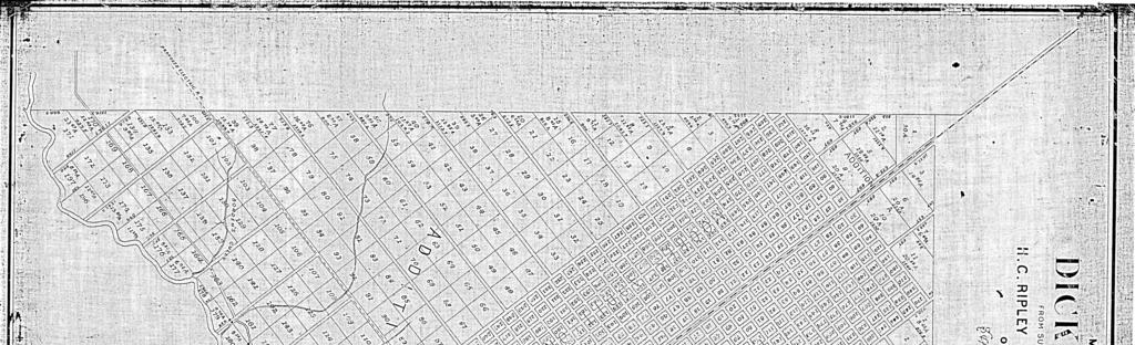
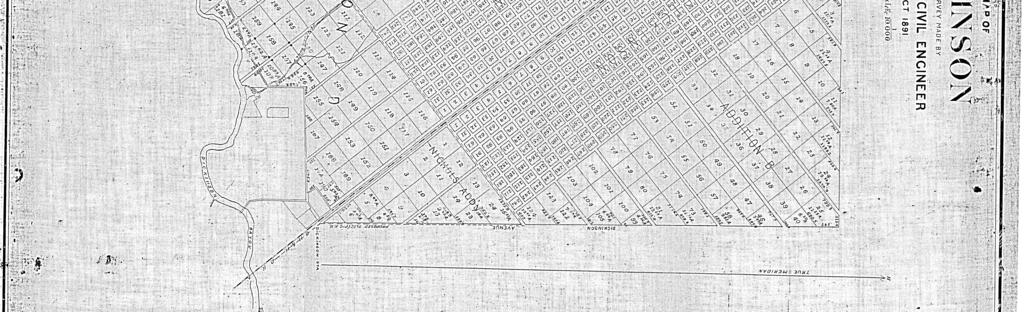
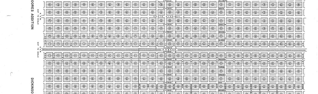
1 Replat Great Garages Subdivision Planning & Zoning Commission Planning & Development Department March 21, 2016 Request Applicant Owner Zoning Location Attachments Subdivide approximately acres of a previously platted property to create 3 commercial lots. Dale Hardy, RPLS, GeoSurv LLC. Inverness Motor Group CG, IL and OS (General Commercial, Limited Industrial and Open Space) Generally located south of Olive Street and east of State HWY 3 in League City, Texas. 1. Current Plat 2. Proposed Plat 3. Aerial Map Site and Surrounding Area Access The property is undeveloped with few trees. The surrounding area has transitioned from rural to autosuburban character. Direction Surrounding Zoning Surrounding Land Use North PS, OS, CG, IL and Olive Street, New Beginnings Church, RSF-5 Commercial and Limited Industrial lots, Single- Family residences and Undeveloped ROW. South IL, RSF-5 and OS Momentum Iron and Metal, Single-Family lot and Undeveloped ROW. East OS Hill Avenue ROW, Railroad ROW and Dickinson Avenue ROW. West N/A SH 3 ROW Access will be provided to this site via a primary driveway on SH 3 and two secondary access driveways on Olive Street and Hill Avenue. State Highway 3 Existing Conditions Proposed Conditions Roadway Type Principal Arterial Principal Arterial Right-of-way Width 150 feet 150 feet Pavement Width and Type 5-lane, undivided, 84-foot wide concrete pavement width with drainage ditch on either side. No proposed improvements per Master Mobility Plan. Olive Street (11 th Street) Existing Conditions Proposed Conditions Roadway Type Local Local Right-of-way Width 70 feet 70 feet Pavement Width and Type 2-lane, undivided, 21-foot wide concrete pavement width with drainage ditch on either side. No proposed improvements per Master Mobility Plan. (Replat) Great Garages Subdivision Page 1 of 2 March 21, 2016 P&Z Meeting
2 Hill Avenue (Avenue A) Existing Conditions Proposed Conditions Roadway Type Local Local Right-of-way Width 70 feet 70 feet Pavement Width and Type 2-lane, undivided, 21-foot wide concrete pavement width with drainage ditch on either side. No proposed improvements per Master Mobility Plan. Water & Sewer Equivalent Dwelling Units (EDU s) are used to determine the capacity of water and waste water available to a site. With a single-family dwelling unit being equivalent to 1 EDU, the Engineering Department indicates that the water and sewer capacity are adequate to serve this development. Water is accessible through a 10-inch water line along the south side of Olive Street. Sanitary sewer is accessible through a 10-inch sewer line on the east side of State Highway 3. The applicant proposes to extend this line across Olive Street to the northwest corner of their property. Municipal Extension of Infrastructure The plat conforms to the general plan for the extension of the municipality and its roads, streets, and public highways within the municipality and in its extraterritorial jurisdiction, taking into account access to and extension of sewer and water mains and the instrumentalities of public utilities. Staff finds the plat conforms. See, also Water and Sewer section above. Municipal Compliance of Regulations The plat conforms to the rules adopted by the municipality governing plats and subdivisions of land within the municipality s jurisdiction to promote health, safety, morals, or general welfare of the municipality and the safe, orderly, and healthful development of the municipality. Staff finds the plat conforms. Recommendation Staff recommends approval of this request. Recommended Motion Motion to approve Great Garages Subdivision Replat as presented in the staff report. For additional information, you may contact Matthew Grooms, Planner at or at matthew.grooms@leaguecity.com. (Replat) Great Garages Subdivision Page 2 of 2 March 21, 2016 P&Z Meeting
3
4
5

6 Aerial Map ALASKA 2207 HILL MULBERRY ARIZONA Subject Property 2401 DICKINSON MULBERRY HILL OLIVE SH ARIZONA STRAWBERRY 302 1:4, SAGE FM 646 Aerial Map HWY FM 646 City of League City Department of Planning & Development For Planning Purposes Only 03/21/
Planning & Zoning Commission Meeting Date: June 04, 2012
 Meeting Date: June 04, 2012 Request Applicant Owner Zoning Preliminary/Final Plat of 24.114 acres of unplatted property into one lot with one reserve for landscape/open space. Extension of infrastructure
Planning & Zoning Commission Planning & Development Department February 17, 2014
 Request Applicant Owner Zoning Location Attachments Subdivision of 2.79 acres of currently vacant property to create 27 town home lots and 6 restricted reserves for the use of HOA Parks. John English;
Planning & Zoning Commission
 Replat Veranda Townhomes, Phase 1 Planning & Zoning Commission Planning & Development Department July 21, 2014 Request Applicant Owners Zoning Location Parks Board Attachments Hold a public hearing for
Planning & Zoning Commission Meeting Date: June 18, 2012
 Meeting Date: June 18, 2012 Request Applicant Owner Zoning Location Attachments Proposed Master Plan for 11.5 acres of undeveloped property in the Tuscan Lakes PUD. The land is platted as one lot, and
Planning & Zoning Commission Meeting Date: February 18, 2012
 Meeting Date: February, Request Reduce the required 5-foot buffer yard to accommodate a 5-foot drive approach on the northeast side of the property. Section 5. states that adjacent CM and RSF- zoning districts
Planning & Zoning Commission
 Planning & Zoning Commission Planning & Development Department June 2, 2014 Request Applicant Owner Zoning Location Attachments Background Consideration of a Master/Site Development Plan for Calder Plaza
Planning & Zoning Commission Meeting Date: September 17, 2012
 Planning & Development Department City of League City Planning & Zoning Commission Meeting Date: September 17, 2012 Master/Site Plan League City Public Safety Building Request A Master/ Site Plan for approximately
Planning & Zoning Commission
 Preliminary/Final Plat Parkway Commons Planning & Zoning Commission Planning & evelopment epartment October 5, 2015 equest Applicant Owner Zoning Location Attachments Site and Surrounding Area Subdivide
Planning. The property. is owned by. one roof. As League City. 78 Notices. Citizen. / Zoning Map 2. Aerial Map. September 2014 EMS.
 Zoning Change Z15-12 (355 Newport Boulevard) Planning & Zoning Commissionn Planning & Development Department May 18, 20155 Request Rezone approximately 0.4 acres from PS (Public / Semi-Public) to CG (General
Planning. Buffer. buffer yard is i. The applicant. an additional 50,000 square. Ricky Jenkins. Owner. CM (Mixed. Zoning. Egret Bay Boulevard (FM
 Drainage Ditch and Undeveloped Property Austin Street and Single-family residences Undevelopedd Property and Egret Bay Boulevard Drainage Ditch, Abandonedd Drill Site, and Single- family residence Planning
Request Applicant /Owner City Council Location Citizen Response Attachments Background 1966 December 2008 September 2009 April 13, 2015 May 18, 2015
 Zoning Change Z15-10 (Glen Cove and FM 2094) Planning & Zoning Commissionn Planning & Development Department May 18, 20155 Request Rezone approximately 0.3 acres from PS (Public / Semi-Public) to CN (Neighborhood
General Location Annex, Rezone & Preliminary Plat Lansdowne Addition, Unit Three
 NEWFOUNDLAND I-5 Agricultural District Subject Site SUNDANCE ANDERSON Single Family Residential CHRISTY PUD Agricultural District Highway Business General Location Annex, Rezone & Preliminary Plat Lansdowne
A General Summary of Land Use Zones 1
 A General Summary of Land Use s 1 2 A General Summary of Land Use s A General Summary of Land Use s Land use zones are used to classify and regulate land development and use. The following descriptions
M E M O R A N D U M July 27, 2018
 M E M O R A N D U M July 27, 2018 To: Southlake 2035 Corridor Planning Committee From: Kenneth Baker, Sr. Director of Planning and Development Services Subject: Item #6 First National Bank Purpose Review,
SUBDIVISION, PLANNED UNIT DEVELOPMENT, PLANNING APPROVAL, REZONING & SIDEWALK WAIVER STAFF REPORT Date: February 7, 2013
 SUBDIVISION, PLANNED UNIT DEVELOPMENT, PLANNING APPROVAL, REZONING & SIDEWALK WAIVER STAFF REPORT Date: February 7, 2013 APPLICANT NAME SUBDIVISION NAME DEVELOPMENT NAME LOCATION S. E. Cemeteries of AL
2 Project Description
 Project Description 2 Project Description The proposed project would involve the demolition of the existing church and the construction of 40 twostory single family residences. The residential lots would
North Central Texas APA Transit-Oriented Development Seminar. Case Study City of North Richland Hills TOD. February 20, 2009
 North Central Texas APA Transit-Oriented Development Seminar Case Study City of North Richland Hills TOD February 20, 2009 1. Background TOD Code Adoption 2. Regulating Plans 3. Street Types 4. Special
Planning. Master/Sit. being phased. developments. Julie Doan of. Owner. Zoning. Road with the. 2. Aerial Map. Background. Use Plan.
 Master/Sit te Development Plan Calder Plaza II Planning & Zoning Commissionn Planning & Development Department May 19, 20144 Request Applicant Owner Zoning Location Attachments Background Site and Surrounding
SUBDIVISION, REZONING, PLANNING APPROVAL, PUD & SIDEWALK WAIVER STAFF REPORT Date: May 3, 2007
 SUBDIVISION, REZONING, PLANNING APPROVAL, PUD & SIDEWALK WAIVER STAFF REPORT Date: May 3, 2007 APPLICANT NAME SUBDIVISION NAME LOCATION TOG Properties, LLC Highland Professional Park, Resubdivision of
Definitions. Average Daily Traffic Demand (ADT): The actual number or projected number of cars that pass a point in a 24-hour period.
: The actual number or projected number of cars that pass a point in a 24-hour period.") Definitions Access Management: A combination of physical techniques and transportation policies used to control the flow of traffic between roads and the surrounding lands. Alternative City Form Scenarios:
Definitions Access Management: A combination of physical techniques and transportation policies used to control the flow of traffic between roads and the surrounding lands. Alternative City Form Scenarios:
2 August 14, 2013 Public Hearing APPLICANT: CRESCENT COMMUNITY CENTER CORP. PROPERTY OWNER: S. L. ETHERIDGE, LLC
 2 August 14, 2013 Public Hearing APPLICANT: CRESCENT COMMUNITY CENTER CORP. PROPERTY OWNER: S. L. ETHERIDGE, LLC REQUEST: Conditional Use Permit (religious use) STAFF PLANNER: Karen Prochilo ADDRESS /
Rapid City Planning Commission Rezoning Project Report
 Rapid City Planning Commission Rezoning Project Report April 5, 2018 Item # 4 Applicant Request(s) Case # 18RZ008 Rezoning request from General Agricultural District to Low Density Residential District
Section 9 NEIGHBORHOOD DESIGN
 Section 9 NEIGHBORHOOD DESIGN City of Lancaster Comprehensive Plan D u n k i n, S e f k o & A s s o c i a t e s, I n c. NEIGHBORHOOD DESIGN INTRODUCTION There are many ways in which a neighborhood can
S o u t h C e n t r a l O u t l i n e P l a n. Leduc Business Park. North Leduc Industrial Area Structure Plan C it y of Led u c.
 Leduc Business Park North Leduc Industrial Area Structure Plan C it y of Led u c Prepared for Farm Air Properties Inc. January, 2007 Table of Contents Page Number 1.0 Purpose of Plan and Definition of
ITEM # _ 41 _ DATE: COUNCIL ACTION FORM MAJOR FINAL PLAT FOR MENARDS SUBDIVISION BACKGROUND:
 ITEM # _ 41 _ DATE: 06-12-18 COUNCIL ACTION FORM SUBJECT: MAJOR FINAL PLAT FOR MENARDS SUBDIVISION BACKGROUND: The City s subdivision regulations are included in Chapter 23 of the Ames Municipal Code.
Planning. Zoning. Parkway. The intent of. entertainment. Citizen 1 Letters of 1 Letters of. 2. Aerial Map. osition. Site and Surrounding Area
 Zoning Change 14-03 (Brittany Estates) Planning & Zoning Commissionn Planning & Development Department June 2, 20144 Request Rezone approximately 38.2 acres from CO (Office Commercial) and PS (Public /
PLANNED UNIT DEVELOPMENT Date: April 5, 2018
 PLANNED UNIT DEVELOPMENT Date: April 5, 2018 DEVELOPMENT NAME SUBDIVISION NAME LOCATION Robert Myers Robert Myers 2955 and 2989 Dauphin Street (Southeast corner of Dauphin Street and Sage Avenue) CITY
PLANNED UNIT DEVELOPMENT & SUBDIVISION STAFF REPORT Date: March 15, 2012
 PLANNED UNIT DEVELOPMENT & SUBDIVISION STAFF REPORT Date: March 15, 2012 DEVELOPMENT NAME SUBDIVISION NAME LOCATION OSR Subdivision OSR Subdivision 5559 Old Shell Road (South side of Old Shell Road, 570
COLVER ROAD INDUSTRIAL CONCEPT PLAN
 COLVER ROAD INDUSTRIAL CONCEPT PLAN A CONCEPTUAL LAND USE AND TRANSPORTATION PLAN FOR TA-4 AN URBAN RESERVE AREA OF THE CITY TALENT City of Talent Adopted by City Council Resolution No., June, 2015 PART
BYLAW NO. 3549/2015. Being a Bylaw of The City of Red Deer to provide a uniform levy of off-site costs in respect of previously undeveloped land.
 BYLAW NO. 3549/2015 Being a Bylaw of The City of Red Deer to provide a uniform levy of off-site costs in respect of previously undeveloped land. 1 WHEREAS pursuant to provisions of Section 648 of the Municipal
Tucson Koi & Water Gardens
 OV113-031 Tucson Koi & Water Gardens CONDITIONAL USE PERMIT SITE ANALYSIS 05.22.2014 Property Owners Walter & Jane Wong Family Investments, LLP 5437 East 3rd Street Tucson, Arizona 85711 Tucson Koi and
Michael D, Harvey, Current Planning Supervisor. This project was originally approved in 2012 by the BOCC and is summarized as follows:
 PLANNING & INSPECTIONS DEPARTMENT Craig N. Benedict, AICP, Director Current Planning (919) 245-2575 (919) 644-3002 (FAX) www.orangecountync.gov 131 W. Margaret Lane Suite 201 P. O. Box 8181 Hillsborough,
8 October 14, 2015 Public Hearing
 8 October 14, 2015 Public Hearing APPLICANT & PROPERTY OWNER: PRICE S HOLDINGS, LLC STAFF PLANNER: Karen Lasley REQUEST: A. Conditional Use Permit (Automobile Repair Garage) B. Change in Nonconforming
PLANNING AND ZONING COMMISSION AGENDA MEMORANDUM
 PLANNING AND ZONING COMMISSION AGENDA MEMORANDUM City and County of Broomfield, Colorado To: Planning and Zoning Commission From: John Hilgers, Planning Director Anna Bertanzetti, Principal Planner Meeting
PLANNED UNIT DEVELOPMENT & SUBDIVISION STAFF REPORT Date: May 18, 2017
 & PUD-0000102-2017 PLANNED UNIT DEVELOPMENT & SUBDIVISION STAFF REPORT Date: May 18, 2017 NAME SUBDIVISION NAME Dauphin Creek Estates Subdivision Dauphin Creek Estates Subdivision LOCATION CITY COUNCIL
M E M O R A N D U M. Consider a recommendation of a site plan for Sherwin Williams, a proposed approximately 4,500 square-foot paint store.
 M E M O R A N D U M Meeting Date: February 10, 2014 Item No. E- 8 To: From: Subject: Planning and Zoning Commission Cassie Harashe, Planner I Consider a recommendation of a Site Plan for Sherwin Williams,
ARTICLE 13 STREETS General
 ARTICLE 13 STREETS 13.1 General Streets shall be designed to suit their functions. Many streets have purposes other than vehicular traffic. As an alternative to current N.C. Department of Transportation
PLANNING REPORT CITY OF EAGAN. APPLICANT: Wyatt Sharing & Caring, LLC HEARING DATE: January 27, 2015
 PLANNING REPORT CITY OF EAGAN REPORT DATE: January 21, 2015 CASE: 12-CG-05-12-14 APPLICANT: Wyatt Sharing & Caring, LLC HEARING DATE: January 27, 2015 PROPERTY OWNER: Gift of Mary, LLC APPLICATION DATE:
D3 January 14, 2015 Public Hearing
 D3 January 14, 2015 Public Hearing APPLICANT: DONALD J. BOUCHER, JR. PROPERTY OWNER: D.J.B. SERVICE CENTER, LLC STAFF PLANNER: Kristine Gay REQUEST: A. Conditional Change of Zoning (I-1 to B-2) B. Conditional
Leduc Industrial Outline Plan SE W4
 Leduc Industrial Outline Plan SE 1-50-25-W4 Within the North Leduc Industrial ASP Prepared for: Leduc Energy Park Ltd. Prepared by: Stantec Consulting Ltd. File No. 1161 104655 V5 Table of Contents 1.0
OP Council Resolution June 16, Planning and Development Services
 OP-08-01 Council Resolution June 16, 2008 Planning and Development Services Kingsgate Landing Outline Plan Table of Contents 1.0 Introduction 1 1.1 Purpose of Plan 1 1.2 Plan Area Location 1 1.3 Ownership
MOBILE CITY PLANNING COMMISSION LETTER OF DECISION. October 22, 2010
 MOBILE CITY PLANNING COMMISSION LETTER OF DECISION Archbishop of Mobile 400 Government St. Mobile, AL 36602 Re: Case #SUB2010-00075 (Subdivision) 3650 Springhill Avenue (Northwest corner of Springhill
Rapid City Planning Commission Rezoning Project Report
 Rapid City Planning Commission Rezoning Project Report July 21, 2016 Applicant Request(s) Case # 16RZ022 Rezoning from Office Commercial District to Light Industrial District Companion Case(s): 16RZ023-Rezoning
CITY OF MOBILE MOBILE CITY PLANNING COMMISSION LETTER OF DECISION. November 5, 2012
 SAMUEL L. JONES MAYOR CITY OF MOBILE LETTER OF DECISION OFFICE OF THE CITYCOUNCIL COUNCIL MEMBERS REGGIE COPELAND, SR. PRESIDENT-DISTRICT 5 FREDRICK D. RICHARDSON, JR. VICE PRESIDENT-DISTRICT 1 WILLIAM
AWH REPORT OF THE PLANNING AND DEVELOPMENT DEPARTMENT FOR APPLICATION FOR REZONING ORDINANCE TO PLANNED UNIT DEVELOPMENT
 AWH REPORT OF THE PLANNING AND DEVELOPMENT DEPARTMENT FOR APPLICATION FOR REZONING ORDINANCE TO PLANNED UNIT DEVELOPMENT MAY 8, 2014 The Planning and Development Department hereby forwards to the Planning
Title 11 Streets and Sidewalks
 Chapter 11.01 - Definitions Title 11 Streets and Sidewalks Low Impact Development (LID) - A stormwater and land use management strategy that strives to mimic predisturbance hydrologic processes of infiltration,
Rapid City Planning Commission Comprehensive Plan Amendment Project Report
 Rapid City Planning Commission Comprehensive Plan Amendment Project Report June 7, 2018 Applicant Request(s) Item #3 Case # 18CA001 Comprehensive Plan Amendment to change the future land use from Mixed-
PLANNING AND ZONING COMMISSION AGENDA MEMORANDUM
 PLANNING AND ZONING COMMISSION AGENDA MEMORANDUM City and County of Broomfield, Colorado To: Planning and Zoning Commission From: John Hilgers, Planning Director Michael Sutherland, Planner Meeting Date
Planning Commission Staff Report March 15, 2007
 Planning Commission Staff Report Project: Request: Madeira East Tentative Subdivision Map, Design Review for Subdivision Layout & Abandonment of Easements Location: Phase IV of the Laguna Ridge Specific
Staff Report and Recommendation
 Community Planning and Development Planning Services 201 W. Colfax Ave., Dept. 205 Denver, CO 80202 p: 720.865.2915 f: 720.865.3052 www.denvergov.org/cpd TO: City Council Neighborhoods and Planning Committee
Planning & Zoning Commission Staff Report
 Planning & Zoning Commission Staff Report Meeting Date: May 26, 2015 Drafted by: Katherine Harrison-Rogers CASE # Z2886 PROJECT NAME: APPLICANT/ REPRESENTATIVE: Shawna Runyan PROPERTY OWNER: 1840 (previously
Amendment to the Elderberry Neighborhood Development Plan
 Amendment to the Elderberry Neighborhood Development Plan Recommendations for Land Use, Transportation and Development July 13, 2018 City of Madison, Wisconsin Department of Planning and Community and
11605 JUDGE ORR ROAD PUD (PLANNED UNIT DEVELOPMENT) PLAN LETTER OF INTENT:
 PLAN LETTER OF INTENT:") Est. 1982 Bill Guman, RLA, ASLA Principal Colorado Springs City Councilman 1993-2001 Colorado Springs Planning Commissioner 1992-1993 Regional Building Commissioner 1995-2001 Urban Planning Community Design
Est. 1982 Bill Guman, RLA, ASLA Principal Colorado Springs City Councilman 1993-2001 Colorado Springs Planning Commissioner 1992-1993 Regional Building Commissioner 1995-2001 Urban Planning Community Design
Village of Glenview Appearance Commission
 Village of Glenview Appearance Commission STAFF REPORT July 23, 2014 TO: Chairman and Appearance Commissioners CASE #: A2014-059 LOCATION: 727 Harlem Avenue FROM: Community Development Department PROJECT
14 October 10, 2012 Public Hearing APPLICANT: MPB, INC
 14 October 10, 2012 Public Hearing APPLICANT: MPB, INC PROPERTY OWNER: MUNDEN & ASSOCIATES, LP STAFF PLANNER: Karen Prochilo REQUEST: Conditional Change of Zoning (AG-1 & AG-2 to Conditional O-2) ADDRESS
4.500 Preston Road Overlay District
 Section 4.500 Preston Road Overlay District 2004 Zoning Ordinance 4.500 Preston Road Overlay District (ZC 98-29; Ordinance No. 98-9-12) 4.501 Purpose To provide appropriate design standards for the use
EXHIBIT B PROJECT NARRATIVE POULSBO MEADOWS
 EXHIBIT B PROJECT NARRATIVE POULSBO MEADOWS Name of Project: Poulsbo Meadows; A Planned Residential Development (PRD)/Plat Applicants Name: PBH Group LLC/Byron Harris PO Box 1010 Silverdale, WA 98038 Description
4 January 11, 2012 Public Hearing APPLICANT:
 . 4 January 11, 2012 Public Hearing APPLICANT: MID-ATLANTIC AUTO PROPERTY OWNER: DZR, LLC STAFF PLANNER: Leslie Bonilla REQUEST: Conditional Use Permit (truck rental, automobile service, and automotive/bulk
City of Grande Prairie Development Services Department
 City of Grande Prairie Development Services Department ROYAL OAKS NORTH OUTLINE PLAN OP-07-03 NW 35-71-6 W6M May 7, 2007 Royal Oaks North Outline Plan TABLE OF CONTENTS 1.0 INTRODUCTION........ 3 1.1 Purpose
TOP TEN LIST OF COMMUNITY CONCERNS REGARDING PROPOSED AMENDMENTS TO CHAPTER 42
 TOP TEN LIST OF COMMUNITY CONCERNS REGARDING PROPOSED AMENDMENTS TO CHAPTER 42 1. Extend the urban area to Beltway 8 in stages, over say a three-year period, prioritizing development in transit and declining
Future Land Use and Development Policies
 Future Land Use and Development Policies Introduction This section presents policies for future development and land use, given the consensus identified through the extensive public participation process.
Access Management and Site Plan Review. Robert W. Hofrichter Asst Administrator, Transportation and Mobility Planning Division April 2014
 Access Management and Site Plan Review Robert W. Hofrichter Asst Administrator, Transportation and Mobility Planning Division April 2014 Access Management 2 Access Management What is Access Management?
PARISH OF ASCENSION OFFICE OF PLANNING AND DEVELOPMENT PLANNING DEPARTMENT. Joint Planning and Zoning Meeting
 1. Call To Order 2. Roll Call of Members 3. Chairman's Comments PARISH OF ASCENSION OFFICE OF PLANNING AND DEVELOPMENT PLANNING DEPARTMENT Joint Planning and Zoning Meeting January 11, 2017 6:00 PM Courthouse
PREPARED FOR: PLATTEVIEW ROAD CORRIDOR STUDY EXECUTIVE SUMMARY
 PREPARED FOR: PLATTEVIEW ROAD CORRIDOR STUDY EXECUTIVE SUMMARY SEPTEMBER 2016 Introduction The Platteview Road Corridor Study was led by the Metropolitan Area Planning Agency (MAPA) with assistance from
SUMMER VILLAGE OF SUNRISE BEACH
 SUMMER VILLAGE OF SUNRISE BEACH Municipal Development Plan Bylaw No. 132-13 ~ 2 ~ Summer Village of Sunrise Beach Municipal Development Plan 1 INTRODUCTION 1.1 SETTING The Summer Village of Sunrise Beach
City of Grande Prairie Development Services Department KENNEDY DEVELOPMENTS LTD. OUTLINE PLAN OP-09-01
 City of Grande Prairie Development Services Department KENNEDY DEVELOPMENTS LTD. OUTLINE PLAN OP-09-01 July 27, 2009 TABLE OF CONTENTS 1.0 Introduction... 1 1.1 Plan Area Location & Context... 1 1.2 Ownership
GATEWAY AREA STRUCTURE PLAN
 CHESTERMERE GATEWAY AREA STRUCTURE PLAN COMMUNITY OPEN HOUSE SEPTEMBER 22 nd, 2015 PLAN AREA ± 512 hectares (± 1,265 acres) GATEWAY LOCATION UNDEVELOPED LANDS PRESENT AGRICULTURAL USE REGIONAL LAND USE
Proposed Kenmount Hill CDS Amendment. Public Hearing October 25 th, 2018
 Proposed Kenmount Hill CDS Amendment Public Hearing October 25 th, 2018 History of Kenmount Hill Why Kenmount Hill? Why Now? We are a city with a vision for growth and the development of Kenmount Hill
Palisades Outline Plan
 NE ¼ 25 36 28 W4 Town of Penhold Approved August 13, 2012 Contents Figures & Tables... 2 Introduction... 1 Overview... 1 Purpose... 1 Development Area... 3 Ownership... 3 Topography... 3 Existing & Surrounding
Preserving Green Streetscape Character on Hillside Drive
 STAFF REPORT ACTION REQUIRED Preserving Green Streetscape Character on Hillside Drive Date: February 19, 2014 To: From: Toronto and East York Community Council Deputy City Manager, Cluster B Wards: Toronto-Danforth,
COMPREHENSIVE LAND USE PLAN AND THOROUGHFARE PLAN
 COMPREHENSIVE LAND USE PLAN AND THOROUGHFARE PLAN Updated February 2010 INTRODUCTION McLendon-Chisholm has a very rich history. In fact, the community has the combined history of two early pioneer communities.
City of Fort Lupton Administrative Site Plan Process
 City of Fort Lupton Administrative Site Plan Process Purpose The Site Plan process is meant to promote orderly and sound development standards as they apply to the City. These site development standards
CITY OF FORT COLLINS TYPE 1 ADMINISTRATIVE HEARING FINDINGS AND DECISION. Elevations Credit Union (2025 S. College Avenue)
") CITY OF FORT COLLINS TYPE 1 ADMINISTRATIVE HEARING FINDINGS AND DECISION HEARING DATE: September 28, 2016 PROJECT NAME: Elevations Credit Union (2025 S. College Avenue) CASE NUMBER: PDP #160021 APPLICANT:
CITY OF FORT COLLINS TYPE 1 ADMINISTRATIVE HEARING FINDINGS AND DECISION HEARING DATE: September 28, 2016 PROJECT NAME: Elevations Credit Union (2025 S. College Avenue) CASE NUMBER: PDP #160021 APPLICANT:
OFFICE CONSOLIDATION SECONDARY PLAN AREA 22 THE BRAMALEA SOUTH INDUSTRIAL SECONDARY PLAN
 OFFICE CONSOLIDATION SECONDARY PLAN AREA 22 THE BRAMALEA SOUTH INDUSTRIAL SECONDARY PLAN November 2010 EXPLANATORY NOTES (Secondary Plan Area 22) General (pertaining to all secondary plan office consolidations)
MONTGOMERY COUNTY PLANNING DEPARTMENT THE MARYLAND-NATIONAL CAPITAL PARK AND PLANNING COMMISSION
 MONTGOMERY COUNTY PLANNING DEPARTMENT THE MARYLAND-NATIONAL CAPITAL PARK AND PLANNING COMMISSION MCPB Item No. Date: 12-10-15 Leisure World Clubhouse II Addition Fitness Center, Limited Site Plan Amendment
VILLAGE OF CLEMMONS PLANNING BOARD DRAFT STAFF REPORT. Single Family Residential, Townhomes
 VILLAGE OF CLEMMONS PLANNING BOARD DRAFT STAFF REPORT PETITION INFORMATION Docket # C-212 Staff Megan Ledbetter Petitioner(s) Peacehaven Development LLC Owner(s) Larry Jarvis, William Alexander and Peacehaven
Harmony Technology Park Third Filing, Second Replat Custom Blending, Project Development Plan/Final Development Plan - FDP #130021
 ITEM NO FDP #130021 MEETING DATE July 23, 2013 STAFF Pete Wray ADMINISTRATIVE TYPE I HEARING STAFF REPORT PROJECT: APPLICANT: OWNER: Harmony Technology Park Third Filing, Second Replat Custom Blending,
ARTICLE 13 STREETS General
 ARTICLE 13 STREETS 13.1 General Streets shall be designed to suit their functions. Many streets have purposes other than vehicular traffic. As an alternative to current N.C. Department of Transportation
STORM WATER UTILITY FREQUENTLY ASKED QUESTIONS
 STORM WATER UTILITY FREQUENTLY ASKED QUESTIONS In 2007, the City Council adopted Ordinance No. 1155 establishing a storm water utility in the City. No fee structure was adopted at that time. The idea of
Planning Commission Staff Report June 5, 2008
 Owner/Applicant Taylor Village Sacramento Investments Partners, LP c/o Kim Whitney 1792 Tribute Road #270 Sacramento, CA 95815 Staff Recommendation Planning Commission Staff Report Project: File: Request:
12 AMENDMENT NO. 149, TOWN OF MARKHAM HIGHWAY 404 NORTH SECONDARY PLAN
 12 AMENDMENT NO. 149, TOWN OF MARKHAM HIGHWAY 404 NORTH SECONDARY PLAN The Planning and Economic Development Committee recommends the adoption of the recommendation contained in the following report August
2007 Land Development Study
 2007 Land Development Study V ACANT L AND I NVENTORY G ROWTH I SSUES AND P OLICIES A NNEXATION P LAN PREPARED BY: Department of Planning MARCH 2007 2007 Land Development Study Table of Contents Page Introduction
M E M O R A N D U M July 27, 2018
 Item #7 M E M O R A N D U M July 27, 2018 To: 2035 Corridor Planning Committee From: Kenneth Baker, Sr. Director of Planning and Development Services Subject: Item #7 Overview Michael Drive Purpose: Review
1. Request: The subject application requests the construction of a single-family home in the R-R Zone.
 R E S O L U T I O N WHEREAS, the Prince George's County Planning Board is charged with the approval of Detailed Site Plans pursuant to Part 3, Division 9 of the Zoning Ordinance of the Prince George's
KASPER. City of Georgetown, Texas PUD Planned Unit Development. December 30, 2015 Revised January 27, 2016
 KASPER City of Georgetown, Texas PUD Planned Unit Development December 30, 2015 Revised January 27, 2016 Applicant: Sentinel Land Company, LLC 4910 Campus Drive Newport Beach, CA Prepared by: SEC Planning
Section 1. Executive Summary
 Executive Summary (This page left blank intentionally) Executive Summary Background Economic growth in southern Leavenworth County over the past decade has been strong. As both the number of business and
MONTGOMERY COUNTY PLANNING DEPARTMENT THE MARYLAND-NATIONAL CAPITAL PARK AND PLANNING COMMISSION
 MONTGOMERY COUNTY PLANNING DEPARTMENT THE MARYLAND-NATIONAL CAPITAL PARK AND PLANNING COMMISSION MCPB Item No. Date: 3.10.2016 Site Plan 820160040 Nora School Parker Smith, Planning Technician, Area 1,
Master Site Development Plan (MSDP) Rocky View County Campus at Balzac East
 Rocky View County Campus at Balzac East") Master Site Development Plan (MSDP) Rocky View County Campus at Balzac East Balzac East, Alberta July 2009 CONTENTS 1.0 purpose 1 2.0 guiding principles 2 3.0 site description 3 4.0 site analysis and county
Master Site Development Plan (MSDP) Rocky View County Campus at Balzac East Balzac East, Alberta July 2009 CONTENTS 1.0 purpose 1 2.0 guiding principles 2 3.0 site description 3 4.0 site analysis and county
College Park (66-021)
") College Park (66-021) Old Town College Park is a representative example of the many residential subdivisions that emerged as the suburbs of Washington, D.C. expanded with the advent of the streetcar and
College Park (66-021) Old Town College Park is a representative example of the many residential subdivisions that emerged as the suburbs of Washington, D.C. expanded with the advent of the streetcar and
REPORT OF THE PLANNING AND DEVELOPMENT DEPARTMENT FOR APPLICATION FOR REZONING ORDINANCE TO PLANNED UNIT DEVELOPMENT AUGUST 18, 2016
 REPORT OF THE PLANNING AND DEVELOPMENT DEPARTMENT FOR APPLICATION FOR REZONING ORDINANCE TO PLANNED UNIT DEVELOPMENT AUGUST 18, 2016 AWH The Planning and Development Department hereby forwards to the Planning
8 February 9, 2011 Public Hearing APPLICANT: 7-ELEVEN, INC.
 . 8 February 9, 2011 Public Hearing APPLICANT: REQUEST: Conditional Use Permit for an automobile service station with a convenience store ADDRESS / DESCRIPTION: 2448 Nimmo Parkway PROPERTY OWNER: COURTHOUSE
2040 Long Range Transportation Plan
 2040 Long Range Transportation Plan Adopted: April 15, 2013 APPENDIX D HIGHWAY NEEDS PLAN PROJECTS FREDERICKSBURG Existing and Committed Projects Fall Hill Avenue/Mary Washington Blvd. (Fredericksburg)
SECTION 6 - LAND USE - RURAL RESIDENTIAL
 16.6.10.1 Intent The intent of the rural residential land use category is to provide low-density, single-family residential development within the Town s outer fringe. The current land is predominantly
CITY OF PORTSMOUTH PLANNING DEPARTMENT. MEMORANDUM To: From:
 CITY OF PORTSMOUTH PLANNING DEPARTMENT MEMORANDUM To: From: Subject: Date: Planning Board Juliet T.H. Walker, Planning Director Jillian Harris, Planner 1 Staff Recommendations for the August 23, 2018 Planning
CONCEPTUAL DEVELOPMENT PLAN REVIEW - CITY OF MARYLAND HEIGHTS
 APPLICATION NUMBER: CDP15-0004 APPLICATION (PROJECT) NAME: MARYLAND OAKS APPLICANT: PROPERTY OWNER NAME: APPLICANT S REQUEST: McBride Maryland Oaks, LLC 16091 Swingley Ridge Road, Suite 300 Chesterfield,
M E M O R A N D U M November 9, 2018
 M E M O R A N D U M November 9, 2018 To: Southlake 2035 Corridor Planning Committee From: Kenneth Baker, Sr. Director of Planning and Development Services Subject: Item #8 Up to thirteen (13) residential
Red Fox Commercial Outline Plan
 Red Fox Commercial Outline Plan City of Cold Lake, Alberta Prepared by Durrance Projects Ltd and Ross W. Sharp & Associates Ltd October 2014 Rupert 1 Table of Contents 1. PURPOSE...3 1.1. Location...4
Planned Residential Neighborhoods Land Use Goals
 Planned Residential Neighborhoods Land Use Goals Issue: Guidelines that provide for diverse high quality residential areas that include a variety of housing styles and layouts are needed. Goal 1: Create
ADMINISTRATION RECOMMENDATION(S) 2018 January 25. That Calgary Planning Commission recommend APPROVAL of the proposed Land Use Amendment.
 2018 January 25. That Calgary Planning Commission recommend APPROVAL of the proposed Land Use Amendment.") Page 1 of 9 EXECUTIVE SUMMARY This land use amendment proposes to redesignate a parcel from DC Direct Control District to Multi-Residential Contextual Grade-Oriented (M-CG) District to allow for multi-residential
Page 1 of 9 EXECUTIVE SUMMARY This land use amendment proposes to redesignate a parcel from DC Direct Control District to Multi-Residential Contextual Grade-Oriented (M-CG) District to allow for multi-residential
Sustainable Development Call for Projects Western Infrastructure Project Submissions
 2009-2010 Sustainable Development Call for Projects Western Infrastructure Project Submissions January 20, 2010 2009-2010 SDCFP Summary of Infrastructure Funding Infrastructure Projects Number of Projects