TRAFFIC AND TRANSPORTATION ADDENDUM GOAL: ENSURE SAFE ACCESS TO PARKS AND INSTITUTIONS FOR PHILADELPHIA PARKS AND RECREATION
|
|
|
- Ginger McGee
- 5 years ago
- Views:
Transcription


1 TRAFFIC AND TRANSPORTATION ADDENDUM GOAL: ENSURE SAFE ACCESS TO PARKS AND INSTITUTIONS FOR PHILADELPHIA PARKS AND RECREATION PREPARED BY PENNPRAXIS, SCHOOL OF DESIGN UNIVERSITY OF PENNSYLVANIA SUPPORTED BY THE PEW CHARITABLE TRUSTS THE LENFEST FOUNDATION

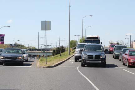
2 MORE PARK, LESS WAY Without fail, every plan that touches the Parkway addresses the need for significant reconfigura on of roadways, revised vehicular circula on, and traffic calming interven ons. 1 This ac on plan is no different. The approach in More Park, Less Way: An Ac on Plan to Increase Urban Vibrancy on the Benjamin Franklin Parkway, centers on pushing back the boundary of the highway style design so it is closer to I-676 and I-76, and reclaiming surface intersec ons and streets as safe, mul func onal urban spaces that will transform the Parkway into a fully integrated component of the city s urban fabric. It is important to keep in mind that improving traffic around the Parkway is not without precedent. The 2005 Logan Square project and recently completed 2011 streetscape improvement project have successfully enhanced pedestrian condi ons, had minimal impact on traffic capacity, and, most importantly, established a built-in framework for community buy-in. These recent projects serve as a founda on for the con nued urbaniza on of the Benjamin Franklin Parkway. Throughout the course of this project, PennPraxis and Parks and Recrea on met with key city and non-profit stakeholders that have been in mately exploring traffic related improvements to the Parkway. These stakeholders include the Philadelphia City Planning Commission, Mayor s Office of Transporta on and U li es, Philadelphia Streets Department, Pennsylvania Environmental Council, Center City District, and the Philadelphia Museum of Art. In this addendum, PennPraxis shares the more detailed recommenda ons for traffic and transporta on improvements that will make significant strides in ensuring safe access to the parks and ins tu ons that line the Parkway. The recommenda ons put forth represent both short- and longterm remedies for improving access and connec vity in and around the Parkway. Many of the recommenda ons reflect a degree of consensus between city agencies and non-profits while other recommenda ons reflect longer-term interven ons that will require more detailed traffic studies and analysis before implementa on.

3 MORE PARK, LESS WAY: TRAFFIC AND TRANSPORTATION ADDENDUM EAKINS OVAL Recommendations: 1. The plan proposes ghtening the turn radius. The intent is to slow the traffic turning onto 23rd and con nuing west along the Parkway. Tightening the turn radius at this intersec on will encourage the re-urbaniza on of the district by making the intersec on more pedestrian and bicycle friendly. This interven on helps to reclaim the intersec on, crea ng a more safe, mul -func onal urban space. This proposed interven on received support from all partners listed above. 2. Proposed interven ons at the intersec on of 23rd Street and Spring Garden Street include adjustments to the exis ng parking configura on along Pennsylvania Avenue, the extension of pedestrian refuge islands to help improve pedestrian accessibility across Pennsylvania Avenue, and improvements to the bicycle lane network that will set up connec ons with the East Coast Greenway. The parking reconfigura on establishes dedicated parking corrals that will help manage parking and narrow
4 MORE PARK, LESS WAY the crossing for pedestrians. The Center City District es mates that this parking redesign will increase parking from 361 to 457 spaces. 2 Although the final design may result in a less significant increase in parking, these improvements to Pennsylvania Avenue will help establish a more urban connec on between the Parkway itself and the neighborhoods to the north. The proposed bicycle improvements within this area have been designed by the Pennsylvania Environmental Council in consulta on with the Streets Department and are moving forward to implementa on. The Planning Commission and Streets Department have acknowledged the fact that this intersec on presents dis nct challenges. The Streets Department has been exploring signal issues at this intersec on as well as the concept of redesigning the entry into the tunnel in order to slow down traffic and encourage drivers to yield to pedestrians. Any combina on of improvements at this intersec on will help to so en this edge of the Parkway and will help to ensure safe pedestrian access to the Parkway and nearby neighborhoods. 3. Tightening the turn where Spring Garden meets the Parkway and Kelly Drive combined with formalizing the painted bumpout at Kelly Drive will represent an important step in urbanizing this intersec on. Formalizing the bumpout will create a pedestrian refuge, helping to improve the crossing experience. These proposed improvements were supported by each city agency consulted. The proposed improvements to the bicycle network align with recent work completed by the Planning Commission with one excep on. The Planning Commission proposes incorpora ng a Copenhagen Turn at the intersec on of Spring Garden and Kelly Drive. The Copenhagen Turn serves as a landing area for cyclists and enables and smooth le turn. 4. At the present me, this plan recommends maintaining the exis ng pedestrian crossing between Eakins Oval to the Rocky Statue. However, for the long-term, the ideal scenario would be to install a pedestrian crossing directly to the foot of the art museum steps. PennPraxis recognizes that more detailed traffic modeling is necessary before implementa on of this recommenda on. The Planning Commission and Streets Department have been casually exploring more drama c and expensive reconfigura ons of Eakins Oval in order to take steps to address this issue. In the mean me, all par es agree that signage, pavement markings, and landscaping can serve to safely direct pedestrians from Eakins Oval to the Art Museum. 5. A new traffic alignment at the exit to Spring Garden Street and Mar n Luther King Drive is intended to be er organize vehicular traffic and be er manage the weaving that currently occurs in this sec on of Eakins Oval. Addi onally, the ghtening of the turn radius would help to urbanize this intersec on and lessen its role as a highway on-ramp. City agencies have highlighted that the proposed interven on might be unsafe and result in rear-end crashes. City officials recommend modeling the poten al for a signal at this intersec on th Street currently serves as an on-ramp to the Vine Street Expressway. In an effort to calm traffic and provide improved connec ons to Eakins Oval, this proposal recommends signalizing the intersec on, adding new crosswalks, narrowing the turn radius, installing a double wide bicycle lane to enable le hand turns around the Oval, and formalizing the exis ng painted bumpout to aid in pedestrian crossing at the eastern edge of the Oval. PennPraxis feels that signalizing this intersec on is a cri cal step in establishing important connec ons to Eakins Oval. However, we do recognize that this proposed interven on is controversial and does require detailed traffic modeling. The implementa on of signaliza on at this loca on represents a long-term solu on that would make significant strides in re-urbanizing the Parkway and more fully integra ng the Parkway into the fabric of the city.

5 MORE PARK, LESS WAY: TRAFFIC AND TRANSPORTATION ADDENDUM EXISTING 22ND STREET INTERSECTION Recommendations: PROPOSED The traffic and transporta on recommenda ons at the 22nd Street intersec on, center on improving bicycle safety and the north/south pedestrian connec ons. It is important to note that within the past few years the City has already begun to implement intersec on improvements such as new bumpouts and enlarged pedestrian refuges. These interven ons have drama cally improved access across the Parkway and have enhanced pedestrian safety. Moving forward, PennPraxis recommends concentra ng on formalizing the bicycle network and supports the Planning Commission s goal of marking all signalized intersec ons with bike boxes.

6 MORE PARK, LESS WAY EXISTING 21ST STREET INTERSECTION Recommendations: PROPOSED In the coming years, Pennsylvania Department of Transporta on will be inves ng in improvements along the Parkway between 21st Street and 20th Street. The project is es mated to be completed by This plan supports the proposed streetscape changes as they will help to improve pedestrian access across the Parkway and calm traffic. Some key interven ons center on enlarging pedestrian refuges and bumpouts. Within this area of the Parkway, bicycle safety con nues to be of concern. Again, in this loca on, formalizing the bicycle network and suppor ng the Planning Commission s goal of marking all signalized intersec ons with bike boxes will help realize an improved bicycle network.


7 MORE PARK, LESS WAY: TRAFFIC AND TRANSPORTATION ADDENDUM


8 CONCLUSION MORE PARK, LESS WAY The 2005 Logan Square project and recently completed 2011 streetscape improvement project have laid the groundwork for restoring the Parkway to a place that is hospitable to both pedestrians and vehicles. Moving forward, it is impera ve that the City build upon these successes and address the accessibility issues that con nue to define the character of the Parkway. Working to make the Parkway and its surrounding assets parks, ins tu ons, and neighborhoods more accessible will enable the Parkway to become more fully integrated into the life of the city.
9 NOTES Endnotes 1. OLIN Partnership, Public Improvements and a New Design Framework for the Benjamin Franklin Parkway (2003); Kise Straw & Kolodner, Logan Square Neighborhood Parkway Plan (2009); Econsult in conjunction with JzTi, Wallace Roberts & Todd, and Portfolio Associates, Reconfi guring Key Intersections: Eakins Oval and Intersections of Kelly Drive/Pennsylvania Avenue/Fairmount Avenue/25th Street (2011); Wallace Roberts & Todd, Fairmount Community Plan (2003). 2. Center City District. Presentation: Pennsylvania Avenue Redesign. Date Unknown. Additional Interviews: Meeting with Pennsylvania Environmental Council, July 19, Correspondence: Planning Commission. Feedback on traffi c recommendations provided by Deborah Schaaf. Dated December 17, Photo Citations Photographs in this report were taken by PennPraxis staff members Andrew Goodman, Bridget Keegan and Christine Lee with the exception of the following: Philly Phlash and Las Vegas Strip and Downtown Express. Courtesy of Frank Jaskiewicz of JzTI. Meeting with Rina Cutler, Deputy Mayor. Mayor s Offi ce of Transportation and Utilities, October 15, Meeting with representatives from Mayor s Offi ce of Transportation and Utilities, Streets Department, and Parks and Recreation, October 19, Correspondence: Mayor s Offi ce of Transportation and Utilities. Feedback on recommendations provided by Charles Carmalt. Dated October 26, 2012.
10 MORE PARK, LESS WAY PENNPRAXIS TEAM HARRIS STEINBERG, FAIA BRIDGET KEEGAN, AICP CHRISTINE LEE TRANSPORTATION PLANNING FRANK JASKIEWICZ, JZTI DESIGN ANDEE MAZZOCCO, WHOLE-BRAINED DESIGN, LLC JANUARY 2013
Setbacks & Building Placement
 Setbacks & Building Placement This design element addresses how the factors of setbacks and building placement affect the size and placement of mul modal transporta on infrastructure and create a comfortable
CONCESSIONS. Tenant Design Manual Addendum Dallas/Fort Worth Interna onal Airport Terminal D - South Village Improvements
 CONCESSIONS Tenant Design Manual Addendum Terminal D - South Village Improvements February 14, 2017 Rev 1 February 22, 2017 Introduc on As stated in the Tenant Design Manual, the design image of the in-line
CHAPTER 4: LAND USE PLAN
 CHAPTER 4: LAND USE PLAN A. LAND USE PLAN MAP The Mountain View Targeted Neighborhood Plan Land Use Plan Map (LUPM) illustrates the goals of this plan in map form. The LUPM identifies locations and intensities
MONTCO 2040: A SHARED VISION The New Comprehensive Plan for Montgomery County. Dra Themes and Goals March, 2014
 MONTCO 2040: A SHARED VISION The New Comprehensive Plan for Montgomery County Dra Themes and Goals March, 2014 INTRODUCTION 2 WHAT IS A COMPREHENSIVE PLAN? A comprehensive plan is a long-range plan required
Public input has been an important part of the plan development process.
 Lakewood s Comprehensive Plan recognizes that transportation helps shape the community, and that the way the community provides for the safe and efficient movement of people affects the character of the
Potential Green Infrastructure Strategies May 6, 2015 Workshop
 Potential Green Infrastructure Strategies May 6, 2015 Workshop Background The City of Cortland is developing the Tioughnioga Urban Headwaters Green Infrastructure Action Plan with funding from the National
Section4 Design Vision & Implementation Plan
 Section4 Design Vision & Implementation Plan W Woodschurch Rd 4.1 Design Focus Areas The Framework Plan is simply the starting point for directing the design and implementation of a wide range of transportation
Key Ac on Strategies & Plan Recommenda ons
 Key Ac on Strategies & Plan Recommenda ons SECTION - 4 35 Public Policy, Economic Development and Administra ve Ac ons Refine the Borough s Urban Mixed Use Zoning Ordinance and Subdivision and Land Development
hermitage town center
 hermitage town center A Community Vision prepared by Strada for The City of Hermitage and The Mercer County Regional Planning Commission January 2007 table of contents introduction 3 design principles
Small Area Plan. South Gateway
 Small Area Plan Adopted May 12, 2008 South Gateway Purpose. The South Gateway Small Area Plan defines the City s expectations for the future of the southern entrance to the City at Interstate 85 and Highway
REDEFINING QUEENSWAY CONCEPT DESIGN DESIGN RATIONALE
 DESIGN RATIONALE INTRODUCTION The council and its partners are passionate about Queensway and we are excited about the opportuni es to redefine it as part of these streetscape proposals. We would like
The Vision. Photo provided by The Minervini Group. 46 Vision, Objectives & Strategies
 Vision, Objectives & Strategies The is the public framework and guide for future development of the Grand Traverse Commons. The establishes public polices for infrastructure, the preservation of natural
ES.0 Introduc on. Execu ve Summary. ES.1 Purpose and Need for the Project (Chapter 1) ES.2 Project Alterna ves (Chapter 2)
 ES.2 Project Alterna ves (Chapter 2)") ES.0 Introduc on The (VBTES) is a mul year study evalua ng the range of alterna ves for extending The Tide light rail transit (LRT) east into the City of Virginia Beach. The VBTES Corridor is centered
ES.0 Introduc on The (VBTES) is a mul year study evalua ng the range of alterna ves for extending The Tide light rail transit (LRT) east into the City of Virginia Beach. The VBTES Corridor is centered
Welcome! Get On Board!
 Get On Board! Welcome! Thank you for a ending! This public informa on mee ng is being held to provide an update and an opportunity to comment on DC2RVA s: Purpose and Need Statement Alterna ves Development
SOLU T IONS / PRODUCT OVERVIEW
 SOLU T IONS / PRODUCT OVERVIEW OCTOBER 2012 www.criticalroom.com www.criticalroom.com CONTENTS CASCADED LABS / BSL VIVARIUMS RESEARCH ISOLATION ROOMS OPERATING ROOMS PHARMACIES Fume Hood Monitor / Controller:
Maplewood Avenue Downtown Complete Street Project
 Maplewood Avenue Downtown Complete Street Project Second Public Meeting January 24, 2018 Welcome and Introduction of Project Team City Planning and Public Works Staff City of Portsmouth Juliet Walker Planning
Parking. Chapter 3 Design Elements INFRASTRUCTURE & AMENITIES
 Parking Parking lots are cri cal linkages between the transporta on system and des na ons. A poorly designed parking lot that does not accommodate all modes can single handedly discourage alterna ve modes.
The Horry Planner. Horry County Housing Fair. Implementing the Horry Co. Bicycle & Pedestrian Plan. Volume 1, Issue 1. Planning and Zoning Department
 The Horry Planner INSIDE THIS ISSUE: The Quarterly Electronic Newsletter of the Horry County Planning and Zoning Department VOLUME 4 ISSUE 2 Bicycle & Pedestrian Plan Highways and Byways Landscape Calculators
BUILDING 240 SITE REDEVELOPMENT STRATEGY
 BUILDING 40 SITE REDEVELOPMENT STRATEGY A SITE EVALUATION AND CAPACITY REVIEW GRIFFISS BUSINESS AND TECHNOLOGY PARK CITY OF ROME, NEW YORK JULY 05 GRIFFISS BUSINESS AND TECHNOLOGY PARK BUILDING 40 REDEVELOPMENT
This Review Is Divided Into Two Phases:
 Semiahmoo Town Centre Review The purpose of this review: To review the Semiahmoo Town Centre Concept Plan, originally approved in 1993, to ensure that this centre will continue to serve the needs of South
Benjamin Franklin Parkway, Recent Accomplishments, New Opportunities
 C E N T E R C I T Y R E P O R T S : A publication of the Central Philadelphia Development Corporation and the Center City District Philadelphia, PA February 2005 www.centercityphila.org Benjamin Franklin
The Placemaking Process so far
 The Placemaking Process so far Ac vity Date 2013 Review of exis ng historic informa on and other data Reviewed historic informa on, crime data, event informa on and other Benchmark research established
38 Queen s University Campus Master Plan Part 1
 38 Queen s University Campus Master Plan Part 1 46 The Campus at the City Scale Chapter 4 The Campus at the City Scale 39 Queen s is an urban University centrally located in Kingston. Decisions made by
Introduc on. Mul genera onal Play
 Play Trends Play Trends Introduc on Play is in mately connected to people s lives. As our lives evolve with the changing world, play evolves, too. Shown here are some current trends in play. You may not
OPEN HOUSE. Future. Neighborhood. Thursday April 27, :30 8:30 PM Refreshments provided Discovery Center, 4444 Hadley Avenue North
 OPEN HOUSE Thursday April 27, 2017 6:30 8:30 PM Refreshments provided Discovery Center, 4444 Hadley Avenue North The City Council has ini ated a planning process to guide future development on 206 acres
SOUTH UNIVERSITY Street Design Alternatives in Progress
 1 Alternatives in Progress 2016.01.20 Meeting Agenda 2 1. Progress & Schedule 2. Utilizing the Street Design Manual 3. Site Characteristics and Input Received 4. Street Geometry What can we accomplish
McMaster University. Campus Master Plan Update
 McMaster University Campus Master Plan Update April 2017 Table Of Contents Sec on One Introduc on & Overview 1 1.1 Purpose of the Plan 1 1.2 Campus Context 3 1.3 The Master Plan Process 5 1.4 Consulta
COMPLETE GREEN STREET CHECKLIST
 COMPLETE GREEN STREET CHECKLIST This document was developed to dissect the structure of an urban street and explore opportunities to make our streets more complete while also integrating green street strategies.
TOWN BRANCH COMMONS & VINE STREET MOBILITY IMPROVEMENTS
 TOWN BRANCH COMMONS & VINE STREET MOBILITY IMPROVEMENTS CONTACT: Jeff Fugate, President O: 859-367-4972 F: 859-425-2292 JFugate@LexingtonDDA.com www.lexingtondda.com TOWN BRANCH COMMONS & VINE STREET MOBILITY
Complete Streets Master Plan for Downtown New Britain CRCOG Transportation Committee Meeting Monday, December 9, 2013
 CRCOG Transportation Committee Meeting Monday, December 9, 2013 Introduction Why the Project was Initiated About Downtown New Britain Master Plan Goals Master Plan Overview Master Plan Study Areas and
UNIVERSITY AVENUE CORRIDOR REDESIGN JULY 10, 2017 KICK-OFF MEETING
 UNIVERSITY AVENUE CORRIDOR REDESIGN JULY 10, 2017 KICK-OFF MEETING COLLABORATIVE COMMUNITY-BASED DESIGN IS THE FOUNDATION TO A SUCCESSFUL PROJECT AGENDA FOR TONIGHT 1 INTRODUCTIONS 2 PROJECT LIMITS & OVERVIEW
Old Town Neighborhoods Plan. Choices Event Wednesday, December 9, 2015
 Old Town Neighborhoods Plan Choices Event Wednesday, December 9, 2015 Agenda 6:00 6:10 p.m. Welcome + Sign In 6:10 6:30 p.m. Presentation 6:30 8:00 p.m. Workshop + Open House Seeking your input on: Neighborhood
GREENING THE BOULEVARD Master Plan Concepts for Venice Boulevard between Lincoln and Sawtelle
 GREENING THE BOULEVARD Katherine Spitz Associates Inc. 4212½ Glencoe Avenue Marina Del Rey, CA 90292 310 574 4460 Fax 574 4462 January 2008 Table of Contents Overview Proposed Design Improvements Illustration
CENTERTOWN VISION PLAN
 CITY OF GRAND HAVEN, MICHIGAN CENTERTOWN VISION PLAN A Strategic Plan for the Future Development of Centertown MARCH 2014 Prepared By: The Johnson Hill Land Ethics Studio The Johnson Hill Land Ethics Studio,
WEST BROADWAY BIZ MASTER PLAN
 WEST BROADWAY BIZ MASTER PLAN 1. 2. 3. 4. 5. 6. 7. 8. 9. Introduc on: West Broadway BIZ Character Master Plan Goals and Objec ves Master Plan Key Features BIZ Entry & Important Intersec ons Concepts Streetscaping
SAWYER RANCH ROAD Pedestrian and Bicycle Improvements
 SAWYER RANCH ROAD Pedestrian and Bicycle Improvements RM 150: From West of Kyle to I-35 Oct. 25, 2018 Thank you for your interest in the RM 150 project. The purpose of this meeting is to share project
OperaƟons Department
 The Opera ons Department is responsible for the opera ons and maintenance of the City s water, sanitary sewer, storm drainage, road and dyke infrastructure, as well as the opera on and maintenance of the
West Greenville Small Area Plan
 planning report, Texas Adopted July 12, 2011 Acknowledgement elected and appointed officials, staff members and key stakeholders from the Plan Advisory Commi ee provided knowledge, assistance and insight
STORM TACOMA 02. Potential permitting requirements STANDARD DETAILS FOR RAIN GARDEN CONSTRUCTION. How to use this document
 R R G R P 02 STORM TACOMA 02 STANDARD DETAILS FOR RAIN GARDEN CONSTRUCTION Updated October 23, 2013 How to use this document Your rain garden will need to be designed and constructed in accordance with
SpringHillRISING:2040. A vision for the future of Spring Hill, Tennessee.
 SpringHillRISING:2040 A vision for the future of Spring Hill, Tennessee. This page is le blank inten onally. Acknowledgements Adopted November 2015 A special thank you to the City of Spring Hill, to the
The Illinois Department of Transportation and Lake County Division of Transportation. Route 173, including the Millburn Bypass
 The Illinois Department of Transportation and Lake County Division of Transportation welcome you to this Public Hearing for U.S. Route 45 from Illinois Route 132 to Illinois Route 173, including the Millburn
Date: April 10, 2017 City Council Work Session April 24, 2017: Status Report on the Comprehensive Plan Update and Transportation Master Plan
 AGENDA REPORT To: From: By: Honorable Mayor and City Council Members Warren Hutmacher, City Manager Sharon Ebert, Director Community Development Date: April 10, 2017 Agenda: City Council Work Session April
SR 916/NW/NE 135 Street Public Hearing
 Florida Department of TRANSPORTATION SR 916/NW/NE 135 Street Public Hearing Resurfacing, Restoration, and Rehabilitation (RRR) Project From NW 6 Avenue to west of SR 5/Biscayne Boulevard FM #429346-1-52-01
EXECUTIVE SUMMARY EXECUTIVE SUMMARY
 1 EXECUTIVE SUMMARY EXECUTIVE SUMMARY Penn s Landing is envisioned as a welcoming riverfront green space adjacent to a refurbished civic marina becoming the centerpiece for adjacent development. With a
PIKE PINE RENAISSANCE: ACT ONE. October 19, 2017
 PIKE PINE RENAISSANCE: ACT ONE October 19, 2017 WATERFRONT SEATTLE PROGRAM PROJECT INTRODUCTION Pike and Pine streets, between First and Melrose avenues Pedestrian and streetscape improvements Budget:
Overview of the Plan. The Building Blocks of Centers, Neighborhoods and Network INTERNAL DRAFT
 Overview of the Plan 4 East Davidson Ramah Church Rd June Washam Rd Bradford District Park Bradford Shearer Rd Campus District NC 73 Davidson-Concord North Rocky River This Master Plan projects an approximate
Access Management: An Overview
 Figures 1-5 Below Evolution of development along a highway. In the early stages, land along the road is used for farming with little traffic generated. As time passes, the highway corridor becomes a de
Preservation Planning
 Protect and Maintain the Historic Character of your Community Beverly, West Virginia Randolph County HLC PROTECT Purpose of all work done in survey and registration is not to only register properties.
FERRYBANK DEVELOPMENT PLAN HAMILTON CITY RIVER PLAN
 FERRYBANK DEVELOPMENT PLAN HAMILTON CITY RIVER PLAN PAGE 1 Te Awa Waikato - Tooku awa koiora me oona pikonga, he kura tangihia o te maataamuri King Tawhiao The Waikato River - the river of life, and each
DESIGN WORKSHOP. November 17, 2015
 DESIGN WORKSHOP November 17, 2015 needs more housing. But there is no one-size fits-all solution. Every neighborhood has its own character. In some places, density is not only appropriate it is badly -
ARLINGTON COUNTY, VIRGINIA
 ARLINGTON COUNTY, VIRGINIA County Board Agenda Item Meeting October 15, 2005 DATE: September 28, 2005 SUBJECT: Request to Advertise the adoption of the 2005 Clarendon Sector Plan C. M. RECOMMENDATION:
Issues Requiring Future Study
 Issues Requiring Future Study Transportation planning is an ongoing process that tends to identify new issues as it finds solutions for others. Some issues are so complex that a solution to one problem
Executive Summary. NY 7 / NY 2 Corridor
 Executive Summary NY 7 / NY 2 Corridor Transportation and Land Use Study December 2005 Prepared for: Town of Colonie Capital District Transportation Committee Prepared by: Introduction: Land use decisions
Animating the Rideau Canal December 2013
 Executive Summary Animating the Rideau Canal December 2013 Why study the Rideau Canal? The Rideau Canal has been an important part of Ottawa throughout its history, and has shaped and been shaped by the
PLANNING COORDINATING COMMITTEE
 PLANNING COORDINATING COMMITTEE Fall Meeting/Luncheon Welcome! October 16, 2009 PLANNING COORDINATING COMMITTEE Fall Meeting/Luncheon WELCOME! WELCOME! October 16, 2009 October 16, 2009 Agenda I. Lunch/Socialize
Sewanee Village + Request for Builder/Developer Proposals
 Sewanee Village + Request for Builder/Developer Proposals Contact: Frank X. Gladu Special Assistant to the Vice Chancellor University of the South 735 University Ave Version 3 Sewanee TN 37383 Released:
City of Burlington Downtown Street Design & Construction Standards
 City of Burlington Downtown Street Design & Construction Standards Adopted April 16, 2018 b City of Burlington Downtown Street Design Standards CITY OF BURLINGTON, VT The Great Streets Initiative is a
PROPOSED REDEVELOPMENT OF THE GLEN ABBEY GOLF CLUB. STREETSCAPE DESIGN STUDY (excerpt from the Urban Design Brief) TOWN OF OAKVILLE.
 TOWN OF OAKVILLE.") PROPOSED REDEVELOPMENT OF THE GLEN ABBEY GOLF CLUB STREETSCAPE DESIGN STUDY (excerpt from the Urban Design Brief) TOWN OF OAKVILLE OCTOBER, 2016 for 2.4.2 STREETS Streets are the single largest component
PROPOSED REDEVELOPMENT OF THE GLEN ABBEY GOLF CLUB STREETSCAPE DESIGN STUDY (excerpt from the Urban Design Brief) TOWN OF OAKVILLE OCTOBER, 2016 for 2.4.2 STREETS Streets are the single largest component
The transportation system in a community is an
 7 TRANSPORTATION The transportation system in a community is an important factor contributing to the quality of life of the residents. Without a sound transportation system to bring both goods and patrons
Chris Gent Landscape Studio
 Projects, Landscaped Medians Design Lead: Creation of standards for the City of Chicago s new median program Development of the city s first salt tolerant plant list Supervision of staff and consultants
Whitemarsh Comprehensive Plan Update: Housing & Land Use. Public Workshop #3: September 20, 2018
 Whitemarsh Comprehensive Plan Update: Housing & Land Use Public Workshop #3: September 20, 2018 Agenda Welcome Process Recap What We ve Heard The Plan Framework Review of Recommended Actions Land Use Housing
2 STATUTORY PUBLIC MEETING AND INFORMATION REPORT FOR PUBLIC MEETING ON AMENDMENT NO. 62 TO THE YORK REGION OFFICIAL PLAN
 2 STATUTORY PUBLIC MEETING AND INFORMATION REPORT FOR PUBLIC MEETING ON AMENDMENT NO. 62 TO THE YORK REGION OFFICIAL PLAN Pursuant to Section 17(15) of the Planning Act, as amended, the Regional Planning
DRAFT ROOSEVELT ROAD. District Recommendations. Figure 5.23 The Roosevelt Road Corridor
 CHAPTER 5 Figure 5.23 The Road Corridor Road will develop as a mixed-use corridor, emphasizing regional retail, west of the river and mixed-use development east of the river. KEY RECOMMENDATIONS 1. High
SCTPO Project Summary September 2014
 A1A MULTIMODAL CORRIDOR PLANNING AND ENGINEERING ANALYSIS Florida Department of Transportation SCTPO Project Summary September 2014 PRESENTATION FOOTER Meeting Agenda What We Plan To Do Project Background
John M. Fleming Managing Director, Planning and City Planner. Old East Village Dundas Street Corridor Secondary Plan Draft Terms of Reference
 Report to Planning and Environment Committee To: From: Subject: Chair and Members Planning & Environment Committee John M. Fleming Managing Director, Planning and City Planner Old East Village Dundas Street
Route 7/15 Norwalk. Route 7/15 Norwalk Project Project Advisory Committee Meeting #5. Wednesday, November 14 th, Norwalk City Hall
 Route 7/15 Norwalk Project Project Advisory Committee Meeting #5 Route 7/15 Norwalk PAC Meeting #5 November 14, 2018 Wednesday, November 14 th, Norwalk City Hall Route 7/15 Norwalk - AGENDA Introductions
Roanoke Rapids Streetscape Master Plan. City Council Presentation
 SCHEDULE: Stakeholder Meeting/Kick off November,2016 Master Planning Phase (November March 2017) Public Meeting #1 December 13, 2016 Review Meeting with Key Stakeholders Refine Concepts Based on Input
PLAN ELEMENTS WORKSHOP. April 5, 2016
 PLAN ELEMENTS WORKSHOP April 5, 2016 needs more housing. But there is no one-size fits-all solution. Every neighborhood has its own character. In some places, density is not only appropriate it is badly
Fifth and Detroit Street Design May 2017 Capital Improvements Committee. DOWNTOWN Street Design
 1 Fifth and Detroit Street Design May 2017 Capital Improvements Committee Agenda 2 Review Street Configuration Prior Meeting Review Outreach Synopsis Functional Street Design Refinements Curb Edge, Turning
University Parkway Corridor Plan. Public Workshop Sept. 18, 2017
 University Parkway Corridor Plan Public Workshop Sept. 18, 2017 AGENDA 1. Overview of Process 2. Study Area 3. Components of the Plan 4. What We Know 5. What We Have Heard 6. Tonight s Input 7. Next Steps
PEDO Bench Includes Models: PB4000 & PB4001
 Product Informa on Manual PEDO Bench Includes Models: PB4000 & PB4001 PB4000 PB4001 12900 44th Street North Clearwater, Florida 33762 800 255 2693 * 727 561 9292 FAX: 727 561 9393 SALES FAX: 727 573 1682
Sherri Ferguson. President/CEO Portland Chamber of Commerce. Tennessee Certified Economic Developer Capstone Project
 Sherri Ferguson President/CEO Portland Chamber of Commerce Tennessee Certified Economic Developer Capstone Project Strategic Plan Development for the North Gateway of Portland, Tennessee The New Gateway
ANCHOR TO ANCHOR. Rescale the street to create an iconic boulevard.
 ANCHOR TO ANCHOR Rescale the street to create an iconic boulevard. UR NE ER UV GO NE LA OBJECTIVES 1. Maintain appropriate traffic flow and prioritize commercial curb access 2. Mark gateways at the street
The Lower SaLuda Greenway
 The Lower SaLuda Greenway InITIaTIve a FLourIShInG Greenway. a hub For economic GrowTh. a ConneCTIon BeTween CoMMunITIeS. In April 2017 the Michael J. Mungo Foundation and Lexington County commissioned
US-10/US-31 Corridor Planning Charrette Summary. Resilient Ludington Mason County, Michigan
 US-10/US-31 Corridor Planning Charrette Summary Resilient Ludington Mason County, Michigan Plan Prepared By Resilient Ludington Participating Units of Government: Mason County City of Ludington Pere Marquette
Unique. Livable. Connected. Sustainable. Anticipate and Manage Change. Variety of Housing Choices. Enhanced Arterial Corridors
 Neighborhood Vision The Old Town Neighborhoods are Unique, Livable, Connected, and Sustainable. As mature, established neighborhoods, many of the ideas and opportunities expressed by stakeholders in support
Sheridan Boulevard S TAT I O N A R E A P L A N S H E R I D A N B O U L E VA R D S TAT I O N A R E A P L A N
 Sheridan Boulevard S TAT I O N A R E A P L A N 1 City of Lakewood Adopted November, 2006 S H E R I D A N B O U L E VA R D S TAT I O N A R E A P L A N The Vision The City of Lakewood s overall vision is
City of Farmington. Downtown Plan. Amendment to the 1998 Master Plan Adopted October 11, 2004
 City of Farmington Amendment to the 1998 Master Plan Adopted October 11, 2004 Introduction Planning Background 1 Scope and Components of the Plan Amendment 2 Concept Introduction 3 Plan Concepts 3 Conceptual
III - design standards
 III - design standards The Circulation Classification and Character section of the Design Standards chapter prescribes the types of circulation routes, the location of the circulation routes, the connections
Introduction. Intent of the Plan. Urban Design and Land Use Approach
 Introduction Intent of the Plan This is the Second Public Open House for the. The intent of the is to update current City policy in order to encourage future development that will ensure a diverse, lively,
Midtown Greenway to lake street
 Making the connection: Midtown Greenway to lake street May 2016 Design experiment: site amenities, wayfinding, and activities at Cepro, near the Midtown Global Market Recent Greenway Development Highlights
Town Center (part of the Comprehensive Plan)
") Town Center (part of the Comprehensive Plan) Mercer Island Town Center Looking North (2014) In 1994, a year-long process culminated in a set of design guidelines and code requirements for the Town Center
Town Center (part of the Comprehensive Plan) Mercer Island Town Center Looking North (2014) In 1994, a year-long process culminated in a set of design guidelines and code requirements for the Town Center
Urban Planning and Land Use
 Urban Planning and Land Use 701 North 7 th Street, Room 423 Phone: (913) 573-5750 Kansas City, Kansas 66101 Fax: (913) 573-5796 Email: planninginfo@wycokck.org www.wycokck.org/planning To: From: City Planning
DRAFT Subject to Modifications
 TREASURE COAST REGIONAL PLANNING COUNCIL M E M O R A N D U M To: Council Members AGENDA ITEM 8 From: Date: Subject: Staff May 19, 2017 Council Meeting Florida Department of Transportation Complete Streets
Project Team and Committee
 Project Team and Committee Village of Northfield (lead agency) staff: Stacy Sigman Michael Nystrand Cook County (partner agency) staff Tara Fifer Tara Orbon Consultant Engineering staff: Jarrod Cebulski
Subject: Expo Light Rail - Revision of the Terminus Station North Entrance Design
 Information Item Date: June 12, 2012 To: Mayor and City Council From: David Martin, Director, Planning & Community Development Martin Pastucha, Director, Public Works Kathryn Vernez, Deputy City Manager
Products & Services. Capability Overview. e: w: t: +44 (0) Precise Automa on
 Precise Automa on") Products & Services Capability Overview Turns les Access Solu ons EDS deliver full fit solu ons for various Universi es, Colleges / Educa onal establishments. At ADA college and QA training our access
Products & Services Capability Overview Turns les Access Solu ons EDS deliver full fit solu ons for various Universi es, Colleges / Educa onal establishments. At ADA college and QA training our access
Memorandum CITY OF DALLAS
 Memorandum DATE September 23, 2016 CITY OF DALLAS TO The Honorable Members of the Transportation and Trinity River Project Committee: Lee M. Kleinman (Chair), Deputy Mayor Pro Tem Erik Wilson (Vice-Chair),
Olde Towne Vision Plan
 Olde Towne Vision Plan Introduction In 2016, the City of Bellevue will complete its move of City offices from Olde Towne Bellevue to its new municipal complex on Wall Street. The City intends to sell its
TRIO TV SERIES VERTICAL IMPACT CRUSHERS. Highly Efficient Crushing Solutions.
 TRIO TV SERIES VERTICAL IMPACT CRUSHERS Highly Efficient Crushing Solutions www.trioproducts.com TRIO offers World Class Design, Engineering and Manufacturing to provide high value solu ons for your crushing,
New York Avenue Streetscape and Trail Project Public Meeting #1 Summary
 New York Avenue Streetscape and Trail Project Public Meeting #1 Summary I. King Jordan Student Academic Center (SAC) Gallaudet University, Washington, DC February 23, 2017 Table of Contents 1.0 Introduction...
5. Father Hennepin Blufs Park and Hennepin Island Father Hennepin Bluffs Park Supporting Initiatives (see Figure 36): 7-22
: 7-22") 5. Father Hennepin Blufs Park and Hennepin Island As described in existing conditions portion of Chapter 2, Father Hennepin Blufs Park lies on the upland portion of the park and Hennepin Island spans the
5. Father Hennepin Blufs Park and Hennepin Island As described in existing conditions portion of Chapter 2, Father Hennepin Blufs Park lies on the upland portion of the park and Hennepin Island spans the
INDEPENDENCE BOULEVARD AREA PLAN. Economic Development Committee Overview May 25, 2010
 INDEPENDENCE BOULEVARD AREA PLAN Economic Development Committee Overview May 25, 2010 Presentation Outline Plan Purpose and Development Process Draft Plan Policies and Implementation Strategies Request
Hockessin Community Redevelopment Plan
 Hockessin Community Redevelopment Plan 3.1 Introduction The Community Redevelopment Plan for the Village of Hockessin is the result of the people s vision for a distinct village center that serves as the
DENVER DESIGN DISTRICT GDP
 DENVER DESIGN DISTRICT GDP Urban Design Standards and Guidelines November 17, 2008 Amended February 3, 2016 City and County of Denver CF Property Management, Inc. C/O Denver Design District - Starboard
Planning Board Briefing
 Planning Board Briefing Why Now? The Sector Plan Implementation Chapter States: Before Stage 1 begins, the following must occur: Approval of the Sectional Map Amendment. Approval of the Greater Lyttonsville
Community Advisory Commi ee Mee ng #3 January 20, :30pm - 8:30pm. Minneapolis Sculpture Garden and Cowles Conservatory Reconstruc on Project
 Community Advisory Commi ee Mee ng #3 January 20, 2015 5:30pm - 8:30pm Chare e and CAC 2 Recap Rooms The Quad: -Smaller -Organized zones for collec ons of art -Opportunity for more permeability The
V. Vision and Guiding Principles
 V. Vision and Guiding Principles The Master Plan for the Powers Ferry Corridor seeks a foundation in the desires of the community. At times, various elements of the community offered opposing viewpoints,
the Housatonic Railroad line in Berkshire County; restored passenger rail service between Pi sfield and New York City; provide sta on design and
 Project background, purpose and scope PROJECT BACKGROUND The Housatonic Railroad Company (HRRC) has proposed re-establishing passenger rail service between Danbury, Connec cut and Pi sfield, Massachuse
OVERVIEW PROJECT SUMMARY
 OVERVIEW Parklets are very small parks or mini-plazas that are constructed in on-street car parks. San Francisco s parklets programme provides inspiration for how we may use parking spaces to drive better