SUSTAINABLE URBAN DEVELOPMENT INVESTMENT PROGRAM FOUR YEARS OF PROGRESS
|
|
|
- Augustus Boone
- 5 years ago
- Views:
Transcription


1 SUSTAINABLE URBAN DEVELOPMENT INVESTMENT PROGRAM FOUR YEARS OF PROGRESS
2 Yerevan is the economic, scientific and cultural center of the Republic of Armenia. It is considered as the major regional transportation junction. And due to the increase of the transportation flow the necessity of the city expansion is becoming a vital issue. Sustainable development preconditions are urged along with the expansion of Yerevan. One of the sustainable development projects is implemented within the framework of Sustainable Urban Development Investment Program, the aim of which is to create safe, affordable and sustainable transport system. The aim of the Project implemented by the loan funds of the Asian Development Bank is to construct a highway according to international standards, which will also significantly relieve the city center from the traffic flows. Yerevan Municipality is currently working with the Asian Development Bank on the implementation of the Sustainable Urban Development Investment Program, which is the biggest infrastructure investment project implemented in Yerevan during the last 30 years. As a result of this cooperation the City of Yerevan is going to have the Western Ring Road, linking North and South of the City and significantly decreasing the traffic in the center of the City, as well as a new bus network. By the loan funds of the Asian Development Bank major road construction programs are carried out in Yerevan. Construction of roads and bridges, improvement of urban infrastructure, rehabilitation of public transport network and infrastructure are planned within the Sustainable Urban Development Investment Program. 2
3 3


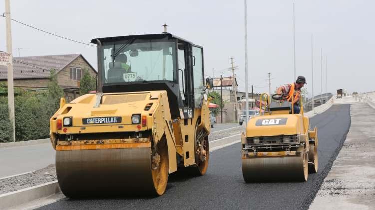
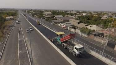
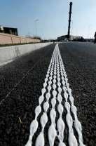
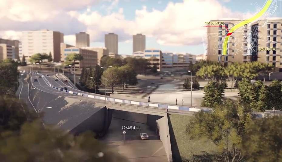
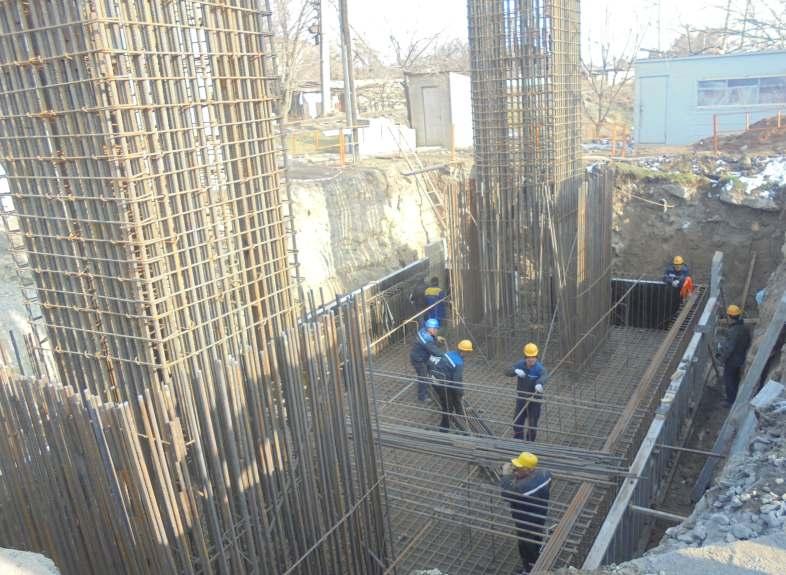
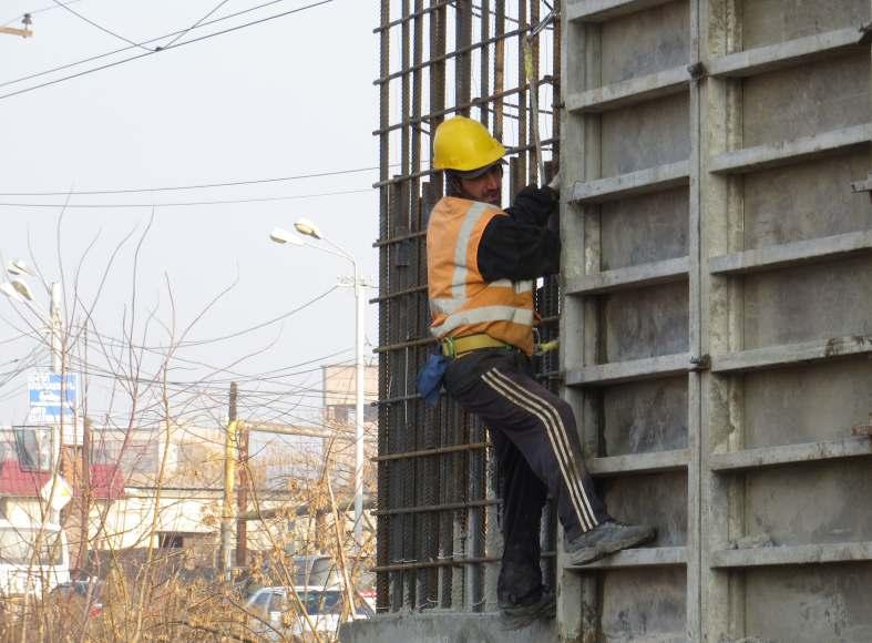
4 ARSHAKUNYATS AVENUE (reconstruction/widening of the existing road section) The newly reconstructed road section with 1.3km length and 21m width carriageway located within Arshakunyats Avenue, Ashkhatank square and Shirak street was put into operation in December Within the Program, the carriageway was widened by ensuring 4-6 traffic lanes. One separated traffic lane was built which is foreseen to serve the population in adjacent district. The opposing traffic lanes were separated, new pavements were constructed. The street is provided with drainage system. During construction all the communications under the road are replaced with the new ones. The road is equipped with power-saving lighting system according to European standards. Appropriate compensations were provided to the land users affected by the implementation of the road construction. BEFORE CONSTRUCTION 4
5 DURING CONSTRUCTION AFTER CONSTRUCTION 5

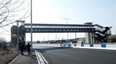
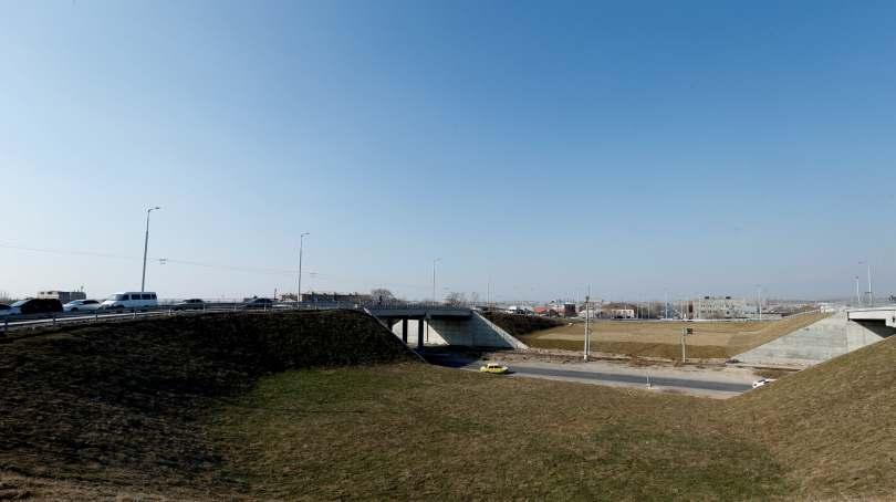
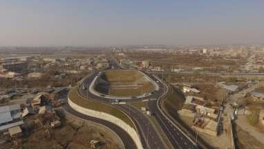
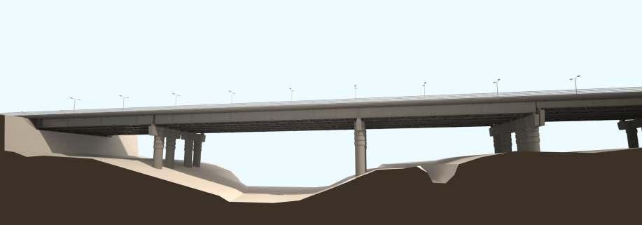
6 ARTASHAT HIGHWAY AND SHIRAK STREET ARE RECONSTRUCTED The reconstrcution of Artashat highway and extention of Shirak street were launched in The quality control of the works was under strict supervision from the beginning of the construction. By the construction of this road Yerevan Municipality initiated the major road construction project, bypassing the capital, based on Yerevan Master Plan. The project had planned decades before. The southern entrance of the capital: Artashat highway, will be built with international standards. During the construction works, we also took into consideration the suggestions of the residents of the nearby houses, regarding the formation of service roads and pavements'', - noted Vahe Nikoyan by also mentioning that during the construction works, the Contractor had done all the possible to manage the regular flow of the traffic. The construction works are finialized: 2 tunnel overpasses are constructed to ensure the traffic flow of the railway section and Noragavit 1st street, as well as an overpass with approximately 270m width and 9meter height is built over Artashat highway railway pass. The road is equipped with high-tech lighting system. Also a pedestrian overpass is built, furnished with elevator for the physically impaired persons, which is the first of its kind in the capital. One of the important achivements of this road construction is that all the communications under the road were removed from the carrigeway, which is a gurantee that road surface will not be damaged during elimination. 6
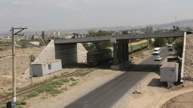
7 BEFORE CONSTRUCTION DURING CONSTRUCTION 7

8 AFTER CONSTRUCTION 8
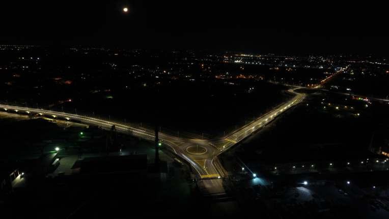
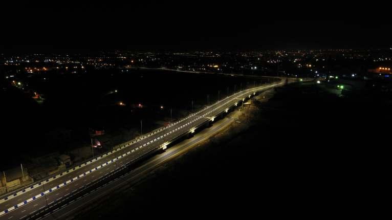
9 AFTER CONSTRUCTION 9
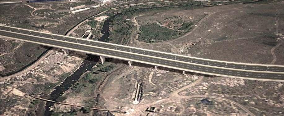
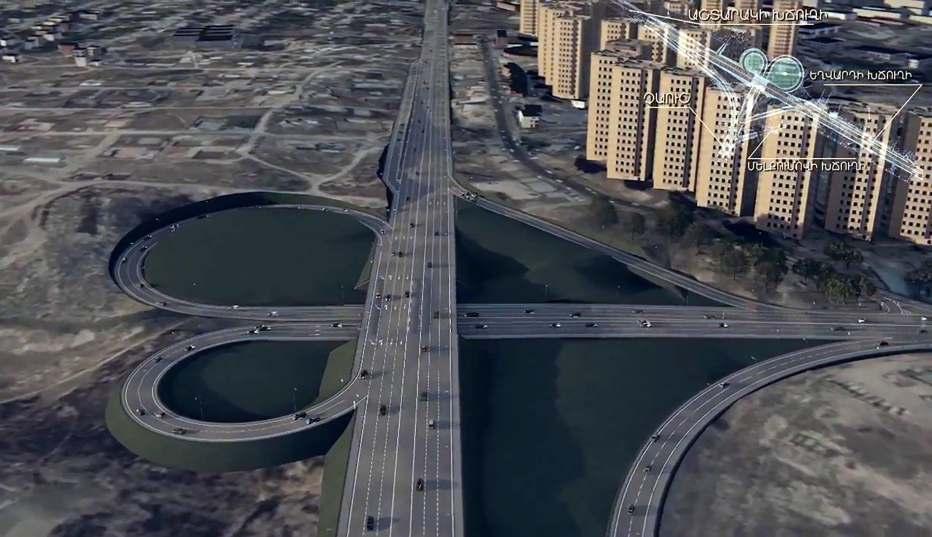
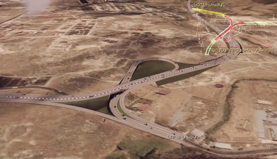
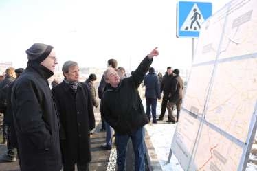
10 The main objective of the new road, which is a part of the complex program aimed to construct roads bypassing Yerevan, is to divert through-traffic around Yerevan city center by establishing a smooth connection between southern and northern enterernces of the city. Taron Margaryan: ''Eventually, Yerevan will have a proper southern entrance of strategic importance, which has really been a dream for decades''. By particularly highlighting the implementation of major road construction programs in the capital, Mayor Taron Margaryan mentioned that the constructed road would have its logical continuation, the commencement of which had already been launched. By the following stage, in the result of the implementation of Tranche 2, the southern and northern entrances will be connected to each other. In this context, the construction works from Shirak street to Argavand section have already been started, within which the construction of 252m length bridge over Hrazdan River is also envisaged, which will be named ''Erebuni-Yerevan 2800'' and will be dedicated to 2800 anniversary of Yerevan. The tender for construction works of Davtashen- Ashtarak highway road section has already been held and now we are at a contract awarding stage and the construction works will commence at the beginning of the next year. The bidding documents of Babajanyan street -Ashtarak highway road section are also ready and we the tendering process will be announced in the nearest future. I am sure that aſter the completion of this road construction the central streets of the capital will be singnificantly relieved - mentioned Taron Margaryan and added that the construction of the capital bypass road is forseen to be fully completed in 2019, and the result will be 23km length highway which will connect the southern and northern entrances of Yerevan with international standards. 10
11 ARGAVAND-SHIRAK 11
12 DAVTASHEN-ASHTARAK 12
13 BABAJANYAN-ASHTARAK 13

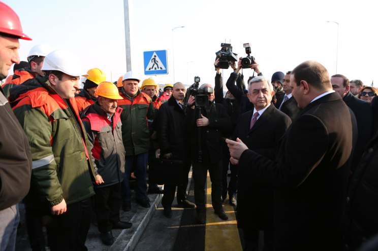
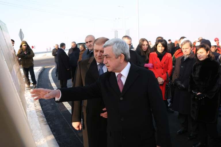
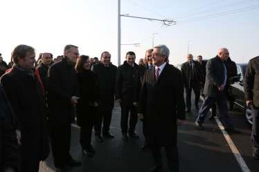
14 On 19 December 2016 Arshakunyats avenue, Shirak street and Artashat highway was officially opened by RA President Serzh Sargsyan, Yerevan Mayor Taron Margaryan and Asian Development Bank Country Director Shane Rosenthal. The responsible officials assured President that aſter the implementation of this major construction project the newly constructed highway will become the main route for the traffic entering the city from the south and exiting it in the opposite direction. The length of the road, which corresponds to international standards, is 5 km, the average width is meters. The construction of the road was preceded by the large-scale development works which were implemented in accordance with the procedures established by the Asian Development Bank. As a result, 217 units of inventory with 6,543 USD compensation payments were developed. The next stage the use of the second tranche will allow to link together the northern and southern entries of the capital. 14
15 15

16 SAFEGUARDS IMPLEMENTED DURING THE PROGRAM Environmental and social impacts assessments are the main components of the Sustainable Urban Development Investment Program, the main objective of which is to address possible social impacts and land acquisition and resettlement issues required for certain sections of the road, ensure the design, implementation and maintenance of the road and structures within the implementation of the Program according to Armenian existing laws and Asian Development Bank (ADB) Safeguard Policy Statement. During the whole implementation of the Program, the public was informed about the possible environmental impacts and their mitigation measures, as well as social impacts through public hearings, discussions. During meetings, residents were informed about the traffic management plan and road safety maintenance principles. Affected persons were informed about their rights and responsibilities, evaluation methodology, griviance redress mechanism. Before the implementation of the road construction activities, affected land users were provided with the appropriate compensations. 16
17 17


18 TRACING URARTIAN KINGDOM Construction of Argavand-Shirak new road section is planned by the Sustainable Urban Development Investment Program, which will pass through the historical heritage Karmir Blur. Therefore, before the commencement of the construction works, excavation works are carried out to check the existence of the archaeological layers. The construction of the road here was planned as far back as in the Soviet years. Worth mentioning, that the first excavation works of Karmir Blur historical heritage site have been implemented starting from However, during 90s the historical heritage site became a dump. And only within the framework of the program it became possible to restart the excavations which have already given its positive results. Karmir Blur red fortress or Teishebaini is an Urartian city is located on the leſt bank of the Hrazdan river. The city was built by the last powerful king Rusa B of Van Kingdom in the first half of VII BC. Teishebaini fortress is named aſter war and thunder Urartian God Teishebani. A huge building has been excavated in Teishebaini which is 2000 square meters with 4 separate entrances from front of the oblong. The two-story castle citadel is surrounded by a stone fence, storage buildings and had irrigation systems. The bases of that building have been preserved. Facade of the building with its own entrance is very similar to the one found in Van -bronze border on the three-story building with separate entrances (some parts of which are kept in British and Berlin museums). Asian Development Bank and Yerevan Municipality pay a great attention to the archaeological findings, which are not only national valuable heritage materials, but are also significant archaeological heritage materials of Asia, Middle East and Asia Minor. 18

19 On April 16, 2014 an exhibition called Tracing History took place in Yerevan History Museum hall. The findings dated from the Urartian period till the 1st century AD which were discovered at the historical and cultural site of Karmir Blur were presented. This archaeological site occupying the area of 40 hectares consists of the pre-urartian settlement, an Urartian town with a middle fortress. From the 6th century BC till the 1st century AD the area served as a burial place. We have rather a flexible design. As a result of numerous discussions, with the involvement of specialists, representatives of NGOs, all interested parties it was decided that first of all excavations are to be organized so that no items of archaeological significance remained there. So, the construction of the road caused the discovery of the necropolis of Karmir Blur. The design is implemented through mutual consent preserving and reviling cultural and historical values to public and cit benefits., mentioned the Deputy Mayor of Yerevan Aram Sukiasyan in the opening speech of the exhibition called Tracing History and added that the construction of the road will also limit the expansion of the cemetery adjacent to Karmir Blur. 19
20 Investing Projects Implementation Unit Building up of Yerevan CNCO Sustainable Urban Development Investment Program Tel: Address: 1/3 Buzand st, 5th floor Website: SUSTAINABLE URBAN DEVELOPMENT INVESTMENT PROGRAM
2993-ARM: North-South Road Corridor Investment Program - Tranche November 2015, 15:00 (Yerevan time)
") Invitation for Bids Date: 30 September 2015 Loan No. and Title: Contract No. and Title: Deadline for Submission of Bids: 1. The Republic of Armenia has received financing from the Asian Development Bank
Invitation for Bids Date: 30 September 2015 Loan No. and Title: Contract No. and Title: Deadline for Submission of Bids: 1. The Republic of Armenia has received financing from the Asian Development Bank
Response by the Wiltshire Archaeological and Natural History Society
 Highways England Consultation A303 Stonehenge Response by the Wiltshire Archaeological and Natural History Society Background About the Society Founded in 1853 to educate the public by promoting, fostering
Social Monitoring Report
 Social Monitoring Report Due Diligence Report Four Bridges Improvement Project Ganja Region, Roads: R24 and Y-05-08 Involuntary September 2013 Azerbaijan: Road Network Development Program Tranche 4 Prepared
IND: MFF - North Karnataka Urban Sector Investment Program - Tranche 2
 Resettlement Planning Document Project Number: 38254-043 January 2016 IND: MFF - North Karnataka Urban Sector Investment Program - Tranche 2 Subproject: Yadgir 02FES03 Submitted by Karnataka Urban Infrastructure
The Illinois Department of Transportation and Lake County Division of Transportation. Route 173, including the Millburn Bypass
 The Illinois Department of Transportation and Lake County Division of Transportation welcome you to this Public Hearing for U.S. Route 45 from Illinois Route 132 to Illinois Route 173, including the Millburn
Shift Rapid Transit Public Participation Meeting May 3, 2017
 Shift Rapid Transit Public Participation Meeting May 3, 2017 Shift Rapid Transit Initiative Largest infrastructure project in the city s history. Rapid Transit initiative will transform London s public
Chapter 7 Route window W20 Dover Road and Leigh Road bridges. Transport for London
 Chapter 7 Route window W20 Dover Road and Leigh Road bridges Transport for London ROUTE WINDOW W20 7 Route window W20 Dover Road and Leigh Road bridges Transport for London 7.6 7.7 7.8 Baseline conditions
A21. Start of works exhibition Tonbridge to Pembury. Welcome. Dualling Scheme
 Welcome We would like to welcome you to our start of works exhibition for the. On display you will see information about what is currently taking place and what will be happening during the coming months
SUSTAINABLE URBAN DEVELOPMENT PROJECT (SUDP)
") SUSTAINABLE URBAN DEVELOPMENT PROJECT (SUDP) STRATGIC CITIES DEVELOPMENT PROGRAME (SCDP) MINISTRY OF MEGAPOLIS AND WESTERN DEVELOPMENT Strategic Cities Development Programme (SCDP) SCDP Kandy Galle Jaffna
SUSTAINABLE URBAN DEVELOPMENT PROJECT (SUDP) STRATGIC CITIES DEVELOPMENT PROGRAME (SCDP) MINISTRY OF MEGAPOLIS AND WESTERN DEVELOPMENT Strategic Cities Development Programme (SCDP) SCDP Kandy Galle Jaffna
INTERNATIONAL SYMPOSIUM ON
 CONGRES DES POUVOIRS LOCAUX ET REGIONAUX DE L'EUROPE Chambre des Pouvoirs Locaux CONGRESS OF LOCAL AND REGIONAL AUTHORITIES OF EUROPE Chamber of Local Authorities Council of Europe/Conseil de l Europe
Welcome to the Public Consultation Exhibition
 Welcome to the Public Consultation Exhibition Today is your opportunity to: Speak to the team Learn more about the project Leave feedback on the plans The Secretary of State for Transport has recognised
2002/ Modernisation Road N 4
 2002/000-606.02 - Modernisation Road N 4 1. Basic Information 1.1. CRIS Number 2002/000-606.02 1.2. Title: Modernisation of the national road No 4 1.3 Sector : Cross Border Co-operation / Infrastructure
The Dreispitz in Basel / Switzerland: New economy on old sites
 The Dreispitz in Basel / Switzerland: New economy on old sites 1. Introduction At 50.000m 2 Dreispitz is currently the largest and most ambitious development project in Basel, the second biggest town in
A303 Stonehenge. Amesbury to Berwick Down Scheme Assessment Report Appendix D CSR and Policy Assessment. Volume 6
 A0 Stonehenge Amesbury to Berwick Down Scheme Assessment Report Appendix D CSR and Policy Assessment Volume 6 September 2017 Appendix D Client Scheme Requirements (CSRs) and Policy Assessment D.1 CSR Assessment
9 CITY OF VAUGHAN OFFICIAL PLAN AMENDMENT NO BOCA EAST INVESTMENTS LIMITED
 9 CITY OF VAUGHAN OFFICIAL PLAN AMENDMENT NO. 631 - BOCA EAST INVESTMENTS LIMITED The Planning and Economic Development Committee recommends the adoption of the recommendations contained in the following
DESIGN PUBLIC HEARING MAY 10, 2018 GRANBY TOWN HALL FIRST FLOOR CONFERENCE ROOM 10 WEST STATE STREET GRANBY, MASSACHUSETTS 7:00 PM FOR THE PROPOSED
 DESIGN PUBLIC HEARING MAY 10, 2018 AT GRANBY TOWN HALL FIRST FLOOR CONFERENCE ROOM 10 WEST STATE STREET GRANBY, MASSACHUSETTS 7:00 PM FOR THE PROPOSED Reconstruction of Granby Road/West State Street (Route
A Brief History. 1578: The walls, constructed by the Venetians, had 3 gates, Famagusta, Pafos and Kyrenia.
 A Brief History. 1578: The walls, constructed by the Venetians, had 3 gates, Famagusta, Pafos and Kyrenia. 1882: During the British rule, 7 more entry points open up. 1972: An architectural completion
Foreword. Síle de Valera, TD, Minister for Arts, Heritage, Gaeltacht and the Islands
 Foreword This Code of Practice is a significant milestone in the protection of the archaeological heritage. It marks an agreement between my Department and the National Roads Authority, one of the largest
COUNCIL OF EUROPE LANDSCAPE AWARD EUROPEAN LANDSCAPE CONVENTION
 COUNCIL OF EUROPE LANDSCAPE AWARD EUROPEAN LANDSCAPE CONVENTION FOURTEEN COUNCIL OF EUROPE MEETING OF THE WORKSHOPS FOR THE IMPLEMENTATION OF THE EUROPEAN LANDSCAPE CONVENTION Council of Europe Landscape
ASSESSMENT OF THE URBAN AND TOURISM DEVELOPMENT IN THE FENER-BALAT DISTRICTS. Sevgul Limoncu & Banu Celebioglu
 ASSESSMENT OF THE URBAN AND TOURISM DEVELOPMENT IN THE FENER-BALAT DISTRICTS Sevgul Limoncu & Banu Celebioglu Fener and Balat districts are located in the Historical Peninsula, in the region stretching
Chapter 8: Cultural Heritage Assessment
 Chapter 8: Cultural Heritage Assessment Cultural Heritage Assessment 8. Cultural Heritage Assessment... 2 8.1 Introduction... 2 8.2 Baseline Assessment... 2 8.3 Results / Assessment Findings... 3 8.4 Mitigation...
Clay Street Bridge Replacement Project
 Clay Street Bridge Replacement Project Frequently Asked Questions (FAQs) No. 2 April 4, 2018 The project is located in downtown Placerville on Clay Street between US Highway 50 and Main Street and Cedar
CITY OF HELSINKI ACCESSIBILITY GUIDELINES
 CITY OF HELSINKI ACCESSIBILITY GUIDELINES 2011 HELSINKI FOR ALL 2(13) Contents 1. Introduction... 3 1.1 Drafting of the accessibility guidelines... 3 1.2 Aim and content of the accessibility guidelines...
RIGA LATVIA. KEY FEATURES OF THE CITY Demographic Facts. Urban Figures. Heritage. EXISTING GOVERNANCE MECHANISMS Development and Management Plans
 RIGA LATVIA KEY FEATURES OF THE CITY Demographic Facts around 700.000 inhabitants in the city 1.15 million people in the Riga region Urban Figures the medieval core of the Old Town the 19th century grid
Chapter 24 Route Window SE5 Arsenal Way shaft. Transport for London
 Chapter 24 Route Window SE5 Arsenal Way shaft Transport ARSENAL WAY SHAFT 24 Route Window SE5 Arsenal Way shaft Introduction Transport 24.1 South of the River Thames (see Route Window SE4), the tunnel
Kibworth Harcourt. Introduction. Introduction
 Introduction Introduction Welcome to this public exhibition on the proposals for the delivery of new homes on land at The Kibworths. The purpose of today s exhibition is to give you the opportunity to
,,XIX century was the age of empires, XX century the age of states, XXI century becomes the age of cities. Wellington E. Webb, Mayor of Denver
 ,,XIX century was the age of empires, XX century the age of states, XXI century becomes the age of cities Wellington E. Webb, Mayor of Denver 1 VILNIUS : FACTS & FIGURES 16 million inhabitants in a 300
Public Consultation. Land at Monks Farm, North Grove. Welcome
 Welcome Welcome to our public exhibition for development on Land at Monks Farm, orth Grove. Gallagher Estates and Gleeson Strategic Land are preparing an outline planning application for new homes, open
Construction of the A30 Bodmin India Queens Improvement
 Construction of the Bodmin India Queens Improvement This case study involved the construction of the Bodmin-India Queens Improvement Scheme. The scheme upgraded this section of the to dual carriageway
University Park, Worcester Non Technical Summary December 2011
 University Park, Worcester Non Technical Summary December 2011 Introduction UW Wrenbridge LLP, a Joint Venture Company of the University of Worcester and Wrenbridge Land Ltd (the Applicants ) intend to
Bridgedale, Bridgetown Request for Expressions of Interest to Lease and/ or Develop
 Bridgedale, Bridgetown Request for Expressions of Interest to Lease and/ or Develop 1 Are you interested in leasing Bridgetown s oldest building and/or redeveloping an iconic site on the banks of the Blackwood
Newcourt Masterplan. November Exeter Local Development Framework
 Newcourt Masterplan November 2010 Exeter Local Development Framework Background The Exeter Core Strategy Proposed Submission sets out the vision, objectives and strategy for the development of Exeter up
Development Brief Ursuline Convent, Blackrock, Cork
 Development Brief Ursuline Convent, Blackrock, Cork Comhairle Cathrach Chorcaí Cork City Council 2002 URSULINE CONVENT DEVELOPMENT BRIEF 1 INTRODUCTION AND MAIN OBJECTIVES... 3 1.1 The convent estate is
HS2 Hybrid Bill Petitioning. Summary of SMBC Asks 23/09/13. Background
 Summary of SMBC Asks 23/09/13 Background The Council has a developed a significant number of asks and propositions for consideration by HS2 Ltd and Government throughout further development of the HS2
Dresden s SUMP with broad citizen participation in the Dresden Debate
 Dresden s SUMP with broad citizen participation in the Dresden Debate 2014 Annual Polis Conference 27 28 November 2014, Madrid Kerstin Burggraf, Urban planning office Topics Something about Dresden Dresden
Former North Works, Lickey Road, Longbridge, Birmingham
 Committee Date: 14/11/2013 Application Number: 2013/06431/PA Accepted: 27/08/2013 Application Type: Full Planning Target Date: 26/11/2013 Ward: Longbridge Former North Works, Lickey Road, Longbridge, Birmingham
City: Introduction and characteristics
 1 City: Introduction and characteristics Index Unit Data Population 1 735 442 Residents 2014 Area 517 km 2 2014 Population density 3 355 Persons/ km 2 2014 GDP 29 153 /per capita 2012 Climate classification
ROYAL BOROUGH OF WINDSOR & MAIDENHEAD
 ROYAL BOROUGH OF WINDSOR & MAIDENHEAD 30 March 2017 Application No.: Location: Proposal: Applicant: Agent: Parish/Ward: 17/00188/FULL Roundabout Adjacent To Heatherwood Hospital London Road Ascot Installation
WELCOME. Welcome and thank you for visiting today.
 WELCOME Welcome and thank you for visiting today. Bellway Homes Ltd (Yorkshire) are preparing a reserved matters planning application for a residential development of 293 homes at land North of Yew Tree
Transportation Committee
 Transportation Committee Business Item No. 2013-286SW Meeting date: October 14, 2013 For the Metropolitan Council meeting of October 16, 2013 Subject: Southwest Light Rail Transit (Green Line Extension):
DESIGN PUBLIC HEARING APRIL 24, 2018 MUNICIPAL OFFICE BUILDING HARDWICK, MASSACHUSETTS 7:00 PM FOR THE PROPOSED
 DESIGN PUBLIC HEARING APRIL 24, 2018 AT MUNICIPAL OFFICE BUILDING HARDWICK, MASSACHUSETTS 7:00 PM FOR THE PROPOSED ROUTE 32/32A GILBERTVILLE VILLAGE RECONSTRUCTION PROJECT Roadway Project Management Section
6 Growth Management Challenges and Opportunities
 6 Growth Management Challenges and Opportunities The Town has established a goal of attaining a 50% participation rate with respect to employment opportunities versus residential population. The Town s
Municipal Class EA Study Public Information Centre No. 1 December 13, :00 pm 7:00 pm. Please sign in so we can keep you updated on this study
 Reconstruction of Regional Road 45 (Creek Road) Between Regional Road 27 (River Road) and Regional Road 63 (Canborough Road) in the Township of Wainfleet Municipal Class EA Study Public Information Centre
Experiences of dealing with Lesser Horseshoe Bats (Rhinolophus
 Experiences of dealing with Lesser Horseshoe Bats (Rhinolophus hipposideros) in Wales, UK Len Wyatt Environmental Science Advisor, Transport, Housing and Strategic Regeneration, Welsh Assembly Government,
Welcome to this public consultation event for the proposed South Western Relief Road. Thank you for taking the time to come along.
 WELCOME Welcome to this public consultation event for the proposed South Western Relief Road. Thank you for taking the time to come along. The South Western Relief Road (SWRR) route is proposed in Stratford-on-Avon
NON-TECHNICAL SUMMARY
 Proposed Sand and Gravel Extraction and Associated Processing Operations with Restoration to a Mixture of Agriculture and Nature Conservation including Areas of Shallow Water at Hedgeley, Northumberland
PHASE 1 ARCHAEOLOGICAL IMPACT ASSESSMENT PROPOSED DEVELOPMENT ERF 3 ROBERTSON WESTERN CAPE PROVINCE
 PHASE 1 ARCHAEOLOGICAL IMPACT ASSESSMENT PROPOSED DEVELOPMENT ERF 3 ROBERTSON WESTERN CAPE PROVINCE Prepared for BOLAND ENVIRO Att: Mr Nik Wullschleger PO Box 250 Worcester 6849 Fax: (023) 347 0336 By
Thank you for sparing the time to visit our exhibition and to provide us with your feedback on our proposals displayed here today.
 WELCOME Aerial image of the application site in context Thank you for sparing the time to visit our exhibition and to provide us with your feedback on our proposals displayed here today. Plymouth City
West Gate Tunnel panel hearing
 Source: Western Distributor Authority Alison Whitten Master in Urban Planning Bachelor of Science in Systems Engineering James Whitten Master of Architecture in Urban Design Bachelor of Architecture Bachelor
Fall 2017 Construction Update
 Fall 2017 Construction Update Ward 4 Southeast Engineering Department Riverwalk Red Multi-Use Trail Bridge Rehabilitation The Riverwalk Red Multi Use Trail Bridge was awarded to Cramer and Associates,
AGINCOURT SECONDARY PLAN
 1 AGINCOURT SECONDARY PLAN 1. AGINCOURT SECONDARY PLAN The following policies and principles apply to the area herein referred to as Agincourt, as outlined on Map 1-1. 1. GENERAL POLICIES 1.1 This Secondary
WELCOME GYPSY LANE. Wider Site Location plan. Proposals for the development of LAND OFF FOXLYDIATE LANE WEBHEATH. Proposals for the development of
 WELCOME The developers are preparing an outline planning application for a residential led development and need the community s views in order to develop the proposals further WHAT IS PROPOSED? A high
PROJECT STATEMENT LOCATION/DESIGN PUBLIC HEARING. 19 th AVENUE NORTH EXTENSION PROJECT FROM SPRINGDALE DRIVE TO NORTH 2 ND STREET/U.S.
 PROJECT STATEMENT LOCATION/DESIGN PUBLIC HEARING 19 th AVENUE NORTH EXTENSION PROJECT FROM SPRINGDALE DRIVE TO NORTH 2 ND STREET/U.S. 67 HEARING LOCATION: ERICKSEN COMMUNITY CENTER 1401 11 TH AVENUE NORTH
Introduction. Public Information Package. Project website. Overview. Class Environmental Assessment Process
 1 Introduction Public Information Package Baseline Road Extension between Lambs Road and Bennett Road, Bowmanville Schedule B Municipal Class Environmental Assessment November 6, 2017 Overview The purpose
PROJECT BACKGROUND. Preliminary Design Scope and Tasks
 PROJECT BACKGROUND Preliminary Design Scope and Tasks The purpose of this Study is the development of preliminary designs for intersection improvements for Trunk Highway (TH) 36 at the intersections of
Page 1 of 19 URBAN DESIGN FRAMEWORK FOR BOLTON STREET WATERFORD
 Page 1 of 19 URBAN DESIGN FRAMEWORK FOR BOLTON STREET WATERFORD 1.0 Introduction: The relocation of the City Council stores and depot from Bolton Street creates an exciting opportunity for development
Archaeology and Planning in Greater London. A Charter for the Greater London Archaeology Advisory Service
 Archaeology and Planning in Greater London A Charter for the Greater London Archaeology Advisory Service THE PURPOSE OF THE CHARTER This Charter sets out how English Heritage will provide archaeological
Welcome to our exhibition
 Welcome to our exhibition housing development A46 Wildmoor Alcester Road Canal Quarter A422 Town Centre housing development Warwickshire-based IM Properties, one of the UK s largest privately owned property
Highways England Environment Fund. Graeme Hull Tyne Tees Catchment Coordinator
 Highways England Environment Fund Graeme Hull Tyne Tees Catchment Coordinator 2 3 Strategic Road Network HE Road Investment Strategy 2015/16 to 2019/20 Part 1: Strategic Vision Part 2: Investment Plan
Kildare County Council. Proposed Development of 77 no. Residential Units at College Wood Manor, Ballingappa Road, Clane, Co. Kildare.
 Job No. : 16027 SHB2-CLA-CS- MOR Date: Feb 2018 Kildare County Council Proposed Development of 77 no. Residential Units at College Wood Manor, Ballingappa Road, Clane, Co. Kildare. Traffic and Transport
Integration of Trees into Roads Policy - the road to success -
 Integration of Trees into Roads Policy - the road to success - Trees, People and the Built Environment 3 City of Birmingham, UK April 5 th, 2017 Ian Buchanan Natural Heritage and Forestry Regional Municipality
Outer Congress Street Land Use
 Outer Congress Street Land Use Outer Congress Street, with its historic residential district, natural resource and open space amenities, trail network, and proximity to major transportation infrastructure
West Gate Tunnel Project. Incorporated Document May Incorporated document pursuant to section 6(2)(j) of the Planning and Environment Act 1987.
(j) of the Planning and Environment Act 1987.") West Gate Tunnel Project Incorporated Document May 2017 Incorporated document pursuant to section 6(2)(j) of the Planning and Environment Act 1987. Drafting Note: The planning control contained in this
West Gate Tunnel Project Incorporated Document May 2017 Incorporated document pursuant to section 6(2)(j) of the Planning and Environment Act 1987. Drafting Note: The planning control contained in this
11.1 INTRODUCTION. The characteristics of these areas are briefly discussed below.
 SECTION 11 : HERITAGE PRECINCTS 11.1 INTRODUCTION This section applies to some areas within the Residential and Business Resource Areas. The significant resource management issues for this section are
2017 Canadian Consulting Engineering Awards
 2017 Canadian Consulting Engineering Awards Northeast Anthony Henday Drive DBFO Edmonton, Alberta Four years of detours, traffic snarls, varying speed limits, and stop-and-start driving has come to an
Transforming Kennedy Plaza
 PROVIDENCE REVITALIZATION Transforming Kennedy Plaza Plan calls for moving bus stops, creating open space for multiple uses By ALISHA A. PINA JOURNAL STAFF WRITER PROVIDENCE A vision is emerging to turn
Making the case for Sustainable Transport Project Potential
 Making the case for Sustainable Transport Project Potential The Structural Investment Fund (SIF) Strategy for Greater Lincolnshire identifies the barriers to growth identified by having poor transport
The Capital Design Advisory Committee St. Mary s College of Maryland & Historic St. Mary s City
 The Capital Design Advisory Committee St. Mary s College of Maryland & Historic St. Mary s City Welcome April 21, 2010 Capital Design Advisory Presentation: Relocating Margaret Brent Hall Traffic Calming
City of Cornwall Municipal Class Environmental Assessment. Proposed Improvement and Extension of Lemay Street
 Welcome City of Cornwall Municipal Class Environmental Assessment Proposed Improvement and Extension of Lemay Street Redevelopment and Design of the Municipal Works Yard Public Information Centre #1 Thursday,
Świętokrzyskie region (PL): Modern water supply and sewerage disposal for more effective utilisation of local assets.
: Modern water supply and sewerage disposal for more effective utilisation of local assets.") Świętokrzyskie region (PL): Modern water supply and sewerage disposal for more effective utilisation of local assets. SYNTHESIS The Serwis village project was an infrastructure project in Nowa Słupia commune
Świętokrzyskie region (PL): Modern water supply and sewerage disposal for more effective utilisation of local assets. SYNTHESIS The Serwis village project was an infrastructure project in Nowa Słupia commune
Public Information Centre #1
 and Highway 401 Interchange Improvements WELCOME Public Information Centre #1 Veterans Memorial Parkway Extension and Highway 401 Interchange Improvements Study May 23, 2012 4 p.m. to 7 p.m. Brief Overview
A BLUEPRINT FOR BROCKTON A CITY-WIDE COMPREHENSIVE PLAN
 A BLUEPRINT FOR BROCKTON A CITY-WIDE COMPREHENSIVE PLAN Public Meeting October 2016 1 Plan Summary and Discussion Public Meeting May 4 2017 City of Brockton Bill Carpenter, Mayor Department of Planning
Welcome to our public exhibition
 About Our Scheme Welcome to our public exhibition This exhibition gives you the chance to view and comment upon our emerging proposals for a new residential development of 68 new homes on the site of the
WELCOME TO OPEN HOUSE TWO November 28, 2018
 Langstaff Road Weston Road to Highway 7 Class Environmental Assessment Study WELCOME TO OPEN HOUSE TWO November 28, 2018 Please sign in and join our mailing list Study Overview York Region is conducting
WHITELEY TOWN COUNCIL NORTH WHITELEY DEVELOPMENT SEPTEMBER 2014
 WHITELEY TOWN COUNCIL NORTH WHITELEY DEVELOPMENT SEPTEMBER 2014 Dear Resident This Special Edition of the Whiteley Voice which has been prepared in conjunction with the North Whiteley Consortium is to
Environmental Impact Assessment
 Environmental Impact Assessment Environmental impact assessment (EIA) is the process of systematically drawing together an assessment of the likely significant environmental effects of a development project.
St. Clair Avenue West Area Transportation Master Plan
 1 (Between Keele Street and Old Weston Road) Public Information Centre 1 December 2, 2015 2 Welcome Welcome to the first Public Information Centre for the St. Clair Avenue West Area. The panels will present
24. ARCHAEOLOGY & BUILT HERITAGE
 24. ARCHAEOLOGY & BUILT HERITAGE Overview There are no known archaeological or built heritage sites within or adjacent to the Project designation boundaries. There is a history of both Māori and European
Welcome to our exhibition
 Welcome to our exhibition The Homes & Communities Agency (HCA) welcomes you to this public exhibition explaining our proposals for the redevelopment of the former Lea Castle Hospital site. About the Homes
5. Bankside and The Borough 5.1. Bankside and The Borough Area Vision
 5. 5.1. Area Vision 5.1.1. are: A globally significant central London business district which is home to international business headquarters; At the heart of the commercial and cultural life of the capital
MINNESOTA HISTORIC PROPERTY RECORD PART I. PROPERTY IDENTIFICATION AND GENERAL INFORMATION
 MINNESOTA HISTORIC PROPERTY RECORD PART I. PROPERTY IDENTIFICATION AND GENERAL INFORMATION Common Name: Fort Snelling-Mendota Bridge Bridge Number: 4190 Identification Number: Location: Feature Carried:
Rapid Transit Implementation Working Group September 14, 2017
 Rapid Transit Implementation Working Group September 14, 2017 BACKGROUND Council approved the Rapid Transit Master Plan and Updated Business Case on July 25, 2017. Approval of the RTMP confirmed the BRT
Energy Efficient Strategies for Urban Transportation Planning
 EinT2018 3 rd International Conference ENERGY in TRANSPORTATION 2018 Energy Efficient Strategies for Urban Transportation Planning Prof. Dr. Doaa M. El-Sherif, PhD, Arch. Email: doaa_elsherif@yahoo.com
523, 525 and 525A Adelaide Street West - Zoning Amendment Application - Preliminary Report
 STAFF REPORT ACTION REQUIRED 523, 525 and 525A Adelaide Street West - Zoning Amendment Application - Preliminary Report Date: May 12, 2012 To: From: Wards: Reference Number: Toronto and East York Community
QUESTIONNAIRE. Public Participation General Plan
 QUESTIONNAIRE Public Participation General Plan As you know, a General Plan is the instrument that analyses the current planning of a municipality and marks its future development, specifying, among other
I539. Smales 2 Precinct
 I539. Smales 2 Precinct I539.1. Precinct Description The Smales 2 Precinct applies to a 4.8 hectare block of land located on the southern side of Northcote Road and fronting Lake Pupuke, Takapuna. The
HARDWICK GREEN, King s Lynn. Welcome to our Exhibition. What are your views? Introduction to the site and proposals. About us
 HARDWICK GREE, King s Lynn Welcome to our Exhibition Welcome to our exhibition, which is being held to provide you with the opportunity to understand and comment upon our proposals for new residential
KING-SPADINA COMMERCIAL HERITAGE CONSERVATION DISTRICT PLAN COMMUNITY CONSULTATION MEETING #1
 KING-SPADINA COMMERCIAL HERITAGE CONSERVATION DISTRICT PLAN 1 TUESDAY, APRIL 21, 2015 METRO HALL, ROOM 308/309 55 JOHN STREET, TORONTO 6:30 7:00 Open House 7:00 7:15 Remarks Councillor Cressy Heritage
APPENDIX K WINDSOR OFFICIAL PLAN
 CEAA ENVIRONMENTAL ENVIRONMENTAL IMPACT ASSESSMENT AMBASSADOR BRIDGE ENHANCEMENT PROJECT Replacement Span and Plaza Expansion APPENDIX K WINDSOR OFFICIAL PLAN Avalon Consulting Professionals of Ontario,
SOUTH CAMBRIDGESHIRE DISTRICT COUNCIL. Planning and New Communities Director
 SOUTH CAMBRIDGESHIRE DISTRICT COUNCIL REPORT TO: Planning Committee 9 January 2013 AUTHOR/S: Planning and New Communities Director S/2270/12/FL FEN DRAYTON 850m long flood defence embankment ranging in
West Dennis Center: Bass River to Old Main Street. West Dennis Business District: Old Main Street to Dennis Commons
 West Dennis Center: Bass River to Old Main Street West Dennis Business District: Old Main Street to Dennis Commons Dennisport Center: Dennis Commons to Division Street Main Street Project Goals Project
European code of good practice: "ARCHAEOLOGY AND THE URBAN PROJECT"
 European code of good practice: "ARCHAEOLOGY AND THE URBAN PROJECT" Introduction The role of public authorities and planners The role of architects and developers The role of archaeologists Introduction
ENGINEERING CONSULTANTS (PVT.) LIMITED
 LIMITED") ENGINEERING CONSULTANTS (PVT.) LIMITED Engineering Consultants (Pvt.) Limited ( ECL) is a multi-disciplinary independent consulting firm established in 1968 as a partnership and incorporated on 21 st April
ENGINEERING CONSULTANTS (PVT.) LIMITED Engineering Consultants (Pvt.) Limited ( ECL) is a multi-disciplinary independent consulting firm established in 1968 as a partnership and incorporated on 21 st April
South of Hillside Road West, Rothbury. Design and Access Statement with Design Code. Outline Planning Application May 2016
 Outline Planning Application May 2016 Design and Access Statement with Design Code Jane Darbyshire and David Kendall Ltd This Design and Access Statement has been produced by Jane Darbyshire and David
Mavis Road Class Environmental Assessment
 Mavis Road Class Environmental Assessment Public Information Centre #2 Wednesday November 9, 2016 6:00 to 8:00 p.m. Please sign in and complete a comment sheet Review the displays on your own or join in
Land at Fiddington Hill Nursery, Market Lavington
 Land at Fiddington Hill Nursery, Market Lavington Briefing Report for Market Lavington Parish Council Persimmon Homes (Wessex) April 2016 Background This brief report has been prepared following the Market
A Claustrophobic Corridor Grows Up
 A Claustrophobic Corridor Grows Up Presenters: Chris Bauserman, PE, PS Delaware County Engineer Jeff Griffin, PE Burgess & Niple, Inc. Brian Moore, PE Burgess & Niple, Inc. PROJECT OVERVIEW Sawmill Parkway
North Somerset Council Local Development Framework
 North Somerset Council Local Development Framework Sites and Policies Development Plan Document Evidence Paper Re-opening Portishead Railway Line and Options for the Location of Portishead Railway Station
Conception of Syzran town development for the year of 2020 Russia
 Subscriber: Vervoorn, IHS Subscription Expires: 31-DEC-09 Conception of Syzran town development for the year of 2020 Russia Categories: Urban and Regional Planning: - community-based planning -cultural
11. ISLINGTON ROUTE SECTION ENVIRONMENTAL BASELINE AND ASSESSMENT OF IMPACTS OVERVIEW OF ISLINGTON ROUTE SECTION... 2
 11. ISLINGTON ROUTE SECTION ENVIRONMENTAL BASELINE AND ASSESSMENT OF IMPACTS... 2 11.1 OVERVIEW OF ISLINGTON ROUTE SECTION... 2 11.2 POLICIES RELEVANT TO ALL WORKSITES IN ISLINGTON... 3 11.3 FARRINGDON