The Monahan Outdoor Education Center
|
|
|
- Brianne Cook
- 6 years ago
- Views:
Transcription
 restored grassland atop what was a gob pile a large pile of abandoned coal refuse.")
1 The Monahan Outdoor Education Center Department of Biology, Pittsburg State University, Pittsburg, Kansas Description The Monahan Outdoor Education Center is a 153 acre (62 ha) partially reclaimed abandoned coal mine. The major feature is an 80 acre (32.3 ha) restored grassland atop what was a gob pile a large pile of abandoned coal refuse. To the east of the grassland is the remnant of an erosion control dam built during the reclamation project. It forms a rough semi-circular border between the grassland and the naturally re-vegetated oak woodland growing on the mine spoils. The dam has created two small wetlands and has a hiking trail on it that also moves through the woodland and over two small streams. There is a gathering pavilion and restroom facility at the edge and at the end of the gravel road onto the property from the north border. To the west of the prairie is a barn (for equipment storage) and trailer home (for the caretaker), then a large bordering strip-mine lake. To the south is small drainage (from the strip-mine lake eastward) and wetland that flow to join a similar drainage way from the north border and then leave the property to the east. South of this drainage is a railroad track and a large un-reclaimed area with poorly vegetated mine spoils and strip pits. Fig. 1. Aerial photo of Monahan site. (1) main strip pit lake. (2) Caretaker s residence and barn. (3) Pavilion area and nature trail. (4) NRCS wetland. (5) south wetland. (6) location of berm wetlands. (7) unreclaimed south area. Acquisition, reclamation, and development In 1988, Dr. and Mrs. William J. Reals of Wichita donated the land to the PSU Biology Department in memory of Mrs. Reals father, the late Francis A. Monahan. Monahan was the son of a mining engineer from Scotland and he used the valuable skills he learned from his father in the coal fields in Cherokee and Crawford Counties. The site was dedicated on November 6, In the early 1950s, Monahan bought the 156 acre tract of land from the Commercial Fuel Company because he knew there was still a lot coal there and a lot of coal dust in the washings and thought some of it might be salvaged. Monahan was also interested in seeing the land restored. He was always concerned about the impact mining had on the land. He was even appointed by the governor to serve on a state commission that studied the environmental impact of strip mining. Reclamation of the site began in 1984 and ended eight months later. The reclamation included three phases: (1) stabilization and clean up built an erosion control dam and cleared mining debris; (2) site preparation de-water small pits, reshape surface including lowering of gob pile; (3) restoration addition of topsoil (mine spoils were used) and limestone, construction of tile drainage system to divert surface infiltration, discing, fertilizing and planting of an oats cover crop. In Spring 1985, trees, shrubs and grass were planted. The grasses planted were a mixture of native species including Little bluestem, Big bluestem, Sideoats grama, Wheatgrass, Switchgrass, Buffalograss, Prairie coneflower, Purple prairie clover, and Prairie sunflowers. The initial development of the Monahan Outdoor Education Center included a barn and caretakers quarters (mobile home). The barn houses maintenance equipment and supplies including a tractor and implements, fire-fighting equipment, and related materials for managing the site. Rural water was provided later. In 2001, the Reals Pavilion was completed as a shelter for visitors. The Real's Pavilion was dedicated May 4, Located on the grassland/wooded border on the east side of the October 28, 2016 Page 1 of 10
2 Monahan, the pavilion provides access to the Coal Creek Nature Trail. Part of the Coal Creek trail runs on top of a berm of coal fine material that was used as a detention dam during construction. In 2005, a pit toilet was constructed alongside the gravel parking lot at the Real s Pavilion. In 2006, an NRCS co-funded project created a wetland in the southwest corner of the reclaimed grassland and built a small berm in the northwest corner to direct flow to the new wetland. Three other wetland exist on the site. The strip mine lake on the west side forms a backwater wetland on the south end of the reclamation project. The other two wetlands are at the northeast end of the grassland, in the wooded area. One in inside the berm and one outside. The outside wetland receives flow from the inside wetland via a pipe through the berm. Usage The site has been used for several theses and research projects. The vegetation was first surveyed in by Vickers (1989) and in 1994 by Yates (1996). Imhoff (1994) performed the first post-reclamation water quality survey. Various undergraduate students have also conducted short-term water quality studies on the site, most recently in the period by Tommy Wells, Brandon Dunham, and Kip Sagehorn. The Kansas Dept. of Health and Environment funded a $30,000 study of surface and groundwater to assist in planning a remediation project for controlling seepage along the north side of the mound. The study was conducted by Dr. Joe Arruda and employed several graduate (Scott Benard, Josh Jagels) and undergraduate (Lynsey Earl, Sarah Smith, James Daniel, John Imhof, Glenn Reed Selby, and Deep Bhari) students. Many classes, including Stream Ecology, Terrestrial Field Ecology, Wetland Ecology, Ornithology, Mammalogy, and Wildlife Management have used the area. Soil Ecology, a requirement for all field biology students, uses the Monahan for soil analysis. Travis Robb completed an undergraduate research project on the Monahan and presented a paper titled A comparison of organic soil carbon at a native grassland and a reclaimed strip mine site in southeast Kansas at the Biology Undergraduate Research Colloquium. He was sponsored by Dr. Dixie Smith. The Coal Creek Nature Trail was developed with student help. The large strip-pit lake to the west is used by the public for fishing. A new trail, Bluebird trail, is located along the edge of the eastern woodland. It was built in order to access a series of Bluebird nest boxes for a study. Management The large central restored grassland is mowed or burned, usually in the spring but at times in the fall. The focus of recent management has been to control the seepage of acid mine drainage from the north slope. To that end, a water quality study (surface and ground water) was conducted and a new wetland constructed. In the future, it is hoped that funds will be secured for more extensive reclamation effort. The remaining areas are not actively manipulated. The area to the east of the grassland has revegetated on its own post-mining. It is dominated by some hardwood species (oaks) and has a heavy understory of brush. The triangular-shaped portion of the property south of the railroad tracks has not been reclaimed and serves as a contrast for the restored part. Theses The Evaluation of Two Types of Multivariate Analyses Applied to Grassland Vegetation Data from a Reclaimed Coal Mine Area in Southeast Kansas, USA. Yates, Karen F. (Advisor: Dr. Joe Arruda) Land Use and Anuran Biodiversity in Southeast Kansas. Anderson, Lewis Ray. (Advisor: Dr. Joe Arruda) [used MOEC as one location] A Post-Reclamation Water Quality Assessment of the Monahan Outdoor Education Center. Imhof, Sally A. (Advisor: Dr. Joe Arruda) Vegetative Analysis of the Monahan Reclaimed Mined Land Area. Vickers, Jeff L. (Advisor: Dr. Ralph Kelting) Publications Anderson, L. and J.A. Arruda. The relationship between land use and amphibian biodiversity in southeast Kansas. October 28, 2016 Page 2 of 10
3 Amphibian and Reptile Conservation. In Press Imhoff, Sally. Reclamation of the Monahan Site. Francis A. Monahan Outdoor Education Center. pp in: J. Arruda (ed), Kansas Academy of Science Multidisciplinary Guidebook 6. Fall Field Trip to the Natural Areas of Southeast Kansas. Kansas Geological Survey Open-File Report pp Ford, Steven. Francis A. Monahan Outdoor Education Center. pp in: J. Arruda (ed), Kansas Academy of Science Multidisciplinary Guidebook 6. Fall Field Trip to the Natural Areas of Southeast Kansas. Kansas Geological Survey Open-File Report pp. October 28, 2016 Page 3 of 10
.")

4 Mound and terraces Monahan, view to south, early post-reclamation (NRCS). The snow lines highlight the terraces of the mound system. View of terraces looking northeast. October 28, 2016 Page 4 of 10

5 Coal Creek Trail The Coal Creek Trail Trail from the Pavilion October 28, 2016 Page 5 of 10


6 Staircase on southeast leg October 28, 2016 Page 6 of 10
.")
7 NRCS Wetland During construction (almost same view as below). NRCS wetland looking east from the southwest corner (January 2016). October 28, 2016 Page 7 of 10
.")
8 South Wetland Southeast corner looking northwest (October 2005). South wetland looking east-southeast from the northwest corner (January 2016). October 28, 2016 Page 8 of 10


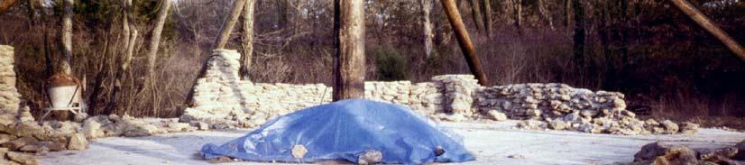
9 Pavilion During construction February 2016 October 28, 2016 Page 9 of 10

10 October 28, 2016 Page 10 of 10
Surface Coal Mining and Reclamation in ND. Guy Welch ND Public Service Commission
 Surface Coal Mining and Reclamation in ND Guy Welch ND Public Service Commission Surface Coal Mines in North Dakota Approximately 1500 acres are disturbed each year History of Reclamation in ND First surface
Chris James Park Planner July 16, Master Plan Kick Off Meeting
 Chris James Park Planner July 16, 2014 Master Plan Kick Off Meeting Meeting Overview Introductions Purpose of Meeting and Master Plan History & Background of Park Property Prior Planning Considerations
Non-Metallic Mining Reclamation Checklist
 Eau Claire County DEPARTMENT OF PLANNING AND DEVELOPMENT Eau Claire County Courthouse, Rm. 1510 721 Oxford Avenue Eau Claire, Wisconsin 54703-5481 (715) 839-4741 f Housing & Community Development 839-6240
The scope of the plan will focus on the Prospect Heights Slough and Hillcrest Lake as one entity.
 Plan for Prospect Heights Natural Resources Commission Plan for Improved Public Access and Enjoyment of the Prospect Heights Slough and Hillcrest Lake July 23, 2018 The City Council has requested the Natural
Grand River Ravines Georgetown Township
 Grand River Ravines Georgetown Township Project Description: The Grand River Ravines County Park property is composed of the 68-acre former Fillmore at the Bend Open Space purchased in 1999 and two more
Natural Areas Certification Program Guidelines
 Natural Areas Certification Program Guidelines Purpose of the Program The City of Fort Collins Natural Areas Department encourages site management practices that focus on protecting, restoring, and enhancing
POLLINATOR HABITAT PLANTING
 POLLINATOR HABITAT PLANTING Michigan CRP - SAFE CP-38E Pollinator Natural Resources Conservation Service (NRCS) Pollinators provide a very important ecological service. Approximately three quarters of
Conservation Plan. I. Property Information. II. Objectives. Natural Resource Objectives. Sustainability in Practice (SIP) Certified
 Certified") Conservation Plan Sustainability in Practice (SIP) Certified I. Property Information Vineyard Name and Establishment Date: Location: Map (attach showing blocks and acres): II. Objectives Natural Resource
Conservation Plan Sustainability in Practice (SIP) Certified I. Property Information Vineyard Name and Establishment Date: Location: Map (attach showing blocks and acres): II. Objectives Natural Resource
Expanding Planter Boxes. Plant Biology EMPACTS Project Dr. Burnetta Hinterthuer, Instructor
 Expanding Planter Boxes Plant Biology EMPACTS Project Dr. Burnetta Hinterthuer, Instructor Team Members Alma Sanchez Trevor Robinson Jeffery Longoria Zack Marsh Baker s Prairie, NW Arkansas Project Introduction
11: Good Design - Boor Site
 Rural Design Workbook: 11: Site Introduction: A dairy and feed farm of over 450 acres in the town of Horseheads (Chemung County), David Boor s property has a number of notable features. The site is nearly
Chris Powter Executive Director Oil Sands Research and Information Network School of Energy and the Environment University of Alberta
 Chris Powter Executive Director Oil Sands Research and Information Network School of Energy and the Environment University of Alberta www.osrin.ualberta.ca OSRIN Creating and Sharing Knowledge 2 CRR provides
Caledon Villas Corp. c/o Mr. John Spina 55 Blue Willow Drive Woodbridge, ON L4L 9E8 May 14, Floodplain Characteristics, Old Church Road
 Caledon Villas Corp. c/o Mr. John Spina 55 Blue Willow Drive Woodbridge, ON L4L 9E8 May 14, 2013 Re: Floodplain Characteristics, Old Church Road This letter serves to confirm that I, Linda Sober, have
Draft Master Plan for Franklin Park
 Draft Master Plan for Franklin Park Metro Parks Tacoma with SiteWorkshop November 2009 I. overview & background Process & History Master Plan Process The Master Plan is based on a community involvement
Urban Conservation Practice Physical Effects ESTABLISHMENT, GROWTH, AND HARVEST NUTRIENT MANAGEMENT
 NOT WELL 800 - Urban Stormwater Wetlands A constructed system of shallow pools that create growing conditions for wetland plants to lessen the impacts of stormwater quality and quantity in urban areas.
Wildflowers grow in the new community park on Oakwood Road
 Wildflowers grow in the new community park on Oakwood Road PLANNING AREA - NEW PARKS An important element in the plan for the City of Delafield is to look ahead for future park needs. The City has the
SECTION 4(f) DE MINIMIS DOCUMENTATION
 DE MINIMIS DOCUMENTATION") SECTION 4(f) DE MINIMIS DOCUMENTATION Illinois Route 60/83 IL 176 to the intersection of IL 60 (Townline Road) Lake County P-91-084-07 Mundelein Park and Recreation District Project Limit SECTION 4(f)
SECTION 4(f) DE MINIMIS DOCUMENTATION Illinois Route 60/83 IL 176 to the intersection of IL 60 (Townline Road) Lake County P-91-084-07 Mundelein Park and Recreation District Project Limit SECTION 4(f)
Final Report for the Preliminary Analysis of GHS-OWLS Impact Study
 Final Report for the Preliminary Analysis of GHS-OWLS Impact Study Goddard High School s Outdoor Wildlife Site The OWL site is composed of a grassland ecosystem and a pond ecosystem. The OWL site belongs
Applied Ecological Services, Inc. Sustainable Solutions for Over 30 Years.
 Applied Ecological Services, Inc. Sustainable Solutions for Over 30 Years. Landfills Can Mitigate and Restore Riparian Impacts on Their Property Jason Dremsa, Construction Manager Applied Ecological Services,
Rain Gardens. A Welcome Addition to Your Landscape
 Rain Gardens A Welcome Addition to Your Landscape Where Does The Rainwater Go? Naturally, forests provide a way for rainwater to percolate into the soil, filtering pollutants while trees are allowed to
Habitat garden: IWF. Fishing: Morguefile. Bird feeders: IWF. White-tailed deer: Morguefile
 2016, Indiana Wildlife Federation. This material contained in this presentation may not be reproduced or distributed, wholly or in part, without the express permission of the Indiana Wildlife Federation.
Kazoo school students are presenting a research project on Japanese Knotweed in collaboration with researcher, Joe Dauer, from MSU.
 AmeriCorps NCCC is a government-funded national service program consisting of young adults, ages 18 to 24. Their main areas of focus include, urban and rural development, infrastructure improvement, energy
Section 1 TABLE OF CONTENTS
 Section 1 TABLE OF CONTENTS... [M]ineral fertilizer is essential to feed around half of the world s population, and will be fundamental to ensure global food security through the 21 st century. 2013 U.N.
Design Around Waterways and Wetlands
 Design Around Waterways and Wetlands NL Green Economy Conference Newleef-2014 NEIA, St. John s, NL October 9-10 th, 2014 Wade Lewis Amherst, Nova Scotia, w_lewis@ducks.ca DUC conserves, restores and manages
Morro Shoulderband Snail Protocol Survey Report for the Parcel at 3093 Beachcomber Drive, Morro Bay, San Luis Obispo County, California
 Morro Shoulderband Snail Protocol Survey Report for the Parcel at 3093 Beachcomber Drive, Morro Bay, San Luis Obispo County, California Prepared for: John K. Construction Inc. Prepared by: SWCA Environmental
QUARRY REHABILITATION PLANS Specifications (version 1.3)
") For all our quarries, a rehabilitation plan must be developed from the outset. It is an integral part of the quarrying plan and provides for progressive and co-ordinated rehabilitation whenever possible.
For all our quarries, a rehabilitation plan must be developed from the outset. It is an integral part of the quarrying plan and provides for progressive and co-ordinated rehabilitation whenever possible.
Arkansas Agronomy Technical Note 1 Conservation Practice Seeding Recommendations February 1, 2014
 Arkansas Agronomy Technical Note 1 Conservation Practice Seeding Recommendations February 1, 2014 Introduction This technical note may be used to develop site specific recommendations for Arkansas NRCS
Action Item Recommend Initiation of Public Art Project at Bishop Arts Station. Kay Kallos, Public Art Program Manager
 Action Item Recommend Initiation of Public Art Project at Bishop Arts Station COMMITTEE: Cultural Affairs Commission MEETING DATE: March 22, 2018 COUNCIL DISTRICT(S): DEPARTMENT: STAFF: MAPSCO: FUNDING
City of Sun Prairie Wetland Buffer Reduction Request
 City of Sun Prairie Wetland Buffer Reduction Request Westside Development Area January 9, 2017 Prepared by: City of Sun Prairie 300 E. Main Street Sun Prairie, WI 53590 BACKGROUND The City of Sun Prairie
is the Cree word for beautiful
 is the Cree word for beautiful Created in 1979 by an Act of the Province Meewasin is a conservation organization dedicated to conserving the cultural and natural resources of the South Saskatchewan River
2011 ASLA Design Awards. Coyote Gulch Honor Award and Land Stewardship Designation Valerian LLC. Environmental Restoration and Reclamation
 2011 ASLA Design Awards Honor Award and Land Stewardship Designation Valerian LLC Environmental Restoration and Reclamation Project Name: Category : Project Location: 5 2011 Environmental Restoration and
RECONNECTING A COMMUNITY TO THE CREEK
 RECONNECTING A COMMUNITY TO THE CREEK 0 The J.J. Seabrook Stream Restoration, Rain Garden, and Urban Trail Project Kristin K. Pipkin, P.E. Michelle Adlong, EI.T. TXSER/TRA Joint Conference November 2,
Monica Smith, PE President Robinson Engineering Company
 Monica Smith, PE President Robinson Engineering Company Owner Robinson Engineering Masters Degree in Water Resource Management for Colorado State University The Dry Run Creek project got me interested
Welcome To Our Sandbox. Playing in the dirt, riding the rototiller all that s missing is the camp fire
 Welcome To Our Sandbox Playing in the dirt, riding the rototiller all that s missing is the camp fire Box 1 Motley Crew Brandy Jacobs Zach Olson Roger Acevedo Jenifer Hart Donovan Wisely * Ricardo Hinojosa
This definition is from the Soil Science Glossary (Soil Science Society of America).
.") What is Soil? This definition is from the Soil Science Glossary (Soil Science Society of America). soil - (i) The unconsolidated mineral or organic material on the immediate surface of the earth that serves
What is Soil? This definition is from the Soil Science Glossary (Soil Science Society of America). soil - (i) The unconsolidated mineral or organic material on the immediate surface of the earth that serves
APPENDIX C NATURAL RESOURCES MANAGEMENT PLAN: ACTIONS AND PRIORITIES
 APPENDIX C NATURAL RESOURCES MANAGEMENT PLAN: ACTIONS AND PRIORITIES TABLE C-1: Resource Actions and Priorities GOAL NRM-4 Objective 4.1: Restore Natural floodplain functions. Objective 4.2: Define and
Cedar Niles Future Park Site Wetland #1
 Date: October 20, 2014 Site: Landowner: Johnson County Parks Designer: Thomas R. Biebighauser Individuals Present: Thomas R. Biebighauser, Dr. Eliodora Chamberlain (US EPA), Jason Daniels (US EPA), Jeannette
SOUTH PARK. Construction of a Portion of South Park at Fresh Kills Park, Staten Island
 SOUTH PARK Construction of a Portion of South Park at Fresh Kills Park, Staten Island FRESHKILLS PARK FIRST PHASE OF SOUTH PARK FRESHKILLS PARK CONTEXT SOUTH PARK EXISTING CONDITIONS PROJECT OPPORTUNITIES
Your 2016 Thank You Report
 Your 2016 Thank You Report Cover photo: Natural lands purchased and protected by Conservation Halton and partners in 2015. At almost 100 acres, this area protects valleys and headwater streams that flow
HAZARD MITIGATION GOALS AND OBJECTIVES
 SEWRPC Community Assistance Planning Report No. 282, 2nd Edition CITY OF MILWAUKEE ALL HAZARDS MITIGATION PLAN UPDATE Chapter IV HAZARD MITIGATION GOALS AND OBJECTIVES [NOTE: Throughout this plan update
Pony Barn Recreation Area Working Group November 10, 2014 DRAFT Meeting Minutes
 Pony Barn Recreation Area Working Group November 10, 2014 DRAFT Meeting Minutes The Reston Association (RA) Pony Barn Recreation Area Working Group (PBRAWG) held its fourth meeting at 6:30 pm on Monday,
Triangle Land Conservancy Conservation Area Monitoring Report Carolina North
 Triangle Land Conservancy Conservation Area Monitoring Report Carolina North Property Name: Bolin Creek West Conservation Area Date of visit: 2.18.13, 2.18.13, 3.13.13, and 6.10.13 County: Orange Property
FirstLight Power Shoreline Management Manual Sustainable Shoreline Designs: From Long Island to Lake Erie Webinar Series
 FirstLight Power Shoreline Management Manual Sustainable Shoreline Designs: From Long Island to Lake Erie Webinar Series Presented by Jason Williams, PLA, NCI February 19, 2017 Introduction Lakes (impoundments)
Oil Sands Reclamation From the Ground Up : A Suncor Energy Perspective
 Oil Sands Reclamation From the Ground Up : A Suncor Energy Perspective Lelaynia Cox, RPF and Cecilia Jeje, PhD College of Alberta Professional Forest Technologists April 14, 2011 Overview Oil sands mining
Roof Runoff Harvesting Benefits for Regional Conditions in Low Density and Medium Density Residential Areas. Leila Talebi 1 and Robert Pitt 2
 Roof Runoff Harvesting Benefits for Regional Conditions in Low Density and Medium Density Residential Areas Leila Talebi 1 and Robert Pitt 2 1Graduate Student, Department of Civil, Construction, and Environmental
Soil Reclamation and Site Reinstatement
 APPENDIX 6 Soil Reclamation and Site Reinstatement Purpose To undertake soil reclamation, erosion protection, Site restoration and reinstatement, taking into account natural processes, operational requirements
In the tall grass prairie, grasses can be up to 2 meters tall! This is tall grass prairie at a state park in Iowa.
 This presentation is designed to give you a feel for what tall, mixed and short grass prairie environments on North America look like. I hope that these pictures will help you understand more deeply when
2.1 Principles & Objectives
 Designing With The Landform 2.1 Principles & Objectives Land planning which integrates the natural features of a site (i.e., designing with the landform ) into the site design is a major component of the
SECTION 6. Routine Maintenance Activity Details
 SECTION 6 Routine Maintenance Activity Details 80. DEBRIS REMOVAL When Deadfall, and other objects, such as shopping carts, tires, appliances, and mattresses have accumulated in the drain. Why To prevent
Hiawatha Drain County Drain or Habitat Restoration?
 Michigan Water Environment Association 2018 Conference June 25, 2018 Dana Burd, PE Melanie Manion, Ottawa County Natural Resources Supervisor Hiawatha Drain County Drain or Habitat Restoration? Joe Bush,
SITE SUMMARY REPORT Arlington Dump NONCD Yadkin County
 SITE SUMMARY REPORT Arlington Dump NONCD 0000644 Yadkin County Hurricane Recovery Act of 2005 State of North Carolina State Contract N06009S Schnabel Project No. 06210002.15 July 31, 2009 Prepared for:
Why Are We Here? Mrs. Farrow protected this land. CCPRC Acquires Property. Funding Appropriated. Structure Stabilization
 Why Are We Here? Mrs. Farrow protected this land CCPRC Acquires Property Funding Appropriated Structure Stabilization Programs at Park Master plan implement improvements Project Team Introductions & Roles
LILAC Housing: Site Management Plan
 LILAC Housing: Site Management Plan Prepared by: Joe Atkinson. Date: 30/10/2011 Version 1.0 Relevant Legislation & Policy Conservation Regulations 1994, 2007, 2009, 2010 Wildlife & Countryside Act 1981;
Samuel E. Paul War Memorial Recreation Area Natural Resource Inventory
 Samuel E. Paul War Memorial Recreation Area Natural Resource Inventory Created By: Timothy Rosadini Keene State College Environmental Studies Acknowledgments I would like to acknowledge the following people
Stormwater Standards. Clackamas County Service District No. 1. Planting Guide for Buffers
 Stormwater Standards Clackamas County Service District No. 1 APPENDIX B Planting Guide for Buffers Table of Contents Appendix B - Planting Guide for Buffers... Page B.1 General... 1 B.1.1 Introduction...
MetroParks Board Meeting 2018 Capital Improvement Projects
 MetroParks Board Meeting 2018 Capital Improvement Projects Stephen L. Avery Planning & Operations Director Last Edited: 3.12.18 Presentation Outline MetroParks Mission Statement Strategic Master Plan MetroParks
Storm Water Quality and Shoreline Restoration Improvements - Grant Funding Request City of Mound Carlson Park Bolton & Menk Project No.
 September 15, 2016 Brett Eidem Cost Share Grant Administrator Minnehaha Creek Watershed District 15320 Minnetonka Boulevard Minnetonka, MN 55345 RE: Storm Water Quality and Shoreline Restoration Improvements
Community LID Workgroup Issue Paper #6
 Community LID Workgroup Issue Paper #6 Topic: Hard and Impervious Surface Coverage Limits Objective: Minimize the amount of hard and impervious surfaces in developments to allow more stormwater to infiltrate
WHITE HOUSE FARM FOUNDATION 1917 Kauffmans Mill Rd. Luray, VA Summary Report 2016
 WHITE HOUSE FARM FOUNDATION 1917 Kauffmans Mill Rd. Luray, VA 22835 www.whfarmfoundation.org Summary Report 2016 Mission Statement: To enrich individuals with knowledge of and involvement with our natural
IOWA FFA STATE SOILS CDE SATURDAY, OCTOBER 13, 2007 AMES, IOWA
 IOWA FFA STATE SOILS CDE SATURDAY, OCTOBER 13, 2007 AMES, IOWA 1. Moderately sloping has what percent slope: a. 9-14% b. 2-5% c. 5-9% d. over 14% 2. Which of the following horizons is the loose underlying
Glenborough at Easton Land Use Master Plan
 Land Use Framework November 30, 2007 2.0 LAND USE FRAME- WORK 2.1 LAND USE HISTORY and Setting Glenborough at Easton is located on property that was used for mining in the 19th and 20th centuries and rocket
Yates Cattle & Conservation Ranch
 Yates Cattle & Conservation Ranch Yates Cattle and Conservation Ranch 385 +/- acres Hays & Travis Counties, Texas James King, Agent Office 432.426.2024 James@KingLandWater.com Location There is a property
Memorandum. From: Holly Lawson Doc #: 069/12 Subject: Rosemont Reclamation Treatments Date: July 18, Introduction
 Memorandum To: File From: Holly Lawson Doc #: 069/12 Subject: Rosemont Reclamation Treatments Date: July 18, 2012 Introduction The Rosemont Copper Project is located in the northern portion of the Santa
Triangle Land Conservancy Conservation Area Monitoring Report Carolina North
 Triangle Land Conservancy Conservation Area Monitoring Report Carolina North Property Name: Bolin Creek West Conservation Area Date of visit: April 11, 2018 County: Orange Property Type: Restrictive Covenants
Alberta policy and regulations for grassland reclamation criteria, evolution of the criteria from the 1995 version to today
 Alberta policy and regulations for grassland reclamation criteria, evolution of the criteria from the 1995 version to today Jody Spady on behalf of Reclamation Criteria Advisory Group (RCAG) Native Prairie
SEED lacrosseseed.com Native Restoration Guidelines
 info@laxseed.com 800.356.SEED lacrosseseed.com Native Restoration Guidelines Step 1: Research and Planning Well in advance of planting day, set aside some time to think about all of the steps involved
Policy & Procedure Effective Date: Parks Department Page of
 City of Arvada Policy & Procedure Effective Date: Parks Department Page of TITLE: City of Arvada Prairie Dog Habitat Plan APPROVAL: PURPOSE: To establish a plan for the preservation of black-tailed prairie
Outstanding Environmental Achievement
 [ A blood, sweat, and tears project becomes an Outstanding Environmental Achievement ] the story of the C.A. Chier Resource Center In the Badger Mining Corporation crest, the color green signifies BMC
Section 3 Non-Structural BMPs
 3.1 Stream Buffers A stream buffer or stream setback is a designated area around a stream, lake, or wetland left in a natural, densely vegetated state so as to protect the receiving water quality and provide
APPENDIX 1: SCOPED ENVIRONMENTAL IMPACT STATEMENT (EIS) FORM
 FORM") APPENDIX 1: SCOPED ENVIRONMENTAL IMPACT STATEMENT (EIS) FORM This form is intended for use by applicants (primarily private landowners) who need to conduct a Scoped EIS in support of minor development
APPENDIX 1: SCOPED ENVIRONMENTAL IMPACT STATEMENT (EIS) FORM This form is intended for use by applicants (primarily private landowners) who need to conduct a Scoped EIS in support of minor development
Rockwell Collins Green Communities Grant Application
 Rockwell Collins Green Communities Grant Application Contact Information Legal Name of Organization Applying for Funding: Indian Creek Nature Center (should be the same as on IRS determination letter and
James Corner. Lifescape Fresh Kills Parkland
 James Corner Lifescape Fresh Kills Parkland 14 For over 50 years Fresh Kills on Staten Island served as a landfill for New York City. A long-term strategy based on natural processes, agricultural practice
Forest Grove Park Master Plan
 Workshop 03 Steering Committee Meeting 2:00 5:00 PM Public Open House 5:00 7:00 PM February 21, 2012 Agenda February 21, 2012 Schedule and planning process update. Preliminary Program review. Concept plan
Weston s Wetlands, Stormwater, & Open Space
 Weston s Wetlands, Stormwater, & Open Space Weston s Wetlands, Stormwater, & Open Space Conservation Commission Role and Responsibilities Laws that protect wetlands What residents can do to protect wetlands
Dam Management. Must be managed No trees allowed
 Bank Management Vegetation managed or wild? Watch out for: multiflora rose, Russian olive, Japanese knotweed, honeysuckle, Purple loosestrife in particular Ky 31 fescue and lespedezas are considered invasive
ADOPTED CAPITAL IMPROVEMENT PROGRAM BUDGET ARROYO PROJECTS
 ADOPTED CAPITAL IMPROVEMENT PROGRAM BUDGET ARROYO PROJECTS HAHAMONGNA FY 212-216 Capital Improvement Program Priority Description Total Estimated Costs Appropriated Through FY 211 Adopted FY 212 FY 213
PARKS & RECREATION SUBCOMMITTEE. Oct. 1, 2015
 PARKS & RECREATION SUBCOMMITTEE Oct. 1, 2015 1999 Bond - $22,000,000 Land Acquisition Allen Station Phase II Neighborhood Parks PREVIOUS BOND ELECTIONS 1999 & 2007 2002 Bond - $4,000,000 Allen Senior Recreation
STORM WATER POLLUTION PREVENTION TRAINING. For Officials and Residents of Doylestown Township
 STORM WATER POLLUTION PREVENTION TRAINING For Officials and Residents of Doylestown Township THOUSANDS HAVE LIVED WITHOUT LOVE, NOT ONE WITHOUT WATER. W. H. Auden, First Things First Time for a Pop Quiz!
POST CONSTRUCTION STORMWATER MANAGEMENT FOR "WHITE OAK SEWER INTERCEPTOR"
 POST CONSTRUCTION STORMWATER MANAGEMENT PLAN FOR "WHITE OAK SEWER INTERCEPTOR" Located in Newberry Township, York County March 21, 2008 Prepared by: Mellott Engineering, Inc. 7500 Devonshire Heights Road
Soil is formed by various processes and originates from parent material.
 Soils and sediments usually contain organic matter from decayed vegetation. A majority of the organic matter is humic substances. o Humic substances are naturally formed from the decomposition of vegetation.
BISCUIT RUN PARK MASTER PLAN
 BOARD OF SUPERVISORS November 14, 2018 BISCUIT RUN PARK MASTER PLAN COUNTY OF ALBEMARLE ANHOLD ASSOCIATES Contents Project Introduction Property Background County Park Planning Process Existing Site &
East Montpelier SWMP Preliminary BMP Summary Sheet BMP ID #: 1 Site name: U-32 High School. Current site type
 East Montpelier SWMP Preliminary BMP Summary Sheet BMP ID #: 1 Site name: U-32 High School 930 Gallison Hill Rd, East Montpelier, VT Filter Berm, Sand Filter, Cistern / Rain Barrel, Gravel Wetland, Check
How to Design A Better Wildlife Garden
 How to Design A Better Wildlife Garden This guide will help you design a better wildlife garden by providing useful methods rooted in ecological landscape design. Ecological design works with natural processes
MONROE COUNTY PROPOSED RECLAMATION PLAN
 MONROE COUNTY PROPOSED RECLAMATION PLAN SITE NAME: Purpus Quarry GENERAL INFORMATION: Operator Name/Address: The Kraemer Company, LLC 820 Wachter Avenue P.O. Box 235 Plain, Wisconsin 53577 (608) 546-2255
City of Waco Stormwater Management Regulations
 1.0 Applicability: City of Waco Stormwater Management Regulations These regulations apply to all development within the limits of the City of Waco as well as to any subdivisions within the extra territorial
319 Grant: Baker Creek & Centenary Creek Restoration Initiative
 319 Grant: Baker Creek & Centenary Creek Restoration Initiative Objectives: Overview of Watershed Characteristics: Discussion of Project Tasks: Discussion of Watershed Management Plan: Presented by: Erich
OPPORTUNITIES AND CONSTRAINTS - OXBOW PARK ENTRANCE AND PUT-IN
 OPPORTUNITIES AT OXBOW EXISTING WETLANDS Site is undeveloped and we can design a park that works well from the start. SAND BEACH Potential to eliminate invasive species. DEBRIS (CONCRETE, OLD CARS) VEGETATION
WETLAND SOD u Bare Root Wetland Plants u Deep Rooted Willows u Coir Logs u Native Trees & Shrubs u Habitat Islands u Custom Growing
 WETLAND SOD u Bare Root Wetland Plants u Deep Rooted Willows u Coir Logs u Native Trees & Shrubs u Habitat Islands u Custom Growing 2009 PROJECT HIGHLIGHTS The following 10 projects highlight the interesting
Why the workshop, why the cases?
 Green Infrastructure in Central and Eastern Europe Cases from the Czech Republic, Poland and Romania Kristijan Civic, ECNC and Agnes Zolyomi, Zolyomi, CEEweb Workshop on redesigning the landscape, connecting
RAIN GARDEN ILLINOIS URBAN MANUAL PRACTICE STANDARD. (feet) CODE 897 DEFINITION
 CODE 897 DEFINITION") ILLINOIS URBAN MANUAL PRACTICE STANDARD RAIN GARDEN (feet) CODE 897 Source: Kendall County Soil and Water Conservation District DEFINITION Rain gardens are small, shallow, flat bottomed depressions constructed
ILLINOIS URBAN MANUAL PRACTICE STANDARD RAIN GARDEN (feet) CODE 897 Source: Kendall County Soil and Water Conservation District DEFINITION Rain gardens are small, shallow, flat bottomed depressions constructed
ATTACHMENT 1 WILSON MINE LECROY AREA SEMIPERMANENT DEWATERING SYSTEM
 ATTACHMENT 1 WILSON MINE LECROY AREA SEMIPERMANENT DEWATERING SYSTEM Reclamation plans for the Wilson Mine Lecroy area were approved by the Arkansas Department of Environmental Quality with a passive barrier
Arana Gulch Park Master Plan
 809 Center Street, Santa Cruz, CA 95060 Arana Gulch Park Master Plan Executive Summary The Arana Gulch Master Plan completes the last master planning work for the parks and open spaces within the City
The Fairfield Association and Flora: Past, Present, Plans and Possibilities. Registered charity number:
 The Fairfield Association and Flora: Past, Present, Plans and Possibilities Registered charity number: 1058030 http://www.fairfieldassociation.org/ The Fairfield Association A very brief history of the
City of Lafayette Study Session Staff Report Design Review Commission
 ++ City of Lafayette Study Session Staff Report Design Review Commission Meeting Date: January 08, 2018 Staff: Subject: Chris Juram, Planning Technician SS12-17 Miramar Homebuilders, R-20 Zoning: Request
Town of Essex Small Site Erosion Control Guide
 Town of Essex Small Site Erosion Control Guide Why do we need to protect against erosion? Water Quality: Erosion and the transport of sediment and pollutants impacts the water quality of nearby streams
V.E. and Lydia H. Owens Recreational Park - Public Input Meeting One 9/22/2015
 V.E. and Lydia H. Owens Recreational Park - Public Input Meeting One 9/22/2015 1 Project Team Franklin County Scott Hammerbacher, Franklin County Planning & Inspections Director Elton Daniels, Assistant
FARMLAND AUCTION. FSA INFORMATION: Farmland: acres Cropland: acres Tillable: acres
 FARMLAND AUCTION January 22, 2019 at 10:30 am Keep an eye on BarnesRealty.com for possible blizzard date of 1/24/2019 Fisher Community Center, 201 E. Iowa St. Hiawatha, KS 66434 Here is a very productive
DRAFT ALDER CREEK FARM MASTER PLAN
 DRAFT ALDER CREEK FARM MASTER PLAN Lower Nehalem Community Trust Mission: To preserve land and nurture conservation values in partnership with an engaged community in the Nehalem region of the Oregon Coast
EROSION & SEDIMENT CONTROL
 EROSION & SEDIMENT CONTROL Surface Water Protection During Well Site Construction Kelly Kees, PE WVDEP, Office of Oil and Gas SEDIMENT & EROSION CONTROL PLANS Per West Virginia State Code 22-6-6(d) 22-6A-7(c),
Chapter 11 Site Rehabilitation and Stabilization
 Chapter 11 Site Rehabilitation and Stabilization Chapter 11 Layout: Part 1 - Page 131 Planning Site Rehab Part 2 - Page 132 Controlling Runoff and Capturing Sediment Part 3 - Page 133 Rehab for Crossings
Biodiversity Conservation
 Biodiversity Conservation and Site Plan Review Biodiversity conservation principles Threats to biodiversity Location of development Reviewing site plans Lunch Reviewing site plans (continued) LEED and