OCRR Background County has had a revitalization program for approximately 20 years
|
|
|
- Gladys Robertson
- 6 years ago
- Views:
Transcription

1 January 11, 2010
2 OCRR Background County has had a revitalization program for approximately 20 years On December 8, 2006, the Fairfax County Board of Supervisors (BOS) directed that the Revitalization Program be relocated to the Office of the County Executive Effective July 1, 2007, the new Office of Community Revitalization and Reinvestment (OCRR) became operational OCRR reports directly to the County Executive 1
3 OCRR Mission To Facilitate Strategic Redevelopment and Investments within Targeted Commercial Areas that Align with the Community Vision, and Improve the Economic Viability, Appearance and Function of these Areas 2
4 OCRR Organizational Structure BOS/BOS Committee on Revitalization and Reinvestment Community Revitalization and Reinvestment Advisory Group (CRRAG) Anthony Griffin County Executive Revitalization and Reinvestment Coordinating Committee (G-7) Barbara A. Byron OCRR Director Maritza De La Vega Administrative Assistant IV Elizabeth A. Hagg OCRR Deputy Director Richmond Highway Lucia Bowls Hall Revitalization Program Manager /Urban Designer Tysons Bridget F. Hill Revitalization Program Manager Lake Anne Village Center McLean Matt Flis Revitalization Program Manager/Urban Designer Annandale Baileys Crossroads-7 Corners Scott Sizer Revitalization Program Manager Springfield Adam C. Kelly GIS Program Manager GIS Web Page Merrifield 3
5 Major Program Areas Support to County s 7 Revitalization Districts/Areas Participation in Special Studies, APRs, Development Review Applications Urban Design Public/Private Partnerships 4
 BOS also endorsed procedures for a facilitated development process for applications in CRD/CRAs Concurrent Comprehensive Plan Amendment/Zoning Process for")
6 Support to County s 7 Revitalization Districts/Areas Fairfax County Board of Supervisors (BOS) amended the Zoning Ordinance Text and Map to create 5 Commercial Revitalization Districts (CRD) and 2 Community Revitalization Areas (CRA) BOS also endorsed procedures for a facilitated development process for applications in CRD/CRAs Concurrent Comprehensive Plan Amendment/Zoning Process for properties in CRD/CRAs 5
7 Support to County s 7 Revitalization Districts/Areas CRD - Annandale, Baileys Crossroads-Seven Corners, McLean, Richmond Highway and Springfield Amended Zoning Ordinance to create Overlay Districts with greater flexibility in applying certain zoning regulations Allow for use of facilitated administrative procedures to expedite development review process Establish distinct urban design measures for streetscape and landscaping CRA - Lake Anne and Merrifield Boundaries adopted by Board policy (not Zoning Overlay Districts) Allow for use of facilitated administrative procedures to expedite development review process Can take advantage of certain CRD Zoning Ordinance provisions related to area identification signs and parking reductions 6
8 Support to County s 7 Revitalization Districts/Areas Each of the CRD/CRAs has a community group whose role is targeted to the revitalization of the area OCRR works closely with these groups to tailor services and to encourage economic development and reinvestment in these older commercial areas One member from each group is a member of the G-7 G-7 meets periodically for discussion of issues of mutual interest and education, and challenges and accomplishments of Each CRD-CRA 7
9 Support to Revitalization Groups Chain Bridge Road Revitalization Projects Streetscape Pilot Project; Completed 2009 Westmoreland Street and Cedar Avenue Installation of Brick Pavers, New Lighting, and Landscaping completed Undergrounding of Utilities Project Phase 1 Ongoing, Corner Lane to Laughlin Avenue and extending along Old Dominion to Center Street Funded through existing Bonds and Proffers Will tie in with undergrounding undertaken as part of Palladium Project along Whittier Avenue and Emerson McLean Pedestrian Task Force Ongoing identification and prioritization of sidewalk, crosswalk, and trails improvements for funding under county current and future funding programs Installation of benches and bus shelters 8
 commercial Guides travelers")
10 Support to Revitalization Groups Richmond Highway Wayfinding Program Richmond Highway Wayfinding Program Signage project begins at the Richmond Highway North and South Gateways The signage creates a consistent and identifiable sense of place that assists travelers in navigating the northern most 7 ½ mile section of the Richmond Highway corridor and locates its six (6) commercial Guides travelers to historic, cultural, and public resources Installation of some signs to begin in


11 Support to Revitalization Groups Golds Gym Citron Safe & Lock Support to Revitalization Groups Hybla Valley Veterinary Bodner Chiropractic Richmond Highway Façade Improvement Program Matching Grant up to $25,000 for approved façade improvements to businesses or commercial properties located on or visible from Richmond Highway; design service reimbursement up to $3,500 Completed Projects Include: Golds Gym, Citron Safe & Lock, Hybla Valley 10 Veterinary, Bodner Chiropractic and Fast Eddies
12 Special Studies Annandale Baileys Lake Anne Village Center Springfield Tysons

13 Annandale Commercial Revitalization District 12
 Circulation Study Study Focus on CBC")

14 Annandale Planning Study Existing Park in Center of CBC Annandale Community Business Center (CBC) Circulation Study Study Focus on CBC Transportation Networks Land Use Flexibility Placemaking Economic Development Plan Amendment Illustration of Visioning for Town Center 13

15 Bailey s Crossroads/Seven Corners CRD City of Falls Church Arlington County City of Alexandria 14
 and Columbia Pike (Route 244) interchange in the Baileys Crossroads CBC Will result in recommendations for changes to the Fairfax County Comprehensive Plan and")
16 Baileys Crossroads Planning Study Focus on evaluating and refining concepts and strategies developed by the Urban Land Institute (ULI) Advisory Services Panel Study area includes the areas south and east of Leesburg Pike (Route 7) and Columbia Pike (Route 244) interchange in the Baileys Crossroads CBC Will result in recommendations for changes to the Fairfax County Comprehensive Plan and strategies for implementing those changes Plan Amendment


17 Lake Anne Village Center CRA Historic Lake Anne Copyright Pictometry, Inc
 221,000 SF Commercial (Office & Retail) Consolidation Option 2,106,000")
18 Lake Anne Comprehensive Plan The Comprehensive Plan area-wide and sitespecific recommendations divides the Lake Anne Village Center (LAVC) CRA into six land units and provides recommendations for development under Baseline, Redevelopment and Consolidation Options Redevelopment Option 1,698,000 SF Residential (1,415 Units) 221,000 SF Commercial (Office & Retail) Consolidation Option 2,106,000 SF Residential (1,755 Units) 247,000 SF Commercial (Office & Retail) March 2009, the Fairfax County Board approved an amendment to the Comprehensive Plan that expanded the boundary of the 1998 designated LAVC CRA, and provides guidance to the Transportation Network, Urban Design Guidelines, Affordable Housing, and Green Building Infrastructure 41 acre site OCRR lead in working with multiple property owners to effectuate combined development proposal 17
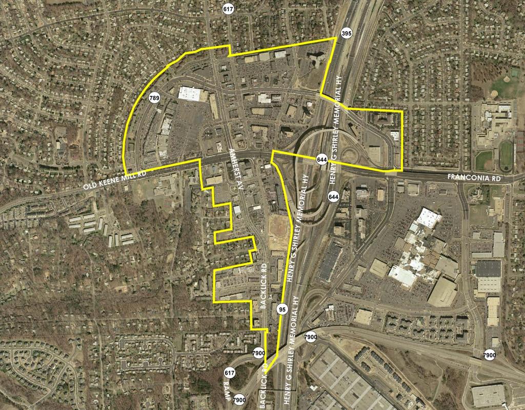
19 Springfield CRD 18

20 Springfield Connectivity Study Springfield Connectivity Study Area 1,400 Acres NW Quadrant/ CBC North SW Quadrant/ CBC South Springfield Mall GSA/ WMATA Station Area Planning For The Future Managing Our Growth Gateway Placemaking Theme/Branding Landscaped Roadway Corridors Organized Open Spaces Natural Systems Recreation Ecosystem 19

21 Tysons Corner Collective Vision for a Positive and Exciting Future 12 th largest Business Center in the United States Four new Metro stations present opportunity to transform Tysons In 2005, the Board authorized a study to evaluate the area s transportation system and land use, and created the 36 member Tysons Land Use Task Force September 2007, Task Force presented findings to the Board Planning Commission committee working with staff and community to develop Plan language Public Hearings Spring 2010 OCRR role: Participation in Plan Amendment; Responsible for Urban Design text and streetscape plans; responsible for detailed Design Guidelines following Plan adoption; lead in funding mechanisms and strategies, including an ownership entity, required to bring plan to fruition 20
22 APRs/Development Review Springfield Mall Heights of Groveton Markham Place Columbia Crossroads McLean Main Street


 SF residential, 2200 Units 1,000,000 (1,487,000)")
23 Springfield Mall Town Center Current Conditions Mixed Use Town Center Walkable, Livable Community Looking South Toward Main Mall $1.2 billion redevelopment of 80 acre Springfield Mall Bounded by Spring Mall Road, Loisdale Road, Franconia Road, & Frontier Drive; easy access to I-95; and, Franconia-Springfield Metro Project Components: 2,100,000 (2,166,000) SF retail 2,180,000 (2,240,000) SF residential, 2200 Units 1,000,000 (1,487,000) SF office 360,000 SF Hotel, 300 rooms 22


24 The Heights of Groveton Architectural Rendering Office and Retail Available Fall 2010 $100 million 360,000 SF mixed use redevelopment 4.6 acre, former Groveton School site, at Richmond Highway and Memorial Street, 1.5 miles from Huntington Metro Station Project components: 5-story 50,000 SF office building with 1 st floor retail 6-story residential building with 1 st floor retail 20,000 SF Retail Total Outdoor courtyard with pool Entertainment area 290 luxury rental units Grilling-picnic facilities Fitness center Structured parking Cyber café Current Conditions Land Swap for South County Center 23
 Certified Building in Fairfax County 4 acre site, 1-block from Markham Street intersection with Little River Turnpike Project components:")

25 Markham Plaza $14 million mixed use project Current Conditions (Bowling Alley) One of the First Leadership in Energy and Environmental Design (LEED) Certified Building in Fairfax County 4 acre site, 1-block from Markham Street intersection with Little River Turnpike Project components: 305,000 SF development 9 story building 80,000 SF retail and restaurant space 185,000 SF office, bottom three floors 80 residential units, top three floors 8-10 residences set aside for workforce housing 815 space parking garage Architectural Rendering - Bird s Eye View of New Building & Plaza 24


 $60 million mixed")

26 Columbia Crossroads Mixed-Use Development (PPEA Project) Current Conditions Baileys Crossroads Charette Study Area 5.9 acre consolidated site on Columbia Pike Weissberg Corporation, Owner/Developer4.2 acres Fairfax County Government, Owner1.7 acres Public-Private Partnership (PPEA) $60 million mixed use redevelopment Project Proposed Development Project components: 170,000 SF East County Government Center 300+ residential units 60,000-90,000 SF retail Public plaza/park Bohler Engineering 25

27 McLean Main Street Project Old Dominion Dr. Beverly Rd Location of proposed Main Street Sub Area 6 Sub Area 5 Ingleside Ave Chain Bridge Rd 26


28 McLean Main Street Project Key downtown McLean mixed use redevelopment project 15 acre assemblage bounded by Beverly Road, Old Dominion Drive, Chain Bridge Road & Ingleside Avenue OCRR Facilitated Community Outreach Presentations and Visioning Sessions to Obtain Stakeholder Input and Encourage the Exchange of Ideas Summer 2009 conceptual design and planning McLean Main Street Public Forum 27

29 Urban Design TYSONS CORNER STREETSCAPE

30 Urban Design JEFFERSON MANOR / HUNTINGTON METRO STATION STUDY


31 Urban Design NORTH COUNTY GOVERNMENT CENTER STUDY BARON CAMERON AVE POSSIBLE RESIDENTIAL DEVELOPMENT NCGC ART / COMM LIBRARY POLICE PARK Police Parking Public Parking Fuel BOWMAN TOWNE DR LIBRARY ST NEW DOMINION PKWY


32 Urban Design ANNANDALE DESIGN GUIDELINES
33 Public Financing Options Plan efforts in Tysons, Springfield and other areas require the county to look at new ways to fund public facilities Proffers Historical source of provision of public facilities related to development proposals Proffers do not address improvements that exceed the ability of the project to provide General Obligation Bonds Typically for large scale area-wide improvements (transportation) Smaller area improvements of general benefit on public land (streetscapes) Transportation Improvement Districts Large projects of general benefit to all area users (Route 28, Dulles Rail) Voluntary tax by petition of landowners 32
34 Public Financing Options Sanitary Districts Broad range of purposes ( water supply, garbage disposal, public facilities, transportation, parks, streets, bridges, etc) Broad range of revenue options (access fees, special annual taxes) to finance operating costs (McLean and Reston Community Centers) Uniform taxation with no direct General Fund or debt impact Public Private Partnerships Public Private Education Facilities and Infrastructure Act of 2002 (PPEA) allows local governments to partner with the private sector for qualifying projects Used for provision of specific public facilities where there is a confluence of public need and private profit (public school facility, public building, affordable housing, public safety equipment/improvements, communication infrastructure, utility and telecommunications, etc.) 33
35 Public Financing Options Community Development Authorities (CDA) /Tax Increment Financing (TIF) Established by petition of majority of owners (51%) Provides for broad range of infrastructure and services Flexible tool, funded by ad valorem special taxes or special assessments, as negotiated with petitioners; obligates portion of future additional tax revenue generated by the development On April 27, 2009, County adopted its first CDA with a TIF Used to assist in funding projects that would not otherwise occur without such assistance ( but for test) Service Districts Generally service oriented, but certain infrastructure may be funded Option for continuing maintenance and/or operating support Ad valorem tax 34


 507,000 SF retail 20,000 SF office")
36 Public/Private Partnerships Edens & Avant Town Center Architectural Rendering Current Condition $750 million mixed use redevelopment project million SF total project 27 acre site continues Main Street Town Center theme County s first CDA/TIF Site Plan Project components: 878,000 SF residential (926 units) 507,000 SF retail 20,000 SF office 120,000 SF theater 1.67 acres parkland 5,700 space underground parking 35
 Development 15-acre site bounded by I-66, Gallows")
 720 Class A Apartments (8%")


37 Dunn Loring Metro Project Trammel Crow Residential and WMATA Planned Mixed Use Residential (PRM) Development 15-acre site bounded by I-66, Gallows Road & Prosperity Avenue Project components: Road Improvements: 3 Residential Towers (One 13-story; Two 6-story) 720 Class A Apartments (8% ADU Workforce Housing) 1,150 Underground parking spaces 125,000 SF Ground level retail 2,000 Space structured parking stacked over retail 8 Bus Bays 40 space Kiss & Ride Additional lanes on Gallows and Prosperity Turning lanes with signals at Merille Drive New signal locations and 36 rebuilt signals at current location
 6,000 SF Multi-Purpose/Multi-Use Community Facility On-Site")
38 The Residences at the Government Center Architectural Rendering $50 million dollar residential development project PPEA between JPI and Fairfax County Government Located on Monument Drive on the Fairfax County Government Center campus Project Components: 270 housing units Workforce Housing, and Residential Studio (200,000 SF) 6,000 SF Multi-Purpose/Multi-Use Community Facility On-Site Parking 37
39 Tysons Lead on team to identify sources of funding for needed transportation improvements Lead on The Tysons Partnership, ownership entity called for by the Task Force to keep the Vision of the Plan
40 Challenges Funding for initiatives such as streetscapes, façade improvements, undergrounding utilities, etc. Current economic conditions affect how long it will take to implement community vision Change in philosophy from reliance on developers to make public improvements to ways that the County can assist developers in implementing their projects. Identifying and assisting areas beyond the original 7 CRDs/CRAs


41 OCRR Making a Difference 7-Corners Pedestrian Walkway Stakeholder Meetings Annandale Streetscape Ribbon Cutting ULI Studies CRD-CRA Bus Tours Before Honoring History Phase II Springfield Streetscape Project After Façade Improvement Program 40
42 Want More Information? Contact Us! Office of Community Revitalization and Reinvestment (OCRR) Government Center Parkway (Herrity Building) Suite 1048 Fairfax, Virginia Fairfax County is committed to nondiscrimination on the basis of disability in all County programs, services and activities. Special accommodations will be provided upon request. For information call or TTY
McLean Main Street Public Forum Exchange of Ideas
 McLean Main Street Public Forum Exchange of Ideas Sponsored & Hosted by McLean Planning Committee John W. Foust, Dranesville District Supervisor Fairfax County Office of Community Revitalization and Reinvestment
TEMPLE MEDICAL & EDUCATION DISTRICT
 City of Temple, Texas TEMPLE MEDICAL & EDUCATION DISTRICT 1 Description. The City of Temple joined in partnership with key public and private entities to jointly promote education and medical activities
40 Years of Smart Growth Arlington County s Experience with Transit Oriented Development in the Rosslyn-Ballston Metro Corridor
 40 Years of Smart Growth Arlington County s Experience with Transit Oriented Development in the Rosslyn-Ballston Metro Corridor A presentation by the Arlington County Department of Community Planning,
VOLUME II DISTRICT DESIGN GUIDELINES BAILEYS CROSSROADS SEVEN CORNERS
 VOLUME II DISTRICT DESIGN GUIDELINES BAILEYS CROSSROADS SEVEN CORNERS SEPTEMBER 2018 ACKNOWLEDGEMENTS FAIRFAX COUNTY BOARD OF SUPERVISORS Sharon Bulova, Chairman Penelope A. Gross, Vice Chairman - Mason
Status Update (2006 vs. Now) Citizen s Advisory Committee February Plan for Prosperity
 Citizen s Advisory Committee February Plan for Prosperity") Status Update (2006 vs. Now) Citizen s Advisory Committee February 2018 Plan for Prosperity 2000 2017 2000 2017 Gardnerville Population 6,000 5,760 5746 5,500 5,000 5,067 5,550 5,165 5,394 5,412 5,250
Status Update (2006 vs. Now) Citizen s Advisory Committee February 2018 Plan for Prosperity 2000 2017 2000 2017 Gardnerville Population 6,000 5,760 5746 5,500 5,000 5,067 5,550 5,165 5,394 5,412 5,250
EXHIBIT A. Tax Increment Reinvestment Zone No. 1 (Town Center) First Amended Project Plan 1
 First Amended Project Plan 1") EXHIBIT A Tax Increment Reinvestment Zone No. 1 (Town Center) First Amended Project Plan 1 1 As amended by Resolution No. 2008-02-001(TR1R) of the Tax Increment Reinvestment Zone No.1, and approved to
EXHIBIT A Tax Increment Reinvestment Zone No. 1 (Town Center) First Amended Project Plan 1 1 As amended by Resolution No. 2008-02-001(TR1R) of the Tax Increment Reinvestment Zone No.1, and approved to
2.7 ac park. TOTAL 5,403 DU 1,297,900 sf 1,105,450 sf 3.87 ac 5,563 DU 1,121,200 sf 1,105,450 sf 3.87 ac
 PLAN AMENDMENT 2013-I-B1: SEVEN CORNERS SPECIAL STUDY Summary of Pre-staffing Comments Planner: Bernard Suchicital bsuchi@fairfaxcounty.gov (703) 324-1254 Background On October 29, 2013, the Board of Supervisors
Review of Opportunity Area C Draft Comprehensive Plan and Draft BOS Follow-On Motions. Special Working Group Meeting March 4, 2015
 Review of Opportunity Area C Draft Comprehensive Plan and Draft BOS Follow-On Motions Special Working Group Meeting March 4, 2015 The slides that follow identify where the draft Comprehensive Plan has
ARLINGTON COUNTY, VIRGINIA
 ARLINGTON COUNTY, VIRGINIA County Board Agenda Item Meeting October 15, 2005 DATE: September 28, 2005 SUBJECT: Request to Advertise the adoption of the 2005 Clarendon Sector Plan C. M. RECOMMENDATION:
ANC 2A Presentation. November 9, 2006
 ANC 2A Presentation November 9, 2006 Introduction & Overview Applicants Boston Properties and KSI Services (project developers) The George Washington University (land owner) 2.66 acre site (former GW hospital
8implementation. strategies
 PROGRAM STRATEGIES 8implementation strategies T he implementation actions of this chapter are designed to support and carry out the land use, economic development, transportation, urban design, and program
Beachside Redevelopment Committee
 Beachside Redevelopment Committee DRAFT FINAL RECOMMENDATIONS MARCH 22, 2018 This is a new slide 2 This is a new slide Table of Contents I. Introduction and Overview II. III. Community Improvements and
Implementation Guide Comprehensive Plan City of Allen
 Implementation Guide 2030 Comprehensive Plan City of Allen DRAFT 2015 Implementation Guide Allen 2030 Comprehensive Plan INTRODUCTION The Comprehensive Plan serves as a guide for the growth and development
WHEREAS, the current Comprehensive Plan was adopted in 2005; and
 RESOLUTION 2018-06 RESOLUTION TO AMEND THE CITY S COMPREHENSIVE PLAN TO (1) AMEND CHAPTER 4 TO ADD A SPECIAL REVITALIZATION DISTRICT FOR EDUCATION AND ECONOMIC DEVELOPMENT ; (2) DESIGNATE ON THE FUTURE
ROBBINSDALE LRT STATION CDI DEVELOPMENT GUIDELINES
 August 2018 OVERVIEW The City of Robbinsdale has a prime-opportunity site in the middle of the 13 mile stretch of the Bottineau LRT corridor / Blue Line extension. Robbinsdale offers a prominent, vital,
Potential Green Infrastructure Strategies May 6, 2015 Workshop
 Potential Green Infrastructure Strategies May 6, 2015 Workshop Background The City of Cortland is developing the Tioughnioga Urban Headwaters Green Infrastructure Action Plan with funding from the National
The University District envisions, in its neighborhood
 Envisioning the University District Link Light Rail in Seattle s neighborhoods CIY OF SEALE CONCEP-LEVEL SAION AREA PLANNING RECOMMENDAION RESOLUION # 30165 EXHIBI L Vision 08.2000 he University District
City of Bristol Route 6 Corridor Implementation Program
 City of Bristol Route 6 Corridor Implementation Program FITZGERALD & HALLIDAY, INC. Innovative Planning, Better Communities June 2017 Route 6 Corridor Plan IMPLEMENTATION PROGRAM The following Implementation
Robbinsdale LRT Station. CDI Development Guidelines. August Overview
 Robbinsdale LRT Station August 2018 Overview The City of Robbinsdale may have the coolest opportunity site along the 13 mile stretch of the Bottineau LRT corridor / Blue Line extension. Located a block
Northwest Rail Corridor and US 36 BRT Development Oriented Transit Analysis 4.4 STATION AREA FINDINGS
 4.4 STATION AREA FINDINGS Each station is different, and each one requires a separate set of recommendations based on the vision for the site. This section outlines an initial TOD strategy and recommendations
City of Fort Lauderdale UPTOWN URBAN VILLAGE. Public Workshop December 7, 2016
 Public Workshop December 7, 2016 Workshop Agenda Introductions Project Presentation o o o History Project Scope/Timeline Character of Study Area o o o o Land Use Public Realm/Pedestrian Mobility Multimodal
CHAPTER 1. Ms. Guajardo s Class - Central Elementary CH 1 1
 INTRODUCTION CHAPTER 1 Ms. Guajardo s Class - Central Elementary CH 1 1 1.1 SETTING South Centre City is a linear corridor south of Downtown Escondido paralleling Centre City Parkway and South Escondido
Downtown Dubuque...it s a great time.
 Downtown Dubuque...it s a great time. Your timing could not be better to invest in Downtown. With hundreds of millions in public and private investment occurring on the City s downtown waterfront, millions
Illustration of Eastlake Farmer s Cooperative Grain Elevator. Chapter 5: implementation 5-1
 Illustration of Eastlake Farmer s Cooperative Grain Elevator Chapter 5: implementation 5-1 chapter 5: implementation Introduction The Eastlake Subarea Plan includes a wide range of recommendations intended
Public input has been an important part of the plan development process.
 Lakewood s Comprehensive Plan recognizes that transportation helps shape the community, and that the way the community provides for the safe and efficient movement of people affects the character of the
The Village of Shirlington
 The Village of Shirlington Suburban Smart Growth Without Rail Transit July 2018 Agenda History (1940 to present) Attributes and Outcomes Lessons Learned Setting the Stage Arlington County Arlington is
Strategic Growth Area #1 Northampton Boulevard Corridor Area
 Strategic Growth Area #1 Northampton Boulevard Corridor Area Description Strategic Growth Area #1 has established itself as a major employment center in Southside Hampton Roads. Opportunities exist to
ULI St. Louis Technical Assistance Panel
 ULI St. Louis Technical Assistance Panel ULI St. Louis Technical Assistance Panel Sponsored by: Citizens for Modern Transit in partnership with METRO ULI St. Louis Mission Statement The mission of the
PLAN ELEMENTS WORKSHOP. April 5, 2016
 PLAN ELEMENTS WORKSHOP April 5, 2016 needs more housing. But there is no one-size fits-all solution. Every neighborhood has its own character. In some places, density is not only appropriate it is badly
Status Report: MD 355 Project
 Status Report: MD 355 Project OCTOBER 2006 M-NCPPC MONTGOMERY COUNTY PLANNING DEPARTMENT Summary of Community Comments, and break to the Results of the MD 355 Participation Session Brookside Gardens -
The Baileys Planning District portion of the Comprehensive Plan contains site design recommendations for both the Baileys Crossroads Community
 The Baileys Planning District portion of the Comprehensive Plan contains site design recommendations for both the Baileys Crossroads Community Business Center and the Seven Corners Community Business Center.
PLANNING IN ARLINGTON. Briefing to Katie Cristol
 1 PLANNING IN ARLINGTON Briefing to Katie Cristol Overview 2 Comprehensive Plan - Background Administration of the Comprehensive Plan Review of the Comprehensive Plan Implementation of the Comprehensive
Project Overview. Get Involved. Public Information Meeting. Contact Information
 Get Involved VDOT representatives will review and evaluate information received as a result of this meeting. Please fill out the comment sheet provided in this brochure if you have any comments or questions.
CHAPTER 7: Transportation, Mobility and Circulation
 AGLE AREA COMMUNITY Plan CHAPTER 7 CHAPTER 7: Transportation, Mobility and Circulation Transportation, Mobility and Circulation The purpose of the Transportation, Mobility and Circulation Chapter is to
Town of Avon Village Center. A New Village Center for Avon October, 2015
 Town of Avon Village Center A New Village Center for Avon October, 2015 A busy Avon Center approx. 1940 The Avon Town Center Study: In 2004 the Planning and Zoning Commission (PZC) undertook the Avon
Pedestrian and Bike Bridge LOGO
 6.2.2 Pedestrian and Bike Bridge The proposed pedestrian and bike crossing re-envisions the existing bridge at Pismo Creek on Cypress Street. The bridge is currently underutilized by vehicular through
edmonton.ca/ribbonofgreen #ribbonofgreen
 WHAT IS THE RIBBON OF GREEN? The Ribbon of Green is Edmonton s entire river valley and ravine system. The Ribbon of Green (2018) Project will provide strategic guidance for the southwest and northeast
THE 355/270 CORRIDOR:
 THE 355/270 CORRIDOR: Strategic Ideas for Sustaining a Livable Work Place Project Summary ACCESS LIFE DESIGN HEALTH WORK Montgomery County Planning Department The Maryland-National Capital Park and Planning
TOWN COUNCIL / PLANNING COMMISSION
 Workshop #3 TOWN COUNCIL / PLANNING COMMISSION January 20, 2011 Consultant Team In Attendance Tonight BMS Design Group Nevada City and San Francisco Michael Smiley, AICP, ASLA Partner-in-Charge Nancy L.
Silver Line CPAM UPDATE. Transportation and Land Use Committee October 14, 2016
 Silver Line CPAM UPDATE Transportation and Land Use Committee October 14, 2016 Purpose Recap Project History and Map Changes Provide Overview of CPAM Components Discuss Transportation Impacts Discuss Fiscal
Developer s Program. The Station at East 54
 Developer s Program The Station at East 54 Existing Conditions The Station at East 54 is proposed for a 1.12 acre site at the northeast corner of Hamilton Road and Prestwick Road, tucked between the East
Planning Districts INTRODUCTION
 INTRODUCTION To facilitate detailed examination of development prospects for all areas of the community, Delano has been divided into 14 planning districts. The location of these planning districts is
JANUARY 19, 2011 CENTRAL AVENUE-METRO BLUE LINE TRANSIT-ORIENTED DEVELOPMENT IMPLEMENTATION PROJECT COMMUNITY FORUM
 CENTRAL AVENUE-METRO BLUE LINE TRANSIT-ORIENTED DEVELOPMENT IMPLEMENTATION PROJECT COMMUNITY FORUM JANUARY 19, 2011 THE MARYLAND-NATIONAL CAPITAL PARK AND PLANNING COMMISSION PRINCE GEORGE S COUNTY PLANNING
S C O P E O F W O R K A P R I L
 white flint 2 sector plan S C O P E O F W O R K A P R I L 2 0 1 2 MONTGOMERY COUNTY PLANNING DEPARTMENT M-NCPPC MontgomeryPlanning.org 1 white flint 2 sector plan Scope of Work abstract This scope of work
Jason D. Sutphin, Community Development Division Chief. Through: Brooke Hardin, Director of Community Development and Planning
 Meeting Date: 12/18/2017 Agenda Item: 9a. MEMORANDUM To: Chairman Cunningham and Members of the Planning Commission From: Jason D. Sutphin, Community Development Division Chief Through: Brooke Hardin,
HISTORIC TOWN CENTER MASTER PLAN CITY COUNCIL PRESENTATION APRIL 3, 2012
 HISTORIC TOWN CENTER MASTER PLAN CITY COUNCIL PRESENTATION APRIL 3, 2012 REQUESTED CITY COUNCIL ACTIONS Certification of the Final Program Environmental Impact Report (PEIR); and, Approval of General Plan
Prince George s County Economic Development Corporation David Iannucci President & CEO
 Prince George s County Economic Development Corporation David Iannucci President & CEO WBC REGIONAL ECONOMIC DEVELOPMENT FORUM THE FUTURE OF PRINCE GEORGE S COUNTY Wednesday, March 6, 2019 Why Prince George
The Atlanta BeltLine. Quarterly Briefing March @atlantabeltline. Reynoldstown Senior Affordable Housing
 The Atlanta BeltLine Quarterly Briefing March 30, 2017 @atlantabeltline @atlantabeltline @atlantabeltline Reynoldstown Senior Affordable Housing Framework for a multi-use and transit corridor in the heart
DRAFT PLAN PRESENTATION
 DRAFT PLAN PRESENTATION 1.23.2018 AGENDA Process Project Schedule Results from Visioning Workshop Draft Plan Highlights Concept Plans Feedback Next Steps PROJECT SCHEDULE KICK-OFF WORKSHOP August 29 th
DOMINION BOULEVARD CORRIDOR STUDY AND ECONOMIC DEVELOPMENT STRATEGIC PLAN A MODEL FOR CHESAPEAKE S FUTURE
 DOMINION BOULEVARD CORRIDOR STUDY AND ECONOMIC DEVELOPMENT STRATEGIC PLAN A MODEL FOR CHESAPEAKE S FUTURE Overview I. Draft Plan Process II. Draft Plan Overview a. Market Analysis b. Master Land Use Plan
QUINCE ORCHARD/FIRSTFIELD CORRIDOR CITY OF GAITHERSBURG MTAP 2017
 QUINCE ORCHARD/FIRSTFIELD CORRIDOR CITY OF GAITHERSBURG MTAP 2017 ULI LEADERSHIP INSTITUTE 2017 The Team Allison Davis, WMATA Daniel Park, Rodgers Consulting Debbie Albert, Arlington County Harry Ross,
Rio/29 Future Land Use Alternatives. Rio/29 Small Area Plan Phase 1 December 12, 2016
 Rio/29 Future Land Use Alternatives Rio/29 Small Area Plan Phase 1 December 12, 2016 PRESENTATION OVERVIEW 1 BACKGROUND 2 COMMUNITY INPUT 3 DESIGN PRINCIPLES 4 5 ALTERNATIVES OPEN HOUSE 2 1 PROJECT BACKGROUND
The Auburn Plan Designing the Future of Auburn February 28, 2005
 The Auburn Plan Designing the Future of Auburn February 28, 2005 Block-by-Block Bicycle Tour Aerial survey Focus Group Meetings September 7 and 8 Design Workshops October 11, 14, and 21 Revitalization
NASSAU COUNTY TOWN HALL NEW YORK & CONNECTICUT SUSTAINABLE COMMUNITIES. A Unique Bi-State Partnership to Improve Jobs, Housing and Transportation
 NASSAU COUNTY TOWN HALL NEW YORK & CONNECTICUT SUSTAINABLE COMMUNITIES A Unique Bi-State Partnership to Improve Jobs, Housing and Transportation Police Headquarters Auditorium Mineola, NY December 9 th,
Cumberland Region Tomorrow is a private, non-profit, citizen based regional organization working with Greater Nashville Regional Council
 Cumberland Region Tomorrow is a private, non-profit, citizen based regional organization working with Greater Nashville Regional Council and others in the public and private sectors, dedicated to planning
Mark-up of the effect of the proposed Bronte Village Growth Area OPA No.18 on the text of section 24, Bronte Village, of the Livable Oakville Plan
 Mark-up of the effect of the proposed Bronte Village Growth Area OPA No.18 on the text of section 24, Bronte Village, of the Livable Oakville Plan Notes: This document is provided for information purposes
2030 Comprehensive Plan VISION STATEMENT
 RESOURCE DOCUMENT for Steering Committee Meeting #2 July 12, 2017 2030 Comprehensive Plan VISION STATEMENT Steering Committee from 2008 Established the Lauderdale s Vision as: Creating a livable, lovable
The Private Role in a Public-Private Partnership. Ask Me Anything Conference May 30, 2018
 The Private Role in a Public-Private Partnership Ask Me Anything Conference May 30, 2018 1 Thoughts to Share Today Schmit+Associates Essential Elements of a P3 Community Vision Market Demand Economic Viability
GPA FALL 2017 CONFERENCE
 Change in Doraville Doraville at the beginning of a new era Design Doraville (Comp. Plan) adopted in 2016 Doraville Town Center Masterplan LCI (2005) Downtown Doraville Masterplan LCI (2010) 2014 Adoption
Downtown Whitby Action Plan
 Downtown Whitby Action Plan Final Report October 2016 Table of Contents Introduction 1 Public Consultation 2 Walkability 3 Downtown Whitby Walkability Map 4 Vision 5 Goal & Objectives 6 Objective 1 7 Objective
1.0 Purpose of a Secondary Plan for the Masonville Transit Village
 Report to Planning and Environment Committee To: Chair and Members Planning & Environment Committee From: John M. Fleming Managing Director, Planning and City Planner Subject: Masonville Transit Village
THAT the attached Terms of Reference for the Thornhill Centre Street Study be approved.
 COMMITTEE OF THE WHOLE AUGUST 18, 2003 THORNHILL CENTRE STREET STUDY PLANNING FILE: 15.92 Recommendation The Commissioner of Planning recommends: THAT the attached Terms of Reference for the Thornhill
CITY OF NORCROSS LILLIAN WEBB PARK REDEVELOPMENT AREAS
 7/2/2016 CITY OF NORCROSS LILLIAN WEBB PARK REDEVELOPMENT AREAS 2016 Potential Development Around Lillian Webb Park The Lillian Webb Park Development Project is located north of Buford Highway; east of
AMENDMENT TO THE COMPREHENSIVE PLAN (2007 EDITION) The following changes to the Comprehensive Plan have been adopted by the Board of Supervisors.
 The following changes to the Comprehensive Plan have been adopted by the Board of Supervisors.") Amendment No. 2007-23 Adopted June 22, 2010 AMENDMENT TO THE COMPREHENSIVE PLAN (2007 EDITION) The following changes to the Comprehensive Plan have been adopted by the Board of Supervisors. REPLACE: Fairfax
Amendment No. 2007-23 Adopted June 22, 2010 AMENDMENT TO THE COMPREHENSIVE PLAN (2007 EDITION) The following changes to the Comprehensive Plan have been adopted by the Board of Supervisors. REPLACE: Fairfax
Arlington County Long Range Planning Committee Meeting
 Arlington County Long Range Planning Committee Meeting Preliminary FY2015 Planning Division Work Program A presentation by the Arlington County Department of Community Planning, Housing and Development,
THE TOWN OF WASAGA BEACH
 THE TOWN OF WASAGA BEACH Downtown Development Master Plan Committee of the Whole Presentation January 26 th 2017 Uses within this designation should reflect a dependence on tourism as opposed to the permanent
LOS ANGELES CITY PLANNING DEPARTMENT STAFF REPORT
 LOS ANGELES CITY PLANNING DEPARTMENT STAFF REPORT LOS ANGELES CITY PLANNING COMMISSION CASE NO: CPC 2006-9374 CRA CEQA: Exempt DATE: December 21, 2006 Location: Valley Plaza and Laurel Plaza TIME: after
CHAPTER VIII Implementation
 CHAPTER VIII Implementation VIII. Implementation The vision for the Marlboro Pike Corridor will require that a variety of participants work together to make it a reality. The following action steps outline
RESOLUTION NO. R Refining the route, profile and stations for the Downtown Redmond Link Extension
 RESOLUTION NO. R2018-32 Refining the route, profile and stations for the Downtown Redmond Link Extension MEETING: DATE: TYPE OF ACTION: STAFF CONTACT: Capital Committee Board PROPOSED ACTION 09/13/2018
Olde Towne Vision Plan
 Olde Towne Vision Plan Introduction In 2016, the City of Bellevue will complete its move of City offices from Olde Towne Bellevue to its new municipal complex on Wall Street. The City intends to sell its
South Davis County COMMUNITY SPOTLIGHT
 South Davis County COMMUNITY SPOTLIGHT Davis/SLC Community Connector Bus Rapid Transit line connecting SLC & Davis County RTP Phase 1 Project Generate 3,100 average weekday riders Relieve congestion on
Washington Plaza at the. Lake Anne Village Center
 Lake Anne Village Center Washington Plaza Design Charrette Washington Plaza at the Lake Anne Village Center Process and Recommendations Presentation to the Reston Association Board of Directors January
City Center Specific Plan Amendments And Background Report City of Richmond. PLANNING COMMISION FINAL DRAFT January, 2001
 City Center Specific Plan Amendments And Background Report City of Richmond PLANNING COMMISION FINAL DRAFT January, 2001 TABLE OF CONTENTS Page LIST OF TABLES... LIST OF FIGURES... INDEX... OVERVIEW...
Introduction. Chapter 1. Purpose of the Comprehensive Plan Plan Organization Planning Process & Community Input 1-1
 Chapter 1 Introduction Lakewood 2025: Moving Forward Together Purpose of the Comprehensive Plan Plan Organization Planning Process & Community Input 1-1 Purpose of the Comprehensive Plan The Comprehensive
SW Ecodistrict A VISION PLAN FOR A MORE SUSTAINABLE FUTURE June 25, 2013
 Urban Land Institute The Past, Present and Future of Sustainable Urbanism in Southwest DC SW Ecodistrict A VISION PLAN FOR A MORE SUSTAINABLE FUTURE June 25, 2013 Study Area The National Mall DOE FAA FAA
CRYSTAL CITY BLOCK PLAN # CCBP- G 1 DRAFT
 CRYSTAL CITY BLOCK PLAN # CCBP- G 1 DRAFT BLOCK G (Metro Market Square block) Long Range Planning Committee Meeting January 29, 2018 1 1. Introduction 2 1. LRPC Meeting Purpose Review of proposed Crystal
Mini Technical Assistance Panel. Rock Spring Park
 Mini Technical Assistance Panel Rock Spring Park May 22, 2013 The Team Jason Bonnet, Forest City Washington Matthew Flis, Town of Vienna William Herbig, National Capital Planning Commission Sophie Lambert,
MONTGOMERY COUNTY METRO STATION AREA DESIGN CHARRETTE
 MONTGOMERY COUNTY METRO STATION AREA DESIGN CHARRETTE Shady Grove Metro Station Area Charrette Closing Presentation October 25-28, 2000 MONTGOMERY COUNTY, MD M-NCPPC Design Collective, Inc. Architects
TRANSIT ORIENTED DEVELOPMENT PINELLAS COUNTY MPO LIVABLE COMMUNITIES INITIATIVE PINELLAS COUNTY COMPREHENSIVE PLAN AMENDMENTS
 PINELLAS COUNTY MPO LIVABLE COMMUNITIES INITIATIVE MODEL LAND DEVELOPMENT CODE TRANSIT ORIENTED DEVELOPMENT PINELLAS COUNTY COMPREHENSIVE PLAN AMENDMENTS MPO Livable Communities Initiative Goal: Improve
DRAFT. Urban Development Areas Fairfax County. UDA Needs Profile: Tysons Corner 13% Location Characteristics. Socio-Economic Characteristics
 14 Urban Development Areas Fairfax County UDA Needs Profile: Tysons Corner Tysons Corner is located in Fairfax County, surrounded by the town of McLean to the east and Vienna on the west along I-495, the
Cherokee. Corporate Headquarters 111 East Hargett Street Suite 300 Raleigh, NC
 Cherokee Corporate Headquarters 111 East Hargett Street Suite 300 Raleigh, NC 27601 919-743-2500 Denver 4600 S. Ulster Street Suite 500 Denver, CO 80237 303-689-1460 London 41-43 Maddox Street London W1S
Long Lost Allies? Walking Advocates & Business District Organizations. Matt Kazinka Lake Street Council. Shaina Brassard Seward Redesign
 Long Lost Allies? Walking Advocates & Business District Organizations Shaina Brassard Seward Redesign Rob Hanson West Broadway Business and Area Coalition Matt Kazinka Lake Street Council Jamie Schumacher
CHAPTER 3 VISION, GOALS, & PLANNING PRINCIPLES. City of Greensburg Comprehensive Plan. Introduction. Vision Statement. Growth Management Goals.
 CHAPTER 3 VISION, GOALS, & PLANNING PRINCIPLES Introduction The Greensburg Comprehensive Plan is intended as a working community document. A combination of long and short-term goals, this document is intended
Implementation Status Jan 2013
 Implementation Status Jan 2013 Key Red Strikethrough: Green Text: Black Text: Completed Project has been initiated or is underway No action Circulation & Linkages Goal A: To establish safe and efficient
Route 1 Corridor Study
 Route 1 Corridor Study Westbrook, Connecticut A Vision for the Connecticut Shoreline Public Informational Meeting July 28, 2015 Lower Connecticut River Valley Council of Governments Fitzgerald & Halliday,
City of Lake Mary, Florida. Evolution of a Historic Downtown with Transit Oriented Development Strategies
 City of Lake Mary, Florida Evolution of a Historic Downtown with Transit Oriented Development Strategies What is Transit Oriented Development? Walkable villages located at and around transit stations in
FUTURE LAND USE ELEMENT
 FUTURE LAND USE ELEMENT GOAL I: To create and sustain a great place to live, play, and prosper Objective 1: The City of Ocala shall incorporate the principles and strategies of the Ocala 2035 Vision into
Welcome to Greenwood Village Corporate Capital of Colorado
 Welcome to Greenwood Village Corporate Capital of Colorado Greenwood Village Setting Incorporated: 1950 Land Area: 8.4 sq. miles + / - Budget $35M Debt $0 Reserve $20M Population Daytime: 50,000 Residents:
City of Long Beach. creating vibrant and exciting places
 City of Long Beach creating vibrant and exciting places Land Use Element Urban Design Element Overview of the two draft General Plan elements Discuss areas of change Economic goals of the plans Case study
PORT CLINTON DOWNTOWN REVITALIZATION PLAN
 The City has been awarded a $2.34 million Ohio Department of Transportation (ODOT), Small Cities Grant for the complete reconstruction of Madison Street AWARD WINNING PROJECT Best of Lake Erie Award Lake
CONTEXT: the Highway, the River + the Railroads run through us.
 CONTEXT: the Highway, the River + the Railroads run through us. I-25 36 In the past they have divided us, now we have an opportunity to unite us. I-76 I-270 I-76 CSU I-25 LEGEND Cut + Cover River North
MALL REVITALIZATION CASE STUDIES
 MALL REVITALIZATION CASE STUDIES DECEMBER 9, 2012 MALL REVITALIZATION OVERVIEW Introduction Sample Case Studies prepared for Lacey Woodland District Steering Committee as it considers strategies to revitalize
MAIN STREET ECONOMIC DEVELOPMENT STRATEGY
 MAIN STREET ECONOMIC DEVELOPMENT STRATEGY A PATHWAY TO A BETTER POUGHKEEPSIE DRAFT Working Paper #2: Planning Strategies Submitted December 1 st, 2015 to the City of Poughkeepsie LAND USE LAW CENTER PACE
Stafford County Strategic Plans
 Stafford County Strategic s Strategic Department Description Date Adopted Board of Supervisors Priorities Fiscal Responsibility Education Public Safety Infrastructure Economic Development Service Excellence
City of Heath. Town Center Concept
 In the give-and-take of getting projects designed, financed, and approved, the famous refrain from the film Field of Dreams is heard often: if you build it, they will come. From the perspective of the
Midtown Greenway Land Use and Development Plan Executive Summary
 Midtown Greenway Land Use and Development Plan Executive Summary Introduction The Midtown Greenway Land Use and Development Plan sets policy direction for land use and development in the Midtown Greenway
Arlington County Retail Plan
 Arlington County Retail Plan Draft April 28, 2015 EXECUTIVE SUMMARY Arlington will be a community where retail is convenient, appealing, activating and sustainable; that provides interest and authenticity,
Town of Peru Comprehensive Plan Executive Summary
 Town of Peru Comprehensive Plan Executive Communities that plan grow by choice, not by chance. A plan makes growth thoughtful, understandable, and predictable. A plan shows that a community is managing
Transportation. Strategies for Action
 Transportation A major priority for the Overlake Neighborhood is to develop a multimodal transportation system. To achieve this system, a balance has to be found among travel, circulation and access needs;