CLAIREVILLE CONSERVATION AREA
|
|
|
- Cody Bruce
- 6 years ago
- Views:
Transcription

1 CLAIREVILLE CLAIREVILLE CONSERVATION AREA MANAGEMENT PLAN UPDATE
2 Table of Contents Table of ContentS LIST OF BOXES... iv LIST OF FIGURES... iv LIST OF MAPS... iv LIST OF TABLES... v EXECUTIVE SUMMARY... ES-1 SECTION 1: INTRODUCTION Overview Toronto and Region Conservation Toward A Living City Region Conservation Lands Claireville Conservation Area Claireville Conservation Area Management Plan Updating the Claireville Conservation Area Management Plan The Claireville Subcommittee Municipal Consultation Public Consultation SECTION 2: CURRENT CONDITIONS Land Use Land Use Changes at Claireville Conservation Area since Land Use Changes in the Surrounding Area since Claireville Conservation Area Policies, Plans and Other Studies Claireville Natural Area Enhancement Plan (2000) Claireville Reservoir and Surrounding Area Natural Enhancement Plan (January 2006; Draft) Claireville Lands Study Area Terrestrial Biological Inventory and Assessment (September 2006) Claireville Conservation Area Terrestrial Natural Heritage Assessment (May 2007) Claireville Conservation Area Conservation Land Ecosystem Management Projects 2007 and Heritage Impact Assessment Report on 8712 Claireville Conservation Road (July 2009) Claireville Dam Operation, Maintenance, Surveillance and Safety Manual (2009) TRCA Policies, Plans and Other Studies Terrestrial Natural Heritage System Strategy (2006) Pathways to a Healthy Humber (2008) Listen to Your River: A Report Card on the Health of the Humber River Watershed (2007) Humber River Fisheries Management Plan (2008) Municipal Policies, Plans and Other Studies Heritage Report, Statement of Reason for Heritage Designation: McVean Farm Site, McVean Drive, Claireville Conservation Area (PT Lot 7, Con 8, ND Toronto Gore) (November 2006) Claireville Bowstring Arch Bridge City of Brampton s PathWays Master Plan (2002) City of Brampton Parks, Culture & Recreation Master Plan City of Brampton Official Plan (October 2006) Regional Municipality of Peel Official Plan, Office Consolidation (November 2005) City of Toronto Official Plan, Consolidated (August 2007) I
3 Claireville Conservation Area Management Plan Update 2.5 Provincial Guidelines, Policies, Plans and Other Studies Greenbelt Plan Endangered Species Act Ontario Regulation 166/06 Development, Interference with Wetlands and Alterations to Shorelines and Watercourses (2006) Community Involvement Claireville Stewardship Group Friends of Claireville Claireville Community Environmental Stewardship Project Other Public Events and Participation SECTION 3: UPDATES TO THE MANAGEMENT PLAN Vision, Principles and Goals Vision Statement Guiding Management Principles and Goals Guidelines for Planning Land Use Changes Land Management Zones Determining the Land Management Zones Management Recommendations Land Management Zones Nature Reserve (98.34 hectares) Natural Environment ( hectares) Primary Restoration ( hectares) Public Use ( hectares) Residential Lease (0.40 hectares) Operations (0.77 hectares) Heritage Preserve (0.74 hectares) Agricultural Reserve (21.51 hectares) Special Management (2.52 hectares) Additional Guidelines and Recommendations Terrestrial Resources Aquatic Resources Cultural Heritage Resources Nature-based Public Use Conservation Education Stewardship and Outreach Operations and Conservation Area Management Conservation Land Use and Management Implementation, Monitoring and Review of the Management Plan II
4 Table of Contents SECTION 4: SITE SECUREMENT AND PROTECTION PLAN Securement and Protection Concerns Findings Gates and Access Points Encroachments Signs Fencing Safety Hazards Recommendations Implementation Corrective Actions Manswood Crescent Area Valleycreek Drive Area Trails Fencing and Gates Dumping Further Actions Next Steps SECTION 5: INTER-REGIONAL TRAIL ALIGNMENT Introduction Inter-regional Trail Alignment Trail Closures Hazards and Emergency Response Comprehensive Trail Plan SECTION 6: PLAN IMPLEMENTATION Management Plan Implementation Schedule Claireville Subcommittee Agency and Municipal Stewardship Private Land Stewardship Safety and Security Endorsement and Maintenance of the Management Plan Plan Review and Amendment APPENDIX A: ACCOMPLISHMENTS AT CLAIREVILLE CONSERVATION AREA SINCE AA-1 APPENDIX B: NATURAL AREA ENHANCEMENT PLAN (2000)... AB-1 APPENDIX C: CLAIREVILLE RESERVOIR AND SURROUNDING AREA NATURAL ENHANCEMENT PLAN... AC-1 APPENDIX D: CLAIREVILLE TERRESTRIAL NATURAL HERITAGE ASSESSMENT FINDINGS... AD-1 APPENDIX E: CLAIREVILLE CONSERVATION AREA LAND ECOSYSTEM MANAGEMENT PROJECTS AE-1 APPENDIX F: ROLES OF CONSERVATION AUTHORITIES IN THE CITY OF BRAMPTON S PARKS, CULTURE & RECREATION MASTER PLAN... AF-1 APPENDIX G: SITE SECUREMENT AND PROTECTION PLAN... AG-1 REFERENCES... R-1 III
5 Claireville Conservation Area Management Plan Update LIST OF BOXES Box 2.1: Key Findings from the Public Attitude Survey and Public and Stakeholder Events, City of Brampton PathWays Master Plan Box 2.2: Actions of the City of Brampton PathWays Campaigns LIST OF FIGURES Figure 3.1: Paul Flood Memorial Garden building parking lot detailed design, April LIST OF MAPS Map 1.1: Humber River Watershed Map 1.2: Location of Claireville Conservation Area Map 1.3: Land Uses, Claireville Conservation Area Map 1.4: Land Management Zones, Claireville Conservation Area, Map 2.1: Completed Habitat Restoration and Enhancement Projects, , Claireville Conservation Area Map 2.2: Requested permanent easement for a City of Brampton stormwater management facility Map 2.3: City of Brampton s recommended pathways system, Map 2.4: Greenbelt External Connections (River Valleys), Claireville Conservation Area Map 3.1: Land management zones, Claireville Conservation Area, Map 4.1: Location of temporary road, Claireville Conservation Area Map 4.2: Site securement and protection action sites, Claireville Conservation Area Map 5.1: Conceptual alignment for a Humber River inter-regional trail, western branch Map B.1: Wetland Restoration Sites, Claireville Natural Area Enhancement Plan... AB-1 Map B.2: Reforestation Sites, Claireville Natural Area Enhancement Plan... AB-2 Map B.3: Interior Habitat Restoration Sites, Claireville Natural Area Enhancement Plan... AB-3 Map B.4: Priority Restoration Sites, Claireville Natural Area Enhancement Plan... AB-4 Map C.1: Claireville Natural Area Enhancement Plan, Claireville Reservoir, Naturalization Plan AC-1 Map D.1: Recommended land management zone changes, based on Terrestrial Natural Heritage Assessment 2007, Claireville Conservation Area... AD-2 Map D.2: Restoration and management priority areas, Claireville Conservation Area... AD-6 Map E.1: Ecosystem management projects, Claireville Conservation Area, AE-1 Map G.1: Gates and access points, Site Securement and Protection Plan, Claireville Conservation Area... AG-1 Map G.2: Encroachment types, Site Securement and Protection Plan, Claireville Conservation Area... AG-2 Map G.3: Signage and other points of interest, Site Securement and Protection Plan, Claireville Conservation Area... AG-3 Map G.4: existing fencing types and conditions, Site Securement and Protection Plan, Claireville Conservation Area... AG-4 Map G.5: Fencing repair and installation schedule, Claireville Conservation Area, AG-5 IV
6 Table of Contents LIST OF TABLES Table 1.1: Land Uses and Property Management in Claireville Conservation Area, Table 1.2: Land Cover, Claireville Conservation Area, Table 2.1: Claireville Conservation Area Conservation Land Ecosystem Management Project, 2007 and Table 3.1: Claireville Conservation Area Land Management Zone Definitions, Table 3.2: land Management Zones at Claireville Conservation Area and Examples of Standard TRCA Permitted Uses Table 3.3: Land Management Zones, Claireville Conservation Area, Table 4.1: Classification of existing fencing, encroachments and gates Table 4.2: Site Securement and Protection Actions and Recommended Implementation Timelines Table 5.1: Summary of TRCA combined use trail design and construction guidelines Table 6.1: Implementation schedule, Claireville Conservation Area Management Plan Update Table D.1: Recommended Land Management Zone Changes, per Terrestrial Natural Heritage Assessment, Claireville Conservation Area... AD-1 Table D.2: Summary of Restoration and Management Priority Areas, per Terrestrial Natural Heritage Assessment, Claireville Conservation Area... AD-3 V
7 Executive Table of Summary Content EXECUTIVE SUMMARY Toronto and Region Conservation Authority (TRCA) last prepared a management plan for the Claireville Conservation Area (CCA) in One of the recommendations of the 1997 plan was to review and update the plan as required, approximately every five years. Since the endorsement of the 1997 CCA Management Plan, the CCA and its surrounding area have been subject to increased development pressure. Surrounding lands are being urbanized through residential, commercial, institutional and industrial development, as well as associated municipal infrastructure improvements. Within the CCA boundaries, TRCA is being asked to consider proposals for commercial, educational and recreational developments, some of which are contrary to the nature first philosophy of TRCA s strategic documents and the CCA Management Plan. In addition, the impacts of climate change and changes in the patterns of public use, recreation and outdoor education have significantly increased the need for greater environmental protection. The CCA remains a natural oasis in the urbanizing landscape of the cities of Brampton and Toronto, the Region of Peel and the Greater Toronto Area (GTA). The need to conserve this greenspace and to incorporate recent TRCA strategic plans and policy directions prompted a formal updating of the management plan. TRCA engaged local and regional municipal staff from Brampton, Mississauga, Toronto and Vaughan, the Brampton Environmental Planning Advisory Committee, members of the Humber Watershed Alliance and the Claireville Subcommittee, community partners, stakeholders and local residents in the process of updating the management plan for the CCA. A public information session was held to present the draft CCA Management Plan Update to neighbours and the general public and to receive their input. The CCA Management Plan Update addresses public use pressures, natural habitat conservation and enhancement, cultural heritage preservation, property securement, community stewardship and conservation education at the CCA. It supports a number of TRCA initiatives, including The Living City vision, the Terrestrial Natural Heritage System Strategy (Section 2.3.1) and Pathways to a Healthy Humber (Section 2.3.2), while providing a strong link to the regional greenspace system. New and updated policies, plans and other studies from local and regional municipalities, as well as the province of Ontario, are also incorporated. At Meeting #3/10 of the TRCA Board, held on March 25, 2011, RES. #A47/11 was adopted as follows: THAT the Claireville Conservation Area Management Plan, dated March 2011, including updates described herein, be approved; THAT funding for the implementation of the Claireville Conservation Area Management Plan be included in the Toronto and Region Conservation Authority (TRCA) capital budget ten year forecast for Peel Region; THAT copies of the updated Claireville Conservation Area Management Plan be distributed to members of the Humber Watershed Alliance and Councillors and staff representing the City of Brampton, City of Toronto and Region of Peel who have a jurisdictional interest in the Claireville area; THAT the Regional Municipality of Peel, City of Brampton and City of Toronto be requested to include consideration of the Claireville Conservation Area Management Plan in planning decisions related to this geographic area; AND FURTHER THAT TRCA staff continue to work with local community groups on trail options for the alignment in the vicinity of Queen Street and staff invite Authority members to attend a site visit. At Meeting #7/11 of the TRCA Board, held on July 29, 2011, RES. #A150/11 and RES. #A151/11 were adopted as follows: THAT Toronto and Region Conservation Authority (TRCA) staff be authorized to proceed with the ES-1
8 Claireville Conservation Area Management Plan Update construction of the inter-regional trail in accordance with the approved Claireville Conservation Area Management Plan and identified as TRCA s preferred alignment in the drawing included as Attachment 1, dated July 19, 2011; THAT the construction of the trail be subject to the availability of funding from the City of Brampton; THAT TRCA staff maximize environmental enhancements such as forest establishment, meadow protection, streambank planting, wetland creation and interpretive signs in association with the trail construction to improve public awareness and the overall health and diversity of the property; THAT staff investigate with stakeholders other appropriate secondary walking trails that will link to neighbouring residential areas (i.e., Dunegrass Gate and McVean Drive) and points of interest within the Claireville Conservation Area; AND FURTHER THAT authorized TRCA officials be directed to take whatever action is necessary to implement the trail construction including obtaining necessary approvals and the signing and execution of documents. This plan for the CCA is a comprehensive management plan to guide future use of this conservation area and replaces the 1997 version. New policies, plans and other studies, as well as current land management planning techniques were considered in the updating of the management plan. Key changes are: Updated management zone mapping and associated management recommendations (Section 3.3) Development of a Site Securement and Protection Plan, with associated mapping (Section 4) Development of an implementation schedule (Section 6). Based on input from partners, stakeholders and the public, the following statement was developed to reflect a strategic vision for the CCA over the next 50 years and to provide strategic direction for the CCA Management Plan Update: Claireville Conservation Area is an oasis for wildlife and people a healthy, diverse urban forest and one of the largest natural corridors in a major city region. It is a destination where the natural and cultural heritage resources are protected and restored through partnerships and community-based stewardship. Visitors enjoy year-round nature-based recreation and education experiences while respecting the unique environmental features. In support of achieving this vision for the CCA, management principles and goals were developed for inclusion in the CCA Management Plan Update (Section 3.1.2). The principles are overarching statements for management of the CCA required to achieve the vision, while the goals provide further clarification on how the principles should be actualized at the CCA. The principles and goals are consistent with the guiding principles established in the 1997 CCA Management Plan. The CCA has nine land management zones Agricultural Reserve, Heritage Preserve, Natural Environment, Nature Reserve, Operations, Primary Restoration, Public Use, Residential Lease and Special Management (Section 3.2). Management recommendations have been developed based on these zones and information from relevant plans and policies (Section 3.3). Land management zones identified for the preservation of the natural environment (Nature Reserve, Natural Environment and Primary Restoration) now represent 82 per cent of the property. Some 42 per cent of the CCA is zoned as Primary Restoration reflecting TRCA s intent to improve the natural habitat of the CCA. In addition, certain lands have been allocated for near-urban agriculture (almost three per cent), heritage preservation at the McVean farm site (less than one per cent), and an easement for a City of Brampton stormwater management pond (less than one per cent). Meanwhile, 14 per cent of the lands have been identified for public use (Public ES-2
9 Executive Table of Summary Content Use land management zone) to accommodate public facilities and programming associated with increasing public use and access at the CCA. These lands are generally located around the Paul Flood Memorial Garden building and the former rugby fields. There are no lands within the CCA designated as surplus, nor are there lands designated for commercial development in the CCA Management Plan Update. A private residence and operational areas for Indian Line Campground constitute the remaining land zone management allocations. Implementation of the plan will take place over the next ten years. At that time, the management plan will be reviewed and updated as required. Projects for implementation have been divided into several phases immediate, short-term, medium-term and long-term. In addition to these projects, on-going endeavours will include broad conservation area planning, production of a community newsletter, habitat restoration, and trail development and maintenance. TRCA recognizes the need to continue to work with its partner municipalities and agencies to incorporate consideration of the CCA (and the directions provided in this updated management plan) into municipal and agency plans and programs. This update has clearly stated TRCA s commitment to managing the CCA based on a nature first philosophy, and will reinforce a sense of stewardship among the CCA s stakeholders, partners, public users and adjacent land owners. TRCA will look for new partnerships and alliances to increase public use opportunities at the CCA that support the protection, restoration and management of the CCA s unique environmental, cultural and recreational resources. As such, TRCA will partner with the City of Brampton, Regional Municipality of Peel, City of Toronto, and various other programming and facility partners in order to more fully explore future options. In addition, TRCA and the Claireville Subcommittee will continue to rely on its partners at the CCA to cooperate on funding applications to private organizations, municipal governments, and provincial and federal agencies. ES-3
10 Section 1: Introduction SECTION 1: INTRODUCTION 1.1 Overview The Claireville Conservation Area (CCA) is a unique and irreplaceable natural oasis in the increasingly urbanized Greater Toronto Area (GTA). The original Claireville Conservation Area Management Plan has been updated to ensure that the best information is used to protect, conserve and restore the valuable ecological features and functions of the site, as well as guide the current and potential future public uses of the area. The CCA Management Plan Update is based largely on the 1997 Claireville Conservation Area Management Plan, which has been revised to: Reflect changes in land use Incorporate the most recent guidelines, plans, policies and strategies of TRCA, regional and local municipalities, and the province of Ontario Add a strategic vision, guiding management principles and goals that were developed following extensive consultation. The process of updating the 1997 CCA Management Plan occurred in several phases that consisted of: Reviewing recent policy and planning documents that have come into place since Removing outdated information, references and language. Utilizing the Terrestrial Natural Heritage evaluation tool to evaluate the existing land management zones. Holding information and consultation sessions with the Humber Watershed Alliance, Claireville Stewardship Committee, stakeholders, regional and local municipalities and the general public. Defining a long-term vision for the property along with supporting principles, goals and objectives. Revisiting and updating land management zones and recommendations. The CCA Management Plan Update includes an evaluation of the property based on relevant plans and policies, existing resource inventories and environmental conditions, and an assessment of site limitations and opportunities. Additionally, the plan revises specific land management zones for the site to delineate and guide the types and levels of natural and cultural heritage, land use, operations and management activities. The updated plan also makes recommendations for future initiatives, including the protection of natural features and habitat regeneration based on an ecosystem approach to conservation land use planning and management. 1.2 Toronto and Region Conservation In 1946, the province of Ontario enacted the Conservation Authorities Act, permitting municipalities in a watershed (or watersheds) to form a Conservation Authority to conserve and manage natural resources. In 1957, Metropolitan Toronto and Region Conservation Authority (MTRCA) was formed, replacing four smaller watershed-specific authorities. In December of 1997, the name of the authority was changed from Metropolitan Toronto and Region Conservation Authority to Toronto and Region Conservation Authority (TRCA) to reflect the amalgamation of the City of Toronto. The Conservation Authorities Act assigns Conservation Authorities the responsibility for the conservation, restoration, development and management of natural resources other than gas, oil, coal and minerals (Government of Ontario, 1990, s. 20). Accordingly, they were granted the power to make regulations governing the protection of the watershed (Estrin and Swaigen, 1993). TRCA prepares and delivers programs for the management of the renewable resources within its watersheds. TRCA provides: Protection, enhancement and regeneration of natural resources on a watershed basis Sound environmental information and advice to promote land management best practices Community action on environmental projects Outdoor recreation opportunities on over 16,000 hectares of open space, forest lands and Conservation Areas Conservation education programs, residential and day-use Outdoor Education Centres and Black Creek Pioneer Village. 1-1
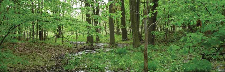
11 Claireville Conservation Area Management Plan Update Toward A Living City Region The quality of life on Earth is being determined in the rapidly expanding city regions. The vision of TRCA is for a new kind of community The Living City where human settlement can flourish forever as part of nature s beauty and diversity. This vision of a Living City Region has four objectives: Healthy Rivers and Shorelines To restore the integrity and health of the region s rivers and waters from the headwaters in the Oak Ridges Moraine, throughout each of the nine watersheds in TRCA s jurisdiction, to the Toronto waterfront on Lake Ontario. Regional Biodiversity To protect and restore a regional system of natural areas that provide habitat for plant and animal species, improve air quality and provide opportunities for the enjoyment of nature. Sustainable Communities To facilitate broad community understanding, dialogue and action toward integrated approaches to sustainable living and city building that improves the quality of life for residents, businesses and nature. Business Excellence To produce continuous improvement in the development and delivery of all programs through creative partnerships, diverse funding sources and careful auditing of outcomes and effectiveness. TRCA is committed to engaging in community partnerships with all sectors of society, to encouraging environmental stewardship, and to building on innovative thinking about environmental health, social responsibility and sustainable economies. TRCA s mission is to work with its partners to ensure that The Living City is built upon a natural foundation of healthy rivers and shorelines, greenspace and biodiversity, and sustainable communities Conservation Lands TRCA owns over 16,600 hectares of land within the Greater Toronto Area. The purpose of this ownership is to protect and manage valley and stream corridors, flood plains, the Lake Ontario shore lands, wildlife, vegetation and environmentally significant areas. Where compatible, access and facilities for public use are permitted and encouraged (MTRCA, 1995). The goal of TRCA in managing its conservation lands is to ensure the environmental stewardship of Authority lands and to continue to bring into ownership additional conservation and hazard lands essential for achieving a healthy regional environment and sustainable communities (TRCA, 2001). For the purpose of land care, TRCA greenlands are divided into the following management categories: Management agreements Special agreements and rentals Conservation parks Education field centres Limited interest acquisitions Other lands (TRCA, 2005). 1.3 Claireville Conservation Area The Humber River watershed, the largest of nine in the TRCA s jurisdiction, spans 903 square kilometres (Map 1.1). The river originates in the Niagara Escarpment and the Oak Ridges Moraine and meanders 126 kilometres south to Lake Ontario. The Humber River was designated as a Canadian Heritage River in 1999, recognizing its importance in the history of First Nations peoples, the early Euro-Canadian explorers and settlers of Upper Canada, as well as its contribution to the development of the country. This designation helps to conserve and protect the best examples of Canada s river heritage, provides national recognition, and encourages the public to enjoy and appreciate rivers. The CCA is an 848-hectare (2,100-acre) parcel of land owned by TRCA (Map 1.2) that includes 817 hectares of land and approximately 30 hectares of the Claireville Reservoir. It is located in the West Humber subwatershed and totals almost 15 per cent of the lands owned by TRCA in the Humber River watershed. Within the CCA, the Salt Creek converges with the West Humber River, north of Regional Road 107 (also known as Queen Street East). 1-2

12 Section 1: Introduction Map 1.1: Humber River watershed 1-3

13 Claireville Conservation Area Management Plan Update Map 1.2: Location of Claireville Conservation Area 1-4
14 Section 1: Introduction The CCA is located in the City of Brampton, Regional Municipality of Peel (728 hectares of land) and the City of Toronto (19 hectares of land). The City of Mississauga abuts the property to the southwest and the City of Vaughan in the Regional Municipality of York abuts the property to the northeast. This proximity to major urban centres renders the CCA one of the most accessible TRCA properties available for public use by the GTA population. The CCA lands are bounded by Finch Avenue to the south, Goreway Drive to the west, Valley Creek Drive to the north and Highway 427 to the east. Highway 407, Steeles Avenue and Regional Road 107 (Queen Street East) transect the property, and Regional Road 50 is located just east of the area. In total, the Claireville property is approximately seven kilometres long and ranges between 0.8 and 2.0 kilometres wide. TRCA acquired the numerous agricultural lands that now constitute the CCA in 1957 to construct a dam and reservoir to control the flooding that was occurring in the Lower Humber River valley lands. The Claireville Dam and Reservoir were built in The Watershed Plan for TRCA (MTRCA, 1980, p.52) defines conservation areas as lands capable of providing a broad range of outdoor recreation opportunities supported by the development of facilities and services. In the 1997 CCA Management Plan, the CCA was identified as one of the most important recreation, education and environmental appreciation destination areas in the GTA. The CCA is one of the largest tracts of land that TRCA owns. It contains significant natural and cultural heritage features. It is highly accessible to the public and has recreation, tourism and education facilities and programs. It is an integral part of the City of Brampton s natural heritage system, cultural heritage fabric and recreation destinations. For the purpose of the management plan, the Claireville lands encompass the area of TRCA land occupied by Claireville Reservoir, Indian Line Campground, and Wild Water Kingdom in the southern section of the property, as well as the 98-hectare parcel of land formally known as the Ebenezer Resource Management Tract (located north of Regional Road 107 and bounded by McVean Drive and Goreway Drive to the east and west respectively). These four areas have been combined with the formal conservation area (located between Steeles Avenue and Regional Road 107) to ensure that a comprehensive management plan is completed. The Ebenezer Resource Management Tract was purchased by TRCA in the 1950s to construct a second major dam and reservoir. The proposed dam and reservoir were to be about the same size as the Claireville facilities. The Ebenezer flood control facility was never built and today much of the land is being revegetated while some remains in agricultural use. In 1990, TRCA closed the CCA to public vehicle access for financial reasons. However, sections of the property that are leased to private interests or run by TRCA as a specialized business remain open. Access has since been limited to pedestrians and those accessing the leased areas. The uses are shown on Map 1.3 and Table

15 Claireville Conservation Area Management Plan Update Map 1.3: Land uses, Claireville Conservation Area 1-6
16 Section 1: Introduction Table 1.1: Land Uses and Property Management in Claireville Conservation Area, 2009 Land Use Managed By Size Agricultural Properties Private 67 hectares (165 acres) Claireville Ranch Private 35 hectares (86 acres) Residential Properties Private 2 hectares (6 acres) Wild Water Kingdom Private 44 hectares (108 acres) Etobicoke Field Studies Centre Toronto District School Board 2 hectares (5 acres) Claireville Reservoir TRCA 31 hectares (77 acres) Indian Line Campground TRCA 21 hectares (52 acres) Remaining Greenspace Lands (currently closed to public vehicle access) TRCA 646 hectares (1,595 acres) The CCA lies on the Peel Clay Plain physiographic region. The region defines the character of the vegetation communities that can persist within the area (Chapman & Putnam, 1984). There is a mixture of forest, successional forest, meadows and wetlands in the CCA. The site lies on the boundary between the Great Lakes-St. Lawrence and the Carolinian floristic regions, the latter of which is composed of mixed coniferous-deciduous forest. The majority of the CCA lies within and/or adjacent to the West Humber River valley corridor. Numerous watercourses flow through the CCA, and as previously mentioned, the Salt Creek converges with the West Humber River in the Claireville property. The CCA is the largest natural greenspace area in the City of Brampton and provides the community with attractions such as bird watching, boating, fishing, hiking and equestrian trails, and camping sites. Public use areas include Indian Line Campground, Wild Water Kingdom, Etobicoke Field Studies Centre and Claireville Ranch. When the Claireville lands were first acquired in 1957, much of the property was actively used for agricultural purposes, which dominated the land use of the property and surrounding communities. Several woodlots were also present. Today, residential and industrial developments surround most of the CCA, and only a few agricultural fields (70 hectares) and woodlots (186 hectares of forest cover) exist in the CCA (see Table 1.2 for a breakdown of the current natural cover in the CCA). Recent reforestation efforts have increased the amount of forest cover in the CCA. 1-7
17 Claireville Conservation Area Management Plan Update Table 1.2: Natural Cover, Claireville Conservation Area, Land Cover Type Area (Hectares) Portion of CCA Area (%) Forest Meadow Successional Wetland Total Natural cover was captured by digitizing using 2002 orthophotography and has not yet been confirmed by field evaluations. 1.4 Claireville Conservation Area Management Plan 1997 At Meeting #2/97 of the TRCA Board, held on April 4, 1997, RES. #A46/97 was adopted as follows: THAT the Claireville Conservation Area Management Plan, dated February 28, 1997, as attached, be approved; The 1997 CCA Management Plan defined the context for the CCA by reviewing land uses and relevant plans, studies, project and proposals for TRCA, the CCA and the municipalities. This analysis of the land uses in the CCA was used in conjunction with an ecosystem framework to develop land management zones (Map 1.4) and guidelines for the property. Many of the projects that have been implemented in the CCA since 1997 have fulfilled the recommendations of the original CCA Management Plan. The management plan has also been used as a resource for other planning projects in the local area. One of the directives of the 1997 plan was to review the management plan approximately every five years and make appropriate changes as conditions dictate. Some of the major accomplishments that are associated with the Claireville Conservation Area Management Plan (1997) are: Habitat restoration Vegetation management Community planting events and stewardship Outreach education programs Public use Trail head signs installation Site protection and securement Archaeological investigations Heritage plaque installation Deer inventory program Debris removal Various monitoring programs. For a more complete list of accomplishments, refer to Appendix A. 1-8

18 Section 1: Introduction Map 1.4: Land management zones, Claireville Conservation Area,
19 Claireville Conservation Area Management Plan Update 1.5 Updating the Claireville Conservation Area Management Plan Since the endorsement of the CCA Management Plan in 1997, the area surrounding the CCA has been subject to increased urban development in accordance with regional and municipal Official Plans. The CCA remains one of the largest publicly owned natural greenspaces in the Humber River watershed, within the GTA. To ensure that management decisions for the CCA are based on current information, the 1997 CCA Management Plan recommended that the document be reviewed approximately every five years; however, the review was postponed in order to incorporate TRCA s new Terrestrial Natural Heritage System Strategy (Section 2.3.1) and the latest biological inventories and assessments (Sections and 2.2.4). In addition, the CCA site has been experiencing increased pressures from surrounding industrial and residential development (Section 2.1.2), and from proposals for the development of the CCA site for public use and commercial purposes (Section 2.1.1). Updating the management plan was done in consultation with a number of key stakeholders and organizations. Humber Watershed Alliance members, Friends of Claireville members, the cities of Brampton, Mississauga, Toronto and Vaughan, the Regional Municipality of Peel, and the Brampton Environmental Planning Advisory Committee reviewed and provided input into plan revisions. Progress updates were provided to the Claireville Stewardship Committee and the Humber Watershed Alliance as the plan update was developed. A public information session was held to present the draft CCA Management Plan Update to neighbours and the general public and to receive their input. Local residents and additional partners will be informed of the final updated management plan in a newsletter at the completion of the process. The following steps were taken to update the 1997 CCA Management Plan: 1. Initial review of the existing management plan by the Humber Watershed Alliance members to identify new information and outdated project and proposal references. 2. Update the biological inventory and conduct an analysis of current conditions by TRCA staff. 3. Revise land management zones based on terrestrial natural heritage analysis, public use directives and other initiatives in the area by TRCA staff. 4. Develop an inter-regional trail alignment in conjunction with the cities of Brampton and Toronto. 5. Prepare a site securement and protection plan. 6. Update management recommendations to reflect new information. 7. Prepare a strategic vision, principles, goals and objectives for the CCA. 8. Review the final draft management plan by TRCA staff. 9. Review the final draft management plan by partners including the Claireville Stewardship Committee, Humber Watershed Alliance, cities of Brampton, Mississauga, Toronto and Vaughan, Regional Municipality of Peel and other stakeholders. 10. Review the final draft management plan by the general public, including a presentation and question period. 11. Obtain the endorsement of the updated management plan from the City of Brampton. 12. Obtain the endorsement and/or approval of the updated management plan from the TRCA Board. 13. Publish a newsletter informing the local community of the updated management plan. Members of the Humber Watershed Alliance and the Claireville Stewardship Committee emphasized the need to preserve and enhance the areas north of Steeles Avenue, especially the Ebenezer Resource Management Tract north of Regional Road 107 to the northern boundary of the property. The 1997 CCA Management Plan states that environmental considerations are paramount and the actions implemented since the plan s endorsement in 1997 have reinforced this position. The updated management plan clearly reflects this nature first philosophy. 1-10
20 Section 1: Introduction The Claireville Subcommittee The West Humber Subcommittee of the Humber Watershed Alliance was established to focus on assisting TRCA with implementing the watershed plan in the West Humber subwatershed. It merged with the Claireville Stewardship Committee that was established after the completion of the original management plan to become the Claireville Subcommittee of the Humber Watershed Alliance. The memberships of the two groups were very similar and both were concerned with implementing the 1997 CCA Management Plan. The Claireville Subcommittee assisted in updating the CCA Management Plan. At the time of update, the committee consisted of representatives from the following groups and municipalities: Architectural Conservancy of Ontario Councils of the cities of Brampton, Mississauga and Toronto Friends of Claireville Residents from Brampton, Caledon, Toronto and Vaughan West Humber Naturalists TRCA. The committee reviewed the 1997 CCA Management Plan, made editorial suggestions, and recommended additions, deletions and corrections. The subcommittee s primary suggestions were to remove the Commercial land management zone on Regional Road 107 and avoid trail impacts on interior forest habitat Municipal Consultation The CCA is an integral element of Brampton s environmental, cultural and social fabric. Consequently, the City of Brampton contributed to the update of the CCA Management Plan by reviewing and commenting on drafts of the updated management plan, contributing to the development of the strategic vision, principles, goals and objectives, and assisting with the public information sessions. At meeting #3/10 of the TRCA Board, held on April 30, 2010 the Mayor of Brampton made a delegation to emphasize the city s interest in the CCA. At that same meeting the following was adopted by Resolution #A46/10. THAT above-noted presentation (a) be heard and received; THAT Toronto and Region Conservation Authority (TRCA) approve, in principle, the following motion, subject to staff reviewing and reporting back to the Authority on its implementation and how it will be incorporated into the management plan: THAT TRCA identify the Claireville Conservation Area as an Urban Forest; THAT TRCA support the integration of Claireville into the environmental, social and cultural fabric of the City of Brampton; THAT TRCA prepare a strategic vision, in partnership with the City of Brampton and other interested municipalities, to define a long term, environmental framework to guide the future planning of Claireville; THAT TRCA consult and engage municipal and community partners to protect and restore Claireville; THAT TRCA manage and program Claireville with a nature first philosophy to restore and enhance the environmental sustainability of the local and regional ecosystem; AND FURTHER THAT TRCA ban future development and land use activities in Claireville Conservation Area that will affect the ecological health and diversity of Claireville s natural heritage system. This delegation and resolution reinforces the value that TRCA and the City of Brampton places upon the CCA as an important part of the natural heritage system, a cultural heritage resource and an important recreational destination for local, regional and watershed residents and visitors. TRCA engaged City of Brampton staff and council and the Brampton 1-11
21 Claireville Conservation Area Management Plan Update Environmental Planning Advisory Committee in the process of updating the management plan for the CCA and much discussion came from this engagement. Beyond the City of Brampton, staff from the cities of Mississauga, Toronto and Vaughan and the Regional Municipality of Peel were provided opportunities to comment and provide direction on the updates to the management plan. Their comments further refined the updated management plan Public Consultation At the outset of the management plan update process, it was agreed that public use, enjoyment and stewardship of the CCA would be important to the community. Public consultation was facilitated by members of the original stakeholders working group who helped develop the 1997 document. Input was also obtained at meetings of the Claireville Stewardship Committee and Humber Watershed Alliance. A public meeting was held in June 2010 to present background information and receive input on the updated management plan. This meeting also yielded valuable insights into the general public s key issues and concerns. Overall, TRCA was satisfied with the support it received from the public for the management plan. Toward the end of the management plan updating process, additional public consultation was required in order to finalize the conceptual alignment of the Inter-Regional Trail. On April 30, 2011, a site visit was held with members of the public, TRCA and City of Brampton staff and members of the TRCA Board. Participants walked the proposed trail alignment and discussed the advantages and disadvantages of that alignment, and three proposed alternatives. On June 16, 2011, a public meeting was hosted by TRCA and the City of Brampton. Approximately 100 residents attended in addition to the Mayor of Brampton and the local and regional councillors. The trail alignment and design specifications were described to those in attendance. The additional public consultation ensured that all interested and affected parties had a chance to provide input on the Inter-Regional Trail; this resulted in an alignment that received broader public support, while remaining consistent with the intent of the management plan. 1-12
22 Section 2: Current Conditions SECTION 2: CURRENT CONDITIONS There have been many projects implemented at the CCA since In addition, the surrounding landscape has changed due to urban growth. This section discusses current conditions and changes in the Claireville area since Land Use Most of the forests that were present in the 1800s on the site, including those in the valley and stream corridors, have been removed with only a few woodlots left intact. When TRCA purchased the original Claireville lands in the 1950s for the construction of the Claireville Dam and Reservoir, most of the property was actively used for agricultural purposes. To this day, agriculture continues on select fields at the CCA, occupying almost 70 hectares. The pressures of urban development have resulted in some of the fields becoming less agriculturally viable for conventional farming practices from an environmental perspective. In order to support the directions and principles of the 1997 CCA Management Plan, TRCA has undertaken reforestation, permitted natural regeneration or used the fields for recreational and educational purposes. There have not been any significant changes to land use at the CCA since 1997 (see Map 1.3 for current land uses). The Claireville Dam and Reservoir, Indian Line Campground, Claireville Equestrian Ranch, Wild Water Kingdom and the Etobicoke Field Studies Centre continue to operate as reported in the 1997 CCA Management Plan. In addition, there are four residential lease properties at the CCA, and a lease agreement with the City of Toronto for a day camp and recreation activities including a low-ropes/obstacle course Land Use Changes at Claireville Conservation Area since 1997 Many of the land use changes since 1997 relate to lease agreements with TRCA. TRCA no longer leases property to the Chinguacousy Snowmobile Club and the Yeoman Rugby Club, as detailed in the previous management plan. Only two residential leases remain active one by the Claireville Dam near Indian Line Campground and another by the Claireville Ranch area. In addition, agricultural uses continue, although TRCA has decided not to renew several leases to allow for enhanced terrestrial habitat restoration opportunities. A 10-hectare parcel of the CCA lands designated as surplus in the 1997 CCA Management Plan (as shown in Map 1.4) has been sold. Numerous habitat restoration projects have been implemented on retired agricultural fields and other natural areas (Map 2.1). This has increased the natural cover and biodiversity of the CCA. Habitat restoration projects between 1997 and 2008 resulted in the enhancement of 82 hectares of forest, 50 hectares of riparian and 20 hectares of wetland habitats. In addition, landscape berms have been created near the Regional Road 50 entrance and Gorewood Drive to create visual and noise barriers, thereby reducing the impact of outside influences on the CCA. The McVean New Farmers project, a partnership between TRCA and FarmStart, was formed in It is based on a renewable lease for 15 hectares of the historic McVean property located west of McVean Drive and east of the Humber River valley. Additional lands (4 hectares) at McVean Drive and Ebenezer Road were added to the lease agreement in The project is leading the way towards sustainable, local agriculture that serves the needs of growing urban and near-urban communities while protecting the local greenspace and ecosystems. By encouraging new farmers and products and promoting local food production and community engagement, this farm project will allow community members to access and connect to the source of their food. The multi-year lease promotes good stewardship practices on the land and infrastructure investments. TRCA is working with FarmStart to provide infrastructure support, such as rain water collection harvesting systems, fencing, irrigation, storage facilities, and market buildings. In addition, TRCA is supporting the project through stewardship and educational programming beginning in In the 2008 season, these lands accommodated four farm enterprises, several test croppers and a test plot of 2-1

23 Claireville Conservation Area Management Plan Update Map 2.1: Completed habitat restoration and enhancement projects, , Claireville Conservation Area 2-2
24 Section 2: Current Conditions world crops. Two hectares were farmed and produced a wide variety of crops, including garlic, tomatoes, beans, lettuce, beets, rutabagas, celery, zucchini, strawberries and herbs. World crops included okra, callaloo, chilies, bitter gourd and hot peppers. It was a successful season, with farmers reporting good yields. Other contributing factors to the project s success were the support and learning gained from the interaction between farmers, as well as the access to resources provided by FarmStart and TRCA. In 2008, the City of Brampton entered into an agreement with TRCA to initiate a summer camp at the CCA. The summer camp operation is centered at the Paul Flood Memorial Garden building area and campers generally use lands within the central section of the CCA for their activities and programs. Improvements were made to a parking lot near the building in 2009 to facilitate buses for day campers. The Paul Flood Memorial Garden was reinvigorated in 2010 with new plantings and increased maintenance. At meeting #11/08 of the TRCA Board, held on January 30, 2009, RES. #A312/08 was adopted, thereby granting the City of Brampton a permanent easement for a 2.44 hectare stormwater management pond (SWMP) located south of Regional Road 107 and west of The Gore Road in the CCA (Map 2.2). The SWMP proposal was presented to the public and adjacent residents through a public meeting held in This stormwater management facility will service 60 hectares of new residential development by Orchard Ridge (Brampton) G.P. Inc. and retrofit existing storm drainage that previously drained to the West Humber River through the CCA. The following terms and conditions were placed on the easement, as per TRCA Board RES. #A312/08 in order to provide a net benefit to the CCA and the Humber River Watershed: Orchard Ridge (Brampton) G.P. Inc. will provide the following restoration enhancements i. buffer planting along the west limit of the subdivision; ii. tertiary wetland enhancement; and iii. development and construction of an off-site wetland and restoration project. All disturbed areas are to be restored to the satisfaction of TRCA as soon as possible after completion of construction. Sediment control measures in a manner satisfactory to TRCA are to be practiced during construction. Orchard Ridge (Brampton) G.P. Inc. shall monitor the effectiveness of the facility for a two-year period following construction. The City of Brampton is to be responsible for all repairs and/or maintenance of the stormwater management facility which may be required in perpetuity and for indemnifying TRCA from any and all claims arising from the construction and payment of all taxes. An archaeological investigation is to be conducted before any site disturbance with any mitigative measures required being carried out all at the expense of Orchard Ridge (Brampton) G.P. Inc. to the satisfaction of TRCA. Any additional considerations as deemed appropriate by TRCA staff or its solicitor. In addition to approved and implemented changes, there have been several development and infrastructure proposals for the CCA since 1997 that have not been supported by the Claireville Stewardship Committee. These included a golf course, a sustainable housing subdivision and the extension of Williams Parkway. Early in 2000, the Royal Canadian Golf Association and the City of Brampton presented a proposal for a championship golf course in the Ebenezer Resource Management Tract (north of Regional Road 107). The 1997 CCA Management Plan designated this area almost entirely as Nature Reserve, Natural Environment, or Primary Restoration land management zones. The proposal spurred strong public opposition including an active citizens group, large public meetings, letters to the editor and to TRCA and consequently, the proposal was rejected by TRCA. Although various earlier golf course proposals are described in the 1997 CCA Management 2-3

25 Claireville Conservation Area Management Plan Update Map 2.2: Requested permanent easement for a City of Brampton stormwater management facility 2-4
26 Section 2: Current Conditions Plan, TRCA and public have conceded that this is an inappropriate use at the CCA. In May 2010, public access to the CCA was formally increased during daylight hours throughout the year to designated public use areas between Steeles Avenue and Regional Road 107. General admission is free, but charges apply to special events and organized groups, such as day camps. TRCA staff are not onsite on a regular basis, but do open, close and clean washrooms and pick up garbage. The washrooms are handicap accessible and open weekends during the spring and fall and every day in July and August. Water is available in the washrooms at the Paul Flood Memorial Garden near the playing fields from June through September. Parking for passive uses is permitted at the designated parking areas at Regional Road 50 and Regional Road 107 (a gravel parking lot at Regional Road 107 is scheduled for construction in 2011). Permitted activities include walking, hiking and cycling on trails, nature appreciation, day camps, orienteering, adventure races, filming, and special events. TRCA requires permits and additional fees for some of these activities. The CCA does not operate as a traditional TRCA conservation park due to limited staffing and services, but it does have more services and facilities than TRCA s other conservation lands that permit public access. The City of Brampton s BramEast Secondary Plan proposed an extension to Williams Parkway as a major road crossing the CCA between Humberwest Parkway and McVean Drive. The 1997 CCA Management Plan recognized this potential infrastructure need and kept open the possibility of the road, subject to an environmental assessment including a review of alternatives. Active public opposition, alternative traffic studies and TRCA s commitment to preserving and developing interior forest in the area led TRCA to oppose the proposed route. The City of Brampton s recognition of the significant natural heritage values of the CCA resulted in Brampton Council removing this road through the CCA from the BramEast Secondary Plan. The Toronto Commons group proposed an environmentally-focused housing development in the CCA at the corner of McVean Drive and Ebenezer Road in January A number of concerns were expressed by community members, and the proposal was ultimately rejected by TRCA. The concept of developing the CCA into a leadership adventure conservation centre was proposed by an umbrella group that would bring organizations promoting various forms of outdoor recreation to the CCA. Canoeists represent a particularly strong interest group, for whom a dock was installed at the Claireville Reservoir. A BMX course was proposed, but concerns were raised with regard to the appropriateness and operational logistics of such a facility at the CCA. Proponents of the leadership adventure conservation centre have not provided business plans and, therefore, the proposal has not been resolved to date. This update to the CCA management plan will provide guidance to resolve some of these and future public use possibilities at the CCA Land Use Changes in the Surrounding Area since 1997 The area around the CCA is undergoing rapid urban development. Since the 1997 CCA Management Plan was prepared, the surrounding population has increased and continues to grow in accordance with regional and local municipal Official Plans and Ontario s Growth Plan. Residential development has replaced agriculture and open fields along the northern boundary of the CCA. This has placed additional pressure on the natural habitat of the CCA, as fewer supporting land uses now exist. Also, there is increased demand for public use in the publicly-owned greenspace as new neighbours wish to explore the CCA s natural areas. This is evidenced by numerous unauthorized entrances along the northern boundary (see Section 4: Site Securement and Protection Plan for more details about access points and encroachments). All the areas adjacent to the CCA are now developed or are in the planning process. Much of the planning for the adjacent areas north of Regional Road 107 was completed in the early 2000s, and the majority of these areas have now been developed. This area is 2-5
27 Claireville Conservation Area Management Plan Update predominantly characterized by low density residential development with some high density residential development constructed to the west of the CCA. Development buffers applied to these urbanizing lands have been variable and, as a result, natural buffers to the CCA are limited in features and functions. The area surrounding the CCA south of Regional Road 107 is a mixture of commercial, industrial and residential development. The lands to the west of the CCA have been developed for commercial/industrial uses. An estate residential development exists to the east of the CCA, and a new residential subdivision is planned for the remaining vacant lands known as the Gore Road Residential Subdivision south of Brewster Road, and north of Manswood Crescent, west of The Gore Road. Since 1997, several of the roads surrounding the CCA have been or are scheduled to be widened. Currently, there are several road widening projects in the area of the CCA that are at the detailed design/permitting stage, including McVean Drive from Castlemore Road to Regional Road 107, Regional Road 107 from Airport Road to Beaumaris Drive, and Goreway Drive from Regional Road 107 to Mayfield Road. The Regional Road 107 works facilitated the development of Züm, the City of Brampton s Bus Rapid Transit (BRT) service that is a goal of Metrolinx s Regional Transportation Plan. An Environmental Assessment is also underway for the widening of The Gore Road from Regional Road 50 to Regional Road 107. These proposed works are reviewed under the Municipal Class Environmental Assessment process at which time alternative solutions and designs are examined; in addition, impacts, mitigation and monitoring measures, restoration and compensation requirements are identified. While TRCA prefers that impacts do not negatively affect its land or the terrestrial natural heritage system, the assessment process does provide an opportunity for staff to request that proponents employ leading edge techniques, increase natural habitat in the local area and provide other types of compensation when natural features or TRCA property is affected. 2.2 Claireville Conservation Area Policies, Plans and Other Studies Numerous policies, plans, studies and projects have been developed for the CCA over the years. Those detailed below have come into effect or have been produced since the 1997 CCA Management Plan was prepared. They have regard for the 1997 management plan and their directives have been considered in the development of the management plan. This Management Plan update shall take precedence over the policies, plans and studies listed below Claireville Natural Area Enhancement Plan (2000) The Claireville Natural Area Enhancement Plan was developed to enhance the natural areas and has the following goal: Create and restore a diverse mosaic of habitat features within the CCA as a means of increasing wildlife diversity and ecosystem health within the Humber Watershed; provide unprecedented opportunities for community involvement through a phased implementation approach that is in keeping with the CCA Management Plan. To achieve this goal a detailed, multi-year, phased enhancement plan was developed. The plan designated specific sites for planting and wetland creation in the restoration zones defined in the 1997 CCA Management Plan. Specifically outlined in the plan are five components reforestation, oxbow wetland enhancement, broad flood plain wetland creation, scattered flood plain wetland creation, and interior habitat enhancement (see Appendix B). Each of these components has its own objectives and restoration targets that function to complement the evolving habitat communities at the CCA and form the desired mosaic of diverse and functional habitats. Detailed prescriptions are prepared each year to guide the annual restoration projects and sites within the overall plan. 2-6
28 Section 2: Current Conditions Key recommendations of the plan include: Reshaping the flood plain and minor manipulation of water levels in the reservoir to regulate flow and surficial runoff to form permanent and ephemeral wetland habitats. Restoring the form and function of terrestrial habitats through planting agricultural lands and some abandoned fields, and closing gaps in existing forest cover through strategic planting and enhancement techniques. Planting of native vegetation to prevent erosion, increase species diversity, enlarge forests and link forest patches. Monitoring of the projects with the assistance of local volunteers and TRCA staff. The Claireville Natural Area Enhancement Plan supports the CCA Management Plan (1997). The proposed restoration activities conform to the definitions of the land management zones outlined in the management plan and closely adhere to the environmental management guidelines that have been recommended. Many of the enhancement projects recommended in the plan have already been implemented (see Map 2.1). Community plantings to implement the regeneration plans developed in the Claireville Natural Area Enhancement Plan have been organized annually for 10 years. These have been well attended and demonstrate ongoing public support for Claireville Claireville Reservoir and Surrounding Area Natural Enhancement Plan (January 2006; Draft) The Claireville Natural Area Enhancement Plan (2000) recommended specific reforestation and wetland creation/enhancement projects for the CCA, with the exception of the reservoir and the TRCA lands south of Steeles Avenue, including Wild Water Kingdom and Indian Line Campground. The purpose of the Claireville Reservoir and Surrounding Area Natural Enhancement Plan (2007) is to identify important natural enhancement opportunities for the Claireville Reservoir and the CCA lands south of Steeles Avenue. The 2006 document provides a prioritized list of enhancement opportunities that are consistent with the Claireville Natural Area Enhancement Plan (2000), CCA Management Plan (1997), Terrestrial Natural Heritage System Strategy (2006), Humber River Fisheries Management Plan (November 2005) and Remedial Action Plan target areas. The recommendations are focused on increasing and/or enhancing core habitat areas, maintaining and expanding corridor connectivity for local and migratory wildlife, buffering important habitat features from adjacent land uses and improving water quality. In addition to these recommendations, there is an opportunity to engage the community when implementing regeneration and habitat enhancement initiatives. A variety of habitat improvement opportunities were identified (see Appendix C) and assigned actions. These included opportunities for reforestation, bluff habitat, wetland creation/enhancement, shoreline naturalization and stabilization, aquatic habitat improvements, shorebird habitat improvements, water level management, and recreation and interpretation. The plan also identified locations, planning priorities and approximate costs. The implementation of this plan has begun and completed restoration projects are reflected in Map 2.1. Refer to the original document for further details Claireville Lands Study Area Terrestrial Biological Inventory and Assessment (September 2006) The TRCA s Ecology Division prepared the inventory and assessment report that describes the CCA lands north of Highway 407 in the context of the TRCA s Terrestrial Natural Heritage Program. It utilized a systems approach to delineate the terrestrial natural heritage system, wherein site level decisions can have an impact on the integrity of the regional system and vice versa. This report explains the results of vegetation community and flora and fauna species inventories conducted at the CCA and how this information fits into the regional Natural Heritage Strategy and targets. The inventory and assessment also informs the land management zones and recommendations of this update to the management plan for the CCA. 2-7
29 Claireville Conservation Area Management Plan Update The location of the CCA within the Peel Clay Plain physiographic region influences the vegetation communities that can persist at the site (Chapman & Putnam, 1984). The CCA is located in the Great Lakes-St. Lawrence floristic region at the boundary to the Carolinian floristic region and consequently is composed of mixed coniferous-deciduous forests. The terrestrial habitats at the CCA are strongly influenced by proximity to urban development. The report provides findings on habitat patches, vegetation communities, flora and fauna on the CCA lands north of Highway 407, including the following: The average habitat quality has been assessed as fair. The area around the CCA is undergoing rapid urbanization, which is affecting the distribution of natural cover. Natural cover is predominantly meadow (49%) and forest (47%), with some wetland (4%). Majority of wetlands found at this site are associated with valley lands, riparian areas and floodplains. A total of 90 Ecological Land Classification (ELC) vegetation types were identified, including 13 communities of regional concern. A total of 274 flora species were identified, including 58 exotic or possible non-native and 189 native species of which 33 are regional species of concern. A total of 12 bird species of regional concern and an additional 27 bird species of urban concern were identified. A total of six herpetofauna species (reptiles and amphibians) of regional and urban concern were identified. A total of four mammal species of regional and urban concern were identified Claireville Conservation Area Terrestrial Natural Heritage Assessment (May 2007) TRCA s Terrestrial Natural Heritage Group prepared a terrestrial natural heritage assessment of the CCA to inform the management plan update. The goal of the report was to develop a plan for preserving and enhancing the natural habitats within the CCA to maintain and restore native biodiversity by using the latest scientific tools and available biological data. This can be done by protecting existing habitats and species, restoring lands to provide additional habitat, and acquiring lands that influence what happens in the surrounding areas. The report has three main components: 1. Landscape level and biological assessment conditions within the CCA. The analysis includes: Current conditions (reflecting current urbanization and natural cover) A condition based on an improved optimal target terrestrial natural heritage system as refined from the Terrestrial Natural Heritage System Strategy (TRCA, 2007) and anticipated future urbanization to the Ontario Greenbelt Plan (Ontario Ministry of Municipal Affairs and Housing, 2005) boundary A condition based on the Target Terrestrial Natural Heritage System modified with the existing 1997 land management zones and anticipated future urbanization to the Ontario Greenbelt Plan boundary. 2. Recommended adjustments to the 1997 land management zones for the CCA, as the original zones were drafted prior to the availability of site specific species and vegetation community information. 3. Recommendations that will prioritize the restoration and management of areas within the refined Target Terrestrial Natural Heritage System based on local TRCA species of concern and vegetation community of concern data. Five changes to the 1997 land management zones are recommended and rationalized in the report (see Appendix D), and these suggestions have been incorporated into the updated management plan as appropriate. Candidate sites for terrestrial system restoration and management were also identified using the Refined Optimal Target Terrestrial Natural Heritage System. Sites were prioritized and ranked based on ecological gains to the terrestrial 2-8
30 Section 2: Current Conditions system and immediacy for action. Recommendations from this report have been evaluated and incorporated into the updated management plan recommendations Claireville Conservation Area Conservation Land Ecosystem Management Projects 2007 and 2008 In 2007 and 2008, the Regional Municipality of Peel provided TRCA with funds to support ecosystem management projects at the CCA. These projects have helped TRCA to maintain and improve water quality and quantity, natural heritage and sustainable public use, thereby supporting TRCA s Living City objectives, Terrestrial Natural Heritage System Strategy, Legacy: A Strategy for a Healthy Humber, Claireville Natural Area Enhancement Plan and Claireville Conservation Area Natural Heritage Update Report. Key initiatives included reforestation and habitat restoration, site securement, scoping of a leashfree dog-walking area, and vegetation management (Table 2.1). Locations for these initiatives were identified (Appendix E). Prior to the implementation of these initiatives, archival and archaeological assessments were conducted to identify the presence of known heritage features, as well as to discover previously unknown heritage sites. This enhanced the overall project goals by enabling the documentation, protection and interpretation of cultural landscapes on the property. The leash-free project was expanded to include public consultation and conceptual site design. Public consultation with the local dog-walker community was conducted by TRCA to identify options that would be of benefit to both parties. A 14.7 hectare area at the Regional Road 50 entrance was proposed and a site design drafted. TRCA has indicated that it will only further investigate the opportunity if either the City of Brampton or a formal dog-walking group is formed and assumes responsibility for the maintenance of a leash-free area as defined in the TRCA s Policy and Operational Procedures for Managing Domestic Animals (2003). A group, Hikers with Dogs at Claireville, organized itself and proposed a leash-free hiking trail. TRCA staff reviewed this proposal but declined to proceed with it due to the cost of building and maintaining the trail, the increased ecological impact from trail construction and from dog interaction with sensitive fauna, especially ground-nesting birds and the higher potential for conflict with other park users. Hikers with Dogs at Claireville did not support a leash-free area. The City of Brampton and TRCA discussed the leash-free area at the CCA, including changing the location of the proposed leash-free area to a site closer to the residential neighbourhoods. No proposals were satisfactory to TRCA. In the meantime, TRCA had undertaken an education and monitoring program to inform dog walkers about its policy prohibiting dogs off-leash. The program includes information pamphlets, monitoring of off-leash use, and issue of trespassing notices to offenders. Improvements will be made at the Regional Road 50 entrance, including a 40-car parking lot and trail, and the area will act as an additional trailhead location. Ultimately, TRCA staff received direction from the TRCA Board to not permit a leash-free area at the CCA by way of adopting the City of Brampton s recommendations in Mayor Fennell s delegation (see Section for more information). TRCA will continue to enforce its Policy and Operational Procedures for Managing Domestic Animals. Discussions regarding the enforcement assistance of the City of Brampton By-law Enforcement continue between TRCA and the City of Brampton. The City of Brampton will be looking at other alternatives for an off-leash dog park in east Brampton Heritage Impact Assessment Report on 8712 Claireville Conservation Road (July 2009) In July 2009, Unterman McPhail Associates prepared Heritage Impact Assessment Report for 8712 Claireville Conservation Road (Lot 5, Concession 8 ND, Geographic Township of Toronto Gore), City of Brampton, Ontario, for TRCA. A heritage impact assessment is a study to determine how significant a cultural heritage resource might be and how a proposed land use development, demolition or site alterations may impact the resource. It can also be 2-9
31 Claireville Conservation Area Management Plan Update Table 2.1: Claireville Conservation Area Conservation Land Ecosystem Management Project, 2007 and Refer to Map E.1 for more locations. Land Management Initiative Reforestation and Habitat Restoration Site Securement Fencing Component Measure 2007 Measure hectares, including the former Robinson property (7 hectares), former Duncan property (18 hectares), and additional works on existing sites (6 hectares); 9,675 trees and shrubs planted; 30,600 conifer seedlings planted 4 or 5 sites; approximately 22,000 conifers planted metres, farm fencing 50 metres, temporary fencing 580 metres, temporary fencing Property boundary signs 20 0 Planting nodes with project signs 5 0 Leash-free Area Scoping and public consultation proposed 14.7 hectare area updates to siting criteria and Policy and Operational Procedures for Managing Domestic Animals; information pamphlet Vegetation Management Buckthorns, dog-strangling vine, and common reed 5.7 hectares used to determine if and when demolition, relocation, salvage or other potentially negative impacts may be permissible. The report describes the property and its contents, evaluates their cultural heritage value, and provides heritage resource management and mitigation recommendations. Members of the John Blanding family owned land in Lot 5, Concession 8 ND, Toronto Gore Township for over 100 years, settling in the early 19th century to develop the land for agricultural purposes. The residence, built in 1915, sits on a height of land on the south side of Regional Road 107 to the east of the West Branch of the Humber River within the CCA. It is an early 20th century home and is considered to be of design or physical value because it displays craftsmanship in its design execution, retains its architectural integrity, and is not significantly altered from the original design, plan and materials. The heritage impact assessment indicates that the brick residence located on the property is considered to be of local heritage interest and/or value for design/physical, historical and contextual reasons, and is worthy of consideration for municipal listing and/or designation. Notable heritage attributes of the residence include, but are not limited to: The overall massing and design, including the incorporation of two two-storey sun porches on the southeast and southwest corners Window openings both paired and groups of three with flat concrete lintels and concrete sills 2-10
32 Section 2: Current Conditions Simulated ashlar pattern on the parged concrete foundation Pencil inscription by John Blanding on brickwork of west elevation in south corner Original early 20th century interior door and window trim, solid wood doors with five panels, doors with upper glazing and three vertical panels on lower section, door locks and door knobs, and kitchen wainscoting. The assessment was requested by TRCA as it was evaluating the potential removal of the house structure. Given the heritage attributes listed above, it was stated that the proposed removal of this residence will alter the historical context of the former agricultural land and remove a visual landmark in this area of Regional Road 107. The following conservation options, listed in descending order of preference, were recommended in the heritage impact assessment: 1. Retention of the existing residence in situ. 2. Relocation of the existing residence in a new location on its current site. 3. Relocation of the existing residence to an appropriate new site nearby. 4. Salvage of elements for incorporation into existing historic or new structures. 5. Full recording and documentation of the structure if it is to be demolished. Mitigation recommendations within the heritage impact assessment include: Immediate municipal listing of the residence by the City of Brampton. Consideration of municipal heritage designation by the City of Brampton. Preparation of conservation, restoration or adaptive reuse plans, as necessary, if the buildings are to be retained in situ and municipally listed and/or designated. Preparation of a security plan and a letter of credit to help ensure security and protection of heritage resources if to be retained in situ. Consideration of relocation of the residence to a site near its present location within the Claireville Conservation Area, to nearby lands, or to other parts of the City of Brampton if municipal listing and/or designation is considered in order to better accommodate conservation and adaptive reuse. If retention of the residence is not feasible, a documentation report containing measured drawings, high-resolution digital photographs and photo key plans will be completed, as deemed necessary. Salvage recommendations shall form part of the documentation report. An interpretive plaque commemorating the history of the Blanding family and their connection to the property and their contributions to the former Toronto Gore Township should be prepared and installed near the residence, if retained and/ or demolished, preferably near the subject site, possibly in the north parking lot of the Claireville Conservation Area. Finally, the assessment states that the City of Brampton should be consulted prior to any mitigation actions, and that an archaeological assessment of the site should be completed before any demolition or removal of the residence occurs. The recommendations of this heritage impact assessment will be considered in the land management zones and recommendations of the updated management plan for the CCA, as appropriate Claireville Dam Operation, Maintenance, Surveillance and Safety Manual (2009) TRCA completed an update to the Operations, Maintenance and Surveillance Manual for the Claireville Dam in 2009 in accordance with provincial requirements. The review confirmed that the procedures used since the construction of the dam in 1964 provide the optimal degree of flood protection for flood-prone communities downstream of the dam. The seasonal operations procedures for Claireville Dam are as follows: reservoir levels are raised in the spring and maintained at a higher level in the summer months to facilitate recreational opportunities on the 2-11
33 Claireville Conservation Area Management Plan Update water. The reservoir s water levels are drained down to the minimum level in the fall to provide additional storage for the spring melt. It should be noted that for a few years, TRCA had altered the seasonal operations procedures at the dam to maintain the reservoir level at the summer level throughout the entire year. Unfortunately, keeping the reservoir high year-round created a maintenance issue on the dam s gates. Due to the cost of repairing this problem, and to ensure that the gates function as intended during a flood, TRCA has returned to the original seasonal operations procedures. As public safety is the overriding concern with respect to the dam, if an important maintenance issue is identified in the summer months the water level may need to be lowered to address the issue. Due to the rural nature of the conservation lands upstream of the dam, there is not much flow during summer rainfall events and, consequently, flooding is of minimal public safety concern. In addition, TRCA must maintain a constant flow of water to the West Humber River downstream of the dam; therefore, it can be difficult to raise the water level back up to the summer level after it has been lowered for maintenance operations. It is recognized that human altering of the water levels in the reservoir has an effect on upstream habitats. However, the dam s purpose is flood control. Consequently, the protection of lives, homes and other infrastructure downstream from the CCA is the priority. Restoration of aquatic and terrestrial habitat upstream from the dam should help mitigate the effects of alteration of water levels. 2.3 TRCA Policies, Plans and Other Studies Several TRCA policies, plans and other studies that have been prepared since 1997 also impact the management of the CCA. Consequently, each has influenced this CCA Management Plan Update by providing directions for land management zones and recommendations. Please refer to the original documents listed below for additional information Terrestrial Natural Heritage System Strategy (2007) The Terrestrial Natural Heritage System Strategy was approved at Meeting #11/06 of the TRCA Board, held on January 26, 2007 (RES. #A306/06). The strategy outlines the science and modeling tools that have been developed to identify the potential effects of changing land use on existing natural cover and its habitat value for wildlife species within TRCA s jurisdiction. It also demonstrates how existing habitat function can be improved with the addition of lands that have the potential to become natural cover. This allows TRCA to model the effects of changing land use on existing habitats and determine what is required to protect and enhance habitats in the future. The regional terrestrial natural heritage system defined in the strategy is designed to protect and improve biodiversity by increasing the quality and amount of forest and wetland habitats in a system that builds upon the existing terrestrial system and optimizes the opportunities for native species diversity. It uses ecologically-based analytical tools to identify lands that have the greatest potential to contribute to improvements in habitat quality and function resulting in a target terrestrial natural heritage system. The strategy incorporates the current thinking on terrestrial natural heritage protection and restoration, as well as comprehensive data on the terrestrial natural heritage assets in the TRCA s jurisdiction. While the strategy can be used to inform TRCA activities, from restoration to development plan review, the potential of lands to contribute to the system must be assessed using current site specific information in order to make informed decisions. The Terrestrial Natural Heritage System Strategy was used when preparing Claireville Lands Study Area Terrestrial Biological Inventory and Assessment (September 2006) and Claireville Conservation Area Terrestrial Natural Heritage Assessment (May 2007), as detailed in Sections and 2.2.4, respectively. These reports provide details about the terrestrial natural heritage system at the CCA and its surrounding lands. 2-12
34 Section 2: Current Conditions Pathways to a Healthy Humber (2008) The update to the Humber River Watershed Plan, entitled Pathways to a Healthy Humber, was approved in June This updated watershed plan is part of an adaptive management approach to address the challenges in the watershed. Since the publication of Legacy: A Strategy for a Healthy Humber in 1997, much has been learned about the Humber River watershed from monitoring, research and the experiences of watershed partners. Watershed management strategies were updated in light of new information, a stronger scientific foundation and better understanding of the effects of human actions on the ecosystem. The updated watershed plan also responds to recent policy and planning initiatives, including the Oak Ridges Moraine Conservation Plan, Growth Plan for the Greater Golden Horseshoe, the Clean Water Act, City of Toronto s Wet Weather Flow Master Plan, stormwater retrofit studies of other municipalities, and the TRCA s vision for The Living City. The guiding framework for this watershed plan comprises a set of principles and 30 objectives with specific targets. They address: Environment: stream form, groundwater, surface water, air, aquatic system, terrestrial system Society: cultural heritage, nature-based recreation Economy: land use, resource use Getting it done: coordination, funding, monitoring, education and marketing. The pathway to a healthier, more resilient watershed that emerged is based on a comprehensive and inter-dependent set of strategies that will protect and enhance valued resources, regenerate damaged systems, and build more sustainable communities. This will help to increase the resilience of natural systems to human activities and climate change. It will also create healthier places for people and wildlife and stronger support for economic activities. The recommended management strategies can be classified into three broad actions, as follows: Establish the targeted terrestrial natural heritage system Build sustainable communities Recognize the distinctive heritage of the Humber through an enhanced regional open space system. The updated watershed plan identifies the CCA as a major nature-based recreation destination, a key component of the greenspace system, a location for continued terrestrial habitat restoration, enhancement and protection, and a significant component of the water management system in the TRCA s jurisdiction. These directions are reflected in the land management zones and recommendations of the updated management plan for the CCA Listen to Your River: A Report Card on the Health of the Humber River Watershed (2007) The 2007 report card revisited the 26 watershed health indicators from the first report card released in The indicators illustrated a wide range of watershed conditions, such as how well landforms like the Oak Ridges Moraine are being conserved, the quantity and quality of natural vegetation cover, how swimmable the waters of the Humber River are, how well the fish and wildlife are doing, and how involved people are in stewardship activities. The results are mixed, showing a wide range of conditions. While a few of the aspects of the Humber River watershed are relatively healthy, most of the aspects are still in fair health and some are in poor health. Some aspects of watershed health appear to be declining, but a few appear to be improving. Overall, the watershed is in fair shape, but under significant stress. The report card emphasizes that a healthy Humber River watershed can be achieved by working together. The following messages about the CCA were highlighted in the Humber River Watershed Report Card: Community partners have helped TRCA create four hectares of new wetlands in the CCA. The West Humber River at the CCA met the Provincial Water Quality Objectives for bacteria concentrations 19 per cent of the time. Samples from the West Humber at the CCA met provincial guidelines for conventional pollutants 2-13
35 Claireville Conservation Area Management Plan Update 68 per cent of the time. Chlorides, phosphorous and nitrates are problems for the West Humber subwatershed. The West Humber River subwatershed, just below the Claireville Dam, frequently exceeds the provincial guidelines for phosphorous level. Although the change is not statistically significant, a minor improvement in consumption recommendations for carp at the station below the Claireville Dam has occurred. Toronto has been providing canoeing opportunities at the CCA through the Inner City Out-Tripping Centre. The Friends of Claireville are assisting with recreational and educational events at the CCA. The Claireville Community Stewardship Project was launched in 2006 with the Friends of Claireville and the Ontario Trillium Foundation to encourage local stakeholders to become actively involved in the wise use and protection of the natural environment in Claireville. During the first year, the Project engaged over 200 local volunteers in activities such as tree plantings and clean-ups. The Toronto and District School Board operates an outdoor education centre at the CCA. Bird nesting boxes were installed in CCA. The results detailed in the report card have directed the land management zones and recommendations of the CCA s updated management plan Humber River Fisheries Management Plan (2008) The Humber River Fisheries Management Plan (FMP) was approved by the Ontario Ministry of Natural Resources in It is a resource document to be used to develop and implement rehabilitation projects and as a tool to guide and influence where development occurs within the Humber River watershed. It establishes fisheries management direction consistent with federal and provincial objectives, but provides additional details regarding specific project locations, priorities and species management targets at a subwatershed level. A preferred management option is identified in the plan. Mitigation of upstream barriers, on-line ponds, and the implementation of other projects (such as the revegetation of stream corridors and improvement of aquatic habitat) forms the basis of the plan. The plan identifies the types of aquatic habitats found in the watershed and defines how they should be managed. It addresses, at a watershed scale, accessibility (public lands), the protection of species at risk and species of conservation concern, the management of consumptive uses (such as harvesting of baitfish, fish stocking, angling regulations) and the provision of nonconsumptive uses (like fish viewing and education). The plan also explains how fisheries issues are managed from a development review perspective. Seven rehabilitation activities commonly used to address aquatic habitat degradation and resource use are also described. These activities include planting streamside vegetation, improving water quality, stabilizing flows, mitigating in stream barriers, instream habitat improvements, natural channel design, and fish stocking. Management direction for individual tributaries is provided at a subwatershed level. The plan identifies habitat categories, impacts to the quality of habitats, recommended management strategies and target species. It also details locations for public access, angling regulations, and fish stocking and transfer strategies. Implementation projects include barrier mitigation, riparian planting, stormwater management retrofits, natural channel design, signage, angling regulation changes, stocking, fish transfers and more. There are management directions for the CCA, as reflected in the land management zones and recommendations of the updated management plan. 2.4 Municipal Policies, Plans and Other Studies Land use planning in the Claireville area is affected by the various levels of government within whose jurisdiction the CCA is situated. The management of the CCA requires cooperation between TRCA and the various municipal governments and agencies. The CCA plays an important role in the long-term ecological health of the City of Brampton, Region of Peel and GTA, and in the conservation of social and cultural resources. The CCA is an integral part of 2-14
36 Section 2: Current Conditions the City of Brampton s environmental, recreational and educational interests and programs. The management of the CCA requires strategic direction and communication, collaboration and partnerships between TRCA, municipalities, agencies and community groups, committed resources, and public engagement. Since most of the CCA is located within the City of Brampton, policies, plans and other studies prepared by the cities of Mississauga, Toronto and Vaughan were not reviewed in great detail. The policies, plans and other studies included below are those which have come into effect or have been produced since the 1997 CCA Management Plan was prepared Heritage Report, Statement of Reason for Heritage Designation: McVean Farm Site, McVean Drive, Claireville Conservation Area (PT Lot 7, Con 8, ND Toronto Gore) (November 2006) At Meeting #9/05 of the TRCA Board, held on November 25, 2005, RES. #A271/05 was adopted as follows: THAT the heritage designation of the McVean Barn Site, located in the Claireville Conservation Area, be supported; AND FURTHER THAT Brampton City Council be requested to pass a municipal by-law for this purpose. In a heritage report prepared by the City of Brampton, the heritage designation of the McVean farm site, under Part IV of the Ontario Heritage Act, is recommended for architectural, historical and contextual reasons. The report identified various heritage attributes of significance at the site as follows: Exterior Architectural Heritage Attributes o Rare double English wheat barn built by the McVean family in the 1840s Contextual Heritage Attributes o Laneway leading into the property from McVean Drive o West Branch of the Humber River and bridge structure over it o Ravine and hedgerows flanking the lane o The wheat barn located on a rise at the end of the lane o Ruins and site of the later McVean farmhouse (demolished) o Several early plantings, hedgerows, flower beds, mature conifers, several century-old apple trees and deciduous trees o The possible burial site of Alexander McVean Jr. (Further investigation determined that the site was not the burial site of Alexander McVean, Jr. However, it is possible that this burial site may be somewhere else within the woodlot or on the property.) Historical/Cultural Heritage Attributes o Geographical, historical and contextual linkages to the nearby site of the McVean saw and gristmills (located on Lot 5) o Historical associations with the McVean family. The McVean barn, the surrounding vegetation, archaeological potential, cultural landscapes and remains of buildings that once stood on the site, in addition to the historical associations with the McVean family, lend this parcel of land considerable cultural heritage value. The City of Brampton enacted that the property of the McVean farm site and the farm s laneway be designated as being of cultural heritage value or interest pursuant to Part IV of the Ontario Heritage Act. The recommendations of this report are reflected in the land management zones and recommendations of the updated management plan for the CCA Claireville Bowstring Arch Bridge The Wiley concrete bowstring bridge in Brampton is located in the CCA on the now unused portion of McVean Drive to the north of the intersection of Steeles and Finch Avenues. The bridge was named after an adjoining farmstead. It was built in 1924 and is the larger of two remaining bowstring bridges in the City of Brampton. It is presently listed as a heritage structure, under the Ontario Heritage Act with directive to receive full heritage designation status in the near future. The bridge is in need of 2-15
37 Claireville Conservation Area Management Plan Update restoration. Restoration is scheduled under short term implementation as outlined in Section City of Brampton s PathWays Master Plan (2002) The City of Brampton commissioned the PathWays Master Plan to outline its desire to create a unique community that builds on its natural and cultural heritage features. The PathWays Master Plan acts as a strategic plan to attain a safe, seamless pathway system that best reflects the needs of Brampton and as a plan that supports inter-modal activities that the community enjoys. The following details some of the key aspects of the plan, as it relates to Brampton s recreational vision, with particular emphasis on the CCA. The findings of this plan can help TRCA establish what the Brampton community values in terms of its pathways and how the City of Brampton intends to incorporate the CCA into its PathWays vision. Brampton envisions itself as providing a high quality of community life, a prosperous and diversified economy, excellence in local government and an efficient transportation network. In order to realize this vision, Brampton must build on its open space infrastructure. This open space helps to define Brampton s image by establishing a contextual relationship with the built form and providing an avenue for community stewardship and health. The PathWays system (Map 2.3) is an important component of the city s open space infrastructure. The pathways entwine parks and valleys together and provide convenient pedestrian and cycling routes across the city. In order to involve the community, businesses and stakeholders in the creation of the PathWays Master Plan, a public consultation process was undertaken. Its major findings were as follows: Walkers, cyclists and in-line skaters actively use the existing 89 kilometres of pathways. In 2001 alone, an estimated two-thirds of Brampton residents used pathways for recreation, exercise and practical purposes. Existing pathways are attractive amenities that help to define the identity and character of Brampton s neighbourhoods. New pathways are being used to connect and market Brampton s newest neighbourhoods. Residents clearly support better and expanded pathways. In a public attitude survey conducted for this study, nine-in-ten residents stated they favour the City of Brampton spending money to maintain, expand and improve the pathways system. Public and stakeholder events and a public attitude survey yielded several key findings (Box 2.1). The results emphasized the importance of a well-connected and maintained pathways system for all users as well as the desire for improved promotion and material. The PathWays Master Plan will take approximately 20 years to successfully implement due to budgeting and program availability. A number of goals, objectives and actions were assigned to each of the campaigns (Box 2.2). It should be noted that the plan is flexible, in that it allows for the various actions to evolve. As such, specific changes in alignments, facility types, awareness initiatives and implementation priorities should be evaluated in the context of such a decision s impact upon the community s desire to achieve Brampton s vision. There are numerous implications for the CCA in the PathWays Master Plan (see Map 2.2). The trails at the CCA would provide a key gateway to the City of Brampton from the neighbouring cities of Mississauga, Toronto and Vaughan, and provide linkages within Brampton to other trail systems. In addition, the CCA has been identified as a potential staging area within the PathWays system, providing parking or public transit for trail users and amenities, such as water fountains, washrooms and benches. The directions set forth in the PathWays Master Plan will be considered and incorporated where appropriate into trail plans for the CCA. 2-16

38 Section 2: Current Conditions Map 2.3: City of Brampton s Recommended PathWays System,
39 Claireville Conservation Area Management Plan Update Box 2.1: Key Findings from the Public Attitude Survey and Public and Stakeholder Events, City of Brampton PathWays Master Plan Public Attitude Survey Findings 1. PathWays benefit Brampton. 2. PathWays are well used. 3. PathWays serve a variety of roles. 4. PathWays can be made even better. 5. PathWays must be well designed. 6. PathWays use can be increased. 7. Residents support paying for PathWays. Public and Stakeholder Events Findings 1. PathWays must be maintained. 2. PathWays should be connected and accessible. 3. PathWays should be safe. 4. PathWays should be green. 5. PathWays should accommodate multiple users. 6. PathWays marketing should be improved. 7. PathWays development should involve the community. Box 2.2: Actions of the City of Brampton PathWays Campaigns Campaign for Customer-Driven PathWays 1. Develop PathWays for all uses. 2. Adopt the PathWays Network Plan. 3. Improve and expand PathWays in a logical manner. 4. Adopt a maintenance regime. Campaign for Beautiful PathWays 1. Establish PathWays themes that reflect Brampton. 2. Adopt design standards and guidelines. 3. Enhance strategic points of interests and focal areas along the PathWays. 4. Provide appropriate signage. Campaign for Valued PathWays 1. Encourage PathWay use. 2. Educate PathWay users about proper trail etiquette. 3. Promote stewardship and foster partnerships City of Brampton Parks, Culture & Recreation Master Plan The City of Brampton s Parks, Culture and Recreation Master Plan was prepared in two documents: a Consolidated Technical Report (dma Planning & Management Services, et al., 2006) and a Strategic Master Plan Report (dma Planning & Management Services, et al., 2007). The technical report includes an overview of the city s socio-demographic characteristics and future population projections, a review of current and emerging activity trends, the identification of areas of best practice in leisure service delivery, and preliminary audits of the city s recreation and culture facilities, parks and open space, and programs and services. Also included is an overview of consultation activities with primary themes arising from these consultations. Finally, a gap analysis exercise identified the discrepancies between existing conditions, relevant trends and best practices, and population and socio-demographic considerations. As the city expands outwards, former rural hamlets, such as Claireville, have merged into burgeoning community areas. Park planning challenges for these new communities will be in meeting the recreation needs and expectations of residents within an increasingly challenged fiscal environment for acquiring and developing new parks. Conservation Authorities, including TRCA, play a crucial role in Brampton s environmental open space planning and management as they influence watershed and greenlands issues (see Appendix F). With respect to trails, it is noted that future recreational trails are planned for the Humber River valley system as the eastern area of the City of Brampton is further developed. Trail use is one of the most popular leisure activities undertaken, and the results of consultation undertaken for the City of Brampton s Parks, Culture and Recreation Master Plan suggest that many Brampton residents are looking for a higher priority to be placed on trails development. Based on population growth estimates, an additional 40 kilometres of trail will be needed by 2011 to meet current target objectives. A further 35 kilometres of trail will be required by The draft Strategic Master Plan Report details the directions the City of Brampton proposes to take over the next 10 years in its delivery and enhancement of its parks, culture and recreation services and facilities. The document focuses extensively on why and how the city should deliver its services. Major parkland acquisition and development is one of the central recommendations of the City of Brampton s Parks, Culture and Recreation Master Plan. Through the master planning process, 2-18
40 Section 2: Current Conditions the City of Brampton identified additional facilities and projects that complement the Parks, Culture and Recreation Master Plan and that relate to opportunities at the CCA, including: Beautification under the Flower City & Gateways program Outdoor education and event areas (including buildings) at two city parks $12.4 million for pathway development Picnic areas and shade structures at various parks Annual provision of $900,000 for valley land naturalization The City of Brampton s Parks, Culture and Recreation Master Plan provides a local context for the increasing public use pressures on the CCA. The local demands will need to be balanced with watershed objectives and requirements. TRCA works with its partners, including the City of Brampton, to achieve this balance. Exploring opportunities for TRCA to partner with the City of Brampton and other public and private organizations for the provision of naturebased recreation activities that are in keeping with the management plan is important to the vision for the CCA. More details about such opportunities can be found in Section 3.3: Management Guidelines and Recommendations. TRCA supports partnering with its municipal partners, including the City of Brampton, in achieving common goals City of Brampton Official Plan (October 2006) The City of Brampton s Official Plan is based on the concept of a sustainable city where a holistic approach to ecosystem planning strives to achieve a balance between the social, cultural and economic needs of the community and environmental conservation. The plan identifies the need to make wise use of non-renewable resources and to strive to protect, enhance and restore the natural heritage system so the future generations will be able to continue to enjoy and use them. The concept includes an extensive, interconnected open space and natural heritage system that represents the city s greenspaces and green links. The CCA is designated as Open Space, with agriculture being an acceptable use, and is bordered by lands designated for Residential, Estate Residential, Business Corridor and Industrial uses. The Parkway Belt West and provincial highways traverse the CCA. The CCA encompasses 30 per cent of the Open Space System in Brampton. The city s Natural Heritage and Environmental Management policies (Section 4.5 of the Official Plan) are committed to the protection, enhancement and restoration of natural heritage features in Brampton. In addition, the city recognizes that public and private stewardship is a key component of the protection of natural heritage features and linkages that will help achieve long-term ecosystem health and biodiversity. The city s Recreational Open Space policies (Section 4.6 of the Official Plan) encourage the public use of conservation areas to the greatest extent practical while considering any site-specific environmental sensitivity. Also, the co-ordinated effort of the city and TRCA in planning, developing and programming conservation areas for opportunities to develop local, regional and inter-regional linkages as a component of the total open space system is identified. This update to the management plan for the CCA supports the policies and objectives of the Official Plan listed in Sections 4.5 and 4.6, and particularly those in Section (Pathways System). Specifically, coordinating a comprehensive trail system through the CCA provides not only recreational opportunities but it supports the development of a city-wide, multiuse, recreational pathways network that is sought by the city. The goal of this system is to encourage active living through the promotion and availability of cycling and walking paths, which will also benefit the local air quality due to greenhouse gas emissions reductions. This updated management plan will serve to inform any future amendments to the policies in Brampton s Official Plan. Any trail development must also respect the natural environment protection and enhancement policies of the city s Official Plan. The McVean New Farmers agriculture project at the former McVean property is in compliance with the City of Brampton s policies regarding agriculture. Should additional agricultural lands be designated, they will comply with the minimum distance separation (MDS) 2-19
41 Claireville Conservation Area Management Plan Update guidelines for livestock operations (Section of the Official Plan). The city s Cultural Heritage policies (Section 4.10 of the Official Plan) support the preservation of Brampton s cultural heritage resources, the restoration and rehabilitation of structures, buildings, sites and landscapes deemed to have significance, and the promotion of public awareness of the city s heritage. These policies have influence over the designation and subsequent public use of heritage features at the CCA, which could include the McVean farm site and the former Robinson house (also known as the Blanding residence, at 8712 Claireville Conservation Road), both of which have been deemed to have heritage value Regional Municipality of Peel Official Plan, Office Consolidation (November 2005) The Regional Municipality of Peel s Official Plan is a public document which provides Regional Council with a long-term policy framework for decisionmaking. Within its Official Plan, the Regional Municipality of Peel makes a commitment to the protection, restoration and enhancement of its natural features. The Greenlands System (which incorporates much of the CCA as a Core Area of the System) establishes directions for its municipalities to protect Core Areas, Natural Areas and Corridors (NACs), and Potential Natural Areas and Corridors (PNACs). Many of the details of the protection of the locally significant natural features (i.e., NACs and PNACs of the Greenlands System) are left to the area municipalities official plans. The region also shows a strong commitment to working with and endorsing the initiatives of its local conservation authorities, area municipalities and other agencies. The policies within Peel s Official Plan are supportive of protecting the CCA as greenspace, while also supporting the initiatives within the property, such as recreation provision and habitat restoration. The Regional Municipality of Peel is currently reviewing and revising its Official Plan City of Toronto Official Plan, Consolidated (August 2007) The CCA lands within the City of Toronto are owned by TRCA and, therefore, fall under the City of Toronto/TRCA Management Agreement. These lands are classified as part of the Natural Heritage System in the City of Toronto s Official Plan, and a section is in the Ravine & Natural Feature Protection By-law area. The continued management of these lands for natural environment protection, restoration and public recreation are consistent with City of Toronto policy. 2.5 Provincial Guidelines, Policies, Plans and Other Studies Greenbelt Plan (2005) The Greenbelt Plan (GP; Ontario Ministry of Municipal Affairs and Housing, 2005) was developed to permanently protect ecological features and functions as well as agricultural lands in the Greater Golden Horseshoe. The intent of the GP is to connect rural and ecologically sensitive lands already covered by the Oak Ridges Moraine Conservation Plan (ORMCP), the Niagara Escarpment Plan (NEP) and the Parkway Belt West Plan (PBWP) to form a continuous band across the Greater Golden Horseshoe. The GP was made possible by the Greenbelt Act which received Royal Assent in February The Greenbelt Act defines the land designated as part of the Greenbelt (O. Reg. 59/05). The GP was approved by the Lieutenant Governor in Council in late February 2005 (Order-In- Council No. 208/2005). The vision for the Greenbelt addresses three main areas of importance: agricultural lands, natural heritage and the social and economic well-being of rural communities. The GP promotes on-going agricultural activities and protects against the loss and fragmentation of the agricultural land base. The GP also gives permanent protection to the natural heritage and water resource systems that sustain ecological and human health, and enhances the economic and social good of rural communities through supporting agriculture, tourism, recreation and resources uses. 2-20
42 Section 2: Current Conditions The Greenbelt Plan identifies the Humber River (and West Humber River and major tributaries) within TRCA s jurisdiction as External Connections (River Valleys) that connect the Greenbelt to Lake Ontario (Map 2.4). As noted, the main branch of the West Humber River traverses the CCA. The Greenbelt Plan contains External Connection policies. In anticipation of the fifth anniversary of the designation of the Greenbelt and in consideration of the province s support of Growing the Greenbelt, Sierra Club Peel presented delegations to the cities of Brampton, Mississauga and Toronto for the inclusion of public lands in the Credit River Valley, Humber River and Claireville Conservation Area in the provincial Greenbelt. Sierra Club has received motions of support in principle from the municipal environmental advisory committees and councils for staff to review and report back on the implications of adding these lands to the Greenbelt Plan. The City of Brampton s Environmental Planning Advisory Committee (BEPAC) and Planning, Design and Development Committee passed a motion to review the implications and advantages of including the CCA in the Greenbelt Plan. TRCA will work with the cities of Brampton and Toronto in 2011 to thoroughly understand and identify the potential benefits, feasibility and opportunities of adding these lands to the Greenbelt Plan. Of importance are the implications of the Greenbelt designation and policies to existing public and private land uses within and/or adjacent to the valley system, and the relationship of these policies to municipal Official Plan policies and TRCA s Valley and Stream Corridor policies (and future The Living City policies) for the protection and management of the CCA Endangered Species Act (2007) Ontario s original Endangered Species Act was passed in Since that time there have been significant changes in land and resource use, planning processes, and increasing threats to native species. The new Endangered Species Act (ESA) was prepared in 2007 and provides the following: Broader protection for species at risk and their habitats Greater support for volunteer stewardship efforts of private landowners, resource users and conservation organizations A stronger commitment to recovery of species Greater flexibility Increased fines and more effective enforcement Greater accountability, including government reporting requirements. The habitat of species at risk (SAR) is determined by the Ministry of Natural Resources (MNR). For aquatic SAR, stream reaches are identified based on criteria used to define Aquatic Resource Areas (ARAs). These criteria include thermal regime, stream order, channel morphology, species community composition, in-stream barriers and other factors that help characterize and distinguish one stream reach from another. Through this process, the main branch of the West Humber River and the reach of Salt Creek that traverses the CCA has been identified as habitat that supports redside dace (Clinostomus elongatus), an endangered species under the Endangered Species Act, The minimum width of stream corridors considered habitat for redside dace is established by the width of meander belt plus an additional 30 metres on each side of the stream as written in the Redside Dace Recovery Strategy (Ontario Ministry of Natural Resources, 2010). If there is a record of redside dace within the previous 10 years, then the entire reach is determined to be habitat. Records up to 20-years-old can be considered current if the habitat remains in similar condition from the time of the last record. Records older than 20 years are considered historical. Habitat for redside dace includes occupied stream reaches, and can also include unoccupied upstream reaches and areas that provide important contributing functions such as groundwater, nutrients and food resources. In 2011, a specific habitat regulation for redside dace will be prepared by MNR which will provide a detailed description of the habitat. 2-21
, Claireville")
43 Claireville Conservation Area Management Plan Update Map 2.4: Greenbelt External Connections (River Valleys), Claireville Conservation Area 2-22
44 Section 2: Current Conditions Section 17 of the ESA allows for the issuance of permits to conduct certain activities that would otherwise be prohibited under the Act. This requires that all other options have been considered, described and explained (including the option of not proceeding with the proposal). A permit under subsection 17(2) may then be required for activities or proposals that are not principally intended to assist with the recovery or protection of a species. The MNR District Office will screen and review projects to determine the effect on the species or its habitat, and whether or not an ESA permit is required. As part of the existing review process, TRCA shares all project proposals (internal and external) occurring within redside dace habitat with MNR to ensure consistency and compliance with the ESA. Overall, the types of projects that the Humber River Fisheries Management Plan (2008) recommends for the CCA are in-line with what MNR is largely defining as beneficial contributions to redside dace protection and recovery, including planting streamside vegetation, improving water quality, stabilizing flows, mitigating in-stream barriers, in-stream habitat improvements, and natural channel design. The Humber River FMP also provides guidance on the timing windows for construction within redside dace habitat (July 1 to September 15), a mitigation measure that is further supported by the expectation of species protection underlying the intent of the ESA Ontario Regulation 166/06 Development, Interference with Wetlands and Alterations to Shorelines and Watercourses (2006) TRCA administers Ontario Regulation 166/06, Development, Interference with Wetlands and Alterations to Shorelines and Watercourses (Government of Ontario, 2006). Through this regulation TRCA has the ability to: Prohibit, regulate or require the permission of the Authority for straightening, changing, diverting or interfering in any way with the existing channel of a river, creek, stream or watercourse, or for changing or interfering in any way with a wetland. Prohibit, regulate or require the permission of the Authority for development, if in the opinion of the authority, the control of flooding, erosion, dynamic beaches or pollution or the conservation of land may be affected by the development. Development, as defined in section 28 of the Conservation Authorities Act, includes: The construction, reconstruction, erection or placing of a building or structure of any kind Any change to a building or structure that would have the effect of altering the use or potential use of the building or structure, increasing the size of the building or structure or increasing the number of dwelling units in the building or structure, Site grading The temporary or permanent placing, dumping or removal of any material originating on the site or elsewhere. Permit applications made under Ontario Regulation 166/06 are assessed to determine if proposed works will affect the control of flooding, erosion, dynamic beaches, pollution or the conservation of land in accordance with the TRCA s programs and policies. TRCA also adheres to the same programs and policies when undertaking development, interference with wetlands, alterations to shorelines and watercourses projects on its own lands. 2.6 Community Involvement The CCA is located in a rapidly urbanizing community. It has been a conservation area without public motor vehicle access since 1990, lending itself to daily passive uses and enjoyment by local residents and other pedestrians. This hidden community treasure has led to a deep sense of ownership and protection as a natural area by many residents. As caretakers with a vested interest in the land, TRCA has sought to capitalize on this public interest by involving the local community in the stewardship of the CCA. TRCA will continue to involve residents and other partners in stewardship activities at the CCA Claireville Stewardship Group The Claireville Stewardship Group was formed in response to direction by TRCA when the CCA 2-23
45 Claireville Conservation Area Management Plan Update Management Plan (1997) was approved. Members included representatives from the following groups: Architectural Conservancy of Ontario, Brampton Chapter Community residents Councils of the cities of Brampton, Mississauga and Toronto Friends of Claireville Humber Arboretum Humber Watershed Alliance West Humber Naturalists. The Claireville Stewardship Group generally focused its efforts on implementing the 1997 CCA Management Plan, undertaking habitat restoration and public education events (such as the Hoot and Howl family nature event, nature hikes and garbage clean-ups), and reviewing and commenting on proposed public uses. As mentioned earlier, the Claireville Stewardship Group has since merged with the West Humber Subcommittee to become the Claireville Subcommittee of the Humber Watershed Alliance. This group will assist and advise TRCA on the implementation of the updated management plan for the CCA Friends of Claireville The Friends of Claireville (FOC) is a small, independent group of citizens who have a keen interest in the CCA. Formed in 1999, the group focuses on the protection and restoration of the natural environment in and around the CCA. The FOC has partnered with TRCA to sponsor various activities that introduce the public to the natural environment at the CCA, including plantings, conservation seminars, hikes and guided bird watching Claireville Community Environmental Stewardship Project The Claireville Community Environmental Stewardship Project (CCESP) was initiated in December 2005 as a partnership between TRCA and the Friends of Claireville (FOC). The project was provided a grant of $100,500 by the Ontario Trillium Foundation for a three-year community initiative. The goal of the CCESP was to strengthen the organizational structure and capacity of the FOC and to foster awareness, build community capacity and restore the ecological health of the CCA through a hands-on environmental stewardship program that provides youth, adults, community and business leaders with the knowledge and tools required to help revitalize and care for the watershed s natural resources. The CCESP s main stewardship activities included community naturalization plantings, community watershed clean-ups, volunteer environmental monitoring (Claireville Stewards in the Field), the annual Claireville Fishing Festival, and increased community engagement in stewardship activities as well as the protection, restoration and enhancement of the CCA. The CCESP: Hosted two large community naturalization plantings per year and planted over 4,500 native trees and shrubs. Hosted four large community clean-up events and collected over 500 bags of garbage and recyclables. Registered over 100 people for the Stewards in the Field program. Monitored water quality in the West Humber River at three different sites, using benthic macroinvertebrates as indicators. Mulched over 500 native trees and shrubs. Hosted over 100 members of the community at the Claireville Fishing Festival. This project reached over 115,000 people, engaged over 1,000 volunteers, and two OMNR Stewardship Ranger Crews. The program was very successful in exceeding its targets. Once the three-year period ended, the formal project also concluded Other Public Events and Participation The Heritage Stewardship Program hosted Archaeology 101 at the CCA. Participants experienced the history of Claireville and walked among the 19th century cultural heritage landscape. They also learned field techniques used to identify and document these sites and contributed to their protection. 2-24
46 Section 3: Updates To The Management Plan SECTION 3: UPDATES TO THE MANAGEMENT PLAN After undertaking a comprehensive evaluation of the property and the relevant plans, policies and projects introduced since the 1997 CCA Management Plan was prepared, updates to the management plan were advanced. These included the development of a strategic vision, the refinement of guiding management principles, goals and objectives, the modification of land management zones consistent with current TRCA standards, and the subsequent addition of management recommendations. 3.1 Vision, Principles and Goals A strategic vision, guiding management principles and goals define the purpose of a property and focus the management of a property toward achievement of that vision. The update to the CCA Management Plan supports TRCA s vision for The Living City a place where human settlement can flourish in nature s beauty and diversity Vision Statement A visioning session with representatives from City of Brampton departments, Friends of Claireville, Claireville Subcommittee, Etobicoke Fields Studies Centre and TRCA staff was held on May 20, Regrets came from staff from the cities of Mississauga, Toronto and Vaughan and the Region of Peel, local councillors from the Region of Peel and the City of Brampton, Humber Watershed Alliance members, and the Architectural Conservancy of Ontario, although some provided comments in advance of or following the session. Subsequent communications refined a vision statement for the CCA. This vision was then presented to the public at an information session held on June 10, 2010, where additional feedback was received by TRCA. Based on input from partners, stakeholders and the public, the following statement has been developed to reflect a vision of CCA over the next 50 years and to provide strategic direction of the updated management plan. Claireville Conservation Area is an oasis for wildlife and people a healthy, diverse urban forest and one of the largest natural corridors in a major city region. It is a destination where the natural and cultural heritage resources are protected and restored through partnerships and community-based stewardship. Visitors enjoy year-round naturebased recreation and education experiences while respecting the unique environmental features Guiding Management Principles and Goals In support of achieving this vision for the CCA, management principles and goals have been developed for inclusion in the CCA Management Plan Update. These were also developed in consultation with same group of stakeholders that was involved in developing a vision for the CCA. The principles are overarching statements for management of the CCA required to achieve the vision, while the goals provide further clarification on how the principles should be actualized in the CCA. Management recommendations (see Section 3.3: Management Guidelines and Recommendations) describe the actions designed to achieve the vision, principles and goals. The principles and goals are consistent with the guiding principles established in the 1997 CCA Management Plan. Management Principle 1: A nature first management philosophy shall be paramount at the CCA. Goal 1(a) Natural features, such as forest, wetland and meadow cover, dominate the CCA. Goal 1(b) Natural features, functions and linkages are remediated, restored and enhanced. Goal 1(c) Cultural heritage resources and landscapes are protected, restored and managed to support the natural environment. Goal 1(d) All land uses and activities are managed to ensure healthy aquatic and terrestrial systems and consider local, regional and inter-regional ecosystem and corridors needs. 3-1
47 Claireville Conservation Area Management Plan Update Goal 1(e) Public uses and programming are naturebased and incorporate conservation education whenever possible. Goal 1(f) Existing public uses are permitted to continue and lands within these areas are restored to a natural environment wherever possible. Management Principle 2: The CCA shall maintain its primary function to store water, control downstream flooding and regulate summer flow. Goal 2(a) The flood plain will be managed to account for variable water levels that ensure public safety and the success of habitat management. Goal 2(b) Water quality and quantity at the CCA will be improved by the management of the natural heritage system and park operations. Management Principle 3: Land management activities shall implement sustainable best practices and strive to eliminate, minimize and mitigate adverse impacts to natural and cultural heritage features, functions and linkages. Goal 3(a) Existing uses subject to previous land management plans, agreements or site-specific proposal approvals are permitted to continue, subject to review as per the terms and conditions of current agreements. Goal 3(b) Uses within Public Use land management zones are screened in accordance with the CCA s nature first philosophy and TRCA s Strategy for Public Use on Conservation Authority Lands (1995). Goal 3(c) Uses shall incorporate environmental protection and ecological restoration and enhancement to conserve and connect natural habitats and to provide trail connections between public land holdings. Goal 3(d) Land uses must strive to be financially sustainable. Management Principle 4: Land uses shall respect the unique natural heritage attributes of the CCA and conform to land management zone criteria and targets. Goal 4(a) Commercial recreation uses will not expand beyond where currently permitted in the proposed land management zones. Goal 4(b) Recreational and educational uses, trails, site access and parking are designed and sited to complement and safeguard natural and cultural heritage resources.. Goal 4(c) Motorized vehicles are not permitted in natural areas except for specific management purposes. Parking facilities are provided where appropriate, subject to need and available funding. Bicycles are only permitted in designated areas and on designated trails. Goal 4(d) Limits are established for the number and frequency of visitors to the natural areas when necessary. Activities are temporarily restricted or prohibited where necessary to protect the natural and cultural heritage features of the area. Goal 4(e) Future land use and development activities that would adversely impact the ecological health and diversity of the CCA s natural heritage system and cultural resources will not expand beyond the limits of the updated land management zones. Management Principle 5: The CCA shall be integrated into the environmental, social and cultural fabric of the City of Brampton, City of Toronto, Region of Peel and neighbouring municipalities. Goal 5(a) Municipal policies and programs that protect the natural ecosystem and cultural heritage resources are supported through partnerships. Goal 5(b) Local, regional and inter-regional trail connections are promoted. Goal 5(c) Capital and operational funding including in-kind services from partner municipalities and other stakeholders to support conservation management and programming are sought. 3-2
48 Section 3: Updates To The Management Plan Management Principle 6: Residents, local community groups, municipalities, businesses and other agencies shall have opportunities to assist in the planning and stewardship of the CCA. Goal 6(a) The natural and cultural heritage resources and nature-based public use opportunities at the CCA are appreciated and respected by users and neighbours. Goal 6(b) Impacts from surrounding land uses, including unauthorized encroachments, access points and trails, are eliminated and mitigated. Goal 6(c) The management plan reflects current plans, programs and policies of TRCA and partner municipalities Guidelines for Planning Land Use Changes There are eight guidelines for land use changes of the CCA. These guidelines remain consistent with the objectives for planning for land use changes identified in the 1997 CCA Management Plan and utilize today s conservation land planning and management approaches. The following guidelines for changes in land use support the management principles and goals identified in Section 3.1.2: Guiding Management Principles and Goals. (1) New land uses must be consistent with all approved strategies, policy directions and guidelines of TRCA. (2) New uses will be assessed on a subwatershed basis using a screening process, as set out in TRCA s Strategy for Public Use on Conservation Authority Lands (MTRCA, 1995). (3) All new activities must be compatible with the vision, management principles and goals for the CCA. (4) Any new activities or practices that would negatively affect the landscape or that could result in ecological damage will be prohibited. (5) New land uses will incorporate environmental improvements to link natural habitats and to provide trail connections between public land holdings. (6) New recreation uses will incorporate conservation education. (7) A portion of the revenue generated at the CCA may be used to implement recommendations put forth in the management plan, subject to the discretion of TRCA. (8) For each new or change in public use of TRCA lands, all those with direct interest, involvement or investment in the CCA will be identified and will be involved as part of the planning, assessment and evaluation process. 3.2 Land Management Zones Current natural heritage and cultural heritage information was reviewed as part of updating the management plan. Additional public use opportunities were also considered. This information formed the basis for refining the TRCA s standard land management zones and their requirements (Table 3.1). The zones are distinguished by a graduated level of ecological protection, management and operational criteria and acceptable levels of public use (Table 3.2). 3-3
49 Claireville Conservation Area Management Plan Update Table 3.1 Claireville Conservation Area Land Management Zone Definitions, 2010 Land Management Zone Definition Nature Reserve Areas that have significant or unique natural features, landforms, species or habitats that require careful management to ensure long-term protection. Natural Environment Large core habitat areas and corridors that are natural in character, but do not meet the criteria of the Nature Reserve zone. Primary Restoration Public Use Priority lands within CCA where ecological health and diversity could be enhanced to become Natural Environment zones through active environmental restoration. Areas that have existing or potential for recreational and educational uses, facilities or services. This designation may include areas where low, moderate or high intensity public uses are suitable. These areas may include areas of the property containing buildings or lands rented or leased from TRCA that have restricted public access, and areas subject to other lease agreements that permit public access, such as Wild Water Kingdom, Etobicoke Field Studies Centre, and Claireville Ranch. Residential Lease Houses, other buildings and immediate lands that are subject to residential lease agreements. Operations Areas of the property containing operational buildings and their surrounding areas used by the TRCA staff for operational, maintenance and administrative duties. No public use is allowed. Heritage Preserve Areas that have important cultural heritage features, including structures, vistas or landscapes, which require careful management to ensure long-term protection. Agricultural Reserve Areas that have existing or potential for horticultural or agricultural uses, including crops or nursery operations. Special Management Areas that require special management practices to address invasive vegetation, for remediation of the natural environment or for some other reason. 3-4
50 Section 3: Updates To The Management Plan Table 3.2: Land Management Zones at CCA and Examples of Standard TRCA Permitted Uses 1 Land Management Zone Nature Reserve Natural Environment Primary Restoration Public Use Residential Lease Intensity of Permitted Uses None to Low Low Low Low to High Only low to moderate uses will be permitted north of Steeles Avenue on CCA. High intensity uses will only be permitted south of Steeles Avenue on CCA. None Example Permitted Uses 2 Local and inter-regional trails, nature viewing/interpretation, research, education, photography, canoeing and cross-country skiing. Local and inter-regional trails, nature viewing/interpretation, research, education, photography, canoeing and cross-country skiing. Local and inter-regional trails, nature viewing/interpretation, research, education, photography, canoeing and cross-country skiing. Low to Moderate Intensity: Local and inter-regional trails, nature viewing/interpretation, research, education, photography and crosscountry skiing, sports fields, group picnic areas, day camp and group camping facilities, outdoor education facilities, nature interpretation centre, equestrian facility and accessory facilities. High Intensity: Water park, trailer camping facilities, golf driving range, miniature golf course, banquet facility, restaurant, accommodation (bed & breakfast), office building, institution, retail establishment, service shop and accessory facilities, prestige corporate centre, low rise conference centre. Considered a private area subject to specific residential lease agreements. Operations Low to High Considered a private area for the purposes of TRCA staff operations. Special Management Heritage Preserve Agricultural Reserve None to Low Low to Moderate Low to Moderate Management of invasive exotic species, monitoring, attempts to contain the flora species to prevent spreading; management of infrastructure. Local and inter-regional trails, nature viewing/interpretation, research, education, photography, cross-country skiing, archaeological excavations, interpretation and education opportunities, and market garden and supporting retail sales. Agriculture/crop fields, horticultural nursery operations, meadows and hay fields, associated buildings, and market garden and supporting retail sales. 1. The uses listed in this table are examples of public uses that may be permitted within a management zone on TRCA property. The actual uses permitted at a specific site, such as the CCA, are subject to the direction of the property s management plan and proposals for uses will be evaluated on a site-by-site basis. Refer to the detailed management recommendations in Section 3.3 of this updated management plan for more direction on the uses permitted at the CCA. 2. The permitted uses listed above are neither exclusive nor exhaustive. Uses may not be appropriate at all TRCA properties. Appropriate permitted uses will be determined on a site-by-site basis. 3-5
51 Claireville Conservation Area Management Plan Update The land management zones defined for the CCA include Nature Reserve, Natural Environment, Primary Restoration, Operations, Heritage Preserve, Agricultural Reserve, Public Use, Residential Lease and Special Management. These differ from those used in the 1997 CCA Management Plan by the addition of three new zones (Heritage Preserve, Agricultural Reserve and Special Management), the modification of some of the 1997 land management zones (Public Use, Public Use /Commercial: high intensity, and Public Use: low - moderate intensity have been changed to Public Use), and the removal of the Commercial/Office Node. These zones and definitions are based on the Ontario Provincial Parks Planning and Management Policies but have been modified to more closely address the requirements of the CCA and TRCA. Given the current pressures of urbanization on the quality and quantity of natural cover throughout TRCA s jurisdiction, it is paramount to adopt a nature first philosophy for the management of any natural area and to address each site in the larger regional context. By implementing the recommended system of land management zones, TRCA and the CCA will improve the condition and resilience of natural habitats in the GTA, Region of Peel and City of Brampton Determining the Land Management Zones In order to apply the appropriate land management zones in the CCA, TRCA staff reviewed, inventoried, analyzed and ranked the features and functions for the area using the geographic information system (GIS). The final land management zone delineation is shown in Map 3.1. The critical information that was considered in determining the land management zones is as follows: Interior habitat Vegetation communities Species of concern Environmentally Significant Areas (ESAs) Areas of Natural and Scientific Interest (ANSIs) Evaluated, identified and unclassified wetlands, including Provincially Significant Wetlands (PSWs) Natural corridors and linkages Existing public use areas Lease areas Existing and approved infrastructure Easements Identified and potentially hazardous areas Contaminated sites Sites containing invasive vegetation Archaeological resources Heritage and cultural resources. While priority is given to maintaining natural habitat and cultural features through the CCA, permitted uses described for land management zones are not exclusive, such that habitat restoration may take place in Nature Reserves and passive public use may occur in Heritage Preserves. The degree and purpose of these secondary uses will determine whether they may be permitted within the particular land management zone. Detailed restoration, public use and agriculture plans must be prepared in accordance with the land management zones criteria and definitions. The Primary Restoration land management zones were established through a landscape-level analysis to determine opportunities to increase the size and shape of natural communities and habitat. Primary Restoration land management zones were considered adjacent to sensitive natural areas, especially those that are located close to higher-intensity public uses. Other Primary Restoration land management zones include areas near Public Use land management zones to provide additional tree cover and visually enhanced landscapes for the benefit of users, particularly if the current cultural practices and maintenance activities are altered. Mapping of the land management zones was undertaken in layers based on recognizing TRCA s mandate and legal obligations for Public Use, Heritage Preserve and Residential Lease land management zones; sensitive natural areas including Nature Reserve, Natural Environment, Primary Restoration; and operational needs, including Agricultural Reserve, Special Management and Operations land management zones. As previously noted, permitted uses have been identified for each land management zone; however, the delineation of a land management 3-6

52 Section 3: Updates To The Management Plan Map 3.1: Land Management Zones, Claireville Conservation Area,
53 Claireville Conservation Area Management Plan Update zone does not necessarily preclude other uses and management actions within the zone. The development of detailed site plans is critical to maintain the integrity of the land management zones. As a result of the updated land management zones, Primary Restoration is the largest land management zone (Table 3.3). Land management zones that focus on maintaining or improving the natural environment (i.e., Nature Reserve, Natural Environment and Primary Restoration) account for over 82 per cent of the property allocation. This represents a decrease from 88 per cent in 1997 as a result of lands being identified for: Near-urban agriculture in the Agricultural Reserve land management zone (almost three per cent) Heritage preservation in the Cultural Heritage Preserve land management zone (less than one per cent) at the McVean farm site An easement for a City of Brampton stormwater management pond in the Special Management land management zone (less than one per cent) Other public uses. However, a greater portion of the CCA is zoned as Primary Restoration (up from 28 per cent in 1997 to 42 per cent in 2011), which reflects the intent to improve the natural habitat of the CCA. Meanwhile, lands identified for public use (Public Use land management zone) increased (from 10 per cent to 14 per cent) to accommodate the space for public facilities and programming associated with increasing public use and access at the CCA. These lands are generally located around the Paul Flood Memorial Garden building and the former rugby fields. There are no lands within the CCA designated as surplus, nor are there lands designated for commercial development in the CCA Management Plan Update. A private residence and operational areas for Indian Line Campground constitute the remaining land zone management allocations. Table 3.3: Land Management Zones, Claireville Conservation Area, 2010 Land Management Zone Area (hectares) Portion of Property (%)* Nature Reserve Natural Environment Primary Restoration Public Use Residential Lease Operations Heritage Preserve Agricultural Reserve Special Management * Based on total land area of 749 hectares. 3-8
54 Section 3: Updates To The Management Plan 3.3 Management Recommendations The management recommendations are intended to guide the actions of TRCA, its partners and stakeholders to ensure that the CCA will remain a healthy and vital part of the Humber River watershed. The recommendations are consistent with the provisions outlined in TRCA s Valley and Stream Corridor Management Program (1994), the Strategy for Public Use of Conservation Authority Lands (1995) and the watershed management objectives outlined in Legacy (1997) and Pathways to a Healthy Humber (2008). The land management zone recommendations build on the guiding management principles, goals and objectives (Sections and 3.1.3) to provide more detailed input into management actions. Combined, they provide a foundation for managing the CCA in a manner that protects and regenerates the ecological form and function of the area while providing opportunities for public enjoyment and stewardship Land Management Zones Within the nine land management zones in the CCA, specific land management activities are permitted, and recommendations are made to improve the overall conditions of the ecological and public use features. Recommendations Monitor all land management zones regularly for terrestrial natural heritage and public use indicators. Monitoring may include frog call surveys, species of regional conservation concern lists, public opinion surveys, trail user counts and other specifics as developed as part of a monitoring program. Restore, enhance and connect environmental features and functions within the land management zones to support TRCA s Terrestrial Natural Heritage System Strategy. Install limited interpretive signage in land management zones to educate the public about the environmental features of the zone and appropriate public uses. For example, a sign at a Primary Restoration land management zone would include information about the reasons for undertaking restoration, what is being restored and appropriate use of the area. However, signs should be limited in scope, number and location so they do not detract from the natural protection and restoration objectives or the aesthetics enjoyed by visitors Nature Reserve (98.34 hectares) Almost 100 hectares of the CCA is zoned as Nature Reserve. Resource management projects encouraged in this zone include those designed to protect, enhance, restore and connect natural features, landforms, species or habitats. This includes forest management, fish habitat improvement, naturalization and invasive species management activities. All trails should be monitored to ensure that invasive species are not spread throughout the area. See recommended access points and permitted uses for Nature Reserve land management zones in Section 3.2 of this plan. Recommendations Remove encroachments and dump sites from sensitive areas, including the City of Toronto day camp s low-ropes course. See Section 4.1 for more detail. Install limited interpretive signage to promote awareness about the function of the Nature Reserve land management zones. Signs should be limited in number to preserve the natural heritage attributes and aesthetics of the area. Decommission informal and inappropriate trails through environmentally sensitive areas Natural Environment ( hectares) Over 205 hectares of the CCA is zoned as Natural Environment to allow for environmental management projects designed to protect, enhance, restore and connect natural features, landforms, species or habitats. This includes forest management, fish habitat improvement, naturalization and invasive species management activities. All trails should be monitored to ensure that invasive species are not spread throughout the area. Recommendations Install interpretive signage to promote awareness about the function of the Natural Environment land management zone. Signs should be limited in 3-9
55 Claireville Conservation Area Management Plan Update number to preserve the natural heritage attributes and aesthetics of the area. Decommission informal and inappropriate trails through environmentally sensitive areas Primary Restoration ( hectares) Over 313 hectares of the CCA is zoned for active restoration projects by being classified Primary Restoration. Resource management activities encouraged in this zone include environmental management projects designed to protect, enhance, restore and connect natural features, landforms, species or habitats. By undertaking successful restoration activities these areas would naturally mature and evolve into either Natural Environment or Nature Reserve Zones. There are opportunities to partner with municipal partners and other agencies to facilitate the enhancement of the terrestrial system. For example, the City of Brampton s Valley Re-Naturalization Program can facilitate enhancement efforts with plant material on an annual basis through a long-term planting contract. Recommendations Implement habitat restoration projects as recommended in current and future habitat enhancement plans. The Claireville Natural Area Enhancement Plan and Claireville Reservoir and Surrounding Area Natural Enhancement Plan provide more detailed recommendations. After implementation, actively maintain primary restoration areas to ensure the success of the plant materials and the achievement of restoration goals. Pursue opportunities to partner with local municipalities and other agencies to enhance the terrestrial and aquatic habitats of the CCA Public Use ( hectares) Public uses will be concentrated in the 105 hectares of land zoned as Public Use. Resource management activities encouraged in this zone include environmental management projects designed to protect, enhance, restore and connect natural features, landforms, species or habitats wherever possible, while still allowing for appropriate public access. The high intensity public uses at the CCA are concentrated south of Steeles Avenue so as to reduce the impact on the higher quality terrestrial habitat in the northern section of the property. Limited low to moderate intensity public uses are permitted in the central section of the CCA, between Steeles Avenue and Regional Road 107 (Queen Street East). The Public Use land management zone now incorporates the areas leased to the Claireville Ranch for the horse ranch operations, the former rugby fields to provide open areas for day camp activities and an expanded area around the washroom buildings near the Regional Road 50 entrance to act as a drop off and meeting area for City of Toronto and City of Brampton day camp operations. No new high intensity public use areas have been introduced since the 1997 CCA Management Plan was developed. Public uses of the Ebenezer Resource Management Tract will only be low intensity activities associated with the near-urban agriculture project (FarmStart) zoned as Agricultural Reserve, the Heritage Preserve of the McVean barn and laneway, and the interregional trail. As mentioned in Section 2.1.1: Land Use Changes at Claireville Conservation Area since 1997, several public uses have been proposed for the CCA. High intensity activities are not supported outside of the Indian Line Campground and Wild Water Kingdom sites south of Steeles Avenue. Therefore, a BMX course is not supported by the updated land management zones and recommendations. Other passive public uses for parts of the CCA will be evaluated against the updated management plan as they are proposed to TRCA. Leasing is a preferred option whereby TRCA can continue to provide public use opportunities at the CCA while minimizing its costs. Some areas designated as Public Use land management zones contain lands and/or buildings owned by TRCA and rented to organizations. As a result, access to these leased areas is restricted to TRCA staff, building tenants and their guests. These areas include Wild Water Kingdom, the Etobicoke Field Studies Centre and Claireville Ranch. Lease holders are permitted to use areas of the CCA that are open to the general public. 3-10
56 Section 3: Updates To The Management Plan After much discussion and consultation with interest groups, stakeholders and the City of Brampton, TRCA has decided against providing a leash-free area and/ or trail at the CCA. TRCA s Policy and Operational Procedures for Managing Domestic Animals will be enforced at the CCA. Recommendations Continue to provide existing public use programs and facilities within Public Use land management zones. This includes Indian Line Campground, Wild Water Kingdom, Claireville Ranch, Etobicoke Field Studies Centre, and day camps operated by the cities of Brampton and Toronto. Locate new public use activities in the areas zoned as Public Use in keeping with the vision, management principles and goals of the CCA established in this CCA Management Plan Update. Focus high intensity public uses south of Steeles Avenue in order to limit the impact on natural and cultural heritage. Limited low to moderate impact public uses may be permitted north of Steeles Avenue. Continue lease agreements to provide public use opportunities in Public Use land management zones, and enter into additional agreements, subject to suitability with regard to land management zone criteria and permitted uses. Restrict access to leased Public Use land management zones to TRCA staff, tenants and their guests. Do not permit a leash-free area or trail. As such, enforce TRCA s Policy and Operational Procedures for Managing Domestic Animals Residential Lease (0.40 hectares) Buildings and lands subject to residential lease agreements are part of the Residential Lease land management zone. Access to these areas is restricted to TRCA staff, building tenants and their guests. This zone includes the house at the Claireville Ranch and totals 0.4 hectares of the CCA lands. Recommendations Restrict access to Residential Lease land management zones to TRCA staff, tenants and t heir guests Operations (0.77 hectares) The Operations Zone represents a small area of the CCA (less than 0.8 hectares) that contains operational buildings and facilities used by TRCA employees, including the Indian Line Campground workshop, administration building and rental house by the Claireville Dam. These areas are restricted to TRCA staff. Recommendations Install shrubs and/or trees around Operations Zones, as appropriate. This will provide privacy for TRCA staff and will reinforce that these areas are not for general public use, as well as provide additional natural habitat enhancement. Continue to lease the residence near the Claireville Dam to TRCA staff exclusively to maintain an operational/management presence at the dam site during non-working hours Heritage Preserve (0.74 hectares) This land management zone encompasses the McVean farm site (a total of 0.74 hectares), including the barn, laneway, woodlot and agricultural fields. The property is designated as a Category A heritage resource by the City of Brampton. Features to be preserved include exterior architectural heritage attributes, contextual heritage, and historical/cultural heritage attributes. The heritage designation applies to the exterior and interior heritage attributes of the barn, along with the surrounding landscape. These include the laneway leading into the property from McVean Drive, West Branch of the Humber River and bridge structure over it, ravine, hedgerows flanking the lane, the double English wheat barn located on a rise at the end of the lane, ruins and site of the later McVean farmhouse (demolished), several early plantings, hedgerows, flower beds and mature conifers, several century-old apple trees and deciduous trees. At this time, the barn is in limited use and efforts to maintain its current condition have been made in response to acts of vandalism, including repair of damaged barn boards and installation of temporary fencing around the barn. There may be potential for alternative uses for the barn; occupancy and viable use of the barn may be the best deterrent to on-going vandalism. 3-11
57 Claireville Conservation Area Management Plan Update The Heritage Impact Assessment of the former Robinson house (Blanding residence) at 8712 Claireville Conservation Road indicated that it has heritage value; however, it is recognized that the building is in a state of disrepair. TRCA will actively pursue alternative uses in keeping with this plan s vision, management principles and goals; in the meantime, TRCA will consult with the City of Brampton regarding opportunities for maintenance and security. Demolition of the building is a final option that would be considered when all other options have been exhausted. See Section : Conservation Land Use and Management for further recommendations for the former Robinson house. Recommendations Prepare comprehensive conservation plans for the designation, restoration, reuse and maintenance of cultural heritage resources, including the removal or redesign of existing buildings and equipment not in keeping with the heritage designation, protection of the heritage values of the surrounding site context, and immediate property and building securement. Some of the features of a conservation plan would address the following: o Preservation of the heritage attributes of the McVean farm site and other archaeological resources, built heritage and heritage landscapes. o Securement of the McVean double English wheat barn to help reduce vandalism. It is hoped that the active use of the McVean farm site will help to deter vandalism. This should be done in consultation with the City of Brampton Heritage Planning staff. o Development of conservation, restoration and adaptive re-use plans for the McVean double English wheat barn and former Robinson house (Blanding residence). These plans should be developed in cooperation with the Heritage Planning staff at the City of Brampton. Consult with the City of Brampton regarding the maintenance and security of the two structures. o Posting of an interpretive sign detailing the cultural heritage significance of the McVean farm site and its features. Promotion of the cultural heritage value of the site may help deter vandalism of the McVean double English wheat barn Agricultural Reserve (21.51 hectares) Agricultural reserves have been designated near the McVean farm heritage site and near the intersection of Ebenezer Road and McVean Drive. These 22 hectares will be used for agriculture. Recommendations Maintain near-urban agriculture use at the McVean farm site. The agricultural lands of the McVean farm site should be maintained in keeping with the heritage designation of the McVean farm site, and to protect the heritage values of the surrounding site context. Expand the agricultural operations to the tableland area northwest of Ebenezer Road and McVean Drive in order to support the operations of FarmStart. Investigate the creation of a landscape berm along the frontage of the two roads to provide a visual barrier to the agricultural operations. Such a berm would be subject to an environmental assessment to ensure a net positive environmental gain and would be planted with native materials to further enhance biodiversity of the CCA. Complete the development and implement a policy of mandatory best management practices for farming operations at the CCA. Monitor the agricultural operations to ensure the implementation of best management practices. Investigate the potential for a farmers market at the McVean farm site. Consider opportunities to provide land for community gardens. For example, the City of Brampton s Community Garden Program creates community gardens on public lands to enable local residents to grow their own food and/or flowers and offer opportunities for social gatherings, beautification, education and recreation. Post an interpretive sign and/or prepare a brochure regarding near-urban agriculture Special Management (2.52 hectares) TRCA has granted the City of Brampton a permanent easement for a 2.44 hectare stormwater management pond (SWMP) located south of Regional Road
58 Section 3: Updates To The Management Plan and west of The Gore Road in the CCA (see Map 2.2) and has directed the City of Brampton to provide an account of the environmental benefits associated with the SWMP (see Section 2.1.1: Land Use Changes at Claireville Conservation Area since 1997). This area is designated as a Special Management land management zone and is bordered by Restoration, Natural Environment and Nature Reserve land management zones in this updated management plan. TRCA has required that the City of Brampton implement a state-of-the-art stormwater management facility that will minimize negative impact on the neighbouring conservation land and the West Humber River watershed, and that will contribute to on-site ecological diversity (i.e., wetland creation). Off-site compensation to enhance other areas within the CCA will also be required. Recommendations Ensure that the City of Brampton monitors the construction of the stormwater management facility to ensure that site alteration and construction activities are undertaken in accordance with approved construction, sediment and erosion control, and restoration plans to minimize and mitigate impacts on the neighbouring conservation land and the West Humber River subwatershed. TRCA will monitor the off-site compensation measures undertaken in conjunction with the stormwater management facility construction to determine whether these measures are contributing to the ecological enhancement of the surrounding conservation lands Additional Guidelines and Recommendations In addition to management recommendations relating to land management zone designations, there are further recommendations that have been developed for: terrestrial resources, aquatic resources, cultural heritage resources, nature-based public use, conservation education, stewardship and outreach, operations and conservation area management, conservation land use and management, and implementation, monitoring and review of the management plan Terrestrial Resources Protection and restoration of terrestrial habitat should be a primary focus for action at the CCA. This focus will enhance the natural system functions and processes within the entire Humber River watershed. Using the Terrestrial Natural Heritage System Strategy, the health of the CCA can be enhanced and the natural system biodiversity maintained and restored. By improving the quality, quantity, distribution and connectivity of natural cover, terrestrial biodiversity will better withstand the impacts of the highly urbanized area which will soon surround it; biodiversity will also be more resilient to factors such as climate change, increased public uses in the CCA and invasive species. The enhancement of the terrestrial system within the CCA will benefit other watershed components, such as the aquatic system, water quality/quantity and air quality, along with providing more opportunity for nature appreciation and recreation in the area. Recommendations The following recommendations are a summary of recommendations from various natural heritage studies and plans, including the Claireville Conservation Area Terrestrial Natural Heritage Assessment (2007), the Claireville Natural Area Enhancement Plan (2000), the Claireville Reservoir and Surrounding Area Natural Area Enhancement Plan (2006), and the Claireville Lands Terrestrial Biological Inventory and Assessment (2006). Refer to the original documents for more detailed recommendations. Protect, restore and enhance the existing terrestrial system remaining in the CCA. Implement the Terrestrial Natural Heritage System Strategy in the CCA by protecting the land base and restoring and/or enhancing habitat wherever possible. Aesthetics can also be improved by enhancing natural habitat. Mitigate the negative effects of the surrounding land use, including unauthorized trail proliferation, invasive and exotic vegetation species incursion, and encroachment and illegal use of conservation lands. 3-13
59 Claireville Conservation Area Management Plan Update Comply with the Priority Areas for Management and Restoration, as recommended in the Claireville Conservation Area Terrestrial Natural Heritage Assessment (see Appendix B). Complete remaining biological surveys for the lands below Steeles Avenue, so that management and restoration priorities can be set, and the information may be used to inform future decisionmaking processes. Protect the habitat of chorus frogs (Pseudacris) and other meadow species as identified in the Claireville Conservation Area Terrestrial Natural Heritage Assessment. Mitigate public use and commercial impacts on the terrestrial system. Conduct regular inventories of flora and fauna in the CCA that can be used to provide input to management directions and implementation decisions. Undertake habitat creation and enhancement, including reforestation, bluff protection, the creation of oxbow and other wetlands, shoreline restoration and provision of wildlife structures. Improve the biodiversity of the CCA by retaining and restoring natural cover, and preventing the further spread of invasive species. Develop a current natural heritage features map that can be incorporated into public use programming and signage Aquatic Resources The West Humber River and several tributaries are central features of the Claireville lands. The reservoir created by the Claireville Dam is another significant aquatic feature of the CCA. Consequently, fisheries management is an important component of the management of the CCA. Of particular relevance are management recommendations from the Humber River Fisheries Management Plan (draft 2005). The West Humber River provides habitat for redside dace and, therefore, the Endangered Species Act will influence and potentially restrict some activities at the CCA. Recommendations The following recommendations are from the Humber River Fisheries Management Plan (draft 2005), and are intended to improve the fisheries health of the West Humber River subwatershed. Increase woody vegetation along the length of the watercourse at the CCA. Enhancement of the riparian zone will improve thermal benefits, erosion stability, habitat creation, and run-off filtration. Protect existing wetlands and rehabilitate or restore wetlands where degraded or eliminated. Wetland creation and rehabilitation will attenuate run-off and increase infiltration, create habitat and enhance spawning. Planting of aquatic vegetation to restore in-water habitat should be a key component of wetland creation and enhancement. New wetlands in the Region of Peel could include those already proposed in the Natural Area Enhancement Plans, those identified in the TRCA s Terrestrial Natural Heritage System Strategy and those sites identified for wetland creation in the recent CCA Conservation Land Ecosystem Management Projects. Rehabilitate aquatic habitat, including altered streams. Degraded reaches should be identified, then aquatic plantings can be used to create and restore in-water habitat. Tree stumps, logs and brush bundles for in-stream cover can be added. Protect or enhance the existing water budget. The operation of the Claireville Dam and associated reservoir water levels should be reviewed in relation to fisheries management interests. Maintain or enhance existing stream baseflow. In order to determine the target baseflow, in-stream flow requirements for target fish species should be determined. Improve the water quality of the West Humber River. In the CCA, this can be accomplished by implementing best management practices for all land uses and by controlling waterfowl access to water bodies, such as the Claireville Reservoir. Identify in-stream barriers and assess stream crossing for fish passage. Assess populations of priority species and implement appropriate species recovery strategies, in particular that of the redside dace. Continue to monitor and assess aquatic communities and habitat at the Claireville Reservoir. 3-14
60 Section 3: Updates To The Management Plan Cultural Heritage Resources Cultural heritage resources beyond those addressed in the Heritage Preserve land management zone require management directions. Several cultural heritage resources and features that have been identified through provincial and municipal channels are present within the CCA and will require management actions. These include the former Robinson house (Blanding house) and the Wiley concrete bowstring bridge. Recommendations Develop a restoration plan for the Wiley concrete bowstring bridge in association with appropriate stakeholders. Engineers, consultants and/or contractors that are well-versed in built heritage conservation and restoration should be used to address recommended restoration measures. This work may be phased to respond to budget constraints. Seek heritage designation of the Wiley concrete bowstring bridge. Such designation will make TRCA eligible for incentive grant funding for the bridge restoration work. Develop a cultural heritage features map with highlighted areas that can be incorporated into public use programming and signage. Focus areas may include the McVean barn site and the Wiley concrete bowstring bridge. The trail system in the CCA should provide access to the heritage areas in a manner that will celebrate but not degrade their heritage value. Incorporate cultural heritage information into interpretive signs at various locations throughout the CCA Nature-based Public Use Public use refers to nature-based recreation opportunities, ranging from formal facilities and programs, such as the Indian Line Campground and Wild Water Kingdom, to passive use facilities and activities, such as trails and nature interpretation. After the closure of the CCA to vehicular access in 1990, many of the public use opportunities have been restricted to pedestrian access and related passive uses in the central section of the CCA. Given the increasing demand for public uses in greenspaces in the GTA, TRCA intends to increase public access to the CCA. This will include improving existing public use facilities and providing additional amenities and programs. The CCA will be different from other TRCA conservation areas in that it will rely exclusively on partnerships to develop and manage programmed public use activities at the property. Existing partnerships include the City of Toronto, the City of Brampton, Toronto District School Board, and private operators for Wild Water Kingdom and the Claireville Ranch. Proposals for recreational use of the land continue to be made; however, only those that focus on nature-based recreation and education in conjunction with the preservation and enhancement of the natural environment will be considered. High intensity public uses will continue to be located south of Steeles Avenue; only low to moderate intensity uses will be considered in the CCA lands north of Steeles Avenue classified as Public Use Zones. General public vehicular access to public use areas will be limited north of Steeles Avenue to designated parking areas provided at trail heads. Exceptions will be made for group arrivals to the designated day camp areas, special events, film production sessions, land management operations and other circumstances as permitted by TRCA. Access for trail users will be permitted only at designated access points. The primary trail heads and access points are identified in the inter-regional trail plan (Section 5). The potential for a leash-free area at the CCA has been investigated since the 1997 CCA Management Plan was prepared. The investigation involved communication between the local dog-walker community and TRCA staff resulting from the 2007 and 2008 CCA Conservation Land Ecosystem Management Projects. As mentioned in Section 2.2.5, TRCA has decided not to provide a leash-free area at the CCA. TRCA is conducting an education and monitoring program to continue to inform dog walkers about the TRCA s Policy and Operational Procedures for Managing Domestic Animals, which prohibits dogs off-leash. Further investigation into the capability of TRCA staff and City of Brampton by-law enforcement staff to enforce this policy throughout the CCA is taking 3-15

61 Claireville Conservation Area Management Plan Update Figure 3.1: Paul Flood Memorial Garden building parking lot concept design, April
62 Section 3: Updates To The Management Plan place. The Regional Road 50 entrance area has been improved with a 40-car parking lot and trail link, and the location will act as an additional trail head and access point. There is an effort to increase recreation opportunities at the Claireville Reservoir with the provision of canoes and row boats. In addition, TRCA has improved the area around the building at the Paul Flood Memorial Garden by renovating the washrooms and providing a parking lot for 10 cars and two buses (Figure 3.1). This lot may act as a secondary trailhead for the trail system at the CCA and as a meeting/drop-off location for programmed activities focused in the nearby fields, such as the City of Brampton day camp programs. Trails are an important recreation feature in the CCA and are well used by local residents. In addition, the CCA is a strategic location for trails that will connect Brampton s pathway system to trails in neighbouring Toronto, Mississauga and Vaughan, and extend a western branch of a Humber River inter-regional trail. The City of Brampton s PathWays Master Plan (see Section 2.4.3) positioned the CCA as a gateway to its trail system and identified a trail through the CCA along the West Branch of the Humber River. An inter-regional trail alignment has been developed as part of the CCA Management Plan Update (Section 5) and supports the CCA as a gateway linking local trails in the City of Brampton and the City of Toronto. Additional planning for neighbourhood access points, loop trails, trail heads and minimization of trail user conflicts is necessary; consequently, a detailed trail plan for the CCA is required. The completed trail system should provide the opportunity for the public to use the trail system for recreation, exercise and transportation, connect public use facilities within the CCA, and protect environmentally sensitive and significant areas within the property. Recommendations Improve public use opportunities with recreational and educational programs and facilities. Continue to maintain Indian Line Campground and lease agreements with Wild Water Kingdom, Toronto District School Board for the Etobicoke Field Studies Centre, Claireville Ranch and cities of Brampton and Toronto for their day camp programs. Pursue additional partnership opportunities for public use at the CCA. Potential partners may include Toronto Housing, Toronto Police Department 21 Division, Rotary Club, City of Toronto Parks, Recreation and Forestry, City of Brampton Community Services (i.e., Parks and Recreation), and the Ontario Cycling Association. This may include facilities and programming opportunities. For example, the City of Brampton is interested in creating an outdoor classroom where participants can use each of their senses while learning about Brampton s natural environment. The CCA may be an appropriate location for such a classroom. Implement the inter-regional trail as per the alignment and features proposed in the updated management plan in conjunction with the City of Brampton and the City of Toronto and subject to an environmental impact review. Develop a comprehensive trail master plan for the CCA in consultation with the City of Brampton, the City of Toronto, other stakeholders, local residents and trail users. The plan should complement the proposed inter-regional trail route and connect local municipal pathways, the West Humber interregional trails and a looped trail system in the CCA. Trails should be designed to minimize impacts on sensitive natural habitat and cultural heritage attributes of the CCA as per the vision statement, management principles, goals and objectives for the CCA. The various trails should accommodate multiple user types, address accessibility for users with disabilities, and explore the potential for a heritage trail. This plan should also identify and provide direction for the design and construction of access points, parking areas, trail furnishings, directional way-finding and interpretive signs, and maintenance and operational activities that support the trail system. Ensure trail development, maintenance and management, signage and other public use management activities are consistent with the vision, management principles, goals and objectives of the management plan, and are fully evaluated 3-17
63 Claireville Conservation Area Management Plan Update in terms of whether they should be permitted and how potential impacts can be mitigated. This should include limiting garbage receptacles to trail heads and designated public use areas, and limiting on-trail signage and benches in a manner that will allow TRCA to address safety concerns, mandated requirements and educational opportunities. Construct a parking area on the south side of Regional Road 107 to accommodate a minimum of 20 cars. Develop natural heritage and cultural heritage features maps in conjunction with a trail guide. Incorporate these feature maps into programming and interpretive signage. Promote recreation opportunities on the Claireville Reservoir, including fishing, and canoeing. The water can be accessed via the docks on the east side of the reservoir. Lookouts at the reservoir would also enhance the user experience at the CCA. Improve upon and promote recreation and interpretation features within the reservoir area. Through the trail plan, existing trails enhancement and new trails can be identified to highlight the important natural components of the reservoir area without significantly encroaching upon the wildlife of the CCA. Interpretive signs can be posted in strategic locations to inform the users of the important cultural heritage, natural habitat features and current restoration initiatives within the area. Enforce TRCA s Policy and Operational Procedures for Managing Domestic Animals. Further investigation into the capability of TRCA staff and City of Brampton by-law enforcement staff to enforce TRCA s Policy and Operational Procedures for Managing Domestic Animals throughout the CCA is taking place. Increase enforcement of angling regulations and implement a Fish and Wildlife Guardian Program. Adhere to the TRCA s Policy and Procedures for Water-based Activities. These policies and procedures relate to swimming and boating, both of which are available at the CCA. Liaise with municipal tourism organizations, such as Tourism Brampton, to further promote the CCA Conservation Education While visiting the CCA, there is an opportunity to enhance the visitor experience by providing naturebased education that furthers the message of The Living City and the vision for the CCA; this may be accomplished through passive interpretive opportunities and formal educational programming. If visitors are inspired to value the CCA and The Living City through investigating and experiencing its many systems first hand, then they will be much more likely to shift their behaviours to sustainable ones. Implementing the conservation education recommendations will provide these opportunities at the CCA. Education opportunities will be passive in nature with the exception of the formally programmed opportunities provided by the Toronto District School Board at the Etobicoke Field Studies Centre. Recommendations Provide interpretive signs at the trail heads and at other points of interest along the trails to enhance the visitor experience. Interpretation themes may include natural and cultural heritage features, habitat restoration and conservation land management. All themes should support the CCA s strategic vision and The Living City vision. Provide opportunities for agricultural learning at the McVean farm area. Maintain the lease agreement with the Toronto District School Board for the Etobicoke Field Studies Centre. Explore opportunities to partner with the City of Brampton on outdoor nature-based education initiatives Stewardship and Outreach Achieving the vision for the CCA and The Living City requires everyone s involvement. Planting trees, shrubs and wildflowers, participating in community planning workshops, donating money to conservation initiatives and changing daily habits are just some of the ways that the community can contribute towards a healthy environment. TRCA is a leader in communitybased environmental stewardship. There is a strong sense of stewardship at the CCA with the Friends of Claireville, the Claireville Stewardship Committee and the Claireville Subcommittee of the Humber Watershed Alliance. Community stewardship events, such as tree plantings, clean- 3-18
64 Section 3: Updates To The Management Plan ups, environmental monitoring workshops and the Claireville Fishing Festival, have been well attended. Given the urban development which continues to surround the CCA, there is a real urgency for the stewardship message to be relayed to the local community. Users and neighbours need to understand the value of this large greenspace in their community and within the Greater Toronto bioregion and how their actions can impact the natural heritage system and the CCA s environmental resources. The concept of community stewardship can go a long way toward reinforcing the protection, restoration and enhancement of the CCA. Recommendations Continue to maintain, support and increase opportunities for effective community and partner stewardship of the CCA. Recruit people for volunteer programs and events. TRCA s existing database of previous event participants can provide a starting point. Promote a sense of ownership in the local community by encouraging people to participate in the management of the CCA. Opportunities may include plantings, flora and fauna monitoring, litter clean-up, and trail maintenance. In addition, the community can participate in nature walks and educational workshops. Continue to support the Heritage Stewardship program. Continue the annual Claireville Fishing Festival as a means to promote awareness of the fish habitat and angling opportunities in the CCA. Encourage stewardship from neighbouring landowners. Important initiatives may include planting native gardens, organic gardening and stopping dumping. Review and implement the Stewards in the Field activities as interest warrants. Continue outreach education programs associated with Watershed on Wheels, such as the Yellow Fish Road and Aquatic Plants programs, in the local community. This hands-on experience reinforces conservation messages to young children with the expectation that they will retain what they have learned and will pass it on to others. Publish a regular newsletter to communicate activities, programs and other newsworthy items to the community Operations and Conservation Area Management TRCA has a Sustainability Management System (SMS) in place to change its own operational practices and processes to minimize its impact on the environment. Components of the system include undertaking inventories, developing best management practices and policies, monitoring progress and revising targets as necessary. It is important that the SMS be supported through the operation and management of the CCA, which are reflected in the recommendations below. At Indian Line Campground, the directives of the SMS contributed to the installation of a solar hot water system so as to supplement existing electric heaters and ensure that there is sufficient hot water to meet demand and reduce hydro requirements. In addition, the swimming pool was converted to a salt water system, thereby reducing chlorine usage. With the exception of Indian Line Campground, TRCA has a limited regular staff presence at CCA. Staff for public programs is provided by the partner organizations. Consequently, day-to-day operational requirements of the CCA will be minimal. There is an opportunity to encourage lease holders, partners and the local community to actively participate in the operation of the site, especially in response to notification of encroachments and of illegal uses, and litter clean-up. As well, TRCA will partner with the City of Brampton to achieve the overall land management objectives for the area. Recommendations Health and Safety Operations Follow the operating procedures for the Claireville Dam as directed in the Claireville Dam Operation, Maintenance, Surveillance and Safety Manual (2009). Develop an Emergency Preparedness Plan for the CCA. This will include response procedures for ground and water emergencies, as well as defining appropriate access locations and way-finding signs in the CCA. This document should be circulated to TRCA staff responsible for the operations of the CCA, as well as the police, fire and emergency 3-19
65 Claireville Conservation Area Management Plan Update medical response services and municipal Emergency Preparedness offices in the cities of Brampton, Mississauga, Toronto and Vaughan. Ensure all fuel storage containers and spill control structures adhere to established and/or regulated standards. Adhere to the requirements of Ontario Regulation 903 (wells), under the Ontario Water Resources Act. Follow TRCA operations directives for Smog Alert Days. These measures include, but are not limited to, minimizing the use of motorized vehicles, electricity and gas-powered equipment and oilbased products such as paints and solvents during Smog Alerts. Take measures to restrict public access to the Claireville Reservoir during the winter and spring by erecting warning signs and fencing. Given variable weather during these seasons, ice that forms on the reservoir may not be stable enough to support the weight of humans. By restricting access to the water body, the potential for someone to fall through the ice is greatly reduced. Communications Provide a bulletin board in a public use space to inform the community of local community events and initiatives. Possible locations for such a board include the recommended parking and trail head areas at Regional Road 50 and Regional Road 107. Land Care Use only native flora species for all plantings, with the exception of annual ornamental flowers. Ensure all management practices adhere to the parks and greenspaces criteria of Audubon International s Cooperative Sanctuary Program. General Operations Practice best management sediment control techniques at all applicable construction sites, properly maintaining all control structures. Structures should be monitored and results recorded at least once per week. Follow and enforce all TRCA policies. Example policies include the TRCA Policy and Operational Procedures for Managing Domestic Animals, the TRCA Policy for Managing Hazard Trees and the TRCA Pest Management Policy. These policies support the TRCA s Living City objectives and best management practices. Follow the policies and procedures in TRCA s Conservation Parks Operations Manual. This manual provides reference materials and detailed instructions on how to operate the park in order to meet environmental, customer service and corporate objectives. Acquire and use alternative energy vehicles at Indian Line Campground as appropriate. Options include the use of hybrid trucks and manual or electric mowers. Reduce landfill waste by encouraging reduction, reuse and recycling programs, including composting of organic waste. Use local and regionally-sourced materials, when financially feasible, in order to reduce environmental impacts resulting from long distance transportation and to support the local economy. Illustrate sustainable practice techniques and backyard habitats at the CCA to act as a model for local residents and other visitors. Improve water and energy efficiency wherever possible. Promote water efficiency programs and tools. Use alternative methods of water treatment, such as constructed wetlands, secondary treatment, solar aquatics and bio-filtration marshes, where appropriate Conservation Land Use and Management In addition to the CCA s land management zoning, some strategic recommendations also address the use and management of the property. Recommendations Focus on protection, restoration and enhancement of natural habitat, within the West Humber River valley corridor, for the Ebenezer Resource Management Tract. Limited low to moderate impact public uses may be permitted in Agricultural Reserve Zones in this area. Develop a communications strategy regarding the facilities, passive and formal uses and education opportunities at the CCA. 3-20
66 Section 3: Updates To The Management Plan Ensure all signage is limited in scale, scope, number and location so as not to impact natural heritage objectives, aesthetics or the visitor s enjoyment of the natural area. Conduct an archaeological assessment prior to any change in land use or land disturbance. Take appropriate actions given the results and recommendations of the assessment. Conduct municipal, stakeholder and public consultation when contemplating any proposals or changes in land use and/or site alterations that are not supported by the vision, management principles, goals, objectives and management recommendations of this updated management plan. The input, results and recommendations of the consultation should be included in any TRCA staff report that is provided to senior TRCA staff, the TRCA Board and/or Humber Watershed Alliance. Incorporate Leadership in Energy and Environmental Design (LEED) principles and requirements for new and renovated facilities at the CCA to ensure minimal ecological impact on the surrounding area. These requirements should also be incorporated within lease agreements, as appropriate. Implement the Site Securement and Protection Plan for the CCA (see Section 4.3: Recommendations for specific actions). By fencing the property and providing appropriate direct access TRCA will be able to deter encroachment from neighbours and discourage vandalism, dumping, poaching and trespassing in the CCA. TRCA maintains its properties to provide a safe environment for the public via direct access to appropriate locations and aims to enhance its lands to improve the visitor experience. These initiatives support TRCA s objective of sustainable communities. Components of the site securement plan include the assessment and/or upgrade of fencing, removal of hazardous trees, property signage and illegal dumping mitigation measures. Implementation should be undertaken in conjunction with the cities of Brampton and Toronto. The City of Brampton s Community Access Strategy will be of great value in developing implementation strategies for the CCA. Provision of access points should also support the trail plan for the CCA and the City of Brampton s PathWays Master Plan. Undertake regular patrols to curb illegal poaching and garbage dumping on the property. Representatives from the Ministry of Natural Resources should be involved when required. There is potential to partner with a local police unit and/or the City of Brampton s by-law enforcement office. If problems persist, TRCA may need to consider hiring a security company to conduct additional patrols. Continue to investigate the purchase of lands in the area that can expand the CCA to include areas of environmental significance. The Greenlands Acquisition Project for provides guidance on TRCA land acquisition Review requests for land purchases and leases submitted to TRCA (i.e., requests to lease or sell land currently in TRCA ownership) as they are submitted. Follow the established processes for these reviews. Decommission structures on former rental properties. This limits TRCA s liability due to decrepit nature of the structures and provides increased area for public use or for terrestrial habitat regeneration. If the structures may be of cultural heritage value, take steps to investigate retention and preservation. Investigate potential uses for the former Robinson house (Blanding residence), which has been deemed to have heritage value by a 2009 heritage impact assessment (see Section 2.2.6: Heritage Impact Assessment Report on 8712 Claireville Conservation Road). Potential uses shall be consistent with the heritage strategy and the vision, management principles and goals of this updated management plan. A request for proposals for use of the house should be circulated and the proposals evaluated with regard to their financial impact. If a proposal meets the criteria set by TRCA, pursue heritage listing of the building, rezone the area to a Heritage Preserve land management zone, and maintain security of the site with regular inspections. Should no proposal succeed in meeting the criteria set by TRCA, then removal and preservation of any heritage items should be 3-21
67 Claireville Conservation Area Management Plan Update undertaken as per the recommendations in the Heritage Impact Assessment and the house should be demolished. Recommendations regarding demolition of the house as provided in the Heritage Impact Assessment Report (Section of this management plan) should be followed. These include receiving demolition approval and permits from the City of Brampton, filing a copy of the Heritage Impact Assessment with the Brampton Heritage Board for review and comment, and installing an interpretive plaque commemorating the history of the Blanding family and their connection to the property and their contributions to the former Toronto Gore Township. TRCA will also consult with Regional Municipality of Peel, the City of Brampton and the Claireville Subcommittee of the Humber Watershed Alliance regarding additional recommendations for demolition Implementation, Monitoring and Review of the Management Plan This update to the management plan for the CCA shall replace the Claireville Conservation Area Management Plan (1997) and further provides the following recommendations for future implementation, monitoring and review of the updated management plan. Recommendations Review and update the plan as necessary. Reviews may be prompted by new or amended provincial, municipal and TRCA legislation, policies and plans, as well as new programs. Develop a comprehensive conservation land monitoring program for the CCA. Determine key indicators and monitor on a regular basis. This information should be recorded in a database that is accessible to all TRCA staff, and should be shared with partners as necessary. Monitoring data can be incorporated into evaluations of the West Humber River subwatershed and Humber River watershed plans, especially for use in the Humber River report card and watershed plan updates. These will also inform subsequent updates to the management plan. Indicators may include, but are not limited to, per cent natural cover, number of regional significant species, number of users at Indian Line Campground, and number of encroachments. A complete list of indicators for terrestrial and aquatic habitat, groundwater, surface water, air quality, cultural heritage resources, nature-based recreation, conservation land management, agricultural practices, resource use and community stewardship should be determined by TRCA staff. Ensure that the land management zones and recommendations of the updated management plan for the CCA are reflected in local and regional municipal plans and policies. It is suggested that TRCA staff meet with staff from the City of Brampton, the Regional Municipality of Peel and the City of Toronto to confirm appropriate land use designations and zoning of the CCA in their respective Official Plans and associated documents. The land use designations and zones should best reflect the CCA s recommended land management zones and uses. As well, the interregional trail alignment should be incorporated into corresponding municipal and regional trail and recreation plans. 3-22
68 Section 4: Site Securement And Protection Plan SECTION 4: SITE SECUREMENT AND PROTECTION PLAN Unauthorized use of TRCA land is a major issue affecting land care across TRCA s jurisdiction including the CCA. As such, the Claireville Conservation Area Site Securement and Protection Plan (2008) has been developed to manage the unauthorized uses that are occurring on the property. The plan outlines all boundary issues for the property, including current access points, major authorized and unauthorized trails, and existing fencing conditions. The plan also makes recommendations about actions to remedy these issues. Some of these actions are short-term and were implemented by the end of Others are longer-term action items and may be implemented as a result of the management planning update process. Refer to the Claireville Conservation Area Site Securement and Protection Plan (2008) for full details, including methodology. 4.1 Securement and Protection Concerns During the site securement and protection planning exercise, two major concerns surfaced: 1. The need to confirm that current uses of the City of Toronto day camp have been properly authorized with respect to land management zone criteria and recommendations, and to the lease agreement. 2. The creation of a road that bisects the northwest portion of the property (Map 4.1) and dumping that has occurred as a result of the gate being removed. The TRCA-Claireville Day Camp agreement states that if equipment, vehicles, buildings or other structure are to be placed within or erected on-site, prior written permission of TRCA is required. At this time, there are a number of existing permanent and temporary structures, including (but not limited to) fire pits, trailers, shelters, cables attached to trees and balance beams. Written permission has not been located to date for these structures. A TRCA staff investigation determined that verbal consent was provided by TRCA Customer Service, but that approvals from other TRCA departments were not sought or received. The low ropes course is currently in an area zoned as Nature Reserve in both the 1997 CCA Management Plan and this update to the management plan. TRCA staff expressed concern about the environmental impacts of screws being placed in trees and the understorey covered by wood chips in a Nature Reserve land management zone. There are other environmental concerns that should be addressed with respect to the day camp operations, such as deteriorated stream bank and understorey conditions, garbage, construction of forts, mulching and unauthorized trail building. The second concern is the creation of a road in the northwest portion of the property and subsequent dumping that has occurred. Permission to enter (PTE) was granted by TRCA to the Regional Municipality of Peel from February 26, 2007, until February 26, 2008, for the construction of the Brampton East Feedermains. The PTE was extended until 2009 until such time that the Cottrelle Boulevard Environmental Assessment (City of Brampton project) was approved. TRCA staff is now working with the City of Brampton and Region of Peel staff to transfer the PTE to the City of Brampton to allow for temporary access to construct the Cottrelle Boulevard Extension. Upon completion of the Cottrelle Boulevard Extension, the temporary access road will be completely restored to the satisfaction of TRCA. Conditions included in the PTE include clean-up of any dumping that has occurred on the road or adjacent land. In addition, TRCA has identified the need for compensation for the loss of wetland pockets due to construction of the road and feedermains. Funding for restoration of TRCA land will be provided by the Regional Municipality of Peel and City of Brampton. In addition, permitted uses and authorized access are also concerns, namely the proliferation of unauthorized trails and off-leash dogs in the CCA. There are numerous informal trails at the CCA that have been created by users. These trails contribute to the degradation of natural areas, pose a risk to public safety and result in garbage being left in the interior of the CCA. A detailed trail plan will make recommendations on the formalization and decommissioning of select trails on the property. 4-1

69 Claireville Management Plan Update Map 4.1: Location of temporary road, Claireville Conservation Area 4-2
70 Section 4: Site Securement And Protection Plan In accordance with TRCA s Policy and Operational Procedures for Managing Domestic Animals, dogs must be leashed and no person or family is permitted to have more than three dogs in the conservation area at any given time. However, it is recognized that many people are in contravention of this policy, and TRCA does not currently have the staff resources to effectively enforce the policy. As previously mentioned, the possibility for a leash-free area at the CCA has been investigated by TRCA, but there has been insufficient support from the local dog-walking community and the City of Brampton to establish such an area (see Section and Section for more information). 4.2 Findings Securement and protection indicators for existing fencing, encroachments and gates were classified into good, fair, poor, and needs repair (Table 4.1). These classes correlate with the data illustrated in the various maps presented in the Site Securement and Protection Plan (SSPP, 2008) Gates and Access Points There are seven criteria for describing gates illustrated on the map (Appendix G, Map G.1). They are: (1) locked-fair, (2) locked-good, (3) open-poor, (4) open-good, (5) open-needs repair, (6) gate with an interpretive sign, and (7) hole in fence (Table 4.1). Excluded from the list is gate with an interpretive sign and hole in fence. Access is defined in terms of the size of the access point and what is likely to enter the property. This is divided into the following: Foot/Bike, Snowmobile/ ATV, Vehicle, or All. All gates recorded as open are open access points as well. For the purpose of the Claireville Conservation Area Site Securement and Protection Plan, access points are generally considered unauthorized or unofficial because most authorized access points for this property are distinguished by a gate and were recorded under gate. This is an important distinction and should be considered when reviewing the corresponding mapping. There are additional access points to the Claireville property associated with municipal infrastructure and neighbourhoods. Neighbourhood vista nodes established as part of the residential community design during the development of the area connect to the northern portion of the CCA. These sites encourage access into the CCA, thereby creating a network of unauthorized trails. A number of access points are identified as foot/bike paths; however, there is little evidence that biking is a widely occurring activity in the CCA. Therefore, the points illustrated on the map in Map G.1 should be regarded as foot access. Table 4.1: Classification of existing fencing, encroachments and gates Land Use Good Fair Poor Needs Repair Fencing Structural Encroachment upright undamaged solid posts appears new undamaged upright some damage posts compromised sections may lean established may be damaged falling/fallen down badly damaged posts are broken/missing possibly old damaged disintegrating heavy lean or falling down condition of materials still good n/a Gates undamaged secure some damage fairly secure damaged unsecured repairs needed to increase security 4-3
71 Claireville Management Plan Update Encroachments The location and type of encroachments found during the site visits were mapped (Appendix G, Map G.2). TRCA staff found that there are more encroachments where residential properties border the CCA, including unauthorized gardens, plantings, yard waste and mowing. For example; it is clear that many residents dump their yard clippings over the existing fence. Also, industrial waste dumps occur along the property line behind adjacent industrial areas and along the roadside borders of CCA as well Signs Existing sign types and locations were mapped (Appendix G, Map G.3). The signs for the entrance to the Claireville Ranch and the Etobicoke Field Studies Centre were excluded, as their management is the responsibility of the tenants. Signs to communicate TRCA s property ownership have been installed along the property line (see Appendix G, Map G.3). New boundary signs will be required whenever new fencing is erected. The access points to the Claireville Ranch and Etobicoke Field Centre are currently in need of better sign management. Numerous poorly placed and sometimes contradictory signs are creating confusion for visitors and trail users, and also have poor aesthetics Fencing Existing fence types and conditions at the Claireville property were mapped (Appendix G, Map G.4). See Table 4.1 for a complete list of classifications. The CCA is relatively well-fenced when compared to other TRCA properties in less urbanized areas. The property boundary along McVean Drive is scheduled for fencing once the City of Brampton completes the road widening of this section. Temporary snow fencing has been erected inset from the road in the interim. Wild Water Kingdom does not have fencing around the entire perimeter of its leased area, but it does have fencing to prevent unauthorized access into the water park. As well, there are sections along the railroad tracks bisecting Wild Water Kingdom from Indian Line Campground that do not have fencing but pose little risk for encroachment as the tracks are not easily accessible to the public. Indian Line Campground has minor security issues, including a small section of open fencing (i.e., where there is a breach in the fence line) in the southern part of the campground. This is noted on the fencing map (Appendix G, Map G.4) and appears as a red dot in an otherwise secure area. In addition, the signage is confusing around the north side of the campground near the abandoned Indian Line Road. The small northern parcel on the west side of Goreway Road is not well fenced, but does not have easy access or many encroachments. Permanent fencing (625 metres) and temporary fencing (580 metres) was erected in 2008 along the CCA boundary, including sections along Goreway Drive, Regional Road 50 and near Brewster Road (Appendix G, Map G.5) Safety Hazards Known potential safety hazards exist, but few were inspected for the purpose of the CCA Site Securement and Protection Plan due to logistical constraints. One such hazard is the abandoned former Robinson house (Blanding residence). No actions were prescribed as part of the CCA Site Securement and Protection Plan because potential new uses, relocation or demolition of the structure were being considered by TRCA (see Section for more details). Two concrete cistern structures were found near the intersection of The Gore Road and Regional Road 50. These structures may present a safety risk to people and wildlife and should be decommissioned. It is not widely known that geocaching (an outdoor activity in which participants use a global positioning system or device to hide and look for containers) occurs at the CCA, but it was confirmed by a representative from Ontario Geocaching that there are three known caches with the possibility of a fourth on-site. Of the three known caches, the oldest was 4-4
72 Section 4: Site Securement And Protection Plan placed in 2002 and the newest was placed in The potential for safety related hazards is contingent on where the caches are hidden, which has not yet been determined by TRCA staff. The Ontario Geocaching website stipulates that permission must be obtained by any landowner prior to placing the caches. Formal authorization by TRCA has not been granted. Refer to TRCA s Geocaching Policy (2012) for more direction. 4.3 Recommendations Implementation In order to secure the CCA and provide safe public access, the following actions must be implemented for the entire property in a timely manner (Map 4.2): Secure gate access throughout the property Mend existing fencing where necessary Consider fence installation along the railroad tracks Remove existing structural hazards Remove low-ropes course from Nature Reserve zone Inform adjacent landowners about encroachments Remove unnecessary signs and standardize signs for consistency Corrective Actions The following recommendations are directed at specific areas where site securement and protection has been compromised. The prescribed actions will secure those areas that are unauthorized access points and/or pose a risk to public safety or environmental health Manswood Crescent Area It is recommended that fencing be erected behind the estate homes located on Manswood Crescent off The Gore Road. Unauthorized access in this area leads directly into a portion of the field school that is operated by the City of Toronto in agreement with TRCA. Fencing will not only secure this area but will curb the mowing and dumping encroachments associated with these private residences. This is especially important because the adjacent area is defined as a Nature Reserve land management zone (TRCA, 1997). The CCA Management Plan Update maintains this classification with portions also identified as Primary Restoration Valleycreek Drive Area There are a number of encroachments along the property line near Upper Ridge Crescent, Valleycreek Drive and Valleyside Trail. In an effort to educate residents and reduce the encroachments from the abutting properties, letters were sent to all adjacent home owners informing them about the documented encroachments. It is recommended that follow- up site visits be conducted to ensure these encroachments have been removed in an appropriate and timely manner Trails The City of Brampton has placed public benches in vista blocks in the Valleycreek subdivision that borders the northern portion of the conservation area. Signs have been posted by TRCA to delineate the boundary and communicate that the property is owned and managed by TRCA. However, unauthorized access continues to occur at these points, and it is recommended that future trail development plans consider formalizing some of these access points by incorporating the foot paths and access points into the broader trail network, where appropriate. Other access points and unauthorized foot paths shall be decommissioned Fencing and Gates It is advised that TRCA staff inspect and repair the damaged or missing portions of fence that have been identified through the site securement and protection planning process. This will reduce the number of unauthorized foot access points and consequently the number of small unauthorized trails. One area of particular concern is the boundary along Gorewood Drive, north of Highway 407. There is also a hole cut in the existing chain link fence behind the industrial complex south of Regional Road 107 on Goreway Drive. Additional TRCA boundary signs will be required once new fencing is put in place. TRCA staff should inspect all gates recorded as open 4-5

73 Claireville Management Plan Update Map 4.2: Site securement and protection action sites, Claireville Conservation Area 4-6
74 Section 4: Site Securement And Protection Plan or needs repair. These should be locked and secured in coordination with the superintendent at Indian Line Campground Dumping Currently, waste is being dumped onto CCA lands over the fence of the industrial complex along Regional Road 107. It is recommended that a No Dumping sign be placed on the property boundary behind the facility (near its intersection with The Gore Road) to inform owners, employees and visitors that this dumping is illegal. This location is denoted on the encroachment map (Map G.2) with an industrial waste symbol. It is recommended that TRCA staff organize site clean-ups wherever dumping has occurred. These clean-ups may occur in partnership with the Friends of Claireville and other interested stakeholders Additional Actions The creation of a land care strategy for TRCA conservation lands is an essential action to improve site securement and protection of all TRCA properties, including the CCA. This strategy will aid in the overall land management planning process and provide direction to TRCA staff in the process of determining appropriate permitted uses on TRCA lands. In order to improve management activities, a database will be developed to track monitoring data, permits and agreements, in addition to securement work planning, encroachments and other management issues. This should strengthen the collective efforts of all departments within TRCA in addressing site securement and protection issues. Ongoing municipal consultation will be a key component of any site monitoring and management work Next Steps An internal technical committee will review the implementation actions of the CCA Site Securement and Protection Plan, and will work toward implementation of the recommendations. Some remedial actions are currently underway. Table 4.2 provides a proposed timeline for addressing outstanding major action items identified in the plan. Table 4.2: Site Securement and Protection Actions and Recommended Implementation Timelines Recommended Action Proposed Timeline Fencing repair general Spring 2010 and ongoing Dumping clean-up Summer 2009 and ongoing 4-7
75 Section 5: Inter-Regional Trail Alignment SECTION 5: INTER-REGIONAL TRAIL ALIGNMENT 5.1 Introduction One of the key components of the updated management plan is a trail system through the CCA with connections to local municipal pathways and inter-regional trails. As noted in Section 2.4.3, the City of Brampton s PathWays Master Plan (2002) identifies the CCA as a key trail gateway into Brampton from Mississauga, Toronto and Vaughan. This concept is supported by TRCA and reinforced by TRCA s desire to create an inter-regional trail alignment in the West Humber River watershed. The CCA is currently well used by people who walk, jog, hike, walk dogs, cycle, and even horseback ride at the Claireville Ranch. No authorized public trails exist in the CCA at present, although the former park road does provide a main passageway. As has been noted in this CCA Management Plan Update, there are some sensitive habitats in the CCA and existing trails do not necessarily avoid these areas. As a result, any and all public uses must be carefully planned, implemented and monitored to ensure the long-term sustainability of these and other natural features and functions. While these lands remain healthy from an ecological perspective, they face increasing recreational pressures from use of an extensive trail system that includes both existing and proposed trails. For the most part, lands in sensitive areas have been designated as a Nature Reserve land management zone, and trails in these areas will be located, constructed and managed to protect and restore ecological features, functions and linkages. By providing controlled public access to such sensitive natural areas, trails can provide both valuable educational and aesthetic exposure to our natural heritage system. The same delineation, respect and management are necessary for the cultural heritage features at the CCA. While it is ideal to promote cultural features, such as the Wiley concrete bowstring bridge and the McVean farm site, it is important to protect these features from overuse and/or inappropriate uses, as well as the effects of weather. In addition, it is important to identify unknown archaeological resources at the CCA. Archaeological investigations and assessments prior to trail construction will ensure that cultural heritage features are not impacted. As stated, one of the major components of this CCA Management Plan Update is defining an inter-regional trail alignment (Map 5.1). TRCA has recognized the need for consultation on trails through the CCA. Discussions and public meetings about the inter-regional trail have been held with the City of Brampton, lease holders at the CCA, neighbouring municipalities, the local community and other interested trail groups based on a preliminary trail alignment. The proposed trail has also been subject to an environmental impact review by TRCA staff. Recommendations from this review have influenced the location and design of the inter-regional trail, especially tread and corridor width, surface material and crossings. Extensive community, stakeholder and municipal interest and input have yielded both alignment and design concepts that TRCA has amalgamated into an inter-regional trail alignment (Map 5.1). The information in this section is intended to guide the development and management of trails, access points, signage and related facilities in order to achieve the management plan goals and objectives until such time as a detailed trail plan for the CCA is prepared. The more detailed trail plan will address links to existing and public trail systems and access points, trails identified for closure and remediation, and how trail hazards will be managed. 5.2 Inter-regional Trail Alignment At Meeting #7/11 of the TRCA Board, held on July 29, 2011, RES. #A150/11 and RES. #A151/11 were adopted as follows: THAT Toronto and Region Conservation Authority (TRCA) staff be authorized to proceed with the construction of the inter-regional trail in accordance with the approved Claireville Conservation Area 5-1

76 Claireville Conservation Area Management Plan Update Map 5.1: Proposed alignment for a Humber River inter-regional trail, western branch 5-2
77 Section 5: Inter-Regional Trail Alignment Management Plan and identified as TRCA s preferred alignment in the drawing included as Attachment 1, dated July 19, 2011; THAT the construction of the trail be subject to the availability of funding from the City of Brampton; THAT TRCA staff maximize environmental enhancements such as forest establishment, meadow protection, streambank planting, wetland creation and interpretive signs in association with the trail construction to improve public awareness and the overall health and diversity of the property; THAT staff investigate with stakeholders other appropriate secondary walking trails that will link to neighbouring residential areas (i.e., Dunegrass Gate and McVean Drive) and points of interest within the Claireville Conservation Area; AND FURTHER THAT authorized TRCA officials be directed to take whatever action is necessary to implement the trail construction including obtaining necessary approvals and the signing and execution of documents. The inter-regional trail will form the foundation of the CCA s trail network with additional loop and specialized trails providing users the opportunity to explore the CCA and connect to neighbouring municipal pathways (Map 5.1). This 12-kilometre stretch will be a part of the western branch of the Humber River Inter-regional Trail system and will support TRCA strategies for inter-regional trail connections through its watersheds, as well as the City of Brampton s PathWays Master Plan (2002). The trail alignment was subject to archaeological and environmental reviews and has been approved by TRCA and City of Brampton staff. Site assessments have concluded that there will be no detrimental impact on the environment by the construction of the inter-regional trail. The trail will be designed to meet both TRCA and City of Brampton trail design standards and requirements. The Ministry of Natural Resources has confirmed the trail route is within the limits of the protected redside dace fish habitat. TRCA is waiting for the permit and recommended actions to enhance the local fish habitat of the West Humber at this location. Most of the inter-regional trail alignment follows the CCA s existing roads, south of Regional Road 107, that were developed when the CCA was an active conservation park, including the park road and the closed sections of Indian Line Road, Gorewood Drive and Claireville Conservation Road. This trail alignment is in previously disturbed, open areas through much of the park. In the Ebenezer Resource Management Tract, north of Regional Road 107, existing informal trails form the basis for the inter-regional trail route. The selection of an appropriate trail alignment through this area of the CCA must recognize and address watercourse tributaries, rolling and steep terrain, the West Humber River valley slope, natural and created wetlands, and regenerating forest communities. The need for built trail infrastructure, such as trail heads and public access points, pedestrian bridges and stairs, must be considered with regard to natural features, functions and linkages, as well as accessibility, safety, maintenance and cost. It is the preference of both TRCA and the City of Brampton to minimize the need for these built features. TRCA recognizes the need to prepare a comprehensive trail plan for the CCA that integrates the inter-regional trail, local municipal pathways, and a CCA looped trail system, into a comprehensive trail network. The environmental review of the proposed West Humber River Inter-regional Trail, through the Ebenezer Resource Management Tract, will direct the location and design (trail and tread width, surface material, crossings, etc.) of the additional trail routes. The inter-regional trail will be designated as multiuse and designed to meet TRCA s combined-use guidelines established in TRCA s Trail Planning & Design Guidelines: A Handbook for an Inter-regional Trail System in the Greater Toronto Area (MTRCA, 1992) (see Table 5.1). The section of trail through the Ebenezer Resource Management Tract will also meet the City of Brampton s trail design standards and requirements for accessibility and maintenance, including issues such as bridge width and weight restrictions, and trail base construction. Trail uses 5-3
78 Claireville Conservation Area Management Plan Update Table 5.1: Summary of TRCA combined use trail design and construction guidelines Design/Construction Criteria Surface type Desirable grade Maximum sustained grade Minimum clearing width Minimum clearing height Trail length Tread width Combined Use (rural/low-use) limestone fines 0 5 per cent 7 8 per cent 4.0 metres 3.0 metres minimum two kilometres maximum ten kilometres metres 1 Maximum length not always applicable should include walking, hiking, cycling, dog-walking, cross-country skiing and snowshoeing. The inter-regional trail is identified in the City of Brampton s PathWays Master Plan and Brampton Council approved funds for its construction in The City of Brampton has also indicated that it will maintain the inter-regional trail and associated bridges. A trail agreement in the form of a memorandum of understanding will be signed by TRCA and the City of Brampton to reflect this commitment and will also include any other clauses for trail management that TRCA deems necessary. Refinement of the trail alignment in 2011 resulted in the addition of a secondary trail link between the main trail and the residential community near Valleycreek Drive and Cottrelle Boulevard. This will allow for a smaller neighbourhood link to the Inter-Regional Trail from the Valleycreek community, as well as the provision of parking amenities for regional users at the trailhead on Goreway Drive. Trail construction is scheduled to be initiated and completed in 2013 The trail will also link CCA trails with those in the neighbouring municipalities. The City of Brampton is developing an extensive neighbourhood pathway system in the Claireville area (see Map 5.1). In addition, the City of Brampton has installed public benches at view vistas in the Valleycreek subdivision. TRCA has posted signs to delineate its property boundary in these areas. As noted in the CCA Site Securement and Protection Plan (Section 4), unauthorized access continues to occur at these points and must be addressed through future management and enforcement actions. The inter-regional trail alignment may take advantage of some of these access points, including defining a formal trail head at the Valleybrook stormwater management pond. Fencing should be erected along the TRCA property boundary at other view vistas from the Valleybrook development to discourage unauthorized access and trails. In addition to the Brampton pathways, a trail along the Humber River in the City of Toronto currently ends just downstream (south-east) of the Claireville Reservoir and Dam. A road widening design process is currently underway for Highway 427. TRCA is working with the City of Toronto through SNC Lavalin (a consultant to the Ontario Ministry of Transportation) to include a pedestrian trail linkage from the City of Toronto s trail to the CCA s inter-regional trail as part of this process. It is hoped that SNC Lavalin can complete the trail alignment and design work (in accordance with TRCA trail design guidelines and Toronto multi-use trail standards) in conjunction with the highway re-design. Also, it is hoped that the ministry will tender the trail construction through the highway s right of way as part of their construction contract, although both the design and construction costs would be funded at the expense of TRCA and the City of Toronto. The construction of this trail connection to the inter-regional trail alignment along the Claireville Reservoir and Dam and Indian Line Road would be subject to City of Toronto funding. At this time, the project is low on the City of Toronto s priority list. TRCA will continue to monitor the Ministry of Transportation s project planning and potential implementation progress so that a continuous trail can be developed. 5-4
79 Section 5: Inter-Regional Trail Alignment In addition to the trail route, a number of other basic features have been identified on the inter-regional trail alignment (Map 5.1) including: Eight access points with five primary and three secondary trail heads Five parking lots (Regional Road 107, Regional Road 50, Goreway Drive, Gorewood Drive and Indian Line Road) Two gates Two new engineered bridges across rivers (30 and 40 metres long) One pedestrian bridge (two metres wide) One staircase. Primary trail heads would be at, or close to parking areas, and would include signs with a map of the trail system, trail rules and emergency contact information, as well as other promotional and educational materials. Secondary trail heads would have signs with a map of the trail system, trail rules and emergency contact information. 5.3 Trail Closures As previously mentioned, even though no formal public trails exist at the CCA, the property is well used by people who walk, jog, hike, walk dogs, cycle, and ride horseback. Some of these existing trails traverse sensitive ecological areas and are compromising the natural heritage system of the CCA. Closure of existing trails through sensitive habitat and rehabilitation of such areas will be an important component of trail plan implementation. Although exact trail closures have yet to be identified through a comprehensive trail planning process, trail closure techniques will include the use of signage (to identify that the trail is closed and the reason for closure), brush piles and native plantings. Trail closures, with the exception of those trails that are immediately affecting sensitive flora and fauna habitats or cultural heritage features, may be delayed until a detailed trail plan for the CCA is developed. 5.4 Hazards and Emergency Response Mitigating trail hazards is done through active trail auditing under the TRCA s Conservation Land Care program. Hazardous tree removal along trail routes is subject to the standards and guidelines established in the TRCA s Policy for Managing Hazard Trees and the associated Operational Procedures for Managing Hazard Trees. All trail hazards are removed once they are identified. Currently no Emergency Response Procedures for the CCA have been formalized. In order to prepare a formal emergency response plan, the following systems should be implemented: Signage and way-finding markers Trail maintenance and auditing programs Designation of people who have access to all locked gates Notification of local fire departments, police departments and Emergency Preparedness offices, and provision of appropriate maps and a copy of the trail plan Provision of trail maps at trail heads. The emergency response plan should be completed once the comprehensive trail plan is developed. A draft emergency response plan should be provided to local emergency response units in the interim. 5.5 Comprehensive Trail Plan As previously mentioned, the West Humber River Inter-regional Trail is one component of a comprehensive trail network for the CCA, including local municipal pathways and the CCA s looped trail system. The trail network shall be designed to support the vision, management principles and goals established in this CCA Management Plan Update. The various trails should accommodate multiple user types, address accessibility for users with disabilities, and explore the potential for a heritage trail. The comprehensive trail plan will provide detailed trail alignments, closures and management strategies. It should identify and provide direction for the design and construction of access, parking areas and trail heads, trail furnishings, way-finding and interpretive signs, and maintenance and operational activities that support the trail system. 5-5
80 Claireville Conservation Area Management Plan Update Key objectives and directives for a comprehensive trail plan include the following: Locate and design trails that protect, restore and enhance the natural heritage system of the CCA. Remove trails from environmentally sensitive areas wherever appropriate. Integrate the area s natural features, ecological processes and cultural heritage into the trail experience at CCA. Connect the CCA s loop trail system to local municipal pathway and inter-regional trail systems. Promote active and healthy lifestyles. Encourage emissions reductions by providing alternative commuting choices. Provide a trail link between the City of Brampton and the City of Toronto. Promote limited and passive public uses throughout the year that have minimal negative environmental impacts. Secure trails for the use of the Claireville Ranch. Design trails that respect aesthetic considerations. Reduce social impacts on neighbouring properties. Incorporate access from the City of Brampton s vista points in the Valleybrook subdivision, as appropriate and in consultation with the City of Brampton. Address the different levels and abilities of trail users, and thus offer a variety of trail lengths, difficulties and types. Reduce conflicts between user types with appropriate trail design and signage. 5-6
81 Section 6: Plan Implementation SECTION 6: PLAN IMPLEMENTATION It is anticipated that the CCA will become a model of sustainability, achieved through protecting and enhancing the area s natural environment while providing environmental, public use and outdoor education benefits to the community through financial sustainability and community stewardship. It is therefore imperative that management of the property follow sound environmental management principles and involve collaboration with partner municipalities, interest groups and the local community. 6.1 Management Plan Implementation Schedule The implementation of the CCA Management Plan Update will require cooperation between TRCA, partners and the public. Table 6.1 summarizes the major projects for implementation that are identified in this plan. Detailed cost estimates will be developed when site plans and funding applications are developed. TRCA s Conservation Parks will lead the implementation of the public use facilities. Restoration Services will implement the restoration projects put forth in the area s Habitat Implementation Plan. Conservation Lands will coordinate the planning and implementation of the trail system, and manage site securement and protection actions. Watershed Management will coordinate work on the property, review implementation priorities and support advocacy through the Claireville Stewardship Committee, other public stewardship groups and partner municipalities. Table 6.1: Implementation schedule, CCA Management Plan Update Land Use Immediate (funding or partial funding is allocated) Short-term (one to three years) Medium-term (three to five years) Long-term (five to ten years) On-going Managed By Claireville Conservation Area Trail Plan planning, including an inter-regional trail alignment Property boundary identification and securement Property signage improvement Habitat restoration of former agricultural fields and riparian zones Encroachment removal Fence repair where necessary Securing gates where necessary Observation of public use Monitoring and informing dog walkers about TRCA s Policy and Operational Procedures for Managing Domestic Animals Investigation of potential uses for the former Robinson house with the circulation of a request for proposals Parking area development and improvement at Regional Road 107 trail head Detailed inter-regional trail construction plans, including cost estimates, trail development and trail head implementation City of Toronto and City of Brampton day camp sites improvement Development of detailed proposals for public use facilities Development of cultural and natural heritage feature maps Land Care inventory Development of a restoration and adaptive re-use plan for the McVean barn Development of a restoration plan for the Wiley concrete bowstring bridge Partial restoration of the Wiley bridge Trail plan implementation, including construction and closures Decommission and restore temporary access road permitted to developer Restoration of unused agricultural fields Stewardship committee and newsletter Habitat restoration maintenance Trail maintenance Land Care audits Review of implementation priorities 6-1
82 Claireville Conservation Area Management Plan Update 6.2 Claireville Subcommittee This CCA Management Plan Update contains a variety of detailed management recommendations that were established with the assistance and support of the Humber Watershed Alliance and the Claireville Stewardship Committee. An integral part of the CCA management is the continuation of a functioning stewardship committee to participate in the management and implementation of the nature first vision for the CCA and numerous plan recommendations. It is important to have a group that can advise TRCA on actions to implement the updated management plan. The Claireville Subcommittee of the Humber Watershed Alliance will serve this function. TRCA recognizes the opportunity to update the Terms of Reference for the Claireville Subcommittee with a strong mandate to advise TRCA and its partners on the programming, operations and consultation for the CCA, and to assist TRCA and its partners with the implementation of the vision for the CCA. These Terms of Reference, as approved by the TRCA Board, will govern the Claireville Subcommittee and identify the group s mandate. In general, the subcommittee will: Provide assistance and advice to TRCA and its partners on specific aspects for the programming, operations and consultation for the CCA including trails, education and communications. Provide assistance and advice to TRCA and its partners on the implementation of maintenance, environmental protection and restoration activities. Provide assistance and advice to TRCA and its partners in the monitoring of environmental and public use indicators and plan implementation. An important factor in the continued success of the Claireville Subcommittee is the recruitment of new members to represent park users, adjacent landowners and other stakeholders. The Subcommittee membership should include active members of the Friends of Claireville, a representative from each lease agreement, and a representative of the Humber Watershed Alliance. Additional members will be requested to represent councils and staff of the cities of Brampton and Toronto and local multicultural and faith organizations. The Subcommittee will continue to build upon the accomplishments of the Claireville Community Environmental Stewardship Project (CCESP). As described in Section 2.6.3, the CCESP was a joint project between TRCA and the Friends of Claireville that received Ontario Trillium Foundation funding for three years from 2005 to The management recommendations provide a basic framework from which the Claireville Subcommittee s Terms of Reference can be developed. While some of the key recommendations are outlined here, the subcommittee will continue to assess the management plan and subsequently will maintain an updated priority list. Key directions for the subcommittee include: Assist in the review of the management plan and establish priorities for implementation. Assist in the development of an interpretive/wayfinding guide for trail users. Assist in the development and maintenance of a CCA newsletter and communications plan to raise awareness and inform surrounding communities about the area. Advise TRCA on negotiations with private landowners in and around the CCA regarding stewardship practices, conservation easements, land donations and sales. Assist in the management of forests with a focus on increasing diversity in plantation areas and improving overall health and diversity of native species. Recruit for and participate in volunteer programs and events. Assist TRCA with the preparation and installation of natural and cultural heritage interpretive signs. Assist TRCA in implementing various stewardship programs, including the Rural Clean Water Program. Advise TRCA on the development of educational resources and tools for private landowners and visitors. Review and implement the Stewards in the Field activities as interest warrants. 6-2
83 Section 6: Plan Implementation Assist TRCA with the maintenance of a community board at select trail head locations. Assist TRCA with the monitoring of trails for invasive or noxious plant species and assist with appropriate mitigation measures as necessary. Assist TRCA with the organization of celebration events to increase public awareness. Assist TRCA in implementing the Terrestrial Natural Heritage Monitoring Program. Assist TRCA in securing financial and in-kind resources to undertake the work. During the three years of the CCESP, there were many advertising and event templates, contact lists and communications tools prepared. These products are available to assist the Claireville Subcommittee with their mandate. Some of the products include: A one page flyer outlining the CCA A contact list from public events The Stewards in the Field volunteer training program for invasive species, tree tending, water quality monitoring and trails maintenance A contact list from previous Stewards in the Field volunteers A newsletter template Private landowner fact sheets about organic lawn care and native plant gardening A multicultural outreach program to support new Canadian group visits to the area. 6.3 Agency and Municipal Stewardship The natural, cultural and recreational resources in the CCA provide benefits beyond the TRCA property boundaries, positively contributing to the surrounding local and regional landscape. Therefore, integration of the CCA resources with the community was considered throughout the management planning process. An effort was made to reflect the recommendations and opportunities identified in municipal and government agency documents so that support for and implementation of the updated management plan can be achieved. TRCA will work with government agencies at all levels to have the recommendations and opportunities provided for the CCA in this updated management plan into relevant documents, such as municipal official plans, trails master plans and recreation master plans. TRCA will continue to rely on partnerships with the cities of Brampton and Toronto, the Regional Municipality of Peel and other partner agencies to achieve the vision, management principles and goals for the CCA established in this CCA Management Plan Update (Sections and 3.1.2). Actualization of the plan s management recommendations through agency and municipal stewardship can be accomplished through planning and design phases, implementation phases and continued monitoring, and may take the form of financial and/or staffing support. There is a great opportunity to connect the recommendations of the updated CCA management plan to municipal operations and management programs. Therefore, continued communication with the cities of Brampton and Toronto, the Regional Municipality of Peel and neighbouring municipalities will be crucial to finding shared opportunities and efficiencies for achieving the recommendations within this CCA Management Plan Update and those related to the CCA identified in municipal plans, programs and activities. To support TRCA policies, municipalities and government agencies should be encouraged to have regard for the following recommendations when considering new community design: Protect, restore and enhance natural features, functions, linkages and open spaces within the West Humber River subwatershed and Humber River watershed to maintain terrestrial natural habitat biodiversity, connectivity and interior habitats. Environmental planning practices that promote natural heritage system linkages and connectivity at the local and regional scale should be encouraged. Create publicly accessible trail systems that will connect communities to trail systems in the cities of Brampton, Mississauga, Toronto and Vaughan, and to other trails in the Humber River watershed. Promote private land stewardship that increases awareness about best management practices and creates opportunities to engage landowners in protecting and enhancing the CCA and its valuable resources. 6-3
84 Claireville Conservation Area Management Plan Update Revise municipal by-laws to permit agricultural use. Support heritage preservation and management. At the same time, TRCA s management of the CCA must respect the municipal land use planning and approvals process, and integrate with the recreation, cultural heritage, environmental education and open space management programs of both the City of Brampton and the City of Toronto. The participation of municipal councils and staff representatives on the Claireville Stewardship Committee and additional consultation with staff as necessary should facilitate open communication and effective partnerships. 6.4 Private Land Stewardship The CCA will continue to provide opportunities for outdoor recreation, conservation education and nature appreciation to surrounding communities, providing many health and economic benefits. Adjacent landowners and users of the TRCA property can help to ensure that the surrounding urbanized landscape does not negatively impact the environmental quality of this unique natural area. Key roles of neighbouring landowners in the fulfillment of the goals and objectives of this management plan include: Plant native species on adjacent lands instead of exotic vegetation species, some of which are invasive species (such as purple loosestrife and Norway maple). Protect and restore private lands identified for natural area regeneration through the application of the TRCA s Terrestrial Natural Heritage System Strategy approach. Respect the CCA boundary fences and encroachment policies, parking and access points, and assigned trail uses. Leash pets on-site to minimize disturbance to wildlife and promote stoop and scoop to prevent pet feces from entering watercourses after rainfall. All priorities should be reviewed and re-evaluated for their feasibility and effectiveness as needed. 6.5 Safety and Security Discussions will be held with police and other emergency service providers to identify their concerns and questions regarding accessing the lands for patrol and emergency response purposes. As a result of the CCA s natural landscape, many areas are inaccessible by conventional response vehicles, such as fire, ambulance and police vehicles. Special considerations are therefore required, including: A trail locator system, such as a series of distance markers along the trails, to locate and orient trail users. Geographic integration of the trail location system into the emergency response system of the fire, police and ambulance departments. A fully integrated map depicting all named trails and locations of markers along each trail should be installed at all primary and secondary trail heads. An emergency response plan for the CCA with involvement from local and neighbouring emergency service providers. 6.6 Endorsement and Maintenance of the Management Plan To further partnerships with the Regional Municipality of Peel, City of Brampton, the Friends of Claireville, the Humber Watershed Alliance and the community, TRCA sought the endorsement of the updated management plan from a variety of groups. At Meeting #3/10 of the TRCA Board, held on March 25, 2011, RES. #A47/11 was adopted as follows: THAT the Claireville Conservation Area Management Plan, dated March 2011, including updates described herein, be approved; THAT funding for the implementation of the Claireville Conservation Area Management Plan be included in the Toronto and Region Conservation Authority (TRCA) capital budget ten year forecast for Peel Region; 6-4
85 Section 6: Plan Implementation THAT copies of the updated Claireville Conservation Area Management Plan be distributed to members of the Humber Watershed Alliance and Councillors and staff representing the City of Brampton, City of Toronto and Region of Peel who have a jurisdictional interest in the Claireville area; THAT the Regional Municipality of Peel, City of Brampton and City of Toronto be requested to include consideration of the Claireville Conservation Area Management Plan in planning decisions related to this geographic area; AND FURTHER THAT TRCA staff continue to work with local community groups on trail options for the alignment in the vicinity of Queen Street and staff invite Authority members to attend a site visit. At Meeting #7/11 of the TRCA Board, held on July 29, 2011, RES. #A150/11 and RES. #A151/11 were adopted as follows: THAT Toronto and Region Conservation Authority (TRCA) staff be authorized to proceed with the construction of the inter-regional trail in accordance with the approved Claireville Conservation Area Management Plan and identified as TRCA s preferred alignment in the drawing included as Attachment 1, dated July 19, 2011; THAT the construction of the trail be subject to the availability of funding from the City of Brampton; THAT TRCA staff maximize environmental enhancements such as forest establishment, meadow protection, streambank planting, wetland creation and interpretive signs in association with the trail construction to improve public awareness and the overall health and diversity of the property; AND FURTHER THAT authorized TRCA officials be directed to take whatever action is necessary to implement the trail construction including obtaining necessary approvals and the signing and execution of documents. TRCA will continue to work with its partners to implement, maintain and adapt the plan to fulfill the vision, goals, objectives and management recommendations of the Claireville Conservation Area Management Plan Update, March Plan Review and Amendment The management plan will be reviewed and updated as required to respond to changes in the management of the CCA. Minor revisions include those that are consistent with the vision, goals and objectives of the CCA Management Plan Update (Sections and 3.1.2) to protect the natural, cultural, recreational and educational values of the property, and do not require an extensive public consultation process. If major revisions are necessary to reflect changing environmental, social or economic conditions, they will only be made after consultation with affected municipal and community stakeholders, and will be subject to a public consultation process. TRCA will seek endorsement of subsequent amendments and updates to the CCA management plan from the cities of Brampton and Toronto and the Regional Municipality of Peel. To facilitate this endorsement, TRCA staff will consult with municipal staff and council representatives throughout the management planning process. THAT staff investigate with stakeholders other appropriate secondary walking trails that will link to neighbouring residential areas (i.e., Dunegrass Gate and McVean Drive) and points of interest within the Claireville Conservation Area; 6-5
86 Appendices APPENDIX A: ACCOMPLISHMENTS AT CLAIREVILLE CONSERVATION AREA SINCE 1997 The goals and objectives of the 1997 CCA Management Plan have been realized in many different ways at the CCA. Below are some of the major accomplishments at the CCA since Terrestrial and Aquatic Habitat Resources Approximately 82 hectares of forest, 50 hectares of riparian and 20 hectares of wetland habitat have been restored and enhanced between 1997 and Community partners have helped TRCA create four hectares of new wetlands in the CCA. Although the change is not statistically significant, a minor improvement in consumption recommendations for carp at the station below the Claireville Dam has occurred. A deer census project was initiated with the Ontario Ministry of Natural Resources. Bird nesting boxes were installed in CCA. Some 450,000 cubic metres of earth were placed at the CCA to create berms and facilitate habitat restoration. Habitat restoration of former agricultural fields was undertaken. Water Quality The West Humber River at the CCA met the Provincial Water Quality Objectives for bacteria concentrations 19 per cent of the time. Samples from the West Humber at the CCA met provincial guidelines for conventional pollutants only 68 per cent of the time. Chlorides, phosphorous and nitrates are problems for the West Humber subwatershed. The West Humber River subwatershed, just below the Claireville Dam, frequently exceeds the provincial phosphorous level guidelines. Cultural Heritage Preser vation The McVean farm site received Heritage designation from the City of Brampton. The McVean barn was repaired and protected through various actions. o A non-heritage and dilapidated chicken coop was removed from the side of the barn, with new boards installed in this area to cover hole from the coop in o In 2008, boards were ripped off of the side of the barn by vandals. These boards were replaced and attached using salvaged square-head nails. o More boards were ripped off of the barn by vandals in These boards were replaced with new boards and the sagging barn door was boarded over with new boards and made to look as though the door was still present even though it no longer functions. o Snow fencing was installed around barn and along McVean Drive in o Repair efforts continued in 2010 with the scheduling of gutter replacement. Near-Urban Agriculture The McVean New Farmers project, a partnership between TRCA and FarmStart, was formed in Conservation Land Care and Infrastructure Improvements Repairs to the Claireville Dam were undertaken. Encroachments have been inventoried. Fence lines along exterior property lines have been inventoried and the repair process has begun. Renovations made to the interior and exterior of the Paul Flood Memorial Garden building. Constructed a parking lot at the Paul Flood Memorial Garden building. Replaced front signs at Indian Line Campground and Claireville Conservation Area. Renovated interior of washrooms at Indian Line AA-1
87 Claireville Conservation Area Management Plan Update Campground. Serviced campsites at Indian Line Campground with hydro, water and sewer. Replaced old washers and dryers at Indian Line Campground with high efficiency units. Paved the park road at Indian Line Campground. Parking lot development and improvement at Regional Road 50 trail head undertaken. Improved property identification signs at major access points. Secured gates along the property boundary. Nature-Based Public Use, Recreation and Education Toronto has been providing canoeing opportunities at the CCA through the Inner City Out-Tripping Centre. The Friends of Claireville are assisting with recreational and educational events at the CCA. The Toronto and District School Board operates an outdoor education centre at the CCA. Community Engagement and Stewardship The Claireville Community Environmental Stewardship Project ran for three years (2006 to 2008). Highlights of the project include: o Held two large community naturalization plantings per year and planted over 4,500 native trees and shrubs. o Held four large community clean-up events and collected over 500 bags of garbage and recyclables. o Registered over 100 people for the Stewards in the Field program. o Monitored water quality in the West Humber River at three different sites, using benthic macro-invertebrates as indicators. o Mulched over 500 native trees and shrubs. o Hosted over 100 members of the community at the Claireville Fishing Festival. o Reached over 115,000 people, engaged over 1,000 volunteers and two OMNR Stewardship Ranger Crews. The Heritage Stewardship Program hosted Archaeology 101 at the CCA in April o About 60 participants experienced the history of Claireville and walked among the 19th century cultural heritage landscape. They also learned field techniques used to identify and document these sites and contributed to their protection. o Approximately 15 people enrolled to become Heritage Stewards. Numerous Hoot and Howl events were held at the CCA. Annual community planting events to implement the Claireville NAEP were organized. Undertook an awareness campaign about offleash dogs in 2008 and Monitoring and informing dog walkers about TRCA s Policy and Operational Procedures for Managing Domestic Animals were major components of the campaign. AA-2

88 Appendices APPENDIX B: NATURAL AREA ENHANCEMENT PLAN (2000) Map B.1: Wetland Restoration Sites, Claireville Natural Area Enhancement Plan AB-1

89 Claireville Conservation Area Management Plan Update Map B.2: Reforestation Sites, Claireville Natural Area Enhancement Plan AB-2

90 Appendices Map B.3: Interior Habitat Restoration Sites, Claireville Natural Area Enhancement Plan AB-3

91 Claireville Conservation Area Management Plan Update Map B.4: Priority Restoration Sites, Claireville Natural Area Enhancement Plan AB-4

92 Appendices APPENDIX C: CLAIREVILLE RESERVOIR AND SURROUNDING AREA NATURAL ENHANCEMENT PLAN Map C.1: Claireville Natural Area Enhancement Plan, Claireville Reservoir, Naturalization Plan 2006 AC-1
93 Claireville Conservation Area Management Plan Update APPENDIX D: CLAIREVILLE TERRESTRIAL NATURAL HERITAGE ASSESSMENT FINDINGS Table D.1: Recommended Land Management Zone Changes, based on Terrestrial Natural Heritage Assessment 2007, Claireville Conservation Area Land Management Zone Number (See Map D-1) 1 Rationale for Recommended Land Management Zone Revisions This area was zoned as Natural Environment in the 1997 CCA Management Plan. This means that over time restoration and natural succession would see most of the area converted to predominantly forest with some wetland habitat. The presence of chorus frogs and many avian meadow species of concern within this location suggests that this area should receive special attention to protect both the chorus frog, which requires wetland habitat and generally open habitat conditions, and open meadow avian species of concern. Activities in this area, whether for restoration or public use, should have regard for these factors; habitat management should endeavor to maintain this area as open field/native meadow habitat. Note: chorus frog habitat extends south in a linear strip along the river in the existing Nature Reserve zone. This area should also be included within the same meadow management regime. 2 It is recommended that the existing Nature Reserve zone be extended within this area to capture many flora species of concern that were excluded from the original boundary. These species require this additional measure of protection and consideration if they are to continue to survive and reproduce. 3 4 It is recommended that this area be added to the Nature Reserve zone to offer additional protection to some very sensitive ground flora within this woodlot. Generally, this suite of flora species of concern have a higher susceptibility to trampling, trail compaction and picking, and should be afforded more consideration than they would receive under a less restrictive land management zone designation. It is recommended that this area be zoned as Nature Reserve to protect a suite of flora species of concern and to afford protection to the Fresh-Moist Bitternut Hickory Forest that largely dominates this area. This is one of only four vegetation communities of concern in the area of the CCA between Steeles Avenue and Regional Road It is recommended that this area be zoned as Nature Reserve to capture two vegetation communities of concern a Dry-Fresh Hickory Deciduous Forest and a Deciduous Treed Bluff. AD-1

94 Appendices Map D.1: Recommended land management zone changes, based on Terrestrial Natural Heritage Assessment 2007, Claireville Conservation Area AD-2
95 Claireville Conservation Area Management Plan Update Table D.2: Summary of Restoration and Management Priority Areas, per Terrestrial Natural Heritage Assessment, Claireville Conservation Area Area Priority Site Description and Recommendations 1 High 2 Low 3 High 4 High 5 Medium 6 Medium 7 High This area has one vegetation community of concern, a Fresh-Moist Oak Lowland Maple Deciduous Forest. Restoration should seek to expand the size of this community and seek restoration of tableland opportunities to connect with the established Dry-Fresh Sugar Maple Deciduous Forest on the valley slopes. Invasive flora species are a problem in this area, and active management should occur within the vegetation community of concern and as restoration proceeds. This is a large area that, if restored to native natural cover, would represent a significant terrestrial gain, and also benefit riparian interests. There are few native vegetation types in this area. Where native types occur, it is recommended that these communities be built upon and linkages to others developed. Largely, this is an area where considerable management for invasive flora species needs to occur to encourage native community succession and growth. This area is likely one of the more troublesome areas for invasive flora species; many of the communities here are non-native and consist of species prone to spreading. Management should focus on controlling invasive species and replanting with native stock. There is one vegetation community of concern in this area, a Fresh-Moist Bitternut Hickory Deciduous Forest, along with several flora species of concern that if left unattended will be at risk from invasive flora colonization. It is recommended that restoration and management focus around this community and build outwards. This area has two high quality Fresh-Moist Sugar Maple-Black Maple Deciduous Forests with numerous species of concern. It is recommended that management focus on removing invasive flora species that threaten this community and its host of species of concern. Restoration opportunities should be focused to the north and southwest of this community. Combining this area with area #3 would create a significant forest patch within the CCA south of Regional Road 107. Within this area are two good quality woodlots. These are both vegetation communities of concern one is a regional vegetation community of concern and one is a vegetation community of concern within urban areas. Both have a severe rating for invasive flora species. Management will be critical within this area to ensure these two communities continued survival. It is recommended that restoration focus on these communities, seeking connections and restoration that focuses on increasing size while improving shape. This area contains a diverse assemblage of forest types associated with both swamp and open marsh communities. Species of concern are well represented. It is recommended that invasive flora species be managed. The degree of invasive infestation is not yet severe, but management should focus on this area before the situation becomes more costly to address. This area envelops area #6, which is diverse in vegetation types. As suggested in area #5, restoration that focuses on improving both the size and shape of area #6 is recommended. AD-3
96 Appendices Area Priority Site Description and Recommendations 8 Medium 9 Low 10 Medium 11 Low While the priority for this area in terms of active management and restoration is low, it should be noted that the area is somewhat more significant given the population of chorus frog. It is the only such population in this area, with the next nearest being the isolated population in Wildwood Park to the southwest and areas on the south slope of the Oak Ridges Moraine. It is recommended that efforts in this area focus on: 1. Restore native meadow and open habitat types while managing for invasive flora species, enhance wetland cover that will benefit species of concern within the area indicated in Table D.1, # 1 (recommended land management zone changes). Attempt to connect pocket wetlands, manage trails within the vicinity of wetlands and consider realignment or boardwalks to mitigate their impact. 2. Restore forest cover outside of the meadow management area noted above, by building around existing habitat features while considering improving both size and shape of the ultimate forest patch. Invasive flora species management will be required for successful restoration of communities. Invasive flora species are the main concern within this area, and should be addressed as restoration occurs. It is recommended that restoration first focus on those areas that will augment the improvements made to areas #6, 7, 8 and 10. This area is linked to area #11 that represents a large existing forest patch with an abundance of species of concern. Area #11 and a restored area #10 would represent a significant forest patch within the CCA that would provide both forest and interior habitat and mitigate the influences of an increasingly urban area around the CCA. Invasive species within this area are within the light to moderate range; it is recommended that they be managed before they jeopardize successful restoration projects or threaten existing native communities and species. See #10. This is the highest quality forest patch within the CCA. It is recommended that management focus on initiating and continuing management of invasive flora species. 12 Medium This area has many non-native community types and moderate to severe infestations of invasive flora species. This poses a threat to the forest patch in area #11. It is recommended that invasive species be removed and the area restored with planting of native species. 13 Low Recommendations are similar to those put forth for area # High There are several forest vegetation communities of concern within this area. It is recommended that open meadow/old agricultural fields be restored. This will create a significant forest patch (that will buffer existing species and vegetation communities of concern from future urbanization) and new habitat (that will provide opportunities for both resident and colonizing species). Managing for existing invasive flora within this area will be critical. AD-4
97 Claireville Conservation Area Management Plan Update Area Priority Site Description and Recommendations 15 Medium 16 High Bridging two high priority restoration/management priority areas, this area serves as an important link for movement of species and will ultimately create a significant patch when combined with the two areas. Restoration around native communities, elimination of invasive flora communities and replanting of native stock are recommended. Pre-existing within this area are two vegetation communities of concern and a host of species of concern. Recommendations are similar to those put forth for area # Low 18 Medium It is recommended that restoration focus on improving the existing patches size and improving its overall shape. Invasive flora is a considerable challenge in this area and should be factored into any restoration plans for this area. It is recommended that efforts focus on restoration around existing native communities, while considering both size and shape in any design plans. Invasive flora are not yet problematic, but should be monitored before they become a management concern. 19 Low Recommendations are the same as those put forth for area # Medium 21 Low Existing native forest communities are small and fragmented within this area. Non-native communities dominate. It is recommended that restoration focus on remaining native forest nodes, with management and restoration taking place around these nodes. This area receives slightly higher priority; in addition to the southern part of area #21, it will provide the only good quality habitat patch north of Regional Road 107 if it is restored. Recommendations are the same as those put forth for area #20. Open meadow and old agricultural fields dominate this area. The potential lies in the contribution restoration can make to area #20 becoming a significant habitat patch in terms of good size and shape. These areas have not been surveyed for species or vegetation communities, and therefore cannot be ranked on an equal footing with other areas of the CCA. There are some general assumptions that can be made based on the results of the landscape analysis model and the biologist s familiarity with the site No Rank Only two patches in this area (#24 & #27) score as fair. Given the concentration of recreational activities on the west side of the reservoir, any biodiversity gains that area #24 could achieve will be compromised. Overall, the concentration of recreational activities on the western side (#24 and #26) will place more significance on habitat patches on the east side (#25 and #27) as corridors for species movement from north to south in the watershed (important for seasonal species migration, gene migration and recolonization of habitats). It also increases these patches importance as overall habitat and as a refuge for any shorebirds that utilize the area. A limited walk through area #27 turned up at least one L3 flora species, gleaming hawthorn (Cratagegus corusca). It is recommended that these areas be assessed at a site level to determine species and community richness to inform responsible and sustainable planning as well as appropriate restoration and management activities. AD-5

98 Appendices Map D.2: Restoration and management priority areas, Claireville Conservation Area AD-6

99 Claireville Conservation Area Management Plan Update APPENDIX E: CLAIREVILLE CONSERVATION AREA LAND ECOSYSTEM MANAGEMENT PROJECTS Map E.1: Ecosystem management projects, Claireville Conservation Area, AE-1
100 Appendices APPENDIX F: ROLES OF CONSERVATION AUTHORITIES IN THE CITY OF BRAMPTON S PARKS, CULTURE & RECREATION MASTER PLAN On November 5, 2008, the City of Brampton s Committee of Council passed a resolution to receive the Strategic Master Plan Report, which represented the detailed recommendations of the Parks, Culture and Recreation Master Plan exercise. This document was released for public comment in November It responded to the input and observations made through the formal consultation phase of the study process as documented in the Consolidated Technical Report. This included input from TRCA. The role of the local Conservation Authorities, including TRCA, in environmental open space planning and management is described. With respect to watershed and greenlands planning, key issues for the master plan include: Promoting the enhancement of existing urban open spaces and parks to support ecosystem objectives through continued and expanded naturalization initiatives. Establishing an outreach plan that focuses on long-term management goals, and identifies stewardship programs/initiatives for residents, linked to conservation authority programs, including The Living City. Establishing an open space system that supports: o Landscape connections, linkage and expansions o Woodlot and remnant woodlots o Increased levels of passive open space (although these may have some management implications related to overuse and will benefit from user education, etc.). Incorporating heritage landscape features into developments. Promoting an understanding that parks and open space will be developed and/or used in a number of ways and getting the environmental message out to users. Different cultures bring different ideas about nature, and it is important that new and existing residents learn about impacts on natural systems and the importance of a stewardship approach. Increasing partnerships, input and guidance from the Conservation Authorities for the City of Brampton in all appropriate areas, such as strategic planning, site design and development, education and interpretation, securement of land (in partnership with the City of Brampton) and promotion of stewardship. Conservation Authorities have opportunities to access regional and provincial funds, as well as third party funds through their Foundations. Improved communication can be achieved by establishing a committee with Conservation Authorities, City of Brampton staff and interested community organizations to provide input on community planning issues, improve partnership opportunities, identify/address issues of mutual interest and establish/promote stewardship/ outreach initiatives. (The City of Brampton established an Environmental Planning Advisory Committee in 2008.) AF-1
101 Claireville Conservation Area Management Plan Update APPENDIX G: SITE SECUREMENT AND PROTECTION PLAN Map G.1: Gates and access points, Site Securement and Protection Plan, Claireville Conservation Area AG-1
102 Appendices Map G.2: Encroachment types, Site Securement and Protection Plan, Claireville Conservation Area AG-2

103 Claireville Conservation Area Management Plan Update Map G.3: Signage and other points of interest, Site Securement and Protection Plan, Claireville Conservation Area AG-3

104 Appendices Map G.4: Existing fencing types and conditions, Site Securement and Protection Plan, Claireville Conservation Area AG-4

105 Claireville Conservation Area Management Plan Update Map G.5: Fencing repair and installation schedule, Claireville Conservation Area, 2008 AG-5
106 References REFERENCES Chapman, L. F., and D. F. Putnam The Physiography of Southern Ontario, 3 rd Edition, Special Volume 2. Toronto, ON: Ontario Research Foundation, Ontario Geological Survey. City of Brampton Brampton s PathWays Master Plan (Volume One). Brampton, ON: City of Brampton. City of Brampton Heritage Report, Statement of Reason for Heritage Designation: McVean Farm Site, McVean Drive, Claireville Conservation Area (PT Lot 7, Con 8, ND Toronto Gore) (dated November 2006). Brampton, ON: City of Brampton. City of Brampton Official Plan (October 2006). Brampton, ON: City of Brampton. dma Planning & Management Services, ENVision The Hough Group, and Hemson Consulting City of Brampton Parks, Culture and Recreation Master Plan: Consolidated Technical Report (December 2006). Brampton, ON: City of Brampton. dma Planning & Management Services, ENVision The Hough Group, and Hemson Consulting City of Brampton Parks, Culture and Recreation Master Plan: Strategic Master Plan Report (November 2007). Brampton, ON: City of Brampton. Estrin, D., and J. Swaigen Environment on Trial: A Guide to Ontario Environmental Law and Policy. Toronto, ON: Emond Montgomery Publications Limited. Government of Ontario Conservation Authorities Act (R.S.O. 1990, c. C.27). < on.ca/>. Accessed September 1, Government of Ontario O. Reg. 166/06, made under the Conservation Authorities Act. < gov.on.ca/>. Accessed January 21, Government of Ontario Endangered Species Act (R.S.O. 2007, c. 6). < Accessed January 21, Metropolitan Toronto and Region Conservation Authority (MTRCA) Watershed Plan. Downsview, ON: TRCA. MTRCA Trail Planning & Design Guidelines: A Handbook for an Inter-Regional Trail System in the Greater Toronto Area. Downsview, ON: TRCA. MTRCA The Strategy for Public Use of Conservation Authority Lands. January 27, Downsview, ON: MTRCA. Ontario Ministry of Natural Resources Redside Dace Recovery Strategy. < stdprodconsume/groups/lr/@mnr/@species/ documents/document/ pdf>. Accessed January 21, Ontario Ministry of Municipal Affairs and Housing Greenbelt Plan < Asset1277.aspx>. Accessed January 21, Regional Municipality of Peel Official Plan, Office Consolidation (November 2005). Brampton, ON: Regional Municipality of Peel. Toronto and Region Conservation Authority (TRCA) Claireville Conservation Area Management Plan. Downsview, ON: TRCA. TRCA Legacy: A Strategy for a Healthy Humber. Downsview, ON: TRCA. TRCA Claireville Natural Area Enhancement Plan. Downsview, ON: TRCA. R-1
107 Claireville Conservation Area Management Plan Update TRCA Business Plan for Toronto and Region Conservation Authority. Downsview, ON: TRCA. TRCA Policy and Operational Procedures for Managing Domestic Animals. Downsview, ON: TRCA. TRCA Claireville Reservoir and Surrounding Area Natural Enhancement Plan (draft January 2006). Downsview, ON: TRCA. TRCA Terrestrial Natural Heritage System Strategy. Downsview, ON: TRCA. TRCA Claireville Conservation Area, Terrestrial Natural Heritage Target System Update, Restoration Priority Areas and Recommended Management Zones (May 2007). Downsview, ON: TRCA. TRCA Claireville Site Securement and Protection Plan. Downsview, ON: TRCA. TRCA Pathways to a Healthy Humber. Downsview, ON: TRCA. TRCA Claireville Dam Operation, Maintenance, Surveillance and Safety Manual. Downsview, ON: TRCA. TRCA Greenlands Acquisition Project For Downsview, ON: TRCA. Unterman McPhail Associates Heritage Impact Assessment Report for 8712 Claireville Conservation Road (Lot 5, Concession 8 ND, Geographic Township of Toronto Gore), City of Brampton, Ontario (July 2009). Toronto, ON: Unterman McPhail Associates. TRCA Listen to Your River: A Report Card on the Health of the Humber River Watershed. Downsview, ON: TRCA. R-2

108 5 Shoreham Drive Downsview, Ontario M3N 1S4 Tel: Fax:
CLAIREVILLE CONSERVATION AREA MANAGEMENT PLAN UPDATE March For TRCA Endorsement
 CLAIREVILLE CONSERVATION AREA MANAGEMENT PLAN UPDATE March 2011 For TRCA Endorsement LIST OF BOXES... iv LIST OF FIGURES... iv LIST OF MAPS... iv LIST OF TABLES... v EXECUTIVE SUMMARY... 1 SECTION 1: INTRODUCTION...
Albion Hills Conservation Area Master Plan. Public Information Session
 Albion Hills Conservation Area Master Plan Public Information Session 1 03.25.2014 Meeting Agenda 1. Project Introduction Property History Current Use Master Plan Process 2. Draft Vision Goals and Objectives
9 CITY OF VAUGHAN OFFICIAL PLAN AMENDMENT NO BOCA EAST INVESTMENTS LIMITED
 9 CITY OF VAUGHAN OFFICIAL PLAN AMENDMENT NO. 631 - BOCA EAST INVESTMENTS LIMITED The Planning and Economic Development Committee recommends the adoption of the recommendations contained in the following
AMENDMENT NO. 30 TO THE OFFICIAL PLAN OF THE TOWN OF MILTON
 AMENDMENT NO. 30 TO THE OFFICIAL PLAN OF THE TOWN OF MILTON Subject: Boyne Survey Secondary Plan and Related Official Plan Amendments The following text and schedules constitute Amendment No. 30 to the
CONSULTING SERVICES FOR THE WHITEBELT VISIONING EXERCISE ADDENDUM TO THE GTA WEST LAND USE STUDY WORK PROGRAM
 CONSULTING SERVICES FOR THE WHITEBELT VISIONING EXERCISE ADDENDUM TO THE GTA WEST LAND USE STUDY 1. Introduction WORK PROGRAM The Town of Caledon is a large, local municipality located in the Greater Toronto
TERRESTRIAL NATURAL HERITAGE SYSTEM STRATEGY APPENDIX F: MODEL POLICIES FOR THE IMPLEMENTATION OF THE TARGET TERRESTRIAL NATURAL HERITAGE SYSTEM
 TERRESTRIAL NATURAL HERITAGE SYSTEM STRATEGY APPENDIX F: MODEL POLICIES FOR THE IMPLEMENTATION OF THE TARGET TERRESTRIAL NATURAL HERITAGE SYSTEM C H A P T E R 1 M O D E L P O L I C I E S F O R I M P L
Central Lake Ontario Conservation Conservation Lands Master Plan
 Conservation Lands Master Plan Top 13 Frequently Asked Questions 1. What are conservation lands? Where are these conservation lands located in the Central Lake Ontario Conservation watershed? Conservation
3-2 Environmental Systems
 3-2 Environmental Systems 3.0 ENVIRONMENTAL SYSTEMS CONTENTS 3.1 GREENWAY SYSTEM 3.1.1 General Policies 3.1.2 Natural Heritage Network 3.1.3 Natural Heritage Network Enhancement Lands 3.1.4 Rouge Watershed
FURTHER TO EXECUTIVE COMMITTEE MEETING #11/12 To be held on Friday, January 11, 2013
 FURTHER TO EXECUTIVE COMMITTEE MEETING #11/12 To be held on Friday, January 11, 2013 FURTHER TO: Pages EX10. APPLICATION FOR PERMITS UNDER ONTARIO REGULATION 166/06 Development, Interference with Wetlands
Conservation Area Master Plan
 Conservation Area Master Plan October 2011 A 1.0 INTRODUCTION TABLE OF CONTENTS PREPARED BY: Advisory Committee Conservation Lands Group, TRCA EXECUTIVE SUMMARY... iv Chapter 1. Introduction...1 1.1 Overview...
Feasibility Analysis for Expansion of the Provincial Greenbelt Plan Area into Mississauga
 Feasibility Analysis for Expansion of the Provincial Greenbelt Plan Area into Mississauga November 8, 2013 Natural Heritage and Urban Forest Strategy: Draft Discussion Paper #3: Table of Contents 1.0 Introduction...
APPENDIX I Presentations
 APPENDIX I Presentations Workshop Summary Report 11 Peel Region Official Plan Review May 5, 2010 Compatible Active Recreation Workshop July 29, 2010 Components of PROPR Sustainability Planning Tools/Updates
Brampton. Secondary Plan. Review. Bram West. A New Direction in Planning & Public Consultation
 Brampton Bram West Secondary Plan Review A New Direction in Planning & Public Consultation Introduction The Bram West Secondary Plan Review offers an important opportunity for the community to define a
10.0 Open Space and Public Realm
 10.0 Open Space and Public Realm 10.0 Open Space and Public Realm The Public Open Space System is comprised of: outdoor spaces available for public use that are either publicly owned (e.g., parks and
MAYFIELD WEST SECONDARY PLAN PHASE 2
 MAYFIELD WEST SECONDARY PLAN PHASE 2 Public Open House #3 February 25, 2010 Draft Preferred Land Use Scenario TOWN OF CALEDON PLANNING & DEVELOPMENT DEPARTMENT Open House Agenda TOWN OF CALEDON 1. Welcome
The protection of the agricultural resources of the Province;
 PART II INTRODUCTION An Official Plan is a policy document, which is intended to serve as the basis for making land use decisions and managing change in any municipality in Ontario. According to the Planning
Ashbridges Bay Erosion and Sediment Control Project
 Ashbridges Bay Erosion and Sediment Control Project Project Brief Overview Toronto and Region Conservation Authority, in partnership with the City of Toronto, intends to carry out remedial erosion control
SUBJECT: Waterfront Hotel Planning Study Update TO: Planning and Development Committee FROM: Department of City Building. Recommendation: Purpose:
 Page 1 of Report PB-23-18 SUBJECT: Waterfront Hotel Planning Study Update TO: Planning and Development Committee FROM: Department of City Building Report Number: PB-23-18 Wards Affected: 2 File Numbers:
This page intentionally blank.
 This page intentionally blank. Parks, Recreation, and Open Space Chapter Relationship to Vision Vision Parks, Recreation and Open Space Chapter Concepts County Government. County government that is accountable
Albion Hills Conservation Area Master Plan: Project Summary
 Albion Hills Conservation Area Master Plan- Project Summary December 9, 2014 Albion Hills Conservation Area Master Plan- Project Summary December 9, 2014 Albion Hills Conservation Area Master Plan: Project
CITY OF VAUGHAN EXTRACT FROM COUNCIL MEETING MINUTES OF NOVEMBER 15, 2016
 Item 11, Report No. 38, of the Committee of the Whole, which was adopted without amendment by the Council of the City of Vaughan on November 15, 2016. Regional Councillor Di Biase declared an interest
An Introduction to the Far North Land Use Strategy
 An Introduction to the Far North Land Use Strategy December, 2013 Ministry of Natural Resources Table of Contents PREFACE... 3 About the Far North... 3 Evolution of Land Use Planning in the Far North...
COMMUNITY SUSTAINABILITY AND ENVIRONMENTAL MASTER PLAN IMPLEMENTATION UPDATE
 Attachment 1 COMMUNITY SUSTAINABILITY AND ENVIRONMENTAL MASTER PLAN IMPLEMENTATION UPDATE Priorities and Key Initiatives Committee May 2013 Page E-1 How we grow Goal 2: To ensure sustainable development
Background Summary Report
 Background Summary Report May 2014 Submitted by Macaulay Shiomi Howson Ltd. In association with AMEC MMM Group Brook McIlroy Inc. Hemson Consulting Ltd. Table of Contents 1. Introduction... 1 2. Why is
1 Introduction. Chapter. In this chapter:
 Chapter 1 Introduction In this chapter: 1.1 A Snapshot of the Region 1.2 Towards a Sustainable Region 1.3 The Provincial Context 1.4 Purpose and Organization The Regional Municipality of York Official
Lewisville Lake Master Plan Revision Public Information Meeting May 2 & 4, 2017
 Lewisville Lake Master Plan Revision Public Information Meeting May 2 & 4, 2017 Presented By Rob Jordan Lake Manager U.S. Army Corps of Engineers Fort Worth District US Army Corps of Engineers Purpose
April 11, 2016 Park Board Chair and Commissioners General Manager Vancouver Board of Parks and Recreation New Brighton Salt Marsh - Preferred Concept
 TO: FROM: SUBJECT: April 11, 2016 Park Board Chair and Commissioners General Manager Vancouver Board of Parks and Recreation New Brighton Salt Marsh - Preferred Concept RECOMMENDATION A. THAT the Vancouver
APPENDIX L3. Table of Contents. SWP EA Information Sheets
 E N V I R O N M E N T A L A S S E S S M E N T APPENDIX L3 SWP EA Information Sheets Table of Contents EA Info Sheet 1... L3-1 EA Info Sheet 2... L3-3 EA Info Sheet 3... L3-5 EA Info Sheet 4... L3-7 SCARBOROUGH
MAYFIELD WEST SECONDARY PLAN PHASE 2
 MAYFIELD WEST SECONDARY PLAN PHASE 2 Council Information Workshop February 16, 2010 Draft Preferred Land Use Plan TOWN OF CALEDON PLANNING & DEVELOPMENT DEPARTMENT Workshop Agenda TOWN OF CALEDON 1. Welcome
4. What are the goals of the Kawarthas, Naturally Connected project? 7. What are watersheds and why are they being used as the project boundaries?
 Frequently Asked Questions (FAQs) 1. What are Natural Heritage Systems (NHS)? 2. Why are they important? 3. Which areas of the province have undertaken NHS projects? 4. What are the goals of the Kawarthas,
CITY OF VAUGHAN EXTRACT FROM COUNCIL MEETING MINUTES OF DECEMBER 10, 2013
 Item 1, Report No. 55, of the Committee of the Whole (Working Session), which was adopted without amendment by the Council of the City of Vaughan on December 10, 2013. Regional Councillor Di Biase declared
THE REGIONAL MUNICIPALITY OF PEEL BY-LAW NUMBER
 - 1 - THE REGIONAL MUNICIPALITY OF PEEL BY-LAW NUMBER 34-2010 A by-law to adopt Regional Official Plan Amendment Number 24 to the Region of Peel Official Plan in order to amend policies related to Growth
Arlington, Virginia is a worldclass
 EXECUTIVE S U M M A RY Arlington maintains a rich variety of stable neighborhoods, quality schools and enlightened land use policies, and received the Environmental Protection Agency s highest award for
The West Vaughan Employment Area Secondary Plan Policies
 Part 2: The West Vaughan Employment Area Secondary Plan Policies 2.1 General Policies It is the policy of Council: 2.1.1. That the West Vaughan Employment Area (the WVEA), identified on Schedule 1, will
Canyon Lake Master Plan Revision Public Information Meeting March 18, 2016
 Canyon Lake Master Plan Revision Public Information Meeting March 18, 2016 Marcus Schimank Canyon Lake Manager Capital Regional Office U.S. Army Corps of Engineers Fort Worth District US Army Corps of
Report to: Development Services Committee Report Date: April 24, 2017
 SUBJECT: Cornell Rouge National Urban Park Gateway - Report on Design Charrette and Next Steps PREPARED BY: Lilli Duoba, MES, MCIP, RPP, Manager, Natural Heritage (ext. 7925) REVIEWED BY: Marg Wouters,
Infrastructure, Development and Enterprise Services. Natural Heritage Action Plan (NHAP) Project Initiation
 Project Initiation") Staff Report To Service Area Committee of the Whole Infrastructure, Development and Enterprise Services Date Monday, March 6, 2017 Subject Natural Heritage Action Plan (NHAP) Project Initiation Report
Staff Report To Service Area Committee of the Whole Infrastructure, Development and Enterprise Services Date Monday, March 6, 2017 Subject Natural Heritage Action Plan (NHAP) Project Initiation Report
Town of Cobourg Heritage Master Plan. Statutory Public Meeting
 Town of Cobourg Heritage Master Plan Statutory Public Meeting April 25 th 2016 Presentation Overview 1. Introduction 2. Project background and schedule overview 3. Review of strategic direction content
Whitemarsh Township Greenway Plan
 Whitemarsh Township Greenway Plan Prepared for: Whitemarsh Township August 16, 2007 Table of Contents Table of Contents... i Introduction... 1 Study Area Setting... 2 Regional Setting... 2 Township Character...
Regional Context Statement
 Regional Context Statement REGIONAL CONTEXT STATEMENT 3. REGIONAL CONTEXT STATEMENT In 1995, the Provincial Government passed into law the Growth Strategies Act. The purpose of this provincial initiative
edmonton.ca/ribbonofgreen #ribbonofgreen
 WHAT IS THE RIBBON OF GREEN? The Ribbon of Green is Edmonton s entire river valley and ravine system. The Ribbon of Green (2018) Project will provide strategic guidance for the southwest and northeast
City of Toronto. Emery Village Transportation Master Plan
 City of Toronto Emery Village Transportation Master Plan May 2009 Emery Village Transportation Master Plan Toronto, ON May 2009 Consulting Inc. 100 York Blvd., Suite 300 Richmond Hill, ON L4B 1J8 Tel:
Peel Region. Greenbelt Plan Conformity. Plan Review. Background & Approach
 Peel Region Plan Review Background & Approach Greenbelt Plan Conformity November 2008 Page 2 of 13 2 COMMENT SHEET Region of Peel Greenbelt Plan Policy Review This comment sheet is to be used to provide
11.4 Highway 400 North Employment Lands Secondary Plan APPROVED BY THE ONTARIO MUNICIPAL BOARD ON NOVEMBER 21, 2011
 11.4 Highway 400 North Employment Lands Secondary Plan APPROVED BY THE ONTARIO MUNICIPAL BOARD ON NOVEMBER 21, 2011 11.4.1 General 11.4.1.1. as approved by the Ontario Municipal Board on November 21, 2011,
THE CORPORATION OF THE CITY OF WINDSOR Office of the City Solicitor Planning Department
 THE CORPORATION OF THE CITY OF WINDSOR Office of the City Solicitor Planning Department REPORT TO THE CITY OF WINDSOR PLANNING ADVISORY COMMITTEE DATE OF REPORT: August 19, 2010 SUBJECT: Official Plan
NEW REGIONAL OFFICIAL PLAN HIGH LEVEL PROCESS & FRAMEWORK
 NEW REGIONAL OFFICIAL PLAN HIGH LEVEL PROCESS & FRAMEWORK Why A New Official Plan Originally the role of Regionally Planning and content of Regional Official Plan (1970s) primarily focused on protecting
SECTION FOUR: MISSION STATEMENT, GOALS & OBJECTIVES
 SECTION FOUR: MISSION STATEMENT, GOALS & OBJECTIVES Chapter Summary Chapter Ten: Mission Statement, Goals & Objectives To fulfill its mission, the Parks and Recreation Commission has identified four basic
Vaughan Metropolitan Centre (VMC) Black Creek Renewal CLASS ENVIRONMENTAL ASSESSMENT
 Black Creek Renewal CLASS ENVIRONMENTAL ASSESSMENT") PUBLIC INFORMATION CENTRE Vaughan Metropolitan Centre (VMC) Black Creek Renewal Wednesday, May 10, 2017 6:00 p.m. to 8:00 p.m. Add photo Project Management, Environmental Assessment, Stormwater Management
PUBLIC INFORMATION CENTRE Vaughan Metropolitan Centre (VMC) Black Creek Renewal Wednesday, May 10, 2017 6:00 p.m. to 8:00 p.m. Add photo Project Management, Environmental Assessment, Stormwater Management
THE CORPORATION OF THE TOWN OF OAKVILLE BY-LAW NUMBER
 THE CORPORATION OF THE TOWN OF OAKVILLE BY-LAW NUMBER 20012-08530 A by-law to adopt an amendment to the Official Plan of the Oakville Planning Area (Official Plan Amendment 198) Land North of Dundas Street.
Town of Peru Comprehensive Plan Executive Summary
 Town of Peru Comprehensive Plan Executive Communities that plan grow by choice, not by chance. A plan makes growth thoughtful, understandable, and predictable. A plan shows that a community is managing
Preface. Erie. Scranton. Allentown. Pittsburgh. Harrisburg. Philadelphia
 The Southern Alleghenies Region The Southern Alleghenies Region spans the Laurel Highlands and Allegheny Front in the west across the Appalachians to the east. It is comprised of Blair, Bedford, Cambria,
SPECIAL COMMITTEE OF THE WHOLE DECEMBER 9, 2002 BLOCK 57/58 WEST BLOCK PLAN BLOCK PLAN FILE BL.57/58W.99 HUNTINGTON BUSINESS PARK LAND OWNERS
 SPECIAL COMMITTEE OF THE WHOLE DECEMBER 9, 2002 BLOCK 57/58 WEST BLOCK PLAN BLOCK PLAN FILE BL.57/58W.99 HUNTINGTON BUSINESS PARK LAND OWNERS Recommendation The Commissioner of Planning recommends: THAT
Parks Master Plan Implementation: Phase I Waterfront Use and Design REPORT #: September 7, 2016 File #
 0 'O DI Lan-171-14 1 - THE CORPORATION OF THE TOWN OF COBOURG..,. STAFF REPORT TO: FROM: Mayor and Members of Council Dean A. Hustwick, Director of Recreation and Culture DATE OF MEETING: Committee of
~!VAUGHAN NOV Z November 21, Mr. Denis Kelly, Regional Clerk The Regional Municipality of York Yonge Street Newmarket, ON L3Y 6Z1
 ~!VAUGHAN NOV Z 5 2016 November 21, 2016 Mr. Denis Kelly, Regional Clerk The Regional Municipality of York 17250 Yonge Street Newmarket, ON L3Y 6Z1 Dear Mr. Kelly: RE: NEW KIRBY GO STATION IN BLOCK 27
Community Conservation Workshop. Lake Placid
 Community Conservation Workshop Lake Placid 2 Community Conservation Program Welcome! We have designed a Community Conservation Program that listens to the needs of community members. We are conducting
3. VISION AND GOALS. Vision Statement. Goals, Objectives and Policies
 Vision Statement Queen Creek s interconnected network of parks, trails, open spaces and recreation opportunities provide safe and diverse activities and programs that sustain its unique, small town, equestrian
Cc~tporate Sers~ic:es
 tg * Cc~tporate Sers~ic:es Csrmcil and Adnrirristrativs Services April 26,201 1 ". RE(;lr?N (1;. 1q.1 i Town of Caledon Region of Peel ci E~iliS DEP? Attn: Karen Landry, Director of Attn: Carol Reig, Regional
6 Growth Management Challenges and Opportunities
 6 Growth Management Challenges and Opportunities The Town has established a goal of attaining a 50% participation rate with respect to employment opportunities versus residential population. The Town s
1.0 PLANNING MARKHAM S FUTURE CONTENTS
 1-1 Planning Markham s Future 1.0 PLANNING MARKHAM S FUTURE CONTENTS 1.1 THE PURPOSE OF THE OFFICIAL PLAN 1.2 THE MARKHAM CONTEXT 1.3 THE REGULATORY CONTEXT 1.3.1 Province of Ontario 1.3.2 York Region
Joe Pool Lake Master Plan Revision Public Information Meeting May 23, 2017
 Joe Pool Lake Master Plan Revision Public Information Meeting May 23, 2017 Presented By Jason Owen Lake Manager U.S. Army Corps of Engineers Fort Worth District US Army Corps of Engineers Purpose of this
Lake O the Pines Master Plan Revision Public Information Meeting April 25 & 27, 2017
 Lake O the Pines Master Plan Revision Public Information Meeting April 25 & 27, 2017 Presented By Matthew Like, Lake Manager U.S. Army Corps of Engineers Fort Worth District US Army Corps of Engineers
THE GREENBELT ACT AND PLAN
 Ontarians have come to value the Greenbelt since it was created in February 2005. It protects 1.8 million acres of environmentally sensitive and agricultural land around the Greater Golden Horseshoe. Growing
CHAPTER 1 Introduction
 CHAPTER 1 Introduction From sea to summit, Lane County covers almost 4,800 square miles of diverse Oregon landscape. Stretching from the Pacific Ocean through the Coastal Range, the Willamette Valley to
13. VANDORF-PRESTON LAKE SECONDARY PLAN 13.1 INTRODUCTION
 13. VANDORF-PRESTON LAKE SECONDARY PLAN 13.1.1 Purpose 13.1 INTRODUCTION The Vandorf-Preston Lake Secondary Plan establishes the principles, objectives and general policies, as well as specific strategies
Yadkin River Greenway Feasibility Study Fact Sheet Village of Clemmons, Town of Lewisville, Town of Bermuda Run
 Fact Sheet Village of Clemmons, Town of Lewisville, Town of Bermuda Run Project Background The Yadkin River Greenway Feasibility Study is a joint project with the Village of Clemmons, the Town of Bermuda
ADOPTION OF THE REVISED OPEN SPACE AND CONSERVATION ELEMENT OF THE GENERAL PLAN
 TO: FROM: SUBJECT: Honorable Mayor and City Council Planning Department ADOPTION OF THE REVISED OPEN SPACE AND CONSERVATION ELEMENT OF THE GENERAL PLAN RECOMMENDATION: It is recommended that the City Council:
RECREATION AND OPEN SPACE ELEMENT GOALS, OBJECTIVES, AND POLICIES
 RECREATION AND OPEN SPACE ELEMENT GOALS, OBJECTIVES, AND POLICIES Goal 7 To provide park facilities, recreation programs, and open space resources that are safe, adequate, and accessible to all City residents,
Community Conservation Workshop. Saranac River Basin Communities
 Community Conservation Workshop Saranac River Basin Communities 2 Community Conservation Program Welcome! We have designed a Community Conservation Program that listens to the needs of community members.
TRCA Roles and Responsibilities in Planning and Development
 TRCA Roles and Responsibilities in Planning and Development Regional Watershed Alliance November 14, 2018 Laurie Nelson, MCIP, RPP Associate Director, Planning and Policy Outline Roles and Legislation
Planning Department. Director of Planning. Manager of Planning. Planning Technician/ Sustainability Coordinator. Planner II/ Heritage Coordinator
 Department Director of Manager of Policy Planner Planner II (2) Planner II/ Heritage Coordinator Technician/ Sustainability Coordinator Technician Administrative Clerk March 2017 Department 2018 Business
Silverwood Masterplan Kickoff Meeting. Jim Neidhart Dane County Parks Planning
 Silverwood Masterplan Kickoff Meeting Jim Neidhart Dane County Parks Planning 608-224-3614 January 30, 2014 Silverwood County Park Public Information Meeting Notice Sent notice to all landowners adjacent
A Growing Community Rural Settlement Areas
 Town of Huntsville Official Plan Review - POLICY BACKGROUND PAPER A Growing Community Rural Settlement Areas BACKGROUND: In addition to the fully municipally-serviced Urban Settlement Area and the Hidden
HURON COMMUNITY PLAN
 CITY OF KITCHENER DEPARTMENT OF DEVELOPMENT AND TECHNICAL SERVICES PD 94/7 HURON COMMUNITY PLAN Recommended by Planning and Economic Development Committee: October 31, 1994 Adopted by Kitchener City Council:
Public Information Meeting
 Lavon Lake Master Plan Revision Public Information Meeting March 10, 2015 Presented By Michael Kinard Lake Manager U.S. Army Corps of Engineers Fort Worth District US Army Corps of Engineers Purpose of
2.0 REGULATORY CONTEXT
 2.0 REGULATORY CONTEXT 2.1 CEAA and BC Parks Cooperation This Environmental Assessment Report (EAR) reflects the Terms of Reference for a Screening Report under the Canadian Environmental Assessment Act
Concord Community Reuse Project Goals and Guiding Principles. Overarching Goals (OG)
") Concord Community Reuse Project Goals and Guiding Principles Overarching Goals (OG) No priority is implied by the order of presentation of the goals and guiding principles. Overarching goals for the Concord
Concord Community Reuse Project Goals and Guiding Principles Overarching Goals (OG) No priority is implied by the order of presentation of the goals and guiding principles. Overarching goals for the Concord
Edward R. Sajecki Commissioner of Planning and Building
 Corporate Report Clerk s Files Originator s Files CD.03.POR DATE: TO: FROM: SUBJECT: Chair and Members of Planning and Development Committee Meeting Date: February 27, 2012 Edward R. Sajecki Commissioner
Local Growth Planning in North Central Green Line Communities
 2018 April 30 Page 1 of 6 EXECUTIVE SUMMARY This report outlines a high-level scope for local growth planning for north central Green Line communities. The catalyst for this review is the significant investments
OFFICIAL PLAN FOR THE TOWN OF NEW TECUMSETH
 OFFICIAL PLAN FOR THE TOWN OF NEW TECUMSETH Approved by Simcoe County- March 10, 2010 TABLE OF CONTENTS PAGE# 1.0 TITLE AND COMPONENTS... 5 2.0 INTRODUCTION... 6 2.1 Purpose... 6 2.2 Organization of the
VILLAGE OF BOLTON HERITAGE CONSERVATION DISTRICT PLAN
 Page 1 1. INTRODUCTION AND BACKGROUND 1.1 THE PROJECT VILLAGE OF BOLTON HERITAGE CONSERVATION DISTRICT PLAN TERMS OF REFERENCE The Town of Caledon (Town) is a large, predominantly rural municipality with
Table 8-4: Road Classification Local Roads, second table, of Chapter 8 Create a Multi-Modal City, be amended by adding the following:
 1 Port Street East Official Plan Amendment APPENDIX 3 Amendments to Mississauga Official Plan Table 8-4: Road Classification Local Roads, second table, of Chapter 8 Create a Multi-Modal City, be amended
RESPONSES TO PUBLIC CONCERNS AND QUESTIONS
 RESPONSES TO PUBLIC CONCERNS AND QUESTIONS Stations and Summary Questions for Public Meeting #2 June 23, 2015 General Questions / Concerns: 1. Is there any way this development can raise revenue for the
RECOMMENDED DIRECTIONS REPORT FOR THE TOWN OF RICHMOND HILL
 RECOMMENDED DIRECTIONS REPORT ENVIRONMENTAL POLICY REVIEW FOR THE TOWN OF RICHMOND HILL Prepared for: Town of Richmond Hill 225 East Beaver Creek Road Richmond Hill, ON, L4B 3P4 Prepared by: SENES Consultants
{Best Practices. Summary of Tools, Strategies and Best Practices from 11 Michigan Case Study Communities
 Case Studies Michigan Coastal Community Working Waterfronts { Summary of Tools, Strategies and from 11 Michigan Case Study Communities Table of Contents Zoning...2 Community and Stakeholder Collaboration
Meeting Agenda. City of Guelph. River Systems Advisory Committee. Agenda Items. Item 1, 2 and 3. Item 4 Ward to Downtown Pedestrian Bridge
 Meeting Agenda City of Guelph River Systems Advisory Committee September 19, 2018 City Hall, Meeting Room B From 4:00 to 6:00 p.m. Meeting Chair: Mariette Pushkar Agenda Items Welcome to all Item 1, 2
NORTHERN LANDS NORTHERN LEADERSHIP
 NORTHERN LANDS NORTHERN LEADERSHIP The GNWT Land Use and Sustainability Framework Our Lands, Our Interests, Our Future ii Land is Life MESSAGE FROM THE PREMIER Land is life. It is the link to our past.
S A C R A M E N T O C O U N T Y JACKSON HIGHWAY & GRANT LINE EAST VISIONING STUDY
 JACKSON HIGHWAY & GRANT LINE EAST S A C R A M E N T O C O U N T Y P L A N N I N G D E P A R T M E N T SUMMARY AND WORKBOOK November 19, 2008 History of the Visioning Study Sacramento County has two growth
Report to: Development Services Committee Report Date: September 11, 2017
 ~RKHAM Report to: Development Services Committee Report Date: September 11, 2017 SUBJECT: PREPARED BY: Conceptual Master Plan for the Future Urban Area - Community Structure Plan and Key Policy Direction
HUMBER BAY PARK PROJECT - BUILDING CONCEPT
 WELCOME 1 Humber Bay Park, with its system of trails, rugged shoreline, and dramatic views, is a unique and rare waterfront experience within the larger metropolitan Toronto area offering a place for quiet,
North Oakville East Parks Facilities Distribution Plan. November, 2009
 North Oakville East November, 2009 POLICY CONTEXT 1) Purpose a) The purpose of this document is to be a guide for the location, configuration, design and development of the parks system for the North Oakville
PDS June 1, 2016 Page 1. Planning and Development Committee. MEETING DATE: Wednesday, June 01, 2016
 Page 1 REPORT TO: Planning and Development Committee MEETING DATE: Wednesday, June 01, 2016 SUBJECT: ROPA 12: Project Initiation Report Regional Official Plan Amendment (ROPA # 12) Watercourse Policies
Whitemarsh Comprehensive Plan Update: Housing & Land Use. Public Workshop #3: September 20, 2018
 Whitemarsh Comprehensive Plan Update: Housing & Land Use Public Workshop #3: September 20, 2018 Agenda Welcome Process Recap What We ve Heard The Plan Framework Review of Recommended Actions Land Use Housing
Ottawa County Parks, Recreation & Open Space Plan. February, 2006
 2006 Ottawa County Parks, Recreation & Open Space Plan February, 2006 TABLE OF CONTENTS ACKNOWLEDGMENTS.................................................... v PLAN ADOPTION..........................................................vi
implementation r expression in landscape
 6 ubc okanagan implementation campus plan r expression in landscape 68 6 implementation campus plan sections The Campus Plan supports the academic mission, values and commitments of the University by providing
Objectives and Strategies for the Integration of Recreation, Parks and Open Space in Regional Plans
 BULLETIN 2 Objectives and Strategies for the Integration of Recreation, Parks and Open Space in Regional Plans TABLE OF CONTENTS Introduction 3 Land-use Framework Outcomes 1 4-8 Land-use Framework Outcomes
12 AMENDMENT NO. 149, TOWN OF MARKHAM HIGHWAY 404 NORTH SECONDARY PLAN
 12 AMENDMENT NO. 149, TOWN OF MARKHAM HIGHWAY 404 NORTH SECONDARY PLAN The Planning and Economic Development Committee recommends the adoption of the recommendation contained in the following report August
Director, Community Planning, Etobicoke York District
 STAFF REPORT April 25, 2006 To: From: Subject: Etobicoke York Community Council Director, Community Planning, Etobicoke York District Refusal Report Rezoning Application 04 203855 WET 07 OZ Plan of Subdivision
Chelsea Creek Municipal Harbor Plan
 Chelsea Creek Municipal Harbor Plan Public Meeting #1 June 11th, 2018 1 Presentation outline I. Introduction: Why are we doing this plan? II. Evolution of Chelsea Creek III. State of Chelsea Creek IV.
Official Plan Review
 Official Plan Review Summary Report - The Built Environment August 2014 Part 1: Introduction Planning for a healthy, prosperous and sustainable community is an important goal for our municipality. From
CITY OF VAUGHAN EXTRACT FROM COUNCIL MEETING MINUTES OF DECEMBER 10, 2013
 CITY OF VAUGHAN EXTRACT FROM COUNCIL MEETING MINUTES OF DECEMBER 10, 2013 Item 1, Report No. 55, of the Committee of the Whole (Working Session), which was adopted without amendment by the Council of the