Boyne Valley to Lakelands County Greenway. Feasibility Report. Navan Kingscourt Railway Committee
|
|
|
- Duane Lyons
- 6 years ago
- Views:
Transcription


1 Boyne Valley to Lakelands County Greenway Feasibility Report Navan Kingscourt Railway Committee June 2013
2 Quality Control Issue/revision Issue 1 Revision 1 Remarks DRAFT FINAL Date April 2013 June 19 th 2013 Prepared by MF / AMP / JH MF Signature Checked by KB KB Signature Authorised by KB KB Signature Project number 2012P P025
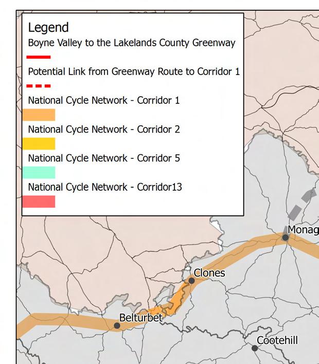
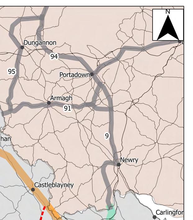
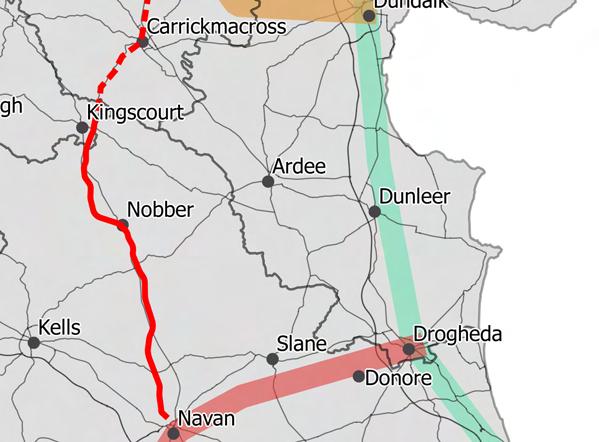
3 CONTENTS 1 INTRODUCTION Context Scope of Feasibility Study Land Ownership Condition of the Rail Line Appropriate Assessment Health Impact Assessment Project Methodology Overall Methodology WP 1: Desktop Review WP 2: On Site Assessments WP 3: Stakeholder Consultation WP 4: Community Consultation WP 5: Route and Loop Specifications WP 6: Links to Other Strategies and Policies WP 7: Business Case WP 8: Implementation Plan Policy Context and Design Guidance Policy Context Guidance Documents Desktop Review The Route History of the Navan Kingscourt Railway The National Cycle Network Other Regional Trails and Tourist Attractions Future Developments Navan Railway, Navan North Train Station National Monuments Natura 2000 Sites... 22
4 5 Existing Characteristics of the Rail Corridor Trail Sections Navan Town Park to Kilberry ( 0 4km) Kilberry to Wilkinstown (4km 8km ) Wilkinstown to Castletown (8km 12km) Castletown to Nobber (12km 16km) Nobber (16km 20km) Nobber to Kilmainhamwood (20km 24km) Kilmainhamwood to Enniskeen (24km 28km) Enniskeen to Kingscourt (28km 30km) OPTIONS CONSIDERED Route Alignment Greenway Width Surface Finish Retention or Removal of the tracks and sleepers Lighting CONSULTATION Stakeholder Groups Removal or retention of the tracks and sleepers Rail line classification and ownership Development, construction and maintenance of the Greenway Replacement of the N52 bridge Decontamination of lands at Gyproc Health Benefits Identification of potential local walking and cycling loops Recommended Greenway Specification Route Maps Greenway Width Greenway Gradient Greenway Path Specification Screening... 52
5 8.6 Fencing Road Crossings Farm Crossings and other Access Crossings Trail head/parking locations Project Costs and Implementation Plan Implementation Plan Project Cost Estimate Business Case Introduction Data Sources Estimated Number of Users Estimated Spend Summary of Estimated Users and Spend Conclusion Appendix A: Route Character Maps Appendix B: Route Specification Maps Appendix C: National Monuments within 500m
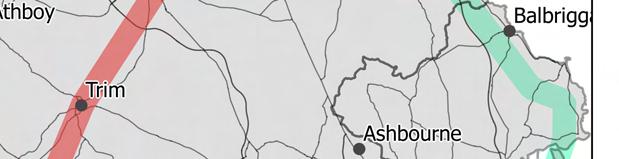
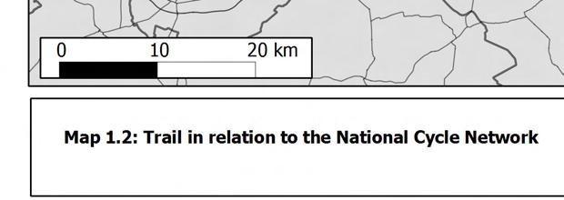
6 1 INTRODUCTION 1.1 Context Kieran Boyle Consulting was appointed by the Navan to Kingscourt Railway Committee to carry out a feasibility study of the development of the disused Navan to Kingscourt railway line as a Greenway for both walkers and cyclists. The route would be approximately 30 km in length would extend from the major tourist and amenity area of the Boyne Valley in Navan to Kingscourt, in County Cavan, which is known as the Lakelands County The proposed route of the Boyne Valley to Lakelands County Greenway (BVLCG) is shown on Map 1.1. The Greenway would accommodate walkers and cyclists from the local communities and the wider region and national and international tourists alike and Map 1.2 illustrates the scheme in this context. The route will be linked to the national cycle network and to the existing national cycle routes in Northern Ireland. Given the proximity of the route to the Greater Dublin Area and the towns of Navan, Drogheda and Dundalk, it is anticipated that the route would attract a high level of use and would thus benefit the region in terms of the local economy, tourism and public health The development of the greenway is in accordance with national policy across a number of sectors and the specific objectives of the BVLCG are to: Make better use of an existing, disused transport corridor Create a first class walking and cycling facility for local communities Create a tourist attraction which can contribute to the economic development of the local communities and the wider region. Encourage use of a sustainable mode of transport which interlinks with local amenities, services and existing public transport, Promote the National Cycle Policy Framework and support the National Recreation Strategy Help tackle obesity and promote activity Raise the profile of cycling and encourage people to cycle 1.2 Scope of Feasibility Study The scope of this feasibility study is to examine the technical and practical aspects of redeveloping the disused Navan- Kingscourt Railway line into an off-road walking/cycling greenway. The study also contains a robust cost estimate for the scheme and an assessment of the business case for the scheme. The feasibility study is extensive in scope and is addressing the key issues outlined below. All of these issues are addressed under cover of this report apart from the Appropriate Screening which is contained under separate cover. Route specification: Form of construction, width, surface finish, drainage; 1
7 Health and Safety: Bridges, road crossings, fencing, access to farm land; Environmental Assessment: Appropriate Assessment Screening; Project Costs; Project Phasing and Implementation Plan, and; Business Case: Economic Impact Assessment. 1.3 Land Ownership The rail line is entirely on the ownership of CIE and is classified as a disused rail line. The line is operated by Irish Rail in terms of the on-going maintenance. Because the line is entirely within the ownership of the State this removes a significant potential barrier to the development of the Greenway The feasibility study has identified a practical option for the greenway to be developed and maintained by Meath County Council and Cavan County Council through a license agreement with CIE which would facilitate the route to be reopened as a rail line in the future. The line would remain in the freehold ownership of CIE and would retain its disused classification. 1.4 Condition of the Rail Line In overall terms the rail corridor offers a relatively flat alignment which is ideal for recreational walkers and cyclists and can readily be redeveloped as a Greenway. The rail tracks and sleepers are by and large still in place but are no longer fit for purpose for carrying rail services. If the line was to be reopened to rail traffic then the tracks and sleepers would be required to be removed and replaced. The option of retaining or removing the track and sleepers was considered and the recommendation is to remove the tracks and sleepers The structure of the line in terms of embankments and bridges are well maintained with the exception of the N52 under bridge which was recently removed following a collision. Drainage routes are currently not maintained which leads to standing water on the line at some locations, in particular in sections of cut, however drainage could be readily re-established along the Greenway corridor. 1.5 Appropriate Assessment The feasibility study is the subject of a screening report for the required Appropriate Assessment that will determine if the project requires a Natura Impact Statement (NIS) to assess the potential impact of the project on Natura 2000 sites within its area of influence. In addition, If the planning authority determines that the project may have a significant impact on the environment, a sub threshold Environmental Impact Assessment will be required as part of the planning process. Based on the findings of the Appropriate Assessment screening Meath County Council consider it highly unlikely that a Natura Impact Statement or sub-threshold EIS would be required. 2
8 1.6 Health Impact Assessment A Health Impact Assessment of the project has been carried out in parallel to this feasibility study. This study was carried out by the Health Services Executive (HSE), in accordance with the Institute of Public Health guidance, and assessed the potential effects of the Greenway on the health of the population and the distribution of those effects within the population. 3

9 Legend Boyne Valley to the Lakelands County Greenway Main Town Names km Map 1.1: Boyne Valley to the Lakelands County Greenway - Route


10
11 2 PROJECT METHODOLOGY 2.1 Overall Methodology The project methodology was based on specific tasks defined as Work Packages. Eight Work Packages were identified and executed, as identified in Table 2.1 and summarised below. WP No 2.2 WP 1: Desktop Review Task 1 Desktop Review Work Packages 2 On Site Assessment 3 Stakeholder Consultation 4 Community Consultation 5 Route Specification 6 Links to Other Strategies and Policies 7 Business Case 8 Implementation Plan Table 2.1: Work Packages A comprehensive desk top review of the route was carried out including a review of mapping and photography of the rail line and potential loops and linkages, collation of best practise guidance for the development of walking and cycling routes and greenways and the review of relevant linked strategies. 2.3 WP 2: On Site Assessments A number of site visits were undertaken including a walkthrough of the entire route. A GPS unit was utilised on this site audit, allowing for the accurate recording of required information. The information was be recorded using a bespoke template that was used to develop the mapping, specification and cost estimate. The following information was recorded on site Existing rail line conditions, available width and drainage Structures including bridges, culverts, station platforms and buildings etc. Road crossings Features including existing and potential gates, cycle parking, signage etc. Access points, linkages and local loops, Construction and maintenance access points, 6
12 Adjacent land use and land ownership, Health and Safety issues 2.4 WP 3: Stakeholder Consultation Consultation was carried out with key stakeholders including Meath County Council, Cavan County Council, Irish Rail and the HSE. The main purpose of this consultation was to review the main opportunities and potential constraints along the route and to inform practical solutions that would facilitate the feasibility of delivering the Greenway. 2.5 WP 4: Community Consultation Community consultation was carried out to identify the existing and potential local walking and cycling loops that would be integrated into the Greenway. Future community consultation was undertaken as part of the Health Impact Assessment for the project. 2.6 WP 5: Route and Loop Specifications This work package formed key element of the study to determine the feasibility, specification and cost of the greenway. The route mapping was produced on a GIS base and the route was subdivided into coherent sections for the presentation of the route maps at an appropriate scale. The maps identify the salient existing conditions on the route and the recommended route specification in terms of construction, surface finish, width and drainage. The route specification was prepared in spread sheet format based on a route chainage identified on the route maps. This specification formed the basis for the cost estimate Proposed cross sections were produced as part of the design specification requirements. These sections identify variances in existing conditions and represent the recommended construction details where these variances occur along the route. Structures and road crossing required specific attention. The key structures are the embankments and the main road and river / watercourse bridges which were identified on the route maps and the required remedial work were identified. 2.7 WP 6: Links to Other Strategies and Policies As part of the desk top review and stakeholder consultation all links to other strategies and policies were identified. This section of the study was used to underline the cross-sectoral benefits of the greenway in terms of health, tourism, local amenity, social capital and the local economy. 7
13 2.8 WP 7: Business Case An Economic Impact Assessment will be developed based on evidence from various sources including Sustrans, the Great Western Greenway, census data, Failte Ireland tourism statistics and evidence from Greenway research across Europe and the United States. The direct economic benefits were identified in terms of potential spend from local users, domestic visitors and overseas tourist. These will were based on the potential number of annual users of the route from each of these user group classifications and their potential daily spend including bed nights. 2.9 WP 8: Implementation Plan An Implementation was developed that summarise the key actions required to deliver the Greenway from the planning approval stage through to construction. This Plan details in particular the planning approval stage and the potential requirements and options for achievement of planning. A programme for the delivery of the project through to completion of construction has been developed. 8
14 3 POLICY CONTEXT AND DESIGN GUIDANCE 3.1 Policy Context The following key documents have been reviewed to identify the relevant policies and objectives associated with the development of the proposed Greenway. National Level Smarter Travel Policy The National Guidelines on Physical Activity for Ireland Regional Level Regional Planning Guidelines National Cycle Policy Framework The Rural Development Programme Local Level Meath County Development Plan Cavan County Development Plan Navan Local Area Plan Kingscourt Local Area Plan National Level Smarter Travel Policy Overall Aims: To achieve a sustainable transport system by Relevant Objectives: o To create a strong cycling culture in Ireland and ensure that all cities, towns, villages and rural areas will be cycling-friendly. o Commitment to creating a culture of walking in Ireland, with recognition that there is strong convergence between walking as a tourism asset and walking as recreational activity for local residents. This in turn complements a culture of walking as a mode of everyday transport, by encouraging people to walk as a matter of routine. National Cycle Policy Framework Aim: To create a strong cycling culture in Ireland and ensure that all cities, towns, villages and rural areas will be bicycle friendly and that the bicycle will be the transport mode of choice for all ages.a culture of cycling will have developed in Ireland to the extent that, by 2020, 10% of all trips will be by bike. Relevant Objectives: o Support the planning, development and design of towns and cities in a cycling and pedestrian friendly way. o Provide designated rural signed cycle networks providing especially for visitors and 9
15 recreational cycling. Encouraging recreational cycling is a key element of creating a cycling culture in Ireland and recreational routes in and around urban areas, which, in turn link to rural areas are very important. o Provide Cycling-Friendly Routes To All Schools, Provide Adequate Cycling Parking Facilities Within Schools And Colleges, And Provide Cycling Training To All School Pupils o Ensure that all cycling networks - both urban and rural - are signposted to an agreed standard. o Ensure Proper Integration Between Cycling And Public Transport (PT) The National Guidelines on Physical Activity for Ireland Aim: To emphasise the importance of physical activity to the health of all Irish people; and outline the recommendations for physical activity for people of all ages and abilities. Provides guidelines for recommended physical activity for different age groups (2-18, and 64+ age groups and for adults with disabilities). The Rural Development Programme Aim / Objective: Focuses on three key objectives 1) Increasing the competitiveness of the agricultural sector through support for restructuring. 2) Enhancing the environment and countryside through support for land management. 3) Strengthening the quality of life in rural areas and promoting diversification of economic activities. Regional Level Regional Planning Guidelines For The Greater Dublin Area Overall Aim: The GDA by 2022 is an economically vibrant, active and sustainable international Gateway Region, with strong connectivity across the GDA Region, nationally and worldwide; a region which fosters communities living in attractive, accessible places well supported by community infrastructure and enjoying high quality leisure facilities; and promotes and protects across the GDA green corridors, active agricultural lands and protected natural areas. Relevant Objectives o Continuous development and delivery of Regional & Local Cycle network. o Increase opportunities and ease of access to countryside and areas of interest for residents, wildlife and biodiversity, with focus on promoting river corridors, Natura 2000 sites, nature reserves and other distinctive landscapes and regionally important green spaces as focal features for linkages between natural, semi natural and formalised green spaces. o Informal recreation, particularly walking and cycling, should be promoted through the development and expansion of a network of safe cycle and walking routes through and across towns, accessing parkland, in the built up area and into and through rural areas 10
16 Local Level Meath County Development Plan Transport Section Goal - To promote and facilitate the provision of the necessary transport infrastructure to fully accommodate existing and future population needs as well as the demand for economic development in an environmentally sustainable manner. Relevant Objectives o TRAN OBJ 1: To protect and safeguard the detailed designed alignment of Phase II of the Navan rail route and surrounding lands (including identified station locations). o TRAN OBJ 8: To promote and explore the development of the following linkages within the lifetime of the Development Plan (..) (ii) To provide the development of a cycle / greenway on the disused Navan Kingscourt rail line in conjunction with Cavan County Council subject to the completion of a feasibility study obtaining the necessary statutory planning consent, landowner co-operation and the securing of the necessary funding. Rural Development Section Goal - To encourage the continued sustainable development of rural communities without compromising the physical, environmental, natural and heritage resources of the County. Relevant Objectives o RUR DEV SO 8 To support and protect the existing economic base and seek to diversify the economy through both inward investment and the promotion of agriculture, forestry and tourism- related industries in rural areas. Cavan County Development Plan Transport To promote and facilitate the development of cycling and walking facilities in the County. Recreational Policy Seek to ensure the provision of recreation facilities to cater for different abilities, ages and interests within the County, as far as is practical. Tourism To promote the development of new walking routes To facilitate the protection, development and maintenance of walking and cycling routes within the County Navan Town Development Plan INF OBJ 28 To reserve the old Navan Dublin Rail line free from development given it is a proposed alignment for the Phase 2 of the Navan railway line Kingscourt Local Area Plan No relevant objectives/policies. 11
17 3.2 Guidance Documents The development of the trail specification included reference to best practice guidance from Ireland, the UK and Europe. This best practise is based on experience gained in the development of walking and cycling trails across Europe and further afield. The main guidance referenced was sourced from the following documents: A Guide to Planning and Developing Recreational Trails in Ireland National Trails Office Ireland Management Standards for Recreational Trails National Trails Office Ireland Classification and Grading for Recreational Trails National Trails Office Ireland National Cycle Manual National Transport Authority Ireland Connect 2 Greenways Design Guide SUSTRANS UK A technical guide to the design and construction of lowland recreation routes Scottish Natural Heritage Lowland Path construction A Guide to Good Practice (Paths for ALL) UK The European Greenways ; Good Practice Guide (European Commission) Pathsforall.org.uk In particular the National Trails Office recently produced guidance documents create, for the first time, clear guidance for trail development in Ireland which sets out the general criteria to be achieved if trails are to be recognised to a particular classification on the national trails register. In relation to the requirements for the routes to be traffic free this would permit the need to access the route by motorised vehicles for maintenance of the Greenway Figure 3.1 : Greenway / Shared Use Trail requirements (Reproduction of Table 8.1 from the Classification and Grading for Recreational Trails National Trails Office Ireland outlines the classification for Greenways and Shared Use Trails. The guidance outlines that for shared use walking and cycling trails a width between 2.0m and 3.0m would be desirable and that the surface should be either a consistent sealed surface or a consistent compacted material. The classification criteria were used as the main guidance for the overall specification for the Greenway The Boyne Valley to Lakelands County Greenway is being designed as a multi-user trail for by walker and cyclists of all ages. It is not intended to be used as a horse-riding trail. 12


18 Figure 3.1 : Greenway / Shared Use Trail requirements (Reproduction of Table 8.1 from the Classification and Grading for Recreational Trails National Trails Office Ireland 13
7 CONSULTATION. 7.1 Stakeholder Groups. 7.2 Removal or retention of the tracks and sleepers
 7 CONSULTATION 7.1 Stakeholder Groups 7.1.1 Stakeholder consultation has taken place with the following groups and on the following key issues during the preparation of this feasibility report Stakeholder
Overview Report. Proposed Development
 Overview Report Proposed Development the construction of a 1km cycle/pedestrian trail including a new footbridge, new car park and entrance road at Drumshanbo Lock and a new pedestrian/cycle road crossing,
North Somerset Council Local Development Framework
 North Somerset Council Local Development Framework Sites and Policies Development Plan Document Evidence Paper Re-opening Portishead Railway Line and Options for the Location of Portishead Railway Station
elbridge Core Strategy
 C elbridge Core Strategy Celbridge is designated as a Moderate Growth Town in the RPGs. The County Development Plan reinforces this designation in its settlement strategy. Moderate Growth Towns within
Strategic Environmental Assessment Screening Report. Dublin Port Masterplan Review 2017
 Strategic Environmental Assessment Screening Report Dublin Port Masterplan Review 2017 Table of Contents 1 Introduction... 1 2 Purpose of the Masterplan... 2 3 Task 1.1 Pre-Screening Check... 5 4 Task
Appendix 1 Structure plan guidelines
 Appendix 1 Structure plan guidelines This appendix forms part of the regional policy statement [rps]. 1.1. Introduction Structure plans are an important method for establishing the pattern of land use
WINCHESTER TOWN 3.1 LOCATION, CHARACTERISTICS & SETTING
 WINCHESTER TOWN 3.1 LOCATION, CHARACTERISTICS & SETTING 3.1.1 The area referred to by the City Council, as Winchester Town, consists of the Winchester Wards plus the adjoining built up areas of Badger
Newcourt Masterplan. November Exeter Local Development Framework
 Newcourt Masterplan November 2010 Exeter Local Development Framework Background The Exeter Core Strategy Proposed Submission sets out the vision, objectives and strategy for the development of Exeter up
3. Neighbourhood Plans and Strategic Environmental Assessment
 1. Introduction This report sets out a draft Screening Determination for the Preston Parish Council s Neighbourhood Plan and has been prepared by rth Hertfordshire District Council. The purpose of the
CITY VIEW OBJECTIVES
 SECTION 2: CITY VIEW OBJECTIVES CONTENTS 2.1 Introduction 1 2.2 Strategic Direction 1 2.3 The City View Resource Management Issues for the City 1 2.4 The Goal 3 2.5 The City View Objectives 3 Palmerston
Great Easton Neighbourhood Plan Statement of Basic Conditions
 Great Easton Neighbourhood Plan 2017-2031 Statement of Basic Conditions OCTOBER 2016 GREAT EASTON PARISH COUNCIL Contents 1.0 Introduction....Page 2 2.0 Summary of Submission Documents and Supporting Evidence..
WELCOME GYPSY LANE. Wider Site Location plan. Proposals for the development of LAND OFF FOXLYDIATE LANE WEBHEATH. Proposals for the development of
 WELCOME The developers are preparing an outline planning application for a residential led development and need the community s views in order to develop the proposals further WHAT IS PROPOSED? A high
20. Ballysadare Mini-Plan
 20. Ballysadare Mini-Plan 20. Ballysadare Mini-Plan Community facilities Ballysadare has a wide range of community facilities: a primary school, St Mary s College (secondary school), a health centre, playing
Dublin Mountains Project Q & A
 01 What is the background to the project? What is the Project? Why is the needed now? Why Hellfire/Masseys? What has happened so far? What is the project status now? Why is the planning application for
Appendix A. Planning Processes. Introduction
 1 Planning Processes Introduction This appendix outlines a number of planning processes which are used in the Auckland Region to support the effective management of development in the region s rural and
Parish of Repton NEIGHBOURHOOD DEVELOPMENT PLAN
 Parish of Repton NEIGHBOURHOOD DEVELOPMENT PLAN BASIC CONDITIONS STATEMENT December 2018 CEF 4 Legal Requirements This statement has been produced by the NDP Working Group on behalf of Repton Parish Council
8.0 Design and Form of Development 43/
 42/ 8.0 Design and Form of Development 43/ Rothwells Farm, Golborne/ Development Statement Figure 7. Site Constraints Key 44/ Site Boundary 360 Bus Route/Stops Existing Trees Underground Water Pipe Sensitive
Making the case for Sustainable Transport Project Potential
 Making the case for Sustainable Transport Project Potential The Structural Investment Fund (SIF) Strategy for Greater Lincolnshire identifies the barriers to growth identified by having poor transport
Sustainability Statement. Whitby Business Park Area Action Plan
 Sustainability Statement Whitby Business Park Area Action Plan November 2014 Contents Page 1. Introduction 1 2. Scoping 3 3. Sustainability Appraisal of Options 6 4. Assessment of Draft Area Action Plan
DUBLIN DOCKLANDS MASTER PLAN AND RELATIONSHIP WITH OTHER PLANS
 .1 National Policy and Programmes.1.1 Sustainable Development A Strategy for Ireland, 1997.1.2 National Climate Change Strategy, 2007-2012.1. National Development Plan 2007-201.1.4 National Spatial Strategy,
Development of green infrastructure in EU regions Nature-based solutions delivering multiple benefits
 Development of green infrastructure in EU regions Nature-based solutions delivering multiple benefits A Policy Brief from the Policy Learning Platform on Environment Introduction What is green infrastructure?
Tāhuhu whakaruruhau ā-taone The sheltering ridge pole
 B2. Tāhuhu whakaruruhau ā-taone - Urban growth and form B2.1. Issues Tāhuhu whakaruruhau ā-taone The sheltering ridge pole Auckland s growing population increases demand for housing, employment, business,
PLACE WORKSHOP REPORT. A+DS SNH sustainable placemaking programme
 PLACE briefing WORKSHOP REPORT A+DS SNH sustainable placemaking programme INTRODUCTION This report summarises the outcome of a Scottish Natural Heritage workshop on placemaking which was held on Wednesday
Chapter 3 Core Strategy
 Chapter 3 Core Strategy 3.0 Introduction The core strategy sets out how the development objectives in the Development Plan are consistent with the National Spatial Strategy and the Regional Planning Guidelines.
Plan Modification to Chapter B2 of the Auckland Unitary Plan(AUP) Operative in part (15 November 2016)
 Operative in part (15 November 2016)") UNITARY PLAN UPDATE REQUEST MEMORANDUM TO FROM Phill Reid Linley Wilkinson DATE 25 September 2018 SUBJECT Plan Modification to Chapter B2 of the Auckland Unitary Plan(AUP) Operative in part (15 November
UNITARY PLAN UPDATE REQUEST MEMORANDUM TO FROM Phill Reid Linley Wilkinson DATE 25 September 2018 SUBJECT Plan Modification to Chapter B2 of the Auckland Unitary Plan(AUP) Operative in part (15 November
28. Coolaney-Rockfield Mini-Plan
 28. Coolaney-Rockfield Mini-Plan 28. Coolaney-Rockfield Mini-Plan Community facilities Community facilities in Coolaney-Rockfield consist of a primary school, crèche, community centre, sports field and
A Growing Community Rural Settlement Areas
 Town of Huntsville Official Plan Review - POLICY BACKGROUND PAPER A Growing Community Rural Settlement Areas BACKGROUND: In addition to the fully municipally-serviced Urban Settlement Area and the Hidden
Dublin Mountains Visitor Centre
 Dublin Mountains Visitor Centre 27 th February 2017 Whitechurch Library Landowners Information Meeting PROPOSAL FOR THIS EVENING - Between 6-8pm - 20min Introduction & presentation - 10 mins brief Q&A
Neighbourhood Planning Local Green Spaces
 Neighbourhood Planning Local Green Spaces Introduction... 2 1. Why green space is important... 4 2. Neighbourhood plans and green space... 6 3. Evidence... 8 Statutory designations... 9 Green space audit...
CREATING GREEN INFRASTRUCTURE FOR IRELAND
 CREATING GREEN INFRASTRUCTURE FOR IRELAND Dr William Hynes Downey Hynes Partnership 15 th September 2010 Overview of Presentation Definition of GI Legislation and Policy Background Examples of GI-type
BRE Strategic Ecological Framework LI Technical Information Note 03/2016
 BRE Strategic Ecological Framework Technical Information Note 03/2016 September 2016 Contents 1. Introduction 2. Aims of BRE s Strategic Ecological Framework 3. How SEF is different from previous approaches
ROCHFORD LOCAL DEVELOPMENT FRAMEWORK: Sustainability Appraisal/ Strategic Environmental Assessment. Rochford Core Strategy Preferred Options Document
 ROCHFORD LOCAL DEVELOPMENT FRAMEWORK: Sustainability Appraisal/ Strategic Environmental Assessment Non Technical Summary Rochford Core Strategy Preferred Options Document October 2008 SUSTAINABILITY APPRAISAL
Town of Cobourg Heritage Master Plan. Statutory Public Meeting
 Town of Cobourg Heritage Master Plan Statutory Public Meeting April 25 th 2016 Presentation Overview 1. Introduction 2. Project background and schedule overview 3. Review of strategic direction content
10.0 Open Space and Public Realm
 10.0 Open Space and Public Realm 10.0 Open Space and Public Realm The Public Open Space System is comprised of: outdoor spaces available for public use that are either publicly owned (e.g., parks and
Navan 1. Nevinstown 2. Farganstown 3. Liscarton
 Review of Economic Development Sites and Residential Lands regarding the Proposed Variation No. 3 (Phase 3b) for Meath County Council Navan Review of Economic Development Sites regarding the Proposed Variation
Place Brief. National Collections Facility (NCF site)
") Place Brief. National Collections Facility (NCF site) Contents 1.0 Purpose 2.0 Location and Proposal 3.0 Vision and Aim 4.0 Placemaking Principles 5.0 Conclusion Plan 1 Location Plan Plan 2 Placemaking
Place Brief. National Collections Facility (NCF site) Contents 1.0 Purpose 2.0 Location and Proposal 3.0 Vision and Aim 4.0 Placemaking Principles 5.0 Conclusion Plan 1 Location Plan Plan 2 Placemaking
Neighbourhood Planning Guidance Local Green Spaces
 Neighbourhood Planning Guidance Local Green Spaces Introduction This guidance note has been produced for communities preparing neighbourhood plans in North Dorset to help them to identify, assess and designate
Welcome to our exhibition
 Welcome to our exhibition housing development A46 Wildmoor Alcester Road Canal Quarter A422 Town Centre housing development Warwickshire-based IM Properties, one of the UK s largest privately owned property
7. The Landscape. 7.1 Introduction. Environmental Impact Statement (EIS) Scoping Report
 Scoping Report") 7. The Landscape 7.1 Introduction The purpose of this section of the EIS Scoping Report is to describe the scope of work and methods to be applied in the identification and assessment of landscape and
7. The Landscape 7.1 Introduction The purpose of this section of the EIS Scoping Report is to describe the scope of work and methods to be applied in the identification and assessment of landscape and
Elderberry Walk. Developer HAB Housing
 Case studies Elderberry Walk Developer HAB Housing Development of 161 new homes on the former Dunmail Primary School site, focused around a central green street, with retained trees, new multifunctional
CITY OF CHARLOTTESVILLE, VIRGINIA CITY COUNCIL AGENDA
 CITY OF CHARLOTTESVILLE, VIRGINIA CITY COUNCIL AGENDA Agenda Date: December 16, 2013 Action Required: Adoption of Resolution Presenter: Staff Contacts: Title: James E. Tolbert, AICP, Director of NDS James
INTRODUCTION NORTH HEYBRIDGE GARDEN SUBURB
 INTRODUCTION This event is being hosted by the promoters of the proposed North Heybridge Garden Suburb who are working with Maldon District Council and other key stakeholders on the preparation of a comprehensive
Scottish Natural Heritage. Better places for people and nature
 Scottish Natural Heritage Better places for people and nature Contents Summary... 3 SNH approach... 5 Place-making in policy and practice... 6 Developing the contribution of the natural heritage to place-making...
ALLERTHORPE NEIGHBOURHOOD PLAN
 Allerthorpe s Neighbourhood Plan sets out a vision for the Parish for the next 15 years (2018 2033) that builds on and reflects the opinions and views of parish residents. VISION In 2033 Allerthorpe will
I615. Westgate Precinct
 I615. Westgate Precinct I615.1. Precinct Description The Westgate Precinct is located approximately 18km west of the Auckland city centre. There are seven Sub-precincts in the Westgate Precinct: Sub-precinct
Summer North West Greenway Network - Information Booklet
 NORTH WEST GREENWAY NETWORK Summer 2018 1 Overview This leaflet provides an overview of the North West Greenway Network, a project led by Derry City and Strabane District Council working in partnership
SOUTH CAMBRIDGESHIRE DISTRICT COUNCIL. Planning and New Communities Director
 SOUTH CAMBRIDGESHIRE DISTRICT COUNCIL REPORT TO: Planning Committee 9 January 2013 AUTHOR/S: Planning and New Communities Director S/2270/12/FL FEN DRAYTON 850m long flood defence embankment ranging in
SUB AREA 3 CENTRAL STRATFORD AND SOUTHERN QUEEN ELIZABETH OLYMPIC PARK
 191 ADOPTED LOCAL PLAN: THE SUB AREAS SUB AREA 3 CENTRAL STRATFORD AND SOUTHERN QUEEN ELIZABETH OLYMPIC PARK SECTION 12 Vision VISION Central Stratford and Southern Queen Elizabeth Olympic Park will become
Variation No 1: Dundalk & Environs Development Plan Core Strategy
 Variation No 1: Dundalk & Environs Development Plan 2009-2015 Core Strategy Adopted on 29 th August 2011 CONTENTS Page Section 1 1.0 Synopsis 1 1.1 Background Document 1 1.2 Variation of Dundalk and Environs
3. VISION AND GOALS. Vision Statement. Goals, Objectives and Policies
 Vision Statement Queen Creek s interconnected network of parks, trails, open spaces and recreation opportunities provide safe and diverse activities and programs that sustain its unique, small town, equestrian
Appendix. Statement Outlining Compliance with Ministerial Guidelines
 18 Appendix Statement Outlining Compliance with Ministerial Guidelines A18 Statement Outlining Compliance with Ministerial Guidelines Under section 28 of the Planning and Development Act 2010, Meath County
Circular L8/08 2 September Water Services Investment and Rural Water Programmes Protection of Natural Heritage and National Monuments
 Circular L8/08 2 September 2008 Water Services Investment and Rural Water Programmes Protection of Natural Heritage and National Monuments 1. The purpose of this Circular is to provide local authorities
Visioning Statement and Guiding Principles
 Visioning Statement and Guiding Principles Planning for the Future The General Plan The General Plan represents Woodland's shared vision of the future and defines a path to lead the community toward its
Comprehensive Plan ADOPTED APRIL 2014
 Comprehensive Plan ADOPTED APRIL 2014 8 8. Outstanding Recreational & Cultural Opportunities We are proud of our community s parks and recreation system. Our community will ensure that the legacy of our
CHAPTER 8 ISSUES, CONCERNS, CONSTRAINTS AND OPPORTUNITIES
 CHAPTER 8 ISSUES, CONCERNS, CONSTRAINTS AND OPPORTUNITIES Introduction This River Conservation Plan was developed during a time of tremendous activity and effort in planning the transformation of the Delaware
Preface. Erie. Scranton. Allentown. Pittsburgh. Harrisburg. Philadelphia
 The Southern Alleghenies Region The Southern Alleghenies Region spans the Laurel Highlands and Allegheny Front in the west across the Appalachians to the east. It is comprised of Blair, Bedford, Cambria,
Guide. Guide to Regional Planning Policies. Background
 Guide Guide to Regional Planning Policies January 2017 Background The Strategic Planning Policy Statement for NI - Planning for Sustainable Development - sets out the Department s regional planning policies
38 Queen s University Campus Master Plan Part 1
 38 Queen s University Campus Master Plan Part 1 46 The Campus at the City Scale Chapter 4 The Campus at the City Scale 39 Queen s is an urban University centrally located in Kingston. Decisions made by
Study of the Economic Value of Northern
 Study of the Economic Value of Northern Ireland s Historic Environment Summary Report on behalf of: Department of the Environment June 2012 eftec and RSM McClure Watters i May 2012 1 Introduction to the
CHARLES PUTMAN CHARLES PUTMAN AND ASSOCIATES, INC
 MEMORANDUM CHARLES PUTMAN & ASSOCIATES, INC. LAND DEVELOPMENT CONSULTANTS PLANNING ZONING PERMITTING 4722 NW Boca Raton Boulevard, Suite C-106 Boca Raton, Florida 33431 Phone: 561/994-6411 FAX: 561/994-0447
The Meath County Development Plan will provide the main public statement of planning policies and objectives at county level.
 Meath County Council are delighted to engage in this public consultation process in relation to the review of the Meath County Development Plan 2007-2013 and the preparation of the next County Development
Wind energy development in the South Pennines landscape
 Wind energy development in the South Pennines landscape Programme for today Background Policy context South Pennines landscape Impacts of wind energy development The South Pennines Wind Energy Landscape
Midtown Greenway Land Use and Development Plan Executive Summary
 Midtown Greenway Land Use and Development Plan Executive Summary Introduction The Midtown Greenway Land Use and Development Plan sets policy direction for land use and development in the Midtown Greenway
Colchester Northern Gateway Master Plan Vision Review Draft. July 2016
 Colchester Northern Gateway Master Plan Vision Review Draft July 2016 Contents Introduction 4 Context 8 Purpose of the Report 8 Strategic Position 9 Overview of the Process 11 2012 Master Plan Vision 12
Basic Conditions Statement
 POTTON NEIGHBOURHOOD DEVELOPMENT PLAN Basic Conditions Statement Date: 19/10/2018 Version: 1 Status: draft Table of Contents 1 INTRODUCTION... 3 1.1 POTTON NEIGHBOURHOOD PLAN DESIGNATED AREA... 3 1.2 PREPARATION
Welcome to our exhibition
 Welcome to our exhibition The Homes & Communities Agency (HCA) welcomes you to this public exhibition explaining our proposals for the redevelopment of the former Lea Castle Hospital site. About the Homes
EVALUATION OF MASTER PLAN ALTERNATIVES
 7 The Environmental Report is required to identify, describe and evaluate reasonable alternatives, taking into account the objectives and geographical scope of the Master Plan 2008. Three plan alternatives
Response to the London Bridge Area Vision and Site Allocations within the New Southwark Plan
 1 Melior Place London SE1 3SZ 020 7407 4701 teamlondonbridge.co.uk info@teamlondonbridge.co.uk 28 April 2017 Response to the London Bridge Area Vision and Site Allocations within the New Southwark Plan
I-70 Corridor Enhancement Plan
 i - Table of Contents Table of Contents Chapter I Overview Chapter II Bridge and Roadway Improvements Chapter III Landscape Enhancements Chapter IV Riparian Corridors Chapter V Showcase Missouri Plan Chapter
DEVELOPMENT MANAGEMENT REPORT
 ITEM A08-1 DEVELOPMENT MANAGEMENT REPORT TO: BY: DATE: DEVELOPMENT: SITE: WARD: APPLICATION: APPLICANT: Development Management Committee Development Manager Proposed live/work unit in connection with existing
CLOUGHJORDAN SETTLEMENT PLAN
 CLOUGHJORDAN SETTLEMENT PLAN 1.0 General Introduction and Development Context Location The market town of Cloughjordan lies close to the border with Offaly at the junction of the R490 and R491 Regional
The New Planning System 5 June 2015
 The New Planning System 5 June 2015 The Purpose of the Planning System The town and country planning system exists to regulate the development and use of land in the public interest. The public interest
Public Consultation. Land at Monks Farm, North Grove. Welcome
 Welcome Welcome to our public exhibition for development on Land at Monks Farm, orth Grove. Gallagher Estates and Gleeson Strategic Land are preparing an outline planning application for new homes, open
Inspiring Technovation
 1 2 Table of content List of table and figures... Executive summary... 1. Introduction... 2. Material and methods... 3. Results... 3.1 Today s facts about Versailles: a diagnostic approach... 3.1 Vision
Schedule of Planning Applications Committee Date: 23 May Reference: 06/17/0726/F Parish: Hemsby Officer: Mr J Beck Expiry Date:
 Schedule of Planning Applications Committee Date: 23 May 2018 Reference: 06/17/0726/F Parish: Hemsby Officer: Mr J Beck Expiry Date: 22-05-2018 Applicant: Proposal: Site: Mr Gillett Change of use to the
Public Realm: Publicly accessible streets, footpaths, parks, squares, bridges, public buildings and facilities.
 Welcome Introduction Welcome to the public consultation process for the Draft Ballinrobe Public Realm Plan. These presentation panels explain the findings of the process and a series of draft projects
Preliminary Plan Framework: Vision and Goals
 Preliminary Plan Framework: Vision and Goals Draft: May 2015 Introduction Since the Town of Milliken s comprehensive plan was last updated in 2010, the community was heavily impacted by the 2013 flood,
DLR Open Space Strategy. Final Draft Report April 2010
 I DLR Open Space Strategy Final Draft Report April 2010 Urban parks and green spaces are an essential part of the urban heritage and infrastructure, being a strong element in the architectural and landscape
Chapter 2: OUTLINE PLANNING APPLICATION PROPOSALS. A New Garden Neighbourhood Matford Barton 17
 Chapter 2: OUTLINE PLANNING APPLICATION PROPOSALS A New Garden Neighbourhood Matford Barton 17 2.1. SUMMARY AND STATUS OF THE PROPOSALS 2.1.1. The parameter plans and associated wording in this chapter
Connecting Nature and People
 Comhairle Contae Fhine Gall Connecting Nature and People Fingal: An Irish Local Authority s experience Gerry Clabby Europarc Conference, Killarney, Ireland, 28 September 1 October 2014 Planning and Strategic
KELLS DEVELOPMENT PLAN
 KELLS DEVELOPMENT PLAN 2013-2019 J Statement Outlining Compliance with Ministerial Guidelines Adopted 7th October 2013 APPENDIX J STATEMENT OUTLINING COMPLIANCE WITH MINISTERIAL GUIDELINES Under section
An Bord Pleanála. Eirgrid Plc. Meath County Council Cavan County Council Monaghan County Council
 An Bord Pleanála Ref: PL02.VS0002 Prospective Applicant: Eirgrid Plc. Local Authorities: Meath County Council Cavan County Council Monaghan County Council Nature of Application: Written opinion on information
Town of Oakville Streetscape Strategy
 Town of Oakville Streetscape Strategy Endorsed by PDC on February 10, 2014 (PD-011-14) Town of Oakville Streetscape Strategy [endorsed by PDC February 10, 2014] 0 Town of Oakville Streetscape Strategy
Regeneration Initiatives in Monaghan
 Regeneration Initiatives in Monaghan Monaghan: Border Town Context Town pop. 7,678, MD pop. 20,891, County pop. 61,386 (Census 2016) Challenge of building critical mass of population Indigenous agri-food
LITTLE FRANCE PARK, EDINBURGH
 LITTLE FRANCE PARK, EDINBURGH INTEGRATING ACTIVE TRAVEL ROUTES WITHIN A MASTERPLAN FROM THE OUTSET Location: Implemented: Edinburgh, Scotland 2016 - ongoing CASE STUDY The Little France Park cycling and
Drrumconrratth Wrriitttten Sttattementt. Position in Settlement Hierarchy Village - Local centre for services and local enterprise development
 Drrumconrratth Wrriitttten Sttattementt Settlement Drumconrath Position in Settlement Hierarchy Village - Local centre for services and local enterprise development Position in Retail Strategy Level 4
URBAN MOBILITY PLAN PERSPECTIVES FOR APPROVED BY THE COMMUNITY COUNCIL MEETING ON 20 JUNE 2011
 URBAN MOBILITY PLAN 2010-2015 PERSPECTIVES FOR 2030 APPROVED BY THE COMMUNITY COUNCIL MEETING ON 20 JUNE 2011 The Sustainable Urban Mobility Plan (PDU in French) is an institutional document defining the
Valuing Historic Places
 Valuing Historic Places Introduction Historic buildings and places have played an increasingly central role in the delivery of a range of public benefits, including education, economic development, sustainable
Welcome to the Oakridge Centre Open House
 Welcome to the Oakridge Centre Open House Why is the City hosting this event? This open house is to inform you of a rezoning application submitted to the City of Vancouver to amend the existing CD-1 (Comprehensive
14.5 HOPEFIELD: (REFER PLAN 39 AND PLAN 40)
") URBAN DYNAMICS WESTERN CAPE INC. 248 14.5 HOPEFIELD: (REFER PLAN 39 AND PLAN 40) FIGURE 83: LOCALITY - HOPEFIELD Within the context of the Saldanha Bay Municipal area, Hopefield, an historical agricultural
URBAN DYNAMICS WESTERN CAPE INC. 248 14.5 HOPEFIELD: (REFER PLAN 39 AND PLAN 40) FIGURE 83: LOCALITY - HOPEFIELD Within the context of the Saldanha Bay Municipal area, Hopefield, an historical agricultural
Former North Works, Lickey Road, Longbridge, Birmingham
 Committee Date: 14/11/2013 Application Number: 2013/06431/PA Accepted: 27/08/2013 Application Type: Full Planning Target Date: 26/11/2013 Ward: Longbridge Former North Works, Lickey Road, Longbridge, Birmingham
Hobart A Strategic Framework
 Hobart 2025 A Strategic Framework Adopted by the Hobart City Council 15 October 2007 Table of Contents Introduction...2 Vision and Future Directions...3 FD1 Offers opportunities for all ages and a city
Planning and Regulatory Committee 20 May Applicant Local Councillor Purpose of Report
 Planning and Regulatory Committee 20 May 2014 7. APPLICATION FOR PLANNING PERMISSION FOR THE CARRYING-OUT OF DEVELOPMENT PURSUANT TO PLANNING PERMISSION REFERENCE NUMBER 603451 DATED 28 FEBRUARY 2007 WITHOUT
University of Saskatchewan CAMPUS MASTER PLAN. Senate Meeting Preliminary Presentation. April 21, 2018 DIALOG ECS DA WATT
 University of Saskatchewan CAMPUS MASTER PLAN Senate Meeting Preliminary Presentation April 21, 2018 DIALOG ECS DA WATT project process presentation agenda Stakeholder Engagement Project Control phase1
Guidelines for Planning Authorities and Part V of the Planning and Development Act 2000: December 2000
 Slide 1 Slide 2 Slide 3 Slide 4 As a planner in practice, whether within the Local Authority, private practice or An Bord Pleanala, due regard must be given to the guidance provided by the Department in
Connecting rural dwellings with rural development
 Connecting rural dwellings with rural development Dr Mark Scott Department of Planning and Environmental Policy University College Dublin Mark.Scott@ucd.ie Introduction Growing emphasis in the EU is being
and services The protection and conservation of environmentally significant and sensitive natural heritage features and functions.
 6. Land Use 6.0 Preamble A healthy and livable city is one in which people can enjoy a vibrant economy and a sustainable healthy environment in safe, caring and diverse neighbourhoods. In order to ensure
RURAL ZONE - POLICY. Rural Zone Policy. Issue: Rural Environment. Ruapehu District Plan Page 1 of 8
 Rural Zone Policy RU2 RURAL ZONE - POLICY RU2.1 Introduction The natural resources of the rural environment in the Ruapehu District provide the basis for the existing and potential character, intensity
Official Plan Review
 Official Plan Review Summary Report - The Built Environment August 2014 Part 1: Introduction Planning for a healthy, prosperous and sustainable community is an important goal for our municipality. From
K. SMART ASSOCIATES LIMITED
 Planning Justification Report Zoning By-Law Amendment 185 King Street North Waterloo, Ontario April 7th, 2017 Project Reference Number 16-245 K. SMART ASSOCIATES LIMITED CONSULTING ENGINEERS AND PLANNERS