NORTH QUINCY STREET PLAN ADDENDUM
|
|
|
- Paul Warner
- 5 years ago
- Views:
Transcription


1 NORTH QUINCY STREET PLAN ADDENDUM
2 a2 North Quincy Street Plan Addendum Adopted by the Arlington County Board on February 23, 2013 TABLE OF CONTENTS PAGE I. INTRODUCTION...1 ACKNOWLEDGEMENTS Members of the Planning Commission s Long Range Planning Committee and Invited Participants: Ellen Armbruster, Bernie Berne, Liz Birnbaum, Seth Carus, Rosemary Ciotti, Steve Cole, Judah Del Cais, Mark Falcone, Peter Fallon, Tom Flournoy, Chris Forinash, Bill Gearhart, Brian Harner, Nancy Hunt, Nancy Iacomini, Carrie Johnson, Karen Kumm Morris, Richard Lake, Inta Malis, Ralph Mastantuono, Charles Monfort, Jim Richardson, Paul Ropp, Terry Serie, and Steve Sockwell. Ashton Heights Civic Association 2013 North Quincy Street Plan Addendum II. PLANNING HISTORY FOR THE AREA...5 North Quincy Street Plan...5 West Ballston Land Use Study...5 III. AREA ANALYSIS...7 Land Use and Zoning...7 Recent Development...7 Multimodal Transportation...11 Existing Conditions Summary...13 IV. PLANNING PRINCIPLES + CONCEPTS...15 Transportation...17 Land Use...19 Building Form...21 Open Space...25 Bluemont Civic Association Buckingham Community Civic Association Ballston Crest Homeowners Association Hyde Park Condominium Association Thomas Street Mews Homeowners Association Department of Community Planning, Housing and Development, Planning Division Department of Environmental Services, Division of Transportation and Development Arlington Economic Development, Real Estate Services Group V. RELATIONSHIP TO 1995 NORTH QUINCY STREET PLAN...27 VI. IMPLEMENTATION RECOMMENDATIONS...28 APPENDIX Street Cross Sections...31 Department of Park and Recreation, Park Development Division
 Study Area, and Original (1995) North Quincy Street Plan Area (2011 Aerial")
3 a3 Quincy Street Plan Area Study Area: East Side Study Area: West Side 2013 North Quincy Street Plan Addendum Study Area Original 1995 North Quincy Street Plan Study Area and Adopted North Quincy Street Coordinated Mixed-Use District 2012 North Quincy Street Plan Addendum (NQSP) Study Area, and Original (1995) North Quincy Street Plan Area (2011 Aerial Image)
 property at 585 N. Glebe Road.")
4 I. INTRODUCTION 1 Planning Impetus In 2009, Arlington began a review of part of the original North Quincy Street Plan (NQSP) area. This planning study responded to the Founders Square site plan approval and a proposed site plan amendment for the Mercedes Benz of Arlington (MBA) property at 585 N. Glebe Road. Initially, this study focused on the southwestern quadrant of the original NQSP area, which had not changed significantly since the Plan s adoption in As of 2012, the properties in this area included a mix of commercial and light industrial uses, many of which related to MBA operations. West Side Study Area During the study, the LRPC wished to explore potential development opportunities that might arise through the consolidation of MBA s local operations and facilities on the east and west sides of N. Glebe Road in south Ballston. As a result, several owners and potential developers of property on the west side of N. Glebe Road between N. Carlin Springs Road and N. Henderson Road began to analyze their sites and develop preliminary concepts for a consolidated, redevelopment project capable of meeting each property owner s objectives. The LRPC-led special study was then expanded to include the subject properties west of N. Glebe Road North Quincy Street Plan Addendum East Side Study Area The primary forum for this study was the Long Range Planning Committee (LRPC) of the Planning Commission, and included affected civic associations, pertinent property owners and other stakeholders. The study first aimed to determine whether the community vision for this general area, as described in the NQSP and the North Quincy Street Coordinated Mixed-Use District on the General Land Use Plan, needed updating. This question was timely given the preceding approval of Founders Square, with a scale of development more intensive than that anticipated in the NQSP. Through the study, a set of guiding principles with illustrations would be developed and included in a new plan document to update the vision for this area. In addition, this new plan document supersedes the NQSP for the block west of N. Quincy Street, while affirming the NQSP principles and guidance for the block east of N. Quincy Street. (For planning guidance for the NQSP block between N. Quincy Street and N. Pollard Street, the 1995 NQSP should be referenced.) Although Glebe and Randolph Park is strategically located in an area connecting the east and west side study areas, the separate planning of this small piece of the Ballston Common Mall block was not included as part of the Plan Addendum scope. Should the opportunity present itself in the future, the County will address the planning of the Ballston Common Mall block (inclusive of Glebe and Randolph Park) at that time. Ballston s Southern Gateway, looking north up N. Glebe Road
5 Role of the Plan Addendum The North Quincy Street Plan Addendum herein provides refined planning guidance for future development in the southern gateway area of Ballston. This refined guidance is communicated through a set of overarching and specific planning principles, concept maps, and other exhibits addressing topics such as land use, transportation, building form, and open space. It sets the stage for discussion around future private development proposals and County investments that may be proposed for the area over the next several decades. As a long range planning document, this Addendum provides a guiding framework for future redevelopment in the area. This framework is clear on the elements most important to the area, and is flexible enough to accommodate a range of development scenarios. Aside from those areas where the plan expressly reserves flexibility for future decisions on specific elements, plan recommendations as a rule of thumb should generally not be deviated from without good reason. Included in this Plan Addendum are a series of recommendations for consideration of future General Land Use Plan amendments in the study area. With the exception of adding an open space symbol and updating Note 14 on the GLUP map and the text for the North Quincy Street Coordinated Mixed-Use District in the GLUP booklet, no other GLUP amendments are being acted on at the time of Plan Addendum adoption. However, the Plan Addendum does include several recommendations to consider two potential GLUP amendments in conjunction with future site plan proposals for select areas within the study area. These recommendations provide a basis for future consideration of such GLUP amendments with site plan development proposals, to be reviewed and discussed by the Site Plan Review Committee and through other community forums. In addition, any associated rezonings that might be required to support the requested site plan application would also be part of those discussions, as no rezonings or other development entitlements are within the scope of this Plan Addendum. Structure of the Plan Addendum The Plan Addendum is divided into six sections: Introduction, Planning History for the Area, Area Analysis, Planning Principles + Concepts, Relationship to the 1995 North Quincy Street Plan, and Implementation Actions. The Planning History section summarizes the history of the 1995 North Quincy Street Plan (NQSP) and the planning of nearby properties west of N. Glebe Road. The Area Analysis section describes recent development in the area, presents some key existing conditions and analyzes potential opportunities and constraints. The Planning Principles + Concepts section presents a refined vision described through text and exhibits that address land use, building form, transportation, open space, and retail conditions. The Relationship to the 1995 North Quincy Street Plan section provides additional background on the original NQSP and establishes which areas of the original NQSP are covered by this document, or not. The Implementation Actions section identifies key steps to be taken in order to help facilitate the vision set forth in this plan. Finally, the Appendix includes general recommendations for street cross sections in the study area to be further studied and refined through future Special Exception Site Plan projects. 2


6 East Side, current conditions North Quincy Street Plan Addendum Mercedes Benz of Arlington Showroom, 585 N. Glebe Road, looking southeast Existing land uses between N. Randolph and N. Quincy Streets, looking east Existing land uses, east side of N. Glebe Road, looking north


7 West Side, current conditions 4 Existing frontage condition along west side of N. Glebe Road, looking southeast Existing conditions, intersection of N. Glebe Road and N. Randolph Street, looking southwest Existing land uses, west side of N. Glebe Road, looking southwest


8 II. PLANNING HISTORY FOR THE AREA 2013 North Quincy Street Plan Addendum 5 North Quincy Street Plan, 1995 Before N. Quincy Street was extended south from Wilson Boulevard to N. Glebe Road, the County crafted a preferred vision for the area, which at that time was largely comprised of light industrial and auto related uses, the WMATA bus yard, and garden apartments. In 1995, the County Board adopted the North Quincy Street Plan (NQSP) along with General Land Use Plan (GLUP) amendments. At that time, Note 14 was added to the GLUP to create the North Quincy Street Coordinated Mixed-Use District. This special district permitted a 1.5 FAR base density with potential increases to 2.5 FAR on the block west of N. Quincy Street for projects that achieve major elements of the plan. Key aspects of the plan included: Commercial uses on the west block and residential uses to the east Neighborhood serving retail along Wilson Boulevard Provision of Mosaic Park to serve the neighborhood Increased pedestrian linkages Tapering down of building height to the residential neighborhoods. West Ballston Land Use Study, 1981 The 1980 Ballston Sector Plan provided limited guidance for the future vision of the area of Ballston west of N. Glebe Road south of Fairfax Drive. While several images in the Sector Plan identified parts of this area as a Neighborhood Preservation area, the Sector Plan did not provide specific zoning and land use recommendations for this area given the incomplete status of the neighborhood conservation plan. However, growing development pressures eventually led to the need for a West Ballston Land Use Study. Completed one year after the Sector Plan s adoption, the 1981 study primarily involved: Addressing development pressures along N. Glebe Road Seeking good transitions between high- and low-intensity areas Resolving inconsistencies between GLUP and zoning designations Amending the GLUP designation for properties along the west side of N. Glebe Road, between Wilson Boulevard and the Hyde Park building, to High-Medium Residential Mixed Use. Aerial photo of North Quincy Street Plan Area (1980) Aerial photo of West Ballston area (2009)
) West")
 GLUP")
9 6 N Illustrative Plan (North Quincy Street Plan, (1995)) West Ballston Land Use Study, Recommended (and adopted) GLUP Changes (1981)
10 III. AREA ANALYSIS Land Use and Zoning 7 East Side East of N. Glebe Road, the study area is planned Medium Office-Apartment-Hotel with office densities up to 2.5 FAR, up to 115 apartment units/acre, and up to 180 hotel units/acre. Note 14 on the GLUP established the North Quincy Street Coordinated Mixed-Use District which states that to achieve these densities, a project must meet the goals set forth in the 1995 NQSP. The area is currently zoned a mix of C-2, CM, and C-O-2.5. The C-2 and C-M areas typically permit commercial or light industrial uses up to 1.5 FAR, inconsistent with the future planned uses for this area. The area currently contains a mix of auto-oriented commercial, service, and light industrial uses North Quincy Street Plan Addendum West Side West of N. Glebe Road the area is planned High-Medium Residential Mixed-Use (up to 3.24 FAR including associated office and retail activities) transitioning to Low-Medium Residential (16-36 units/acre) along N. Thomas Street. The area is zoned a mix of C-O-2.5, C-2, R-C, and RA8-18. The R-C district permits residential and commercial uses up to 3.24 FAR, with limits on the commercial share of the project. RA8-18 permits apartments and townhomes at densities up to 36 units per acre. Much of the existing zoning is inconsistent with the future planned uses for this area. Currently, several automobile-oriented service uses and a full service grocery store are located on the site. Recent Development East Side Since the extension of N. Quincy Street, several nearby properties have been repurposed or redeveloped. Until 2010, most of this activity involved changes to MBA properties to support their growth and expanded operations. Immediately north of the east side study area is the Founders Square site plan, approved by the County Board in January When fully developed, this 5.3 acre project will feature a 20-story office building, a 13-story office building for DARPA (completed), a 17-story residential building (under construction in early 2013), an 11-story hotel building (under construction in early 2013), a one-story retail building (completed), and a mid-block plaza and pedestrian connection. The approved density of Founders Square (8.37 FAR commercial GFA, 120 units per acre residential, and 179 units per acre hotel) includes density bonuses for elements such as provision of a secure office tenant, affordable housing contributions and LEED certification, plus a transfer of development rights from the Mosaic Park site in exchange for funds to develop that park. West Side Since 1995, several development projects have been completed west of N. Glebe Road. The Carlin Retirement Home was completed in 1993 and, in 1999, a Harris Teeter supermarket was built adjacent to the Hyde Park condominium. Along N. Thomas Street, the Ballston Crest Townhomes and Thomas Place Apartments were completed in 1995 and 2009, respectively. Most recently, a portion of Site Plan 72 was amended with the May 2012 County Board approval of 650 N. Glebe Road, which will provide a six-story 163-unit residential building with ground floor retail along N. Glebe Road at the intersection with N. Carlin Springs Road. Over the years, Site Plan 72 has evolved to encompass several properties in the west side study area, in addition to Hyde Park, and has included a number of buildings of various uses, some of which have been completed while others were never built.


11 8 Note 14: This area was designated as the North Quincy Street Coordinated Mixed-Use District on 2/4/95. Zoning Designations Publicly Owned N CM C-O C-O-A C-O-2.5 C-2 R-C RA8-18 RA6-15 S-D Limited Industrial Districts Commercial Office Building, Hotel, Multiple-Family Dwelling Districts Commercial Office Building, Hotel, and Apartment Districts Commercial Office Building, Hotel, and Apartment Districts Service Commercial - Community Business Districts Apartment Dwelling and Commercial Districts Apartment Dwelling Districts Apartment Dwelling Districts Special Development Districts Local Historic Districts N General Land Use Plan Map, existing Zoning Classifications, existing


, Quincy")


12 2013 North Quincy Street Plan Addendum 9 Surrounding Development Several development projects have been recently completed near the study area. The Kettler Capitals Iceplex atop the Ballston Common garage opened in fall A 53-unit addition to the Birchwood Apartments was completed in 2002 and its original building was redeveloped in The completion of Liberty Center (2006), Quincy Crossing (2002), and the Hawthorne (2007) have also expanded the mix of high-density residential, retail and office uses nearby. The following images illustrate several of the more notable development projects and reflect the variety of land uses in the area. Liberty Center 1 Kettler Iceplex Mosaic Park 6 Phoenix House 7 Founders Square, west (rendering) Hyde Park Condominium 9 Ballston Crest Townhomes 10 Carlin Spring Apartments 11 The Carlin


13 Founders Square, east (rendering) Study Area East Side Study Area West Side 8 Thomas Place Apartments Townes of Ballston Locations of Recent Development in the Vicinity


14 Multimodal Transportation 11 Existing Transit Services The area is well-established from a transportation perspective with strong links to multi-modal transportation options. N. Glebe Road bisects the two sides of the study area and is part of the County s Primary Transit Network. Multiple local (ART) and regional (WMATA) bus routes provide service through the study area. The study area is within 1/2 mile of the Ballston and Virginia Square Metro Stations, 2013 North Quincy Street Plan Addendum which generally translates into approximately a 10-minute walk. The pedestrian network in the area is good as reflected in the area s high Walk Score rating of 88 (out of 100). The walkability of the area could be further improved by breaking up the large blocks in the area and by better defining N. Glebe Road as a multi-modal roadway with a more hospitable pedestrian environment. N. Quincy Street is a primary cycling route, with on-street bike lanes connecting into the County s broader bike network. All of these existing services and facilities add to the multimodal nature of the area and help reduce Ballston Metro Station ART 41, Metrobus 23A on N. Randolph Street Metrobus 23A on N. Randolph Street Metrobus 10B on N. Glebe Road vehicle trips and on-site parking demands.

15 Ballston Metro Station M Transportation - Land Use Connections In Arlington, decades of planning have been based on the fundamental connections between land use and transportation facilities. High and medium-density mixed-use development works best in locations that are pedestrian friendly, transit-oriented, and accessible via a wide variety of travel options. When the original planning for Metro was conducted in the 1960s and 1970s, the rule of thumb was to target higher density and more intense uses on land generally within 1/4 mile of a Metro station. Over the years, mixed-use development has also been approved outside of the 1/4 mile radius where high-quality transit service and pedestrian facilities support such development. In the graphic below, the study area is shown to be just outside the 1/4 mile to Metro, but within 1/2 mile, or 10 minute walk, to the Ballston Metro Station. Given its specific location, future development in the study area s east and west sides has the potential to be transit-oriented and mixed-use, while also taking on a development form and character that reflect and embrace its location in a transition zone between central Ballston and lower density residential development along its edges. 12 Study Area East Side Ballston Metro Station Area 1/4 Mile Radius Study Area West Side 1/2 Mile Radius Ballston Metro Station 1/2 Mi 1/4 Mi Distance between study area and the Ballston Metro Station Metrobus Routes 1ABEF 10B 22A 23AC 25AB ARTbus Routes West Side East Side Existing Transit Service Distance from Metro Stations, Site Vicinity


16 Existing Conditions Summary 2013 North Quincy Street Plan Addendum 13 East Side The existing conditions map on the next page depicts the existing property boundaries, streets, and buildings in the study area and vicinity. The east side study area includes more than a dozen individual real estate parcels, although several of them are under the common ownership of Mercedes Benz of Arlington. For the purposes of the guiding principles and area concepts presented in the next section, all of the existing buildings in the east side study area are presumed likely to change as a result of future development. 5th Road N. between N. Randolph Street and N. Quincy Street is also planned to be relocated as part of the proposed area concepts that follow. West Side In the west side study area, there is a mix of building types located on approximately ten properties. Although the 3-D modeling of build out scenarios generated during the LRPC process assumed a few of the existing buildings would remain, all property within the study area could be developed either by right or through the special exception site plan process, depending on their individual status. 650 N. Glebe Road, recently approved by the County Board, is depicted as approved, and it is anticipated that the developer will build this site plan in the near future. Most other buildings in the west side study area are anticipated to potentially change or be supplanted with redevelopment over time. While no existing streets penetrate into the west side study area, a private easement for the Hyde Park garage ramp located on the Harris Teeter parcel is also depicted in the existing conditions map. Existing land uses, east side of study area (between N. Randolph and Quincy Streets) Existing land uses, west side of study area

17 N. VERMONT ST. EXISTING CONDITIONS MAP N. TAZEWELL ST. N. CARLIN SPRINGS RD. BALLSTON CREST N. THOMAS ST. MBA West Side BALLSTON COMMON PARKING GARAGE Randolph and Glebe Park HARRIS TEETER HYDE PARK HYDE PARK N. RANDOLPH ST. MBA N. GLEBE RD. N. HENDERSON ST. East Side 5TH RD. N 4TH ST. N N. QUINCY S Mosaic Park 5TH RD. N N. POLLARD ST. Existing buildings outside of the study area Existing buildings within the study area Approved site plan within the study area General location of private easement Existing Streets Study area boundary Property lines 14


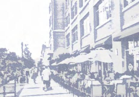
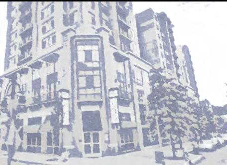
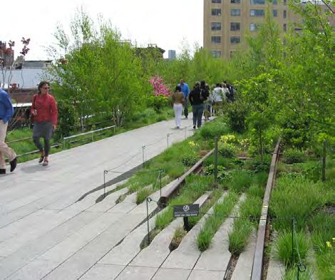
18 15 IV. PLANNING PRINCIPLES + CONCEPTS This section presents a set of overarching planning principles to guide future development decisions to be applied to the entire study area. This section also presents additional principles broken down by various categories, such as transportation, land use, building form, and open space. These principles are further classified by their geographic application: either area wide, east side, or west side. These principles are then stated through concept maps and other photos or exhibits. EAST SIDE Visioning 2013 North Quincy Street Plan Addendum Overarching Planning Principles This plan is based on a foundation of overarching principles of what future development in the area should achieve. Briefly stated, the overarching principles aim to: Enhance the southern gateway of Ballston as a great urban place Allow established businesses to develop new, improved facilities while remaining in the community Achieve a well-balanced mix of land uses to provide for a vibrant neighborhood Reinforce desired transitions between the high-density mixed-use core of Ballston and surrounding residential neighborhoods Create new street connections and smaller blocks to improve circulation and permeability, while better serving new development Add to the variety of open space types and sizes in the area Provide opportunities for increasing the affordable housing stock in the area Transform N. Glebe Road into an urban boulevard with a pedestrian scale and other significant improvements, and Promote energy efficiency and environmental sustainability Representative Precedents The future vision of the study area includes the creation of a great place that fits appropriately into its context. The images to the right illustrate elements of other projects that may serve as inspiration for the type of place that can be created in this area of Ballston. While the goal is not to replicate any of these examples, these projects demonstrate ways in which development, urban streets, and public spaces in the study area can be approached in the future to implement the guiding principles and overall concept for the area.

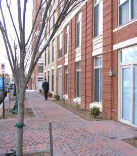
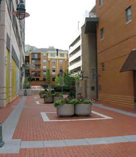
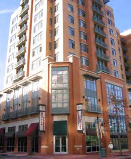
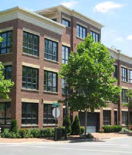
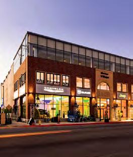
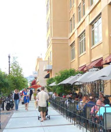
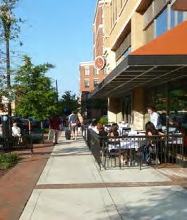
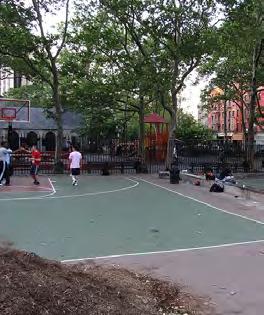
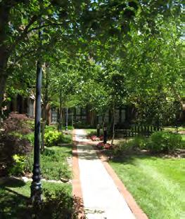
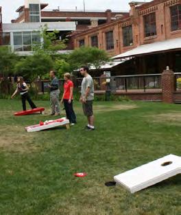
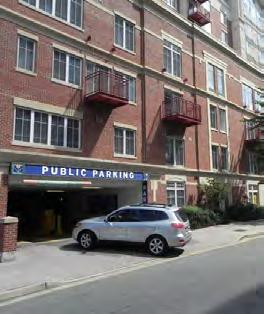
19 Visioning WEST SIDE 16 DEVELOPMENT URBAN STREETS PUBLIC SPACES
20 Transportation Principles 2013 North Quincy Street Plan Addendum 17 Area-Wide Improve connectivity and accessibility by introducing new public streets and multi-use paths that help break up existing superblocks. Make the pedestrian experience safer and more enjoyable by designing streets with wide sidewalks, additional street trees, improved intersections and crosswalks, and on-street parking where possible. Limit, to the greatest extent possible, the number of curb cuts. Transform this portion of N. Glebe Road into an urban boulevard through a combination of site-specific improvements and road-diet techniques, such as conversion of roadway width to other uses such as on-street parking, bikeways, wider sidewalks, and planting areas. At a minimum, future site plans with major commercial or retail uses shall be governed by site plan conditions similar to those currently in place for the Harris Teeter property that relate to appropriate measures to mitigate potential significant adverse impacts (these could include limiting hours and number of deliveries, noise mitigation measures, security measures, etc.). Design and locate service and loading areas, access points, and traffic patterns to limit adverse impacts on surrounding properties and neighborhoods. Encourage shared parking to achieve efficiencies for complementary uses. Consider nearby parking availability and transit services when determining parking requirements. Improve existing undersized and poorly maintained sidewalks throughout the study area and vicinity to enhance the overall pedestrian experience. Align new street segments with existing intersections where possible, and locate other transportation facilities generally where shown on the Transportation Concept map, with exact locations to be determined with the review and analysis of future site plans. East Side Provide a new 5th Road N. that begins at N. Randolph Street and connects with the existing 5th Road east of N. Quincy Street [with future redevelopment.] Provide an additional new north-south street in the interior of the block, as a primary location for the service, loading and garage entries for new development. Explore a variety of locations for pedestrian connections through the block, including the potential conversion of existing 5th Road N. into an attractive pedestrian route between Glebe & Randolph Park and Mosaic Park. West Side Continue N. Randolph Street westward across N. Glebe Road into the block. Extend N. Tazewell Street through the block to the Hyde Park property, and focus service, loading and garage entrances along this new segment. The potential urban center local street/alley on the west side should be further studied based on specific site plan proposals, and consideration shall address potential impact and conflict with the existing Hyde Park driveway on N. Glebe Road and potential methods of mitigating such conflicts. If, after further study based on specific site plan proposals, a new road is the preferred overall solution, consideration should be given to how a new egress to the Hyde Park garage can be provided. Create new multi-use paths to improve pedestrian and bicyclist circulation through the block, including a pedestrian/bicyclist connection between N. Tazewell Street extension and N. Thomas Street.
21 N. TAZEWELL ST. West side TRANSPORTATION CONCEPT MAP N. CARLIN SPRINGS RD. N. RANDOLPH ST. N. GLEBE RD. N. QUINCY ST. East side 5TH RD. N N. POLLARD ST. Type-B Primarily Urban Mixed-Use Urban Center Local 5TH ST. N Urban Center Local/Alley Pedestrian/Bicycle connection Intersection Improvement 18 N. VERMONT ST. N. THOMAS ST. N. HENDERSON ST. 4TH ST. N General location of private easement Needs further study per site plan review as noted in the guiding principles NOTE: Locations of planned transportation facilities are general, with exact locations to be determined with the review and analysis of future site plans.
22 Land Use Principles 2013 North Quincy Street Plan Addendum 19 Area-Wide Encourage medium-scale development that creates a sensitive transition between high-intensity development in the center of Ballston and surrounding lower-density residential neighborhoods. Provide redevelopment opportunities to transform the area s primarily automobile-oriented development into an integrated mixed-use urban neighborhood. Organize a rich mix of uses in a way that helps enliven the area and balance local travel demand. Provide opportunities for increasing the County s affordable housing stock. Ensure ground floor uses, building massing and frontages are designed to add interest and enhance the pedestrian experience. Ensure activated, interesting ground-floor retail frontages at key locations to further enhance the pedestrian experience. Establish retail and retail-related outdoor activities along a N. Glebe Road that is transformed into an urban boulevard, at the corners of arterial streets, and at other strategic locations noted in the Land Use Concept Map. Designate additional locations within the study area that link destinations (such as open spaces or retail streets) as optional retail locations, where flexible building designs do not preclude retail while also permitting other uses; any retail or other commerce proposed for frontages not specifically identified on the Land Use Concept Map should be considered on a case by case basis. East Side Implement medium-density mixed-use development, with a base density of 1.5 FAR and set a maximum of up to 4.0 FAR through tools such as transfer of development rights or the provision of additional significant community benefits, in keeping with the spirit of the 1995 North Quincy Street Plan and in accordance with Note 14 of the GLUP, as updated over time. Identify the N. Glebe Road frontage, including the plaza at N. Quincy Street and N. Glebe Road, and the N. Quincy Street frontage north of new 5th Road N. as predominantly retail or commerce locations. Designate both sides of the new 5th Road N. and the corner spaces to its northwest and southeast termini across this block as optional retail locations. West Side Locate ground-floor commercial uses along N. Glebe Road and explore residential, hotel, or commercial uses above and in the balance of the block that achieve effective transitions towards properties along N. Thomas Street. Consider a General Land Use Plan change for the N. Glebe Road frontage (in conjunction with a site plan application) to Medium Office-Apartment-Hotel, to provide limited flexibility for land use and building height to achieve better urban design and to not preclude desirable uses for the study area. If the study area were partly redesignated as Medium Office-Apartment-Hotel, then the provisions of corresponding zoning districts should apply. Consider a General Land Use Plan change for the corner of N. Carlin Springs Road and N. Thomas Street to High-Medium Residential Mixed-Use, in conjunction with a site plan application that provides a building form and massing scheme compatible with surrounding properties and appropriate for the transitional location. Establish predominantly retail frontages along N. Glebe Road, while allowing supporting commerce. Designate the N. Randolph Street extension into the block as optional retail locations.
23 LAND USE CONCEPT MAP N. TAZEWELL ST. West side N. CARLIN SPRINGS RD. N. RANDOLPH ST. N. GLEBE RD. N. QUINCY ST. East side 5TH RD. N N. POLLARD ST. Upper Story Land Use Public Space Residential Office, Residential and Hotel 5TH ST. N 20 General location of consolidated open space Gateway landscaped plaza N. VERMONT ST. N. THOMAS ST. N. HENDERSON ST. 4TH ST. N Pedestrian / Bike connection Ground Floor Retail Approved retail frontage Predominantly retail frontage Optional retail frontage
24 Building Form Principles 2013 North Quincy Street Plan Addendum 21 Area-Wide Consider refinements to the previously planned building heights identified in the 1995 North Quincy Street Plan (east side) and the General Land Use Plan (west side) that reflect both the evolved context in the area and the continued desire for effective and sensitive transitions. Establish maximum building heights that are appropriate for the area and will achieve the desired transitions between central Ballston and its edges. Encourage massing and architecture that generally provides buildings with modestly-sized floor plates and slender building towers, except where large format commercial uses are approved. Incorporate building form elements that help limit the perceived length of any individual long building walls, such as varied building modulation and massing, articulation, multiple entrances, and/or fenestration techniques. Incorporate distinctive features or focal points to add visual interest and help establish a more distinct sense of place, to be achieved through architectural, landscape, or other urban design elements. Ancillary structures that support outdoor rooftop amenities, such as green roofs, outdoor swimming pools, and code required ancillary facilities, rooftop gardens, etc., subject to zoning ordinance requirements, should not count against height limits. East Side Allow building heights up to a maximum of 10 stories (commercial or residential) along N. Randolph Street, and require buildings to step down to N. Quincy Street with maximum heights of 5 stories (residential). West Side Concentrate the greatest building heights along N. Glebe Road, tapering down sensitively to the surrounding low-rise residential properties. Under a Medium Office-Apartment-Hotel scenario, limit building heights up to a maximum of 12 stories for office and 14 stories for residential or hotel immediately adjacent to N. Glebe Road as shown on the Building Form Concept Map. Under a High-Medium Residential Mixed-Use scenario, consider building heights only up to a maximum of 9 stories or 95 feet for the majority of the west side study area per Note 1 on the Building Form Concept Map.- Allow building heights no greater than a maximum of 5 stories (residential) at the corner of N. Thomas Street and N. Carlin Springs Road and along the Ballston Crest and Thomas Place properties to reinforce a sensitive transition to the nearby low-scale residential developments.
![BUILDING FORM CONCEPT MAP N. TAZEWELL ST. West side N. CARLIN SPRINGS RD. [SEE NOTE 3] N. RANDOLPH ST. N. GLEBE RD. N. QUINCY ST. East side 5TH RD. N N. POLLARD ST.](/docs-images/81/84724192/images/25-0.jpg "Building Heights [SEE NOTE 2] [SEE NOTE 1] Lower (up to 5 stories) Lower (up to 6 stories) Medium (East Side: up to10 stories West Side: up to 9 stories) Higher (up to12 stories) 5TH ST.")
25 BUILDING FORM CONCEPT MAP N. TAZEWELL ST. West side N. CARLIN SPRINGS RD. [SEE NOTE 3] N. RANDOLPH ST. N. GLEBE RD. N. QUINCY ST. East side 5TH RD. N N. POLLARD ST. Building Heights [SEE NOTE 2] [SEE NOTE 1] Lower (up to 5 stories) Lower (up to 6 stories) Medium (East Side: up to10 stories West Side: up to 9 stories) Higher (up to12 stories) 5TH ST. N Higher (up to14 stories) [SEE NOTE 1 and 3] 22 N. VERMONT ST. N. THOMAS ST. N. HENDERSON ST. 4TH ST. N Distinctive features NOTES: 1]. West side building heights above 9 stories would require a GLUP change (such as to Medium O-A-H) and rezoning to a district permitting such heights. 2]. Under a Medium O-A-H scenario, heights in the specified area would be limited to 5 stories. 3]. Under a Medium O-A-H scenario, only residential or hotels could exceed 12 stories in this height zone. 4]. Delimitations of heights zones depicted on this map are general.


26 West Block Height Taper Key map 23 The Specific Building Form Principles and Concept Map on pages are designed to provide a deliberate taper in Medium O-A-H taper HYDE PARK Section cut building heights between the high density core of Ballston and the lower density HMRMU taper residential areas nearby. The recommended consideration of a future GLUP change to Medium Office-Apartment-Hotel for a THE CARLIN portion of the west block specifically relates to this goal of a more distinct taper, as 650 N. GLEBE RD. N. Thomas Street 2013 North Quincy Street Plan Addendum illustrated in the two images to the right. The top image depicts a hypothetical transition under the current High-Medium Residential Mixed-Use designation. In comparison, the bottom image depicts a hypothetical transition per a Medium Office-Apartment-Hotel scheme. While the Plan Addendum supports either land use designation for the block, the preference is for a physical transition comparable to what is shown in the bottom image, with greater heights along N. Glebe Road and lower heights approaching N. Thomas Street. NOTE: The massing schemes shown here Potential Building Height Transition on West Block, Hypothetical High-Medium Residential Mixed-Use scenario Medium O-A-H taper HMRMU taper HYDE PARK THE CARLIN N. Carlin Springs Road Key map N. Thomas Street Section cut are only illustrative and do not reflect 650 N. GLEBE RD. a preferred development scheme. It is expected that any future site plans for this area will include site massing and designs that vary from what is shown here but that are compatible and consistent with the N. Carlin Springs Road Addendum s planning principles. Potential Building Height Transition on West Block, Hypothetical Medium Office-Apartment-Hotel scenario


27 Focal Points/ Distinctive Features Another specific building form principle included in the Plan Addendum is the idea of incorporating distinctive features or focal points at strategic locations in the study area. While the primary goal of including such features is to increase the overall level of visual interest, they can also help establish a more distinct sense of place as well as provide landmarks for improved wayfinding and navigation of visitors to the area. 24 As illustrated in the images to the right, the provision of the recommended distinctive features or focal points can be achieved through a variety of architectural, landscape, or other urban design elements integrated with future development in the area.
28 Open Space Principles 2013 North Quincy Street Plan Addendum 25 Area-Wide Create a high-quality urban environment with attractive and successful open spaces through redevelopment these open spaces should vary in size and should provide opportunities for both active and passive recreation to meet the community s public space needs. Achieve pedestrian connections that reflect existing travel patterns, strengthen desired linkages, and provide visibility of and access to public open spaces without sacrificing the utility of such spaces. Open spaces should be designed so that they are perceived as areas for public use. Areas identified as public open spaces should be controlled by the County either through fee ownership or access and use easements. Ground level open spaces and abutting first floor uses should be designed and programmed to mutually benefit one another. Consider opportunities for publicly accessible open spaces on rooftops to accommodate a range of activities, such as community gardening or active recreation. In addition to public open spaces on-site, consider how projects may contribute to the improvement, expansion or enhancement of nearby existing or planned open spaces nearby (such as Mosaic Park and Glebe & Randolph Park). Initiate County-led park/public space design processes for recommended neighborhood open space, which will refer to the Public Spaces Master Plan when forming decisions related to the public space network. East Side Establish a significantly sized landscaped gateway plaza with canopy trees and other green features at the corner of N. Glebe Road and N. Quincy Street, defined by strong architectural features and/or focal points, to complement the other three green corners defining this intersection. Provide a strong pedestrian/bike connection linking the West Side, Glebe & Randolph Park, and Mosaic Park - along that connection, provide opportunities for smaller, more intimate setbacks or open space areas for respite. West Side Establish a central open space of at least one-half acre in size within the block to provide for recreation opportunities, break up the bulk and massing of development on the block, and enhance the pedestrian experience. This may be achieved through coordinated redevelopment of the entire west side study area or by encouraging adjacent property owners to create a consolidated, large space at the interface of two or more properties along the street frontage.


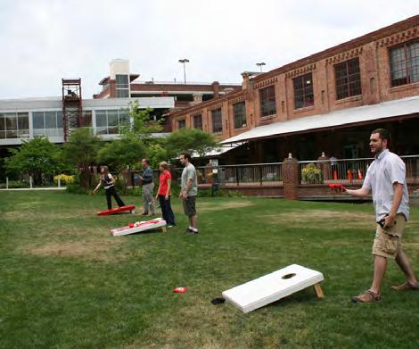
29 OPEN SPACE CONCEPT - PRECEDENT IMAGES 26 Image credit: Ken Lund & Flickr Image credit:


30 V. RELATIONSHIP TO 1995 NORTH QUINCY STREET PLAN 27 This planning document is intended to update the planning guidance of and supersede the 1995 North Quincy Street Plan (NQSP) as it applies to the area between N. Quincy and N. Randolph Streets, while also providing guidance for an expanded study area that includes an area west of N. Glebe Road not originally subject to the NQSP. Principles relating to the western block have either been addressed by the Founders Square site plan or have been incorporated, revised or superseded through the effort to create this Plan Addendum North Quincy Street Plan Addendum Principles from the 1995 NQSP that apply to the block east of N. Quincy Street have not been superseded and are still relevant. These principles that are still current for the original NQSP east block generally relate to the NQSP s concept plan, land use recommendations, and urban design guidelines. Therefore, the 1995 NQSP should continue to be referenced for an understanding of the most up to date principles and planning guidance for the area bounded by Wilson Boulevard, N. Quincy Street, N. Glebe Road, and N. Pollard Street. East block area of 1995 North Quincy Street Plan
31 VI. IMPLEMENTATION RECOMMENDATIONS This section lists recommendations necessary to support the implementation of the North Quincy Street Plan Addendum s vision and goals. Action 1: Adoption of the North Quincy Street Plan Addendum RECOMMENDATION: Adopt the North Quincy Street Plan Addendum as an updated plan to guide future development for the revitalization of the properties located in the study area. The recommendations in this Addendum for the block west of North Quincy Street shall supersede those presented in the 1995 North Quincy Street Plan. Where conditions permit, the County s transfer of development rights mechanism can also be employed in achieving densities up to 4.0 FAR. RECOMMENDATION: Add the General Location for Open Space Symbol to reflect the goal for an open space of importance within the west side study area block. The addition of this symbol on the GLUP will emphasize this key open space goal for the block as recommended by this Addendum. 28 Action 2: General Land Use Plan Amendments RECOMMENDATION: Amend Note 14 of the General Land Use Plan to reflect the updates associated with the North Quincy Street Coordinated Mixed-Use District. These changes primarily include the updated goals and objectives for the North Quincy Street Coordinated Mix- Use District and the surrounding area west of N. Glebe Road as expressed in this Addendum. They also identify the updated list of potential community benefits that may permit density above 1.5 FAR on the block between N. Randolph and N. Quincy Streets (up to a maximum of 4.0 FAR, subject to the height and massing concepts in this plan), including: Development of residential uses on the east block consistent with the concept plan and the Medium Residential designation; Implementation of other significant elements of the concept plan; The development of community, cultural, or public facilities; The provision of open space; The consolidation of properties that achieve relocation of existing streets and/or establishment of new streets; The development or protection/preservation of affordable/moderate income housing; and Green building certification (consistent with then current County policy).

32 29 Add Open Space Symbol 2013 North Quincy Street Plan Addendum Note 14. This area was designated as the North Quincy Street Coordinated Mixed-Use District on 2/4/95, and amended on 2/23/13. Proposed General Land Use Plan Changes Map
 the study area east and west of Glebe Road is shown in blue hatch, indicating these as areas planned for new streets.")
 to identify this as an area planned for new streets.")
33 Existing Master Transportation Plan Amendment: The existing Master Transportation Plan (top) currently lacks any indication that new streets should be created in the study area with future development. In the proposed MTP map (bottom) the study area east and west of Glebe Road is shown in blue hatch, indicating these as areas planned for new streets. The exact number and location of new streets should be guided by this Addendum and determined through future site plan approvals. Proposed Action 3: Master Transportation Plan Amendments RECOMMENDATION: Amend the Master Transportation Plan (Street Typology Map) to identify this as an area planned for new streets. The Master Transportation Plan (MTP) guides decisions that affect Arlington s transportation network and helps the public understand the rationale behind the decisions. To help accommodate planned growth in the study area, the MTP should be amended to add this as an area planned for new streets. As future development is proposed for these areas, staff, residents, and other stakeholders should refer to the MTP when forming decisions related to the street network. As redevelopment projects are approved within the study area, the MTP Street Typology Map should be further amended to show the exact locations and extent of any newly approved and created streets in this area. Action 4: Zoning Ordinance Amendments RECOMMENDATION: Amend the Zoning Ordinance to modify the R-C District purpose language in the section s first paragraph, involving the one-quarter mile radius from a Metro Station entrance criteria as it pertains to at least the study area of this Addendum. During the course of this study, attention was brought to the current purpose language in the first paragraph of the R-C District and the apparent requirement that to be rezoned to R-C, a site must be located one-quarter mile or less from a Metro Station entrance in addition to being designated High-Medium Residential Mixed-Use on the General Land Use Plan. The relevant issue is that, although they have been designated High-Medium Residential Mixed-Use since 1981 and some have been rezoned to R-C, several of the properties in the study area west of N. Glebe Road are further than one-quarter mile from the closest (Ballston) Metro Station entrance. To have the Zoning Ordinance language for R-C be more consistent with the vision for the area as portrayed on the GLUP, staff should present to the County Board revisions to the R-C district to address this one-quarter mile from Metro requirement, at least as it pertains to the study area outlined in this Addendum. 30
34 APPENDIX GENERAL STREET CROSS-SECTIONS 2013 North Quincy Street Plan Addendum 31 The Proposed Street Cross-Section exhibits illustrated on the following pages in this document are conceptual. Exact dimensions and details including but not limited to the design of bulbouts, curb ramps and crosswalks, the configuration of bicycle lanes or sharrows, and landscaping features will be determined during engineering design and will reflect then-current County practices. Prior to implementation, the number of travel lanes shown in these cross-sections and proposed changes to other aspects of the transportation network will be reviewed further to determine the impacts upon traffic flow. N. TAZEWELL ST. West side VERMONT ST. N. CARLIN SPRINGS RD. 2 3 N. THOMAS ST N. RANDOLPH ST. N. GLEBE RD. 7 5 N. HENDERSON ST. N. QUINCY ST. East side 4TH ST. N 5TH RD. N N. POLLARD ST. Type-B Primarily Urban Mixed-Use Urban Center Local 5TH ST. N Urban Center Local/Alley Pedestrian/Bicycle connection Intersection Improvement General location of private easement Needs further study per site plan review as noted in the guiding principles NOTE: Locations of planned transportation facilities are general, with exact locations to be determined with the review and analysis of future site plans.
 16-8 12'-6 12' Travel Lane 12' Median Build-to Line N.")

 8 6 14 12' 11' 1' 47'-0 Travel Lane 11' Travel Lane (w/ C&G) 12' Build-to Line Tree Pit")
35 1 SECTION: N. Glebe Road Streetscape Condition West Building Face Walkway Tree Pit Travel Lane/ Travel Off-Peak Lane Parking Lane '-6 (w/ C&G) '-6 12' Travel Lane 12' Median Build-to Line N. Glebe Road: The proposed streetscape and sidewalk condition for N. Glebe Road in the study area includes a minimum 16-8 sidewalk with tree pits. This reflects a wider sidewalk than the 13-0 recommended in the Rosslyn- Ballston Corridor Streetscape Standards. This frontage should be primarily retail-oriented. Non-peak off-street parking should be provided in the curbside travel lane SECTION: N. Carlin Springs Road Streetscape Condition West Building Face Walkway Tree Pit Travel Travel Lane Lane (w/ C&G) ' 11' 1' 47'-0 Travel Lane 11' Travel Lane (w/ C&G) 12' Build-to Line Tree Pit Walkway East 6' 8' 14' N. Carlin Springs Road: The proposed streetscape and sidewalk condition for N. Glebe Road in the study area includes a minimum 13-8 sidewalk with tree pits. This reflects a wider sidewalk than the 10 width recommended in the R-B Corridor Streetscape Standards. This frontage should be primarily residential in character. N. Carlin Springs Road south of N. Tazewell Street would have bicycle lanes and fewer travel lanes. 75'-0
 11-6 31'-6\" 23'-0\" Travel Lane (w/ C&G) 11-6 SECTION: N.")
: This new extension will be integral to future redevelopment on the block west of N.")
36 2013 North Quincy Street Plan Addendum SECTION: N. Tazewell Street Extension Interim Treatment North North Building Face Building Face Travel Lane (w/ C&G) '-6" 23'-0" Travel Lane (w/ C&G) 11-6 SECTION: N. Tazewell Street Extension Ultimate Treatment Fence Line Garage Ramp (for the Carlin) Walkway 8'-6 Walkway Tree Pit Travel Lane Travel Lane Parking Lane Tree Pit Walkway (w/ C&G) (w/ C&G) 8' 5'-6 5'-6 8' 13' ' 13'-6 28'-6" 55'-6" Building Face South South N. Tazewell Street Extension (Interim): This new extension will be integral to future redevelopment on the block west of N. Glebe Road. This street will provide access from N. Carlin Springs Road, and will be a primary location for building service, garage, and loading access points. Given existing physical constraints, this plan provides for an interim treatment for the segment approaching N. Carlin Springs Road, which could be enhanced through future redevelopment of or modifications to the Carlin property. N. Tazewell Street Extension (Ultimate): Where physical constraints do not exist, the ultimate street-section condition should be achieved. A minimum dimension of 55-6 should be provided between building faces, and may vary depending on the actual ground floor uses proposed as part of any future site plan proposal. On-street parking, street trees, and other plantings should be included where feasible.

 (w/ C&G) 6' 5'-6 5'-6 6' 11'-6 11-6 11-6 11'-6 23'-0\" 46'-0\" East *This street could function as more of a service alley,")
37 5 SECTION OPTION A: Urban Center Local Street Treatment Building Face Building Face Urban Center Local Street Treatment Option: This street type provides prime locations for the building service, garage, and loading access points of new buildings. Possibly functioning much more as a service alley, this street may have reduced dimension through the reduction of sidewalk width and/or street trees. 34 West Walkway Lane Lane way Tree Pit Travel Travel Tree Pit Walk- (w/ C&G) (w/ C&G) 6' 5'-6 5'-6 6' 11' '-6 23'-0" 46'-0" East *This street could function as more of a service alley, with reduced dimensions between building faces and sidewalks and/or street trees. 5 SECTION OPTION B: Alley Treatment Building Face Building Face Alley Treatment Option: This treatment type specifically provides potential locations for the building service, garage, and loading access points of new buildings, with a less pedestrian-focused orientation than the Urban Center Local optional treatment above. These service, garage, and loading access impacts shall be minimized. West Walkway 6' Travel Lane 12-0 Travel Lane 12-0 East 30'-0" *This street could function as more of a service alley, with reduced dimensions between building faces and sidewalks and/or street trees.
 8' 5-6 13'-6 SECTION: New 5th Road N.")
 8'-6 5'-6 5-6 8'-6 14' 7' 10 10 7' 14' 34'-0 62'-0\" Building Face Building Face South N. Randolph Street Extension: The extension of N. Randolph Street into the site west of N.")
38 2013 North Quincy Street Plan Addendum West North SECTION: N. Randolph Street Extension Minimum Preferred Building Face Building Face Walkway Tree Pit Travel Turn Lane Lane (w/ C&G) 8' '-6 SECTION: New 5th Road N. Complete Street Treatment 11' 11' 11' 60' 33' Travel Lane (w/ C&G) Tree Pit Walkway East 5-6 8' 13'-6 Walkway Lane Lane Lane Lane way Tree Pit Parking Travel Travel Parking Tree Pit Walk- (w/ C&G) (w/ C&G) 8'-6 5' '-6 14' 7' ' 14' 34'-0 62'-0" Building Face Building Face South N. Randolph Street Extension: The extension of N. Randolph Street into the site west of N. Glebe Road should act as a gateway into the site with a street width similar to N. Randolph Street east of N. Glebe Road. The street is envisioned as a Type-B Primarily Urban Mixed- Use Arterial street. However, the dimensions shown in this crosssection may vary depending on the specific development program proposed for the site. 5th Road N.: 5th Road N. is proposed to be relocated to more of a mid-block location that aligns with 5th Road N. east of N. Quincy Street, from its existing position closer to N. Glebe Road. If implemented as an urban center local street, it could have a 62 building face-to-face dimension, allowing for 14 sidewalks, one parking lane, and one travel lane in each direction.
NORTH QUINCY STREET P LAN ADDENDUM DRAFT:
 NORTH QUINCY STREET P LAN ADDENDUM DRAFT: 09-10-2012 a2 North Quincy Street Plan Addendum DRAFT 9-10-2012 2012 North Quincy Street Plan Addendum DRAFT TABLE OF CONTENTS PAGE I. INTRODUCTION...1 Background...1
SP # Carlin Springs Road The Springs
 SP #430 4318 Carlin Springs Road The Springs SPRC #1 July 29, 2013 Site Site 2 Proposal GLUP change From Low-Medium Residential to High-Medium Residential Mixed-Use Rezoning From RA8-18 to R-C Site Plan
ARLINGTON COUNTY, VIRGINIA
 ARLINGTON COUNTY, VIRGINIA County Board Agenda Item Meeting October 15, 2005 DATE: September 28, 2005 SUBJECT: Request to Advertise the adoption of the 2005 Clarendon Sector Plan C. M. RECOMMENDATION:
From: Sent: To: Subject: Zoning: Landscaping:
 From: Bernard H. Berne [mailto:bhberne@yahoo.com] Sent: Tuesday, May 15, 2012 1:18 AM To: CountyBoard Subject: May 19, 2012 County Board Meeting: Goodyear Site Plan (SP #72-650 N. Glebe Road) and amendment
ATTACHMENT. To the west, north, and east of the block, primarily singlefamily detached residential patterns, with some townhouses, predominate.
 COMMENT / REVISION MATRIX (as of ) for Washington and Kirkwood Special GLUP Study "Plus" and Concept Plan 1 2 Resolve inconsistency between American Legion site area noted in Map 1 1.36 AC 1.29 AC and
EXISTING COMPREHENSIVE PLAN
 EXISTING COMPREHENSIVE PLAN Town Center Land Use Element: V. LAND USE POLICIES Town Center Mercer Island's business district vision as described in "Your Mercer Island Citizen-Designed Downtown" was an
TO: FROM: SUBJECT: Background
 TO: FROM: SUBJECT: Long Range Planning Committee and Zoning Committee of the Planning Commission Kellie Brown and Margaret Rhodes, Planning Division, CPHD DATE: June 8, 2017 Courthouse Square Implementation
THAT the attached Terms of Reference for the Thornhill Centre Street Study be approved.
 COMMITTEE OF THE WHOLE AUGUST 18, 2003 THORNHILL CENTRE STREET STUDY PLANNING FILE: 15.92 Recommendation The Commissioner of Planning recommends: THAT the attached Terms of Reference for the Thornhill
DEPARTMENT OF COMMUNITY PLANNING, HOUSING AND DEVELOPMENT Planning Division. Arlington County Planning Commission
 DEPARTMENT OF COMMUNITY PLANNING, HOUSING AND DEVELOPMENT Planning Division 2100 Clarendon Boulevard, Suite 700 Arlington, VA 22201 TEL 703.228.3525 FAX 703.228.3543 www.arlingtonva.us DRAFT TO: FROM:
A. Background Summary of Existing Challenges and Potential Possibilities. 1. Summary of Existing Assets and Potential Opportunities
 A. Background 1 A Main Street Master Plan Study was performed and completed in October of 2007. The study was initiated to review current land uses and development patterns along Main Street, from Parrish
Town Center (part of the Comprehensive Plan)
") Town Center (part of the Comprehensive Plan) Mercer Island Town Center Looking North (2014) In 1994, a year-long process culminated in a set of design guidelines and code requirements for the Town Center
Town Center (part of the Comprehensive Plan) Mercer Island Town Center Looking North (2014) In 1994, a year-long process culminated in a set of design guidelines and code requirements for the Town Center
Clairtrell Area Context Plan
 Clairtrell Area Context Plan March 2005 Urban Development Services City Planning Contents 1. Introduction... 4 2. Development Structure... 6 2.1 Streets... 7 2.1.1 Sheppard Avenue and Bayview Avenue...
Gold Line Bus Rapid Transit Transit Oriented Development (BRTOD) Helmo Station Area Plan
 Helmo Station Area Plan") Appendix F Gold Line Bus Rapid Transit Transit Oriented Development (BRTOD) Helmo Station Area Plan Introduction and Purpose of the Plan The Gold Line Bus Rapid Transit facility is an eleven-mile dedicated
Appendix F Gold Line Bus Rapid Transit Transit Oriented Development (BRTOD) Helmo Station Area Plan Introduction and Purpose of the Plan The Gold Line Bus Rapid Transit facility is an eleven-mile dedicated
Urban Design Manual PLANNING AROUND RAPID TRANSIT STATIONS (PARTS) Introduction. Station Study Areas
 Introduction. Station Study Areas") 111111 PLANNING AROUND RAPID TRANSIT STATIONS (PARTS) Introduction The ION rapid transit system will link Waterloo, Kitchener and Cambridge through a central transit corridor (CTC). There are a number
111111 PLANNING AROUND RAPID TRANSIT STATIONS (PARTS) Introduction The ION rapid transit system will link Waterloo, Kitchener and Cambridge through a central transit corridor (CTC). There are a number
Rosslyn Sector Plan Implementation
 DEPARTMENT OF COMMUNITY PLANNING, HOUSING AND DEVELOPMENT Planning Division #1 Courthouse Plaza, 2100 Clarendon Boulevard, Suite 700 Arlington, VA 22201 TEL 703.228.3525 FAX 703.228.3543 www.arlingtonva.us
ARLINGTON COUNTY, VIRGINIA
 ARLINGTON COUNTY, VIRGINIA County Board Agenda Item Meeting of April 23, 2019 DATE: April 12, 2019 SUBJECT: SP #413 SITE PLAN AMENDMENT to permit a fixed bar in a private outdoor café space with associated
ARLINGTON COUNTY, VIRGINIA. County Board Agenda Item Meeting of February 23, 2019
 ARLINGTON COUNTY, VIRGINIA County Board Agenda Item Meeting of February 23, 2019 DATE: February 15, 2019 SUBJECT: Amendment to the Master Transportation Plan (MTP) Map to add a new section of North Kansas
ARLINGTON COUNTY, VIRGINIA
 ARLINGTON COUNTY, VIRGINIA County Board Agenda Item Meeting of March 20, 2007 SUPPLEMENTAL REPORT #2 Additional and Revised Information DATE: March 20, 2007 SUBJECT: Request to Advertise Public Hearings
ELMVALE ACRES SHOPPING CENTRE MASTER PLAN
 ELMVALE ACRES SHOPPING CENTRE MASTER PLAN Contents 1.0 INTRODUCTION... 2 2.0 LOCATION... 2 3.0 EXISTING CONTEXT... 2 4.0 VISION & GUIDING PRINCIPLES... 2 5.0 LAND USE AND BUILT FORM... 4 5.1 St. Laurent
City of Farmington. Downtown Plan. Amendment to the 1998 Master Plan Adopted October 11, 2004
 City of Farmington Amendment to the 1998 Master Plan Adopted October 11, 2004 Introduction Planning Background 1 Scope and Components of the Plan Amendment 2 Concept Introduction 3 Plan Concepts 3 Conceptual
Hockessin Community Redevelopment Plan
 Hockessin Community Redevelopment Plan 3.1 Introduction The Community Redevelopment Plan for the Village of Hockessin is the result of the people s vision for a distinct village center that serves as the
40 Years of Smart Growth Arlington County s Experience with Transit Oriented Development in the Rosslyn-Ballston Metro Corridor
 40 Years of Smart Growth Arlington County s Experience with Transit Oriented Development in the Rosslyn-Ballston Metro Corridor A presentation by the Arlington County Department of Community Planning,
CRYSTAL CITY BLOCK PLAN # CCBP- G 1 DRAFT
 CRYSTAL CITY BLOCK PLAN # CCBP- G 1 DRAFT BLOCK G (Metro Market Square block) Long Range Planning Committee Meeting January 29, 2018 1 1. Introduction 2 1. LRPC Meeting Purpose Review of proposed Crystal
FUTURE LAND USE ELEMENT
 FUTURE LAND USE ELEMENT GOAL I: To create and sustain a great place to live, play, and prosper Objective 1: The City of Ocala shall incorporate the principles and strategies of the Ocala 2035 Vision into
Mark-up of the effect of the proposed Bronte Village Growth Area OPA No.18 on the text of section 24, Bronte Village, of the Livable Oakville Plan
 Mark-up of the effect of the proposed Bronte Village Growth Area OPA No.18 on the text of section 24, Bronte Village, of the Livable Oakville Plan Notes: This document is provided for information purposes
40 Years of Smart Growth Arlington County s Experience with Transit Oriented Development in the Rosslyn-Ballston Metro Corridor
 40 Years of Smart Growth Arlington County s Experience with Transit Oriented Development in the Rosslyn-Ballston Metro Corridor A presentation by the Arlington County Department of Community Planning,
The transportation system in a community is an
 7 TRANSPORTATION The transportation system in a community is an important factor contributing to the quality of life of the residents. Without a sound transportation system to bring both goods and patrons
ARLINGTON COUNTY, VIRGINIA
 ARLINGTON COUNTY, VIRGINIA County Board Agenda Item Meeting of July 21, 2012 DATE: July 12, 2012 SUBJECT: SP #416 SITE PLAN AMENDMENT to modify condition #6 to eliminate requirement to provide a pedestrian
CITY OF PUYALLUP. Background. Development Services
 CITY OF PUYALLUP Development Services 333 South Meridian Puyallup WA 98371 To: City Council From: Katie Baker, AICP, Planning Division Re: South Hill Neighborhood Plan Adoption Date: (Meeting date: February
CHAPTER 7: VISION AND ACTION STATEMENTS. Noble 2025 Vision Statement
 CHAPTER 7: VISION AND ACTION STATEMENTS This chapter presents the vision, policy and action statements that transform the comprehensive planning study, an analysis of Noble s past, future trends and community
ARLINGTON COUNTY, VIRGINIA
 ARLINGTON COUNTY, VIRGINIA County Board Agenda Item Meeting of October 21, 2017 DATE: October 2, 2017 SUBJECTS: Request to authorize advertisement of public hearings by the Planning Commission and County
Executive Summary. NY 7 / NY 2 Corridor
 Executive Summary NY 7 / NY 2 Corridor Transportation and Land Use Study December 2005 Prepared for: Town of Colonie Capital District Transportation Committee Prepared by: Introduction: Land use decisions
Policies and Code Intent Sections Related to Town Center
 Policies and Code Intent Sections Related to Town Center The Town Center Vision is scattered throughout the Comprehensive Plan, development code and the 1994 Town Center Plan. What follows are sections
Regency Developments. Urban Design Brief. Holyrood DC2 Rezoning
 Regency Developments Urban Design Brief Holyrood DC2 Rezoning Stantec Consulting Ltd. 7-31-2017 1. Overview Regency Developments intends to rezone the lands located at 8510 and 8511 93 Avenue, within the
4.1.3 LAND USE CATEGORIES
 4.1.3 LAND USE CATEGORIES a. City Center District The City Center District incorporates the existing character and mix of uses in downtown Belmont to encourage redevelopment and new development in keeping
5.1 Site Plan Guidelines
 5. Community Core Guidelines Development of the Community Core will take place by plan of subdivision and site plan approval. It will occur in a phased manner that will reflect the timing of residential
Washington Boulevard & Kirkwood Road SPECIAL GLUP STUDY PLUS and CONCEPT PLAN NOVEMBER 2017
 Washington Boulevard & Kirkwood Road SPECIAL GLUP STUDY PLUS and CONCEPT PLAN NOVEMBER 2017 Washington and Kirkwood Special GLUP Study PLUS AND CONCEPT PLAN a2 Washington Boulevard and Kirkwood Road Special
V. Vision and Guiding Principles
 V. Vision and Guiding Principles The Master Plan for the Powers Ferry Corridor seeks a foundation in the desires of the community. At times, various elements of the community offered opposing viewpoints,
Staff Report to the North Ogden City Planning Commission
 Staff Report to the North Ogden City Planning Commission SYNOPSIS / APPLICATION INFORMATION Application Request: Concept review on a legislative application to rezone land located at approximately 1750
Arlington County Retail Plan
 Arlington County Retail Plan Draft April 28, 2015 EXECUTIVE SUMMARY Arlington will be a community where retail is convenient, appealing, activating and sustainable; that provides interest and authenticity,
ARLINGTON COUNTY, VIRGINIA
 ARLINGTON COUNTY, VIRGINIA County Board Agenda Item Meeting of April 12, 2014 DATE: April 2, 2014 SUBJECT: to the Arlington County Zoning Ordinance, Article 11.1 "CP-FBC" Columbia Pike Form Based Code
WEST LOOP DESIGN GUIDELINES CHECKLIST
 WEST LOOP DESIGN GUIDELINES CHECKLIST Section 1.0 General Strategies 1.1 DESIGN EXCELLENCE: ENCOURAGE HIGH QUALITY AND INNOVATIVE DESIGN OF NEW BUILDINGS WITHIN THE WEST LOOP WITHOUT BEING PRESCRIPTIVE
Washington Boulevard & Kirkwood Road SPECIAL GENERAL LAND U SE PLAN STU DY PLU S DRAFT JULY 21, 2017
 Washington Boulevard & Kirkwood Road SPECIAL GENERAL LAND U SE PLAN STU DY PLU S DRAFT JULY 21, 2017 Washington & Kirkwood Special GLUP Study PLUS a2 Washington Boulevard & Kirkwood Road Special GLUP Study
Midtown Greenway Land Use and Development Plan Executive Summary
 Midtown Greenway Land Use and Development Plan Executive Summary Introduction The Midtown Greenway Land Use and Development Plan sets policy direction for land use and development in the Midtown Greenway
12 January 12, 2011 Public Hearing APPLICANT: TAILWIND DEVELOPMENT GROUP,LLC PROPERTY OWNER: CITY OF VIRGINIA BEACH
 12 January 12, 2011 Public Hearing APPLICANT: TAILWIND DEVELOPMENT GROUP,LLC PROPERTY OWNER: CITY OF VIRGINIA BEACH STAFF PLANNER: Faith Christie REQUEST: Conditional Change of Zoning (from PD-H1 Planned
ARLINGTON COUNTY, VIRGINIA
 ARLINGTON COUNTY, VIRGINIA County Board Agenda Item Meeting of March 10, 2012 DATE: February 29, 2012 SUBJECT: SP #197 SITE PLAN AMENDMENT to add a new condition #25 to allow a new use for a Yoga and Pilates
DRAFT. October Wheaton. Design Guidelines
 October 2011 DRAFT Wheaton Design Guidelines 2 Draft - Design Guidelines - Wheaton Sector Plan Contents 04 Section 1: Introduction 06 Section 2: Context 08 Section 3: Design Guidelines 09 Goal 1: Create
[PLANNING RATIONALE] For Site Plan Control and Lifting of Holding Zone By-Law 101 Champagne Avenue. May 23, 2014
![[PLANNING RATIONALE] For Site Plan Control and Lifting of Holding Zone By-Law 101 Champagne Avenue. May 23, 2014](/thumbs/75/71599615.jpg "[PLANNING RATIONALE] For Site Plan Control and Lifting of Holding Zone By-Law 101 Champagne Avenue. May 23, 2014") [PLANNING RATIONALE] For Site Plan Control and Lifting of Holding Zone By-Law 101 Champagne Avenue May 23, 2014 Contents 1.0 Introduction... 2 2.0 Site Context... 2 2.1 Adjacent Uses... 2 Figure 1: Site
[PLANNING RATIONALE] For Site Plan Control and Lifting of Holding Zone By-Law 101 Champagne Avenue May 23, 2014 Contents 1.0 Introduction... 2 2.0 Site Context... 2 2.1 Adjacent Uses... 2 Figure 1: Site
SITE PLAN REVIEW COMMITTEE MEETING AGENDA. Courthouse Plaza 2100 Clarendon Boulevard Cherry and Dogwood Rooms (C&D) Arlington, VA 22201
 Arlington, VA 22201") Page 1 SITE PLAN REVIEW COMMITTEE MEETING AGENDA DATE: Monday, May 15, 2017 TIME: 8:00 10:00 p.m. PLACE: Courthouse Plaza 2100 Clarendon Boulevard Cherry and Dogwood Rooms (C&D) Arlington, VA 22201 SPRC
Page 1 SITE PLAN REVIEW COMMITTEE MEETING AGENDA DATE: Monday, May 15, 2017 TIME: 8:00 10:00 p.m. PLACE: Courthouse Plaza 2100 Clarendon Boulevard Cherry and Dogwood Rooms (C&D) Arlington, VA 22201 SPRC
PINE CURVE REZONING. Property does not meet criteria for open space preservation and is not a candidate for a park
 PINE CURVE REZONING BACKGROUND Purchased as two parcels in 2001 and 2002 Annexed and Zoned Greater Downtown District Historic Center September 25, 2002 and October 7, 2002 WHAT THE PROJECT IS AND IS NOT
ARLINGTON COUNTY, VIRGINIA. County Board Agenda Item Meeting of June 16, 2018
 ARLINGTON COUNTY, VIRGINIA County Board Agenda Item Meeting of June 16, 2018 DATE: June 7, 2018 SUBJECT: Z-2604-18-1 Rezoning from R-6 and R-5 Single Family Residential Districts to S-3A Special District
ARTICLE 6: Special and Planned Development Districts
 ARTICLE 6: Special and Planned Development Districts 6-10 Traditional Neighborhood Development (TND) District 6-10.10 Purpose and Intent The Traditional Neighborhood Development (TND) District provides
Appendix I ARLINGTON COUNTY SECTOR PLANS SUMMARY RECOMMENDATIONS RELATED TO PUBLIC SPACES
 Appendix I ARLINGTON COUNTY SECTOR PLANS SUMMARY RECOMMENDATIONS RELATED TO PUBLIC SPACES The County has developed Sector Plans for various planning areas within Arlington County s Metro corridors. Following
, C-MS I June 3, 2016 $1500 pd chk #216918
 , C-MS-8 LOTS 21 THROUGH 40, INCLUSIVE, BLOCK 299 CLEMENTS ADDITION TO THE CITY OF DENVER SOUTHEAST QUARTER OF SECTION 34, TOWNSHIP 3 SOUTH, RANGE 68 WEST, SIXTH PRINCIPAL MERIDIAN, CITY
Welcome. Walk Around. Talk to Us. Write Down Your Comments
 Welcome This is an information meeting introducing the applications for proposed redevelopment of the Yorkdale Shopping Centre site at 3401 Dufferin Street and 1 Yorkdale Road over the next 20+ years,
PUBLIC RIGHT-OF-WAY IN THIS CHAPTER PUBLIC REALM
 PUBLIC RIGHT-OF-WAY This section provides design guidelines for improvements in the public right-of-way. The public right-of-way refers to streets, sidewalks, non-vehicular thoroughfares, parks and greenways
North Oakville East Parks Facilities Distribution Plan. November, 2009
 North Oakville East November, 2009 POLICY CONTEXT 1) Purpose a) The purpose of this document is to be a guide for the location, configuration, design and development of the parks system for the North Oakville
2.0 THE PLATINUM TRIANGLE VISION
 2.0 THE PLATINUM TRIANGLE VISION The envisions an exciting future for the area surrounding Angel Stadium of Anaheim, the Honda Center and The Grove of Anaheim. 2.1 Planning Principles In order to further
S C O P E O F W O R K A P R I L
 white flint 2 sector plan S C O P E O F W O R K A P R I L 2 0 1 2 MONTGOMERY COUNTY PLANNING DEPARTMENT M-NCPPC MontgomeryPlanning.org 1 white flint 2 sector plan Scope of Work abstract This scope of work
SECTION TWO: Urban Design Concepts
 SECTION TWO: Urban Design Concepts The Gardnerville Plan for Prosperity shapes economic opportunities presented by regional growth. The Urban Design Concepts provide policies and concepts for land use,
PINE CURVE REZONING. BACKGROUND Purchased as two parcels in 2001 and 2002
 BACKGROUND Purchased as two parcels in 2001 and 2002 WHAT THE PROJECT IS AND IS NOT A Rezoning establishes the land use standards for Annexed and Zoned Greater Downtown District Historic Center September
7Page 91 CLEMMONS COMMUNITY COMPASS 7 COMMUNITY CHARACTER
 7 Community Character The beauty of Clemmons won t necessarily be a reflection of our past, but our future. This quote from Comprehensive Plan Steering Committee member Wayne Dodson captures the essence
3.0 URBAN DESIGN. December 6, OVERVIEW
 Urban Design 3.0 URBAN DESIGN December 6, 2007 3.1 OVERVIEW The highly urban character of Easton Place is defined by the overall design of the community. The following sections provide an overview of the
38 Queen s University Campus Master Plan Part 1
 38 Queen s University Campus Master Plan Part 1 46 The Campus at the City Scale Chapter 4 The Campus at the City Scale 39 Queen s is an urban University centrally located in Kingston. Decisions made by
Wheaton CBD & Vicinity Sector Plan D E S I G N G U I D E L I N E S
 Wheaton CBD & Vicinity Sector Plan D E S I G N G U I D E L I N E S 1 a b s t r a c t This document contains the design guidelines the property owners, community members, and planners should use to implement
Review of Opportunity Area C Draft Comprehensive Plan and Draft BOS Follow-On Motions. Special Working Group Meeting March 4, 2015
 Review of Opportunity Area C Draft Comprehensive Plan and Draft BOS Follow-On Motions Special Working Group Meeting March 4, 2015 The slides that follow identify where the draft Comprehensive Plan has
Planned Development Review Revisions (Project No. PLNPCM )
") Planned Development Review Revisions (Project No. PLNPCM2014-00139) Standard residential development Planned Development Example: Smaller lot sizes than what is allowed to create open space amenity. What
Planned Development Review Revisions (Project No. PLNPCM2014-00139) Standard residential development Planned Development Example: Smaller lot sizes than what is allowed to create open space amenity. What
CHARLES PUTMAN CHARLES PUTMAN AND ASSOCIATES, INC
 MEMORANDUM CHARLES PUTMAN & ASSOCIATES, INC. LAND DEVELOPMENT CONSULTANTS PLANNING ZONING PERMITTING 4722 NW Boca Raton Boulevard, Suite C-106 Boca Raton, Florida 33431 Phone: 561/994-6411 FAX: 561/994-0447
C. Westerly Creek Village & The Montview Corridor
 C. Westerly Creek Village & The VISION Community Vision When the goals of the city are achieved Westerly Creek Village, a distinctive community defined by Montview Boulevard and Westerly Creek, is a strong
Planning Board Briefing
 Planning Board Briefing Why Now? The Sector Plan Implementation Chapter States: Before Stage 1 begins, the following must occur: Approval of the Sectional Map Amendment. Approval of the Greater Lyttonsville
Urban Planning and Land Use
 Urban Planning and Land Use 701 North 7 th Street, Room 423 Phone: (913) 573-5750 Kansas City, Kansas 66101 Fax: (913) 573-5796 Email: planninginfo@wycokck.org www.wycokck.org/planning To: From: City Planning
Tyvola & Archdale Transit Station Area Plan. June 5, 2008
 Tyvola & Archdale Transit Station Area Plan Second Public Meeting June 5, 2008 Presentation Outline 1. Purpose and Process 2. Station Area Overview 3. Plan Recommendations 4. Comments Received and Proposed
GUIDING PRINCIPLES IN THIS CHAPTER
 GUIDING PRINCIPLES The guiding principles and design concepts in this chapter work together with the Chapel Hill 2020 Comprehensive Plan to support new public places that can be enjoyed by all while also
REQUEST Current Zoning: O-15(CD) (office) Proposed Zoning: TOD-M(CD) (transit oriented development mixed-use, conditional)
 (office) Proposed Zoning: TOD-M(CD) (transit oriented development mixed-use, conditional)") Rezoning Petition 2016-117 Zoning Committee Recommendation January 4, 2017 REQUEST Current Zoning: O-15(CD) (office) Proposed Zoning: TOD-M(CD) (transit oriented development mixed-use, conditional) LOCATION
Rezoning Petition 2016-117 Zoning Committee Recommendation January 4, 2017 REQUEST Current Zoning: O-15(CD) (office) Proposed Zoning: TOD-M(CD) (transit oriented development mixed-use, conditional) LOCATION
Transportation. Strategies for Action
 Transportation A major priority for the Overlake Neighborhood is to develop a multimodal transportation system. To achieve this system, a balance has to be found among travel, circulation and access needs;
Courthouse Square Implementation Comment/Response Matrix
 Courthouse Square Implementation /Response Matrix 1 Are open space symbols binding? GLUP No, open space symbols are not binding, as the GLUP is a policy instrument illustrating the County s future vision
Chapter 1.0 Introduction
 Chapter 1.0 Introduction 1.1 Background The North Metro commuter rail line is part of the RTD FasTracks regional transit system expansion program to build more than 100 miles of rail transit throughout
SITE PLAN REVIEW COMMITTEE MEETING AGENDA Clarendon Boulevard Conference Room 311 Arlington, VA 22201
 SITE PLAN REVIEW COMMITTEE MEETING AGENDA DATE: Thursday, July 13, 2017 TIME: 7:00 8:30 p.m. PLACE: 2100 Clarendon Boulevard Conference Room 311 Arlington, VA 22201 SPRC STAFF COORDINATOR: TBD Item 1.
Urban Design Brief to 1557 Gordon Street & 34 Lowes Road West
 Urban Design Brief 1533 to 1557 Gordon Street & 34 Lowes Road West Reid s Heritage Homes Ltd. & 883928 Ontario Ltd. and RHH Property Management Ltd. City of Guelph Zoning By-law Amendment November 2017
URBAN DESIGN BRIEF URBAN DESIGN BRIEF 721 FRANKLIN BLVD, CAMBRIDGE August 2018
 URBAN DESIGN BRIEF URBAN DESIGN BRIEF 721 FRANKLIN BLVD, CAMBRIDGE August 2018 DESIGN BRIEF CONTENTS PART A 1.0 INTRODUCTION 2.0 DESCRIPTION & ANALYSIS OF SITE CONTEXT 3.0 DESIGN CONSTRAINTS AND OPPORTUNITIES
Appendix C: Interim Mixed-Use Evaluation Criteria
 Appendix C: Interim Mixed-Use Evaluation Criteria C-1 Appendix C: Interim Mixed-Use Evaluation Criteria PURPOSE: The implementation of numerous policies contained within the Master Plan hinges on the creation
Proposed Comprehensive Plan Strategies DRAFT for discussion June 28, 2017
 Proposed Comprehensive Plan Strategies DRAFT for discussion June 28, 2017 Land Use Rural Areas Refine the Farm and Forest area (FF) Update FF boundaries to account for existing lots less than five acres
The University District envisions, in its neighborhood
 Envisioning the University District Link Light Rail in Seattle s neighborhoods CIY OF SEALE CONCEP-LEVEL SAION AREA PLANNING RECOMMENDAION RESOLUION # 30165 EXHIBI L Vision 08.2000 he University District
DEPARTMENT OF COMMUNITY PLANNING, HOUSING AND DEVELOPMENT Planning Division/Site Plan Review Committee
 DEPARTMENT OF COMMUNITY PLANNING, HOUSING AND DEVELOPMENT Planning Division/Site Plan Review Committee 2100 Clarendon Boulevard, Suite 700, Arlington, VA 22201 TELL 703-228-3525 FAX 703-228-3543 www.arlingtonva.us
Future Five. Design/ Development Guidelines. January 2008 Amended June 08 per City Council motion
 Future Five Design/ Development Guidelines January 2008 Amended June 08 per City Council motion 5-Points Design Guidelines Table of Contents I. Introduction 3 II. Area boundaries 4 III. Review Process
3. VISION AND GOALS. Vision Statement. Goals, Objectives and Policies
 Vision Statement Queen Creek s interconnected network of parks, trails, open spaces and recreation opportunities provide safe and diverse activities and programs that sustain its unique, small town, equestrian
appendix and street interface guidelines
 appendix five: building and street interface guidelines appendix 5 building and street interface guidelines BOULEVARDS Boulevards are generally characterized by higher levels of traffic movement at higher
SECTION TWO: Overall Design Guidelines
 SECTION TWO: Overall Design Guidelines This section provides overall design principles and guidelines for the Gardnerville Mixed-use Overlay. They provide criteria for mixed-use places consisting of residential,
hermitage town center
 hermitage town center A Community Vision prepared by Strada for The City of Hermitage and The Mercer County Regional Planning Commission January 2007 table of contents introduction 3 design principles
Status Update (2006 vs. Now) Citizen s Advisory Committee February Plan for Prosperity
 Citizen s Advisory Committee February Plan for Prosperity") Status Update (2006 vs. Now) Citizen s Advisory Committee February 2018 Plan for Prosperity 2000 2017 2000 2017 Gardnerville Population 6,000 5,760 5746 5,500 5,000 5,067 5,550 5,165 5,394 5,412 5,250
Status Update (2006 vs. Now) Citizen s Advisory Committee February 2018 Plan for Prosperity 2000 2017 2000 2017 Gardnerville Population 6,000 5,760 5746 5,500 5,000 5,067 5,550 5,165 5,394 5,412 5,250
SP #94, AREP Rosslyn City Center
 SP #94, AREP Rosslyn City Center 1700 & 1810 N. Moore Street Department of Community Planning, Housing, and Development County Board July 15, 2017 1 19 th Street N. Wilson Boulevard Location Rosslyn City
Baumgarten MPUD. Exhibit 3 Evaluation Criteria
 Pursuant to LDC subsections 10.02.13 B, 10.02.08 F and Chapter 3 G. of the Administrative Code, staff s analysis and recommendation to the Planning Commission, and the Planning Commission s recommendation
Courthouse Square Planning & Urban Design Study. Courthouse Square Working Group #13 October 15, 2014
 Courthouse Square Planning & Urban Design Study Courthouse Square Working Group #13 October 15, 2014 1 Courthouse Square Process Working Group Community Courthouse Square Advisory Groups & Civic Associations
Lehigh Acres Land Development Regulations Community Planning Project
 Lehigh Acres Land Development Regulations Planning Effort Summary In July, 2010 Commissioner Frank Mann invited the Lehigh Acres community to start discussing how to achieve their recently adopted community
City of Bristol Route 6 Corridor Implementation Program
 City of Bristol Route 6 Corridor Implementation Program FITZGERALD & HALLIDAY, INC. Innovative Planning, Better Communities June 2017 Route 6 Corridor Plan IMPLEMENTATION PROGRAM The following Implementation
ARLINGTON COUNTY PLANNING COMMISSION SITE PLAN REVIEW COMMITTEE SITE PLAN CHAIR GUIDE
 ARLINGTON COUNTY PLANNING COMMISSION SITE PLAN REVIEW COMMITTEE SITE PLAN CHAIR GUIDE Excerpts from the SPRC Operating Guide, 1/31/04 Revised March 17,2010 1. Site Plan Chair Responsibilities 1 1, The
A. WHAT IS A GENERAL PLAN?
 I. Introduction A. WHAT IS A GENERAL PLAN? A general plan is the planning guideline for the future of a city. It contains goals and policies which regulate urban development, the protection of the natural
Prosperity Hucks Area Plan. Transportation and Planning Committee May 11, 2015
 Prosperity Hucks Area Plan Transportation and Planning Committee May 11, 2015 Presentation Outline 1. Background and Location 2. Community Dialog Process 3. Activity Center Recommendations 4. Wedge Recommendations
CITY OF CHARLOTTESVILLE, VIRGINIA CITY COUNCIL AGENDA
 CITY OF CHARLOTTESVILLE, VIRGINIA CITY COUNCIL AGENDA Agenda Date: December 16, 2013 Action Required: Adoption of Resolution Presenter: Staff Contacts: Title: James E. Tolbert, AICP, Director of NDS James
Rosslyn Plaza PDSP (SP #422) SPRC Staff Presentation
 SPRC Staff Presentation") Rosslyn Plaza PDSP (SP #422) SPRC Staff Presentation ote Guiding Principles included in this document are taken from the latest working draft of the Guiding Principles dated. The illustrations included
Rosslyn Plaza PDSP (SP #422) SPRC Staff Presentation ote Guiding Principles included in this document are taken from the latest working draft of the Guiding Principles dated. The illustrations included