THE LOCAL PLAN SUB AREAS
|
|
|
- Shana Harrington
- 5 years ago
- Views:
Transcription
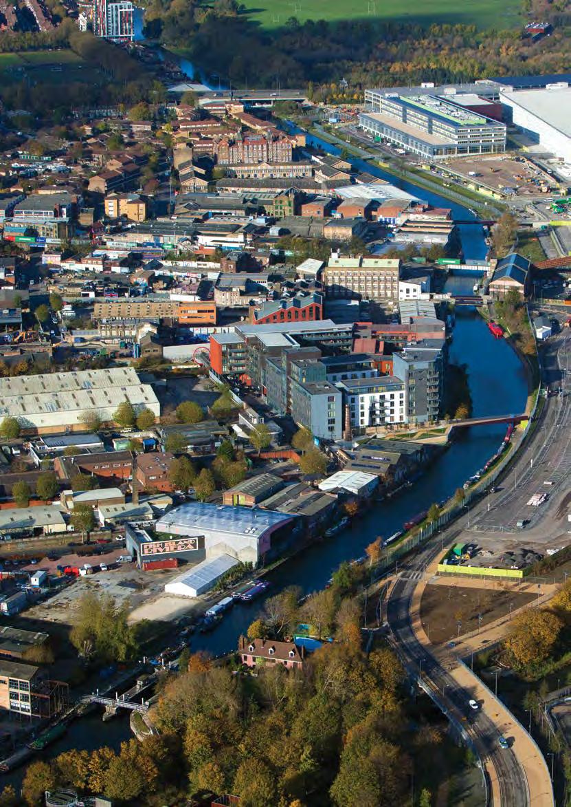
1 ADOPTED LOCAL PLAN THE LOCAL PLAN SUB AREAS INTRODUCTION 9.1 The Legacy Corporation area, while geographically well defined, also consists of a series of places, some of which are well established, others of which are in the process of change. Some will in time become new places with a new identity. The Local Plan divides the area into four separate Sub Areas that group these places so they are considered in a way that will help to integrate them with Queen Elizabeth Olympic Park at its centre. 9.2 The following Sub Area sections allow the Local Plan to include specific policies that are more relevant to the character and situation of each and include a vision that sets the direction for change in each area over the lifetime of the Local Plan to These sections include SiteSpecific Allocations which set out the type and form of development that will be considered acceptable on sites that are known to be available for future development. 9.3 The four Sub Areas are: S ub Area 1: Hackney Wick and Fish Island S ub Area 2: North Stratford and Eton Manor S ub Area 3: Central Stratford and Southern Queen Elizabeth Olympic Park Sub Area 2 S ub Area 4: Bromley-by-Bow, Pudding Mill, Sugar House Land and Mill Meads. Sub Area 1 Sub Area 3 Sub Area 4 Figure 27: The Local Plan Sub Areas SECTION
2 144 Hackney Marshes SA2.3 SA2.2 SA2.1 SA1.7 SA1.9 Hackney Wick SA3.1 SA1.1 Stratford SA1.2 SA1.8 SA1.3 Victoria Park SA3.2 SA1.6 Fish Island SA1.4 SA3.4 SA3.3 SA1.5 SA3.5 SA3.6 Pudding Mill SA4.3 SA4.2 Bow SA4.1 Figure 28: Site Allocations Bromleyby-Bow
3 145 SITE ALLOCATIONS SECTION 09 Table 8: Site Allocations SITE ALLOCATION REFERENCE SITE ALLOCATION NAME PAGE NUMBER SA1.1 Hackney Wick Station Area 164 SA1.2 Hamlet Industrial Estate 166 SA1.3 Hepscott Road 167 SA1.4 Bream Street 168 SA Wick Lane 170 SA1.6 Neptune Wharf 171 SA1.7 East Wick and Here East 172 SA1.8 Sweetwater 173 SA1.9 Bartrip Street South 174 SA2.1 Chobham Farm 186 SA2.2 East Village 187 SA2.3 Chobham Manor 188 SA3.1 Stratford Town Centre West 200 SA3.2 Stratford Waterfront East 202 SA3.3 Stratford Waterfront West 204 SA3.4 Greater Carpenters District 205 SA3.5 Bridgewater Road 207 SA3.6 Rick Roberts Way 208 SA4.1 Bromley-by-Bow 220 SA4.2 Sugar House Lane 222 SA4.3 Pudding Mill 224
4

5 147 ADOPTED LOCAL PLAN: THE SUB AREAS SUB AREA 1 HACKNEY WICK AND FISH ISLAND SECTION 10 Vision VISION Hackney Wick and Fish Island will become a more vibrant, diverse and well connected series of mixed and balanced neighbourhoods with places of social, cultural and economic activity. The established residential areas in the north, historic character in the centre, and industrial areas to the south, will have been complemented by a mix of new homes, employment floorspace and community facilities around and within buildings of historic interest, a new Neighbourhood Centre and an upgraded railway station. These will be served by and have direct access to the open spaces and world-class sporting facilities of Queen Elizabeth Olympic Park. A new digital quarter of hi-tech, media, broadcasting and education activities will be clustered within and around Here East, and complemented by a significant presence of creative and cultural industries producing bespoke and artistic products west of the Lee Navigation.
6 148 SUB AREA 1: HACKNEY WICK AND FISH ISLAND A12 Lee Valley VeloPark Hackney Wick Copper Box Arena Victoria Park Fish Island Stadium Figure 29: Sub Area 1 key diagram KEY Employment designations Neighbourhood Centre Pudding Mill Green space Key visitor attraction Bow
7 149 SUB AREA 1: HACKNEY WICK AND FISH ISLAND STRENGTHS Proximity to Queen Elizabeth Olympic Park and Westfield Stratford City, including Stratford Regional/International stations Existing Overground station and planned improvements Heritage assets River and canal frontages Creative cultural industries and community Businesses and industry Intricate yards and passages Access to the A12. OPPORTUNITIES AREA ANALYSIS SECTION 10 SUB AREA 1 Under-utilised and empty sites and canal/river frontages New open spaces, internal connections, and the creation of a legible street network New residential/mixed-use development New businesses/creative cultural industries New Neighbourhood Centre, delivering local amenities/services Heritage-led regeneration. CHALLENGES Physical severance Poor internal movement network and legibility Improving safety (i.e. natural surveillance) Rebalancing the currently disproportionate mix of uses Lack of small open spaces and local amenities/services Access to canal and river frontages Flood risk Noise and pollution from the A12 Preserving or enhancing heritage assets and maintaining local distinctiveness Preventing development that is ad hoc, low quality and/or of an inappropriate scale Retaining employment floorspace Increasing the number of creative cultural industries.

8 150 SUB AREA 1: HACKNEY WICK AND FISH ISLAND Area profile 10.1 Hackney Wick and Fish Island represents a significant opportunity to integrate and connect areas of new development and new communities with established communities and an existing concentration of businesses and creative and cultural industries. The area has the potential to accommodate many new homes and to create a genuine and vibrant mix of business, retail, service and community uses. An integral part of this is the creation of a new Neighbourhood Centre around an upgraded Hackney Wick Station. This will ensure that the area is well served by shops and services alongside other local facilities, and help deliver improved connections along streets and bridges to Queen Elizabeth Olympic Park and other clusters of activity such as Roman Road. Here East will complement this by providing a regionally important focus for technology and education that attracts further creative and cultural industries to the area Hackney Wick and Fish Island has the potential to become a diverse location, driving a significant element of business and employment growth, alongside the delivery of new homes, open spaces, education and community facilities. The character of this new development must draw upon and respect the form and character set by the existing streets and buildings within the area. The Hackney Wick and Fish Island area has the potential to evolve into a more sustainable series of communities but still retain its unique identity and sense of place by using its architectural and historic legacy to inform new development. This new development will be supported and serviced by a Neighbourhood Centre and benefit from the area s industrial heritage, waterside setting, improved transport infrastructure and sporting, leisure, cultural and education facilities within Queen Elizabeth Olympic Park.
9 151 SUB AREA 1: HACKNEY WICK AND FISH ISLAND Development potential of Sub Area 1 DEVELOPMENT Approximately 2,000 new homes have planning permission and a further 2,500 could be delivered across potential development sites within the next 15 years. Overall, 4,500 new homes are anticipated to be delivered within the Sub Area during the Plan period, including the new development planned for East Wick and Sweetwater. The East Wick and Sweetwater sites are located to the east of Hackney Wick and Fish Island, along the western edge of the Park. These will exemplify the best of London s residential architecture with a range of family homes and apartments inspired by the attractive housing found along the edges of London s parks. The sites have outline planning consent as part of the wider Legacy Communities Scheme for more than 30,000 sqm of employment floorspace, leisure, retail, community and education facilities, and approximately 1,500 homes. There is potential for an additional 20,000 square metres (approximately) of A1 A5 and D1 D2 Use Class floorspace west of the Lee Navigation. The delivery of this will contribute to the creation of a genuinely mixed-use environment with residential uses (C3) interlaid amongst business (B1 B2), retail and service (A1 A5) and Community (D1 D2) Use Classes. SECTION 10 SUB AREA 1 Area priorities 10.3 The priorities for Sub Area 1 have been derived from the analysis of the Sub Area. The policies and allocations within this section are tailored to address these priorities and achieve the objectives of the Local Plan within the context of Hackney Wick and Fish Island. Heritage-led regeneration and high-quality design: Ensuring that proposals for development are designed to respond to heritage assets, and where possible, restore and reuse those assets in a way that reinforces and celebrates their historic significance. Heritage assets are intrinsic to both the historic identity and urban fabric of Hackney Wick and Fish Island, and the Legacy Corporation considers them essential to delivering heritage-led regeneration within this area. Following an exemplary approach to urban, architectural and landscape design will ensure that new residential and employment floorspace is of the highest quality. Proposals for development within the Sub Area must restore heritage assets, and sustain the heritage value within Hackney Wick and Fish Island. Creative and productive employment: Protecting creative and cultural industrial uses that support the continuation of Hackney Wick and Fish Island s entrepreneurial and enterprising work culture. The Legacy Corporation in its role as Local Planning Authority will support the creative and cultural industries that combine to give Hackney Wick and Fish Island its distinctive sense of place. It will also promote development that incorporates a range of employment floorspace including starter and move on units for small and medium enterprises. Hackney Wick and Fish Island contains nearly 40 per cent of the employment land within the Legacy Corporation area, and more than 60 per cent of its businesses.
10 152 SUB AREA 1: HACKNEY WICK AND FISH ISLAND Mix of uses: Accommodating a range of employment uses and a significant increase in residential floorspace and community facilities. This Sub Area provides a number of opportunities for re-development in the form of cleared sites and where there are buildings of lower architectural and townscape quality. These should deliver a range of uses through contemporary schemes that are informed by an understanding and evaluation of the area s defining characteristics. Development should not prejudice the comprehensive regeneration of the area through piecemeal proposals. Neighbourhood Centre: Establishing a new Neighbourhood Centre to provide a focus for retail, community, leisure and service uses, and improving the amenities of the area to support both existing and new residential communities. In order to support the amount of development envisaged within this Sub Area, the area around Hackney Wick Station and the Copper Box Arena is designated as a Neighbourhood Centre within this Local Plan. This will facilitate the delivery of the retail, community and leisure facilities that are crucial to support the demand that will arise from an increase in people living and working in the area. This designation will also help to ensure that existing industry and amenities are retained, and that the area can capitalise on the increased footfall that will be generated between the Here East digital quarter and an improved Hackney Wick Overground Station. The Legacy Corporation anticipates that the Neighbourhood Centre will become a destination and the point at which routes and spines of activity meet. Clusters of activity: Promoting places where public and employment uses animate the private and public realm. To the east, across the Lee Navigation, there is an employment cluster to support digital and creative businesses at Here East. This provides flexible business/studio floorspace, a data centre, retail uses, and conference and education facilities in the former International Broadcast Centre (IBC) and Main Press Centre (MPC). Here East will provide an incubator and accelerator space for start-up businesses, and will create more than 5,000 jobs within a new quarter for London that supports the growth of the digital and creative industries. Connectivity: Repairing movement networks by creating new streets, better pedestrian and cycle routes across the A12 and the waterways, and enhancing access to an upgraded Hackney Wick Station. Local connectivity needs to be improved by repairing, extending and enhancing the existing street pattern to deliver a more coherent and legible movement network. Priority will be given to pedestrians, cyclists and public transport. Employment areas in Hackney Wick and Fish Island currently have poor access to local facilities and amenities. Despite the Sub Area having good access to the road network, there is a need to improve access to local public transport and the adjacent waterways, and to the Lee Valley Regional Park and other local open spaces outside the Legacy Corporation area. Waterways and open spaces: Enhancing the waterside environment and facilitating the provision of publicly accessible open spaces and the activation of the Blue Ribbon Network. A significant proportion of the Sub Area lies within the Lee Valley Regional Park and is situated at the southern extent of a continuous area of open spaces and waterways. Opportunities for informal leisure on and along the waterways should be provided. As part of the public realm improvements for Hackney Wick and Fish Island, a Canal Park runs along the entire western edge of Queen Elizabeth Olympic Park adjacent to the Lee Navigation. This is a local park and a critical piece of public realm for Queen Elizabeth Olympic Park and Hackney Wick and Fish Island. The park accommodates a varied set of landscapes and routes, providing a consistent and active edge to the canal. The design for the Canal Park responds to the ecology, history and diverse heritage of the Lower Lea Valley and helps to meet the needs of future communities in East Wick and Sweetwater.
 designation that incorporates the safeguarded Bow Midland West Rail site (as identified on the Policies Map).")
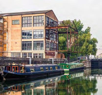
11 153 SUB AREA 1: HACKNEY WICK AND FISH ISLAND Strategic Links: Safeguarding the Bow Midland West Rail site for rail use and promoting access to the surrounding road network. Further south in Fish Island, there is a Strategic Industrial Location (SIL) designation that incorporates the safeguarded Bow Midland West Rail site (as identified on the Policies Map). New development should not adversely affect existing businesses and should be designed to take account of their existence and their existing and future operational requirements, particularly where those businesses are located within the designated employment clusters. SECTION 10 SUB AREA 1 Communities: Delivering and integrating development that benefits and connects to existing communities, such as those living within or around Hackney Wick, Fish Island, Wick Village and Trowbridge Estate. Residents within these areas currently lack sufficient access to small-scale retail and community uses. Therefore new development should cater for their needs as well as those arising from new residential development. Flooding: Parts of Hackney Wick and Fish Island are at risk of fluvial flooding from the River Lee Navigation. To ensure future growth in this area is sustainable, development proposals will need to incorporate appropriate flood mitigation measures in accordance with Policy S.8 and the guidance within the most up to date strategic flood risk assessments for this area (see evidence base list at page 141 for the current assessments) and the most up to date flood modelling held by the Environment Agency. Policy 1.1: Managing change in Hackney Wick and Fish Island POLICY Proposals for development within Sub Area 1 will be considered acceptable where they: 1. Maintain the overall amount of existing employment floorspace (B Use Class), including that used by creative and cultural industries and operating as low-cost and managed workspace (in accordance with the provisions outlined under Policies B.1 and B.4) 2. Propose employment floorspace falling within B1 (a), B1 (b), B1 (c) and B2 Use Classes inside the Hackney Wick Station Area allocation boundary, and B1 (b), B1 (c), B2 and B8 Use Classes outside it 3. Restore and reuse heritage assets for employment or other uses. Cross-reference to policies: B.1; B.4

12 154 SUB AREA 1: HACKNEY WICK AND FISH ISLAND Reasoned justification 10.4 Proposals for development within Hackney Wick and Fish Island must protect the existing industrial and economic base of the Sub Area and enhance its overall vitality. Policy application 10.5 Proposals for development should be brought forward as part of a comprehensive and integrated approach, particularly within the Hackney Wick Station Area allocation boundary. A mixture of approaches to the layering and integration of uses is likely to maintain the area s interesting character and deliver an appropriate balance of uses. The balance of uses within proposals for mixed use development will be assessed on the basis of the overall viability of a proposal and any other overriding factors.

13 155 SUB AREA 1: HACKNEY WICK AND FISH ISLAND Policy 1.2: Promoting Hackney Wick and Fish Island s unique identity and appearance Proposals for development within Sub Area 1 will be considered acceptable where they: 1. Reinforce local distinctiveness by incorporating high-quality and distinctive architecture that uses durable and suitable materials which reference the area s industrial past 2. Enhance existing yards and poor-quality and under-used passages and streets 3. Create new open spaces that complement the identity of the area 4. Allow for future changes in use through flexible design 5. Respect the contribution made by cultural and creative industries to the identity, culture and character of the area. POLICY SECTION 10 SUB AREA 1 Cross-reference to policies: BN.1; BN.2; BN.7; BN.16; T.9 Sub Area Policy: 1.4 Reasoned justification 10.6 Proposals for development within the Sub Area should reference and reinforce its local distinctiveness and use it as a driver for economic, environmental and heritage-led regeneration. The overall aim is to deliver place-specific development that is well designed for its context. Policy application 10.7 Development must support long-term heritage-led regeneration through positive high-quality development that takes account of the baseline information and relevant design principles within the Hackney Wick and Fish Island Design and Planning Guidance.
14 156 SUB AREA 1: HACKNEY WICK AND FISH ISLAND Policy 1.3: Connecting Hackney Wick and Fish Island POLICY Proposals for development within Sub Area 1 will be considered acceptable where they: 1. Relate well to key nodes of public activity and routes 2. Enable access to north-south walking routes between Wallis Road and Monier Road 3. Provide active frontages along streets and public routes 4. Connect with existing/proposed bridges where possible 5. Offer passages through yards and building plots where appropriate and support the creation of a new network of pedestrian passages and streets 6. Improve connections across and into the area, including through the provision of new bridges across waterways and the A12, where appropriate. Cross-reference to policies: T.1; T.2; T.3; T.5; T.6; T.9; T.10 Reasoned justification 10.8 With a new foot and cycle bridge built at Wallis Road to connect to East Wick and Here East, the planned route that will cut under Hackney Wick Station, and a vehicular bridge planned to connect Monier Road to Sweetwater, the most significant barriers to movement left within and through Sub Area 1 are the A12 to the west and the limited options for north-south movement across the Hertford Union Canal. The potential development sites identified as Site Allocations present opportunities to improve the existing movement network and, in some cases, provide new infrastructure, including bridges, to help overcome these remaining barriers. The overall aim is to achieve new and enhanced walking, cycling and vehicular routes that intersect with open spaces and nodes of public activity. Together, these improvements will help create a more legible and permeable sense of place. Policy application 10.9 New bridges and underpasses should be delivered to overcome the physical severance imposed by the waterways, railway embankment, A12 carriageway and the industrial sites either side of the Hertford Union Canal. This will improve the fragmented route network, encourage the use of streets and sustainable modes of transport, and promote pedestrian movement along routes that provide natural surveillance. New connections, particularly those within larger development sites, should be supported by new or enhanced green spaces that animate the public realm at key intersections.
 Key connections (off-road) Key connections to be enhanced (on-road) Key connections to be enhanced (off-road) Fish Island Stadium Pudding Mill")
15 157 A12 Lee Valley VeloPark SECTION 10 SUB AREA 1 Hackney Wick Copper Box Arena Figure 30: Sub Area 1 key connections Victoria KEY Park Principal connection improvement Key connections (on-road) Key connections (off-road) Key connections to be enhanced (on-road) Key connections to be enhanced (off-road) Fish Island Stadium Pudding Mill Bow
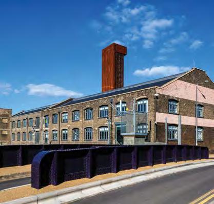
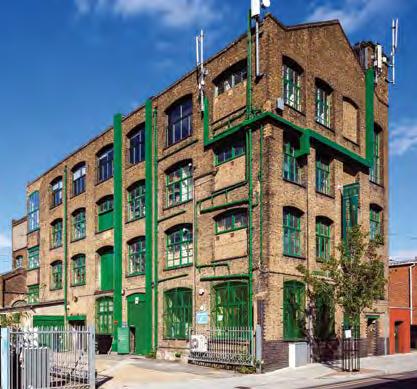
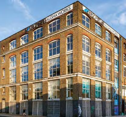
16 158 SUB AREA 1: HACKNEY WICK AND FISH ISLAND Policy 1.4: Preserving or enhancing heritage assets in Hackney Wick and Fish Island POLICY Proposals for development in Sub Area 1, within the boundary or immediate setting of heritage assets (see Figure 31), will be considered acceptable where they: 1. Preserve or enhance the special architectural or historic interest that has been identified within the appraisals of those heritage assets, in particular historic buildings, structures, yards, waterways and the pre-war residential and industrial street patterns that give the area its unique character 2. Enhance and reveal the significance of heritage assets, including the Lee Navigation and Hertford Union Canal 3. Restore and reuse heritage assets located within application boundaries as part of new development 4. Exhibit an understanding of and reference the architectural and historic interest of the area within their design 5. Retain street trees and/or provide these, where appropriate. Cross-reference to policy: BN.16 Sub Area Policy: 1.2 Reasoned justification The heritage assets in Hackney Wick and Fish Island will help define the future character of the area and Policy 1.4 ensures that the design and form of new development will preserve or enhance the area s special architectural and historic interest. This will add value to the future residential and business uses located here and distinguish the area from its surrounding urban context. Policy application There is a presumption against the loss of the heritage assets that have been identified as making a positive contribution to the architectural or historic interest of Hackney Wick and Fish Island. Historic England (formally English Heritage) has published guidance on the setting of heritage assets. This should be used to manage issues that arise in relation to setting through development proposals.
17 159 Lee Valley VeloPark SECTION 10 SUB AREA Figure 31: Heritage assets situated within Sub Area 1 KEY Heritage buildings/ structures Conservation areas 61 to 79 Eastway The Old Baths Trafalgar Mews St Mary of Eton Church 32a Eastway Gainsborough School Sewer vent pipe Warehouse at corner of Wallis Road and Berkshire Road Central Books and Rubber Works Oslo House Lion Works Former Carless Institute Spegelstein buildings/daro Works Eton Mission Rowing Club 88 Wallis Road 86 Wallis Road Railway bridge over Lee Navigation Hope Chimical Works Wall Lord Napier public house and adjacent housing Everett House 14 Queen s Yard Queens Yard and Kings Yard/ Energy Centre (former Clarnico Works) Carpenter s Road Bridge 92 White Post Lane Boundary wall to the Hertford Union Canal McGrath House and Outbuildings Carlton Chimney Bottom lock of Hertford Union Canal Former Timber Yard Gatehouse Broadwood s Piano Factory Algha Works Wick Lane Rubber Works (East) Wick Lane Rubber Works (West) Britannia Works Swan Wharf Old Ford Lock Northern Outfall Sewer Bridge Former Christ Church Mission and Sunday School Former Glass Bending Factory Former Ammonia Works Warehouse Public House, 421 Wick Lane Trowbridge Road Berkshire Rd Hackney Wick Victoria Park Bow Felstead Street Wansbeck Road Wallis Rd 18 7 Rothbu ry Road Trego Road Dace Rd Fish Island 28 Smeed Rd Wyke Road Roach Road Monier Road Beachy Road Copper Box Arena Stadium Pudding Mill For further detail please refer to the HW and FIWPL Conservation Area Appraisals

18 160

19 161 SUB AREA 1: HACKNEY WICK AND FISH ISLAND Policy 1.5: Improving the public and private realm in Hackney Wick and Fish Island In order to ensure that development benefits from the positive qualities of the public and private realm within Sub Area 1, proposals for development will only be considered acceptable where they: 1. Relate well to waterways, green infrastructure and Queen Elizabeth Olympic Park 2. Contribute to the provision of green infrastructure and urban greening 3. Promote pedestrian access to, across or along historic canal and river frontages. POLICY SECTION 10 SUB AREA 1 Cross-reference to policies: SP.3; S.7; BN.2; T.9; T.6 Sub Area Policies: 1.2; 1.3 Reasoned justification Hackney Wick and Fish Island has a mix of private, semi-public and public open spaces that will inevitably undergo a degree of transition over the coming years. It is important that this change respects, retains and contributes towards the positive characteristics of the public realm that are unique to this area. Policy application Proposals for development should have regard to the historic urban grain and street pattern within the area and demonstrate that their form and function relates well to this and other areas of existing public realm. Areas of new public realm will need to integrate well with the existing street network, waterway frontages, and green spaces.

20 162 SUB AREA 1: HACKNEY WICK AND FISH ISLAND Policy 1.6: Building to an appropriate height in Hackney Wick and Fish Island POLICY Proposals for development greater than 20 metres above ground level will only be acceptable subject to the provisions outlined within Policy BN.10. Cross-reference to policies: BN.10, BN.1 Reasoned justification The prevailing height of Sub Area 1 is 20 metres above existing ground level. This is represented through a mixture of intermittent building heights that together form a unique arrangement that contributes to the area s townscape. Policy application This policy sets the building height level above which development proposals will be assessed against Policy BN.10. Further guidance An area-based Supplementary Planning Document (SPD) will be prepared for the core areas of regeneration and change west of the Lee Navigation. This will outline the ways that development within those locations can achieve the Sub Area 1 priorities and policy requirements, as well as the overarching objectives of the Local Plan. The SPD will provide additional guidance on the types and forms of development that are appropriate for those core areas, facilitate delivery and ensure that piecemeal development does not prejudice the comprehensive heritage-led regeneration of Hackney Wick and Fish Island.

21 163 SECTION 10 SUB AREA 1

22 164 SUB AREA 1: SITE ALLOCATIONS Site Allocation SA1.1: Hackney Wick Station Area SITE ALLOCATION An area around Hackney Wick Station supporting comprehensive employment-focused mixed-use development, including a significant number of new homes complemented by new retail, leisure, food/drink and community facilities. Development should deliver a mix of uses around the rebuilt Hackney Wick Station, integrate with established retail frontage at Felstead Street and Prince Edward Road, and utilise buildings of heritage value. Development will be focused around the improved station at Hackney Wick, with active uses concentrated in clusters on primary routes connecting Hackney Wick, Fish Island, Sweetwater and East Wick The overall amount of existing employment floorspace (B Use Class) within the allocation boundary must be maintained, with a particular emphasis on retaining and providing for creative and cultural industries and any other businesses that are compatible with residential use Conflict between uses should be avoided by consolidating compatible uses together and mitigating potential impacts through careful design Yard spaces should be predominantly either residential or employment/ workspace focused New retail uses should be mainly focused around the station Avoid ground-floor residential use where assessed flood-risk levels indicate such use is inappropriate Key locations for public activity and local amenities should be at the points of connection between the four neighbourhoods (Hackney Wick, Fish Island, Sweetwater and East Wick), i.e. clustered around bridges and connections below the railway A new direct and legible north-south connection which structures the heart of the area should be delivered between Wallis Road and Monier Road, integrated with Hackney Wick Station and an improved bridge over the Hertford Union Canal extending from Roach Road A fine grain of streets, passageways and yards should be established that should create informal secondary connections to the canal edge Existing streets should be reinforced with strong building edges and active ground floors Where there is no continuous towpath along a canal edge, a series of new public spaces should be created which provide public access to the water and which also integrate informal connections between adjacent bridges, streets, passages or yards New tall buildings should not be located adjacent to or compete with existing taller buildings such as that housing Central Books Massing should respond to adjacent existing and proposed public spaces and buildings Development should preserve or enhance the Conservation Area and, where outside, enhance its setting.
23 165 SUB AREA 1: SITE ALLOCATIONS Site Allocation SA1.1: Hackney Wick Station Area (continued) Site Allocation SA1.1: Hackney Wick Station Area KEY Open space WALLIS ROAD Copper Box Arena SITE ALLOCATION SECTION 10 SUB AREA 1 Active frontage Non-residential ground floor frontage Principal connection improvement Station Key connections ROTHBURY ROAD Supporting development principles Mix Development should retain or re-provide existing employment floorspace classified as B1 Use Class (business) Development should re-provide employment floorspace falling within the B2 to B8 Use Classes, as B1 Use Class (business) and/or B2 Use Class (general industry). B2 uses should be compatible with mixed use development Workspace provision should be provided at both upper and ground-floor levels to acknowledge the variety of workspace typologies Queen s Yard will act as a high-quality public space defined by a mixture of cultural and public uses that complement existing uses such as The White Building and the Yard Theatre. Movement New passages connecting pockets of public space should create a varied sense of enclosure Narrower passages should be framed by lower buildings (of two to three storeys) to create an asymmetrical street section. Scale Development should make a positive contribution to the characteristics and composition of views within and to/from the area. Appearance Buildings should be detailed to create a sense of weight, solidity and permanence, with brick and masonry as the predominant façade material Public realm design should be simple and refined employing a reduced palette of high-quality robust materials Generally, continual roof forms should be employed. Where an articulated roof form is proposed, it should be an integrated part of the architectural character and not compete with the setting of existing buildings. Phasing and implementation Delivery on site from 2016 onwards. Relevant planning history White Post Lane and Wallis Road Hackney Wick Hub Scheme (LPA ref LTGDC OUT) Upgrade and improvement works to Hackney Wick Station (14/00275/FUL) Address Site address: Area to the east and west of the Lee Navigation around Hackney Wick Station Existing uses: Employment/cultural/creative/ retail/residential Size: 6.3 ha PTAL rating: 3 Flood Zone: 1 3 (areas to the west of the Lee Navigation are within Flood Zones 2 and 3)
24 166 SUB AREA 1: SITE ALLOCATIONS Site Allocation SA1.2: Hamlet Industrial Estate SITE ALLOCATION Mixed-use development including employment and residential floorspace complemented by restaurants/cafes. Avoid ground-floor residential use where assessed flood-risk levels indicate such use is inappropriate Development should improve access to the lower-level towpath along the western bank of the Lee Navigation Canal. There is an opportunity for a public use on this key corner New development should vary in height Development should respond to the height and massing of the immediate context Enhance natural surveillance of the surrounding towpath. Site Allocation SA1.2: Hamlet Industrial Estate WHITE POST LANE KEY Active frontage Non-residential ground floor frontage Principal connection improvement Key connections Supporting development principles Utilise access to White Post Lane and Queen Elizabeth Olympic Park (using the Lee Navigation vehicular bridge) New development should engage with the established townscape of juxtaposed tall and low buildings, such as the relationship between The White Building and Mother Studios New proposals should positively engage with 92 White Post Lane through both architectural character and urban design Cultural and public uses should be located at the interface of White Post Lane and the Lee Navigation crossing, and have a strong relationship to a public space on the canal edge. Phasing and implementation 2020 onwards. Relevant planning history Not applicable. Address Site address: Site with White Post Lane to the north, Lee Navigation to the east, Hertford Union Canal to the south Existing uses: Light Industrial Units Size: 0.4 ha PTAL rating: 3 Flood Zone: 2 and 3 (Flood Zone 3 only along far-eastern edge of site)
25 167 SUB AREA 1: SITE ALLOCATIONS Site Allocation SA1.3: Hepscott Road SITE ALLOCATION Comprehensive mixed-use development including employment, residential, creative and cultural uses and a linear park. SECTION 10 SUB AREA 1 Development should provide new walking and cycling routes through the site providing connections to the Hertford Union Canal towpath, Roach Point Bridge, and Hackney Wick Station Development should respond Hackneypositively to the waterside setting, enhance Wick the character of the canal and enhance strategic views west towards central London Proposals should provide a high-quality frontage and deliver public realm improvements to Wansbeck Road Development should enable the delivery of improved or new north-south connections across the canal Form, connectivity and delivery of development needs to be considered with the Neptune Wharf site opposite Any proposal that does not safeguard the existing waste capacity should be resisted unless it can be demonstrated this capacity can be more efficiently re-provided elsewhere within London. Any such proposal must ensure that such an approach counts towards the Borough s overall waste apportionment target (to the satisfaction of the Borough and the GLA) Copper Box Retain and reuse buildings of heritage value. These buildings should anchor new routes, frontages and public spaces. Development should preserve or enhance the Conservation Area and, where outside, enhance its setting. HEPSCOTT ROAD Site Allocation SA1.3: Hepscott Road KEY TREGO ROAD Open space WANSBECK ROAD Active frontage Non-residential ground floor frontage Principal connection improvement Key connections Fish Island Supporting development principles Development should provide a new linear park of approximately 1.2 ha, to serve the wider area. Phasing and implementation 2020 onwards. Relevant planning history Not applicable. Address Site address: Site with Trego Road and Hepscott Road to the north, Hertford Union Canal to the south and Wansbeck Road to the west Existing uses: Waste Transfer Site Size: 2.8 ha PTAL rating: 3 Flood Zone: 1 and 2
26 168 SUB AREA 1: SITE ALLOCATIONS Site Allocation SA1.4: Bream Street SITE ALLOCATION Mixed-use development including employment, residential, and creative and cultural uses to come forward in a comprehensive manner. Development should respond to the waterfront character where the site adjoins the Lee Navigation and enhance the setting of Old Ford Lock The site should provide for public access to and views across the water space, together with an active canal frontage Development should improve and enhance the setting of the surrounding Conservation Area and provide a highquality frontage to improve local views along Dace Road. Fish Island Site Allocation SA1.4: Bream Street STOUR ROAD KEY BREAM ST Open space Active frontage Non-residential ground floor frontage Principal connection improvement DACE ROAD Key connections Supporting development principles The site should provide streets and pedestrian passages flanked by robust building forms between Stour Road and Dace Road. Phasing and implementation 2020 onwards. Relevant planning history Not applicable. Address Site address: Site with Stour Road to the north, Lee Navigation to the east, Dace Road to the south and Bream Street to the west Existing uses: Vacant site Size: 0.9 ha PTAL rating: 1b Flood Zone: 2 and 3 (Flood Zone 1 in northern part of the site)

27 169 SECTION 10 SUB AREA 1
28 170 SUB AREA 1: SITE ALLOCATIONS Site Allocation SA1.5: 415 Wick Lane SITE ALLOCATION Mixed-use development, including employment and residential, to provide a transition between the Fish Island SIL and the mixed-use character north of the Greenway. Development should provide a high-quality frontage to improve the local views along Wick Lane from Crown Close Development should relate well to the Greenway and enhance natural surveillance without over-dominating Development should enhance the setting of the Conservation Area Development should provide a new direct link from Wick Lane to the Greenway that new development can access Fish Island Development should improve the setting of the cluster of heritage buildings on Crown Close. Site Allocation SA1.5: 415 Wick Lane WICK LANE KEY Open space Non-residential ground floor frontage Principal connection improvement WICK LANE Key connections Supporting development principles Development should provide a new public space adjacent to 417 Wick Lane to improve the outlook for the existing ground-floor business units within that development Development should re-provide employment floorspace in accordance with the function of employment cluster B.1b5 and Policy B.1. Phasing and implementation 2020 onwards. Relevant planning history Not applicable. Address Site address: Site with the Greenway to the north, Wick Lane to the south and west Existing uses: B Class Uses Size: 0.6 ha PTAL rating: 2 Flood Zone: 1
29 171 SUB AREA 1: SITE ALLOCATIONS Site Allocation SA1.6: Neptune Wharf SITE ALLOCATION Comprehensive, phased, mixed-use medium density residential development incorporating public open space and land for a future primary school to help meet education needs arising across Fish Island. SECTION 10 SUB AREA 1 Focus active frontages/retail uses around public open space and the waterfront Ensure improved permeability with the creation of new north-south and east-west public routes through the site, including a new access and visual connection to the Hertford Union Canal from the south Ensure building footprints and open spaces allow for future enhanced walking and cycling connections across the canal Building heights must provide a transition from a frontage height of six storeys along the Hertford Union Canal down to four to six storeys along Wyke Road. Site Allocation SA1.6: Neptune Wharf KEY WANSBECK ROAD Open space ROACH ROAD Active frontage Non-residential ground floor frontage Principal connection improvement School WYKE ROAD Fish Island Playspace Key connections Supporting development principles Development should include 0.44 ha of land for a future primary school (three-form entry) and at least 0.8 ha of public open space Workspace should be focused around internal yards or on-street. Phasing and implementation Delivery on site from 2015/16 onwards. Relevant planning history Application reference: 12/00210/OUT. Permission for up to 522 residential units. Address Site address: Site with Hertford Union Canal to the north, Roach Road to the east, Wyke Road to the south and Wansbeck Road to the west Existing uses: Part B1a and c, B2 and B8 Class employment uses Size: 2.5 ha PTAL rating: 2 3 Flood Zone: 1
30 172 SUB AREA 1: SITE ALLOCATIONS Site Allocation SA1.7: East Wick and Here East SITE ALLOCATION Employment cluster and comprehensive, phased mixed-use development, including residential, employment, retail, leisure and community floorspace (incorporating a new primary school and two nurseries). Development should relate well to Hackney Wick Neighbourhood Centre and Canal Park Development should provide a gateway to Queen Elizabeth Olympic Park and establish a high-quality frontage that engages with both the Lee Navigation and Queen Elizabeth Olympic Park Development should support the continuation of direct east-west connections from Hackney Wick and Fish Island to the primary school and Queen Elizabeth Olympic Park Routes between East Wick and the Neighbourhood Centre should provide frontages to support the generation of active ground-floor uses. Site Allocation SA1.7: Eastwick and Here East KEY Open space Non-residential ground floor frontage Principal connection improvement School Playspace NORTH WEST ROAD Active frontage Key connections WATERDEN ROAD Phasing and implementation 2015/16 onwards. Relevant planning history East Wick: The East Wick site was granted planning permission on 28 September 2012, subject to conditions and a Section 106 (S106) Agreement (LPA ref 11/90621/OUTODA). Up to 96,097 sqm residential floorspace, approximately 880 homes Up to 9,001 sqm employment (B1a and B1b/c) floorspace Up to 4,725 sqm of retail (A1 A5) and leisure (D2) floorspace Up to 6,888 sqm of community (D1) floorspace, including a new primary school and two nurseries. Here East: Here East was granted planning permission on 25 February 2014, subject to conditions and a Section 106 (S106) Agreement (LPA ref 13/00534/FUM, 13/00536/COU and 13/00537/FUL) Address Copper Box Arena An employment cluster including digital, creative, media and broadcasting businesses and further/higher education uses (i.e. 115,755 sqm of commercial floorspace including data centre, business/studios, education, conference and retail floorspace). Site address: Land with Queen Elizabeth Olympic Park to the east, Copper Box to the south and the Lee Navigation to the west Existing uses: Broadcast Centre Size: 23.4 ha PTAL rating: 3 Flood Zone: 1
31 173 SUB AREA 1: SITE ALLOCATIONS Site Allocation SA1.8: Sweetwater SITE ALLOCATION Comprehensive, phased mixed-use development, including residential, employment, retail and community floorspace (incorporating a new primary school, nursery, health centre and library). SECTION 10 SUB AREA 1 Development should relate well to Hackney Wick Neighbourhood Centre, Canal Park and the Stadium Development should support the continuation of direct east-west connections from Hackney Wick and Fish Island to the primary school and Queen Elizabeth Olympic Park New bridge links should be provided across the Lee Navigation that align with the street pattern of Hackney Wick and Fish Island. Copper Box Arena Site Allocation SA1.8: Sweetwater WHITE POST LANE KEY Open space Active frontage Non-residential ground floor frontage ROACH ROAD Principal connection improvement School Playspace Key connections Fish Island Stadium Phasing and implementation 2015/16 onwards Relevant planning history This site was granted planning permission on 28 September 2012, subject to conditions and a Section 106 (S106) Agreement (LPA ref 11/90621/OUTODA). Up to 67,730 sqm residential floorspace, approximately 650 homes Up to 1,065 sqm of employment (B1a) floorspace Up to 2,576 sqm of retail (A1 A5) floorspace Up to 8,410 sqm of community (D1) floorspace, including: new primary school nursery health centre library. Address Site address: Area east of the Lee Navigation, south of the London Overground railway Line Existing uses: Vacant site Size: 11.2 ha PTAL rating: 2 Flood Zone: 1 Pudding Mill Lane
32 174 SUB AREA 1: SITE ALLOCATIONS Site Allocation SA1.9: Bartrip Street South SITE ALLOCATION Land with potential for gypsy and traveller site. Development should: Maximise the provision of gypsy and traveller pitches Design must incorporate noise mitigation measures. Hackney Wick WICK ROAD VICTORIA PARK ROAD Victoria Park Site Allocation SA1.9: Bartrip Street South KEY Key connections Supporting development principles Development should be stepped back from surrounding roads and orientated towards Wick Road Development should maintain the green amenity and green infrastructure value of the site and existing vegetation where appropriate The site should be accessed from the corner of Bartrip Street/Wick Road. Phasing and implementation Delivery on site is expected to meet the first five-year requirements for pitches (between ). Relevant planning history Not applicable. Address Site address: Triangle of land at Bartrip Street, to the north of Wick Road Existing uses: Former operational land Size: 0.42 ha PTAL rating: 3 Flood Zone: 1 (except for far-eastern tip of site which is in Flood Zone 2)

33 175 SECTION 10 SUB AREA 1 Signposting Other designations applying to this Sub Area are: Employment Clusters B.1a1, B.1a2, B.1a3, B.1b1, B.1b2, B.1b3, B.1b4, B.1b5 see Policy B.1 Metropolitan Open Land see Policy BN.6 Local Open Space see Policy BN.7, Figure 15, Table 6 and the Policies Map. Hackney Wick Neighbourhood Centre see Table 3 Evidence base references The London Plan. The Spatial Development Strategy for London consolidated with alterations since 2011 (Greater London Authority, 2015) Mayor s Olympic Legacy Supplementary Planning Guidance (Greater London Authority, 2012) Hackney Wick and Fish Island Design and Planning Guidance (London Legacy Development Corporation, 2013) Infrastructure Delivery Plan (Legacy Development Corporation, 2013) Retail and Leisure Requirements Review (London Legacy Development Corporation, 2014) Local Economy Study Part A: Existing Business Survey (London Legacy Development Corporation, 2014) Local Economy Study Part B: Employment Land Review (London Legacy Development Corporation, 2014) Local Economy Study Part C: Qualitative Research (London Legacy Development Corporation, 2014) Hackney Wick Fish Island Strategic Connectivity Study (London Legacy Development Corporation, 2013) Research and viability study of affordable and managed workspaces supporting artistic practices in east London (London Legacy Development Corporation, 2014) Hackney Wick Area Action Plan (London Borough of Hackney, 2012) Fish Island Area Action Plan (London Borough of Tower Hamlets, 2012) Legacy Communities Scheme Planning Application: 11/90621/OUT (London Legacy Development Corporation, 2012)
34
SUB AREA 3 CENTRAL STRATFORD AND SOUTHERN QUEEN ELIZABETH OLYMPIC PARK
 191 ADOPTED LOCAL PLAN: THE SUB AREAS SUB AREA 3 CENTRAL STRATFORD AND SOUTHERN QUEEN ELIZABETH OLYMPIC PARK SECTION 12 Vision VISION Central Stratford and Southern Queen Elizabeth Olympic Park will become
Masterplanning in Hackney Wick and Fish Island
 Masterplanning in Hackney Wick and Fish Island Hannah Lambert Senior Designer London Legacy Development Corporation London Legacy Development Corporation is. Regeneration body answerable to Mayor of London
BROMLEY-BY-BOW SUPPLEMENTARY PLANNING DOCUMENT (ADOPTED - APRIL 2017)
") BROMLEY-BY-BOW SUPPLEMENTARY PLANNING DOCUMENT (ADOPTED - APRIL 2017) CONTENTS 1. Introduction 4 PART A: SETTING THE SCENE 6 2. Background, purpose and structure of this SPD 6 3. Planning Policy Framework
BROMLEY-BY-BOW SUPPLEMENTARY PLANNING DOCUMENT (ADOPTED - APRIL 2017) CONTENTS 1. Introduction 4 PART A: SETTING THE SCENE 6 2. Background, purpose and structure of this SPD 6 3. Planning Policy Framework
OUR AREA SECTION 02 I NEXT PAGE. 2.1 This section sets the scene in regard to the role of the Legacy Corporation and the baseline
 7 ADOPTED LOCAL PLAN SECTION 02 2.1 This section sets the scene in regard to the role of the Legacy Corporation and the baseline position of the Local Plan. It sets out the historical context and current
5. Bankside and The Borough 5.1. Bankside and The Borough Area Vision
 5. 5.1. Area Vision 5.1.1. are: A globally significant central London business district which is home to international business headquarters; At the heart of the commercial and cultural life of the capital
PUDDING MILL SUPPLEMENTARY PLANNING DOCUMENT (CONSULTATION DRAFT - OCTOBER 2016)
") PUDDING MILL SUPPLEMENTARY PLANNING DOCUMENT (CONSULTATION DRAFT - OCTOBER 2016) CONTENTS 1. Introduction 3 2. A New Identity for Pudding Mill 4 Queen Elizabeth Olympic Park 3. Development Context 5 4.
PUDDING MILL SUPPLEMENTARY PLANNING DOCUMENT (CONSULTATION DRAFT - OCTOBER 2016) CONTENTS 1. Introduction 3 2. A New Identity for Pudding Mill 4 Queen Elizabeth Olympic Park 3. Development Context 5 4.
BACK TO CONTENTS I PREVIOUS PAGE I NEXT PAGE. Figure 13: Major wildlife corridors
 Figure 13: Major wildlife corridors 69 ADOPTED LOCAL PLAN CREATING A HIGH-QUALITY BUILT AND NATURAL ENVIRONMENT SECTION 06 6.1 The unique interplay of green spaces, waterways and the built environment
16. Peckham Peckham Area Vision
 16. 16.1. Area Vision 16.1.1. is: A lively town centre providing a range of daytime and night time activities on Rye Lane including a Library, a Leisure Centre and many independent retailers which specialise
PUDDING MILL INTRODUCTORY FLIP-BOOK. Summer Pudding Mill Square
 PUDDING MILL INTRODUCTORY FLIP-BOOK Summer 2016 Pudding Mill Square 2 3 INTRODUCTION The Legacy Corporation is revisiting the Pudding Mill masterplan in response to the changing context of adjoining developments,
BROMLEY BY BOW SOUTH. LANDOWNER MASTERPLAN Final October 2016
 BROMLEY BY BOW SOUTH LANDOWNER MASTERPLAN Final October 2016 Danescroft Land British Land Vastint Lindhill Southern Housing Group London Legacy Development Corporation Unit E03 The Biscuit Factory 100
Peckham Peckham Area Vision Map
 Area Vision Map PNAAP13 PNAAP8 Sumner Road Surrey Canal Walk Bird in Bush Park Key: NSP Site Allocations PNAAP Allocations Greenspace Low Line Cycle Network Primary Shopping Areas Square Surrey Canal Walk
Colchester Northern Gateway Master Plan Vision Review Draft. July 2016
 Colchester Northern Gateway Master Plan Vision Review Draft July 2016 Contents Introduction 4 Context 8 Purpose of the Report 8 Strategic Position 9 Overview of the Process 11 2012 Master Plan Vision 12
Newcourt Masterplan. November Exeter Local Development Framework
 Newcourt Masterplan November 2010 Exeter Local Development Framework Background The Exeter Core Strategy Proposed Submission sets out the vision, objectives and strategy for the development of Exeter up
97 Lea Bridge Road, Leyton, E10 7QL London Borough of Waltham Forest December 2015
 97 Lea Bridge Road, Leyton, E10 7QL London Borough of Waltham Forest December 2015 Public Realm and Landscape Proposals LEA BRIDGE ROAD, WALTHAMSTOW Public Realm & Landscape Proposals BDP(90)RPT001 December
LOCAL PLAN BACKGROUND PAPER: BUILT ENVIRONMENT. August 2014
 LOCAL PLAN BACKGROUND PAPER: BUILT ENVIRONMENT August 2014 CONTENTS 1. Introduction 3 2. Legislative and Policy Context 5 3. Soundness 10 4. Responding to place 12 5. Designing residential schemes 16 6.
Elephant and Castle. Elephant and Castle Area Vision Map. Elephant and Castle. 216 New Southwark Plan Proposed Submission Version NSP42 NSP49 NSP44
 Area Vision Map Lamberth North Station Waterloo Road Southwark Station NSP49 NSP43 Blackfriars Rd St George s Road Borough Road NSP48 Great Suffolk Street NSP42 NSP44 NSP45 Borough Station Newington Gardens
6. Bermondsey 6.1. Bermondsey Area Vision
 6. 6.1. Area Vision 6.1.1. is: An inner-london neighbourhood characterised by modest worker ho associated with the historic Rotherhithe docks and local manufacturing industries such as biscuits, jam, vinegar
FISH ISLAND POST LANE & WHITE CONSERVATION AREA APPRAISAL
 FISH ISLAND & WHITE POST LANE CONSERVATION AREA APPRAISAL LONDON LEGACY DEVELOPMENT CORPORATION NOVEMBER 2014 Page_2 CONTENTS 1.0 INTRODUCTION 1.1 Background 1.2 The purpose of conservation areas 1.3 The
APPENDIX 1: SITE ALLOCATIONS. GREAT WEST CORRIDOR Local Plan Review
 APPENDIX 1: SITE ALLOCATIONS GREAT WEST CORRIDOR Local Plan Review 1000 Great West Road Ward: Brentford Address: 1000 Great West Road Brentford TW8 9DW Source: Call for sites 2016 PTAL: 2 Site Area (ha):
Public Consultation. Land at Monks Farm, North Grove. Welcome
 Welcome Welcome to our public exhibition for development on Land at Monks Farm, orth Grove. Gallagher Estates and Gleeson Strategic Land are preparing an outline planning application for new homes, open
Town and Country Planning (Local Planning) (England) Regulations 2012, Regulation 22 Submission of Legacy Corporation Local Plan
 (England) Regulations 2012, Regulation 22 Submission of Legacy Corporation Local Plan") Level 10, 1 Stratford Place Montfichet Road London E20 1EJ Tel: +44 (0) 20 3288 8821 Fax: +44 (0) 20 3288 1851 alex.savine@londonlegacy.co.uk Stuart Liddington The Planning Inspectorate 3/12 Kite Wing
Level 10, 1 Stratford Place Montfichet Road London E20 1EJ Tel: +44 (0) 20 3288 8821 Fax: +44 (0) 20 3288 1851 alex.savine@londonlegacy.co.uk Stuart Liddington The Planning Inspectorate 3/12 Kite Wing
Rotherhithe Rotherhithe Area Vision Map
 Area Vision Map CWAAP1 Improved pedestrian and cycle links to the wider area Improved link from town centre to River Thames and docks CWAAP2 Brunel Museum NSP79 CWAAP3 Proposed Thames Crossing Station
3.3. Urban Structure Defining a New Hierarchy of Routes and Spaces >Images
 Section 3.0 I The Masterplan Framework 18 >Images Examples of high quality routes and spaces 3.3. Urban Structure The success of any masterplan lies in a clear definition of the future urban structure
Chapter 5 Urban Design and Public Realm
 5.1 Introduction Public realm is all areas of the urban fabric to which the public have access. It is where physical interaction takes place between people. It therefore, includes buildings and their design,
75-89 Wallis Road & 59 Berkshire Road, Hackney Wick, London, E9 5LN
 East London Mixed-Use Development Opportunity CGI of Proposed Scheme Summary A mixed-use development opportunity located in Hackney Wick within the jurisdiction of the London Legacy Development Corporation.
QUEEN-RIVER SECONDARY PLAN
 34 QUEEN-RIVER SECONDARY PLAN 34. QUEEN RIVER SECONDARY PLAN 1. INTRODUCTION The Queen-River area is approximately 6.4 hectares and is located at the eastern edge of the Downtown as shown on Map 34-1.
8. Camberwell 8.1. Camberwell Area Vision
 8. 8.1. Area Vision 8.1.1. is: Centred on a medieval village centre which has become a thriving modern town centre surrounded by residential streets laid out in the Georgian era; Linked by rail to central
The Master Plan Framework
 The Master Plan Framework The East Harbour Master Plan advances the development of 60 acres of former industrial lands east of the Don River. The Master Plan outlines a vision for a vibrant, transit-oriented
Camberwell Camberwell Area Vision Map
 Area Vision Map NSP23 Burgess Park Edmund Street NSP29 NSP30 NSP31 New Road Benhill Road NSP27 NSP33 Green Brunswick Park NSP22 station NSP24 Peckham Road NSP26 St Giles Church Lucas Gardens NSP28 NSP25
Chapter 2: OUTLINE PLANNING APPLICATION PROPOSALS. A New Garden Neighbourhood Matford Barton 17
 Chapter 2: OUTLINE PLANNING APPLICATION PROPOSALS A New Garden Neighbourhood Matford Barton 17 2.1. SUMMARY AND STATUS OF THE PROPOSALS 2.1.1. The parameter plans and associated wording in this chapter
Aerial view of Hackney Wick. PTE - Diespeker Wharf, Islington. PTE - Deptford Lounge
 80-84 & 88 WALLIS ROAD Welcome Welcome to this public exhibition of our plans for 80-84 and 88 Wallis Road (known as Daro Factors). Our proposals aim to replace the low grade warehouse buildings and to
Ipswich Issues and Options for the Ipswich Local Plan Review, August 2017, Public Consultation
 Ipswich Issues and Options for the Ipswich Local Plan Review, August 2017, Public Consultation Having reviewed the issues and options documents, the Society has made the following response: Part 1 Strategic
London Legacy Development Corporation Quality Review Panel. Thursday 16 April 2015 Level 10, 1 Stratford Place, Montfichet Road, London E20 1EJ
 London Legacy Development Corporation Quality Review Panel : McGrath Site Thursday Level 10, 1 Stratford Place, Montfichet Road, London E20 1EJ Panel Peter Studdert (chair) Adam Khan Tom Holbrook Dan Epstein
GREENFORD HALL & ADJOINING LAND
 GREENFORD HALL & ADJOINING LAND CONTENTS 1. Introduction 1. Introduction 2. Urban Context 2.1 The Site and Surroundings 2.2 Urban Context Map 2.3 Access and Movement 3. Planning Context 3.1 Planning History
2.0 Strategic Context 4
 2.0 Strategic Context 4 2.1 The Area Action Plan is a non-statutory plan, which forms a corporate policy document, expressing particular issues and areas of concern while also providing a vision for the
London Bridge London Bridge Area Vision Map
 Area Vision Map Borough Market Southwark Cathedral NSP54 Hay s Galleria Key: NSP Site Allocations Greenspace Low Line Thames Path Cycle Network Primary Shopping Areas Borough High Street Tube Station NSP51
Local Plan Background Paper: Transport and Connectivity. August 2014
 Local Plan Background Paper: Transport and Connectivity August 2014 Contents 1. Introduction... 3 2. Legislative and policy context... 5 3. Evidence and policy development... 9 Appendix 1: Existing Planning
New-Cast Mixed-use Development Proposal King Street West, Newcastle, Ontario
 URBAN DESIGN BRIEF New-Cast Mixed-use Development Proposal King Street West, Newcastle, Ontario TABLE OF CONTENTS: 1.0 Executive Summary 2.0 Creating Vibrant and Sustainable Urban Places: Excerpts from
13. London Bridge London Bridge Area Vision
 13. 13.1. Area Vision 13.1.1. is: A globally significant central London business district which is home to international business headquarters; Internationally renowned for its prominent riverfront location
Tāhuhu whakaruruhau ā-taone The sheltering ridge pole
 B2. Tāhuhu whakaruruhau ā-taone - Urban growth and form B2.1. Issues Tāhuhu whakaruruhau ā-taone The sheltering ridge pole Auckland s growing population increases demand for housing, employment, business,
A. The sites in Table 16 below, as identified on the Policies Map, are allocated for retail-led development:
 SWDP 44: Worcester City Centre A. The sites in Table 16 below, as identified on the Policies Map, are allocated for retail-led development: Table 16: Sites Allocated for Retail-Led Development Policy Reference
Welcome to our exhibition
 Welcome to our exhibition housing development A46 Wildmoor Alcester Road Canal Quarter A422 Town Centre housing development Warwickshire-based IM Properties, one of the UK s largest privately owned property
PART AOTEA PRECINCT
 CONTENTS... PAGE AOTEA PRECINCT...4 14.5.1 INTRODUCTION...4 14.5.2 RESOURCE MANAGEMENT ISSUES...4 14.5.3 RESOURCE MANAGEMENT OBJECTIVES AND POLICIES... 4 14.5.4 RESOURCE MANAGEMENT STRATEGY...5 14.5.5
NATURAL AND BUILT ENVIRONMENT BACKGROUND PAPER
 NATURAL AND BUILT ENVIRONMENT BACKGROUND PAPER OCTOBER 2018 CONTENTS 1. Introduction 2 2. Legislative and policy context 2 3. Evidence Base 3 4. Key changes 8 4.1 Strategic Policy 8 4.2 The waterway environments
Herne Hill and North Dulwich Herne Hill and North Dulwich Area Vision Map
 Area Vision Map East Dulwich station Greendale Playing Fields Green Dale Sunray Gardens North Dulwich station Herne Hill station Herne Hill Velodrome NSP50 Edward Alleyn Club Key: NSP Site Allocations
8.0 Design and Form of Development 43/
 42/ 8.0 Design and Form of Development 43/ Rothwells Farm, Golborne/ Development Statement Figure 7. Site Constraints Key 44/ Site Boundary 360 Bus Route/Stops Existing Trees Underground Water Pipe Sensitive
Neighbourhood Planning Local Green Spaces
 Neighbourhood Planning Local Green Spaces Introduction... 2 1. Why green space is important... 4 2. Neighbourhood plans and green space... 6 3. Evidence... 8 Statutory designations... 9 Green space audit...
URBAN DESIGN BRIEF. 2136&2148 Trafalgar Road. Town of Oakville
 URBAN DESIGN BRIEF 2136&2148 Trafalgar Road Town of Oakville Prepared By: METROPOLITAN CONSULTING INC For 2500674 Ontario Inc November 2016 TABLE OF CONTENTS Page No. 1.0 Introduction/Description of Subject
London Legacy Development Corporation Quality Review Panel
 London Legacy Development Corporation Quality Review Panel : Thursday, 14.30 16.00 Level 10, 1 Stratford Place, Montfichet Road, London E20 1EJ Panel Peter Studdert (chair) Adam Khan Liam Bond Julia Barfield
3.5 Principle 5/Response
 5 Principle 5/Response Existing street network Proposed street network Pedestrian street hierarchy Existing streets Existing Regional Arterial 4 Existing Street Network Existing and proposed streets Indicative
Taking forward the All London Green Grid
 Taking forward the All London Green Grid Foreword Earlier this year, the Mayor published the All London Green Grid Supplementary Planning Guidance to the London Plan which set the vision, and framework,
Former North Works, Lickey Road, Longbridge, Birmingham
 Committee Date: 14/11/2013 Application Number: 2013/06431/PA Accepted: 27/08/2013 Application Type: Full Planning Target Date: 26/11/2013 Ward: Longbridge Former North Works, Lickey Road, Longbridge, Birmingham
The Proposed Auckland Unitary Plan (notified 30 September 2013)
") 3 Business zones Introduction There are 10 business zones in the Unitary Plan: City Centre Metropolitan Centre Town Centre Local Centre Neighbourhood Centre Mixed Use General Business Business Park Light
3 Business zones Introduction There are 10 business zones in the Unitary Plan: City Centre Metropolitan Centre Town Centre Local Centre Neighbourhood Centre Mixed Use General Business Business Park Light
Soho Loop, Dudley Road
 01 Early artists impression of the Soho Loop site from the early stages of the design process Welcome Soho Loop Limited intend to submit new planning proposals for the derelict Soho Loop site on Dudley
Kibworth Harcourt. Introduction. Introduction
 Introduction Introduction Welcome to this public exhibition on the proposals for the delivery of new homes on land at The Kibworths. The purpose of today s exhibition is to give you the opportunity to
I615. Westgate Precinct
 I615. Westgate Precinct I615.1. Precinct Description The Westgate Precinct is located approximately 18km west of the Auckland city centre. There are seven Sub-precincts in the Westgate Precinct: Sub-precinct
ENVIRONMENTAL STATEMENT NON TECHNICAL SUMMARY
 ENVIRONMENTAL STATEMENT NON TECHNICAL SUMMARY HWK-DOC-INF-ESNTA-02 FEBRUARY 2017 REVISION HACKNEY WICK CENTRAL OUTLINE PLANNING APPLICATION Contents Introduction... 1 Application Site and Surroundings...2
LDF. Local Development Framework. Manor House Area Action Plan. Adopted January 2013 PJ50811
 LDF Local Development Framework Manor House Area Action Plan Adopted January 2013 PJ50811 CONTENTS PART A Introduction, Baseline and Options 1. Introduction 4 1.1. Why prepare an Area Action Plan? 4 1.2.
Horwood Map of London, Westminster & Southwark First edition
 Barratt London is developing plans in tandem with Southwark Council and TfL to transform the southern end of Blackfriars Road. The residential-led, mixed-use scheme will deliver new private and affordable
10. East Dulwich East Dulwich Area Vision
 10. 10.1. Area Vision 10.1.1. is: A predominantly residential area characterised by mostly medium density housing, including many family homes. Many parts of have retained historic character and it includes
Response to the London Bridge Area Vision and Site Allocations within the New Southwark Plan
 1 Melior Place London SE1 3SZ 020 7407 4701 teamlondonbridge.co.uk info@teamlondonbridge.co.uk 28 April 2017 Response to the London Bridge Area Vision and Site Allocations within the New Southwark Plan
Plan Modification to Chapter B2 of the Auckland Unitary Plan(AUP) Operative in part (15 November 2016)
 Operative in part (15 November 2016)") UNITARY PLAN UPDATE REQUEST MEMORANDUM TO FROM Phill Reid Linley Wilkinson DATE 25 September 2018 SUBJECT Plan Modification to Chapter B2 of the Auckland Unitary Plan(AUP) Operative in part (15 November
UNITARY PLAN UPDATE REQUEST MEMORANDUM TO FROM Phill Reid Linley Wilkinson DATE 25 September 2018 SUBJECT Plan Modification to Chapter B2 of the Auckland Unitary Plan(AUP) Operative in part (15 November
WELCOME. Welcome to our second public exhibition on proposals for the redevelopment of the Paddington Central Management Office.
 WELCOME Management Office Paddington Central Welcome to our second public exhibition on proposals for the redevelopment of the Paddington Central Management Office. Following feedback from meetings with
Hackney A Place for Everyone
 October 2016 Introducing Hackney A Place for Everyone Local Plan 2033 (LP33) A New Local Plan For Hackney What is the Local Plan 2033? The Local Plan will set out a vision for what Hackney will be like
Chapter 3 Core Strategy
 Chapter 3 Core Strategy 3.0 Introduction The core strategy sets out how the development objectives in the Development Plan are consistent with the National Spatial Strategy and the Regional Planning Guidelines.
Site Allocations. REG 107 Appendix 1 Part B. february 2014
 Site Allocations Proposed submission local plan REG 107 Appendix 1 Part B february 2014 site allocations overview map of proposed site allocations overview map to be inserted prior to consultation 2 site
Urban Design Manual PLANNING AROUND RAPID TRANSIT STATIONS (PARTS) Introduction. Station Study Areas
 Introduction. Station Study Areas") 111111 PLANNING AROUND RAPID TRANSIT STATIONS (PARTS) Introduction The ION rapid transit system will link Waterloo, Kitchener and Cambridge through a central transit corridor (CTC). There are a number
111111 PLANNING AROUND RAPID TRANSIT STATIONS (PARTS) Introduction The ION rapid transit system will link Waterloo, Kitchener and Cambridge through a central transit corridor (CTC). There are a number
WELCOME TO THE NEW WILTON PARK
 WELCOME TO THE NEW WILTON PARK VISION HISTORY OF WILTON PARK TOWARDS A PLANNING APPLICATION Our objective is to create a truly outstanding environment at Wilton Park. At the heart of our proposals is a
Appendix A: Retail Planning Assessment
 Rotherham Town Centre Masterplan Appendix A: Retail Planning Assessment 139 Appendix A Rotherham Town Centre Masterplan Retail Planning Background and Policy Context 1. Introduction 1.1 The Masterplan
ELMVALE ACRES SHOPPING CENTRE MASTER PLAN
 ELMVALE ACRES SHOPPING CENTRE MASTER PLAN Contents 1.0 INTRODUCTION... 2 2.0 LOCATION... 2 3.0 EXISTING CONTEXT... 2 4.0 VISION & GUIDING PRINCIPLES... 2 5.0 LAND USE AND BUILT FORM... 4 5.1 St. Laurent
Shaping the heart of Stroud - Policy options
 Shaping the heart of Stroud - Policy options Objective Relevant LP policies Policy options (options may be inconsistent and/or conflict with one another) To make the town centre accessible by all modes
Huddersfield Urban Design Framework. 3. Framework
 3. Framework The illustrative plan has been used as the basis for developing an urban design framework and strategy in Part 3 of this report. This is based on a series of regulatory plans that code the
elbridge Core Strategy
 C elbridge Core Strategy Celbridge is designated as a Moderate Growth Town in the RPGs. The County Development Plan reinforces this designation in its settlement strategy. Moderate Growth Towns within
3.1 The hybrid planning application proposes the following description of development:
 CHAPTER 3: PROPOSED DEVELOPMENT 3.1 The hybrid planning application proposes the following description of development: Hybrid (part-outline/part-full) planning application for a single composite development
7.1.6 The main components of the development strategy for Hertford are as follows:
 Chapter 7 Hertford 2 Chapter 7 Hertford 7.1 Introduction 7.1.1 The County town of Hertford lies at the confluence of four rivers in a valley setting, which in the past has influenced its shape and form.
Anston House, Brighton
 Anston House, Brighton Welcome to our Anston House community consultation event Welcome to our first public consultation event regarding Anston House, Brighton. The site has been acquired by One Preston
PUBLIC REALM STRATEGY
 CONSULTATION DRAFT PUBLIC REALM STRATEGY Trenchard Street & Frogmore Street City Design Group Place Directorate Public Realm Strategy Trenchard Street & Frogmore Street Contents 1. Introduction 2. Understanding
DESIGN & ACCESS STATEMENT
 DESIGN & ACCESS STATEMENT January 2016 Contents Introduction section 1 Section 1 - Introduction Section 2 - Assessment Section 3 - Involvement Section 4 - Evaluation Section 5 - Design Section 6 - Layout
Rochford District Council Allocations Development Plan Document: Discussion and Consultation Document Sustainability Appraisal
 Option SWH1 Balanced Communities Option SWH1 1 To ensure the delivery of high quality sustainable communities where people want to live and work Will it ensure the phasing of infrastructure, including
Page 1 of 19 URBAN DESIGN FRAMEWORK FOR BOLTON STREET WATERFORD
 Page 1 of 19 URBAN DESIGN FRAMEWORK FOR BOLTON STREET WATERFORD 1.0 Introduction: The relocation of the City Council stores and depot from Bolton Street creates an exciting opportunity for development
ROCHFORD LOCAL DEVELOPMENT FRAMEWORK: Sustainability Appraisal/ Strategic Environmental Assessment. Rochford Core Strategy Preferred Options Document
 ROCHFORD LOCAL DEVELOPMENT FRAMEWORK: Sustainability Appraisal/ Strategic Environmental Assessment Non Technical Summary Rochford Core Strategy Preferred Options Document October 2008 SUSTAINABILITY APPRAISAL
COURTHOUSE CAMPUS BARNSLEY Executive Summary March 2010
 COURTHOUSE CAMPUS BARNSLEY Executive Summary March 2010 Estell Warren Cartwright Pickard Buro Happold King Sturge BWA Barnsley Metropolitan Borough Council introduction Courthouse Campus is the last major
City of Kingston. North King s Town Secondary Plan Open House + Workshop #1 February 28, 2018
 City of Kingston North King s Town Secondary Plan Open House + Workshop #1 February 28, 2018 1 event agenda 30 min Panel Review + Discussion 30 min Presentation + Q&A 75 min Workshop Session 15 min Report
STATEMENT OF OBJECTION TO THE PROPOSED DEVELOPMENT OF LAND AT CHURCH CLIFF DRIVE FILEY
 STATEMENT OF OBJECTION TO THE PROPOSED DEVELOPMENT OF LAND AT CHURCH CLIFF DRIVE FILEY You will be aware that Scarborough borough council have adopted a new local plan that includes land at Church Cliff
ROYAL MINT COURT SECURES PLANNING CONSENT FOR 600,000 SQ. FT. COMMERCIAL SCHEME FOR OVER 6,000 LONDON WORKERS
 PAGE 1 OF 5 ROYAL MINT COURT SECURES PLANNING CONSENT FOR 600,000 SQ. FT. COMMERCIAL SCHEME FOR OVER 6,000 LONDON WORKERS JULY 2016 Approved plans will transform the historic 5.2 acre central London site
Regency Developments. Urban Design Brief. Holyrood DC2 Rezoning
 Regency Developments Urban Design Brief Holyrood DC2 Rezoning Stantec Consulting Ltd. 7-31-2017 1. Overview Regency Developments intends to rezone the lands located at 8510 and 8511 93 Avenue, within the
LOCAL PLAN BACKGROUND PAPER: NATURAL ENVIRONMENT. August 2014
 LOCAL PLAN BACKGROUND PAPER: NATURAL ENVIRONMENT August 2014 Contents 1. Introduction... 3 2. Legislative and Policy Context... 5 3. Local Plan Policy Approach... 12 4. Local Plan Policy Background...
Evesham 7. Reasoned Justification
 95 Reasoned Justification 7.1 Evesham is situated within the Vale of Evesham and has an estimated population of 22,800 (2009 Mid-Term Population Estimates). As a main town it provides a wide range of services
Edward R. Sajecki Commissioner of Planning and Building
 Corporate Report Clerk s Files Originator s Files CD.03.POR DATE: TO: FROM: SUBJECT: Chair and Members of Planning and Development Committee Meeting Date: February 27, 2012 Edward R. Sajecki Commissioner
SWLP 42: Worcester City Centre
 SWLP 42: Worcester City Centre A. The following sites are allocated for retail development (as shown on the Proposals Map): Policy Reference SWDP7/1 SWDP7/2 SWDP7/3 Sites allocated for retail development
Land use strategy. Chapter 4. high density mixed use. mixed use housing. limited intensification. market consolidation. industrial intensification
 Chapter 04 Land use strategy Mayor of London 31 high density mixed use mixed use housing Chapter 4 Land use strategy limited intensification market consolidation industrial intensification aerial image
MOUNT PLEASANT COMMUNITY PLAN
 MOUNT PLEASANT COMMUNITY PLAN What is a Community Plan? A community plan describes what the community should be like in the future: it identifies what is valuable and should be retained, as well as Key
MATURE SUBURBS RESIDENTIAL DEVELOPMENT GUIDELINES
 MATURE SUBURBS RESIDENTIAL DEVELOPMENT GUIDELINES DRAFT FEBRUARY 2005 BIRMINGHAM CITY COUNCIL 1 Introduction Mature Suburbs Residential Development Guidelines - Interim Supplementary Planning Advice -
Mark-up of the effect of the proposed Bronte Village Growth Area OPA No.18 on the text of section 24, Bronte Village, of the Livable Oakville Plan
 Mark-up of the effect of the proposed Bronte Village Growth Area OPA No.18 on the text of section 24, Bronte Village, of the Livable Oakville Plan Notes: This document is provided for information purposes
Poolbeg West SDZ Draft Planning Scheme
 Poolbeg West SDZ Draft Planning Scheme Introduction/vision Housing Community Economy/Employment Movement/transport Infrastructure green infrastructure /open space Land-use and phasing Public Realm Urban
Building and Public Space Design Guidelines
 AMERICA'S CUP WYNYARD HOBSON Building and Public Space Design Guidelines INTRODUCTION 10 April 2018 The 36 th America s Cup in Auckland requires the construction of new wharf and breakwater structures.
REPORT BACK BROADSHEET 3 May 2016
 Paddington Place REPORT BACK BROADSHEET May 06 Architects and planners should work with the community first and then thinking about developers profits second. - Quote from participant at Paddington Place
Kidbrooke Village Forthcoming Planning Proposals Phases 3, 5 and 6
 July 2014 Kidbrooke Village Forthcoming Planning Proposals Phases 3, 5 and 6 Design Evolution and changes since our last consultation This document outlines how the feedback received from our last consultation
Abercrombie s Legacy and the Olympic Legacy
 Abercrombie s Legacy and the Olympic Legacy LLDC asked the people From 2008 to 2011 there were: 59 roadshows, including 16 mobile exhibitions 65 technical workshops - from dedicated days to week-long
The West Vaughan Employment Area Secondary Plan Policies
 Part 2: The West Vaughan Employment Area Secondary Plan Policies 2.1 General Policies It is the policy of Council: 2.1.1. That the West Vaughan Employment Area (the WVEA), identified on Schedule 1, will