Glendale Niagara District Plan. New Text
|
|
|
- Ilene Wilkins
- 5 years ago
- Views:
Transcription


1 Glendale Niagara District Plan New Text NIagara-on-the-Lake Committee-of-the-Whole September

2 District Plans A District Plan is a proactive planning strategy intended to drive growth and economic prosperity High-level framework for the land-use planning, design and development of complete, exciting communities Developed in collaboration with relevant stakeholders Intended to provide an authentic urban experience for people who live, work and visit the district Glendale Niagara District Plan Presentation to Niagara-on-the-Lake Committee-of-the-Whole September


3 Who is involved in the District Plan? The District Plan process is led by Niagara Region, in collaboration with various stakeholders Local residents and local Councils Local planning staff other governmental agencies affected landowners and investors local businesses Area organizations Glendale Niagara District Plan Presentation to Niagara-on-the-Lake Committee-of-the-Whole September

4 Intended Outcomes Support local communities in recognizing and responding to future growth pressures Attract quality investment, talent, jobs Proactively support investment Leverage existing assets Promote collaboration and build relationships Glendale Niagara District Plan Presentation to Niagara-on-the-Lake Committee-of-the-Whole September


5 Glendale Niagara District Plan Visioning & Conceptual Development Plan Niagara-on-the-Lake September 10, 2018


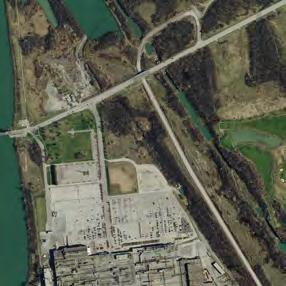
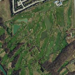
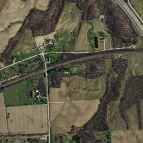
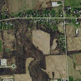
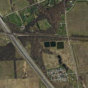
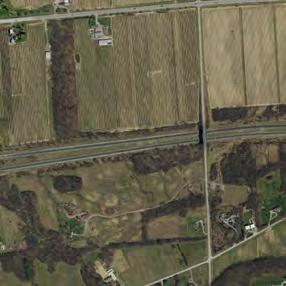
6 Welland Canal Airport Rd Taylor Rd Concession 7 Rd Concession 6 Rd Creating a Vision for the Future Welland Canals Parkway 700 hectares 400 hectares east of Homer Road Stewart Rd Niagara Stone Rd Glendale Niagara District Today Queenston Rd Queenston Rd Queenston St Victoria Lawn Cemetery Queen Elizabeth Way York Rd Glendale Ave York Rd General Brock Parkway Glendale Ave Wood End Conservation Area Queen Elizabeth Way Glendale Ave Royal Niagara Golf Club CN RAIL - FUTURE GO GM
7 Creating a Vision for the Future Many inputs and considerations Existing Conditions Attributes of Context Precedents What People Said Vision & Principles Vision Key Directions
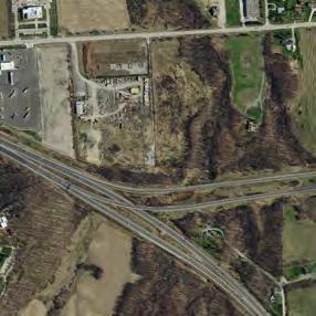
8 Development Applications: Isolated on e St a ar Ni ag Welland Ca d rt R wa Ste Rd Concession 6 Rd way Concession 7 Rd nals Park QEW 90 Que Airport Rd 55 n Rd Qu ee ns to n Welland Ca St ensto nal ee ne be th Yo rk Wa y le A ve nda Gle way Victoria Lawn Cemetery Rd Townline Rd liza nals Park Welland Ca Qu Queenston Rd Queenston Rd 81 York Rd Homer Rd QEW 405 ay ve le A da n Gle S Wood End Conservation Area n ee 89 Qu -THE-LAKE ST CATHARINE NIAGARA-ON ock Parkw General Br be iza El th Taylor Rd ay W E ula Ha LAK NIAGARA-ON-THEST CATHARINES ay aw Se ge Rd Gle nd e Av ale E N-THE-LAK NIAGARA-O 70 LLS NIAGARA FA Royal Niagara Golf Club CN R AIL O EG UR FUT QEW


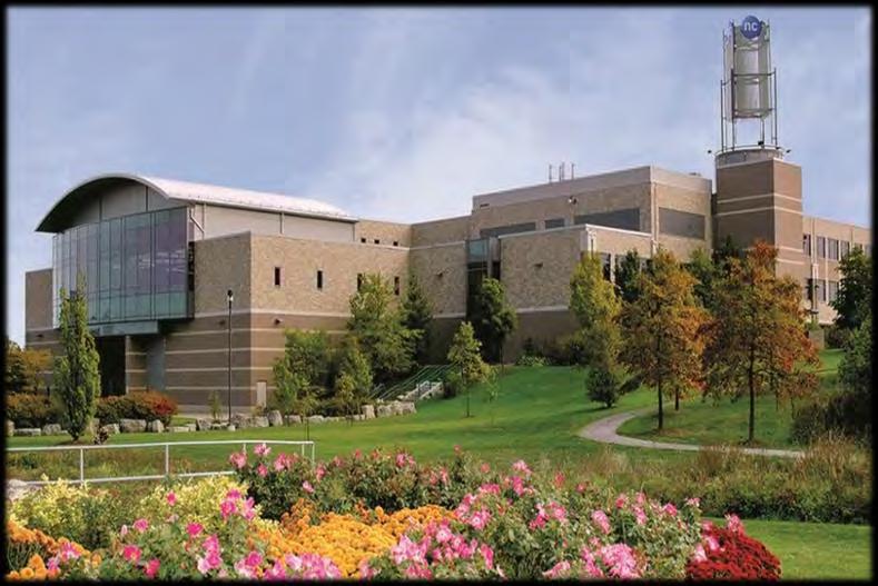
9 Glendale has all the right Ingredients Higher Education Highway Access Niagara College QEW and 405 Destination Retail Potential Train Access Outlet Collection Niagara GO Train Connection Green Spaces Residential Community Niagara Escarpment Wine and Fruit Growing Niagara-on-the-Green
10 Vision Statement Input from landowners and key stakeholders robust intra-municipal transit system well-connected network of open spaces, trails, walkways live-work destination mobility-first approach vision lifestyle choice unique to Niagara 4-season community attract entrepreneurial businesses vibrant town centre
11 Principles Input from landowners and key stakeholders housing mix of housing options accommodating full spectrum of ages and lifestyles connections more connections across QEW or create nodes on either side GO, pedestrian crossings over canal and QEW leverage natural system to improve connectivity across QEW improve connections opportunities to Niagara Region views maintain view corridors walkable make development more walkable employment ensure a range of employment opportunities attractions a cultural destination/ attraction along Welland Canal principles sustainable/ resilient incubators provide incubator/shared spaces for start-ups and small entrepreneurial businesses LID, electric car chargers, protection of natural spaces, innovative building technology, biodiverse schools neighbourhood schools within walking distance responsive development development sensitive and responsive to the context beautiful complete streets, tree-lined roads, complementary architecture, character
12 Why did you choose Glendale? Input from residents Location Food grows here country environment Cultural heritage Weather live in a smaller community Family community that is close-knit Ease of getting around love hearing the birds Buying local farm produce Conservation area golf course Avoid Toronto traffic Small town atmosphere Proximity to Buffalo Good deals on shopping Central location
13 Why are the biggest opportunities for change? Input from residents high rise rental housing Laura Secord Trail GO train station Parking within the neighbourhood festivals opportunities for change public square main street more restaurants grocery store bike lanes green spaces community facilities student housing complete community support for the college Regular and direct transit meaningful employment
14 Vision Statement Niagara will be a vibrant community for people of all ages, lifestyles, and abilities - a place to live, work, play, learn and grow. Its urban districts, with a mix of uses, will protect, integrate and celebrate the natural and rural surroundings reflecting the distinct character of the area. Niagara will be framed by a new park on the Welland Canal, the creek valleys, the Niagara Escarpment and agricultural lands. Niagara will put mobility first with a robust transit system, cycling trails and pedestrian routes seamlessly connecting areas north and south of the QEW.


15 Design Principles Niagara is cohesive & complete has identifiable neighbourhoods has a mix of uses is walkable is authentic is sustainable has an integrated and extended green space system


16 10 Big Moves 1 Lead with the landscape/natural features 3 Hard edge to the agricultural lands 2 Create a Seaway Ecological Park 4 A convergence for the area s trails

17 5 Provide transit 7 Create a main street as a transition from the Outlet Collection Niagara to the adjacent urban neighbourhood Option 2 Option 1 6 Integrate the College into the District, accommodate its expansion and integrate/create a focus with food tech industries 8 Provide a diverse range of housing ensuring choice and affordability
18 9 Create a public/civic space as a focus for the urban district 10 Green streets and parking
 Prestige Employment Mixed Use Destination REGIONAL ROAD 70 (SOUTH SERVICE ROAD) Hospitality Precinct Y0RK ROAD REGIONAL ROAD 89 (GLENDALE AVE.")
19 2010 Secondary Plan QUEENSTON ROAD AIRPORT ROAD TOWNLINE (GRANTHAM) ROAD CONCESSION 7 ROAD MARTIN ROAD QUEENSTON ROAD QEW TO TORONTO Queenston Road Community Prestige Employment REGIONAL ROAD 58 (COON ROAD) Prestige Employment Mixed Use Destination REGIONAL ROAD 70 (SOUTH SERVICE ROAD) Hospitality Precinct Y0RK ROAD REGIONAL ROAD 89 (GLENDALE AVE.) Industrial Park Industrial Park Prestige Employment REGIONAL ROAD 81 (YORK ROAD) TO ST. DAVIDS Village Centre TAYLOR ROAD GLENDALE AVENUE EXTENSION Prestige Employment Prestige Employment Legend Niagara-on-the-Green Residential Community Institutional Campus NIAGARA ESCARPMENT QEW TO NIAGARA FALLS HIGHWAY 405 Special Study Area Secondary Plan Area Environmental Conservation Area REGIONAL ROAD 89 (GLENDALE AVENUE) REGIONAL ROAD 70 (TAYLOR ROAD) Schedule A: LAND USE & CHARACTER PRECINCTS Glendale Secondary Plan NORTH m 10 50
20 Preferred Vision Legend Low rise residential Mid rise residential Taller residential Mixed Use multi-storey Commercial (1 or 2 storey) Institutional (could be multi-storey) Business/Employment (could be multi-storey) Hospitality (could be multi-storey)

21 Land Use Legend Greenlands Residential Mixed Use Commercial Institutional Hospitality Employment Transit Terminal

22 Heights Legend Low Rise Mid Rise Taller Residential


23 Roads & Trails Network of trails and multi-user paths Existing and new roads Transit terminal/tourist Centre Pedestrian bridge could be underpass instead Legend Existing Roads New Roads Trails
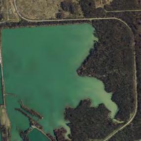
24 Natural Areas Eco-park & Welland Canal Heritage Park Natural areas Woodlots
25 Eco-Park & Welland Canal Heritage Park New road New multi-user path Preservation/expansion of natural environment Space for camping in Eco- Park Heritage interpretation (eg Signage etc) in Southern portion Potential tourism destination area (winery, craft brewery, amphitheater, farm-to-table restaurant, wedding/event centre, hotel)

26 Parks System New community parks Stormwater management ponds with trails

27 Community Focus Park Community Centre Park Community centre
 Greenway connects into Niagara-on-the-Green Potential high school site (10-11")
28 Glendale Crossing Potential Grocery Store Park Greenway Main Street Park Core community area Mixed uses Main street retail Potential Grocery Store Local grocery store (2 sites: stand alone format and integrated behind main street) Greenway connects into Niagara-on-the-Green Potential high school site (10-11 acres)

29 Niagara College Plan incorporates Niagara College s master plan Expansion towards Taylor Road and Glendale Road/ Taylor Road intersection Frame north-south open space East-west pathway to Research & Innovation Hub

30 Research & Innovation Hub Expansion around existing Niagara Corporate Business Centre building Frame an open space that looks south across the ponds to the escarpment

31 Transit Terminal & Tourist Centre Large area available on MTO lands, adjacent to Niagara College and accessible from north and south New Ontario Travel Information Centre Transit Terminal with bus parking, shelters etc. Taylor Rd

32 Mixed Use/Residential Centre York Rd Mixed Uses Residential

33 Mixed Use/Employment Park New park Potential Health Care or Medical Hub Mixed uses with employment, residential and some commercial
 Mixed uses at York Road and Concession 7 Road Small")
34 East Glendale Concession 7 Rd Park Mostly low-rise residential (townhouses) Mixed uses at York Road and Concession 7 Road Small park

35 Employment Area Queenston Rd Glendale Ave Park New roads connecting eastwest and north-south Park/Woodlot preserved Preserves most existing development while unlocking internal parcels York Rd

36 Hospitality District Hotels

37 Interchange District Park Medium density residential Mixed uses Community park
38 North Glendale Park Park Mixed uses Hotels Community area Community parks Potential school site


39 Alternate Vision: Tourism Destination Park Potential large scale tourism destination such as a waterpark and resort hotel
 Institutional (could be multi-storey) Business/Employment (could be multi-storey) Hospitality (could be")
40 Preferred Vision Legend Low rise residential Mid rise residential Taller residential Mixed Use multi-storey Commercial (1 or 2 storey) Institutional (could be multi-storey) Business/Employment (could be multi-storey) Hospitality (could be multi-storey)
41 Glendale Niagara District Plan Next Steps Phase 2 District Plan Transform the vision into definitive land-use plans and strategies for economic development of the District Complete background studies to inform the Plan including transportation, commercial lands assessment, and urban design/public realm hold public information sessions to gather input on the draft Plan Refine the Plan based on local input Present the Plan to Councils for endorsement Glendale Niagara District Plan Presentation to Niagara-on-the-Lake Committee-of-the-Whole September

42 Glendale Niagara District Plan Next Steps Public Consultation Process in Phase Public Information Centres/Open Houses between now and May 2019 Technical Advisory Committee meetings 3 Community Focus Group meetings 1 Statutory Public Meeting under the Planning Act for the Regional OP Amendment Glendale Niagara District Plan Presentation to Niagara-on-the-Lake Committee-of-the-Whole September
43 Glendale Niagara District Plan Next Steps Public Consultation Process in Phase 2 Glendale Niagara District Plan Presentation to Niagara-on-the-Lake Committee-of-the-Whole September


44 In Conclusion For further information: Tom Villella, Manager of Special Projects Niagara Region Planning and Development 1815 Sir Isaac Brock Way ext 3374 Glendale Niagara District Plan Presentation to Niagara-on-the-Lake Committee-of-the-Whole September
Glendale Niagara District Plan
 Glendale Niagara District Plan Planning and Economic Development Committee September 5 2018 District Plans A District Plan is a proactive planning strategy intended to drive growth and economic prosperity
Brampton. Secondary Plan. Review. Bram West. A New Direction in Planning & Public Consultation
 Brampton Bram West Secondary Plan Review A New Direction in Planning & Public Consultation Introduction The Bram West Secondary Plan Review offers an important opportunity for the community to define a
Official Plan Review
 Official Plan Review Summary Report - The Built Environment August 2014 Part 1: Introduction Planning for a healthy, prosperous and sustainable community is an important goal for our municipality. From
Welcome. Walk Around. Talk to Us. Write Down Your Comments
 Welcome This is an information meeting introducing the applications for proposed redevelopment of the Yorkdale Shopping Centre site at 3401 Dufferin Street and 1 Yorkdale Road over the next 20+ years,
GLENDALE plan. Prepared by:
 GLENDALE plan secondary plan for the glendale community, Town of niagara-on-the-lake AUGUST 26, 2010 Prepared by: Table of Contents Introduction to the Study 1 i Purpose and Intent of this Document 1
This page has been intentionally left blank.
 This page has been intentionally left blank. Chapter 3 3-2 3. Employment 3.A Niagara Economic Gateway 3.A.1 General The Niagara Economic Gateway comprises: a) The Gateway Economic Zone which includes all
Trafalgar Road Corridor Planning Study Open House
 Trafalgar Road Corridor Planning Study Open House June 24, 2013 6:30-8:30 p.m. Oakville & Trafalgar Rooms Overview The Livable Oakville Plan identifies the lands along Trafalgar Road, between the QEW and
DOWNTOWN GEORGETOWN PLANNING STUDY
 DOWNTOWN GEORGETOWN PLANNING STUDY Community Workshop #3 Thursday, May 4, 08 The Planning Partnership OVERVIEW OF STUDY, PROCESS & MILESTONES We are here PURPOSE OF THE STUDY To develop a clear vision
DOMINION BOULEVARD CORRIDOR STUDY AND ECONOMIC DEVELOPMENT STRATEGIC PLAN A MODEL FOR CHESAPEAKE S FUTURE
 DOMINION BOULEVARD CORRIDOR STUDY AND ECONOMIC DEVELOPMENT STRATEGIC PLAN A MODEL FOR CHESAPEAKE S FUTURE Overview I. Draft Plan Process II. Draft Plan Overview a. Market Analysis b. Master Land Use Plan
burlington mobility hubs study Downtown Burlington Mobility Hub
 burlington mobility hubs study Downtown Burlington Mobility Hub Draft Precinct Plan Workbook PIC #3, September 7, 2017 downtown mobility hub objectives City staff and their consultants are proposing an
1 Introduction. Chapter. In this chapter:
 Chapter 1 Introduction In this chapter: 1.1 A Snapshot of the Region 1.2 Towards a Sustainable Region 1.3 The Provincial Context 1.4 Purpose and Organization The Regional Municipality of York Official
MAYFIELD WEST SECONDARY PLAN PHASE 2
 MAYFIELD WEST SECONDARY PLAN PHASE 2 Council Information Workshop February 16, 2010 Draft Preferred Land Use Plan TOWN OF CALEDON PLANNING & DEVELOPMENT DEPARTMENT Workshop Agenda TOWN OF CALEDON 1. Welcome
Plan Framework Report. Attachment A
 Plan Framework Report Attachment A Uptown-Douglas Corridor Plan - Plan Framework Report Contents Introduction... 1 Planning Process... 3 Project Objectives... 4 Vision... 5 Community Values... 6 Structural
Report to: Development Services Committee Report Date: April 24, 2017
 SUBJECT: Cornell Rouge National Urban Park Gateway - Report on Design Charrette and Next Steps PREPARED BY: Lilli Duoba, MES, MCIP, RPP, Manager, Natural Heritage (ext. 7925) REVIEWED BY: Marg Wouters,
Chairman and Members of the Planning and Development Committee. Thomas S. Mokrzycki, Commissioner of Planning and Building
 LA.09.TOR (Toronto) DATE: TO: FROM: SUBJECT: Chairman and Members of the Planning and Development Committee Thomas S. Mokrzycki, Commissioner of Planning and Building Central Waterfront Secondary Plan
CONTENTS 2.0 A FRAMEWORK FOR SUSTAINABLE GROWTH 2.1 MANAGING SUSTAINABLE GROWTH THE VISION TO GOALS AND OBJECTIVES 2.3 MARKHAM STRUCTURE
 2 A Framework for Sustainable Growth 2.0 A FRAMEWORK FOR SUSTAINABLE GROWTH CONTENTS 2.1 MANAGING SUSTAINABLE GROWTH THE VISION TO 2031 2.2 GOALS AND OBJECTIVES 2.2.1 Protecting the Natural Environment
John M. Fleming Managing Director, Planning and City Planner. Old East Village Dundas Street Corridor Secondary Plan Draft Terms of Reference
 Report to Planning and Environment Committee To: From: Subject: Chair and Members Planning & Environment Committee John M. Fleming Managing Director, Planning and City Planner Old East Village Dundas Street
Lakeview. March 18, N. Barry Lyon Consultants Ltd. UEM TMIG
 Lakeview March 18, 2014 N. Barry Lyon Consultants Ltd. UEM TMIG Mississauga s Waterfront A Coordinated Approach mississauga.ca/waterfront Mississauga s Waterfront - Projects Natural Heritage and Urban
PLANNING AND URBAN DESIGN RATIONALE REPORT. Hunters Pointe Golf Course Redevelopment 289 Daimler Parkway Prepared For: Ontario Ltd.
 PLANNING AND URBAN DESIGN RATIONALE REPORT Hunters Pointe Golf Course Redevelopment 289 Daimler Parkway Prepared For: 2599587 Ontario Ltd. February 2018 Redevelopment of Hunters Pointe Golf Course, Welland
Edward R. Sajecki Commissioner of Planning and Building
 Corporate Report Clerk s Files Originator s Files CD.03.POR DATE: TO: FROM: SUBJECT: Chair and Members of Planning and Development Committee Meeting Date: February 27, 2012 Edward R. Sajecki Commissioner
Further input invited as Colchester Growth Strategy nears final phase
 IUE 3 / NOVEMBER 2015 Further input invited as Colchester Growth trategy nears final phase trathcona County is seeking public feedback as it enters the final phase of work on a Growth Management trategy
McCowan Precinct Plan Study Background & Deliverables
 1 DRAFT & WITHOUT PREJUDICE McCowan Precinct Plan Study Background & Deliverables In September, 2011, City Planning (Scarborough District) began a study of an area within the Scarborough Centre, identified
9 CITY OF VAUGHAN OFFICIAL PLAN AMENDMENT NO BOCA EAST INVESTMENTS LIMITED
 9 CITY OF VAUGHAN OFFICIAL PLAN AMENDMENT NO. 631 - BOCA EAST INVESTMENTS LIMITED The Planning and Economic Development Committee recommends the adoption of the recommendations contained in the following
NEW REGIONAL OFFICIAL PLAN HIGH LEVEL PROCESS & FRAMEWORK
 NEW REGIONAL OFFICIAL PLAN HIGH LEVEL PROCESS & FRAMEWORK Why A New Official Plan Originally the role of Regionally Planning and content of Regional Official Plan (1970s) primarily focused on protecting
University of Saskatchewan CAMPUS MASTER PLAN. Senate Meeting Preliminary Presentation. April 21, 2018 DIALOG ECS DA WATT
 University of Saskatchewan CAMPUS MASTER PLAN Senate Meeting Preliminary Presentation April 21, 2018 DIALOG ECS DA WATT project process presentation agenda Stakeholder Engagement Project Control phase1
Mark-up of the effect of the proposed Bronte Village Growth Area OPA No.18 on the text of section 24, Bronte Village, of the Livable Oakville Plan
 Mark-up of the effect of the proposed Bronte Village Growth Area OPA No.18 on the text of section 24, Bronte Village, of the Livable Oakville Plan Notes: This document is provided for information purposes
Derry Green Corporate Business Park
 Town of Milton Derry Green Corporate Business Park Urban Design Guidelines BMI/Pace - June 2010 Draft 3 Prepared by: Brook McIlroy Planning + Urban Design / Pace Architects Suite 300-51 Camden Street Toronto,
PORT WHITBY COMMUNITY
 PORT WHITBY COMMUNITY SECONDARY PLAN UPDATE COMMUNITY IMPROVEMENT PLAN URBAN DESIGN GUIDELINES September 2015 DRAFT PROPOSED AMENDMENT NUMBER # to the Whitby Official Plan PURPOSE: The intent of this Amendment
GOLDEN MILE SECONDARY PLAN. Community Consultation Meeting #3 June 26, 2018
 GOLDEN MILE SECONDARY PLAN Community Consultation Meeting #3 June 26, 2018 Meeting Overview 1. Introduction 2. Principles + Vision 3. Street + Block Alternatives 4. Parks + Open Space Alternatives 5. Land
THE NEIGHBORHOOD TODAY
 THE NEIGHBORHOOD TODAY CORE AREA VISION How are we Good Urbanism A Site s DNA thinking about Elements of great Unique elements urban communities embedded in a place the site and design? ELEMENTS LIKE:
MAYFIELD WEST SECONDARY PLAN PHASE 2
 MAYFIELD WEST SECONDARY PLAN PHASE 2 Public Open House #3 February 25, 2010 Draft Preferred Land Use Scenario TOWN OF CALEDON PLANNING & DEVELOPMENT DEPARTMENT Open House Agenda TOWN OF CALEDON 1. Welcome
2.0 A FRAMEWORK FOR SUSTAINABLE GROWTH CONTENTS
 2-2 A Framework for Sustainable Growth 2.0 A FRAMEWORK FOR SUSTAINABLE GROWTH CONTENTS 2.1 MANAGING SUSTAINABLE GROWTH THE VISION TO 2031 2.2 GOALS AND OBJECTIVES 2.2.1 Protecting the Natural Environment
CITY OF VAUGHAN KIRBY GO TRANSIT HUB SUB-STUDY
 WELCOME! Thank you for attending, and welcome to the first of three Public Meetings for the Kirby GO Transit Hub Study. Your feedback is important to us, and will help inform the development of the draft
5 TOWN OF MARKHAM OFFICIAL PLAN AMENDMENT NO. 144 MILLIKEN MAIN STREET SECONDARY PLAN
 5 TOWN OF MARKHAM OFFICIAL PLAN AMENDMENT NO. 144 MILLIKEN MAIN STREET SECONDARY PLAN The Planning and Economic Development Committee recommends the following: 1. The communication from Brendan O Callaghan,
MILTON HEIGHTS COMMUNITY January 2006 Revised February 2015 Revised November 2015
 REVISED DRAFT MILTON HEIGHTS COMMUNITY January 2006 Revised February 2015 Revised November 2015 Urban Design Guidelines Milton Heights Landowners Group This page has been intentionally left blank. Contents
LUNDY S LANE COMMUNITY IMPROVEMENT PLAN STUDY
 PUBLIC INFORMATION MEETING #2 October 12, 2016 LUNDY S LANE COMMUNITY IMPROVEMENT PLAN STUDY AGENDA 5:00 to 5:30pm: Open House 5:30 to 6:15pm: Presentation 6:15 to 7:00pm: Individual paced workshop with
WELCOME and introduction
 1 WELCOME and introduction Mobility Hub Locations within Burlington STUDY OVERVIEW STUDY OBJECTIVES The City of Burlington is developing four Area Specific Plans, one for each of Burlington s Mobility
Create Policy Options Draft Plan Plan Approval. Public Consultation Events. Phase 2
 Background Grandview-Woodland Community Plan In the spring of 2012, the City of Vancouver embarked on a comprehensive community planning program in the Grandview-Woodland neighbourhood. The process has
YONGE STEELES CORRIDOR SECONDARY PLAN. Young + Wright / IBI Group Architects Dillon Consulting Ltd. GHK International (Canada) Ltd.
 Ltd.") PART A: PREAMBLE 1.0 PURPOSE The purpose of this Secondary Plan is to provide a development framework for intensification of the Yonge/ Steeles corridor including the north side of Steeles Avenue West
PART A: PREAMBLE 1.0 PURPOSE The purpose of this Secondary Plan is to provide a development framework for intensification of the Yonge/ Steeles corridor including the north side of Steeles Avenue West
Former Rockcliffe Airbase Community Design Plan Guiding Design Vision and Principles December 4, 2013
 APPENDIX 5 - Guiding Design Vision and Principles Former Rockcliffe Airbase Community Design Plan Guiding Design Vision and Principles December 4, 2013 Vision Statement The redevelopment of the former
THE CITY OF VAUGHAN BY-LAW BY-LAW NUMBER A By-law to adopt Amendment Number 1 to the Official Plan of the Vaughan Planning Area.
 THE CITY OF VAUGHAN BY-LAW BY-LAW NUMBER 015-2014 A By-law to adopt Amendment Number 1 to the Official Plan of the Vaughan Planning Area. NOW THEREFORE the Council of the Corporation of the City of Vaughan
Isabel Neighborhood Plan: Alternatives
 Isabel Neighborhood Plan: Alternatives Presented by: Lori Parks, Associate Planner February 2, 2015 Agenda 1. Background on BART to Livermore 2. Isabel Neighborhood Plan 3. Alternative Scenarios 4. General
The Master Plan Framework
 The Master Plan Framework The East Harbour Master Plan advances the development of 60 acres of former industrial lands east of the Don River. The Master Plan outlines a vision for a vibrant, transit-oriented
Seneca Meadows. Block 4 Locate office, technology, and medical development adjacent to I Screen views of garage structures from I-270.
 Seneca Meadows Seneca Meadows has an industrial park in its southern end and a mixed-use employment area planned for the north end. The district benefits from extensive I-270 visibility, stream valley
1.0 PLANNING MARKHAM S FUTURE CONTENTS
 1-1 Planning Markham s Future 1.0 PLANNING MARKHAM S FUTURE CONTENTS 1.1 THE PURPOSE OF THE OFFICIAL PLAN 1.2 THE MARKHAM CONTEXT 1.3 THE REGULATORY CONTEXT 1.3.1 Province of Ontario 1.3.2 York Region
Community Open House March 26 th, 2018
 Community Open House March 26 th, 2018 Open House Agenda 1. Overview of Planning Process What we heard 2. Future Land Use Policy 3. Priority Growth Areas 4. Plan Elements Making it happen What is a Comprehensive
Queensborough Eastern Neighbourhood Node. Community Open House
 Queensborough Eastern Community Open House The Vision The Queensborough Eastern will become the heart of eastern Queensborough. Through a sensitive mix of viable commercial and residential areas, the neighbourhood
Welcome to the Oakridge Centre Open House
 Welcome to the Oakridge Centre Open House Why is the City hosting this event? This open house is to inform you of a rezoning application submitted to the City of Vancouver to amend the existing CD-1 (Comprehensive
Sustainable Growth. Sustainable Growth
 2 Sustainable Growth Sustainable Growth SUSTAINABLE GROWTH 2.1 COMMUNITY VISION... 2-5 2.2 THE CITY SYSTEM... 2-7 2.2.1 AREAS... 2-7 2.2.2 CITY-WIDE SYSTEMS... 2-8 2.2.3 PROVINCIAL PLAN BOUNDARIES AND
DRAFT WESTERN CITY DISTRICT PLAN PLANNING PRIORITIES AND ACTIONS
 Greater Sydney Commission DRAFT WESTERN CITY DISTRICT PLAN PLANNING PRIORITIES AND ACTIONS Issued: 26 OCTOBER 2017 Version: 1 Subject: Greater Sydney Region and District Plans This information note is
Cambie Corridor Planning Program Phase Two Draft Plan. Standing Committee on City Services and Budgets May 5, 2011
 Cambie Corridor Planning Program Phase Two Draft Plan Standing Committee on City Services and Budgets May 5, 2011 Cambie Corridor Program Terms of Reference approved July 2009 Land Use Transportation Energy
2900 Steeles Avenue East at Don Mills Road in the Town of Markham
 STAFF REPORT INFORMATION ONLY 2900 Steeles Avenue East at Don Mills Road in the Town of Markham Date: January 23, 2008 To: From: Wards: Reference Number: North York Community Council Director, Community
Complete Neighbourhood Guidelines Review Tool
 Complete Neighbourhood Guidelines Review Tool Prepared By: City of Regina Planning Department October 2014 Page 1 of 14 Community Development Review Checklist for Secondary Plans and Concept Plans The
Small Area Plan. South Gateway
 Small Area Plan Adopted May 12, 2008 South Gateway Purpose. The South Gateway Small Area Plan defines the City s expectations for the future of the southern entrance to the City at Interstate 85 and Highway
LAKEVIEW VILLAGE VISION & MASTERPLAN PRESENTATION TO CITY OF MISSISSAUGA. April 9, 2018
 LAKEVIEW VILLAGE VISION & MASTERPLAN PRESENTATION TO CITY OF MISSISSAUGA April 9, 2018 AGENDA Introduction Vision Plan Comparison The Big Moves Trail Connections Plan Overview Districts Conveyance Comparison
GATEWAY AREA STRUCTURE PLAN
 CHESTERMERE GATEWAY AREA STRUCTURE PLAN COMMUNITY OPEN HOUSE SEPTEMBER 22 nd, 2015 PLAN AREA ± 512 hectares (± 1,265 acres) GATEWAY LOCATION UNDEVELOPED LANDS PRESENT AGRICULTURAL USE REGIONAL LAND USE
Animating the Rideau Canal December 2013
 Executive Summary Animating the Rideau Canal December 2013 Why study the Rideau Canal? The Rideau Canal has been an important part of Ottawa throughout its history, and has shaped and been shaped by the
13 THORNHILL YONGE STREET STUDY IMPLEMENTATION CITY OF VAUGHAN OPA 669 AND TOWN OF MARKHAM OPA 154
 13 THORNHILL YONGE STREET STUDY IMPLEMENTATION CITY OF VAUGHAN OPA 669 AND TOWN OF MARKHAM OPA 154 The Planning and Economic Development Committee recommends the adoption of the recommendations contained
MOUNT PLEASANT SECONDARY PLAN & VILLAGE BLOCK PLAN. Wednesday, March 5, 2008 Informal Public Open House
 MOUNT PLEASANT SECONDARY PLAN & VILLAGE BLOCK PLAN Wednesday, March 5, 2008 Informal Public Open House 1. Welcome & Introductions 2. Highlights of Provincial Growth Plan 3. Overview and Status Update -
2.5 Roads. Loading and service areas adjacent to Highway 401 should be screened through architectural walls and/or landscape buffer planting.
 N HIGHWAY OFF RAMP 2.5 Roads A legible road network with a clear hierarchy will help create a connected community, both within and surrounding the Milton Heights. The following section outlines the proposed
The Allen District. Community Consultation Meeting #1. Presented for Local Advisory Committee Monday, May 2, 2016
 The Allen District Community Consultation Meeting #1 Presented for Local Advisory Committee Monday, May 2, 2016 Presenters William Bryck President & CEO Build Toronto Pino Di Mascio Partner Urban Strategies
SUBJECT: Proposed Downtown Mobility Hub Precinct Plan and Proposed Official Plan Policies
 Page 1 of Report PB-81-17 SUBJECT: Proposed Downtown Mobility Hub Precinct Plan and Proposed Official Plan Policies TO: FROM: Committee of the Whole Planning and Building Department Report Number: PB-81-17
Public Open House. Yonge Street and Bernard Avenue (Bernard KDA) Planning Study Update Town of Richmond Hill. March 30, 2017
 Planning Study Update Town of Richmond Hill. March 30, 2017") Public Open House Yonge Street and Bernard Avenue (Bernard KDA) Planning Study Update Town of Richmond Hill March 30, 2017 Open House Review of Project Purpose and Process Policy Refresher Highlights of
Public Open House Yonge Street and Bernard Avenue (Bernard KDA) Planning Study Update Town of Richmond Hill March 30, 2017 Open House Review of Project Purpose and Process Policy Refresher Highlights of
Corridor Vision. 1Pursue Minnehaha-Hiawatha Community Works Project. Mission of Hennepin County Community Works Program
 1Pursue Minnehaha-Hiawatha Community Works Project Minnehaha-Hiawatha Community Works is a project within the Hennepin Community Works (HCW) program. The mission of the HCW program is to enhance how the
BROOKLYN PARK / 85TH AVE LRT STATION CDI DEVELOPMENT GUIDELINES DRAFT
 August 2018 Page intentionally left blank The Brooklyn Park Library adjacent to the 85th Ave LRT Station Area. OVERVIEW The Blue Line LRT Extension / Bottineau corridor offers a unique opportunity to leverage
Toronto Complete Streets Guidelines Stakeholder Advisory Group #
 Toronto Complete Streets Guidelines Stakeholder Advisory Group #1 2015-03-24 What are Complete Streets? 2 Streets designed with all users in mind: pedestrians/those with disabilities cyclists street car
10.0 Open Space and Public Realm
 10.0 Open Space and Public Realm 10.0 Open Space and Public Realm The Public Open Space System is comprised of: outdoor spaces available for public use that are either publicly owned (e.g., parks and
Moody Centre Station TOD Area Today
 Moody Centre Station TOD Area Today WHAT IS a transit-oriented Murray Street development area? A Transit-Oriented Development (TOD) Area is a dense, walkable residential and commercial area built to support
GO Station Mobility Hubs: Draft Precinct Plans. Committee of the Whole July 12, 2018
 GO Station Mobility Hubs: Draft Precinct Plans Committee of the Whole July 12, 2018 Purpose of this Workshop Present Draft Precinct Plans for the 3 GO Station Mobility Hubs Continue the conversations that
Draft Urban Hamilton Official Plan. Amendment No. XX
 1 of 75 The following text, together with: Draft Appendix A Appendix B Volume 1, Schedule E-1 Urban Land Use Designations Appendix C Volume 1, Appendix A Parks Classification Map Appendix D Volume 1, Appendix
MEETING PURPOSE AND OVERVIEW
 MEETING PURPOSE AND OVERVIEW On February 23, 2012, the City of Elk Grove hosted the first of two community workshops related to the Southeast Policy Area. The workshop was held from 6:00 8:30 p.m. in the
THE GARDEN CITY PLAN. City of St. Catharines Official Plan. City of St. Catharines
 THE GARDEN CITY PLAN City of St. Catharines Official Plan City of St. Catharines August 2010 APPROVAL INFORMATION This Official Plan of the City of St. Catharines Planning Area, known as the Garden City
12 AMENDMENT NO. 149, TOWN OF MARKHAM HIGHWAY 404 NORTH SECONDARY PLAN
 12 AMENDMENT NO. 149, TOWN OF MARKHAM HIGHWAY 404 NORTH SECONDARY PLAN The Planning and Economic Development Committee recommends the adoption of the recommendation contained in the following report August
2.0 A FRAMEWORK FOR SUSTAINABLE GROWTH CONTENTS
 2-2 A Framework for Sustainable Growth 2.0 A FRAMEWORK FOR SUSTAINABLE GROWTH CONTENTS 2.1 MANAGING SUSTAINABLE GROWTH THE VISION TO 2031 2.2 GOALS AND OBJECTIVES 2.2.1 Protecting the Natural Environment
Bressa Developments Limited. Planning Justification Report. Revised Draft Plan of Subdivision and Zoning By-Law Amendment
 Bressa Developments Limited Revised Draft Plan of Subdivision and Zoning By-Law Amendment Planning Justification Report Part of Lots 7 & 8 Concession 1, North of Dundas Street Town of Oakville September,
Don Mills Crossing Study and Celestica Lands Development Application Community Meeting, Open House, and Breakout Discussions
 Consultation Summary Don Mills Crossing Study and Celestica Lands Development Application Community Meeting, Open House, and Breakout Discussions This report is not intended to provide a verbatim transcript
WELCOME Mayfield West Secondary Plan (Phase 2) Open House #2: June 25, 2009
 Open House #2: June 25, 2009") WELCOME Mayfield West Secondary Plan (Phase 2) Open House #2: June 25, 2009 Please sign in View the display boards Meet with the project team Presentation of the development scenarios at 7pm THE OPPORTUNITY
WELCOME Mayfield West Secondary Plan (Phase 2) Open House #2: June 25, 2009 Please sign in View the display boards Meet with the project team Presentation of the development scenarios at 7pm THE OPPORTUNITY
SPECIAL COMMITTEE OF THE WHOLE DECEMBER 9, 2002 BLOCK 57/58 WEST BLOCK PLAN BLOCK PLAN FILE BL.57/58W.99 HUNTINGTON BUSINESS PARK LAND OWNERS
 SPECIAL COMMITTEE OF THE WHOLE DECEMBER 9, 2002 BLOCK 57/58 WEST BLOCK PLAN BLOCK PLAN FILE BL.57/58W.99 HUNTINGTON BUSINESS PARK LAND OWNERS Recommendation The Commissioner of Planning recommends: THAT
Design Charrettes Description of Winning Designs
 Design Charrettes Description of Winning Designs I. Introduction Community and business leaders were invited to participate in a Station Design Charrette hosted by the Pinellas Metropolitan Planning Organization
DOWNTOWN PARKS & PUBLIC REALM PLAN
 DOWNTOWN PARKS & PUBLIC REALM PLAN CHALLENGES The Parks and Public Realm Strategy addresses challenges associated with a growing Downtown, including: GOALS 3.3 New buildings will fit within their existing
MEMORANDUM. Future Urban Area Conceptual Master Plan Cultural Heritage Resources
 MEMORANDUM TO: FROM: Heritage Markham Committee Regan Hutcheson, Manager-Heritage Planning DATE: June 14, 2017 SUBJECT: STUDI / PROJECTS Future Urban Area Conceptual Master Plan Cultural Heritage Resources
Official Plan & Zoning By-Law Amendment Intercontinental Combo Hotel Niagara-on-the-Lake, ON PLANNING JUSTIFICATION REPORT
 Official Plan & Zoning By-Law Amendment Intercontinental Combo Hotel Niagara-on-the-Lake, ON PLANNING JUSTIFICATION REPORT October 2015 Project # 13254 CONTENTS Introduction... 1 The Site... 1 The Proposed
Summary of Changes for the Comprehensive Draft Proposed Official Plan Amendment
 Summary of Changes for the Comprehensive Draft Proposed Official Plan Amendment Note: Due to the broad scope of the Official Plan Review, this list is not exhaustive of the extent of changes in the comprehensive
1.0 VISION STATEMENT. December 6, PRINCIPLES
 Vision Statement Lincoln Regional Airport 1.0 VISION STATEMENT 1.1 City LOCATION of AND OVERVIEW The Easton Lincoln Place Land Use Master Plan identifies the principles, goals, policies, and standards
Speers Road Corridor Study. Livable Oakville (Official Plan) Council Sub Committee March 20, 2017
 Council Sub Committee March 20, 2017") Speers Road Corridor Study Livable Oakville (Official Plan) Council Sub Committee March 20, 2017 Overview 1) Study Purpose & Background 2) Study Area 3) Policy Context and Plan Review 4) Speers Road Corridor
Speers Road Corridor Study Livable Oakville (Official Plan) Council Sub Committee March 20, 2017 Overview 1) Study Purpose & Background 2) Study Area 3) Policy Context and Plan Review 4) Speers Road Corridor
Workshop #1 Outcomes. The Planning Partnership
 Workshop #1 Outcomes The Planning Partnership 1 Background Review Planning Provincial Policy Statement Greenbelt Plan Places to Grow: Growth Plan York Region Official Plan York Region Draft Official Plan
REGIONAL ACTIVITY CENTER
 DRAFT REGIONAL ACTIVITY CENTER 70 EAST BENCH MASTER PLAN DRAFT 06 Introduction The East Bench Regional Activity center is comprised of large educational, research, medical, and employment centers. These
MALL REVITALIZATION CASE STUDIES
 MALL REVITALIZATION CASE STUDIES DECEMBER 9, 2012 MALL REVITALIZATION OVERVIEW Introduction Sample Case Studies prepared for Lacey Woodland District Steering Committee as it considers strategies to revitalize
Blue Line LRT Extension
 v e Noble Pkwy Noble Pkwy Xerxes Ave N Shingle Creek Penn Ave N Penn Ave N Fremont Ave N Lyndale Ave N S Washington Ave University Ave NE Blue Line LRT Extension LIGHT RAIL PLATFORM AND STATION DESIGN
Municipal Development Plan Update Urban Service Area and Hamlets
 ENCLOSURE 1 Municipal Development Plan Update Urban Service Area and Hamlets Priorities Committee January 24, 2017 MUNICIPAL DEVELOPMENT PLAN UPDATE SHAPING OUR FUTURE MDP Update - Agenda MDP Update Public
SYRINGA VALLEY SPECIFIC PLAN NARRATIVE
 SYRINGA VALLEY SPECIFIC PLAN NARRATIVE Introduction With this application, Pleasant Valley South LLC ( Pleasant Valley ) seeks the City of Boise s approval of a new Specific Plan Ordinance to be added
October 25 Downtown Partnership and Action Plan Workshop Record of Group Table Results
 October 25 Downtown Partnership and Action Plan Workshop Record of Group Table Results During the October 25 workshop, participants were asked to rank their top priorities for the Downtown Action Plan.
Public Open House #1
 Public Open House #1 TONIGHT S AGENDA Welcome Project Overview The Big Picture The Station Area The Analysis Thoughts about Future Change Breakout Group Discussions Summation / Next Steps Project Overview
1.0 Purpose of a Secondary Plan for the Masonville Transit Village
 Report to Planning and Environment Committee To: Chair and Members Planning & Environment Committee From: John M. Fleming Managing Director, Planning and City Planner Subject: Masonville Transit Village
Trafalgar Road Corridor Planning Study FINAL REPORT
 Trafalgar Road Corridor Planning Study FINAL REPORT February 2014 Table of Contents Executive Summary... 1 SECTION I Introduction... 2 What is a corridor?... 2 Why are corridors important?... 2 Why study
A Growing Community Rural Settlement Areas
 Town of Huntsville Official Plan Review - POLICY BACKGROUND PAPER A Growing Community Rural Settlement Areas BACKGROUND: In addition to the fully municipally-serviced Urban Settlement Area and the Hidden
ROBBINSDALE LRT STATION CDI DEVELOPMENT GUIDELINES
 August 2018 OVERVIEW The City of Robbinsdale has a prime-opportunity site in the middle of the 13 mile stretch of the Bottineau LRT corridor / Blue Line extension. Robbinsdale offers a prominent, vital,
ARLINGTON COUNTY, VIRGINIA
 ARLINGTON COUNTY, VIRGINIA County Board Agenda Item Meeting October 15, 2005 DATE: September 28, 2005 SUBJECT: Request to Advertise the adoption of the 2005 Clarendon Sector Plan C. M. RECOMMENDATION:
Pioneering the Sustainable Future of Pakistan. A New Destination of Islamabad
 Pioneering the Sustainable Future of Pakistan A New Destination of Islamabad A New Destination of Islamabad C A P I TAL S M A R T CIT Y ISL A M A B A D, PAKISTA N CAPITAL SMART CITY ISLAMABAD C A P I TAL
Subarea 4 Indian Creek. Vision The combination of park networks and transportation amenities make Subarea 4 the greenest hub in the Corridor.
 indian creek 180 extends south from 101st Street to I-435. The I-435 and Metcalf intersection is one of the primary intersections in the Kansas City Metro Area. The area includes several residential neighborhoods