Re-imagine. Plan. Build.
|
|
|
- Jordan Brown
- 5 years ago
- Views:
Transcription
1 Re-imagine. Plan. Build. Edmonton Metropolitan Region Growth Plan Regional Action. Global Opportunity. (formerly Capital Region Board) Effective October 26, 2017 H
2 Regional Action. Global Opportunity. contact us EDMONTON METROPOLITAN REGION BOARD #1100 Bell Tower, Avenue Edmonton AB T5J 0H8 Phone: Fax: MEDIA INQUIRES: Please direct media inquires to: Malcolm Bruce, CEO Edmonton Metropolitan Region Board Phone: In accordance with the Edmonton Metropolitan Region Board Regulation 189/2017, the Edmonton Metropolitan Region Growth Plan applies to the following Participating Municipalities: City of Edmonton,Town of Beaumont,Town of Devon, City of Fort Saskatchewan, City of Leduc, Leduc County, Town of Morinville, Parkland County, City of St. Albert, City of Spruce Grove, Town of Stony Plain, Strathcona County, and Sturgeon County. All references to the Capital Region Board (CRB) now refer to the Edmonton Metropolitan Region Board (EMRB).
3 Re-imagine. Plan. Build. Edmonton Metropolitan Region Growth Plan
4 44 33 i FOREWARD Thorhild County Westlock County County of Barrhead Smoky Lake County No 28 rth Sas ka t ch 43 Edmonton Metropolitan Region 18 ew an 28 River Legal 28 Sturgeon County Lac Ste.Anne County Morinville 44 Alexander First Nation Redwater 38 Gibbons Bruderheim Bon Accord 28A 37 Lac Ste.Anne 22 CFB Edmonton 43 Lamont Spruce Grove Wabamun Wabamun Lake Paul First Nation Parkland County 16 Edmonton 16A Stony Plain Sherwood Park Enoch Cree Nation Elk Island National Park Strathcona County 22 r nr i ve wa Devon Calmar atc he Thorsby rth S ask 39 Warburg Edmonton International Airport Beaumont Leduc Leduc County 39 Beaver Hill Lake Cooking Lake 14 n River No Brazeau County 39 wa 16 County of Minburn 2 tche aska th S Nor Beaver County Camrose County 2A 2 Edmonton Metropolitan Region Buck Lake 13 Scale: 1:270, Pigeon Lake County of Two Hills 29 Fort Saskatchewan St.Albert Yellowhead County Lamont County County of Wetaskiwin 13 Camrose Wetaskiwin Kilometers
5 FOREWARD MESSAGE FROM THE BOARD CHAIR MESSAGE FROM THE TASK FORCE CHAIR I am very pleased to bring forward the Edmonton Metropolitan Region Growth Plan - Re-imagine. Plan. Build. on behalf of the Capital Region Board. Over the last few decades, the 24 municipalities that form the Capital Region Board have experienced a dramatic transformation from individual communities villages, towns, cities and counties to an interconnected Region of immense, collective potential and inherent worth. It is a significant made in the Region guide for thoughtful and strategic long term planning to enable the Edmonton Metropolitan Region to maintain its place as a strong and confident heart of a more competitive and resilient Alberta. The Edmonton Metropolitan Region is a collection of diverse communities, cooperating to bolster each other s strengths, enhance connections and represent our strength to the world. Together our communities form a complete and sustainable growing Region, with something to suit every ambition. We already represent almost 30% of the Province s gross domestic product (GDP) and over the next 30 years we will move from a population of 1.2 to 2.2 million people and from 725,000 to 1.2 million jobs. This Plan, which will continue to be updated in response to new information from data monitoring, will keep us on track towards our long term vision. Leadership in regional growth planning is the fundamental work of the Board, where 24 independent and diverse municipalities gather to think as a Region, enabling, shaping and promoting the best future for all residents. Certainly the Edmonton Metropolitan Region is complex, making the Capital Region Board itself a formidable collaboration. Consensus does not come easily. Importantly, together, we have updated and advanced our roadmap for the future, for enduring prosperity and an enviable quality of life, in joint recognition of this remarkable Region. Mayor Nolan Crouse Board Chair ii This Plan is a comprehensive update that builds upon the foundation of the original 2010 Capital Region Growth Plan. I am proud of our thorough review process, guided by clear principles. Our work was grounded in extensive and broad consultations with all interested stakeholders and benefited from their diverse wisdom over the past two years. Among the innovations of the Edmonton Metropolitan Region Growth Plan is its recognition of the need for additional policy areas for agriculture and economic development, while addressing the issue of climate change. Most importantly, there is a specific Implementation Plan that includes performance measures to monitor, compare and inform the next Growth Plan update. In short, the Plan sets the path for balanced, steady planning toward our regional vision, allowing us to better navigate and succeed together through the inevitable and unpredictable changes ahead. I sincerely thank the members of the Task Force. Coming together for this Plan was no small feat. In addition to significant responsibilities in their own municipalities, members took countless hours to become familiar with and make decisions on the technical details and regional impacts of long term planning. Working with technical experts and referring to other international, economically successful city regions, they have crafted a flexible, inclusive and visionary template for guiding this Region forward. It is truly a unique made in this Region success! Finally, I must recognize the sincere efforts and excellent work of Project Manager Sharon Shuya; the leadership of CEO Malcolm Bruce; the tremendous input of the Regional Technical Advisory Committee; and the project s subject matter expert consultant team - ISL Engineering and Urban Strategies. Their support helped move us forward from a good plan to a great plan. Mayor Roxanne Carr Task Force Chair

6 iii FOREWARD 50 YEAR VISION The Edmonton Metropolitan Region is the dominant hub for northern Alberta and is recognized globally for its economic diversity, entrepreneurialism, leadership in energy development, environmental stewardship and excellent quality of life. The Region is anchored by a thriving core that is interconnected with diverse urban and rural communities. The Region is committed to growing collaboratively through the efficient use of infrastructure, building compact communities, and fostering economic opportunities and healthy lifestyles. Downtown Edmonton

7 FOREWARD GUIDING PRINCIPLES 1 Collaborate and coordinate as a Region to manage growth responsibly. 4 We will work together to create a Region that is well managed and financially sustainable with a shared commitment to growing responsibly and achieving long term prosperity. 2 Promote global economic competitiveness and regional prosperity. We will foster a diverse and innovative economy that builds upon our existing infrastructure and employment areas to achieve sustained economic growth and prosperity. 3 Recognize and celebrate the diversity of communities and promote an excellent quality of life across the Region. In planning for growth, we will recognize and respond to the different contexts and scales of communities and provide a variety of housing choice with easy access to transportation, employment, parks and open spaces, and community and cultural amenities. Achieve compact growth that optimizes infrastructure investment. We will make the most efficient use of our infrastructure investments by prioritizing growth where infrastructure exists and optimizing use of new and planned infrastructure. 5 Ensure effective regional mobility. 6 Ensure the wise management of prime agricultural resources. Recognizing the link between efficient movement of people and goods and regional prosperity, we will work towards a multi-modal and integrated regional transportation system. In the context of metropolitan growth, we will ensure the wise management of prime agricultural resources to continue a thriving agricultural sector. 7 Protect natural living systems and environmental assets. We will practice wise environmental stewardship and promote the health of the regional ecosystem, watersheds and environmentally sensitive areas. iv


8 v FOREWARD ACKNOWLEDGMENTS THE CAPITAL REGION BOARD, 2016 Camille Berube Mayor Town of Beaumont Randolph Boyd Mayor Town of Bon Accord Karl Hauch Mayor Town of Bruderheim Wally Yachimetz Mayor Town of Calmar Stephen Lindop Mayor Town of Devon Don Iveson Mayor City of Edmonton Gale Katchur Mayor, City of Fort Saskatchewan Louise Bauder Councillor Town of Gibbons Wayne Woldanski Reeve Lamont County Bill Skinner Mayor Town of Lamont John Whaley Mayor Leduc County Greg Krischke Mayor City of Leduc Carol Tremblay Mayor Town of Legal Lisa Holmes Mayor Town of Morinville Rodney Shaigec Mayor Parkland County Mel Smith Mayor Town of Redwater Stuart Houston Mayor City of Spruce Grove Nolan Crouse Mayor City of St. Albert William Choy Mayor Town of Stony Plain Roxanne Carr Mayor Strathcona County Tom Flynn Mayor Sturgeon County Barry Rasch Mayor Village of Thorsby Charlene Smylie Mayor Village of Wabamun Ralph van Assen Mayor Village of Warburg Bruce McDonald Provincial Liasion
9 FOREWARD vi This kind of broad based regional planning gives every municipality a part to play in creating the greater whole. Our collaborative leadership is transformational. I am proud of this Growth Plan. It is for everyone, and it will enhance the Region s attractiveness, competitiveness and effectiveness and continuing good fortune. Mayor Lisa Holmes, Town of Morinville GROWTH PLAN UPDATE TASK FORCE Roxanne Carr - Chair Mayor, Strathcona County Lisa Holmes - Vice-Chair Mayor, Town of Morinville Don Iveson - Member Mayor, City of Edmonton Gale Katchur - Member Mayor, City of Fort Saskatchewan John Schonewille - Member Councillor, Leduc County Cathy Heron - Member Councillor, City of St. Albert Ralph van Assen - Member Mayor, Village of Warburg REGIONAL TECHNICAL ADVISORY COMMITTEE David Hales, RPP, MCIP Greg Hofmann, RPP Barry Huybens, CMC, PMP, MBCP Clayton Kittlitz Peter Ohm, RPP, MCIP Peter Vana, RPP, MCIP CRB ADMINISTRATION Malcolm Bruce, CEO, MSM Sharon Shuya, MBA Neal Sarnecki, RPP, MCIP CONSULTANT TEAM ISL Engineering and Land Services Ltd. Hassan Shaheen, P.Eng. Constance Gourley, RPP, MCIP Darren Young, RPP, MCIP, GISP Shauna Kuiper Urban Strategies Inc. Melanie Hare, RPP, MCIP Mark Reid, CSLA Andrea Friedman, RPP, MCIP, PMP Anna Iannucci, PMP Christie Yuen, RGD Strategic Advisors Jerry Bouma, MSc. Toma & Bouma Associates Gary Gordon, MPA, Gary Gordon & Associates Dr. Enid Slack, MA Ph.D., University of Toronto Applications Management Consulting Ltd.
10 vii TABLE OF CONTENTS TABLE OF CONTENTS Executive Summary A Framework for Responsible Growth Regional Policies Implementing the Plan ix x Xi xiii PART B: REGIONAL POLICIES CHAPTER 4 Regional Policy Areas 30 Regional Policy Areas PART A: SETTING THE CONTEXT CHAPTER 1 Introduction Re-imagine. Plan. Build Toward the Edmonton Metropolitan Region Growth Plan 4 CHAPTER 2 The Regional Context The Transformation to a Metropolitan Region A Strong, Diverse and Interconnected Region Future Challenges and Opportunities The Region in 2044: Population and Employment Projections 18 CHAPTER 3 Framework for Responsible Growth Key Strategies for Planning and Managing Growth Edmonton Metropolitan Regional Structure 22 1 Economic Competitiveness and Employment 32 2 Natural Living Systems 42 3 Communities and Housing 48 4 Integration of Land Use and Infrastructure 54 5 Transportation Systems 68 6 Agriculture 76 PART C: IMPLEMENTATION CHAPTER 5 Implementation Transition to the Edmonton Metropolitan Region Growth Plan Implementation Mechanisms Regional Collaboration and Advocacy Future CRB Studies and Initiatives Recommendations to the Government of Alberta Summary of Roles and Responsibilities Implementation and Interpretation of Greenfield, 94 Intensification and Centres Targets
11 TABLE OF CONTENTS viii Glossary 98 Appendices 110 A. Resource Plan 110 B. Template for a Regional Context Statement 111 C1. Regional Agriculture Master Plan: Terms of Reference 114 C2. Land Evaluation and Site Assessment: Terms of Reference 116 D. Agricultural Impact Assessment: Scope of Work 118 E. List of Plans that Remain in Effect 121 F. Key Performance Indicators 122 References and Contributions 124 List of Schedules and Tables Schedule 1 Population and Employment Projections 2014 to Schedule 2 Edmonton Metropolitan Regional Structure to Schedule 3A Major Employment Areas 37 Schedule 3B Planned and Local Employment Areas 38 Schedule 3C Existing Resource Based Economic Assets 39 Schedule 4 Natural Living Systems 45 Schedule 5 Housing Sub-regions 52 Schedule 6 Greenfield Density, Centres and Intensification Targets 59 Schedule 7 Regional Commuter Shed 61 Schedule 8A Infrastructure Corridors 64 Schedule 8B Energy Corridors 65 Schedule 9 Land Use Buffers 66 Schedule 10A Transportation Systems - Regional Roads to Schedule 10B Transportation Systems - Regional Transit and Trails to Schedule 10C Transportation Systems - Airports, Rail Facilities and 73 Overdimensional Corridors to 2044 Schedule 11 Agricultural Land Suitability Ratings 80 Table 1 The Policy Tiers: Types of Centres, Community Characteristics and Growth Directions A: Rural Area 23 B: Metropolitan Area 24 C: Metropolitan Core 25 Table 2 Future CRB Studies and Initiatives 90 Table 3 Recommendations to the Government of Alberta 92


12 ix EXECUTIVE SUMMARY EXECUTIVE SUMMARY Re-imagine. Plan. Build. Just three words, but they convey the spirit that underlies the Edmonton Metropolitan Region (the Region ). With an economy based on the boom and bust cycles of the energy industry, the Region must continually Re-imagine. Plan. Build. The Edmonton Metropolitan Region Growth Plan (the Plan ) adopts this spirit and sets an innovative path to plan growth across the Region in a responsible manner that sustains and advances regional prosperity and well being. This Plan provides a substantive update to the 2010 Capital Region Board Growth Plan and builds on the Plan s successes, while recognizing the Region s diverse rural and urban context. This Plan focuses on the Region s strengths and competitive advantages. It adopts a forward looking approach to addressing challenges today to strongly position the Region over the next three decades, and to advancing the Region s global economic competitiveness based on leveraging its key economic assets and competitive advantages. Addressing the challenges of the future means planning for and managing growth with different tools and strategies to maintain the Region s high quality of life and economic prosperity. By 2044, it is anticipated that the Region will be home to 2.2 million people and 1.2 million jobs. The doubling of the population is a significant transformation that will result in a complex metropolitan region requiring deliberate and determined collaboration and leadership. This Growth Plan provides a compelling vision, guiding principles and six interrelated regional policy areas to guide growth and development over the next 30 years. It recognizes the symbiotic and integrated nature of growth. Regional growth has many dimensions including population, jobs, businesses, economic productivity, economic diversity and prosperity, culture and natural living systems and has a distinct meaning when applied in the rural and urban context. Planning for and managing growth on a regional scale aims to increase the prosperity, vitality, livability and sustainability of the Region s people, communities and economy. This Plan places an emphasis on responsible growth through minimizing the expansion of the urban footprint, integrating land use and infrastructure decisions, building resilient, adaptable and complete communities, ensuring the Region s transportation systems are interconnected and enable economic prosperity, protecting the environment and encouraging the growth of the agriculture sector. 50 Year Vision The Edmonton Metropolitan Region is the dominant hub for northern Alberta and is recognized globally for its economic diversity, entrepreneurialism, leadership in energy development, environmental stewardship and excellent quality of life. The Region is anchored by a thriving core that is interconnected with diverse urban and rural communities. The Region is committed to growing collaboratively through the efficient use of infrastructure, building compact communities, and fostering economic opportunities and healthy lifestyles. Strathcona County
13 EXECUTIVE SUMMARY x A Framework for Responsible Growth The Edmonton Metropolitan Region Growth Plan provides a comprehensive and integrated policy framework for planning for growth tailored to the regional context. The Plan provides guidance on how to grow in a responsible manner through compact and contiguous development. Compact and contiguous development means planning for and developing lands in an adjacent, logical manner that minimizes the expansion of the Region s development footprint. This type of development will help support viable multi-modal transportation options, facilitate a mode shift away from the private automobile, and also foster the creation of complete communities. Responsible growth means using land and resources efficiently for the benefit of current and future generations. This means ensuring growth is financially sustainable, optimizes public investment and maximizes the use of existing and planned infrastructure and services over the long term. Responsible growth conserves the Region s agricultural land base for farmland to ensure long term viability and regional food security, and conserves the Region s natural assets for future generations. The Edmonton Metropolitan Regional Structure to 2044 (Schedule 2, page 27) provides the foundation for managing employment and population growth in the Region. The regional structure consists of three policy tiers: the rural area, metropolitan area and metropolitan core. These tiers reflect and respond to the diversity of communities within the Region. The policy tiers provide a mechanism for defining policies and targets that respond to different urban and rural contexts, addressing unique growth challenges in the Region. The Edmonton Metropolitan Regional Structure to 2044 also identifies a series of other geographic components including centres, major employment areas and infrastructure corridors. These components and related policies help plan areas of regional significance and reflect differing roles, levels of service and places to accommodate growth. Policy Tiers RURAL AREA METROPOLITAN AREA METROPOLITAN CORE
14 xi EXECUTIVE SUMMARY Regional Policies This Plan includes six interrelated regional policy areas to support where and how to manage growth. ECONOMIC COMPETITIVENESS & EMPLOYMENT NATURAL LIVING SYSTEMS COMMUNITIES & HOUSING Guiding Principle Promote global economic competitiveness and regional prosperity. We will foster a diverse and innovative economy that builds upon our existing infrastructure and employment areas to achieve sustained economic growth and prosperity. Objectives Promote global economic competitiveness and diversification of the regional economy Promote job growth and the competitiveness of the Region s employment base Enhance competitiveness through the efficient movement of people, goods and services to, from and within the Region Promote the livability and prosperity of the Region and plan for the needs of a changing population and workforce Guiding Principle Protect natural living systems and environmental assets. We will practice wise environmental stewardship and promote the health of the regional ecosystem, watersheds, airsheds, and environmentally sensitive areas. Objectives Conserve and restore natural living systems through an ecological network approach Protect regional watershed health, water quality and quantity Plan development to promote clean air, land and water and address climate change impacts Minimize and mitigate the impacts of regional growth on natural living systems Guiding Principle Recognize and celebrate the diversity of communities and promote an excellent quality of life across the Region. In planning for growth, we will recognize and respond to the different contexts and scales of communities and provide a variety of housing choices with easy access to transportation, employment, parks and open spaces, and community and cultural amenities. Objectives Plan and develop complete communities within each policy tier to accommodate people s daily needs for living at all ages Plan for and promote a range of housing options Plan for and promote market affordable and nonmarket housing to address core housing need
15 EXECUTIVE SUMMARY xii INTEGRATION OF LAND USE & INFRASTRUCTURE TRANSPORTATION SYSTEMS AGRICULTURE Guiding Principle Achieve compact growth that optimizes infrastructure investment. We will make the most efficient use of our infrastructure investments by prioritizing growth around existing infrastructure and optimizing use of new and planned infrastructure. Objectives Establish a compact and contiguous development pattern to accommodate employment and population growth Enable growth within built-up urban areas to optimize existing infrastructure and minimize the expansion of the development footprint Plan and develop greenfield areas in an orderly and phased manner to contribute to complete communities Plan for and accommodate rural growth in appropriate locations with sustainable levels of local servicing Plan for and develop mixed use and higher density centres as areas to concentrate growth of people and jobs Prioritize investment and funding of regional infrastructure to support planned growth Guiding Principle Ensure effective regional mobility. Recognizing the link between efficient movement of people and goods and regional prosperity, we will work towards a multi-modal and integrated regional transportation system. Objectives Develop a regional transportation system to support and enhance growth and regional and global connectivity Encourage a mode shift to transit, high occupancy vehicles and active transportation modes as viable and attractive alternatives to private automobile travel, appropriate to the scale of the community Coordinate and integrate land use and transportation facilities and services to support the efficient and safe movement of people, goods and services in both urban and rural areas Support the Edmonton International Airport as northern Alberta s primary air gateway to the world Ensure effective coordination of regional transportation policies and initiatives between all jurisdictions Guiding Principle Ensure the wise management of prime agricultural resources. In the context of metropolitan growth, we will ensure the wise management of prime agricultural resources to continue a thriving agricultural sector. Objectives Identify and conserve an adequate supply of prime agricultural lands to provide a secure local food source for future generations Minimize the fragmentation and conversion of prime agricultural lands for non-agricultural uses Promote diversification and value-added agriculture production and plan infrastructure to support the agricultural sector and regional food system 4.7 Ensure compatible land use patterns to minimize risks to public safety and health
16 xiii EXECUTIVE SUMMARY Implementing the Plan The success of this Growth Plan depends on regional collaboration on implementation between member municipalities, other orders of government and regional stakeholders. To transition to this Growth Plan, member municipalities will need to prepare regional context statements (RCS) within one year to define the local transition strategy. RCS will identify how existing municipal development plans (MDP) conform or diverge from the new Growth Plan, and how municipalities will bring their MDPs into conformity. The Capital Region Board (CRB) also recommends to the Government of Alberta that member municipalities be required to update their MDPs to bring them into conformance within three years. The Regional Evaluation Framework (REF) will continue to be the principal mechanism for evaluating the conformance of new statutory plans with the Growth Plan. The CRB will work with the Government of Alberta to update legislation and, in particular, the REF process and to identify implementation resources. A number of future studies will need to be completed to support the implementation of this Plan. These studies will be coordinated through the CRB business planning process as part of the implementation of this Plan. The CRB will work with member municipalities to monitor and track progress on an annual basis through key performance indicators and the use of Capital Region - Geographic Information Services (CRGIS). Through monitoring, the CRB will be able to identify areas of on the ground success and areas to strengthen the Plan through the review and amendment process. Through the adoption and implementation of this Growth Plan, the CRB member municipalities, other orders of government and regional stakeholders will work together, as one metropolitan region, to become globally competitive, sustainable and prosperous. The Growth Plan Implementation Process CRB to adopt Growth Plan Province to approve Growth Plan/ Growth Plan comes into effect Member Municipalities - Implementation Items Regional Context Statements CRB Future Studies CRB - Implementation Items CRB Amendments to Plan Monitoring and Reporting Municipal Development Plan Updates New Statutory Plans Non- Statutory Plans CRB Updates to Plan 2 Year, 5 Year, 10 Year REF & Referral Process Regional Evaluation Framework for Approval CRB Referral for Comment

17 St. Albert, International Children's Festival EXECUTIVE SUMMARY xiv I am convinced that this Plan for the Edmonton Metropolitan Region, which our children and grandchildren will inherit, will be a showcase for the benefits of responsible growth planning. Their prosperity will be born of this Plan s focus on connection and interdependence. It is evidence of what we can accomplish today for the future when we wear our regional hats. Big win for the Board and for the residents of the Region. Mayor Gale Katchur, City of Fort Saskatchewan????

18 Sturgeon County


19 PART A Setting the Context
20 2 PART A: SETTING THE CONTEXT CHAPTER 1: INTRODUCTION 1.1 Re-imagine. Plan. Build. Population Growth Rates in Major Canadian Census Metropolitan Areas 1. Calgary 2. Edmonton 3. Saskatoon 4. Regina 5. Winnipeg 6. Toronto 7. Vancouver 8. St Johns 9. Ottawa 10. Moncton 11. Halifax 12. Montreal 13. Quebec 14. Victoria Source: Statistics Canada, 2014; growth rates Edmonton Census Metropolitan Area Population Growth Rate Natural increase 7.6% International Migration 11.5% Interprovincial Migration 10.4% Intraprovincial Migration 3.0% Just three words, but they convey the spirit that underlies the Edmonton Metropolitan Region (the Region ). With an economy based on the boom and bust cycles of the energy industry, the Region must continually Re-imagine. Plan. Build. The Edmonton Metropolitan Region Growth Plan (the Plan ) is a 30 year regional plan with a 50 year vision for a diverse, thriving and competitive metropolitan region. The Region is one of the fastest growing metropolitan areas in Canada and will continue to be a magnet for people, business and investment. It is made up of vibrant rural and urban communities, abundant natural assets, rich resources and high quality agricultural lands. Energy has been the primary driver for growth for decades and has created wealth, jobs and prosperity. As a result, our communities have grown and developed quickly, attracting people looking for a high quality of life and good jobs. People, communities and businesses in this Region have embraced opportunity, taking risks to innovate and reinvest in ourselves, and ultimately be more competitive. But we cannot plan for our communities of the future by relying on the strengths of the past. Planning for long term growth requires forward and collaborative thinking at a regional scale. The recent market downturn in the energy sector brought on by technical advancements and an increasingly globally competitive marketplace reinforces the need to work together to sustain and advance prosperity. The next 30 to 50 years will see significant change in the Region, Alberta and across the world. Global shifts in green energy, smart technology and the knowledge economy will impact the types of jobs in the Region, the way people move through the Region, and where and how people live. Climate change will impact our weather patterns and natural environment, and where and how we grow our food. The composition of our communities will continue to evolve with the influx of young adults and immigrants, and an aging population.


21 CHAPTER 1: INTRODUCTION 3 The Edmonton Metropolitan Region: Global, Provincial and Regional Context In the context of this massive transformation, the Region needs to embrace change. We need to work together to leverage our competitive advantages to be successful and compete here in Alberta, within Canada and around the world. As our communities grow and develop, we need to work together to plan for and manage growth as one metropolitan region. We must plan for all the multifaceted components of growth and build our communities in an integrated and responsible manner in a way that enhances global economic competitiveness, creates vibrant places to live and work, attracts people and jobs, facilitates a mode shift to public transit and active transportation, and conserves the environment and prime agricultural lands for future generations. Regional growth has many dimensions including: population, jobs, businesses, economic productivity, economic diversity and prosperity, culture and natural living systems and has a distinct meaning when applied in the rural and urban context. Planning for and managing growth on a regional scale aims to increase the prosperity, vitality, livability and sustainability of the Region s people, communities and economy. The focus and mandate of the Plan is to plan and manage future population, job growth and related infrastructure investment to ensure the attractiveness, livability and economic prosperity of the Region for future generations. The Edmonton Metropolitan Region Growth Plan is our regional plan for the future. It does not apply a one size fits all solution, but recognizes, plans for, and celebrates the diversity of this Region. This evidence-based Plan will guide growth and development for 30 years with a forward thinking 50 year vision and guiding principles. The Plan update started with a simple idea and a shared commitment to plan without boundaries and think regionally when making tough decisions about the future. The implementation of this Plan and achieving our vision will require an ongoing commitment to this approach and deliberate, determined and decisive leadership from the Capital Region Board Members. Ultimately, this Plan enables a sustainable future for this Region based on a shared commitment to Re-imagine. Plan. Build. an attractive, livable and prosperous place for future generations.
22 4 PART A: SETTING THE CONTEXT 1.2 Toward the Edmonton Metropolitan Region Growth Plan This Plan builds on a tradition of regional planning and collaboration. The 2010 Capital Region Growth Plan: Growing Forward was the first regional plan in over fifteen years, following a period of significant and uncoordinated rapid growth. This Plan provides a substantive update and replaces Growing Forward, incorporating its strengths and key planning directions from numerous other CRB led regional studies and initiatives. It incorporates a metropolitan regional planning perspective, building on the legacy and history of collaboration in planning for the Edmonton Metropolitan Region. Edmonton District Planning Commission forms as voluntary planning commission Edmonton Regional Planning Commission forms as mandatory regional planning body Municipal Government Act is amended and planning commissions and mandatory regional planning are dissolved Formation of Capital Region Board by Government of Alberta as a Regional Services Commission Introduction of Bill 28: Modernizing Regional Governance Act, transitioned the Board to a Growth Management Board Gap in regional planning policy McNally Commission 2010 Capital Region 1956 recommends mandatory 1981 Planning Commission forms 2007 Radke report which 2010 Growth Plan: Growing 2015 metropolitan planning Edmonton Metropolitan and commissions first regional metropolitan plan Province commissions sets the foundation for formation of Capital Region Board and the 2010 Capital Region Growth Plan: Growing Forward Forward is approved by the Province Introduction of Bill 21: Modernized Municipal Government Act
23 CHAPTER 1: INTRODUCTION 5 The CRB Mandate and Scope of this Plan The CRB was formed by the Government of Alberta in 2008 by the Capital Region Board Regulation (AP49/2008) under the Municipal Government Act. The Regulation lays out the Board s membership, the voting rights of members, its powers and duties, and calls for the creation of a Capital Region Growth Plan. The Regulation sets out the objectives of a regional growth plan which are to: a. promote an integrated and strategic approach to planning for future growth in the Region; b. identify the overall development patterns and key future infrastructure investments that would best complement existing infrastructure, services and land uses in the Region and maximize benefits to the Region; and c. coordinate decisions in the Region to sustain economic growth and ensure strong communities and a healthy environment. To assist in implementation at the local municipal level, the CRB has authority, through a Ministerial Order, to evaluate and approve municipal statutory plans through the Regional Evaluation Framework (REF) to ensure compliance with the Growth Plan. Implementation of Growing Forward and CRB Regional Planning Since the approval of Growing Forward in 2010, the CRB has completed a number of other plans and studies to support the implementation of the regional Growth Plan and further regional collaboration. These include but are not limited to: Transportation an Integrated Regional Transportation Master Plan (IRTMP) and annual prioritization process for regional infrastructure; Intermunicipal Transit a 30 year service plan, a regional fare strategy and exploration of alternate governance models to advance a regional transit system; Housing Regional Housing Needs Assessments to inform a standardized approach for determining housing priorities by sub-regions and Our Affordable Future: Market Affordable Policy Framework to identify creative approaches to increase housing supply; Energy a Regional Energy Corridors Master Plan to establish a regional energy corridor strategy to protect energy corridors for the future; Economic Development CAPITALIZE: The Economic Roadmap for Alberta s Capital Region to promote and support regional economic development; and Geographic Information Services the operation of a Capital Region GIS database and web portal to support regional planning and decision making. Through this work and other initiatives, the CRB member municipalities have demonstrated a commitment to work together, debate complex issues around one regional table, and advocate to other orders of government. This Plan builds on this foundation and collaborative spirit. Growth Plan Update Process In 2013, the CRB initiated the update of the Growth Plan with the creation of a Project Charter, an independent review of Growing Forward, and the appointment of a Growth Plan Update Task Force. The independent review identified strengths and successes in Growing Forward, but also gaps and areas for improvement. This Plan was prepared through extensive consultation with the provincial cross-ministerial committee, member municipalities and their Chief Administrative Officers (CAOs) and other regional stakeholders. This consultation process clarified the opportunities and challenges facing the Region, and how to best respond, through an integrated approach. The Growth Plan Update Task Force led the update process and worked with CRB administration, regional technical advisors and consultants on the analysis, visioning and preparation of this Plan. It s exciting. In this process much was learned through broad engagement from many different perspectives. We have hit the right notes for the long term prosperity for all parts of our Region big and small. Mayor Ralph van Assen, Village of Warburg
24 6 PART A: SETTING THE CONTEXT Plan Overview This Plan provides a comprehensive update and replaces the 2010 Capital Region Growth Plan: Growing Forward and integrates the policy directions from other CRB plans and studies. It provides an integrated policy framework to plan for and manage all of the multifaceted components of growth through a holistic approach. The Plan includes a vision, guiding principles, a framework for responsible growth with six overarching strategies, a Metropolitan Regional Structure, six policy areas with objectives and policies, and an implementation plan. Together, these components provide the CRB member municipalities with a clear and robust direction to facilitate responsible growth and create a prosperous and sustainable Edmonton Metropolitan Region. Vision Guiding Principles Framework for Responsible Growth Key Strategies & Edmonton Metropolitan Regional Structure Policy Areas Economic Competitiveness & Employment Natural Living Systems Communities & Housing Integration of Land Use & Infrastructure Transportation Systems Agriculture Implementation
25 CHAPTER 1: INTRODUCTION 7 Outcomes of the Edmonton Metropolitan Region Growth Plan Compact development & efficient infrastructure Complete communities & housing diversity MAJOR EMPLOYMENT AREAS A thriving agricultural sector & an integrated regional food system BUILT-UP URBAN AREAS RURAL AREAS H A multi-modal & integrated regional transportation system A diverse, globally competitive economy & prosperous Region Healthy natural living systems & climate change adaptability
26 8 PART A: SETTING THE CONTEXT CHAPTER 2: REGIONAL CONTEXT Realizing our vision for the future starts with acknowledging our history, defining our shared assets, understanding the opportunities and challenges ahead and re-imagining the Region to The Transformation to a Metropolitan Region Indigenous peoples, the earliest inhabitants of the Region moved through the western plains along the North Saskatchewan River Valley and Beaver Hills. In 1876, the Canadian Monarch and the Plains and Wood Cree Nations signed Treaty 6. This resulted in Indigenous peoples ceding their interest in the land to the Crown in exchange for certain government provisions. With this agreement, European settlers and the Crown were granted the use and title over the land with an obligation to share prosperity of the territory. Since that time, the Region has undergone a number of growth led transformations. The discovery of oil in 1947 and the post war housing shortage led to accelerated urban growth and expansion. Since then, the Region has grown predominately in the form of low-density satellite communities around a central city core, with energy as the primary regional economic driver. Country residential development also expanded in this period to provide rural housing without a farming purpose, a trend that has subsided since the 1970s. The investment in the national railway system at the turn of the 20th century accelerated farming activity and agricultural production across western Canada. With the arrival of the railway in the early 1900s, the Region grew as a compact city core and connected agricultural settlements, villages and towns.


27 CHAPTER 2: REGIONAL CONTEXT 9 The Transformation to a Metropolitan Region... From Pre European Settlement to Today 2800 years ago s 1880s s 1990s s First Nations move across western plains and establish camps in Beaver Hills and through North Saskatchewan River Valley Fort Edmonton established on banks of river as major trading posts for Hudson's Bay Company Postwar housing shortage and discovery of oil in Leduc leads to mass growth and expansion Early seeds for metropolitan planning and growth management Metropolitan and regional planning decline and resurgence Prewar Era 1950s s Treaty Six signed between Plains and Wood Cree People and Canadian monarch Development of Canadian Northern Railway leads to advances in farming and trade across western Canada Accelerates growth and development of compact city core and connected agricultural settlements, villages and towns Post war suburbanization and mass growth Region grows with development of low density satellite communities around central city core Oil and gas industries develop around Edmonton as key regional industry and driver of growth Postwar development of industry in Industrial Heartland and around Edmonton International Airport
28 10 PART A: SETTING THE CONTEXT The Region s Development Footprint Over the past 40 years, the Region has doubled its population from 500,000 people to 1.2 million people, while tripling its urban development footprint from 22,260 hectares to 69,930 hectares. Under the policies of the 2010 Growth Plan, the urban footprint could expand with an additional 443 quarter sections of land for urban residential growth, and 322 quarter sections of land for rural residential growth, resulting in a significant loss of productive farmland. This pattern of development, predominantly in the form of single family suburban neighbourhoods is not sustainable. Looking globally, this form of development contributes to climate change and the overconsumption of the planet s resources. Locally, this pattern of development contributes to traffic congestion, increasing commute times, mounting infrastructure deficits, decreases in health and wellness, impacts to natural living systems, and the loss of productive high quality farmland among other consequences. We need to plan for the future differently. Today, the Region s cities, towns and rural communities form a single metropolitan region with a distinct settlement pattern. Within the urbanized area, there is a dense metropolitan core in the City of Edmonton, providing regionally significant amenities and services such as post-secondary educational institutions, cultural and sports attractions, and major healthcare facilities. Over the past decades the areas outside the core have experienced significant population and employment growth and the development of large scale industrial and energy related employment areas, resulting in a dispersed suburban form. Edmonton s suburbs and the surrounding urban communities of Beaumont, Fort Saskatchewan, the City of Leduc, Sherwood Park, Spruce Grove, St. Albert and Stony Plain provide services and amenities for local and surrounding communities. Beyond these urban communities is a significant rural working landscape, comprised of farmland, natural and recreational areas, resource extraction areas, towns, villages and hamlets and country residential areas. Together, the core, suburban communities, employment areas and rural working landscapes form the Edmonton Metropolitan Region. developed area * developed area * developed area * * Based on registered survey plans within urban communities and major employment areas. Excludes country residential and other rural areas.

29 CHAPTER 2: REGIONAL CONTEXT 11 Old Strathcona Fringe Festival
30 12 PART A: SETTING THE CONTEXT 2.2 A Strong, Diverse and Interconnected Region Above and beyond managing growth in people and jobs across the Region, the Growth Plan responds to the distinct and varied characteristics of CRB member communities: it is a complex and evolving metropolitan region of 24 municipalities with over 1.2 million people spread over 12,000 square kilometres, encompassing urban and rural landscapes, with three First Nations reserves within its boundaries, and Metis settlements, Inuit and several other bands with land holdings that may be affected. The 50 year vision acknowledges that these diverse communities are interconnected and share a common economic, social, cultural and institutional core in Edmonton. The Plan recognizes that each municipality has its own attributes, strengths and ambitions. These include historic settlement patterns, natural living systems and economic drivers, all of which play a role in creating this diverse and interconnected metropolitan region. The Canvas of Regional Assets Through the process to create this Plan, member municipalities and stakeholders were asked to identify assets and distinct strengths that drive the Region s current success and provide the foundation for a prosperous future. Excellent quality of life a rich array of cultural, wellness, educational and recreational amenities. Economy rooted in the energy sector a historically strong economy and employment base rooted in the resource and energy sector and distributed across the Region. Ease of moving people, services and goods a well developed regional, national and international transportation system for carrying people, services and goods. Efficient infrastructure shared regional infrastructure for water, wastewater, waste management, energy pipelines and infrastructure to support a thriving economy. Abundance of natural and environmental assets a wealth of lakes, rivers and other natural features provide a healthy environment and opportunities for recreation. Legacy of agricultural resources and rural communities high-quality agricultural land and an innovative and diverse agricultural sector and numerous rural communities. Choice of housing and lifestyle housing options to meet a range of life stages, income levels and lifestyle preferences. The mix of small towns, cities and rural communities enhances the choices available to residents of the Region. Demonstrated collaboration the CRB and member municipalities form partnerships at the regional and subregional level to address shared challenges. The Plan builds on these strengths, celebrates the diverse character of member municipalities and creates a planning framework that can effectively manage growth in this context.
31 CHAPTER 2: REGIONAL CONTEXT 13 Canvas of Regional Assets Total farm receipts of $690 million in ,344 farms 5 725,00 jobs in ,197,345 jobs by ,640 establishments with employees 7 $88 billion in GDP for Edmonton CMA (2007 CDN$ 8 Legacy of Agricultural Resources and Rural Communities Strong Economy 2nd youngest population among Canadian metropolitan areas 4 Median age: Industrial Heartland LRT lines covering 24 km regional sports facilities major arts and culture venues 28 CFB Edmonton Edmonton Energy and Technology Park 15 Sturgeon Industrial Park Abundance of Natural Heritage and Environmental Assets 33% of households live in multi-family dwellings across the Region 4 16 Efficient Infrastructure 1,775 km of pipelines 3 Demonstrated Collaboration 16 Ancheson Industrial Park 215 Excellent Quality of Life Nisku Refinery Row regional 15 medical facilities The Capital Region North Saskatchewan River Valley is long, covering 18,000 acres 88km 78% workforce works in the City of Edmonton 4 50% of workers have a post-secondary education 4 16 Choice of Housing & Lifestyle major pipeline projects are forecast over the next 20 years 3 2 Ease of Moving Goods & People 70% of the population lives in the City of Edmonton 4 The Region can pipe in 2 million barrels of bitumen, refine 430,000 1 & upgrade 255,000 every day 2 Edmonton International Airport is the busiest airport in Canada, with over 7 million passengers in th 10 intermunicipal bus routes, covering 155 km * Refer to reference sources on page 124.

32 14 PART A: SETTING THE CONTEXT 2.3 Future Challenges and Opportunities The growing Region has challenges to overcome and opportunities to capture. The trend of rapid growth and change will continue over the next thirty years and beyond and the Region will have to be prepared to adapt to capitalize on the opportunities created in the areas of: manufacturing, logistics, technology, communications, energy and resource development, finance and healthcare. We cannot afford to build for the next million people in the same way we built for the first million people. The Edmonton Metropolitan Region Growth Plan is a significant opportunity to establish a critical new direction for the Region to grow responsibly, minimizing the expansion of the development footprint by approximately 250 quarter sections 1 in the next 30 years, as we Reimagine, Plan and Build for the next generation. Global Economic Competitiveness and Diversification Regions today compete in the global marketplace. The primary driver of the Edmonton Metropolitan Region s economy is energy and will continue to be in the future. The cyclical nature of the energy sector demands a diversified economy that is resilient to external shocks. The Region needs to leverage its strengths in the energy sector, grow its knowledge-based businesses, and be ready for a global shift to green energy. Some of the building blocks for regional economic diversification are in place the Region has a skilled labour force and a high proportion of retail, health, construction and government services. The lack of sufficient and adequate infrastructure, transportation choice and housing diversity to serve the metropolitan region are impediments to our competitiveness and ongoing growth. Coordinating and optimizing regional infrastructure, investing in transit, and planning complete communities to attract workers all shape the Region s ability to compete on a global stage and contribute to regional prosperity. Improvements in these three areas are key for the Region to enhance its profile as a player in the global economy. This will require strong regional leadership, close collaboration with the private sector, and key commitments and directions from the Government of Alberta. Climate Change and Environmental Impacts The Region needs to deal with new and escalating challenges over the next thirty years relating to climate change and the environmental impacts of growth. The Region must consider these challenges in planning for growth both to ensure its own resiliency and to shoulder its global responsibility. Urban expansion has impacts on natural living systems that can be mitigated through collaborative regional environmental planning. Patterns of development, land use and mobility are linked to greenhouse gas emissions and human health. The Plan presents a significant opportunity to address these and to manage growth to mitigate health and environmental consequences. Big Lake and Sturgeon River 1 The land need analysis prepared as part of this Growth Plan Update estimates that the policies and related density targets will result in a reduction of approximately 250 quarter sections of land need over the next 30 years.
33 CHAPTER 2: REGIONAL CONTEXT 15 Housing Diversity and Supply of Non-Market Housing Housing choice across the Region is somewhat limited and does not address the needs of some members of our communities today or in the future. In terms of affordable housing, provincially and across Canada, there has been a lack of commitment to provide sustained funding for affordable housing for over a generation. As a result, there is a critical shortage of affordable housing across the Region. Housing Tenure 30% 70% Region 14% 86% Outside Edmonton 35% Edmonton Owner 65% Renter ~90% of Region s affordable housing within Edmonton The CRB s Housing Needs Assessments have identified a supply mismatch, in that the housing available does not match the portion of income that households can afford to pay for housing. Moving forward, these issues will become more pressing with an aging population and increasingly diverse population. Housing Types 33% 12.5% 40.5% 67% 87.5% 59.5% Region Outside Edmonton Edmonton Low density Multi-family Source: Statistics Canada, 2011


34 16 PART A: SETTING THE CONTEXT Fort Saskatchewan, source: Silva Sell, flickr Long Term Cost of Growth and Infrastructure Population growth in the Region over the past forty years has been accommodated predominantly through an outward spread of low-density residential housing. The development model requires developers to pay upfront capital costs associated with roads and basic hard infrastructure, a model that responds to development rather than anticipates it. Municipalities pay long term maintenance and operating costs, and often lack revenue tools to support sustainable growth and renewal. Municipal studies have shown that lowdensity residential development does not pay for itself and is financially challenging for municipalities once soft services and ongoing maintenance costs are factored into the equation. As communities age, municipalities are faced with diminishing capacity of existing infrastructure and escalating renewal costs. This is an inefficient and unsustainable model. Municipalities will need to consider the financial, environmental and social impacts of growth and make decisions mindful of the long term costs of infrastructure maintenance and renewal, and the consequences for future generations. Transportation Choice There is an extensive roadway network that extends across the entire Region. The Region has the components for an interconnected transportation system and has demonstrated commitment to pursuing multi-modal transportation options as viable alternatives to the car. However, outside of Edmonton s core, the car is the dominant mode of travel across the Region. Dispersed land uses and low-density forms of development make it very difficult to provide viable public transit service. Consequently, the Region s rural and urban roadway network is experiencing relatively high congestion levels at peak periods. If the Region continues to grow outward with a low-density development pattern, efforts to offer convenient and cost effective transportation choices will continue to be undermined. In addition to the economic costs to individuals, businesses and governments, the effects of congestion and increasing commute times will diminish the quality of life for the Region s residents and hamper the Region s ability to attract and retain people, employers and employees. St. Albert Transit

35 CHAPTER 2: REGIONAL CONTEXT 17 Viability of the Agriculture Sector Agriculture is the largest single land use in the Region, a key economic sector and an irreplaceable resource for local food security. During the Region s recent period of rapid uncoordinated growth, neither the Province nor municipalities considered ways to conserve prime agricultural lands for farmland. Existing and planned urban development is encroaching on high quality agricultural soils and placing pressure on the Region s agricultural land base. From 2002 to 2012, a total of 38,250 hectares of farmland have been converted to non-agricultural uses, with over 60% of loss being lands prime agricultural lands. 2 The agricultural sector is experiencing significant change with a decrease in the overall number of farms and operators, but an increase in farm productivity and profits. Although Region-wide, agriculture represented only 1% of all jobs in 2014, it provides 10 to 20% of employment in many regional municipalities. 3 This Plan recognizes the importance of a viable agricultural sector as a key asset, economic sector and strategy for enhancing local food security. Changing Political and Governance Context The CRB operates in a changing economic, social and political environment. In 2015, a new provincial government was elected with new priorities. At the provincial level a number of new legislative and policy changes are underway. This includes the modernization of the Municipal Government Act and a new North Saskatchewan Regional Plan, among other plans and initiatives. Within the Region, there are new regional and sub-regional partnerships forming to advance global economic competitiveness and regional growth planning. Moving forward in the future, the CRB will need to continue to demonstrate regional leadership and collaboration, and explore and pursue improved governance models to successfully plan for growth, deliver seamless infrastructure and sustain the quality of life across the Region. 2 Alberta Land Institute, Statistics Canada, 2011 Leduc County Sturgeon County
36 18 PART A: SETTING THE CONTEXT 2.4 The Region in 2044: Population and Employment Projections By 2044, the Region will be significantly larger and more complex. The Region will grow by an additional one million people and 470,000 jobs. Schedule 1: Population and Employment Projections 2014 to 2044 provides population and employment projections to 2044 by member municipality. These are long term projections, based on the best available data today, and acknowledge that within this 30 year planning period, there will be economic cycles and demographic shifts. Over 470,000 new jobs will be created in the Region by 2044, with a large concentration in Edmonton and dispersion across large-scale major employment areas. 5 With boom and bust cycles of the resource economy and a global shift to green energy, the Region needs to diversify the economy and to compete on the global stage to sustain job growth. The Region has sufficient employment land to accommodate job growth for the next thirty years, but needs to ensure infrastructure and transportation networks connect people, services and jobs to employment areas and global markets. Given the rapid growth forecast over the next thirty years and the anticipated complexity and scale of the Region by 2044, it is imperative that we get it right. Chapter Three outlines a framework to do so. To sustain long term population and employment growth, the Region needs to retain and attract residents, employees and employers. Growth will rely on national migration and immigration, and in particular attracting young adults and families. This is in keeping with the Region s current demographic profile as the youngest metropolitan area in Canada, with 40% of the Region s population under At the same time the population is aging. It is imperative to plan growth in a manner that will continue to draw and retain this population and its evolving needs. This includes more housing choice, more services and amenities, and viable transportation options to meet the evolving needs of young people, newcomer families and seniors. To be prepared for the demands of the future, the Region needs housing, transit, infrastructure and amenities in the right places Population 1,254,500 Employment 725,545 33,000 new people/year 16,000 new jobs/year 2044 Population 2,235,100 Employment 1,197,345 4 Statistics Canada, Major Employment Areas, Employment Forecasts, , Applications Management Consulting Ltd. February 2016
37 CHAPTER 2: REGIONAL CONTEXT 19 Member Municipality Population Projections* 2014 Low 2044 High 2044 Employment Projections** 2014 Employment 2044 Employment Beaumont 15,800 36,800 59,800 2,474 8,022 Bon Accord 1,600 2,700 3, Bruderheim 1,300 2,400 3, Calmar 2,100 3,500 4, Devon 6,700 11,200 13,200 1,930 3,110 Edmonton 877,900 1,361,700 1,470, , ,065 Fort Saskatchewan 22,800 43,600 63,500 12,341 21,275 Gibbons 3,200 5,400 6, ,135 Lamont 1,900 3,100 3, ,802 Lamont County 4,200 7,200 8,500 1,625 2,566 Leduc 28,600 49,600 68,000 16,230 23,985 Leduc County 14,100 19,300 23,200 20,339 46,669 Legal 1,400 2,200 2, Morinville 9,400 15,200 17,900 2,779 4,344 Parkland County 31,800 42,700 50,000 11,700 20,550 Redwater 2,200 3,100 4, ,681 Spruce Grove 29,500 51,600 69,600 11,348 19,043 St. Albert 63,300 90, ,000 21,140 35,437 Stony Plain 16,700 32,200 40,000 6,755 12,452 Strathcona County 96, , ,000 39,888 68,671 Sturgeon County 20,600 31,000 39,200 7,555 12,406 Thorsby 1,000 1,700 2,200 1,084 1,457 Wabamun 700 1,100 1, Warburg 900 1,300 1, Total Region 1,254,500 1,956,700 2,235, ,545 1,197,345 Edmonton Only 877,900 1,361,700 1,470, , ,065 Excluding Edmonton 376, , , , ,280 SCHEDULE 1: Population and Employment Projections 2014 to 2044 These are the consolidated CRB accepted employment and population projections from 2014 to *** Population adjustments have been made to reflect the results of 2014 municipal censuses. *Accepted by Board Decision, May 14, **Accepted by Board Decision, February 11, ***These projections reflect adjustments to the 2013 projections based on updated municipal census data and further analysis of existing employment data.

38 20 PART A: SETTING THE CONTEXT CHAPTER 3: FRAMEWORK FOR RESPONSIBLE GROWTH This Growth Plan provides a comprehensive and integrated policy framework for managing growth and implementing the 50 year vision and guiding principles, one which is tailored to the context of the Region. The framework incorporates six overarching strategies for planning and managing both population and employment growth through a holistic approach. The Plan is not a one size fits all solution, but applies the same principles, strategies and objectives across the Region in a contextually sensitive manner. It provides direction for managing growth to conserve and protect what is valuable, striving to increase livability and global economic competitiveness. 3.1 Key Strategies for Planning and Managing Growth Global Economic Competitiveness The future well being of the Region and its residents depends largely on its economy and the ability to compete on the national and world stage. There is ample opportunity to use our economic strengths and social and educational resources to diversify and enhance the Region s economy. The Plan s policies provide direction to achieve and sustain global economic competitiveness and increase economic resiliency. Responsible Growth The Region is committed to pursuing responsible growth using land and resources efficiently for the benefit of current and future generations. Within this context, responsible growth includes: wisely managing the Region s prime agricultural land base to ensure long term viability and food security, maximizing the use of existing and planned infrastructure and services, conserving the Region s natural assets, and ensuring financially sustainable regional growth over the long term. Alberta's Industrial Heartland

39 CHAPTER 3: FRAMEWORK FOR RESPONSIBLE GROWTH 21 Integrating Land Use and Infrastructure Infrastructure and land use planning are two integral components of any growth plan. The efficient use of infrastructure and land requires planning these two elements together rather than in isolation. Planning for growth in a responsible manner requires aligning existing and planned infrastructure with development. Key to success is thinking in an integrated manner about where people live, work, shop, how they move through the Region, and planning how best to connect those places together. Compact and Contiguous Development Compact and contiguous development helps to achieve responsible growth through the efficient use of land and resources. A compact land use pattern can include a mix of uses and higher density development such as detached and semi-detached houses on small lots as well as townhouses, walk up apartments, multi-storey commercial developments, and apartments or offices above retail development. It creates walkable neighbourhoods where multi-modal transportation options can be provided efficiently. Contiguous development means developing new urban areas as part of existing urban communities and logically extending infrastructure and services. Combining compact and contiguous development patterns reduces the cost to build, maintain and operate infrastructure and services. Agricultural Viability Regional growth needs to be carefully managed to ensure the long term viability of the agricultural sector. The Plan addresses this issue from multiple standpoints to provide for food production and food security over the long term, and contribute to the Region s economic prosperity and diversification. Agricultural viability requires conserving prime agricultural lands for farmland, limiting fragmentation and conversion of the agricultural land base to non-agricultural uses, and fostering growth and diversification through value added productions within the agricultural sector and supportive infrastructure investments. Complete Communities Devon and surrounding area This Plan aims to create complete communities at a variety of scales and contexts across the Region. Complete communities meet people s needs for daily living at all ages and provide convenient access to a mix of jobs, local services, a full range of housing, community infrastructure and multi-modal transportation choices. For planning purposes, complete communities at the regional scale are focused on hard infrastructure, land use, transportation and development patterns. This Plan acknowledges but does not address the soft infrastructure components of a complete community including culture, health, education, law enforcement and emergency services. The elements of a complete community can be provided at different levels, appropriate to the size and scale of the community. A small hamlet, for example, will not be able to provide all these elements but a larger urban centre could meet many of those needs. The network of complete communities creates a complete Region.
40 22 PART A: SETTING THE CONTEXT 3.2 Edmonton Metropolitan Regional Structure The tiered policies for growth and the measurements for their effectiveness are the keys to regional long term success. Transit oriented densification in the core, a focus on putting people where the jobs will be, and appropriate integration of our next million people throughout the Region this is thoughtful leadership of the best kind. Proud to be part of it. Mayor Don Iveson City of Edmonton The Regional Structure depicted on Schedule 2: Edmonton Metropolitan Regional Structure to 2044 (page 27) provides the framework for managing economic, employment and population growth. It recognizes the Region s diverse urban and rural contexts and provides a tiered policy approach to establish a compact and contiguous development pattern. The Regional Structure reinforces existing urban communities and major employment areas, and builds on existing infrastructure and land use patterns. The Regional Structure includes two elements - policy tiers and structure components. This Regional Structure replaces the Priority Growth Areas (PGAs) and Cluster Country Residential Areas (CCRAs) and associated maps in the 2010 Growth Plan and Addenda and provides a more strategic approach to plan and manage growth across the Region. Policy Tiers The Region is large and complex, consisting of diverse communities in terms of size, scale and urban and rural contexts. Different geographic areas in the Region have varying regional roles and distinct opportunities and constraints for growth and change. The Regional Structure introduces three policy tiers: rural area, metropolitan area and metropolitan core. These tiers reflect and respond to the diversity within the Region and are depicted conceptually on Schedule 2. The policy tiers provide a mechanism to introduce tailored policies and targets to respond to different urban and rural contexts, addressing unique growth challenges in the Region and in some cases, policies that apply to one or more of the tiers. The intent is that each community in the Edmonton Metropolitan Region will grow in a responsible, compact and contiguous manner, but in a form and at a scale appropriate to the corresponding policy tier. Rural Area is defined as the lands outside the metropolitan area within the wider Edmonton Metropolitan Region, consisting of rural working landscapes with agricultural lands, major employment areas and local employment areas, natural living systems, recreation areas and resource extraction areas, counties, towns, villages, incorporated hamlets and country residential development with some local levels of service and community amenities. Metropolitan Area is defined as the area surrounding the metropolitan core, including portions of county lands, urban communities, major and local employment areas, and intervening undeveloped areas that are socio-economically tied and that share industry, housing and infrastructure. The metropolitan area encompasses the highest concentration of existing and future urban development in the Region, and reflects the general direction of future urban growth. It is not intended that the metropolitan area form a growth boundary, or that all of the lands within the metropolitan area will be urbanized by Metropolitan Core is defined as the contiguous developed area within the City of Edmonton with the highest density development served by higher order transit and the highest concentration of regionally significant amenities and services, including downtown Edmonton. Each policy tier s general character, types of centres, and directions for accommodating growth are described in detail in Table 1A-C on the following pages.
41 CHAPTER 3: FRAMEWORK FOR RESPONSIBLE GROWTH 23 The Policy Tiers: Types of Centres, Community Characteristics and Growth Directions The following provides an overview of the characteristics of each policy tier and the types of centres and levels of service within each tier and how growth is anticipated to be accommodated within each tier. TABLE 1A: Rural Area Description Types of Centres and Community Characteristics Growth Directions Small urban communities; Existing and planned country residential areas; Major employment areas, local employment areas and resource extraction areas; Local and sub-regional levels of service; Potential for lifeline transportation to some urban communities; and Rural working landscapes, natural resource assets, agricultural lands and pipeline, power and recreation corridors and natural living systems. Rural Centres Rural centres provide level of service consisting of: local employment; convenience retail and small scale entertainment uses; some levels of primary education; facilities that accommodate community gathering space and limited recreation opportunities; potential for lifeline transportation services; limited government services; and potential for small medical offices. Sub-regional Centres Some rural centres have a role as service centres for the surrounding rural area and have been identified as sub-regional centres and provide a local level of service consisting of: local employment; convenience and major retail and entertainment; all levels of primary and secondary education; major community centres and recreation facilities; lifeline transportation services with potential for local or commuter transit service; some government services; emergency medical services * ; community health centres; and social and supportive services to support non-market housing. Encourage growth in existing towns, villages and in the built-up urban area and brownfield sites and plan and develop compact and contiguous greenfield areas to optimize servicing capacity and transportation connections; Plan and build rural centres and subregional centres with a mix of land uses and higher densities; Permit infill and build out of existing country residential areas in accordance with existing zoning and land use permissions and in new areas, subject to specific criteria; Support employment growth in the major employment areas including Alberta s Industrial Heartland and regional airports, local employment areas, within rural/sub-regional centres and within agriculture, forestry, resource extraction and processing areas; and Promote the growth and diversification of the agricultural sector. * The exception is Lamont Health Care Centre, which provides a higher level of service.
42 24 PART A: SETTING THE CONTEXT TABLE 1B: Description Types of Centres and Community Characteristics Growth Directions Metropolitan Area Contiguous urban settlement pattern; Major employment areas and local employment areas; Cultural and health facilities and major commercial centres; Urban levels of service; and Regional commuter transit service with varying levels of local service and park and ride facilities. Urban Centres Urban centres provide a sub-regional level of service consisting of: a broad base of service, office, government and institutional employment; convenience and major retail and entertainment uses; all levels of primary and secondary education and potential for satellite campuses of post-secondary institutions; major community centres and recreation facilities; local and commuter transit service; some government services; emergency medical services; hospitals or community health centres; and social and supportive services to support non-market housing. Encourage intensification of builtup urban areas including brownfield sites to optimize existing and planned infrastructure; Plan and develop greenfield areas that are compact and contiguous, with a diverse and compatible mix of land uses including a range of housing and employment types; Plan and build transit oriented development (TOD) with higher densities and foster active transportation opportunities; Support employment growth in major employment areas, local employment areas and within urban centres and TOD centres and encourage the growth of institutional, health and education sectors; Promote the diversification and growth of the agricultural sector including urban agriculture in an urban context; and Support the development of market affordable and non-market housing and support services.
43 CHAPTER 3: FRAMEWORK FOR RESPONSIBLE GROWTH 25 TABLE 1C: Description Types of Centres and Community Characteristics Growth Directions Metropolitan Core Highest urban density; Regional levels of service; Concentrated employment node consisting of downtown Edmonton; and Interconnected higher order transit with LRT network connecting to inner parts of metropolitan area. Downtown Edmonton Downtown Edmonton is recognized as the primary centre within the Edmonton Metropolitan Region and will be planned to deliver the highest level of regional service consisting of: a broad base of employment including the regionally significant central business district; all types of convenience, major and specialized retail and regional cultural and entertainment uses; all levels of primary, secondary and post-secondary education institutions, regional sports and entertainment facilities, and cultural amenities; bus, rail and commuter transit service; provincial legislature and all levels of government services federal, provincial and municipal; regional hospitals and specialized health care facilities such as the Cross Cancer Institute, Mazankowski Alberta Heart Institute and Stollery Children s Hospital; and the highest concentration of social and supportive services in the Region. Encourage intensification in builtup urban areas including brownfield sites to optimize existing and planned infrastructure; Plan for and build transit oriented development with the highest level of density in the Region in areas with existing and planned LRT service; Continue to develop downtown Edmonton as a major employment area with a mix of uses and activities with high density residential development as well as commercial, institutional and office employment; and Support the development of market affordable and non-market housing and support services.
44 26 PART A: SETTING THE CONTEXT Structure Components The following provides descriptions of the structure components shown on Schedule 2: Edmonton Metropolitan Regional Structure to These descriptions should be read together with the regional policies and the implementation plan. These components provide the basis for defining matters of regional significance and identifying geographic elements where growth may and may not be anticipated. Each component has an important role to play in the Region, and has corresponding Growth Plan policies to provide direction. The Structure identifies the general locations (not parcel based boundaries) of the components. Other Schedules in the Plan provide further detail on the components. Existing Developed Areas: Built-up Urban Areas: are defined as all lands located within the limits of the developed urban area within plans of subdivision that were registered as of December 31, Built-up urban areas are shown conceptually on Schedule 2 and will be delineated in detail by member municipalities as part of the implementation of this Plan. Country Residential: is defined as the subdivision of rural lands to create multiple unserviced country residential lots in which households are responsible to provide their own on-site water and private sewage systems. Schedule 2 depicts the existing country residential areas with municipal zoning or designations in place as of December 31, Range and Type of Centres: Schedule 2: identifies a network of centres in the Region, reflecting the differing roles, levels of service and ability to accommodate growth. Centres are key community focal points that offer opportunities to align higher levels of density, services, and connectivity with transportation and transit and to focus on placemaking. Rural Centres: urban areas within the rural area that provide a local level of service to serve their own community with potential to accommodate higher density mixed use development, appropriate to the size and scale of the community. Rural centres include central areas of towns, villages and some growth hamlets. Sub-regional Centres: centres that provides a subregional level of service to meet the needs of their own communities and those in the wider area within the rural area. Sub-regional centres have potential to accommodate higher density mixed use development, appropriate to the scale of the community. Urban Centres: central urban areas in the metropolitan area that provide a sub-regional level of service. Urban centres are intended to accommodate mixed use development at higher intensities, and include downtowns and central areas of urban communities. Downtown Edmonton: the regional scale centre in the metropolitan core and the central core of the City of Edmonton, with a concentration of regionally significant amenities and services, the highest levels of residential and employment density, mixed use development, higher order transit services and active transportation options. Transit Oriented Development (TOD) Centres: to capitalize on investments in existing and planned higherorder transit, areas around major transit stations where transit oriented development with mixed use development and/or intensive employment uses should be planned. The City of Edmonton s TOD Guidelines for planned TOD Centres are shown with refinements based on directions from this Growth Plan. Transit Corridors: existing and planned dedicated right of way for transit vehicles (buses or trains) or a right of way for a multitude of modes. Existing and planned transit corridors will accommodate bus service and/or rail transit. Major Employment Areas: areas with a concentration of industrial, commercial and/or institutional land uses that have regionally significant business and economic activities and high levels of employment. This includes existing larger scale urban and rural industrial parks, Alberta s Industrial Heartland, the lands around Edmonton International Airport and regional airports. Natural Living Systems: a system of natural features and areas, linked and connected by natural corridors that are necessary to maintain biological and geological diversity, natural functions, viable populations of indigenous species and ecosystems. These are areas where development should not occur and specific conservation and mitigation measures may be required to protect the integrity across the system. These areas include the North Saskatchewan River Basin, provincial parks and other areas of ecological significance. Airports: Edmonton International Airport is an important economic asset at the heart of a growing regionally significant cluster, known as Aerotropolis. The Region s other three airports are also identified as regional transportation infrastructure. The Region's airports will be driving forces for growth and will shape development patterns in the Region to Regional Infrastructure: significant infrastructure corridors need to be accommodated in planning for growth. Regional infrastructure includes infrastructure developed by one or more levels of government and/or regional service commissions to provide services to citizens and businesses, and to support the function of a regional economy. This includes transportation and energy corridors.

45 CHAPTER 3: FRAMEWORK FOR RESPONSIBLE GROWTH 27 SCHEDULE 2: Edmonton Metropolitan Regional Structure to 2044

46 Sturgeon County


47 PART B Regional Policies
48 30 PART B: REGIONAL POLICIES CHAPTER 4: REGIONAL POLICY AREAS Communities & Housing Natural Living Systems The Edmonton Metropolitan Region Growth Plan covers six interconnected regional policy areas. The policy areas respond to the challenges and opportunities facing the Region to 2044, and advance the 50 year vision and guiding principles for planning and managing growth. The policy areas are interrelated and where pertinent, areas of integration are identified. Transportation Systems Regional Evaluation Framework Agriculture Regional Growth Regional Context Statements & Municipal Development Plan Updates Future Studies Amendments & Updates to the Growth Plan Monitoring & Reporting Integration of Land Use & Infrastructure Economic Competitiveness & Employment Geographic Information Services IMPLEMENTATION

49 CHAPTER 4: REGIONAL POLICY AREAS Policy Interpretation Village of Wabumun How to interpret the policies: 1. The policies in Part B and implementation sections in Part C along with the schedules and glossary of this Plan shall be read and interpreted together as an integrated policy framework. 2. The policies of this Plan apply to all lands within the Region, except for those lands owned or under federal jurisdiction, such as airports, military bases and First Nations Reservations. 3. Phrases in italics are defined policy terms and are included in the glossary. Additional terms are included in the glossary to assist in understanding the policy intent and context. 4. The preamble introductory text and footnotes provide context and background and are intended to assist in understanding the intent of the policies, but are not policy. 5. The policies apply to the three policy tiers: rural area, metropolitan area and metropolitan core. Policies apply to the entire Region unless a specific tier is indicated. 6. To implement the Edmonton Metropolitan Regional Structure, member municipalities shall refer to the Municipal Planning Toolkit. 7. Population and employment projections are presented as a planning tool to provide direction on the amount of growth projected and its anticipated distribution across the Region over the next thirty years. The projections do not constitute a limit on the amount of growth of any individual municipality. Where the population and employment projections are referenced in the policies, the projections should be used to ensure the Region is planning to accommodate projected growth in a way that is consistent with the guiding principles, objectives and policies of this Plan. 8. Where the Plan policies contain a list of sub-policies or criteria, they shall all be required to be met, unless otherwise noted. 9. All provincial and federal policies and regulations in effect shall apply. If the application of a target or a policy conflicts with a provincial and federal policy and/ or regulation, the provincial and federal policy and/or regulation shall prevail. 10. All instances of the word: must, shall or will are elements that municipalities must conform with through their statutory plans to fully implement this Plan. All instances of the word should are elements expressing recommendations. 11. The Plan Appendices are tools to provide direction to implement the Plan, but are not policy. The Appendices may be subject to further elaboration and refinement following the approval of this Plan.

50 32 PART B: REGIONAL POLICIES POLICY AREA 1: Economic Competitiveness and Employment GUIDING PRINCIPLE Promote global economic competitiveness and regional prosperity. We will foster a diverse and innovative economy that builds upon our existing infrastructure and employment areas to achieve sustained economic growth and prosperity. OBJECTIVES Promote global economic competitiveness and diversification of the regional economy Promote job growth and the competitiveness of the Region s employment base Enhance competitiveness through the efficient movement of people, goods and services to, from and within the Region Promote the livability and prosperity of the Region and plan for the needs of a changing population and workforce Edmonton International Airport Source: Ellis Don
51 CHAPTER 4: REGIONAL POLICY AREAS 33 This policy area advances the regional economic development policies from the 2010 Growth Plan and integrates the policy directions from the Energy Corridors Master Plan, with an emphasis on global economic competitiveness and regional economic prosperity. Global economic competitiveness and employment growth will be supported by other regional economic development initiatives pursued by the CRB, member municipalities and other regional stakeholders. The Edmonton Metropolitan Region is the major economic hub for northern Alberta. It has significant competitive advantages: a strong, knowledge based energy sector, skilled workforce, opportunities for growth and diversification to green energy and technology, proximity to resources and markets, high quality agricultural lands and resource areas, institutional capacity in research and education, and strong connections to northern Canada. The Region needs to leverage these considerable assets to position itself as a global competitor for investment, jobs, markets and a magnet for talented people. The global marketplace poses challenges - increased competition for goods, services and labour, but also significant opportunities for access to markets, a mobile workforce and the free flow of data and information. The Plan sees collaboration among the 24 member municipalities as the catalyst to transform the Region into a thriving, efficient and diverse powerhouse that will attract new workers and international investment, support the growth of existing sectors already here and encourage new sectors. H This Plan provides regional direction to promote job growth and competitiveness of the Region s employment base including regionally significant major employment areas, and resource based assets related to agriculture, resource extraction and forestry. Planning now with a focus on global economic competitiveness and employment and the issue of climate change is critical... It s forward thinking that, along with the Region s innovative and entrepreneurial spirit, will pay off across the board. Thinking about how we will live and work together is as important as how prosperous we will be. TODAY 2044 Councillor Cathy Heron, City of St. Albert A diverse, globally competitive & prosperous Region

52 34 PART B: REGIONAL POLICIES Major employment areas include regionally significant areas with a concentration of employment-related uses. Approximately 60% of all jobs in the Region are currently located within these areas, and they are anticipated to continue to experience significant job growth to These areas vary in their roles and specializations, from downtown Edmonton, which serves as the Region s office, commercial and cultural core, to large scale industrial areas and Alberta s Industrial Heartland. This Plan provides directions to protect these lands for future employment uses, and improve infrastructure and transportation connections to ensure these areas can accommodate future employment growth. Job growth will also be important within urban communities in smaller scale local employment areas and within mixed use areas within the metropolitan area and rural area. Coordinating and aligning regional infrastructure and enhancing regional assets are essential to achieving global economic competitiveness and regional prosperity. This Plan incorporates policy directions from the Energy Corridors Master Plan and other regional initiatives to protect, prioritize and strategically develop integrated infrastructure, transportation, transit, pipeline and energy corridors with connections via the Edmonton International Airport to Fort McMurray in the near north, territories in the North, and Calgary and the United States in the south, and cross- Canada connections from east to west. While the Region has a resource-based economy, recent growth in technology, health, education and culture means that these sectors are anticipated to be strong drivers. This Plan also recognizes that the Edmonton International Airport, Port Alberta and related Aerotropolis make up an important regionally significant economic generator. Growing this economic cluster and protecting for infrastructure and energy corridors will be critical to advancing the Region s supply chain and ability to connect to global markets. Prosperity and growth rely on people who want to live and work in the Region. By 2044, the Region s labour force will grow to nearly 1.2 million, with an increase of 470,000 new jobs. Those jobs will attract workers who want not just work, but a good quality of life, with diverse housing options, educational opportunities, recreational and cultural amenities and more. The Plan recognizes these regional assets as critical to attracting investment and jobs and attracting and retaining talent to ensure the Region remains globally economically competitive. Accordingly, there is a strong connection between this policy area and several others: the Integration of Land Use and Infrastructure, Transportation Systems, and Communities and Housing. This integrated approach will deliver more complete communities to meet the diverse housing, transportation and social and cultural needs of the people who live in the Region, today and in the future. Royal Alexandra Hospital SCHEDULES AND TABLES REFERENCED IN THIS POLICY AREA: Schedule 1: Population and Employment Projections 2014 to 2044 (p19) Schedule 3A: Major Employment Areas (p37) Schedule 3B: Planned and Local Employment Areas (p38) Schedule 3C: Existing Resource Based Economic Assets (p39) Schedule 8A: Infrastructure Corridors (p64) Schedule 8B: Energy Corridors (p65) Table 1A-C: The Policy Tiers, Types of Centres, Community Characteristics and Growth Directions (p23-25) 6 Major Employment Areas, Employment Forecasts, , Applications Management Consulting Ltd. February 2016.

53 CHAPTER 4: REGIONAL POLICY AREAS 35 OBJECTIVE 1.1 Promote global economic competitiveness and diversification of the regional economy Policies Global economic competitiveness and diversification in the Region will be promoted by: a. identifying and enhancing regional assets; b. developing the Region as a hub and gateway to Northern Alberta and Canada by expanding sectors related to government, education, health, culture, agriculture and the arts; c. encouraging diversification of the energy sector to attract and support green energy, manufacturing and technology industries; d. supporting the growth of sectors related to and not limited to finance, health, the knowledge-based economy, manufacturing and logistics; e. coordinating sustained investment in infrastructure and planning for the efficient movement of goods, services and people; f. supporting efforts to improve information and communications technology across the Region; g. defining and protecting major employment areas to provide for employment growth; h. attracting and retaining investment, businesses and workers by sustaining the high quality of life within the Region; i. supporting resource extraction and forestry activities; j. promoting the growth and diversification of the agricultural sector related to food production, value-added activities, processing and distribution; k. identifying and promoting opportunities for tourism and recreation including planning and developing recreation corridors throughout and beyond the Region; l. contributing to and supporting regional economic development initiatives and initiatives pursued by member municipalities and other regional stakeholders; and m. supporting efforts to market and promote the Region in the national and global marketplace. NAIT Alternative Energy Technology Source: NAIT, flickr Arguing for a focus on energy and its value chain isn t about building a case for more of the same. It s an argument for leveraging and stacking on this critical area of strength. Jeremy Heigh, Sift Everything, Choose to Lead: Building on the Competitive Advantages of the Capital Region, November 2014.
54 36 PART B: REGIONAL POLICIES OBJECTIVE 1.2 Promote job growth and the competitiveness of the Region s employment base Policies An adequate supply of lands shall be identified and protected by member municipalities to accommodate the employment projections in Schedule 1 and provide a variety of employment types and support economic diversification Employment growth will be accommodated in: a. major employment areas and centres indicated on Schedule 3A; b. planned employment areas and smaller-scale local employment areas 7 indicated on Schedule 3B; c. within urban communities and within centres in a compact form; d. in resource-based areas related to resource extraction and forestry and indicated on Schedule 3C; and e. on agricultural lands for agricultural purposes Within major employment areas, growth will be accommodated by: a. supporting employment intensive land uses with a range of employment types including commercial, industrial and institutional uses; b. planning for and promoting intensification and increasing employee density in areas with multimodal transportation access in the metropolitan core and metropolitan area; c. planning and coordinating infrastructure to support current and future employment and diversification opportunities; and d. supporting mixed use development, office and institutional uses in downtown Edmonton Regional infrastructure investment, including municipal services, telecommunications and utilities, will support commercial and industrial development, economic diversification opportunities and job growth in major employment areas The conversion of employment uses to nonemployment uses in major employment areas, with the exception of downtown Edmonton, will be evaluated as part of a comprehensive review through a municipal development plan update or amendment. Conversion will only be considered if the review demonstrates that: a. there is a need for the conversion to support employment and population growth; b. the lands are not required over the horizon of this Plan for employment purposes; c. the member municipality will maintain sufficient employment lands to accommodate projected employment growth to the horizon of this Plan; d. the conversion and proposed uses will not adversely impact the overall viability of the major employment area; e. there is existing or planned infrastructure to accommodate the proposed land use; and f. cross-jurisdictional issues have been considered Employment growth outside of major employment areas will be accommodated by: a. supporting the designation and growth of local employment areas, generally in accordance with Schedule 3B, for locally relevant business and economic activities to support complete communities and strive for a diversified tax base; b. promoting the growth of the agricultural sector and resource-based economic activities to optimize resource-based assets, generally in accordance with Schedule 3C; and c. directing higher density commercial, institutional and office uses to mixed use areas and corridors with multi-modal transportation access within urban communities including centres and encouraging the intensification of these areas. 7 Local employment areas are identified and designated by member municipalities. Schedule 3B indicates all local employment areas designated for commercial, industrial, institutional and mixed use purposes per local land use designations and statutory plans, and is provided for information purposes only.

55 CHAPTER 4: REGIONAL POLICY AREAS 37 SCHEDULE 3A: Major Employment Areas
56 38 PART B: REGIONAL POLICIES SCHEDULE 3B: Planned and Local Employment Areas

57 CHAPTER 4: REGIONAL POLICY AREAS 39 SCHEDULE 3C: Existing Resource-Based Economic Assets

58 40 PART B: REGIONAL POLICIES OBJECTIVE 1.3 Enhance competitiveness through the efficient movement of people, goods and services to, from and within the Region Policies The movement of people, goods and services to, from and within the Region will be enhanced to advance the Region as a gateway to Northern Alberta, Canada and the world by improving air, road and rail connectivity The coordination and planning of future regional infrastructure and energy corridors will be undertaken in collaboration with the CRB, member municipalities, utility commissions, the Government of Alberta and the energy sector. This will include: a. planning and investing in regional infrastructure and energy corridors to support growth in major employment areas and centres; b. investigating, identifying and strategically developing regional infrastructure and energy corridors in accordance with the Policy and shown conceptually on Schedules 8A- 8B; c. identifying and protecting new and planned regional infrastructure and energy corridors within multi-use corridors, where appropriate; d. identifying, protecting and prioritizing lands for energy corridors in and out of the Region; e. ensuring access to key upstream sources and their production destinations to connect to national and global energy markets; f. supporting the expansion of existing and planned energy corridors that contribute to the growth of the energy sector and regional economic prosperity; and g. supporting regionally significant initiatives such as Port Alberta and Aerotropolis to enhance the Region s supply chains and access to global markets The Edmonton International Airport (EIA) is recognized as a regionally significant economic engine and transportation asset that will enhance the Region s connectivity to global markets and as a key enabler of the Region s global economic competitiveness Regional infrastructure in the southern portion of the metropolitan area will be coordinated and aligned in collaboration between the Government of Alberta, the EIA and the Canadian Pacific Railway to support efficient access to the EIA and enable the growth of and the regional Aerotropolis Regional infrastructure will be coordinated and aligned with the Government of Alberta, member municipalities and regional stakeholders to support the growth of Alberta s Industrial Heartland. CN Railway Source: Kurt Bauschardt, flickr 8 The Transportation Systems policy area provides specific policy direction with regards to the regional transportation system and the movement of people, goods and services. Refer to Transportation Systems objectives #1-3.

59 CHAPTER 4: REGIONAL POLICY AREAS 41 OBJECTIVE 1.4 Promote the livability and prosperity of the Region and plan for the needs of a changing population and workforce Policies To improve housing diversity in the Region, market affordable and non-market housing will be planned and developed within close commuting distance to major employment areas and within centres, appropriate to the level of service and amenities identified in Table 1A-C Downtown Edmonton, urban centres, TOD centres, rural centres and sub-regional centres will be planned and developed with a mix of jobs, services, amenities and diversity of housing and with multi-modal transportation access To attract and retain a diverse range of workers, complete communities will be planned and developed appropriate to the scale and level of service identified in Table 1A-C and in accordance with the policies in the Communities and Housing policy area. Downtown Edmonton

60 42 PART B: REGIONAL POLICIES POLICY AREA 2: Natural Living Systems GUIDING PRINCIPLE Protect natural living systems and environmental assets. We will practice wise environmental stewardship and promote the health of the regional ecosystem, watersheds, airsheds, and environmentally sensitive areas. OBJECTIVES Conserve and restore natural living systems through an ecological network approach Protect regional watershed health, water quality and quantity Plan development to promote clean air, land and water and address climate change impacts Minimize and mitigate the impacts of regional growth on natural living systems Parkland County
61 CHAPTER 4: REGIONAL POLICY AREAS 43 This policy area updates and incorporates the principles and policies in the 2010 Land Use Plan to protect the environment and resources, with a broader focus on natural living systems and ecological networks. The Edmonton Metropolitan Region has a rich array of environmental assets, including, but not limited to environmentally sensitive areas, natural habitats, wildlife, watersheds and airsheds, that together make up the Region s natural living systems. This includes significant natural features such as the North Saskatchewan River Basin and ravine system, the Sturgeon River Valley, the Beaver Hills Biosphere, the Wagner Natural Area, Big Lake, Lake Wabamun, Pigeon Lake and Cooking Lake, among others. All of these natural features, together with provincial and local parks, are important to the long term sustainability and resilience of the Region. They provide recreational opportunities for residents and visitors, and natural habitat for wildlife. However, urban expansion and industrial and resource-based development is putting tremendous pressure on the Region s natural living systems. The Region is committed to environmental stewardship through responsible growth and protecting the natural environment through conservation and sustainable practices. First Nations peoples express a strong spiritual belief in protecting land and ecological systems, emphasizing the interconnections between the natural elements and the land. The Growth Plan adopts a similar approach, and views natural living systems as part of an ecological network. As such, this policy area must be considered in conjunction with other policy areas in this Plan. This holistic approach includes conserving and restoring these systems to maintain a healthy ecological network, which will increase biodiversity and conserve prime agricultural lands within the Region. To address and respond to the impacts of climate change and increase resiliency, this Plan emphasizes compact and contiguous development patterns and transportation choice and promotes the use of low impact development and green building practices. The health of all communities depends on the aquatic and terrestrial health of the Region s watersheds. As we grow, protection of watersheds is imperative to ensure a reliable supply of clean water for future generations. Natural resource extraction, a key economic activity in the Region, must be carefully planned and managed to minimize impacts on natural living systems. Water and air quality, habitat for terrestrial and aquatic organisms, and wildlife disturbance must all be taken into account. This policy area will align with provincial initiatives to manage cumulative effects on environmental health. Objectives in this policy area promote the health of the environment, and the associated quality of life for citizens. Policies will achieve this by encouraging land use and development patterns that minimize loss, degradation and fragmentation of ecosystems, and by introducing mechanisms to identify, conserve and restore the Region s natural living systems. SCHEDULES REFERENCED IN THIS POLICY AREA: TODAY 2044 Healthy natural living systems & climate change adaptability Schedule 4: Natural Living Systems (p45) Schedule 9: Land Use Buffers (p66)

62 44 PART B: REGIONAL POLICIES OBJECTIVE 2.1 Conserve and restore natural living systems through an ecological network approach Policies Natural living systems of regional, provincial and federal significance identified on Schedule 4 will be conserved in addition to other natural features identified for protection under provincial and federal legislation to maintain and enhance the Region s biodiversity The Region will work together to conserve and restore the function, integrity and connectivity of natural living systems for the long term ecological and social benefit of the Region, including but not limited to: a. watercourses; b. surface water bodies; c. regional and sub-regional watersheds; d. crown reservations; e. provincial parks and protected areas; f. provincial environmentally sensitive areas; g. the Beaver Hills Biosphere; and h. key wildlife and biodiversity zones Conservation tools shall be used to minimize the loss and fragmentation of natural living systems through the implementation of the provincial Land-use Framework and North Saskatchewan Regional Plan. OBJECTIVE 2.2 Protect regional watershed health, water quality and quantity Policies The provincial Water for Life and Alberta s Strategy for Sustainability will guide statutory plans, regional plans and regional infrastructure projects to protect, enhance, and restore the water quality in the Region. Statutory plans, regional plans and regional infrastructure projects will include policies and initiatives to: a. conserve natural areas along waterways; b. improve water quality and quantity; c. incorporate best practices to minimize soil erosion, protect and enhance riparian zones, and conserve and enhance areas that contain habitat for significant, rare or endangered plant species; and d. conserve wetlands with sufficient buffers to maintain their water quality and hydraulic function, as well as upland habitat necessary to support the life cycle needs of the wetland ecosystem In accordance with the Alberta Land Stewardship Act, member municipalities will adhere to the Groundwater Management Framework and the Water Management Framework for the North Saskatchewan Region. These provincial management frameworks provide guidance to protect watershed health and manage water quality and quantity in the North Saskatchewan River watershed including its sub-regional watersheds. Future generations are relying on us to make good decisions, we must protect the sacred elements - water, sun, air, animals, and earth (soil). Dennis R. Paul, Paul First Nation, Treaty 6 Confederacy All development shall be required to comply with all applicable provincial and federal acts, regulations and guidelines with respect to water quality, flood plains and hazard management. Morinville

63 CHAPTER 4: REGIONAL POLICY AREAS 45 SCHEDULE 4: Natural Living Systems
64 46 PART B: REGIONAL POLICIES OBJECTIVE 2.3 Plan development to promote clean air, land and water and address climate change impacts Policies The planning, design and construction of new development and infrastructure in greenfield areas and built-up urban areas will incorporate low-impact development and green building practices Energy conservation, energy recovery and the use of green energy will be integrated in community design and development to reduce energy consumption and greenhouse gas emissions, including but not limited to: bio energy, district energy systems and renewable energy In accordance with the Alberta Land Stewardship Act, member municipalities shall adhere to the Air Quality Management Framework for the North Saskatchewan Region. Improving ambient air quality in the Region will be pursued through the use of local community programs, statutory plans and non-statutory plans addressing best practices in land use planning and community design Adapting to climate change and climate variability will be pursued through risk prevention and management by: a. supporting ecosystem based adaptation approaches including but not limited to: flood plain, wetland and forest management solutions; and b. developing and promoting investment in climate adaptation tools and initiatives to address climate change risks and ensure resilience. OBJECTIVE 2.4 Minimize and mitigate the impacts of regional growth on natural living systems Policies Statutory plans and regional infrastructure plans for development that may impact the Region s natural areas identified on Schedule 4 shall require supporting environmental and technical studies. The environmental and technical studies will: a. incorporate an ecological network approach; b. consider the maintenance and restoration of wildlife passageways; and c. identify the required conservation buffers, mitigation measures, flood plain and development setbacks, and transition of land uses from natural living systems Development adjacent to provincially recognized and protected natural living systems, the Beaver Hills Biosphere, key wildlife and biodiversity zones, surface water bodies and watercourses identified on Schedule 4 will: a. protect for and incorporate conservation buffers and linkages; and b. incorporate ecological design features to mitigate and minimize potential adverse impacts Resource extraction areas identified on Schedule 9 and extraction activities related to energy, sand and gravel deposits shall be directed away from natural living systems to the greatest extent possible. Where no reasonable alternative exists, the proposed development will: a. consider and assess potential adverse impacts on natural living systems on-site and off-site in the surrounding area; b. incorporate buffers and setbacks in the planning and design of the development to minimize and mitigate potential adverse impacts on natural living systems on-site and off-site in the surrounding area; and c. incorporate safety and risk management in accordance with Policy

65 CHAPTER 4: REGIONAL POLICY AREAS 47 Gravel Extraction, Sturgeon County

66 48 PART B: REGIONAL POLICIES POLICY AREA 3: Communities and Housing GUIDING PRINCIPLE Recognize and celebrate the diversity of communities and promote an excellent quality of life across the Region. In planning for growth, we will recognize and respond to the different contexts and scales of communities and provide a variety of housing choices with easy access to transportation, employment, parks and open spaces, and community and cultural amenities. OBJECTIVES Plan and develop complete communities within each policy tier to accommodate people s daily needs for living at all ages Plan for and promote a range of housing options Plan for and promote market affordable and non-market housing to address core housing need Beaumont Spray Park
67 CHAPTER 4: REGIONAL POLICY AREAS 49 This policy area updates the principles and objectives of the 2010 Housing Plan, recognizing the important connection between complete communities and housing. This policy area is closely aligned with the objectives and policies related to compact and contiguous development in the Integration of Land Use and Infrastructure and Transportation Systems policy areas. The transformation to a more complete and sustainable Region will require a range of housing and transportation options for those who choose to make this Region their home. Strong and healthy communities enhance the quality of life for current and future residents, which in turn will advance the success of the Region. The objectives and policies in this policy area focus on planning and developing complete communities to accommodate people s daily needs at all ages, providing a range of housing options including non-market housing, and addressing core housing need. Complete communities are designed to meet the needs of all people at all stages of life given the resources available and the size and situation of the particular community. A complete community could be a city, town or village that incorporates a range of housing types and transportation choice, and most of the services and amenities required for residents of that location. It could be a neighbourhood that includes housing, offices, daycare and a grocery store with accessible transit nearby. Complete communities offer local employment opportunities and multi-modal transportation connections to other employment areas for a faster commute to work. Complete communities at the regional scale deliver a broader range of services and hard and soft infrastructure, such as medical services, recreation facilities and education. Within the Region, the elements of a complete community can be provided at different levels appropriate to the size and scale of each community. There is a spectrum across the policy tiers. In the rural area, the elements of a complete community might be distributed throughout a sub-region rather than concentrated in a single urban community. In the metropolitan area, the elements of a complete community might be provided throughout an urban community. In the metropolitan core, the elements of a complete community might all be available within a single neighbourhood. Each policy tier offers something that the others do not, and together they create a complete Region. The level of services and amenities available in a complete community can include job opportunities, shopping, public services, health and social services, community facilities, schools and libraries and transportation options. Rural centres, sub-regional centres, urban centres and downtown Edmonton each act as service centres to differing degrees based on their scale and context. Table 1A-C: The Policy Tiers: Types of Centres, Community Characteristics and Growth Directions describes the level of service provided by the different types of centres. The policies also relate to housing diversity and options. Housing diversity is essential to attract and retain a skilled workforce and to accommodate an aging demographic. A wide variety of housing choices allow people to transition as they age: children raised in a community can stay close to their family as young adults; seniors can find appropriate housing for their changing needs; and newcomers can be accommodated close to their workplace. To provide more housing options, new residential development will be encouraged to include diverse types and forms of housing at affordable levels to meet the needs of the changing population. TODAY 2044 Complete communities & housing diversity Finally, addressing core housing need and providing greater choice in housing will be critical to creating inclusive communities that meet the needs of vulnerable members
68 50 PART B: REGIONAL POLICIES throughout the Region. Safe and adequate housing for all across the housing continuum is fundamental to physical, economic and social well-being, and the stability of individuals, families and communities. An adequate stock of non-market and market housing will also benefit the entire regional economy, and help to create a more complete Region. The CRB and its member municipalities will identify core housing need and work in collaboration with other orders of government to invest in a range of housing to meet the needs of the Region s changing population. SCHEDULES AND TABLES REFERENCED IN THIS POLICY AREA: Schedule 2: Edmonton Metropolitan Regional Structure to 2044 (p27) Schedule 5: Housing Sub-regions (p52) Schedule 6: Greenfield Density, Centres and Intensification Targets (p59) Table 1A-C: The Policy Tiers: Types of Centres, Community Characteristics and Growth Directions (p23-25) The Housing Continuum The housing continuum is comprised of both market and non-market components. Market housing is supplied by the private sector in a competitive environment where volume and price adjust according to demand. Nonmarket housing is generally provided by the public sector because those in need cannot afford market rates. Nonmarket housing includes subsidized and affordable housing. Subsidized or social housing requires ongoing subsidies to bridge the gap between what people can afford for rent and the actual cost of the accommodation. Affordable housing is generally supported by a one time capital grant. Homelessness Subsidized Housing Receives direct subsidies enabling rents to be provided on a geared to income basis for a range of low-income and/or special needs households Non-market Housing 15-20% of households whose housing needs are not met by the market Housing operated, funded or created by government funding and is comprised of different categories of housing based on the associated services included and the level of public funding achieved Requires direct capital and/or operating subsidies to enable rents of ownership costs to be provided for short or long term occupancy by lower income and/or special needs households Emergency Shelters Transitional Housing 65-80% of Median Income Supportive Housing Affordable Housing Rental and or ownership housing generally requiring no ongoing subsidies, though may include rent supplements for income challenged households % of Median Income 100% Median Income Market Housing 80-85% of households whose housing need and demand is sufficiently met by the private market Rental and ownership housing provided by the private sector Market Affordable Household income can exceed median income. Minimum rent or ownership changes calculated through private financing based on cost effective construction % of Median Income (Moderate Income Level) Pure Market Housing
69 CHAPTER 4: REGIONAL POLICY AREAS 51 OBJECTIVE 3.1 Plan and develop complete communities within each policy tier to accommodate people s daily needs for living at all ages Policies OBJECTIVE 3.2 Plan for and promote a range of housing options Policies Built-up urban areas and greenfield areas will be planned and developed as complete communities generally in accordance with Table 1A-C Centres will be planned and developed to be generally consistent with the characteristics indicated in Table 1A-C In the rural area, greenfield areas will be planned and developed as complete communities that: a. are compact and contiguous; b. are accessible and age-friendly; c. provide a diversity of housing options in terms of density and built form; d. achieve the minimum greenfield density in accordance with Schedule 6; e. incorporate an interconnected street network to support active transportation; f. include access to jobs and local services and amenities, where appropriate; and g. connect to regional trails and open spaces, where appropriate In the metropolitan area, greenfield areas will be planned and developed as complete communities that: a. are compact, contiguous, and incorporate a mix of uses; b. are accessible and age-friendly; c. provide a diversity of housing options in terms of density and built form; d. achieve the minimum greenfield density, in accordance with Schedule 6; e. incorporate an interconnected street network and urban form to support active transportation; f. integrate local services, amenities, institutional and commercial uses with residential development, within buildings and/or within a five-minute walk (400 metres); g. incorporate higher density uses along existing and planned transit corridors and at major transit stations; and h. provide high quality parks, trails and open spaces Built-up urban areas and greenfield areas will be planned and developed to provide municipal public services and open spaces to support population growth Housing will be planned and developed to address the changing demographics in the Region by including housing that offers a diversity of types, forms and levels of affordability to support a variety of lifestyle options, income levels and to meet the needs of all residents Within the built-up urban area and centres, infill development, more compact housing forms and increased density will be encouraged to achieve a more diverse housing stock in the Region The greatest density and diversity of housing in terms of type, form and affordability, including row housing and low, mid and high-rise buildings, will be directed to centres and areas with existing or planned regional infrastructure, transit and amenities, at a scale appropriate to the community. Projected Growth in Housing Need and Demand 9,306 households requiring pure market housing 73% 1,593 households requiring nonmarket housing 12% 15% 1,892 households requiring market affordable housing 12,791 units average annual rate (total) Source: Capital Region Board Housing Needs Assessment Summary, 2016
70 52 PART B: REGIONAL POLICIES OBJECTIVE 3.3 Plan for and promote market affordable and non-market housing to address core housing need Policies Market affordable and non-market housing will be planned in a coordinated and collaborative way to address core housing need through the following measures: a. completion of housing needs assessments for each sub-region identified on Schedule 5; b. preparation and implementation of a 10-year rolling Capital Region Housing Plan; and c. advocacy to the provincial and federal governments to provide long term sustainable sources of funding and address regional housing priorities and the specific needs of each sub-region The supply of market affordable and non-market housing will be increased through a variety of strategies including: a. collaborating between the CRB, member municipalities, other levels of government and non-profit housing providers on the funding and delivery of non-market housing including subsidized and market affordable housing; b. adopting and implementing regional and municipal policy to pursue inclusionary housing in built-up urban areas and greenfield areas; c. incorporating innovative building practices related to prefabrication, building materials and built forms with good urban design to improve affordability; and d. forming innovative partnerships and exploring creative financing models, regulations, standards and approval processes, and incentives for the private sector to provide Priorities will be established for the location of market affordable and non-market housing within rural centres, sub-regional centres, urban centres, TOD centres and the metropolitan core and within 800 metres of a major transit station. SCHEDULE 5: Housing Sub-regions
71 CHAPTER 4: REGIONAL POLICY AREAS 53 Community Assets in the Edmonton Metropolitan Region The Region consists of diverse and distinct communities. Together the Region offers a rich array of assets, attractions and amenities. Capital Region Four Seasons Playground PARKLAND COUNTY Gravel, peat & coal resources to support regional growth Acheson employment centre Community arts & festivals Mix of amenities & employers: Westview Health Centre North Business Park Norquest College Regional Campus Village of Wabamun LEDUC COUNTY Edmonton International Airtport, Nisku Industrial Business Park, Genesee Power Plant, Key location for air, road, rail transportation Growing population 1st municipality to introduce flexible zoning. Employers -Bee Maid & Cargill Value Added Meats Village of Warburg Proximity to Pigeon Lake Community spirit Town of Stony Plain Collection of towns and hamlets with rural industries Strong agricultural base with Sturgeon Bounty County Sturgeon Industrial Park STURGEON COUNTY City of Spruce Grove International Children s Festival Heritage sites & public art Sturgeon Hospital Village of Thorsby Town of Calmar Recreation amenities with proximity to Pigeon and Wizard Lake Affordable community Head offices for Sturgeon Schoool Division, Sturgeon Foundation, Sturgeon County Town of Legal Town of Morinville City of St Albert Town of Devon Bilingual community Young population Town of Bon Accord EDMONTON City of Leduc Affordable housing Proximity to Wizard/Pigeon lake Active economic development Town of Beaumont Proximity to Edmonton International Airport Economic centre for oil and gas Mix of institutions and facilities, festivals and medical pod Town of Gibbons Bilingual community with French heritage and culture Town of Redwater Full service community with Health Care Centre, recreation facilities Close to Heartland City of Fort Saskatchewan Town of Bruderheim STRATHCONA COUNTY Gateway to the Industrial Heartland Access to North Saskatchewan River Access to North Saskatchewan River Federal Devon Research Centre & Devon General Hospital Regional Centre for health, post-secondary education, arts, culture and entertainment Economic hub for logistics and finance Small town community at centre of Industrial Heartland Town of Lamont Specialized municipal status and diversity Mix of urban, agricultural and natural landscapes Strong industry in value-added upgrading & petrochemical manufacturing Gateway to Elk Island National Park Accessible health care and affordable housing LAMONT COUNTY Strong agriculture sector 25% of employment agriculture 231,000 ha farmland

72 54 PART B: REGIONAL POLICIES POLICY AREA 4: Integration of Land Use and Infrastructure Centre in the Park, Sherwood Park GUIDING PRINCIPLE Achieve compact growth that optimizes infrastructure investment. We will make the most efficient use of our infrastructure investments by prioritizing growth around existing infrastructure and optimizing use of new and planned infrastructure. OBJECTIVES Establish a compact and contiguous development pattern to accommodate employment and population growth Enable growth within built-up urban areas to optimize existing infrastructure and minimize the expansion of the development footprint Plan and develop greenfield areas in an orderly and phased manner to contribute to complete communities Plan for and accommodate rural growth in appropriate locations with sustainable levels of local servicing Plan for and develop mixed use and higher density centres as areas to concentrate growth of people and jobs Prioritize investment and funding of regional infrastructure to support planned growth Ensure compatible land use patterns to minimize risks to public safety and health
73 CHAPTER 4: REGIONAL POLICY AREAS 55 The 2010 Growth Plan marked an important step by introducing regional land use policies to plan for growth on a regional scale. This policy area updates the principles and policies of the 2010 Land Use Plan, and introduces new objectives, policies, new and refined densities and growth targets to plan and manage growth across the Region in diverse contexts. The Edmonton Metropolitan Region is committed to growing in a responsible manner by building compact, contiguous and complete communities. This necessitates efficient use of existing and new infrastructure. This Plan establishes a long term approach to integrate land use and infrastructure planning. The Plan promotes a compact and contiguous development pattern to accommodate employment and population growth to It will allow the Region to welcome 1.0 million more people and accommodate 470,000 more jobs within a smaller footprint than anticipated in the 2010 Growth Plan. This will reduce the need to extend infrastructure and convert valuable prime agricultural lands to non-agricultural uses. This Plan focuses on accommodating employment and population growth across the Region through intensification of built-up urban areas and greenfield areas to minimize the expansion of the Region s development footprint. Intensification increases density through redevelopment and infill development within the built-up urban areas, leveraging investment in existing infrastructure, businesses and services. The level of intensification and scale of development in built-up urban areas will vary depending on the policy tiers. Some communities in the Region are already actively pursuing intensification policies, recognizing the benefit of adding new housing forms, jobs and amenities to existing communities and optimizing existing infrastructure Growth Plan Policies 515 quarter sections quarter sections 2044 Growth Plan Policies 250 quarter sections Land Savings TODAY 2044 Total 30-year land savings for rural and urban land Compact development & efficient infrastructure
74 56 PART B: REGIONAL POLICIES The amount of growth projected for the Region to 2044 will require a significant amount of land for future urban development, known as greenfield areas. Greenfield areas are lands for future urban development outside of built-up urban areas or previously planned areas. Greenfield areas will be developed at higher densities to support the logical and orderly extension of infrastructure and minimize the expansion of the Region s development footprint and the consumption of land for urban uses. The density, level of service, land use and housing mix in greenfield areas will vary based on the policy tiers. Within urban communities, centres are places that offer a range of activities and services and multi-modal transportation connections. Schedule 2: Edmonton Metropolitan Regional Structure to 2044 identifies a network of centres across the Region that range in terms of size, services and regional roles. The level of service anticipated in each type of centre is identified in Table 1A-C: The Policy Tiers: Types of Centres, Community Characteristics and Growth Directions. Urban, subregional and rural centres include the historic downtowns and central business districts and surrounding areas in urban communities. Transit oriented development centres (TOD centres) are areas around regionally significant higher order transit stations where residential and job growth is anticipated. Encouraging mixed use and higher density development in centres is closely related to the Communities and Housing policy area. These multifaceted centres can offer living, shopping, working and recreation within a walkable environment and help to create complete communities. In the rural area, a significant share of employment and population growth will be accommodated in towns, villages and hamlets in a compact form, rather than dispersed across the rural countryside. Country residential development will be provided through infill and the build-out of existing designated or zoned country residential areas. New country residential lots will only be permitted in accordance with specific criteria. By growing small-scale urban communities in the rural area, this Plan supports the sustainability of rural communities. Member municipalities will be required to identify opportunities to cluster infrastructure, services and amenities to support growth, while minimizing the loss of and adverse impacts on natural living systems and prime agricultural lands. This policy area provides guidance for infrastructure planning to support and accommodate employment and population growth to 2044 and to optimize public investment in infrastructure. Responsible growth requires a coordinated approach to planning land use and regional infrastructure to ensure that public dollars are used wisely and efficiently, both for capital and ongoing operation and maintenance. Growing in a responsible manner also involves minimizing land use conflicts and protecting public safety. Policies in this section provide direction to manage natural resources and heavy industrial, transportation and energy related uses in a way that minimizes adverse impacts on surrounding communities, natural living systems and other sensitive uses. SCHEDULES AND TABLES REFERENCED IN THIS POLICY AREA: Schedule 1: Population and Employment Projections 2014 to 2044 (p19) Schedule 2: Edmonton Metropolitan Regional Structure to 2044 (p27) Schedule 6: Greenfield Density, Centres and Intensification Targets (p59) Schedule 7: Regional Commuter Shed (p61) Schedule 8A: Infrastructure Corridors (p64) Schedule 8B: Energy Corridors (p65) Schedule 9: Land Use Buffers (p66) Schedule 11: Agricultural Land Suitability Ratings (p80) Table 1A-C: The Policy Tiers: Types of Centres, Community Characteristics and Growth Directions (p23-25)

75 CHAPTER 4: REGIONAL POLICY AREAS 57 OBJECTIVE 4.1 Establish a compact and contiguous development pattern to accommodate employment and population growth 9 Policies Employment and population growth will be planned and phased in a responsible manner and a contiguous pattern to accommodate the projections in Schedule 1 and in accordance with the Edmonton Metropolitan Regional Structure depicted in Schedule Employment and population growth will be accommodated in a compact form and a contiguous pattern within existing urban communities Major employment areas will be planned to accommodate current and future employment in accordance with the policies in the Economic Competitiveness and Employment policy area Non-residential uses including commercial, retail, and institutional uses in built-up urban areas and greenfield areas will be planned and developed in a compact form to reduce auto dependency, enhance connectivity and create vibrant mixed use areas with on-site or adjacent residential uses to meet the needs of the local community Proposed non-residential development that is contiguous to urban communities in the metropolitan area and rural area will require intermunicipal coordination and planning and shall be developed in a compact form consistent with Policy and in accordance with the policies in the Agriculture policy area. OBJECTIVE 4.2 Enable growth within built-up urban areas to optimize existing infrastructure and minimize the expansion of the development footprint Policies A proportion of residential growth will be accommodated in urban communities through intensification of built-up urban areas to meet the intensification targets identified in Schedule Intensification will be directed to rural centres, sub-regional centres, urban centres, TOD centres, the metropolitan core and downtown Edmonton, brownfield sites and along transit corridors at a form and scale appropriate to the community and corresponding level of service Job growth and intensification of major and local employment areas will be planned for and promoted along existing and planned transit corridors Intensification will optimize existing and planned infrastructure. Infrastructure investments to support intensification will be identified and planned appropriately. Refer to Part C. Implementation, Section for further detail on how to interpret and apply the intensification target. Downtown St. Albert 9 The provincial Land Use Framework s Efficient Use of Land Implementation Tools Compendium will be used to plan and develop lands in an efficient manner to limit the expansion of the development footprint and preserve agricultural land.

76 58 PART B: REGIONAL POLICIES OBJECTIVE 4.3 Plan and develop greenfield areas in an orderly and phased manner to contribute to complete communities Policies Greenfield areas shall be part of a new statutory plan and planned, developed and phased in a contiguous pattern to: a. achieve the minimum greenfield density as identified in Schedule 6; b. provide a mix of land uses in a compact form, including a mix of residential and employment uses to support the creation of complete communities; c. incorporate innovative and sustainable development standards to achieve compact development; d. incorporate an interconnected street network and open space network to support active transportation and transit viability, where applicable; and e. provide for a mix of housing forms and housing options that are attainable in areas close to existing and planned major and local employment areas and multi-modal transportation access Greenfield areas will only be considered for development in locations that meet all of the following criteria: a. are part of an existing urban community; b. are contiguous to planned areas approved through a statutory plan or are adjacent to existing or planned infrastructure or support the logical and orderly extension of infrastructure; c. have long term municipal storm, water and wastewater servicing capacity to accommodate the planned development; d. an agricultural impact assessment has been completed to identify the potential adverse impacts of the proposed development on prime agricultural lands and existing agricultural operations, in accordance with the policies in the Agriculture policy area; and e. if the lands are part of a new area structure plan including or adjacent to prime agricultural lands as identified on Schedule 11, an agricultural impact assessment shall be completed by a qualified professional in accordance with Policy Phasing strategies will be used to stage the development and build-out of greenfield areas to: a. ensure that existing agricultural activities on prime agricultural lands remain in operation for as long as possible; and b. align growth with existing and planned regional infrastructure. Refer to Part C. Implementation, Section for further detail on how to interpret and apply the minimum greenfield density. Refer to Appendix D. Agricultural Impact Assessment Scope of Work for further detail on the contents of an agricultural impact statement. Greenbury, Spruce Grove
77 CHAPTER 4: REGIONAL POLICY AREAS 59 SCHEDULE 6: Greenfield Density, Centres and Intensification Targets *Minimum greenfield density shall be required for all applicable statutory plans. **Intensification targets and centres density targets are aspirational targets. Aspirational targets mean that member municipalities will plan to work towards achieving the target and will demonstrate how they are working towards this target in their municipal development plans and other statutory plans. Sub-regional centres density targets only apply to towns and villages with a population of 5,000 and over. ***The City of Edmonton s intensification target shall be applied on a municipal-wide basis and include the built-up urban area within the metropolitan core and the metropolitan area. Communities by Tier Minimum Greenfield Residential Density * (du/nrha) Aspirational Intensification Target *** (% Dwellings to Built- Up Urban Areas) Aspirational TOD Centres Density Target ** (people+jobs/gha) Aspirational Urban and Sub-regional Centres Density Target ** (du/nrha) Metropolitan Core n/a Varies n/a Metropolitan Area Varies Varies Varies Varies Edmonton *** 25% n/a Leduc County (West of QE2 45 to Whitemud Creek) n/a St. Albert Strathcona County (Urban) % Fort Saskatchewan Leduc 15% 100 Stony Plain n/a 35 Beaumont 10% Spruce Grove Leduc County (balance) n/a Rural Area Varies Varies n/a Varies Towns Varies Varies n/a Varies Devon Morinville 30 10% 75 Calmar Lamont 7.5% Bon Accord n/a Bruderheim Gibbons Legal Redwater 25 5% n/a Villages 20 Growth Hamlets n/a n/a n/a Other Hamlets n/a
78 60 PART B: REGIONAL POLICIES OBJECTIVE 4.4 Plan for and accommodate rural growth in appropriate locations with sustainable levels of local servicing Policies In the rural area, rural centres and sub-regional centres will be planned to develop at a higher density in accordance with Policy and Schedule In the rural area, growth will be accommodated in built-up urban areas, brownfield sites and greenfield areas in towns, villages and growth hamlets in a contiguous pattern and compact form to optimize existing and planned infrastructure and servicing capacity, and to meet the targets in Schedule In the rural area, growth hamlets will be identified by member municipalities as locations to focus growth in a compact form through intensification of built-up urban areas, and contiguous development in greenfield areas. Growth hamlets shall have servicing capacity and/or the ability to tie into servicing New country residential development in the Region shall only be considered if a member municipality s proposal meets all of the following criteria: a. 90% or more of the member municipality s existing country residential land supply has been built out; b. the proposed country residential lots represent a maximum of a five year land supply based on the municipality s last five year absorption rate of country residential land; c. the proposed lands are located on non-prime agricultural lands as identified in Schedule 11 within the rural area; d. the proposed country residential lots are: i. outside of the regional commuter shed boundary as identified in Schedule 7; ii. not less than 3.2 km (2.0 mi) from the boundary of an existing urban community in the rural area; and iii. not less than 4.8 km (3.0 mi) from the boundary of an existing urban community in the metropolitan area; e. the proposed country residential lots within the regional commuter shed identified on Schedule 7 may only be considered when it can be demonstrated that: i. there are no changes in the net country residential land supply within the municipality; ii. the country residential lots are not less than 3.2 km (2.0 mi) from the boundary of an existing urban community in the rural area; and iii. the country residential lots are not less than 4.8 km (3.0 mi) from the boundary of an existing urban community in the metropolitan area; f. if the proposed country residential lots are located on or adjacent to natural living systems identified in Schedule 4, environmental and technical studies completed by qualified professionals shall be submitted and accompany a REF application, identifying the impacts the development will have on natural living systems, and including recommended conservation buffers, development setbacks and mitigation measures that will be incorporated into the proposed development; g. the proposed country residential development does not exceed a maximum density of 50 lots in a quarter section; h. the proposed country residential development shall be serviced with on-site wells or cisterns and private sewage systems in accordance with provincial regulations; i. the proposed country residential development shall only be accommodated through a proposed area structure plan that is submitted as a REF application to CRB for its consideration; and j. notwithstanding the foregoing, the CRB may, in the event of unique or extenuating circumstances, the details of which shall be provided by the member municipality, choose to consider and render a decision on a municipality s REF application that does not meet one or more of criteria (a) through (h) above. Some examples may include but are not limited to: an absorption rate that exceeds a historical five year average, an economic development opportunity that creates greater than anticipated demand, or other factor(s) that contribute to prudent planning and/or effective infrastructure investment Development in the Sturgeon Valley will be addressed through a special study area process in accordance with Part C. Implementation, Section Area specific policies approved by the CRB and Government of Alberta for the Sturgeon Valley will prevail.

79 CHAPTER 4: REGIONAL POLICY AREAS 61 SCHEDULE 7 Regional Commuter Shed
80 62 PART B: REGIONAL POLICIES OBJECTIVE 4.5 Plan for and develop mixed use areas and higher density centres as areas to concentrate growth of people and jobs Policies Centres will be planned and developed to accommodate higher density development and shall meet the specified centres density target identified in Schedule In the rural area, rural centres and sub-regional centres will be planned and developed to: a. accommodate a mix of employment and population through intensification; b. strive to provide services, local employment and cultural amenities for residents within the community and surrounding area, generally consistent with the characteristics indicated in Table 1A; and c. incorporate active transportation facilities In the metropolitan area, urban centres will be planned and developed to: a. accommodate a mix of employment and population growth through intensification and transit-oriented development in accordance with the centre density targets identified in Schedule 6; b. provide a balanced mix of uses including residential, commercial, institutional, cultural and entertainment, generally consistent with the characteristics indicated in Table 1B; c. incorporate medium and higher-density housing to provide for a range of incomes, life stages and physical abilities in locations that provide links to jobs, services and other opportunities; and d. provide connections between local and intermunicipal transit and promote multi-modal transportation options including transit and active transportation In the metropolitan core, downtown Edmonton will be planned and developed to: a. accommodate a mix of employment and population growth through intensification and transit-oriented development with the highest level of density in the Region; b. provide a balanced mix of uses including residential, commercial, institutional, and cultural amenities, generally consistent with the characteristics indicated in Table 1C; c. incorporate higher density housing for a range of incomes, life stages and physical abilities in locations that provide links to jobs, services and other opportunities; d. function as the Region s highest density major employment area with a concentration of institutional, commercial, office and governmentrelated jobs; and e. optimize investment in existing and planned transit service and infrastructure, and support integration of regional transit services In the metropolitan core and metropolitan area, TOD centres will be identified, planned and developed as locations around major transit stations to: a. accommodate growth through increased residential and/or employment densities within 800 metres of the major transit station in accordance with the TOD centres density target in Schedule 6; b. incorporate a mix of medium and higher density housing and/or higher employee density uses; and c. provide for transit connectivity with local and intermunicipal regional transit services and active transportation opportunities. Refer to Part C. Implementation, Section for further detail on how to interpret and apply the minimum centres density target.
81 CHAPTER 4: REGIONAL POLICY AREAS 63 OBJECTIVE 4.6 Prioritize investment and funding of regional infrastructure to support planned growth Policies Regional infrastructure priorities will be identified to target and focus public investments to support employment and population in the Region and the policies of this Plan Regional infrastructure and energy corridors planning 10 by the CRB and its member municipalities in collaboration with other stakeholders will include the following: a. identifying lands and corridors for multi-use corridors and advocating for future infrastructure lines to be co-located in existing and planned multi-use corridors identified on Schedule 8A and 8B, where feasible; b. defining and prioritizing the need for and the future form, function and final alignment of multi-use corridors; and c. coordinating and aligning regional infrastructure, and pursuing opportunities to co-locate infrastructure, such as water and wastewater services between municipalities to improve efficiencies and infrastructure costs. OBJECTIVE 4.7 Ensure compatible land use patterns to minimize risks to public safety and health Policies Safety and risk management shall be required for existing and future sites for airports, petrochemical clusters and previously planned locations for heavy industrial uses, refineries and ancillary facilities in the Region. Safety and risk management buffers are indicated on Schedule 9. Member municipalities shall: a. ensure that a risk management assessment is completed and implemented in accordance with accepted leading practices, such as the standards established by the Major Industrial Accidents Council of Canada; and b. identify the recommendations for risk assessment in municipal development plans and any other applicable statutory plan A transition of land uses will be required within the regional buffer areas to prevent or mitigate the adverse effects from odour, noise and other contaminants and minimize risk to public health and safety as identified on Schedule 9. This includes but is not limited to: the Edmonton International Airport and other regional airports; CFB Edmonton; the Transportation Utility Corridor (TUC); resource extraction areas; Alberta s Industrial Heartland; coal power generation plants; and any future multi-use corridors. Transitional land uses may include passive open space, berms, light and medium industrial land uses, business and commercial land uses, and agricultural uses Resource extraction areas identified on Schedule 9 will be protected for long term resource extraction uses. Development within regional buffer areas that would preclude or hinder resource extraction uses, either continued or expanded, or activities that would be incompatible with these uses for public health or public safety reasons, will be prohibited In the rural area and metropolitan area, eco-industrial approaches will guide the design and development of heavy industrial uses to minimize their adverse impacts on natural living systems and prime agricultural lands. Eco-industrial approaches may include, but are not limited to: wastewater re-use and integrated treatment systems, heat exchange networks and green technology, and/or the use of transitional land uses and natural buffers Future multi-use corridors will minimize the fragmentation of greenfield areas, prime agricultural lands and natural living systems. 10 Refer to Capital Region Energy Corridor Master Plan, February 2016
82 64 PART B: REGIONAL POLICIES SCHEDULE 8A: Infrastructure Corridors

83 CHAPTER 4: REGIONAL POLICY AREAS 65 SCHEDULE 8B: Energy Corridors

84 66 PART B: REGIONAL POLICIES SCHEDULE 9: Land Use Buffers

85 CHAPTER 4: REGIONAL POLICY AREAS 67 Fort Saskatchewan, looking east

86 68 PART B: REGIONAL POLICIES POLICY AREA 5: Transportation Systems GUIDING PRINCIPLE Ensure effective regional mobility. Recognizing the link between efficient movement of people and goods and regional prosperity, we will work towards a multi-modal and integrated regional transportation system. 104 Street LRT, Edmonton OBJECTIVES Develop a regional transportation system to support and enhance growth and regional and global connectivity Encourage a mode shift to transit, high occupancy vehicles and active transportation modes as viable and attractive alternatives to private automobile travel, appropriate to the scale of the community Coordinate and integrate land use and transportation facilities and services to support the efficient and safe movement of people, goods and services in both urban and rural areas Support the Edmonton International Airport as northern Alberta s primary air gateway to the world Ensure effective coordination of regional transportation policies and initiatives between all jurisdictions
87 CHAPTER 4: REGIONAL POLICY AREAS 69 The CRB has made significant progress to advance a regional transportation system by adopting the Integrated Regional Transportation Master Plan (IRTMP) and 30-Year Transit Service Plan. It has fostered a culture of collaboration and advocacy with the Province to set the transportation priorities for the Region. Building on these successes, this policy area incorporates and updates the 2010 Transit Plan and previous work with a broader focus on building an integrated and multi-modal regional transportation system. Transportation infrastructure is one of the most substantial investments needed to support growth and the economic competitiveness of the Region. Robust, effective and resilient transportation systems are often cited as key contributors to a region s economic success and competitiveness. The Region has all the key ingredients to build an integrated globally competitive transportation system: an international airport, national passenger and freight rail links, mass transit, provincial and national highway links, a hierarchy of municipal roads as well as networks of active transportation facilities. This policy area focuses on planning and developing an integrated regional transportation system, while facilitating a mode shift away from the car to transit, cycling, walking and other alternatives, appropriate to the size and scale of the community. As the Region grows, it is essential to coordinate and align transportation planning with land use decisions to optimize investment and achieve the policy outcomes of this Plan. There is a strong link between transportation, land use patterns, socio-economic factors and travel behaviour. Compact higher-density development, a network of centres, and a more fully developed transit system will encourage transit use, reduce reliance on private vehicles, and in turn, alleviate traffic congestion, reduce energy consumption and improve air quality. Through an integrated regional transportation system, the Region will also enhance the movement of goods and services across the Region and to national and international markets, contributing to global economic competitiveness and prosperity. As such, this policy area is closely connected with the objectives and policies in the Integration of Land Use and Infrastructure policy area. TODAY 2044 A multi-modal & integrated regional transportation system Transportation is critical to connect communities in the rural area with the rest of the Region so that residents have access to jobs, schools and services, and industries have efficient, timely access to markets. While roads and automobiles will continue to be the primary means of travel, other transportation services can support residents in the rural area. Lifeline and specialized transportation services for connecting smaller communities with larger ones need to be considered; this may include various modes of public transportation, including community bus, large passenger van and contracted taxi services.
88 70 PART B: REGIONAL POLICIES To enhance global economic competitiveness and connectivity, the Edmonton International Airport and the complementary regional airports will become increasingly important as the gateway to the Region. Planning for the long term growth of the airports must ensure that surrounding growth is compatible with, and optimizes these assets. To develop an effective regional transportation system for the Region as envisioned in the Growth Plan, the CRB, member municipalities and the Government of Alberta must work together to coordinate transportation planning, align transit service to advance an integrated regional transportation network and transit system, and mobilize investment to support global economic competitiveness and economic prosperity. SCHEDULES REFERENCED IN THIS POLICY AREA: Schedule 10A: Transportation Systems - Regional Roads to 2044 (p71) Schedule 10B: Transportation Systems - Regional Transit and Trails to 2044 (p72) Schedule 10C: Transportation Systems - Airports, Rail Facilities and Overdimensional Corridors to 2044 (p73) OBJECTIVE 5.1 Develop a regional transportation system to support and enhance growth and regional and global connectivity Policies The regional transportation system shown conceptually on Schedules 10A-10C will be planned and developed to: a. deliver viable multi-modal transportation choices that provide urban and rural residents and businesses with convenient access to the Region s economic, educational, recreational and cultural opportunities; b. ensure that regional transportation corridors provide connections to major employment areas and link the Region with local and extra-regional markets in Canada and abroad; c. provide an efficient system of regional truck routes and over dimensional corridors to ensure the effective and efficient movement of goods into and out of significant industrial, commercial and agricultural areas; and d. ensure that access, intersection and interchange practices recognize and support the economic activities and provide a reasonable balance between access, efficiency and safety Traffic congestion will be managed and monitored by: a. improving existing infrastructure before investing in new infrastructure. This includes but is not limited to: providing missing infrastructure/ transportation links and resolving critical bottlenecks and/or safety deficiencies by way of roadway widening, lane additions, at-grade intersection improvements and interchanges; b. providing alternative travel choices with appropriate levels of transit service and active transportation facilities and services; c. considering tolls within the metropolitan area to incentivize a greater diversity of travel choices; d. considering and supporting car sharing schemes; and e. adopting traffic management and intelligent transportation measures. Infrastructure defines the destiny of the Region. What s in place can t sustain our future this Region needs a deliberate and aggressive strategy. Jeremy Heigh, Sift Everything, Choose to Lead: Building on the Competitive Advantages of the Capital Region, November 2014.

89 CHAPTER 4: REGIONAL POLICY AREAS 71 SCHEDULE 10A: Transportation Systems - Regional Roads to 2044
90 72 PART B: REGIONAL POLICIES SCHEDULE 10B: Regional Transit and Trails to 2044

91 CHAPTER 4: REGIONAL POLICY AREAS 73 SCHEDULE 10C: Airports, Rail Facilities and Overdimensional Corridors to 2044
92 74 PART B: REGIONAL POLICIES OBJECTIVE 5.2 Encourage a mode shift to transit, high occupancy vehicles and active transportation modes as viable and attractive alternatives to private automobile travel, appropriate to the scale of the community Policies An integrated regional transit system will be planned, developed and operated to encourage a mode shift away from private automobiles by: a. building and maintaining transit facilities to connect residents with major job destinations, post-secondary institutions, health centres, major cultural and entertainment venues and the Edmonton International Airport; b. integrating transit facilities and services with other modes including walking, cycling and driving; c. improving the convenience, reliability, comfort and overall appeal of transit services; d. developing a regional transit fare system that is fully integrated and that facilitates ease and convenience of travel across municipal borders and between different transit operators; and e. pursuing alternative governance and costsharing models for the provision of Region wide transit services Local and regional transit and high occupancy vehicle facilities and services will be planned and developed to provide competitive alternatives to single occupant automobile transportation. This includes: a. in the rural area, encouraging car sharing and carpooling opportunities, and the provision of lifeline transportation and specialized transportation services between outlying communities and rural and sub-regional centres to connect to regional services and amenities; b. in the metropolitan area, the integration of park and ride facilities and/or transit-oriented development at strategic locations such as light rail transit (LRT) stations and other major transit stations to encourage convenient access to transit; c. in the metropolitan core and metropolitan area, the provision of dedicated bus lanes and/or other transit priority measures such as bus-on-shoulder operation, transit queue jumps and advance signal preemption schemes to isolate transit vehicles from prevailing traffic congestion; d. in the metropolitan core, the provision of higher order transit such as LRT, commuter rail, bus rapid transit, and express routes with the highest level of service in the Region. In areas that are not served by LRT, consideration should be given to bus based transit service that offers similar levels of service in terms of frequency and/or service reliability; e. the enhancement of the speed and reliability of local and regional transit services; and f. consideration of traffic demand management measures, where appropriate, to moderate the need for transportation infrastructure Active transportation networks and facilities will be integrated into transportation and land use planning to provide safe, comfortable and reliable travel for pedestrians and cyclists within greenfield areas and built-up urban areas, and provide nonmotorized linkages to transit services, adjacent neighbourhoods and employment and recreational destinations, where applicable.
93 CHAPTER 4: REGIONAL POLICY AREAS 75 OBJECTIVE 5.3 Coordinate and integrate land use and transportation facilities and services to support the efficient and safe movement of people, goods and services in both urban and rural areas Policies The locations, types, scale and built form of residential, commercial, institutional and industrial uses will be planned and developed to optimize the use of transportation infrastructure to ensure efficient, convenient and safe movement of people and goods The locations, types, scale and built form of development, including related parking regulations, will be actively managed with transit service, routing and alignment planning to foster a modal shift towards transit and active transportation modes The provision of transportation infrastructure and services will be consistent with and supportive of the guiding principles, objectives and polices of this Plan The locations of goods movement routes throughout the Region will be reviewed and refined periodically to minimize barriers to effective movement of goods to both local and extra-regional destinations. OBJECTIVE 5.4 Support the Edmonton International Airport as northern Alberta s primary air gateway to the world Policies Access to the Edmonton International Airport (EIA) will be improved by: a. providing effective, fast, reliable higher order transit service to the EIA; b. ensuring an effective network of roadways and access including built-in redundancy and alternates to the QE2 Highway; and c. ensuring airport access routes include transit preferential features to isolate bus-based transit services from road congestion Regional and municipal land use plans shall comply with Airport Vicinity Protection Area Regulation (AVPA) Adequate transportation access to the regionally significant small-scale airports will be pursued. OBJECTIVE 5.5 Ensure effective coordination of regional transportation policies and initiatives between all jurisdictions Policies The type, location and timing of transportation improvements that are implemented by the CRB s member municipalities will reflect a commitment to the vision, guiding principles, objectives and policies of this Growth Plan Achieving the vision and guiding principles and supporting the objectives of this Plan will be pursued by: a. ensuring a high level of integration and coordination amongst the individual transportation plans and related actions; and b. advocating jointly for policies, funding and actions by other levels of government.

94 76 PART B: REGIONAL POLICIES POLICY AREA 6: Agriculture GUIDING PRINCIPLE Ensure the wise management of prime agricultural resources. In the context of metropolitan growth, we will ensure the wise management of prime agricultural resources to continue a thriving agricultural sector. OBJECTIVES Identify and conserve an adequate supply of prime agricultural lands to provide a secure local food source for future generations Minimize the fragmentation and conversion of prime agricultural lands for nonagricultural uses Promote diversification and value-added agriculture production and plan infrastructure to support the agricultural sector and regional food system Mouth of the Sturgeon River
95 CHAPTER 4: REGIONAL POLICY AREAS 77 Agriculture is a new policy area in this Growth Plan. The CRB is providing regional leadership and setting the groundwork for future collaboration. Regional growth includes a healthy and expanding agricultural sector which depends on conserving a supply of prime agricultural land. The sector contributes to economic diversification within the Region and is an important component of an integrated growth management strategy. Agricultural resources include people, communities, and, of course, the essential component - land. Agriculture is an important contributor to the regional economy, and is the largest single land use in the Region. The Region contains excellent soil and a history of farming practices that contribute to a productive agricultural sector and include food production and processing. Agriculture is a key regional economic driver in the Region. As the Region grows, we need to identify and conserve enough prime agricultural land to provide a secure local source of food for future generations of residents, to meet national and global demand, and to support the growth and diversification of the agri-economy. The objectives and policies will set the stage for future regional work and collaboration. A Regional Agriculture Master Plan will provide the overarching framework and rationale for the Region s agricultural policies which will include strategies to conserve and maintain prime agricultural lands and to guide infrastructure investments to support the growth and diversification of agriculture. A land evaluation and site assessment tool is a critical and objective method to assess, qualify and quantify the prime agricultural lands in the Region. The CRB will work with the Government of Alberta, member municipalities and the agricultural sector to develop an evaluation tool concurrently with the Regional Agriculture Master Plan. The results of the land evaluation and site assessment will be integrated into the Regional Agriculture Master Plan. The conversion of prime agricultural lands to non-agricultural uses is a significant issue for the Region and a fundamental challenge to a thriving agricultural sector. The commitment to compact, contiguous growth set out in this Plan will conserve a secure supply of prime agricultural lands for agricultural uses for future generations. This Plan intends that further policy direction on the issue of conversion of prime agricultural land for subdivision for non-agricultural uses be considered in the development of the Regional Agriculture Master Plan. The Regional Agriculture Master Plan will be informed by the results of the land evaluation and site assessment and agricultural master plans and agricultural strategies completed by member municipalities. A thriving agricultural sector requires strategic investment in supportive infrastructure to maintain, diversify and continue to grow. The Region will work together to plan and prioritize infrastructure to support the agri-economy, and to promote the agricultural sector to attract investment and new opportunities including, but not limited to, value-added agricultural products, bio-fuels, and urban agriculture. Addressing agriculture, as a Region, means we are serious about investing in and growing this industry, sustaining our land and way of life so we can continue to contribute meaningfully to the world. It s absolutely the right thing to do. TODAY 2044 A thriving agricultural sector & regional food system Councillor John Schonewille, Leduc County
 Schedule 11: Agricultural Land Suitability Rating (p80) OBJECTIVE 6.")
96 78 PART B: REGIONAL POLICIES SCHEDULES AND TABLES REFERENCED IN THIS POLICY AREA: Schedule 1: Population and Employment Projections 2014 to 2044 (p19) Schedule 6: Greenfield Density, Centres and Intensification Targets (p59) Schedule 11: Agricultural Land Suitability Rating (p80) OBJECTIVE 6.1 Identify and conserve an adequate supply of prime agricultural lands to provide a secure local food source for future generations Policies Prime agricultural lands shall be assessed to identify and conserve a supply of prime agricultural lands. The CRB will pursue this through the following measures: a. prepare a Regional Agriculture Master Plan (RAMP) to conserve and maintain a secure supply of prime agricultural lands with the aim to: support the regional food system, diversify the agri-food production base, contribute to the value-added growth of the agri-economy, and guide agriculture supportive infrastructure investment; b. develop a land evaluation and site assessment tool to assess land quality and contextual factors, and identify and quantify a supply of prime agricultural lands; and c. use Schedule 11 to identify prime agricultural lands, until the land evaluation and site assessment tool is completed In the rural area, prime agricultural lands identified through the land evaluation and site assessment tool shall be conserved subject to revision based on the outcomes of the Regional Agriculture Master Plan In the metropolitan area, prime agricultural lands identified through the land evaluation and site assessment tool shall be conserved for agricultural purposes for as long as possible, recognizing that these lands will urbanize over time to accommodate growth In the rural area, opportunities to redesignate prime agricultural lands for agricultural uses will be encouraged in areas defined by municipal zoning or designations for non-agricultural uses including, but not limited to, country residential areas or reclaimed resource extraction areas. Arguably the act of preserving agricultural land runs counter to the prevailing ethos underlying the development of Western Canadian urban regions for the past 150 years. Farmer's Market, Edmonton Refer to Appendix C1. Regional Agricultural Master Plan: Terms of Reference & Appendix C2.Terms of Land Evaluation and Site Assessment Tool: Terms of Reference. Jerry Bouma, B.Sc., M. Sc. Agriculture Working Paper, January 2016.
97 CHAPTER 4: REGIONAL POLICY AREAS 79 OBJECTIVE 6.2 Minimize the fragmentation and conversion of prime agricultural lands for non-agricultural uses Policies The fragmentation and conversion of prime agricultural lands shall be minimized when planning alignments for and developing multi-use corridors. Where no reasonable alternative can be demonstrated, mitigation measures to protect prime agricultural lands and existing agricultural operations on adjacent and surrounding lands will be adopted and implemented to minimize and mitigate the potential for land use conflicts In the rural area, large contiguous agricultural areas will be protected and maintained to enable efficient agricultural production and to support the agricultural sector in the Region In the rural area, the fragmentation and conversion of prime agricultural lands for non-agricultural uses outside the boundaries of urban communities may be considered for resource extraction uses, recreation corridors and development of major employment areas subject to meeting all of the following criteria: a. lands proposed for development are located within a proposed statutory plan or statutory plan amendment; b. an agriculture impact assessment has been completed to identify the potential adverse impacts of the proposed development on agricultural lands and existing agricultural operations on-site and off-site in the surrounding area; and c. mitigation measures recommended through an agricultural impact assessment are incorporated in the planning and design of the proposed development to minimize potential adverse impacts on agricultural lands and active agricultural operations on-site and off-site in the surrounding area In the metropolitan area, the fragmentation and conversion of prime agricultural lands for nonagricultural uses will only be considered when the proposed development meets all of the following criteria: a. the lands are contiguous with built-up urban areas and/or planned areas; b. the lands are required to accommodate municipal employment and population projections in accordance with Schedule 1; c. if residential uses are proposed, the lands are within a proposed statutory plan in conformance with the applicable minimum greenfield density identified in Schedule 6; d. an agricultural impact assessment has been completed to identify the potential adverse impacts of the proposed development on agricultural lands and existing agricultural operations on-site and offsite in the surrounding area; and e. mitigation measures recommended through an agricultural impact assessment are incorporated in the planning and design of the proposed development to minimize potential adverse impacts on agricultural lands and active agricultural operations on-site and off-site in the surrounding area from near neighbour impacts of urban growth An agricultural impact assessment prepared by a qualified professional shall be required when a new area structure plan proposes development in a greenfield area that contains prime agricultural land as identified on Schedule 11. The application and contents of an assessment may be subject to review following completion of the Regional Agriculture Master Plan. The assessment shall: a. describe the proposed development and contextual factors; b. determine potential adverse impacts on agricultural lands and active agricultural operations on-site and off-site in the surrounding area; and c. recommend measures to buffer, mitigate and minimize potential land use conflicts. Refer to Appendix D. Agricultural Impact Statement: Scope of Work for a detailed description of the scope of work of an agricultural impact assessment.

98 80 PART B: REGIONAL POLICIES SCHEDULE 11: Agricultural Land Suitability Ratings
99 CHAPTER 4: REGIONAL POLICY AREAS 81 OBJECTIVE #6.3 Promote diversification and value-added agriculture production and plan infrastructure to support the agricultural sector and regional food system Policies Value-added agriculture production and the diversification of the agricultural sector will be pursued by: a. advancing food production, processing and distribution, value-added opportunities related to agricultural products and services; b. supporting manufacturing, packaging, shipping and distribution to wholesalers, agri-tourism, farmers markets and urban agriculture; and Production c. promoting diversification related to food production, processing and distribution Supportive infrastructure for the agricultural sector to sustain the regional food system, attract new opportunities and maximize investment to grow and diversify the sector will be pursued through the following measures, including, but not limited to: Resource and Waste Recovery REGIONAL FOOD SYSTEM Processing a. maintaining and improving transportation access and facilities; and b. providing drainage and irrigation infrastructure. Consumption Distribution Access

100 Telford Lake, City of Leduc


101 PART C Implementation
102 84 PART C: IMPLEMENTATION CHAPTER 5: 5.1 IMPLEMENTATION Transition to the Edmonton Metropolitan Region Growth Plan The implementation of the Edmonton Metropolitan Region Growth Plan requires continued collaboration among CRB members, the Government of Alberta and other regional stakeholders. This section provides guidance and direction to transition to the Edmonton Metropolitan Region Growth Plan. It describes how the policies will be implemented and interpreted, the roles of the various partners and resourcing to implement the Plan. It also lists future work that needs to be undertaken, as outlined in earlier sections, and how this work will be incorporated into the Plan. As the mandate and authority of the CRB are derived from the Municipal Government Act (MGA) and its Regulation, the Plan will come into force once it is approved by the Government of Alberta. The Growth Plan Implementation Process CRB to adopt Growth Plan Province to approve Growth Plan/ Growth Plan comes into effect Member Municipalities - Implementation Items Regional Context Statements This Growth Plan introduces a number of transition mechanisms to implement the Plan. The transition mechanisms are subject to approval by the Government of Alberta, as indicated in Section 5.5. Municipal Development Plan Updates New Statutory Plans Non- Statutory Plans REF & Referral Process Regional Evaluation Framework for Approval CRB Referral for Comment CRB - Implementation Items CRB Future Studies CRB Amendments to Plan CRB Updates to Plan 2 Year, 5 Year, 10 Year Monitoring and Reporting
103 CHAPTER 5: IMPLEMENTATION Existing Area Structure Plans Consistent with the CRB Regulation, existing area structure plans that were adopted in accordance with the MGA prior to the date this Plan comes into force will remain in effect and will be grandfathered. Substantive amendments to these approved plans will be subject to the Regional Evaluation Framework (REF) evaluation, as established through the REF submission criteria. Agricultural impact assessments are not required for existing area structure plans unless they are amended to expand their boundaries into new greenfield areas. This also applies to any sub-area or lower level plans under existing area structure plans Regional Context Statements To address the time lag between the approval of the Growth Plan and the updating of municipal development plans (MDP) for conformance with the Growth Plan, regional context statements (RCS) are intended as a transition mechanism. CRB members will prepare a statement outlining how their existing MDPs conform with, or diverge from the new Growth Plan, and how they will bring their MDP into compliance. Refer to Appendix B: Regional Context Statement Template for more detailed guidance on the required content for a regional context statement. The preparation of a RCS applies to the following: a. member municipalities that are required by the MGA to prepare MDPs, must submit a RCS to the CRB for information within one year of the Growth Plan being approved by the Government of Alberta; b. in general, RCSs shall describe how existing MDPs will be brought into conformance with the following key Growth Plan items including: i. Edmonton Metropolitan Regional Structure including delineation of the policy tiers and structure components; ii. spirit and intent of the Economic Competitiveness and Employment policy area including the recognition and support of major, local and resource-based employment areas and the depiction of major employment areas in municipal mapping; iii. spirit and intent of the Natural Living Systems policy area including the recognition of natural living systems identified in this Growth Plan; iv. spirit and intent of Community and Housing policy area including the recognition of complete communities, housing diversity and addressing core housing need; v. spirit and intent of the Integration of Land Use and Infrastructure policy area, including, but not limited to: a. minimum greenfield densities; b. aspirational intensification targets and centres target; c. identification of centres and definition of built-up urban areas and delineation in municipal mapping; d. identification of growth hamlets in the rural area; and e. country residential policy and density target; vi. spirit and intent of the Transportation Systems policy area, including recognition of the regional transportation infrastructure and modal shift policies; vii spirit and intent of the Agriculture policy area, including the recognition of prime agricultural lands (according to LSRS classification system) pending completion of the Regional Agriculture Master Plan and definition of a regional land evaluation and site assessment tool; and c. The councils of member municipalities shall adopt RCS by resolution and submit them to the CRB Municipal Development Plans MDPs are an essential means of implementing this Growth Plan. Member municipalities that are required by the MGA to prepare MDPs shall update their MDP to conform to this Growth Plan within three years of this Plan coming into effect. This transitional item is subject to approval by the Government of Alberta and is reflected in Section 5.5.
104 86 PART C: IMPLEMENTATION 5.2 Implementation Mechanisms Regional Evaluation Framework The Government of Alberta established the REF as the mechanism for the evaluation of the conformance of statutory plans with the 2010 Growth Plan. To support the future requirement of ensuring conformance by member municipalities with this Plan, the CRB will work with the Government of Alberta to ensure that the REF is updated and aligns with this Plan to ensure the following: a. the overall intent of REF remains the same; b. the submission criteria extends screening of regionally significant amendments to MDPs and intermunicipal development plans (IDPs); c. the evaluation criteria reflects the guiding principles, objectives and policies of the Growth Plan; d. the evaluation criteria, where appropriate, reflects measurable targets (e.g., minimum greenfield densities) of the Growth Plan; e. the evaluation criteria reflects applicable features identified through mapping within the schedules of the Growth Plan; f. redundancies in the existing REF s evaluation criteria be removed; g. use of the population and employment projections within the Growth Plan serves only as a planning tool and not evaluation criteria or cap; and h. the evaluation criteria includes a demonstration of the long term financial viability of the development Non-Statutory Plans The REF is the mechanism for the CRB to evaluate the implementation of the Growth Plan, however it only applies to statutory plans. In an effort to address concerns about the ability to adequately monitor municipal growth and the use of non-statutory planning documents (e.g., outline plans) to accommodate growth, the CRB recommends that all employment and population growth within the Region be planned through statutory plans or conceptual schemes as defined by the MGA. This recommendation is reflected in Section Referral of Non-Statutory Master Plans Municipalities may undertake major non-statutory master planning exercises that affect growth and more importantly, may have an impact on the implementation of the Growth Plan. Transportation master plans and agriculture master plans are two such non-statutory master plans that typically extend over an entire municipality and influence how land and transportation corridors are planned. There are also intermunicipal dimensions that could result from such plans and potentially be in conflict or inconsistent with the Growth Plan. To enable conformity between municipal actions and the Growth Plan, a member municipality that undertakes a transportation master plan or agriculture master plan will include the CRB as a regional stakeholder as part of the external referral process for review and comment before the plan is considered for approval by its Council. The CRB will provide written comments on the alignment of the master plans with the guiding principles, objectives and policies of the Growth Plan.

105 CHAPTER 5: IMPLEMENTATION Amendments to the Growth Plan The CRB may consider amendments to the Growth Plan by adopting an enabling procedure through the bylaws within the CRB Regulation. Proposed amendments may be submitted by the Board or a member municipality in writing. All amendments to the Growth Plan require approval by the Board and the Government of Alberta Amendments to the Edmonton Metropolitan Structure The metropolitan area tier may be reviewed and considered for amendment prior to the next Growth Plan review to address municipal land use studies that are underway or various forms of municipal restructuring approved by the Government of Alberta that impact the contiguity of the policy tier. The proposed amendment shall: a. demonstrate the need to accommodate employment and population growth to 2044; b. be consistent with the guiding principles, objectives and policies of the Plan; and c. be subject to CRB approval Special Study Areas Special study areas will be considered to address intermunicipal areas that may require special policy consideration to resolve regional growth issues within a defined geographic area. Special study areas may address highly specific circumstances needing further detailed study or analysis by affected member municipalities. Special study areas shall: a. be proposed by the proponent(s) with a supporting terms of reference addressing: the proposed study area, the growth-related issues to be addressed, the proposed planning process, timing, and the involvement of municipalities and other stakeholders; b. be initiated through CRB approval; c. be prepared in a collaborative manner between the involved municipalities and other stakeholders; d. include area specific policies and initiatives that shall be consistent with the guiding principles, objectives and policies of this Plan; and e. be approved by the CRB and implemented through statutory plans. Until any special study is completed and the recommendations approved by the CRB and Government of Alberta and implemented through statutory plans, the area will be subject to all applicable policies of this Plan Amendments to Incorporate Outcomes of Future CRB Studies Future CRB studies and initiatives identified in Section 5.4 are necessary to implement the key policies of this Plan. The outcomes of these studies shall be approved by the CRB and the Government of Alberta and incorporated through subsequent formal amendments to this Plan. Morinville Ice Festival
106 88 PART C: IMPLEMENTATION Updates to the Growth Plan To ensure the Growth Plan continues to guide planning and management of growth in the Region, the CRB is committed to evergreening the Plan through a two year update, a five year interim review followed by a comprehensive review every ten years Two Year Update to Incorporate Outcomes of Future CRB Studies There are several future CRB studies and initiatives intended for completion within two years of Growth Plan approval by the Government of Alberta, as detailed in Section 5.4 of this Plan. These studies are necessary to further inform key policies of the Growth Plan and their implementation. The CRB should undertake a two-year update of the Growth Plan to incorporate the outcomes of the following studies: a. Land Evaluation and Site Assessment Tool; and b. Regional Agriculture Master Plan Five Year Interim Review The CRB will undertake a five year interim review of the Growth Plan to: a. review and update employment and population projections to align with releases of federal census data; b. consider the need for amendments to the Plan if results of the key performance indicators show that the outcomes are not being met; and c. amend the Growth Plan to integrate the outcomes of other future work. The Growth Plan Review and Update Process CRB to Adopt Growth Plan Future Studies 2 Year Update to Incorporate Future Studies Ten Year Comprehensive Review The CRB will undertake a ten year comprehensive review and update of the Growth Plan with work beginning in the eighth year of this Growth Plan coming into effect. The terms of reference for the Growth Plan update process and requirements will be determined by the CRB in consultation with the Government of Alberta. 5 Year Interim Review 10 Year Comprehensive Review Province to Approve Growth Plan 11 The update process and future CRB studies are subject to funding approval.

107 CHAPTER 5: IMPLEMENTATION Monitoring and Reporting Monitoring, evaluating and reporting on changes in the Region and the implementation of the Plan are critical to analyzing and understanding the effectiveness of the Growth Plan and enabling its success. The CRB will use the information to initiate corrective action where and when the guiding principles, objectives and policies of the Growth Plan are not being achieved. Key Performance Indicators Building on the success of the Capital Region Geographic Information Services database, key performance indicators (KPIs) will be used to determine if the actions of the CRB member municipalities are achieving the desired outcomes of this Plan. The CRB will collect and analyze data for an initial set of KPIs to monitor and evaluate regional trends over the Growth Plan horizon. Data pertinent to these KPIs will be obtained from a variety of sources including member municipalities, federal and provincial agencies, relevant regional stakeholder organizations and agencies, and subject matter experts in the stakeholder community. Data and observations generated through the monitoring of the KPIs will be published in an annual report. Refer to Appendix F. Key Performance Indicators for a comprehensive list of key performance indicators. Reporting The CRB will produce an annual report for submission to the Minister of Municipal Affairs before August 31 of each year. The report will document activities and work items undertaken by the CRB during the preceding year, and relay information on KPIs Capital Region Geographic Information Services The Capital Region Geographic Information Services (CRGIS) will be used as one of the CRB s principal tools to record, track and convey information on growth within the Region and other geographic-specific KPIs. The CRGIS is critical to annual monitoring and the interim and comprehensive reviews of the Growth Plan. 12 The CRGIS will be used to maintain maps and update key information as growth occurs and future work items are completed. Items to be mapped include, but are not limited to: a. the development of major employment areas; b. additional natural living systems, restoration areas, and ecological areas; c. prime agricultural lands identified for conservation through the land evaluation and site assessment tool; d. the delineation of urban, rural and sub-regional centres and TOD centres; e. delineation of built-up urban areas, planned areas and depiction of growth patterns; f. growth hamlets identified by member municipalities; g. infrastructure, transportation and transit corridors; h. land uses requiring land use buffers; and i. the delineation of recreation corridors. 12 The CRGIS includes a public website ( with a compendium of interactive maps, applications and regional open data that supports the policy areas of the Growth Plan. This tool continues to evolve and advance and is fully accessible to the public.
108 90 PART C: IMPLEMENTATION 5.3 TABLE 2: Future Studies and Initiatives Future Study or Initiative Description Regional Collaboration and Advocacy The success of this Growth Plan depends on the active engagement and collaborative effort of the CRB to support the Plan. Board members are the best advocates for the Growth Plan at the local level through their municipal actions and decisions. They can be equally persuasive at the provincial and federal levels by building relationships and advocating for funding and operational support for the Plan s goals to other orders of government. Member municipalities can be effective ambassadors to the private sector by engaging in constructive dialogue over how to work collaboratively to achieve the goals of this Plan and to Re-imagine. Plan. Build. this dynamic Edmonton Metropolitan Region. 5.4 Future CRB Studies and Initiatives There are a number of future work items necessary to implement key policies of the Plan by policy area, as detailed in Table 2. The work items are subject to internal and external funding sources, as detailed in Appendix A. Regional Economic Competitiveness Economic Competitiveness and Employment Natural Living Systems Integrated Regional Open Space Master Plan Communities and Housing Regional and Sub-regional Plans Our Affordable Future Market Affordable Housing Framework Implementation Exploration of Best Practices to Implement Complete Communities Pursue future economic development initiatives to understand the employment base of the Region, which may include: a. an analysis of the Region s major economic clusters and the structure and location of the Region s major industries; and b. a labour market profile to identify jobs in the Region, demonstrate productivity, and identify labour gaps, talent deficits and strategies to attract and retain a skilled workforce. Identify a regional strategy to connect parks, open spaces, greenways and trails in the Region to: a. clearly demarcate recreation corridors and where public access is and is not permitted; b. meet the recreational needs of the Region s population; c. advance a coordinated approach to regional recreation; and d. minimize adverse environmental impacts. Develop and implement regional and sub-regional plans. Identify ambassadors and champions, pilot projects, and ongoing education and development to promote options for market affordable housing. Work with the development industry to explore the identification of best practices in engineering standards to support the development of complete communities consistent with the guiding principles and objectives of this Growth Plan.
109 CHAPTER 5: IMPLEMENTATION 91 Future Study or Initiative Description Integration of Land Use and Infrastructure Regional Infrastructure Master Plan Prepare a regional plan to identify, coordinate and align regional infrastructure investments. Transportation Systems Integrated Regional Transportation Master Plan (IRTMP) Regional Transportation Priorities Update the Region s Integrated Regional Transportation Master Plan (IRTMP) in conjunction with the ten year Growth Plan update. The update should reflect the vision, guiding principles, objectives and policies of the Growth Plan and define the key elements of the Region s multi-modal transportation system to support the mobility and accessibility needs of its people and its economy. Identify regional transportation priorities annually and advocate these to the provincial and federal governments to ensure that they are supported by policy and through project funding by these senior levels of government. Agriculture Land Use Planning and Conservation Tools Regional Agriculture Master Plan Develop a land evaluation and site assessment tool to assess, qualify and quantify prime agricultural lands in order to identify a supply of prime agricultural lands to conserve for agricultural uses in the Region. Complete a Regional Agriculture Master Plan that provides a policy framework for conserving a stable, predictable supply of prime agricultural lands in the Region, growing and diversifying the agrifood economy, including development of a value-added strategy, and guiding agriculture supportive infrastructure investment. The Regional Agriculture Master Plan will consider existing municipal agriculture master plans and agricultural strategies and provide further policy direction. Implementation REF 2.0 Explore methods to evaluate the long term financial viability of development for inclusion in REF 2.0. Regional Transit Cost Sharing Formula Review and update the Transit Cost Sharing Formula for consistency with the Plan. Municipal Planning Toolkit Prepare municipal planning toolkit to assist with implementation and interpretation of Edmonton Metropolitan Regional Structure and Plan targets.
110 92 PART C: IMPLEMENTATION 5.5 Recommendations to the Government of Alberta Sections 5.1 and 5.2 outline the steps necessary to facilitate a smooth transition to the Edmonton Metropolitan Region Growth Plan by member municipalities. The following table describes the specific recommendations to the Government of Alberta to enable implementation of the Growth Plan. TABLE 3: Recommendations to the Government of Alberta Implementation Mechanism Existing Statutory Plans Regional Context Statement Municipal Development Plans Non-Statutory Plans Regional Evaluation Framework Legislation Capital Region Board Regulation, Sections 20(5) and 23 Capital Region Board Regulation, Section 19(1) Capital Region Regulation, Section 19 Municipal Government Act Regional Evaluation Framework Recommended Amendment That statutory plans, other than MDPs, that were adopted in accordance with the MGA prior to the date of approval of this Growth Plan by the Government of Alberta, remain in full force and effect. That member municipalities that are required by the MGA to prepare MDPs must review their MDPs to determine what changes are required to bring their MDPs into conformance with the Growth Plan and submit a regional context statement (RCS) to the CRB for information within one year of the Growth Plan being approved by the Government of Alberta. That conformance to the Growth Plan through MDPs be achieved within three years of the approval of the Growth Plan by the Government of Alberta. That all new growth within the Region be accommodated through statutory plans or conceptual schemes as defined by the Municipal Government Act. That the Regional Evaluation Framework be amended to reflect the Edmonton Metropolitan Regional Structure, guiding principles, objectives and policies of the Growth Plan and reflect the following: overall intent of REF remains the same; submission criteria are improved to extend screening of regionally significant amendments to municipal development plans and intermunicipal development plan; evaluation criteria reflect the guiding principles, objectives and policies of the Growth Plan; evaluation criteria reflect measurable targets (e.g., minimum greenfield densities) where applicable; redundancies in the evaluation criteria are removed; and employment and population projections are not included as evaluation criteria.
111 CHAPTER 5: IMPLEMENTATION Summary of Roles and Responsibilities The Government of Alberta, CRB, and member municipalities have specific roles in the implementation of the Growth Plan Government of Alberta To implement the Growth Plan, the Government of Alberta will need to: a. approve the Growth Plan; b. approve CRB recommendations regarding amendments to provincial legislation; c. collaborate with the CRB on the implementation of the guiding principles, objectives and policies of the Growth Plan; d. support regional agriculture, infrastructure, transportation and housing priorities, and outcomes of future work (e.g., Regional Agriculture Master Plan, land evaluation and site assessment tool, updates to the Integrated Regional Transportation Master Plan, Integrated Regional Open Space Master Plan, Regional Infrastructure Master Plan); and e. consider the Growth Plan policy framework when planning investments and funding, including but not limited to: transportation; health; education; cultural amenities; housing; and agriculture supportive tools and infrastructure Capital Region Board To implement the Growth Plan, the CRB will need to: a. maintain, amend and update the Growth Plan as prescribed by provincial regulation; b. ensure conformance of municipal plans with the Growth Plan by reviewing statutory plans and amendments thereto submitted under the REF; c. review and receive regional context statements as information; d. provide comment on transportation master plans and agriculture master plans and agriculture strategies circulated by municipalities; e. produce and submit an annual monitoring report to the Government of Alberta; f. develop work plans and budgets for interim and comprehensive reviews of the Growth Plan; g. collaborate with stakeholders and advocate for regional priorities related to the objectives of the Growth Plan; and h. facilitate future CRB work items including, but not limited to: i. a land evaluation and site assessment tool to assess, qualify and quantify prime agricultural lands; ii a Regional Agriculture Master Plan; iii. updates to the Integrated Regional Transportation Master Plan; iv. a Regional Infrastructure Master Plan; v. Sub-regional and Regional Housing Plans; vi. an Integrated Regional Open Space Master Plan; vii. an update to the Municipal Planning Toolkit, and viii. complete the carryover work from the 2010 Growth Plan Member Municipalities To implement the Growth Plan, the CRB s member municipalities will need to: i. submit a regional context statement within one year of the Growth Plan being approved by the Government of Alberta, in accordance with Section 5.1.2; j. update their MDP within three years of the Growth Plan approval by the Government of Alberta; k. implement the guiding principles, objectives and policies of the Growth Plan through statutory plans, transportation master plans and agriculture master plans and agricultural strategies; l. submit statutory plans and amendments to the CRB for review in accordance with the REF; m. circulate transportation master plans and agriculture master plans and agriculture strategies to the CRB for review and comment; and n. submit relevant data to the CRB on established key performance indicators to support the CRB s monitoring and reporting responsibilities.
112 94 PART C: IMPLEMENTATION 5.7 Implementation and Interpretation of Greenfield, Intensification and Centres Targets Statutory plans adopted by a municipality by bylaw in accordance with the Municipal Government Act to provide a framework for the subsequent subdivision and development of a defined area of land will be required to comply with the minimum greenfield density. This includes major area structure plans, local area structure plans and area concept plans that are adopted by bylaw in accordance with the MGA. Area Structure Plan Neighbourhood Structure Plans/ Neighbourhood Area Structure Plans The following provides further detail to interpret and apply the minimum greenfield density, and centres density targets. CRB Regional Growth Plan Regional Context Statements Municipal Development Plans CRB Municipal Plans * * Area Concept * Major Area * Plan Structure Plan Area Structure Plans Local Area Structure Plans Area Structure Plans Sub-Area Structure Plan * Statutory Plans to comply with minimum greenfield density Minimum Greenfield Density Minimum greenfield density shall be used and interpreted as follows: a. minimum greenfield density is measured at the area structure plan level as the average number of dwelling units per net residential hectare (du/nrha); b. all area structure plans proposed and approved after this Plan comes into effect shall comply with the required minimum greenfield density in accordance with Schedule 6; c. the minimum greenfield density shall be measured as the average dwelling units per net residential hectare within an area structure plan; d. the density within a portion of an area structure plan, such as an neighbourhood area structure plan or similar sub-area plan, may be lower than the minimum greenfield density, as long as the variation at the sub-area structure/ neighbourhood plan level does not exceed five (5) dwelling units below the required minimum greenfield density. Notwithstanding this permitted variation, the overall total area structure plan area shall meet the required minimum greenfield density; e. existing area structure plans excluding municipal development plans with land use and/or zoning permissions shall remain in effect as per Section Notwithstanding that existing area structure plans remain in effect, amendments to approved plans may be subject to REF evaluation, as established through the REF submission criteria; Refer to Part B. Regional Policies, Objective 4.3 for policies on greenfield areas.
113 CHAPTER 5: IMPLEMENTATION 95 f. member municipalities are encouraged to exceed the minimum greenfield density, particularly in locations with multi-modal transportation access and/or proximity to major employment areas; g. if an urban centre or a TOD centre identified in Schedule 2 is located within a greenfield area that will be part of a new area structure plan, the area and planned density for the urban centre or a TOD centre may be considered together with the remainder of the lands within the area structure plan for the purposes of meeting the required minimum greenfield density for the area structure plan; h. area structure plans for new greenfield areas will be subject to REF, and all REF applications shall include a land use statistics summary table indicating the dwelling units per net residential hectare for each sub-area/ neighbourhood plan and the overall total for the area structure plan; i. all subsequent lower level plans such as subdivision plans and development permits shall comply with the density approved in the area structure plan as well as the densities of sub-area plans; j. notwithstanding the reference to area structure plans as the statutory plan for establishing the minimum greenfield density for a plan area above, municipalities with a population of less than 5,000 can utilize their municipal development plan to address and satisfy the provisions and requirements of Policy and Section 5.7.1; and k. the achievement of minimum greenfield density will be measured on an annual basis by member municipalities with data provided to the CRB for monitoring and reporting purposes Intensification Targets Intensification targets shall be used and interpreted as follows: a. intensification is measured as the percentage of new dwelling units that are constructed within the built-up urban area of an urban community each year; b. intensification targets are aspirational in nature. Member municipalities will plan to work toward achieving the target by 2044 and will demonstrate how in MDPs and other statutory plans; c. the achievement of the centres density target will contribute to the overall achievement of the intensification target, if the centre is located within the built-up urban area; d. member municipalities are encouraged to meet and exceed intensification targets; and e. the achievement of intensification targets will be measured on an annual basis by member municipalities with data provided to the CRB for monitoring and reporting purposes. Refer to Part B. Regional Policies, Objective 4.2 for policies on intensification Centres Density Target Centres density targets shall be used and interpreted as follows: a. the centres density target for urban centres and subregional centres will be measured as dwelling units per net residential hectare (du/nrha) and be applied to the area delineated by the member municipality as the boundary of the centre; b. the centres density target for TOD centres will be measured as a total of people and jobs per gross hectare and will be applied to the area delineated by the member municipality as the boundary of the TOD centre; c. the centres density targets are aspirational in nature. Member municipalities will plan to work toward achieving the target by 2044 and will demonstrate how in MDPs and other statutory plans; d. member municipalities are encouraged to meet and exceed centres density targets over the 30 year life of the Plan; and e. the achievement of centres density targets will be measured on an annual basis by member municipalities with data provided to the CRB for monitoring and reporting purposes. Refer to Part B. Regional Policies, Objective 4.5 for policies on centres.

114 Strathcona County


115 Glossary
116 98 GLOSSARY Glossary Terms: All glossary terms are bolded and followed by a definition or description. Words in italics reflect their inclusion within the policies and implementation plan in the Edmonton Metropolitan Region Growth Plan ( the Plan ). Additional terms are included in the glossary to assist in understanding the policy intent and context. Some terms have an associated acronym. Once a term has a defined acronym, that acronym will be used in place of the term in the remaining sections of the glossary. The definitions found within this glossary are provided to support the interpretation of the Plan and therefore may vary from local planning definitions. Absorbed Land - Those lands that are ready for residential, commercial or industrial development from a planning approvals perspective (i.e., lands that are shovel-ready where the zoning is in place and the subdivision has been registered). This includes zoned and subdivided lands that are already developed. Active Transportation - Human powered travel, including but not limited to: walking, cycling, inline skating and travel with the use of mobility aids, including motorized wheelchairs and other power assisted devices moving at a comparable speed. Aerotropolis - A regional economic generator concept that provides a broad base of economic benefits to all municipalities in the Region through access to the Edmonton International Airport (EIA) and interconnected with regional infrastructure and transportation systems. Affordable Housing - Rental or owned housing that is affordable and targeted for long term occupancy costing less than 30% of before tax household income. Shelter costs include the following: for renters (rent and any payments for electricity, fuel, water and other municipal services); and for owners (mortgage payments for principal and interest, property taxes, and any condominium fees, along with payments for electricity, fuel, water and other municipal services). Age-friendly Community - An accessible and inclusive community that is designed to meet the needs of residents as they age by optimizing opportunities for health, participation and security. Agriculture - The growing, raising, managing and /or sale of livestock (cattle, pigs, sheep, horses, game animals, poultry (hens, chickens, turkeys, chicks, game birds, other poultry), crops (hay, field crops, tree fruits or nuts, berries or grapes, vegetables, seed), foods or other agricultural products (e.g., trees, greenhouse or nursery products, mushrooms, sod, honey), horticulture and agri-food related value added enterprises including education, motivated either by profit or lifestyle. Agricultural Impact Assessment - An assessment to determine if a development proposal will adversely affect existing and future agricultural activities on-site and in the surrounding area. The assessment describes the proposed development, the on-site and surrounding land uses, and the physical and socio-economic components of the agricultural resource bases; identifies the direct and indirect impacts of the proposed development on existing agricultural operations and on the flexibility of the area to support different types of agriculture; considers mitigation measures for reducing any adverse impacts; considers compensation such as the provision of agricultural protection easements; and makes recommendations in that regard. It has consideration for the cumulative effects of other potential development. Agricultural Land - Land use in which agriculture is either a permitted or discretionary use under a municipal land use bylaw or Metis settlement in which the land is situated or is permitted pursuant to the Municipal Government Act (MGA); land that is subject to an approval, registration or authorization; or land described in an Alberta Land Stewardship Act (ALSA) regional plan, or in a conservation easement, conservation directive or Transfer Development Credits (TDC) scheme as those terms are defined in the ALSA, that is protected, conserved or enhanced as agricultural land or land for agricultural purposes (as defined by Government of Alberta Agricultural Operation Practices Act). Agricultural Land, Prime - Lands that include Class 2 and 3 soils according to the Land Suitability Rating System (LSRS) used by the Government of Alberta. These lands are equivalent to Canada Land Inventory (CLI) Class 1, 2 and 3 soils. Prime agricultural lands are shown on Schedule 11. (See Land Suitability Rating System)
117 GLOSSARY 99 Agricultural Resources - The land and on farm buildings, equipment, processing and handling facilities and agribusiness activities that contribute to the production, preparation and marketing of crops, livestock and livestock products as a commercial enterprise. Agriculture, Value-added - The addition of a process or service to an agricultural raw material being produced by the farmer (producer). This may include some form of processing (milling, drying, cleaning, sorting, slaughtering, distilling (winery), or direct marketing such as farm gate sales, farmer s markets or direct distribution). Airshed - A geographic area that experiences similar air quality because of emissions, topography and meteorology. Ambient Air Quality - The quality of outdoor air existing in our surrounding environment. It is typically measured near ground level, away from direct sources of pollution. Area Redevelopment Plan (ARP) - A statutory plan adopted by a municipality by bylaw in accordance with the MGA to provide a framework for the future redevelopment of a defined area of land. Area Structure Plan (ASP) - A statutory plan adopted by a municipality by bylaw in accordance with the MGA to provide a framework for the subsequent subdivision and development of a defined area of land. ASPs include major area structure plans (MASPs), local area structure plans (LASPs) and Area Concept Plans (ACPs) that are adopted by bylaw in accordance with the MGA. Aspirational Target - Member municipalities will plan to work toward achieving the target by 2044 and will demonstrate how they are working toward this target in their municipal development plans and other statutory plans. The aspirational target will be applied to the geographic area delineated by the member municipality. Brownfield - Undeveloped or previously developed properties that are contaminated. Brownfield sites are usually former industrial or commercial properties that may be underutilized, vacant or abandoned. The expansion and redevelopment of brownfield sites may involve the remediation of hazardous or contaminated substances or pollutants. Built-up Urban Area - All lands located within the limits of the developed urban area with plans of subdivision registered prior to December 31, Built-up urban areas are shown conceptually on Schedule 2 and will be delineated in detail by member municipalities as part of the implementation of this Plan. Centres - Areas that reflect differing roles, levels of services and ability to accommodate growth. Centres are indicated on Schedule 2 and include rural centres, sub-regional centres, urban centres, downtown Edmonton and transit-oriented development (TOD) centres. Downtown Edmonton - The regional-scale centre of the metropolitan core and central core of the City of Edmonton, with a concentration of regionally significant amenities and services, the highest levels of residential and employment density, mixed use development, higher order transit services and active transportation options. Rural centre - Urban area in the rural area that provides a local level of service to serve their own community, with potential to accommodate higher density mixed use development, appropriate the size and scale of the community. Rural centres include the central areas of towns, villages and some growth hamlets. Sub-regional Centre - A centre in the rural area that provides a sub-regional level of service to meet the needs of their own community and those in the wider area. Subregional centres have potential to accommodate higher density mixed use development, appropriate to the scale of the community. This includes Morinville, Devon and the Town of Lamont. Transit Oriented Development Centre (TOD) - Areas around major transit stations where transit oriented development with mixed use development and/or intensive employment uses should be planned. The City of Edmonton s TOD Guidelines for planned TOD Centres are shown in Schedule 2 with refinements based on directions emerging from the updating of the 2010 Capital Region Board Growth Plan. Urban Centre - Central urban areas in the metropolitan area that provide a sub-regional level of service. Urban centres are intended to accommodate mixed use development at higher intensities in the metropolitan area, and include downtowns and central areas of urban communities. Centres Density Target - An aspirational target for people+jobs/gross hectare (gha) or dwelling units per net residential hectare (du/nrha) for TOD centres and urban centres and sub-regional centres with a population of over Centres density targets vary within the policy tiers. [See Aspirational Target, Transit-oriented Development (TOD)] Climate Change - A long term change in the statistical distribution of weather patterns over periods of time that range from decades to millions of years. It may be a change in the average weather conditions or a change in the distribution of weather events with respect to an average, for example, greater or fewer extreme weather events. Community Infrastructure and Services - Public facilities and services that support the needs of a municipality including but not limited to: libraries, recreation centres, police stations, social services, medical offices, parks and playgrounds.
118 100 GLOSSARY Commuter Transit Service - Regional transit service from larger urban communities to key destinations in the metropolitan core and metropolitan area. Compact Development or Compact Form - A land use pattern that reflects efficient use of land, walkable neighbourhoods, mixed land uses (residential, retail, workplace and institutional), multi-modal transportation access, and the efficient use of infrastructure. Compact development may include detached and semi-detached houses on small lots as well as townhouses and walk-up apartments, multi-story commercial developments, and apartments or offices above retail. Complete Community - Includes housing suitable for all ages and income levels, provides residents with easy access to jobs, local amenities, services, community facilities and access to a multi-modal transportation system. The elements of a complete community will vary depending on the policy tier and the size and scale of a community meaning the amount, diversity and range of affordable housing, jobs, amenities and facilities and generally increasing from the rural area, to the metropolitan area and metropolitan core. Complete Region - The Edmonton Metropolitan Region that is made up of complete communities at varying levels of service, which together provide a diversity of jobs, housing, services, institutions and amenities to meet residents daily and occasional needs. Connectivity - Having the parts or elements joined or linked together. Conserve - As defined in the provincial Land-use Framework, 2008 (LUF), the responsible preservation, management and care of our land and of our natural and cultural resources. For the purpose of this Growth Plan, this definition shall also apply to prime agricultural lands and Natural Living System policies. Contiguous - Being in actual contact, sharing a common border, touching or connected through an unbroken sequence. Adjacent to a built-up urban area or planned area approved for urban development through a statutory plan. Conversion of Agricultural Land - The change from an agricultural use to a non-agricultural use (e.g., residential, commercial, industrial, infrastructure, etc.) or to nonagricultural rural uses (e.g., country residential, industrial, linear infrastructure such as roads etc.). Conversion of Employment Lands - The change from an employment land use (industrial, commercial, office) to a non-employment use (residential etc.). Core Housing Need - Refers to those households unable to obtain shelter that is adequate, suitable or affordable to their needs, or those who spend 30% or more of their gross income to pay the median rent of alternative acceptable local housing. Adequate housing does not require any major repairs; affordable housing costs less than 30% of total before-tax household income; and suitable housing has enough bedrooms for the size and make-up of resident households, according to National Occupancy Standard (NOS) requirements. A household is not in core housing need if its housing does not meet one or more of these standards, and has sufficient income to obtain alternative local housing that is acceptable (meets all these standards). Corridor - A designated right-of-way or route for moving people and goods as well as accommodating above and below ground linear service infrastructure piped services. This includes, but is not limited to: major arterial roads, transit routes, product pipelines, utility lines, power transmission corridors, regional water and waste corridors and recreation corridors. Country Residential - The subdivision of rural lands to create multiple unserviced country residential lots in which households are responsible to provide their own on-site water and private sewage systems. (See Private Sewage System) Build-out of Country Residential areas - The development of country residential lots in areas with existing municipal zoning and/or land use permissions. Net Country Residential - The supply of country residential lots available in a municipality resulting from the addition of new country residential lots and the removal of pre-existing approved country residential lots (as a result of conversion to agricultural or other non-residential uses). Development - Means a change of use of land or a building; the construction of a building; an extraction or stockpile; or change in intensity of use, as per the definition in the MGA. Downtown Edmonton - See Centres. Eco-Industrial - An industrial development designed to reduce its environmental impact. Eco-industrial approaches can include a closed loop production cycle to tackle a broad set of environmental challenges such as soil and water pollution, species preservation, energy management, resource efficiency and air quality. Ecological Design - Any form of design that minimizes environmentally destructive impacts by integrating itself with living processes (e.g., low impact development). Ecological Networks - A coherent system of natural and semi-natural landscape elements. Ecosystem - A biological environment consisting of all the organisms living in a particular area, as well as all the nonliving, physical components of the environment with which the organisms interact, such as air, soil, water, and sunlight.
119 GLOSSARY 101 Edmonton Metropolitan Region (the Region) - means the geographic area known as the Capital Region, as defined by the CRB Regulation to include its members. Edmonton Metropolitan Regional Structure to 2044 (Schedule 2) is a schedule in the Plan that spatially depicts and describes how land uses, transportation networks, infrastructure, open spaces and natural features are organized with related policies and implementation mechanisms. Consists of three policy tiers- metropolitan core, metropolitan area and rural area. Energy Corridors - Identified multiple-use corridors for regional power infrastructure (electricity transmission (138kv and larger) and bulk system substations) and regional petroleum pipeline infrastructure (transmission pipelines and feeder lines) within and beyond the Region. Energy Corridors are shown on Schedule 8B. Environmental Assets - Components of nature including air, land, water, organic and inorganic matter and living organisms, and all interacting natural systems. Environmentally Sensitive Area (ESA) - A landscape element or area with important and/or unique environmental characteristics essential to the long term maintenance of biological diversity, soil, water or other natural processes, both within the ESA and in a regional context. Food Security - Availability of and access to food of sufficient quantity and quality to meet the nutritional needs of a healthy and active life. Fragmentation - The process of reducing the size and connectivity of an area. In the context of natural living systems, fragmentation of an eco-region or habitat results in reduction in the total habitat area, the isolation of patches of habitat from each other and the increase in edge effects, and can affect the ability of organisms to maintain healthy populations and to survive. In the context of rural lands, fragmentation occurs when a contiguous agricultural area is divided into isolated parcels separated by non-agricultural land uses, and can impact the productivity of the land. Fragmentation can also occur within a given agricultural parcel of land by access roads, oil and gas developments and/or linear infrastructure. Grandfathering- The exemption of statutory plans that were approved previous to the adoption of this Plan from the application of its guiding principles, objectives and policies. The effective date to identify statutory plans subject to grandfathering is determined by the Minister of Municipal Affairs and reflected in the Capital Region Board Regulation. Green Building - The practice of creating structures and using processes that are environmentally responsible and resourceefficient throughout a building s life cycle. From siting to design, construction, operation, maintenance, renovation, and demolition, this practice expands and complements the classical building design concerns of economy, utility, durability, and comfort. Greenfield Area - An area for future urban growth in an urban community located outside of the built-up urban area or previously planned areas. Minimum Greenfield Density - The required residential density for greenfield areas planned and approved once this Plan comes into effect; measured as average dwelling unit per net residential hectare within an area structure plan, in accordance with Schedule 6. Growth Hamlet - Hamlets identified by member municipalities as locations to accommodate growth with servicing capacity or the ability to tie into servicing. Habitat - The sum of the environmental conditions in which an organism lives, or the physical and biological environment that provides essential food, water and shelter for an organism. Hamlet - An unincorporated urban community within a municipal district or specialized municipality with: five or more dwellings (e.g., the majority on parcels less than 1,850 ft²); a generally accepted name and boundary; and parcels of land used for non-residential purposes. Hamlets are designated by municipal districts and specialized municipalities and each designation must specify the hamlet s name and boundaries. Higher Order Transit - Transit infrastructure and service that is high-speed, frequent, reliable and comfortable. It may include heavy rail, light rail, commuter, and express or limited bus service using dedicated corridors or lanes and other transit-preferential features. Housing Continuum - A framework used to identify a full range of housing options required to meet the diverse housing needs of the population as a whole. It extends from subsidized and affordable non-market housing required by low-income households at one end to pure market housing appropriate for medium and higher income households at the other. Impacts - Refers to a measure of the tangible and intangible effects (consequences) of one thing or entity s action or influence upon another. Infill - The development of vacant lots within previously developed areas. (See Redevelopment) Inland Port - An area around the Edmonton International Airport (EIA), providing transportation, logistics, supply chain solutions to connect Alberta s economy to global markets. (See Port Alberta)
120 102 GLOSSARY Intensification - Development at a higher density than currently exists in built-up urban areas, major employment areas and local employment areas through: redevelopment; the development of underutilized lots within previously developed areas; infill development; or the expansion or conversion of existing buildings (See Infill and Redevelopment). Intensification Areas - Lands identified by municipalities within built-up urban area to accommodate intensification. Intensification areas can include rural centres, subregional centres, urban centres, downtown Edmonton, the metropolitan core, TOD centres and brownfield sites. (See Intensification, Built-up Urban Area). Intensification Target - An aspirational target for the amount of residential growth to be achieved within a builtup urban area. Intensification targets will be measured as the percentage of new residential dwellings that are constructed within the built-up urban area of an urban community each year. Intermunicipal Development Plan (IDP) - A statutory plan adopted by two or more municipalities by bylaw in accordance with the MGA that applies to lands of mutual interest to the participating municipalities, typically along their shared boundaries. An IDP includes: procedures to resolve or attempt to resolve conflicts between the participating municipalities; procedures to amend or repeal the IDP; and provisions relating to administration of the IDP. It may also prescribe future land use and development as well as other matters considered necessary by the municipal councils. Land Evaluation and Site Assessment Tool - A rating system developed by the United States Department of Agriculture (USDA) for the assessment of agricultural land. This tool assists in identifying farmland for preservation by taking into account not only soil quality but other factors that affect agricultural practices such as size of parcel, current level of farm sales, soil and water conservation practices; factors measuring development pressure such as proximity of residential, commercial and industry zoning and proximity of agricultural or rural zoning and factors measuring other public values such as historic or scenic values and environmental considerations. A similar tool will be developed and customized for the Region as part of the Regional Agriculture Master Plan. Land Need Analysis - A land use analytical process to determine the gross amount of land required to facilitate future growth based on foundational population and employment forecasts or projections and evidence-based quantitative land generator assumptions (e.g., household sizes, density and intensification multipliers, etc.). Land Suitability Rating System (LSRS) - The Agriculture and Agri-Food Canada soil classification system that is used by the Government of Alberta to determine soil classification. The LSRS uses the same Class and Sub class designation system as the Canada Land Inventory (CLI) system, but the LSRS is slightly more specific than the CLI system with a few more factors taken into consideration for defining subclasses. The LSRS system also allows for the classification of organic soils that could not be done with the CLI system. Essentially, differences between the two systems are minor and the LSRS system can be substituted for the older CLI system without substantially changing the use implications. The classification system addresses the suitability or capability of land for sustained agricultural production but does not assess the productivity of the land. Classifications are useful for identifying factors such as topography, climate or drainage that may limit agricultural production and is not intended as a means of setting property values. Under the LSRS classification system, prime agricultural lands are Class 2 and 3 soils. These classes are equivalent to CLI Class 1, 2 and 3. Lifeline Transportation - A transportation service that connects smaller communities to larger ones to satisfy irregular or occasional travel needs otherwise not available, for medical, shopping and recreational purposes. Lifeline transportation services may include various modes of public transportation, including community bus, large passenger van, contracted taxi services or a variety of privately provided services. Local Employment Area - Localized area with industrial, commercial and/or institutional land uses that have locally significant business and economic activities and generate a small concentration of employment for the local area; or rural areas with existing resource based economic assets resulting in dispersed employment through agricultural activities, mining activities (coal, sand and gravel) and forestry activities, etc. Local employment areas may be located within an existing urban community, or outside of urban communities in the rural area. Local Level of Service - A range of services that meet the daily needs of the local community and may include: local employment, convenience retail and small scale entertainment uses; some or all levels of primary and secondary education; small community centres and recreation facilities; services with potential for local or commuter transit service; limited government services; potential for small medical offices or emergency medical services; and potential for social and supportive services. Low Impact Development (LID) - A land planning and engineering design approach for managing stormwater runoff. LID emphasizes conservation and use of on-site natural features to protect water quality. This approach implements engineered small scale hydrologic controls to replicate the predevelopment hydrologic regime of watersheds through infiltrating, storing, evaporating, and detaining runoff close to its source.
121 GLOSSARY 103 Major Employment Area - An area with a concentration of industrial, commercial and/or institutional land uses that have regionally significant business and economic activities and high levels of employment. This includes existing larger scale urban and rural industrial parks, Alberta s Industrial Heartland, the lands around Edmonton International Airport and regional airports. Shown conceptually on Schedule 3A. Major Transit Station - Transit station with higher order transit service. Market Affordable Housing - Rental or ownership housing that is modest in form and specification and capable of being produced for moderate income households without upfront or ongoing direct government subsidies. Market Housing - Housing supplied by the private market without direct government subsidies. Metropolitan Area Tier - The area surrounding the metropolitan core, including portions of county lands, urban communities, major and local employment areas and intervening undeveloped areas that are socio-economically tied and that share industry, housing and infrastructure, shown on Schedule 2. Metropolitan Core Tier - The contiguous developed area within the City of Edmonton with the highest density development served by higher order transit and the highest concentration of regionally significant amenities and services including downtown Edmonton; a major employment area, shown on Schedule 2. Metropolitan Region - An area consisting of a densely populated urban core and its less populated surrounding area, interconnected by industry, infrastructure, and housing. A Metropolitan Region generally comprises multiple jurisdictions and municipalities, and may include one or more urban areas, as well as satellite cities, towns and intervening rural areas that are socio-economically tied to the urban core, typically measured by commuting patterns. Minimum Greenfield Density - See Greenfield Area. Mitigation Measures - Measures to eliminate reduce or control the frequency, magnitude, severity of exposure to adverse impacts, or to minimize the potential impact of development. Mitigation for a proposed development means the elimination, reduction or control of adverse environmental impacts and agricultural impacts of new development through the use of buffering techniques. Buffering techniques are a proven tool to help mitigate and minimize conflict areas between different land uses and can be applied in a municipal statutory plan, infrastructure plan, or individual application. Examples of some buffering techniques that provide a spatial and visual barrier include: fencing (no access), landscaping, vegetated berms, Municipal Reserves (with appropriate fencing, signage and vegetative and spatial barriers), community agricultural plots, stormwater management facilities, ecological/ vegetative buffers, increased setback requirements for new development that has the potential to create disturbance and adversely impact an established land use that differs from the proposed land use(s). Mixed Use Development - Development that mixes compatible residential, commercial, institutional and recreational land uses within buildings or in close proximity in order to increase density, reduce development footprint through land use and improve public accessibility to amenities. Multi-modal transportation - The availability or use of more than one form of transportation, such as automobiles, walking, cycling, transit, rail (commuter/freight), trucks, air and marine. Multi-use Corridors - A dedicated land area for co-location of linear infrastructure that supports critical economic linkages and is in the public interest. May include one or more of the following: public highways and roads; electricity transmission lines; high-speed rail and rail; pipelines; water management; telecommunication towers and underground fibre-optic cables; and recreation trails. Municipal Development Plan (MDP) - A statutory plan adopted by a municipality by bylaw in accordance with the MGA that: addresses future land use and development within the municipality; coordinates land use, growth patterns and infrastructure with adjacent municipalities (if there are no IDPs in place); and provides for transportation systems, municipal services and facilities (either generally or specifically). Natural Living System - A system of natural features and areas, linked and connected by natural corridors that are necessary to maintain biological and geological diversity, natural functions, viable populations of indigenous species and ecosystems. These areas include the North Saskatchewan River Basin, provincial parks and other areas of ecological significance. Non-agricultural Land Uses - Land uses for other than agricultural purposes including residential, industrial, commercial, institutional and recreational uses, resource extraction (e.g., gravel pits, coal mining (surface), oil and gas), landfill sites, highways and other uses. Non-market Housing - Housing that is funded, created and operated through direct government subsidies and includes different categories of housing based on needs of the clients. Non-market housing is further segmented into categories Affordable Housing and Subsidized Housing.(See Affordable Housing and Subsidized Housing) Non-statutory Plan - A plan adopted by a municipality by resolution to address land use planning or master planning needs.
122 104 GLOSSARY In the land use planning context, a non-statutory plan can include an outline plan, a conceptual scheme, a concept plan, etc. In the master planning context, a non-statutory plan can provide a framework for the delivery of infrastructure or services (e.g., transportation master plan, parks and open space master plan, cultural master plan, etc.), or the promotion of economic development (e.g., agriculture master plan, etc.). Open Space - Passive and structured leisure and recreation areas in the Region that enhance the aesthetic quality and conserve the environment. Open space includes parks, recreation and tourism attractions, and natural areas. Park and Ride Facility - A facility located at the terminus of the LRT line and will intercept regional LRT customers at convenient points of access. Planned Area - An area subject to a previously adopted statutory or non-statutory plan below the MDP or IDP level. This includes plans adopted before the approval of the Edmonton Metropolitan Region Growth Plan as well as those adopted before the approval of the 2010 Capital Region Board Growth Plan. Policy Tiers - A planning framework to reflect, respond and plan for the diversity and different contexts within the Edmonton Metropolitan Region. It is a mechanism to tailor growth policies to respond to size and scale of communities across the Region. The policy tiers reflect different levels of service in the Region and are informed by a regional land need analysis. Port Alberta - A joint venture between the Edmonton Economic Development Corporation (EEDC) and the EIA that is part of a major employment and logistics management area in the south end of the region s metropolitan area. Port Alberta comprises a regional network of roads, rail, and airports; a foreign trade zone (FTZ) and Edmonton International Trade Program; and innovation technology, professional services, and manufacturing facilities. Prime Agricultural Lands - See Agricultural Lands, Prime. Private Sewage Systems - On-site private systems for the management and/ or treatment of wastewater as provided for in the Alberta Private Sewage Systems Standard of Practice (SOP), includes, but not limited to: holding tanks; packaged sewage treatment plants; lift stations (system internal to a building that pumps effluent to an off-site, municipal (low pressure) sewer line), treatment fields, treatment mounds, subsurface drip dispersal and irrigation, litter fermented humic (LFH) at grade treatment systems, open discharges, evaporative and storage lagoons, and privies (Note: The SOP also addresses septic tanks, sand filters, gravel filters, effluent and settling tanks, but these are components of the other listed systems, not systems in themselves). (See Country Residential) Protection or Protect - To maintain the long term land use of a major employment area or maintain lands for a planned and future regional corridor. Recreation Corridor / Areas - Public and private lands acquired in the public interest to conserve and protect natural features, landscapes and resources, and/ or to provide passive recreation space with limited or no development (e.g., school yards, public parks, parks adjacent to water courses and/or water bodies, and recreation areas). Redevelopment - The creation of new units, uses or lots on previously developed land in existing urban communities, including brownfield sites. (See Infill and Intensification) Regional - Of a scale or significance that is relevant to more than one municipality within the Region. Regional Arterial Roads - Arterial roads carry relatively high numbers of people and goods from one part of a municipality to another, or from one municipality to another within a region. Arterial roads typically do not provide direct property access, although direct property access to commercial establishments or groups of commercial establishments is common in urban areas. Arterial roads will typically connect with lower order roadways (e.g., collectors and locals) which provide direct property access. Arterial roads connect with other arterials and lower order roads by way of level intersections which are controlled by yield control, stop control or traffic signals. Spacing of intersections along arterials can vary widely, but should generally fall in the 250 to 400m range, depending on the adjoining development patterns. Regional Assets - Economic drivers and wealth generators (e.g., Alberta s Industrial Heartland (AIHA), EIA, Aerotropolis and post-secondary education institutions, and healthcare facilities). Regional Buffer Areas - Land that separates significant regional uses from other land uses for the purposes of safety and risk management, compatibility or conservation, shown on Schedule 9. Regional buffer areas ensure that appropriate setbacks from significant regional land uses (e.g., EIA, Transportation and Utility Corridors, Alberta s Industrial Heartland, petrochemical clusters and major river valleys) are provided to protect these uses, and the land in proximity to them. Regional buffer areas may include, but are not limited to: recreation corridors, transitional development, agricultural land and passive open space. Regional Commuter Shed - A defined area identified in Schedule 7 that will explicitly be subject to Part B. Regional Policies, Policy d and e. The regional commuter shed boundary is defined by the highway or road identified in
123 GLOSSARY 105 Schedule 7 plus 800 metres beyond the outermost edge of the highway or road right-of-way. Regional Context Statement (RCS) - A written statement prepared by member municipalities identifying how their strategic level planning documents or their existing MDPs will be brought into conformance with the Plan until such time as they bring their MDP into full compliance. RCSs are to be approved by council resolution and submitted to the CRB for information. Regional Expressways - Expressways are a form of arterial roads that are intended to operate at higher speeds than arterials with no direct property access. Expressways are typically intended to operate at speeds of km/hr and typically intersect with other arterials in a roadway network. Intersections along expressways are typically further apart; metres. Intersections along expressways may be either at grade or may be grade separated. Expressways may or may not be an interim stage towards a fully free-flowing facility with no at-grade intersections. Expressways should be planned and design to respect the adjoining context in terms of access spacing, right of way, speed and design standard; expressways in urban areas should be designed to urban standards. Expressways within urban or urbanizing areas should have lower speed and closer intersection spacing than in rural areas. Regional Food System - Consists of food production, processing, storage, transportation, buying and selling, eating, and waste management within the Region. Regional Freeways - Freeways are a type of arterial roadway that is aimed at conveying people and goods over relatively large distances and at relatively high speeds. Freeways may extend through just a single municipality across multiple municipalities or across multiple regions and provinces. Freeways are by definition aimed at rapid and conflict-free movement of people and goods and therefore have no at-grade intersections with other crossing roadways; all intersections are grade-separated and there are no direct accesses to any adjoining lands. Speeds along freeways are typically higher than on arterial roadways and fall in the 80km/hr to 110km/hr range with the higher speed range being more common and appropriate in rural environments. Interchange spacing on urban freeways should be in the 1600 to 3200 metres range with actual spacing to be determined by the needs and development patterns and intensities of the adjoining areas. Regional Infrastructure - Infrastructure developed by one or more levels of government and/or regional service commissions to provide services to citizens and businesses, and to support the function of a regional economy. This includes transportation and energy corridors. Regional Level of Service - Services that meet the needs of a substantial portion of the Edmonton Metropolitan Region. This includes, but not limited to: a broad base of employment in downtown Edmonton; bus, rail and commuter transit services; all types of convenience, major and specialized retail; all levels of primary, secondary education and post-secondary institutions; regional hospitals and specialized health care facilities; regional sports and entertainment facilities, recreation facilities and cultural institutions; and all government services federal, provincial and municipal. Regional Transportation System - A region wide group of interconnected transportation facilities consisting of corridors and rights-of-way that facilitate the movement of people, goods and services via multiple modes. This includes, but is not limited to: regional transportation roads/ highways, transit facilities and services, transit stations, cycle lanes, bus lanes, high occupancy vehicle lanes, rail facilities, park and ride facilities, rest stops, and inter-modal and intermunicipal terminals. Residential Density, Low - Consists of single-detached, semi-detached and duplex housing forms as well as manufactured homes. Residential Density, Medium - Consists of triplex, stacked townhouses, row housing and apartments less than five storeys. Residential Density, High - Consists of apartments greater than four storeys. Resilience - The capacity of a system to withstand and bounce back intact from environmental or human disturbances. Responsible Growth - Development that incorporates land uses and resources to enhance quality of life for current and future generations; and is accountable to the long term financial implications including the operation, maintenance and capital costs associated with growth; and the management of resources and agricultural land base. Resource Extraction Areas - Areas currently used for large scale exploration, extraction, processing and reclamation of natural resources, with existing uses shown on Schedule 3C. Rural - An area with a lower concentration and dispersed of settlement pattern compared to urban areas. Rural areas typically include farms, natural areas, rural residential uses (e.g., acreages, country residential subdivisions and lakeshore residential subdivisions), resource extraction areas, recreation areas, and rural industrial developments (including agri-business). Rural Area Tier - Lands outside of the metropolitan area within the wider Edmonton Metropolitan Region, consisting of rural working landscapes with agricultural lands, major employment areas and local employment areas, natural living systems, recreation areas and resource extraction areas, counties, towns, villages incorporated hamlets and country
124 106 GLOSSARY residential development with some local levels of service and community amenities, shown on Schedule 2. Rural Centre - See Centres. Social Housing - Primarily rental housing that requires ongoing operating subsidies to make it affordable to households with incomes that are generally between 65 80% of the median renter income for their household size. Special Study Area - An area identified to address intermunicipal / or regional growth issues that may require special policy consideration within the Plan to support the vision, guiding principles and objectives and will be addressed in accordance with the process outlined in Part C. Section of the Plan. Specialized Transportation - Public transit and other transportation service for people with mobility challenges. Specialized transit may include various modes of public transportation, including, but not limited to: community bus; large passenger van; and contracted taxi services that are specially equipped to accommodate mobility-challenged individuals typically restricted to travel in a wheelchair. Statutory Plan - A plan adopted by a municipality by bylaw in accordance with the MGA including IDPs, MDPs, ASPs and ARPs. Sub-Area Structure Plan An area structure plan or area development plan that is subordinate to another higher order area structure plan (ASP) or area redevelopment plan (ARP). Municipalities use various terms to describe plans that are approved using the area structure plan and area development plan provisions of the MGA, such as area concept plans, neighborhood structure plans, local area structure plans, etc. Higher order ASPs cover larger areas, set principles and development objectives for the plan area, and include an overall development concept. Sub-Area Structure Plans are typically proposed at the neighborhood level and contain levels of detail that are less conceptual than higher order ASPs. Sub-regional - An area larger than one community in which urban and rural communities share common infrastructure, regional assets and services, and have the potential to leverage related economic areas and link proximate areas to accommodate people and job growth. Sub-regional Centre - See Centres. Sub-regional Services - May include: broad base of employment; local and commuter transit service; convenience and major retail and entertainment uses; all levels of primary and secondary education; social and supportive services to support non-market housing; major community centres and recreation facilities; some government services; and hospitals or community health centres. Subsidized Housing - Housing where direct subsidies are provided, enabling rents to be established on a rent-gearedto-income basis so that the housing is affordable for a range of low-income and/or special needs households. Transit Corridors - Existing or planned dedicated right of way for transit vehicles (buses or trains) or a right of way for a multitude of modes. Existing and planned transit corridors would accommodate bus service and/or rail transit. Transit Oriented Development (TOD) - Compact mixed use development that has high levels of employment and/or residential densities to support higher order transit service and optimize transit investment, and makes development more accessible for transit users. Features can include roads laid out in a grid network, a pedestrian-friendly built form environment along roads to encourage walking to transit, reduced setbacks and parking requirements, placing parking at the sides/rears of buildings, and improved access between arterial roads and interior blocks in residential areas. Transit Oriented Development Centre (TOD Centre) - See Centres. Unabsorbed Land - Lands that are planned for future residential, commercial or industrial development per approved statutory plans or non-statutory land use plans, but are not yet through the final two prerequisite planning approvals before becoming shovel-ready (i.e., zoning is not yet in place, subdivision has not yet been registered, or both). Urban - Areas where there is a concentration of people and buildings, such as cities, towns and villages as well as unincorporated urban communities such as urban services areas (e.g., Sherwood Park) or hamlets (e.g., Cardiff, New Sarepta). Urban Centre - See Centres. Urban Community - An urban municipality (village, town or city), or existing unincorporated urban community within rural and specialized municipalities (e.g., urban service area, hamlet, etc.). This does not include neighbourhoods, areas or districts within larger communities. Value-added agriculture - See agriculture, value-added Watershed - An area of land, bounded by topographic features, that drains into a shared destination such as a river, stream, lake, pond or ocean. The size of a watershed can be tiny or immense and its boundaries and velocity of flow are determined by land forms such as hills, slopes and mountain ranges that direct water. Within each large watershed, there are many smaller watersheds. For example, a small creek that flows into the Sturgeon River has its own watershed, but is also part of the larger Sturgeon River watershed, which is part of the much larger North Saskatchewan River Watershed (NSWA 2006). Wetlands - Land saturated with water long enough to promote formation of water altered soils, growth of water

125 GLOSSARY 107 tolerant vegetation and various kinds of biological activity that are adapted to the wet environment. Wetlands are highly diverse, productive ecosystems that provide a host of ecological services and form an integral component of Alberta s diverse landscapes. North Saskatchewan River - Mouth of Strawberry River

126 Alberta's Legislature Source: IQRemix, flickr

127 Appendices
128 110 APPENDICES Appendix A. Resource Plan The implementation of the Edmonton Metropolitan Region Growth Plan requires the allocation of resources by the CRB and member municipalities. In most cases these resources need to be expended as part of the normal responsibilities of the CRB and its members. The following table provides an initial indication of the resources, the anticipated timing from Plan adoption, and the source of funding required to implement key aspects of the Growth Plan. Natural Living Systems Communities and Housing Integration of Land Use and Infrastructure Transportation Systems Agriculture Implementation Deliverable Responsibility Existing or New Responsibility CRB Resource Requirement Expected Timing Anticipated Funding Source ** Integrated Regional Open Space Master Plan CRB New Major 2 Yrs External Regional and Sub-regional Housing Plans CRB Existing Moderate 1 Yr TBC Regional Infrastructure Master Plan CRB New Moderate 1 Yr External Intensification Strategy Municipalities Existing / New Minor to Moderate 1 Yr Municipality Sturgeon Valley Special Study Municipalities New Minor 1 Yr Municipality Integrated Regional Transportation Master Plan CRB Existing Major 1 Yr External Transportation Master Plan Municipalities Existing Minor to Moderate Annually Municipality Regional Agriculture Master Plan CRB New Major 2 Yrs External Land Evaluation and Site Assessment Tool* CRB New Moderate 1 Yr External CRGIS CRB Existing Moderate Ongoing Internal Annual Reporting CRB Existing Moderate Annually Internal Communications and Engagement CRB Existing Moderate Ongoing Internal Regional Evaluation Framework CRB Existing Minor 1 Yr Internal Growth Plan Update (10 Year) CRB Existing Major 2 Yrs starting in Yr 8 External Regional Context Statements Municipalities New Minor to Moderate 1 Yr Municipality Municipal Development Plan Updates Municipalities Existing Minor to Moderate 3 Yrs Municipality Monitoring Growth Plan CRB/ Municipalities Existing / New Minor to Moderate Annually Internal/ Municipality Municipal Planning Toolkit CRB Existing Minor 1 Yr Internal * Note this deliverable is to be completed concurrently with the Regional Agriculture Master Plan. ** Funding Source Internal means within CRB Core Funding Operating Budget; External means outside of CRB Core Funding.
129 APPENDICES 111 Appendix B. Template for Regional Context Statement Background This template is intended to provide member municipalities with a basic structure for the completion of Regional Context Statements in accordance with Part C. Implementation, Section of the Edmonton Metropolitan Region Growth Plan. Part 1. Metropolitan Regional Structure Members are required to demonstrate how their existing municipal development plans (MDPs) conform with, or diverge from the new Growth Plan, and to indicate how they would bring their MDPs into compliance. This template represents the minimum information required to be submitted, members may choose to provide a more detailed Regional Context Statement. In Part 1: Metropolitan Regional Structure, members are to indicate the relevant Growth Plan policy tier(s) and structure components that apply to their municipality per Schedule 2: Edmonton Metropolitan Regional Structure. In Part 2: Growth Plan Objectives and Policies, under Consistency Requirements members are required to identify the policies that are applicable based on the relevant policy tier and structure components; content provided in this template reference specific targets only. Metropolitan Regional Structure Consistency Requirements * MDP Response Action required Identify relevant policy tier Identify applicable structure components Built-up urban areas Sub-regional centres, urban centres, rural centres, transit oriented development centres Depiction and recognition of major employment areas Part 2: Growth Plan Objectives and Policies Policy Area Growth Plan Objectives Consistency Requirements * MDP Response Action required 1.1: Promote global economic competitiveness and diversification of the regional economy #1: Economic Competitiveness and Employment 1.2: Promote job growth and the competitiveness of the region s employment base 1.3: Enhance competitiveness through the efficient movement of people, goods and services to, from and within the Region 1.4: Promote the livability and prosperity of the Region and plan for the needs of a changing population and workforce
130 112 APPENDICES Policy Area Growth Plan Objectives Consistency Requirements * MDP Response Action required 2.1: Conserve and restore natural living systems through an ecological network approach #2: Natural Living Systems 2.2: Protect regional watershed health, water quality and quantity 2.3: Plan development to promote clean air, land and water and address climate change impacts #3: Communities and Housing #4: Integration of Land Use and Infrastructure 2.4: Minimize and mitigate the impacts of regional growth on natural living systems 3.1: Plan and develop complete communities within each policy tier to accommodate people s daily needs for living at all ages 3.2: Plan for and promote a range of housing options 3.3: Plan for and promote market affordable and non-market housing to address core housing need 4.1: Establish a compact and contiguous development pattern to accommodate employment and population growth 4.2: Enable growth within built-up urban areas to optimize existing infrastructure and minimize the expansion of the development footprint 4.3: Plan and develop greenfield areas in an orderly and phased manner to contribute to complete communities 4.4: Plan for and accommodate rural growth in appropriate locations with sustainable levels of local servicing 4.5: Plan for and develop mixed use and higher density centres as areas to concentrate growth of people and jobs 4.6: Prioritize investment and funding of regional infrastructure to support planned growth 4.7: Ensure compatible land use patterns to minimize risks to public safety and health Minimum Greenfield Residential Density Aspirational Intensification Target Minimum Greenfield Residential Density Aspirational centres target (subregional centres) Maximum density of 50 lots per quarter section for Country residential areas Aspirational centres target (urban centres, sub-regional centres, transit-oriented development centres)
131 APPENDICES 113 Policy Area Growth Plan Objectives Consistency Requirements * MDP Response Action required 5.1: Develop a regional transportation system to support and enhance the growth of the Region and regional and global connectivity 5.2: Encourage a mode shift to transit, high occupancy vehicles and active transportation modes as viable and attractive alternatives to private automobile travel, appropriate to the scale of the community #5: Transportation Systems 5.3: Coordinate and integrate land use and transportation facilities and services to support the efficient and safe movement of people, goods and services in both urban and rural areas 5.4: Support the Edmonton International Airport as northern Alberta s primary air gateway to the world 5.5: Ensure effective coordination of regional transportation policies and initiatives between all jurisdictions 6.1: Identify and conserve an adequate supply of prime agricultural lands to provide a secure local source of food security for future generations #6: Agriculture 6.2: Minimize the fragmentation and conversion of prime agricultural lands for nonagricultural uses 6.3: Promote diversification and value-added agriculture production and plan infrastructure to support the agricultural sector and regional food system * Consistency Requirements include all applicable policies for the policy area and objective statement; content listed in this template are targets only. Members are responsible for determining applicable policies based on the Metropolitan Structure policy tier and components.
132 114 APPENDICES Appendix C1. Regional Agriculture Master Plan: Terms of Reference Background Pursuant to Part B. Regional Policies, Policy a. of the Edmonton Metropolitan Region Growth Plan, a Regional Agriculture Master Plan (RAMP) is required to support implementation of the Growth Plan guiding principle: Ensure the wise management of prime agricultural resources. Accordingly, the Growth Plan specifically requires that a Regional Agriculture Master Plan be developed to provide a policy framework for conserving and maintaining a secure supply of prime agricultural lands to support the regional food system, diversify the agri-food production base and value added growth of the agri-economy, and to guide agriculture supportive infrastructure investment. Part B. Regional Policies, Policy a. is linked to Policy b. in that the former requires that a Capital Region land evaluation and site assessment tool be developed to qualify and quantify the prime agricultural lands to be conserved in the Region. It is intended that the land evaluation and site assessment of prime agricultural lands as defined by the Land Suitability Rating System (LSRS) used by the Government of Alberta, and depicted in Schedule 11: Agricultural Land Suitability Ratings of the Growth Plan, be undertaken concurrently with the Regional Agriculture Master Plan, and that the results be integrated into the Regional Agriculture Master Plan. Proposed Scope of Services: Provide a Region wide profile of agriculture utilizing data from federal and provincial government sources, agriculture master plans and/or strategies completed by member municipalities, Alberta Land Institute, and key agriculture stakeholders; Identify new agriculture opportunities by policy tier rural area, metropolitan area and metropolitan core in the Region to focus economic development activities and support diversification of the agriculture sector and encourage investment (e.g. food production and processing including urban agriculture, livestock operations, commercial agriculture activities, equine operations, agri-tourism, bio-energy industrial activities, market development); Provide specific policy direction on urban agriculture regarding opportunities to allow for specific and limited livestock to be raised subject to public nuisance and safety requirements, and community gardens on Municipal Reserve lands in urban areas across the Region; Identify implementation mechanisms to ensure municipal statutory plans and zoning conform to the Regional Agriculture Master Plan including policies to designate prime agricultural lands to be conserved; Provide direction on areas of large agricultural holdings to be maintained in the Region; Identify regional infrastructure needed to support the growth of and investment in the agricultural sector in the Region; Provide specific policy directions regarding: - Conditions under which lot creation on prime agricultural lands in the rural area policy tier may be considered for: agriculture related uses and non farm uses (i.e., agricultural acreages, rural residential, new multilot country residential, rural industrial (outside an industrial park); Residences surplus to farming operations as a result of farm consolidations; One lot, 1 ha (2.5 ac) or less, on a previously unsubdivided quarter section; Infrastructure where the facility cannot be accommodated through the use of easements or rights-of-way; and Legal or technical reasons. - Conditions under which lot creation on prime agricultural lands in the metropolitan area policy tier may be considered for: agriculture related uses and non farm uses (i.e., greenfield development, aggregate extraction industry, new and expansion of existing facilities owned and operated by the Edmonton Airport Authority)

133 APPENDICES 115 Provide Agricultural Boundary Design Guidelines to minimize and mitigate potential land use conflict and interface issues between agriculture and non farm uses in the rural area and metropolitan area; and Provide specific policy direction to harmonize municipal agriculture zoning of prime agricultural lands for conservation across the Region to ensure the purpose of the zone is for agriculture and not competing or conflicting non agricultural uses. Sturgeon County
 is required to identify and quantify a supply of prime agricultural lands for")
134 116 APPENDICES Appendix C2. Land Evaluation and Site Assessment Tool: Terms of Reference Background Pursuant to Policy b. of the Edmonton Metropolitan Region Growth Plan, the development of a land evaluation and site assessment tool (LESA) is required to identify and quantify a supply of prime agricultural lands for conservation in the Region. Once completed the LESA tool will establish a consistent basis for assessing land quality and contextual factors of the prime agricultural land base across the Region. The LESA tool will provide an essential foundation for the development of a Regional Agriculture Master Plan in support of the Growth Plan guiding principle: Ensure the wise management of prime agricultural resources. Accordingly, the Growth Plan specifically requires that a LESA tool be developed to qualify and quantify the prime agricultural lands to be conserved in order to maintain a secure agri-food production base for the long term and to support the value-added growth of the agri-economy. An Edmonton Metropolitan Region LESA tool will rate and rank agricultural lands depicted in Schedule 11: Agricultural Land Suitability Ratings for agricultural purposes on the basis of their agricultural value for continued agricultural use. Soil quality factors and other site factors (including but not limited to: social, geographic, and economic factors such as proximity to urban areas and level of agricultural investments) that affect agricultural practices will be assessed, and then systematically combined to produce a score for an agricultural land parcel on a relative basis for decision making. Agricultural land parcels with similar scores may be grouped and thresholds may be established as a basis for taking action. * It is intended that the Edmonton Metropolitan Region LESA tool utilize the Land Suitability Rating System (LSRS) that the Government of Alberta uses to define soil quality in the Region. The LSRS will prevail until the land evaluation and site assessment of prime agricultural lands in the Region is completed. Development of the LESA tool will be undertaken concurrently with the Regional Agriculture Master Plan and the results of LESA shall form an integral part of the Regional Agriculture Master Plan. Lamont County * Land Evaluation and Site Assessment: A Guidebook for Rating Agricultural Lands, Second Edition. Soil and Water Conservation Society, circa 1995.
135 APPENDICES 117 Proposed Approach The key outcomes of this work is the development of an Edmonton Metropolitan Region LESA tool for classifying prime agricultural land assets to be conserved, inform refinements or additions to agriculture policy directions in the Growth Plan for implementation through the Regional Agriculture Master Plan and municipal statutory plans. The development of a LESA tool is to be completed as part of the development of the Regional Agricultural Master Plan and included in a Project Charter and Project Terms of Reference to be approved by the Board. Project Charter The Project Charter will identify key outcomes such as: the specific area of application for the LESA tool; the LESA tool and land use decision making criteria and implementation measures; plans for stakeholder engagement and consultations to build consensus for the final LESA tool and approach; and a high level work plan and budget. Once completed the LESA system tool should help to facilitate consistency of land use decision making in the Region regarding prime agricultural lands. Proposed Scope of Work: Governance Structure, Terms of Reference and Work Plan The following is a general outline of the proposed scope of work for the development of an Edmonton Metropolitan Region LESA system tool. The Board will determine the Governance Structure responsible to develop a Project Charter, Terms of Reference and Work Plan including, but not limited to the following: Develop a Stakeholder Engagement Strategy and Plan; Develop an Edmonton Metropolitan Region LESA system tool that applies a draft list of LESA rating factors, weight factors, and scale factors to address the following four components: 1. LE (Land Evaluation): soil-based factors (such as LSRS ratings) to assess the physical capability of the land to support viable agricultural production. 2. SA-1 (Site Assessment): other agricultural factors measuring limitations on agricultural productivity such as size of parcel; current level of farm sales; net income generated; farm practices such as soil and water conservation practices. 3. SA-2 (Site Assessment): factors measuring development pressure or land conversion such as proximity of residential, commercial and industry zoning; proximity of agricultural or rural zoning. 4. SA-3 (Site Assessment): factors measuring other public values such as historic or scenic values; and environmental considerations. Develop a rating scale for each factor and assign weights; Calculate weighted factor ratings to obtain a LESA score and adjust factors and relative factor weightings as needed; Conduct a field test of the draft LESA system tool as well as stakeholder engagement to obtain feedback, and refine as needed; Prepare proposed score thresholds for land use decision making and conduct stakeholder engagement to obtain feedback, and refine as needed; and Recommend a final draft LESA system tool for Board approval including recommendations for necessary actions to implement the LESA tool at the regional and local municipal level; and recommend specific updates to Schedule 11: Agricultural Land Suitability Ratings as part of the two year update to the Growth Plan to incorporate outcomes of future CRB studies pursuant to Part C. Section of the Growth Plan.
136 118 APPENDICES Appendix D. Agricultural Impact Assessment: Scope of Work Background Pursuant to Part B. Regional Policies, Policy of the Edmonton Metropolitan Region Growth Plan, an agricultural impact assessment (AIA) shall be required for new area structure plans for non-agriculture developments on prime agricultural lands as identified on Schedule 11: Agricultural Land Suitability Ratings in the Growth Plan. The AIA will support implementation of the Growth Plan guiding principle: Ensure the wise management of prime agricultural resources; and Objectives 6.1 and 6.2. The scope of work described in this Appendix is intended to be completed by the proponents of new area structure plan for non-agricultural developments on prime agricultural lands in the Region. Implementation of the Growth Plan requires the completion of a Regional Agriculture Master Plan which may further inform the content and application of the AIA. The study area for an AIA should be confirmed with the municipality in which the new area structure plan is being proposed during the municipal pre-application process and should have regard for area features including property ownership configuration, pattern of agricultural operations, road system and other infrastructure, topographic features, and municipal land use designations or zoning. An AIA will be completed by a qualified professional which may include an agrologist and/or land use planner. 1.0 Description of Proposal Provide a description of the development proposal: identify the type of application and describe the nature of the proposal including a site plan and plan showing the location of the proposal in the context of the surrounding area; and describe any activities or processes associated with the proposal and indicate the range of possible uses and activities that may cause the maximum adverse impacts on agriculture. 2.0 Planning and Contextual Factors Provide a description of applicable planning policies, regulations and contextual factors: a. Applicable Planning Policies and Regulations review the regional and municipal policy context and regulatory framework in which the development is proposed, from an agricultural perspective, including relevant provisions of the Edmonton Metropolitan Region Growth Plan, the local municipal development plan (MDP), local agricultural master plan or agricultural strategy where applicable, and local zoning bylaw; and identify existing and proposed MDP designations and zoning on the site; and demonstrate how the proposed development is consistent with these policies or when the application is for an MDP amendment, provide a rationale for the designation change. b. On-Site Physical Resource Inventory Agricultural Capability: describe the agricultural soil resources capability on-site and off-site in the surrounding area according to the Land Suitability Rating System (LSRS) used by the Government of Alberta; Drainage, Flood Control, and Irrigation Improvements: describe the on-site and surrounding land improvements on properties surrounding the site of the proposed non-agricultural development; Slope/Topography: describe slope and topographic features including contour mapping of the site and surrounding area; Drainage Details: describe drainage patterns, including existing or past improvements, and whether and how site drainage has the potential to affect drainage systems serving adjacent agricultural lands. If no system exists, describe the proposed drainge system and potential improvements; and Groundwater and Irrigation: describe the current use of water for agricultural domestic supply and irrigation in the surrounding area.
137 APPENDICES 119 c. On-site Features Past Farming Practices: outline the history of the type and extent of agricultural operations on the site, including any recent changes; Existing Agricultural Production: include current cultivation patterns, livestock operations, and other land use; Non-Agricultural Land Use On-site: describe on-site non-agricultural lands uses. Indicate conflicts with existing and potential on-site agriculture; Parcel Size, Configuration, and Agricultural Accessibility: describe farm fields on-site, and their accessibility by farm machinery and indicate any limitations on farming efficiency created by these factors; Existing Farm Management: describe land tenure and management on-site e.g. leased or owner-operated, on or off-site residence, size of the total operation of which the site is part; including the juxtaposition of the site to current operations; Capital Investment in Agriculture: describe and assess the degree of investment in land improvements, irrigation systems, tile drainage, root stocks, facilities, buildings, machinery, etc., in relation to similar types of operations on adjacent agricultural land; and Local and Regional Context: describe current land use and the contribution of the agriculture on-site and in the surrounding area to the regional agricultural sector. d. Off-site Features Surrounding Land Use Types: provide location and a description of the type and intensity of surrounding agricultural and non agricultural land uses and proposed land use changes up to a distance of 1 km from the property boundary of the site. These should be indicated on a map with details about the history of surrounding agricultural uses; Existing and Potential Constraints to On-site Agriculture: assess constraints on agricultural production on-site arising as a result of existing and proposed non agricultural uses in the area, including minimum distance separation, nutrient management, traffic impacts, access, etc.; Regional Land Use, Lot and Tenure Patterns: provide an overview description of the broad rural area containing the site, identifying key factors such as the extent of the area potentially affected, fragmentation and tenure (absentee, non farm) characteristics, nonagricultural land uses, the general agricultural (soil and macroclimatic) capability based on the LSRS, and a review of other commitments to nonagricultural developments in the immediate area; and Availability of Agricultural Services: indicate the availability of agricultural support services to the site. 3.0 Agricultural Viability Provide an assessment of the viability of the site as an agricultural operation on its own and in consolidation with a larger existing operation. The flexibility of the site for different types of agricultural operations should be considered in the viability assessment. This review should include considerations related to alternative agricultural operations that could occur into the future; and Assess the impact on the viability of neighbouring agricultural operations resulting from increased restrictions that may occur as a result of the proposed non-agricultural development. 4.0 Potential Impacts on Agriculture Indicate the land loss effects of the proposed nonagricultural development on the agricultural community, including a description of the quantity and quality of land lost from agricultural production, and effects on existing or potential operations on the site; Indicate the potential effects of the proposed nonagricultural development on existing and potential farming operations on surrounding lands. The discussion should consider minimum distance separation criteria, nutrient management issues, the compatibility of the proposal with agricultural operations, and the effects on the flexibility of surrounding lands to accommodate both changes in types of farming, such as from cash crops to livestock, and expansions to livestock operations;

138 120 APPENDICES Consider the development proposal s impact on the existing agricultural character of the general area including such matters as precedence issues or other implications of land use, tenure or fragmentation patterns. The effect of the development proposal as an intrusion in an agricultural area or on the continuity of agricultural activity should be considered; Consider the impact on services to agriculture in the surrounding area and how their activities may be affected by the nonagricultural development; and Consider the potential cumulative impacts of this proposed development in the context of other existing and future nonagricultural developments. 5.0 Alternate Location Analysis An alternative location analysis should be completed to demonstrate that the proposed non-agricultural development location has the least impact on agriculture and to demonstrate the need, within an appropriate planning horizon, for additional land to be designated to accommodate the proposed use. 6.0 Mitigation Measures Recommend any measures that could be taken to minimize the impacts of the proposal on off-site agriculture and indicate the degree to which the impacts would be reduced (e.g., establishing buffers on the development site so as not to impact the ability of abutting operations to expand); Identify the impact of removal and /or mitigation measures the proponent proposes to undertake as part of the proposal; and Identify any conditions of development approval that should be included to ensure that the presence of surrounding agricultural operations are recognized and to advise future landowners that those operations may be subject to future expansion or shifts in production. This Scope of Work is adapted from the Agricultural Impact Assessment (AIA) Guidelines prepared for Metro Vancouver by Environmental Farm Planners Ltd., February Bruderheim East and Strathcona County
139 APPENDICES 121 Appendix E. List of Plans that Remain in Effect Plans and reports that remain in effect to inform future work of the Capital Region Board and outcomes of the Edmonton Metropolitan Region Growth Plan: Population & Employment Population and Employment Forecasts, September 2013 Regional Economic Development 1. Capitalize, The Economic Roadmap for Alberta s Capital Region, May Edmonton Metropolitan Region Economic Development Strategy and Framework, June 11, 2015 Regional Housing 1. Our Affordable Future Market Affordable Housing Framework, Regional Housing Plan Sub-regional Planning Framework Phase 1: Environmental Scan, Sub-regional Housing Needs Assessment Framework User Guide, Capital Region Board Housing Needs Assessment (including 6 Sub-regional Housing Needs Assessments and 2 Addenda), 2014 and 2016 Regional Transportation & Infrastructure 1. Transit Service Standards for Intermunicipal Transit, August Integrated Regional Transportation Systems Study, June Integrated Regional Transportation Master Plan, September Year Transit Service Plan, September Regional Fare Strategy and Implementation Plan, January Regional Energy Corridors Policy Framework Report, September Capital Region Specialized Transportation Needs Assessment Pilot Project Report, June Capital Region Specialized Transportation Needs Assessment Report, June Regional Household Travel Survey, High Occupancy Vehicle/Transit Priority Measures Study, Capital Region Energy Corridors Master Plan, February 2016 Regional Geographic Information Services 1. CRGIS Spatial Data Demonstration Project Report, April 2013 Regional Cost Sharing Formula 1. General, 2010 Capital Region Board, Growing Forward 2. Regional Transit, Growth Plan Addendum, October 2009
140 122 APPENDICES Appendix F. Key Performance Indicators The following table contains a detailed list of indicators by policy area that will be collected and monitored by CRB. The recommended geographies, funding sources and frequency may change, depending on the availability of data. Policy Area Key Performance Indicator Recommended Geographies Potential Source(s) Frequency Region and by planning StatsCan s Census of Population Every 5 years based on census 1. Employment growth, % change tier, municipality and major Economic employment area Competitiveness Every 5 years and GP update and Employment 2. Employment diversity, job classification (NAICS) Natural Living Systems Communities and Housing Region and by municipality, major employment area and centre StatsCan s Census of Population and other StatCan sources 3. Employment density within centres By centre StatsCan s Census of Population Every 5 years based on census 4. Fuel sales and GHG emissions, per capita Region Kent Group Ltd. Annual 5. Ambient air quality, AQHI ratings Region Clean Air Strategic Alliance Annual 6. Amount of and locations of provincial parks, protected areas and ESAs Region Alberta Environment and Parks As needed or every 5 years 7. Estimated total area of wetland loss by wetland type (and if possible by location for analysis by land use zoning; i.e., zoned agriculture vs. other zoned areas) 8. Amount of wetland loss and amount of wetlands saved (conserved) and/or restored 9. Housing mix, housing distribution by structure type 10. Housing spending, including housing affordability 11. Diversity of land uses in greenfield areas (% of area per generalized land use category) Region and by planning tier and municipality Region and by planning tier and municipality Region and by housing sub-region, planning tier and municipality Region and by housing sub-region and planning tier Region, planning tier, municipality and hamlets where land use plans are in effect Alberta Environment and Parks (potentially Alberta Merged Wetland Inventory [AMWI]), AltaLIS parcel mapping and municipal land use data Alberta Environment and Parks and Ducks Unlimited Canada StatsCan s Census of Population, municipal censuses and potential regional survey StatsCan s Census of Population (if longform reintroduces it) and potential regional survey Approved land use plans Annual Annual Every 5 years based on census Every 5 years based on census Annual
141 APPENDICES 123 Policy Area Key Performance Indicator Recommended Geographies Potential Source(s) Frequency Integration of Land Use and Infrastructure Transportation Systems Agriculture 12. Total population and dwellings, % change 13. Intensification target (% of new dwelling units approved in the Built-Up Urban Area) 14. Planned and as-built densities of greenfield areas 15. Residential units constructed within centres and built-up urban areas 16. Residential land supply unabsorbed and absorbed urban residential and rural (country) residential lands 17. Industrial land supply unabsorbed and absorbed industrial lands 18. Investments in regional road infrastructure by level of government 19. Investments in intermunicipal transit by level of government Region and by planning tier, municipality and hamlet (where data is available) Region and by planning tier, municipality and centre Region and by planning tier, municipality, hamlet (where land use plans in place) and approved land use plans (e.g., ASPs) Region and by planning tier, municipality and centre Region and by planning tier, municipality and hamlet By major employment area StatsCan s Census of Population and municipal censuses Member municipalities (development permit approvals) Approved land use plans for planned density Either CRB administration methodology (using municipal and federal censuses) or member municipality methodology for as-built density Either CRB Admin methodology (using municipal and federal censuses) or member municipality methodology for as-built density Municipal land use data and AltaLIS parcel mapping Municipal land use data and AltaLIS parcel mapping Every 5 years based on census Annual Annual for planned density. Every 5 years for as-built density Every 5 years GP Update GP update Region and by planning tier Federal, provincial and municipal budgets Every 5 years Region and by planning tier Federal, provincial and municipal budgets Every 5 years 20. Median commuting duration Region and by municipality StatsCan s Census of Population and Regional Household Travel Survey (RHTS) Every 5 years (10 years for RHTS) 21. Commuting mode share Region and by municipality StatsCan s Census of Population and Regional Household Travel Survey (RHTS) Every 5 years (10 years for RHTS) 22. Transit ridership (transit trips per capita) By municipality Canadian Urban Transit Association (CUTA) Annual 23. Total prime agricultural land consumed (LSRS transitioning to CRB tool; subject to outcomes of Agriculture Master Plan 24. Distribution of subdivision acres by land class (LSRS transitioning to CRB tool) mapping 25. Value of farm receipts Region and by planning tier and municipality Region and by planning tier and municipality Region and by six agricultural sub-regions AltaLIS parcel mapping, Alberta Agriculture and Forestry and CRB (once LESA in place), potentially Alberta Land Institute (UofA) AltaLIS parcel mapping, Alberta Agriculture and Forestry and CRB (once LESA in place), potentially Alberta Land Institute (UofA) StatsCan s Census of Agriculture Annual Annual Every 5 years Implementation 26. REF Approvals versus Denied or Withdrawn Region CRB Annual

142 124 APPENDICES LRT Station, Edmonton References Canvas of Regional Assets, page Government of Alberta. BRIK Infrastructure and Bitumen Supply Availability", Alberta Energy. Upgrading and Refining, Capital Region Board. "Capital Region Regional Energy Corridors Policy Framework," Statistics Canada, National Household Survey, AlbertaCanada.com. Agriculture. Statistics Canada, Population and Employment Projections 2014 to 2044, Accepted by Capital Region Board Decision, February 11, AlbertaCanada.com. Establishments with employees, Edmonton Metropolitan Region Economic Development Strategy and Framework, June 11, Contributions The Capital Region Board would like to thank the following organizations who generously provided the images found within this Plan. Alberta Industrial Heartland Association (AIHA) Beaverbrook Edmonton International Airport (EIA) North Saskatchewan Watershed Alliance (NSWSA) City of Edmonton City of Fort Saskatchewan City of Leduc City of St. Albert Lamont County Town of Beaumont Town of Morinville Parkland County Strathcona County Sturgeon County Village of Wabamun ISL Engineering & Land Services Inc. Edmonton Transit Station source: ISL Engineering and Land Services Ltd.
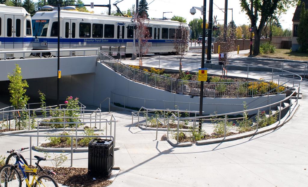
143
Edmonton Metropolitan Region Growth Plan. DRAFT #2 May 27, 2016
 Edmonton Metropolitan Region Growth Plan DRAFT #2 May 27, 2016 Table of Contents Acknowledgements and Forward... (Forthcoming) Executive Summary... (Forthcoming) Chapter 1: Introduction - Why Plan?...
CITY COUNCIL AGENDA REPORT
 CITY COUNCIL AGENDA REPORT Subject: COUNCIL MOTION LRT ALIGNMENT REMOVAL FROM THE TRANSPORTATION MASTER PLAN On February 10, 2016 Councillor Hughes provided notice in accordance with Section 23 of Procedure
1 Introduction. Chapter. In this chapter:
 Chapter 1 Introduction In this chapter: 1.1 A Snapshot of the Region 1.2 Towards a Sustainable Region 1.3 The Provincial Context 1.4 Purpose and Organization The Regional Municipality of York Official
Municipal Development Plan 2013
 UNIQUELY STONY PLAIN: Municipal Development Plan 2013 Quick Reference Guide What is a Municipal Development Plan (MDP)? The Town s highest-level planning document Sets the long-term vision and key themes
TOWN OF BRUDERHEIM Report to the capital region board
 TOWN OF BRUDERHEIM Report to the capital region board Introduction to the Town of Bruderheim Municipal Development Plan amendment and Relation to the CRB Evaluation Criteria 02 march 2017 1 Introduction
SECTION ONE: INTRODUCTION. introduction
 introduction 1 INTRODUCTION Since it was first established in 1843 as a trading post for the Hudson s Bay Company, Victoria has evolved into a Provincial capital city that is recognized across Canada and
Official Plan Review
 Official Plan Review Summary Report - The Built Environment August 2014 Part 1: Introduction Planning for a healthy, prosperous and sustainable community is an important goal for our municipality. From
Visioning Statement and Guiding Principles
 Visioning Statement and Guiding Principles Planning for the Future The General Plan The General Plan represents Woodland's shared vision of the future and defines a path to lead the community toward its
Sustainable Growth. Sustainable Growth
 2 Sustainable Growth Sustainable Growth SUSTAINABLE GROWTH 2.1 COMMUNITY VISION... 2-5 2.2 THE CITY SYSTEM... 2-7 2.2.1 AREAS... 2-7 2.2.2 CITY-WIDE SYSTEMS... 2-8 2.2.3 PROVINCIAL PLAN BOUNDARIES AND
The Corporation of the Town of Milton
 Report To: From: Council Barbara Koopmans, Commissioner, Planning and Development Date: May 7, 2018 Report No: Subject: Making it Possible Positioning the Town s Strategy for Growth and Economic Development
4 Sustainability and Growth Management
 4 Sustainability and Growth Management Introduction Traditionally, has assumed growth and development with limited consideration for the long-term negative social, environmental or economic impacts on
Transforming Saint John s Urban Heart -
 Transforming Saint John s Urban Heart - How Innovative Community Engagement Inspires a Bold Municipal Plan for a More Sustainable and Compact Saint John 2012 NNECAPA Conference - Brunswick, ME October
NEW REGIONAL OFFICIAL PLAN HIGH LEVEL PROCESS & FRAMEWORK
 NEW REGIONAL OFFICIAL PLAN HIGH LEVEL PROCESS & FRAMEWORK Why A New Official Plan Originally the role of Regionally Planning and content of Regional Official Plan (1970s) primarily focused on protecting
Municipal Development Plan Update Urban Service Area and Hamlets
 ENCLOSURE 1 Municipal Development Plan Update Urban Service Area and Hamlets Priorities Committee January 24, 2017 MUNICIPAL DEVELOPMENT PLAN UPDATE SHAPING OUR FUTURE MDP Update - Agenda MDP Update Public
SUMMARY. An Attractive, Competitive and Sustainable GREATER MONTREAL. Draft Metropolitan Land Use and Development Plan. April 2011
 April 2011 Draft Metropolitan Land Use and Development Plan GREATER MONTREAL An Attractive, Competitive and Sustainable SUMMARY Message from the Chair I am pleased to introduce this draft of the Metropolitan
6 Growth Management Challenges and Opportunities
 6 Growth Management Challenges and Opportunities The Town has established a goal of attaining a 50% participation rate with respect to employment opportunities versus residential population. The Town s
Niagara Region Official Plan. Table of Contents
 Niagara Region Official Plan Table of Contents This page has been intentionally left blank. Table of Contents ii Niagara Region Official Plan Niagara Region Official Plan - Table of Contents Chapter 1
2040 LUP is a part of the Comprehensive Plan and carries the same legal authority. Economic Challenges
 1.1. Guiding Anchorage s Growth Where will new residents settle over the next two decades? Where will people work, shop, and play? Will there be enough room to grow? How will Anchorage look? Will growth
PSRC REVIEW REPORT & CERTIFICATION RECOMMENDATION
 PSRC REVIEW REPORT & CERTIFICATION RECOMMENDATION KITSAP COUNTY COUNTYWIDE PLANNING POLICIES July 2, 2012 BACKGROUND A major emphasis of the Washington State Growth Management Act (GMA) is the need to
section 3: Vision, Values and Goals
 Vision, Values and Goals 3 2041 Vision: Victoria is an urban sustainability leader inspiring innovation, pride and progress towards greater ecological integrity, livability, economic vitality, and community
1.0 PLANNING MARKHAM S FUTURE CONTENTS
 1-1 Planning Markham s Future 1.0 PLANNING MARKHAM S FUTURE CONTENTS 1.1 THE PURPOSE OF THE OFFICIAL PLAN 1.2 THE MARKHAM CONTEXT 1.3 THE REGULATORY CONTEXT 1.3.1 Province of Ontario 1.3.2 York Region
Port Credit Local Advisory Panel October 20 th Meeting
 Port Credit Local Advisory Panel October 20 th Meeting Focus Of This Evening s Meeting: 1. Hurontario Main Street Higher Order Transit Study 2. Port Credit Mobility Hub & GO Station Parking Structure Study
Concord Community Reuse Project Goals and Guiding Principles. Overarching Goals (OG)
") Concord Community Reuse Project Goals and Guiding Principles Overarching Goals (OG) No priority is implied by the order of presentation of the goals and guiding principles. Overarching goals for the Concord
Concord Community Reuse Project Goals and Guiding Principles Overarching Goals (OG) No priority is implied by the order of presentation of the goals and guiding principles. Overarching goals for the Concord
Public Open House. Overview of the Downtown Plan Official Plan Amendment April 23, 2018
 Public Open House Overview of the Downtown Plan Official Plan Amendment April 23, 2018 1 A 25-Year Plan for Downtown To ensure growth contributes positively to Toronto s Downtown as a great place to live,
NORTHERN LANDS NORTHERN LEADERSHIP
 NORTHERN LANDS NORTHERN LEADERSHIP The GNWT Land Use and Sustainability Framework Our Lands, Our Interests, Our Future ii Land is Life MESSAGE FROM THE PREMIER Land is life. It is the link to our past.
The Way We Grow. Draft Municipal Development Plan. Reference Consolidation of approved and proposed amendments to draft Bylaw
 Attachment 1 Appendix 1 The Way We Grow Draft Municipal Development Plan Reference Consolidation of approved and proposed amendments to draft Bylaw 15100 October 23, 2009 Prepared by the Planning & Development
1.0 Purpose of a Secondary Plan for the Masonville Transit Village
 Report to Planning and Environment Committee To: Chair and Members Planning & Environment Committee From: John M. Fleming Managing Director, Planning and City Planner Subject: Masonville Transit Village
2018 Priority Regional Transportation Projects. Integrated Regional Transportation Master Plan
 2018 Priority Regional Transportation Projects June 14, 2018 Table of Contents 1.0 INTRODUCTION 3 1.1 BACKGROUND 3 1.2 OBJECTIVES 3 2.0 METHODOLOGY 4 2.1 OVERVIEW OF EVALUATION PROCESS 4 2.2 PROJECT LIST
Corridor Vision. 1Pursue Minnehaha-Hiawatha Community Works Project. Mission of Hennepin County Community Works Program
 1Pursue Minnehaha-Hiawatha Community Works Project Minnehaha-Hiawatha Community Works is a project within the Hennepin Community Works (HCW) program. The mission of the HCW program is to enhance how the
1 October Dear Citizens of Charlotte and Mecklenburg County,
 1 October 2011 Dear Citizens of Charlotte and Mecklenburg County, As co-chairs of the Center City 2020 Vision Plan Steering Committee, we are proud to present the Center City 2020 Vision Plan, which sets
CITY OF LANGLEY OFFICIAL COMMUNITY PLAN BYLAW, 2005, NO APPENDIX II - REGIONAL CONTEXT MAP
 CITY OF LANGLEY OFFICIAL COMMUNITY PLAN BYLAW, 2005, NO. 2600 APPENDIX II - REGIONAL CONTEXT MAP ± Legend Agricultural Mixed Employment Industrial Conservation & Recreation Regional City Centre Urban Containment
1. MAKING CHOICES. What kind of city will Toronto be in the 21st century?
 1. MAKING CHOICES Toronto is a great city! It has evolved into a special place that people care about deeply. It is a wonderful city in which to live, offering a diversity and richness of urban life that
13 THORNHILL YONGE STREET STUDY IMPLEMENTATION CITY OF VAUGHAN OPA 669 AND TOWN OF MARKHAM OPA 154
 13 THORNHILL YONGE STREET STUDY IMPLEMENTATION CITY OF VAUGHAN OPA 669 AND TOWN OF MARKHAM OPA 154 The Planning and Economic Development Committee recommends the adoption of the recommendations contained
Hurontario/Main Street Corridor Master Plan Mississauga and Brampton Building a new and integrated vision for the corridor
 Hurontario/Main Street Corridor Master Plan Mississauga and Brampton Building a new and integrated vision for the corridor Martin Powell, Commissioner of Transportation and Works, City of Mississauga Paper
SUMMER VILLAGE OF SUNRISE BEACH
 SUMMER VILLAGE OF SUNRISE BEACH Municipal Development Plan Bylaw No. 132-13 ~ 2 ~ Summer Village of Sunrise Beach Municipal Development Plan 1 INTRODUCTION 1.1 SETTING The Summer Village of Sunrise Beach
Supporting a Culturally Rich and Diverse City
 81 Supporting a Culturally Rich and Diverse City This paper is the sixth in a series of eight discussion papers. Culture. It s one of those words that we use a lot, but it has many different meanings,
Town of Devon. Municipal Development Plan
 Municipal Development Plan September 2017 ISL Engineering and Land Services Ltd. is an award-winning full-service consulting firm dedicated to working with all levels of government and the private sector
CITY CLERK. Parkland Acquisition Strategic Directions Report (All Wards)
") CITY CLERK Clause embodied in Report No. 10 of the, as adopted by the Council of the City of Toronto at its meeting held on November 6, 7 and 8, 2001. 10 Parkland Acquisition Strategic Directions Report
CITY CLERK Clause embodied in Report No. 10 of the, as adopted by the Council of the City of Toronto at its meeting held on November 6, 7 and 8, 2001. 10 Parkland Acquisition Strategic Directions Report
Section 1 Introduction
 Section 1 Section 1,, describes the role of the Official Plan. The Official Plan is one of five growth management plans that was completed under the umbrella of Ottawa 20/20. 1.1 The Role of the Official
edmonton.ca/ribbonofgreen #ribbonofgreen
 WHAT IS THE RIBBON OF GREEN? The Ribbon of Green is Edmonton s entire river valley and ravine system. The Ribbon of Green (2018) Project will provide strategic guidance for the southwest and northeast
Streets for People, Place-Making and Prosperity. #TOcompletestreets
 COMPLETE STREETS FOR TORONTO Streets for People, Place-Making and Prosperity COMPLETE STREETS: A NEW APPROACH A Complete Streets design approach considers the needs of all users people who walk, bicycle,
City of Toronto Official Plan Indicators
 City of Toronto Official Plan Indicators Attachment 1 2017 Gladki Planning Associates in association with Hemson Consulting & Studio Jaywall City of Toronto Official Plan Indicators 1 Introduction What
Parks Master Plan Implementation: Phase I Waterfront Use and Design REPORT #: September 7, 2016 File #
 0 'O DI Lan-171-14 1 - THE CORPORATION OF THE TOWN OF COBOURG..,. STAFF REPORT TO: FROM: Mayor and Members of Council Dean A. Hustwick, Director of Recreation and Culture DATE OF MEETING: Committee of
A Growing Community Rural Settlement Areas
 Town of Huntsville Official Plan Review - POLICY BACKGROUND PAPER A Growing Community Rural Settlement Areas BACKGROUND: In addition to the fully municipally-serviced Urban Settlement Area and the Hidden
WELCOME. The Yonge-Eglinton area has experienced significant growth and change in the last decade.
 WELCOME DID YOU KNOW? MIDTOWN IS REPRESENTED BY 3 CITY COUNCILLORS: WARD 16 EGLINTON-LAWRENCE WARD 22 ST. PAUL S WARD 25 DON VALLEY WEST Midtown in Focus: Building a Livable Yonge-Eglinton The Yonge-Eglinton
S A C R A M E N T O C O U N T Y JACKSON HIGHWAY & GRANT LINE EAST VISIONING STUDY
 JACKSON HIGHWAY & GRANT LINE EAST S A C R A M E N T O C O U N T Y P L A N N I N G D E P A R T M E N T SUMMARY AND WORKBOOK November 19, 2008 History of the Visioning Study Sacramento County has two growth
Arlington, Virginia is a worldclass
 EXECUTIVE S U M M A RY Arlington maintains a rich variety of stable neighborhoods, quality schools and enlightened land use policies, and received the Environmental Protection Agency s highest award for
Welcome to the Oakridge Centre Open House
 Welcome to the Oakridge Centre Open House Why is the City hosting this event? This open house is to inform you of a rezoning application submitted to the City of Vancouver to amend the existing CD-1 (Comprehensive
1.3 TRANSIT VISION 2040 FROM VISION TO ACTION THEME 1: PUTTING TRANSIT AT THE CENTRE OF COMMUNITIES. Fully integrate transit with community planning
 TRANSIT VISION 2040 FROM VISION TO ACTION TRANSIT VISION 2040 defines a future in which public transit maximizes its contribution to quality of life with benefits that support a vibrant and equitable society,
CONTENTS 2.0 A FRAMEWORK FOR SUSTAINABLE GROWTH 2.1 MANAGING SUSTAINABLE GROWTH THE VISION TO GOALS AND OBJECTIVES 2.3 MARKHAM STRUCTURE
 2 A Framework for Sustainable Growth 2.0 A FRAMEWORK FOR SUSTAINABLE GROWTH CONTENTS 2.1 MANAGING SUSTAINABLE GROWTH THE VISION TO 2031 2.2 GOALS AND OBJECTIVES 2.2.1 Protecting the Natural Environment
2.0 A FRAMEWORK FOR SUSTAINABLE GROWTH CONTENTS
 2-2 A Framework for Sustainable Growth 2.0 A FRAMEWORK FOR SUSTAINABLE GROWTH CONTENTS 2.1 MANAGING SUSTAINABLE GROWTH THE VISION TO 2031 2.2 GOALS AND OBJECTIVES 2.2.1 Protecting the Natural Environment
Vancouver. Title of the Initiative. Initiative Duration. Submitted by. Comments by the Jury
 134 Vancouver Title of the Initiative Initiative Duration Submitted by Comments by the Jury Visionary Vancouver: Creating a Welcoming and Sustainable Place for All 2009-2020 Wendy Au, Deputy City Manager,
Local Growth Planning in North Central Green Line Communities
 2018 April 30 Page 1 of 6 EXECUTIVE SUMMARY This report outlines a high-level scope for local growth planning for north central Green Line communities. The catalyst for this review is the significant investments
OUR GREATER SYDNEY A metropolis of three cities. OVERVIEW. connecting people. DRAFT Greater Sydney Region Plan
 OUR GREATER SYDNEY 2056. A metropolis of three cities. OVERVIEW. connecting people. DRAFT Greater Sydney Region Plan October 2017 This document is an overview of the draft Greater Sydney Region Plan. To
The protection of the agricultural resources of the Province;
 PART II INTRODUCTION An Official Plan is a policy document, which is intended to serve as the basis for making land use decisions and managing change in any municipality in Ontario. According to the Planning
Chapter 2: Vision, Goals and Strategies
 Chapter 2: Vision, Goals and Lake Elmo Today & Tomorrow Comprehensive Plan 2040 2 VISION, GOALS & STRATEGIES - DRAFT 4-6-2018 INTRODUCTION Comprehensive Plan Purpose Perhapse the most important objective
Western City District What we heard
 What we heard Vision to 2056 and Priorities Governance and implementation Infrastructure and funding The protection of the natural landscape including biodiversity and the Metropolitan Rural Area for food
Fostering metropolitan cooperation for sustainable urban development THE MONTRÉAL DECLARATION ON METROPOLITAN AREAS
 Fostering metropolitan cooperation for sustainable urban development THE MONTRÉAL DECLARATION ON METROPOLITAN AREAS October 7, 2015 This document has not been proofread 2 Fostering metropolitan cooperation
Expert Group Meeting. NUP Framework for A Rapid Diagnostic. Mainstreaming Climate Change into National Urban Policies. Themba R.
 Expert Group Meeting Mainstreaming Climate Change into National Urban Policies Themba R. Phakathi NUP Framework for A Rapid Diagnostic United Nations Conference Centre, Bangkok, Thailand, 17-18 March 2015
3. Endorse the LRT vision in transforming Surrey into Connected-Complete-Livable communities, and more specifically, the official vision statement:
 CORPORATE REPORT NO: R038 COUNCIL DATE: February 20, 2017 REGULAR COUNCIL TO: Mayor & Council DATE: February 16, 2017 FROM: General Manager, Engineering FILE: 8740-01 SUBJECT: Surrey Light Rail Transit
Cumberland Region Tomorrow is a private, non-profit, citizen based regional organization working with Greater Nashville Regional Council
 Cumberland Region Tomorrow is a private, non-profit, citizen based regional organization working with Greater Nashville Regional Council and others in the public and private sectors, dedicated to planning
Planning Department. Director of Planning. Manager of Planning. Planning Technician/ Sustainability Coordinator. Planner II/ Heritage Coordinator
 Department Director of Manager of Policy Planner Planner II (2) Planner II/ Heritage Coordinator Technician/ Sustainability Coordinator Technician Administrative Clerk March 2017 Department 2018 Business
IMPLEMENTING SOMERSET COUNTY S INVESTMENT FRAMEWORK
 IMPLEMENTING SOMERSET COUNTY S INVESTMENT FRAMEWORK SMART CONSERVATION THROUGH SMART GROWTH NJ LAND CONSERVATION RALLY March 22, 2014 Laurette Kratina, PP, AICP, Supervising Planner Somerset County Planning
Burlington s Strategic Plan
 Burlington s Strategic Plan 2015 2040 DRAFT FOR CONSULTATION burlington.ca/strategicplan Welcome to Burlington s 2015 2040 Strategic Plan The City of Burlington s 2015-2040 Strategic Plan is the result
DRAFT FOR PUBLIC REVIEW. Game Plan for a Healthy City
 DRAFT FOR PUBLIC REVIEW 2018 Game Plan for a Healthy City 2 Denveright. Parks & Recreation Game Plan Draft for Public Review Draft for Public Review Executive Summary Game Plan Overview Executive Summary
Robbinsdale LRT Station. CDI Development Guidelines. August Overview
 Robbinsdale LRT Station August 2018 Overview The City of Robbinsdale may have the coolest opportunity site along the 13 mile stretch of the Bottineau LRT corridor / Blue Line extension. Located a block
Chapter 1. Community Context. Vision Statement Population and Housing Trends Legislative Context Regional Context Statement
 Chapter 1 Community Context Vision Statement Population and Housing Trends Legislative Context Regional Context Statement 1.1 VISION STATEMENT CORPORATE MISSION STATEMENT To promote a safe and livable
ORANGE COUNTY IMPLEMENTING THE FOUR C s
 ORANGE COUNTY IMPLEMENTING THE FOUR C s East Central Florida Corridor Task Force O R A N G E COUN TY P LA N N I N G DIVISION C O M M U N I T Y, E N V I R O N M E N T A L A N D D E V E L O P M E N T S E
LAND USE AMENDMENT CORNERSTONE (WARD 3) 60 STREET NE AND COUNTRY HILLS BOULEVARD NE MAP 26NE BYLAW 22D2017
 60 STREET NE AND COUNTRY HILLS BOULEVARD NE MAP 26NE BYLAW 22D2017") Page 1 of 14 EXECUTIVE SUMMARY This Land Use Amendment application covers an area of 43.76 hectares ± (108.14 acres ±) located in northeast Calgary, bound by Country Hills Boulevard NE to the south and
Page 1 of 14 EXECUTIVE SUMMARY This Land Use Amendment application covers an area of 43.76 hectares ± (108.14 acres ±) located in northeast Calgary, bound by Country Hills Boulevard NE to the south and
SCARBOROUGH SUBWAY EXTENSION. Scarborough Subway Extension. Final Terms of Reference
 Scarborough Subway Extension Final Terms of Reference 1 1.0 Introduction and Background 1.1 Introduction Toronto City Council recently confirmed support for an extension of the Bloor-Danforth Subway from
THE TOWN OF WASAGA BEACH
 THE TOWN OF WASAGA BEACH Downtown Development Master Plan Committee of the Whole Presentation January 26 th 2017 Uses within this designation should reflect a dependence on tourism as opposed to the permanent
How can we improve mobility and access?
 How can we improve mobility and access? North King s Town is located fairly centrally within the city, but there are still multiple opportunities to improve mobility within the study area, including connections
MAYFIELD WEST SECONDARY PLAN PHASE 2
 MAYFIELD WEST SECONDARY PLAN PHASE 2 Public Open House #3 February 25, 2010 Draft Preferred Land Use Scenario TOWN OF CALEDON PLANNING & DEVELOPMENT DEPARTMENT Open House Agenda TOWN OF CALEDON 1. Welcome
EDMONTON: Changing the Way We Grow and the Way We Move
 EDMONTON: Changing the Way We Grow and the Way We Move Rhonda, Toohey, P.Eng. Transportation Department City of Edmonton Paper prepared for presentation at the Sustainable Urban Transportation Session
ROBBINSDALE LRT STATION CDI DEVELOPMENT GUIDELINES
 August 2018 OVERVIEW The City of Robbinsdale has a prime-opportunity site in the middle of the 13 mile stretch of the Bottineau LRT corridor / Blue Line extension. Robbinsdale offers a prominent, vital,
Town of Cobourg Heritage Master Plan. Statutory Public Meeting
 Town of Cobourg Heritage Master Plan Statutory Public Meeting April 25 th 2016 Presentation Overview 1. Introduction 2. Project background and schedule overview 3. Review of strategic direction content
Town of Peru Comprehensive Plan Executive Summary
 Town of Peru Comprehensive Plan Executive Communities that plan grow by choice, not by chance. A plan makes growth thoughtful, understandable, and predictable. A plan shows that a community is managing
ELK GROVE GENERAL PLAN VISION
 2-1 CHAPTER 2: 2-2 CREATING OUR The Community Vision for Elk Grove, expressed through a Vision Statement and a series of Supporting Principles, is a declaration of the kind of community that Elk Grove
UNIT 2B URBAN AND RURAL CANADA: BUILDING SUSTAINABLE COMMUNITIES
 UNIT 2B URBAN AND RURAL CANADA: BUILDING SUSTAINABLE COMMUNITIES Part 1: Where Do Canadians live? The majority of Canadians live in cities. WHY? Because cities 1. Provide more services for people 2. Large
Table of Contents PART 1 FRAMEWORK... 1
 Table of Contents PART 1 FRAMEWORK... 1 1.0 PURPOSE... 1 1.1 MUNICIPAL GOVERNMENT ACT... 1 1.2 REGIONAL & MUNICIPAL POLICIES... 2 1.3 COMMUNITY CONTEXT... 6 PART 2 VISION... 8 2.1 SUSTAINABILITY... 8 2.2
Synopsis of 50 years of Planning in the Greater Golden Horseshoe (GGH), Ontario, Canada. Olusola Olufemi 2015
, Ontario, Canada. Olusola Olufemi 2015") Synopsis of 50 years of Planning in the Greater Golden Horseshoe (GGH), Ontario, Canada Olusola Olufemi 2015 Canada Background Canada s population is 34,834,841 (July 2014 est.) Capital city: Ottawa Canada
Synopsis of 50 years of Planning in the Greater Golden Horseshoe (GGH), Ontario, Canada Olusola Olufemi 2015 Canada Background Canada s population is 34,834,841 (July 2014 est.) Capital city: Ottawa Canada
Eastern City District Plan
 OUR GREATER SYDNEY 2056 Revised Draft Eastern City District Plan OVERVIEW Bayside Burwood Canada Bay City of Sydney Inner West Randwick Strathfield Waverley Woollahra Snapshot of the Eastern City District
Edward R. Sajecki Commissioner of Planning and Building
 Corporate Report Clerk s Files Originator s Files CD.03.POR DATE: TO: FROM: SUBJECT: Chair and Members of Planning and Development Committee Meeting Date: February 27, 2012 Edward R. Sajecki Commissioner
Former Rockcliffe Airbase Community Design Plan Guiding Design Vision and Principles December 4, 2013
 APPENDIX 5 - Guiding Design Vision and Principles Former Rockcliffe Airbase Community Design Plan Guiding Design Vision and Principles December 4, 2013 Vision Statement The redevelopment of the former
Ningbo Initiative - APEC High-Level Urbanization Forum 2016
 2016/SOM3/006 Agenda Item: 3.5 Ningbo Initiative - APEC High-Level Urbanization Forum 2016 Purpose: Information Submitted by: China Third Senior Officials Meeting Lima, Peru 27-28 August 2016 EXECUTIVE
CITY COUNCIL AGENDA REPORT
 CITY COUNCIL AGENDA REPORT Subject: DESIGNATED FLOOD LINE CARROT CREEK Recommendation(s) That Administration bring forward a Land Use Bylaw amendment in October 2014 establishing the Designated Flood Line
Introducing the Main Street Strategic Toolbox
 Ulster County Main Streets: A Regional Approach Ulster County Planning Department, 244 Fair Street, Kingston NY 12401 Why do we take a regional approach to Main Streets? There are many different approaches
CITY VIEW OBJECTIVES
 SECTION 2: CITY VIEW OBJECTIVES CONTENTS 2.1 Introduction 1 2.2 Strategic Direction 1 2.3 The City View Resource Management Issues for the City 1 2.4 The Goal 3 2.5 The City View Objectives 3 Palmerston
CITY OF COLWICH COMPREHENSIVE PLAN LAND USE LAND USE 1
 LAND USE LAND USE 1 WHAT YOU WILL FIND IN THIS CHAPTER: Discussion of today s conditions and tomorrow s projections Discussion of challenges and opportunities Discussion of the environmental quality goals,
Preliminary Plan Framework: Vision and Goals
 Preliminary Plan Framework: Vision and Goals Draft: May 2015 Introduction Since the Town of Milliken s comprehensive plan was last updated in 2010, the community was heavily impacted by the 2013 flood,
A BLUEPRINT FOR BROCKTON A CITY-WIDE COMPREHENSIVE PLAN
 A BLUEPRINT FOR BROCKTON A CITY-WIDE COMPREHENSIVE PLAN Public Meeting October 2016 1 Plan Summary and Discussion Public Meeting May 4 2017 City of Brockton Bill Carpenter, Mayor Department of Planning
Metro Vancouver. Regional Growth. Strategy. Optimizing the Urban Footprint
 Metro Vancouver Regional Growth Metro Vancouver Fraser Valley Regional District Strategy USA Victoria Bellingham Optimizing the Urban Footprint 2011 Salish Sea Ecosystem Conference October 25, 2011 Terry
Calgary Metropolitan Plan
 Calgary Metropolitan Plan Calgary Regional Partnership phone: 403-851-2509 email: info@calgaryregion.ca www.calgaryregion.ca MAY 2014 WATER IS ESSENTIAL FOR OUR SURVIVAL 1 Water is essential We are fortunate
Smart Growth for Dallas
 Smart Growth for Dallas Data-driven decisions for the future of Dallas parks, open spaces, and green infrastructure Dallas Park and Recreation Board March 10, 2016 Agenda I. Welcome and Introductions II.
John M. Fleming Managing Director, Planning and City Planner. Old East Village Dundas Street Corridor Secondary Plan Draft Terms of Reference
 Report to Planning and Environment Committee To: From: Subject: Chair and Members Planning & Environment Committee John M. Fleming Managing Director, Planning and City Planner Old East Village Dundas Street
AT A GLANCE... Our People, Culture & Place. A plan to sustain Ballarat s heritage (final draft)
") AT A GLANCE... Our People, Culture & Place A plan to sustain Ballarat s heritage 2017-2030 (final draft) Image: Lydiard Street, Ballarat, c1875-1938, John Henry Harvey collection, La Trobe Picture Collection,
AT A GLANCE... Our People, Culture & Place A plan to sustain Ballarat s heritage 2017-2030 (final draft) Image: Lydiard Street, Ballarat, c1875-1938, John Henry Harvey collection, La Trobe Picture Collection,
1 Introduction. 4 Environmental Integrity. 7 Community Facilities
 2037: A CALL TO ACTION 2017 COMPREHENSIVE PLAN EXECUTIVE SUMMARY is the purpose of the Q: What Comprehensive Plan? The comprehensive plan serves as a guide for the community s physical, social, and economic
Plano Tomorrow Vision and Policies
 Plano Tomorrow Vision and Policies PLANO TOMORROW PILLARS The Built Environment The Social Environment The Natural Environment The Economic Environment Land Use and Urban Design Transportation Housing
Land Use & Planning Committee. Agenda
 1. Call to Order Mayor Tom Flynn, Chair 2. Chair Opening Remarks Agenda Thursday, April 28, 2016 9:00 a.m. 11:00 a.m. La Cite Francophone Hall Jean-Louis Dentinger 8627 rue-marie-gaboury (91 Street), Edmonton
Create Policy Options Draft Plan Plan Approval. Public Consultation Events. Phase 2
 Background Grandview-Woodland Community Plan In the spring of 2012, the City of Vancouver embarked on a comprehensive community planning program in the Grandview-Woodland neighbourhood. The process has