Design Brief for Proposed Mixed-Use Medical / Office Building
|
|
|
- Daniel Warren
- 5 years ago
- Views:
Transcription
1 Design Brief for Proposed Mixed-Use Medical / Office Building 1637 Bank Street, Ottawa ON Project No: PC Date: June 25th, 2015 For: Kersten Nitsche, Planner II Development Review (Urban Services) City of Ottawa 110 Laurier Avenue West Ottawa ON K1P1J1
2 Table of Contents 1.0 Section Introduction Project Description Official Plan Objective Building Liveable Communities Strategic Direction Managing Growth Strategic Direction Maintaining Environmental Integrity Strategic Direction Providing Infrastructure Strategic Direction Arterial Mainstreet Urban Designation Objective Mainstreet Principle Bank Street Secondary Plan & Community Design Plan Objective Built Form Principle Design Principle Parking and Access Principle Node 2: Heron Road Principle Contextual Analysis Description Context Map Site Photographs Analysis Section Design Objectives and Principles Urban Design and Compatibility Objective Building Profile & Transitions Principle Annex 3 Design Framework Building Massing Building Context Building Transition Grading Alternative Building Massing Relationship to the Public Realm Building Design Sustainability 29 2
3 3.0 Section Minor Variance Minimum Parking Rate Reduced Aisle & Driveway Width Location of Parking & Loading Space Exterior Garbage & Recycling Enclosure Location Minimum Width of Landscape Area Abutting a Residential Zone Minimum Width of Landscape Area Around a Parking Lot Site Plan Conclusion Further Information 35 3
4 Section Introduction Project Description 1.2 Official Plan This design brief has been prepared in support of the site plan application being submitted for a proposed 4-storey mixed-use medical/office building to be constructed at 1637 Bank Street, Ottawa. The design brief seeks to illustrate and explain how the architectural design conforms to the City of Ottawa s relevant plans, studies and policies for the subject site, which is legally defined as: Part of Lots 453 & 454 (East Bank Street), City of Ottawa Pin under Registered Plan M-23 dated February 10, 2014 and revised June 15, The 1,010m 2 (0.101 hectare) site is located at the corner of Bank Street and Collins Avenue, and the vision for the proposed 1,232m 2 (13,261ft 2 ) gross floor area development is to create a strong architectural form with a blended massing of transparent and opaque building materials that anchors this highly visible urban streetscape. The site is steeply sloped along Collins Avenue and the intent is to utilize this grade change to transition from a 4-storey building facing Bank Street to a 3-story building abutting the neighbouring residential properties, while at the same screening the required parking through the building form along Bank Street Objective The City of Ottawa Official Plan designation for the property is General Urban Area Arterial Mainstreet, and the subject Zoning Designation under the City of Ottawa Zoning Bylaw is AM1 [1913] - Sector C. The site at present is vacant and the proposed development seeks to intensify the corner site through the construction of a proposed 4-storey mixed-use medical/office building containing a walk-in clinic on the ground floor and an x-ray imaging lab on the third floor. An enclosed parking garage accessed off Collins Avenue would occupy the second floor, while the fourth floor would be leased to a tenant offering a related medical/office service. The area in front of the building along the Bank Street Right of Way (ROW) would be a pedestrian-friendly zone with a mixture of soft and hard landscaping, as well as visible and physical connections to the existing sidewalks and access points on the site. These landscape components would then continue up Collins Avenue to provide a soft transition and pedestrian linkage to the adjacent residential properties, while also screening the rear parking lot from view. The 4-storey Bank Street façade would present a continuous built-form of alternating patterns of wall and glass elements with soft accent lighting and canopies over the building entrances. 4
5 1.2.2 Building Liveable Communities Strategic Direction The proposed mixed-use development has been designed to respect and enhance both the commercial strip of Bank Street and the adjacent neighbouring residential properties. This has been achieved by capping the building height at 4-storey when 6-storeys could have been accommodated along Bank Street, and using a balance of precast stone panels and glass for the building facades. The building s primary façade along Bank Street has been designed with a series of solid and transparent masses and planes to create a vibrant streetscape, and is anchored on the Bank Street and Collins Avenue intersection by a prominent building form that acts as a visual anchor for the building for pedestrians and motorists alike. The upper floor levels of the building have also been setback 12.0m from the rear lot line and capped at an 11.0m building height measured from average grade to provide adequate separation from the smaller residences. The proposed development is compatible to its urban surroundings while at the same time expressing its unique identity through the architectural form and materiality. The intensification on the vacant lot relates to the intent of Section of the City of Ottawa Official Plan, which states: In general terms, compatible development means development that, although it is not necessarily the same as or similar to existing buildings in the vicinity, nonetheless enhances an established community and coexists with existing development without causing undue adverse impact on surrounding properties. It fits well within its physical context and works well among those functions that surround it. Furthermore, the building design meets the Design Objectives and Principles of Section of the City of Ottawa Official Plan in accordance with Section 4.11 Urban Design and Compatibility and Annex 3 of the Official Plan, which are described in greater detail in Section 2 of this document. The proposed architectural design in conjunction with the landscape and civil engineering design meets Items 1 through 7 of Section Design Objectives and Principles of the City of Ottawa Official Plan by first creating a place with a distinct architectural identity that reflect a thorough and sensitive understanding of place, context and setting. The development provides a public space with hard and soft landscapes materials and retaining walls acting as benches along the Bank Street façade that enhance and enliven the quality, character and spatial delineation of public spaces and encourage a continuity of street frontages. The design provides highly visible and accessible public entrances to the building with appropriate signage and lighting that create places and spaces that are visible and safe and can be confidently used at all hours of the day and at night where it is appropriate to do so, and meets the intent of Policy 1 under Section Personal Security of the City of Ottawa Official Plan. The existing site is vacant and the proposed development will complement and enliven the surroundings through a smaller massing form and materials that are of a complimentary use to the neighbouring residential properties. Similarly, the floor plans have been designed as open floor plates with the building services grouped to provide flexibility for buildings and spaces to adapt to a variety of possible uses in response to changing social, economic and technological conditions. And finally, the associated engineering design will demonstrate that all practical means of retaining stormwater on site have been considered and will maximize energy-efficiency and promote sustainable design to reduce the resource consumption, energy use, and carbon footprint of the built environment. 5
6 1.2.3 Managing Growth Strategic Direction The proposed development and urban intensification on the vacant lot relates to the intent of Section of the City of Ottawa Official Plan, which states: Within lands designated General Urban Area, opportunities for intensification exist and will be supported, and by directing major intensification to the Central Area, along Mainstreets, and within Mixed-Use Centres and Town Centres in association with the transportation network, the stability of neighbourhoods within the General Urban Area is enhanced. In addition, the intensification will create employment in the medical field with the mixed-use medical/office building, which meets the objectives of Policy 21 under the Employment Section of the City of Ottawa Official Plan and Figure 2.3 Density Targets by providing a minimum 12 net density jobs/gross hectare for the 1,010m 2 (0.101 hectare) site Maintaining Environmental Integrity Strategic Direction Please refer to the corresponding civil engineering plans and reports prepared by D.B Gray Engineering Inc., and the corresponding traffic study prepared by D.J. Halpenny & Associates Ltd. accompanying the site plan application Providing Infrastructure Strategic Direction Please refer to the corresponding civil engineering plans and reports prepared by D.B Gray Engineering Inc. accompanying the site plan application. 1.3 Arterial Mainstreet Urban Designation Objective The proposed development and urban intensification on the vacant lot relates to the intent of City of Ottawa Official Plan and Section of the Mainstreet Urban Designation, which states: Over time, it is the City s intent that Mainstreets will achieve more compact, mixed-use, pedestrianorientated patterns, and this Plan encourages intensification along Mainstreets. Intensification is most likely to occur through the redevelopment of such sites as vacant lots Mainstreet Principle The proposed mixed-use medical/office program addresses Item 3 under Section of the Mainstreet Urban Designation, which states: a broad range of uses is permitted on Traditional and Arterial Mainstreets, including retail and service commercial uses, offices, residential and institutional uses. In addition, the proposed building program creates a node of medical-related uses serving the commercial Bank Street corridor and surrounding residential neighbourhoods with the existing pharmacy located across Collins Avenue from the site. The proposed building form with a continuous streetscape along Bank Street and pedestrian access to the building at grade addresses the intent of Item 8 under Section of the Mainstreet Urban Designation, by providing a building format that encloses and defines the street edge and provides direct access to the sidewalk. 6
7 1.4 Bank Street Secondary Plan & Community Design Plan Objective The site is located near the intersection of Heron Road and Bank Street and is situated in the Connecting Area just outside of the boundary of Node 2 as identified on the Bank Street CDP Secondary Plan Volume 2A - Appendix A Land Use. The proposed development promotes the three key visions identified under Section 1.3 Vision and Design Principles of the Bank Street Secondary Plan and Section 3.1 CDP Vision and Design Principles of the Bank Street Community Design Plan by providing a mixed-use development that is accessible by both pedestrians and automobiles alike, and that creates a new urban streetscape on the previously vacant lot Built Form Principle The proposed building has been designed at 4-storeys to respect the scale of the neighbouring residential properties while at the same time providing a strong built-form along the Bank Street streetscape to meet the objectives of Section 1.4 General Land Use and Design Policies of the Bank Street Secondary Plan and Section 5.1 General Land Use and Design Guidelines of the Bank Street Community Design Plan. Specifically the building height and floor space index (FSI) respect Items 2 to 4 of the Built Form Section of both plans, as well as the zoning provisions for maximum building height and floor space index as identified under the City of Ottawa Zoning Bylaw - AM1 [1913] Zoning Designation. This includes a maximum building height of 11.0m measured from average grade for a distance of 20.0m from the adjacent R2F residential zoning, and a proposed FSI of Please note that in order to provide vehicular access off Collins Avenue to the proposed parking lot located in the rear yard as required by Item 1 of the Parking and Access Section of the Bank Street Secondary Plan and Bank Street Community Design Plan (see Item below for further clarification), the second floor level is proposed at 2.9m above the Bank Street sidewalk. This height above grade cannot be increased as the resulting driveway accessing the parking lot from Collins Avenue would be too steep relative to municipal standards. As a result, the desired 4.5m ceiling height for the ground floor space as identified in Item 5 of the Built Form Section of the Bank Street Secondary Plan and Item 7 of the Built Form Section of the Bank Street Community Design Plan cannot be achieved and a finished ceiling height of 3.0m has been proposed instead. This ceiling height is sufficient for the proposed walk-in clinic occupying the space, and to achieve this height the ground floor slab is proposed at 0.55m below the exterior grade. Pedestrians entering the building would enter the building lobby at grade and descend to the lowered floor slab via a generous barrier-free 1:12 ramp and stairs located within the unit. Similarly, the upper floor levels have a proposed finished ceiling height of 2.5m instead of the desired 4.5m, which is a sufficient height for the intended mixed-use medical/office occupancies. If this height were too be increased then the overall building height would exceed the maximum 11.0m building height as noted in the AM1 [1913] Zoning Designation. 7
8 1.4.3 Design Principle The proposed building design conforms to the required building setbacks as identified under the City of Ottawa Zoning Bylaw - AM1 [1913] Zoning Designation, as well as Item 3 of the Design Section of the Bank Street Secondary Plan and Item 4 of the Design Section of the Bank Street Community Design Plan. The required 37.5m Bank Street Right of Way (ROW) width and 5.0m Hydro Ottawa overhead clearance from the adjacent high voltage power lines have been provided. In addition, the building elevations along both Bank Street and Collins Avenue have been designed with visible barrier-free entrances and varying architectural materials treatments and massing not exceeding 15.0m in length to meet the objectives of Items 4 & 5 of the Design Section of the Bank Street Secondary Plan and Items 2 & 5 of the Design Section of the Bank Street Community Design Plan. Low-growing maple trees and other vegetation are proposed along Bank Street and Collins Avenue as per Items 10 and 11 of the Design Section of the Bank Street Secondary Plan and Item 10 of the Built Form Section of the Bank Street Community Design Plan in order to help enliven the building façade and screen the parking lot from view. This also adds character, identity and distinction to Bank Street as an important pedestrian and automobile route, and meets the intent of Policy 7 under Section Walking, Cycling, Transit, Roads and Parking Lots of the Official Plan Parking and Access Principle The required parking for the site has been provided via an asphalt parking lot with 14 parking spaces located to the rear of the property and accessed off of Collins Avenue, and an enclosed parking garage with 6 spaces accessed from the rear lot. All the parking is screened from view by the building massing along Bank Street and by landscape elements consisting of trees and plantings along Collins Avenue and a 2.0m high privacy fence where abutting the neighbouring residential properties in conformance to Items 1 & 3 of the Parking and Access Section of the Bank Street Secondary Plan and Bank Street Community Design Plan Node 2: Heron Road Principle While the site is located outside of the Node 2 boundary on the east side of Bank Street, the proposed development seeks to reinforce the objectives of Section Node 2: Heron Road of the Bank Street Secondary Plan and Section Node 2: Bank Street and Heron Road of the Bank Street Community Design Plan by providing a mixed-use development with a continuous streetscape and strong street edge along Bank Street. 1.5 Contextual Analysis Description Within a 100 metre radius of the site located at 1637 Bank Street are a collection of commercial and residential properties with AM and R2F Zoning Designations. This area is roughly bounded by the commercial properties of Bank Street and Wildwood Avenue to the west of the site, the mixed-use commercial and residential properties located to the north of the site up to Heron Road, the mixeduse commercial and residential properties located to the south of the site up to Ridgemont Avenue, and the residential properties located to the east of the site towards Edge Hill Place along Anoka Street, Collins Avenue and Ridgemont Avenue. 8
, service and retail businesses, a pharmacy (IDA), and a large retailer (Canadian Tire).")
9 The commercial properties located along the Bank Street corridor and within the 100 metre radius of the site include: small independent restaurants, a fast food franchise (Tim Horton s), two gas stations (Esso & Canadian Tire), service and retail businesses, a pharmacy (IDA), and a large retailer (Canadian Tire). There is also a multi-unit medical centre (Canada Care Medical Centre) located just outside the 100m radius to the south of the Canadian Tire off Wildwood Avenue. These buildings varying in height and scale, and are generally clad in metal or stucco and lacking in any significant or noticeable architectural treatment. They are generally characterized by multiple signage elements, visible parking along Bank Street, and minimal landscape elements. The residential properties are generally single family residences of 1 to 2 storeys in height, and varying in age from older post-war constructions to more recently renovated properties. The residences are for the most part clad in masonry veneer or horizontal siding and a very well maintained with landscaped yards. Bank Street is a large arterial mainstreet with OC Transpo service on both sides of the street, and high voltage power lines running down the east side of the roadway. The local streets are without sidewalks but are fronted by mature trees along their respective lengths Context Map 9


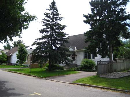
10 1.5.3 Site Photographs Site Photograph No. 1 Site Photograph No. 2 Site Photograph No. 3 Site Photograph No. 4 Site Photograph No. 5 Site Photograph No. 6 10


11 Site Photograph No. 7 Site Photograph No. 8 Site Photograph No. 9 Site Photograph No. 10 Site Photograph No. 11 Site Photograph No


12 Site Photograph No. 13 Site Photograph No. 14 Site Photograph No. 15 Site Photograph No. 16 Site Photograph No. 17 Site Photograph No


13 Site Photograph No. 19 Site Photograph No. 20 Site Photograph No. 21 Site Photograph No. 22 Site Photograph No. 23 Site Photograph No
14 1.5.4 Analysis The proposed mixed-use development has been designed to act as a prominent focal element for this portion of Bank Street due to occupying a prominent corner lot, and in the absence of any unifying or significant architectural features present in the existing buildings. The proposed architectural design has an architectural form and material palette that blends the two different surrounding zones. It respects the smaller massing and cladding of the residential properties to the north, south and east through an 11.0m building height measured from average grade, and with an exterior cladding of precast stone panels to reference the masonry veneer of the adjacent residences. The windows on the upper floor levels have also been reduced in size from a typical floor to ceiling arrangement in commercial properties to a more modest opening with a sill height of 0.45m from the floor, and a finished ceiling height of 2.5m. Similarly, the proposed design respects the commercial vitality of Bank Street by presenting a 4- storey streetscape of the same glass and precast stone panels, and a generous pedestrian zone in front of the building consisting of hard and soft landscaping materials. The parking for the site, which is accessed off Collins Avenue and located level with the second floor of the building due to the 2.7m grade change on site from the front of the lot to the rear, is screened from view along Bank Street by the building massing and landscape elements along Collins Avenue. Proposed signage elements on the building would be limited to specific areas on the building façade so as to present a clear and legible identity for the prospective tenants, while ensuring that the architectural design of the building is not diminished or detracted by multiple signage. Exterior lighting will primarily be used to accentuate the architectural features of the building, and to illuminate public areas and entrances for safety and building wayfinding. Bicycle parking has been provided with a single 2-station 5-capacity bicycle ring rack as per the City Ottawa Zoning Bylaw Part 4 Parking, Queuing and Loading Provisions and Section Bicycle Parking Space Rates and Provisions and Table 111a (e) Area C. This ring rack is located on a welllit concrete pad situated adjacent to the vehicular entrance off Collins Avenue, which meets the intent of Policy 6 under Section Walking, Cycling, Transit, Roads and Parking Lots of the City of Ottawa Official Plan. However, should the City permit the bicycle parking to be located within the Bank Street Right of Way (ROW) then it will be moved to the hard landscaped area beside the principal entrance off Bank Street in order to be more visible and encourage cycling use to the building. 14
15 Section Design Objectives and Principles Urban Design and Compatibility Objective Since the subject site connects a high-traffic commercial strip characterized by a range of building types and sizes to a more modest low-scale residential neighbourhood of single family residences, the proposed development and ensuing architectural design utilizes a number of strategies to bridge these distinct zones as required by the City of Ottawa Official Plan and Section 4.11 Urban Design and Compatibility - Policies. All required building setbacks as identified under the AM1 [1913] Zoning Designation have been provided, and this in turn has established a building footprint that reflects the profile of the site while providing a 12.0m horizontal separation from the adjacent R2F zoning and single family residences as intended by Items 2(d) and 2(h). This separation diminishes shadows cast towards the neighbouring properties from the building volume during the lateafternoon, while also providing a measure of privacy to their outdoor amenity areas and acoustical separation from noise generated in the building. Lighting is typically downcast to avoid spill-off onto the neighbouring residences, and the entire rear parking lot has been visually separated with a 2.0m privacy fence and landscape materials to provide a visual and acoustical buffer in order to meet the intent of Items 2(f) and 2(g). Access to the site for vehicular traffic has been provided via Collins Avenue so as to not further encumber Bank Street, and the maximum amount of area that can be used for on-site parking has been utilized to mitigate against off-site parking along Collins Avenue in response to Item 2(b). This parking has in turn been split between a surface lot and an enclosed parking garage so as to reduce the amount of asphalt present on site as per the objectives of Item 2(c), while providing a building mass that echoes the form and materiality of the upper floor levels above. Bicycle parking has been provided on-site, and the building is serviced by the nearby Bank/Collins OC Transpo Bus Stop #8435 on the east side of Bank Street, and Bank/Heron OC Transpo Bus Stop #8306 on the west side of Bank Street. The proposed mixed-use medical/office tenant mix under the banner M3 Medical will create a designated health sector facility serving the Bank Street area, and the proposed architectural and engineering design will conform to the 2012 Ontario Building Code and Energy Efficiency requirements under MMAH Supplementary Standard SB-10 and ANSI/ASHRAE/IES 90.1 to meet the intent of Items 2(i) and 2(j) Building Profile & Transitions Principle Under the City of Ottawa Official Plan, the proposed 4-storey mixed-use development is considered low-rise as per Item 7(a) of Section 4.11 Urban Design and Compatibility - Building Profile. To help scale the building mass to the smaller 1 to 2-storey residential properties located to the east of the property, the 2.7m grade change along Collins Avenue has been used to step the building height from 4-storeys along Bank Street to 3-storeys at the rear of the property. This measure ensures that there is a strong and visible building form along Bank Street, yet respects the residential properties to the rear through a smaller 9.6m building height. 15
16 The mass of the building volume is further scaled-down with the use of horizontal banding elements that are clad with a precast stone panel between floors, and a continuous row of glazing on the upper floor levels. These strong horizontal lines and continuous glazing act to counter the verticality present in the tall corner element which holds the building s core services (i.e. elevator, stairwell, and service chases), and acts as an anchor on the highly visible corner site for vehicular traffic and pedestrians alike. Horizontality is further expressed through colour-contrasting linear canopies centered over the barrier-free pedestrian entrances to the building, horizontal metal siding around the enclosed parking garage area, and through the building soffit which projects past the exterior building face 0.15m. This colour-contrasted projection helps introduce depth to the façade, while also providing a surface to mount down-cast accent lighting. Furthermore, the 13.65m high corner element of the building is reduced in scale through the use of 0.6m wide horizontal precast stone panels running in an alternating bond-pattern at varying lengths, varied retaining walls and steps complete with glass and metal guardrails, and softened through the use and placement of lowgrowing maple trees and vegetation planted along Bank Street and Collins Avenue. These measures all seek to reinforce the policies of the City of Ottawa Official Plan and Item 12 under Section 4.11 Urban Design and Compatibility Building Transitions. Within the public realm of the building along Bank Street and a portion of the side elevation along Collins Avenue are a collection of soft and hard landscape elements, which include planting beds with brown cedar mulch, grassed areas, and low-growing trees and shrubs. These soft measures seek to reduce the height of the 4-storey building relative to the Bank Street sidewalk, while also providing an area of respite and shade for pedestrians either entering the building or passing by the site. This is further supported by accessible sidewalks and 0.6m high retaining walls that double as seats and edges for raised landscaped planting beds. The entrance canopies over the building entrances seek to reduce the scale of the building for pedestrians, while providing a measure of safety through under-canopy lighting. Along the Bank Street façade the ground floor level is substantially glazed to provide a sense of openness to the public realm, as well as providing views into and from the walk-in clinic located on the ground floor of the building. In addition, the hard landscape plaza area located in front of the building at the Bank Street and Collins Avenue intersection can double as a gathering space for both users of the building and community members. To reduce the scale of this hard landscape, precast stone pavers are proposed in an alternating running-bond pattern to reference the horizontal siding on the building and framed by low-growing shrubs and flowers around the perimeter Annex 3 Design Framework The proposed architectural design and site development as detailed in Sections 1 and 2 of this report are to be considered as meeting the intent and objectives of the City of Ottawa Official Plan and Secondary Plans, and the following sampling of Annex 3 Design Framework statements can be considered as supporting that application. Design Objective 1: Enhancing or creating nodes of activity within communities or districts at important junctions and points of interaction where a distinctive urban design character is created, such as through the erection of landmark buildings Incorporating architectural and functional excellence to create distinctive places, enhance local identity, and assist in public interaction. 16
17 Design Objective 2: Addressing locations that abut a public space frequented by pedestrians by providing elements such as: active, at-grade community-serving uses; at-grade entrances at frequent intervals; windows giving views to passerby that both informs them of the function of the building and provides views out of the building to enhance natural surveillance; colonnades, awnings or other features that have the effect of widening the public space and/or providing weather protection to pedestrians; and seating and related amenities at known waiting areas, points of interest, vistas or changes in grade. Locating surface parking lots away from the street in rear or side yards and screening them from pedestrians. Design Objective 3: Providing the primary site and building access directly from the street in ways that are clearly identifiable, barrier free and incorporate safe, attractive pedestrian routes. Defining clear, continuous pedestrian circulation that does not conflict with vehicular movement. Design Objective 4: Considering infill and redevelopment as opportunities to enliven and create a sense of visual interest and delight. Addressing the impact of the height of medium / tall buildings by means such as: incremental changes in height; providing substantial space separation or planting buffers; or using existing topographical breaks or natural features... Design Objective 5: Anticipating the infilling of vacant spaces in front of and between buildings with new development. Design Objective 6: Using plant materials to create transitions between urban development and adjacent natural areas and open spaces and between existing and proposed development. Incorporating green building technology to ensure resource efficiency, including the use of recycled, renewable, and reused resources to the maximum extent practical. 17
18 2.1.4 Building Massing West Building Elevation (Bank Street) South Building Elevation (Collins Avenue) 18


19 East Elevation North Elevation Please refer further to Architectural Drawing A1.1 for a list of the exterior finish materials and respective dimensions of each building element, and to Section Building Profile & Transitions Principle in this document for a description of the measures used to transition to the adjacent properties. 19
20 2.1.5 Building Context Bank Street / Collins Avenue Intersection View Bank Street View Please refer further to Section Urban Design and Compatibility Objective and Section Building Profile & Transitions Principle in this document for a description of how the proposed building design responds to and relates to the existing context Building Transition Please refer further to Section Building Profile & Transitions Principle in this document for a further description of the measures used to transition to the adjacent properties. 20


21 2.1.7 Grading The 2.7m grade change from Bank Street to the proposed driveway access off Collins Avenue has been used to step the building height from 4-storeys along Bank Street to 3-storeys at the rear of the property. This results in the parking allocation for the site being placed at the second floor level in conformance to the Item 1 of the Parking and Access Section of the Bank Street Secondary Plan and Bank Street Community Design Plan. The site section and rendered street profile image below further illustrates this grade transition. Site Section Collins Avenue / Parking Lot Driveway 21
22 2.1.8 Alternative Building Massing Prior to the involvement of Peter Mansfield Architect on this project, the drafting firm of Clear Drafting Inc. explored the concept of a 6-storey building on the site (see Image No. 01 & 02). The 6- storey building volume was aligned with Bank Street and extended back to the 20.0m setback from the adjacent R2F residential zoning as required by the City of Ottawa Zoning Bylaw - AM1 [1913] Zoning Designation for a building exceeding 11.0m in height. This scheme was not furthered explored by Peter Mansfield Architect as the floor plates were seen as too small, and the proposed height was seen as unsympathetic to the 1 to 2-storey residential properties to the east, and out of scale with the 1 to 2-storey buildings along Bank Street in the general vicinity. Under our direction, the proposed mixed-use medical/office building was reconsidered and redesigned as a 4-storey building meeting the City of Ottawa Zoning Bylaw - AM1 [1913] Zoning Designation. The resulting floor plates are more adaptable as they allow either a single or double tenant arrangement, and the larger floor area is more efficient as stairwells and elevators do not need to extend an extra 2 floor levels. Similarly, the structural system of reinforced concrete floor slabs, shear walls and columns can be better accommodated and the structural loads better distributed over the wider floor volume. We initially proposed floor to ceiling glass and spandrel panels at the floor assemblies, and with a large volume at the corner the 4-storey building (see Image No. 03). The colour scheme was white, charcoal grey and burgundy but there was no specific material treatment identified for the corner element. This scheme was presented to the City at the pre-consultation meeting, and following that discussion we scaled back the amount of glazing and adopted a precast stone panel exterior of light beige tones to connect to the materiality and colours of the neighbouring residential properties, while introducing horizontality into the proposed design to help further reduce the scale of the building thorough accented canopies, fascia, and material profiles. 1. Bank Street View (Courtesy of Clear Drafting Inc.) 22
23 2. Collins Avenue View (Courtesy of Clear Drafting Inc.) 3. Bank Street & Collins Avenue Intersection View Relationship to the Public Realm Please refer further to Landscape Drawing L1.0, Section Urban Design and Compatibility Objective and Section Building Profile & Transitions Principle in this document for a description of how the proposed building design responds to and relates to the public realm. 23

24 Ground Floor Plan 24

25 Second Floor Plan 25

26 Third Floor Plan 26
27 Fourth Floor Plan 27
28 Roof Plan 28
29 Building Design Please refer further to Architectural Drawing A1.1 for a list of the exterior finish materials and respective dimensions of each building element, and Section Relationship to the Public Realm in this document for the respective floor plans and dimensions. Similarly, please refer further to Section Built Form Principle and Section Building Profile & Transitions Principle in this document, as well as other parts as required, for a description of the proposed building design and respective architectural features Sustainability Please refer further to Section Annex 3 Design Framework and Design Objective 6 in this document for sustainable features to be incorporated into the building and landscape design. 29
30 Section Minor Variance Minimum Parking Rate Under the City of Ottawa Zoning By-Law Part 4 Parking, Queuing and Loading Provisions and Section 101 Minimum Parking Space Rates, the proposed mixed-use medical/office building requires 31 parking space consisting of the following: Medical Facility (Ground floor & 3 rd floor units): 612m² unit area / 100m² x 4 = 25 spaces as per Urban Exception [1913] and Table Column III Area B Clause (bo) Medical Facility Office (4 th floor units): 289m² unit area / 100m² x 2 = 6 spaces as per Urban Exception [1913] and Table Column III Area B Clause (bw) Office. At present 20 parking spaces consisting of 19 regular spaces at 2.6m x 5.2m and 1 handicap space at 3.9m x 5.2m have been provided on site, which results in a deficit of 11 spaces. Under the City of Ottawa Zoning Bylaw and Urban Exemption [1913] for the site it states: Despite any requirements to the contrary, parking for a use required on one lot, may be located on another lot, but must be in the same city block, or on a lot on the opposite side of the public street on which the use requiring the parking is located. There exists an opportunity to provide the additional 11 parking spaces required through a cash in-lieu arrangement with the small 21 space Canadian Tire parking lot located across Bank Street from the site. However, Bank Street is a very busy arterial mainstreet and with the proposed mixed-use medical/office building generally serving an aging population or persons with potential mobility issues it is generally not a desirable arrangement to have pedestrians either crossing the busy roadway at their own risk, or alternatively having to walk 2 blocks north of the site to use the pedestrian crossing at the Heron Road intersection before then walking back 2 blocks south. Under Section Managing Growth Within the Urban Area of the City of Ottawa Official Plan, it states: To promote compact, mixed-use development and achieve the density targets, and notes under Clauses13 (d) and 13(e) that the City will consider how to reduce the amount of land used for parking, through such measures as reductions in parking standards and establish maximum limits for the provision of on-site parking, consider waiving minimum parking requirements, maximize opportunities for on-street parking, and consider target designations as priorities for the creation of municipal parking structures. Since the strategic direction and policies of the City of Ottawa Official Plan allow for such reductions, it is hoped that the parking rate required for the site can be set at 20 spaces in order that a cash in-lieu arrangement is not required with the commercial property located across Bank Street Reduced Aisle & Driveway Width Under the City of Ottawa Zoning By-Law Part 4 - Parking, Queuing and Loading Provisions and Section 107 Aisle and Driveway Provisions and Clause 107(1)(a)(ii), a driveway providing access to a parking lot or parking garage must have a minimum width of 6.7m for a double traffic lane. 30
31 In order to provide as many on-site parking spaces as possible to service the building as per Item Minimum Parking Rate above, and to mitigate against potential off-site street parking in the neighbouring residential areas, the proposed site plan proposes a 6.2m aisle and driveway width for a double traffic lane serving the rear parking lot and parking garage. Under Section Managing Growth Within the Urban Area of the City of Ottawa Official Plan and Clauses 13(d) and 13(e), it states that the City will consider how to reduce the amount of land used for parking, through such measures as reductions in parking standards and establish maximum limits for the provision of on-site parking, consider waiving minimum parking requirements, maximize opportunities for on-street parking, and consider target designations as priorities for the creation of municipal parking structures. Since the strategic direction and policies of the City of Ottawa Official Plan allow for such reductions, it is hoped that a reduced aisle and driveway width of 6.2 m will be permitted for a double traffic lane accessing the rear parking lot and parking garage. Further to that request, the Architectural Drawings 1/A1.0 and 3/A1.0 show a series of 5.1m x 1.8m passenger vehicles accessing the rear parking lot and parking garage spaces. The 6.2m aisle and driveway width accommodates the required turning radius for this typical passenger vehicle as shown and generated by AutoTurn software. Furthermore, where wall projections or structural columns are located to the edges of required parking spaces the minimum parking width of 2.6m x 5.2m has been provided from this potential obstruction so as to ensure ease of turning into and out of the space as required by the City of Ottawa Zoning Bylaw Part 4 - Parking, Queuing and Loading Provisions and Section 106 Parking Space Provisions and Clause (4). Should the reduced 6.2m driveway and aisle width not been seen as a favourable or a practical measure for the 20 parking spaces, Clause (3)(a)(i) under the City of Ottawa Zoning By-Law Part 4 Parking, Queuing and Loading Provisions and Section 106 Parking Space Provisions states that up to 40% of the required parking spaces may be reduced to a minimum width of 2.4 metres and a minimum length of 4.6 metres where the parking spaces are located in a parking lot or parking garage containing more than 20 spaces. While the 8 parking spaces located along the eastern parking lot edge could be reduced in depth to 4.6m in order to provide a 6.7m aisle and driveway width, it would actually hinder the flow and use of the lot by restricting larger passenger vehicles from parking along this bank of spaces. This could potentially lead to off-site street parking in the neighbouring residential areas or a constriction in the parking lot where the tail-end of a large vehicle projects into the required aisle Location of Parking & Loading Space Under the City of Ottawa Zoning Bylaw Part 4 - Parking, Queuing and Loading Provisions and Section 109 Location of Parking and Clause (2)(b), it states that no person may park a motor vehicle, in a required corner side yard. In order to provide as many on-site parking spaces as possible to service the building as per Item Minimum Parking Rate above, and to mitigate against potential off-site street parking in the neighbouring residential areas, the proposed site plan proposes that 2 parking spaces be located beyond the exterior face of the building along Collins Avenue where the minimum corner side yard setback is 0.0m under the AM1 [1913] Zoning Designation for the site. Under Item 4 of the Parking and Access Section of the Bank Street Secondary Plan and Bank Street Community Design Plan, it states parking may be permitted in side yards if the subject property is too shallow to allow for rear yard parking or if not all required parking can be accommodated in the rear yard. 31
32 Since the guidelines of the Secondary Plan and Community Design Plan allow for such parking arrangements, and because all available area in the rear yard is presently allocated to parking and other site amenities, it is hoped that such parking can remain as detailed on the site plan so as to not lose additional parking which is already at a deficit on site as detailed in Item Minimum Parking Rate above. To buffer the two parking spaces from the street, the area would be screened from view along Collins Avenue through soft and hard landscaping elements including low-growing trees and shrubs, and with a guardrail/retaining wall feature beside the building entrance. Under the City of Ottawa Zoning Bylaw Part 4 - Parking, Queuing and Loading Provisions and Section 113 Loading Space Rates and Provisions and Table 113B - Clauses (5)(c), (5)(d)(ii) & (5)(e), it states that the minimum loading space must be 3.5m x 7.0m when accessed from a 6.0m double traffic lane width and with a 4.2m high vertical clearance. Furthermore, under Table 113B Clause (5)(f), it states that a loading space is permitted in all locations other than in a required front yard or required corner side yard, or in a required yard abutting a residential zone. To provide the required single loading space as required by the City of Ottawa Zoning Bylaw Part 4 - Parking, Queuing and Loading Provisions and Section 113 Loading Space Rates and Provisions and Table 113A IV for the proposed 1,232m 2 (13,261ft 2 ) gross floor area, one of the parking spaces located in the corner side yard above is proposed to double as a loading space for the building. Under Item 4 of the Parking and Access Section of the Bank Street Secondary Plan and Bank Street Community Design Plan, it states parking may be permitted in side yards if the subject property is too shallow to allow for rear yard parking or if not all required parking can be accommodated in the rear yard. Since the guidelines of the Secondary Plan and Community Design Plan allow for such parking arrangements, and because the proposed occupancies are all of a medical/office nature with occasional deliveries via small cube vans and parcel delivery vehicles, it is hoped that the oversized 3.5m x 5.2m parking space located beside the parking lot building entrance and with a 2.7m height clearance can double as a parking and loading space for the building so as to not eliminate one of the required parking spaces from the rear parking lot Exterior Garbage & Recycling Enclosure Location Under the City of Ottawa Zoning Bylaw Part 4 - Parking, Queuing and Loading Provisions and Section 110 Landscaping Provisions for Parking Lots and Clause (3)(b), an exterior garbage enclosure must be located at least 3.0m from any other lot line. The garbage and recycling generated by the building tenants is proposed to be contained outside the building along the interior side lot line in four 50 gallon plastic bins with lids. These bins are to be screened from view behind a 2.0m high privacy fence and located 12.7m away from the rear lot line and neighbouring residential property as per the City of Ottawa Zoning Bylaw Part 4 - Parking, Queuing and Loading Provisions and Section 110 Landscaping Provisions for Parking Lots and Clause (3)(c). However, the proposed 3.7m x 1.0m garbage enclosure is proposed to be located only 0.5m from the adjacent interior side yard lot line shared with the neighbouring property. Since the exterior garbage and recycling enclosure will be screened by a 2.0m high privacy fence, the building will only be serving medical-related occupancies with minimal food waste and related odours, and the neighbouring property to the north will be developed as a commercial property in the future, it is hoped that the enclosure will be permitted in this location. Furthermore, if the enclosure must be located 3.0m from the interior side yard lot line then it will result in the loss of a parking space, which is already at a deficit on site as detailed in Item Minimum Parking Rate above. 32
33 3.1.5 Minimum Width of Landscape Area Abutting a Residential Zone Under the City of Ottawa Zoning Bylaw Part 10 Mixed-Use / Commercial Zones and Section AM Arterial Mainstreet - Table Clause (3)(h)(i), a 3.0m minimum width of landscape area must be provided around a parking lot when abutting a residential zone. In order to provide as many on-site parking spaces as possible to service the building as per Item Minimum Parking Rate above, and to mitigate against potential off-site street parking in the neighbouring residential areas, the proposed site plan shows a proposed 1.5m width of landscape area abutting the rear yard lot line and neighbouring residential zone. Under the City of Ottawa Zoning Bylaw Part 4 - Parking, Queuing and Loading Provisions and Section 110 Landscaping Provisions for Parking Lots and Table Clause 1(b) III, a 1.5m minimum width of landscape area must be provided around a parking lot not abutting a street and containing more than 10 but fewer than 100 spaces. 33


34 Since the zoning provisions for landscape areas around a parking lot not abutting a street allow for a smaller landscape area, it is hoped that the reduced 1.5m width of landscape area will permitted along the eastern edge of the parking lot which contains 14 parking spaces. To buffer the parking lot from the neighbouring residential property the reduced landscape area would be screened from view by 2.0m high privacy fence Minimum Width of Landscape Area Around a Parking Lot Under the City of Ottawa Zoning Bylaw Part 4 - Parking, Queuing and Loading Provisions and Section 110 Landscaping Provisions for Parking Lots and Table Clause (1)(b) III, a 1.5m minimum width of landscape area must be provided around a parking lot not abutting a street and containing more than 10 but fewer than 100 spaces. In order to provide as many on-site parking spaces as possible to service the building as per Item Minimum Parking Rate above, and to mitigate against potential off-site street parking in the neighbouring residential areas, the proposed site plan shows a proposed 0.5m width of landscape area abutting the interior side yard lot line and neighbouring property. Under the AM1 [1913] Zoning Designation for the site, the interior side yard setback is 0.0m, and the northern exterior building face has been setback 0.38m from the lot line. Since the proposed building face is located closer to the lot line than the parking area, it is hoped that the reduced 0.5m width of landscape area will permitted along the northern edge of the parking lot which contains 14 parking spaces. To buffer the parking lot from the neighbouring property the reduced landscape area would be screened from view by a 1.0m concrete retaining wall with a 1.0m high privacy fence above. 34


35 3.1.7 Site Plan 3.2 Conclusion Further Information We trust the information above is sufficient. Should you have any questions with respect to any of the items addressed please feel free to contact us at your convenience. Sincerely, Peter Mansfield, O.A.A. Architect Peter Mansfield Architect Tom Bonhomme, M.Arch. Peter Mansfield Architect 35
Urban Design Brief. 583, 585 and 589 OXFORD STREET EAST. Salt Clinic Canada Inc.
 Urban Design Brief 583, 585 and 589 OXFORD STREET EAST Salt Clinic Canada Inc. February 3, 2013 TABLE OF CONTENTS Page No. INTRODUCTION... 1 SECTION 1 LAND USE PLANNING CONCEPT... 1 1.1 The Subject Property...
Bel-Air Lexus Automobile Service Station
 Bel-Air Lexus Automobile Service Station Design Brief 443-447 McArthur Avenue Ottawa April 30, 2015 14-1299-MCA Site Details Application: Site Plan Control Legal Description and Municipal Addresses: 443
Urban Design Manual 2.0 DRIVE-THROUGH FACILITIES. Background. Urban Design Challenges
 222221 2.0 DRIVE-THROUGH FACILITIES Background In recent years, drive-through facilities have grown significantly in popularity with drive-through restaurants, in particular, being established on numerous
DRAFT Northeast Quadrant of Kipling Avenue and Highway 7 DRAFT AUGUST 29, Goals Land Use. The goals of this Plan are to:
 AUGUST 29, 2017 12.15 Northeast Quadrant of Kipling Avenue and Highway 7 12.15.1 Goals 12.15.2 Land Use The goals of this Plan are to: 12.15.2.1 General Provisions: a) Ensure the development of a compact
ELMVALE ACRES SHOPPING CENTRE MASTER PLAN
 ELMVALE ACRES SHOPPING CENTRE MASTER PLAN Contents 1.0 INTRODUCTION... 2 2.0 LOCATION... 2 3.0 EXISTING CONTEXT... 2 4.0 VISION & GUIDING PRINCIPLES... 2 5.0 LAND USE AND BUILT FORM... 4 5.1 St. Laurent
PLANNING RATIONALE FOR THE PROPOSED RIVERSIDE SOUTH ELEMENTARY SCHOOL 715 BRIAN GOOD AVENUE, OTTAWA, ON
 PLANNING RATIONALE FOR THE PROPOSED RIVERSIDE SOUTH ELEMENTARY SCHOOL 715 BRIAN GOOD AVENUE, OTTAWA, ON Conseil des écoles publiques de l'est de l'ontario (CEPEO) French Public School Board TABLE OF CONTENTS
Urban Design Brief December 23, 2015 Southside Construction Group Official Plan & Zoning By-Law Amendment
 Urban Design Brief Proposed Official Plan & Zoning By-Law Amendment 3244, 3263 and 3274 Wonderland Road South Southside Group December 23, 2015 TABLE OF CONTENTS Page No. INTRODUCTION... 1 SECTION 1 LAND
URBAN DESIGN BRIEF URBAN DESIGN BRIEF 721 FRANKLIN BLVD, CAMBRIDGE August 2018
 URBAN DESIGN BRIEF URBAN DESIGN BRIEF 721 FRANKLIN BLVD, CAMBRIDGE August 2018 DESIGN BRIEF CONTENTS PART A 1.0 INTRODUCTION 2.0 DESCRIPTION & ANALYSIS OF SITE CONTEXT 3.0 DESIGN CONSTRAINTS AND OPPORTUNITIES
URBAN DESIGN BRIEF. 2136&2148 Trafalgar Road. Town of Oakville
 URBAN DESIGN BRIEF 2136&2148 Trafalgar Road Town of Oakville Prepared By: METROPOLITAN CONSULTING INC For 2500674 Ontario Inc November 2016 TABLE OF CONTENTS Page No. 1.0 Introduction/Description of Subject
URBAN DESIGN BRIEF Gordon Street City of Guelph. Prepared on behalf of Ontario Inc. March 25, Project No. 1507
 URBAN DESIGN BRIEF 1131 Gordon Street City of Guelph Prepared on behalf of 1876698 Ontario Inc. March 25, 2016 Project No. 1507 423 Woolwich Street, Suite 201, Guelph, Ontario, N1H 3X3 Phone (519) 836-7526
Bank Street Secondary Plan
 1.1 Introduction The is a guide to the long term design and development of the portion of Bank Street between Riverside Drive and Ledbury Park, and provides direction on land use, built form, design, parking,
CONTENTS 8.0 LAND USE 8.1 GENERAL LAND USE 8.2 RESIDENTIAL 8.3 MIXED USE 8.4 COMMERCIAL 8.5 EMPLOYMENT LANDS
 8-2 Land Use 8.0 LAND USE CONTENTS 8.1 GENERAL LAND USE 8.1.1 Uses provided for in all Land Use Designations 8.1.2 Uses prohibited in Hazardous Lands, Hazardous Sites and Special Policy Areas 8.1.3 Uses
Planning Rationale Fernbank Road, Ottawa. Major Zoning By-law Amendment and Site Plan Control Application Ontario Inc.
 Planning Rationale Major Zoning By-law Amendment and Site Plan Control Application 5264 Fernbank Road, Ottawa 1872089 Ontario Inc. March 2014 Planning Rationale Major Zoning By-law Amendment and Site Plan
Uptown Rideau Street Secondary Plan [Amendment #166, January 12, 2016]
![Uptown Rideau Street Secondary Plan [Amendment #166, January 12, 2016]](/thumbs/76/73760497.jpg "Uptown Rideau Street Secondary Plan [Amendment #166, January 12, 2016]") [Amendment #166, January 12, 2016] The policies of this Secondary Plan are in effect, save and except for the property at 560 Rideau Street, for which there remains a site specific appeal to this Secondary
[Amendment #166, January 12, 2016] The policies of this Secondary Plan are in effect, save and except for the property at 560 Rideau Street, for which there remains a site specific appeal to this Secondary
Tel: (705) Fax: (705)
 Fax: (705)") 521 and 525 Essa Road City of Barrie Tel: (705) 812-3281 Fax: (705) 812-3438 Email: INFO@IPSCONSULTINGINC.com 1 5 0 D U N L O P S T R E E T E A S T, S U I T E 2 0 1, B A R R I E O N T A R I O L 4 M 1 B
521 and 525 Essa Road City of Barrie Tel: (705) 812-3281 Fax: (705) 812-3438 Email: INFO@IPSCONSULTINGINC.com 1 5 0 D U N L O P S T R E E T E A S T, S U I T E 2 0 1, B A R R I E O N T A R I O L 4 M 1 B
Clairtrell Area Context Plan
 Clairtrell Area Context Plan March 2005 Urban Development Services City Planning Contents 1. Introduction... 4 2. Development Structure... 6 2.1 Streets... 7 2.1.1 Sheppard Avenue and Bayview Avenue...
AIRPORT BUSINESS PARK
 PIER MAC PETROLEUM INSTALLATION LTD. AIRPORT BUSINESS PARK DEVELOPMENT APPLICATIONS March 2003 4.1 Airport Business Park Development Permit Area 4.1.1 Justification/Design Concept The design concept envisioned
New-Cast Mixed-use Development Proposal King Street West, Newcastle, Ontario
 URBAN DESIGN BRIEF New-Cast Mixed-use Development Proposal King Street West, Newcastle, Ontario TABLE OF CONTENTS: 1.0 Executive Summary 2.0 Creating Vibrant and Sustainable Urban Places: Excerpts from
Westwind Developments Ltd. PIONEER LANDS AREA STRUCTURE PLAN - PROPOSED AMENDMENT
 FEBRUARY 2013 TABLE OF CONTENTS 1.0 BACKGROUND... 1 1.1 Amendment... 1 2.0 LOCATION & CONTEXT... 2 2.1 Land Ownership... 2 3.0 POLICY CONTEXT... 3 3.1 Municipal Development Plan... 3 3.2 Capital Region
Urban Design Brief. Watson Parkway North & Watson Road North Guelph, Ontario. Prepared by Coletara Development
 Urban Design Brief Watson Parkway North & Watson Road North Guelph, Ontario Prepared by Coletara Development December, 2013 Urban Design Brief, Coletara Development 1 Introduction This Urban Design Brief
Urban Design Brief Fanshawe Park Road. Competition Toyota
 Urban Design Brief 1300 Fanshawe Park Road Competition Toyota May 2, 2014 TABLE OF CONTENTS Page No. INTRODUCTION... 1 SECTION 1 LAND USE PLANNING CONTEXT... 1 1.1 The Subject Lands... 1 1.2 The Proposal...
MOMENTUM. Design Brief. Site Plan Control and Minor Variance Applications. 59 Russell Avenue
 MOMENTUM PLANNING AND COMMUNICATIONS Design Brief Site Plan Control and Minor Variance Applications 59 Russell Avenue December 2014 Revised February 2015 Prepared by: Dennis Jacobs MCIP, RPP Index 1. Introduction
Gas Stations ottawa.ca
 Urban Design Guidelines for Gas Stations ottawa.ca Ce document est disponible en français sur ottawa.ca. This document is available in French on ottawa.ca. Approved by City Council May 24, 2006 City of
10 COPE DRIVE. May 08, 2018 Planning Rationale and Design Brief. Site Plan Control
 10 COPE DRIVE May 08, 2018 Planning Rationale and Design Brief Site Plan Control Prepared for: Taggart Realty Management 225 Metcalfe Street, Suite 708 Ottawa, ON K2P 1P9 taggart.ca Prepared by: Fotenn
KANATA CENTRUM 255 KANATA AVENUE OFFICIAL PLAN AMENDMENT ZONING BY-LAW AMENDMENT
 KANATA CENTRUM 255 KANATA AVENUE OFFICIAL PLAN AMENDMENT ZONING BY-LAW AMENDMENT JUNE 2015 PREPARED BY: FOTENN Consultants Inc. 223 Mcleod Street Ottawa, ON K2P OZ8 (613) 730-5709 PREPARED FOR: Kanata
Urban Design Brief to 1557 Gordon Street & 34 Lowes Road West
 Urban Design Brief 1533 to 1557 Gordon Street & 34 Lowes Road West Reid s Heritage Homes Ltd. & 883928 Ontario Ltd. and RHH Property Management Ltd. City of Guelph Zoning By-law Amendment November 2017
Regency Developments. Urban Design Brief. Holyrood DC2 Rezoning
 Regency Developments Urban Design Brief Holyrood DC2 Rezoning Stantec Consulting Ltd. 7-31-2017 1. Overview Regency Developments intends to rezone the lands located at 8510 and 8511 93 Avenue, within the
WELLINGTON STREET WEST COMMUNITY DESIGN PLAN
 36 3.CDP POLICIES 37 Wellington Street West CDP Vision Statement 38 3.1 Introduction 3.1.1 Purpose The development of buildings and public spaces is influenced by a variety of factors over time. City of
Urban Design Brief 1576 Richmond Street City of London
 Urban Design Brief City of London Treadstone Developments October 31, 2014 Urban Design Brief October 31, 2014 TABLE OF CONTENTS Page No. INTRODUCTION... 1 SECTION 1 LAND USE PLANNING CONCEPT... 1 1.1
URBAN DESIGN BRIEF NORTHVIEW FUNERAL HOME HIGHBURY AVE N, LONDON, ON
 URBAN DESIGN BRIEF NORTHVIEW FUNERAL HOME - 1490 HIGHBURY AVE N, LONDON, ON 1.1Purpose The intent of the following report is to identify an opportunity for redevelopment of two residential properties within
Design Brief and Planning Rationale. for Site Plan Control Application. Harmony Subdivision, Stage 1, Block 104
 Design Brief and Planning Rationale for Site Plan Control Application Harmony Subdivision, Stage 1, Block 104 4025 Strandherd Drive, Minto Communities Inc. Prepared By: NOVATECH Suite 200, 240 Michael
URBAN DESIGN BRIEF REPORT
 URBAN DESIGN BRIEF REPORT PREPARED FOR 2568401 ONTARIO INC NEW GASBAR, CONVENIENCE STORE & CARWASH DEVELOPMENT @ 1509 FANSHAWE PARK ROAD WEST LONDON, ONTARIO GAMA ENGINEERING INC. PROJECT NUMBER 1669 PREPARED
[PLANNING RATIONALE] For Site Plan Control and Lifting of Holding Zone By-Law 101 Champagne Avenue. May 23, 2014
![[PLANNING RATIONALE] For Site Plan Control and Lifting of Holding Zone By-Law 101 Champagne Avenue. May 23, 2014](/thumbs/75/71599615.jpg "[PLANNING RATIONALE] For Site Plan Control and Lifting of Holding Zone By-Law 101 Champagne Avenue. May 23, 2014") [PLANNING RATIONALE] For Site Plan Control and Lifting of Holding Zone By-Law 101 Champagne Avenue May 23, 2014 Contents 1.0 Introduction... 2 2.0 Site Context... 2 2.1 Adjacent Uses... 2 Figure 1: Site
[PLANNING RATIONALE] For Site Plan Control and Lifting of Holding Zone By-Law 101 Champagne Avenue May 23, 2014 Contents 1.0 Introduction... 2 2.0 Site Context... 2 2.1 Adjacent Uses... 2 Figure 1: Site
Lacolle Way. Planning Rationale. Zoning By-law Amendment Site Plan Control. November 17, 2016
 571 Lacolle Way Planning Rationale Zoning By-law Amendment Site Plan Control November 17, 2016 Prepared By: FOTENN Consultants Inc. 223 McLeod Street Ottawa, ON K2P 0Z8 www.fotenn.com 613.730.5709 TABLE
Arterial Mainstreets ottawa.ca
 Urban Design Guidelines for Development along Arterial Mainstreets ottawa.ca Ce document est disponible en français sur ottawa.ca. This document is available in French on ottawa.ca. Approved by City Council
FORMER CANADIAN FORCES BASE (CFB) ROCKCLIFFE SECONDARY PLAN. Official Plan Amendment XX to the Official Plan for the City of Ottawa
 ROCKCLIFFE SECONDARY PLAN. Official Plan Amendment XX to the Official Plan for the City of Ottawa") FORMER CANADIAN FORCES BASE (CFB) ROCKCLIFFE SECONDARY PLAN Official Plan Amendment XX to the Official Plan for the City of Ottawa 1 INDEX THE STATEMENT OF COMPONENTS PART A THE PREAMBLE PAGE Purpose...
FORMER CANADIAN FORCES BASE (CFB) ROCKCLIFFE SECONDARY PLAN Official Plan Amendment XX to the Official Plan for the City of Ottawa 1 INDEX THE STATEMENT OF COMPONENTS PART A THE PREAMBLE PAGE Purpose...
FLORIN ROAD CORRIDOR Site Plan and Design Review Guidelines Checklist
 FLORIN ROAD CORRIDOR Site Plan and Design Review Guidelines Checklist Applicant s Name: Project Address: Phone: Email: Applicant shall fill out the design guidelines checklist for all guidelines applicable
Commercial Development Proposal Tenth Line Road. Planning Rationale Report. Minto Developments Inc.
 Commercial Development Proposal 2168 Tenth Line Road Report September 2015 Prepared for Minto Developments Inc. Paquette Planning Associates Ltd. 56 Hutchison Avenue Ottawa, Ontario K1Y 4A3 PH: 613-722-7217
Mixed Use Centres Development Permit Guidelines
 1 Mixed Use Centres Development Permit Guidelines Area Commercial or Mixed Use development occurring in City Centre, Urban Centre, Neighbourhood Centre, or Institutional Complex land use designations is
13. New Construction. Context & Character
 13. New Construction Context & Character While historic districts convey a sense of time and place which is retained through the preservation of historic buildings and relationships, these areas continue
lot flankage Y street 16m 6m landscape strip for large site 3m landscape strip for small medium site
 Commercial General Commercial Objectives Create developments compatible with adjacent land uses in scale, function and character Define a consistent and attractive street edge with quality landscaping,
Sierra Springs Regional Commercial Master Site Plan Airdrie, Alberta Hopewell Development Corporation Project No May 26, 2010
 Sierra Springs Regional Commercial Master Site Plan Airdrie, Alberta Hopewell Development Corporation Project No. 205-077 May 26, 2010 TABLE OF CONTENTS Purpose... 2 Master Site Plan Guidelines... 3 Overall
Urban Design Guidelines Townhouse and Apartment Built Form
 Urban Design Guidelines Townhouse and Apartment Built Form Town of Wasaga Beach Table of Contents 1. Introduction 1.1. Purpose 1.2. Urban Design Principles 1.3. Application of Guidelines 2. Site Design,
DRAFT. 10% Common Open Space
 % OF CHARLOTTE IS CATEGORIZED AS A. LAND USES : Placeholder map displaying location of Place Type GOALS: Accommodate XX% of future growth. Provide a concentration of primarily commercial and civic activity
Commercial Development Permit Area
 City of Kamloops KAMPLAN Commercial Development Permit Area PURPOSE The purpose of this Development Permit Area (DPA) is to establish objectives and provide guidelines for the form and character of commercial
776 and 784 St. Laurent Boulevard City of Ottawa
 Engineering Land / Site Development Municipal Infrastructure Environmental / Water Resources Traffic / Transportation Structural Recreational 776 and 784 St. Laurent Boulevard City of Ottawa Planning Rationale
13 THORNHILL YONGE STREET STUDY IMPLEMENTATION CITY OF VAUGHAN OPA 669 AND TOWN OF MARKHAM OPA 154
 13 THORNHILL YONGE STREET STUDY IMPLEMENTATION CITY OF VAUGHAN OPA 669 AND TOWN OF MARKHAM OPA 154 The Planning and Economic Development Committee recommends the adoption of the recommendations contained
HALF MOON BAY CATHOLIC ELEMENTARY SCHOOL SITE PLAN CONTROL DESIGN BRIEF
 HALF MOON BAY CATHOLIC ELEMENTARY SCHOOL SITE PLAN CONTROL DESIGN BRIEF February 12, 2015 BRYDEN MARTEL ARCHITECTS INCORPORATED 1066 somerset street west, suite 200, ottawa, ontario K1Y 4T3 tel: (613)
5514 Manotick Main Street Mixed-Use Building Planning Rationale for Zoning By-Law Amendment & Site Plan Control Application
 5514 Manotick Main Street Mixed-Use Building Planning Rationale for Zoning By-Law Amendment & Site Plan Control Application Prepared for Prepared by Date Stephen Philip 1846253 Ontario Inc. Chmiel Architects
*** DRAFT 2 FOR PUBLIC REVIEW ***
 6.7 The area is generally bounded by the Red Hill Valley Parkway to the west, Lake Avenue to the east, the Queen Elizabeth Way (QEW) to the north, and by the properties just south of Queenston Road to
Urban Design Review Panel Submission. The Ottawa Train Yards - Office Development. 405 Terminal Avenue. 17 April Table of Contents.
 Table of Contents PHOTOGRAPHS OF EXISTING SITE CONDITION URBAN DESIGN BRIEF PART A: Summary and Response to City Urban Design Guidelines and Policies PART B: Site Specific Urban Design Objectives PART
URBAN DESIGN BRIEF 305, 309, & 315 SOUTHDALE ROAD WEST LONDON ONTARIO
 URBAN DESIGN BRIEF 305, 309, & 315 SOUTHDALE ROAD WEST LONDON ONTARIO CARVEST PROPERTIES LTD. December 2013 Section 1 - Land Use Planning Context 1.1 Subject Lands The subject lands are located immediately
Urban Design Manual PLANNING AROUND RAPID TRANSIT STATIONS (PARTS) Introduction. Station Study Areas
 Introduction. Station Study Areas") 111111 PLANNING AROUND RAPID TRANSIT STATIONS (PARTS) Introduction The ION rapid transit system will link Waterloo, Kitchener and Cambridge through a central transit corridor (CTC). There are a number
111111 PLANNING AROUND RAPID TRANSIT STATIONS (PARTS) Introduction The ION rapid transit system will link Waterloo, Kitchener and Cambridge through a central transit corridor (CTC). There are a number
WINDSOR GLEN DESIGN GUIDELINES
 WINDSOR GLEN DESIGN GUIDELINES Adopted by Council, 2006 WINDSOR GLEN REDEVELOPMENT DESIGN GUIDELINES August 2006 1.0 Master Plan Organization For this area of the Coquitlam Town Centre, a mix of high,
East Bayshore Road Neighbourhood
 East Bayshore Road Neighbourhood Northridge Property Management Urban Design Brief 3195 East Bayshore Road City of Owen Sound January 2016 East Bayshore Road Neighbourhood Northridge Property Management
Policies and Code Intent Sections Related to Town Center
 Policies and Code Intent Sections Related to Town Center The Town Center Vision is scattered throughout the Comprehensive Plan, development code and the 1994 Town Center Plan. What follows are sections
FRUITVALE TRANSIT VILLAGE (Phase 2) Residential Project
 Residential Project") FRUITVALE TRANSIT VILLAGE (Phase 2) Residential Project DEVELOPER: SIGNATURE PROPERTIES ARCHITECT: HKIT ARCHITECTS April 23, 2010 TABLE OF CONTENTS 3 Vision 4 Description of Site 5 Guiding Concepts 6
FRUITVALE TRANSIT VILLAGE (Phase 2) Residential Project DEVELOPER: SIGNATURE PROPERTIES ARCHITECT: HKIT ARCHITECTS April 23, 2010 TABLE OF CONTENTS 3 Vision 4 Description of Site 5 Guiding Concepts 6
Cit of Kitchener Ur 6 an Design Manual PARTA. Desi n for _--::
 Cit of Kitchener Ur 6 an Design Manual Date PARTA Year ) Desi n for k Nodes Corridors _--:: Section Page 01 of 12 2 INTRODUCTION Purpose & Application Nodes and Corridors have been identified as key intensification
(DC1) Direct Development Control Provision DC1 Area 4
 Direct Development Control Provision DC1 Area 4") . General Purpose (DC) Direct Development Control Provision DC Area 4 The purpose of this Provision is to provide for an area of commercial office employment and residential development in support of the
. General Purpose (DC) Direct Development Control Provision DC Area 4 The purpose of this Provision is to provide for an area of commercial office employment and residential development in support of the
New Street Proposed Redevelopment Architecture & Urban Design Brief
 2130 2136 New Street Proposed Redevelopment Architecture & Urban Design Brief Prepared By: Cynthia Zahoruk Architect Inc. 3077 New Street, Burlington, ON, L7N 1M6 TABLE OF CONTENTS Background and Objective
Mark-up of the effect of the proposed Bronte Village Growth Area OPA No.18 on the text of section 24, Bronte Village, of the Livable Oakville Plan
 Mark-up of the effect of the proposed Bronte Village Growth Area OPA No.18 on the text of section 24, Bronte Village, of the Livable Oakville Plan Notes: This document is provided for information purposes
R STREET CORRIDOR NEIGHBORHOOD Site Plan and Design Review Supplemental Guidelines Checklist
 R STREET CORRIDOR NEIGHBORHOOD Site Plan and Design Review Supplemental Guidelines Checklist Applicant s Name: Project Address: Phone: Email: Applicant shall fill out the design guidelines checklist for
ONTARIO MUNICIPAL BOARD
 PL 120483 ONTARIO MUNICIPAL BOARD Applicant/Appellant: 2124123 Ontario Limited Subject: OPA, Rezoning and Draft Plan of Subdivision Municipal Address: 3940 Highway 7 East Municipality: City of Markham
B. Blocks, Buildings and Street Networks
 B. Blocks, Buildings and Street Networks Figure IV.4 A rational block pattern with connected streets Introduction The single most important element in the physical and functional integration of mixed use
appendix and street interface guidelines
 appendix five: building and street interface guidelines appendix 5 building and street interface guidelines BOULEVARDS Boulevards are generally characterized by higher levels of traffic movement at higher
Planning Justification Report
 Planning Justification Report Application for Zoning By-law Amendment Prepared for: Sherrill Becker (OK Tire Auto Service) Prepared By: Black, Shoemaker, Robinson & Donaldson Limited June 2015 Sherrill
1. General Purpose. 3. Uses
 1. General Purpose The purpose of this DC1 Provision is to facilitate the development of a pedestrian friendly Community Commercial Centre that may accommodate a range of commercial, residential, office,
Attachment 1 TOWN OF NEW TECUMSETH. Manual for the Preparation of an Urban Design Report
 Attachment 1 TOWN OF NEW TECUMSETH Manual for the Preparation of an Urban Design Report July 2010 TABLE OF CONTENTS Background, Policy Framework and the Preparation of Urban Design Reports 1. Introduction
Urban Design Guidelines for Large-Format Retail
 Urban Design Guidelines for Large-Format Retail May 2006 Compte tenu de la nature de ce document, il n'est disponible qu'en anglais. La Ville pourra, sur demande, traduire ce document au complet ou en
The West Vaughan Employment Area Secondary Plan Policies
 Part 2: The West Vaughan Employment Area Secondary Plan Policies 2.1 General Policies It is the policy of Council: 2.1.1. That the West Vaughan Employment Area (the WVEA), identified on Schedule 1, will
SECTION TWO: Overall Design Guidelines
 SECTION TWO: Overall Design Guidelines This section provides overall design principles and guidelines for the Gardnerville Mixed-use Overlay. They provide criteria for mixed-use places consisting of residential,
Duplex Design Guidelines
 Duplex Design Guidelines Adopted by Council May 29, 2006 Prepared By: Table of Contents 1.0 Application and Intent 1 2.0 Areas of Application 2 3.0 Design Principles 3 4.0 Design Guidelines 4 4.1 Site
PLANNING JUSTIFICATION REPORT
 PLANNING JUSTIFICATION REPORT 55 DELHI STREET CITY OF GUELPH PREPARED FOR: VESTERRA PROPERTY MANAGEMENT PREPARED BY: LABRECHE PATTERSON & ASSOCIATES INC. SCOTT PATTERSON, BA, CPT, MCIP, RPP PRINCIPAL,
City of Vaughan Urban Design Guidelines for Infill Development in Established Low-Rise Residential Neighbourhoods
 City of Vaughan Urban Design Guidelines for Infill Development in Established Low-Rise Residential Neighbourhoods DRAFT - September 2016 Contents 1. Introduction 1 2. Policy Context 3 3. Characteristics
T O W N O F A J A X URBAN DESIGN GUIDELINES FOR MOTOR VEHICLE GAS BARS / SERVICE CENTRES
 T O W N O F A J A X URBAN DESIGN GUIDELINES FOR MOTOR VEHICLE GAS BARS / SERVICE CENTRES June 2006 Table of Contents TABLE OF CONTENTS... 1 1.0 INTRODUCTION... 2 1.1 Purpose... 2 1.2 Organization of the...
URBAN DESIGN BRIEF 181 Burloak Drive, Oakville
 URBAN DESIGN BRIEF 181 Burloak Drive, Oakville February 2017 Our File: 1730B 230-7050 WESTON ROAD / WOODBRIDGE / ONTARIO / L4L 8G7 / T: 905 761 5588/ F: 905 761 5589/WWW.MHBCPLAN.COM TABLE OF CONTENTS
DEVELOPMENT DESIGN GUIDELINES
 DEVELOPMENT DESIGN GUIDELINES Approved by Surrey City Council January 26, 2004 Campbell Heights Business Park - Development Design Guidelines TABLE OF CONTENTS 1.0 DEVELOPMENT CONCEPT... 1 2.0 DESIGN OBJECTIVES...
141 GEORGE STREET PLANNING RATIONALE
 141 GEORGE STREET PLANNING RATIONALE MINOR ZONING BY-LAW AMENDMENT NOVEMBER 2, 2016 PLANNING RATIONALE 223 McLeod Street Ottawa, ON K2P 0Z8 613.730.5709 fotenn.com INTRODUCTION FOTENN Consultants is acting
Harmony Technology Park Third Filing, Second Replat Custom Blending, Project Development Plan/Final Development Plan - FDP #130021
 ITEM NO FDP #130021 MEETING DATE July 23, 2013 STAFF Pete Wray ADMINISTRATIVE TYPE I HEARING STAFF REPORT PROJECT: APPLICANT: OWNER: Harmony Technology Park Third Filing, Second Replat Custom Blending,
CITY OF MERCER ISLAND DESIGN COMMISSION STAFF REPORT
 CITY OF MERCER ISLAND DESIGN COMMISSION STAFF REPORT Agenda Item: 2 March 9, 2011 Project: Description: Applicant: DSR11-004 The applicant is requesting approval to replace the existing exterior wood framed
Landscape and Streetscape Design 2.5
 Landscape and Streetscape Design 2.5 2.5.1 Goals 2.5.2 Planting 2.5.3 Sidewalks and Pavement 2.5.4 Furnishings 2.5.5 Walls 2.5.6 Lighting 2.5.7 Stormwater 2.5.8 Street Cross Sections 2.5 LANDSCAPE AND
Urban Design Brief Milton Thompson Developments Limited
 Urban Design Brief Milton Thompson Developments Limited Mixed Use Node Louis St. Laurent Avenue at Thompson Rd. Milton, Ontario September 11, 2014 Prepared by MSAi Michael Spaziani Architect Inc. 1 INTRODUCTION
Highland Village Green Design Guidelines
 Highland Village Green Design Guidelines Publishing Information Title Highland Village Green Design Guidelins Author The City of Calgary Status DRAFT - Proposed document subject to changes Additional Copies
KEY MAP DEVELOPMENT PERMIT AREA MAP. Sunnymede North Sub-Area Plan
 Richmond Official Community Plan BROADMOOR AREA SUNNYMEDE NORTH SUB-AREA PLAN Bylaw 7100 Schedule 2.6C SUNNYMEDE NORTH SUB-AREA PLAN SUNNYMEDE NORTH SUB-AREA PLAN SUNNYMEDE NORTH SUB-AREA PLAN KEY MAP
DAVENPORT VILLAGE SECONDARY PLAN
 27 DAVENPORT VILLAGE SECONDARY PLAN 27. DAVENPORT VILLAGE SECONDARY PLAN 1. VISION FOR THE DAVENPORT VILLAGE SECONDARY PLAN Davenport Village, municipally known as 830, 940, 980 and 1100 Lansdowne Avenue,
VILLAGE OF SKOKIE Design Guidelines for Mixed-Use Districts NX Neighborhood Mixed-Use TX Transit Mixed-Use CX Core Mixed-Use
 VILLAGE OF SKOKIE Design Guidelines for Mixed-Use Districts NX Neighborhood Mixed-Use TX Transit Mixed-Use CX Core Mixed-Use TABLE OF CONTENTS CHAPTER 1 SITE DESIGN Purpose 1 CHAPTER 2 SITE DESIGN Streetscape
5.1 Site Plan Guidelines
 5. Community Core Guidelines Development of the Community Core will take place by plan of subdivision and site plan approval. It will occur in a phased manner that will reflect the timing of residential
QUEEN-RIVER SECONDARY PLAN
 34 QUEEN-RIVER SECONDARY PLAN 34. QUEEN RIVER SECONDARY PLAN 1. INTRODUCTION The Queen-River area is approximately 6.4 hectares and is located at the eastern edge of the Downtown as shown on Map 34-1.
Complete Neighbourhood Guidelines Review Tool
 Complete Neighbourhood Guidelines Review Tool Prepared By: City of Regina Planning Department October 2014 Page 1 of 14 Community Development Review Checklist for Secondary Plans and Concept Plans The
GUIDELINES REPLACEMENT HOUSING GUIDELINES LOCATION INTRODUCTION URBAN DESIGN GUIDELINES
 Replacement housing in the former City of North York will be consistent with the following urban design guidelines. They provide a framework for residential re-development in the former City of North York
TABLE OF CONTENTS 1.0 INTRODUCTION... 3
 TABLE OF CONTENTS 1.0 INTRODUCTION... 3 1.1. BACKGROUND... 3 1.2. THE PROPOSAL... 5 2.0 EXISTING POLICY FRAMEWORK... 5 2.1. PROVINCIAL POLICY STATEMENT (PPS)... 5 2.2. CITY OF LONDON OFFICIAL PLAN (OP)...
Community Design Plan
 Gardena General Plan 2006 Authority While the is not a required element of a General Plan, it is included because improving the community appearance and image is paramount to the overall quality of life
5.1.1 The streetscape along US Highway 64 (Brevard Road); and, The built environment within new residential developments; and,
; and, The built environment within new residential developments; and,") Article 5. Landscaping 5.1 Purpose The Town of Laurel Park s landscape standards are designed to create a beautiful, aesthetically pleasing built environment that will complement and enhance community
Article 5. Landscaping 5.1 Purpose The Town of Laurel Park s landscape standards are designed to create a beautiful, aesthetically pleasing built environment that will complement and enhance community
770 BRONSON AVENUE. Zoning By-law Amendment and Site Plan Control
 770 BRONSON AVENUE Zoning By-law Amendment and Site Plan Control Revised Planning Rationale + Design Brief August 2016 REVISED PLANNING RATIONALE 223 McLeod Street Ottawa, ON K2P 0Z8 613.730.5709 fotenn.com
I615. Westgate Precinct
 I615. Westgate Precinct I615.1. Precinct Description The Westgate Precinct is located approximately 18km west of the Auckland city centre. There are seven Sub-precincts in the Westgate Precinct: Sub-precinct
WEST LOOP DESIGN GUIDELINES CHECKLIST
 WEST LOOP DESIGN GUIDELINES CHECKLIST Section 1.0 General Strategies 1.1 DESIGN EXCELLENCE: ENCOURAGE HIGH QUALITY AND INNOVATIVE DESIGN OF NEW BUILDINGS WITHIN THE WEST LOOP WITHOUT BEING PRESCRIPTIVE
URBAN DESIGN BRIEF. April FREEPORT Street TOWNHOUSES. 711 FREEPORT St., LONDON
 URBAN DESIGN BRIEF April 2013 FREEPORT Street TOWNHOUSES 711 FREEPORT St., LONDON TABLE OF CONTENTS 1.0 Land Use Planning Context...... pg. 1 1.1 Subject Lands... pg. 1 1.2 Proposed Development... pg.
Planning Rationale Report
 École secondaire catholique Paul-Desmarais Air Supported Dome Structure Zoning By-law Amendment Application Report Prepared for Conseil des écoles catholiques du Centre-Est Paquette Planning Associates
Urban Design Brief Proposed Residential Development 5219 Upper Middle Road City of Burlington
 Urban Design Brief Proposed Residential Development 5219 Upper Middle Road City of Burlington Prepared by Weston Consulting Prepared for BLOOMFIELD DEVELOPMENT INC. Date: March 2017 Table of Contents 1.
Official Community Plan Bylaw No. 4360, 2004, Amendment Bylaw No. 4897, 2016 (Sewell s Landing)
") District of West Vancouver Official Community Plan Bylaw No. 4360, 2004, Amendment Bylaw No. 4897, 2016 (Sewell s Landing) Effective Date: 1089612v1 District of West Vancouver Official Community Plan Bylaw
District of West Vancouver Official Community Plan Bylaw No. 4360, 2004, Amendment Bylaw No. 4897, 2016 (Sewell s Landing) Effective Date: 1089612v1 District of West Vancouver Official Community Plan Bylaw