4.1 GENERAL PUBLIC EDUCATION
|
|
|
- Frederick Stewart
- 5 years ago
- Views:
Transcription
1 4.0 PUBLIC EDUCATION Based on the variety of designs within this project, and the limited public education resources, decisions were made early on about the focus on individual projects. For instance, public education activities about the herbiciding and seeding of passive recreation areas at the Venoy and Inkster sites in Wayne County Parks took less precedence over those projects that had a more obvious impact on nearby residents and the public in general. The Detroit Parks projects which relied on controlled burns in two parks adjacent to residential areas a practice that had never been conducted in Detroit became a public education priority. Staff attended numerous community meetings and workshops to explain the controlled burn concept and much more focused time and effort was needed to ensure the residents were comfortable with the project. The Valley Woods Nature Preserve in Southfield also took priority, because it involved a controlled burn alongside a busy thoroughfare and adjacent to a senior citizen apartment complex and an office building. Again, this was the first time a controlled burn was conducted in the City of Southfield. Finally, the Lola Valley site in Wayne County Parks also deserved attention, because it ran through a residential neighborhood in Redford Township. The project involved converting 10 acres of turf grass into natural areas with native seeding. This section will explain the variety of public education tools used to educate the public about Transforming the Rouge AOC from Mowed Down to Grown Up (Transforming the Rouge). 4.1 GENERAL PUBLIC EDUCATION The Alliance of Rouge Communities (ARC) began public education activities for this grant as soon as notice of the award was announced. A fact sheet was created to explain the project to ARC members and other interested parties and is included as Attachment D at the end of this section. This fact sheet was posted on the ARC s website ( Additionally, a fact sheet describing various federal grant activities, conducted by the ARC, including this GLRI project, was created as part of a public education fact sheet about the ARC and is included as Attachment E at the end of this section. This fact sheet was distributed in a variety of ways and at a variety of ARC public education events, which included ARC rain barrel sales ( ), seedling distribution events ( ) and public education workshops conducted by the ARC, such as homeowner native gardening workshops, green infrastructure workshops and various community meetings. To date, approximately 6,000 fact sheets have been distributed to the general public from The ARC also conducted a tour of the Rouge Park project site for approximately a dozen attendees to the Healing Our Waters conference held in Detroit on October and a display board was created for the conference describing the projects being conducted under the Transforming the Rouge grant. A smaller version of the display board is included as Attachment F at the end of this section. GLRI Final Report, October 25, Transforming the Rouge AOC from Mowed Down to Grown Up
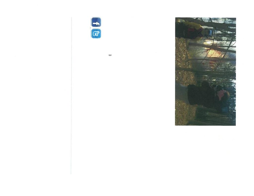
2 4.2 DETROIT PARKS ARC staff met with Friends of Rouge Park and Friends of Eliza Howell Park in Detroit in November, 2010 and June, 2011 to discuss the proposed grow zone projects in both parks. The presentation included preliminary designs for both parks and distribution of a fact sheet on the Transforming the Rouge project. In general, attendees were pleased with the proposed project. This project was stalled for most of the 2011, due to the retirement of two Detroit Parks project managers and difficulty getting a signed agreement with the City of Detroit to allow the ARC to conduct the projects. However, an agreement was signed with the City of Detroit in September, 2011 and the projects proceeded forward. Staff met with the Friends of Rouge Park in November, 2011 to update the group on upcoming activities in Rouge Park and in December, 2011 met with Neighbors Building Brightmoor, a group of residents who live adjacent to Eliza Howell Park. A fact sheet was created for residents in the neighborhoods adjacent to both parks and was posted on the Friends of Rouge Park website and included in the Neighbors Building Brightmoor newsletter which is distributed to 600 residents and is included as Attachment G at the end of this section. ARC staff met with Friends of Eliza Howell Park on January 17, 2012 and Friends of Rouge Park on January 23, 2012 to provide project updates, including that the burns were scheduled for April, A power point presentation was developed for a joint neighborhood meeting for both parks slated for February 15, 2012, so residents could hear the latest details of the controlled burn activities. The power point presentation is included as Attachment H at the end of this section. Because controlled burns are reliant on weather conditions, the ability to give advance notice to interested residents was tricky, and in fact two scheduled burn days were cancelled because of windy weather. However, through the use of signage, s and phone calls, those residents that were interested in observing the burns were contacted. Additionally, Friends of Rouge Park posted the information on a permanent sign at the entrance of Rouge Park. On April 11, 2012, the day of the burns, lawn signs Observers at Rouge Park burn on April 11, 2012 publicizing the burns were installed around the Rouge Park and on surrounding residential streets. About 20 residents, including a school environmental club, and other interested persons observed the burn at Rouge Park and a half dozen residents observed the burn at Eliza Howell Park. Additionally, the media attended the event, as well as the Valley Woods controlled burn. The newspaper articles covering the controlled burns are included as Attachment I at the end of this section. GLRI Final Report, October 25, Transforming the Rouge AOC from Mowed Down to Grown Up

3 4.3 VALLEY WOODS The City of Southfield conducted its own public education campaign, supported by ARC staff. A presentation was made to City Council and is provided at the end of this section as Attachment J. In addition, the City of Southfield generated press releases (see Attachment K at the end of this section), publicized the project on Southfield City Cable 15, met with area businesses, prepared road signage and sent flyers and letters to adjacent condo associations and senior housing. There were no complaints from the public or businesses and on April 6, 2012, a successful burn was implemented at Valley Woods Nature Preserve, allowing for wetland restoration with minimal disturbance of sensitive soils. The Southfield Fire Marshall and City Administration was happy with effort and the event generated positive media interest on prescribed burns as shown in Attachment L included at the end of this section. The City of Southfield also presented the Valley Woods Wetlands Restoration project at the Michigan Water Environment Association Watershed Seminar in December of The presentation is provided at the end of this section as Attachment M. 4.4 LOLA VALLEY Lola Valley Park in Redford Township cuts a narrow green swath through a residential neighborhood along the Upper Branch of the Rouge River and is located in the floodplain and seasonally floods. Before this project, Lola Valley Park was primarily landscaped with turf grass and was used by nearby residents for a variety of activities, including walking, sledding in the winter and disc golf in the summer. A fact sheet was developed for residents in September, 2011 to explain that 8.8 acres of the 60 acre park would be converted to native grasses and flowers in the fall, 2011 or the spring, 2012 as part of this project. The fact sheet is included as Attachment N at the end of this section. Redford Township displayed the fact sheet on its website and mailed the flyers to 189 households surrounding Lola Valley Park. Unfortunately, the site was too wet in the fall, 2011, and most of the spring, 2012, so the site was not seeded until June, Unfortunately, the summer of 2012 was extremely dry and the grow zone failed to establish. The site was re seeded in November Another fact sheet was developed for residents in the Lola Valley Park neighborhood in September, 2012 explaining the status of the project and is included as Attachment O at the end of this section. Lola Valley Park GLRI Final Report, October 25, Transforming the Rouge AOC from Mowed Down to Grown Up


4 Lola Valley Park with adjacent housing 4.5 SIGNAGE A variety of signage was developed for this project: Temporary signage during construction and permanent signage for the Grow Zones project. The sign below was installed at the Valley Woods site during construction. GLRI Final Report, October 25, Transforming the Rouge AOC from Mowed Down to Grown Up


5 Signs were used in and around the Eliza Howell Park and Rouge Park neighborhoods in Detroit on the day of the controlled burns in April, Permanent signage was created for the grow zones at Detroit Parks and Wayne County Parks. Ten signs were installed at Eliza Howell and Rouge Parks in Detroit and 50 signs were installed in Wayne County Parks at the Venoy, Inkster and Lola Valley locations. Below is an example of the permanent sign for Detroit s Rouge Park. GLRI Final Report, October 25, Transforming the Rouge AOC from Mowed Down to Grown Up
6 Sign installation at Detroit Eliza Howell Park on May 30, GLRI Final Report, October 25, Transforming the Rouge AOC from Mowed Down to Grown Up
7 Friends of Eliza Howell Park member with newly installed sign. Volunteers install permanent signage in Rouge Park on Rouge Rescue, July 1, 2013 GLRI Final Report, October 25, Transforming the Rouge AOC from Mowed Down to Grown Up
8 Friends of the Rouge volunteer with newly installed sign. GLRI Final Report, October 25, Transforming the Rouge AOC from Mowed Down to Grown Up
9 Sign Installation at Wayne County Parks Venoy location on June 4 5, 2013 Installed sign at Wayne County Parks Inkster CSO Basin location GLRI Final Report, October 25, Transforming the Rouge AOC from Mowed Down to Grown Up
 ARC (Public Education) Total Project Cost: $648,750 The green")


, Friends of Rouge Park and the City of Detroit.")
10 TRANSFORMING THE ROUGE AREA OF CONCERNN (AOC) FROM MOWED DOWN TO GROWN UP October 2010 December 2012 EPA GLNPO Grant: Required Match: City of Southfield Wayne County FOTR (Erb Foundation) ARC (Public Education) Total Project Cost: $648,750 The green infrastructure projects to be funded by this grant will: $181,250 $30,000 $56,250 $80,000 $15,000 $830,000 Unite the major green corridors along the Rouge River, Create a framework to develop consistent priorities for restoration implementation, and Improve the Rouge River fisheries by creating green areas that will stabilize flow to encourage a healthy macroinvertebrate population. This will be achieved by improving, installing and enhancing riparian buffers, wetlands and upland habitat in the Rouge River Watershed. River Rouge Park (C City of Detroit, Wayne County) In the 1920s, the City of Detroit paid $1.3 million dollars to purchase land from six farmers at the western edge of the city to be used for Rouge Park. Rouge Park is the City of Detroit s largest park at 1,184 acres, making it larger than New York City s Central Park. The Rouge River flows for more than two miles through this park and it encompasses 26,000 feet of the river s Main Branch. This park contains an 18 hole golf course, 14 regulation baseball diamonds, including the Hank Aaron and Aurelio Rodriguez baseball fields, 12 playgrounds, 11 tennis courts and eight miles of bicycle trails, ncluding one used by the Michigan Mountain Biking Association. Additionally, it is home to the large Alex Jefferson Model Airplane Field. The Brennan Pools feature two Olympic sized pools side by side and a smaller pool. The park is home to varied wildlife and includes over 15 acres of native prairie created about 10 years ago. This project will restore approximately five acres of the prairie and adjacent areas to native vegetation grow zones. The project will conduct a prescribed burn and reseeding and planting in spring, This project is being conducted in partnership with Friends of the Rouge (FOTR), Friends of Rouge Park and the City of Detroit. Eliza Howell Park (C City of Detroit, Wayne County) This project will restore approximately 5 acres of mowed turf grass to native vegetation grow zones. This 200 acre park contains the main stem of the Rouge River and connects the green corridor along this branch.


11 Valley Woods Wetland Restoration (Nature Preserve at 10-Mile Road, Southfield, Oakland County) This project will restore 7 acres of wetlands and the capacity of wetlands to store and retain storm water from the park. This 27 acre preserve is bound on the northeast, where the Rouge River enters the preserve by two major roads. The river channel meanders through a relatively intact floodplain forest containing mature sycamore, oak and red ash trees. A variety of other tree species including maple and elm, complete the overstory composition of this significantly large, functioning floodplain forest. The plant communities within this preserve are diverse relative to many of the other park/preserve sites; a large emergent marsh is present in the northern end and a shrub carr wetland is present at the southern end of the preserve. This preserve provides a variety of natural functions, including floodwater retention and storage, wildlife habitat and green space. Lower Rouge and Upper Rouge Parkway (Wayne County) This project will convert approximately 15 acres of managed turf grass to native vegetation grow zones within Wayne County Parks in the Upper and Lower Subwatersheds. The Lower Rouge Parkway is nearly 1200 acres of riparian public lands beginning in the City of Dearborn at the downstream end of the Rouge River and extending to Canton Township at the upstream end. Approximately 15 miles of the Lower Rouge River flows through the Lower Rouge Parkway. Wayne County has identified approximately 20 acres of mowed turf area that could potentially be converted to native plant grow zones. With funding as proposed in this grant submittal a minimum of 5 acres would be converted to grow zone. Lola Valley Park is within the Upper Rouge subwatershed and has approximately 1.5 miles of the Upper Rouge River flowing through the 58 acres of riparian parkland owned by Wayne County. Lola Valley Park is completely within Redford Township and winds through a residential neighborhood. The park is approximately one half mile upstream from the City of Detroit s Eliza Howell Park. Wayne County has identified approximately 12 acres of mowed turf area immediately adjacent to the Upper Rouge River that could potentially be converted to native plant grow zone. With funding as proposed under this grant a minimum of 10 acres would be converted to grow zone. For More Information Contact: Alliance of Rouge Communities Phone: James Ridgway, P.E., Executive Director info@allianceofrougecommunities.com 719 Griswold St., Suite 820, Detroit, Michigan Website:

12 PONTIAC E ORCHARD LAKE WEST BLOOMFIELD TWP. M A I N 1-2 Pebble Franklin BLOOMFIELD TWP. Branch FRANKLIN Telegraph Rd BINGHAM FARMS BLOOMFIELD HILLS Maple Rd Rouge Woodward Ave River BEVERLY HILLS 13 Mile BIRMINGHAM TROY Park Fish Monitoring Location Lower Rouge Parkway Rouge Park Upper Rouge Parkway Rouge River Watershed FARMINGTON HILLS Creek 12 Mile Valley Woods Nature Preserve SOUTHFIELD 11 Mile LATHRUP VILLAGE M A I N 1-2 WP. FARMINGTON Tarabusi Bell Creek Branch Upper Rouge U P P E R R O U G E River US-5 Grand River Ave Lola Valley Park Beech Daly Civic Center DrNorthwestern 9 Mile Hwy Rouge River 8 Mile 7 Mile MN-4 Fenkell Ave Southfield Rd DETROIT M I D D L E 1 L O W E R 1 U P P E R M I D D L E 3 L O W E R 2 M A I N 3-4 LIVONIA US-3 Eliza Howell Park P. River Tonquish Creek M I D D L E 3 WESTLAND GARDEN CITY Middle Rouge Middlebelt Rd Perrin Joy Rd Drain REDFORD Rouge Park River Warren Rd DEARBORN HEIGHTS Ford Rd L O W E R 2 Plymouth Rd Evergreen Rd LO-4 M A I N 3-4 Michigan Ave I-94 P. Wayne Rd Lower WAYNE Venoy Rd Rouge Merriman Rd River Rouge WatershedROMULUS Project & Fish Monitoring Locations INKSTER Telegraph Rd TAYLOR DEARBORN ALLEN PARK ALLEN PARK MELVINDALE LINCOLN PARK Rouge River RIVER ROUGE ECORSE Detroit River Miles


13 A lliance of R ouge C ommunities The Alliance of Rouge Communities, or ARC, is a 501(c)(3) non-profit organization consisting of 35 local municipalities, three counties, educational institutions and stewardship groups working together to improve the Rouge River. Founded in 2005, the ARC is funded by membership dues from local governments and supported by grants. The ARC and its partners work cooperatively to meet water quality requirements mandated by the state s storm water permit and to restore beneficial uses, such as canoeing, fishing and other recreational activities, to the Rouge River. That means better water quality for less cost to its members! Membership has its Benefits! The ARC helps its members support a variety of activities that benefit the Rouge River and meet the State of Michigan s permit requirements. Some of the benefits to members include: Access to grant funding Permit compliance support Simplified reporting Planning tools Native planting programs Public education Questions? Contact us at info@allianceofrougecommunities.com. Rain barrel sales Workshops and presentations ARC Members: Auburn Hills Beverly Hills Bingham Farms Birmingham Bloomfield Hills Bloomfield Twp. Canton Twp. Commerce Twp. Dearborn Dearborn Heights Farmington Farmington Hills Franklin Garden City Henry Ford Community College Lathrup Village Livonia Melvindale Northville Northville Twp. Novi Oak Park Oakland County Orchard Lake Plymouth Plymouth Twp. Pontiac Redford Twp. Rochester Hills Romulus Southfield Troy University of Michigan- Dearborn Van Buren Twp. Walled Lake Washtenaw County Wayne Wayne County Wayne County Airport Authority Westland Wixom Cooperating Partners: Cranbrook Institute of Science Friends of the Rouge Rouge River Advisory Council Southeastern Oakland County Water Authority Wayne State University For more information go to: or info@allianceofrougecommunities.com
 to restore the")
 From Mowed Down to Grown Up, $830,000 The three green")


.")
14 What the ARC is Doing! The ARC continues to leverage its resources by conducting these projects under the Great Lakes Restoration Initiative (GLRI) to restore the river. EPA Great Lakes National Program Office - Transforming the Rouge Area of Concern (AOC) From Mowed Down to Grown Up, $830,000 The three green infrastructure projects to be funded by this grant are: Southfield s Valley Woods Wetland: This project is restoring seven acres of wetlands which will store and retain storm water. Wayne County s Lower Rouge Parkway and Lola Valley Park: This project has converted 15 acres of managed turf grass to native vegetation grow zones. Detroit s Eliza Howell Park and River Rouge Park: A controlled burn of ten acres of mowed turf grass and prairie was conducted in both parks and they were seeded with native plants. Photo courtesy of Friends of the Rouge EPA Great Lakes National Program Office - Danvers Pond Dam Removal and Stream Restoration, $499,254 The Danvers Pond project, located in Farmington Hills, will: Remove the existing dam to create a naturalized water course. Stabilize erosion using bioengineering and naturalizing techniques. Create and improve habitat and increase water quality in the tributary to the Rouge River. National Oceanic and Atmospheric Administration (NOAA) Great Lakes Habitat Improvement Project - Wayne Road Dam Removal and Habitat Improvement, $1,033,536 The Wayne Road Dam project, located in the City of Wayne, will: Remove the existing low head dam (Wayne Road Dam). Reconnect approximately 22 miles of the Lower Rouge River to the Great Lakes system and the Detroit River. Create related ecosystem restoration improvements. Before After Before After U.S. Forest Service - Emerald Ash Borer (EAB) Forest Habitat Restoration, $374,980 The EAB Project will: Restore the urban tree canopy that was destroyed by the Emerald Ash Borer infestation in the Rouge River Watershed. Plant 2,400 trees in 12 communities and Wayne County. Participating ARC members are: Bingham Farms, Bloomfield Hills, Bloomfield Township, Canton Township, Lathrup Village, Livonia, Plymouth Township, Redford Township, Southfield, Walled Lake, Wayne, Westland and Wayne County. The Alliance of Rouge Communities - Working Cooperatively to Improve the River!
 and local partners to improve the local waterways by restoring fish and wildlife habitat and local fisheries.")
: Loss of Fish and Wildlife Habitat Degradation of Fish and Wildlife Populations Degradation of Benthos These projects are funded under the Great Lakes Restoration")
 as well as National Oceanic & Atmospheric Administration (NOAA), and represent an exciting opportunity for the region,")


15 Southern Michigan Projects Contribute to Great Lakes Restoration background These projects illustrate a variety of activities being conducted by Environmental Consulting & Technology, Inc. (ECT) and local partners to improve the local waterways by restoring fish and wildlife habitat and local fisheries. All of these projects are helping meet the goals of the Great Lakes Restoration Initiative Action Plan, and many constitute work toward restoring the following Beneficial Use Impairments (BUIs) to Michigan s Areas of Concern (AOCs): Loss of Fish and Wildlife Habitat Degradation of Fish and Wildlife Populations Degradation of Benthos These projects are funded under the Great Lakes Restoration Initiative (GLRI) by U.S. Environmental Protection Agency s Great Lakes National Program Office (GLNPO) as well as National Oceanic & Atmospheric Administration (NOAA), and represent an exciting opportunity for the region, from the standpoint of ecological restoration and creating and retaining jobs. In partnership with federal and state regulatory agencies, local and county governments, non-profit organizations, stewardship groups and other stakeholders, ECT is overseeing the following projects: Detroit River AOC Belle Isle South Fishing Pier Habitat Enhancement U.S. Steel Site Habitat Restoration Blue Heron Lagoon Habitat Restoration ProjectS funded by Watervliet Dams Danvers Pond Dam Wayne Rd. Dam Transforming rming the Rouge Belle Isle South Pier, U. S. Steel Site and Blue Heron Lagoon Rouge River AOC Danvers Pond Dam Removal and Stream Restoration Transforming the Rouge AOC from Mowed Down to Grown Up Wayne Road Dam Removal and Habitat Restoration Belle isle south fishing pier and blue heron lagoon habitat enhancement and restoration Remedial actions to clean up the Detroit River over the past 30 years have led to improved conditions for reproduction and early life history survival by a large number of native fish species. The recent Belle Isle Sturgeon Spawning Reef Restoration has resulted in successful reproduction by 16 native fish species in the vicinity. However, the ability of fish larvae to find nursery habitat is critical for their survival and there is no suitable coastal wetland nursery habitat in the immediate area which is critical to the survival of fish spawned at enhanced habitats. Friends of the Detroit River received Great Lakes Restoration Initiative funding to improve spawning habitat at Belle Isle in Detroit, Michigan. ECT is leading a team to complete two projects that will provide the necessary spawning habitat and contribute to the removal of the Loss of Fish and Wildlife Habitat BUI. The Belle Isle South Fishing Pier habitat enhancement project will construct 2.5 acres of coastal wetlands and deep water habitat along Belle Isle in the vicinity of the U.S. Coast Guard South Fishing Pier, which is immediately downstream from the Sturgeon Spawning Reef. The proximity of associated spawning to the newly created nursery habitats will increase the survival of young fish and support adult fish in what is becoming a world class fishery. The coastal wetland will also benefit bird, reptile and amphibian wildlife on Belle Isle, the only park of its kind in the U.S. waters of the Detroit River. Highlights: Over 97 acres of wetlands and nursery habitat enhancements; 2.2 miles of open free flowing canals that will enhance biological habitat; Increased abundance of target fish and wildlife species, and Changes in recreational angling use. Partners: Friends of the Detroit River, EPA-GLNPO, Detroit River AOC, JJR, Inc. u.s. steel site habitat restoration The U.S. Steel site was identified as a key restoration priority for advancing restoration and contributing to the delisting of the Detroit River AOC. ECT is leading an interdisciplinary team to implement a key element in the habitat restoration plan for the Detroit River AOC located in southeast Michigan. The project, funded through the Great Lakes Restoration Initiative, will transform an industrial riverfront site into viable shoreline habitat for fish, amphibians and waterfowl as well as upland habitat for reptiles, birds, and mammals. The project will restore 1,100 feet of shoreline, 1.7 acres of emergent wetlands, 750 feet of rock shoal (barrier island), and create over an acre of fish spawning area in the Detroit River and an embayment for turtle and fish habitat. Additionally, approximately 4.6 acres of upland habitat will be restored adjacent to the shoreline through removal of invasive species and replanting with native trees, shrubs, and other types of native vegetation. Highlights: 1,000 linear feet of river shoreline restoration; 1.7 acres of wetlands habitat/nursery; 750 linear feet of shoal restoration; Partners: Friends of the Detroit River, EPA-GLNPO, Detroit River AOC, U. S. Steel 1.0 acres of aquatic habitat/spawning restoration; 4.6 acres of upland restoration with tall grass; Increased abundance of target species, and Changes in recreational angling use. watervliet dams removal The Berrien County Brownfield Redevelopment Authority is the current owner of two concrete dams formerly owned by a now-defunct paper company on the Paw Paw River in the City of Watervliet, Michigan. The dams impounded the Paw Paw River to provide processing water. The dams block fish movement between upstream and downstream reaches, block potadromous fish spawning migrations, and alter the flow of water, sediment, nutrients, and organic matter. The two dams act in concert to redirect flow from a historical channel of the Paw Paw River through a single north channel. As a result, habitat in the historical channel has been significantly impacted by sedimentation, increased water temperatures, and insufficient flow velocity and depth. Berrien County received grants from the Michigan Department of Natural Resources (MDNR), Fisheries Division; U.S. Fish and Wildlife Service; and National Oceanic and Atmospheric Administration (NOAA) to remove the dams. ECT provided the initial dam removal design and is providing permitting, construction oversight and grant management to remove the dams and create a naturalized channel to restore the habitat. Currently, construction is 40% complete. The spillway dam has been removed and restored along with 200 feet of eroded streambank downstream of the spillway dam. Construction is expected to be complete by December, Post-construction monitoring will occur in the spring of Highlights: More than 100 miles of river will be accessible to all Great Lakes potadromous and resident fish species; Restore 1.7 miles of stream including an abandoned channel; Improve floodplain connectivity, flood conveyance and storage, and Eliminate a public safety hazard and economic liability. Partners: Berrien County Brownfield Redevelopment Authority, NOAA, MDNR Fisheries Division, U. S. Fish and Wildlife Service, Southwest Michigan Planning Commission, The Nature Conservancy, City of Watervliet environmental consulting & Technology, inc. Over the last decade, ECT has been at the forefront of delisting activities in nearly half of the Great Lakes AOCs. ECT has worked in AOCs located in six of eight Great Lakes states on topics related to the development of delisting targets as well as pathways to delisting the AOCs. These projects have involved bringing together the major stakeholders, such as the technical community, government and the general public to reach consensus on addressing BUI issues within an AOC. We specialize in facilitating discussions focused on the application and interpretation of regulatory standards and guidance. Along with its close working relationship with the basin s stakeholders, over the last five years, ECT has worked as a key member of the GLNPO s Mission Support Contract Consulting Team. As of 2011, ECT is also on the winning team for the GLNPO s Great Lakes Legacy Act - Construction Services Contract. These contract vehicles allow ECT s clients additional flexibility in accomplishing the goals of the GLRI-Action Plan. ECT has had great success developing restoration blueprints to restore fish/wildlife habitat/population related BUIs and developing methods to prioritize hundreds of potential implementation projects to improve water quality in the Great Lakes. ECT has also been successful in assisting its clients secure funding to complete field implementation projects. Since 1999, ECT has secured over $66 million through a variety of grants for its clients and partners. Natural Resources Experience Defining the final benchmarks to delist the AOCs by establishing delisting targets; Managing multi-million dollar, multi-year large-scale monitoring projects; Designing and/or constructing large and small-scale sustainable resource projects to improve a watershed s water quality and ecology ECT s staff includes professionals providing services and expertise in: natural resources planning and management; developing strategies to restore and protect natural resources; stream and lake restoration; lakewide management plan development; TMDL development and implementation; point and nonpoint source control selection; public education and involvement; monitoring and design; illicit discharge investigation; and numerical modeling in limnological, marine, lacustrine, estuarine, fluvial, and hydro-geological environments. For More Information Contact Sanjiv Sinha, Ph.D., P.E. ssinha@ectinc.com John O Meara, P.E. jomeara@ectinc.com 2200 Commonwealth Blvd., Suite 300, Ann Arbor, Michigan 48105, danvers pond dam removal and stream restoration Danvers Pond Dam is located in Farmington Hills, Michigan, on Pebble Creek, a tributary of the Main Rouge River. The pond has a history of sediment accumulation contributing to the degradation of the creek and the dam has prevented fish passage. The primary goal of the project is removal of the dam, improvement of the habitat and water quality of Pebble Creek and its receiving waters. This will allow the Rouge River AOC to take steps towards delisting the Loss of Fish and Wildlife Habitat BUI. The Alliance of Rouge Communities received Great Lakes Restoration Initiative funding to address the sediment accumulation by removing the Danvers Pond Dam. ECT designed, permitted and is providing construction oversight to remove the existing dam, create a naturalized water course and restore the former impoundment bottom lands as an open area connected to the stream to dissipate and store flood flows. The stream bank will be stabilized by using bioengineering and naturalizing techniques to prevent erosion. Habitat will be created to improve water quality in the creek. The proposed project fulfills local community and subwatershed goals by improving the quality of the ecosystem and restoring approximately two acres of habitat for fish and terrestrial wildlife, reducing sedimentation within the creek and re-vegetating 300 linear feet of naturalized stream channel. The dam removal will allow unencumbered fish passage for the 6.5 mile Pebble Creek and create a natural buffer of native vegetation between private property and the stream corridor. Highlights: Two acres of woodlands and wetlands habitat will be restored and preserved; 300 linear feet of channel will be enhanced, and 6.5 miles of stream will be opened up for fish passage. Partners: Alliance of Rouge Communities, EPA-GLNPO, City of Farmington Hills, Friends of the Rouge transforming the rouge AOC from mowed down to grown-up The Rouge River AOC suffers from extreme flow variation and volume which has impacted habitat and conditions for benthic macroinvertebrates, as well as fish and wildlife populations. The Alliance of Rouge Communities received Great Lakes Restoration Initiative funding to increase green infrastructure in the Rouge River AOC by creating 25 acres of native grow zones and restoring seven acres of wetlands within the watershed, along the Main, Upper and Lower branches of the Rouge River in Michgan. This project addresses the Degradation of Benthos and Loss of Fish and Wildlife Habitat BUIs. The foundation of these efforts has been to create or restore habitat with grow zones, wetland restoration, invasive species management, and preservation of the flood plain. This project will significantly advance efforts to restore and better maintain the riparian corridor that encompasses the main branches of the Rouge River Watershed. The project will also support a comprehensive evaluation of the benthos communities and data in partnership with Wayne County and Friends of the Rouge. Highlights: Enhance and convert approximately 25 acres of turf grass to native vegetation; Restore seven acres of wetlands; Remove approximately 11,250 cubic feet of stormwater volume from the Rouge River; Increase native vegetation from 0% to 75% in the implementation area, and Increase pollutant removal efficiencies within the watershed. Partners: Alliance of Rouge Communities, EPA-GLNPO, Wayne County, City of Southfield, Erb Foundation, Friends of the Rouge, City of Detroit, Rouge River AOC Wayne road dam removal The MDNR 1998 Fisheries Assessment identified the Wayne Road Dam in the City of Wayne, Michigan, as a major impediment to restoring fish and wildlife habitat in the Rouge River s Lower Branch. The Alliance of Rouge Communities received a grant from the NOAA to implement the Wayne Road Dam Removal and Habitat Improvement Project. The project will restore fish passage for migratory species such as salmon, walleye, northern pike and small mouth bass, while stabilizing and improving shoreline habitat. The project will also reconnect 22 miles of the Lower Rouge River with the Great Lakes for the first time in over a century. The Lower Rouge River flows through Dearborn, Dearborn Heights, Inkster, Wayne, Canton Township and Superior Township. This project will complement other projects conducted by neighboring communities, such as the Lower Rouge Recreational Trail in Canton Township and the creation of 15 acres of native plantings in Wayne County Parks in Inkster and Wayne. This project address the following BUIs: Degradation of Fish and Wildlife Populations, Degradation of Benthos and Loss of Fish and Wildlife Habitat. ECT provided the initial dam removal design and is providing permitting, construction oversight and grant management to remove the dam and create a naturalized channel to restore the habitat. Highlights: Hydrologically reconnect 22 miles of the Lower Rouge River to the Great Lakes; New and enhanced outdoor recreational activities such as fishing, canoeing and park usage, and Fish passage for multiple valued species, such as trout, northern pike and walleye. Partners: Alliance of Rouge Communities, NOAA, Wayne County, City of Wayne, Friends of the Rouge

.")

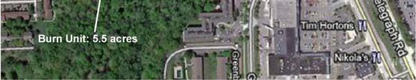
16 Natural Area Restoration ATTACHMENT G River Rouge Park and Eliza Howell Park, Detroit Designated areas in River Rouge Park and Eliza Howell Park will be restored this spring using a method called controlled burns. The designated areas are five acres in River Rouge Park just north of Tireman and east of Parkland and five acres in the north end of Eliza Howell Park, south of Fenkell and adjacent to an existing nature trail (areas are outlined in yellow to the right). Areas targeted in Detroit Parks: Controlled burns have been used at natural areas at Detroit s Belle Isle, in the City of Ann Arbor and throughout Michigan, including natural areas in White Lake Township and Berrien, Mason, Oceola and Van Buren counties. Both River Rouge Park and Eliza Howell Park were seeded with native plants in 2000, but some portions have become a monoculture that is overtaken by one native species or have been degraded by an overgrowth of non-native plants. In order to restore these natural park areas, a controlled burn (or prescribed burn) will be conducted in both parks in March or April, To enhance the new growth after the burn, the areas will be re-seeded with native plants. River Rouge Park - north of Tireman, east of Parkland This project is being federally funded through the Great Lakes Restoration Initiative (GLRI) and is being conducted by the Alliance of Rouge Communities (ARC) in partnership with the City of Detroit. Why Use Controlled Burns? A controlled burn rejuvenates natural areas such as prairies, wetlands and woodlands. Non-native plants, such as phragmites, Canadian thistle, buckthorn and garlic mustard, can compete with natural areas, turning them into thickets of shrubs or weeds with little to no diversity. A controlled burn rids the native area of invasive, non-native plants and allows the native plants to thrive. It promotes diversity, enriches the soil and lengthens the growing season. The burns will be conducted by well-equipped, fully trained staff and volunteers. The burns at both parks are conducted in cooperation with the Detroit Recreation Department and must be approved by the Detroit Fire Department. Questions? Learn More about the Project! In the Brightmoor Neighborhood call Riet Schumack, Neighbors Building Brightmoor, at (313) , 8 a.m. - 5 p.m. Friends of Rouge Park will sponsor an informational meeting about both projects: In the Rouge Park Neighborhood call Friends of Rouge Park, at (313) 799-FORP (3677) Wednesday, February 15, 2012, 6 p.m. - 7 p.m. Don Bosco Center, 9357 Westwood (at W. Chicago) Or the ARC at info@allianceofrougecommunities.com or call (734) Eliza Howell Park - north end of the park adjacent to the nature trail


 The ARC is a 501(c)(3) non-profit organization consisting of 35 local municipalities, three counties, educational institutions and stewardship groups")


17 Natural Area Restoration River Rouge Park and Eliza Howell Park, Detroit When Will the Burns Happen? The burns are scheduled for March or April 2012, but are dependent on weather conditions. In order to conduct a controlled burn, weather conditions temperature, wind direction and strength, humidity, barometric pressure and ground moisture all must be within the range specified in the burn plan before the burning can proceed. In urban areas, a controlled burn can last from 15 minutes to 45 minutes of actual fire time. Before burn Burn in progress After burn How Will I Know? If you would like to be notified the day before the burn, please send your phone number or address to info@allianceofrougecommunities.com with Detroit Parks as the subject or leave your phone number on the ARC information line at (734) This information will only be used to notify you of these project activities. There will be periodic updates through your local neighborhood newsletters and on the ARC website at About the Alliance of Rouge Communities (ARC) The ARC is a 501(c)(3) non-profit organization consisting of 35 local municipalities, three counties, educational institutions and stewardship groups working together to improve the Rouge River. Founded in 2005, the ARC and its partners work cooperatively to meet water quality requirements mandated by the state s storm water permit and to restore beneficial uses, such as canoeing, fishing and other recreational activities, to the Rouge River. The ARC is funded by membership dues from local governments and supported by grants. That means better water quality for less cost to its members! Funding for This Project Transforming the Rouge Area of Concern from Mowed Down to Grown Up is a federally-funded project conducted by the ARC to improve the Rouge River by restoring or creating natural areas in Valley Woods Nature Preserve in Southfield, Eliza Howell and River Rouge parks in Detroit and Wayne County parks in Redford Township, Inkster and Westland. Partners in this effort include Wayne County, Friends of the Rouge, the City of Detroit, the City of Southfield, Friends of Rouge Park, Friends of Eliza Howell Park and the Fred A. and Barbara M. Erb Family Foundation. The Great Lakes Restoration Initiative (GLRI) is a federal effort to restore the Great Lakes by cleaning up toxics and Areas of Concern; combating invasive species; promoting nearshore health by protecting watersheds from polluted run-off; restoring wetlands and other habitats, and working with partners on outreach. In Partnership with: The Alliance of Rouge Communities - Working Cooperatively to Improve the River! For more information go to: (US EPA grant #GL-00E )


18 7/16/2013 Natural Area Restoration River Rouge Park and Eliza Howell Park Use Of Prescribed Burns In Habitat Restoration Project Information River Rouge Park Eliza Howell Park Restore ten acres in Eliza Howell and River Rouge Park Overtaken by one native species or degraded by an overgrowth of non-native plants Eliza Howell Park south of Fenkell at north end of the park adjacent to the nature trail River Rouge Park north of Tireman, east of Parkland Funded through the Great Lakes Restoration Initiative 1
19 7/16/2013 Project Information Phragmites australis Reed Canary Grass Monoculture Introduction Purpose & Need for Prescribed Burns Prescribed Burn Planning Prescribed Burn Implementation Project Information 2

20 7/16/2013 Purpose & Need for Prescribed Burns At this season of the year the country was beautiful beyond description, the plains were covered at intervals as far as the eye could reach with wide spreading forest trees which gave it the appearance of an immense park, and the earth was covered with a rich carpet of beautifully variegated wild flowers and grapes -J.W. Wing ref Scio Twp (near Dexter) June, 1834 Purpose & Need for Prescribed Burns The singular and interesting appearance of the country, in its alternating ggroves and fields So far as my observations and inquiries have extended they go to the support of the hypothesis that the fire annually communicated by the Indians for the purpose of hunting has produced the present prairies, plains and openings that diversify the whole face of the country. -An 1829 letter from Ann Arbor by a traveler from Canada (Beakes,1906) Maintain Ecosystem Diversity 3


21 7/16/2013 Purpose & Need for Prescribed Burns Control Invasive Species Reed Canary Grass Phragmites australis Purpose & Need for Prescribed Burns Restore Native Plant Communities 4
22 7/16/2013 Planning a Prescribed Burn Determine goals Identify the burn unit Create a burn plan Secure your permits Work with neighbors and manage the smoke Identify crew and equipment Prep the site Planning a Prescribed Burn Determining Goals 5
23 7/16/2013 Planning a Prescribed Burn Identify the Burn Unit: Based on habitat and natural breaks Planning a Prescribed Burn Changes in fuel type make excellent burn lines or breaks 6
24 7/16/2013 Planning a Prescribed Burn Create a Burn Plan: Provides ownership and emergency contact information Outlines goals of prescribed burn Describes physical characteristics of site Identifies neighbors and potential smoke concerns Establishes weather parameters for burn Lists crew and equipment needs Provides emergency (contingency) planning information Incorporates map of unit and surrounding Planning a Prescribed Burn 7
25 7/16/2013 Planning a Prescribed Burn Discuss Burn Plan with Local Fire Marshal or designated local fire authority Obtain, complete and submit Burn Permit Application for approval. Planning a Prescribed Burn Smoke Management: Requires understanding of how wind will effect smoke 8


26 7/16/2013 Planning a Prescribed Burn Crew and Equipment Size of crew and type of equipment are determined prior to implementing prescribed burn Planning a Prescribed Burn Site Preparation: Prior to, and during burning, we ensure that the site is properly prepared for example: Removing bird boxes Wetting around fencing, turtle enclosures, hibernacula, nests, and other obstacles. 9
27 7/16/2013 Prescribed Burn Implementation Backfire or Back burn: A backfire is set at the downwind edge of the burn unit and is perpendicular to the wind. Prescribed Burn Implementation Head fire: A head fire is set at the upwind edge of the burn unit and is pushed by the wind. 10
28 7/16/2013 Project Information What to Expect? Burns scheduled dfor March or April 2012 and will be weather dependent Notifications will be within 24 hours of burn Actual fire time will be from 1-1 1/2 hours Smell and color of smoke will be similar to burned leaves Project Information If you would like to be notified the day before the burn, please: send your phone number or address to with Detroit Parks as the subject Call the ARC info line at and leave your phone number Project updates will be: On the ARC Website at In neighborhood newsletters 11
29
30
31
32
33


34 7/16/2013 City of Southfield Valley Woods Project Use Of Prescribed Burns In Habitat Restoration Project Information Valley Woods Nature Preserve along the Rouge River Contains mature floodplain forests Project will restore 7 acres of degraded wetlands Funded through the Great Lakes Restoration Initiative 1
35 7/16/2013 Introduction Purpose & Need for Prescribed Burns Prescribed Burn Planning Prescribed Burn Implementation Project Information Purpose & Need for Prescribed Burns At this season of the year the country was beautiful beyond description, the plains were covered at intervals as far as the eye could reach with wide spreading forest trees which gave it the appearance of an immense park, and the earth was covered with a rich carpet of beautifully variegated wild flowers and grapes -J.W. Wing ref Scio Twp (near Dexter) June,
36 7/16/2013 Purpose & Need for Prescribed Burns The singular and interesting appearance of the country, in its alternating ggroves and fields So far as my observations and inquiries have extended they go to the support of the hypothesis that the fire annually communicated by the Indians for the purpose of hunting has produced the present prairies, plains and openings that diversify the whole face of the country. -An 1829 letter from Ann Arbor by a traveler from Canada (Beakes,1906) Maintain Ecosystem Diversity Purpose & Need for Prescribed Burns Control Invasive Species Reed Canary Grass Phragmites australis 3

37 7/16/2013 Purpose & Need for Prescribed Burns Restore Native Plant Communities Planning a Prescribed Burn Determine goals Identify the burn unit Create a burn plan Secure your permits Work with neighbors and manage the smoke Identify crew and equipment Prep the site 4


38 7/16/2013 Planning a Prescribed Burn Determining Goals Planning a Prescribed Burn Identify the Burn Unit: Based on habitat and natural breaks 5

 planning information Incorporates map of unit and")
39 7/16/2013 Planning a Prescribed Burn Changes in fuel type make excellent burn lines or breaks Planning a Prescribed Burn Create a Burn Plan: Provides ownership and emergency contact information Outlines goals of prescribed burn Describes physical characteristics of site Identifies neighbors and potential smoke concerns Establishes weather parameters for burn Lists crew and equipment needs Provides emergency (contingency) planning information Incorporates map of unit and surrounding 6


40 7/16/2013 Planning a Prescribed Burn Planning a Prescribed Burn Discuss Burn Plan with Local Fire Marshal or designated local fire authority Obtain, complete and submit Burn Permit Application for approval. 7


41 7/16/2013 Planning a Prescribed Burn Smoke Management: Requires understanding of how wind will effect smoke Planning a Prescribed Burn Crew and Equipment Size of crew and type of equipment are determined prior to implementing prescribed burn 8


42 7/16/2013 Prescribed Burn Implementation Backfire or Back burn: A backfire is set at the downwind edge of the burn unit and is perpendicular to the wind. Prescribed Burn Implementation Head fire: A head fire is set at the upwind edge of the burn unit and is pushed by the wind. 9


43 7/16/2013 Project Information Phragmites australis Reed Canary Grass Monoculture 10

44 7/16/2013 Project Information What to Expect? Burns scheduled dfor March or April 2012 and will be weather dependent Notifications will be within 24 hours of burn Actual fire time will be from 1-1 1/2 hours Smell and color of smoke will be similar to burned leaves 11
 672-4096 (cell) FOR IMMEDIATE RELEASE Controlled Burn planned at Valley Woods Nature Preserve April 6 (SOUTHFIELD, Mich.")
45 Department: Fire Department Phone: (248) Fax: (248) News Release Date: April 5, 2012 Subject: Controlled burn at Valley Woods Nature Preserve Prepared by: Michael Manion, Community Relations Manager Contact: Jim Dundas, Fire Marshall (248) (cell) FOR IMMEDIATE RELEASE Controlled Burn planned at Valley Woods Nature Preserve April 6 (SOUTHFIELD, Mich.) The city of Southfield Fire and Parks & Recreation Departments will conduct a controlled burn at the Valley Woods Nature Preserve (located west of Telegraph, south of Franklin) on Friday, April 6 from approximately 10-11:30 a.m. to restore and re-seed the area with native plants. Area residents can expect to see and smell smoke in the vicinity. The burns will be conducted by wellequipped, fully trained staff. The burn will be conducted in cooperation with the Southfield Parks & Recreation and Public Services Departments and under permit from the Southfield Fire Department. For more information, contact Southfield Fire Marshall Jim Dundas at (248) or P&R Landscape Architect Merrie Carlock at (248) ### Evergreen Rd. P.O. Box 2055 Southfield, Michigan


46

47


48


49


50

51


52 Merrie Carlock, LLA / Landscape Architect Southfield Department of Parks & Recreation Brandy Siedlaczek, CSM / Storm Water Manger Southfield Department of Public Works John O Meara, PE / Principal Engineer Environmental Consulting & Technology Community Background Urbanization in Southeast Michigan SEMCOG 1

53 Community Background An urbanized 1 st tier community bordering Detroit 26 square miles Population of 78,000 Daytime population of 175,000 96% developed land Little land left for open space The Rouge River Watershed The Rouge River Watershed is an Area of Concern in the Great Lakes region Watershed: 467 square miles 3 counties 48 municipalities 1.5 million people 2


54 Features of the Rouge Green Corridor Many areas of high floristic value Highest diversity of fish species in the Rouge River watershed Sensitive River Bugs macro-invertebrates Five kinds of turtles, two kinds of snakes, eight species of frogs, seventeen species of mammals and the largest and most diverse population of freshwater mussels within the entire watershed 3


55 The was undertaken as a result of recommendations of the Rouge Green Corridor Urban Habitat Conservation & Stewardship Project funded through the National Fish & Wildlife Foundation Habitat Restoration Goals The Rouge Green Corridor Urban Habitat Conservation & Stewardship Project identified 12 habitat restoration goals within the corridor. Each goal is associated with target habitat metrics used to measure progress and achievement: 1. Connect river and floodplain 2. Maintain or expand riparian buffer 3. Educate & involve residents in stewardship 4. Expand survey and monitoring efforts 5. Improve in-stream aquatic habitat 6. Improve water quality to meet set criteria 7. Manage invasive species 8. Manage woody debris 9. Promote the RGC as a recreational asset 10. Reduce erosion and sedimentation 11. Reduce flashiness 12. Restore wetlands 4


56 Valley Woods Nature Preserve Southfield nature preserve within the Rouge Green Corridor 128 acres along the Main Branch of the Rouge River Between Ten and Twelve Mile Roads Bisected by I-696, Telegraph & Northwestern Highways Restoration Site Management plan made recommendations for all segments of the river through three communities Valley Woods site, west of Telegraph, south of Franklin and Civic Center Drive, was identified as potential site for a large scale restoration project 5


57 River Segment Aquatic habitat in the river at this location is some of the best within the corridor. Undisturbed riparian forest Wildlife include fox, deer, mink, coyote and small mammals Birds include belted kingfisher Wetlands One of largest floodplain wetlands in the corridor. Old ditches drained the wetlands, increasing flood flows to the river and impairing function of the wetland to retain floodwaters, and filter out sediments and pollutants before they enter the river system. Monoculture of invasive species of phragmites and reed canary grass diminish function of wetlands. Phragmites Reed Canary Grass Monoculture 6

 for Transforming the Rouge Area of Concern to fund 4 projects in the Rouge")
58 Management Recommendations Restore capacity of wetlands to store and detain storm water by filling existing ditches and rock armor inlets into wetlands. Manage invasive phragmites and reed canary grass and replace with native wetland species. Allow spring flood waters to submerge the wetlands to discourage re-establishment t of the invasive plants and reduce downstream flashiness and erosion. Great Lakes Restoration Initiative Alliance of Rouge Communities received a Great Lakes Restoration Initiative Grant (GLRI) for Transforming the Rouge Area of Concern to fund 4 projects in the Rouge River Watershed : /Southfield Rouge River Park / Detroit Restore 5 acre parcel/controlled burn Eliza Howell Park / Detroit Convert 5 acres of turf grass to native grow zones Lower Rouge and Upper Rouge Parkway This project will convert 15 acres of managed turf grass to native grow zones within Wayne County Parks Total Project Cost $830,000 7


59 Transforming the Rouge Area of Concern Southfield Portion $320,000 Management plan Herbicide treatments Excavation of invasives Prescribed Burn Planting / seeding Hydrologic modifications Environmental Permitting Michigan Department of Environmental Quality Permit required for herbicide treatment and working in the floodplain l wetlands. DEQ representative toured site 8


60 Herbicide Treatment Phragmites and Reed Canary Grass were treated with herbicide to begin the control program. Multiple treatments with a specialized consultant 9


61 Excavation Phragmites next to pond was excavated Must be excavated to a depth of four feet Water depth prevents regeneration of plant Excavation Expanded a water feature both for habitat and bli i t t public interest. 10

 Fire Control Access: Denso Dr/Ensley Dr at North Ownership: City of Southfield Prescribed Burn Manager: ECT, Inc.")


 672 4096 Merrie Carlock Southfield Parks & Recreation, cell (248) 933 8737 Brandy Siedlaczek")
62 Steps for a Prescribed Burn 1. Determine goals Control invasive i species Restore native habitats for plants and animals Promote habitat diversity 2. Identify the area to be burned 3. Create a burn plan 4. Secure approvals & permits 5. Communicate to the public 6. Site preparation 7. Implementation Valley Woods Burn Plan Page 1 of 5 Burn Plan Site: Valley Woods On Site Cell Phone (734) Location: Oakland Co., City of Southfield T.1N R.10E Section 20 (SE) Fire Control Access: Denso Dr/Ensley Dr at North Ownership: City of Southfield Prescribed Burn Manager: ECT, Inc. Prescribed Burn Leader: David Mindell (PlantWise, LLC) Fire Jurisdiction: City of Southfield Fire Department!!!!!!!!!!!!!!!!!!!!!!!!!!!!!!!!!!!!!!!!!!!!!!!!!!!!!! Emergency assistance: 911 Southfield Fire Department, Fire Marshal Jim Dundas, cell Site Description: Reed canary grass dominated floodplain wetland surrounded on north and west by oak upland, and on south and east by Rouge River. Total acreage: 5 acres Slope & Aspect: Flat. Fuels surround unit: Oak woodlands surround site at north and west sides with 20% slopes; Rouge River with floodplain vegetation to east and south. Burn Objective: Eliminate invasive vegetation to allow re growth of native wetland plant species. Fire Sensitive Animal Species of Concern: Scientific name Common name State Rank None Known Window of opportunity to burn: Spring, late February through mid May, with a preference to burn on weekends early during this burn window. Before burning notify: Jim Dundas Southfield Fire Department, Fire Marshal cell (248) Merrie Carlock Southfield Parks & Recreation, cell (248) Brandy Siedlaczek Southfield Public Works, cell (734) Gary Crawford ECT (734) , cell (248) Develop the Burn Plan: Outlines goals of prescribed burn Defines area to be burned based on habitat & natural breaks Incorporates map of unit and surrounding affected area Provides ownership and emergency contact information Describes physical characteristics Identifies neighbors and potential issues Establishes weather parameters Identifies crews and equipment Defines smoke management plans Provides emergency (contingency) planning information 11


63 Burn Location Define burn perimeter 5 acres Multiple land use Commercial Apartments Corporate Senior Housing Highways Natural area Fire Marshall Approval Meet with the Fire Marshall Discuss concept No history of any type of burn permit Provide information on prescribed burns Show examples in other communities 12


64 City Approvals Administrative Approval Council Presentation Prescribed burn consultant Fire Marshall Education about burns Address their concerns Public outreach & notification plan Public Outreach Council Presentation Press releases Southfield City Cable 15 News coverage Road signage Met with area businesses Flyers / letters to local condos and senior housing 13


65 Conditions Seasonal requirements Spring is a good time City requested weekend Lower traffic issues Weather requirements Must wait for perfect conditions Morning best Temperature Humidity Wind speed & direction Precipitation Unable to make final notifications until 24 hours before the burn Crew & Equipment Professional burn consultant Crew size based on the area Fire Marshall on site Can incorporate trained volunteers on crew 14


66 Site Preparation 1-2 hours prior Clear perimeter of burn area Wet down edge, trees, or other things within burn Smoke Management How wind will effect smoke Odor of burned leaves Proximity to residences, businesses and highways 15


67 Fire Period 2 hours Fire moves across burn area Phragmites Burns high & fast 16


68 Grass fire Lower fire heights & smoke Post Fire ie Burn follow up Fire staff stays on site all day, until all fires are out Use water sprayers to put out fires/smoke 17


69 Response No complaints from the public or businesses Successful burn implementation Allowed wetland restoration ti with minimal disturbance of sensitive soils Fire Marshall & City Administration happy with effort Positive media interest and coverage for public education about prescribed burns /Fire set to kill plants foreign to Michigan/ / / / /4dht6y/ /index.html Herbicide treatments of remnant invasives 18


70 Restoration of wetland area with native planting and wetland seed mix Tree planting on access route 19


71 Filled in ditches to restore natural flooding of wetlands 2012 drought delayed germination and stressed new planting Contractor t watered and guaranteed plant material establishment. 20


72 Fall 2012 Fall


73 Fall 2012 Merrie Carlock, LLA / Landscape Architect Southfield Department of Parks & Recreation mcarlock@cityofsouthfield.com ld Brandy Siedlaczek, CSM / Storm Water Manger Southfield Department of Public Works bsiedlaczek@cityofsouthfield.com John O Meara, PE / Principal Engineer Environmental Consulting & Technology jomeara@ectinc.com 22


(3) non-profit organization")


74 Transforming the Rouge Area of Concern from Mowed-down to Grown-up ATTACHMENT N Wayne County Lola Valley Park, Redford Township The Alliance of Rouge Communities received grant funds to install Green Infrastructure in your neighborhood through the Transforming the Rouge Project. This project will create Green Infrastructure by converting 10 acres of mowed turf grass into native vegetation within Wayne County s Lola Valley Park along the Upper Rouge River. Designated areas shown below will be seeded with a mixture of native grasses and wildflowers. This project is funded, in part, by the U.S. EPA s Great Lakes Restoration Initiative to improve water quality by creating more natural areas near the Rouge River. The Rouge River is the most urban river in the state and has been designated as a significant source of pollution to Lake Erie. Projects like this improve water quality by restoring the riparian corridor and help to reduce extreme flow variation and volume. What is Green Infrastructure? Green Infrastructure is the interconnected network of open spaces, natural areas and native plant vegetation that naturally manages storm water, reduces flooding, improves water quality and creates wildlife habitat. About the Alliance of Rouge Communities (ARC) The ARC is a 501(c)(3) non-profit organization consisting of 35 local municipalities, three counties, educational institutions and stewardship groups working together to improve the Rouge River. Founded in 2005, the ARC and its partners work cooperatively to meet water quality requirements mandated by the state s storm water permit and to restore beneficial uses, such as canoeing, fishing and other recreational activities, to the Rouge River. The ARC is funded by membership dues from local governments and supported by grants. That means better water quality for less cost to its members! (US EPA grant #GL-00E )


75 Transforming the Rouge Area of Concern from Mowed-down to Grown-up Lola Valley Park, Redford Township When will the Lola Valley Park Green Infrastructure be installed? It is anticipated that site preparation, seeding and planting will take place in the fall of If the project is delayed, planting activities will occur in the spring of Maintenance of the site by the contractor will occur during the summer of What can I expect to see once the plant material has been installed? Initially, the site will be covered with straw mulch to facilitate the germination of the native seeds. After about a week or so, the seeds will begin to grow and it may initially look like new lawn as the native grasses in the seed mix will germinate first. For the first couple of years, there may not be much color as native plants spend more time developing their roots and less energy producing flowers. It may just look like someone forgot to mow at first but, with time, the native wildflowers will start to appear and provide colorful accents throughout the growing season. It often takes three to four years for native wildflowers to bloom proficiently. Native plants will generally grow to a height of four to six feet depending on the species. Seeded area Year 1 growth Year 3 growth Will I still be able to walk through Lola Valley Park? Yes, it will be possible to walk through the park and avoid the Green Infrastructure areas. It is requested that the green infrastructure areas be avoided while the native plants are young to prevent damage to the establishing plant material. What types of plants will be installed as part of the Green Infrastructure project? The native seed mix contains a variety of native grasses and wildflowers suitable for growing in a river floodplain like Lola Valley Park. Below are a few of the 40+ species proposed for this Green Infrastructure project. Black Eyed Susan Big Bluestem Bergamot Sand Coreopsis Culver s Root Rough Blazing Star Butterfly Weed New England Aster Purple Coneflower The Alliance of Rouge Communities - Working Cooperatively to Improve the River! For more information go to:


76 Transforming the Rouge Area of Concern from Mowed-down to Grown-up Wayne County Lola Valley Park, Redford Township What happened to the Lola Valley Park Native Plant Project? As you know, heavy rains and flooding conditions in 2011 prevented the seeding of the native plant areas in Lola Valley. The project was delayed until June 20, 2012 when the contractor completed seeding the areas. Although the contractor provided maintenance and watering throughout the summer of 2012, excessive heat and drought conditions prevented the seed from germinating. The contractor will be out in the next 60 days to re-seed the areas in Lola Valley that are currently bare. What types of plants will be installed as part of the Green Infrastructure project? The native seed mix contains a variety of native grasses and wildflowers suitable for growing in a river floodplain like Lola Valley Park. Below are a few of the 40+ species proposed for this Green Infrastructure project. Big Bluestem Black Eyed Susan Culver s Root Sand Coreopsis New England Aster Bergamot Rough Blazing Star Butterfly Weed Purple Coneflower What Can I Expect to See After the Seeding is Completed? For the first couple of years, there may not be much color as native plants spend more time developing their roots and less energy producing flowers. It may just look like someone forgot to mow at first but, with time, the native wildflowers will start to appear and provide colorful accents throughout the growing season. Two other areas within the Wayne County Park system Venoy Park and Inkster Road were seeded in the fall of It is anticipated that Lola Valley will look similar to these sites in the summer of 2013 after being re-seeded this year. Venoy Park - July 2012 (Installed Fall 2011) Inkster Road - August 2012 (Installed Fall 2011) (US EPA grant #GL-00E ) Questions? Call Noel Mullett Wayne County Department of Public Services at (734)


77 Transforming the Rouge Area of Concern from Mowed-down to Grown-up Lola Valley Park, Redford Township The Alliance of Rouge Communities received grant funds to install Green Infrastructure in your neighborhood through the Transforming the Rouge Project. This project will create Green Infrastructure by converting 10 acres of mowed turf grass into native vegetation within Wayne County s Lola Valley Park along the Upper Rouge River. Designated areas shown below will be seeded with a mixture of native grasses and wildflowers. This project is funded, in part, by the U.S. EPA s Great Lakes Restoration Initiative to improve water quality by creating more natural areas near the Rouge River. The Rouge River is the most urban river in the state and has been designated as a significant source of pollution to Lake Erie. Projects like this improve water quality by restoring the riparian corridor and help to reduce extreme flow variation and volume. What is Green Infrastructure? Green Infrastructure is the interconnected network of open spaces, natural areas and native plant vegetation that naturally manages storm water, reduces flooding, improves water quality and creates wildlife habitat. About the Alliance of Rouge Communities (ARC) The ARC is a 501(c)(3) non-profit organization consisting of 35 local municipalities, three counties, educational institutions and stewardship groups working together to improve the Rouge River. Founded in 2005, the ARC and its partners work cooperatively to meet water quality requirements mandated by the state s storm water permit and to restore beneficial uses, such as canoeing, fishing and other recreational activities, to the Rouge River. The ARC is funded by membership dues from local governments and supported by grants. That means better water quality for less cost to its members! The Alliance of Rouge Communities - Working Cooperatively to Improve the River! For more information go to:
5/18/2012. Valley Woods wetlands before. Rouge Park prairie before
 GLRI Grant Transforming the Rouge from Mowed Down to Grown Up Controlled Burns at: Valley Woods Nature Preserve, Southfield River Rouge Park and Eliza Howell Park, Detroit Why Do Controlled Burn? Maintain
Tonya Hunter, LLA, CA Environmental Consulting & Technology, Inc.
 Presented to: Michigan Water Environment Association Watershed Seminar December 5, 2013 Tonya Hunter, LLA, CA Environmental Consulting & Technology, Inc. What is Green Infrastructure? Green infrastructure
ROUGE RIVER COLLABORATIVE ILLICIT DISCHARGE ELIMINATION PLAN 2017 PROGRESS REPORT
 ROUGE RIVER COLLABORATIVE ILLICIT DISCHARGE ELIMINATION PLAN 2017 PROGRESS REPORT Water Quality Data Corrections Healthier Rouge River Training Investigations Pollution Hotline Prepared by: 46036 Michigan
Rouge River Gateway Master Plan Update: 2011
 Rouge River Gateway Master Plan Update: 2011 Environmental Stewardship Cultural Heritage Recreation Economic Development Rouge Gateway Master Plan (2001) 1 Rouge Gateway Master Plan Update (2005) Significant
Southeast Michigan Council of Governments
 Southeast Michigan Council of Governments SEMCOG Green Infrastructure Activities Regional Green Infrastructure Vision GLRI Green Streets EPA Technical Assistance MDOT Grants Green Infrastructure Vision
Planning for Staten. Habitat Restoration and Green Infrastructure. Island s North Shore
 Habitat Restoration and Green Infrastructure Planning for Staten Island s North Shore Community Board 1 March 1, 2018 NYC Parks Forestry, Horticulture, and Natural Resources Funded by the NYS Department
April 11, 2016 Park Board Chair and Commissioners General Manager Vancouver Board of Parks and Recreation New Brighton Salt Marsh - Preferred Concept
 TO: FROM: SUBJECT: April 11, 2016 Park Board Chair and Commissioners General Manager Vancouver Board of Parks and Recreation New Brighton Salt Marsh - Preferred Concept RECOMMENDATION A. THAT the Vancouver
Lake and Stream Restoration Project
 Pre-project Fact Sheet May 2012 Toledo Botanical Garden (TBG) is a 60 acre public garden visited by more than 120,000 people annually. It is located in Toledo, Ohio in the Ottawa River watershed within
Oakland County s Green Infrastructure Vision. L. Brooks Patterson Oakland County Executive
 Oakland County s Green Infrastructure Vision L. Brooks Patterson Oakland County Executive Southeast Michigan 20 miles northwest of Detroit Consists of 910 square miles Population of 1.2 million More than
Principles for Ecological Landscape Design in Brownfield Business Parks
 Principles for Ecological Landscape Design in Brownfield Business Parks Part of USDA Forest Service research project # 00-JV-11231300-033: Aligning Social and Ecological Drivers of Urban Landscape Change
The scope of the plan will focus on the Prospect Heights Slough and Hillcrest Lake as one entity.
 Plan for Prospect Heights Natural Resources Commission Plan for Improved Public Access and Enjoyment of the Prospect Heights Slough and Hillcrest Lake July 23, 2018 The City Council has requested the Natural
Weston s Wetlands, Stormwater, & Open Space
 Weston s Wetlands, Stormwater, & Open Space Weston s Wetlands, Stormwater, & Open Space Conservation Commission Role and Responsibilities Laws that protect wetlands What residents can do to protect wetlands
Stream Restoration: Working with Nature?
 Stream Restoration: Working with Nature? Greg Jennings, PhD, PE jenningsenv@gmail.com Ecosystem Restoration activities that initiate or accelerate the recovery of ecosystem health, integrity, and sustainability
Stream Restoration: Working with Nature? Greg Jennings, PhD, PE
 Stream Restoration: Working with Nature? Greg Jennings, PhD, PE jenningsenv@gmail.com Ecosystem Restoration activities that initiate or accelerate the recovery of ecosystem health, integrity, and sustainability
Improving Communities Through the Arroyo Seco Sustainability Campaign and Watershed Assessment
 Improving Communities Through the Arroyo Seco Sustainability Campaign and Watershed Assessment Arroyo Seco Headwaters in the San Gabriel Mountains Major tributary to the Los Angeles River 44 square mile
Milwaukee River Watershed Fish Passage Program. Making Connections Across Our Watershed
 Milwaukee River Watershed Fish Passage Program Making Connections Across Our Watershed 2 71 st Annual Upper Midwest Fish & Wildlife Conference Wednesday, December 15, 2010 Milwaukee River Watershed Fish
SUSTAINABILITY PLAN OTTAWA COUNTY PARKS AND RECREATION COMMISSION FALL 2017
 SUSTAINABILITY PLAN OTTAWA COUNTY PARKS AND RECREATION COMMISSION FALL 2017 Table of Contents Introduction Natural Resources Quality of Life Community Continuing the Mission Sustainability Measuring Sustainability
Client #: Dawson /91. NRCS Tract #(s): Location: Fleming Memorial Park Field #(s): Program(s): Urban Project Name: Date:
: Location: Fleming Memorial Park Field #(s): Program(s): Urban Project Name: Date:") Natural Resource Stewardship Plan Jackson Soil and Water Conservation District 89 Alder Street Central Point, Oregon 97502 Ph. (541) 664-1070 www.jswcd.org Client Name: Elisa Dawson, City of Rogue River
Natural Resource Stewardship Plan Jackson Soil and Water Conservation District 89 Alder Street Central Point, Oregon 97502 Ph. (541) 664-1070 www.jswcd.org Client Name: Elisa Dawson, City of Rogue River
APPENDIX C NATURAL RESOURCES MANAGEMENT PLAN: ACTIONS AND PRIORITIES
 APPENDIX C NATURAL RESOURCES MANAGEMENT PLAN: ACTIONS AND PRIORITIES TABLE C-1: Resource Actions and Priorities GOAL NRM-4 Objective 4.1: Restore Natural floodplain functions. Objective 4.2: Define and
Staff will be providing an overview of the project need, purpose and intent for consideration as part of the Amendment cycle.
 Agenda Item D-2 City of Tacoma Planning and Development Services To: Planning Commission From: Stephen Atkinson, Planning Services Division Subject: Open Space Corridors Project Meeting Date: March 1,
Coquitlam River Riparian Planting
 Coquitlam River Riparian Planting Year Four Year Four Report, March 2016 Prepared for: Fish and Wildlife Compensation Program Prepared by: Watershed Watch Salmon Society and the Kwikwetlem First Nation
Stormwater Standards. Clackamas County Service District No. 1. Planting Guide for Buffers
 Stormwater Standards Clackamas County Service District No. 1 APPENDIX B Planting Guide for Buffers Table of Contents Appendix B - Planting Guide for Buffers... Page B.1 General... 1 B.1.1 Introduction...
Technical Memorandum 5
 Technical Memorandum 5 Environmental Resources August 2015 PREPARED BY AECOM Table of Contents Introduction... 3 Natural Features... 6 Watersheds... 6 Rivers, Lakes, Creeks... 6 Wetlands... 8 Floodplains...
The Development of Riparian Stream Buffers in Greensboro, NC
 The Development of Riparian Stream Buffers in Greensboro, NC Why our stream banks have grown up? Presented by: Peter Schneider, Water Quality Supervisor City of Greensboro Stormwater Management Division
Weston Conservation Commission
 Weston Conservation Commission Commission Roles and Responsibilities Laws that protect Wetlands What residents can do to protect wetlands and open space 1 Conservation Commission Made up of 7 volunteer
319 Grant: Baker Creek & Centenary Creek Restoration Initiative
 319 Grant: Baker Creek & Centenary Creek Restoration Initiative Objectives: Overview of Watershed Characteristics: Discussion of Project Tasks: Discussion of Watershed Management Plan: Presented by: Erich
Conserving Illinois North Shore Ravines
 Conserving Illinois North Shore Ravines Rebecca Grill, Natural Areas Manager, Park District of Highland Park, rgrill@pdhp.org Jeff Boeckler, Principal Water Resource Specialist, Northwater Consulting,
Chagrin River Watershed Partners, Inc. Local Regulations. Amy H. Brennan (440)
") Chagrin River Watershed Partners, Inc. Local Regulations Amy H. Brennan (440) 975-3870 www.crwp.org abrennan@crwp.org July 9, 2013 Applicable Zoning and Building Codes Erosion and Sediment Control Grading
Chagrin River Watershed Partners, Inc. Local Regulations Amy H. Brennan (440) 975-3870 www.crwp.org abrennan@crwp.org July 9, 2013 Applicable Zoning and Building Codes Erosion and Sediment Control Grading
Storm Water Quality and Shoreline Restoration Improvements - Grant Funding Request City of Mound Carlson Park Bolton & Menk Project No.
 September 15, 2016 Brett Eidem Cost Share Grant Administrator Minnehaha Creek Watershed District 15320 Minnetonka Boulevard Minnetonka, MN 55345 RE: Storm Water Quality and Shoreline Restoration Improvements
Call for Artists for: Design and Construction of Environmental Art Activation Story Mill Community Park, Bozeman, MT
 Call for Artists for: Design and Construction of Environmental Art Activation Story Mill Community Park, Bozeman, MT Seeking artists to design, fabricate and install art elements in the nature sanctuary
Boardman River Watershed VILLAGE OF KALKASKA. WATER QUALITY ACTION PLAN Fall 2009
 Boardman River Watershed VILLAGE OF KALKASKA WATER QUALITY ACTION PLAN Fall 2009 Partners: The Watershed Center Grand Traverse Bay Northwestern Michigan College - Great Lakes Water Studies Institute Grand
Wisconsin Dept. of Transportation November 2017
 Wisconsin Dept. of Transportation November 2017 Jennifer Gibson WisDOT Environmental Coordinator Mike Helmrick WisDOT Environmental Coordinator Background on compensatory wetland mitigation Site purpose
Lewisville Lake Master Plan Revision Public Information Meeting May 2 & 4, 2017
 Lewisville Lake Master Plan Revision Public Information Meeting May 2 & 4, 2017 Presented By Rob Jordan Lake Manager U.S. Army Corps of Engineers Fort Worth District US Army Corps of Engineers Purpose
E x E C U T I v E S U M M A R y / P L A N N I N G C O N T E x T 14 //
 14 // executive summary / planning context COMMUNITY GREENING PLAN PLANNING CONTEXT Capital Region Water has entered into a partial consent decree with the United States Department of Justice to address
Canyon Lake Master Plan Revision Public Information Meeting March 18, 2016
 Canyon Lake Master Plan Revision Public Information Meeting March 18, 2016 Marcus Schimank Canyon Lake Manager Capital Regional Office U.S. Army Corps of Engineers Fort Worth District US Army Corps of
Tour of Nonpoint Source Pollution Reduction Projects in the Western Lake Superior Watershed
 Tour of Nonpoint Source Pollution Reduction Projects in the Western Lake Superior Watershed On September 8 th, 2006 Minnesota's Lake Superior Coastal Program and the South St Louis Soil and Water Conservation
New Brighton Park Shoreline Habitat Restoration Project
 Vancouver Board of Parks and Recreation and Port Metro Vancouver New Brighton Park Shoreline Habitat Restoration Project Conceptual Design Public Consultation August 26 September 9, 2015 Discussion Paper
Rain Gardens. A Welcome Addition to Your Landscape
 Rain Gardens A Welcome Addition to Your Landscape Where Does The Rainwater Go? Naturally, forests provide a way for rainwater to percolate into the soil, filtering pollutants while trees are allowed to
Template for Restoration in a Lake Superior Area of Concern. Template for Restoration in a Lake Superior Area of Concern
 Keith Bowers, Principal Ivette Bolender, Great Lake Bioregion Team Leader Presentation outline: Project background Master planning process Habitat restoration approach Lessons learned Hog Island and Newton
Once Upon a Gravel Pit: Reconnecting Floodplain through Aggregate Extraction
 Once Upon a Gravel Pit: Reconnecting Floodplain through Aggregate Extraction 5 th International Conference on Natural Channel Systems September 26, 2016 1 The Story of Snyder s Flats Historical influences
The Tollgate Drain as built was $6.2 Million
 Case Studies Traditional Options Option 1 Take storm water to the south and outlet to the Red Cedar River. Cost about 23 million dollars. Option 2 Take storm water to the west and outlet to the Grand River.
Bristol Marsh Heritage Conservancy
 Bristol Marsh Heritage Conservancy The Pennsylvania Environmental Council (PEC) protects and restores the natural and built environments through innovation, collaboration, education and advocacy. PEC believes
RECREATION, OPEN SPACE AND GREENWAYS ELEMENT GOALS, OBJECTIVES, AND POLICIES
 RECREATION, OPEN SPACE AND GREENWAYS ELEMENT GOALS, OBJECTIVES, AND POLICIES GOAL R-1: DEVELOP A RECREATION, OPEN SPACE AND GREENWAYS SYSTEM AS AN INTEGRAL COMPONENT OF AN OVERALL, COUNTY-WIDE ECONOMIC
COASTAL CONSERVANCY. Staff Recommendation June 5, 2008 SAN DIEGO RIVER TRIBUTARY CANYONS PROJECT. File No Project Manager: Megan Johnson
 COASTAL CONSERVANCY Staff Recommendation June 5, 2008 SAN DIEGO RIVER TRIBUTARY CANYONS PROJECT File No. 08-059 Project Manager: Megan Johnson RECOMMENDED ACTION: Authorization to disburse an amount not
Natural Shoreline Landscapes on Michigan Inland Lakes. Introduction. Workshop for Property Owners. Photo by Jane Herbert
 Natural Shoreline Landscapes on Michigan Inland Lakes Workshop for Property Owners Introduction Photo by Jane Herbert MSU is an affirmative action, equalopportunity employer. Michigan State University
Texas AgriLife Extension Service
 I. Abstract Texas AgriLife Extension Service Sheldon Lake State Park Prairie Wetland Restoration FY 10 CWA 319(h) TSSWCB Project 10 05 Quarter no. _9 From 10 1 12 Through 12 31 12 The quarter was marked
A Review of Green Infrastructure Projects Implemented in the Grand Traverse Region
 A Review of Green Infrastructure Projects Implemented in the Grand Traverse Region Sarah U Ren Program Director The Watershed Center of Grand Traverse Bay 231-935-1514, suren@gtbay.org Our Mission: The
Working Group Meeting
 April 4,, 2017 Parks Operations Bldg Working Group Meeting Arts Districts Overview Stormwater/RPA/Stream Considerations First Principles Agenda 7:00pm 7:05pm 7:10pm 7:40pm 8:30pm 9:40pm 9:45pm Welcome
Why a new Food & Farm Ordinance?
 Growing for Kane Why a new Food & Farm Ordinance? 1. Growing obesity issue 64% of Kane adults are overweight or obese 2. Low rates of fruit & vegetable consumption Healthy diets include more fruits & veggies.
Arlington, Virginia is a worldclass
 EXECUTIVE S U M M A RY Arlington maintains a rich variety of stable neighborhoods, quality schools and enlightened land use policies, and received the Environmental Protection Agency s highest award for
Why the workshop, why the cases?
 Green Infrastructure in Central and Eastern Europe Cases from the Czech Republic, Poland and Romania Kristijan Civic, ECNC and Agnes Zolyomi, Zolyomi, CEEweb Workshop on redesigning the landscape, connecting
Applied Ecological Services, Inc. Sustainable Solutions for Over 30 Years.
 Applied Ecological Services, Inc. Sustainable Solutions for Over 30 Years. Landfills Can Mitigate and Restore Riparian Impacts on Their Property Jason Dremsa, Construction Manager Applied Ecological Services,
Restoring Water Ecosystems in NYC Parks
 Restoring Water Ecosystems in NYC Parks Hooked on our Waters Con October 19, 2013 - CUNY Graduate Center Marit Larson NYC Parks Landscape and ecosystem focus Watershed Streams Freshwater wetlands Tidal
Stream Corridor Management Plan
 Stream Corridor Management Plan A unified and comprehensive approach to protecting, restoring and managing the Upper Delaware River Graydon Dutcher Delaware County Soil and Water Conservation District
STREAM BANK STABILIZATION THORPS MORTIMER RECREATION AREA Grandfather Ranger District SITE LOCATION & DRAINAGE AREA
 STREAM BANK STABILIZATION THORPS CREEK @ MORTIMER RECREATION AREA SITE LOCATION & DRAINAGE AREA SITE LOCATION Drainage Area = 1.14 sq. miles STREAM BANK STABILIZATION THORPS CREEK @ MORTIMER RECREATION
An Ambitious Plan: Transforming the blighted South Platte River and surrounding environment into Denver s greatest natural resource.
 CONNECTING THE PEOPLE TO THEIR RIVER SOUTH PLATTE RIVER VISION IMPLEMENTATION PROGRAM: GRANT-FRONTIER PARK TO OVERLAND POND PARK REACH The South Platte River Vision Implementation Program (River Vision)
Tentatively Selected Plan within Harlem River, East River and Western Long Island Sound Planning Region. First Level Costs. Federal Non-Federal Total
 HARLEM RIVER, EAST RIVER AND WESTERN LONG ISLAND SOUND PLANNING REGION Flushing Bay and Creek Ecosystem Restoration Source Feasibility Study Background Study Resolution (1994), Reconnaissance Report (1996),
The Planning Partnership Baird + Associates TCI Management Consultants Ltd. Plan B Natural Heritage Wills Consulting Engineers Poulos & Chung Limited
 Little Lake Master Plan The Planning Partnership Baird + Associates TCI Management Consultants Ltd. Plan B Natural Heritage Wills Consulting Engineers Poulos & Chung Limited May 26, 2009 Purpose of Study
Policy & Procedure Effective Date: Parks Department Page of
 City of Arvada Policy & Procedure Effective Date: Parks Department Page of TITLE: City of Arvada Prairie Dog Habitat Plan APPROVAL: PURPOSE: To establish a plan for the preservation of black-tailed prairie
ADOPTED CAPITAL IMPROVEMENT PROGRAM BUDGET ARROYO PROJECTS
 ADOPTED CAPITAL IMPROVEMENT PROGRAM BUDGET ARROYO PROJECTS HAHAMONGNA FY 212-216 Capital Improvement Program Priority Description Total Estimated Costs Appropriated Through FY 211 Adopted FY 212 FY 213
Caledon Villas Corp. c/o Mr. John Spina 55 Blue Willow Drive Woodbridge, ON L4L 9E8 May 14, Floodplain Characteristics, Old Church Road
 Caledon Villas Corp. c/o Mr. John Spina 55 Blue Willow Drive Woodbridge, ON L4L 9E8 May 14, 2013 Re: Floodplain Characteristics, Old Church Road This letter serves to confirm that I, Linda Sober, have
Poisoned Park? How Exide s Lead Contamination Risks Frisco s Grand Park
 Frisco City Hall has big plans to transform Stewart Creek into a Grand Park with lots of water features for kids to play in. Poisoned Park? How Exide s Lead Contamination Risks Frisco s Grand Park But
Chapter 5: Natural Resources and Environment
 NATURAL RESOURCES AND ENVIRONMENT 5-1 5 Chapter 5: Natural Resources and Environment BACKGROUND AND INTENT Urban expansion represents the greatest risk for the future degradation of existing natural areas,
STEWARDSHIP OF LONG ISLAND SOUND S ECOLOGICAL AND RECREATIONAL RESOURCES
 STEWARDSHIP OF LONG ISLAND SOUND S ECOLOGICAL AND RECREATIONAL RESOURCES Robin Kriesberg, Save the Sound, Inc. Thomas Halavik, US Fish and Wildlife Service Coastal Program An Initiative to Identify, Protect
Study Area Map. Wasatch Hollow Open Space Restoration, Use, & Management Plan. Legend. Harrison Ave East. Roosevelt East.
 Harrison Ave Roosevelt Emerson «4 «5 Rosecrest 1900 East «3 1800 East Wasatch Hollow Open Space Restoration, Use, & Management Plan Study Area Map Legend «2 «1 Potential Access Location Emigration Creek
North Branch of Cypress Creek Ecological Restoration: A Comprehensive Approach to Stream Restoration
 North Branch of Cypress Creek Ecological Restoration: A Comprehensive Approach to Stream Restoration Rocky Powell Clear Creeks Consulting, LLC Keith D. Tate, P.E. BayLand Consultants & Designers, Inc.
Introduction. Integrating Ecological Restoration of Estuarine Shorelines with Urban Community Revitalization Efforts. Ed Morgereth Biohabitats, Inc.
 Introduction Integrating Ecological Restoration of Estuarine Shorelines with Urban Community Revitalization Efforts Ed Morgereth Biohabitats, Inc. 5 th National Conference & Expo on Coastal and Estuarine
ITA and Vicinity Master Plan Update
 1 ITA and Vicinity Master Plan Update PHASE 3 SEPTEMBER 27, 2017 Three Phase Process 2 Phase 1 - Understanding October 13th Public Meeting Phase 2A - Exploring Ideas November 17th Public Meeting Phase
Summer Public Education and Outreach Campaign Toolkit
 Summer Public Education and Outreach Campaign Toolkit ABOUT THIS TOOLKIT The communications tools and messages included in this toolkit were developed by Bluestem Communications for the Lower DuPage River
Draft Rhode Island Stormwater Design and Installation Standards Manual
 Draft Rhode Island Stormwater Design and Installation Standards Manual Summary The May 2009 Public Review Draft version of the RI Stormwater Design and Installation Standards Manual consists of approximately
Service Learning Project. Bender Park
 Service Learning Project Bender Park Spencer Walesh & Tyler Pletz Milwaukee County Parks 4/29/2009 Pletz, Walesh 2 Pletz, Walesh 3 Pletz, Walesh 4 Spencer Walesh & Tyler Pletz Geography 125 DIS 603 Service
KISHWAUKEE MUNICIPALITIES PLAN FOR SUSTAINABLE DEVELOPMENT
 KISHWAUKEE MUNICIPALITIES PLAN FOR SUSTAINABLE DEVELOPMENT 4 "Natural areas, parks and open space create a high quality of life that attracts tax-paying businesses and residents to communities." Trust
Green Infrastructure Project Guidance
 OTHER OPTIONS Green Infrastructure Project Guidance Stakeholder Informed Introduction Green infrastructure is an approach to mitigating environmental challenges using vegetation, soils and natural processes
The Niantic River Watershed. Implementation
 The Niantic River Watershed Successful Partnerships for Watershed-Based Plan Implementation Judy Rondeau Eastern Connecticut Conservation District August 16, 2018 Watershed Partners Watershed towns East
Rule D Wetland and Creek Buffers
 Rule D Wetland and Creek Buffers 1 Policy It is the policy of the Board of Managers to ensure the preservation of the natural resources, recreational, habitat, water treatment and water storage functions
Pontchartrain Coastal Lines of Defense Program Figure 1 Figure 2 Figure 1
 Pontchartrain Coastal Lines of Defense Program Coastal Sustainability Program February 2006 The Pontchartrain Coastal Lines of Defense Program consists of ten priority project areas within the Pontchartrain
Red Hill Valley Project More Than A Road October 16, 2006
 Red Hill Valley Project Presented By: More Than A Road October 16, 2006 September, 2007 Gerry Davis, C.M.A., Senior Director, Capital Planning and Implementation Division Public Works Department City of
Putting the Pieces Together
 Putting the Pieces Together A guided tour of the St Croix Valley's land and water resources A Guided View from the River: What are the challenges and obstacles your community is facing? 1 Site 2 Buk and
The Napa River Flood Protection Project
 The Napa River Flood Protection Project Creating Flood Protection and Restoring Geomorphic and Biological Processes Jeremy Sarrow, Napa County Flood Control & Water Conservation District June 2, 2014.
Holland Country Club Golf Course to Wetlands
 Holland Country Club Golf Course to Wetlands John Scholtz, Director Ottawa County Parks & Recreation Commission Amy A. Berry, Project Manager Niswander Environmental, LLC OTTAWA COUNTY PARKS: Focusing
Joe Pool Lake Master Plan Revision Public Information Meeting May 23, 2017
 Joe Pool Lake Master Plan Revision Public Information Meeting May 23, 2017 Presented By Jason Owen Lake Manager U.S. Army Corps of Engineers Fort Worth District US Army Corps of Engineers Purpose of this
5 TH ANNUAL CAPE COASTAL CONFERENCE COONAMESSETT RIVER RESTORATION PROJECT. Elizabeth H. Gladfelter, Ph.D. Conservation Commission Town of Falmouth
 5 TH ANNUAL CAPE COASTAL CONFERENCE COONAMESSETT RIVER RESTORATION PROJECT Elizabeth H. Gladfelter, Ph.D. Conservation Commission Town of Falmouth Mural by Teaticket Elementary School 2 nd graders, Spring
STORMWATER STRATEGY PROJECTS IN ACTION
 STORMWATER STRATEGY PROJECTS IN ACTION NEW JERSEY DEPARTMENT OF ENVIRONMENTAL PROTECTION 2018 WATER QUALITY RESTORATION GRANTS FOR NONPOINT SOURCE POLLUTION PUBLIC INFORMATION SESSION JUNE 2018 319(H)
Lake O the Pines Master Plan Revision Public Information Meeting April 25 & 27, 2017
 Lake O the Pines Master Plan Revision Public Information Meeting April 25 & 27, 2017 Presented By Matthew Like, Lake Manager U.S. Army Corps of Engineers Fort Worth District US Army Corps of Engineers
CONSERVATION ELEMENT GOALS, OBJECTIVES, AND POLICIES
 CONSERVATION ELEMENT GOALS, OBJECTIVES, AND POLICIES Goal 4 To conserve, manage, appropriately use and protect the natural resources of the City ensuring continued resource availability and environmental
Master Plan Objectives and Policies
 Master Plan Objectives and Policies Introduction This chapter identifies the Park issues and recommended policies established by this Master Plan. The issues were identified through meetings with staff,
Environmental Protection Ordinances (Performance Zoning) Bedminster Township, Bucks County
 Bedminster Township, Bucks County") Environmental Protection Ordinances (Performance Zoning) Bedminster Township, Bucks County ARTICLE VI. PERFORMANCE STANDARDS Section 600 Compliance All uses, activities, subdivisions and/or land developments
Environmental Protection Ordinances (Performance Zoning) Bedminster Township, Bucks County ARTICLE VI. PERFORMANCE STANDARDS Section 600 Compliance All uses, activities, subdivisions and/or land developments
Member Service Plan Sierra Nevada AmeriCorps Partnership
 Member Service Plan Sierra Nevada AmeriCorps Partnership Service plans lay the framework for what each Member will be doing during their service. Service plans detail the major projects and expected results
Rocky Areas Project Guidance HABITAT
 Rocky Areas Project Guidance HABITAT Introduction Rocky habitats are surface areas dominated by exposed rock, such as mountain peaks, inland cliffs, buttes and rocky outcrops. In many cases, rocky areas
Community Conservation Workshop. Lake Placid
 Community Conservation Workshop Lake Placid 2 Community Conservation Program Welcome! We have designed a Community Conservation Program that listens to the needs of community members. We are conducting
This page intentionally blank.
 This page intentionally blank. Parks, Recreation, and Open Space Chapter Relationship to Vision Vision Parks, Recreation and Open Space Chapter Concepts County Government. County government that is accountable
2018 Pollinator Protection Efforts in Dane County. Progress Report
 2018 Pollinator Protection Efforts in Dane County Progress Report The Dane County Environmental Council is charged with guiding the implementation of the report recommendations produced by the Dane County
Middle Mississippi River. Regional Corridor
 Middle Mississippi River St. Louis District Regional Corridor Lessons Learned from a Collaborative Planning Study Brian Johnson US Army Corps of Engineers 12 th Biennial Governor s Conference on the Management
2011 ASLA Design Awards. Coyote Gulch Honor Award and Land Stewardship Designation Valerian LLC. Environmental Restoration and Reclamation
 2011 ASLA Design Awards Honor Award and Land Stewardship Designation Valerian LLC Environmental Restoration and Reclamation Project Name: Category : Project Location: 5 2011 Environmental Restoration and
VACANT TO VIBRANT : GREEN INFRASTRUCTURE & URBAN REVITALIZATION
 VACANT TO VIBRANT : GREEN INFRASTRUCTURE & URBAN REVITALIZATION Calumet Summit 2013: Connecting for Action Lauren Riga, Director City of Gary Department of Green Urbanism Gary Storm Water Management District
BE WATER WISE. Managing Your Onlot Stormwater. Sept. 23, 2006 Watershed Weekend
 BE WATER WISE Managing Your Onlot Stormwater Sept. 23, 2006 Watershed Weekend 2006 1 All water resources are interrelated through the Hydrologic Cycle Sept. 23, 2006 Watershed Weekend 2006 2 What is Storm
NJ Department of Environmental Protection
 NJ Department of Environmental Protection COASTAL AND LAND USE PLANNING New Jersey Coastal Management Program Covers NJ coastal waters to limit of tidal influence including 239 municipalities in 19 counties,
Pat Rector, Environmental & Resource Management Agent Morris and Somerset Counties
 Morris County Presented to Bayer August 26, 2014 Pat Rector, Environmental & Resource Management Agent Morris and Somerset Counties rector@njaes.rutgers.edu Goal of the program Program Goal: The goal of
Green Infrastructure
 New York State Water Resources Institute Green Infrastructure in the Hudson Valley May 17, 2011 Emily Vail Hudson River Estuary Program New York State Department of Environmental Conservation In cooperation
CHATHAM COUNTY S PATH TO SUSTAINABILITY - THE NATURAL RESOURCES SIDE
 CHATHAM COUNTY S PATH TO SUSTAINABILITY - THE NATURAL RESOURCES SIDE GEORGIA ENVIRONMENTAL CONFERENCE SAVANNAH, GEORGIA AUGUST 23, 2012 Jackie Jackson Teel Chatham County-Savannah Metropolitan Planning