Bristol Marsh Heritage Conservancy
|
|
|
- Alyson Hunter
- 5 years ago
- Views:
Transcription

1 Bristol Marsh Heritage Conservancy


2 The Pennsylvania Environmental Council (PEC) protects and restores the natural and built environments through innovation, collaboration, education and advocacy. PEC believes in the value of partnerships with the private sector, government, communities and individuals to improve the quality of life for all Pennsylvanians. 2

3 Greening the Greenway: Ecological Restoration Along the Trail Add more Green to the Greenway Enhance public use and enjoyment of land/water trails Restore fish/wildlife habitat on adjacent waterways and uplands
4 Agenda Why Green? Where to Green? Prioritizing Ecological Restoration Opportunities Case Studies Philadelphia Area Opportunities on the Bensalem Greenway Funding Sources

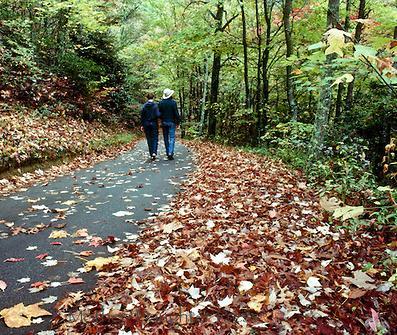

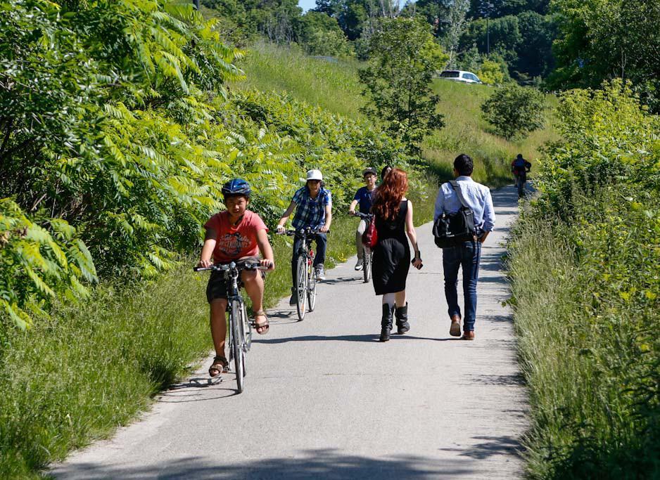
5 People Enjoy Green

6 Nature is good for us and has both long and short term mental and physical health benefits. American Society of Landscape Architects


7 Habitat for Fish and Wildlife Atlantic Coastal Plain forest Freshwater tidal wetlands Delaware River and shoreline Tributary streams Threatened, endangered, and special concern plants in each habitat

8 Where will the trail go; get property, route, actual path Priorities Think about the greening and related benefits Recreation Health Habitat Viewscape Shading Security and safety
9 Agenda Why Green? Where to Green? Prioritizing Ecological Restoration Opportunities Case Studies Philadelphia Area Opportunities on the Bensalem Greenway Funding Sources

10 Where to Green Green directly adjacent to trail Rain gardens, trees/shrubs, vegetated bump outs Greening along the trail corridor Riparian buffer, trees and shrubs Green Parks Nodes Including Restoring Brownfields Intertidal wetlands, forest/meadows, palustrine wetlands, recreational space

11 Indianapolis Cultural Trail, Indiana Greening Directly Adjacent to Trail

12 Murfreesboro Greenway System; Stones River and Lytle Creek Trails, Tennessee Greening Along Trail Corridor


13 Greening Along Trail Corridor Little Sugar Creek Greenway, North Charlotte, North Carolina Mecklenburg County, NC
14 Wildcat Creek Restoration and Greenway Trail, City of San Pablo, CA Greening Along Trail Corridor Restoration Design Group

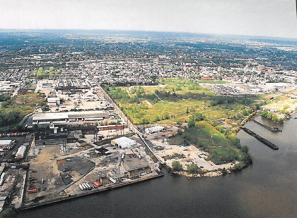
15 Lardner's Point Park Greening Parks and Restoring Brownfields
16 Agenda Why Green? Where to Green? Prioritizing Ecological Restoration Opportunities Case Studies Philadelphia Area Opportunities on the Bensalem Greenway Funding Sources


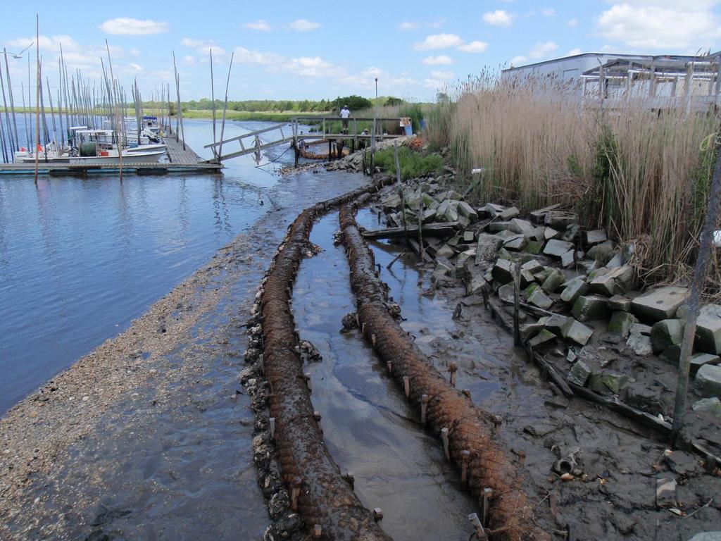
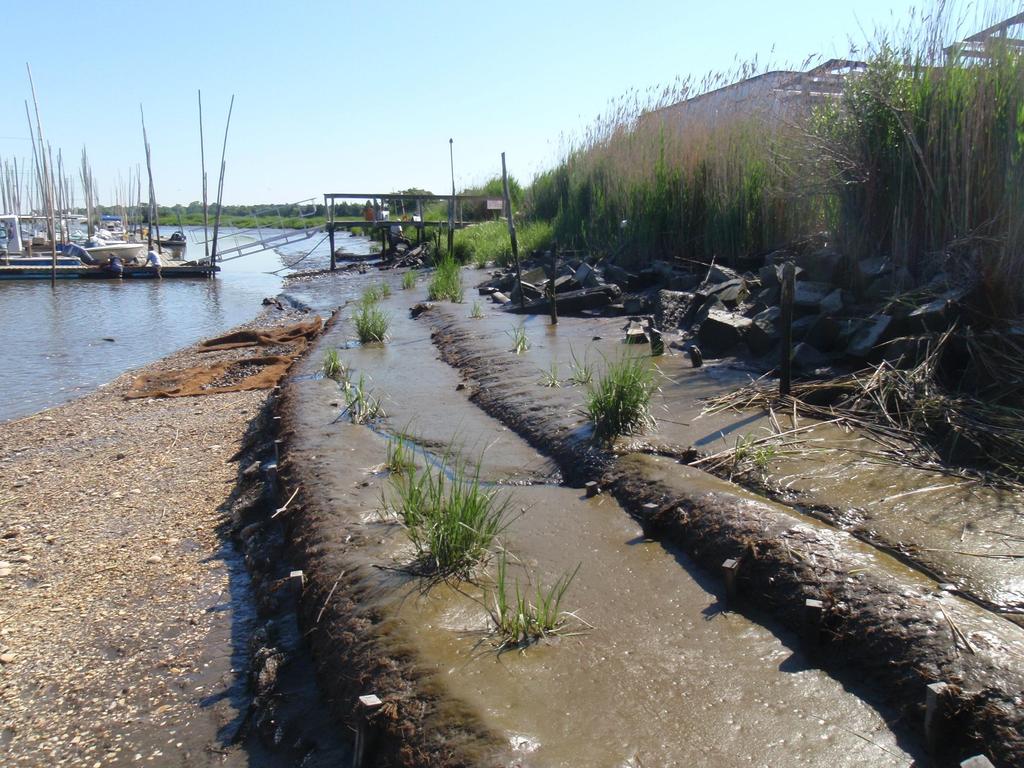
17 Habitat Restoration Types Uplands Plant trees/shrubs Enhance forest lands Create meadows Stream bank Planting Regrade and plant Off channel aquatic Wetlands in upland matrix Backchannels, floodplains and wetlands Intertidal shoreline Enhance/create wetlands (fringe) Soften, regrade, or excavate bank Marsh sill or breakwater Subtidal Enhance structure and diversity

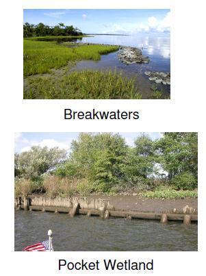
18 Shoreline and Bank Protection Options


19 Living Shoreline: A method of shoreline stabilization that protects the coast from erosion while also preserving or enhancing environmental conditions. From Kurt Cheng, PDE, 10/12/2017 Presentation 19
20
21
22
23

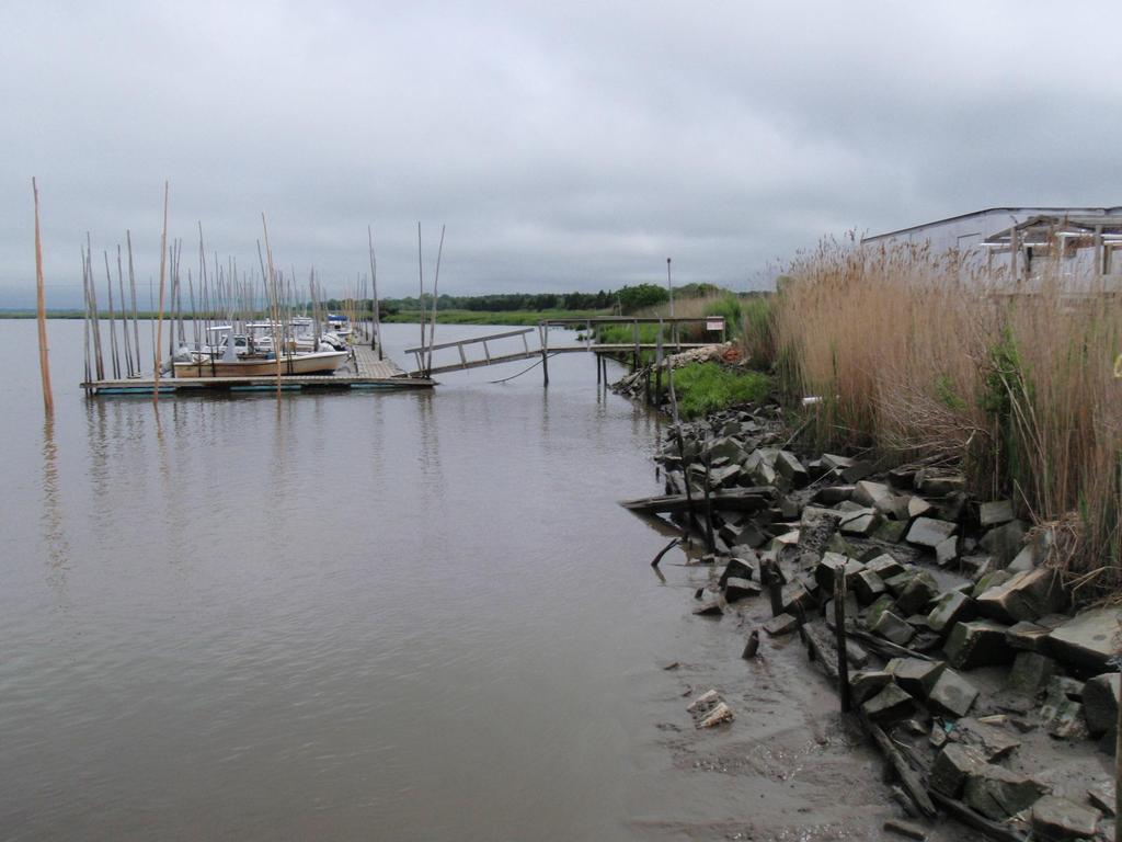
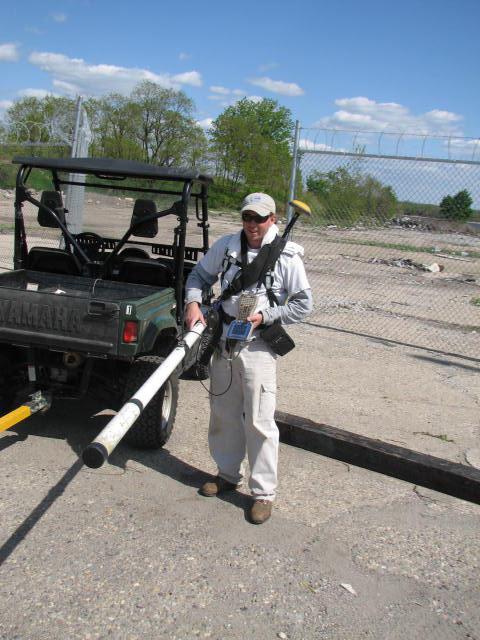
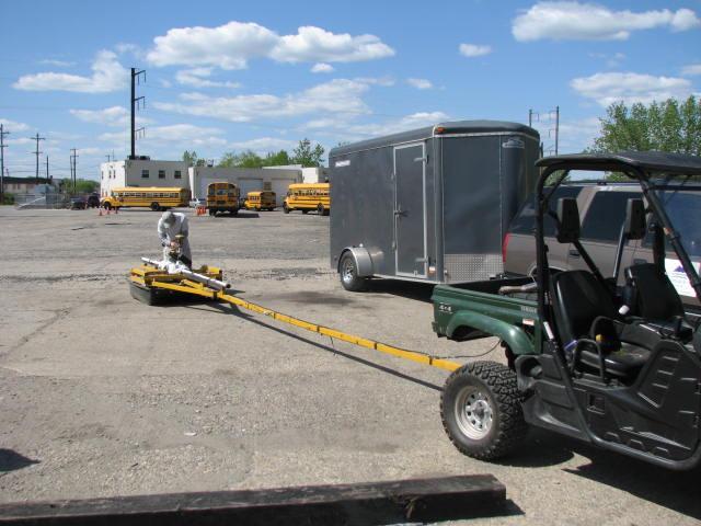
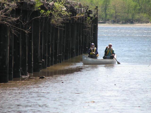
24 Lardner's Point Living Shoreline

25 Restoration Design Group Wildcat Creek Restoration and Greenway Trail, City of San Pablo, CA Greening Along Trail Corridor


26 Fort Washington Park Flood Plain Back Channel


27 Upper Dublin Township Trail trees and green stormwater management


28 Reports can be downloaded at Scroll down to Tidal Delaware River Restoration to see report download buttons.
 Site Wide: Landowner interest Contaminant potential Accessibility Ability to maintain Recreational: Public access")
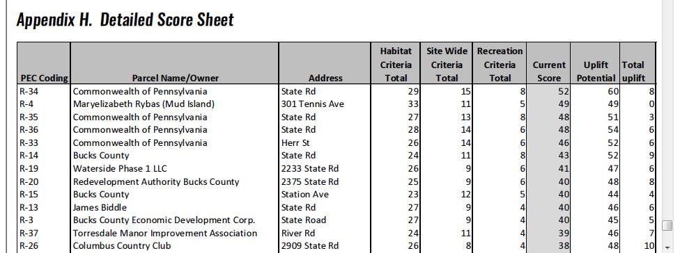
29 Prioritization Criteria Habitat: Parcel size Diversity of vegetation Natural resource features Connectivity Riverbank (vegetated, armored, stable) Intertidal (vegetated, protected) Site Wide: Landowner interest Contaminant potential Accessibility Ability to maintain Recreational: Public access Habitat Uplift
30 Consult Background Resources Pennsylvania Natural Heritage Program Interactive Map Pennsylvania Natural Areas Inventory Updates Open Space and Greenways Plans River Conservation Plans Waterfront Revitalization and Master Plans Comprehensive Plans Pennsylvania Natural Diversity Inventory (PNDI) Pennsylvania Wildlife Action Plan


31 Use Google Earth Riverbank vegetation Score of 1 (Spotty or no trees/shrubs) Score of 3 (extensive shoreline cover)


32 Riverbank (armored) Score of 1 (75-100% bulkhead/riprap) Score of 3 (lower armoring; 0 to 25%)


33 Natural resource features Score of 1 (limited to turf/forest patches) Score of 3 (high value; wetlands, mature forest)
34

35 River Front and Upland Parcels Glen Foerd Bucks County Park/Station Ave Neshaminy State Park
36 Agenda Why Green? Where to Green? Prioritizing Ecological Restoration Opportunities Case Studies Philadelphia Area Opportunities on the Bensalem Greenway Funding Sources


37 Central Delaware River Trail, Philadelphia

38 Delaware River Waterfront Corporation

39 Spring Garden Street Greenway Plan


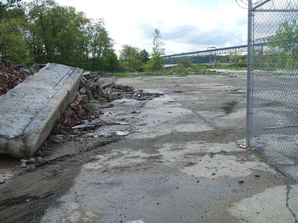
40 Indianapolis Cultural Trail, Indiana 500 new street trees 25,400 ft2 of stormwater planters. Reducing stormwater runoff rate and volume Stormwater Planters Reduce water pollution 8-mile bike and pedestrian path Indianapolis Cultural Trail Inc

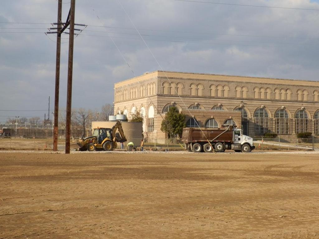
41 Riverfront North Partnership

42 North Delaware Riverfront Greenway Riverfront North Partnership Port Richmond Trail


43 Background Opened in October, 2013 Part of East Coast Greenway 30 wide x 1.6 mile linear open space & trail Pulaski Park clean-up 200+ trees, 1800 native grasses & shrubs Weekly bed maintenance Riverfront North Partnership
44 North Delaware Riverfront Greenway Greenway Stewardship Riverfront North Partnership K&T Trail

 New 4.")

45 Background Opened Trail in 2017 Links 3 open space/park spaces 1.1 mile trail (Phase 1) Links Lardner s Point Park to Frankford Boat Launch (±12 acres) New 4.5 acres of open space along river New 3 acre open space parcel on the river 80 trees, 1200 shrubs, 3300 grasses Frankford Boat Launch Lardner s Point Park Riverfront North Partnership


46 North Delaware Riverfront Greenway Greenway Stewardship Lardner s Point Park Riverfront North Partnership Lardner s Point Park


47 Background Trailhead Park opened Spring 2012 Restroom facility, picnic areas, drinking fountain, trails, fishing pier Restored Ecological Resource 7 habitat zones Coastal Plain Forest, Wet and Dry Meadows & Scrub-shrubs, High and Low Freshwater Tidal Marshes Shoreline and upland restoration projects 100 native plant species Active Monitoring Athos 5-year monitoring Weekly work days Riverfront North Partnership


48 Lardner s Point Park Before Restoration After Restoration PlanPhilly Eyes on the Street photos
49 Lardner's Point During Construction
50

51 Lardner s Point Park Physical Condition Transformed to fringe wetlands plus restored uplands Biohabitats

52 Background 2015 DCNR/PRPS Green Park of the Year Riverfront North Partnership

53

54 Rec Center Bridesburg Neighborhood National Grid Bridesburg Outboard Club PIDC

55 PIDC
56


57 Option C, full restoration 3 Acres Enhanced Wetlands 12.5 Acres Restored Upland Cost: $3.3 Million

58 Design by: Locus Partners Parks and Recreation Riverfront North Bridesburg Residents Locus Partners

59 Parcel 24 ~ 1 acre

60 Parcel 25 ~2.8 acres


61 Mondauk Park Trail - Meadow and Woodlands


62 Route 202 Parkway Trail meadows, shrubs, green stormwater management


63 202 Parkway Trail Stormwater BMPs Bioretention Infiltration trenches Vegetated swales Riparian plantings Volume control basins. Vegetated islands Extensive native plantings. Urban Engineers
64 Agenda Why Green? Where to Green? Prioritizing Ecological Restoration Opportunities Case Studies on Philadelphia s Greenway North Opportunities on the Bensalem Greenway Funding Sources

65 Bensalem Greenway Ecological Assessment and Prioritization Study December 2017

66 Bensalem Greenway Part of the East Coast Greenway 3000 mile trail from Maine to Florida Bensalem Greenway is missing link

67 Bensalem Greenway A spine trail and community amenity from Bristol to Philadelphia Targeted for revitalization
68 Glen Foerd Bucks County Park/Station Ave Neshaminy State Park River Front and Upland Parcels


69 Neshaminy State Park Neshaminy State Park Wetland expansion and Delaware River shoreline restoration

70 Neshaminy State Park

71 Restoration at Jack s Marina Site
72 Neshaminy State Park

73 Neshaminy State Park

74 Neshaminy State Park


75 Andalusia and Bucks County Park Enhance Atlantic Coastal Plan Forest


76 Wetland delineation Locate trail on Bucks County Park and Andalusia Foundation lands


77 Wetland delineation by AD Marble Trail Design by Gilmore & Associates


78 State and Street Road Wetlands Green Gate Way to Bensalem Waterfront


79 Bucks County Park Shoreline Potential Delaware River living shoreline restoration
80 Agenda Why Green? Where to Green? Prioritizing Ecological Restoration Opportunities Case Studies on Philadelphia s Greenway North Opportunities on the Bensalem Greenway Funding Sources


81 Project Funders
82 Schuylkill Action Network Grants Page

83 Paul Racette Program Manager - Watersheds Pennsylvania Environmental Council Southeast Office 1315 Walnut Street, Ste. 532 Philadelphia, PA x112
Introduction. Integrating Ecological Restoration of Estuarine Shorelines with Urban Community Revitalization Efforts. Ed Morgereth Biohabitats, Inc.
 Introduction Integrating Ecological Restoration of Estuarine Shorelines with Urban Community Revitalization Efforts Ed Morgereth Biohabitats, Inc. 5 th National Conference & Expo on Coastal and Estuarine
Planning for Staten. Habitat Restoration and Green Infrastructure. Island s North Shore
 Habitat Restoration and Green Infrastructure Planning for Staten Island s North Shore Community Board 1 March 1, 2018 NYC Parks Forestry, Horticulture, and Natural Resources Funded by the NYS Department
Bensalem Greenway Ecological Assessment and Prioritization Report
 Bensalem Greenway Ecological Assessment and Prioritization Report December 2017 Report for PA Department of Conservation and Natural Resources, Project # BRC-TAG-19-141 Completed by Pennsylvania Environmental
Green Infrastructure. NYS Department of Environmental Conservation
 Green Infrastructure Green infrastructure is an interconnected network of natural areas and open spaces that sustains ecosystems. Benedict, M.A. and E.T. McMahon. 2006. Green Infrastructure Linking Landscapes
Welcome to the Public Meeting!
 Welcome to the Public Meeting! Please sign in, grab a paper survey, and check out the boards around the perimeter of the room. Once you ve viewed all of the boards, come join us in the middle of the room
Urban Stormwater Retrofit Program Highlights
 Urban Stormwater Retrofit Program Highlights Delaware Estuary Environmental Summit 2007 Prepared and Presented by: Liz Feinberg Project Funding: William Penn Foundation PA Coastal Zone Management Program
DISCUSSION TOPIC: ST JOHNS RIVER & ITS TRIBUTARIES (BPII) 2030 COMPREHENSIVE PLAN POLICES AND REGULATORY FRAMEWORK
 2030 COMPREHENSIVE PLAN POLICES AND REGULATORY FRAMEWORK") DISCUSSION TOPIC: ST JOHNS RIVER & ITS TRIBUTARIES (BPII) 2030 COMPREHENSIVE PLAN POLICES AND REGULATORY FRAMEWORK St. John s River & Its Tributaries Issue Summary: The St. Johns River is an important
DISCUSSION TOPIC: ST JOHNS RIVER & ITS TRIBUTARIES (BPII) 2030 COMPREHENSIVE PLAN POLICES AND REGULATORY FRAMEWORK St. John s River & Its Tributaries Issue Summary: The St. Johns River is an important
The Benefits and Challenges Associated with Green Infrastructure Practices
 The Benefits and Challenges Associated with Green Infrastructure Practices Thomas M. Evans ASLA, LEED AP Regional Green Infrastructure Design Services Director OWEA Technical Conference, June 20, 2013
Restoring Water Ecosystems in NYC Parks
 Restoring Water Ecosystems in NYC Parks Hooked on our Waters Con October 19, 2013 - CUNY Graduate Center Marit Larson NYC Parks Landscape and ecosystem focus Watershed Streams Freshwater wetlands Tidal
RECREATION, OPEN SPACE AND GREENWAYS ELEMENT GOALS, OBJECTIVES, AND POLICIES
 RECREATION, OPEN SPACE AND GREENWAYS ELEMENT GOALS, OBJECTIVES, AND POLICIES GOAL R-1: DEVELOP A RECREATION, OPEN SPACE AND GREENWAYS SYSTEM AS AN INTEGRAL COMPONENT OF AN OVERALL, COUNTY-WIDE ECONOMIC
ROUND ONE PROJECTS. Capital Grants 18 DELAWARE VALLEY REGIONAL PLANNING COMMISSION
 ROUND ONE PROJECTS DVRPC awarded the first round Take Me to the River grants in 2008 (see Figure 5 for project locations). The 13 projects selected were chosen based on their ability to reconnect citizens
Planning for Staten. Habitat Restoration and Green Infrastructure. Island s North Shore
 Habitat Restoration and Green Infrastructure Planning for Staten Island s North Shore Walker Park December 7, 2017 NYC Parks Forestry, Horticulture, and Natural Resources Funded by the NYS Department of
Potential Green Infrastructure Strategies May 6, 2015 Workshop
 Potential Green Infrastructure Strategies May 6, 2015 Workshop Background The City of Cortland is developing the Tioughnioga Urban Headwaters Green Infrastructure Action Plan with funding from the National
Steering Committee 3. September 17, :30-7:30pm. Welcome.
 Steering Committee 3 September 17, 2015 5:30-7:30pm Welcome DOG RIVER www.makingwatershedswork.org Agenda 1. Welcome 2. Scientific Research: Water Quality 3. Current and Relevant Planning 4. Community
National Fish & Wildlife Foundation Delaware River Restoration Fund 2014 Award Descriptions
 National Fish & Wildlife Foundation Delaware River Restoration Fund 2014 Award Descriptions Restoring Paulins Kill Floodplain Forests and Functions ( Highlands) $99,759 Barrett s Run Afforestation and
MCCOYS CREEK RESTORATION 30% DESIGN
 MCCOYS CREEK RESTORATION 30% DESIGN THE MCCOYS CREEK RESTORATION PLAN The restoration plan aims to reduce flooding, restore ecosystem health, expand recreational opportunities along the creek, and connect
Oakland County s Green Infrastructure Vision. L. Brooks Patterson Oakland County Executive
 Oakland County s Green Infrastructure Vision L. Brooks Patterson Oakland County Executive Southeast Michigan 20 miles northwest of Detroit Consists of 910 square miles Population of 1.2 million More than
City of Iowa City Department of Neighborhood and Development Services Department of Parks and Recreation Department of Public Works City Manager s
 RFP Pre-submittal meeting December 18, 2015 City of Iowa City Department of Neighborhood and Development Services Department of Parks and Recreation Department of Public Works City Manager s Office Background
Whitemarsh Township Greenway Plan
 Whitemarsh Township Greenway Plan Prepared for: Whitemarsh Township August 16, 2007 Table of Contents Table of Contents... i Introduction... 1 Study Area Setting... 2 Regional Setting... 2 Township Character...
INTRODUCING THE BALTIMORE CITY GREEN NETWORK VISION PLAN
 INTRODUCING THE BALTIMORE CITY GREEN NETWORK VISION PLAN GOALS OF THE GREEN NETWORK PLAN Protect and enhance the unique ecological resources of our city Support economic growth and sustainable redevelopment
CHAPTER 8 ISSUES, CONCERNS, CONSTRAINTS AND OPPORTUNITIES
 CHAPTER 8 ISSUES, CONCERNS, CONSTRAINTS AND OPPORTUNITIES Introduction This River Conservation Plan was developed during a time of tremendous activity and effort in planning the transformation of the Delaware
Chapter 5: Natural Resources and Environment
 NATURAL RESOURCES AND ENVIRONMENT 5-1 5 Chapter 5: Natural Resources and Environment BACKGROUND AND INTENT Urban expansion represents the greatest risk for the future degradation of existing natural areas,
3.22 Tacony a new urban riverfront neighborhood
 3.22 Tacony a new urban riverfront neighborhood 45 The Tacony study site extends north from the Tacony-Palmyra Bridge to the edge of the Northern Shipping site, alongside the Holmesburg Prison and Pennypack
Public Meeting May 20, 2014
 Public Meeting May 20, 2014 Overview Study Purpose Study Area Overview Strategies Potential Opportunities Implementation and Discussion Skeo Solutions Raleigh Walkable Watershed Pilot 2 Purpose Develop
Green Streets. Sustainable Stormwater Solutions for Greener Communities and a Cleaner Bay
 Green Streets Sustainable Stormwater Solutions for Greener Communities and a Cleaner Bay As the Bay Area continues to grow through development of roads, revitalization of neighborhoods, and construction
Storm Water Quality and Shoreline Restoration Improvements - Grant Funding Request City of Mound Carlson Park Bolton & Menk Project No.
 September 15, 2016 Brett Eidem Cost Share Grant Administrator Minnehaha Creek Watershed District 15320 Minnetonka Boulevard Minnetonka, MN 55345 RE: Storm Water Quality and Shoreline Restoration Improvements
Green Infrastructure. by Karen Engel, NYS DEC. NYS Department of Environmental Conservation
 Green Infrastructure by Karen Engel, NYS DEC What is Green Infrastructure? For some it s all about water Green Infrastructure techniques use soils and vegetation to infiltrate, evapotranspirate, and/or
The Mystic River Greenway
 The Mystic River Greenway City of Medford November 30, 2006 MIT Department of Urban Studies and Planning The Mystic River Greenway A greenway is a regional network that connects: Open Space Visibility,
Figure 1. Proposed Strategic Habitat Conservation Areas for Florida
 Figure 1. Proposed Strategic Habitat Conservation Areas for Florida Critical Lands and Waters Identification Project (CLIP) Cooperative Effort Century Commission for Sustainable Florida Florida Natural
Planning for and Managing Open Space and Natural Areas
 Planning for and Managing Open Space and Natural Areas Increasingly, development proposals in Delaware include large amounts of open space and natural areas. While open space is important as a community
Open Space, Natural Areas, Parks, and Recreation
 Open Space, Natural Areas, Parks, and Recreation WHAT ARE THE CITY S CURRENT VALUES? This section addresses open spaces, natural areas, parks and recreation, and stormwater multi-use projects under separate
Urban Revitalization using Green Infrastructure and Conservation Planning
 Urban Revitalization using Green Infrastructure and Conservation Planning Ted Brown and Scott Whalen Biohabitats, Inc. and WK Dickson June 17, 2015 Outline Sustainability/Resiliency Whole Systems, Biodiversity,
2011 ASLA Design Awards. Westside Creeks Restoration Plan Merit Award AECOM, Fort Collins. Planning & Urban Design
 2011 ASLA Design Awards Westside Creeks Restoration Plan Merit Award AECOM, Fort Collins Planning & Urban Design Project Fact Sheet Category of Entry: Rotating Specialty Award: 2011 2011 ASLA Colorado
Introducing Green Infrastructure for Coastal Resilience
 Introducing Green Infrastructure for Coastal Resilience National Oceanic and Atmospheric Administration (NOAA) Office for Coastal Management Gloucester, MA Office of Travel Courtesy, Tim Grafft What Is
Please read the entire document
 projects impacting the waterfront revitalization area. The waterfront revitalization area of the town will have to subareas to the west and east of the village. Page 6 of 6 Wayfinding master plan create
Stream Restoration: Working with Nature?
 Stream Restoration: Working with Nature? Greg Jennings, PhD, PE jenningsenv@gmail.com Ecosystem Restoration activities that initiate or accelerate the recovery of ecosystem health, integrity, and sustainability
Stream Restoration: Working with Nature? Greg Jennings, PhD, PE
 Stream Restoration: Working with Nature? Greg Jennings, PhD, PE jenningsenv@gmail.com Ecosystem Restoration activities that initiate or accelerate the recovery of ecosystem health, integrity, and sustainability
Public Visioning City of Kelso Planning Commission
 Shoreline Master Program Update Public Visioning City of Kelso Planning Commission November 13, 2012 Schedule Jurisdiction Inventory Analysis Visioning Topics Process Governing Principles Structure of
Executive Summary Purpose of the Plan Defining Open Space and Greenways
 Executive Summary Bucks County possesses a vast array of open space resources including natural areas, parks, farmland and historic and cultural resources that contribute to a high quality of life valued
Mendota Heights 2040 Comprehensive Plan Draft Vers
 4 Parks and Trails The City of Mendota Heights boasts a variety of recreational and open space opportunities. Few cities can claim access to regional trails, riverside and lakeside parks, scenic bluffs
A Review of Green Infrastructure Projects Implemented in the Grand Traverse Region
 A Review of Green Infrastructure Projects Implemented in the Grand Traverse Region Sarah U Ren Program Director The Watershed Center of Grand Traverse Bay 231-935-1514, suren@gtbay.org Our Mission: The
319 Grant: Baker Creek & Centenary Creek Restoration Initiative
 319 Grant: Baker Creek & Centenary Creek Restoration Initiative Objectives: Overview of Watershed Characteristics: Discussion of Project Tasks: Discussion of Watershed Management Plan: Presented by: Erich
This page intentionally blank.
 This page intentionally blank. Parks, Recreation, and Open Space Chapter Relationship to Vision Vision Parks, Recreation and Open Space Chapter Concepts County Government. County government that is accountable
LOUISIANA STATE UNIVERSITY COMPREHENSIVE & STRATEGIC CAMPUS MASTER PLAN. APPENDIX G - Stormwater Study Findings & Stormwater Solutions
 LOUISIANA STATE UNIVERSITY COMPREHENSIVE & STRATEGIC CAMPUS MASTER PLAN APPENDIX G - Stormwater Study Findings & Stormwater Solutions LSU: MP Narrative July 2017 3.5 Open Space Existing Conditions The
RIPARIAN BUFFERS PLANNER S PORTFOLIO
 RIPARIAN BUFFERS PLANNER S PORTFOLIO ISSUE 10 JUNE 2017 PLANNER S PORTFOLIO RIPARIAN BUFFERS 1 OVERVIEW 2 4 6 8 10 FUNCTIONS MUNICIPAL PROTECTION ZONES OF A RIPARIAN BUFFER BUFFER TYPES AND WIDTHS PLANNING
Greenways as an alternative to traditional infrastructure. Green Infrastructure
 Greenways as an alternative to traditional infrastructure Green Infrastructure What is a Greenway? Little (1990) - A linear open space along a natural or human made corridor. Fabos - linked corridors nature
Regional Open Space Conservation Plan. Regional Staff Committee January 18, 2018
 Regional Open Space Conservation Plan Regional Staff Committee January 18, 2018 Schedule We are here Task 1 - Stakeholder Input & Work Plan Dev. v z 2016 2017 2018 Oct Nov Dec Jan Feb Mar Apr May Jun Jul
PARKS AND RECREATION
 PARKS AND RECREATION WHAT YOU WILL FIND IN THIS CHAPTER: Background information on the development of the Park, Recreation, and System Plan (PRSP). General overview of Ellensburg s parks and recreation
ENVIRONMENTAL PROJECTS
 pennsylvania environmental council ENVIRONMENTAL PROJECTS 1 Well known for its role in environmental policy discussions and decision-making in the State capital, in both the regulatory and legislative
Reconnecting to a Forgotten River St. Cloud MN. Aaron Hanson Design Design Thesis LA 572, Thesis, Spring 2012
 Reconnecting to a Forgotten River St. Cloud MN Aaron Hanson Design Design Thesis LA 572, Thesis, Spring 2012 site context 2.5 Miles Sartell St. Cloud to Fargo 170 Miles (2 hrs 45 mins) Hwy 10 infrastructure
Green or Grey Solutions? Why not both? Lessons from the Mid-Atlantic on Hybrid Living Shorelines
 Green or Grey Solutions? Why not both? Lessons from the Mid-Atlantic on Hybrid Living Shorelines Proactive By Design. Our Company Commitment Jesse Baldwin Coastal Geologist Project Manager GZA GeoEnvironmental,
Parks, Open Space and Trails
 Introduction Parks have often been referred as the lungs of our cities, cleansing the air of pollutants and particulate matter. Parks are also gathering places for families and community. They offer spaces
The Restoration of Reading Creek & Model Stream Buffer Ordinances/ Zoning Regulations for Alabama Streams
 The Restoration of Reading Creek & Model Stream Buffer Ordinances/ Zoning Regulations for Alabama Streams Charlene LeBleu, AICP, ASLA, Associate Professor of Landscape Architecture Auburn University Auburn,
One County s Success in Linking Watershed Protection and Land Use Planning
 One County s Success in Linking Watershed Protection and Land Use Planning Bob Thompson Porter County Plan Commission March 28, 2012 Indiana Watershed Leadership Academy Population 160,000 Approximately
1. Parks & Recreation Neighborhood Parks Community Parks Special Use Sites 2. Open Space 3. Trails
 Appendix A: Park Classifications The intent of parks and recreation classifications is to aid in making acquisition and design decisions for park sites, facilities and the organization of recreation space
KISHWAUKEE MUNICIPALITIES PLAN FOR SUSTAINABLE DEVELOPMENT
 KISHWAUKEE MUNICIPALITIES PLAN FOR SUSTAINABLE DEVELOPMENT 4 "Natural areas, parks and open space create a high quality of life that attracts tax-paying businesses and residents to communities." Trust
EXISTING PLANS Harriet Festing Center for Neighborhood Technology Midlothian Community Meeting March 12, 2015
 EXISTING PLANS Harriet Festing Center for Neighborhood Technology Midlothian Community Meeting March 12, 2015 BENEFITS Bring economic, community + environmental benefits Enhance property values Use
Working Group Meeting
 April 4,, 2017 Parks Operations Bldg Working Group Meeting Arts Districts Overview Stormwater/RPA/Stream Considerations First Principles Agenda 7:00pm 7:05pm 7:10pm 7:40pm 8:30pm 9:40pm 9:45pm Welcome
The following principles guide the development of goals and strategies to protect and promote these amenities:
 OPEN SPACE/PARKS/TRAILS/RECREATION GOALS/STRATEGIES Cherry Hills Village is a living environment that offers low density development, open areas, public scenic vistas, public trails and public parks. This
{Best Practices. Summary of Tools, Strategies and Best Practices from 11 Michigan Case Study Communities
 Case Studies Michigan Coastal Community Working Waterfronts { Summary of Tools, Strategies and from 11 Michigan Case Study Communities Table of Contents Zoning...2 Community and Stakeholder Collaboration
Riparian Buffer on the Bushkill Creek. Policies
 Riparian Buffer on the Bushkill Creek Riparian buffers provide numerous benefits to landowners and the community by protecting groundwater recharge areas, providing flood control, providing stormwater
Balancing Conservation and Development on the Jordan River
 Balancing Conservation and Development on the Jordan River Jordan River Parkway Trail Regional Athletic Complex Conservation & Restoration Balancing Conservation and Development on the Jordan River Jordan
Craven Street Stormwater Improvement Projects
 Craven Street Stormwater Improvement Projects The Craven Street Watershed drains the area from Haywood Road to Westwood Place and down Haywood to the French Broad River. The watershed has one main un-named
National Association of Conservation Districts. Kris Hoellen Vice President, Sustainable Programs The Conservation Fund September 19, 2013
 National Association of Conservation Districts Kris Hoellen Vice President, Sustainable Programs The Conservation Fund September 19, 2013 Our Mission The Conservation Fund forges partnerships to conserve
Increasing Storm Resiliency in Urban Areas Through Ecological Restoration and Design
 Increasing Storm Resiliency in Urban Areas Through Ecological Restoration and Design Rutgers Cooperative Extension Brooke Maslo, Ph.D. Wildlife Extension Specialist Jeremiah Bergstrom, LLA Senior Project
Natural Shorelines. for Inland Lakes. A Landowner s Guide to using. to STABLIZE SHORELINES, Michigan s inland lakeshore.
 Natural Shorelines for Inland Lakes A Landowner s Guide to using NATURAL MATERIALS to STABLIZE SHORELINES, IMPROVE WATER QUALITY and ENHANCE WILDLIFE HABITAT along Michigan s inland lakeshore. Natural
Zoning Ordinance Article 3
 Article 3 Natural Resources Protection Section 301 Natural Resources Protection 301.1. Purpose - The following natural resources protection standards are established to protect the public health, safety
Appendix E: Illustrative Green Infrastructure Examples
 Appendix E: Illustrative Green Infrastructure Examples Integrating LID into San Francisco s Urban Landscape Figure E. High-density Residential Figure E. Low-density Residential Figure E. Mixed Use 7 Figure
3-2 Environmental Systems
 3-2 Environmental Systems 3.0 ENVIRONMENTAL SYSTEMS CONTENTS 3.1 GREENWAY SYSTEM 3.1.1 General Policies 3.1.2 Natural Heritage Network 3.1.3 Natural Heritage Network Enhancement Lands 3.1.4 Rouge Watershed
Jack Creek Park Capital Improvement Project
 Jack Creek Park Capital Improvement Project Public Information Meeting October 2, 2017 Consultants & Designers, Inc. Integrating Engineering and Environment 7455 New Ridge Road, Suite T Phone: (410) 694-9401
Stormwater Management at The University of New Orleans
 University of New Orleans ScholarWorks@UNO DRU Workshop 2013 Presentations Disaster Resistant University Workshop: Linking Mitigation and Resilience Conferences and Workshops 3-1-2013 Stormwater Management
PARKS AND OPEN SPACE PARKS AND OPEN SPACE
 Purpose General Findings Goals Early Action Create New Parks Connect the City to the Riverfront Invest in a Sustainable Riverfront PARKS AND OPEN SPACE 6 PARKS AND OPEN SPACE Port Richmond Riverfront Park
10.0 Open Space and Public Realm
 10.0 Open Space and Public Realm 10.0 Open Space and Public Realm The Public Open Space System is comprised of: outdoor spaces available for public use that are either publicly owned (e.g., parks and
PrairieWalk Pond Lisle, IL
 PrairieWalk Pond Lisle, IL Hybrid of Native Vegetation and Traditional Landscape Design Scott Kuykendall, Planning Resources Inc. Awards 2011 Chicago Wilderness Conservation & Native Landscaping Award
FirstLight Power Shoreline Management Manual Sustainable Shoreline Designs: From Long Island to Lake Erie Webinar Series
 FirstLight Power Shoreline Management Manual Sustainable Shoreline Designs: From Long Island to Lake Erie Webinar Series Presented by Jason Williams, PLA, NCI February 19, 2017 Introduction Lakes (impoundments)
Portage County Parks, Trails and Greenways Plan
 Portage County Parks, Trails and Greenways Plan Agenda for Local Planning Meeting Introductory Presentation Why we need a Plan Plan project goals and process Benefits Overview of local planning region
April 11, 2016 Park Board Chair and Commissioners General Manager Vancouver Board of Parks and Recreation New Brighton Salt Marsh - Preferred Concept
 TO: FROM: SUBJECT: April 11, 2016 Park Board Chair and Commissioners General Manager Vancouver Board of Parks and Recreation New Brighton Salt Marsh - Preferred Concept RECOMMENDATION A. THAT the Vancouver
VIRGINIA KEY CONSENSUS MASTER PLAN
 VIRGINIA KEY CONSENSUS MASTER PLAN JULY 2010 Existing Conditions JULY 2010 STAKEHOLDER INTERVIEW PROCESS, January 18-22, 2007 PUBLIC MEETING #1: SITE INVENTORY AND ANALYSIS, March 29, 2007 PUBLIC MEETING
The Community Conservation Assistance Program (CCAP) in North Carolina
 in North Carolina") The Community Conservation Assistance Program (CCAP) in North Carolina 17 River Basins Background on the State and Water Quality Issues 550+ Municipalities 9,765,000 Residents 13 Congressional Districts
The Community Conservation Assistance Program (CCAP) in North Carolina 17 River Basins Background on the State and Water Quality Issues 550+ Municipalities 9,765,000 Residents 13 Congressional Districts
Southeast Michigan Council of Governments
 Southeast Michigan Council of Governments SEMCOG Green Infrastructure Activities Regional Green Infrastructure Vision GLRI Green Streets EPA Technical Assistance MDOT Grants Green Infrastructure Vision
New York City, 19 th c.
 New York City, 19 th c. Lower Manhattan, circa 1930s Westside Highway, Manhattan, circa 1940s Greenpoint Terminal Market, Brooklyn TRANSFORMATIONS ON THE WATERFRONT Harlem River Park, Manhattan BEFORE
Yadkin River Greenway Feasibility Study Fact Sheet Village of Clemmons, Town of Lewisville, Town of Bermuda Run
 Fact Sheet Village of Clemmons, Town of Lewisville, Town of Bermuda Run Project Background The Yadkin River Greenway Feasibility Study is a joint project with the Village of Clemmons, the Town of Bermuda
Jill Stachura STORMWATER BMP AND STREAM RESTORATION IN A CITY PARK. October 2013 Southeast Stormwater Association Annual Conference, Charlotte, NC
 Jill Stachura STORMWATER BMP AND STREAM RESTORATION IN A CITY PARK October 2013 Southeast Stormwater Association Annual Conference, Charlotte, NC Project Location Gwinnett County, GA: Population: 825,000
Whitemarsh Comprehensive Plan Update: Housing & Land Use. Public Workshop #3: September 20, 2018
 Whitemarsh Comprehensive Plan Update: Housing & Land Use Public Workshop #3: September 20, 2018 Agenda Welcome Process Recap What We ve Heard The Plan Framework Review of Recommended Actions Land Use Housing
Camden SMART Initiative Stormwater Management and Resource Training
 Camden SMART Initiative Stormwater Management and Resource Training www.camdensmart.com Camden s Struggle with Stormwater 1 The City of Camden is served by a combined sewer system, which uses the same
RECREATION AND OPEN SPACE ELEMENT GOALS, OBJECTIVES, AND POLICIES
 RECREATION AND OPEN SPACE ELEMENT GOALS, OBJECTIVES, AND POLICIES Goal 7 To provide park facilities, recreation programs, and open space resources that are safe, adequate, and accessible to all City residents,
Meeting Agenda. 1. Introductions (5 min)
") Meeting Agenda Monaca, PA Ohio River Brownfields Redevelopment Planning Federal/State/Regional Partners Meeting June 5, 2012; 3-4pm EDT Conference call-in #: 1-866-299-3188 Conference code: 202 566 0633#
Meeting Agenda Monaca, PA Ohio River Brownfields Redevelopment Planning Federal/State/Regional Partners Meeting June 5, 2012; 3-4pm EDT Conference call-in #: 1-866-299-3188 Conference code: 202 566 0633#
Green Infrastructure and Coastal Community Resilience
 Florida Waterfronts Program Managers Meeting May 24, 2012 - Crystal River, FL Green Infrastructure and Coastal Community Resilience Rosalyn Kilcollins Coastal Training Program Coordinator Apalachicola
Philadelphia Trail Master Plan
 Philadelphia Trail Master Plan Jeannette Brugger, AICP Philadelphia City Planning Commission April 30, 2013 Delaware Valley Regional Planning Commission 190 N. Independence Mall West, 8 th Floor Philadelphia2035
Pat Rector, Environmental & Resource Management Agent Morris and Somerset Counties
 Morris County Presented to Bayer August 26, 2014 Pat Rector, Environmental & Resource Management Agent Morris and Somerset Counties rector@njaes.rutgers.edu Goal of the program Program Goal: The goal of
Supporting Hudson Riverfront Communities as Climate-Adaptive Leaders. Libby Zemaitis November 17, 2017 NYS DEC Hudson River Estuary Program
 1 Supporting Hudson Riverfront Communities as Climate-Adaptive Leaders Libby Zemaitis November 17, 2017 NYS DEC Hudson River Estuary Program The Hudson River Estuary Program 2 Working to achieve 6 key
A Vision for Walnut Creek
 A Vision for Walnut Creek Photo: City of Clive Walnut Creek Booklet 8 of 8 Greater Des Moines Water Trails and Greenways 1 Table of Contents Booklet 1: Water Trails Strategies and Policies Booklet 2: Beaver
4. What are the goals of the Kawarthas, Naturally Connected project? 7. What are watersheds and why are they being used as the project boundaries?
 Frequently Asked Questions (FAQs) 1. What are Natural Heritage Systems (NHS)? 2. Why are they important? 3. Which areas of the province have undertaken NHS projects? 4. What are the goals of the Kawarthas,
BE WATER WISE. Managing Your Onlot Stormwater. Sept. 23, 2006 Watershed Weekend
 BE WATER WISE Managing Your Onlot Stormwater Sept. 23, 2006 Watershed Weekend 2006 1 All water resources are interrelated through the Hydrologic Cycle Sept. 23, 2006 Watershed Weekend 2006 2 What is Storm
Stormwater Low Impact Development - A Natural Solution
 Stormwater Low Impact Development - A Natural Solution Sarah U Ren Program Director The Watershed Center of Grand Traverse Bay 231-935-1514, suren@gtbay.org Our Mission: The Watershed Center advocates
Building Ecological Solutions to Coastal Community Hazards: Guidance and NJ Coastal Community Assistance
 Building Ecological Solutions to Coastal Community Hazards: Guidance and NJ Coastal Community Assistance Stacy Small-Lorenz National Wildlife Federation Restore America s Estuaries Summit New Orleans,
Regional Restoration Planning:
 Regional Restoration Planning: A Case Study in Collaborative Restoration Science and Planning Campbell Ingram, Executive Officer NCER August 28, 2018 Co-Equal Responsibilities Act as a primary state agency
Putting the Pieces Together
 Putting the Pieces Together A guided tour of the St Croix Valley's land and water resources A Guided View from the River: What are the challenges and obstacles your community is facing? 1 Site 2 Buk and
Landscape Conservation Design April, 2014
 Designing Sustainable Landscapes in the Northeast A project of the North Atlantic Landscape Conservation Cooperative & Northeast Climate Science Center Landscape Conservation Design April, 2014 Conceptual
North Carolina Coastal Federation
 North Carolina Coastal Federation Erosion Control: Non-Structural Alternatives A Shorefront Property Owner s Guide Shoreline erosion and landward migration of marshes are natural processes, and are important