The Mystic River Greenway
|
|
|
- Lee Cunningham
- 5 years ago
- Views:
Transcription
1 The Mystic River Greenway City of Medford November 30, 2006 MIT Department of Urban Studies and Planning

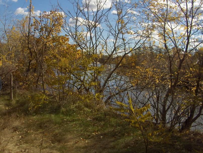
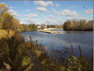
2 The Mystic River Greenway A greenway is a regional network that connects: Open Space Visibility, identity, easy passage Ecology Clean river, diverse landscape/habitat People Residents, businesses, institutions Recreation Diverse active and passive activities Transportation Biking, boating, public transport Time Past, present, and future

3 Context W. Medford T Medford Square Commercial Zone T Minuteman Path Tufts Wellington Alewife Brook T Alewife

4 Review of Goals Enhance physical and psychological connections to the river Establish identity to reflect unique history, environment, and character Restore ecological integrity Engage community in shaping and building the greenway


5 Objectives Propose connections for continuous recreational/commuter path Locate opportunities for views, uses, and river access Suggest approach for signage system Recommend interventions to restore ecology Identify models for community partnership and non-profit collaboration
6 General Recommendations: Solidify Connections Collaborate with DCR Mystic River Master Plan (June 2007)


7 General Recommendations: Views, Access, and Uses Restore and maintain views to and from river Create physical access for waterbased activities Involve community in programming uses Playgrounds Picnic areas Gardens Fishing docks Boat launches Cultural events


8 General Recommendations: Signage System Purpose Identity Navigation Education Stewardship Process Coordinate with DCR Involve residents, businesses, and organizations Design for low maintenance Consider users Content Do not overwhelm with information Consistent and unique image


9 General Recommendations: Ecology Process Regional coordination Multi-disciplinary team Involve and educate Goals Reduce maintenance Wildlife habitat Control erosion Filter storm water and CSO pollution Moderate flooding Diversify landscape Widen and restore riverbank Restore wetlands Replace lawn with meadow Control invasive species Utilize educational/artistic interventions


10 General Recommendations: Community Partnerships Structure Public-private partnership Model Emerald Necklace Conservancy Potential Partners Adjacent municipalities DCR Chamber of Commerce Meadow Glen Mall Tufts Medford Public Schools Medford Historical Society Mystic River Watershed Association Local community groups Roles Fundraising Visioning and planning Maintenance Education
11 Auburn Street to Winthrop Street

12 Auburn Street to Winthrop Street Formalize path, signage Diversify landscape and reduce maintenance Riverbank restoration and views 1-2 neighborhood uses


13 Auburn Street to Winthrop Street Formalize path, signage Diversify landscape and reduce maintenance Riverbank restoration and views 1-2 neighborhood uses

14 Auburn Street to Winthrop Street Formalize path, signage Diversify landscape and reduce maintenance Riverbank restoration and views 1-2 neighborhood uses


15 Auburn Street to Winthrop Street Formalize path, signage Diversify landscape and reduce maintenance Riverbank restoration and views 1-2 neighborhood uses
16 Winthrop St to Medford Square


17 Winthrop St to Medford Square Maintain pathway Wetlands Parking lot and canoe launch Alleys Views and signs Neighborhood use

18 Winthrop St to Medford Square Maintain pathway Wetlands Parking lot and canoe launch Alleys Views and signs Neighborhood use

19 Winthrop St to Medford Square Maintain pathway Wetlands Parking lot and canoe launch Alleys Views and signs Neighborhood use


20 Winthrop St to Medford Square Maintain pathway Wetlands Parking lot and canoe launch Alleys Views and signs Neighborhood use

21 Winthrop St to Medford Square Maintain pathway Wetlands Parking lot and canoe launch Alleys Views and signs Neighborhood use


22 Winthrop St to Medford Square Maintain pathway Wetlands Parking lot and canoe launch Alleys Views and signs Neighborhood use
23 Clippership Drive


24 Clippership Drive New 1.5 acre formal park Extend civic life of Square to River Public Art Historical and environmental education Medford Historical Society Cafes and shops Public-private partnership DCR conservation easements
25 I-93 and the Yacht Club


26 I-93 and the Yacht Club Short-term route Long-term route


27 I-93 and the Yacht Club Short-term route Long-term route


28 I-93 and the Yacht Club Short-term route Long-term route

29 I-93 and the Yacht Club Short-term route Long-term route
30 I-93 and the Yacht Club Short-term route Long-term route


31 I-93 and the Yacht Club Short-term route Long-term route
32 Riverbend Park


33 Riverbend Park Improve signage and wayfinding
34 Mystic River Reservation

35 Mystic River Reservation Improve signage and wayfinding Reduce lawn maintenance Restore dock Enhance views

36 Mystic River Reservation Improve signage and wayfinding Reduce lawn maintenance Restore dock Enhance views

37 Mystic River Reservation Improve signage and wayfinding Reduce lawn maintenance Restore dock Enhance views

38 Next Steps Collaborate with DCR on Mystic River master plan Concept due for completion by June 2007 Form Medford Greenway Committee Citizens, Municipal officials, Institutions, Businesses, Community groups Tasks Continue ongoing dialogue with DCR Investigate funding sources Develop public-private partnership organization
Medford Square and the Mystic River Reconnection, revitalization, redevelopment
 Medford Square and the Mystic River Reconnection, revitalization, redevelopment City of Medford, Massachusetts Massachusetts Institute of Technology Department of Urban Studies and Planning Community Growth
Pittsfield Action Plan (West Branch of the Housatonic River)
") An initiative of the Massachusetts Executive Office of Energy and Environmental Affairs in partnership with the City of Pittsfield Pittsfield Action Plan (West Branch of the Housatonic River) The spring
An initiative of the Massachusetts Executive Office of Energy and Environmental Affairs in partnership with the City of Pittsfield Pittsfield Action Plan (West Branch of the Housatonic River) The spring
PARK AND RECREATION MASTER PLAN UPDATE
 PARK AND RECREATION MASTER PLAN UPDATE 2014-2018 Prepared for: Avon Parks, Recreation and Beautification Council (PRBC) and Town of Avon Prepared by: Lehman & Lehman, Inc. 24-Apr-14 Mission Statement The
This page intentionally blank.
 This page intentionally blank. Parks, Recreation, and Open Space Chapter Relationship to Vision Vision Parks, Recreation and Open Space Chapter Concepts County Government. County government that is accountable
Support the implementation of Cape Coral's Comprehensive Plan. Protect and utilize the unique natural resources in the City.
 7.0 OVERVIEW - RECOMMENDATIONS Chapter 7 The preparation of the Cape Coral Parks and Recreation Master Plan spanned a period of approximately 12 months. Plan preparation included the input of a wide range
A Vision for Walnut Creek
 A Vision for Walnut Creek Photo: City of Clive Walnut Creek Booklet 8 of 8 Greater Des Moines Water Trails and Greenways 1 Table of Contents Booklet 1: Water Trails Strategies and Policies Booklet 2: Beaver
Whitemarsh Comprehensive Plan Update: Housing & Land Use. Public Workshop #3: September 20, 2018
 Whitemarsh Comprehensive Plan Update: Housing & Land Use Public Workshop #3: September 20, 2018 Agenda Welcome Process Recap What We ve Heard The Plan Framework Review of Recommended Actions Land Use Housing
Highland Falls Waterfront Redevelopment Feasibility Study Village Board Meeting March 20, 2017
 Village Board Meeting March 20, 2017 Agenda I. Public Meeting #1 Visioning Summary II. Public Meeting #2 Comment Summary III. IV. IV. Case Study: Milton Train Station Schematic Design Concepts Schedule/Next
RECREATION, OPEN SPACE AND GREENWAYS ELEMENT GOALS, OBJECTIVES, AND POLICIES
 RECREATION, OPEN SPACE AND GREENWAYS ELEMENT GOALS, OBJECTIVES, AND POLICIES GOAL R-1: DEVELOP A RECREATION, OPEN SPACE AND GREENWAYS SYSTEM AS AN INTEGRAL COMPONENT OF AN OVERALL, COUNTY-WIDE ECONOMIC
Increasing Storm Resiliency in Urban Areas Through Ecological Restoration and Design
 Increasing Storm Resiliency in Urban Areas Through Ecological Restoration and Design Rutgers Cooperative Extension Brooke Maslo, Ph.D. Wildlife Extension Specialist Jeremiah Bergstrom, LLA Senior Project
MCCOYS CREEK RESTORATION 30% DESIGN
 MCCOYS CREEK RESTORATION 30% DESIGN THE MCCOYS CREEK RESTORATION PLAN The restoration plan aims to reduce flooding, restore ecosystem health, expand recreational opportunities along the creek, and connect
Bristol Marsh Heritage Conservancy
 Bristol Marsh Heritage Conservancy The Pennsylvania Environmental Council (PEC) protects and restores the natural and built environments through innovation, collaboration, education and advocacy. PEC believes
Ashbridges Bay Erosion and Sediment Control Project
 Ashbridges Bay Erosion and Sediment Control Project Project Brief Overview Toronto and Region Conservation Authority, in partnership with the City of Toronto, intends to carry out remedial erosion control
The following principles guide the development of goals and strategies to protect and promote these amenities:
 OPEN SPACE/PARKS/TRAILS/RECREATION GOALS/STRATEGIES Cherry Hills Village is a living environment that offers low density development, open areas, public scenic vistas, public trails and public parks. This
SECTION 9 PUBLIC FORUM DRAFT 5/31/2017 SEVEN YEAR ACTION PLAN
 SECTION 9 SEVEN YEAR ACTION PLAN The Seven-Year Action Plan addresses the objectives of the Open Space and Recreation Plan and identifies actions to meet these objectives. While the Open Space and Recreation
An Ambitious Plan: Transforming the blighted South Platte River and surrounding environment into Denver s greatest natural resource.
 CONNECTING THE PEOPLE TO THEIR RIVER SOUTH PLATTE RIVER VISION IMPLEMENTATION PROGRAM: GRANT-FRONTIER PARK TO OVERLAND POND PARK REACH The South Platte River Vision Implementation Program (River Vision)
APPENDIX D: PARKS AND RECREATION ACTION PLAN
 APPENDIX D: PARKS AND RECREATION ACTION PLAN Goals The following goals are specific to the development, maintenance, and operation of the existing parks in the Township, as well as the acquisition and
HUMBER BAY PARK PROJECT - BUILDING CONCEPT
 WELCOME 1 Humber Bay Park, with its system of trails, rugged shoreline, and dramatic views, is a unique and rare waterfront experience within the larger metropolitan Toronto area offering a place for quiet,
Planning for Staten. Habitat Restoration and Green Infrastructure. Island s North Shore
 Habitat Restoration and Green Infrastructure Planning for Staten Island s North Shore Community Board 1 March 1, 2018 NYC Parks Forestry, Horticulture, and Natural Resources Funded by the NYS Department
DRAFT FOR PUBLIC REVIEW. Game Plan for a Healthy City
 DRAFT FOR PUBLIC REVIEW 2018 Game Plan for a Healthy City 2 Denveright. Parks & Recreation Game Plan Draft for Public Review Draft for Public Review Executive Summary Game Plan Overview Executive Summary
PARKS. Chapter Introduction
 Chapter 4. PARKS 4.1. Introduction This Parks Element of the 2016 Comprehensive Plan Update provides direction and guidance, based on citizen input, in order to improve and maintain the City s existing
Parks, Open Space and Trails
 Introduction Parks have often been referred as the lungs of our cities, cleansing the air of pollutants and particulate matter. Parks are also gathering places for families and community. They offer spaces
Minto-Brown Island. November 18, City of Salem, Parks & Transportation Services
 Minto-Brown Island Park Master Plan Public Meeting #1 November 18, 2014 City of Salem, Parks & Transportation Services Division, i i Public Works Welcome... and thanks for participating in the master planning
1. Parks & Recreation Neighborhood Parks Community Parks Special Use Sites 2. Open Space 3. Trails
 Appendix A: Park Classifications The intent of parks and recreation classifications is to aid in making acquisition and design decisions for park sites, facilities and the organization of recreation space
Regional Context Statement
 Regional Context Statement REGIONAL CONTEXT STATEMENT 3. REGIONAL CONTEXT STATEMENT In 1995, the Provincial Government passed into law the Growth Strategies Act. The purpose of this provincial initiative
Open Space, Natural Areas, Parks, and Recreation
 Open Space, Natural Areas, Parks, and Recreation WHAT ARE THE CITY S CURRENT VALUES? This section addresses open spaces, natural areas, parks and recreation, and stormwater multi-use projects under separate
{Best Practices. Summary of Tools, Strategies and Best Practices from 11 Michigan Case Study Communities
 Case Studies Michigan Coastal Community Working Waterfronts { Summary of Tools, Strategies and from 11 Michigan Case Study Communities Table of Contents Zoning...2 Community and Stakeholder Collaboration
Master Plan for Preservation and Scenic Conservation (1995)
") 3.2 Master Plan for Preservation and Scenic Conservation (1995) The Master Plan for Preservation and Scenic Conservation was developed under the direction of the Guilford Preservation Alliance in the 1980s
3.2 Master Plan for Preservation and Scenic Conservation (1995) The Master Plan for Preservation and Scenic Conservation was developed under the direction of the Guilford Preservation Alliance in the 1980s
SUSTAINABILITY PLAN OTTAWA COUNTY PARKS AND RECREATION COMMISSION FALL 2017
 SUSTAINABILITY PLAN OTTAWA COUNTY PARKS AND RECREATION COMMISSION FALL 2017 Table of Contents Introduction Natural Resources Quality of Life Community Continuing the Mission Sustainability Measuring Sustainability
POLICY The Trillium Park Master Plan was approved by the Board on April 4, 2012.
 TO: FROM: SUBJECT: Date: June 2, 2014 Board Members Vancouver Park Board General Manager Parks and Recreation Proposed Trillium North Park Artists Garden RECOMMENDATION THAT the Board approve the new arts-focused
Town of Peru Comprehensive Plan Executive Summary
 Town of Peru Comprehensive Plan Executive Communities that plan grow by choice, not by chance. A plan makes growth thoughtful, understandable, and predictable. A plan shows that a community is managing
Linking Ecological Restoration and Economic Recovery at a Great Lakes Area of Concern: Muskegon Lake, MI. Heather Braun Great Lakes Commission
 Linking Ecological Restoration and Economic Recovery at a Great Lakes Area of Concern: Muskegon Lake, MI Heather Braun Great Lakes Commission Why Here? Restoration in urban centers: Muskegon Lake AOC Why
CHAPTER 8 ISSUES, CONCERNS, CONSTRAINTS AND OPPORTUNITIES
 CHAPTER 8 ISSUES, CONCERNS, CONSTRAINTS AND OPPORTUNITIES Introduction This River Conservation Plan was developed during a time of tremendous activity and effort in planning the transformation of the Delaware
Mendota Heights 2040 Comprehensive Plan Draft Vers
 4 Parks and Trails The City of Mendota Heights boasts a variety of recreational and open space opportunities. Few cities can claim access to regional trails, riverside and lakeside parks, scenic bluffs
MASTER PLAN for the EARL NEWHOUSE WATERFRONT
 MASTER PLAN for the EARL NEWHOUSE WATERFRONT on RESERVOIR POND - CANTON, MA Community Meeting #2 - Thursday, January 11 th PROJECT INTRODUCTION Project Goals: To prepare a MASTER PLAN which develops the
Urban Greening Plan Proposed Policies and Programs Matrix Existing City Plans and Goals Programs Policies Notes/Comments
 Urban Greening Plan Circulation Plan for Bicyclists and Pedestrians (2007) 1.1 - Develop a coordinated Trail Maintenance Volunteer Program that identifies funding and leverages community efforts and partnerships
implementation10 Village of Greendale Comprehensive Plan: Greendale, Wisconsin. Revisiting a Greenbelt Community
 implementation10 Village of Greendale Comprehensive Plan: 2010 - Village of Greendale Comprehensive Plan: 2010 - Implementation The recommendations of this Plan must be implemented by the Village of Greendale,
ATTACHMENT A AERIAL PHOTO OF McINTIRE PARK EAST
 ATTACHMENT A AERIAL PHOTO OF McINTIRE PARK EAST McIntire Botanical Garden Request for Proposals Attachments Page 1 of 33 ATTACHMENT B - MEMORANDUM OF AGREEMENT WITH THE CITY OF CHARLOTTESVILLE McIntire
10.0 Open Space and Public Realm
 10.0 Open Space and Public Realm 10.0 Open Space and Public Realm The Public Open Space System is comprised of: outdoor spaces available for public use that are either publicly owned (e.g., parks and
TOWN OF BETHLEHEM OPEN SPACE CONSERVATION PLAN PUBLIC MEETING: OCTOBER 12, 2017
 TOWN OF BETHLEHEM OPEN SPACE CONSERVATION PLAN PUBLIC MEETING: OCTOBER 12, 2017 Welcome and Agenda 6:00 6:45: Open House, Part One 6:45 7:15: Presentation and Questions 7:15 8:00: Open House, Part Two
Community Conservation Workshop. Lake Placid
 Community Conservation Workshop Lake Placid 2 Community Conservation Program Welcome! We have designed a Community Conservation Program that listens to the needs of community members. We are conducting
Sustaining Historic Public Landscapes Preservation & Sustainability for Our Shared Heritage To Enhance Quality of Life & Experience of Place
 Body & Soul: Parks & the Health of Great Cities National Association for Olmsted Parks & City Parks Alliance Pittsburgh Parks Conservancy 22 September 2008 Sustaining Historic Public Landscapes Preservation
Planned Residential Neighborhoods Land Use Goals
 Planned Residential Neighborhoods Land Use Goals Issue: Guidelines that provide for diverse high quality residential areas that include a variety of housing styles and layouts are needed. Goal 1: Create
Objectives and Strategies for the Integration of Recreation, Parks and Open Space in Regional Plans
 BULLETIN 2 Objectives and Strategies for the Integration of Recreation, Parks and Open Space in Regional Plans TABLE OF CONTENTS Introduction 3 Land-use Framework Outcomes 1 4-8 Land-use Framework Outcomes
TRANSPORTATION & STREET DESIGN
 TRANSPORTATION & STREET DESIGN Review of Goals Connect neighborhoods to Square Enable access to the river Improve pedestrian environment Reorient road network to local use Three Specific Areas of Intervention
December 23, MyWRA's interest in the Alewife Envision Plan
 December 23, 2017 To: Melissa Peters, Project Manager, Envision Alewife Copy to: Cambridge City Council, DPW Commissioner Owen O'Riordan, Deputy City Manager for Community Development Iram Farooq, Director
City of Plattsburgh DRI: Downtown Streetscapes & Riverfront Access. Downtown Streetscape and Riverfront Access Design
 City of Plattsburgh DRI: Downtown Streetscapes & Riverfront Access Welcome Thank you for coming this evening. Agenda PART I - Project Context The Downtown Revitalization Program Our DRI Projects Other
Executive Summary Purpose of the Plan Defining Open Space and Greenways
 Executive Summary Bucks County possesses a vast array of open space resources including natural areas, parks, farmland and historic and cultural resources that contribute to a high quality of life valued
NORTH CLAYMONT AREA MASTER PLAN COMMUNITY WORKSHOP #1 FEBRUARY 3, 2016
 NORTH CLAYMONT AREA MASTER PLAN COMMUNITY WORKSHOP #1 FEBRUARY 3, 2016 1. Introduction To the team and to the Plan Planning Partners The Claymont Community WILMAPCO New Castle County Claymont Renaissance
CAL POLY MASTER PLAN UPDATE, March 2015
 Some Key Themes in the General Guiding Principles Academic Mission The plan must foremost advance the University s academic mission and student success. Foresight and Adaptability The plan should take
Charles River Skate Park Project
 Charles River Skate Park Project East Cambridge Planning Team Meeting December 12, 2012, 7:00 p.m. 9:00 pm East End House Basement Meeting Room 105 Spring Street, East Cambridge, MA Mission To protect,
W&OD PARK MASTER PLAN. The City s Greenest Street. DRAFT W&OD Trail Master Plan v4.docx Page 1
 W&OD PARK MASTER PLAN Adopted XXX-XX-XXXX The City s Greenest Street DRAFT W&OD Trail Master Plan v4.docx Page 1 Introduction and Purpose The Washington & Old Dominion Railroad Regional Park (W&OD) (which
RAIN TO RECREATION CASE STUDY
 RAIN TO RECREATION CASE STUDY About Lenexa, Ks Lenexa, Kansas, which was incorporated in 1907, is a rapidly growing city in the Kansas City metropolitan area, adding about 1000 new residents per year.
San Diego River Coalition 2012 Work Plan
 San Diego River Coalition 2012 Work Plan Adopted November 18, 2011 The mission of the San Diego River Coalition is preserve and enhance the San Diego River, its watershed, and its natural, cultural and
SAN RAFAEL GENERAL PLAN 2040 INTRODUCTION AND OVERVIEW
 SAN RAFAEL GENERAL PLAN 2040 INTRODUCTION AND OVERVIEW Steering Committee Presentation February 14, 2018 Purpose of General Plan Guide land use and development decisions Coordinate transportation, infrastructure,
Whitemarsh Township Greenway Plan
 Whitemarsh Township Greenway Plan Prepared for: Whitemarsh Township August 16, 2007 Table of Contents Table of Contents... i Introduction... 1 Study Area Setting... 2 Regional Setting... 2 Township Character...
Green Infrastructure. NYS Department of Environmental Conservation
 Green Infrastructure Green infrastructure is an interconnected network of natural areas and open spaces that sustains ecosystems. Benedict, M.A. and E.T. McMahon. 2006. Green Infrastructure Linking Landscapes
A BLUEPRINT FOR BROCKTON A CITY-WIDE COMPREHENSIVE PLAN
 A BLUEPRINT FOR BROCKTON A CITY-WIDE COMPREHENSIVE PLAN Public Meeting October 2016 1 Plan Summary and Discussion Public Meeting May 4 2017 City of Brockton Bill Carpenter, Mayor Department of Planning
Terra Nova Rural Park Plan
 Terra Nova Rural Park Plan Part 1 Getting to know the land The Surrounding Area North Side Airport, River, Trail East Side - Residential West Side- Sturgeon Banks, West Dyke Trail South Side:Terra Nova
Call for Artists for: Design and Construction of Environmental Art Activation Story Mill Community Park, Bozeman, MT
 Call for Artists for: Design and Construction of Environmental Art Activation Story Mill Community Park, Bozeman, MT Seeking artists to design, fabricate and install art elements in the nature sanctuary
Provide and maintain sufficient public parks, recreation facilities, and open space to meet the recreational needs of County residents and visitors.
 (ROS) Goal Provide and maintain sufficient public parks, recreation facilities, and open space to meet the recreational needs of County residents and visitors. OBJECTIVE ROS.01 The County shall acquire,
4. What are the goals of the Kawarthas, Naturally Connected project? 7. What are watersheds and why are they being used as the project boundaries?
 Frequently Asked Questions (FAQs) 1. What are Natural Heritage Systems (NHS)? 2. Why are they important? 3. Which areas of the province have undertaken NHS projects? 4. What are the goals of the Kawarthas,
Implementation. A plan is a list of actions arranged in whatever sequence is thought likely to achieve an objective. John Argenti
 A plan is a list of actions arranged in whatever sequence is thought likely to achieve an objective. John Argenti This Implementation section is structured into a coordinated action program so that elected
Summary of Action Strategies
 Strategic Action Plan 6 Summary of Action Strategies Action Strategy Categories: 1. Organization and Management 2. Implementation 3. Marketing and Promotion This chapter summarizes all of the action strategies
10 Principles for a Sustainable Development of Urban Waterfront Areas
 10 Principles for a Sustainable Development of Urban Waterfront Areas In the context of the initiatives for the Global Conference on the Urban Future (URBAN 21) held in Berlin in July 2000 and in the course
KISHWAUKEE MUNICIPALITIES PLAN FOR SUSTAINABLE DEVELOPMENT
 KISHWAUKEE MUNICIPALITIES PLAN FOR SUSTAINABLE DEVELOPMENT 4 "Natural areas, parks and open space create a high quality of life that attracts tax-paying businesses and residents to communities." Trust
Park Board Strategic Framework. (Mission, Vision, Directions, Goals and Objectives) June 27, 2012
 June 27, 2012") Park Board Strategic Framework (Mission, Vision, Directions, Goals and Objectives) June 27, 2012 Planning Process Overview Phase 1: Renewed Strategic Framework Phase 2: Objectives Phase 3: Prioritization
Park Board Strategic Framework (Mission, Vision, Directions, Goals and Objectives) June 27, 2012 Planning Process Overview Phase 1: Renewed Strategic Framework Phase 2: Objectives Phase 3: Prioritization
Map Development 5/15/2012. New Virginia Modeling Tools
 Regional Green Infrastructure Base Map Development 5/15/2012 RRRC Land Use & Environment Committee New Virginia Modeling Tools VA Natural Landscape Assessment Forest Habitats Cultural Model Historic Resources
UPPER BRODHEAD CREEK PARADISE CREEK GREENWAY PLAN
 UPPER BRODHEAD CREEK PARADISE CREEK GREENWAY PLAN The Upper Brodhead & Paradise Creeks Greenway Cooperating Municipalities Mount Pocono Borough Paradise Township Barrett Township Price Township Funding
AREA-WIDE PEDESTRIAN AND BICYCLE CIRCULATION
 OUSD LANEY CHILD CARE CENTER ART BUILDING LANEY COLLEGE BALL FIELDS PCCD OFFICES PERALTA PARK AQUATIC CENTER & ESTUARY PARK EDOFF MEMORIAL BANDSTAND SNOW PARK COURT HOUSE OAKLAND MUSEUM OAK ST AREA-WIDE
Candlestick Point SRA Yosemite Slough Restoration Project. Presented by
 Candlestick Point SRA Yosemite Slough Restoration Project Presented by Yosemite Slough Restoration Project The Center of a Revitalized Waterfront in Southeastern San Francisco The Yosemite Slough Restoration
ITA and Vicinity Master Plan Update
 1 ITA and Vicinity Master Plan Update PHASE 3 SEPTEMBER 27, 2017 Three Phase Process 2 Phase 1 - Understanding October 13th Public Meeting Phase 2A - Exploring Ideas November 17th Public Meeting Phase
SF RECREATION & PARK DEPARTMENT URBAN TRAILS PROGRAM
 SF RECREATION & PARK DEPARTMENT URBAN TRAILS PROGRAM TRAIL IMPROVEMENTS October 5, 2011 TRAIL IMPROVEMENTS 6:30 8:00 p.m. AGENDA WELCOME & INTRODUCTION URBAN TRAILS PROGRAM OVERVIEW TRAIL IMPROVEMENTS
A larger version of this map is located on the last page of this PDF.
 MAP Committee Input McLoughlin Area Draft Vision Map A larger version of this map is located on the last page of this PDF. 1. The map above is intended to portray a vision for the McLoughlin area. It highlights
Rocky Areas Project Guidance HABITAT
 Rocky Areas Project Guidance HABITAT Introduction Rocky habitats are surface areas dominated by exposed rock, such as mountain peaks, inland cliffs, buttes and rocky outcrops. In many cases, rocky areas
Urban runoff in my neighborhood (Capitol Hill) is heavy with trash and other debris.
 is heavy with trash and other debris.") South Platte River Meeting Comments & s #1 I am a huge fan of river areas and would love the Platte and surrounding waterways to improve to allow habitat for wildlife and recreation opportunities for citizens.
South Platte River Meeting Comments & s #1 I am a huge fan of river areas and would love the Platte and surrounding waterways to improve to allow habitat for wildlife and recreation opportunities for citizens.
Throughout. square. (Crystal City Vision Plan 2050)
") 1: Terms related to the PSMP document 1 public space (see also public realm, civic space) An open space designated on the regulating plan, accessible to all, including Plazas, Mini Parks, and Neighborhoods
1: Terms related to the PSMP document 1 public space (see also public realm, civic space) An open space designated on the regulating plan, accessible to all, including Plazas, Mini Parks, and Neighborhoods
Client #: Dawson /91. NRCS Tract #(s): Location: Fleming Memorial Park Field #(s): Program(s): Urban Project Name: Date:
: Location: Fleming Memorial Park Field #(s): Program(s): Urban Project Name: Date:") Natural Resource Stewardship Plan Jackson Soil and Water Conservation District 89 Alder Street Central Point, Oregon 97502 Ph. (541) 664-1070 www.jswcd.org Client Name: Elisa Dawson, City of Rogue River
Natural Resource Stewardship Plan Jackson Soil and Water Conservation District 89 Alder Street Central Point, Oregon 97502 Ph. (541) 664-1070 www.jswcd.org Client Name: Elisa Dawson, City of Rogue River
SECTION FOUR: MISSION STATEMENT, GOALS & OBJECTIVES
 SECTION FOUR: MISSION STATEMENT, GOALS & OBJECTIVES Chapter Summary Chapter Ten: Mission Statement, Goals & Objectives To fulfill its mission, the Parks and Recreation Commission has identified four basic
UNIVERSITY TOWN NEIGHBOURHOODS 5.2 ECO-CORRIDOR MELBOURNE CAMPUS MASTER PLAN 2014
 5.2 ECO-CORRIDOR 37 ECO-CORRIDOR EXISTING CONDITIONS & VISION NEIGHBOURHOOD VISION Investment in the Eco-corridor Neighbourhood will signify the University s commitment to supporting local ecology and
Auke Bay Area Plan. Complete List of Goals and Policies for the Auke Bay Area Plan
 Auke Bay Area Plan Complete List of Goals and for the Auke Bay Area Plan Recreation Goals & Pedestrian Access Goal 1: Link the Auke Bay area with an accessible system for recreation and transportation.
Route 347. New York State Department of Transportation Region 10, Long Island. THE GREENING of ROUTE 347
 The GREENING of Route 347 The Greening of Route 347 The Greening of Route 347: History 3 The Greening of Route 347 4 The Greening of Route 347 5 The Greening of Route 347 Smith Haven Mall 6 The Greening
Community Conservation Workshop. Saranac River Basin Communities
 Community Conservation Workshop Saranac River Basin Communities 2 Community Conservation Program Welcome! We have designed a Community Conservation Program that listens to the needs of community members.
Director of Development and External Relations
 Director of Development and External Relations Emerald Necklace Conservancy Boston, MA Summer/Fall 2017 Tracy Marshall SENIOR VICE PRESIDENT OF EXECUTIVE SEARCH SERVICES Development Guild DDI 617.277.2112
Green Infrastructure The Indianapolis Greenways Connection
 Green Infrastructure The Indianapolis Greenways Connection Fewer things in the transportation industry today make better since than combining the needs for pedestrian and bike trails with the need to locate,
Central Lake Ontario Conservation Conservation Lands Master Plan
 Conservation Lands Master Plan Top 13 Frequently Asked Questions 1. What are conservation lands? Where are these conservation lands located in the Central Lake Ontario Conservation watershed? Conservation
OVERVIEW OF PLANS FOR THE JEFFERSON COUNTY COUNTRYSIDE FARM In the Context of Quality Place Characteristics
 OVERVIEW OF PLANS FOR THE JEFFERSON COUNTY COUNTRYSIDE FARM In the Context of Quality Place Characteristics By Steve Grabow, Professor and Community Development Educator University of Wisconsin-Extension,
Aquatic, Terrestrial and Landscape Conservation Design Tools and Products of the North Atlantic LCC
 Aquatic, Terrestrial and Landscape Conservation Design Tools and Products of the North Atlantic LCC Scott Schwenk Science Coordinator, North Atlantic LCC Chesapeake Bay FWS Partners Meeting Annapolis,
City of Iowa City Department of Neighborhood and Development Services Department of Parks and Recreation Department of Public Works City Manager s
 RFP Pre-submittal meeting December 18, 2015 City of Iowa City Department of Neighborhood and Development Services Department of Parks and Recreation Department of Public Works City Manager s Office Background
Public Workshop 2 December 11, 2014 OLIN
 Public Workshop 2 December 11, 2014 OLIN TRIPLE IMAGE PANORAMA A NEW VISION FOR THE RIVERFRONT PROMENADE Burlington s Riverfront has historically been a defining character of the City s identity. This
PREVIOUS PUBLIC PARTICIPATION BRIEF October 2014
 Comprehensive Planning During the development of the county comprehensive plan, Cultivating Community: A Plan for Union County s Future from 2007 through 2009, and three concurrent multi municipal plans
THE ETOW A H RIVER CANOE TRAIL
 THE ETOW A H RIVER CANOE TRAIL A collaborative effort between the City of Canton, Cherokee, Dawson and Forsyth Counties Making the dream a reality MATTHEW PATE MANAGER- FORSYTH OUTDOOORS FORSYTH COUNTY
4. Parks, Open Space and Urban Forest
 4. Parks, Open Space and Urban Forest Goals 1. Enhance parks as public gathering places for the neighbourhood 2. Refresh park facilities to attract diverse ages and activities 3. Improve waterfront access
BISCUIT RUN PARK MASTER PLAN
 BOARD OF SUPERVISORS November 14, 2018 BISCUIT RUN PARK MASTER PLAN COUNTY OF ALBEMARLE ANHOLD ASSOCIATES Contents Project Introduction Property Background County Park Planning Process Existing Site &
Parks & Recreation report cards
 2011 Parks & Recreation 2011 report cards Anchorage Parks & RECREATION DEPARTMENT Purpose & Need The Anchorage Parks & Recreation Department is responsible for providing excellent upkeep of Anchorage s
The Five Components of the McLoughlin Area Plan
 The Five Components of the McLoughlin Area Plan This documents contains the complete language of the five components of the McLoughlin Area Plan: The Vision Statement The Values The Guiding Principles
Green Infrastructure. by Karen Engel, NYS DEC. NYS Department of Environmental Conservation
 Green Infrastructure by Karen Engel, NYS DEC What is Green Infrastructure? For some it s all about water Green Infrastructure techniques use soils and vegetation to infiltrate, evapotranspirate, and/or
Delaware River Waterfront Corporation
 Delaware River Waterfront Corporation Delaware River Waterfront Corporation Created in January 2009 to replace Penn s Landing Corporation o Open, accountable, effective leadership o New Board of Directors
CHECKLIST AND BENCHMARKS
 IMAX Corporation, Mississauga Greening CORPORATE Grounds CHECKLIST AND BENCHMARKS Participant Information Name Address Program Start Date Date of Last Assessment Level at Last Assessment Teck Metals Ltd,
North Fair Oaks Community Plan Summary and Information
 North Fair Oaks Community Plan Summary and Information WHAT IS THE NORTH FAIR OAKS COMMUNITY PLAN? The North Fair Oaks Community Plan is part of the San Mateo County General Plan, and establishes policies