Aquatic Macrophyte Survey for Lower Turtle Lake Barron County, Wisconsin WBIC:
|
|
|
- Chastity Cox
- 6 years ago
- Views:
Transcription


1 Aquatic Macrophyte Survey for Lower Turtle Lake Barron County, Wisconsin WBIC: White Water Lily Project Sponsored by: The Lower Turtle Lake Management District * Lower Turtle Lake Wild Celery in Bloom Survey Conducted by and Report Prepared by: Endangered Resource Services, LLC Matthew S. Berg, Research Biologist St. Croix Falls, Wisconsin Summer 2008
2 TABLE OF CONTENTS ABSTRACT ACKNOWLEDGEMENTS LIST OF FIGURES LIST OF TABLES. Page ii iii iv v INTRODUCTION PLANT SURVEY METHODS 2 DATA ANALYSIS RESULTS DISCUSSION AND CONSIDERATIONS FOR MANAGEMENT LITERATURE CITED.. 17 APPENDICES I: Lower Turtle Lake Map with Survey Sample Points. 18 II: Boat Survey Data Sheet. 20 III: Vegetative Survey Data Sheet.. 22 IV: Habitat Variable Maps V: Plant Specimen Labels VI: Plant Species Distribution Maps VII: Glossary of Biological Terms VIII: June CLP Survey Map and Additional Exotic Species Information IX: Raw Data Spreadsheets i
3 ABSTRACT Lower Turtle Lake (WBIC ) is a 276-acre drainage water body in west-central Barron County. It is eutrophic in nature with maximum summer Secchi readings ranging from 2-4ft, and a littoral zone that extends to 8ft. A desire to determine the level of Curly-leaf pondweed (Potamogeton crispus) infestation and decide what, if any, management of CLP would be appropriate, prompted members of the Lower Turtle Management District to authorize two surveys of aquatic macrophytes in The early season survey found CLP at 51 points throughout the lake or approximately 10.6% of the lake s surface. Of these locations, 29 points rated a 2 or a 3 meaning that 6.1% of the lake s surface had a sizable infestation. The full point intercept survey found macrophytes at 112 of the 479 survey points (23.4%) of Lower Turtle Lake. We identified a total of 24 plants to species in and immediately adjacent to the lake that produced a below average mean Coefficient of Conservation of 5.0 and a slightly above average Floristic Quality Index value of Flat-stem pondweed (Potamogeton zosteriformis), Wild celery (Vallisneria americana), Coontail (Ceratophyllum demersum) and Fries pondweed (Potamogeton friesii) were the most common species in the lake being found at 69.64%, 50.89%, 46.43% and 38.39% of survey points with vegetation respectively. Future management goals should include maintaining the lake s plant community and working to improve water clarity and quality by reducing algal blooms. Completing an Aquatic Plant Management Plan, identifying nutrient sources and working to reduce the nutrient load coming into the lake, restoring shorelines, adding buffer strips of native vegetation, continuing to educate boaters and residents about the threat of Aquatic Invasive Species, and monitoring for Eurasian water milfoil (Myriophyllum spicatum) in transects parallel to the shore at the east boat launch at least once a month during the summer are management ideas for the Lake District to consider moving forward. ii
4 ACKNOWLEDMENTS We wish to thank the Lower Turtle Management District for funding this project; Jennifer Hauxwell, WDNR for technical assistance, and Whitney Johnson, Jessica Ilgen and Mitchel and Noah Berg for assistance in conducting this survey. iii
5 LIST OF FIGURES Page Figure 1: Lower Turtle Lake Map Figure 2: Rake Fullness Ratings... 2 Figure 3: CLP June and July Distribution Figure 4: Survey Sample Points and Lake Depth Figure 5: Lake Bottom Substrate and Littoral Zone Figure 6: Lower Turtle Lake Dominant Species... 9 Figure 7: Filamentous algae in Lower Turtle Lake, July Figure 8: Filamentous algae over Muck in Shallow Areas Figure 9: Elimination of Native Shoreline Vegetation iv
6 LIST OF TABLES Page Table 1: Aquatic Macrophytes Survey Summary Statistics Lower Turtle Lake, Barron County July Table 2: Frequencies and Mean Rake Sample of Aquatic Macrophytes Lower Turtle Lake, Barron County July Table 3: Floristic Quality Index of Aquatic Macrophytes Lower Turtle Lake, Barron County July v
7 INTRODUCTION: Lower Turtle Lake (WBIC ) is a 276 acre, drainage lake in west-central Barron County, Wisconsin in the Town of Almena (T33N R14W S02 NW NW). It achieves a maximum depth of 24ft in the central basin, and has an average depth of approximately 15ft. Lower Turtle Lake is eutrophic (nutrient rich) with very poor water clarity. Normal summer Secchi readings range from 2-4ft (WDNR 2008), and the littoral zone extends to 8ft. The bottom substrate is predominately sand, and sandy muck, with organic muck in the north and south bays, and scattered gravel bars throughout. Figure 1: Lower Turtle Lake Map (Busch, C., et al. 1967). A desire to determine the level of Curly-leaf pondweed (Potamogeton crispus) (CLP) infestation, and decide what, if any, management of CLP would be appropriate, prompted members of the Lower Turtle Management District to authorize a survey of aquatic macrophytes using the Wisconsin Department of Natural Resources (WDNR) statewide guidelines for conducting systematic point intercept macrophyte sampling. The guidelines ensure that all sampling in the state will be conducted in the same manner, thus allowing data to be compared across time and space. This report represents the summary analysis of the data collected during two surveys of Lower Turtle Lake in June 1
8 and July of The immediate goals of the project were to map the abundance and distribution of CLP, determine if Eurasian water milfoil (Myriophyllum spicatum) had invaded the lake and to establish baseline data on the diversity, abundance and distribution of native aquatic plant populations. These data provide a baseline for longterm monitoring of the lake s macrophyte community. PLANT SURVEY METHODS: June Cold Water Curly-leaf pondweed Survey: Using a standard formula that takes into account the shoreline shape and distance, islands, water clarity, depth and total lake acres, Jennifer Hauxwell (WDNR) generated a sampling grid for the lake (Appendix I). In June, we conducted a Curly-leaf pondweed survey to determine the distribution and density of this invasive species. This survey randomly selects 100 points that are likely to have Curly-leaf pondweed growing near them if it is present. If the target species is found, additional points are added to the survey so that a positive point ultimately is completely boxed in with negative survey points before moving on to the next random point. This rapid survey should result in both detection and approximate mapping of the infestation. July Warm Water Full Point/Intercept Survey: On July 18 th, prior to beginning the point intercept survey, we conducted a general boat survey of Lower Turtle Lake to gain familiarity with the species present (Appendix II). All plants found were identified (Voss 1996; Boreman et al. 1997; Chadde 2002; Crow and Hellquist 2006), and two vouchers were pressed and retained for herbarium specimens one to be retained by the Lower Turtle Management District, and one to be sent to the state for identification confirmation. During the point intercept survey, we located each survey point using a handheld mapping GPS unit (Garmin 76Cx). At each point, we recorded a depth reading with a Polar Vision hand held sonar unit. Following the establishment of the littoral zone at 8ft., we sampled for plants within the depth range of plant growth. At each of these points, we used a rake on a pole to sample an approximately 2.5ft. section of the bottom. All plants on the rake, as well as any that were dislodged by the rake were identified, and assigned a rake fullness value of 1-3 as an estimation of abundance (Figure 2). We also recorded visual sightings of plants within six feet of the sample point. Substrate (lake bottom) type was assigned at each site where the bottom was visible or it could be reliably determined using the rake. Figure 2: Rake Fullness Ratings (UWEX, 2008) 2
9 DATA ANALYSIS: We entered all data collected into the standard APM spreadsheet (Appendix III) (UWEX, 2008). From this, we calculated the following: Total number of points sampled: This included the total number of points on the lake coverage (Appendix I). Although depth measurements are taken at all points, only those points that were within the littoral zone (0-maximum depth where plants are found) were sampled for plants. Once we established this maximum depth, most points beyond this depth were not rake sampled. Total number of sites with vegetation: These included all sites where we found vegetation after doing a rake sample. For example, if 20% of all sample sites have vegetation, it suggests that 20% of the lake has plant coverage. Total number of sites shallower than the maximum depth of plants: This is the number of sites that are in the littoral zone. Because not all sites that are within the littoral zone actually have vegetation, we use this value to estimate how prevalent vegetation is throughout the littoral zone. For example, if 60% of the sites shallower than the maximum depth of plants have vegetation, then we estimate that 60% of the lake s littoral zone has plants. Frequency of occurrence: The frequency of all plants (or individual species) is generally reported as a percentage of occurrence at all sample points. It can also be reported as a percentage of occurrence at sample points within the littoral zone. Frequency of occurrence example: Plant A is sampled at 70 out of 700 total points = 70/700 =.10 = 10% This means that Plant A s frequency of occurrence = 10% considering the entire lake sample. Plant A is sampled at 70 out of 350 total points in the littoral zone = 70/350 =.20 = 20% This means that Plant A s frequency of occurrence = 20% when only considering the littoral zone. From these frequencies, we can estimate how common each species was throughout the lake, and how common the species was at depths where plants were able to grow. Note the second value will be greater as not all the points (in this example, only ½) occur at depths shallow enough for plant growth. 3
10 Simpson s diversity index: A diversity index allows the entire plant community at one location to be compared to the entire plant community at another location. It also allows the plant community at a single location to be compared over time thus allowing a measure of community degradation or restoration at that site. With Simpson s diversity index, the index value represents the probability that two individuals (randomly selected) will be different species. The index values range from 0-1 where 0 indicates that all the plants sampled are the same species to 1 where none of the plants sampled are the same species. The greater the index value, the higher the diversity in a given location. Although many natural variables like lake size, depth, dissolved minerals, water clarity, mean temperature, etc. can affect diversity, in general, a more diverse lake indicates a healthier ecosystem. Perhaps most importantly, plant communities with high diversity also tend to be more resistant to invasion by exotic species. Maximum depth of plants: This indicates the deepest point that vegetation was sampled. In clear lakes, plants may be found at depths of over 20ft, while in stained or turbid locations, they may only be found in a few feet of water. While some species can tolerate very low light conditions, others are only found near the surface. In general, the diversity of the plant community decreases with increased depth. Number of sites sampled using rope/pole rake: This indicates which rake type was used to take a sample. Protocol suggests a 15ft pole rake, and a 25ft rope rake for sampling (Wagoner personal communication). Average number of species per site: This value is reported using four different considerations. 1) shallower than maximum depth of plants indicates the average number of plant species at all sites in the littoral zone. 2) vegetative sites only indicates the average number of plants at all sites where plants were found. 3) native species shallower than maximum depth of plants and 4) native species at vegetative sites only excludes exotic species from consideration. Species richness: This value indicates the number of different plant species found in and directly adjacent to (on the waterline) the lake. Species richness alone only counts those plants found in the rake survey. The other two values include those seen during the point intercept survey and the initial boat survey. Mean and median depth of plants: The mean depth of plants indicates the average depth in the water column where plants were sampled. Because a few samples in deep water can skew this data, median depth is also calculated. This tells us that half of the plants sampled were in water shallower than this value, and half were in water deeper than this value. 4
11 Relative frequency: This value shows a species frequency relative to all other species. It is expressed as a percentage, and the total of all species relative frequency will add up to 100%. Organizing species from highest to lowest relative frequency value (Tables 3 and 4) gives us an idea of which species are most important within the macrophyte community. Relative frequency example: Suppose that we sample 100 points and found 5 species of plants with the following results: Plant A was located at 70 sites. Its frequency of occurrence is thus 70/100 = 70% Plant B was located at 50 sites. Its frequency of occurrence is thus 50/100 = 50% Plant C was located at 20 sites. Its frequency of occurrence is thus 20/100 = 20% Plant D was located at 10 sites. Its frequency of occurrence is thus 10/100 = 10% To calculate an individual species relative frequency, we divide the number of sites a plant is sampled at by the total number of times all plants were sampled. In our example that would be 150 samples ( ). Plant A = 70/150 =.4667 or 46.67% Plant B = 50/150 =.3333 or 33.33% Plant C = 20/150 =.1333 or 13.33% Plant D = 10/150 =.0667 or 6.67% This value tells us that 46.67% of all plants sampled were Plant A. Floristic Quality Index (FQI): This index measures the impact of human development on a lake s aquatic plants. Species in the index are assigned a Coefficient of Conservatism (C) which ranges from The higher the value assigned, the more likely the plant is to be negatively impacted by human activities relating to water quality or habitat modifications. Plants with low values are tolerant of human habitat modifications, and often exploit these changes to the point where they may crowd out other species. The FQI is calculated by averaging the conservatism value for each species found in the lake and multiplying it by the square root of the total number of plant species (N) in the lake (FQI = Σ(c1+c2+c3+ cn)/ N). Statistically speaking, the higher the index value, the healthier the lake s macrophyte community is assumed to be. Nichols (1999) identified four eco-regions in Wisconsin: Northern Lakes and Forests, Northern Central Hardwood Forests, Driftless Area and Southeastern Wisconsin Till Plain. He recommended making comparisons of lakes within ecoregions to determine the target lake s relative diversity and health. Lower Turtle Lake is in the Northern Central Hardwood Forests Ecoregion. 5
12 RESULTS: June Cold Water Curly-leaf pondweed Survey: We located Curly-leaf pondweed at 51 points throughout the lake. This approximated to slightly more than 10.6% of the lake s surface (Figure 3). Of these locations, 29 points rated a 2 or a 3 meaning that 6.1% of the lake s surface had a sizable infestation. These points were almost exclusively located in the north and south bays surrounding the Turtle Creek inlet and outlet over CLP s preferred habitat of thick organic muck. We also noticed there were few cabins along the lake directly adjacent to these beds. Although CLP was also widely distributed in the shallow sand flats along the highly developed eastern shoreline, this habitat did not support dense growth. By July, most of the plants had senesced, and we only documented 18 points with CLP of which none rated a 2 or 3. Figure 3: CLP June and July Distribution July Warm Water Full Point/Intercept Survey: We surveyed 479 points for depth (Figure 4). The lake forms an elongated bowl with gently sloping north/south bays and rapid east/west drop-offs into a 20+ft. muck bottom flat that extends most of the length of the lake. Of the 142 points where we measured bottom substrate in or immediately adjacent to the littoral zone, 50.0% were organic muck, 44.4% were sand, and 5.6% were rock (Figure 5) (Appendix IV). This topography resulted in expansive plant beds in the north and south bays around the Turtle Creek inlet and outlet where shallow water and thick organic muck promoted both plant density and species richness. The sandy/rocky bottom and relatively narrow littoral zone along most of the east and west sides supported relatively fewer species in lower densities. 6
13 Figure 4: Survey Sample Points and Lake Depth Figure 5: Lake Bottom Substrate and Littoral Zone 7
14 We found plants growing on approximately 23.4% of the entire lake bottom, and in 85.5% of the littoral zone (Table 1). Diversity was high with a Simpson Diversity Index value of Species richness was average with 27 total species found growing in and immediately adjacent to the lake (Appendix V and VI). The majority of aquatic macrophytes were found growing in shallow water with a mean depth of 3.8ft, and a median depth 3.5ft. Table 1: Aquatic Macrophytes Survey Summary Statistics Lower Turtle Lake, Barron County July 2008 Summary Statistics: Total number of points sampled 479 Total number of sites with vegetation 112 Total number of sites shallower than the maximum depth of plants 131 Frequency of occurrence at sites shallower than maximum depth of plants Simpson Diversity Index 0.88 Maximum depth of plants (ft) 8.00 Number of sites sampled using rope rake (R) 0 Number of sites sampled using pole rake (P) 142 Average number of all species per site (shallower than max depth) 2.95 Average number of all species per site (veg. sites only) 3.46 Average number of native species per site (shallower than max depth) 2.82 Average number of native species per site (veg. sites only) 3.29 Species Richness 18 Species Richness (including visuals) 19 Species Richness (including visuals and boat survey) 27 Mean depth of plants (ft) 3.8 Median depth of plants (ft) 3.5 Flat-stem pondweed (Potamogeton zosteriformis), Wild celery (Vallisneria americana), Coontail (Ceratophyllum demersum) and Fries pondweed (Potamogeton friesii) were the most common species in the lake being found at 69.64%, 50.89%, 46.43% and 38.39% of survey points with vegetation respectively (Figure 6) (Table 2). Together, they combined for over 59% of the total relative frequency. In general, we found bottom substrate to be the best predictor of the plant community at any given location in Lower Turtle Lake. Flat-stem pondweed and Small pondweed (Potamogeton pusillus) were true habitat generalists being found throughout the lake regardless of bottom type. Coontail, Curly-leaf pondweed, White water lily (Nymphaea odorata), Spatterdock (Nuphar variegata), Small duckweed (Lemna minor), Large duckweed (Spirodela polyrhiza) and Northern water milfoil (Myriophyllum sibiricum) dominated over organic muck areas. In sandy areas, we found Wild celery, Fries pondweed, Clasping-leaf pondweed (Potamogeton richardsonii), Sago pondweed (Stuckenia pectinata), and Bushy pondweed (Najas flexilis) to be the dominant species. Each of these communities provided unique habitats and food sources for mammals, birds, fish, aquatic insects and other invertebrates. 8
15 Figure 6: Lower Turtle Lake Dominant Species 9
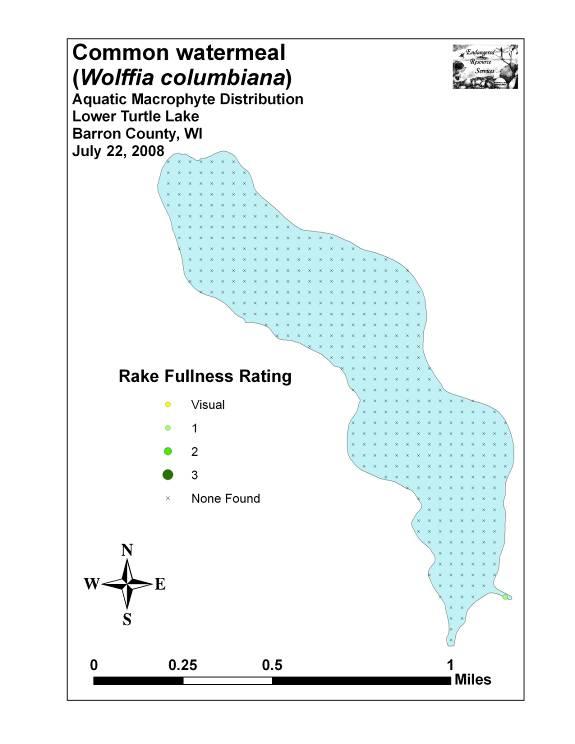
16 Species Table 2: Frequencies and Mean Rake Sample of Aquatic Macrophytes Lower Turtle Lake, Barron County, July 2008 Common Name Total Sites Relative Freq. Freq. in Veg. Freq. in Lit. Mean Rake Potamogeton zosteriformis Flat-stem pondweed Vallisneria americana Wild celery Ceratophyllum demersum Coontail Potamogeton friesii Fries pondweed Potamogeton pusillus Small pondweed Filamentous algae Potamogeton richardsonii Clasping-leaf pondweed Potamogeton crispus Curly-leaf pondweed Stuckenia pectinata Sago pondweed Lemna minor Small duckweed Nymphaea odorata White water lily Spirodela polyrhiza Large duckweed Myriophyllum sibiricum Northern water milfoil Najas flexilis Bushy pondweed Chara sp. Muskgrass Heteranthera dubia Water star-grass Sparganium eurycarpum Common bur-reed Wolffia columbiana Common watermeal Nuphar variegata Spatterdock ** ** ** ** ** Carex comosa Bottle-brush sedge *** *** *** *** *** Eleocharis erythropoda Red-footed spikerush *** *** *** *** *** Elodea canadensis Common waterweed *** *** *** *** *** Phalaris arundinacea Reed canary grass *** *** *** *** *** Sagittaria latifolia Common arrowhead *** *** *** *** *** 10
17 Table 2 (cont ): Frequencies and Mean Rake Sample of Aquatic Macrophytes Lower Turtle Lake, Barron County, July 2008 Schoenoplectus fluviatilis River bulrush *** *** *** *** *** Schoenoplectus tabernaemontani Softstem bulrush *** *** *** *** *** Typha latifolia Broad-leaved cattail *** *** *** *** *** ** Visual Only *** Boat Survey Only 11
18 Table 3: Floristic Quality Index of Aquatic Macrophytes Lower Turtle Lake, Barron County July 2008 Species Common Name C Carex comosa Bottle brush sedge 5 Ceratophyllum demersum Coontail 3 Chara sp. Muskgrass 7 Eleocharis erythropoda Red-footed spikerush 3 Elodea canadensis Common waterweed 3 Heteranthera dubia Water star-grass 6 Lemna minor Small duckweed 5 Myriophyllum sibiricum Northern water milfoil 7 Najas flexilis Bushy pondweed 6 Nuphar variegata Spatterdock 6 Nymphaea odorata White water lily 6 Potamogeton friesii Fries' pondweed 8 Potamogeton pusillus Small pondweed 7 Potamogeton richardsonii Clasping-leaf pondweed 5 Potamogeton zosteriformis Flat-stem pondweed 6 Sagittaria latifolia Common arrowhead 3 Schoenoplectus fluviatilis River bulrush 5 Schoenoplectus tabernaemontani Softstem bulrush 4 Sparganium eurycarpum Common bur-reed 5 Spirodela polyrhiza Large duckweed 5 Stuckenia pectinata Sago pondweed 3 Typha latifolia Broad-leaved cattail 1 Vallisneria americana Wild celery 6 Wolffia columbiana Common watermeal 5 N 24 mean C 5.0 FQI 24.5 We identified a total of 24 native plants to species in and immediately adjacent to Lower Turtle Lake (Table 3). They produced a mean Coefficient of Conservation of 5.0 and a Floristic Index of Nichols (1999) reported Average Mean C for the Northern Central Hardwood Forests Region of 5.6 putting Lower Turtle Lake below average for this part of the state. The FQI was, however, slightly above the mean FQI of 20.9 for the Northern Central Hardwood Forests Region (Nichols 1999). These numbers indicate the lake had few species that can tolerate disturbance or pollution, but a slightly higher than average number of species overall. Besides Curly-leaf pondweed, Reed canary grass (Phalaris arundinacea) was the only other exotic species we found. It was common in the marsh areas around the north and south bays, and in undeveloped shoreline areas. We did not locate any Eurasian water milfoil, Purple Loosestrife or any other new exotic species during either the June or July surveys. For more information on exotic species, see Appendix VIII. 12
 and other floating algae throughout Lower Turtle Lake (Figures 7 and 8).")

19 Figure 7: Filamentous algae in Lower Turtle Lake, July 2008 Figure 8: Filamentous algae over Muck in Shallow Areas We noted significant amounts of filamentous algae (relative frequency of 8.01) and other floating algae throughout Lower Turtle Lake (Figures 7 and 8). We found it to be especially common in the north and south bays over organic muck, in front of managed lawns where fertilizer application was evident, along shoreline areas where agricultural fields were immediately across the street, and in areas where property owners cut the native vegetation down to the lakeshore (Figure 9). 13

20 Figure 9: Elimination of Native Shoreline Vegetation DISCUSSION AND CONSIDERATIONS FOR MANAGEMENT: Lower Turtle Lake s aquatic plants are critical to the overall health of the lake. As the base of the aquatic food pyramid, they provide food and shelter for insects and other aquatic invertebrates. These animals then provide food for baitfish which are then eaten by gamefish. The leaves, shoots and roots of aquatic plants are also important food for waterfowl and other wildlife. Aquatic plants also prevent erosion by stabilizing the shoreline, and work to improve water clarity by absorbing excess nutrients from the water. Based on our June Curly-leaf pondweed (CLP) survey, July point intercept survey, and general boat survey observations, we feel there are two main threats to the current and future health of Lower Turtle Lake s plant community and the lake s overall water clarity and quality. The first and most immediate threat is the high levels of filamentous and floating algae in the lake. The presence of these algae is strong anecdotal evidence that there are excessive nutrients in the water from such things as dead plant breakdown, failed septic systems, and lawn and field fertilizer runoff. The breakdown of CLP in June may have contributed to the algal blooms we observed in July. Analysis of the data suggests there is a strong correlation between areas of high CLP densities in June and high filamentous algae blooms in July. The elimination of shoreline vegetation can also increase the lake s nutrient load. The dense areas of filamentous algae that occurred in front of some residences where there is no obvious visual reason for it may indicate septic systems are leaching nutrients into the lake. In other instances, obviously fertilized lawns or nearby agricultural fields seemed to be the most likely explanation for these high levels of localized algae growth. Educating lake residents about reducing nutrient input directly along the lake is the least expensive way to decrease algal growth and improve water clarity. Not mowing down to 14
21 the lakeshore, switching to a phosphorus-free fertilizer or eliminating fertilizer altogether would all be positive steps to this end. Where possible, especially along the east and west shores of Lower Turtle Lake, shoreline restoration and buffer strips of native vegetation would enhance water quality by preventing erosion and runoff as well as improve the aesthetic value of these highly developed shorelines. Lakewide septic system analysis would be expensive, but could pay significant dividends towards improving water clarity and quality. Perhaps the most ambitious potential solution both from a time and cost perspective, but the one that promises the greatest potential benefit is a comprehensive watershed analysis plan. By testing surface water input, ground water, wells and septic systems, a more complete picture of nutrient loading throughout the system would provide strong direction on how to best reduce these nutrients. A project of this scale would ideally involve Upper Turtle Lake as ultimately, their water quality becomes Lower Turtle Lake s water quality. The second biggest threat to Lower Turtle Lake s native plant community is the future introduction of Eurasian water milfoil (EWM) into the lake. Preventing aquatic invasive species (AIS) introduction or detecting them immediately upon introduction when there is a chance to eliminate them should be one of the Management District s top priorities. Many area lakes have established Clean Boats/Clean Water programs, landing cameras, and noticeable signage about AIS. Improving the current signage would be a positive step as it provides education, reeducation, and continual reminders of the dangers/impacts of AIS. One of the simplest ways to reduce the likelihood of introduction is for lake shore owners to refrain from removing plants from the lake. When they clear native plants from the lake bottom, the patches of barren substrate provide an easy place for invasive plants to take root and become established. Conducting monthly or bimonthly EWM surveys in transects parallel to the shore at the public boat launches would also improve the odds of detecting a EWM infestation early on before it has a chance to spread. Finally, although we did not locate any Purple loosestrife on or directly adjacent to the lake, it is present in Barron County, and as close as Horseshoe Lake. Because of this, it is possible that it will show up at Lower Turtle Lake at some point in the future. As Purple loosestrife prefers organic muck soil, the most likely point for this invasion would be the cattail marsh areas surrounding the north and south bays. Spotting a new infestation would be easiest when the plant blooms in mid-late August. Catching it early on would allow removal before the plants could spread and take over the marsh. Regardless of which if any of these recommendations the Lake District decides to consider, any active management of the lake s plants will require the development and completion of an Aquatic Plant Management Plan (APMP) as outlined by the WDNR. Because of this, completing an APMP will be the next step in managing the lake and its aquatic plants. 15
22 Prioritized Management Considerations Summary: Preserve and maintain Lower Turtle Lake s native plant community. Complete an Aquatic Plant Management Plan Reduce and, wherever possible, eliminate fertilizer applications near the lakeshore. Encourage owners to refrain from removing native plants from the lake as these areas provide Aquatic Invasive Species an ideal place to become established. Consider transect monitoring for invasive species at the lake s boat landing. Establish native vegetation buffer strips along the lakeshore. Encourage shoreline restoration Consider establishing a Clean Boats/Clean Water campaign. Consider joining with Upper Turtle Lake to complete a watershed wide analysis of water quality to determine where nutrients are entering the system. 16
23 LITERATURE CITED Borman, S., R. Korth, and J. Temte Through the Looking Glass A Field Guide to Aquatic Plants. Wisconsin Lakes Partnership. DNR publication FH Busch, C., G. Winter, and L. Sather. [online] Lake Map for Lower Turtle Lake - Barron County, Wisconsin. Available from:< (2008, August). Chadde, Steve W A Great Lakes Wetland Flora: A complete guide to the aquatic and wetland plants of the Upper Midwest. Pocketflora Press; 2nd edition Crow, G. E., C. B. Hellquist Aquatic and Wetland Plants of Northeastern North America, Volume I + II: A Revised and Enlarged Edition of Norman C. Fassett's A Manual of Aquatic Plants. University of Wisconsin Press; Nichols, Stanley A Floristic Quality Assessment of Wisconsin Lake Plant communities with Example Applications. Journal of Lake and Reservoir Management 15 (2): UWEX Lakes Program. [online] Aquatic Plant Management in Wisconsin. Available from (2008, September). Voss, Edward G Michigan Flora Vol I-III. Cranbrook Institute of Science and University of Michigan Herbarium. WDNR. [online] Citizen Monitoring Lake Water Quality Database. Available from (2008, September). WDNR. [online] Curly-leaf pondweed fact sheet. (2008, September). WDNR. [online] Eurasian water milfoil fact sheet. (2008, September). WDNR. [online] Purple loosestrife fact sheet. (2008, September). WDNR. [online] Reed canary grass. (2008, September). 17
24 Appendix I: Lower Turtle Lake Map with Survey Sample Points 18
25 19
26 Appendix II: Boat Survey Data Sheet 20
27 Boat Survey Lake Name County WBIC Date of Survey (mm/dd/yy) workers Nearest Point Species seen, habitat information 21
28 Appendix III: Vegetative Survey Data Sheet 22
29 Observers for this lake: names and hours worked by each: Lake: WBIC County Date: Site # Depth (ft) Muck (M), Sand (S), Rock (R) Rake pole (P) or rake rope (R) EWM CLP
30 Appendix IV: Habitat Variable Maps 24
31 25
32 26
33 27
34 Appendix V: Plant Specimen Labels 28
35 County/State: Barron County, Wisconsin Date: 7/18/08 Species: (Carex comosa) Bottle-brush sedge Specimen Location: Lower Turtle Lake; N , W Collected/Identified by: Matthew S. Berg Col. #: MSB Habitat/Distribution: Muck bottom along the shoreline. A very few individuals were scattered near the Turtle Creek outlet. Common Associates: (Typha latifolia) Broad-leaved cattail, (Eleocharis erythropoda) Red-footed spikerush, (Sagittaria latifolia) Common arrowhead, (Schoenoplectus tabernaemontani) Softstem bulrush, (Schoenoplectus fluviatilis) River bulrush County/State: Barron County, Wisconsin Date: 7/18/08 Species: (Ceratophyllum demersum) Coontail Specimen Location: Lower Turtle Lake; N , W Collected/Identified by: Matthew S. Berg Col. #: MSB Habitat/Distribution: Found in almost any bottom type, but preferred thick organic muck in meters. Abundant in the north and south bays where it and CLP formed dense beds. Along with Small and Flat-stem pondweeds, it was the deepest growing plant. Common Associates: (Potamogeton zosteriformis) Flat-stem pondweed, (Potamogeton crispus) Curly-leaf pondweed, (Nuphar variegata) Spatterdock, (Nymphaea odorata) White water lily, (Potamogeton pusillus) Small pondweed, Filamentous algae County/State: Barron County, Wisconsin Date: 7/22/08 Species: (Chara sp.) Muskgrass Specimen Location: Lower Turtle Lake; N , W Collected/Identified by: Matthew S. Berg Col. #: MSB Habitat/Distribution: A single individual was found in a sand bottom area in water between meter deep. Common Associates: (Vallisneria americana) Wild celery, (Stuckenia pectinata) Sago pondweed, (Najas flexilis) Bushy pondweed, (Potamogeton richardsonii) Clasping-leaf pondweed, (Potamogeton zosteriformis) Flat-stem pondweed County/State: Barron County, Wisconsin Date: 7/18/08 Species: (Eleocharis erythropoda) Red-footed spikerush Specimen Location: Lower Turtle Lake; N , W Collected/Identified by: Matthew S. Berg Col. #: MSB Habitat/Distribution: Muck bottom along the shoreline. A very few individuals were scattered among cattails and arrowheads near the Turtle Creek outlet. Common Associates: (Typha latifolia) Broad-leaved cattail, (Sagittaria latifolia) Common arrowhead, (Schoenoplectus tabernaemontani) Softstem bulrush, (Schoenoplectus fluviatilis) River bulrush, (Carex comosa) Bottle-brush sedge 29
36 County/State: Barron County, Wisconsin Date: 7/18/08 Species: (Elodea canadensis) Common waterweed Specimen Location: Lower Turtle Lake; N , W Collected/Identified by: Matthew S. Berg Col. #: MSB Habitat/Distribution: Muck bottom in meters of water. Rare; No specimens were found at survey points, but a few individuals were located in the northeast corner of the north bay. Common Associates: (Potamogeton crispus) Curly-leaf pondweed, (Ceratophyllum demersum) Coontail, (Potamogeton pusillus) Small pondweed, Filamentous algae County/State: Barron County, Wisconsin Date: 7/18/08 Species: (Heteranthera dubia) Water star-grass Specimen Location: Lower Turtle Lake; N , W Collected/Identified by: Matthew S. Berg Col. #: MSB Habitat/Distribution: Firm muck bottoms usually in water < 1 meter deep. Although we found star-grass at only one survey point, we observed a few individuals at several other locations in the lake. Common Associates: (Vallisneria americana) Wild celery, (Stuckenia pectinata) Sago pondweed, (Potamogeton friesii) Fries pondweed, (Potamogeton pusillus) Small pondweed, (Potamogeton richardsonii) Clasping-leaf pondweed, (Ceratophyllum demersum) Coontail County/State: Barron County, Wisconsin Date: 7/18/08 Species: (Lemna minor) Small duckweed Specimen Location: Lower Turtle Lake; N , W Collected/Identified by: Matthew S. Berg Col. #: MSB Habitat/Distribution: Located floating at or just under the surface in sheltered areas in the north and south bays. Scattered individuals found interspersed between the lilypads, and Coontail beds. Common Associates: (Potamogeton zosteriformis) Flat-stem pondweed, (Ceratophyllum demersum) Coontail, (Nymphaea odorata) White water lily, Filamentous algae, (Spirodela polyrhiza) Large duckweed, (Potamogeton crispus) Curly-leaf pondweed County/State: Barron County, Wisconsin Date: 7/18/08 Species: (Myriophyllum sibiricum) Northern water milfoil Specimen Location: Lower Turtle Lake; N , W Collected/Identified by: Matthew S. Berg Col. #: MSB Habitat/Distribution: Muck to sand bottom in water up to 2 meters. Uncommon in the south bay and along the southeast shore. Common Associates: (Potamogeton zosteriformis) Flat-stem pondweed, (Ceratophyllum demersum) Coontail, (Potamogeton pusillus) Small pondweed, (Potamogeton richardsonii) Clasping-leaf pondweed, (Vallisneria americana) Wild celery 30
37 County/State: Barron County, Wisconsin Date: 7/18/08 Species: (Najas flexilis) Bushy pondweed Specimen Location: Lower Turtle Lake; N , W Collected/Identified by: Matthew S. Berg Col. #: MSB Habitat/Distribution: Found in sand bottom areas in meters of water. Uncommon being found at only a few scattered locations on the east and west shorelines. Common Associates: (Vallisneria americana) Wild celery, (Potamogeton pusillus) Small pondweed, (Potamogeton richardsonii) Clasping-leaf pondweed, (Stuckenia pectinata) Sago pondweed County/State: Barron County, Wisconsin Date: 7/18/08 Species: (Nuphar variegata) Spatterdock Specimen Location: Lower Turtle Lake; N , W Collected/Identified by: Matthew S. Berg Col. #: MSB Habitat/Distribution: Muck bottom in meters of water where it often forms dense canopies with White water lily. Uncommon in muck bays and sheltered shoreline areas of the lake. Most plants were restricted to the southwest and southern end of the lake. It normally preferred a firmer bottom than Nymphaea. Common Associates: (Nymphaea odorata) White water lily, (Potamogeton zosteriformis) Flat-stem pondweed, (Ceratophyllum demersum) Coontail, (Potamogeton pusillus) Small pondweed County/State: Barron County, Wisconsin Date: 7/18/08 Species: (Nymphaea odorata) White water lily Specimen Location: Lower Turtle Lake; N , W Collected/Identified by: Matthew S. Berg Col. #: MSB Habitat/Distribution: Muck bottom in 0-2 meters where it forms dense canopies with other floating leaf species. Relatively common in its preferred habitat; especially in the south and southwest bays. Common Associates: (Nuphar variegata) Spatterdock, (Ceratophyllum demersum) Coontail, (Potamogeton zosteriformis) Flat-stem pondweed, Filamentous algae County/State: Barron County, Wisconsin Date: 7/18/08 Species: (Phalaris arundinacea) Reed canary grass Specimen Location: Lower Turtle Lake; N , W Collected/Identified by: Matthew S. Berg Col. #: MSB Habitat/Distribution: Common in undeveloped low areas - especially at the edge of cattail marshes on the north and south end of the lake. Prefers thick muck soil in and out of water <0.5 meters. Common Associates: (Typha latifolia) Broad-leaved cattail, (Sparganium eurycarpum) Common bur-reed 31
38 County/State: Barron County, Wisconsin Date: 7/18/08 Species: (Potamogeton crispus) Curly-leaf pondweed Specimen Location: Lower Turtle Lake; N , W Collected/Identified by: Matthew S. Berg Col. #: MSB Habitat/Distribution: Found in all bottoms types, but only abundant over thick muck in 0-2m of water. Common in the north and south bays near the Turtle Creek inlet and outlet. Common Associates: (Ceratophyllum demersum) Coontail, (Potamogeton zosteriformis) Flat-stem pondweed, Filamentous algae County/State: Barron County, Wisconsin Date: 7/18/08 Species: (Potamogeton friesii) Fries pondweed Specimen Location: Lower Turtle Lake; N , W Collected/Identified by: Matthew S. Berg Col. #: MSB Habitat/Distribution: Sand and gravel in meters of water. Widespread and abundant; especially on the east shoreline. Common Associates: (Vallisneria americana) Wild celery, (Potamogeton zosteriformis) Flat-stem pondweed, (Potamogeton pusillus) Small pondweed, (Potamogeton richardsonii) Clasping-leaf pondweed County/State: Barron County, Wisconsin Date: 7/18/08 Species: (Potamogeton pusillus) Small pondweed Specimen Location: Lower Turtle Lake; N , W Collected/Identified by: Matthew S. Berg Col. #: MSB Habitat/Distribution: Found in almost any bottom conditions, but grows best in rock/ sand bottoms in 1-2 meters of water. Common and widely distributed throughout. Common Associates: (Potamogeton crispus) Curly-leaf pondweed, (Vallisneria americana) Wild celery, (Ceratophyllum demersum) Coontail, (Potamogeton zosteriformis) Flat-stem pondweed, (Potamogeton friesii) Fries pondweed County/State: Barron County, Wisconsin Date: 7/18/08 Species: (Potamogeton richardsonii) Clasping-leaf pondweed Specimen Location: Lower Turtle Lake; N , W Collected/Identified by: Matthew S. Berg Col. #: MSB Habitat/Distribution: Found in sand and sandy/muck bottom areas in shallow water meter deep. Common and widespread in the southern 2/3rds of the lake; especially on the east shore. Common Associates: (Vallisneria americana) Wild celery, (Potamogeton zosteriformis) Flat-stem pondweed, (Potamogeton friesii) Fries pondweed, (Stuckenia pectinata) Sago pondweed 32
39 County/State: Barron County, Wisconsin Date: 7/18/08 Species: (Potamogeton zosteriformis) Flat-stem pondweed Specimen Location: Lower Turtle Lake; N , W Collected/Identified by: Matthew S. Berg Col. #: MSB Habitat/Distribution: Thick organic muck to sandy muck. Widely distributed and common to abundant throughout the lake where it grows in meters of water. Common Associates: (Ceratophyllum demersum) Coontail, (Vallisneria americana) Wild celery, (Potamogeton friesii) Fries pondweed, (Stuckenia pectinata) Sago pondweed, (Potamogeton pusillus) Small pondweed, (Potamogeton crispus) Curly-leaf pondweed County/State: Barron County, Wisconsin Date: 7/18/08 Species: (Sagittaria latifolia) Common arrowhead Specimen Location: Lower Turtle Lake; N , W Collected/Identified by: Matthew S. Berg Col. #: MSB Habitat/Distribution: Muck bottom along the shoreline. Relatively common scattered among cattails; especially near the Turtle Creek outlet. Common Associates: (Typha latifolia) Broad-leaved cattail, (Eleocharis erythropoda) Red-footed spikerush, (Schoenoplectus tabernaemontani) Softstem bulrush, (Schoenoplectus fluviatilis) River bulrush, (Carex comosa) Bottle-brush sedge County/State: Barron County, Wisconsin Date: 7/18/08 Species: (Schoenoplectus fluviatilis) River bulrush Specimen Location: Lower Turtle Lake; N , W Collected/Identified by: Matthew S. Berg Col. #: MSB Habitat/Distribution: Firm muck bottom along the shoreline. A very few individuals were scattered at the point near the Turtle Creek outlet. Common Associates: (Typha latifolia) Broad-leaved cattail, (Eleocharis erythropoda) Red-footed spikerush, (Sagittaria latifolia) Common arrowhead, (Schoenoplectus tabernaemontani) Softstem bulrush, (Carex comosa) Bottle-brush sedge County/State: Barron County, Wisconsin Date: 7/18/08 Species: (Schoenoplectus tabernaemontani) Softstem bulrush Specimen Location: Lower Turtle Lake; N , W Collected/Identified by: Matthew S. Berg Col. #: MSB Habitat/Distribution: Muck bottom along the shoreline to water <.5 meters deep. Normally occurs in scattered small patches; especially common on the southeast shore in the bay immediately north and west of the Turtle Creek outlet. Common Associates: (Typha latifolia) Broad-leaved cattail, (Eleocharis erythropoda) Red-footed spikerush, (Sagittaria latifolia) Common arrowhead, (Schoenoplectus fluviatilis) River bulrush, (Carex comosa) Bottle-brush sedge 33
40 County/State: Barron County, Wisconsin Date: 7/18/08 Species: (Sparganium eurycarpum) Common bur-reed Specimen Location: Lower Turtle Lake; N , W Collected/Identified by: Matthew S. Berg Col. #: MSB Habitat/Distribution: Rare over firm sand/muck; a single large patch occurred in the southeast corner of the lake in and out of water <.5m deep. Common Associates: (Typha latifolia) Broad-leaved cattail, (Phalaris arundinacea) Reed canary grass County/State: Barron County, Wisconsin Date: 7/18/08 Species: (Spirodela polyrhiza) Large duckweed Specimen Location: Lower Turtle Lake; N , W Collected/Identified by: Matthew S. Berg Col. #: MSB Habitat/Distribution: Located floating at or just under the surface in stagnant bays. Rare; scattered individuals occur interspersed between the lilypads at a few sites in the north and south bays. Common Associates: (Ceratophyllum demersum) Coontail, (Potamogeton zosteriformis) Flat-stem pondweed, (Nymphaea odorata) White water lily, (Nuphar variegata) Spatterdock, (Wolffia columbiana) Common watermeal, (Lemna minor) Small duckweed County/State: Barron County, Wisconsin Date: 7/18/08 Species: (Stuckenia pectinata) Sago pondweed Specimen Location: Lower Turtle Lake; N , W Collected/Identified by: Matthew S. Berg Col. #: MSB Habitat/Distribution: Found in sand and sandy/muck bottom areas in shallow water meter deep. Relatively common throughout; especially on the eastern shore. Common Associates: (Potamogeton richardsonii) Clasping-leaf pondweed, (Vallisneria americana) Wild celery, (Potamogeton zosteriformis) Flat-stem pondweed, (Potamogeton friesii) Fries pondweed County/State: Barron County, Wisconsin Date: 7/18/08 Species: (Typha latifolia) Broad-leaved cattail Specimen Location: Lower Turtle Lake; N , W Collected/Identified by: Matthew S. Berg Col. #: MSB Habitat/Distribution: Muck bottom areas along undeveloped shoreline. Scattered individuals were located throughout, but the biggest patches were in the marshy bays along the Turtle Creek inlet and outlet. Common Associates: (Eleocharis erythropoda) Red-footed spikerush, (Sagittaria latifolia) Common arrowhead, (Schoenoplectus tabernaemontani) Softstem bulrush, (Schoenoplectus fluviatilis) River bulrush, (Carex comosa) Bottle-brush sedge 34
41 County/State: Barron County, Wisconsin Date: 7/18/08 Species: (Vallisneria americana) Wild celery Specimen Location: Lower Turtle Lake; N , W Collected/Identified by: Matthew S. Berg Col. #: MSB Habitat/Distribution: Found in almost any bottom conditions, but grows best in sandy to sand/muck bottoms in meters of water. Abundant and widely distributed throughout the lake. It forms especially dense beds along the east shoreline. Common Associates: (Potamogeton pusillus) Small pondweed, (Potamogeton zosteriformis) Flat-stem pondweed, (Potamogeton richardsonii) Clasping-leaf pondweed, (Stuckenia pectinata) Sago pondweed, (Potamogeton friesii) Fries s pondweed County/State: Barron County, Wisconsin Date: 7/18/08 Species: (Wolffia columbiana) Common watermeal Specimen Location: Lower Turtle Lake; N , W Collected/Identified by: Matthew S. Berg Col. #: MSB Habitat/Distribution: Located floating at or just under the surface in sheltered areas. Only specimens were found in a stagnant bay in the far southeast corner of the lake interspersed between the lilypads and along shore. Common Associates: (Nymphaea odorata) White water lily, (Spirodela polyrhiza) Large duckweed, (Potamogeton zosteriformis) Flat-stem pondweed County/State: Barron County, Wisconsin Date: 7/27/08 Species: Filamentous algae Habitat/Distribution: Most common in stagnant areas in the north and south bays in areas that had high densities of Curly-leaf pondweed in June, and in front of properties with managed lawns where fertilizer runoff encouraged growth. High levels throughout the lake are likely due to these factors coupled with agricultural runoff from the many surrounding farm fields immediately adjacent to the lake. Common Associates: (Ceratophyllum demersum) Coontail, (Potamogeton zosteriformis) Flat-stem pondweed, (Potamogeton crispus) Curly-leaf pondweed 35
42 Appendix VI: Plant Species Distribution Maps 36
43 37
44 38
45 39
46 40
47 41
48 42
49 43
50 44
51 45
52 46
53 47
54 48
55 49
56 50
57 51
58 52
59 53
60 54
61 55
62 Appendix VII: Glossary of Biological Terms (Adapted from UWEX 2008) 56
63 Aquatic: organisms that live in or frequent water. Cultural Eutrophication: accelerated eutrophication that occurs as a result of human activities in the watershed that increase nutrient loads in runoff water that drains into lakes. Dissolved Oxygen (DO): the amount of free oxygen absorbed by the water and available to aquatic organisms for respiration; amount of oxygen dissolved in a certain amount of water at a particular temperature and pressure, often expressed as a concentration in parts of oxygen per million parts of water. Diversity: number of species in a particular community or habitat. Drainage lakes: Lakes fed primarily by streams and with outlets into streams or rivers. They are more subject to surface runoff problems but generally have shorter residence times than drainage lakes. Watershed protection is usually needed to manage lake water quality. Ecosystem: a system formed by the interaction of a community of organisms with each other and with the chemical and physical factors making up their environment. Eutrophication: the process by which lakes and streams are enriched by nutrients, and the resulting increase in plant and algae growth. This process includes physical, chemical, and biological changes that take place after a lake receives inputs for plant nutrients--mostly nitrates and phosphates--from natural erosion and runoff from the surrounding land basin. The extent to which this process has occurred is reflected in a lake's trophic classification: oligotrophic (nutrient poor), mesotrophic (moderately productive), and eutrophic (very productive and fertile). Exotic: a non-native species of plant or animal that has been introduced. Habitat: the place where an organism lives that provides an organism's needs for water, food, and shelter. It includes all living and non-living components with which the organism interacts. Limnology: the study of inland lakes and waters. 57
64 Littoral: the near shore shallow water zone of a lake, where aquatic plants grow. Macrophytes: Refers to higher (multi-celled) plants growing in or near water. Macrophytes are beneficial to lakes because they produce oxygen and provide substrate for fish habitat and aquatic insects. Overabundance of such plants, especially problem species, is related to shallow water depth and high nutrient levels. Nutrients: elements or substances such as nitrogen and phosphorus that are necessary for plant growth. Large amounts of these substances can become a nuisance by promoting excessive aquatic plant growth. Organic Matter: elements or material containing carbon, a basic component of all living matter. Photosynthesis: the process by which green plants convert carbon dioxide (CO2) dissolved in water to sugar and oxygen using sunlight for energy. Photosynthesis is essential in producing a lake's food base, and is an important source of oxygen for many lakes. Phytoplankton: microscopic plants found in the water. Algae or one-celled (phytoplankton) or multicellular plants either suspended in water (Plankton) or attached to rocks and other substrates (periphyton). Their abundance, as measured by the amount of chlorophyll a (green pigment) in an open water sample, is commonly used to classify the trophic status of a lake. Numerous species occur. Algae are an essential part of the lake ecosystem and provides the food base for most lake organisms, including fish. Phytoplankton populations vary widely from day to day, as life cycles are short. Plankton: small plant organisms (phytoplankton and nanoplankton) and animal organisms (zooplankton) that float or swim weakly though the water. ppm: parts per million; units per equivalent million units; equal to milligrams per liter (mg/l) 58
65 Rooted Aquatic Plants: (macrophytes) Refers to higher (multi-celled) plants growing in or near water. Macrophytes are beneficial to lakes because they produce oxygen and provide substrate for fish habitat and aquatic insects. Overabundance of such plants, especially problem species, is related to shallow water depth and high nutrient levels. Runoff: water that flows over the surface of the land because the ground surface is impermeable or unable to absorb the water. Secchi Disc: An 8-inch diameter plate with alternating quadrants painted black and white that is used to measure water clarity (light penetration). The disc is lowered into water until it disappears from view. It is then raised until just visible. An average of the two depths, taken from the shaded side of the boat, is recorded as the Secchi disc reading. For best results, the readings should be taken on sunny, calm days. Drainage lakes: Lakes without a significant inlet or outlet, fed by rainfall and groundwater. Drainage lakes lose water through evaporation and groundwater moving on a down gradient. Lakes with little groundwater inflow tend to be naturally acidic and most susceptible to the effects of acid rain. Drainage lakes often have long,residence times. and lake levels fluctuate with local groundwater levels. Water quality is affected by groundwater quality and the use of land on the shoreline. Turbidity: degree to which light is blocked because water is muddy or cloudy. Watershed: the land area draining into a specific stream, river, lake or other body of water. These areas are divided by ridges of high land. Zooplankton: Microscopic or barely visible animals that eat algae. These suspended plankton are an important component of the lake food chain and ecosystem. For many fish, they are the primary source of food. 59
66 Appendix VIII: June CLP Survey Map and Additional Exotic Species Information 60
67 61

68 Curly-leaf pondweed DESCRIPTION: Curly-leaf pondweed is an invasive aquatic perennial that is native to Eurasia, Africa, and Australia. It was accidentally introduced to United States waters in the mid-1880s by hobbyists who used it as an aquarium plant. The leaves are reddishgreen, oblong, and about 3 inches long, with distinct wavy edges that are finely toothed. The stem of the plant is flat, reddish-brown and grows from 1 to 3 feet long. The plant usually drops to the lake bottom by early July DISTRIBUTION AND HABITAT: Curly-leaf pondweed is commonly found in alkaline and high nutrient waters, preferring soft substrate and shallow water depths. It tolerates low light and low water temperatures. It has been reported in all states but Maine LIFE HISTORY AND EFFECTS OF INVASION: Curly-leaf pondweed spreads through burr-like winter buds (turions), which are moved among waterways. These plants can also reproduce by seed, but this plays a relatively small role compared to the vegetative reproduction through turions. New plants form under the ice in winter, making curly-leaf pondweed one of the first nuisance aquatic plants to emerge in the spring. It becomes invasive in some areas because of its tolerance for low light and low water temperatures. These tolerances allow it to get a head start on and out compete native plants in the spring. In mid-summer, when most aquatic plants are growing, curly-leaf pondweed plants are dying off. Plant die-offs may result in a critical loss of dissolved oxygen. Furthermore, the decaying plants can increase nutrients which contribute to algal blooms, as well as create unpleasant stinking messes on beaches. Curly-leaf pondweed forms surface mats that interfere with aquatic recreation. (Taken in its entirety from WDNR,

69 Eurasian water milfoil DESCRIPTION: Eurasian water milfoil is a submersed aquatic plant native to Europe, Asia, and northern Africa. It is the only non-native milfoil in Wisconsin. Like the native milfoils, the Eurasian variety has slender stems whorled by submersed feathery leaves and tiny flowers produced above the water surface. The flowers are located in the axils of the floral bracts, and are either four-petaled or without petals. The leaves are threadlike, typically uniform in diameter, and aggregated into a submersed terminal spike. The stem thickens below the inflorescence and doubles its width further down, often curving to lie parallel with the water surface. The fruits are four-jointed nut-like bodies. Without flowers or fruits, Eurasian water milfoil is nearly impossible to distinguish from Northern water milfoil. Eurasian water milfoil has 9-21 pairs of leaflets per leaf, while Northern milfoil typically has 7-11 pairs of leaflets. Coontail is often mistaken for the milfoils, but does not have individual leaflets. DISTRIBUTION AND HABITAT: Eurasian milfoil first arrived in Wisconsin in the 1960's. During the 1980's, it began to move from several counties in southern Wisconsin to lakes and waterways in the northern half of the state. As of 1993, Eurasian milfoil was common in 39 Wisconsin counties (54%) and at least 75 of its lakes, including shallow bays in Lakes Michigan and Superior and Mississippi River pools. Eurasian water milfoil grows best in fertile, fine-textured, inorganic sediments. In less productive lakes, it is restricted to areas of nutrient-rich sediments. It has a history of becoming dominant in eutrophic, nutrient-rich lakes, although this pattern is not universal. It is an opportunistic species that prefers highly disturbed lake beds, lakes receiving nitrogen and phosphorous-laden runoff, and heavily used lakes. Optimal growth occurs in alkaline systems with a high concentration of dissolved inorganic carbon. High water temperatures promote multiple periods of flowering and fragmentation. 63
70 LIFE HISTORY AND EFFECTS OF INVASION: Unlike many other plants, Eurasian water milfoil does not rely on seed for reproduction. Its seeds germinate poorly under natural conditions. It reproduces vegetatively by fragmentation, allowing it to disperse over long distances. The plant produces fragments after fruiting once or twice during the summer. These shoots may then be carried downstream by water currents or inadvertently picked up by boaters. Milfoil is readily dispersed by boats, motors, trailers, bilges, live wells, or bait buckets, and can stay alive for weeks if kept moist. Once established in an aquatic community, milfoil reproduces from shoot fragments and stolons (runners that creep along the lake bed). As an opportunistic species, Eurasian water milfoil is adapted for rapid growth early in spring. Stolons, lower stems, and roots persist over winter and store the carbohydrates that help milfoil claim the water column early in spring, photosynthesize, divide, and form a dense leaf canopy that shades out native aquatic plants. Its ability to spread rapidly by fragmentation and effectively block out sunlight needed for native plant growth often results in monotypic stands. Monotypic stands of Eurasian milfoil provide only a single habitat, and threaten the integrity of aquatic communities in a number of ways; for example, dense stands disrupt predatorprey relationships by fencing out larger fish, and reducing the number of nutrient-rich native plants available for waterfowl. Dense stands of Eurasian water milfoil also inhibit recreational uses like swimming, boating, and fishing. Some stands have been dense enough to obstruct industrial and power generation water intakes. The visual impact that greets the lake user on milfoildominated lakes is the flat yellow-green of matted vegetation, often prompting the perception that the lake is "infested" or "dead". Cycling of nutrients from sediments to the water column by Eurasian water milfoil may lead to deteriorating water quality and algae blooms of infested lakes. (Taken in its entirety from WDNR,

71 Reed canary grass DESCRIPTION: Reed canary grass is a large, coarse grass that reaches 2 to 9 feet in height. It has an erect, hairless stem with gradually tapering leaf blades 3 1/2 to 10 inches long and 1/4 to 3/4 inch in width. Blades are flat and have a rough texture on both surfaces. The lead ligule is membranous and long. The compact panicles are erect or slightly spreading (depending on the plant's reproductive stage), and range from 3 to 16 inches long with branches 2 to 12 inches in length. Single flowers occur in dense clusters in May to mid-june. They are green to purple at first and change to beige over time. This grass is one of the first to sprout in spring, and forms a thick rhizome system that dominates the subsurface soil. Seeds are shiny brown in color. Both Eurasian and native ecotypes of reed canary grass are thought to exist in the U.S. The Eurasian variety is considered more aggressive, but no reliable method exists to tell the ecotypes apart. It is believed that the vast majority of our reed canary grass is derived from the Eurasian ecotype. Agricultural cultivars of the grass are widely planted. Reed canary grass also resembles non-native orchard grass (Dactylis glomerata), but can be distinguished by its wider blades, narrower, more pointed inflorescence, and the lack of hairs on glumes and lemmas (the spikelet scales). Additionally, bluejoint grass (Calamagrostis canadensis) may be mistaken for reed canary in areas where orchard grass is rare, especially in the spring. The highly transparent ligule on reed canary grass is helpful in distinguishing it from the others. Ensure positive identification before attempting control. 65
72 DISTRIBUTION AND HABITAT: Reed canary grass is a cool-season, sod-forming, perennial wetland grass native to temperate regions of Europe, Asia, and North America. The Eurasian ecotype has been selected for its vigor and has been planted throughout the U.S. since the 1800's for forage and erosion control. It has become naturalized in much of the northern half of the U.S., and is still being planted on steep slopes and banks of ponds and created wetlands. Reed canary grass can grow on dry soils in upland habitats and in the partial shade of oak woodlands, but does best on fertile, moist organic soils in full sun. This species can invade most types of wetlands, including marshes, wet prairies, sedge meadows, fens, stream banks, and seasonally wet areas; it also grows in disturbed areas such as bergs and spoil piles. LIFE HISTORY AND EFFECTS OF INVASION: Reed canary grass reproduces by seed or creeping rhizomes. It spreads aggressively. The plant produces leaves and flower stalks for 5 to 7 weeks after germination in early spring, then spreads laterally. Growth peaks in mid-june and declines in mid-august. A second growth spurt occurs in the fall. The shoots collapse in mid to late summer, forming a dense, impenetrable mat of stems and leaves. The seeds ripen in late June and shatter when ripe. Seeds may be dispersed from one wetland to another by waterways, animals, humans, or machines. This species prefers disturbed areas, but can easily move into native wetlands. Reed canary grass can invade a disturbed wetland in less than twelve years. Invasion is associated with disturbances including ditching of wetlands, stream channelization, deforestation of swamp forests, sedimentation, and intentional planting. The difficulty of selective control makes reed canary grass invasion of particular concern. Over time, it forms large, monotypic stands that harbor few other plant species and are subsequently of little use to wildlife. Once established, reed canary grass dominates an area by building up a tremendous seed bank that can eventually erupt, germinate, and recolonize treated sites. (Taken in its entirety from WDNR,

73 Purple loosestrife DESCRIPTION: Purple loosestrife is a perennial herb 3-7 feet tall with a dense bushy growth of 1-50 stems. The stems, which range from green to purple, die back each year. Showy flowers vary from purple to magenta, possess 5-6 petals aggregated into numerous long spikes, and bloom from July to September. Leaves are opposite, nearly linear, and attached to four-sided stems without stalks. It has a large, woody taproot with fibrous rhizomes that form a dense mat. This species may be confused with the native wing-angled loosestrife (Lythrum alatum) found in moist prairies or wet meadows. The latter has a winged, square stem and solitary paired flowers in the leaf axils. It is generally a smaller plant than the Eurasian loosestrife. By law, purple loosestrife is a nuisance species in Wisconsin. It is illegal to sell, distribute, or cultivate the plants or seeds, including any of its cultivars. Distribution and Habitat: Purple loosestrife is a wetland herb that was introduced as a garden perennial from Europe during the 1800's. It is still promoted by some horticulturists for its beauty as a landscape plant, and by beekeepers for its nectarproducing capability. Currently, about 24 states have laws prohibiting its importation or distribution because of its aggressively invasive characteristics. It has since extended its range to include most temperate parts of the United States and Canada. The plant's reproductive success across North America can be attributed to its wide tolerance of physical and chemical conditions characteristic of disturbed habitats, and its ability to 67
2015 Aquatic Plant Surveys
 Lake Puckaway 2015 Aquatic Plant Survey Results June 13, 2016 Shallow Lakes are Special Clear State Turbid State Brenton Butterfield Tim Hoyman Paul Garrison Aquatic Plants are Incredibly Important Shallow
To whom it may concern:
 State of Wisconsin DEPARTMENT OF NATURAL RESOURCES 2801 Progress Rd. Madison WI 53716 Scott Walker, Governor Cathy Stepp, Secretary December 16, 2012 To whom it may concern: This summer you requested information
memo Project Name Spider Lake Point Intercept Survey 2017 Date 9/5/17 To / Contact info Jerry Spetzman Cc / Contact info Greg Graske, PE
 memo Project Name Spider Lake Point Intercept Survey 2017 Date 9/5/17 To / Contact info Cc / Contact info From / Contact info Regarding Jerry Spetzman Greg Graske, PE Joe Pallardy, Mike Majeski Spider
memo Project Name Little Lake Point Intercept Survey 2017 Date 9/5/17 To / Contact info Jerry Spetzman Cc / Contact info Greg Graske, PE
 memo Project Name Little Lake Point Intercept Survey 2017 Date 9/5/17 To / Contact info Cc / Contact info From / Contact info Regarding Jerry Spetzman Greg Graske, PE Joe Pallardy, Mike Majeski Little
Project Initiated by: Burnett County Land and Water Conservation Department, Wisconsin Department of Natural Resources, and the Ham Lake Association
 Warm Water Point Intercept Aquatic Macrophyte and Fall EWM (Myriophyllum spicatum) Bed Mapping Surveys Ham Lake (WBIC: 2467700) Burnett County, Wisconsin Project Initiated by: Burnett County Land and Water
WELCOME. Scott Provost Water Resources Specialist - WDNR Wisconsin Rapids, WI
 WELCOME Scott Provost Water Resources Specialist - WDNR Wisconsin Rapids, WI 715.421.7881 Water Level Flux to Control AIS and Restore Impoundments WHY? Restore natural ebb and flow Restore natural rhythm
Lake Mansfield 2012 Aquatic Vegetation Survey
 Final Project Report: September 13, 2012 Lake Mansfield 2012 Aquatic Vegetation Survey ======== Prepared For: Town of Great Barrington Attn: Amanda Sewall, Conservation Agent Town Hall, 334 Main Street
Curly-leaf Pondweed and Full Warm Water Point/Intercept Macrophyte Surveys Fawn Lake Spider Chain (WBIC: ) Sawyer County, Wisconsin
 Sawyer County, Wisconsin") Curly-leaf Pondweed and Full Warm Water Point/Intercept Macrophyte Surveys Fawn Lake Spider Chain (WBIC: 2435900) Sawyer County, Wisconsin Fawn Lake aerial photo (2010) Emergent vegetation in the Fawn
Curly-leaf Pondweed and Full Warm Water Point/Intercept Macrophyte Surveys Fawn Lake Spider Chain (WBIC: 2435900) Sawyer County, Wisconsin Fawn Lake aerial photo (2010) Emergent vegetation in the Fawn
Aquatic vegetation of Grand Lake
 Aquatic vegetation of Grand Lake July and August, 2010 ID# 73-0055-00 Stearns County, Minnesota Wild rice bed, south shore of Grand Lake 2010. COPYRIGHT Minnesota Department of Natural Resources 2011 Report
Aquatic Vegetation of Edward Lake Crow Wing County, Minnesota (DOW ) July 8, 9, 14, 26; August 2, 2004
 July 8, 9, 14, 26; August 2, 2004") Aquatic Vegetation of Edward Lake Crow Wing County, Minnesota (DOW 18-0305-00) July 8, 9, 14, 26; August 2, 2004 Report by: Donna Perleberg Minnesota Department of Natural Resources Division of Ecological
Aquatic Vegetation of Edward Lake Crow Wing County, Minnesota (DOW 18-0305-00) July 8, 9, 14, 26; August 2, 2004 Report by: Donna Perleberg Minnesota Department of Natural Resources Division of Ecological
Serpent Lake (DOW # )
") Aquatic Vegetation Survey of Serpent Lake (DOW #18-0090-00) Crow Wing County, Minnesota 2009 Loons on Serpent Lake, May 2009. COPYRIGHT Minnesota Department of Natural Resources 2009 Report by: Donna Perleberg,
Aquatic Vegetation Survey of Serpent Lake (DOW #18-0090-00) Crow Wing County, Minnesota 2009 Loons on Serpent Lake, May 2009. COPYRIGHT Minnesota Department of Natural Resources 2009 Report by: Donna Perleberg,
Aquatic vegetation of Cross Lake
 Aquatic vegetation of Cross Lake June and July, 2010 ID# 18-0312-00 Crow Wing County, Minnesota Cross Lake 2010. COPYRIGHT Minnesota Department of Natural Resources 2010 Report by: Stephanie Simon, Aquatic
Aquatic vegetation of Whitefish Lake
 Aquatic vegetation of Whitefish Lake June, July, August, 2011 Whitefish Lake, ID# 18-0310-00 Crow Wing County, Minnesota Emergent and floating-leaf aquatic plants in Willow Creek Bay, Whitefish Lake, August
Upper South Long Lake (ID # ) and Lower South Long Lake (ID # )
 and Lower South Long Lake (ID # )") Aquatic Vegetation Survey of Upper South Long Lake (ID #18-0096-00) and Lower South Long Lake (ID #18-0136-00) Crow Wing County, Minnesota 2009 Great Blue Heron on Upper South Long Lake, June 2009. COPYRIGHT
Aquatic Vegetation Survey of Upper South Long Lake (ID #18-0096-00) and Lower South Long Lake (ID #18-0136-00) Crow Wing County, Minnesota 2009 Great Blue Heron on Upper South Long Lake, June 2009. COPYRIGHT
Saugus River Watershed Invasive Aquatic Vegetation Assessment
 Saugus River Watershed Invasive Aquatic Vegetation Assessment ================================== DECEMBER 2008 Prepared For: Saugus River Watershed Council c/o Joan LeBlanc, Executive Director P.O. Box
Aquatic vegetation of Roemhildts Lake
 Aquatic vegetation of Roemhildts Lake 2004 and 2011 ID# 40-0039-00 Le Sueur County, Minnesota White waterlilies, bulrush and cattails in Roemhildts Lake, June 2011. COPYRIGHT Minnesota Department of Natural
Farm Island Lake (DOW # )
") Aquatic Vegetation Survey of Farm Island Lake (DOW #01-0159-00) Aitkin County, Minnesota 2009 Farm Island Lake, June 2009. COPYRIGHT Minnesota Department of Natural Resources 2009 Lake survey conducted
Aquatic Vegetation Survey of Farm Island Lake (DOW #01-0159-00) Aitkin County, Minnesota 2009 Farm Island Lake, June 2009. COPYRIGHT Minnesota Department of Natural Resources 2009 Lake survey conducted
Aquatic Macrophyte Survey of the St. Croix/Gordon Flowage Douglas County, Wisconsin JANUARY 2008
 Aquatic Macrophyte Survey of the St. Croix/Gordon Flowage Douglas County, Wisconsin JANUARY 2008 Prepared By UW-Stevens Point, Center for Watershed Science and Education B. Swenson, K. Homan, N. Turyk
Aquatic Vegetation of Grace Lake (DOW ) Hubbard County, Minnesota July 24 and 25, 2006
 Hubbard County, Minnesota July 24 and 25, 2006") Aquatic Vegetation of Grace Lake (DOW 29-0071-00) Hubbard County, Minnesota July 24 and 25, 2006 Grace Lake, Hubbard County, MN. 2006 COPYRIGHT Minnesota Department of Natural Resources 2006 Report by:
Aquatic Vegetation of Grace Lake (DOW 29-0071-00) Hubbard County, Minnesota July 24 and 25, 2006 Grace Lake, Hubbard County, MN. 2006 COPYRIGHT Minnesota Department of Natural Resources 2006 Report by:
Designation of Critical Habitat Areas Bear Lake, Portage County. Wisconsin Department of Natural Resources Eau Claire, WI
 Designation of Critical Habitat Areas Bear Lake, Portage County Wisconsin Department of Natural Resources Eau Claire, WI March 2007 Critical Habitat Area Designation Bear Lake, Portage County I. INTRODUCTION
Trout Lake (DOW # )
") Aquatic Vegetation Survey of Trout Lake OW #31-0216-00) Itasca County, Minnesota 2005 Trout Lake. 2005 COPYRIGHT Minnesota epartment of Natural Resources 2009 Report by: onna Perleberg Aquatic Plant cologist)
Aquatic Vegetation Survey of Trout Lake OW #31-0216-00) Itasca County, Minnesota 2005 Trout Lake. 2005 COPYRIGHT Minnesota epartment of Natural Resources 2009 Report by: onna Perleberg Aquatic Plant cologist)
Fish Trap Lake (ID # )
") Aquatic Vegetation Surveys of Fish Trap Lake (ID #49-0137-00) Morrison County, Minnesota 2005 and 2009 Fish Trap Lake 2009. COPYRIGHT Minnesota Department of Natural Resources 2009 Report by: Donna Perleberg,
Aquatic Vegetation Surveys of Fish Trap Lake (ID #49-0137-00) Morrison County, Minnesota 2005 and 2009 Fish Trap Lake 2009. COPYRIGHT Minnesota Department of Natural Resources 2009 Report by: Donna Perleberg,
Aquatic Vegetation of Big Pine Lake
 Aquatic Vegetation of Big Pine Lake Three-square bulrush stands in Big Pine Lake, August 2013. August, 2013 Big Pine Lake, ID# 01-0157-00 Aitkin County, Minnesota COPYRIGHT Minnesota Department of Natural
Aquatic Vegetation of Round Lake
 Aquatic Vegetation of Round Lake August and September, 2013 Round Lake, ID# 01-0204-00 Aitkin County, Minnesota Pickerelweed and waterlilies along the west shore of Round Lake, July 2013 COPYRIGHT Minnesota
2017 Assessment of Native Plants in Treatment Plots
 15771 Creekside Lane Osseo, MN 55369 james@freshwatersci.com (651) 336-8696 2017 Assessment of Native Plants in Treatment Plots Lake John (# 86-0288) Wright County, MN Surveyed June 8, 2017 Survey, Analysis,
Aquatic Vegetation of Big Swan Lake Todd County, Minnesota (DOW ) June 3, 4, 15, 2004
 June 3, 4, 15, 2004") Aquatic Vegetation of Big Swan Lake Todd County, Minnesota (DOW 77-0023-00) June 3, 4, 15, 2004 N 200 0 200 400 Meters Report by: Donna Perleberg Minnesota Department of Natural Resources Division of Ecological
Aquatic Vegetation of Big Swan Lake Todd County, Minnesota (DOW 77-0023-00) June 3, 4, 15, 2004 N 200 0 200 400 Meters Report by: Donna Perleberg Minnesota Department of Natural Resources Division of Ecological
Cold Water Curly-leaf Pondweed and Full Warm Water Point-Intercept Aquatic Macrophyte Surveys Kirby Lake (WBIC: ) Barron County, Wisconsin
 Barron County, Wisconsin") Cold Water Curly-leaf Pondweed and Full Warm Water Point-Intercept Aquatic Macrophyte Surveys Kirby Lake (WBIC: 1858200) Barron County, Wisconsin Watershield and Purple bladderwort on Kirby Lake (Berg
Cold Water Curly-leaf Pondweed and Full Warm Water Point-Intercept Aquatic Macrophyte Surveys Kirby Lake (WBIC: 1858200) Barron County, Wisconsin Watershield and Purple bladderwort on Kirby Lake (Berg
Aquatic Vegetation of Norway Lake (DOW ) Cass County, Minnesota May 27 and 28, 2008
 Cass County, Minnesota May 27 and 28, 2008") Aquatic Vegetation of Norway Lake (DOW 11-0307-00) Cass County, Minnesota May 27 and 28, 2008 Pelicans in Norway Lake, Cass County, MN. May 28, 2008. COPYRIGHT Minnesota Department of Natural Resources
Aquatic Vegetation of Norway Lake (DOW 11-0307-00) Cass County, Minnesota May 27 and 28, 2008 Pelicans in Norway Lake, Cass County, MN. May 28, 2008. COPYRIGHT Minnesota Department of Natural Resources
Aquatic Vegetation of Ten Mile Lake (DOW ) Cass County, Minnesota June 2006
 Cass County, Minnesota June 2006") Aquatic Vegetation of Ten Mile Lake (DOW 11-0413-00) Cass County, Minnesota June 2006 Ten Mile Lake, Cass County, MN. June 19, 2006 Report by: Donna Perleberg Minnesota Department of Natural Resources
Aquatic Vegetation of Ten Mile Lake (DOW 11-0413-00) Cass County, Minnesota June 2006 Ten Mile Lake, Cass County, MN. June 19, 2006 Report by: Donna Perleberg Minnesota Department of Natural Resources
Aquatic Vegetation Survey of Boy Lake (DOW ) Cass County, Minnesota
 Cass County, Minnesota") Aquatic Vegetation Survey of Boy Lake (OW 11-0143-00) Cass County, Minnesota 2008 Boy Lake, Cass County, MN. 2008. COPYRIGHT Minnesota epartment of Natural Resources 2008 P Aquatic Vegetation Survey of
Aquatic Vegetation Survey of Boy Lake (OW 11-0143-00) Cass County, Minnesota 2008 Boy Lake, Cass County, MN. 2008. COPYRIGHT Minnesota epartment of Natural Resources 2008 P Aquatic Vegetation Survey of
Latimer Lake (DOW # )
") Aquatic Vegetation Survey of Latimer Lake (DOW #77-0105-00) Todd County, Minnesota Spring, 2009 Matted curly-leaf pondweed along south shore of Latimer Lake, June 2009. COPYRIGHT Minnesota Department of
Aquatic Vegetation Survey of Latimer Lake (DOW #77-0105-00) Todd County, Minnesota Spring, 2009 Matted curly-leaf pondweed along south shore of Latimer Lake, June 2009. COPYRIGHT Minnesota Department of
Aquatic vegetation of Pelican Lake
 Aquatic vegetation of Pelican Lake June and July, 2010 ID# 18-0308-00 Crow Wing County, Minnesota Emergent plants in Crey Bay, northwest shore of Pelican Lake, 2010. COPYRIGHT Minnesota Department of Natural
Aquatic Vegetation Survey of Upper, Middle and Lower Cullen Lakes Crow Wing County, Minnesota 2007
 Aquatic Vegetation Survey of Upper, Middle and Lower Cullen Lakes Crow Wing County, Minnesota 2007 Upper Cullen (DOW 18-0376-00) Middle Cullen (DOW 18-0377-00) Lower Cullen (DOW 18-0403-00) Loon in bulrush
Aquatic Vegetation of George Lake
 Aquatic Vegetation of George Lake July and September, 2013 George Lake, ID# 02-0091-00 Anoka County, Minnesota Bulrush stands along the shoreline of George Lake, July, 2013. COPYRIGHT Minnesota Department
Aquatic Vegetation Surveys of Pleasant Lake (DOW ) Cass County, Minnesota
 Cass County, Minnesota") Aquatic Vegetation Surveys of Pleasant Lake OW 11-0383-00) Cass County, Minnesota 2007-2008 Green Heron on waterlily bed in Pleasant Lake, August 2007. COPYRIGHT Minnesota epartment of Natural Resources
Aquatic Vegetation Surveys of Pleasant Lake OW 11-0383-00) Cass County, Minnesota 2007-2008 Green Heron on waterlily bed in Pleasant Lake, August 2007. COPYRIGHT Minnesota epartment of Natural Resources
Aquatic Vegetation of Little Sand Lake ( ) and Sand Lake ( ) Cass County, Minnesota July 11-12, 2006
 and Sand Lake ( ) Cass County, Minnesota July 11-12, 2006") Aquatic Vegetation of Little Sand Lake (11-0275-00) and Sand Lake (11-0279-00) Cass County, Minnesota July 11-12, 2006 Report by: Donna Perleberg Minnesota Department of Natural Resources Division of Ecological
Aquatic Vegetation of Little Sand Lake (11-0275-00) and Sand Lake (11-0279-00) Cass County, Minnesota July 11-12, 2006 Report by: Donna Perleberg Minnesota Department of Natural Resources Division of Ecological
Aquatic Vegetation of Borden Lake
 Aquatic Vegetation of Borden Lake July, August, September, 2013 Borden Lake, ID# 18-0020-00 Crow Wing County, Minnesota COPYRIGHT Minnesota Department of Natural Resources (MNDNR) 2015 Report by: Stephanie
Natural Shorelines. for Inland Lakes. A Landowner s Guide to using. to STABLIZE SHORELINES, Michigan s inland lakeshore.
 Natural Shorelines for Inland Lakes A Landowner s Guide to using NATURAL MATERIALS to STABLIZE SHORELINES, IMPROVE WATER QUALITY and ENHANCE WILDLIFE HABITAT along Michigan s inland lakeshore. Natural
Public Information Meeting on Aquatic Plant Management: Lakes Mendota, Monona, Wingra, Waubesa, and Kegonsa. October 2 and 9, :00-8:30 p.m.
 Public Information Meeting on Aquatic Plant Management: Lakes Mendota, Monona, Wingra, Waubesa, and Kegonsa October 2 and 9, 2017 7:00-8:30 p.m. Agenda Welcome and introductions Overview of aquatic plant
Wycamp Lake Aquatic Plant Survey 2006 by Tip of the Mitt Watershed Council
 Wycamp Lake Aquatic Plant Survey 2006 by Tip of the Mitt Watershed Council Completed by Kevin L. Cronk July 19, 2007 Table of Contents Page List of Tables and Figures...iii Summary......... 1 Introduction....2
Identification and Control of Common Invasive and Nuisance Vegetation in Stormwater Management Systems
 Identification and Control of Common Invasive and Nuisance Vegetation in Stormwater Management Systems J. Wesley Allen Environmental Scientist Territory Leader Restoring Balance. Enhancing Beauty. November
APPENDIX E AQUATIC WEED CONTROL. Revision 5
 APPENDIX E AQUATIC WEED CONTROL Revision 5 July 10 2015 ROANOKE RAPIDS AND GASTON SHORELINE MANAGEMENT PLAN APPENDIX E AQUATIC WEED CONTROL July 10, 2015 1.0 Overview The accidental introduction of exotic
Aquatic Vegetation of Ban Lake St. Louis County, Minnesota (DOW ) August 3-4, 2004
 August 3-4, 2004") Aquatic Vegetation of Ban Lake St. Louis County, Minnesota (DOW 69-0742-00) August 3-4, 2004 Report by: Donna Perleberg Minnesota Department of Natural Resources Division of Ecological Services 1601 Minnesota
Aquatic Vegetation of Ban Lake St. Louis County, Minnesota (DOW 69-0742-00) August 3-4, 2004 Report by: Donna Perleberg Minnesota Department of Natural Resources Division of Ecological Services 1601 Minnesota
Natural Shoreline Landscapes on Michigan Inland Lakes. Introduction. Workshop for Property Owners. Photo by Jane Herbert
 Natural Shoreline Landscapes on Michigan Inland Lakes Workshop for Property Owners Introduction Photo by Jane Herbert MSU is an affirmative action, equalopportunity employer. Michigan State University
Designation of Critical Habitat Areas Jacqueline Lake, Portage County. Wisconsin Department of Natural Resources Eau Claire, WI
 Designation of Critical Habitat Areas Jacqueline Lake, Portage County Wisconsin Department of Natural Resources Eau Claire, WI 2006 Critical Habitat Area Designation Jacqueline Lake, Portage County I.
RappFLOW Pond Workshop
 Algae and Nuisance Aquatic Vegetation for RappFLOW Pond Workshop Shannon Junior, Aquatic Ecologist VIRGINIA LAKE MANAGEMENT P.O. BOX 969 VIRGINIA BEACH, VIRGINIA 23451 Definition Q: What is nuisance aquatic
Eleanor Burkett. Smart Landscaping to prevent spread of AIS
 Eleanor Burkett Smart Landscaping to prevent spread of AIS Do not transplant non-native plants into lakes, streams, wetlands or storm water ponds intentionally or unintentionally! Non-native plants can
2015 Report. Adirondack Aquatic Regional Response Team. Adirondack Watershed Institute Paul Smith s College P.O. Box 265 Paul Smiths, NY 12970
 2015 Report Adirondack Aquatic Regional Response Team Adirondack Watershed Institute Paul Smith s College P.O. Box 265 Paul Smiths, NY 12970 1 2015 Report Acknowledgements The Adirondack Park Invasive
The scope of the plan will focus on the Prospect Heights Slough and Hillcrest Lake as one entity.
 Plan for Prospect Heights Natural Resources Commission Plan for Improved Public Access and Enjoyment of the Prospect Heights Slough and Hillcrest Lake July 23, 2018 The City Council has requested the Natural
Meadowbrook Condominium Association c/o Mr. Scott Locke 7868 Ashbrook Drive Haslett, MI
 July 21, 2010 P.O. Box 100 Holt, Michigan 48842 Phone: 517-898-9018 Fax: 517-913-5959 Stuart Kogge Vice President Technical Services skogge@jfnew.com Corporate Office: Walkerton, Indiana Chicago, Illinois
Draft Mayflower Lake Management Plan. Goal: Reach a balance between high quality, unimpeded recreation and a healthy, balanced aquatic plant community
 Overall Vision for the Lake: Draft Mayflower Lake Management Plan Aquatic Plants Goal: Reach a balance between high quality, unimpeded recreation and a healthy, balanced aquatic plant community Objectives:
Fact Sheet Series Potamogeton crispus 1 CURLY LEAF PONDWEED. An Invasive Plant heading towards Manitoba: Potomogeton crispus
 Fact Sheet Series Potamogeton crispus 1 Alien Invasive Aquatic and Wetland Plants CURLY LEAF PONDWEED An Invasive Plant heading towards Manitoba: Potomogeton crispus Some suggest that curly leaf pondweed
Aquatic Plant Surveys in the Bureau of Land Management, Medford District,
 Portland State University PDScholar Center for Lakes and Reservoirs Publications and Presentations Center for Lakes and Reservoirs 12-2011 Aquatic Plant Surveys in the Bureau of Land Management, Medford
A Cooperative Effort Between:
 Lake Shamineau Shoreline Assessment August 2007 A Cooperative Effort Between: Morrison County Planning and Zoning Morrison Soil and Water Conservation District Minnesota Department of Natural Resources
Maintaining Your Sparkle. Maintenance Issues. by Kathy Danforth
 Maintaining Your Sparkle Maintenance Issues by Kathy Danforth Whether it s a natural feature or a constructed retention pond, many communities are endowed with bodies of water for which they are the caretakers.
Mosquito Control Guidelines
 Appendix F Mosquito Control Guidelines This appendix presents guidance from the Countywide Program s Vector Control Plan for designing and maintaining stormwater treatment measures to control mosquitoes.
Service Learning Project. Bender Park
 Service Learning Project Bender Park Spencer Walesh & Tyler Pletz Milwaukee County Parks 4/29/2009 Pletz, Walesh 2 Pletz, Walesh 3 Pletz, Walesh 4 Spencer Walesh & Tyler Pletz Geography 125 DIS 603 Service
NEIGHBORHOOD WATER RESOURCES ENHANCEMENT GRANT OPPORTUNITIES
 VEGETATED BUFFER STRIPS A vegetated buffer strip is defined as an area of undisturbed vegetation abutting a pond, lake or wetland that is not mowed, cut or fertilized. It is left undisturbed to prevent
Lake Nokomis Shoreline Enhancement Project
 Lake Nokomis Shoreline Enhancement Project Community Meeting 2 February 13, 2018 Agenda Current Problems Project Goals Project Status Existing Conditions Community Input Draft Schematic Design Long-term
BACKYARD POND. Backyard Pond. A pond or water garden will likely become the focal point for all your backyard conservation.
 BACKYARD POND Backyard Pond Pond Ecosystem. Source: Fairfax County Parks Authority A pond or water garden will likely become the focal point for all your backyard conservation. In Your Backyard Backyard
Site Preparation. What to Look for in a Vegetation Implementation Plan. Plant Community Goals (restoration checklist) Plant Community Goals
 Plant Community Goals") What to Look for in a Vegetation Implementation Plan Plant Community Goals (restoration checklist) Defining Project Goals Goals Site Preparation Mixes and Plant ing/planting Zone Map ing/planting Methods
What to Look for in a Vegetation Implementation Plan Plant Community Goals (restoration checklist) Defining Project Goals Goals Site Preparation Mixes and Plant ing/planting Zone Map ing/planting Methods
Rain Gardens. A Welcome Addition to Your Landscape
 Rain Gardens A Welcome Addition to Your Landscape Where Does The Rainwater Go? Naturally, forests provide a way for rainwater to percolate into the soil, filtering pollutants while trees are allowed to
Myriophyllum aquaticum. Parrot feather milfoil
 Myriophyllum aquaticum Parrot feather milfoil Parrotfeather (Myriophyllum aquaticum) is an exotic invasive water weed from South America. It is becoming a problem in a number of places globally. Like many
PLANTS FOR LAKEFRONT REVEGETATION
 PLANTS FOR LAKEFRONT REVEGETATION Prepared by John A. Rodgers Florida Fish and Wildlife Conservation Commission Invasive Plant Management Section 3900 Commonwealth Boulevard, MS 705 Tallahassee, FL 32399
Quantitative Plant Surveys: Arcadia and Metacomet Lakes
 Quantitative Plant Surveys: Arcadia and Metacomet Lakes Mark June-Wells, Ph.D. Director, Water Resource Services All Habitat Services LLC. NALMS Certified Lake Manager Non-native Aquatic Plant Species
2012 Lake Puckaway EPS Planting Report Andrew Sabai November 2012
 2012 Lake Puckaway EPS Planting Report Andrew Sabai November 2012 Prior to the construction of the Princeton Dam circa 1899, the primary habitat on Lake Puckaway was emergent vegetation. Emergent vegetation
A Landowner s Guide to Creating Woodland Pools for Amphibians and Other Wildlife
 Cornell Department of Natural Resources Conservation Education Program Fact Sheet Kristi L. Sullivan and Stephen J. Morreale A Landowner s Guide to Creating Woodland Pools for Amphibians and Other Wildlife
Benefits of Native Vegetation. Presented by: Mary Beth Falsey DuPage County Senior Wetland Technician
 Benefits of Native Vegetation Presented by: Mary Beth Falsey DuPage County Senior Wetland Technician Turf to Prairie-why would I do that? Improved water quality Soil stabilization and absorption Goose
Lakefront Revegetation
 Florida Department of Environmental Protection Bureau of Invasive Plant Management Circular 4 Plants For Lakefront Revegetation By: John Rodgers Bureau of Invasive Plant Management South Gulf Office 8302
Mosquito Control Guidelines
 Appendix F Mosquito Control Guidelines This appendix presents guidance from the Countywide Program s Vector Control Plan for designing and maintaining stormwater treatment measures to control mosquitoes.
FirstLight Power Shoreline Management Manual Sustainable Shoreline Designs: From Long Island to Lake Erie Webinar Series
 FirstLight Power Shoreline Management Manual Sustainable Shoreline Designs: From Long Island to Lake Erie Webinar Series Presented by Jason Williams, PLA, NCI February 19, 2017 Introduction Lakes (impoundments)
Green Roofs for Urban Biodiversity: Latornell Symposium. Gavin Miller TRCA Flora Biologist November 2010
 Green Roofs for Urban Biodiversity: Latornell Symposium Gavin Miller TRCA Flora Biologist November 2010 Green Roof Research to Date Hydrology storm water quantity attenuation storm water quality improvement
Best Management Practices
 Best Management Practices Urban Areas Aquatic Areas Natural Areas Best Management Practices Urban Areas Green Industry Best Management Practices Fertilizer Label Nitrogen Applications Phosphorous Applications
Floating Wetlands EMPACTS
 Floating Wetlands EMPACTS Austin, Eric, Clint, Steven Plant Biology, Spring 2014 Kurtis Cecil, Instructor What is a Floating Wetland? A floating wetland is a man-made ecosystem, that mimics naturally occurring
Mosquito Control Guidelines
 Appendix F Mosquito Control Guidelines The Santa Clara Vector Control District (SCC VCD) has the responsibility for providing enforcement of mosquito control measures when public health is threatened.
Section 3 Non-Structural BMPs
 3.1 Stream Buffers A stream buffer or stream setback is a designated area around a stream, lake, or wetland left in a natural, densely vegetated state so as to protect the receiving water quality and provide
Healthy Watershed Practices
 Healthy Watershed Practices Summit County Soil and Water Conservation District Mission Statement: To provide local leadership and technical assistance for innovative programs to conserve soil, improve
Wisconsin NRCS Direct Volume Method Bank Recession Rate Categorizations
 2 Executive Summary The City of Ramsey contracted the Anoka Conservation District to complete an inventory of riverbank condition along the entire 5.8 miles of City that border the Mississippi River. The
Ponds of. Ballantrae
 Ponds of Ballantrae December 2012 Assessments & Recommendations for Pond Management Assessments and Recommendations for management of each pond were made to the CDD Board by its district engineer and pond
Module 1 ~ Silent Invaders (MS/HS) Emersed Plants Reading Activity
 Emersed Plants Reading Activity") Name: Class Period: Date: Directions: Read the passage and use the information you ve learned to answer the questions below using complete sentences. Emersed plants are rooted in shallow water with much
Name: Class Period: Date: Directions: Read the passage and use the information you ve learned to answer the questions below using complete sentences. Emersed plants are rooted in shallow water with much
Lake Ogallala Bathometric Project
 THE CENTRAL NEBRASKA PUBLIC POWER AND IRRIGATION DISTRICT Lake Ogallala Bathometric Project Mitigation Area Vegetation Monitoring Year 2 Mark Peyton 9/20/2012 Lake Ogallala Bathometric Project Mitigation
NW SE 42 wetland
 The following document contains lists, database excerpts, graphics, and maps that show the location of aquatic invasive species in Itasca County Minnesota. These data show KNOWN locations of these invasive
Bioengineering Shoreline Protection
 Insert Company Logo Here (first slide only) Bioengineering Shoreline Protection Agrecol LLC Evansville WI rob.walker@agrecol.com A little about Agrecol 1,100 acres in production in SC WI Produce 3.5 million
THE EDGE. Helping fish and wildlife on your waterfront property
 THE EDGE Helping fish and wildlife on your waterfront property 2 Shoreline habitat Shoreline habitat T he water s edge is a busy place. Northern pike, bluegills, bass, and other fish spawn in the shallow
Flowering Rush (Butomus umbellatus)
") Flowering Rush (Butomus umbellatus) Designation: Proposed Provincial Noxious Weed; Regional Category 1 a b c d Figure 1: a) Root Rhizomes and Bulbils, b) Site Infestation, c) Flower, d) Submersed plant
Flowering Rush (Butomus umbellatus) Designation: Proposed Provincial Noxious Weed; Regional Category 1 a b c d Figure 1: a) Root Rhizomes and Bulbils, b) Site Infestation, c) Flower, d) Submersed plant
Stormwater Systems in Your Neighborhood
 SOUTHWEST FLORIDA WATER MANAGEMENT DISTRICT Stormwater Systems in Your Neighborhood Maintaining, landscaping and improving stormwater The Southwest Florida Water Management District (District) is the agency
Aquatic Weed Management: Control Methods
 Southern Regional Aquaculture Center SRAC Publication No. 360 April 2014 Revision PR VI Aquatic Weed Management: Control Methods Lyn A. Gettys 1 Water is a valuable resource that we rely on for drinking,
Lawn and Yard Care Choices
 SYSTEM (n) Interacting and interdependent parts that form a whole. Whether you choose an exceptional lawn, low input lawn, conversion of lawn, or a combination of types Lawn and Yard Care Choices Thank
Wetland Types. Grade Level: Basic. Duration: 30 minutes. Setting: Classroom
 Wetland Types Adapted from: An original Creek Connections activity created by Cassandra Hamilton. Creek Connections, Box E, Allegheny College, Meadville, PA 16335 http://creekconnections.allegheny.edu
Schoolyard Report Card~ -By the Student Action Team of the Chesapeake Bay Foundation
 Schoolyard Report Card~ -By the Student Action Team of the Chesapeake Bay Foundation How is your schoolyard doing? Is it helping the Chesapeake Bay or is it contributing to the Bay s current condition?
Polpis Bike Path. General Impacts: 1.47 acres forested, marsh, shrub swamp
 Polpis Bike Path File No.: 199201570 City and State: Nantucket, MA General Impacts: 1.47 acres forested, marsh, shrub swamp Functions and Values Lost: (from EA/SOF) Floodflow Alteration Groundwater Discharge
Problem aquatic plants
 What s the submerged water plant that s filling my pond? There are around 90 species of submerged water plants in Britain but only a handful commonly fill ponds (see table below). Some are native plants;
A Field Guide to Common Aquatic Plants of Pennsylvania
 A Field Guide to Common Aquatic Plants of Pennsylvania College of Agricultural Sciences CONTENTS Introduction... 2 Algae... 8 Emergent... 20 Submerged... 48 Floating... 82 Index... 102 INTRODUCTION Pennsylvania
Wisconsin Dept. of Transportation November 2017
 Wisconsin Dept. of Transportation November 2017 Jennifer Gibson WisDOT Environmental Coordinator Mike Helmrick WisDOT Environmental Coordinator Background on compensatory wetland mitigation Site purpose
( THE M4 CORRIDOR AROUND NEWPORT )
") PUBLIC INQUIRY IN THE MATTER OF THE HIGHWAYS ACT 1980 AND THE ACQUISITION OF LAND ACT 1981 AND IN THE MATTER OF: THE M4 MOTORWAY (JUNCTION 23 (EAST OF MAGOR) TO WEST OF JUNCTION 29 (CASTLETON) AND CONNECTING
PUBLIC INQUIRY IN THE MATTER OF THE HIGHWAYS ACT 1980 AND THE ACQUISITION OF LAND ACT 1981 AND IN THE MATTER OF: THE M4 MOTORWAY (JUNCTION 23 (EAST OF MAGOR) TO WEST OF JUNCTION 29 (CASTLETON) AND CONNECTING
Phase 1 Habitat Replacement & Reconstruction
 Phase 1 Habitat Replacement & Reconstruction Marc Greenberg, USEPA greenberg.marc@epa.gov Hudson River EPA s Expectation of Habitat Reconstruction & Replacement provides diverse habitats Plants, plankton,
A PUBLICATION FROM AMERY LAKES PROTECTION AND REHABILITATION DISTRICT COMPLETES STORMWATER MANAGEMENT PLAN
 Protecting& Rehabilitating for SUMMER 2009 HEALTHIER LAKES A PUBLICATION FROM AMERY LAKES PROTECTION AND REHABILITATION DISTRICT WHAT S INSIDE LAKE LITTER IT S A PROBLEM.... P. 2 BOARD NOTICES & MEETINGS...
McArthur Swamp Planning Unit. Fish, Plant, and Wildlife Habitat MCARTHUR SWAMP PLANNING UNIT
 McArthur Swamp Planning Unit Fish, Plant, and Wildlife Habitat Conduct surveys of the planning unit to identify biological resources and enable their protection. Most of the McArthur Swamp land acreage
Fact Sheet Series 1 FLOWERING RUSH. An Invasive Plant Found in Manitoba: Butomus umbellatus
 Fact Sheet Series 1 Alien Invasive Aquatic and Wetland Plants FLOWERING RUSH An Invasive Plant Found in Manitoba: Butomus umbellatus Flowering rush (Butomus umbellatus) is an aquatic alien invasive plant
Green Roof Field Trip
 Adapted from the rain garden curriculum created by the University of Wisconsin, Madison, Arboretum s Earth Partnership for Schools Grade level: Elementary (K 6); Group size: 12 35; Time needed: 1 to 3