Draft Section 7(a) Evaluation Wild and Scenic Rivers Act St. Croix River Crossing Project
|
|
|
- Richard Bond
- 5 years ago
- Views:
Transcription
1

2 Draft Section 7(a) Evaluation Wild and Scenic Rivers Act St. Croix River Crossing Project National Park Service United States Department of the Interior October 2005
3 I. Introduction A. Purpose of this Document The purpose of this document is to evaluate the impact of the Alternative B-1 for the St. Croix River Crossing Project (preferred crossing) on the values for which the Lower St. Croix National Scenic Riverway (Riverway) was established by Congress. The Riverway is a narrow corridor (approximately 1/4 mile wide on either side of the river) that runs for 52 miles along the border between Minnesota and Wisconsin from Taylors Falls/St. Croix Falls to the Mississippi River at Prescott/Point Douglas (see Figure 1-4 of SDEIS). The preferred crossing would be located between TH 36 in the cities of Stillwater and Oak Park Heights, (Washington County) Minnesota and STH 64 in the Town of St. Joseph, (St. Croix County) Wisconsin. This is at the approximate halfway point of the 52 mile long Riverway. B. Authority The authority for this evaluation is found in Section 7(a) of the Wild and Scenic Rivers Act (the Act) (Public Law as amended; 16 U.S.C ). Section 7(a) is one of the most important and powerful parts of the Act. Through the language of this section, Congress expressed the clear intent to protect river values from the harmful effects of water resources projects. The Act prohibits Federal agencies from assisting in the construction of any water resources project that would have a direct and adverse effect on a designated river or congressionally authorized study river. Section 7(a) states: "no department or agency of the United States shall assist by loan, grant, license or otherwise in the construction of any water resources project that would have a direct and adverse effect on the values for which such river was established, as determined by the Secretary charged with its administration." The preferred crossing is a water resources project subject to Section 7(a) of the Act. It will require Federal assistance in the form of funding from the Federal Highway Administration and permits from the U.S. Army Corps of Engineers and U.S. Coast Guard. A Federal Court decision of April 13, 1998, upheld that bridges are water resources projects under Section 7(a) (Montgomery, 1998). There are also several items in the mitigation package for the preferred crossing that are water resources projects. They include removal of the Xcel Energy mooring cells and spreading their stone fill on the river bottom, shoreline restoration at the Terra Terminal, and the public boat launch (see Chapter IV, Part D for more information). This document evaluates the effect of preferred crossing (and to the extent possible, the other water resources projects that are part of the mitigation package) on the values for which the river was established. 1
4 II. Legislative Purpose for Establishing the Lower St. Croix National Scenic Riverway A. Introduction Congress passed the Wild and Scenic Rivers Act in The Act established a method for providing Federal protection for certain of our country's remaining free-flowing rivers, preserving them and their immediate environments for the use and enjoyment of present and future generations. Section 1(b) of the Act contains the congressional declaration of policy. It states: "It is hereby declared to be the policy of the United States that certain selected rivers of the Nation which, with their immediate environments, possess outstandingly remarkable scenic, recreational, geologic, fish and wildlife, historic, cultural, or other similar values, shall be preserved in free-flowing condition, and that they and their immediate environments shall be protected for the benefit and enjoyment of present and future generations. The Congress declares that the established national policy of dam and other construction at appropriate sections of the rivers of the United States needs to be complemented by a policy that would preserve other selected rivers or sections thereof in their free-flowing condition to protect the water quality of such rivers and to fulfill other vital national conservation purposes." The Act allows implementation of this policy by instituting a National Wild and Scenic Rivers System (System), by designating components of that System and by providing for the protection of rivers included in the System. B. Legislative History The upper St. Croix River and its major tributary, the Namekagon, were among the eight original rivers to be included in the System with passage of the Act in The upper St. Croix National Scenic Riverway includes the St. Croix River from Gordon Dam to the hydroelectric dam at St. Croix Falls, Wisconsin, and the Namekagon River from the Namekagon Dam near Cable, Wisconsin, to the confluence with the St. Croix upstream of Danbury, Wisconsin. At the same time, the lower 52 miles of the St. Croix River (hereafter referred to as the lower St. Croix River) from the hydroelectric dam at St. Croix Falls to its confluence with the Mississippi was designated as a study river to determine if it was eligible for inclusion in the System. The Bureau of Outdoor Recreation performed the study (BOR, 1973). 1. Outstandingly Remarkable Values To be eligible for inclusion in the System a river area must be relatively free-flowing and, along with its adjacent land area, it must possess one or more outstandingly remarkable scenic, recreational, geologic, fish and wildlife, historic, cultural, or other similar values. The study found that the lower St. Croix was eligible for inclusion in the System based on its outstandingly 2
5 remarkable scenic, recreational and geologic values (BOR, 1973). The original Master Plan for management of the Riverway and the updated Cooperative Management Plan completed in 2002 also identify the river s outstandingly remarkable values as scenic, recreational, and geologic (USDOI, 2002). 2. Congressional Record Rising concern over development on the lower St. Croix River led to public support for its designation and protection under the Act. The shoreline of the lower St. Croix was rapidly being developed for both residential and commercial uses and was under constant pressure from the expanding Minneapolis/St. Paul Metropolitan Area. Bills to designate the lower St. Croix were introduced and considered by Congress in the early seventies. The Congressional Record (October 9, 1972) provides additional clarification regarding the outstandingly remarkable values and purpose for designating the lower St. Croix River. It states that: "This 52-mile segment of the St. Croix River is a natural resource which will provide present and future generations the opportunity for swimming, boating, fishing and other recreational pursuits." (Representative John Saylor) "I should point out that this is one of the last remaining rivers in the United States which lies within a major metropolitan area and is still relatively unspoiled. The river borders the eastern boundary of the Minneapolis-St. Paul urban area and is within easy access of over 2 million people. Ironically, it is this accessibility which places in jeopardy the features which make this river an outstanding natural resource, and which makes it imperative that the river quickly receive protection under the Wild and Scenic Rivers Act." (Senator Henry Jackson) "The waters of the St. Croix are of high quality and provide opportunity for fishing, swimming, boating, and other recreational pursuits" (Senator Henry Jackson) "The river provides recreational and scenic opportunities for sportsmen, boaters, hikers, campers, and those who come simply to enjoy its natural beauty." (Senator Walter Mondale) C. Establishment of the Lower St. Croix National Scenic Riverway Based on the results of the study and public support, Congress amended the Wild and Scenic Rivers Act on October 25, 1972, by adding the lower St. Croix River to the System (Public Law ). The amendment provided that the upper 27 miles of the Lower St. Croix National Scenic Riverway be administered by the Secretary of the Interior, and that the lower 25 miles be designated by the Secretary upon his approval of an application for such designation made by the Governors of the states of Minnesota and Wisconsin. Section 2(a)(ii) of the Act grants authority to the Secretary of the Interior to include rivers in the System upon application by the Governor 3
6 or Governors of the state or states involved. The Governors of Minnesota and Wisconsin applied for designation of the lower 25 miles of the Riverway in early 1976, and the Secretary of Interior designated the stretch on June 17, III. Management of the Lower St. Croix National Scenic Riverway A. Nondegredation and Enhancement Policy The Wild and Scenic Rivers Act provides management mandates to agencies responsible for administering components of the System. Section 10(a) of the Act states that: Each component of the national wild and scenic rivers system shall be administered in such manner as to protect and enhance the values which caused it to be included in said system without, insofar as is consistent therewith, limiting other uses that do not substantially interfere with public use and enjoyment of these values." The Final Revised Guidelines for Eligibility, Classification and Management of River Areas (Federal Register, 1982) provide further clarification. These guidelines interpret Section 10(a) as a non-degradation and enhancement policy for all designated river areas, regardless of their classification as wild, scenic, or recreational. B. River Classification Rivers designated under the Act are classified as "wild," "scenic," or "recreational," depending on the extent of development and accessibility along each segment of river. Wild rivers are generally inaccessible except by trail; scenic rivers are largely undeveloped, but are accessible in places by road; and recreational rivers are readily accessible by road. The upper 10.3 miles of the Riverway are classified as scenic. The lower 42 miles, including the State-administered section and the location of the preferred crossing are classified as recreational. Although each classification permits certain existing development at the time of designation, they do not imply that additional inconsistent development is permitted in the future. Nor does the classification imply management intent. For instance, a classification as recreational does not mean that the river must be managed or developed specifically for recreational activities. All rivers are managed to protect and enhance the values that caused them to be eligible for inclusion in the National Wild and Scenic Rivers System, regardless of their classification. C. Managing Agencies for the Lower St. Croix National Scenic Riverway Rivers added under Section 2(a)(ii) of the Act are generally managed by an agency or political subdivision of the State or States concerned. These rivers are often referred to as Stateadministered rivers. The same standards and level of protection apply to them as to Federally administered rivers. In the case of the lower 25 miles of the Lower St. Croix National Scenic Riverway, a management commission was established. The Lower St. Croix Management 4
7 Commission is currently made up of representatives from the Wisconsin Department of Natural Resources (WisDNR), Minnesota Department of Natural Resources (MnDNR), and National Park Service (NPS) (hereinafter referred to as the managing agencies). The States of Minnesota and Wisconsin are responsible for working with local governments to develop zoning ordinances to protect the corridor, acquiring scenic easements, and providing recreational facilities. The NPS is responsible for preparing and updating management plans with the assistance of the States. The NPS also retains responsibility for protecting State-administered rivers under section 7(a) of the Act. Such is the case with the preferred crossing since it would be located on the State-administered portion of the Lower St. Croix National Scenic Riverway. The original Master Plan for the Lower St. Croix National Scenic Riverway (hereinafter referred to as the Riverway) was adopted in Recognizing that the Master Plan was dated, the managing agencies agreed to jointly develop a cooperative management plan for the Riverway. The Cooperative Management Plan (CMP) was finalized in January 2002 and provides general direction for managing the Riverway over the next years (USDOI, 2002). IV. Description of the Proposed Water Resources Project A. Project Sponsors The Minnesota Department of Transportation (Mn/DOT) and the Wisconsin Department of Transportation (Wis/DOT) are proposing the crossing of the Riverway with funding assistance from the Federal Highway Administration (FHWA) (hereinafter collectively referred to as the transportation agencies). B. Purpose of the project The purpose of this project is described in Chapter 2 of the Supplemental Draft Environmental Impact Statement (SDEIS). To briefly restate, the purpose of this project is to improve Trunk Highway (TH) 36 and State Trunk Highway (STH) 64 between TH 5 in Stillwater, Minnesota and 150 th Avenue in the Town of St. Joseph, Wisconsin, to provide a safe, reliable, and efficient transportation corridor by reducing congestion, improving roadway safety, and providing an adequate level of service for forecasted 2030 traffic volumes. C. Location of the project The location of this project is described in Chapter 3 of the SDEIS. The bridge location evaluated in this document is Alternative B-1. The bridge type is extradosed girder. Only the portion of the project that crosses the Riverway is redescribed here. The proposed bridge would be located approximately 7,550 feet south of the Stillwater Lift Bridge along the Minnesota shoreline to a point 6,450 feet south of the Lift Bridge along the Wisconsin shoreline. The bridge would cross the river approximately 80-90º to the center of the river. It would create a crossing in a new corridor. 5
8 D. Proposed Bridge The preferred crossing, as proposed by the transportation agencies is described below. Additional detail on the project is given in Chapter 3 of the SDEIS. The preferred crossing was developed in consultation with a Stakeholders Group. 1. Bridge Design The bridge would be an extradosed box girder bridge type. Drawings of the proposed bridge are shown in Figure 7-12, 7-16, and 7-21 of the SDEIS. Photo simulations of the proposed bridge are shown at the end of this document in Figures F-8 through F Bridge Height and Length The bridge deck would be about 113 feet above the normal pool elevation of the river at the Minnesota shore, rising at a 1.7% grade to about 159 feet above the normal pool elevation at the Wisconsin shore. The bridge would be 4,953 feet long from abutment to abutment. The bridge length over the river would be 2,840 feet. Project length within the Riverway boundary is approximately 5,000 feet. 3. Bridge Width The bridge would include two 12-foot through-traffic lanes in each direction separated by a center median, with 6-foot inside shoulders and 10-foot outside shoulders on each side of the travel lanes. A 12-foot wide pedestrian/bicycle path would be located on the north side of the bridge. The total width of the bridge would be 98 feet for the deck, plus an additional 20 feet for the extradosed cable tie-in areas. 4. Bridge Lighting The roadway surface of the bridge and sidewalk would be illuminated to provide a safe river crossing for bicyclists, pedestrians, and motorists. Shielded roadway lighting fixtures would be used to direct lighting at the roadway area and minimize spillover lighting onto the Riverway. Navigational lighting design is unknown at this time but would be in conformance with U.S. Coast Guard requirements. 5. Bridge Piers The specific number and dimensions of the bridge piers in the river is unknown at this time pending final bridge design, but would range from 4 to 6. It is likely that there would also be one pier on the riverbank on the Minnesota side and one pier on the riverbank on the Wisconsin side. There would be additional piers on land in Minnesota from the riverbank to the bridge abutment and for the TH 36/95 interchange ramps. It is unlikely that piers would be located on the Wisconsin bluff between the bridge abutment and riverbank. 6
9 6. Project Duration Construction of the new bridge is scheduled to be complete between Once constructed, the bridge would remain in place indefinitely. E. Proposed Mitigation Package 1. Development of the Mitigation Package A mitigation package for the preferred crossing was developed by the project sponsors in consultation with a Stakeholders Group. In addition to the transportation agencies, the Stakeholders Group includes the NPS, U.S. Army Corps of Engineers, U.S. Coast Guard, U.S. Environmental Protection Agency, U.S. Fish and Wildlife Service, Advisory Council on Historic Preservation, National Trust for Historic Preservation, Minnesota and Wisconsin State Historic Preservation Offices (SHPOs), MnDNR, WisDNR, City of Stillwater, City of Oak Park Heights, Town of St. Joseph, Preservation Alliance of Minnesota, Stillwater Heritage Preservation Commission, St. Croix River Association, Friends of the St. Croix, Stillwater Area Chamber of Commerce, Sierra Club, St. Croix Alliance for an Interstate Bridge, St. Croix County Transportation Committee, Stillwater Lift Bridge Association, Western Wisconsin Realtors Association, New St. Croix Bridge Coalition, and the Minnesota Center for Environmental Advocacy. While there is not complete agreement among the Stakeholders on the content of the mitigation package, it represents a package proposed by the project sponsors with their input. 1. Types of Mitigation The Council on Environmental Quality s Regulations for Implementing the Procedural Provisions of the National Environmental Policy Act (40 CFR ) states that mitigation includes a) avoiding the impact altogether by not taking a certain action or parts of an action; b) minimizing impacts by limiting the degree or magnitude of the action and its implementation; c) rectifying the impact by repairing, rehabilitating, or restoring the affected environment; d) reducing or eliminating the impact overtime by preservation and maintenance operations during the life of the action; and e) compensating for the impact by replacing or providing substitute resources or environments. The project sponsors have proposed mitigation that minimizes the impact (as in a above), rectifies the impact (as in b above), and compensates for impacts (as in e above). 7
10 Table F-1: SUMMARY TABLE OF MITIGATION ITEMS: RIVERWAY IMPACTS Item Estimated Funding Agencies Responsible Implementation Schedule Contract/ Agreement 1. Extradosed Girder/Aesthetic bridge type $30 million Mn/DOT, Wis/DOT, FHWA Bridge construction Record of Decision 2. Remove Xcel barge unloading facility and mooring cells $1,100,000 Mn/DOT, Wis/DOT, FHWA During bridge construction MOU between Mn/DOT and Xcel 3. Purchase of offsetting blufflands (including restoration of previously developed land) within ¼ mile of project $2,000,000 Funding: DOT s and FHWA Implement: WiDNR After bridge construction Partnership agreement b/t DOT s and WisDNR 4. Bluffland restoration: Remove Buckhorn sign, restore Wisconsin approach (remove pavement from east end of bridge to STH 35 and portions of CTH E) $60,000 Mn/DOT, Wis/DOT, FHWA During bridge construction Construction contract 5. Remove Terra Terminal building including hazardous material removal $100,000 Mn/DOT, Wis/DOT, FHWA During bridge construction Construction contract 6. Kiosks for interpretation of the natural and cultural resources of the Riverway $300,000 Funding: DOT s Implement: NPS, DNR s, consultation SHPO s 7. Public boat access $1,200,000 Funding: DOT s Implement: MnDNR 8. Remove vehicular traffic from the Lift Bridge 9. Complete a pedestrian/bicycle loop trail including grading of the municipal barge facility property Mn/DOT, Wis/DOT, FHWA (trail (construction ) 8 After bridge construction After bridge construction During bridge construction $2,000,000 Funding: DOT s During construction Partnership agreement b/t DOT s, DNR s, and NPS Partnership Agreement b/t DOT s and MnDNR Construction contract Construction contract ownership and maintenance agreement yet to be
11 10. Archeological surveys and research within the Riverway and restroom facilities $250,000 Funding: DOT s Implement: NPS After bridge construction determined. Partnership Agreement b/t DOT s and NPS 11. Kolliner Park: removal of non-historic elements to allow reversion to natural state $6,000 Mn/DOT, Wis/DOT, FHWA and SHPO s During bridge construction Construction contract 12. Covenants on excess property owned by Wis/DOT $466,000 lost value Mn/DOT, Wis/DOT, FHWA After bridge construction Property deed 13. Action plan from Land use-transit Planning Workshop DOT staff support only Mn/DOT, Wis/DOT, FHWA Prior to bridge construction Consultant agreement for feasibility study Item 1: Extradosed Girder/Aesthetic Bridge Type Goal of Mitigation Item: Minimize the impact of the preferred crossing by using an extradosed bridge type which reduces the number of bridge piers necessary for support and lends itself to aesthetic treatments. Description/Location: See Part IV, C above. Item 2: Remove the Xcel barge unloading facility and mooring cells Goal of Mitigation Item: Offset impact of new crossing by removing an existing visual intrusion along the Riverway. Description/Location: This Xcel barge unloading facility consists of 18 mooring cells and 4 additional foundation cells that support a large coal barge off-loading facility that is no longer used (Figure F-1). The mooring cells are located in the St. Croix River parallel to the Minnesota shoreline adjacent to the Xcel Energy King Plant. They span a distance of approximately 2,500 feet. A conveyor system between the structure and the shoreline would also be removed. The pivot cell near the shoreline would remain to accommodate potential future Xcel mooring needs. Steel sheeting from each of the mooring cells would be removed, by either pulling off the sheeting or cutting off the sheeting near the river bottom. The stone fill in each cell would be spread out near each cell location and would be left in-place as aquatic habitat. Coal spillage on the bottom of the river near the structure would be left in-place to minimize riverbed disturbance. Removing the mooring cells and spreading their stone fill on the river bottom requires a Section 7(a) evaluation and determination by the NPS. 9
12 Contract/Agreements: Mn/DOT is developing a Memorandum of Understanding (MOU) with Xcel for the removal of the mooring cells and barge unloading facility. The MOU has not been signed to date. Item 3: Purchase offsetting blufflands within 1/4 mile of the project Goal of Mitigation Item: Protect and/or improve visual quality by purchasing blufflands to limit future development or restore blufflands that have already been developed. Description/Location: $2 million would be spent to purchase and protect undeveloped blufflands or purchase and restore developed blufflands. Based on fair market values reported in the St. Croix County database developed land along the Wisconsin bluff is valued at approximately $125,200/acre. Undeveloped land is valued at approximately $31,300/acre. Therefore about 16 acres of developed land or about 64 acres of undeveloped land could be purchased at today s land prices. Locations for land purchase have not been identified at this time. According to Wis/DOT, the purchases would need to be within ¼ mile of the project corridor (including new approach roads) on the Wisconsin side to comply with Wisconsin State Statute Figure F-2 shows the area that would fall within the ¼ mile project corridor. Acquisition of land or an interest in land would require a willing seller. It has not been determined whether there are any willing sellers within ¼ mile of the project corridor. Item 4: Bluffland restoration: Remove Buckhorn sign, restore Wisconsin approach Goal of Mitigation Item: Improve visual quality by removing an existing visual intrusion. Offset impacts of the new bridge to the Wisconsin bluff by restoring a portion of the bluff. Description/Location: The Buckhorn sign consists of block-style, capitol letters that spell BUCKHORN in the style of the Hollywood sign. It sits on the Wisconsin bluff approximately 200 feet above the normal pool elevation of the St. Croix River and approximately 1850 feet north of the proposed bridge alignment. The letters span a distance of approximately 115 feet. Each letter is approximately 10 feet high. A representative photo is shown in Figure F-3. Vegetation around the sign was once removed, but shrubs have since regrown. Removing the sign would require a willing seller. Wis/DOT has contacted the property owner s son about removing the sign. The son has contacted his father who has indicated that removal of the sign is agreeable to him. Wis/DOT is currently developing a MOU for removal of the sign. The existing approach roads to the Lift Bridge would be restored. STH 64 from the Lift Bridge east to STH 35 would be removed and replaced with the pedestrian/bicycle loop 10
13 trail. CTH E from STH 64 east to State Street in Houghton would be removed and revegetated. Photos of existing conditions and photo simulations showing pavement removed, a trail established, and areas revegetated are shown in Figure F-4. Item 5: Remove Terra Terminal building including solid waste material removal Goal of Mitigation Item: Offset impact of new crossing by removing an existing visual intrusion along the Riverway. Description/Location: The Terra Terminal Building is an abandoned fertilizer warehouse located just south of downtown Stillwater, between TH95 and the St. Croix River (Figure F-5). The building would be removed, including any solid waste material removal. The City of Stillwater is currently considering placing two buildings that are eligible for the National Register of Historic Places on the site. These two building are the Bergstein Shoddy Mill and Warehouse. The mill is a small stone building approximately 28 feet long, 21 feet wide and 15 feet high. The warehouse is a much larger building approximately 61 feet long, 29 feet wide and 28 feet high. If placed, the City of Stillwater plans to put the buildings into public use as potential elements of the pedestrian/bicycle loop trail (see below). The warehouse may be used as a hostel facility. This use within the Riverway district would require approval of the MnDNR. Construction debris used for bank stabilization near the Terra Terminal Building and below-water debris near the shoreline would be removed. Any replacement materials needed for riverbank stabilization would be natural appearing. The bank stabilization component of the project would also require a Section 7(a) evaluation and determination from the NPS. Agreements/Guarantees: The Terra Terminal building is owned by the City of Stillwater. In their 1998 park master plan the City considered using the Terra Terminal building as a visitor center. However, as of March 2005, City staff noted that the Terra Terminal building had become a nuisance for the City. Stillwater staff confirmed that they are no longer interested in use of the Terra Terminal building as a visitor center, its removal would be consistent with the park master plan, and have requested that its removal be completed as early as possible in the construction timeframe. The removal of the Terra Terminal building would be included in the construction contract for the new bridge. Item 6: Kiosks for interpretation natural and cultural resources of the Riverway Goal of Mitigation Item: Provide enhanced recreational opportunities. Description/Location: $300,000 would be provided to develop interpretive kiosks highlighting the natural and cultural resources of the Riverway. The location of the interpretive kiosks would be determined by the NPS, MnDNR, and WisDNR. Item 7: Public boat access 11
14 Goal of Mitigation: Provide additional recreational facilities Description/Location: A public boat launch facility would be constructed by the MnDNR consistent with municipal regulations. This item would help meet the need identified by the MnDNR for more public access to this stretch of the St. Croix River. Presently most access is through private marinas. The design of the boat ramp is not known at this time, but is anticipated to include an access road, paved parking area, boat launching ramp, and docks. The boat ramp would be managed by the MnDNR. A location for the public boat launch has not yet been selected. It is anticipated that it would be close to the preferred crossing. Item 8: Remove vehicular traffic from the Lift Bridge Goal of Item: Limit vehicular crossings of the Riverway. Compensate impacts to scenery and recreation by providing a new recreational opportunity in the area. Compensate for noise impacts of preferred crossing by removing vehicle traffic from the existing crossing.. Description/Location: The Lift Bridge would be closed to all motorized vehicular traffic except for emergency and maintenance vehicles. Contract/Agreement: The Draft MOA between the FHWA, the Advisory Council on Historic Preservation (ACHP), and the Minnesota and Wisconsin State Historic Preservation Officers (SHPO s) indicates that the Lift Bridge would be used for Trunk Highway purposes in accordance with Federal, state and local law, and safety standards, until a new river crossing has been constructed and opened to traffic. Mn/DOT would continue to own and operate the Stillwater Lift Bridge with the intent to preserve and protect it beyond the opening of the new bridge for conversion to pedestrian/bicycle use. The Draft MOA goes on to state that once the new river crossing has been constructed and opened to traffic in the new corridor, Mn/DOT would remove the Lift Bridge from the Trunk Highway system and close it to vehicular traffic. Mn/DOT or the Minnesota Department of Administration would retain ownership and maintenance of the Lift Bridge. If Mn/DOT proposes to transfer ownership of the Lift Bridge, consultation with the ACHP and SHPO s would be reinitiated. Item 9: Complete a pedestrian/bicycle loop trail system including grading of the municipal barge facility property Goal of Item: Compensate impacts to scenery and recreation by providing a new recreational opportunity in the area. Allow for partial restoration of Wisconsin bluff by removing unnecessary pavement. Description/Location: A loop trail system connecting Minnesota and Wisconsin via the 12
15 Lift Bridge and the trail on the preferred crossing would be created to interconnect recreational resources in the project area. Details are to be determined with the final bridge design and through a Visual Quality Planning Process, however, it would be constructed according to Mn/DOT and Wis/DOT guidelines. The item would include grading of the Stillwater Municipal Barge Facility property during bridge construction in coordination with the City of Stillwater to ensure consistency with the City s plans to develop the property as a riverfront park. This is approximately 1-mile strip of disturbed deciduous floodplain forest, approximately 17 acres in size. The trail up the Wisconsin bluff would be constructed as parallel pedestrian and bicycle trails separated by a vegetated strip. Figure F-6 is a visual simulation of the trail along the Wisconsin bluff. Long-term ownership and maintenance agreements for the loop trail have yet to be determined. However, the Wis/DOT would own and maintain the trail until such time as a new owner can be found. Starting from the new river crossing on the Minnesota shore it would routed as follows: - north through the Terra Terminal and Stillwater Municipal Barge Facility property to Lowell Park; - use of the Lift Bridge as a pedestrian/bicycle facility to cross the St. Croix River into Wisconsin; - east up the Wisconsin bluff along the existing STH 64 alignment to existing STH 35 in Houlton (a parking area for ~ 43 vehicles may be provided at the top of the bluff just west of STH 35); - shared roadway or paved shoulders along existing CTH E to the new STH 64 roadway; - paved trail along new STH 64 from the STH 64/STH 35/CTH E interchange south to the new river crossing; and - across the new bridge on the pedestrian/bicycle path to be provided on its north side. Contract/Agreement: At the time this document was written, it had not been determined who would administer the loop trail. Item 10: Archeological surveys and research and restroom facilities in the Riverway Goal of Mitigation Item: Increase knowledge of human activities, improve visual quality, and provide recreational opportunities Description/Location: $250,000 would be provided to the NPS to conduct archeological surveys and research along the Riverway. Archeological surveys are often needed before the NPS can initiate work to restore native vegetation communities (particularly prescribed burns) and provide recreational facilities (such as landings, campsites etc). Archeological surveys would be conducted at locations as needed throughout the Riverway. Archeological research is also needed to document how humans have changed the St. Croix River in the past. The results of the research would be communicated through interpretive programs and media to increase public understanding 13
16 and enjoyment of the Riverway. Item 11: Kolliner Park: Removal of non-historic elements to allow reversion to a more natural state Goal of Mitigation Item: Restore bluffland to natural state. Description/Location: Kolliner Park is a 49- to 58-acre parkland, depending upon the level of the river, owned by the city of Stillwater, Minnesota but located in Wisconsin. It is across from downtown Stillwater and is bisected by the existing Lift Bridge approach roadway (STH 64). It has been closed to the public since The non-historic elements (existing driveway, parking area, retaining walls, and other miscellaneous structures) would be removed from the property. Minor re-grading and plantings may be required. Once work is completed, the site would be allowed to revert to a more natural state. Item 12: Covenants on excess properties owned by Mn/DOT and Wis/DOT within the Riverway Goal of Mitigation Item: Protect visual quality by limiting future development. Description/Location: There are several parcels of property in the project area that are owned by Wis/DOT that are not expected to be needed for the current project and would be resold. A restrictive covenant, consistent with CMP land use regulation guidelines (e.g., bluff setback, structure height) would be placed on these properties during resale. The following table describes the amount of land and the land use restrictions that would be placed on these properties. Figure F-7 shows the location of the properties. Table F-2: Covenants of Excess Property Location Size of parcel(s) Land use restriction Term of covenant - Buckhorn ravine (shoreline east to STH 35) 10.8 acres open space perpetuity - East of STH 35 to new STH 64/35/CTH E interchange area 25.9 acres open space and/or agriculture perpetuity STH 35 wayside rest area 9.9 acres open space perpetuity Total area w/ restrictive covenant 46.6 acres
17 Item 13: Action plan from the Land Use and Transit Planning Workshop Goal of Mitigation Item: Mitigate for the impacts of the proposed river crossing by identifying options that could be implemented to avoid future direct impacts of expanding existing crossings or constructing a new river crossing to meet future transportation demand. Description/Location: A one-day workshop was held on December 13, 2004, to discuss growth, transit, pricing and other demand management strategies related to the St. Croix Crossing. The workshop was sponsored by the University of Minnesota Center for Transportation Studies (CTS) and the Minnesota Department of Transportation (Mn/DOT). One outcome of the workshop was a proposal for a Transit Feasibility Study. The study would focus on the transit needs of the river crossings (TH 36, I-94). The action plan for the proposed study describes the issues that should be considered in the development of a scope for further study, including: evaluating potential institutional impediments for operation of transit services across independent autonomous jurisdictions (across States); identify potential options for establishing an authority for transit service in western Wisconsin; identify possible goals and objectives for transit service in western Wisconsin, including basic mobility needs, work-related trips within western Wisconsin, workrelated trips to the Twin Cities metropolitan area, and non-work trips; examine the short-, medium and long-term feasibility for transit in the St. Croix Valley given current and future growth expectations; describe proven steps that can be taken to improve the attractiveness and demand for transit, such as park and ride availability, bicycle and walking access and facilities, promotional free rides, passes and redeemable coupons, attractive transit stations, and incorporation of ancillary transit-friendly uses (such as daycare services, dry cleaning and grocery stores); and evaluate the implementation of non-traditional transit services that are more aligned with current low-density development pattern and diverse origin-destination travel desires, such as shared-ride taxi and car-sharing. Mn/DOT, in cooperation with the Metropolitan Council, would conduct a transit feasibility study to determine transit goals and objectives and examine potential transit markets (including non-traditional transit services) in western Wisconsin. V. The Free-flowing Character of the Lower St. Croix National Scenic Riverway "As used in this Act, the term free-flowing as applied to any river or section of a river means existing or flowing in natural condition without impoundment, diversion, straightening, riprapping, or other modifications of the waterway." Section 16(b) of the Wild and Scenic Rivers 15
18 Act. A. Hydrology of the St. Croix River in the Project Area The St. Croix River begins to resemble a long, winding, lake from the Stillwater area downstream to the confluence with the Mississippi River at Prescott, Wisconsin. In fact, many refer to this stretch as "Lake St. Croix." This lake-like condition is influenced primarily by an alluvial deposit at Point Douglas, which is at the confluence with the Mississippi River, and by an alluvial fan further downstream on the Mississippi at its confluence with the Chippewa River, which forms Lake Pepin. Both of these alluvial fans were the results of changing flow conditions at the end of the last glacial episode (Eyster-Smith, et al in Troelstrup, et al. 1993). The lock and dam system at Redwing, Minnesota is often cited as having a profound influence on the water level in the St. Croix. That dam was built to maintain a flat pool level in Pool 3, which includes Lake St. Croix, at a level of feet ( meters) above mean sea level at the dam and at the Stillwater gauge. At 675.0, the river is three to five feet (.9 to 1.5 meters) above its pre-dam water level. However, the influence of the lock and dam on the St. Croix becomes incrementally less as water levels rise above feet. Despite the river's lake-like appearance below Stillwater, the Lower St. Croix is indeed a freeflowing river, transporting a large volume of water to the Mississippi River. Congress recognized this when it included this stretch of river in the System. The U.S. Geological Survey (1996a) reports that the St. Croix River as it enters the Mississippi accounts for 26 percent of the mean annual discharge of the Mississippi at Prescott. The mean annual discharge of the Mississippi at that location is 18,600 cubic feet (527 cubic meters) per second (U.S.G.S., 1996a), or 8.34 million gallons per minute. Because of the relatively wide and deep nature of the river at the proposed bridge corridor, the large volume of water moving downstream flows slowly through this segment, with an average velocity of around 0.1 feet (0.031 meters) per second or miles per hour. The bridge project will have no measurable impact on the river's volume or velocity. B. Temporary Effect of Bridge Construction Activities on the Free-flowing Character of the Lower St. Croix National Scenic Riverway As described below, construction of the proposed bridge would require numerous temporary instream structures. These structures include barge docking areas and cofferdams for each of the bridge piers. Some minor excavation and fill may be required at each site to level moored barges with the shoreline. Temporary cofferdams would be constructed around each pier location to separate the river water from construction activity. Although the structures form a minor obstruction, their influence on flood elevations and river velocity are predicted to be negligible. Construction staging sites and barge docking facilities are to be determined with the final construction staging plans. The following discussion describes the areas along the river 16
19 proposed for use as barge docking facilities. The use of these sites would be temporary (i.e., during construction of the river crossing). Wisconsin The Wisconsin shoreline work area is expected to include temporary docking facilities for use by work boats, tugboats, and construction barges. It is anticipated that a temporary docking facility would be located under the preferred crossing. The exact location of the work area and temporary docking facility relative to the preferred crossing would be decided prior to construction activities. The temporary docking facility would include a buffer area at both the upstream and downstream ends of the docking site. Minnesota In Minnesota, there are several existing barge docking facilities that could serve as temporary facilities to be used during bridge construction; therefore, construction of temporary barge docking facilities on the Minnesota side is not anticipated. The existing facilities include the Stillwater Municipal Barge Facility Property and the Xcel Energy barge unloading facility and mooring cells. The Stillwater Municipal Barge Facility property is a planned Stillwater park north of the preferred crossing. At the north end of the site is the Terra Terminal building. Mn/DOT and Wis/DOT have discussed the use of the Terra Terminal building site as a construction staging site prior to the complete removal of the building pad with representatives from the City of Stillwater. Stillwater representatives have requested that the Terra Terminal building be removed from the site as soon as possible in the construction process. Mn/DOT and Wis/DOT will continue to discuss and coordinate use of the Terra Terminal building site as a construction staging site through final design. At the south end of the Stillwater Municipal Barge Facility property is a Stillwater-owned barge docking facility. This barge docking facility is currently used as a barge repair business. The owner of this business leases the facility from the City of Stillwater; the terms of this lease provide for the use of the facility for a new river crossing construction. The City of Stillwater has offered the use of this facility as a barge docking area for the river bridge construction, as long as the timeframe when this facility would be needed is coordinated with them. Removing the Xcel Energy barge unloading facility and mooring cells from the river near Bayport, Minnesota is Mitigation Item 2. Under this mitigation item, the barge unloading facility and mooring cells would be removed, eliminating an existing human-made structure from the Riverway. The use of the barge unloading facility and mooring cells as a barge docking facility prior to its removal is being negotiated with Xcel Energy and will be documented in a Memorandum of Understanding with Xcel. Access to the northernmost mooring cell and shoreline would be provided by an existing dirt access road. Once the preferred crossing is constructed, the barge unloading facility and mooring cells would be removed. The re-use of the 17
20 Xcel facility as a barge docking facility would avoid the placement of a temporary barge docking facility that would otherwise be constructed in the river if the Xcel facility was not present. C. Permanent Effect of Bridge Construction Activities on the Free-flowing Character of the Lower St. Croix National Scenic Riverway 1. Permanent Changes There would be several permanent changes that would take place near the normal pool elevation of 675 feet above mean sea level within and adjacent to the river. Construction of 4 to 6 piers within the river to support the bridge. Each pier would most likely consist of piling or caisson groups driven or drilled down to the bedrock. Each pier would also have a concrete foundation constructed above the piling or caisson groups near the elevation of the riverbed. Construction of stormwater outlets on the Minnesota and Wisconsin sides of the river. These will be defined during detail design. Removal of the Xcel barge unloading facility and mooring cells (see Mitigation Item 2). Shoreline restoration activities along the Terra Terminal Building. This includes removal of construction debris (concrete and asphalt) currently used for bank stabilization (see Mitigation Item 5). Construction of a public boat access on the Minnesota shoreline at a yet to be determined location (see Mitigation Item 7). 2. Estimate of the maximum amount of fill that would be placed in or removed from waters of the United States The following table was completed for the preferred crossing to a planning level analysis. Actual numbers may vary depending upon final extradosed bridge design and final design of mitigation items. Assumptions used in completing the table include the following: 1. The Minnesota approach bridge would require piers to be placed in the 100-year floodplain. It was assumed that 3 to 5 piers could be located in the 100-year floodplain from the floodplain boundary east to the first extradosed bridge pier. 2. One pier of the extradosed bridge would be located on the Minnesota shoreline. 3. Four to six piers of the extradosed bridge would be located in the river. 4. The 100-year floodplain along the Wisconsin shoreline is quite narrow. For this analysis, it was assumed the extradosed bridge pier would be located outside of the 100-year floodplain 18
21 along the Wisconsin shoreline. impacts Table F-3: Estimates of Fill and Excavation Below normal pool Floodplain Item (675 feet) (1) (675 to feet) (2) Excavation Fill Excavation (cubic yards) (cubic yards) (cubic yards) Minnesota approach roadway (3) Piers (Minnesota approach bridge) -3 piers in floodplain -4 piers in floodplain -5 piers in floodplain Pier (P1 first pier of extradosed bridge on Minnesota shoreline) Piers (4 to 6 piers in river) - P2-P5 (4 piers in river) - P2-P6 (5 piers in river) - P2-P7 (6 piers in river) Pier (P6, P7, or P8 (4) one pier to be located in Wisconsin) Fill (cubic yards) , ,400 20,500 24, ,300 2,900 3, Wisconsin approach roadway (3) Stillwater Municipal Barge Facility property access road Stormwater pond Minnesota Xcel barge facility mooring cells (6) 0 5,000 5,000 0 Shoreline restoration (7) 5,000 5,000 5,000 5,000 Loop trail system (8) ,000 TOTALS: w/4 piers in river w/5 piers in river w/6 piers in river ,000 2,300 (5) 5,000 5,000 5,000 26,400 30,500 34,600 48,700 48,700 48,700 15,110-15,310 15,710-15,910 16,310-16,510 Table notes: (1) Within riverbanks. Does not include excavation of river bottom for pier shafts. (2) Within 100-year floodplain boundary. (3) Bridge abutments and approach roadways in Minnesota and Wisconsin are located outside of the 100-year floodplain. (4) Pier assumed to be located outside of 100-year floodplain. Label for pier in Wisconsin would vary depending
22 upon the number of piers in the river. (5) Stormwater pond berm adjacent to the pond. (6) Assumes that fill material in mooring cells above normal pool elevation will be allowed to settle to the river bottom when the mooring cells are removed. (7) Shoreline restoration activities associated with removal of the Terra Terminal building and hazardous material clean up. Assumes approximately 1,500 feet of shoreline restoration in the Stillwater Municipal Barge Facility property. (8) Pedestrian trail along St. Croix River shoreline in the Stillwater Municipal Barge Facility property would be located within the 100-year floodplain. 3. Permanent Effect of the Proposed Bridge on Free-flowing Character Upon completion of the proposed bridge, the temporary barge docking facilities and cofferdams would be removed. The pier support structures will be slightly less of a surface area obstruction compared to the cofferdams, and as such, will have no measurable influence on flood elevations and river velocity (Memo from Brett Danner, SRF Consulting Group, January 18, 2005). D. Conclusion The bridge piers would serve as a minor obstruction to the free-flowing character of the Riverway. While the impact of the proposed bridge on the free-flowing character of the river would be negligible, there would be a measurable alteration of the bed and banks of the river. Water resources projects are any construction projects that would affect the free-flowing characteristics of the river as defined in the Act. Section 16(b) of the Act defines free-flowing as: "existing or flowing in natural condition without impoundment, diversion, straightening, riprapping, or other modifications of the waterway." Therefore, the project is a water resources project subject to evaluation under section 7(a). While the proposed project is legally considered a water resources project under Section 7(a) it would have no measurable influence on flood elevations, the velocity of the river, and water depth upstream. Removal of the 18 mooring cells and coal off-loading structures at the NSP Allan S. King Plant would have a positive influence to free-flowing condition. The actions would remove a large mass of material that currently serve as unnatural modifications of the Riverway. VI. Water Quality of the Lower St. Croix National Scenic Riverway The Congress declares that the established national policy of dam and other construction at appropriate sections of the rivers of the United States needs to be complemented by a policy that would preserve other selected rivers or sections thereof in their free-flowing condition to protect the water quality of such rivers and to fulfill other vital national conservation purposes." 20
23 (Section 1(b) of the Wild and Scenic Rivers Act) 21
24 A. Existing Water Quality The St. Croix River has long been noted for its good water quality, especially considering the river's proximity to a major metropolitan area. The good water quality and the opportunities it presents for fishing, swimming, boating, and other recreational pursuits was an important factor in the river being designated under the Act. The good water quality also supports a diversity of aquatic biota, including the native mussel populations, which are of particular importance. The state of Minnesota has classified the St. Croix River as an Outstanding Resource Value Waters-Restricted (ORVW-R) for its entire length. Under the ORVW-R classification, any new or increased point source discharge, such as a municipal wastewater treatment plant, would not be allowed unless there was no "prudent and feasible alternative." The state of Wisconsin (WDNR, 1994) has classified the river in the proposed bridge corridor segment as an Outstanding Resource Water (ORW). Under the ORW classification, a new or increased point source discharge must meet the background water quality of the river. Using the Environmental Protection Agency's (EPA) water quality data storage and retrieval system (STORET), data were retrieved for water samples that were collected near the proposed bridge corridor over the last thirty years (NPS, 1995). Sampling stations at Stillwater and Hudson have been monitored the most extensively. Using EPA's water quality criteria for freshwater aquatic organisms as an evaluation tool, the data showed very few pollutants that exceeded EPA's criteria. There were occasional exceptions when some of the naturally occurring metals such as copper or lead had higher readings. Fecal coliform concentrations were also occasionally above the criteria limits. The water is highly colored but usually low in turbidity. Secchi disk readings were usually in the 3 to 5 foot (1 to 1.5 meter) range. Troelstrup, et. al, 1993b, conducted an analysis of the existing water quality data for the lower St. Croix River. They concluded that water quality within the lower St. Croix River is high relative to other large river systems within the region. However, they expressed concern for deteriorating conditions in some reaches of the Riverway due to non-point source contributions and extensive development and use along the river corridor. Construction and use of the preferred crossing may contribute to that threat, as outlined below. The St. Croix Basin Water Resources Planning Team (the Basin Team) identified nutrient loading to the St. Croix as a major water quality issue. In 2004, they issued a goal calling for a twenty percent reduction in the human-caused phosphorus going into the river. They are concerned about local and distant sources of non-point pollution contributing to the phosphorus loading of the river. Bridge proponents have been advised of these concerns and the phosphorus reduction goal. B. Bottom Sediments While surface water quality is good in the St. Croix River, there is concern about toxic materials bound to bottom sediments. The U.S. Geological Survey (USGS) sampled sediments in the river bed near Hudson, Wisconsin, for analysis of trace metals and trace hydrophobic (attached to 22
25 sediment) organic compounds as part of the National Water Quality Assessment program (NAWQA). Although the sampling site is downstream of the proposed bridge, it does provide the best and most recent data for discussion. Trace metals were detected in the sediments. The copper concentration, 80 micrograms per gram (ug/g), was among the highest detected at all of the sites analyzed in the Upper Mississippi River Basin NAWQA project. Other trace metal concentrations included 74.0 ug/g chromium, ug/g lead, and 15.0 ug/g zinc. There were also detections of trace hydrophobic organic compounds. The detected compounds were generally polycyclic aromatic hydrocarbons such as benzo(a) pyrene, indeno-123cd pyrene, and benzo(b) fluoranthrene, which were detected at concentrations of 51 milligrams per kilogram (mg/kg), 72 mg/kg, and 66 mg/kg respectively. The pesticide endosulfan I and the internal combustion engine combustion byproduct p-cresol were detected at concentrations of 2.2 mg/kg and 350 mg/kg, respectively (data from U.S.G.S., 1996). There is concern that resuspension of the bottom sediments could place toxic materials back into the water column, at least until the sediments settled out again or are removed from the system by river currents. C. Temporary Impacts to Water Quality During Bridge Construction Construction of a major structure within the St. Croix River, such as the preferred crossing, has significant potential to impact water quality. These threats are related to construction activities within the river and construction activities on the shore and bluffs above the river. Within the river, water quality impacts could occur from one or more of the following: installation of coffer dams, dewatering of coffer dams, construction of piers, construction of the bridge deck, and hydraulic or fuel spills from work barges and construction equipment. Impacts to water quality from the shoreline and river bluffs include those that could arise from erosion of exposed soils, and hydraulic or fuel spills from construction equipment. 1. Within River Impacts Installation of coffer dams and construction of pier supports Mn/DOT would probably use two construction methods for the bridge pier support structures. One method would be to insert cassion tubes into drilled shafts and then fill with concrete. There would be a number of these tubes per pier. The other method would be to drive H-piles into the underlying bedrock. With either method, a concrete cap would be installed to create the bridge pier footings. Cofferdams would likely be used to dewater the area to enable the pouring of concrete. All of these activities result in agitation of the sediments on the riverbed. Installation of cofferdams would involve driving interlocking sheet piling into the bed of the river. In the location of the central piers the river bed sediments most likely consist of several meters of fine sediments. The installation process would probably agitate the fine sediments on the riverbed, causing their resuspension. Once resuspended, the fine sediments would remain in the water column for various lengths of time as a function of the density and weight of the particles. The finer particles could remain suspended for long periods and due to the current would be slowly transported downstream. Thus for each piling driven into the 23
26 riverbed, a "plume" of fine sediment would be sent downstream. The plumes could impact fish inhabiting this zone both physically, by limiting visibility or covering food sources, or biologically by interfering with gill respiration. There could also be chemical effects due to the resuspension of heavy metals, pesticides, and other toxic chemicals as discussed above. When the fine sediments eventually settled out, there could be off-site impacts to bottom dwelling aquatic organisms, including mussels, aquatic insects, and perhaps fish spawning areas. Coffer dam dewatering Pumping sediment-ladened water out of the cofferdams would provide a significant challenge to protecting the quality of the St. Croix River. One way to address this potential problem would be to filter the water before discharging it back to the river. Because of the river's status as an outstanding resource value water, the discharged water would have to equal the quality of the river water. The filtered sediment would have to be brought to shore and properly disposed of at an upland site. Mn/DOT has indicated that they will filter to protect the water quality of the St. Croix (memo from Brett Danner, SRF Consulting Group, January 18, 2005). In a worse case scenario, failure of the filtering system would result in the release of large volumes of suspended sediment. Release of sediment at the surface would impact most of the water column as the sediment is transported downstream. As discussed above, some of the fine sediments could remain in suspension for a long period of time, thus potentially influencing a large section of the river. The physical, biological, and chemical impacts of such a failure are the same as those listed above in the section on installation of cofferdams and construction of piers. Bridge deck construction The potential threat to water quality from the actual construction of the bridge deck relate mostly to the accidental loss of materials, including concrete, into the river. Much of the potentially introduced material would be relatively benign to water quality. Water used to rinse concrete conveyance equipment could also be accidentally discharged to the river. The possibilities of these occurrences are considered to be minimal. Hydraulic and fuel spills A construction project of this magnitude would require the extensive use of large barges, cranes, pile driving equipment, pumps, conveyance devices, etc. As with any machinery, the potential for a spill of fuel, lubricating oils or hydraulic fluids is always present. The impact of a spill is related to the volume of material lost and the chemical characteristics of the fluid. In most instances, the fluids would probably be lighter than water and would consequently float on the river's surface in calm conditions. If captured before they can be emulsified, such fluids would pose little danger to aquatic life. However, if a spill was not captured and was subject to turbulent conditions such as those created by storms or storm runoff flowing down steep slopes, the fluids could be emulsified and expose aquatic biota to their toxic effects. 24
27 Removal of Xcel Energy barge mooring cells During the removal of the barge mooring cells, there is a chance of releasing any fine sediments that are contained within those structures. Implementation of best management practices, such as the use of floating turbidity barriers and erosion control measures on the causeway, will minimize this risk. As discussed above, any released sediment will have offsite impacts. With prudent control measures, the benefits of removing these structures outweigh the risks. Terra Terminal Shoreline Restoration The removal of debris from the shoreline at the Terra Terminal building may create shortterm water quality impacts, primarily sedimentation, until the process is complete and the site has been stabilized and revegetated. The impacts could easily be minimized by using a floating silt curtain and other erosion control techniques. Long-term water quality impacts from the project should be negligible, assuming the Aiple shoreline is properly stabilized. 2. Impacts from the shoreline and bluffs Water quality impacts from this project that could originate from the shoreline and bluffs adjacent to the river include erosion of exposed soils on the bluffs and shoreline surrounding the river, and from the potential spill of fuel, lubricating oils, hydraulic fluids, or other chemicals. Erosion from shoreline and bluffs Construction of the approaches to the bridge would require extensive soil disturbance on both sides of the river. The approach on the Wisconsin side would be the most vulnerable to erosion because of the slope. To trap eroded material during construction will be challenging, especially since the disturbed area which is a step bluff would host a temporary road down to the river's edge. Preventing sediment from reaching the river will require diligent implementation of best management practices, constant maintenance, and frequent assessment of the effectiveness of sediment control measures. Much of the potentially eroded material is sand that can be controlled more easily than finer materials. Slopes on the Minnesota side of the river are more conducive to controlling erosion and trapping sediment. A series of drainage ways and settling basins would be utilized both on a temporary and a permanent basis. Until those control devices are in place, there is still an opportunity for sediment to reach the river during construction activities, especially following a severe storm. The effects of sediment have been discussed above. Sediment delivered to the river on the Wisconsin shoreline would likely affect the mussel habitat found in that section. Any finer particles would remain in suspension and would be slowly transported downstream affecting water quality over a broader area. 25
28 Fuel, lubricating oils, and hydraulic fluid spills As discussed earlier concerning the potential spillage of fuel, lubricating oils, and hydraulic fluids from within river construction equipment, a similar accident could occur from landbased construction equipment. When emulsified, these substances can be toxic to aquatic life. The opportunity to control such a spill on land is much greater though, and the risk to water quality should be quite low if spills are cleaned up immediately. If spills from land based equipment are not cleaned up, they could run-off into the river and be toxic to aquatic life. D. Long Term Impacts to Water Quality from the Proposed Bridge The National Park Service recognizes the potential indirect impacts to water quality due to the construction of the proposed bridge and has urged the FHWA and Mn/DOT to further expand and refine the indirect impacts section of the EIS. The indirect impacts would be related to development in western Wisconsin, including conversion of land to residential and related commercial uses, with subsequent increases in impervious surfaces, additional individual and community waste water treatment systems, use of lawn and garden chemicals, increased runoff, and increased erosion, among other impacts. Section 7(a) of the Wild and Scenic Rivers Act directs the administering official to evaluate the "direct and adverse impacts" of a water resource project. It does not authorize the administering official to examine indirect impacts. The NPS has commented on those indirect impacts through the NEPA process, but it cannot focus on them during its Section 7(a) evaluation. The NPS is committed to water quality protection in the Basin. In 1993, the NPS helped initiate the St. Croix Basin Water Resources Planning Team. Since then, NPS has provided a staff member who is fully engaged in the activities of the Basin Team, including serving as Chair for the last 10 years and serving on various subcommittees, most notably, the Nutrient Subcommittee. The NPS staff member was directly involved with the 2004 phosphorus reduction goal-setting process. To that end, the NPS fully endorses the 20 percent phosphorus reduction goal and urges its state and local counterparts to adopt the goal through policy or rule making procedures. Potential threats to water quality once the bridge has been built relate to sedimentation from erosion of the Wisconsin slope, introduction of materials deposited on the bridge deck, introduction of materials from the storm runoff control system, and introduction of bridge maintenance materials. 1. Sedimentation As described above, the Wisconsin bluff is steep and potentially vulnerable to erosion. Until erosion control measures are fully functional, there remains a chance of eroded materials reaching the river. Even when control systems are functional, a severe storm could create erosive conditions beyond the design standards of the system. As stated above in the temporary effects section, preventing sediment from reaching the river will require diligent implementation 26
29 of best 27
30 management practices, constant maintenance, and frequent assessment of the effectiveness of sediment control measures. 2. Materials from the bridge deck This category of potential pollutants includes gas, oil, tire and brake particles, litter, non-airborne exhaust particles, dust, salt, sand, and gravel from normal traffic use, and any number of hazardous materials from a catastrophic spill on the bridge or its approaches. The bridge's drainage system will be designed to drain into a retention basin system. Any materials deposited on the bridge would eventually be entrained in these drainage systems. The existing Stillwater Lift Bridge does not have such a drainage system. The effectiveness of the drainage system assumes it would not freeze or become plugged. The effectiveness of the retention pond system assumes adequate storage, retention time, regular maintenance (sediment removal) and treatment of the full range of potential pollutants. In a worse case scenario, a catastrophic spill in combination with a major precipitation event might lead to direct runoff into the river. The retention pond on the Minnesota side would be located within the river's 100-year floodplain. In the event of a flood, material in the pond could be flushed out by the floodwaters. There is a 1% chance of a 100-year flood occurring in any given year. 3. Materials from the storm runoff control system The same materials that were listed as potential pollutants from the bridge deck could also be deposited on the road surface and ditches of the highway as it approaches the bridge. Storm water would be routed through a series of ditches and retention ponds. As stated above, the effectiveness of the retention pond assumes adequate storage, retention time, and treatment of the full range of potential pollutants. 4. Bridge maintenance materials This category includes paints and chemicals used to prolong the life of the concrete or metal on the bridge. If adequate control measures are not taken to prevent drift, these materials might be introduced into the river from spraying or treating the bridge structure. The impacts to water quality would depend on the exact material and the quantity reaching the river's surface. E. Conclusion The proposed bridge project may have temporary negative impacts on water quality, most of which would occur during the construction of the bridge. Other negative impacts could occur after bridge construction is complete if storm water run-off systems fail or retention/detention basins are flushed during flood events. Most of the water quality impacts are temporary in nature or could be avoided as long as precautions are taken to protect the basins from floods and safeguards such as the storm water run-off system do not fail. Sedimentation from erosion of the Wisconsin bluff could result in temporary impacts spread over a longer term. 28
31 VII. Scenic Values of the Lower St. Croix National Scenic Riverway According to the Bureau of Recreation study prior to designation, the scenic value of the Riverway was one of the outstandingly remarkable values that made the lower St. Croix River eligible for inclusion in the National Wild and Scenic River System (BOR, 1973). Contributing elements to the scenic value of the Riverway include the landforms and terrain such as the river bluffs and islands, vegetation, wildlife, and historic river towns. All play a part in creating beautiful views. Because it is one of the outstandingly remarkable values for which the Riverway was designated, protecting the scenic values of the river from the impacts of the preferred crossing is of utmost importance. A. Landform/Terrain Description of Landforms/Terrain in Wisconsin: On the Wisconsin side, the terrain immediately adjacent to the river at the preferred crossing location includes a fairly level sandy beach area. This beach area quickly gives way to a steep bluff that rises to 200 feet above the river. The area is heavily vegetated and relatively undisturbed. Impacts to Landforms/Terrain in Wisconsin: Direct impacts to terrain would occur as a result of constructing the preferred crossing. On the Wisconsin side, at least 2.20 acres of bluff would be directly impacted. This acreage figure includes the area from the bridge abutment east to the top of the bluff, and the area underneath the bridge (including the one pier that would be placed) from the shoreline east to the bridge abutment. This would deface a portion of the bluff that is presently in natural condition. Additional bluff impacts that would occur along the bluff and shoreline for installation of erosion control measures, temporary barge docking facilities, or for pier construction would be dependent on the final design of the bridge and erosion control plans. Mitigation for Impacts to Landforms/Terrain in Wisconsin: Mitigation Items 4 and 11 would partially restore bluffland to compensate for the impacts of the preferred crossing to terrain in Wisconsin. Mitigation Item 4 would partially restore portions of the Wisconsin approach to the Lift Bridge. Under Item 4, STH 64 would be converted to a pedestrian/bicycle trail from the bluff top west and pavement would be removed from a portion of CTH E. Mitigation Item 11 would remove non-historic elements from Kolliner Park, including pavement for existing access roads. Areas where pavement is removed would be revegetated. Impacts Table F-4: Terrain Impacts and Mitigation Preferred Crossing Item 4: Restore portion of Wisconsin Approach Item 11: Kolliner Park: Remove non-historic elements 2.20 acres of 1.74 acres of disturbed bluff 0.99 acres of disturbed bench/bluff natural bluff restored (0.44 acres by removing restored defaced pavement from CTH E and 1.3 acres from converting road to trail) 29
32 In total, Items 4 and 11 would result in the restoration of 2.73 acres of bench/bluff land ( = 2.73). Description of Landforms/Terrain in Minnesota: The terrain on the Minnesota side rises gently from the river surface to the TH 95 corridor and then more steeply on the west side of TH 95. The preferred crossing would cross an area that includes a nearby wetland, a wastewater treatment plant, Sunnyside Marina and Condominiums, and the Xcel Energy King Plant. Impacts to Landforms/Terrain in Minnesota: Localized impacts on terrain would occur along TH 36, between TH 5 and the new TH36/TH95 interchange where the existing grade would be lowered or otherwise altered. Mitigation for Impacts to Landforms/Terrain in Minnesota: No mitigation is proposed for the impacts to terrain in Minnesota. Effectiveness of Mitigation for Impacts to Landforms/Terrain: Direct impacts to terrain would deface 2.20 acres of previously undisturbed bluff land along what is now a contiguous natural bluff from the Lift Bridge to North Hudson, a distance of about 6 miles. Direct mitigation for impacts to terrain would restore 2.73 acres of disturbed bluff land near a proposed pedestrian/bicycle trail. Of this total, 0.99 acres comes from removing pavement from Kolliner Park, which is owned by the city of Stillwater and 1.3 acres of restoration comes from converting the Wisconsin approach roads to a pedestrian/bicycle trail to be owned, at least initially, by the Wis/DOT. Restoration measures would be effective over the long-term if assurances are built in that any future development of Kolliner Park is low-key and does not negate the restoration provided here and that, if sold by Wis/DOT, the pedestrian/bicycle trail is never returned to vehicular road use. B. Vegetation Description of Vegetation in Wisconsin: The Wisconsin bluff and ravine area at the preferred crossing is heavily vegetated and relatively undisturbed. It supports a young - to middle-aged forest of mixed hardwood trees and understory typical of an eastern deciduous forest. This forest cover is contiguous from the approaches to the existing Lift Bridge to the northern city limits of North Hudson, a distance of approximately 6 miles. Estimated tree height is feet (18-24 meters). Trees closest to the shore (on the lower bluff) include silver maple, cottonwood, eastern red cedar, and red pine. The upper bluff and ravine areas include a young- to middle aged forest of mixed hardwoods including basswood, northern red oak, white oak, bur oak, green ash, American elm, Siberian elm, trembling aspen, big tooth aspen, paper birch, and black cherry. Impacts to Vegetation in Wisconsin: An area of trees and associated understory vegetation and beach area vegetation would be removed for construction of the bridge. Vegetation changes (e.g. loss of trees) could also occur to varying degrees in the area of bridge abutments and piers due to shadowing from the new bridge. Direct impacts would be similar to impacts to terrain, at least 2.20 acres of vegetation impacted. 30
33 Mitigation for Impacts to Vegetation in Wisconsin: Landscaping and revegetation would be implemented for vegetative loss in appropriate areas. The transportation agencies have indicated that the use of native plant materials would be investigated and implemented where appropriate. In addition, the mitigation items described above (Items 4 and 11) for impacts to terrain would also help to offset impacts to vegetation. Description of Vegetation in Minnesota: The project area in Minnesota encompasses major developments including a wastewater treatment plant, TH 95, and TH 36. Most vegetation in the project area has been disturbed by past human activity and includes small pockets of trees, grass, and lawn. The area immediately adjacent to the St. Croix River and on the bluffs is less disturbed and includes wetland, floodplain forest, and other woody vegetation. Impacts to Vegetation in Minnesota: The preferred crossing would require the removal of trees, shrubs, and undergrowth in the affected area. Most of the vegetation on the Minnesota side has been disturbed in the past. Mitigation for Impacts to Vegetation in Minnesota: Landscaping and revegetation would be implemented for vegetative loss in appropriate areas. The use of native plant materials would be investigated and implemented where appropriate. Effectiveness of Mitigation for Impacts to Vegetation: The preferred crossing would impact at least 2.20 acres of terrain and the vegetation along a previously undisturbed bluff. Direct mitigation for impacts to terrain would also provide revegetation of 2.73 acres of disturbed bluff land near a proposed pedestrian/bicycle trail. As with terrain in order for these restoration measures to remain in effect, assurances would need to be built in that any future development of Kolliner Park does not negate the restoration provided here and that, if sold by Wis/DOT, the pedestrian/bicycle trail is never returned to vehicular road use. C. Wildlife Description of Wildlife in Wisconsin: The relatively undisturbed vegetation of the Wisconsin bluff and ravine area provide habitat for a number of species including songbirds, raptors, fox, cottontail rabbits, raccoons, ruffed grouse, wild turkey, and white-tailed deer. Impacts to Wildlife in Wisconsin: Contiguous forests provide extended travel corridors that enable both avian and mammal species to safely forage for food, shelter and breeding sites. The proposed bridge and approach roads would create a barrier to wildlife movement, result in habitat loss and decrease the attractiveness of habitat adjacent to the bridge. Displaced wildlife might relocate to adjoining habitat, possibly increasing competition for food and shelter for some species. Mitigation for Impacts to Wildlife in Wisconsin: Impacts to wildlife would be mitigated through revegetation of disturbed areas. In addition, the mitigation items described for impacts to terrain and vegetation would help to mitigate the impacts to wildlife. 31
34 Description of Wildlife in Minnesota: The vegetation on the Minnesota side provides habitat for birds and small mammals common to urban and suburban areas. Impacts to Wildlife in Minnesota: Due to the already urbanized nature, impacts to wildlife on the Minnesota side would be minimal. Most species have adapted to living in a disturbed environment. Habitat loss would occur through conversion of vegetation to paved highway surface, decreased attractiveness of habitat adjacent to the highway, and an increase in wildlifevehicle accidents. Removing the Xcel coal off-loading facility would impact an existing osprey nest. Mitigation for Impacts to Wildlife in Minnesota: Impacts to wildlife would be mitigated through revegetation. In addition, a replacement osprey nesting platform would be constructed nearby during the non-nesting season prior to removal of the off-loading facility. Effectiveness of Mitigation for Impacts to Wildlife: The preferred crossing would impact wildlife through loss of vegetation and disruption and degradation of habitat. Restoration and revegetation of areas near the existing Wisconsin approach would provide some mitigation. However, due to their proximity to areas with greater disturbance, the restored areas would not be of the same quality of habitat as that impacted by the preferred crossing. The restored areas would be more likely to provide habitat for birds and small mammals common to suburban areas, while the species impacted at the preferred crossing are more likely to include species that prefer undisturbed areas. It also is not clear to what extent native plant species would be used for revegetation. Native species would be more beneficial to wildlife. D. Views 1. Methodology The assessment of visual impacts is often problematic because aesthetic values vary from person to person. As the saying goes, beauty is in the eye of the beholder. The nature of scenic resources also varies dramatically from location to location. As a result, the selection of the most appropriate methodology for a particular situation is critical to achieving a valid outcome. There are two basic approaches to visual impact assessments. These approaches differ primarily in terms of who makes the subjective evaluation of the visual impact of a proposed project. One approach is to have people who will be viewing the proposed change make the evaluation. This is done though the use of visual simulations and sophisticated questioning of the viewers. The second approach is to have others make the evaluation using their own criteria. For the preferred crossing, the use of the first method was not selected by the NPS or the transportation agencies. Instead, the transportation agencies identified generalized groups of people whose views would be affected by the project and attempted to assess impacts from what they believed was their perspective (see Chapter 7 of the SDEIS). The NPS is charged with evaluating the impact of the proposed project on the outstandingly remarkable scenic values for which Congress established the Riverway. This section of the 32
35 evaluation assesses the impact of the proposed project on the scenery as viewed from various areas in the affected viewshed. Also, as an introduction to this section, an aerial view of the project area showing existing conditions and a visual simulation of the preferred crossing is shown in Figure F-8. As a tool in the analysis, the NPS completed a viewshed analysis of the preferred crossing. Figure F-9 shows the maximum area along the Riverway from which the preferred crossing would be seen (or the affected viewshed ). The viewshed analysis is worst case as it takes topography into consideration, but not vegetation. The viewshed analysis was also groundtruthed by site visits to various recreation areas within the affected viewshed. 2. Views, Affected Viewers, and Impacts The Riverway in the project area appears today much as it did at the time of designation in For purposes of this discussion the viewing area is separated into three sections; 1) from the head of Lake St. Croix near Boomsite Landing to Stillwater Downtown, 2) South Stillwater to Andersen Point in Bayport, Minnesota and 3) Andersen Point to the confluence with the Willow River (Lake Mallalieu) in North Hudson, Wisconsin. Description of View from Boomsite Landing to Stillwater Downtown: The river valley broadens considerably just north of Stillwater and the river itself becomes lake-like for the remaining 25 miles to the Mississippi. The scene along the Wisconsin side of the river in this segment is largely natural. The Wisconsin bluff is covered with trees and shrubs which descend almost to the water s edge, and the bluff top is dotted with homes, largely hidden from view by vegetation. The existing approach roads to the Lift Bridge and a cluster of cell towers are the primary humanmade features along this stretch in Wisconsin. The scene along the Minnesota side on this segment of river is more urban in character with a combination of recreational, residential, and historic features. The upper portion of this stretch includes Boomsite Landing on the river and the Boomsite Scenic Overlook, Historic Overlook and Wayside Rest along the bluff top. Downstream of the Boomsite Landing is Wolf s Marine and shoreline homes. Continuing downstream is the historic portion of Stillwater. The Stillwater Commercial Historic District and the Stillwater Lift Bridge are the most visible historic properties listed on the National Register of Historic Places within this segment. The commercial district includes 57 buildings and the riverfront Lowell Park and Levee, covering an 11 block area of downtown Stillwater from Nelson Street on the south to Commercial Street on the north along Main Street, the historic riverfront meander line and portions of Second Street and Third Street along the principal east-west streets: Nelson, Nelson Alley, Chestnut and Myrtle. Constructed primarily of red and some of yellow brick, most of the buildings stand two or three stories high and reflect the popular architectural styles between 1870 and 1940 such as Italianate, Queen Anne, Richardsonian, Classical Revival, and early twentieth century commercial (Roberts, 1991). Several new large condominium projects in the downtown area are among the largest structures in the area. Lowell Park and Levee and the Stillwater Lift Bridge dominate the historic riverfront. Just 33
36 upstream of the Lift Bridge is the Stillwater Marina. Lowell Park s seawall abuts the river adjacent to downtown Stillwater. The park and levee provide a promenade and green space along the river approximately one block north and two to three blocks south of the Lift Bridge. Built between 1910 and 1916, the park replaced some of the older lumber and manufacturing structures, reflecting Stillwater s early development as a lumber and manufacturing center. The bridge is a relatively unaltered 10-span, 2-lane highway crossing of the Riverway and has a counter weighted, tower-and-cable, vertical lift span of the Waddell and Harrington type. The river is about 1,800 feet wide at this bridge site, and the bridge span is 1,050 feet. An earthen causeway, coming out from the Wisconsin shore covers the remaining distance. The causeway serves to reduce the distance between the opposing banks and lowered the cost of the bridge. Built in 1931, the bridge connects Stillwater, Minnesota, with Houlton, Wisconsin, just beyond the tree-covered bluff (Hess, 1988). Stillwater s Lift Bridge, Lowell Park, historic Main Street as well as the St. Croix Lumber Mills are also the primary visual features of the Stillwater Cultural Landscape District. The Stillwater Cultural Landscape District contains 250 properties that contribute to its significance, including residences, commercial buildings, public stairways, buildings, parks and a historic archeological site, the Hersey & Bean Lumber site. Among the 250 properties that contribute to the Stillwater Cultural Landscape District, 12 individual properties, the Lift Bridge, and the 82 property Stillwater Commercial Historic District are listed on the National Register of Historic Places. The landscape district also extends across the St. Croix River to include the Kolliner Park property (FHWA, 2000). According to the CMP, the land management area along this stretch of Riverway is River Town along the Minnesota side and Rural Residential along the Wisconsin side. The River Town Management Area is to provide a feeling of being on a river flowing next to a small city. A mixture of commercial, park, and residential development is within the Riverway; however, the historic character of the river town is to be maintained. The Rural Residential Management Area is to provide a feeling of being on a river in a sparsely developed landscape. Users are to encounter no large concentrations of development or people small numbers of people are to be the rule in this area, with little or no commercial development. Residential settings are to be limited to large-lot development scattered along the shore and/or bluffs at lower densities than small town or river town management areas. Natural vegetation is to cover significant portions of the shoreline, with some stretches being largely undisturbed. Impact to Bank Recreationists View (Boomsite Landing to Downtown Stillwater): According to the NPS viewshed analysis (Figure F-9), the preferred crossing would be visible to bank users along the Minnesota side of the river on the upper portion of this segment (from Boomsite Landing to the Lift Bridge). Site visits to the Boomsite Landing, Boomsite Scenic Overlook, Boomsite Historic Overlook, and the Boomsite Wayside indicate that the preferred crossing would not likely be visible from these locations, which are approximately 17,400 feet north of the preferred crossing. Because of a bend in the river, the preferred crossing would be blocked from view by the Wisconsin bluff and the vegetative cover on it. As one continues downstream along this segment, however, the preferred crossing would become 34
37 visible. The existing electric transmission line crossing is clearly visible from Wolf s Marina. The preferred crossing would be upstream from this electric transmission line crossing, and, therefore, it would also be clearly visible. Wolf s Marine is approximately 14,400 feet north of the preferred crossing. Continuing downstream to the Stillwater Marina and the north end of Lowell Park (just upstream of the Lift Bridge) it appears that the preferred crossing would be visible, but somewhat obscured by the Lift Bridge. A representative view from this section of river is shown in Figure F-10, looking south from just north of the Lift Bridge. This view would be very similar to that from the Minnesota bank. The preferred crossing would not be visible from the Wisconsin side of the river between Boomsite Landing and the Lift Bridge. Once downstream of the Lift Bridge, the preferred crossing would be highly visible and would interrupt and obscure the views of the river downstream. The Lift Bridge is approximately 7,200 feet north of the preferred crossing. The large size of the proposed bridge, (a 2,840 foot span over the river channel) combined with the fact that it crosses the river at heights ranging from 113 to 159 feet above normal pool elevation would make it one of the most visually dominant features in this stretch of the river. The view, would be as shown in Figure F-11, which was taken from the Minnesota bank looking south from Historic Downtown Stillwater towards the proposed bridge. The SDEIS also indicates that the addition of the preferred crossing would interrupt the view from Lowell Park and other downtown points by adding a large physical element to the river corridor (FHWA, 2004). Impacts to River Recreationists View (Boomsite Landing to Downtown Stillwater): The impact to the view of river recreationists on this segment of river would be very similar to the impact on bank recreationists. The preferred crossing would be visible from the Minnesota side of the channel once downstream as far as Wolf s Marine. Once as far downstream as the Stillwater Marina, the preferred crossing would be visible, but somewhat obscured by the Lift Bridge. A representative view from this section of river is shown in Figure F-10, looking south from just north of the Lift Bridge. The preferred crossing would not be visible from the Wisconsin side of the river between Boomsite Landing and the Lift Bridge. Once downstream of the Lift Bridge, the preferred crossing would be highly visible and would interrupt and obscure the views of the river downstream. The large size of the proposed bridge, (a 2,840 foot span over the river channel) combined with the fact that it crosses the river at heights ranging from 113 to 159 feet above normal pool elevation would make it one of the most visually dominant features in this stretch of the river. The view, particularly from the Minnesota side of the river would be similar to that shown in Figure F- 11, which was taken from the bank looking south from Historic Downtown Stillwater towards the proposed bridge. Description of View from South Stillwater to Andersen Point (area where preferred crossing would cross the river) The scene along the Wisconsin side on this stretch of the Riverway is natural. The Wisconsin 35
38 bluff is covered with trees and shrubs, which descend almost to the water s edge, and the top of the bluff is dotted with homes. However, vegetative cover makes the homes difficult to see from the river. The Minnesota shore is more developed. The tree covered bluff is set back from the river s edge. The vegetation on the terrace along the shore is interrupted by a commercial dry-dock, a marina and condominium development, a waste water treatment plant, Xcel Energy s Allan S. King Plant and Andersen Windows. Views of the Minnesota shore in this reach of river are presently affected by the power plant, the plant s tall smokestack (783 feet) and the electric transmission lines that cross the river. The electric transmission line crosses the river approximately 5000 feet downstream of the preferred crossing location. The towers that support the transmission line on the Minnesota and Wisconsin shore are approximately 170 feet high. The river itself remains broad and lake-like. According to the CMP, the land management area along this stretch of Riverway is River Town and Small Town along the Minnesota side and Rural Residential along the Wisconsin side. The River Town and Rural Residential management areas are outlined above in the section describing the view from Boomsite Landing to Downtown Stillwater. The Small Town Management Area covers the distance from the north limits of Bayport to Andersen Point in this viewing area. In this management area the predominant character of the landscape is to be large-lot, single family residences. Natural vegetation is to be interspersed with the built environment. Public and private recreational facilities will be scattered along the river. Impact to Bank Recreationist s View (South Stillwater to Andersen Point) (area where preferred crossing would cross the river): For riverbank recreationists in the uppermost portion of this section the bridge would be highly visible. The interruption of the Wisconsin bluff for the development of the bridge would be very apparent since this area currently has a nearly continuous vegetative cover. The large size of the proposed bridge would make it one of the most visibly dominant features in this stretch of the river. A representative view from this section of river bank is shown in Figure F-14 looking south from the Stillwater Municipal Barge Facility Property. There were two scenic overlooks that provided recreationists with views of this portion of the river and river valley, a scenic overlook in Wisconsin (Wisconsin STH 35 Wayside) and a historic scenic overlook in Minnesota (St. Croix Overlook). The Wisconsin STH 35 Wayside was just south of the preferred crossing on the Wisconsin bluff top. This scenic overlook has already been closed by Wis/DOT in anticipation of bridge construction. The St. Croix Overlook, on the tree covered bluff on the Minnesota side, has been determined eligible to the National Register of Historic Places. The National Youth Administration designed and built the scenic overlook between 1936 and 1938 as a Federal relief project during the Great Depression. Its design and native stone materials fit neatly and mirror the promontory on which it sits just south of Stillwater. The preferred crossing would have a 36
39 negative visual impact on the view from St. Croix Overlook. A visual simulation of the proposed bridge from the St. Croix Overlook is shown in Figure F-15. Impact to River Recreationists View (South Stillwater to Andersen Point) (area where preferred crossing would cross the river): The preferred crossing would cut across this section of the Riverway. The view of river recreationists would be dramatically affected by the preferred crossing. The proposed bridge would be highly visible in this stretch of the river, and would interrupt and obscure the views of the river downstream as well as upstream. The large size and height of the proposed bridge would make the bridge one of the most visibly dominant feature in this stretch of the river. A representative view from this section of river is shown in Figure F-12, from just north of the proposed bridge looking downstream. The interruption of the Wisconsin bluff for the development of the bridge would be very apparent, since this area currently has a nearly continuous vegetative cover. It would represent the only major intrusion on the Wisconsin side of the river in what is otherwise a contiguous forested corridor extending from the existing Lift Bridge to the northern city limits of North Hudson. For recreationists boating up the Riverway, the new bridge would be a highly visible intrusion to the approach to the picturesque setting of Stillwater, the Lift Bridge, and the Wisconsin bluff. The historic character of the city of Stillwater would be interrupted by a large bridge located high overhead. A representative view of the bridge from this section of river is shown in Figure F-13, from just south of the bridge looking north. Description of View from Andersen Point to Hudson (south of proposed bridge): This reach of river is broad and lake-like. On the Wisconsin side, tall bluffs rise from very near the water. Homes dot the wooded bluff top. At North Hudson the bluffs recede and the terrace adjacent to the river contains residential development. The Willow River flows over the Lake Mallalieu Dam and enters the St. Croix at the south edge of North Hudson. Just downstream of the Mallalieu Dam, a causeway and railroad bridge cross the river at the north end of Hudson. At Lakefront Park in downtown Hudson, the remains of the old Hudson Toll Bridge jut out into the Riverway and serve as a popular recreational pier. On the Minnesota side of the river, residential and recreational properties are visible throughout this stretch. Some residential properties are screened with vegetation and not highly visible. Others are more noticeable. Other features along this stretch of river include marinas, city park land, and, in some places, TH 95. According to the CMP, the land management area along this stretch of Riverway is Small Town and Rural Residential on the Minnesota side and Rural Residential, Small Town and River Town on the Wisconsin side. The nature of these management areas is outlined in the sections above describing the view from Boomsite Landing to Downtown Stillwater and from South Stillwater to Andersen Point. 37
40 Impact to Bank Recreationists View (Andersen Point to Hudson): According to the viewshed analysis, the maximum area of visibility from the preferred crossing may extend to the I-94 bridge and beyond. A site visit to Lakeside Park in Bayport indicates that the preferred crossing would not likely be visible from this location, or if visible it would be largely obscured by the vegetation on Andersen Peninsula. A site visit to the recreational pier in Hudson indicates that the existing electric transmission line and towers are within view. However, because the lines and towers are relatively transparent, binoculars must be used to make them out. The cell towers on the Wisconsin bluff in Houlton are clearly visible. Since the preferred crossing lies approximately 7,200 feet downstream of the cell towers and 5000 feet upstream of the electric transmission line (between those two points), it is likely that the proposed bridge would also be seen from the recreational pier. However, it would be largely obscured by the railroad bridge and causeway just upstream. The recreational pier at Hudson is 26,500 feet south of the preferred crossing. Site visits to the Lake Mallalieu Dam (approximately 21,000 feet south of the preferred crossing) and Brown s Beach just upstream, also indicate that portions of the preferred crossing would be visible from these locations. Impact on River Recreationist s View (Andersen Point to Hudson): It is in this section of river that the preferred crossing would largely drop out of sight for users headed downstream and first appear for users headed upstream. Impacts to the view of river recreationists on this stretch of river would be similar to that of bank recreationists. The preferred crossing would not likely be visible from the water close to the Minnesota shoreline. However, once midchannel (as from the Hudson recreational pier) portions of the preferred crossing would be visible. Downstream of the railroad bridge causeway the proposed crossing would be largely obscured. Upstream of the railroad bridge, portions of the proposed bridge would be visible from locations mid-channel and towards the Wisconsin side. River users in this section of river would be affected by the view of the proposed bridge when looking upstream. However, the proposed bridge would be obscured by the railroad bridge, the causeway, topography and vegetation, particularly in the lower reaches of this section. Summary Impacts The lower St. Croix River was included in the System in large part because of its outstandingly remarkable scenic values. Placing a bridge where there previously was not one results in a fundamental change in the scenic qualities that existed in this portion of the Riverway at the time of designation. The preferred crossing would dramatically change and adversely affect the visual character of the river. The negative visual impacts would occur both during the construction of the bridge and during the entire time the bridge is in place (indefinitely). The visual impacts of the proposed bridge would be highly disruptive for many reasons. The bridge would be visible for long distances upstream and downstream. The length, height, 38
41 mass and position of the bridge (crossing the river) would make it more visually intrusive to river and riverbank users than other developments in the affected area. A bridge cutting across the river is fundamentally different in terms of its visual impacts than the impacts of shore and bank development. The preferred crossing would cross the river and have 4-6 supporting piers in the river, 1 additional pier on the Wisconsin bank and 3-5 additional piers in the Minnesota floodplain. The placement of a visual obstruction horizontally across the river makes the visual impact far more dramatic and disruptive to the viewer. This is compounded by the vertical visual obstructions created by bridge piers placed in the river and its banks. This mix of vertical and horizontal elements obstructs and interrupts views up and down river. The proposed bridge would result in an increased urban character on this stretch of river. As the SDEIS notes, "potential impacts on the visual quality of the St. Croix River and the river valley could result from the construction of Alternative B-1 that would disturb the natural harmony, cultural order, or design quality of the existing scene. In general, impacts would be related to the scale and extent of the Alternative B-1 Bridge and approach roadways and to the personal preference of the viewer. 3. Minimizing the Impact to Views The following discussion describes typical strategies that are used to minimize the visual impact of construction projects (The Landscape Institute, 1995), how they have been applied to this project, and their effectiveness. Location, siting and layout: The preferred crossing uses an alignment that is mostly perpendicular to the river and located in existing bluff cuts in an effort to minimize bridge length and bluff impacts. The location of the preferred crossing minimizes impacts to the historic scene of Stillwater, Minnesota but interrupts the natural scene provided by the Wisconsin bluff. Design: An extradosed box girder bridge-type was selected for the preferred crossing. This bridge type is expected to help reduce the apparent mass of the structure, which is influenced by horizontal and vertical elements. The extradosed bridge type would reduce apparent mass by minimizing the number of piers in the river while also minimizing the overall height. It is also an aesthetic bridge type which could lend itself to the use of materials that would further minimize impacts to the scene. Form & Materials: A common strategy to lessen the visual impacts of human-made structures is to use materials and colors which blend with the environment. This approach is most successful when the 39
42 structure s mass and form is compatible with the environment and when the colors that surround the structure are uniform in time and space. The structure of the bridge makes the use of color as a minimization method difficult to apply. The use of color alone to minimize the visual impacts would not be effective because the color backdrop changes between the dark color of vegetation, the light backdrop of the sky, and the reflective qualities of the water, depending on the viewer s vantage point. Any single color would fail to help the bridge blend into the color backdrop. This problem is compounded by the daily lighting variations and dramatic seasonal variations in color typical for this area. Other strategies that may be effective in minimizing visual impacts would be to use treatments on the piers and abutments to provide an obvious connection to the historic materials found in structures in nearby downtown Stillwater and the natural materials that make up the river bluffs. These treatments are to be developed through the Visual Quality Planning Process (VQPP), which the NPS is participating in. The mission of the VQPP is to articulate community values to ensure sensitive visual quality and aesthetic design results while at the same time satisfying transportation needs and avoiding adverse impacts to the area s social, economic, cultural, and environmental needs (MnDOT/WisDOT, 2005). 4. Effectiveness of Minimization Strategies: The preferred crossing applies several minimization strategies in an effort to minimize the visual impacts of a new river crossing. These strategies minimize the impact of the proposed bridge to the extent possible. However, the construction of a bridge of this size would introduce a massive constructed feature that fundamentally alters the scenic qualities of this segment of the Riverway. Minimization strategies alone cannot reduce the impact of the proposed bridge on the scenic values of the Riverway to an acceptable level. However, the minimization strategies that have been incorporated into the project may reduce its impact to the level that remaining impacts could be adequately offset by mitigation measures that restore the affected environment and/or compensate for the impacts by replacing or providing substitute resources or environments. 5. Mitigating Impacts to Views: One of the most effective ways to mitigate the scenic impacts of the proposed bridge would be to rectify its impacts by repairing, rehabilitating or restoring the affected view by removing visual intrusions in the same viewshed. Therefore, considerable effort was expended to identify opportunities to improve the scenic quality of the affected viewshed. Scope and Scale In order for such efforts to restore the view to be adequate they must be comparable to the proposed construction project in terms of scope and scale, and must help meet the legislative purpose to protect and enhance scenic values. Scale is related to the size of the structure; scope to its visibility, both in terms of the distances from which it is visible and position. Given two 40
43 structures of similar scale, a structure positioned across the river will be more visible and block more views than structures along the shoreline. It is apparent that there is no single restorative measure available that would completely offset the impact of the preferred crossing on the scenic values of the Riverway. Therefore, the transportation agencies have proposed a package of mitigation items that includes several different types of mitigation measures; restorative measures that are within the affected viewshed (on site); restorative measures that are outside the affected viewshed (off site); and compensatory mitigation that offsets impacts by replacing or providing substitute resources or environments. Onsite restorative mitigation items include: Item 2: Remove Xcel barge unloading facility and mooring cells; Item 4: Remove the Buckhorn sign; Item 5: Remove the Terra Terminal Building, and Item 8: Remove vehicular traffic from the Lift Bridge. Offsite restorative mitigation measures include: Item 10: Archeological surveys would facilitate offsite restoration of native vegetation and views. Compensatory mitigation measures that provide substitute resources or environments include: Item 3: Purchase of offsetting blufflands within ¼ mile of the project; and Item 12: Covenants on excess property owned by Wis/DOT. For comparison purposes, the scope and scale of the preferred crossing and the direct and indirect offsets are summarized in the table below. However, the reader is cautioned that there is no physical measurement that can be applied to determine whether impacts to scenic values have been adequately mitigated. A certain degree of subjectivity is necessary in such a management decision. The comparison is provided to help decision-makers "weigh" the impact of the preferred crossing with the offsets provided by the mitigation package. The NPS visibility calculations for the preferred crossing and the mitigation items are "worst case." Both were calculated by taking topography into account, but not tree cover. Since "worst case" is consistent to both, it provides a fair comparison. 41
44 Preferred Crossing Table F-5: Comparison of Proposed Bridge and Direct Offsets Item Appx. Scale: Visibility Position Consistency with Legislative Purpose Item 2: Remove Xcel barge unloader and mooring cells Item 3: Purchase offsetting blufflands within ¼ mile of project Item 4: Remove BUCKHORN sign Item 5: Remove Terra Terminal Building and Restore Shoreline Item 8: Remove vehicular traffic from the Lift Bridge Item 10: Archeological Surveys (for habitat restoration activities) 2,840 ft (length over the river) / 5000 ft within Riverway / ft high 2000 ft long / up to 80 ft high Up to 16 acres of developed or 64 acres of undeveloped land from willing seller BUCKHORN sign 115ft long / 10ft high 17,400 ft north 26,500 ft south 17,000 ft north 22,000 ft south Of the eligible land F- 2, only that along bluff face would be visible from Riverway. 350 ft /40 ft 13,000 ft north 23,000 ft south N/A (removal not proposed) Up to 10 scattered prescribed burn areas along the lower Riverway 42 Cuts across river Parallels Minnesota shore See Figure F-2 for eligible land on Wisconsin side of river ft west On Wisconsin bluff 200 feet above river On Minnesota river bank Degrades scenic values by introducing a large humanmade visual intrusion. Enhances scenic value by removing industrial development and free-flow by removing in channel obstructions Protects purchased land from future development Minor enhancement to scenic value by removing human made feature from Riverway Enhances scenic value by removing industrial development and reestablishes natural shoreline N/A N/A Helps meet CMP policy of no net increase in number of transportation corridors by eliminating motorized vehicles No viewshed analysis available. Visibility of most probably limited to nearby areas. Lower Riverway from St. Croix Falls to north of Allows NPS to take action to restore native vegetation, thereby restoring
45 Item 12: Covenants on excess property owned by Wis/DOT totaling ~120 acres 46.6 acres No viewshed analysis available. Approximately 20.7 acres may be visible from the Riverway. Stillwater Along and on top of Wisconsin bluff (see Figure F-7) scenic values Protects views by preventing future development 6. Effectiveness of Mitigation Items: Removing the Xcel Energy barge unloader and mooring cells (Item 2) from the river would help restore views in this stretch of river by removing industrial facilities from the river. However, because they are lower in height and positioned parallel to the Minnesota riverbank, they are not as visible and do not obstruct views to same degree as would the preferred crossing. The effectiveness of Item 3: Purchasing offsetting blufflands within ¼ mile of the transportation project is difficult to assess. It is clear that much of the eligible land is not bluff land and not visible from the river and, therefore, would not be effective mitigation for the impacts of the preferred crossing on the natural Wisconsin bluff. The bluffland that is eligible is with ¼ mile of the loop trail or preferred crossing which places it adjacent to disturbed areas. This bluffland would not have the same scenic or wildlife value as that impacted by the preferred crossing. The fact that land would only be purchased from willing sellers and the question of whether and where there are willing sellers further complicates the ability to assess the effectiveness of this measure. It may be that only scattered small parcels could be purchased. This mitigation item would be more effective if the ¼ mile restriction were removed. Removing the BUCKHORN sign (Item 4) would remove unnecessary signage along the Riverway. However, the visibility of the BUCKHORN sign from the river and its banks is very limited due to its position and vegetation cover. Removing it is desirable, but provides very little in the way of restoring scenic values. Removing the Terra Terminal Building (Item 5) would help restore scenic values on this stretch of river. Because of its size and its location directly on the riverbank, the Terra Terminal Building is visible for long distances. The effectiveness of this measure, however, is contingent upon how the City of Stillwater develops the site after the Terra Terminal is removed. Unless the shoreline can be naturalized and any future developments effectively screened from view, future use could greatly diminish the effectiveness of this mitigation measure. Removing vehicular traffic from the Lift Bridge (Item 8) would maintain the current number of vehicular transportation crossings of the Riverway. Closure of the Lift Bridge to motorized traffic would allow for partial restoration of the Wisconsin bluff at the approach to the Lift Bridge and improve the aesthetics of the area by removing traffic noise, while preserving a historic bridge. However, the fact that the Lift Bridge would remain if the preferred crossing is constructed results in two bridges in a section of river where there was one at the time of 43
46 designation and would create an increased urban nature to this stretch of Riverway. The archeological surveys (Item 10) would assist in habitat restoration activities at locations upstream of the effected viewshed. These habitat restoration activities would enhance the scenic values of the Riverway by restoring fire-adapted communities and providing more visual diversity along the Riverway. Covenants on excess property would result in protecting approximately 20.7 acres of bluffland from future development. The remaining 25.9 acres would not be visible from the Riverway. However, protecting these areas from development would help protect the Riverway by protecting a small portion of the watershed. Direct mitigation for impacts to terrain and vegetation would restore 2.73 acres of disturbed bluff land near a proposed pedestrian/bicycle trail. Assurances would need to be built in so that any future development does not negate the mitigation value of the restoration activities. E. Conclusion The preferred crossing would negatively impact landforms/terrain, vegetation and wildlife particularly on the Wisconsin side of the Riverway. Direct impacts to terrain would deface at least 2.20 acres of a previously undisturbed bluff land along what is now a contiguous natural bluff from the Lift Bridge to North Hudson, a distance of about 6 miles. Direct mitigation for impacts to terrain would restore 2.73 acres of bench and bluffland. Native species should be used to revegetate disturbed areas. Native vegetation is more beneficial to wildlife and more suitable for restoring the natural appearance to river bluffs. The addition of a large new bridge would create a visual intrusion to natural and historic scenic values in the project area. It would affect views as described above and would result in an increased urban character in the project area. The increased urban character would be contrary to protecting the outstandingly remarkable values and the purposes of designation referenced in the Congressional Record (see Part II, B). Measures have been incorporated into the bridge to minimize it s intrusion to the scene. Impacts could be further minimized by using bridge treatments that are compatible with the surrounding natural and historic scene. To minimize the impacts of the proposed bridge to a level where they could be adequately mitigated, the Visual Quality Planning Process must conclude with a bridge design that is sensitive to the natural and historic context in which it would be located. The mass of the bridge and the degree to which it obstructs views must also be minimized by placing the fewest number of piers necessary. 44
47 The long-term success of the mitigation measures depends on the cooperation of the involved units of government and businesses. Assurances need to be built in to many of the mitigation measures to assure that future development does not negate their mitigation value. For Item 5 to be successful, any future development of the Terra Terminal site by its owner (currently the City of Stillwater) must meet State land use regulations for the Riverway District and preserve the mitigation value gained by providing adequate screening for any future developments. Shoreline restoration should incorporate native vegetation and be natural-appearing. For Item 2: Bluffland Restoration to be successful, WisDOT must place covenants on the loop trail before it is sold to any other entity to assure that it is not converted back to road approaches. Any future development of Kolliner Park (currently owned by the City of Stillwater) must be low impact and adequately screened from the Riverway. Item 3: Purchase of off-setting bluffland would be more effective if the ¼ mile restriction could be removed. For Item 8: Remove vehicular traffic from the Lift Bridge to be successful, MnDOT must place a covenant on it before it is sold to any other entity to assure that vehicular traffic is not reintroduced. The NPS, WisDNR, and MnDNR should be consulted about any future development of the Terra Terminal site, Kolliner Park or any proposed transfer of ownership of the loop trail or the Lift Bridge. While there is no one mitigation measure that completely offsets the impact of the preferred crossing to the scenic resources of the Riverway, the total package is adequate provided that the Visual Quality Planning Process results in a context sensitive design and assurances are built into the mitigation measures to secure their long-term success. IIX. Recreational Values of the Lower St. Croix National Scenic Riverway A. Description of Recreation Resource and Activities The recreational value of the Riverway is one of the outstandingly remarkable values that made the river eligible for inclusion in the System. According to the eligibility study, the characteristics that make the lower St. Croix an outstanding recreational resource are its high water quality suitable for many outdoor recreation pursuits, including whole body contact activities; its highly scenic course; and, because of its close proximity to the Minneapolis-St. Paul area, its capacity to provide outdoor recreation opportunities to an urban population. (BOR, 1973). Water- based recreation Most of the Riverway is not accessible by public road. Therefore, much of the Riverway is accessed by water for recreational purposes. Many private marinas and docks can be found along Riverway at the Boomsite, Stillwater, Bayport, Hudson, Afton, and Prescott. Private boat ramps are located at Stillwater, Bayport, Hudson, Lakeland, and Afton. Public boat ramps can be found at Boomsite Park north of Stillwater, Bayport, Hudson, and Afton. Water-based recreation on the Riverway includes boating, camping, and fishing. The Riverway is among the 45
48 most popular motor boating areas in Minnesota and Wisconsin (DOI, 1999). The widest portions of Riverway, above and below Hudson, are also very popular for sail boating. Boat densities vary widely on the Riverway. Density at Stillwater is about 16 acres of water per moving boat. At Hudson it is about 30 acres per moving boat. The most congested portions are at the Hudson Narrows at 2.2 acres of water per moving boat, the Kinnickinnic Narrows at 3.8 acres and the Prescott narrows at 4.6 acres of water per moving craft (DOI, 1999). The agencies that manage Riverway have agreed that the need for water surface use regulations should be studied when density reaches 15 acres of water per moving boat and should be implemented when density reaches 10 acres of water per moving boat (DOI, 1999). Each of the congested areas mentioned above is already managed as a no wake zone. Fishing is a popular recreation pursuit. The Riverway supports a diverse fishery. Game fish species include walleye, smallmouth bass, and northern pike. State-listed rare species present in the river include blue sucker, Crystal darter, paddlefish, greater redhorse, American Eel, western sand darter, and pugnose minnow. Camping is also a popular activity on the Riverway. In or near the affected area, camping is popular on Mile Long Island across from Boomsite Landing and points upstream. Camping is also popular on the Hudson Islands across from the City of Hudson. According to the CMP for the Riverway, the affected portion of the Riverway (defined as the viewshed for the preferred crossing) is in the Active Social Recreation water management area. During peak times in this management area, river users will often encounter large numbers of both people and watercraft; opportunities for solitude will be low. During non-peak times, users will encounter moderate numbers of people and boats; there will be moderate opportunities for solitude. Land-based recreation There is no source of comprehensive data on land-based recreation in the project area. However, bank fishing is popular as is walking and sight-seeing along the river, particularly in the vicinity of Lowell Park in downtown Stillwater. B. Impacts on Recreational Values The preferred crossing would degrade the recreational experience on the Riverway in three primary ways; by creating a visual intrusion on the natural and historic scene, by generating noise, and by placing obstructions in the river channel. The impacts of the preferred crossing are considered in detail in Section VII above. The negative visual impacts would adversely affect recreationists' enjoyment of the natural and historic scene. The proposed bridge would generate noise both during construction and, once in use, from bridge traffic. Traffic and construction noise would negatively impact recreational use and enjoyment of the Riverway. Noise impacts of the proposed bridge are considered in detail in 46
49 Part 8.2 of the SDEIS. The preferred crossing would increase noise by 1-14 dba over existing levels. The greatest increase is at Receptor W-1 on the Wisconsin side just south of the preferred crossing location. At this receptor noise would increase from 52 dba to 66 dba. This would be comparable to going from typical noise level of Quiet Urban Daytime (or a dishwasher in the next room) to a Commercial Area (or normal speech at 3 feet). No noise receptors were located in the St. Croix River, so the noise level that boaters may experience has not been evaluated. Construction activities and the placement of bridge piers in the river would create in-channel obstructions to recreational boaters. Boaters would need to navigate around these obstructions. Impacts to Fisheries: The primary source of impacts to the fishery from construction of the preferred crossing would be erosion and sedimentation from construction and induced development in the watershed. C. Mitigation for Impacts to the Recreational Values of the Lower St. Croix National Scenic Riverway Mitigation for Impacts to Views: Mitigation for the intrusion to the view enjoyed by recreationists would be the same as that described in Section VII, 5 above. Measures would be taken to restore views along the Riverway and protect them from future development. Additional mitigation for impacts to recreation include compensating for the impact by providing substitute resources or environments. Mitigation Item 6: Kiosks for interpretation of the natural and cultural resources of the Riverway and restroom facilities would provide recreationists with new opportunities to learn about the significance of the Riverway and enhance their experience. The restroom facilities would provide needed visitor services. Completing a pedestrian/bicycle loop trail (Item 9) would provide a new recreational activity in the affected area. Mitigation Item 7: Public boat access and restroom facilities would provide a new public boat launch on the affected stretch of river. Most boat access to the State-administered portion of the Riverway is via private marinas. This new boat access would satisfy a need identified by the MnDNR for additional public boat access on this stretch of river. A new boat launch would be considered a water resources project and would require a Section 7(a) determination. It is not possible to prepare a Section 7(a) determination on this proposal because a location has not yet been identified and the extent of development has not been described. However, the fact that an additional public boat access is also called for in the CMP for the Riverway (DOI, 1999) indicates that it would be consistent with management policies for the Riverway. Item 10: Archeological surveys would provide funds for work often needed before new recreational facilities, such as primitive campsites can be developed. Mitigation for Impacts to Soundscape: Removing vehicular traffic from Lift Bridge would reduce the noise level in the vicinity of the Lift Bridge, making the area more pleasant for recreational activities. 47
50 Mitigation for Impacts to Fisheries: The preferred crossing would result in improved water quality near the Lift Bridge by removing vehicular traffic and eliminating emissions and depositions which can then be washed in the river. Stormwater runoff from the proposed new crossing would be treated in ponds prior to discharge into the St. Croix River. This could result in positive impacts to water quality and fisheries. In addition, Mitigation Item 2: Remove the Xcel barge unloading facility and mooring cells would have a positive impact on fish and the aquatic community by restoring and enhancing habitat in the river along the Minnesota shore. The mooring cells contain rock fill which will be deposited on the river bottom. This mitigation item is considered a water resources project and would require a determination under Section 7(a). It would appear that removing the mooring cells would not have a direct and adverse effect on the scenic or recreational values of the Riverway. In fact, it would enhance these values. Effectiveness of Mitigation for Impacts to Recreational Value: Mitigation for the impact to recreationists enjoyment of the scene has been determined adequate as described in Section VII, E. Several mitigation items provide new or enhanced opportunities to experience the natural and historic setting of this stretch of Riverway. D. Conclusion The preferred crossing would negatively impact recreation by creating a visual intrusion, generating noise, and placing obstructions in the river channel. Mitigation for these impacts includes the measures for mitigating impacts to scenic resources, removing vehicular traffic from the Lift Bridge to reduce noise in the affected area, and an array of measures to provide substitute resources or environments. The impact of the visual intrusion would be adequately mitigated if, as indicated in Section IX, E (Scenic Resources, Conclusion) the final bridge design is compatible with the natural and historic setting and assurances are built in to all mitigation measures to assure their long-term success. Noise impacts would be adequately mitigated by removing vehicular traffic from the Lift Bridge. For this noise mitigation measure to be successful over the long-term, assurances must be built in to assure that vehicular traffic is not reintroduced to the Lift Bridge. Channel obstructions must be minimized to the extent possible by placing the fewest number of piers necessary. Item 2: Removing the Xcel barge unloading facility and mooring cells would provide some mitigation for placing piers in the river. Mitigation Items 6, 7 and 9 would provide additional means of enjoying the Riverway. These substitute resources provide additional mitigation for impacts to recreation. Safe design of Item 9: Pedestrian/Bicycle trail is important to assure its success as a means to provide a new way of enjoying the Riverway. All recreational facilities must be designed in such a way that they do 48
51 not adversely affect the scenic values of the Riverway. While there is no one mitigation measure that completely offsets the impact of the preferred crossing to the recreation resources of the Riverway, the total package is adequate provided that the Visual Quality Planning Process results in a context sensitive design, assurances are built into the mitigation measures to secure their long-term success, and the final design of the loop trail minimizes safety hazards. IX. Draft Section 7(a) determination The purpose of designating a river under the Act is to preserve certain rivers and their immediate environments; to maintain their free-flowing condition; to protect water quality; and to fulfill other vital national conservation purposes. Free-flow: As described in Section V, C of this document, the preferred crossing would have an effect on the free-flow of the Riverway. The bridge piers would serve as a minor obstruction to the freeflowing character of the Riverway. While the impact of the proposed bridge on the free-flowing character of the river would be negligible, there would be a measurable alteration of the bed and banks of the river. Water resources projects are any construction projects that would affect the free-flowing characteristics of the river as defined in the Act. Section 16(b) of the Act defines free-flowing as: "existing or flowing in natural condition without impoundment, diversion, straightening, riprapping, or other modifications of the waterway." Therefore, the proposed bridge is a water resources project subject to evaluation under Section 7(a) of the Act. While the proposed project is legally considered a water resources project under Section 7(a) it would have no measurable influence on flood elevations, the velocity of the river, and water depth upstream. Removal of the 18 mooring cells and the barge off-loading facility at the Xcel Energy Allan S. King Plant would have a positive influence to free-flowing condition. The actions would remove a large mass of material that currently serves as an unnatural modification of the Riverway. Water Quality: Ongoing water quality impacts could result from the indirect effects of induced development in the watershed. In addition, occasional water quality impacts could occur if storm water run-off systems fail or retention/detention basins are flushed during flood events. The proposed bridge project may have temporary negative impacts on water quality, most of 49
52 which would occur during the construction of the bridge. Other negative impacts could occur after bridge construction is complete if storm water run-off systems fail or retention/detention basins are flushed during flood events. Most of the water quality impacts are temporary in nature or could be avoided as long as precautions are taken to protect the basins from floods and safeguards such as the storm water run-off system do not fail. Sedimentation from erosion of the Wisconsin bluff could result in temporary impacts spread over a longer term. River Classification: The river segment where the proposed project is located is classified as recreational. Classification is dependent upon the amount of development and road access existing at time of designation. See Part III, B of this document for further clarification. Adding road access points can result in a change in the river's classification from wild to scenic or scenic to recreational and should be avoided. There is no guidance on the result of adding additional road access points to a river classified as recreational. Removing vehicular traffic from the Lift Bridge would maintain vehicular crossing of the Riverway at their current level. Section 7(a) of the Act Section 7(a) of the Wild and Scenic Rivers Act states: "no department or agency of the United States shall assist by loan, grant, license or otherwise in the construction of any water resources project that would have a direct and adverse effect on the values for which such river was established, as determined by the Secretary charged with its administration." The Riverway was established for its outstandingly remarkable scenic, recreational and geologic values. As described in the foregoing Section 7(a) evaluation, the National Park Service has arrived at the following conclusions. Scenic Value The preferred crossing would have an adverse effect on the scenic values for which the Riverway was included in the System. These adverse effects would be direct because the proposed bridge project would be located directly on a segment of the Riverway; not upstream, downstream or outside the boundaries. The proposed bridge would change the scenic qualities of this segment of river more than any single development since the time of designation. There is no one mitigation measure that completely offsets the impact of the preferred crossing to the scenic resources of the Riverway. However, the mitigation package minimizes the impact to the Riverway by using the extrados bridge type, removes a number of existing visual intrusions to restore scenic values, and provides means to help prevent future visual impacts. The total package is adequate to offset the adverse affect to scenic values provided that the Visual Quality Planning Process results in a context sensitive design and assurances are built in to each mitigation measure to secure their 50
53 long-term success. Recreational Value There is a direct relationship between scenic value and recreational value. The adverse effect the proposed bridge would have on scenic values would interfere with recreationists enjoyment of those values. Therefore, the preferred crossing would also have an adverse effect on the recreational values for which the Riverway was included in the System. These adverse effects on recreational values would be direct because the proposed bridge project would be located directly on a segment of the Riverway; not upstream, downstream or outside the boundaries. The mitigation package is adequate to offset the adverse affect to scenic values provided that the Visual Quality Planning Process results in a context sensitive design and assurances are built into each mitigation measure to secure their long-term success. Since the mitigation is adequate to offset the impact on scenic values it is adequate to offset the impact on recreationists enjoyment of scenic values. In addition, the mitigation package reduces noise levels near the existing Lift Bridge by removing vehicular traffic, and provides substitute recreational resources and environments. The total package is adequate to offset the adverse affect to recreational values provided that assurances are built in to assure the long-term success of scenic mitigation measures. In addition, recreational facilities must be designed so that safety hazards are minimized and so that they do not adversely affect the scenic values of the Riverway. Geologic Value The outstandingly remarkable geologic values for which the Riverway was included in the System refer to the Dalles, located approximately 25 miles upstream of the project location. These geologic values would not be affected by the proposed bridge project. Pursuant to Section 7(a) of the Act, the National Park Service has determined that the preferred crossing, when taken along with its mitigation package would not have a direct and adverse effect on the scenic and recreational values for which the Riverway was included in the System provided that the measures as identified Section VII and IIX of this document are incorporated into the project to insure that the mitigation package remains intact in perpetuity. Therefore, in compliance with the Act, the NPS would not object to Federal Highway Administration funding of this project. This Draft Section 7(a) Evaluation will be reexamined in light of the outcome of the Visual Quality Planning Process. The NPS will provide comments during the review period for the public notice that application has been made for Section 10/404 permits for the preferred crossing from the U.S Army Corps of Engineers. If the scope of the project or mitigation package should change substantially, the NPS will need to reevaluate the project under Section 51
54 7(a). If there is no substantial change, the draft determination will stand. In addition, some of the mitigation items are not yet assured. If any of the identified Riverway mitigation items cannot be implemented, the transportation agencies should consult with the managing agencies to identify suitable replacement items. Additional Measures to Protect and Enhance the Riverway Section 10(a) of the Act states that: Each component of the national wild and scenic rivers system shall be administered in such manner as to protect and enhance the values which caused it to be included in said system According to the Act, the Riverway is to be managed in such a way as to not only protect its resource values, but also to enhance them. The Lower St. Croix is cooperatively managed by the National Park Service and the states of Wisconsin and Minnesota, as well as local governments within the Riverway. The planning effort for the St. Croix River Crossing Project brought many representatives from government and the private sector to the table in an effort to resolve transportation issues while protecting the Riverway. To ensure Riverway protection and enhancement in future phases of the bridge project, there will be a continuing need for cooperation among involved agencies and local units of government. Continued cooperation is particularly important to the success of mitigation, because the NPS does not have jurisdiction over many of the properties and improvements that are part of the mitigation package (such as Kolliner Park, the Terra Terminal Property, Wisconsin bluffland, or the loop trail). For this reason, the NPS requests development of a Memorandum of Understanding among appropriate parties to delineate project-related items that need ongoing monitoring to ensure the success of mitigation. X. Literature Cited: U.S. Department of Interior- National Park Service, Minnesota Department of Natural Resources and Wisconsin Department of Natural Resources Cooperative Management Plan. Lower St. Croix National Scenic Riverway. Bureau of Outdoor Recreation, Scenic River Study of the Lower St. Croix River. February Federal Highway Administration, Minnesota Department of Transportation, Wisconsin Department of Transportation Supplemental Draft Environmental Impact Statement for the TH 36/STH 64 St. Croix River Crossing. Federal Register, Final Revised Guidelines for Eligibility, Classification and Management of River Areas; National Wild and Scenic Rivers System. Volume 47, No. 173, p
55 Hess, Jeffrey A Stillwater Bridge. National Register of Historic Places Registration Form. U.S. Department of the Interior. National Park Service. Landscape Institute, Institute of Environmental Assessment, Guidelines for Landscape and Visual Impact Assessment. E&FN SPON, London. Louks & Associates, Inc Cultural Resources Investigation Phase II T.H. 36 and Stillwater/Houlton Bridge Project." Prepared for the Minnesota Department of Transportation. Barbara Becing Long, Principal Investigator. St. Paul, Minnesota. Montgomery, United States District Court, District of Minnesota. Memorandum Opinion and Order. Civil No (ADM/JGL). Minnesota Department of Transportation and Wisconsin Department of Transportation Workbook for the Visual Quality Review Committee for the Visual Quality Planning and Visual Quality Manual for the St. Croix River Crossing Project. Roberts, Norene Stillwater Commerical Historic District. National Register of Historic Places Registration Form. U.S. Department of the Interior. National Park Service. 53


56 Figure F-1: Xcel Barge Unloading Facility and Mooring Cells Figure F-1: Xcel Barge Mooring Cells 54
57 Figure F-2: 55

58 Figure F-3: Letter from Buckhorn sign 56

59 Figure F-4: 57


60 Figure F-5: Terra Terminal Building as seen from Wisconsin Shore 58

61 Figure F-6: 59
62 Figure F- 60
63 Figure F-8: 61


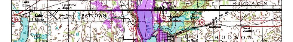
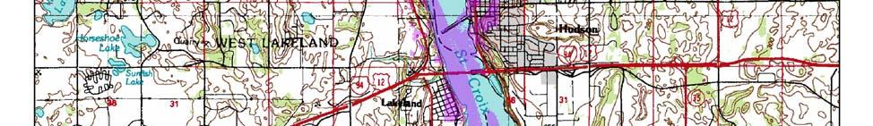

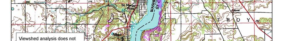
64 Figure F-9: 62
DRAFT SECTION 4(F) EVALUATION STILLWATER MUNICIPAL BARGE FACILITY
 EVALUATION STILLWATER MUNICIPAL BARGE FACILITY") DRAFT SECTION 4(F) EVALUATION I. DESCRIPTION OF SECTION 4(F) RESOURCE The Section 4(f) resource discussed in this evaluation is known as the Stillwater Municipal Barge Facility property, known previously
DRAFT SECTION 4(F) EVALUATION I. DESCRIPTION OF SECTION 4(F) RESOURCE The Section 4(f) resource discussed in this evaluation is known as the Stillwater Municipal Barge Facility property, known previously
DRAFT SECTION 4(F) EVALUATION KOLLINER PARK
 EVALUATION KOLLINER PARK") DRAFT SECTION 4(F) EVALUATION I. DESCRIPTION OF SECTION 4(F) RESOURCE The Section 4(f) resource potentially affected by the proposed action is Kolliner Park. The Alternative B-1 and C bridge crossings
DRAFT SECTION 4(F) EVALUATION I. DESCRIPTION OF SECTION 4(F) RESOURCE The Section 4(f) resource potentially affected by the proposed action is Kolliner Park. The Alternative B-1 and C bridge crossings
Evaluation and Determination Section 7(a) of the Wild and Scenic Rivers Act St. Croix River Crossing Project
 of the Wild and Scenic Rivers Act St. Croix River Crossing Project") Evaluation and Determination Section 7(a) of the Wild and Scenic Rivers Act St. Croix River Crossing Project Minnesota Wisconsin Mn/DOT Photo National Park Service United States Department of the Interior
Evaluation and Determination Section 7(a) of the Wild and Scenic Rivers Act St. Croix River Crossing Project Minnesota Wisconsin Mn/DOT Photo National Park Service United States Department of the Interior
DRAFT SECTION 4(F) EVALUATION LIFT BRIDGE
 EVALUATION LIFT BRIDGE") DRAFT SECTION 4(F) EVALUATION I. DESCRIPTION OF SECTION 4(F) RESOURCE The Section 4(f) resource affected by the proposed action is the Lift Bridge, a property listed on the National Register of Historic
DRAFT SECTION 4(F) EVALUATION I. DESCRIPTION OF SECTION 4(F) RESOURCE The Section 4(f) resource affected by the proposed action is the Lift Bridge, a property listed on the National Register of Historic
Mississippi Skyway Preliminary Engineering Report
 EXECUTIVE SUMMARY Mississippi Skyway Preliminary Engineering Report CITY OF RAMSEY, MINNESOTA DECEMBER 2014 City of RAMSEY EXECUTIVE SUMMARY Project Need and Intent The Mississippi Skyway pedestrian bridge
Draft Stillwater 2030 Comprehensive Plan- Goals and Policies
 Draft Stillwater 2030 Comprehensive Plan- Goals and Policies Instructions- Review each goal and policy and discuss with group any changes, deletions for additions to the list using your groups pen. Keep
DRAFT SECTION 4(F) EVALUATION LOWER ST. CROIX NATIONAL SCENIC RIVERWAY
 EVALUATION LOWER ST. CROIX NATIONAL SCENIC RIVERWAY") DRAFT SECTION 4(F) EVALUATION I. DESCRIPTION OF SECTION 4(f) RESOURCE The Section 4(f) resource discussed in this evaluation is the Lower St. Croix National Scenic Riverway, a federally designated Wild
DRAFT SECTION 4(F) EVALUATION I. DESCRIPTION OF SECTION 4(f) RESOURCE The Section 4(f) resource discussed in this evaluation is the Lower St. Croix National Scenic Riverway, a federally designated Wild
I-494 Rehabilitation Project SP (I-394 to Fish Lake Interchange) June 2014 Section 4(f) De Minimis Determination
 June 2014 Section 4(f) De Minimis Determination") I-494 Rehabilitation Project SP 2785-330 (I-394 to Fish Lake Interchange) June 2014 Section 4(f) De Minimis Determination State Project Number 2785-330 Federal Project No. NHPP-I494 (002) Trunk Highway:
I-494 Rehabilitation Project SP 2785-330 (I-394 to Fish Lake Interchange) June 2014 Section 4(f) De Minimis Determination State Project Number 2785-330 Federal Project No. NHPP-I494 (002) Trunk Highway:
The Illinois Department of Transportation and Lake County Division of Transportation. Route 173, including the Millburn Bypass
 The Illinois Department of Transportation and Lake County Division of Transportation welcome you to this Public Hearing for U.S. Route 45 from Illinois Route 132 to Illinois Route 173, including the Millburn
Appendix E Section 4(f) Evaluation
 Evaluation") Appendix E Section 4(f) Evaluation Appendix E Draft Section 4(f) Evaluation E.1 Introduction This appendix addresses a federal regulation known as Section 4(f), which protects parks, recreation areas,
Appendix E Section 4(f) Evaluation Appendix E Draft Section 4(f) Evaluation E.1 Introduction This appendix addresses a federal regulation known as Section 4(f), which protects parks, recreation areas,
PROJECT BACKGROUND. Preliminary Design Scope and Tasks
 PROJECT BACKGROUND Preliminary Design Scope and Tasks The purpose of this Study is the development of preliminary designs for intersection improvements for Trunk Highway (TH) 36 at the intersections of
CLACKAMAS COUNTY ZONING AND DEVELOPMENT ORDINANCE
 704 RIVER AND STREAM CONSERVATION AREA (RSCA) 704.01 PURPOSE Section 704 is adopted to: A. Maintain the integrity of the rivers and streams in the County by minimizing erosion, promoting bank stability,
Lake O the Pines Master Plan Revision Public Information Meeting April 25 & 27, 2017
 Lake O the Pines Master Plan Revision Public Information Meeting April 25 & 27, 2017 Presented By Matthew Like, Lake Manager U.S. Army Corps of Engineers Fort Worth District US Army Corps of Engineers
7.0 SECTION 4(F) EVALUATION
 EVALUATION") Chapter 7 Section 4(f) Evaluation 7.0 SECTION 4(F) EVALUATION 7.1 Background Information and Regulatory Requirements This chapter presents the existing conditions and potential effects to parklands and
Chapter 7 Section 4(f) Evaluation 7.0 SECTION 4(F) EVALUATION 7.1 Background Information and Regulatory Requirements This chapter presents the existing conditions and potential effects to parklands and
Mendota Heights 2040 Comprehensive Plan Draft Vers
 4 Parks and Trails The City of Mendota Heights boasts a variety of recreational and open space opportunities. Few cities can claim access to regional trails, riverside and lakeside parks, scenic bluffs
Chapter 5: Recreation
 Chapter 5: Recreation Introduction and Setting Recreational opportunities within Nevada County are varied, ranging from public parks with intensively used active recreational facilities, to vast tracts
Exhibit A. 8:9 Scuffletown Rural Conservation District
 Exhibit A 8:9 Scuffletown Rural Conservation District 8:9.1 Intent and Purpose The Scuffletown Rural Conservation (SRC) District is intended to provide for residential development that supports the development
Your town s subdivision or land use ordinance standards should reference the following street standards, for example:
 Your town s subdivision or land use ordinance standards should reference the following street standards, for example: Streets shall be designed to move traffic safely and in a way that minimizes environmental
Landowner's Guide to the Lower St. Croix Riverway. Protect. Restore. Celebrate. stcroixriverassociation.org
 Landowner's Guide to the Lower St. Croix Riverway Protect. Restore. Celebrate. stcroixriverassociation.org Cover and page spread photographs by Craig Blacklock. For more information on how to be a river
CITY OF SCANDIA ORDINANCE NO. 174
 CITY OF SCANDIA ORDINANCE NO. 174 AN ORDINANCE AMENDING ORDINANCE NO. 122, THE SCANDIA DEVELOPMENT CODE, CHAPTER 2, SECTION 4.34, REGARDING SOLAR FARMS AND COMMUNITY SOLAR GARDENS The City Council of the
DRAFT SECTION 4(f) EVALUATION INTERSTATE 73 FEIS: I-95 to I-73/I-74 in North Carolina
 EVALUATION INTERSTATE 73 FEIS: I-95 to I-73/I-74 in North Carolina") DRAFT SECTION 4(f) EVALUATION INTERSTATE 73 FEIS: I-95 to I-73/I-74 in North Carolina 1.0 INTRODUCTION Section 4(f) of the Department of Transportation Act of 1966, 49 U.S.C. 303, requires that prior to
DRAFT SECTION 4(f) EVALUATION INTERSTATE 73 FEIS: I-95 to I-73/I-74 in North Carolina 1.0 INTRODUCTION Section 4(f) of the Department of Transportation Act of 1966, 49 U.S.C. 303, requires that prior to
River Corridor Overlay Zone (RCOZ) Article 5
 Article 5") River Corridor Overlay Zone (RCOZ) Article 5 The site is in one of two designated districts. The first is the CBD (central business district) River District, which recognizes the urban character and unique
River Corridor Overlay Zone (RCOZ) Article 5 The site is in one of two designated districts. The first is the CBD (central business district) River District, which recognizes the urban character and unique
DISCUSSION TOPIC: ST JOHNS RIVER & ITS TRIBUTARIES (BPII) 2030 COMPREHENSIVE PLAN POLICES AND REGULATORY FRAMEWORK
 2030 COMPREHENSIVE PLAN POLICES AND REGULATORY FRAMEWORK") DISCUSSION TOPIC: ST JOHNS RIVER & ITS TRIBUTARIES (BPII) 2030 COMPREHENSIVE PLAN POLICES AND REGULATORY FRAMEWORK St. John s River & Its Tributaries Issue Summary: The St. Johns River is an important
DISCUSSION TOPIC: ST JOHNS RIVER & ITS TRIBUTARIES (BPII) 2030 COMPREHENSIVE PLAN POLICES AND REGULATORY FRAMEWORK St. John s River & Its Tributaries Issue Summary: The St. Johns River is an important
Canyon Lake Master Plan Revision Public Information Meeting March 18, 2016
 Canyon Lake Master Plan Revision Public Information Meeting March 18, 2016 Marcus Schimank Canyon Lake Manager Capital Regional Office U.S. Army Corps of Engineers Fort Worth District US Army Corps of
CHAPTER 7: Transportation, Mobility and Circulation
 AGLE AREA COMMUNITY Plan CHAPTER 7 CHAPTER 7: Transportation, Mobility and Circulation Transportation, Mobility and Circulation The purpose of the Transportation, Mobility and Circulation Chapter is to
DRAFT MAP AMENDMENT FLU 04-4
 DRAFT MAP AMENDMENT FLU 04-4 SW 24 TH AVENUE ROADWAY CORRIDOR The University of Florida participates with the Metropolitan Transportation Planning Organization (MTPO) in its responsibilities for the continuing,
TRANSPORTATION ELEMENT GOALS, OBJECTIVES, AND POLICIES
 TRANSPORTATION ELEMENT GOALS, OBJECTIVES, AND POLICIES GOAL 2 The City shall provide a safe, convenient, effective, and energy efficient multimodal transportation system which is coordinated with the Future
Lewisville Lake Master Plan Revision Public Information Meeting May 2 & 4, 2017
 Lewisville Lake Master Plan Revision Public Information Meeting May 2 & 4, 2017 Presented By Rob Jordan Lake Manager U.S. Army Corps of Engineers Fort Worth District US Army Corps of Engineers Purpose
WELCOME! 8 8:30 6: TH STREET IMPROVEMENTS. Open House. Presentation & Q&A
 WELCOME! 168 TH STREET IMPROVEMENTS 6:30 Open House 7 8 Presentation & Q&A 8 8:30 Open House WELCOME Todd Pfitzer City of Omaha Engineer Bob Stubbe City of Omaha Public Works Director Jon Meyer Project
RECREATION, OPEN SPACE AND GREENWAYS ELEMENT GOALS, OBJECTIVES, AND POLICIES
 RECREATION, OPEN SPACE AND GREENWAYS ELEMENT GOALS, OBJECTIVES, AND POLICIES GOAL R-1: DEVELOP A RECREATION, OPEN SPACE AND GREENWAYS SYSTEM AS AN INTEGRAL COMPONENT OF AN OVERALL, COUNTY-WIDE ECONOMIC
{Best Practices. Summary of Tools, Strategies and Best Practices from 11 Michigan Case Study Communities
 Case Studies Michigan Coastal Community Working Waterfronts { Summary of Tools, Strategies and from 11 Michigan Case Study Communities Table of Contents Zoning...2 Community and Stakeholder Collaboration
Master Plan for Preservation and Scenic Conservation (1995)
") 3.2 Master Plan for Preservation and Scenic Conservation (1995) The Master Plan for Preservation and Scenic Conservation was developed under the direction of the Guilford Preservation Alliance in the 1980s
3.2 Master Plan for Preservation and Scenic Conservation (1995) The Master Plan for Preservation and Scenic Conservation was developed under the direction of the Guilford Preservation Alliance in the 1980s
Public Information Meeting
 Lavon Lake Master Plan Revision Public Information Meeting March 10, 2015 Presented By Michael Kinard Lake Manager U.S. Army Corps of Engineers Fort Worth District US Army Corps of Engineers Purpose of
Appendix E Preliminary Location Hydraulic Study
 Appendix E Prepared for: State of Alaska Department of Transportation and Public Facilities Prepared by: HDR Alaska, Inc. 2525 C Street, Suite 305 Anchorage, Alaska 99503 February 2014 This page intentionally
1.0 EXECUTIVE SUMMARY
 1.0 EXECUTIVE SUMMARY The Minnesota Department of Transportation (Mn/DOT) proposes to make capacity improvements to the interregional corridor (IRC) connection between Interstate 94 (I-94) and Trunk Highway
METROPOLITAN COUNCIL 390 North Robert Street, St. Paul, MN Phone (651) ; TDD (651)
 ; TDD (651)") DATE: December 20, 2011 METROPOLITAN COUNCIL 390 North Robert Street, St. Paul, MN 55101 Phone (651) 602-1000; TDD (651) 291-0904 TO: Metropolitan Parks and Open Space Commission FROM: Tori Dupre, Senior
DATE: December 20, 2011 METROPOLITAN COUNCIL 390 North Robert Street, St. Paul, MN 55101 Phone (651) 602-1000; TDD (651) 291-0904 TO: Metropolitan Parks and Open Space Commission FROM: Tori Dupre, Senior
Town of Portola Valley General Plan. Nathhorst Triangle Area Plan
 Town of Portola Valley General Plan Amended December 10, 1997 Table of Contents Introduction... 1 Planning Area... 1 Objectives... 2 Principles... 2 Standards... 4 Description... 4 Community Commercial...
Transportation Systems and Utility Infrastructure
 77 Audience Local and regional units of government, Landowners and developers, Community and citizen organizations, and Transportation/utility planners and engineers. Overview Transportation systems and
7.0 SOCIAL, ECONOMIC, AND ENVIRONMENTAL ISSUES
 7.0 SOCIAL, ECONOMIC, AND ENVIRONMENTAL ISSUES The following list of social, economic, and environmental issues have been identified based on a preliminary inventory of resources in the project area, an
Yadkin River Greenway Feasibility Study Fact Sheet Village of Clemmons, Town of Lewisville, Town of Bermuda Run
 Fact Sheet Village of Clemmons, Town of Lewisville, Town of Bermuda Run Project Background The Yadkin River Greenway Feasibility Study is a joint project with the Village of Clemmons, the Town of Bermuda
RE: Application for FERC Project No , Scott s Mill dam hydropower proposal
 RE: Application for FERC Project No. 14425, Scott s Mill dam hydropower proposal To Whom It May Concern: James River Association (JRA) is a conservation organization that has been solely dedicated to restoring
Provide and maintain sufficient public parks, recreation facilities, and open space to meet the recreational needs of County residents and visitors.
 (ROS) Goal Provide and maintain sufficient public parks, recreation facilities, and open space to meet the recreational needs of County residents and visitors. OBJECTIVE ROS.01 The County shall acquire,
OPEN SPACE CHAPTER 7: OVERVIEW. Preserve open space to protect natural resources, enhance character and provide passive recreation opportunities
 CHAPTER 7: OPEN SPACE OVERVIEW Ridgefield has made tremendous progress permanently preserving areas of town as open space. Open space preservation can serve many important purposes, including: protect
Right-of-Way Acquisitions and Relocations Technical Memorandum
 Right-of-Way Acquisitions and Relocations Technical Memorandum Southeast Extension Project Lincoln Station to RidgeGate Parkway Prepared for: Federal Transit Administration Prepared by: Denver Regional
Planned Development Review Revisions (Project No. PLNPCM )
") Planned Development Review Revisions (Project No. PLNPCM2014-00139) Standard residential development Planned Development Example: Smaller lot sizes than what is allowed to create open space amenity. What
Planned Development Review Revisions (Project No. PLNPCM2014-00139) Standard residential development Planned Development Example: Smaller lot sizes than what is allowed to create open space amenity. What
1.0 INTRODUCTION 1.1 TH 14 WEST STUDY AREA Project Description Functional Classification Purpose of the Project
 1.0 INTRODUCTION 1.1 TH 14 WEST STUDY AREA 1.1.1 Project Description The Trunk Highway (TH) 14 West Corridor is a two-lane roadway approximately 22 miles in length. Located in Nicollet County, the corridor
CONSERVATION ELEMENT GOALS, OBJECTIVES, AND POLICIES
 CONSERVATION ELEMENT GOALS, OBJECTIVES, AND POLICIES Goal 4 To conserve, manage, appropriately use and protect the natural resources of the City ensuring continued resource availability and environmental
Joe Pool Lake Master Plan Revision Public Information Meeting May 23, 2017
 Joe Pool Lake Master Plan Revision Public Information Meeting May 23, 2017 Presented By Jason Owen Lake Manager U.S. Army Corps of Engineers Fort Worth District US Army Corps of Engineers Purpose of this
RECREATION AND OPEN SPACE ELEMENT GOALS, OBJECTIVES, AND POLICIES
 RECREATION AND OPEN SPACE ELEMENT GOALS, OBJECTIVES, AND POLICIES Goal 7 To provide park facilities, recreation programs, and open space resources that are safe, adequate, and accessible to all City residents,
5.1.1 The streetscape along US Highway 64 (Brevard Road); and, The built environment within new residential developments; and,
; and, The built environment within new residential developments; and,") Article 5. Landscaping 5.1 Purpose The Town of Laurel Park s landscape standards are designed to create a beautiful, aesthetically pleasing built environment that will complement and enhance community
Article 5. Landscaping 5.1 Purpose The Town of Laurel Park s landscape standards are designed to create a beautiful, aesthetically pleasing built environment that will complement and enhance community
HAZARD MITIGATION GOALS AND OBJECTIVES
 SEWRPC Community Assistance Planning Report No. 282, 2nd Edition CITY OF MILWAUKEE ALL HAZARDS MITIGATION PLAN UPDATE Chapter IV HAZARD MITIGATION GOALS AND OBJECTIVES [NOTE: Throughout this plan update
G. RECREATION AND OPEN SPACE ELEMENT. The following summarizes the Recreation and Open Space Element:
 G. RECREATION AND OPEN SPACE ELEMENT The purpose of the Element is to provide the framework and direction for a comprehensive system of public and private sites for recreation, including, but not limited
Parks, Recreation, and Open Space Land Use Goals
 Parks, Recreation, and Open Space Land Use Goals Issue: The preservation of open space and natural features will enhance the character of the built environment, promote public health and safety, provide
SUMMARY. Support the Southeast Arkansas Regional Intermodal Facility.
 SUMMARY THE I-69 LOCATION STUDY The proposed I-69 Location Study from El Dorado to McGehee, Arkansas, represents one section (Section of Independent Utility No. 13) of the nationally designated I-69 Corridor
ARTICLE IV: DEVELOPMENT STANDARDS 404 MASTER PLANNING
 IV 13 404 MASTER PLANNING Master Planning through the Site Analysis (Master Planning Site Analysis) or Planned Development (Master Planning Planned Development) is provided to encourage development which
This page intentionally blank.
 This page intentionally blank. Parks, Recreation, and Open Space Chapter Relationship to Vision Vision Parks, Recreation and Open Space Chapter Concepts County Government. County government that is accountable
Gold Line Bus Rapid Transit Transit Oriented Development (BRTOD) Helmo Station Area Plan
 Helmo Station Area Plan") Appendix F Gold Line Bus Rapid Transit Transit Oriented Development (BRTOD) Helmo Station Area Plan Introduction and Purpose of the Plan The Gold Line Bus Rapid Transit facility is an eleven-mile dedicated
Appendix F Gold Line Bus Rapid Transit Transit Oriented Development (BRTOD) Helmo Station Area Plan Introduction and Purpose of the Plan The Gold Line Bus Rapid Transit facility is an eleven-mile dedicated
CARVER COUNTY DIVISION OF PUBLIC WORKS LANDSCAPE POLICY. Adopted by the Carver County Board of Commissioners March 3, 2015
 CARVER COUNTY DIVISION OF PUBLIC WORKS LANDSCAPE POLICY Adopted by the Carver County Board of Commissioners March 3, 2015 Policy Statement Goals It is the goal of Carver County Public Works to provide
I-90 Mississippi River Bridge & Interchange Project
 I-90 Mississippi River Bridge & Interchange Project Presentation Outline I. Background: Context & Need for Project II. Preferred Alternative Overview III. Project Development IV. Project Management Tools
AWH REPORT OF THE PLANNING AND DEVELOPMENT DEPARTMENT FOR APPLICATION FOR REZONING ORDINANCE TO PLANNED UNIT DEVELOPMENT
 AWH REPORT OF THE PLANNING AND DEVELOPMENT DEPARTMENT FOR APPLICATION FOR REZONING ORDINANCE TO PLANNED UNIT DEVELOPMENT MAY 8, 2014 The Planning and Development Department hereby forwards to the Planning
When planning stormwater management facilities, the following principles shall be applied where possible.
 2.0 Principles When planning stormwater management facilities, the following principles shall be applied where possible. 2.0.1 Drainage is a regional phenomenon that does not respect the boundaries between
KASPER. City of Georgetown, Texas PUD Planned Unit Development. December 30, 2015 Revised January 27, 2016
 KASPER City of Georgetown, Texas PUD Planned Unit Development December 30, 2015 Revised January 27, 2016 Applicant: Sentinel Land Company, LLC 4910 Campus Drive Newport Beach, CA Prepared by: SEC Planning
7.5 Impacts on the Section 4(f) Properties
 Properties") constructive use, such as noise, air quality and visual impacts were also assessed. It was determined that this project would not introduce changes of an external nature that would affect the recreational
constructive use, such as noise, air quality and visual impacts were also assessed. It was determined that this project would not introduce changes of an external nature that would affect the recreational
Page. I. Introduction 1. II. Project Purpose and Need 2. IV. Description of Section 4(f) Property 2. V. Impacts to Section 4(f) property 3
 Property 2. V. Impacts to Section 4(f) property 3") Table of Contents Programmatic Section 4(f) Evaluation for use of a Historic Bridge Replacement of Route 30/130 Bridge over the Cooper River Structure No. 0405-153 City of Camden, Borough of Collingswood,
Table of Contents Programmatic Section 4(f) Evaluation for use of a Historic Bridge Replacement of Route 30/130 Bridge over the Cooper River Structure No. 0405-153 City of Camden, Borough of Collingswood,
APPENDIX J PERFORMANCE STANDARDS FOR GRAVEL MINE, PIT MINE, OR QUARRY
 APPENDIX J PERFORMANCE STANDARDS FOR GRAVEL MINE, PIT MINE, OR QUARRY A. Purpose: 1. Regulatory Requirement and Use Mitigation: The purpose of this appendix is to provide a regulatory context (standards)
-MENDOCINO COUNTY PLANNING AND BUILDING SERVICES- DIVISION II OF TITLE 20--COASTAL ZONING CODE
 CHAPTER 20.504 VISUAL RESOURCE AND SPECIAL TREATMENT AREAS Sec. 20.504.005 Applicability. Sec. 20.504.010 Purpose. Sec. 20.504.015 Highly Scenic Areas. Sec. 20.504.020 Special Communities and Neighborhoods.
Olde Towne Vision Plan
 Olde Towne Vision Plan Introduction In 2016, the City of Bellevue will complete its move of City offices from Olde Towne Bellevue to its new municipal complex on Wall Street. The City intends to sell its
PLANNED UNIT DEVELOPMENT STAFF REPORT Date: June 2, 2016
 # 9 ZON2016-01032 PLANNED UNIT DEVELOPMENT STAFF REPORT Date: June 2, 2016 DEVELOPMENT NAME JJT Properties LLC LOCATION 1147 & 1151 East I-65 Service Road South and 1180 Sledge Drive (Southeast corner
LAND USE ELEMENT. Purpose. General Goals & Policies
 LAND USE ELEMENT Purpose This Land Use Element contains the goals and policies necessary to support the City s responsibility for managing land resources and guiding development through implementing regulations,
Northern Branch Corridor SDEIS March 2017
 14. Water Quality 14.1. Chapter Overview 14.1.1. Introduction This section discusses changes to the potential for activities associated with the development and operation of the Preferred Alternative to
COMMUNITY DESIGN. GOAL: Create livable and attractive communities. Intent
 COMMUNITY DESIGN Intent An attractive, well-designed County will attract quality development, instill civic pride, improve the visual character of the community, and create a strong, positive image for
PROJECT STATEMENT LOCATION/DESIGN PUBLIC HEARING. 19 th AVENUE NORTH EXTENSION PROJECT FROM SPRINGDALE DRIVE TO NORTH 2 ND STREET/U.S.
 PROJECT STATEMENT LOCATION/DESIGN PUBLIC HEARING 19 th AVENUE NORTH EXTENSION PROJECT FROM SPRINGDALE DRIVE TO NORTH 2 ND STREET/U.S. 67 HEARING LOCATION: ERICKSEN COMMUNITY CENTER 1401 11 TH AVENUE NORTH
The Palisades Interstate Parkway and Henry Hudson Drive designated a New Jersey State Scenic Byway, 2005
 The Palisades Interstate Parkway and Henry Hudson Drive designated a New Jersey State Scenic Byway, 2005 What are scenic byways? How Did Scenic Byways Come About? National Scenic Byways Program Administered
I. STAFF POLICY RECOMMENDATIONS. The following RMP policy strategies are proposed by staff in support of a Scenic Resource Protection Program:
 Policy Consideration: Scenic Resource Protection Program Status: For Consideration by the Highlands Council at September 14, 2006 Work session Date: September 12, 2006 I. STAFF POLICY RECOMMENDATIONS The
Office of Greenways & Trails Providing Statewide Leadership and Coordination. Southeast Greenways and Trails Summit October 1-3, 2017
 Office of Greenways & Trails Providing Statewide Leadership and Coordination Southeast Greenways and Trails Summit October 1-3, 2017 1 Office of Greenways and Trails The Office of Greenways and Trails
Public Hearing. Charlotte County-Punta Gorda MPO - Meeting Rooms A and B March 14, open house at 4 p.m., formal presentation at 5 p.m.
 Public Hearing Charlotte County-Punta Gorda MPO - Meeting Rooms A and B March 14, 2019 open house at 4 p.m., formal presentation at 5 p.m. Welcome to the Public Hearing for the Harborview Road (CR 776)
ARLINGTON COUNTY, VIRGINIA. County Board Agenda Item Meeting of January 28, 2017 SUPPLEMENTAL REPORT
 ARLINGTON COUNTY, VIRGINIA County Board Agenda Item Meeting of January 28, 2017 SUPPLEMENTAL REPORT DATE: January 26, 2017 SUBJECT: The Virginia Department of Transportation s Transform I-66 Inside the
7.0 DRAFT SECTION 4(f) EVALUATION
 EVALUATION") 7. DRAFT SECTION 4(f) EVALUATION 7.1 Background Information and Regulatory Requirements This chapter presents the existing conditions and potential effects on parks, recreation areas, wildlife and waterfowl
7. DRAFT SECTION 4(f) EVALUATION 7.1 Background Information and Regulatory Requirements This chapter presents the existing conditions and potential effects on parks, recreation areas, wildlife and waterfowl
To qualify for federal Transportation Enhancement (TE) funds a project must meet two basic federal requirements:
 funds a project must meet two basic federal requirements:") Eligibility Requirements To qualify for federal Transportation Enhancement (TE) funds a project must meet two basic federal requirements: 1) Relate to surface transportation and 2) Be one of the 12 designated
Eligibility Requirements To qualify for federal Transportation Enhancement (TE) funds a project must meet two basic federal requirements: 1) Relate to surface transportation and 2) Be one of the 12 designated
A BILL FOR AN ORDINANCE TO AMEND CHAPTER 9, KAUAI COUNTY CODE 1987, RELATING TO STREET REQUIRE:MENTS FOR SUBDIVISIONS
 ORDINANCE NO. BILL NO. { vy"yj1j A BILL FOR AN ORDINANCE TO AMEND CHAPTER 9, KAUAI COUNTY CODE 1987, RELATING TO STREET REQUIRE:MENTS FOR SUBDIVISIONS BE IT ORDAINED BY THE COUNCIL OF THE COUNTY OF KAUA'I,
Section 4(f) De Minimis Memorandum for the Hickman Road over Tuolumne River Bridge Replacement Project (Bridge No. 38C 0004)
 De Minimis Memorandum for the Hickman Road over Tuolumne River Bridge Replacement Project (Bridge No. 38C 0004)") 11060 White Rock Road, Suite 200 Rancho Cordova, CA 95670 Phone: (916) 363 4210 Fax: (916) 363 4230 M e m o r a n d u m To: Julie Myrah, Branch Chief Date: May 5, 2017 California Department of Transportation
11060 White Rock Road, Suite 200 Rancho Cordova, CA 95670 Phone: (916) 363 4210 Fax: (916) 363 4230 M e m o r a n d u m To: Julie Myrah, Branch Chief Date: May 5, 2017 California Department of Transportation
Dwelling Units Max 12 dwelling units per acre/min 8 dwelling units per acre. Development Mix 80% non residential/20% residential
 13. OSTEEN LOCAL PLAN Background: The Osteen Local Plan area is located in southwest Volusia County along the SR 415 corridor between Lemon Bluff Road and Acorn Lake Road and includes 3,990 acres. The
Options for addressing City of Edmonds Alternatives to Ecology s Required Changes addressing Edmonds Marsh Buffers and Setbacks.
 Options for addressing City of Edmonds Alternatives to Ecology s Required Changes addressing Edmonds Marsh Buffers and Setbacks. This document presents Ecology s response to the City of Edmonds alternatives
Historic Ottawa Beach Waterfront Walkway Park Township
 Historic Ottawa Beach Waterfront Walkway Park Township Project Description: Public access improvements to the shoreline of Lake Macatawa are the final steps in completing the park master plan for the Historic
Appendix I. Access Management & Land Use Zoning Strategies Memo
 Appendix I ` Access Management & Land Use Zoning Strategies Memo Route 96 Access Management and Land Use/Zoning Strategies The Town of Victor has access management guidelines in Section 5.0 of the 2014
STAFF REPORT FOR STANDARD COASTAL DEVELOPMENT PERMIT #CDP FEBRUARY 26, 2015 CPA - 1 PO BOX 238 APTOS, CA 94001
 STAFF REPORT FOR STANDARD COASTAL DEVELOPMENT PERMIT #CDP 2014-0030 FEBRUARY 26, 2015 CPA - 1 OWNER/APPLICANT: AGENT: REQUEST: HANS HEIM PO BOX 238 APTOS, CA 94001 JAMES HAY PO BOX 762 MENDOCINO, CA 95460
5. Father Hennepin Blufs Park and Hennepin Island Father Hennepin Bluffs Park Supporting Initiatives (see Figure 36): 7-22
: 7-22") 5. Father Hennepin Blufs Park and Hennepin Island As described in existing conditions portion of Chapter 2, Father Hennepin Blufs Park lies on the upland portion of the park and Hennepin Island spans the
5. Father Hennepin Blufs Park and Hennepin Island As described in existing conditions portion of Chapter 2, Father Hennepin Blufs Park lies on the upland portion of the park and Hennepin Island spans the
Minnesota Department of Natural Resource - Natural Resource Guidance Checklist Conserving Natural Resources through Density Bonuses
 Minnesota Department of Natural Resource - Natural Resource Guidance Checklist Conserving Natural Resources through Density Bonuses NRDB Why Use Density Bonuses & This Checklist Local units of government
CONFORMED AGREEMENT INCORPORATED REVISIONS PER AMENDMENT DATED: APRIL 2, 2013 FOR REFERENCE
 CONFORMED AGREEMENT INCORPORATED REVISIONS PER AMENDMENT DATED: APRIL 2, 2013 FOR REFERENCE CITY STREETS AS PART OF STATE HIGHWAYS GUIDELINES REACHED BY THE WASHINGTON STATE DEPARTMENT OF TRANSPORTATION
APPENDIX D: Visual and Aesthetic Conditions for NCCU Station Refinement. Durham-Orange Light Rail Transit Project
 APPENDIX D: Visual and Aesthetic Conditions for NCCU Station Refinement Durham-Orange Light Rail Transit Project October 2016 1. Introduction The Combined FEIS/ROD summarizes the effects of the D-O LRT
Rezoning Transportation Analysis Petition Number: General Location Identifier:
 From: Kelsie Anderson, PE Kelsie.Anderson@charlottenc.gov 704-432-5492 Staff Reviewer: Kory Hedrick, PE, PMP Khedrick@charlottenc.gov 704-432-6511 CDOT s review of this rezoning petition is intended to
(Exhibit A) Site Plan Adoption Detail and Support Information
 Site Plan Adoption Detail and Support Information") McCormick Park Master Site Plan (Exhibit A) Site Plan Adoption Detail and Support Information July, 2003 McCormick Park Site Plans.... 2-3 McCormick Park Site Plan Comparison... 4 Basic Assumptions about
McCormick Park Master Site Plan (Exhibit A) Site Plan Adoption Detail and Support Information July, 2003 McCormick Park Site Plans.... 2-3 McCormick Park Site Plan Comparison... 4 Basic Assumptions about
6.8 SCENIC HIGHWAYS Introduction
 6.8 SCENIC HIGHWAYS 6.8.1 Introduction The Scenic Highways Element is an optional General Plan element authorized by Section 65303 of the Government Code. The Scenic Highways Element is intended to establish
Existing Conditions and Environmental Consequences Floodplains
 3.9 Environmental Consequences 3.8 3.8.1 WHAT ARE FLOODPLAINS? are low-lying areas adjacent to rivers, streams, and other waterbodies that are susceptible to inundation (flooding) during rain events. These
Saranac River Trail Greenway C O N D I T I O N S R E P O R T
 Saranac River Trail Greenway C O N D I T I O N S R E P O R T City of Plattsburgh Clinton County, NY For: Clinton County Final Issued: March 22, 2017 This document was prepared for the New York State Department
F. Driveways. Driveways which provide access to off-street parking or loading from public streets shall comply with the following:
 Section 20.945.040 General Design Standards for Surface Parking Areas. A. Review Authority. Parking lot design and drainage shall be subject to review and approval of the City Transportation Manager. B.
6 PORT SYDNEY SETTLEMENT AREA
 Section 6 Port Sydney Page 61 6 PORT SYDNEY SETTLEMENT AREA 6.1 Basis and Principles Village of Port Sydney Waterfront Community Existing Services 6.1.1 Port Sydney is an historic settlement that has developed
ARTICLE VI: SITE PLAN REVIEW
 Section 6.01 - Site Plan Review (All Districts) ARTICLE VI: SITE PLAN REVIEW Site plans give the Planning commission an opportunity to review development proposals in a concise and consistent manner. The
Bourne Downtown Site Planning
 Prepared for: The Town of Bourne, MA In Cooperation with: Bourne Financial Development Corporation Prepared by:, Inc. June 24, 2009 Table of Contents Introduction and Summary... 1 Site Existing Conditions...
APPENDIX K WINDSOR OFFICIAL PLAN
 CEAA ENVIRONMENTAL ENVIRONMENTAL IMPACT ASSESSMENT AMBASSADOR BRIDGE ENHANCEMENT PROJECT Replacement Span and Plaza Expansion APPENDIX K WINDSOR OFFICIAL PLAN Avalon Consulting Professionals of Ontario,