Appendix E Section 4(f) Evaluation
|
|
|
- Maria Farmer
- 6 years ago
- Views:
Transcription
1 Appendix E Section 4(f) Evaluation
2
3 Appendix E Draft Section 4(f) Evaluation E.1 Introduction This appendix addresses a federal regulation known as Section 4(f), which protects parks, recreation areas, historic and cultural resources, and wildlife and waterfowl refuges. The U.S. Department of Transportation Act of 1966, Section 4(f), generally prohibits U.S. Department of Transportation (DOT) agencies (including the Federal Transit Administration [FTA]) from approving projects that would use land from: a significant publicly-owned park, recreation area or wildlife and waterfowl refuge or any significant historic site, unless there is no feasible and prudent alternative to the use of land from the property and the action includes all possible planning to minimize harm to the property resulting from the use. A use is generally defined as a transportation activity that permanently or temporarily acquires land from a Section 4(f) property, or that substantially impairs the important activities, features, or attributes that qualify the property as a Section 4(f) resource. Section 4(f) applies to significant publicly owned parks and recreation areas that are open to the public, publicly owned wildlife and waterfowl refuges, and historic sites of national, state, or local significance. The DOT regulations for Section 4(f) define historic properties as those listed in or eligible for the National Register of Historic Places (NRHP). The Section 4(f) study area for this project is based on the Area of Potential Effects (APE) used for cultural, archaeological, and historic resources (see Section 4.16) and the parks and recreational resources analysis (see Section 4.17). This evaluation also takes into account the areas of effect and analyses from other environmental investigations, including acquisitions, displacements, and relocations; transportation; land use; noise and vibration; and visual and aesthetic resources. E.2 Uses of Section 4(f) Resources Under Section 4(f), a use can be permanent, temporary, or constructive. Permanent use would acquire or incorporate all or part of a Section 4(f) property as part of the transportation facility. Temporary use occurs when the project temporarily occupies any portion of the resource (typically during construction), and it substantially impairs the resources. A temporary occupancy can avoid a use if: The project would occupy the property less than the time needed for the construction of the project, and there will be no change in ownership; There are minimal changes to the Section 4(f) resource; Federal Way Link Extension E-1 Draft EIS April 2015
4 Appendix E Draft Section 4(f) Evaluation There are no permanent adverse physical changes or interference with protected activities, features, or attributes of the resource; The land is restored to the same or better condition; and The federal, state, or local officials with jurisdiction over the resource and the authority over the land agree in writing that the use is not adverse. Constructive, or indirect, use can occur when the project is near the Section 4(f) resource and has effects that substantially impair the protected activities, features, or attributes of a property. For example, a park property that is primarily a scenic viewpoint could have a constructive use if a transportation project blocks its views. The FTA can approve a transportation use of a Section 4(f) property if: Or: Or: The use of the property meets the requirements for a regulatory exception established under Section 4(f). For instance, a temporary use can be allowed if it meets the requirements described above. The use will have a de minimis impact on the property. There is no feasible and prudent avoidance alternative to using the property; and The program or project includes all possible planning to minimize harm to the property resulting from the use. De minimis impacts are those which do not adversely affect the activities, features, and attributes of a Section 4(f) resource. A de minimis impact finding can take into account any mitigation or enhancement measures that would be implemented, including design measures to avoid or reduce impacts. Before FTA can make this finding, it must send a written notice to notify the official with jurisdiction over the resource, and there must be an opportunity for public notice and comment (the Draft Environmental Impact Statement [EIS] comment period is serving this purpose for the Federal Way Link Extension [FWLE]). For public parks or recreation properties, a de minimis impact finding requires written concurrence from the agency with jurisdiction over the property, such as a city or county parks department. For historic and archaeological sites, a de minimis impact finding is allowed if FTA has made a no adverse effect finding in compliance with Section 106 of the National Historic Preservation Act of 1966 (NHPA) (see Section 4.16). Before making a de minimis finding, FTA must send a written notice to the State Historic Preservation Office (SHPO). If the SHPO concurs or does not object, FTA may proceed with its finding. When FTA has made a de minimis determination, the project is not required to analyze avoidance alternatives for that Section 4(f) property. Federal Way Link Extension E-2 Draft EIS April 2015
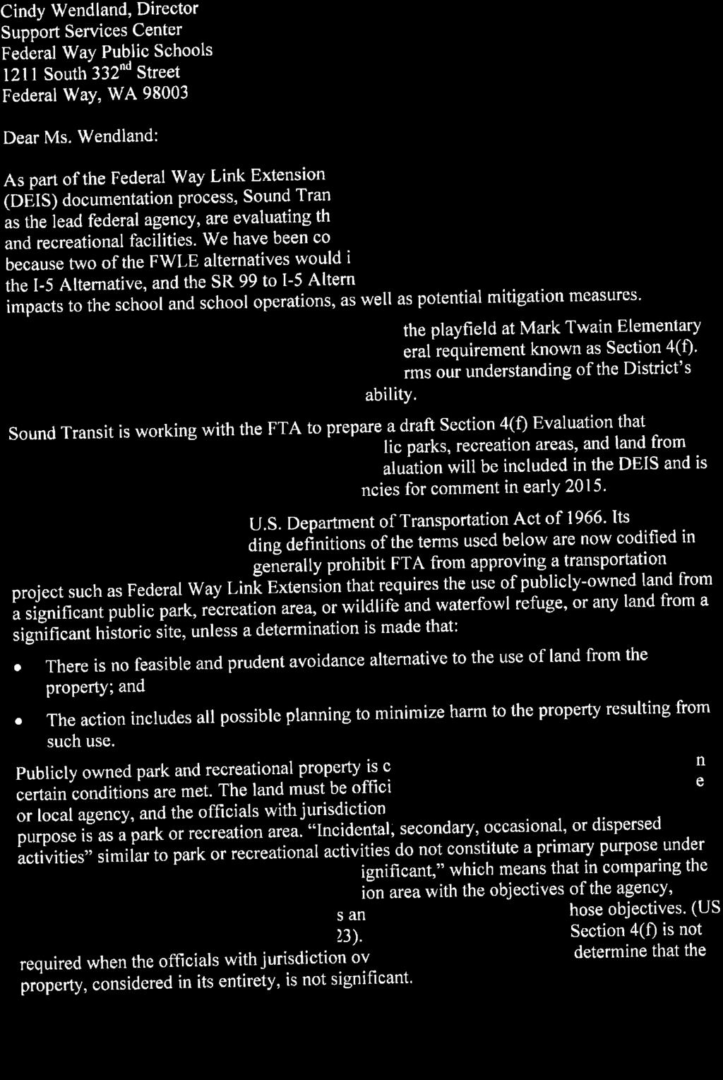
5 Appendix E Draft Section 4(f) Evaluation This Section 4(f) evaluation addresses: Whether lands in the FWLE study area are considered Section 4(f) properties; and Whether FWLE alternatives would use Section 4(f) properties as defined by Section 4(f) regulations. E.3 Proposed Action The proposed action is to expand the existing Sound Transit Link light rail system south to serve the cities of SeaTac, Des Moines, Kent, and Federal Way in south King County. This 7.6-mile extension would connect the future Angle Lake Station at S 200th Street in SeaTac with the Federal Way Transit Center in Federal Way. This Section 4(f) Evaluation was prepared in conjunction with the FWLE Draft EIS. The Draft EIS Chapter 1, Purpose and Need, and Chapter 2, Alternatives Considered, provide a complete description of the proposed action. E.4 Section 4(f) Resources E.4.1 Public Parks and Recreation Areas Table E-1 lists all park and recreation resources in the FWLE study area, indicates whether each is a 4(f) resource, and if so, provides the Section 4(f) use assessment. The cities of Kent and Federal Way have identified possible future parks in their local planning documents that could be within the study area, although specific locations have not yet been defined. In addition, city zoning requirements in the corridor may provide for additional land dedicated as public parks or open space as part of private residential and mixed use developments in the future. At this time, no planned parks in the study area are considered Section 4(f) properties. The Mark Twain Elementary school playfield would be affected during construction of the I-5 Alternative. Public school property is typically not considered under Section 4(f) unless the recreational area is used outside of school hours by the public and the school district owning the property determines that it is of national, State, or local significance. The playfield at Mark Twain Elementary is used outside of school hours by community youth softball, baseball, and soccer leagues, primarily as a practice field. The field would be closed for approximately 9 months during construction of a cut-andcover tunnel segment through the property. Following construction, the playfield would be restored to its existing condition and use of the playfield would not change. The school district has indicated that during the FWLE construction period, use of the field by community youth leagues could be programmed at other playfields owned by the district. Given the nature of non-school uses at the playfield, and the school district s ability to provide for these recreational functions at other facilities, FTA s preliminary determination is that the playfield is not a recreation area of national, State, or local significance and therefore is not considered a Section 4(f) property. Federal Way Public Schools agreed with this conclusion on December 30, Federal Way Link Extension E-3 Draft EIS April 2015
6 Appendix E Draft Section 4(f) Evaluation TABLE E-1 Section 4(f) Park and Recreation Resource Assessment Summary Resource Name Size (acres) Type and/or Function Facilities Ownership Section 4(f) Resource? Preliminary Section 4(f) Determination Existing Parks Steven J. Underwood Memorial Park 20.5 Community park Three lighted softball fields. City of Des Moines Yes No 4(f) use Midway Park 1.6 Community park Play area, picnicking areas, basketball hoops, and a walking path. City of Des Moines Yes No 4(f) use Parkside Park 4.4 Community park Basketball hoops and a walking path. City of Des Moines Yes No 4(f) use Dr. Shirley B. Gordon Park 0.9 Community park Playground and open space. City of Des Moines Yes No 4(f) use Sacajawea Park 18.0 Community park Two lighted baseball fields, a tennis court, a soccer field, a football field, a 440-yard track, walking pathways, a playground, and restrooms. City of Federal Way Yes No 4(f) use Mark Twain Elementary School Athletic Fields 1.7 School athletic field Playfield for softball and soccer. Federal Way Public Schools No (see Appendix E1) Not applicable Steel Lake Park 52.0 Community park Beach, swimming area, boat launch, a sand volleyball pit, horseshoe pits, a concession building, restrooms, playgrounds, five picnic areas, open lawn areas, a trail, parking. City of Federal Way Yes No 4(f) use Federal Way Town Square Park 4.1 Community park Labyrinths, basketball courts, open lawn area, p- patch, chess boards, and picnic area. Future plans include a seating area and stage. City of Federal Way Yes Preliminary de minimis determination The only park or recreational property directly affected by an FWLE alternative is Town Square Park in Federal Way. Town Square Park is a 4.1-acre community park constructed in July 2014 in the Federal Way City Center. This property is bounded by S 316th Street to the north, 20th Avenue S to the west, 21st Avenue S to the east, and a private parcel to the south. The park includes basketball courts, a playfield, labyrinths, an open grass area with picnic tables and benches, a kiosk, chess boards, landscaping, and parking. The park and recreational facilities are concentrated on the northern half of the property. Parking stalls, a driveway, and landscaping are located on the southern half of the property. The parcel where the park is located was acquired by the City in 2007 with the intent of coordinating with a private developer to develop the parcel as a mixed-use property with a public park. The property is not currently included in the City s Parks, Recreation, and Open Space Plan. Last updated in Federal Way Link Extension E-4 Draft EIS April 2015
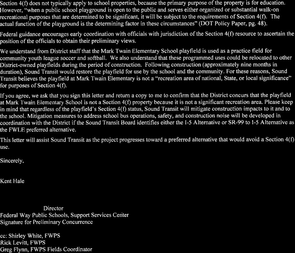
7 Appendix E Draft Section 4(f) Evaluation January 2013, the City s plan includes goals and policies related to creating community gathering spaces in higher density areas of the city, particularly in the City Center. The plan does not identify specific properties in the City Center, but describes working with development groups when opportunities arise to develop park space in the City Center (City of Federal Way, 2013a). After acquisition of the property, the City issued Requests for Proposals with the intention of selling the property to a private-sector developer to develop the site with a mixed-use project that included a public park component. As of 2014, no such development had yet occurred, and the City developed the entire property as a park. The City indicates that portions of the property could be redeveloped by a private developer, but that some portion of the property is intended to remain as a public park. It is unknown at this time how the park might be reconfigured when further development occurs or the timing of such development. While it is unclear whether this kind of facility is considered a 4(f) resource, the City of Federal Way believes Town Square Park is a recreational resource of local significance, and as such is being considered a Section 4(f) property. The FWLE project team met with the City of Federal Way on June 19 and October 24, 2014, regarding potential impacts to the Federal Way Town Square Park. The Federal Way SR 99 Station Option for the SR 99 Alternative and the I-5 to SR 99 Alternative would directly impact the Federal Way Town Square Park. As shown on Exhibit E-1, a 0.7-acre linear section at the southern end of the park parcel would be converted to transportation use by the project to accommodate a new transit-only roadway between the light rail station and the existing Federal Way Transit Center. The area of the parcel that would be impacted contains parking and landscaping, which would be removed; no recreational features or amenities would be impacted. The Federal Way SR 99 Station Option was designed prior to the planning and development of the Federal Way Town Square Park. The location of the transit-only roadway at the southern end of this property was informed by the City s comprehensive plan for transportation improvements in the City Center. Specifically, as shown in Exhibit E-2, the City s plan calls for creating an enhanced street network, including a new roadway in this general area (City of Federal Way, 2013b). It is possible that this roadway could be constructed by the City or as part of a private development project on the property before the FWLE is built. At this time, no such plans have been developed. If the Federal Way SR 99 Station Option is selected for the FWLE, its final design would seek to avoid or minimize the impact on the parking and landscaping in the park. Mitigation could include financial compensation for the use of land as agreed with the City or providing replacement parking, and any park areas temporarily disturbed during construction would be restored to existing conditions following construction. FTA and the City are discussing ways to minimize the project's impacts on the park and whether such measures would reduce the impacts to a de minimis level. The FWLE would only impact parking stalls and landscaping and would not adversely affect the park's recreational activities, features, and attributes. Consultation with City of Federal Way is ongoing. FTA is the lead federal agency for DOT on the FWLE and as such would make the final determination on de minimis for this resource in the Final EIS or Record of Decision. Federal Way Link Extension E-5 Draft EIS April 2015
8 Date: 2/4/2015 G:..\FWLE_Ph2_220013\DEIS\Appx-E...Exhibit_E-1_FWTownSquarePark.mxd 23RD AVE S 20TH AVE S S 314TH ST Federal Way Transit Center s Õ S 316TH ST 20TH AVE S Federal Way Town Square Park S Õ Bus-Only Roadway Note: Date of photo precedes development of Federal Way Town Square Park. Section 4(f) Resource Parcel Recreational Use Parking Use Federal Way SR 99 Station Option Elevated Permanent Footprint s Station Õ Data Sources: King County, Cities of Des Moines, Federal Way, Kent, SeaTac, AeroMetric (2013). ± Feet 500 SR 99 Alternative Elevated Permanent Footprint S Station Õ EXHIBIT E-1 Impacts to Federal Way Town Square Park Federal Way Link Extension
 evaluation of historic sites relates directly to evaluation of resources and impacts through the NHPA Section 106 process, the method by which a cultural resource's")
9 Appendix E Draft Section 4(f) Evaluation Source: City of Federal Way, 2013b. EXHIBIT E-2 Proposed Street Network E.4.2 Wildlife and Waterfowl Refuges No designated wildlife and waterfowl refuges of national, state, or local significance exist in the study area. E.4.3 Historic Sites Section 4(f) evaluation of historic sites relates directly to evaluation of resources and impacts through the NHPA Section 106 process, the method by which a cultural resource's significance is determined Federal Way Link Extension E-7 Draft EIS April 2015
10 Appendix E Draft Section 4(f) Evaluation for a federal undertaking. The results of the Section 106 analysis are a critical part of determining the applicability and outcome of the Section 4(f) use determination. Historic sites protected under Section 4(f) include any prehistoric or historic district, site, building, structure, or object included in, or eligible for inclusion in, the National Register of Historic Places. Section 4.16 of the Draft EIS (Historic and Archaeological Resources) provides information on historic properties in the FWLE project area. No NRHP-listed or eligible historic properties would be physically impacted by a project alternative, and there are no NHPA Section 106 findings of adverse effect for any of the NRHP-listed or eligible properties in the study area. The project's potential Section 4(f) use of historic properties is limited to partial acquisitions of parcels where eligible buildings are located. Under the SR 99 Alternative Kent/Des Moines HC Campus Station Option, the FWLE would occupy part of the east campus parking lot (Exhibit E-3). The parking lot is on a large parcel that contains most of the Highline College campus, including the historic buildings in the APE. The east parking lot does not contribute to the historic buildings in the APE. The SR 99 Alternative, the I-5 to SR 99 Alternative, and the Federal Way SR 99 Station Option would acquire a narrow strip of the US Bank property for road widening adjacent to SR 99 (Exhibit E-4). For both the Highline College parcel and the US Bank property, the acquisition of land would not affect the physical integrity of NRHP-eligible buildings and would have a minor effect on the buildings' setting. FTA's preliminary determination is that these potential effects would be de minimis use of historic properties. E.5 References City of Federal Way. 2013a. City of Federal Way Parks, Recreation, and Open Space Plan. Final Plan. January. City of Federal Way. 2013b. City of Federal Way Comprehensive Plan. Adopted 1995, revised City of Kent Midway Subarea Plan. Adopted December 13, Available at Federal Way Link Extension E-8 Draft EIS April 2015

 24TH AVE S Data")

11 ± 3/13/2015 G:..\FWLE_Ph2_220013\DEIS\C4-Cultural.. Exhibit_E-3_HC_Campus.mxd Legend 23RD PL S Highline College Campus Parcel NRHP Eligible Buildings 25TH AVE S S 234TH ST Kent/Des Moines HC Campus Station Option!!! Trench ÕS Permanent Footprint Station SR 99 Alternative Elevated Permanent Footprint (SR 99 Alternative) 24TH AVE S Data Sources: King County, Cities of Des Moines, Federal Way, Kent, SeaTac, AeroMetric (2013) Feet 26TH AVE S Highline College S 240TH ST S 236TH ST 26TH PL S 27TH AVE S 28TH AVE S!!!!!!!!!!!!!!!!!!!!!!!!!!!!!!!!!!!!!!!!!!!!!!!!!!!!!!!!!!!!!!!!!!!!!!!!!!!!!!!!!!!!!!!!!!!!!!!!!!!!!!!!!!!!!!!!!!!!!!!!!!!!!!!!!!!!!!! Õ s UV 99 EXHIBIT E-3 Impacts to Highline College Campus Federal Way Link Extension


.")
12 2/20/2015 G:..\FWLE_Ph2_220013\DEIS\C4-Cultural.. Exhibit_E-4_US_Bank.mxd Legend U.S. Bank Building Parcel NRHP Eligible Buildings SR 99 Alternative Elevated Permanent Footprint Federal Way SR 99 Station Option Elevated Permanent Footprint PACIFIC HWY S UV 99 S 312TH ST ± Data Sources: King County, Cities of Des Moines, Federal Way, Kent, SeaTac, AeroMetric (2013) Feet EXHIBIT E-4 Impacts to U.S. Bank Building Parcel Federal Way Link Extension
13 Appendix E1 Mark Twain Elementary School Correspondence
14 This page intentionally left blank.
15
16
DRAFT SECTION 4(f) EVALUATION INTERSTATE 73 FEIS: I-95 to I-73/I-74 in North Carolina
 EVALUATION INTERSTATE 73 FEIS: I-95 to I-73/I-74 in North Carolina") DRAFT SECTION 4(f) EVALUATION INTERSTATE 73 FEIS: I-95 to I-73/I-74 in North Carolina 1.0 INTRODUCTION Section 4(f) of the Department of Transportation Act of 1966, 49 U.S.C. 303, requires that prior to
DRAFT SECTION 4(f) EVALUATION INTERSTATE 73 FEIS: I-95 to I-73/I-74 in North Carolina 1.0 INTRODUCTION Section 4(f) of the Department of Transportation Act of 1966, 49 U.S.C. 303, requires that prior to
4.5 Visual and Aesthetic Resources
 4.5 Visual and Aesthetic Resources 4.5.1 Summary Table 4.5-1 shows how many homes would have reduced visual quality under each alternative. Measures like the ones suggested in Section 4.5.5, Potential
7.0 SECTION 4(F) EVALUATION
 EVALUATION") Chapter 7 Section 4(f) Evaluation 7.0 SECTION 4(F) EVALUATION 7.1 Background Information and Regulatory Requirements This chapter presents the existing conditions and potential effects to parklands and
Chapter 7 Section 4(f) Evaluation 7.0 SECTION 4(F) EVALUATION 7.1 Background Information and Regulatory Requirements This chapter presents the existing conditions and potential effects to parklands and
7.0 DRAFT SECTION 4(f) EVALUATION
 EVALUATION") 7. DRAFT SECTION 4(f) EVALUATION 7.1 Background Information and Regulatory Requirements This chapter presents the existing conditions and potential effects on parks, recreation areas, wildlife and waterfowl
7. DRAFT SECTION 4(f) EVALUATION 7.1 Background Information and Regulatory Requirements This chapter presents the existing conditions and potential effects on parks, recreation areas, wildlife and waterfowl
CHAPTER 6 SECTION 4(f ) EVALUATION
 EVALUATION") Final Environmental Impact Statement/Final Environment Impact Report CHAPTER 6 SECTION 4(f ) EVALUATION Final Environmental Impact Statement/Final Environmental Impact Report THIS PAGE INTENTIONALLY BLANK
Final Environmental Impact Statement/Final Environment Impact Report CHAPTER 6 SECTION 4(f ) EVALUATION Final Environmental Impact Statement/Final Environmental Impact Report THIS PAGE INTENTIONALLY BLANK
I-494 Rehabilitation Project SP (I-394 to Fish Lake Interchange) June 2014 Section 4(f) De Minimis Determination
 June 2014 Section 4(f) De Minimis Determination") I-494 Rehabilitation Project SP 2785-330 (I-394 to Fish Lake Interchange) June 2014 Section 4(f) De Minimis Determination State Project Number 2785-330 Federal Project No. NHPP-I494 (002) Trunk Highway:
I-494 Rehabilitation Project SP 2785-330 (I-394 to Fish Lake Interchange) June 2014 Section 4(f) De Minimis Determination State Project Number 2785-330 Federal Project No. NHPP-I494 (002) Trunk Highway:
Right-of-Way Acquisitions and Relocations Technical Memorandum
 Right-of-Way Acquisitions and Relocations Technical Memorandum Southeast Extension Project Lincoln Station to RidgeGate Parkway Prepared for: Federal Transit Administration Prepared by: Denver Regional
ENVIRONMENTAL REQUIREMENTS FOR FEDERALLY FUNDED PROJECTS: SECTION 106 AND SECTION 4(F)
") ENVIRONMENTAL REQUIREMENTS FOR FEDERALLY FUNDED PROJECTS: SECTION 106 AND SECTION 4(F) Oklahoma Association of County Engineers November 8, 2016 Law and Regulatory Requirements: Section 106 National Historic
ENVIRONMENTAL REQUIREMENTS FOR FEDERALLY FUNDED PROJECTS: SECTION 106 AND SECTION 4(F) Oklahoma Association of County Engineers November 8, 2016 Law and Regulatory Requirements: Section 106 National Historic
112th Avenue Light Rail Options Concept Design Report JUNE 2010 PREPARED FOR PREPARED BY TBG PGH
 112th Avenue Light Rail Options Concept Design Report JUNE 2010 PREPARED FOR PREPARED BY TBG060310124909PGH C ontents Introduction 1 Project Overview 1 Public Involvement and Technical Coordination 4 Description
PARTF Scoring System for Grants
 PARTF Scoring System for Grants The members of the N.C. Parks and Recreation Authority use the PARTF scoring system as one of several tools to select grant recipients. Please provide all of the information
Open Space and Recreational Resources
 Chapter 3: Open Space and Recreational Resources A. INTRODUCTION Under the 2012 City Environmental Quality Review (CEQR) Technical Manual guidelines, open space is defined as publicly accessible, publicly
7.0 FINAL SECTION 4(f) AND 6(f) EVALUATION
 AND 6(f) EVALUATION") 7.0 FINAL SECTION 4(f) AND 6(f) EVALUATION 7.1 INTRODUCTION This chapter presents the existing conditions and potential effects to public parklands, recreational resources, and historic properties as they
7.0 FINAL SECTION 4(f) AND 6(f) EVALUATION 7.1 INTRODUCTION This chapter presents the existing conditions and potential effects to public parklands, recreational resources, and historic properties as they
TABLE OF CONTENTS. Tables Table UC Davis Park and Open Space Resources
 TABLE OF CONTENTS 4.13 Recreation... 4.13-1 4.13.1 Environmental Setting... 4.13-1 4.13.2 Impacts and Mitigation Measures... 4.13-4 4.13.3 References... 4.13-8 Tables Table 4.13-1 UC Davis Park and Open
2.1.8 Cultural Resources Regulatory Setting. Affected Environment, Environmental
 REVISED DRAFT ENVIRONMENTAL IMPACT REPORT/ Affected Environment, Environmental 2.1.8 Cultural Resources This section evaluates the potential for historical and archaeological resources within the proposed
City of Mahtomedi Park System Plan Public Hearing Draft: September 13, 2006
 Chapter 6: IMPLEMENTATION INTRODUCTION Earlier chapters of this Plan analyzed existing conditions, identified park and recreation needs, and proposed park, trail, and open space recommendations. This chapter
D.7 Segment B/C Least Harm Analysis
 Appendix D Section 4(f)/6(f) Supplemental Evaluation D.7 Segment B/C Least Harm Analysis D.7.1 Introduction to Least Harm Analysis As discussed in Section D.6.1.3, as there is no prudent and feasible alternative
City of Bonney Lake Allan Yorke Park. MASTER PLAN SUMMARY REPORT June 30, 2016
 City of Bonney Lake Allan Yorke Park MASTER PLAN SUMMARY REPORT June 30, 2016 TABLE OF CONTENTS INTRODUCTION PUBLIC INVOLVEMENT PROCESS MASTER PLAN North Park Central Park South Park East Park Field Development
Little Neck Planning Area
 Little Neck Planning Area Current Reality The Little Neck Planning Area is characterized by established residential neighborhoods, Town Center and Pembroke. The Eastern and Western Branches of the Lynnhaven
Draft Environmental Assessment
 Draft Environmental Assessment CASCADE PARK Orem City, Utah A conversion of land protected under Section 6(f)(3) of the Land and Water Conservation Fund Act, Public Law 108-98 September 2017 For information,
Resources Evaluated Relative to the Requirements of Section 4(f) and Proposed De Minimis Determination
 and Proposed De Minimis Determination") Screencheck Draft For Internal Review Only Resources Evaluated Relative to the Requirements of Section 4(f) and Proposed De Minimis Determination 1 INTRODUCTION The US Department of Transportation s (DOT
Screencheck Draft For Internal Review Only Resources Evaluated Relative to the Requirements of Section 4(f) and Proposed De Minimis Determination 1 INTRODUCTION The US Department of Transportation s (DOT
Meeting Display Boards for Public Hearing on the Wilson Transfer Station Project held Tuesday, February 18, 2014.
 Meeting Display Boards for Public Hearing on the Wilson Transfer Station Project held Tuesday, February 18, 2014. Board 1: Welcome Welcome to the Wilson Transfer Station Project Public Hearing. The purpose
RESOLUTION NO. R Refining the route, profile and stations for the Downtown Redmond Link Extension
 RESOLUTION NO. R2018-32 Refining the route, profile and stations for the Downtown Redmond Link Extension MEETING: DATE: TYPE OF ACTION: STAFF CONTACT: Capital Committee Board PROPOSED ACTION 09/13/2018
Section 4(f) De Minimis Memorandum for the Hickman Road over Tuolumne River Bridge Replacement Project (Bridge No. 38C 0004)
 De Minimis Memorandum for the Hickman Road over Tuolumne River Bridge Replacement Project (Bridge No. 38C 0004)") 11060 White Rock Road, Suite 200 Rancho Cordova, CA 95670 Phone: (916) 363 4210 Fax: (916) 363 4230 M e m o r a n d u m To: Julie Myrah, Branch Chief Date: May 5, 2017 California Department of Transportation
11060 White Rock Road, Suite 200 Rancho Cordova, CA 95670 Phone: (916) 363 4210 Fax: (916) 363 4230 M e m o r a n d u m To: Julie Myrah, Branch Chief Date: May 5, 2017 California Department of Transportation
Section 3 INVENTORY OF RECREATION LAND AND FACILITIES
 Photo of Juan Bautista de Anza Park Section 3 INVENTORY OF RECREATION LAND AND FACILITIES Summary of Findings Park Definitions Summary of Recreation Facilities Other Recreation Facilities Nearby Recreation
4.1 LAND USE AND HOUSING
 4.1 This section provides a project-level analysis of potential impacts to land use, Shorelines of the State (shorelines), and housing. The study area for the land use and housing analysis in the Final
APPENDIX F DRAFT SECTION 4(f) EVALUATION
 EVALUATION") APPENDIX F DRAFT SECTION 4(f) EVALUATION APPENDIX F DRAFT SECTION 4(f) EVALUATION Section 4(f) of the Department of Transportation Act of 1966, as amended, (49 United States Code (USC) 303) states that
APPENDIX F DRAFT SECTION 4(f) EVALUATION APPENDIX F DRAFT SECTION 4(f) EVALUATION Section 4(f) of the Department of Transportation Act of 1966, as amended, (49 United States Code (USC) 303) states that
4.8 LAND USE AND PLANNING
 4.8 LAND USE AND PLANNING 4.8.1 INTRODUCTION This section describes existing and planned land uses at the Hayward campus and analyzes the impact of implementation of the proposed Master Plan on land uses
Chapter 6. Overall Vision RECOMMENDATIONS. More Trail and Trail. Connections. Equal Access to Park. Facilities and Programs. Water Access.
 Overall Vision More Trail and Trail Connections Equal Access to Park Facilities and Programs Water Access Environment Variety Chapter 6 RECOMMENDATIONS Chapter 6 The following recommendations for park,
Section 4(f) Chapter Introduction. 8.2 Regulatory Setting
 Chapter Introduction. 8.2 Regulatory Setting") Chapter 8 8.1 Introduction This chapter describes the environmental and regulatory setting for resources and summarizes the evaluation of the BART Extension Alternative relative to the Department of Transportation
Chapter 8 8.1 Introduction This chapter describes the environmental and regulatory setting for resources and summarizes the evaluation of the BART Extension Alternative relative to the Department of Transportation
Courthouse Planning Area
 Courthouse Planning Area Current Reality The Courthouse Planning Area is the characterized by expansive suburbanscale residential areas as well as the community resource planned area of athletic, educational,
Ann Arbor Intermodal Station Environmental Review
 Ann Arbor Intermodal Station Environmental Review Park Advisory Commission September 19, 2017 AGENDA 1. Project Update 2. Draft Environmental Assessment 3. Draft Preferred Alternative 4. Next Steps 5.
1. Parks & Recreation Neighborhood Parks Community Parks Special Use Sites 2. Open Space 3. Trails
 Appendix A: Park Classifications The intent of parks and recreation classifications is to aid in making acquisition and design decisions for park sites, facilities and the organization of recreation space
RIVER ARTS DISTRICT TRANSPORTATION PROJECT
 RIVER ARTS DISTRICT TRANSPORTATION PROJECT A section of the Public Meeting #3 December 6, 2012 The RiverWay Plan The Wilma Dykeman RiverWay is a 17 mile corridor along the French Broad and Swannanoa Rivers.
25. Section 4(f) Evaluation
 Evaluation") 25 Section 4(f) Evaluation 251 Chapter Overview 2511 Introduction Documentation of compliance with Section 4(f) is required for transportation projects that may receive Federal funding and/or discretionary
25 Section 4(f) Evaluation 251 Chapter Overview 2511 Introduction Documentation of compliance with Section 4(f) is required for transportation projects that may receive Federal funding and/or discretionary
The Illinois Department of Transportation and Lake County Division of Transportation. Route 173, including the Millburn Bypass
 The Illinois Department of Transportation and Lake County Division of Transportation welcome you to this Public Hearing for U.S. Route 45 from Illinois Route 132 to Illinois Route 173, including the Millburn
Provide and maintain sufficient public parks, recreation facilities, and open space to meet the recreational needs of County residents and visitors.
 (ROS) Goal Provide and maintain sufficient public parks, recreation facilities, and open space to meet the recreational needs of County residents and visitors. OBJECTIVE ROS.01 The County shall acquire,
8.0 Recreation and Open Space Element
 8.0 PURPOSE The purpose of this element is to ensure the provision of adequate and accessible recreation facilities and open space to meet the future needs of the University. (1) DATA REQUIREMENTS. This
SEWRPC OUTDOOR RECREATION AND OPEN SPACE PLANNING OBJECTIVES, PRINCIPLES, AND STANDARDS
 SEWRPC OUTDOOR RECREATION AND OPEN SPACE PLANNING OBJECTIVES, S, AND STANDARDS Introduction The Southeastern Wisconsin Regional Planning Commission (SEWRPC), as part of the regional park and open space
Open Space and Recreational Facilities
 Chapter 5: Open Space and Recreational Facilities A. INTRODUCTION According to the guidelines of the 2001 New York City Environmental Quality Review (CEQR) Technical Manual, an open space analysis is necessary
General Manager, Planning and Development; General Manager, Parks, Recreation and Culture. Proposed Mini-Park and Plaza Designations
 Corporate NO: R106 Report COUNCIL DATE: June 16, 2008 REGULAR COUNCIL TO: Mayor & Council DATE: June 12, 2008 FROM: SUBJECT: General Manager, Planning and Development; General Manager, Parks, Recreation
DRAFT SECTION 4(F) EVALUATION KOLLINER PARK
 EVALUATION KOLLINER PARK") DRAFT SECTION 4(F) EVALUATION I. DESCRIPTION OF SECTION 4(F) RESOURCE The Section 4(f) resource potentially affected by the proposed action is Kolliner Park. The Alternative B-1 and C bridge crossings
DRAFT SECTION 4(F) EVALUATION I. DESCRIPTION OF SECTION 4(F) RESOURCE The Section 4(f) resource potentially affected by the proposed action is Kolliner Park. The Alternative B-1 and C bridge crossings
Appendix A. Park Land Definitions
 Appendix A Park Land Definitions Mini Park May serve specific function for any and all ages, depending on need of the user area. Size range 1-5 acres with optimum size being 3 acres. Service area is sub-neighborhood
PARKS. Chapter Introduction
 Chapter 4. PARKS 4.1. Introduction This Parks Element of the 2016 Comprehensive Plan Update provides direction and guidance, based on citizen input, in order to improve and maintain the City s existing
Northern Branch Corridor SDEIS March 2017
 Northern Branch Corridor SDEIS March 2017 15. 15.1. Chapter Overview 15.1.1. Introduction This chapter discusses changes to the Preferred Alternative resulting in the potential for project improvements
ESTABLISH AN EFFICIENT TOWN CENTER
 ESTABLISH AN EFFICIENT TOWN CENTER 4 Overview Lisbon residents are proud of the history of Newent and at the same time recognize its current importance as a centralized location for a variety of municipal
APPENDIX J SHPO COORDINATION
 Final Environmental Impact Statement/Final Environment Impact Report Appendix J SHPO Coordination APPENDIX J SHPO COORDINATION August 2011 CRENSHAW/LAX TRANSIT CORRIDOR PROJECT Final Environmental Impact
Long Branch-Wayne Local Park Renovation Project
 Montgomery Parks Long Branch-Wayne Local Park Renovation Project Community Meeting #2 September 20, 2016 Oak View Elementary School 7:00-9:00 PM Welcome / Team Introductions M-NCPPC (Montgomery Parks)
December 1, 2014 (revised) Preliminary Report -- Thomas Jefferson Site Evaluation
 Preliminary Report -- Thomas Jefferson Site Evaluation") December 1, 2014 (revised) TO: FROM: RE Arlington County Board Thomas Jefferson Site Evaluation Working Group by Carrie Johnson, Chair Preliminary Report -- Thomas Jefferson Site Evaluation The Thomas
December 1, 2014 (revised) TO: FROM: RE Arlington County Board Thomas Jefferson Site Evaluation Working Group by Carrie Johnson, Chair Preliminary Report -- Thomas Jefferson Site Evaluation The Thomas
Description of Preferred Alternative
 Chapter 2 Description of Preferred Alternative 2.1 Introduction This chapter of the programmatic Sammamish Town Center Sub-area Plan Final EIS provides a more detailed description of the Preferred Alternative
PUBLIC HEARING. Thursday, December 14, 2017 FDOT Urban Office 2198 Edison Avenue Jacksonville, FL 32204
 DISTRICT TWO PUBLIC HEARING I 10 (SR 8) from I 295 to I 95 Project Development & Environment Study Duval County, Florida Financial Project Number 213326 2 22 01 Efficient Transportation Decision Making
City of Naples Parks Master Plan (Draft)
") City of Naples (Draft) CSAB April 12, 2016 OVERVIEW Presentation Outline Overview Needs Assessment Recap Response to Needs Implementation Strategy Questions, Discussion Preserving Naples: A vision plan
City of Naples (Draft) CSAB April 12, 2016 OVERVIEW Presentation Outline Overview Needs Assessment Recap Response to Needs Implementation Strategy Questions, Discussion Preserving Naples: A vision plan
Services Department F May 28, 2007
 Report To: Development Services Committee Item: Date of Report: From: DS-07-144 May 23, 2007 Commissioner, Development File: Date of Meeting: Services Department F-7000-0013 May 28, 2007 Subject: Gibb
PROJECT STATEMENT LOCATION/DESIGN PUBLIC HEARING. 19 th AVENUE NORTH EXTENSION PROJECT FROM SPRINGDALE DRIVE TO NORTH 2 ND STREET/U.S.
 PROJECT STATEMENT LOCATION/DESIGN PUBLIC HEARING 19 th AVENUE NORTH EXTENSION PROJECT FROM SPRINGDALE DRIVE TO NORTH 2 ND STREET/U.S. 67 HEARING LOCATION: ERICKSEN COMMUNITY CENTER 1401 11 TH AVENUE NORTH
3.2 P - Park District
 3.2 P - Intent - The P: s are established to promote and maintain the development of recreational opportunities within the. The development of new parks or the major expansion of existing parks within
SOUTHWEST CORRIDOR EXTENSION. Environmental Evaluation and Basic Engineering Results PUBLIC MEETING/OPEN HOUSE November 18, 2009
 SOUTHWEST CORRIDOR EXTENSION Environmental Evaluation and Basic Engineering Results PUBLIC MEETING/OPEN HOUSE November 18, 2009 AGENDA I. Welcome/Introductions II. Project Review and Status III. Environmental
Transportation Committee
 Transportation Committee Business Item No. 2013-286SW Meeting date: October 14, 2013 For the Metropolitan Council meeting of October 16, 2013 Subject: Southwest Light Rail Transit (Green Line Extension):
SECTION 4(f) DE MINIMIS DOCUMENTATION
 DE MINIMIS DOCUMENTATION") SECTION 4(f) DE MINIMIS DOCUMENTATION Illinois Route 60/83 IL 176 to the intersection of IL 60 (Townline Road) Lake County P-91-084-07 Mundelein Park and Recreation District Project Limit SECTION 4(f)
SECTION 4(f) DE MINIMIS DOCUMENTATION Illinois Route 60/83 IL 176 to the intersection of IL 60 (Townline Road) Lake County P-91-084-07 Mundelein Park and Recreation District Project Limit SECTION 4(f)
Master Plan Presentation August 12, 2015
 Master Plan Presentation August 12, 2015 A vision for tomorrow... May, 13 2015 prepared for: prepared by: SITE LOCATION SITE NTS SITE ANALYSIS +/- 17.8 Ac. RESIDENTIAL HOMES 1 2 RAIL ROAD (SAFETY CONCERNS)
OPEN SPACE TYPES. SIZE 8 acres. SIZE 20 acres. SIZE 1 acre
 TYPICAL CHARACTERISTICS OPEN SPACE TYPES OPEN SPACE TYPES The neighborhood contains an extensive variety of open space types. Most of these spaces incorporate multiple uses and activities, so that each
To: Planning Commission D.. June 3, 2009
 Agenda Item No. 9(a~ CITY OF WOODINVILLE, WA REPORT TO THE PLANNING COMMIS ION 17301 133 1'd Avenue NE, Woodinville, WA 98072 WWW.CI.WOODINVILLE.WA.US To: Planning Commission D.. June 3, 2009 From: Subject:
RECREATION AND OPEN SPACE ELEMENT GOALS, OBJECTIVES, AND POLICIES
 RECREATION AND OPEN SPACE ELEMENT GOALS, OBJECTIVES, AND POLICIES Goal 7 To provide park facilities, recreation programs, and open space resources that are safe, adequate, and accessible to all City residents,
RECREATION AND OPEN SPACE ELEMENT
 RECREATION AND OPEN SPACE ELEMENT Last amended August 19, 2008 Table of Contents Objective Page 5.1 Park system defined... 5-1 5.2 Access to parks and recreational facilities... 5-2 5.3 Recreation and
Parks, Trails, and Recreational Resources B. REGULATORY CONTEXT AND METHODOLOGY
 Chapter 6: Parks, Trails, and Recreational Resources A. INTRODUCTION This chapter inventories existing and recreational areas within or intersecting a 1,000-foot boundary on any side of the current rail
SPRINGHILL LAKE TRANSIT VILLAGE
 Greenbelt Metro Area Sector Plan - Subarea Design Policies and Guidelines - Springhill Lake Transit Village 113 SPRINGHILL LAKE TRANSIT VILLAGE Residential Neighborhood and Village Center CONCEPT Springhill
TREASURE COAST REGIONAL PLANNING COUNCIL M E M O R A N D U M. To: Council Members AGENDA ITEM 3I
 TREASURE COAST REGIONAL PLANNING COUNCIL M E M O R A N D U M To: Council Members AGENDA ITEM 3I From: Date: Subject: Staff December 8, 2017 Council Meeting Local Government Comprehensive Plan Review Draft
Great Neck Planning Area
 Great Neck Planning Area Current Reality The Great Neck Planning area is characterized primarily by large lot/lowdensity residential development with the majority of recreational opportunity existing as
a) Inventory of all existing privately-owned, state-owned, or local governmentowned recreational facilities and open spaces within the context area
 Inventory of all existing privately-owned, state-owned, or local governmentowned recreational facilities and open spaces within the context area") 8.0 RECREATION AND OPEN SPACE ELEMENT (1) DATA REQUIREMENTS a) Inventory of all existing privately-owned, state-owned, or local governmentowned recreational facilities and open spaces within the context
8.0 RECREATION AND OPEN SPACE ELEMENT (1) DATA REQUIREMENTS a) Inventory of all existing privately-owned, state-owned, or local governmentowned recreational facilities and open spaces within the context
Y Sports Complex PROGRAMMING Capitol Improvement Plan. Anticipated/Suggested Improvements. Sedgwick County Park: Sports Complex:
 PROJECT OVERVIEW Location: East of Ridge Road, between 21 st Street and 13 th Street, not including SCZ In conjunction with The Sedgwick County Park Facilities Observation Report Compilation of improvements
TREASURE COAST REGIONAL PLANNING COUNCIL M E M O R A N D U M. To: Council Members AGENDA ITEM 5I
 TREASURE COAST REGIONAL PLANNING COUNCIL M E M O R A N D U M To: Council Members AGENDA ITEM 5I From: Date: Subject: Staff December 12, 2008 Council Meeting Local Government Comprehensive Plan Review Town
3. VISION AND GOALS. Vision Statement. Goals, Objectives and Policies
 Vision Statement Queen Creek s interconnected network of parks, trails, open spaces and recreation opportunities provide safe and diverse activities and programs that sustain its unique, small town, equestrian
SOUTHEAST SPORTS COMPLEX MASTER PLAN
 REPORT TO SOUTHGATE NEIGHBORHOOD COUNCIL APRIL 13, 2016 Visioning Process April 30: Stakeholder Meeting with Sports Groups May 5: Stakeholder Meeting with Southgate Land Use Committee May 13: SNC Meeting
SUMMARY. Support the Southeast Arkansas Regional Intermodal Facility.
 SUMMARY THE I-69 LOCATION STUDY The proposed I-69 Location Study from El Dorado to McGehee, Arkansas, represents one section (Section of Independent Utility No. 13) of the nationally designated I-69 Corridor
G. RECREATION AND OPEN SPACE ELEMENT. The following summarizes the Recreation and Open Space Element:
 G. RECREATION AND OPEN SPACE ELEMENT The purpose of the Element is to provide the framework and direction for a comprehensive system of public and private sites for recreation, including, but not limited
Kempsville Planning Area
 Kempsville Planning Area Current Reality The Kempsville Planning Area is by far the most populated planning area in the City. The preservation of the 1,422 Stumpy Lake Natural Area, the largest City-owned
Page. I. Introduction 1. II. Project Purpose and Need 1. IV. Description of Section 4(f) Property 2. V. Impacts to Section 4(f) Property 3
 Property 2. V. Impacts to Section 4(f) Property 3") TABLE OF CONTENTS Programmatic Section 4(f) Evaluation for Use of a Public Park Replacement of Route 30/130 Bridge over the Cooper River Structure No. 0405-153 City of Camden, Township of Pennsauken Camden
TABLE OF CONTENTS Programmatic Section 4(f) Evaluation for Use of a Public Park Replacement of Route 30/130 Bridge over the Cooper River Structure No. 0405-153 City of Camden, Township of Pennsauken Camden
Municipal Development Plan. Summer Village of ROCHON SANDS. Bylaw #241-18
 Municipal Development Plan Summer Village of ROCHON SANDS Bylaw #241-18 TABLE OF CONTENTS PART ONE: BACKGROUND AND PURPOSE 3 SECTION 1: BACKGROUND 3 SECTION 2: GOALS AND POLICIES 3 PART TWO: PHYSICAL ENVIRONMENT
TAO S PARKS MASTER PLAN
 TAO S PARKS MASTER PLAN December 2017 Kit Carson Park Fred aca Park Eco Park Youth + Family Center Eco Park TAOS PARKS MASTER PLAN December 2017 SCOPE OF WORK Town of Taos Parks + Recreation Master Plan
Appendix E Memorandum of Agreement between FHWA and the SHPO
 Appendix E between FHWA and the SHPO MEMORANDUM OF AGREEMENT BETWEEN THE FEDERAL HIGHWAY ADMINISTRATION AND THE FLORIDA STATE HISTORIC PRESERVATION OFFICER PURSUANT TO 36 CFR PART 800 REGARDING THE WEKIVA
Charles P. Johnson and Associates. Annapolis Landscape Architects
 Charles P. Johnson and Associates Annapolis Landscape Architects AGENDA Introduction Project Limits and Scope Site Analysis Opportunities & Constraints Program Goals Image Boards Design Alternatives Pros
POTOMAC YARD METRORAIL STATION
 POTOMAC YARD METRORAIL STATION DRAFT ENVIRONMENTAL IMPACT STATEMENT EXECUTIVE SUMMARY R Introduction Environmental Impact Statement for a New Metrorail Station at Potomac Yard The Federal Transit Administration
Chapter 5: Recreation
 Chapter 5: Recreation Introduction and Setting Recreational opportunities within Nevada County are varied, ranging from public parks with intensively used active recreational facilities, to vast tracts
Re: Alameda Point Update Review and Comment on SunCal s September 19, 2008 Development Concept
 Alameda Reuse and Redevelopment Authority Memorandum ITEM 10-A To: From: Honorable Chair and Members of the Alameda Reuse and Redevelopment Authority Debra Kurita Executive Director Date: November 5, 2008
DRAFT SECTION 4(F) EVALUATION STILLWATER MUNICIPAL BARGE FACILITY
 EVALUATION STILLWATER MUNICIPAL BARGE FACILITY") DRAFT SECTION 4(F) EVALUATION I. DESCRIPTION OF SECTION 4(F) RESOURCE The Section 4(f) resource discussed in this evaluation is known as the Stillwater Municipal Barge Facility property, known previously
DRAFT SECTION 4(F) EVALUATION I. DESCRIPTION OF SECTION 4(F) RESOURCE The Section 4(f) resource discussed in this evaluation is known as the Stillwater Municipal Barge Facility property, known previously
BeltLine Corridor Environmental Study
 BeltLine Corridor Environmental Study Joint TAC and SAC Meeting December 8, 2008 What We Will Discuss Today Outreach and Agency Coordination Scoping Results Existing Conditions Historical and Archeological
2.4 FUTURE LAND USE ELEMENT Goals, Objectives and Policies
 GOAL 1: To create developmental patterns that direct future growth to appropriate areas on campus, in a manner that promotes the educational mission of the University, the protection of environmentally
Canyon Lake Master Plan Revision Public Information Meeting March 18, 2016
 Canyon Lake Master Plan Revision Public Information Meeting March 18, 2016 Marcus Schimank Canyon Lake Manager Capital Regional Office U.S. Army Corps of Engineers Fort Worth District US Army Corps of
6. RECREATION AND OPEN SPACE ELEMENT
 6. RECREATION AND OPEN SPACE Introduction This Recreation and Open Space Element includes Goals, Objectives and Policies (GOP) that apply to the main campus in Gainesville and the Lake Wauburg Recreation
TREASURE COAST REGIONAL PLANNING COUNCIL M E M O R A N D U M. To: Council Members AGENDA ITEM 8B5
 TREASURE COAST REGIONAL PLANNING COUNCIL M E M O R A N D U M To: Council Members AGENDA ITEM 8B5 From: Date: Subject: Staff February 17, 2017 Council Meeting Local Government Comprehensive Plan Review
Bus Rapid Transit Environmental Assessment and Section 4(f) Evaluation Summary
 Evaluation Summary") Bus Rapid Transit Environmental Assessment and Section 4(f) Evaluation Summary S.0 SUMMARY August 25, 2000 As a grantee of the Federal Transit Administration (FTA), the Greater Cleveland Regional Transit
Bus Rapid Transit Environmental Assessment and Section 4(f) Evaluation Summary S.0 SUMMARY August 25, 2000 As a grantee of the Federal Transit Administration (FTA), the Greater Cleveland Regional Transit
5 EIS Process, Content, and Exhibits
 5 EIS Process, Content, and Exhibits 5.1 Draft and Final Environmental Impact Statements The recent SW LRT process began with a comprehensive analysis of alternative corridors, the results of which form
Planned Development Review Revisions (Project No. PLNPCM )
") Planned Development Review Revisions (Project No. PLNPCM2014-00139) Standard residential development Planned Development Example: Smaller lot sizes than what is allowed to create open space amenity. What
Planned Development Review Revisions (Project No. PLNPCM2014-00139) Standard residential development Planned Development Example: Smaller lot sizes than what is allowed to create open space amenity. What
STAFF RECOMMENDATION: Adopt the Parks and Recreation Master Plan 2013, or take other action as deemed appropriate.
 Regular 7. CITY COUNCIL AGENDA Meeting Date: 12/02/2013 TITLE: Parks and Recreation Master Plan 2013 Adoption Proposal - Dwight Curtis Responsible Staff: Dwight Curtis Backup Material: Backup material
CHAPTER 12. RECREATION
 CHAPTER 12. RECREATION 12.1 HOW WERE RECREATIONAL RESOURCES IN THE COMBINED STUDY AREA EVALUATED? This chapter provides a programmatic analysis of potential impacts to recreation sites including parks,
Central Corridor Light Rail Transit. Environmental Assessment Three Infill Stations. Western, Victoria, and Hamline
 Central Corridor Light Rail Transit Environmental Assessment Three Infill Stations Western, Victoria, and Hamline Metropolitan Council January 2010 ABSTRACT The Metropolitan Council on behalf of the Federal
LEGAL NOTICE. City of Tacoma Determination of Environmental Nonsignificance. Fred Wagner, Wagner Development. Demolition of Manitou school buildings
 LEGAL NOTICE City of Tacoma Determination of Environmental Nonsignificance Lead Agency: Applicant: Proposal: Location: City of Tacoma Fred Wagner, Wagner Development Demolition of Manitou school buildings
PARK M A I N T E N A N C E REPORT CARD
 PARK M A I N T E N A N C E REPORT CARD Park Name: Date: General Instructions: Your Name: Phone: Contact Information Optional: Email: SAMPLE The Report Card consists of six specific park areas to be graded.
APPENDIX D: Visual and Aesthetic Conditions for NCCU Station Refinement. Durham-Orange Light Rail Transit Project
 APPENDIX D: Visual and Aesthetic Conditions for NCCU Station Refinement Durham-Orange Light Rail Transit Project October 2016 1. Introduction The Combined FEIS/ROD summarizes the effects of the D-O LRT
SECTION 4 OPEN SPACE ELEMENT
 Open Space Element SECTION 4 OPEN SPACE ELEMENT c 4.1 INTRODUCTION 4.1.1 SCOPE OF ELEMENT The state requires every general plan to have an open space element Section 65302{e». The open space element must
Chapter 1 - General Design Guidelines CHAPTER 1 GENERAL DESIGN GUIDELINES
 CHAPTER 1 GENERAL DESIGN GUIDELINES 1.0 INTRODUCTION This Publication has been developed to provide current, uniform procedures and guidelines for the application and design of safe, convenient, efficient
APPENDIX C Township 9 Consistency with Applicable Plans
 Township 9 Consistency with Applicable Plans 1985 American River Parkway Plan Policies Project Consistency Policy 4.14: The following activities and facilities, which are incompatible with the Parkway,