RIVER ARTS DISTRICT TRANSPORTATION PROJECT
|
|
|
- Jemima Fowler
- 5 years ago
- Views:
Transcription


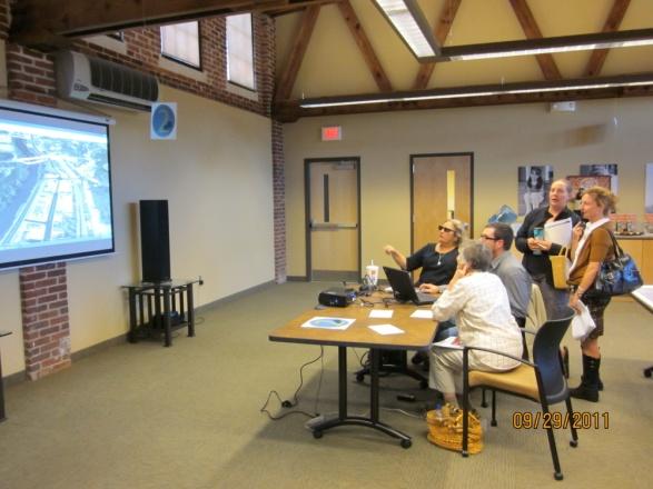
1 RIVER ARTS DISTRICT TRANSPORTATION PROJECT A section of the Public Meeting #3 December 6, 2012


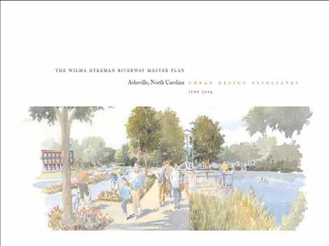
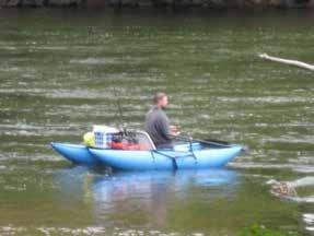
2 The RiverWay Plan The Wilma Dykeman RiverWay is a 17 mile corridor along the French Broad and Swannanoa Rivers. The Master Plan consolidates 20 years of planning for the redevelopment of the urban riverfront corridor by RiverLink and was adopted by the City of Asheville.


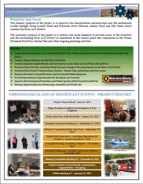
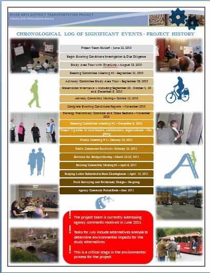
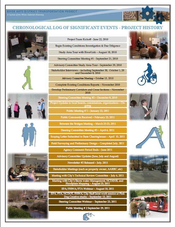
3 Project History


 Image from the Parks, Recreation,")
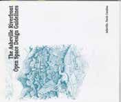
4 Project Background This project will implement portions of the Wilma Dykeman RiverWay Master Plan, the City of Asheville s 2025 Plan and the City of Asheville Parks, Recreation, Cultural Arts and Greenways Master Plan and will be coordinated with other City plans and initiatives such as East of the River. nitiatives such as East o Image from Land Use Plan from the 2025 Plan (2000) Image from the Wilma Dykeman RiverWay Master Plan (2004) Image from the Parks, Recreation, Cultural Arts and Greenways Master Plan (2009)


5 City of Asheville Website Links to city approved plans that relate to this project can be found at the City of Asheville website:

6 Project Study Area


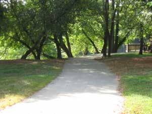
7 Project Goals Implement previous plans Create a unique gateway Connect adjacent neighborhoods Promote Smart Growth principles Increase multimodal choices Enhance economic competitiveness & sustainable redevelopment Provide recreational opportunities Promote equitable, affordable housing Enhance economic competitiveness Improve environmental protection and water quality Develop opportunities for streetscapes, amenities, and public art Minimize conflict points for bicyclists and pedestrians Preserve future mobility through access management Provide more transportation choices LIVABILITY Support existing communities Coordinate policies and leverage investment t Value communities and neighborhoods oods


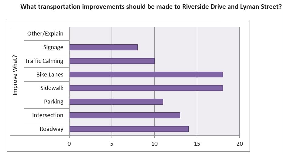
8 Purpose and Need To improve the existing roadway geometric deficiencies along Riverside Drive and Lyman Street between Amboy Road (SR 3556) and Hill Street (SR 1231); and To enhance the multimodal mobility and system linkages (vehicular, pedestrian, and bicycle) along Lyman Street and Riverside Drive by providing efficient and convenient access from Amboy Road to Hill Street.

9 Purpose and Need
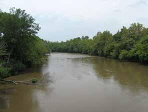
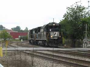
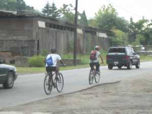
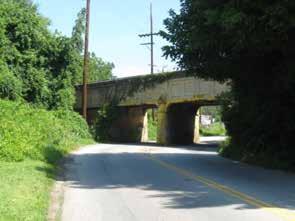
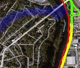
10 Challenges/Opportunities

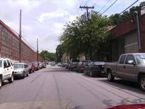
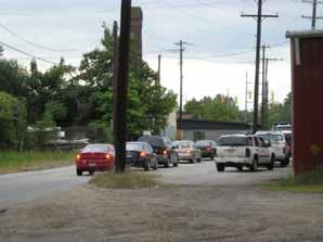
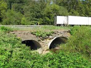
11 Challenges/Opportunities

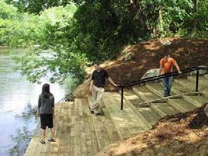
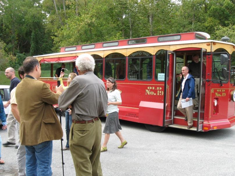
12 Precedent Photos

13 Precedent Photos

14 Precedent Photos

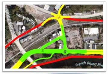
15 Railroad Crossing Concepts

16 Railroad Crossing Concepts
 Parks/Open Space Traffic calming measures Railroad crossing")
17 Alternatives Build upon previous work/studies Understand Challenges Take a fresh look at Opportunities Preferred alternative: Improve & Reconfigure intersections Multi-modal access Transit stops, Bridges Stormwater retention features Other (river access, public art, etc) Parks/Open Space Traffic calming measures Railroad crossing modifications
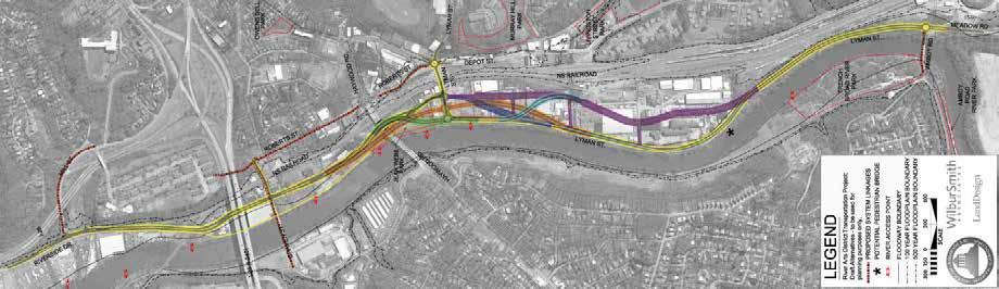
18 Project Alternatives Segments same in all colors
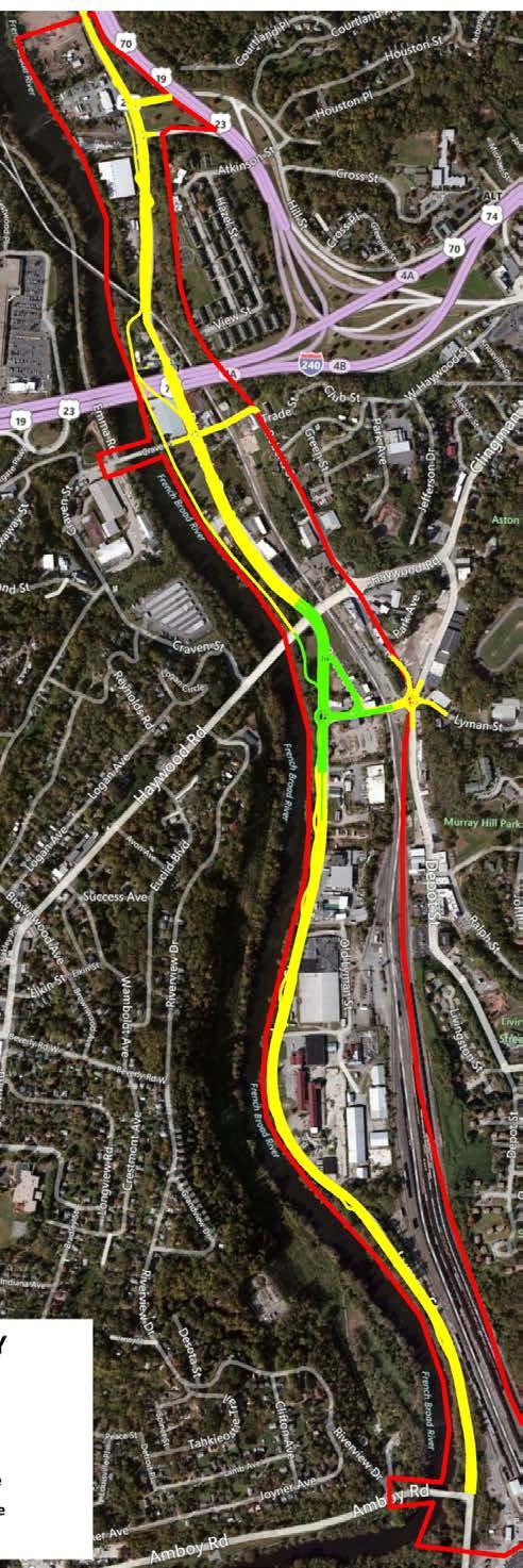
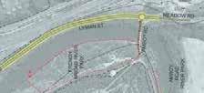
19 Recommended Alternative


20 Typical Cross-Sections All Locations Two 11-foot wide travel lanes Two 5-foot wide bike lanes Two 5-foot wide sidewalks foot wide multi-use path Some Locations Median On-street parking
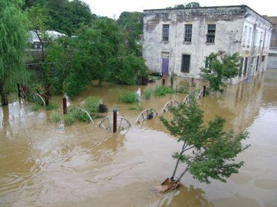
21 Impacts of Recommended Alternative Impact Category Plants & Animals Water Resources Historic Resources Community Resources Hazardous Materials Land Use Visual Economics Noise Description - Unlikely to impact Threatened or Endangered Species - Minor potential to impact other species -Impacts to streams due to replacement of pipes and culverts - Project lies within floodplain & floodway; permits will be required - Minor impacts on the Riverside Industrial Historic District - Minor impacts on the former Hans Rees Tannery (historic site) - Archaeological monitoring during construction acres of right-of-way within Jean Webb Park and 0.70 acres of right-of-way within city-owned parcel south of Jean Webb Park, planned for future park use - No residential relocations - Four business relocations - Additional right-of-way required from 19 parcels with known contamination - Project supports ongoing redevelopment efforts - No perceptible impacts - No perceptible impacts - No perceptible impacts
 Former Hans Rees Tannery (c.")
22 Historic Resources NS Railroad Bridge (1910) Old Smoky Park Bridge (1950) Riverside Industrial Historic District ( ) Former Hans Rees Tannery (c. 1917) NS Roundhouse (c. 1926)
 of the US Department of Transportation Act protects publicly owned parks, recreation areas, wildlife refuges, and historic sites.")
23 Section 4(f) WHY IS YELLOW/GREEN THE RECOMMENDED ALTERNATIVE? All the alternatives shown on the previous page were screened against the Project Purpose and Need then against federal law. Specifically, Section 4(f) of the US Department of Transportation Act protects publicly owned parks, recreation areas, wildlife refuges, and historic sites. By law, a Section 4(f) property may be converted to a transportation use only if there is no prudent and feasible alternative and if the project includes all possible planning to minimize harm to the resource. Of all the alternatives considered, Yellow and Green led to the fewest impacts on Section 4(f) resources. However, they do still lead to impacts. Land within two historic resources the Riverside Industrial Historic District and the former Hans Rees Tannery would be converted to a transportation use. At both locations, the additional right-of-way is minor and located adjacent to existing roadways. On-street parking and medians were removed from the proposed cross-section to minimize the new area required. Therefore, these takes count as De Minimis or minor uses. Provide your comments on these Section 4(f) Uses
")
24 Section 4(f)

25 Project Environmental Process Define Project Purpose Stakeholder & Public Coordination Throughout Technical & Environmental Studies Develop Alternatives Screen Alternatives Select Recommended Alternative
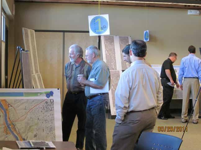
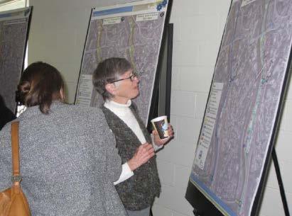
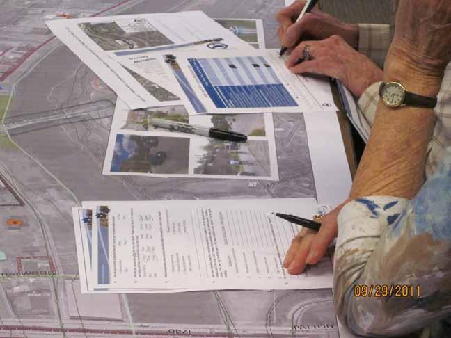
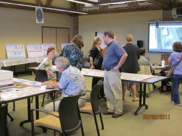
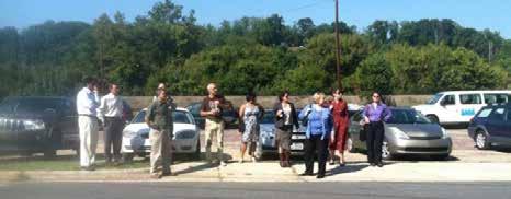
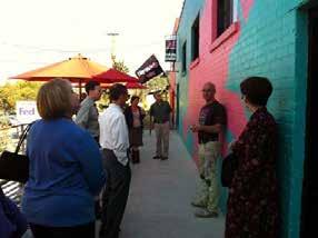
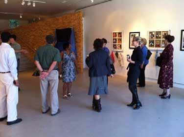
26 Public Involvement
27 Project Newsletters Project Newsletters
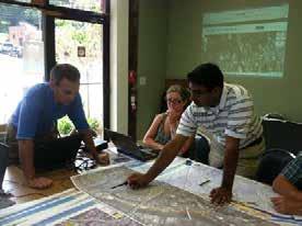
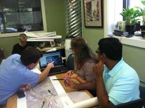
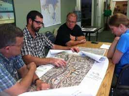
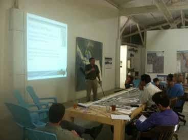
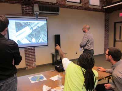
28 Agency Coordination & Team Work Sessions

29 Google Earth 3D Model

30 Discover America's Best Places to Live Article The River Arts District has flourished amazingly well in the last five years. It s continuing to grow; people are purchasing buildings and investing in this area. New construction, building renovation and an influx of restaurants, new businesses and full-time residents have created a hip urban feel down by the river. Events spaces, framing shops, healthand pet-care providers, landscape architects, building suppliers and nonprofit organizations are all adding to the vibe that is the River Arts District.


31
Asheville Design Center March 2010
 Community-Based Design Update Asheville Design Center March 2010 www.ashevilledesigncenter.org 1 introduction contents 1. Introduction 2. Background 3. ovember Design Charrette 4. January Work Session
Draft Stillwater 2030 Comprehensive Plan- Goals and Policies
 Draft Stillwater 2030 Comprehensive Plan- Goals and Policies Instructions- Review each goal and policy and discuss with group any changes, deletions for additions to the list using your groups pen. Keep
Ann Arbor Intermodal Station Environmental Review
 Ann Arbor Intermodal Station Environmental Review Park Advisory Commission September 19, 2017 AGENDA 1. Project Update 2. Draft Environmental Assessment 3. Draft Preferred Alternative 4. Next Steps 5.
The transportation system in a community is an
 7 TRANSPORTATION The transportation system in a community is an important factor contributing to the quality of life of the residents. Without a sound transportation system to bring both goods and patrons
Route 1 Corridor Study
 Route 1 Corridor Study Westbrook, Connecticut A Vision for the Connecticut Shoreline Public Informational Meeting July 28, 2015 Lower Connecticut River Valley Council of Governments Fitzgerald & Halliday,
410 Depot Street, Asheville, NC 28801
 410 Depot Street, Asheville, NC 28801 Scott Carter Office: 828-255-4663 Cell:828-215-9701 159 S Lexington Ave, Asheville, NC 28801 scottcarter@recenter.com www.recenter.com Property Details.67 acres offered
Secrest Short Cut and Monroe Expressway Small Area Plan AUGUST 29, 2018
 Secrest Short Cut and Monroe Expressway Small Area Plan AUGUST 29, 2018 Background and Process Monroe Expressway will be open by the end of 2018 Union County and Indian Trail identified a need to revisit
FDOT D4 Complete Streets
 FDOT D4 Complete Streets Context Sensitive Solutions Directs that complete street solutions will complement the context of the community. Collaborative approach to decision making, project development,
Civic Center District
 Civic Center District The Civic Center district is the civic and social heart of Warrenville, containing such public buildings as the City Hall, Warrenville Public Library, Police Station, Park District
Gold Line Bus Rapid Transit Transit Oriented Development (BRTOD) Helmo Station Area Plan
 Helmo Station Area Plan") Appendix F Gold Line Bus Rapid Transit Transit Oriented Development (BRTOD) Helmo Station Area Plan Introduction and Purpose of the Plan The Gold Line Bus Rapid Transit facility is an eleven-mile dedicated
Appendix F Gold Line Bus Rapid Transit Transit Oriented Development (BRTOD) Helmo Station Area Plan Introduction and Purpose of the Plan The Gold Line Bus Rapid Transit facility is an eleven-mile dedicated
Public input has been an important part of the plan development process.
 Lakewood s Comprehensive Plan recognizes that transportation helps shape the community, and that the way the community provides for the safe and efficient movement of people affects the character of the
Scope of Services. River Oaks Boulevard (SH 183) Corridor Master Plan
 Corridor Master Plan") Scope of Services River Oaks Boulevard (SH 183) Corridor Master Plan PROJECT AREA The project area consists of the River Oaks Boulevard (SH 183) corridor bounded by SH 199 at the northern end and the Trinity
Scope of Services River Oaks Boulevard (SH 183) Corridor Master Plan PROJECT AREA The project area consists of the River Oaks Boulevard (SH 183) corridor bounded by SH 199 at the northern end and the Trinity
Transportation Land Use Integration & Regional Planning. Don Kostelec, AICP Senior Planner, Louis Berger Group February 1, 2010
 Transportation Land Use Integration & Regional Planning Don Kostelec, AICP Senior Planner, Louis Berger Group February 1, 2010 Transportation Land Use Integration DOT-HUD-EPA Sustainable Communities Initiative
Craven Street Stormwater Improvement Projects
 Craven Street Stormwater Improvement Projects The Craven Street Watershed drains the area from Haywood Road to Westwood Place and down Haywood to the French Broad River. The watershed has one main un-named
Potential Green Infrastructure Strategies May 6, 2015 Workshop
 Potential Green Infrastructure Strategies May 6, 2015 Workshop Background The City of Cortland is developing the Tioughnioga Urban Headwaters Green Infrastructure Action Plan with funding from the National
Transportation. Strategies for Action
 Transportation A major priority for the Overlake Neighborhood is to develop a multimodal transportation system. To achieve this system, a balance has to be found among travel, circulation and access needs;
A larger version of this map is located on the last page of this PDF.
 MAP Committee Input McLoughlin Area Draft Vision Map A larger version of this map is located on the last page of this PDF. 1. The map above is intended to portray a vision for the McLoughlin area. It highlights
PD&E STUDY SR 9/I-95 FROM SOUTH OF SR 870/COMMERCIAL BOULEVARD TO NORTH OF CYPRESS CREEK ROAD FM # ETDM 14222
 PD&E STUDY SR 870/COMMERCIAL BOULEVARD TO NORTH OF CYPRESS CREEK ROAD FM # 435808-1-22-02 ETDM 14222 WELCOME TO THE KICK-OFF MEETING May 24, 2016 1 1 2 3 4 5 6 PLANNING PROJECT DEVELOPMENT AND ENVIRONMENT
Rapid Transit Implementation Working Group
 Rapid Transit Implementation Working Group October 12, 2017 1 Agenda 1. Consultation Update 2. Technical Work Update 3. LTC Rapid Transit Integration 4. Next Steps 2 Consultation Update 3 Consultation
HILLSBOROUGH COUNTY Greenways and Trails Plan Update. Executive Summary. Date
 HILLSBOROUGH COUNTY Greenways and Trails Plan Update Executive Summary Date PURPOSE AND PROJECT OVERVIEW The Hillsborough County Greenways Master Plan (1995) and the City of Tampa s Greenways and Trails
DRAFT City of Titusville 2040 Comprehensive Plan Future Land Use, Housing, and Transportation Elements April 16, 2018
 DRAFT City of Titusville 2040 Comprehensive Plan Future Land Use, Housing, and Transportation Elements April 16, 2018 Prepared by Canin Associates for the City of Titusville About the Comprehensive Plan:
Executive Summary. NY 7 / NY 2 Corridor
 Executive Summary NY 7 / NY 2 Corridor Transportation and Land Use Study December 2005 Prepared for: Town of Colonie Capital District Transportation Committee Prepared by: Introduction: Land use decisions
New Auburn Village Center Study Auburn, Maine
 Auburn, Maine Option Review Summary Prepared for: Androscoggin Transportation Resource Center and City of Auburn Prepared by: T.Y. Lin International MRLD October 10, 2013 1. Introduction This memo summarizes
Appendix E Section 4(f) Evaluation
 Evaluation") Appendix E Section 4(f) Evaluation Appendix E Draft Section 4(f) Evaluation E.1 Introduction This appendix addresses a federal regulation known as Section 4(f), which protects parks, recreation areas,
Appendix E Section 4(f) Evaluation Appendix E Draft Section 4(f) Evaluation E.1 Introduction This appendix addresses a federal regulation known as Section 4(f), which protects parks, recreation areas,
Public Hearing. Charlotte County-Punta Gorda MPO - Meeting Rooms A and B March 14, open house at 4 p.m., formal presentation at 5 p.m.
 Public Hearing Charlotte County-Punta Gorda MPO - Meeting Rooms A and B March 14, 2019 open house at 4 p.m., formal presentation at 5 p.m. Welcome to the Public Hearing for the Harborview Road (CR 776)
Chapter 5: Natural Resources and Environment
 NATURAL RESOURCES AND ENVIRONMENT 5-1 5 Chapter 5: Natural Resources and Environment BACKGROUND AND INTENT Urban expansion represents the greatest risk for the future degradation of existing natural areas,
This page left intentionally blank.
 July 2012 This page left intentionally blank. Table of Contents Appendix A : Project Development Checklist Appendix B: At-Grade Rail Crossings Appendix C: Maintenance and Operations Examples Appendix D:
SH 199 Corridor Master Plan. Community Meeting No. 2 May 31, 2017
 Community Meeting No. 2 May 31, 2017 Transportation Projects On or Near SH 199 SH 199 from 0.3 miles south of FM 1886 to south end of Lake Worth bridge Construct freeway mainlanes and frontage roads 10-Year
Mississippi Skyway Preliminary Engineering Report
 EXECUTIVE SUMMARY Mississippi Skyway Preliminary Engineering Report CITY OF RAMSEY, MINNESOTA DECEMBER 2014 City of RAMSEY EXECUTIVE SUMMARY Project Need and Intent The Mississippi Skyway pedestrian bridge
Welcome. Northern Segment of Hwy 100 I-90 to South of Madison Street Meeting Goals:
 Welcome Northern Segment of Hwy 100 I-90 to South of Madison Street Meeting Goals: - Review Environmental Assessment - Share Preferred Alternative -Receive Public Comments 2003 EA Preferred Alternative
CHAPTER 7: VISION AND ACTION STATEMENTS. Noble 2025 Vision Statement
 CHAPTER 7: VISION AND ACTION STATEMENTS This chapter presents the vision, policy and action statements that transform the comprehensive planning study, an analysis of Noble s past, future trends and community
Atlanta BeltLine Subarea 3 Master Plan Update
 Atlanta BeltLine Subarea 3 Master Plan Update April 14, 2018 Workshop Meeting 1 22 miles, connecting 45 neighborhoods 22 MILES of transit 46 MILES of streetscapes and complete streets 33 MILES of urban
DRAFT MAP AMENDMENT FLU 04-4
 DRAFT MAP AMENDMENT FLU 04-4 SW 24 TH AVENUE ROADWAY CORRIDOR The University of Florida participates with the Metropolitan Transportation Planning Organization (MTPO) in its responsibilities for the continuing,
Mary Hills Nature Area. Roadway Lighting. The Minneapolis Clinic of Neurology Courage Kenny Rehabilitation Institute
 PUBLIC REALM IMPROVEMENTS Mary Hills Nature Area Enhanced Programming Glenview Terrace Valley View Roadway Lighting Enhanced Streetscape Trail Lighting / Roadway Lighting Wayfinding Public Art The Minneapolis
The Mobile Peninsula Corridor Master Plan Dauphin Island Parkway I 10 to Dog River
 The Mobile Peninsula Corridor Master Plan Dauphin Island Parkway I 10 to Dog River Welcome and Introductions Alice Keel Co Founder Prayer Rev. Jim Langston Fulton Road Baptist Church Comments Stewart Hanley,
Section4 Design Vision & Implementation Plan
 Section4 Design Vision & Implementation Plan W Woodschurch Rd 4.1 Design Focus Areas The Framework Plan is simply the starting point for directing the design and implementation of a wide range of transportation
STAFF SUMMARY FOR S17-02 SPECIAL USE PERMIT APPLICATION
 APPLICATION SUMMARY Case Number: S17-02 Request: STAFF SUMMARY FOR S17-02 SPECIAL USE PERMIT APPLICATION SUP application in order to develop a convenience food store. Applicant: Property Owner(s): Cindee
Panama City Beach Community Redevelopment Agency Condo Con Property Owner Conference & Expo November 14, 2014
 Panama City Beach Community Redevelopment Agency Condo Con Property Owner Conference & Expo November 14, 2014 Front Beach Road CRA On November 30, 2000, the City created the Panama City Beach Community
Commercial Node Plan Devine Street/Jackson Blvd. COLUMBIA, SC
 Commercial Node Plan Devine Street/Jackson Blvd. COLUMBIA, SC 9.17.13 AGENDA 1 Introductions 2 Project Update 3 Concepts 4 Recommendations 5 Next Steps Introductions Project Update Process 5-Phase Process
WELCOME! 8 8:30 6: TH STREET IMPROVEMENTS. Open House. Presentation & Q&A
 WELCOME! 168 TH STREET IMPROVEMENTS 6:30 Open House 7 8 Presentation & Q&A 8 8:30 Open House WELCOME Todd Pfitzer City of Omaha Engineer Bob Stubbe City of Omaha Public Works Director Jon Meyer Project
1 ESRI User Conference Eastside Greenway
 1 ESRI User Conference Eastside Greenway Grand Rapids, Michigan ~200,000 residents 45 sq. miles Leader in smart public investment Green infrastructure program ArtPrize BeerCity USA 2 ESRI User Conference
RECREATION AND OPEN SPACE ELEMENT GOALS, OBJECTIVES, AND POLICIES
 RECREATION AND OPEN SPACE ELEMENT GOALS, OBJECTIVES, AND POLICIES Goal 7 To provide park facilities, recreation programs, and open space resources that are safe, adequate, and accessible to all City residents,
Gratigny Parkway East Extension Project Development & Environment (PD&E) Study
 Study") Gratigny Parkway East Extension Project Development & Environment (PD&E) Study Session 4: Presentation of Charrette Results December 8, 2010 MDX Work Program #: 92407 ETDM#: 11500 Project Location & Description
Gratigny Parkway East Extension Project Development & Environment (PD&E) Study Session 4: Presentation of Charrette Results December 8, 2010 MDX Work Program #: 92407 ETDM#: 11500 Project Location & Description
Implementation Guide Comprehensive Plan City of Allen
 Implementation Guide 2030 Comprehensive Plan City of Allen DRAFT 2015 Implementation Guide Allen 2030 Comprehensive Plan INTRODUCTION The Comprehensive Plan serves as a guide for the growth and development
WELCOME TO OPEN HOUSE TWO November 28, 2018
 Langstaff Road Weston Road to Highway 7 Class Environmental Assessment Study WELCOME TO OPEN HOUSE TWO November 28, 2018 Please sign in and join our mailing list Study Overview York Region is conducting
Welcome to the. Open House
 Welcome to the 5th Street to Kinsman Road Open House November 14 5:30 7:00 p.m. Please sign in Project Overview In December 2016, City Council adopted SW 5th Street as the preferred alignment to connect
TRANSPORTATION ELEMENT
 TRANSPORTATION ELEMENT GOAL I: To create and maintain a safe, efficient and aesthetic transportation system that encourages multi-modal transportation and promotes the mobility strategies of the Ocala
CHAPTER VIII Implementation
 CHAPTER VIII Implementation VIII. Implementation The vision for the Marlboro Pike Corridor will require that a variety of participants work together to make it a reality. The following action steps outline
Commissioners Road West Realignment Environmental Assessment
 City of London Commissioners Road West Realignment Environmental Assessment Public Information Centre No. 1 March 30, 2017 Welcome to the Public Information Centre This first Public Information Centre
TRANSPORTATION ELEMENT GOALS, OBJECTIVES, AND POLICIES
 TRANSPORTATION ELEMENT GOALS, OBJECTIVES, AND POLICIES GOAL 2 The City shall provide a safe, convenient, effective, and energy efficient multimodal transportation system which is coordinated with the Future
Chapter IV: Development Pattern
 Chapter IV: Development Pattern Introduction The 2002 Prince George s County Approved General Plan designates three growth policy tiers Developed, Developing, and Rural as well as three center designations
BROOKHILL NEIGHBORHOOD MODEL ZONING MAP AMENDMENT PREFACE TO APPLICATION
 BROOKHILL NEIGHBORHOOD MODEL ZONING MAP AMENDMENT PREFACE TO APPLICATION June 15, 2015 Revised: August 1, 2016 I. VISION Brookhill is a proposed community based upon the principles of Albemarle County
Public Meeting March 10 th 2011
 Public Meeting March 10 th 2011 Agenda 6:00-6:15 6:15-7:00 7:00-8:00 8:00-8:30 8:30-9:00 9:00 Welcome and Introductions Presentation» Project Overview» Recap Existing Conditions / Issues & Opportunities»
St. Clair Avenue West Area Transportation Master Plan
 1 (Between Keele Street and Old Weston Road) Public Information Centre 1 December 2, 2015 2 Welcome Welcome to the first Public Information Centre for the St. Clair Avenue West Area. The panels will present
Mendota Heights 2040 Comprehensive Plan Draft Vers
 4 Parks and Trails The City of Mendota Heights boasts a variety of recreational and open space opportunities. Few cities can claim access to regional trails, riverside and lakeside parks, scenic bluffs
Citizen Advisory Group Meeting 5: Land Use April 14, 2011
 Citizen Advisory Group Meeting 5: Land Use April 14, 2011 Meeting Agenda 1. Background Review 2. Transportation Follow-up 3. PED Overlay Approach 4. Land Use Mapping 5. Group Exercise 6. Wrap-up and Next
5. Father Hennepin Blufs Park and Hennepin Island Father Hennepin Bluffs Park Supporting Initiatives (see Figure 36): 7-22
: 7-22") 5. Father Hennepin Blufs Park and Hennepin Island As described in existing conditions portion of Chapter 2, Father Hennepin Blufs Park lies on the upland portion of the park and Hennepin Island spans the
5. Father Hennepin Blufs Park and Hennepin Island As described in existing conditions portion of Chapter 2, Father Hennepin Blufs Park lies on the upland portion of the park and Hennepin Island spans the
CHAPTER 7: Transportation, Mobility and Circulation
 AGLE AREA COMMUNITY Plan CHAPTER 7 CHAPTER 7: Transportation, Mobility and Circulation Transportation, Mobility and Circulation The purpose of the Transportation, Mobility and Circulation Chapter is to
CHAPTER 8 ISSUES, CONCERNS, CONSTRAINTS AND OPPORTUNITIES
 CHAPTER 8 ISSUES, CONCERNS, CONSTRAINTS AND OPPORTUNITIES Introduction This River Conservation Plan was developed during a time of tremendous activity and effort in planning the transformation of the Delaware
LAND USE ELEMENT. Purpose. General Goals & Policies
 LAND USE ELEMENT Purpose This Land Use Element contains the goals and policies necessary to support the City s responsibility for managing land resources and guiding development through implementing regulations,
MONTGOMERY COUNTY PLANNING DEPARTMENT THE MARYLAND-NATIONAL CAPITAL PARK AND PLANNING COMMISSION
 MONTGOMERY COUNTY PLANNING DEPARTMENT THE MARYLAND-NATIONAL CAPITAL PARK AND PLANNING COMMISSION MCPB Item No. Date: 1/26/12 Hanover Shady Grove, Sketch Plan 320120020 Joshua Sloan, Coordinator, Joshua.Sloan@MontgomeryPlanning.org,
G. RECREATION AND OPEN SPACE ELEMENT. The following summarizes the Recreation and Open Space Element:
 G. RECREATION AND OPEN SPACE ELEMENT The purpose of the Element is to provide the framework and direction for a comprehensive system of public and private sites for recreation, including, but not limited
I. DESCRIPTION OF PROPOSED ACTION... 1 A. General Description... 1 B. Historical Resume and Project Status... 2 C. Cost Estimates...
 PROJECT COMMITMENTS SUMMARY... S-1 1. Type of Action... S-1 2. Description of Action... S-1 3. Summary of Purpose and Need... S-1 4. Alternatives Considered... S-2 5. NCDOT Alternatives Carried Forward...
1.0 Circulation Element
 5/9/18 1.0 Circulation Element 1.1 Introduction As growth and development occur in Apache County, enhancements to its circulation system will be necessary. With time, more roads will be paved and air and
Downtown Dubuque...it s a great time.
 Downtown Dubuque...it s a great time. Your timing could not be better to invest in Downtown. With hundreds of millions in public and private investment occurring on the City s downtown waterfront, millions
Atlanta BeltLine. Subareas 9 & 10. Master Plan Updates. March 26, Washington Park Jamboree 1
 Atlanta BeltLine Subareas 9 & 10 Master Plan Updates March 26, 2018 Washington Park Jamboree 1 22 miles, connecting 45 neighborhoods 22 MILES of transit 46 MILES of streetscapes and complete streets 33
Meeting Agenda. 1. Introductions (5 min)
") Meeting Agenda Monaca, PA Ohio River Brownfields Redevelopment Planning Federal/State/Regional Partners Meeting June 5, 2012; 3-4pm EDT Conference call-in #: 1-866-299-3188 Conference code: 202 566 0633#
Meeting Agenda Monaca, PA Ohio River Brownfields Redevelopment Planning Federal/State/Regional Partners Meeting June 5, 2012; 3-4pm EDT Conference call-in #: 1-866-299-3188 Conference code: 202 566 0633#
V. Vision and Guiding Principles
 V. Vision and Guiding Principles The Master Plan for the Powers Ferry Corridor seeks a foundation in the desires of the community. At times, various elements of the community offered opposing viewpoints,
AGENDA ACTION ITEMS INFORMATION ITEMS
 NOACA Bicycle and Pedestrian Advisory Council Meeting Friday, March 21 st, 2014 10:30 a.m. NOACA Office 1299 Superior Avenue Cleveland, Ohio 44114 Phone: (216) 241-2414; website: www.noaca.org AGENDA ACTION
MURRAY CENTRAL STATION MASTER PLAN Central Station Area of Influence and Site Analysis
 CENTRAL STATION MASTER PLAN Central Station Area of Influence and Site Analysis OVERVIEW Planned Fire Station TAYLORSVILLE A thorough Site Analysis was conducted to ensure planning and design concepts
Date: April 10, 2017 City Council Work Session April 24, 2017: Status Report on the Comprehensive Plan Update and Transportation Master Plan
 AGENDA REPORT To: From: By: Honorable Mayor and City Council Members Warren Hutmacher, City Manager Sharon Ebert, Director Community Development Date: April 10, 2017 Agenda: City Council Work Session April
The Illinois Department of Transportation and Lake County Division of Transportation. Route 173, including the Millburn Bypass
 The Illinois Department of Transportation and Lake County Division of Transportation welcome you to this Public Hearing for U.S. Route 45 from Illinois Route 132 to Illinois Route 173, including the Millburn
Capital Projects in and near Odenton Town Center
 Capital Projects in and near Odenton Town Center Map ID Anne Arundel County Department of Public Works This project provides for the design, right of way acquisition, and construction of approximately
7.0 SOCIAL, ECONOMIC, AND ENVIRONMENTAL ISSUES
 7.0 SOCIAL, ECONOMIC, AND ENVIRONMENTAL ISSUES The following list of social, economic, and environmental issues have been identified based on a preliminary inventory of resources in the project area, an
Por favor, levanten la mano si necesita traduccion en espanol Please raise your hand if you need Spanish translation
 FEDERAL BOULEVARD CORRIDOR WIDE STUDY PUBLIC MEETING #1 APRIL 27, 2016 Por favor, levanten la mano si necesita traduccion en espanol Please raise your hand if you need Spanish translation HDR DESIGN WORKSHOP
1.0 INTRODUCTION 1.1 TH 14 WEST STUDY AREA Project Description Functional Classification Purpose of the Project
 1.0 INTRODUCTION 1.1 TH 14 WEST STUDY AREA 1.1.1 Project Description The Trunk Highway (TH) 14 West Corridor is a two-lane roadway approximately 22 miles in length. Located in Nicollet County, the corridor
DRAFT ROOSEVELT ROAD. District Recommendations. Figure 5.23 The Roosevelt Road Corridor
 CHAPTER 5 Figure 5.23 The Road Corridor Road will develop as a mixed-use corridor, emphasizing regional retail, west of the river and mixed-use development east of the river. KEY RECOMMENDATIONS 1. High
Be it enacted by the Town Board of the Town of Guilderland that the following new A (Transit Oriented Development (TOD) District) is adopted:
 District) is adopted:") Local Law No. 4 of 2018 (Adoption of 280-18A (Transit Oriented Development District) Be it enacted by the Town Board of the Town of Guilderland that the following new 280-18A (Transit Oriented Development
Local Law No. 4 of 2018 (Adoption of 280-18A (Transit Oriented Development District) Be it enacted by the Town Board of the Town of Guilderland that the following new 280-18A (Transit Oriented Development
Beachside Redevelopment Committee
 Beachside Redevelopment Committee DRAFT FINAL RECOMMENDATIONS MARCH 22, 2018 This is a new slide 2 This is a new slide Table of Contents I. Introduction and Overview II. III. Community Improvements and
DOMINION BOULEVARD CORRIDOR STUDY AND ECONOMIC DEVELOPMENT STRATEGIC PLAN A MODEL FOR CHESAPEAKE S FUTURE
 DOMINION BOULEVARD CORRIDOR STUDY AND ECONOMIC DEVELOPMENT STRATEGIC PLAN A MODEL FOR CHESAPEAKE S FUTURE Overview I. Draft Plan Process II. Draft Plan Overview a. Market Analysis b. Master Land Use Plan
TRANSPORTATION PROJECTS
 TRANSPORTATION PROJECTS 40 BUFFALO S LWRP PROPOSED PROJECTS T1. Niagara Street/Great Lakes Seaway Trail Streetscape Project City of Buffalo Department of Public Works Niagara Street from Niagara Square
Parks, Trails, and Open space Element
 Parks, Trails, and Open space Element Parks, Trails, and Open Space element Parks, Recreation, and Open Space are important components of the quality of life desired by the residents of Elk Grove. This
MONTGOMERY COUNTY METRO STATION AREA DESIGN CHARRETTE
 MONTGOMERY COUNTY METRO STATION AREA DESIGN CHARRETTE Shady Grove Metro Station Area Charrette Closing Presentation October 25-28, 2000 MONTGOMERY COUNTY, MD M-NCPPC Design Collective, Inc. Architects
SUMMERSIDE / MT. CARMEL REINVESTMENT CORRIDOR COMMUNITY DEVELOPMENT STRATEGY
 SUMMERSIDE / MT. CARMEL REINVESTMENT CORRIDOR COMMUNITY DEVELOPMENT STRATEGY FEBRUARY 2013 I. Location of the Summerside/Mt. Carmel Reinvestment Corridor The Summerside/Mt. Carmel Reinvestment Corridor
Green Infrastructure The Indianapolis Greenways Connection
 Green Infrastructure The Indianapolis Greenways Connection Fewer things in the transportation industry today make better since than combining the needs for pedestrian and bike trails with the need to locate,
Subareas 9 & 10 Master Plan Updates
 Atlanta BeltLine Subareas 9 & 10 Master Plan Updates Study Group Meeting 4 September 17, 2018 Washington Park Jamboree 1 22 miles, connecting 45 neighborhoods 22 MILES of transit 46 MILES of streetscapes
Town Center (part of the Comprehensive Plan)
") Town Center (part of the Comprehensive Plan) Mercer Island Town Center Looking North (2014) In 1994, a year-long process culminated in a set of design guidelines and code requirements for the Town Center
Town Center (part of the Comprehensive Plan) Mercer Island Town Center Looking North (2014) In 1994, a year-long process culminated in a set of design guidelines and code requirements for the Town Center
Community Workshop. Tuesday, February 15, 2011 New Haven Free Public Library
 Community Workshop Tuesday, February 15, 2011 New Haven Free Public Library 1 Planning and Engineering Design Team PARSONS BRINCKERHOFF (PB) Lead Planning and Design NEWMAN ARCHITECTS Urban Architecture
EXECUTIVE SUMMARY. Introduction
 EXECUTIVE SUMMARY Introduction State Route 68 is a designated scenic route that connects the world-renowned Monterey Peninsula to US Highway 101 and the Salinas Valley. SR 68 is a key route for bicycle,
At first Work Session on October 22, At second Work Session on November 19, At third Work Session on December 3, 2015
 At first Work Session on October 22, 2015 Staff Reviewed Infrastructure: Transportation Capacity School Capacity Willett Branch Proposed Staging Language At second Work Session on November 19, 2015 Land
Complete Streets in Lancaster County
 Complete Streets in Lancaster County PRESENTED BY: Robert Bini, AICP Director for Transportation Planning November 14, 2017 Lancaster County is a growing county of over 534,000 and the bottom line is...
Cultivate Hopkins: Built Environment. Comprehensive Plan Advisory Committee September 13, 2017
 Cultivate Hopkins: Built Environment Comprehensive Plan Advisory Committee September 13, 2017 Four Dimensions of a Sustainable Plan Land Use Urban Design Housing Transportation Resilience Water Resources
8implementation. strategies
 PROGRAM STRATEGIES 8implementation strategies T he implementation actions of this chapter are designed to support and carry out the land use, economic development, transportation, urban design, and program
Small Area Plan. South Gateway
 Small Area Plan Adopted May 12, 2008 South Gateway Purpose. The South Gateway Small Area Plan defines the City s expectations for the future of the southern entrance to the City at Interstate 85 and Highway
TREASURE COAST REGIONAL PLANNING COUNCIL M E M O R A N D U M. To: Council Members AGENDA ITEM 5H
 TREASURE COAST REGIONAL PLANNING COUNCIL M E M O R A N D U M To: Council Members AGENDA ITEM 5H From: Date: Subject: Staff October 17, 2008 Council Meeting Local Government Comprehensive Plan Review Draft
Northwest Rail Corridor and US 36 BRT Development Oriented Transit Analysis 4.4 STATION AREA FINDINGS
 4.4 STATION AREA FINDINGS Each station is different, and each one requires a separate set of recommendations based on the vision for the site. This section outlines an initial TOD strategy and recommendations
Planning Board Briefing
 Planning Board Briefing Why Now? The Sector Plan Implementation Chapter States: Before Stage 1 begins, the following must occur: Approval of the Sectional Map Amendment. Approval of the Greater Lyttonsville
DRAFT Subject to Modifications
 TREASURE COAST REGIONAL PLANNING COUNCIL M E M O R A N D U M To: Council Members AGENDA ITEM 8 From: Date: Subject: Staff May 19, 2017 Council Meeting Florida Department of Transportation Complete Streets
PIKE PINE RENAISSANCE: ACT ONE. October 19, 2017
 PIKE PINE RENAISSANCE: ACT ONE October 19, 2017 WATERFRONT SEATTLE PROGRAM PROJECT INTRODUCTION Pike and Pine streets, between First and Melrose avenues Pedestrian and streetscape improvements Budget:
FOUR MILE RUN VALLEY WORKING GROUP AND CHARGE
 FOUR MILE RUN VALLEY WORKING GROUP AND CHARGE Adopted April 16, 2016 Amended July 19, 2016 Overview of Integrated Effort The overall goal of the Four Mile Run Valley (4MRV) initiative is to develop a comprehensive