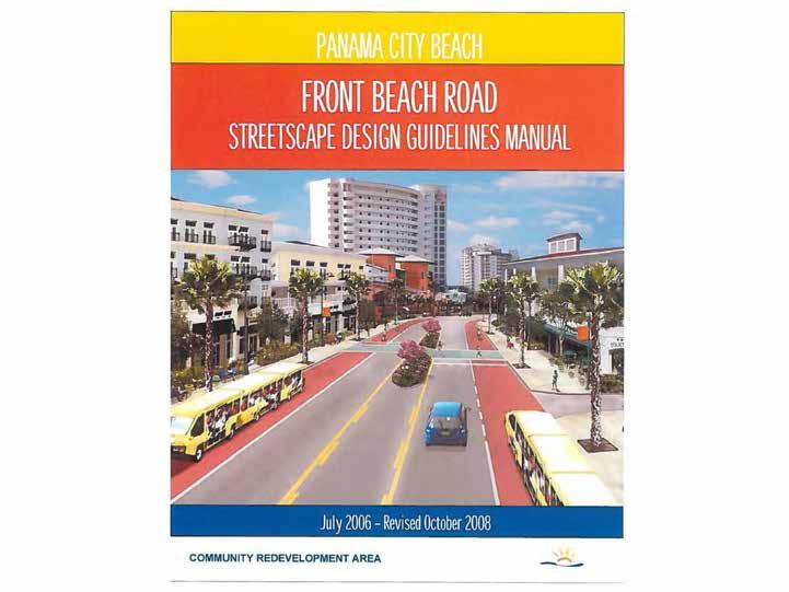
Panama City Beach Community Redevelopment Agency Condo Con Property Owner Conference & Expo November 14, 2014
|
|
|
- Rodger Long
- 5 years ago
- Views:
Transcription
1
2
3
4
5
6
7

8 Panama City Beach Community Redevelopment Agency Condo Con Property Owner Conference & Expo November 14, 2014
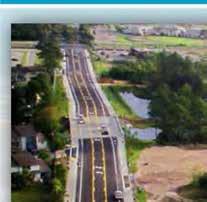
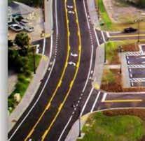
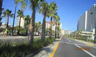
9 Front Beach Road CRA On November 30, 2000, the City created the Panama City Beach Community Redevelopment Agency and declared the City Council as the governing body of the Agency. On June 21, 2001 the City adopted a resolution and created the Front Beach Road Community Redevelopment Area (CRA).

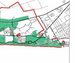
10 CRA Limits CRA Map
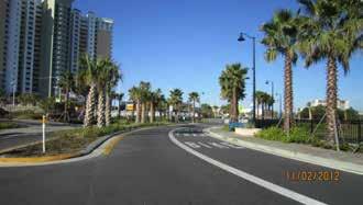
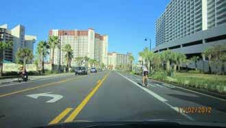
11 CRA Program Objectives Program focuses on transportation projects Improve mobility along Front Beach Road and the connector roads Create a walkable community with extensive sidewalks, bike paths, enhanced streetscapes and people friendly areas Provide better beach access and increased public parking Encourage Private/Public Partnerships Develop programs to encourage economic development and revitalization


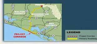
12 CRA Redevelopment Plan The CRA Redevelopment Plan provides a framework for redevelopment of approximately 19.8 miles of existing Roadways. The Plan recommends enhancement such as streets widening, roadway lighting, turn lanes, landscaped medians, new signage, hardscape/landscape, sidewalks, stormwater ponds/parks and undergrounding all utilities.
13 Front Beach Road CRA Streets within the Redevelopment Area: Front Beach Road Hutchison Blvd North Thomas Drive South Thomas Drive Churchwell Drive Richard Jackson Blvd AIf Coleman Road Clara Avenue Nautilus Street Hills Road Powell Adams Road, South Arnold Road Cobb Road, and Panama City Beach Parkway (US 98)


14 Transit Vision Resort Corridor Service 15 minute frequencies 16 hr. day 7 days/week Employee Commute Program Airport Shuttle Service City/County Transit Connections Park and Ride Remote Beach Parking Special Events Management

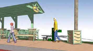
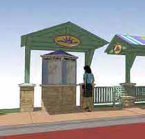
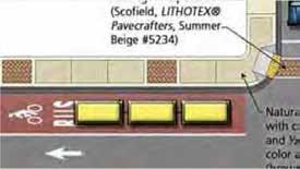
15 Transit Stops


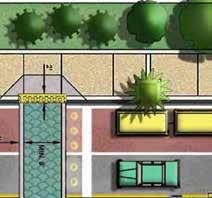

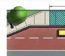
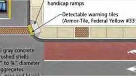
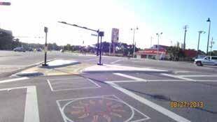
16 Pedestrian Crossing

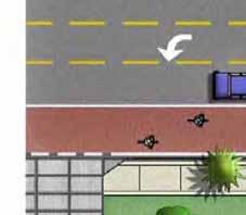
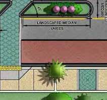
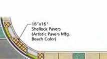
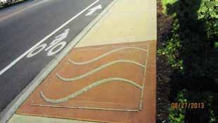
17 Typical Side Street


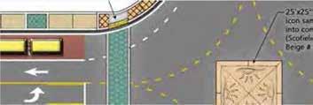
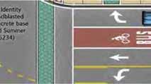
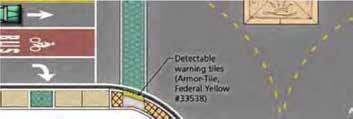

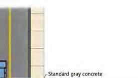
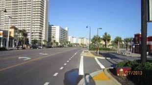
18 Major Intersections


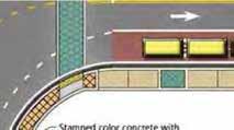
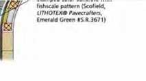
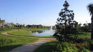
19 Creating Public Space


20 Creating Public Space

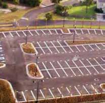
21 Past Accomplishments Churchwell Dr Redevelopment

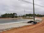
22 R. Jackson Blvd Redevelopment

23 A Vision of Beckrich Road


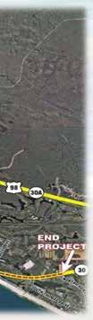

24 PD&E Study Front Beach Road Project Development & Environment Study was Completed in FY 2012
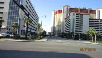
25 Front Beach Road
26 Front Beach Road

27 Past Accomplishments FBR Seg 1 & South Thomas Drive N. THOMAS DR S. THOMAS DR

28 South Thomas Drive

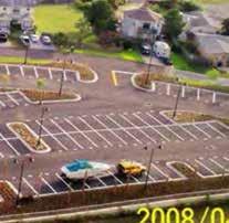
29 South Thomas Dr Reconstruction Project in South Thomas Drive

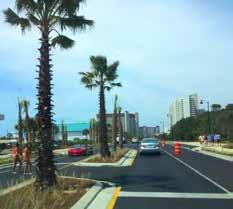

30 South Thomas Dr Reconstruction open with amenities in South Thomas Drive


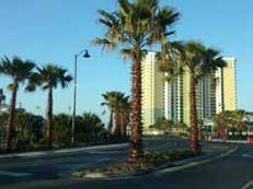
31 South Thomas Drive

32 South Thomas Drive

33 South Thomas Drive
34


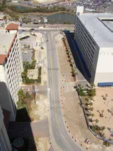
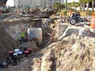
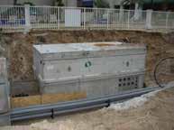
35 Front Beach Road Seg 1 Front Beach Road in progress with underground power duct bank/vaults, stormwater system, new water-main and traffic control.


36 A wider Front Beach Road for 2012 with 8 foot sidewalks, new underground power and pond with walking trail Front Beach Rd Seg 1

37 Front Beach Rd Seg 1


38 Front Beach Road Seg 1

39 Powell Adams Road

40 Powell Adams Road Completed Final Design & Permitting of Powell Adams Rd

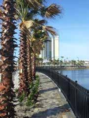
41 Powell Adams Road


42 Powell Adams Road

43 Powell Adams Road


44 Powell Adams Rd Segment 1
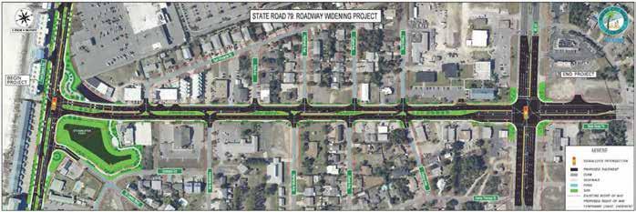
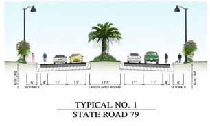
45 SR 79 Improvement Project


46 Front Beach Road Segment 3


47 Front Beach Road Seg 2 Construction Design Complete Acquired property for stormwater ponds Required right-of-way acquisition efforts are ongoing Schedule for Construction in Spring of 2015 FRONT BEACH ROAD


48 Long Beach Looking East

49 Long Beach Looking West
50 Panama City Beach Community Redevelopment Agency Questions?
Panama City Beach Community Redevelopment Agency ON THE MOVE IN PCB
 Panama City Beach Community Redevelopment Agency ON THE MOVE IN PCB Program Goals, Activities and Accomplishments I. Beach Front Multi-modal Transportation, Aesthetic and Parking Improvements III. Connector
March 31. Fiscal Year 2016 Financial Statements Front Beach Road & Pier Park Community Redevelopment Areas
 Financial Statements March 31 2017 Fiscal Year 2016 Financial Statements Front Beach Road & Pier Park Community Redevelopment Areas In order to provide the reader with as much information as possible with
The Project. In 2013, construction was completed between 100 Street and 102 Street.
 The Project Jasper Avenue New Vision (JANV) is a major catalyst project identified in the Capital City Downtown Plan (2010) between 92 Street and 109 Street, including the streets half a block north and
TRANSPORTATION ELEMENT
 TRANSPORTATION ELEMENT GOAL I: To create and maintain a safe, efficient and aesthetic transportation system that encourages multi-modal transportation and promotes the mobility strategies of the Ocala
CHAPTER VIII Implementation
 CHAPTER VIII Implementation VIII. Implementation The vision for the Marlboro Pike Corridor will require that a variety of participants work together to make it a reality. The following action steps outline
Gratigny Parkway East Extension Project Development & Environment (PD&E) Study
 Study") Gratigny Parkway East Extension Project Development & Environment (PD&E) Study Session 4: Presentation of Charrette Results December 8, 2010 MDX Work Program #: 92407 ETDM#: 11500 Project Location & Description
Gratigny Parkway East Extension Project Development & Environment (PD&E) Study Session 4: Presentation of Charrette Results December 8, 2010 MDX Work Program #: 92407 ETDM#: 11500 Project Location & Description
Implementation Guide Comprehensive Plan City of Allen
 Implementation Guide 2030 Comprehensive Plan City of Allen DRAFT 2015 Implementation Guide Allen 2030 Comprehensive Plan INTRODUCTION The Comprehensive Plan serves as a guide for the growth and development
A larger version of this map is located on the last page of this PDF.
 MAP Committee Input McLoughlin Area Draft Vision Map A larger version of this map is located on the last page of this PDF. 1. The map above is intended to portray a vision for the McLoughlin area. It highlights
Mary Hills Nature Area. Roadway Lighting. The Minneapolis Clinic of Neurology Courage Kenny Rehabilitation Institute
 PUBLIC REALM IMPROVEMENTS Mary Hills Nature Area Enhanced Programming Glenview Terrace Valley View Roadway Lighting Enhanced Streetscape Trail Lighting / Roadway Lighting Wayfinding Public Art The Minneapolis
GPA FALL 2017 CONFERENCE
 Change in Doraville Doraville at the beginning of a new era Design Doraville (Comp. Plan) adopted in 2016 Doraville Town Center Masterplan LCI (2005) Downtown Doraville Masterplan LCI (2010) 2014 Adoption
Route 347. New York State Department of Transportation Region 10, Long Island. THE GREENING of ROUTE 347
 The GREENING of Route 347 The Greening of Route 347 The Greening of Route 347: History 3 The Greening of Route 347 4 The Greening of Route 347 5 The Greening of Route 347 Smith Haven Mall 6 The Greening
2040 Long Range Transportation Plan
 2040 Long Range Transportation Plan Adopted: April 15, 2013 APPENDIX D HIGHWAY NEEDS PLAN PROJECTS FREDERICKSBURG Existing and Committed Projects Fall Hill Avenue/Mary Washington Blvd. (Fredericksburg)
Transportation. Strategies for Action
 Transportation A major priority for the Overlake Neighborhood is to develop a multimodal transportation system. To achieve this system, a balance has to be found among travel, circulation and access needs;
I-95 Interchange & Ellis Road PD&E Study
 I-95 Interchange & Ellis Road PD&E Study Brevard County, Florida Presentation to the Space Coast TPO October 14, 2010 The Project Provide a New Interchange with I-95 Using the Ellis Road Corridor, Extend
Crenshaw Transit Corridor Alternatives Analysis/EIS/EIR
 Crenshaw Transit Corridor Alternatives Analysis/EIS/EIR Working Group Meetings South Corridor Meeting Darby Park Wednesday, September 17, 2008 6:30 8:30 PM Mid-Corridor Meeting Leimert Park Community Build
Section4 Design Vision & Implementation Plan
 Section4 Design Vision & Implementation Plan W Woodschurch Rd 4.1 Design Focus Areas The Framework Plan is simply the starting point for directing the design and implementation of a wide range of transportation
Good Neighbor Plan Dallas Love Field Airport Transportation and Environment Committee
 June 25, 2012 Good Neighbor Plan Dallas Love Field Airport Transportation and Environment Committee Overview Vision for Dallas Love Field Downtown Dallas 360 Plan Targeted Improvement Zones Lemmon Avenue
Tyvola & Archdale Transit Station Area Plan. June 5, 2008
 Tyvola & Archdale Transit Station Area Plan Second Public Meeting June 5, 2008 Presentation Outline 1. Purpose and Process 2. Station Area Overview 3. Plan Recommendations 4. Comments Received and Proposed
Issues Requiring Future Study
 Issues Requiring Future Study Transportation planning is an ongoing process that tends to identify new issues as it finds solutions for others. Some issues are so complex that a solution to one problem
Potential Green Infrastructure Strategies May 6, 2015 Workshop
 Potential Green Infrastructure Strategies May 6, 2015 Workshop Background The City of Cortland is developing the Tioughnioga Urban Headwaters Green Infrastructure Action Plan with funding from the National
Status Report: MD 355 Project
 Status Report: MD 355 Project OCTOBER 2006 M-NCPPC MONTGOMERY COUNTY PLANNING DEPARTMENT Summary of Community Comments, and break to the Results of the MD 355 Participation Session Brookside Gardens -
Welcome. Community Consultation Meeting November 28, Review and discuss the Bathurst Quay Neighbourhood Plan Framework
 Welcome Community Consultation Meeting November 28, 2016 Why Are We Here Today? Review and discuss the Bathurst Quay Neighbourhood Plan Framework Review and discuss an Action Plan for Implementation Next
38 Queen s University Campus Master Plan Part 1
 38 Queen s University Campus Master Plan Part 1 46 The Campus at the City Scale Chapter 4 The Campus at the City Scale 39 Queen s is an urban University centrally located in Kingston. Decisions made by
Richmond Road Complete Street Meeting #1, April 25, 2016
 Richmond Road Complete Street Meeting #1, April 25, 2016 Agenda Overview Richmond Road Complete Street Other Ongoing Studies Discussion Map buses/day removed from Sir John A. Macdonald Parkway Confederation
Public input has been an important part of the plan development process.
 Lakewood s Comprehensive Plan recognizes that transportation helps shape the community, and that the way the community provides for the safe and efficient movement of people affects the character of the
DRAFT Civic Center Station Area Plan. Executive Summary
 DRAFT Civic Center Station Area Plan Executive Summary This project is funded in part through the Metropolitan Transportation Commission s Station Area Planning Program. The preparation of this report
West Ocala Vision & Community Plan City Council Work Session. Presented by West Ocala Community Plan Steering Committee
 West Ocala Vision & Community Plan City Council Work Session Presented by West Ocala Community Plan Steering Committee November 29,2011 Ocala 2035 Vision West Ocala Community Vision & Master Plan West
12/9/2013. HOLLYWOOD/PINES CORRIDOR PROJECT AMPO 2013 Annual Conference October 24, Our Perspective. Broward.
 HOLLYWOOD/PINES CORRIDOR PROJECT AMPO 2013 Annual Conference October 24, 2013 Our Perspective Broward Fort Lauderdale 1 Broward Metropolitan Planning Organization Fort Lauderdale Fort Lauderdale Skyline
South Davis County COMMUNITY SPOTLIGHT
 South Davis County COMMUNITY SPOTLIGHT Davis/SLC Community Connector Bus Rapid Transit line connecting SLC & Davis County RTP Phase 1 Project Generate 3,100 average weekday riders Relieve congestion on
SH 199 Corridor Master Plan. Community Meeting No. 2 May 31, 2017
 Community Meeting No. 2 May 31, 2017 Transportation Projects On or Near SH 199 SH 199 from 0.3 miles south of FM 1886 to south end of Lake Worth bridge Construct freeway mainlanes and frontage roads 10-Year
RIVER ARTS DISTRICT TRANSPORTATION PROJECT
 RIVER ARTS DISTRICT TRANSPORTATION PROJECT A section of the Public Meeting #3 December 6, 2012 The RiverWay Plan The Wilma Dykeman RiverWay is a 17 mile corridor along the French Broad and Swannanoa Rivers.
Cobb County Design Guidelines Mableton Parkway & Veterans Memorial Highway Community Design Workshop January 12, 2017
 Community Design Workshop January 12, 2017 Agenda Opening Remarks / Introductions Scope of Work Existing Conditions Key Issues / Opportunities VPS Summary Draft Vision & Goal Statement Implementation Concepts
Atlanta BeltLine. Subareas 9 & 10. Master Plan Updates. March 26, Washington Park Jamboree 1
 Atlanta BeltLine Subareas 9 & 10 Master Plan Updates March 26, 2018 Washington Park Jamboree 1 22 miles, connecting 45 neighborhoods 22 MILES of transit 46 MILES of streetscapes and complete streets 33
Beachside Redevelopment Committee
 Beachside Redevelopment Committee DRAFT FINAL RECOMMENDATIONS MARCH 22, 2018 This is a new slide 2 This is a new slide Table of Contents I. Introduction and Overview II. III. Community Improvements and
Capital Projects in and near Odenton Town Center
 Capital Projects in and near Odenton Town Center Map ID Anne Arundel County Department of Public Works This project provides for the design, right of way acquisition, and construction of approximately
TAC/CAC, TPO Project Update February 2016
 A1A MULTIMODAL CORRIDOR PLANNING AND ENGINEERING ANALYSIS Florida Department of Transportation TAC/CAC, TPO Update February 2016 PRESENTATION FOOTERT Meeting Agenda What We Plan To Discuss Background New
TIRZ 17/Redevelopment Authority Capital Improvements Plan Projects
 Gessner Widening: T-1701 What: Widen the road from a six-lane divided boulevard to an eight-lane divided boulevard street section, increase turn lanes, update traffic signal system, improve drainage by
The University District envisions, in its neighborhood
 Envisioning the University District Link Light Rail in Seattle s neighborhoods CIY OF SEALE CONCEP-LEVEL SAION AREA PLANNING RECOMMENDAION RESOLUION # 30165 EXHIBI L Vision 08.2000 he University District
SUMMARY Downtown Malabar Meeting on July 30, 2013 State Road (SR) 514 (Malabar Road) Project Development and Environment (PD&E) Study
 514 (Malabar Road) Project Development and Environment (PD&E) Study") SUMMARY Downtown Malabar Meeting on July 30, 2013 State Road (SR) 514 (Malabar Road) Project Development and Environment (PD&E) Study www.sr514malabar.com LOCATION: TIME: ATTENDEES: Malabar Town Hall 2725
SUMMARY Downtown Malabar Meeting on July 30, 2013 State Road (SR) 514 (Malabar Road) Project Development and Environment (PD&E) Study www.sr514malabar.com LOCATION: TIME: ATTENDEES: Malabar Town Hall 2725
Planning Board Briefing
 Planning Board Briefing Why Now? The Sector Plan Implementation Chapter States: Before Stage 1 begins, the following must occur: Approval of the Sectional Map Amendment. Approval of the Greater Lyttonsville
1.0 VISION STATEMENT. December 6, PRINCIPLES
 Vision Statement Lincoln Regional Airport 1.0 VISION STATEMENT 1.1 City LOCATION of AND OVERVIEW The Easton Lincoln Place Land Use Master Plan identifies the principles, goals, policies, and standards
South Fulton Parkway Transit Feasibility Study
 South Fulton Parkway Transit Feasibility Study Study Purpose To conduct a high level assessment of potential transit improvements in the South Fulton Parkway Corridor through the evaluation of various
Blue Line LRT Extension
 v e Noble Pkwy Noble Pkwy Xerxes Ave N Shingle Creek Penn Ave N Penn Ave N Fremont Ave N Lyndale Ave N S Washington Ave University Ave NE Blue Line LRT Extension LIGHT RAIL PLATFORM AND STATION DESIGN
Preliminary Recommendations Tk Takoma/Langley Crossroads Sector Plan
 Preliminary Recommendations Tk Takoma/Langley Crossroads Sector Plan Vision is to achieve a Transit Oriented, pedestrian friendly Community that Celebrates and builds upon the cultural Diversity of the
1.0 Introduction. Purpose and Basis for Updating the TMP. Introduction 1
 1.0 Introduction The Town of Castle Rock is situated between the metropolitan areas of Denver and Colorado Springs, amidst a unique terrain of rolling hills, mesas, ravines, and waterways. Like many Front
Urban Planning and Land Use
 Urban Planning and Land Use 701 North 7 th Street, Room 423 Phone: (913) 573-5750 Kansas City, Kansas 66101 Fax: (913) 573-5796 Email: planninginfo@wycokck.org www.wycokck.org/planning To: From: City Planning
St. Clair Avenue West Area Transportation Master Plan
 1 (Between Keele Street and Old Weston Road) Public Information Centre 1 December 2, 2015 2 Welcome Welcome to the first Public Information Centre for the St. Clair Avenue West Area. The panels will present
LITTLE ELM CAPTIAL IMPROVEMENT BOND STREET PRESENTATION
 LITTLE ELM 2009-2014 CAPTIAL IMPROVEMENT BOND STREET PRESENTATION Denton Frisco Little Elm Lewisville Legacy Southlake Grapevine Addison DENTON COUNTY & LEWISVILLE LAKE MATCHING FUNDS DENTON COUNTY BOND
Lower Merion Commercial Districts Issues and Characteristics Handbook November 2013
 Lower Merion Commercial Districts Issues and Characteristics Handbook November 2013 DRAFT TOWNSHIP-WIDE VISION: To maintain and enhance commercial areas to complement the surrounding high-quality residential
MONTGOMERY COUNTY METRO STATION AREA DESIGN CHARRETTE
 MONTGOMERY COUNTY METRO STATION AREA DESIGN CHARRETTE Shady Grove Metro Station Area Charrette Closing Presentation October 25-28, 2000 MONTGOMERY COUNTY, MD M-NCPPC Design Collective, Inc. Architects
KCATA Transit Oriented Development Initiatives
 KCATA Transit Oriented Development Initiatives KCATA: Regional Transportation Authority Created by bi-state compact Approved by Congress 7 County service area Quasi-governmental with broad powers Power
2017 General Obligation Bond
 2017 General Obligation Bond Presentation of Public and Council Projects to the Transportation & Mobility Stakeholder Committee April 13, 2017 Agenda Deferred Maintenance Project Development Process Projects
CHAPTER 7: Transportation, Mobility and Circulation
 AGLE AREA COMMUNITY Plan CHAPTER 7 CHAPTER 7: Transportation, Mobility and Circulation Transportation, Mobility and Circulation The purpose of the Transportation, Mobility and Circulation Chapter is to
Application for LCI Supplemental Study FY 2012 Dec. 16, 2011
 Perimeter Community Improvement Districts LCI Supplemental Study FY 2012 Application for LCI Supplemental Study FY 2012 Dec. 16, 2011 Perimeter Community Improvement Districts LCI Supplemental Study FY
Executive Summary. NY 7 / NY 2 Corridor
 Executive Summary NY 7 / NY 2 Corridor Transportation and Land Use Study December 2005 Prepared for: Town of Colonie Capital District Transportation Committee Prepared by: Introduction: Land use decisions
LUNDY S LANE COMMUNITY IMPROVEMENT PLAN STUDY
 PUBLIC INFORMATION MEETING #2 October 12, 2016 LUNDY S LANE COMMUNITY IMPROVEMENT PLAN STUDY AGENDA 5:00 to 5:30pm: Open House 5:30 to 6:15pm: Presentation 6:15 to 7:00pm: Individual paced workshop with
Subarea 4 Indian Creek. Vision The combination of park networks and transportation amenities make Subarea 4 the greenest hub in the Corridor.
 indian creek 180 extends south from 101st Street to I-435. The I-435 and Metcalf intersection is one of the primary intersections in the Kansas City Metro Area. The area includes several residential neighborhoods
BROOKHILL NEIGHBORHOOD MODEL ZONING MAP AMENDMENT PREFACE TO APPLICATION
 BROOKHILL NEIGHBORHOOD MODEL ZONING MAP AMENDMENT PREFACE TO APPLICATION June 15, 2015 Revised: August 1, 2016 I. VISION Brookhill is a proposed community based upon the principles of Albemarle County
MURRAY CENTRAL STATION MASTER PLAN Central Station Area of Influence and Site Analysis
 CENTRAL STATION MASTER PLAN Central Station Area of Influence and Site Analysis OVERVIEW Planned Fire Station TAYLORSVILLE A thorough Site Analysis was conducted to ensure planning and design concepts
Route 1 Corridor Study
 Route 1 Corridor Study Westbrook, Connecticut A Vision for the Connecticut Shoreline Public Informational Meeting July 28, 2015 Lower Connecticut River Valley Council of Governments Fitzgerald & Halliday,
Completing the Vision:
 Completing the Vision: North A1A-Lane Reconfiguration TDLC-Transportation Design for Liveable Communities Surf Rd. Redirection of Traffic Phase III Streetscape October 30, 2012 1 Project Overview District
Scope of Services. River Oaks Boulevard (SH 183) Corridor Master Plan
 Corridor Master Plan") Scope of Services River Oaks Boulevard (SH 183) Corridor Master Plan PROJECT AREA The project area consists of the River Oaks Boulevard (SH 183) corridor bounded by SH 199 at the northern end and the Trinity
Scope of Services River Oaks Boulevard (SH 183) Corridor Master Plan PROJECT AREA The project area consists of the River Oaks Boulevard (SH 183) corridor bounded by SH 199 at the northern end and the Trinity
Making Transit Oriented Development Work For Boonton, NJ
 Making Transit Oriented Development Work For Boonton, NJ Bloustein School of Planning and Public Policy Studio Dan Burton Loannie Dao Webster Slater Brandon Williams Ian Watson Maria Laham Nicola Mammes
V. Vision and Guiding Principles
 V. Vision and Guiding Principles The Master Plan for the Powers Ferry Corridor seeks a foundation in the desires of the community. At times, various elements of the community offered opposing viewpoints,
EXPO LINE COMMUNITY WORKSHOPS NOVEMBER 27 TH & DECEMBER 3 RD Los Angeles Department of City Planning
 EXPO LINE COMMUNITY WORKSHOPS NOVEMBER 27 TH & DECEMBER 3 RD 2012 Los Angeles Department of City Planning Agenda for Tonight Open House 6:00 to 6:15pm Presentation and Questions 6:15 to 6:50 Small Group
Glenborough at Easton Land Use Master Plan
 Vision Statement Sunrise Blvd. Hazel Ave. Prairie City Rd. Gencorp Property Lincoln Regional Airport 1.0 VISION STATEMENT The identifies City of the principles, goals, policies, and standards Lincoln that
Atlanta BeltLine Subarea 3 Master Plan Update
 Atlanta BeltLine Subarea 3 Master Plan Update April 14, 2018 Workshop Meeting 1 22 miles, connecting 45 neighborhoods 22 MILES of transit 46 MILES of streetscapes and complete streets 33 MILES of urban
TRANSPORTATION ELEMENT GOALS, OBJECTIVES, AND POLICIES
 TRANSPORTATION ELEMENT GOALS, OBJECTIVES, AND POLICIES GOAL 2 The City shall provide a safe, convenient, effective, and energy efficient multimodal transportation system which is coordinated with the Future
Please see attached for more detailed project information. Project Schedule Designer Award by SBC Executive Sub-Committee December 21, 2015
 Project Title Campus Beautification Projects Volunteer Blvd Ph 1 540/009-08-2015 Institution Description UT Knoxville This project will improve Volunteer Boulevard from West Cumberland Ave. to East Cumberland
PIKE PINE RENAISSANCE: ACT ONE. October 19, 2017
 PIKE PINE RENAISSANCE: ACT ONE October 19, 2017 WATERFRONT SEATTLE PROGRAM PROJECT INTRODUCTION Pike and Pine streets, between First and Melrose avenues Pedestrian and streetscape improvements Budget:
JANUARY 19, 2011 CENTRAL AVENUE-METRO BLUE LINE TRANSIT-ORIENTED DEVELOPMENT IMPLEMENTATION PROJECT COMMUNITY FORUM
 CENTRAL AVENUE-METRO BLUE LINE TRANSIT-ORIENTED DEVELOPMENT IMPLEMENTATION PROJECT COMMUNITY FORUM JANUARY 19, 2011 THE MARYLAND-NATIONAL CAPITAL PARK AND PLANNING COMMISSION PRINCE GEORGE S COUNTY PLANNING
Study Area. Capitol Way. Greening America s Capitals 11/13/2014. A Greening America s Capitals Project
 Olympia, WA: Greening Capitol Way Supporting Communities move towards sustainability is a priority for the federal government. A Greening America s Capitals Project Office of Sustainable Communities U.S.
DALY CITY VISIONING PROCESS COMMUNITY WORKSHOP 3 MAY 8, 2008
 DALY CITY VISIONING PROCESS COMMUNITY WORKSHOP 3 MAY 8, 2008 PROCESS General Plan - a statement of the community s values, vision and aspirations for now and into the future... Timeframe LONG TERM - 2030
Transportation Projects Quarterly Report. Morrisville Planning Department May 22, 2018
 Transportation Projects Quarterly Report Morrisville Planning Department May 22, 2018 Transportation Improvements Most Common Ways the Town secures transportation improvements: 1. Development 2. Grant
City of Fort Lauderdale UPTOWN URBAN VILLAGE. Public Workshop December 7, 2016
 Public Workshop December 7, 2016 Workshop Agenda Introductions Project Presentation o o o History Project Scope/Timeline Character of Study Area o o o o Land Use Public Realm/Pedestrian Mobility Multimodal
7,600 Residential Units 1,700,000 SF Non-Res 300-Room ALF 300-Room Hotel University School, Park, Civic parcels 1,889 ac flow-way/preservation
 4,763 ac undeveloped long-term AG use Over 75% characterized by non-native & invasive species Has severely degraded habitat functions 11,565 of frontage along Northlake Blvd. 1,687 of frontage along Beeline
CHAPTER 1. Ms. Guajardo s Class - Central Elementary CH 1 1
 INTRODUCTION CHAPTER 1 Ms. Guajardo s Class - Central Elementary CH 1 1 1.1 SETTING South Centre City is a linear corridor south of Downtown Escondido paralleling Centre City Parkway and South Escondido
Welcome to the. Open House
 Welcome to the 5th Street to Kinsman Road Open House November 14 5:30 7:00 p.m. Please sign in Project Overview In December 2016, City Council adopted SW 5th Street as the preferred alignment to connect
DRAFT City of Titusville 2040 Comprehensive Plan Future Land Use, Housing, and Transportation Elements April 16, 2018
 DRAFT City of Titusville 2040 Comprehensive Plan Future Land Use, Housing, and Transportation Elements April 16, 2018 Prepared by Canin Associates for the City of Titusville About the Comprehensive Plan:
Gold Line Bus Rapid Transit Transit Oriented Development (BRTOD) Helmo Station Area Plan
 Helmo Station Area Plan") Appendix F Gold Line Bus Rapid Transit Transit Oriented Development (BRTOD) Helmo Station Area Plan Introduction and Purpose of the Plan The Gold Line Bus Rapid Transit facility is an eleven-mile dedicated
Appendix F Gold Line Bus Rapid Transit Transit Oriented Development (BRTOD) Helmo Station Area Plan Introduction and Purpose of the Plan The Gold Line Bus Rapid Transit facility is an eleven-mile dedicated
Reinventing Miner Avenue as a
 Reinventing Miner Avenue as a Complete Street Reinventing Miner Avenue as a Complete Street Agenda Project Overview / Introductions Previous Meeting Recap Economic Considerations Opportunities & Constraints
Pedestrian and Bike Bridge LOGO
 6.2.2 Pedestrian and Bike Bridge The proposed pedestrian and bike crossing re-envisions the existing bridge at Pismo Creek on Cypress Street. The bridge is currently underutilized by vehicular through
PROJECT STATEMENT LOCATION/DESIGN PUBLIC HEARING. 19 th AVENUE NORTH EXTENSION PROJECT FROM SPRINGDALE DRIVE TO NORTH 2 ND STREET/U.S.
 PROJECT STATEMENT LOCATION/DESIGN PUBLIC HEARING 19 th AVENUE NORTH EXTENSION PROJECT FROM SPRINGDALE DRIVE TO NORTH 2 ND STREET/U.S. 67 HEARING LOCATION: ERICKSEN COMMUNITY CENTER 1401 11 TH AVENUE NORTH
Route 9 Gateway Project. October 9, 2014 Informational Meeting
 Route 9 Gateway Project NYS DOT P.I.N. 1759.67 Town of Lake George, New York October 9, 2014 Informational Meeting Open House 3:00-3:30 Presentation 3:30-4:15 Introductions Town Representatives Dennis
ITEM #8. Regional Smart Growth Program. Regional Smart Growth Program. Presentation Overview. Coast Highway Vision and Stategic Plan.
 Regional Smart Growth Program Economic Development Commission What is Smart Growth? Adopted as part of the Regional Comprehensive Plan (RCP) RCP provides vision for region based on Smart Growth and sustainability
Sheridan Boulevard S TAT I O N A R E A P L A N S H E R I D A N B O U L E VA R D S TAT I O N A R E A P L A N
 Sheridan Boulevard S TAT I O N A R E A P L A N 1 City of Lakewood Adopted November, 2006 S H E R I D A N B O U L E VA R D S TAT I O N A R E A P L A N The Vision The City of Lakewood s overall vision is
Figure 5. Previously Identified Viable Corridors
 OVERVIEW The Central Florida Expressway Authority (CFX) is evaluating the potential to expand SR 408 from its current eastern terminus along SR 50 to SR 520 in northeastern Orange County, Fl. This new
Date: April 10, 2017 City Council Work Session April 24, 2017: Status Report on the Comprehensive Plan Update and Transportation Master Plan
 AGENDA REPORT To: From: By: Honorable Mayor and City Council Members Warren Hutmacher, City Manager Sharon Ebert, Director Community Development Date: April 10, 2017 Agenda: City Council Work Session April
ULI St. Louis Technical Assistance Panel
 ULI St. Louis Technical Assistance Panel ULI St. Louis Technical Assistance Panel Sponsored by: Citizens for Modern Transit in partnership with METRO ULI St. Louis Mission Statement The mission of the
BENJAMIN BANNEKER PARK FRAMEWORK PLAN (PLAN ADOPTION)
") BENJAMIN BANNEKER PARK FRAMEWORK PLAN (PLAN ADOPTION) COUNTY BOARD MEETING DECEMBER 16, 2017 County Board Consideration: Adopt the Benjamin Banneker Park Framework Plan and Design Guidelines Framework
BENJAMIN BANNEKER PARK FRAMEWORK PLAN (PLAN ADOPTION) COUNTY BOARD MEETING DECEMBER 16, 2017 County Board Consideration: Adopt the Benjamin Banneker Park Framework Plan and Design Guidelines Framework
The Five Components of the McLoughlin Area Plan
 The Five Components of the McLoughlin Area Plan This documents contains the complete language of the five components of the McLoughlin Area Plan: The Vision Statement The Values The Guiding Principles
9 North Downtown Master Plan & Saskatchewan Polytechnic
 9 North Downtown Master Plan & Saskatchewan Polytechnic Overview The area south of 33 rd Street (across from Kelsey-Woodlawn) will begin to see significant changes in the future. The North Downtown Master
Description of Preferred Alternative
 Chapter 2 Description of Preferred Alternative 2.1 Introduction This chapter of the programmatic Sammamish Town Center Sub-area Plan Final EIS provides a more detailed description of the Preferred Alternative
Project Team and Committee
 Project Team and Committee Village of Northfield (lead agency) staff: Stacy Sigman Michael Nystrand Cook County (partner agency) staff Tara Fifer Tara Orbon Consultant Engineering staff: Jarrod Cebulski
Table of Contents. Elm Avenue Improvement Plan City of Waco, Texas. Introduction 1. Existing Context 1 Figure 1 2.
 Table of Contents Introduction 1 Existing Context 1 Figure 1 2 Plan Guidelines 3 Future Urban Form 4 The West-End 4 Main Street 6 The East-End 7 Figure 2 9 Public Improvement Recommendations 7 General
Somers Point Master Plan
 Somers Point Master Plan Progress Report and Public Meeting August 20, 2014 Master Plan Reexamination Municipal Land Use Law require that all municipalities reexamine their master plan every ten years.
City of Bristol Route 6 Corridor Implementation Program
 City of Bristol Route 6 Corridor Implementation Program FITZGERALD & HALLIDAY, INC. Innovative Planning, Better Communities June 2017 Route 6 Corridor Plan IMPLEMENTATION PROGRAM The following Implementation
PLANNING COORDINATING COMMITTEE
 PLANNING COORDINATING COMMITTEE Fall Meeting/Luncheon Welcome! October 16, 2009 PLANNING COORDINATING COMMITTEE Fall Meeting/Luncheon WELCOME! WELCOME! October 16, 2009 October 16, 2009 Agenda I. Lunch/Socialize
Attachment B: Centers and Corridors Proposal
 Attachment B: Centers and Corridors Proposal B. B This page is intentionally left blank. ATTACHMENT B: CENTERS AND CORRIDORS FRAMEWORK PROPOSAL B-2 Table of Contents Introduction... B-7 Focus Area... B-7
Sustainable Development Call for Projects Western Infrastructure Project Submissions
 2009-2010 Sustainable Development Call for Projects Western Infrastructure Project Submissions January 20, 2010 2009-2010 SDCFP Summary of Infrastructure Funding Infrastructure Projects Number of Projects