Oil Sands Reclamation From the Ground Up : A Suncor Energy Perspective
|
|
|
- Charla Harrison
- 5 years ago
- Views:
Transcription


1 Oil Sands Reclamation From the Ground Up : A Suncor Energy Perspective Lelaynia Cox, RPF and Cecilia Jeje, PhD College of Alberta Professional Forest Technologists April 14, 2011

2 Overview Oil sands mining perspective Planning through to operations Current practices Future challenges 1

3 Suncor Energy Inc. Oil Sands 2


4 Oil Sands at a Glance Mining Extraction Upgrading Separate the bitumen from the sand using hot water 3 Remove the ore from the ground Upgrade the bitumen into diesel, kerosene and gas oil

5 Environmental Setting Suncor s oil sands operation is located in northeastern Alberta, at approximately 57 latitude. In the Boreal Mixedwood ecological area, with temperatures ranging from over 30 C in the summer to below 40 C in the winter. Annual precipitation is 434 mm with net potential evapotranspiration of about 0. 4

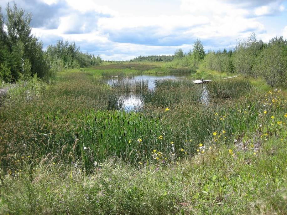
6 What is Reclamation? Pond 1, 2004 Pond 1, Goal: To achieve maintenance-free, self-sustaining ecosystems with a capability equivalent to pre-development conditions.
7 Environmental Impact Assessment (EIA) An EIA must be submitted to the regulators prior to a project being approved. A Closure Conservation & Reclamation Plan (CC&R) is submitted as part of the EIA The CC&R Plan includes descriptions of the following: Regulatory Framework, Regional Planning and Consultation Requirements for the Closure Plan Design and approach for the Closure Plan Closure Water Management Soil Management Revegetation Wildlife Habitat Establishment Biodiversity Establishment Reclamation and Closure Plans Timber Salvage Landform Development Reclamation Monitoring and Research Mitigation strategies to reduce the effect of mine operations 6
8 Reclamation Plans Suncor must submit a Life of Mine Closure plan including: Revegetation Plan Forest Resource Plan Wetlands Reclamation Plan Biodiversity Plan Mine Reclamation Plans are submitted every 3 years which show reclamation plans for the next 5 years and link it to the Life of Mine Closure Plan. Soil Salvage and Placement Plans are submitted annually detailing the upcoming year s program. Suncor has submitted a Wetlands Research Plan, Wetland Monitoring Program, Waterfowl Protection Plan, Fish & Wildlife Habitat Enhancement Plan, and Wildlife Habitat Corridor Research & Monitoring Program. 7

9 Inter-disciplinary Planning Tree Clearing - Foresters Drainage - Hydrologists Soil Salvage Agrologists Mining Engineers Landform Grading Geotechnical Engineers Soil Placement Agrologists Tree and shrub Planting Foresters Wetland Reclamation - Biologists Monitoring Researchers, Consultants 8


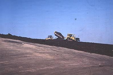
10 Landform Design Landscape design view of Dyke 11A from Super Test hill Post mine reclamation View of Dyke 11A from Super Test hill July


11 Preparation for Mining Tree Clearing and Soil Salvage 10


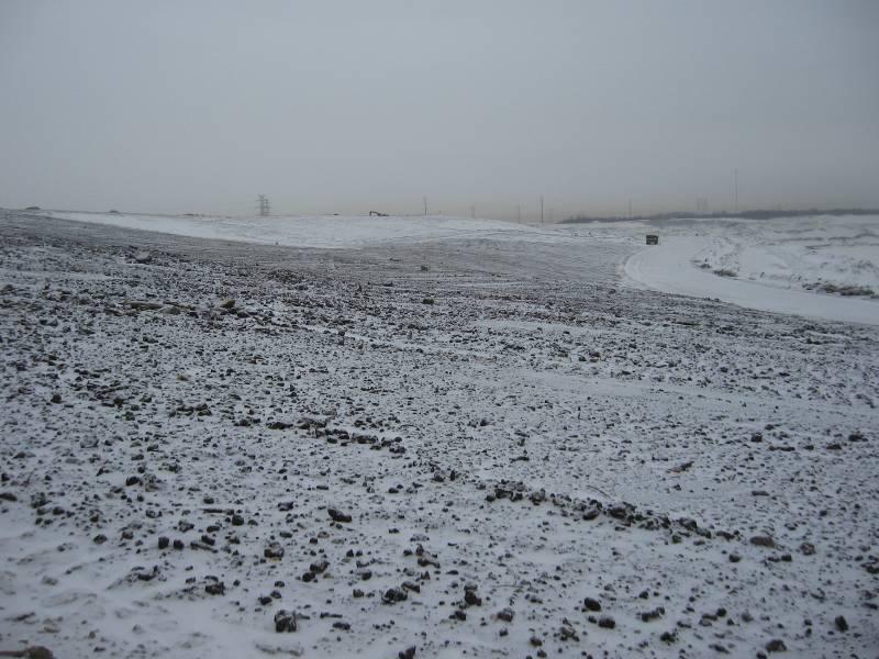
12 Landform Grading Pre-sloping Establish effective drainage to shed water from structure to minimize erosion Natural, non-engineered appearance 1970s practice Current practice 11


13 Reclamation Material Salvage: Capping Overburden Low-sodic overburden Typically 4-5 m directly below peat layer Overburden rated as unsuitable must be capped at 100 cm depth prior to coversoil placement Overburden Face Capping Overburden Placement Capping Overburden Salvage 12
14 Reclamation Material Salvage: Peat/Mineral Peat/mineral mix soil 60:40 peat:mineral Salvaged during frozen conditions Salvage depth cm Direct placement is preferred technique Stockpile coversoils Salvage from Mine Face Advance From Stockpile 13

 salvage depth 20-50 cm Upland Soil Brunisol Upland Soil")
15 Reclamation Material Salvage: Upland Soils Aspen/White Spruce Mixedwood Forest: Luvisols Jack Pine Forest: Brunisols Salvaged in winter, spring, fall LFH salvage depth 5-20 cm Subsoil (B & C horizons) salvage depth cm Upland Soil Brunisol Upland Soil Salvage 14
16 Reclamation Material Placement 15


17 Wildlife or snag Trees Wildlife Habitat Features Rock Piles Rock Coarse piles Woody Debris 16 Natural Features
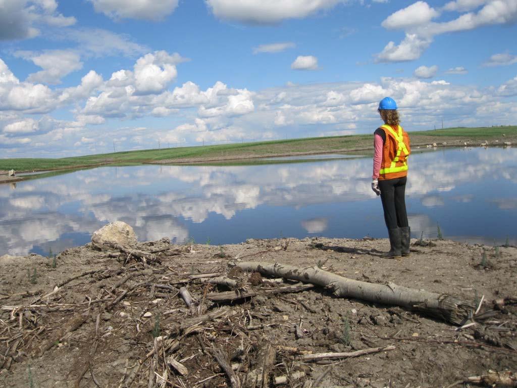
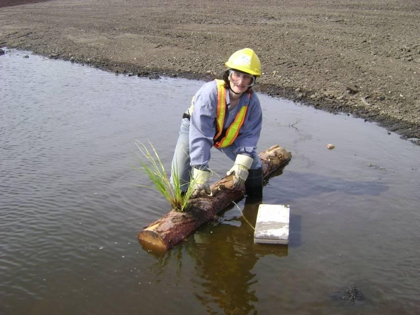
18 Wetland Reclamation 17


19 Revegetation: Native Seed Collection Tree and shrub seeds collected from Suncor lease or surrounding area Collected according to standards in Alberta Forest Genetic Resource Management and Conservation Standards (Second Revision of STIA) 18

20 Revegetation: Nurse Crop Seeding Early 1980s-2009: Annual Barley 2010: Oats and seven native grasses Offers erosion control Increases seedling survival: shade in summer, thermal protection in winter Conducted with equipment or by hand 19
21 Revegetation: Fertilization Overburden sites: 4 years Tailings sand structures: 5 years Fixed-wing application New reclamation areas: Maintenance areas: kg/ha Research & Development: teabags, alfalfa pellets, compost 20


22 Revegetation: Planning & Growing Planting prescription developed using 2 nd edition of Guidelines for Reclamation to Forest Vegetation in the Athabasca Oil Sands Region Stand types based on soil moisture and nutrients, crown closure and overstory species Stock grown in Smoky Lake, Alberta Recent numbers Trees Shrubs


 Aquatic water sedge,")
23 Revegetation: Tree & Shrub Planting 6 tree species (jack pine, white spruce, trembling aspen, balsam poplar, white birch, black spruce) 13 shrub species (eg. blueberry, red-osier dogwood, green alder, kinnikinnick, buffaloberry) Aquatic species (eg. water sedge, marsh cinquefoil) Spring (June) planting 22


24 Reclamation Monitoring: Soils Annual Soil Assessments Conduct survey during the first year on newly reclaimed site and then re-surveyed every 5 years there after. Land Capability Classification System (LCCS) Industry standard tool to evaluate land quality as a function of soil & landscape parameters. Conducted 1 year after initial reclamation. Long Term Soil/Veg Plots (CEMA) 23


25 Reclamation Monitoring: Vegetation Survival surveys one year after planting, up to 5 years Regeneration Surveys Long Term Soil/Veg Plots (CEMA) 24


26 Reclamation Monitoring: Insects & Weeds Insects: YHSS, spruce budworm, forest tent caterpillar Vegetation Control: focus on control of noxious weeds (Canada thistle, common tansy, scentless chamomile) 25


27 Reclamation Monitoring: Wildlife amphibian breeding call surveys breeding songbird point counts owl call playback surveys, raptor sightings browse-pellet surveys, winter track counts remote camera work Canadian toad telemetry study Reclamation and corridor areas Regional wildlife research monitoring program 26


28 Future Challenges Reclamation of Dried MFT Tailings Pond Reclamation 27
29 Questions? 28 Suncor Oil Sands Reclamation Team, 2010

30 29
Surface Coal Mining and Reclamation in ND. Guy Welch ND Public Service Commission
 Surface Coal Mining and Reclamation in ND Guy Welch ND Public Service Commission Surface Coal Mines in North Dakota Approximately 1500 acres are disturbed each year History of Reclamation in ND First surface
Northgate Minerals Corporation Kemess South Mine. Reclamation & Closure Preparation. Minerals North Conference 2009, Fort St. James, B.C.
 Northgate Minerals Corporation Kemess South Mine Reclamation & Closure Preparation Minerals North Conference 2009, Fort St. James, B.C. Harold Bent, P. Geo Environmental Manager Presentation Outline Kemess
WETLAND SOD u Bare Root Wetland Plants u Deep Rooted Willows u Coir Logs u Native Trees & Shrubs u Habitat Islands u Custom Growing
 WETLAND SOD u Bare Root Wetland Plants u Deep Rooted Willows u Coir Logs u Native Trees & Shrubs u Habitat Islands u Custom Growing 2009 PROJECT HIGHLIGHTS The following 10 projects highlight the interesting
Evolution of Reclamation Practices in NE Alberta
 Evolution of Reclamation Practices in NE Alberta Alfred Burk Reclamation and Remediation Coordinator CAPFT Edmonton April 14, 2011 Agenda Introduction to Cenovus Energy Reclamation in the Green Zone Forestry
Potential of LFH Mineral Soil Mixes for Reclamation of Forested Lands in Alberta
 Potential of LFH Mineral Soil Mixes for Reclamation of Forested Lands in Alberta M.A. Naeth, S.R. Wilkinson, D.D. Mackenzie, H.A. Archibald and C.B. Powter University of Alberta June 2013 OIL SANDS RESEARCH
Reclamation Success Best Management Practices. Pinedale Field Office. Joseph Debebe PhD. Natural Resource Specialist PFO 04/30/2014
 Reclamation Success Best Management Practices Pinedale Field Office Joseph Debebe PhD. Natural Resource Specialist PFO 04/30/2014 Objective Identifying factors necessary for reclamation success at different
Aim to Reclaim. Introduction
 Aim to Reclaim Introduction Welcome to Aim to Reclaim, a virtual lab that takes you inside the world of copper mining. You may remember that the mining process involves four important phases: Exploration,
DEVELOPMENT PERMIT SENSITIVE ECOSYSTEMS
 DEVELOPMENT PERMIT SENSITIVE ECOSYSTEMS What is the Sensitive Ecosystem Development Permit Area (SEDPA)? Surrey s SEDPA is made up of two distinct classifications of the natural environment: Streamside
Stormwater Standards. Clackamas County Service District No. 1. Planting Guide for Buffers
 Stormwater Standards Clackamas County Service District No. 1 APPENDIX B Planting Guide for Buffers Table of Contents Appendix B - Planting Guide for Buffers... Page B.1 General... 1 B.1.1 Introduction...
Healthy Living Strategy: Shorelines
 Healthy Living Strategy: Shorelines Shoreline Vegetation in Muskoka The basis of a natural ecosystem is a complex combination of vegetation that forms canopy, understory, and herbaceous layers. It is easier
Environmental Protection Guidelines for Transmission Lines
 Alberta Environment R&R/11-03 Environmental Protection Guidelines for Transmission Lines GENERAL This Guideline replaces Conservation and Information Letter 95-2 and the 1994 Guide for Transmission Lines.
Effect of soil cover system design on cover system performance and early tree establishment
 Mine Closure 2015 A.B. Fourie, M. Tibbett, L. Sawatsky and D. van Zyl (eds) 2015 InfoMine Inc., Canada, ISBN 978-0-9917905-9-3 Effect of soil cover system design on cover system performance and early tree
Chris Powter Executive Director Oil Sands Research and Information Network School of Energy and the Environment University of Alberta
 Chris Powter Executive Director Oil Sands Research and Information Network School of Energy and the Environment University of Alberta www.osrin.ualberta.ca OSRIN Creating and Sharing Knowledge 2 CRR provides
APPENDIX 1: SCOPED ENVIRONMENTAL IMPACT STATEMENT (EIS) FORM
 FORM") APPENDIX 1: SCOPED ENVIRONMENTAL IMPACT STATEMENT (EIS) FORM This form is intended for use by applicants (primarily private landowners) who need to conduct a Scoped EIS in support of minor development
APPENDIX 1: SCOPED ENVIRONMENTAL IMPACT STATEMENT (EIS) FORM This form is intended for use by applicants (primarily private landowners) who need to conduct a Scoped EIS in support of minor development
Juneau Watershed Partnership
 Juneau Watershed Partnership Native Plant Resource Center Final Report A Partners for Fish and Wildlife Project Prepared for: U.S. Fish and Wildlife Service For Grant #F11C00552 Prepared by: The Juneau
Alberta policy and regulations for grassland reclamation criteria, evolution of the criteria from the 1995 version to today
 Alberta policy and regulations for grassland reclamation criteria, evolution of the criteria from the 1995 version to today Jody Spady on behalf of Reclamation Criteria Advisory Group (RCAG) Native Prairie
UNIT 1 SUSTAINING ECOSYSTEMS
 UNIT 1 SUSTAINING ECOSYSTEMS Chapter 3 Sustaining Terrestrial Ecosystems Science 1206 / 2200 Sustainable Systems One that survives and functions over time In human terms One that meets the needs of present
Soil Reclamation and Site Reinstatement
 APPENDIX 6 Soil Reclamation and Site Reinstatement Purpose To undertake soil reclamation, erosion protection, Site restoration and reinstatement, taking into account natural processes, operational requirements
Flat Lake, Highway 103, HADD Compensation Project (DFO HADD Authorization 03-G8-068): 2010 Vegetation Monitoring
: 2010 Vegetation Monitoring") Flat Lake, Highway 103, HADD Compensation Project (DFO HADD Authorization 03-G8-068): 2010 Vegetation Monitoring Year 5 Final Diane LaRue, Vegetation Consultant Environmental Services, NSTIR Monitored
Flat Lake, Highway 103, HADD Compensation Project (DFO HADD Authorization 03-G8-068): 2010 Vegetation Monitoring Year 5 Final Diane LaRue, Vegetation Consultant Environmental Services, NSTIR Monitored
QUARRY REHABILITATION PLANS Specifications (version 1.3)
") For all our quarries, a rehabilitation plan must be developed from the outset. It is an integral part of the quarrying plan and provides for progressive and co-ordinated rehabilitation whenever possible.
For all our quarries, a rehabilitation plan must be developed from the outset. It is an integral part of the quarrying plan and provides for progressive and co-ordinated rehabilitation whenever possible.
NATIVE PLANTS. Native Plants. Exotic Plants
 NATIVE PLANTS Handouts: MontGuide: Deer Resistant Ornamental Plants For Your Garden (MT199521AG) MontGuide: Fire Resistant Plants (MT200101AG) MontGuide: Poisonous Plants (MT199902AG) Native Plants Native
SUSTAINING ECOSYSTEMS
 UNIT 1 SUSTAINING ECOSYSTEMS Chapter 3 Sustaining i Terrestrial Ecosystems Science 1206 / 2200 Sustainable Systems One that survives and Short Activity: functions over time In human terms One that meets
BLACK CREEK VALLEY CONNECTION SIGNIFICANT WETLAND CONNECTION PROPOSED OFFSITE NATURAL AREAS MANAGEMENT STRATEGY BLACK CREEK WATERSHED
 BLACK CREEK VALLEY V:\01609\active\2001 Active Projects\1100-1199\G1188\graphics\GIS\MXD\_Final Draft Sept 2008\MXD\Section_7\62601188_Fig7-1_ProposedNaturalAreasMngmtStrategyBCWSNorth_28Nov08_MC.mxd HIGHWAY
SECTION AMENDED TOPSOIL
 SECTION 02486 AMENDED TOPSOIL PART 1 - GENERAL 1.01 SUMMARY A. Work described in this section includes requirements for soil amendments, soil preparation, preparation and finish grading of turf restoration
Riparian zones A guide to the protection of Canterbury s rivers, streams and wetlands
 Riparian zones A guide to the protection of Canterbury s rivers, streams and wetlands Everything is connected What is a riparian zone? Riparian zones are strips of land bordering rivers, streams, lakes
Section 1 TABLE OF CONTENTS
 Section 1 TABLE OF CONTENTS... [M]ineral fertilizer is essential to feed around half of the world s population, and will be fundamental to ensure global food security through the 21 st century. 2013 U.N.
Ecosystems Change Over Time
 Ecosystems Change Over Time A. How organisms change 1. Natural Selection: a member of a species has a certain characteristic that makes it easier to obtain food and mates. Mates= offspring. If you are
Non-Metallic Mining Reclamation Checklist
 Eau Claire County DEPARTMENT OF PLANNING AND DEVELOPMENT Eau Claire County Courthouse, Rm. 1510 721 Oxford Avenue Eau Claire, Wisconsin 54703-5481 (715) 839-4741 f Housing & Community Development 839-6240
POND SUCCESSION
 Name period date assigned date due date returned Directions: Carefully cut out the cards for each example of succession. Only cut out the six to eight cards for each type at one time. Match the picture
Weston s Wetlands, Stormwater, & Open Space
 Weston s Wetlands, Stormwater, & Open Space Weston s Wetlands, Stormwater, & Open Space Conservation Commission Role and Responsibilities Laws that protect wetlands What residents can do to protect wetlands
Natural Shorelines. for Inland Lakes. A Landowner s Guide to using. to STABLIZE SHORELINES, Michigan s inland lakeshore.
 Natural Shorelines for Inland Lakes A Landowner s Guide to using NATURAL MATERIALS to STABLIZE SHORELINES, IMPROVE WATER QUALITY and ENHANCE WILDLIFE HABITAT along Michigan s inland lakeshore. Natural
Conservation Plan. I. Property Information. II. Objectives. Natural Resource Objectives. Sustainability in Practice (SIP) Certified
 Certified") Conservation Plan Sustainability in Practice (SIP) Certified I. Property Information Vineyard Name and Establishment Date: Location: Map (attach showing blocks and acres): II. Objectives Natural Resource
Conservation Plan Sustainability in Practice (SIP) Certified I. Property Information Vineyard Name and Establishment Date: Location: Map (attach showing blocks and acres): II. Objectives Natural Resource
ALBERTA TRANSPORTATION POST-DISTURBANCE ASSESSMENT GUIDE FOR BORROW EXCAVATIONS. Dec 2013 Edition
 ALBERTA TRANSPORTATION POST-DISTURBANCE ASSESSMENT GUIDE FOR BORROW EXCAVATIONS Dec 2013 Edition - ii - ACKNOWLEDGEMENTS This guide supersedes the document entitled Alberta Transportation Post-Disturbance
TRCA Field Staking Protocol December 2016
 Page 1 of 6 TRCA Field Staking Protocol December 2016 This Protocol describes TRCA staff s current practice for field staking the physical top of bank, the physical toe of slope, and the limit of existing
Ecosystems Change Over Time
 Ecosystems Change Over Time A. How organisms change 1. Natural Selection: A member of a species has a certain characteristic that makes it easier to obtain food and mates. Mates= offspring. If you are
There are 11 different micro-ecosystems that are found in 76 different areas throughout Stoneybrook. They are divided into three major groups.
 by Larry Eichert There are 11 different micro-ecosystems that are found in 76 different areas throughout Stoneybrook. They are divided into three major groups. Wetlands Upland Mitigated sections (a term
Rule D Wetland and Creek Buffers
 Rule D Wetland and Creek Buffers 1 Policy It is the policy of the Board of Managers to ensure the preservation of the natural resources, recreational, habitat, water treatment and water storage functions
POND SUCCESSION
 Name period date assigned date due date returned Directions: Carefully cut out the cards for each example of succession. Only cut out the six to eight cards for each type at one time. Match the picture
Florida s Ephemeral Ponds and Pond-Breeding Amphibians
 Florida s Ephemeral Ponds and Pond-Breeding Amphibians What are Ephemeral Ponds? Ephemeral ponds are small, isolated wetlands that dry periodically. These ponds can be deep, sand-bottomed depressions with
HARDWOOD SEEDLINGS FOR REFORESTATION
 HARDWOOD SEEDLINGS FOR REFORESTATION from SuperTree Seedlings High productivity on short rotations Potential planting on marginal lands Multiple crops from a single planting (coppicing ability) High bulk
E16: MAINTENANCE OF LANDSCAPED AREAS
 HIGH SPEED TWO INFORMATION PAPER E16: MAINTENANCE OF LANDSCAPED AREAS This paper outlines the proposed approach to the maintenance of landscaped areas created for HS2 Phase One. It will be of particular
Washtenaw County Conservation District 7203 Jackson Rd Ann Arbor MI Phone: (734) x 5 Fax: (734) Web:
 x 5 Fax: (734) Web:") Washtenaw County Conservation District 7203 Jackson Rd Ann Arbor MI 48103-9506 Phone: (734) 761-6721 x 5 Fax: (734) 662-1686 Web: www.washtenawcd.org STEPS IN BUILDING A POND The following list has been
Washtenaw County Conservation District 7203 Jackson Rd Ann Arbor MI 48103-9506 Phone: (734) 761-6721 x 5 Fax: (734) 662-1686 Web: www.washtenawcd.org STEPS IN BUILDING A POND The following list has been
319 Grant: Baker Creek & Centenary Creek Restoration Initiative
 319 Grant: Baker Creek & Centenary Creek Restoration Initiative Objectives: Overview of Watershed Characteristics: Discussion of Project Tasks: Discussion of Watershed Management Plan: Presented by: Erich
VISUAL IMPACT ASSESSMENT
 VISUAL IMPACT ASSESSMENT JULY 2010 / 9061V DUFFERIN AGGREGATES PROPOSED EXTENSION OF THE ACTON QUARRY CONTENTS 1.0 Introduction 3 1.1 Description of the Proposed Extension 3 1.2 Purpose 3 1.3 Description
UBC Technical Guidelines Section Edition Planting Preparation Page 1 of 6
 Page 1 of 6 1.0 GENERAL 1.1 Scope.1 This guideline addresses the materials, and equipment necessary for the supply, placement, and amendment of the growing medium. 1.2 Related Work:.1 Section 32 93 00
Meeting Agenda. City of Guelph. River Systems Advisory Committee. Agenda Items. Item 1, 2 and 3. Item 4 Ward to Downtown Pedestrian Bridge
 Meeting Agenda City of Guelph River Systems Advisory Committee September 19, 2018 City Hall, Meeting Room B From 4:00 to 6:00 p.m. Meeting Chair: Mariette Pushkar Agenda Items Welcome to all Item 1, 2
Planning a Development in the District of Summerland
 Planning a Development in the District of Summerland A Special Place Summerland enjoys beautiful lake views and abundant natural areas. As our valley s population grows, we want to maintain these natural
BACKYARD POND. Backyard Pond. A pond or water garden will likely become the focal point for all your backyard conservation.
 BACKYARD POND Backyard Pond Pond Ecosystem. Source: Fairfax County Parks Authority A pond or water garden will likely become the focal point for all your backyard conservation. In Your Backyard Backyard
City of Loveland Natural Areas Sites
 City of Loveland Natural Areas Sites 2007 -insert full page photo- July 2008 In the Nature of Things: City of Loveland Natural Areas Sites An update to the citizens and officials of Loveland, Colorado
Making Space for Nature A Leicester Case Study. Dr Helen O Brien Leicester City Council
 Making Space for Nature A Leicester Case Study Dr Helen O Brien Leicester City Council Helen.Obrien@Leicester.gov.uk Definitions Biodiversity (biological diversity) The variety of plant and animal life
Guidelines for planting within the 100 Ft. Buffer
 CAPE COD COOPERATIVE EXTENSION PO Box 367 Barnstable, MA 02630 508 375-6690 (www.capecodextension.org) Guidelines for planting within the 100 Ft. Buffer Introduction: The Barnstable County Extension Service
Surrey Ecosystem Management Study
 Surrey Ecosystem Management Study Green Infrastructure Network Opportunities Public Open House & Information Session June 24 th, 2010 EMS Process Ecological Inventory Ecological Assessment Management Policy
Single most pervasive problem: Polluted runoff from watershed development
 What are Some Potential Threats to Maine s Lakes Acid rain Mercury contamination Aquatic Invaders: The Milfoil threat Loss of critical habitat Global climate change Single most pervasive problem: Polluted
F.I.S.H. First Investigation of Stream Health:
 F.I.S.H. First Investigation of Stream Health: A citizen science monitoring protocol developed as part of the Conewago Creek Initiative for detecting early signals of stream improvements in the watershed.
Ecosystems and Biodiversity Ecosystem Services in the City. City of Burnaby Environmental Sustainability Strategy
 Ecosystems and Biodiversity Ecosystem Services in the City City of Burnaby Environmental Sustainability Strategy Realms of concern / Realms of possibility In ecosystems, everything is connected to everything
Rain Gardens. A Welcome Addition to Your Landscape
 Rain Gardens A Welcome Addition to Your Landscape Where Does The Rainwater Go? Naturally, forests provide a way for rainwater to percolate into the soil, filtering pollutants while trees are allowed to
Bench-Scale to Bulldozers
 Bench-Scale to Bulldozers Mark Teshima, P.Chem September 13, 2016 Semiamhoo, WA Outline The origins of biosolids in mine reclamation (70s and 80s) Surf: PNW evolution in aggregate mine reclamation (mid
Mine Reclamation Planning in High Elevation Caribou Range
 Mine Reclamation Planning in High Elevation Caribou Range Advancing Ecosystem Restoration Research through an Academic Partnership with Teck Resource s Quintette Mine, First Nations, and Scientists Photo
Turning your Dam into habitat. By Damien Cook
 Turning your Dam into habitat By Damien Cook Depending on their particular habitat needs wetland animals will be found in different habitats within a wetland, from damp margins to deeper water. An important
Certifier and Site Information
 Certifier and Site Information Please submit a separate ecopro BMP Tracking Form for each new project. You must complete a form at least once a year to renew your ecopro certification. Submit this paper
HABITAT ACQUISITION TRUST
 HABITAT ACQUISITION TRUST Plan for Nesting Habitat Rehabilitation for the Western Painted Turtle at Swan Lake Nature Sanctuary Suite 316, 620 View St PO Box 8552 Victoria, B.C. V8W 3S2 Tel: (250) 995.2428
Detailed Site Assessment Requirements
 Directive PNG018 November 2015 Revision 1.0 Governing Legislation: Act: The Oil and Gas Conservation Act Regulation: The Oil and Gas Conservation Regulations, 2012 Order: 251/18 Record of Change Revision
7. Biodiversity & Conservation Areas
 7. & Conservation Areas 7.1. Objectives The objectives of biodiversity and conservation areas are founded on the need to recognise the importance of biodiversity and acknowledge the need to protect, restore
Phase II Ecological Network Report Terms of Reference. Terms of Reference
 Phase II Ecological Network Report Terms of Reference Phase II Ecological Network Report Terms of Reference APRIL 2014 April 2014 Phase II Ecological Network Report Terms of Reference contents 1.0 Introduction.................................................................
CHAPTER 4. SPECIAL CONDITION EROSION CONTROL MEASURES
 CHAPTER 4. SPECIAL CONDITION EROSION CONTROL MEASURES 4.1 INFILTRATION BASIN AND TRENCH Figure 4.1. Infiltration basin and trench (Source: Department of Civil, Construction, and Environmental Engineering,
Appendix 16 Guideline for native revegetation plantings
 Appendix 16 Guideline for native revegetation plantings 16.1. Introduction These guidelines explain what specific information is needed for native revegetation plantings, why the information is necessary
Landscape Conservation Design April, 2014
 Designing Sustainable Landscapes in the Northeast A project of the North Atlantic Landscape Conservation Cooperative & Northeast Climate Science Center Landscape Conservation Design April, 2014 Conceptual
Environmental Protection Ordinances (Performance Zoning) Bedminster Township, Bucks County
 Bedminster Township, Bucks County") Environmental Protection Ordinances (Performance Zoning) Bedminster Township, Bucks County ARTICLE VI. PERFORMANCE STANDARDS Section 600 Compliance All uses, activities, subdivisions and/or land developments
Environmental Protection Ordinances (Performance Zoning) Bedminster Township, Bucks County ARTICLE VI. PERFORMANCE STANDARDS Section 600 Compliance All uses, activities, subdivisions and/or land developments
Landscaping Management Plan. Woodlawn Mechanical Biological Treatment Facility. Veolia Environmental Services Australia Pty Ltd
 Landscaping Management Plan Woodlawn Mechanical Biological Treatment Facility Veolia Environmental Services Australia Pty Ltd May 2014 THIS PAGE INTENTIONALLY LEFT BLANK Landscaping Management Plan Page
Stormwater and Your Rain Garden
 Stormwater and Your Rain Garden When rain falls on natural areas, such as a forest or meadow, it is slowed down, filtered by soil and plants, and allowed to soak back into the ground. When rain falls on
INDIAN SCHOOL MUSCAT MIDDLE SECTION DEPARTMENT OF SOCIAL SCIENCE LAND,SOIL,WATER,NATURAL VEGETATION AND WILDLIFE RESOURCES
 INDIAN SCHOOL MUSCAT MIDDLE SECTION DEPARTMENT OF SOCIAL SCIENCE LAND,SOIL,WATER,NATURAL VEGETATION AND WILDLIFE RESOURCES NAME: CLASS VIII SEC: ROLL NO: DATE: /06/2017 I. FILL IN THE BLANKS : 1. The uneven
1. How do I Improve the Quality of my Waterways?
 The Centre for Land and Water Stewardship Trees and Wildlife in the Equine Landscape Horse farms are rapidly becoming a more common site in the Southern Ontarian landscape, taking up many more acres of
Terms and Definitions. Characteristics and Qualities. Environmental Issues
 GROWING MEDIA & SOIL AMENDMENT Terms and Definitions Characteristics and Qualities Uses Environmental Issues EARTHWIZE ENVIRONMENTAL GROUP HORTICULTURAL DIVISION Suite C12, Century Square, Heron Crescent,
Josephine County, Oregon Board of Commissioners: Jim Riddle, Dwight F. Ellis, & Jim Raffenburg
 Josephine County, Oregon Board of Commissioners: Jim Riddle, Dwight F. Ellis, & Jim Raffenburg PLANNING OFFICE Michael Snider, Director 510 NW 4 th Street / Grants Pass, OR 97526 (541) 474-5421 / FAX (541)
Lab Notebook. Topic Investigation Activity Title Page Ref. Give It A Try Survivor! 96
 Lab Notebook Plants for Food and Fibre Index of Investigations, Challenges and Activities Topic Investigation Activity Title Page Ref. Give It A Try Survivor! 96 1 Understanding structures and life processes
Plant Propagation Protocol for Phlox speciosa ESRM 412 Native Plant Production. Image:
 Plant Propagation Protocol for Phlox speciosa ESRM 412 Native Plant Production Image: http://www.plantsystematics.org/reveal/pbio/lnc/lncpublic7.html Family Names Family Scientific Name: Family Common
Raingardens. Conserving and Protecting Water L
 L-5482 08-08 Raingardens Justin Mechell, Extension Assistant, and Bruce Lesikar, Extension Program Leader for Biological and Agricultural Engineering,The Texas A&M University System A raingarden is an
2016 Iowa FFA Soils Evaluation CDE Exam
 2016 Iowa FFA Soils Evaluation CDE Exam 1. Which of the following is true regarding soil horizons? a. A horizon is darker in color and has more organic matter b. B horizon is darker in color and has more
Don't Bag It - Leaf Management Plan
 Don't Bag It - Leaf Management Plan During the year, at least 20 percent of the solid waste generated comes from grass clippings, tree leaves and other landscape wastes. Bagging these materials and placing
Table of Contents INTRODUCTION APPLICATION. Document No.: WRG 5A-8 Publication Date: 10/4/2012
 MINNESOTA WETLAND RESTORATION GUIDE PLANTING UPLAND TREES AND SHRUBS TECHNICAL GUIDANCE DOCUMENT Document No.: WRG 5A-8 Publication Date: 10/4/2012 Table of Contents Introduction Application Other Considerations
This definition is from the Soil Science Glossary (Soil Science Society of America).
.") What is Soil? This definition is from the Soil Science Glossary (Soil Science Society of America). soil - (i) The unconsolidated mineral or organic material on the immediate surface of the earth that serves
What is Soil? This definition is from the Soil Science Glossary (Soil Science Society of America). soil - (i) The unconsolidated mineral or organic material on the immediate surface of the earth that serves
Guidelines for Designing Wildlife Friendly Ponds
 Guidelines for Designing Wildlife Friendly Ponds A wildlife pond is an effective way to add habitat, beauty and value to a property. Whether a pond is designed for a residence, subdivision or commercial
field note Culvert foundation improvement design concepts The challenge of low-cost culvert foundations
 field note Culvert improvement design concepts Mark Partington, R.P.F., M.Sc., EP 1 Papa Masseck Thiam, Ing. Jr., M.Sc. 2 Introduction Canada s northern forested landscapes feature numerous wetlands, such
Terra Nova Rural Park Plan
 Terra Nova Rural Park Plan Part 1 Getting to know the land The Surrounding Area North Side Airport, River, Trail East Side - Residential West Side- Sturgeon Banks, West Dyke Trail South Side:Terra Nova
Natural Areas Certification Program Guidelines
 Natural Areas Certification Program Guidelines Purpose of the Program The City of Fort Collins Natural Areas Department encourages site management practices that focus on protecting, restoring, and enhancing
A Master Plan for High Park s Hillside Garden and other Ornamental Gardens: Recommendations from the High Park Natural Environment Committee
 www.highparknature.org mail@highparknature.org A Master Plan for High Park s Hillside Garden and other Ornamental Gardens: Recommendations from the High Park Natural Environment Committee September 2015
Chagrin River Watershed Partners, Inc. Local Regulations. Amy H. Brennan (440)
") Chagrin River Watershed Partners, Inc. Local Regulations Amy H. Brennan (440) 975-3870 www.crwp.org abrennan@crwp.org July 9, 2013 Applicable Zoning and Building Codes Erosion and Sediment Control Grading
Chagrin River Watershed Partners, Inc. Local Regulations Amy H. Brennan (440) 975-3870 www.crwp.org abrennan@crwp.org July 9, 2013 Applicable Zoning and Building Codes Erosion and Sediment Control Grading
SCHOOLYARD HABITATS BASELINE AUDIT, GRADES K-2
 SCHOOLYARD HABITATS The Schoolyard Habitats audit was developed as a tool for students to investigate the school ground s use and to be used as the basis for improving native wildlife habitat and outdoor
Working with nature to manage your stream
 Working with nature to manage your stream Issued by Auckland Council March 2013 If you have any questions about this information sheet please contact Auckland Council on 09 301 0101 A stream in a property
Understanding Soil Variability to Utilize Variable Rate Fertilizer Technology
 Understanding Soil Variability to Utilize Variable Rate Fertilizer Technology Agronomy Update -2012 Red Deer, AB Jan 17 & 18, 2012 Ross H. McKenzie Research Scientist Agronomy Research & Innovation Div.
HYVAR X-L WEED AND BRUSH KILLER
 2015-2336 2015-07-09 GROUP 5 HERBICIDE HYVAR X-L WEED AND BRUSH KILLER Water Soluble Liquid for Non-Crop Land Areas COMMERCIAL READ THIS LABEL BEFORE USING GUARANTEE: Bromacil. 0.24 kg per L REGISTRATION
Bioengineering Shoreline Protection
 Insert Company Logo Here (first slide only) Bioengineering Shoreline Protection Agrecol LLC Evansville WI rob.walker@agrecol.com A little about Agrecol 1,100 acres in production in SC WI Produce 3.5 million
5.0 Storm Water Landscape Guidance Introduction
 5.0 Storm Water Landscape Guidance Introduction Landscaping is a critical element to improve both the function and appearance of storm water management practices. Integrated storm water landscapes can
MAIN ROADS Western Australia COALFIELDS HIGHWAY PROJECTS ROADSIDE REVEGETATION MANAGEMENT
 MAIN ROADS Western Australia COALFIELDS HIGHWAY PROJECTS ROADSIDE REVEGETATION MANAGEMENT Presentation - South West Region - Alan Grist, Project Manager, Environment (November 2015) Protecting and enhancing
Biodiversity Conservation
 Biodiversity Conservation and Site Plan Review Biodiversity conservation principles Threats to biodiversity Location of development Reviewing site plans Lunch Reviewing site plans (continued) LEED and
2011 ASLA Design Awards. Coyote Gulch Honor Award and Land Stewardship Designation Valerian LLC. Environmental Restoration and Reclamation
 2011 ASLA Design Awards Honor Award and Land Stewardship Designation Valerian LLC Environmental Restoration and Reclamation Project Name: Category : Project Location: 5 2011 Environmental Restoration and
RAIN GARDEN ILLINOIS URBAN MANUAL PRACTICE STANDARD. (feet) CODE 897 DEFINITION
 CODE 897 DEFINITION") ILLINOIS URBAN MANUAL PRACTICE STANDARD RAIN GARDEN (feet) CODE 897 Source: Kendall County Soil and Water Conservation District DEFINITION Rain gardens are small, shallow, flat bottomed depressions constructed
ILLINOIS URBAN MANUAL PRACTICE STANDARD RAIN GARDEN (feet) CODE 897 Source: Kendall County Soil and Water Conservation District DEFINITION Rain gardens are small, shallow, flat bottomed depressions constructed
Once Upon a Gravel Pit: Reconnecting Floodplain through Aggregate Extraction
 Once Upon a Gravel Pit: Reconnecting Floodplain through Aggregate Extraction 5 th International Conference on Natural Channel Systems September 26, 2016 1 The Story of Snyder s Flats Historical influences
A Landowner s Guide to Creating Woodland Pools for Amphibians and Other Wildlife
 Cornell Department of Natural Resources Conservation Education Program Fact Sheet Kristi L. Sullivan and Stephen J. Morreale A Landowner s Guide to Creating Woodland Pools for Amphibians and Other Wildlife
In compliance with Condition 6 of the Order, NGTL encloses for filing the Fifth Year Post-Construction Monitoring Program Report for the Project.
 450 1 Street SW Calgary, Alberta T2P 5H1 Tel: (403) 920-6296 Fax: (403) 920-2347 E-mail: dan_wyman@transcanada.com January 25, 2017 National Energy Board Suite 210, 517 Tenth Avenue SW Calgary, Alberta