Northland Regional Landscape Assessment Worksheet
|
|
|
- Opal Green
- 5 years ago
- Views:
Transcription
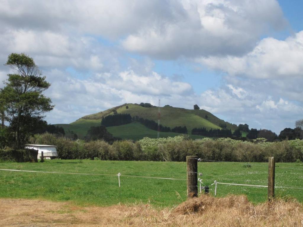
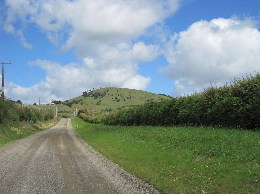
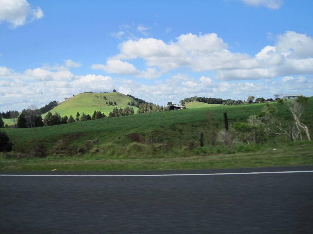
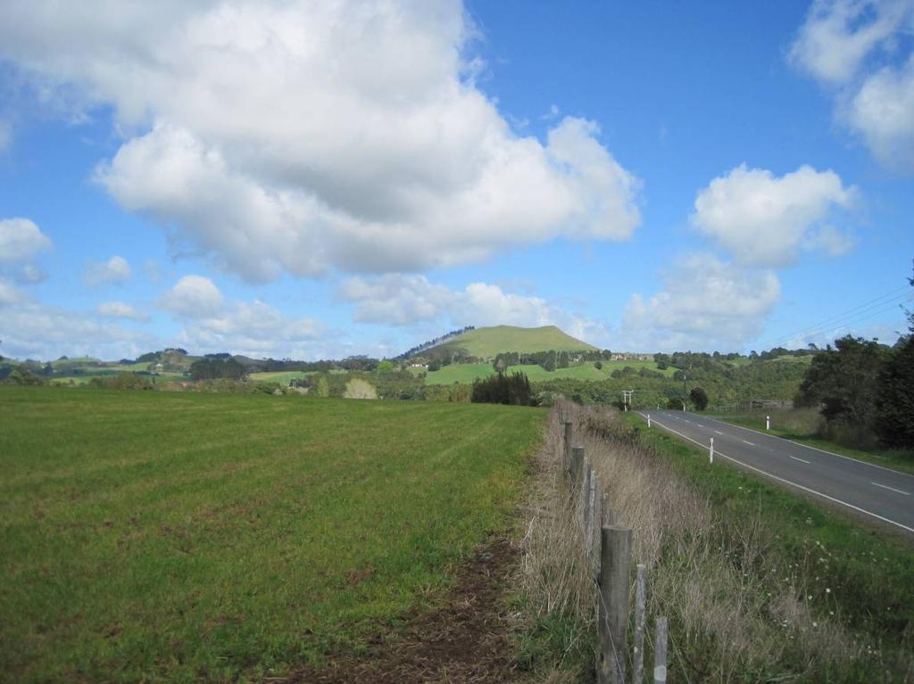
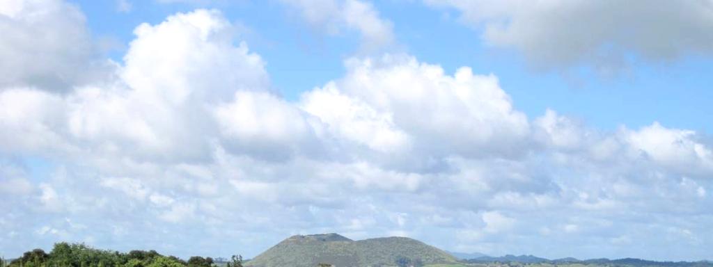
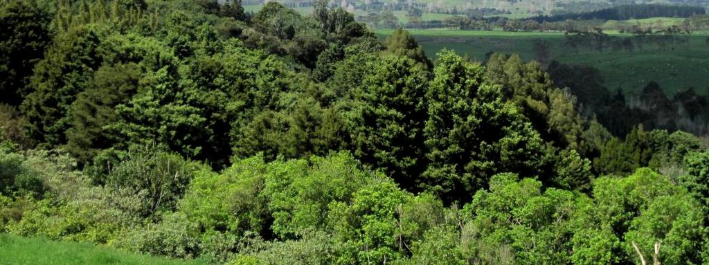
1 Northland Regional Landscape Assessment Worksheet DESCRIPTION AND CHARACTERISATION Component Land Types (refer to list overleaf) Volcanic cones Geology (including geopreservation sites) Soil Types Unit name OHAEWAI AREA VOLCANIC FIELD Comment A field of volcanic cones that are frequently inter-related through lowland elements of volcanic origin such as lava flows, rock outcrops, agricultural stone walls and stonefields. NZ Geopres Inventory: Pouerua (Pakaraka Mountain) scoria cone and lava fields - well preserved crater and volcanic form. Largest pa and stonefields (possibly outside ONL) prehistoric site remaining in NZ. Tarahi scoria cone breached scoria cone thought to be the highest centre in Kaikohe area. Maungaturoto volcanic cone well preserved volcanic form typical of the younger centres in Northland. Te Ahuahu volcanic cone a well preserved volcanic cone. Basaltic bombs can be found in a small quarry at the site. Papakauri silt loam (hill country) Ecology (including protected vegetation / features, PNAP Level 1 and 2 sites) Largely grazed with some small pockets of forest on Pouerua, Tarahi and Maungaturoto. Typically hardwood species such as puriri, taraire, along with totara and towai. Pouerua Cone small forest remnant with the crater of this basaltic cone. Contain puriri-taraire forest with frequent kohekohe and karaka with occasional totara and Griselinia lucida. Has two species of endemic snails. Main body of landform clad in gorse, flannelweed and patches of rank pasture. Archaeological sites Heritage Landscapes All but Tarahi were pa sites, and each cone has extensive archaeological evidence. Archaeological sites exist on each cone and there is a proliferation of records on Pouerua. The wider volcanic landscape that these ONLs sit within also contains a large number of recorded sites. An integral part of an extremely important wider landscape that was intensively used by Maori and Pakeha cultures. Evidence of that manipulation and habitation is still clearly expressed through earthworks, stone walls and historic buildings. Landscape characterisation (including the identification of any specific characteristics) An inter-related field of volcanic cones, with those identified within this ONL being the most prominent and graphic of a larger number that exist. These stand strongly above lower rolling land or small flats, their conical form standing typically against the skyline. Pouerua is the largest and signals the existence of the field for those travelling from the south. Many views through the wider landscape feature two or three of the cones within the same vista. Most of these individual cones are grazed pasture, but some have small remnant pockets of indigenous forest (but secondary growth). Tarahi has a telecommunications facility installed upon it. The volcanic field is an area of very rich historical activity, with abundant pa sites (including upon 3 of the ONL sites), terraces, stonefields and early European agriculture. That history is graphically portrayed in the contemporary landscape, particularly in the low light levels of early and late in the day. Pouerua pa terracing has lost much of its legibility as the mountain has been overtaken by weed species from its former pastoral cover. The cones are a significant component of the character of the area around Ohaewai, making it a unique area that is not replicated elsewhere. 1
2 EVALUATION Criteria Rank Comment Natural Science Factors Representativeness Natural landscapes are clearly characteristic of the area, district or region. The key components of the landscape will be present in a way that defines the character of the place and distills its character and essence. Endemic associations. Rarity Natural features are unique or rare in the region or nationally, and few comparable examples exist. Entirely representative and determining of the Ohaewai area landscape and its volcanic origins. Distinctive within mid/upper Northland and rarely found elsewhere in New Zealand. Similarities with the numerous peaks around Whangarei. Aesthetic Values Coherence The patterns of land cover and land use are largely in harmony with the underlying natural pattern of the landform of the area and there are no significant discordant elements of land cover or land use. Diversity & Complexity The elements contributing to overall landscape character are diverse and complex (particularly in ecological terms) without creating disharmony. Vividness Natural features and landscape are widely recognized across the community and beyond the local area and remain clearly in the memory; striking landscapes are symbolic of an area due to their recognisable and memorable qualities. Highly cohesive and connected through consistencies in the rolling lowlands (outside of the ONL) that lies between the cones. Consistencies in landform, profile and land cover (except Pouerua) draw these areas together Ecologically simple, but geologically diverse and complex. The interplay between the cones and their settings (and related geology) has numerous dimensions. Very graphic and memorable. The cones define the area and act as spatial markers within a wider landscape where volcanic origins are expressed in many forms. Naturalness How affected by human activity is the landscape? Does human activity intrude on the landscape? Eg. Presence of buildings and associated built development. Presence of infrastructure services. Extent of indigenous forest cover. Homogeneity of exotic vegetation. Presence / extent of modified agricultural land use. Strength of natural processes / ecological patterns. Unmodified and legible physical relief and landform. Presence of water. 3 Whilst the form and profile of the cones is typically complete and uncompromised by buildings, earthworks and infrastructure, the land cover is typically one of agricultural production. In these terms it brings a measure of naturalness compared with more intensive and disruptive land uses. Some of the cones are affected by linear shelter-belt plantings and another by a communication mast. The productive and lived-in rural landscape that the cones sit within is largely a result of human interaction, including houses often sited near the toe of the peaks, so more raw forms of ecological and natural processes are rather suppressed by those activities. This in turn reflects upon the naturalness of the ONL. Intactness Natural systems are intact and aesthetically coherent and do not display significant visual signs of human modification, intervention or manipulation, visually intact and highly aesthetic natural landscapes. The cone landforms are predominantly intact, although typically largely clear of natural vegetation cover. Almost all have been subjected to substantial historic earthworks during the formation of pa and other Maori earth structures. However, those formations tend to relate to the natural contour of the landforms as distinct from more intrusive earthworks. 2
3 Experiential Values Expressiveness The legibility of the landscape. Natural features clearly demonstrate the natural processes that formed them. Sensory qualities (These are landscape phenomena as directly perceived and experienced by humans, such as the view of a scenic landscape, or the distinctive smell and sound of the foreshore). Transient Values The consistent and repeated occurrence of transient features that contributes to the character, qualities and values of the landscape; landscapes are widely recognised for their transient features and the contribution that these make to the landscape. Remoteness / Wildness Does the landscape display a wilderness character, remote from and untouched by human presence? Eg. Sense of remoteness Accessibility Distance from built development Shared and recognised values Natural features and landscape are widely known and valued by the immediate and wider community for their contribution to a sense of place leading to a strong community association with, or high public esteem for the place. Spiritual, cultural and historical associations Natural features and landscapes can be clearly and widely known and influenced by their connection to the spiritual, cultural and historical valued in the place and includes associative meanings and associative activities valued by the community. Associative meanings are spiritual, cultural or social associations with particular landscape elements, features, or areas, whilst associative activities are patterns of social activity that occur in particular parts of a landscape, for example, popular walking routes or fishing spots. 3 2 *** Highly expressive and legible. The elevation of the cones above the surrounding landforms and their evocative forms are a clear expression of the volcanic processes that formed them and shaped the surrounding landscape. Strong sensory signals and meanings generated by the conical volcanic forms. The repetition of that theme by the number of cones present reinforces those sensory experiences. These landforms, and particularly the pre-european earthworks that overlay them, are heavily influenced by light angles, being most expressive during the early and latter parts of the day, and during winter months. Situated within a working agricultural landscape and in close proximity to road corridors. The volcanic fields are an essential part of the local areas character and are major landmarks (or waymarkers) for those travelling. It is considered likely that the ONL will be highly valued for their distinctive nature and contribution to local identity. Consultation was initiated during the mapping process, but has not led to any feedback within the required period It is probable that there will be strongly established spiritual and cultural values associated with this area as a reflection of intensive past use and settlement, with that history still being portrayed by the wider landscape as it exists today. Rank scale between 1 (low) and (high) Land Types Coastal cliffs / escarpment Low escarpment Bays and headlands Beach Dune complex Reefs and islands Estuarine / inlet Open harbour Coastal plain Rolling hills Steep hills; moderate to high relief Ranges; high relief Strongly rolling land Low rolling land Valley floors and flats Plains Volcanic cones 3
4 River mouth Wetland Watercourses Lakes and water bodies Photographs of unit
5
6 6
7 7
Northland Regional Landscape Assessment Worksheet
 Northland Regional Landscape Assessment Worksheet Unit name TE POUAHI HEADLAND DESCRIPTION AND CHARACTERISATION Component Land Types (refer to list overleaf) Dune complex Coastal cliffs / escarpment Reefs
Northland Regional Landscape Assessment Worksheet
 Northland Regional Landscape Assessment Worksheet DESCRIPTION AND CHARACTERISATION Component Land Types (refer to list overleaf) Coastal cliffs / escarpment Bays and headlands Dune complex Beach Reefs
Northland Regional Landscape Assessment Worksheet
 Northland Regional Landscape Assessment Worksheet DESCRIPTION AND CHARACTERISATION Component Land Types Northern and eastern dissected hills; moderate to high relief land type Unit name NORTH EAST BUSH
Northland Regional Landscape Assessment Worksheet
 Northland Regional Landscape Assessment Worksheet Unit name BALD ROCK DESCRIPTION AND CHARACTERISATION Component Land Types (refer to list overleaf) Volcanic cone (remains). Comment The site is an eye-catching
Northland Regional Landscape Assessment Worksheet
 Northland Regional Landscape Assessment Worksheet Unit name KAURI MOUNTAIN BUSH DESCRIPTION AND CHARACTERISATION Component Land Types Volcanic cones land type Northern and eastern dissected hills; moderate
Northland Regional Landscape Assessment Worksheet
 Northland Regional Landscape Assessment Worksheet Unit name MARERETU RANGE DESCRIPTION AND CHARACTERISATION Component Land Types Northern and eastern dissected ranges; high relief land type Geology (including
Northland Regional Landscape Assessment Worksheet
 Northland Regional Landscape Assessment Worksheet DESCRIPTION AND CHARACTERISATION Component Comment Land Types (refer to list overleaf) Coastal cliffs / escarpment Bays and headlands Dune complex Beach
Section 6A 6A Purpose of the Natural Features and Landscapes Provisions
 Section 6A 6A Purpose of the Natural Features and Landscapes Provisions This Chapter addresses the protection and management of natural features and landscapes within the City. The City has a number of
Northland Regional Landscape Assessment Worksheet
 Northland Regional Landscape Assessment Worksheet DESCRIPTION AND CHARACTERISATION Component Land Types Volcanic cones land type Geology (including geopreservation sites) Unit name PARAKIORE VOLCANIC CONE
B4. Te tiaki taonga tuku iho - Natural heritage
 B4. Te tiaki taonga tuku iho - Natural heritage Tuia I runga, tuia i raro, tuia ki te waonui a Tiriwa Bind the life forces of heaven and earth to the great realm of Tiriwa B4.1. Issues Auckland s distinctive
LANDSCAPE GUIDELINES. Countryside & Coastal Countryside Environments. Landscape, Natural Character & Amenity Values Guide
 Landscape, Natural Character & Amenity Values Guide Copyright WDC 2009 Version A2 18May09 Environmental Services Group Publication Countryside & Coastal Countryside Environments START HERE Quality Land
Northland Regional Landscape Assessment Worksheet
 Northland Regional Landscape Assessment Worksheet Unit name MAUNGATAPERE DESCRIPTION AND CHARACTERISATION Component Land Types Volcanic cones land type Comment One of a sequence of volcanic cones, which
LANDSCAPE UNIT 10 Te Kawau, Turipeka & Otautu Point
 Location Map LANDSCAPE VALUES Landscape Unit No. 10 Description: Te Kawau, Turipeka, & Otautu Point KEY LANDSCAPE FACTORS / VARIABLES LANDSCAPE UNIT 10 Te Kawau, Turipeka & Otautu Point LEGEND Outstanding
D10. Outstanding Natural Features Overlay and Outstanding Natural Landscapes Overlay
 D10. Outstanding Natural Features Overlay and Outstanding Natural Landscapes Overlay D10.1. Background These provisions give effect to Policy 15(a) of the New Zealand Coastal Policy Statement 2010, and
D10. Outstanding Natural Features Overlay and Outstanding Natural Landscapes Overlay
 D10. Outstanding Natural Features Overlay and Outstanding Natural Landscapes Overlay D10.1. Background These provisions give effect to Policy 15(a) of the New Zealand Coastal Policy Statement 2010, and
Part 3 : : Outstanding Natural Features and Landscapes
 Part 3 : : Outstanding Natural Features and Landscapes Review and Evaluation of Outstanding Natural Features and Landscapes tauranga city : : landscape study 157 Introduction Introduction Tauranga City
ENVIRONMENT BAY OF PLENTY. Outstanding Natural Features and Landscapes Review in Inland Bay of Plenty
 ENVIRONENT BAY OF PLENTY Outstanding Natural Features and Landscapes Review in Inland Bay of Plenty February 2009 Outstanding Natural Features and Landscapes Review in Inland Bay of Plenty CONTENTS 1.0
Appendix 17A Scenic Quality Rating Forms
 1 2 Appendix 17A Scenic Quality Rating Forms UNITED STATES DEPARTMENT OF THE INTERIOR BUREAU OF LAND MANAGEMENT SCENIC QUALITY RATING SUMMARY Date: March 7, 2018 Landscape Character Unit: N/A Key Observation
3. Highway Landscaping Assessment
 Guidelines for Highway Landscaping 3-1 3. Highway Landscaping Assessment 3.1 Introduction This section outlines the steps necessary to assess the highway landscaping component of a state highway construction
CA.1 Coastal Area. Index. CA.1.1 Description and Expectations
 Index.1.2.3.4 CA.2 CA.2.1 CA.2.2 CA.2.3 CA.3 CA.3.1 CA.3.2 CA.3.1 CA.4 CA.4.1 CA.4.2 CA.4.3 CA.4.4 CA.5 CA.5.1 CA.5.2 Description and Expectations Objectives Policies Guidance Note Landuse Eligibility
Landscape Guidelines. Landscape type: Valley Pasture Character areas: Frome Valley Pasture Stour Valley Pasture. Landscape change
 Landscape type: Valley Pasture Character areas: Frome Valley Pasture Stour Valley Pasture The valley pasture landscape type is found along the lower reaches of the Stour and Frome, formed from alluvial
Lower Sensitivity. VS Classification Level 2: Hills, Lower Plateau & Scarp Slopes (74%)/ Lowland Valleys (17%) / Exposed Upland/Plateau (7%)
/ Lowland Valleys (17%) / Exposed Upland/Plateau (7%)") S06 Coedwig Gwydyr Reproduced from the Ordnance Survey map with the permission of Ordnance Survey on behalf of the Controller of Her Majesty s Stationery Office, Crown copyright Licence No. 100023387 Location
S06 Coedwig Gwydyr Reproduced from the Ordnance Survey map with the permission of Ordnance Survey on behalf of the Controller of Her Majesty s Stationery Office, Crown copyright Licence No. 100023387 Location
Evidence-based Assessment of Natural Character
 Evidence-based Assessment of Natural Character RMLA Waikato Branch 07 Sept 2016 Michael Steven Landscape Architect/Landscape Planner Pohara, Golden Bay 1 The key issue. The adequacy of landscape & natural
- - - Key Characteristics
 S23 Dyffryn Dysynni Reproduced from the Ordnance Survey map with the permission of Ordnance Survey on behalf of the Controller of Her Majesty s Stationery Office, Crown copyright Licence No. 100023387
7. Landscape. Introduction
 Introduction Our landscapes provide us with a Marlborough identity and are an integral part of the Marlborough environment. Landscapes are distinct spatial areas influenced by location-specific processes
1 INTRODUCTION TO NATURAL ENVIRONMENT
 Kāpiti Coast District Plan Review Section 32 Analysis Summary Report 1 INTRODUCTION TO NATURAL ENVIRONMENT Diverse landscapes, plants and animals make up the natural environment of the District. Much has
Appendix One. Landscape. Areas of Outstanding Landscape Value: Criteria for Selection. Landscape Character
 Areas of Outstanding Value: Criteria for Selection The dimensions of landscape are landscape character and landscape quality. The analysis of landscape character and quality draws heavily on the visual
Rural Subdivision and Development
 Rural Subdivision and Development Design Guidelines MAY 2012 1 Rural Subdivision and Development Design Guidelines 2The open spaciousness of the rural environment in the foreground of Mount Taranaki from
Lower Sensitivity. VS Classification Level 2: Exposed Upland/Plateau
 S02 Y Carneddau Reproduced from the Ordnance Survey map with the permission of Ordnance Survey on behalf of the Controller of Her Majesty s Stationery Office, Crown copyright Licence No. 100023387 Location
Chapter 3: Natural Environment. Proposed Waikato District Plan Stage 1. (Notified version)
") Chapter 3: Natural Environment Proposed Waikato District Plan Stage 1 Page 2 of 7 Contents Chapter 3: Natural Environment... 3 3.1 Indigenous Vegetation and Habitats... 3 3.1.1 Objective Biodiversity and
Chapter 3: Natural Environment Proposed Waikato District Plan Stage 1 Page 2 of 7 Contents Chapter 3: Natural Environment... 3 3.1 Indigenous Vegetation and Habitats... 3 3.1.1 Objective Biodiversity and
Lower Sensitivity. VS Classification Level 2: Exposed Upland/Plateau
 S04 Moel Hebog Reproduced from the Ordnance Survey map with the permission of Ordnance Survey on behalf of the Controller of Her Majesty s Stationery Office, Crown copyright Licence No. 100023387 Location
S08 Dyffryn Y Ddwyryd
 S08 Dyffryn Y Ddwyryd Reproduced from the Ordnance Survey map with the permission of Ordnance Survey on behalf of the Controller of Her Majesty s Stationery Office, Crown copyright Licence No. 100023387
Landscape considerations in Forests & Woodlands. Jill Bullen, Senior Landscape Specialist
 Landscape considerations in Forests & Woodlands Jill Bullen, Senior Landscape Specialist UK Forestry Standard (UKFS) Sustainable forest management Landscape sub-section (S6.4, page 96) Standards and requirements
Lower Sensitivity. VS Classification Level 2: Exposed Upland/Plateau
 S05 Y Moelwynion Reproduced from the Ordnance Survey map with the permission of Ordnance Survey on behalf of the Controller of Her Majesty s Stationery Office, Crown copyright Licence No. 100023387 Location
Visual Impact Rating Form - Instructions
 Visual Impact Rating Form Instructions Project Name: Baron Winds Project EDR Project No: 13039 Date: 05.16.17 Reference: Visual Impact Rating Form - Instructions These instructions are intended to guide
Mollers Lane, Leopold, Victoria Significant Landscape Overlay Re-assessment
 XURBAN Mollers Lane, Leopold, Victoria Significant Landscape Overlay Re-assessment For: TGM Group November 2016 Final Mollers Lane, Leopold, Victoria Significant Landscape Overlay Re-assessment Client
Types of Reserves. Recreational activities
 VALLEY FLOOR AND EASTERN HILLS Physical and ecological features Large, flat valley floor and river plain with intensive urban development Hutt River / Te Awa Kairangi and tributaries Waiwhetu Stream Eastern
Rolling Wooded Pasture Lulworth Wooded Pasture Rempstone Wooded Pasture
 Landscape type: Character areas: Rolling Wooded Pasture Lulworth Wooded Pasture Rempstone Wooded Pasture The rolling wooded pasture landscape type is found around the margins of the Dorset Heaths. Although
COROMANDEL PENINSULA LANDSCAPE ASSESSMENT. PREPARED FOR Thames Coromandel District Council DATE September STATUS Draft
 PREPARED FOR Thames Coromandel District Council DATE September 2011. STATUS Draft STATUS DRAFT. SCALE as shown @ A3. DATE September 2011. PAGE 2 INTRODUCTION OUTSTANDING & AMENITY LANDSCAPES Coromandel
Assessment of Landscape, Visual and Natural Character Effects
 Assessment of Landscape, Visual and Natural Character Effects Consent Footprint Amendments Mangamaunu Half Moon Bay Okiwi Bay South Report prepared for: New Zealand Transport Agency and KiwiRail Holdings
Raewyn Peart. Policy Director Environmental Defence Society
 1 Raewyn Peart Policy Director Environmental Defence Society www.eds.org.nz Coastal Environment Where the sea impacts on the land and the land impacts on the sea 2 www.eds.org.nz Section 6 RMA matters
Landscape Character Assessment
 Landscape Character Assessment What Is It? Survey of the county landscapes For what purpose? To analyse and define character Says Who? Planning and Development Act 2000 Applications To provide a basis
I309. Cornwall Park Precinct
 I309. Cornwall Park Precinct I309.1. Precinct Description Cornwall Park is a privately owned and managed landscaped park designed for public recreation and enjoyment and is a highly used and valued open
6 Landsc apes and rur al char ac
 LANDSCAPES AND RURAL CHARACTER QLDC PROPOSED DISTRICT PLAN [PART TWO] DECISION VERSION ter 6 Landsc apes and rur al char ac 6.1 Purpose Appendix C QLDC DISTRICT PLAN [PART TWO] DECISION VERSION 6 Landsc
Section 3b: Objectives and Policies Rural Environment Updated 19 November 2010
 Page 1 of Section 3b 3b RURAL ENVIRONMENT 3b.1 Introduction The Rural Environment comprises all the land outside of the Residential, Town Centre and Industrial Environments. Most land within the District
Tables of Criteria and Matrices for Landscape Assessment (LSCA & LVIA)
") Carly Tinkler CMLI Environmental, Landscape and Colour Consultancy 46 Jamaica Road, Malvern, Worcestershire WR14 1TU Tel +44 (0)7711 538854 carlytinkler@hotmail.co.uk Tables of Criteria and Matrices for
Carly Tinkler CMLI Environmental, Landscape and Colour Consultancy 46 Jamaica Road, Malvern, Worcestershire WR14 1TU Tel +44 (0)7711 538854 carlytinkler@hotmail.co.uk Tables of Criteria and Matrices for
Rural (Urban Expansion) Environment
 Environment") RUEE.1 Rural (Urban Expansion) Environment Subsequent to the receipt of appeals, a 'marked up' version of the Proposed District Plan was prepared. The provisions of the Proposed Version of the Plan subject
RUEE.1 Rural (Urban Expansion) Environment Subsequent to the receipt of appeals, a 'marked up' version of the Proposed District Plan was prepared. The provisions of the Proposed Version of the Plan subject
S18 Mynyddoedd Yr Aran
 S18 Mynyddoedd Yr Aran Reproduced from the Ordnance Survey map with the permission of Ordnance Survey on behalf of the Controller of Her Majesty s Stationery Office, Crown copyright Licence No. 100023387
LANDSCAPE CHARACTER ASSESSMENT
 THE COUNTY DURHAM LANDSCAPE CHARACTER ASSESSMENT FOREWORD The landscape of County Durham is one of great contrast and diversity. From the North Pennines in the west to the Durham Coast in the east it contains
TIER ONE - CMI URBAN DESIGN OBJECTIVES
 TIER ONE - CMI URBAN DESIGN OBJECTIVES V I S I O N TO CREATE A MOTORWAY CORRIDOR THAT: makes a positive contribution to city-wide connectivity and the urban fabric of Auckland is visually stimulating and
Proposed Southland District Plan 2012 Appeal Version October 2016
 S e c t i o n 3. 5 - F i o r d l a n d / R a k i u r a Z o n e The Fiordland/Rakiura Zone encompasses the Fiordland and Rakiura National Parks and part of Mt Aspiring National Park. It also includes areas
Rural (Urban Expansion) Environment
 Environment") RUEE.1 Rural (Urban Expansion) Environment Index RUEE.1 RUEE.1.1 RUEE.1.2 RUEE.1.3 RUEE.1.4 RUEE.2 RUEE.2.1 RUEE.2.2 RUEE.2.3 RUEE.2.4 RUEE.3 Rural (Urban Expansion) Environment Description and Expectations
RUEE.1 Rural (Urban Expansion) Environment Index RUEE.1 RUEE.1.1 RUEE.1.2 RUEE.1.3 RUEE.1.4 RUEE.2 RUEE.2.1 RUEE.2.2 RUEE.2.3 RUEE.2.4 RUEE.3 Rural (Urban Expansion) Environment Description and Expectations
Design Guidance. Introduction, Approach and Design Principles. Mauritius. November Ministry of Housing and Lands. .. a
 sig evelo r D Mauritius s. Utilities.. Individu a s. er itects.to ls chpers.po e Public. T. h rban D Sc U e me Promot e h ners. A Design Guidance o.h Planne rs n w iticians r l useholde National Development
H7 Open Space zones. (a) provide for the needs of the wider community as well as the needs of the community in which they are located;
 provide for the needs of the wider community as well as the needs of the community in which they are located;") H7. Open Space zones H7.1. Background The majority of land zoned as open space is vested in the Council or is owned by the Crown. However some areas zoned open space are privately owned. While the open
H7. Open Space zones H7.1. Background The majority of land zoned as open space is vested in the Council or is owned by the Crown. However some areas zoned open space are privately owned. While the open
Part 7 Heritage. Diagrams and tables
 Part 7 Heritage Contents Page 7.1 Introduction... 3 7.2 Resource management issues... 3 7.3 Objective... 5 7.4 Resource management strategy... 5 7.5 Roles and responsibilities... 6 7.6 Notification requirements
Kerikeri Structure Plan Review 2008 Landscape Assessment
 Kerikeri Structure Plan Review 2008 Landscape Assessment 1. INTRODUCTION Littoralis Landscape Architecture has been commissioned by Far North District Council to prepare an updated Landscape Assessment
LANDMAP Methodology Overview
 LANDMAP Methodology Overview June 2017 Jill Bullen, Senior Landscape Specialist jill.bullen@cyfoethnaturiolcymru.gov.uk 0300 065 4706 (Please note this is an information document and not a training presentation)
Figure 6e: Ndwalane Mainline Toll Plaza Viewshed Analysis
 Figure 6e: Ndwalane Mainline Toll Plaza Viewshed Analysis CAVE KLAPWIJK AND ASSOCIATES 27 Figure 6f: Alternative Ndwalane Mainline Toll Plaza Viewshed Analysis CAVE KLAPWIJK AND ASSOCIATES 28 Figure 6g:
Genex Kidston Connection Project: Draf t Environmental Assessment Report Powerlink Queensland
 : Draf t Environmental Assessment Report Powerlink Queensland Chapter 14 \\autsv1fp001\projects\605x\60577456\6. Draft Docs\6.1 Reports\4. Compiled draft 17 September\Covers\Chapters\Ch 14.docx Rev ision
QLDC PROPOSED DISTRICT PLAN [PART FOUR] NOVEMBER WAKATIPU BASIN WAKATIPU BASIN
![QLDC PROPOSED DISTRICT PLAN [PART FOUR] NOVEMBER WAKATIPU BASIN WAKATIPU BASIN](/thumbs/82/85315845.jpg "QLDC PROPOSED DISTRICT PLAN [PART FOUR] NOVEMBER WAKATIPU BASIN WAKATIPU BASIN") QLDC PROPOSED DISTRICT PLAN [PART FOUR] NOVEMBER 2017 24 WAKATIPU BASIN 24 WAKATIPU BASIN QLDC PROPOSED DISTRICT PLAN [PART FOUR] NOVEMBER 2017 24 WAKATIPU BASIN 24.1 Zone Purpose This chapter applies
QLDC PROPOSED DISTRICT PLAN [PART FOUR] NOVEMBER 2017 24 WAKATIPU BASIN 24 WAKATIPU BASIN QLDC PROPOSED DISTRICT PLAN [PART FOUR] NOVEMBER 2017 24 WAKATIPU BASIN 24.1 Zone Purpose This chapter applies
Site Option 3: Te Matai
 Site Option 3: Te Matai Location Napier Drain looking south east Description The Te Matai growth option is located between the existing residential boundary (Ruamahanga Crescent) Napier Road (State Highway
Lower Sensitivity. VS Classification Level 2: Exposed Upland/Plateau (86%)/ Upland Valleys (10%)
/ Upland Valleys (10%)") S09 Y Mignient Reproduced from the Ordnance Survey map with the permission of Ordnance Survey on behalf of the Controller of Her Majesty s Stationery Office, Crown copyright Licence No. 100023387 Location
S09 Y Mignient Reproduced from the Ordnance Survey map with the permission of Ordnance Survey on behalf of the Controller of Her Majesty s Stationery Office, Crown copyright Licence No. 100023387 Location
Digital Terrestrial Television Infrastructure Rollout. Environmental Impact Assessment - Corridor -
 Digital Terrestrial Television Infrastructure Rollout Environmental Impact Assessment - Corridor - 1 1 ENVIRONMENTAL IMPACT ASSESSMENT (EIA): CORRIDOR 1.1 INTRODUCTION Corridor is a small farming community
PART ONE: IDENTIFICATION
 CATEGOR A HISTORIC HERITAGE NRC ID 0008 PART ONE: IDENTIFICATION Place Name: BUTCHERS SHOP RAWENE Image: Site Address: Copyright: Bayleys Real Estate 016. Clendon Esplanade, Rawene Legal Description: GAZ55/44
PART 5 - NATURAL AND PHYSICAL ENVIRONMENT
 CONTENTS...PAGE 5.1 INTRODUCTION...3 5.2 NATURAL RESOURCES...4 5.3 PHYSICAL RESOURCES...4 5.4 COASTAL ENVIRONMENT...4 5.5 HERITAGE FEATURES...4 5.6 HAZARDS...4 5.7 SUMMARY...4 ISTHMUS SECTION - OPERATIVE
Drury Structure Plan. Landscape and Visual Assessment Report Background Investigation for Auckland Council
 Drury Structure Plan Landscape and Visual Assessment Report Background Investigation for Auckland Council DRURY STRUCTURE PLAN : LANDSCAPE AND VISUAL ASSESSMENT BACKGROUND INVESTIGATION FOR AUCKLAND COUNCIL
SCIENCE AND RESEARCH INTERNAL REPORT NO.75 DATABASES AND THEIR APPLICATION TO MANAGEMENT PLANNING. W. Mary McEwen
 SCIENCE AND RESEARCH INTERNAL REPORT NO.75 DATABASES AND THEIR APPLICATION TO MANAGEMENT PLANNING by W. Mary McEwen This is an internal Department of Conservation report and must be cited as Science and
3.0 PART THREE: STRATEGIES FOR RESERVES
 3.0 PART THREE: STRATEGIES FOR RESERVES 3.1 RESERVE ACT OBJECTIVES The purposes of the Reserves Act 1977 are: providing for the preservation and management of areas for the benefit and enjoyment of the
Waipohutukawa Bay, Bay of Islands Visual, Natural Character and Landscape Effects
 Photograph 20: View of Waipohutukawa Bay from the water (Thornton property to the left of view, Collie property to the right of view) Photograph 21: Closer range view from the water (Thornton property
6.1 Introduction [In 2007, Proposed Change 8: Volcanic Features and Landscape was separated into two components, being
 Heritage: 6 1 6.1 Introduction [In 2007, Proposed Change 8: Volcanic Features and Landscape was separated into two components, being Volcanic Features and Landscape. Proposed Change 8: Volcanic Features
3. STATEMENTS OF DESIRED CHARACTER FOR PLANNING AREAS AND PRECINCTS
 3.30 Planning Area No. 30 Mary River Valley 3.30.1 Location and Role This Planning Area encompasses rural lands in the western part of the Shire. These lands are located within the catchment area of the
Section 12C Subdivision in the Rural Residential Zone
 Section 12C 12C Subdivision in the Rural Residential Zone The Rural Residential Zone provides part of the range of residential opportunities within the City. Land zoned rural residential is considered
SUSTAINABLE MANAGEMENT
 . Sustainable Management.1 The Concept of Sustainable Management The concept of sustainable management recognises there are limits to the use of natural and physical resources and there is a need to balance
Apply scoring methodology
 1 Assessment of Alternatives The purpose of this assessment is to evaluate runway options against a range of environmental criteria. The first step is to formulate evaluation criteria necessary to understand
4.3 Dudley Area Plan. Introduction. History and Existing Character. Desired Future Character for Dudley
 4.3 Dudley Area Plan Introduction The suburb of Dudley has developed as a result of various circumstances including its topography, history and mineral resources. Dudley development has been identified
Chapter 7: Landscape and Visual Impact Assessment
 Chapter 7: Landscape and Visual Impact Assessment Landscape Character and Visual Impact Assessment 7. Landscape Character and Visual Impact Assessment... 2 7.1 Methodology... 2 7.2 Assessment Findings...
A Research Framework for the Archaeology of Wales Version 01, Final Paper Neolithic and Earlier Bronze Age
 NEOLITHIC AND EARLIER BRONZE AGE Introduction The introduction of farming around 4000 BC had a dramatic impact on the landscape of Wales and fundamentally changed they ways in which people lived and interacted.
Environmental and Landscape Mapping
 Environmental and Landscape Mapping In support of the Calveley Neighbourhood Plan November 2016 Project Name and Number: Calveley Neighbourhood Plan 16-025 Document Name and Revision: Environmental and
Ōpōtiki Landscape Review Outstanding Natural Landscape Evaluation and Mapping Prepared for Ōpōtiki District Council 8 th July 2016
 Ōpōtiki Landscape Review Outstanding Natural Landscape Evaluation and Mapping Prepared for Ōpōtiki District Council 8 th July 2016 3 Table of Contents Contents 1.0 Introduction... 4 1.1 Background...
25/08/2017 1
 1 2 3 4 5 6 Position of the observer at the same level of the viewing plane Position of the observer at the same level of the viewing plane 7 Lower position of the observer with respect to the plane Lower
9.1 ISSUES OBJECTIVES RULES - Class B - Heritage Items RULES - Class C - Heritage Items RULES - Old Town Overlay Area 18
 9 HISTORIC HERITAGE 9.1 ISSUES 7 9.2 OBJECTIVES 7 9.3 POLICIES 8 9.4 RULES - Class A - Heritage Items 13 9.5 RULES - Class B - Heritage Items 15 9.6 RULES - Class C - Heritage Items 17 9.7 RULES - Old
ENVIRONMENTAL AND LANDSCAPE MAPPING
 APPENDIX IV : Environmental and Landscape Mapping ENVIRONMENTAL AND LANDSCAPE MAPPING Calveley Neighbourhood Plan November 2016 ENVIRONMENTAL AND LANDSCAPE MAPPING Calveley Neighbourhood Plan Calveley
RULES FOR URBAN TREE GROUPS AND REMOVAL OF INDIGENOUS VEGETATION REMOVAL
 27A RULES FOR URBAN TREE GROUPS AND REMOVAL OF INDIGENOUS VEGETATION REMOVAL Activities Table Policies 4.4.10, 12.4.7, 12.4.10, 12.4.11, 12.4.12, 12.4.13, 12.4.14, 12.4.15, and 12.4.16 27A.1 Activities
Digital Terrestrial Television Infrastructure Rollout
 Digital Terrestrial Television Infrastructure Rollout Environmental Impact Assessment - Ruacana - ENVIRONMENTAL IMPACT ASSESSMENT: RUACANA 1 INTRODUCTION Ruacana is a town in the Omusati Region, in northern
Landscape Guidelines. Landscape type: Wooded Hills Character areas: Landscape change. Planning guidelines
 Landscape type: Wooded Hills Character areas: Axe Valley Hills Wootton Hills Chideock Hills Powerstock Hills Powerstock Woods Landscape change Policy driven farming changes over the last sixty years, resulting
AUCKLAND COUNCIL DISTRICT PLAN PAPAKURA SECTION
 AUCKLAND COUNCIL DISTRICT PLAN PAPAKURA SECTION OPERATIVE 16 JUNE 1999 D P Hawkins, Mayor T McLean, Chief Executive Officer Given under the Common Seal of the Papakura District Council this 16th day of
National Character Area 70 Melbourne Parklands
 Summary The are a landscape of rolling farmland, parkland and woodland on the northern flanks of the ridge between Burton upon Trent and Swadlincote. The land slopes down to the River Trent, which borders
Document Quality Assurance
 Document Quality Assurance Bibliographic reference for citation: Boffa Miskell Limited 2015 Nelson Landscape Study: Landscape Evaluation. Report prepared by Boffa Miskell Limited for Nelson City Council.
World Heritage Cultural Landscapes
 International Expert Workshop on Integrity & Authenticity of World Heritage Cultural Landscapes Dec 11, 2007 - Dec 12, 2007 Aranjuez, Spain Patricia M. O Donnell, FASLA, AICP, IFLA, ICOMOS Heritage Landscapes,
SUE ROSEN ASSOCIATES. Re: DA DA/485/2016. Thank you etc
 Re: DA DA/485/2016 Thank you etc I m an Epping based heritage consultant commissioned by the Epping Civic Trust to comment on the heritage aspects of the proposed development and on the reportage associated
Re: planning application no Galetech Energy Developments Ltd, Butter Mountain, Manor Kilbride, Co. Wicklow
 Planning Department, Wicklow County Council, County Buildings, Station Rd, Wicklow Town, Co. Wicklow 12 th December 2013 Re: planning application no. 138844 Galetech Energy Developments Ltd, Butter Mountain,
5.11 AESTHETICS ENVIRONMENTAL SETTING
 5.11 AESTHETICS ENVIRONMENTAL SETTING The lies on a relatively flat valley floor surrounded by rugged hills and mountains. The topography of the planning area is defined by the Box Springs Mountains and
2A District-wide Policies
 2A Introduction This Chapter contains policies which are relevant to subdivision, use and development activities occurring across all zones and areas of the District. The policies in this Chapter implement
LANDSCAPES FOR EVERYONE: CREATING A BETTER FUTURE. A shared vision of why we must treasure our landscapes and how Government can help
 LANDSCAPES FOR EVERYONE: CREATING A BETTER FUTURE A shared vision of why we must treasure our landscapes and how Government can help BRITAIN S DIVERSE LANDSCAPES NEED CHAMPIONS A consortium of national
St Arnaud Guidelines for subdivisions, buildings & plantings
 St Arnaud Guidelines for subdivisions, buildings & plantings Contents 1. Introduction... 1 2. Aim... 1 3. St Arnaud Landscape Priority Area (Map)... 1 4. Visual Character of St Arnaud... 2 5. Guidelines...
Verde Valley Landscape Character Type
 Existing Condition Landscape Character The existing landscape character describes the existing set of valued aesthetic attributes for the current landscape. The landscape character descriptions include
Chapter 5 Urban Design and Public Realm
 5.1 Introduction Public realm is all areas of the urban fabric to which the public have access. It is where physical interaction takes place between people. It therefore, includes buildings and their design,
I207. Learning Precinct
 I207. Learning Precinct I207.1. Precinct description The Learning Precinct is centred on the Symonds Street ridge where the University of Auckland and Auckland University of Technology have the majority
WELLINGTON HOSPITAL DESIGN GUIDE TABLE OF CONTENTS
 WELLINGTON HOSPITAL DESIGN GUIDE TABLE OF CONTENTS 1.0 Introduction Page 2 The Place of Wellington Hospital 2 The Future of the Hospital 2 2.0 The Intention of the Design Guide 3 3.0 Analysis 4 General
LANDSCAPE TOPIC REPORT
 LANDSCAPE TOPIC REPORT Warkworth Structure Plan April 2018 Prepared by Brown NZ Ltd 2 Table of Contents 1. Introduction 4 2. Overview of the Warkworth Structure Plan Area 5 3. Analysis (Figures 1-12) 8