HOT SPRINGS VILLAGE PROTECTIVE COVENANTS
|
|
|
- Lesley York
- 5 years ago
- Views:
Transcription
1 HOT SPRINGS VILLAGE PROTECTIVE COVENANTS [ADOPTED: APRIL 18, 2018] AMENDED: OCTOBER 17,2018
2 [PAGE INTENTIONALLY BLANK]
3 1. General Application Conflict 7 2. Intent Purpose 8 3. Administration POA Staff Consolidated Review Committee (CRC) Naturalization Committee Architectural Control Committee (ACC) Property Owners Association Board of Directors (Board) Enforcement Preservation Pool Issues Not Addressed Pre-existing Conditions Processes Level 1 Review (POA Staff approval) Level 2 Review (ACC approval) Level 3 Review (POA Board approval) Level 4 Review (Membership Vote) Pre-Application Meeting Public Meeting Consolidated Review Committee Review Adjustments and Variances Rezoning Appeals Period of Approval Validity and Extension Time for Completion of Buildings Phased Development Insurance, Bonding, and Assurances Naturalization Permit and Submittal Requirements List of Required Permits Permit Applications Temporary Events 20
4 5.4. Inspection Re-zoning Format of Plans Level 1 Review for Re-plats Level 3 Review for Re-plats Landscape Plan Requirements Maintenance and Storage General Maintenance of Structures and Pavement Signage Maintenance Landscape Maintenance Storage of Vehicles Exterior Property Premises Zoning and Districts Zoning and Zoning Translation Regular Districts Recreation and Conservation districts Special Districts Site Development Standards General Lot Merger Lot Split and Lot Line Adjustment Housing Cluster Re-plat Pocket Neighborhood Re-plat Neighborhood Center Replat Activity Center Replat Site and Building Standards Lot Size Lot Occupation Structures, General Setbacks Height Building Orientation Lakefront Properties Frontage Shopfronts 53
5 9.10. Fencing and Walls Mailboxes Swimming Pools Visitability Accessory Dwelling Units Solar Energy Systems Storm Shelters and Safe Rooms Propane Tanks Emergency Generators Satellite Dishes Radio Antennae Sewage Disposal Water Supply Parking Parking Location And Access: T2 and T Parking Location and Access: T Parking Location and Access: T Amount of Parking Parking Lot Design Parking Lot Landscaping Loading and Service Bays Use Interpretation of Uses Permitted Uses Use Restrictions Home Occupations Signage Exempted Signs Prohibited Signs and Sign Locations Temporary Event Signs Permitted Signs Requirements by Sign Type Landscape General Landscape Standards Site Development Landscape Standards Parking Lot Landscape Standards 78
6 13.4. Tree Preservation Street Tree Requirements Stormwater Facilities Landscaping for Erosion Control Landscape Material Lists Streets General Street Design Intersections Architectural Character Minimum Requirements Character Districts Definitions Sample Site Plans 108
7 CH 1: General 1. GENERAL Paragraphs 1 and 31 of the Protective Covenants, dated , have been preserved without modification below in sections 1.1 and 1.31, in accordance with provisions 1.a.iii and 2.a.i of the Assignment and Assumption of Developer Rights agreement between Cooper Communities, INC. and Hot Springs Village Property Owners Association, dated Paragraphs 2 through 30 and 32 of the Protective Covenants, dated , have been relocated to the remaining chapters of this document APPLICATION These Protective Covenants shall apply to all of the Existing Properties. Same shall also apply to additions to existing Properties unless the Developer shall specifically exempt from these Protective Covenants such additions or a portion thereof in the Supplemental Declaration by which the Developer subjects such additions to this Declaration CONFLICT In the event of conflict between these Protective Covenants and the Declaration, the provisions of the Declaration shall prevail. 7 of 115
8 CH 2: Intent 2. INTENT 2.1. PURPOSE This code is adopted to protect the health, safety, and general welfare of the residents, property owners, and visitors of Hot Springs Village This code is intended to implement the Comprehensive Master Plan, specifically: a. To reduce financial burden on individuals caused by the historic imbalance between infrastructure and housing construction; b. To increase the total number of full assessments collected by increasing development velocity; c. To adjust market segmentation of residential dwelling units to match market demand; d. To preserve and protect natural drainage patterns; e. To preserve natural topography; f. To promote development in locations and formats that support businesses within the Village; g. To allow mixed-use development in the form of activity centers and neighborhood centers; h. To diversify housing options for existing and future residents; i. To support modes of transportation in addition to personal vehicles; j. To reduce vehicle trips within the Village and related infrastructure maintenance burden; k. To protect naturalistic character through: i. Preserving areas of the Village by removing development rights, ii. Preserving tree canopy, iii. Promoting the introduction of additional native tree and plant species, iv. Concentrating more intensive development within limited areas The landscape standards within this code are intended to preserve and enhance the natural beauty of Hot Springs Village by: a. Promoting the beautification of Hot Springs Village and enhancing its aesthetic quality. b. Promoting reasonable conservation and replenishment of valued tree canopy and vegetation. c. Aiding in restoring ecological balance by contributing to air purification, oxygen regeneration, and ground water recharge. d. Providing for vegetation to reduce storm water runoff and the potential damage it may create. e. Achieving a meaningful urban landscape while permitting economically feasible urban development to occur. f. Creating a healthy environment for residents, businesses, and industries. g. Moderating the harmful effects of sun, wind, and temperature changes. h. Buffering noise, air and visual pollution. i. Screening incompatible land uses and enhancing the appearance of parking lots in all zoning districts. j. Promoting energy conservation; and, k. Protecting and enhancing property values. l. Discouraging the new installation of identified invasive plant species and encouraging the removal of existing invasive plant species. 8 of 115
9 CH 3: Administration 3. ADMINISTRATION 3.1. POA STAFF Administrative Review Role a. Hot Springs Village Property Owners Association Staff (Staff) are granted authority to administer this Code according to the Policies and Procedures recommended by the ACC and adopted by the Board of Directors. b. Staff will pursue and faithfully administer the Code to serve the public interest. c. Staff will strive to achieve integrity and proficiency in administering the Code so that respect for the planning and development process are maintained. d. Staff will protect the health, safety, and welfare of the general public Coordination of Applications, Conferences, Reviews, and Hearings a. Staff will be responsible for administering applications, coordinating between applicants and other development entities, and communicating between parties necessary information to serve the applicant s stated goals. b. Staff will require applicants to submit all necessary documents to provide complete and accurate information according to the Policies and Procedures Changes to Design Standards a. Staff will on an annual basis report to the ACC, for review and recommendation to the Hot Springs Village Property Owners Association Board of Directors (Board), any proposed changes to the Protective Covenants Administrative Waivers a. [Reserved] 3.2. CONSOLIDATED REVIEW COMMITTEE (CRC) Purpose of the Committee a. The Consolidated Review Committee (CRC) is established to review certain applications submitted under this code, ensuring cross-departmental coordination. b. Recommendations from each department are coordinated through CRC review and returned to the applicant in a single set of markups Members of the Committee a. The CRC is made up of representatives from: i. ACC; ii. Placemaking & Development Department; iii. Public Works Department. b. Police and Fire Department representatives will join reviews where applicable Meeting Schedule a. The CRC meets monthly to review active applications. b. If no applications are submitted, the CRC may cancel scheduled meetings NATURALIZATION COMMITTEE Purpose of the Committee a. The Naturalization Committee is established to preserve to the greatest extent possible the naturalistic environment of the Village, and to balance the impacts of increased development with new, consolidated open spaces. b. The Naturalization Committee has the following powers: i. To establish methods of preserving open space for passive and active recreation; ii. To recommend dedication of common spaces, parks, riparian zones, and drainage ways to the Board; iii. To review areas for naturalization and make recommendations to the Board; 9 of 115
10 CH 3: Administration iv. To take actions to decommission and naturalize areas following Board approval Members of the Committee a. The Naturalization Committee is made up of representative from: i. ACC; ii. Placemaking & Development Department; iii. Public Works Department; iv. Police Department; v. Fire Department Meeting Schedule a. The Naturalization Committee meets quarterly to review plats to be vacated and POA naturalization progress ARCHITECTURAL CONTROL COMMITTEE (ACC) Refer to powers and election in the Hot Springs Village Covenants and Restrictions Declaration and Charter, Architectural Control Committee ( ACC ) Hot Springs Village Property Owners Association ( POA ) Proposed changes to the Protective Covenants will be addressed per Hot Springs Village Policy Chapter 8 Article PROPERTY OWNERS ASSOCIATION BOARD OF DIRECTORS (BOARD) Refer to powers and election in the Bylaws of the Hot Springs Village Property Owners Association The Board of Directors must review and either approve or deny changes to the Protective Covenants proposed by the ACC ENFORCEMENT Staff will operate on a pro-active basis in the administration of this Code The Compliance Division of the Police Department (CD) will administer Code Enforcement as described in their policy documents Unpermitted changes or alterations to a building, structure, or land is subject to fines and removal or modification following ACC review PRESERVATION POOL The POA may maintain a pool of properties targeted for re-platting to preserve property Properties within the preservation pool are not developable Development rights may be transferred from the preservation pool to fulfill development density requirements elsewhere within the Village The preservation pool can be re-platted to remove individual properties and redistricted into preservation twice a year ISSUES NOT ADDRESSED Development or building permit issues not specifically addressed in this code will be addressed per Hot Springs Village Policy Chapter 8 Article PRE-EXISTING CONDITIONS Structures, uses, site development, and landscape approved prior to the adoption of this Code may continue to operate and be maintained in their approved state The ACC may require certain non-conforming conditions to be remedied prior to the sale of a property or modification of structures, uses, site development, or landscape Modification to structures, uses, site development, and landscape is subject to Level 2 review and may be subject to Level 3 review at the discretion of the ACC. 10 of 115
11 CH 3: Administration Modifications to non-conforming elements should increase their conformity with this Code Any non-conforming use that has been out of continuous operation for 6 months or more is prohibited. 11 of 115
12 CH 4: Processes 4. PROCESSES TABLE AUTHORITY AND REVIEW ITEM FOR REVIEW STAFF ACC BOARD MEMBERSHIP Level 4 Review (general) Review Review Recommend Approve / Deny Level 3 Review (general) Review Recommend Approve / Deny Level 2 Review (general) Review Approve / Deny Level 1 Review (general) Approve / Deny Declaration Changes Review Review Recommend Approve / Deny Protective Covenant Changes Review Recommend Approve / Deny Replats Review Recommend Approve / Deny Lot Split and Merger Approve / Deny New Construction Review Approve / Deny Substantial Modification Review Approve / Deny Landscape Review Approve / Deny Minor Permit (see Ch. 5) Approve / Deny 4.1. LEVEL 1 REVIEW (POA STAFF APPROVAL) Level 1 Review is administered by Staff and is limited to the following: a. Applications and permits listed in Section 5.1 that do not require Level 2 Review or Level 3 Review, and where exterior materials, design, and colors are not affected or are objectively specified as approved in Chapter 13; b. Renovations to existing structures that do not increase the occupied square footage more than 150 square feet; c. Lot mergers and lot splits (re-plats) requiring no alteration to utilities, easements or street access; d. Non-permanent accessibility features. Applicants seeking accessibility features (ramps, handrails, mobility assistance) that are non-permanent construction materials may submit an application for exterior improvements directly to Staff. i. Temporary accessibility features are approved according to a Revocable Permit ii. by Staff. Staff may provide design guidance to applicants and may prepare a voluntary vendor list to support increased accessibility of existing homes. 12 of 115
13 CH 4: Processes iii. Staff may recommend the application for ACC approval if the design of accessibility features is extensive, or significantly alters the appearance of an existing home. iv. Permanent accessibility features require ACC approval Applicants may request a pre-application meeting Applicants will receive notice of approval, denial, or notification of change within 14 business days of the receipt of application LEVEL 2 REVIEW (ACC APPROVAL) Level 2 Review is administered by ACC The ACC has approval authority over the following: a. Applications and permits listed in Section 5.1 that require Level 2 Review or Level 3 Review, and where exterior materials, design, and colors are affected or are not objectively specified as approved in Chapter 13; b. Renovations to existing structures that increase the occupied square footage more than 150 square feet; c. Any issue elevated to Level 2 Review by written Applicant, Staff, or Board request The ACC reviews the following, making recommendations to the Board: a. Rezoning requests; b. Cluster housing applications; c. Pocket neighborhood applications; d. Activity center applications; e. Naturalization plats; f. Amendments to the Comprehensive Master Plan; g. Amendments to this Code Applicants may request a pre-application meeting. Pre-application meetings are recommended Applications for Level 2 Review must be received no later than close of business 5 business days prior to the regularly scheduled ACC meeting Applicants will receive notice of change in ACC hearing no less than 24 hours prior to the regularly scheduled meeting Applicant may request a continuance of an application in writing until the next regularly scheduled meeting Applicants will receive notice of approval, denial, or notification of change within 5 business days of the ACC meeting Applicants shall receive notice of approval, denial, or notification of change within 5 business days of ACC or Board action LEVEL 3 REVIEW (POA BOARD APPROVAL) Level 3 Review is administered by the Board The following actions under this code require Board approval: a. Cluster housing applications; b. Pocket neighborhood applications; c. Activity center applications; d. Re-plats of existing Subdivisions; e. Addition of common property; f. Naturalization plats; g. Any issue elevated to Level 3 Review by written Applicant, Staff, or Board request Applications for Level 3 Review must be received no later than close of business 20 business days prior to the next regularly scheduled Board meeting. 13 of 115
14 CH 4: Processes A pre-application meeting is required and will be scheduled by Staff upon receipt of Level 3 Review application. Where a Public Meeting is required through the pre-application meeting, Board review may be re-scheduled to ensure 20 business days remain Applicants will receive notice of change in Board hearing no less than 24 hours prior to the regularly scheduled meeting Applicant may request a continuance of an application in writing until the next regularly scheduled meeting Applicants will receive notice of approval, denial, or notification of change within 5 business days of the Board meeting LEVEL 4 REVIEW (MEMBERSHIP VOTE) Level 4 Review is determined by vote of the Hot Springs Village membership, as specified in the Hot Springs Village Covenants and Restrictions Declaration and Charter PRE-APPLICATION MEETING Staff will coordinate a pre-application meeting between Applicants and Staff to discuss the extent of the development proposal The applicant will receive written comments and make appropriate changes for submission Should staff determine that additional public review is required before moving forward, the Placemaking and Development Director may require the applicant to hold a Public Meeting Supporting material is not required in advance of pre-application meetings PUBLIC MEETING Staff will coordinate a pre-application meeting between Applicants, Staff, and the general public to discuss the extent of the development proposal Staff will seek feedback from attendees on differences between the application and the adopted Master Plan The applicant will receive written comments and make appropriate changes for resubmission The applicant should prepare presentation boards or a digital slide show of exhibits Supporting material is required a minimum of 14 days in advance of public meetings Notification of public meeting will be posted on the Village website Notification of public meeting must be posted on the property under consideration, using the template provided by the Placemaking and Development Department CONSOLIDATED REVIEW COMMITTEE REVIEW The CRC is intended to be a one-stop-shop for project review and feedback for pending applications. Instead of a linear departmental review, the CRC review will bring to bear all necessary entity representatives together at one time The CRC will work through Staff to issue comments to the Applicants within 5 business days after the CRC meeting Supporting material is required a minimum of 7 days in advance of CRC review Review documents and CRC comments will be posted on the Village website ADJUSTMENTS AND VARIANCES Minor adjustments to Plats and Architectural Drawings, where exterior materials, design, and colors are not affected or are objectively specified as approved in Chapter 15, may be considered for approval by Staff prior to initiation of construction activities. 14 of 115
15 CH 4: Processes Changes to technical drawings, engineering reports, storm water management plans, plats, or the physical layout or design of land or buildings will require approval by the ACC according to established Policies and Procedures Changes to an existing plat requiring alteration or modification of utilities, easements or road access requires Board approval Lot combinations maintaining the existing contiguous perimeter boundary of the original lots is subject to Level 1 Staff approval and must be filed with the County of Record REZONING Any property owner may submit a rezoning request Staff will coordinate rezoning concurrent with re-plats processes, including the steps identified in this section Rezoning requests not conforming to the Master Plan may be required to submit a Master Plan amendment showing the impacts of rezoning on water, sewer, transportation, and land use in the surrounding area Staff will prepare a report to the ACC and Board for their review. a. The report will be made available to the public 5 business days prior to the ACC meeting; b. Written public comments on the report will be received by Staff until the ACC meeting, and Staff will present those comments to the Board; c. Written public comments will be individually limited to 1 page of written text, or 3 minutes of speaking time, whichever is lesser Applications will be reviewed by the ACC for compliance with Master Plan and recommend by simple majority, approval, denial, or modification of the application to the Board. The Board will accept the recommendation and independently determine if the Rezoning request is in compliance with the Master Plan. Appeals must be made according to this Code Rezoning requests approved by the Board will be reflected in the Village Zoning Map within 5 business days of the date of approval or the rezoning or re-plat, whichever is later Approved rezoning requests must be filed with the County of Record on the official plat APPEALS Appeal of a Staff Decision to the ACC a. Applicants may submit a written Notice of Appeal to a Staff decision for consideration by the ACC. b. Notices of appeal received up to 7 days prior to an ACC meeting will be heard during that meeting Appeal of an ACC Decision to the Board a. Applicants may submit a written Notice of Appeal of an ACC decision for consideration by the Board. b. Notices of appeal received up to 14 days prior to a Board meeting will be heard during that meeting, provided the meeting schedule can accommodate the hearing Appeals to a Board decision should be made in writing to Staff within 5 business days of the previous Board meeting. An Appeal to the Board to rehear an agenda item will occur at the next public meeting, and if denied, the Applicant must reapply with a new application, fees, and any other documents required by the Board PERIOD OF APPROVAL VALIDITY AND EXTENSION Staff, ACC, and Board approvals are valid for 6 months or other time period as indicated on the permit. 15 of 115
16 CH 4: Processes Should construction activity not begin within 6 months, a Request for Extension may be filed with Staff, along with a fee, extending the period for an additional 6 months TIME FOR COMPLETION OF BUILDINGS Commercial structures, Single Family Attached structures, and Multi-family structures shall be completed according to plans and specifications both as to exterior and interior within such time as shall be fixed by the A.C.C. when the plans and specifications for the particular structure are approved by the A.C.C. The following shall apply to the construction of a Single Family Detached structure as well as garage and outbuildings permitted. a. The exterior of any Single Family Detached structure, garage, or outbuildings permitted which shall be erected upon or moved upon any Lot of The Properties covered by these Protective Covenants shall be completely finished within six months of the date of the start of construction. b. The interior of any Single Family Detached structure, garage or outbuildings permitted, which shall be erected upon or moved upon a Lot of The Properties, covered by these Protective Covenants shall be completely finished within twelve months following the start of construction The contractor, builder, or Owner, will submit all structures to inspection by the Permitting and Inspections department as required to determine compliance with completion dates as herein provided or as may be provided by the Permitting and Inspections department. In the event of non-compliance with completion dates as herein provided the Association shall have the right, but not the obligation, to hire a contractor and/or contractors to perform the work and furnish the materials necessary for compliance and the particular party acting shall bill the Owner for the amount expended plus 10% for administration. In the event the Owner does not pay same, the Association, as the case may be, shall have the legal right to file a statutory lien against the property involved and proceed in law or equity to sell the property to obtain said charges. All money received over and above said charges and court costs shall be paid over to the Owner PHASED DEVELOPMENT Applicants must submit a Preliminary Plat for review and consideration by the ACC and Board where development work is expected to occur in phases The Preliminary Plat must include designs for all proposed phases of development Applicants must submit a Final Plat for review and consideration by the ACC and Board for each of the proposed phases of development A complete stormwater management plan must be developed for all phases at the time of submission of the first Final Plat INSURANCE, BONDING, AND ASSURANCES Builders Risk Insurance a. The contractor, builder, person or entity constructing a building upon The Properties shall, prior to beginning the construction of any such building, furnish the A.C.C. satisfactory proof that builders risk insurance, including workmen s compensation insurance, if applicable, will be in effect for the construction period. If the Owner is his own builder, he shall furnish to the A.C.C. such credit information and proof of financial ability to complete the building within the time requirements of these Protective Covenants, as shall be required by the A.C.C. In such case, the Owner shall also furnish to the A.C.C. proof of builder s risk insurance, including workmen s compensation insurance, if applicable, being in effect for the construction period. 16 of 115
17 CH 4: Processes Bonding a. Applicants seeking to alter, modify, or extend any public utility, excluding single lot development and development that connects to but does not extend or move a public utility, will furnish a bond according to the Performance Bond Schedule specified in Table TABLE PERFORMANCE BOND SCHEDULE BOND PERIOD AMOUNT Water Maintenance 2 years 100% Sanitary Sewer Maintenance 2 years 100% Paving and Drainage Maintenance First year 50% Second year 25% Third year 20% Fourth year 10% Fifth year 10% Assurances a. Assurances Instruments are a pre-condition to obtaining final plan approval, and must be recorded with the County of Record prior to the issuance of construction permits. i. Acceptable Assurances include the following: (1) Cash; (2) Performance Bond according to Table ; (3) Letter of Credit; (4) Clearance Agreement, subject to the review and approval by the Board. A clearance agreement is negotiated between the Village and the Developer stipulating the terms and conditions for private development of public infrastructure and requires certain performance requirement, inspection and verification by Village authorities NATURALIZATION Naturalization is the process of returning previously developed land back into an undeveloped state The Naturalization Committee may create and administer a Naturalization Plan that will study the surrounding area to determine whether naturalized areas may be decommissioned, and achieve the following: a. Decommission infrastructure and utilities where it does not serve the public interest; i. Remove roads and transportation infrastructure. The road should be retained if deemed necessary for fire protection, but does not need to be maintained; ii. Converting roadway into trails; iii. Remove or abandon water and sewer infrastructure; iv. Remove or abandon electric and telecommunication infrastructure. b. Preserve and support forest, stream, steep-slope, and wetland habitat; i. Preserve large contiguous portions of land; ii. Connect preserved areas with dedicated, undeveloped natural corridors; iii. Preserve view corridors. c. Detain or direct stormwater; 17 of 115
18 CH 4: Processes d. Reinstate natural topography; e. Create common property amenities where there are adjacent recreation opportunities that will benefit from active open space; f. Establish protections for open space, and penalties for misuse; g. Provide education and outreach material to Village residents; h. Create signage and wayfinding to identify the boundaries of naturalized areas Naturalization Plans must be approved by the Board The POA is authorized to do the following in support of an approved Naturalization Plan: a. Purchase property; b. Compensate property owners; c. Transfer development rights; d. Establish an optional Hot Springs Village Naturalization Trust to hold naturalization properties otherwise held by the POA The Board is responsible to remove plat restrictions and property boundaries from previously platted properties in support of an approved Naturalization Plan through a replat of the subject property. 18 of 115
19 CH 5: Submittal and Process Requirements 5. PERMIT AND SUBMITTAL REQUIREMENTS 5.1. LIST OF REQUIRED PERMITS Permits are required as listed in this section Buildings occupation requires a Certificate of Occupancy from the Permitting and Inspections Division of the POA Any activities that require a permit that are carried out without a permit will be fined and may be required to be removed or remedied, in accordance with Code Enforcement policy through the Compliance Division of the Police Department Event Permit a. Temporary event, including garage sales, yard sales, and estate sales, requiring Level 1 approval; b. Temporary event signage, requiring Level 1 approval. See Ch. 12; c. Temporary event parking, requiring Level 1 approval; d. Temporary event noise and nuisance, requiring Level 1 approval Building Permit a. New construction, requiring Level 2 approval. See Ch and 15; b. Interior or exterior building alterations including roofing, siding, windows, doors, porches, decks, and other elements attached to buildings, requiring Level 1 approval. See Ch and 15; c. Storage structure, shed, or other outbuilding, requiring Level 2 approval. See Ch Signage Permit a. New signs and alterations, requiring Level 2 approval. See Ch Landscape Permit a. Landscape plans, requiring Level 2 approval. See Section 5.9 and Ch. 13; b. Retaining walls, requiring Level 1 approval; c. Fences, requiring Level 1 approval. See Ch. 9 & Utilities, Stormwater, Grading, and Roads a. NPDES permit, requiring Level 1 approval; b. Ground Clearing permit, requiring Level 1 approval; c. Roadway construction permit, requiring Level 1 approval; d. Utility construction permit, requiring Level 1 approval; e. Floodplain Development permit according to ADEQ requirements, requiring Level 1 approval Special Permits a. Propane cylinders and buried tanks, requiring Level 1 approval. See Ch. 9; b. Seawalls, rip rap, docks, and lake decks, requiring Level 2 approval. See Ch. 9; c. Swimming pools and related fencing, requiring Level 2 approval. See Ch. 9; d. Electrical, requiring Level 1 approval; e. Plumbing, requiring Level 1 approval; f. Heating, ventilation, and air conditioning, requiring Level 1 approval; g. Sprinkler systems, requiring Level 1 approval; h. Parking lots, driveways, and other site paving, requiring Level 1 approval. See Ch. 10; i. Solar power systems, requiring Level 2 approval. See Ch. 9; j. Garage and yard sales, requiring Level 1 approval. See Section 5.3 and Ch. 12; k. Tree removal, requiring Level 2 approval. See Ch. 13; l. Emergency Generators, requiring Level 1 approval. See Ch of 115
20 CH 5: Submittal and Process Requirements Any other permit required by the State of Arkansas or applicable County, subject to Level 1 approval PERMIT APPLICATIONS Permit applications may be obtained on the Village website or from the Permitting and Inspections Division of the POA. Requirements are specified on the application Landscaping requires a landscape plan, see Section TEMPORARY EVENTS Garage Sales, Yard Sales, and Estate Sales a. Sales are limited to a maximum of 3 per calendar year for no more than 3 consecutive days each instance. b. Sales must not impede the flow of traffic or pedestrians on any right-of-way. c. Sale hours are limited to 7:00 AM to 6:00 PM. d. At the end of the sales period, all sale items and display tables must be removed from public view INSPECTION Upon completion of the installation, or portion completed by separate trade, the following steps will be taken for final approval: a. Written or call-in notification to the Permitting and Inspections Division of the POA must be provided to set an appointment for an inspection walk-thru. b. The department official (or approved 3 rd party) will perform an inspection of the installation to ensure code compliance. c. A list of deficiencies will be provided to the applicant upon completion of the inspection. d. The applicant must correct items on the list to set a final inspection appointment for approval. e. The department official (or approved 3 rd party) will perform the final approval walkthru. f. An approval letter authorizing continuation or a certificate of occupancy will be issued to the applicant upon inspection satisfaction RE-ZONING Application a. The following information and materials must be included with application submittals: i. Survey of Property prepared by a registered land surveyor; ii. Ownership list of property owners within 600 of subject property; iii. Warranty Deed bearing the signature of the Applicant, or Representative; iv. Payment of fees; v. Proposed Use of property; vi. Master Plan Amendment as necessary; b. Impact Statements to supplement the Master Plan Amendment FORMAT OF PLANS Plans submitted for permitting must meet the following requirements: a. Plans must include a north arrow; b. Plans must include a graphic scale; c. Plans must be on bond paper, a minimum of 24 inches by 36 inches (24x36) for new construction, site development, and landscaping, and either 11 inches by 17 inches or 24x36 for modifications to existing structures, sites, or landscaping. 20 of 115
21 CH 5: Submittal and Process Requirements d. Plans must demonstrate compliance with all applicable standards in this Code and all additional codes, such as building and electrical, adopted by Hot Springs Village. e. Where preparation by a licensed engineer, architect, or landscape architect is required, their stamp, signature, and date must be affixed to each plan sheet Plans for discussion in pre-application meetings must meet the following requirements: a. Plans must include a north arrow; b. Plans must be on bond paper, a minimum of 11 inches by 17 inches LEVEL 1 REVIEW FOR RE-PLATS Level 1 Review includes lot splits and lot mergers Level 1 Review of informal sketch plans and development concepts is also provided to applicants as requested Application a. The following information and materials must be included with any application submittal: i. Completed Application, obtained on the Village website or from the Building and ii. Permitting Department; 5 paper copies of the Preliminary or Final Plat, and 1 Electronic copy of each Plat; iii. Payment of fees; iv. Survey of Property prepared by a registered land surveyor; v. Detention Plans; vi. Master Plan Amendment and Environmental Impact Statements as necessary; vii. Editable digital copy of new Plat to modify GIS LEVEL 3 REVIEW FOR RE-PLATS ACC Review Required a. Level 3 Review for re-plat requires ACC recommendation. b. Level 3 application documents will be provided to the ACC by Staff. c. ACC recommendations will be provided to the applicant prior to Board review. The applicant may elect to revise their application accordingly Level 3 Review a. Level 3 Review includes subdivision re-plats, cluster housing re-plats, pocket neighborhood re-plats, neighborhood center re-plats, and activity center re-plats Application a. The following information must be included with any application submittal: i. Completed Application, obtained on the Village website or from the Building and ii. Permitting Department; 5 paper copies of the Preliminary or Final Plat, and 1 Electronic copy of each Plat; iii. Receipt of fees paid at Level 2 Review; iv. Survey of Property prepared by a registered land surveyor; v. Stormwater Plan; vi. Landscape Plan; vii. Master Plan Amendment as necessary; viii. Master Plan Amendment and Environmental Impact Statements as necessary; ix. Editable digital copy of new Plat to modify GIS. 21 of 115
22 CH 5: Submittal and Process Requirements 5.9. LANDSCAPE PLAN REQUIREMENTS Landscape Plan Required a. Activity Center Re-plats, Neighborhood Center Re-plats, and Pocket Neighborhood Re-plats must include a detailed landscape plan for open spaces and shared stormwater facilities, prepared and sealed by a registered landscape architect. b. Cluster Housing Re-plats and new development on individual lots must include a detailed landscape plan for the extent of the development site, prepared by a landscape architect or landscape designer. c. Applications for new structures or expanding existing structures in T5 must include a detailed landscape plan for the site, prepared by a landscape architect or landscape designer. d. Applications for parking lots over 6 spaces must include a detailed landscape plan for the parking lot and all areas within 20 feet of the parking lot, prepared by a landscape architect or landscape designer. e. New development in T2, T3, and T4 requires a landscape plan for the frontage yards and any yards facing lakes or golf courses. f. For previously developed residential properties, any landscape modifications of the frontage yard, or yards facing lakes or golf courses, require a landscape permit Landscape Plan Requirements a. The following information must be included with a landscape plan submittal: i. Names, addresses and telephone numbers of all responsible parties; ii. A separate document showing all dimensions, property lines and lease lines; iii. North arrow, scale and date of preparation; iv. The location, species and size of all existing trees 6 inches or more DBH to be designated preserved trees and the outline of all tree masses and shrub masses to be preserved, including corresponding critical root zones and areas being preserved; v. Significant water flows, rock outcroppings, and other features occurring in nature; vi. The location of all proposed plant materials and the common and botanical names, together with the quantity, spacing, and size of all plant materials; vii. Tree fencing and other methods of protection during construction; viii. Extent of irrigation or water sources; ix. Phasing lines if development is to be constructed in phases; x. Existing and proposed structures, mechanicals, parking spaces, driveways, sidewalks, dumpster locations and screening, wheel stops and curbing or other vehicular use controls; xi. Existing and proposed utility easements and whether the utilities will be above ground or below ground, fire hydrants, and storm sewers, including those in the adjacent rights-of-way; xii. The location of cut and fill, drainage, wet and dry detention basins; xiii. Planting specifications including soil reparation, staking, and necessary measures to ensure plants thrive; xiv. A graphic elevation illustration of proposed opaque screening; xv. Procedures and methods to be followed concerning slopes or cuts and associated trees within hillside benches; xvi. Description of existing soil types, vegetation, and other landscape considerations; xvii. An overlay identifying the outline of existing tree masses and the predominate tree species, the average DBH and condition of the trees in each mass that are to be preserved; 22 of 115
23 CH 5: Submittal and Process Requirements xviii. Identification of trees, vegetation, and soils that are to be protected or removed; xix. The landscape plan must indicate the number and species of all plants, the size of each species at the time of planting, the spacing requirements for each plant, and the type of edging and mulch to be used for the planting areas; xx. Landscape plans for street side landscaping must include the spacing between street trees; xxi. Planting Specifications must be included on the landscape plan; xxii. A statement indicating timetable for commencing and completing work Streetside Landscape Assurance a. Streetside landscape plans must include a binding 3 year maintenance and monitoring plan, which holds the developer responsible for the health of all planted trees. b. Approval of a maintenance agreement and landscape establishment guarantee shall be contingent upon the developer depositing with the POA a surety or contract. c. Where 90% of street trees are determined to be healthy, the POA will release the surety. In the absence of such a finding, the developer will be notified to replace any unhealthy or dead trees or do so themselves using the surety Time of Installation a. Required landscaping must be installed prior to the issuance of a final certificate of occupancy or filing of the final plat, whichever development procedure is most applicable. b. A 90 day temporary certificate of occupancy may be issued or a final plat may be filed as follows: i. The owner must deposit, with the POA, U.S. currency or an irrevocable letter of credit in an amount equal to 150% of the estimated cost of the uninstalled plant material; ii. The letter of credit must be from a bank or banking institution doing business within the State of Arkansas which is a member of the Federal Deposit Insurance Corporation. 23 of 115
24 CH 6: Maintenance 6. MAINTENANCE AND STORAGE 6.1. GENERAL Violations of maintenance requirements are enforced by the Compliance Division of the Police Department (CD) following their policies The CD may adopt additional maintenance, storage, dumping, and nuisance requirements, as specified in their policy documents In accordance with Section XII of the Hot Springs Village Covenants and Restrictions Declaration, the POA may make repairs and issue a lien to cover the cost of repairs MAINTENANCE OF STRUCTURES AND PAVEMENT Structures a. All structures must be maintained by the property owner. b. Structures must be in good repair, free of rot, cracks, and other water damage. c. Structures must be structurally sound, including all walkways, decks, porches, and balconies. d. All hose bibs must be protected to prevent freezing Driveways a. Driveways must be maintained by the property owner, unbroken and free of debris Entry Walkways a. Walkways providing access to the principal entry of all dwellings and businesses must be provided and maintained by the property owner. b. Walkways must be maintained unbroken, free of debris, ice, and snow, and with transitions of less than 1/2 inch Sidewalks a. Sidewalks maintenance is the responsibility of the adjacent property owner, or activity center districts where established. b. Sidewalks must be maintained unbroken, free of debris, ice, and snow, and with transitions of less than 1/2 inch Sprinkler Systems a. Adequate protection of the RPZ valve to prevent freezing is required. b. Damaged or malfunctioning sprinkler heads must be replaced Seawalls, Docks, and Decks a. Seawalls, docks, and decks must be maintained by the property owner. b. Seawalls must remain structurally sound and free of cracks. c. Docks and decks must remain structurally sound, free of rot and other damage SIGNAGE MAINTENANCE All signs must be maintained to be safe, reasonably rust-free and termite-free, sightly, and free of debris LANDSCAPE MAINTENANCE Landscaping must be maintained by regular weeding, irrigating, fertilizing, mowing, and pruning of plant materials, all in conformance with good horticultural practices Grass and weeds must be maintained at or under 10 inches in length Frontage landscaping that dies or is damaged must be replaced Plant materials that exhibit evidence of pest infestation, disease or damage must be appropriately treated and replaced. 24 of 115
25 CH 6: Maintenance 6.5. STORAGE OF VEHICLES General a. Non-family vehicles are considered to be the following: i. Vehicles include buses, box and utility trucks, pickup trucks and vans over 6,000 lb. G.V.W., construction equipment, commercial vehicles, recreation vehicles, motor homes, campers, boats, trailers, and similar non-family vehicles. ii. Vehicles not normally or customarily used for personal or family transport. iii. Excluding golf carts, single-axle golf cart trailers, and vehicles used for transportation network services. b. All vehicles must be in working condition and display a valid license plate. c. Vehicles must not be stored on private property within 20 feet of golf courses and lakes Storage on Residential Property a. Non-family vehicles are subject to the following: i. Vehicles may be parked in a residential driveway for up to 72 hours in any 30 day period for the sole purpose of loading, unloading, cleaning, or servicing the vehicle; ii. Vehicles may be parked in a garage; b. Family vehicles must be stored within garages, carports, or driveways, or other area approved by the ACC and subject to screening and location restrictions Storage on Streets and Common Property a. Non-family vehicles may not be parked on street, except for vehicles actively servicing an adjacent residence or business. b. Parking of family vehicles is permitted on streets with designated on-street parking areas, subject to the following: i. Vehicles must be moved a minimum of once every 72 hours. c. Family vehicles, excluding golf cart trailers, may be parked within road rights-of-way, excluding arterials and collectors, where no on-street parking lane exists for guest overflow and must be removed by 11:00 PM. d. No vehicle may display For Sale or For Lease signs. e. Parking on common property is prohibited except at designated trailheads and parking lots, only for the duration of use of common property facilities. f. If a vehicle is deemed to pose a hazard to public safety, the ranking Police officer in charge is authorized to have the vehicle towed. g. Within activity centers, vehicles in violation may be towed at the owners expense. h. Outside of activity centers, violators will be notified and given adequate time to comply. Failure to comply may result in vehicles being towed at the owners expense EXTERIOR PROPERTY PREMISES Exterior property premises must be maintained free from hazardous conditions, building materials (other than active construction sites), appliances, household items, rubbish, garbage, debris, and similar items, including at yards, sidewalks, driveways, carports, porches, walkways, stairs, parking spaces, and similar areas not completely enclosed The following items are prohibited within front and side yards and within 20 feet of golf courses and lakes: a. Stacks of firewood, except in a side yard in a finished firewood rack or enclosure designed for storing firewood; b. Playground equipment; c. Swimming pools and hot tubs; d. Automobiles parked on non-concrete or non-asphalt surfaces, which are further restricted from the rear yard of lots abutting golf courses and lakes; 25 of 115
26 CH 6: Maintenance e. Gazebos; f. Containment fences; g. Permanent basketball goals; h. Storage sheds, which are further restricted from the rear yard of lots abutting golf courses and lakes; i. Items covered with tarps, which are further restricted from the rear yard of lots abutting golf courses and lakes; j. Vegetable gardens No lot may be used or maintained as a dumping ground for rubbish. Trash, garbage or other waste shall be kept in appropriate sealed containers stored out of sight from the street, within a carport, or in an area approved by the POA; placed at the curb no earlier than the day before collection; and removed from the curb within 24 hours of collection. 26 of 115
27 CH 7: Zoning and Districts 7. ZONING AND DISTRICTS 7.1. ZONING AND ZONING TRANSLATION Properties platted prior to the adoption of this code are interpreted as specified in Table Newly created parcels or parcels requiring an updated plat must record the district - T2, T3.1, T3.2, T4, T5, or SD - as the parcel zoning on the plat to be filed. TABLE 7.1. ZONING TRANSLATION EXISTING ZONING CONDITION DISTRICT Commercial All T5 Residential Duplex, triplex, and townhouses T4 Residential Residential Parcels under 20,000 square feet, single family detached Parcels 20,000 square feet to 5 acres, single family detached T3.2 T3.1 Residential Parcels over 5 acres, single family detached T REGULAR DISTRICTS Development is regulated according to the intensity of use permitted on each parcel, according to the following districts: a. T5: A high intensity mixed-use district, consisting of residential, commercial, and institutional uses. b. T4: A medium intensity residential district, consisting of single family and multi-family housing, attached and detached, and home occupations. c. T3.2: A low intensity residential district, consisting of single family detached housing situated on parcels between 5,400 and 20,000 sf in area. d. T3.1: A low intensity residential district, consisting of single family detached housing situated on parcels between 20,000 and 217,800 sf in area. e. T2: A very low intensity residential district, consisting of single family detached housing situated on parcels greater than 5 acres in area Tables through summarize standards applicable to regular districts, specified in other Chapters, that control building volume and location on the lot RECREATION AND CONSERVATION DISTRICTS The following districts are reserved for recreation, conservation, and land holding, subject to limited development by the POA only: a. Common Property: As defined in the Declarations. b. Limited Common Property: As defined in the Declarations. c. Preserve Property: Areas temporarily or permanently removed from future development through naturalization SPECIAL DISTRICTS Special districts may be created for uses and developments that are not anticipated by this code Special district requirements and approval are by a Level 3 process. 27 of 115

28 CH 7: Zoning and Districts TABLE T5 STANDARDS SUMMARY SETBACKS ILLUSTRATED LOT OCCUPATION FRONTAGE A Lot Width 18 ft ft. Permitted Yard Types Urban, Pedestrian Forecourt, Shallow Yard B Lot Depth 40 ft. min. Glazing - Ground Floor 60% - 90% Lot Area 200,000 sf. max. Glazing - Upper Floors 30% - 60% Lot Coverage 90% max. Encroachments Arcades, Galleries, Canopies & Marquees, Awnings SETBACKS: ALL STRUCTURES BUILDING HEIGHT C Front 2 ft ft. Principal Building 4 stories max. D Side Street 2 ft ft. Outbuildings & Structures 4 stories max. E Side 0 ft. or 5 ft. min. Height Transition 50 ft. to T3, 100 ft. to T2 F Rear 5 ft. min. STORY HEIGHT G Rear Alley 0 ft. min. Ground Floor 16 ft ft.* Upper Stories 10 ft ft. * See Section 9.5 for minimum ground floor height applicable to residential structures. 28 of 115

29 CH 7: Zoning and Districts TABLE T4 STANDARDS SUMMARY SETBACKS ILLUSTRATED LOT OCCUPATION FRONTAGE A Lot Width 20 ft ft. Permitted Yard Types Fenced Yard, Shallow Yard B Lot Depth 60 ft. min. Glazing - Ground Floor 30% - 50% Lot Area 60,000 sf. max. Glazing - Upper Floors 30% - 50% Lot Coverage 70% max. Encroachments Enclosed Porch, Open Porch, Stoop, Terrace SETBACKS: DWELLINGS BUILDING HEIGHT C Front 8 ft ft. Principal Building 3 stories max. D Side Street 6 ft. min. Outbuildings & Structures 2 stories max. E Sid 0 ft. or 5 ft. min. Height Transition 50 ft. to T2 F Rear 20 ft. min. STORY HEIGHT G Rear Alley 0 ft. min. Ground Floor 10 ft ft. SETBACKS: OUTBUILDINGS & STRUCTURES Upper Stories 8 ft ft. H Front 24 ft. min. I Side Street 5 ft. min. J Side K Rear L Rear Alley 0 ft. or 5 ft. min. 5 ft. min. 0 ft. min. 29 of 115

30 CH 7: Zoning and Districts TABLE T3.2 STANDARDS SUMMARY SETBACKS ILLUSTRATED LOT OCCUPATION FRONTAGE A Lot Width 60 ft. min. Permitted Yard Types Continuous Yard B Lot Depth 90 ft. min. Glazing - Ground Floor Lot Area 5,400 sf. - 20,000 sf. Glazing - Upper Floors Lot Coverage 60% max. Encroachments n/a SETBACKS: DWELLINGS BUILDING HEIGHT C Front 12 ft. min. Principal Building 2 stories max. D Side Street 8 ft. min. Outbuildings & Structures 2 stories max. E Side 6 ft. min. Height Transition F Rear 24 ft. min. STORY HEIGHT G Rear Alley Ground Floor 9 ft ft. SETBACKS: OUTBUILDINGS & STRUCTURES Upper Stories 8 ft ft. H Front 30 ft. min. I Side Street 6 ft. min. J Side K Rear L Rear Alley 6 ft. min. 6 ft. min. 0 ft. min. 30 of 115

31 CH 7: Zoning and Districts TABLE T3.1 STANDARDS SUMMARY SETBACKS ILLUSTRATED LOT OCCUPATION FRONTAGE A Lot Width 80 ft. min. Permitted Yard Types Continuous Yard B Lot Depth 120 ft. min. Glazing - Ground Floor Lot Area 20,000 sf ,800 sf. Glazing - Upper Floors Lot Coverage 15% max. Encroachments n/a SETBACKS: DWELLINGS BUILDING HEIGHT C Front 20 ft. min. Principal Building 2 stories max. D Side Street 12 ft. min. Outbuildings & Structures 2 stories max. E Side 12 ft. min. Height Transition F Rear 24 ft. min. STORY HEIGHT G Rear Alley Ground Floor 9 ft ft. SETBACKS: OUTBUILDINGS & STRUCTURES Upper Stories 8 ft ft. H Front 30 ft. min. I Side Street 8 ft. min. J Side K Rear L Rear Alley 8 ft. min. 8 ft. min. 8 ft. min. 31 of 115

32 CH 7: Zoning and Districts TABLE T2 STANDARDS SUMMARY SETBACKS ILLUSTRATED LOT OCCUPATION FRONTAGE A Lot Width 200 ft. min. Permitted Yard Types Continuous Yard B Lot Depth 200 ft. min. Glazing - Ground Floor Lot Area 217,800 sf. min. Glazing - Upper Floors Lot Coverage 5% max. Encroachments n/a SETBACKS: DWELLINGS BUILDING HEIGHT C Front Common 24 ft. min. Principal Building 2 stories max. D Side Common 30 ft. min. Outbuildings & Structures 1 story max. E Side Shared 20 ft. min. Height Transition F Rear 30 ft. min. STORY HEIGHT G Rear Alley Ground Floor 8 ft ft. SETBACKS: OUTBUILDINGS & STRUCTURES Upper Stories 8 ft ft. H Front Common 30 ft. min. I Side Common 12 ft. min. J Side Shared K Rear L Rear Alley 12 ft. min. 12 ft. min. 8 ft. min. 32 of 115
33 CH 8: Site Development Standards 8. SITE DEVELOPMENT STANDARDS 8.1. GENERAL Density Restrictions a. Density is controlled by: i. The ability to develop multiple units, controlled by the district or mix of districts within any site or center; ii. The square footage permitted on each lot by lot coverage, setback, and building height standards as well as minimum dwelling unit sizes set by the building code; and iii. Obtaining sufficient development rights. b. Development rights are required as follows: i. Development rights are required for each unit developed, except for accessory dwelling units; ii. One unit development right is secured for each residential lot within an area being redeveloped; iii. Additional development rights may be obtained: (1) By purchase from the POA, or (2) By purchasing residential lots elsewhere within the Village and transferring ownership of those lots to the POA Stormwater a. Stormwater management is required in all activity center, neighborhood center, and pocket neighborhood developments. b. Stormwater management must be provided collectively within activity centers. c. Stormwater management may be provided collectively or on individual lots within neighborhood center and pocket neighborhood development. d. Infiltration and natural conveyance techniques should be applied; pond storage and constructed, non-naturalistic channels are discouraged. e. Natural stormwater flow should be preserved through all sites. f. Stormwater outflows must be directed along natural stormwater channels. g. Off-site stormwater flow must meet the pre-development to post-development standards of Table TABLE STORMWATER FLOW DEVELOPMENT TYPE Activity Center Neighborhood Center Pocket Neighborhood Housing Cluster Commercial Site PRE-TO-POST DEVELOPMENT FLOW RATE 10% less than pre-development 10% less than pre-development 10% less than pre-development post-development <= pre-development post-development <= pre-development Residential Site post-development <= pre-development Natural Grade Preservation a. The natural topography, soils and vegetation should be preserved and enhanced, where possible, through the careful location and design of thoroughfares, building and structure placement, parking areas, recreation areas, open spaces and drainage facilities. 33 of 115
34 CH 8: Site Development Standards b. Existing grades should not be substantially altered. c. Retaining walls may be permitted in the following cases: i. At shared surface parking lots in activity centers, and ii. Where buildings are used to retain grade changes. d. Other retaining walls may be permitted by the ACC on a case-by-case basis Mature Tree Preservation a. Existing mature trees must be preserved or replaced as specified in Chapter 13: Landscape Standards Street Connectivity a. Existing landlocked properties or properties landlocked due to new development, except common properties, limited common properties, or preserve property, must be provided connectivity in one of the following ways: i. Through an easement, a minimum of 50 feet wide, connecting the landlocked property with an existing or new street; ii. Through a street stub provided to a parcel line of the landlocked property. b. Newly platted areas must provide a maximum link-to-node ratio of 1.8. i. Cluster housing replats are exempts from link-to-node ratio requirements. ii. The link to node ratio is determined by dividing the number of links by the number of nodes. iii. A link is a segment of street between intersections. iv. A node is an intersection, not including culs-de-sac or loop street intersections within closes. v. Where the site connects to collectors or arterials buffered by common property, the intersection along the collector or arterial counts as a node and the street segment connecting to that intersection as a link Streets a. Streets must meet the standards of Chapter 14: Streets. b. Streetscape elements should change in character to match district of the average surrounding lots. c. Streets perpendicular to existing topography should be avoided. d. Non-vehicular streets may be provided as follows: i. Non-vehicular streets must be a minimum of 30 feet in width; ii. Non-vehicular streets must connect two or more streets which have vehicular access; iii. Non-vehicular streets must have a pedestrian walkway a minimum of 6 feet in width providing access to lots and between streets; iv. Non-vehicular streets greater than 120 feet in length must provide fire access along the non-vehicular street or a parallel access way, as determined by the Fire Department Utilities a. Utility location and sizing must be coordinated with the Public Works Department. b. Utility lines of all kinds, including those of franchised utilities, must be supplied through underground networks. c. The developer must make the necessary arrangements for service with each utility in accordance with the utility's established policies. d. On-site sewage disposal systems (OSDS) may be permitted by the public works director on a case-by-case basis. e. Easements providing maintenance access to utility lines must be provided as required by Public Works and any franchised utilities. f. Shared trenching should be used wherever feasible. 34 of 115
35 CH 8: Site Development Standards g. Single Lot Development i. Utility connections and laterals must be provided in accordance with Public Works standards. ii. In T2 and T3, all meters must be provided within the site. iii. In T2 and T3, where the site is served by a pressurized sewer, an individual grinder is required for each lot. iv. In T4 and T5, where the site is served by a pressurized sewer, multiple adjacent units should be served by larger, combined grinders Existing Structures a. Newly platted lots must conform to setback requirements for any existing structures where: i. Lots are subdivided; ii. Lots are merged; iii. Lot lines are adjusted; iv. Lots are replat; v. New lots are created Lot Geometry and Orientation a. Lots must be rectangular or square except as follows: i. Where a new lot aligns with existing irregular lot lines. ii. Where a new lot has frontage along irregular streets or open space geometries. b. Lot corners must be between 70 and 110 degrees except where prevented by existing lot lines or irregular streets or open space geometries. c. For rectangularly proportioned lots, including irregular lots within which a rectangle can be inscribed, the narrower aspect of the lot proportion must be oriented along a street or open space Lot Platting a. Sites must be platted into lots, limited common property, and streets. b. Newly platted lots must have frontage along an existing street, a new street, limited common property, or a common space amenity such as a golf course, lake, plaza, or square. c. Lots must be meet the size requirements by zone, as specified in Section and Section 9.2. d. Sites must be platted with front or side lot lines along existing streets, except along collectors or arterials Frontage Assignment a. Primary frontages must be assigned for each lot, corresponding with the lot line bearing the address. b. Secondary frontages must be assigned for each lot with a side street lot line, corresponding with the side street lot line District and Zone Transitions a. Districts assigned pursuant to this Chapter must transition down in intensity to existing adjacent properties. b. Newly platted lots may transition by one district every 2 lots: T2 to T3.1, T3.1 to T3.2, T3.2 to T4, and T4 to T5. i. Where an existing street separates new lots from existing lots, the required transition is reduced to one lot along the length of the street. c. Special Districts must be buffered from surrounding lots by common property or preserve for a minimum of 50 feet Lakefronts a. Lake edges, seawalls, and docks must meet the requirements of Section of 115
36 CH 8: Site Development Standards b. Shared lakefront landscaping, seawalls, and docks may be constructed as part of any multi-unit development, provided ownership and maintenance procedures and funding are provided as part of deed covenants LOT MERGER Lots may be merged using a Level 1 process Lots within areas to Enlarge or Naturalize may be merged without maximum size restrictions All other lots may be merged up to the maximum lot size specified in Table a. T3 lots may be merged in excess of maximum lot size subject to Level 2 approval, and recorded as the district, T3.2 or T2, corresponding to the new size LOT SPLIT AND LOT LINE ADJUSTMENT Lots may be subdivided into 3 or fewer lots using a Level 1 process Lots may be subdivided into more than 3 lots using a Level 3 process Lot lines may be adjusted between 2 or 3 lots using a Level 1 process Lots resulting from a lot split or lot line adjustment must meet the minimum size requirements specified in Section HOUSING CLUSTER RE-PLAT Housing cluster re-plats are subject to a Level 3 process Qualifying Sites a. The following sites may be re-platted to accommodate cluster housing: i. Undeveloped culs-de-sac fully under ownership of the applicant; ii. Undeveloped or partially developed culs-de-sac where the applicant has legally recorded agreement with all existing property owners within the cul-de-sac; iii. Lots or assembled lots between 1 and 4 acres in area Existing Infrastructure a. Existing streets and infrastructure may be redeveloped, relocated, or removed at the applicant s expense. b. Where existing streets or infrastructure provide service beyond the site, current service must be retained or provided at a minimum of the existing level through relocation or redevelopment Through Access a. Where sites span between two existing streets, a vehicular or pedestrian street must be provided between the streets. b. Where sites abut existing or planned trails, a pedestrian trail connection must be provided from a street to the existing or planned trail Streets a. New streets may be added within housing clusters. b. New streets may be full movement, one-way, yield, or non-vehicular Zoning a. T3.1, T3.2, and T4 zones may be assigned to lots within housing clusters. b. Zones must transition from existing, adjacent lots according to Section Parking Location a. Parking may be provided to each lot individually, or collectively within shared parking lots. b. Shared parking lots are limited to a maximum of 20 spaces per lot. c. Shared parking lots must be located as follows: i. Buildings must be located between shared parking lots and existing streets. 36 of 115
37 CH 8: Site Development Standards ii. Shared parking lots must be a minimum of 20 feet from adjacent existing lots, separated by a landscape buffer, subject to the requirements of Chapter 12: Landscape Limited Common Property a. A minimum of 3% of the total replat area must be provided as limited common property. b. Limited common property must be a minimum dimensions of 40 feet in any direction, measured by an inscribed rectangle. c. Limited common property must not exceed a 5:1 ratio, measured by an inscribed rectangle POCKET NEIGHBORHOOD RE-PLAT Qualifying Sites a. The following sites may be re-plat to accommodate cluster housing: i. Undeveloped subdivisions fully under ownership of the applicant; ii. Undeveloped or partially developed subdivisions where the applicant has legally recorded agreement with all existing property owners; iii. Lots or assembled lots over 8 acres in area Existing Infrastructure a. Existing streets and infrastructure may be redeveloped, relocated, or removed at the applicant s expense. b. Where existing streets or infrastructure provide service beyond the site, current service must be retained or provided at a minimum of the existing level through relocation or redevelopment Through Access a. Where sites span between two existing streets, a vehicular street must be provided between the streets. i. Where grades exceed 12% a pedestrian street may be provided in lieu of a vehicular street. b. Where sites abut existing or planned trails, a pedestrian trail connection must be provided from a street to the existing or planned trail Blocks a. The site must be divided into blocks. b. Block perimeters may be defined by streets, common property, and limited common property. c. Blocks are limited to 800 feet in any dimension Streets a. New streets should have an average slope of 15% or less. b. Yield street centerline length is limited to 50% of total street centerline length. c. Non-vehicular street centerline length is limited to 30% of total street centerline length Alleys a. T4 and T5 lots should be serviced by alleys, except where one lot occupies an entire block or all lots within a block have secondary frontages Zoning a. T3.1, T3.2, T4, and T5 zones may be assigned to lots within pocket neighborhoods. b. Zones must transition from existing, adjacent lots according to Section c. Zone assignments are limited by percentage of lot area, specified in Table of 115
38 CH 8: Site Development Standards TABLE ZONE RATIOS DISTRICT T5 PERCENTAGE 5% max. T % T % T3.1 30% max Limited Common Property a. A minimum of 5% of the total replat area must be provided as limited common property. b. Limited common property must be a minimum dimensions of 40 feet in any direction, measured by an inscribed rectangle. c. Limited common property must not exceed a 4:1 ratio, measured by an inscribed rectangle NEIGHBORHOOD CENTER REPLAT Qualifying Sites a. The following sites may be re-plat to accommodate neighborhood centers: i. Lots or assembled lots between 2 and 8 acres in area in locations identified in the CMP Existing Infrastructure a. Existing streets and infrastructure may be redeveloped, relocated, or removed at the applicant s expense, except Arterials and Collectors, which may only be modified. b. Where existing streets or infrastructure provide service beyond the site, current service must be retained or provided at a minimum of the existing level through relocation or redevelopment Through Access a. Where sites span between two existing streets, a vehicular street or connecting driveway must be provided between the streets. i. Where grades exceed 8% a pedestrian street may be provided in lieu of a vehicular street. b. Where sites abut existing or planned trails, a pedestrian trail connection must be provided from a street to the existing or planned trail Blocks a. Sites over 5 acres in area must be divided into blocks. b. Block perimeters may be defined by streets, common property, and limited common property. c. Blocks are limited to 800 feet in any dimension. d. Where block dimensions exceed 600 feet, a pedestrian path, a minimum of 20 feet in width, must be provided: i. Through the block where blocks are entirely within the site, or ii. Between the block face and the edge of the site where blocks are not entirely within the site Streets a. New streets should have an average slope of 10% or less. b. Yield streets are not permitted within Neighborhood Centers. 38 of 115
39 CH 8: Site Development Standards c. Non-vehicular street centerline length is limited to 30% of total street centerline within the site Alleys a. T4 and T5 lots should be serviced by alleys, except where one lot occupies an entire block or all lots within a block have secondary frontages Zoning a. T4 and T5 zones may be assigned to lots within neighborhood centers. b. Zones must transition from existing, adjacent lots according to Section c. Zone assignments are limited by percentage of lot area, specified in Table TABLE ZONE RATIOS DISTRICT T5 T4 PERCENTAGE 40% min. 60% max Common Property a. Common property must be a minimum dimension of 30 feet in any direction, measured by an inscribed rectangle. b. Common property must not exceed a 5:1 ratio, measured by an inscribed rectangle ACTIVITY CENTER REPLAT Qualifying Sites a. The following sites may be re-plat to accommodate activity centers: i. Sites identified within the CMP Existing Infrastructure a. Existing streets and infrastructure may be redeveloped, relocated, or removed at the applicant s expense. b. Where existing streets or infrastructure provide service beyond the site, current service must be retained or provided at a minimum of the existing level through relocation or redevelopment Through Access a. Where sites span between two existing streets, a vehicular street must be provided between the streets. i. Where grades exceed 12% a pedestrian street may be provided in lieu of a vehicular street. b. Where sites abut existing or planned trails, a pedestrian trail connection must be provided from a street to the existing or planned trail Blocks a. The site must be divided into blocks. b. Block perimeters may be defined by streets, common property, and limited common property. c. Blocks are limited to 600 feet in any dimension. d. Blocks located along the edge of a site which does not lay along an existing street may exceed 600 feet, subject to the following: i. Where topography within 100 feet of the site edge is 15% grade or less, one or more future street rights-of-way must be reserved, reducing future dimensions to 600 feet or less; 39 of 115
40 CH 8: Site Development Standards ii. Where topography within 100 feet of the site edge exceeds 15% grade, one or more future trail connections providing access to common space must be reserved, reducing future dimensions to 600 feet or less; iii. Future vehicular street rights-of-way must be a minimum of 60 feet in width for compliance with this subsection; iv. Future trail connections must be a minimum of 30 feet in width for compliance with this subsection. e. Where block dimensions exceed 400 feet, a pedestrian path, a minimum of 20 feet in width, must be provided: i. Through the block where blocks are entirely within the site, or ii. Between the block face and edge of the site where blocks are not entirely within the site Streets a. New streets should have an average slope of 8% or less. b. Activity centers must provide a maximum link-to-node ratio of 1.5. c. Yield street centerline length is limited to 30% of total street centerline length. d. Non-vehicular street centerline length is limited to 20% of total street centerline length Alleys a. T4 and T5 lots should be serviced by alleys, except where one lot occupies an entire block or all lots within a block have secondary frontages Zoning a. T3.2, T4, and T5 zones may be assigned to lots within activity centers. b. Zones must transition from existing, adjacent lots according to Section c. Zone assignments are limited by percentage of lot area, specified in Table TABLE ZONE RATIOS DISTRICT PERCENTAGE T % T % T3.2 30% max Common Property a. A minimum of 5% of the total replat area of common property must be provided in the form of squares or plazas. b. Squares and plazas must be a minimum dimension of 60 feet in any direction, measured by an inscribed rectangle. c. Squares and plazas must not exceed a 3:1 ratio, measured by an inscribed rectangle. d. Plazas must have a minimum of one edge along a vehicular street. 40 of 115
41 CH 9: Site and Building Standards 9. SITE AND BUILDING STANDARDS 9.1. LOT SIZE Lot size must meet the minimum standards specified in Table TABLE MINIMUM LOT SIZE DISTRICT WIDTH DEPTH AREA T5 T4 18 ft. min. 500 ft. max. 20 ft. min. 250 ft. max. 40 ft. min. 200,000 sf. max. 60 ft. min. 60,000 sf. max. T ft. min. 90 ft. min. 5,400 sf. min. 20,000 ft. max. T ft. min. 120 ft. min. 20,000 sf. min. 217,800 sf. max. T2 200 ft. min. 200 ft. min. 217,800 sf. min LOT OCCUPATION Buildings and covered structures are limited in the total area they may occupy as a percentage of the gross lot area as specified in Table TABLE LOT OCCUPATION DISTRICT T5 T4 OCCUPATION 90% max. 70% max. T3.2 60% max. T3.1 15% max. T2 5% max STRUCTURES, GENERAL Building Codes a. All structures must comply with the current versions of the following codes, as applicable: i. Universal Residential Code; ii. Universal Building Code; iii. Arkansas Fire Prevention Code; iv. Arkansas Plumbing Code; v. Arkansas Mechanical Code; vi. National Electrical Code; vii. Arkansas Propane Code Electrical Wiring 41 of 115
42 CH 9: Site and Building Standards a. Electrical wiring gauge must be no greater than 12 gauge (i.e. 14 gauge is not permitted), except low voltage wiring Existing Easements a. Structures and fencing are prohibited within utility easements SETBACKS Required Setbacks a. All structures must be set back from the lot boundaries as specified in Table 9.4-1, as illustrated in Tables to 7.2-5, and as follows: i. Front specifies the setback from the front lot line. (1) Elements that project forward from frontage facades are permitted to ii. encroach into front common setbacks as specified in Section Side Street specifies the setback from any side street lot lines. (1) In T5, where there are multiple structures on one lot, the Side Street maximum setback applies to only the nearest structure. (2) Elements that project forward from frontage facades are permitted to encroach into side street setbacks as specified in Section iii. Side specifies the setback from any side lot lines. iv. Rear specifies the setback from the rear lot line, except where abutting an alley. v. Rear Alley specifies the setback from the rear lot line in instances that it abuts an alley. b. Structures and pools must be set back a minimum of 20 feet from property lines along lakes and golf courses. c. Structures may exceed maximum setbacks where required by existing utility easement location. TABLE REQUIRED SETBACKS DISTRICT BUILDING FRONT SIDE STREET SIDE REAR REAR ALLEY T5 All Structures 2 ft. min. 12 ft. max. 2 ft. min. 12 ft. max. 0 ft. or 5 ft. min. 5 ft. min. 0 ft. min. T4 Dwellings 8 ft. min. 16 ft. max. 6 ft. min. 0 ft. or 5 ft. min. 20 ft. min. 0 ft. min. T4 Outbuildings & Structures 24 ft. min. 5 ft. min. 0 ft. or 5 ft. min. 5 ft. min. 0 ft. min. T3.2 Dwellings 12 ft. min. 8 ft. min. 6 ft. min. 24 ft. min. T3.2 Outbuildings & Structures 30 ft. min. 6 ft. min. 6 ft. min. 6 ft. min. 0 ft. min. T3.1 Dwellings 20 ft. min. 12 ft. min. 12 ft. min. 24 ft. min. T3.1 Outbuildings & Structures 30 ft. min. 8 ft. min. 8 ft. min. 8 ft. min. 8 ft. min. T2 Dwellings 24 ft. min. 30 ft. min. 20 ft. min. 30 ft. min. T2 Outbuildings & Structures 30 ft. min. 12 ft. min. 12 ft. min. 12 ft. min. 8 ft. min. 42 of 115
43 CH 9: Site and Building Standards Garages a. In alley loaded configurations, where garages are part of the primary dwelling unit structure, the following conditions apply: i. Rear alley setback for outbuildings apply to the garage portion of the structure. ii. Rear alley setback for dwellings apply to all other portions of the structure, including rooms above garages. b. Accessory dwelling units above garages that are separate from the principle dwelling structure are subject to the same setback requirements of the garage Exemptions a. Where existing utility easements require that structures exceed a maximum setback, such structures are exempted from that maximum setback requirement. b. The ACC may permit structures to exceed minimum or maximum setbacks where property slope would prohibit future accessible entry conversion Nonconforming Setbacks for Pre-existing Structures a. Any structure erected prior to the adoption of this code that does not conform to the setbacks requirements of this code: i. May continue to exist and be renovated. ii. May be expanded such that new portions of the structure comply with required setbacks. iii. Must not be expanded in such a way that increases the nonconformity HEIGHT The height of all structures is limited as specified in Table TABLE MAXIMUM HEIGHT DISTRICT BUILDING MAXIMUM HEIGHT HEIGHT TRANSITION T5 All Structures 4 stories 50 ft. to T3; 100 ft. to T2 T4 Dwellings 3 stories 50 ft. to T2 T4 Outbuildings & Structures 2 stories T3.2 Dwellings 2 stories T3.2 Outbuildings & Structures 2 stories T3.1 Dwellings 2 stories T3.1 Outbuildings & Structures 2 stories T2 Dwellings 2 stories T2 Outbuildings & Structures 1 story Height Transition a. Where lots in T4 or T5 are within 50 feet of a lot in T3 or T2, structures are limited to 2 stories in height for a distance from the T3 or T2 properties as specified in Table of 115
44 CH 9: Site and Building Standards Measurement Baseline a. Where the pre-development slope between the front property line and the location of the subject structure is 10% or less, height is measured from the front property line. b. Where the pre-development slope between the front property line and the location of the subject structure is over 10%, height is measured from the portion of the structure nearest to the front property line Story Measurement a. Building height is measured in stories above the measurement baseline. b. Below ground stories do not count toward building height. c. Below ground stories are those where the ceiling height is within 3 feet of the measurement baseline. d. Uninhabited roofs, chimneys, cupolas, antennae, vents, elevator bulkheads, stair housings, and other accessory elements do not count toward building height Story Height a. Above ground stories are limited in height as specified in Table and as follows: i. Story height is measured from finished floor to finished ceiling. ii. Story height is measured at all points within the structure. iii. Where an above ground story exceeds the maximum story height it is counted as one or more stories by diving the story height, dividing by the maximum story height, and rounding up. iv. Ceiling height in bathrooms and kitchens may be lower than minimum story height. TABLE STORY HEIGHT DISTRICT LEVEL MINIMUM HEIGHT MAXIMUM HEIGHT T5 T5 T5 Ground Floor Non-Residential Ground Floor Multi-Family Ground Floor Single Family 16 ft. 25 ft. 12 ft. 16 ft. 10 ft. 14 ft. T5 Upper Stories 10 ft. 14 ft. T4 Ground Floor 10 ft. 16 ft. T4 Upper Stories 8 ft. 12 ft. T3.2 Ground Floor 9 ft. 12 ft. T3.2 Upper Stories 8 ft. 10 ft. T3.1 Ground Floor 9 ft. 12 ft. T3.1 Upper Stories 8 ft. 10 ft. T2 Ground Floor 8 ft. 12 ft. T2 Upper Stories 8 ft. 10 ft BUILDING ORIENTATION Lots with a single building containing dwelling units, excluding accessory dwelling units, are subject to the following: 44 of 115
45 CH 9: Site and Building Standards a. The principle building must be oriented parallel to the front property line or tangent to a curved front property line. b. Where lots abut a lake or golf course, the principle building may be oriented parallel to the lake or golf course abutting property line or tangent to such a curved property line Lots with multiple buildings containing dwelling units, excluding accessory dwelling units, are subject to the following: a. The building closest to the front property line must be oriented parallel to the front property line or tangent to a curved front property line LAKEFRONT PROPERTIES Where properties abut lakes, seawalls or rip rap are required when the lot is sold, developed, or landscape modified. a. Clearing of scrub alone does not activate this standard Seawalls a. Construction of seawalls is limited as follows: i. Construction is not allowed beyond the property line, however footings may ii. extend beyond the property line and onto common property; Seawalls may be constructed within limited common property with the approval of the ACC. b. Seawalls must extend a minimum of 2 feet above the normal pool elevation. c. Seawalls are limited to 2 feet above grade on the land side. d. Seawalls require a 4 foot minimum turn back at adjacent property lines and must extend the full width of the property. e. Seawalls require a footer placed on undisturbed lake bottom. f. Seawalls require a hydraulic pressure relief system. g. Seawalls may not be constructed of wood. h. Stormwater drainage must not be restricted by seawalls. i. Concrete block seawalls are subject to the following (see Table 9.7-1): i. Seawalls may not be attached to neighboring seawalls; ii. Minimum block size is 8 x8 x16 with block cavities filled; iii. 2-inch diameter PVC weep holes must be installed every 15 feet a minimum of 10 inches above normal pool level; iv. Seawalls must be connected to footers with rebar; v. Seawalls must have a cap. j. Stacked rock seawalls are subject to the following: i. The surface must be stable and rated to support active loads; ii. Erosion control must be placed on both sides of the seawall, vegetation on the landward side and rip rap on the lake side. k. Construction plans and details for seawalls over 4 feet in height above the footing must be sealed by an engineer or architect licensed in Arkansas. l. Alternative materials may be approved by the ACC provided the following: i. Designs are sealed by an engineer licensed in Arkansas; ii. Materials are of a uniform or narrow color range; iii. Top of wall elevation changes are within a range of 1/2 foot. 45 of 115
46 CH 9: Site and Building Standards TABLE SEAWALL CROSS SECTION Rip Rap a. Where seawalls are not provided when a lot or waterfront is developed, rip rap must be provided from the property line extending into lakes to an elevation of 24 inches below normal pool level. b. Rip rap must be a minimum of 6 inches in diameter and must be placed upon nonwoven geotextile fabric Docks, Swim Decks, Slips and Piers a. One waterfront structure is permitted per lake front lot. b. Docks in townhouses areas are subject to the following: i. One structure is allowed for each townhouse unit that fronts the lake; ii. ACC may require boat docks to be consolidated into one dock with multiple slips; iii. Docks must be located directly in front of the individual townhouse unit and kept 20 feet from adjoining property lines. iv. Dock and townhouse ownership are linked and transfers together. c. The following are prohibited: i. Flat decks for use as sun decks, party decks, or any other occupancy over boat docks, boat slips, or swim docks. ii. Enclosed boat docks, decks, or slips. d. Lighting and electrical are subject to the following: i. Boat docks with electrical wiring must post electrical shock hazard risk signage, in accordance with Arkansas State Statutes. ii. Lights must be pointed downward and be shielded to prevent bulb visibility within 50 feet of the lake side of the structure and not beyond property lines. e. Permanent boat docks, decks, and piers are subject to the following: i. Structures must be 20 feet from adjoining property lines and extensions of property lines into the lake; 46 of 115
47 CH 9: Site and Building Standards ii. Structures are limited to 28 feet in length from the property line. iii. Structures must not interfere with access to existing docks. iv. Congested Coves: To allow for adequate boat passage between existing and future docks, all boat dock locations must be established with consideration for present and future property owners, and as directed by the ACC. The maximum extension is twenty (20) feet or 33.3% of the width of the water, whichever is less. A minimum of twenty-five (25) feet of water must be maintained at all times between Boat Docks on opposite shores. Considering the mandatory clearances, it may be necessary to build a Boat Slip instead of a Boat Dock. v. Boat slips may be cut into the shoreline or extended into the lake, but must be located a minimum of 15 feet from adjoining property lines. f. Floating boat docks and decks are subject to the following: i. The design must allow for the rise and fall of lake levels; ii. The design must incorporate an encapsulated polyethylene shell; iii. Metal roofs are allowed in earth tone colors only. g. The following modifications or conditions require conformance with this code: i. Additions or changes to the existing dock or deck size, configuration, or location; ii. Changes or repairs to the flotation system, including the dock structural elements attached to the system; iii. Changes or additions of roof coverings and their associated structural elements; iv. Changes or additions to accessories, including manual or electrical boat lift systems; v. Occurrence of visible deterioration or braking up of the existing flotation system, which could result in environmental contamination of the lake; vi. If a dock is moved from one location or lot to another FRONTAGE General a. Primary and secondary frontages may be assigned on the subdivision plat. b. Where primary and secondary frontages are not assigned on the subdivision plat, they are assigned as generally illustrated in Table and as follows: i. Primary frontages correspond with the lot line bearing the address. ii. Secondary frontages correspond with all side street lot lines. c. Frontage requirements regulate the following: i. The yard space between front and side street lot lines and building facades nearest those lot lines, Frontage Yards; ii. Building facades nearest the front and side street lot lines, Frontage Facades; and iii. Elements projecting from building facades into frontages, Frontage Encroachments Frontage Buildout a. Frontage buildout requirements apply to T4 and T5 districts only. b. Frontage buildout requires that a minimum length of frontages, primary or secondary, are lined with building facades situated between the minimum and maximum setbacks, as generally illustrated in Table c. In T4, frontage buildout at primary frontages must be a minimum of 50%. d. In T5, frontage buildout at primary frontages must be a minimum of 70%. e. In T5, frontage buildout at secondary frontages must be a minimum of 50%. i. Secondary frontage buildout is not required where existing street and site grade results in an elevation difference of 15 feet or more along secondary frontages Frontage Yards 47 of 115

48 CH 9: Site and Building Standards a. A frontage yard type must be selected from Table b. Frontage yards are subject to the requirements specified in Table Frontage Facades a. Frontage facade requirements apply to T4 and T5 districts only. b. The primary building entry must be located along a frontage facade. c. Access to the primary building entry must be provided from the front property line. d. Glazing along frontage facades must meet the requirements specified in Table and as follows: i. Glazing is calculated on a per-story basis along the frontage facade. ii. Glazing is calculated as the percentage of the total area of glazing within a story divided by the total facade area of that story. iii. Window muntins and other glazing divisions less than 4 inches in width are considered glazed areas Frontage Encroachments a. Building features that project forward from frontage facades into front or side street setbacks are frontage encroachments. b. Encroachments into frontages are prohibited in T2 and T3. c. Frontage encroachments are limited by district as specified in Table and as follows: i. Trim, cornices, eaves, plaques, mailboxes, bay and bow windows, storefront windows, permitted signs, and other elements that are anchored to walls may project up to 3 feet. ii. Additional requirements by type of encroachment are specified in Table TABLE FRONTAGES 48 of 115
 (b) Side street setback is excluded from the primary frontage")

49 CH 9: Site and Building Standards TABLE FRONTAGE BUILDOUT DISTRICT PERMITTED FRONTAGE YARD TYPES T5 T4 (a) (b) Side street setback is excluded from the primary frontage length when determining frontage buildout. Front setback is excluded from the secondary frontage length when determining frontage buildout. TABLE PERMITTED FRONTAGE YARD TYPES DISTRICT T5 T4 T3 T2 PERMITTED FRONTAGE YARD TYPES Urban, Pedestrian Forecourt, Shallow Yard Fenced Yard, Shallow Yard Continuous Yard Continuous Yard 49 of 115
50 CH 9: Site and Building Standards TABLE FRONTAGE YARD REQUIREMENTS YARD REQUIREMENTS Urban Pedestrian Forecourt Shallow Yard Planting Surface Fencing Planting Surface Fencing Area Activation Planting Surface Walkways Fencing Planting Permitted within raised containers Must be paved and at sidewalk grade, should match sidewalk material Metal fencing permitted at outdoor seating areas only Discretionary Must be a minimum of 30% paved and at sidewalk grade Metal fencing permitted at outdoor seating areas only; masonry walls permitted along the frontage facade line 2,000 square feet, max. Must be lined by habitable spaces 6 shrubs per 500 sf. min. in T4; 50% min. organic surface. Landscaped in T4, may be paved in T5 1 per building entry Permitted 1 large tree, 2 small or medium trees, or 10 shrubs per 600 sf. min.; 60% min. organic surface. Fenced Yard Surface Walkways Fencing Planting Landscaped, paving limited to walkways, driveways, and terraces 1 per building entry Required along front and side street property lines 1 large tree, 2 small or medium trees, or 10 shrubs per 800 sf. min.; 70% min. organic surface Continuous Yard Surface Walkways Fencing Landscaped, paving limited to walkways, driveways, and terraces 1 per building entry Prohibited in T2. Permitted in T3 at frontage facade lines, not permitted along front or side street property lines 50 of 115
51 CH 9: Site and Building Standards TABLE FRONTAGE FACADE GLAZING DISTRICT LEVEL MINIMUM GLAZING MAXIMUM GLAZING T5 T4 Ground Floor 60% 90% Upper Stories 30% 60% Ground Floor 30% 50% Upper Stories 30% 50% TABLE PERMITTED FRONTAGE ENCROACHMENTS DISTRICT ELEMENT Arcades MAXIMUM DEPTH 100% of setback T5 T4 Galleries Canopies & Marquees Awnings Enclosed Porch Open Porch Stoop Terrace 100% of setback 100% of setback 100% of setback 60% of setback, up to 8 feet excluding steps 80% of setback, up to 8 feet excluding steps 100% of setback 100% of setback 51 of 115
52 CH 9: Site and Building Standards TABLE FRONTAGE ENCROACHMENTS REQUIREMENTS ENCROACHMENT REQUIREMENTS Arcades Galleries Canopies & Marquees Awnings Enclosed Porches Open Porches Stoops Depth Width Material Lighting Depth Width Material Lighting Depth Width Material Depth Width Material Depth Width Vertical Material Railing Material Floor Material Depth Width Vertical Material Railing Material Floor Material Depth Width Vertical Material Railing Material Floor Material 10 ft. min., to within 2 feet of curbs 80% of facade width, min. Masonry or metal Avg. 1/2 f.c. between dusk & dawn 8 ft. min., to within 2 feet of curbs 20 ft. min. Metal or wood Avg. 1/2 f.c. between dusk & dawn 6 ft. min., to within 2 feet of curbs Shopfront bay width, 20 ft. min. Metal; wood ceiling permitted 6 ft. min., to within 2 feet of curbs Shopfront bay width Fabric or canvas over metal structure 4 ft. min. 12 ft. min. Wood & glazing Wood infill panels Wood or Masonry 6 ft. min. 12 ft. min. Wood Wood Wood or Masonry 4 ft. min. 4 ft. min. Wood or Masonry Metal or Masonry Masonry 52 of 115
53 CH 9: Site and Building Standards 9.9. SHOPFRONTS All ground floor commercial uses must have shopfronts Shopfronts must occupy a minimum percentage of ground floor tenant facades as follows: a. Tenant spaces 50 feet or less in width require shopfronts across 100% of the tenant facade; b. Tenant spaces between 50 and 100 feet in width require shopfronts across a minimum of 70% of the tenant facade, not less than 50 feet total; c. Tenant spaces over 100 feet in width require shopfronts across a minimum of 50% of the tenant facade Shopfront should be designed with the following elements: a. A bulkhead, between the sidewalk and 18 to 30 inches above the sidewalk; b. Shopfront display windows, between bulkheads and transoms, meeting the following standards: i. Glazing must be clear. ii. Reflective, tinted, and low-e glazing are not permitted. iii. Display windows may project forward of the facade up to 3 feet. c. Transom windows, between shopfront display windows and the signage band, meeting the following standards: i. Glazing should match shopfront window glazing. ii. Transom windows should be a minimum of 18 inches in height. iii. Transom windows should have dividing muntins. iv. Transom windows should be free of signage. d. A signage band to accommodate band signs above transom windows, between 18 and 30 inches in height. e. A transition band, terminating the shopfront by delineating the space between ground floor commercial uses and upper story uses. Gooseneck lighting is recommended, located within the transition band to illuminate band signs. f. Roll-up windows may take the place of shopfront display windows and bulkheads Shopfronts entries should meet the following standards: a. Entry doors should be recessed from the street to accommodate outward door swings. b. Walls providing entry door recesses should be glazed to match shopfront display windows. c. Entry doors should be a minimum of 8 feet in height. d. The business address should be advertised with a window sign on the transom above the entry door Shopfront awnings should meet the following standards: a. Awnings should be installed between shopfront windows and transom windows. b. Awnings may be fixed or retractable. c. Awnings should span the entire width of the shopfront FENCING AND WALLS Fencing and walls within frontage yards is limited as specified in Table Border garden fencing does not require a permit and is limited as follows: a. Border fencing is limited to 24 inches in height; b. Border fencing may not be used for containment; c. Rolled wire and roll up plastic are prohibited; d. Materials should be wrought iron, coated aluminum, rigid plastic, or natural wood picket; 53 of 115
54 CH 9: Site and Building Standards e. Colors should be natural earth tones The following fencing is prohibited: a. Electric, barbed wire, razor wire, hog wire, rolled wire, or other types of hazardous fencing; b. Any wire smaller in size than 12 gauge and wire mesh fencing; c. Galvanized or painted metal wire fencing Chain link fencing is prohibited except: a. In T5, the ACC may permit vinyl covered chain link on a case-by-case basis, set back a minimum of 20 feet from streets, paths, and common property. b. The ACC may permit the continued use of vinyl covered chain link, black, green, or brown in color, in T2 and T Fence and wall height is limited as specified in Table and as follows (see Table ): a. Frontage fencing must be within 2 feet of front and side street property lines. b. Fencing along golf courses and lakes must be black decorative metal or wrought iron, set back 20 feet from the rear property line, and limited to 5 feet in height. c. Fencing along side and rear property lines within frontages is considered frontage fencing Fence and wall materials are limited as specified in Table a. Metal and iron fencing must be black. b. Wood slats must be between 3.5 and 5.5 inches wide, with spaces equal to the slat width. TABLE MAXIMUM FENCE AND WALL HEIGHT DISTRICT FRONTAGE FENCING FRONTAGE FACADE SIDE REAR REAR ALLEY T5 n/a 8 ft. 8 ft. 8 ft. 6 ft. T4 4 ft. 6 ft. 6 ft. 6 ft. 6 ft. T3 n/a 5 ft. 5 ft. 5 ft. 4 ft. T2 n/a 5 ft. 5 ft. 5 ft. 4 ft. TABLE FENCE AND WALL MATERIALS DISTRICT MASONRY DECORATIVE METAL OR WROUGHT IRON WOOD T5 Permitted; Stain or stucco required. Permitted; 70% opaque max. Prohibited T4 Permitted; Stain or stucco required. Permitted; 40% opaque max. Permitted; Paint required. T3.2 Prohibited Permitted Permitted; Paint or stain required. T3.1 & T2 Prohibited Prohibited Permitted 54 of 115

55 CH 9: Site and Building Standards TABLE FENCING TERMINOLOGY Frontage Fencing Frontage Facade Fencing Side Fencing Rear Fencing MAILBOXES Mailboxes must comply with United States Postal Service regulations Multi-family mailboxes must be located within the building or ganged Single-family mailboxes must be located as follows: a. On the right-hand side of the roadway in the direction of delivery. b. Streets without sidewalks: mailboxes must be located a minimum distance from the edge of pavement, 2 feet on local streets and 4 feet on collectors. c. Streets with sidewalks: mailboxes must be located within the private property either accessible from the sidewalk or at the building entrance. d. Mailboxes located at a driveway entrance must be placed on the far side of the driveway in the direction of delivery Mailbox posts must be of the following materials: a. Metal, b. PVC (schedule 80), or 55 of 115
56 CH 9: Site and Building Standards c. 4 x 4 wooden No concrete blocks, brick, rock, or other decorative design can be used for the enclosure of the mailbox support Posts must be supported by a concrete base, embedded no more than 6 below grade Mailboxes must be a minimum of 100 feet from street intersections SWIMMING POOLS Above ground swimming pools are prohibited Swimming pools and equipment is prohibited within frontages Screening is required at lake and golf course adjacent lots where the finished height of the pool deck is 24 inches or more above the natural ground level Swimming pools built on contiguous lots must cross both lot lines Swimming pools must include fencing or other barriers compliant with the International Residential Code, Appendix G and Arkansas Fire Prevention Code. a. Swimming pool fencing and barrier material and design is subject to ACC approval Swimming pool construction must comply with the Arkansas Fire Prevention Code Volume III and the current National Electric Code VISITABILITY Newly constructed single-family residential dwellings are subject to the requirements of this section Ground floor doors must provide a minimum of 32 inches of clear passage space One ground floor bathroom must be wheelchair accessible One ground floor room should be a bedroom or designed for future conversion to a bedroom One entry should be designed for future conversion to a zero-step entry ACCESSORY DWELLING UNITS Accessory dwelling units (ADUs) are restricted as specified in Chapter 11. Use ADUs may be provided in the following locations: a. Within the primary dwelling structure; b. Within a free-standing garage; c. As an independent, free-standing outbuilding ADUs are limited to a maximum area of 800 square feet ADUs must have an entry independent of the primary dwelling, accessible from a frontage or from a rear alley SOLAR ENERGY SYSTEMS Solar panels and solar roofs must be roof-mounted Solar panel trim must be either black or colored to match the roof Solar panels must not be located on street-facing roof slopes Plans for solar roofs must specify the physical size of solar and non-solar units Solar roofs must match in color, size, and shape for the entire roof area Installers must inspect roof framing to ensure it is suited for the weight of the solar power installation STORM SHELTERS AND SAFE ROOMS Storm shelters and safe rooms, collectively shelters, are prohibited within front and side street setbacks Shelters must be screened from visibility from frontages Shelters must be painted to match the primary building. 56 of 115
57 CH 9: Site and Building Standards Shelters may not be installed in the rear yard of lots abutting a lake or golf course Shelters must meet or exceed the following requirements: a. FEMA 320 4th Edition (December 2014); b. FEMA 361 Guidelines; c. ICC 500 (2014 standard) Installer must provide a certificate of installation compliance letter and seal to the homeowner stating compliance with each standard cited in Section Where an existing slab is to be modified to accommodate a shelter, the installer must inspect the slab prior to cutting Where a variance is requested for an external structure location or design, notice of ACC review in the matter will be given to anyone within 150 feet from the property, 30 days prior to review PROPANE TANKS Above Ground Cylinders a. Above ground cylinders are limited to a maximum 100 lb. capacity. b. All 100 lb. cylinders must be placed on a pre-stressed concrete slab. c. 100 lb. cylinders are limited to 4 per property. d. 100 lb. cylinders may be placed adjacent to the side of the structure they are servicing. e. Cylinders may not be located within frontages. f. Cylinders visible from frontages must be screened Underground Containers a. Any container larger than 100 lb. must be underground. b. LPG tanks for commercial buildings may be installed aboveground, subject to ACC approval and screening requirements Propane Piping a. Above ground piping must be no more than 12 inches above grade. b. Above ground piping visible from frontages must be screened System Change or Expansion a. Any system expansion or change in location of system elements requires a new permit. b. A licensed LPG installer must retest the entire system in accordance with Arkansas LPG codes EMERGENCY GENERATORS General a. Generators are prohibited within easements, and front and side street setbacks. b. Generators may not be installed in the rear yard of lots abutting a lake or golf course. c. Generators must be placed on a pre-stressed or poured concrete slab. d. Generators should not exceed a 70DBA noise level, measured at 23 feet from the generator, horizontally Fuel Source a. Fuel source container and location must be specified on the application. b. Residential generators must be propane powered. c. Commercial generators that are diesel fuel powered may be permitted by the ACC on a case-by-case basis. d. Propane tank installation requires a separate permit SATELLITE DISHES Satellite dish location must be approved by the ACC in coordination with the installer. 57 of 115
58 CH 9: Site and Building Standards Satellite dishes are prohibited at the front of buildings except where the installer specifies that front installation is the only location to access a signal Satellite dishes visible from frontages must be screened RADIO ANTENNAE Radio antennae location, height, and support structures must be approved by the ACC Radio antennae are prohibited within frontages SEWAGE DISPOSAL No privately owned on-site sewage disposal system (OSDS) is permitted upon any lot unless the POA has indicated it will not make its sewer system available OSDS must be designed, located and constructed in accordance with requirements, standards and recommendations of the Arkansas State Health Department and approved by the A.C.C. and the public works director WATER SUPPLY No privately owned water system is permitted upon any lot unless the POA has indicated it will not make its water system available Privately owned water systems must be designed, located and constructed in accordance with requirements, standards and recommendations of the Arkansas State Health Department and approved by the A.C.C. and the public works director. 58 of 115
59 10. PARKING CH 10: Parking PARKING LOCATION AND ACCESS: T2 AND T Driveways a. Driveways are limited as follows: i. Front entry garage driveways may be a maximum width of 2 0 wider than the garage openings width, provided the square footage of the driveway (and all front hardscape) does not exceed 30% of the available landscape area for the ii. front landscape area of the home; Side entry garage driveways may be a maximum of 14 at the entry point to the lot. Total square footage of the driveway (and all front hardscape) may not exceed 40% of the available landscape area for the front landscape area of the home; b. In T3, driveways are limited to a single point of access. c. In T2, driveways may have a single point of access or two points of access in a loop. d. All driveways must be exposed aggregate concrete or asphalt. Special material driveways may be approved by the ACC Carports and Covered Parking a. Carports and covered parking, excluding garage parking, is not permitted Garages a. Individual garage doors are limited to a maximum width of 10 feet. b. Garages must be configured in one of the following orientations, as generally illustrated in Table : i. Type 1: Independent of the dwelling. ii. Type 2: Front-entry, subservient to the dwelling facade. iii. Type 3: Side-entry, within the main dwelling volume. iv. Type 4: Side-entry, forward of the main dwelling volume. c. Type 1 garages are subject to the following requirements: i. The garage must be detached from the dwelling a minimum of 10 feet. ii. Where the garage is closer to the front property line than the dwelling: (1) Vehicular entry movement must be parallel with the front property line. (2) A minimum of one window should be installed on the garage facade, facing the front property line. d. Type 2 garages are subject to the following requirements: i. The garage must be set back a minimum of 10 feet from the principal dwelling facade. e. Type 3 garages are subject to the following requirements: i. The garage should be set towards the rear of the main dwelling volume. ii. The garage may not extend forward of the main dwelling volume. iii. Where the garage is located parallel with the dwelling front facade, a minimum of one window should be installed on the garage facade, facing the front property line. f. Type 4 garages are subject to the following requirements: i. Vehicular entry to the garage must be parallel with the front property line. ii. A minimum of one window should be installed on the garage facade, facing the front property line. 59 of 115


60 CH 10: Parking TABLE GARAGE TYPES AND ORIENTATION TYPE 1: FREESTANDING, REAR TYPE 1: FREESTANDING, FRONT TYPE 2: ATTACHED, FRONT ENTRY TYPE 3: ATTACHED, SIDE ENTRY TYPE 4: ATTACHED, FORWARD OF HOUSE 60 of 115
61 CH 10: Parking PARKING LOCATION AND ACCESS: T Off-street parking, where provided, may be provided individually or collectively Driveways are limited as follows: a. Driveways providing parking access to 4 or fewer units are limited to a maximum of 12 feet in width. b. Driveways providing parking access to more than 4 units are limited to a maximum of 22 feet in width Garages within the front half of a lot are limited in width to 30% of the lot width Carports and covered parking are permitted in off-street parking areas and must be located behind buildings relative to front lot lines Parking access is permitted as follows: a. Where alleys abut any property line for individual or collective properties, on-site parking must be accessed from an alley. b. Lots or collective properties without alley access with any side street lot lines must access parking from a side street lot line. c. Lots without alley access or side street lot lines may access parking from the front lot line, limited to one access point adjacent to a side lot line. d. Collective properties without alley access or side street lot lines may access parking from the front lot line, limited to two access points, each along a side lot line Off-street parking serving individual lots must be located as follows: a. Where lot slope is 10% or less, parking must be located within the rear half of the lot. b. Where lot slope is greater than 10%, parking must be located a minimum of 10 feet behind the dwelling front facade Off-street parking serving collective properties must be located as follows: a. Parking must be a minimum of 10 feet behind the facade of the nearest building to front and side street lot lines. b. Parking must be shielded from front and side street lot lines by buildings or frontage facade fencing PARKING LOCATION AND ACCESS: T Off-street parking, where provided, should be provided collectively Adjacent lots providing off-street parking must provide vehicular and pedestrian connections between their off-street parking areas Parking must be located behind buildings relative to front lot lines Carports and covered parking are permitted in off-street parking areas Along side street lot lines, parking must be shielded by buildings or frontage facade fencing Parking access is permitted as follows: a. Where alleys abut any property line, access to on-site parking must be provided from the alley. b. Lots with side street lot lines may provide one access point from each side street lot line. c. Lots without alley or side street lot line access may provide one access point from the front property line Driveways are limited to a maximum of 22 feet in width AMOUNT OF PARKING Single family residential units in T2 and T3 must have a minimum of 2 parking spaces per unit, located within a garage Single family residential units in T4 and T5 must have a minimum of 2 parking spaces per unit, on-street or off-street. 61 of 115
62 CH 10: Parking Accessory dwelling units must have a minimum of 1 parking space per ADU, on-street or off-street Parking provided for all other uses is at the discretion of the applicant Where parking for regular daily use (excluding special events) within activity centers or neighborhood centers overflows into adjacent neighborhoods, the POA may require offstreet parking be added at cost to the original applicant PARKING LOT DESIGN Parking lots must have a minimum vertical clearance of 7 feet, and 15 feet where the facility is to be used by trucks or for loading Parking lot paving should be pervious where soil conditions allow infiltration Drive aisles must meet the minimum size requirements as specified in Table Parking stalls must meet the minimum size requirements as specified in Table TABLE DRIVE AISLE MINIMUM SIZES PARKING ANGLE AISLE: ONE-WAY SINGLE LOADED AISLE: ONE-WAY DOUBLE LOADED AISLE: TWO WAY, DOUBLE LOADED 90 deg. 23 ft. min. 23 ft. min. 23 ft. min. 60 deg ft. min ft. min ft. min. 45 deg ft. min. 9.5 ft. min ft. min. Parallel 10 ft. min. 12 ft. min. 20 ft. min. TABLE PARKING STALL MINIMUM SIZES STALL TYPE STALL WIDTH STALL LENGTH Standard Stall 8.5 ft. min. 18 ft. min. Compact Stall 7.5 ft. min. 16 ft. min. Parallel Stall 7 ft. min. 22 ft. min PARKING LOT LANDSCAPING Parking lot landscaping is required in accordance with Chapter LOADING AND SERVICE BAYS On-site loading must be provided for all buildings greater than 40,000 square feet as follows: a. Two loading bays are required; b. Loading bays must be a minimum of 300 sf.; c. Loading access must not require more than three turning movements Loading and service bays may be located on-site, a minimum of 20 feet behind facades. 62 of 115
63 CH 11: Use 11. USE INTERPRETATION OF USES The ACC determines within which category a use is considered to be ACC use determination may be appealed to the Board PERMITTED USES Uses are permitted by district, according to Table Multiple uses per lot are permitted in T Uses operated by the POA on Common Property are subject to ACC approval and are not further regulated by this Code Parking as a primary use on non-poa owned property is only permitted by the ACC where the following conditions are met: a. The site is within an activity center or neighborhood center, b. The site is within the T5 district, and c. Buildings are located between the parking area and any street fronted by commercial uses, and square, or and plaza Model Homes a. No provision of these Protective Covenants may preclude qualified home builders from erecting and maintaining Model Houses in any area zoned T2, T3, T4, or upon a recorded subdivision plat as Residential. TABLE PERMITTED USES USE SUBCATEGORY T2 T3 T4 T5 Single-family Detached Single-family Attached Accessory Dwelling Residential Multi-family up to 6 units Multi-family over 6 units Assisted Living Independent Living Short-term Rental Lodging Bed & Breakfast up to 6 rooms Inn up to 12 rooms Hotel Commercial All Commercial Uses 63 of 115
64 CH 11: Use USE RESTRICTIONS Residential Occupancy a. Maximum occupancy per dwelling unit and accessory dwelling unit is 2 people per bedroom plus 1 additional person Adult Entertainment a. Adult entertainment establishments are not permitted Automobile Sales a. Automobile sales are permitted within storefront showrooms under 10,000 sf. b. Parking lots related to a storefront showroom must be located behind the showroom building Automobile Service a. Service areas and vehicle storage and stacking must be located behind the main building Drive-Thrus a. Drive-thrus may not be located between the primary building and front or side street lot lines. b. Banks providing a drive-thru must also provide a minimum of one pedestrian-oriented automatic teller accessible from a front or side street lot line. c. Vehicle stacking must be accommodated on site Livestock, Poultry, and Pets a. No animals, livestock or poultry of any kind may be raised, bred, or kept on any lot, except that registered dogs, cats or other household pets may be kept, provided that they are not kept, bred or maintained for any commercial purposes Maximum Commercial Space Size a. Commercial tenant spaces must not exceed 30,000 sf. per tenant Oil and Mining Operations a. No oil drilling, oil development operations, oil refining, quarrying or mining operations of any kind is permitted upon or in any Lot or Parcel of Land of The Properties, nor shall oil wells, tanks, tunnels, mineral excavations or shafts be permitted upon or in any Lot or Parcel of Land. No derrick or other structure designed for use in boring for oil or natural gas shall be erected, maintained or permitted upon any Lot or Parcel of Land Temporary Structures a. No structure of a temporary character, bus, motor home, camper, trailer, basement, tent, shack, garage, or other outbuilding may be used on any lot at any time as a residence, either temporarily or permanently HOME OCCUPATIONS General Restrictions a. Garage sales and estate sales require temporary event permits and are not considered home occupations. b. The dwelling and site must remain residential in appearance and characteristics. c. Outdoor equipment not typically found or used for domestic household use is prohibited. d. Residential trash and recycling values and facilities may not be materially exceeded. e. Explosives, highly flammable materials, and toxic or hazardous waste are prohibited. f. Commercial vehicles must be parked within a carport or garage, except transportation network service vehicles that do not advertise the service. g. Home occupations are divided into two categories, as follows: i. Type A Home Occupations involve only residents of the household. 64 of 115
65 CH 11: Use ii. Type B Home Occupations involve employees who do not reside on the premises and customers who visit the site Type A Home Occupations a. Type A home occupations are permitted in all districts. b. Type A home occupations do not require registration with the ACC. c. Type A home occupations are limited by the following: i. Must not exceed 20% of the dwelling unit; ii. Must not exceed 600 square feet; iii. Customers and employees not residing in the household are not permitted to visit the site; iv. Business signage is prohibited Type B Home Occupations a. Type B home occupations are permitted in T4 and T5. b. Type B home occupations require a permit from the ACC c. Type B home occupations are limited by the following: i. Must not exceed 40% of the dwelling unit; ii. Must not exceed 1,000 square feet; iii. A maximum of 3 individuals not residing in the household, customers or employees, may visit the site at one time and a maximum of 8 within a 24 hour period. (1) Adult or child day care homes are exempted from this requirement. iv. Business signage is limited to one non-illuminated sign, no greater than 3 square feet in area. d. Adult or child day care homes are subject to the following: i. Fencing must be provided around all outdoor use areas; ii. Care homes must be licensed with the State of Arkansas Department of Human Services and comply with all state requirements Prohibited Uses in Home Occupations a. The following activities are prohibited: i. Repair or assembly of vehicles, equipment, and large appliances, ii. Dispatch facilities involving vehicles, iii. Labor pools, iv. Employment agencies, v. Warehousing, vi. Animal sales or kennels. 65 of 115
66 CH 12: Signage 12. SIGNAGE EXEMPTED SIGNS The signs specified in this section are exempt from signage regulations other than those in this section and may be erected without a sign permit Changing copy, maintaining, or repainting a sign are exempt, provided structural and electrical changes are not made without a permit Signs erected entirely within the confines of a nonresidential or mixed-use site, provided the sign cannot be viewed from streets or common property Address and Residential Identification Signs a. Any identification sign at the entrance of a single-family residence or affixed to a mailbox, such as a sign which bears only the street number, mailbox number, or name of the occupant of the premises. b. Identification signs are limited to a maximum size of one (1) foot square Holiday Decorations a. Holiday decorations, flags, streamers, and similar Flags a. A flag of any nation, government, sports team, or nonprofit organization which is deployed from a permanent freestanding or wall-mounted flagpole or, with respect to the United States flag, in a manner acceptable for the display of the national ensign as set forth in the U.S. Flag Code Official Signs a. Any sign erected by the POA. b. Any sign erected by a government. c. Public utility and traffic signs Political Signs a. Political signs conforming with the following requirements do not require permits: i. Political signs are limited to 3 square feet and may not exceed 30 inches above ii. grade. Political signs may be erected 25 days prior to an election and must be removed within 5 days of the election. iii. One sign per candidate or referendum item is permitted per lot, up to 3 signs total, except at Churches being used as polling places Residential Construction Signs a. Subject to the following: i. Signage may only identify contractor of subcontractor name, address, phone number, and license number. ii. The contractor is allowed 1 sign with a maximum area of 4 square feet. iii. Each subcontractor is allowed 1 sign with a maximum area of 4 square feet. iv. Signs may only be erected after a building permit has been issued. v. Signage must be removed within 5 days of the final inspection Residential Rental Signs a. Subject to the following: i. One sign may be attached to the house or fastened to a stake mounted in the yard and one additional sign facing a golf course or lake frontage. ii. Rental signs may be permanently attached to the house, signs mounted in yards must be removed once the house is rented for a 60 day period or longer. iii. Signs are limited to 1 square foot in area. 66 of 115
67 CH 12: Signage Warning and Instructional Signs a. Any warning sign, non-advertising signs (e.g. no trespassing, no dumping ), or non-advertising symbol which pertains to the parcel of property upon which it is located, provided any such sign does not exceed 4 square feet in copy area and is not illuminated. b. Any special instruction sign (e.g. open, closed, hours of business, no smoking ) provided any such sign does not exceed 8 square feet in copy area Miscellaneous Signs a. Any memorial sign, gravestone, or commemorative plaque. b. Any generic, architectural feature that is designed, integrated, and constructed as part of a building. c. Any sign which is integrated into or on a point of sale purchase display. d. Any sign carried by a person PROHIBITED SIGNS AND SIGN LOCATIONS The signs specified in this section are prohibited Billboards Any sign advertising products or articles that are not manufactured, assembled, processed, repaired, or for services sold on the premises Two or more signs that convey a single, cumulative advertising message, part of which is contained on each sign in the series Illuminated, Animated, Moveable, or Inflatable Signs a. Animated signs. b. Inflatable signs. c. Any sign that simulates emergency lights on emergency vehicles, traffic-control signals or devices, directional, informational, or warning signs erected by the POA, a government, utility, or similar agency. d. Any sign that uses an intermittent light or lights, including flashing lights, beach lights, strobe lights, rotating beacons, chasing lights, or zip lights Any sign placed on a wall or fence, independent of a building Any permanent sign that is wind or power operated including flags, streamers, pinwheels, balloons, and feather flags No signs may be located in a way that causes a hazard to pedestrian or vehicular traffic. a. Temporary signs at street intersections are limited to 30 inches in height within a triangle measured 30 feet from the intersection along each right-of-way. b. No permanent sign may be located within a triangle measured 30 feet from the intersection along each right-of-way ECM / EMU signs except where permitted in Section Signage is prohibited at the Hot Springs Village entrance gates, including: a. West Gate: On DeSoto Blvd., from Hwy 7 to San Fernando Road, and, up W. Villena Drive to Nevada Lane (1st street to the left). b. East Gate: On DeSoto Blvd., from Hwy 5 to Entereza Way. c. Glazier Peau Gate: On Estrella Way, from Warren Watson Road to Mazarron Drive, and, on Mazarron Drive South to Pyrenees Way and North to Jalisco Circle. d. Danville Gate: On access road, from Balearic to the west side of Danville Road. e. Cortez Gate: On Cortez, from Cortez Road to Cortez Gate TEMPORARY EVENT SIGNS Temporary off-premises signs for businesses. 67 of 115
68 CH 12: Signage a. Businesses holding one (1) special event per year seeking signage must apply for a permit 2 months prior to the event. b. Temporary event signage for a special event may be erected 3 days prior to the event and must be removed within 24 hours of event completion. c. Businesses seeking temporary event signage are limited to A-Frame ground signs and a maximum of five (5), which must be located consistent with the requirements in section and d. All business signs located in road rights-of-way must be approved by the Public Works Department prior to submittal to the Permitting and Inspections Department Temporary signs for non-profit organizations a. Non-Profit organizations holding multiple annual events, including special and regular events, require an annual Level 1 permit, submitted by January 31 of the current year. Include date and name of each special event b. Non-Profit organizations holding up to 3 special events per year seeking signage must apply for a permit 2 months prior to the event c. Non-Profit organizations seeking temporary event signage may be erected 3 days prior to the event and must be removed within 24 hours of event completion d. Non-Profit organizations seeking special event signage are limited to A-Frame ground signs and yard signs, subject to the requirements of Section and and the following: i. Up to 5 signs are allowed per event, 4 of which may be located on property other than the property where the event is being held ii. All Non-Profit organizations signs located in road rights-of-way must be approved by the Public Works Department prior to submittal to the Permitting and Inspection Department PERMITTED SIGNS General a. Signs must conform with the following standards, as specified in Table and illustrated in Table : i. Sign type limitations by district; ii. The height and area of the sign; iii. The number of signs per site; iv. The height of sign copy. b. Exterior signs must be made of durable, weather resistant materials. c. A permit is required for all signs permitted under this section. d. No sign, once approved, may be moved or altered without additional approval, excluding maintenance or repainting required to restore a sign to its original, approved condition Color a. Signage must be earth-toned. b. White backgrounds are prohibited Clearance a. Signs must provide the following clearance: i. A minimum of 9 feet over pedestrian ways; ii. A minimum of 13.5 feet over vehicular travel ways and parking aisles. b. Signs located along streets must be a minimum of 2 feet from a curb, ramp, driveway, light pole, street sign, or fire hydrant Removal a. Signs must be removed as specified in Table , Section 12.5, and as follows: i. (P) Permanent; Signs do not require removal. 68 of 115
69 CH 12: Signage ii. (O) Occupancy; Signs must be removed within 7 days of the end of tenant occupancy. iii. (B) Business; Signs must be removed when the business is closed. iv. (T) Temporary; Signs must be removed within the time period specified by sign type. b. Any moveable signs must be removed from outdoor spaces during high winds or other weather conditions that might pose a hazard to public safety Sign Templates a. The permitting and inspections department supplies templates for Open House, Model Home, and Under Construction signs Illumination a. Internal sign illumination is limited to window and wall signs within storefronts. b. Light sources must be mounted, shielded, and pointed towards the sign face to eliminate spill-over glare onto any adjacent streets, properties, or skyward. c. Exposed bulbs or lamps must not exceed the equivalent of 25 watts of incandescent light EMC / EMU Signs a. EMC / EMU signs are permitted for use on ground signs for Churches and POA facilities. b. Each image must remain static for a minimum of eight seconds. c. Transitions must be instantaneous, without intervening flashing, animation, ore movement of any kind. d. Signs must be equipped with automatic dimming technology. e. Signs must not exceed 0.3 foot candles above ambient light measured at a distance of 200 feet REQUIREMENTS BY SIGN TYPE Band Signs a. Band signs may be located above tenant storefronts, below second story windows, and beneath the building cornice or coping. b. Band sign copy must be at least 6 inches from building corners Banner Signs a. Banner signs must be made of flexible materials such as cloth, canvas, and vinyl. b. Banner signs may be hung on the side of a building or suspended from a portion of a building structure Commercial Construction Signs a. Signs are limited to identification of the architect, contractor, sub-contractor, landscaper, and financier. b. Signs must be removed within 5 days of the final inspection. c. Signs may only be erected after a building permit has been issued. d. Signage must not be above 4 feet from street grade Commercial Rental Signs a. All commercial rental signs require ACC approval Corner Signs a. Corner signs are only permitted at building corners where each facade is along a street. b. Corner signs may extend up to 6 feet above parapets For Sale a. Signs must be removed within 7 days of closing Garage Sale, Yard Sale, Estate Sale, and Moving Signs 69 of 115
70 CH 12: Signage a. Signs and stakes provided by the permitting and inspections department must be used, limited to 5 signs per sale. b. Signs are valid for 10 days from the date of sale and must not be reused. c. Signs may be erected 1 day prior to the sale and must be removed within 5 hours of the end of the sale. d. Signs must not be altered Ground Signs a. Ground signs are limited to the following locations: i. Side street lot lines; ii. Front lot lines for Churches and POA facilities only; iii. Forecourts. b. The bottom of the sign must be within 2 feet of sidewalk grade. c. Ground signs must be set back a minimum of 10 feet from property lines Marquee Signs a. Marquee signs may be used for lodging and movie theaters. The ACC may permit marquee signs for additional businesses upon request Projecting Signs a. Projecting signs must be erected on a wall of a building. b. Projecting signs may project up to 4 feet from the wall of the building on which it is erected Open House, Model Home a. An annual permit is required. b. Signs must be free standing on a stake or frame. c. The business name must be identified on signs, 2 in. copy minimum. d. Balloons, streamers and other types of decoration may not be used. e. Signs are allowed for 3 consecutive days in any one week. f. Up to 4 signs may be located off site Window Signs a. Window signs may be: i. Letters painted directly on the window; ii. Hanging signs hung interior of the glass; iii. Vinyl appliqué letters applied to the window, consisting of individual letters or graphics with no visible background Yard Signs a. Yard signs must be free standing and constructed using solid materials to prevent the sign from being destroyed or blown away. 70 of 115
71 CH 12: Signage TABLE GENERAL SIGN RESTRICTIONS SIGN T2 T3 T4 T5 PERIOD NUMBER OF SIGNS(MAX.) SIGN AREA (MAX.) COPY HEIGHT (MAX.) A-Frame B 1 per tenant 9 sf. each side n/a Awning O 1 sloping plane, plus 1 valence per awning 75% of sloping plane; 75% area of awning valence 16 in. on sloping plane; 8 in. on valence Banner T 1 per event per ACC per ACC Canopy P 1 per canopy 2 sf. per linear foot of shopfront 30 in. Commercial Construction T 1 per construction site 32 ft. n/a Corner P 1 per building 40 sf. n/a For Sale T 1 per lot plus 1 per golf or lake frontage 3 sf. each side, 60 in. above grade n/a Ground P 1 per frontage 36 sf. each side n/a Hanging P 1 per tenant 6 sf. each side n/a Marquee P 1 per entry n/a n/a Mural P 1 per frontage n/a n/a Projecting P 1 per tenant 6 sf. each side 8 in. Open House Estate Sale Model Home T 1 per lot 3 sf. each side, 30 in. above grade n/a Wall Sign O 1 per frontage 3 sf. per linear ft. 18 in. Window O 1 per window 25% of glazed area 12 in. Yard T 1 per 50 feet of frontage 6 sf. each side n/a 71 of 115


72 CH 12: Signage TABLE SIGN TYPES ILLUSTRATED A-FRAME SIGN AWNING SIGN BANNER SIGN 72 of 115


73 CH 12: Signage TABLE SIGN TYPES ILLUSTRATED CANOPY SIGN CORNER SIGN GROUND SIGN 73 of 115


74 CH 12: Signage TABLE SIGN TYPES ILLUSTRATED HANGING SIGN MARQUEE SIGN MURAL SIGN 74 of 115


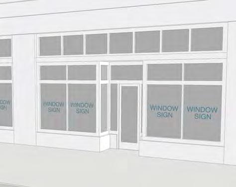

75 CH 12: Signage TABLE SIGN TYPES ILLUSTRATED PROJECTING SIGN WALL SIGN WINDOW SIGN 75 of 115

76 CH 12: Signage TABLE SIGN TYPES ILLUSTRATED YARD SIGN 76 of 115
77 CH 13: Landscape 13. LANDSCAPE GENERAL LANDSCAPE STANDARDS The standards of this section apply to all landscaped areas Landscape Plans a. Landscape plans are required as specified in Section Tree Removal a. Removal of any trees greater than 3 inches DBH requires a tree removal permit or approval as part of a landscape plan. i. Un-permitted tree removal is subject to a fine. b. Tree removal is subject to the standards of Section c. No permit is required for removal of dead, diseased, or leaning trees that have become a hazard to a dwelling Irrigation System a. Some method of irrigation is required in landscaped areas. b. An automated irrigation system is encouraged. c. In landscaped areas without an automated irrigation system the installation of hose bibs is required (water spigots), installed 1 for every 100-foot radius. d. Only single systems are allowed. e. An Arkansas State Master Plumber is required to make the connection from the water service line to the RPZ valve. f. The RPZ valve must have quarter turn ball valves and 3 flare adapters with caps for test cocks. g. All piping under driveways must be installed in sleeves. h. RPZ sizing approval by Public Works is mandatory for commercial projects. RPZ valves must be covered or screened, as approved by the ACC. i. Pumps in lakes require a permit and must be covered or screened, as approved by the ACC Planting Beds a. All landscaping must be planted within areas designated as planting beds. b. Planting beds must have amended soil to insure the health of the plant materials. c. All sod must be removed within the planting bed and mulch must cover the bare soil to ease maintenance. d. Sod is allowed in tree lawns and tree islands if no other plant material is included within these areas Replacement Landscaping a. Landscaping that dies or is damaged must be removed and replaced by the current owner of the property. b. The owner has 60 days from the receipt of written notice issued by a compliance official to remove and replace any required landscaping that dies or is damaged. c. Replacement landscaping does not require a permit Material Selection a. Landscape materials must be selected as specified in Section b. New trees must have a 2-inch caliper (diameter) measured 6 inches above ground level at the time of planting. c. In cases of existing overhead power lines, trees must be selected from the small tree list Relief From Requirements 77 of 115
78 CH 13: Landscape a. At the request of the developer, the ACC may exempt certain site areas from required tree planting where the terrain, existing trees, or other physical limitations make the planting of new trees impracticable Retaining Walls a. Where retaining walls are required because of the slope of the topography, said walls must be constructed based on the standards in section c, e (footer), f, h, I. (ii, iii, v), j., k., l. b. Retaining walls over 4 in height above natural grade, require drawings designed and stamped by an Arkansas licensed engineer SITE DEVELOPMENT LANDSCAPE STANDARDS General a. Site development landscape requirements apply within the area between buildings or facade fencing and property lines along primary and secondary frontages, frontage yards, and yards facing lakes and golf courses. b. Refer to section for Right of Way Landscaping and Structures Requirements a. Landscaping is required according to frontage yard type as specified in Table b. Shrubs and trees must include a minimum of 2 different geneses. c. In T2 and T3, at least 50% of shrubs must be of evergreen variety. d. Yards facing lakes and golf courses should match the frontage yard landscape. e. Landscaping in setbacks (T3 & T2) i. Permanent, non living, landscaping structures (rocks, fountains, berms, mounds and decorative structures, etc) shall not exceed 24 in height above ii. ground level Trees are allowed in setbacks but shall not be planted in a dense manner to provide screening PARKING LOT LANDSCAPE STANDARDS General a. A detailed landscape plan is required for new or expanded parking lots containing 5 or more spaces. b. All tree planting locations should attempt to achieve shade for parking lots, cars, benches, pedestrian walkways, and other pedestrian areas, by utilizing aspect and locating trees along the south and west boundary of these areas. c. All landscaped areas must be protected from potential damage by vehicles by placing concrete curbs or wheel stops adjacent to the landscaped area. d. A portion of a standard parking space may be landscaped instead of paved to meet part of the landscaping requirement as follows: i. The landscaped area may be up to 2 feet of the front of the space as measured from a line parallel to the direction of the bumper of the vehicle using the space; ii. Landscaping may only be groundcover plants in the overhang area Interior Landscaping Requirements a. Parking lots used solely for the purpose of providing areas for the display and storage of motor vehicles or boats for sale, lease, and rental are exempt from this section. b. Parking lots containing 20 or more spaces must be landscaped with one of the following options, as generally illustrated in Table : i. A continuous landscape strip between rows of parking (Narrow Tree Lawn). (1) The minimum width is 8 feet; (2) The minimum area is 300 square feet. 78 of 115
79 CH 13: Landscape (3) 1 tree every 12 parking spaces or one tree every 30 linear feet, whichever provides more canopy, is required. (4) Trees may be grouped or spaced within the lawn area. ii. Tree islands. (1) The minimum width is 8 feet; (2) The minimum area is 150 square feet; (3) 1 tree must be planted for every 12 parking spaces; (4) A maximum run of 12 parking spaces permitted without a tree island. c. Where interior landscaping joins perimeter landscaping, landscaping which extends 4 feet or more into the parking area may be included in the calculation of interior landscaped area. d. Trees must be placed on either side of points of access (entrance drives, exit drives) within tree islands, where building placement permits, as indicated in the Landscape Manual. e. All trees planted to meet these requirements must be deciduous shade trees. f. Species selection must be chosen from the approved list of trees found in Section of 115
 CONTINUOUS STRIP (BELOW GRADE) TREE ISLAND (ABOVE GRADE) TREE ISLAND (BELOW")
 At property lines along")

80 CH 13: Landscape TABLE PARKING LOT INTERIOR LANDSCAPE TYPE ILLUSTRATION MEASUREMENT CONTINUOUS STRIP (ABOVE GRADE) CONTINUOUS STRIP (BELOW GRADE) TREE ISLAND (ABOVE GRADE) TREE ISLAND (BELOW GRADE) Perimeter Landscaping Requirements a. Parking lots adjacent to property lines is required as follows: i. A minimum of 5 feet of landscaped area is required between side and rear property lines and parking lots except in the following locations: (1) At property lines along alleys, (2) At shared property lines where parking lots are connected or shared between adjacent properties. ii. A minimum of 15 feet of landscaped area is required along parking lot edges visible from primary and secondary frontages, except where a street screen is provided by 70% or more opaque walls or fencing. iii. The 2-foot vehicle overhang option may be included to meet this requirement; b. Points of access (entrance drives, exit drives) and sidewalks are allowed to cross the required landscaped area. 80 of 115
81 CH 13: Landscape c. A minimum of 75% of trees planted to meet perimeter landscaping requirements must be deciduous TREE PRESERVATION Requirements a. Trees that are removed to accommodate buildings, driveways, and streets are exempt from tree preservation requirements. b. Tree preservation is required as follows: i. In T4, trees above 18 inches DBH must be preserved or replaced; ii. In T3 and T2, trees above 8 inches DBH and beyond 15 feet of any structure must be preserved or replaced. c. In cluster housing re-plats, tree replacement may occur within common property or limited common property created as part of the re-plat. d. Street tree plantings that are beyond the requirements of this chapter may count as tree replacement, with approval of the ACC. e. Trees selected for preservation or planted for replacement must have the area within the dripline protected from development activities with protective fencing Prohibited Activities a. It is unlawful to allow any of the following activities to occur in protected trees or groups of trees or any area designated "undisturbed" or "preserved" on the landscape plan: i. Material storage. No storage of any kind is permitted within the critical root zone, including, but not limited to, construction materials, waste storage, and excess materials from excavation. ii. Equipment cleaning and liquid disposal. Equipment must not be cleaned nor liquids, including, but not limited to, paint, oil, solvents, asphalt, concrete, and mortar, shall be deposited or allowed to flow within the limits of the critical root zone. iii. Tree attachments. No signs, wires, or other attachments may be attached. iv. Vehicular traffic. No vehicular or construction equipment traffic or parking is permitted within the critical root zone other than on an existing street pavement. v. Grade changes. No grade changes are permitted within the limits of the critical root zone unless adequate construction methods are approved by the POA official. vi. Impervious paving. No paving with asphalt, concrete or other impervious materials in a manner which may reasonably be expected to kill a tree may be placed within the limits of the critical root zone Tree Protection Measures a. Tree protection measures must be in place prior to the arrival of any heavy equipment on the site or the beginning of any construction including land alteration except as necessary to install tree protection. b. The following measures must remain in place until commencement of final landscaping: i. Protective fencing located around the perimeter of the critical root zone, and ii. Flagging with brightly colored vinyl tape wrapped around the main trunk at a height of four (4) feet or more such that the tape is clearly visible to workers on foot or operating equipment A POA official may visit each site and review photographs of each site for which there is a plan in order to verify that the trees to be preserved pursuant to the plan are of sufficient size, quantity and quality to warrant preservation. Trees that do not warrant preservation do not qualify as preserved trees as determined by the POA official. 81 of 115
82 CH 13: Landscape STREET TREE REQUIREMENTS General a. All new developments that create or develop along a public or private street are required to establish street trees in accordance with the standards and procedures of this section and Chapter 13. b. Street tree planting should shade the sidewalk, provide a barrier between vehicles on the street and pedestrians, increase motorized traffic and pedestrian safety, and spatially frame the street. c. Street trees must be selected as specified in Section 12.8 where indicated as appropriate for street planting Planting Requirements a. Street trees must be planted in a planting and furnishing zone between the curb and sidewalk or in tree wells as specified in Chapter 14. b. 1 street tree must be planted every 30 linear feet of planting and furnishing zone except as follows: i. Within visibility triangles; ii. Where alleys interrupt the planting and furnishing zone; iii. In T5, where parking lot entries interrupt the planting and furnishing zone. iv. Where the finish grade slope in the planting area between the top back of the street curb and the property line is in excess of 30%. v. Where bedrock is encountered within 30 inches of finish grade in the planting area between the top back of the curb and the property line; vi. Where existing healthy trees that are shown to be preserved within the right-ofway are in such close proximity they would prevent a new tree from establishing a full canopy when mature. c. The ACC may permit street trees planted within lot frontages in place of the planting and furnishing zone in the following conditions: i. When the planting and furnishing zone is less than 4 feet; ii. Where utilities or other structural conflicts in the planting and furnishing zone; iii. Where existing deciduous trees within lot frontages are located within 6 feet of sidewalks and the existing canopy overlaps the planting and furnishing zone. d. Where street trees are planted in tree wells, the following is required: i. The minimum tree well area is 25 square feet; ii. Tree wells must be covered with a tree grate; iii. Long tree wells may be covered with a tree grate or lined with decorative black metal fencing up to 2 feet in height; iv. Structural soil or similar treatment must be utilized; v. Structural soil, silva cells, or similar treatment is recommended to extend between tree wells and under sidewalks to extend the root area STORMWATER FACILITIES General a. Stormwater management is required to meet the standards of Section b. Light Imprint or Low Impact Development (LID) practices are recommended for all sites. c. Dry surface stormwater facilities may be approved on a case-by-case basis and within activity centers. d. Dry surface stormwater facilities (detention ponds) should be designed for alternative uses when not inundated Plant Materials 82 of 115
83 CH 13: Landscape a. Plant materials must be appropriate for soil, hydrologic, and other existing site conditions. b. Planting selection must minimize the need for herbicides, fertilizers, pesticides, or soil amendments at any time before, during and after construction and for a longterm basis. c. Plantings should be designed to minimize the need for mowing, pruning, and irrigation. d. Plantings must not impede the primary function of the stormwater facility Detention Ponds a. Grass or wildflower seed must be applied to establish ground cover within detention ponds at the rates specified by the suppliers. i. If plant establishment cannot be achieved with seeding by the time of substantial completion of the stormwater facility portion of the project, the contractor must plant the area with wildflower sod, and, container plants or some other means to complete the specified plantings and protect against erosion. ii. Wildflowers, native grasses and ground covers should be designed to require mowing no more than twice annually. b. The stormwater facility area is defined to be equivalent to the area of the detention basin, including the bottom and the side slopes, plus a 10-foot buffer around the detention basin. c. The following planting is required at detention ponds, per every 3,000 square feet of the stormwater facility area: i. 1 evergreen or deciduous tree: (1) Evergreen trees: Minimum height of 6 feet; (2) Deciduous trees: Minimum caliper of 1½ inch at 6 inches above the base. ii. 4 large shrubs/small trees, 3-gallon containers or equivalent; iii. 6 shrubs/large grass-like plants, 1-gallon containers or equivalent; iv. Ground cover plants, 1 per 12 inches on center with triangular spacing, unless seed or sod is specified and installed; v. At least 50% percent of the facility shall be planted with grasses or grass-like plants. d. Where the stormwater facility is designated for alternative active uses when not inundated: i. Plantings may be clustered or concentrated towards the edges of the facility to provide more substantial areas for activity; ii. In activity centers, shrubs may be omitted. e. Trees planted within stormwater facilities may be utilized to meet on-site tree mitigation requirements LANDSCAPING FOR EROSION CONTROL General a. Developments requiring grading must conform with this section. b. Erosion control measures must be installed as soon as practical. c. Prior to vegetation controls, all other appropriate erosion control strategies should be in place. d. The faces of cut and fill slopes which measure 5 feet or greater in vertical height must be treated with vegetation controls. e. Landscape materials must be designed to be compatible with adjacent natural vegetation and must be suitable for the climatic, soil, and ecological characteristics of the area. f. Non-invasive, drought tolerant materials must be selected. 83 of 115
84 CH 13: Landscape Seeding a. Where seeding is required, seeds must be evenly applied. b. Mulching must be used to reduce water runoff, wind blow, and increase moisture conditions of seedlings. c. Re-seeding is required in areas which fail to establish vegetation. d. Temporary seeding is required where exposed soils are not to be fine graded for periods of 20 days or more, including denuded areas, soil stockpiles, dikes, sides of sediment basins, temporary road banks and parking areas, storage areas, and similar. e. Permanent seeding is required where disturbed areas will be permanent and where long lived vegetative cover is needed to stabilize soils. f. Rough graded areas that will not be brought to final grade for 1 year or more require long lived vegetative cover. g. In order to establish a good stand of vegetation, permanent seedbeds should consist of appropriate soil texture, structure, moisture, nutrient content, depth and internal drainage Sodding a. Grass sod must be installed where disturbed areas require immediate vegetative covers or where sod is preferred to other forms of grass establishment Vegetative Streambank Stabilization a. Re-vegetation is required where banks in creeks, streams, and rivers, subject to erosion from excess runoff, have been eroded from land disturbance due to development. b. Revegetation must be consistent with all other required erosion control measures LANDSCAPE MATERIAL LISTS Landscape materials must comply with the following landscape materials lists and requirements: a. General Limitations i. Landscape materials placed within front and side street setbacks are limited in ii. their application to the districts identified in the materials lists; Landscape materials along streets are limited to those identified in column S in the materials lists; iii. Landscape materials along hillsides and terraces are limited to those identified in column H in the materials lists. b. Tree lists: i. Large trees, specified in Table , height 60 ft. avg., width ft avg. ii. Medium trees, specified in Table , height 40 ft. avg., width 30 ft. avg. iii. Small trees, specified in Table , height 20 ft. avg., width 15 ft. avg. c. Shrubs, specified in Table d. Ground cover, specified in Table e. Grasses used adjacent to vehicular areas, specified in Table Invasive species specified in Table are prohibited and must be removed. a. Nandica domestica (heavenly bamboo) cultivars that do not produce flowers or fruit are not considered invasive Plant material must conform to the "American Standards for Nursery Stock, I-73", grade no. 1, American Association of Nurserymen, Inc., or equivalent Artificial plants or trees do not satisfy the requirements of this chapter The ACC may permit landscape materials in addition to those found on the landscape materials lists on a case-by-case basis. 84 of 115
85 CH 13: Landscape TABLE TREE LIST, LARGE TREES BOTANICAL NAME COMMON NAME TYPE S H T2 T3 T4 T5 Celtis laevigata Sugar Hackberry Deciduous Fagus grandifolia American Beech Deciduous Fraxinus pennsyvanica Green Ash Deciduous Liriodendron tulipfera Tulip Poplar Tree Deciduous Magnolia acuminata Cucumber Magnolia Deciduous Magnolia grandiflora Southern Magnolia Evergreen Pinus taeda Loblolly Pine Evergreen Platanus occidentalis Sycamore Deciduous Quercus acutissima Sawtooth Oak Deciduous Quercus alba White Oak Deciduous Quercus falcata Southern Red Oak Deciduous Quercus michauxii Swamp Chestnut Oak Deciduous Quercus nigra Water Oak Deciduous Quercus nuttallii Nuttall Oak Deciduous Quercus palustris Pin Oak Deciduous Quercus phellos Willow Oak Deciduous Quercus shumardii Shumard Oak Deciduous X cupressocyparis leylandii Leyland Cypress Evergreen 85 of 115
86 CH 13: Landscape TABLE TREE LIST, MEDIUM TREES BOTANICAL NAME COMMON NAME TYPE Acer rubrum Red Sunset Red Sunset Maple Deciduous S H T2 T3 T4 T5 Acer rubric Drummondii Swamp Red Maple Deciduous Betula nigra River Birch Deciduous Ginkgo biloba Ginkgo (male) Deciduous Ilex opaca American Holly Evergreen Juniperus virginaiana Eastern Red Cedar Evergreen Koelreuteria paniculata Golden Rain Tree Deciduous Magnolia virginiana Sweet Bay Magnolia Evergreen Pistacia chinensis Chinese Pistach Deciduous Taxodum distichum Cypress Deciduous Ulmus parvifolia Lacebark Lacebark Elm Deciduous Ulmus parvifolia Chinese Elm Deciduous X cupressocyparis leylandii Leyland Cypress Evergreen 86 of 115
87 CH 13: Landscape TABLE TREE LIST, SMALL TREES BOTANICAL NAME COMMON NAME TYPE T2 T3 T4 T5 Acer palmatum Japanese Maple Deciduous Camellia japonica Camellia Evergreen Camellia sasanqua Sasanqua Camellia Evergreen Cercis canandensis Redbud Deciduous Cercis chinesis Chinese Redbud Deciduous Cornus florida Flowering Dogwood Deciduous Crataegus marshallii Parsley Hawthorn Deciduous Crataegus opaca Mayhaw Deciduous Crataegus viridis Green Hawthorn Deciduous Ilex decidua Deciduous Holly Deciduous Ilex attenuata Fosteri Foster s Holly Evergreen Ilex cornuta Burfordii Burford Chinese Holly Evergreen Ilex vomitoria Yaupon Holly Evergreen Juniperus virginiana Canaertii Canaert Red Cedar Evergreen Juniperus virginiana Glauca Silver Red Cedar Evergreen Lagerstroemia Crepe Myrtle Deciduous Magnolia soulangiana Saucer Magnolia Deciduous 87 of 115
88 CH 13: Landscape TABLE SHRUBS LIST BOTANICAL NAME COMMON NAME TYPE T2 T3 T4 T5 Ilex cornuta Burfordii Burford Chinese Holly Evergreen Ilex cornuta Rotunda" Dwarf Rotunda Holly Evergreen Ilex crenata Compacta Dwarf Japanese Holly Evergreen Ilex vomitoria Nana Dwarf Yaupon Evergreen Jasminum messy Primrose Jasmine Evergreen Nandina domestica Nandina Evergreen Ternstroemia gymnanthera Cleyara Evergreen TABLE GROUND COVER LIST BOTANICAL NAME COMMON NAME S H T2 T3 T4 T5 Cynodon dactylon Bermuda Grass Euonymus fortunei Radicans Spreading Euonymus Ergrostis curvyla Weeping Love Grass Festuca arundinancea Kentucky 31 Fescue Gelsemium sempervirens Carolina Jessamine (Hillside) Hedera helix English Ivy Juniperus species Junipers Liriope muscari Liriope Lonicera sempervirens Honeysuckle (Hillside) Nandina domestica Harbour Dwarf Harbour Dwarf Nandian Ophiopogon japonicus Mondo Grass Vinca minor Periwinkle Trachelospermum asiaticum Asian Jasmine 88 of 115
89 CH 13: Landscape TABLE GRASSES ADJACENT TO VEHICULAR AREAS COMMON NAME T2 T3 T4 T5 Bermuda grass Bermuda grass hybrids Centipede Emerald Zoysia Mayer Z-52 Zoysia St. Augustine TABLE INVASIVE SPECIES BOTANICAL NAME Wisteria sinensis, Wisteria floribunda Pyllostachys Spp. Vinca major Pyrus calleryana Euonymus alatus Lonicera maackii, Lonicera fragrantissima Ligustrum sinense Euonymus fortunei Hedera helix Nandica domestica Lonicera japonica Pueraria montana Vinca minor Albizia julibrissin Rosa multiflora Lespedeza cuneata Lespedeza bicolor Ailanthus altissima COMMON NAME Asian Wisteria Bamboo Bigleaf Periwinkle Callary / Bradford Pear Burning Bush Bush Honeysuckle Chinese Privet Creeping Euonymus English Ivy Heavenly Bamboo Japanese Honeysuckle Kudzu Littleleaf Periwinkle Mimosa, Silktree Multiflora Rose Sericea Lespedeza Shrubby Lespedeza Tree-of-Heaven 89 of 115
90 CH 14: Streets 14. STREETS GENERAL Street sections provided in Table are pre-approved for use within the districts specified Applicants may submit alternative street designs, subject to the standards of this Chapter Additional licenses, agreements, and permits may be required Streets must be available for use by all residents, owners, and users of the Village, except where a temporary street closure permit has been granted Right of Way Landscaping Structures a. Property Owners may not landscape or erect structures except approved mail boxes within the street right of way abutting their property. Property Owners may put 2 to 6 rock or natural grass in street right of way abutting their property. Rock is to be kept free of weeds. Natural grass must be cut on a regular basis. Neither rock nor grass may impede the natural water flow STREET DESIGN General Requirements a. Street design is subject to the standards of Table and this section. b. Street design requirements differ by district. c. Street design should change as the street moves from one district to another. i. Where districts differ across a street, the standards of the most intense district ii. apply. Where districts differ along a street, the standards of the most intense district apply for each 1/2 block Street Types a. Street type must be specified for each street section, establishing: i. The desired network function of the street; ii. The applicable street design standards in Table b. Arterials and collectors are limited to existing streets and modifications of existing streets, as provided in Table c. Local streets are categorized as follows: i. Rural Residential Local, the typical local street developed within the Village between 1970 and 2017; ii. Modified Rural Residential Local, a variant of the rural residential local providing limited pedestrian facilities; iii. Yield Residential Local, a low speed, low capacity street providing yield movement through gaps between on-street parking, and full pedestrian facilities; iv. Residential Local, a low speed street providing full two-way vehicular movement, on-street parking on one or both sides, and full pedestrian facilities; v. Urban Residential Local, a variant of the residential local intended for use in T5 and more dense T4 areas; vi. Local Side Street, a connector street providing minimal facilities, not intended for primary frontages; vii. Urban Local Side Street, a variant of the local side street intended for use in T5 and more dense T4 areas; viii. Commercial Street, a low speed, low volume, urban street intended to support non-residential uses in T5 areas; ix. Square One-Way, a low speed, low volume, one-way street intended to be used in a pair on either side of an open space; 90 of 115
91 CH 14: Streets x. Plaza One-Way, a low speed, low volume, one-way street intended to be used in a pair on either side of a plaza. xi. Alleys and Rear Lanes provide access to T5 and T4 lots, with no through capacity. d. Pedestrian and multi-use paths and passages are categorized as non-vehicular streets as specified in subsection Street Context a. Where Center is identified in Table as the context, the street may be used within activity centers, neighborhood centers, and pocket neighborhoods. b. Where General is identified in Table as the context, the street may be used in all other areas, except activity centers and neighborhood centers Non-vehicular Streets a. Pedestrian and multi-use paths are considered non-vehicular streets in order to fulfill frontage requirements and block size requirements in this Code. b. Non-vehicular streets provide pedestrian access through a site and to properties. c. Non-vehicular streets may provide bicycle and golf cart access through a site and to properties. d. Vehicular access on pedestrian streets is limited to emergency vehicles and service vehicles. e. Non-vehicular streets are exempt from the requirements of this Chapter except those specified within this section and street lighting requirements by district. f. Non-vehicular streets must meet the standards of Table Centerline Radius a. Street centerline radius must meet the standards of Table Vehicular Movement a. Vehicular movement is limited according to Table b. One-way streets are limited to use in pairs around common property and limited common property, providing full movement between the pairs Vehicular Lanes a. Vehicular travel lanes are limited according to Table b. Vehicular travel lanes are measured as follows: i. Lanes are measured to the centerline of striping where: (1) Striping is shared between two travel lanes; (2) Striping is shared between a travel lane and a parking or bicycle lane; (3) Striping indicates a shoulder in swale conditions. ii. Lanes are measured to the face of curb where no gutter exists. iii. Lanes are measured to the edge of the gutter when adjacent to a gutter. iv. Lanes are measured to edge of pavement in all other conditions On-street Parking Lanes a. The type, width, and number of on-street parking lanes is limited according to Table b. On-street parking spaces must meet the standards of Table c. Parking lanes are measured as follows: i. Lanes are measured to the centerline of striping shared between a travel lane and a parking lane or bicycle lane. ii. Lanes are measured to the face of curb, where they exist, including gutters Fire Access a. Where any vehicular way is paved less than 20 feet in width, staging areas must be provided as follows: 91 of 115
92 CH 14: Streets i. At increments of 300 feet, staging areas must be provided 30 feet in width by 27 feet in width, coordinated with fire hydrant locations. ii. Staging areas may be provided with stabilized planting areas able to support outriggers. iii. Staging areas may include intersections and driveway aprons Bicycle Facilities a. Off-street bicycle facilities should be provided along the trail network. b. Along local streets, bicycles should be accommodated on street using sharrows along identified bicycle routes. c. Along collector and arterial streets, bicycle facilities must be provided in one of the following configurations: i. Off-street, in a pair of one-way facilities a minimum of 6 feet wide; ii. Off-street, in a two-way facility a minimum of 12 feet wide; iii. On-street, in lanes a minimum of 6 feet wide, buffered from travel lanes by 3 foot wide bicycle buffers Curbing a. Stormwater drainage must be accommodated within street designs. b. Curbing is required where specified in Table c. Vertical curbs should be no taller than 6 inches Sidewalks a. Sidewalks are required as specified in Table i. Sidewalks may be omitted where topography constrains the right-of-way, subject to approval of the ACC Planting and Furnishing Zone a. A planting and furnishing zone is required as specified in Table and illustrated in Table b. Street furniture, including benches, mailboxes, street lights, signage, and similar elements must be located within the planting and furnishing zone. c. Where paving is permitted in the planting and furnishing zone, it must match the adjacent sidewalk paving or be constructed of unit pavers. d. Street trees are required within planting and furnishing zones as specified in Chapter 13: Landscape. e. Street lighting color temperature must be between 2,600 and 4,000 kelvin. f. Street lighting must meet the requirements of Table of 115


93 CH 14: Streets TABLE NON-VEHICULAR STREETS ACCESS DISTRICT RIGHT OF WAY MULTI-USE PATH PEDESTRIAN PATH LIGHTING PLANTING PEDESTRIAN PEDESTRIAN & BICYCLE T3, T4 12 ft. min. n/a 5 ft. min. Optional 6 ft. min. T4, T5 12 ft. min. n/a 8 ft. min. Required 4 ft. min. T3, T4 20 ft. min. 12 ft. min. Multi-use Optional 8 ft. min. T4, T5 20 ft. min. 14 ft. min. Separate or Multi-use Required 6 ft. min. PEDESTRIAN, BICYCLE, & GOLF CART T3, T4 30 ft. min. 16 ft. min. T4, T5 30 ft. min. 16 ft. min. Separate or Multi-use Separate; 5 ft. min. Required Required 12 ft. min. 8 ft. min. TABLE PLANTING AND FURNISHING ZONE TYPES TYPE ILLUSTRATION SWALE CONTINUOUS LONG TREE WELL TREE WELL 93 of 115
94 CH 14: Streets TABLE STREET LIGHTING DISTRICT SPACING HEIGHT TYPE T2 At intersections 8-12 ft. Pipe, Post T3 At intersections 8-12 ft. Pipe, Post T ft ft. Post, Column T ft ft. Column, Double Column [ See Table , Attached Separately for Legibility] 94 of 115
95 CH 14: Streets INTERSECTIONS Crosswalks a. Crosswalks greater than 50 feet in length require a pedestrian refuge. b. Corner crosswalk ramps are prohibited except at pedestrian scramble crosswalks and irregular intersections. c. Crosswalks must be a minimum of 8 feet in width. i. Crosswalks must be a minimum of 12 feet in width at multi-use trails and golf cart trails. d. Crosswalks in T4 and T5 must be striped. e. Crosswalks at Arterials and Collectors must be striped Curb return radius a. Curb return radius is limited by type of intersecting roadways, according to Table b. Curb return radius compliance is measured along the effective radius. i. The effective radius is measured along the path of vehicular tracking. ii. On-street bicycle facilities reduce the required radius of curb returns. iii. On-street parking reduce the required radius of curb returns where bulb-outs are not used. TABLE CURB RETURN RADIUS STREET TYPE ARTERIAL COLLECTOR LOCAL ARTERIAL n/a 35 ft. min. 30 ft. min. COLLECTOR 35 ft. min. 30 ft. min. 25 ft. min. LOCAL 30 ft. min. 25 ft. min. 20 ft. min Angle of intersection a. The centerline of intersecting streets must be between 75 and 135 degrees. i. More acute or obtuse intersection angles may be permitted by Public Works and the ACC where topography is in excess of 15% Bulb-outs a. Bulb-outs are permitted at intersections and mid-block crossings. b. Bulb-outs may extend the width of on-street parking lanes Intersection Spacing a. Intersection spacing is limited by type of intersecting roadways, according to Table TABLE INTERSECTION SPACING STREET TYPE ARTERIAL COLLECTOR LOCAL ARTERIAL n/a 1/2 mile 1/4 mile COLLECTOR 1/2 mile 1/4 mile 660 feet LOCAL 1/4 mile 660 feet 200 feet 95 of 115

 at the Town Center, T4")

96 CH 14: Streets TABLE PRE-APPROVED STREETS ILLUSTRATED ILLUSTRATIONS AR ; DeSoto (arterial) at the Town Center, T4 AR ; DeSoto (arterial) at the Town Center, T5 RR-50-18; Rural Residential Local, T2 and T3 96 of 115

, T2 and T3 RL-40-20;")

97 CH 14: Streets TABLE PRE-APPROVED STREETS ILLUSTRATED RR-46-20; Rural Residential Local (modified), T2 and T3 RL-40-20; Residential Local, One-way, T3 and T4 RL-40-25; Residential Local Side Street, T3 and T4 97 of 115


98 CH 14: Streets TABLE PRE-APPROVED STREETS ILLUSTRATED RL-51-30; Residential Local, T3 and T4 RL-55-34; Residential Local, T3 and T4 URL-58-34; Urban Residential Local, T4 98 of 115


99 CH 14: Streets TABLE PRE-APPROVED STREETS ILLUSTRATED CS-62-34; Commercial Street, T5 SQ T4; One-way pair around a square, T4 SQ T5; One-way pair around a square, T5 99 of 115

100 CH 14: Streets TABLE PRE-APPROVED STREETS ILLUSTRATED PZ T5; One-way pair around a plaza, T5 100 of 115
101 CH 15: Architectural Character 15. ARCHITECTURAL CHARACTER MINIMUM REQUIREMENTS Building Materials a. Where multiple exterior materials are used on a single building, they may only be combined through horizontal transitions, with the heavier material below. i. Building attachments and projections may differ in material from the building volume, with the attachment or projection being of a lighter material, except for chimneys. b. Vinyl siding must imitate wood in size, thickness, profile, and joining. c. Exterior Insulation and Finish Systems (E.I.F.S.) are prohibited. d. All exposed exterior wood must be painted or stained Openings a. All openings, including porches, galleries, doors, and windows must be vertical or square in proportion. Horizontal openings may be provided by combining multiple vertical or square openings together. b. Doors and windows that operate as sliders are prohibited along facades facing front or side street lot lines. c. Where exterior shutters are installed, operable or not, they must be sized and oriented to fit the entire opening if they were to be closed Foundations a. Any structure or building projection on a raised foundation must have skirting or wood lattice screening between piers Mechanical Equipment and Refuse Storage a. Building mechanical equipment, at or above ground level, and refuse storage must not be visible from front or side street lot lines. b. Window mounted air conditioning units must not be visible from front or side street lot lines Exterior Lighting, General a. Fluorescent and compact fluorescent lights are prohibited on the exterior of structures, including within open porches and stoops. b. Exterior lights must have a color temperature between 2,500 and 3,500 kelvin. c. All lighting must be angled or shielded to prevent vertical projection of light beyond 90 degrees, except where lighting is specifically permitted to be angled upwards Exterior Lighting, Residential a. Exterior lighting must not project or reflect light upward or onto a neighboring property. b. Directional fixtures such as exterior entryway lighting, floodlights, and spotlights, must be shielded, installed, and aimed so that they do not project light into the windows of neighboring residences. c. Directional fixtures visible from neighboring properties must be extinguished no later than 11:00 PM, unless controlled by a motion sensor. d. Ground-mounted directional lighting may be pointed upward to illuminate pole mounted flags Outbuildings a. Outbuildings, storage structures, and sheds should match the wall and roof style, color, and material of the primary dwelling. b. Pre-built storage or outbuildings are reviewed on a case-by-case basis by the ACC. c. Storage and outbuildings on lakefront or golf-facing lots, except freestanding garages, are reviewed on a case-by-case basis by the ACC. 101 of 115
102 CH 15: Architectural Character CHARACTER DISTRICTS Character districts may be established for each neighborhood and activity center Neighborhood character districts are established by the POA, ACC, and neighborhood residents and property owners Activity center character districts may be established by the POA and ACC, or by a developer who controls a majority of the center s development Character districts should establish an architectural character for a limited area within the Village, addressing the following elements, within the general limits set by this code: a. Roof materials, slopes, eaves, and other characteristics; b. Window types, sizes, arrangements, and other characteristics; c. Building attachments such as porches and stoops; d. Building materials and colors; e. Story height; f. Entry door location, size, material, and color; g. Fence and wall materials and finishes; and h. Landscape design and materials. 102 of 115
103 CH 16: Definitions 16. DEFINITIONS Term. Definition. 1. Accessory Dwelling Unit (ADU). A dwelling unit that is subservient to a primary dwelling unit in size, location, and design, often located above garages or in independent buildings towards the rear of a property. ADU s may be rented provided the property owner lives in the primary dwelling unit. Alternatively, the property owner may live in the ADU and rent the primary dwelling unit. 2. Activity Center. An area, limited in scope, intended to be developed as a mixed-use district, as identified in the CMP. Residents in and around activity centers should expect noise, light, and traffic to extend into the evening and throughout weekends. 3. Automatic irrigation means the watering of land or plant material by artificial means to foster plant growth by the use of underground pipes, valves, spray heads, and/or drip lines. Automatic irrigation shall be in compliance with all state and POA standards and must include an RPZ, a backflow preventer, and an automatic controller. 4. Buffer, hillside means a strip of land which separates large cuts or fills from abutting properties, public right-of-way or from other large cuts or fills on a site. Its purpose is to facilitate effective drainage and erosion control and to encourage preservation of large trees of a site and reduce public view of cuts and fills. 5. Buffer, street means a strip of land lying parallel and adjacent to a public street right-of-way. This strip shall lie parallel to the street right-of-way line at any point. The purpose of this buffer is to provide for a separation of traffic movements, both on and off the site, and provide for a visual and spatial separation of certain uses and/or activities from the public right-of-way. 6. Building landscape area means the on-site landscape area which separates parking from the building. The principle purpose of this area is to improve the appearance of the building from the street and vehicular use area. 7. Caliper means the diameter of a tree as measured twelve (12) inches above ground level for nursery stock trees and at breast height (four and one-half (4½) feet) for preserved trees. 8. Canopy means the outermost spreading branch layer of a tree. 9. Cluster Housing. A development comprised of small houses, cottages, townhouses, and small multifamily buildings, usually organized around a central, shared open space. 10. Code. The use of the term Code in this document refers to the Protective Covenants document in its entirety. 11. Continuous Yard. A yard type where the yards of neighboring properties are not distinguished from each other by fencing, hedges, or buildings. 12. Comprehensive Master Plan (CMP). The Village master plan as amended. 13. Connectivity. A term describing the relative number of streets that are not dead-ended. For example, increasing connectivity means to add street connections. 14. POA official means the employee of the POA who is designated by the Chief Executive Officer as having responsibility for the administration and enforcement of this chapter. 15. Critical root zone means the area of undisturbed natural soil around a tree defined by a concentric circle with a radius equal to the distance from the trunk to the outermost portion of the dripline. 16. Damaged tree means a tree that has been damaged or diseased greater than fifty (50) percent. An inspection and approval by the POA official is required prior to removal and replacement of a damaged tree. 17. Deciduous means the tendency of a plant to drop or lose its leaves during a particular season of the year, generally during the winter months. 18. Design professional means a landscape architect, an architect, an engineer, a horticulturalist or a certified nurseryman. 19. Diameter at breast height (DBH) means the diameter of a tree measured four and one-half (4½) feet above ground level. 20. Dripline means a vertical line extending from the canopy of a tree to the ground. 103 of 115
104 CH 16: Definitions 21. Driveway access means an area intended to provide entrance, exit or maneuvering for vehicular traffic from a public right-of-way to an off-street vehicular use. 22. Earth berm means a mounding of soil volume in order to create a screen or change in elevation between the use area and adjacent areas. The berm shall be constructed to minimize erosion and should normally be completely covered with ground cover or lawn grass. 23. Evergreen. A plant which retains its leaves during all seasons of the year. 24. Facade. The vertical elevation of a building along one plane. 25. Front setback. The closest distance a structure is located or permitted to be located relative to the front lot line. 26. Frontage. The portion of the property located between the front lot line and the primary structure front setback and between the side street lot line and the primary structure side street setback. 27. Frontage, Primary. (see Primary Frontage) 28. Frontage, Secondary. (see Secondary Frontage) 29. Frontage Encroachment. Building elements that project forward more than 2 feet beyond frontage facades into the front setback or side street setback. 30. Frontage Facade. The building facade closest to and facing the front lot line and the side street lot line. 31. Frontage Facade Fencing. Fencing that is aligned with, or parallel up to 20 feet behind, a frontage facade, spanning between the frontage facade and a side or rear property line. 32. Frontage Fencing. Yard fencing that is located along or within frontages. 33. Frontage Landscaping. Landscaping that is located within a frontage. 34. Frontage Street. The street along which a frontage is located. 35. Frontage Yard. The portion of a property located between frontage facades and frontages. 36. Glazing; Facade Glazing. The portion of a building facade that is comprised of transparent glass, typically set in windows and doors. 37. Ground cover means planting materials which reach a maximum height of not more than eighteen (18) inches in height and may be used in lieu of grass. Ground cover shall present a reasonably complete cover appearance within two (2) years of planting. 38. Hydroseeding means a planting process which utilizes a slurry of seed and mulch. The slurry is transported in a tank, either truck- or trailer-mounted, and sprayed over prepared ground in a uniform layer; helicopters may be used in cases where larger areas must be covered. Hydroseeding is an alternative to the traditional process of broadcasting or sowing dry seed. Hydroseeding promotes quick germination and inhibits soil erosion. 39. Housing Cluster. See Cluster Housing. 40. Intensity. A relative measure used to describe the extent or amount of activity, housing, or diverse uses in a given area. 41. Interior landscape area means any landscape area within the perimeter of the vehicular use area excluding the building landscape area. Its primary purpose is to break up the mass of the vehicular use area and to channelize traffic circulation on the site. 42. Irrigation means an adequate supply of water which can be made available to landscape plant materials. 43. Landscape area means that area within the boundaries of a lot or tract of land which consists of planting materials including, but not limited to, trees, shrubs, ground covers, grass, flowers, and native plant materials; also including, but not limited to, inorganic features such as concrete planters, stone, brick, and aggregate forms, water, and other landscape elements. Inorganic elements shall not predominate over the use of organic plant material. Artificial plants are not considered landscape materials. 44. Landscape and tree protection plan means a document approved by the POA containing the landscaping, tree protection, buffers and other site requirements of a particular development project. This document may be referred to as the "landscape plan. 104 of 115
105 CH 16: Definitions 45. Lawn grass means all species normally grown as permanent lawns in Pulaski County. Grass sod shall be required in all required planting beds and planting strips where bark or other approved ground cover is not proposed. Grass sod shall be reasonably free of weeds and noxious pests or disease. 46. Link-to-node Ratio. A ratio used to measure connectivity. Lower link-to-node ratios are incident with higher connectivity and higher link-to-node ratios are incident with lower connectivity. The link-to-node ratio is measured by dividing the number of street segments (links) by the number of intersections (nodes, excluding culs-de-sac). 47. Lot Line. (See Property Line) 48. Low Impact Development (L.I.D.) is an ecologically-based stormwater management approach favoring soft engineering to accommodate rainfall on site through a vegetated treatment network. 49. Massing, shrubs, means three (3) or more shrubs planted within close proximity. 50. Massing, trees, means existing contiguous tree groupings with the associated undergrowth. 51. Neighborhood Center. An area, very limited in scope, intended to be developed as a mixeduse district, as identified in the CMP. Neighborhood centers are similar to activity centers, but are less intense and much smaller in size. 52. Nursery stock means all plants, trees, shrubs, vines, cuttings and grafts, scions and buds grown or kept for, or capable of, propagation, distribution or sale; provided, that vegetable, grass and other soft-wood herbaceous plants shall not be considered nursery stock except when grown by a producer of hardwood plants. At that point, it becomes nursery stock and subject to fees based on acreage and other requirements that govern the sale of nursery stock. 53. Off-street parking space means a space on private land accessible from a usable street or alley, not less than nine (9) feet wide and twenty (20) feet long, with the necessary maneuvering room within the private property. 54. Perimeter landscape strip means a landscaped area which separates the vehicular use area from adjoining property or public right-of-way. Its purpose is to enhance the visual appearance of the site and to provide screening of the vehicular use area and certain other uses and activities from the public right-of-way and abutting properties. 55. Pocket Neighborhood. A subdivision or portion thereof which includes a variety of housing types and intensities, is usually oriented around a shared open space, and has a relatively high level of connectivity compared to that typically found in the Village. 56. Preserved tree means a tree selected for preservation by the responsible party and approved by the POA. A tree is considered preserved if a minimum of seventy-five (75) percent of the critical root zone is maintained at undisturbed natural grade and not more than twenty-five (25) percent of the canopy is removed. 57. Primary Frontage. Frontage that is located along the property line that bears the lot s address. 58. Property line (lot line). The legal boundary between 2 lots or between a lot and right-of-way. Property line shall also include property lease lines which separate independent uses or activities except: When abutting common driveways; or When abutting areas designed for interior circulation. 59. Protective fencing. Colored fencing of vinyl or wire construction not less than 4 feet in height. 60. Regular District. An overlay district or zone assigned in order to implement this code. 61. Regular Event. Any event that occurs once a month. 62. Rear Alley Setback. The closest distance a structure is located or permitted to be located relative to the rear lot line in instances that an alley is located along the rear lot line. 63. Rear Setback. The closest distance a structure is located or permitted to be located relative to the rear lot line. 64. Rear Lot Line. The lot line that is opposite the front lot line. 65. Remove or removal means the taking from the property or causing damage to trees with DBH of six (6) inches or greater. This term shall not include responsible pruning of trees. 105 of 115
106 CH 16: Definitions 66. Replacement trees means trees that are planted to replace trees that have been severely damaged or have died or have been otherwise removed. Fifty (50) percent of replacement trees shall be a minimum of three (3) inches in caliper at planting and the balance shall be four (4) inches in caliper or greater at planting. 67. Required tree means a tree other than a preserved tree which is included in a landscape plan. 68. Responsible party means the following: The permit applicant who is the designated agent for development related activities for purposes of obtaining all required permits. The permit applicant relinquishes responsibility to the construction superintendent when all necessary permits have been issued by the POA; or The construction superintendent who is that person designated as the on-site agent for the project and responsible for all construction related activities until the issuance of a final certificate of occupancy; or The lessee or any person or entity having control of the property subject to this chapter; or The owner, which is the person, firm, corporation or other entity holding current legal title to the property. The responsibility of the owner shall commence upon the date of issuance of the certificate of occupancy. 69. Rip rap means a foundation or sustaining wall of stones placed together without order on an embankment slope to prevent erosion. The rip-rap shall be covered from both the top and bottom with vegetative cover. 70. Screening means the use of natural or manmade topography, berms, fences, walls, trees, shrubs, ground cover or any combination thereof which partially or completely blocks the view of one area from another. 71. Screening, opaque means a manmade device on, or a natural feature of, a property which restricts access or visibility the purpose of which is to provide privacy, separation of use, and to reduce the impact of automobile lights on an adjacent use. Such screening shall be opaque in nature and prevent the passage of visible light frequencies. 72. Secondary Frontage. All frontages other than the primary frontage. 73. Side Lot Line. Any lot line that is shared between two or more lots except for the rear lot line. 74. Side Setback. The closest distance a structure is located or permitted to be located relative to the side lot line. 75. Side Street Lot Line. Any lot line, other than the front lot line, that is located along a right-ofway and any lot line, other than the rear lot line, that is located along a golf course, lake, park, square, or plaza. 76. Side Street Setback. The closest distance a structure is located or permitted to be located relative to the side street lot line. 77. Side Shared Fencing. Fencing that is located along property lines shared between two or more properties. 78. Shopfront. The portion of a facade bordering a commercial occupancy or tenant. 79. Shrubs and hedges means self-supporting, woody, evergreen species and shall have a minimum height of eighteen (18) inches at installation. 80. Soil means a medium in which plants will grow. 81. Special District. A limited area within which special conditions may be placed on development in order to permit a use or activity not anticipated by this code. 82. Special Event. Any event that does not occur over 3 times per year. 83. Stop work order means an order issued by the POA official directing the parties involved in an activity to cease and desist all work on the development or to cease only that portion which is not in compliance, except such remedial work necessary to bring the project into compliance. 84. Story. The vertical extent of one floor within a structure. 85. Street is defined as a public or private thoroughfare, abutting property, providing access to property for vehicles, bicycles, pedestrians, golf carts, and any combination thereof. 106 of 115
107 CH 16: Definitions 86. Streetscape. A general term describing the combination of elements within a street right-of-way. 87. Swimming Pool. Any structure intended for swimming or recreational bathing that contains water more than 24 inches deep, including in ground and on-ground installations, hot tubs, and spas. 88. Tree means any self-supporting woody perennial plant of two (2) inches or more DBH reaching an overall height at maturity of at least fifteen (15) feet. The canopy of the mature tree shall be ten (10) feet or more above ground level with the height of the canopy of the immature tree being proportional to the current size of the tree. Large woody shrubs shall not constitute a tree. 89. Tree, multitrunk means a tree having three (3) or more trunks. 90. Tree topping means cutting the main vertical leader of the tree or the severe cutting back of limbs to stubs larger than two (2) inches in diameter within the crown of the tree to such an extent as to remove the normal canopy and disfigure the tree. 91. Undisturbed means the condition of a land area which remains in a natural state including topography, trees and vegetation, except that enhancements such as additional landscaping, replacement of underbrush and other treatments may be utilized within the land area when approved by the POA official. 92. Vehicular use area means that area of private development subject to vehicle traffic, including access ways, driveways, loading and service areas used for parking, maneuvering, or storage of vehicles, boats, or portable construction equipment, and all land which vehicles travel over as a function of the primary use. 93. Vine means an herbaceous or semi-wood plant requiring support upon which to grow. Vines are generally used to soften the effect of inorganic elements such as fences, walls, and arbors, as well as to provide screening or buffering effects. 94. Wall or fence means a structure of wire, posts, boards, pickets or rails commonly used to border, secure or delineate a yard, field, lot or other land area. All fences intended as screening fences to fulfill a code or site plan requirement shall be opaque and placed with the decorative or face side toward the subject to be protected. 107 of 115
108 CH 17: Sample Site Plans 17. SAMPLE SITE PLANS Site plans included in this chapter are provided for convince to illustrate certain requirements and communicate the type of information required as part of submittal plans. 108 of 115

109 CH 17: Sample Site Plans SAMPLE SITE PLANS TYPE PLAN T3.1 HOUSE 109 of 115

110 CH 17: Sample Site Plans SAMPLE SITE PLANS T3.2 HOUSE 110 of 115
111 CH 17: Sample Site Plans SAMPLE SITE PLANS T4 COTTAGE 111 of 115

112 CH 17: Sample Site Plans SAMPLE SITE PLANS T4 ROW HOUSE 112 of 115

113 CH 17: Sample Site Plans SAMPLE SITE PLANS T4 MANSION CONDO 113 of 115
114 CH 17: Sample Site Plans SAMPLE SITE PLANS T5 LIVE-WORK 114 of 115

115 CH 17: Sample Site Plans SAMPLE SITE PLANS T5 MIXED-USE BUILDING 115 of 115
ARTICLE 17 SITE PLAN REVIEW
 ARTICLE 17 SITE PLAN REVIEW 17.01 INTENT AND PURPOSE The intent of this section is to provide for consultation and cooperation between the applicant and the township planning commission so that the applicant
DRIVEWAY REGULATIONS
 TOWN OF NEW LONDON PLANNING BOARD DRIVEWAY REGULATIONS INSTRUCTIONS TO APPLICANTS FOR THE CONSTRUCTION OR ALTERATION OF DRIVEWAYS IMPORTANT: READ CAREFULLY BEFORE FILLING OUT ATTACHED APPLICATION Revised
SUBMITTAL REQUIREMENTS
 WHEN PROCESS TYPE III IS USED References to Process Type III applications are found in several places in the Milton Municipal Code (MMC), indicating that the development, activity, or use, is permitted
Project phasing plan (if applicable) 12 copies of site plan
 12 copies of site plan") SITE PLAN REVIEW PERMIT APPLICATION City of Grand Haven, 11 N. Sixth Street, Grand Haven, MI 49417 Phone: (616) 847-3490 Fax: (616) 844-2051 Website: www.grandhaven.org 1. Project Information Address/location
SITE PLAN REVIEW PERMIT APPLICATION City of Grand Haven, 11 N. Sixth Street, Grand Haven, MI 49417 Phone: (616) 847-3490 Fax: (616) 844-2051 Website: www.grandhaven.org 1. Project Information Address/location
C-I-10. The effect of establishing a comprehensive site review as follows will: B. Reduce the cluttered aspects of current development by:
 C-I-10 PART C SECTION I ARTICLE 10 GENERAL REGULATIONS PROJECT SITE REVIEW I. Purpose The effect of establishing a comprehensive site review as follows will: A. Protect streetscapes from projects that
SITE PLAN REVIEW APPLICATION AND CHECKLIST
 SITE PLAN REVIEW APPLICATION AND CHECKLIST PROJECT SUMMARY: Project Name: City/ETA Location: City ETA (Application fee & number of copies needed are based on location) Property Location (Legal Description
TOWNSHIP OF LOGAN SOIL & FILL IMPORTATION AND PLACEMENT APPLICATION SUBMITTAL CHECKLIST
 TOWNSHIP OF LOGAN SOIL & FILL IMPORTATION AND PLACEMENT APPLICATION SUBMITTAL CHECKLIST Applications: 5 copies of application - Applicant will reproduce the copies at his/her costs. The Township Clerk
CITY OF KEIZER MASTER PLAN APPLICATION & INFORMATION SHEET
 CITY OF KEIZER MASTER PLAN APPLICATION & INFORMATION SHEET PRE-APPLICATION CONFERENCE Prior to the actual filing of a Master Plan application, it is strongly recommended that the applicant contact Planning
4. To assure that adequate screening and buffering will be provided between the planned project and contiguous properties;
 CHAPTER V. SITE PLAN REGULATIONS 5.1. Purpose and intent/applicability. 5.2. Procedures for review of site plans. 5.3. Required submittals. 5.1. Purpose and intent/applicability. 5.1.1. Purpose and intent.
Landscape and fencing requirements of this Chapter shall apply to all new landscaped areas.
 Chapter 19.06. Landscaping and Fencing. Sections: 19.06.01. Purpose. 19.06.02. Required Landscaping Improvements. 19.06.03. General Provisions. 19.06.04. Landscaping Plan. 19.06.05. Completion of Landscape
At Your Disposal CUP Amendment, Lot 20, Village Service Commercial, at 128 Bastille Dr. (PLN17-208)
") MEMORANDUM Archuleta County Development Services Planning Department 1122 HWY 84 P. O. Box 1507 Pagosa Springs, Colorado 81147 970-264-1390 Fax 970-264-3338 TO: Archuleta County Planning Commission FROM:
MEMORANDUM Archuleta County Development Services Planning Department 1122 HWY 84 P. O. Box 1507 Pagosa Springs, Colorado 81147 970-264-1390 Fax 970-264-3338 TO: Archuleta County Planning Commission FROM:
BUFFERS, TREE PROTECTION AND LANDSCAPING. Sec Purpose and Intent.
 ARTICLE 20 BUFFERS, TREE PROTECTION AND LANDSCAPING Sec. 20.1. Purpose and Intent. Trees improve air and water quality, reduce soil erosion, reduce noise and glare, provide habitat for desirable wildlife,
ROSS BRIDGE NEIGHBORHOOD ASSOCIATION ARCHITECTURAL REVIEW COMMITTEE ARCHITECTURAL STANDARDS
 ROSS BRIDGE NEIGHBORHOOD ASSOCIATION ARCHITECTURAL REVIEW COMMITTEE ARCHITECTURAL STANDARDS Revised & Approved July 25, 2006 Table of Contents I. BASKETBALL GOAL POSTS AND BACKBOARDS 3 II. RECREATIONAL
Bylaw A Bylaw to amend Bylaw 12800, as amended, The Edmonton Zoning Bylaw Amendment No. 2239
 Bylaw 17672 A Bylaw to amend Bylaw 12800, as amended, The Edmonton Zoning Bylaw Amendment No. 2239 WHEREAS City Council at its meeting of February 22, 2001, gave third reading to Bylaw 12800, as amended;
Procedures IV. V. Rural Road Design Option
 i IV. Procedures A. All applicants required to prepare a Conservation Design Subdivision shall provide the Planning Board with a conceptual conventional subdivision design as well as a proposed layout
City of San Ramon. Zoning Ordinance. Adopted: October 27, Latest Revisions Effective: March 28, 2018
 City of San Ramon Zoning Ordinance Adopted: October 27, 2015 Latest Revisions Effective: March 28, 2018 City of San Ramon 7000 Bollinger Canyon Road San Ramon, California 94583 [Page intentionally left
ARTICLE IV: DEVELOPMENT STANDARDS 404 MASTER PLANNING
 IV 13 404 MASTER PLANNING Master Planning through the Site Analysis (Master Planning Site Analysis) or Planned Development (Master Planning Planned Development) is provided to encourage development which
PLANNED UNIT DEVELOPMENT & SUBDIVISION STAFF REPORT Date: May 18, 2017
 & PUD-0000102-2017 PLANNED UNIT DEVELOPMENT & SUBDIVISION STAFF REPORT Date: May 18, 2017 NAME SUBDIVISION NAME Dauphin Creek Estates Subdivision Dauphin Creek Estates Subdivision LOCATION CITY COUNCIL
Application for Site Plan Review
 Application for Site Plan Review City of Pontiac Office of Land Use and Strategic Planning 47450 Woodward Ave, Pontiac, MI 48342 T: 248.758.2800 F: 248.758.2827 Property/Project Address: Sidwell Number:
CHESAPEAKE LANDSCAPE ORDINANCE
 CHESAPEAKE LANDSCAPE ORDINANCE CONSERVATION PRESERVATION CZO 19-600 Effective October 16, 2008 BUFFER YARD C PARKING LOT REFORESTATION YEAR 1 REFORESTATION YEAR 4 BUFFER YARD F CBPA REFORESTATION Page
ARTICLE 3 LANDSCAPING AND SCREENING REQUIREMENTS
 ARTICLE 3 CHAPTER 4 LANDSCAPING AND SCREENING REQUIREMENTS SEC 3.401 SEC 3.402 (D) (E) PURPOSE: The purpose of this Chapter is to establish minimum standards for the design, installation, and maintenance
Planned Development Review Revisions (Project No. PLNPCM )
") Planned Development Review Revisions (Project No. PLNPCM2014-00139) Standard residential development Planned Development Example: Smaller lot sizes than what is allowed to create open space amenity. What
Planned Development Review Revisions (Project No. PLNPCM2014-00139) Standard residential development Planned Development Example: Smaller lot sizes than what is allowed to create open space amenity. What
Exhibit A. 8:9 Scuffletown Rural Conservation District
 Exhibit A 8:9 Scuffletown Rural Conservation District 8:9.1 Intent and Purpose The Scuffletown Rural Conservation (SRC) District is intended to provide for residential development that supports the development
COUNTY COUNCIL OF PRINCE GEORGE'S COUNTY, MARYLAND SITTING AS THE DISTRICT COUNCIL 2010 Legislative Session. Council Members Dernoga and Olson
 DR- COUNTY COUNCIL OF PRINCE GEORGE'S COUNTY, MARYLAND SITTING AS THE DISTRICT COUNCIL 00 Legislative Session Bill No. CB--00 Chapter No. Proposed and Presented by Introduced by Co-Sponsors The Chairman
ARTICLE RRCO RED ROCK CORRIDOR OVERLAY DISTRICT
 ARTICLE 11.10 RRCO RED ROCK CORRIDOR OVERLAY DISTRICT (adopted 11/22/2011 MC16-116-11) SECTIONS: 11.10.01 Intent 11.10.02 Boundaries of District 11.10.03 Development Standards 11.10.04 Variance 11.10.01
V-5 TREE PROTECTION AND LANDSCAPING REQUIREMENTS
 V-5 TREE PROTECTION AND LANDSCAPING REQUIREMENTS V-5.1 General A. Intent: It is the intent of this section to establish protective regulations for trees within the City of Milton, in order to better control
CHAPTER 22 Rural Open Space Community Developments
 CHAPTER 22 Rural Open Space Community Developments Section 22.1 Description and Purpose The intent of this Chapter is to offer property owners an alternative to traditional zoning requirements for rural
ARTICLE V PLANNED UNIT DEVELOPMENT DISTRICT
 ARTICLE V PLANNED UNIT DEVELOPMENT DISTRICT A. Purpose and Objective The Planned Unit Development (PUD) procedure provides a flexible land use and design regulation through the use of performance criteria
ARTICLE 9: Landscaping
 ARTICLE 9: Landscaping 9-10 Legislative Intent The purpose of this Article is to regulate the planting and preservation of landscape materials; to facilitate the creation of an attractive and healthy environment;
BYLAW C A Bylaw of Rocky View County to amend Land Use Bylaw C
 BYLAW C-7720-2017 A Bylaw of Rocky View County to amend Land Use Bylaw C-4841-97. The Council of Rocky View County enacts as follows: PART 1 TITLE This Bylaw shall be known as Bylaw C-7720-2017. PART 2
GENERAL INFORMATIONaaaaaaaaaaaaaaaaaaaaaaaaaaaaaaaa
 To: Planning and Zoning Commission From: City Staff Date: November 15, 2016 Re: Case #16026 Raymore Activity Center Site Plan GENERAL INFORMATIONaaaaaaaaaaaaaaaaaaaaaaaaaaaaaaaa Applicant/ Property Owner:
ZONING ORDINANCE FOR THE ZONED UNINCORPORATED AREAS ARTICLE 1150 OF PUTNAM COUNTY, WEST VIRGINIA Page 95 ARTICLE 1150 SITE PLAN REVIEW
 OF PUTNAM COUNTY, WEST VIRGINIA Page 95 1150.01 PURPOSE 1150.02 APPLICABILITY 1150.03 APPLICATION PROCESS 1150.04 REVIEW PROCESS 1150.05 REVIEW CRITERIA 1150.06 SITE PLAN GUIDELINES 1150.01 PURPOSE ARTICLE
The purpose of the requirements in this Article is to provide for landscaping and screening of parking and other outdoor areas that will:
 XIII. LANDSCAPING & SCREENING A. Purpose The purpose of the requirements in this Article is to provide for landscaping and screening of parking and other outdoor areas that will: 1. Protect residential
Urban Planning and Land Use
 Urban Planning and Land Use 701 North 7 th Street, Room 423 Phone: (913) 573-5750 Kansas City, Kansas 66101 Fax: (913) 573-5796 Email: planninginfo@wycokck.org www.wycokck.org/planning To: From: City Planning
CITY OF ZEELAND PLANNING COMMISSION
 APPLICATION FOR SITE PLAN REVIEW AND SPECIAL LAND USE Date City Official App. Filing Fee Rec'd ($350) NOTE TO APPLICANT: Please submit this application for Site Plan Review along with twenty (20) copies
CHAPTER SPECIAL PURPOSE AND OVERLAY ZONING DISTRICTS
 Special Purpose and Overlay Zoning Districts 106.28.010 CHAPTER 106.28 - SPECIAL PURPOSE AND OVERLAY ZONING DISTRICTS SPECIAL PURPOSE AND OVERLAY ZONING DISTRICTS Sections: 106.28.010 - Purpose 106.28.020
SITE PLAN REVIEW PROCESS
 BOWNE TOWNSHIP PO Box 35, 8240 Alden Nash Road, Alto, Michigan 49302 Ph. 616-868-6846 Fax 616-868-0110 http://www.bownetwp.org SITE PLAN REVIEW PROCESS 1. Application Form and Fee Schedule Site Plan Review
PLANNED UNIT DEVELOPMENT & SUBDIVISION STAFF REPORT Date: March 15, 2012
 PLANNED UNIT DEVELOPMENT & SUBDIVISION STAFF REPORT Date: March 15, 2012 DEVELOPMENT NAME SUBDIVISION NAME LOCATION OSR Subdivision OSR Subdivision 5559 Old Shell Road (South side of Old Shell Road, 570
PLANNED DEVELOPMENT (MASTER PLAN & UNIT PLAN)
") Central Permit Center 555 Santa Clara Street Vallejo CA 94590 Business License Building Fire Prevention Planning Public Works 707.648.4310 707.648.4374 707.648.4565 707.648.4326 707.651.7151 PLANNED DEVELOPMENT
Central Permit Center 555 Santa Clara Street Vallejo CA 94590 Business License Building Fire Prevention Planning Public Works 707.648.4310 707.648.4374 707.648.4565 707.648.4326 707.651.7151 PLANNED DEVELOPMENT
Proposed Walkability Ordinance for City of Knoxville (6/16/17)
") Proposed Walkability Ordinance for City of Knoxville (6/16/17) New or revised text is highlighted Section 1: Purpose The purpose of this ordinance is to set requirements for walkability and pedestrian
Proposed Walkability Ordinance for City of Knoxville (6/16/17) New or revised text is highlighted Section 1: Purpose The purpose of this ordinance is to set requirements for walkability and pedestrian
AWH REPORT OF THE PLANNING AND DEVELOPMENT DEPARTMENT FOR APPLICATION FOR REZONING ORDINANCE TO PLANNED UNIT DEVELOPMENT
 AWH REPORT OF THE PLANNING AND DEVELOPMENT DEPARTMENT FOR APPLICATION FOR REZONING ORDINANCE TO PLANNED UNIT DEVELOPMENT MAY 8, 2014 The Planning and Development Department hereby forwards to the Planning
ORDINANCE NO WHEREAS, the City of Kalama has many areas of timberland and open areas inside its City limits adjacent to residential areas;
 ORDINANCE NO. 1342 AN ORDINANCE OF THE CITY OF KALAMA, WASHINGTON ADOPTING A NEW KALAMA MUNICIPAL CODE CHAPTER 17.20 ESTATE LOT FLOATING ZONE TO PROVIDE TRANSITIONAL ZONING OPTIONS FOR RESIDENTIAL DEVELOPMENT
ARTICLE 3. LARGE-SCALE SOLAR PHOTOVOLTAIC INSTALLATIONS SECTION XXI
 ARTICLE 3. LARGE-SCALE SOLAR PHOTOVOLTAIC INSTALLATIONS SECTION XXI 1.1 PURPOSE The purpose of this by-law is to regulate the installation of solar photovoltaic installations that are to produce 250 kw
LANDSCAPE STANDARDS PURPOSE AND INTENT OF LANDSCAPE ORDINANCE
 LANDSCAPE STANDARDS COMMUNITY DEVELOPMENT DEPARTMENT / PLANNING DIVISION 8130 Allison Avenue, La Mesa, CA 91942 Phone: 619.667-1177 Fax: 619.667-1380 PURPOSE AND INTENT OF LANDSCAPE ORDINANCE The regulations
Article 3: Police Regulated Occupations and Businesses. Division 37: Burglary, Robbery and Emergency Alarm Systems
 Article 3: Police Regulated Occupations and Businesses Division 37: Burglary, Robbery and Emergency Alarm Systems 33.3701 Definitions Defined words appear in italics. Except as otherwise provided, for
APPENDIX J PERFORMANCE STANDARDS FOR GRAVEL MINE, PIT MINE, OR QUARRY
 APPENDIX J PERFORMANCE STANDARDS FOR GRAVEL MINE, PIT MINE, OR QUARRY A. Purpose: 1. Regulatory Requirement and Use Mitigation: The purpose of this appendix is to provide a regulatory context (standards)
PLANNED UNIT DEVELOPMENT APPLICATION
 PLANNED UNIT DEVELOPMENT APPLICATION CITY OF THE DALLES Community Development Department 313 Court Street The Dalles, OR 97058 (541) 296-5481, ext. 1125 Fax (541) 298-5490 www.ci.the-dalles.or.us Date
Glenborough at Easton Land Use Master Plan
 Implementation 114 9.0 IMPLEMENTATION 9.1 OVERVIEW This chapter summarizes the administrative procedures necessary to implement the proposed land use plan, infrastructure improvements, development standards,
APPLICATION FORM SITE PLAN REVIEW REGULATIONS TOWN OF CONWAY, NH
 February 25, 2010 INSTRUCTIONS APPLICATION FORM SITE PLAN REVIEW REGULATIONS TOWN OF CONWAY, NH Please complete each section of this application from and submit it with all required application material
Applicant Name Phone / Fax / Address City State Zip Code . Property Owner Phone / Fax / Address City State Zip Code
 Master Development Plan Application Community Development Department City of Redmond 411 SW 9 th Street Redmond, Oregon 97756 541-923-7721 541-548-0706 FAX Master Development Plan Fee $38,862.52 File Number
Design Guidelines for Residential Subdivisions
 Design Guidelines for Residential Subdivisions Development Services 972-466-3225 cityofcarrollton.com This page intentionally left blank. Table of Contents Purpose... 1 Design Objectives... 1 Design Guidelines
Neo-Traditional Overlay Application
 MAYOR AND CITY COUNCIL OF LAUREL DEPARTMENT OF ECONOMIC AND COMMUNITY DEVELOPMENT 8103 Sandy Spring Road Laurel, Maryland 20707 (301) 725-5300 Internet Address http://www.cityoflaurel.org E-mail: ecd@laurel.md.us
LONDONDERRY PLANNING BOARD MINOR SITE PLAN APPLICATION & CHECKLIST
 LONDONDERRY PLANNING BOARD MINOR SITE PLAN APPLICATION & CHECKLIST Planning Department Date Stamp Design Review Formal Application Change of Use (No Site Improvements)* All information provided and submitted
ARTICLE 9: LANDSCAPING AND FENCING REQUIREMENTS
 ARTICLE 9: LANDSCAPING AND FENCING REQUIREMENTS Section 9.01 Intent The intent of the landscaping requirements are to improve the appearance of lot areas and soften paved areas and buildings; to provide
Highway Oriented Commercial Development Criteria
 7.6 HOC-1 Highway Oriented Commercial District A. Statement of Purpose The Highway Oriented Commercial District (HOC-1) is intended to provide for the development of high density retail and service businesses
Christopher M. Price, AICP Director of Planning February 7, 2014 STAFF REPORT
 COUNTY OF PRINCE WILLIAM 5 County Complex Court, Prince William, Virginia 22192-9201 PLANNING MAIN (703) 792-7615 FAX (703) 792-4758 OFFICE www.pwcgov.org/planning Christopher M. Price, AICP Director of
Improve the appearance of off-street parking areas, vehicular use areas, and property abutting public and private roads;
 Bedford Township, MI (Monroe Co.) 2012 http://library.municode.com/index.aspx?clientid=02123 400.1907 - Landscaping and screening. Se 1907. 1. Intent. Landscaping, greenbelts, and screening are necessary
PRELIMINARY PLAT DESIGN REQUIREMENTS Updated 4/8/2016
 PRELIMINARY PLAT DESIGN REQUIREMENTS Updated 4/8/2016 The following items are required for the preliminary plat. Numbers correspond with those on the example preliminary plat. RENO COUNTY SUBDIVISION REQUIREMENTS
CHAPTER 26 LANDSCAPING (Chapter added in its entirety 05-08)
") CHAPTER 26 LANDSCAPING (Chapter added in its entirety 05-08) 26.01 DESCRIPTION AND PURPOSE. Landscaping is an important element of the use, development and preservation of land, and a significant factor
CHAPTER 26 LANDSCAPING (Chapter added in its entirety 05-08) 26.01 DESCRIPTION AND PURPOSE. Landscaping is an important element of the use, development and preservation of land, and a significant factor
Chapter 19.5 LANDSCAPING REQUIREMENTS
 Chapter 19.5 LANDSCAPING REQUIREMENTS Sec. 19.5-1. Intent The intent of the landscaping requirements stated herein are as follows: To aid in stabilizing the environment's ecological balance by contribution
CITY OF KITCHENER CONDITIONS REQUIRED FOR ISSUANCE OF SITE PLAN APPROVAL
 CITY OF KITCHENER CONDITIONS REQUIRED FOR ISSUANCE OF SITE PLAN APPROVAL The following is a list of conditions requiring completion to the City s Satisfaction prior to Site Plan Approval being granted
SPECIFIC PLAN Requirements
 CITY OF LANCASTER PLANNING DEPARTMENT 44933 Fern Avenue, Lancaster, California 93534 (661) 723-6100 SPECIFIC PLAN Requirements Purpose The purpose of a specific plan is to provide for the logical development
FORMER CANADIAN FORCES BASE (CFB) ROCKCLIFFE SECONDARY PLAN. Official Plan Amendment XX to the Official Plan for the City of Ottawa
 ROCKCLIFFE SECONDARY PLAN. Official Plan Amendment XX to the Official Plan for the City of Ottawa") FORMER CANADIAN FORCES BASE (CFB) ROCKCLIFFE SECONDARY PLAN Official Plan Amendment XX to the Official Plan for the City of Ottawa 1 INDEX THE STATEMENT OF COMPONENTS PART A THE PREAMBLE PAGE Purpose...
FORMER CANADIAN FORCES BASE (CFB) ROCKCLIFFE SECONDARY PLAN Official Plan Amendment XX to the Official Plan for the City of Ottawa 1 INDEX THE STATEMENT OF COMPONENTS PART A THE PREAMBLE PAGE Purpose...
Article 7.05 Manufactured Home Park Districts
 Article Manufactured Home Park Districts.01 Intent The purpose of the MHP Manufactured Home Park District is to give recognition to the fact that manufactured homes can provide satisfactory living conditions
PUBLIC HEARING May 18, 2010 SUMMARY AND RECOMMENDATION
 PUBLIC HEARING May 18, 2010 SUMMARY AND RECOMMENDATION 7. REZONING: 5912-5970 Oak Street Summary: To rezone from RS-1 (single-family) to Comprehensive Development (CD-1) District to permit a 27-unit townhouse
MEDWAY PLANNING BOARD MINOR SITE PLAN PROJECTS Application Guidelines
 Revised August 28, 2006 A. Procedure MEDWAY PLANNING BOARD MINOR SITE PLAN PROJECTS Application Guidelines 1) Before submitting a formal site plan application, prospective applicants are encouraged to
NEWPORT NEWS/WILLIAMSBURG INTERNATIONAL AIRPORT DESIGN AND SUSTAINABILTY GUIDELINES
 NEWPORT NEWS/WILLIAMSBURG INTERNATIONAL AIRPORT DESIGN AND SUSTAINABILTY GUIDELINES VERSION 1.6 August 2011 PREPARED BY: 900 Bland Boulevard Suite G Newport News, Virginia 23602 DESIGN AND SUSTAINABILITY
Sec Development design approval and procedures.
 Sec. 27-185. Development design approval and procedures. (a) Design approval; when required; submission of application. (1) Required. Any property owner or agent thereof proposing to erect a building or
Checklists. Project Name: Location: File Number: Date of Submittal: Reviewer: Date: Applicant: Contact Name: Phone Number:
 Applicant: Contact Name: Phone Number: Email: Project Name: Location: File Number: Date of Submittal: Reviewer: Date: Concept Plan Requirements: I. General Project Information 1. Address or parcel number
Chapter Master Planned Communities (MPC) District
 District") Sections 14.53.010 Purpose and Intent 14.53.020 Applicability 14.53.030 Procedure 14.53.040 MPC Standards 14.53.050 Required Findings 14.53.010 Purpose and Intent Chapter 14.53 Master Planned Communities
Sections 14.53.010 Purpose and Intent 14.53.020 Applicability 14.53.030 Procedure 14.53.040 MPC Standards 14.53.050 Required Findings 14.53.010 Purpose and Intent Chapter 14.53 Master Planned Communities
LANDSCAPING, BUFFERING
 A. Fencing 1. Unless otherwise provided in this Bylaw, the following shall apply to all Urban zones: a. No fence shall be constructed on a Lot to a Height exceeding: i. 1.9m (6.2 ft), or ii. 1.2m (3.9
CITY PLANNING COMMISSION AGENDA. ITEM NO(s): C.1 C.3 STAFF: STEVE TUCK
: C.1 C.3 STAFF: STEVE TUCK") Page 34 CITY PLANNING COMMISSION AGENDA ITEM NO(s): C.1 C.3 STAFF: STEVE TUCK FILE NOS: CPC ZC 12-00035 QUASI-JUDICIAL CPC NV 12-00036 QUASI-JUDICIAL AR DP 12-00039 QUASI-JUDICIAL PROJECT: APPLICANT: OWNER:
Page 34 CITY PLANNING COMMISSION AGENDA ITEM NO(s): C.1 C.3 STAFF: STEVE TUCK FILE NOS: CPC ZC 12-00035 QUASI-JUDICIAL CPC NV 12-00036 QUASI-JUDICIAL AR DP 12-00039 QUASI-JUDICIAL PROJECT: APPLICANT: OWNER:
ZONING ORDINANCE FOR THE ZONED UNINCORPORATED AREAS ARTICLE 1300 OF PUTNAM COUNTY, WEST VIRGINIA Page 119 ARTICLE 1300 LANDSCAPING AND SCREENING
 OF PUTNAM COUNTY, WEST VIRGINIA Page 119 ARTICLE 1300 LSCAPING SCREENING 1300.01 STATEMENT OF LEGISLATIVE INTENT 1300.02 GENERAL PROVISIONS 1300.03 REQUIREMENTS 1300.04 SUBMISSION APPROVAL 1300.05 SCREENING
PLANNED UNIT DEVELOPMENT Date: April 5, 2018
 PLANNED UNIT DEVELOPMENT Date: April 5, 2018 DEVELOPMENT NAME SUBDIVISION NAME LOCATION Robert Myers Robert Myers 2955 and 2989 Dauphin Street (Southeast corner of Dauphin Street and Sage Avenue) CITY
ASHLAND RANCH COMMUNITY ASSOCIATION ARCHITECTURAL / LANDSCAPE GUIDELINES
 ASHLAND RANCH COMMUNITY ASSOCIATION ARCHITECTURAL / LANDSCAPE GUIDELINES These Architectural/Landscape Guidelines are in addition to the Declaration and are binding on all Owners and Builders. These Architectural/Landscape
The following specific definitions shall apply to the landscaping and screening regulations contained in this article:
 ARTICLE XII. LANDSCAPING Sec. 5-421. Purpose. The purpose of landscaping and screening requirements is to improve certain setback and yard areas, including off-street vehicular parking and open-lot sales
Request Alternative Compliance to the prescribed criteria of the Oceanfront Resort District Form-Based Code. Staff Planner Kristine Gay
 Applicant/Owner Ocean Rental Properties, LLC Public Hearing April 13, 2016 City Council Election District Beach Agenda Item 1 Request Alternative Compliance to the prescribed criteria of the Oceanfront
Chapter RM MULTI FAMILY BUILDING ZONES
 Chapter 19.17 RM MULTI FAMILY BUILDING ZONES 19.17.010 Established 19.17.020 Primary Permitted Uses 19.17.030 Accessory Permitted Uses 19.17.040 Secondary Permitted Uses 19.17.050 Conditional Property
APPLICATION FOR REZONING PROPERTY CITY OF HOLLAND, MICHIGAN. Name of Applicant. Address, and Phone # of Applicant
 APPLICATION FOR REZONING PROPERTY CITY OF HOLLAND, MICHIGAN Name of Applicant Address, Email and Phone # of Applicant Name and Address of Owner (if other than applicant) Ownership Interest of Applicant
APPLICATION BRIEFING Prepared For: Submitted by: Date: Subject:
 Planning & Development APPLICATION BRIEFING Prepared For: Submitted by: Date: Subject: Planning Advisory Committee Jason Fox, Director of Planning & Development Development Agreement application by Godfrey
SITE PLAN REVIEW ITEMS - REFERENCE CHECKLIST
 City of Seminole 9199 113 th Street N. Seminole, FL 33772 Ph: (727) 392-1966 Fx: (727) 319-6583 SITE PLAN REVIEW ITEMS - REFERENCE CHECKLIST Note: This checklist is designed to aid designers in the review
PLANNING COMMISSION Work Session Meeting Agenda
 PLANNING COMMISSION Work Session Meeting Agenda 5200 85TH AVENUE NORTH BROOKLYN PARK MN 55443 PHONE (763) 424-8000 FAX (763) 493-8391 Wednesday, September 27, 2017-7:00 P.M. Brooklyn Township Room If due
ARTICLE 6: Special and Planned Development Districts
 ARTICLE 6: Special and Planned Development Districts 6-10 Traditional Neighborhood Development (TND) District 6-10.10 Purpose and Intent The Traditional Neighborhood Development (TND) District provides
LONDONDERRY PLANNING BOARD SITE PLAN APPLICATION & CHECKLIST
 LONDONDERRY PLANNING BOARD SITE PLAN APPLICATION & CHECKLIST Planning Department Date Stamp Design Review Formal Application All information provided and submitted with this Application Checklist shall
ARTICLE VI: SITE PLAN REVIEW
 Section 6.01 - Site Plan Review (All Districts) ARTICLE VI: SITE PLAN REVIEW Site plans give the Planning commission an opportunity to review development proposals in a concise and consistent manner. The
MONTGOMERY COUNTY PLANNING DEPARTMENT THE MARYLAND-NATIONAL CAPITAL PARK AND PLANNING COMMISSION
 MONTGOMERY COUNTY PLANNING DEPARTMENT THE MARYLAND-NATIONAL CAPITAL PARK AND PLANNING COMMISSION MCPB Item No. Date: 12-10-15 Leisure World Clubhouse II Addition Fitness Center, Limited Site Plan Amendment
COMPLIANCE CHECKLIST HILLSIDE RESIDENTIAL DESIGN GUIDELINES MANUAL
 COMPLIANCE CHECKLIST HILLSIDE RESIDENTIAL DESIGN GUIDELINES MANUAL The following checklist summarizes development guidelines and standards. See the appropriate section for a complete explanation of the
Chapter 1123: Landscaping and Buffering
 Chapter 1123: Landscaping and Buffering 1123.01 Purpose The preservation of existing trees and vegetation, as well as the planting of new trees and vegetation, can significantly add to the quality of the
F. Driveways. Driveways which provide access to off-street parking or loading from public streets shall comply with the following:
 Section 20.945.040 General Design Standards for Surface Parking Areas. A. Review Authority. Parking lot design and drainage shall be subject to review and approval of the City Transportation Manager. B.
Request Alternative Compliance to the prescribed criteria of the Oceanfront Resort District Form-Based Code. Staff Recommendation Approval
 Applicant & Property Owner Public Hearing February 8, 2017 City Council Election District Beach Agenda Item D1 Request Alternative Compliance to the prescribed criteria of the Oceanfront Resort District
PLANNED UNIT DEVELOPMENT STAFF REPORT Date: June 2, 2016
 # 9 ZON2016-01032 PLANNED UNIT DEVELOPMENT STAFF REPORT Date: June 2, 2016 DEVELOPMENT NAME JJT Properties LLC LOCATION 1147 & 1151 East I-65 Service Road South and 1180 Sledge Drive (Southeast corner
SOIL EROSION AND SEDIMENT CONTROL
 SOIL EROSION AND SEDIMENT CONTROL SECTION 1: AUTHORITY, TITLE AND PURPOSE 11. STATUTORY AUTHORIZATION This ordinance is adopted pursuant to the provisions of the Federal Water Pollution Control Act 86
D1 September 11, 2013 Public Hearing APPLICANT:
 D1 September 11, 2013 Public Hearing APPLICANT: BEACH MUNICIPAL FEDERAL CREDIT UNION PROPERTY OWNER: SISTERS II, LLC STAFF PLANNER: Karen Prochilo REQUEST: Conditional Change of Zoning (AG-2 Agriculture
Design Review Application *Please call prior to submittal meeting to determine applicable fees*
 CITY OF EAGLE 660 E. Civic Lane, Eagle, ID 83616 Phone#: (208) 939-0227 Fax: (208) 938-3854 Design Review Application *Please call prior to submittal meeting to determine applicable fees* FILE NO.: CROSS
F. The following uses in the HR District: attached single-family dwellings, condominiums, and institutional uses; and
 1102 DESIGN REVIEW 1102.01 PURPOSE AND APPLICABILITY Section 1102 is adopted to provide standards, criteria, and procedures under which design review may be approved. Design review is required for: A.
Narcoossee Roadway Corridor
 Community Meeting Narcoossee Roadway Corridor April 5, 2012 Meeting Agenda Purpose of Meeting Continuation of Study Update Process (Previous Meetings Oct. & Nov., 2011) Tonight s Objective Review Proposals
Example Codes. City of Brentwood, Tennessee Brentwood Hillside Protection Overlay District Summary
 Example Codes City of Brentwood, Tennessee Brentwood Hillside Protection Overlay District Summary The City of Brentwood in July 2007 adopted a Hillside Protection (HP) Overlay District to address the problems
Article 10: Landscaping and Buffering
 10.01: Purpose Article 10: Landscaping 10.01: Purpose The purpose of this article is to: A) Promote and protect the interest of the public convenience, comfort, prosperity, or general welfare in accordance
5.1.1 The streetscape along US Highway 64 (Brevard Road); and, The built environment within new residential developments; and,
; and, The built environment within new residential developments; and,") Article 5. Landscaping 5.1 Purpose The Town of Laurel Park s landscape standards are designed to create a beautiful, aesthetically pleasing built environment that will complement and enhance community
Article 5. Landscaping 5.1 Purpose The Town of Laurel Park s landscape standards are designed to create a beautiful, aesthetically pleasing built environment that will complement and enhance community
ORDINANCE WHEREAS, this Ordinance is consistent with the City of Winter Garden Comprehensive Plan; and
 ORDINANCE 17-06 AN ORDINANCE OF THE CITY COMMISSION OF THE CITY OF WINTER GARDEN, FLORIDA, CREATING ARTICLE XIV OF CHAPTER 118 OF THE CITY OF WINTER GARDEN CODE OF ORDINANCES PROVIDING FOR THE EAST PLANT