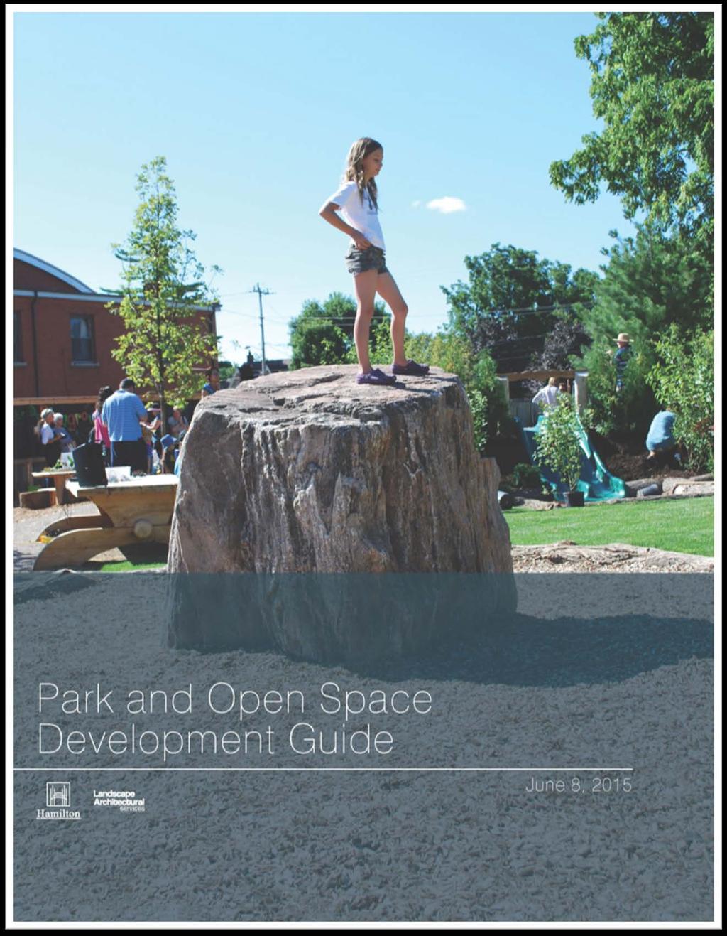
Executive Summary.. 1. Introduction
|
|
|
- Malcolm Gibbs
- 5 years ago
- Views:
Transcription
1
2 Executive Summary.. 1. Introduction 1.1. Park and Open Space Development Park and Open Space Designations and Zones Types of Parks Types of Open Spaces Who Should Use this Guide? How Should this Guide be Used? The Development Process 2.1. Development Options Flow Charts... 5 CHART 1: Comparison of Development Options for Park and Open Space... 6 OPTION CHARTS: Option 1 Developer Completes Minimum Requirements (Steps 1-5)..7 City Completes Park / Open Space (Steps 6-10)... 7 Option 2 Developer Completes Park / Open Space (Steps 1-5) Park Development Options No Park Block Present in the Subdivision Option 1: Park Block Present in the Subdivision Developer Completes Minimum Requirements (Steps 1-5). 11 Option 1 Step 1: Development Review Option 1 Step 2: Draft Plan of Subdivision Option 1 Step 3: Subdivision Agreement Option 1 Step 4: Registration Phase Option 1 Step 5: Park Construction and Assumption... 15
3 NO FURTHER DEVELOPER INVOLVEMENT CITY TO COMPLETE PARK DEVELOPMENT (Steps 6-10) Option 1 Step 6: Facility Fit Plan for Future Park Option 1 Step 7: Capital Budgeting Approval Option 1 Step 8: Master Plan and Functional Plan Option 1 Step 9: Detailed Design of Park Facilities Option 1 Step 10: Park Construction and Assumption Option 2: Park Block Present in the Subdivision Developer Completes Park (Steps 1-5) Option 2 Step 1: Development Review Option 2 Step 2: Draft Plan of Subdivision Option 2 Step 3: Subdivision Agreement Option 2 Step 4: Registration Phase Option 2 Step 5: Park Construction and Assumption Open Space Development Options No Open Space Block Present in the Subdivision Option 1: Open Space Block Present in the Subdivision Developer Completes Minimum Requirements (Steps 1-5). 33 Option 1 Step 1: Development Review Option 1 Step 2: Draft Plan of Subdivision Option 1 Step 3: Subdivision Agreement Option 1 Step 4: Registration Phase Option 1 Step 5: Open Space Construction and Assumption NO FURTHER DEVELOPER INVOLVEMENT CITY TO COMPLETE DEVELOPMENT (Steps 6-10) Option 1 Step 6: Facility Fit Plan for Future Open Space Option 1 Step 7: Capital Budgeting Approval... 39
4 Option 1 Step 8: Master Plan and Functional Plan Option 1 Step 9: Detailed Design of Open Space Facilities Option 1 Step 10: Open Space Construction and Assumption Option 2: Open Space Block Present in the Subdivision Developer Completes Open Space (Steps 1-5) Option 2 Step 1: Development Review Option 2 Step 2: Draft Plan of Subdivision Option 2 Step 3: Subdivision Agreement Option 2 Step 4: Registration Phase Option 2 Step 5: Open Space Construction and Assumption... 50
5 Appendices NOTE: The Appendices are a work in progress and have not as yet been completed. Further discussion is required as to where each of the Appendices links will be found on the City s new website. This will be indicated below as each link becomes available. Appendix A Glossary... x Appendix B Planning Documentation: Comprehensive Planning Guidelines and Financial Policies Planning and Permit Approvals... x Appendix C Plan Submission Standards... x Appendix D Standard Park and Open Space Development Requirements for Developers... x Appendix E Internal and External Approvals... x Appendix F Letter of Intent... Parkland Development Financing Agreement Template... Open Space and Trail Development Financing Agreement Template... Appendix G CPTED Principles for Park and Open Space Design... x (Crime Prevention through Environmental Design) Appendix H Summary of Park Development Standards... x Appendix I

6 Playground Equipment Standards... x Appendix J Park and Open Space Development Standard Detail Drawings... x Appendix K Park and Open Space Development Standard Specifications... x Appendix L Products and Materials Standards... x Appendix M Form of Tender... x Schedule of Quantities and Prices... Special Provision...
7 Disclaimer Information in the Park and Open Space Development Guide is subject to change without notice. The reader must ensure that they have the most current version of this guide. Please contact Landscape Architectural Services (LAS), Corporate Assets and Strategic Planning, Public Works to verify that this is the most up-to-date version or see the City of Hamilton website and search Park and Open Space Development Guide.
8 Executive Summary Executive Summary The Park and Open Space Development Guide was created by the Public Works Department of the City of Hamilton and included inter-departmental assistance, to define the requirements and guidelines in the development of parks and open spaces within the City. Several years ago this guide received valuable input from the Hamilton Halton Home Builders Association which the City of Hamilton has sincerely appreciated. During this time, the development community through the Parkland Development Financing Agreement (PDFA) has successfully participated in the design and construction of at least a dozen park and open space development projects. While the format version of the Guide has been updated and processes better described it remains the goal that this Guide continue to be used by the development community, consultants, and City of Hamilton staff as a resource tool in defining the process of creating Hamilton s parks and open spaces, either by the development community or by the City of Hamilton itself. It is also the intention of this Guide to identify the design standards for the design and construction of park and open space lands. The objectives of the Park and Open Space Development Guide include the following: To define the process and approvals required in designing and constructing park and open space lands. To promote contact and feedback with the development community on the provision of park and open space resources. To ensure that the proposed parkland is efficient and sufficient in size, layout, location, and suitable topography, and supports both active and passive recreation for the citizens of Hamilton. To create the OPTION for developers to build parks or open spaces, only IF both the Developer and the City are in agreement with this Option. To promote the Parkland Development Financing Agreement (PDFA) and Open Space Development Financing Agreement (OSDFA) which is the agreement between a developer and the City to construct a park or open space by the developer for the City and the City s timing and payment for this work generally through Development Charges reimbursement. To improve the timing of the delivery of parks and open spaces to the City of Hamilton s existing and future residents.
9 Executive Summary To support the delivery of parks to the residents of Hamilton utilizing cost effective methodologies related to the applicable development charges funding. To complement existing City of Hamilton Planning and Economic Development Department documents related to parks and open spaces. The Park and Open Space Development Guide outlines two OPTIONS for the design and development of both park and open space lands. Both of these OPTIONS are defined in the Guide as to the process, responsibilities, and approvals typically required in undertaking these Development Options for Park and Open Space lands. OPTION 1 continues the process of park development as it existed in the former City of Hamilton prior to the amalgamation of the City of Hamilton and adjacent communities, in which the Development Community was required to provide the first stage of development of a park or open space. That is, developers ensured the park grading complimented the overall subdivision grading design complete with any required swales or catch basins. In addition, the park or open space was seeded with grass, and the common boundaries between the public parkland and private lands were fenced according to City standards. In this OPTION, the City of Hamilton would later complete the park with the addition of recreational amenities such as playground equipment, multi-purpose courts, sports fields, site furnishings and plantings for examples. OPTION 2 provides the opportunity for a developer to design and build a completed park or open space in a new subdivision development. This OPTION would reimburse the developer for the Development Charge related items for both park and open space development. In order for a Developer to proceed with OPTION 2, that is the Developer building the complete park or open space, a Parkland Development Financing Agreement (PDFA) or Open Space Development Financing Agreement (OSDFA) with the City is required. The PDFA / OSDFA is the agreement between a developer and the City to construct a park or open space by the developer for the City and defines reimbursement of related Development Charges to the Developer. The PDFA / OSDFA is required to be legally executed with the City Manager s Office. The template for the PDFA / OSDFA is included in this Guide for reference.
10 Executive Summary The advantages of the development community choosing OPTION 2, that is developers designing and building parks and open spaces, are as follows: The completed park or open space should be available to the new residential community s residents closer to their time of moving into the community; With the development community building parks and open spaces there is the potential of the development cost of these resources being reduced, and OPTION 2 requires both the developer and the City being in agreement in order to proceed with this strategy. Therefore, the development community and the City both have the choice to proceed with this OPTION. To further assist the Development Community and City staff in undertaking either of the OPTIONS described, the Park and Open Space Development Guide also defines Development Standard Resources. These resources include a primary listing of pertinent related planning and design information, standard construction details, construction specifications, drawing submission standards, and tender requirements. It should be noted that the procedures for tendering of park or open space development has been coordinated, as closely as possible, with the principles and tender process outlined with the City of Hamilton s Public Works Construction and Materials Manual document. NOTES: The preparation of the Park and Open Space Development Guide has deliberately prepared each Section of the Guide to stand on its own. Therefore, the reader in reviewing the entire document may sense that there has been repetition due to this strategy. The Park and Open Space Development Guide shall not be a static document and is subject to change without notice. It is the intent of the Public Works Department to update this Guide as required with new and more efficient standards or requirements to ensure the health and safety of its park patrons, the economic feasibility and sustainability of the City of Hamilton s park and open space assets, and its environmental resources.
11
12 1. Introduction
13 1. Introduction 1.1 Park and Open Space Development Parks and open spaces provide an important resource to the residents and visitors to the City of Hamilton and play a key role in the quality of life that is enjoyed by our residents. These spaces deliver many benefits to both new and established communities across our City. Access to green spaces improve our physical and mental health, bring our communities closer, and make our neighbourhoods more attractive places to live and work. Parks, open spaces and areas with trails are important as Hamilton becomes more and more developed. It is essential to match development growth with recreational areas for everyone to enjoy. The Government of Ontario recognizes the importance of this through the Ontario Planning Act. The Act requires developers to provide land or cash in lieu of land for recreational use to the City within a development area. The preservation and creation of these spaces helps to encourage a healthy and active city. The goal of this guide is to describe the process of developing Hamilton s parks and open spaces. It is designed to help the development community, City staff, and external stakeholders along each step of the park, open space and trail development process. The guide outlines how to obtain approvals and provides the tools to maintain consistent delivery of recreational areas. It is also the aim of this guide to identify the standards for the design and construction of park and open space lands. Parks and open spaces are important as Hamilton becomes more and more developed. It is essential to match this growth with recreational areas for everyone to enjoy. The guide is separated into two development sections. The first section covers the development of parks, while the second outlines open space and trails. The two sections are similar in their development processes, but are different in description and purpose. This guide references development resources to further help with the process. These resources are comprised of relevant planning and design information, standard construction details, construction specifications, plan submission standards, and tender requirements. This information can be found in the Appendix section
14 1. Introduction 1.2. Park and Open Space Designation and Zones The City of Hamilton has four categories of Parks and two categories of Open Space in the Urban Hamilton Official Plan (UHOP) and five zones in Zoning By-law Open Space and Parks Classification that generally align with the UHOP categories as follows: Urban Hamilton Official Plan (UHOP) Zoning By-law City-Wide City-Wide Park (P3) Zone Community Community Park (P2) Zone Neighbourhood Neighbourhood Park (P1) Zone Parkette Parkette (P1, P4 or other) Zone General Open Space Open Space (P4) Zone Natural Open Space Conservation/Hazard Land (P5) Zone 1.3. Types of Parks City-Wide Parks: are municipally, regionally, provincially or nationally significant destinations that meet the needs of residents and are of interest to visitors. These facilities are often associated with major recreation, education or leisure activities and may have natural, historic, or unique features. They range greatly in size and type. Community Parks: serve more than one neighbourhood, but are not intended to serve the City as a whole. Community Parks have more intensive recreational facilities such as sports fields, and recreational and community centres. These facilities shall have good transportation access along adjacent arterial or collector roadways and provide adequate parking to meet anticipated demand. Community Parks in the urban area should appropriately be located along transit routes. They serve a population of approximately 20,000 people and have a minimum size of approximately 7.0 hectares city wide. Neighbourhood Parks: primarily cater to the recreational needs and interests of the residents living within its general vicinity. Residents can easily walk or bike to these parks. Neighbourhood Parks are generally comprised of municipal parkland, containing a mixture of passive areas, sports facilities, informal and formal play areas, and may include natural areas. They serve a population of approximately 5,000 people and have a minimum size of approximately 2.0 hectares. Parkettes: are small open spaces which have no or limited recreational facilities. They are generally located in the older urban areas where they serve an important function in the provision of open space opportunities
15 1. Introduction 1.4. Types of Open Spaces General Open Space: shall include golf courses, community gardens, pedestrian and bicycle trails, walkways, picnic areas, beaches, remnant parcels of open space lands, and urban plazas, squares and core spaces. These areas do not function as parks but are used for both active and passive recreational activities. Natural Open Space: shall include lands with significant natural features and landscapes such as woodlots, hazard lands, forested slopes, creek/ravine corridors, the Niagara Escarpment, environmentally sensitive areas (of natural and scientific interest), and areas of wildlife habitat. These areas perform important biological and ecological functions and provide passive recreational opportunities Who Should Use this Guide? This guide shall be used by the development community in the process of submitting a development application that incorporates a park or open space component within the City of Hamilton. It is designed to provide insight on the development process to consultants, residents and community stakeholders alike. Additionally, this guide shall be used by internal City staff to direct the review process and to establish the staff sections responsible for approvals How Should this Guide be Used? The guide should be used in conjunction with other planning, engineering and landscape architectural documentation referenced throughout. The goal is to guide the process of submitting or reviewing a development application within the City of Hamilton and to inform individuals of the requirements related to park and open space lands
16 2. The Development Process
 or they may choose to build a complete park or open space and trails (Option 2).")

17 2. The Development Process 2.1 Development Options There are two Options offered for the development of parks and open spaces. Developers are required to complete only the minimum construction requirements (Option 1) or they may choose to build a complete park or open space and trails (Option 2). This gives the developer the flexibility to choose the option that best fits their goals and objectives for their development project. Option 1: The developer only completes the first stage of park development and makes sure minimum requirements are met. The City of Hamilton later finishes the park or open space with recreational features and amenities. Figure 3: Minimum requirements met by the developer Option 2: The developer designs and builds a finished park or open space and trails. This method usually supplies the finished product to a community sooner than Option 1. This Option repays the developer with the development related charges collected by the City for park development. Figure 4: Park development completed by the developer Option 1 is the traditional development model used in the City of Hamilton and consists of the City designing and constructing the majority of the completion work for the park or open space. For parks, the developer is responsible for any grading, seeding, and fencing required, all to City standards. If it is general open space, the developer is responsible for providing pedestrian access (sidewalk or walkways) with bollards, hard surfacing treatment, and fencing. Natural open space may not allow pedestrian access nor hard surfacing. Developers are also required to fence any open space with neighbouring land uses. Grading and seeding might also be required depending on the design of the subdivision
18 2. The Development Process Development Charges are primarily used by the City to tender and complete the construction which may include such items as sports facilities, creative play structures, multi-purpose courts, walkways, plantings, utilities, and other amenities. Option 2 is available only if both the developer and City are in agreement that the developer undertakes the design and construction of the park or open space on behalf of the City. This Option repays the developer with the development related charges collected by the City for park development and construction. This model usually supplies the finished product more quickly to the community than Option Flow Charts The following flow charts are designed to assist with the understanding of the processes involved with developing park and open space lands. The charts contain numbered steps that correspond with the Option sections that follow to assist with referencing. The flow charts are a general overview of the development process, while the description of the Option scenarios offer a more detailed look at what a developer may encounter. A comparison of the two Options available for park and open space development in the City is outlined in the first chart titled CHART 1: Comparison of Development Options for Park and Open Space. The next two charts under OPTION CHARTS explain Option 1 and Option 2 in greater detail. These two charts are divided into two columns. The left column outlines the development steps involved for both the developer and the City to each carry out. The right column indicates which internal City staff are involved in that particular step of the flow chart. Please note that the flow charts are to be read in combination with the Options section where more detailed descriptions and explanations are provided

19 2. The Development Process CHART 1: Comparison of Development Options for Park and Open Space - 6 -
 City Completes Park Development (Steps")
20 2. The Development Process OPTION CHARTS: Option 1 Developer Completes Minimum Requirements (Steps 1-5) City Completes Park Development (Steps 6-10) - 7 -
 -")
21 2. The Development Process OPTION CHARTS: Option 2 Developer Completes Park / Open Space (Steps 1-5) - 8 -
22 3. Park Development Options
23 3. Park Development Options 3.1. Through consultation with the Hamilton Halton Home Builders Association (HHHBA), it was clear that not all developers in Hamilton would be interested in participating in the construction of complete parks. However, the City of Hamilton wanted to ensure that the Option was available to those developers that would be interested in doing such work as part of their overall subdivision construction. To help understand the range of possibilities for park development, the City of Hamilton has identified three basic scenarios. Each of these scenarios reflects a common circumstance that a developer may encounter. These scenarios are not intended to represent all development conditions a developer may encounter but to simply offer a broad overview. The three scenarios cover: 1) No park block present in a subdivision 2) Park block present (developer chooses Option 1) 3) Park block present (developer and City chooses Option 2) As previously stated, developers have two Options to develop parkland. Option 1 is the traditional option in the City of Hamilton. If a developer has a park block in the subdivision, they are responsible, as part of the subdivision agreement, for the minimum construction requirements. For a park this includes grading, seeding, and fencing. The park, upon City approval, is assumed in that condition and the development is completed sometime in the future by the City. Option 2 lets developers build the complete park and is common in many municipalities in the Greater Toronto Area. The developer and the City must be in agreement for this option to proceed. This usually produces a completed park for the community faster than Option
24 3.2. No Park Block Present in the Subdivision Description of Scenario Many subdivisions in the City will not have any parkland identified through the planning process. In this case, there is still City involvement by Landscape Architectural Services (LAS) of Public Works. This section generally comments on all Draft Plan applications. In this scenario, Draft Plan submissions are received and reviewed by the City. Comments are made on streetscape elements, pedestrian linkages, and Record of Site Condition. Comments are also made on other features identified on a case-by-case basis. Since this scenario assumes there are no proposed parks, a cash-in-lieu payment value is established. Plans for approval at the Registration Phase are reviewed and approved by the City. Development Planning of the Planning and Economic Development Department (PED) circulates Draft Plan applications when they are submitted by the developer. Comments from LAS are made on the individual applications and submitted to Development Planning. Plans are then prepared by the Developer at the Registration Phase on features that LAS commented on. These plans are submitted to Growth Management of PED. The plans are then circulated to the LAS staff for review and comment. Written approval will be given to Growth Management once LAS is satisfied with the plans. Any issues with the plans are identified in writing to Growth Management. This information is then sent to the developer so that changes can be made. Parkland Dedication or Cash-inlieu of Parkland is also identified at this time by the Real Estate Section of PED. The developer must submit an application for Draft Plan approval and work with City staff to satisfy any development concerns. When this is achieved, plans are submitted to Growth Management of PED. These plans are used by City staff for approval of the details of each phase. After written comments are received, the developer must amend any issues with the plans and resubmit. Plans requiring approvals on specialized features are submitted at the same time as the engineering plans submission. Note: LAS staff needs a minimum of three weeks to review and comment on plan drawing submissions
25 3. Park Development Options 3.3. Option 1: Park Block Present in the Subdivision Developer Completes Minimum Requirements (Steps 1-5) Description of Option Option 1 describes when the City assumes bare parkland with minimum requirements completed by the developer in accordance with the Planning Act and specific Subdivision Agreement. The minimum requirements include rough grading, fine grading, fencing, service stubs to the park, and seeding. These items must be inspected and approved by City staff. Option 1 Step 1: Development Review Step 1a: Official Plan The Official Plan for the City of Hamilton includes Parkland Planning and Classification Information. For more information about the Official Plan and the types of Parkland Classification, please refer to Appendix B Planning Documentation. Development Planning of the Planning and Economic Development Department (PED) will direct park planning at this step and facilitate the development application process. Development Planning reviews the Official Plan, applicable secondary/neighbourhood plans and the zoning By-law to determine where parks and/or open space may be required and if an Official Plan and/or Zoning By-Law amendment is required in addition to the draft plan of subdivision application. If an Official Plan amendment is needed, the application is circulated to Landscape Architectural Services (LAS) for comment. Comments are required from LAS if there is a park or open space issue. City PED staff will investigate to determine if parkland is required in the subdivision development and LAS will confirm parkland programming requirements. Parkland dedication, deficits and other related information are reviewed by PED staff. If required, the developer must submit relevant information and an application for an Official Plan amendment and/or Zoning By-law amendment. - 11
26 3. Park Development Options Step 1b: Secondary Plan/Neighbourhood Plan The Secondary/Neighbourhood Planning process determines the park location and classification. The planning process is referenced in Appendix B Planning Documentation. Many new subdivisions are subject to Secondary/Neighbourhood Plans and the location of the parkland block will have already been identified for development. Should a Secondary/Neighbourhood Plan not exist, requirements are determined using existing and future parkland need and is defined by the City s Official Plan and Zoning By-Law. City involvement is led by Community Planning of the Planning and Economic Development Department (PED). Landscape Architectural Services (LAS) and the Recreation Division give direction to preferred park location, total area requirements, park envelope shape, programming, access, street frontage, and fencing. The developer, if a current landowner, will be consulted by Community Planning for input to the planning process leading to the City s preferred Secondary/Neighbourhood Plan (please refer to Appendix B Planning Documentation). Option 1 Step 2: Draft Plan of Subdivision Step 2a: Program Development During this step, the park block is assessed to determine what facilities are required or can be accommodated. This depends on the road frontage, envelope shape, size, and grading of the park. The Draft Plan will cover all phases of the proposed development. The park block is also evaluated for program requirements at this point. The Recreation Division determines requirements for park facilities on a case-by-case basis. It is the developer s decision when to submit the Draft Plan of Subdivision. The developer is required to have a pre-consultation meeting with City officials which will identify the comments and requirements for the subdivision before a formal submission. Once the comments are received, the developer must choose how to proceed with the Draft Plan. The - 12
27 3. Park Development Options developer can contact Development Planning with any questions or concerns at this step or continue following this guide. Step 2b: Facility Fit Plan The Facility Fit Plan acts as a preliminary concept plan for the park. It is used to determine potential layouts of the park and any facilities that are required. The plan also identifies any conflicts between the desired facilities, the proposed park parcel, and neighbouring land uses in order for the City and developer to resolve any issues early in the development process. Landscape Architectural Services (LAS) prepares the Facility Fit Plan using information from the Recreation Division. LAS staff ensure that the required facilities are possible within the proposed park envelope and work with the developer to achieve an optimal park layout. The developer works with the City to reach the City s parkland goals. This may require meeting with City staff to discuss options for parkland layout. If the developer chooses Option 1, the City will present the preferred Facility Fit plan for the parkland. The City also specifies the program goals for the future park. Step 2c: Draft Conditions Draft Conditions are prepared by Development Planning based on the comments from internal staff and outside agencies review of the proposed Draft Plan. Draft Conditions that relate to all phases of the subdivision are added into the Subdivision Agreement (Step #3a). LAS staff comment on the entire Draft Plan. Comments focus on park and open space blocks, pedestrian connections, trail systems, and any other features that require approval by LAS. These comments are sent to Development Planning to be included in the Draft Conditions for the subdivision. Draft Plan Conditions are identified for features that impact the park block during the City review of the Draft Plan. The developer follows the procedure outlined by Development Planning for this step. Revisions to the Draft Plan are completed as per the City s and external agencies comments. - 13
28 3. Park Development Options Option 1 Step 3: Subdivision Agreement Step 3a: Agreement Preparation The Subdivision Agreement is prepared following the approval of the Draft Plan. The Draft Conditions are added into the Subdivision Agreement for all phases of the subdivision. The Subdivision Agreement is prepared by Growth Management and Legal Services of the City Manager s Office. Development Planning will confirm with Landscape Architectural Services (LAS) that the parkland has been included in the 10 Year Park Capital Budget Forecast. The park development is scheduled into the budget forecast based on demand for park development in the City. The developer follows the procedure outlined by the Development Planning section for this step. Revisions to the Draft Plan are completed as per the City s and external agencies comments. Option 1 Step 4: Registration Phase Step 4a: Plan Submission The developer either registers the subdivision in its entirety or registers each phase of the subdivision individually. These phases are identified in the Draft Plan (Step #2) and the Subdivision Agreement (Step #3). An engineering submission from the developer s consultant is required for each phase. The submission outlines the details of the works in that phase. City approvals are required before the subdivision is registered. Securities for the subdivision works are taken at this step. Landscape Architectural Services (LAS) reviews the park and open space development plans submitted by the developer through Growth Management. LAS provides the approvals of these plans necessary for registration. Any issues with the plans are identified to Growth Management staff. Note: LAS staff need a minimum of three weeks to review and comment on any plan drawing submissions. The developer submits plans to Growth Management for approval and - 14
29 3. Park Development Options registration of the phase of development. Minimum park requirements include finished grading, swales, seeding or sodding, and park fencing on all boundaries next to private lands. Service stubs must also be provided to street frontage on the common boundary of the park. Requirements for plan submissions related to LAS approvals are found in Appendix C Plan Submission Standards. If flaws are found in the submission, the developer will revise and resubmit for approval. Plans must be submitted in a timely manner so that there is enough time for review and comment by staff. The developer will provide securities for the works in each phase of subdivision. The minimum park works are covered by the engineering securities identified in the phases. At the time of Subdivision Registration, the developer will provide 1) a Record of Site Condition for all park and open space lands and any lands being dedicated to or purchased by the City and 2) a Letter of Reliance from the environmental consultant. (For Option 2, transfer of the parkland will not occur at the Registration Phase. The transfer will happen at the time of the City s approval of Substantial Performance of the park (Step #5b). Option 1 Step 5: Park Construction and Assumption Step 5a: Inspections Parkland must meet minimum development requirements as outlined in the subdivision agreement (Step #3a). Standards for these minimum requirements are found in Appendix D Standard Requirements for Park and Open Space Development. An inspection is conducted to verify that the work is completed to City standards. Growth Management staff coordinates an inspection of the parkland. This is led by Landscape Architectural Services (LAS) and Parks and Cemeteries. The inspection ensures that the work meets the City s standards. Staff identify any issues or outstanding deficiencies with the work to be corrected by the developer. Corrections must be made before Substantial Performance (Step #5b) and park assumption (Step #5c). Any issues or outstanding deficiencies identified by City staff during the inspection are to be corrected by the developer. City staff must be notified when this is complete for a second inspection to take place. - 15
30 3. Park Development Options Step 5b: Substantial Performance The park development works must receive final site inspection approval and sign-off before assumption by the City. Parks and Cemeteries staff prepare a final sign-off letter after the final inspection (Step #5a). This verifies that the works are accepted and that all issues and deficiencies have been corrected. The developer must maintain the park until the final sign-off letter is received. Step 5c: Maintenance Assumption Maintenance assumption occurs after final sign-off and approval of the minimum park requirements (Step #5b). A two year warranty period starts at the Substantial Performance approval date. A final warranty inspection is conducted by City staff at the end of this period. Any deficiencies found by the City are corrected by the developer before the park block is assumed by the City. Parks and Cemeteries is responsible for the maintenance of the park after final approval (Step #5b). Parks and Cemeteries staff identify any deficient warranty works during this two year warranty period to Growth Management who then contact the developer to complete the warranty work. A final inspection by Growth Management, Landscape Architectural Services (LAS) and Parks and Cemeteries staff is conducted at the end of the warranty period. The developer must complete any warranty works in a timely manner identified during the warranty period and as identified at the final inspection. The developer can apply for a release of the securities after the two year warranty period once deficiencies have been corrected. No Further Developer Involvement City to Complete Park Development - 16
31 3. Park Development Options 3.3. Option 1: Park Block Present in the Subdivision City Completes Park Development (Steps 6-10) Option 1 Step 6: Facility Fit Plan for Future Park Step 6a: Facility Fit Plan A Facility Fit Plan is required at this point if it was not fully completed at the Draft Plan stage of development. The Facility Fit Plan acts as a concept plan for the park. Information gathered regarding facility needs is used to determine what facilities are required in the park. This determines potential layouts of the park and identifies any conflicts. Landscape Architectural Services (LAS) prepares the Facility Fit Plan based on information from Recreation s needs analysis regarding park facilities. The requirements for park facilities are determined on a case-by-case basis. City staff ensure that the required facilities are possible within the proposed park envelope. Efforts are then made to reach an optimal park layout. Option 1 Step 7: Capital Budgeting Approval Step 7a: Budget for Development Completion The park project is identified in the 10 Year Park Capital Budget Forecast and the Development Charges By-Law by LAS staff (Step #3a). Funding, for design development and public process, needs to be identified at this step. The allocation of funding is required to complete the next steps. LAS is responsible for identifying funding requirements for the park. The funding requirements relate to the park design and construction, not including proposed buildings. The allocation of funding is facilitated through the Capital Budgets and Development Section of Corporate Services. - 17
32 3. Park Development Options Step 7b: Budget for Buildings Funding required for any buildings needs to be identified through the Capital Budget process. It should be noted that buildings are usually constructed in selected parkland, as opposed to open space areas. Facilities Management and Capital Programs is responsible for submitting the Capital Budget funding requirements. The funding requirements are for the design and construction of buildings in parks. This process is assisted by Financial Planning and Policy. Option 1 Step 8: Master Plan and Functional Plan Step 8a: Master Plan The Master Plan Concept is based on the Facility Fit Plan. This step includes public consultation where residents can review and comment on the Master Plan Concept plans. Public consultation follows the guidelines for public notification in the Planning Act. At a minimum residents within a 120 metre radius of the park facility must be notified of any public meetings. This step is led by Landscape Architectural Services (LAS) staff who collect internal and external stakeholder comments regarding the Master Plan, particularly from staff in Recreation and Parks and Cemeteries. Step 8b: Functional Plan The Functional Plan is based on the final approved Master Plan (Step #8a). It provides the basis for construction plans in the next phases. All necessary internal and external stakeholder approvals must be obtained during this step. If required, a Tree Management Plan is made for review and approval by Forestry and Horticulture. The Functional Plan is prepared by LAS. They arrange and discuss all approvals necessary to construct the park facilities. Any buildings other than shade structures need site plan approval by the City. For examples of internal and external approval requirements, see Appendix E Internal and External Approvals. - 18
33 3. Park Development Options Option 1 Step 9: Detailed Design of Park Facilities Step 9a: Working Drawings Final working drawings are prepared based on the Functional Plan (Step #8b). These become part of the tendering package and public bidding process. Permits for building construction must be secured during this step. Landscape Architectural Services (LAS) staff leads this step to prepare final working drawings for the purposes of the tendering process. Step 9b: Tendering The official tendering process comes after the completion of the working drawings and is undertaken as per the City of Hamilton s Procurement Policy. Tendering of the project will be facilitated through the Procurement Section of Financial Services. The award of the tender is completed by Finance and Administration and LAS. Option 1 Step 10: Park Construction and Assumption Step 10a: Inspections The supervision and administration of the park construction begins after the tender is awarded to the successful bidder (Step #9b). This step is led by LAS. Forestry and Horticulture oversees any forestry related works at the start of construction. Parks and Cemeteries are consulted during construction for maintenance related concerns. Step 10b: Substantial Performance After the final inspection, Substantial Performance is awarded if the park construction is acceptable. The contractor, in accordance with the Construction Lien Act, can apply for a release of the statutory holdback after 45 days if the work is satisfactory. The contractor must also correct any deficiencies or outstanding work. - 19
34 3. Park Development Options Substantial Performance is granted by Landscape Architectural Services (LAS) staff in consultation with Parks and Cemeteries. LAS staff review and approve applications for release of the statutory holdback 45 days after Substantial Performance. Finance and Administration staff assist in processing and releasing the holdback. Step 10c: Maintenance Assumption Park maintenance is assumed after Substantial Performance has been awarded (Step #10b). The two year warranty begins on all park work at this point. A final inspection is carried out by City staff at the end of the two year warranty period. This inspection identifies any work issues and warranty replacements that may be required. Park maintenance is assumed by Parks and Cemeteries and occurs after notice from LAS that Substantial Performance has been awarded. This notice marks the start of the two year maintenance period when Parks and Cemeteries will identify any warranty issues. LAS staff are notified of these issues and contact the contractor to make corrections. A final warranty inspection is conducted by Parks and Cemeteries and LAS staff to identify any deficiencies at the end of the warranty period which would require the contractor to rectify. - 20
35 3. Park Development Options 3.4. Option 2: Park Block Present in the Subdivision Developer Completes Park (Steps 1-5) Description of Option This Option describes when the developer undertakes and completes the detailed design and construction of the park block. This process is optional and requires agreement by both the City and developer. At the draft plan stage the developer must notify Development Planning and Landscape Architectural Services Park Development Option 2 is being pursued. Implementation is subject to City approval. Option 2 Step 1: Development Review Step 1a: Official Plan The Official Plan for the City of Hamilton includes Parkland Planning and Classification Information. For more information on the Official Plan and the Parkland Classifications, please refer to Appendix B Planning Documentation. Development Planning of the Planning and Economic Development Department (PED) will direct park planning at this step and facilitate the development application process. Development Planning reviews the Official Plan, applicable secondary/neighbourhood plans and the Zoning By-law to determine where parks and/or open space may be required and if an Official Plan and/or Zoning By-Law amendment is required in addition to the draft plan of subdivision application. If an Official Plan amendment is needed, the application is circulated to Landscape Architectural Services (LAS) for comment. Comments are required from LAS if there is a park or open space issue. City PED staff will investigate to determine if parkland is required in the subdivision development and LAS will confirm parkland programming requirements. Parkland dedication, deficits and other related information are reviewed by PED staff. If required, the developer must submit relevant information and an application for an Official Plan amendment. - 21
36 3. Park Development Options Step 1b: Secondary Plan/Neighbourhood Plan The Secondary/Neighbourhood Planning process determines the park location and classification. The planning process is explained in Appendix B Planning Documentation. Many new subdivisions are subject to Secondary/Neighbourhood Plans and parkland will have already been identified for development. Should a Secondary/Neighbourhood Plan not exist, requirements are determined using existing and future parkland need and is defined by the City s Official Plan and Zoning By-law. City involvement is led by Community Planning of the Planning and Economic Development Department (PED). Landscape Architectural Services (LAS) and the Recreation Division give direction to preferred park location, total area requirements, park envelope shape, programming, access, street frontage, and fencing. The developer, if a current landowner, will be consulted by Community Planning for input to the planning process leading to the City s preferred Secondary/Neighbourhood Plan. Option 2 Step 2: Draft Plan of Subdivision Step 2a: Program Development During this step, the park block is assessed to determine what facilities are required or can be accommodated. This depends on the road frontage, envelope shape, size, and grading of the park. The Draft Plan will cover all phases of the proposed development. The park block is also evaluated at this time for program requirements. The Recreation Division determines requirements for park facilities on a case-by-case basis. It is the developer s decision when to submit the Draft Plan of Subdivision. The developer is required to have a pre-consultation meeting with City officials which will identify the comments and requirements for the subdivision before a formal submission. Once the comments are received, the developer must choose how to proceed with the Draft Plan. The developer can contact Development Planning with any questions or - 22
37 3. Park Development Options concerns at this step or continue following the guide. Step 2b: Facility Fit Plan The Facility Fit Plan acts as a preliminary concept plan for the park. It is used to determine potential layouts of the park and any facilities that are required. The plan also identifies any conflicts between the desired facilities, the proposed park parcel, and neighbouring land uses in order for the City and developer and the developer s landscape architectural consultant to resolve these issues early in the process. It should be noted the developer s landscape architectural consultant is required to be a Full Member with Seal, in good standing, with the Ontario Association of Landscape Architects (OALA). Landscape Architectural Services (LAS) staff, using information from the Recreation Division, ensure that the Facility Fit Plan s required facilities are possible within the proposed park envelope and work with the developer and the developer s landscape architectural consultant to achieve an optimal park layout. The developer and the developer s landscape architectural consultant (who is required to be a Full Member with Seal, in good standing, with the Ontario Association of Landscape Architects (OALA), works with the City to reach the City s parkland goals. This may require meeting with City staff to discuss options for parkland layout. The City also specifies the program goals for the future park. The developer s landscape architectural consultant prepares the Facility Fit Plan based on the Recreation Division s facility requirements and LAS input. Step 2c: Draft Conditions The City must be officially notified at this point if the developer is pursuing Park Development Option 2 (this Option). The City and the developer must be in agreement for Option 2 to proceed. The Ward Councillor is contacted to review the plans for park development with possible public consultation. Draft Conditions are prepared by Development Planning based on comments of the Draft Plan review by internal staff and outside agencies. These conditions are added into the Subdivision Agreement (Step #3a). - 23
38 3. Park Development Options LAS staff comment on the entire Draft Plan. Comments focus on park and open space blocks, pedestrian connections, trail systems, and any other features that require approval by LAS. These comments are added into the draft conditions by Development Planning. One of the conditions is included relating to the Letter of Intent and Parkland Development Financing Agreement (PDFA) (Step#4b). The condition stipulates that the developer will enter into this agreement which states the developer will undertake and complete the detailed design and construction of the park block. The developer follows the procedure outlined by the Development Planning section for this step. The developer agrees to the conditions of the Letter of Intent and Parkland Development Financing Agreement (PDFA) (Step#4b). Revisions to the Draft Plan are completed as per the City s and external comments. Option 2 Step 3: Subdivision Agreement Step 3a: Agreement Preparation The Subdivision Agreement is prepared following the approval of the Draft Plan. Draft Plan Conditions are added into the Subdivision Agreement for all phases of the proposed subdivision. A condition outlines the need for the developer to submit a Letter of Intent and to enter into a Parkland Development Financing Agreement (PDFA) (Step #4b). If the Draft Plan Conditions are approved by City Council, delegated authority is then given to Landscape Architectural Services (LAS) to fulfill the PDFA. This agreement must be made in order to go forward with the construction of the park. A template for the Letter of Intent and PDFA is included as Appendix F. The Subdivision Agreement outlines that the transfer of the Parkland Deed occurs at Substantial Performance (Step #5b). Planning and Economic Development staff prepares a Subdivision Agreement for the entire development for approval by City Council. This agreement includes the requirement for a PDFA between the City and the developer. The PDFA is prepared by LAS and Legal Services and is required at the time of Registration Phase (Step #4c) for all phases where the developer is completing Option
Town of Cobourg Heritage Master Plan. Statutory Public Meeting
 Town of Cobourg Heritage Master Plan Statutory Public Meeting April 25 th 2016 Presentation Overview 1. Introduction 2. Project background and schedule overview 3. Review of strategic direction content
THE GARDEN CITY PLAN. City of St. Catharines Official Plan. City of St. Catharines
 THE GARDEN CITY PLAN City of St. Catharines Official Plan City of St. Catharines August 2010 APPROVAL INFORMATION This Official Plan of the City of St. Catharines Planning Area, known as the Garden City
Attachment 1 TOWN OF NEW TECUMSETH. Manual for the Preparation of an Urban Design Report
 Attachment 1 TOWN OF NEW TECUMSETH Manual for the Preparation of an Urban Design Report July 2010 TABLE OF CONTENTS Background, Policy Framework and the Preparation of Urban Design Reports 1. Introduction
Report to: Development Services Committee Report Date: September 11, 2017
 ~RKHAM Report to: Development Services Committee Report Date: September 11, 2017 SUBJECT: PREPARED BY: Conceptual Master Plan for the Future Urban Area - Community Structure Plan and Key Policy Direction
APPENDIX E: CITY OF HAMILTON* STANDARD REQUIREMENTS FOR PARK OR OPEN SPACE DEVELOPMENT
 * Standard Requirements by Open Space Development and Park Planning Section (OSD & PP) of Capital Planning and Implementation Division (CP&I) of Public Works. 1.1 Standard Comments at Draft Plan Approval
LAND USE AMENDMENT CORNERSTONE (WARD 3) 60 STREET NE AND COUNTRY HILLS BOULEVARD NE MAP 26NE BYLAW 22D2017
 60 STREET NE AND COUNTRY HILLS BOULEVARD NE MAP 26NE BYLAW 22D2017") Page 1 of 14 EXECUTIVE SUMMARY This Land Use Amendment application covers an area of 43.76 hectares ± (108.14 acres ±) located in northeast Calgary, bound by Country Hills Boulevard NE to the south and
Page 1 of 14 EXECUTIVE SUMMARY This Land Use Amendment application covers an area of 43.76 hectares ± (108.14 acres ±) located in northeast Calgary, bound by Country Hills Boulevard NE to the south and
URBAN DESIGN BRIEF. 2136&2148 Trafalgar Road. Town of Oakville
 URBAN DESIGN BRIEF 2136&2148 Trafalgar Road Town of Oakville Prepared By: METROPOLITAN CONSULTING INC For 2500674 Ontario Inc November 2016 TABLE OF CONTENTS Page No. 1.0 Introduction/Description of Subject
The West Vaughan Employment Area Secondary Plan Policies
 Part 2: The West Vaughan Employment Area Secondary Plan Policies 2.1 General Policies It is the policy of Council: 2.1.1. That the West Vaughan Employment Area (the WVEA), identified on Schedule 1, will
Design Specifications & Requirements Manual
 11 PARKS & OPEN SPACES 11.1 DEFINITIONS... 1 11.1.1 Neighbourhood Parks... 1 11.1.2 District Parks... 1 11.1.3. Sport Parks... 1 11.1.4 Urban Parks... 1 11.1.5 Civic Spaces... 1 11.1.6 Open Space System...
General Manager, Planning and Development; General Manager, Parks, Recreation and Culture. Proposed Mini-Park and Plaza Designations
 Corporate NO: R106 Report COUNCIL DATE: June 16, 2008 REGULAR COUNCIL TO: Mayor & Council DATE: June 12, 2008 FROM: SUBJECT: General Manager, Planning and Development; General Manager, Parks, Recreation
North Oakville East Parks Facilities Distribution Plan. November, 2009
 North Oakville East November, 2009 POLICY CONTEXT 1) Purpose a) The purpose of this document is to be a guide for the location, configuration, design and development of the parks system for the North Oakville
FORMER CANADIAN FORCES BASE (CFB) ROCKCLIFFE SECONDARY PLAN. Official Plan Amendment XX to the Official Plan for the City of Ottawa
 ROCKCLIFFE SECONDARY PLAN. Official Plan Amendment XX to the Official Plan for the City of Ottawa") FORMER CANADIAN FORCES BASE (CFB) ROCKCLIFFE SECONDARY PLAN Official Plan Amendment XX to the Official Plan for the City of Ottawa 1 INDEX THE STATEMENT OF COMPONENTS PART A THE PREAMBLE PAGE Purpose...
FORMER CANADIAN FORCES BASE (CFB) ROCKCLIFFE SECONDARY PLAN Official Plan Amendment XX to the Official Plan for the City of Ottawa 1 INDEX THE STATEMENT OF COMPONENTS PART A THE PREAMBLE PAGE Purpose...
Design Specifications & Requirements Manual
 11 PARKS & OPEN SPACES 11.1 DEFINITIONS... 1 11.1.1 Neighbourhood Parks... 1 11.1.2 District Parks... 1 11.1.3. Sport Parks... 1 11.1.4 Urban Parks... 1 11.1.5 Civic Spaces... 1 11.1.6 Open Space System...
CITY CLERK. Parkland Acquisition Strategic Directions Report (All Wards)
") CITY CLERK Clause embodied in Report No. 10 of the, as adopted by the Council of the City of Toronto at its meeting held on November 6, 7 and 8, 2001. 10 Parkland Acquisition Strategic Directions Report
CITY CLERK Clause embodied in Report No. 10 of the, as adopted by the Council of the City of Toronto at its meeting held on November 6, 7 and 8, 2001. 10 Parkland Acquisition Strategic Directions Report
1.0 Purpose of a Secondary Plan for the Masonville Transit Village
 Report to Planning and Environment Committee To: Chair and Members Planning & Environment Committee From: John M. Fleming Managing Director, Planning and City Planner Subject: Masonville Transit Village
Land Use Amendment in Southwood (Ward 11) at and Elbow Drive SW, LOC
 at and Elbow Drive SW, LOC") 2018 November 15 Page 1 of 10 EXECUTIVE SUMMARY This land use amendment application was submitted by Rick Balbi Architect on 2017 August 31 on behalf of Sable Developments Ltd, and with authorization from
2018 November 15 Page 1 of 10 EXECUTIVE SUMMARY This land use amendment application was submitted by Rick Balbi Architect on 2017 August 31 on behalf of Sable Developments Ltd, and with authorization from
PARK DEVELOPMENT MANUAL. 2 nd EDITION
 PARK DEVELOPMENT MANUAL 2 nd EDITION AUGUST 2017 CONTENTS PARK DEVELOPMENT MANUAL - 2 ND EDITION 1.0 Introduction 1 1.1 EXECUTIVE SUMMARY 3 1.2 BACKGROUND AND STRUCTURE 5 1.3 HOW TO USE THIS MANUAL 7 2.0
SUBJECT: Waterfront Hotel Planning Study Update TO: Planning and Development Committee FROM: Department of City Building. Recommendation: Purpose:
 Page 1 of Report PB-23-18 SUBJECT: Waterfront Hotel Planning Study Update TO: Planning and Development Committee FROM: Department of City Building Report Number: PB-23-18 Wards Affected: 2 File Numbers:
HURON COMMUNITY PLAN
 CITY OF KITCHENER DEPARTMENT OF DEVELOPMENT AND TECHNICAL SERVICES PD 94/7 HURON COMMUNITY PLAN Recommended by Planning and Economic Development Committee: October 31, 1994 Adopted by Kitchener City Council:
The Corporation of the TOWN OF MILTON
 Report to: From: Chair & Members of the Administration & Planning Standing Committee W.F. Mann, Director of Planning and Development Date: April 16, 2012 PD 022-12 (Z19/11) Subject: Technical Report Proposed
Figure 1- Site Plan Concept
 Figure 1- Site Plan Concept Parking will be provided underground on three levels at rate of 1.0 space/ unit; this rate includes all visitors parking. MMM Group has prepared a parking assessment (April,
2136 & 2148 Trafalgar Road Town of Oakville Region of Halton
 PLANNING JUSTIFICATION REPORT 2136 & 2148 Trafalgar Road Town of Oakville Region of Halton Zoning By-Law Amendment Application 2500674 Ontario Inc. November 2016 Table of Contents Page 1.0 Location/Summary
SECTION E. Realizing the Plan
 SECTION E Realizing the Plan 60 DESIGN REGINA - OFFICIAL COMMUNITY PLAN SECTION E Realizing the Plan Design Regina has been an ambitious plan-making exercise, with a high level of community, stakeholder,
Planning and Growth Management Committee. Chief Planner and Executive Director, City Planning Division. Pg12013 (File No NNY 34 OZ)
") 865 York Mills Road Official Plan Amendment Application Preliminary Report STAFF REPORT ACTION REQUIRED Date: February 28, 2012 To: From: Wards: Reference Number: Planning and Growth Management Committee
865 York Mills Road Official Plan Amendment Application Preliminary Report STAFF REPORT ACTION REQUIRED Date: February 28, 2012 To: From: Wards: Reference Number: Planning and Growth Management Committee
Town of Oakville Streetscape Strategy
 Town of Oakville Streetscape Strategy Endorsed by PDC on February 10, 2014 (PD-011-14) Town of Oakville Streetscape Strategy [endorsed by PDC February 10, 2014] 0 Town of Oakville Streetscape Strategy
240 and 242 Finch Avenue West Zoning By-law Amendment Application Preliminary Report
 REPORT FOR ACTION 240 and 242 Finch Avenue West Zoning By-law Amendment Application Preliminary Report Date: March 1, 2019 To: North York Community Council From: Director, Community Planning, North York
4780 Eglinton Avenue West - Zoning By-law Amendment and Draft Plan of Subdivision Applications - Preliminary Report
 STAFF REPORT ACTION REQUIRED 4780 Eglinton Avenue West - Zoning By-law Amendment and Draft Plan of Subdivision Applications - Preliminary Report Date: May 29, 2014 To: From: Wards: Reference Number: Etobicoke
The transportation system in a community is an
 7 TRANSPORTATION The transportation system in a community is an important factor contributing to the quality of life of the residents. Without a sound transportation system to bring both goods and patrons
1071 King Street West Zoning Amendment Application - Preliminary Report
 STAFF REPORT ACTION REQUIRED 1071 King Street West Zoning Amendment Application - Preliminary Report Date: August 9, 2012 To: From: Wards: Reference Number: Toronto and East York Community Council Director,
Brampton. Secondary Plan. Review. Bram West. A New Direction in Planning & Public Consultation
 Brampton Bram West Secondary Plan Review A New Direction in Planning & Public Consultation Introduction The Bram West Secondary Plan Review offers an important opportunity for the community to define a
3. VISION AND GOALS. Vision Statement. Goals, Objectives and Policies
 Vision Statement Queen Creek s interconnected network of parks, trails, open spaces and recreation opportunities provide safe and diverse activities and programs that sustain its unique, small town, equestrian
URBAN DESIGN BRIEF URBAN DESIGN BRIEF 721 FRANKLIN BLVD, CAMBRIDGE August 2018
 URBAN DESIGN BRIEF URBAN DESIGN BRIEF 721 FRANKLIN BLVD, CAMBRIDGE August 2018 DESIGN BRIEF CONTENTS PART A 1.0 INTRODUCTION 2.0 DESCRIPTION & ANALYSIS OF SITE CONTEXT 3.0 DESIGN CONSTRAINTS AND OPPORTUNITIES
December 11, December 10, 2015
 December 11, 2015 December 10, 2015 2 Welcome & Introductions Project Overview Discussion Questions Group Insights Key Takeaways Next Steps 3 4 5 6 7 8 9 Governed by multiple layers of policy UNESCO World
CITY OF HAMILTON PUBLIC WORKS DEPARTMENT Environmental Services Division
 CITY OF HAMILTON PUBLIC WORKS DEPARTMENT Environmental Services Division TO: Chair and Members Public Works Committee COMMITTEE DATE: July 12, 2018 SUBJECT/REPORT NO: WARD(S) AFFECTED: PREPARED BY: SUBMITTED
Policy Statement. Purpose
 Policy Title: Park Trail Lighting Policy Number: 05-02-08 Section: Property and Facilities Subsection: Facility Planning Effective Date: December 18, 2017 Last Review Date: July 2016 Approved by: Council
Edward R. Sajecki Commissioner of Planning and Building
 Corporate Report Clerk s Files Originator s Files CD.03.POR DATE: TO: FROM: SUBJECT: Chair and Members of Planning and Development Committee Meeting Date: February 27, 2012 Edward R. Sajecki Commissioner
CITY OF VAUGHAN EXTRACT FROM COUNCIL MEETING MINUTES OF NOVEMBER 15, 2016
 Item 11, Report No. 38, of the Committee of the Whole, which was adopted without amendment by the Council of the City of Vaughan on November 15, 2016. Regional Councillor Di Biase declared an interest
LAND USE AMENDMENT DOWNTOWN COMMERCIAL CORE (WARD 7) MACLEOD TRAIL SE AND 5 AVENUE SE BYLAW 254D2017
 MACLEOD TRAIL SE AND 5 AVENUE SE BYLAW 254D2017") Page 1 of 10 EXECUTIVE SUMMARY This Land Use Amendment application seeks to redesignate a full downtown block (currently the YWCA site) from a Direct Control based on the CM-2 District (Land Use Bylaw
Page 1 of 10 EXECUTIVE SUMMARY This Land Use Amendment application seeks to redesignate a full downtown block (currently the YWCA site) from a Direct Control based on the CM-2 District (Land Use Bylaw
10.0 Open Space and Public Realm
 10.0 Open Space and Public Realm 10.0 Open Space and Public Realm The Public Open Space System is comprised of: outdoor spaces available for public use that are either publicly owned (e.g., parks and
Parks Master Plan Implementation: Phase I Waterfront Use and Design REPORT #: September 7, 2016 File #
 0 'O DI Lan-171-14 1 - THE CORPORATION OF THE TOWN OF COBOURG..,. STAFF REPORT TO: FROM: Mayor and Members of Council Dean A. Hustwick, Director of Recreation and Culture DATE OF MEETING: Committee of
Toronto Complete Streets Guidelines
 c. DTAH 58 60 3.1 70 3.2 Performance Measurement 71 3.3 Exceptions Chapter 3 describes the five general steps in the street design process. Not all projects follow these steps, as the number of steps and
6. REGIONAL AND COMMUNITY FACILITIES DESIGNATIONS 6.1. OBJECTIVES FOR REGIONAL AND COMMUNITY FACILITIES LAND USE DESIGNATIONS
 6. REGIONAL AND COMMUNITY FACILITIES DESIGNATIONS INTRODUCTION The Regional and land use designations provide the primary locations for uses which satisfy the health, education and other service needs
DAVENPORT VILLAGE SECONDARY PLAN
 27 DAVENPORT VILLAGE SECONDARY PLAN 27. DAVENPORT VILLAGE SECONDARY PLAN 1. VISION FOR THE DAVENPORT VILLAGE SECONDARY PLAN Davenport Village, municipally known as 830, 940, 980 and 1100 Lansdowne Avenue,
Town of Newmarket 395 Mulock Drive P.O. Box 328, Newmarket, Ontario, L3Y 4X7. Website: newmarket.ca Phone:
 Town of Newmarket 395 Mulock Drive P.O. Box 328, Newmarket, Ontario, L3Y 4X7 Email: info@newmarket.ca Website: newmarket.ca Phone: 905-895-5193 Natural Heritage System Boundary Refinement: Vacant Lot West
LAND USE AMENDMENT CORNERSTONE (WARD 3) COUNTRY HILLS BOULEVARD AND STONEY TRAIL NE BYLAW 9D2017
 COUNTRY HILLS BOULEVARD AND STONEY TRAIL NE BYLAW 9D2017") Page 1 of 12 EXECUTIVE SUMMARY This Land Use Amendment application covers an area of 54.92 hectares ± (135.71 acres ±) located in northeast Calgary, bound by Country Hills Boulevard NE to the north and
Page 1 of 12 EXECUTIVE SUMMARY This Land Use Amendment application covers an area of 54.92 hectares ± (135.71 acres ±) located in northeast Calgary, bound by Country Hills Boulevard NE to the north and
Bloor St. W. Rezoning - Preliminary Report
 STAFF REPORT ACTION REQUIRED 1638-1644 Bloor St. W. Rezoning - Preliminary Report Date: April 1, 2008 To: From: Wards: Reference Number: Toronto and East York Community Council Acting Director, Community
Welcome. Walk Around. Talk to Us. Write Down Your Comments
 Welcome This is an information meeting introducing the applications for proposed redevelopment of the Yorkdale Shopping Centre site at 3401 Dufferin Street and 1 Yorkdale Road over the next 20+ years,
ADMINISTRATION RECOMMENDATION 2016 November 03. That Calgary Planning Commission recommends APPROVAL of the proposed Land Use Amendment.
 Page 1 of 12 EXECUTIVE SUMMARY This Land Use Amendment application covers an area of 75.76 hectares ± (187.20 acres ±) located in northeast Calgary, bound by Stoney Trail NE to the north, 128 Avenue NE
SUBJECT: GO Station Mobility Hubs Preferred Concepts: Aldershot GO, Burlington GO and Appleby GO. Planning and Development Committee - Public Meeting
 Page 1 of Report PB-76-17 SUBJECT: GO Station Mobility Hubs Preferred Concepts: Aldershot GO, Burlington GO and Appleby GO TO: FROM: Planning and Development Committee - Public Meeting Planning and Building
Planning Commission Report
 Planning Commission Report To: From: Subject: Planning Commission Meeting: January 6, 2016 Agenda Item: 8-B Planning Commission David Martin, Planning & Community Development Director Introduction to the
POLICY AMENDMENT AND LAND USE AMENDMENT KILLARNEY/GLENGARRY (WARD 8) NW CORNER OF RICHMOND ROAD AND 33 STREET SW BYLAWS 1P2015 AND 7D2015
 NW CORNER OF RICHMOND ROAD AND 33 STREET SW BYLAWS 1P2015 AND 7D2015") Page 1 of 13 EXECUTIVE SUMMARY This application seeks to redesignate an RC-2 (Residential Contextual One/Two Dwelling) parcel to MC-Gd72 (Multi-Residential Contextual Grade-Oriented) to allow for multi-residential
Page 1 of 13 EXECUTIVE SUMMARY This application seeks to redesignate an RC-2 (Residential Contextual One/Two Dwelling) parcel to MC-Gd72 (Multi-Residential Contextual Grade-Oriented) to allow for multi-residential
Streets for People, Place-Making and Prosperity. #TOcompletestreets
 COMPLETE STREETS FOR TORONTO Streets for People, Place-Making and Prosperity COMPLETE STREETS: A NEW APPROACH A Complete Streets design approach considers the needs of all users people who walk, bicycle,
Humber Bay Shores Precinct Plan Final Report
 STAFF REPORT ACTION REQUIRED Humber Bay Shores Precinct Plan Final Report Date: May 21, 2010 To: From: Wards: Reference Number: Etobicoke York Community Council Director, Community Planning, Etobicoke
Outline Plan in Belvedere (Ward 9) at Street SE, LOC (OP)
 at Street SE, LOC (OP)") 2018 October 04 Page 1 of 12 EXECUTIVE SUMMARY This outline plan application was submitted by B&A Planning Group on 2016 July 15, on behalf of Tristar Communities Inc. for 50.14 hectares (123.89 acres)
2018 October 04 Page 1 of 12 EXECUTIVE SUMMARY This outline plan application was submitted by B&A Planning Group on 2016 July 15, on behalf of Tristar Communities Inc. for 50.14 hectares (123.89 acres)
Report Regarding Site Plan Control for 55 Wellspring Way (File No. SP-06-16)
") Report Regarding Site Plan Control for 55 Wellspring Way (File No. SP-06-16) Executive Summary: The purpose of this report is to provide Council with information regarding site plan control under Section
Report Regarding Site Plan Control for 55 Wellspring Way (File No. SP-06-16) Executive Summary: The purpose of this report is to provide Council with information regarding site plan control under Section
URBAN DESIGN BRIEF. Terms of Reference. Purpose. When is an Urban Design Brief Required
 Purpose An Urban Design Brief (UDB) is intended to describe and illustrate proposed designs for new development projects and demonstrate how the City s Urban Design Guidelines and other City policies have
TERRESTRIAL NATURAL HERITAGE SYSTEM STRATEGY APPENDIX F: MODEL POLICIES FOR THE IMPLEMENTATION OF THE TARGET TERRESTRIAL NATURAL HERITAGE SYSTEM
 TERRESTRIAL NATURAL HERITAGE SYSTEM STRATEGY APPENDIX F: MODEL POLICIES FOR THE IMPLEMENTATION OF THE TARGET TERRESTRIAL NATURAL HERITAGE SYSTEM C H A P T E R 1 M O D E L P O L I C I E S F O R I M P L
A Growing Community Rural Settlement Areas
 Town of Huntsville Official Plan Review - POLICY BACKGROUND PAPER A Growing Community Rural Settlement Areas BACKGROUND: In addition to the fully municipally-serviced Urban Settlement Area and the Hidden
The Illinois Department of Transportation and Lake County Division of Transportation. Route 173, including the Millburn Bypass
 The Illinois Department of Transportation and Lake County Division of Transportation welcome you to this Public Hearing for U.S. Route 45 from Illinois Route 132 to Illinois Route 173, including the Millburn
Eglinton Avenue East & 50 Thermos Road - Official Plan Amendment Application Preliminary Report
 STAFF REPORT ACTION REQUIRED 1966 2050 Eglinton Avenue East & 50 Thermos Road - Official Plan Amendment Application Preliminary Report Date: March 15, 2016 To: From: Wards: Reference Number: Scarborough
Edward R. Sajecki Commissioner of Planning and Building. Land Use Review- Former Parkway Belt West Lands- Fieldgate Drive and Audubon Boulevard
 Corporate Report Clerk s Files Originator s Files CD.04.FOR DATE: November 15, 2011 TO: FROM: SUBJECT: Chair and Members of Planning and Development Committee Meeting Date: December 5, 2011 Edward R. Sajecki
AMENDMENT NO. 30 TO THE OFFICIAL PLAN OF THE TOWN OF MILTON
 AMENDMENT NO. 30 TO THE OFFICIAL PLAN OF THE TOWN OF MILTON Subject: Boyne Survey Secondary Plan and Related Official Plan Amendments The following text and schedules constitute Amendment No. 30 to the
CITY OF VAUGHAN EXTRACT FROM COUNCIL MEETING MINUTES OF JUNE 24, 2014
 Item 12, Report No. 30, of the Committee of the Whole, which was adopted without amendment by the Council of the City of Vaughan on June 24, 2014. 12 ZONING BY-LAW AMENDMENT FILE Z.14.018 SITE DEVELOPMENT
City of Grande Prairie Development Services Department KENNEDY DEVELOPMENTS LTD. OUTLINE PLAN OP-09-01
 City of Grande Prairie Development Services Department KENNEDY DEVELOPMENTS LTD. OUTLINE PLAN OP-09-01 July 27, 2009 TABLE OF CONTENTS 1.0 Introduction... 1 1.1 Plan Area Location & Context... 1 1.2 Ownership
~!VAUGHAN NOV Z November 21, Mr. Denis Kelly, Regional Clerk The Regional Municipality of York Yonge Street Newmarket, ON L3Y 6Z1
 ~!VAUGHAN NOV Z 5 2016 November 21, 2016 Mr. Denis Kelly, Regional Clerk The Regional Municipality of York 17250 Yonge Street Newmarket, ON L3Y 6Z1 Dear Mr. Kelly: RE: NEW KIRBY GO STATION IN BLOCK 27
The Planning Partnership Urban Design, Landscape Architecture, Planning, Communications
 The Planning Partnership Urban Design, Landscape Architecture, Planning, Communications WHAT WE HEARD Stakeholder Workshops One of the key components in the development of a Guelph-specific parkland dedication
Linden Homes Proposals for land off Ringwood Road, Verwood
 Welcome Welcome to Linden Homes first public exhibition displaying proposals for new homes on land off Ringwood Road in Verwood. Award-winning house builder Linden Homes, part of the Galliford Try Group,
Official Plan Review
 Official Plan Review Summary Report - The Built Environment August 2014 Part 1: Introduction Planning for a healthy, prosperous and sustainable community is an important goal for our municipality. From
ONTARIO MUNICIPAL BOARD
 PL 120483 ONTARIO MUNICIPAL BOARD Applicant/Appellant: 2124123 Ontario Limited Subject: OPA, Rezoning and Draft Plan of Subdivision Municipal Address: 3940 Highway 7 East Municipality: City of Markham
MAYFIELD WEST SECONDARY PLAN PHASE 2
 MAYFIELD WEST SECONDARY PLAN PHASE 2 Public Open House #3 February 25, 2010 Draft Preferred Land Use Scenario TOWN OF CALEDON PLANNING & DEVELOPMENT DEPARTMENT Open House Agenda TOWN OF CALEDON 1. Welcome
8 Oak Street - Official Plan and Zoning By-law Amendment Application - Preliminary Report
 STAFF REPORT ACTION REQUIRED 8 Oak Street - Official Plan and Zoning By-law Amendment Application - Preliminary Report Date: March 17, 2014 To: From: Wards: Reference Number: Planning and Growth Management
280 Manse Road - Official Plan Amendment, Zoning Amendment, Draft Plan of Subdivision Applications - Preliminary Report
 STAFF REPORT ACTION REQUIRED 280 Manse Road - Official Plan Amendment, Zoning Amendment, Draft Plan of Subdivision Applications - Preliminary Report Date: March 11, 2014 To: From: Wards: Reference Number:
QUEEN-RIVER SECONDARY PLAN
 34 QUEEN-RIVER SECONDARY PLAN 34. QUEEN RIVER SECONDARY PLAN 1. INTRODUCTION The Queen-River area is approximately 6.4 hectares and is located at the eastern edge of the Downtown as shown on Map 34-1.
Parks, Trails, and Open space Element
 Parks, Trails, and Open space Element Parks, Trails, and Open Space element Parks, Recreation, and Open Space are important components of the quality of life desired by the residents of Elk Grove. This
6 Growth Management Challenges and Opportunities
 6 Growth Management Challenges and Opportunities The Town has established a goal of attaining a 50% participation rate with respect to employment opportunities versus residential population. The Town s
S A C R A M E N T O C O U N T Y JACKSON HIGHWAY & GRANT LINE EAST VISIONING STUDY
 JACKSON HIGHWAY & GRANT LINE EAST S A C R A M E N T O C O U N T Y P L A N N I N G D E P A R T M E N T SUMMARY AND WORKBOOK November 19, 2008 History of the Visioning Study Sacramento County has two growth
4.11 Town Centre Secondary Plan (Former City of Cumberland)
") 4.11 Town Centre Secondary Plan (Former City of Cumberland) 4.11.1 Town Centre Objectives 4.11.1.1 Introduction The reason for the preparation of this Secondary Plan for the Town Centre is as follows:
4.11 Town Centre Secondary Plan (Former City of Cumberland) 4.11.1 Town Centre Objectives 4.11.1.1 Introduction The reason for the preparation of this Secondary Plan for the Town Centre is as follows:
Emery Village Road 2A Municipal Class Environmental Assessment Study
 PW12.11 STAFF REPORT ACTION REQUIRED Emery Village Road 2A Municipal Class Environmental Assessment Study Date: March 30, 2016 To: From: Wards: Reference Number: Public Works and Infrastructure Committee
13 THORNHILL YONGE STREET STUDY IMPLEMENTATION CITY OF VAUGHAN OPA 669 AND TOWN OF MARKHAM OPA 154
 13 THORNHILL YONGE STREET STUDY IMPLEMENTATION CITY OF VAUGHAN OPA 669 AND TOWN OF MARKHAM OPA 154 The Planning and Economic Development Committee recommends the adoption of the recommendations contained
1296 Kennedy Road - Zoning Amendment Application - Preliminary Report
 STAFF REPORT ACTION REQUIRED 1296 Kennedy Road - Zoning Amendment Application - Preliminary Report Date: January 15, 2016 To: From: Wards: Reference Number: Scarborough Community Council Acting Director,
Toronto Complete Streets Guidelines
 Toronto Complete Streets Guidelines 108 110 7.1 Green Infrastructure Design Principles 112 7.2 Context-Sensitive Green Streets 114 7.3 Key Green Street Elements Green infrastructure refers to natural and
Complete Neighbourhood Guidelines Review Tool
 Complete Neighbourhood Guidelines Review Tool Prepared By: City of Regina Planning Department October 2014 Page 1 of 14 Community Development Review Checklist for Secondary Plans and Concept Plans The
Neighbourhood Planning Local Green Spaces
 Neighbourhood Planning Local Green Spaces Introduction... 2 1. Why green space is important... 4 2. Neighbourhood plans and green space... 6 3. Evidence... 8 Statutory designations... 9 Green space audit...
11.4 Highway 400 North Employment Lands Secondary Plan APPROVED BY THE ONTARIO MUNICIPAL BOARD ON NOVEMBER 21, 2011
 11.4 Highway 400 North Employment Lands Secondary Plan APPROVED BY THE ONTARIO MUNICIPAL BOARD ON NOVEMBER 21, 2011 11.4.1 General 11.4.1.1. as approved by the Ontario Municipal Board on November 21, 2011,
Re: Hazeldean Road - Minto Potters Key Subdivision Responses to Resident Concerns
 November 28, 2015 D07-16-14-0013 Councillor Shad Qadri 110 Laurier avenue west Ottawa, Ontario K1P 1J1 Dear Councillor Qadri, Re: 6111 6141 Hazeldean Road - Minto Potters Key Subdivision Responses to Resident
Corporation of the City of Cambridge Planning and Development Committee Meeting No
 Corporation of the City of Cambridge Planning and Development Committee Meeting No. 02-19 Historic City Hall - 46 Dickson Street Tuesday, January 29, 2019 7:00 p.m. AGENDA Meeting Called to Order Disclosure
Glenborough at Easton Land Use Master Plan
 Implementation 114 9.0 IMPLEMENTATION 9.1 OVERVIEW This chapter summarizes the administrative procedures necessary to implement the proposed land use plan, infrastructure improvements, development standards,
1. Parks & Recreation Neighborhood Parks Community Parks Special Use Sites 2. Open Space 3. Trails
 Appendix A: Park Classifications The intent of parks and recreation classifications is to aid in making acquisition and design decisions for park sites, facilities and the organization of recreation space
Toronto Parks Renaissance Strategy
 Toronto Parks Renaissance Strategy Overview, Emerging Themes and Directions Presentation to EDPC, May 4, 2006 Parks Renaissance Strategy Presentation Agenda Project Overview Emerging Themes and Directions
CITY OF CHARLOTTESVILLE, VIRGINIA CITY COUNCIL AGENDA
 CITY OF CHARLOTTESVILLE, VIRGINIA CITY COUNCIL AGENDA Agenda Date: December 16, 2013 Action Required: Adoption of Resolution Presenter: Staff Contacts: Title: James E. Tolbert, AICP, Director of NDS James
Table 8-4: Road Classification Local Roads, second table, of Chapter 8 Create a Multi-Modal City, be amended by adding the following:
 1 Port Street East Official Plan Amendment APPENDIX 3 Amendments to Mississauga Official Plan Table 8-4: Road Classification Local Roads, second table, of Chapter 8 Create a Multi-Modal City, be amended
STAFF REPORT. December 20, North York Community Council. Director, Community Planning, North York District
 STAFF REPORT December 20, 2005 To: From: Subject: North York Community Council Director, Community Planning, North York District Preliminary Report Application to Amend the Official Plan and Zoning By-law
CONTENTS 8.0 LAND USE 8.1 GENERAL LAND USE 8.2 RESIDENTIAL 8.3 MIXED USE 8.4 COMMERCIAL 8.5 EMPLOYMENT LANDS
 8-2 Land Use 8.0 LAND USE CONTENTS 8.1 GENERAL LAND USE 8.1.1 Uses provided for in all Land Use Designations 8.1.2 Uses prohibited in Hazardous Lands, Hazardous Sites and Special Policy Areas 8.1.3 Uses
Stanley Greene District Downsview (80 Carl Hall Road) Zoning By-law Amendment and Draft Plan of Subdivision Applications Request for Direction Report
 Zoning By-law Amendment and Draft Plan of Subdivision Applications Request for Direction Report") STAFF REPORT ACTION REQUIRED Stanley Greene District Downsview (80 Carl Hall Road) Zoning By-law Amendment and Draft Plan of Subdivision Applications Request for Direction Report Date: December 16, 2011
STAFF REPORT ACTION REQUIRED Stanley Greene District Downsview (80 Carl Hall Road) Zoning By-law Amendment and Draft Plan of Subdivision Applications Request for Direction Report Date: December 16, 2011
30 and 44 Zorra Street - Zoning By-law Amendment Application - Preliminary Report
 STAFF REPORT ACTION REQUIRED 30 and 44 Zorra Street - Zoning By-law Amendment Application - Preliminary Report Date: March 14, 2016 To: From: Wards: Reference Number: Etobicoke York Community Council Director,
Elfrida Growth Area Study
 Elfrida Growth Area Study Public Information Centre #2 December 6, 2017 6:00-8:30 pm PLANNING & ECONOMIC DEVELOPMENT DEPARTMENT Purpose of the Study The Elfrida Area has been identified as the preferred
Central Lake Ontario Conservation Conservation Lands Master Plan
 Conservation Lands Master Plan Top 13 Frequently Asked Questions 1. What are conservation lands? Where are these conservation lands located in the Central Lake Ontario Conservation watershed? Conservation
COUNTY OF LAMBTON OFFICIAL PLAN UPDATE BACKGROUND REPORT NO.
 COUNTY OF LAMBTON OFFICIAL PLAN UPDATE BACKGROUND REPORT NO. 7 TELECOMMUNICATIONS Image Source: (Word Clip Art Stock Photos, 2011) Date: May, 2015 PLANNING AND DEVELOPMENT SERVICES DEPARTMENT 789 Broadway
Local Growth Planning in North Central Green Line Communities
 2018 April 30 Page 1 of 6 EXECUTIVE SUMMARY This report outlines a high-level scope for local growth planning for north central Green Line communities. The catalyst for this review is the significant investments
Description of Preferred Alternative
 Chapter 2 Description of Preferred Alternative 2.1 Introduction This chapter of the programmatic Sammamish Town Center Sub-area Plan Final EIS provides a more detailed description of the Preferred Alternative