PURPOSE OF THE PLAN. Provide for balanced community development
|
|
|
- Shannon Smith
- 5 years ago
- Views:
Transcription
1 1
2 PURPOSE OF THE PLAN The purpose of the Johnson City Comprehensive Plan is to achieve a physical, social, and economic environment which meets the needs of the community. The of the Comprehensive Plan is intended to provide an overall framework and innovative approach to create a more efficient, livable, and higher quality community. In this regard, the Element serves as a decision-making tool for public officials, residents, and the community as a whole. The has as its basis broad-based principles that provide direction for orderly growth and development. They include but are not limited to: Provide for balanced community development; Encourage quality environment; Provide for the optimum use of land; Achieve efficient, orderly, and compact development patterns; and Encourage a quality development. Provide for balanced community development The is intended to promote development in a manner that enables residents to take advantage of a complete range of opportunities. The creation of a relationship between urban and suburban development, and the preservation of agricultural and environmentally sensitive areas is essential to achieving a balanced community. Diversification in the types and cost of housing, livable neighborhoods, an effective open space/greenway system, a diversified economic base, and adequate cultural and social service facilities are other aspects of a balanced community. Encourage a quality environment The physical and cultural environment is a major factor influencing the city s quality of life and its general appeal. New residents have often expressed that the view of the mountains was one of the factors that attracted them to Johnson City. As such, maintaining a quality environment is of prime concern in an effective and responsive planning program. Incompatible land uses, inadequate public facilities and services, air and water pollution, and ridgeline development are but a few examples of issues that may impact the quality of life of city residents. Unfortunately, these issues and concerns often become more acute as development occurs and density increases. Although the ultimate decision concerning the adoption of land use controls and development regulations rests primarily with the Board of Commissioners, the Planning 2


3 Commission can effectively serve in an advisory capacity. This Element provides policy guidelines and standards designed to maintain or improve environmental conditions of the community. Provide for the optimum use of land Perhaps the most valuable resource available in a community is land. However, it is a nonrenewable resource. Once it is developed, the potential for altering the initial use to any significant degree is extremely limited and expensive. The trend toward greater urbanization in this country has emphasized the need to utilize our land resources more efficiently. In too many instances, however, development has advanced along the path of least resistance with little regard to the potential suitability of land to accommodate various forms of development. In addition, such vital considerations as farmland protection, compact infill development, and efficient urban services often have been overlooked. The includes an analysis of the community s land resources to determine the suitability of Hunter s Lake Subdivision various areas to accommodate different types of land uses. Consideration of areas (i.e. floodplains, ridgelines, unstable soils, sinkhole areas) that are not well-suited for intensive urbanized development is of particular importance. Based upon the analysis of land use, existing utilities, and land suitability, an Urban Service Area (USA) has been adopted which respects the physical nature of the community and takes into consideration total development requirements and the interrelationships between various land uses and public facilities and services. Achieve efficient, orderly, compact development patterns As growth occurs in an area, there is generally an increase in the demand for public services and utilities. The cost of providing such services, however, is largely determined by the land development pattern within the service area. Previously, development in Johnson City was based on annexation by request, which promoted sprawled development and an inefficient use of city services. With the adoption of the USA as a component of the Urban Growth and Services Element, there is now a more orderly policy for future growth and annexation. 3
4 Encourage quality development Of major importance to residents and local officials is the need to encourage consistently high quality development. This is especially meaningful in those areas of the USA experiencing rapid growth and change. However, this also includes those older neighborhoods within the city that could benefit from new development and reinvestment in the area. Quality development will protect and enhance property values and help provide longterm benefits to the community. Development which is substandard or marginal often results in higher municipal service costs and could be a negative factor influencing future development. Appropriate land use, subdivision, building, and construction codes are major implementation tools affecting the quality of development. Although many of these tools are not the direct responsibility of the Planning Commission, the Comprehensive Plan should provide direction, guidelines, and insight for local decision makers. PREVIOUS PLANNING EFFORTS In the past 20 years, Johnson City has consistently had an ongoing planning program that has responded to growth issues and pressures facing the city. The following actions summarize accomplishments related to land use and growth management: In January 1986, the City Commission adopted the city s of the General Plan. The plan provided policy for infill development; however, it failed to address growth outside the corporate limits. Thus, growth occurred in a manner that has resulted in the costly extension of city services and without regard to land use compatibility. In 1991, the City Commission adopted the Service Jurisdiction Plan that reviewed projected growth patterns and identified priorities for city service extension. The plan relied heavily on citizen involvement and the identification of citizen needs and concerns. In December 1999, the city contracted with Dover, Kohl & Partners to prepare a land use and transportation plan. The report, Connecting Johnson City; the Land Use and Transportation Plan proposes a philosophical approach of integrating land use and transportation principles. The report recommended that Johnson City develop a comprehensive plan for the city. In 2001, the City Commission adopted a Strategic Plan for Johnson City 2006 & Beyond. The plan identified goals, objectives, and priorities for the major issues concerning the city s development. One of the plan s topics centered around the provision of city services and improving the quality of life. 4
5 LAND USE CATEGORIES The addresses the future development pattern of Johnson City by delineating the proposed character, location, and intensity of the various land use categories. These categories of land use are: suburban residential and agriculture; residential; residential/office; neighborhood business; downtown business; commercial; industrial; major community facilities and resources; and medical/ technical/institutional. For the purpose of guiding development, the land area within the Urban Growth Boundary (UGB) has been classified according to function and intensity of use. The specific recommendations as to the most suitable density for the various sections of the UGB were based on the following factors: 1. Public Sewer and Water Service Areas presently served or planned to be served during the planning period by public sewer and water are most suitable for urban density development. 2. Physical Character of the Area Development density should be related to land capabilities. In areas not served by public sewer and water, density should remain low. Where public sewer and water exist and where soil and topographic conditions are more suitable for building, higher density development is appropriate. Lower densities should be maintained on lands least able to support intensive uses. Ridgelines should be protected by limiting the intensity of land uses. Agricultural areas, open space, and areas of ecological significance are most appropriate for the lowest densities of development. 3. Road Access Land located along major traffic corridors have the best access and are most appropriate for higher density development. Higher density development should be related to the existing street system and its ability to serve increased development within its present and/or planned future capabilities. 4. Community Facilities and Services Areas close to other community facilities and services (e.g., schools, parks, or shopping centers) are more appropriate for higher densities, both for the convenience of residents and for the greater efficiency of the transportation network. Proposed Land Use Categories As a basis for the, the City Commissioners in August 2004 adopted the Urban Growth and Services Element of the Comprehensive Plan. A major component of the element was the adoption of an Urban Service Area (USA). The criteria for identifying the USA included: water/sewer service availability, fire protection, urban infill, and areas outside of the city essential to economic development. The purpose of this element is to provide a framework for a land use plan that encourages compact 5
6 development within the USA and discourages the untimely development and extension of city services resulting in urban sprawl. Suburban Residential and Agriculture This designation is applied to those low-density areas outside the (USA), where residential development is occurring but is not provided with a full-range of urban services in all instances, particularly sanitary sewer service. The minimum residential lot size should be 15,000 square feet, the minimum permitted for an individual septic system (areas served with sanitary sewer can accommodate higher densities). Areas included in this category should be provided with water service as a minimum and will permit, in addition to residential land uses, other supporting uses, such as schools, parks, churches, and neighborhood business uses. Development Guidelines 1. Multi-family uses are allowed, provided the site is on a collector or arterial street and has access to public water and sewer services. 2. Neighborhood business uses may be located at the intersection of two collector streets or arterial streets with access to public water and sewer services. Residential Low to high-density areas within the present city or its immediate fringe within the USA are designated as Residential. Such areas are served with a full-range of utilities and services. It is recognized that under certain circumstances, high density residential uses are encouraged within this category. These uses should be located on collector and arterial roadways, which can accommodate the traffic impact of these more intensive uses. They are served with both water and sewer and are within 5 miles of a city fire station. Development Guidelines 1. Medium density residential uses (up to 14 units per acre) should be located along collector and arterial streets. 2. High density residential uses (14 units or greater) should be located along arterial streets and on public transit routes. 3. Lower density multi-family uses or condominiums may be allowed as infill along local or collector streets as planned developments provided there are adequate public utilities, road capacity, and the development is compatible in scale, and character with surrounding land uses. Residential/Office 6
7 The purpose of this category is to protect the integrity of established residential neighborhoods from noise and excessive levels of traffic while promoting a mixed pattern of compatible development consisting primarily of residential uses and a blend of professional offices, low intensity specialty retail shops, and services. Neighborhood Business Neighborhood business centers provide convenience shopping and services to residents in the immediate area and should be located at the intersection of arterial and/or collector streets. Since their market is limited, the uses and size of neighborhood business centers should be limited to that appropriate to serve neighborhood residents, but not to attract traffic from outside the neighborhood. Appropriate uses would include limited retail uses such as restaurants, drug stores, copy centers, laundry and dry cleaners, video rentals, and gasoline service stations. Non-retail uses could include churches, daycare centers, branch banks, dentist offices, and similar low-intensity uses. Downtown Business The Downtown business district is Johnson City s urban core and includes a compact mixture of commercial, office, institutional, and residential uses. Development in this district should be in keeping with the existing historic nature of the downtown and should encourage pedestrian accessibility. Commercial The commercial category contains the bulk of the city s retail businesses, offering a wide-range of goods and services. They are appropriate locations for traditional retail, offices, personal & business services, and in some cases, residential uses. Both urban and suburban scales of development are included in this category as described below. Urban commercial uses would typically be located in or near the Downtown. This mixed use category would include a broad range of general retail, offices, restaurants, and personal, businesses, and professional services. Residential uses would be permitted on the upper floors of buildings. Outdoor storage of merchandise and temporary containers should be prohibited. Suburban commercial uses would be located along major arterial streets, either as malls, commercial centers, power centers, or freestanding businesses. This category now provides the majority of shopping opportunities in Johnson City. These roadways are the gateways into the community which provide visitors their first impression of the city. This category would also allow a wide range of general retail, offices, restaurants, and personal, businesses, and professional services. Where 7
8 outdoor storage of merchandise or temporary containers are allowed, they should be screened from view from the street. Industrial Most of the industrial development within the UGB lies within Johnson City, where urban services are already available. Guidelines proposed for the development of industrial areas include: 1) efficient and convenient access to transportation facilities including rail and highway; 2) sufficient, suitable land which is free from construction, flooding, and drainage problems with sufficient reserve for future expansion; 3) adequate and reliable sources of utilities, including water, waste disposal, natural gas, and electric power; 4) protection from encroachment by residential and other possible conflicting land uses; 5) location so as to minimize obnoxious external effects on neighboring nonindustrial land uses; and 6) location within easy commuting distance to living areas and other work areas. Several areas have been designated for industrial growth as shown on the land use plan. The areas indicated are sites with a minimum size of 100 acres. The land uses permitted would include light and heavy manufacturing uses, warehousing, distribution, and some limited commercial activities. Medical/Institutional/Technical This category includes medical, technological, educational, research and similar institutional uses and businesses associated with these types of uses. The plan delineates non-manufacturing employment districts that now exist as well as those areas that are appropriate for future intensive development. (Examples include: East Tennessee State University, Veteran s Administration, Johnson City Medical Center Hospital, Med Tech Park, and Innovation Park) Major Community Facilities and Resources This category includes major public and private facilities such as schools, parks, golf courses, cemeteries, and other civic facilities intended to serve the community and contribute to its quality of life. 8


9 9
10 GOAL AND OBJECTIVES GOAL The s goal is - TO ADOPT AND IMPLEMENT A LAND USE POLICY THAT PROMOTES A MORE EFFICIENT, LIVABLE, AND HIGHER QUALITY COMMUNITY. OBJECTIVES, POLICIES, AND ACTIONS To implement this goal the city will pursue the following objectives, policies, and actions: OBJECTIVE 2.1 PROMOTE POLICY THAT PROTECTS PROPERTY VALUES AND ENHANCES THE QUALITY OF LIFE, AND RESPONDS TO THE NEEDS OF FUTURE DEVELOPMENT. Policy 2.1.1: It is the policy of the city that the desired general development pattern for the city of Johnson City is depicted on the Land Use Plan. Although this plan identifies the general locations for various types of broad land use categories (residential, commercial, etc.), it does not address the nature or characteristics of each land use category. Subsequent policies and actions describe the desired characteristics of development for Johnson City. Actions: Adopt the as the official policy regarding land use decisionmaking; (Adopted by the Planning Commission on June 13, 2006, and City Commission on August 17, 2006) Formulate and officially adopt a revised Zoning Ordinance, Subdivision Regulations, and Official Zoning Map consistent with the of the Comprehensive Plan; Support the rezoning of vacant land to or from commercial and industrial uses based on market demand, transportation impact, access, and compatibility with surrounding land uses in conjunction with long-range objectives; At the time of annexation, the city shall consider county zoning, existing land uses, road capacity, existing utilities, the, and city zoning of the property being considered for annexation; At the time of major road improvements within the city, the and rezoning requests will be reviewed based on the proposed development and its compatibility and consistency with existing development trends, land use compatibility, and traffic volume; and Review and update the of the Comprehensive Plan on an as needed basis or every five years at a minimum. 10
11 OBJECTIVE 2.2 PROMOTE INNOVATIVE, HIGH QUALITY, AND COMPACT DEVELOPMENT WHICH FOSTERS INFILL DEVELOPMENT AND DISCOURAGES URBAN SPRAWL THROUGH IMPLEMENTATION OF THE URBAN SERVICE AREA CONCEPT. Policy 2.2.1: It is the policy of the city to guide land development within the Urban Growth Boundary (UGB) and the Urban Service Area (USA) through the use of a planned, phased program for parks, schools, utility extensions, road improvements, and other public facilities in order to create a community in a compact, cost-effective, and EFFICIENT growth pattern. Actions: Encourage the use of incentives such as density bonuses and parking credits to promote infill development; Infill development where rezoning is necessary should be accomplished through the use of planned development zoning, i.e. RP (Planned Residential) and PB (Planned Business); Offer a variety of material reimbursement agreements as incentives to encourage residential development within the city in accordance with city standards; Direct capital improvement projects such as schools, parks, and road projects to areas within the USA; All development in the city shall incorporate sound site planning and appropriate design approaches; Create design guidelines for urban and suburban commercial development; and Franchise or corporate identification architecture shall be encouraged to be compatible and complementary with surrounding development. Policy 2.2.2: It is the policy of the city to promote intergovernmental cooperation with Washington, Carter, and Sullivan counties regarding development within the Urban Growth Boundary. Action: Promote and coordinate zoning regulations and subdivision regulations within the various county governments for consistency with the and with city policies and objectives. Policy 2.2.3: It is the policy of the city to continue to support East Tennessee State University and its long-term growth plans. Actions: 11
12 Ensure that the is consistent with the University s Long-Range Master Plan and that both entities respect the development objectives contained within each long-range plan; and Support rezoning requests that enhance student housing and other opportunities that serve the University. RESIDENTIAL OBJECTIVE 2.3 STRENGTHEN EXISTING NEIGHBORHOODS AND GUIDE THE DEVELOPMENT OF NEW NEIGHBORHOODS IN ORDER TO MAINTAIN AREAS THAT REMAIN STRONG, VIBRANT RESIDENTIAL NEIGHBORHOODS. Policy 2.3.1: It is the policy of the city to promote livable neighborhoods by reducing land use conflicts that negatively affect housing and help restore declining neighborhoods. Actions: New developments shall incorporate design standards intended to improve traffic and pedestrian safety; Aggressively enforce the city s codes (i.e. building, yard maintenance, noise, and traffic control), Zoning Ordinance, and Subdivision Regulations; Provide and maintain public utilities, streets, sidewalks, landscaping, and other public facilities throughout the city; Changes in land uses adjacent to existing residential development shall be reviewed for impacts on housing development and appropriate mitigation shall be encouraged to prevent any negative impact; Revise current zoning and subdivision regulations to address urban design expectations by establishing performance standards. These standards would support/allow more intensive residential development based on existing neighborhood characteristics and imposed site planning requirements; The city shall pursue the authority to adopt design standards for specific types of development; Land use regulations shall be reviewed periodically to ensure that they do not discourage redevelopment and infill development; and The city shall explore the use of impact fees or a development tax to assist in funding infrastructure needs related to new development. 12
13 Policy 2.3.2: It is the policy of the city to promote community and citizen participation in the planning process. Actions: Promote the recognition and acceptance of neighborhood groups in the development process; Support the creation of new neighborhood groups by offering technical assistance from various city departments; and Develop Neighborhood Plans utilizing citizen and city department involvement in the planning and implementation process. Policy 2.3.3: It is the policy of the city to protect the city s historically significant resources from the encroachment of inappropriate development. Actions: Ensure that historically significant properties are properly zoned to ensure their historic integrity and protection from inappropriate reuse; and Property in the vicinity of historically significant sites (as identified in the Historic Preservation Element, by the Johnson City Historic Zoning Commission, or Rocky Mount and Tipton-Haynes) should be developed in a manner consistent and compatible in intensity, design, and character of historic properties. OBJECTIVE 2.4.A PROMOTE INFILL AND REDEVELOPMENT WITHIN THE CITY TO REVITALIZE UNUSED OR UNDERUSED PROPERTY WHILE PROMOTING THE PRESERVATION OF VIABLE AND AFFORDABLE HOUSING STOCK. Policy 2.4.A.1: It is the policy of the city to seek greater efficiency and economy in providing basic city services by encouraging infill development within the city where streets, utilities, and other services are already available. Urban-scale development outside the Urban Service Area will be discouraged. Actions: Promote higher density developments in locations which provide: o proper access to the existing transportation system; o available school capacity; o available water and sewer capacities; and o compatibility with existing land uses; Direct capital improvements in the Urban Service Area, to support the existing city and its developing fringe; and Adopt site plan standards which protect the character, stability, and integrity of existing neighborhoods while meeting changing demands for housing. 13
14 OBJECTIVE 2.4.B TO ENCOURAGE A VARIETY OF HOUSING OPPORTUNITIES AND DEVELOPMENTS, THE CITY SHALL PURSUE THE FOLLOWING POLICIES AND ACTIONS: Policy 2.4.B.1: It is the policy of the city to support quality multi-family development in appropriate locations. Criteria for its location should include: Medium density residential uses (up to 14 units per acre) should be located along collector and arterial streets; High density residential uses (14 units or greater) should be located along arterial streets and on public transit routes; and Lower density, duplexes, multi-family uses, or condominiums may be allowed as infill along local or collector streets as planned developments provided there are adequate public utilities, adequate road capacity, and the development is compatible in scale and character with surrounding land uses. Actions: Adopt and maintain a that encourages medium and high density residential development along transit routes and collector and arterial streets; and Developers shall be encouraged to consult with adjacent property owners and existing neighborhoods during the development review process. OBJECTIVE 2.5 ENCOURAGE THE CONCEPT OF MIXED USE DEVELOPMENT THAT INCLUDES PROVISIONS FOR PLANNED UNIT DEVELOPMENTS AND THAT CREATES DIVERSE AND ATTRACTIVE NEIGHBORHOODS. Policy 2.5.1: It is the policy of the city to promote inclusive and economically-integrated neighborhoods that allow a diverse mix of residents and affordable housing types. Actions: Develop a variety of incentives for housing rehabilitation coordinated through the Community Development Office; Review the waiver of permit fees and tap fees as a means to assist in the provision of affordable housing; Adopt zoning regulations that promote a diversity of housing types within neighborhoods at appropriate locations and densities; and Recognize manufactured housing as a viable housing alternative and the need to allow new opportunities for such housing type. 14
15 Policy 2.5.2: It is the policy of the city to promote responsive development regulations. Actions: Amend the Zoning Ordinance and Subdivision Regulations to ensure consistency with the goals, objectives, and policies of the. This can be accomplished by: o Reducing lot area, lot width, and setback requirements in appropriate residential districts; o Allow for greater flexibility in the placement of buildings; and o Provide for various development techniques, i.e. cluster development to encourage orderly and efficient development that is sensitive to the natural environment. COMMERCIAL OBJECTIVE 2.6 PROVIDE FOR THE EXPANSION AND PROTECTION OF COMMERCIAL AND INDUSTRIAL AREAS IN ORDER TO ENCOURAGE GROWTH AND DEVELOPMENT OF THE CITY S TAX BASE. Policy 2.6.1: It is the policy of the city to strengthen Johnson City as the major retail center in the region by identifying and zoning sufficient land that is suitable for future commercial development and providing the needed infrastructure to accommodate this development. Actions: Adopt land use policies that promote land that is suitable for future commercial development and that is compatible with surrounding neighborhoods; Promote the redevelopment and revitalization of existing commercial areas through infrastructure improvements; and Upgrade and extend the necessary infrastructure to encourage retail growth in areas designed in the. Policy 2.6.2: It is the policy of the city to locate major retail centers along major transportation corridors and public transit routes. Policy 2.6.3: It is the policy of the city to prevent the decline of existing commercial areas. Actions: Adopt regulations that require closed or vacant businesses to maintain storefronts that appear as an open and viable business; Limit the amount of additional commercially-zoned land to that justified by the growth of population and market size; 15
16 Human scale development shall be encouraged with linkages between neighborhoods for pedestrians and bicyclists as well as motorists; and Explore the possibility of increased taxation for vacant/abandoned buildings since they require increased city services, i.e. police and fire protection, and code enforcement. Policy 2.6.4: It is the policy of the city to integrate suburban commercial development guidelines into the city s B-4, B-5, and PB districts. The defining features of the suburban commercial guidelines include: Uses allowed would include a broad range of general retail, offices, restaurants, and personal, business, and professional services. Residential uses would be permitted on the upper floors of buildings. Freestanding residential dwellings would be prohibited. Warehousing and outdoor storage should be discouraged. Where outdoor storage of merchandise or temporary containers are allowed, they should be screened from view from the street; Landscaping and buffering should be required to maximize the appearance of the business, minimize its impact on surrounding uses, and upgrade the visual appearance along the major highway. Large parking lots should be divided into smaller units, to allow more landscaping and to improve their appearance; Building placement should encourage flexibility to allow buildings closer to the street, so that parking lots can be located behind or beside the buildings. Where buildings are not placed on the street edge, additional landscaping should be required for all parking lots that directly abut the public right-of-way to soften their impact. When placing a building near the street, special consideration must be given to the Major Thoroughfare Plan to ensure that the proposed building is not located in any area which may be required for future right-of-way; and Pedestrian safety and accessibility should be upgraded by requiring that dedicated and protected pedestrian corridors are provided in parking lots and between adjacent businesses. OBJECTIVE 2.7 PROMOTE THE REVITALIZATION OF THE DOWNTOWN AREA. Policy 2.7.1: It is the policy of the city to integrate urban commercial development guidelines into the city s B-2 and B-3 districts. The defining features of the urban commercial guidelines include: Uses allowed would include a broad range of general retail, offices, restaurants, and personal, business, and professional services. Residential uses would be permitted on the upper floors of buildings. Outdoor storage of merchandise and temporary containers should be prohibited; Buildings should be located at or near the edge of the right-of-way and oriented to the street. Doors and windows should be oriented to the street, and safe, easy access for pedestrians should be provided directly from the sidewalk and from parking lots; 16
17 Off-street parking should be allowed behind or beside the building but prohibited between the building and any adjoining street (alleys excepted). Shared parking should be encouraged, and the required number of parking spaces should be reduced to minimize excessively large parking lots with associated stormwater runoff, heat, and unattractiveness. Large parking lots should be divided into smaller units, to allow more landscaping and to improve their appearance; and Access to transit services should be provided that is safe and convenient for residents and shoppers. Safe, convenient pedestrian access to transit and between buildings should be ensured with sidewalks and standard street crossings. Policy 2.7.2: It is the policy of the city to minimize the negative impacts of vacant big box retail centers. Actions: Require parking lots to be separated into smaller units by providing sidewalks, pedestrian crossings, and additional landscaping; Encourage outparcels that are developed with freestanding businesses along the adjoining roadway; Require new buildings to be designed with facades that are varied and articulated, to encourage easier reuse if abandoned; and Ensure parking areas that are well-landscaped and maintained. NEIGHBORHOOD BUSINESS Policy 2.7.3: It is the policy of the city to provide for neighborhood business centers which are limited in size, accessible to neighborhood residents, and appropriate in scale and appearance with their surrounding service area. Actions: Designate existing centers at the locations depicted in the ; Amend the existing B-1 (Neighborhood Business) District to incorporate the following standards and criteria: Location Along the periphery of neighborhoods at the intersection of a collector or arterial street with access to non-automobile modes of travel such as public transit. Uses include: 1. General retail goods and services which are oriented to the convenience shopping needs of nearby residents; 2. Medical services such as doctors and dentists offices and small medical clinics; 3. Non-commercial services such as churches and daycare centers; 4. Restaurants, with outdoor seating; on-premise alcohol would be permitted as a Special Exception; 17
18 5. Residential uses, provided they are located on the upper floors of buildings; 6. Service stations limited in size and intensity and compatible with the architectural character of the immediate neighborhood; signage and lighting should be limited to avoid creating a nuisance for surrounding residences. Additional landscaping should be required to soften the visual impact on the surrounding neighborhood. Service stations and convenience store buildings should be located adjacent to and oriented to the street; fuel pump islands and parking should be located toward the side or rear. One-bay car washes may be allowed as an accessory use with strict standards on signage, lighting, and landscaping to limit any negative impact on adjacent areas; and 7. Freestanding car washes - size and scale consistent with the immediate neighborhood; additional landscaping should be required to soften the visual impact; signage should be limited in size and externally lighted; lighting should be limited in brightness and shielded so that no nuisance to nearby residences is created. Minimum separation of 300 feet from a parcel with a residential structure should be required to reduce lighting and noise impact. Operating hours should be limited to 6 AM to midnight. Approval should be by Special Exception. Building scale and placement Two stories or above, depending on height of surrounding residential structures. A neighborhood commercial building should be no more than one story higher than the lowest adjoining residential structure. Buildings should be set back zero to ten feet from any public street, excluding alleys. Landscaping requirements should not create a conflict with building placement. Side setbacks may be zero, if adjoining property is also zoned for neighborhood business. Rear and side setbacks should be adequate to protect adjoining residential uses. The maximum size of the building should not exceed 6,000 square feet of retail space. Parking On-street parking should be permitted where sufficient right-of-way exists. Minimum required off-street parking should be one space per 500 square feet of non-residential gross floor area in the neighborhood commercial center. Maximum off-street parking should be one space per 200 square feet in the center. Residential parking requirements should apply for residential units, if any. Since tenants change over time, parking requirements should apply to the entire center rather than to each use individually. Credit for minimum required parking spaces should be given for location within 500 feet of a transit stop and for bike racks. Parking spaces above the maximum may be permitted, if additional landscaping is provided within the parking lot. Signage Size, height, and lighting should be compatible with adjoining residential areas. Wall and projecting signs should be encouraged in lieu of freestanding signs. Projecting signs should be permitted to overhang the public right-of-way, provided they do not interfere with pedestrian traffic. 18
19 Lighting Lighting should be strictly limited to avoid being a nuisance to adjacent and surrounding residences. Special restrictions on lights at service stations and car washes should be considered if these are allowed to stay open past midnight. Design and appearance Doors and windows should face the street, and the primary entrance should be from the street. Blank walls facing a public street (except alleys) should be discouraged. Awnings and overhangs should be encouraged. Awnings, canopies, and porch coverings should be allowed to extend over the right-of-way (sidewalk), provided they do not interfere with pedestrian and vehicular traffic. OBJECTIVE 2.8 TO ENSURE THAT THERE IS LAND TO SUPPORT WHOLESALING, DISTRIBUTION, CONSTRUCTION, AND BUSINESS SUPPORT SERVICES, THE CITY SHALL PURSUE THE FOLLOWING POLICIES AND ACTIONS: Policy 2.8.1: It is the policy of the city to ensure that sites are provided in sufficient number, location, and size to accommodate wholesaling, distribution, construction yards, business services, and similar uses. Sites should have adequate transportation access to regional roadways and Interstate highways. Actions: Ensure that general commercial and light industrial districts are adequate in area to accommodate the demand for these uses; Ensure that the regulations in the commercial and light industrial zoning districts are sufficient to accommodate the needs of businesses in this category; and Ensure that regulations afford protection to surrounding residential uses in terms of access, buffering, and lighting. INDUSTRIAL OBJECTIVE 2.9 ENSURE THAT SUFFICIFENT AMOUNTS OF PROPERLY LOCATED LAND ARE AVAILABLE FOR MANUFACTURING, DISTRIBUTION, AND OTHER EMPLOYMENT ACTIVITIES THROUGHOUT THE CITY. Policy 2.9.1: It is the policy of the city to identify, properly zone, and protect adequate amounts of land for industrial use to ensure there is sufficient land for manufacturing, distribution, and other basic employment activities throughout the city. Actions: 19
20 Designate sufficient amounts of suitable industrially-zoned land in the Land Use Element to meet the needs of the community with consideration to transportation, utilities, and land use compatibility; Promote public land-banking of industrial land through public/private partnerships to ensure adequate land for future industrial, distribution, med-tech, and employment center development. Protect existing industrial areas from the encroachment of non-related land uses in order to protect growth and development of the tax base. Those areas best-suited for industrial use should be zoned industrial in order to protect them from other competing land uses; and A Strategic Development Plan for the Regional Med-Tech economy should be periodically updated to reflect the changing conditions along State of Franklin Road and the medical/technological advances; amend the accordingly. NATURAL RESOURCES OBJECTIVE 2.10 CREATE A DIVERSIFIED, ATTRACTIVE COMMUNITY WHICH IS SENSITIVE TO THE AREA S ENVIRONMENT AND NATURAL RESOURCES. Policy : It is the policy of the city to protect environmentally sensitive areas such as flood hazard areas and to coordinate land use with appropriate topography and soil conditions. Action: Designate future land use that is consistent with the preservation of natural resources. Policy : It is the policy of the city to protect ridgelines from inappropriate development which destroys the scenic vistas of the city. Actions: Designate scenic ridges for low-density and low-intensity uses; and Protect mountain views and scenic vistas through the creation of overlay zoning which regulates building height and scale. Policy : It is the policy of the city to protect development within the 100-year floodplain. Action: Ensure that development in designated floodplains occurs only in conformance with National Flood Insurance Program guidelines. Policy : It is the policy of the city to ensure high water quality in surface runoff. 20
21 Actions: Review all new developments to ensure that they follow appropriate stormwater management practices; Develop a city-wide stormwater management plan to minimize the impact of flooding on low-lying floodplain areas; Drainage ways should be improved and maintained, and flood control methods strengthened; and Explore the impact of a no net gain policy within the floodplain. Policy : It is the policy of the city to encourage developments to preserve the natural features of a site, including views, natural topography, significant vegetation, and waterways. Action: Revise zoning regulations to provide greater incentives for protecting existing trees and the surrounding natural environment through the adoption of a ridgeline ordinance. Policy : It is the policy of the city to enhance the appearance of the city s streets, especially gateway streets. Actions: Apply for state and federal grants to assist in the landscaping and beautification of the city s gateways; Plant, maintain, and protect trees along public rights-of-way; and Plant, protect, and promote trees as a major part of the city s positive image. Policy : It is the policy of the city to reduce urban sprawl and to minimize the loss of open space and productive farmland. Actions: Adopt a that includes not only those areas within the city but also areas within the Urban Growth Boundary; Adopt/coordinate zoning regulations to ensure growth within the Urban Growth Boundary is consistent with the ; and Implement policies of the Urban Service Area. 21
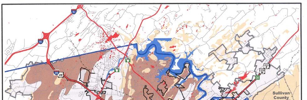
22 EXISTING LAND USE The Planning Department conducted a comprehensive land use inventory of the city in July 1998 and completed a partial land use update of the city and a complete land use inventory of the unincorporated 80.5 square mile portion of the Urban Growth Boundary (UGB) in The land use inventory of the UGB was intended to better understand the developing land use patterns adjacent to the city. Both inventories represent a snapshot in time of existing land use patterns and can be used to assess growth capacity for future development and can also be used to determine the effectiveness of existing regulations in achieving the city s planning goals and objectives. The following, examines land use trends in Johnson City, provides a summary of the existing land uses in the UGB, analyzes the supply of vacant land available for new development and redevelopment, and identifies the major physiographic constraints to development. Johnson City s corporate limits currently encompass over 40 square miles, or approximately 25,000 acres. The city is expected to continue to grow due to its moderate annexation policy and infill opportunities. Because of its annexation policy in recent decades, the city has been able to keep pace with new development on its fringe and expand its tax base. Components of the city s existing land use pattern include: residential; commercial; industrial; public and semi-public uses (schools, churches, government buildings, and institutions); transportation; communication; and utilities (TCU), and vacant land, which are summarized in Table 1. Table 1: Existing Land Use, Johnson City, 2001 Square Percent of Land Use Classification Acreage Miles Total Single-Family Residential 7, % Multi-Family Residential % Mobile Homes % Group Quarters % Mixed Use % Industrial 1, % Commercial 1, % Public/Semi-Public/Institutional 2, % TCU 4, % Vacant 3, % Agriculture 2, % Greenbelt Properties (42 parcels) 1, % Total 24, % Source: Johnson City Planning Department 22
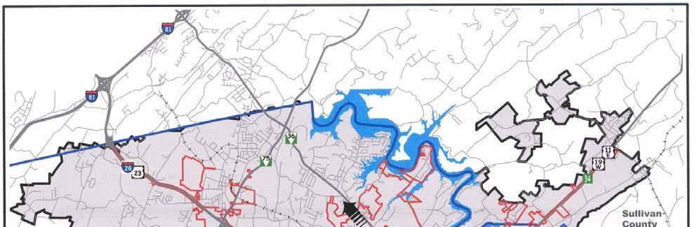
23 Approximately one-third of Johnson City s acreage is devoted to residential uses, with single-family uses accounting for 86 percent. An additional seven percent of the land is allocated to commercial uses, including retail activities, restaurants, and offices. Approximately six percent of the land is used for industrial purposes such as manufacturing and warehousing. Public and semi-public uses account for 11 percent of the city s total land area, which includes institutions and city-owned parks and schools. Another 17 percent is allocated for TCU uses, primarily street rights-of-way. The remaining 25 percent of the land is designated vacant, used for agriculture, or is forested. Urban Growth Boundary Land Use Recent state legislation (Public Chapter 1101, 1998) was enacted to provide cities and counties in Tennessee with a framework for growth policies, including: 1) urban development and redevelopment; 2) municipal boundary changes through annexation; 3) municipal incorporation; 4) the provision of public services; 5) the preservation of undeveloped areas; and 6) local government grant, loan, and tax revenues. Under this law, cities and counties are required to cooperate in identifying where growth is to be encouraged, where urban services are to be extended, and where agricultural and natural areas are to be protected. This is accomplished through the designation of an Urban Growth Boundary (UGB), Planned Growth Areas, and Rural Areas. Once adopted, by each city, the UGB assumes certain legal status in determining where a city may or may not annex, where utilities and other urban services may be extended, and where regional planning commissions have jurisdiction over subdivisions and other planning issues. Johnson City s UGB has a land area of approximately 76,513 acres or square miles and includes portions of Washington, Sullivan, and Carter counties. When the present incorporated area of Johnson City is excluded, the total land area is approximately 51,535 acres or 80.5 square miles. Excluding the historic city core (pre 1960), slightly less than one-third of the land in the UGB is developed into active urban use. Residential uses at varying densities occupy almost 70 percent of all developed land. Approximately 16 percent of the developed land is used for transportation, communication, and utilities, while an estimated nine percent is occupied by public and semi-public uses. The remainder of the developed land is devoted to commercial, industrial, and mixed uses. Table 2 summarizes the current land uses in the UGB. 23
24 Table 2: Existing Land Use, Urban Growth Boundary, 2002 Square Percent of Percent of Urban Growth Boundary (Total) Acreage Miles Total Land Developed Land Single-Family Residential 17, % Multi-Family Residential 1, % Mobile Homes 1, % 56.3% Group Quarters % Mixed Use % 0.7% Industrial 1, % 5.1% Commercial 2, % 6.1% Public/Semi-Public/Institutional 4, % 12.0% TCU 7, % 19.8% Vacant 11, % - Agriculture 28, % - Greenbelt Properties (446 parcels) 16, % - Total Land 76, % - Total Developed Land 35, % 100.0% Source: Johnson City Planning Department, 2002 Land Use Density Trends The gross amounts of land used for various urbanized purposes are important indicators of growth; however, density of development, the ratio of land use to population, can also be revealing and useful. Density of development affects the cost of providing services, including solid waste collection, water and sewer services, police and fire protection, streets, schools, and recreation services. In general, high density compact development results in a lower cost of services on an individual or household basis due to the cost effectiveness related to service extensions. The manner and extent to which land has been used in Johnson City has changed significantly over the past 38 years. The consumption of residential land per person has nearly doubled, meaning that the city s residential areas now occupy twice the amount of land per 1,000 residents than they did in From 1963 to 2001, the amount of vacant land within the city increased by 1,459 acres or 31 percent. However, during that same period, the density of vacant land (acres per 1,000 residents) decreased from acres per 1,000 residents to acres per 1,000 residents. This decrease is largely attributed to the city s aggressive annexation policy during the late 1980s and continued sprawling development patterns, where the overall population density decreased from 6.37 persons per acre in 1963 to 2.93 persons per acre in Similarly, the amounts of commercial and industrial land per person have changed dramatically since 1963, increasing percent and percent respectively. The growth in industrial land is due in large part to the opening of the Iris Glen Environmental Center landfill in The near quadrupling of commercial land consumed per 1,000 persons reflects the influx of more suburban type developments characterized by large shopping centers and linear commercial centers. 24
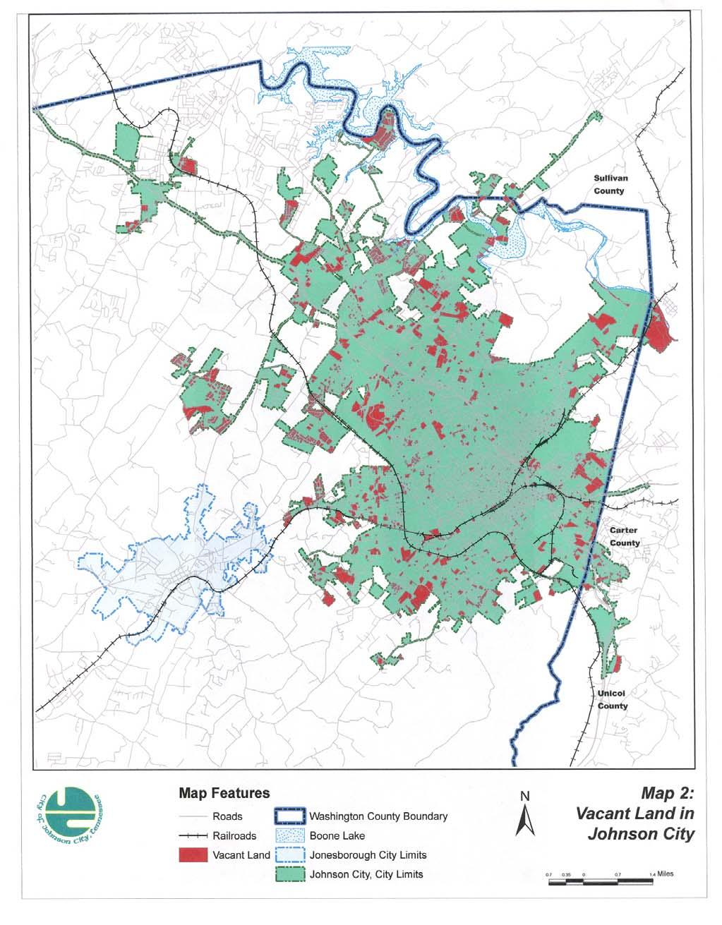
25 The amount of land devoted to street rights-of-way has also increased significantly on a per capita basis, primarily due to the construction of I-26 and State of Franklin Road and to the additional miles of streets needed to serve the more widely dispersed and sprawling development pattern. In summary, while the city s population increased by 79 percent between 1963 and 2001, the amount of developed land increased by 117 percent, reflecting urban sprawl and a less efficient growth trend. VACANT LAND ANALYSIS Since the 1960s, the Johnson City area has experienced substantial growth. During this period, new residential and commercial development has moved outward from the city s center to undeveloped land on the city s fringe. At the same time, in the city s older and more densely developed neighborhoods structures are becoming increasingly vacant and underused, more so for commercial buildings due to leap-frog development and bigbox 1 cannibalism: large format retailers abandoning one location for a more desirable location along new roads and at major intersections. Vacant land and buildings can create a financial burden on the city, both in terms of the public services needed to serve these properties, such as code enforcement, and in the reduced capacity of the municipal tax base to pay for these services. Since the assessed value of vacant property is less than that of improved land, a growing inventory of vacant land obviously produces less property tax revenue. Although the issues surrounding vacant buildings need to be addressed, this section specifically deals with vacant land. The city of Johnson City has a significant amount of land that could be used or redeveloped for future infill development to increase property tax revenue in the older, developed areas of the city. Infill development can be defined as new development that occurs on vacant lots within areas already served by utilities and which has been passed over by previous development. Successful infill development can offer various benefits to urban communities, including: increased property values; stronger sense of neighborhood identity; higher densities that support a mix of uses; the use of existing community facilities and services such as schools, parks, water and sewer, and transit; and encouraging rehabilitation and instilling a sense of vitality. Presently, nearly 6,038 acres of land in Johnson City are vacant or used for agriculture, accounting for 24 percent of the city s total land area. Vacant land alone totals 3,708 acres, or 15 percent of the city s total area. In 2001, there were 2,468 vacant parcels within the city, with the largest concentrations in the Boones Creek area, the western portion of the city along West Market Street, and to the east along Watauga Road. 1 Big-box retailers, otherwise referred to as large format retailers, include the following: Category killers, which carry wide-ranging selections within narrowly defined product categories. Examples include Office Depot and Bath & Beyond; Discount department stores such as Wal-Mart and K-Mart; and Warehouse clubs that off goods in bulk quantities, for example Sam s Club (Source: ZHA). 25
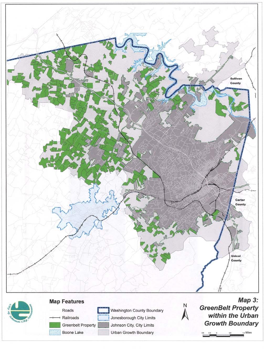
26 Additionally, 203 parcels (2,330 acres) or 9.3 percent of the total land area within the city are designated as agriculture. Of these, 42 parcels (1,197 acres) or 51.4 percent of the total agricultural land area are designated as greenbelt properties under the Agricultural Act of 1976 (revised in 1992), otherwise referred to as the Greenbelt Law (Map 2). The Greenbelt Law was created to offer owners of agricultural land of 15 acres or greater property tax incentives to maintain the land for agricultural and forestry uses. Under this law, property taxes are based upon the use of the land, rather than the market value. The Agricultural Act program contributes to agricultural land conservation; however, the program offers no guarantee that permanent agricultural use will continue. City Zoning Table 3 summarizes the distribution of vacant land by zoning classifications. Fifty percent (50%) of the vacant land (1,851.9 acres) in Johnson City is zoned for low and medium density residential use. Another acres or 15.2 percent is zoned Planned Residential. Commercial and industrial zoning account for one-quarter, acres of the vacant land, while manufactured housing and high density residential-office and medical zoning account for less than two percent of the total vacant land. Industrially zoned land comprises acres, or 10.5 percent. Table 3: Zoning of Vacant Land, 2001 Percent Zoning Acres of Total Low Density Residential 1, % (R-1, R-2, R-2A, R-2B, R-2C) Medium Density Residential % (R-3, R-4) High Density Residential % (R-5, R-6) Planned Residential % (RP-2, RP-3, RP-4, RP-5) Manufactured Homes Residential % (RM-5) Residential/Office/Medical % (RO-1, MS-1) Commercial % (B-1, B-2, B-3, B-4, B-5, PB) Industrial/Research % (I-1, I-2, MX) Agriculture % (A-1) Total 3, % Source: Johnson City Planning Department,
27 27
28 28


29 29
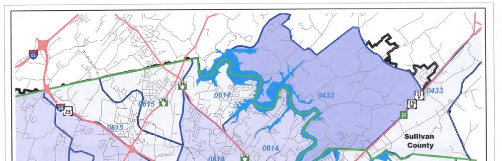
30 Environmental Constraints Approximately 10,000 acres (13.2 percent) of the land within Johnson City s UGB exhibit physiographic constraints for urban development. Flood-prone lands constitute about 5,100 acres, of which 97 percent falls within FEMA s 100-year flood zone, while sinkholes affect approximately 635 acres. LAND USE TRENDS Historic Trends As stated earlier, undeveloped land is being consumed more than twice as fast as the population is growing, an absorption rate that is not sustainable. If the city continues to follow this historical trend, the population per square mile will continue to decrease. This type of sprawling growth pattern comes at a cost. It costs the city s taxpayers significantly more to provide services in a sprawled community versus a denser, more compact community. There are more miles of roads and water and sewer lines to maintain; solid waste vehicles and school buses must travel further, police and fire response vehicles have to travel further or new fire stations are needed to adequately provide service. Figure 1. Persons per Square Mile, Persons Per Square mile Year Growth Areas Source: Johnson City Planning Department, 2001 The city s UGB includes all or a portion of 17 Census Tracts in Washington County and one each in Carter and Sullivan counties. A review of the city s older residential areas (comprising Census Tracts 601, 603, 608, and 609) contain some similarities and differences 30
31 in socio-economic characteristics than the city s newer developing areas (comprising Census Tracts 604, 605, 606, 611, 613, and 614). The city s older residential areas contain significantly higher, but decreasing population densities. In 1980, the city s older residential areas had an average density of 3,119 persons per square mile, decreasing to 2,903 in 2000, a decrease of 6.9 percent. In contrast, developing residential areas increased 18.4 percent in density from 814 persons per square mile in 1980 to 964 in Since 1960, the city s population has almost doubled from 29,892 to 55,469 in During the same period, the city s corporate limits have expanded from 7.6 square miles to approximately 40 square miles, an increase of 410 percent. Table 4: Census Tract Comparison, Census Total Residents Change Tract Number Percentage 433 7,943 8,587 10,496 2, % 601 3,787 3,353 3, % % 603 3,847 3,500 3, % 604 4,947 5,353 5, % 605 8,943 9,015 9, % 606 5,075 5,483 5, % 607 2,520 2,303 2, % 608 3,241 3,032 2, % 609 5,119 4,538 4, % 610 3,613 3,068 2, % 611 3,507 3,673 3, % 612 2,733 2,872 3, % 613 5,060 5,488 6,971 1, % 614 6,045 7,354 10,123 4, % 615 4,066 4,666 5,772 1, % 617 6,763 7,188 9,475 2, % 618 4,972 5,324 6,168 1, % 708 2,217 2,464 2, % 710 2,800 2,793 2, % 711 1,304 1,529 1, % Source: U.S. Bureau of the Census,

32 32


33 33
34 Land use planning enables the Planning Commission, City Commission, and citizens to guide the physical development of Johnson City. Upon adoption, land use recommendations will reflect the vision statement, goals, objectives, and policies outlined in the Comprehensive Plan. Johnson City s is not intended to be a precise blueprint for future development it is meant to be general, guiding the location, intensity, and impact of each land use type. Specific guidelines and regulations for new development will be contained in the Zoning Ordinance and Subdivision Regulations, adopted by the Planning Commission and City Commission. In August 2004, in an attempt to reverse the city s sprawling growth pattern, the City Commission adopted the Urban Growth and Services Element. The element included the Urban Service Area (USA) concept, which focuses on directing growth toward infill areas where urban services are already provided. The USA includes those areas outside the city that were served by water and sewer (6-inch or larger water line), were located within 1 ½ miles of a city Fire Department engine or pumper company, were infill properties, or were considered to be essential to the economic vitality of the city. NEIGHBORHOODS Infill Development One important objective of the USA is to encourage more compact infill development, which would allow the city to provide public utilities and services more efficiently. Other benefits of compact development include: Protection of productive agricultural land and open space; Greater opportunity for higher density, mixed-use developments; Redevelopment of existing commercial properties; Development of vacant and underutilized property; and Increased opportunity to accommodate affordable housing and to provide diversity of housing types and choices. There are two primary ways to foster more compact infill development. The first is public reinvestment in existing neighborhoods in order to make them attractive places to live by introducing those amenities that are missing. The city must also become more proactive in code enforcement in deteriorating neighborhoods to prevent further decline. Attracting people back to the city s older neighborhoods will help to take some of the development pressure off areas along the city s periphery. A second method to promote a more efficient development pattern is to encourage new development which is more compact. A wide range of development models are available to encourage such compact development, such as cluster development, transit-oriented development (TOD), greenbelt, and traditional neighborhood development (TND). All 34
35 encourage compact development and all share many of the same components including: compactness, mixed-use, pedestrian amenities, and a network of local streets. Cluster or open space developments may be more appropriate in areas where there are sensitive environmental concerns such as floodplains, sinkholes, and ridgelines. The interconnected street patterns of these different development models also must be designed to fit the topography of the site. While a grid street pattern may work well on flat topography, the majority of Johnson City has topographical constraints which may be more appropriately developed with a curvilinear street pattern. Neighborhood Characteristics Many different characteristics determine the livability and desirability of neighborhoods, some more important than others. In the Planning Commission s 2003 Citizens Survey, the characteristics of livable streets and walkability were identified as primary contributors to the quality of a neighborhood. Three other characteristics, housing choices, mixed uses, and an identifiable center, were identified as factors that enhance neighborhoods by adding more opportunities, more convenience, and a greater sense of neighborhood identification. These characteristics are not limited to any one type of neighborhood; they are desirable in all neighborhoods, regardless of housing style, income level, or density. These five characteristics are discussed in more detail in the following: 1. Livable Streets A primary element of a strong neighborhood is livable streets. Livable streets are safe streets which include features such as narrower street widths, traffic calming by design, and street trees, all of which encourage motorists to drive at slower, more appropriate speeds. Livable streets also include sidewalks, separated from the street s travel way by a landscaped strip or on-street parking. Livable streets are designed to be part of an interconnected street network which disperses traffic throughout the neighborhood. In addition, a network of narrow streets provides greater traffic carrying capacity than does one multi-lane road. 2. Walkability Walkable neighborhoods are desirable places to live, play, and work. This desirability comes from two factors. First, walkable neighborhoods provide an easy and safe access to services such as schools, parks, and other destinations that residents frequent on a regular basis. Second, by definition, walkable neighborhoods make safe pedestrian activity possible, thus expanding the transportation options and creating a street that better serves a range of users. Safe, walkable streets should first be built with low design speeds. They should include a network of sidewalks that are a minimum of five-feet wide and are well-lighted and maintained. Sidewalks should be buffered from the street by landscape strips or on-street parking and should connect residential areas to neighborhood centers. Safe, visible crosswalks should be provided at high traffic intersections. 35

 make up one of our fastest growing age groups, and their housing needs must be accommodated.")
36 3. Housing Choices Providing for a greater range of housing types and densities allows for a greater diversity in housing choices, which provides more opportunity for people in a wider range of income levels and lifestyles to live within the same neighborhood. For example, accessory apartments and duplexes allow senior citizens and other empty nesters to stay in their neighborhood without having to maintain a large home that is no longer needed. Senior citizens (ages 55 and older) make up one of our fastest growing age groups, and their housing needs must be accommodated. Housing diversity can also allow young families with children to move into neighborhoods they might not otherwise be able to afford. However, when introducing higher density residential uses into an existing neighborhood, careful consideration must be given to ensure that the proposed use is in scale and character with its surrounding neighborhood. A large-scale multi-family development would be out of scale and character in the middle of a low-density, single-family suburban neighborhood. Also, the amount of traffic generated by the development could easily overwhelm the local street network, especially if the streets granting access are not part of an interconnected street network. The two multi-family buildings shown here illustrate how design can influence multifamily buildings of similar density. Both buildings have four (4) units, but they differ in architectural features, setback distances from the street, landscaping, and visibility Multi-family on East Watauga Avenue Multi-family on Boones Creek Road of parking. The building on the left is at a greater density than the one on the right 18.0 units per acre vs units per acre. Density is not the only factor that can affect the acceptance of different housing types in a neighborhood. Its visual and aesthetic impact is a major factor in gaining acceptance by the neighborhood. The apartments on the left which include some architectural detail were viewed more favorably than those on the right in the city s Visual Preference Survey. 36

37 4. Mixed Uses Conventional land use regulations often separate uses and prohibit any mixing, thus lengthening trips between different uses and making walking a less viable option. Providing for a mixture of land uses such as offices, limited commercial shopping and services, and daycare at more convenient locations provides residents with more choices and helps reduce dependency on the automobile. Having convenient shopping and services on the periphery of a neighborhood or nearby should be encouraged. However, when introducing these uses into an existing residential area, it is essential that the use is compatible in scale and character with the surrounding area. A commercial use that is out of scale and incompatible with the surrounding neighborhood would be detrimental and therefore should be discouraged. Also, any added automobile traffic could have a negative impact on the local streets. Such commercial uses should be located along collector or arterial streets, which can accommodate the additional traffic without impacting the local streets. 5. Identifiable Center The fifth characteristic of an enhanced neighborhood is an identifiable center, a gathering place that provides a sense of identity to the neighborhood. Such a center can be a single facility such as a school, park, library, church, small retail district, or even a network of walking trails and open space. The higher the number of these destinations that are clustered together, the stronger the sense of identity among neighbors is likely to be. South Side Elementary School Neighborhood centers are generally compact places of activity and destinations, where neighbors can meet informally. They do not have to be in the center of the neighborhood, but they should be convenient to all residents. The city s Parks and Recreation Master Plan, adopted in 2001, calls for neighborhood parks to be developed which are centrally located and within walking distance of the neighborhood being served. A network of sidewalks and greenways can help ensure accessibility to all residents. Strengthening Existing Neighborhoods The elements listed above are all important in creating strong neighborhoods. Some of these elements are present in existing neighborhoods, but many are not. It is important to 37
38 evaluate each neighborhood independently to determine which components are missing and how best to strengthen each neighborhood. However, it is equally important to remember each neighborhood is different, and that the unique characteristics of each neighborhood must be identified and enhanced. What is appropriate in one neighborhood may not be appropriate in others due to topography, density, or other factors. Code Enforcement and Redevelopment Maintaining our existing neighborhoods and making them attractive places to live are critically important to ensuring livable neighborhoods. According to the 1990 and the 2000 U.S. Census, many of Johnson City s central city neighborhoods have been losing population. A continuation of this trend will have a negative effect on the central part of the city. The exodus of people and businesses reduces the urban tax base and weakens the central core of the city. Efforts should be directed to reverse this trend. Several factors contribute to the deterioration of these neighborhoods. These at-risk indicators include: Rundown or dilapidated buildings are one of the most notable or obvious symptoms of a declining neighborhood. Some of the reasons for dilapidated housing include: absentee landowners, transient residents, lack of incentives for property owners to maintain their property, and inadequate code enforcement. The physical appearance of private property can also have a negative impact. Property owners who fail to properly maintain their property, keep their lawns mowed, or who store junk or abandoned vehicles can have a detrimental impact on adjoining properties. This type of neglect reduces neighborhood pride and discourages adjoining neighbors from improving their property. Vandalism, drug use, and loitering have a significant impact on the residents feeling of safety and sharply reduce the perception of a high quality residential environment. Methods to maintain or restore neighborhood quality 1. Neighborhood Planning An important first step in redeveloping neighborhoods is to identify their boundaries. Although there are many different definitions of a neighborhood, it is generally considered to be a limited geographic area where residents identify with a common tie or bond. These areas may have a relatively homogeneous population, similar housing, and activity characteristics and have boundaries that are usually determined by physical barriers, such as a major roadways or ridgelines. 38
39 Once neighborhoods are identified, a neighborhood plan should be undertaken for each neighborhood. Neighborhood meetings should be held with the residents and with any neighborhood association that may exist. For any effort to be successful, citizen involvement is critical. Existing land uses, structural conditions, and the existing street system should be evaluated to determine what neighborhood elements are missing and which are necessary to enhance the neighborhood and to identify where to concentrate code enforcement efforts. 2. Retrofitting Neighborhoods One method to improve a neighborhood is to ensure that there is an adequate network of sidewalks that allow its residents to safely walk throughout the area. Many older neighborhoods include a network of sidewalks; however, many have either an incomplete network or no sidewalks at all. The city s sidewalk inventory should be updated periodically to identify those areas where the sidewalk network is incomplete. The city s Sidewalk Plan was recently updated as part of the Comprehensive Plan including a review of goals, objectives, policies, and priorities. Many residents have also expressed a concern in the Citizen Survey regarding vehicles speeding through their neighborhood. One method to slow motorists is to place police officers in high-speed areas to enforce speed limits. However, it is not possible to keep an officer at one location for any extended period of time, so this is only a temporary solution. A more effective technique is to install traffic calming devices (e.g. bulb outs, round-abouts, and raised crosswalks) in those areas of concern. The city s traffic-calming program has proved to be very successful in slowing motorists. The city installs approximately 40 to 45 trafficcalming devices a year. Public safety is also an issue that impacts the quality of a neighborhood. In the Citizen s Survey, citizens felt public safety (police and fire protection) was the number one factor affecting the quality of life in Johnson City. Where residents have concerns about higher crime rates, the city should make every effort to address them. Increasing police presence is one way to address these concerns; encouraging residents to establish and participate in a neighborhood watch program is another. The city should also evaluate street lighting to ensure that neighborhood streets are properly lighted. When needed, the city should also upgrade the overall appearance of public streets. Cleaning up trash, repairing potholes, planting street trees, and properly locating and maintaining signage can improve the appearance of streets and promote a positive image and impact on a neighborhood. 39

40 3. Code Enforcement At-risk neighborhoods should be identified and targeted for concentrated and aggressive code enforcement. Ninety-seven percent of the residents who participated in the Citizen Survey felt that code enforcement of private property was important in the community. Aggressive measures need to be taken to prevent further deterioration including steps to eliminate zoning violations, illegal conversions, and incompatible land uses. 4. Redevelopment At-risk neighborhoods should be identified and targeted for redevelopment. Programs such as the Community Development Department s Housing Rehabilitation Program are available to help property owners improve the appearance and safety of their home and may encourage other property owners to make similar improvements. 5. Citizen Involvement For any neighborhood improvement plan to be successful, it must have the strong support of the residents of that neighborhood. Involving the residents early in the planning process is critical to the success of any plan. Neighborhood groups such as the Towne Acres Homeowners Association, the West Davis Park Neighborhood Association, and the Southside Neighborhood Organization have been very active in their neighborhoods. Other neighborhoods should be encouraged to form their own organizations so they can be more proactive in improving their own neighborhoods. New Neighborhoods The objectives of the Urban Service Area are to provide more efficient city services, preserve agricultural land and open space, and encourage reinvestment in older urbanized areas by encouraging a more compact, higher density development. Currently, there is a certain demand for conventional subdivisions with larger single-family lots. This type of development cannot be prohibited and should not be. However, the city can require that this type of development include new streets that are designed to be safe, pedestrian friendly, and with some degree of interconnectivity. As previously mentioned, a number of alternative development options are available which provide more compact development. Cluster development, transit-oriented development (TOD), and new urbanism are examples. All encourage more compact 40
41 development and all share many of the same components including: a greater mix of uses, pedestrian friendliness, and street interconnectivity. Clustering, also called Open Space Development, is a preferable alternative to large lot "sprawl," which consumes open space, privatizes all land, and creates lots that are too small for farming or meaningful for habitat protection. The cluster approach places development in less sensitive areas while preserving steep slopes, productive farmland, wetlands, floodplains, and other environmentally sensitive areas. It can also be used to preserve resources such as buildings or historic sites. Example of Conventional subdivision Example of Cluster subdivision In clustering, typically 50 to 90 percent of a site is preserved in its existing natural or farmed state, with individual lots occupying the remaining acreage. The density of the overall development is calculated and concentrated to create this compact development. Many cities also offer density bonuses as a tool to encourage this type of development. A cluster development often includes many of the components found in traditional neighborhood developments and promotes compact, mixed-use development that is pedestrian friendly and interconnected. Above, are two examples of development with the same number of dwelling units. The benefits of cluster development with large areas of farmland/open space being preserved can be seen. Incentives such as density bonuses may encourage builders to utilize this technique. Conventional subdivisions can be designed to be more compact and include many of the characteristics found in New Urbanism or cluster developments. The city can require some of the elements such as interconnection and walkability; however, it cannot require the developer to provide a mix of uses. The city can amend its codes to promote smaller lots and mixed uses, but ultimately the developer must choose which options to include in a development. A Transit Oriented Development (TOD) is centered on some form of public transit such as bus or rail service. It consists of relatively high-density development. A large population concentration is needed to provide adequate transit ridership to justify frequent service, and to support activities, such as grocery stores within convenient distance of homes and worksites. For example, the neighborhood center may have a 41
42 transit station and a few multi-story commercial and residential buildings surrounded by several blocks of townhouses and small-lot single-family residential, and larger-lot single-family housing farther away. TOD neighborhoods typically have a diameter of one-quarter to one-half mile (stations spaced one half to 1 mile apart), which represents pedestrian scale distances. Presently, Johnson City does not have the density of population necessary to support this type of development Challenges Johnson City residents have expressed a clear interest in and support for viable, more livable neighborhoods. However, many of the city s current codes prevent such neighborhood from being built. The city s Zoning Ordinance has 17 residential zoning districts, most of which have the minimum 20-foot building setback, which discourages the creation of small lot, compact developments. Only the Planned Residential (RP) districts with the minimum 10-foot front yard setback and zero side yard setbacks encourage compact development. Minimum lot size and lot width in the various zoning districts can also be an obstacle to compact development. The smaller, narrower lots found in the R-2C, RP, and MX districts can help create more affordable housing and greater housing choices which would in turn promote and help support neighborhood services. The location of these services must be acceptable and compatible in scale with the surrounding neighborhood. Recommendations 1. Areas which are designated for development as new neighborhoods should be identified on the Land Use Plan. 2. The city s Zoning Ordinance should be reviewed for consideration of combining redundant or similar residential districts. 3. The city should revise its regulations to allow for more efficient lot layouts where appropriate, by reducing the restrictions on lot size, lot width, and building setbacks and offering density bonuses as an incentive for developers. 4. The city should amend its regulations to allow for more housing choices within existing neighborhoods, at appropriate locations. 5. As opportunities arise, the city should support changes or additions to existing neighborhoods that promote the key elements of an enhanced neighborhood 1) livable streets; 2) walkability; 3) a variety of housing choices; 4) mixture of uses (such as shopping, work, services, parks, schools) located within or convenient to the neighborhood; and 5) an identifiable neighborhood center. 42
43 6. The city should aggressively enforce its codes (i.e. building, yard maintenance, noise, and traffic control) to help restore declining neighborhoods and to ensure that sound, healthy neighborhoods remain healthy and viable. 7. The city should amend its code to address concerns of neighborhoods and to ensure continued livability and desirability. COMMERCIAL A varied and healthy commercial sector provides shopping for citizens, attracts visitors from outside the city, and produces tax revenues to pay for schools, police and fire protection, roads, parks, and other desired services. The importance of a thriving commercial sector in Johnson City is prominently emphasized in several recent documents. The Planning Commission s Vision Statement (2002) calls for maintaining a strong and diversified economy, of which a healthy and varied commercial sector is an important part. The City Commission s 2001 Strategic Plan begins with A Stronger Local Economy. A part of this goal is the objective of strengthening Johnson City as the region s major retail center through greater diversity. In the Planning Commission s Citizens Survey, Johnson City citizens gave strong support to a healthy commercial sector. Seventy-seven (77) percent ranked a Variety of retail goods and personal services as a factor contributing to the quality of life in Johnson City. In the same survey, 48 percent felt that Expanding shopping opportunities should be a priority for the city. Types of commercial categories A variety of wholesaling, retailing, office, and service activities require a variety of settings, locations, and policies. In this study, commercial areas are broken down into four categories. Downtown - Traditionally the commercial, financial, cultural, civic, social, and governmental center of a city, Johnson City s Downtown has lost most of its retail and financial base to malls and commercial centers but remains an important center for specialty shopping, entertainment & culture, churches, and government services. Because of the significances of the Downtown, a separate Element of the Comprehensive Plan will address the Downtown in detail. Highway-Oriented/ Gateway Commercial This type of commercial activity is located along major streets such as State of Franklin Road, West Market Street, Bristol Highway, North and South Roan Street, and Boones Creek Road. These roadways, in addition to the Elizabethton Highway (State Route 67) and Interstate 26, are the gateways into Johnson City and are highly visible to residents and visitors and therefore have an impact on the city s image. Since these gateways carry such a high proportion of regional and pass-through traffic, more people are likely to form their impressions of the city from these streets than from any other single source. Therefore, special attention should be 43

44 given along these streets to ensure quality development. In addition, proper maintenance of the streets is essential. In the Planning Commission s Citizens Survey, 86 percent of Johnson City residents indicated that the visual appearance of the community was important. This overwhelming opinion was confirmed in other questions. When asked to rank several growth issues according to priority, increasing public landscaping along major streets was considered important by 62 percent of respondents. The survey also indicated significant support for other appearance issues. When asked what level of importance was placed on several factors, citizens responded as follows: Table 5. Appearance Factors Appearance Factor Very Important Not important Appearance & location of retail, office, and industrial areas 62% 2% Landscaping & trees along major commercial streets 58% 6% Appearance of commercial signs 50% 9% Parking lot landscaping 46% 12% Source: Johnson City Planning Department, 2003 Historically, many of our older commercial shopping centers developed with large unattractive big-box uses with minimal landscaping, long unbroken building facades, poor signage, and poor pedestrian accessibility. However, over the years the city s Zoning Ordinance has been amended to address many of these issues, and more changes are needed to address citizen concerns regarding appearance. Wal-Mart in McKinney Texas 44


45 Building Placement Under Johnson City s current zoning regulations, developments such as this proposed Wal-Mart in McKinney Texas could not be built. With front setbacks ranging between 25 to 45 feet, buildings are pushed back and there is little alternative other than locating parking in the front. This inflexibility in the Zoning Ordinance restricts a developer from utilizing a more innovative approach to site design. Building Façade Another characteristic of older commercial centers and of many of the big box retailers is long unbroken building facades. Over time, such businesses often close or move to other locations due to shifting consumer patterns, the opening of the next hot interchange, a loss of sales, or corporate bankruptcy. When this happens, the original large building may become vacant. Some of these big boxes are reused, but many remain empty for years, becoming eyesores with a negative impact on the surrounding area. Large, empty big boxes receive very negative scores in visual preference exercises, reflecting the community s low opinion of them. Some cities focus on regulations requiring the building to be more adaptable to reuse. They may require the façade of new big box stores be divided visually so that if and when the original use leaves, the building can more easily be converted into a series of smaller uses. Regulations requiring architectural and structural features in new buildings to make conversion into smaller spaces more feasible. Former Wal-Mart Johnson City Crossing Johnson City currently has a façade ordinance which states: Buildings which have their back or side facing the designated highway shall be designed and constructed to avoid lengthy, unbroken facades with no scale, detailing, or fenestration or they shall be required to simply plant shade or evergreen trees on twenty-five (25) foot centers within twelve (12) feet of the rear or side of the building, except in front of entrances or signage. In the area in front of wall signs, there shall be a row of hedges a minimum of eight (8) feet on center. 45

.")
46 However, this ordinance only applies to buildings which are located within the Highway Commercial and City-County Overlay districts. Also, the requirement can be met by planting additional landscaping. This may make the building more appealing to the passing motorist, but it does very little to make the building more adaptable for reuse if it becomes vacant. Landscaping In 1993, the city received a site plan for a K-Mart development located on Peoples Street (below, on the left). Under the landscape regulations that were in affect at the time, the developer was allowed to place all of the required landscaping along the periphery of the site leaving a large area of open asphalt with no landscaping. K-Mart Johnson City Crossing In response to this, the city in 1996 revised the Landscape Regulations to require interior landscape areas and additional trees. As a result of these new regulations commercial centers i.e. the Johnson City Crossing (above, on the right) have been developed which are more heavily landscaped. This preferred landscaping is attractive and will enhance not only the shopping center but will improve the appearance of the entire gateway. Another approach to diminish the visual impact of large, unbroken parking lots is to require that larger parking lots be divided into smaller units, to improve their appearance and provide corridors for safe pedestrian travel between parking areas and buildings. Placing smaller stores on outparcels that directly front the adjoining street, is another method to screen parking lots. The proposed Wal-Mart in McKinney, Texas incorporates this approach( see page 44). The parking lot is broken up by long landscaped medians and pedestrian systems and the developer grouped a series of smaller buildings along the street which not only helps screen the parking area but also creates a street edge along the main roads serving the development. Pedestrian Access In both the Planning Commission s Citizens Survey and the VPS, pedestrian access and safety were identified as being important to Johnson City citizens, and sidewalks are 46

47 the key component for pedestrian access. The city has made significant progress during the past 15 years in providing sidewalks along its major commercial streets, especially North Roan Street and State of Franklin Road. The requirement that new commercial developments include a sidewalk along their public street frontages has produced many new sidewalk segments. In addition, the city has installed sidewalk sections both as stand-alone projects and as part of roadway improvements. While more needs to be done before a full sidewalk network is complete, substantial progress has been and continues to be made. Another measure of a walkable commercial district is the ability to safely walk from a sidewalk or vehicle in the parking lot to the store. A pedestrian system similar to the one shown on the right can provide a safe travel way from the street, help break up a parking lot, and can be an attractive landscape feature. A final component of a safe, walkable commercial district is the ability to travel Example of inter-parking lot pedestrian system between adjacent businesses. In many cases, significant improvements in pedestrian access can be gained through relatively small changes to parking lot layouts, landscape islands, and by removing other obstacles to walking. Overhead Utilities In 1996, the Subdivision Regulations were amended to require that all new residential and non-residential subdivisions with electric service of less than 100 amp, 3-phase, 2,500 KVA be placed underground. The cost to put service greater than this underground was determined to be too expensive. However, the large commercial and industrial developments typically have electric service that exceeds 100 amp, 3-phase, 2,500 KVA, therefore, the regulations do little to improve the city s gateways. Example of overheard wiring Requiring all new commercial development to place their utility service or pole drops underground is one way to reduce some of the clutter of overhead wiring. Currently, the city requires that all development or reconstruction in the Highway Commercial and the City-County Overlay districts place all new utility lines underground. However, this requirement only applies to development along Boones Creek Road, sections of State of 47


48 Franklin Road, and State Route 75. Expanding this requirement to all of Johnson City s gateways should be considered. Further study of the feasibility of converting Johnson City's existing overhead electric system to an underground system is warranted. Signage Photos with commercial sign clutter scored consistently low with Johnson City residents in the Visual Preference Survey. Developments with attractive, appropriately sized, and well-designed signs scored significantly higher. The issue is not the signs themselves, which are necessary, but their appearance and how competing signs dominate the view of the street and scenic vistas around the city. Signs along West Walnut Street Combined signage at Franklin Terrace The signs shown on the left are reflective of those found in the city s older commercial districts and would not be permitted under the city s current sign regulations. Changes in the sign regulations now limit the total number of signs a commercial development can have. Mixed Uses In Johnson City, most commercial development occurs within one of the arterial business zoning districts. These commercial districts do not allow residential uses. Residential uses located on upper floors of retail or office buildings would provide a new housing choice without taking the property out of the commercial inventory. This option benefits the developer or property owner by providing additional investment choices. Such housing can also be more affordable than other choices, while accommodating those who prefer the convenience of living in a mixed-use district. In addition, the combined parking requirements of office and residential uses can be less than they would be if separated. Making this choice optional will allow a developer more flexibility and provide a greater opportunity for innovative design. Gateway Rights-of-Way Although it is important to encourage and promote commercial businesses along the gateways to become more attractive, it is equally important for the city to properly 48


.")
49 maintain the streets. A poorly maintained right-of way can present a negative image of the city regardless of the adjacent development. West Market Street Medians along West Market Street Functional and attractive medians similar to those located along West Market Street, west of State of Franklin Road can significantly improve the appearance of the street. This improvement, although somewhat limited in scope, can be a model for future cooperative efforts to improve West Market Street and other gateway streets. Analysis In general, the city s major commercial streets fall into one of two categories. They are either older built-out urban areas (West Walnut Street, West Market Street, West Main Street, and sections of Roan Street) or they are streets located in developing suburban areas (the northern part of North Roan Street, much of the Bristol Highway, State of Franklin Road north of Sunset Drive, State Route 75 in Gray, and Boones Creek Road). Some commercial activities are inherently oriented toward the suburban highway, such as new and used automobile sales and the sale of mobile homes. In addition, big box stores and shopping centers are established along major thoroughfares and are likely to remain for several years. The challenge is to accommodate these uses while at the same time protecting the character of the city s older urban areas. One strategy for accomplishing this is to create two separate categories for highway business, one for the predominantly suburban commercial districts and a second for the older urban commercial districts. A suburban commercial development which would represent the majority of the city s commercial property could allow uses similar to those now included in the B-4, B-5, and PB districts (retail, commercial services, and office uses) along with residential use in upper floors. The appearance and efficiency of such suburban commercial districts could be significantly improved by allowing a greater variety of uses, reducing or eliminating mandatory building setbacks, upgrading landscaping and design standards of buildings, and minimizing the visibility of large, unbroken parking lots. 49
.")

50 In a new urban commercial development, new development should be compatible with the scale of the surrounding neighborhood. Buildings should be brought out to the street, so that parking would be in the rear or sides of buildings (or stacked vertically when justified by density). Building fronts should be oriented to the street, with doors, windows, and other architectural features providing visual interests. Sidewalks and pedestrian features should be emphasized, Example of new urban commercial center and on-street parking should be encouraged wherever possible. Access for cyclists and transit riders should be enhanced. Public and private landscaping should be upgraded, and street trees should be planted where utility lines are placed underground. Neighborhood Commercial Centers - This category exists to serve a limited market, usually residents within approximately one mile of the center. Such centers can include retail shops as well as non-commercial uses such as churches and day-care centers. They are often auto-oriented, although usually less so than commercial districts along major streets. A neighborhood center s appearance is crucial to the surrounding neighborhood, and can affect it either positively or negatively depending on its location, scale, and design. Reusing older buildings preserves their character and promotes identity for the neighborhood. Many older neighborhoods still have buildings that once were corner groceries but have long-since disappeared because of market changes and economies of scale. The modern successor to the corner grocery is the convenience market, which generally sells gasoline and a variety of beverages, tobacco, packaged foods, and non-food items. These convenience markets cater primarily to auto traffic, since there is insufficient population density within walking distance to support the store. If Johnson City residents believe that convenient access to neighborhood shopping is important to a good neighborhood, most are disappointed with access to shopping near their own neighborhoods. Seventy-two (72) percent indicated that they could not walk safely from home to shopping areas. When asked If a better sidewalk network was available, would you walk more often? 71 percent answered yes. Clearly, improving convenience is essential to successful neighborhood shopping districts and will require more than just designating more such districts on a zoning map. It will require the assurance that access is safe and convenient for nearby residents. 50
51 From the Planning Commission s Citizens Survey, the VPS results, and other sources, the characteristics of a complete neighborhood center can be identified. Such a center should be conveniently located to the residential area along a collector or arterial street preferably at the intersection. Its uses should include a variety of convenience shopping (such as a laundry, restaurants, and video rental) and services such as day-care, a branch bank, and/or a church. In some cities, housing density is high enough to support a strictly pedestrian- or transitoriented commercial center. However, Johnson City does not have this density and is not likely to in the future. Therefore, it is important for the commercial center to be located on a collector or arterial street to capture drive-by traffic in order to remain viable. But even neighborhood commercial centers where visits are mainly by vehicle provide multiple benefits. An automobile trip to a neighborhood center is shorter in both distance and time, so less fuel is consumed, producing less air pollution. In addition, each trip to a neighborhood center substitutes for a longer trip to a major commercial street, reducing traffic congestion on the main streets and at key intersections. Recommendations 1. Create convenient neighborhood commercial centers which offer a variety of necessary goods and services to the nearby neighborhood. The city should provide for neighborhood commercial centers which are limited in size, accessible to neighborhood residents, and appropriate in scale and appearance with their surroundings. 2. Designate existing centers at the locations shown on the Land Use Plan. Any changes or additions to existing centers should be guided by and conform to the criteria in Recommendation 4 below. 3. Amend the B-1 (Neighborhood Business) Zoning District to incorporate the following standards and criteria. 4. Allow new neighborhood centers in the future at appropriate locations, when justified by neighborhood demand and need. All new and existing centers should be required to conform to the following standards and criteria: Location At a convenient location to the neighborhood along a collector or arterial street. Uses General retail goods and services which are oriented to the convenience shopping needs of nearby residents; Medical services, such as doctors and dentists offices and medical clinics; Non-commercial services, such as churches, daycare centers, and schools; Restaurants, with outdoor seating encouraged; on-premise alcohol allowed only as a Special Exception; 51


52 Residential use, provided it is in the second or higher floor of the building, not at street level; Service stations, limited in size and intensity to the market of the immediate neighborhood; signage and lighting should be limited to avoid creating a nuisance for surrounding residences. Additional landscaping on major streets should be required to soften the visual impact on neighbors. Service station and convenience store buildings should be located adjacent to and oriented to the street; fuel pump islands and parking should be located toward the side or rear. One-bay car wash allowed as an accessory use with the same standards on signage, lighting, and landscaping as for freestanding car washes; and Freestanding car washes, size and scale consistent with the immediate neighborhood; extra landscaping required to soften impact; signage should be limited in size and externally lit; lighting should be limited in brightness and shielded so that no negative impact to nearby residents is created. Minimum separation of 300 feet from a parcel with a residential structure to reduce lighting and noise impact. Operating hours limited to 6 AM to midnight. This use should be approved only by Special Exception. Building scale and placement Buildings should be two stories or more, depending on the height of surrounding residential structures. A neighborhood commercial building should be no more than one story higher than the lowest adjoining residential structure. Buildings should be set back zero (0) to ten (10) feet from any public street, excluding alleys. Landscaping requirements should not create a conflict with building placement. Side yard setbacks may be zero (0) feet, if the adjoining property is also zoned for neighborhood business. Rear yard setbacks should be adequate to protect adjoining residential uses. The maximum size of buildings should not exceed 6,000 square feet. The diagrams below illustrate building setbacks for neighborhood commercial structures. Walkable Sidewalks should be constructed along all adjoining public streets, excluding alleys; safe, properly marked, and with ADA crossings. 52

53 Parking On-street parking should be allowed where sufficient right-of-way exists. The minimum allowed off-street parking should be one space per 500 square feet of non-residential gross floor area in the neighborhood commercial center. The maximum off-street parking requirement should be one space per 200 square feet in the center. Residential parking requirements should apply for residential units, if any. Since tenants change over time, parking requirements should apply to the entire center rather than to each use individually. Credit for minimum required parking spaces should be given for locations within 500 feet of a transit stop and for bike racks. Parking spaces above the maximum may be permitted if additional landscaping is provided within the parking lot. Signs Size, height, and lighting should be compatible with adjacent residential areas. Wall and projecting signs should be encouraged in favor of freestanding signs. Projecting signs should be permitted to overhang the public right-of-way, provided they do not interfere with pedestrian and vehicular traffic. Lighting Lighting should be strictly limited to avoid having a negative impact on adjacent residences. Special restrictions on lights at service stations and car washes should be considered, since these often are open 24 hours. Design and appearance Doors and windows should face the street, and the primary entrance should be from the street. Blank walls facing a public street (except alleys) should be prohibited. Awnings and overhangs should be encouraged. Awnings, canopies, and porch coverings should be allowed to extend over the right-of-way (sidewalk), so long as they do not interfere with vehicular traffic. Wholesale, Distribution, and Services This category of commercial activity includes wholesaling, distribution, construction, and business support services. It is a hybrid category partially retail, partially light industrial, and partially service oriented. However, such uses are essential to a diverse local economy and should be provided for. The City Commission s 2001 Strategic Plan recommends a stronger local economy, which implies a diverse mix of goods and services being available. To achieve this stronger local economy, one of the Strategic Plan s objectives is Strengthening Johnson City as a major retail center through greater diversity of Many large buildings are flexible enough to house wholesaling, distribution, and other types of commercial use. the retail base. Implicit in this objective is providing for the component of wholesaling, distribution, and contractor s yards, which are essential to support retail activity. 53
54 Analysis Most of the businesses in this category are dispersed throughout the city, either in industrially-zoned districts, in commercial districts, or in industrial parks. The city has few business parks specifically for these uses. Hanover Drive and Lafe Cox Drive are the best examples, even though both have manufacturing uses adjacent to wholesaling, businesses services, and communications businesses. Many businesses in this category have more in common with light industrial uses than with retail uses. Among the factors that wholesaling and business services have in common with industrial uses are: outdoor storage of supplies, equipment, and merchandise; truck traffic, with the related need for adequate transportation access; the need for security fencing; fewer on-site customers; and less off-street parking. Due to these characteristics, such uses can appropriately be located in light industrial or business parks rather than in retail commercial zones. Because of this crossover, no separate zoning district for this category of commercial use appears needed. The locational needs for wholesaling, distribution, construction, business services, and similar businesses are similar to other commercial and light industrial uses. Among these needs are: adequate land area; adequate utilities; level or gently sloping grades; good surface transportation; compatible zoning; separation from residential neighborhoods; access to major highways and interstates; and the opportunity for on-site security. Recommendations 1. Ensure that sites are provided in sufficient number, location, and size to accommodate wholesaling, distribution, construction yards, business services, and similar businesses. Such sites should have adequate transportation access to regional roadways and Interstate highways. 2. Ensure that commercial and light industrial districts are adequate in area to accommodate the demand from these uses. 3. Ensure that regulations in the appropriate zoning districts are sufficient to accommodate the needs of businesses in this category. 54
55 NATURAL RESOURCES Natural resources are an important component of Johnson City s character and an essential element in maintaining a healthy environment. The preservation of ridgelines, farmlands, and environmentally sensitive areas is also a major component to the quality of life in the area and impacts the city s ability to attract and retain businesses and new residents. In the Planning Commission s Citizen Survey, Johnson City residents rated the protection of natural resources highly as a major quality of life issue, giving it a score of 4.36 on a scale of 1 to 5 with (1) being lowest and (5) being highest. Clean air and water was the highest rated quality of life issue, receiving a score of Residents also indicated that preserving the natural environment is a major growth issue, giving it a score of The need to protect our natural resources is also reflected in the Planning Commission s Vision Statement, which includes the goal to: Respect our heritage and preserve our natural environment. Scenic Beauty/Ridgeline Protection Johnson City is located in the foothills of the Appalachian Mountains. These mountain views have long been considered one of Johnson City s greatest assets. In the recent Citizen Survey, Johnson City residents expressed a strong interest in protecting the city s ridgelines and mountain views. The scenery and mountains were identified as the number one natural resource residents like best about Johnson City. The City Commission also expressed this sentiment in its Strategic Plan, which included the Objective: Protect Vistas and Views Green Skylines, No Visual Pollution. However, many residents expressed a concern that due to the city s growth and sprawling development pattern, Johnson City was losing its mountain views and scenic beauty. In the recent Citizen Survey, 65 percent of the residents felt that the loss of scenic beauty was a concern. 55

56 Bell Ridge In addition to impacting the scenic beauty, improper ridgeline development can cause significant problems for other property owners, such as increased mud and sediment runoff from grading on steep slopes. Adding to the problem is that some of Johnson City s ridgelines are zoned for multi-family uses or other more intense uses. As these properties are developed with these more intensive uses, large areas will graded and a corresponding large numbers of trees will removed exposing the ridge resulting in sediment runoff. Above is a view of Bell Ridge where the top of the ridge was graded down and a large stand of trees were removed to make room for a large apartment complex. Lower density, single-family residential use would fit more harmoniously with the mountainous surroundings. It would have a significantly less environmental impact on the ridges and is less likely to adversely impact the scenic views of the ridgeline. The construction of a single-family home typically requires less grading and less tree removal and should be a requirement for development along ridgelines. Stormwater Protection In August 2003, Johnson City experienced severe flooding causing considerable damage to the downtown area. This flooding was primarily due to record rainfalls but was also the result of the continued development of the stormwater drainage basins and the continued encroachment into the floodplains. Developing and filling of the floodplain decreases valuable storage capacity for stormwater runoff. As development of the larger drainage basins continue, stormwater runoff will increase. The increased stormwater volumes flow to increasingly restricted floodplains, leaving no place for the water to go except out of its banks. The City Commission established a Stormwater Task Force on September 10, 2003 to address the recent flooding and to meet the National Pollutant Discharge Elimination System (NPDES) permit program enacted on March 10, 2003 created under the Clean Water Act of Downtown Flooding, 2003 The Stormwater Task Force was charged with the responsibility to: (1) identify stormwater 56

57 quality and quantity issues affecting the city; (2) suggest stormwater management program alternatives; and (3) present methods for funding the stormwater management program. In December 2004, the Stormwater Task Force presented its findings and recommendations to the City Commission. It concluded that the city had an urgent need to upgrade its existing stormwater management system in order to address flooding issues and to meet water quality mandates. To fund these improvements the Commission discussed a variety of options. These options are discussed in detail in the Stormwater Section of the Public Facilities and Services Plan. Farmland Protection In the 2003 Citizens Survey, residents supported preserving the area s rural character by protecting farmland and that the protection of farmland was a major growth issue. In 1998, the State Legislature passed Public Chapter A primary objective of this law is to minimize sprawl and to protect farmland. However, due to current development policies, valuable farmland is being lost. Inexpensive productive farmland on the fringe of the city is being developed bypassing vacant land within the city or on the city s periphery that is already served by utilities. Until recently, this sprawling pattern of development had been subsidized by the city s policy to extend utilities to undeveloped outlying property at no cost to the developer. In addition, the city also would offer material reimbursement as an incentive for annexation into the city. However, with the recent adoption of the Urban Service Area (USA), the city no longer offers these incentives. If a developer builds outside of the city s USA, he or she must pay for the full cost to extend services to the property and the city will not annex the development. Floodway and Farmland Preservation Clustering or open space developments are an alternative to the traditional subdivision which carves out lots with little regard to the slope or other environmental features of the land. Clustering directs development to the less sensitive areas while preserving steep 57

58 slopes, productive farmland, wetlands, floodplains, and other environmentally sensitive areas. Source: Rural by Design In clustering, 50 to 90 percent of a site area is preserved in its existing natural or farmed state, with individual lots occupying the remaining acreage. The density of the overall development is concentrated to create this compact development. Many cities offer density bonuses as a tool to encourage this type of development. The diagram above illustrates two examples of development with the same number of dwelling units. The benefits of cluster development with large areas of farmland/open space being preserved can be seen. Recommendations Protect scenic views by adopting regulations that reduce the density and intensity of land uses along ridgelines. Fund and implement a stormwater management plan to minimize the impact of flooding on low lying floodplain areas. Take a more proactive position in protecting stormwater storage areas to ensure that there is adequate capacity to accommodate the runoff and to protect development that already exists in the floodplain. Minimize urban sprawl and loss of productive farmland by adopting a Land Use Plan and regulations that include not only those areas within the corporate limits but the entire Urban Growth Boundary. 58
59 INDUSTRIAL Industry has played a central role in the growth and development of Johnson City. A strong and stable industrial base is vital in maintaining and creating new high paying jobs. For a city to continue to grow and prosper it is essential that a sufficient variety of high paying jobs are available in order to continue to attract people into the community and to provide employment for those living in the community. This section will analyze existing conditions, review land use trends, and project future land use needs for the industrial category of land use. In a recent Citizen Survey, residents were asked to identify the major issues in Johnson City. The survey identified the lack of a variety of employment opportunities (86 percent) and unemployment (83 percent) as the two most important issues facing the city. The Planning Commission s Vision Statement includes a statement to Establish and maintain a strong and diversified economy and promote a sustainable level of growth. In order to accomplish this, an adequate amount of developable land should be available to meet the projected needs. The issue of job creation and retention is complex. Topics such as business recruitment, retention, and workforce development are all very important but are beyond the scope of this Element and are discussed in greater detail in the Economic Development Element. The primary purpose of this section is to ensure that there is adequate land available to accommodate anticipated industrial land needs and associated business growth and to identify the appropriate location and amount of land resources. As used in this report, industrial activities include wholesaling, warehousing, storage, research and development, manufacturing, distribution, construction, and business support services. These uses are essential to a diverse local economy and should be provided for at appropriate locations. Historically, industrial land has occupied about 4.5 percent of the total developed land in Johnson City. However, in 2001, industrial land uses increased to 8.4 percent (1,588 acres) of the city s total land area. The increase since 1983 is mainly attributed to the opening of the 260-acre Iris Glen Environmental Center in Other contributors include the annexations of the Buffalo Mountain Industrial Park (97 acres) in the southeast along South Roan Street and the TPI industrial site (85 acres) in Gray, and the annexation of industrial properties along West Market Street. The industrial land use pattern is largely limited to the periphery of the city, with the exception of the areas along the Norfolk Southern Railroad corridor through the city. 59
60 Figure 2. Historical Percentage of Industrially Zoned Land Percent Year Source: Johnson City Planning Department Industrial Parks The development of industrial parks has played an important role in Johnson City s growth. Over the years a number of parks have been constructed to accommodate this growth, including: A&P Industrial Park Anderson Farm Industrial Park Buffalo Mountain Industrial Park Johnson City Industrial Park Lennex Business Park Perma R Industrial Park Rowland Industrial Park Simerly Industrial Subdivision Westside Industrial Park Westside Industrial Park II Westley Court Subdivision Vacant Industrial Land Vacant, industrially zoned land accounts for 10.5 percent (388.7 acres) of the total vacant or greenfield land within the city. A greenfield property is a parcel of land which is vacant and has not been developed or improved. Of this amount, about one-half (191.9 acres) is zoned I-2 Heavy Industrial, while acres, or roughly 40.4 percent, are zoned I-1 Light Industrial. The Mixed Use (MX) district comprises about 10 percent of industrially zoned vacant land, all of which is located in the Med-Tech Park corridor along State of Franklin Road (SR 381). Most of the vacant land zoned I-2 is located in the northeast along Watauga Road and East Fairview Road, including the Johnson City 60
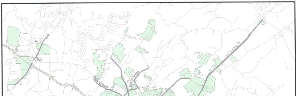


61 61
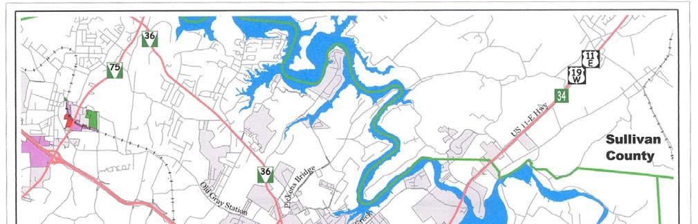


62 62
63 Industrial Park; the remainder is dispersed throughout the city. Vacant land zoned for light industry is mainly concentrated in the Springbrook Drive-Wesley Street area north of the North Roan Street commercial corridor, along Industrial Drive off West Market Street, in the Gray area on Spratlin Park Drive and SR 75, and KLM Drive off Boones Creek Road. Vacant or Underutilized Buildings According to the Economic Development Board s Available Property listings, there are approximately 30 vacant or underutilized industrial grayfield properties currently in the city. A grayfield property is a parcel which has been previously developed but is currently vacant. These grayfield properties represent 1.4 million square feet of floor area on approximately 145 acres of land. Changing Nature of Industry In 2001, Bush Hog International announced that it was planning to construct a new manufacturing facility in Washington County. Unfortunately, these types of announcements are occurring much less frequently as major manufactures move their facilities and operations to cheaper labor markets overseas. In 2006, Superior Industries and Snap-On Tools announced they were closing their facilities in Johnson City, resulting in the loss of approximately 650 jobs. There are a number of distribution, technology, and health-related industries which are viable and continue to expand in the U.S. If the city wants to continue to be competitive and attract jobs, it must recognize these changes in industry and be prepared to accommodate them. In 2004, the Tennessee State Department of Economic and Community Development ranked the top five growing manufacturing sectors in the state by new jobs created, they include: 1. Transportation Equipment 2. Fabrication Metal Products, except Machinery 3. Machinery except Electrical 4. Rubber & Miscellaneous Plastic Products 5. Chemical & Allied Products Projected Industrial Land Use Needs As the nature of industry changes it becomes increasingly difficult to project future land use needs. Although, the nature of industry is changing it is important to note that many of its primary needs will be very similar to those of the traditional manufacturing industries in that they require access to utilities, a multi-modal transportation system, and an educated and trained workforce. Some recent emerging industries will have greater technological needs such as wireless internet and fiber optics, but some uses such as warehousing and distribution centers are still land intensive and will require access to major roadways and rail networks. 63
64 To determine future industrial land use needs, a proportional projection methodology was utilized. The assumption was made that the non-residential land use categories will expand proportionally to the residential uses. This assumes that the demand for future industrial uses will remain proportional to population growth. Based on this methodology, it is projected that the city will need an additional 476 acres of developable industrial land to accommodate projected population growth. This number may be slightly high based on current economic and manufacturing trends; however, to provide for future needs it is necessary to ensure that land is available to accommodate any unexpected growth. Land Availability Currently, Johnson City has approximately 390 acres of vacant, greenfield industrial land and an additional 145 acres of vacant developed property. In addition, there are also several hundred acres of vacant commercially-zoned property in the city that are located in areas which are less desirable for commercial uses and are well-suited for industrial activities. The B-4, Planned Arterial Business District allows wholesaling, warehousing, distribution, and other light manufacturing uses. A good example is Hanover Business Park zoned B-4 and comprised mainly of wholesaling and warehousing businesses with limited retail sales uses. Based of the declining nature of manufacturing and the amount of vacant land and buildings available, it would appear that the city has sufficient property available to meet its projected industrial needs. However, it is imperative to recognize the importance of having sufficient land available in the event of some unforeseen surge in growth resulting from future market condition changes. Land Banking Market realities such as the demand for commercial and even residential land often threaten the availability of prime industrial land. The demand for commercial and residential property are significantly greater than the demand for industrial property. Because of this, there has been continued requests to rezone existing industrial land to more profitable commercial and residential uses. In the past 20 years, the city has rezoned approximately 385 acres of industrially zoned property for commercial and residential uses. Escalating land costs have resulted in much of the industrial land being pre-empted by other uses, primarily commercial. The only proven way to protect suitable industrial land is to buy or land bank the property. Land banking is the purchase of properties by a government, presumably to reduce development pressure or to preserve the land at a reasonable price for some future industrial use. The city has a history of public-public land banking partnerships. The city in partnership with Washington County, Sullivan County, and others purchased land and developed the Tri-County Industrial Park. The city also partnered with Mountain States Health Alliance 64

65 to develop the Regional Med Tech Business Park and is currently working with ETSU to develop the proposed Innovation Park. The city should continue these partnerships and explore others with groups such as the Economic Development Board to ensure that there is suitable industrial land available in the future. Brownfield Sites Brownfield sites also provide an opportunity for redevelopment. A brownfield site by definition is developed real estate, generally in an urban setting, which is contaminated to some degree by years of use. These previously developed properties are generally within the city limits and often have access to a full-range of city services. A brownfield site could be as small as the vacant corner gas station that once held underground storage tanks, or as large as a manufacturing facility that may have dumped wastes on its property. There are; however, some challenges to redeveloping brownfield sites. Brownfield sites often include abandoned or dilapidated buildings on sites where the soils are contaminated or are perceived to be contaminated. The cost to clean-up contaminated property can often be exorbitant which would deter many investors from attempting to redevelop these properties. The properties then remain vacant, often become rundown, and become a detriment to the surrounding neighborhood such as the former Interstate and Machinery Foundry located off State of Franklin Road (below). There are many incentive programs offered by the federal government. For example, the Brownfields Economic Development Initiative (BEDI) is a competitive grant program that the Department of Housing and Urban Development (HUD) administers to stimulate and promote economic and community development. BEDI is designed to assist cities with the redevelopment of abandoned, idled, and underused industrial and commercial facilities. BEDI grant funds are primarily targeted for use with a particular emphasis upon the redevelopment Interstate and Machinery Foundry of brownfield sites for economic development projects and the increase of economic opportunities for low-and moderateincome persons. The purpose of the BEDI program is to spur the return of brownfields to productive economic use through financial assistance to public entities in the redevelopment of brownfields, and improve the viability of a project financed with the Section 108 guaranteed loan authority. 65
66 Recommendations 8. Identify and protect suitable industrial property (with adequate utilities, level or gently sloping grades, and access to a good surface transportation system) to assure that there is adequate land to meet projected needs. 9. Identify prime industrial areas on the Land Use Plan in order to protect them from other competing land uses. Some of these areas include: a. Areas along the northeast end of Watauga Road; b. Large tracts of vacant land lying along SR-75 between I-26 and SR-36; and c. Property identified by the EBD along Ford Creek Road adjoining I Support the EDB s effort to purchase the properties along Ford Creek Road for a proposed industrial park and identify the proposed interstate interchange. 11. Develop an informational brochure explaining what federal and state grant programs are available to help redevelop brownfield properties. 12. Pursue BEDI grant funds to redevelop existing brownfield sites. HEALTH & EDUCATIONAL SERVICES In Johnson City, the largest employers include health care providers, educational institutions, and public agencies. These include the Johnson City Medical Center, Mountain States Health Alliance, East Tennessee State University, the Veterans Administration Hospital, the Washington County School System, and the city of Johnson City (and its school system). These entities comprise six of Washington County s ten largest employers. The medical and educational communities play a major economic role in the city and the region. At a recent Economic Summit, this role was recognized and goals were established to expand educational and health care job opportunities. The City Commission s Strategic Plan also addressed med tech job creation with objectives to strengthen the local economy by expanding Med Tech businesses and by creating higher paying job opportunities. Med Tech Job Opportunities In 1993, the Med Tech Advisory Committee, an outgrowth of the City County Liaison Committee, hired the consultant firm of Hammer, Siler, George Associates to develop a plan for establishing Johnson City as a center for regional medical-technical development. The consultant s report, A Strategic Development Plan for the Regional Med Tech Center called for a large-scale integrated development project that links 66
67 healthcare delivery systems and related research with high technology businesses that serve the health care industry and other related businesses. The plan has six sub-themes, which are: Clinical Health Services - Inpatient an outpatient medical care, including primary care, tertiary care, specialties, health maintenance and prevention services, and related health and fitness programs/services. Applied Research and Continuing Executive Education - Applied research on advanced technology and total quality management in health care delivery systems and an executive education facility and programs for continuing medical education, and specialized technology training. Business and Industry - Medical technology related businesses, such as medical services, supplies, equipment, instruments, pharmaceuticals; non-medical high technology businesses that support the applied research focus, including software, or telecommunications; and other non-medical businesses with mid-tech or hightech elements. Education Services - Instructional, research, and continuing education programs offered by the region s higher education institutions to support the needs of the area s existing and future businesses. Support Facilities and Amenities - Service businesses, cultural facilities, and other amenities to contribute to the overall quality of the business and living environment. Physical Design of the Site - Development and design standards to present the high-quality and unified image of a university-related technology park setting. The consultant s report called for a corridor of medical and technical uses along State of Franklin Road and identified specific sites between the University and Knob Creek Road for potential development. This corridor includes three anchors: Regional Med Tech Business Park, University Innovation Park, and Millennium Park. Regional Med Tech Business Park The Regional Med Tech Business Park is a 130-acre development at the intersection of State of Franklin Road and Knob Creek Road. It is a public-private partnership between Mountain States Health Alliance and the city of Johnson City. The park lies within a Foreign-Trade Sub Zone that offers significant advantages to companies who import and export from abroad. This park includes underground power with redundant capabilities, fiber optic communications, Digital Subscriber Lines (DSL), natural gas, and city water and sewer. 67
68 Innovation Park The proposed Innovation Park will be the middle anchor of the med tech corridor. This 60-acre development is located on West Market Street west of State of Franklin Road. The proposed research park is being developed by East Tennessee State University in partnership with the city of Johnson City. The primary purposes of the park are to support the development and expansion of existing university programs and university related research and technology. Millennium Park The south anchor of the Med Tech Corridor is Millennium Park. This 15.3-acre development lies along State of Franklin Road directly across from the University. The site is partially developed and includes the Johnson City Continuing Education Center, a state-of-the-art regional training facility, a three-level parking garage, the Carnegie Hotel, and several restaurants. Other Potential Sites Several other large vacant tracts totaling approximately 100 acres, which lie between Sunset Drive and Med Tech Parkway, are also suitable for development. Recommendations Update the Hammer, Siler, George & Associates report A Strategic Development Plan for the Regional Med-Tech Center to reflect the changing conditions along State of Franklin Road and the medical/technological advances. 1. Continue to partner with ETSU in the development of Innovation Park. 2. Ensure that the is consistent with the East Tennessee State University s Long-Range Master Plan. 68
69 PHYSICAL DEVELOPMENT FACTORS Johnson City is located in the Great Valley portion of Upper East Tennessee, a region characterized by numerous ridges, stream valleys, and sinkhole concentrations generally running northeast to southwest. The immediate Johnson City area is typical of this geologic region, having steep mountain slopes, sinkholes, rock outcroppings, shale knobs, and flood prone lowlands interspersed with level or gently rolling lands. These steep, rocky, or flood prone areas represent severe impediments to urban use, being either very expensive or not suitable for development. In addition, improper development in these areas can cause significant problems for other property owners, such as increased flooding upstream or downstream and increased mud and sediment runoff from grading on steep slopes. Soil characteristics can also place limitations on urban development. There are seven major soil associations in the Johnson City area. For the most part, Johnson City s landscape is dominated by the Dunmore soil series, more specifically, the Dunmore (Rolling to Hilly) Pace-Greendale (DP) association (Map 10). This soil association occupies over 50 percent of Washington County, where the prevailing relief is rolling to hilly and Karst terrain is prevalent (soils underlain with limestone and dolomite, subject to the formation of sinkholes). As a result of its relief and slow percolation rate, streams located in this region are subject to flooding. Overall, the soil has good potential for urban development where limitations are minor and easily overcome. Other soil associations include the Dunmore (Hilly to Steep) Stony Land Litz (DS) and the Dandridge-Litz Loam-Whitesburg (DL). The DS association occupies about 18 percent of the county, and the prevailing relief is hilly to steep. Numerous sinkholes and subterranean streams are present, creating marginal urban development potential. Although this soil makes development unfavorable, special planning, careful design, and good management can overcome these limitations. The DL association is characterized by round knob-like hills with narrow, winding ridges and steep-walled valleys; it occupies less than five percent of the county. Slopes are generally steep to very steep, making the potential for urban development poor. Johnson City has a legitimate public interest in protecting the general health, safety, and welfare of the community by controlling proposed development in the areas impacted by critical areas (areas impacted by poor soils, steep slopes, and an abundance of sinkholes) than in less constrained areas. Certain measures are already in place to minimize damage from development in certain types of topography, such as the Federal Flood Insurance Program, subdivision regulations that limit the grade at which new streets can be built, and floodplain regulations incorporated into the city s Zoning Ordinance. Additional techniques for limiting environmental and property damage are available for the city. Among these are the erosion control and site grading regulations that control clearing and grading, sediment runoff both during and after construction, vegetation replacement, and the location of proposed buildings on sensitive sites. 69
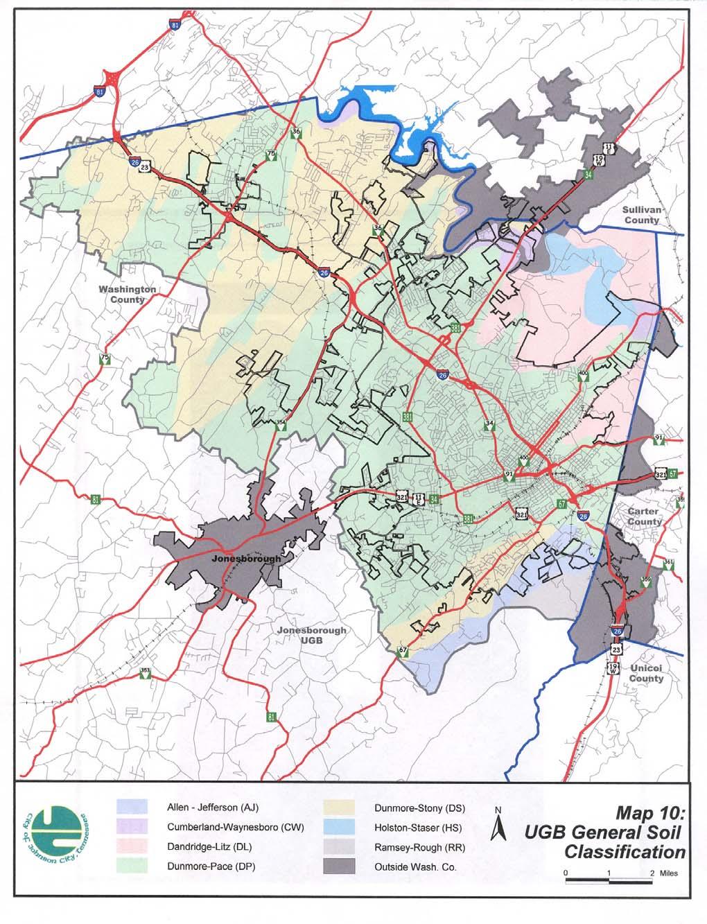
70 70
Planning Districts INTRODUCTION
 INTRODUCTION To facilitate detailed examination of development prospects for all areas of the community, Delano has been divided into 14 planning districts. The location of these planning districts is
and services The protection and conservation of environmentally significant and sensitive natural heritage features and functions.
 6. Land Use 6.0 Preamble A healthy and livable city is one in which people can enjoy a vibrant economy and a sustainable healthy environment in safe, caring and diverse neighbourhoods. In order to ensure
EXISTING COMPREHENSIVE PLAN
 EXISTING COMPREHENSIVE PLAN Town Center Land Use Element: V. LAND USE POLICIES Town Center Mercer Island's business district vision as described in "Your Mercer Island Citizen-Designed Downtown" was an
COMMUNITY DESIGN. GOAL: Create livable and attractive communities. Intent
 COMMUNITY DESIGN Intent An attractive, well-designed County will attract quality development, instill civic pride, improve the visual character of the community, and create a strong, positive image for
The transportation system in a community is an
 7 TRANSPORTATION The transportation system in a community is an important factor contributing to the quality of life of the residents. Without a sound transportation system to bring both goods and patrons
Joint Meeting City Council and the Plan Commission. September 1st, 2015
 Joint Meeting City Council and the Plan Commission September 1st, 2015 1 The City Plan Commission shall recommend a City Plan for the physical development of the City Article IX Section 2 of the City of
CHAPTER 12 IMPLEMENTATION
 CHAPTER 12 IMPLEMENTATION The 2010 Town of Denton Comprehensive Plan is intended to capture a vision of the future of Denton. As such, it provides a basis for a wide variety of public and private actions
NEW CASTLE COUNTY S ZONING DISTRICTS
 NEW CASTLE COUNTY S ZONING DISTRICTS This is general information about New Castle County s zoning districts. The information included is by no means exhaustive or complete. Before designing plans to develop
LAND USE ELEMENT. Purpose. General Goals & Policies
 LAND USE ELEMENT Purpose This Land Use Element contains the goals and policies necessary to support the City s responsibility for managing land resources and guiding development through implementing regulations,
EXECUTIVE SUMMARY DRAFT CHAPTER 1 INTRODUCTION EXECUTIVE SUMMARY
 CHAPTER 1 EXECUTIVE SUMMARY INTRODUCTION Through the joint efforts of the City of Tulsa planning staff and the Land Services division of Indian Nations Council of Governments (INCOG), the Berryhill Land
LAND USE OVERVIEW WHAT YOU WILL FIND IN THIS CHAPTER
 LAND USE WHAT YOU WILL FIND IN THIS CHAPTER Information about the City s expected population and employment growth. Description and capacity of existing and future land use designations. Policies that
Gold Line Bus Rapid Transit Transit Oriented Development (BRTOD) Helmo Station Area Plan
 Helmo Station Area Plan") Appendix F Gold Line Bus Rapid Transit Transit Oriented Development (BRTOD) Helmo Station Area Plan Introduction and Purpose of the Plan The Gold Line Bus Rapid Transit facility is an eleven-mile dedicated
Appendix F Gold Line Bus Rapid Transit Transit Oriented Development (BRTOD) Helmo Station Area Plan Introduction and Purpose of the Plan The Gold Line Bus Rapid Transit facility is an eleven-mile dedicated
Section 9 NEIGHBORHOOD DESIGN
 Section 9 NEIGHBORHOOD DESIGN City of Lancaster Comprehensive Plan D u n k i n, S e f k o & A s s o c i a t e s, I n c. NEIGHBORHOOD DESIGN INTRODUCTION There are many ways in which a neighborhood can
Policies and Code Intent Sections Related to Town Center
 Policies and Code Intent Sections Related to Town Center The Town Center Vision is scattered throughout the Comprehensive Plan, development code and the 1994 Town Center Plan. What follows are sections
4. Shape Transitions. 4. Shape Transitions
 4. Shape Transitions 49 Zoning District Policies Overall Intent: Maintain neighborhood character by creating compatible transitions that minimize land use conflicts. Strategy: Define the character of zoning
CITY OF COLWICH COMPREHENSIVE PLAN LAND USE LAND USE 1
 LAND USE LAND USE 1 WHAT YOU WILL FIND IN THIS CHAPTER: Discussion of today s conditions and tomorrow s projections Discussion of challenges and opportunities Discussion of the environmental quality goals,
IMPLEMENTATION STRATEGIES. In This Chapter. Goals & Strategies 182 Project List 183 Future Land Use 186 CHAPTER 11 IMPLEMENTATION STRATEGIES
 In This Chapter Goals & Strategies 182 Project List 183 Future Land Use 186 11 IMPLEMENTATION STRATEGIES NORTH AUGUSTA, SC 2017 COMPREHENSIVE PLAN 179 Individual commitment to a group effort that is what
Woodburn Comprehensive Plan Growth Management Goals and Policies
 Goal Woodburn Comprehensive Plan Growth Management Goals and Policies G-1. The City's goal is to manage growth in a balanced, orderly and efficient manner, consistent with the City s coordinated population
Dwelling Units Max 12 dwelling units per acre/min 8 dwelling units per acre. Development Mix 80% non residential/20% residential
 13. OSTEEN LOCAL PLAN Background: The Osteen Local Plan area is located in southwest Volusia County along the SR 415 corridor between Lemon Bluff Road and Acorn Lake Road and includes 3,990 acres. The
RECREATION AND OPEN SPACE ELEMENT GOALS, OBJECTIVES, AND POLICIES
 RECREATION AND OPEN SPACE ELEMENT GOALS, OBJECTIVES, AND POLICIES Goal 7 To provide park facilities, recreation programs, and open space resources that are safe, adequate, and accessible to all City residents,
4.1.3 LAND USE CATEGORIES
 4.1.3 LAND USE CATEGORIES a. City Center District The City Center District incorporates the existing character and mix of uses in downtown Belmont to encourage redevelopment and new development in keeping
Implementation Guide Comprehensive Plan City of Allen
 Implementation Guide 2030 Comprehensive Plan City of Allen DRAFT 2015 Implementation Guide Allen 2030 Comprehensive Plan INTRODUCTION The Comprehensive Plan serves as a guide for the growth and development
Town Center (part of the Comprehensive Plan)
") Town Center (part of the Comprehensive Plan) Mercer Island Town Center Looking North (2014) In 1994, a year-long process culminated in a set of design guidelines and code requirements for the Town Center
Town Center (part of the Comprehensive Plan) Mercer Island Town Center Looking North (2014) In 1994, a year-long process culminated in a set of design guidelines and code requirements for the Town Center
SECTION II SECTION II STATEMENT OF GOALS, OBJECTIVES, PRINCIPLES, ASSUMPTIONS, POLICIES AND STANDARDS
 STATEMENT OF GOALS, OBJECTIVES, PRINCIPLES, ASSUMPTIONS, POLICIES AND STANDARDS 1 2 STATEMENT OF GOALS, OBJECTIVES, PRINCIPLES, ASSUMPTIONS, POLICIES AND STANDARDS INTRODUCTION The New Jersey Municipal
Hibbing. Land Use. Hibbing Comprehensive Plan 8.1. Land Use
 Hibbing 8.1 Introduction 8.3 Information and Assessment 8.5-8.14 Recommendations 8.15-8.17 Implementation 8.18-8.19 8.2 Introduction Although land use was not identified as a discrete goal during the community
CHAPTER 3 VISION, GOALS, & PLANNING PRINCIPLES. City of Greensburg Comprehensive Plan. Introduction. Vision Statement. Growth Management Goals.
 CHAPTER 3 VISION, GOALS, & PLANNING PRINCIPLES Introduction The Greensburg Comprehensive Plan is intended as a working community document. A combination of long and short-term goals, this document is intended
AWH REPORT OF THE PLANNING AND DEVELOPMENT DEPARTMENT FOR APPLICATION FOR REZONING ORDINANCE TO PLANNED UNIT DEVELOPMENT
 AWH REPORT OF THE PLANNING AND DEVELOPMENT DEPARTMENT FOR APPLICATION FOR REZONING ORDINANCE TO PLANNED UNIT DEVELOPMENT MAY 8, 2014 The Planning and Development Department hereby forwards to the Planning
HOUSING ELEMENT GOALS, OBJECTIVES, AND POLICIES
 HOUSING ELEMENT GOALS, OBJECTIVES, AND POLICIES Goal 6 Maintain and enhance the supply of decent, safe, energy efficient and affordable housing and maximize viable options and opportunities for present
CITY OF PUYALLUP. Background. Development Services
 CITY OF PUYALLUP Development Services 333 South Meridian Puyallup WA 98371 To: City Council From: Katie Baker, AICP, Planning Division Re: South Hill Neighborhood Plan Adoption Date: (Meeting date: February
Vision Statement for the Town of Flower Mound Master Plan The Town of Flower Mound Master Plan furthers the established community based vision to:
 Vision Statement for the The furthers the established community based vision to: Preserve the country atmosphere and natural environment that makes Flower Mound a unique and desirable community; Mitigate
SECTION UNIFIED DEVELOPMENT ORDINANCE SECTION Part 1 Ordinance. ARTICLE 1 Zoning Districts
 SECTION 1-100 UNIFIED DEVELOPMENT ORDINANCE SECTION 1-300 Part 1 Ordinance SECTION 1-100. Introduction. ARTICLE 1 Zoning Districts Crystal Lake strives to maintain a balance of various land uses for a
City of Tacoma Planning and Development Services
 Agenda Item D-3 City of Tacoma Planning and Development Services To: Planning Commission From: Stephen Atkinson, Associate Planner, Planning Services Division Subject: Land Use Designations - Phase 2 Meeting
COMMISSION ACTION FORM
 ITEM #: 6 DATE: 10-18-17 COMMISSION ACTION FORM REQUEST: Public Hearing on Proposed Amendments to the Ames Urban Fringe Future Land Map and Land Use Policy Plan for the North Growth Gap Area BACKGROUND
Sorted citizen input comments in review of Blount County plans July, August, and September 2007
 Sorted citizen input comments in review of Blount County plans July, August, and September 2007 The following presents sorted citizen input comments from three sessions held in July, August and September
SOUTH MAIN RIVER COMMUNITY REINVESTMENT PROJECT AREA PLAN DATED AUGUST 31, 2018
 SOUTH MAIN RIVER COMMUNITY REINVESTMENT PROJECT AREA PLAN DATED AUGUST 31, 2018 Redevelopment Agency of the City of Logan, Utah South Main River Community Reinvestment Project Area - 1 - INTRODUCTION 1.
Rural Land Use Designations Kittitas County December 6, 2007 Draft
 KITTITAS COUNTY COMMUNITY DEVELOPMENT SERVICES 411 N. Ruby St., Suite 2, Ellensburg, WA 98926 CDS@CO.KITTITAS.WA.US Office (509) 962-7506 Fax (509) 962-7682 Rural Land Use Designations Kittitas County
2.0 AREA PLANS. Lakeside Business District. Lakeside Business District Land Use Categories:
 Lakeside Business District Lakeside Business District Land Use Categories: Campus Commercial Campus Commercial means a mixture of uses which includes corporate offices, office parks, hotels, commercial,
PORT WHITBY COMMUNITY
 PORT WHITBY COMMUNITY SECONDARY PLAN UPDATE COMMUNITY IMPROVEMENT PLAN URBAN DESIGN GUIDELINES September 2015 DRAFT PROPOSED AMENDMENT NUMBER # to the Whitby Official Plan PURPOSE: The intent of this Amendment
COLVER ROAD INDUSTRIAL CONCEPT PLAN
 COLVER ROAD INDUSTRIAL CONCEPT PLAN A CONCEPTUAL LAND USE AND TRANSPORTATION PLAN FOR TA-4 AN URBAN RESERVE AREA OF THE CITY TALENT City of Talent Adopted by City Council Resolution No., June, 2015 PART
17.11 Establishment of Land Use Districts
 17.11 Establishment of Land Use Districts 17.11.010 Purpose. To promote the health, safety, and general welfare of City residents and those who come to South Salt Lake to work, exchange commerce and recreate.
CHAPTER 2: FUTURE LAND USE CONCEPTS
 CHAPTER 2: FUTURE LAND USE CONCEPTS INTRODUCTION The future land use concepts presented in this chapter are an expression of community support for a viable and vital US 50 Corridor. Land use recommendations
Chapter 10 IMPLEMENTATION RECOMMENDATIONS
 Chapter 10 IMPLEMENTATION RECOMMENDATIONS The recommended land use plan presented in the previous chapter provides a design for the attainment of the urban and rural development and open space preservation
The Five Components of the McLoughlin Area Plan
 The Five Components of the McLoughlin Area Plan This documents contains the complete language of the five components of the McLoughlin Area Plan: The Vision Statement The Values The Guiding Principles
CHAPTER 7: Transportation, Mobility and Circulation
 AGLE AREA COMMUNITY Plan CHAPTER 7 CHAPTER 7: Transportation, Mobility and Circulation Transportation, Mobility and Circulation The purpose of the Transportation, Mobility and Circulation Chapter is to
Cumberland Region Tomorrow is a private, non-profit, citizen based regional organization working with Greater Nashville Regional Council
 Cumberland Region Tomorrow is a private, non-profit, citizen based regional organization working with Greater Nashville Regional Council and others in the public and private sectors, dedicated to planning
Definitions. Average Daily Traffic Demand (ADT): The actual number or projected number of cars that pass a point in a 24-hour period.
: The actual number or projected number of cars that pass a point in a 24-hour period.") Definitions Access Management: A combination of physical techniques and transportation policies used to control the flow of traffic between roads and the surrounding lands. Alternative City Form Scenarios:
Definitions Access Management: A combination of physical techniques and transportation policies used to control the flow of traffic between roads and the surrounding lands. Alternative City Form Scenarios:
EXHIBIT A. Tax Increment Reinvestment Zone No. 1 (Town Center) First Amended Project Plan 1
 First Amended Project Plan 1") EXHIBIT A Tax Increment Reinvestment Zone No. 1 (Town Center) First Amended Project Plan 1 1 As amended by Resolution No. 2008-02-001(TR1R) of the Tax Increment Reinvestment Zone No.1, and approved to
EXHIBIT A Tax Increment Reinvestment Zone No. 1 (Town Center) First Amended Project Plan 1 1 As amended by Resolution No. 2008-02-001(TR1R) of the Tax Increment Reinvestment Zone No.1, and approved to
CHAPTER 21 NC-PUD NEIGHBORHOOD COMMERCIAL PUD DISTRICT
 CHAPTER 21 NC-PUD NEIGHBORHOOD COMMERCIAL PUD DISTRICT Section 21.1. Title and Purpose. The Neighborhood Commercial Planned Unit Development District, designated the, is intended for commercial uses of
Town of Peru Comprehensive Plan Executive Summary
 Town of Peru Comprehensive Plan Executive Communities that plan grow by choice, not by chance. A plan makes growth thoughtful, understandable, and predictable. A plan shows that a community is managing
FUTURE LAND USE ELEMENT
 FUTURE LAND USE ELEMENT GOAL I: To create and sustain a great place to live, play, and prosper Objective 1: The City of Ocala shall incorporate the principles and strategies of the Ocala 2035 Vision into
Chapter Master Planned Communities (MPC) District
 District") Sections 14.53.010 Purpose and Intent 14.53.020 Applicability 14.53.030 Procedure 14.53.040 MPC Standards 14.53.050 Required Findings 14.53.010 Purpose and Intent Chapter 14.53 Master Planned Communities
Sections 14.53.010 Purpose and Intent 14.53.020 Applicability 14.53.030 Procedure 14.53.040 MPC Standards 14.53.050 Required Findings 14.53.010 Purpose and Intent Chapter 14.53 Master Planned Communities
RESIDENTIAL DISTRICTS
 RESIDENTIAL DISTRICTS The residential district standards have been revised to reflect on-the-ground conditions, while continuing to respect the use patterns established within the neighborhoods. This will
3. VISION AND GOALS. Vision Statement. Goals, Objectives and Policies
 Vision Statement Queen Creek s interconnected network of parks, trails, open spaces and recreation opportunities provide safe and diverse activities and programs that sustain its unique, small town, equestrian
Envision Skagit 2060 Citizen Committee Briefing Paper
 Envision Skagit 2060 Citizen Committee Briefing Paper Rural Villages & Fully Contained Communities (FCCs) By Mark Personius, AICP, Growth Management Consultant Rural Villages and Fully Contained Communities
DEVELOPMENT FRAMEWORK POST 2030 LAND USE PLAN INTRODUCTION
 INTRODUCTION Oak Grove s Comprehensive Plan identifies a future Metropolitan Urban Service Area (MUSA). The Metropolitan Council does not anticipate extending utilities to this area prior to 2030. The
Port Lavaca Future Land Use
 Port Lavaca Future Land Use Introduction The City of Port Lavaca is beginning to see sustained growth, after many years of relative stable population. New single family homes, apartments, and businesses
Rapid City Planning Commission Comprehensive Plan Amendment Project Report
 Rapid City Planning Commission Comprehensive Plan Amendment Project Report June 7, 2018 Applicant Request(s) Item #3 Case # 18CA001 Comprehensive Plan Amendment to change the future land use from Mixed-
Gloucester County s Comprehensive Plan. The Community Connection
 Gloucester County s Comprehensive Plan The Community Connection Current Comp Plan Adopted in 1991 with a 20 year planning horizon Updated in 1995 with Part V- Implementation Recommendations and Appendix
Guiding Principles, Objectives, Strategies and Policies
 Guiding Principles, Objectives, Strategies and Policies Section 1 Introduction These Guiding Principles were adopted as part of the 1999 Athens-Clarke County Comprehensive Plan and are carried over, in
Section 3: Land Use M C H E N R Y K A N E. Figure 3.1: Potential Future Municipal Boundaries. Future Municipal Boundaries. County Land Use Plans
 Section 3: Land Use Figure 3.1: Potential Future Municipal Boundaries Land use and transportation are intertwined; yet, land use and transpor- tation planning are often undertaken as separate disciplines.
Incentive Zoning Regulations Florida Municipal City of Orlando
 Topic: Resource Type: State: Jurisdiction Type: Municipality: Year (adopted, written, etc.): 2002 Community Type applicable to: Title: Incentive Zoning Regulations Florida Municipal City of Orlando Document
Improve Neighborhood Design and Reduce Non Point Source Water Pollution
 HOW TO Planning Guide Improve Neighborhood Design and Reduce Non Point Source Water Pollution This document was funded by a grant from the New Hampshire Coastal Program with funding from the National Oceanic
4. INDUSTRIAL 53 CASTLE ROCK DESIGN
 4. INDUSTRIAL 53 CASTLE ROCK DESIGN CASTLE ROCK DESIGN 54 4. INDUSTRIAL Overview Well-designed and attractive industrial centers are the product of blending economic realities with both functional and
Future Five. Design/ Development Guidelines. January 2008 Amended June 08 per City Council motion
 Future Five Design/ Development Guidelines January 2008 Amended June 08 per City Council motion 5-Points Design Guidelines Table of Contents I. Introduction 3 II. Area boundaries 4 III. Review Process
FUTURE DEVELOPMENT AREAS
 FUTURE DEVELOPMENT AREAS Refer to the Future Development Map on Page 2. Suburban Residential (Less than 3 units/acre) Suburban Residential neighborhoods form the backbone of Smyrna. While growth and redevelopment
Franklin/Myrtle School Small Area Plan Adopted February 18, 2003
 Franklin/Myrtle School Small Area Plan Adopted February 18, 2003 Introduction This plan area includes properties on all four corners of the Franklin/Myrtle School intersection. The magnitude of development
2030 Comprehensive Plan VISION STATEMENT
 RESOURCE DOCUMENT for Steering Committee Meeting #2 July 12, 2017 2030 Comprehensive Plan VISION STATEMENT Steering Committee from 2008 Established the Lauderdale s Vision as: Creating a livable, lovable
Selected Area Study. Vision Plan Draft
 East Polk County Selected Area Study Draft 10.30.08 Contents Guiding Principles...4 Context Conclusions...5 Current Context...8 Scenarios...9 Scenario: Status Quo...10 Scenario: Connected & Directed Growth...12
Ridgefield and the Growth Management Act
 1 2 Ridgefield and the Growth Management Act 3 Why Do We Plan History of Planning in Ridgefield Washington experiences rapid growth in the late 1980 s that began to change the perceived quality of life.
REPORT OF THE PLANNING AND DEVELOPMENT DEPARTMENT FOR APPLICATION FOR REZONING ORDINANCE TO PLANNED UNIT DEVELOPMENT AUGUST 18, 2016
 REPORT OF THE PLANNING AND DEVELOPMENT DEPARTMENT FOR APPLICATION FOR REZONING ORDINANCE TO PLANNED UNIT DEVELOPMENT AUGUST 18, 2016 AWH The Planning and Development Department hereby forwards to the Planning
3 Vision and Goals. Vision and Goals. Blueprint for Bloomsburg. Vision. Town of Bloomsburg Comprehensive Plan,
 Vision and Goals 3 Vision and Goals Citizens of the Town of Bloomsburg clearly value their natural and cultural heritage, the walkable, mixed use pattern of downtown, the access to education, and the community
Concord Community Reuse Project Goals and Guiding Principles. Overarching Goals (OG)
") Concord Community Reuse Project Goals and Guiding Principles Overarching Goals (OG) No priority is implied by the order of presentation of the goals and guiding principles. Overarching goals for the Concord
Concord Community Reuse Project Goals and Guiding Principles Overarching Goals (OG) No priority is implied by the order of presentation of the goals and guiding principles. Overarching goals for the Concord
City Center Specific Plan Amendments And Background Report City of Richmond. PLANNING COMMISION FINAL DRAFT January, 2001
 City Center Specific Plan Amendments And Background Report City of Richmond PLANNING COMMISION FINAL DRAFT January, 2001 TABLE OF CONTENTS Page LIST OF TABLES... LIST OF FIGURES... INDEX... OVERVIEW...
VILLAGE OF CLEMMONS PLANNING BOARD DRAFT STAFF REPORT
 VILLAGE OF CLEMMONS PLANNING BOARD DRAFT STAFF REPORT PETITION INFORMATION Docket # C-226 Staff Megan Ledbetter Petitioner(s) JBJH Properties, LLC Owner(s) JBJH Properties, LLC Subject Property 5892-49-1766
City of Chickasaw Land Use Comprehensive Plan 2030 Chapter5-Draft(2)Public review_
Public review_") Land Use Land Use refers to the activity or development characteristics of a given parcel of land. The Land Use Plan presented in the following pages, represents the City of Chickasaw s official position
Land Use Land Use refers to the activity or development characteristics of a given parcel of land. The Land Use Plan presented in the following pages, represents the City of Chickasaw s official position
TREASURE COAST REGIONAL PLANNING COUNCIL M E M O R A N D U M. To: Council Members AGENDA ITEM 5H
 TREASURE COAST REGIONAL PLANNING COUNCIL M E M O R A N D U M To: Council Members AGENDA ITEM 5H From: Date: Subject: Staff October 17, 2008 Council Meeting Local Government Comprehensive Plan Review Draft
Corridors. Re-vitalize our Corridors and Gateways
 Corridors Re-vitalize our Corridors and Gateways Artist s rendering from the 287 Strategic Plan, 2015 Corridors are the major throughways of Loveland but they also provide important commercial, community
Bourne Downtown Site Planning
 Prepared for: The Town of Bourne, MA In Cooperation with: Bourne Financial Development Corporation Prepared by:, Inc. June 24, 2009 Table of Contents Introduction and Summary... 1 Site Existing Conditions...
Planning & Zoning Commission Staff Report
 Planning & Zoning Commission Staff Report Meeting Date: May 26, 2015 Drafted by: Katherine Harrison-Rogers CASE # Z2886 PROJECT NAME: APPLICANT/ REPRESENTATIVE: Shawna Runyan PROPERTY OWNER: 1840 (previously
The West Vaughan Employment Area Secondary Plan Policies
 Part 2: The West Vaughan Employment Area Secondary Plan Policies 2.1 General Policies It is the policy of Council: 2.1.1. That the West Vaughan Employment Area (the WVEA), identified on Schedule 1, will
2040 LUP is a part of the Comprehensive Plan and carries the same legal authority. Economic Challenges
 1.1. Guiding Anchorage s Growth Where will new residents settle over the next two decades? Where will people work, shop, and play? Will there be enough room to grow? How will Anchorage look? Will growth
Plano Tomorrow Vision and Policies
 Plano Tomorrow Vision and Policies PLANO TOMORROW PILLARS The Built Environment The Social Environment The Natural Environment The Economic Environment Land Use and Urban Design Transportation Housing
6 Growth Management Challenges and Opportunities
 6 Growth Management Challenges and Opportunities The Town has established a goal of attaining a 50% participation rate with respect to employment opportunities versus residential population. The Town s
ORDINANCE WHEREAS, this Ordinance is consistent with the City of Winter Garden Comprehensive Plan; and
 ORDINANCE 17-06 AN ORDINANCE OF THE CITY COMMISSION OF THE CITY OF WINTER GARDEN, FLORIDA, CREATING ARTICLE XIV OF CHAPTER 118 OF THE CITY OF WINTER GARDEN CODE OF ORDINANCES PROVIDING FOR THE EAST PLANT
Living in Albemarle County s Urban Places
 Living in Albemarle County s Urban Places ALBEMARLE COUNTY, VIRGINIA A Closer Look at Albemarle s Approach to Managing Growth and Creating Quality Urban Environments www.albemarle.org Page 2 Living in
2018 Northampton Township Comprehensive Plan
 2018 BUCKS COUNTY, PENNSYLVANIA What is a? A comprehensive plan is a municipality s main policy document that details the collective vision for the future, the historic, environmental, and cultural facilities
Warren County/Bowling Green Focus 2030 Comprehensive Plan VOLUME 1 INDEX
 Appendix 5: Index VOLUME 1 INDEX A Aesthetics ES-6, FLU-15, FLU-17, FLU-24, NCR-7 Agricultural Base FLU-18, FLU-20 Agricultural Centers, Rural FLU-11 Agricultural District NCR-17-NCR-18 Agricultural Economy
LAND USE GOALS, OBJECTIVES AND POLICIES. Goal 1: [L] (EFF. 7/16/90)
![LAND USE GOALS, OBJECTIVES AND POLICIES. Goal 1: [L] (EFF. 7/16/90)](/thumbs/88/115018937.jpg "LAND USE GOALS, OBJECTIVES AND POLICIES. Goal 1: [L] (EFF. 7/16/90)") LAND USE GOALS, OBJECTIVES AND POLICIES Goal 1: [L] (EFF. 7/16/90) The Comprehensive Plan shall protect and enhance the quality of life in this community by providing economically sound educational, employment,
LAND USE GOALS, OBJECTIVES AND POLICIES Goal 1: [L] (EFF. 7/16/90) The Comprehensive Plan shall protect and enhance the quality of life in this community by providing economically sound educational, employment,
Chapter 4. Linking Land Use with Transportation. Chapter 4
 Chapter 4 Linking Land Use with Transportation Chapter 4 59 Chapter 4 Linking Land Use with Transportation Community Design and Transportation Program Introduction Since the 1950s, the predominant development
TOP TEN LIST OF COMMUNITY CONCERNS REGARDING PROPOSED AMENDMENTS TO CHAPTER 42
 TOP TEN LIST OF COMMUNITY CONCERNS REGARDING PROPOSED AMENDMENTS TO CHAPTER 42 1. Extend the urban area to Beltway 8 in stages, over say a three-year period, prioritizing development in transit and declining
CONTENTS 8.0 LAND USE 8.1 GENERAL LAND USE 8.2 RESIDENTIAL 8.3 MIXED USE 8.4 COMMERCIAL 8.5 EMPLOYMENT LANDS
 8-2 Land Use 8.0 LAND USE CONTENTS 8.1 GENERAL LAND USE 8.1.1 Uses provided for in all Land Use Designations 8.1.2 Uses prohibited in Hazardous Lands, Hazardous Sites and Special Policy Areas 8.1.3 Uses
9 th Street Sub Area Plan
 9 th Street Sub Area Plan In the 1990 s, when the Township prepared the last Master Plan, the 9 th Street corridor was studied as part of a larger 9 th Street Focus Area that included the West Main Street
Hockessin Community Redevelopment Plan
 Hockessin Community Redevelopment Plan 3.1 Introduction The Community Redevelopment Plan for the Village of Hockessin is the result of the people s vision for a distinct village center that serves as the
This page intentionally blank.
 This page intentionally blank. Parks, Recreation, and Open Space Chapter Relationship to Vision Vision Parks, Recreation and Open Space Chapter Concepts County Government. County government that is accountable
PSRC REVIEW REPORT & CERTIFICATION RECOMMENDATION
 PSRC REVIEW REPORT & CERTIFICATION RECOMMENDATION KITSAP COUNTY COUNTYWIDE PLANNING POLICIES July 2, 2012 BACKGROUND A major emphasis of the Washington State Growth Management Act (GMA) is the need to
ARTICLE 6: Special and Planned Development Districts
 ARTICLE 6: Special and Planned Development Districts 6-10 Traditional Neighborhood Development (TND) District 6-10.10 Purpose and Intent The Traditional Neighborhood Development (TND) District provides
URBAN DESIGN BRIEF. 2136&2148 Trafalgar Road. Town of Oakville
 URBAN DESIGN BRIEF 2136&2148 Trafalgar Road Town of Oakville Prepared By: METROPOLITAN CONSULTING INC For 2500674 Ontario Inc November 2016 TABLE OF CONTENTS Page No. 1.0 Introduction/Description of Subject
Ten Mile Creek Planning Area
 PLANNING AREA POLICIES TEN MILE CREEK Ten Mile Creek Planning Area Location and Context The Ten Mile Creek Planning Area ( Ten Mile Creek area ) is located south of the current Boise AOCI, generally south
5.0 VILLAGE AREAS. February 2008 Municipality of West Elgin ~ Official Plan 5-1
 5.0 VILLAGE AREAS This section of the Official Plan deals with the villages of Rodney and West Lorne being the two largest and only fully serviced settlement areas in West Elgin and the most logical and
COMMISSION ACTION FORM
 ITEM #: 6 DATE: 09-06-17 COMMISSION ACTION FORM REQUEST: Introduction and Initial Review of Proposed Amendments to the Ames Urban Fringe Future Land Map for the North Growth Gap Area BACKGROUND INFORMATION: