Town of Sahuarita Open Space Plan Element. Members of the Town of Sahuarita Town Council
|
|
|
- Samantha Gardner
- 5 years ago
- Views:
Transcription
1
2
3 Members of the Town of Sahuarita Town Council Mayor: Lynne Skelton Vice Mayor: Phil Conklin Council Members: Duane Blumberg Charles Oldham Kara Egbert Scott Downs Rosanna Gabaldon Town Manager: Jim Stahle i Page
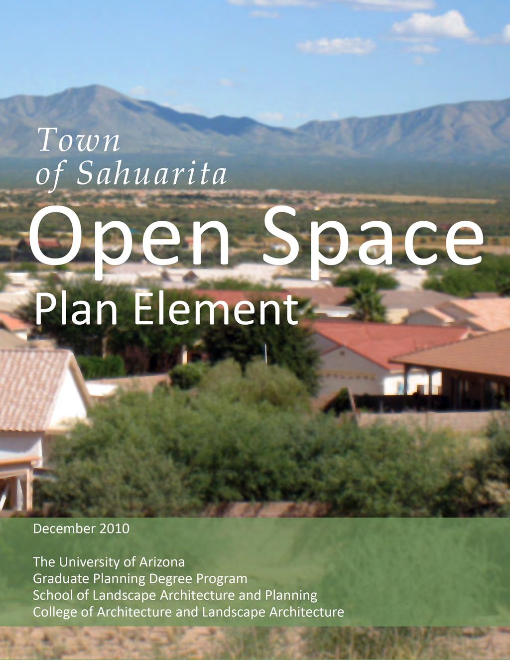
4 Town of Sahuarita 2010 Open Space Plan Date: December 2010 Prepared by: The University of Arizona College of Architecture and Landscape Architecture School of Landscape Architecture and Planning Graduate Planning Degree Program Planning 611 Projects Class Graduate Students: Jessica Abrahams Andrew Babico Frederick Hartshorn Nathan Lothrop Yancy Lucas Kharisma Montes de Oca Kevin Pieters Milini Simms Desiree Smith James Summerset Instructors: Laura Huntoon Jack Siry ii Page
5 Acknowledgements: The class would like to acknowledge the Town of Sahuarita Staff, especially the following individuals for providing valuable input and assisting us in creating this document. Sarah More, Planning & Building Director Orlanthia Henderson, Planner Deborah Summers, Parks & Recreation Director We would also like to thank Dr. Sandra Rosenbloom from the Planning Program at University of Arizona for assisting with the final document. iii Page
6
7 EXECUTIVE SUMMARY The Town of Sahuarita is uniquely positioned to grow into a major hub for outdoor recreation in the Sonoran Desert and Southern Arizona with the proper planning and supportive public policies and private actions. The Town has a rich and diverse cultural heritage based on both Spanish and frontier settlements; it has historically depended on both mining and agriculture for its economic base. The Town is located along the scenic banks of the Santa Cruz River and serves as the gateway to the beautiful Santa Rita Mountains. It is home to a spectacular array of birds, reptiles, and mammals whose viability depends on the sometimes unique vegetation, soil patterns, and natural water courses in the area. Many of the recreational opportunities in the Town depend on the attractiveness of these resources and particularly the existing open spaces that preserve and protect them. The residents of the Town of Sahuarita have long recognized the importance of safeguarding natural corridors, open spaces, and native wildlife and vegetation to protect their unique eco- system, and indeed the character, of their town. Since the Town s incorporation in 1994, public officials and local citizens have repeatedly embraced the goal of preserving and expanding valuable open space in the Town, particularly in ways that can enhance recreational opportunities. In 2004 the voters of Pima County authorized communities to purchase open space; in 2007 the Town of Sahuarita and Pima County signed an intergovernmental agreement that will allow the Town to use $1.5 million in bond funds to acquire open space. Against this backdrop, in August of 2010 the Town of Sahuarita commissioned a team of graduate students from The Planning Program of the University of Arizona, under the leadership of Professors Laura Huntoon and Jack Siry, to develop the required Open Space element of the 2012 mandatory update of the Town General Plan. To meet this objective The University of Arizona Team undertook five specific Tasks whose outcomes are synthesized in this document. The Team: v Page
8 Inventoried and evaluated both natural resources and existing open space in the Town as well as identifying short- and long- term threats to open space Met several times with elected officials, community groups, and key stakeholders to gauge public opinion about open space and long term recreational goals Analyzed the Town s vision for open space and recreational activities as expressed in historical and current planning documents and public surveys Identified five implementable goals to protect, enhance, and expand open space and active recreation in the Town Prepared the Open Space Element for the 2012 Town General Plan, consistent with current planning efforts and public views about preserving open space. The Element includes a specific recommendations for land to be purchased with the $1.5 million bond proceeds under the Intergovernmental Agreement with Pima County The initial section of this document, Existing Conditions, presents the results of the first three of these Tasks. In the first Task, the Team inventoried parks, trails, natural vegetation, wildlife, and water resources in the area. The Team also identified both developed and undeveloped open space in public and private ownership, the active and passive recreational uses associated with these land uses and potentially negative impacts from expected population growth and anticipated land development. In the second Task, the Team met several times with officials and key stakeholders and found widespread agreement that there was a need to protect and enhance open space in the Town of Sahuarita, particularly in ways that improved recreational opportunities. In the third Task the Team found that the Town has repeatedly expressed an open space vision in historical and current planning documents, a genuine commitment to preserving open space and recreational opportunities. The same views were expressed by local residents in a 2006 survey. The second major section of this document, Recommendations, contains the results of the last two Tasks undertaken by the Team. The Team developed five major goals to enhance vi Page
9 and protect open space consistent with the Town s vision; each is built around the crucial importance of the Santa Cruz River. The five goals are: 1) Make the Santa Cruz River the focus of future open space protection and development within the Town 2) Provide community residents with the opportunity to enjoy open space along clearly identified and well- maintained pedestrian, cycling, equestrian and multi- use trails that connect the Santa Cruz River to local and regional trip attractors and points of interest, 3) Increase regional connectivity to enhance all aspects of open space within the Town, 4) Identify and preserve sensitive open space areas with specific planning and policy instruments, and 5) Protect and increase all types of open space within the Town. The fifth and final Task undertaken by the University of Arizona Team was to prepare the Open Space Element of the 2012 Town of Sahuarita General Plan that incorporated these goals; that Element provides a detailed Recommendation section that presents a detailed rationale for each of the five goals and then a number of specific strategies or actions to implement each of the five goals. The Recommendation section includes an Action Plan outlining four priority items that the Town can undertake. The Action Plan is followed by a suggested time frame for implementing various recommendations, and a list of the agencies, stakeholders, or other parties who would be responsible for each action (presented in a matrix format). To support the first goal, making the Santa Cruz the focus of future open space planning, the highest priority action is for the Town to use the $1.5 million County bond proceeds to purchase the Landmark Trust parcels north of Quail Creek Boulevard and south of the Pima County Wastewater Reclamation Facility. This land lies within the Santa Cruz River floodplain, as required by the 2007 Intergovernmental Agreement between the Town of Sahuarita and Pima County. Also listed are alternative properties if the Town is unable to acquire the Landmark Trust parcels. vii Page
10
11 TABLE OF CONTENTS Executive Summary... v Introduction... 1 Methods... 2 Existing Conditions... 5 Town of Sahuarita s Current Open Space Vision... 7 History and Regional Context Factors Influencing Open Space Land Developed Land Undeveloped Land Land Ownership Land in Specific Plans Existing Parks Trails Soils Vegetation Water Wildlife ix Page
12 Recommendations Goal 1: Highlight the Santa Cruz River as Sahuarita's centerpiece for open space Goal 2: Provide community residents with the opportunity to enjoy open space along linkages within the Town of Sahuarita Goal 3: Increase regional connectivity for open space Goal 4: Identify and preserve sensitive areas through planning and policy Goal 5: Protect and increase open space within the Town of Sahuarita Action Plan Recommendations Matrix Bibliography Appendix A: Population Appendix B: Land Use Maps Appendix C: Sahuarita s Natural Environment Appendix D: Parcel Purchase Recommendations (Goal 1) Appendix F: The Santa Cruz River Corridor as a Major Gateway (Goal 2) Appendix G: Detention basins as neighborhood open space (Goal 3) Appendix G: Open Space Funding Resources (Goals 2 & 5) Appendix H: Identifying Wildlife Habitat & Migration Routes (Goals 4 & 5) Appendix I: Proposed TEP/Rosemont 138- kv Transmission Line Project (Goal 3 and 4) Appendix J: Integrated Conservation Design (Goal 5) x Page
13 Appendix K: Wildlife Habitat Enhancement (Goal 5) Appendix L: Low Impact Development (Goal 5) Appendix M: Model Conservation Subdivision Ordinance (Goal 5) Glosssary of Terms List of Figures Figure 1: Specific Plan Areas... 8 Figure 2: Early Map of Sahuarito Figure 3: Juan Bautista de Anza National Historic Trail Figure 4: Regional Interests in and Around the Town of Sahuarita Figure 5: Regional Actors Figure 6: Developed Land Figure 7: Undeveloped Land Figure 8: Public and Private Undeveloped Land Figure 9: Undeveloped Public Land Owners Figure 10: Four Single Largest Undeveloped Private Land Owners and the Remaining Owners Figure 11: Current and Future Residential Development in Specific Plan Areas Figure 12: Private land ownership including the largest individual land holders xi Page
14 Figure 13: Current and Future Residential Development in Quail Creek and Madera Highlands Figure 14: Current and Future Residential Development in Rancho Sahuarita Figure 15: Public Parks and Pedestrian Connectivity Figure 16:Public Parks and Bike Connectivity Figure 17: Top Five Parcels for Acquisition Figure 18: Pedestrian and Bicycle Path Figure 19: Juan Bautista de Anza National Historic Trail, Painting Figure 20: Sahuarita Future Vision for Open Space and Connectivity Figure 21: Natural and Cultural Resources in Sahuarita Town Center Area Figure 22: Parks, Open Space, and Trails Netowrk in Sahuarita Town Center Area Figure 23: Agriculture and Ranching Lands Figure 24: Rancho Sahuarita Recreation and Trails Figure 25: Madera Highlands Development Plan Figure 26: Madera Highlands Schools and Recreation Figure 27: Madera Highlands Recreation and Trails Figure 28: Sahuarita Soils Figure 29: Sahuarita Soils Figure 30: Sahuarita Soils Figure 31: Priority Vulnerable Species: Pima Pineapple Cactus xiv Page
15 Figure 32: Flooding Areas Figure 33: Priority Vulnerable Species: Birds Figure 34: Priority Vulnerable Species: Reptiles Figure 35: Priority Vulnerable Species: Mammals Figure 36: Landmark Parcels Figure 37: Landmark Parcels Aerial View Figure 38: Southeast Corner of La Villita & Sahuarita Roads Parcel Figure 39: Southeast Corner of La Villita & Sahuarita Roads Parcel Aerial Figure 40: Southwest Corner of Pima Mine Road & the Santa Cruz River Parcel Aerial Figure 41: Southwest Corner of Pima Mine Road & the Santa Cruz River Parcel Figure 42: South Santa Rita Road Parcel Figure 43: South Santa Rita Road Parcel Aerial Figure 44: Parcel North of Quail Creek Boulevard Parcel Figure 45: Parcel North of Quail Creek Boulevard Parcel Aerial Figure 46: Tres Pueblos Layout Figure 47: Sycamore Park Layout Figure 48: Valley Ranch Layout Figure 49: Sahuarita and Surrounding Major Watersheds Figure 50: 100- year Floodplains and Proposed Flow Corridors xv Page
16 Figure 51: Proposed TEP/Rosemont 138- KV Transmission Line Routes List of Images Image 1: View of Sahuarita Residential Area... 1 Image 2: Santa Cruz River... 9 Image 3: Open Space in Rancho Sahuarita Image 4: Madera Highlands Image 5: State Lands near the Santa Cruz River Image 6: Twin Buttes, circa Image 7: FICO Pecan Trees Image 8: Quail Creek, Image 9: Quail Creek, Image 10: Quail Creek, Image 11: Entrance to the dog park at Quail Creek Veterans Memorial Park Image 12: Vegetation in Sahuarita Image 13: Pima Pineapple Cactus Image 14: Anna s Hummingbird Image 15: Less Long- Nosed Bat Image 16: Santa Cruz River Image 17: Cactus at Proposed West Desert Preserve xvi Page
17 Image 18: Florence, AZ Recharge Project Image 19: Tres Rios Wetlands Hayfield Site Image 20: Sweetwater Wetlands in Tucson Image 21: Birdwatching and Nature Photography Image 22: Off- road Pedestrian and Bicycle Path Image 23: Mesa Community Farmer's Market Image 24: Sharing a Story Sculpture Image 25: Madera Canyon Image 26: Open Space at Proposed West Desert Preserve (Mines in Background) Image 27: Proposed West Desert Preserve Trail Image 28: Native Landscaping and Natural Stormwater Control Image 29: Automatic Bollards Image 30: Fitness Station along Tucson Rialto River Walk Image 31: Tres Pueblos Detention Basin Image 32: Valley Ranch Dentention Area List of Tables Table 1: Developed Land Use Types Table 2: Undeveloped Land Use Type Table 3: Undeveloped Land Ownership xvii Page
18 Table 4: Public Owners of Undeveloped Land Table 5: Four Single Largest Owners and Others of Undeveloped Land Table 6: Public Park Area Table 7: Public Parkland- to- Population Ratios Table 8: Major Water Consumers in Sahuarita Table 9: Town of Sahuarita Population Growth Projection for Table 10: Town of Sahuarita Population Growth Estimate for Table 11: Land Use Type Category Codes Table 12: Parcel Evaluation Data Set Table 13: Open Space Funding Table 14: Economic Benefits from LID Features xviii Page
19
20
 has assisted the Town by preparing one required element")
21 INTRODUCTION The Town of Sahuarita is currently preparing to revise its General Plan as required under Arizona statute. The Graduate Planning Program of the University of Arizona School of Landscape Architecture and Planning (referred hereafter as Projects Team ) has assisted the Town by preparing one required element of the General Plan, the Open Space Plan. The Open Space Plan recognizes that open space 1 preservation is vital to the future of the Town of Sahuarita; the Plan focuses on a number of factors that affect open space from conserving the Santa Cruz River and its Image 1: View of Sahuarita Residential Area Source: Fred Hartshorn (2010) tributaries to protecting parks, trails, and wildlife habitats. The Open Space Plan has two major sections: Existing Conditions and Recommendations. The Existing Conditions section of the Open Space Plan describes and evaluates the current status and condition of the Town of Sahuarita s crucial open space resources. Identifying, mapping, and assessing the wide range of open spaces currently within and 1 Open Space - Open space is private or publicly owned property in the form of agricultural land, undisturbed desert, riparian areas, parks and even in the landscaped or native vegetation yards of individual homeowners. 1 Page
22 nearby the Town, will underpin the development of a new vision and a new plan for preserving and protecting these valuable natural resources. The Existing Conditions section of the Open Space Plan first describes a 2006 Community Interest and Opinions Survey conducted by the Town of Sahuarita. The section then reviews the Town s current vision, as reflected in several adopted plans, and places it within an historical and regional context. Finally, the Existing Conditions section of the Open Space Plan focuses on a variety of existing land uses; subsequent sections concentrate on existing parks, trails, soils, vegetation, water, and wildlife resources. The Recommendations section of the Open Space Plan outlines five goals and their corresponding objectives and strategies. The overarching rationale, which informs the recommendations, is to position the Town of Sahuarita as the hub for open space activity and enjoyment in southern Arizona. The Santa Cruz River has potential to serve as Sahuarita s open space centerpiece. The Recommendations section lists five areas of land the Town can potentially acquire using proceeds from the $1.5 million bond set aside for the purchase of open space within the Santa Cruz floodplain. Linkages in the form of pedestrian, bicycle, and equestrian trails are suggested to connect the river to local and regional points of interest. Lastly, the Recommendations section of the Open Space Plan contains an Action Plan and matrix including suggested priorities, timelines, and responsible parties. METHODS In order to create the Open Space Plan, the Projects Team reviewed all existing Town of Sahuarita plans with open space elements including: the Town of Sahuarita General Plan (2003), the Sahuarita Town Center and Santa Cruz River Sub Area Plan (2008), the Town of Sahuarita Parks, Recreation, Trails, and Open Space Master Plan (2008), and specific neighborhood plans. The information obtained from that process assisted the Projects 2 Page
23 Team in creating the Existing Conditions section of this report. It also helped the Team to understand the open space achievements made by the Town of Sahuarta in recent years. The Team s various meetings with the public also generated new and different open space needs and goals that ultimately informed the Team s recommendations. The Team sought public participation through public meetings and interviews with key stakeholders. The first public meeting was held on September 22, 2010 in which the Team presented the Existing Conditions portion of the Open Space Plan. Using a break out session held at that meeting, the Team gathered feedback from participants regarding their open space needs and desires. In an effort to gather more information about community needs and desires, the Team also interviewed key stakeholders for their input and expertise. The second public meeting was held on November 1, 2010 when the Team presented their recommendations to Town of Sahuarita Commissioners and the public. Commissioners and the public were encouraged to ask questions and comment on the presentation. The Team used feedback from this meeting to refine and strengthen the Open Space Plan Recommendations. The Team will present the final Open Space Plan to the Town Manager on December 8, Page
24
25 EXISTING CONDITIONS Knowledge of existing conditions is essential to identifying potential open space needs in Sahuarita. This report describes the current physical and environmental aspects of open space in the Town of Sahuarita. The Projects Team provides a synopsis of the Town s vision for open space based in part on a Community Survey and excerpts of community vision statements from several Town plans. The historical and regional context of the Town is presented to allow for a better understanding of land use patterns within and around the Town. Existing open space in the Town can be found in the form of active 2, passive 3, and natural open space areas 4. Specific elements pertaining to open space that are discussed in the Existing Conditions include land, parks, trails, soils, vegetation, water, and wildlife. Over the coming decades, the Town of Sahuarita is expected to continually grow from its approximate current population of 24,767 residents to 47,905 in the year The doubling of the Town s population will have many effects on the Town, including changing the availability of open space. Changes to open space will be most noticeable in the visual character of land in and around residential neighborhoods and in the amount of open space available to the public. For example, existing scenic views and natural open space 2 Active open space - Areas providing for organized sporting and recreational functions. Examples of active open space include sports fields, tennis courts, showgrounds, and areas for other outdoor sports. 3 Passive open space - Areas where users can relax and enjoy the space without a specifically organized sporting activity. Examples of passive open space include viewsheds or scenic areas, landscape amenities, picnic areas, playgrounds, bird watching, boating, fishing, and areas for other such passive or informal activities. 4 Natural open space - May hold little or no recreational value but may serve other purposes such as the protection of sensitive ecosystems, scenic values or as part of stormwater management devices including retention basins and wetlands. Natural open space areas may provide some limited walking or similar recreational opportunities, but will often be restricted or have no access at all. 5 Page
26 areas currently enjoyed by residents may be replaced with residential units as the Town s master- planned communities 5 continue to develop. Community Interest and Opinions Survey 2006 The Town of Sahuarita conducted a Community Interest and Opinions Survey between September and October of 2006 in order to gain public input on the Town s recreational needs. The findings of the study provided important data that the Projects Team used as the initial reference point in preparing the Open Space Plan. The 2006 Survey showed a high level of support for funding, acquiring, and maintaining open space. Almost 50% of the Town s residents stated that they would be willing to fund renovations for walking and biking trails with tax dollars. In addition, 35% of respondents responded positively when asked if they would support using tax dollars to purchase land to develop natural parks. The 2006 study also found: Strong park usage rates within the Town (higher than national benchmarks) High satisfaction with parks among residents Lower participation in recreation programs than the national benchmark Unmet needs for outdoor and indoor facilities and recreation programs Top priorities for residents include the development of trails, an indoor recreation facility, and purchasing land for natural area parks A consistently high priority is improving the park system 6 The Town should be commended for the considerable progress it has made in providing public open space since the document was adopted. The review of the survey as well as plans adopted by the Town of Sahuarita, show that open space is a high priority for residents and government alike. 5 Master- planned community An area of a minimum contiguous size, as specified by ordinance, to be planned, developed, operated, and maintained according to plan as a single entity and containing one or more structures with appurtenant common areas. 6 Findings from the survey can be found in the 2008 Parks, Recreation, Trails, and Open Space Master Plan. 6 Page
27 TOWN OF SAHUARITA S CURRENT OPEN SPACE VISION This section will review open space vision statements from plans that have been adopted by the Town of Sahuarita including the Town of Sahuarita General Plan (2003), the Sahuarita Town Center and Santa Cruz River Corridor Sub Area Plan (2008), and the Town of Sahuarita Parks, Recreation, Trails, and Open Space Master Plan (2008). Additionally, specific plans adopted by the Town of Sahuarita are reviewed including Quail Creek Specific Plan (1989), Rancho Sahuarita Specific Plan (1996), and Madera Highlands Specific Plan (1999). The locations of the specific plan 7 areas can be found in Figure 1. All six plans recognize open space as integral to the future success of Sahuarita. Consensus of Open Space Vision There are several parallels among the vision statements from the plans reviewed. The Town wishes to protect the Santa Cruz River, its washes, and its tributaries, and to conserve its natural and water resources, habitat and wildlife routes, vistas, and scenic corridors. The Town values a balanced approach to development with the provision of both natural open space and public recreational amenities. Lastly, a sense of community and connectivity to the region via open space is viewed as serving an important role in the cultivation of the Town s identity. Based on this review, the Town s current vision of open space can be summarized in the following statement: The Town of Sahuarita envisions open space as a central component to its identity and regional attraction. The Town is committed to social and environmental sustainability and as such, holds the conservation and preservation of the Santa Cruz River and its environs, natural resources, and natural open spaces as a top priority. Connectivity in the form of linkages to the Santa Cruz River, Juan Bautista de Anza National Historic Trial, and the region s system of trails will be promoted. 7 Specific Plan A specific plan is a tool for the systematic implementation of the general plan. It effectively establishes a link between implementing policies of the general plan and the individual development proposals in a defined area. A specific plan may be as general as setting forth broad policy concepts, or as detailed as providing direction to every facet of development from the type, location and intensity of uses to the design and capacity of infrastructure; from the resources used to finance public improvements to the design guidelines of a subdivision. 7 Page
28 Figure 1: Specific Plan Areas Source: See Appendix B for details on creation methodology. 8 Page
 neighborhood parks")
29 The Town of Sahuarita General Plan (2003) The Recreation and Open Space Element of the Town of Sahuarita General Plan (2003) contains two goals pertaining to open space. Goal REC- 2, in particular, recommends promoting balance between natural open space and established regional Image 2: Santa Cruz River Source: Milini Simms and Desiree Smith (2010) neighborhood parks within the Town of Sahuarita and its environs (Town of Sahuarita General Plan, 2003, p. 48). The vision statement in the Town s General Plan makes reference to open space three times. The Plan envisions that by the year 2020, the Town of Sahuarita will: Demonstrate commitment to social and environmental sustainability through the measurement of both short and long- term impacts of [the Town s] decisions, Continue to value, conserve, and protect the Santa Cruz River and its washes and tributaries, and Protect natural resources, clean air, water resources, natural habitat and wildlife routes, vistas, and scenic corridors (2003, p. 5). The Sahuarita Town Center and Santa Cruz River Corridor Sub Area Plan (2008) The importance of open space is clearly emphasized in the vision statement for the Sahuarita Town Center and Santa Cruz Corridor Sub Area Plan (2008): The compact pattern and integrated circulation system of Sahuarita s Town Center/Santa Cruz River area will encourage residents and visitors to travel to, from, and within the area using a variety of modes, including walking, automobile, bicycle, equestrian, and transit. Strong linkages to the Santa Cruz River, the De Anza Trail, and the region s connected system of trails and open space will serve as an important part of our community s identity (p. 7). The Town of Sahuarita Parks, Recreation, Trails, and Open Space Master Plan (2008) The vision of the Town of Sahuarita Parks, Recreation, Trails, and Open Space Master Plan (2008) promotes open space with an emphasis on recreation and community utility. The vision of this plan is: To create community through people, parks, and programs (p. 1). 9 Page
 of open space to the site: The")
. Rancho Sahuarita Specific Plan (1996) The master planned community of Rancho Sahuarita is located at the Town s north end.")
30 Quail Creek Specific Plan (1989) Quail Creek is a master- planned retirement community located in the southern portion of the Town. The following statement in the Quail Creek Specific Plan highlights the importance Image 3: Open Space in Rancho Sahuarita Source: Milini Simms and Desiree Smith (2010) of open space to the site: The Plan focuses on optimizing the site, coordinating a mix of single family attached and detached homes, support commercial and residential lodging, providing adequate circulation, open space and recreational amenities (p. 28). Rancho Sahuarita Specific Plan (1996) The master planned community of Rancho Sahuarita is located at the Town s north end. Two statements in the Rancho Sahuarita Specific Plan call for the allocation of open space within the development: This Plan focuses on optimizing the site by creating recreation. Development will be balanced with natural open space and public recreational amenities (p. 79). Madera Highlands Specific Plan (1999) Madera Highlands is another master- planned community located in the southern portion of Town. This specific plan also underscores the need for both natural open space and recreational amenities within the development: Image 4: Madera Highlands Source: Milini Simms and Desiree Smith (2010) This Plan focuses on optimizing unique existing site conditions to create a high quality mixed- use community setting. Housing, commercial and public services will be balanced with natural open space and public recreational amenities (p. 39). 10 Page

31 HISTORY AND REGIONAL CONTEXT This section will provide a broad overview of the historical and regional context in which the Town of Sahuarita has developed. Knowledge of the Town s history will lead to a better understanding of past and present land use patterns, which is essential to making informed decisions regarding the Town s future. Figure 2: Early Map of Sahuarito Source: Find Target Reference Sahuarita has a long and rich history. Over 200 archaeological sites have been identified in the vicinity, providing evidence of settlement as early as 500 A.D. In 1954, 216 sites from the period of 500 to 1400 AD were discovered in the 20- mile stretch from Tubac to Sahuarita. While there has been little consistent archeological work in the Town, there is consensus among scholars that the land within the region was settled sporadically, usually by only one group at a time. Native American tribes such as the Hohokam and Sobapuri, for example, inhabited the area. The Town of Sahuarita is situated in southwestern Pima County approximately 48 miles north of the U.S. - Mexican border. Neighboring communities include the Tohono O Odham Nation Reserve, San Xavier District to the north, the City of Tucson to the northeast, and Green Valley to the south. The western border of the Town is largely owned and occupied by large- scale active copper mining operators. In addition to being 11 Page

32 positioned near significant areas of regional interest, the Town is largely surrounded by vacant, undeveloped land. Much of the surrounding land is located within unincorporated Pima County, including the community of Green Valley. A map of the Town s boundaries and adjacent jurisdictions is found in Figure 5 on page 33. A large portion of this land is owned by the state. These and other state- owned lands are managed by the Arizona State Land Department. The mission statement of the Arizona State Land Department is to manage state trust lands and resources to enhance value and optimize economic return on state land sales. The department s fiduciary responsibility includes selling state land for the highest and best use, therefore making the most money for the state. Most often, the highest and best use state land is some sort of development, whether this is a housing or commercial development or otherwise. State land is seldom valued as open space, because state lands sold as open space makes no profit for the state. Freeport McMoran and the American Smelting and Refining Company (ASARCO) are major employers within the region. The southeast Image 5: State Lands near the Santa Cruz River Source: Fred Hartshorn (2010) Town boundary borders the Santa Rita Experimental Range and Wildlife Area. This is dedicated State Land is operated by the University of Arizona for rangeland agricultural study. The Coronado National Forest boundary is approximately 13 miles 12 Page

33 southeast from the center of the City of Tucson. To the east of Town are unincorporated lands, primarily owned by the State Land Department. To the west of the Town is land unincorporated by Pima County. It consists of mainly private lands and includes major portions of the Sierrita Mine, Twin Buttes Mine, and Mission Mine. The Town s diverse cultural heritage, its historical dependence on agriculture and mining, and its Spanish and frontier settlements all helped to define the development patterns of the Town. Early Spanish missions, frontier outposts, and old mines surround the Town. Now an active artist colony, the old Spanish settlement of Tubac to the south is the starting point Figure 3: Juan Bautista de Anza National Historic Trail Source: National Park Service of the Juan Bautista de Anza Trail of 1774, which was used by Spanish missionaries as a supply route from Sonora, Mexico to northern California. The trail is now on the list of the National Park Service as the Juan Bautista de Anza National Historic Trail. The route is illustrated in Figure 3 on the following page. It continues north from Tubac directly through the Town of Sahuarita. The San Xavier mission and the Tumacacori National Monument are nearby Spanish missions built by the Jesuits in the early 1700 s. James Kilroy Brown founded Sahuarita Ranch in the late 1800 s to serve as a stagecoach station for the routes connecting the communities of Tucson, Arivaca, and Quijotoa. The community that developed around the Ranch was eventually named Sahuarito. During 13 Page

34 the early 1880 s Sahuarita Ranch evolved into a community center with a school, post office, stagecoach station, and hotel. Brown sold his ranch in 1886 and the area struggled economically for some time; the post office was also closed for a period of time. The earliest reference to the Town s current name is found in a German map from 1875 where the site is referred to as Sahuarito. In 1879, the Town was documented as Saurita on a map created by the U.S. Department of Interior. Mining operations and railroads have both played an integral role in the history of Sahuarita. The Twin Buttes Railroad Company, owned by the Twin Buttes Mining and Smelting Company, was established in October Image 6 shows miners from Twin Buttes waiting to be transported underground. The railroad station in Sahuarita was part of the Nogales branch of the Southern Pacific Railroad. In 1915 Bernard Baruch, Joseph Kennedy, and J.P. Morgan founded an agricultural enterprise in Sahuarita named Continental. The entrepreneurs initial intent was to grow guayule, which Image 6: Twin Buttes, circa 1905 Source: Arizona Pioneers Historical Society is a plant used to produce rubber. At the end of World War I, the project was abandoned. In 1922 the farm was sold to Queen Wilhelmina of the Netherlands who rented the land to cotton farmers. 14 Page

35 In 1948 Queen Wilhelmina sold Continental Farm to Keith Walden. Walden relocated the Farmers Investment Company (FICO) from California to the property he purchased. FICO first established a citrus nursery and then began to Figure 4: Regional Interests in and Around the Town of Sahuarita Source: Yancy Lucas produce cereal grains and other crops. In 1953 FICO opened a cattle feedlot eventually raising a total of 20,000 cattle, which closed in After learning the market for cotton was diminishing, Walden began testing the production of crops such as pecans, pistachios, nectarines, apricots, and grapes. Pecans and grapes fared the best and in 1965 Walden began to convert his cotton farms into what would become the world s largest irrigated pecan orchards. FICO remains the major land holder within the Town. Sahuarita lies in the Santa Cruz/Rio Magdalena/Rio Sonoita watershed. Other points of interest in the region include Pena Blanca Lake, Kitt Peak Observatory, and Madera Canyon. Located within the Santa Rita range, it has been recognized as the third best birding destination in the United States and expands up through four different ecosystem zones supporting an abundance of flora and fauna. 15 Page

36 Figure 5: Regional Actors Source: See Appendix B for details on creation methodology. 16 Page
37
38
39 FACTORS INFLUENCING OPEN SPACE This section will address important factors potentially affecting open space within the Town of Sahuarita. These include land, parks, trails, soils, water, and wildlife resources. LAND This section reviews land use types (developed 8 and undeveloped 9 ), land ownership (public 10 and private 11 ), and the attributes of specific plan 12 areas within the Town of Sahuarita. Future development patterns will be affected by land usage, ownership, and land use regulations. These development patterns will directly and indirectly influence the amount and quality of future open space within the Town. DEVELOPED LAND Developed land contains structures and landscaping that have often fundamentally altered the pre- developed state of a given parcel. As a result, developed land may have little remaining open space that is useful for passive or active enjoyment. By better understanding developed and undeveloped lands, planners can make more educated decisions concerning open space planning and accompanying policy. Developed and undeveloped land uses in the Town of Sahuarita were categorized for inventory and 8 Developed Land Land that contains structures and landscaping that have often fundamentally altered the pre- developed state of the land. 9 Undeveloped Land Land that contains no structures that have often fundamentally altered the pre- developed state of the land. 10 Public Land Land owned by federal, state, county, or local governments. 11 Private Land Land Land that gives the owner the right to: control the use of the property, benefit from the property, transfer or sell the property, and exclude others from the property. 12 Specific Plan A specific plan is a tool for the systematic implementation of the general plan. It effectively establishes a link between implementing policies of the general plan and the individual development proposals in a defined area. A specific plan may be as general as setting forth broad policy concepts, or as detailed as providing direction to every facet of development from the type, location and intensity of uses to the design and capacity of infrastructure; from the resources used to finance public improvements to the design guidelines of a subdivision. 19 Page
40 evaluation. These categories are based on the current use by the property owner as outlined in the Property Use Code Manual of the Arizona Department of Revenue Property Tax Division. More detailed information on the methodology of land use type creation can be found in Appendix B: Land Use Maps. The Town has seven different land use classifications for already developed land as illustrated in Table 1. As the table makes clear, the vast majority of developed land in the Town is residential; the next most common type of developed land is industrial (the mines in most cases). Developed Land Use Type (Examples) Area (Acres) Percentage of Total Developed Area Commercial/Entertainment (Movie theater, bowling alley) 25 <1% Commercial/Office (Commercial bank, credit union) 28 <1% Industrial (Mineral mining, self- storage complex) 265 8% Institutional (Government, public school) 197 6% Services (Daycare, retirement home) 9 <1% Residential (Single- family home, multi- family apartment) 2,648 81% Retail/Sales (Grocery store, gas station) 110 3% Total 3,282 Table 1: Developed Land Use Types Source: See Appendix B for details on how land use calculations were derived, information on land use type definitions, and additional land use type examples. Each respective land use is distributed geographically throughout the Town but is often concentrated in specific areas. For example, residential communities like Rancho Sahuarita in the northwest and Quail Creek and Madera Highlands in the southeast are located in very specific parts of the Town. Institutional uses like schools are situated in the center of Town, along Sahuarita Road. The location of developed land uses can be found in Figure 6 on the next page. Given the Town s projected population of 47,905 persons by 2030, it is certain that new land will be developed for residences and the amenities they necessitate. 20 Page
41 The pattern, intensity, and environmental sensitivity of these new developments will have a measureable effect on open space protection (or destruction). 21 Page
42 Figure 6: Developed Land Source: See Appendix B for details on creation methodology. 22 Page
43 UNDEVELOPED LAND Undeveloped land contains no structures that fundamentally altered the pre- developed state of a given parcel. However, undeveloped land may have been altered from its original, natural state. Such alterations include clearing of native vegetation, farming crops, or using land for ranching. It is important to distinguish between developed and undeveloped land because development has more potent impacts on existing open space. The Town will continue to grow and build structures on what is currently undeveloped land. The more developed an area becomes the more likely it is that existing open space will become altered, degraded, or destroyed. Furthermore, what might be land available to the public as open space could potentially be developed without the provision for public access. Currently, the Town s regulatory framework does not mandate public open space or public access when development occurs. Without regulatory changes that guarantee public open space and public access, two problems will arise. First, there could be a severe deficit of public open space. Second, there could be no way for the public to access public open space without trespassing on private lands. There are five categories of undeveloped land uses within the Town of Sahuarita; they encompass all agricultural and vacant lands within the Town. Descriptions of undeveloped land use types, relevant examples, and acreages can be found in Table 2. Undeveloped Land Use Type (Examples) Area (Acres) Percentage of Total Undeveloped Area Crop Trees (Nut, orange) 5,089 51% Field Crops (Cotton, grapes) 288 3% Ranch/Pasture (Livestock grazing) 1,972 20% Vacant (Drainage area, native vegetation) 2,617 26% Total 9,966 Table 2: Undeveloped Land Use Type Source: See Appendix B for details on how land use calculations were derived, information on land use type definitions, and additional land use type examples. 23 Page

44 Categories were based on the current use as outlined in the Property Use Code Manual of the Arizona Department of Revenue Property Tax Division. For more detailed information on the methodology, please see Appendix B: Land Use Maps. There are tracts/parcels of undeveloped land throughout the Town, but there are higher concentrations of certain kinds of undeveloped land use types. For example, crop trees line both sides of the Santa Cruz River through most of the Town. Crop fields are tucked among the crop trees along the Santa Cruz in the middle of the town. Image 7: FICO Pecan Trees Source: Milini Simms and Desiree Smith Vacant land is dispersed throughout the Town, with concentrations in the northwest and southeastern extents. The exact parcel locations of agricultural, ranching, vacant lands can be found in specific locations in Figure 7. Undeveloped land will not necessarily remain protected from development. Agriculture and ranching have been practiced in the area for many years and will likely continue until development pressures become too great and land is built upon. Vacant land will be developed to maximize profit with no assurance of open space protection. The Town has no regulatory framework for open space protection. Aside from altering regulations to require or exact open space protection and access, the Town s only other option for open space protection is to own the land or its development rights. The Town could purchase the land or development rights, or a land holder could donate the land. Otherwise, undeveloped land that could benefit the Town as preserved open space is unlikely to be protected. 24 Page

45 Figure 7: Undeveloped Land Source: Appendix B for details on creation methodology. 25 Page
46 LAND OWNERSHIP Property ownership influences whether or not land is protected as open space within the Town of Sahuarita. Ownership, in combination with the land use type, can determine the potential for open space protection. However, it is not useful to identify land ownership on developed parcels. These lands do not hold much potential for open space protection because they have already been substantially altered by permanent structures. Undeveloped lands like agricultural, ranching, and vacant lands hold much more open space protection potential because they lack built structures. These are undeveloped lands that, if conserved as open space, could greatly benefit the Town. This section focuses on the two types of undeveloped land ownership: private 13 and public 14. The Town also contains undeveloped land in specific plan 15 areas. The uses and layouts identified within these plans can be changed only by amending the specific plan. The director of the Planning and Building Department must certify the proposed amendment for changing land use, density or zoning on any future parcel. However, unless developers required a change in the existing plan, there is little reason to assume they would do so to increase open space. For these reasons, private land in specific plan areas is not included in the survey of private undeveloped land. Specific plan areas will be discussed in detail in the next section. 13 Public Land Land owned by federal, state, county, or local governments. 14 Private Land - Land that gives the owner the right to control the use of the property, benefit from the property, transfer or sell the property, and exclude others from the property. 15 Specific Plan A specific plan is a tool for the systematic implementation of the general plan. It effectively establishes a link between implementing policies of the general plan and the individual development proposals in a defined area. A specific plan may be as general as setting forth broad policy concepts, or as detailed as providing direction to every facet of development from the type, location and intensity of uses to the design and capacity of infrastructure; from the resources used to finance public improvements to the design guidelines of a subdivision. 26 Page
47 The majority of undeveloped land is owned by private land holders. Examples of private and public owners and the total area of each type can be found in Table 3. The exact location of public and private undeveloped parcels can be in found in Figure 8 on page 44. Undeveloped Land Ownership (Examples) Area (Acres) Percentage of Total Undeveloped Area Public (Pima County, State of Arizona) 1,934 22% Private (Landmark Trust, Farmers Investment Company) 6,802 78% Total 8,736 Table 3: Undeveloped Land Ownership Source: See Appendix B for details on how land use calculations were derived, information on land use type definitions, and additional land use type examples. Public land owners in the Town include the United States, the State of Arizona, Pima County, and the Town of Sahuarita. The respective total land areas can be found in Table 4. The four public landholders have no obligation or restriction on how their land is used unless the property is subdivided or rezoned. The Town is not likely to sell their potential open space parcels, while the other three public land owners, the federal, state, and county governments, are more likely to sell their parcels. The exact locations of public undeveloped land, the owners, and the total area of their respective land, can be in found in Figure 9 on page 45. The federal government may sell land, but it is also possible they may never sell it. The same holds true for state lands. These transactions may come in the near or distant Public Owner Area (Acres) Percentage of Total Public Undeveloped Area Town of Sahuarita 90 5% Pima County 186 9% State of Arizona 1,648 85% United States of America 10 1% Total 1,934 Table 4: Public Owners of Undeveloped Land Source: See Appendix B for details on how land use calculations were derived, information on land use type definitions, and additional land use type examples. 27 Page
48 future, or may never occur at all. State land will be sold when the Arizona State Land Department believes they can obtain the highest and best use for the land that will fetch the highest price from a buyer. Currently, the Town has no regulations on protection of open space, therefore the purchaser of lands is able to rezone, subdivide, and build upon the purchased land to the fullest extent possible, without regard for open space protection. Land owned by Pima County may be held by the county, sold, or given to the Town under certain conditions. Pima County does not have the same fiduciary responsibility as the state; county land can be conserved and protected as publicly accessible open space. They are not required to sell land for the highest price, which often comes in the form of development. Owners of private undeveloped land range from large companies to individual land holders. As shown in Table 5, four private entities own 93% of the total undeveloped private land area in Town; the remaining owners hold 7% of total undeveloped private land area in the Town. Most of the private undeveloped land within the Town is concentrated in large parcels often grouped in contiguous blocks. The locations and cumulative areas of the private owners can be found in Figure 10 on page 46. Private Owner Area (Acres) Percentage of Total Private Undeveloped Area Cyprus Pima Mining Co 201 3% Farmers Investment Co 5,423 80% Landmark Title Trust 325 5% Park Company of Arizona Inc 364 5% Remaining Owners 489 7% Total 6,802 Table 5: Four Single Largest Owners and Others of Undeveloped Land Source: See Appendix B for details on how land use calculations were derived, information on land use type definitions, and additional land use type examples. 28 Page
49 Private undeveloped land is subject to the regulatory framework of the Town of Sahuarita when land is rezoned and/or subdivided. However, there are no regulations that require the protection of open space. Aside from changing regulations to require or exact open space protection and access, the Town s only other option for open space protection is to own the land or its development rights. The Town could purchase the land or development rights, or a land holder could donate the land. Potential funding resources for securing open space from development can be found in Appendix G: Open Space Funding Resources (Goals 2 & 5). In the short term it is unrealistic to expect land owners, both public and private, to voluntarily restrict development where it is feasible for the protection of open space. The stagnant development market has slowed the development of potential open space for the moment, but this may be only temporary. 29 Page
50 Figure 8: Public and Private Undeveloped Land Source: See Appendix B for details on creation methodology. 30 Page
51 Figure 9: Undeveloped Public Land Owners Source: See Appendix B for details on creation methodology. 31 Page
52 Figure 10: Four Single Largest Undeveloped Private Land Owners and the Remaining Owners Source: See Appendix B for details on creation methodology. 32 Page
53 LAND IN SPECIFIC PLANS The Town contains three specific plan 16 areas: the residential neighborhoods of Quail Creek, Rancho Sahuarita, and Madera Highlands. The exact locations of the neighborhoods are illustrated in Figure 11 on page 52. To change the land use or design of these neighborhoods, the specific plan amendments have to be initiated by the developer and approved by the director the Planning and Building Department. Specific plan areas are developed in phases, with each new round of development eliminating what is currently undeveloped land. Changes in the specific plan layout can be categorized as a major or minor amendment, depending on a number of different factors, including affected area size, magnitude of impact, and others. Protecting open space is potentially time and energy consuming for developers. The process of submitting and gaining amendment approval may be lengthy and the effort may be resisted by existing residents. Residents may have located to a community precisely because of its layout, density, or included land uses. Currently, developments in specific plan areas provide their residents with access to private parks controlled by respective home owners associations. Non- members of the home owners associations are usually not permitted to use the private open spaces but there are some public parks in these specific plan areas. Public parks and pedestrian and bicycle connectivity are illustrated in Figure 15 and Figure 16 on pages 57 and Specific Plan A specific plan is a tool for the systematic implementation of the general plan. It effectively establishes a link between implementing policies of the general plan and the individual development proposals in a defined area. A specific plan may be as general as setting forth broad policy concepts, or as detailed as providing direction to every facet of development from the type, location and intensity of uses to the design and capacity of infrastructure; from the resources used to finance public improvements to the design guidelines of a subdivision. 33 Page
54 Many Sahuarita residents enjoy viewsheds or open space simply because they live in neighborhoods that lie on the edge of the built environment. However, current and future residents will watch these open spaces and viewsheds diminish as scheduled plans are constructed. This will happen in specific plans where a majority of future developed lands have not yet been built upon. The location and area of current and approximated future residential development is shown in Figure 11 on page 52. Future residential development was calculated in reference to the neighborhoods respective plans and the existing Geographic Information System (GIS) parcel datasets. All residents but those on the extreme fringes of the specific plan area extents will experience this loss of open space to some degree. Quail Creek Specific Plan (1989) The Quail Creek Specific Plan, adopted by Pima County in 1989, provides regulations and guidelines for the development of this age- restricted community including provisions for golf courses, clubhouses, and recreation facilities. Environmental elements inventoried in the document include three spine washes, wildlife habitat, and view sheds such as the Santa Rita Mountains, Santa Cruz River, and Green Valley. A map of open space, trails, and recreation within the Quail Creek Specific Plan is in Appendix B. The Plan includes an Open Space/Wildlife Concept Plan that emphasizes a focus on the community, the improvement of drainage ways, protecting wildlife habitat, and also establishing a standard of setting aside 33% of the entire site for open space and/or recreation. A 2000 amendment to the Plan requires the provision of recreational amenities for golf, health and fitness, walking, and hiking. It also states that a homeowners association will retain ownership of the common and natural open space areas within the site. 34 Page


55 Figure 13 on page 53 illustrates current developed lands as well as those planned for the future phases of Quail Creek s construction. It also shows that 306 acres have been developed, while approximately 1,178 acres remain to be developed in the future. The great majority of these undeveloped sites remain on the southern and Image 8: Quail Creek, 2002 Source: Pima County Map Guide western sides of the development. Images taken in 2002, 2005, and 2010 visually demonstrate the growth of the development. As residences are built, undeveloped land will be replaced with housing, and viewsheds of the Santa Rita Mountains, Santa Cruz River, and Green Valley will be blocked for all but residents on the outer edges of the development. Rancho Sahuarita Specific Plan (1996) Image 10: Quail Creek, 2005 Source: Pima County Map Guide Image 9: Quail Creek, 2010 Source: Pima County Map Guide The Rancho Sahuarita Specific Plan provides details on existing conditions for the environment, view sheds, and amenities such as parks, trails, and other open spaces. The Plan indicates that the site is environmentally suitable for development; the parcel is flat with no major geologic formations and is classified as Arizona Upland- Sonoran Desert. The Plan also discusses opportunities to maximize views of the Santa Rita Mountains and develop of the site s eastern boundary adjacent to the Santa Cruz 35 Page
56 River for recreational uses. The Plan highlights several open space opportunities for the community including the creation of a linear park along the Santa Cruz River, the proposed national Juan Bautista de Anza National Historic Trail, and Helmet Peak Trail Number 286. Rancho Sahuarita is not yet completely developed. Currently, developed land totals 488 acres in Rancho Sahuarita and land that is planned to be developed totals approximately 1,114 acres. Figure 14 on page 54 illustrates existing and future residential development patters and locations in Rancho Sahuarita. It is clear that almost all existing residential development will be surrounded by future development (with the exception of the center vertically- oriented block closest to the Santa Cruz River). Madera Highlands Specific Plan (1999) Madera Highlands is a 920 acre site with wildlife corridors running across the property and major washes providing passive open space for residents. The eastern portion of the property (550 acres) is comprised of sloping plains dissected by arroyos and broad washes housing native vegetation. The west half of the property is covered with pecan orchards and fallow agricultural land. The residents in Madera Highlands have view sheds of the Santa Rita Mountains to the east and Mt. Wrightson to the south. Residents in Madera Highlands also have access to open space around the Town and region: Madera Canyon is located 12 miles from the site, Anamax Park is three and a half miles to the north, and Sahuarita District Park is six miles to the northeast. Additionally, there are four existing trails within one mile of the property. Madera Canyon Wash Trails and the Juan Bautista de Anza National Historic Trail are onsite as well. The Madera Highlands proposed open space areas include a diverse trail system, utilizing drainage ways as a community amenity for recreation, open space, habitat preservation, neighborhood linkages, and parks. Maps of Madera Highlands schools, recreation, and trails are located in Appendix B. Currently, Madera Highlands is only partially developed. Figure 13 on page 53 shows that only 33 acres of the site have been developed, while approximately 590 acres are planned 36 Page
57 for future development. In the illustration, almost all of the current development has occurred on the central- western portion of the community. As more housing is constructed, viewsheds that current residents enjoy will be lost. It is likely that only residents on the fringes of development will retain viewsheds of Santa Rita Mountains to the east and Mt. Wrightson to the south. 37 Page
58 Figure 11: Current and Future Residential Development in Specific Plan Areas Source: See Appendix B for details on creation methodology. 38 Page

59 Figure 13: Current and Future Residential Development in Quail Creek and Madera Highlands Source: See Appendix B for details on creation methodology. 39 Page

60 Figure 14: Current and Future Residential Development in Rancho Sahuarita Source: See Appendix B for details on creation methodology. 40 Page

61 EXISTING PARKS The Town of Sahuarita currently contains seven public and numerous private parks. Public parks are accessible at least part of the day by the public. A more detailed Public Park Name inventory of parks and pedestrian/bicycle links and locations can be found in Figure 15 and Figure 16 on pages 43 and 44. The Town currently contains 107 acres of public parks, all of which are considered open space. A comprehensive listing of comparative park acreage can be found in Table 6. Some public parkland is developed with amenities such as ball fields or Area (Acres) Percentage of Total Park Acres PARQUE LOS ARROYOS 7 7% ANAMAX PARK & RECREATION CENTER % SAHUARITA LAKE PARK 15 14% QUAIL CREEK VETERANS MEMORIAL PARK % NORTH SANTA CRUZ PARK 14 13% ANZA TRAIL PARK % SAHUARITA DISTRICT PARK Total Table 6: Public Park Area Source: Town of Sahuarita Parks and Recreation Department walking trails, while others are not. Image 11: Entrance to the dog park at Quail Creek Veterans Memorial Park Source: Milini Simms and Desiree Smith (2010) 17 Currently has only 23 of 35 acres developed but is planned for recreational facilities expansion. 18 Currently has only 6 of 25 acres developed. 19 Park belongs to the Sahuarita Unified School District. It is open to the public from 4:00-10:00 PM during school days and from 7:00 AM to 10:00 PM when school isn't in session. 20 Is not Town s park, and is outside jurisdiction. It is mapped but its acres are not counted. 21 Public park land acreage is calculated using the "park_all" and "paregion" shapefiles from the Pima County GIS Library. 41 Page
62 Undeveloped park acres benefit the community by serving different needs, like adding natural beauty and aesthetic appeal. It is also likely that amenities will eventually be provided in currently undeveloped public parkland. Today the Town has a total of 107 public parks and a population of 24,767 people. This means that there is approximately 4.32 acres for every thousand residents. The Town is expected to grow to 47,505 residents by the year If no new public parks are added, then there will be only 2.23 public park acres per person. This will cause the existing park facilities to become over- burdened. The Town already Year Population Public Park Acres/1,000 Persons , , Table 7: Public Parkland- to- Population Ratios Source: Town of Sahuarita has higher- than- average parkland usage rates, thus, having less public parkland would only exacerbate that problem. The Town of Sahuarita also has a number of private parks owned and managed by entities like neighborhood associations. 23 Members of private entities pay a fee in order to maintain and use these areas. Private parks do not guarantee public access, though they may informally allow it. Private park acreage is not used to calculate park acres to population ratio. 22 The 2030 park acres- to- population assumes no new public parks are constructed. 23 Some private parks include: Parque del Tierra, Parque de los Arboles, Parque del Sol, Parque del Lago, and Club Rancho Sahuarita. 42 Page

63 Figure 15: Public Parks and Pedestrian Connectivity Source: Yancy Lucas 43 Page

64 Figure 16:Public Parks and Bike Connectivity Source: Yancy Lucas 44 Page

65 TRAILS Fifteen miles of bicycle trails and five miles of pedestrian trails make their way through the Town of Sahuarita, as illustrated in Figure 15 and Figure 16 on pages 43 and 44. Residents enjoy 7.55 acres of trails per 1000 people, comparing well to the national service level standards of acres per 1000 people. As previously noted, the Juan Bautista De Anza National Historic Trail also passes through the Town. The expansive, cross- border trail has the potential to bring a wide variety of outdoor enthusiasts to the Town and serve as a premier destination for the residents of the Town of Sahuarita. SOILS The Town of Sahuarita must take into consideration soil types as it determines site location for various open space and recreational activities. Erosion, soil compaction, increased flooding and other related issues must be taken into consideration when planning for open space. A more detailed discussion of the Town s soil types, ranges, and properties can be found in Appendix C: Sahuarita s Natural Environmen. VEGETATION The unique vegetation patterns found in and around the Town of Sahuarita provide numerous benefits to the residents and wildlife residing there. The spectacular array of birds, reptiles, and mammals that call the area home depend on the viability of these vegetative areas now and Image 12: Vegetation in Sahuarita Source: Fred Hartshorn (2010) 45 Page

66 in perpetuity. The Upper Santa Cruz Subarea Report included in the Sonoran Desert Conservation Plan describes the vegetation in and around the Town as mixed scrub leading to palo- verde mixed cacti ecosystems. Trees in the area include blue palo verde (Cercidium floridium), ironwood (Oleyna tesota), mesquite (Prosopis spp.) and cat- claw acacia (Acacia greggii). In addition, the upper portion of the Santa Cruz River area (within the incorporated Sahuarita limits) contains large tracts of agricultural pecan groves cultivated by FICO. Micro- environment plays a large role in vegetative diversity. Urban areas tend to support mixed- scrub and cordgrass habitats, which are prime locations for numerous species of desert wildlife. Wash areas create xeroriparian habitats consisting of larger trees and dominant plants (catclaw Image 13: Pima Pineapple Cactus Source: Flickr.com acacia, velvet mesquite, blue palo verde and barrel cactus and hackberry). Xeroriparian habitats, such as the Santa Cruz River, are ecological areas dependent upon rivers that flow intermittently throughout the year. The xeroriparian wash habitats serve as critical connectivity corridors for a diverse cross- section of southern Arizona wildlife. Concerns for vegetation in the area include the prevalence of exotic, invasive species such as buffelgrass and Lehman s lovegrass. These species can effectively force out other types of vegetation, creating numerous biological and safety hazards (such as increasing wildfire potential). The Pima Pineapple Cactus (Coryphantha sheeri var robustispina) is listed as an endangered species, protected by the Arizona Native Plant Law, and as a Forest Service 46 Page
67 Sensitive Species. It is also protected from international trade by the Convention on International Trade in Endangered Species of Wild Fauna and Flora. It requires particular care and conservation and should be identified and considered for conservation when possible. Their range can be found in Appendix C: Sahuarita s Natural Environmen. Preserving these sensitive areas can greatly increase biodiversity, helping to conserve the natural ecosystems that make the Town of Sahuarita so unique. WATER One of the major open space areas within the Town is located along the Santa Cruz River, yet the Santa Cruz River needs water to fulfill a potential role as a desirable recreational area. Arizona depends on three sources of water: groundwater, state surface waters, and its allotment of the Colorado River. Groundwater is more abundant than the other two sources of water. Arizona, along with most of the Southwestern United States, is overdrafting its groundwater aquifers. According to the Arizona Department of Water Resources, on the average, Arizonans now consume about 2 million acre- feet more groundwater annually than nature replenishes causing severe overdraft particularly in the parts of the state where the majority of the population lives, such as the Tucson and Phoenix metropolitan areas. The 1980 Arizona Groundwater Management Act was enacted to attempt to control Arizona s overdrafting of groundwater and created five Active Management Areas: Prescott, Phoenix, Pinal, Tucson, and, more recently, the Santa Cruz River valley. 24 While the Groundwater Management Act was groundbreaking, it did not completely solve Arizona s problems with overdraft. Many communities throughout the state of Arizona, 24 The Arizona Groundwater Management Act has three major goals: The first [goal] is to control the severe overdraft currently occurring in many parts of the state. The second goal is to provide a means to allocate the state s limited groundwater resources to most effectively meet the changing needs of the state. The third goal of the Act is to augment Arizona s groundwater through water supply development (ADWR, 2007). 47 Page
68 including the Town of Sahuarita, are pumping groundwater at a rate that is unsustainable. Generally, one acre foot of water is enough for a family of four for a year. According to a 2006 report, the Green Valley/Sahuarita area is already pumping groundwater at a rate of 68,000 acre feet per year. Only 28,000 acre feet per year are recharged into the groundwater aquifers. This leaves a deficit of 40,000 acre feet per year for the Town s current population of approximately 25,975 people. To meet current needs, the Town of Sahuarita must now bring additional water to the area in order to effectively recharge its aquifer. Table 8 below outlines the amount of water used by the Town s major consumers. Water User Amount Used Annually in Acre Feet (af) Farmers Investment Co. (FICO) 29,800 ASARCO, Freeport- McMoRan Copper & Gold Inc (formerly Phelps 20,000 Dodge) Cemex 404 United Metro Materials 148 Rosemont (future water use) 5,000 Sahuarita 2030 Population (47,905) 13,718 Total 69,070 Table 8: Major Water Consumers in Sahuarita Source: Town of Sahuarita, 2002 The Town of Sahuarita is served by several private water providers including Las Quintas Serenas, Community Water Company of Green Valley, Farmers Water Company, Sahuarita Water Company, LLC (previously named Rancho Sahuarita Water Company), and Quail Creek Water Company. Of these, only Sahuarita Water Company, LLC is listed with the Arizona Department of Water Resources as having a designated assured water supply at present; this water provider only serves Rancho Sahuarita. The other water companies are listed as having certificates of assured water supply. Subdivisions that do not receive water from a provider with a designated assured water supply must obtain a certificate of 48 Page

, or through an agreement with the")
69 assured water supply. Designations of assured water supply are for water providers; certificates of assured water supply are for subdivisions. 25 By 2030, the Town will face a serious water deficit trying to satisfy the projected population of 47,905 and other water users. These issues are critical when preparing for future growth and development in the Town of Sahuarita. Most likely, water for both the Santa Cruz River and the groundwater aquifer must be obtained either through an extension to the Central Arizona Project (CAP), or through an agreement with the Sahuarita Wastewater Treatment and Reclamation Facility that they will treat effluent to tertiary (drinkable) standards and recharge water into either the aquifer, the Santa Cruz River, or both. See Appendix C: Sahuarita s Natural Environment for more information on water use. WILDLIFE Preserving natural corridors and open spaces can ensure that future generations will be able to enjoy the things that make the Sonoran Desert, the Santa Cruz River, and the Town of Sahuarita so unique and precious. An abundant diversity of wildlife call Sahuarita home. In fact, ten priority vulnerable species listed in the Sonoran Desert Conservation Plan Image 14: Anna s Hummingbird Source: Prestige Nature Photo Contest 25 According to ADWR, in order to obtain a determination of assured water supply, a developer must prove that the water supply is physically, legally, and continuously available for 100 years; that it is of sufficient quality for the proposed use; that the proposed water use is consistent with the management goal and plan of the Active Management Area (AMA); and that the developer has the financial capability to construct any necessary water storage, treatment, and delivery systems. The developer can prove a 100 year supply by satisfying the requirements to obtain a Certificate of Assured Water Supply or by a written commitment of service from a water provider with a Designation of Assured Water Supply. 49 Page

70 can be found in the Town. According to the United States Fish and Wildlife Service (USFWS), four species within the Town are designated as threatened, endangered, or as a candidate for such. The four species include the lesser long- nosed bat, Pima pineapple cactus, acuna cactus, and yellow- billed cuckoo. Detailed range maps of priority vulnerable species can be found in Appendix C: Sahuarita s Natural Environmen. Sahuarita s rich (and largely undisturbed) riparian corridors have been identified as particularly critical habitat for preservation. The Pima County Floodplain Ordinances provide protection for development within these corridors, making them prime locations for open space allocation. The Town of Sahuarita Parks, Trails, and Open Space Master Plan (2008) outlined three priorities for the planned preservation of riparian areas: 1) Include linkages, the Santa Cruz river corridor and significant washes,2) discourage channelization of the river, and 3) include significant undeveloped open space buffer areas between the Santa Cruz as well as other important riparian areas and future development. The Town of Sahuarita contains a unique natural ecosystem. As growth and development in the area expands, however, these species (some found nowhere else in the world) will become increasingly threatened through loss of habitat. Image 15: Less Long- Nosed Bat Source: The Firefly Forest online The Town of Sahuarita General Plan (2003) does not clearly establish the extent to which the Town plans to include critical habitat in future planning. Failure to incorporate such concerns in the planning process may lead to loss of important habitat without a full understanding of its relationship to the greater ecosystem. The Sonoran Desert Conservation Plan, which the Town has not adopted, identifies the area as a critical natural corridor. Adopting these policies would greatly increase protections for 50 Page
71 ecologically sensitive areas within the Town. In addition, floodplain ordinance standards restrict significant development in floodplain areas, leaving these locations as potential areas for transfer of development rights in the future. 51 Page
72

73 RECOMMENDATIONS The goals and recommendations included in this work are intended to inform the Open Space Element for the Town of Sahuarita s 2012 General Plan Update. The recommendations provided in the Open Space Plan are the outcome of the Team s analysis of the Town of Sahuarita s open space needs and desires. The Team developed the goals and objectives that appear here based on considerable community input provided at two public meetings and in interviews with various public and private stakeholders. The overarching rationale of these recommendations is to position the Town of Sahuarita as a hub for outdoor enjoyment in Southern Arizona. Three focus areas provide context for the recommendations: 1. promoting the Santa Cruz River as a centerpiece for open space, 2. increasing neighborhood connectivity, and 3. enhancing regional linkages. Each focus area complements the larger goal of making the Santa Cruz River and the Town of Sahuarita into a hub for outdoor recreation in southern Arizona. Image 16: Santa Cruz River Source: Arizona: Beetles, Bugs, Birds and More 51 Page

74 The Existing Conditions section of this document illustrates the vast potential for protecting open space within and around the Town of Sahuarita. The unique natural resources and amenities found in the area provide opportunities to promote and conserve the region s unique ecosystems and wildlife. Currently, the Town of Sahuarita has $1.5 million reserved by Pima County for purchase of open space in the Santa Cruz floodplain. These funding were provide by county voters who approved a $174 million open space bond issue in May The Santa Cruz River, a specific focus of this report, possesses great potential as a civic and natural corridor to enhance local and regional connectivity for humans and other species. The Team describes the specific land parcels Image 17: Cactus at Proposed West Desert Preserve Source: Yancy Lucas (2010) along the Santa Cruz River that are recommended for acquisition in Goal 1 of the Recommendations. The Team also incorporated environmental programs such as groundwater recharge, wetlands construction, and open space preservation, along with educational components into the recommendations described below. The Town has important opportunities to support its environmental, social, and economic vitality while promoting outdoor lifestyles for residents and guests. For example, creating and preserving open space often 52 Page
75 contributes to indirect economic returns including an increase in property values, tourism, and employment. Linking existing open space and signature attractions through comprehensive transportation routes including walk, bicycle, and equestrian paths can encourage usage and increase interest in future open space planning. Considered together, the proposed recommendations can contribute to Sahuarita s identity as a hub for outdoor activity and enjoyment in southern Arizona. GOAL 1: HIGHLIGHT THE SANTA CRUZ RIVER AS SAHUARITA'S CENTERPIECE FOR OPEN SPACE Rationale: Promoting the Santa Cruz River corridor and its rich biological, historical, and cultural treasures can do much to highlight the Town of Sahuarita and position the Town as a hub for outdoor activity and enjoyment in southern Arizona. The Santa Cruz River is a major natural resource essential to Southern Arizona and the Town of Sahuarita s character. Many desert and riparian wildlife habitats as well as recreational activities are centered in and around the river. It has the potential to become the essential access point for wildlife and community interaction, recreation and outdoor enjoyment. Combining educational and recreational components can further encourage preservation and conservation of important sites and ecosystems. Water features such as multi- use recharge basins and wetland facilities in concert with wastewater treatment can serve as interesting and exciting destinations in addition to functioning as important ecological sites. In interviews and public meetings, stakeholders and residents alike indicated a specific interest in some type of water feature to highlight the Santa Cruz River and the Town of Sahuarita. The following section outlines some of the ways in which the Town of Sahuarita can highlight and conserve the Santa Cruz River s natural, cultural, and historic amenities now and in the future. 53 Page
76 Objective 1.1 Purchase open space parcels with bond funds. Strategy 1.1.1: Negotiate with current parcel owners for land acquisition in priority order of recommendations. The Town of Sahuarita should consider purchasing open space parcels in five potential areas using the $1.5 million bond proceeds. All but one parcel fulfilled the bond money requirement of being located in the Santa Cruz River flood plain (Parcel 4 in Figure 17 on the following page). These recommendations used FEMA Flood Insurance Rate Map boundaries as constraints, the Recreation Element of the 2003 General Plan as guidance, evaluated and ranked lands within the floodplain for several attributes including viewshed, riparian habitat, and proximity to existing outdoor amenities, considered how complicated assembling a large parcel of land would be, and assessed whether the land was held in the State Land Trust. These recommendations are outlined in 54 Page
77 Appendix D: Parcel Purchase Recommendations (Goal 1). The first recommended area for acquisition is found in four contiguous parcels held by Landmark Trust in the Santa Cruz floodplain near the Pima County Green Valley Wastewater Reclamation Facility. The properties are located in Township 18 South, Range 13 East, Section 1 and lie north of the Canoa Land Grant, west of Old Nogales Highway and include parcels 1E, 1Q, 2A and 2B. The land is designated with the numeral 1 in Figure 17. The four other areas evaluated are numbered in order of suitability. Our ranking methodology is detailed in 55 Page

78 Appendix D: Parcel Purchase Recommendations (Goal 1). Acquiring the parcels held by Landmark Trust would allow the Town of Sahuarita to: Secure the required easement for the Juan Bautista de Anza National Historic Trail Balance open space and parklands concentrated in the north end of Sahuarita Connect trails along the Santa Cruz and the east- west trail which extends from La Canada through Santo Tomas Provide expansive open space for Santo Tomas, Los Arroyos, La Joya Verde and Quail Creek communities Opportunities and strengths of the recommended site: The site is one of two Conservation Lands System Multiple Use Management Areas in the Santa Cruz floodplain The site surrounds a previous 2004 bond purchase The site is close to Pima County- owned Multiple- Species Conservation Plan property The site is highly suitable for a combination lake/recharge facility as it is located in porous soil upstream on the aquifer flowing under the Santa Cruz River 56 Page
79 Objective 1.2: Distinguish the Santa Cruz River as an outdoor feature for the Town of Sahuarita. Strategy 1.2.1: Promote and enhance amenities near the Santa Cruz River to encourage eco- tourism. Identify and promote the Santa Cruz River s distinct attributes by developing innovative trails, facilities, and natural environments that modernize the outdoor experience. Maintain and enhance existing amenities Eco- tourism Figure 17: Top Five Parcels for Acquisition Eco- tourism provides Source: support Pima for County ecological Map Guide conservation, benefits of economic development, political empowerment, and educates the traveler by respecting the local culture and environment. It generally involves traveling to destinations where plants (flora), animals (fauna), and cultural heritage are the primary attractions. Eco- tourism educates tourists regarding human impact on the environment and gives them a greater appreciation of the natural habitats. There are seven characteristic of eco- tourism: Involving travel to natural destinations Minimizing impacts Building environmental awareness Providing direct financial benefits for conservation Providing financial benefits and empowerment for local people Respecting local culture Supporting human rights and democratic movements in order to emphasize the Santa Cruz River s allure. The Santa Cruz River consists of unique vegetation and a vast array of wildlife species that make this natural feature so appealing. Strategy 1.2.2: Promote the natural, historical, and cultural aspects of the Town of Sahuarita and Southern Arizona. Promote cultural sites to allow current and future generations the opportunity to appreciate the sensitivity and importance of the area, its environment, and its history. Create interactive trails and other outdoor features to encourage visitor interest in the area. Sahuarita and Southern Arizona have a rich history and culture evident throughout the region s natural landscape. Local attractions include the Juan Bautista de Anza National Historic Trail and the Titan Missile Museum. Madera Canyon, the Santa Rita 57 Page


80 Mountains, Mission San Xavier del Bac, Tumacacori and Tubac are just some of the interesting destinations in close proximity to the Town of Sahuarita. Incorporating educational walking trails with exhibition areas and information kiosks or centers can vividly illustrate the Santa Cruz River s influence on wildlife and human history. Objective 1.3: Provide an educational, environmental, and economical multi- use region by creating integrated nature pavilions and outdoor multi- purpose facilities. Strategy 1.3.1: Create a recharge basin near the Santa Cruz River as part of an integrated nature pavilion and outdoor multi- purpose facility network. Image 19: Tres Rios Wetlands Hayfield Site Source: City of Phoenix The Town of Sahuarita should create a recharge basin to recharge its groundwater aquifer. A recharge basin would help ensure that Sahuarita has a reliable and sustainable groundwater supply. Designing the recharge basin to serve as a multi- use facility, possibly as part of a wetland, amphitheater, or outdoor recreation facility, would help the facility to function as part of an integrated nature pavilion. An outdoor multi- purpose network increases connectivity of outdoor facilities in the Town. Image 18: Florence, AZ Recharge Project Source: AZ Dept of Water Resources Strategy 1.3.2: Create a wetlands facility near the Santa Cruz River. Create a wetlands facility to serve as a safe habitat for important migrating wildlife, particularly during periods of low precipitation. The Santa Cruz River is home to a wide 58 Page

81 variety of flora and fauna. Wildlife corridors along the Santa Cruz River not only house numerous native species, but also as critical connections for migrating species. A new wetlands facility, potentially combined with a recharge basin, would provide an excellent opportunity for education and recreation for the Town s residents and visitors. Planned with pedestrian paths encircling the perimeter, this facility should provide easy pedestrian, cyclist, and equestrian uses. Strategy 1.3.3: Plan nature pavilions, amphitheaters and/or outdoor facilities to maximize the educational potential of open space allocations. Create an educational component for the recharge and wetlands facilities, such as a nature pavilion, amphitheater, Image 20: Sweetwater Wetlands in Tucson Source: Tucson Audubon Society and/or outdoor facilities, to provide numerous opportunities for community and visitor interaction and involvement. Promoting educational components should help promote the Town of Sahuarita as an attractive destination for environmental and education- related tourism and can help to raise awareness about sensitive ecological systems and processes. Strategy 1.3.4: Connect the recharge, wetlands, and amphitheater facilities through multi- use trails along the Santa Cruz River as part of the integrated nature pavilion. Connect the recharge, wetlands, and amphitheater facilities to each other through the proposed Juan Bautista de Anza National Historic Trail and other possible multi- use trails, to create interconnected recreational areas along the Santa Cruz River. Linked with other points of interest, educational multi- use trails and open air facilities could enhance the Town s effort to promote itself as an attractive destination for educational tourism and recreation. 59 Page
82 Objective 1.4: Establish the Santa Cruz River as the major gateway for extended connectivity and improved circulation for the Town of Sahuarita and its neighbors. Strategy 1.4.1: Create multi- use trails linking residential, commercial, recreational and natural spaces within the Santa Cruz River and along arterial washes. Create functional trails that are used not only for recreation and enjoyment, but also for everyday commuting needs. Linking trails to particular points of interest can encourage regular use of trailways. The process of creating effective multi- use trail networks should begin with a thorough inventory of existing conditions and consideration of future needs. One approach would be to identify locations of interest such as major parks, residential areas, and shopping centers, mapping their relationship to existing trail infrastructure, and determining possible gaps in adequate coverage. The Town of Sahuarita Master Trails Plan, currently in draft format, addresses many of these considerations. Some existing trails might be suitable for upgrade, particularly those not currently designed for multi- use. Figure 18: Pedestrian and Bicycle Path Source: Iowa Department of Transportation Strategy 1.4.2: Create an Identity for the Town of Sahuarita as a destination for outdoor activity and enjoyment in southern Arizona by highlighting the Santa Cruz River corridor. Link the Town of Sahuarita to regional points of interest throughout the Santa Cruz River corridor in order to create a sense of identity. Connecting locations of interest with non- motorized pedestrian, cyclist, and equestrian trails would do much to expand the identity of the Town as an outdoor activity hub. Incorporating other cultural, historic, and 60 Page

83 environmental attractions (such as the Juan Bautista de Anza National Historic Trail) can serve to encourage tourism. Combining connectivity with cultural and historic attractions would effectively position the Town of Sahuarita as an exciting destination for southern Arizona. Strategy 1.4.3: Maximize pedestrian usage of the Santa Cruz River corridor. Encourage connectivity between destinations at the north and south ends of the Town of Sahuarita along the proposed Santa Cruz River corridor. In addition, connect points on the east and west sides of the Town in order to increase use of the Santa Cruz River corridor. Trails that accommodate pedestrians, cyclists, and horse riders should be encouraged can further maximize usage. Trails must be well maintained to encourage continued use and prevent neglect or misuse. Image 21: Birdwatching and Nature Photography Source: Norman Bird Sanctuary 61 Page
84 GOAL 2: PROVIDE COMMUNITY RESIDENTS WITH THE OPPORTUNITY TO ENJOY OPEN SPACE ALONG LINKAGES WITHIN THE TOWN OF SAHUARITA Rationale: Recommendations described in this section promote the integration of open space into everyday activities to allow children and families to live more active lives. Walking trails and bike paths provide people with opportunities for recreation, resulting in increased levels of physical activity among children, teens, and adults. Pedestrian, bicycle, and equestrian trails provide people with an alternative to the automobile as their primary mode of transportation. Air pollution, primarily from automobile emissions, is a concern for both human health and the environment. For example, when residents choose alternative modes of transportation they reduce traffic and air pollution. In addition to providing pedestrian, bicycle, and equestrian trails within the Town of Sahuarita, pedestrian areas can be aesthetically enhanced to encourage usage. It is crucial that residents of all ages, abilities, and income levels have access to the Santa Cruz River for its environmental, recreational, aesthetic, and educational benefits. Objective 2.1: Increase pedestrian, bicycle, and equestrian linkages between neighborhoods and the Santa Cruz River. Strategy 2.1.1: Consider land suitability and value in the development of pedestrian, bicycle, and equestrian paths. Consider areas not easily developable for potential pedestrian, bicycle, and/or equestrian connections first. Connection standards should include pedestrian, bicycle, and, where appropriate, equestrian capability in accordance with the Town of Sahuarita Parks & Recreation Area Design Standards Manual. These lands should be inventoried and then assessed as to whether or not they can connect residential areas and the Santa Cruz River. These connections may be direct: from a neighborhood entrance gate, along a wash, to the Santa Cruz. They may also be indirect: from an existing connection, along a wash, to another connection that connects to the Santa Cruz River. However, linkages should connect with existing trail or path systems to form more fully integrated and complete 62 Page
85 systems. Lands to inventory for connections include, but are not limited to: erosion hazard setback areas; riparian areas; prominent vegetative and geologic features; and slopes of fifteen percent (15%) or greater. High priority open space lands that may provide suitable linkages between neighborhoods and the Santa Cruz are also suitable for acquisition. Acquisitions should be used to provide trail access to the largest segment of population. Strategy 2.1.2: Revise development and land acquisition standards. Update subdivision design standards to provide for increased open space, connections, and land acquisition in accordance with the Town of Sahuarita General Plan (2003), Town of Sahuarita Parks, Recreation, Trails and Open Space Master Plan (2008), and specific plans. Explore the possibility of requiring private developments to provide access to adjacent public lands. Linkages such as paths or trails should be convenient, safe, and compliant with the Americans with Disabilities Act (ADA). Developers can create linkages on land that is not easily developable or on land that must be left undeveloped. Examples include floodways, riparian areas, erosion hazards, and utility easements. The Town of Sahuarita Master Trails Plan, currently in draft format, should consider provisions such as those listed under this strategy. Strategy 2.1.3: Capitalize on available funding sources to develop non- motorized trails and acquire open space. Use available local funds, including $1 million allocated in the Parks & Recreation Department s CIP program for 2014 and an additional $1 million allocated for 2015, to purchase trail easements in existing and future neighborhoods for connection to the Santa Cruz River. State and federal sources can also be tapped to purchase conservation easements and acquire potential trail and open space land. 63 Page

86 Potential state funding: 1. Arizona State Historic Preservation Fund, 2. Non- Motorized Trails Fund, 3. Arizona Game and Fish Public Land Access Program, 4. Non- Motorized Transportation Pilot Program, 5. Congestion Mitigation and Air Quality Improvement Program Image 22: Off- road Pedestrian and Bicycle Path Source: Biking- Hiking with Kids Potential federal funding: 1. Safe Routes to School 2. National Scenic Byways 3. USDA Natural Resources Conservation Service s Watershed Protection and Flood Prevention Grants 4. National Park Service s Rivers, Trails, and Conservation Assistance Program Additional funding options can be found in Appendix G: Open Space Funding Resources (Goals 2 & 5). The funds should work to complement the incentives established in updated Town of Sahuarita subdivision design standards. Potential acquisition mechanisms include: 1. Fee simple acquisition, 2. Purchasing development rights for a portion of land, 3. Conservation agreements, 4. Historic preservation easements, and 5. Mutual covenants 64 Page


87 Objective 2.2: Increase enjoyment of open space within the Town of Sahuarita through education, outreach, and enhancement of pedestrian environments. Strategy 2.2.1: Identify neighborhoods with potential for pedestrian areas. Create areas for pedestrian usage to provide neighborhoods with a platform on which they can build a sense of community. In order to find the most suitable sites for pedestrian areas, an analysis of the neighborhoods within the Town should be completed. The analysis will help town staff identify gathering places and understand what residents seek in neighborhood pedestrian amenities. Amenities designed to enhance walking and socializing should be added to those areas within neighborhoods identified for pedestrian usage. These amenities include, but are not limited to: water fountains, benches, and trees for shade. The National Parks and Recreation Association s design guidelines encourage a balanced set of amenities that appeal to a broad range of individuals in order to increase usage of passive and active space. Strategy 2.2.2: Improve the pedestrian experience through aesthetic enhancements. Enhance high pedestrian usage areas with art, cultural and historical artifacts, and green infrastructure to augment a positive experience. Creating an aesthetically pleasing pedestrian Image 23: Mesa Community Farmer's Market Source: The Greena Stewart Living experience will encourage residents and tourists to circulate throughout the Town of Sahuarita using alternative modes of transportation to the automobile. Image 24: Sharing a Story Sculpture Source: Touch the Wind 65 Page
88 Organizations can provide sculptures and art for pedestrian areas through partnerships with the Town of Sahuarita. These organizations should be identified by Town staff and recruited to create artwork based on the Town s culture and history. An ongoing partnership should be pursued for long lasting maintenance on the pieces. Green infrastructure such as plants and trees can further enhance the pedestrian environment. 66 Page
89 GOAL 3: INCREASE REGIONAL CONNECTIVITY FOR OPEN SPACE Rationale: The Town of Sahuarita is situated in close proximity to numerous outdoor resources that provide active recreation opportunities for a healthy lifestyle including Madera Canyon and the Santa Rita Mountains. By actively protecting and further developing neighboring lands through annexation, easements, or conservation policy, the Town would greatly enhance the ability of residents to access regional assets such as the Santa Rita Mountains, Madera Canyon and the extended Santa Cruz River region. To better enhance access to these regions, the Town of Sahuarita would benefit by strengthening relationships with neighbors and interested parties such as the community of Green Valley, the Arizona State Land Department, the Tohono O Odham Nation, and the Freeport- McMoRan mining company. Objective 3.1: Coordinate non- motorized connections between the Town of Sahuarita and regional trail systems integrated with the Santa Cruz River. Strategy 3.1.1: Collaborate with the Arizona State Land Department and other agencies for regional trail connectivity. Collaborate with the Arizona State Land Department and other agencies to align common interests in regional trail connectivity to further develop trail connectivity in accord with the proposed Pima Country Trail System. The Arizona State Land Department owns the majority of available land between the Town of Sahuarita and the Santa Rita Mountains. Further development of regional trail connectivity in the area would provide residents and visitors with new opportunities for recreation. In addition, the Lee Moore Wash area to the northeast of the Town contains high preservation and trail development potential. The Lee Moore wash is a 198 square mile area watershed from the Santa Rita Mountains. The area is prone to heavy flooding and would serve to increase regional connectivity for open space while simultaneously meeting preservation needs. The extents of the wash system can be found in 67 Page

90 Appendix H: Identifying Wildlife Habitat & Migration Routes (Goals 4 & 5). Strategy 3.1.2: Develop a multi- use, non- motorized trail along Santa Rita Road to the Santa Rita Mountain s and Madera Canyon. Ensure that all non- motorized traffic, such as cyclists, safely share the road with motorized vehicles by coordinating with adjacent jurisdictions to develop a multiuse non- motorized trail as part of a Pima County trail network. The current method of access from the Town to the Santa Rita Mountains and Madera Canyon is primarily by motorized vehicle. The proposed Rosemont mine site design has incorporated a 30- foot easement for the transport of water from the Town to the site via a buried water main along the same route. While only a proposal at the moment, the potential easement may provide an opportunity to create a trail and enhance regional connectivity. Strategy 3.1.3: Develop a multi- use, non- motorized trail along proposed Tucson Electric Power (TEP) transmission lines to Madera Canyon through the experimental range. Enhance and extend existing single- track trails by utilizing TEP transmission lines intended to serve the proposed Rosemont Mine or Santa Cruz County. Image 25: Madera Canyon Source: Fred Hartshorn (2010) 68 Page

91 Appendix I: Proposed TEP/Rosemont 138- kv Transmission Line Project (Goal 3 and 4) provides exact locations of utility lines. Connections to Madera Canyon through the Santa Rita Experimental Range and Wilderness Area should be established. Existing single- track trails could be developed into multiuse trails connecting Madera Canyon to the proposed Santa Cruz River trail system. Developing this trail poses potential opportunities for future collaboration with Pima County. Figure 19: Juan Bautista de Anza National Historic Trail, Painting Source: Arizona State Parks: Historic Strategy 3.1.4: Enhance the Juan Bautista de Anza Trail for regional connectivity north and south of Sahuarita. Provide regional connectivity enhancements north and south of the Town along the Juan Bautista de Anza National Historic Trail to help promote this historical and recreational resource within the region. Registered with the National Parks Service, the Juan Bautista de Anza National Historic Trail is an opportunity for the Town to pay homage to its history while at the same time promoting opportunity for passive uses of open space. 69 Page

92 GOAL 4: IDENTIFY AND PRESERVE SENSITIVE AREAS THROUGH PLANNING AND POLICY Rationale: The Town of Sahuarita is made up of approximately 30 square miles of natural beauty highlighted by the Santa Cruz River. With riparian areas, wildlife, and vegetation seen in few areas within the state, the Town of Sahuarita is environmentally and culturally valuable. The future of the Town s open space lies within policies that guide and protect the area s sensitive ecosystem including the watershed, floodplains, wetlands, riparian areas, native vegetation, and wildlife. Policies outlined in this section will ensure that sensitive environmental areas remain open and protected. Objective 4.1: Identify important wildlife habitat and migration lands. Strategy 4.1.1: Create a Habitat Conservation Plan (HCP). Adopt a Habitat Conservation Plan to help ensure that areas set aside for wildlife will in fact encourage animals to thrive. The Habitat Conservation Plan can uphold the value that Sahuarita residents place on wildlife, even as progress wends its way through lands that are now wild. Objective 4.2: Create open space annexation policies for sensitive areas. Strategy 4.2.1: Use existing conservation information and best practices from agencies to create annexation policies. Create policy guidelines to protect sensitive lands by implementing more stringent open space requirements, providing incentives for residential cluster development, and preserving wildlife habitat with connected wildlife corridors. Image 26: Open Space at Proposed West Desert Preserve (Mines in Background) Source: Yancy Lucas (2010) 70 Page

93 The Town should collaborate with agencies such as Arizona Game and Fish Department and organizations like the Coalition for Sonoran Desert Protection to identify environmentally sensitive lands adjoining the Town boundaries. Policy guidelines should help to protect sensitive wetlands, riparian areas, and wildlife habitat. Image 27: Proposed West Desert Preserve Trail Source: Yancy Lucas (2010) Implementing such policies could lead to an increase in the availability of natural, undisturbed open space for the enjoyment of residents and visitors. Strategy 4.2.2: Use local, county, and federal floodplain data to identify lands sensitive to flooding and erosion hazards and lands that have an important role in the function of the watershed basin. Adopt policy guidelines, such as those of the Lee Moore Wash Basin Management Plan, to identify areas susceptible to flooding and erosion hazards and provide alternatives to mitigate those hazards. Both structural and non- structural measures should be incorporated into the alternatives in order to address drainage and flooding problems. Strategy 4.2.3: Maintain community values in pre- annexation agreements. In order to better achieve open space goals, avoid pre- annexation agreements containing commitments which compromise or disregard community values. 71 Page
94 Objective 4.3: Seek open space preserves between mining lands and urban development Strategy 4.3.1: Create a focus group to work with mining companies to create open space preserves, such as the proposed Green Valley West Desert Preserve. Promote the benefits of community good will and protection from residential encroachment to the mining companies in order to achieve the open space preserves. 72 Page
95 GOAL 5: PROTECT AND INCREASE OPEN SPACE WITHIN THE TOWN OF SAHUARITA Rationale: The striking natural views in and around the Town of Sahuarita set it apart from many other communities in the region. Enhancing open space will preserve natural beauty in the Town of Sahuarita for years to come and could assist the Town in becoming a hub for outdoor activity and enjoyment in southern Arizona. The benefits of protecting and enhancing open space include improved ecosystem health and landscape aesthetics, more opportunities for outdoor enjoyment, and increased property values. Preserving ecosystems provides direct benefits to sensitive wildlife habitats and vegetation. Healthy ecosystems perform vital services such as reducing the urban heat island effect, filtering air pollutants, and controlling groundwater pollutants. Outdoor enjoyment and recreation, ranging from bird watching to horseback riding, will benefit from additional sites where such activities can take place. Furthermore, including and protecting open space within neighborhoods directly correlates with property values; as open space within a neighborhood increases, property values rise. Public and private coordination will best facilitate open space conservation within the Town of Sahuarita for the benefit of the entire community. Objective 5.1: Create an appropriate institutional framework for open space protection. Strategy 5.1.1: Create an open space coalition. Create a public- private open space coalition of stakeholders to set open space priorities and provide input during General Plan updates. The coalition could work to protect lands identified as open space in several major planning documents including: the Town of Sahuarita General Plan, Town of Sahuarita Parks, and Recreation, Trails and Open Space Master Plan, and specific plans. The coalition could survey the community to gauge interests and make suggestions regarding open space. Identifying funding sources for constructing and maintaining open space is another function the coalition could serve. 73 Page
96 The coalition should include, but is not limited to: appropriate public officials, homeowner associations, neighborhood associations, and pertinent special interest groups. Seek out and identify both public and private stakeholders with which to work to construct, improve, and maintain trails between neighborhoods and the Santa Cruz River. Local groups such as homeowner associations and neighborhood organizations are most important to contact first. Include stakeholders like hiking, cycling, and equestrian groups active in both the Town and the greater Southern Arizona region. Work with or create public- private partnerships for conserving open space and accessing linkages. Forming a diverse coalition can help to include a greater number of potential stakeholders and interested parties during the open space planning process. Strategy 5.1.2: Create and maintain an inventory of open space in the Town of Sahuarita. Conduct an inventory that identifies the area, location, ownership, current use, current zoning, covenants, restrictions, and other characteristics important to protecting and enhancing specific open space sites within the Town of Sahuarita. This inventory shall be used in determining and approving subdivision designs, mixed- use centers, and other development or redevelopment sites, in acquiring open space lands where and when appropriate, and in determining compliance with connectivity standards. Open space areas, open space area resources, and access points to open space areas and resources, should be accounted for in the inventory as well. Strategy 5.1.3: Provide for open space acquisition and management programs. Develop a program to acquire, manage, and maintain public open space. The program will assess both costs and benefits and ensure that those projects whose benefits substantially exceeded their costs are given priority. Analysis will be based on, but not limited to: environmental sensitivity, ecosystem services, recreational facility creation, and aesthetic or scenic considerations. Acquired open space areas should adhere to standards set by the Town of Sahuarita Parks & Recreation Design Standards Manual. Acquisition, 74 Page
97 management, and maintenance of open space can be supported with funds from the $1.5 million bond and the Town of Sahuarita s Capital Improvement Plan. Potential sources of open space are located in Appendix G: Open Space Funding Resources (Goals 2 & 5). Strategy 5.1.4: Incentivize preservation of open space, vegetation, and wildlife. Offer incentives, such as density bonuses and mitigation measure assistance, to developers for preserving open space, vegetation, and wildlife habitat and corridors. In the long- term, both the developer and the Town will benefit from ecologically sensitive development of property. These properties will sell faster, maintain higher property values, and will generate higher property taxes than properties designed with less open space. The Town should make an effort to steer development away from the following lands: 1. Lakes, ponds, wetlands, floodway and erosion hazard setback areas 2. Riparian areas, prominent hilltops, peaks or ridges, and prominent rock outcroppings extending from public preserves 3. Riparian habitat corridors and riparian areas of hydroriparian, mesoriparian, and xeroriparian, and any segments of riparian areas that are hydroriparian and mesoriparian according to Riparian Habitat Regulations in Article X of the Pima County Floodplain and Erosion Hazard Management Ordinance 4. Prominent vegetative and geologic features of a site, including saguaros and ironwoods, mesquite bosques, prominent hilltops and prominent rock outcrops, and peaks or ridges 5. Habitat with plant species listed as Highly Safeguarded by the Arizona Native Plant Law 6. Areas of undisturbed native upland vegetative communities adjacent to primary riparian area Integrated development design can relocate development to less preservation- worthy lands (see Appendix J: Integrated Conservation Design (Goal 5)). Clustering, gradient density, density transfers, and density bonuses allow the developer to spare important open space while increasing the value of his/her development. 75 Page
98 Mitigation measures can apply when the development is not able to practically avoid disturbing lands with high preservation value when building the prescribed development. Town staff from appropriate departments like Public Works, Planning and Building, and Parks and Recreation should provide technical assistance for implementing mitigation measures. Measures include but are not limited to: 1. Riparian habitat restructuring or revitalization 2. Wildlife friendly fencing built at a maximum 42 high fence using T- posts and 12- gauge wire 3. Native vegetation and natural landscaping (see Appendix K: Wildlife Habitat Enhancement (Goal 5)) Strategy 5.1.5: Implement incentive programs for specific planned communities to minimize environmental impacts. Work with representatives of specific planned communities to minimize impacts on environmentally sensitive lands by amending plans while allowing development in accordance with the character of existing approvals. Developers can increase open space through mitigation measures listed in Strategy The appropriate Town staff should assist developer in amending specific plans to minimize environmental impacts from future development. 76 Page

99 Low impact development (LID) strategies further help to reduce development s impact on the environment. LID strategies deal with storm water runoff in an ecologically beneficial way and are often aesthetically pleasing. These include rainwater harvesting Image 28: Native Landscaping and Natural Stormwater Control Source: Watershed Management Group barrels, rain gardens, bio- swales along roads and sidewalks, reduced paved areas and porous pavement (see 77 Page
100 Appendix L: Low Impact Development (Goal 5)). Increasing the amount and enhancing the quality of open space will occur as storm water runoff is reduced and more water is recharged into the aquifer. The Town s appropriate staff at the Department of Public Works and Planning and Building should assist developers in planning and implementing designs that minimize environmental impacts. Objective 5.2: Consolidate open space within neighborhoods to provide greater opportunity for outdoor enjoyment and reflection. Strategy 5.2.1: Encourage developers to consolidate open space in future plans. Create incentives for developers to participate in a cluster development option. A cluster development option allows for developers to set aside minimum lot sizes for open space in addition to complying with the established percentage- per- lot ratio option. 26 Several Pima County neighborhoods consolidate drainage ways and drainage basins in order to set aside new areas for open space amenities ranging from basketball courts to contemplation groves. Incentives for developers to participate in a cluster development option include: density bonuses, expedited permits, and reduced permit fees. The Town of Sahuarita s Planning and Building Department should approve individual sites to ensure that the sites designated for open space are functional. Strategy 5.2.2: Update subdivision design standards in order to increase functional open space in neighborhoods. Update standards for future subdivision layout and design to increase functional open space in residential areas. Clear and concise guidelines are necessary to remove any ambiguity in how to best maximize the use of open space in future developments. Examples of functional open space that can satisfy environmental and human needs in residential areas are: community gardens, nature- walk parks, multi- use detention basins, and natural flood control features like wetlands or rain gardens. Adding street furniture to 26 Town Code Cluster development 78 Page
101 a small open space area may encourage neighbors to take a seat and talk to each other. A small parcel set aside for sight visibility at an intersection could become a garden patch. 79 Page

102 Figure 20: Sahuarita Future Vision for Open Space and Connectivity Source: Yancy Lucas 80 Page
103 ACTION PLAN There are several immediate items that the Town of Sahuarita can undertake in moving forward with the recommendations set forth in this Open Space Plan. Many of the groups and individuals interviewed as part of creating this Plan demonstrated an enthusiasm for increased and enhanced open space within the Town. Capturing this enthusiasm for open space by establishing an Open Space Coalition, for example, would be an important first step. Given time constraints for the purchasing of open space with proceeds from the $1.5 million bond, the Town should consider land acquisition as another top priority. In addition, the Town should seize the opportunity to update the Town s regulatory framework pertaining to open space. With development proposals forthcoming, an updated framework can help to increase the amount of open space for the benefit of the Town s future residents, wildlife, and natural systems. Lastly, the Town can take measures to enhance connectivity along the Santa Cruz River, an important first step in establishing the Town as a hub for outdoor activity and enjoyment in southern Arizona. The four recommended action items are listed and prioritized below: 1. Establish an Open Space Coalition advocacy group. 2. Purchase identified Landmark property with Pima County bond money. 3. Update the regulatory framework to increase open space in future development. 4. Develop trail linkages along the Santa Cruz River corridor in accordance with Sahuarita Master Trails Plan. 81 Page
104 RECOMMENDATIONS MATRIX The following matrices are presented to clearly outline and illustrate the Recommendations presented in the Open Space Plan including goals, objectives, strategies, and actions. Each action is appointed a responsible party for ensuring that the action is completed. Lastly, a timeline for completion is provided. Recommendations are classified as having a short, mid, long term or ongoing timeframe for completion. Short term recommendations must be completed within a twelve month time frame. Mid- term recommendations take over one year, but generally less than three years, to complete. Long term recommendations take approximately five years or more to be completed; and the ongoing recommendation requires constant attention. Many goals will require attention on an annual basis and many medium and long term goals will require immediate attention. 82 Page
105 GOAL 1: HIGHLIGHT THE SANTA CRUZ RIVER AS SAHUARITA S CENTERPIECE FOR OPEN SPACE Objective Strategy Action Responsible Party Timeline 1.1. Purchase open Negotiate with Using FEMA Flood Town of Sahuarita Short space parcels with current parcel owners for Insurance Rate Map staff, Open Space Term bond funds land acquisition in boundaries as Coalition, Pima priority order of constraints, acquire County recommendations parcels for open space in the Santa Cruz River floodplain as part of the $1.5 million bond Acquire parcels held by Town of Sahuarita Short Landmark Trust in the staff, Open Space Term Santa Cruz River Coalition, Pima floodplain near the County Pima Country Green Valley Wastewater Reclamation Facility 1.2. Distinguish the Promote and Develop innovative and Town of Sahuarita Mid Santa Cruz River as an enhance amenities near distinctive trails, staff, Open Space Term outdoor feature for the Santa Cruz River to facilities, and natural Coalition, the Town of Sahuarita encourage eco- tourism environments Chamber of Commerce Maintain and enhance Town of Sahuarita Short existing amenities staff, Open Space Term/ Coalition, Ongoing Chamber of Commerce 83 Page
106 Promote the Create educational Town of Sahuarita Mid natural, historical, and exhibition areas, staff, Sahuarita Term cultural aspects of the information kiosks and School District, Town of Sauhuarita and centers Open Space southern Arizona Coalition Develop viewsheds, Town of Sahuarita Long interactive trailheads staff, Open Space Term and other features Coalition that would encourage outdoor curiosity 1.3. Provide an Create a recharge Design the recharge Town of Sahuarita Mid educational, basin near the Santa basin so as to serve as staff, Open Space Term environmental, and Cruz River as part of an an outdoor multi- Coalition, water economical multi- use integrated nature purpose and companies, CAP, region by creating an pavilion and outdoor recreational facility FICO, CAGRD integrated nature multi- purpose facility pavilion and outdoor network multi- purpose facilities Create a wetlands Study the feasibility of Town of Sahuarita Short facility near the Santa creating a combined staff, water Term Cruz River recharge companies, CAP, basin/wetlands facility FICO, CAGRD in Sahuarita List possible locations Town of Sahuarit Short for the wetlands staff a, Open Term facility based on Space Coalition wildlife corridors. 84 Page
107 Plan nature Construct an outdoor Town of Sahuarita Mid pavilions, amphitheaters amphitheater near the staff, Open Space Term and/or outdoor facilities recharge and wetlands Coalition, to maximize the facilities, or at the Sahuarita School educational potential of combined facility, to District open space allocations provide classroom space Construct an Town of Sahuarita Short educational curriculum staff, Open Space Term regarding Sahuarita s Coalition, recharge and wetlands Sahuarita School facilities that is District tailored to various grade levels and age groups Connect the Connect the integrated Town of Sahuarita Mid recharge, wetlands and nature pavilions staff, Open Space Term amphitheater facilities through trails, Coalition through multi- use trails including the Juan along the Santa Cruz Bautista de Anza River as part of the National Historic Trail integrated nature pavilions 85 Page
108 1.4. Establish the Create multi- use Identify target Town of Sahuarita Short Santa Cruz River as trails linking residential, destinations (schools, staff, Sahuarita Term the major gateway for commercial, parks, commercial School District, extended connectivity recreational, and natural centers, etc), map such Open Space and improved spaces within the Santa locations in relation to Coalition circulation for the Cruz corridor and along existing trail Town of Sahuarita and arterial washes. infrastructure, and its neighbors determine gaps in coverage Identify current trails Town of Sahuarita Short that can be staff, Open Space Term augmented enhanced Coalition Identify desirable and Town of Sahuarita Mid suitable locations for staff, Open Space Term new trails (or land Coalition allocations for new trails) Ensure efficient access Town of Sahuarita Ongoing to multi- use trails and staff, Open Space trailheads Coalition Create an identity Link Santa Cruz Town of Sahuarita Long for the Town as a corridor with staff, Open Space Term/ destination for outdoor activity and enjoyment in connections to regional points of Coalition, Pima County Ongoing Southern Arizona by interest (such as highlighting the Santa Madera Canyon, Cruz River corridor Canoa Ranch, etc) 86 Page
109 Ensure major points of interest within the Town of Sahuarita are linked by a multi- modal trail network Town of Sahuarita staff, Open Space Coalition Long Term/ Ongoing Establish a Santa Cruz corridor trail (perhaps combined with the Juan Bautista de Anza National Historic Trail) Town of Sahuarita staff, Open Space Coalition Long Term Maximize Connect destinations Town of Sahuarita Long pedestrian, cyclist, and on the north and south staff, Open Space Term equestrian usage of the ends of the Town of Coalition, Santa Cruz River corridor Sahuarita via trails to Chamber of encourage north- south Commerce and east- west circulation Ensure adequate Town of Sahuarita Long access to major points staff, Open Space Term/ of interest within the Coalition Ongoing Town of Sahuarita Maintain a high level of Town of Sahuarita Ongoing service for trail staff, Open Space infrastructure Coalition, Pima County 87 Page
110 Plan the Santa Cruz Corridor to be accessible to all residents and visitors to the Town of Sahuarita Town of Sahuarita staff, Open Space Coalition, Neighborhood Groups Mid Term/ Ongoing 88 Page
111 GOAL 2: PROVIDE COMMUNITY RESIDENTS WITH THE OPPORTUNITY TO ENJOY OPEN ALONG LINKAGES WITHIN THE TOWN OF SAHUARITA Objective Strategy Action Responsible Party Timeline 2.1. Increase Consider land Inventory, map, and Town of Short Term pedestrian, bicycle, suitability and value assess lands with low Sahuarita staff, and equestrian in the development development value for Open Space linkages between of pedestrian, use as pedestrian, bicycle, Coalition neighborhoods and bicycle, and and equestrian paths the Santa Cruz River equestrian paths Revise Update subdivision Town of Short Term development and design standards to Sahuarita staff, land acquisition provide open space, open Open Space standards space access points, and Coalition open space connections where appropriate Capitalize on Apply for state and Town of Mid Term/ available funding federal funding sources Sahuarita staff, Ongoing sources to develop for pedestrian, bicycle, Open Space non- motorized trails and equestrian paths Coalition and acquire open space Assess value of potential Town of Mid Term/ paths and purchase those Sahuarita staff, Ongoing that provide the most Open Space convenient access for the Coalition largest of Town residents 89 Page
112 2.2. Increase Identify Analyze neighborhoods Town of Mid Term enjoyment of open neighborhoods with for potential pedestrian Sahuarita staff space within the potential for areas. Prioritize areas Town of Sahuarita pedestrian areas based on potential usage through education, outreach, and enhancement of pedestrian environments Add amenities such as water fountains, benches, and shade to decided areas Town of Sahuarita staff, Property Management Mid Term Company Improve the Identify, recruit, and Town of Mid Term pedestrian partner with Sahuarita staff experience through organizations to provide aesthetic cultural and artistic enhancements pieces for pedestrian areas and routes. Encourage green Town of Mid Term infrastructure additions Sahuarita staff throughout routes and areas Identify and seek funding Town of Mid Term/ opportunities for Sahuarita staff, Ongoing aesthetic improvements Partnering Organizations 90 Page
113 GOAL 3: INCREASE REGIONAL CONNECTIVITY FOR OPEN SPACE Objective Strategy Action Responsible Party Timeline 3.1. Coordinate Collaborate with Further develop trail Town of Long Term non- motorized the Arizona State Land connectivity between the Sahuarita staff, connections Department and other Town of Sahuarita and the Open Space between the Town agencies for regional Santa Rita Mountains Coalition of Sahuarita and regional trail systems integrated with the Santa Cruz River trail connectivity Enhance Lee Moore Wash trail and pathway development Town of Sahuarita staff, Open Space Coalition Mid Term Develop a multi- Coordinate with adjacent Town of Mid Term use, non- motorized jurisdictions to develop a Sahuarita staff, trail along Santa Rita multiuse non- motorized Open Space Road to the Santa trail as part of a Pima Coalition Rita s and Madera County trail network Canyon Develop a multi- Collaborate with TEP to Town of Long Term use, non- motorized trail create connections to Sahuarita staff, along proposed TEP Madera Canyon, possibly Open Space transmission lines to through the Santa Rita Coalition Madera Canyon through Experimental Range and the experimental range Wilderness Area Enhance the Begin discussions with the Santa Cruz Short Term Juan Bautista de Anza Santa Cruz Valley Heritage Valley Heritage Trial for regional Alliance, Green Valley and Alliance, Green 91 Page
114 connectivity north and south of Sahuarita the Tohono O odham Nation Valley, and Tohono O odham Nation 92 Page
115 GOAL 4: IDENTIFY AND PRESERVE SENSITIVE AREAS THROUGH PLANNING AND POLICY Objective Strategy Action Responsible Party Timeline 4.1. Identify Create a Evaluate Arizona Game Town of Short Term important wildlife Habitat Conservation and Fish endangered Sahuarita habitat and migration Plan (HCP) species list for sensitive staff, Open lands habitat and wildlife within Space the Town s boundaries Coalition and possible annexation areas 4.2. Create open Use existing Collaborate with agencies Town of Short Term space annexation conservation such as Arizona Game and Sahuarita policies for sensitive information and best Fish Department and staff, Open areas practices from organizations such as the Space agencies Coalition for Sonoran Coalition Desert Protection to identify environmentally sensitive lands Use local, Use the Lee Moore Wash Town of Short Term county and federal Basin Management Plan Sahuarita floodplain data and as a guideline for staff, Open maps to identify developing Town policies Space lands that are Coalition sensitive to flooding and erosion hazards; and has important role in the function of the watershed basin 93 Page
116 Maintain Avoid pre- annexation Town of Ongoing community values in agreements that Sahuarita pre- annexation compromise community staff, Open agreements values Space Coalition 4.3. Seek open space Create focus Promote the benefits of Town of Mid Term preserves between group to work with community good will Sahuarita mining lands and mining companies to and protection from staff, Open urban development create open space residential encroachment Space preserves, such as to mining companies Coalition the proposed Green Valley West Desert Preserve 94 Page
117 GOAL 5: PROTECT AND INCREASE OPEN SPACE WITHIN THE TOWN OF SAHUARITA Objective Strategy Action Responsible Party Timeline 5.1. Create an Create an open Identify all relevant Town of Short Term appropriate space coalition stakeholders and form a Sahuarita staff institutional diverse coalition framework for open space protection Create and Identify current open Town of Short Term maintain an space and possible open Sahuarita inventory of open space staff, Open space in the Town of Space Sahuarita Coalition Provide for Create an acquisition Town of Short Term open space methodology and Sahuarita acquisition and implement a staff, Open management management program Space programs Coalition Incentivize Offer incentives, such as Town of Mid Term preservation of open density bonuses and Sahuarita space, vegetation, mitigation measure staff, Open and wildlife assistance to developers Space for preserving open Coalition space, vegetation, and wildlife habitat and corridors Implement Work with Town of Mid Term incentive programs representatives of Sahuarita 95 Page
118 for Specific Planned Specific Planned staff, Open communities to communities to minimize Space minimize impacts on Coalition environmental environmentally impacts sensitive lands by amending plans, while allowing development in accordance with the character of existing approvals 5.2. Consolidate open Encourage Create a cluster Town of Short Term space within developers to development option that Sahuarita neighborhoods to consolidate open allows developers to set staff, Open provide greater space in future plans aside a minimum of Space opportunity for contiguous open space Coalition outdoor enjoyment that can be used for and reflection enjoyment of future residents Relevant Town Staff Town of Mid Term/ members discuss and Sahuarita Ongoing agree on practical limits staff or rules for density bonuses, permit expedition, and reduction in permit fees. These should provide the developer enough incentive to choose the cluster development within practical limits set by the Town 96 Page
119 Update Update general Town of Short Term subdivision design subdivision design Sahuarita staff standards in order standards to detail how to increase to maximize potential functional open open space functionality space in for nature and humans neighborhoods Add functional open Town of Mid Term space features like Sahuarita staff community gardens, multi- use detention basins, and rain gardens to the current Parks and Recreation Design Manual 97 Page
120
121 BIBLIOGRAPHY Arizona Department of Revenue (2000, January 1). Property Use Code Manual. Arizona Department of Water Resources (2010, March 8). ADWR - Water Management AAWS. Retrieved from Arizona Department of Water Resources (2007, September 28). Arizona Administrative Code Title 12. Natural Resources Chapter 15 Department of Water Resources. Retrieved from Arizona Department of Water Resources. Florence Recharge Project. Retrieved from verview.htm Arizona Land and Water Trust. How to Protect Open Space: Funding. Retrieved from Arizona State Parks: Historic Trails of Arizona. Retrieved from: Barnes, G. B. (1983). Arizona Names: X Marks the Place. Treasure Chest Publications. Biking- Hiking with Kids (2009). Multi- use Trail. Retrieved from: park- mountain- bike- ride/ Bowman, T., Thompson, J., & Colletti, J. (2009, January 01). Valuation of open space and conservation features in residential subdivisions. Journal of Environmental Management, 90, 1, BWR (2008). Town of Sahuarita Parks and Recreation Department. Retrieved from departments/planning- a- building.html Campbell, Craig S., Ogden, Michael H. (1999) Constructed Wetlands in the Sustainable Landscape. John Wiley and Sons, Inc. ISBN: Carter, T. (2009, January 01). Developing conservation subdivisions: Ecological constraints, regulatory barriers, and market incentives. Landscape and Urban Planning, 92, 2, Center for Urban Forest Research (2008). Trees in Our City. Retrieved from: DSW.SWF Center, T. P. (1999). Madera Highlands Specific Plan - The Town of Sahuarita. Retrieved from departments/planning- a- building.html 97 Page
122 City of Flagstaff (2001). Regional Land Use and Transportation Plan. Flagstaff, AZ: City of Flagstaff. Retrieved from: flagstaff2.civicplus.com/documentview.asp?did=6396 City of Phoenix (2008, November 5). Tres Rios Hayfield Site. Retrieved from: City of Tucson & Pima County (2009, July 19). Appendix - CAGRD. Retrieved from Tucson Pima City of Virginia Beach (January 2000). Crime Prevention through Environmental Design: General Guidelines for Designing Safer Communities. City of Virginia Beach. Retrieved from: es.com/cpted.pdf Clarion Associations (2004). Sahuarita Town Center and Santa Cruz River Corridor Sub- Area Plan. Retrieved from departments/planning- a- building.html Colley, C. C. (1972). Documents of Southwestern History: a guide to the manuscript collections of the Arizona Historical Society. Company, R. M. (2009). Summary of the Proposed Rosemont Copper Project Mine Plan of Operations Summary. Retrieved from proposal- overview.pdf CPTED Security (2005). Crime Prevention through Environmental Design. CPTED Security. Retrieved from: CPTED Training (2009). CPTED Training. National Institute of Crime Prevention. Retrieved from: Debbie. (September 2009). "The Mesa Community Farmer's Market." The Greena Stewart Living. Retrieved from: Environmental Protection Agency (2010, September). Retrieved from Farmers Investment Company (2009, April 10). Letter to Ken Seasholes re: Access to Excess Central Arizona Project Water Proposal. Retrieved from az.com/includes/media/docs/ FICO.pdf Farmers Investment Company (2009, October 15). Sahuarita Farms. Retrieved from Firefly Forest online (2007). Lesser Long- Nosed Bat. Retrieved from long- nosed- bats/ 98 Page
123 Flickr.com (2010). Pima Pineapple Cactus Image; Gics, Erica (2006). The Health Benefits of Parks. San Francisco, CA: Trust for Public Land Groundwater Users Advisory Council (2009, March 25). Groundwater Users Advisory Council Minutes of March 25, Retrieved from s/tama- GUAC pdf Hellmund, P. C., & Smith, D. S. (2006). Designing greenways: Sustainable landscapes for nature and people. Washington: Island Press. Herman Frederik Carel, P. H. (2004). Travels and Researches in Native North American University of New Mexico Press. Iowa Department of Transportation. Retrieved from: Kinsley, S. (2009). Tubac. Arcadia Publishing. Korbitz, W. E. (1976). Urban Public Works Administration. Washington, D.C.: International City Management Assocation. McLaughlin, N. (2004). Increasing the tax incentives for conservation easement donations a responsible approach. Ecology Law Quarterly, 31, McNally, R. (n.d.). David Rumsey. Retrieved from &name=Rand+McNally+Official+1925+Auto+Trails+Map+Arizona+New+Mexico.# National Complete Streets Coalition (2010). Complete Streets Facts. National Complete Streets Coalition. Retrieved from: streets- fundamentals/complete- streets- faq/ National Park Services (2010). Juan Bautista de Anza National Historic Trail. Retrieved from National Policy & Legal Analysis Network to Prevent Childhood Obesity (NPLAN) (2010). Model Comprehensive Plan Language on Complete Streets. Nature Lover. Heather Farms Park, Walnut Creek, CA. Retrieved from: birds- and- otters- at/egret- and- persondsc0116/ _bzrkd- S.jpg Pedestrian and Bicycle Information Center (PBIC) (2006). Steps to Creating a Safe Routes to School Program. Retrieved from: 99 Page
124 Perlman, D. L., Milder, J. C., & Lincoln Institute of Land Policy (2005). Practical ecology for planners, developers, and citizens. Washington, DC: Island Press. Pima County (2010). Pima County Map Guide. Retrieved from Pima County (1998). Sonoran Desert Conservation Plan. Retrieved from Pima County Department of Transportation. Pima County- Tucson Safe Routes to School Program. Retrieved from Pima County GIS Library. n.d. Sahuarita and Washes [Map], Retrieved from: Prestige Nature Photo Contest (2010). Anna s Hummingbird. Retrieved from Reichert, A. K., & Liang, H.- Y. (2007, January 01). An Economic Analysis of Real Estate Conservation Subdivision Developments. The Appraisal Journal, 75, 3, 236. Robinson, W. C. (1998). Terms of refuge: the Indochinese exodus & the internation response. Zed Books. Rosemont Mining Company (2009, October). ADWR Activities. Retrieved April 29, 2010, from Rosemont EIS: Save the Santa Cruz Aquifer (2010). Impact of Proposed Mining Project at Rosemont, Pima County, Arizona. Retrieved from Staaten, V. &. (2009, October 15). Retrieved from &name=Die+Vereinigten+Staaten+Von+Nord- Amerika+In+6+Blattern State of Arizona Office of the Arizona Miner (1865). Title Acts, resolutions and memorials adopted by the Legislative Assembly of the Territory of Arizona. The Pecan Store (2010, October 15). The Pecan Store. Retrieved from Town of Sahuarita Parks and Recreation Department (June 2005). Parks and Recreation Area Design Standards Manual. Sahuarita, AZ: Town of Sahuarita. Retrieved from: center/file/78.htm Town of Sahuarita Parks and Recreation Department (2008). Parks, Recreation, Trails and Open Space Master Plan. Sahuarita, AZ: Town of Sahuarita. 100 Page
125 Town of Sahuarita (2004) Town of Sahuarita. Retrieved September 18, 2010, from Town of Sahuarita General Plan: departments/planning- a- building.html Town of Sahuarita (2002, December 9). Town of Sahuarita Final General Plan. Retrieved April 8, 2010, from Town of Sahuarita: 3.pdf Town of Sahuarita (1999). The Wastewater Management Plan for Sahuarita: An Amendment to the PAG Areawide 208 Plan. Sahuarita, AZ: Town of Sahuarita. Trust for Public Land City Parks Fact Sheet. Retrieved from Tucson Audubon Society (2010). Sweetwater Wetland. Retrieved from: we- do/visit/planning/locations/212.html U.S. Department of Agriculture (2010). Pima County, Arizona, Eastern Part, Sahuarita Quadrangle. Retrieved September 30, 2010, from United States Department of Agriculture Soil Data Mart: U.S. Department of Agriculture (2010). Soil Survey of Pima County, Arizona, Eastern Part. Retrieved September 30, 2010, from United States Department of Agriculture Soil Data Mart: U.S. Department of the Interior (2009, October 15). Retrieved from &name=Territory+Of+Arizona. University of Virginia: Arizona Historical Society. Commission, A. C. (1913). Annual Report, Volume 2. Princeton University. Warren. (November 2009). Sharing a Story Sculpture. Touch the Wind. 101 Page
126
.")
127 APPENDIX A: POPULATION The Town of Sahuarita calculated population figures from years 2010 through These figures were used in this document in addition to projected figures derived assuming an annual growth rate of three percent (for years 2017 to 2030). See table below for projected population figures. Over the past 10 years, the Town of Sahuarita has experienced a population boom. The graph below illustrates this population growth. Table 10: Town of Sahuarita Population Growth Estimate for Source: Town of Sahuarita Year Population 27 24,767 26,468 27,509 28,549 29,589 30,629 31,671 32,621 33,600 34,608 35,646 Year Population 36,715 37,817 38,951 40,120 41,323 42,563 43,840 45,155 46,510 47,905 Table 9: Town of Sahuarita Population Growth Projection for Source: Town of Sahuarita 27 Population from years has been calculated by the Town of Sahuarita. Population from years assumes an annual growth rate of 3%. 103 Page
128 APPENDIX B: LAND USE MAPS Located in this appendix is a description of how maps were created; the Property Use Code Table; and maps extracted from other plans (i.e. specific site plans). By better understanding existing land uses and lands still undeveloped, planners can make more educated decisions concerning land use planning and accompanying policy. In order to do this, land uses in the Town of Sahuarita were categorized for inventory and evaluation. Undeveloped parcels as well as developed land uses ranging from single family residences to crop trees were considered. Knowing what land is not yet improved upon is important as it can potentially predict patterns of future development. Furthermore, completed land use maps can be used in a variety of forms, from simple visual surveys to complex statistical analyses for the benefit of future planning. Both the process and product rely on the Property Use Code Manual (Arizona Department of Revenue, 2001) of the Arizona Department of Revenue Property Tax Division and GIS software mapping techniques found within the ESRI ArcMap software. The Property Use Code Manual (PUCM) details all land use types and variants in Arizona, including improvements in stages of disrepair (salvage improvement), partial construction, converted re- use, and completed improvements, in no particular order. In addition, lands without structures like vacant parcels, agriculture, and ranching are also documented. Codes are based on the current use by the property owner. Furthermore, many properties may have more than one unofficial use currently attributed to them; however it is up to the property appraiser as to which code will most accurately describe the usage. For these purposes, the PUCM provides clearly demarcated land use codes that can be grouped into more general categories for land use inventory. However, data from PUCM does not readily translate into geographic information as it must first be converted. The PUCM tabular data and a shapefile ( paregion.shp ) illustrating Pima County parcels share a common attribute field, use code, used to align 104 Page
129 two different data formats. The shapefile format is readable in ArcMap and contains a spatial representation of tabular data. The basic process for categorizing these uses is to: 1. Determine what lands are not likely to change in the future and do not include these in land use categories. 2. Identify unimproved parcels without a current use or appraised value ( vacant ). 3. Identify improved land uses according to their basic use type and group them according to a generalized classification (e.g. residential, industrial, office/commercial. retail). 4. Map the generalized categories in ArcMap. In order to fully understand the possible uses of these categories when applied to parcel data, it is necessary to investigate the process through which they are created. 1. Exclude Unchanging Parcels When determining which land uses to exclude from mapping, such exclusions were determined based upon their development potential. In the PUCM, there are a number of such uses that were deemed as impertinent to the mapping of land uses. Some of these include railroad operating property and utility operating property. Other uses that are not expected to change but are not recorded in the PUCM are open water and riverine systems. Landscape features like wetlands or rivers are unlikely to be developable space due to environmental restrictions. Roadways are not included in the parcels shapefile so there is no need to remove them. However, if they were integrated with the parcel dataset, they would have to be excluded since only in rare occasions are roads converted to an urban use. Exclusion of these and other lands provide for a more precise illustration of lands available for future development 2. Identify Unimproved Parcels Land that is categorized as vacant is the first property use coded in the PUCM. These parcels are described as lands that hold no significant site or structural improvements. The code identifies intended or probable uses; whether its surrounding environment is 105 Page
130 more urban or rural in nature; and whether or not it has been subdivided. Other than these items of information, there is no particular data included. The intended uses are speculative and based on nearby existing uses and do not guarantee any future use. Lands not in use but in a stage of development (salvage improvements; partially- constructed buildings) are not included as vacant parcels, because we assume they will be used in future. 3. Categorize Improved Parcels Improved or developed parcels make up the majority of PUCM land use coding and are the main focus of the document and this project. The land use categories were based roughly on their designations found at the end of the PUCM. However, when comparing the list below and the index, it will be obvious there are far more specific land use categories in the project than the PUCM codes. These more articulated land use categories are best divided among agricultural and urban types of uses. Agricultural uses are land- intensive activities, such as crop farming or ranching. Urban uses include structurally- based parcel usage, like housing, industry, or retail sales. As mentioned earlier, some uses are coded as salvage improvements or partially constructed in the PUCM. Only partially- constructed parcel codes, not salvage improvements, were not included as developed parcels even though they are not yet in use. Salvage improvements are buildings damaged to the point of being unusable, while partially completed structures are not yet habitable and therefore not actively used lands. 4. Mapping Categories Once the various uses have been appropriately amalgamated and labeled, they can then be mapped in ArcMap. This step allows for a great deal of data to be gathered about the location of various uses. Furthermore, analyses and processing models can be used to determine and illustrate various land attributes or scenarios that might be translated into policy or design. 106 Page
131 PUCM Use Code Land Use Category Description Vacant Land 0001, 0002, 0003, 0004, 0005, 0011, 0012, 0013, 0014, 0015, 0016, 0021, 0022, 0023, 0024, 0026, 0031, 0032, 0033, 0034, 0037, 0041, 0081, 0082, 0083, 0084, 9200, 9400, 9401, 9500, 9501, 9600, 9601, 9700, 9701 Vacant Land that holds no significant site or structural improvements. 0002, 0003, 0004, 0005, 9500, 9501 Vacant Agriculture 0021, 0022, 0023, 0024, 0026 Vacant Commercial 0031, 0032, 0033, 0034, 0037 Vacant Industrial Land that holds no significant site or structural improvements and that is predicted to become agriculture once improved. Land that holds no significant site or structural improvements and that is predicted to become commercial once improved. Land that holds no significant site or structural improvements and that is predicted to become industrial once improved. 0001, 0002, 0003, 0004, 0005, 9200, 9400, 9401, 9500, 9501, 9600, 9601, 9700, 9701 Vacant Miscellaneous Land that holds no significant site or structural improvements and is predicted to remain under institutional or government control. 0001, 0002, 0003, 0004, 0005, 0011, 0012, 0013, 0014, 0015, 0016, 0021, 0022, 0023, 0024, 0026, 0031, 0032, 0033, 0034, 0037, 0041, 0081, 0082, 0083, 0084 Vacant Residential Land that holds no significant site or structural improvements and that is predicted to become residential once improved. Agricultural Land 4310, 4320, 4350, 4351, 4355, 4356, 4357 Crop Trees and Tree Farms Property used in the production of tree crops likes nuts or apples, as well as non- timber, decorative trees. 4110, 4111, 4112, 4113, 4115, 4116, 4117 Field Crops Property used in the production of grain, hay, cotton, etc. 107 Page
132 4710, 4711, 4712, 4713, 4714, 4715, 4716, 4717 Ranch Land Natural grazing land and associated improvements that are required for livestock on grazing land. Urban Land , 2040, 2050, 2051, 2059, 2230, , , 2720, 2723, 2820, 2827, 8903, 8933, 8963, 8973, 9160 Entertainment Restaurants, night clubs, bars, sporting event facilities, or other social gathering spaces. 1020, 1030, 1040, , 1610, 1620, 1630, 2810, 2815, 2816, 8901, 8911, 8931, 8951, 8961, 8971, 8981, 8991, 8907, 8917, 8997, 9220, 9250, 9420, 9520, 9620, 9621, 9720, 9721, 9150, 9650 Commercial / Office Miscellaneous commercial property, office buildings, banking- related businesses, and other related uses. 3010, 3011, 3012, 3020, 3021, 3022, 3029, 3030, 3032, 3040, 3041, 3050, 3070, 3072, 3073, 3080, 3710, 3711, 3712, 3716, 3717, 3720, 3721, 3722, 3730, 3731, 3732, 3740, 3741, 3742, 3746, 3747, 3751, 3754, 3770, 9430, 9530, 9630, 9730, 0930, 1730, 2830, 2837, 6100, 9430, 9530, 9630, 9730, 6100, 6600, 6800 Industrial The manufacture of food products and durable and nondurable goods, warehousing operations, mining operations, and other related uses. 1050, , , , 2110, 2120, 2125, 2130, 2135, 2136, 2140, 2145, 2146, , , 2819, 2821, 2829, , 8905, 8906, 8915, 8935, 8936, 8945, 8985, , 9120, 9121, 9140, 9170, 9270, 9280, 9290, 9292, 9480, 9482, 9590, 9591, 9670, 9671, 9690, 9770, 9771, 9790, 1050, 1080, 9070, 9180 Institutional Government facilities, religious structures, medical and care facilities, educational facilities, and other community and public services. 1210, 1220, 1229 Mixed Use A store combined with a single- family or multi- family residential complex , 2730, 9110, 9450, 9550, 9650, 9750 Recreation Golf courses, fitness clubs, museums, parks, and other related uses. 0100, 0101, 0102, 0103, 0104, 0110, 0111, 0112, 0113, 0114, 0115, 0120, 0121, 0122, 0123, 0124, 0125, 0130, 0131, 0132, 0133, 0134, 0135, 0136, 0140, 0141, 0142, 0143, 0144, 0145, 0146, 0150, 0151, 0152, 0153, 0154, 0155, 0155, 0156, 0161, 0162, 0163, 0164, 0171, 0180, 0181, 0182, 0183, 0184, 0185, 0189, 0190, 0191, 0192, 0193, 0194, 0195, 0197, , 0839, 0840, 0841, , 2801, 2887, 4013, 4016, 4023, 4113, 4115, 4116, 4355, 4356, 4713, 4714, 4715, 4716, 4815, , Residential (Single- family) A single, detached housing unit on its own parcel. 108 Page
133 0310, 0311, 0312, 0314, 0315, 0316, 0319, 0320, 0321, 0322, 0323, 0324, 0325, 0326, 0329, 0330, 0335, 0336, 0340, 0341, 0345, 0346, 0350, 0351, 0352, 0355, 0356, 0357, 0359, 0360, 0361, 0362, 0364, 0365, 0366, 0367, 0370, 0374, 0375, 0376, 0377, 0380, 0385, 0386, 0390, , 2803, 2807 Residential (Multi- family) More than two residences existing on the same parcel. These residences can consist of any combination of single- family, multiple dwelling units, affixed mobile homes, and other related uses. 1230, 1240, 1110, 1111, 1119, 1120, 1122, 1130, 1140, 1141, 1150, 1170, 1230, 1240, 1310, 1320, 1410, 1411, 1412, 1413, 1414, 1415, 1416, 1417, 1420, 1422, 1430, 1431, 1432, 1440, 1441, 1460, 1710, 1711, 1720, 1740, 1810, 1811, 1812, 1820, 1821, 1822, 1830, 1831, 1832, 1839, 1840, 1860, 1870, 1879, 1880, 1881, 2811, 2814, 2817, 2818, 8902, 8912, 8922, 8932, 8962, 8972, 8982, 1060, Retail Sales Convenience markets, retail stores, supermarkets, shopping centers, service stations, automobile sales, plant nurseries, greenhouses, and other related uses. 0410, 0411, 0412, 0510, 0519, 0520, 0530, , , 1779, 1780, 1850, 1852, 1890, 1892, , 8904, 8974, 2240, 2270, 2279 Table 11: Land Use Type Category Codes Services Source: Arizona Department of Revenue Property Use Code Manual Hotels, motels, resorts, automobile repair, restaurants, storage facilities, and other related uses. 109 Page
")
134 Natural and Cultural Resources Figure 21: Natural and Cultural Resources in Sahuarita Town Center Area Source: Sahuarita Town Center and Santa Cruz River Corridor Sub area Plan (2008) 110 Page
")
135 Figure 22: Parks, Open Space, and Trails Netowrk in Sahuarita Town Center Area Source: Sahuarita Town Center and Santa Cruz River Corridor Sub area Plan (2008) 111 Page
136 Figure 23: Agriculture and Ranching Lands Source: See the beginning entry in Appendix B for details on creation methodology. 112 Page
 113")
137 Figure 24: Rancho Sahuarita Recreation and Trails Source: Rancho Sahuarita Specific Plan (1996) 113 Page
 (1999) 114")
138 Figure 25: Madera Highlands Development Plan Source: Madera Highlands Specific Plan Plan (1999) (1999) 114 Page
139 Figure 26: Madera Highlands Schools and Recreation Source: Madera Highlands Specific Plan (1999) 115 Page
140 Figure 27: Madera Highlands Recreation and Trails Source: Madera Highlands Specific Plan (1999) 116 Page
141 APPENDIX C: SAHUARITA S NATURAL ENVIRONMENT Soils Not all of the Town of Sahuarita is mapped by the U.S. Department of Agriculture soil survey. The types of soils that are mapped are as follows: 3 = Anthony fine sandy loam, 0 to 3 percent slopes. Anthony fine sandy loam drains well, and is found on nearly level floodplains at an elevation of 2200 to 3600 feet. The permeability of this soil is moderately rapid. It is moderately well suited to desert shrubs and trees, and is well suited to grains, seed crops, and grasses and legumes for wildlife. When this soil is disturbed, wind erosion (one of the hazards of this type of soil) can be controlled by keeping the soil rough. 5 = Arizo- Riverwash complex, 0 to 3 percent slopes. Arizo- Riverwash complex is found on nearly level floodplains at an elevation of 2000 to 3000 feet. This type of soil is very deep and excessively drained. This type of soil is so frequently flooded and drained that it supports very little vegetation besides mesquite, paloverde, Johnsongrass, and catclaw acacia. When the protective plant cover is removed, this type of soil is susceptible to erosion. This type of soil is moderately suited to recreational development such as horseback riding and off- road vehicles, and poorly suited to urban development. 15 = Chimenea- Cellar- Rock outcrop complex, 15 to 50 percent slopes. Chimenea- Cellar- Rock is found on steep and moderately steep hills at an elevation of 2400 to 4000 feet. This type of soil is shallow and well drained. It is moderately permeable but has low water capacity. Runoff from this type of soil is very rapid. This type of soil is poorly suited to recreational development. 32 = Graham- Pantak- Rock outcrop complex, 15 to 45 percent slopes. Graham- Pantak- Rock outcrop complex is found on steep and moderately steep hills and mountains at an elevation of 3400 to 5300 feet. This type of soil is very shallow and well drained. 117 Page
142 Permeability of this soil is slow and water capacity is low. Runoff is very rapid, and the hazard of water erosion is moderate. This type of soil is suited to rangeland, cattle grazing, and construction of trails, but if used for grazing, it should be used properly with periodic rest to maintain plants. 35 = Hayhook sandy loam, 1 to 5 percent slopes. Hayhook sandy loam is found on gently sloping fan terraces at an elevation of 2200 to 3600 feet. Permeability of this soil is moderately rapid and it has moderate water capacity. Runoff is medium, and the hazard of wind erosion is moderately high. If this soil is disturbed and/or used for home development, it is recommended that the soil be re- vegetated as soon as possible with plants native to the area. Because of high seepage rates, community sewer systems, rather than onsite sewage disposal systems, are recommended to avoid contamination of water supplies. 36 = Hayhook- Sahuarita complex, 1 to 5 percent slopes. Hayhook- Sahuarita complex is found on gently sloping and low to intermediate fan terraces with narrow drainage ways at an elevation of 2200 to 3600 feet. This type of soil is well suited to home development, but when the soil is disturbed, it should be re- vegetated as soon as possible to avoid wind erosion with plants native to the area. Because of high seepage rates, community sewer systems, rather than onsite sewage disposal systems, are recommended to avoid contamination of water supplies. 39 = Lampshire- Pantak- Rock outcrop complex, 25 to 60 percent slopes. Lampshire- Pantak- Rock outcrop complex is found on moderately steep to steep slopes of hills and mountains at an elevation of 3400 to 5300 feet. It is very shallow and well drained. Permeability is moderately rapid. Water erosion is moderate to severe. Runoff is very rapid and water capacity is very low. This type of soil is suited to rangeland, cattle grazing, and construction of trails, but if used for grazing, it should be used properly with periodic rest to maintain plants. 118 Page
143 64 = Pits, dumps. This denotes open pit mines, extremely stony waste rock dumps, mine- tailing impoundments, mine support facilities, and/or sanitary landfills and pits for materials such as sand, gravel and crushed limestone. If this unit is used for housing, an onsite investigation is needed for development to be successful. Wind erosion potential is high. 82 = Tubac sandy loam, 0 to 2 percent slopes. Tubac sandy loam is found on nearly level basin floors and fan terraces at an elevation of 2200 to 3400 feet. Permeability of this soil is slow and water capacity is moderate. The wind erosion hazard is moderately high. If used for home development, foundations and footings should be designed to divert runoff away from buildings. If used as rangeland, fencing, livestock watering and range seeding, as well as reducing competition from woody plants, should be used to improve grazing conditions. This type of soil is moderately well suited to desert plants, shrubs and trees for wildlife. 119 Page
 120")
144 Figure 28: Sahuarita Soils Source: United States Department of Agriculture (USDA) 120 Page
 121")
145 Figure 29: Sahuarita Soils Source: United States Department of Agriculture (USDA) 121 Page
 122")
146 Figure 30: Sahuarita Soils Source: United States Department of Agriculture (USDA) 122 Page
")
147 Vegetation Figure 31: Priority Vulnerable Species: Pima Pineapple Cactus Source: Town of Sahuarita Parks, Trails, and Open Space Master Plan (2008) 123 Page
148 Water Some Considerations: Would a CAP allocation for Sahuarita be possible? According to the Water Elements chapter of the Town of Sahuarita s General Plan, Sahuarita sees gaining a CAP allotment as a possible solution to alleviate its aquifer overdraft of 40,000 acre feet per year. At present, none of the Town s providers have begun negotiations to acquire CAP water at present. However, there are CAP water lines and a recharge station located at the northwest end of the Town limits near Pima Mine Road, so future accessibility will not be a problem (Town of Sahuarita 2002). The Pima Mine Road Recharge Project received a total of 4,085 acre feet of water from the CAP in 2009, and has a total maximum recharge capacity of 30,000 acre feet per year (Central Arizona Project 2010). However, this facility is not currently available for the Town of Sahuarita s water storage needs: Water users that can store water currently include the Arizona Water Banking Authority, CAWCD, the City of Tucson, Green Valley Domestic Water Improvement District, the Tohono O odham Nation and Augusta Resource Corporation. The recharge capacity is fully utilized each year with priority given to the City of Tucson and CAWCD who co- own the facility (City of Tucson and Pima County Cooperative Project 2009). All of the Pima Mine Road Recharge Project s storage capacity of 30,000 acre feet per year is currently being used. Even so, the Community Water Company of Green Valley, which services a few parcels in the area around the intersection of Duval Mine Road and I- 19, including the Wal- Mart, a small section of the Town, has a CAP allocation for 1,337 acre feet of water [per year] (Town of Sahuarita 2002). Thus, a small portion of the Town of Sahuarita already receives CAP water, but most of the Town of Sahuarita does not at present. Effluent Recycling? The recycling of wastewater (effluent) is seen as the extreme solution to the problem of water supply in an arid climate, an alternative of last- resort. Yet as Arizona grows, it is 124 Page
149 possible that the recycling of effluent may become a necessary alternative. At present, the Town of Sahuarita is not using effluent as part of its water supply. The Town of Sahuarita Wastewater Treatment and Reclamation Facility only serves the Rancho Sahuarita community. This facility provides an effluent line to be used within the community for the Lake Park and for the golf course, once the community is built out (Town of Sahuarita 2002). For effluent to be used for irrigation, it must be treated to secondary standards. This means incoming wastewater (influent) must go through preliminary screening to remove any abrasive material that might clog the system. It then must go through pumping into a primary sedimentation facility in which the scum is skimmed from the surface and the sludge is scraped from the bottom. Next, it must go through secondary treatment, which is a biological process in which all solids and dissolved organic materials are removed from the wastewater typically through the use of either trickling filters (tanks with slime that absorbs organic material from wastewater) or through the use of the activated sludge process (aeration tanks or reactors into which wastewater is introduced with biological organisms). Once secondary treatment has occurred, the wastewater leaves the tank or reactor and flows into a secondary clarifier. The remaining sludge settles out and is removed by hydraulic means. But secondary treatment will not remove non- degradable organic compounds, such as phosphorous or nitrogen, in significant amounts. To use effluent for drinking water, it must undergo tertiary treatment. This involves high lime treatment to remove nitrogen and phosphorus, and activated carbon filtration to remove remaining organic compounds (Korbitz 1976). Although not technically necessary, what has happened in parts of Arizona is that tertiary- treated effluent has been recharged into groundwater aquifers, giving the effluent an extra layer of filtration. In the aquifer, it is blended with water from various sources, such as the CAP, the CAGRD, natural groundwater, and incidental recharge. The City of Tucson s annual water supply as of 125 Page
150 2009 was 217,441 acre feet, and of this, 30,500 acre feet, or approximately 14%, were effluent (City of Tucson and Pima County Cooperative Project 2009). How Does Mining Affect Sahuarita s Water Table? Rosemont Mining Company owns property to the southeast of the Town of Sahuarita, located in the Coronado National Forest, and proposes to begin mining copper, molybdenum, and silver at this site. The site s location is a cause of concern for several reasons, one of those being the hydrology of the Santa Cruz River aquifer running beneath the Town. Groundwater in the area generally moves east from the Sierrita Mountains, northwest from the Santa Rita Mountains, and then north under the channel and floodplain of the Santa Cruz River (Town of Sahuarita 1999). Pumping in a location to the southeast of the Town of Sahuarita will directly affect the area s water table. At present, two other mines, the ASARCO mine and the Phelps Dodge mine, exist to the west and southwest of the Town of Sahuarita, respectively, and pump approximately 20,000 acre feet per year. The Rosemont Mining Company proposes to pump an additional 5,000 acre feet of water annually at peak operation for the mine and support facilities (Rosemont Mining Company 2008). Thus, mining activities near the Town of Sahuarita pump approximately 25,000 acre feet per year from the Santa Cruz River aquifer, according to current reports. How does FICO s Pecan Groves Affect the Town of Sahuarita s Water Table? The primary agricultural area of the Town of Sahuarita is the pecan groves owned by the Farmers Investment Company (FICO). In order to maintain these groves, FICO used approximately 30,681 acre feet of water in 1995, and has the rights to an annual allotment of 34,685 acre feet of water (Town of Sahuarita, 2002). According to the Groundwater Awareness League, FICO was only using 29,800 acre feet of water in 2006 (Groundwater Awareness League, 2006). FICO does have a permitted groundwater savings facility, which covers much of the Town of Sahuarita, and which has a capacity of 22,000 acre feet per year (Rosemont Mining Company, 2009). 126 Page
151 Could the Town of Sahuarita Enroll in the Central Arizona Groundwater Replenishment District (CAGRD)? Since 1 acre foot is enough water for a family of 4-5 people for a year, a groundwater savings facility with a storage capacity of 22,000 acre feet per year could potentially provide water for approximately 22,000 families, or 88, ,000 people. A groundwater savings facility with a 22,000 acre foot capacity can help the Town of Sahuarita better meet its water needs, however, more water is required to address agricultural and industrial needs. A letter submitted to Ken Seasholes of the CAP by FICO in April 2009 indicates that FICO may be open to the idea of working with the CAP to recharge its groundwater savings facility. According to the letter: We support the scoring system that gives higher scores for Groundwater Savings Facilities than Underground Savings Facilities. Water users that partner with GSFs allow for a direct use of the Excess CAP Water...Relying on a potentially intermittent water source simply is not sound water policy (Farmers Investment Co. 2009). FICO clearly has a desire for a reliable water supply to use to recharge its Groundwater Savings Facility and to thus provide water for its pecan grove. 127 Page

152 Flooding Areas Figure 32: Flooding Areas Source: Pima County GIS Library 128 Page
 129")
153 Wildlife Figure 33: Priority Vulnerable Species: Birds Source: Town of Sahuarita Parks, Trails, and Open Space Master Plan (2008) 129 Page
 130")
154 Figure 34: Priority Vulnerable Species: Reptiles Source: Town of Sahuarita Parks, Trails, and Open Space Master Plan (2008) 130 Page
 131")
155 Figure 35: Priority Vulnerable Species: Mammals Source: Town of Sahuarita Parks, Trails, and Open Space Master Plan (2008) 131 Page

156 APPENDIX D: PARCEL PURCHASE RECOMMENDATIONS (GOAL 1) The Sonoran Desert Conservation Plan MapGuide website has a acre placeholder for the Town of Sahuarita $1.5 million share of the 2004 open space bond. Just how much real estate the funds will buy depends on market factors and whether or not the Town can negotiate a Bargain Purchase with a seller. A Bargain Purchase occurs when a jurisdiction acquires property for a reduced price because the subject land has constraints such as floodplain rendering the property essentially undevelopable. Recommendation 1: Landmark Parcels Figure 36: Landmark Parcels Source: Pima County Assessor Note: See Objective 1.1 for the rationale for selecting this land for recommendation. A matrix below outlines how ranking was accomplished. 132 Page


157 Figure 37: Landmark Parcels Aerial View Source: Pima County Map Guide Recommendation 2: Southeast Corner of La Villita & Sahuarita Roads Nice view of the Santa Rita Mountains and Madera Canyon Contiguous to Sahuarita Road, the Town s Gateway route Figure 39: Southeast Corner of La Villita & Sahuarita Roads Parcel Aerial Source: Pima County Map Guide Figure 38: Southeast Corner of La Villita & Sahuarita Roads Parcel Source: Pima County Map Guide 133 Page


158 Recommendation 3: Southwest Corner of Pima Mine Road & the Santa Cruz River Riparian habitat Completes connection of trail to Pima Mine Road Complex land assembly Figure 40: Southwest Corner of Pima Mine Road & the Santa Cruz River Parcel Aerial Source: Pima County Map Guide Figure 41: Southwest Corner of Pima Mine Road & the Santa Cruz River Parcel Source: Pima County Map Guide 134 Page


159 Recommendation 4: South Santa Rita Road Riparian habitat Small parcels Remote from the river Figure 43: South Santa Rita Road Parcel Aerial Source: Pima County Map Guide Figure 42: South Santa Rita Road Parcel Source: Pima County Map Guide 135 Page
 Figure 44: Parcel North of Quail")

160 Recommendation 5: Parcel North of Quail Creek Boulevard Riparian habitat State land (complex purchase) Figure 44: Parcel North of Quail Creek Figure 45: Parcel North of Quail Creek Boulevard Parcel Aerial Source: Pima County Assessor Boulevard Parcel Source: Pima County Assessor 136 Page
161 Parcel Selection Criteria Matrix Attribute Parcel 1 Parcel 2 Parcel 3 Parcel 4 Parcel 5 Riparian Area Viewshed Parcel Area ac 40± ac 103± ac ac ac Complex Land Assembly Southern Sahuarita Recharge Site Close to the Santa Cruz River Required Anza Trail location Table 12: Parcel Evaluation Data Set Source: Fred Hartshorn 137 Page
162 APPENDIX F: THE SANTA CRUZ RIVER CORRIDOR AS A MAJOR GATEWAY (GOAL 2) As there is no river water to be recharged into the basin, water for recharge can be obtained in two ways. The first alternative is that the Town of Sahuarita can negotiate with the CAP, FICO, and Community Water Company to build a CAP extension, negotiate with the CAGRD to use CAP water for the recharge basin, and negotiate with Planning and Department of Public Works officials to locate and build an appropriate recharge basin. The second alternative, if the CAP extension does not happen, is for the Town of Sahuarita to negotiate with the Town of Sahuarita Wastewater Treatment and Reclamation Facility to receive tertiary- treated effluent that has undergone high- lime processes to bring it up to EPA drinking water standards, and use this highly- treated effluent to recharge the aquifer. Planning, constructing and managing multi- modal trail networks require care and attention. The following Appendix provides an outline of some of the ways the Santa Cruz River Corridor can be maximized to ensure the most efficient use of time and resources. Creating linkages between existing open spaces, residential, and commercial areas has been recommended throughout this work. These recommendations are based on considerable support received through various stakeholder interviews and discussions from bicycle advocacy groups to school administrators. Share Use Path Design Designing shared use paths allows for multiple recreational opportunities, including walking, bicycling and skating. Efficient trail construction requires some care and attention. The Federal Highway Administration (FHA) has produced a comprehensive, user- friendly manual to facilitate this process. The FHA guidelines address some of the basic concepts of multi- user trail design. Access/connections to existing and future sites 138 Page
163 Surfaces and grade Conflicts between users Signage and layout (Federal Highway Administration, 2001) Flink et al (2001) provide a more in- depth examination of trail design in their work, Trails of the Twenty- First Century: Planning, Design, and Management Manual for Multi- use Trails 2 nd Edition. In it, the planning process is broken down into a series of user- friendly steps for efficient time and resource management. The trail vision or concept evolves from mapping and community discussion of desired linkages. This portion of the process is ideally driven, at least in part, by citizen input and involvement. Creating a sense of community support and ownership in the project is an important step in successful trail creation. A master plan is then created, providing a more detailed framework for implementation, funding, phasing and management. Preliminary design incorporates the engineering and landscape components of the trail. It is important to consult with landscape architects, engineers and trail organizations to maximize the efficiency of the process. The final stage of trail planning involves the creation of construction or building documents. (Flink et al, 2001) Funding Numerous avenues exist for securing multi- use trail funding. The National Trails Training Partnership (NTTP) has compiled a comprehensive listing of federal sources of funding for trail programs. ([2] MacDonald, 2009) The NTTP has also produced an extensive catalogue of links for general funding including information on grant writing and volunteer organization. ([1] MacDonald, 2009) The American Trails Organization has compiled resources for trails in the State of Arizona. The site includes informational resources as well as links to advocacy groups and potential funding sources. (American Trails, n.d.) Utilizing available funding sources can do much to increase the economic viability of a project. 139 Page
164 Implementation Making multi- modal trail plans a reality can be a challenge. Several existing projects and programs may serve as useful guides for the implementation project. The Katy Trail project in Missouri has resulted in interesting findings regarding the correlation between large- scale trail network creation and economic and tourism development. The 225- mile trail network stretches from Machens in the east to Clinton on the western edge of the state. In a study commissioned in 1998, the Katy Central Partners Cooperative Marketing Program found the average expenditures for those who visited the trail network spent $ during their stay (with half of that being allocated for food and lodging). More than 50% of the total visitors traveled from out- of- state to visit the trail. Furthermore, historic/interpretive sites, shopping and visiting wineries all received higher than 41% response ratings for additional activities enjoyed while visiting the Katy Trail. (Graham, 2003) These findings are suggestive of the types of gains made through support and promotion of comprehensive multi- use trails. Pedestrian areas can assist in building social capacity in a community. Social capacity is people's ability to work together to organize public relationships. Social capacity includes building community trust, encouraging residents to develop a voice, and empowering residents. The ownership social capacity creates in areas benefits the community by reducing crime, stimulating the economy, and aesthetically pleasing areas. 1 By adding pedestrian only areas and enhancing pedestrian routes in the Town of Sahuarita, residents are encouraged to come out of their homes and interact with one another. Gatherings of residents lead to building social capital in the area. Pedestrian areas and routes can be created through the following design elements. 140 Page


165 Entry and Exit Points: Create designated pedestrian areas through entry and exit points. Bollards and vegetation can notify users where the pedestrian areas begin and end. This also increases safety for pedestrians using the area from traffic or other threats. Image 29: Automatic Bollards Source: EDS: The Service Providers pleasing as well as increases safety for the user. Amenities: Passive amenities such as lighting, seating, shade, and proximity to restrooms and water are all needed to enhance the pedestrian experience. These amenities also increase the chances of people interacting with one another throughout their day. Cultural, artistic, and historical artwork can be placed throughout the space as well to enhance this experience. Providing these amenities along routes creates destinations, as well as moves the user through the space. Active amenities can also be placed along pedestrian areas such as fitness stations and pullouts for parks or Boundaries: Create boundaries for pedestrian areas using different pavement textures. Pavement textures create boundaries for users between pedestrian and non- pedestrian areas. Pavement texture design is aesthetically Image 30: Fitness Station along Tucson Rialto River Walk Source: Tucson Citizen community gardens. Active uses encourage engagement with the environment. Once these areas and routes are created promoting and educating residents about them is crucial. Maps of routes and areas should be placed in public spaces and be made accessible to the public via internet or other sources. Schools should be informed of possible routes for children to walk to school as well. 141 Page

166 APPENDIX G: DETENTION BASINS AS NEIGHBORHOOD OPEN SPACE (GOAL 3) New development must be done in a way that avoids increasing flood risk to surrounding property. Detention basins are engineered to detain or slow down stormwater flows to decrease the risk of neighborhoods being submerged in a large rain event. Typically, small basins were distributed throughout a neighborhood. The small basins were unobtrusive but could be dangerous as they could fill rapidly, resulting in a significant safety hazard. Recent changes in neighborhood drainage design have coupled hydrologists with recreation area designers to connect stormwater management initiatives with functional open space. The small basins have been consolidated to larger areas, which allow for more gentle side slopes creating more efficient exits. These lands are, often, now home to playgrounds, ball field picnic areas and other amenities encouraging people to enjoy the outdoor activity. Three examples of multiuse detention basins follow. The neighborhoods, two in the City of Tucson and one in unincorporated Pima County are identified by subdivision Final Plat Book & Page to aid researching special conditions associated with the consolidated detention basins in these neighborhoods. Image 31: Tres Pueblos Detention Basin Source: Fred Hartshorn (2010) 142 Page


167 Tres Pueblos detention basin empties into a tributary of the Alamo Wash in the City of Tucson. The Tres Pueblos Homeowners Association is responsible for the basin. Signage states the area is for HOA members. Picnic tables, a basketball court and a play gym are amenities residents can enjoy. Figure 46: Tres Pueblos Layout Source: Pima County Map Guide Sycamore Park is located south of I- 10 on Wilmot in unincorporated Pima County. The basin also features a basketball court, a baseball diamond and walking trails. The basin empties into the North Fork of the Airport Wash. Figure 47: Sycamore Park Layout Source: Pima County Map Guide 143 Page


168 Image 32: Valley Ranch Dentention Area Source: Fred Hartshorn (2010) The detention basin associated with Valley Ranch features contemplative space, as opposed to more traditional athletic opportunities. Benches are placed under shade trees on islands in the basin. The basin outlet drains to the Alamo Wash. Figure 48: Valley Ranch Layout Source: Pima County Map Guide 144 Page
169 APPENDIX G: OPEN SPACE FUNDING RESOURCES (GOALS 2 & 5) State Funding ARIZONA WATER PROTECTION FUND The Arizona Water protection Fund was established by the state legislature in 1994 to provide grants to private, local, state, federal and Indian agencies for the protection and restoration of rivers and streams (Arizona Land and Water Trust). The fund is generated by mandated direct appropriations by the legislature of $5 million per year and varying surcharges on sales of Central Arizona Project water to out- of- state utilities. In 1996, grants totaled $5.5 million, but unfortunately the funding zeroed out in the FY'02 budget. There was $2.5 million in the FY'0s budget. The dedicated funding source (in lieu of taxes collected through the general fund appropriations) was diverted to the general fund during the FY'02- FY'03 budget debate Federal Funding U.S. DEPARTMENT OF AGRICULTURE Grassland Reserve Program: Funds 100% of the acquisition of conservation easements on a minimum 40 acres to conserve grasslands from conversion to cropland or other uses, while maintaining grazing. Wetlands Reserve Program: Funds 100% of the costs of conservation easements or restoration cost- share agreements to conserve wetlands on private lands. Farm and Ranchlands Protection: Funds 50% of the acquisition of conservation easements on farm and ranch lands. Environmental Quality Incentives Program: Provides funding for structural and management conservation practices on agricultural land. Landowners are responsible for 25% of the costs. A possible project includes vegetation restoration. 145 Page
170 Wildlife Habitat Incentives Program: Landowners may apply for 75% of the cost to improve wildlife habitat. Projects must be on- the- ground restoration and not land acquisition. Contract agreements range from 5-10 years. Conservation Innovation Grants: Funds the development and adoption of innovative conservation approaches and technologies. Private landowners and nonprofits may apply and are responsible for 50% of the project costs. Conservation Reserve Program: Funds projects to plant vegetation that will improve the quality of water, control soil erosion, and enhance wildlife habitat. Individual landowners may apply and are required to cover 50% of the costs. Contract agreements are either 10 or 15 years. NATIONAL FISH AND WILDLIFE FOUNDATION Migratory Bird Conservancy Fund: Funds 50% of the costs for projects that directly address conservation of priority bird habitats in the Western Hemisphere. Land acquisition, habitat restoration, and improved management of habitats are program priorities. Conservation of Private Lands Grants: Offered in partnership with the National Resource Conservation Service, this grant program supports 50% of the cost of projects that engage private landowners, primarily farmers and ranchers, in the conservation and enhancement of fish and wildlife and natural resources on their lands. LANDOWNER INCENTIVE PROGRAM Funded by the U.S. Fish & Wildlife Service, and administered through the Arizona Game & Fish Department, this program provides funding of up to 75% of the costs for private landowners to protect, enhance or restore habitats that benefit at risk species. Funds can be used for conservation easements, but not for fee title acquisition. 146 Page
171 NORTH AMERICAN WETLANDS CONSERVATION ACT Funds 50% of the cost for wetland conservation projects. Projects can involve acquisition, restoration and enhancement of wetlands and habitat for fish and wildlife dependent on wetlands. Additional Funding Arizona: Conservation Education Grants: The Maricopa County Cooperative Extension has compiled a list of grant and funding resources for a variety of conservation activities, from gardening to wildlife habitat development and educational outreach. Arizona Partners for Fish & Wildlife: The Arizona Partners for Fish & Wildlife Program provides technical and financial support to private landowners in Arizona who wish to improve fish and wildlife habitat on their property. Arizona Game & Fish Bird Grants: Arizona Bird Conservation Initiative (ABCI) annually announces the availability of State Wildlife Grant and Heritage funds for bird conservation work. EE Link- Arizona: EE Link- Arizona provides a comprehensive listing of funding and programs for environmental education in Arizona. Wilburforce Foundation: The Wilburforce Foundation focuses funding on organizations that work to protect critical habitats aimed at sustaining abundant ecological communities in Western Canada and the Western United States. Within this geographic area, the Wilburforce Foundation has identified specific ecologically significant and intact natural habitats as priorities for funding. 147 Page
172 Nina Mason Pulliam Charitable Trust: The Nina Mason Pulliam Charitable Trust seeks to protect nature and enrich community life in the metropolitan areas of Indianapolis, IN and Phoenix, AZ. Funding opportunity Funding range Description The Nature Conservancy Community- based Matching Grants $25,000 - $85,000 and up to $250,000 Funds marine and coastal habitat restoration projects that benefit fish and shellfish around the coastal U.S. Preference will be given to projects at priority sites identified through Marine Ecoregional Assessments and other TNC priority setting approaches at the state and territory level. NOAA RC National and Regional Partnership Grants Arizona Community Tree Council Arizona Department of Agriculture $500,000 - $1,000,000 Funding available for multi- year national and regional habitat restoration Partnerships that will result in implementation of a wide- range of habitat restoration projects - - from locally- driven, hands- on projects that emphasize stewardship, to mid- scale, watershed- scale projects that yield significant ecological and socioeconomic benefits. Challenge grants are provided for projects that are directed at improving the long- term health and care of the urban forest, or those that initiate new urban forestry projects in Arizona communities. These grants are available to communities, schools and non- profit organizations. Comprehensive listing of available grants for specific agriculture concerns. American Rivers Table 13: Open Space Funding Feasibility or Design phase: max of $75,000; Construction phase: max of $100,000 Source: Cyber- Sierra Conservation Grants Center Arizona Funds dam & barrier removal projects that restore and improve migratory fish habitat. 148 Page
173 APPENDIX H: IDENTIFYING WILDLIFE HABITAT & MIGRATION ROUTES (GOALS 4 & 5) Create a Habitat Conservation Plan (HCP) These guidelines should provide the Town of Sahuarita and project planners with the necessary information and tools to help protect wildlife and wildlife habitat in and around their planning area. The Arizona Game and Fish Department document Wildlife Friendly Guidelines; Community and Project Planning, provides the information necessary for the creation of a Habitat Conservation Plan (HCP). This document can be located at: Heritage Data Management System and Online Environmental Review Tool: Points to be considered; Interconnected networks of large wildland blocks supporting viable populations of all native species, while providing ample opportunity for people to enjoy and benefit from the presence of wildlife. Development of community transportation and infrastructure corridors that are permeable to wildlife movement. Incorporating wildlife passage structures into roadways to improve human safety. Planned communities where residents can enjoy positive wildlife viewing experiences from retained contiguous areas of open space along wildlife movement corridors and riparian areas that connect to larger wildland blocks. Within individual developments, limiting the proportion of disturbed area, utilizing native vegetation, and encouraging water conservation, ultimately allowing residents to enjoy and appreciate Arizona wildlife in their community while avoiding negative interactions Create open space policies for sensitive areas Use existing conservation information and best practices from agencies The Sonoran Desert Conservation Plan (SDCP) focuses on two essential environmental elements, biological corridors and critical and sensitive habitats (see biological and critical 149 Page
174 habitat map). This document can provide the necessary guidelines for open space polices. This document can be located at: Necessary Conservation Strategies Focus future growth and associated infrastructure expansion in areas with closer proximity to existing urbanized areas, not in areas of highest biological richness. Significantly lower intensity of future land uses allowed in certain biologically sensitive locations, such as areas near major washes, areas within ecologically rich habitats, or areas adjacent to National Parks. Avoid or minimize future losses and fragmentation by incorporating a publicly supported land acquisition and conservation program. Open Space Acquisition funds and other private/public partnerships enable the acquisition of lands or conservation easements adjacent to the existing reserve system, as well as ranches conserved through acquisition of development rights or conservation easements, thereby implementing the Ranch Conservation and Mountain Park Expansion Elements of the SDCP. Use local, county and federal floodplain data and maps to identify lands that are sensitive to flooding and erosion hazards and have important role in the function of the watershed basin. The Lee Moore Wash Basin Management Study (LMWBMS) provides a basis for potential policy development. LMWBMS is management study of a 198 square mile watershed situated within southeastern Pima County. The LMWBMS project area extends from the Santa Rita Mountains to the east/southeast to the Lee Moore Wash and Santa Cruz River along the western margin. The watershed consists of eight tributaries, generally known as Gunnery Range Wash, Sycamore Canyon Wash, Fagan Wash, Cuprite Wash, Petty Ranch Wash, Flato Wash, Summit Wash, and Franco Wash (Figure 49). Headwaters of the larger tributaries are situated within the Santa Rita Mountains, generally draining west- northwest. The Summit Wash and Petty Ranch Wash are situated within valley areas of the northwestern portion of the Lee Moore watershed. All watercourses within the study watershed ultimately discharge to the Lee Moore Wash or Santa Cruz River. Approximately 48% of the 150 Page

175 LMWBMS area is owned by the state of Arizona and managed by the Arizona State Land Department (ASLD). The purpose of the LMWBMS is to provide a comprehensive flood control protection program and develop floodplain management protocols. The LMWBMS also focuses on enhancing public safety, fiscal responsibility, and habitat preservation through a balanced multi- objective approach. The study is intended to provide guidance and regulatory authority to discourage development in flood prone areas by minimizing encroachments into regional floodplains, as well as establishing a watershed- wide backbone drainage system, primarily by employing a natural flow corridor concept (Figure 50). In addition, the study seeks to ensure that the floodplain management regulations and guidelines incorporate a multi- objective approach, which will balance the competing community and private interests. Figure 49: Sahuarita and Surrounding Major Watersheds Source: Lee More Wash Basin Management Study The LMWBMS develops sixteen alternative solutions, focused on mitigating the identified drainage issues, and represented the final suite of recommended alternatives for the 151 Page

176 LMWBMS, with the recommended alternatives including both structural and non- structural solutions. Structural alternatives, which address existing drainage issues, ranged from the installation of new culverts, construction of bank stabilization, flood proofing, to construction of regional detention facilities. Non- structural alternatives will involve public education and outreach, and potential implementation of the FLAP (Floodplain Land Acquisition Program) and/or improvement districts. Future recommended alternatives were much more broad- based in nature, and with the exception of the construction of regional detention facilities, were generally non- structural in nature. The major components of future alternatives involve generating Development Criteria, intended to provide regulations and guidelines for future development within the area, as well as the delineation of a network of flow corridors throughout the study area. Public education and outreach, as well as recommending modifications or changes to future roadway alignments to avoid flood prone areas, were also recommended alternatives associated with the future analyses. Figure 50: 100- year Floodplains and Proposed Flow Corridors Source: Lee More Wash Basin Management Study 152 Page
 operations in the Santa Rita Mountains.")

177 APPENDIX I: PROPOSED TEP/ROSEMONT 138- KV TRANSMISSION LINE PROJECT (GOAL 3 AND 4) Tucson Electric Power (TEP) is in the preliminary stages of planning for the construction and operation of new electrical transmission facilities to serve the proposed Rosemont Copper Company (Rosemont) operations in the Santa Rita Mountains. The power delivery requirements will necessitate construction of a new 138- kilovolt (kv) transmission line, a new substation at the Rosemont facilities, and upgrades to an existing substation. The transmission line is expected to be in service by early The project area incorporates locations for potential future construction of facilities. The area generally consists of state and federal land, including the Coronado National Forest and Bureau of Land Management administered land, as well as privately- owned land in Pima County. A portion of the state land in the project area is the Santa Rita Experimental Range, managed by the University of Arizona. Figure 51: Proposed TEP/Rosemont 138- KV Transmission Line Routes Source: Tucson Electric Power 153 Page
178 APPENDIX J: INTEGRATED CONSERVATION DESIGN (GOAL 5) Integrated Conservation Design typically involves a shift away from conventional grid development design, where developers can increase the intensity of land use on a portion of their property while conserving the remainder of the property as open space (Arizona Game and Fish Department, 2009). Ideally, these open space areas within developments connect to a larger wildlife corridor system or protect environmentally sensitive lands. The best ways to ensure open spaces remain as undeveloped natural areas for wildlife is to donate a conservation easement on those lands to the county, city, or town in which your development resides. Otherwise, stipulate the allowable passive recreational uses of your open space within the Codes, Covenants, and Regulations (CC&Rs) for your development s Homeowners Association. The process for developing a property using an integrated conservation design method can vary. 1. Clustering This approach involves clustering development on a portion of the property that is not environmentally sensitive and allowing the same net density that would be permitted with a conventional grid design under the existing zoning. When a cluster approach is combined with the specification of building envelopes (designated spaces where structures are permitted), the land surrounding each site plus all other undeveloped land can be held in common by all owners for wildlife conservation purposes. The ability to use clustering depends on the authority and flexibility within local land ordinances, so you will need to coordinate your project with your community planners. 2. Gradient Density Similar to clustering, this approach allows the same net density that would be permitted with a conventional grid design under the existing zoning but allows for variation in lot size. This variation in lot size allows you to focus your highest residential densities toward the center of your development, and then create a gradient of decreasing densities out 154 Page
179 from the project center toward the open space. Low- density residential developments can be more permeable to wildlife use and movement, and provide a safer buffer between high- density residential development and the wildlife that respond negatively to urban land uses. 3. Transferring Development Rights (TDR) This approach requires your county, city, or town to have passed a TDR ordinance. Check with your community planner to determine if this is an option for you. TDR allows sending area property owners to realize an economic benefit from their property without having to develop the entire property, while allowing receiving area property owners to develop at densities greater than is permitted under the existing zoning. To transfer development rights to or from your development property, you must have a willing sender or receiver and you must have concurrence from your local government through the planning and zoning process. This can be an effective tool to reduce wildlife impacts in sensitive areas while allowing more intensive land uses in areas with fewer wildlife concerns. 4. Density Bonus An incentive- based approach wherein density of a developed area increases proportionately with every increase in area set aside for open space. Again, this type of approach requires going through your community s planning and zoning process. Consider landscape context public/private partnerships to stitch adjacent habitats together Conservation Based Design Ordinances (allowing higher density development on a portion of the project in exchange for open space easements on the other portion of the property) Environmentally Sensitive Lands Ordinances (protecting wetlands, caves, riparian areas, etc.) Open space easements: More effective when dedicated to the County/City/Town, can also be incorporated as part of local Codes, Covenants, and Regulations (CC&Rs). Open space designs that consider focal species priorities derived from more general open space priorities. 155 Page
180 APPENDIX K: WILDLIFE HABITAT ENHANCEMENT (GOAL 5) Native Landscaping Using native vegetation for landscaping in a developed area can provide many benefits to wildlife in the urban setting. Wildlife that have adapted to an urban environment quickly utilize any available habitat for food, cover, and shelter. Using native vegetation landscaping within your development not only provides a micro- habitat for wildlife, but if done consistently throughout the community, can provide mini- corridors that the animals can use to take care of daily needs. This would include areas between the sidewalk and the building and the medians in parking lots (Arizona Game and Fish Department, 2009). Typically when a location is ready to be developed, the entire area is graded flat and constructed from the ground up. When possible, designate building envelopes where ground disturbance is allowed at the development site, while simultaneously leaving natural vegetation and topography intact in areas where development will not take place. While some ordinances may require trimming and pruning landscape for aesthetic and safety purposes, try to keep vegetation as robust and natural as possible (especially in larger, undeveloped areas) to allow wildlife to use the vegetation available. Below are basic guidelines for native landscaping that will help enhance wildlife connectivity for the benefit of the community. Food: Birds, mammals and reptiles eat seeds, fruit, insects and nectar. Consider including a range of plants to provide a variety of food types. Keep in mind that attracting prey mammals like rabbits may in turn bring their predators, so it is best to invite these animals to areas away from the home and walkways or patios. Water: Water is a critical component of natural systems, attracting a variety of animals and birds. Place water in an open area, preferably, where people can observe animals 156 Page
181 without disturbing them. If predators (such as cats) and javelina are excluded from the area, water can be provided at ground level, with perches nearby for birds. If the area is open to predators, water should be sited beyond their reach. Remember to change water at least every two days; watch out for still water in which mosquitoes could breed; and remove algae with a scrub brush rather than chemicals. Let the basin dry in the sun between fillings to prevent diseases from spreading. Shelter: The landscape must provide plenty of escape cover if quail, lizards, ground squirrels and other small animals are to survive. The natural, mounded shape of most desert shrubs allows prey to disappear from sight as soon as it reaches the bush. It also makes it difficult for a larger predator to follow. Keep in mind that dense brush can also provide cover for predators and rattlesnakes, so place these away from areas where people walk or children play. Variety: Some birds perch high in the treetops, while others forage under shrubs. When planning a diverse landscape, choose plants that will grow to different heights. By varying the height of plants provided, a landscape provides nesting, roosting and preening opportunities for more types of birds. Plant choice: Hundreds of plants from other dry regions of the planet are sold in Arizona nurseries and home stores. Unfortunately, some have escaped from managed landscapes to invade Arizona s natural areas. These pests grow and spread aggressively, crowding out native plants and competing for limited resources. Some of these invasive plants, like fountain grass (Pennisetum setaceum) and buffelgrass (Pennisetum ciliare), fuel desert fires. When purchasing plants, it is recommended to focus on plants native to your area. For more information, consult the Arizona Native Plant Society s information page about invasive non- native landscape plants, aznps.org/html/invasives.html. Gravel: Gravel is often a popular form of mulch. However, if it is deep enough to provide effective weed control, crawling insects can use it to escape from birds and lizards. Seeds 157 Page
182 tend to fall down into the crevices and out of the reach of birds. Limiting gravel to selected open spaces is preferable for wildlife and natural systems. Wildlife- friendly maintenance: Allow plants to go to seed. Avoid trimming off flowers and berries. Be tolerant of insects. They are an important wildlife food source, especially for birds and lizards. Use organic gardening methods and non- toxic pest and weed control. For ideas, see Audubon s Healthier Choices program. Avoid using poisons or sticky traps to remove rodents, insects or other pests. Poisons can affect predators like hawks, owls and bobcats, and sticky traps can catch birds and other unintended victims. Let the lower branches of shrubs extend to the ground as escape cover for small animals. Near walkways, however, keep shrubs trimmed to allow visibility of potentially dangerous fauna such as rattlesnakes. Leave fallen leaves and mesquite pods on the ground to create natural mulch and provide habitat for insects. Birds will dig through the mulch and eat the insects. 158 Page
183 APPENDIX L: LOW IMPACT DEVELOPMENT (GOAL 5) Low Impact Development (LID) is an alternative method of land development that seeks to maintain the natural hydrologic character of the site or region (Office of Environmental Health Hazard Assessment & the California Water & Land Use Partnership). The natural hydrology, or movement of water through a watershed, is shaped over centuries under location specific conditions to form a balanced and efficient system. When hardened surfaces such as roads, parking lots, and rooftops are constructed, the movement of water is altered; in particular, the amount of runoff increases and infiltration decreases. This results in increased peak flow rate and volume, and pollution levels in stormwater runoff. LID designs with nature in mind: working with the natural landscape and hydrology to minimize these changes. LID accomplishes this through source control, retaining more water on the site where it falls, rather than using traditional methods of funneling water via pipes into local waterways. Both improved site design and specific management measures are utilized in LID designs. LID has been applied to government, residential, and commercial development and redevelopment, and has proven to be a cost- efficient and effective method for managing runoff and protecting the environment. Below are some examples of LID features that can be adapted to desert environments. 159 Page

184 LID Benefits Water Quality Contributes to groundwater recharge through infiltration Improves surface water quality Protects stream quality from large volumes of polluted runoff Flood Control Reduces frequency & severity of floods Reduces peak flow volume & velocity Habitat Protection Preserves stream & riparian habitats Preserves regional trees & vegetation Reduces eroded sediment loading into streams 160 Page
Town of Sahuarita Open Space Plan Element. University of Arizona Planning Program Projects Team
 Town of Sahuarita Open Space Plan Element University of Arizona Planning Program Projects Team Introduction Planning students in the Planning Program Project Class Overall Goal Potential uses of $1.5 Million
Farmers Investment Co. (FICO) Sahuarita Farms Specific Plan & Minor General Plan Amendment Community Meeting July 1, 2014
 Sahuarita Farms Specific Plan & Minor General Plan Amendment Community Meeting July 1, 2014") Farmers Investment Co. (FICO) Sahuarita Farms Specific Plan & Minor General Plan Amendment Community Meeting July 1, 2014 FICO / Property Overview FICO Properties 7,000 Acres Total 5,900 Acres in Town
Farmers Investment Co. (FICO) Sahuarita Farms Specific Plan & Minor General Plan Amendment Community Meeting July 1, 2014 FICO / Property Overview FICO Properties 7,000 Acres Total 5,900 Acres in Town
3. VISION AND GOALS. Vision Statement. Goals, Objectives and Policies
 Vision Statement Queen Creek s interconnected network of parks, trails, open spaces and recreation opportunities provide safe and diverse activities and programs that sustain its unique, small town, equestrian
City of Nogales General Plan
 Open Space, Parks, Recreation and Trails City of Nogales General Plan Residents of Nogales place a high priority in the development of a comprehensive system of open space, parks, recreation and trails
Chapter 5: Recreation
 Chapter 5: Recreation Introduction and Setting Recreational opportunities within Nevada County are varied, ranging from public parks with intensively used active recreational facilities, to vast tracts
Arlington, Virginia is a worldclass
 EXECUTIVE S U M M A RY Arlington maintains a rich variety of stable neighborhoods, quality schools and enlightened land use policies, and received the Environmental Protection Agency s highest award for
OPEN SPACE AND RECREATION
 OPEN SPACE AND RECREATION The Town celebrates and maintains the spectacular visual character of our Sonoran Desert setting and we value our open space, mountain views, washes, vegetation, and wildlife.
Farmers Investment Co. (FICO) Continental Farms
 Continental Farms") Farmers Investment Co. (FICO) Continental Farms Planning & Zoning Commission Study Session (River Master Plan) January 25, 2012 FICO Property 7,000 acres total area 6,000 acres in Town of Sahuarita 1,000
Farmers Investment Co. (FICO) Continental Farms Planning & Zoning Commission Study Session (River Master Plan) January 25, 2012 FICO Property 7,000 acres total area 6,000 acres in Town of Sahuarita 1,000
Santa Cruz River Master Plan. Presented to the Arizona Floodplain Management Association Spring Conference June 8-10, 2011
 Santa Cruz River Master Plan Presented to the Arizona Floodplain Management Association Spring Conference June 8-10, 2011 Introduction Who is FICO? 2 Project Team Kimley-Horn and Associates, Inc. River
This page intentionally blank.
 This page intentionally blank. Parks, Recreation, and Open Space Chapter Relationship to Vision Vision Parks, Recreation and Open Space Chapter Concepts County Government. County government that is accountable
North Fair Oaks Community Plan Summary and Information
 North Fair Oaks Community Plan Summary and Information WHAT IS THE NORTH FAIR OAKS COMMUNITY PLAN? The North Fair Oaks Community Plan is part of the San Mateo County General Plan, and establishes policies
PSRC REVIEW REPORT & CERTIFICATION RECOMMENDATION
 PSRC REVIEW REPORT & CERTIFICATION RECOMMENDATION KITSAP COUNTY COUNTYWIDE PLANNING POLICIES July 2, 2012 BACKGROUND A major emphasis of the Washington State Growth Management Act (GMA) is the need to
G. RECREATION AND OPEN SPACE ELEMENT. The following summarizes the Recreation and Open Space Element:
 G. RECREATION AND OPEN SPACE ELEMENT The purpose of the Element is to provide the framework and direction for a comprehensive system of public and private sites for recreation, including, but not limited
City of Missoula and Missoula County Open Space Planning Open House
 City of Missoula and Missoula County Open Space Planning Open House FEBRUARY 6, 2018 The following slides contain the display board content from the open house. Please use boards to answer questions in
CITY OF COLWICH COMPREHENSIVE PLAN LAND USE LAND USE 1
 LAND USE LAND USE 1 WHAT YOU WILL FIND IN THIS CHAPTER: Discussion of today s conditions and tomorrow s projections Discussion of challenges and opportunities Discussion of the environmental quality goals,
Gold Line Bus Rapid Transit Transit Oriented Development (BRTOD) Helmo Station Area Plan
 Helmo Station Area Plan") Appendix F Gold Line Bus Rapid Transit Transit Oriented Development (BRTOD) Helmo Station Area Plan Introduction and Purpose of the Plan The Gold Line Bus Rapid Transit facility is an eleven-mile dedicated
Appendix F Gold Line Bus Rapid Transit Transit Oriented Development (BRTOD) Helmo Station Area Plan Introduction and Purpose of the Plan The Gold Line Bus Rapid Transit facility is an eleven-mile dedicated
Preface. Erie. Scranton. Allentown. Pittsburgh. Harrisburg. Philadelphia
 The Southern Alleghenies Region The Southern Alleghenies Region spans the Laurel Highlands and Allegheny Front in the west across the Appalachians to the east. It is comprised of Blair, Bedford, Cambria,
CITY CLERK. Parkland Acquisition Strategic Directions Report (All Wards)
") CITY CLERK Clause embodied in Report No. 10 of the, as adopted by the Council of the City of Toronto at its meeting held on November 6, 7 and 8, 2001. 10 Parkland Acquisition Strategic Directions Report
CITY CLERK Clause embodied in Report No. 10 of the, as adopted by the Council of the City of Toronto at its meeting held on November 6, 7 and 8, 2001. 10 Parkland Acquisition Strategic Directions Report
Authority of the General Plan
 Authority of the General Plan This La Habra Heights General Plan will serve as the blueprint for future planning and development in the City. This General Plan describes the City s vision for the future
COLVER ROAD INDUSTRIAL CONCEPT PLAN
 COLVER ROAD INDUSTRIAL CONCEPT PLAN A CONCEPTUAL LAND USE AND TRANSPORTATION PLAN FOR TA-4 AN URBAN RESERVE AREA OF THE CITY TALENT City of Talent Adopted by City Council Resolution No., June, 2015 PART
Midtown Greenway Land Use and Development Plan Executive Summary
 Midtown Greenway Land Use and Development Plan Executive Summary Introduction The Midtown Greenway Land Use and Development Plan sets policy direction for land use and development in the Midtown Greenway
Urban Planning and Land Use
 Urban Planning and Land Use 701 North 7 th Street, Room 423 Phone: (913) 573-5750 Kansas City, Kansas 66101 Fax: (913) 573-5796 Email: planninginfo@wycokck.org www.wycokck.org/planning To: From: City Planning
I. STAFF POLICY RECOMMENDATIONS. The following RMP policy strategies are proposed by staff in support of a Scenic Resource Protection Program:
 Policy Consideration: Scenic Resource Protection Program Status: For Consideration by the Highlands Council at September 14, 2006 Work session Date: September 12, 2006 I. STAFF POLICY RECOMMENDATIONS The
City of Tacoma Planning and Development Services
 Agenda Item D-3 City of Tacoma Planning and Development Services To: Planning Commission From: Stephen Atkinson, Associate Planner, Planning Services Division Subject: Land Use Designations - Phase 2 Meeting
Section 4 BUILDING THE MASTER PLAN
 The Master Plan 33 Section 4 BUILDING THE MASTER PLAN Figure 4:1. A collaborative effort characterized the two design workshops sponsored by DISC to create hypothetical Master Plans for the Towers Property
Derry Green Corporate Business Park
 Town of Milton Derry Green Corporate Business Park Urban Design Guidelines BMI/Pace - June 2010 Draft 3 Prepared by: Brook McIlroy Planning + Urban Design / Pace Architects Suite 300-51 Camden Street Toronto,
City Of Sparks Planning Commission Item
 Page 1 of 12 City Of Sparks Planning Commission Item Meeting Date: May17, 2012 Subject: PCN12009, Public Hearing, Consideration and possible action on a Master Plan Amendment and Rezoning request to change
OPEN SPACE CHAPTER 7: OVERVIEW. Preserve open space to protect natural resources, enhance character and provide passive recreation opportunities
 CHAPTER 7: OPEN SPACE OVERVIEW Ridgefield has made tremendous progress permanently preserving areas of town as open space. Open space preservation can serve many important purposes, including: protect
Department of Community Development. Planning and Environmental Review Division Revised Notice of Preparation
 Department of Community Development Michael J. Penrose, Acting Director Divisions Building Permits & Inspection Code Enforcement County Engineering Economic Development & Marketing Planning & Environmental
2040 LUP is a part of the Comprehensive Plan and carries the same legal authority. Economic Challenges
 1.1. Guiding Anchorage s Growth Where will new residents settle over the next two decades? Where will people work, shop, and play? Will there be enough room to grow? How will Anchorage look? Will growth
The transportation system in a community is an
 7 TRANSPORTATION The transportation system in a community is an important factor contributing to the quality of life of the residents. Without a sound transportation system to bring both goods and patrons
National Association of Conservation Districts. Kris Hoellen Vice President, Sustainable Programs The Conservation Fund September 19, 2013
 National Association of Conservation Districts Kris Hoellen Vice President, Sustainable Programs The Conservation Fund September 19, 2013 Our Mission The Conservation Fund forges partnerships to conserve
Executive Summary Purpose of the Plan Defining Open Space and Greenways
 Executive Summary Bucks County possesses a vast array of open space resources including natural areas, parks, farmland and historic and cultural resources that contribute to a high quality of life valued
ELK GROVE GENERAL PLAN VISION
 2-1 CHAPTER 2: 2-2 CREATING OUR The Community Vision for Elk Grove, expressed through a Vision Statement and a series of Supporting Principles, is a declaration of the kind of community that Elk Grove
The City shall enhance and improve the accessibility of parks and recreational facilities while protecting their quality. by:
 GOALS, OBJECTIVES AND POLICIES GOAL 1: To provide open space and recreation as an essential element needed for the betterment of the City s character and quality of urban life. The City shall plan for
Support the implementation of Cape Coral's Comprehensive Plan. Protect and utilize the unique natural resources in the City.
 7.0 OVERVIEW - RECOMMENDATIONS Chapter 7 The preparation of the Cape Coral Parks and Recreation Master Plan spanned a period of approximately 12 months. Plan preparation included the input of a wide range
Town of Peru Comprehensive Plan Executive Summary
 Town of Peru Comprehensive Plan Executive Communities that plan grow by choice, not by chance. A plan makes growth thoughtful, understandable, and predictable. A plan shows that a community is managing
Parks, Trails, and Open space Element
 Parks, Trails, and Open space Element Parks, Trails, and Open Space element Parks, Recreation, and Open Space are important components of the quality of life desired by the residents of Elk Grove. This
Mendota Heights 2040 Comprehensive Plan Draft Vers
 4 Parks and Trails The City of Mendota Heights boasts a variety of recreational and open space opportunities. Few cities can claim access to regional trails, riverside and lakeside parks, scenic bluffs
Policy & Procedure Effective Date: Parks Department Page of
 City of Arvada Policy & Procedure Effective Date: Parks Department Page of TITLE: City of Arvada Prairie Dog Habitat Plan APPROVAL: PURPOSE: To establish a plan for the preservation of black-tailed prairie
PREVIOUS PUBLIC PARTICIPATION BRIEF October 2014
 Comprehensive Planning During the development of the county comprehensive plan, Cultivating Community: A Plan for Union County s Future from 2007 through 2009, and three concurrent multi municipal plans
Pinellas County Greenways
 Pinellas County Greenways USING GREENWAYS TO LINK OPEN SPACES The Florida Greenways Commission has defined a greenway as...a corridor of protected open space that is managed for conservation and/or recreation.
2.0 AREA PLANS. Lakeside Business District. Lakeside Business District Land Use Categories:
 Lakeside Business District Lakeside Business District Land Use Categories: Campus Commercial Campus Commercial means a mixture of uses which includes corporate offices, office parks, hotels, commercial,
Chapter 10 IMPLEMENTATION RECOMMENDATIONS
 Chapter 10 IMPLEMENTATION RECOMMENDATIONS The recommended land use plan presented in the previous chapter provides a design for the attainment of the urban and rural development and open space preservation
Chapter Master Planned Communities (MPC) District
 District") Sections 14.53.010 Purpose and Intent 14.53.020 Applicability 14.53.030 Procedure 14.53.040 MPC Standards 14.53.050 Required Findings 14.53.010 Purpose and Intent Chapter 14.53 Master Planned Communities
Sections 14.53.010 Purpose and Intent 14.53.020 Applicability 14.53.030 Procedure 14.53.040 MPC Standards 14.53.050 Required Findings 14.53.010 Purpose and Intent Chapter 14.53 Master Planned Communities
ADOPTION OF THE REVISED OPEN SPACE AND CONSERVATION ELEMENT OF THE GENERAL PLAN
 TO: FROM: SUBJECT: Honorable Mayor and City Council Planning Department ADOPTION OF THE REVISED OPEN SPACE AND CONSERVATION ELEMENT OF THE GENERAL PLAN RECOMMENDATION: It is recommended that the City Council:
3.10 LAND USE SETTING PROJECT SITE EXISTING LAND USE DESIGNATIONS AND ZONING. General Plan Land Use Designations.
 This section of the Draft EIR addresses the existing land uses on and adjacent to the project site and discusses the potential impacts of the proposed project on existing land uses. Key issues addressed
Southeast Quadrant Plan
 Southeast Quadrant Plan Southeast Quadrant Distinctive Features Land Use The Southeast Quadrant includes all the area within the planning area that is east of Interstate 5 and south of State Route 44.
Staff Report and Recommendation
 Community Planning and Development Planning Services 201 W. Colfax Ave., Dept. 205 Denver, CO 80202 p: 720.865.2915 f: 720.865.3052 www.denvergov.org/cpd TO: City Council Neighborhoods and Planning Committee
CHAPTER 12 IMPLEMENTATION
 CHAPTER 12 IMPLEMENTATION The 2010 Town of Denton Comprehensive Plan is intended to capture a vision of the future of Denton. As such, it provides a basis for a wide variety of public and private actions
EXHIBIT A. Tax Increment Reinvestment Zone No. 1 (Town Center) First Amended Project Plan 1
 First Amended Project Plan 1") EXHIBIT A Tax Increment Reinvestment Zone No. 1 (Town Center) First Amended Project Plan 1 1 As amended by Resolution No. 2008-02-001(TR1R) of the Tax Increment Reinvestment Zone No.1, and approved to
EXHIBIT A Tax Increment Reinvestment Zone No. 1 (Town Center) First Amended Project Plan 1 1 As amended by Resolution No. 2008-02-001(TR1R) of the Tax Increment Reinvestment Zone No.1, and approved to
S A C R A M E N T O C O U N T Y JACKSON HIGHWAY & GRANT LINE EAST VISIONING STUDY
 JACKSON HIGHWAY & GRANT LINE EAST S A C R A M E N T O C O U N T Y P L A N N I N G D E P A R T M E N T SUMMARY AND WORKBOOK November 19, 2008 History of the Visioning Study Sacramento County has two growth
A citizen s guide to the. Comprehensive Plan. City of Lakeville, Minnesota 1
 A citizen s guide to the Comprehensive Plan 2008 City of Lakeville, Minnesota 1 Introduction The City of Lakeville completed an update of its Comprehensive Plan in 2008. A comprehensive plan is a tool
Yadkin River Greenway Feasibility Study Fact Sheet Village of Clemmons, Town of Lewisville, Town of Bermuda Run
 Fact Sheet Village of Clemmons, Town of Lewisville, Town of Bermuda Run Project Background The Yadkin River Greenway Feasibility Study is a joint project with the Village of Clemmons, the Town of Bermuda
ARTICLE 6: Special and Planned Development Districts
 ARTICLE 6: Special and Planned Development Districts 6-10 Traditional Neighborhood Development (TND) District 6-10.10 Purpose and Intent The Traditional Neighborhood Development (TND) District provides
SAN RAFAEL GENERAL PLAN 2040 INTRODUCTION AND OVERVIEW
 SAN RAFAEL GENERAL PLAN 2040 INTRODUCTION AND OVERVIEW Steering Committee Presentation February 14, 2018 Purpose of General Plan Guide land use and development decisions Coordinate transportation, infrastructure,
SECTION 4 OPEN SPACE ELEMENT
 Open Space Element SECTION 4 OPEN SPACE ELEMENT c 4.1 INTRODUCTION 4.1.1 SCOPE OF ELEMENT The state requires every general plan to have an open space element Section 65302{e». The open space element must
Town of Rico Three Mile Plan for Annexation
 Town of Rico Three Mile Plan for Annexation 10.20.2010 Adopted by Resolution 2010-2 Produced with funding support from the Colorado Department of Local Affairs 2 Content Guide Introduction. 3 Annexation
MADRID MINING LANDSCAPE Western Planner/Nevada APA Conference. A New Mexico Abandoned Mine Land (AML) Program Community-Based Planning Project
 Program Community-Based Planning Project") MADRID MINING LANDSCAPE 2013 Western Planner/Nevada APA Conference A New Mexico Abandoned Mine Land (AML) Program Community-Based Planning Project Presented by: Ken Romig, ASLA Associate, Dekker/Perich/Sabatini
MADRID MINING LANDSCAPE 2013 Western Planner/Nevada APA Conference A New Mexico Abandoned Mine Land (AML) Program Community-Based Planning Project Presented by: Ken Romig, ASLA Associate, Dekker/Perich/Sabatini
RECREATION AND OPEN SPACE ELEMENT GOALS, OBJECTIVES, AND POLICIES
 RECREATION AND OPEN SPACE ELEMENT GOALS, OBJECTIVES, AND POLICIES Goal 7 To provide park facilities, recreation programs, and open space resources that are safe, adequate, and accessible to all City residents,
FOUR MILE RUN VALLEY WORKING GROUP AND CHARGE
 FOUR MILE RUN VALLEY WORKING GROUP AND CHARGE Adopted April 16, 2016 Amended July 19, 2016 Overview of Integrated Effort The overall goal of the Four Mile Run Valley (4MRV) initiative is to develop a comprehensive
Official Plan Review: Draft Built Form Policies
 PG.30.1 REPORT FOR ACTION Official Plan Review: Draft Built Form Policies Date: May 15, 2018 To: Planning and Growth Management Committee From: Chief Planner and Executive Director, City Planning Division
INTRODUCTION PLANNING HISTORY
 INTRODUCTION The Upper Rock Creek Master Plan Area lies in the east central part of Montgomery County. The Master Plan Area is adjacent to the City of Rockville to the south, the Olney Planning Area to
2.7 ac park. TOTAL 5,403 DU 1,297,900 sf 1,105,450 sf 3.87 ac 5,563 DU 1,121,200 sf 1,105,450 sf 3.87 ac
 PLAN AMENDMENT 2013-I-B1: SEVEN CORNERS SPECIAL STUDY Summary of Pre-staffing Comments Planner: Bernard Suchicital bsuchi@fairfaxcounty.gov (703) 324-1254 Background On October 29, 2013, the Board of Supervisors
Scope of Services. River Oaks Boulevard (SH 183) Corridor Master Plan
 Corridor Master Plan") Scope of Services River Oaks Boulevard (SH 183) Corridor Master Plan PROJECT AREA The project area consists of the River Oaks Boulevard (SH 183) corridor bounded by SH 199 at the northern end and the Trinity
Scope of Services River Oaks Boulevard (SH 183) Corridor Master Plan PROJECT AREA The project area consists of the River Oaks Boulevard (SH 183) corridor bounded by SH 199 at the northern end and the Trinity
10.0 Open Space and Public Realm
 10.0 Open Space and Public Realm 10.0 Open Space and Public Realm The Public Open Space System is comprised of: outdoor spaces available for public use that are either publicly owned (e.g., parks and
RECREATION AND OPEN SPACE VISION
 City of South Lake Tahoe General Plan Policy Document Recreation and Open Space Element INTRODUCTION This element provides the policy context for the City of South Lake Tahoe to achieve its vision for
Corridor Vision. 1Pursue Minnehaha-Hiawatha Community Works Project. Mission of Hennepin County Community Works Program
 1Pursue Minnehaha-Hiawatha Community Works Project Minnehaha-Hiawatha Community Works is a project within the Hennepin Community Works (HCW) program. The mission of the HCW program is to enhance how the
Call for Artists for: Design and Construction of Environmental Art Activation Story Mill Community Park, Bozeman, MT
 Call for Artists for: Design and Construction of Environmental Art Activation Story Mill Community Park, Bozeman, MT Seeking artists to design, fabricate and install art elements in the nature sanctuary
RECREATION, OPEN SPACE AND GREENWAYS ELEMENT GOALS, OBJECTIVES, AND POLICIES
 RECREATION, OPEN SPACE AND GREENWAYS ELEMENT GOALS, OBJECTIVES, AND POLICIES GOAL R-1: DEVELOP A RECREATION, OPEN SPACE AND GREENWAYS SYSTEM AS AN INTEGRAL COMPONENT OF AN OVERALL, COUNTY-WIDE ECONOMIC
LAND USE AMENDMENT DOWNTOWN COMMERCIAL CORE (WARD 7) MACLEOD TRAIL SE AND 5 AVENUE SE BYLAW 254D2017
 MACLEOD TRAIL SE AND 5 AVENUE SE BYLAW 254D2017") Page 1 of 10 EXECUTIVE SUMMARY This Land Use Amendment application seeks to redesignate a full downtown block (currently the YWCA site) from a Direct Control based on the CM-2 District (Land Use Bylaw
Page 1 of 10 EXECUTIVE SUMMARY This Land Use Amendment application seeks to redesignate a full downtown block (currently the YWCA site) from a Direct Control based on the CM-2 District (Land Use Bylaw
REGIONAL ACTIVITY CENTER
 DRAFT REGIONAL ACTIVITY CENTER 70 EAST BENCH MASTER PLAN DRAFT 06 Introduction The East Bench Regional Activity center is comprised of large educational, research, medical, and employment centers. These
SUBJECT: Waterfront Hotel Planning Study Update TO: Planning and Development Committee FROM: Department of City Building. Recommendation: Purpose:
 Page 1 of Report PB-23-18 SUBJECT: Waterfront Hotel Planning Study Update TO: Planning and Development Committee FROM: Department of City Building Report Number: PB-23-18 Wards Affected: 2 File Numbers:
CHAPTER 7: Transportation, Mobility and Circulation
 AGLE AREA COMMUNITY Plan CHAPTER 7 CHAPTER 7: Transportation, Mobility and Circulation Transportation, Mobility and Circulation The purpose of the Transportation, Mobility and Circulation Chapter is to
Mariposa Lakes. Planned Community. Project Overview. Stockton, CA
 Planned Community Stockton, CA Project Overview March 2007 Summary of Proposed Community is a master-planned community proposed for development on approximately 3,810 acres in southeast Stockton. In 2004,
1.0 Circulation Element
 5/9/18 1.0 Circulation Element 1.1 Introduction As growth and development occur in Apache County, enhancements to its circulation system will be necessary. With time, more roads will be paved and air and
Parks, Trails, and Open Space Element
 P arks, Recreation, and Open Space are important components of the quality of life desired by the residents of Elk Grove. This Element of the General Plan addresses the City s goals, policies, and actions
Goal 14 Urbanization
 Urbanization The residents of Benton County value the rural character that still exists in much of the County, the distinction that has been maintained between settlement areas and resource lands and open
ROSEMONT 138kV TRANSMISSION LINE PROJECT. Public Open House Meeting #2 August 27, 2009
 ROSEMONT 138kV TRANSMISSION LINE PROJECT Public Open House Meeting #2 August 27, 2009 Project Overview Tucson Electric Power (TEP), as a part of its obligation to serve, is proposing to construct and operate
ARLINGTON COUNTY, VIRGINIA. County Board Agenda Item Meeting of June 16, 2018
 ARLINGTON COUNTY, VIRGINIA County Board Agenda Item Meeting of June 16, 2018 DATE: June 7, 2018 SUBJECT: Z-2604-18-1 Rezoning from R-6 and R-5 Single Family Residential Districts to S-3A Special District
Background Summary Report
 Background Summary Report May 2014 Submitted by Macaulay Shiomi Howson Ltd. In association with AMEC MMM Group Brook McIlroy Inc. Hemson Consulting Ltd. Table of Contents 1. Introduction... 1 2. Why is
Presenting a Vision for Thread Lake
 Presenting a Vision for Thread Lake FEBRUARY 20, 2014 SPECIAL THANKS TO: International Academy of Flint Flint River Watershed Coalition South Saginaw Business and Resident Association South Side Neighborhood
A. WHAT IS A GENERAL PLAN?
 I. Introduction A. WHAT IS A GENERAL PLAN? A general plan is the planning guideline for the future of a city. It contains goals and policies which regulate urban development, the protection of the natural
EL DORADO COUNTY GENERAL PLAN PARKS AND RECREATION ELEMENT PRINCIPLE INTRODUCTION STATE AUTHORIZATION
 EL DORADO COUNTY GENERAL PLAN PARKS AND RECREATION ELEMENT PRINCIPLE The General Plan must identify the types of governmental services, including parks and recreation facilities, which are necessary to
INTRODUCTION. 1.1 What is a General Plan? 1.2 Requirements for a General Plan. 1.3 Introduction to Monterey County
 1.1 What is a General Plan? INTRODUCTION California state law requires each city and county to adopt a comprehensive, long-term general plan for the physical development of the county or city, and any
North Oakville East Parks Facilities Distribution Plan. November, 2009
 North Oakville East November, 2009 POLICY CONTEXT 1) Purpose a) The purpose of this document is to be a guide for the location, configuration, design and development of the parks system for the North Oakville
III. PROJECT DESCRIPTION
 III. PROJECT DESCRIPTION A. PROJECT LOCATION Regional Setting The project site is located in the southeast quadrant of the City of Chico in Butte County, California and is comprised of four parcels totaling
TREASURE COAST REGIONAL PLANNING COUNCIL M E M O R A N D U M. To: Council Members AGENDA ITEM 5I
 TREASURE COAST REGIONAL PLANNING COUNCIL M E M O R A N D U M To: Council Members AGENDA ITEM 5I From: Date: Subject: Staff December 12, 2008 Council Meeting Local Government Comprehensive Plan Review Town
DRAFT MAP AMENDMENT FLU 04-4
 DRAFT MAP AMENDMENT FLU 04-4 SW 24 TH AVENUE ROADWAY CORRIDOR The University of Florida participates with the Metropolitan Transportation Planning Organization (MTPO) in its responsibilities for the continuing,
CHAPTER 8 ISSUES, CONCERNS, CONSTRAINTS AND OPPORTUNITIES
 CHAPTER 8 ISSUES, CONCERNS, CONSTRAINTS AND OPPORTUNITIES Introduction This River Conservation Plan was developed during a time of tremendous activity and effort in planning the transformation of the Delaware
EXECUTIVE SUMMARY DRAFT CHAPTER 1 INTRODUCTION EXECUTIVE SUMMARY
 CHAPTER 1 EXECUTIVE SUMMARY INTRODUCTION Through the joint efforts of the City of Tulsa planning staff and the Land Services division of Indian Nations Council of Governments (INCOG), the Berryhill Land
Request for Statement of Interest in Implementation of the Roosevelt Road Redevelopment Plan
 425 Hillside Avenue Request for Statement of Interest in Implementation of the Roosevelt Road Redevelopment Plan I. INTRODUCTION The is seeking the services of a qualified consulting firm to prepare plans
CHUGIAK-EAGLE RIVER SITE-SPECIFIC LAND USE PLAN
 CHUGIAK-EAGLE RIVER SITE-SPECIFIC LAND USE PLAN JUNE 2010 Final Prepared for The Heritage Land Bank, Municipality of Anchorage by Agnew: :Beck Consulting www.agnewbeck.com 907.222.5424 Chugiak-Eagle River
STEWARDSHIP OF LONG ISLAND SOUND S ECOLOGICAL AND RECREATIONAL RESOURCES
 STEWARDSHIP OF LONG ISLAND SOUND S ECOLOGICAL AND RECREATIONAL RESOURCES Robin Kriesberg, Save the Sound, Inc. Thomas Halavik, US Fish and Wildlife Service Coastal Program An Initiative to Identify, Protect
4.1 AESTHETICS AND VISUAL QUALITY
 SCOPE AND METHODOLOGY 4.1 AESTHETICS AND VISUAL QUALITY This section evaluates the potential impacts to aesthetics and visual quality. Aesthetics refers to visual resources and the quality of what can
Section 3 INVENTORY OF RECREATION LAND AND FACILITIES
 Photo of Juan Bautista de Anza Park Section 3 INVENTORY OF RECREATION LAND AND FACILITIES Summary of Findings Park Definitions Summary of Recreation Facilities Other Recreation Facilities Nearby Recreation
Mitchell Ranch South MPUD Application for Master Planned Unit Development Approval Project Narrative. Introduction
 Mitchell Ranch South MPUD Application for Master Planned Unit Development Approval Project Narrative Introduction Mitchell Ranch South is a proposed single family (detached) residential development on
1INTRODUCTION. Purpose of the Truckee Railyard Master Plan
 1INTRODUCTION Purpose of the Truckee Railyard Master Plan The purpose of the Truckee Railyard Master Plan is to capture and describe the Town s vision for the Railyard Area and to guide its future redevelopment.
The following principles guide the development of goals and strategies to protect and promote these amenities:
 OPEN SPACE/PARKS/TRAILS/RECREATION GOALS/STRATEGIES Cherry Hills Village is a living environment that offers low density development, open areas, public scenic vistas, public trails and public parks. This
Living in Albemarle County s Urban Places
 Living in Albemarle County s Urban Places ALBEMARLE COUNTY, VIRGINIA A Closer Look at Albemarle s Approach to Managing Growth and Creating Quality Urban Environments www.albemarle.org Page 2 Living in