CHAPTER 4 ENVIRONMENTAL SETTING AND IMPACT ANALYSIS
|
|
|
- Violet Norris
- 5 years ago
- Views:
Transcription
1 CHAPTER 4 ENVIRONMENTAL SETTING AND IMPACT ANALYSIS
2
3 SECTION 4.1 AESTHETICS AND VISUAL RESOURCES
4
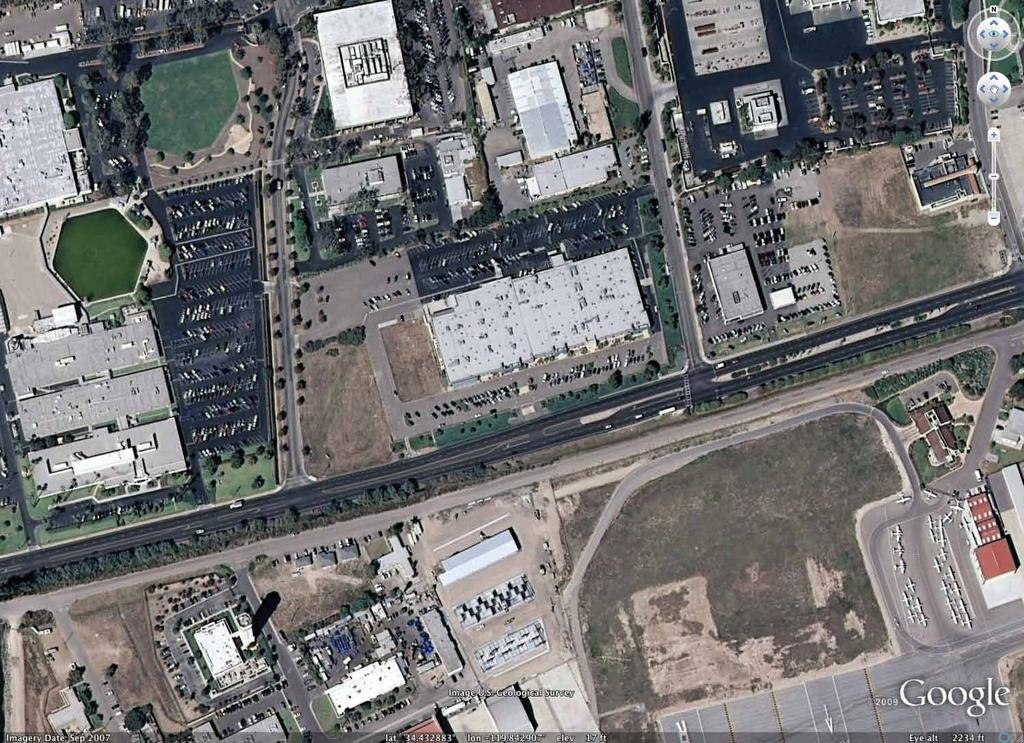
5 CHAPTER 4 ENVIRONMENTAL SETTING AND IMPACT ANALYSIS 4.1 AESTHETICS AND VISUAL RESOURCES Existing Setting Aesthetic values are important aspects of a community in establishing its identity, sense of place, and quality of life. Goleta Valley is well known for the scenic beauty of its open spaces, foothills, and ocean and mountain views. Goleta lies between the Santa Ynez Mountains and the Pacific Ocean. Although the mountains are outside city boundaries, these landforms remain largely undeveloped and provide a scenic backdrop to Goleta s urbanized area. Prominent features of the foothills and mountains are seen throughout the city and include expanses of orchards, chaparral, and rock outcroppings. (City of Goleta 2006a, page 6-1). The project is located on the north side of Hollister Avenue, bounded by La Patera Lane on the east and Robin Hill Road on the west. General Plan Policy VH 2.1 and Figure 6-1, the Scenic and Visual Resources Map, identify Hollister Avenue west of Fairview Avenue as a Scenic Corridor. Figure 6-1 of the General Plan identifies scenic corridors that pass through, or provide visual access to, areas of high scenic value. The Visual and Historic Resources Element identifies both coastal and mountain views as important views to be protected and the segment of Hollister Avenue in front of the project site is identified on Figure 6-1 as a vantage point for viewing scenic resources in all directions. Views of the Santa Ynez Mountains from Hollister Avenue, near the project site, are most prominent when travelling eastbound (toward the City of Santa Barbara). Traveling westbound on Hollister Avenue (toward Storke Road), views of the mountains across the project site are far less perceptible, due to existing structures and vegetation, as well as the distance of the mountains that are visible within this viewshed. There are no coastal views at this location due to intervening topography, vegetation, and the Santa Barbara Municipal Airport. The project vicinity includes a broad mix of industrial and commercial uses, including research and development, office, light-manufacturing, retail space (former car dealership), and development associated with the Santa Barbara Municipal Airport. Structural development includes a variety of architectural styles, building heights, building sizes, and landscape treatments, although many of the structures include substantial front yard setbacks (e.g., exceeding the Zoning Ordinance requirements of 50 feet from the right-of-way and 80 feet from the centerline of Hollister Avenue). As development has continued to fill in along the north side of Hollister Avenue, scenic views of the Santa Ynez Mountains have diminished, although the ridgeline is still visible along most of the corridor. The project site is one of several undeveloped parcels on the north side of Hollister Avenue (between Los Carneros Road and Fairview Avenue), through which broad mountain views are available between buildings and trees for eastbound travelers using Hollister Avenue. When approaching the project site from the west, views of development on the north side of the street are of varied building styles and sizes. There is no strong architectural or design theme. The general visual context on the north side of this segment of Hollister Avenue is of older industrial, service industrial, and research park developments. The scenic views of the mountains from this section of Hollister Avenue are generally visible behind these existing developments, although in some cases views are briefly screened by landscaping or structures. October
6 City of Goleta Marriott FEIR Section 4.1. Aesthetics and Visual Resources Primary public views of the undeveloped portion of the site are from Hollister Avenue, although the site has limited project frontage on Hollister Avenue (approximately 350 feet). Given the nearly level topography of the property and the lack of effective screening landscaping, views into the site from Hollister Avenue are essentially unobstructed. Robin Hill Road on the west also provides views of the property. Views from La Patera Lane are substantially blocked by the existing Hollister Center buildings. The property is also visible from westbound Firestone Road, which is just south of and runs parallel to Hollister Avenue. More distant views of the property are also available, looking down onto the site from higher elevations well to the north, including from the southbound lanes of the Los Carneros Road overpass. Due to differences in elevation, the project would not obstruct coastal or other scenic views from the north. The existing Hollister Center was permitted under a 1979 County of Santa Barbara Development Plan (79-DP-22). The building is currently occupied by multiple tenants. The existing development of the site is a single-story building of typical tilt-up construction, with few windows. It is gray and gray-green in color, with a flat roof and minimal architectural detailing. There is a parking lot and landscaping between the roadway and the existing building. With the exception of a very short segment of sidewalk on Hollister Avenue near La Patera Lane, the property s public roadway frontages on La Patera Lane, Robin Hill Road, and Hollister Avenue do not include sidewalks. There are overhead utility lines between two poles on the property s Hollister Avenue frontage. Vegetation on Parcel 1 is limited to ornamental landscaping. Established screening shrubs are planted along the majority of the site s northern boundary, and landscaping along the eastern and southern portions of the properties includes ivy and scattered shrubs and trees. The existing vegetation provides little screening of the existing development from surrounding public roads. Some supplemental landscaping has recently been added on the south side of the existing building as part of new tenant improvements near the west end of the building. The existing building does not obstruct views of the Santa Ynez Mountains ridgeline from Hollister Avenue. There is an existing bus stop on Hollister Avenue, near La Patera Lane and utility infrastructure along the Hollister frontage. Parcel 2 is currently undeveloped with the exception of paved parking in the north end, as well as some paved areas on the east, near the existing Hollister Center building, and three existing power poles located along the western half of the project frontage (see current conditions photos in Figures and ). The majority of Parcel 2 is undeveloped and the dominant vegetation is nonnative grasses and other weedy species. There are seven nonnative trees along Robin Hill Road (bottle brush) and five additional small nonnative trees in the northeast corner of the site. There were previously a few coyote brush plants along the southern perimeter of the northern paved area. Currently, this area is comprised of lower growing grasses and forbs Regulatory Framework Federal Regulations There are no federal regulations applicable to this aesthetic analysis. October
7 City of Goleta Marriott FEIR Section 4.1. Aesthetics and Visual Resources State Regulations California Government Code Section Section allows counties and cities to regulate the use of buildings, structures, and land to address scenic beauty by regulating such things as the location, height, bulk, number of stories, and size of structures, including the percentage of a lot which may be occupied by structural development and the intensity of land use. California Government Code Section Section authorizes the general plan to express community intentions regarding urban form and design. These expressions may provide for specific measures to regulate relationships between buildings as well as between buildings and outdoor public areas, including streets Local Regulations General Plan Policy Section 6.0, Visual and Historic Resources, of the City s General Plan provides objectives and policies that address the issues involving the identification and protection of scenic resources. The guiding objectives for these visual resource policies are as follows: To identify, preserve, and enhance Goleta s scenic resources and to protect views or vistas to these resources from public and private areas. (Policy VH-1 Scenic Views). To protect and enhance the visual character and public views within and from Goleta s scenic corridors and locations from which scenic vistas can be enjoyed. (Policy VH-2 Local Scenic Corridors). To protect and enhance Goleta s visual character. (Policy VH-3: Community Character). To preserve, protect, and enhance Goleta s character through high quality design. (Policy VH-4 Design Review) Project Impacts and Mitigation Thresholds of Significance Based on both the City s Initial Study Checklist (CEQA Appendix G; Environmental Checklist Form) and the City s Environmental Thresholds and Guidelines Manual (Thresholds Manual), a significant impact on aesthetics and visual resources could occur, if the project would: a. Have a substantial adverse effect on a scenic vista. b. Substantially damage scenic resources, including but not limited to, trees, rock outcroppings, and historic buildings within a state scenic highway. c. Substantially degrade the existing visual character or quality of the site and its surroundings. d. Create a new source of substantial light or glare which would adversely affect day or nighttime views in the area. e. Have significant visual resources by virtue of surface waters, vegetation, elevation, slope, or other natural or man-made features which are publicly visible. October
8 City of Goleta Marriott FEIR Section 4.1. Aesthetics and Visual Resources f. Have the potential to impact visual resources of the Coastal Zone or other visually important area (i.e., mountainous area, public park, urban fringe, or scenic travel corridor). g. Have the potential to create a significantly adverse aesthetic impact through obstruction of public views, incompatibility with surrounding uses, structures, or intensity of development, removal of significant amounts of vegetation, loss of important open space, substantial alteration of natural character, lack of adequate landscaping, or extensive grading visible from public areas. Items a d are from the Initial Study Checklist, and Items e g are from the Thresholds Manual Project Impacts The Design Review Board (DRB) first considered the current Marriott Residence Inn project on December 8, At that time, the project involved a larger, 99,634 square foot, 140-room hotel, very similar to the hotel project approved by the City in At the December 8, 2009, meeting, the DRB accepted public comment on the 140-room hotel project and viewed a presentation of still photo and video drive-by visual simulations (Interacta 2009Appendix B) of the project. In response to the visual simulation still photos and video presentation, the DRB and members of the public expressed concern with the size, bulk and scale of the hotel structure, exceedence of the Hotel Overlay Floor Area Ratio (FAR) of 0.50, the challenge of making required findings to exceed the FAR, and the project s obstruction of scenic views of the Santa Ynez Mountains when traveling east on Hollister Avenue. The project was considered at the conceptual level by the DRB at six additional meetings. Three of these meetings were regular DRB meetings (January 26, 2010; February 9, 2010; and March 9, 2010) and an additional three meetings (January 19, 2010; January 26, 2010; and February 24, 2010) were attended by a DRB-designated ad hoc committee. As part of this review process, the applicant submitted incrementally smaller project designs, until reaching the current 118-room hotel design. Table below summarizes the various project revisions submitted for conceptual DRB review in MARRIOTT RESIDENCE INN DP TABLE PROJECT CHANGES IN RESPONSE TO DRB PROCESS DRB MEETING DEC DRB MEETING JAN DRB MEETING FEB DRB MEETING MAR Square Footage 99,634 95,256 94,876 80,945 Hotel Rooms Hotel Overlay FAR is 0.5 Setback from Hollister Ave 108 ft, 2 in 131 ft, 6 in 131 ft, 6 in 151 ft, 4 in Visual simulations for the 118-room revised project were presented to the DRB in March DRB members were supportive of the March 2010 project revisions and were specifically supportive of the reduced size of the hotel, the substantial increase to the structural setback from Hollister Avenue, improvements in maintaining mountain views from Hollister Avenue, and the reduction in the FAR to 0.49 (this reduction in the FAR avoided the requirement that the DRB make a good cause finding before a 0.5 FAR may be exceeded). The DRB completed October
9 City of Goleta Marriott FEIR Section 4.1. Aesthetics and Visual Resources conceptual review of the project on March 23, Still photo simulations presented to the DRB in March 2010, showing the current setting and current project request, are included as Figures to at the end of this section. Photo simulations comparing the current project with the project initially reviewed by the DRB in December 2009 are included in Appendix B. The video simulation is available upon request by contacting the project planner, Natasha Campbell, at or Additional modifications have been incorporated into the project since the DRB s March 23, 2010, review, including refinement of grading details, foundation design, and installation details for the tree plantings and utility trenching. The applicant has identified these more recent changes to minimize impacts to cultural resources. These changes do not affect the finished floor elevations, nor do these changes otherwise affect the visual appearance of the project. Impact AES-1. Scenic Vistas and Scenic Resources 1 The project is not located within, nor does it affect any views from, a State Scenic Highway as designated by the State of California. As such, the project would not result in any impacts on scenic resources within a State of California Scenic Highway viewshed. The site is primarily visible from Hollister Avenue and Robin Hill Road. Given the vantage point for views from these roadways, the project would not obstruct any coastal views from these roadways. In addition, although rooftops are expected to be visible from higher elevations to the north (e.g., the southbound lanes of the Los Carneros Overpass), the rooflines would not extend high enough to block existing ocean or island views from these higher elevations. Therefore, impacts to coastal views are less than significant. Hollister Avenue is identified as a Scenic Corridor in the General Plan, and General Plan Figure 6-1 identifies views in all directions from the Hollister Avenue segment near La Patera Lane as scenic views to be protected. Therefore, mountain views from Hollister Avenue are considered a significant visual resource. Expansive scenic views of the Santa Ynez Mountains are available in the project area from eastbound Hollister Avenue. Views of the mountains for westbound travelers are less prominent due to existing structures and vegetation as well as the distance of the mountains that are visible within this viewshed. Therefore, the focus of the analysis of scenic views is from eastbound Hollister Avenue. The Development Plan Amendment for Parcel 1 of the project, Hollister Center, would not result in significant changes to existing views. The visual simulations included as Figures to at the end of this section show how development of the Marriott Residence Inn would appear. The existing 160,500-square-foot Hollister Center covers the eastern two-thirds of the project site and comprises Parcel 1 of the subdivision request. Existing views of the site are of an updated 106,500-square-foot research and development/office building with sub-optimal landscaping around the building, the parking lot, and the building s Hollister Avenue frontage. Changes to the existing development include new frontage improvements along Hollister Avenue and La Patera Lane (upgrades to bus stop/pull out, meandering sidewalk, lighting, landscaping, Hollister Avenue medians, utility undergrounding, and utility installation/relocation). Additional landscaping is also identified for the parking lot, and some landscaping has recently been added to the site as part of a separate tenant improvement permit. No other changes are proposed to the Hollister Center portion of the property. As a result, the project would not alter views of the Santa Ynez Mountains across this portion of the property from Hollister Avenue, 1 See Section , Thresholds a, b, and f. October
10 City of Goleta Marriott FEIR Section 4.1. Aesthetics and Visual Resources and impacts to scenic mountain views associated with changes to the Hollister Center Development Plan are less than significant. General Plan/Coastal Land Use Plan Policy VH 2.2 addresses preservation of scenic corridors. The policy states that the aesthetic qualities of scenic corridors shall be preserved through retention of the general character of significant natural features; views of ocean, foothills, and mountainous areas; and open space associated with recreational and agricultural areas including orchards, prominent vegetation, and historic structures. The proposed project would preserve the general character of views of foothills and mountainous areas, and would be consistent with Policy VH 2.2. (Note: Text moved to later in this subsection in this Final EIR.) The western third of the site is identified for the 118-room, 80,945-square-foot Marriott Residence Inn, which would occupy Parcel 2 of the subdivision request. Existing views from eastbound Hollister Avenue of the Santa Ynez Mountains across Parcel 2 would be affected by development of the two- and three-story hotel; however, views of the ridgeline would not be fully blocked. The hotel site s Hollister Avenue frontage is limited to approximately 350 feet. Only when a viewer on Hollister Avenue is directly in front of the hotel would the mountain views behind the structure be completely obscured (see Figures and ). Even from this location, Figures and show that some mountain views would remain visible across the hotel site on either side of the new structure. This is typical of other multi-story development along Hollister Avenue. The visual simulations in Figures and show the change in public views from a worst-case location. Figures and show that views from slightly west of the Hollister Avenue/Robin Hill Road intersection would have substantially less obstruction views by the hotel structure. Therefore, the greatest loss of views would occur from the worst-case vantage point, on the south side of Hollister Avenue, opposite the unsignalized Robin Hill Road intersection, facing the same direction as eastbound traffic (Figure ). More distant views from slightly west and east of the hotel would not be fully obstructed. While any development on the project site would result in some loss of mountain views from Hollister Avenue, the current project design, including a 151-foot setback from Hollister Avenue, would maintain some views of the mountains across the project site on both sides of the new hotel building and, except for the eastbound view from Hollister Avenue at the unsignalized Robin Hill Road intersection, views of the mountain would be maintained above the height of the hotel structure as well. General Plan/Coastal Land Use Plan Policy VH 2.2 provides direction regarding preservation of scenic corridors. The policy does not require that existing scenic views be retained, with no changes. Rather, the policy states that the aesthetic qualities of scenic corridors shall be preserved through retention of the general character of significant natural features; views of ocean, foothills, and mountainous areas... While the project would alter the existing views toward the Santa Ynez Mountains from Hollister Avenue, the project would preserve the general character of these views, as shown in the visual photo simulations included in this section and in the video drive-by simulation (available for review upon request and via a link on the City s website). The current project design, including removal of three power poles and provision of a 151-foot setback from Hollister Avenue, would maintain approximately two-thirds of the existing views across the site of the upper portion of the mountains, which would result in less-than-significant impacts on scenic vistas. However, even minor changes to the height of roof features and mechanical equipment placement have the potential to alter assumptions regarding the level at which mountain views would be retained following project development. Therefore, development of the Marriott Residence Inn has the potential to result in significant adverse impacts relating to loss of scenic mountain views from the Hollister Avenue Scenic Corridor. October
11 City of Goleta Marriott FEIR Section 4.1. Aesthetics and Visual Resources Impact AES-2. Visual Character and Quality 2 The Hollister Center portion of the property is already developed with a 106,500-square -foot building. This existing development is part of the existing setting with regard to the style, size, height, and intensity of development of surrounding development. Physical changes resulting from the Hollister Center Development Plan Amendment are limited to frontage, access, and landscaping improvements, including a new driveway, new sidewalk with landscaping, upgraded bus stop, and lighting along Hollister Avenue. The two existing power poles along Hollister Avenue in front of the site would also be undergrounded. Therefore, the Development Plan Amendment would not result in significant aesthetic impacts, and would in fact result in incremental improvements, related to visual character and quality. The existing undeveloped western third of the property would be converted to a 80,945-squarefoot, two- and three-story, 118-room, Marriott Residence Inn extended stay hotel and associated swimming pool, parking, exterior lighting, landscaping as well as frontage improvements on Hollister Avenue and Robin Hill Road. The hotel layout is a U-shaped configuration around a patio/pool area, framed by three building wings, each between two and three stories in height. The main entrance is oriented toward Hollister Avenue with access from both Hollister Avenue and Robin Hill Road. The proposed architecture is characterized as Spanish with an emphasis on smooth stucco finish, accent awnings, wood trellis, cornice moldings, and concrete roof tile. The hotel building has a FAR of 0.49 and a lot coverage ratio of 19.5%.The typical parapet height is 34 feet, with peak heights ranging from 35 to 37 feet at the top of certain roof ridges. The project request also includes modifications to allow some parking within the front yard setbacks from Hollister Avenue and Robin Hill Road as well as to allow the trash enclosure area to be located within the front yard setback from Robin Hill Road. Development in the surrounding neighborhood includes service commercial, industrial, and airport related development, a variety of architectural styles, building sizes, and landscaping. Therefore, project compatibility with the existing neighborhood character becomes more an issue of good project design rather than consistency with a particular neighborhood quality or character. The style of existing development in the surrounding area and along the Hollister Avenue corridor varies. The Marriott Residence Inn would be one of the larger structures along the corridor, but there are similarly scaled structures located at various places along Hollister Avenue, as well as directly north of the site. Although the size, bulk, scale, and to a lesser degree, the semi-residential appearance of the hotel building would result in the project being a visually prominent development along this section of Hollister Avenue, the project would not substantially alter the visual character of the existing commercial and industrial developments in the project area. In addition, while the project would stand out to some extent because of its size and semi-residential architecture, it will not be incompatible in this neighborhood in the same way it would in a neighborhood with structures that are more homogeneous with regard to size, height, and/or design. A number of features of the project design would serve to soften the size of the building and to strengthen the quality of the built environment in the surrounding neighborhood. These features include the substantial (151-foot) setback from Hollister Avenue, stepping back the highest point of the roofline from Hollister Avenue, inclusion of frontage improvements (meandering sidewalk along entire Hollister Avenue and Robin Hill Road frontages, three new landscaped traffic medians in Hollister Avenue, undergrounding of the two power poles and related utility lines on Hollister Avenue) that would enhance immediate views of the site from Hollister Avenue and Robin Hill Road, and the addition of extensive landscaping on both sides of the new meandering sidewalk, throughout the parking lot, and near the 2 See Section , Threshold c. October
12 City of Goleta Marriott FEIR Section 4.1. Aesthetics and Visual Resources building. The DRB considered the project architecture, building height, colors, and materials in their meetings as well as the project s compatibility with the surrounding built environment. The current project design incorporates comments received at these meetings with regard to compatibility, specifically comments addressing architectural features, colors, and materials. As with the impact to scenic vistas and resources, any changes to the final project plans, including to the height of various portions of the hotel roofline; final placement of mechanical equipment; changes to colors, materials, or finished floor elevations; and/or changes to plant species in the landscape plan have the potential to alter assumptions regarding the project s compatibility with surrounding development. Therefore, development of the Marriott Residence Inn has the potential to result in significant impacts relating to compatibility with the surrounding area. Impact AES-3. Substantial Light and Glare 3 Exterior night lighting, including lighting of the proposed parking area, could result in the exposure of adjoining areas to excessive light and glare if such lighting is not properly shielded and directed away from neighboring land uses, or if the light standards are excessively tall creating a situation where appropriate light shielding is not possible. In addition, if appropriate dark-sky lighting fixtures are not incorporated and properly installed, project lighting could increase lighting of the night sky. Such night-lighting and glare impacts are considered potentially significant. Impact AES-4. Obstruct Onsite Visual Resources 4 The site itself is not considered scenic or visually significant. There are no waterways, interesting topography, or significant native habitats or vegetation on site. Existing ornamental landscaping on site is primarily limited to grasses, forbs, and small shrubs and trees scattered along the perimeter. There are no other natural or man-made features on site that are considered worthy of protection as a scenic resource. Because the existing property lacks features that could be construed as conveying significant positive visual resource values, potential project impacts to onsite visual resources are considered less than significant. Impact AES-5. Loss of Vegetation, Open Space, or Natural Character 5 The project site is not associated with sensitive vegetation. As an infill site, with extensive paving, minimal landscaping, and surrounded by existing and varied industrial, service industrial, and research park development in an urban area, the site does not contain substantial or especially scenic open space. The change in topography and cut and fill activities for site preparation are not expected to result in significant impacts from altering the natural character of the site, and the amount of earthwork is not considered excessive grading. In addition, while trees on site are not considered visually significant, the majority of existing trees would be retained as part of the project and new trees would be planted throughout the site as identified on the landscape plan. Therefore, impacts associated with vegetation removal, loss of open space on site, alteration of natural character, and grading are considered less than significant. 3 See Section , Threshold d. 4 See Section , Threshold e. 5 See Section , Threshold g. October
13 City of Goleta Marriott FEIR Section 4.1. Aesthetics and Visual Resources Cumulative Impacts The project would contribute to the overall changes in aesthetic resources of the City as it grows in accordance with the General Plan. This includes the project s contribution to the historic trend of reduced scenic views of the Santa Ynez Mountains from highly travelled Hollister Avenue as the Hollister Avenue Corridor is built out. Most planned new development in the vicinity would occur over vacant land within the City of Santa Barbara s Airport Planning Area. Visual resources policies in the General Plan and the DRB process are intended to protect scenic resources and ensure that the area s visual character is maintained. The project would continue the trend of developing the remaining vacant parcels along the Hollister Avenue corridor and would impact available views from eastbound Hollister Avenue of the scenic Santa Ynez Mountains, but it would not totally obstruct such views, as discussed above. There is the possibility, however, if the assumptions made for this analysis were not implemented per the current designs, that significant impacts to views and character could occur and contribute to cumulative aesthetic impacts; this is considered potentially significant Mitigation Measures MM AES-1a/AES-2a. Receive Preliminary and Final Approval from Design Review Board The permittee will receive preliminary and final approval from the Design Review Board (DRB).City staff and the The DRB will specifically consider and ensure that the details of the preliminary and final lighting, utility, landscape, and building plans are consistent with the approved project and conditions of approval affecting these project features, including but not limited to, mitigation measures MM AES-1b/AES-2b through AES-3a. To ensure consistency with assumptions regarding loss of mountain views and compatibility with surrounding development, special attention will be given to consistency of final plans with project approval assumptions for grading plans/finished floor elevations, roof heights, placement of mechanical equipment, colors, materials, finished floor elevations, and changes to plant species in the landscape plan, particularly with regard to screening the development but maintaining views of the mountains. Plan Requirements and Timing: The review will include site plan, floor plan, elevations, grading plan, landscape plan, frontage improvements, and lighting plans consistent with the Design Review Board submittal requirements. Additional materials will be provided as required by the Design Review Board to complete its review. Preliminary and final approval will be granted prior to issuance of a land use permit. Monitoring: City staff will verify compliance prior to issuance of a land use permit, during field inspection, and prior to final inspection. MM AES-1b/AES-2b. Height Limitations The height of structural development shown on final plans will not exceed the mean height and peak height shown on approved project exhibit maps. Finished grade will be consistent with the approved final grading plan. Height limitations shown on plan sets on the issued land use permit will be adhered to during construction. Plan Requirements and Timing: During the framing state of construction and prior to commencement of roofing, the permittee will submit verification from a licensed surveyor October
14 City of Goleta Marriott FEIR Section 4.1. Aesthetics and Visual Resources demonstrating that the mean height and peak height conform to those shown on issued land use permit plan sets. Monitoring: City staff will verify compliance prior to issuance of a land use permit, during field inspection, and prior to commencement of roofing. MM AES-1c/AES-2c. Utility Plan Review The permittee will submit a composite utility plan for City staff and Design Review Board preliminary and final review. All external/roof-mounted mechanical equipment (including heating, ventilation, and air conditioning condensers, switch boxes, etc.) will be included on all building plans and will be designed to be integrated into the structure and/or screened in their entirety from public view. Rooftop equipment will not alter the visual profile of the building in a manner that degrades or diminishes views of the mountains from public viewing places. Plan Requirements and Timing: Detailed plans showing all external/roof-mounted mechanical equipment will be submitted for review by City staff and the Design Review Board to ensure compliance with this condition prior to land use permit issuance. Monitoring: Prior to final inspection, City staff will verify installation of all external/roof-mounted mechanical equipment per the approved plans. MM AES-1d/AES-2d. Screening Utility Service Connections and Above-ground Mounted Equipment All new utility service connections and above-ground mounted equipment such as backflow devices will be screened from public view and/or painted in a soft earth-tone color(s) (red is prohibited) so as to blend in with the project. Screening may include a combination of landscaping and/or fencing/walls. Whenever possible, utility transformers will be placed in underground vaults. All gas and electrical meters will be concealed and/or painted to match the building. All gas, electrical, backflow prevention devices, and communications equipment will be completely concealed in an enclosed portion of the building, on top of the building, or within a screened utility area. All transformers and vaults that must be located within the right-of-way will be installed below grade unless otherwise approved by the City, and then must be completely screened from view. Plan Requirements and Timing: The plans submitted for City staff and Design Review Board preliminary and final review (and prior land use permit issuance) will identify the type, location, size, and number of utility connections and above-ground mounted equipment as well as how such equipment would be screened from public view and the color(s) that it would be painted so as to blend in with the project and surrounding area. Monitoring: Project plan consistency with these requirements for screening shall be determined by City staff before issuance of land use permits. Prior to final inspection, City staff will verify that all above-ground utility connections and equipment are installed, screened, and painted per the approved plans. October
15 City of Goleta Marriott FEIR Section 4.1. Aesthetics and Visual Resources MM AES-1e/AES-2e. Landscaping Requirements Project landscaping will consist of approximately 75% drought-tolerant native and/or Mediterranean type plant coverage that adequately complements the project design and integrates the site with surrounding land uses. Plan Requirements and Timing: The final landscape plan will identify the following: a. Type of irrigation b. All existing and new trees, shrubs, and groundcovers by species c. Size of all plantings d. Location of all plantings The final landscape plan will be reviewed and approved by the Design Review Board and City staff prior to land use permit issuance. Monitoring: Before land use permit issuance, City staff must ensure the final landscape plan includes the above components and must ensure DRB has reviewed the final landscape plan for consistency with the approved project plans and conditions. Prior to final inspection, City staff will inspect the site to ensure that landscaping has been installed consistent with the final landscape plan. MM AES-1f/AES-2f. Landscape Maintenance The permittee will implement and will maintain required landscaping for the life of the project. The permittee will also enter into an agreement to install and maintain required landscaping and water-conserving irrigation systems for the life of the project. Plan Requirements and Timing: The permittee will sign the landscape installation and maintenance agreement, including at least a 3-year maintenance period, prior to land use permit issuance. Performance securities acceptable to the City of Goleta for installation and maintenance will be reviewed and approved by City staff prior to land use permit issuance. The landscape maintenance agreement(s) must address landscaping on site as well as associated landscaping within Hollister Avenue right-of-way (see Public Works memo August 13, 2013, included in Appendix U). Monitoring: Prior to final inspection, City staff will inspect the site to ensure installation according to approved plan. City staff will check maintenance as needed. Release of any performance security requires appropriate documentation and City staff signature. MM AES-1g/AES-2g. Trash/Recycling Enclosure Requirements Trash/recycling enclosure(s) will be provided. Plan Requirements and Timing: The enclosure will be compatible with the architectural design of the project, will be of adequate size for trash and recycling containers (at least 50 square feet), and will be accessible by users and for removal. The trash/recycling area will be enclosed with a solid wall of sufficient height to screen the area, will include a solid gate and a roof, and will be maintained in good repair in perpetuity. The enclosure(s) will be shown on project plans October
16 City of Goleta Marriott FEIR Section 4.1. Aesthetics and Visual Resources and will be reviewed and approved by City staff and the Design Review Board prior to land use permit issuance. Monitoring: Prior to final inspection, City staff will inspect the site to ensure installation according to approved plan. MM AES-1h/AES-2h. Undergrounding Utilities Except along La Patera Lane, Existing and new all utility lines along Hollister Avenue and Robin Hill Road associated with the project site will be placed underground. Plan Requirements and Timing: Construction plans for these improvements will be reviewed and approved as part of the Design Review Board preliminary and final review and will be reviewed and approved by the City prior to land use permit issuance. Improvements will be implemented prior to occupancy. Monitoring: City staff will verify completion of the improvements in the field. MM AES-3a. Exterior Night Lighting Restrictions Exterior night lighting installed on the project site will be of low intensity, low glare design, and will be hooded to direct light downward onto the subject parcel and prevent spill-over onto adjacent parcels. Exterior lighting fixtures will be kept to the minimum number and intensity needed to ensure public safety. These lights will be dimmed after 11 p.m. to the maximum extent practical without compromising public safety. Upward directed exterior lighting is prohibited. All exterior lighting fixtures will be appropriate for the architectural style of the structure and surrounding area. Plan Requirements and Timing: The locations of all exterior lighting fixtures, complete cutsheets of all exterior lighting fixtures, and a photometric plan prepared by a registered professional engineer showing the extent of all light and glare emitted by all exterior lighting fixtures will be reviewed and approved by the Design Review Board and City staff prior to land use permit issuance. Monitoring: Prior to final inspection, City staff will inspect to ensure that exterior lighting fixtures have been installed consistent with approved plans Residual Impact With implementation of these mitigation measures, residual project specific impacts to aesthetics and visual resources, as well as project contributions to cumulative changes in visual character of the surrounding area, would be less than significant. October
17 101 Ellwood Pier Tecolote Creek Calle Real }}& }}& & n } }}& n n & } & }}& } }}& & } } & } &}} }& }}& } }& n Hollister Ave &}} }}& & } & } }}& & & } }}& }}& Bell Canyon Creek Winchester Canyon Creek Ellwood Canyon Creek Devereux Creek El Encanto Creek } Glen Annie Creek Phelps Rd Glen Annie Rd Storke Rd }& } &}} Cathedral Oaks Rd & } & } &} Los Carneros Creek & } }}& & } }}& }}& Los Carneros Rd n }}& Los Carneros Lake }}& Calle Real San Pedro Creek La Patera Ln & } Goleta Slough }}& Santa Barbara Municipal Airport n Project Site Hollister Ave Las Vegas Creek n }}& }}& Fairview Ave Fairview Ave & } Cathedral Oaks Rd & } }}& Old San Jose Creek n Rancho Goleta Lake San Jose Creek rs n }}& Kellogg Ave Atascadero Creek }}& Patterson Ave }}& }}& Union Pacific RR Maria Ignacio Creek Hollister Ave n San Antonio Creek n n K:\Irvine\GIS\Projects\Goleta\00405_12\mapdoc\Fig04_1_1_HistoricResources Pacific Ocean Amended by Reso , 11/17/09 Legend Scenic Views to be Protected Public Lands with View Opportunities Scenic Corridor Local Scenic Corridor View Orientation & } }}& Views to one Direction Views to all Directions }}& Devereux Slough Coal Oil Pt Other Features Goleta City Boundary n Coastal Zone Schools!!!!!!! Creeks n El Colegio Rd Isla Vista Mesa Rd UCSB Campus Lagoon Goleta Pt Goleta Pier Figure 6-1 GENERAL PLAN/COASTAL LAND USE PLAN November 2009 ± 0 1,200 2,400 Feet SCENIC AND VISUAL RESOURCES Source: City of Goleta 2009 Figure Visual and Historic Resources Map City of Goleta Marriott EIR
18


19 K:\Irvine\GIS\Projects\Goleta\00405_12\mapdoc\Fig04_1_2_Photo_Simulation EB1 EB2 WB2 WB1 North Source: Interacta Inc Figure Map of Photo Simulation Locations City of Goleta Marriott EIR
20

21 Project Without Landscaping Current Conditions K:\Irvine\GIS\Projects\Goleta\00405_12\mapdoc\Fig04_1_3_HollisterAve Source: Interacta Inc, 2010 Figure Hollister Ave - Westbound View 1, Current Conditions and Project Without Landscaping City of Goleta Marriott EIR
22
23 K:\Irvine\GIS\Projects\Goleta\00405_12\mapdoc\Fig04_1_4_HollisterAve Source: Interacta Inc, 2010 Figure Hollister Ave - Westbound View 1, Project With Landscaping City of Goleta Marriott EIR
24
25 Project With Landscaping Project Without Landscaping K:\Irvine\GIS\Projects\Goleta\00405_12\mapdoc\Fig04_1_5_HollisterAve Source: Interacta Inc, 2010 Figure Hollister Ave - Westbound View 1, Project With and Without Landscaping City of Goleta Marriott EIR
26
27 Project Without Landscaping Current Conditions K:\Irvine\GIS\Projects\Goleta\00405_12\mapdoc\Fig04_1_6_HollisterAve Source: Interacta Inc, 2010 Figure Hollister Ave - Westbound View 2, Current Conditions and Project Without Landscaping City of Goleta Marriott EIR
28
29 K:\Irvine\GIS\Projects\Goleta\00405_12\mapdoc\Fig04_1_7_HollisterAve Figure Hollister Ave - Westbound View 2, Project With Landscaping City of Goleta Marriott EIR
30

31 Project With Landscaping Project Without Landscaping K:\Irvine\GIS\Projects\Goleta\00405_12\mapdoc\Fig04_1_8_HollisterAve Source: Interacta Inc, 2010 Figure Hollister Ave - Westbound View 2, Project With and Without Landscaping City of Goleta Marriott EIR
32

33 Project Without Landscaping K:\Irvine\GIS\Projects\Goleta\00405_12\mapdoc\Fig04_1_9_HollisterAve Current Conditions Source: Interacta Inc, 2010 Figure Hollister Ave - Eastbound View 1, Current Conditions and Project Without Landscaping City of Goleta Marriott EIR
34
35 K:\Irvine\GIS\Projects\Goleta\00405_12\mapdoc\Fig04_1_10_HollisterAve Source: Interacta Inc, 2010 Figure Hollister Ave - Eastbound View 1, Project With Landscaping City of Goleta Marriott EIR
36

37 Project With Landscaping Project Without Landscaping K:\Irvine\GIS\Projects\Goleta\00405_12\mapdoc\Fig04_1_11_HollisterAve Source: Interacta Inc, 2010 Figure Hollister Ave - Eastbound View 1, Project With and Without Landscaping City of Goleta Marriott EIR
38

39 Project Without Landscaping Current Conditions K:\Irvine\GIS\Projects\Goleta\00405_12\mapdoc\Fig04_1_12_HollisterAve Source: Interacta Inc, 2010 Figure Hollister Ave - Eastbound View 2, Current Conditions and Project Without Landscaping City of Goleta Marriott EIR
40

41 K:\Irvine\GIS\Projects\Goleta\00405_12\mapdoc\Fig04_1_13_HollisterAve Source: Interacta Inc, 2010 Figure Hollister Ave - Eastbound View 2, Project With Landscaping City of Goleta Marriott EIR
42
43 Project With Landscaping Project Without Landscaping K:\Irvine\GIS\Projects\Goleta\00405_12\mapdoc\Fig04_1_14_HollisterAve Source: Interacta Inc, 2010 Figure Hollister Ave - Eastbound View 2, Project With and Without Landscaping City of Goleta Marriott EIR
44
5.1 AESTHETICS AND VISUAL RESOURCES Physical Setting
 5.1 AESTHETICS AND VISUAL RESOURCES 5.1.1 Physical Setting Aesthetic values are an important aspect in establishing the identity, sense of place, and quality of life in a community. Natural features in
3.1 Aesthetics, Light, and Glare
 3.1 3.1.1 Introduction This section describes the existing aesthetics, light, and glare setting and potential effects from project implementation on visual resources and the site and its surroundings.
Nob Hill Pipeline Improvements Project EIR
 Section 3.1 Aesthetics This section addresses the visual aspects that may affect the views experienced by the public, including the potential to impact the existing character of each area that comprises
GENERAL PLAN CONSISTENCY ANALYSIS
 GENERAL PLAN CONSISTENCY ANALYSIS Prepared by Planning Staff 10/28/2013 APPLICABLE GOALS, POLICIES AND PROGRAMS FROM the LAND USE CHAPTER Goal LU-1 Policy LU-1.1 Policy LU-1.2 Goal LU-2 Protect the character
5.11 AESTHETICS ENVIRONMENTAL SETTING
 5.11 AESTHETICS ENVIRONMENTAL SETTING The lies on a relatively flat valley floor surrounded by rugged hills and mountains. The topography of the planning area is defined by the Box Springs Mountains and
IV.B. VISUAL RESOURCES
 IV.B. VISUAL RESOURCES ENVIRONMENTAL SETTING Existing Visual Character Project Site The project site is located at 17331-17333 Tramonto Drive in the Pacific Palisades community of the City of Los Angeles
CHAPTER 10 AESTHETICS
 CHAPTER 10 AESTHETICS CHAPTER 10 AESTHETICS This section identifies and evaluates key visual resources in the project area to determine the degree of visual impact that would be attributable to the project.
Environmental Setting, Impacts, and Mitigation Measures
 CHAPTER 3 Environmental Setting, Impacts, and Mitigation Measures Format of the Environmental Analysis The assessment of each environmental resource discussed in this chapter includes the following: Environmental
The impacts examined herein take into account two attributes of aesthetic values:
 IV. ENVIRONMENTAL IMPACT ANALYSIS This section addresses the potential impacts to views and aesthetics as a result of the proposed Project at the Project Site and the development scenarios analyzed for
City of Lafayette Study Session Staff Report Design Review Commission
 ++ City of Lafayette Study Session Staff Report Design Review Commission Meeting Date: January 08, 2018 Staff: Subject: Chris Juram, Planning Technician SS12-17 Miramar Homebuilders, R-20 Zoning: Request
Section 3.16 Visual Quality
 Chapter 3 Affected Environment, Environmental Consequences, and Mitigation Measures Section 3.16 Visual Quality Introduction This section discusses existing conditions, effects and mitigation measures
PLANNING COMMISSION AGENDA REPORT SEPTEMBER 1, 2016
 PLANNING COMMISSION AGENDA REPORT SEPTEMBER 1, 2016 TO: Members of the Planning Commission FROM: Michael Klein, Planner FILE NO.: 150000780 PROPOSAL: APPLICANT: RECOMMENDATION: A request for a Site Plan
5.1.1 The streetscape along US Highway 64 (Brevard Road); and, The built environment within new residential developments; and,
; and, The built environment within new residential developments; and,") Article 5. Landscaping 5.1 Purpose The Town of Laurel Park s landscape standards are designed to create a beautiful, aesthetically pleasing built environment that will complement and enhance community
Article 5. Landscaping 5.1 Purpose The Town of Laurel Park s landscape standards are designed to create a beautiful, aesthetically pleasing built environment that will complement and enhance community
City of Placerville Planning Commission AGENDA REPORT ITEM 7
 Placerville, a Unique Historical Past Forging into a Golden Future City of Placerville Planning Commission REPORT ITEM 7 MEETING DATE: September 1, 2015 APPLICATION NO: 225 Placerville Drive Site Plan
Venice Pumping Plant Dual Force Main Project Draft EIR
 City of Los Angeles 5.9 LAND USE PLANS 5.9.1 Environmental Setting Venice Pumping Plant Dual Force Main Project Draft EIR The Project lies within the bounds of Los Angeles County and the City of Los Angeles.
4.1 AESTHETICS/VISUAL RESOURCES
 4.1 AESTHETICS/VISUAL RESOURCES This section provides a discussion of the visual resources in and around the project site, with an emphasis on the visual character and scenic qualities of the Gaviota Coast
DRAFT ENVIRONMENTAL IMPACT REPORT DEEP VALLEY DRIVE AND INDIAN PEAK ROAD MIXED-USE RESIDENTIAL PROJECT
 LSA ASSOCIATES, INC. JUNE 2012 SECTION 4.1 AESTHETICS DRAFT ENVIRONMENTAL IMPACT REPORT 4.1 AESTHETICS Introduction This section provides a discussion of the existing visual and aesthetic resources on
CHAPTER ADDITIONAL REQUIREMENTS IN THE NC, NEIGHBORHOOD COMMERCIAL ZONE
 CITY OF MOSES LAKE MUNICIPAL CODE CHAPTER 18.31 ADDITIONAL REQUIREMENTS IN THE NC, NEIGHBORHOOD COMMERCIAL ZONE Sections: 18.31.010 Purpose 18.31.020 Minimum Lot Area 18.31.030 Setbacks 18.31.040 Maximum
PLANNING COMMISSION AGENDA REPORT NOVEMBER 15, 2012
 PLANNING COMMISSION AGENDA REPORT NOVEMBER 15, 2012 TO: FROM: Members of the Planning Commission Michael Klein, Associate Planner FILE NO.: 120000890 PROPOSAL: APPLICANT: Request for an Administrative
36.1. PURPOSE APPLICABILITY DESIGN REVIEW GUIDELINES
 CHAPTER 36: DESIGN STANDARDS 36.1. PURPOSE The purpose of this chapter is to ensure that projects are designed and constructed consistent with the Community Design Subelement of the Land Use Element and
City of Lafayette Study Session Staff Report Design Review Commission
 City of Lafayette Study Session Staff Report Design Review Commission Meeting Date: April 24, 2017 Staff: Payal Bhagat, Senior Planner Subject: HDP18-15 & HDP31-15 Ramesh Patel & Melcor Development (Owners),
3.10 LAND USE SETTING PROJECT SITE EXISTING LAND USE DESIGNATIONS AND ZONING. General Plan Land Use Designations.
 This section of the Draft EIR addresses the existing land uses on and adjacent to the project site and discusses the potential impacts of the proposed project on existing land uses. Key issues addressed
3.1 AESTHETICS AND VISUAL RESOURCES
 3.1 AESTHETICS AND VISUAL RESOURCES This section examines the potential for the proposed Project to create aesthetic and visual impacts as defined by the California Environmental Quality Act (CEQA) as
Agenda Report Meeting Date 11/02/16. Architectural Review (Wildwood Estates Townhomes)
") Architectural Review and Historic Preservation Board Agenda Report Meeting Date 11/02/16 REPORT DATE: October 24, 2016 File: AR 16-19 TO: FROM: RE: Architectural Review and Historic Preservation Board
Architectural Review and Historic Preservation Board Agenda Report Meeting Date 11/02/16 REPORT DATE: October 24, 2016 File: AR 16-19 TO: FROM: RE: Architectural Review and Historic Preservation Board
3.1 AESTHETICS Background and Methodology
 3.1 AESTHETICS 3.1.1 Background and Methodology 3.1.1.1 Regulatory Context The California Environmental Quality Act (CEQA) requires that project sponsors evaluate the project s potential to cause aesthetic
RZC Public View Corridors and Gateways
 RZC 21.42 Public View Corridors and Gateways 21.42.010 Purpose 21.42.020 Scope and Authority 21.42.030 Administration 21.42.040 Gateways Design 21.42.050 Unidentified Public Views 21.42.060 Identification
4.1 AESTHETICS. A. Regulatory Framework
 4.1 This section includes a description of the existing visual setting of the project site and an analysis of the effects the proposed project would have on aesthetics in the project vicinity. Aesthetics
EXHIBIT A. Chapter 2.7 SPECIAL PLANNED DISTRICTS. Article XVIII 15th Street School Master Planned Development
 EXHIBIT A Chapter 2.7 SPECIAL PLANNED DISTRICTS Article XVIII 15th Street School Master Planned Development Sections: 2.7.3600 15 th Street School Master Planned Development 2.7.3610 Purpose 2.7.3620 Definitions
Town of Portola Valley General Plan. Nathhorst Triangle Area Plan
 Town of Portola Valley General Plan Amended December 10, 1997 Table of Contents Introduction... 1 Planning Area... 1 Objectives... 2 Principles... 2 Standards... 4 Description... 4 Community Commercial...
-MENDOCINO COUNTY PLANNING AND BUILDING SERVICES- DIVISION II OF TITLE 20--COASTAL ZONING CODE
 CHAPTER 20.504 VISUAL RESOURCE AND SPECIAL TREATMENT AREAS Sec. 20.504.005 Applicability. Sec. 20.504.010 Purpose. Sec. 20.504.015 Highly Scenic Areas. Sec. 20.504.020 Special Communities and Neighborhoods.
PC RESOLUTION NO ARCHITECTURAL CONTROL (AC)
") PC RESOLUTION NO. 16-07-26- ARCHITECTURAL CONTROL (AC) 15-035 A RESOLUTION OF THE PLANNING COMMISSION OF THE CITY OF SAN JUAN CAPISTRANO, CALIFORNIA APPROVING ARCHITECTURAL CONTROL (AC) 15-035, INN AT
PC RESOLUTION NO. 16-07-26- ARCHITECTURAL CONTROL (AC) 15-035 A RESOLUTION OF THE PLANNING COMMISSION OF THE CITY OF SAN JUAN CAPISTRANO, CALIFORNIA APPROVING ARCHITECTURAL CONTROL (AC) 15-035, INN AT
VISUAL RESOURCES 1. INTRODUCTION 2. EXISTING CONDITIONS. a. Visual Character
 IV.A VISUAL RESOURCES 1. INTRODUCTION This section addresses the potential changes in visual character that would result from implementation of the proposed Wilshire and La Brea Project. Also evaluated
URBAN DESIGN BRIEF 305, 309, & 315 SOUTHDALE ROAD WEST LONDON ONTARIO
 URBAN DESIGN BRIEF 305, 309, & 315 SOUTHDALE ROAD WEST LONDON ONTARIO CARVEST PROPERTIES LTD. December 2013 Section 1 - Land Use Planning Context 1.1 Subject Lands The subject lands are located immediately
IV. ENVIRONMENTAL IMPACT ANALYSIS B. AESTHETICS 1. VIEWS
 IV. ENVIRONMENTAL IMPACT ANALYSIS B. AESTHETICS 1. VIEWS ENVIRONMENTAL SETTING Existing Visual Character Project Site The project site is located at 10250 Wilshire Boulevard in the Westwood community of
IV. ENVIRONMENTAL IMPACT ANALYSIS
 IV. ENVIRONMENTAL IMPACT ANALYSIS A. AESTHETICS/VIEWS EXISTING CONDITIONS REGIONAL SETTING The project area (between Devonshire Street and the SR-118 freeway) is generally characterized by single-family
5. Environmental Analysis
 5.1 This section of the Draft Environmental Impact Report (DEIR) describes the existing landform and aesthetic character of the project area and discusses the potential impacts to the visual character
ENVIRONMENTAL IMPACT ANALYSIS
 IV. ENVIRONMENTAL IMPACT ANALYSIS A. AESTHETICS This section addresses the potential impacts to aesthetics and views that could result from the proposed project, including development of the Add Area,
TO: CITY COUNCIL DATE: MARCH 23,2009
 Report TO: CITY COUNCIL DATE: MARCH 23,2009 FROM: CITY MANAGER SUBJECT: MASTER DEVELOPMENT PLAN AMENDMENT FOR PASADENA CHRISTIAN SCHOOL AT 1515 NORTH LOS ROBLES AVENUE AND GENERAL PLAN AMENDMENT AND ZONE
URBAN DESIGN GOALS / POLICIES / MEASURES
 URBAN DESIGN GOALS / POLICIES / MEASURES GOALS / POLICIES Authority Consideration of urban design issues in the general plan is provided under the Land Use Element requirements which direct attention to
4.1 AESTHETICS AND VISUAL QUALITY
 SCOPE AND METHODOLOGY 4.1 AESTHETICS AND VISUAL QUALITY This section evaluates the potential impacts to aesthetics and visual quality. Aesthetics refers to visual resources and the quality of what can
Visual and Aesthetics
 Such a connection could accommodate timed transfers and improve connections between local transit service and Presidio Shuttle service. Level of Service The results of the analysis are provided on a route-by-route
File No (Continued)
") (Continued) Request for: (1) a Site Plan Review; (2) a Variance (to build on a significant ridgeline); (3) an Oak Tree Permit (to encroach into the protected zone of 25 oak trees and for potential thinning
(Continued) Request for: (1) a Site Plan Review; (2) a Variance (to build on a significant ridgeline); (3) an Oak Tree Permit (to encroach into the protected zone of 25 oak trees and for potential thinning
D. Landscape Design. 1. Coverage Intent: To provide adequate landscaping materials that enhance the appearance of development projects.
 D. Landscape Design The standards and guidelines in this section give design guidance for the landscaping components of industrial and office projects. City regulations require that all landscaping be
Planning Commission Staff Report June 5, 2008
 Owner/Applicant Taylor Village Sacramento Investments Partners, LP c/o Kim Whitney 1792 Tribute Road #270 Sacramento, CA 95815 Staff Recommendation Planning Commission Staff Report Project: File: Request:
NOTICE OF PREPARATION
 NOTICE OF PREPARATION DATE: January 6, 2016 TO: LEAD AGENCY: Responsible Agencies, Organizations, and Interested Parties Contact: Tyler Barrington, Principal Planner Planning Department Community Development
4.8 Landform Alteration and Aesthetics
 4.8 Landform Alteration and Aesthetics 4.8 LANDFORM ALTERATION AND AESTHETICS This section describes the potential environmental effects related to temporary and permanent impacts to landform and aesthetics,
CHAPTER 11 HC HIGHWAY COMMERCIAL DISTRICT
 CHAPTER 11 HC HIGHWAY COMMERCIAL DISTRICT SECTION 11.01 DESCRIPTION AND PURPOSE This District is intended primarily for uses emphasizing highway related service, such as service stations, restaurants,
DESIGN REVIEW BOARD Staff Report
 DESIGN REVIEW BOARD Staff Report Agenda Item I.2 Meeting Date: February 24, 2015 TO: Goleta Design Review Board FROM: Michael Concepcion, Assistant Planner; (805) 961-7566 SUBJECT: 622 Dara Road (APN 069-371-007)
WESTSIDE SUBWAY EXTENSION PROJECT. Addendum to the Visual and Aesthetic Impacts Technical Report
 PROJECT to the Visual and Aesthetic Impacts Technical Report August 2011 Visual and Aesthetic Impacts Technical Report SUMMARY On October 28, 2010, the Metro Board selected the Westwood/VA Hospital Extension
CHAPTER SPECIAL PURPOSE AND OVERLAY ZONING DISTRICTS
 Special Purpose and Overlay Zoning Districts 106.28.010 CHAPTER 106.28 - SPECIAL PURPOSE AND OVERLAY ZONING DISTRICTS SPECIAL PURPOSE AND OVERLAY ZONING DISTRICTS Sections: 106.28.010 - Purpose 106.28.020
I539. Smales 2 Precinct
 I539. Smales 2 Precinct I539.1. Precinct Description The Smales 2 Precinct applies to a 4.8 hectare block of land located on the southern side of Northcote Road and fronting Lake Pupuke, Takapuna. The
ARCHITECTURAL REVIEW BOARD STAFF REPORT
 ARCHITECTURAL REVIEW BOARD STAFF REPORT Project #/Name Review Type Parcel Identification Location Zoned Owner/Applicant Magisterial District Proposal Context Visibility ARB-2013-86: Stonefield Blocks F
4.0 AFFECTED ENVIRONMENT AND ENVIRONMENTAL CONSEQUENCES
 4.0 AFFECTED ENVIRONMENT AND ENVIRONMENTAL CONSEQUENCES The following sections discuss the impacts associated with environmental resources for the tunneling method Alternatives A and B. The construction
City of Lafayette Staff Report
 City of Lafayette Staff Report For: By: Design Review Commission Greg Wolff, Senior Planner Meeting Date: April 27, 2015 Subject: SS03-15 Gundi & Peter Younger (Owners), R-40 Zoning: Request for a Study
AIRPORT BUSINESS PARK
 PIER MAC PETROLEUM INSTALLATION LTD. AIRPORT BUSINESS PARK DEVELOPMENT APPLICATIONS March 2003 4.1 Airport Business Park Development Permit Area 4.1.1 Justification/Design Concept The design concept envisioned
Covenant Design Review Committee Supplemental Design Criteria
 Covenant Design Review Committee Supplemental Design Criteria FENCESandWALLS ne of the defining characteristics of Rancho Santa Fe is the open character of its landscape. The Ranch s unique appearance
Workshop Summary: Neighborhood Character
 Neighborhood Character SUMMARY OF COMMENTS 1. What defines neighborhood character? Eclectic and diverse Urban and Rural 2. What are the important defining characteristics of Summerland s residential neighborhoods?
Design Guidelines Checklist
 Design Guidelines Checklist A quick reference to the City of Vista Design Guidelines City of Vista Community Development Department Planning Division 600 Eucalyptus Avenue Vista, CA 92084 760.639.6100
Draft Gaviota Coast Plan Chapter 7: Visual Resources
 Draft Gaviota Coast Plan Chapter 7: Visual Resources 11/28/2012 Long Range Planning Division Planning and Development Department County of Santa Barbara Page Intentionally Blank Cover Photo: Gaviota Morning
4. INDUSTRIAL 53 CASTLE ROCK DESIGN
 4. INDUSTRIAL 53 CASTLE ROCK DESIGN CASTLE ROCK DESIGN 54 4. INDUSTRIAL Overview Well-designed and attractive industrial centers are the product of blending economic realities with both functional and
4.500 Preston Road Overlay District
 Section 4.500 Preston Road Overlay District 2004 Zoning Ordinance 4.500 Preston Road Overlay District (ZC 98-29; Ordinance No. 98-9-12) 4.501 Purpose To provide appropriate design standards for the use
3.2 AESTHETICS/VISUAL QUALITY
 3.2 AESTHETICS/VISUAL QUALITY This section evaluates the potential impacts of the proposed project on the existing visual conditions within MTRP. Design features proposed to reduce or avoid adverse effects
U.S. Highway 377 North Overlay District. 1. General Purpose and Description
 U.S. Highway 377 North Overlay District 1. General Purpose and Description The purpose of the U.S. Highway 377 North Overlay District is to implement the recommendations within the U.S. Highway 377 North
4 January 11, 2012 Public Hearing APPLICANT:
 . 4 January 11, 2012 Public Hearing APPLICANT: MID-ATLANTIC AUTO PROPERTY OWNER: DZR, LLC STAFF PLANNER: Leslie Bonilla REQUEST: Conditional Use Permit (truck rental, automobile service, and automotive/bulk
CITY PLANNING COMMISSION AGENDA. ITEM NO: 6.a 6.b STAFF: LONNA THELEN
 Page 156 CITY PLANNING COMMISSION AGENDA ITEM NO: 6.a 6.b STAFF: LONNA THELEN FILE NO(S): A. - CPC ZC 08-00069 QUASI-JUDICIAL B. - CPC CU 08-00070 QUASI-JUDICIAL PROJECT: APPLICANT: OWNER: PHIL LONG VALUCAR
Chapter 3: Office & Office Mixed-Use Project Types
 Chapter Contents Purpose... 3-2 Applicability and Use Types...3-3 (1) Site Design...3-4 Building Placement and Orientation...3-5 Circulation and Vehicle Parking...3-6 Bicycle/Pedestrian Amenities...3-8
CITY OF CYPRESS 5275 Orange Avenue Cypress, California (714) DESIGN REVIEW COMMITTEE PERMIT PROCESS
 DESIGN REVIEW COMMITTEE PERMIT PROCESS") CITY OF CYPRESS 5275 Orange Avenue Cypress, California 90630 (714) 229-6720 DESIGN REVIEW COMMITTEE PERMIT PROCESS 1. Discuss project with Planning staff to determine zoning regulations, any unusual characteristics
CITY OF CYPRESS 5275 Orange Avenue Cypress, California 90630 (714) 229-6720 DESIGN REVIEW COMMITTEE PERMIT PROCESS 1. Discuss project with Planning staff to determine zoning regulations, any unusual characteristics
4. ENVIRONMENTAL IMPACT ANALYSIS 7. LAND USE AND PLANNING
 4. ENVIRONMENTAL IMPACT ANALYSIS 7. LAND USE AND PLANNING 4.7.1 INTRODUCTION The following analysis discusses the consistency of the Proposed Project with the corresponding land use and zoning designations
CHAPTER 2 PROJECT DESCRIPTION
 CHAPTER 2 PROJECT DESCRIPTION 2.1 LOCATION AND EXISTING SETTING The project site refers to and encompasses the approximately 14.38 acres currently designated as Assessor s Parcel Number (APN) 077-530-019
Narcoossee Roadway Corridor
 Community Meeting Narcoossee Roadway Corridor April 5, 2012 Meeting Agenda Purpose of Meeting Continuation of Study Update Process (Previous Meetings Oct. & Nov., 2011) Tonight s Objective Review Proposals
Site Development Plan (SDP) Checklist
 Checklist") Development Services Department 100 N. Wilcox Street, Castle Rock CO 80104 303-660-1393 or CRGov.com Site Development Plan (SDP) Checklist A complete Site Development Plan (SDP) submittal will contain
Development Services Department 100 N. Wilcox Street, Castle Rock CO 80104 303-660-1393 or CRGov.com Site Development Plan (SDP) Checklist A complete Site Development Plan (SDP) submittal will contain
CHAPTER 3. Design Standards for Business, Commercial, Industrial, Recreational and Institutional Uses
 CHAPTER 3 Design Standards for Business, Commercial, Section Number Title Ordinance Number Date of Ordinance 16-3-1 Applicability 2006-11 2008-04 07-01-08 16-3-2 Uniform Standards for Architectural Design
Project phasing plan (if applicable) 12 copies of site plan
 12 copies of site plan") SITE PLAN REVIEW PERMIT APPLICATION City of Grand Haven, 11 N. Sixth Street, Grand Haven, MI 49417 Phone: (616) 847-3490 Fax: (616) 844-2051 Website: www.grandhaven.org 1. Project Information Address/location
SITE PLAN REVIEW PERMIT APPLICATION City of Grand Haven, 11 N. Sixth Street, Grand Haven, MI 49417 Phone: (616) 847-3490 Fax: (616) 844-2051 Website: www.grandhaven.org 1. Project Information Address/location
Architectural Review Board Report
 Architectural Review Board Report Architectural Review Board Meeting: February 3, 2014 Agenda Item: 7.9 To: From: Subject: Architectural Review Board Steve Traeger, Principal Urban Designer Scott Albright,
Infill Residential Design Guidelines
 Infill Residential Design Guidelines Adopted March 23, 2004 Amended September 10, 2013 City of Orange Community Development Department Planning Division Phone: (714) 744-7220 Fax: (714) 744-7222 www.cityoforange.org
Site Design (Table 2) Fact Sheet & Focus Questions:
 Fact Sheet & Focus Questions:") Site Design (Table 2) Fact Sheet & Focus Questions: BACKGROUND WHAT IS SITE DESIGN? Site design refers to the arrangement of buildings and open spaces on adjacent sites to maximize the shared benefits
Site Design (Table 2) Fact Sheet & Focus Questions: BACKGROUND WHAT IS SITE DESIGN? Site design refers to the arrangement of buildings and open spaces on adjacent sites to maximize the shared benefits
Wide asphalt driveway abutting school property. garage built with incompatible materials, too close to park. incompatible fencing materials
 Wide asphalt driveway abutting school property incompatible fencing materials garage built with incompatible materials, too close to park Lack of plantings as a buffer between private property and open
APPENDIX D: Visual and Aesthetic Conditions for NCCU Station Refinement. Durham-Orange Light Rail Transit Project
 APPENDIX D: Visual and Aesthetic Conditions for NCCU Station Refinement Durham-Orange Light Rail Transit Project October 2016 1. Introduction The Combined FEIS/ROD summarizes the effects of the D-O LRT
Visual Impact Assessment 830 Pratt Avenue St Helena, CA
 Visual Impact Assessment 830 Pratt Avenue St Helena, CA 1. Introduction The following aesthetic visual impact assessment has been prepared pursuant to the California Environmental Quality Act (CEQA). The
CHAPTER 15 AESTHETICS. Setting. Introduction. Impacts and Mitigation Measures of the 2015 Plan Alternatives
 CHAPTER 15 AESTHETICS Introduction Setting Impacts and Mitigation Measures of the 2015 Plan Alternatives CHAPTER 15 AESTHETICS INTRODUCTION Public acceptance of a project may be strongly influenced by
SECTION 5.1 Aesthetics, Light, and Glare
 SECTION 5.1 Aesthetics, Light, and Glare 5.1 AESTHETICS, LIGHT, AND GLARE Visual resources information for this section was compiled from photographs and site surveys conducted by RBF Consulting. The purpose
4.1 Aesthetics Setting. a. Visual Character
 Environmental Impact Analysis Aesthetics 4.1 Aesthetics This section analyzes the proposed Specific Plan s impacts related to aesthetics, including the existing visual character of and scenic views in
4.1 AESTHETICS WATSON INDUSTRIAL PARK ENVIRONMENTAL IMPACT REPORT EXISTING CONDITIONS
 This Subsection describes the aesthetic qualities and visual resources present on the Project site and in the site s vicinity and evaluates the potential effects that the Project may have on these resources.
Residential Design Guidelines
 Residential Design Guidelines Single-Family Residential Design Guidelines Introduction These guidelines seek to provide property owners, designers and developers with a clear understanding of the City
PLANNED UNIT DEVELOPMENT & SUBDIVISION STAFF REPORT Date: May 18, 2017
 & PUD-0000102-2017 PLANNED UNIT DEVELOPMENT & SUBDIVISION STAFF REPORT Date: May 18, 2017 NAME SUBDIVISION NAME Dauphin Creek Estates Subdivision Dauphin Creek Estates Subdivision LOCATION CITY COUNCIL
Landscape and fencing requirements of this Chapter shall apply to all new landscaped areas.
 Chapter 19.06. Landscaping and Fencing. Sections: 19.06.01. Purpose. 19.06.02. Required Landscaping Improvements. 19.06.03. General Provisions. 19.06.04. Landscaping Plan. 19.06.05. Completion of Landscape
SECTION UNIFIED DEVELOPMENT ORDINANCE SECTION Part 1 Ordinance. ARTICLE 1 Zoning Districts
 SECTION 1-100 UNIFIED DEVELOPMENT ORDINANCE SECTION 1-300 Part 1 Ordinance SECTION 1-100. Introduction. ARTICLE 1 Zoning Districts Crystal Lake strives to maintain a balance of various land uses for a
PLANNING COMMISSION AGENDA REPORT APRIL 7, 2016
 PLANNING COMMISSION AGENDA REPORT APRIL 7, 2016 TO: FROM: Members of the Planning Commission Talyn Mirzakhanian, Senior Planner FILE NO.: 160001710 PROPOSAL: APPLICANT: RECOMMENDATION: A request for a
EXHIBIT B PROJECT NARRATIVE POULSBO MEADOWS
 EXHIBIT B PROJECT NARRATIVE POULSBO MEADOWS Name of Project: Poulsbo Meadows; A Planned Residential Development (PRD)/Plat Applicants Name: PBH Group LLC/Byron Harris PO Box 1010 Silverdale, WA 98038 Description
Request Alternative Compliance (Commercial Parking Lot in Restricted Area) Staff Recommendation Approval. Staff Planner Ashby Moss
 Staff Recommendation Approval. Staff Planner Ashby Moss") Applicant Property Owners Pacific Avenue West, LLC Public Hearing April 11, 2018 City Council Election District Beach Agenda Item 2 Request Alternative Compliance (Commercial Parking Lot in Restricted
Applicant Property Owners Pacific Avenue West, LLC Public Hearing April 11, 2018 City Council Election District Beach Agenda Item 2 Request Alternative Compliance (Commercial Parking Lot in Restricted
I. VISUAL/AESTHETICS/NEIGHBORHOOD CHARACTER. b. Existing Conditions Views from Kimball Avenue
 I. VISUAL/AESTHETICS/NEIGHBORHOOD CHARACTER 1. Existing Conditions a. View Of The Site From Area Roads Figures IV.I-2, I-3 and I-4 depict existing views from the Cross County Parkway, Central Park Avenue,
Prepared by: Casey Kempenaar, Senior Planner
 CITY OF CITRUS HEIGHTS PLANNING DIVISION STAFF REPORT PLANNING COMMISSION MEETING September 13, 2017 Prepared by: Casey Kempenaar, Senior Planner REQUEST The applicant requests a Design Review Permit Modification
MIXED-USE VILLAGE OVERLAY FLOATING DISTRICT
 MIXED-USE VILLAGE OVERLAY FLOATING DISTRICT Zoning regulations developed by committee to the Planning Board for the Town of DeWitt, NY Issue date: 13 July 2017 revised 3/12/2018, revised 4/26/2018, 5/9/2018
5.1 AESTHETICS, LIGHT, AND GLARE
 This section describes the existing aesthetic resources in the Project area and discusses potential impacts associated with implementation of the proposed Project. The analysis focuses on the anticipated
Glenn Highway MP DSR. Landscape Narrative
 Glenn Highway MP 34-42 DSR Landscape Narrative Project Landscape Goals The Glenn Highway MP 34-42 Project extends through a variety of landscape types typical to the Matanuska-Susitna Valley. In general,
MIDTOWN MIXED-USE VILLAGE. TECHNICAL DATA SHEET COMPONENT C-1 FOR PUBLIC HEARING - PETITION NUMBER Project No RZ1.1. Issued.
 N MIDTOWN MIXED-USE VILLAGE TECHNICAL DATA SHEET COMPONENT C- FOR PUBLIC HEARING - PETITION NUMBER 04-00 Project No. 496 Issued Revised SCALE: " = 0' N 0 0 0 40 RZ. c GENERAL PROVISIONS: a. SITE LOCATION.
Planned Development Review Revisions (Project No. PLNPCM )
") Planned Development Review Revisions (Project No. PLNPCM2014-00139) Standard residential development Planned Development Example: Smaller lot sizes than what is allowed to create open space amenity. What
Planned Development Review Revisions (Project No. PLNPCM2014-00139) Standard residential development Planned Development Example: Smaller lot sizes than what is allowed to create open space amenity. What
APPENDIX C. Architectural and Environmental Design Standards. Environmentally sensitive areas should be protected.
 APPENDIX C Architectural and Environmental Design Standards Environmentally Sensitive Areas Goal A. Environmentally sensitive areas should be protected. Development, such as roads, houses, and other structures,
California Department of Transportation, California Scenic Highway Program; Placer Vineyards Specific Plan EIR prepared by Placer County;
 3.1 AESTHETICS 3.1.1 INTRODUCTION This section describes the visual character of the project site and views from surrounding public areas. This section also evaluates the change to visual resources in
At Your Disposal CUP Amendment, Lot 20, Village Service Commercial, at 128 Bastille Dr. (PLN17-208)
") MEMORANDUM Archuleta County Development Services Planning Department 1122 HWY 84 P. O. Box 1507 Pagosa Springs, Colorado 81147 970-264-1390 Fax 970-264-3338 TO: Archuleta County Planning Commission FROM:
MEMORANDUM Archuleta County Development Services Planning Department 1122 HWY 84 P. O. Box 1507 Pagosa Springs, Colorado 81147 970-264-1390 Fax 970-264-3338 TO: Archuleta County Planning Commission FROM: