COPENHAGEN URBAN LAB EXECUTIVE SUMMARY
|
|
|
- Christopher Gaines
- 5 years ago
- Views:
Transcription


1 COPENHAGEN URBAN LAB EXECUTIVE SUMMARY 2017

2 Published by Ramboll A/S July, 2017 Department of Climate Adaptation and Green Infrastructure, Ramboll Water 2 EXECUTIVE SUMMARY

3 CONTENTS BACKGROUND & CONTEXT....4 CHALLENGE....6 HOSTS & SPONSORS....8 PROGRAMME....9 TEAM CONCLUSION EXECUTIVE SUMMARY 3

4 BACKGROUND & CONTEXT FOREWORD The idea of an Urban Lab was introduced by International Water Association (IWA) as part of the vision for Water-Wise Cities under the Cities of the Future programme. In 2020 Copenhagen will host the IWA World Water Congress and Exhibition under the theme Water for smart liveable cities. The conference programme builds on three overall legacy elements: the Urban Water Charter, the Water, Food & Energy charter and Securing Recruitment. The idea of an Urban Lab embeds naturally to the Securing Recruitment legacy element coordinated by an large through the Young Water Professionals Denmark (YWP- DK). The iniative to host an Urban Lab thus sprung from ongoing collaboration between IWA and Rambøll on the Water-Wise Cities and across the Danish water sector in general as a result of teaming efforts in relation to hosting the IWA World Water Congress & Exhibition in The aspiration is to continue the Securing Recruitment legacy by repeating an Urban Lab each year leading up to the conference in 2020, where all Urban Lab participants are invited to share their experiences and reunite in a special Urban Lab Session. For the Copenhagen Urban Lab 2017, a group of six talented, young urban planners, water engineers and landscape architects were selected to exchange knowledge and combine professional expertise within neighbourhood resiliency planning on the case of Sankt Jørgens Sø in the inner city of Copenhagen. The group was tasked with developing a new conceptual cloudburst design for the area building on existing visions, challenges and plans. The team had nine intense days in Copenhagen in June 2017 to build their design! This executive summary presents the background, setup, process, findings and conclusions from their experiences participating in the Copenhagen Urban Lab It is prepared by the team and reflects their understanding of challenges and solutions. I hope, that their ideas will be further reviewed by the stakeholders and utilised for their project implementation at the Sankt Jørgens Sø. I will like to complement the team on extraordinary team effort, collaborative skills, openness and drive and to congratulate them with their exceptional outcome. I look forward to continued collaboration in the future. I would also like to thank everyone, who contributed to making the urban lab a reality. I look forward to the next one. On behalf of the entire team behind the Copenhagen Urban Lab 2017, Trine Stausgaaard Munk IWA WORLD WATER CONGRESS & EXHIBITION COPENHAGEN EXECUTIVE SUMMARY

5 BACKGROUND & CONTEXT BACKGROUND & REASONING A very severe rain event, also known as a cloudburst, hit Copenhagen on the 2nd of July 2011 which resulted in large portions of the city being flooded. The event nearly paralised the ciy and caused significant damages to the infrastructure and functions in the inner parts of Copenhagen and Frederiksberg. The serious consequences associated with this cloudburst event, coupled with the probability of more intense cloudbursts in the future as a result of climate change, have led the municipalities of Copenhagen and Frederiksberg to collaborate together and initiate a forward thinking cloudburst resiliency planning scheme. This is aimed at highlighting potential cloudburst projects effective in mitigating flooding and reducing damages related to cloudbursts in the future. Proposed solutions for cloudburst management comply with the service level for cloudbursts in Copenhagen and Frederiksberg, i.e. allowing for a maximum of 10 cm of water on terrain during a 100-year storm event. Additionally, in accordance with the intentions and visions set out in the Cloudburst Plan for Copenhagen and Frederiksberg from 2012, proposed solutions developed are to include elements that provide added value and benefits, which contribute to making the city more green, more blue, more attractive and more liveable. The Cloudburst Masterplan for Ladegårdså, Frederiksberg East & Vesterbro prioritises four catchments based on an assessment of flood risks in the individual catchment. Figure 1 Water catchment of Ladegardså, Frederiksberg East & Vesetrbro A EXECUTIVE SUMMARY 5

6 CHALLENGE SUBCATCHMENT OF FREDERIKSBERG ALLÉ Copenhagen is a frontrunner in climate adaptation and cloudburst management planning. Resiliency planning saw the city be divided and rationalised into several water catchment areas and localised sub-catchments. Each sub-catchment has undergone detailed cloudburst management planning focused on blue-green terrain-based solutions which can add value to the city not only through hydraulic functions for flood mitigation, but also in terms of recreational, environmental, social and economic values. low-lying and popular historic neighbourhood of Vesterbro in Copenhagen. This neighbourhood was severely flooded during the 2011 event. The Cloudburst Masterplan in this subcatchment deploys blue-green infrastructure to detain as much stormwater as possible in upstream areas and convey it downstream through robust cloudburst roads draining the water via Sankt Jørgens Sø followed by a cloudburst pipe directed towards the harbour. The Copenhagen Urban Lab project focused on the subcatchment of Frederiksberg Allé in the Figure 2 Cloudburst masterplan for the subcatchment of Sønder Boulevard B 6 EXECUTIVE SUMMARY

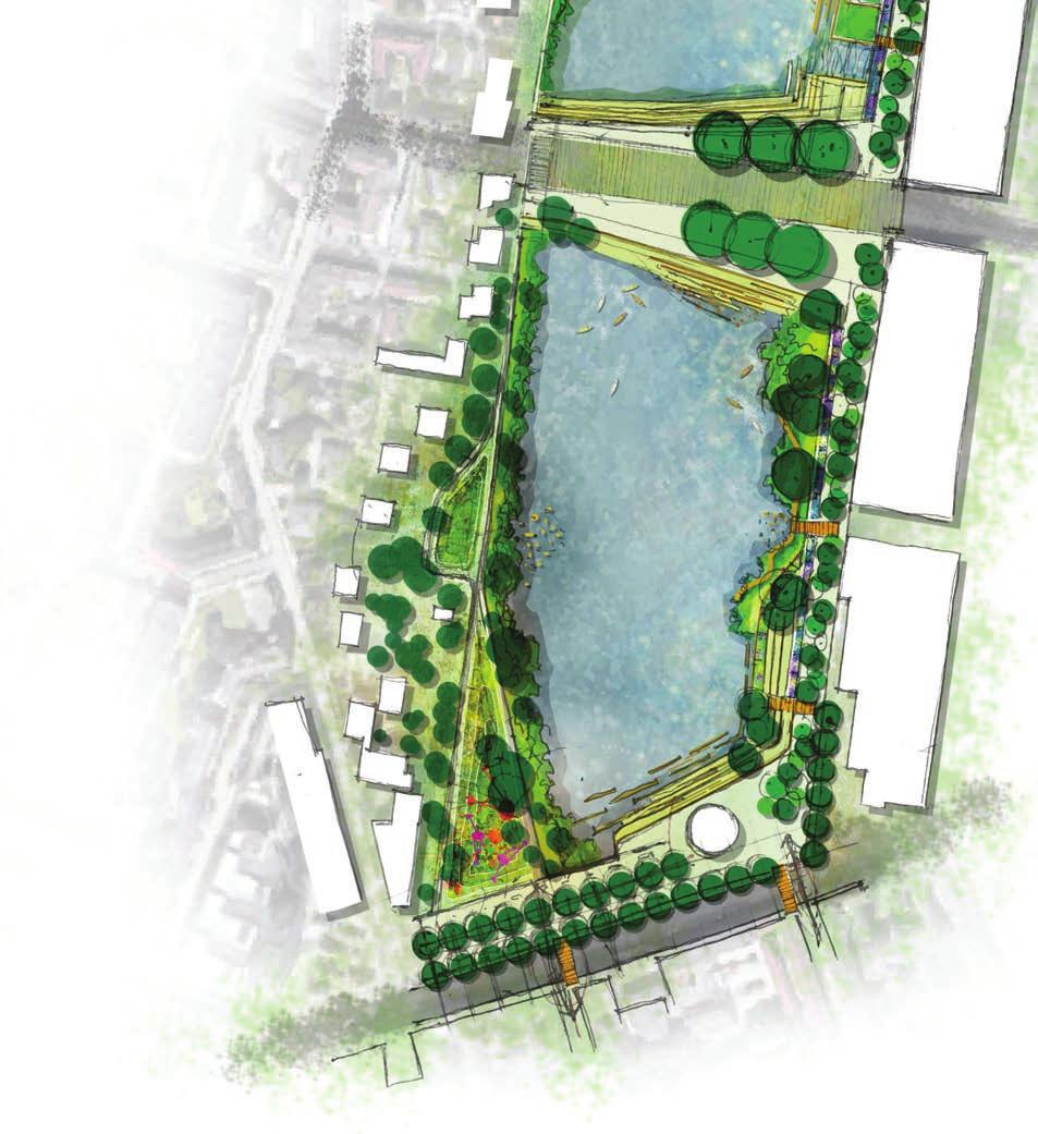
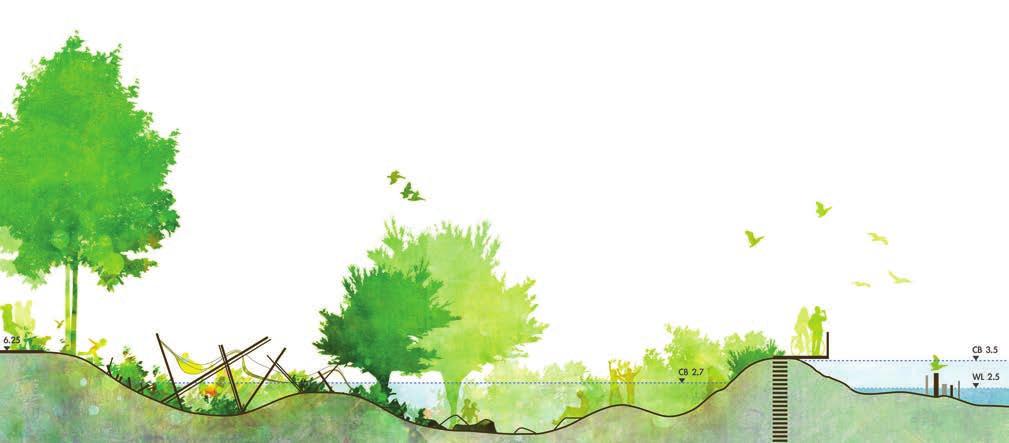
7 CHALLENGE SANKT JØRGENS SØ One of the projects in the Frederiksberg Allé subcatchment is the Sankt Jørgens Sø detention project. This project is intended to detain and convey water from the upstream areas to a large cloudburst pipe leading the water to the lake and eventually to the harbour in cloudburst situations. The lake needs to accommodate between 47,000 m 3 and 75,000 m 3 during cloudburst events. Achieving this requires substantial terrain modifications and lowering the water table in the lake. Our task was to address the complexity of the current plans for the lake, both in scale and technicality and to bring new ideas to the planning processes in close cooperation with key stakeholders. We worked within the hydraulic catchment of Sankt Jørgens Sø in order to address the following issues and challenges: Figure 3 Illustration showing the transformation and urban landscape qualities proposed for Sankt Jørgens Sø CHALLENGES 1. Need for stormwater storage - How much volume and how? 2. Terrain modifications for stormwater to reach the lake and discharge from the lake - if we alter the water table, which is the optimum level for the future lake? 3. To which degree can we rely on gravitation for this part of the system and how much pumping will we have to add? 4. How do we integrate the water quality of the lakes into the design? 5. How do we integrate our design into existing profile of the neighborhood, both in terms of landscape, traffic and culture? 6. Which added benefits and values do we prioritise in our design? EXECUTIVE SUMMARY 7


, the Municipality of")
8 HOSTS & SPONSORS Denmark has a very strong water sector known for innovative partnerships and cooperation. The Danish water sector is increasingly becoming international and interdisciplinary through new political agendas especially related to green initiatives, streamlining of services and processes and through climate resiliency initiatives. The links between water management and other aspects of urban planning are strengthening and integrated planning approaches are increasingly applied by both public and private actors. Joint efforts across traditional planning corridors are provoking a transformation towards more liveable cities. Copenhagen is a great example of such efforts with city wide strategies, catchment specific masterplans and co-created projects at the local level. The Urban Lab is jointly funded by the City of Copenhagen (Lykke Leonardsen), the Municipality of Frederiksberg (Dorte Nilsson and Niels Kaalund), the Utility for Greater Copenhagen HOFOR (Jes Clauson-Kaas), the Utility of Frederiksberg (Henrik Bay), the University of Copenhagen (Marina Bergen Jensen), IWA Denmark (Miriam Feilberg), the Young Water Professionals Denmark (YWPDK) and Rambøll (Christian Nyerup Nielsen and Trine Stausgaard Munk). 8 EXECUTIVE SUMMARY
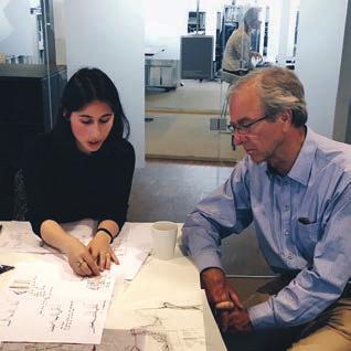
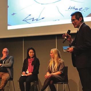
9 PROGRAMME The Urban Lab took place from June 1st to June 9th The host organisation behind the Copenhagen Urban Lab is a welcomed the team in Copenhagen on June 1st. The team worked on one of the most contemporary challenges in the city: building resilient neighbourhoods. The purpose of the Urban Lab was to reflect on how to apply and improve current integrated planning approaches by focusing on the case of the Sankt Jørgens Sø in the inner city of Copenhagen. Sankt Jørgens Sø is a signature project within cloudburst resiliency planning in Copenhagen. The ideas, designs and proposed solutions could be of high value to the city and reflections in the process likewise. The 9-day programme included informal lectures, guided tours, discussions, presentations and dinners with various stakeholders and within the group itself in preparation for a final presentation on the 9th June. June 1st - Arrival, welcome and introduction Arrival at Rambøll Head Office Welcome and team introduction Trine Stausgaard Munk, Project Manager, Rambøll Rambøll as host and as driver for change in urban planning practices Christian Nyerup Nielsen, Director, Rambøll Programme of the week, tour of the building, contacts and materials Dinner at Restaurant Rasoi June 2nd - Setting the scene 8.30 Breakfast with the Rambøll climate adaptation departments 9.00 Introduction to the full masterplan developed by Rambøll: Jesper Rasmussen, Project Director, Rambøll Introduction to climate adaptation work Lykke Leonardsen, Program Director for Resilient and Sustainable City Solutions, City of Copenhagen Introduction to the Cloudburst Management Plan Lykke Leonardsen, Program Director for Resilient and Sustainable City Solutions, City of Copenhagen Introduction to Sankt Jørgens Sø Rikke Hedegaard Christensen, Urban Planner, City of Copenhagen Niels Kaalund Jensen, Civil Engineer, Frederiksberg EXECUTIVE SUMMARY Lunch at Rambøll Stormwater management and urban development Marina Bergen Jensen, Professor MSO, University of Copenhagen Questions/discussions on aspects, clarifications The role of green infrastructure in water management Li Liu, Post Doc, University of Copenhagen Questions/discussion on aspects, clarifications Understanding of the task and preparing for meeting with HOFOR Dinner at Von Fressen on Vesterbro June 3rd - Catchment day 9.15 Arrival at Frederiksberg Station where we met Morten Plesner Hansen from HOFOR 9.30 Presentation of the Frederiksberg cloudburst system draining to Sankt Jørgens Sø Presentation of the Copenhagen cloudburst system draining to Sankt Jørgens Sø Walk to Lindevang Park Frederiksberg presents the climate project in Lindevang Park Walk with HOFOR to cloudburst roads in Frederiksberg Allé subcatchment and to Sankt Jørgens Sø Lunch with HOFOR Field work at Sankt Jørgens Sø Dinner at Bevar s on Nørrebro June 4th - Urban liveability 8.30 Breakfast and self-study Urban liveability, urban aesthetics, changes over time, and aspects on water in the urban space, Bettina Lamm, Associate Professor, University of Copenhagen Questions/discussions on aspects, clarifications Discussions of group project Lunch Self-study research Dinner at Mothers in the meatpacking district 9

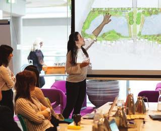
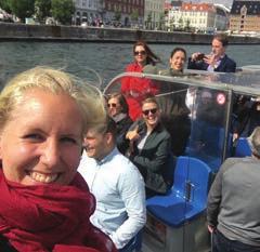
10 PROGRAMME June 5th - Adding value 8.30 Breakfast 9.00 Adding values and building the business case, Jonathan Leonardsen, Senior Consultant, Rambøll Group work building our concepts Lunch Group work building our concepts Tour and dinner at Papirøen with Kirsten Prisum and Marco Sempreviva Lund from YWPDK June 6th - Feedback day 9.00 Breakfast 9.30 Presentation of initial findings to Rambøll and Jes Clauson-Kaas, HOFOR Discussions and feedback Lunch at Rambøll Group work how can we use the feedback? Hydraulic session, Toke Sloth Madsen, HOFOR Dinner with Rambøll and other stakeholders at Pegasus on Vesterbro June 8th - Finalising plans 8.30 Breakfast 9.30 Finalising our plans and preparing our presentations Lunch at Rambøll hour tour of the canals of Copenhagen with YWPDK and Jes Clauson-Kaas, HOFOR Dinner at Halifax Nørrebro June 9th - Presenting results 8.30 Breakfast Final presentation of our findings to key stakeholders Lunch at Rambøll Official end of Lab June 12th to 14th - Embrace the Water a Cities of the Future Conference, Göteborg Sweden Oral and poster presentation of the Copenhagen Urban Lab June 7th - Building statements 9.00 Breakfast 9.30 Building our statements, Marina Bergen Jensen and Bettina Lam, University of Copenhagen Lunch at Rambøll Building our statements, Li Liu and Ole Fryd, University of Copenhagen Dinner with HOFOR at BOB Bistro 10 EXECUTIVE SUMMARY


11 TEAM LANDSCAPE URBAN Master student Landscape Architecture & Urban Design University of Copenhagen, Denmark Portugal Landscape Architect Grant Associates UK Associate Rambøll Environ, USA Japan URBAN WATER Master student Institute for Housing and Urban Studies, Rotterdam Netherlands Research Specialist Regional Centre on Urban Water Management Iran Civil Engineer E2DesignLab Australia EXECUTIVE SUMMARY 11


12 CLOUDBURST SOLUTIONS The challenge How can we provide 47,000 m 3 to 75,000 of CLOUDBURST STORAGE in the lake? 47,000 to 70,000 m Olympic Pools The process C The team explored multiple options, both prior and after consulting with key stakeholders, including HOFOR. The short amount of time, the limited availbility of data and many preconditions framed the discussions to be at a conceptual level based on overal hand calculations of flows and volumes. Proposed designs should be validated through detailed hydraulic modelling. Below a list of discussed options: Gravity drainage from cloudburst streets into cloudburst parks that are dry for the majority of time but fill up during cloudburst events. This is a low energy solution but would require significant lowering of the wall along the western edge of the lake. Extension of the cloudburst tunnel. A smaller diameter pipe could be used to transfer regular flows directly to the Harbour but still allow for surcharge during large cloudburst events. This could avoid the need for gravity drainage of the adjacent cloudburst streets as all flows form these catchments could discharge into the cloudburst pipe extension. This could also minimise the need for lowering the wall along the western edge of the lakes (if the hydraulic energy is sufficient more investigations are needed). Consider using one lake or both lakes for storage. By using two lakes the changes to the lake water level and boundaries can be reduced and the length of cloudburst tunnel can be reduced (saving significant costs). Figure 4 Use one lake and surcharge all flows Figure 5 Use one lake but include an extension of the cloudburst pipe to accommodate low flows 12 EXECUTIVE SUMMARY


13 CLOUDBURST SOLUTIONS The outcome The proposed approach utilises gravity drainage form the western cloudburst catchments into local parks that becomes storages during cloudburst events. Both lakes are used for storage to minimise the height of the wall separating the new parks and the lakes. This also allows for future flexibility as the storage of the lakes could be increased by raising the wall. Figure 6 Use two lakes and surcharge all flows Figure 7 Use two lakes but include an extension of the cloudburst pipe to accommodate low flows EXECUTIVE SUMMARY 13


14 CLOUDBURST SOLUTIONS The initial proposal - lake Figure 8 The initial proposal utilised one lake to achieve the required cloudburst storage volume. This proposal also includes some storages in parks connected to cloudburst streets along Norsvej and Vodsroffsvej (parks are dry during everyday rainfall events but provide storage during cloudburst events). Only using one lake for storing surcharge flood water from the cloudburst pipe means that the wall separating the park and lake needs to be 2.0 m high The new proposal - lakes Figure 9 The new proposal presented by the urban lab team utilises two lakes to achieve the required cloudburst storage volume. This has the benefit of reducing the level change in the lakes during cloudburst events from ~1.5 m to 1.0 m. It also means that the wall separating the lakes from the adjacent parks used to stormwater from local cloudburst streets can be reduced to 1.5 m. This proposal also has greater flexibility. For instance, if more cloudburst storage is required in the future the height of the wall separating the parks and lakes could be increased to provide more storage 14 EXECUTIVE SUMMARY


, high phosphorus concentrations that can lead to algal blooms and the challenge of managing runoff contaminated by salt during")

15 WATER QUALITY SOLUTIONS The challenge How can we improve the water quality in the lake(s) as well as the water quality from cloudbursts tunnels and streets? This requires consideration of the first flush phenomenon (i.e. high level of pollutants during the first period of runoff, especially from roads), high phosphorus concentrations that can lead to algal blooms and the challenge of managing runoff contaminated by salt during winter periods. The process We explored multiple options, including: Natural treatment options (e.g. wetlands and rain gardens) both within the lakes and in new green boulevards along the eastern edges of the lakes. More traditional treatment options, such as Alum dosing or even a biological/ chemical treatment plant. The potential for a natural pool system that combines treatment through vegetation and filtration to improve the water quality enough to allow for swimming. This option would only be provided in an isolated part of the lakes where the number of swimmers could be controlled and wildlife interactions (e.g. swans) regulated. D F E G EXECUTIVE SUMMARY 15


16 WATER QUALITY SOLUTIONS The outcome The proposed approach utilises natural treatment wetlands both within the lakes themselves and in the boulevard running along the eastern edges. This solution was adopted because: Retaining some treatment and vegetation within the lakes themselves is important as it reflects the current more, natural feel of these lakes relative to the very formal and unvegetated edges of the northern lakes. Providing treatment within the boulevard brings water and nature into the streetscape and allows for greater interaction with nature. This also allows for the amount of vegetation within the lakes to be reduced, this is an important outcome as it preserves the existing open water views which provide an important amenity function. H Locating treatments within the boulevards also simplifies maintenance as it allows for easy access and regulation of the vegetation in separate cells. This is considered to be easier than maintaining the more natural and unvegetated wetland systems proposed within the lake, If this approach is adopted the management of mosquitos will need to be considered as part of the design. This should be easily achieved by ensuring a constant flow within the boulevard treatment systems and/or designing sub-surface treatment wetlands that minimise standing water. I The proposed solution requires water to be pumped from the northern lake to the boulevard. From the boulevard water can flow by gravity to the southern lakes. This also provides an opportunity for disconnection of adjacent residential downpipes into the boulevard treatment systems. Once the treated water has returned to the southern lake it will then need to be lifted by a pump into the northern lake to keep the circulation going. This treatment system will help improve the water quality in the lake on an everyday basis. The cloudburst streets have been kept separate from the lakes to avoid the risk of regular first flush, phosphorus and salt pollution. During a cloudburst polluted water will enter the lakes from the cloudburst tunnel and drain out over an extended period. These cloudburst flows will receive minimal treatment prior to discharge to the lake. Figure 10 Water is treated using natural vegetated systems in the lakes and boulevards. Water is recirculated from the upper lake (pumped), through the boulevards (gravity), to the lower lake (gravity) and then back to the upper lake (pumped). The pipe or weir connecting the two lakes will only be engaged in cloudburst events 16 EXECUTIVE SUMMARY


17 INTEGRATED URBAN LANDSCAPE SOLUTIONS The challenges Challenge 1 The group discussed the following questions in trying to approach the Urban Landscape response: Should the approach be driven by the critical need to implement a cloudburst project and be therefore technically driven? VOLUME Should it be driven by the urgent need to improve the water quality of Sankt Jørgens Sø and be therefore technically driven? WATER QUALITY Should it be driven by ambitious thoughts to improve the existing limitations found in the immediate and surrounding urban landscape and be therefore aspirationally driven? URBAN-LANDSCAPE What is the order of priority of the three main elements? Should there be a priority list or is each aspect equally important? These questions required serious consideration and agreement as they began to form the rules and restrictions behind the integrated design solution as well as the multiple benefits that can be achieved alongside any chosen solution. As a group the agreed stance would be to adopt a realistic yet aspirational approach by weighing out the multiple benefit opportunities or lack thereof across the solutions. The reality is that the Urban Landscape needs to work hard, the question was how hard? Challenge 2 The team also discussed how to make the Urban Landscape work hard in providing space for: People (residents, surrounding locals) People (visitors) Commuters & Lingerers Programable / Passive Activities Additional Water Volume (space for segregated volumes and different frequencies) Formal & Informal Vegetation that provides opportunity for: - wildlife to develop and thrive, - people to connect with nature - water cleansing functions Challenge 3 How to resolve / integrate the implications of the lake modification to accommodate the Cloudburst volume: Resultant high wall Significant drop in level and how to reach the water safely Challenge 4 How to resolve / integrate the implications of Water Quality and the potential variations. Figure 11 The Project Area in its immediate & wider urban context Saint Jørgens Lake Frederiksberg Cloudburst Boulevard Cloudburst Street Green Boulevard Green Street Proposed Tunnel EXECUTIVE SUMMARY 17


18 INTEGRATED URBAN LANDSCAPE SOLUTIONS The process The group kept in mind the planning policies and ambitions for the whole of Copenhagen and identified the opportunities and constraints of the site: The project area forms part of a wider complex piece of urban landscape with a strong identity. Sankt Jørgens Sø is one of several lakes that all share a historical background. The lakes are an important identifiable element to the City of Copenhagen. They depict a very formal edge, resonating a particular moment in their history. The character of the vegetation changes along various stretches of the banks. The water as an element is the factor that binds all the lakes together. There is no other urban landscape element that unifies the lakes. Sankt Jørgens Sø feels very separate due to the existing road. Connectivity across both visually and physically is rather poor. Figure 12 The City of Copenhagen published documents Figure 13 The Project Area in its immediate & wider urban context 18 EXECUTIVE SUMMARY
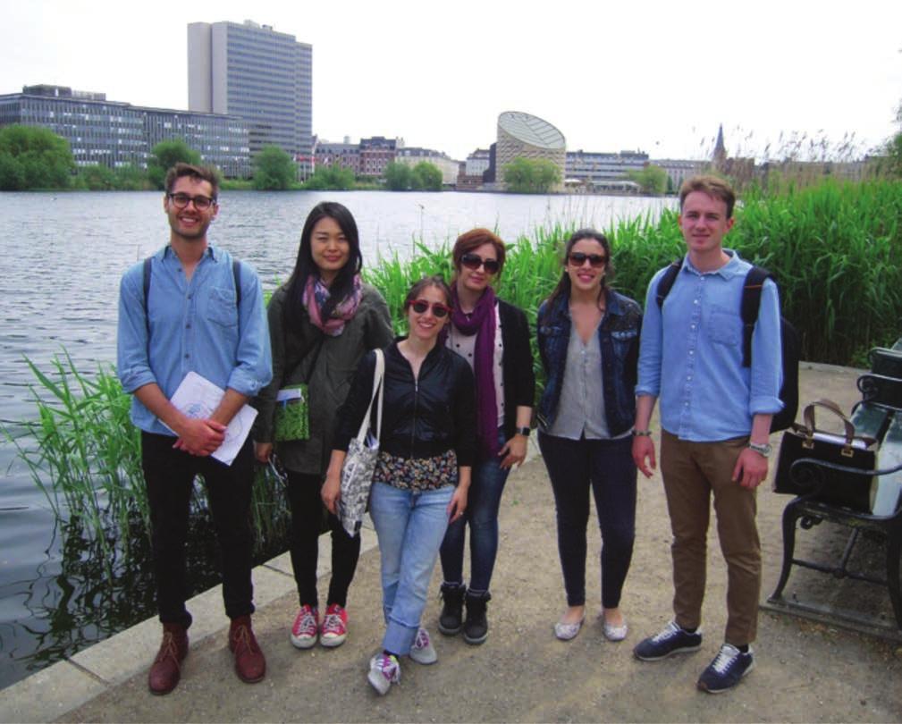


19 INTEGRATED URBAN LANDSCAPE SOLUTIONS Figure 14 The Copenhagen Urban Lab Team 2017 visting Sankt Jørgens Sø EXECUTIVE SUMMARY Figure 15 Snapshots from the urban lab process and free time 19
20 INTEGRATED URBAN LANDSCAPE SOLUTIONS LEGEND: Physical & visual barriers Existing buildings FFL currently lower than Water Level Existing road with under-used potential Existing landform and/or change in level Cycle Lane & pedestrian walkway Existing vegetation that largely creates a barrier between the people and the water Limited opportunities to come close to the water Water quality concern due to algal bloom Figure 16 The Project Area Explored various criteria with the intention to create a defined brief. Discussed and challenged: The benefits of taking into consideration the immediate streets surrounding the lake? The integration of the cloudburst street that transports water to Sankt Jørgens Sø? The potential for looking at the bigger picture in which Sankt Jørgens Sø sits, the relationship between one lake and the other and how these can begin to work together? The degree of change/modification to the lake edges, depth and overall character is considered acceptable? The balance between a formal/informal character, if any? Sankt Jørgens Sø as a water body. Shouldn t it still read as a water body? The role of the surrounding streets as mainly car transporting means? 20 EXECUTIVE SUMMARY
21 INTEGRATED URBAN LANDSCAPE SOLUTIONS In context with the City of Copenhagen Cloudburst Management Plan, 2012, Sankt Jørgens Sø needs to provide sufficient cloudburst storage volume. A simple technical check in comparing the existing volume vs required volume (to ensure provision for cloudburst resiliency) indicated that: the water level needs to drop significantly additional excavation is required to retain the lake as a water body This scenario would give way to an increased detatchment between: the water body and the people the water body and its immediate context The outcome Water volume calculations & checks indicated that it was beneficial to accommodate the cloudburst volume across two of the lakes. Therefore, it was the technical planning aspects that informed the decision to extend the project area. This gave rise to an opportunity to develop an idea that can begin to form the basis of a wider aspiration for all of the lakes. Figure 17 The Extended Project Area EXECUTIVE SUMMARY 21


22 INTEGRATED URBAN LANDSCAPE SOLUTIONS Design considerations The extended project area is not isolated. It is a piece of a wider, complex puzzle of green-blue infrastructure. Its design needs to connect on the micro scale as well as on the macro scale. The elements in the urban landscape need to connect up to a wider existing and future planned green infrastructure that can begin to work harder. The hydraulic function is active 1 in every 100 years - what about the other years??? Figure 18 The Extended Project Area in its immediate & wider urban context 22 EXECUTIVE SUMMARY
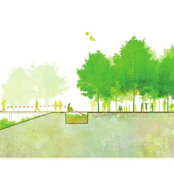
23 INTEGRATED URBAN LANDSCAPE SOLUTIONS The everyday park A park for 99 years A resilient solution for 1 in 100 years Sankt Jørgens Park! Figure 19 The Proposal: Everyday Lake EXECUTIVE SUMMARY 23
24 INTEGRATED URBAN LANDSCAPE SOLUTIONS Manipulate the topography Lowered the existing landforms that create a visual/physical barrier around the edges of both lakes. Maintained and/or created a formal edge (reflecting the identity & character of the current lakes) balanced by complex undulating topography that creates: opportunity for habitat increased contact between plant material & water for improved water quality treatement varied connection between people & the water Retained a select number of existing trees that due to their size and character provide cultural & natural benefits to the local environment. Formed basins which segregate the lake water from more frequent rainfall. The structure walls supporting these basins are integrated and hidden behind the undulating topography providing a gradual soft decent into the water. Figure 20 The Proposal: Physical changes 24 EXECUTIVE SUMMARY

25 INTEGRATED URBAN LANDSCAPE SOLUTIONS Accommodate the cloudburst volume Figure 21 The Proposal: During cloudburst EXECUTIVE SUMMARY 25
26 INTEGRATED URBAN LANDSCAPE SOLUTIONS Reclaim the streets Transformed the existing adjacent street into a multi-functional boulevard that opens up onto the view of the lakes, thereby taking advantage of the site orientation and creating an active front along the sunnier side of the site. The boulevard will provide space for: a cycle lane pedestrian avenue F.23 urban-nature programmable spaces for people & children additional water cleansing facility Transformed, (temporarily or not), the road separating the two lakes into a Stage on the Water animated by people, activities and life. F.24 F.25 Figure 22 The Proposal: Physical Changes 26 EXECUTIVE SUMMARY


27 INTEGRATED URBAN LANDSCAPE SOLUTIONS Illustrations showing: 1. Complex, varied waters edge 2. Urban nature boulevard 3. Cut-through cycle route 4. Water cleansing feature 5. Programmable spaces Figure Figure Figure 25 EXECUTIVE SUMMARY 27
28 INTEGRATED URBAN LANDSCAPE SOLUTIONS Urban public outdoor life In creating the boulevard we are providing more space for people rather than for cars. By providing a new cycle lane along the edge of the boulevard, the existing cycle lane on the west (before chaotic & busy) is freed up giving way to a quieter, slower route for pedestrians only. This will be a benefit to: the houses along the western edge of the lakes the public who can enjoy a relaxed stroll whilst away from the activity on the eastern edge wildlife to find quieter, undisturbed habitat to nest in The proposed topographical changes as well as the shared space principles applied to the design of the existing dividing road/bridge will help transform the space into an important element that can become an active, piece of urban landscape in the City of Copenhagen. This space can, initially temporarily, close on a weekly or monthly basis, eventually permanently, become a Stage on water where the people become the main actors of the space. It will be characterised by: visual connection across the lakes landmark trees stepped connection to the water events and organised activities Figure 26 The Proposal: Proposed Uses 28 EXECUTIVE SUMMARY

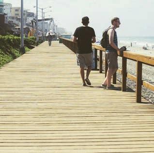
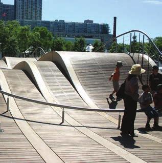
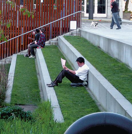
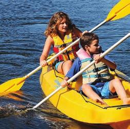
29 INTEGRATED URBAN LANDSCAPE SOLUTIONS J K M O N L P EXECUTIVE SUMMARY 29
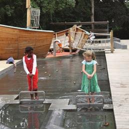
30 INTEGRATED URBAN LANDSCAPE SOLUTIONS Urban public outdoor life The boulevard is a quite wide, long area for opportunities related to active public outdoor life. It is interspersed with a variety of programmable spaces that give opportunity for people of all age groups to enjoy. Some offer passive use, others more active. There is space to: read alone sit in groups and chat listen to music take shelter from the sun play enjoy the feeling of wild urban-nature set up stalls for public events/ markets Thoughts have been discussed on the potential of this stretch of land to be transformed into an active, lively boulevard-promenade if the ground floor of the adjacent buildings are also transformed into more public uses such as: cafes, bars, restaurants, playschool etc. The scheme also provides quieter, more relaxed edges on the western side of the lakes which overlook onto the water. The basin located on the southwest side of the south lake is designed to collect and transfer water. When it is dry, it doubles up as a lively, natural play area with fun opportunities and play elements for children that take advantage of the bowl-like topography. Thoughts have been discussed in how the play elements in this area can be designed in such a way that they link into the use of the existing building nearby, the Tycho Brahe Planetarium. While this area is essentially a depression in the ground, it is quite large and views into it and through it will be maintained to ensure safety and overlooking by the childrens parents. Figure 27 The Proposal: Proposed Uses 30 EXECUTIVE SUMMARY


31 INTEGRATED URBAN LANDSCAPE SOLUTIONS Q S R T U V Figure 28 Multi-functional Urban-Landscape EXECUTIVE SUMMARY 31
32 INTEGRATED URBAN LANDSCAPE SOLUTIONS Connection to the water & urban nature The waters edge is designed to accommodate a gradation of planting characters that allow various and diverse plant communities to co-exist: formal, semi- formal, wild. This vegetation complexity coupled with the variations in topography will create areas of different character, interest, access, proximity and interaction with a dynamic waters edge. People are invited to move through, explore and get lost in, experience moments enveloped by the vegetation, moments at an elevated view point enjoyinging views across the lake, and moments close to the open water. There are areas where the vegetation is the element that connects people to the water, in other instances it may be a playful urban element poking out of the water or even nature (birds) itself. Access to the water is also varied. In some cases the connection is faster, through steps or platforms, whereas in other occasions the approach is slower. There are also moments along the edge where accessibility by people is purposely restricted which, if supported by a limited/ careful maintenance and management strategy, will make for an undisturbed habitat for biodiversity and wildlife to thrive. These areas are mostly on the western edges and close to the water. The boulevard adopts the urban nature theme, is characterised by a stretch of tree groupings planted at irregular spacing and for resiliency purposes consists of trees of different age and species. The boulevard is also flanked by a formal, linear wetland that receives storm water run off from the decoupled buildings along its length as well as the boulevard itself. It is an important element integrated in the scheme that circulates and cleans the water of the lakes and brings an additional layer and richness to the theme of Urban-Nature in the City of Copenhagen. Figure 29 The Proposal: Proposed Uses 32 EXECUTIVE SUMMARY

33 INTEGRATED URBAN LANDSCAPE SOLUTIONS X W Lake inflow Boulevard Treatment (consecutive gravity biofilter or wetland cells) Re-circulation Treatment boulevard outflow EXECUTIVE SUMMARY 33

34 CONCLUSION The Copenhagen Urban Lab ended with very positive feedback and interest received from key stakeholders involved as well as the audience at the Embrace the Water Conference in Göteborg. This executive summary was prepared as a response to their request to be able to further review our work and experience. Our vision was to transform Sankt Jørgens Sø in a way that it can handle the cloudburst storage of 47,000 m 3 to 75,000 m 3 and simultaenously, on a daily basis, function as an Everyday Park. In doing this, there were various limitations we had to deal with, the biggest constraint being time to effectively think across the disciplines, try out various options and resolve one further. As a result, we chose to focus our time on creating a vision for a place, identifying ideas, principles and key moves which can then be resolved in further detail if this study is taken forward. Another challenge was to find the balance between being creative, uninhibited by the practical/physical constraints, even utopian ideals and concepts, and ensuring the functionality and feasibility of the hydraulic solutions in the urbanlandscape design. The team faced difficult challenges both in the project complexity and group work within the members from different countries. We helped each other catch up with the programme progress and discussions and brought unique project examples and experiences from our own country in the hopes of delivering outcomes that would exceed stakeholders expectations. Having dinner together on our own as well as with stakeholders was a precious time to get to know each other faster and better. It also provided for an informal setting to review lectures, discussions and findings of the day. Casual conversations sometimes led us to good ideas that became a base for our discussions on the following day. Programme deliverables and the stakeholders expectations became clear as the programme progressed, feedback and advice was provided by the respective stakeholders and Trine Stausgaard Munk, Project Manager, when needed. Within this short programme, each member gained valuable experience and learned important lessons about the world s leading cloudburst management plans and projects that are highly embedded in the theme of liveability. We hope that this executive summary gives an overview of our process, learnings and outcomes as part of the Copenhagen Urban Lab. We also hope that the lessons learned during this programme will be applied to the next Urban Lab. We would like to once again express our great gratitude and appreciation to the hosts and sponsors of this event. We hope, that we will be able to share our experiences with other Urban Lab participants and meet once again at the IWA World Water Congress & Exhibition in 2020! Simon, Paula, Fumi, Meivis, Ana & Niloofar We would to give a special thank you to the following people: Lykke Leonardsen City of Copenhagen Rikke Hedegaard Christensen City of Copenhagen Niels Kaalund Jensen City of Frederiksberg Marina Bergen Jensen University of Copenhagen Bettina Lamm University of Copenhagen Li Liu University of Copenhagen Ole Fryd University of Copenhagen Jan-Michael Blum YWPDK Jes Clauson-Kaas HOFOR Toke Sloth Madsen HOFOR Morten Plesner Hansen HOFOR Henrik Bay Frederiksberg Forsyning Christian Lauersen Frederiksberg Forsyning Kirsten Prisum YWPDK Marco Sempreviva Lund YWPDK Christian Nyerup Nielsen Rambøll Trine Stausgaard Munk Rambøll Jesper Rasmussen Rambøll Jonathan Leonardsen Rambøll Neil Goring Rambøll Camilla Julie Hvid Rambøll Miriam Feilberg DANVA 34 EXECUTIVE SUMMARY

35 BIBLIOGRAPHY A Water catchment of Ladegardså, Frederiksberg East & Vesetrbro... 5 Cloudburst Masterplan for Ladegårdså, Frederiksberg East & Vesterbro, City of Copenhagen. B Cloudburst masterplan for the subcatchment of Sonder Boulevard... 6 Cloudburst Masterplan for Ladegårdså, Frederiksberg East & Vesterbro, City of Copenhagen. C Swimming pool Viewed July D Algae lake Viewed July E Stormwater oil pollution Viewed July F Stormwater drain Viewed July G Ice road with salt Viewed July H Urban wetland Viewed July I Cattail reed pond plant Viewed July J Photographer at viewpoint...29 Viewed July K Outdoor stage...29 Viewed July L Wave deck...29 Viewed July M Concert...29 Viewed July N Street performance...29 Viewed July O Boardwalk...29 Viewed July P Kayak...29 Viewed July Q Chess Viewed July R Children in nature Viewed July S Child in flowers Viewed July T Binoculars Viewed July U Bench Viewed July V Playground Viewed July W Boardwalk in swamp...33 Viewed July X Duck...33 Viewed July EXECUTIVE SUMMARY 35


36 The Copenhagen Urban Lab was an invaluable and great experience! CONTACT Trine Stausgaard Munk Project Manager Ramboll Liveable Cities, US Ramboll Environ 20 Custom House St #800 Boston, MA United States of America 36 EXECUTIVE SUMMARY
Welcome on board the Copenhagen Urban Lab!
 The host organisation behind the Copenhagen Urban Lab is looking forward to welcoming you in Copenhagen June 1 st. We are excited, that you will be working on one of our key contemporary challenges in
Welcome. /The Design Companion 4. /Planning London 7. /Getting Homes Built 8. /Transport & Streets 10. /Tech & The City 12
 Welcome With the draft publication of the London Plan and the Mayor s Transport Strategy (MTS) this year s events programme will examine both documents in detail with a wide range of seminars, debates
Scottish Natural Heritage. Better places for people and nature
 Scottish Natural Heritage Better places for people and nature Contents Summary... 3 SNH approach... 5 Place-making in policy and practice... 6 Developing the contribution of the natural heritage to place-making...
Section 4 - Public Realm & Landscape proposals Landscape Masterplan. Section 4 52
 - Public Realm & Landscape proposals Landscape Masterplan 52 Proposed Masterplan - Green Infrastructure Strategy District Park 4.33 Ha to provide Passive and active recreation with a large play area which
LITTLE FRANCE PARK, EDINBURGH
 LITTLE FRANCE PARK, EDINBURGH INTEGRATING ACTIVE TRAVEL ROUTES WITHIN A MASTERPLAN FROM THE OUTSET Location: Implemented: Edinburgh, Scotland 2016 - ongoing CASE STUDY The Little France Park cycling and
Welcome. Proposals for land at Smug Oak Lane BRICKET WOOD
 Proposals for land at Smug Oak Lane BRICKET WOOD Previous Linden Homes and Wates Developments scheme Welcome Welcome to Linden Homes and Wates Developments public exhibition. Working together as joint
EXECUTIVE SUMMARY INTRODUCTION. Nicolle Shandrow, Laura Antul, Samee Swartz, Worcester Polytechnic Institute
 EXECUTIVE SUMMARY Nicolle Shandrow, Laura Antul, Samee Swartz, Worcester Polytechnic Institute INTRODUCTION Copenhagen has been struggling with problems related to traffic congestion since the city s expansion
Scope of Services. River Oaks Boulevard (SH 183) Corridor Master Plan
 Corridor Master Plan") Scope of Services River Oaks Boulevard (SH 183) Corridor Master Plan PROJECT AREA The project area consists of the River Oaks Boulevard (SH 183) corridor bounded by SH 199 at the northern end and the Trinity
Scope of Services River Oaks Boulevard (SH 183) Corridor Master Plan PROJECT AREA The project area consists of the River Oaks Boulevard (SH 183) corridor bounded by SH 199 at the northern end and the Trinity
1 Welcome! UBC Okanagan Master Plan Update - Open House
 1 Welcome! UBC Okanagan Master Plan Update - Open House UBC is updating the Master Plan for the Okanagan Campus. The purpose of today s Open House is to: Present the draft 2015 Master Plan Answer any questions
CITIZEN PARTICIPATION FOR BETTER URBAN GREEN SPACES
 CITIZEN PARTICIPATION FOR BETTER URBAN GREEN SPACES This policy brief illustrates the resources citizens can bring to green space planning and management, while also providing guidelines for how to design
Cotswolds AONB Landscape Strategy and Guidelines. June 2016
 Cotswolds AONB Landscape Strategy and Guidelines June 2016 Cotswolds AONB Landscape Strategy and Guidelines Introduction The evolution of the landscape of the Cotswolds AONB is a result of the interaction
An interdisciplinary approach to identify adaptation strategies that enhance flood resilience and urban liveability
 Downloaded from orbit.dtu.dk on: Mar 28, 2019 An interdisciplinary approach to identify adaptation strategies that enhance flood resilience and urban liveability Rogers, B. C.; Bertram, N.; Gunn, Alex;
Building with nature
 Building with nature Prioritising ecology and biodiversity for better buildings and cities Executive Summary May 2018 National Strategic Sponsor Research and evidence demonstrating the positive impacts
97 Lea Bridge Road, Leyton, E10 7QL London Borough of Waltham Forest December 2015
 97 Lea Bridge Road, Leyton, E10 7QL London Borough of Waltham Forest December 2015 Public Realm and Landscape Proposals LEA BRIDGE ROAD, WALTHAMSTOW Public Realm & Landscape Proposals BDP(90)RPT001 December
Writtle University College Policy & Principles for Sustainable Development
 Writtle University College Policy & Principles for Sustainable Development P.R.Hobson & A. Perera Preface As a higher education institute with a specialist provision in land-based studies, Writtle University
December 1, 2014 (revised) Preliminary Report -- Thomas Jefferson Site Evaluation
 Preliminary Report -- Thomas Jefferson Site Evaluation") December 1, 2014 (revised) TO: FROM: RE Arlington County Board Thomas Jefferson Site Evaluation Working Group by Carrie Johnson, Chair Preliminary Report -- Thomas Jefferson Site Evaluation The Thomas
December 1, 2014 (revised) TO: FROM: RE Arlington County Board Thomas Jefferson Site Evaluation Working Group by Carrie Johnson, Chair Preliminary Report -- Thomas Jefferson Site Evaluation The Thomas
Implementing sustainable water strategy through development industry engagement
 Implementing sustainable water strategy through development industry engagement Ian Director, Organica Engineering, Melbourne, Australia E-mail: iadams@organicaeng.com.au Edward Cotter Sustainability Leader,
The Hadean-Creation studio.
 Residential Designing Spring 2016 The Hadean-Creation studio. We provide sustainable and ethical responses to the client s brief by adding value and empowering a sense of pride and ownership. Hadean-Creation
DEALING WITH STORM WATER MANAGEMENT
 December 2012 DEALING WITH STORM WATER MANAGEMENT This fact sheet provides information on the guiding principles of storm water management practices, explains the difference between structural and non-structural
A new park will be delivered as part of the Elephant Park regeneration.
 A new park will be delivered as part of the Elephant Park regeneration. The exhibition boards presented here introduce the first phase of the new park that is scheduled to open in spring 2017 that has
Manor Ponds, Sheffield
 Manor Ponds, Sheffield SuDS used Ponds Basins Benefits 1. Location Substantial improvement in amenity and biodiversity value. Effective stormwater treatment. Engagement/educational opportunity for all
North District What we heard
 What we heard Vision to 2056 and Priorities Governance and implementation Infrastructure and funding The vision for a metropolis of three cities, and the 30 minute city. Feedback emphasised: That for the
QUEENSTOWN LAKES DISTRICT COUNCIL SUBDIVISION DESIGN GUIDELINES
 Attachment C: Draft QLDC Subdivision Design Guidelines QUEENSTOWN LAKES DISTRICT COUNCIL DESIGN GUIDELINES A DESIGN GUIDE FOR AND DEVELOPMENT IN THE URBAN ZONES QUEENSTOWN OFFICE 10 Gorge Road Queenstown
LIVEABILITY FROM NEARLY BANKRUPT TO MOST LIVEABLE IN 15 YEARS - 12 LEARNINGS FROM COPENHAGEN, MARCH 2ND, 2016
 LIVEABILITY FROM NEARLY BANKRUPT TO MOST LIVEABLE IN 15 YEARS - 12 LEARNINGS FROM COPENHAGEN, MARCH 2ND, 2016 COPENHAGEN FROM NEARLY BANKRUPT TO MOST LIVEABLE IN 15 YEARS In 1993 Copenhagen municipality
CHAPTER 5: GUIDING PRINCIPLES
 CHAPTER 5: GUIDING PRINCIPLES The following 10 principles were developed based on public consultation, planning policy and the background analysis conducted during Phase 1. The Guiding Principles significantly
Davis Landscape Architecture. Davis. Landscape Architecture
 23a Iliffe Yard, London, SE17 3QA, UK +44 (0)20 7277 1035 mail@davisla.com www.davisla.com Practice Overview We are a design led London based practice that prides itself on the delivery of schemes that
Our City Centre is a vibrant, creative and welcoming destination, with a modern business, cultural, shopping, leisure and residential offer
 3. Sheffield in 2034 Our City sits at the heart of a strong, distinctive and internationally successful City Region economy which supports innovation and enterprise Our City Centre is a vibrant, creative
{Best Practices. Summary of Tools, Strategies and Best Practices from 11 Michigan Case Study Communities
 Case Studies Michigan Coastal Community Working Waterfronts { Summary of Tools, Strategies and from 11 Michigan Case Study Communities Table of Contents Zoning...2 Community and Stakeholder Collaboration
John M. Fleming Managing Director, Planning and City Planner. Old East Village Dundas Street Corridor Secondary Plan Draft Terms of Reference
 Report to Planning and Environment Committee To: From: Subject: Chair and Members Planning & Environment Committee John M. Fleming Managing Director, Planning and City Planner Old East Village Dundas Street
Vision for Mayfair and Belgravia
 Vision for Mayfair and Belgravia Vision for Mayfair and Belgravia Foreword We have a 20 year vision for Mayfair and Belgravia. It summarises our aspirations for the future of this London estate, which
Sub-committee on Harbour Plan Review of Harbour-front Enhancement Committee. Ninth Meeting
 Sub-committee on Harbour Plan Review of Harbour-front Enhancement Committee Ninth Meeting Date: 5 October 2005 Time: 3:30pm Venue: Conference Room 15/F, North Point Government Offices, 333 Java Road, North
Elderberry Walk. Developer HAB Housing
 Case studies Elderberry Walk Developer HAB Housing Development of 161 new homes on the former Dunmail Primary School site, focused around a central green street, with retained trees, new multifunctional
Vision Plan Kickoff Meeting Summary Report
 Vision Plan Kickoff Meeting Summary Report October 2018 The Vision Plan With the redevelopment of the Amtrak Property, Penn Station Partners (PSP) seeks to build on the creative talent and entrepreneurial
Designing Open Spaces for Recreation
 Designing Open Spaces for Recreation Guidance Notes for the Design of Open Space Local Plan Policy L11 Referencing L10, L9 (July 2006) Concept drawings 2006 LOCAL PLAN 1996-2011 This document provides
Arlington, Virginia is a worldclass
 EXECUTIVE S U M M A RY Arlington maintains a rich variety of stable neighborhoods, quality schools and enlightened land use policies, and received the Environmental Protection Agency s highest award for
10.0 Open Space and Public Realm
 10.0 Open Space and Public Realm 10.0 Open Space and Public Realm The Public Open Space System is comprised of: outdoor spaces available for public use that are either publicly owned (e.g., parks and
Statement of Community Involvement LAND OFF SOUTHDOWN ROAD HORNDEAN, HAMPSHIRE
 LAND OFF SOUTHDOWN ROAD HORNDEAN, HAMPSHIRE CONTENTS Page 1. Introduction 3 2. Pre-application Discussions 4 3. The Consultation Process 5 4. Consultation Feedback 7 5. Responses to Consultation Feedback
Loebl Schlossman & Hackl
 Loebl Schlossman & Hackl in association with PSA-Dewberry Chicago, IL EIU Experience 1999 Plan Eastern Illinois University 1999 and 2002 Campus Master Plans Charleston, IL 2002 Update Highly Participatory
AUCKLAND DESIGN OFFICE. Terms of Reference: Auckland Urban Design Panel
 AUCKLAND DESIGN OFFICE Terms of Reference: Auckland Urban Design Panel Auckland Design Office 3 Contents 4 Introduction Benefits of the Panel 6 Terms of Reference The Purpose of the Auckland Urban Design
Wetland Design Manual. A1: Vision, core outcomes and aspirational outcomes
 Wetland Design Manual A1: Vision, core outcomes and aspirational outcomes Table of contents Introduction 5 Vision 6 Core outcomes 7 Effective pollutant removal and flow management... 7 Community safety...
Chairman and Members of the Planning and Development Committee. Thomas S. Mokrzycki, Commissioner of Planning and Building
 LA.09.TOR (Toronto) DATE: TO: FROM: SUBJECT: Chairman and Members of the Planning and Development Committee Thomas S. Mokrzycki, Commissioner of Planning and Building Central Waterfront Secondary Plan
Western City District What we heard
 What we heard Vision to 2056 and Priorities Governance and implementation Infrastructure and funding The protection of the natural landscape including biodiversity and the Metropolitan Rural Area for food
GREENBANK DEVELOPMENT MASTERPLAN
 DEVELOPMENT MASTERPLAN POTENTIAL TRAIN STATION COMMUNITY CENTRE Greenbank will be a connected masterplanned community providing easy access to local and surrounding amenity. Affordable quality homes, green
Parks Master Plan Implementation: Phase I Waterfront Use and Design REPORT #: September 7, 2016 File #
 0 'O DI Lan-171-14 1 - THE CORPORATION OF THE TOWN OF COBOURG..,. STAFF REPORT TO: FROM: Mayor and Members of Council Dean A. Hustwick, Director of Recreation and Culture DATE OF MEETING: Committee of
WHITELEY TOWN COUNCIL NORTH WHITELEY DEVELOPMENT SEPTEMBER 2014
 WHITELEY TOWN COUNCIL NORTH WHITELEY DEVELOPMENT SEPTEMBER 2014 Dear Resident This Special Edition of the Whiteley Voice which has been prepared in conjunction with the North Whiteley Consortium is to
BRE Strategic Ecological Framework LI Technical Information Note 03/2016
 BRE Strategic Ecological Framework Technical Information Note 03/2016 September 2016 Contents 1. Introduction 2. Aims of BRE s Strategic Ecological Framework 3. How SEF is different from previous approaches
8.0 Design and Form of Development 43/
 42/ 8.0 Design and Form of Development 43/ Rothwells Farm, Golborne/ Development Statement Figure 7. Site Constraints Key 44/ Site Boundary 360 Bus Route/Stops Existing Trees Underground Water Pipe Sensitive
World Towns Agreement
 World Towns Agreement A Public-Private-Social Vision for Urban Centres Sponsored by Developed with support from MISSION STATEMENT We, the delegates and online participants at the World Towns Leadership
Reimagining Arnolds Creek. Community engagement report. May 2018
 Reimagining Arnolds Creek Community engagement report May 2018 Melbourne Water is owned by the Victorian Government. We manage Melbourne s water supply catchments, remove and treat most of Melbourne s
... on the draft Arden Vision & Framework
 April 2017 Integrated world-class urban renewal Feedback... on the draft Arden Vision & Framework On 1 September 2016 the Victorian Planning Authority (VPA) released the draft Arden Vision & Framework
SCIENCE FICTION >> WEIRD FACTION MASTER OF LANDSCAPE ARCHITECTURE PROGRAM FALL 2014
 SCIENCE FICTION >> WEIRD FACTION MASTER OF LANDSCAPE ARCHITECTURE PROGRAM FALL 2014 UNIVERSITY OF TORONTO, DANIELS FACULTY OF ARCHITECTURE, LANDSCAPE, AND DESIGN COURSE CODE: COURSE NAME: LAN3016Y 1F FROM
An Ambitious Plan: Transforming the blighted South Platte River and surrounding environment into Denver s greatest natural resource.
 CONNECTING THE PEOPLE TO THEIR RIVER SOUTH PLATTE RIVER VISION IMPLEMENTATION PROGRAM: GRANT-FRONTIER PARK TO OVERLAND POND PARK REACH The South Platte River Vision Implementation Program (River Vision)
Western Sydney Parklands Australia s Largest Urban Park
 Western Sydney Parklands Australia s Largest Urban Park 37 WLA 1 MAGAZINE 21 38 WESTERN SYDNEY PARKLANDS AUSTRALIA S LARGEST URBAN PARK Large urban parks have dual roles to play in meeting the demands
ELK GROVE GENERAL PLAN VISION
 2-1 CHAPTER 2: 2-2 CREATING OUR The Community Vision for Elk Grove, expressed through a Vision Statement and a series of Supporting Principles, is a declaration of the kind of community that Elk Grove
OUR GREATER SYDNEY A metropolis of three cities. OVERVIEW. connecting people. DRAFT Greater Sydney Region Plan
 OUR GREATER SYDNEY 2056. A metropolis of three cities. OVERVIEW. connecting people. DRAFT Greater Sydney Region Plan October 2017 This document is an overview of the draft Greater Sydney Region Plan. To
Welcome. Community Consultation Meeting November 28, Review and discuss the Bathurst Quay Neighbourhood Plan Framework
 Welcome Community Consultation Meeting November 28, 2016 Why Are We Here Today? Review and discuss the Bathurst Quay Neighbourhood Plan Framework Review and discuss an Action Plan for Implementation Next
CITY OF CHARLOTTESVILLE, VIRGINIA CITY COUNCIL AGENDA
 CITY OF CHARLOTTESVILLE, VIRGINIA CITY COUNCIL AGENDA Agenda Date: December 16, 2013 Action Required: Adoption of Resolution Presenter: Staff Contacts: Title: James E. Tolbert, AICP, Director of NDS James
Published in March 2005 by the. Ministry for the Environment. PO Box , Wellington, New Zealand ISBN: X.
 Action Pack Published in March 2005 by the Ministry for the Environment Manatū Mō Te Taiao PO Box 10-362, Wellington, New Zealand ISBN: 0-478-18994-X ME number: 580 This document is available on the Ministry
Eligibility, programme and financial information
 Eligibility programme finance Hothouse 2019 Hothouse 2019: Eligibility, programme and financial information Crafts Council Registered Charity Number: 280956 1 Introduction Are you an emerging maker? Have
PUBLIC REALM STRATEGY
 CONSULTATION DRAFT PUBLIC REALM STRATEGY Trenchard Street & Frogmore Street City Design Group Place Directorate Public Realm Strategy Trenchard Street & Frogmore Street Contents 1. Introduction 2. Understanding
DRAFT FOR PUBLIC REVIEW. Game Plan for a Healthy City
 DRAFT FOR PUBLIC REVIEW 2018 Game Plan for a Healthy City 2 Denveright. Parks & Recreation Game Plan Draft for Public Review Draft for Public Review Executive Summary Game Plan Overview Executive Summary
Green Streets and Water
 Green Streets and Water Creating liveable sustainable streets through new design and adaptation An exploration of SUDS and landscape issues Illman Young Landscape Design A landscape and environmental practice
CHAPTER 8 ISSUES, CONCERNS, CONSTRAINTS AND OPPORTUNITIES
 CHAPTER 8 ISSUES, CONCERNS, CONSTRAINTS AND OPPORTUNITIES Introduction This River Conservation Plan was developed during a time of tremendous activity and effort in planning the transformation of the Delaware
H7 Open Space zones. (a) provide for the needs of the wider community as well as the needs of the community in which they are located;
 provide for the needs of the wider community as well as the needs of the community in which they are located;") H7. Open Space zones H7.1. Background The majority of land zoned as open space is vested in the Council or is owned by the Crown. However some areas zoned open space are privately owned. While the open
H7. Open Space zones H7.1. Background The majority of land zoned as open space is vested in the Council or is owned by the Crown. However some areas zoned open space are privately owned. While the open
NBS solution managing run-off in cities Bruno Tisserand EurEau President
 NBS solution managing run-off in cities Bruno Tisserand EurEau President NBS2017 - Tallinn 25 October 2017 Overview ~Who we are ~Setting the scene ~NBS and urban planning ~Case studies ~How to make it
Cambridge. West Cambridge site. What is a Shared Facilities Hub? Welcome
 Cambridge West Cambridge site What is a Shared Facilities Hub? Welcome Thank you for taking the time to attend our public exhibition on proposals for the Shared Facilities This will be a landmark building
Grantsburg Community Design Team (CDT)
") Grantsburg Community Design Team (CDT) Summary Report Overview On April 10-13, 2014, a team of (19) volunteer planners, design professionals, and community development educators volunteered their time
Grantsburg Community Design Team (CDT) Summary Report Overview On April 10-13, 2014, a team of (19) volunteer planners, design professionals, and community development educators volunteered their time
vision & process willowburn, tarves community engagement 04/18
 vision & process Historic Conservation area Scotia intend to create a high quality residential development based upon best practice urban design principles. This will include a contemporary reinterpretation
Green Infrastructure Project Guidance
 OTHER OPTIONS Green Infrastructure Project Guidance Stakeholder Informed Introduction Green infrastructure is an approach to mitigating environmental challenges using vegetation, soils and natural processes
Chapter 2: OUTLINE PLANNING APPLICATION PROPOSALS. A New Garden Neighbourhood Matford Barton 17
 Chapter 2: OUTLINE PLANNING APPLICATION PROPOSALS A New Garden Neighbourhood Matford Barton 17 2.1. SUMMARY AND STATUS OF THE PROPOSALS 2.1.1. The parameter plans and associated wording in this chapter
Official Plan Review: Draft Built Form Policies
 PG.30.1 REPORT FOR ACTION Official Plan Review: Draft Built Form Policies Date: May 15, 2018 To: Planning and Growth Management Committee From: Chief Planner and Executive Director, City Planning Division
The Moors at Arne Project, Managing Coastal Change
 General Questions What are we doing? The Environment Agency, RSPB and Natural England are working together to adapt approximately 150ha of The Moors at Arne into a diverse wetland habitat. With the sea
V. Vision and Guiding Principles
 V. Vision and Guiding Principles The Master Plan for the Powers Ferry Corridor seeks a foundation in the desires of the community. At times, various elements of the community offered opposing viewpoints,
The Corporation of Delta. COUNC~L REPORT Regular Meeting. Burnsview Secondary School/Chalmers Park Memorandum of Understanding
 The Corporation of Delta COUNC~L REPORT Regular Meeting Fa 13 To: Mayor and Council File No.: 14035-20/ChaP From: Parks, Recreation & Culture Department Date: June 19, 2015 Burnsview Secondary School/Chalmers
STUDY AREA. Tonight s Agenda. Project Tasks Completed. Next Steps. Town of Oyster Bay Eastern Waterfront Community Vision & Revitalization Plan
 Town of Oyster Bay Eastern Waterfront Community Vision & Revitalization Plan Public Meeting January 27, 2009 Opening Remarks Presentation Tonight s Agenda Introduction Study Area Overview Public Participation
JACKsON STREET PIER CONCEPTUAL DESIGN PACKAGE SEPTEMBER 21, 2017
 JACKsON STREET PIER CONCEPTUAL DESIGN PACKAGE SEPTEMBER 21, 2017 JACKsON STREET PIER Process outline DESIGN PROCESS OVERVIEW: Sandusky s Jackson Street Pier Conceptual Design process included input from
A BLUEPRINT FOR BROCKTON A CITY-WIDE COMPREHENSIVE PLAN
 A BLUEPRINT FOR BROCKTON A CITY-WIDE COMPREHENSIVE PLAN Public Meeting October 2016 1 Plan Summary and Discussion Public Meeting May 4 2017 City of Brockton Bill Carpenter, Mayor Department of Planning
quarters Building Our Cultural Quarters Together
 cultural quarters Building Our Cultural Quarters Together Implementation Plan june 2013 To enrich the ability of Montréalers to appreciate art, culture and heritage in its downtown core and throughout
04Design. Methodology. Future of Jacksons Hill Identifying Potential Uses Building Typology and Adaptability Community Engagement
 Jacksons Hill Adaptive Re-Use Study 25 04Design Methodology Objectives Future of Jacksons Hill Identifying Potential Uses Building Typology and Adaptability Community Engagement Jacksons Hill Adaptive
Longbridge Town Centre Phase 2 Planning Application
 Longbridge Town Centre Phase 2 Planning Application Non-Technical Summary of the Environmental Statement December 2013 Introduction A full application for Planning Permission has been submitted to Birmingham
Excellencies, Dear colleagues from other agencies and organizations, Ladies and Gentlemen,
 Address by Dr Mechtild Rossler Deputy Director of UNESCO s World Heritage Centre The UNESCO Recommendation on the Historic Urban Landscape on the occasion of the European Heritage Heads Forum Leuven, Belgium,
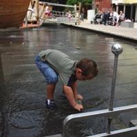
Our Cities Blue-Green Infrastructure & Innovative Stormwater Solutions
 Source of of image: DE DE URBANISTEN AND AND THE WONDROUS THE WONDROUS WATER WATER SQUARE SQUARE Our Cities Blue-Green Infrastructure & Innovative Stormwater Solutions Misagh Mottaghti, VA-teknik, Lund
CHAPTER 1. Ms. Guajardo s Class - Central Elementary CH 1 1
 INTRODUCTION CHAPTER 1 Ms. Guajardo s Class - Central Elementary CH 1 1 1.1 SETTING South Centre City is a linear corridor south of Downtown Escondido paralleling Centre City Parkway and South Escondido
building with nature - a new benchmark for green infrastructure
 building with nature - a new benchmark for green infrastructure Danielle Sinnett, Gemma Jerome, Sarah Burgess, Nick Smith and Roger Mortlock outline the aims, development and proposed operation of Building
ROSENTHAL CARPARK LIFE BETWEEN BUILDINGS IN LANE COVE
 south square Life between buildings includes all the very different activities people engage in when they use common city space; purposeful walks from place to place, promenades, short stops, longer stays,
SHORELINE, FLOOD AND COASTAL DEFENCE MANAGEMENT PLANS
 These plans may provide opportunities as well as concern for recreational boating. They are currently being revised and consulted on. This document explains how we can engage in the process. Shoreline,
EAST VILLAGE STRATEGIC SITE NOVEMBER 2017
 EAST VILLAGE STRATEGIC SITE NOVEMBER 2017 East Village will be a sustainable, mixeduse precinct with a focus on innovative employment and education opportunities. Enhanced by green spaces and places for
Welcome to our public exhibition
 About our development Welcome to our public exhibition This exhibition gives you the chance to view and comment on our proposals for a new residential development of 165 high-quality homes, along with
This Review Is Divided Into Two Phases:
 Semiahmoo Town Centre Review The purpose of this review: To review the Semiahmoo Town Centre Concept Plan, originally approved in 1993, to ensure that this centre will continue to serve the needs of South
AUCKLAND DESIGN OFFICE. Terms of Reference: Auckland Urban Design Panel 2017
 AUCKLAND DESIGN OFFICE Terms of Reference: Auckland Urban Design Panel 2017 Auckland Design Office 3 Contents 4 Introduction Benefits of the Panel 6 Terms of Reference The Purpose of the Auckland Urban
Evaluation Criteria. Detailed Evaluation Criteria
 Evaluation Criteria Detailed Evaluation Criteria Community Well-being A safe and socially inclusive service that improves access to key community destinations and provides transportation choices for Calgarians.
The Chinese University of Hong Kong Campus Master Plan Stage 3 Stakeholders' Engagement Report
 The Chinese University of Hong Kong Campus Master Plan Stage 3 Stakeholders' Engagement Report CONTENTS 1.0 OVERVIEW... 2 2.0 KEY FINDINGS... 3 2.1 Conserving Places of Value... 3 2.2 Places for Academic
Nordic Built Cities Challenge: Evaluations by the Nordic/international jury
 Nordic Built Cities Challenge: Evaluations by the Nordic/international jury 29 August 2016 Evaluation and decision of the jury of the Nordic Built Cities Challenge The jury is pleased to submit our final
Ivywild On The Creek PRELIMINARY CREEK DISTRICT MASTER PLAN
 Ivywild On The Creek PRELIMINARY CREEK DISTRICT MASTER PLAN Introduction: Rejuvenating an extraordinary Creekside neighborhood THE CREEKSIDE DISTRICT The Ivywild On The Creek Neighborhood District Master
Pinellas County Greenways
 Pinellas County Greenways USING GREENWAYS TO LINK OPEN SPACES The Florida Greenways Commission has defined a greenway as...a corridor of protected open space that is managed for conservation and/or recreation.
4- PA - LD - LIVELY DOWNTOWN. LD - Background
 4- PA - LD - LIVELY DOWNTOWN LD - Background The downtown has been the service centre for the community since the city s inception and the area continues to supply people with their personal services,
Call for Artists for: Design and Construction of Environmental Art Activation Story Mill Community Park, Bozeman, MT
 Call for Artists for: Design and Construction of Environmental Art Activation Story Mill Community Park, Bozeman, MT Seeking artists to design, fabricate and install art elements in the nature sanctuary
University of Denver Land Use Plan Update I. Executive Summary
 Executive Summary The task of developing a Land Use Plan for the University of Denver has been an exciting collaborative process that engaged a variety of interested people, including members of the University
Technical Advisory in Rainwater Management
 Technical Advisory in Rainwater Management Dr Mark Fletcher Global Water Leader MILLENIUM PARK CHICAGO Mark Fletcher Global Water Leader background Arup Fellow (Water) RA Eng Visiting Professor Engineering
Neighbourhood Planning Local Green Spaces
 Neighbourhood Planning Local Green Spaces Introduction... 2 1. Why green space is important... 4 2. Neighbourhood plans and green space... 6 3. Evidence... 8 Statutory designations... 9 Green space audit...