June 17, ACHD Board of Commissioners. Mindy Wallace Planning Review Supervisor. PUD /Cantabria Apartments
|
|
|
- Jewel Hall
- 5 years ago
- Views:
Transcription
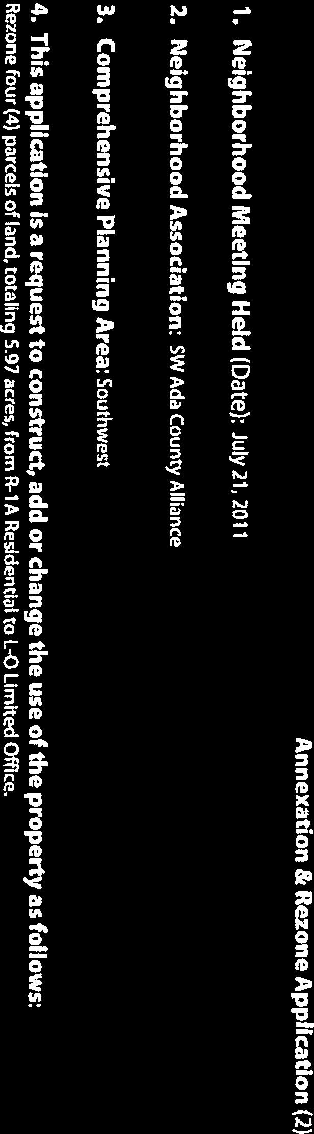
1 Development Services Department June 17, 2013 TO: FROM: SUBJECT: ACHD Board of Commissioners Mindy Wallace Planning Review Supervisor PUD /Cantabria Apartments Executive Summary: The applicant is requesting approval of a planned unit development application for the construction 22 fourplex buildings consisting of 88-apartment units. The site is located at W Overland Road in Boise, Idaho. This item is on the regular agenda due to staff recommend modifications to ACHD s Access Management and Successive Driveway polices, and to allow testimony from neighboring property owners. For this application ACHD is a recommending body to Boise City. Modification of Policy: Staff is recommending modification of policy to allow one 36-foot wide temporary full access driveway on Overland Road to serve the site. This reduces the number of existing driveways on Overland Road from 4 to 1, and the driveway is needed to provide reasonable access to the site, for site circulation, and emergency access given the number of proposed units. Staff also recommends a modification of policy to allow the construction of a 30-foot wide signed rightin/right-out driveway in alignment with Armga on Cloverdale Road to serve the site. Neighborhood Concerns: Staff has received letters from residents living in the Pepper Hills Subdivision directly south of the site. The letters note concerns with exiting and entering Sumpter Way, the potential for additional traffic on Sumpter Way and Peppermint Drive through the existing neighborhood, and land use concerns. Staff has looked into these concerns and believes they can be adequately addressed by working with the Pepper Hills HOA to obtain a cross access easement through an existing landscape strip on Sumpter Way. Staff Recommendation: Staff recommends approval of the staff report, as written. Attachments: 1. Letter from neighboring property owners 1

2


3


4

5

6

7


8
9 Development Services Department Project/File: Lead Agency: Site address: PUD /Cantabria Apartments This is a conditional use permit application for the construction 22 fourplex buildings consisting of 88-apartment units. The site is located at W Overland Road in Boise, Idaho. For this application ACHD is a recommending body to Boise City. City of Boise W Overland Road Commission Hearing: June 26, 2013 Regular Agenda Applicant: Dave Scaggs Summit Development Inc th Avenue Road # 384 Nampa, ID Representative: Lance Warnick Aspen Engineers th Avenue Road # 323 Nampa, ID Staff Contact: Mindy Wallace Phone: mwallace@achdidaho.org A. Findings of Fact 1. Description of Application: The applicant is proposing to construct 22 fourplex buildings consisting of 88-apartment units, a clubhouse and swimming pool on 4 parcels totaling 5.96 acres. The site is located at the southeast corner of Overland and Cloverdale Roads in Boise, ID. 2. Land Use Information Provide by the Boise City: The proposed use is in compliance with and supports the goals of Boise City s Comprehensive Plan. The Land Use Map identifies this site as suburban. Although the suburban land use accommodates predominantly detached single-family homes, it also encourages a mix of multi-family units. Principal GDP-N.3 encourages providing a variety of housing within a neighborhood. It discourages creating large concentrations of specific types of housing and segregating certain types of housing from one another. The proposed development will add variation to the predominantly single-family neighborhoods in the vicinity. Principal IDP-N.1 discusses transitions in building height and mass. It states that infill and redevelopment within established neighborhoods should be compatible with the height, scale and massing of adjacent homes and the overall character of the street frontage. Boise City Staff 1 DRAFT PUD /Cantabria Apartments
10 believes this site, at the intersection of two arterial roadways, is an ideal location to introduce a multi-family development. The City also supports concentrating highest intensity uses within one-quarter mile of transit stops to promote increased ridership and help support services. There is a Valley Ride bus stop on the north and south side of Overland Road adjacent to the development. 3. Description of Adjacent Surrounding Area: Direction Land Use Zoning North Single-family Residential/Neighborhood Commercial R-1A/C-1D South Single-family Residential R-1A East Single-family Residential R-1A West Single-family Residential R-1A 4. Site History: ACHD previously reviewed this site as CAR in August The requirements of this staff report are not consistent with those of the prior action due to neighborhood concerns and input from Traffic Services staff. The ACHD Commission previously reviewed this site as CUP on November 14, The conditions of this staff report are consistent with those of the prior action with the exceptions of a staff recommendation regarding sidewalks on Cloverdale and Overland Roads. 5. Impact Fees: There will be an impact fee that is assessed and due prior to issuance of any building permits. The assessed impact fee will be based on the impact fee ordinance that is in effect at that time. 6. Capital Improvements Plan (CIP)/Five Year Work Plan (FYWP): There are currently no roadways, bridges or intersections in the general vicinity of the project that are currently in the Five Year Work Program. The following improvements are listed in the District s Capital Improvement Plan (CIP): Cloverdale Road is listed in the Capital Improvement Plan to be widened to 5-lanes from Victory to Overland between 2014 and Overland Road is listed in the Capital Improvement Plan for corridor preservation to accommodate the future widening to 7 lanes between Cloverdale and Five Mile Roads. The intersection of Overland/Cloverdale is listed in the Capital improvement plan to be widened to 7 lanes on the north/south legs and to 9 lanes on the east/west legs of the intersection between 2017 to B. Traffic Findings for Consideration 1. Trip Generation (if TIS not required): This development is estimated to generate 585 additional vehicle trips per day (0 existing); 55 additional vehicle trips per hour in the PM peak hour (0 existing), based on the Institute of Transportation Engineers Trip Generation Manual, 9 th edition. 2 DRAFT PUD /Cantabria Apartments
11 2. Condition of Area Roadways Traffic Count is based on Vehicles per hour (VPH) Roadway Frontage Functional Classificati on PM Peak Hour Traffic Count PM Peak Hour Level of Service Existing Plus Project Cloverdale Overland 360-feet 830-feet Minor Arterial Principal Arterial * Acceptable level of service for a five-lane minor arterial is D (1,540 VPH). * Acceptable level of service for a five-lane principal arterial is E (1,770 VPH) ,182 Better than D Better than E Better than D Better than E 3. Average Daily Traffic Count (VDT) Average daily traffic counts are based on ACHD s most current traffic counts. The average daily traffic count for Cloverdale Road south of Overland of was 14,187 on 11/1/12 The average daily traffic count for Overland Road east of Cloverdale was 23,323 on 11/1/12. C. Findings for Consideration 1. Southwest Boise Transportation Study The Southwest Boise Transportation Study Plan (SWBTS) is a long range planning tool developed to plan for future growth in southwest Boise by identifying future roadway, intersection, and corridor needs. The SWBTS provides a framework for future roadway improvements based on the land use designations. The plan also investigates alternative transportation solutions including pedestrian and bicycle pathways. The plan was created in collaboration the City of Boise and was adopted by the ACHD Commission in May of The SWBTS recommends right-of-way preservation for the future widening of Cloverdale Road to 5-lanes, Overland Road to 7-lanes, and for the widening of the Cloverdale/Overland intersection to a 7 X 7 intersection. 2. Cloverdale Road a. Existing Conditions: Cloverdale Road is improved with 5-travel lanes, 68-feet of pavement, vertical curb, gutter, and 7-foot wide attached sidewalk abutting the site. There is 90-feet of right-of-way for Cloverdale Road (45-feet from centerline). b. Policy: Arterial Roadway Policy: District Policy states that the developer is responsible for improving all street frontages adjacent to the site regardless of whether or not access is taken to all of the adjacent streets. Master Street Map and Typology Policy: District Policy states that the design of improvements for arterials shall be in accordance with District standards, including the Master Street Map and Livable Streets Design Guide. The developer or engineer should contact the District before starting any design. Street Section and Right-of-Way Width Policy: District Policies & state that the standard 7-lane street section shall be 96-feet (back-of-curb to back-of-curb) within 3 DRAFT PUD /Cantabria Apartments
12 120-feet of right-of-way. This width typically accommodates three travel lanes in each direction, a continuous raised or landscaped median with intermittent turn lanes, and safety shoulders. Street Section and Right-of-Way Width Policy: District Policies & state that the standard 5-lane street section shall be 72-feet (back-of-curb to back-of-curb) within 96-feet of right-of-way. This width typically accommodates two travel lanes in each direction, a continuous center left-turn lane, and bike lanes on a minor arterial and a safety shoulder on a principal arterial. Sidewalk Policy: District Policy requires a concrete sidewalks at least 5-feet wide to be constructed on both sides of all arterial streets. A parkway strip at least 6-feet wide between the back-of-curb and street edge of the sidewalk is required to provide increased safety and protection of pedestrians. Consult the District s planter width policy if trees are to be placed within the parkway strip. Sidewalks constructed next to the back-of-curb shall be a minimum of 7-feet wide. Detached sidewalks are encouraged and should be parallel to the adjacent roadway. Meandering sidewalks are discouraged. A permanent right-of-way easement shall be provided if public sidewalks are placed outside of the dedicated right-of-way. The easement shall encompass the entire area between the rightof-way line and 2-feet behind the back edge of the sidewalk. Sidewalks shall either be located wholly within the public right-of-way or wholly within an easement. Minor Improvements Policy: District Policy states that minor improvements to existing streets adjacent to a proposed development may be required. These improvements are to correct deficiencies or replace deteriorated facilities. Included are sidewalk construction or replacement; curb and gutter construction or replacement; replacement of unused driveways with curb, gutter and sidewalk; installation or reconstruction of pedestrian ramps; pavement repairs; signs; traffic control devices; and other similar items. ACHD Master Street Map: ACHD Policy Section requires the Master Street Map (MSM) guide the right-of-way acquisition, arterial street requirements, and specific roadway features required through development. This segment of Cloverdale Road is designated in the MSM as a Residential Arterial with 5-lanes and on-street bike lanes, a 72-foot street section within 96-feet of right-of-way. c. Applicant Proposal: The applicant has not proposed any improvements to Cloverdale Road abutting the site. d. Staff Comments/Recommendations: Cloverdale Road is already improved with 5-travel lanes, 68-feet of pavement, vertical curb, gutter, and sidewalk abutting the site. Therefore no additional street improvements should be required as part of this application. Consistent with the District s Capital Improvement Plan, and as noted in the SWBTS the south leg of the Cloverdale /Overland intersection is to be widened to 7 lanes. To accommodate the future widening the applicant should be required to dedicated 65-feet of right-of-way from the centerline of Cloverdale Road abutting the site s entire frontage. Additionally, the applicant should be required to dedicate the triangle located at the intersection between Cloverdale Road, Overland Road, and the canal. The applicant will be compensated for the right-of-way dedicated which is an addition to existing through available corridor preservation funds. The applicant should be required to replace any broken curb, gutter, or sidewalk on Cloverdale Road abutting the site consistent with ACHD s Minor Improvement policy. e. Prior Action on the Site: During the November 14, 2012 Commission hearing for the CUP (135-apartment units) the Commission heard testimony from staff and 4 DRAFT PUD /Cantabria Apartments
13 neighboring property owners regarding proposed development the Commission required the applicant to remove the existing 7-foot wide attached concrete sidewalks on Cloverdale Road, and replace them with 5-foot wide detached concrete sidewalks. The existing 7-foot wide sidewalks on Cloverdale Road meet District policy, and staff recommends the sidewalk remain as is. The sidewalks were installed as part of the ACHD s Overland/Cloverdale intersection project in For this application ACHD is a recommending body to the City of Boise and City of Boise staff has indicated that the city may require the construction of detached sidewalks on Cloverdale Road abutting the site. If the City does require the sidewalks to be detached they should be constructed a minimum of 58-feet from the centerline of Cloverdale Road, as measured to the face of walk, from the south property line north to the bridge. The sidewalk should reattach and at the bridge for the canal and wrap around the corner of the intersection to the bridge on Overland. 3. Overland Road a. Existing Conditions: Overland Road is improved with 5-travel lanes, 60-feet of pavement, vertical curb, gutter, and sidewalk abutting the site. There is 100 to 80-feet of right-of-way for Overland Road (40-feet from centerline). b. Policy: Arterial Roadway Policy: District Policy states that the developer is responsible for improving all street frontages adjacent to the site regardless of whether or not access is taken to all of the adjacent streets. Master Street Map and Typology Policy: District Policy states that the design of improvements for arterials shall be in accordance with District standards, including the Master Street Map and Livable Streets Design Guide. The developer or engineer should contact the District before starting any design. Street Section and Right-of-Way Width: District policies & state that the standard 7-lane street section shall be 96-feet (back-of-curb to back-of-curb) within 120-feet of right-of-way. This width typically accommodates three travel lanes in each direction, a continuous raised or landscaped median with intermittent turn lanes, and safety shoulders. Sidewalk Policy: District policy requires a concrete sidewalks at least 5-feet wide to be constructed on both sides of all arterial streets. A parkway strip at least 6-feet wide between the back-of-curb and street edge of the sidewalk is required to provide increased safety and protection of pedestrians. Consult the District s planter width policy if trees are to be placed within the parkway strip. Sidewalks constructed next to the back-of-curb shall be a minimum of 7-feet wide. Detached sidewalks are encouraged and should be parallel to the adjacent roadway. Meandering sidewalks are discouraged. Appropriate easements shall be provided if public sidewalks are placed out of the right-of-way. The easement shall encompass the entire area between the right-of-way line and 2-feet behind the back edge of the sidewalk. Sidewalks shall either be located wholly within the public right-of-way or wholly within an easement.). Minor Improvements Policy: District Policy states that minor improvements to existing streets adjacent to a proposed development may be required. These improvements are to correct deficiencies or replace deteriorated facilities. Included are sidewalk construction or replacement; curb and gutter construction or replacement; replacement of unused driveways with curb, gutter and sidewalk; installation or reconstruction of pedestrian ramps; pavement repairs; signs; traffic control devices; and other similar items. 5 DRAFT PUD /Cantabria Apartments
14 ACHD Master Street Map: ACHD Policy Section requires the Master Street Map (MSM) guide the right-of-way acquisition, arterial street requirements, and specific roadway features required through development. This segment of Overland Road is designated in the MSM as a Mobility Arterial with 7-lanes and on-street bike lanes, a 98-foot street section within 124-feet of right-of-way. c. Applicant Proposal: The applicant hasn t proposed any improvements to Overland Road abutting the site. d. Staff Comments/Recommendations: Overland Road is already improved with 5-travel lanes, 60-feet of pavement, vertical curb, gutter, and sidewalk abutting the site. Therefore no additional street improvements should be required with this application. Consistent with the District s Capital Improvement Plan, east leg of the Cloverdale /Overland intersection is to be widened to 9 lanes. To accommodate the future widening the applicant should be required to dedicated 68-feet of right-of-way from the centerline of Overland Road abutting the site s entire frontage. Additionally, the applicant should be required to dedicate the triangle located at the intersection between Cloverdale Road, Overland Road, and the canal. The applicant will be compensated for the right-of-way dedicated which is an addition to existing through available corridor preservation funds. The applicant should be required to replace any broken curb, gutter, or sidewalk on Overland Road abutting the site consistent with ACHD s Minor Improvement Policy. e. Prior Action on the Site: During the November 14, 2012 Commission hearing for the CUP (135-apartment units) the Commission heard testimony from staff and neighboring property owners regarding proposed development the Commission required the applicant to remove the existing 7-foot wide attached concrete sidewalks on Overland Road, and replace them with 5-foot wide detached concrete sidewalks. The existing 7-foot wide sidewalks on Overland Road meet District policy, and staff has recommended that they remain as proposed. The sidewalks were installed as part of the ACHD s Overland/Cloverdale intersection project in For this application ACHD is a recommending body to the City of Boise. City of Boise staff has indicated that the city may require the construction of detached sidewalks on Overland Road abutting the site. If the City does require the sidewalks to be detached they should be constructed a minimum of 61-feet from the centerline of Overland Road, as measured to the face of walk, from the east property line west to the bridge. The sidewalk should reattach and at the bridge for the canal and wrap around the corner of the intersection to the bridge on Cloverdale. 4. Driveways 4.1 Overland Road a. Existing Conditions: There are 4 existing driveways onto Overland Road from the site. They are located as follows (all measurements are centerline to centerline): First 30-foot wide full access driveway located approximately 129-feet east of Cloverdale Road. Second - 40-foot wide full access driveway located approximately 370-feet east of Cloverdale Road. Third - 40-foot wide full access driveway located approximately 418-feet east of Cloverdale Road. Fourth - 40-foot wide full access driveway located approximately 796-feet east of Cloverdale Road. 6 DRAFT PUD /Cantabria Apartments
15 b. Policy Access Points Policy: District Policy states that all access points associated with development applications shall be determined in accordance with the policies in this section and Section Access points shall be reviewed only for a development application that is being considered by the lead land use agency. Approved access points may be relocated and/or restricted in the future if the land use intensifies, changes, or the property redevelops. Access Policy: District policy states that direct access to principal arterials is typically prohibited. If a property has frontage on more than one street, access shall be taken from the street having the lesser functional classification. If it is necessary to take access to the higher classified street due to a lack of frontage, the minimum allowable spacing shall be based on Table 1b under District policy , unless a waiver for the access point has been approved by the District Commission. Driveways, when approved on a principal arterial shall operate as a right-in/right-out only, and the District will require the construction of a raised median to restrict the left turning movements. Temporary Full Access Policy: District policy notes The District may consider a temporary full access driveway when the following conditions are met: It is a single lane principal arterial (one lane in each direction of travel), AND The road has less than 24,000 ADT, AND If granted, temporary access will be administered per Section (Temporary Access). Driveway Location Policy: District policy requires driveways located on principal arterial roadways to be located a minimum of 355-feet from the nearest intersection for a rightin/right-out only driveway. Full-access driveways are not allowed on principal arterial roadways. Successive Driveways: District policy Table 1b, requires driveways located on principal arterial roadways with a speed limit of 40 MPH to align or offset a minimum of 400- feet from any existing or proposed driveway. Driveway Width Policy: District policy restricts high-volume driveways (100 VTD or more) to a maximum width of 36-feet and low-volume driveways (less than 100 VTD) to a maximum width of 30-feet. Curb return type driveways with 30-foot radii will be required for high-volume driveways with 100 VTD or more. Curb return type driveways with 15-foot radii will be required for low-volume driveways with less than 100 VTD. Driveway Paving Policy: Graveled driveways abutting public streets create maintenance problems due to gravel being tracked onto the roadway. In accordance with District policy, , the applicant should be required to pave the driveway its full width and at least 30- feet into the site beyond the edge of pavement of the roadway and install pavement tapers in accordance with Table 2 under District Policy Temporary Access Policy: District Policy identifies a temporary access as that which is permitted for use until appropriate alternative access becomes available. Temporary access may be granted through a development agreement or similar method, and the developer shall be responsible for providing a financial guarantee for the future closure of the driveway. Cross Access Easements/Shared Access Policy: District Policy states that cross access utilizes a single vehicular connection that serves two or more adjoining lots or parcels so that the driver does not need to re-enter the public street system. 7 DRAFT PUD /Cantabria Apartments
16 c. Applicant s Proposal: The applicant is proposing maintain the existing 30-foot wide driveway located approximately 129-feet east of Cloverdale Road. This driveway is currently used and will only be used for maintenance access to the Ridenbaugh Canal by the irrigation District The applicant is also proposing to construct one 36-foot wide full access driveway on to Overland Road to access the site. The driveway is proposed to be located approximately 710-feet east of Cloverdale Road. The applicant has proposed to close three other existing driveways with curb, gutter, and sidewalk to match the existing improvements. d. Staff Comments/Recommendations: The applicant s proposal to close three driveways onto Overland Road located 370, 418, and 796-feet east of Cloverdale Road meet s District policy should be approved, as proposed. The applicant s proposal to leave the existing driveway for canal access should be approved, as proposed, as the driveway is currently used and will only be used for maintenance access to the Ridenbaugh Canal by the irrigation District. The applicant s proposal for the driveway to serve the site located 710-feet east of Cloverdale does not meet Access Management policy, which when allowed, requires right-in/right-out driveways on principal arterials and does not meet District Successive Driveway policy, which requires driveways when allowed, to align or off-set by 400-feet. The proposed second driveway off-sets Sumpter Way, an existing public street west of the site, by 232-feet. Although the proposed driveway does not meet Access Management, or Successive Driveway polices, staff recommends a modification of policy to allow the driveway onto Overland Road, as proposed. The applicant s proposal reduces the number of existing driveways on Overland Road from 4 to 1, and the driveway is needed to provide site circulation and emergency access given the number of proposed units. Staff recommends that the driveway located approximately 710-feet east of Cloverdale Road be a temporary full access driveway. This recommendation is due to the fact that Overland Road with an average ADT of 23,323 meets one of the conditions in which a temporary full access driveway would be allowed, as the road has less than 24,000 ADT. The driveway should be restricted to right-in/right-out in the future when Overland Road is widened and u- turns are possible at the Overland Road / Cloverdale Road intersection or as conditions warrant. The width of the proposed driveways meets District policy, and should be approved, as proposed. The driveway should be paved their full width at least 30-feet into the site beyond the edge of pavement. 4.2 Cloverdale Road a. Existing Conditions: There is one 40-foot driveway from the site onto Cloverdale Road located approximately 250-feet south of the Cloverdale/Overland intersection (measured centerline to centerline). b. Policy Access Points Policy: District Policy states that all access points associated with development applications shall be determined in accordance with the policies in this section and Section Access points shall be reviewed only for a development application that is 8 DRAFT PUD /Cantabria Apartments
17 being considered by the lead land use agency. Approved access points may be relocated and/or restricted in the future if the land use intensifies, changes, or the property redevelops. Access Policy: District policy states that direct access to minor arterials is typically prohibited. If a property has frontage on more than one street, access shall be taken from the street having the lesser functional classification. If it is necessary to take access to the higher classified street due to a lack of frontage, the minimum allowable spacing shall be based on Table 1a under District policy , unless a waiver for the access point has been approved by the District Commission. Driveway Location Policy: District policy requires driveways located on minor arterial roadways from a signalized intersection with a single left turn lane shall be located a minimum of 330-feet from the nearest intersection for a right-in/right-out only driveway and a minimum of 660-feet from the intersection for a full-movement driveway. District policy requires driveways located on minor arterial roadways from a signalized intersection with a dual left turn lane shall be located a minimum of 330-feet from the nearest intersection for a right-in/right-out only driveway and a minimum of 710-feet from the intersection for a full-movement driveway. Successive Driveways: District policy Table 1a, requires driveways located on minor arterial roadways with a speed limit of 40 MPH to align or offset a minimum of 330-feet from any existing or proposed driveway. Driveway Width Policy: District policy restricts high-volume driveways (100 VTD or more) to a maximum width of 36-feet and low-volume driveways (less than 100 VTD) to a maximum width of 30-feet. Curb return type driveways with 30-foot radii will be required for high-volume driveways with 100 VTD or more. Curb return type driveways with 15-foot radii will be required for low-volume driveways with less than 100 VTD. Driveway Paving Policy: Graveled driveways abutting public streets create maintenance problems due to gravel being tracked onto the roadway. In accordance with District policy, , the applicant should be required to pave the driveway its full width and at least 30- feet into the site beyond the edge of pavement of the roadway and install pavement tapers in accordance with Table 2 under District Policy Cross Access Easements/Shared Access Policy: District Policy states that cross access utilizes a single vehicular connection that serves two or more adjoining lots or parcels so that the driver does not need to re-enter the public street system. c. Applicant s Proposal: The applicant is proposing to close the existing 40-foot wide full access driveway onto Cloverdale Road located approximately 250-feet south of the Cloverdale/Overland intersection with vertical curb, gutter, and sidewalk to match the existing improvements the improvements on either side. The applicant is proposing to construct a new 30-foot wide porkchop restricted right-in/right-out only driveway onto Cloverdale Road aligned centerline to centerline with Armga Drive on west side of Cloverdale Road across from the site. d. Staff Comments/Recommendations: The applicant's proposal to close the existing 40-foot wide full access driveway onto Cloverdale Road located approximately 250-feet south of Overland Road meet s District policy and should be approved, as proposed. The applicant s proposal for a 30-foot right-in/right-out only driveway onto Cloverdale Road in alignment with Armga does not meet District Driveway Location. However, staff recommends a modification of policy to allow the driveway to be located, as proposed, and to be signed as right-in/right-out only, as ACHD does not allow the installation of pork chop style islands due to maintenance issues. 9 DRAFT PUD /Cantabria Apartments

18 Typically, staff would recommend the installation of a 6 raised median to restrict the driveway on Cloverdale to right-in/right-out only, but Armga Drive an existing public street is across from the site. At this time staff does not recommend restricting Armga Drive, as it provides sole access to several single family homes in the area. There is a 50-foot wide right-of-way that contains a micro path that runs between 2 segments of Mayflower Way, platted as part of Crawford Place Subdivision. ACHD anticipated that micro path will be removed and replaced with a roadway in the future when Cloverdale Road or the Overland/Cloverdale intersection is widened. At that time those on Armga Drive would have alternative access to Cloverdale Road via Peppermint Drive, and the driveway could be restricted to right-in/right-out with a raised median. The driveway should be paved its full width at leave 30-feet into the site beyond the edge of pavement. 5. Neighborhood Concerns During the previous review of the site staff has received letters from residents living in the Pepper Hills Subdivision directly south of the site. The letters note concerns with traffic backing up into the Overland/Cloverdale intersection, accidents at the Overland/Cloverdale intersection, and the potential for additional traffic on Sumpter Way and Peppermint Drive through the existing neighborhood, and land use concerns. Staff believes that concerns regarding the traffic backing up into the Overland/Cloverdale intersection have been address by signing the driveway onto Cloverdale Road for right-in/right-out only eliminating left turns in and out of the site, as noted in Finding for Consideration 4.2 above. 10 DRAFT PUD /Cantabria Apartments
19 As noted above the intersection of Overland/Cloverdale is listed in the Capital improvement plan to be widened to 7 lanes on the northbound leg of the intersection. As such, staff has required right-of-way dedication consistent with the future improvement. This intersection currently operates at an acceptable level of service (LOS) with an overall LOS of C in the AM peak hour and D in the PM peak hour. The neighboring property owners also requested information regarding the number of accidents occurring at the Overland/Cloverdale intersection. Over the last 5 years there have been a total of 43 (9, 6, 10, 11, 7) accidents at the Overland/Cloverdale intersection. To put this in perspective the intersection has a crash rate of 0.65 for the past five years, which is a relatively good rate as 1.0 crashes per million entering vehicles is typically used as the threshold. The crash rate is used in determining when improvements need to be made to an intersection and for establishing ACHD s ranking and reporting of high accident intersections. One of the challenges in trying to compare trends at this location is that over the past two years major construction was started and continues on Franklin Road, starting with the intersection project at Cloverdale and continuing with the widening of Franklin between Touchmark and Five Mile. The construction work can shift drivers to parallel roadways where they are less familiar with and can have some negative impacts. One change that was made to the intersection this August of 2012, which may help mitigate accidents at the Overland / Cloverdale intersection, was the installation of the Flashing Yellow Arrows on all four approaches of the intersection. This should reduce the accident rate, but due to the recent installation it is too soon to know the benefit they may be providing. When looking at the crash data for the current year of 2012, there has not been a single reported crash at the Overland / Cloverdale intersection. Both Sumpter Way and Peppermint Drive are residential collector roadways with no front-on housing. The collectors were constructed as part of Pepper Hills Subdivision. Sumpter Way had an average daily traffic (ADT) count of 1,612 (96 PM peak hour) and Peppermint Drive had an ADT of 1,184 (73 PM peak hour) on 9/17/12. ACHD policy allows up to 530 vehicle trips in the PM peak hour on a collector roadway; both roadways are well below this threshold with Sumpter Way operating at 18% of capacity and Peppermint Drive at 14% capacity. The neighbors believe that the future residents of apartments will have difficulties accessing the site and will travel from Overland onto Sumpter, to Peppermint and onto Cloverdale to turn to make a right turn into the site; thus creating additional traffic in their neighborhood. These concerns could be greatly reduced if the Pepper Hill Home Owners Association would grant an access easement through the existing landscape spite strip along Sumpter Way. This would allow left and right turns into the site without the future residents of the apartments traveling through the Pepper Mills neighborhood. As the site is currently laid out it does not allow for future vehicular access to Sumpter Way. As such, staff recommends that the site be modified to allow for a future 30-foot wide driveway onto Sumpter Way so that in the future if an easement can be obtained from the Pepper Hill Home Owners Association a driveway could be constructed. 11 DRAFT PUD /Cantabria Apartments

20 SITE Potential Driveway Route of Neighborhood Concern = HOA Landscape Spite Strip = 6. Tree Planters Tree Planter Policy: Tree Planter Policy: The District s Tree Planter Policy prohibits all trees in planters less than 8-feet in width without the installation of root barriers. Class II trees may be allowed in planters with a minimum width of 8-feet, and Class I and Class III trees may be allowed in planters with a minimum width of 10-feet. 7. Landscaping Landscaping Policy: A license agreement is required for all landscaping proposed within ACHD right-of-way or easement areas. Trees shall be located no closer than 10-feet from all public storm drain facilities. Landscaping should be designed to eliminate site obstructions in the vision triangle at intersections. District Policy requires a 40-foot vision triangle and a 3-foot height restriction on all landscaping located at an uncontrolled intersection and a 50-foot offset 12 DRAFT PUD /Cantabria Apartments
21 from stop signs. Landscape plans are required with the submittal of civil plans and must meet all District requirements prior to signature of the final plat and/or approval of the civil plans. 8. Other Access Overland Road is classified as a principal arterial roadway. Cloverdale Road is classified as a minor arterial roadway. Other than the accesses specifically approved with this application, direct lot access is prohibited to these roadways. D. Site Specific Conditions of Approval 1. Dedicate 65-feet of right-of-way the centerline of Cloverdale Road abutting the site. The applicant will be compensated for the right-of-way dedicated which is an addition to existing through available corridor preservation funds. The right-of-way purchase and sale agreement and deed must be completed and signed by the applicant prior to scheduling the final plat for signature by the ACHD Commission or prior to issuance of a building permit (or other required permits), whichever occurs first. Allow up to 30 business days to process the right-of-way dedication after receipt of all requested material. The District will purchase the right-of-way which is in addition to existing right-of-way from available Corridor Preservation Funds. 2. Replace any broken curb and gutter on Cloverdale Road abutting the site consistent with ACHD s Minor Improvement Policy. 3. Dedicate 68-feet of right-of-way from the centerline of Overland Road abutting the site s entire frontage. The applicant will be compensated for the right-of-way dedicated which is an addition to existing through available corridor preservation funds. The right-of-way purchase and sale agreement and deed must be completed and signed by the applicant prior to scheduling the final plat for signature by the ACHD Commission or prior to issuance of a building permit (or other required permits), whichever occurs first. Allow up to 30 business days to process the right-ofway dedication after receipt of all requested material. The District will purchase the right-of-way which is in addition to existing right-of-way from available Corridor Preservation Funds. 4. Replace any broken curb and gutter on Overland Road abutting the site consistent with ACHD s Minor Improvement Policy. 5. Close three existing driveways onto Overland Road located 370, 418, and 796-feet east of Cloverdale Road with vertical curb, gutter, and sidewalk to match the existing conditions on either side, as proposed. 6. Construct on 36-foot wide temporary full access driveway onto Overland Road located 710-feet east of Cloverdale Road, as proposed. Pave the driveway its full with at least 30-feet into the site beyond the edge of pavement. This driveway shall be restricted to right-in/right-out in the future when Overland Road is widened and u-turns are possible at the Overland Road / Cloverdale Road intersection or as conditions warrant. 7. Close the existing driveway on Cloverdale Road located 250-feet south of Overland Road with vertical curb, gutter, and sidewalk to match the existing conditions on either side. 8. Construct a 30-foot wide driveway onto Cloverdale Road aligned centerline to centerline with Armga Drive on the west side of Cloverdale across from the site. Pave the driveways its full width at least 30-feet into the site beyond the edge of pavement. Sign the driveway for Right-in/Rightout only. 9. Payment of impacts fees are due prior to issuance of a building permit. 10. Comply with all Standard Conditions of Approval. 13 DRAFT PUD /Cantabria Apartments
22 E. Standard Conditions of Approval 1. Any existing irrigation facilities shall be relocated outside of the ACHD right-of-way. 2. Private sewer or water systems are prohibited from being located within the ACHD right-ofway. 3. In accordance with District policy, , the applicant may be required to update any existing non-compliant pedestrian improvements abutting the site to meet current Americans with Disabilities Act (ADA) requirements. The applicant s engineer should provide documentation of ADA compliance to District Development Review staff for review. 4. Replace any existing damaged curb, gutter and sidewalk and any that may be damaged during the construction of the proposed development. Contact Construction Services at (with file number) for details. 5. A license agreement and compliance with the District s Tree Planter policy is required for all landscaping proposed within ACHD right-of-way or easement areas. 6. All utility relocation costs associated with improving street frontages abutting the site shall be borne by the developer. 7. It is the responsibility of the applicant to verify all existing utilities within the right-of-way. The applicant at no cost to ACHD shall repair existing utilities damaged by the applicant. The applicant shall be required to call DIGLINE ( ) at least two full business days prior to breaking ground within ACHD right-of-way. The applicant shall contact ACHD Traffic Operations in the event any ACHD conduits (spare or filled) are compromised during any phase of construction. 8. Utility street cuts in pavement less than five years old are not allowed unless approved in writing by the District. Contact the District s Utility Coordinator at (with file numbers) for details. 9. All design and construction shall be in accordance with the ACHD Policy Manual, ISPWC Standards and approved supplements, Construction Services procedures and all applicable ACHD Standards unless specifically waived herein. An engineer registered in the State of Idaho shall prepare and certify all improvement plans. 10. Construction, use and property development shall be in conformance with all applicable requirements of ACHD prior to District approval for occupancy. 11. No change in the terms and conditions of this approval shall be valid unless they are in writing and signed by the applicant or the applicant s authorized representative and an authorized representative of ACHD. The burden shall be upon the applicant to obtain written confirmation of any change from ACHD. 12. If the site plan or use should change in the future, ACHD Planning Review will review the site plan and may require additional improvements to the transportation system at that time. Any change in the planned use of the property which is the subject of this application, shall require the applicant to comply with ACHD Policy and Standard Conditions of Approval in place at that time unless a waiver/variance of the requirements or other legal relief is granted by the ACHD Commission. F. Conclusions of Law 1. The proposed site plan is approved, if all of the Site Specific and Standard Conditions of Approval are satisfied. 14 DRAFT PUD /Cantabria Apartments
23 2. ACHD requirements are intended to assure that the proposed use/development will not place an undue burden on the existing vehicular transportation system within the vicinity impacted by the proposed development. G. Attachments 1. Vicinity Map 2. Site Plan 3. Utility Coordinating Council 4. Development Process Checklist 5. Request for Reconsideration Guidelines 15 DRAFT PUD /Cantabria Apartments
24 Vicinity Map 16 DRAFT PUD /Cantabria Apartments

25 Site Plan 17 DRAFT PUD /Cantabria Apartments
26 Ada County Utility Coordinating Council Developer/Local Improvement District Right of Way Improvements Guideline Request Purpose: To develop the necessary avenue for proper notification to utilities of local highway and road improvements, to help the utilities in budgeting and to clarify the already existing process. 1) Notification: Within five (5) working days upon notification of required right of way improvements by Highway entities, developers shall provide written notification to the affected utility owners and the Ada County Utility Coordinating Council (UCC). Notification shall include but not be limited to, project limits, scope of roadway improvements/project, anticipated construction dates, and any portions critical to the right of way improvements and coordination of utilities. 2) Plan Review: The developer shall provide the highway entities and all utility owners with preliminary project plans and schedule a plan review conference. Depending on the scale of utility improvements, a plan review conference may not be necessary, as determined by the utility owners. Conference notification shall also be sent to the UCC. During the review meeting the developer shall notify utilities of the status of right of way/easement acquisition necessary for their project. At the plan review conference each company shall have the right to appeal, adjust and/or negotiate with the developer on its own behalf. Each utility shall provide the developer with a letter of review indicating the costs and time required for relocation of its facilities. Said letter of review is to be provided within thirty calendar days after the date of the plan review conference. 3) Revisions: The developer is responsible to provide utilities with any revisions to preliminary plans. Utilities may request an updated plan review meeting if revisions are made in the preliminary plans which affect the utility relocation requirements. Utilities shall have thirty days after receiving the revisions to review and comment thereon. 4) Final Notification: The developer will provide highway entities, utility owners and the UCC with final notification of its intent to proceed with right of way improvements and include the anticipated date work will commence. This notification shall indicate that the work to be performed shall be pursuant to final approved plans by the highway entity. The developer shall schedule a preconstruction meeting prior to right of way improvements. Utility relocation activity shall be completed within the times established during the preconstruction meeting, unless otherwise agreed upon. Notification to the Ada County UCC can be sent to: 50 S. Cole Rd. Boise 83707, or Visit iducc.com for notification information. 18 DRAFT PUD /Cantabria Apartments
27 Development Process Checklist Items Completed to Date: Submit a development application to a City or to Ada County The City or the County will transmit the development application to ACHD The ACHD Planning Review Section will receive the development application to review The Planning Review Section will do one of the following: Send a No Review letter to the applicant stating that there are no site specific conditions of approval at this time. Write a Staff Level report analyzing the impacts of the development on the transportation system and evaluating the proposal for its conformance to District Policy. Write a Commission Level report analyzing the impacts of the development on the transportation system and evaluating the proposal for its conformance to District Policy. Items to be completed by Applicant: For ALL development applications, including those receiving a No Review letter: The applicant should submit one set of engineered plans directly to ACHD for review by the Development Review Section for plan review and assessment of impact fees. (Note: if there are no site improvements required by ACHD, then architectural plans may be submitted for purposes of impact fee assessment.) The applicant is required to get a permit from Construction Services (ACHD) for ANY work in the right-ofway, including, but not limited to, driveway approaches, street improvements and utility cuts. Pay Impact Fees prior to issuance of building permit. Impact fees cannot be paid prior to plan review approval. DID YOU REMEMBER: Construction (Non-Subdivisions) Driveway or Property Approach(s) Submit a Driveway Approach Request form to ACHD Construction (for approval by Development Services & Traffic Services). There is a one week turnaround for this approval. Working in the ACHD Right-of-Way Four business days prior to starting work have a bonded contractor submit a Temporary Highway Use Permit Application to ACHD Construction Permits along with: a) Traffic Control Plan b) An Erosion & Sediment Control Narrative & Plat, done by a Certified Plan Designer, if trench is >50 or you are placing >600 sf of concrete or asphalt. Construction (Subdivisions) Sediment & Erosion Submittal At least one week prior to setting up a Pre-Construction Meeting an Erosion & Sediment Control Narrative & Plan, done by a Certified Plan Designer, must be turned into ACHD Construction to be reviewed and approved by the ACHD Stormwater Section. Idaho Power Company Vic Steelman at Idaho Power must have his IPCO approved set of subdivision utility plans prior to Pre-Con being scheduled. Final Approval from Development Services is required prior to scheduling a Pre-Con. 19 DRAFT PUD /Cantabria Apartments
28 Request for Reconsideration of Commission Action 1. Request for Reconsideration of Commission Action: A Commissioner, a member of ACHD staff or any other person objecting to any final action taken by the Commission may request reconsideration of that action, provided the request is not for a reconsideration of an action previously requested to be reconsidered, an action whose provisions have been partly and materially carried out, or an action that has created a contractual relationship with third parties. a. Only a Commission member who voted with the prevailing side can move for reconsideration, but the motion may be seconded by any Commissioner and is voted on by all Commissioners present. If a motion to reconsider is made and seconded it is subject to a motion to postpone to a certain time. b. The request must be in writing and delivered to the Secretary of the Highway District no later than 3:00 p.m. on the day prior to the Commission s next scheduled regular meeting following the meeting at which the action to be reconsidered was taken. Upon receipt of the request, the Secretary shall cause the same to be placed on the agenda for that next scheduled regular Commission meeting. c. The request for reconsideration must be supported by written documentation setting forth new facts and information not presented at the earlier meeting, or a changed situation that has developed since the taking of the earlier vote, or information establishing an error of fact or law in the earlier action. The request may also be supported by oral testimony at the meeting. d. If a motion to reconsider passes, the effect is the original matter is in the exact position it occupied the moment before it was voted on originally. It will normally be returned to ACHD staff for further review. The Commission may set the date of the meeting at which the matter is to be returned. The Commission shall only take action on the original matter at a meeting where the agenda notice so provides. e. At the meeting where the original matter is again on the agenda for Commission action, interested persons and ACHD staff may present such written and oral testimony as the President of the Commission determines to be appropriate, and the Commission may take any action the majority of the Commission deems advisable. f. If a motion to reconsider passes, the applicant may be charged a reasonable fee, to cover administrative costs, as established by the Commission. 20 DRAFT PUD /Cantabria Apartments
Committed to Service
 Committed to Service Kent Goldthorpe, President Paul Woods, Vice President Rebecca W. Arnold, Commissioner Sara M. Baker, Commissioner Jim D. Hansen, Commissioner December 5, 2016 Development Services
1173 W. University Dr. Request to construct a new Alumni Center.
 John S. Franden, President Mitchell A. Jaurena, Vice President Rebecca W. Arnold, Commissioner Sara M. Baker, Commissioner Jim D. Hansen, Commissioner Date: May 22, 2014 To: Jennifer Wheeler Boise State
Planning and Zoning Commission. Boise City Planning and Development Services. CUP and CVA
 TO: Planning and Zoning Commission FROM: David Moser, Associate Planner Boise City Planning and Development Services DATE: 4/27/2017 HEARING DATE: 5/1/17 RE: CUP17-00018 and CVA17-00022 Attached to this
August 14, Staff Recommendation: Staff recommends approval of the staff report, as written. Development Services Department
 Development Services Department August 14, 2013 TO: FROM: SUBJECT: ACHD Board of Commissioners Stacey Yarrington, Planner II Merlin Pointe/13-01-AN/13-01-ZC/ Northwest corner of Kuna Road and State Highway
12 January 12, 2011 Public Hearing APPLICANT: TAILWIND DEVELOPMENT GROUP,LLC PROPERTY OWNER: CITY OF VIRGINIA BEACH
 12 January 12, 2011 Public Hearing APPLICANT: TAILWIND DEVELOPMENT GROUP,LLC PROPERTY OWNER: CITY OF VIRGINIA BEACH STAFF PLANNER: Faith Christie REQUEST: Conditional Change of Zoning (from PD-H1 Planned
PLANNED UNIT DEVELOPMENT & SUBDIVISION STAFF REPORT Date: May 18, 2017
 & PUD-0000102-2017 PLANNED UNIT DEVELOPMENT & SUBDIVISION STAFF REPORT Date: May 18, 2017 NAME SUBDIVISION NAME Dauphin Creek Estates Subdivision Dauphin Creek Estates Subdivision LOCATION CITY COUNCIL
CUP Idaho Power Company
 CUP16-00059 Idaho Power Company Summary Conditional use permit for the addition of a solar power facility adjacent to an existing Idaho Power substation site located on 42.9 acres at 2001 E. Amity Road
14 October 10, 2012 Public Hearing APPLICANT: MPB, INC
 14 October 10, 2012 Public Hearing APPLICANT: MPB, INC PROPERTY OWNER: MUNDEN & ASSOCIATES, LP STAFF PLANNER: Karen Prochilo REQUEST: Conditional Change of Zoning (AG-1 & AG-2 to Conditional O-2) ADDRESS
3. Additional driveways may be permitted where determined by the Planning Commission to adequately accommodate traffic or ensure public safety.
 ARTICLE 10 ACCESS MANAGEMENT Section 10.01 Purpose. The purpose of this Article is to protect the substantial public investment in the City s street system by preserving the traffic capacity of existing
Subdivision Staff Report
 Subdivision Staff Report Subdivision Name Villa Veneto Subdivision File Number SUB08-00021 Approval Preliminary Plat Lead Agency Boise City Annexation Date Pending (CAR08-00015/DA) Comp. Plan Does Not
ARTICLE 17 SITE PLAN REVIEW
 ARTICLE 17 SITE PLAN REVIEW 17.01 INTENT AND PURPOSE The intent of this section is to provide for consultation and cooperation between the applicant and the township planning commission so that the applicant
2 January 13, 2010 Public Hearing APPLICANT: AUTOBELL CAR WASH, INC
 REQUEST: Conditional Use Permit (car wash) 2 January 13, 2010 Public Hearing APPLICANT: AUTOBELL CAR WASH, INC PROPERTY OWNER: MESSER 1060 INDEPENDENCE BOULEVARD STAFF PLANNER: Carolyn A.K. Smith ADDRESS
CUP &CVA / Boise State University
 2 CUP12-00007&CVA12-00008/ Boise State University Summary Conditional use permit for an intramural sports field with 70 tall light poles. The field is located on approximately 2.8 acres, north of Belmont
Proposed Walkability Ordinance for City of Knoxville (6/16/17)
") Proposed Walkability Ordinance for City of Knoxville (6/16/17) New or revised text is highlighted Section 1: Purpose The purpose of this ordinance is to set requirements for walkability and pedestrian
Proposed Walkability Ordinance for City of Knoxville (6/16/17) New or revised text is highlighted Section 1: Purpose The purpose of this ordinance is to set requirements for walkability and pedestrian
PLANNED UNIT DEVELOPMENT & SUBDIVISION STAFF REPORT Date: March 15, 2012
 PLANNED UNIT DEVELOPMENT & SUBDIVISION STAFF REPORT Date: March 15, 2012 DEVELOPMENT NAME SUBDIVISION NAME LOCATION OSR Subdivision OSR Subdivision 5559 Old Shell Road (South side of Old Shell Road, 570
VALLEY COUNTY MINIMUM STANDARDS FOR PRIVATE ROAD DESIGN AND CONSTRUCTION
 MINIMUM STANDARDS FOR PRIVATE ROAD DESIGN AND CONSTRUCTION Adopted November 28, 2005 TABLE OF CONTENTS DEFINITION OF TERMS...II I. DESIGN CRITERIA... 1 A. GENERAL DESIGN CRITERIA... 1 B. ROADWAY CLASSIFICATION...
PRELIMINARY PLAT DESIGN REQUIREMENTS Updated 4/8/2016
 PRELIMINARY PLAT DESIGN REQUIREMENTS Updated 4/8/2016 The following items are required for the preliminary plat. Numbers correspond with those on the example preliminary plat. RENO COUNTY SUBDIVISION REQUIREMENTS
Subdivision Staff Report
 Subdivision Staff Report Name: Bridgewalk Subdivision Date: December 8, 2004 File: SUB04-00089 Meeting: December 14, 2004 Approval: Preliminary To: City Council Lead Agency: Boise City From: Richard Beck
The Town Board of the Town of Vienna, County of Dane, State of Wisconsin, does ordain and adopt as follows.
 ORDINANCE DRIVEWAYS AND CULVERTS NO. 6-5-06 ORDINANCE CONCERNING DRIVEWAY AND CULVERT REQUIREMENTS 1-1-1 Driveway Permits; Culvert Requirements 1-1-2 Driveway and Culvert Location, Design and Construction
Rezoning Transportation Analysis Petition Number: General Location Identifier:
 From: Kelsie Anderson, PE Kelsie.Anderson@charlottenc.gov 704-432-5492 Staff Reviewer: Kory Hedrick, PE, PMP Khedrick@charlottenc.gov 704-432-6511 CDOT s review of this rezoning petition is intended to
MONTGOMERY COUNTY PLANNING DEPARTMENT THE MARYLAND-NATIONAL CAPITAL PARK AND PLANNING COMMISSION
 MONTGOMERY COUNTY PLANNING DEPARTMENT THE MARYLAND-NATIONAL CAPITAL PARK AND PLANNING COMMISSION MCPB Item No. Date: 12-10-15 Leisure World Clubhouse II Addition Fitness Center, Limited Site Plan Amendment
CITY PLANNING COMMISSION AGENDA. ITEM NO(s): C.1 C.3 STAFF: STEVE TUCK
: C.1 C.3 STAFF: STEVE TUCK") Page 34 CITY PLANNING COMMISSION AGENDA ITEM NO(s): C.1 C.3 STAFF: STEVE TUCK FILE NOS: CPC ZC 12-00035 QUASI-JUDICIAL CPC NV 12-00036 QUASI-JUDICIAL AR DP 12-00039 QUASI-JUDICIAL PROJECT: APPLICANT: OWNER:
Page 34 CITY PLANNING COMMISSION AGENDA ITEM NO(s): C.1 C.3 STAFF: STEVE TUCK FILE NOS: CPC ZC 12-00035 QUASI-JUDICIAL CPC NV 12-00036 QUASI-JUDICIAL AR DP 12-00039 QUASI-JUDICIAL PROJECT: APPLICANT: OWNER:
The transportation system in a community is an
 7 TRANSPORTATION The transportation system in a community is an important factor contributing to the quality of life of the residents. Without a sound transportation system to bring both goods and patrons
Asbury Chapel Subdivision Sketch Plan
 Asbury Chapel Subdivision Sketch Plan PART 1: PROJECT SUMMARY Applicant: NVR Inc. Project Size: +/- 76.13 acres Parcel Numbers: 02101112,02116101,02116112, 02116113 Current Zoning: Transitional Residential
R E S O L U T I O N. Single-Family Residence/ Church. 2,488 sq. ft. 2,488 sq. ft. Area Parking Required: Church
 R E S O L U T I O N WHEREAS, the Prince George s County Planning Board is charged with the approval of Detailed Site Plans pursuant to Part 3, Division 9 of the Zoning Ordinance of the Prince George s
Camden County Development Regulations. Updated February 2017
 Camden County Development Regulations Updated February 2017 GENERAL MEETING SCHEDULE OF THE CAMDEN COUNTY PLANNING BOARD All meetings will convene at 6:00 PM on the 4th Tuesday of each month and will be
Town of Excelsior, Sauk County, Wisconsin DRIVEWAY ORDINANCE
 Town of Excelsior, Sauk County, Wisconsin DRIVEWAY ORDINANCE 1.01 PURPOSE The purpose of this ordinance is to regulate the establishment, construction, improvement, modification or reworking of a driveway
PLANNED DEVELOPMENT (MASTER PLAN & UNIT PLAN)
") Central Permit Center 555 Santa Clara Street Vallejo CA 94590 Business License Building Fire Prevention Planning Public Works 707.648.4310 707.648.4374 707.648.4565 707.648.4326 707.651.7151 PLANNED DEVELOPMENT
Central Permit Center 555 Santa Clara Street Vallejo CA 94590 Business License Building Fire Prevention Planning Public Works 707.648.4310 707.648.4374 707.648.4565 707.648.4326 707.651.7151 PLANNED DEVELOPMENT
IOWA HIGHWAY 57 / WEST 1 ST STREET STUDY PUBLIC INFORMATIONAL MEETING APRIL 22, 2014
 IOWA HIGHWAY 57 / WEST 1 ST STREET STUDY PUBLIC INFORMATIONAL MEETING APRIL 22, 2014 INTRODUCTION The City of Cedar Falls and the Iowa Department of Transportation are conducting a Public Informational
CITY OF LOS ANGELES INTER-DEPARTMENTAL CORRESPONDENCE
 CITY OF LOS ANGELES INTER-DEPARTMENTAL CORRESPONDENCE 20000 Prairie St. DOT Case No. 41443 Date: November 5, 2014 To: R. Nicolas Brown, Associate Zoning Administrator Department of City Planning From:
Request Change in Nonconformity. Staff Recommendation Approval. Staff Planner Jonathan Sanders
 Applicant & Owner Public Hearing April 11, 2018 City Council Election District Beach Agenda Item 5 Request Change in Nonconformity Staff Recommendation Approval Staff Planner Jonathan Sanders Location
CARVER COUNTY DIVISION OF PUBLIC WORKS LANDSCAPE POLICY. Adopted by the Carver County Board of Commissioners March 3, 2015
 CARVER COUNTY DIVISION OF PUBLIC WORKS LANDSCAPE POLICY Adopted by the Carver County Board of Commissioners March 3, 2015 Policy Statement Goals It is the goal of Carver County Public Works to provide
Project Name: MELWOOD HOTEL. Date Accepted: 1/12/04. Waived. Planning Board Action Limit: Plan Acreage: 1.7 Zone: Dwelling Units:
 The Maryland-National Capital Park and Planning Commission Prince George's County Planning Department Development Review Division 301-952-3530 Note: Staff reports can be accessed at www.mncppc.org/pgco/planning/plan.htm.
SUBDIVISION, PLANNED UNIT DEVELOPMENT, PLANNING APPROVAL, REZONING & SIDEWALK WAIVER STAFF REPORT Date: February 7, 2013
 SUBDIVISION, PLANNED UNIT DEVELOPMENT, PLANNING APPROVAL, REZONING & SIDEWALK WAIVER STAFF REPORT Date: February 7, 2013 APPLICANT NAME SUBDIVISION NAME DEVELOPMENT NAME LOCATION S. E. Cemeteries of AL
Ref: March 21, Ms. Jody Kablack Director of Planning and Community Development Town of Sudbury 278 Old Sudbury Road Sudbury, MA 01776
 35 New England Business Center Drive Suite 140 Andover, MA 01810-1066 Office: 978-474-8800 Fax: 978-688-6508 Web: www.rdva.com Ref: 7198 Director of Planning and Community Development Town of Sudbury 278
Rezoning Transportation Analysis Petition Number: General Location Identifier: , ,
 From: Kelsie Anderson, PE Kelsie.Anderson@charlottenc.gov 704-432-5492 Staff Reviewer: Rick Grochoske, PE rgrochoske@charlottenc.gov 704-432-1556 CDOT s review of this rezoning petition is intended to
CITY OF KEIZER MASTER PLAN APPLICATION & INFORMATION SHEET
 CITY OF KEIZER MASTER PLAN APPLICATION & INFORMATION SHEET PRE-APPLICATION CONFERENCE Prior to the actual filing of a Master Plan application, it is strongly recommended that the applicant contact Planning
Request Conditional Rezoning (R-15 Residential to Conditional A-24 Apartment) Staff Recommendation Approval. Staff Planner Jimmy McNamara
 Staff Recommendation Approval. Staff Planner Jimmy McNamara") Applicant Franklin Johnston Group Management & Development, LLC Property Owner Virginia Wesleyan College Public Hearing July 12, 2017 City Council Election District Bayside Agenda Item 3 Request Conditional
Applicant Franklin Johnston Group Management & Development, LLC Property Owner Virginia Wesleyan College Public Hearing July 12, 2017 City Council Election District Bayside Agenda Item 3 Request Conditional
R E S O L U T I O N. 2. Development Data Summary:
 R E S O L U T I O N WHEREAS, the Prince George s County Planning Board has reviewed Departure from Design Standards DDS-631 requesting a departure to allow the loading space and the driveway to the loading
D3 January 14, 2015 Public Hearing
 D3 January 14, 2015 Public Hearing APPLICANT: DONALD J. BOUCHER, JR. PROPERTY OWNER: D.J.B. SERVICE CENTER, LLC STAFF PLANNER: Kristine Gay REQUEST: A. Conditional Change of Zoning (I-1 to B-2) B. Conditional
Watertown City Council
 City of Watertown Watertown City Council April 14 th, 2015 Agenda Item: City Comment on Sun Share CUP Application Request for Action: Motion to Approve City Comments regarding CUP Application Department:
Preliminary Development Plan 07/ /2
 OWENSBORO METROPOLITAN PLANNING COMMISSION Preliminary Development Plan 07/06 120 1/2 Development Information The table at right refers to the application materials required for submission, unless otherwise
Drexel, Barrell & Co.
 Drexel, Barrell & Co. June 18, 2018 Engineers/Surveyors Boulder Colorado Springs Greeley 3 South 7 th Street Colorado Springs, Colorado 80905-1501 719 260-0887 719 260-8352 Fax El Paso County Planning
Right-of-Way Acquisitions and Relocations Technical Memorandum
 Right-of-Way Acquisitions and Relocations Technical Memorandum Southeast Extension Project Lincoln Station to RidgeGate Parkway Prepared for: Federal Transit Administration Prepared by: Denver Regional
PLANNED UNIT DEVELOPMENT Date: April 5, 2018
 PLANNED UNIT DEVELOPMENT Date: April 5, 2018 DEVELOPMENT NAME SUBDIVISION NAME LOCATION Robert Myers Robert Myers 2955 and 2989 Dauphin Street (Southeast corner of Dauphin Street and Sage Avenue) CITY
The Illinois Department of Transportation and Lake County Division of Transportation. Route 173, including the Millburn Bypass
 The Illinois Department of Transportation and Lake County Division of Transportation welcome you to this Public Hearing for U.S. Route 45 from Illinois Route 132 to Illinois Route 173, including the Millburn
A raised and landscaped median will be constructed in South College Avenue between Trilby Road and Skyway Drive.
 5.0 ACCESS CONTROL PLAN This section presents the Access Control Plan Update which has been formulated through the considerable input of the governing agencies, business owners, organized homeowner groups,
Chapter PEDESTRIAN COMMERCIAL (PC) ZONING DISTRICT
 ZONING DISTRICT") Chapter 11-17 PEDESTRIAN COMMERCIAL (PC) ZONING DISTRICT Sections: 11-17-01 GENERAL PURPOSE 11-17-02 PERMITTED BUILDING TYPES 11-17-03 USES PERMITTED WITH DESIGN REVIEW 11-17-04 USES PERMITTED BY CONDITIONAL
Chapter 11-17 PEDESTRIAN COMMERCIAL (PC) ZONING DISTRICT Sections: 11-17-01 GENERAL PURPOSE 11-17-02 PERMITTED BUILDING TYPES 11-17-03 USES PERMITTED WITH DESIGN REVIEW 11-17-04 USES PERMITTED BY CONDITIONAL
Project phasing plan (if applicable) 12 copies of site plan
 12 copies of site plan") SITE PLAN REVIEW PERMIT APPLICATION City of Grand Haven, 11 N. Sixth Street, Grand Haven, MI 49417 Phone: (616) 847-3490 Fax: (616) 844-2051 Website: www.grandhaven.org 1. Project Information Address/location
SITE PLAN REVIEW PERMIT APPLICATION City of Grand Haven, 11 N. Sixth Street, Grand Haven, MI 49417 Phone: (616) 847-3490 Fax: (616) 844-2051 Website: www.grandhaven.org 1. Project Information Address/location
PLANNED UNIT DEVELOPMENT STAFF REPORT Date: June 2, 2016
 # 9 ZON2016-01032 PLANNED UNIT DEVELOPMENT STAFF REPORT Date: June 2, 2016 DEVELOPMENT NAME JJT Properties LLC LOCATION 1147 & 1151 East I-65 Service Road South and 1180 Sledge Drive (Southeast corner
Approved: CITY OF ARDEN HILLS, MINNESOTA PLANNING COMMISSION WEDNESDAY, AUGUST 5, :30 P.M. - ARDEN HILLS CITY HALL
 Approved: CITY OF ARDEN HILLS, MINNESOTA PLANNING COMMISSION WEDNESDAY, AUGUST 5, 2015 6:30 P.M. - ARDEN HILLS CITY HALL PLANNING CASES A. Planning Case 15-016; Final Planned Unit Development Arden Plaza;
8 October 14, 2015 Public Hearing
 8 October 14, 2015 Public Hearing APPLICANT & PROPERTY OWNER: PRICE S HOLDINGS, LLC STAFF PLANNER: Karen Lasley REQUEST: A. Conditional Use Permit (Automobile Repair Garage) B. Change in Nonconforming
WHEREAS, after consideration of the evidence presented at the public hearing on January 14, 2010, the Prince George's County Planning Board finds:
 R E S O L U T I O N WHEREAS, the Prince George s County Planning Board has reviewed DDS-600 requesting a departure for the location of two loading spaces without driveway access along Toledo Terrace in
STAFF SUMMARY FOR S17-02 SPECIAL USE PERMIT APPLICATION
 APPLICATION SUMMARY Case Number: S17-02 Request: STAFF SUMMARY FOR S17-02 SPECIAL USE PERMIT APPLICATION SUP application in order to develop a convenience food store. Applicant: Property Owner(s): Cindee
4 January 11, 2012 Public Hearing APPLICANT:
 . 4 January 11, 2012 Public Hearing APPLICANT: MID-ATLANTIC AUTO PROPERTY OWNER: DZR, LLC STAFF PLANNER: Leslie Bonilla REQUEST: Conditional Use Permit (truck rental, automobile service, and automotive/bulk
Chapter 1 - General Design Guidelines CHAPTER 1 GENERAL DESIGN GUIDELINES
 CHAPTER 1 GENERAL DESIGN GUIDELINES 1.0 INTRODUCTION This Publication has been developed to provide current, uniform procedures and guidelines for the application and design of safe, convenient, efficient
MONTGOMERY COUNTY PLANNING DEPARTMENT THE MARYLAND-NATIONAL CAPITAL PARK AND PLANNING COMMISSION
 MONTGOMERY COUNTY PLANNING DEPARTMENT THE MARYLAND-NATIONAL CAPITAL PARK AND PLANNING COMMISSION MCPB Item No. Date: 1/15/2015 Bethesda North Marriott Hotel and Conference Center: Limited Site Plan Amendment
PRELIMINARY CONDITIONAL USE SUBMITTAL CHECKLIST REQUIREMENTS
 This checklist must accompany your submittal as the cover page. CONDITIONAL USE Application Submittal Checklist for PRELIMINARY AND FINAL APPROVAL Per Winter Park Land Development Code Sec. 58-90 PRELIMINARY
CITY OF ZEELAND PLANNING COMMISSION
 APPLICATION FOR SITE PLAN REVIEW AND SPECIAL LAND USE Date City Official App. Filing Fee Rec'd ($350) NOTE TO APPLICANT: Please submit this application for Site Plan Review along with twenty (20) copies
STAFF SUMMARY FOR S17-02 SPECIAL USE PERMIT APPLICATION
 APPLICATION SUMMARY Case Number: S17-02 Request: STAFF SUMMARY FOR S17-02 SPECIAL USE PERMIT APPLICATION SUP application in order to develop a convenience food store. Applicant: Property Owner(s): Cindee
TRANSPORTATION ELEMENT
 TRANSPORTATION ELEMENT GOAL I: To create and maintain a safe, efficient and aesthetic transportation system that encourages multi-modal transportation and promotes the mobility strategies of the Ocala
A BILL FOR AN ORDINANCE TO AMEND CHAPTER 9, KAUAI COUNTY CODE 1987, RELATING TO STREET REQUIRE:MENTS FOR SUBDIVISIONS
 ORDINANCE NO. BILL NO. { vy"yj1j A BILL FOR AN ORDINANCE TO AMEND CHAPTER 9, KAUAI COUNTY CODE 1987, RELATING TO STREET REQUIRE:MENTS FOR SUBDIVISIONS BE IT ORDAINED BY THE COUNCIL OF THE COUNTY OF KAUA'I,
2016 REVISIONS COMMENT FORM RULES AND REGULATIONS FOR CONSTRUCTION IN THE PUBLIC WAY COMMENT PERIOD: JUNE 1 TO JUNE 30, 2015
 AGENCY: 2016 REVISIONS COMMENT FORM Section Title Number Chapter 1 Introduction Comment 1.1 CDOT Mission Statement 1.2 Purpose of Rules and Regulations for Construction in the Public Way 1.3 Chicago Department
Collaborative Planning:
 Spokane County City of Spokane City of Spokane Valley City of Liberty Lake City of Airway Heights City of Millwood Collaborative Planning: Implementation in Spokane County s Metro Urban Growth Area Appendix
4 CIRCULATION AND TRANSPORTATION
 4 CIRCULATION AND TRANSPORTATION 4.1 INTRODUCTION One of the central concepts of the Hecker Pass Specific Plan is to maintain the rural character and scenic qualities of the area. The transportation and
Title 11 Streets and Sidewalks
 Chapter 11.01 - Definitions Title 11 Streets and Sidewalks Low Impact Development (LID) - A stormwater and land use management strategy that strives to mimic predisturbance hydrologic processes of infiltration,
CHAPTER BEAUTIFICATION AND LANDSCAPE MANAGEMENT
 APPLICATIONS FOR BEAUTIFICATION GRANTS (STARTING FISCAL YEAR 2017-2018) MUST ADHERE TO THE REQUIREMENTS OF RULE CHAPTER 14-40, FLORIDA ADMISTRATIVE CODE Including the pending revisions shown below CHAPTER
Request Modification of Conditions (Automobile Service Station) Staff Recommendation Approval. Staff Planner Jimmy McNamara
 Staff Recommendation Approval. Staff Planner Jimmy McNamara") Applicant Larae Tucker Property Owner Doswell Ventures, LLC Public Hearing May 10, 2017 City Council Election District Princess Anne Agenda Item 3 Request Modification of Conditions (Automobile Service
Applicant Larae Tucker Property Owner Doswell Ventures, LLC Public Hearing May 10, 2017 City Council Election District Princess Anne Agenda Item 3 Request Modification of Conditions (Automobile Service
Town of Portola Valley General Plan. Nathhorst Triangle Area Plan
 Town of Portola Valley General Plan Amended December 10, 1997 Table of Contents Introduction... 1 Planning Area... 1 Objectives... 2 Principles... 2 Standards... 4 Description... 4 Community Commercial...
Bypass #16 - Bend Parkway (new alignment for US 97) (MP )
 (MP )") Bypass #16 - Bend Parkway (new alignment for US 97) (MP 134.76-141.83) Description: The Parkway is on new alignment for US 97 through Bend. US 97 is a Statewide Highway on the National Highway System that
Bypass #16 - Bend Parkway (new alignment for US 97) (MP 134.76-141.83) Description: The Parkway is on new alignment for US 97 through Bend. US 97 is a Statewide Highway on the National Highway System that
CITY OF VACAVILLE PLANNING COMMISSION Agenda Item No. G. 1 STAFF REPORT August 4, Staff Contact: Tricia Shortridge (707)
") CITY OF VACAVILLE PLANNING COMMISSION Agenda Item No. G. 1 STAFF REPORT August 4, 2009 Staff Contact: Tricia Shortridge (707) 449-5140 TITLE: REQUEST: LONGS / CVS DRIVE-THRU PHARMACY & REMODEL TIME EXTENSION
CITY OF VACAVILLE PLANNING COMMISSION Agenda Item No. G. 1 STAFF REPORT August 4, 2009 Staff Contact: Tricia Shortridge (707) 449-5140 TITLE: REQUEST: LONGS / CVS DRIVE-THRU PHARMACY & REMODEL TIME EXTENSION
PARKLET PROPOSAL PACKAGE & PROCESS
 500.3 I PARKLETS The term parklet refers to a small temporary constructed seating or community gathering area over an on-street parking space or an extension of the sidewalk into the operating State highway
D1 September 11, 2013 Public Hearing APPLICANT:
 D1 September 11, 2013 Public Hearing APPLICANT: BEACH MUNICIPAL FEDERAL CREDIT UNION PROPERTY OWNER: SISTERS II, LLC STAFF PLANNER: Karen Prochilo REQUEST: Conditional Change of Zoning (AG-2 Agriculture
APPENDIX J PERFORMANCE STANDARDS FOR GRAVEL MINE, PIT MINE, OR QUARRY
 APPENDIX J PERFORMANCE STANDARDS FOR GRAVEL MINE, PIT MINE, OR QUARRY A. Purpose: 1. Regulatory Requirement and Use Mitigation: The purpose of this appendix is to provide a regulatory context (standards)
KASPER. City of Georgetown, Texas PUD Planned Unit Development. December 30, 2015 Revised January 27, 2016
 KASPER City of Georgetown, Texas PUD Planned Unit Development December 30, 2015 Revised January 27, 2016 Applicant: Sentinel Land Company, LLC 4910 Campus Drive Newport Beach, CA Prepared by: SEC Planning
PART 1: PROJECT SUMMARY. Proposed Land Use: 120 single-family lots. The application is Attachment A. The site plan is Attachment B.
 PART 1: PROJECT SUMMARY Applicant: JBH Development, LLC and Hopper Communities, INC Project Size: +/- 80.48 acres Parcel Number: 01513107, 01513108, 01513109, 01513113, 01513120, 01513121, 01513122, 01513124,
SPECIFIC PLAN Requirements
 CITY OF LANCASTER PLANNING DEPARTMENT 44933 Fern Avenue, Lancaster, California 93534 (661) 723-6100 SPECIFIC PLAN Requirements Purpose The purpose of a specific plan is to provide for the logical development
McDonald s Restaurant - Purcellville Town of Purcellville Special Use Permit Statement of Justification July 24, 2014
 Introduction / Written Statement McDonald s Restaurant - Purcellville McDonald s Corporation is proposing to redevelop the existing McDonald s eating establishment with a drive-through located at 121 N
PLANNING AND ZONING COMMISSION AGENDA MEMORANDUM
 PLANNING AND ZONING COMMISSION AGENDA MEMORANDUM City and County of Broomfield, Colorado To: Planning and Zoning Commission From: John Hilgers, Planning Director Anna Bertanzetti, Principal Planner Meeting
Chapter Master Planned Communities (MPC) District
 District") Sections 14.53.010 Purpose and Intent 14.53.020 Applicability 14.53.030 Procedure 14.53.040 MPC Standards 14.53.050 Required Findings 14.53.010 Purpose and Intent Chapter 14.53 Master Planned Communities
Sections 14.53.010 Purpose and Intent 14.53.020 Applicability 14.53.030 Procedure 14.53.040 MPC Standards 14.53.050 Required Findings 14.53.010 Purpose and Intent Chapter 14.53 Master Planned Communities
Executive Summary. The goals of the Plan are to:
 Executive Summary The Wiscasset Bath Road Master Plan (Plan) seeks to maximize development opportunities along Bath Road through the strategic coordination of traffic infrastructure improvements, land
BOISE, IDAHO COUNCIL WORK SESSION AGENDA September 19, :00 PM City Hall - Council Chambers
 BOISE, IDAHO COUNCIL WORK SESSION AGENDA September 19, 2017 5:00 PM City Hall - Council Chambers I. CALL TO ORDER II. WORK SESSION ITEMS 1. Interim Changes (10 mins) Presenter: Brent Davis, Finance and
ARTICLE 13 STREETS General
 ARTICLE 13 STREETS 13.1 General Streets shall be designed to suit their functions. Many streets have purposes other than vehicular traffic. As an alternative to current N.C. Department of Transportation
DCA , Stormwater Quality and Facilities Ordinance June 23, 2009
 PROPOSED NEW SECTION 10.486 Stormwater Quality and Detention Facilities, Public Streets. A. Purpose. It is the City s policy to maintain the natural hydrology and preserve water quality by mitigating the
City of Reedley Community Development Department 1733 Ninth Street Reedley, CA (559) FAX
 FAX") City of Reedley SPECIAL PERMIT Submittal Requirements Conditional Use Permit (CUP), Site Plan Review (SPR) & Variance (VAR) Please use this information sheet as a checklist to assemble materials required
City of Reedley SPECIAL PERMIT Submittal Requirements Conditional Use Permit (CUP), Site Plan Review (SPR) & Variance (VAR) Please use this information sheet as a checklist to assemble materials required
BOULEVARD AND PARKWAY STANDARDS
 88-323 BOULEVARD AND PARKWAY STANDARDS 88-323-01 PURPOSE Considerable public and private investment exists and is expected to occur adjacent to boulevards and parkways within the city. The following standards
SUBMITTAL REQUIREMENTS
 WHEN PROCESS TYPE III IS USED References to Process Type III applications are found in several places in the Milton Municipal Code (MMC), indicating that the development, activity, or use, is permitted
At Your Disposal CUP Amendment, Lot 20, Village Service Commercial, at 128 Bastille Dr. (PLN17-208)
") MEMORANDUM Archuleta County Development Services Planning Department 1122 HWY 84 P. O. Box 1507 Pagosa Springs, Colorado 81147 970-264-1390 Fax 970-264-3338 TO: Archuleta County Planning Commission FROM:
MEMORANDUM Archuleta County Development Services Planning Department 1122 HWY 84 P. O. Box 1507 Pagosa Springs, Colorado 81147 970-264-1390 Fax 970-264-3338 TO: Archuleta County Planning Commission FROM:
ARTICLE 13 STREETS General
 ARTICLE 13 STREETS 13.1 General Streets shall be designed to suit their functions. Many streets have purposes other than vehicular traffic. As an alternative to current N.C. Department of Transportation
Access Management: An Overview
 Figures 1-5 Below Evolution of development along a highway. In the early stages, land along the road is used for farming with little traffic generated. As time passes, the highway corridor becomes a de
CITY OF GARDEN CITY. Garden City Design Review Committee Staff Contact: Chris Samples STAFF REPORT: DSRFY Page 1
 Page 1 CITY OF GARDEN CITY 6015 Glenwood Street Garden City, Idaho 83714 Phone (208)472-2921 Fax (208)472-2926 File Number: DSRFY2018-12 For: Brilliant Services - New Commercial Structure Location: 211
Appendix I. Access Management & Land Use Zoning Strategies Memo
 Appendix I ` Access Management & Land Use Zoning Strategies Memo Route 96 Access Management and Land Use/Zoning Strategies The Town of Victor has access management guidelines in Section 5.0 of the 2014
3. VISION AND GOALS. Vision Statement. Goals, Objectives and Policies
 Vision Statement Queen Creek s interconnected network of parks, trails, open spaces and recreation opportunities provide safe and diverse activities and programs that sustain its unique, small town, equestrian
4.500 Preston Road Overlay District
 Section 4.500 Preston Road Overlay District 2004 Zoning Ordinance 4.500 Preston Road Overlay District (ZC 98-29; Ordinance No. 98-9-12) 4.501 Purpose To provide appropriate design standards for the use
Request Alternative Compliance to the prescribed criteria of the Oceanfront Resort District Form- Based Code. Staff Recommendation Approval
 Applicant Property Owner Steven H. Murden Public Hearing June 14, 2017 City Council Election District Beach Agenda Item 8 Request Alternative Compliance to the prescribed criteria of the Oceanfront Resort
11 May 9, 2012 Public Hearing APPLICANT: KROGER LIMITED PARTNERSHIP I
 REQUEST: Conditional Use Permit (Automobile Service Station (Fuel Sales) ADDRESS / DESCRIPTION: 3901 Holland Drive 11 May 9, 2012 Public Hearing APPLICANT: KROGER LIMITED PARTNERSHIP I PROPERTY OWNER:
Ten Mile Creek Planning Area
 PLANNING AREA POLICIES TEN MILE CREEK Ten Mile Creek Planning Area Location and Context The Ten Mile Creek Planning Area ( Ten Mile Creek area ) is located south of the current Boise AOCI, generally south
DRIVEWAY REGULATIONS
 TOWN OF NEW LONDON PLANNING BOARD DRIVEWAY REGULATIONS INSTRUCTIONS TO APPLICANTS FOR THE CONSTRUCTION OR ALTERATION OF DRIVEWAYS IMPORTANT: READ CAREFULLY BEFORE FILLING OUT ATTACHED APPLICATION Revised
Baumgarten MPUD. Exhibit 3 Evaluation Criteria
 Pursuant to LDC subsections 10.02.13 B, 10.02.08 F and Chapter 3 G. of the Administrative Code, staff s analysis and recommendation to the Planning Commission, and the Planning Commission s recommendation
PLANNING APPROVAL & SIDEWALK WAIVER STAFF REPORT Date: December 1, 2016
 PLANNING APPROVAL & SIDEWALK WAIVER STAFF REPORT Date: December 1, 2016 NAME Dennis P. Wilkins LOCATION. CITY COUNCIL DISTRICT District 6 7078 Bruns Drive (Northeast corner of Bruns Drive and Cody Road)