MONTGOMERY COUNTY PLANNING DEPARTMENT THE MARYLAND-NATIONAL CAPITAL PARK AND PLANNING COMMISSION
|
|
|
- Nigel Heath
- 6 years ago
- Views:
Transcription
1 MONTGOMERY COUNTY PLANNING DEPARTMENT THE MARYLAND-NATIONAL CAPITAL PARK AND PLANNING COMMISSION MCPB Item No. Date: 04/05/2018 Solera Reserve at Kensington, Sketch Plan No Description Garry Meus, Planner Coordinator, Area 2 Division, garry.meus@montgomeryplanning.org, Patrick Butler, Acting Supervisor, Area 2 Division, patrick.butler@montgomeryplanning.org, Carrie Sanders, Chief, Area 2 Division, carrie.sanders@montgomeryplanning.org, Construction of a mixed-use development including a five-story senior living facility with 135 units, the adaptive re-use of two existing historic buildings for retail/service uses, and one floor of below-grade parking. Location: Southwest quadrant of the intersection of Metropolitan Avenue and St. Paul Street, Kensington; Master Plan: 2012 Kensington Sector Plan; Size: 1.93-acre tract; Zone: CRT-1.5, C-1.5, R-1.5, H-60; Applicant: SM Kensington Senior Living RE, LLC.; Acceptance date: October 23, 2017; Review Basis: Chapter 59, Zoning Ordinance. Staff Report Completed: 03/26/18 Summary Staff recommends approval of the Solera Reserve at Kensington Sketch Plan with conditions. Proposed redevelopment of the site under the Optional Method of Development with an Independent Living Facility for seniors or persons with disabilities, a residential care facility that would provide Independent Living units, and one level of below grade parking. A minimum of 15% of the Independent Living units will be Moderately Priced Dwelling Units (MPDUs). The proposal will retain two existing historic buildings and adaptively reuse them to provide for up to 5,000 square feet of retail/service use and provide one level of below grade parking. The Applicant participated in a preliminary consultation before the Historic Preservation Commission (HPC) on March 14, The HPC had concerns with the proposed design, and the Applicant will participate in additional consultation(s) with the HPC prior to submittal of the Site Plan. The 90-day Sketch Plan schedule was extended by one month to April 7, 2018 by the Planning Director pursuant to Section C of the Zoning Ordinance. Staff has received one letter of support for the project on March 26, 2018.
2 TABLE OF CONTENTS SECTION 1: RECOMMENDATION AND CONDITIONS 3 SECTION 2: SITE DESCRIPTION 6 SECTION 3: PROJECT DESCRIPTION 9 SECTION 4: OUTSTANDING ISSUES TO BE ADDRESSED DURING SUBSEQUENT REVIEW 15 SECTION 5: PROJECT ANALYSIS AND FINDINGS 17 2
3 SECTION 1: RECOMMENDATION AND CONDITIONS Staff recommends approval of the Solera Reserve at Kensington Sketch Plan No , for construction of up to 89,129 square feet of a mixed-use project including a senior housing building of up to 84,129 total square feet of residential development and up to 5,000 square feet of non-residential uses on 1.93 acres of land, zoned CRT 1.5, C1.5, R1.5, H60. The following site development elements shown on the latest electronic version as of the date of this Staff Report submitted via eplans to the M-NCPPC are required except as modified by the conditions below: 1. Maximum density and height; 2. Approximate location of public dedications; 3. General location and extent of public open space; 4. General location of vehicular access points; and 5. Public benefit schedule. All other elements of the Sketch Plan are illustrative and subject to refinement at the time of Preliminary Plan and Site Plan. This approval is subject to the following conditions: 1. Density The Sketch Plan is limited to a maximum of 84,219 square feet of residential development and up to 5,000 square feet of non-residential uses. While the maximum number of units will be determined at Preliminary Plan, the proposed number of units and use mix of 135 total units is as follows: Independent Living: Approximately 66 of the projected 135 total units will be allocated to independent living units. The Project will provide a minimum of 15% of the independent living units as Moderately Priced Dwelling Units ("MPDUs"); Assisted Living: Approximately 45 of the projected 135 total units will be allocated to assisted living units (or 50 beds) and will be provided on the 2nd and 3rd floors of the proposed building; and Memory Care: Approximately 24 memory care units (or 26 beds) will be located on the 3rd floor, in a separate memory care wing. 2. Height The development is limited to a maximum height of 60 feet, as specified in the Zoning Ordinance. 3. Incentive Density The Applicant must construct the development with the public benefits listed below, unless modifications are made under Section I. Since the Applicant is proposing to provide a minimum of 15% MPDUs, the total points must equal at least 50 and be chosen from at least two categories per Sections A.2. and D.6.a.v. The requirements of Division and the CR Zone Incentive Density Implementation Guidelines must be fulfilled for each public benefit. Final points will be established at Site Plan approval. a. Transit Proximity, achieved through location abutting/confronting an existing Level 3 MARC Station; b. Connectivity and Mobility, achieved through providing minimum parking; c. Diversity of Uses and Activities, achieved through enhanced accessibility for the disabled and affordable housing; 3
4 d. Quality of Building and Site Design, achieved through structured parking; and e. Building Reuse, achieved through the adaptive reuse of two existing historic structures. 4. Building & Site Design At the time of Site Plan submission, the Applicant must: a. Establish a prominent feature for the building at the Metropolitan Avenue and St. Paul Street intersection; b. Improve the St. Paul Street façade by: i. Integrating the historic structures seamlessly to the five-story proposed building footprint; ii. Respecting the character of the existing historic structures; iii. Resolving scale issues when incorporating the rehabilitation of the historic buildings to the 5-story proposed building. c. Improve the Metropolitan Avenue façade by: i. Respecting the character of existing residential neighborhoods; ii. Providing a step-back or design the building façade above the base to minimize perceived mass along Metropolitan Avenue; iii. Embrace Metropolitan Avenue by providing a building façade that activates and contributes to the architectural elements and pedestrian connections of the historic context of the corridor. 5. Historic Preservation Prior to submittal of the Site Plan, the Applicant must continue to coordinate the proposal for the adaptive reuse of the two historic structures for review by the Historic Preservation Commission (HPC). The HPC is concerned with the current design and desires more suitable architectural treatments toward respecting the historic fabric of the existing historic structures, as well as better integrating design reverence if linking the proposed 5-story building. 6. Public Open Space Per Section Optional Method Development, the property has a tract area between 1.01 to 3.00 acres with 2 right-of-way frontages which requires 5% of the site to be dedicated for Open Space. The final location and amount provided is to be determined at Site Plan. 7. Streetscape The Applicant must adhere to the Kensington Sector Plan Design Guidelines, including undergrounding of utilities, along the Property frontages, including Metropolitan Avenue and St. Paul Street. 8. Landscape The Applicant must develop, provide, install and maintain an integrated Landscape Plan at the time of Site Plan submission, that is coordinated with other associated site conditions as well as shall provide the following: a. Landscaping shall include plantings, shrubs, groundcover for the east-west pedestrian connection along Metropolitan Avenue, and north-south along St. Paul Street; b. Ensure positive drainage in all planted areas; c. Provide detail, section and plan drawings of tree wells showing proposed plantings and associated materials, adjacent curb/pavement construction, including edge restraint system, dimensions, drainage, and coordination with signage and site utilities; d. Provide detail sections showing above and below grade conditions for plantings above structure; and 4
5 e. Provide planting details for all proposed conditions including street trees, multi-trunk trees, shrubs, perennials, and groundcovers. 9. Building Lot Terminations (BLTs) Prior to release of any building permit, the Applicant must provide proof of purchase and/or payment for the required BLTs to the Department of Permitting Services (DPS). 10. Moderately Priced Dwelling Units (MPDUs) The Applicant must provide a minimum of 15% of the Independent Living units as MPDUs on the Subject Property, and the MPDUs must be provided in accordance with Chapter 25A. 11. Noise Mitigation Noise analysis to determine appropriate noise mitigation for noise generated by the CSX railroad adjacent to the site at Preliminary Plan. 12. Future Coordination for Preliminary and Site Plan In addition to any other requirements for Preliminary Plans under Chapter 50 and Site Plans under Chapter 59, the following must be addressed when filing a Preliminary or Site Plan: a. Fire and Rescue access and facility details; b. Streetscape details; c. Demonstration of how each public benefit satisfies the Zoning Ordinance and Incentive Density Implementation Guideline requirements; d. Right-of-way abandonment within the area previously truncated at the intersection of Metropolitan Avenue and St. Paul Street prior to Preliminary Plan; e. Determine existing right-of-way for Metropolitan Avenue and St. Paul Street, and provide dedication as necessary at Preliminary Plan; f. Submit a draft Traffic Mitigation Agreement at Preliminary Plan; g. Provide the 8-foot wide shared-use path along the Metropolitan Avenue frontage as an extension of the master-planned shared-use path to the east; h. Provide the Sector Plan recommended LB-6, shared use path along St. Paul Street; i. Coordination with the Maryland State Highway Administration (SHA) regarding the proposed curb curt from Metropolitan Avenue (MD-192) for the garage access point and assure that the spacing between curb cuts for the drop-off/pick-up loop satisfies SHA requirements; j. Architectural alternatives for the historic structures that will be rehabilitated as part of the project, including additional review by the Historic Preservation Commission prior to submittal of the Site Plan; k. Vehicular and truck/loading circulation; l. Pedestrian crosswalks and ADA-compliant connections; and m. Determine required number of inverted-u bike racks (or equivalent as approved by the Planning Board staff) for short-term bicycle parking spaces located in a well-lit area near the main entrance and the required number of bike lockers (or an alternative bike room) for long-term bicycle parking spaces in a safe and convenient location at Site Plan. 5

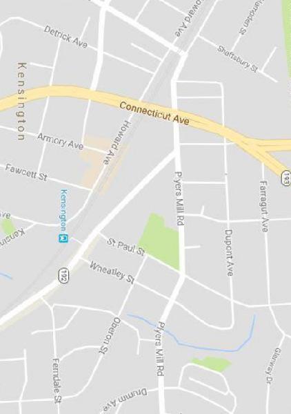
6 SECTION 2: SITE DESCRIPTION Site Vicinity and Analysis Subject Property The subject site (Subject Property or Property outlined in red in Figure 1) is located in the southwest quadrant of the intersection of Metropolitan Avenue and St. Paul Street, at the eastern edge of the Town Center core in the Crafts / Services District of the 2012 Kensington Sector Plan (Sector Plan) area, and has a portion of the Property located within the Master Plan Historic District of Kensington. The Property is zoned CRT 1.5, C1.5, R1.5, H60, and has a tract area of 84,129 square feet (1.93 acres) and will have a net lot area of 69,309 square feet (1.59 acres) upon subdivision. Figure 1: Site Aerial of the Subject Property 6

7 Site Analysis The Property, occupied by the dormant Mizell Lumber & Hardware Company and the operational Bergman s Dry-Cleaning Facility, is improved with several single-story buildings and associated surface parking. There are no known rare, threatened, or endangered species on-site, and there are no forest, streams, wetlands, or any environmental buffers on site. The Property houses two historic structures within the Master Plan Historic District Boundary. These buildings are located along St. Paul Street and are slated to be rehabilitated with the proposed project. Figure 2: Existing Site Conditions The two buildings along St. Paul Street are located within the Kensington Historic District (see Figure 2) and listed as historic structures within the Master Plan Historic District Boundary. These historic buildings were constructed in the 1930s and up until recently, were operated as an extension to the Mizell Lumber & Hardware Company. Although these are slated to be rehabilitated within the proposed project under this Sketch Plan submission, the rear additions to these buildings and the remainder of the Property, including the concrete storage facilities that were also previously used for the Mizell Lumber & Hardware Company, and the building on the northern end of the Property, currently operated as Bergman's Dry Cleaners, are not historic and will demolished as part of the proposed project. 7

8 Figure 3: St. Paul Street with the existing historic buildings (looking west) 8

9 SECTION 3: PROJECT DESCRIPTION Previous Submissions On July 25, 2017, Staff discussed the concept plan at the Development Review Committee (DRC) meeting with the Applicant where the proposal was for a five-level, 131-unit luxury senior housing community, with adaptive reuse of the two historic structures. Nine hundred-square feet of commercial was envisioned in the reuse of the historic structures. The 1.9 FAR proposed at Concept Plan exceeded the 1.5 FAR recommended by the Sector Plan and the Property s zoning. To redevelop the Property at a higher density beyond 1.5 FAR, the Applicant would have had to pursue a zoning map amendment for a Commercial/Residential Floating Zone. Staff recommended compliance with the density recommended in the Sector Plan and Zoning Ordinance, and the Applicant revised the subsequent Sketch Plan accordingly. Figure 4: Project site location with various landmarks that define the Master Plan Historic District boundary of the Town of Kensington. Proposal The Sketch Plan application (Project Attachment 1) proposes to develop a five-level 89,129 square foot mixeduse development, including 84,129 square feet of residential uses for a 135-unit senior housing community, 5,000 9

10 square feet of retail/service uses with the adaptive reuse of two historic structures fronting on St. Paul Street that will tie themselves architecturally to the proposed building, and one-level of below grade parking. Buildings Although building architecture is conceptual at the time of Sketch Plan, the concept features a 5-story senior living residential facility which includes the following numerous services of care: independent living, assisted living, and memory care, and are broken down in the following manner: Independent Living: Approximately 66 of the projected 135 total units will be allocated to independent living units. The independent living units will primarily be located on the 4th and 5th floors, with a handful of units located on the ground level. The independent living apartments will be a mix of oneand two-bedroom units and will provide complete cooking facilities. The Project will provide a minimum of 15% of the independent living units as MPDUs. Assisted Living: Approximately 45 of the projected 135 total units will be allocated to assisted living units (or 50 beds) and will be provided on the 2nd and 3rd floors of the proposed building. The assisted living component of the Project will include both private and shared suites that vary from one- and twobedrooms. Memory Care: Approximately 24 memory care units (or 26 beds) will be located on the 3rd floor, in a separate memory care wing. For the safety and security of the memory care residents, the memory care wing will be secured and is accessed by a separate elevator designated for the sole use of memory care residents (and employees), and their visitors and guests. Figure 5: Building Massing with Surrounding Context. 10
11 While the current proposal includes the rehabilitation of two buildings on St. Paul Street in the Kensington Historic District, these are the only two designated commercial buildings in this district. Any work done on the two historic buildings requires an approved Historic Area Work Permit. The proposal calls for rehabilitating the historic buildings, removing several non-historic additions, and constructing a contemporary hyphen that will connect the two historic buildings to the proposed new development. The work proposed on the exterior of these two buildings is minimal and is largely repair in nature. The proposed hyphen/connector is a large new feature, but its transparent design will allow the historic buildings to be read as individual historic buildings and is generally compatible with historic preservation best practices. The Applicant participated in a preliminary consultation before the Historic Preservation Commission (HPC) on March 14, The HPC did not render a decision or provide recommendations for approval at this meeting, but did provide guidance with respect to the following points: 1. Decrease the pressure of the proposed building s impact onto the historic structures; 2. Revise the connector piece linking the proposed building to the historic structures; 3. Revise the number of entrances within the connector piece and the historic structures; 4. Incorporate architectural revisions to scale with respect to the existing historic structures. The HPC did recommend a second preliminary consultation for the project in order to further give the applicant additional time to work through the different issues raised during the meeting. As submitted, the Sketch Plan design carries forward most of the elements from the Concept Plan review and modifies the design to increase the total number of proposed units, while concentrating on how to integrate the rehabilitation of the historic structures with the proposed building. The underground parking garage continues to underlie the entire building footprint and the two historic structures are unified within the design with an extended ground level structure that looks to link them together (Figure 4). Retail remains the key essential use for these structures along St. Paul Street. Staff has been working with the Applicant to address design concerns on how the historic structures are integrated into the proposed development. Open Spaces Per Section B of the Zoning Ordinance, the Project is required to provide 5% Public Open Space (POS). The Project s primary POS is located at the northeast corner of the site and is the neighborhood connecting space at the intersection of Metropolitan Avenue and St. Paul Street, where it widens to form a small plaza. This public space may contain bicycle parking and will serve as a significant gathering area from Metropolitan Avenue to the MARC Train station. Staff has advised the Applicant that the promotion of such a space would assist in building increased pedestrian traffic within the neighborhood, as well as enhance the quality and interaction of its residents. Staff has already worked with the Applicant in revising the design of the space to continue fitting the requirements per the zone as well as meeting the vision of the Sector Plan of reinvigorating public space and enhancing the pedestrian-oriented public realm for the Town. The final configuration and amount of POS will be determined at Site Plan. 11

12 Figure 6: Open Space Exhibit Environment Staff approved a Natural Resources Inventory/Forest Stand Delineation (NRI/FSD) for the Property on August 4, 2017 (NRI/FSD No Attachment 2). The Property contains no forest, streams or stream buffers, wetlands or wetland buffers, hydraulically adjacent steep slopes, 100-year floodplains, or known occurrences of Rare, Threatened or Endangered (RTE) species. One specimen tree exists near the southwest corner of the Property and will require a variance at the time of subsequent Preliminary Plan and Site Plan. Forest Conservation At the Sketch Plan stage this Application is subject to the Chapter 22A, Montgomery County Forest Conservation Law, but only needs to have approval of an NRI/FSD. The Applicant is required to submit a Preliminary Forest Conservation Plan at the time of Preliminary Plan and a Final Forest Conservation Plan at the time of Site Plan. Noise The project shares a common property line with the CSX Railroad tracks and proposes residential units to be built adjacent to the Railway line. The project does initially propose a sound wall to attenuate for noise, but a noise analysis is needed at time of Preliminary Plan submission. A noise analysis must be prepared by an engineer specializing in acoustics that quantifies the existing and 20 year projected noise levels. The study must address the type and location of noise mitigation techniques that may be required to appropriately attenuate noise levels for any affected dwelling units and areas of common outdoor activity, as applicable. Stormwater Management A Stormwater Management Concept Plan is not required at the time of Sketch Plan. Submission of the concept to the Department of Permitting Services (DPS) and approval will be required at the time of Preliminary Plan. 12
13 Transportation Sector/Master-Planned Roadway and Bikeways The master-planned transportation facilities are designated below in accordance with the following: 2012 Kensington Sector Plan, 2005 Countywide Bikeways Functional Master Plan, and Current Draft Bikeways Master Plan. Metropolitan Avenue, MD Route 192, is designated as a business district street, B-4, with a recommended 70- foot right-of-way. The existing right-of-way varies between 40 and 56 feet along the Property frontage of Metropolitan Avenue. At Preliminary Plan, the Applicant must dedicate additional right-of-way along the Property frontage for a total of 35 feet from its centerline. The Sector Plan recommends a signed shared roadway, LB-5, while the Countywide Bikeways Functional Master Plan and draft Bikeways Master Plan does not recommend a bikeway along this segment of Metropolitan Avenue. Figure 7: Master Plan of Highways Roadway Classifications for both Metropolitan Avenue and St. Paul Street. St. Paul Street, between Metropolitan Avenue and the CSX Railroad, is currently maintained by the Town of Kensington, and the Town has expressed concern over the status and maintenance of this section of St. Paul Street. The Applicant has been advised that at Preliminary Plan, they must provide documentation that clearly identifies if dedication has occurred for St. Paul Street. Staff will then determine if any additional dedication for St. Paul Street is required. The Sector Plan recommends a signed shared roadway, LB-6, to connect Howard Avenue and Metropolitan Avenue. This connection will be explored further at Preliminary Plan and Site Plan. Public Transit Service The Property is adjacent to the Kensington MARC Station which is part of the MARC Brunswick Line that operates between Brunswick, Maryland and Washington, DC s Union Station. The nearest public transit routes are as follows: Ride On route 4 operates along Howard Avenue, Kent Street, and Stoneybrook Drive between the Kensington (i.e., Knowles Avenue & Amory Avenue) and the Shady Grove Metrorail Station with halfhour headways on weekdays only. 13

14 Ride On route 5 operates along Metropolitan Avenue between the Twinbrook Metrorail Station and the Shady Grove Metrorail Station with half-hour headways on weekdays and weekends. Ride On route 33 operates along Howard Avenue and Kensington Parkway between the Glenmont Metrorail Station and the NIH/Medical Center Metrorail Station with half-hour headways on weekdays only. Figure 8: Existing bus stop location for Ride On Bus along Metropolitan Avenue. The nearest bus stops are located at the Metropolitan Avenue/St. Paul Street intersection, the Howard Avenue/Fawcett Street intersection, and the Kent Street/Stoneybrook Drive intersection. Connecticut Avenue (MD 185) is located approximately 1,300 feet to the west, where the following two other bus routes operate: Ride On route 34 operates along Cedar Lane to Connecticut Avenue to University Boulevard between Aspen Hill (i.e., Grand Road & Bel Pre Road) and the Friendship Heights Metrorail Station with half-hour headways on weekdays and weekends. Metrobus route L8 operates along Connecticut Avenue between the Aspen Hill (i.e., Grand Road & Bel Pre Road) and the Friendship Heights Metrorail Station with half-hour headways on weekdays and weekends. 14
 Community Outreach The Applicant held a pre-submittal public meeting on September 27, 2017, at the Kensington Town Hall at 3710 Mitchell Street in")
15 Figure 9: CSX Transportation Inc. (looking west from the Kensington MARC Station) Community Outreach The Applicant held a pre-submittal public meeting on September 27, 2017, at the Kensington Town Hall at 3710 Mitchell Street in Kensington and has complied with all submittal and noticing requirements. The meeting regrouped approximately 70 individuals from the community and was relatively well received. Staff has received one letter of support from a community member on March 26, 2018 (Attachment 3). The Town of Kensington Manager, Mayor and Council, and the Development Review Board are all in support of the proposed Sketch Plan. The Town Manager has indicated that the Development Review Board is in process of drafting a letter of support for the application to the Planning Board. SECTION 4: OUTSTANDING ISSUES TO BE ADDRESSED DURING SUBSEQUENT REVIEW During the technical review of this Project, Staff raised numerous issues to be resolved as the design develops in preparation for Preliminary and Site Plan review. Staff remains concerned about the Project s design, architecture, and landscaping as it relates to the historic context of the Kensington Historic District and the adjacent uses. Additional concerns relate to the property s location with respect to noise generating from the CSX transportation railway line and its architectural massing with the historic structures and context of Kensington. However, the Project as conditioned satisfies the intent of the Sketch Plan. The site layout and building design will be further refined during the Site Plan review with careful consideration of the Project s relationship as a project on the edge of the Kensington Historic District. 15

16 Figure 10: Staff Illustrative Layout Sketch (plan view) of the subject property. During the Sketch Plan review process, Staff developed an alternative design for the Property that maintained the same density proposed by the Applicant, but better addressed the issue of open space and contextual framework for the proposed layout (see Figure 10 above). Staff s alternative design was intended to increase the amount of open space at the intersection of Metropolitan Avenue and St. Paul Street, increase the amount and quality of the public open space, and improve the relationship to the public realm. It also focused on decreasing the amount of vehicular space within the drop-off area, which results in improved safety and security of the Project s future residents. The Applicant revised the layout to lend itself toward maximizing the open space at the intersection while decreasing the vehicular drop-off area for the project (see Figure 11 below). 16

17 Figure 11: Revised open space layout with the decrease in vehicular drop-off area. Comparison between the initial design and the collaborative effort between Staff and the Applicant. Lastly, as previously stated, at the time of Preliminary Plan, the Applicant must provide documentation that clearly identifies if dedication has occurred for St. Paul Street. Staff will then determine if any additional dedication for St. Paul Street is required. SECTION 5: PROJECT ANALYSIS AND FINDINGS The purpose of a Sketch Plan is to identify general land uses, development intensity, and public benefits for the optional method of development in the CR, CRT, EOF or LSC Zones. The Sketch Plan is intended to be conceptual in nature with an emphasis on building densities, massing, heights and anticipated uses, the locations of open and public use spaces, the general circulation patterns for all modes of transportation, an estimated range of peak hour trips and relationships between existing or proposed adjacent buildings and rights-of-way. Details of the proposed development are determined during Preliminary and Site Plan review. Section E of the Zoning Ordinance states: To approve a Sketch Plan, the Planning Board must find that the following elements are appropriate in concept and appropriate for further detailed review at site plan. The Sketch Plan must: 1. meet the objectives, general requirements, and standards of this Chapter; The Sketch Plan meets the development standards of Section , as shown in the Data Table below: 17
18 Table 1 - Project Data Table for the CRT-1.5, C-1.5, R-1.5, H-60 Optional Method of Development Required/Allowed Proposed Gross Tract Area Dedications Previous Proposed Net Lot Area 1.93 ac. (84,129 sf.) 0.35 ac. (15,132 sf.) 0.25 ac. (11,089 sf.) 0.09 ac. (4,043 sf.) 1.58 ac. (68,997 sf.) Zoning CRT-1.5, C-1.5, R-1.5, H-60 CRT-1.5, C-1.5, R-1.5, H-60 Development Standards (Section 4.5.4) Public Open Space 5% (3,465 sf.) 5.3% (3,711 sf.) Density and Height Commercial 1.5 FAR (126, sf.) 0.04 FAR (3,000 sf.) Residential 1.5 FAR (126, sf.) 1.5 FAR (126, sf.) Total Density (max.) 1.5 FAR (126, sf.) 1.5 FAR (126, sf.) Height (max.) 60' 60' Public Benefit Points and Categories (Section A) Public Benefit Points Number of Benefit Categories (min.) 2 7 Moderately Priced Dwelling Units (MPDUs) 15% 15% 1. Mix of Uses will be determined at Site Plan, but will not exceed the maximum FAR permitted for Commercial Uses (1.5 FAR) and Residential Uses (1.5 FAR). 2. Final amount of Public Open Space will be determined at Site Plan as appropriate. 3. The Illustrative Right of way dedication area and the Total Site area for Public Open Space Public Benefit Point Calculation shown are illustrative for Public Benefit Point calculation only. Final layout will be determined at Site Plan. Table 1: Zoning Criteria Data Table The Sketch Plan conforms to the intent of the CRT zone as described below. a) Implement the recommendations of applicable master plans. Site-Specific Recommendations 18
19 The Subject Property is within the portion of the Kensington Sector Plan described as The Crafts/Services District which includes the West Howard Antiques District and service industrial activities on the south side of Metropolitan Avenue (Sector Plan, page 34). The 6.2-acre area located on the south side of Metropolitan Avenue and east of the intersection of Metropolitan Avenue and Plyers Mill Road is furthermore described within the CS-1, CS-2 Zone for Konterra and Metropolitan Avenue South. The Sector Plan proposes to preserve the character of this district. Aesthetic and environmental improvements should enhance the area s look and function without compromising its eclectic nature. The portion of this district on the south side of Metropolitan Avenue is recommended for the CRT Zone, with total maximum FARs of 1.5. It furthermore recommends a height of 60 feet with the option to explore going up to 75 feet on the Konterra property if the additional height can be provided in a manner compatible with surrounding uses and if public amenities are provided that exceed the requirements of the CRT Zone, to the extent practicable. The Sketch plan, as conditioned, is consistent with the recommended zone and height requirements for the area as envisioned by the Sector Plan. The Project provides a mix of residential possibilities (with final unit count and unit mix to be determined at Site Plan) with 15% on-site MPDUs and up to 3,000 square feet of non-residential uses. The Project is also consistent with the recommendation of revitalization to this area, while incorporating additional open space and best management practices for stormwater management. Thus, the Project is in substantial conformance with the 2012 Kensington Sector Plan. b) Target opportunities for redevelopment of single use commercial areas and surface parking lots with a mix of uses. The Project will redevelop the existing underutilized Property with a mixed use building with residential and ground floor retail uses, providing a much needed transformation of the Property. The Project meets the objective of this finding. c) Encourage development that integrates a combination of housing types, mobility options, commercial services, and public facilities and amenities, where parking is prohibited between the building and the street. The Project encourages such development by proposing a variety of levels of independent and assisted senior living options, including market rate residential units as well as 15% MPDUs. The Project facilitates improved pedestrian, bicycle, and vehicular movement, is located near the Kensington MARC Station and bus service, and improves the streetscape along its two frontages. The Project provides for a public open space amenity and gathering space at the intersection of Metropolitan Avenue and St. Paul Street. Perpendicular parking is proposed along St. Paul Street, which dead-ends at the CSX railroad tracks, to serve the proposed retail uses. However, further analysis of the proposed parking will occur during subsequent Preliminary Plan and Site Plan reviews. d) Allows a flexible mix of uses, densities, and building heights appropriate to various settings to ensure compatible relationships with adjoining neighborhoods. The Project will provide activating ground floor uses in the form of retail along the St. Paul Street frontage, and needed residential uses with height and density compatible with the existing neighborhood and the Sector Plan recommended character of the Crafts/Services District. 19
20 e) Integrate an appropriate balance of employment and housing opportunities. The Solera Reserve at Kensington provides much needed senior housing at a variety of different levels of care, including MPDUs, in the County. Employment opportunities within the Project may be found within the proposed 5,000 square feet of retail/service space on the ground floor, and in the many other businesses in the immediate vicinity. As proposed, the Project provides additional employment and housing opportunities, as recommended in the Sector Plan. f) Standardize optional method development by establishing minimum requirements for the provision of public benefits that will support and accommodate density above the standard method limit. The Project will provide the required public benefits from a minimum of two categories to achieve the desired incentive density above the standard method limit. Final determination of public benefit points will be determined at the time of Site Plan. 2. substantially conforms with the recommendations of the applicable master plan; As discussed in Finding 1.a. above, the Project substantially conforms with the recommendations of the 2012 Kensington Sector Plan. The Project will increase the supply of housing to serve a variety of levels of care for seniors and income levels, redevelop an under utilized property, improve the visual quality and architectural character of the immediate area, and provide streetscape improvements that improve the safety and character of the existing streets. 3. satisfies any development plan or schematic development plan in effect on October 29, 2014; The Sketch Plan is not subject to a development or schematic development plan. 4. achieves compatible internal and external relationships between existing and pending nearby development; The Sector Plan envisions a reinvigorated, pedestrian-oriented, and safe mixed-use Town Center that respects and builds on Kensington s historic character and modest scale, with active streets, new public spaces, well-designed buildings, and enhanced streetscape. The Project moves forward with proposing objectives of design that addresses this vision as the Applicant continues to work with Staff toward reaching the various goals of height, density, diversity of housing, architectural reverence to the historic district, and integral open space that benefit both the residents and the community of Kensington. Thus, the building design is compatible in height and scale with the existing nearby development. 5. provides satisfactory general vehicular, pedestrian, and bicyclist access, circulation, parking, and loading; The Project provides satisfactory general vehicular, pedestrian, and bicyclist access, circulation, parking, and loading. The Project appropriately locates activating pedestrian realm near the intersection of Metropolitan Avenue and St. Paul Street including the residential entrance, the public open space, and streetscaping inspired by the historic context of Metropolitan Avenue. Staff still has concerns with the vehicular loading access off of St. Paul Street, which will be further analyzed at Preliminary Plan and Site Plan review. The amount and location of long- and short-term bicycle parking will be determined at Site Plan. 20
21 6. Proposes an outline of public benefits that support the requested incentive density and is appropriate for the specific community. Taking into account the considerations in Section B, including the recommendations and objectives of the Sector Plan and any applicable design guidelines, the Incentive Density Implementation Guidelines, the size and configuration of the site and its relationship to adjacent properties, similar public benefits nearby, and additional enhancements related to the individual public benefits, Staff finds that the following outline of public benefits supports the Applicant s request for incentive density and is appropriate for the community surrounding the site, as described below. For the proposed development, the Zoning Ordinance requires 50 public benefit points in two categories rather than three. This is a result of when a project proposes a minimum of 15 percent MPDUs, one less benefit category than required under Section A.2 and Section A.2 must be satisfied 1. Although at the time of Sketch Plan review only the categories need be approved, Table 2 demonstrates both the categories and points for the public benefits recommended at Sketch Plan to demonstrate the project s ability to meet the requirement to provide sufficient benefit points. Table 2- Public Benefits Valuations Section # Benefit Categories Points Allowed B: Transit Proximity Points Recommended B1 Transit Proximity C: Connectivity and Mobility C.2 Minimum Parking D: Diversity of Uses and Activities D.4 Enhanced Accessibility for the Disabled D.6 Moderately Priced Dwelling Units 12 pts per 1% MPDUs E: Quality Building and Site Design E.6 Structured Parking G: Building Reuse G.1 Building Reuse Total 71 Table 2: Public Benefit Points for the project. Transit Proximity The Applicant requests 5 points for proximity to a MARC Train Station, a Level 3 transit facility, as a confronting property across St. Paul Street right-of-way from transit. Staff supports the Applicant s request at this time, with final calculations and points determined at the time of Site Plan C/R Zones Incentive Density Implementation Guidelines, Diversity of Uses and Activities, Zoning Ordinance Citation, Section D. Diversity of Uses and Activities, 6. Affordable Housing a.v. (p. 31) 21
22 Connectivity and Mobility Minimum Parking: The Applicant requests 6 points for providing approximately 103 parking spaces on-site, which is more than the minimum (e.g. 88 parking spaces), but less than the maximum (e.g. 136 parking spaces) number of parking spaces required. Points for this incentive are granted on a sliding scale from no points for providing the maximum allowable number of on site spaces to 20 points for providing no more than the minimum numbers of spaces on site. Final determination on the number of points recommended in this category will be made at Site Plan. Diversity of Uses and Activities Enhanced Accessibility for Seniors or the Disabled: The Applicant requests 10 points for providing a minimum of 3% of the living units will meet American National Standards Institute A117.1 Residential Type A standards or an equivalent County standard. Final number of points will be determined at Site Plan. Moderately Priced Dwelling Units: The Applicant is requesting 31 points for providing a minimum of 15% of the independent living units as MPDUs, thereby exceeding the minimum percentage of MPDUs required (e.g. 12.5%), per the following equation of 12 pts per 1% MPDUs. Final number of points will be determined at Site Plan. Quality Building and Site Design Structured Parking: The Applicant is requesting 18 points for providing parking on-site in a below-grade structured parking garage. Of the 103 parking spaces proposed, 93 will be located in the structured parking garage, and the points are calculated per the following equation: [(A/T)*10]+[(B/T)*20]. Final number of points will be determined at Site Plan. Building Re-Use The Applicant requests 2 points by the adaptive re-use of the two historic structures located along St. Paul Street per the following formula: (R/I)*100. The Applicant has denoted that a minimum of 75% of the structure system of the building will be retained, and that an architectural deconstruction company will be used to remove reusable and recyclable materials before any demolition. Final number of points will be determined at Site Plan. 7. Establishes a feasible and appropriate phasing plan for all structures, uses, rights-of-way, sidewalks, dedications, public benefits, and future preliminary and site plan applications. The Project will be constructed in one phase. CONCLUSION The Sketch Plan application satisfies the findings under Section of the Zoning Ordinance and substantially conforms to the recommendations of the 2012 Kensington Sector Plan. Therefore, Staff recommends approval of the Sketch Plan with the conditions specified at the beginning of this report. ATTACHMENTS 1. Sketch Plan 2. Approved NRI/FSD 3. Community Correspondence 4. MCDOT Approval Letter 22

23 Attachment 1 60'-0" to ROOF DENSITY: 121,188sf - RESIDENTIAL 5,000sf - RETAIL 20'-0" to ROOF APPLICANT: SM Kensington Senior Living RE, LLC 2200 Clarendon Boulevard, Suite 1125 Arlington, VA PH: Contact: Travis Westmoreland CONSULTING TEAM: ANTUNOVICH ASSOCIATES Architects: 2200 Clarendon Boulevard, Suite 1150 Arlington, VA PH: Contact: Kevin C Sperry, AIA LANTZ-BOGGIO ARCHITECTS 5650 DTC Parkway, Suite 200 Englewood, CO PH: Contact: Kevin Durham, AIA LERCH EARLY BREWER Land Use Attorney: 7600 Wisconsin Ave, Suite 700 Bethesda, MD PH: Contact: William Kominers DEWBERRY CONSULTANTS LLC. LandscapeArchitect: Civil Engineer / Land Planner: 2101 Gaither Road Suite 340 Rockville, MD PH: Contact: Meredith Byer BY Description PP#: DATE REVISIONS No. SHEET TITLE Building Density, Massing, Height PROJECT NO. 07-SKETCH SHEET NO.
24 Attachment 1
25 Attachment 1
26 Attachment 1
 APPROVED - 420180750 THE MARYLAND-NATIONAL CAPITAL PARK")

27 Attachment 2 Steve Findley ( steve.findley@montgomeryplanning.org ) APPROVED THE MARYLAND-NATIONAL CAPITAL PARK AND PLANNING COMMISSION MONTGOMERY PLANNING DEPARTMENT 11/20/17 This NRI/FSD Approval will expire 2 years from the date noted above.
28 Attachment 3 Hello, Mr. Anderson, I do not plan to be at the hearing 5 April for the Solera Independent Living care facility proposed for Kensington. As a resident of the Town of Kensington, I support this project. I feel it is an excellent use of the land area previously used as a car dealer storage lot and a lumber yard. Restoring and reusing the two historic buildings and sign on the property is welcome, subject to the Historic Preservation Commission and LAP for Kensington approval. I would encourage the Planning Board to allow this project to move forward. Peter Bartram 3824 Warner Street Kensington
29 Attachment 4
30 Attachment 4
31 Attachment 4
MONTGOMERY COUNTY PLANNING DEPARTMENT THE MARYLAND-NATIONAL CAPITAL PARK AND PLANNING COMMISSION
 MONTGOMERY COUNTY PLANNING DEPARTMENT THE MARYLAND-NATIONAL CAPITAL PARK AND PLANNING COMMISSION MCPB Item No. Date: 1/26/12 Hanover Shady Grove, Sketch Plan 320120020 Joshua Sloan, Coordinator, Joshua.Sloan@MontgomeryPlanning.org,
MONTGOMERY COUNTY PLANNING DEPARTMENT
 MONTGOMERY COUNTY PLANNING DEPARTMENT THE MARYLAND-NATIONAL CAPITAL PARK AND PLANNING COMMISSION MCPB Item No.: Date: 5-03-18 Pike and Rose, Phase I: Site Plan Amendment No. 82012002D Rhoda Hersson-Ringskog,
MONTGOMERY COUNTY PLANNING DEPARTMENT THE MARYLAND NATIONAL CAPITAL PARK AND PLANNING COMMISSION
 MONTGOMERY COUNTY PLANNING DEPARTMENT THE MARYLAND NATIONAL CAPITAL PARK AND PLANNING COMMISSION MCPB Item No. Date: 5.3.18 8000 Wisconsin Avenue Sketch Plan No. 320180120 Matthew Folden, Planner Coordinator,
MONTGOMERY COUNTY PLANNING DEPARTMENT
 MONTGOMERY COUNTY PLANNING DEPARTMENT THE MARYLAND-NATIONAL CAPITAL PARK AND PLANNING COMMISSION Ourisman Ford at Montgomery Mall, Sketch Plan No. 320170100 MCPB Item No. Date: 11-30-17 LS Lori Shirley,
MONTGOMERY COUNTY PLANNING DEPARTMENT THE MARYLAND-NATIONAL CAPITAL PARK AND PLANNING COMMISSION
 MONTGOMERY COUNTY PLANNING DEPARTMENT THE MARYLAND-NATIONAL CAPITAL PARK AND PLANNING COMMISSION Solera Reserve Kensington: Preliminary Plan No. 120180220 and Site Plan No. 820180180 MCPB Item No. Date:
MONTGOMERY COUNTY PLANNING DEPARTMENT THE MARYLAND-NATIONAL CAPITAL PARK AND PLANNING COMMISSION
 MONTGOMERY COUNTY PLANNING DEPARTMENT THE MARYLAND-NATIONAL CAPITAL PARK AND PLANNING COMMISSION MCPB Item No. Date: 12-10-15 Leisure World Clubhouse II Addition Fitness Center, Limited Site Plan Amendment
MONTGOMERY COUNTY PLANNING DEPARTMENT THE MARYLAND-NATIONAL CAPITAL PARK AND PLANNING COMMISSION
 MONTGOMERY COUNTY PLANNING DEPARTMENT THE MARYLAND-NATIONAL CAPITAL PARK AND PLANNING COMMISSION MCPB Item No. Date10/25/12 Sketch Plan No. 32012004, White Flint Mall Redevelopment Nkosi Yearwood, Senior
MONTGOMERY COUNTY PLANNING DEPARTMENT THE MARYLAND-NATIONAL CAPITAL PARK AND PLANNING COMMISSION
 MONTGOMERY COUNTY PLANNING DEPARTMENT THE MARYLAND-NATIONAL CAPITAL PARK AND PLANNING COMMISSION MCPB Item No. Date: 3.10.2016 Site Plan 820160040 Nora School Parker Smith, Planning Technician, Area 1,
MONTGOMERY COUNTY PLANNING DEPARTMENT THE MARYLAND-NATIONAL CAPITAL PARK AND PLANNING COMMISSION
 MONTGOMERY COUNTY PLANNING DEPARTMENT THE MARYLAND-NATIONAL CAPITAL PARK AND PLANNING COMMISSION MCPB Item No. 8 Date: 12-15-16 Montgomery Village Center Sketch Plan No. 320170020 TL Troy Leftwich, Senior
MONTGOMERY COUNTY PLANNING DEPARTMENT
 MONTGOMERY COUNTY PLANNING DEPARTMENT THE MARYLAND-NATIONAL CAPITAL PARK AND PLANNING COMMISSION MCPB Item No. Date: 04/05/2018 850 Sligo Avenue Sketch Plan No. 320180090 Neil Sullivan, Planner Coordinator,
MONTGOMERY COUNTY PLANNING DEPARTMENT THE MARYLAND-NATIONAL CAPITAL PARK AND PLANNING COMMISSION
 MONTGOMERY COUNTY PLANNING DEPARTMENT THE MARYLAND-NATIONAL CAPITAL PARK AND PLANNING COMMISSION MCPB Item No. Date: 11-16-17 Hillandale Gateway, Sketch Plan, 320180020 Summary Lori Shirley, Planner Coordinator,
MONTGOMERY COUNTY PLANNING DEPARTMENT THE MARYLAND-NATIONAL CAPITAL PARK AND PLANNING COMMISSION
 MONTGOMERY COUNTY PLANNING DEPARTMENT THE MARYLAND-NATIONAL CAPITAL PARK AND PLANNING COMMISSION Staff Report: Sketch Plan #320110010, Mid-Pike Plaza ITEM #: MCPB HEARING DATE: January 20, 2011 REPORT
I. Introduction. Prior Approvals
 Statement of Justification First National Bank 19790 Crystal Rock Drive, Germantown, Maryland Application for Site Plan and Limited Preliminary Plan Amendment I. Introduction DPH Architecture, for First
MONTGOMERY COUNTY PLANNING DEPARTMENT THE MARYLAND-NATIONAL CAPITAL PARK AND PLANNING COMMISSION
 MONTGOMERY COUNTY PLANNING DEPARTMENT THE MARYLAND-NATIONAL CAPITAL PARK AND PLANNING COMMISSION MCPB Item No. Date: 04/24/2014 Sketch Plan No. 320140020, AVA Wheaton Michael Brown, Planner Coordinator,
MONTGOMERY COUNTY PLANNING DEPARTMENT THE MARYLAND-NATIONAL CAPITAL PARK AND PLANNING COMMISSION
 MONTGOMERY COUNTY PLANNING DEPARTMENT THE MARYLAND-NATIONAL CAPITAL PARK AND PLANNING COMMISSION MCPB Item No. Date: 05/12/2016 North Bethesda Conference Center Parking Structure, Mandatory Referral No.
Westwood Shopping Center Sketch Plan, Plan # February 23, 2017 Item # 9
 Westwood Shopping Center Sketch Plan, Plan # 320170010 February 23, 2017 Item # 9 Westwood II Site 64,111 s.f. Manor Care site: vacant two story building HOC-Westwood Towers, 15 story tower To be considered
Sketch Plan. MNCPPC Plan No: A
 General Notes 1. The Sketch Plan drawings are conceptual only and represent proposed development in an illustrative manner. Final building locations, dimensions, heights, uses and development standards
The Development Review Process. Presentation to the GSSC IAC
 The Development Review Process Presentation to the GSSC IAC July 19, 2011 Regulatory Processes in the Planning Department Natural Resource Inventory/Forest Stand Delineation Zoning (Development Plan) Special
MONTGOMERY COUNTY PLANNING DEPARTMENT THE MARYLAND-NATIONAL CAPITAL PARK AND PLANNING COMMISSION
 MONTGOMERY COUNTY PLANNING DEPARTMENT THE MARYLAND-NATIONAL CAPITAL PARK AND PLANNING COMMISSION MCPB Item No. Date: 05-22-14 Consent Item - Park Potomac: Site Plan Amendment No. 82004015K MCS. Molline
MONTGOMERY COUNTY PLANNING DEPARTMENT THE MARYLAND-NATIONAL CAPITAL PARK AND PLANNING COMMISSION
 MONTGOMERY COUNTY PLANNING DEPARTMENT THE MARYLAND-NATIONAL CAPITAL PARK AND PLANNING COMMISSION MCPB Item No. Date: 7/26/12 Camden Shady Grove (Danac Stiles), Sketch Plan 320120050 Joshua Sloan, Planner
MONTGOMERY COUNTY PLANNING DEPARTMENT
 MONTGOMERY COUNTY PLANNING DEPARTMENT THE MARYLAND-NATIONAL CAPITAL PARK AND PLANNING COMMISSION Ashburton Elementary School Addition, Mandatory Referral, MR2018009 MCPB Item No. Date: 02-15-18 Troy Leftwich,
S C O P E O F W O R K A P R I L
 white flint 2 sector plan S C O P E O F W O R K A P R I L 2 0 1 2 MONTGOMERY COUNTY PLANNING DEPARTMENT M-NCPPC MontgomeryPlanning.org 1 white flint 2 sector plan Scope of Work abstract This scope of work
Gold Line Bus Rapid Transit Transit Oriented Development (BRTOD) Helmo Station Area Plan
 Helmo Station Area Plan") Appendix F Gold Line Bus Rapid Transit Transit Oriented Development (BRTOD) Helmo Station Area Plan Introduction and Purpose of the Plan The Gold Line Bus Rapid Transit facility is an eleven-mile dedicated
Appendix F Gold Line Bus Rapid Transit Transit Oriented Development (BRTOD) Helmo Station Area Plan Introduction and Purpose of the Plan The Gold Line Bus Rapid Transit facility is an eleven-mile dedicated
MONTGOMERY COUNTY PLANNING DEPARTMENT THE MARYLAND-NATIONAL CAPITAL PARK AND PLANNING COMMISSION
 MONTGOMERY COUNTY PLANNING DEPARTMENT THE MARYLAND-NATIONAL CAPITAL PARK AND PLANNING COMMISSION MCPB Item No. Date: 1/15/2015 Bethesda North Marriott Hotel and Conference Center: Limited Site Plan Amendment
MONTGOMERY COUNTY PLANNING DEPARTMENT
 MONTGOMERY COUNTY PLANNING DEPARTMENT THE MARYLAND-NATIONAL CAPITAL PARK AND PLANNING COMMISSION 6000 Executive Boulevard, Sketch Plan No. 320180140 MCPB Item No. Date: 06/21/2018 Emily Tettelbaum, Senior
DRAFT. October Wheaton. Design Guidelines
 October 2011 DRAFT Wheaton Design Guidelines 2 Draft - Design Guidelines - Wheaton Sector Plan Contents 04 Section 1: Introduction 06 Section 2: Context 08 Section 3: Design Guidelines 09 Goal 1: Create
JUSTIFICATION STATEMENT FOR SKETCH PLAN NO Sketch Plan Justification for Wilgus
 JUSTIFICATION STATEMENT FOR SKETCH PLAN NO. 320190070 Sketch Plan Justification for Wilgus I. INTRODUCTION Owner and Applicant, Wilgus-Montrose Associates LLC ( Applicant ), by its attorneys, Linowes and
MONTGOMERY COUNTY PLANNING DEPARTMENT THE MARYLAND-NATIONAL CAPITAL PARK AND PLANNING COMMISSION
 MONTGOMERY COUNTY PLANNING DEPARTMENT THE MARYLAND-NATIONAL CAPITAL PARK AND PLANNING COMMISSION MCPB Item No. Date: 7/30/2015 Pooks Hill Sketch Plan No. 320150060 Kathleen A. Reilly, AICP Planner Coordinator,
MONTGOMERY COUNTY PLANNING DEPARTMENT THE MARYLAND-NATIONAL CAPITAL PARK AND PLANNING COMMISSION
 MONTGOMERY COUNTY PLANNING DEPARTMENT THE MARYLAND-NATIONAL CAPITAL PARK AND PLANNING COMMISSION The Goddard School in North Bethesda Preliminary Plan Amendment 11996015B and Site Plan Amendment 82006005A
Ripley East. Sketch Plan Amendment No A Preliminary Plan No Site Plan No MONTGOMERY COUNTY PLANNING DEPARTMENT
 Ripley East Sketch Plan Amendment No. 32015001A Preliminary Plan No. 120150220 Site Plan No. 820150130 Planning Board Hearing Date: December 3, 2015 Site Vicinity and Site Description Silver Spring Transit
City of Farmington. Downtown Plan. Amendment to the 1998 Master Plan Adopted October 11, 2004
 City of Farmington Amendment to the 1998 Master Plan Adopted October 11, 2004 Introduction Planning Background 1 Scope and Components of the Plan Amendment 2 Concept Introduction 3 Plan Concepts 3 Conceptual
JUSTIFICATION STATEMENT FOR SKETCH PLAN NO Sketch Plan Justification for Ourisman Ford
 I. INTRODUCTION JUSTIFICATION STATEMENT FOR SKETCH PLAN NO. 320170100 Sketch Plan Justification for Ourisman Ford Owner and Applicant, FP Whitro Westlake, LLC ( Applicant ), by its attorneys, Linowes and
PROJECT NARRATIVE AND JUSTIFICATION STATEMENT
 7000 WISCONSIN AVENUE SKETCH PLAN NO. 320190090 PROJECT NARRATIVE AND JUSTIFICATION STATEMENT I. INTRODUCTION Starr Capital LLC and Woodfield Development Company (collectively, the Applicant ) are the
MONTGOMERY COUNTY PLANNING DEPARTMENT THE MARYLAND-NATIONAL CAPITAL PARK AND PLANNING COMMISSION
 MONTGOMERY COUNTY PLANNING DEPARTMENT THE MARYLAND-NATIONAL CAPITAL PARK AND PLANNING COMMISSION MCPB Item No. Date: 12/11/2014 Ripley East Sketch Plan No. 320150010 SD Stephanie Dickel, Planner Coordinator,
ARLINGTON COUNTY, VIRGINIA
 ARLINGTON COUNTY, VIRGINIA County Board Agenda Item Meeting October 15, 2005 DATE: September 28, 2005 SUBJECT: Request to Advertise the adoption of the 2005 Clarendon Sector Plan C. M. RECOMMENDATION:
MONTGOMERY COUNTY PLANNING DEPARTMENT THE MARYLAND-NATIONAL CAPITAL PARK AND PLANNING COMMISSION
 MONTGOMERY COUNTY PLANNING DEPARTMENT THE MARYLAND-NATIONAL CAPITAL PARK AND PLANNING COMMISSION MCPB Item No. 6 Date: 5-9-13 Site Plan No. 820130090, West Chevy Chase Heights Erin Grayson, Senior Planner,
Kenilworth Avenue and Town of Cheverly Industrial Study Briefing
 Kenilworth Avenue and Town of Cheverly Industrial Study Briefing The Maryland-National Capital Park and Planning Commission Prince George s County Planning Department www.pgplanning.org Vanasse Hangen
Status Report: MD 355 Project
 Status Report: MD 355 Project OCTOBER 2006 M-NCPPC MONTGOMERY COUNTY PLANNING DEPARTMENT Summary of Community Comments, and break to the Results of the MD 355 Participation Session Brookside Gardens -
ARTICLE 6: Special and Planned Development Districts
 ARTICLE 6: Special and Planned Development Districts 6-10 Traditional Neighborhood Development (TND) District 6-10.10 Purpose and Intent The Traditional Neighborhood Development (TND) District provides
MONTGOMERY COUNTY PLANNING DEPARTMENT THE MARYLAND-NATIONAL CAPITAL PARK AND PLANNING COMMISSION
 MONTGOMERY COUNTY PLANNING DEPARTMENT THE MARYLAND-NATIONAL CAPITAL PARK AND PLANNING COMMISSION MCPB Item No. Date: 06-12-14 King of the Nations Christian Fellowship Church: Limited Site Plan Amendment
Proposed Comprehensive Plan Strategies DRAFT for discussion June 28, 2017
 Proposed Comprehensive Plan Strategies DRAFT for discussion June 28, 2017 Land Use Rural Areas Refine the Farm and Forest area (FF) Update FF boundaries to account for existing lots less than five acres
12 January 12, 2011 Public Hearing APPLICANT: TAILWIND DEVELOPMENT GROUP,LLC PROPERTY OWNER: CITY OF VIRGINIA BEACH
 12 January 12, 2011 Public Hearing APPLICANT: TAILWIND DEVELOPMENT GROUP,LLC PROPERTY OWNER: CITY OF VIRGINIA BEACH STAFF PLANNER: Faith Christie REQUEST: Conditional Change of Zoning (from PD-H1 Planned
MONTGOMERY COUNTY PLANNING DEPARTMENT THE MARYLAND NATIONAL CAPITAL PARK AND PLANNING COMMISSION
 MONTGOMERY COUNTY PLANNING DEPARTMENT THE MARYLAND NATIONAL CAPITAL PARK AND PLANNING COMMISSION MCPB Item No. 3 Date: 1.5.17 7272 Wisconsin Avenue: Sketch Plan Amendment No. 32016004A, Preliminary Plan
The Maryland-National Capital Park and Planning Commission Prince George's County Planning Department Development Review Division
 The Maryland-National Capital Park and Planning Commission Prince George's County Planning Department Development Review Division 301-952-3530 Note: Staff reports can be accessed at www.mncppc.org/pgco/planning/plan.htm.
The subject site plan amendment proposes the following revisions to the approved site plan:
 PROPOSED AMENDMENT The subject site plan amendment proposes the following revisions to the approved site plan: 1. The building footprint was modified to accommodate the revised architectural design. 2.
Michael Brown, Senior Planner, Area 2 Planning Division,
 THE MARYLAND-NATIONAL CAPITAL PARK AND PLANNING COMMISSION MCPB Item No. Date: 12-15-11 Glenmont Fire Station, Mandatory Referral, MR 2012007 Michael Brown, Senior Planner, Area 2 Planning Division, michael.brown@montgomeryplanning.org,
COMMUNITY DESIGN. GOAL: Create livable and attractive communities. Intent
 COMMUNITY DESIGN Intent An attractive, well-designed County will attract quality development, instill civic pride, improve the visual character of the community, and create a strong, positive image for
Description of Preferred Alternative
 Chapter 2 Description of Preferred Alternative 2.1 Introduction This chapter of the programmatic Sammamish Town Center Sub-area Plan Final EIS provides a more detailed description of the Preferred Alternative
Glenborough at Easton Land Use Master Plan
 Implementation 114 9.0 IMPLEMENTATION 9.1 OVERVIEW This chapter summarizes the administrative procedures necessary to implement the proposed land use plan, infrastructure improvements, development standards,
Policies and Code Intent Sections Related to Town Center
 Policies and Code Intent Sections Related to Town Center The Town Center Vision is scattered throughout the Comprehensive Plan, development code and the 1994 Town Center Plan. What follows are sections
Wheaton CBD & Vicinity Sector Plan D E S I G N G U I D E L I N E S
 Wheaton CBD & Vicinity Sector Plan D E S I G N G U I D E L I N E S 1 a b s t r a c t This document contains the design guidelines the property owners, community members, and planners should use to implement
14 October 10, 2012 Public Hearing APPLICANT: MPB, INC
 14 October 10, 2012 Public Hearing APPLICANT: MPB, INC PROPERTY OWNER: MUNDEN & ASSOCIATES, LP STAFF PLANNER: Karen Prochilo REQUEST: Conditional Change of Zoning (AG-1 & AG-2 to Conditional O-2) ADDRESS
2.7 ac park. TOTAL 5,403 DU 1,297,900 sf 1,105,450 sf 3.87 ac 5,563 DU 1,121,200 sf 1,105,450 sf 3.87 ac
 PLAN AMENDMENT 2013-I-B1: SEVEN CORNERS SPECIAL STUDY Summary of Pre-staffing Comments Planner: Bernard Suchicital bsuchi@fairfaxcounty.gov (703) 324-1254 Background On October 29, 2013, the Board of Supervisors
MONTGOMERY COUNTY PLANNING DEPARTMENT THE MARYLAND-NATIONAL CAPITAL PARK AND PLANNING COMMISSION
 MONTGOMERY COUNTY PLANNING DEPARTMENT THE MARYLAND-NATIONAL CAPITAL PARK AND PLANNING COMMISSION MCPB Item No. Date: 7/19/18 4 Bethesda Metro Center, Sketch Plan No. 320180110 SD Stephanie Dickel, Planner
Establish a network of streetscaped vehicle and pedestrian routes that connect within and outside the Plan area.
 This Plan s urban design goals are to create an urban scale, walkable community with connections to transit, parks, and services and with amenities and facilities for residents and employees. The 1992
MIXED-USE VILLAGE OVERLAY FLOATING DISTRICT
 MIXED-USE VILLAGE OVERLAY FLOATING DISTRICT Zoning regulations developed by committee to the Planning Board for the Town of DeWitt, NY Issue date: 13 July 2017 revised 3/12/2018, revised 4/26/2018, 5/9/2018
The transportation system in a community is an
 7 TRANSPORTATION The transportation system in a community is an important factor contributing to the quality of life of the residents. Without a sound transportation system to bring both goods and patrons
MONTGOMERY COUNTY PLANNING DEPARTMENT THE MARYLAND-NATIONAL CAPITAL PARK AND PLANNING COMMISSION
 MONTGOMERY COUNTY PLANNING DEPARTMENT THE MARYLAND-NATIONAL CAPITAL PARK AND PLANNING COMMISSION MCPB Item No. Date: 10.25.18 Artery Plaza: Site Plan Amendment 81984002E SD Stephanie Dickel, Planner Coordinator,
Note: Staff reports can be accessed at Zone: I-3. Tier:
 The Maryland-National Capital Park and Planning Commission Prince George s County Planning Department Development Review Division 301-952-3530 Note: Staff reports can be accessed at www.mncppc.org/pgco/planning/plan.htm.
Asbury Chapel Subdivision Sketch Plan
 Asbury Chapel Subdivision Sketch Plan PART 1: PROJECT SUMMARY Applicant: NVR Inc. Project Size: +/- 76.13 acres Parcel Numbers: 02101112,02116101,02116112, 02116113 Current Zoning: Transitional Residential
Hockessin Community Redevelopment Plan
 Hockessin Community Redevelopment Plan 3.1 Introduction The Community Redevelopment Plan for the Village of Hockessin is the result of the people s vision for a distinct village center that serves as the
4.1.3 LAND USE CATEGORIES
 4.1.3 LAND USE CATEGORIES a. City Center District The City Center District incorporates the existing character and mix of uses in downtown Belmont to encourage redevelopment and new development in keeping
1071 King Street West Zoning Amendment Application - Preliminary Report
 STAFF REPORT ACTION REQUIRED 1071 King Street West Zoning Amendment Application - Preliminary Report Date: August 9, 2012 To: From: Wards: Reference Number: Toronto and East York Community Council Director,
VILLAGE OF CLEMMONS PLANNING BOARD DRAFT STAFF REPORT
 VILLAGE OF CLEMMONS PLANNING BOARD DRAFT STAFF REPORT PETITION INFORMATION Docket # C-226 Staff Megan Ledbetter Petitioner(s) JBJH Properties, LLC Owner(s) JBJH Properties, LLC Subject Property 5892-49-1766
MONTGOMERY COUNTY METRO STATION AREA DESIGN CHARRETTE
 MONTGOMERY COUNTY METRO STATION AREA DESIGN CHARRETTE Shady Grove Metro Station Area Charrette Closing Presentation October 25-28, 2000 MONTGOMERY COUNTY, MD M-NCPPC Design Collective, Inc. Architects
UAA School of Engineering Parking Garage Master Plan Amendment. 1. Purpose
 UAA School of Engineering Parking Garage Master Plan Amendment 1. Purpose Since the UAA campus master plan was drafted in 2003, adopted in 2004, and amended in 2009 a number of significant changes regarding
MONTGOMERY COUNTY PLANNING DEPARTMENT THE MARYLAND-NATIONAL CAPITAL PARK AND PLANNING COMMISSION
 MONTGOMERY COUNTY PLANNING DEPARTMENT THE MARYLAND-NATIONAL CAPITAL PARK AND PLANNING COMMISSION William H. Farquhar Middle School Modernization MCPB Item No. 10 Date: 09-18-2014 Description Summary Fred
THAT the attached Terms of Reference for the Thornhill Centre Street Study be approved.
 COMMITTEE OF THE WHOLE AUGUST 18, 2003 THORNHILL CENTRE STREET STUDY PLANNING FILE: 15.92 Recommendation The Commissioner of Planning recommends: THAT the attached Terms of Reference for the Thornhill
COUNTY COUNCIL OF PRINCE GEORGE'S COUNTY, MARYLAND SITTING AS THE DISTRICT COUNCIL 2010 Legislative Session. Council Members Dernoga and Olson
 DR- COUNTY COUNCIL OF PRINCE GEORGE'S COUNTY, MARYLAND SITTING AS THE DISTRICT COUNCIL 00 Legislative Session Bill No. CB--00 Chapter No. Proposed and Presented by Introduced by Co-Sponsors The Chairman
THE 355/270 CORRIDOR:
 THE 355/270 CORRIDOR: Strategic Ideas for Sustaining a Livable Work Place Project Summary ACCESS LIFE DESIGN HEALTH WORK Montgomery County Planning Department The Maryland-National Capital Park and Planning
BROOKHILL NEIGHBORHOOD MODEL ZONING MAP AMENDMENT PREFACE TO APPLICATION
 BROOKHILL NEIGHBORHOOD MODEL ZONING MAP AMENDMENT PREFACE TO APPLICATION June 15, 2015 Revised: August 1, 2016 I. VISION Brookhill is a proposed community based upon the principles of Albemarle County
MONTGOMERY COUNTY PLANNING DEPARTMENT THE MARYLAND NATIONAL CAPITAL PARK AND PLANNING COMMISSION
 MONTGOMERY COUNTY PLANNING DEPARTMENT THE MARYLAND NATIONAL CAPITAL PARK AND PLANNING COMMISSION MCPB Item No. 8 Date: 3.30.2017 Project Name: Lot 31/31A Bethesda, Site Plan Amendment, No. 82007018C Elza
kensington sector plan revised recommendations march 28, 2011
 kensington sector plan revised recommendations march 28, 2011 today s tasks.review and discuss revisions made in response to council directive.approve creation of public hearing draft.set april 28 as public
K. SMART ASSOCIATES LIMITED
 Planning Justification Report Zoning By-Law Amendment 185 King Street North Waterloo, Ontario April 7th, 2017 Project Reference Number 16-245 K. SMART ASSOCIATES LIMITED CONSULTING ENGINEERS AND PLANNERS
STATEMENT OF JUSTIFICATION CLARKSBURG PREMIUM OUTLETS AT CABIN BRANCH NORTH DISTRICT, PHASE
 STATEMENT OF JUSTIFICATION CLARKSBURG PREMIUM OUTLETS AT CABIN BRANCH NORTH DISTRICT, PHASE 1 Southwest Corner of Clarksburg Road and Interstate-270 Clarksburg, Maryland Application for Site Plan #820140160
M E M O R A N D U M July 27, 2018
 M E M O R A N D U M July 27, 2018 To: Southlake 2035 Corridor Planning Committee From: Kenneth Baker, Sr. Director of Planning and Development Services Subject: Item #6 First National Bank Purpose Review,
JUSTIFICATION STATEMENT FOR SITE PLAN NO Site Plan Justification for Chevy Chase Lake Townhouses
 I. INTRODUCTION JUSTIFICATION STATEMENT FOR SITE PLAN NO. 820150050 Site Plan Justification for Chevy Chase Lake Townhouses Applicant, CC Associates LLC (the Applicant ), by its attorneys, Linowes and
ASPEN HILL Minor Master Plan Amendment
 ASPEN HILL Minor Master Plan Amendment Project Briefing Planning Board Agenda Item #7 Andrea Gilles, Area 2 June 5, 2014 Briefing Purpose 1. Follow-up evaluation on Mixed-Use land use in the Minor Amendment
AWH REPORT OF THE PLANNING AND DEVELOPMENT DEPARTMENT FOR APPLICATION FOR REZONING ORDINANCE TO PLANNED UNIT DEVELOPMENT
 AWH REPORT OF THE PLANNING AND DEVELOPMENT DEPARTMENT FOR APPLICATION FOR REZONING ORDINANCE TO PLANNED UNIT DEVELOPMENT MAY 8, 2014 The Planning and Development Department hereby forwards to the Planning
Urban Planning and Land Use
 Urban Planning and Land Use 701 North 7 th Street, Room 423 Phone: (913) 573-5750 Kansas City, Kansas 66101 Fax: (913) 573-5796 Email: planninginfo@wycokck.org www.wycokck.org/planning To: From: City Planning
D1 September 11, 2013 Public Hearing APPLICANT:
 D1 September 11, 2013 Public Hearing APPLICANT: BEACH MUNICIPAL FEDERAL CREDIT UNION PROPERTY OWNER: SISTERS II, LLC STAFF PLANNER: Karen Prochilo REQUEST: Conditional Change of Zoning (AG-2 Agriculture
MONTGOMERY COUNTY PLANNING DEPARTMENT THE MARYLAND NATIONAL CAPITAL PARK AND PLANNING COMMISSION
 MONTGOMERY COUNTY PLANNING DEPARTMENT THE MARYLAND NATIONAL CAPITAL PARK AND PLANNING COMMISSION MCPB Item No. 5 Date: 07/19/18 7607 Old Georgetown Road, Sketch Plan No. 320180160 Description Grace Bogdan,
DRAFT Northeast Quadrant of Kipling Avenue and Highway 7 DRAFT AUGUST 29, Goals Land Use. The goals of this Plan are to:
 AUGUST 29, 2017 12.15 Northeast Quadrant of Kipling Avenue and Highway 7 12.15.1 Goals 12.15.2 Land Use The goals of this Plan are to: 12.15.2.1 General Provisions: a) Ensure the development of a compact
Chapter IV: Development Pattern
 Chapter IV: Development Pattern Introduction The 2002 Prince George s County Approved General Plan designates three growth policy tiers Developed, Developing, and Rural as well as three center designations
Planning Board Briefing
 Planning Board Briefing Why Now? The Sector Plan Implementation Chapter States: Before Stage 1 begins, the following must occur: Approval of the Sectional Map Amendment. Approval of the Greater Lyttonsville
MONTGOMERY COUNTY PLANNING DEPARTMENT THE MARYLAND-NATIONAL CAPITAL PARK AND PLANNING COMMISSION
 MONTGOMERY COUNTY PLANNING DEPARTMENT THE MARYLAND-NATIONAL CAPITAL PARK AND PLANNING COMMISSION MCPB Item No.: 2 Date: 12-19-13 Site Plan 820140020, 8001 Newell Street Neil Braunstein, AICP, Area 1, neil.braunstein@montgomeryplanning.org,
MONTGOMERY COUNTY PLANNING DEPARTMENT
 MONTGOMERY COUNTY PLANNING DEPARTMENT THE MARYLAND-NATIONAL CAPITAL PARK AND PLANNING COMMISSION MCPB Item No. 4 Date: 12-15-16 CVS Derwood: Site Plan No. 820160150 Calvin Nelson, Jr., Planner Coordinator,
July 6 th, Re: The Sugarmont Apartments Planned Development. Dear John,
 July 6 th, 2016 Planning Division Community And Economic Development Salt Lake City Corporation c/o John Anderson 451 South State Street, Room 215 Salt Lake City, Utah 84114 Re: The Sugarmont Apartments
STAFF REPORT TO COUNCIL PLANNING AND DEVELOPMENT
 DATE: April 29, 2013 STAFF REPORT TO COUNCIL PLANNING AND DEVELOPMENT 1100 Patricia Boulevard, Prince George, B.C., V2L 3V9 TO: FROM: SUBJECT: MAYOR AND COUNCIL JESSE DILL, PLANNER Development Variance
ASPEN HILL Minor Master Plan Amendment
 ASPEN HILL Minor Master Plan Amendment Worksession #3 Planning Board Agenda Item #5 MONTGOMERY COUNTY PLANNING DEPARTMENT Maryland-National Capital Park and Planning Commission Area 2 Planning November
Bloor St. W. Rezoning - Preliminary Report
 STAFF REPORT ACTION REQUIRED 1638-1644 Bloor St. W. Rezoning - Preliminary Report Date: April 1, 2008 To: From: Wards: Reference Number: Toronto and East York Community Council Acting Director, Community
MEMORANDUM. I2 District Downtown Parking Overlay District 24,000 square feet /.55 acres. Industrial Employment District North Loop Small Area Plan
 Department of Community Planning & Economic Development 50 South 4th Street, Room 300 Minneapolis, MN 5545-385 MEMORANDUM To: City Planning Commission, Committee of the Whole Prepared By: Peter Crandall,
Approved: CITY OF ARDEN HILLS, MINNESOTA PLANNING COMMISSION WEDNESDAY, AUGUST 5, :30 P.M. - ARDEN HILLS CITY HALL
 Approved: CITY OF ARDEN HILLS, MINNESOTA PLANNING COMMISSION WEDNESDAY, AUGUST 5, 2015 6:30 P.M. - ARDEN HILLS CITY HALL PLANNING CASES A. Planning Case 15-016; Final Planned Unit Development Arden Plaza;
Town Center. Block 5 Existing multifamily residential units are expected to remain.
 Area Guidelines Germantown s districts should be developed as distinct communities with unique features that are supported through the guidelines. The guidelines not only help distinguish these districts
MONTGOMERY COUNTY PLANNING DEPARTMENT
 MONTGOMERY COUNTY PLANNING DEPARTMENT THE MARYLAND-NATIONAL CAPITAL PARK AND PLANNING COMMISSION MCPB Item # Date: 9-6-18 Ourisman Ford at Montgomery Mall, Site Plan No. 82009014B Emily Tettelbaum, Planner
VIRGINIA DRIVE SPECIAL PLAN
 August 15, 2017 Staff Report to the Municipal Planning Board CASE #GMP2017-10006 & LDC2017-00231 Item # 7 VIRGINIA DRIVE SPECIAL PLAN Location Map Subject Site SUMMARY Applicant City of Orlando, Planning
MONTGOMERY COUNTY PLANNING DEPARTMENT THE MARYLAND-NATIONAL CAPITAL PARK AND PLANNING COMMISSION
 MONTGOMERY COUNTY PLANNING DEPARTMENT THE MARYLAND-NATIONAL CAPITAL PARK AND PLANNING COMMISSION MCPB Item No. Date: 9/22/16 Ripley II: Sketch Plan Amendment No. 32015003A, Preliminary Plan No. 120160190,
Silverdale Regional Center
 Silverdale Regional Center Vision for Silverdale Regional Center The Silverdale Regional Center Plan (Plan) will guide the evolution of the Silverdale Regional Center from a collection of strip malls and
Planning Districts INTRODUCTION
 INTRODUCTION To facilitate detailed examination of development prospects for all areas of the community, Delano has been divided into 14 planning districts. The location of these planning districts is
ROLL CALL Member Anthony, Member Avdoulos, Member Greco, Member Lynch, Member Maday, Chair Pehrson
 CALL TO ORDER The meeting was called to order at 7:00 PM. PLANNING COMMISSION ACTION SUMMARY CITY OF NOVI Regular Meeting July 11, 2018 7:00 PM Council Chambers Novi Civic Center 45175 W. Ten Mile (248)