Vienna AUSTRIA STRATEGY FOR THE TRANSFORMATION OF THE FRINGE IN VÖSENDORF VIENNA-SIEBENHIRTEN. More Info
|
|
|
- Valerie Ross
- 5 years ago
- Views:
Transcription


1 More Info This is a special edition. It brings the essence of 2,5 years of hard work and new insights. Vienna AUSTRIA partner cities of sub>urban Antwerp, Baia Mare, AMB, Brno, Casoria, Düsseldorf, Oslo, Solin, Vienna Spring 2018 STRATEGY FOR THE TRANSFORMATION OF THE FRINGE IN VÖSENDORF VIENNA-SIEBENHIRTEN EUROPEAN UNION European Regional Development Fund English summary of the Integrated Action Plan in the framework of the URBACT network sub>urban, Reinventing the fringe.
2 Strategy for the transformation of the fringe in Vösendorf Vienna-Siebenhirten English summary of the Integrated Action Plan in the framework of the URBACT network sub>urban, reinventing the fringe Table of Content 1. Initial situation Objectives for the transformation Action plan & Transformation timeline Management & Governance structure for the transformation process General idea dealing with the transformation of the entire fringe in the future Further information... 23

3 1. INITIAL SITUATION Exemplary illustrations of Regional Cooperation Areas in Vienna, following the Vienna's Urban Development Plan STEP The Metropolitan Region of Vienna is currently one of the most rapidly growing regions in Central Europe. By 2025, the metropolitan area of Vienna - Lower Austria is to increase by 400,000 people. Dynamic growth requires space for living. There should be built around houses per year only in Vienna. Liesing, the south district of Vienna, where the northern part of the project area is located, is about to exceed the inhabitant level, and this means more inhabitants until Vienna's surrounding municipalities also note a steady increase in the number of inhabitants. The municipality of Vösendorf the location of the southern part of the project area increased its population between 2001 and 2017 by 40 percent. More people living and working in Vienna means that the city is used more intensively; more interaction and mobility means growing demand for efficient and smart transport services as well as space for recreation. More children and young people need additional educational offerings as well as sport and leisure facilities; a prospering, growing city entails more production and consumption as well as corresponding demand for space for workplaces, commerce or logistics and stronger links with the environs as well as within the metropolitan region. The transformation of the stock to liveable, intensively used neighbourhoods represents an important challenge. The long-standing tradition of municipal and subsidised housing construction safeguards a good social mix, affordability and high quality of both housing and living and will continue to play an important role for urban growth of the metropolitan region of Vienna. 3
4 VÖSENDORF VIENNA-SIEBENHIRTEN, AN URBAN LAB TO DISCUSS SOLUTIONS FOR URBAN CHALLENGES OF THE 21 ST CENTURY? Solutions for these challenges can be found at the fringe and undefined areas of the metropolitan regions. In the sub>urban project area Vösendorf Vienna-Siebenhirten you find different kinds of interesting spots in terms of transformation. Here you see and feel the different layers of urban development of the last decades. What they left behind is a fragmented urban landscape small scale industrial enterprises (in many cases vacant), huge wastelands, abandoned buildings, a huge outdated retail park, industrial and commercial zones, historic villages, farmland facing highways, wilderness, ponds and new residential areas and this in the middle of a vibrant, fast growing region. This all makes it an urban lab for future solutions. An additional challenge is, that the project area is crossing the city border, which is the border between Vienna and Lower Austria in the same time. This means different laws, land use regulations, responsibilities, competences and planning approaches. For example, within the sub>urban process, for the first time the colours of the categories of the land use regulation plans on both sides of the border were levelled, what makes the plan readable. A good governance is required for a successful transformation process. "Governance" refers to a cooperative and transparent cooperation between political-administrative units, civil society and the real economy. Therefore at the administrative borders, together with neighbouring municipalities, the STEP 2025 the urban development plan of Vienna, supports to define so called regional cooperation areas (Regionale Kooperationsräume). A STRONG VISION OF THE FUTURE City, country, suburb, fringe? The project area has many identities at the same time and this means that development cannot follow traditional urban principles. There is a high level of development dynamics and pressure on existing sites. At the same time, there is a variety of problems and resulting obstacles to development. In summary, this means that many paths are possible, while each step is difficult. The planning and implementation process faces special challenges. It must be possible to give a clear direction, to create strong images and to give the space a viable future in order to overcome developmental blockades and counteract unwanted developments. The "reinvention of the fringe" cannot be done with conventional means. It demands experiments and new pictures. And that is why as many local stakeholders as possible are involved in the process. Important political representatives, experts from the planning departments, representatives of institutions and organizations, owners, committed citizens as well as international partners from the sub> urban network wrote together future stories for the project area. These were discussed and enriched during the process. The future stories are visionary as well as ready for implementation and give space to already running projects. 4

5 It s a very special opportunity, as well it needs very special planning approaches and courageous stakeholders. Because of the variety of development opportunities, a ready-made vision and a linear development pattern would have restricted the possibilities originating from the multiplicity of the stakeholders and their ideas. Vösendorf Vienna-Siebenhirten Size (ha): 450 ha Proximity (distance to centre): 10 km Location The area is located on both sides of southern border of Vienna and Lower Austria. Along the railway and highway, it is part of a dynamic southern development axis of Vienna Region. Function, physical conditions and connection Characteristics of the project area. The southern border of Vienna shows different layers of urban development of the last decades and a fragmented urban landscape. The planning area is characterized by a side by side of different spatial uses and functions - wasteland among large scale and small scale industrial and commercial zones, historic villages of Vösendorf and Siebenhirten, farmland facing highways, wilderness, ponds and new residential areas. The area has a significant building vacancy along the Triester Straße, as well in the potential transformation area of the retail area Marktviertel. Public green spaces are at the Kellerberg, at the Viennese side of the border, and the yard of the housing estate Wiener Flur. A huge open space is located at the Ehemaliges Raffineriegelände (former refinery site), which is not officially open to the community, but informally used by walkers. This area is highly contaminated with significant inherent pollution. 5
6 Land owner group(-s) The only areas in public ownership are the open green spaces Kellerberg, and the area on top of the highway tunnel. The remaining planning area is owned by a huge variety of land owner groups including developers and housing associations. Areas with a high potential for transformation as the Marktviertel Vösendorf and the Alvorada Areal are owned by private stakeholders and developers. Vast parts of the former refinery area are owned and maintained by municipal departments of the City of Vienna. Main local stakeholders The cross-border planning area is subject to a variety of different planning authorities of Vienna as well as Lower Austria. Stakeholder Map Challenges & Potentials on regional Level avoid further urban sprawl and land consumption by increasing the density transformation of obsolete areas new spatial configurations encouraging mixed use developments housing space development in already built up urban zones and quality upgrading of existing structures city of short distances and developing mixed use typologies governance steering spatial development using new planning tools 6
7 Challenges & Potentials at the project area Vösendorf Vienna-Siebenhirten Challenges Education high population grow rates in the last 10 years; infrastructure needs to be upgraded, schools are missing Connections and barriers Vacancy Triester Straße is a potential development corridor in the south of Vienna. The arterial road is accompanied by vacancies and is converting into a red-light and car-corridor. Highway, Triester Straße and Badner Bahn (tramway to city centre) are important connections on a regional level and significant barriers on a local level. A lot of vacant lots in the planning area with a potential for densification and mixed use (Marktviertel Vösendorf, Alvorada Areal, along Triester Straße, Raffineriegelände ) Local Mobility Governance Car dominated area Missing infrastructure for bicycles and pedestrians good public transport connection to the planning area in North-South Direction (metro and tramway Badner Bahn, many bus lines), a lack of connections in east-west direction not attractive bus and tram stops, insufficient spatial integration in the surrounding Different Laws and Land Use Regulation, Instruments, Competences in Vienna and Lower Austria, and the planning approach is different in Vienna and Lower Austria. 7


8 Local Economy Fast economic growth in the south of Vienna Urbanity Particularity Within and outside the project area high grade of industrial and commercial uses Reached capacity limits of road infrastructure makes development of new businesses Area lacks of centralities, rethinking of centralities is needed Missing Day / Night activities in the area, lack of mixed-use Urban Scale: Single Family homes next to industry, commerce, production. mono-functional and typologies are clustered bad design, lack of design of the present day architecture in the area Historic villages, wastelands and old fashioned commercial zones in the project area Vösendorf Vienna-Siebenhirten all you find is a fragmented urban landscape with a high potential to solve questions of the 21 st century. Figure Ground Plan Growth Maps 8


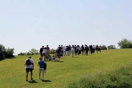
9 Timeline Areal Pictures Map Density 9


10 Image Project Area Alejandro Sosa Triester Straße Daniel Dutkowski Petersbach ChristophKirchberger 10
Construct Marktviertel, The Walk- and Rideable City, and Green NetWorks to show the potentials,")
11 2. OBJECTIVES FOR THE TRANSFORMATION Based on the following situation , participants of the sub>urban process developed four future stories: Think Big, (Re-)Construct Marktviertel, The Walk- and Rideable City, and Green NetWorks to show the potentials, opportunities and objectives The landing coordinates are entered. Silently we are on the descent. On the horizon, we see the skyscrapers of Vienna, in the west the Viennese Forests. In the east a huge lake, called Neusiedler See, reflects the sunlight. Through the windows of the Zeppelin, we recognize the interlocking of the green spaces and the settlement area, the old town centres and the new projects. Previously, the proximity between Vienna and Lower Austria was scarcely noticed, and this was perhaps also its luck. The area Siebenhirten-Vösendorf has become an unmistakable symbol of a new type of a growing urban region. There was space for social and structural future strategies. Together with the population and interwoven in an international network, answers to the pressing questions of the beginning 21st century were found. October 18, 2031, we land on time. When we leave the Zeppelin, we see... THINK BIG Think Big tells the story of the restructuring of the cooperation area Vösendorf - Wien- Siebenhirten. The story keeps an eye on the "big picture" and sets the foundations for future development. 11

12 Strengthen existing and create new platforms for dynamic-stable cooperation structures and mechanisms and strategic partnerships with the other communities Strengthen communication-platforms for private and public stakeholders Cooperative and coordinated planning for mobility and location planning for businesses, recreation, recreation etc. Identify and use potentials of high quality transformation areas, therefore create a urban concept for transformation sites (integration of development-relevant stakeholders, timing of development phases, consideration of regional interdependencies) (RE-)CONSTRUCT MARKTVIERTEL The Martkviertel Vösendorf is an outdated, car-orientated and low density commercial and shopping area. It is located very central in the project area, nearby are two stations of Badner Bahn and the Triester Straße. The high quality of connection and the vacant buildings make the Marktviertel a strategic important site. The story tells the change of the Marktviertel Vösendorf - from an auto-oriented retail location towards a vibrant, mixed-use district. Transformation to a mixed used neighbourhood by adding new uses (social infrastructure facilities and a needed school, ) Realise urban competitions and new procedures to guarantee good urban design architectural qualities Create quality of stay and attractive shopping Attractive, urban densities towards Triester Straße Excellent accessibility in the neighbourhood attractive green and public spaces 12

13 Path connections for pedestrians and cyclists, connection to the centre of Vösendorf Improvement of the public transport connection, upgrade Badner Bahn stations (comfort, Bike & Ride) THE WALK- AND RIDEABLE CITY The project area is highly car-dominated. It is marked by barriers and there is a significant lack of bicycle-lanes and infrastructure for pedestrians. With the Badner Bahn and the metro U6 there is a high potential for a shift of modal split towards sustainable forms of mobility. This future-story is about a fundamental change of the project area to a "sustainable mobility culture". Strengthen public transport, walking and cycling is recognized as a sustainable strategy - more environmentally friendly, more economical and socially acceptable. Improvement of public transport densification with mixed-use within walking distance improvement of the mode share, strengthening of environmental modes of transport; i.e. the stations become a multi-modal transport hubs upgrade of the tram Badner Bahn to a high performance tramway (increase in frequency and speed), upgrade of stations, and their surroundings improvement of accessibility to retail centres and workplaces for cyclists and pedestrians improvement of the public transport's east-west link 13

14 GREEN NETWORKS! The cooperation area has a variety of green and free space potentials, such as the areas of the former refinery, the Wienerberger Teich, the Kellerberg, the Petersbach, fallow land in the Marktviertel, accompanying green along the highways or the agricultural areas east of the expressway S1. The story tells us, how open space networks become a scaffold for the development of the locations in the project area. connecting local recreation areas and break spatial barriers opening of fallow lands for extensive recreational use Marktviertel is a mixed-used neighbourhood, pedestrian and cycling paths, and small parks contribute to the inhabitants' quality of life realising urban gardening projects and community gardens reclaiming qualities in the centre of Siebenhirten renaturation of the stream Petersbach and structuring of the waterfront preservation of ecologically valuable biotope structures, expansion and networking into a biotope network system 14
15 3. ACTION PLAN & TRANSFORMATION TIMELINE Based on the four basic stories the participants of the sub>urban process developed projects. The projects that had been recorded so far underwent a "reality check" and were reviewed with regard to their feasibility and their priority. Finally, further steps of selected projects were discussed in a "Project and Implementation Workshop" with potential implementers. In a final step five implementation projects were defined. 15
16 Story /Objective Project Description Leading Stakeholder Timescale THINK BIG Built up Cooperation platform Regional Cooperation Area Strengthen existing and create new platforms for cooperation in the Regional Cooperation Area Stadt-Umland- Management Vienna / Lower Austria Implementation Project Masterplan for development and The development and transformation transformation areas in the regional areas are set in relation within the cooperation area Vösendorf - Vienna-framework of a higher-level mission Siebenhirten statement in order to coordinate developments Municipality of Vösendorf mid-term City of Vienna Vision Boulevard Triester Straße Whithin a vision process, the way is being City of Vienna developed for a transformation from an Municipality - Urban "access road" to a regional boulevard. Development and Planning, Institutions of Lower Austria - Transport Planning Implementation Project Scenarios Refinery Site Identify possible usage scenarios for the old industrial location City of Vienna Implementation Municipality - Real Estate Project Management (RE-)CONSTRUCT MARKTVIERTEL VÖSENDORF Masterplan Marktviertel Vösendorf Development of an integrated concept for center development (mixed use), clarity on functions and timing as well as coordination of private and public investments Municipality of Vösendorf Implementation Project Open Space Concept Marktviertel Vösendorf The open space forms the framework for urban development in the Marktviertel Municipality of Vösendorf mid-term Mobility Concept Marktviertel Vösendorf Attractive pedestrian and cycle paths, parking space concept, attractive stops of the Badner Bahn lead to the "reversal of the modal split" in the direction of sustainable mobility Municipality of Vösendorf mid-term Implementation of a school location in the Marktviertel Vösendorf Creation of the required school location in cooperation of Lower Austria and Vienna Municipality of Vösendorf Institutions of Lower Austria -Schools (K4) City of Vienna Municipality MA56 Viennese Schools mid-term 16
17 WALK- AND RIDEABLE CITY Cross-Border Mobility Concept Concept for optimized content and timing of projects. It includes infrastructure measures for Institutions of Lower Austria - Transport mid-term cyclists and pedestrians, public transport, motor Planning vehicles and freight traffic City of Vienna Municipality MA46 Traffic Management and Organisation Mobility-Hub Trainstation Siebenhirten-Vösendorf Extension of the station to a multimodal transport hub City of Vienna Municipality long-term High-Performance Tram Badner Bahn Acceleration of the Badner Bahn and upgrading of the stations and surroundings Wiener Lokalbahnen AG (WLB) long-term High-level public transport connection Siebenhirten U6 and Marktviertel Creating an attractive East-West public transport VOR - East Region Public connection Transport Association mid-term GREEN NETWORKS Peterspark Development of a linear park along the Petersbach - renaturation, opening and design Petersbach- Wasserverband (Petersbach Water- Association) Implementation Project Regional recreational area Kellerberg-Wienerberger pond The connection of large open spaces to a landscape park of regional importance Stadt-Umland- Management Vienna / Lower Austria long-term Urban Design Concept Siebenhirten /Ketzergasse Upgrading of the public space and renewal of the City of Vienna Municipality buildings along the Ketzergasse - District Planning and Land Use mid-term Local Recreation at the former refinery site The open spaces are made accessible to the public for extensive use and district Vienna-Liesing Municipality of Vösendorf short-term 17
18 IMPLEMENTATION PROJECTS REGIONAL COOPERATION PLATFORM In the second phase of the sub>urban process, the ULG + (Urbact Local Support Group) developed the projects and implementation steps specified in the Integrated Action Plan (IAP). For the implementation process of the Action Plan, the members of the ULG + form implementation platforms. The Stadt-Umland-Management Vienna / Lower Austria (SUM) acts as an information hub for the implementation platforms and thus supports the "cooperation at eye level" between Vienna (district Liesing) and the municipality of Vösendorf. The SUM assumes responsibility - beyond the funding period of the Urbact program - to organize and bring to life the regional cooperation platform. VISION TRIESTER STRAßE The process "Vision Triester Straße" deals with the topics of mobility, urban development and renewal of urban development, open space networking, centre development. The local action group consists of the entrusted actors of the ULG + and is extended by representatives of the municipalities along the Triester Straße, private actors (landowners, users...) as well as representatives of relevant organizations. The group is tasked with the development of a common "Vision Triester Straße". On the basis of this vision, an action program is created in thematic workshops, with which the implementation steps are structured and private and public investments are coordinated. MASTERPLAN MARKTVIERTEL Supervised representatives of the ULG + as well as owners and (potential) users form the Local Action Group for the implementation of a dialogical-integrative master plan procedure "(Re-) Construct Marktviertel". In the process, framework conditions and development interests are coordinated and quality assurance instruments are defined for an implementation process. The master plan "(Re-) Construct Marktviertel Vösendorf" structures the transformation of the retail area into a mixed-use quarter. It includes a clarification of the functions as well as statements on the centre development, the activation of fallow land and under-used areas, public spaces and mobility, the revaluation of the entrance areas and the breaking down of existing barriers. The relation to Triester Straße and a possible school location in the Marktviertel are other important topics. URBAN CONCEPT EHEMALIGES RAFFINERIEGELÄNDE (FORMER REFINERY SITE) Concerning the former refinery site, many development-related issues remain unresolved, e.g. rehabilitation of the contaminated site, possible uses, density and efficiency of the Triester Straße, access possibilities, options for the future of the animal shelter, potentials of green networking. The planning process focuses on capturing the development intentions of the landowners, which provides for a definition of the framework conditions and utilization options for the development. Based on that, development scenarios are designed. PETERSPARK Along the stream Petersbach, a green and open space axis, the "Peterspark", should arise gradually and in a long-term perspective. The Local Action Group consists of the delegates of the 18
19 ULG + entrusted with the task, extended by representatives of the partner communities (along the stream) and experts in planning administration (MA 45 - Vienna Waterways, as owner along Ketzergasse, MA 42-Parks and Gardens, MA 49-Land and Forestry Operations). On the basis of a recording of the existing uses and potentials of the Petersbach and the adjoining areas, the development options for the subsections are shown. In a further step, quality standards are agreed and development options are identified for the individual subareas and implementation programs are drawn up. 19

20 4. MANAGEMENT & GOVERNANCE STRUCTURE FOR THE TRANSFORMATION PROCESS URBACT Local Group In the metropolitan region of Vienna, a large number of actors with different interests as well as several local authorities are required to work together on an integrated and sustainable development of the region. A common approach, regional objectives and regional investment are important. Resources have to be networked, jobs have to be distributed and settlement policy has to be structured. This requires close cooperation between politicians, administrators and civil society. In the project area Vösendorf - Wien-Siebenhirten, the forces of the growing metropolitan region and stakeholders interact with each other with their different objectives - framework conditions are constantly changing. The consequence is a high degree of complexity and dynamics - the cooperation area is therefore not "planable" in the classical sense. Further development of the area thus turns from a factual issue into a question of procedure. In further processes, cooperation links and reliable cooperation structures are necessary in order to be able to cope with future action requirements in the cooperation area. The Integrated Action Plan and the implementation strategy also react to this situation. It is about realizing robust objectives with flexible and open processes in order to be able to react to changing framework conditions. Existing cooperation will be further strengthened and new fields of cooperation will be created on the basis of "Local Action Groups". 20
21 The Vösendorf Siebenhirten Story describes the objectives of the development of the cooperation area. The Integrated Action Plan shows development options. For 16 priority projects, the Integrated Action Plan presents framework conditions, possible project partners and initial implementation steps. RESPONSIBILITIES In the "Project and Implementation Workshop", five projects for the first implementation phase of the LAP were discussed with the ULG +. These projects are in close interaction with other developments in the cooperation area and are seen as key projects and "door openers" of regional cooperation. Some of the described projects were not generated or designed in the sub>urban process. In many cases, they can be found in different forms in higher-level planning documents. As part of the sub>urban process, they were revisited, correlated and prioritized in dialogue with key actors for implementation. The premise for the realization of all these projects is a clearly defined regional political mandate. Beyond commitment, responsibility and leadership must be assumed. The present LAP should provide the basis for that. For the implementation projects, the existing ULG + will be adapted to the topic and through additional actors to "Local Action Groups". 21
22 5. GENERAL IDEA DEALING WITH THE TRANSFORMATION OF THE ENTIRE FRINGE IN THE FUTURE A REGIONAL COOPERATION AREA IS RISING Original text in german language by Paul Grohmann The fringe such as the area Vösendorf - Vienna-Siebenhirten have been increasingly in the focus of urban development lately. For a long time, they were perceived as transit spaces, such as the Triester Straße, or just for commercial purposes, such as the Marktviertel - with no other qualities that motivate to stay longer. The existing dwellings were only an insignificant part of a patchwork of different, random uses. The strong population growth in the city region and the far advanced suburbanisation processes, clearly visible at this border between the two provinces of Lower Austria and Vienna, now open up the opportunity to investigate the potential of this area. The location on the "fringe" can certainly be questioned. With the Badner Bahn, the underground line U6, the motorway junction and the Triester Straße, the area is very well developed and can be reached from the city centre of Vienna in an acceptable distance. It lies in the centre of the city region and at the intersection of European traffic routes. The municipal border is not visible with the naked eye. Nevertheless, the administrative dividing line goes right through the area. Due to the historically grown administrative structures, there is no regional planning competence for the metropolitan region Lower Austria and Vienna. It would greatly facilitate future cooperation. Since this is unlikely to change in the near future, projects such as sub>urban are a great opportunity to co-design a space so closely interwoven beyond the borders of the state or municipality. The potential for densification was also determined according to the current legal situation. Most areas have potential and space for vertical building. But how can this space be used in such a way that "densification" is not perceived as a threat? How can a moderate structural development increase the quality of life, enable "liveable" neighbourhoods with attractive, green public spaces and parks, and establish the area as a mixed-use residential location? How can the choice of transport in the vast suburban area be changed in favour of the environmental alliance? Such questions are at the centre of sub>urban and go beyond the project's end. The specific characteristics and identity of the area should be preserved and further developed. The time is now. The current overall strategies set a vision that focuses on the entire city-regional issue. The Urban Development Plan Vienna STEP 2025 defines Regional Cooperation Areas as an essential instrument of city-regional cooperation. The regional master plan for the district of Mödling defines target areas for integrated site and green planning in the Vösendorf-Siebenhirten area. And thanks to the binding organizational framework, international exchanges and financial support provided by URBACT III, it was possible to lay the foundations for a cooperation routine that will enable the implementation of the ideas developed in the project. 22
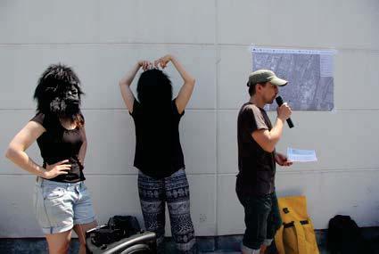
23 6. FURTHER INFORMATION Excursion TUVienna Excursion TuDelft Idea Competition Connection Competition winners Gorillas Process 23


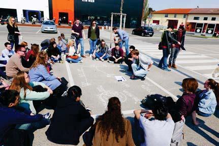
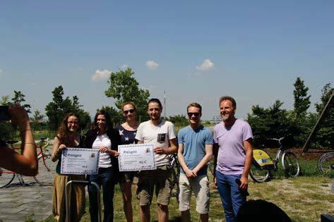
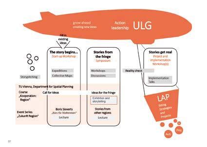
24 Movie, scan the QR-code to watch the movie. PLATFORM AND PROCESS ON THE WAY TO AN INTEGRATED ACTION PLAN The IAP is based on preparatory work for the first phase of the URBACT III project. The subjects were explored, the characteristics of the planning area were surveyed and important intervention areas were identified. The focus was on the possibilities of transformation and densification of commercial, mono-functional locations to mixed-use quarters. Planning beyond city borders requires sound communication structures for a sustainable implementation process. The second sub>urban phase pursued two goals. On the one hand, the gradual development of a broad, implementation-oriented Integrated Action Plan. On the other hand, the extension of the Urban Local Group (ULG) to a communication platform for the ongoing implementation processes. STUDENTS CAPTURE THE FRINGE The sub> urban project was carried out in cooperation with the Department of Regional Planning of the Technical University of Vienna, Department of Spatial Planning. As part of an elective module and a bachelor's seminar, students literally placed questions into urban landscape, interviewed people from the fringe, made a film out of it, lead their colleagues from Technical University of Delft through the project area and finally took part in an idea competition for the project area. Four innovative competition entries were chosen for a price by a sub>urban experts from partner cities. STORIES FROM THE FRINGE... At the beginning of phase 2, key actors were specifically targeted to pitch the "basic story" and motivate them to actively participate in the Integrated Action Plan. At the start-up-workshop The story begins..., in April 2017, potential intervention centres were researched and future stories were designed. At the symposium "Stories from the Fringe" the stories were enriched with projects. A two-day symposium Stories from the Fringe, on May 2017, served to enrich the developed future stories with project ideas. Priority projects were discussed in terms of objectives and implementation options, and in depth detailing was proposed. Partners of the sub>urban network made references to international best practice projects and were also part of the jury at the presentation of the students' ideas competition. 24
25 At the reality check Stories Get Real on , ULG+ chose from a large number of project ideas generated in the process, those with high implementation potential and high priority. In advance, the planning team had checked the project ideas for compatibility with the objectives of existing concepts and plans. At the Project and Implementation Workshop on in Vösendorf Castle (Municipal Office), the organizational timetable and the responsibilities for implementation were set out together. The selected projects represent the main contents of the Integrated Action Plan. 25
The Dreispitz in Basel / Switzerland: New economy on old sites
 The Dreispitz in Basel / Switzerland: New economy on old sites 1. Introduction At 50.000m 2 Dreispitz is currently the largest and most ambitious development project in Basel, the second biggest town in
Urban Development and Planning in Vienna
 Urban Development and Planning in Vienna Angelika Winkler Municipal Department for Urban Development and Planning Urban Development and Planning in Vienna April 2013 1 Vienna Key Facts and Figures federal
Fragmented competences, for example: spatial planning
 Fragmented competences, for example: spatial planning Republic / Federal Chancellery, Austrian Conference on Spatial Planning (ÖROK): Strategy Provinces (Bundesländer): Legislation, supervision monitoring
Integrated urban policies and land management The URBACT Experience Didier Vancutsem
 Integrated urban policies and land management The URBACT Experience Didier Vancutsem Didier Vancutsem URBACT Expert Prof Urban Planner ISOCARP Contents Integrated urban policies and land management: a
A Bilingual Cooperative Planning Process on the Swiss-French Border in the Basel Area
 A Bilingual Cooperative Planning Process on the Swiss-French Border in the Basel Area 1. Situation The city of Basel is located on the north-western edge of Switzerland. With the borders of France to the
Elodie Gonthier (Team leader) Kevin Ramirez Sandra Velasco Krishna Chandran Anna Aghvanyan Sirin Hamsho
 Kevin Ramirez Sandra Velasco Krishna Chandran Anna Aghvanyan Sirin Hamsho") 2 T he nature of today s global economy highlights our interdependence and the need for much better global policies. Inspiring Technovation is pleased to present its report on transforming the city of
2 T he nature of today s global economy highlights our interdependence and the need for much better global policies. Inspiring Technovation is pleased to present its report on transforming the city of
Implementation Guide Comprehensive Plan City of Allen
 Implementation Guide 2030 Comprehensive Plan City of Allen DRAFT 2015 Implementation Guide Allen 2030 Comprehensive Plan INTRODUCTION The Comprehensive Plan serves as a guide for the growth and development
ANNEX A CONCEPT FOR SUSTAINABLE URBAN MOBILITY PLANS. to the
 EUROPEAN COMMISSION Brussels, 17.12.2013 COM(2013) 913 final ANNEX 1 ANNEX A CONCEPT FOR SUSTAINABLE URBAN MOBILITY PLANS to the COMMUNICATION FROM THE COMMISSION TO THE EUROPEAN PARLIAMENT, THE COUNCIL,
Strasbourg SUMP Award: Finalist factsheet. Local Transport facts. Urban transport policy objectives of the city:
 Strasbourg 2013 SUMP Award: Finalist factsheet Local Transport facts Name of the authority: Urban Community of Strasbourg, FR Website: www.strasbourg.eu Contact: Maeva Moreau Telephone: +33 388436514 Email:
PART 5: DEVELOPMENT FRAMEWORK Figure 57: Proposed Height
 Figure 57: Proposed Height 103 Figure 58: Proposed Land Use 104 Figure 59: 3D Image of the Initial Height and Land Use in the Study Area 105 4.3.2 Landmarks and Nodes The growth of Sandton from an out
Recent UN and EU Sustainable Development Policies (Post 2015): What challenges for city planning and governance
: What challenges for city planning and governance") Recent UN and EU Sustainable Development Policies (Post 2015): What challenges for city planning and governance Europe at a crossroads: the challenge for future sustainable development 20 July 2016 Roudaina
Recent UN and EU Sustainable Development Policies (Post 2015): What challenges for city planning and governance Europe at a crossroads: the challenge for future sustainable development 20 July 2016 Roudaina
Remixing the (suburban) city institutional frame, strategies, projects in the Vienna Region. Metropolitan Area Management Vienna - Lower Austria
 city institutional frame, strategies, projects in the Vienna Region. Metropolitan Area Management Vienna - Lower Austria") Remixing the (suburban) city institutional frame, strategies, projects in the Vienna Region DI Andreas Hacker Schwartzstraße 50, 2500 Baden Tel.: 0043 (0)2252/9025-11637 Fax: 0043 (0)2252/9025-11645 Mobil:
Remixing the (suburban) city institutional frame, strategies, projects in the Vienna Region DI Andreas Hacker Schwartzstraße 50, 2500 Baden Tel.: 0043 (0)2252/9025-11637 Fax: 0043 (0)2252/9025-11645 Mobil:
SUMMARY. An Attractive, Competitive and Sustainable GREATER MONTREAL. Draft Metropolitan Land Use and Development Plan. April 2011
 April 2011 Draft Metropolitan Land Use and Development Plan GREATER MONTREAL An Attractive, Competitive and Sustainable SUMMARY Message from the Chair I am pleased to introduce this draft of the Metropolitan
Articulating planning, urban design and mobility policy
 Articulating planning, urban design and mobility policy 1 29 Km Presentation of the Greater Nantes - competences Inter-municipal cooperation body and urban transport organising authority created in 2001
The Five Components of the McLoughlin Area Plan
 The Five Components of the McLoughlin Area Plan This documents contains the complete language of the five components of the McLoughlin Area Plan: The Vision Statement The Values The Guiding Principles
K. SMART ASSOCIATES LIMITED
 Planning Justification Report Zoning By-Law Amendment 185 King Street North Waterloo, Ontario April 7th, 2017 Project Reference Number 16-245 K. SMART ASSOCIATES LIMITED CONSULTING ENGINEERS AND PLANNERS
Complete Neighbourhood Guidelines Review Tool
 Complete Neighbourhood Guidelines Review Tool Prepared By: City of Regina Planning Department October 2014 Page 1 of 14 Community Development Review Checklist for Secondary Plans and Concept Plans The
The Urban Development Network
 The Urban Development Network Workshop on Urban Development Strategies Budapest, Hungary 17 October 2017 Aalborg region and city City approx. 135.000 inhabitants Municipality: 212.000 Approx. 3.69% of
Implementing Sustainable Urban Mobility Plans (SUMP): Guidelines and Best Practice from around Europe
: Guidelines and Best Practice from around Europe") Implementing Sustainable Urban Mobility Plans (SUMP): Guidelines and Best Practice from around Europe Awareness raising Workshop, Riga, 27 January 2012 Lauri Johannes Hooli Project Coordinator, Union of
Implementing Sustainable Urban Mobility Plans (SUMP): Guidelines and Best Practice from around Europe Awareness raising Workshop, Riga, 27 January 2012 Lauri Johannes Hooli Project Coordinator, Union of
CHAPTER 7: Transportation, Mobility and Circulation
 AGLE AREA COMMUNITY Plan CHAPTER 7 CHAPTER 7: Transportation, Mobility and Circulation Transportation, Mobility and Circulation The purpose of the Transportation, Mobility and Circulation Chapter is to
SUSTAINABLE URBAN MOBILITY PLAN TRAINING WORKSHOP. Module 1 Concept & Approach
 SUSTAINABLE URBAN MOBILITY PLAN TRAINING WORKSHOP Module 1 Concept & Approach Sustainable Urban Mobility Plans: What is a SUMP? Definition of Sustainable Urban Mobility Plan (SUMP): A Sustainable Urban
Case Study Berlin. Abstract. WP 3 Urban Development
 Case Study Berlin Abstract WP 3 Urban Development Table of Contents Situation of the Area in the early 1990ies... 2 Needs for Action in the early 1990ies... 3 Integrated Development Concepts of the past
Robbinsdale LRT Station. CDI Development Guidelines. August Overview
 Robbinsdale LRT Station August 2018 Overview The City of Robbinsdale may have the coolest opportunity site along the 13 mile stretch of the Bottineau LRT corridor / Blue Line extension. Located a block
NEW VISIONS OF URBAN POLITICS MEDIUM-SIZED EUROPEAN CITIES IN THE 21 ST CENTURY MAY 14-16, 2014, OLOMOUC, CZECH REPUBLIC
 NEW VISIONS OF URBAN POLITICS MEDIUM-SIZED EUROPEAN CITIES IN THE 21 ST CENTURY MAY 14-16, 2014, OLOMOUC, CZECH REPUBLIC The Green City as Model for Cities in CEE? Sustainable urban development strategies
Corridor Vision. 1Pursue Minnehaha-Hiawatha Community Works Project. Mission of Hennepin County Community Works Program
 1Pursue Minnehaha-Hiawatha Community Works Project Minnehaha-Hiawatha Community Works is a project within the Hennepin Community Works (HCW) program. The mission of the HCW program is to enhance how the
Urban Growth Management in Seven New World cities: Aligning visions and quality neighbourhood outcomes
 Urban Growth Management in Seven New World cities: Aligning visions and quality neighbourhood outcomes New Zealand Centre for Sustainable Cities 14 August 2013 Errol Haarhoff & Lee Beattie School of Architecture
«Corridor» designs in town planning : Sustainable planning for large cities in developed countries
 CODATU XIII «Corridor» designs in town planning : Sustainable planning for large cities in developed countries Challenges of implementation in booming cities in emerging and developing countries Lyon Town
JOINT DECLARATION BETWEEN THE EUROPEAN UNION AND THE REPUBLIC OF INDIA ON A PARTNERSHIP FOR SMART & SUSTAINABLE URBANISATION. New Delhi, 6 Oct 2017
 JOINT DECLARATION BETWEEN THE EUROPEAN UNION AND THE REPUBLIC OF INDIA ON A PARTNERSHIP FOR SMART & SUSTAINABLE URBANISATION New Delhi, 6 Oct 2017 The Republic of India and the European Union, CONSIDERING
Fossumdumpa Stovner, Oslo
 Fossumdumpa Stovner, Oslo The site is part of a larger area of 25.000 sqm called Fossumdumpa, which is located in the center of Stovner district and situated in the Grorud Valley in the eastern part of
AT A GLANCE... Our People, Culture & Place. A plan to sustain Ballarat s heritage (final draft)
") AT A GLANCE... Our People, Culture & Place A plan to sustain Ballarat s heritage 2017-2030 (final draft) Image: Lydiard Street, Ballarat, c1875-1938, John Henry Harvey collection, La Trobe Picture Collection,
AT A GLANCE... Our People, Culture & Place A plan to sustain Ballarat s heritage 2017-2030 (final draft) Image: Lydiard Street, Ballarat, c1875-1938, John Henry Harvey collection, La Trobe Picture Collection,
Inspiring Technovation
 1 2 Table of content List of table and figures... Executive summary... 1. Introduction... 2. Material and methods... 3. Results... 3.1 Today s facts about Versailles: a diagnostic approach... 3.1 Vision
Regional Context Statement
 Regional Context Statement REGIONAL CONTEXT STATEMENT 3. REGIONAL CONTEXT STATEMENT In 1995, the Provincial Government passed into law the Growth Strategies Act. The purpose of this provincial initiative
Plano Tomorrow Vision and Policies
 Plano Tomorrow Vision and Policies PLANO TOMORROW PILLARS The Built Environment The Social Environment The Natural Environment The Economic Environment Land Use and Urban Design Transportation Housing
PSRC REVIEW REPORT & CERTIFICATION RECOMMENDATION
 PSRC REVIEW REPORT & CERTIFICATION RECOMMENDATION KITSAP COUNTY COUNTYWIDE PLANNING POLICIES July 2, 2012 BACKGROUND A major emphasis of the Washington State Growth Management Act (GMA) is the need to
REVIEW AND EVALUATION OF REGIONAL LAND USE
 REVIEW AND EVALUATION OF REGIONAL LAND USE AND TRANSPORTATION SCENARIOS #220831 Environmental Justice Task Force October 7, 2014 VISION 2050 Process Development of Guiding Vision for Land Use and Transportation
Urban dimension of future cohesion policy
 Urban dimension of future cohesion policy Christian Svanfeldt European Commission Directorate-General for Regional and Inclusive growth, Urban and territorial development Brussels 10 June 2013 Regional
Growth Management Planning in the Central Puget Sound Region. Today s Presentation. Puget Sound Region. New Partners for Smart Growth
 Growth Management Planning in the Central Puget Sound Region New Partners for Smart Growth Denver, CO January 2006 Today s Presentation Regional growth management in central Puget Sound, WA Regional geographies
SUBJECT: Waterfront Hotel Planning Study Update TO: Planning and Development Committee FROM: Department of City Building. Recommendation: Purpose:
 Page 1 of Report PB-23-18 SUBJECT: Waterfront Hotel Planning Study Update TO: Planning and Development Committee FROM: Department of City Building Report Number: PB-23-18 Wards Affected: 2 File Numbers:
City Introduction & Context
 City Introduction & Context Indicator Units Year of data Population 547733 Inhabitants 2011 Area 84.9 km 2 2014 Population Density 5090 Inh/km 2 2014 GDP 22800 /Capita 2014 Köppen climate classification
Official Plan Review
 Official Plan Review Summary Report - The Built Environment August 2014 Part 1: Introduction Planning for a healthy, prosperous and sustainable community is an important goal for our municipality. From
Urban planning and Public Transport
 Urban planning and Public Transport MOJCA SASEK DIVJAK Urban Planning Institute of the Republic of Slovenia Trnovski pristan 2, 1000 Ljubljana SLOVENIA e-mail: mojca.sasek@uirs.si; http://www.uirs.si Abstract:
Cooperative Research in Water Management
 Proceedings of the 8 th International Conference on Applied Informatics Eger, Hungary, January 27 30, 2010. Vol. 1. pp. 273 281. Cooperative Research in Water Management Margit Horosz-Gulyás, Katalin Katonáné
SECTION ONE: INTRODUCTION. introduction
 introduction 1 INTRODUCTION Since it was first established in 1843 as a trading post for the Hudson s Bay Company, Victoria has evolved into a Provincial capital city that is recognized across Canada and
North Fair Oaks Community Plan Summary and Information
 North Fair Oaks Community Plan Summary and Information WHAT IS THE NORTH FAIR OAKS COMMUNITY PLAN? The North Fair Oaks Community Plan is part of the San Mateo County General Plan, and establishes policies
Sacramento Area Council of Governments (SACOG)
") Sacramento Area Council of Governments (SACOG) The Blueprint Vision The SACOG Board of Directors adopted the Preferred Blueprint Scenario in December 2004, a bold vision for growth that promotes compact,
Sacramento Area Council of Governments (SACOG) The Blueprint Vision The SACOG Board of Directors adopted the Preferred Blueprint Scenario in December 2004, a bold vision for growth that promotes compact,
Heritage Master Plan. A new participative planning instrument for heritage and landscape in Flanders
 Heritage Master Plan A new participative planning instrument for heritage and landscape in Flanders Nineteenth Council of Europe Meeting of the Workshops for the Implementation of the European Landscape
Rio de Janeiro - Brazil. Urban Regeneration & Climate Change
 Rio de Janeiro - Brazil Urban Regeneration & Climate Change 2017 Rio de Janeiro - Brazil introduction slide 1 BRASIL 204.5 million inhabitants RIO DE JANEIRO STATE 16.5 million inhabitants RIO DE JANEIRO
25th November Final statement by the ministers in charge of urban development
 11 25th November 2008 Final statement by the ministers in charge of urban development EU urban development ministers met in Marseille on 25 November 2008 at the invitation of the French Presidency of the
Alpine Green Infrastructure Joining forces for nature, people and the economy
 Alpine Green Infrastructure Joining forces for nature, people and the economy Joint declaration of Alpine States and Regions Munich, October 2, 2017 The project is co-financed by the European Regional
Excellencies, Dear colleagues from other agencies and organizations, Ladies and Gentlemen,
 Address by Dr Mechtild Rossler Deputy Director of UNESCO s World Heritage Centre The UNESCO Recommendation on the Historic Urban Landscape on the occasion of the European Heritage Heads Forum Leuven, Belgium,
Context Integrated Infrastructure Planning. Key to attractive and competitive urban regions. POLIS Conference Urban Mobility in Transition
 18-11-2016 Integrated Infrastructure Planning Key to attractive and competitive urban regions POLIS Conference Urban Mobility in Transition Rotterdam, 1 December 2016 Raymond Linssen, The Netherlands Context
1Planning. Approach. Part I Chapter 1: Planning Approach
 1Planning Approach Part I Chapter 1: Planning Approach 1 Planning Approach page 5 1Planning Approach The preparation of the Master Plan constitutes a unique opportunity to reflect collectively on the
Welcome to the Oakridge Centre Open House
 Welcome to the Oakridge Centre Open House Why is the City hosting this event? This open house is to inform you of a rezoning application submitted to the City of Vancouver to amend the existing CD-1 (Comprehensive
Graduate-Level Course List
 CRPLAN 5001 - Introduction to GIS (4) Introduction to the basic principles of geographic information systems and their use in spatial analysis and information management. Prereq: Sr or Grad standing. Not
CITY CLERK. Parkland Acquisition Strategic Directions Report (All Wards)
") CITY CLERK Clause embodied in Report No. 10 of the, as adopted by the Council of the City of Toronto at its meeting held on November 6, 7 and 8, 2001. 10 Parkland Acquisition Strategic Directions Report
CITY CLERK Clause embodied in Report No. 10 of the, as adopted by the Council of the City of Toronto at its meeting held on November 6, 7 and 8, 2001. 10 Parkland Acquisition Strategic Directions Report
ROBBINSDALE LRT STATION CDI DEVELOPMENT GUIDELINES
 August 2018 OVERVIEW The City of Robbinsdale has a prime-opportunity site in the middle of the 13 mile stretch of the Bottineau LRT corridor / Blue Line extension. Robbinsdale offers a prominent, vital,
Important note To cite this publication, please use the final published version (if applicable). Please check the document version above.
. Please check the document version above.") Delft University of Technology Design Research on the City of the Future Cavallo, Roberto; Kuijper, Joran Publication date 2018 Document Version Final published version Published in City of the Future
Delft University of Technology Design Research on the City of the Future Cavallo, Roberto; Kuijper, Joran Publication date 2018 Document Version Final published version Published in City of the Future
Port Credit Local Advisory Panel October 20 th Meeting
 Port Credit Local Advisory Panel October 20 th Meeting Focus Of This Evening s Meeting: 1. Hurontario Main Street Higher Order Transit Study 2. Port Credit Mobility Hub & GO Station Parking Structure Study
SUSTAINABLE TRANSPORT & INTEGRATED LAND USE PLANNING
 SUSTAINABLE TRANSPORT & INTEGRATED LAND USE PLANNING UNESCAP Capacity Building Workshop, Colombo Integrated Land use and Urban Transport Planning : Principles and Practices 31st October 2017 ACTIVE TRANSPORTATION
Taking forward the All London Green Grid
 Taking forward the All London Green Grid Foreword Earlier this year, the Mayor published the All London Green Grid Supplementary Planning Guidance to the London Plan which set the vision, and framework,
Newcourt Masterplan. November Exeter Local Development Framework
 Newcourt Masterplan November 2010 Exeter Local Development Framework Background The Exeter Core Strategy Proposed Submission sets out the vision, objectives and strategy for the development of Exeter up
1 Introduction. Chapter. In this chapter:
 Chapter 1 Introduction In this chapter: 1.1 A Snapshot of the Region 1.2 Towards a Sustainable Region 1.3 The Provincial Context 1.4 Purpose and Organization The Regional Municipality of York Official
Results and Expectations of the Megacity Project LiWa
 Presentation Results and Expectations of the Megacity Project LiWa Innovative Urban Planning Aspects - Context and Special Significance of Water Issues Dr.-Ing. Irene Wiese-von Ofen Member of the BMBF
iii. Visioning framework
 III. VISION iii. Visioning framework III.1 Overview A vision is a clear and succinct description of what an institution and its community should look like after it successfully implements its goals and
CDAC. Update: Downtown Dartmouth Update: CDAC July 25 th Motion
 CDAC Update: Downtown Dartmouth Update: CDAC July 25 th Motion 2018-10-24 Downtown Dartmouth Plan Open House October 22, 2018 6:00 pm Open House 6:30 pm Presentation + Q&A 7:20 pm Open House 8:30 pm Close
Chapter 2: Vision, Goals and Strategies
 Chapter 2: Vision, Goals and Lake Elmo Today & Tomorrow Comprehensive Plan 2040 2 VISION, GOALS & STRATEGIES - DRAFT 4-6-2018 INTRODUCTION Comprehensive Plan Purpose Perhapse the most important objective
Chapter 1: Introduction
 Chapter 1: Introduction The Penn Avenue Community Works Corridor Vision and Implementation Framework presents an integrated communitybased vision and a coordinated, long-term implementation framework for
Sustainable Growth. Sustainable Growth
 2 Sustainable Growth Sustainable Growth SUSTAINABLE GROWTH 2.1 COMMUNITY VISION... 2-5 2.2 THE CITY SYSTEM... 2-7 2.2.1 AREAS... 2-7 2.2.2 CITY-WIDE SYSTEMS... 2-8 2.2.3 PROVINCIAL PLAN BOUNDARIES AND
Vancouver. Title of the Initiative. Initiative Duration. Submitted by. Comments by the Jury
 134 Vancouver Title of the Initiative Initiative Duration Submitted by Comments by the Jury Visionary Vancouver: Creating a Welcoming and Sustainable Place for All 2009-2020 Wendy Au, Deputy City Manager,
Streets for People, Place-Making and Prosperity. #TOcompletestreets
 COMPLETE STREETS FOR TORONTO Streets for People, Place-Making and Prosperity COMPLETE STREETS: A NEW APPROACH A Complete Streets design approach considers the needs of all users people who walk, bicycle,
City Development Projects in Graz
 CIVITAS Open Eyes Open Mind Open Space 12. März 2014, Graz City Development Projects in Graz DI Mag. Bertram Werle Executive Directorate for Urban Planning, Development and Construction Stadt Graz Graz-Rathaus
City of Heath. Town Center Concept
 In the give-and-take of getting projects designed, financed, and approved, the famous refrain from the film Field of Dreams is heard often: if you build it, they will come. From the perspective of the
RIGA LATVIA. KEY FEATURES OF THE CITY Demographic Facts. Urban Figures. Heritage. EXISTING GOVERNANCE MECHANISMS Development and Management Plans
 RIGA LATVIA KEY FEATURES OF THE CITY Demographic Facts around 700.000 inhabitants in the city 1.15 million people in the Riga region Urban Figures the medieval core of the Old Town the 19th century grid
CHAPTER 3 VISION, GOALS, & PLANNING PRINCIPLES. City of Greensburg Comprehensive Plan. Introduction. Vision Statement. Growth Management Goals.
 CHAPTER 3 VISION, GOALS, & PLANNING PRINCIPLES Introduction The Greensburg Comprehensive Plan is intended as a working community document. A combination of long and short-term goals, this document is intended
Scottish Natural Heritage. Better places for people and nature
 Scottish Natural Heritage Better places for people and nature Contents Summary... 3 SNH approach... 5 Place-making in policy and practice... 6 Developing the contribution of the natural heritage to place-making...
Town of Cobourg Heritage Master Plan. Statutory Public Meeting
 Town of Cobourg Heritage Master Plan Statutory Public Meeting April 25 th 2016 Presentation Overview 1. Introduction 2. Project background and schedule overview 3. Review of strategic direction content
PLAN ELEMENTS WORKSHOP. April 5, 2016
 PLAN ELEMENTS WORKSHOP April 5, 2016 needs more housing. But there is no one-size fits-all solution. Every neighborhood has its own character. In some places, density is not only appropriate it is badly
SOUTH AFRICA S PREPARATIONS FOR HABITAT III COMMON AFRICAN POSITION FOR HABITAT III. Habitat III Urban Breakfast 5 October 2016
 SOUTH AFRICA S PREPARATIONS FOR HABITAT III COMMON AFRICAN POSITION FOR HABITAT III Habitat III Urban Breakfast 5 October 2016 Context and Background 1. Africa intends actively shaping the New Urban Agenda,
1 October Dear Citizens of Charlotte and Mecklenburg County,
 1 October 2011 Dear Citizens of Charlotte and Mecklenburg County, As co-chairs of the Center City 2020 Vision Plan Steering Committee, we are proud to present the Center City 2020 Vision Plan, which sets
A. WHAT IS A GENERAL PLAN?
 I. Introduction A. WHAT IS A GENERAL PLAN? A general plan is the planning guideline for the future of a city. It contains goals and policies which regulate urban development, the protection of the natural
Sustainable Urban Mobility Plans. a concept to create liveable cities
 1 st European Conference on Sustainable Urban Mobility Plans Sopot, Poland, June 12&13, 2014 Sustainable Urban Mobility Plans a concept to create liveable cities Dr. Susanne Böhler-Baedeker Rupprecht Consult
Dresden s SUMP with broad citizen participation in the Dresden Debate
 Dresden s SUMP with broad citizen participation in the Dresden Debate 2014 Annual Polis Conference 27 28 November 2014, Madrid Kerstin Burggraf, Urban planning office Topics Something about Dresden Dresden
UNECE Committee on Housing and Land Management activities on urban development
 UNECE Committee on Housing and Land Management activities on urban development GULNARA ROLL, UN ECONOMIC COMMISSION FOR EUROPE HOUSING AND LAND MANAGEMENT UNIT Areas of work Sustainable Housing and Real
1. Introduction to Linköping
 INTERREG IVC - Project "Hybrid Parks" Partner 5: Linköping Municipality Environment and Community Development Department Situation Report, April 2012 1. Introduction to Linköping Linköping is Sweden s
SUSTAINABLE URBAN DEVELOPMENT AND COHESION POLICY EUROPEAN COMMISSION. Urban Policy within the framework of EU Cohesion Policy
 Urban Policy within the framework of EU Cohesion Policy 2007-2013 16/09/2007 SUSTAINABLE URBAN DEVELOPMENT AND COHESION POLICY 2007-2013 Marco Orani European Commission Directorate General for 1 SUSTAINABLE
8.0 Design and Form of Development 43/
 42/ 8.0 Design and Form of Development 43/ Rothwells Farm, Golborne/ Development Statement Figure 7. Site Constraints Key 44/ Site Boundary 360 Bus Route/Stops Existing Trees Underground Water Pipe Sensitive
Good education Good living Green future
 D66 Groningen - english summary of the election programme - 2018-2022 Good education Good living Green future Together we make Groningen Highlights 2 Groningen has many things to offer: a vibrant cultural
Summary of the world café
 Talking about things that matter to L Aquila Invitation to a discussion about the future of L Aquila (world café) 6 July 2012, School Dante Alighieri, L Aquila Context Summary of the world café The OECD
BETTER PUBLIC TRANSPORT PROJECT WATERBEACH TO SCIENCE PARK AND EAST CAMBRIDGE CORRIDORS
 Report To: Greater Cambridge Partnership Joint Assembly 20 th September 2018 Lead Officer: Peter Blake GCP Director of Transport BETTER PUBLIC TRANSPORT PROJECT WATERBEACH TO SCIENCE PARK AND EAST CAMBRIDGE
Former Rockcliffe Airbase Community Design Plan Guiding Design Vision and Principles December 4, 2013
 APPENDIX 5 - Guiding Design Vision and Principles Former Rockcliffe Airbase Community Design Plan Guiding Design Vision and Principles December 4, 2013 Vision Statement The redevelopment of the former
38 Queen s University Campus Master Plan Part 1
 38 Queen s University Campus Master Plan Part 1 46 The Campus at the City Scale Chapter 4 The Campus at the City Scale 39 Queen s is an urban University centrally located in Kingston. Decisions made by
WELCOME and introduction
 1 WELCOME and introduction Mobility Hub Locations within Burlington STUDY OVERVIEW STUDY OBJECTIVES The City of Burlington is developing four Area Specific Plans, one for each of Burlington s Mobility
CITY COUNCIL AGENDA REPORT
 CITY COUNCIL AGENDA REPORT Subject: COUNCIL MOTION LRT ALIGNMENT REMOVAL FROM THE TRANSPORTATION MASTER PLAN On February 10, 2016 Councillor Hughes provided notice in accordance with Section 23 of Procedure
CHAPTER 7: VISION AND ACTION STATEMENTS. Noble 2025 Vision Statement
 CHAPTER 7: VISION AND ACTION STATEMENTS This chapter presents the vision, policy and action statements that transform the comprehensive planning study, an analysis of Noble s past, future trends and community
NORTHERN LANDS NORTHERN LEADERSHIP
 NORTHERN LANDS NORTHERN LEADERSHIP The GNWT Land Use and Sustainability Framework Our Lands, Our Interests, Our Future ii Land is Life MESSAGE FROM THE PREMIER Land is life. It is the link to our past.
CONTENTS 2.0 A FRAMEWORK FOR SUSTAINABLE GROWTH 2.1 MANAGING SUSTAINABLE GROWTH THE VISION TO GOALS AND OBJECTIVES 2.3 MARKHAM STRUCTURE
 2 A Framework for Sustainable Growth 2.0 A FRAMEWORK FOR SUSTAINABLE GROWTH CONTENTS 2.1 MANAGING SUSTAINABLE GROWTH THE VISION TO 2031 2.2 GOALS AND OBJECTIVES 2.2.1 Protecting the Natural Environment
or there is no smart city without smart citizen
 or there is no smart city without smart citizen Thomas Madreiter, Director of Planning City of Vienna Meeting the Urbanization Challenge Smart City Solutions from Austria and California October 11, 2013
4 Sustainability and Growth Management
 4 Sustainability and Growth Management Introduction Traditionally, has assumed growth and development with limited consideration for the long-term negative social, environmental or economic impacts on
CHAPTER 8 ISSUES, CONCERNS, CONSTRAINTS AND OPPORTUNITIES
 CHAPTER 8 ISSUES, CONCERNS, CONSTRAINTS AND OPPORTUNITIES Introduction This River Conservation Plan was developed during a time of tremendous activity and effort in planning the transformation of the Delaware
ELMVALE ACRES SHOPPING CENTRE MASTER PLAN
 ELMVALE ACRES SHOPPING CENTRE MASTER PLAN Contents 1.0 INTRODUCTION... 2 2.0 LOCATION... 2 3.0 EXISTING CONTEXT... 2 4.0 VISION & GUIDING PRINCIPLES... 2 5.0 LAND USE AND BUILT FORM... 4 5.1 St. Laurent