HERITAGE CONSERVATION STRATEGY REPORT VISION GEORGETOWN SECONDARY PLAN PHASE 3 TOWN OF HALTON HILLS REGIONAL MUNICIPALITY OF HALTON, ONTARIO
|
|
|
- Chastity Harris
- 5 years ago
- Views:
Transcription
1 HERITAGE CONSERVATION STRATEGY REPORT VISION GEORGETOWN SECONDARY PLAN PHASE 3 TOWN OF HALTON HILLS REGIONAL MUNICIPALITY OF HALTON, ONTARIO February 2018 Revised May 2018 Prepared for: Meridian Planning Consultants Prepared by: In Association with: Wayne Morgan Heritage Planner
2 HERITAGE CONSERVATION STRATEGY REPORT VISION GEORGETOWN SECONDARY PLAN PHASE 3 TOWN OF HALTON HILLS REGIONAL MUNICIPALITY OF HALTON, ONTARIO February 2018 Revised May 2018 Prepared for: Meridian Planning Consultants 9100 Jane Street, Suite 208 Vaughan ON L4K 0A4 Prepared by: Underman McPhail Associates Heritage Resource Management Consultants 540 Runnymede Road Toronto, Ontario, M6S 2Z7 Tel: In Association with: Wayne Morgan Heritage Planner
3 TABLE OF CONTENTS Executive Summary 1.0 INTRODUCTION Project Description Methodology HISTORICAL SUMMARY OF STUDY AREA Esquesing Township Stewarttown Ashgrove MUNICIPAL PLANNING The Planning Act and the Provincial Policy Statement (2014) Ontario Heritage Act (OHA) and the Ministry of Tourism, Culture and Sport (MTCS) Places to Grow Growth Plan for the Greater Golden Horseshoe Halton Region Official Plan Halton Hills Official Plan Southwest Georgetown Secondary Plan DESCRIPTION OF EXISTING CONDITIONS: CULTURAL HERITAGE RESOURCES Introduction Description of the Existing Environment Description of Identified Cultural Heritage Resources ASSESSMENT OF POTENTIAL EFFECTS OF THE PROPOSED DEVELOPMENT ON CULTURAL HERITAGE RESOURCES Introduction Potential Impacts Within the Study Area Direct Impacts Indirect Impacts Potential Impacts Adjacent Properties Direct Impacts Indirect Impacts CONSERVATION RECOMMENDATIONS Introduction Conservation Recommendations 35 SOURCES APPENDIX: Historical Maps
4 LIST OF TABLES Table 1. Identified Cultural Heritage Landscapes (CHL) and Built Heritage Resources (BHR) located within or adjacent to the Vision Georgetown Project Study Area, Phase Table 2. Potential Impacts and Conservation Recommendations 37 LIST OF FIGURES Figure 1. Figure 2. Figure 3. Figure 4. Figure 5. This aerial map shows the study area for the Vision Georgetown Secondary Plan, Phase 3 [As adapted, Town of Halton Hills, 2012]. 2 Halton Hills Official Plan Land Use Designations for the Vision Georgetown Study Area]. 13 Vision Georgetown Secondary Plan. Draft Preferred Land Use Concept [November 2017]. 14 The general location of the identified cultural heritage resources are represented by site number, resource type and a red rectangle [ Halton Hills Maplinks]. 18 The general location identified cultural heritage resources are located on the Draft Preferred Land Use Concept Plan [November 2017]. 30
5 5 Executive Summary The study area for the, encompasses Lots 11 to 15 in the Eighth Concession in the Town of Halton Hills, an area immediately southwest of the community of Georgetown. The historical development of the study area, within the context of the 19 th and 20 th century agricultural development of Esquesing Township is contained in Section 2.0 of this report. Section 3.0 includes heritage policies affecting municipal planning and consulted for this study. Generally these policies require the conservation of heritage resources in the development of the study area and consideration of impacts on heritage resources adjacent to the study area. A Draft Preferred Land Use Concept Plan (November 29, 2017) was used to assess potential impacts to identified cultural heritage resources within and adjacent to the study area. Section 4 identifies thirteen (13) cultural heritage resources, seven (7) in the study area and six (6) on adjacent lands and describes each resource in Table 1. Section 5.0 identifies potential adverse impacts to the identified cultural heritage resources. Section 6.0 contains the following conservation recommendations. o o o o o o o o o Appropriate Land Use Policies in the planning process should be applied to conserve identified cultural heritage resources. As well, all identified cultural heritage resources within the study area will be mapped on the final Vision Georgetown Secondary Plan, Preferred Land Use Concept Plan. The preferred conservation measure is the retention in-situ of all identified cultural heritage resources identified on the Draft Preferred Land Use Concept Plan. The building condition of all identified built heritage resources should be monitored regularly as a protective measure to ensure their retention. A heritage evaluation of all identified non-listed and listed cultural heritage resources using the Town of Halton Hills approved process shall be undertaken. If the evaluation recommends listing or municipal designation under Part IV of the OHA, the Town shall consider this action to protect the heritage resource. The Town of Halton Hills indicates a CHIS, as provided in F5.1.2 of the Town s Official Plan, will be required as part of the development proposal process for all cultural heritage resources identified within and adjacent to the study area. This action should be undertaken during the next stage in the planning approval process. If retention of an identified cultural heritage resource in-situ is not considered to be feasible as a conservation approach, and relocation is proposed, the preferred conservation option is to relocate the resource within the same property. If this is not possible, it should be relocated to a property in proximity to its original site. If a built heritage resource is to be relocated, the Town of Halton Hills notes a CHIS should include, as the CHDR, documentation of the built heritage resource and its original cultural heritage landscape. If an identified cultural heritage resource is to be demolished, a salvage list of building materials should be considered in consultation with the Town of Halton Hills. An arborist report should be completed with regard to the assessment of the trees and hedgerows in the existing landscape where deemed necessary. Site specific conservation measure recommendations for each identified cultural heritage site are provided in Table 2: Potential Impacts and Conservation Recommendations.
6 1 1.0 INTRODUCTION 1.1 Project Description Meridian Planning Consultants, Project Managers for the Vision Georgetown Secondary Plan, retained, on behalf of the Town of Halton Hills, Unterman McPhail Associates, Heritage Resource Management Consultants, to undertake a Heritage Conservation Strategy Report for cultural heritage landscapes and built heritage resources. The Vision Georgetown Secondary Plan for the Town of Halton Hills is being undertaken in five phases. This report contributes to Phase 3 of the project. In February 2014, Unterman McPhail Associates completed the document Existing Conditions Report, Cultural Heritage Resources, Vision Georgetown Project, Town of Halton Halls, Regional Municipality of Halton, Ontario as part of this project. In April of 2014, three land use concepts were prepared for Vision Georgetown and stakeholder engagement was undertaken to obtain comments on the concepts. Report PDS provided an overview of the consultation undertaken to obtain comments on the three land use concepts and the input from the stakeholder consultation was considered in order to undertake environmental studies to delineate the natural heritage system, undertake further study on the major road network and commercial needs for Vision Georgetown and to review best practices from other municipalities. An annotated aerial photograph of the project study area is included in this report as Figure Methodology The principal objectives of this Phase 3 Heritage Conservation Strategy Report for cultural heritage landscapes and built heritage resources are: o to understand the development of the study area through historical research and a review of historical mapping; o to conduct a survey to update to current conditions of identified cultural heritage landscapes and built heritage resources found within and adjacent to the study area; o to identify sensitivities for change; o to provide an assessment of potential impacts to those cultural heritage resources identified in the study areas being potentially of cultural heritage value or interest to the Town of Halton Hills; and o to make general conservation recommendations for affected built heritage resources and cultural heritage landscapes with respect to the proposed Vision Georgetown Secondary Plan.

7 Heritage Conservation Strategy Report 2 Figure 1. This aerial map shows the study area for the [As adapted, Town of Halton Hills, 2012]. Unterman McPhail Associates Heritage Resource Consultants February 2018 Revised May 2018 Wayne Morgan Heritage Planner
8 3 Heritage policies affecting municipal planning including the Planning Act, the Provincial Policy Statement and the Ministry of Tourism, Culture and Sport (MTCS), Ontario Heritage Tool Kit, the Ontario Heritage Act, the Growth Plan for the Greater Golden Horseshoe and Official Plans of Halton Region and the Town of Halton Hills were consulted for this study. 2.0 HISTORICAL SUMMARY OF STUDY AREA The following historical summary of the study area relies on information from the report, Existing Conditions Report, Cultural Heritage Resources, Vision Georgetown Project, Town of Halton Halls, Regional Municipality of Halton, Ontario (February 2014). 2.1 Esquesing Township Charles Kennedy and Richard Bristol conducted the first survey of Esquesing Township in The survey was organized into a grid pattern of 11 concessions with 32 lots each. 1 Originally part of the Gore District, which included the area that became Halton and Wentworth Counties, Esquesing Township was established in 1816 as part of the area encompassing the future Halton County. In 1853, Halton County separated with Wentworth and received full municipal and judicial powers on January 1, It included the townships of Trafalgar, Nelson, Nassagaweya and Esquesing. 2 In 1819, James Hume and Ronald MacDonald arrived in Esquesing Township as its first settlers. The village of Esquesing (renamed Stewarttown in 1849) was founded in 1819 on Credit River at the Seventh Concession (Trafalgar Road). Other early township settlements included, amongst others, Georgetown founded in 1823, Dansville, renamed Acton in 1844, and the hamlet of Ashgrove at the intersection of Seventh Line (Trafalgar Road) and 10 Side Road around Georgetown, located on the Credit River, became the site in 1888 of first paper mill in Canada to use hydroelectric power. Acton s early industries also included a saw and gristmill; however, the local tannery became the settlement s main industry. The township developed quickly, and the first town meeting was held on January 1, The population had reached 424 in that year. 3 Esquesing s population was predominately composed of immigrants from the British Isles (England, Ireland and Scotland). The first post office in the township was opened in 1820 at the home of Henry Fyfe on Lot 9, 1 Livingstone, Dawn. Are You the One? Access: --< (October 2013). 2 Illustrated Historical Atlas of the County of Halton Ontario (Toronto: Walker & Miles, 1877) 54-55; and Colin Gibson, Stewarttown: Capital of Esquesing, Tackaberry Times. Access: --< (October 2013). 3 Illustrated Historical Atlas, 55.
9 4 Concession 7. It was moved to the village of Esquesing in By 1846, Smith s Canadian Gazetteer was reporting that 57,347 acres of Esquesing s total 66,700 acres had been purchased and 19,622 acres were under cultivation. The township was described as a fine township with excellent land and many good farms, which are generally well cultivated. 5 Two main roads were opened in the township in the 1830s. York Road, which eventually connected Little York (Toronto) to Guelph, reached Georgetown in In the 1830s, the Gore District Council decided to build a road running northwards from Oakville to the township of Erin through the townships of Esquesing and Trafalgar to facilitate the transportation of goods. The road followed the Seventh Concession in Esquesing passing through Ashgrove and Stewarttown. It was named the Garafraxa Road when it was extended at a later date into Garafraxa Township. 7 In , the Trafalgar, Esquesing and Erin Road Company improved the road between Oakville and Stewarttown by building a plank/corduroy road. Stewarttown was the site of its official opening ceremony dinner. The road was later extended to Georgetown. In the 1860s, the planking, which proved to be too expensive to maintain, was replaced by a gravel surface. 8 By 1877, two railway companies had built lines through Esquesing Township, namely, the Grand Trunk Railway and the Hamilton and Northwestern Railway. The Grand Trunk Railway had a line in the northern part of the township passing through Georgetown and Acton, and the Hamilton and Northwestern Railway ran diagonally northwards through the township, passing just north of Stewarttown. 9 Esquesing Township was described in 1877 as a well developed agricultural landscape with established farmsteads, an established grid pattern of sidelines and concession roads, numerous villages and hamlets, schools, churches and small business enterprises that served the local population, as well as, larger commercial mills and businesses in the larger population centres. 10 Twentieth century topographic maps indicate the township remained essentially rural and agricultural in character outside of the population centres through most of the century. By the end of the 20 th century and into the 21 st century urban development and growth had taken place, for the most part, around the centres of Acton, Georgetown and Stewarttown. The Town of Halton Hills was established in 1974 through the amalgamation of the Towns of Georgetown and Acton, much of the land comprising Township of Esquesing and a small section of the Town of Oakville north of Highway Gibson, Stewarttown: Capital of Esquesing. 5 The Esquesing Historical Society, The Historical Hamlet of Ashgrove. Access: --< (October 2013); and, W.H. Smith, Smith s Canadian Gazetteer (Toronto: H. & W. Rowsell, 1846) Illustrated Historical Atlas, Steven J. Brown and Krista A. Taylor, East Garafraxa, A History (Orton: The Corporation of the Township of East Garafraxa, 2006) Brown & Taylor, 17-18; Gibson, Stewarttown: Capital of Esquesing. 9 Illustrated Historical Atlas, 55; Gibson, Stewarttown: Capital of Esquesing. 10 Illustrated Historical Atlas, 55.
10 Stewarttown The village of Esquesing (renamed Stewarttown in 1849) was founded in 1819 on the west bank of the Credit River on the Seventh Concession. Stewarttown s early industries included saw and gristmills. In the 1840s, John and Duncan Stewart dammed the Credit River to increase the power needed for their saw and gristmills. The first post office in Esquesing Township was established in 1820 in the store of Henry Fyfe at Lot 9, Concession 7 and later moved to Stewarttown. 11 The Village of Esquesing became Stewarttown at a town meeting on February 28, Stewarttown became the seat of local government in In the early 1850s, with the arrival of the railway and problems due to a non-resident owner of the mills, Stewarttown suffered an economic decline in the 1850s that lasted into the 1870s. By 1877, the population had reached over 200 people. The Lawson Bros. had taken over the mills, erecting a steam sawmill and planning to build a steam shingle mill. A flourmill was operating on the west branch of the Credit River. Other industries in the late 1870s included, but were not limited to, Captain Johnston s saw and shingle mill, a tannery, a saddle and harness maker, and a blacksmith. 13 In 1963, new township offices were built north of Stewarttown on Trafalgar Road. On January 1, 1974, Halton County became the regional municipality of Halton, and the name Halton Hills was adopted for the area comprising Esquesing Township and part of the old Trafalgar Township. The Town of Halton Hills government is held in the Civic Centre in Georgetown Ashgrove The hamlet of Ashgrove in Esquesing Township was established at the intersection of Seventh Line (Trafalgar Road) and 10 Side Road around It was originally known as Leonard s Corners after Edward Leonard who built a hotel on the intersection. Irish born Samuel Watkins arrived in the Ashgrove area in 1817 and acquired property on three corners of the intersection. His business operations included grain storage sheds, which were used by farmers from as far away as Hillsburgh, and the transportation of the grain to the Oakville Harbour. Watkin s son, Thomas C. Watkins operated a store in the settlement from 1844 until He then moved to Hamilton. Other hotels and stores were built in the hamlet in the early years, with the hotels servicing the stagecoach travel along Seventh Line. The Ashgrove United Church, originally a Methodist New Connexion Church, was built in 1860 on Lot 9, Concession 8. A cemetery was established across the road. The Ashgrove Public School opened in In 1851, the School Section built a frame building about one-half mile south of the hamlet. A brick 11 Ibid., 56; and, Gibson, Stewarttown: Capital of Esquesing. 12 Gibson, 13 Illustrated Historical Atlas, 55.
11 6 building replaced it in By 1877, Ashgrove was described as having a hotel, blacksmith shop, a store and a post office and is shown as being developed on the northeast, southwest and southeast corners of the intersection. 14 Twentieth century topographic maps continue to show Ashgrove as a crossroads hamlet. 3.0 MUNICIPAL PLANNING 3.1 The Planning Act and Provincial Policy Statement (2014) Section 2 of the Planning Act identifies, matters of provincial interest, which includes the conservation of significant features of architectural, cultural, historical, archaeological or scientific interest. 15 Section 3 of the Planning Act enables the Province to issue Policy Statements on matters of Provincial Interest. The Provincial Policy Statement (PPS) issued under the Planning Act in 2014 applies to the project study area. The Town of Halton Hills is required to make decisions on planning applications within the study area that are consistent with the PPS. The PPS contains a broad range of policies that address the complex inter-relationships among environmental, economic and social factors in land use planning. Municipal decisions must be based on all relevant policies of the PPS. Section 2.6 of the PPS addresses Cultural Heritage. PPS Policy states: Significant built heritage resources and significant cultural heritage landscapes shall be conserved. The PPS provides the following definitions to the italicized terms. Significant means in regard to cultural heritage and archaeology, resources that have been determined to have cultural heritage value or interest for the important contribution they make to our understanding of the history of a place, an event, or a people. Built heritage resources means a building, structure, monument, installations or any manufactured remnant that contributes to a property s cultural heritage value or interest as identified by a community, including the Aboriginal community. Built heritage resources are generally located on property that has 14 Ibid., Ontario Ministry of Culture, Heritage Resources in the Land use Planning Process (Toronto: Queen s Printer for Ontario, 2016) 1.
12 7 been designated under Parts IV or V of the Ontario Heritage Act, or included on local, provincial and/or federal registers. Cultural heritage landscape means a defined geographical area that may have been modified by human activities and is identified as having cultural heritage value or interest by a community including an Aboriginal community. The area may involve features such as structures, spaces, archaeological sites or natural elements that are valued together for their interrelationship meaning or association. Examples may include, but are not limited to, heritage conservation districts designated under the Ontario Heritage Act; villages, parks, gardens, battlefields, mainstreets and neighbourhoods, cemeteries, trailways, viewsheds, natural areas and industrial complexes of heritage significance, and areas recognized by federal or international designation authorities (e.g., a National Historic Site or District designation, or a UNESCO World Heritage Site). Conserved means the identification, protection, management and use of built heritage resources, cultural heritage landscapes and archaeological resources in a manner that ensures their cultural heritage value or interest is retained under the Ontario Heritage Act. This may be achieved by the implementation of recommendations set out in a conservation plan, archaeological assessment and/or heritage impact assessment. Mitigative measures and/or alternative development approaches can be included in these plans and assessments. Policy of the PPS deals with development adjacent to a protected heritage property: Planning authorities shall not permit development and site alteration on adjacent lands to protected heritage property except where the proposed development and site alteration has been evaluated and it has been demonstrated that the heritage attributes of the protected heritage property will be conserved. Each of the italicized terms has the following definition in the PPS: Development means the creation of a new lot, a change in land use, or the construction of buildings and structures, requiring approval under the Planning Act. Site alteration means activities, such as grading, excavation and the placement of fill that would change the landform and natural vegetative characteristics of a site. Adjacent lands means for the purposes of policy 2.6.3, those lands contiguous to a protected heritage property or as otherwise defined in the municipal official plan.
13 8 Protected heritage property means property designated under Part IV, V or VI of the Ontario Heritage Act; property subject to a heritage conservation easement under Parts II or IV of the Ontario Heritage Act; property identified by the Province and prescribed public bodies as provincial heritage property under the Standards and Guidelines for Conservation of Provincial Heritage Properties; property protected under federal legislation, and UNESCO World Heritage Sites. Heritage attributes means the principal features or elements that contribute to a protected heritage property s cultural heritage value or interest, and many included the property s built or manufactured elements, as well as natural landforms, vegetation, water features, and its visual setting (including significant views or vistas to or from a protected heritage property). Conserved is defined above. 3.2 Ontario Heritage Act (OHA) and Ministry of Tourism, Culture and Sport (MTCS) Parts IV (individual properties) and V (heritage conservation districts) of the OHA enables a municipality to list and designate properties and areas of cultural value or interest after consultation with its heritage advisory committee, if one is appointed. Section 27 of the OHA requires the municipal clerk to keep a register of properties of cultural heritage value or interest. Subsection 27.1 allows municipal councils to include properties of cultural heritage value that have not been designated (listed properties) on the register after the council has consulted with its heritage advisory committee. The Provincial Government has established criteria for determining the cultural heritage value or interest of properties under Part IV of the OHA through Regulation 9/06. Criteria in the regulation are grouped into three broad categories design or physical value, historical or associative value and contextual value. A property need meet only one of the criteria to merit designation under the OHA. Once a property is designated, demolition or alterations that may affect the heritage attributes may not occur without municipal council approval. Heritage conservation districts have plans that provide guidance to municipal councils and property owners on alterations, demolitions and new construction within the district. An owner may appeal Council s decision on an application to alter or demolish to the Ontario Municipal Board. The Ministry of Tourism, Culture and Sport (MTCS) provides guidance to the heritage conservation process with its Ontario Heritage Tool Kit. Within the Tool Kit the document, Heritage Resources in the Land Use Planning Process (2006) explains cultural heritage policies of the PPS.
14 9 3.3 Places to Grow Growth Plan for the Greater Golden Horseshoe In 2006, the Provincial Government approved the Growth Plan for the Greater Golden Horseshoe and subsequently amended it in The Growth Plan for the Greater Golden Horseshoe, 2017 is to take effect on July 1, It forms the Government s framework for development and the management of growth in the area to The subject site is shown as Designated Greenfield Area - Conceptual on Schedule 2, Places to Grow Concept. For this Area, the Plan requires that new development be planned, designated, zoned and designed in a manner that supports complete communities, active transportation and encourages transit services. Minimum density targets are established for these areas to accommodate the growth anticipated in the Plan. Municipal official plans are to conform to the Growth Plan policies. The Growth Plan also requires municipalities to develop and implement official plan policies and other strategies in support of cultural heritage conservation (Section 4.2.4, policy e). 3.4 Halton Region Official Plan In 2009 the Halton Regional Council approved a new regional official plan (ROP). The ROP was referred to the Ontario Municipal Board (OMB), which has approved the plan in part. The January 13, 2016 office consolidation of the ROP, incorporating OMB approvals, has been reviewed for this report. Part IV of the ROP contains the following cultural heritage resource goals and objective relevant to the study area 165. The goal for Cultural Heritage Resources is to protect the material, cultural and built heritage of Halton for present and future generations The objectives of the Region are: 166(2) to promote and facilitate public and private stewardship of Halton's heritage. The following policies of the ROP are applicable to the project study area: 167. It is the policy of the Region to: 167(3) require that development proposals on adjacent lands to protected Cultural Heritage Resources: a) study and consider the preservation, relocation and/or adaptive re-use of historic buildings and structures based on both social and economic costs and benefits;
15 10 b) incorporate in any reconstruction or alterations, design features that are in harmony with the area's character and existing buildings in mass, height, setback and architectural details; and c) express the Cultural Heritage Resources in some way, including: display of building fragments, marking the traces of former locations, exhibiting descriptions of former uses, and reflecting the former architecture and uses. 167(5) Encourage the Local Municipalities to prepare, as part of any Area Specific Plan or relevant Official Plan amendment, an inventory of heritage resources and provide guidelines for preservation, assessment and mitigative activities. In the ROP, the following are defined terms: CULTURAL HERITAGE RESOURES means elements of the Regional landscape which, by themselves, or together with the associated environment, are unique or representative of past human activities or events. Such elements may include built heritage resources, cultural heritage landscapes, and archaeological resources. BUILT HERITAGE RESOURCES means one or more significant buildings, structures, monuments, installations or remains associated with architectural, cultural, social, political, economic or military history and identified as being important to a community. These resources may be identified through designation or heritage conservation easement under the Ontario Heritage Act, or listed by local, provincial or federal jurisdictions. On Map 1 of the ROP, The Regional Structure, the subject property is designated Urban Area. There are no additional policies in this designation regarding the conservation of heritage properties. 3.5 Halton Hills Official Plan The Halton Hills Official Plan (OP) was approved by the Region in March 2008 and has been amended since then. The January 2017 OP office consolidation was reviewed for this report. Section 2.6 of the OP contains cultural heritage objectives. The following objectives are relevant to the study area.
16 Strategic Objectives a) To enhance the character of the Town by protecting and maintaining the Town s cultural heritage resources; b) To encourage the retention of cultural heritage resources wherever possible to provide continuity between the past and the present; d) To use the preservation of cultural heritage resources as a tool to enhance the character and vitality of neighbourhoods and districts; g) To pursue the designation, or other means of protection, under the Ontario Heritage Act, of significant cultural heritage resources; h) To prevent the demolition, destruction, inappropriate alteration or use of designated cultural heritage resources; i) To promote the conservation of significant cultural heritage resources on lands that are adjacent to proposed development and to encourage the adjacent development to be of an appropriate scale and character; Section F2 contains Urban Design policies. Policy F2.2.4 is relevant to the study area: Cultural Heritage Development shall be designed to incorporate, conserve and enhance identified cultural heritage resources as distinct elements and/or focal points, and incorporate these features into the overall site and building design. Section F5 contains Cultural Heritage Resources policies. The OP definition of cultural heritage resources includes built heritage and cultural heritage landscapes. Policy F5.1.2 specifies the requirement for and scope of Cultural Heritage Impact Statements: Council shall require the submission of a Cultural Heritage Impact Statement (CHIS) to support an application for development if the affected lands are the site of an identified or significant cultural heritage resource or are located in close proximity to a significant cultural heritage resource or are on adjacent lands to a significant cultural heritage resource. The purpose of the CHIS is to determine what impacts the development will have on the resource and whether the application for development will conform to the goals, objectives and policies of this Plan and/or the area-specific policies or zoning regulations described in Section F5.1.1 of this Plan.
17 12 Development or site alteration may be permitted on adjacent lands to a protected heritage property where a CHIS has demonstrated that the heritage attributes of the protected heritage property will be conserved, including the use of mitigation measures and/or alternative development approaches. Policy F5.1.4 enables Council to impose conditions to protect cultural heritage resources: Council may impose as a condition of any development approval the retention and conservation of cultural heritage resources identified in a CHIS or the CHMP [Cultural Heritage Master Plan], or the implementation of appropriate mitigation measures, to minimize the impact of the development on the cultural heritage resource. Policy F5.1.8 deals with pioneer cemeteries: Council shall discourage the closure and relocation of pioneer cemeteries since they contribute to the character of the Town and are an excellent representation of the Town's history and identity. Policy F5.2.6 enables Council, through OP amendments or approval of secondary plans to provide guidance on redevelopment so that cultural heritage resources are conserved. Policy F5.2.7 deals with the retention and relocation of heritage structures. Council shall encourage the retention of buildings of significant cultural heritage and protected heritage structures in their original locations whenever possible. All options for onsite retention shall be considered before approval is given for relocation to another site. These options include: integration within new development areas, adaptive re-use of the building in its original location (e.g. use as a community centre within a residential subdivision), and relocation of the building on the development site. Schedule A3, the Georgetown Urban Area Land Use Plan, designates the project study area (Figure 2) Future Residential/Mixed Use Area Regional Phasing and Greenlands. Section D6.3 contains policies regarding these land use designations. There are no additional requirements in these land use designations regarding the conservation of cultural heritage resources.

18 13 Greenlands Future Residential/Mixed Use Area Regional Phasing Figure 2. Halton Hills Official Plan Land Use Designations for the Vision Georgetown Study Area.
 a draft preferred land use concept")

19 Southwest Georgetown Secondary Plan In preparing a secondary plan for southwest Georgetown (Vision Georgetown) a draft preferred land use concept (Figure 3) has been prepared for the study area (Figure 3). Figure 3. Vision Georgetown Secondary Plan, Draft Preferred Land Use Concept [November 2017].
20 IDENTIFICATION OF CULTURAL HERITAGE LANDSCAPES AND BUILT HERITAGE RESOURCES 4.1 Introduction For the purposes of cultural heritage landscape and built heritage resource identification, this section provides a brief description of the existing environment of the study area and its associated principal cultural heritage landscapes and built heritage resources. A windshield survey of the study area was completed in August 2013 to identify heritage resources older than 40 years of age within and adjacent to the study area. The initial identification of cultural heritage resources was based on age, i.e., forty years and older, architecture, site context, historical settlement, cultural landscape context and known municipal cultural heritage significance. The identified resources were not evaluated under Ontario Regulation 09/06 of the OHA for heritage interest and/or value. In December 2017, the consultants completed a windshield survey of the study area to update the 2013 survey findings contained in the report Existing Conditions Report, Cultural Heritage Resources, Vision Georgetown Project, Town of Halton Halls, Regional Municipality of Halton, Ontario (February 2014). 4.2 Description of the Existing Environment The project study area is largely agricultural with the exception of the Stewarttown and Ashgrove hamlet developments in the northwest and southwest corners. The land, which is gently rolling with an overall slope to the southeast, is largely cultivated except for forest cover in the northeast corner, an interior woodlot in Lot 14 and along the shallow creeks and drainage ditches. At one time the area farm complexes generally contained a farmhouse, barns, farmyards, sheds, orchards and a lane to the nearest road. Some farm complexes have lost their defining built heritage resources such as houses and barns, either in whole or part, leaving only the farm lane and trees, heritage attributes of the cultural heritage landscape, to mark the location of the former farmsteads in the existing environment. The current study area lot pattern is similar to the original survey and the grid-like pattern shown on the 1877 Illustrated Historical Atlas map of the township (Appendix). The exceptions comprise some small, rural residential lots created in the latter part of the 20 th century on the road frontages of Lots 13 and 14 on the Eighth Line, the centre of Lot 15 on the 15 Side Road, and Lot 14, on Trafalgar Road. The study area is bounded on all four sides by two lane, paved roads. The character of Trafalgar Road and 10 Side Road on the west and south sides, respectively, differs from the Eighth Line and 15 Side Road on the east and north borders, respectively. Trafalgar Road and 10 Side Road are rural in character with open drainage ditches, gravel shoulders and no sidewalks. The Eighth Line and 15 Side Road have buried storm drains,
21 16 curbs and usually pedestrian walkways on one side. There are additional traffic lanes at the intersection of the Eighth Line and 10 Side Road. To the immediate north and east of the study area, the lands are characterized by more recent residential subdivision development within Georgetown. To the west and south, the area lands remain agricultural in character. 4.3 Description of Identified Cultural Heritage Resources A windshield survey completed in November 2017 confirmed there has been a loss of cultural heritage resources identified in the 2013 survey of the study area. Currently, thirteen (13) cultural heritage resources remain within or adjacent to the study area. Since the survey conducted in 2013, the built heritage resources associated with the farm complex at Eighth Line (Site 1-CHL) have been demolished; however, the property is still included on the Town of Halton Hills Heritage Register - Listed Cultural Heritage Properties and associated cultural heritage landscape elements such as mature trees and a driveway are described. As well, a barn has been demolished on the property located at Eighth Line (Site 2-BHR) and a farm complex at Trafalgar Road has been demolished with, for the most part, all evidence of its existence in the environment removed. A total of fourteen (14) cultural heritage resources are identified within and adjacent to the study area. The general location of each resource is shown on Figure 4. A description of each identified cultural heritage landscapes (CHL) and built heritage resources (BHR) is included in Table 1: Identified Cultural Heritage Landscapes (CHL) and Built Heritage Resources (BHR) Located Within or Adjacent to the Vision Georgetown Study Area, Phase 3 (2017). Seven (7) of the identified cultural heritage resources were identified within the study area during the resurvey in 2017, and more recently, one (1) additional property was identified by the Town of Halton Hills. The additional property, as described by the Town, is a c1870 house that is set back and hidden from the public road at th Side Road. This property is not listed or designated; however, the Town considers it to be of some heritage value; therefore, it is included as Site BHR-14 in Table 1. Therefore, a total of eight (8) identified cultural heritage resources are identified within the study area, namely, Sites 1-CHL, 2-CHL, 5-BHR, 6-CHL, 9-BHR, 11-CHL, 13-CHL and 14-BHR. The six (6) cultural heritage resources located adjacent to the study area include Sites 3- CHL, 4-BHR, 7-CHL, 8-CHL, 10-CHL, and 12-CHL. Five (5) of the six (6) sites are included on the Heritage Register, namely, Sites 4-BHR, 7-CHL, 8-CHL, 10-CHL and 12-CHL. Table 1 includes a site number, resource category, resource type, location, a brief description, recognized heritage recognition and an illustration. Unterman McPhail
22 17 Associates took all photographs unless otherwise noted. The following explanatory notes provide background material on the information contained in Table 1. o Sites are numbered, for the most part, in a counterclockwise manner starting in the southeast corner of the study area. o Resources are identified by category: Cultural Heritage Landscape (CHL) or Built Heritage Resource (BHR) and by type: roadscape, farm complex, residence, etc. o The municipal address, when applicable, and lot and concession number locates the identified cultural heritage resources. o A brief description of the cultural heritage resource, e.g., notable landscape features, structures on the property, construction period(s), building materials and architectural style or influence is based upon information gained from on-site inspections for properties within the study area and from the public roadway for properties adjacent to the study area. o Known heritage value as identified through listings and designations in the municipal register under the OHA. o Digital photographs, aerials or maps with a caption are provided for each resource as a reference.


![and a red rectangle [2017 Halton Hills Maplinks].](/docs-images/83/88034706/images/23-4.jpg "Unterman McPhail Associates Heritage Resource Consultants")
23 Heritage Conservation Strategy Report 18 #14-BHR STUDY AREA Figure 4. The general location of the identified cultural heritage resources are represented by site number, resource type and a red rectangle [2017 Halton Hills Maplinks]. Unterman McPhail Associates Heritage Resource Consultants February 2018 Revised May 2018 Wayne Morgan Heritage Planner

, Town of Halton Hills Within the Study Area The Reed Farmhouse has been removed from the property.")
24 19 TABLE 1: IDENTIFIED CULTURAL HERITAGE LANDSCAPES (CHL) AND BUILT HERITAGE RESOURCES (BHR) LOCATED WITHIN OR ADJACENT TO THE VISION GEORGETOWN PROJECT STUDY AREA, PHASE 3 Site # Resource Category Resource Type 1. CHL Agricultural: Former Farm Complex 2. BHR Residential: Former Farmhouse Location Heritage Resource Description Known Heritage Recognition Eighth Line, west side (Lot 11, Con. 8, geographical township of Esquesing), Town of Halton Hills Within the Study Area Eighth Line west side (Lot 14, Con. 8, geographical township of Esquesing), Town of Halton Hills Within the Study Area The Reed Farmhouse has been removed from the property. A tree-lined farm lane, a windbreak north of lane, and other mature trees as attributes of the farm complex remain in the landscape marking the location of the Reed Farm in the environment. Constructed c 1880, this 2 storey dichromatic brick house sits on a rubble stone foundation. It has a hip roof with centre gable on the east (front) side and a boxed cornice with decorated frieze and brackets. Stone sills and arched yellow brick voussoirs accent the window openings with 2/2 double hung sashes. The front (east) elevation has a double leafed door with a distinctive arched transom and bay window. The associated farm outbuildings that included a large gambrel barn and mature trees along the farm lane have been removed. Included on the Town of Halton Hills Heritage Register as a listed property with reference to its chestnut trees, 8 to 10 over 100 years in age. Included on the Town of Halton Hills Heritage Register as a listed property. Photograph / Aerial / Map View of the farm lane (left) and windbreak (right) of the former Reed farm complex from Eighth Line [2017]. View of south and east elevations of Eighth Line [2017].


25 20 TABLE 1: IDENTIFIED CULTURAL HERITAGE LANDSCAPES (CHL) AND BUILT HERITAGE RESOURCES (BHR) LOCATED WITHIN OR ADJACENT TO THE VISION GEORGETOWN PROJECT STUDY AREA, PHASE 3 Site # Resource Category Resource Type 3. CHL Historical Settlement Location Heritage Resource Description Known Heritage Recognition Trafalgar Road and 15 Side Road (Lot 16, Con. 7 & 8, geographical township of Esquesing), Town of Halton Hills Adjacent to the Study Area The Village of Esquesing was established in 1819 on the Credit River at Trafalgar Road and renamed Stewarttown in Stewarttown became the seat of local government in By 1877, it had over 200 people and numerous mills and businesses. In 1963, new township offices were built north of Stewarttown on Trafalgar Road. On January 1, 1974, Stewarttown became part of the Town of Halton Hills. Stewarttown is not included on the Town of Halton Hills Heritage Register as a cultural heritage landscape. There are cultural heritage resources of potential and recognized heritage value within Stewarttown. Photograph / Aerial / Map Map of Stewarttown from Illustrated Historical Atlas (1877). Aerial view of Stewarttown looking east [2018, Google Earth].

, Town of Halton Hills Adjacent to the Study Area 10677 Trafalgar Road, east side (Lot 14, Con.")
26 21 TABLE 1: IDENTIFIED CULTURAL HERITAGE LANDSCAPES (CHL) AND BUILT HERITAGE RESOURCES (BHR) LOCATED WITHIN OR ADJACENT TO THE VISION GEORGETOWN PROJECT STUDY AREA, PHASE 3 Site # Resource Category Resource Type 4. BHR Religious: Church 5. BHR Residential: Former Farm House Location Heritage Resource Description Known Heritage Recognition Trafalgar Road, Stewarttown, east side (Lot 15, Con. 7, geographical township of Esquesing), Town of Halton Hills Adjacent to the Study Area Trafalgar Road, east side (Lot 14, Con. 8, geographical township of Esquesing), Town of Halton Hills Within the Study Area St. John s Anglican Church is a 1 storey, stucco clad, Gothic Revival style church building with a front gable roof and Gothic window openings with 4/2 sashes, the upper sash a pointed arch design. There is a typical 3 window arrangement on the side elevations and 2 window openings on the front elevation on either side of the entrance that has a gable roof porch containing a bell. The entrance vestibule has 2 fixed sashes; the upper sash has complex glazing. There is a 1 storey rear addition with a gable roof. The building has functioned as church since This vernacular, 1 ½ storey, red brick structure is set on a rubble stone foundation and has a side gable roof with returned eaves and a chimney on north roof ridge. Window openings have stone sills (ground floor), wood lug sills upper floor, radiating brick voussoirs, and 2/2 sashes (ground floor). The front door opening has been altered. There is a rear 1 storey modern wing. Included on the Town of Halton Hills Heritage Register as a listed property. The Heritage Register notes the building is an example of a typical Gothic Revival style church. Included on the Town of Halton Hills Heritage Register as a listed property. The Heritage Register notes the preconfederation house is representative of Vernacular style of architecture and linked to the theme of agricultural settlement and rural development. Photograph / Aerial / Map View of the east and north elevations of Trafalgar Road [2017]. View of the north and west elevations of Trafalgar Road [2017].

, Town of Halton Hills Adjacent to the Study Area Mount Pleasant Wesleyan Methodist Cemetery In 1833, land was donated for a cemetery and a schoolhouse or")
27 22 TABLE 1: IDENTIFIED CULTURAL HERITAGE LANDSCAPES (CHL) AND BUILT HERITAGE RESOURCES (BHR) LOCATED WITHIN OR ADJACENT TO THE VISION GEORGETOWN PROJECT STUDY AREA, PHASE 3 Site # Resource Category Resource Type 6. CHL Funerary: Cemetery 7. CHL Agricultural: Farm Complex Location Heritage Resource Description Known Heritage Recognition Trafalgar Road, east side (Lot 13, Con. 8, geographical township of Esquesing), Town of Halton Hills Within the Study Area Trafalgar Road, west side (Lot 13, Con. 7, geographical township of Esquesing), Town of Halton Hills Adjacent to the Study Area Mount Pleasant Wesleyan Methodist Cemetery In 1833, land was donated for a cemetery and a schoolhouse or Methodist meeting house, or both. A chapel was built in 1844, closed in 1858 and moved to Lot 16, Concession 8 where it was reopened as the Stewarttown Wesleyan Church in the following year. In the mid 20 th century, the Ashgrove Women s Institute removed the neglected cemetery markers on the east side and placed them in a concrete pad. The site is mainly a green space with a few isolated mature trees and shrubs. This early 20 th century farm contains a 2 storey red brick house with a hip roof set on a concrete block foundation. An early 20 th century, gambrel roof, bank barn set on a concrete clad stone foundation and a concrete silo are located to the north of the farmhouse. Included on the Town of Halton Hills Heritage Register as a listed property. The Heritage Register notes the cemetery contributes to the historic rural landscape of Halton Hills. Included on the Town of Halton Hills Heritage Register as a listed property. The Heritage Register notes the house is representative of the Edwardian style of architecture and the property contributes to the historic rural landscape of Halton Hills. Photograph / Aerial / Map View of the Mount Pleasant Wesleyan Methodist Cemetery from Trafalgar Road [2017]. View west to the house and barn at Trafalgar Road [2016, Google].


28 23 TABLE 1: IDENTIFIED CULTURAL HERITAGE LANDSCAPES (CHL) AND BUILT HERITAGE RESOURCES (BHR) LOCATED WITHIN OR ADJACENT TO THE VISION GEORGETOWN PROJECT STUDY AREA, PHASE 3 Site # Resource Category Resource Type 8. CHL Agricultural: Farm Complex Location Heritage Resource Description Known Heritage Recognition Trafalgar Road, west side (Lot 12, Con. 7, geographical township of Esquesing), Town of Halton Hills Adjacent to the Study Area The 19 th century, 1 ½ storey, vernacular Gothic style dichromatic brick residence is set on a cut field stone foundation. It has a cross gable roof with an additional gable centred over the 1 storey veranda, an L plan structure with rounded window openings in the gables, a bay window and 2 /2 sashes and a front entrance with side lights and a rectangular transom. The site also includes a large barn with gable roof with dormers that sits on a cut stone foundation. It has an attached gable roofed shed. A tree lined farm lane and mature trees around the house accent the site. Included on the Town of Halton Hills Heritage Register as a listed property. The Heritage Register notes the house is a good example of L- shaped Gothic Revival style architecture and the property contributes to the historic rural landscape of Halton Hills. Photograph / Aerial / Map View to the east elevation of the house [2017]. View of the main barn [2017].
, Town of Halton Hills 10.")
, Town of Halton Hills Adjacent to the Study Area This vernacular 2 storey structure was built in the late 19 th or early 20 th century.")
 and 5 x 2 sashes (upper floor) and there is a 1 storey bay window on front ground floor.")
29 24 TABLE 1: IDENTIFIED CULTURAL HERITAGE LANDSCAPES (CHL) AND BUILT HERITAGE RESOURCES (BHR) LOCATED WITHIN OR ADJACENT TO THE VISION GEORGETOWN PROJECT STUDY AREA, PHASE 3 Site # Resource Category Resource Type 9. BHR Residential Trafalgar Road, east side (Lot 12, Con. 8, geographical township of Esquesing), Town of Halton Hills 10. CHL Agricultural: Farm Complex Location Heritage Resource Description Known Heritage Recognition Within the Study Area Trafalgar Road, west side (Lot 11, Con. 7, geographical township of Esquesing), Town of Halton Hills Adjacent to the Study Area This vernacular 2 storey structure was built in the late 19 th or early 20 th century. It sits on a stone foundation, is clad in modern siding and has an asphalt shingled, cross gable roof. A 1 storey veranda is located in the L on the front elevation. Typical window openings are 2 x 2 sashes (ground floor) and 5 x 2 sashes (upper floor) and there is a 1 storey bay window on front ground floor. This property includes a vernacular Gothic style, 1 ½ storey solid brick residence that sits on a stone rubble foundation. It has a centre gable roof accented by decorative vergeboard. The rectangular plan structure has a tail wing. The window openings are flat headed with radiating brick voussoirs (ground floor) and modern 6 x 6 sashes. The front entrance has sidelights and a rectangular transom. The large gable roof barn with a dormer sits on a fieldstone foundation. There is an attached gable roof shed. A tree lined farm lane and mature trees around house are elements of the landscape. Not Included on the Town of Halton Hills Heritage Register. Included on the Town of Halton Hills Heritage Register as a listed property. The Heritage Register notes it contributes to the historic rural landscape of Halton Hills. Photograph / Aerial / Map View of the north and west elevations of Trafalgar Road [2017]. View of the farmhouse at Trafalgar Road (above); barn, north elevation (below) [2017].

 and 10 Side Road circa 1820. It was originally known as Leonard s Corners. By 1877, Ashgrove was described as having a hotel, blacksmith shop, a store and a post office.")

30 25 TABLE 1: IDENTIFIED CULTURAL HERITAGE LANDSCAPES (CHL) AND BUILT HERITAGE RESOURCES (BHR) LOCATED WITHIN OR ADJACENT TO THE VISION GEORGETOWN PROJECT STUDY AREA, PHASE 3 Site # Resource Category Resource Type 11. CHL Historical Settlement Location Heritage Resource Description Known Heritage Recognition Trafalgar Road and 10 th Side Road (Lot 11, Con. 8, geographical township of Esquesing), Town of Halton Hills Within the Study Area (Northeast corner of settlement) The historical hamlet of Ashgrove was established at the intersection of Seventh Line (Trafalgar Road) and 10 Side Road circa It was originally known as Leonard s Corners. By 1877, Ashgrove was described as having a hotel, blacksmith shop, a store and a post office. Twentieth century topographic maps show Ashgrove as a crossroads hamlet through that century. On January 1, 1974, Ashgrove became part of the Town of Halton Hills. Currently, the northeast corner of Ashgrove located within the study area comprises residences, principally from the latter part of the 20 th century. No properties located in the northeast corner of Ashgrove and within the study area are included on the Town of Halton Hills Heritage Register. Photograph / Aerial / Map Ashgrove as shown on the Esquesing Township Map in the Illustrative Historical Atlas (1877). Aerial view of Ashgrove looking east (2018, Google Earth)

31 26 TABLE 1: IDENTIFIED CULTURAL HERITAGE LANDSCAPES (CHL) AND BUILT HERITAGE RESOURCES (BHR) LOCATED WITHIN OR ADJACENT TO THE VISION GEORGETOWN PROJECT STUDY AREA, PHASE 3 Site # Resource Category Resource Type 12. CHL Residential Side Road, south side (Lot 10, Con. 8, geographical township of Esquesing), Town of Halton Hills Location Heritage Resource Description Known Heritage Recognition Adjacent to the Study Area The property is associated with the Wilson family, prominent members of the local community. The house is not clearly visible from the public roadway. Included on the Town of Halton Hills Heritage Register as a listed property. The Heritage Register notes the farmhouse is a good example of Italianate architecture. Photograph / Aerial / Map Aerial view of the farmstead at Side Road [ Halton Hills Maplinks].
.")
32 27 TABLE 1: IDENTIFIED CULTURAL HERITAGE LANDSCAPES (CHL) AND BUILT HERITAGE RESOURCES (BHR) LOCATED WITHIN OR ADJACENT TO THE VISION GEORGETOWN PROJECT STUDY AREA, PHASE 3 Site # Resource Category Resource Type 13. CHL Agricultural Lots 11 to 15, Concession 8, geographical township of Esquesing). Town of Halton Hills Location Heritage Resource Description Known Heritage Recognition Within the Study Area Existing and Former Agricultural land The study area was first settled in the early 19 th century and welldeveloped as rural agricultural land by mid century. It has retained its historical agricultural character into the present with the historical landscape delineated by a rolling landform, former and existing agricultural fields, tree lines, fence lines, and hedgerows. The east to west survey pattern of the original lots is clearly visible in the landscape. The few remaining farm complexes continue to define the historical agricultural character of the area. The CHL represents a contextual descriptive layer and its cultural heritage merit is associative. Not Included on the Town of Halton Hills Heritage Register as a cultural heritage landscape. Photograph / Aerial / Map Aerial of the study area showing the east to west lots, and agricultural character of the land [2017 Halton Hills Maplinks].


33 28 TABLE 1: IDENTIFIED CULTURAL HERITAGE LANDSCAPES (CHL) AND BUILT HERITAGE RESOURCES (BHR) LOCATED WITHIN OR ADJACENT TO THE VISION GEORGETOWN PROJECT STUDY AREA, PHASE 3 Site # Resource Category Resource Type 14. BHR Residential th Side Road (Lot 15, Con. 8, geographical township of Esquesing), Town of Halton Hills Location Heritage Resource Description Known Heritage Recognition Within the Study Area According to information provided by the Town of Halton Hills, this property includes two houses, one modern and another 1 storey frame house that may be a c1870 that is set back from public view to the side of the property. The Esquesing Township Map, Illustrated Historical Atlas of the County of Halton Ontario (1877) shows a house on the property of J. Campbell. Not Included on the Town of Halton Hills Heritage Register. Photograph / Aerial / Map Esquesing Township Map, Illustrated Historical Atlas of the County of Halton Ontario (1877).
34 ASSESSMENT OF POTENTIAL EFFECTS OF THE PROPOSED DEVELOPMENT ON CULTURAL HERITAGE RESOURCES 5.1 Introduction This section provides a preliminary assessment of the potential adverse effects to identified cultural heritage resources located within and adjacent to the Vision Georgetown Secondary Plan study area as a result of the Draft Preferred Land Use Concept Plan (November 2017). Each identified cultural heritage resources is shown in its general location on the Draft Preferred Land Use Concept Plan (Figure 5). Generally, urban development of former agricultural lands has the potential to adversely affect cultural heritage landscapes and built heritage resources. The principal heritage philosophy for the protection of cultural heritage resources is retention in situ. The protection of built heritage resources strives to preserve in situ the structures and their material integrity to the maximum extent possible, consistent with public safety. Impacts can be described as direct when cultural heritage landscapes and/or built heritage resources will be removed or significantly altered by a proposed development activity or indirect when cultural heritage resources are disrupted by the introduction of physical, visual, audible or atmospheric elements that are not in keeping with their character and, or setting. Direct impacts may include, but are not limited to: o the demolition, removal of built heritage resources due to neglect and the planning process for site development; o the isolation of built heritage resources from their surrounding context or a significant relationship that results in demolition due to the planning process for site development; o the relocation of a built heritage resource or change in use due to the planning process for site development; and o significant changes to the setting and/or character or building fabric of a built heritage resource through unsympathetic or incompatible alterations. Indirect impacts may include, but are not limited to: o land use change such as rezoning and changes in building use; o land disturbances such as changes to grade and drainage patterns; o alterations to the setting and significant views through the removal of heritage attributes such as structures, tree lines, hedgerows, etc.; and o temporary impacts during construction such as vibration impacts, dust particles and noise levels that may result in change. Section 5.2 includes a summary of the potential impacts as a result of the Draft Preferred Land Use Concept Plan (November 2017) for the Vision Georgetown Secondary Plan, Phase 3. Table 2: Potential Impacts and Conservation Recommendations in Section 6.0 includes a summary of the potential impacts with recommended conservation measures.

35 30 #3 - CHL #4 - BHR #14 - BHR #2 - BHR #5- BHR #6 - CHL #7 - CHL #8- CHL #13 CHL Agricultural Land #9 - BHR #1 - CHL #10 - CHL #11 - CHL #12 - CHL Figure 5. The general locations of the identified cultural heritage resources are located on the Draft Preferred Land Use Concept Plan [November 2017].
36 Potential Impacts Within the Study Area Within the project study area, potential direct and indirect impacts to built heritage resources and cultural heritage landscapes due to the Draft Preferred Land Use Concept Plan (November 2017) vary depending on the type of resource and the proposed land use change. Trafalgar Road, on the west side and adjacent to the Vision Georgetown Secondary Plan study area, was the subject of a transportation study report completed by MMM Group for Halton Region, namely, Trafalgar Road (Regional Road 3) Transportation Corridor Improvements, Class Environmental Assessment Study, Section 2 - North of 10 Side Road to Highway 7, Environmental Study Report (July 2016). This study identified impacts and provided mitigation actions for cultural heritage resources located on Trafalgar Road to be affected by regional road improvements Direct Impacts A summary of the potential for seven (7) direct impacts to identified built heritage resources and cultural heritage landscapes within the study area as a result of the proposed land uses are described below and summarized in Table 2: Potential Impacts and Conservation Recommendations. o Site 1-CHL (10114 Eighth Line) This property is included on the Town s Heritage Register. Although the associated built heritage resources on this property have already been removed, mature trees near the former house site and trees along the drive still mark the location of the former farm complex in the environment and its agricultural character is still evident. While the trees around the house site are proposed to be included in a proposed new public park, there is a potential for the loss of some trees marking the location of the former farmhouse and for the loss of vegetation along the farm lane due to the proposed construction of school buildings shown on the Draft Preferred Land Use Concept Plan. The removal of these trees will result in the loss of the last identifiable landscape attributes of this identified cultural heritage landscape. o Site 2-BHR (10686 Eighth Line) This property is included on the Town s Heritage Register. The Draft Preferred Land Use Concept Plan appears to place the existing farmhouse on the property in a proposed low-density residential area in proximity to a proposed school site and local commercial area. The proposed school and local commercial area and the proposed low density development may have direct impacts on this property depending on the configuration of uses. The existing location of the house may become a direct impact depending on the location of an elementary school site and local commercial area on the final plan.
37 32 o Site 5-BHR (10677 Trafalgar Road) This property is included on the Town s Heritage Register. It may be in conflict with the proposed medium density land use designation on the Draft Preferred Land Use Concept Plan with regard to its long-term conservation and retention insitu, and has the potential to result in the demolition, removal or relocation of the resource. o Site 9-CHL (10229 Trafalgar Road) This property is not included on the Town s Heritage Register. As a consequence of the identified need to convey drainage along the east side of Trafalgar Road, Natural Heritage System is the proposed land use designation on the Draft Preferred Land Use Concept Plan. The need to place a channel in this location has the potential to conflict with the long-term conservation and the retention of the cultural heritage resource, i.e., the house, in-situ and has the potential to result in the demolition, removal or relocation of the resource. o Site 11-CHL (Hamlet of Ashgrove) The designated land use for the hamlet of Ashgrove will be Mixed Use. Although this designation may result in the demolition of individual buildings and the addition of new buildings to the community, none of the buildings in Ashgrove are on the Town s Heritage Register. The design of the new built environment within the former hamlet should ensure the presence of the historic village area is continued within the new redevelopment. o Site 13-CHL (Agricultural Land) The character and setting of the existing agricultural land will be removed by the proposed designation as urban development on the Draft Preferred Land Use Concept Plan. The open landscape character and many landscape features, including but not limited to, tree lines and hedgerows and the rolling field character will be removed. For all practical purposes the existing character of the agricultural landscape will cease to exist in the environment. It is noted that large woodlots and some of the tree lines and hedgerows will be retained in the Natural Heritage System designation. o Site 14-CHL ( th Side Road) This property is not included on the Town s Heritage Register. The Draft Preferred Land Use Concept Plan may potentially conflict with the long-term conservation and the retention of the cultural heritage resource, i.e., the house, insitu and it has the potential to result in the demolition, removal or relocation of the resource Indirect Impacts Adjacent to the study area, the potential for the widening of the boundary roads to accommodate the proposed development and construction activity may have the potential
38 33 to adversely affect cultural heritage resources due to changes to the setting and character of the resources such as the removal of tree lines, vegetation and fence lines near the boundary road right-of-way. As well land use designation may result in indirect impacts. Three (3) potential indirect impacts to identified built heritage resources and cultural heritage landscapes within the study area as a result of the proposed land uses are described in this section and summarized in Table 2: Potential Impacts and Conservation Recommendations. The two (2) identified cultural heritage resources that may be affected by any changes to Eighth Line are: o Site 1-CHL (10114 Eighth Line), a listed property on the Town s Heritage Register; and o Site 2-BHR (10686 Eighth Line), a listed property on the Town s Heritage Register. The one (1) identified cultural heritage resource that may be affected by indirect impacts due to land use designation is, o Site 6-CHL (10579 Trafalgar Road) This property is included on the Town s Heritage Register. The Town has indicated it will propose to place the Mount Pleasant Wesleyan Cemetery in a restricted land use designation for the cemetery only. The intent is to protect the contextual value of the site from adjacent change. 5.3 Potential Impacts Adjacent Property Adjacent to the project study area, potential direct and indirect impacts to built heritage resources and cultural heritage landscapes due to the Draft Preferred Land Use Concept Plan (November 2017) may occur depending on the type of resource and the proposed land use change. Table 2: Potential Impacts and Conservation Recommendations provides a summary of the potential direct and indirect impacts of the proposed land uses on the identified built heritage resources and cultural heritage landscapes Direct Impacts There are no anticipated direct impacts, i.e., demolition or removal, to identified cultural heritage resources adjacent to the study area as a result of the Draft Preferred Land Use Concept Plan (November 2017) Indirect Impacts There may be potential temporary indirect impacts to identified cultural heritage resources located adjacent to the study area as a result of construction activity that will
39 34 affect the existing air, noise and dust conditions and the setting and character of the resources such as the removal of tree lines, vegetation and fence lines near the road rightof-way. The five (5) sites that may be affected by some or all of the temporary effects include: o Site 4-BHR (10996 Trafalgar Road (St. John s Anglican Church), a listed property on the Town s Heritage Register; o Site 7-CHL (10552 Trafalgar Road), a listed property on the Town s Heritage Register; o Site 8-CHL (10284 Trafalgar Road), a listed property on the Town s Heritage Register; o Site 10-CHL (10054 Trafalgar Road), a listed property on the Town s Heritage Register; and O Site 12-CHL ( Side Road), a listed property on the Town s Heritage Register. 6.0 CONSERVATION RECOMMENDATIONS 6.1 Introduction The principal heritage philosophy for the protection of cultural heritage resources is retention in situ and the preservation of the material integrity to the maximum extent possible, consistent with public safety. The conservation of cultural heritage resources considers not only the preservation of specific built heritage resources and cultural heritage landscapes, but also the relationship of the resources to features inside and outside its boundaries and within the surrounding area context. Consequently, conservation measures and best management practices implemented to address potential impacts and proposed developments should not affect cultural heritage resources adversely and new development should be managed in such a way that its impact is sympathetic with the value of the resources and to minimize or avoid adverse affects. If adverse impacts are unavoidable in new development, it is necessary to implement management or conservation strategies that alleviate the deleterious effects to cultural heritage resources. These strategies may include, but are not limited to, such actions as alternative development approaches, design guidelines that harmonize mass, setback, setting and materials, isolating development and site alteration from cultural heritage resources, monitoring, protecting and relocating, only if required, built heritage resources and the application of remedial landscaping. A CHIS may be required to identify the heritage values of a property, to examine the impacts in detail and to propose site specific conservation measures. It also provides protection measures for the heritage resource(s) prior to and during construction. The Town of Halton Hills OP includes reference to a CHIS and the Town has produced the document, Cultural Heritage Impact Statement Terms of Reference (October 2006) as a guideline for the preparation of a CHIS.
40 35 Documentation of the cultural heritage resources through the preparation of a Cultural Heritage Documentation Report (CHDR) may be required as a mitigation action. It is a separate record of the built heritage resource, its existing character and setting and the cultural heritage landscape prior to demolition or relocation. In some instances, a CHDR may form part of a CHIS. A CHDR may include a building material salvage list or a salvage list may be produced as a separate document. A professional member of the Canadian Association of Heritage Professionals (CAHP) should complete the CHIS, the CDHR and a salvage list. Currently, the Town of Halton Hills is in the process of reviewing and adding to its Heritage Register. Listing in the Register, without designation, enables the municipality to prevent demolition for a limited time period but not to prevent deterioration of the structures. Designation enables the municipality to ensure the maintenance and retention of the heritage features of those properties. Conservation strategies recommended in this report should be refined in later planning and implementation phases, including subdivision design, site plan approval and detail construction design. 6.2 Conservation Recommendations The Draft Preferred Land Use Concept Plan (November 2017) was provided to assess potential impacts to the identified cultural heritage resources within and adjacent to the study area. Based on this plan and the information assembled for the identified cultural heritage resources, the following conservation strategies are recommended to address the adverse impacts of the secondary plan development. o Appropriate Land Use Policies in the planning process should be applied to conserve identified cultural heritage resources. As well, all identified cultural heritage resources within the study area will be mapped on the final Vision Georgetown Secondary Plan, Preferred Land Use Concept Plan. o The preferred conservation measure is the retention in-situ of all identified cultural heritage resources identified on the Draft Preferred Land Use Concept Plan. o The building condition of all identified built heritage resources should be monitored regularly as a protective measure to ensure their retention. o A heritage evaluation of all identified non-listed and listed cultural heritage resources using the Town of Halton Hills approved process shall be undertaken. If the evaluation recommends listing or municipal designation under Part IV of the OHA, the Town shall consider this action to protect the heritage resource. o The Town of Halton Hills indicates a CHIS, as provided in F5.1.2 of the Town s Official Plan, will be required as part of the development proposal process for all cultural heritage resources identified within and adjacent to the study area. This
41 36 action should be undertaken during the next stage in the planning approval process. o If retention of an identified cultural heritage resource in-situ is not considered to be feasible as a conservation approach, and relocation is proposed, the preferred conservation option is to relocate the resource within the same property. If this is not possible, it should be relocated to a property in proximity to its original site. o If a built heritage resource is to be relocated, the Town of Halton Hills notes a CHIS should include, as the CHDR, documentation of the built heritage resource and its original cultural heritage landscape where deemed necessary. o If an identified cultural heritage resource is to be demolished, a salvage list of building materials should be considered in consultation with the Town of Halton Hills. o An arborist report should be completed with regard to the assessment of the trees and hedgerows in the existing landscape where deemed necessary. Site specific conservation measure recommendations for each identified cultural heritage site are provided in Table 2: Potential Impacts and Conservation Recommendations.
42 37 TABLE 2: POTENTIAL IMPACTS AND CONSERVATION RECOMMENDATIONS Site # Resource Category Resource Type 1. CHL Agricultural: Former Farm Complex Location Eighth Line Known Heritage Recognition Listed on Town of Halton Hills Heritage Register. Potential Impacts: Direct or Indirect Within the Study Area Direct: Potential loss of tree lines along the former farm lane due to the development of school properties and some trees around farmhouse site. Recommended Conservation Strategy 1. Complete an arborist report with the planning application; report to include identification and protection of trees around former farmhouse site and trees and shrubs along former farm lane as part of the evolving landscape. 2. BHR Residential Eighth Line Included on the Town of Halton Hills Heritage Register. Indirect: Potential impacts associated with changes to the setting and character of the resources. This may include such activities as grading, the removal of tree lines, vegetation and fence lines. Within the Study Area Direct: On the Draft Preferred Land Use Concept Plan the farmhouse appears to be in a proposed low-density residential area in proximity to a proposed school site and a local commercial area. There may be potential adverse impacts to the house depending on the final location of an elementary school site and local commercial area. Indirect: Potential impacts associated with changes to the setting and character of the resources. This may include such activities as the removal of tree lines, vegetation and fence lines 1. The Town will determine eligibility for municipal designation under Part IV of the OHA. 2. Include Land Use policies in proposed land use category requiring appropriate conservation of heritage resources, i.e., retention of the house in-site in a proposed low-density residential designation. 3. Complete a CHIS in accordance with the Town s Cultural Heritage Impact Statement Terms of Reference as part of planning applications. 4. Monitor the physical condition of the house regularly. 5. If the house is to be relocated, a CHDR should be completed. 6. If the house is to be demolished, complete a salvage list.
43 38 TABLE 2: POTENTIAL IMPACTS AND CONSERVATION RECOMMENDATIONS Site # Resource Category Resource Type 3. CHL Historical Settlement Location Trafalgar & 15 Side Road 4. BHR Religious Trafalgar Road (St. John s Anglican Church) 5. BHR Residential Trafalgar Road Known Heritage Recognition Stewarttown Includes some individual properties outside the study area that are on the Town of Halton Hills Heritage Register. Included on the Town of Halton Hills Heritage Register. Included on the Town of Halton Hills Heritage Register. Potential Impacts: Direct or Indirect Adjacent to the Study Area No anticipated impacts as a result of the proposed Mixed Use designation within the study area at the southeast corner of Trafalgar Road and 15 th side Road as result of this study. Adjacent to the Study Area Indirect: Potential impact to the character and setting of this listed property as a result of construction activity and development of adjacent lands. Within the Study Area Direct: Proposed medium density housing land use may be inconsistent with conservation of the house on this listed property and may require its relocation. Indirect: Potential impacts associated with changes to the setting and character of the resources. This may include such activities as the removal of tree lines, vegetation and fence lines. Recommended Conservation Strategy No anticipated mitigation actions required. 1. The Town will determine eligibility for municipal designation under Part IV of the OHA. 2. In accordance with the Town of Halton Hills document Cultural Heritage Impact Statement Terms of Reference, the proponent will consult with the Town regarding the completion of a CHIS for this adjacent property on the Town s Heritage Register. 1. The Town will determine eligibility for municipal designation under Part IV of the OHA 2. Include Land Use policies in proposed land use category requiring appropriate conservation of the heritage resources, i.e., retention of the house on-site. 3. Monitor the physical condition of the house regularly. 4. Complete a CHIS in accordance with the Town s Cultural Heritage Impact Statement Terms of Reference as part of planning application. 5. If the house is to be relocated, a CHDR should be completed. 6. If the house is to be demolished complete a salvage list.
44 39 TABLE 2: POTENTIAL IMPACTS AND CONSERVATION RECOMMENDATIONS Site # Resource Category Resource Type Location 6. Religious Trafalgar Road (Mount Pleasant Wesleyan Methodist Cemetery) Known Heritage Recognition Included on the Town of Halton Hills Heritage Register. Potential Impacts: Direct or Indirect Within the Study Area Indirect: Low-density residential land use designation may conflict with long-term conservation. Recommended Conservation Strategy 1. Retention of the cemetery in-situ is the preferred conservation measure. Avoid impacts to the resource. 2. The Town will determine eligibility for municipal designation under Part IV of the OHA 3. Include Land Use policies in proposed land use category requiring appropriate conservation of the heritage resource or consider changing the proposed designation to open space. 4. Complete a CHIS in accordance with the Cultural Heritage Impact Statement Terms of Reference as part of planning applications. 5. Consider establishing a 30 m wide study area that will be reviewed during the planning applications phase to the north, east and south of the cemetery to protect the site during the planning application phase. 6. Consider appropriate landscaping around the site. 7. CHL Agricultural Trafalgar Rd Included on the Town of Halton Hills Heritage Register. Adjacent to the Study Area Indirect: Potential impact to the character and setting of this listed property as a result of construction activity and development of adjacent lands. 1. The Town will determine eligibility for municipal designation under Part IV of the OHA. 2. In accordance with the Town of Halton Hills document Cultural Heritage Impact Statement Terms of Reference, the proponent will consult with the Town regarding the completion of a CHIS for this adjacent property on the Town s Heritage Register.
45 40 TABLE 2: POTENTIAL IMPACTS AND CONSERVATION RECOMMENDATIONS Site # Resource Category Resource Type Location 8. CHL Agricultural Trafalgar Road 9. BHR Residential Trafalgar Rd Known Heritage Recognition Included on the Town of Halton Hills Heritage Register. Not included on the Town of Halton Hills Heritage Register. Potential Impacts: Direct or Indirect Adjacent to the Study Area Indirect: Potential impact to the character and setting of this listed property as a result of construction activity and development of adjacent lands. Within the Study Area Direct: Potential for demolition, removal or relocation of the house due to its location in a Natural Heritage System. Recommended Conservation Strategy 1. The Town will determine eligibility for municipal designation under Part IV of the OHA. 2. In accordance with the Town of Halton Hills document Cultural Heritage Impact Statement Terms of Reference, the proponent will consult with the Town regarding the completion of a CHIS for this adjacent property on the Town s Heritage Register The Town will determine eligibility for listing or municipal designation under Part IV of the OHA. 2. Include Land Use policies in proposed land use category requiring appropriate conservation of heritage resources, i.e., retention of the house in-situ. 3. If determined to have cultural heritage value or interest, complete a CHIS in accordance with the Cultural Heritage Impact Statement Terms of Reference as part of to assess potential impacts as a result of the planning applications. 4. Monitor the physical condition of the house regularly. 5. If determined have cultural heritage value or interest and the house is to be relocated, a CHDR should be completed. 6. If determined to have cultural heritage value or interest and the house is to be demolished, a salvage list should be completed.
46 41 TABLE 2: POTENTIAL IMPACTS AND CONSERVATION RECOMMENDATIONS Site # Resource Category Resource Type Location 10. CHL Agricultural Trafalgar Road Known Heritage Recognition Included on the Town of Halton Hills Heritage Register. Potential Impacts: Direct or Indirect Adjacent to the Study Area Indirect: Potential impact to the character and setting of this listed property as a result of construction activity and development of adjacent lands. Recommended Conservation Strategy 1. The Town will determine eligibility for municipal designation under Part IV of the OHA. 2. In accordance with the Town of Halton Hills document Cultural Heritage Impact Statement Terms of Reference, the proponent will consult with the Town regarding the completion of a CHIS for this adjacent property on the Town s Heritage Register. 11. CHL Historical Settlement Northeast of intersection of Trafalgar & 10 Side Road 12. BHR Residential Side Road Ashgrove Not included on the Town of Halton Hills Heritage Register. Included on the Town of Halton Hills Heritage Register. Within the Study Area Direct The designated land use for the hamlet of Ashgrove will be Mixed Use. This designation may result in the demolition of individual buildings and the addition of new buildings. Adjacent to the Study Area Indirect: Potential impact to the character and setting of this listed property as a result of construction activity and development of adjacent lands. 1. New development should have a distinct character that will contribute to the creation of a unique community that is respectful to Ashgrove and continues to acknowledge it s historical presence. 1. The Town will determine eligibility for municipal designation under Part IV of the OHA. 2. In accordance with the Town of Halton Hills document Cultural Heritage Impact Statement Terms of Reference, the proponent will consult with the Town regarding the completion of a CHIS for this adjacent property on the Town s Heritage Register. 13. CHL Agricultural Study Area Not included on the Town of Halton Hills Heritage Register; however, individual properties are within the study area. Within the Study Area Direct Loss of agricultural character and hedgerows and trees lines from redevelopment within the study area. 1. Complete an arborist report with planning applications and the report to include identification and protection of hedgerows and tree lines wherever deemed necessary as part of the evolving landscape.
47 42 TABLE 2: POTENTIAL IMPACTS AND CONSERVATION RECOMMENDATIONS Site # Resource Category Resource Type Location 14. BHR Residential th Side Road Known Heritage Recognition Not included on the Town of Halton Hills Heritage Register. Potential Impacts: Direct or Indirect Within the Study Area Direct: Potential for demolition, removal or relocation of the house. Recommended Conservation Strategy 1. The Town will determine eligibility for listing or municipal designation under Part IV of the OHA. 2. Include Land Use policies in proposed land use category requiring appropriate conservation of heritage resources, i.e., retention of the house in-situ. 3. If determined to have cultural heritage value or interest, complete a CHIS in accordance with the Cultural Heritage Impact Statement Terms of Reference as part of to assess potential impacts as a result of the planning applications. 4. Monitor the physical condition of the house regularly. 5. If determined have cultural heritage value or interest and the house is to be relocated, a CHDR should be completed. 6. If determined to have cultural heritage value or interest and the house is to be demolished, a salvage list should be completed.
48 SOURCES Brown, Steven J. and Taylor, Krista A. East Garafraxa, A History. Orton: The Corporation of the Township of East Garafraxa, MMM Group. Trafalgar Road (Regional Road 3) Transportation Corridor Improvements, Class Environmental Assessment Study, Section 2 - North of 10 Side Road to Highway 7, Environmental Study Report. Prepared for Halton Region, July Ontario Heritage Act, R.S.O. Chapter Ontario Ministry of Culture. Ontario Heritage Tool Kit. Heritage Resources in the Land use Planning Process. Toronto: Queen s Printer for Ontario, Ontario Ministry of Municipal Affairs and House. Provincial Policy Statement Toronto: Queen s Printer for Ontario, Ontario Ministry of Public Infrastructure Renewal. Places to Grow, Growth Plan for the Greater Golden Horseshoe. Toronto: Queen s Printer for Ontario. May 2017, to take effect on July 1, Regional Municipality of Halton. Official Plan Consolidation January 13, Smith, Wm. H. Smith s Canadian Gazetteer: comprising Statistical and General Information Respecting all parts of the Upper Province, or Canada West. Toronto: H. & W. Rowsell, Town of Halton Hills. Cultural Heritage Impact Statement Terms of Reference. October Heritage Register - Listed Cultural Heritage Properties. Office Consolidation September 5, Official Plan. Office Consolidation January Unterman McPhail Associates. Existing Conditions Report, Cultural Heritage Resources, Vision Georgetown Project, Town of Halton Halls, Regional Municipality of Halton, Ontario. February Maps Google Maps 2018.
49 Map of Esquesing Township. Pope, J. H. Illustrated Historical Atlas of the County of Halton Ontario. Toronto: Walker & Miles, National Topographic Map (NTS). Brampton 30 M/12, 1909, 1922, 1938, 1964, 1974, 1985, and Town of Halton Hills. Maplinks. Aerial, Tremaine, George R., Tremaine s Map of the County of Halton, Canada West. G. R. & G. M. Tremaine, Toronto, Websites Ontario Genealogical Society (OGS), Mount Pleasant Wesleyan Methodist Cemetery. Access: --< - Mount Pleasant Cemetery> (January 2018). Town of Halton Hills, Heritage Register. Access: --< (January 2017).
50 APPENDIX: HISTORICAL MAPS


51 : Vision Georgetown 1858 Tremaine s Map of Halton County 1877 Halton County Historical Atlas

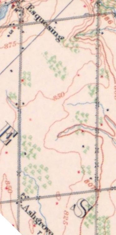
52 : Vision Georgetown 1909 NTS 1974 NTS
CULTURAL HERITAGE ASSESSMENT REPORT CULTURAL HERITAGE LANDSCAPE & BUILT HERITAGE FEATURES
 CULTURAL HERITAGE ASSESSMENT REPORT CULTURAL HERITAGE LANDSCAPE & BUILT HERITAGE FEATURES DUNTROON QUARRY EXPANSION LOT 25 AND PART LOT 26, CONCESSION 12 & PART LOT 25, CONCESSION 12 CLEARVIEW TOWNSHIP
Demolition of a Designated Heritage Property Roncesvalles Avenue
 REPORT FOR ACTION Demolition of a Designated Heritage Property - 421 Roncesvalles Avenue Date: March 8, 2018 To: Toronto Preservation Board Toronto and East York Community Council From: Acting Chief Planner
APPENDIX F CULTURAL HERITAGE RESOURCE ASSESSMENT
 APPENDIX F CULTURAL HERITAGE RESOURCE ASSESSMENT TO Katherine Jim, MRC DATE February 28, 2013 (Revised March 6 2013, May 27 2013, June 24 2013) FROM Lindsay Popert, ASI ASI FILE 12EA-084 RE Dundas Street
57: 2031 North Service Road West, Hilton Farm
 1. Description of Property Municipal Address Name (if applicable) Legal Description Location of Property Ownership Access Current Use Existing Designation General Description Priority Level 57: 2031 North
TOWN OF AURORA HERITAGE IMPACT ASSESSMENTS AND CONSERVATION PLANS GUIDE
 PLANNING AND DEVELOPMENT SERVICES Development Planning Division Heritage Planning Section Phone: 905-727-3123 ext. 4226 Fax: 905-726-4736 Email: planning@aurora.ca Town of Aurora 100 John West Way, Box
Chapter 6 cultural heritage
 6 Cultural Heritage 6.1 Protecting Vaughan s Cultural Heritage 165 6.1.1 Protecting Vaughan s Cultural Heritage 165 6.1.2 Maintaining a Heritage Inventory 166 6.1.3 Promoting Vaughan s Cultural Heritage
VILLAGE OF BOLTON HERITAGE CONSERVATION DISTRICT PLAN
 Page 1 1. INTRODUCTION AND BACKGROUND 1.1 THE PROJECT VILLAGE OF BOLTON HERITAGE CONSERVATION DISTRICT PLAN TERMS OF REFERENCE The Town of Caledon (Town) is a large, predominantly rural municipality with
Mayfield West Phase 2 Secondary Plan
 Town of Caledon Mayfield West Phase 2 Secondary Plan Built Heritage Resources & Cultural Heritage Landscapes Assessment André Scheinman Heritage Preservation Consultant / ENVision The Hough Group Assignment
Purpose of Report...1. Planning Framework Provincial Policy Statement Draft PPS...2. Ontario Heritage Act...3
 Cultural Heritage Policy Discussion Paper November 4 th, 2013 Table of Contents Purpose of Report...1 Planning Framework...1 2005 Provincial Policy Statement...1 2012 Draft PPS...2 Ontario Heritage Act...3
Cultural Heritage Resource Assessment Review Update of the Mayfield West Phase II Secondary Plan TOWN OF CALEDON, ONTARIO.
 TOWN OF CALEDON, ONTARIO Prepared for: Town of Caledon 6311 Old Church Road Caledon, ON L7C IJ6 File: 17CH-030 May 2017 Archaeological & Providing Cultural Heritage Services 528 Bathurst Street Toronto,
CULTURAL HERITAGE RESOURCES POLICIES
 New Official Plan CULTURAL HERITAGE RESOURCES POLICIES Date March 6, 2009 Distributed at: Livable Oakville Committee, March 9, 2009 Planning Services Department March 2009 1 1 Policy Discussion Paper:
Planning Justification Brief
 Planning Justification Brief Proposed Re-Zoning Halton Catholic District School Board 302, 312, 324, 332 Rebecca Street Lots 4, 5, 6, & 7 and Blocks A & B Registered Plan 552 May 2017 Introduction Strategy
L 3-1. Heritage Report: Reasons for Heritage Designation. Peter Archdekin Farmhouse Mayfield Road
 L 3-1 Heritage Report: Reasons for Heritage Designation Peter Archdekin Farmhouse 4585 Mayfield Road December 2011 1 L 3-2 Profile of Subject Property Municipal Address 4585 Mayfield Road PIN Number 142250084
43: 2165 Dundas St. West, Smith-Carrique Barn and Shed
 1. Description of Property Municipal Address Name (if applicable) Legal Description Location of Property Ownership Access Current Use Existing Designation General Description Priority Level 43: 2165 Dundas
L 2-1 HERITAGE REPORT: REASONS FOR HERITAGE DESIGNATION. Cheyne Family Cemetery. Main Street South
 L 2-1 HERITAGE REPORT: REASONS FOR HERITAGE DESIGNATION Cheyne Family Cemetery Main Street South October 2013 L 2-2 PROFILE OF SUBJECT PROPERTY: Municipal Address Main Street South (Lot 14, Con 1, EHS)
Cultural Heritage Landscapes Strategy
 Cultural Heritage Landscapes Strategy TABLE OF CONTENTS Executive Summary 1.0 Introduction 1.1 Objectives of the Strategy 2.0 Definition and Identification of Cultural Heritage Landscapes 2.1 Definitions
PLANNING JUSTIFICATION REPORT
 PLANNING JUSTIFICATION REPORT 55 DELHI STREET CITY OF GUELPH PREPARED FOR: VESTERRA PROPERTY MANAGEMENT PREPARED BY: LABRECHE PATTERSON & ASSOCIATES INC. SCOTT PATTERSON, BA, CPT, MCIP, RPP PRINCIPAL,
I 1-1 HERITAGE IMPACT ASSESSMENT. OSTRANDER FARM 2378 EMBLETON ROAD Lots 5 and 6, Concession 5 WHS CITY OF BRAMPTON, ONTARIO.
 I 1-1 HERITAGE IMPACT ASSESSMENT Ostrander Farm House 2001 Ostrander Farm House Site, May, 2010 Source: Unterman McPhail OSTRANDER FARM 2378 EMBLETON ROAD Lots 5 and 6, Concession 5 WHS CITY OF BRAMPTON,
HERITAGE REPORT: REASONS FOR HERITAGE DESIGNATION. 62 Union Street. Prepared By:
 L 3-1 1 Brampton Heritage Board Date: January 18, 2011 HERITAGE REPORT: REASONS FOR HERITAGE DESIGNATION 62 Union Street Prepared By: Prepared by: Antonietta Minichillo, Heritage Coordinator Planning,
Appendix D. Cultural Heritage Assessment Report
 Appendix D Cultural Heritage Assessment Report EXISTING CONDITION REPORT CULTURAL HERITAGE LANDSCAPES & BUILT HERITAGE RESOURCES & CLASS EA STUDY AND PRELIMINARY DESIGN MAVIS ROAD FROM COURTNEYPARK DRIVE
CONSULTING SERVICES FOR THE WHITEBELT VISIONING EXERCISE ADDENDUM TO THE GTA WEST LAND USE STUDY WORK PROGRAM
 CONSULTING SERVICES FOR THE WHITEBELT VISIONING EXERCISE ADDENDUM TO THE GTA WEST LAND USE STUDY 1. Introduction WORK PROGRAM The Town of Caledon is a large, local municipality located in the Greater Toronto
CHAIR AND MEMBERS PLANNING & ENVIRONMENT COMMITTEE MEETING ON MONDAY AUGUST 28, 2017 JOHN M. FLEMING MANAGING DIRECTOR, PLANNING AND CITY PLANNER
 TO: FROM: SUBJECT: CHAIR AND MEMBERS PLANNING & ENVIRONMENT COMMITTEE MEETING ON MONDAY AUGUST 28, 2017 JOHN M. FLEMING MANAGING DIRECTOR, PLANNING AND CITY PLANNER REQUEST FOR DEMOLITION OF HERITAGE LISTED
1. Description of Property
 1. Description of Property 39: 2483 Burnhamthorpe Rd. West, Schellenberg Stables Municipal Address 2483 Burnhamthorpe Rd. West ame (if applicable) Schellenberg Stables Legal Description PT LT 30, CO 2
6: 2417 Fourth Line, Sixteen Hollow, Lion Valley Park
 1. Description of Property 6: 2417 Fourth Line, Sixteen Hollow, Lion Valley Park Municipal Address 2417 Fourth Line ame (if applicable) Sixteen Hollow, Lion Valley Park Legal Description CO 1 SDS PT LOTS
9 CITY OF VAUGHAN OFFICIAL PLAN AMENDMENT NO BOCA EAST INVESTMENTS LIMITED
 9 CITY OF VAUGHAN OFFICIAL PLAN AMENDMENT NO. 631 - BOCA EAST INVESTMENTS LIMITED The Planning and Economic Development Committee recommends the adoption of the recommendations contained in the following
a) buildings, structures and artifacts of historical significance;
 buildings, structures and artifacts of historical significance;") 12.3.2. Definition Heritage Resources: There are two classes of heritage resources: monumental or landmark heritage that is considered to reflect exemplary architecture and style of a particular area or
12.3.2. Definition Heritage Resources: There are two classes of heritage resources: monumental or landmark heritage that is considered to reflect exemplary architecture and style of a particular area or
Garden District Heritage Conservation District Study
 Garden District Heritage Conservation District Study Community Consultation Meeting September 24 th, 2013 What is a Heritage Conservation District? A defined area of heritage significance and character
Memo. B R A Y H e r i t a g e
 6 1 3. 5 4 2. 3 3 9 3 6 1 3. 5 4 9. 6 2 3 1 c a r l @ b r a y h e r i t a g e. c o m Memo To: Jennifer Murray, Windmill Development Corporation From: Carl Bray, Bray Heritage Date: Monday, June 5, 2017
L 4-1. Heritage Report: Reasons for Heritage Designation. Kodors House. 35 Rosedale Avenue West
 L 4-1 Brampton Heritage Board Date: January 17, 2012 Heritage Report: Reasons for Heritage Designation Kodors House 35 Rosedale Avenue West December 2011 1 L 4-2 Profile of Subject Property Municipal Address
APPENDIX B Exsiting Conditions Report for Built Heritage and Cultural Heritage Landscapes
 APPENDIX B Exsiting Conditions Report for Built Heritage and Cultural Heritage Landscapes EXISTING CONDITIONS REPORT! BUILT HERITAGE RESOURCES & CULTURAL HERITAGE LANDSCAPES! BRITANNIA AVENUE WEST EXTENSION
Long Branch Neighbourhood Character Guidelines Final Report
 STAFF REPORT ACTION REQUIRED Long Branch Neighbourhood Character Guidelines Final Report Date: October 26, 2017 To: From: Wards: Reference Number: Etobicoke York Community Council Director, Community Planning,
12 AMENDMENT NO. 149, TOWN OF MARKHAM HIGHWAY 404 NORTH SECONDARY PLAN
 12 AMENDMENT NO. 149, TOWN OF MARKHAM HIGHWAY 404 NORTH SECONDARY PLAN The Planning and Economic Development Committee recommends the adoption of the recommendation contained in the following report August
CULTURAL HERITAGE RESOURCE REPORT BUILT HERITAGE & CULTURAL HERITAGE LANDSCAPES DERRY GREEN CORPORATE BUSINESS PARK SECONDARY PLAN MILTON, ONTARIO
 CULTURAL HERITAGE RESOURCE REPORT BUILT HERITAGE & CULTURAL HERITAGE LANDSCAPES DERRY GREEN CORPORATE BUSINESS PARK SECONDARY PLAN MILTON, ONTARIO March 2008 Prepared for: Macaulay Shiomi Howson Ltd. Prepared
Cookstown Heritage Conservation District Plan Heritage Workshop Public Open House September 10, 2013
 Heritage Workshop Public Open House September 10, 2013 Funded by the Government of Ontario MMM Group Darryl Bird Project Manager, Senior Planner Shannon Baker Senior Landscape Architect, CAHP AREA Architects
L 1-1. Reason. ns for Heritage Designa
 L 1-1 Herita age Repo ort: Reason ns for Heritage Designa ation Brampton Heritage Board Date: April 15, 2014 10300 Th he Gore Road Former Castlemore Sch hool S.S. No. 6 Ap pril 2014 4 L 1-2 Profile of
St. Lawrence Neighbourhood Focused Area - Official Plan Amendment Status Report
 STAFF REPORT ACTION REQUIRED St. Lawrence Neighbourhood Focused Area - Official Plan Amendment Status Report Date: May 21, 2015 To: From: Wards: Reference Number: Toronto and East York Community Council
Authority: North York Community Council Item 31.7, as adopted by City of Toronto Council on May 6, 7 and 8, 2014 CITY OF TORONTO. BY-LAW No.
 Authority: North York Community Council Item 31.7, as adopted by City of Toronto Council on May 6, 7 and 8, 2014 CITY OF TORONTO BY-LAW No. 53-2015 To designate the property at 65 Centre Avenue (Alexander
The Evolution of Cultural Heritage Landscapes as a Means of Protecting Heritage Resources
 The Evolution of Cultural Heritage Landscapes as a Means of Protecting Heritage Resources Heritage conservation itself is not a new planning issue. This issue has traditionally been framed primarily as
HERITAGE IMPACT ASSESSMENT SALEM BRIDGE, COUNTY SITE No. B IRVINE CREEK (LOTS 15 & 16, CONCESSION 11 GEOGRAPHIC TOWNSHIP OF NICHOL)
") HERITAGE IMPACT ASSESSMENT SALEM BRIDGE, COUNTY SITE No. B018050 IRVINE CREEK (LOTS 15 & 16, CONCESSION 11 GEOGRAPHIC TOWNSHIP OF NICHOL) WOOLWICH STREET WEST (WR 18) SALEM, TOWNSHIP OF CENTRE WELLINGTON
HERITAGE IMPACT ASSESSMENT SALEM BRIDGE, COUNTY SITE No. B018050 IRVINE CREEK (LOTS 15 & 16, CONCESSION 11 GEOGRAPHIC TOWNSHIP OF NICHOL) WOOLWICH STREET WEST (WR 18) SALEM, TOWNSHIP OF CENTRE WELLINGTON
2154 Dundas Street West Intention to Designate under Part IV, Section 29 of the Ontario Heritage Act
 STAFF REPORT ACTION REQUIRED 2154 Dundas Street West Intention to Designate under Part IV, Section 29 of the Ontario Heritage Act Date: February 2, 2009 To: From: Toronto Preservation Board Toronto and
The protection of the agricultural resources of the Province;
 PART II INTRODUCTION An Official Plan is a policy document, which is intended to serve as the basis for making land use decisions and managing change in any municipality in Ontario. According to the Planning
The Corporation of the TOWN OF MILTON
 Report to: From: Chair & Members of the Administration & Planning Standing Committee W.F. Mann, Director of Planning and Development Date: April 16, 2012 PD 022-12 (Z19/11) Subject: Technical Report Proposed
Alterations to a Designated Heritage Property and Authority to Amend a Heritage Easement Agreement Queen's Park
 REPORT FOR ACTION Alterations to a Designated Heritage Property and Authority to Amend a Heritage Easement Agreement - 100 Queen's Park Date: April 27, 2017 To: Toronto Preservation Board Toronto and East
Appendix D. Cultural Heritage Assessment (Unterman McPhail Associates)
") Region of Halton Municipal Class EA for New Forcemain from Fulton Street Pumping Station to Derry Road/Santa Maria Boulevard in the Town of Milton Project File Report April 2018 Appendix D Cultural Heritage
Region of Halton Municipal Class EA for New Forcemain from Fulton Street Pumping Station to Derry Road/Santa Maria Boulevard in the Town of Milton Project File Report April 2018 Appendix D Cultural Heritage
112 College Street Zoning Amendment Application Preliminary Report
 ~TORONTO REPORT FOR ACTION 112 College Street Zoning Amendment Application Preliminary Report Date: January 25, 2019 To: Toronto and East York Community Council From: Director, Community Planning, Toronto
HERITAGE ASSESSMENT REPORT APPENDIX B. Cultural Heritage Resource Evaluation Forms. Project Number:
 APPEDIX B Cultural Heritage Resource Evaluation Forms Project umber: 160960594 Project umber: 160960594 35 List of Properties 823 County Road 4... 1 840 County Road 4... 2 1568 County Road 5... 3 1582/1590
THE CORPORATION OF THE TOWN OF OAKVILLE BY-LAW NUMBER
 THE CORPORATION OF THE TOWN OF OAKVILLE BY-LAW NUMBER 2017-120 A by-law to adopt an amendment to the Livable Oakville Plan, Official Plan Amendment Number 20 (Downtown Oakville Growth Area) WHEREAS the
URBAN DESIGN BRIEF 181 Burloak Drive, Oakville
 URBAN DESIGN BRIEF 181 Burloak Drive, Oakville February 2017 Our File: 1730B 230-7050 WESTON ROAD / WOODBRIDGE / ONTARIO / L4L 8G7 / T: 905 761 5588/ F: 905 761 5589/WWW.MHBCPLAN.COM TABLE OF CONTENTS
46: 4022 Fourth Line, Ford-Slacer Farm
 1. Description of Property 46: 4022 Fourth Line, Ford-Slacer Farm Municipal Address 4022 Fourth Line Name (if applicable) Ford-Slacer Farm Legal Description PT LT 21, CON 2 TRAFALGAR, NORTH OF DUNDAS STREET,
URBAN DESIGN BRIEF. 2136&2148 Trafalgar Road. Town of Oakville
 URBAN DESIGN BRIEF 2136&2148 Trafalgar Road Town of Oakville Prepared By: METROPOLITAN CONSULTING INC For 2500674 Ontario Inc November 2016 TABLE OF CONTENTS Page No. 1.0 Introduction/Description of Subject
Official Plan Amendment to Further Protect Heritage Views of City Hall, Old City Hall and St. James Cathedral - Preliminary Report
 STAFF REPORT ACTION REQUIRED Official Plan Amendment to Further Protect Heritage Views of City Hall, Old City Hall and St. James Cathedral - Preliminary Report Date: June 6, 2017 To: From: Toronto and
240 and 242 Finch Avenue West Zoning By-law Amendment Application Preliminary Report
 REPORT FOR ACTION 240 and 242 Finch Avenue West Zoning By-law Amendment Application Preliminary Report Date: March 1, 2019 To: North York Community Council From: Director, Community Planning, North York
ONTARIO MUNICIPAL BOARD
 PL 120483 ONTARIO MUNICIPAL BOARD Applicant/Appellant: 2124123 Ontario Limited Subject: OPA, Rezoning and Draft Plan of Subdivision Municipal Address: 3940 Highway 7 East Municipality: City of Markham
Urban Design Brief Woodland Cemetery Funeral Home 493 Springbank Drive
 Urban Design Brief Woodland Cemetery Funeral Home The Incorporated Synod of the Diocese of Huron April 15, 2016 Urban Design Brief April 15, 2016 TABLE OF CONTENTS Page No. INTRODUCTION... 1 SECTION 1
Official Plan Review: Draft Built Form Policies
 PG.30.1 REPORT FOR ACTION Official Plan Review: Draft Built Form Policies Date: May 15, 2018 To: Planning and Growth Management Committee From: Chief Planner and Executive Director, City Planning Division
Edward R. Sajecki Commissioner of Planning and Building
 Corporate Report Clerk s Files Originator s Files CD.03.POR DATE: TO: FROM: SUBJECT: Chair and Members of Planning and Development Committee Meeting Date: February 27, 2012 Edward R. Sajecki Commissioner
2: Bond Street, I.O.F Orphanage
 1. Description of Property 2: 37-53 Bond Street, I.O.F Orphanage Municipal Address 37-53 Bond Street ame (if applicable) Independent Order of Foresters (I.O.F.) Orphanage Legal Description PT LTS 15 &
Policy Discussion Paper CULTURAL HERITAGE RESOURCES
 New Official Plan Policy Discussion Paper CULTURAL HERITAGE RESOURCES Planning Services Department March 2009 1 Preamble As part of the Livable Oakville work program, the current general policies, land
1. Description of Property
 1. Description of Property Municipal Address Name (if applicable) Legal Description Location of Property Ownership Access Current Use Existing Designation General Description Priority Level 34: 1141 Burnhamthorpe
GUIDELINES FOR CULTURAL HERITAGE IMPACT ASSESSMENTS
 GUIDELINES FOR CULTURAL HERITAGE IMPACT ASSESSMENTS Purpose A Cultural Heritage Impact Assessment (CHIA) is a study to identify and evaluate built heritage resources and cultural landscapes in a given
Figure 1- Site Plan Concept
 Figure 1- Site Plan Concept Parking will be provided underground on three levels at rate of 1.0 space/ unit; this rate includes all visitors parking. MMM Group has prepared a parking assessment (April,
BENSON / HUNT TERTIARY PLAN
 BENSON / HUNT TERTIARY PLAN TABLE OF CONTENTS 1.0 INTRODUCTION 1.1 Purpose 2 1.2 How to Read This Plan 3 1.3 Tertiary Plan Context 3 1.4 Vision and Principles 5 1.5 Public Consultation 5 2.0 PLANNING CONTEXT
5: Cross Avenue Bridge, Sixteen Mile Creek Rail Bridge
 1. Description of Property Municipal Address Name (if applicable) Legal Description Location of Property Ownership Access Current Use Existing Designation General Description Priority Level 5: Cross Avenue
Mark-up of the effect of the proposed Bronte Village Growth Area OPA No.18 on the text of section 24, Bronte Village, of the Livable Oakville Plan
 Mark-up of the effect of the proposed Bronte Village Growth Area OPA No.18 on the text of section 24, Bronte Village, of the Livable Oakville Plan Notes: This document is provided for information purposes
Intention to Designate under Part IV, Section 29 of the Ontario Heritage Act 844 Don Mills Road and 1150 Eglinton Avenue East
 STAFF REPORT ACTION REQUIRED Intention to Designate under Part IV, Section 29 of the Ontario Heritage Act 844 Don Mills Road and 1150 Eglinton Avenue East Date: September 7, 2016 To: From: Toronto Preservation
Provincial Heritage Places Recognition Program
 Prince Edward Island Provincial Heritage Places Recognition Program A guide for heritage property owners Contents 1 1) Contents 2) The Island s Heritage 3) Historic Places Initiative 4) Heritage Recognition
Courtice Main Street Study Community Vision Workshop PLANNING SERVICES DEPARTMENT
 Courtice Main Street Study Community Vision Workshop PLANNING SERVICES DEPARTMENT July 22, 2009 Tonight s Meeting 7:00 pm Introduction David Crome, Director of Planning 7:05 Presentation Stasia Bogdan,
10 Park Lawn Rd - Zoning Amendment Application- Preliminary Report
 STAFF REPORT ACTION REQUIRED 10 Park Lawn Rd - Zoning Amendment Application- Preliminary Report Date: March 9, 2012 To: From: Wards: Reference Number: Etobicoke York Community Council Director, Community
2136 & 2148 Trafalgar Road Town of Oakville Region of Halton
 PLANNING JUSTIFICATION REPORT 2136 & 2148 Trafalgar Road Town of Oakville Region of Halton Zoning By-Law Amendment Application 2500674 Ontario Inc. November 2016 Table of Contents Page 1.0 Location/Summary
Toronto and East York Community Council Item TE34.30, as adopted by City of Toronto Council on August 25, 26, 27 and 28, 2014 CITY OF TORONTO
 Authority: Toronto and East York Community Council Item TE34.30, as adopted by City of Toronto Council on August 25, 26, 27 and 28, 2014 CITY OF TORONTO BY-LAW 1393-2017 To designate the property at 481
Cookstown Heritage Conservation District Study Public Consultation March 26, 2013
 Public Consultation March 26, 2013 Funded by the Government of Ontario MMM Group Darryl Bird Project Manager, Senior Planner, CAHP Intern Shannon Baker Senior Landscape Architect, CAHP AREA Architects
Access was not granted. Photographed from road, September 16 th, 2015 (AB) Current Use
 Current Use") 1. Description of Property 32: 191 Burnhamthorpe Rd. East, McDuffie Farm Municipal Address 191 Burnhamthorpe Rd. East ame (if applicable) McDuffie Farm (also spelled McDuffe) Legal Description PT LT 14,
1. Description of Property 32: 191 Burnhamthorpe Rd. East, McDuffie Farm Municipal Address 191 Burnhamthorpe Rd. East ame (if applicable) McDuffie Farm (also spelled McDuffe) Legal Description PT LT 14,
CULTURAL HERITAGE IMPACT ASSESSMENT TERMS OF REFERENCE
 CULTURAL HERITAGE IMPACT ASSESSMENT TERMS OF REFERENCE The Corporation of the Town of Whitby Planning and Development Department 575 Rossland Road East, Whitby Ontario, L1N 2M8 Telephone: 905-430-4306
DOWNTOWN GEORGETOWN PLANNING STUDY
 DOWNTOWN GEORGETOWN PLANNING STUDY Community Workshop #3 Thursday, May 4, 08 The Planning Partnership OVERVIEW OF STUDY, PROCESS & MILESTONES We are here PURPOSE OF THE STUDY To develop a clear vision
13 THORNHILL YONGE STREET STUDY IMPLEMENTATION CITY OF VAUGHAN OPA 669 AND TOWN OF MARKHAM OPA 154
 13 THORNHILL YONGE STREET STUDY IMPLEMENTATION CITY OF VAUGHAN OPA 669 AND TOWN OF MARKHAM OPA 154 The Planning and Economic Development Committee recommends the adoption of the recommendations contained
PG: 82B , Nottingham School House, Nottingham Road
 Nottingham (82B-035) Located in southeastern Prince George s County, the community of Nottingham was established when the General Assembly of the Province of Maryland passed the Act for the Advancement
Town of Cobourg Heritage Master Plan. Statutory Public Meeting
 Town of Cobourg Heritage Master Plan Statutory Public Meeting April 25 th 2016 Presentation Overview 1. Introduction 2. Project background and schedule overview 3. Review of strategic direction content
MINISTRY OF TRANSPORTATION. Environmental Guide for Built Heritage and Cultural Heritage Landscapes
 MINISTRY OF TRANSPORTATION Environmental Guide for Built Heritage and Cultural Heritage Landscapes Version: February 2007 MINISTRY OF TRANSPORTATION Environmental Guide for Built Heritage and Cultural
!!"#$"%&#'()%*$&+)'%),-"%!)'&,,),,.)/$'%)0-%$1' 2"*#$'()%*$&+)'%),-"%!),'3'!"#$"%&#'()%*$&+)' #&/4,!&0),' '
%*$&+)'%),-%!)'&,,),,.)/$'%)0-%$1' 2*#$'()%*$&+)'%),-%!),'3'!#$%&#'()%*$&+)' #&/4,!&0),' '") !!"#$"%&#()%*$&+)%),-"%!)&,,),,.)/$%)0-%$1 2"*#$()%*$&+)%),-"%!),3!"#$"%&#()%*$&+) #&/4,!&0),!#&,,)/5*%-/.)/$&#&,,),,.)/$6)&7,$"48 %-&4!%-,,*/+-9(*+(:&8; $( &5)/") 8-%?%)+*-/0%-@)!$ABA=
!!"#$"%&#()%*$&+)%),-"%!)&,,),,.)/$%)0-%$1 2"*#$()%*$&+)%),-"%!),3!"#$"%&#()%*$&+) #&/4,!&0),!#&,,)/5*%-/.)/$&#&,,),,.)/$6)&7,$"48 %-&4!%-,,*/+-9(*+(:&8; $( &5)/") 8-%?%)+*-/0%-@)!$ABA=
Baker Historic District
 DISTRICT DESCRIPTION This is a historically middle-class neighborhood in the South Side, an area annexed by Denver in 1883, consisting of more than 20 tightly interwoven residential subdivisions. The earliest
Synopsis of 50 years of Planning in the Greater Golden Horseshoe (GGH), Ontario, Canada. Olusola Olufemi 2015
, Ontario, Canada. Olusola Olufemi 2015") Synopsis of 50 years of Planning in the Greater Golden Horseshoe (GGH), Ontario, Canada Olusola Olufemi 2015 Canada Background Canada s population is 34,834,841 (July 2014 est.) Capital city: Ottawa Canada
Synopsis of 50 years of Planning in the Greater Golden Horseshoe (GGH), Ontario, Canada Olusola Olufemi 2015 Canada Background Canada s population is 34,834,841 (July 2014 est.) Capital city: Ottawa Canada
Bressa Developments Limited. Planning Justification Report. Revised Draft Plan of Subdivision and Zoning By-Law Amendment
 Bressa Developments Limited Revised Draft Plan of Subdivision and Zoning By-Law Amendment Planning Justification Report Part of Lots 7 & 8 Concession 1, North of Dundas Street Town of Oakville September,
4780 Eglinton Avenue West - Zoning By-law Amendment and Draft Plan of Subdivision Applications - Preliminary Report
 STAFF REPORT ACTION REQUIRED 4780 Eglinton Avenue West - Zoning By-law Amendment and Draft Plan of Subdivision Applications - Preliminary Report Date: May 29, 2014 To: From: Wards: Reference Number: Etobicoke
Report to: Development Services Committee Report Date: April 24, 2017
 SUBJECT: Cornell Rouge National Urban Park Gateway - Report on Design Charrette and Next Steps PREPARED BY: Lilli Duoba, MES, MCIP, RPP, Manager, Natural Heritage (ext. 7925) REVIEWED BY: Marg Wouters,
MOUNT PLEASANT SECONDARY PLAN & VILLAGE BLOCK PLAN. Wednesday, March 5, 2008 Informal Public Open House
 MOUNT PLEASANT SECONDARY PLAN & VILLAGE BLOCK PLAN Wednesday, March 5, 2008 Informal Public Open House 1. Welcome & Introductions 2. Highlights of Provincial Growth Plan 3. Overview and Status Update -
Town of Whitchurch-Stouffville Cultural Heritage Impact Assessment
 Revised: March 2012 Town of Whitchurch-Stouffville 1. Purpose of a Heritage conservation involves identifying, protecting and promoting buildings, structures or other elements that have been deemed to
URBAN DESIGN BRIEF Gordon Street City of Guelph. Prepared on behalf of Ontario Inc. March 25, Project No. 1507
 URBAN DESIGN BRIEF 1131 Gordon Street City of Guelph Prepared on behalf of 1876698 Ontario Inc. March 25, 2016 Project No. 1507 423 Woolwich Street, Suite 201, Guelph, Ontario, N1H 3X3 Phone (519) 836-7526
2.2.1 Scope of Preliminary Cultural Heritage Landscape Inventory
 Cultural Heritage Landscape and Policy Study Page 7 2.0 CULTURAL HERITAGE LANDSCAPE INVENTORY 2.1 Introduction As part of the City of Vaughan s Official Plan review and associated development of cultural
Attachment 1 TOWN OF NEW TECUMSETH. Manual for the Preparation of an Urban Design Report
 Attachment 1 TOWN OF NEW TECUMSETH Manual for the Preparation of an Urban Design Report July 2010 TABLE OF CONTENTS Background, Policy Framework and the Preparation of Urban Design Reports 1. Introduction
YONGE STEELES CORRIDOR SECONDARY PLAN. Young + Wright / IBI Group Architects Dillon Consulting Ltd. GHK International (Canada) Ltd.
 Ltd.") PART A: PREAMBLE 1.0 PURPOSE The purpose of this Secondary Plan is to provide a development framework for intensification of the Yonge/ Steeles corridor including the north side of Steeles Avenue West
PART A: PREAMBLE 1.0 PURPOSE The purpose of this Secondary Plan is to provide a development framework for intensification of the Yonge/ Steeles corridor including the north side of Steeles Avenue West
APPENDIX 9 HERITAGE CHARACTER
 APPENDIX 9 HERITAGE CHARACTER Defining attributes and features Perth Official Plan Appendix 9 HERITAGE CHARACTER defining attributes and features This appendix includes a table describing heritage attributes
THE CORPORATION OF THE TOWN OF OAKVILLE BY-LAW NUMBER
 THE CORPORATION OF THE TOWN OF OAKVILLE BY-LAW NUMBER 20012-08530 A by-law to adopt an amendment to the Official Plan of the Oakville Planning Area (Official Plan Amendment 198) Land North of Dundas Street.
The Corporation of the Town of Milton
 Report To: From: Council Barbara Koopmans, Commissioner, Planning and Development Date: May 7, 2018 Report No: Subject: Making it Possible Positioning the Town s Strategy for Growth and Economic Development
OFFICE CONSOLIDATION SECONDARY PLAN AREA 22 THE BRAMALEA SOUTH INDUSTRIAL SECONDARY PLAN
 OFFICE CONSOLIDATION SECONDARY PLAN AREA 22 THE BRAMALEA SOUTH INDUSTRIAL SECONDARY PLAN November 2010 EXPLANATORY NOTES (Secondary Plan Area 22) General (pertaining to all secondary plan office consolidations)
20 & 30 Frank Nighbor Place
 Engineering Land / Site Development Municipal Infrastructure Environmental / Water Resources Traffic / Transportation Structural Recreational Planning Land / Site Development Planning Application Management
URBAN DESIGN BRIEF REPORT
 URBAN DESIGN BRIEF REPORT PREPARED FOR 2568401 ONTARIO INC NEW GASBAR, CONVENIENCE STORE & CARWASH DEVELOPMENT @ 1509 FANSHAWE PARK ROAD WEST LONDON, ONTARIO GAMA ENGINEERING INC. PROJECT NUMBER 1669 PREPARED
Original License Report. Submitted to: New Horizon Development Inc. 69 John Street South, Suite 304 Hamilton, Ontario L8N 2B9 Phone (905)
") STAGE 1 ARCHAEOLOGICAL ASSESSMENT OF 2480-2496 OLD BRONTE ROAD, PART OF LOT 31, CONCESSION 1 SOUTH OF DUNDAS STREET, GEOGRAPHIC TOWNSHIP OF TRAFALGAR, TOWN OF OAKVILLE, REGIONAL MUNICPALITY OF HALTON Original
STAGE 1 ARCHAEOLOGICAL ASSESSMENT OF 2480-2496 OLD BRONTE ROAD, PART OF LOT 31, CONCESSION 1 SOUTH OF DUNDAS STREET, GEOGRAPHIC TOWNSHIP OF TRAFALGAR, TOWN OF OAKVILLE, REGIONAL MUNICPALITY OF HALTON Original
BIBLIOGRAPHY DOCUMENT 8
 BIBLIOGRAPHY DOCUMENT 8 Bibliography: Reports, Studies, Monitoring Completed since May 2003 (date of adoption of the first Official Plan by the amalgamated City of Ottawa) 1.0 GENERAL DATA REPORTS 1.1
Cultural Heritage Assessment Report: Built Heritage Resources and Cultural Heritage Landscapes. Existing Conditions Assessment of Impacts
 Cultural Heritage Assessment Report: Built Heritage Resources and Cultural Heritage Landscapes Existing Conditions Assessment of Impacts Class Environmental Assessment and Preliminary Design for McLaughlin
Morgan s Subdivision Historic District Character-defining Features
 Morgan s Subdivision Historic District Character-defining Features DISTRICT DESCRIPTION This small addition, designed as a neighborhood for those wishing to move east from Capitol Hill, was predominantly