APPENDIX F CULTURAL HERITAGE RESOURCE ASSESSMENT
|
|
|
- Mildred Rose
- 5 years ago
- Views:
Transcription
1 APPENDIX F CULTURAL HERITAGE RESOURCE ASSESSMENT
2
3 TO Katherine Jim, MRC DATE February 28, 2013 (Revised March , May , June ) FROM Lindsay Popert, ASI ASI FILE 12EA-084 RE Dundas Street Environmental Assessment Study, Oak Park Boulevard to Neyagawa Boulevard Results of Cultural Heritage Assessment and Impact Assessment 1.0 Introduction Archaeological Services Inc. (ASI) was contracted by MRC, Mississauga, on behalf of Halton Region, to conduct a cultural heritage assessment as part of the Dundas Street EA Study, from Oak Park Boulevard to Neyagawa Boulevard in the Town of Oakville, Ontario (Figure 1). Between 2003 and 2009, ASI conducted four cultural heritage assessments along Dundas Street through various areas. Previous reports that were consulted include the following: Cultural Heritage Assessment Report Built Heritage Resources and Cultural Heritage Landscapes Dundas Street Transportation Corridor From Brant Street to Proudfoot Trail Environmental Assessment City of Burlington & Town of Oakville (ASI 2009; ASI File #07EA- 270) Cultural Heritage Evaluation Report: Bronte Creek (Tansley) Bridge, Dundas Street Transportation Corridor Environmental Assessment, City of Burlington, DRAFT (ASI 2009; ASI File #07EA-270) Heritage Assessment Report: Built Heritage & Cultural Landscape Bronte Road (Highway 25) Improvements Class EA Region of Halton (Unterman McPhail Associates (UMA) 2002) Class Environmental Assessment: Cultural Heritage Resource Assessment, Dundas Street (Regional Road 5) and Sixteen Mile Creek Structure Improvements, Town of Oakville (ASI 2003a; ASI File #01HA-04) Built Heritage and Cultural Landscape Assessment Dundas Street (Regional Road) Neyagawa Boulevard to Oak Park Boulevard Class Environmental Assessment, Town of Oakville, Regional Municipality of Halton, Ontario (ASI 2007 DRAFT; ASI File #05EA-197) Built Heritage and Cultural Landscape Assessment: Dundas Street (Regional Road 5) Improvements from Oak Park Boulevard to Ninth Line (former Trafalgar Township, Halton County), Regional Municipality of Halton, Ontario. (ASI 2003b; ASI File #02HA-03) In September 2011, ASI submitted a Cultural Heritage Assessment Report containing the existing conditions of the Dundas Street study corridor from Brant Street in Burlington to Trafalgar Road in Oakville. The purpose of this report was to present a built heritage and cultural landscape inventory of cultural heritage resources in the Dundas Street corridor, identify general impacts to identified cultural heritage resources, and propose appropriate mitigation measures when more detailed road improvement plans became available for review. The results of the five previous studies were compiled into this single report. The level of heritage recognition, location and condition of previously identified heritage resources were confirmed through field review and consulting up-todate municipal heritage inventories. This research was conducted under the project direction of Rebecca A. Sciarra, Cultural Heritage Specialist.
4 Page 2 In February 2013, ASI provided an updated existing conditions memorandum for the study section between Oak Park Boulevard and Neyagawa Boulevard in the Town of Oakville, Ontario. In May 2013, MRC directed ASI to update the existing conditions data with an impact assessment, as contained in this updated memorandum. 2.0 Historical Background Oak Park Boulevard to Neyagawa Boulevard in the Town of Oakville This section of the Dundas Street EA Study is located in the former Townships of South Trafalgar, between Concessions I South and I North, Lots 14 to 20 (Figure 2). The historic village of Munn s Corners is located on Lots 15 and 16, situated north of the original limits of the Town of Oakville. Munn s Corners This settlement is named after the Munn family who had acquired the land to either side of Dundas Street and Sixth Line and had become very active in the affairs of this settlement. Daniel Munn, the family patriarch, was the first township clerk and built the first tavern in the township at this intersection. He also sold a part of his land for use as a local cemetery, and his sons sold additional lands upon which the church and schoolhouse were constructed in 1843 or 1844 (Deeds 526N and 548N). Records from the 1871 Census (Division B2, pp.4-6) show that a few skilled workmen had settled at this community in the nineteenth century. On the north side of Dundas Street, on part Lot 15, was a blacksmith named Hiram Cline as well as a shoemaker named George Elliot. On the opposite side of Sixth Line, on Lot 16 Concession I NDS, there is record of a labourer named Henry Pope and a butcher named William Long. On Lot 16, Concession I SDS, there was an innkeeper named John Wray, and John Appelbe was the Township Clerk. 3.0 Existing Conditions Oak Park Boulevard to Neyagawa Boulevard in the Town of Oakville The level of heritage recognition of previously identified cultural heritage resources in the study corridor was confirmed by consulting the most recent editions of: the Town of Oakville s Register of Designated Heritage Properties under Part IV of the Ontario Heritage Act; the Town of Oakville s Register of Properties of Cultural Heritage Value or Interest (NOT Designated); and the Town of Oakville s online interactive mapping. A field review was undertaken by ASI in March 2011 to document the existing conditions of Dundas Street from Brant Street to Trafalgar Road. The results of field review confirmed the location, condition and descriptions of previously identified cultural heritage resources. A subsequent field review was undertaken on February 21 st, 2013 to confirm the location, condition and descriptions of previously identified cultural heritage resources between Oak Park Boulevard and Neyagawa Boulevard. Ongoing construction work associated with the wastewater main and forcemain installation made it difficult to view heritage resources located on the north side of Dundas Street East, just west of Oak Park Boulevard. The Dundas Street corridor, between Oak Park Boulevard and Neyagawa Boulevard in the Town of Oakville, is generally comprised of late twentieth-century residential subdivisions to the south of Dundas Street and agricultural fields to the north. A large portion of the agricultural fields north of
.")
5 Page 3 Dundas Street and west of Sixth Line are currently being graded for development. A concentration of cultural heritage buildings and landscapes are located at the hamlet of Munn s Corners. A total of five cultural heritage resources, BHR 16 BHR 18, and CHL 20 CHL 21 were identified within the Oak Park Boulevard to Neyagawa Boulevard segment of the corridor (Table 1). One of the properties, BHR 16, is no longer extant as the associated farmhouse has been demolished and the landscape has been removed through grading activities for future development. Demolition of the remains of the farmhouse was approved on April 10 th, 2012, and portions of the house were salvaged with the intention that they be incorporated into a new village square to be located nearby. This property has been identified in Table 1 given that it remains, for now, identified as heritage by the Town of Oakville. Please refer to Figures 3 5 for location mapping of identified cultural heritage resources. Table 1: Dundas Street EA Study, Oak Park Boulevard to Neyagawa Boulevard Identified Built Heritage Resources (BHR) and Cultural Heritage Landscapes (CHL) Feature Number, Description/Comments Recognition Photos Type and Address BHR 16 Residence 237 Dundas St W, Oakville Associated with the Kaitting Family of Trafalgar Township. Features a one and a half storey nineteenth-century dwelling with variations of an Ontario Vernacular brick gable roof house. In the fall of 2009, the house suffered from a fire. Only three of the exterior walls were left standing, and the interior was completely destroyed (see lower photograph, taken in March 2011). In April 2012, Oakville Town Council approved a demolition application for the subject Kaitting farmhouse. Communications with the Town of Oakville (February 2013) confirmed that demolition of the remains of the farmhouse was approved on April 10 th, 2012, with the condition that portions of the house are salvaged and installed in a new village square to be located nearby. Negotiations for a heritage easement agreement associated with these remnants are also underway. The property will be officially de-designated at some point in the future. Designated under Part IV of the Ontario Heritage Act. The Kingsholm/ Kaitting House BY-LAW: Note: Dedesignation of this property will take place in the future. Looking north from Dundas Street (ASI 2008) Front elevation of house, looking north from Dundas Street (ASI 2011)


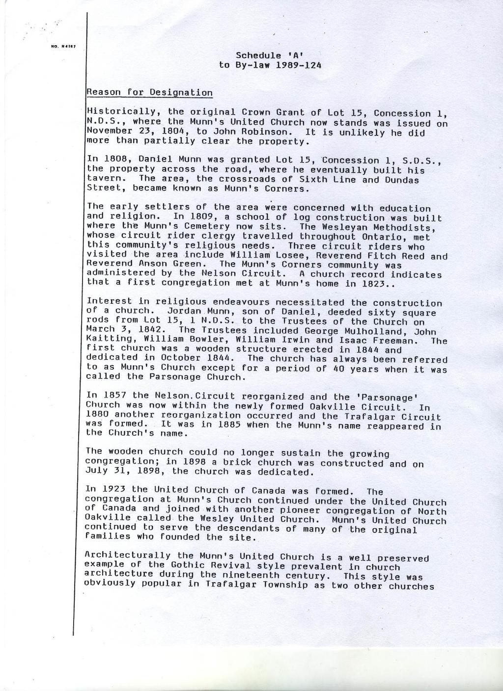
6 Page 4 Table 1: Dundas Street EA Study, Oak Park Boulevard to Neyagawa Boulevard Identified Built Heritage Resources (BHR) and Cultural Heritage Landscapes (CHL) Feature Number, Description/Comments Recognition Photos Type and Address BHR 17 Church 5 Dundas St E, Oakville BHR 18 Residence 87 Dundas St E, Oakville A Wesleyan Methodist Church congregation was established at Munn s Corners during the nineteenth century. This church was probably established at a very early date, and services were conducted in the log school house at the hamlet by itinerant Methodist circuit preachers. It is recorded in the abstract index to deeds that Justus Munn sold a parcel of land sixty square rods in extent, being part of Lot 15 Concession 1 NDS, for the use of the church in March 1843 (deed 526N). The church itself was constructed in It was rebuilt in 1898 in the Gothic Revival style, replete with nine pointed windows, a Palladian style window, brick buttresses and stone window sills. In 1929, a manse was added to the property. In 1977, the sanctuary building (1898) was moved back for road widening, placing its front wall on the rear line of foundation stones and in 1989 a parish hall was added (McIlwraith 1997) and the property was modified significantly. The former foundations remain visible underneath the two coniferous trees in front of the church. This property was designated by the local LACAC in 1989 under By-law under Part IV of the Ontario Heritage Act. A one and a half storey, nineteenthcentury frame farmhouse with central gable dormer, end chimneys, and front porch. Likely retains associations with the agricultural development of Trafalgar Township. In 2012, the property owner demolished the outbuildings associated with this property. Designated under Part IV of the Ontario Heritage Act. BY-LAW: *See Appendix A for a copy of the By-law. Listed in the Register of Properties of Cultural Heritage Value or Interest (NOT Designated under Part IV of the Ontario Heritage Act) Front elevation of Munn s Church (ASI 2013) View showing the existing space between the front of Munn s Church and Dundas Street, looking east (ASI 2013) Front elevation (ASI 2011)

.")
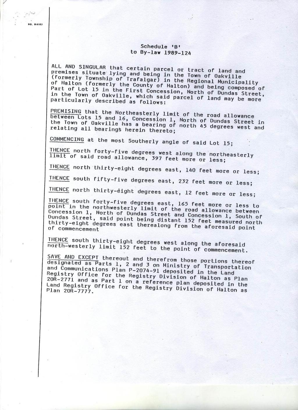
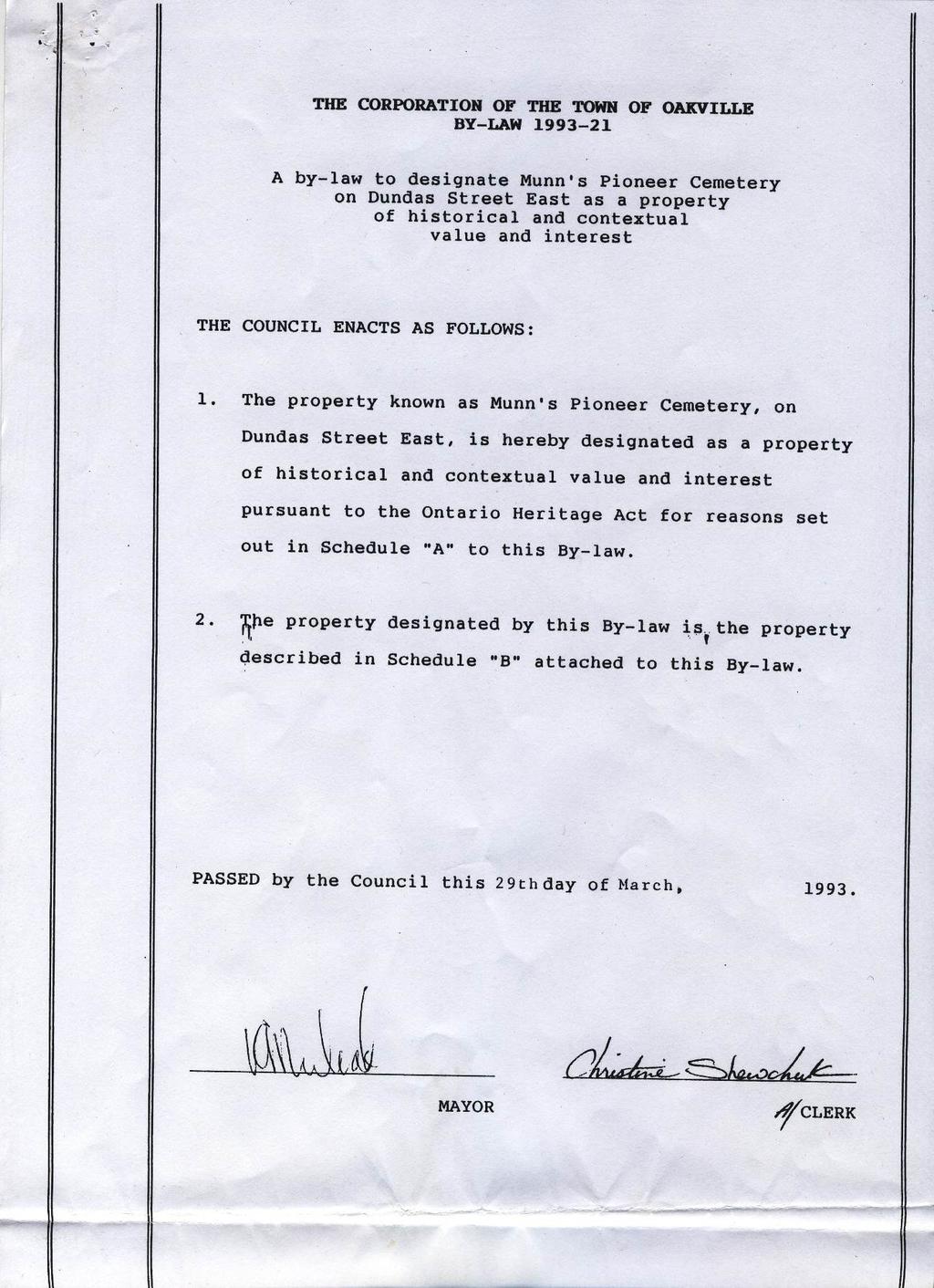
7 Page 5 Table 1: Dundas Street EA Study, Oak Park Boulevard to Neyagawa Boulevard Identified Built Heritage Resources (BHR) and Cultural Heritage Landscapes (CHL) Feature Number, Description/Comments Recognition Photos Type and Address CHL 20 Cemetery SE corner of Dundas St and Sixth Line, Oakville This cemetery was established in November 1820 when Daniel Munn sold a parcel of land measuring 72 perches, or approximately onequarter acre, at the northwest corner of his farm for 10 (deed 829B, registered July 27, 1822). Additional land was sold to the cemetery trustees by King Henry Munn for $5 in October 1890 (deed 5692S). The first burial in this cemetery has not been recorded although it is thought to be that of Daniel Munn who died sometime in His tombstone, which stood in this cemetery until around 1953, can no longer be located. A listing of the existing tombstone inscriptions, compiled by the Ontario Genealogical Society, shows that there were at least 200 marked burials in this plot of land (Watt 1984). The cemetery was maintained for a time by the Women s Institute of Munn s United Church although it eventually fell into disuse and was neglected for a number of years during the twentieth century. No burials take place in this cemetery today, although it is currently maintained by the Town of Oakville. In March 1993, this cemetery was designated as a property of historical and contextual value and interest under By-Law under Part IV of the Ontario Heritage Act. Designated under Part IV of the Ontario Heritage Act. BY-LAW: *See Appendix A for a copy of the By-law. View of Munn s Cemetery, looking southeast (ASI 2006) CHL 21 Farm complex 41 Dundas St E, Oakville Comprised of a one and a half storey brick farmhouse with internal chimney and a one storey frame accretion, two barns, mature trees and an agricultural landscape. It is identified on the heritage register as the William Perkins Farm. On November 14, 2012, a Heritage Impact Assessment for Part of Lot 15, Concession 1 North, former Township of Trafalgar, now Town of Oakville, Ontario (Golder 2012) was completed and submitted to Sixth Line Corporation. The proposed Development Plan for the area will result in removal of the subject farmhouse, for which a Heritage Documentation Report prior to removal has been recommended. Listed in the Register of Properties of Cultural Heritage Value or Interest (NOT Designated under Part IV of the Ontario Heritage Act) Front elevation, looking north (ASI 2011)
8 Page 6 Table 1: Dundas Street EA Study, Oak Park Boulevard to Neyagawa Boulevard Identified Built Heritage Resources (BHR) and Cultural Heritage Landscapes (CHL) Feature Number, Type and Address Description/Comments Recognition Photos Field review in February 2013 confirmed that the house remains extant, but is boarded up and in an advanced state of disrepair. 4.0 Impact Assessment To assess the potential impacts of the preliminary plan for the proposed improvements on Dundas Street between Oak Park Boulevard and Neyagawa Boulevard, the most current plans (May 15, 2013) were reviewed and identified cultural heritage resources were considered against a range of possible impacts as outlined in the Ministry of Tourism and Culture document entitled Screening for Impacts to Built Heritage and Cultural Heritage Landscapes (September 2010), which include: Destruction of any, or part of any, significant heritage attribute or feature (III.1). Alteration which means a change in any manner and includes restoration, renovation, repair or disturbance (III.2). Shadows created that alter the appearance of a heritage attribute or change the visibility of a natural feature of plantings, such as a garden (III.3). Isolation of a heritage attribute from it surrounding environment, context, or a significant relationship (III.4). Direct or indirect obstruction of significant views or vistas from, within, or to a built and natural feature (III.5). A change in land use (e.g. rezoning a battlefield from open space to residential use), allowing new development or site alteration to fill in the formerly open spaces (III.6). Soil Disturbance such as a change in grade, or an alteration of the drainage pattern or excavation (III.7) The following table presents potential impacts of the preferred plan on identified cultural heritage resources. Figures 3-7 show the preliminary plan for the preferred road design. Table 2: Potential impacts of preferred alignment on identified cultural heritage resources. Description of potential impacts Recommended Mitigation BHR 16 No impacts to this resource are expected. No further action is required. BHR 17 Direct impacts through limited encroachment and property acquisition. Road improvements will result in the removal of trees along the Dundas Street property frontage, and removal of former church foundations. The foundations are remnants of the 1977 church relocation due to a previous road widening. Given that the property limits of this heritage designated property will be altered, a heritage permit is required. To begin the heritage permit application process, contact Heritage Planning staff and fill out the permit application, available online here: Heritage permit applications are reviewed by Heritage Planning staff and the Heritage Oakville Committee at monthly meetings. As part of the heritage permit process, the Town of Oakville may require documentation of the remnant

9
, edition 20,")

10 Page 8 Figure 1: Location of the study corridor. Base Map: NTS Sheet 30 M/5 (Hamilton-Burlington), edition 20, 1999 Figure 2: Location of the study corridor on historic mapping. Base Map: 1877 Illustrated Historical Atlas of the County of Halton
 [Basemap Date: 2011].")
11 Figure 3: Location of Built Heritage Resources (BHR) and Cultural Heritage Landscapes (CHL) [Basemap Date: 2011]. Date: June 7, 2013 Page 9
 [Basemap Date: 2011].")
12 Figure 4: Location of Built Heritage Resources (BHR) and Cultural Heritage Landscapes (CHL) [Basemap Date: 2011]. Date: June 7, 2013 Page 10
 [Basemap Date: 2011].")
13 Figure 5: Location of Built Heritage Resources (BHR) and Cultural Heritage Landscapes (CHL) [Basemap Date: 2011]. Date: June 7, 2013 Page 11

14 Figure 6: Location of BHR 17 (Munn s Church) and CHL 20 (Munn s Cemetery) in proximity to the proposed Dundas Street right-of-way. Date: June 7, 2013 Page 12

15 Figure 7: Location of CHL 21 (property to the left) and BHR 18 (property to the right) showing proximity to the proposed Dundas Street right-of-way. Date: June 7, 2013 Page 13
16 Page 14 APPENDIX A: Municipal Designation By-Laws under the Ontario Heritage Act: The Corporation of the Town of Oakville By-Law (Munn s United Church) The Corporation of the Town of Oakville By-Law (Munn s Cemetery)
17 Page 15
18 Page 16
19 Page 17
20 Page 18
21 Page 19
22 Page 20
23 Page 21
24 Page 22
6: 2417 Fourth Line, Sixteen Hollow, Lion Valley Park
 1. Description of Property 6: 2417 Fourth Line, Sixteen Hollow, Lion Valley Park Municipal Address 2417 Fourth Line ame (if applicable) Sixteen Hollow, Lion Valley Park Legal Description CO 1 SDS PT LOTS
57: 2031 North Service Road West, Hilton Farm
 1. Description of Property Municipal Address Name (if applicable) Legal Description Location of Property Ownership Access Current Use Existing Designation General Description Priority Level 57: 2031 North
HERITAGE CONSERVATION STRATEGY REPORT VISION GEORGETOWN SECONDARY PLAN PHASE 3 TOWN OF HALTON HILLS REGIONAL MUNICIPALITY OF HALTON, ONTARIO
 HERITAGE CONSERVATION STRATEGY REPORT VISION GEORGETOWN SECONDARY PLAN PHASE 3 TOWN OF HALTON HILLS REGIONAL MUNICIPALITY OF HALTON, ONTARIO February 2018 Revised May 2018 Prepared for: Meridian Planning
43: 2165 Dundas St. West, Smith-Carrique Barn and Shed
 1. Description of Property Municipal Address Name (if applicable) Legal Description Location of Property Ownership Access Current Use Existing Designation General Description Priority Level 43: 2165 Dundas
46: 4022 Fourth Line, Ford-Slacer Farm
 1. Description of Property 46: 4022 Fourth Line, Ford-Slacer Farm Municipal Address 4022 Fourth Line Name (if applicable) Ford-Slacer Farm Legal Description PT LT 21, CON 2 TRAFALGAR, NORTH OF DUNDAS STREET,
1. Description of Property
 1. Description of Property Municipal Address Name (if applicable) Legal Description Location of Property Ownership Access Current Use Existing Designation General Description Priority Level 34: 1141 Burnhamthorpe
1. Description of Property
 1. Description of Property 39: 2483 Burnhamthorpe Rd. West, Schellenberg Stables Municipal Address 2483 Burnhamthorpe Rd. West ame (if applicable) Schellenberg Stables Legal Description PT LT 30, CO 2
CULTURAL HERITAGE RESOURCE REPORT BUILT HERITAGE & CULTURAL HERITAGE LANDSCAPES DERRY GREEN CORPORATE BUSINESS PARK SECONDARY PLAN MILTON, ONTARIO
 CULTURAL HERITAGE RESOURCE REPORT BUILT HERITAGE & CULTURAL HERITAGE LANDSCAPES DERRY GREEN CORPORATE BUSINESS PARK SECONDARY PLAN MILTON, ONTARIO March 2008 Prepared for: Macaulay Shiomi Howson Ltd. Prepared
L 3-1. Heritage Report: Reasons for Heritage Designation. Peter Archdekin Farmhouse Mayfield Road
 L 3-1 Heritage Report: Reasons for Heritage Designation Peter Archdekin Farmhouse 4585 Mayfield Road December 2011 1 L 3-2 Profile of Subject Property Municipal Address 4585 Mayfield Road PIN Number 142250084
Chapter 6 cultural heritage
 6 Cultural Heritage 6.1 Protecting Vaughan s Cultural Heritage 165 6.1.1 Protecting Vaughan s Cultural Heritage 165 6.1.2 Maintaining a Heritage Inventory 166 6.1.3 Promoting Vaughan s Cultural Heritage
CULTURAL HERITAGE ASSESSMENT REPORT CULTURAL HERITAGE LANDSCAPE & BUILT HERITAGE FEATURES
 CULTURAL HERITAGE ASSESSMENT REPORT CULTURAL HERITAGE LANDSCAPE & BUILT HERITAGE FEATURES DUNTROON QUARRY EXPANSION LOT 25 AND PART LOT 26, CONCESSION 12 & PART LOT 25, CONCESSION 12 CLEARVIEW TOWNSHIP
Edward R. Sajecki Commissioner of Planning and Building. Region of Halton Proposed Regional Official Plan Amendment for 5768 Ninth Line
 Corporate Report Clerk s Files Originator s Files MG.11.MIL DATE: TO: FROM: SUBJECT: Chair and Members of Planning and Development Committee Meeting Date: April 3, 2006 Edward R. Sajecki Commissioner of
THE CORPORATION OF THE TOWN OF OAKVILLE BY-LAW NUMBER
 THE CORPORATION OF THE TOWN OF OAKVILLE BY-LAW NUMBER 20012-08530 A by-law to adopt an amendment to the Official Plan of the Oakville Planning Area (Official Plan Amendment 198) Land North of Dundas Street.
Bressa Developments Limited. Planning Justification Report. Revised Draft Plan of Subdivision and Zoning By-Law Amendment
 Bressa Developments Limited Revised Draft Plan of Subdivision and Zoning By-Law Amendment Planning Justification Report Part of Lots 7 & 8 Concession 1, North of Dundas Street Town of Oakville September,
Memo. B R A Y H e r i t a g e
 6 1 3. 5 4 2. 3 3 9 3 6 1 3. 5 4 9. 6 2 3 1 c a r l @ b r a y h e r i t a g e. c o m Memo To: Jennifer Murray, Windmill Development Corporation From: Carl Bray, Bray Heritage Date: Monday, June 5, 2017
Town of Whitchurch-Stouffville Cultural Heritage Impact Assessment
 Revised: March 2012 Town of Whitchurch-Stouffville 1. Purpose of a Heritage conservation involves identifying, protecting and promoting buildings, structures or other elements that have been deemed to
VILLAGE OF BOLTON HERITAGE CONSERVATION DISTRICT PLAN
 Page 1 1. INTRODUCTION AND BACKGROUND 1.1 THE PROJECT VILLAGE OF BOLTON HERITAGE CONSERVATION DISTRICT PLAN TERMS OF REFERENCE The Town of Caledon (Town) is a large, predominantly rural municipality with
L 1-1. Reason. ns for Heritage Designa
 L 1-1 Herita age Repo ort: Reason ns for Heritage Designa ation Brampton Heritage Board Date: April 15, 2014 10300 Th he Gore Road Former Castlemore Sch hool S.S. No. 6 Ap pril 2014 4 L 1-2 Profile of
Cultural Heritage Resource Assessment Built Heritage Resources and Cultural Heritage Landscapes. Existing Conditions Assessment of Impacts
 Cultural Heritage Resource Assessment Built Heritage Resources and Cultural Heritage Landscapes Existing Conditions Assessment of Impacts Midtown Oakville Transportation Network and Municipal Storm Water
Cultural Heritage Assessment Report: Built Heritage Resources and Cultural Heritage Landscapes. Existing Conditions Assessment of Impacts
 : Built Heritage Resources and Cultural Heritage Landscapes Existing Conditions Assessment of Impacts Tremaine Road to Highway 407 Class Environmental Assessment Study, Town of Milton, Regional Municipality
CULTURAL HERITAGE IMPACT ASSESSMENT TERMS OF REFERENCE
 CULTURAL HERITAGE IMPACT ASSESSMENT TERMS OF REFERENCE The Corporation of the Town of Whitby Planning and Development Department 575 Rossland Road East, Whitby Ontario, L1N 2M8 Telephone: 905-430-4306
Original License Report. Submitted to: New Horizon Development Inc. 69 John Street South, Suite 304 Hamilton, Ontario L8N 2B9 Phone (905)
") STAGE 1 ARCHAEOLOGICAL ASSESSMENT OF 2480-2496 OLD BRONTE ROAD, PART OF LOT 31, CONCESSION 1 SOUTH OF DUNDAS STREET, GEOGRAPHIC TOWNSHIP OF TRAFALGAR, TOWN OF OAKVILLE, REGIONAL MUNICPALITY OF HALTON Original
STAGE 1 ARCHAEOLOGICAL ASSESSMENT OF 2480-2496 OLD BRONTE ROAD, PART OF LOT 31, CONCESSION 1 SOUTH OF DUNDAS STREET, GEOGRAPHIC TOWNSHIP OF TRAFALGAR, TOWN OF OAKVILLE, REGIONAL MUNICPALITY OF HALTON Original
Figure 1- Site Plan Concept
 Figure 1- Site Plan Concept Parking will be provided underground on three levels at rate of 1.0 space/ unit; this rate includes all visitors parking. MMM Group has prepared a parking assessment (April,
Access was not granted. Photographed from road, September 16 th, 2015 (AB) Current Use
 Current Use") 1. Description of Property 32: 191 Burnhamthorpe Rd. East, McDuffie Farm Municipal Address 191 Burnhamthorpe Rd. East ame (if applicable) McDuffie Farm (also spelled McDuffe) Legal Description PT LT 14,
1. Description of Property 32: 191 Burnhamthorpe Rd. East, McDuffie Farm Municipal Address 191 Burnhamthorpe Rd. East ame (if applicable) McDuffie Farm (also spelled McDuffe) Legal Description PT LT 14,
Dundas Street (Regional Road 5) Improvements Class Environmental Assessment Study
 Improvements Class Environmental Assessment Study") REGION Dundas Street (Regional Road 5) Improvements Class Environmental Assessment Study Brant Street (Regional Road 18) to Bronte Road (Regional Road 25) ENVIRONMENTAL STUDY REPORT May 2015 DUNDAS STREET
REGION Dundas Street (Regional Road 5) Improvements Class Environmental Assessment Study Brant Street (Regional Road 18) to Bronte Road (Regional Road 25) ENVIRONMENTAL STUDY REPORT May 2015 DUNDAS STREET
TOWN OF AURORA HERITAGE IMPACT ASSESSMENTS AND CONSERVATION PLANS GUIDE
 PLANNING AND DEVELOPMENT SERVICES Development Planning Division Heritage Planning Section Phone: 905-727-3123 ext. 4226 Fax: 905-726-4736 Email: planning@aurora.ca Town of Aurora 100 John West Way, Box
Planning Justification Brief
 Planning Justification Brief Proposed Re-Zoning Halton Catholic District School Board 302, 312, 324, 332 Rebecca Street Lots 4, 5, 6, & 7 and Blocks A & B Registered Plan 552 May 2017 Introduction Strategy
Cultural Heritage Assessment Report: Built Heritage Resources and Cultural Heritage Landscapes. Existing Conditions Assessment of Impacts Report
 : Built Heritage Resources and Cultural Heritage Landscapes Existing Conditions Assessment of Impacts Report Reconstruction of County Road 2 from Hamilton Road in Port Hope to William Street in Cobourg,
D4. Cultural Heritage Assessment Report: Built Heritage Resources and Cultural Heritage Landscapes
 D4. Cultural Heritage Assessment Report: Built Heritage Resources and Cultural Heritage Landscapes : Built Heritage Resources and Cultural Heritage Landscapes Lambton County, Ontario Submitted to AECOM
Mayfield West Phase 2 Secondary Plan
 Town of Caledon Mayfield West Phase 2 Secondary Plan Built Heritage Resources & Cultural Heritage Landscapes Assessment André Scheinman Heritage Preservation Consultant / ENVision The Hough Group Assignment
Appendix D. Cultural Heritage Assessment Report
 Appendix D Cultural Heritage Assessment Report EXISTING CONDITION REPORT CULTURAL HERITAGE LANDSCAPES & BUILT HERITAGE RESOURCES & CLASS EA STUDY AND PRELIMINARY DESIGN MAVIS ROAD FROM COURTNEYPARK DRIVE
Appendix D. Cultural Heritage Assessment (Unterman McPhail Associates)
") Region of Halton Municipal Class EA for New Forcemain from Fulton Street Pumping Station to Derry Road/Santa Maria Boulevard in the Town of Milton Project File Report April 2018 Appendix D Cultural Heritage
Region of Halton Municipal Class EA for New Forcemain from Fulton Street Pumping Station to Derry Road/Santa Maria Boulevard in the Town of Milton Project File Report April 2018 Appendix D Cultural Heritage
a) buildings, structures and artifacts of historical significance;
 buildings, structures and artifacts of historical significance;") 12.3.2. Definition Heritage Resources: There are two classes of heritage resources: monumental or landmark heritage that is considered to reflect exemplary architecture and style of a particular area or
12.3.2. Definition Heritage Resources: There are two classes of heritage resources: monumental or landmark heritage that is considered to reflect exemplary architecture and style of a particular area or
HERITAGE IMPACT ASSESSMENT
 HERITAGE IMPACT ASSESSMENT CITY OF BURLINGTON 5218 5226 DUNDAS STREET PREPARED FOR: NEW HORIZON DEVELOPMENT GROUP (SUTTON) INC. PREPARED BY: MARTINDALE PLANNING SERVICES WITH THE ASSISTANCE OF GORDON ZIMMERMAN
APPENDIX M. Correspondence with the New York State Office of Parks, Recreation and Historic Preservation. Continued
 Draft Generic Environmental Impact Statement South Fourth Avenue East Third Street Urban Renewal Plan Plan Adoption, Zoning Code and Map Amendments APPENDIX M Correspondence with the New York State Office
61: 3437 Trafalgar Rd, Matthew Clements House
 1. Description of Property 61: 3437 Trafalgar Rd, Matthew Clements House Municipal Address 3347 Trafalgar Rd Name (if applicable) Matthew Clements Farm Legal Description PT LT 12, CON 1 TRAFALGAR, NORTH
PG: 82B , Nottingham School House, Nottingham Road
 Nottingham (82B-035) Located in southeastern Prince George s County, the community of Nottingham was established when the General Assembly of the Province of Maryland passed the Act for the Advancement
STAGE 1 ARCHAEOLOGICAL ASSESSMENT OF RATHBURN ROAD, FROM DUKE OF YORK BOULEVARD TO SHIPP DRIVE, CITY OF MISSISSAUGA. Submitted to:
 STAGE 1 ARCHAEOLOGICAL ASSESSMENT OF RATHBURN ROAD, FROM DUKE OF YORK BOULEVARD TO SHIPP DRIVE, CITY OF MISSISSAUGA Submitted to: McCormick Rankin Corporation 2655 North Sheridan Way, Suite 280 Mississauga,
HERITAGE REPORT: REASONS FOR HERITAGE DESIGNATION. 62 Union Street. Prepared By:
 L 3-1 1 Brampton Heritage Board Date: January 18, 2011 HERITAGE REPORT: REASONS FOR HERITAGE DESIGNATION 62 Union Street Prepared By: Prepared by: Antonietta Minichillo, Heritage Coordinator Planning,
2136 & 2148 Trafalgar Road Town of Oakville Region of Halton
 PLANNING JUSTIFICATION REPORT 2136 & 2148 Trafalgar Road Town of Oakville Region of Halton Zoning By-Law Amendment Application 2500674 Ontario Inc. November 2016 Table of Contents Page 1.0 Location/Summary
THE CORPORATION OF THE TOWN OF OAKVILLE BY-LAW NUMBER
 THE CORPORATION OF THE TOWN OF OAKVILLE BY-LAW NUMBER 2017-120 A by-law to adopt an amendment to the Livable Oakville Plan, Official Plan Amendment Number 20 (Downtown Oakville Growth Area) WHEREAS the
50: 1475 Lakeshore Road East, Ryrie Estate
 1. Description of Property 50: 1475 Lakeshore Road East, Ryrie Estate Municipal Address 1475 Lakeshore Road East Name (if applicable) Ryrie Estate Legal Description PT LT 6, CON 3 TRAFALGAR, SOUTH OF DUNDAS
Cookstown Heritage Conservation District Plan Heritage Workshop Public Open House September 10, 2013
 Heritage Workshop Public Open House September 10, 2013 Funded by the Government of Ontario MMM Group Darryl Bird Project Manager, Senior Planner Shannon Baker Senior Landscape Architect, CAHP AREA Architects
21: Sovereign Street, Streetscape
 1. Description of Property Municipal Address ame (if applicable) Legal Description Location of Property Ownership Access Current Use Existing Designation General Description Priority Level 21: Sovereign
Demolition of a Designated Heritage Property Roncesvalles Avenue
 REPORT FOR ACTION Demolition of a Designated Heritage Property - 421 Roncesvalles Avenue Date: March 8, 2018 To: Toronto Preservation Board Toronto and East York Community Council From: Acting Chief Planner
ARCHEOWORKS INC. Project Number: Licence/CIF#: P June 2006
 ARCHEOWORKS INC. ADDENDUM to CIF# P029-088: Stage 2 Archaeological Assessment of Two parcels within Proposed Green Ginger Developments Subdivision: A) Fallow Field/Wooded Parcel (16.3-acres) & B) Holdout
2.2.1 Scope of Preliminary Cultural Heritage Landscape Inventory
 Cultural Heritage Landscape and Policy Study Page 7 2.0 CULTURAL HERITAGE LANDSCAPE INVENTORY 2.1 Introduction As part of the City of Vaughan s Official Plan review and associated development of cultural
Cultural Heritage Landscapes Strategy
 Cultural Heritage Landscapes Strategy TABLE OF CONTENTS Executive Summary 1.0 Introduction 1.1 Objectives of the Strategy 2.0 Definition and Identification of Cultural Heritage Landscapes 2.1 Definitions
GUIDELINES FOR CULTURAL HERITAGE IMPACT ASSESSMENTS
 GUIDELINES FOR CULTURAL HERITAGE IMPACT ASSESSMENTS Purpose A Cultural Heritage Impact Assessment (CHIA) is a study to identify and evaluate built heritage resources and cultural landscapes in a given
RE: Report CDS (Municipal Heritage Committee Minutes May 8, 2018) Randwood Estate
 Randwood Estate") June 4, 2018 Members of the Committee of the Whole Town of Niagara-on-the-Lake 1593 Four Mile Creek Road P.O. Box 100, Virgil, ON L0S 1T0 Dear Lord Mayor Darte and Town Councillors: RE: Report CDS-18-028
June 4, 2018 Members of the Committee of the Whole Town of Niagara-on-the-Lake 1593 Four Mile Creek Road P.O. Box 100, Virgil, ON L0S 1T0 Dear Lord Mayor Darte and Town Councillors: RE: Report CDS-18-028
L 2-1 HERITAGE REPORT: REASONS FOR HERITAGE DESIGNATION. Cheyne Family Cemetery. Main Street South
 L 2-1 HERITAGE REPORT: REASONS FOR HERITAGE DESIGNATION Cheyne Family Cemetery Main Street South October 2013 L 2-2 PROFILE OF SUBJECT PROPERTY: Municipal Address Main Street South (Lot 14, Con 1, EHS)
SUBJECT: Request for removal from Municipal Register and demolition of The Charles Fothergill House and Farm.
 Page 1 of Report PB-46-16 TO: FROM: Development and Infrastructure Committee Planning and Building Department SUBJECT: Request for removal from Municipal Register and demolition of The Charles Fothergill
Table of Contents 1.0 Introduction
 Table of Contents 1.0 Introduction..1 2.0 Site Description and Surrounding Land Uses 1 3.0 Redevelopment Proposal..3 4.0 Provincial, Regional and Municipal Policy Context... 10 4.1 The Provincial Policy
Cultural Heritage Resource Assessment Review Update of the Mayfield West Phase II Secondary Plan TOWN OF CALEDON, ONTARIO.
 TOWN OF CALEDON, ONTARIO Prepared for: Town of Caledon 6311 Old Church Road Caledon, ON L7C IJ6 File: 17CH-030 May 2017 Archaeological & Providing Cultural Heritage Services 528 Bathurst Street Toronto,
SUBJECT: Report recommending 563 North Shore Boulevard East remain on the Municipal Register of Cultural Heritage Resources
 Page 1 of Report PB-61-14 TO: FROM: Development and Infrastructure Committee Planning and Building SUBJECT: Report recommending 563 North Shore Boulevard East remain on the Municipal Register of Cultural
COMMUNITY, DISTRICT AND SPECIAL STUDY AREA PLANS
 1.8 RIVER OAKS COMMUNITY - FIGURE "O" a) Background The River Oaks Community is bounded by Dundas Street on the north; the Sixteen Mile Creek on the west; Upper Middle Road on the south; and Trafalgar
Cultural Heritage Assessment Report: Built Heritage Resources and Cultural Heritage Landscapes Existing Conditions
 Appendix G Cultural Heritage Assessment Report: Built Heritage Resources and Cultural Heritage Landscapes Existing Conditions Cultural Heritage Assessment Report: Built Heritage Resources and Cultural
Garden District Heritage Conservation District Study
 Garden District Heritage Conservation District Study Community Consultation Meeting September 24 th, 2013 What is a Heritage Conservation District? A defined area of heritage significance and character
Cultural Heritage Assessment Report: Built Heritage Resources and Cultural Heritage Landscapes. Existing Conditions Assessment of Impacts
 Cultural Heritage Assessment Report: Built Heritage Resources and Cultural Heritage Landscapes Existing Conditions Assessment of Impacts Class Environmental Assessment and Preliminary Design for McLaughlin
HERITAGE REPORT REASONS FOR HERITAGE DESIGNATION
 L 4-1 HERITAGE REPORT Brampton Heritage Board Date: September 21, 2010 REASONS FOR HERITAGE DESIGNATION Harrison-Hewgill Cemetery The Gore Road at Castle Oaks Crossing August 2010 Jim Leonard Heritage
CULTURAL HERITAGE RESOURCE ASSESSMENT: BUILT HERITAGE RESOURCES AND CULTURAL HERITAGE LANDSCAPES
 CULTURAL HERITAGE RESOURCE ASSESSMENT: BUILT HERITAGE RESOURCES AND CULTURAL HERITAGE LANDSCAPES EXISTING CONDITIONS IMPACT ASSESSMENT WILSON STREET RECONSTRUCTION MUNICIPAL CLASS ENVIRONMENTAL ASSESSMENT
Cultural Heritage Evaluation and Heritage Impact Assessment: Hillsburgh Dam Bridge
 Cultural Heritage Evaluation and Heritage Impact Assessment: Station Street over the Spillway Separating Hillsburgh Pond and Ainsworth Pond Lot 24, Concession VII, Wellington County, Ontario Structure
CHAIR AND MEMBERS PLANNING & ENVIRONMENT COMMITTEE MEETING ON MONDAY AUGUST 28, 2017 JOHN M. FLEMING MANAGING DIRECTOR, PLANNING AND CITY PLANNER
 TO: FROM: SUBJECT: CHAIR AND MEMBERS PLANNING & ENVIRONMENT COMMITTEE MEETING ON MONDAY AUGUST 28, 2017 JOHN M. FLEMING MANAGING DIRECTOR, PLANNING AND CITY PLANNER REQUEST FOR DEMOLITION OF HERITAGE LISTED
CULTURAL HERITAGE RESOURCES POLICIES
 New Official Plan CULTURAL HERITAGE RESOURCES POLICIES Date March 6, 2009 Distributed at: Livable Oakville Committee, March 9, 2009 Planning Services Department March 2009 1 1 Policy Discussion Paper:
Cultural Landscape Heritage Impact Statement Terms of Reference
 Culture Division Community Services Department City of Mississauga 201City Centre Dr, Suite 202 MISSISSAUGA ON L5B 2T4 www.mississauga.ca Leading today for tomorrow Cultural Landscape Heritage Impact Statement
PROJECT STATEMENT LOCATION/DESIGN PUBLIC HEARING. 19 th AVENUE NORTH EXTENSION PROJECT FROM SPRINGDALE DRIVE TO NORTH 2 ND STREET/U.S.
 PROJECT STATEMENT LOCATION/DESIGN PUBLIC HEARING 19 th AVENUE NORTH EXTENSION PROJECT FROM SPRINGDALE DRIVE TO NORTH 2 ND STREET/U.S. 67 HEARING LOCATION: ERICKSEN COMMUNITY CENTER 1401 11 TH AVENUE NORTH
MINISTRY OF TRANSPORTATION. Environmental Guide for Built Heritage and Cultural Heritage Landscapes
 MINISTRY OF TRANSPORTATION Environmental Guide for Built Heritage and Cultural Heritage Landscapes Version: February 2007 MINISTRY OF TRANSPORTATION Environmental Guide for Built Heritage and Cultural
Town of Oakville Name of public meeting/open house etc. Info. Session. Palermo Village Growth Area Review
 Town of Oakville Name of public meeting/open house etc. Info. Session Palermo Village Growth Area Review Town of Oakville Name Official of Plan public Review meeting/open house etc. What is an Official
The Regional Municipality of Halton. Chair and Members of the Planning and Public Works Committee
 The Regional Municipality of Halton Report To: From: Chair and Members of the Planning and Public Works Committee Art Zuidema, Commissioner, Legislative and Planning Services Date: October 4, 2017 Report
Cultural Heritage Documentation Report. Home Farm Development, Town of Blue Mountains, County of Grey, Ontario. Prepared for:
 Town of Blue Mountains, County of Grey, Ontario Prepared for: MacPherson Builders (Blue Mountains) Ltd. 40 West Wilmot Street, Unit 6 Richmond Hill, Ontario L4V 1H8 Tel: 905-882-8000 Fax: 905-882-8001
TOWN OF AURORA ARCHITECTURAL SALVAGE PROGRAM GUIDE
 PLANNING AND DEVELOPMENT SERVICES Development Planning Division Heritage Planning Section Phone: 905-727-3123 ext. 4226 Fax: 905-726-4736 Email: planning@aurora.ca Town of Aurora 100 John West Way, Box
Appendix F Study Area Cultural Heritage Assessment (Unterman McPhail Associates)
") Appendix F Study Area Cultural Heritage Assessment (Unterman McPhail Associates) "#$%&$'()*'+$&$*'%,"-*,& $+"'&$.$"+/0$1&2",$&3(","%*0,)"%4 )01&0,312",$&3("13'+%)3-"% )13%%"'5$,*'6"'&313%%"%%6"'&.*, 7*'"8%0/9&,3'%6$%%$*'63$':
Appendix F Study Area Cultural Heritage Assessment (Unterman McPhail Associates) "#$%&$'()*'+$&$*'%,"-*,& $+"'&$.$"+/0$1&2",$&3(","%*0,)"%4 )01&0,312",$&3("13'+%)3-"% )13%%"'5$,*'6"'&313%%"%%6"'&.*, 7*'"8%0/9&,3'%6$%%$*'63$':
Municipal Inventory of Cultural Heritage Properties - St. Joseph Inventory of Designated and Potential Heritage Properties
 Municipal Inventory of Cultural Heritage Properties - St. Joseph Inventory of Designated and Potential Heritage Properties Municipality of Bluewater, Ontario (Comprised of the former Geographical Townships
URBAN DESIGN BRIEF. 2136&2148 Trafalgar Road. Town of Oakville
 URBAN DESIGN BRIEF 2136&2148 Trafalgar Road Town of Oakville Prepared By: METROPOLITAN CONSULTING INC For 2500674 Ontario Inc November 2016 TABLE OF CONTENTS Page No. 1.0 Introduction/Description of Subject
CITY OF VAUGHAN EXTRACT FROM COUNCIL MEETING MINUTES OF FEBRUARY 16, 2016
 CITY OF VAUGHAN EXTRACT FROM COUNCIL MEETING MINUTES OF FEBRUARY 16, 2016 Item 6, Report No. 7, of the Committee of the Whole, which was adopted without amendment by the Council of the City of Vaughan
2: Bond Street, I.O.F Orphanage
 1. Description of Property 2: 37-53 Bond Street, I.O.F Orphanage Municipal Address 37-53 Bond Street ame (if applicable) Independent Order of Foresters (I.O.F.) Orphanage Legal Description PT LTS 15 &
The Corporation of the TOWN OF MILTON
 Report to: From: Chair & Members of the Administration & Planning Standing Committee W.F. Mann, Director of Planning and Development Date: April 16, 2012 PD 022-12 (Z19/11) Subject: Technical Report Proposed
Cultural Heritage Landscape Heritage Impact Statement Terms of Reference
 Community Services Department City of Mississauga 201City Centre Dr, Suite 900 MISSISSAUGA ON L5B 2T4 www.mississauga.ca Leading today for tomorrow Cultural Heritage Landscape Heritage Impact Statement
GUIDELINES FOR CULTURAL HERITAGE IMPACT ASSESSMENTS
 GUIDELINES FOR CULTURAL HERITAGE IMPACT ASSESSMENTS Purpose The purpose of undertaking a Cultural Heritage Impact Assessment, which is provided by the applicant, is to identify and evaluate cultural heritage
I 1-1 HERITAGE IMPACT ASSESSMENT. OSTRANDER FARM 2378 EMBLETON ROAD Lots 5 and 6, Concession 5 WHS CITY OF BRAMPTON, ONTARIO.
 I 1-1 HERITAGE IMPACT ASSESSMENT Ostrander Farm House 2001 Ostrander Farm House Site, May, 2010 Source: Unterman McPhail OSTRANDER FARM 2378 EMBLETON ROAD Lots 5 and 6, Concession 5 WHS CITY OF BRAMPTON,
!!"#$"%&#'()%*$&+)'%),-"%!)'&,,),,.)/$'%)0-%$1' 2"*#$'()%*$&+)'%),-"%!),'3'!"#$"%&#'()%*$&+)' #&/4,!&0),' '
%*$&+)'%),-%!)'&,,),,.)/$'%)0-%$1' 2*#$'()%*$&+)'%),-%!),'3'!#$%&#'()%*$&+)' #&/4,!&0),' '") !!"#$"%&#()%*$&+)%),-"%!)&,,),,.)/$%)0-%$1 2"*#$()%*$&+)%),-"%!),3!"#$"%&#()%*$&+) #&/4,!&0),!#&,,)/5*%-/.)/$&#&,,),,.)/$6)&7,$"48 %-&4!%-,,*/+-9(*+(:&8; $( &5)/") 8-%?%)+*-/0%-@)!$ABA=
!!"#$"%&#()%*$&+)%),-"%!)&,,),,.)/$%)0-%$1 2"*#$()%*$&+)%),-"%!),3!"#$"%&#()%*$&+) #&/4,!&0),!#&,,)/5*%-/.)/$&#&,,),,.)/$6)&7,$"48 %-&4!%-,,*/+-9(*+(:&8; $( &5)/") 8-%?%)+*-/0%-@)!$ABA=
HERITAGE STATEMENT AND IMPACT ASSESSMENT HILLBARK FARMHOUSE FRANKBY
 HILLBARK FARMHOUSE HERITAGE STATEMENT AND IMPACT ASSESSMENT HILLBARK FARMHOUSE FRONT ENTRANCE CONTENTS Executive summary 1.0 INTRODUCTION 1.1. Background to the report 1.2. Purpose of the Report 2.0 SIGNIFICANCE
Appendix B.8. Cultural Heritage Assessment Report
 Appendix B.8 Cultural Heritage Assessment Report HURONTARIO-MAIN LRT PROJECT Preliminary Design/TPAP Cultural Heritage Assessment Report June 2014 508956 3170 4ERA 0001 Cultural Heritage Assessment Report
Policy Discussion Paper CULTURAL HERITAGE RESOURCES
 New Official Plan Policy Discussion Paper CULTURAL HERITAGE RESOURCES Planning Services Department March 2009 1 Preamble As part of the Livable Oakville work program, the current general policies, land
52: 2182 Lakeshore Road East, Horizons
 1. Description of Property Municipal Address Name (if applicable) Legal Description Location of Property Ownership Access Current Use Existing Designation General Description Priority Level 52: 2182 Lakeshore
SUBJECT: Waterfront Hotel Planning Study Update TO: Planning and Development Committee FROM: Department of City Building. Recommendation: Purpose:
 Page 1 of Report PB-23-18 SUBJECT: Waterfront Hotel Planning Study Update TO: Planning and Development Committee FROM: Department of City Building Report Number: PB-23-18 Wards Affected: 2 File Numbers:
9 CITY OF VAUGHAN OFFICIAL PLAN AMENDMENT NO BOCA EAST INVESTMENTS LIMITED
 9 CITY OF VAUGHAN OFFICIAL PLAN AMENDMENT NO. 631 - BOCA EAST INVESTMENTS LIMITED The Planning and Economic Development Committee recommends the adoption of the recommendations contained in the following
FIRST COCONUT GROVE SCHOOLHOUSE
 FIRST COCONUT GROVE SCHOOLHOUSE 3429 DEVON ROAD Designation Report City of Miami REPORT OF THE CITY OF MIAMI PLANNING DEPARTMENT TO THE HERITAGE CONSERVATION BOARD ON THE POTENTIAL DESIGNATION OF THE FIRST
Lake Erie Connector National Energy Board Election Certificate Application
 Lake Erie Connector National Energy Board Election Certificate Application : Built Heritage Resources and Cultural Heritage Landscapes Existing Conditions Impact Assessment Lake Erie Connector Project
Acting Director, Transportation Services Division. p:\2010\cluster B\TRA\EtobicokeYork\eycc tp
 STAFF REPORT ACTION REQUIRED Closing Sections of Indian Line between Eglinton Avenue West and Renforth Drive, and Eglinton Avenue West between Orbitor Drive to West of Spectrum Way Date: July 14, 2010
Edward R. Sajecki Commissioner of Planning and Building. Land Use Review- Former Parkway Belt West Lands- Fieldgate Drive and Audubon Boulevard
 Corporate Report Clerk s Files Originator s Files CD.04.FOR DATE: November 15, 2011 TO: FROM: SUBJECT: Chair and Members of Planning and Development Committee Meeting Date: December 5, 2011 Edward R. Sajecki
Cultural Heritage Assessment Report: Built Heritage Resources and Cultural Heritage Landscapes. Existing Conditions Impact Assessment
 : Built Heritage Resources and Cultural Heritage Landscapes Existing Conditions Impact Assessment Mayfield Road Class Environmental Assessment Chinguacousy Road to Heart Lake Road Regional Municipality
CITY OF VAUGHAN REPORT NO. 5 OF THE HERITAGE VAUGHAN COMMITTEE
 CITY OF VAUGHAN REPORT NO. 5 OF THE HERITAGE VAUGHAN COMMITTEE For consideration by the Committee of the Whole of the City of Vaughan on September 9, 2015 The Heritage Vaughan Committee met at 7:04 p.m.,
North Oakville East Parks Facilities Distribution Plan. November, 2009
 North Oakville East November, 2009 POLICY CONTEXT 1) Purpose a) The purpose of this document is to be a guide for the location, configuration, design and development of the parks system for the North Oakville
Background Summary Report
 Background Summary Report May 2014 Submitted by Macaulay Shiomi Howson Ltd. In association with AMEC MMM Group Brook McIlroy Inc. Hemson Consulting Ltd. Table of Contents 1. Introduction... 1 2. Why is
Friends Meeting House, Broughton. Meeting House Lane, Little Broughton, Cockermouth, CA13 0YQ. National Grid Reference: NY
 Friends Meeting House, Broughton Meeting House Lane, Little Broughton, Cockermouth, CA13 0YQ National Grid Reference: NY 07832 31740 Statement of Significance The modest building has medium significance
that the Town Board of the Town of East Greenbush will hold a public hearing on April 11,
 TOWN OF EAST GREENBUSH NOTICE OF PUBLIC HEARING PLEASE TAKE NOTICE that the Town Board of the Town of East Greenbush will hold a public hearing on April 11, 2018, at 5:45 p.m. at the East Greenbush Town
280 Manse Road - Official Plan Amendment, Zoning Amendment, Draft Plan of Subdivision Applications - Preliminary Report
 STAFF REPORT ACTION REQUIRED 280 Manse Road - Official Plan Amendment, Zoning Amendment, Draft Plan of Subdivision Applications - Preliminary Report Date: March 11, 2014 To: From: Wards: Reference Number:
Declarations of Pecuniary Interest under the Municipal Conflict Of Interest Act
 Regional Municipality of Waterloo Heritage Planning Advisory Committee Minutes February 8, 2018 5:00 PM Regional Administrative Headquarters, Room 110 150 Frederick Street, Kitchener Present were: Councilor
Access not granted, notes and photographs from the street Sept (AB) Current Use
 Current Use") 1. Description of Property 49: 1248-1250 Lakeshore Road East, Grenvilla Lodge Municipal Address 1248-1250 Lakeshore Road East ame (if applicable) Grenvilla Lodge. (Incorrectly spelled in the Heritage Register
1. Description of Property 49: 1248-1250 Lakeshore Road East, Grenvilla Lodge Municipal Address 1248-1250 Lakeshore Road East ame (if applicable) Grenvilla Lodge. (Incorrectly spelled in the Heritage Register