the west loop HOME TO 5,000 NEW DOGS
|
|
|
- Meredith Melton
- 5 years ago
- Views:
Transcription

1 the west loop

2 the west loop HOME TO 5,000 NEW DOGS

3 the west loop HOME TO 5,000 NEW DOGS AND 20,000 NEW RESIDENTS
4 outline: the west loop now the vision how do we get there?
5 opportunity LEVERAGE TRANSIT INVESTMENT ENHANCE CONNECTIONS TO THE NORTHSIDE & DOWNTOWN CREATE NEW EMPLOYMENT ACCELERATE TAX BASE GROWTH BUILD A DISTINCT 21ST CENTURY NEIGHBORHOOD
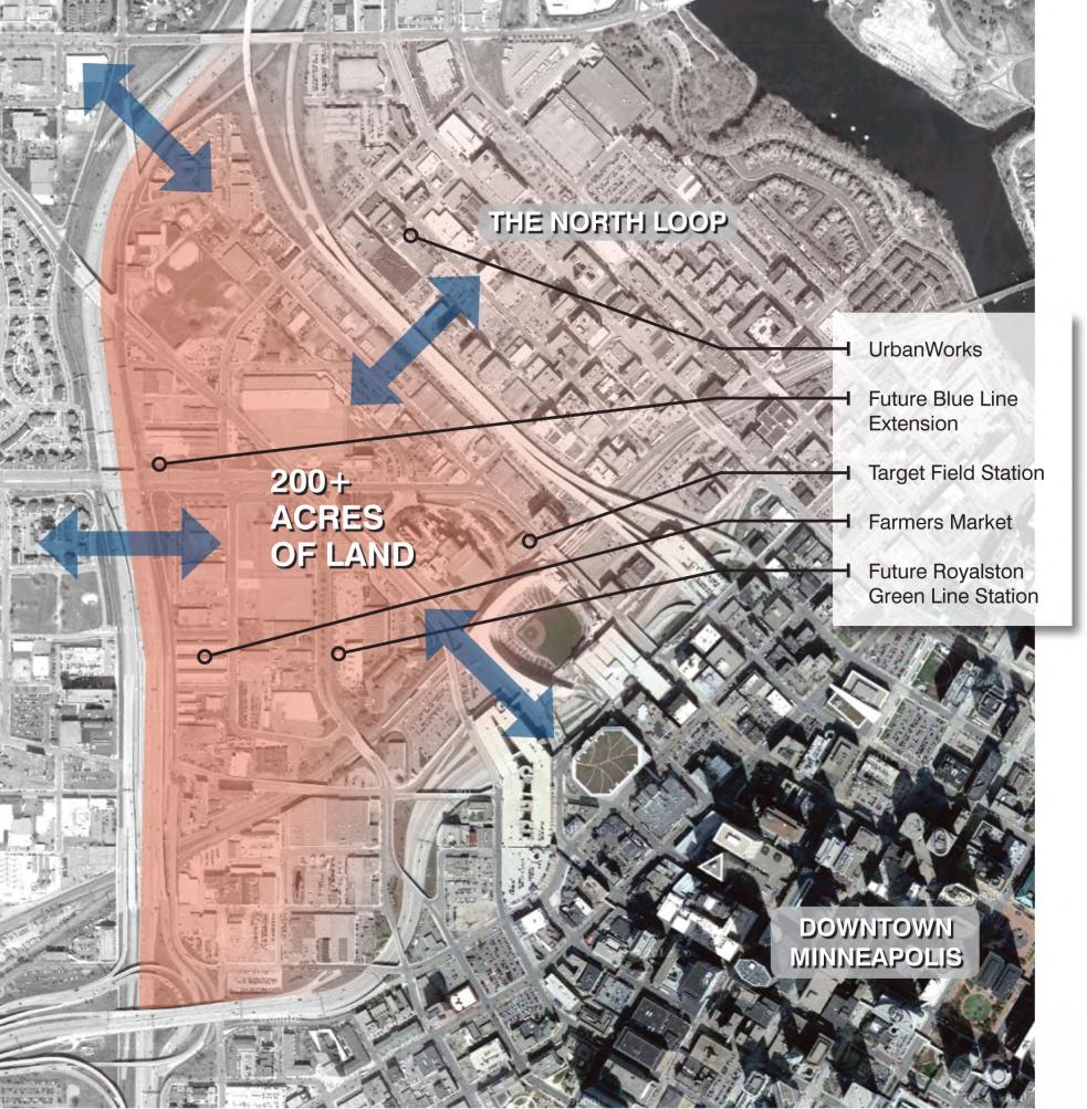
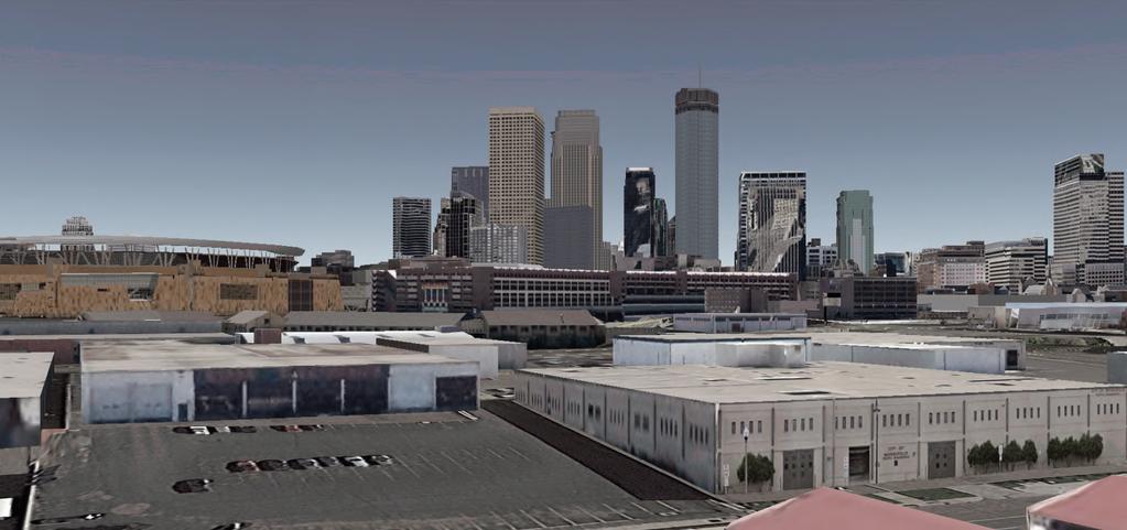
6 location
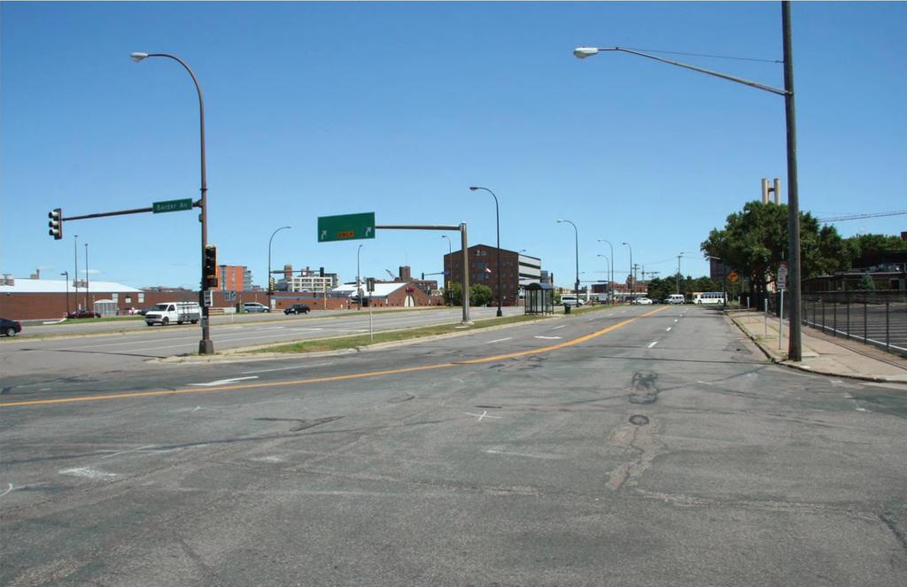
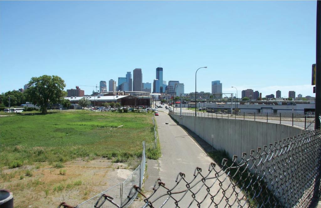
7 the west loop today

8 not connected 17

9 not safe 19
10 20
11 not intentional 21
12 not functional 23
13 206 ACRES TOTAL 25

14 206 ACRES TOTAL 30% PUBLICLY OWNED 26

15 206 ACRES TOTAL 30% PUBLICLY OWNED 70% PRIVATELY OWNED 27

16 206 ACRES TOTAL 30% PUBLICLY OWNED 70% PRIVATELY OWNED UNDERUTILIZED 28
17 why here?
18 TRANSIT INVESTMENT & LOCATION 30

19 TRANSIT INVESTMENT & LOCATION URBAN RENAISSANCE Nicollet Mall, Minneapolis, MN PURPLEPROOFS.COM 31


20 building upon
21 premise
22 with a thoughtful vision Tanner Springs Park, Portland, OR MUSEUMOFTHECITY.ORG

23 the whole can be greater than the sum of its parts GREATER THAN THE SUM OF IT S PARTS 37 Tanner Springs Park, Portland, OR MUSEUMOFTHECITY.ORG
24 the elements of the vision

25 RECONNECT THE URBAN STREET GRID Urban Grid HELMOFTHEPUBLICREALM>COM 39

26 RECONNECT THE URBAN STREET GRID BUILD GREEN INFRASTRUCTURE Loring Greenway, Minneapolis, MN PANORAMIO.COM 40


27 RECONNECT THE URBAN STREET GRID BUILD GREEN INFRASTRUCTURE CREATE THE INFRASTRUCTURE OF OPPORTUNITY East Harlem School, Harlem, NY ARCHDAILY.COM 41

28 QUALITY URBAN DEVELOPMENT 43

29 INTENTIONAL DIVERSITY 49
30 over a 20 year build out
31 URBAN STREET GRID 5th STREET CONNECTION TO LYNDALE AVENUE AND NORTHSIDE 4TH STREET BOULEVARD RECONFIGURED INTERSECTION AT 7th STREET AND 6th AVENUE (OLSON MEMORIAL) RESTORED STREETS TO COMPLETE THE GRID 59

32 NEWLY DEVELOPABLE LAND 7.5 ACRES DUE TO GRADE CHANGE AT I-94 ENTRANCE RAMP 5.3 ACRES DUE TO REMOVAL OF I-94 4TH STREET EXIT CAUSEWAY 0.75 ACRES DUE TO REUSE OF UN-USED ALLEY ALONG 7TH STREET 2.8 ACRES DUE TO RE-ALIGNMENT OF OLSON MEMORIAL & CLOSURE OF ROYALSTON AVENUE 1.8 ACRES DUE TO RE-ESTABLISHED STREET GRID & LAND BRIDGE OVER I ACRES TOTAL 69
33 GREEN INFRASTRUCTURE RE-PURPOSED FORMER LYNDALE BRIDGE TO PEDESTRIAN-BIKE BRIDGE 74
34 GREEN INFRASTRUCTURE RE-PURPOSED FORMER LYNDALE BRIDGE TO PEDESTRIAN-BIKE BRIDGE WEST LOOP GREENWAY (LINEAR PARK) 76
35 GREEN INFRASTRUCTURE RE-PURPOSED FORMER LYNDALE BRIDGE TO PEDESTRIAN-BIKE BRIDGE WEST LOOP GREENWAY (LINEAR PARK) NORTH EXTENTION OF TARGET FIELD PROMENADE 78
36 GREEN INFRASTRUCTURE RE-PURPOSED FORMER LYNDALE BRIDGE TO PEDESTRIAN-BIKE BRIDGE WEST LOOP GREENWAY (LINEAR PARK) NORTH EXTENTION OF TARGET FIELD PROMENADE NEW FARMERS MARKET LOCATED NEXT TO GREEN LINE ROYALSTON STATION 80

37 THE INFRASTRUCTURE OF OPPORTUNITY EMPLOYMENT TRAINING SUPPORTIVE HOUSING INTAKE FACILITY (WELCOME CENTER) SCHOOLS ADDED BLUE LINE BOTTINEAU STATION BUS RAPID TRANSIT TRANSFER FACILITY INDOOR PUBLIC MARKET & RECONFIGURED OUTDOOR FARMER S MARKET 101
38 QUALITY URBAN DEVELOPMENT DEVELOPMENT ALONG NEW 4TH STREET BOULEVARD 106
39 QUALITY URBAN DEVELOPMENT DEVELOPMENT ALONG NEW 4TH STREET BOULEVARD HOUSING, OFFICE, AND RETAIL FLANKING THE WEST LOOP GREENWAY 108
40 QUALITY URBAN DEVELOPMENT DEVELOPMENT ALONG NEW 4TH STREET BOULEVARD HOUSING, OFFICE, AND RETAIL FLANKING THE WEST LOOP GREENWAY DENSE DEVELOPMENT CLUSTERED NEAR NEW BLUE LINE STATION 110


41 QUALITY URBAN DEVELOPMENT DEVELOPMENT ALONG NEW 4TH STREET BOULEVARD HOUSING, OFFICE, AND RETAIL FLANKING THE WEST LOOP GREENWAY DENSE DEVELOPMENT CLUSTERED NEAR NEW BLUE LINE STATION DENSE DEVELOPMENT NEAR RECONFIGURED FARMER S MARKET & NEW SOCCER STADIUM 112
42 4th & 5th streets district:
43 118 TODAY

44 120 5 years
45 years

46 years
47 years
48 removing the 4th street overhead freeway:
49 128 today


50 129 FUTURE
51 130 today

52 131 FUTURE
53 royalston district:
54 133 today
55 135 5 years

56 years
57 years
58 years
59 re-envisioning the farmer s market & royalston district:
60 143 today

61 144 FUTURE

62 value - development 23.2 MILLION SQUARE FEET
63 value - development NO PLAN, MINIMAL INVESTMENT
64 value - development FULL BUILD OUT
65 the west loop
Corridor Vision. 1Pursue Minnehaha-Hiawatha Community Works Project. Mission of Hennepin County Community Works Program
 1Pursue Minnehaha-Hiawatha Community Works Project Minnehaha-Hiawatha Community Works is a project within the Hennepin Community Works (HCW) program. The mission of the HCW program is to enhance how the
Chapter 1: Introduction
 Chapter 1: Introduction The Penn Avenue Community Works Corridor Vision and Implementation Framework presents an integrated communitybased vision and a coordinated, long-term implementation framework for
Midtown Greenway Land Use and Development Plan Executive Summary
 Midtown Greenway Land Use and Development Plan Executive Summary Introduction The Midtown Greenway Land Use and Development Plan sets policy direction for land use and development in the Midtown Greenway
Corridors. Re-vitalize our Corridors and Gateways
 Corridors Re-vitalize our Corridors and Gateways Artist s rendering from the 287 Strategic Plan, 2015 Corridors are the major throughways of Loveland but they also provide important commercial, community
DOWNTOWN RESIDENTIAL DISTRICT DEVELOPMENT OPPORTUNITES
 DOWNTOWN RESIDENTIAL DISTRICT DEVELOPMENT OPPORTUNITES Out of all the areas in Downtown Painesville, this district provides the greatest opportunity for change with the vacation of Lake East Hospital.
History: a Grand Urban Boulevard
 History: a Grand Urban Boulevard 1890 1910: At its peak, Euclid Avenue, "Millionaire's Row," was considered the second most beautiful urban street in the country next to Fifth Avenue in Manhattan. 1910-2030:
ALTERNATIVES WHAT ELSE IS POSSIBLE?
 ALTERNATIVES WHAT ELSE IS POSSIBLE? VISION STATEMENT Rather than make a ±$250 million investment that will lock in place and exacerbate the current dysfunctional system for at least 5 more decades Let
THE NEIGHBORHOOD TODAY
 THE NEIGHBORHOOD TODAY CORE AREA VISION How are we Good Urbanism A Site s DNA thinking about Elements of great Unique elements urban communities embedded in a place the site and design? ELEMENTS LIKE:
THE GAS PLANT DISTRICT MASTER PLAN SCENARIO 2. COMMUNITY MEETING August 6, 2018
 THE GAS PLANT DISTRICT MASTER PLAN SCENARIO 2 COMMUNITY MEETING August 6, 2018 The Gas Plant Neighborhood in the 1970 s The development should honor the history of the Gas Plant neighborhood and the community
MEMORANDUM. I2 District Downtown Parking Overlay District 24,000 square feet /.55 acres. Industrial Employment District North Loop Small Area Plan
 Department of Community Planning & Economic Development 50 South 4th Street, Room 300 Minneapolis, MN 5545-385 MEMORANDUM To: City Planning Commission, Committee of the Whole Prepared By: Peter Crandall,
Blue Line LRT Extension
 v e Noble Pkwy Noble Pkwy Xerxes Ave N Shingle Creek Penn Ave N Penn Ave N Fremont Ave N Lyndale Ave N S Washington Ave University Ave NE Blue Line LRT Extension LIGHT RAIL PLATFORM AND STATION DESIGN
Robbinsdale LRT Station. CDI Development Guidelines. August Overview
 Robbinsdale LRT Station August 2018 Overview The City of Robbinsdale may have the coolest opportunity site along the 13 mile stretch of the Bottineau LRT corridor / Blue Line extension. Located a block
Planning for TOD Implementation at a Corridor Scale
 Planning for TOD Implementation at a Corridor Scale Bill Sadler, Reconnecting America Presentation to Gold Line Corridor Working Group July 2, 2013 What is Reconnecting America? Reconnecting America is
Planning for TOD Implementation at a Corridor Scale
 Planning for TOD Implementation at a Corridor Scale Catherine Cox Blair, Reconnecting America Presentation to DRCOG and the Sustainable Communities Initiative May 14, 2012 What is Reconnecting America?
Gold Line Bus Rapid Transit Transit Oriented Development (BRTOD) Helmo Station Area Plan
 Helmo Station Area Plan") Appendix F Gold Line Bus Rapid Transit Transit Oriented Development (BRTOD) Helmo Station Area Plan Introduction and Purpose of the Plan The Gold Line Bus Rapid Transit facility is an eleven-mile dedicated
Appendix F Gold Line Bus Rapid Transit Transit Oriented Development (BRTOD) Helmo Station Area Plan Introduction and Purpose of the Plan The Gold Line Bus Rapid Transit facility is an eleven-mile dedicated
Southwest Light Rail Transit (LRT) A corridor of opportunity
 A corridor of opportunity") Southwest Light Rail Transit (LRT) A corridor of opportunity Minneapolis Jobs: 151,200 Suburban Jobs: 72,400 Downtown Minneapolis 147,000 emp.* West Calhoun 4,200 emp. Beltline Business Park 6,000 emp.
Southwest Light Rail Transit (LRT) A corridor of opportunity Minneapolis Jobs: 151,200 Suburban Jobs: 72,400 Downtown Minneapolis 147,000 emp.* West Calhoun 4,200 emp. Beltline Business Park 6,000 emp.
Southwest Ecodistrict CREATING A MORE SUSTAINABLE FUTURE ULI/GSA Symposium: Planning the Future of Federal Triangle South March 27 th, 2013
 Southwest Ecodistrict CREATING A MORE SUSTAINABLE FUTURE ULI/GSA Symposium: Planning the Future of Federal Triangle South March 27 th, 2013 Study Area The National Mall DOE FAA FAA Cotton Annex DOE DOE
DRAFT ROOSEVELT ROAD. District Recommendations. Figure 5.23 The Roosevelt Road Corridor
 CHAPTER 5 Figure 5.23 The Road Corridor Road will develop as a mixed-use corridor, emphasizing regional retail, west of the river and mixed-use development east of the river. KEY RECOMMENDATIONS 1. High
Welcome. Community Consultation Meeting November 28, Review and discuss the Bathurst Quay Neighbourhood Plan Framework
 Welcome Community Consultation Meeting November 28, 2016 Why Are We Here Today? Review and discuss the Bathurst Quay Neighbourhood Plan Framework Review and discuss an Action Plan for Implementation Next
RE-Imagining the Downtown Colorado Springs Master Plan
 RE-Imagining the Downtown Colorado Springs Master Plan 2016 APA Colorado State Conference October 25, 2016 Overview 8:00 Welcome, Introductions, and Overview 8:15 Downtown s Planning History 8:30 A Market
West Broadway Transit Study Initial Screening of Alternatives Memo
 West Broadway Transit Study Initial Screening of Alternatives Memo 5/22/2015 Prepared by the SRF Consulting Group Team for Table of Contents Purpose... 1 Methodology... 1 Screening... 5 Screening Criteria...
Subcampus Recommendations
 T he campus is is comprised of three major areas. These subcampus areas are known as WestCampus, South Campus, Campus Oakland and Drive East Campus. and Future East growth Campus. requires a Future careful
José Campos Manager of Planning and Design Review SPUR San José Symposium October 12, 2018
 1 Transbay: Freeways to New Ways José Campos Manager of Planning and Design Review SPUR San José Symposium October 12, 2018 2 Transbay freeway land pre-1989 3 1989 Loma Prieta Earthquake 4 TRANSBAY c.
3.1 community vision. 3.3 required plan elements
 Chapter 3 Community Form 3.1 community vision 3.2 Parks & landscaping concepts 3.3 required plan elements D R A F T 20 Community Form Chapter 3 3.0 Community form 3.1 community vision The Specific Plan
Embrace Green Urban Space:
 1 Embrace Green Urban Space: Parks/Green Space as Vital to Urban Livability Jenna Fletcher The Trust for Public Land LUAC November 15, 2012 2 The Trust for Public Land conserves land for people to enjoy
ALMONO. Hazelwood, City of Pittsburgh. A riverfront investment opportunity combining residential, office and light industrial uses A L M O N O S I T E
 Tecumseh St. ALMONO Hazelwood, City of Pittsburgh A riverfront investment opportunity combining residential, office and light industrial uses Downtown Pittsburgh Oakland South Side Flats Birmingham Bridge
ROBBINSDALE LRT STATION CDI DEVELOPMENT GUIDELINES
 August 2018 OVERVIEW The City of Robbinsdale has a prime-opportunity site in the middle of the 13 mile stretch of the Bottineau LRT corridor / Blue Line extension. Robbinsdale offers a prominent, vital,
DRAFT. 10% Common Open Space
 % OF CHARLOTTE IS CATEGORIZED AS A. LAND USES : Placeholder map displaying location of Place Type GOALS: Accommodate XX% of future growth. Provide a concentration of primarily commercial and civic activity
Lynn Waterfront Master Plan
 Lynn Waterfront Master Plan Public Meeting #2 December 10th, 2018 1 Project Schedule Update September 26, 2018 December 10, 2018 Development of the Master Harbor Plan Amendment and Revised Waterfront Master
Community Advisory Committee. February 24, 2015
 Community Advisory Committee February 24, 2015 1 Today s Topics Welcome & Introductions Approve Charter 2015 Meeting Calendar Hennepin County Community Works Update Development Update Environmental Update
A Plan for the Heart of the Region: Tukwila, WA
 : Tukwila, WA 1 The Plan orchestrates the Restructuring of a 1,000-acre Regional Shopping Area into a Social and Symbolic for the Region. REGIONAL CONTEXT Downtown Seattle (Metropolitan ) 20 miles Bellevue
Northwest commuter rail station US 36 BRT. Westminster Station
 Northwest commuter rail station Westminster Station US 36 BRT Westminster Center US 36 & Church Ranch Broomfield Flatiron/96 th St. US 36 & McCaslin Table Mesa Boulder Junction 13-month effort that will
Tyvola & Archdale Transit Station Area Plan. May 15, 2008
 Tyvola & Archdale Transit Station Area Plan First Public Meeting May 15, 2008 Presentation Outline 1. Purpose and Process 2. Station Area Overview 3. Plan Recommendations Vision Land Use Transportation
BROOKHILL NEIGHBORHOOD MODEL ZONING MAP AMENDMENT PREFACE TO APPLICATION
 BROOKHILL NEIGHBORHOOD MODEL ZONING MAP AMENDMENT PREFACE TO APPLICATION June 15, 2015 Revised: August 1, 2016 I. VISION Brookhill is a proposed community based upon the principles of Albemarle County
Welcome. Walk Around. Talk to Us. Write Down Your Comments
 Welcome This is an information meeting introducing the applications for proposed redevelopment of the Yorkdale Shopping Centre site at 3401 Dufferin Street and 1 Yorkdale Road over the next 20+ years,
Atlanta BeltLine Corridor Environmental Study. Scoping Meeting August 2008
 Atlanta BeltLine Corridor Environmental Study Scoping Meeting August 2008 What Will We Be Discussing Today? Study Overview - How Did We Get Here? - What Is the Study About? - Who Is Involved? - Where Is
Pedestrian and Bike Bridge LOGO
 6.2.2 Pedestrian and Bike Bridge The proposed pedestrian and bike crossing re-envisions the existing bridge at Pismo Creek on Cypress Street. The bridge is currently underutilized by vehicular through
LEED-ND 101: Practical Strategies for Achieving Sustainability Goals. Travis Parker Lakewood Planning Director
 LEED-ND 101: Practical Strategies for Achieving Sustainability Goals Travis Parker Lakewood Planning Director Metro Vision Idea Exchange Oct 11, 2012 West Corridor Stations West Corridor Overview West
Good Design Guidelines for Downtown. Preliminary Findings and Recommendations
 Good Design Guidelines for Downtown Preliminary Findings and Recommendations City Council Meeting - February 5, 2017 Advisory Committee Team: Larry Paul: Planning Commission /Architect Bruce Bagnoli: Business
Stakeholders Advisory Working Groups (SAWGs) Smart Growth and TOD Land Use (#11) SAWG Meeting
 Smart Growth and TOD Land Use (#11) SAWG Meeting") Presentation - Part II Tappan Zee Bridge/I-287 Corridor Project July 21, 2010 Slide 1. David Kooris (Regional Plan Association) welcomed members of the Land Use Stakeholders Advisory Working Groups (SAWGs)
Presentation - Part II Tappan Zee Bridge/I-287 Corridor Project July 21, 2010 Slide 1. David Kooris (Regional Plan Association) welcomed members of the Land Use Stakeholders Advisory Working Groups (SAWGs)
Community Engagement Committee Meeting #1 December 10, :30pm-8:30pm
 Community Engagement Committee Meeting #1 December 10, 2014 6:30pm-8:30pm Welcome and Introductions Dana Murdoch Minneapolis Park and Recreation Board Project Manager Ryan French Walker Art Center Director
Reconfiguration of The Six Points Interchange. Community Update #2 June 18, 2014
 Reconfiguration of The Six Points Interchange Community Update #2 June 18, 2014 Outline 1. Project overview 2. How did we get here? 3. Etobicoke Centre 4. Existing and future road network 5. Design Update
Promoting Economic Development Through Upfront SEPA Review: Lessons from South Downtown Tacoma
 Promoting Economic Development Through Upfront SEPA Review: Lessons from South Downtown Tacoma 1 This session will focus on the City of Tacoma s South Downtown Subarea Plan and associated Non-Project SEPA
Northwest Rail Corridor and US 36 BRT Development Oriented Transit Analysis 4.4 STATION AREA FINDINGS
 4.4 STATION AREA FINDINGS Each station is different, and each one requires a separate set of recommendations based on the vision for the site. This section outlines an initial TOD strategy and recommendations
V. Case Study Sites. Case Study Site Descriptions and Concepts. Case Study #1: Lake Street and Calhoun
 V. Case Study Sites The project area includes a wide variety of neighborhood contexts with diverse development opportunities. To better understand these contexts and how they affect choices concerning
Civic Center District
 Civic Center District The Civic Center district is the civic and social heart of Warrenville, containing such public buildings as the City Hall, Warrenville Public Library, Police Station, Park District
REBUILD GUTTER AND ROLLED CURB TO MATCH EXISTING DETAIL. (TYPICAL) REPAIR EXISTING BENCH FINISH. RETURN TO EXISTING LOCATIONS.
 REPAIR EXISTING BENCH FINISH. RETURN TO EXISTING LOCATIONS.") MILL STREET REBUILD GUTTER AND ROLLED CURB TO MATCH EXISTING DETAIL. CURB RAMP FLUSH WITH STREET. REMOVE TWO PARKING SPACES FOR BIKE RACKS AND WASTE RECEPTACLES OVER CONCRETE SURFACE. REMOVE ONE PARKING
MILL STREET REBUILD GUTTER AND ROLLED CURB TO MATCH EXISTING DETAIL. CURB RAMP FLUSH WITH STREET. REMOVE TWO PARKING SPACES FOR BIKE RACKS AND WASTE RECEPTACLES OVER CONCRETE SURFACE. REMOVE ONE PARKING
Mary Hills Nature Area. Roadway Lighting. The Minneapolis Clinic of Neurology Courage Kenny Rehabilitation Institute
 PUBLIC REALM IMPROVEMENTS Mary Hills Nature Area Enhanced Programming Glenview Terrace Valley View Roadway Lighting Enhanced Streetscape Trail Lighting / Roadway Lighting Wayfinding Public Art The Minneapolis
APPENDIX C Township 9 Consistency with Applicable Plans
 Township 9 Consistency with Applicable Plans 1985 American River Parkway Plan Policies Project Consistency Policy 4.14: The following activities and facilities, which are incompatible with the Parkway,
CHAPTER 1. Ms. Guajardo s Class - Central Elementary CH 1 1
 INTRODUCTION CHAPTER 1 Ms. Guajardo s Class - Central Elementary CH 1 1 1.1 SETTING South Centre City is a linear corridor south of Downtown Escondido paralleling Centre City Parkway and South Escondido
Part 2 Common Elements
 WHITE FLINT SECTOR PLAN Round Table Discussion: Part 2 Common Elements October 8, 2007 The M-NCPPC 1 Role Regional Marketplace North Bethesda s Downtown with a Conference Center District The M-NCPPC 2
NorthPoint, Inc. Community-Based Development Concept
 NorthPoint, Inc. Community-Based Development Concept 6.0.01 EXECUTIVE SUMMARY The NorthPoint Community Board Development concept is a community development strategy. It leverages NorthPoint s mission,
Mississippi Skyway Preliminary Engineering Report
 EXECUTIVE SUMMARY Mississippi Skyway Preliminary Engineering Report CITY OF RAMSEY, MINNESOTA DECEMBER 2014 City of RAMSEY EXECUTIVE SUMMARY Project Need and Intent The Mississippi Skyway pedestrian bridge
The Master Plan Framework
 The Master Plan Framework The East Harbour Master Plan advances the development of 60 acres of former industrial lands east of the Don River. The Master Plan outlines a vision for a vibrant, transit-oriented
Taming Tysons Corner Transforming the Quintessential Edge City
 Taming Tysons Corner Transforming the Quintessential Edge City Transit is the greatest catalyst for change at Tysons, but how do we take advantage of this billion-dollar investment? If transit is built
Tacoma Mall Neighborhood Subarea Plan & EIS. Planning Commission January 18, 2017
 Tacoma Mall Neighborhood Subarea Plan & EIS Planning Commission January 18, 2017 Objectives Develop one or more options for connectivity requirement What is the intent? Key considerations Range of options
WEST OAKLAND SPECIFIC PLAN Final Plan. 2. Vision & Goals. 2.1 Community-Based Goals and Objectives
 WEST OAKLAND SPECIFIC PLAN Final Plan 2. Vision & Goals 2.1 Community-Based Goals and Objectives June 2014 2: Vision & Goals The vision of the West Oakland Specific Plan is to see this remarkable community
THE COUTURE AT A GLANCE $122 MILLION TOTAL PROJECT COST 44 STORIES / 700,000 SQUARE FEET PUBLIC PLAZAS, PARK & PEDESTRIAN BRIDGES 302 MARKET RATE
 MILWAUKEE THE COUTURE AT A GLANCE $122 MILLION TOTAL PROJECT COST 44 STORIES / 700,000 SQUARE FEET PUBLIC PLAZAS, PARK & PEDESTRIAN BRIDGES 302 MARKET RATE APARTMENTS 54,893 SQUARE FEET OF DESTINATION
Learning Objectives. Introduction. Design at an Ecodistrict Scale can Change Washington, DC s Landscape
 Learning Objectives Design at an Ecodistrict Scale can Change Washington, DC s Landscape Presenters Elizabeth Miller, ASLA, National Capital Planning Commission Diane Sullivan, National Capital Planning
Citizen Comment Staff Response Staff Recommended Revision Planning Committee
 Citizen Comment Staff Response Staff Recommended Revision Planning Committee Area No. 1: Owner desires retail land uses. Area No. 1a: Owner of two small parcels adjacent to Area No. 1 desires retail land
Study Area. Capitol Way. Greening America s Capitals 11/13/2014. A Greening America s Capitals Project
 Olympia, WA: Greening Capitol Way Supporting Communities move towards sustainability is a priority for the federal government. A Greening America s Capitals Project Office of Sustainable Communities U.S.
SW Ecodistrict A VISION PLAN FOR A MORE SUSTAINABLE FUTURE June 25, 2013
 Urban Land Institute The Past, Present and Future of Sustainable Urbanism in Southwest DC SW Ecodistrict A VISION PLAN FOR A MORE SUSTAINABLE FUTURE June 25, 2013 Study Area The National Mall DOE FAA FAA
Equitable Growth Through TOD Planning
 Equitable Growth Through TOD Planning Community Meeting # 2 November 2017 Goals Objectives Extend investment from downtown Connect neighborhoods physically and economically Enhance places based on local
Hopkins. Development Guidelines May Overview. Sponsored by: Blake Road Corridor Collaborative City of Hopkins
 Hopkins Blake Road LRT Station Area Development Guidelines May 2015 Sponsored by: Blake Road Corridor Collaborative City of Hopkins Overview Hopkins is a dynamic community of over 17,000 residents located
PIKE PINE RENAISSANCE: ACT ONE. October 19, 2017
 PIKE PINE RENAISSANCE: ACT ONE October 19, 2017 WATERFRONT SEATTLE PROGRAM PROJECT INTRODUCTION Pike and Pine streets, between First and Melrose avenues Pedestrian and streetscape improvements Budget:
Community Information Meeting
 Queensborough Eastern Community Information Meeting July 24, 2014 Cameron Chalmers, MCIP, RPP Platform Properties Meeting Format Purpose Format The purpose of the meeting is to invite the community to
Town Center (part of the Comprehensive Plan)
") Town Center (part of the Comprehensive Plan) Mercer Island Town Center Looking North (2014) In 1994, a year-long process culminated in a set of design guidelines and code requirements for the Town Center
Town Center (part of the Comprehensive Plan) Mercer Island Town Center Looking North (2014) In 1994, a year-long process culminated in a set of design guidelines and code requirements for the Town Center
Historic Preservation Preserve, restore or adaptively re-use historic structures and landscapes.
 Checklist for New Construction Developers of building projects in the Loring Park Neighborhood are encouraged to pursue the standards that are identified below. For large projects requiring special allowances,
The University District envisions, in its neighborhood
 Envisioning the University District Link Light Rail in Seattle s neighborhoods CIY OF SEALE CONCEP-LEVEL SAION AREA PLANNING RECOMMENDAION RESOLUION # 30165 EXHIBI L Vision 08.2000 he University District
University Avenue District
 University Avenue District UPDATE ON THE OPPORTUNITY 07.8.15 1 University Avenue District The new century nexus of live, work, learn, research, and engage. An intentional partnership of developers, businesses,
U R B A N D E S I G N & D E V E L O P M E N T P L A N
 U R B A N D E S I G N & D E V E L O P M E N T P L A N F O R T H E S K I N K E R D e B A L I V I E R E C O M M U N I T Y P U B L I C W O R K S H O P # 3 S T. L O U I S, M I S S O U R I H 3 S T U D I O M
BROOKLYN PARK / 85TH AVE LRT STATION CDI DEVELOPMENT GUIDELINES DRAFT
 August 2018 Page intentionally left blank The Brooklyn Park Library adjacent to the 85th Ave LRT Station Area. OVERVIEW The Blue Line LRT Extension / Bottineau corridor offers a unique opportunity to leverage
VISUALIZATION TOOLS FOR COMMUNICATION & DECISION MAKING REAL MINNESOTA EXAMPLES
 REAL MINNESOTA EXAMPLES 23rd Annual CTS Transportation Research Conference Leif Garnass, P.E., PTOE Senior Engineer lgarnass@srfconsulting.com Sean Jergens, ASLA, LEED AP Senior Landscape Architect sjergens@srfconsulting.com
Albert Lea. Redevelopment Plan. 701 Xenia Avenue South, Suite 300 Minneapolis, MN Tel: (763) Fax: (763) wsbeng.
 Fax: (763) wsbeng.") Albert Lea Redevelopment Plan 701 Xenia Avenue South, Suite 300 Minneapolis, MN 55416 Tel: (763) 541-4800 Fax: (763) 541-1700 wsbeng.com Albert Lea Redevelopment Plan Table of Contents Composite Districts...
Albert Lea Redevelopment Plan 701 Xenia Avenue South, Suite 300 Minneapolis, MN 55416 Tel: (763) 541-4800 Fax: (763) 541-1700 wsbeng.com Albert Lea Redevelopment Plan Table of Contents Composite Districts...
Draft for Public Review. The Market and Octavia Neighborhood Plan
 Draft for Public Review The Market and Octavia Neighborhood Plan San Francisco Planning Department As Part of the Better Neighborhoods Program December 2002 . A New Neighborhood in SoMa West OBJECTIVE.1
New Auburn Village Center Study Auburn, Maine
 Auburn, Maine Option Review Summary Prepared for: Androscoggin Transportation Resource Center and City of Auburn Prepared by: T.Y. Lin International MRLD October 10, 2013 1. Introduction This memo summarizes
A P P E N D I X B - O P P O R T U N I T Y S I T E S
 A P P E N D I X B - O P P O R T U N I T Y S I T E S OPPORTUNITY SITES As listed in the Land Use Element, the City has identified 15 Opportunity Sites expected to be the focus of change and revitalization
McCowan Precinct Plan Study Background & Deliverables
 1 DRAFT & WITHOUT PREJUDICE McCowan Precinct Plan Study Background & Deliverables In September, 2011, City Planning (Scarborough District) began a study of an area within the Scarborough Centre, identified
City of Tacoma Planning and Development Services
 Agenda Item E-1 City of Tacoma Planning and Development Services To: Planning Commission From: Elliott Barnett, Planning Services Division Subject: Tacoma Mall Regional Center Subarea Plan and EIS Meeting
Attachment B Summary of Plan Alternatives Report
 Attachment B Summary of Plan Alternatives Report Based on community ideas and feedback to date, a series of draft alternative scenarios for the future of downtown s neighborhood districts have been created
New Partners for Smart Growth Conference February 5, 2010
 Dan Stroh, Planning Director City of Bellevue Planning and Community Development Bellevue, WA New Partners for Smart Growth Conference February 5, 2010 Summary of Project Long-range plan update for Bel-Red
GREENING THE BOULEVARD Master Plan Concepts for Venice Boulevard between Lincoln and Sawtelle
 GREENING THE BOULEVARD Katherine Spitz Associates Inc. 4212½ Glencoe Avenue Marina Del Rey, CA 90292 310 574 4460 Fax 574 4462 January 2008 Table of Contents Overview Proposed Design Improvements Illustration
MONTGOMERY COUNTY METRO STATION AREA DESIGN CHARRETTE
 MONTGOMERY COUNTY METRO STATION AREA DESIGN CHARRETTE Shady Grove Metro Station Area Charrette Closing Presentation October 25-28, 2000 MONTGOMERY COUNTY, MD M-NCPPC Design Collective, Inc. Architects
City of Long Beach. creating vibrant and exciting places
 City of Long Beach creating vibrant and exciting places Land Use Element Urban Design Element Overview of the two draft General Plan elements Discuss areas of change Economic goals of the plans Case study
TRANSIT RICH DEVELOPMENT
 TRANSIT RICH DEVELOPMENT Alan Hart AIA MAIBC AAA There is only one way to reduce congestion and get people out of their cars: design the places where people live around the patterns of their lives; give
Table of Contents. Elm Avenue Improvement Plan City of Waco, Texas. Introduction 1. Existing Context 1 Figure 1 2.
 Table of Contents Introduction 1 Existing Context 1 Figure 1 2 Plan Guidelines 3 Future Urban Form 4 The West-End 4 Main Street 6 The East-End 7 Figure 2 9 Public Improvement Recommendations 7 General
Moody Centre Station TOD Area Today
 Moody Centre Station TOD Area Today WHAT IS a transit-oriented Murray Street development area? A Transit-Oriented Development (TOD) Area is a dense, walkable residential and commercial area built to support
Wasatch CHOICE for 2040
 Wasatch CHOICE for 2040 Economic Opportunities We Can Choose a Better Future We enjoy an unparalleled quality of life along the Wasatch Front. People from all over the world are drawn to our stunning scenery,
Allen Street Civic District Redevelopment Area Plan Redevelopment Plan & Proposal State College Planning Commission State College Redevelopment
 Allen Street Civic District Redevelopment Area Plan Redevelopment Plan & Proposal State College Planning Commission State College Redevelopment Authority September 17, 2015 Discussion Points Overview of
tinyan lee the hastings experience masterplan : hastings corridor individual design sustainable urbanism : the hastings corridor
 tinyan lee the hastings experience masterplan : hastings corridor individual design Research Context Managing urban growth in Burnaby has become an increasing challenge. Burnaby currently has an estimated
Small Area Plan. South Gateway
 Small Area Plan Adopted May 12, 2008 South Gateway Purpose. The South Gateway Small Area Plan defines the City s expectations for the future of the southern entrance to the City at Interstate 85 and Highway
East Central Area Plan
 East Central Area Plan Steering Committee Meeting March 8 th, 2018 CHUN Tears McFarlane House Vision Statement Development Opportunities Analysis Vision Elements 1. Equitable, Affordable and Inclusive
EXHIBIT A. Tax Increment Reinvestment Zone No. 1 (Town Center) First Amended Project Plan 1
 First Amended Project Plan 1") EXHIBIT A Tax Increment Reinvestment Zone No. 1 (Town Center) First Amended Project Plan 1 1 As amended by Resolution No. 2008-02-001(TR1R) of the Tax Increment Reinvestment Zone No.1, and approved to
EXHIBIT A Tax Increment Reinvestment Zone No. 1 (Town Center) First Amended Project Plan 1 1 As amended by Resolution No. 2008-02-001(TR1R) of the Tax Increment Reinvestment Zone No.1, and approved to
Reconnecting New Haven: Downtown Crossing
 Reconnecting New Haven: Downtown Crossing Phase 2 Update Introduction to Phase 3 November 16, 2017 City of New Haven, Connecticut Toni N. Harp, Mayor Reconnecting New Haven Introduction Project Overview
HEALING THE PIKES FOREWORD INTRODUCTION PRECEDENT STUDIES NOLENSVILLE PIKE VISION AREAS OF FOCUS URBAN NEIGHBORHOOD COMMERCIAL CORRIDORS
 HEALING THE PIKES FOREWORD INTRODUCTION PRECEDENT STUDIES NOLENSVILLE PIKE VISION AREAS OF FOCUS URBAN NEIGHBORHOOD COMMERCIAL CORRIDORS SUBURBAN CENTERS IMPLEMENTATION 9 9 Nashville, TN s historic pikes
BeltLine Corridor Environmental Study
 BeltLine Corridor Environmental Study Citywide Conversation on Transit and Trails April 2, 2009 Agenda & Introductions Introductions Environmental Study Process Overview of the BeltLine Project BeltLine
Downtown Elkton Station Area Plan, Elkton, MD. Difficult enough to get support for new starts challenge to fund Houston transit
 Difficult enough to get support for new starts challenge to fund Houston transit More difficult to build Community Support for dense development at station areas Major Concerns: Traffic, Property values,
Por favor, levanten la mano si necesita traduccion en espanol Please raise your hand if you need Spanish translation
 FEDERAL BOULEVARD CORRIDOR WIDE STUDY PUBLIC MEETING #1 APRIL 27, 2016 Por favor, levanten la mano si necesita traduccion en espanol Please raise your hand if you need Spanish translation HDR DESIGN WORKSHOP
Preliminary Recommendations Tk Takoma/Langley Crossroads Sector Plan
 Preliminary Recommendations Tk Takoma/Langley Crossroads Sector Plan Vision is to achieve a Transit Oriented, pedestrian friendly Community that Celebrates and builds upon the cultural Diversity of the
Draft for Public Review. The Market and Octavia Neighborhood Plan
 Draft for Public Review The Market and Octavia Neighborhood Plan San Francisco Planning Department As Part of the Better Neighborhoods Program December 2002 IOverview Why Plan a Better Neighborhood Here