Mosaic of patches Agents of patch formation: Environmental constraints (Abiotic) Biotic processes Disturbances (natural and human induced)
|
|
|
- Ashlie Griffin
- 5 years ago
- Views:
Transcription
1 Landscape: Mosaic of patches Agents of patch formation: Environmental constraints (Abiotic) Biotic processes Disturbances (natural and human induced) Concepts for Quantification of a Landscape Landscape ecology involves the study of landscape patterns, the interactions among patches within a landscape mosaic, and how these patterns and interactions change over time. Structure, Function, and Change 1
2 Distribution of Flow of Change of Energy Materials Species Structure Function Change Landscape ecology focuses on three characteristics of the landscape: Structure: Refers to the spatial relationships among the distinctive ecosystems, that is, the distribution of energy, materials, and species in relation to the sizes, shapes, numbers, kinds, and configurations of components. (Spatial Pattern) Function: Refers to the interactions among the spatial elements, that is, the flows of energy, materials, and species among the component ecosystems. (Processes) Change: Refers to the alteration in the structure and function of the ecological mosaic through time. (Dynamics) 2
3 Spatial heterogeneity and pattern of a landscape: where it come from why it matters how to characterize it how it changes through time Quantitative analysis of landscape patterns is a necessary. Quantitative Methods Landscape level research requires new methods to 1. quantify spatial patterns; 2. compare landscapes; 3. identify significant differences; and 4. determine relationships of functional processes to landscape patterns. 3
4 Landscape Elements Patches - size, number, shape, location Edges and Boundaries - structure, shape Corridors and Connectivity - pathways, barriers Mosaics - network, fragmentation, pattern, scale Tools for Quantification of Landscape: Landscape Metrics landscape metrics refers to indices developed for categorical map patterns. Landscape metrics are algorithms that quantify specific spatial characteristics of patches, classes of patches, or entire landscape mosaics. Quantitatively measure the landscape including patch size, shape, proximity, edge density, dominance, diversity, fractal dimension, 4


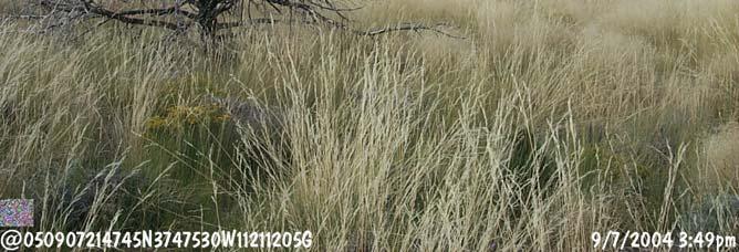
5 Source of Data for Quantification of Landscape 1. Aerial Photography: One of the most widely used types of remote sensing data from which land use/land cover types can be obtained directly. 2. Digital Remote Sensing: Sequences of satellite data can be used to derive estimates of transition frequencies between land use categories. 3. Spatial Database (GIS) Thematic maps 4. Published Data and Censuses 5. Field Survey Patch Size and Number Patches must be defined relative to the phenomenon under consideration. A patch is a relative homogeneous area that differs from its surroundings. Patches have familiar attributes, such as large or small, rounded or elongated, and straight or convoluted boundaries. These attributes in turn have widespread ecological implications for productivity, biodiversity, soil, and water. 5

6 Why are characteristics of patches important? In forestry: affects road construction and erosion In urban planning: affects the size of housing development and natural reserve In aquifer and lake protection: large patch of natural vegetation is required In agriculture, optimum field size has both ecologic and economic implications Conservation planning requires one large patch or several smaller ones Relationships between number and size of patches and biodiversity Matrix A landscape is composed of several types of landscape elements. Of these, a matrix is the most extensive and most connected landscape element type, and therefore plays the dominant role in the functioning of the landscape. 6


; Disturbance patch (Forman, R.T.T. 1995.")
7 In order to quantify landscape patterns in a meaningful way, the origins and half-life of dynamic patches should be considered. For example, succession is only one of many processes determining the rate and direction of change in a patch. On land, five basic causes or origins of vegetation patches are evident and wide spread. Remnant patch; Regenerated patch; Introduced patch; Environmental patch (of vegetation); Disturbance patch (Forman, R.T.T ) The five types illustrated assume the original landscape was mature coniferous forest. Thickness of arrow over each patch type is roughly proportional to its persistence or half-life. 7


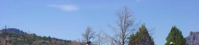
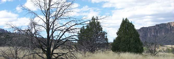
8 Remnant Patch: Appears when an area escapes disturbance surrounding it (e.g., from fires, loggings, anthropogenic impacts...) Regenerated Patch: A regenerated patch resembles a remnant but instead has re-grown on a previously disturbed site. 8


 is caused by the")

9 Introduced Patch: Introduced patches are created by human activities (e.g., farming practices, forestry, urban development, infrastructure, Environmental Patch An environmental patch (of vegetation) is caused by the patchness of the environment, such as a rock or soil type. Example: vegetation distribution and bed rock/soil 9


.")


10 Disturbance Patch: A disturbance patch results from alteration or disturbance of a small area (e.g., fire and wind disturbances). The diverse assemblage of patch types composing a landscape has ecological implications. The rate of change varies widely depending on the cause or origin of patch. 10


11 Environmental patches change slowly, reflecting the stability of the substrate. Example: The Lerai Forest in the Ngorongoro Crater is gradually moving from its present location to a nearby well drained area. Although the yellow-barked fever trees are groundwater dependent, Acacia was not to be. When groundwater changes in water table and supplies, the trees will grow, die, or move accordingly. Those that could not adjust quickly would be eliminated. 11


12 Remnant and Disturbance Patches change relatively rapidly, reflecting the rate of succession, and disappear when they converge in similarity with the adjacent vegetation. When the disturbance stops, succession takes over. Regenerated Patch 12
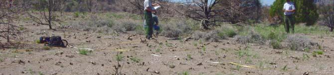
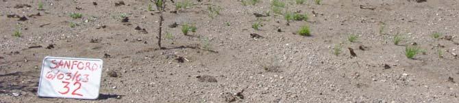
13 Regenerated Patch Disturbance Patch: results from alteration or disturbance of a small area. 13

14 06/21/ /14/


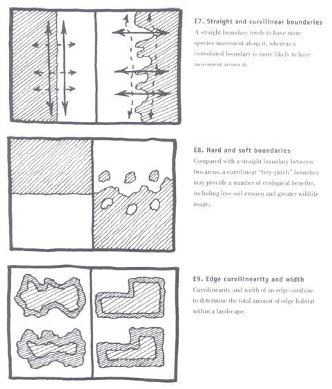
15 Disturbance may be a single or repeated event. Repeated or chronic disturbance, such as tractor plowing or daily local pollution, maintains the patch over time. Each landscape element contains an edge, the outer area exhibiting the edge effect, i.e. dominated by species found only near the border. The inner area of a landscape element is considered the interior or core, and is dominated by species live away from the border. The edges combined compose the boundary or boundary zone. A border is the line separating the edges of adjacent landscape elements. 15

16 Landscape ecology principles in landscape architecture and land-use planning by W.E. Dramstad, J.D. Olson, R.T.T. Forman, Island Press

17 Patch Size: Large or Small... Dramstad, et al., Dramstad, et al.,

18 Dramstad, et al., Patch Locations: Where... Dramstad, et al.,


19 Eastern Arc Mountains: a unique chain of isolated mountains that are directly influenced by the climatic effects of the Indian Ocean and the great age of the mountains. These mountains are recognized as globally important hot spots for forest biodiversity and are major national, regional and local sources of hydropower, water, and forest products. Dramstad, et al.,


20 October 2, 1972 Landsat TM Spring Brook Tall Grass Prairie Restoration Site May 30, 1985 Landsat TM October 10, 1997 Landsat TM Land Cover Change in Naperville Area between 1985 and 1997 Agriculture Urban Spring Brook Prairie Restoration Site 20
 In many cases, natural disturbance and human activities sharpen an existing boundary, thus increase contrast in landscape. Edge Structure: Dramstad, et al.")
21 Boundaries and Edges Three mechanisms produce vegetation boundaries in landscape. A patchy physical environment (e.g., mosaic of soil or landforms ) Natural disturbance (e.g., wild fire ) Human activities (e.g., clear cutting, housing development ) In many cases, natural disturbance and human activities sharpen an existing boundary, thus increase contrast in landscape. Edge Structure: Dramstad, et al.,

22 Dramstad, et al., Dramstad, et al.,

23 Dramstad, et al., Dramstad, et al.,

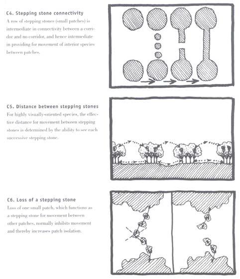
24 Corridors and Connectivity Corridors perform five major functions in landscape: habitat, conduit, filter, source, and sink. Corridor acts a conduit when objects move along it. Corridor is a filter or barrier when objects are inhibited from crossing between patches on opposite sides. Conduit fluxes may be either inside or alongside a corridor. Corridors and Connectivity Nature creates corridors in the form of streams, ridges, and animal trails Example: bare rock range land brush along the creak. 24


25 Corridors and Connectivity Nature creates corridors in the form of streams, ridges, and animal trails Example: The Badlands Wall Appalachian Trail 25

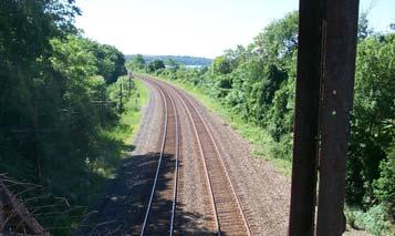
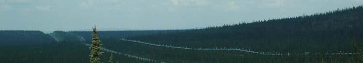
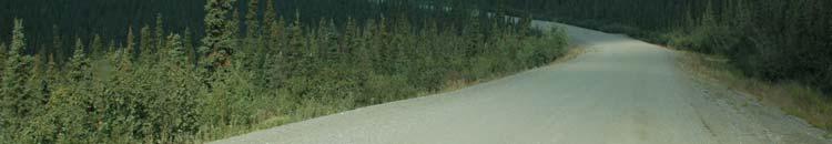
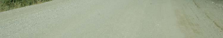
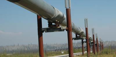
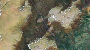
26 Corridors and Connectivity Humans create roads, power-lines, ditches, walk trails Corridors and Connectivity Humans create roads, power-lines, ditches, walk trails 26

 of effects on neighboring patches, corridor may harbor herbivores that")
27 Stone walls Corridors and Connectivity As a source (i.e., an area or reservoir that gives off objects) of effects on neighboring patches, corridor may harbor herbivores that feed on crops, predators that control crop pests, trees that disperse seeds, and hunters that hunt in the matrix. As a sink (i.e., an area or reservoir that absorb objects) for fluxes from neighboring areas, corridor may accumulate wind-blown sediment and snow, subsurface mineral nutrients, and animals from the matrix. 27

28 Dramstad, et al., Dramstad, et al.,
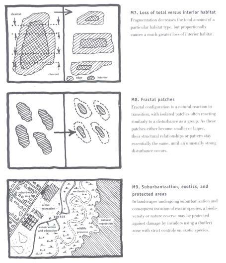
29 Mosaic Patterns The overall structural and functional integrity of a landscape can be understood and evaluated in terms of both pattern and scale. Ecological health of a landscape is the overall connectivity of the natural systems present. Corridors often interconnect with one another to form networks, enclosing other landscape elements. Networks in turn exhibit connectivity, circuitry, and mesh size. Mosaic Patterns A common landscape pattern is fragmentation, which is considered as one of several land transformation processes, which together may produce isolation of habitat. Fragmentation also results from natural disturbances, but has become an international policy issue because of the widespread alternation of land mosaics by human activities. 29


30 Mosaic Patterns The spatial scale at which fragmentation occurs is important when identifying strategies to cope with continued habitat loss and isolation. For example, fragmented habitat at a fine scale may be perceived as intact at a broader scale. Only by recognizing and addressing landscape changes across different scales can planners and designers maximum protection of biodiversity and natural processes. Gross, et al., Map showing connectivity of natural landscapes in the United States. The thickness of red lines indicates magnitude of cumulative movement, assuming that animals avoid human-modified areas. The surface underneath the pathways depicts the averaged cost distance surfaces, or the overall landscape connectivity surface. Colors range from green through yellow and purple to white, where green is greatest connectivity (lowest travel cost) and white indicated lowest connectivity (highest travel cost). National Park Service units are outlined in black. 30


31 Mosaic Patterns In landscape, context is usually more important than content, i.e., the surrounding mosaic has a greater effect on patch functioning and change than do the present characteristics within the patch. Context includes three components: adjacency neighborhood, and location within a landscape Dramstad, et al.,

32 Dramstad, et al., Dramstad, et al.,


33 Chicago Wilderness Example: Is a regional nature reserve, comprising of 200,000 acres of protected natural lands in the metropolitan region. It is the globally significant concentration of rare natural communities--the woodlands, forests, grasslands, streams and wetlands. Landscape Composition and Configuration. 33
34 Landscape Structure Landscapes are distinguished by spatial relationships among components. A landscape can be characterized by both its composition and configuration (landscape pattern). These two aspects of a landscape can independently or in combination affect ecological processes and organisms. Landscape Composition Landscape composition refers to features associated with the presence and amount of each patch type within the landscape, but without being spatially explicit or does not explain the placement or location of patches within the landscape mosaic. It s about the presence and absence of species and habitats. 34
35 Landscape Configuration Landscape configuration refers to the physical distribution or spatial character and arrangement, position, orientation of patches within the landscape. Some aspects of configuration, such as patch isolation or patch contagion, are measures of the placement of patch types relative to other patch types, the landscape boundary, or other features of interest. Certain aspects of configuration, such as shape and core area, are measures of the spatial character of the patches. Quantifying a landscape, such as the mean patch core area across the landscape, could provide a good index to landscape suitability for the relative species 35
36 Quantification of a landscape, or describe landscape in a meaningful quantitative way. Number of Patches? Average Patch Size? Patch Density? Edge Index? Quantification of a landscape, or describe landscape in a meaningful quantitative way. Number of Patches? Average Patch Size? Patch Density? Edge Index? 36
37 Mean patch size is a function of the number of patches in the class and total class area. In contrast, patch density is a function of total landscape area. The two landscapes could have the same number and size distribution of patches for a given class and thus have the same mean patch size; yet, if total landscape area differed, patch density could be different between landscapes. Alternatively, two landscapes could have the same number of patches and total landscape area and thus have the same patch density; yet, if class area differed, mean patch size could be very different between landscapes. These differences defines landscape patterns in a quantitative way. Challenging? 37
38 One big patch vs. Several Small Patches? Number of Patches? Average Patch Size? Patch Density? Edge Index? One big patch vs. Several Small Patches? Number of Patches? Average Patch Size? Patch Density? Edge Index? 38
39 Classes of Landscape Patterns Landscape patterns can be quantified in a variety of ways depending on the type of data collected, the manner in which it is collected, and the objectives of the investigation. Broadly considered, landscape pattern analysis involves four basic types of spatial data corresponding to different representations of landscape pattern. Spatial point patterns; Linear network patterns; Surface patterns; and Categorical (or Thematic) map patterns (1) Spatial Point Patterns Which represent collections of entities where the geographic locations of the entities are of primary interest, rather than any quantitative or qualitative attribute of the entity itself. Typically, the points would be labeled by species, and perhaps further specified by their sizes (a marked point pattern). 39


40 (g/m 2 ) National Soil Survey Soil Organic Carbon Calculations (Total soil organic carbon content value in unit of g/m 2, 13, 000 pedon points)
 at which the points tend to be more or less clustered than expected by chance (Greig-Smith 1983, Dale 1999).")
. Often, the nodes and corridors are further characterized by composition (e.g., vegetation type) and spatial character (e.")
41 The goal of point pattern analysis is to determine whether the points are more or less clustered than expected by chance and/or to find the spatial scale(s) at which the points tend to be more or less clustered than expected by chance (Greig-Smith 1983, Dale 1999). (2) Linear Network Patterns Which represent collections of linear landscape elements that intersect to form a network (corridors that connect nodes). Often, the nodes and corridors are further characterized by composition (e.g., vegetation type) and spatial character (e.g., width). 41
42 The geographic location and arrangement of nodes and corridors are of primary interest. The goal of linear network pattern analysis is to characterize the physical structure (e.g., corridor density, mesh size, network connectivity) of the network, and a variety of metrics have been developed for this purpose (Forman 1995). (3) Surface Patterns Which represent quantitative measurements that vary continuously across the landscape; there are no explicit boundaries (i.e., patches are not delineated). The data can be conceptualized as representing a three-dimensional surface, where the measured value at each geographic location is represented by the height of the surface. 42
 Surface Patterns In many cases the data are collected at discrete sample locations separated by some distance.")
43 A familiar example is a digital elevation model (DEM), but any quantitative measurement can be treated this way (e.g., plant biomass, leaf area index, soil nitrogen, density of individuals). (3) Surface Patterns In many cases the data are collected at discrete sample locations separated by some distance. Interpolation techniques exist that permit the modeling of these spatial patterns. 43
 Categorical (or Thematic) Map Patterns Which represent data")

 or grid cells (raster format) classified into discrete land")

44 IDW (Inverse Distance Weighting) Spline Kriging Cokriging Interpolation of land surface temperature (4) Categorical (or Thematic) Map Patterns Which represent data in which the system property of interest is represented as a mosaic of discrete patches. A familiar example is a map of land cover types, wherein the data consists of polygons (vector format) or grid cells (raster format) classified into discrete land cover classes. Patches may be classified and delineated qualitatively through visual interpretation of the data or digital image classification. An edge in this case is an area where the measured value changes abruptly (i.e., high local variance or rate of change). 44

45 LANDSCAPE METRICS Landscape metrics refer exclusively to indices developed for categorical map patterns. Landscape metrics focus on the characterization of the geometric and spatial properties of categorical map patterns represented at a particular scale. Landscape metrics are algorithms that quantify specific spatial characteristics of patches, classes of patches, or entire landscape mosaics. 45
46 LANDSCAPE METRICS Landscape metrics fall into two general categories: 1. To quantify composition of the map without reference to spatial attributes, and 2. To quantify spatial configuration of the map, requiring spatial information for their calculation (McGarigal and Marks 1995, Gustafson 1998). FRAGSTATS 46
Consequences of Landscape Patterns on Flows of Energy, Nutrients, Organisms
 Consequences of Landscape Patterns on Flows of Energy, Nutrients, Organisms Consequences of Landscape Patterns on Flows of Energy, Nutrients, Organisms Questions: How does landscape structure influence
Lecture: Landscape Ecology
 Borderland: Border Landscapes Across Europe 2013 Lecture: Landscape Ecology Dr Iwona Markuszewska Department of Landscape Ecology iwmark@amu.edu.pl Presentation schedule: Landscape ecology as a scientific
THE LANDSCAPE ECOLOGICAL ASSESSMENT MODEL AND ITS APPLICATIONS
 The 5 th International Conference of the International Forum on Urbanism (IFoU) 2011 National University of Singapore, Department of Architecture Global Visions: Risks and Opportunities for the Urban Planet
Principles for Ecological Landscape Design in Brownfield Business Parks
 Principles for Ecological Landscape Design in Brownfield Business Parks Part of USDA Forest Service research project # 00-JV-11231300-033: Aligning Social and Ecological Drivers of Urban Landscape Change
A Network Theory Framework for Urban Cultural Heritage Conservation. Manal Ginzarly LEMA, Université de Liège
 A Network Theory Framework for Urban Cultural Heritage Conservation Manal Ginzarly LEMA, Université de Liège Objective Develop an ecological approach to the integration of heritage conservation and urban
THE GENERAL AND SPECIAL PRINCIPLES IN LANDSCAPE ECOLOGY
 Ekológia (Bratislava) Vol. 28, No. 1, p. 1 6, 2009 THE GENERAL AND SPECIAL PRINCIPLES IN LANDSCAPE ECOLOGY MILAN RUŽIČKA, REGINA MIŠOVIČOVÁ Department of Ecology and Environmentalistic, associated workplace
Landscape Conservation Design June, 2014
 Designing Sustainable Landscapes in the Northeast A project of the North Atlantic Landscape Conservation Cooperative & Northeast Climate Science Center June, 2014 Adaptive Establish Conservation Goals
Policy & Procedure Effective Date: Parks Department Page of
 City of Arvada Policy & Procedure Effective Date: Parks Department Page of TITLE: City of Arvada Prairie Dog Habitat Plan APPROVAL: PURPOSE: To establish a plan for the preservation of black-tailed prairie
Nature without barriers
 Nature without barriers Natura2000 sites as Green Infrastructure in the Austrian-Hungarian transborder region Fertö-Hansag-Neusiedlersee Thomas Wrbka Michael Kuttner Univ. Vienna - Department of Biodiversity
Landscape Ecology and Amphibians
 and Amphibians WFS 533 Wyn Miller March 26, 2009 Overview Introduction to landscape ecology Metapopulation dynamics Natural habitat fragmentation Anthropogenic habitat fragmentation landscape ecology Introduction
Conservation Corridor Planning and Green Infrastructure Themes
 Conservation Corridor Planning and Green Infrastructure Themes Prepared by the Green Infrastructure Center Inc. and the Northern Virginia Regional Commission February 22, 2011 Brief Overview Project Background
Landscape functional mosaics
 Klasyfikacja krajobrazu. Teoria i praktyka. Problemy Ekologii Krajobrazu. 2008, t. XX. 135-141. Landscape functional mosaics Burhard Meyer 1, Gábor Mezősi 2 1 University of Dortmund, Department of Landscape
The analysis area for the scenic resource is the project area described in Chapter 1. Affected Environment/Existing Condition
 Chapter 3 - Scenic Resource SCENIC RESOURCES Introduction The Spotted Bear Ranger District is a destination point for outdoor recreation activities and offers a variety of recreation opportunities: driving
New Tools for Land Management: A Quick Introduction to Ecological Site Descriptions
 New Tools for Land : A Quick Introduction to Ecological Site Descriptions Land management agencies have the job of managing natural resources for multiple uses in a sustainable manner. A sound understanding
FRAGSTATS SPATIAL PATTERN ANALYSIS PROGRAM FOR QUANTIFYING LANDSCAPE STRUCTURE. Version 2.0 KEVIN MCGARIGAL 1
 FRAGSTATS SPATIAL PATTERN ANALYSIS PROGRAM FOR QUANTIFYING LANDSCAPE STRUCTURE Version 2.0 by KEVIN MCGARIGAL 1 Forest Science Department, Oregon State University, Corvallis, OR 97331 (303) 882-2114 BARBARA
Landscape Ecology and EA in Ontario:
 Landscape Ecology and EA in Ontario: Bridging Gaps in Biodiversity Assessment Christina Rehbein, Dr. Scott Mitchell & Dr. Mike Brklacich Carleton University OAIA 2017 18 October 2017 Biodiversity and EA
2.1 Principles & Objectives
 Designing With The Landform 2.1 Principles & Objectives Land planning which integrates the natural features of a site (i.e., designing with the landform ) into the site design is a major component of the
Green Infrastructure Policies and Ordinances
 Green Infrastructure Policies and Ordinances October 23, 2013 By Karen Firehock, Green Infrastructure Center 2013 Georgia Urban Forest Council s 23 rd Annual Conference The mission of the nonprofit Green
Countywide Green Infrastructure
 Montgomery County s Countywide Green Infrastructure F U N C T I O N A L M A S T E R P L A N The Maryland National Capital Park and Planning Commission INFRASTRUCTURE An underlying base or foundation especially
Virginia DCR- Natural Heritage Program. Tools for Linking Conservation and Transportation Planning
 Virginia DCR- Natural Heritage Program Tools for Linking Conservation and Transportation Planning November 9, 2009 MISSION: to conserve Virginia's biodiversity through statewide biological inventory, protection,
The Soils That We Classify
 The Soils That We Classify 2 Abstract Soil is the natural medium for the growth of land plants, whether or not it has discernible soil horizons. People consider soil important because it supports plants
Midtown Greenway Land Use and Development Plan Executive Summary
 Midtown Greenway Land Use and Development Plan Executive Summary Introduction The Midtown Greenway Land Use and Development Plan sets policy direction for land use and development in the Midtown Greenway
Blue/Green Infrastructure Study Accomack County, VA
 Blue/Green Infrastructure Study Accomack County, VA Draft Asset Maps March 8-9, 2010 Green Infrastructure Center, Inc. 2 Overview What is Green and Blue Infrastructure Project Timeline & Tasks Literature
3. Highway Landscaping Assessment
 Guidelines for Highway Landscaping 3-1 3. Highway Landscaping Assessment 3.1 Introduction This section outlines the steps necessary to assess the highway landscaping component of a state highway construction
Phase I Ecological Network Report Terms of Reference
 Phase I Ecological Network Report Terms of Reference INTRODUCTION In 2007, the City of Edmonton created a new Natural Area Systems Policy (C-531) and a strategic plan, Natural Connections. Together, these
I ll be talking about the Designing Sustainable Landscapes project today. This is a large integrated modeling effort our group at UMass has been
 1 I ll be talking about the Designing Sustainable Landscapes project today. This is a large integrated modeling effort our group at UMass has been working on for the past 5 years, in close collaboration
ANALYSIS AND EVALUATION OF NATURE SPACE POTENTIAL IN PERI-URBAN SPACES USING REMOTE SENSING DATA AND GIS
 ANALYSIS AND EVALUATION OF NATURE SPACE POTENTIAL IN PERI-URBAN SPACES USING REMOTE SENSING DATA AND GIS Ellen BANZHAF UFZ-Centre for Environmental Research Leipzig-Halle, Permoserstr. 15, D-04318 Leipzig
Building a green infrastructure concept and process in the Gauteng City Region, South Africa. Kerry Bobbins Researcher GCRO
 Building a green infrastructure concept and process in the Gauteng City Region, South Africa Kerry Bobbins Researcher GCRO kerry.bobbins@gcro.ac.za IGU Regional Conference Krakow, Poland 1 18 22 August
2.1 Decision Making Matrix
 2.1 Decision Making Matrix The following decision-making matrix merges the elements of architectural and historical significance and current condition within the over-arching treatment recommendation of
Using AutoCAD Civil 3D and ESRI ArcGIS to meet LEED-ND (Neighborhood Development) Requirements NDIA O Brien & Gere. All Rights Reserved.
 Requirements NDIA O Brien & Gere. All Rights Reserved.") Using AutoCAD Civil 3D and ESRI ArcGIS to meet LEED-ND (Neighborhood Development) Requirements NDIA 12457 1 Using AutoCAD Civil 3D and ESRI ArcGIS to meet LEED-ND (Neighborhood Development) Requirements
Using AutoCAD Civil 3D and ESRI ArcGIS to meet LEED-ND (Neighborhood Development) Requirements NDIA 12457 1 Using AutoCAD Civil 3D and ESRI ArcGIS to meet LEED-ND (Neighborhood Development) Requirements
Biodiversity and Urban Streets
 Biodiversity and Urban Streets Urban Street Design for Engineers CPD Session 3 Constituent Elements Engineers Ireland Maryann Harris BSLA MSc Dip Law Past-President, Irish Landscape Institute Parks Services
THREE-STEP DESIGN PROCESS FOR OPEN SPACE SUBDIVISIONS
 00216106.DOC NMA/RRK 1/30/14 THREE-STEP DESIGN PROCESS FOR OPEN SPACE SUBDIVISIONS Open space subdivisions, sometimes called cluster developments, maintain a significant portion of a development site in
Master Plan Objectives and Policies
 Master Plan Objectives and Policies Introduction This chapter identifies the Park issues and recommended policies established by this Master Plan. The issues were identified through meetings with staff,
PRESENTATION ON JOHANNESBURG S BIODIVERSITY PROGRAMME
 PRESENTATION ON JOHANNESBURG S BIODIVERSITY PROGRAMME Member of Mayoral Committee: Cllr Prema Naidoo Environmental Management & Johannesburg City Parks PRESENTATION OVERVIEW Jo burg Overview & Context
Outline of remarks. Corridor ecology: a snapshot. Definitions, cont.
 Outline of remarks Corridor ecology: a snapshot William Z. Lidicker, Jr. Museum of Vertebrate Zoology, University of California, Berkeley 1. Definitions of corridor a) Structural b) Functional 2. Advantages
Greenways as an alternative to traditional infrastructure. Green Infrastructure
 Greenways as an alternative to traditional infrastructure Green Infrastructure What is a Greenway? Little (1990) - A linear open space along a natural or human made corridor. Fabos - linked corridors nature
Ecography. Supplementary material
 Ecography E7519 García, D., Martínez, D., Herrera, J. M. and Morales, J. M. 2012. Functional heterogeneity in a plant frugivore assemblage enhances seed dispersal resilience to habitat loss. Ecography
OPEN SPACE CHAPTER 7: OVERVIEW. Preserve open space to protect natural resources, enhance character and provide passive recreation opportunities
 CHAPTER 7: OPEN SPACE OVERVIEW Ridgefield has made tremendous progress permanently preserving areas of town as open space. Open space preservation can serve many important purposes, including: protect
Landscape Change in a Mountainous Area in Northeastern Portugal: Implications for Management
 WSEAS International Conference on URBAN PLANNING and TRANSPORTATION (UPT'7), Heraklion, Crete Island, Greece, July 22-24, 28 Landscape Change in a Mountainous Area in Northeastern Portugal: Implications
Green Infrastructure. by Karen Engel, NYS DEC. NYS Department of Environmental Conservation
 Green Infrastructure by Karen Engel, NYS DEC What is Green Infrastructure? For some it s all about water Green Infrastructure techniques use soils and vegetation to infiltrate, evapotranspirate, and/or
The urban block as a potential for sustainable urban design
 The Sustainable City X 69 The urban block as a potential for sustainable urban design M. Oikonomou Department of Urban Planning and Regional Development, Aristotle University of Thessaloniki, Greece Abstract
Figure 1. Proposed Strategic Habitat Conservation Areas for Florida
 Figure 1. Proposed Strategic Habitat Conservation Areas for Florida Critical Lands and Waters Identification Project (CLIP) Cooperative Effort Century Commission for Sustainable Florida Florida Natural
EFU - Ecological Functional Units: A Basis for Sustainable Development Planning. Klaus Krumme, M.Sc.
 Krumme Summer School 2006 EFU - Ecological Functional Units: A Basis for Sustainable Development Planning Klaus Krumme, M.Sc. Sustainable Development Group University of Duisburg-Essen E-mail: klaus.krumme@uni-essen.de
This definition is from the Soil Science Glossary (Soil Science Society of America).
.") What is Soil? This definition is from the Soil Science Glossary (Soil Science Society of America). soil - (i) The unconsolidated mineral or organic material on the immediate surface of the earth that serves
What is Soil? This definition is from the Soil Science Glossary (Soil Science Society of America). soil - (i) The unconsolidated mineral or organic material on the immediate surface of the earth that serves
City of Surrey Ecosystem Management Study. Integration of ecological processes with land use
 City of Surrey Ecosystem Management Study Integration of ecological processes with land use Natural areas in Surrey are changing as the City grows and evolves. Many important natural areas remain or may
Urban Head Island Background Information
 Urban Head Island Background Information Living in the desert has always been a challenge for people and other living organisms. There is too little water and, in most cases, too much heat. Some of the
Secondary Consumer (Carnivore or Omnivore)
") Chapter 8 - Water and Soil Conservation Benefits of Living Organisms for Water and Soil 1. plants break fall of rain and reduce damage to the soil 2. plant materials on the soil provide a rain absorbing
Chapter 8 - Water and Soil Conservation Benefits of Living Organisms for Water and Soil 1. plants break fall of rain and reduce damage to the soil 2. plant materials on the soil provide a rain absorbing
GIS to Estimate Archaeological Site Loss and Develop Conservation Strategies
 GIS to Estimate Archaeological Site Loss and Develop Conservation Strategies Terry Jackson Office of Decision Support Systems Planning and Environmental Management Division Georgia Department of Community
LANDSCAPE CHARACTER ASSESSMENT
 THE COUNTY DURHAM LANDSCAPE CHARACTER ASSESSMENT FOREWORD The landscape of County Durham is one of great contrast and diversity. From the North Pennines in the west to the Durham Coast in the east it contains
DETECTION AND MONITORING OF ACTIVE FIRES USING REMOTE SENSING TECHNIQUES
 DETECTION AND MONITORING OF ACTIVE FIRES USING REMOTE SENSING TECHNIQUES Source: Unknown n.d., http://www.hotrodsandclassics.net/featuredpictures/featurepictures2.htm. by Claire Riddell DETECTION AND MONITORING
Ch. 13 Urbanization. Global urbanizing trends 2/9/2016. Our urbanizing world. Central Case: Managing growth in Portland, Oregon
 Ch. 13 Urbanization Central Case: Managing growth in Portland, Oregon Oregon residents feared sprawling development would ruin their communities Urban Growth Boundaries (UGBs) allow development in urban
In the tall grass prairie, grasses can be up to 2 meters tall! This is tall grass prairie at a state park in Iowa.
 This presentation is designed to give you a feel for what tall, mixed and short grass prairie environments on North America look like. I hope that these pictures will help you understand more deeply when
Community Conservation Workshop. Lake Placid
 Community Conservation Workshop Lake Placid 2 Community Conservation Program Welcome! We have designed a Community Conservation Program that listens to the needs of community members. We are conducting
MAPPING THE BENEFITS OF THE GREEN NETWORK: A NEW TOWN CASE STUDY
 MAPPING THE BENEFITS OF THE GREEN NETWORK: A NEW TOWN CASE STUDY Illustrating the use of the EcoServ- GIS toolkit to quantify the benefits of nature and the green network across Cumbernauld, North Lanarkshire.
GREEN INFRASTRUCTURE PLANNING GUIDE
 GREEN INFRASTRUCTURE PLANNING GUIDE Authors: C Davies, R MacFarlane, C McGloin, MRoe. Abbreviation Green Infrastructure is frequently abbreviated to as GI and Green Infrastructure Planning as GIP. Contents
Rangeland Health (Rangeland only)
") Chapter 20 Rangeland Health (Rangeland only) 20.1 Overview This chapter covers data elements relating to Rangeland Health. Rills Infiltration and Runoff Waterflow patterns Compaction Layer Pedestals and/or
Chapter 20 Rangeland Health (Rangeland only) 20.1 Overview This chapter covers data elements relating to Rangeland Health. Rills Infiltration and Runoff Waterflow patterns Compaction Layer Pedestals and/or
Landscape Biodiversity Planning & Design System. Technical Report
 Landscape Biodiversity Planning & Design System Technical Report Spring 2013 2000 Olympic Village, Newington at Homebush Bay, NSW, Australia AECOM Executive Summary The landscape biodiversity planning
LANDSCAPE GUIDELINES. Countryside & Coastal Countryside Environments. Landscape, Natural Character & Amenity Values Guide
 Landscape, Natural Character & Amenity Values Guide Copyright WDC 2009 Version A2 18May09 Environmental Services Group Publication Countryside & Coastal Countryside Environments START HERE Quality Land
Shared History, Shared Future
 Open Space is Shared History, Shared Future Builds upon past and current regional planning: PSP Action Agenda, Vision 2040, the Cascade Agenda, and Mountains to Sound Greenway The ROSS Approach Building
Surrey Ecosystem Management Study
 Surrey Ecosystem Management Study Green Infrastructure Network Opportunities Public Open House & Information Session June 24 th, 2010 EMS Process Ecological Inventory Ecological Assessment Management Policy
HORT 102: Soil Properties. Cultivated Plants: Lecture 15. [Teresa Koenig] Slide #: 1 Slide Title: Intro Information Slide
![HORT 102: Soil Properties. Cultivated Plants: Lecture 15. [Teresa Koenig] Slide #: 1 Slide Title: Intro Information Slide](/thumbs/76/74082590.jpg "HORT 102: Soil Properties. Cultivated Plants: Lecture 15. [Teresa Koenig] Slide #: 1 Slide Title: Intro Information Slide") HORT 102: Soil Properties Cultivated Plants: Lecture 15 [Teresa Koenig] Slide #: 1 Slide Title: Intro Information Slide Title: Lecture 15 Soil Properties Speaker: Teresa Koenig Created by: Teresa Koenig,
HORT 102: Soil Properties Cultivated Plants: Lecture 15 [Teresa Koenig] Slide #: 1 Slide Title: Intro Information Slide Title: Lecture 15 Soil Properties Speaker: Teresa Koenig Created by: Teresa Koenig,
UBC Social, Ecological Economic Development Studies (SEEDS) Student Reports
 Student Reports") SEEDS Student Reports 1 UBC Social, Ecological Economic Development Studies (SEEDS) Student Reports University Neighbourhood Association Open House Assessment Rebecca Colter Ivy Chen Nicholas Sinkewicz
SEEDS Student Reports 1 UBC Social, Ecological Economic Development Studies (SEEDS) Student Reports University Neighbourhood Association Open House Assessment Rebecca Colter Ivy Chen Nicholas Sinkewicz
A Landowner s Guide to Creating Woodland Pools for Amphibians and Other Wildlife
 Cornell Department of Natural Resources Conservation Education Program Fact Sheet Kristi L. Sullivan and Stephen J. Morreale A Landowner s Guide to Creating Woodland Pools for Amphibians and Other Wildlife
Gather information from online resources covering the following topics:
 Assignment #1: Regional Analysis Project Site Location: Greater Boston Area What comprises a region? The many elements within a region comprise the region as a whole. Natural as well as manmade environmental
Florida Forever Conservation Needs Assessment Overview Maps
 Florida Forever Conservation Needs Assessment Overview Maps Prepared by Florida Natural Areas Inventory, The maps in this document are derived from the Florida Forever Conservation Needs Assessment, an
T H E I N T E R R E L A T I O N S H I P OF L A N D S C A P E E C O L O G Y & L A N D S C A P E A R C H I T E C T U R E:
 T H E I N T E R R E L A T I O N S H I P OF L A N D S C A P E E C O L O G Y & L A N D S C A P E A R C H I T E C T U R E: A P P L I C A T I O N S F O R T R E N D S I N U R B A N I Z A T I O N Prepared by
LANDMAP Methodology Overview
 LANDMAP Methodology Overview June 2017 Jill Bullen, Senior Landscape Specialist jill.bullen@cyfoethnaturiolcymru.gov.uk 0300 065 4706 (Please note this is an information document and not a training presentation)
AREASTRUCTURE PLAN AMENDMENT COCHRANE NORTH
 AREASTRUCTURE PLAN AMENDMENT COCHRANE NORTH In order to implement the vision outlined in the Conceptual Scheme, the following three amendments to the Cochrane North ASP are proposed: 1. Allow commercial
Principles of Landscape Ecology
 Principles of Landscape Ecology By: William R. Clark (Department of Ecology, Evolution, and Organismal Biology, Iowa State University) 2010 Nature Education Citation: Clark, W. (2010) Principles of Landscape
GREENBANK DEVELOPMENT MASTERPLAN
 DEVELOPMENT MASTERPLAN POTENTIAL TRAIN STATION COMMUNITY CENTRE Greenbank will be a connected masterplanned community providing easy access to local and surrounding amenity. Affordable quality homes, green
Stormwater Standards. Clackamas County Service District No. 1. Planting Guide for Buffers
 Stormwater Standards Clackamas County Service District No. 1 APPENDIX B Planting Guide for Buffers Table of Contents Appendix B - Planting Guide for Buffers... Page B.1 General... 1 B.1.1 Introduction...
Green Infrastructure. NYS Department of Environmental Conservation
 Green Infrastructure Green infrastructure is an interconnected network of natural areas and open spaces that sustains ecosystems. Benedict, M.A. and E.T. McMahon. 2006. Green Infrastructure Linking Landscapes
Rural Land Use Designations Kittitas County December 6, 2007 Draft
 KITTITAS COUNTY COMMUNITY DEVELOPMENT SERVICES 411 N. Ruby St., Suite 2, Ellensburg, WA 98926 CDS@CO.KITTITAS.WA.US Office (509) 962-7506 Fax (509) 962-7682 Rural Land Use Designations Kittitas County
TOWN OF SPRINGFIELD, NEW HAMPSHIRE
 TOWN OF SPRINGFIELD, NEW HAMPSHIRE NATURAL RESOURCES INVENTORY EXECUTIVE SUMMARY March 2008 Prepared by: Watershed to Wildlife, Inc. Natural Resource Consultants 42 Mill Street, Suite 3 Littleton, NH 03561
City of Surrey Ecosystem Management Study. Integration of ecological processes with land use
 City of Surrey Ecosystem Management Study Integration of ecological processes with land use Natural areas in Surrey are changing as the City grows and evolves. Many important natural areas remain or may
Great Lakes Conservation Blueprint for Terrestrial Biodiversity on the Canadian Shield
 Great Lakes Conservation Blueprint for Terrestrial Biodiversity on the Canadian Shield Bonnie L. Henson 1, Kara E. Brodribb 2 and John L. Riley 3 1 Ontario Ministry of Natural Resources 2,3 The Nature
7.0 SOCIAL, ECONOMIC, AND ENVIRONMENTAL ISSUES
 7.0 SOCIAL, ECONOMIC, AND ENVIRONMENTAL ISSUES The following list of social, economic, and environmental issues have been identified based on a preliminary inventory of resources in the project area, an
Community Conservation Workshop. Saranac River Basin Communities
 Community Conservation Workshop Saranac River Basin Communities 2 Community Conservation Program Welcome! We have designed a Community Conservation Program that listens to the needs of community members.
50-year Water & Wetland Vision for England WORKSHOP DETAILS
 50-year Water & Wetland Vision for England Workshop 3: Wetland vision maps; your feedback on draft maps, methodology and ways forward 7 th December 2006 WORKSHOP DETAILS Theme 1: Methodology and prioritisation
Section 3 Non-Structural BMPs
 3.1 Stream Buffers A stream buffer or stream setback is a designated area around a stream, lake, or wetland left in a natural, densely vegetated state so as to protect the receiving water quality and provide
DRAFT SCOPE FOR THE DRAFT ENVIRONMENTAL IMPACT STATEMENT FOR HUDSON HIGHLANDS RESERVE TOWN OF PHILIPSTOWN, NEW YORK June 5, 2018
 DRAFT SCOPE FOR THE DRAFT ENVIRONMENTAL IMPACT STATEMENT FOR HUDSON HIGHLANDS RESERVE TOWN OF PHILIPSTOWN, NEW YORK June 5, 2018 Project Name: Project Location SEQRA Classification of Project: Lead Agency:
City of Lafayette Staff Report
 City of Lafayette Staff Report For: By: Design Review Commission Greg Wolff, Senior Planner Meeting Date: April 27, 2015 Subject: SS03-15 Gundi & Peter Younger (Owners), R-40 Zoning: Request for a Study
How do nutrients change flowering in prairies?
 How do nutrients change flowering in prairies? Authors: Lori Biederman, Brent Mortensen, Philip Fay, Nicole Hagenah, Johannes Knops, Kimberly La Pierre, Ramesh Laungani, Eric Lind, Rebecca McCulley, Sally
Chapter 8. Grasslands
 Chapter 8. Grasslands 8.1 Grassland An ecosystem in which there is too much water to form a desert, but not enough water to support a forest. Grasslands begin at the edges of the desert biome and stretch
McArthur Swamp Planning Unit. Fish, Plant, and Wildlife Habitat MCARTHUR SWAMP PLANNING UNIT
 McArthur Swamp Planning Unit Fish, Plant, and Wildlife Habitat Conduct surveys of the planning unit to identify biological resources and enable their protection. Most of the McArthur Swamp land acreage
B - Coalfield River Corridor Landscape Character Type
 B - Coalfield River Corridor Landscape Character Type Landscape Character Type - Coalfield River Corridor The Coalfield River Corridors Landscape Character Type is located in the two converging valleys
National Association of Conservation Districts. Kris Hoellen Vice President, Sustainable Programs The Conservation Fund September 19, 2013
 National Association of Conservation Districts Kris Hoellen Vice President, Sustainable Programs The Conservation Fund September 19, 2013 Our Mission The Conservation Fund forges partnerships to conserve
Soil Classification: Outline
 Soil Classification: Outline Introduction Soil moisture regimes Soil temperature regimes The Soil Taxonomy Diagnostic horizons soil orders Why Classify? Organize knowledge in an attempt to find order in
The urbanization process through urban ecology: which definitions
 Addis Abeba, 1 st November 2014 PhD thesis: The urbanization process through urban ecology: which definitions & which resilience among ecosystems? André M. Introduction: a growing urban population 2 ONU,
How do reclamation conditions affect the invasion success of the exotic autumn olive?
 How do reclamation conditions affect the invasion success of the exotic autumn olive? Jacob N. Barney, Morgan Franke Department of Plant Pathology, Physiology, and Weed Science Virginia Tech Introduction:
Seneca Meadows. Block 4 Locate office, technology, and medical development adjacent to I Screen views of garage structures from I-270.
 Seneca Meadows Seneca Meadows has an industrial park in its southern end and a mixed-use employment area planned for the north end. The district benefits from extensive I-270 visibility, stream valley
Grassland. Grassland Food Web
 Grassland Grassland Food Web An ecosystem that is dominated by grasses; some types of grasslands include campos, meadow, pampas, prairie, savanna, steppe, and yield. Grasses Big Bluestem was the chief
Evidence-based Assessment of Natural Character
 Evidence-based Assessment of Natural Character RMLA Waikato Branch 07 Sept 2016 Michael Steven Landscape Architect/Landscape Planner Pohara, Golden Bay 1 The key issue. The adequacy of landscape & natural
Stability. Macronutrients. Moisture. Micronutrients. Keep slope in place long term vegetation Terracing/contouring Hay bales Logs Other
 Historical context Repairing Damaged Processes/ Directed Vegetation Change Readings: Whisenant Chapter 3 & 4 Modify site to fit desired species Problems Cost Not sustainable Works/ doesn t work http://www.homes4saleky.com/kentucky-farms%20200-300000.asp
BC Soil Information Finder Tool. Questions
 BC Soil Information Finder Tool Questions 1 What is the Soil Information Finder Tool?... 2 2 How accurate is the information for a point on the map?... 3 3 What does Soil Erosion Potential mean?... 4 4
ADDENDUM TO BIOLOGICAL SCOPING SURVEY REPORT, BOTANICAL SURVEY AND WETLAND DELINEATION
 ADDENDUM TO BIOLOGICAL SCOPING SURVEY REPORT, BOTANICAL SURVEY AND WETLAND DELINEATION FOR AVALON INN (APN 069-241-27 & -04) 1201 & 1211 NORTH MAIN STREET FORT BRAGG, CA MENDOCINO COUNTY prepared for:
City of Lafayette Study Session Staff Report Design Review Commission
 ++ City of Lafayette Study Session Staff Report Design Review Commission Meeting Date: January 08, 2018 Staff: Subject: Chris Juram, Planning Technician SS12-17 Miramar Homebuilders, R-20 Zoning: Request
New forms of territorial governance for the promotion of landscape policies in the field of water resources management at water
 New forms of territorial governance for the promotion of landscape policies in the field of water resources management at water territories i EU Community Initiative Interreg III B ArchiMed KEPEMEP-MedRegio
Approximations of Landscape
 Approximations of Landscape Geodesign. Approximations of a catchphrase 1. Geodesign Approaches and a typologies 2. Spatial Scenario Design Models for Geodesign 3. Collaboration as a challenge 4. Conclusions
Key Elements of Successful Conservation Planning. John Paskus October 17, 2013 Pierce Cedar Creek Institute Michigan Natural Features Inventory
 Key Elements of Successful Conservation Planning John Paskus October 17, 2013 Pierce Cedar Creek Institute Michigan Natural Features Inventory What is Conservation Planning? Pressey et al (2008): The process