PLAN ELEMENTS WORKSHOP. April 5, 2016
|
|
|
- Abigayle Skinner
- 5 years ago
- Views:
Transcription


1 PLAN ELEMENTS WORKSHOP April 5, 2016
2 needs more housing. But there is no one-size fits-all solution. Every neighborhood has its own character. In some places, density is not only appropriate it is badly - Mayor Martin J. Walsh, Chamber of Commerce December, 2014
3 "People want to live in need to shape growth as a community, not let it shape us. That's what residents are doing along the Red Line in South Boston...They're helping us plan vibrant, walkable streets, with affordable homes, diverse businesses, and great open space." - Mayor Martin J. Walsh, State of the City January 19, 2016

4 AGENDA 1. Schedule and Mobility Results 2. Homework 3. Plan Vision & Goals 4. Plan Framework Elements Mobility & Connectivity Land Uses Open Space Height & Density Placemaking & Character 5. Review of Framework Elements at Interactive Stations T Andrew T Broadway

5 PLAN Overview Talk to Us open house July 30, 2015
6 STUDY GOALS & OBJECTIVES Create a VISION, with the community, that establishes GUIDELINES that will result in a comprehensive PLAN informing new ZONING to guide future development. Work with the community to create a shared vision Assess existing conditions Engage in open and informed discussions Determine what to: - PRESERVE and maintain in the Study Area; - ENHANCE and renew/restore/rehab; - GROW with new development in the future.
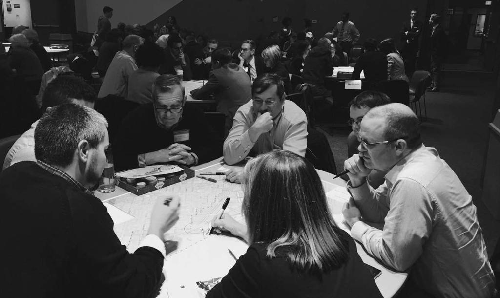
7 SCHEDULE JULY 30, 2015 Talk to Us Open House SEPTEMBER 14, 2015 Walk and Bike With Us Study Area Tours OCTOBER 1, 2015 Imagine with Us Visioning Workshop OCTOBER 26, 2015 Plan with Us Streets & Blocks, Land Use Workshop NOVEMBER 17, 2015 Design With Us Height & Density, Open Space Workshop DECEMBER 14, 2015 What We Heard Recap/Dialogue Session FEBRUARY 23, 2016 Discuss with Us Mobility & Getting Around Workshop April 5, 2016 Review with Us Elements of Plan & Implementation Strategies May, 2016 Finalize with Us Open House - Presentation of Plan MAY and JUNE, 2016 Final Plan production by BRA staff JUNE and JULY, 2016 BRA staff draft zoning documents JANUARY 27, 2016 Draft with Us Placemaking and Mobility Workshop
8 MOBILITY WORKSHOP February 23, 2016 Part I: Drawing connections Improve D Street for all modes Enhance connectivity to the west, across rails and Interstate highway Improve bike/pedestrian connections north and south to downtown and Moakley Park Walk Bike


9 MOBILITY WORKSHOP February 23, 2016 Part I: Drawing connections Create transit connection to South Boston Waterfront Create transit connections to Back Bay/ Fens/Green Line without having to transfer downtown Create Track 61 rail connection to South Boston Waterfront, South End and Back Bay Dorchester Ave and D Street are vehicular priorities Transit Drive

10 MOBILITY WORKSHOP February 23, 2016 Part II: Analyze Mobility Strategies Discussion of potential impact and level of difficulty to implement mobility strategies Part III: Prioritize Mobility Strategies Participants were given dots to place on strategies they felt would have the most desirable impacts
 5.")
11 MOBILITY WORKSHOP February 23, 2016 Part III: Prioritize Mobility Strategies Most prioritized strategies: 1. Bus service to South Boston Waterfront 2. Improve Red Line to allow more service 3. Track 61 train service to Waterfront, South End and Back Bay 4. Lower minimum parking requirements for developments with trip reduction strategies 5. Cycle track along Old Colony (tied) 5. Bike Network throughout Study Area (tied)

12 Homework Mobility Workshop February 23, 2016
13 HOMEWORK Underway with City and State agencies, consultant Real Estate Market Analysis/Economic Feasibility Consultant Housing Department of Neighborhood Development, Boston Housing Authority, Fair Housing Economic Development Mayor s Office of Economic Development, Office of Business Development Public Financing Treasury, Assessing, Economic Development & Industrial Corporation (EDIC) Public Facilities Boston Public Schools, Boston Public Library, Boston Police Department, Boston Fire Department, Property & Construction Management Open Space - Parks and Recreation Arts & Culture Arts Commission Public Transportation MBTA Transportation Boston Transportation Department, Boston Bikes, MassDOT Public Works Public Works Department, Public Improvement Commission Water Boston Water & Sewer Commission Environment/Sustainability/Climate Change Environment Department, Boston Landmarks Commission, Boston Public Health Boston Centers for Youth & Families Elderly Commission Commission for Persons with Disabilities
14 RECOMMENDATIONS FOR IMPLEMENTATION TOPICS Land Use & Zoning Open Space Mobility & Transportation Placemaking, Arts & Culture Economic Development Public Health Environment/Sustainability People
15 EMERGING RECOMMENDATIONS Placemaking, Arts & Culture Encourage/introduce public art, in a variety of settings, using local artists to beautify, and/or activate a space by creating place Encourage more space for artists and/or artist live/work space; encourage artist and maker space in new developments Support temporary artist ("pop up") uses that can potentially become permanent Work with developers and real estate agents to activate temporary vacant space; build permanent shared arts production space in partnership with local viable arts organizations Bring public art into the development (budget) discussion early
16 EMERGING RECOMMENDATIONS Open Space Create open space in the study area Create a mix of linear, neighborhood and large open spaces Provide open space that is programmed for both active and passive users Work with the City s Parks & Recreation Department on alternate methods (beyond zoning) for creating and funding new open space
17 EMERGING RECOMMENDATIONS Economic Development Support and enhance existing businesses, especially local businesses, within the Corridor Attract new businesses to the Corridor, especially those that complement and support existing local businesses and those of the future Encourage affordable commercial space in new or existing development Ensure existing businesses have access to services (such as training and funding) so they can continue to be viable enterprises
18 EMERGING RECOMMENDATIONS Land Use & Zoning Create new zoning for land uses, dimensions, and design as defined in strategic PLAN: South Boston Dorchester Ave Create new zoning that provides predictable entitlements at base and bonus density levels Use density bonus to require additional public benefits Provide a complete neighborhood over time for multiple uses, various connections, and diverse populations Define gateway zones to encourage Transit Oriented Development (TOD)
19 EMERGING RECOMMENDATIONS Environment /Sustainability Explore creation of a district energy plan among utilities and City entities that showcases new ways of building and sustaining district over time Ensure preparedness for effects of climate change including sea-level rise, heat waves and severe storms through building design Provide adequate open space within new developments through green roofs (i.e. heat reduction and storm water retention) and landscaping
20 EMERGING RECOMMENDATIONS Mobility & Transportation Develop proposed transportation network to City of Boston Complete Streets guidelines Add direct, frequent publically accessible transit from study area to Waterfront along D Street or within South Boston Bypass Road corridor Explore bus operational improvements at Andrew Square and extension of existing routes to serve area Design street system to encourage regional traffic to utilize regional facilities (i.e. I-93 instead of Dorchester Ave or Old Colony Ave) Implement protected intersections for pedestrians and cyclists Promote shared parking concepts; explore maximum parking ratios within zoning Conduct comprehensive transportation analysis with consultant

21 Plan Vision & Goals Imagine with Us workshop October 1, 2015
22 STUDY VISION Based on shared priorities A walkable neighborhood with improved public transportation Walkable sidewalks and bikeable streets Less traffic congestion Cycling opportunities for people of all ages A neighborhood with amenities Retail and other services Civic/Cultural/Art spaces New and varied open spaces A diversity of housing types Live/work opportunities Tall apartment buildings Smaller housing units preserving existing character
23 GOALS OF THE PLAN Present elements of the 21 st Century Mixed Use Neighborhood Provide planning and zoning tools for implementation of the community vision Create predictable benefits for the neighborhood Create a framework for future development

24 PLAN REPORT Table of Contents 1. Introduction / Executive Summary 2. PLAN Workshops & Outcomes 3. Framework Planning Context Mobility & Connectivity Land Uses Open Space Height & Density Placemaking & Character 4. Implementation Urban Design Guidelines Zoning Recommendations Phasing (Short, Mid, Long-Term) Coordination of Development and Benefits 5. Appendices DRAFT Strategic Plan

25 Plan Framework Elements Walk/Bike Tour workshop September 10, 2015


26 Mobility & Connectivity


27 NEIGHBORHOOD SCALE Existing Transit Network In conjunction with redevelopment, create a network of Complete Streets that will foster an active pedestrian environment and allow traffic to be distributed throughout the Study Area.

28 NEIGHBORHOOD SCALE Conceptual Future Connections Create a direct transit connection to the South Boston Waterfront Create a bus connection between Andrew and Broadway T Stations

29 NEIGHBORHOOD SCALE Conceptual Future Connections Create a new cross-town transit connection via the Track 61 corridor to connect to the South Boston Waterfront, South End and Back Bay

30 NEIGHBORHOOD SCALE Conceptual Future Connections Enhance connectivity across the rail corridors and I-93 to the west Improve bike/pedestrian connectivity to downtown and Moakley Park Dorchester Ave and D Street provide important vehicular connectivity

31 NEIGHBORHOOD SCALE Conceptual Future Connections Create a connection down Dorchester Avenue across Fort Point Channel to Summer Street

32 DISTRICT SCALE Dorchester Avenue View North on Dorchester Ave
33 BLOCK SCALE Dorchester Avenue 200 ft 200 ft 30ft 30ft 70ft 70ft Conceptual Drawing of Future Dorchester Ave * R.O.W = Right of Way 90ft R.O.W *
34 BLOCK SCALE Dorchester Avenue 200 ft 200 ft 30ft 30ft 70ft 70ft Conceptual Section** of Future Dorchester Ave * * R.O.W = Right of Way **detailed transportation study will be recommended 90ft R.O.W


35 DISTRICT SCALE Green Corridor (Ellery Extension) View down Alger St towards the tracks
36 BLOCK SCALE Green Corridor (Ellery Extension) 250ft 200ft 10ft 10ft 70ft 70ft Conceptual Drawing of Future Green Corridor * R.O.W = Right of Way 136ft R.O.W *
37 BLOCK SCALE Green Corridor (Ellery Extension) 250ft 200ft 10ft 10ft * 70ft 70ft Conceptual Section** of Future Green Corridor * R.O.W = Right of Way **detailed transportation study will be recommended 136ft R.O.W *

38 DISTRICT SCALE Old Colony Avenue View North on Old Colony Ave

39 BLOCK SCALE Old Colony Avenue 200ft 30ft 70ft 70ft Conceptual Drawing of Future Old Colony Ave * R.O.W = Right of Way

40 BLOCK SCALE Old Colony Avenue 200ft 30ft 70ft 70ft * Conceptual Section** of Future Old Colony Ave * R.O.W = Right of Way **detailed transportation study will be recommended

41 DISTRICT SCALE Service Road Conceptual Drawing of Future Service Road
42 BLOCK SCALE Service Road Rail Corridor 250ft 10ft * 70ft Conceptual Section** of Future Service Corridor * R.O.W = Right of Way **detailed transportation study will be recommended
43 PRECEDENT Harrison-Albany Study LOT COVERAGE To achieve a pedestrian friendly public realm: Limit development footprint to 80% of the lot 20% of the lot to be designed and built to ensure public access or enhance the pedestrian experience

44 PRECEDENT Harrison-Albany Study SET BACK LOT COVERAGE & BUILDING SET BACKS SET BACK

45 Public Street Public Street BLOCK SCALE LOT COVERAGE & BUILDING SET BACKS 50% MAX DEVELOPMENT FOOTPRINT 50% PUBLIC REALM SET BACK FROM PROPERTY LINE FOR SIDEWALK THROUGH BLOCK CONNECTION OPEN SPACE CONTINUOUS STREET WALL ON DORCHESTER AVE No Curb Cuts

46 LAND USES

47 EXISTING LAND USE

48 Dorchester Ave DISTRICT SCALE Proposed Land Use T Broadway "21st CENTURY INDUSTRIAL" Green and clean technologies - renewable energies, smart grid, fuel cells Creative industries - artist work studios, architectural and industrial design, game development Incubators - shared maker spaces for inventors of all kinds and combinations, small scale commercial kitchen spaces, contract or partner brewing Today's uses are different from yesterday's manufacturing New ways to balance and integrate functions of industrial and commercial uses with live/work options Andrew T

49 Dorchester Ave DISTRICT SCALE Proposed Land Use T Broadway Residential Residential + 1 st Floor Retail Mixed Use Mixed Use + 21st Century Industrial Andrew T Open Space

50 DISTRICT SCALE Proposed Land Use Broadway T Andrew T Dorchester St

51 BLOCK SCALE Proposed Land Uses

52 OPEN SPACE


53 NEIGHBORHOOD SCALE Open Space Connections The diagram is conceptual and intended for illustrative purposes only.

54 NEIGHBORHOOD SCALE Open Space Connections The diagram is conceptual and intended for illustrative purposes only.

55 NEIGHBORHOOD SCALE Open Space Connections Bike/Ped Connection The diagram is conceptual and intended for illustrative purposes only.


56 Dorchester Ave DISTRICT SCALE Green Corridor T Broadway The diagram is conceptual and intended for illustrative purposes only. Conceptual Drawing of Future Green Corridor Andrew T


57 Public Street BLOCK SCALE Park and Streets Testing Open Space Public Street Conceptual Drawing of Future Open Space

58 HEIGHT & DENSITY
 ~ 5 7M sf Ground Floor Retail and Cultural uses ~ 0.5M 1M sf Andrew T The diagram is conceptual and intended for illustrative purposes only.")
59 Dorchester Ave HYBRID CONCEPT 2030 Conceptual Buildout Broadway T Total New Development ~ 12-16M sf Residential uses ~ 6 8M sf Other (office, 21-century industrial) ~ 5 7M sf Ground Floor Retail and Cultural uses ~ 0.5M 1M sf Andrew T The diagram is conceptual and intended for illustrative purposes only.

60 HYBRID CONCEPT Public Realm Roads & Sidewalks ~ acres Open Space ~ 8-12 acres


61 HYBRID CONCEPT Residential Uses 6 8 M sf of residential uses 6,000 8,000 Residential units 2.3 persons per household ~ 14,000 16,000 people

62 DISTRICT SCALE Base Heights Broadway T Andrew T The diagram is conceptual and intended for illustrative purposes only. Dorchester St

63 DISTRICT SCALE Bonus Heights Broadway T Andrew T The diagram is conceptual and intended for illustrative purposes only. Dorchester St

64 DISTRICT SCALE Bonus Heights Broadway T Andrew T The diagram is conceptual and intended for illustrative purposes only. Dorchester St
65 Placemaking & Character
66 PLACEMAKING STRATEGIES 1. Build streets as places 2. Create squares and parks as multi-use destinations 3. Design buildings to create places 4. Provide opportunities for public art and culture 5. Design places for diverse retail & other community uses 6. Link a public health agenda to a public space agenda Source:

67 NEIGHBORHOOD SCALE Zoning Height Envelope with View Corridors Broadway T Andrew The diagram is conceptual and intended for illustrative purposes only. T Dorchester St Primary View Corridors Secondary View Corridors


68 NEIGHBORHOOD D Street View Corridor Conceptual Drawing of Future D Street The diagram is conceptual and intended for illustrative purposes only.
69 DISTRICT SCALE Neighborhood Character Broadway T The diagram is conceptual and intended for illustrative purposes only. Andrew T Dorchester St

70 BLOCK SCALE Building Massing & Distance between Towers The diagram is conceptual and intended for illustrative purposes only.

71 BLOCK SCALE Block Character

72 BLOCK SCALE Placemaking with Lot Coverage & Setbacks
73 BLOCK SCALE Street Zones* *Boston Complete Streets Streetwall: active and transparent street wall with retail or other public uses Frontage Zone: provides zone for outdoor activities and cafes Pedestrian Zone: reserved for unrestricted pedestrian movement and accessible to all Greenscape/Furnishing Zone: provides space for trees, lights, signage, and bike racks, etc. Cycle Track: bicycle facility physically separated from traffic and pedestrians Curb Zone: provides barrier between traffic and sidewalk activities, can accommodate some signage, meters, bike racks.
74 Mobility & Connectivity Land Uses & Open Space Review of Framework Elements at Interactive Stations Height & Density Placemaking & Character Imagine with Us workshop October 1, 2015
PLACEMAKING & MOBILITY WORKSHOP. January 27, 2016
 PLACEMAKING & MOBILITY WORKSHOP January 27, 2016 Boston needs more housing. But there is no one-size fitsall solution. Every neighborhood has its own character. In some places, density is not only appropriate
DESIGN WORKSHOP. November 17, 2015
 DESIGN WORKSHOP November 17, 2015 needs more housing. But there is no one-size fits-all solution. Every neighborhood has its own character. In some places, density is not only appropriate it is badly -
WELCOME and introduction
 1 WELCOME and introduction Mobility Hub Locations within Burlington STUDY OVERVIEW STUDY OBJECTIVES The City of Burlington is developing four Area Specific Plans, one for each of Burlington s Mobility
Rio/29 Small Area Plan. Design Plan & Implementation Framework Open House - January 25, 2018
 Rio/29 Small Area Plan Design Plan & Implementation Framework Open House - January 25, 2018 MEETING PURPOSE PRESENTATION 1. Orient to the updated design plans 2. Introduce implementing options 3. Explain
A BLUEPRINT FOR BROCKTON A CITY-WIDE COMPREHENSIVE PLAN
 A BLUEPRINT FOR BROCKTON A CITY-WIDE COMPREHENSIVE PLAN Public Meeting October 2016 1 Plan Summary and Discussion Public Meeting May 4 2017 City of Brockton Bill Carpenter, Mayor Department of Planning
Public may provide comments on the GDP within the next two weeks (December 24)
") 25/70 General Development Plan (GDP) Public Meeting Wednesday, December 10, 2014 6:00 8:00 P.M. District 1 Police Station Community Room 1311 W 46th Ave, Denver, CO 80211 Council Woman Montero: This particular
25/70 General Development Plan (GDP) Public Meeting Wednesday, December 10, 2014 6:00 8:00 P.M. District 1 Police Station Community Room 1311 W 46th Ave, Denver, CO 80211 Council Woman Montero: This particular
Streets, Connectivity & Built Environment Working Group August 2, 2017
 Streets, Connectivity & Built Environment Working Group August 2, 2017 DOWNTOWN OAKLAND SPECIFIC PLAN WELCOME Streets, Connectivity & Built Environment Working Group Social Equity Meeting August 2, 2017
Town Center (part of the Comprehensive Plan)
") Town Center (part of the Comprehensive Plan) Mercer Island Town Center Looking North (2014) In 1994, a year-long process culminated in a set of design guidelines and code requirements for the Town Center
Town Center (part of the Comprehensive Plan) Mercer Island Town Center Looking North (2014) In 1994, a year-long process culminated in a set of design guidelines and code requirements for the Town Center
Sustainability, Health, Safety, Recreation & Open Space Working Group August 3, 2017
 Sustainability, Health, Safety, Recreation & Open Space Working Group August 3, 2017 DOWNTOWN OAKLAND SPECIFIC PLAN WELCOME Sustainability, Health, Safety, Recreation & Open Space Working Group Social
KENDALL SQUARE INITIATIVE. Planned Unit Development Special Permit Application - SoMa September 8, 2015
 KENDALL SQUARE INITIATIVE Planned Unit Development Special Permit Application - SoMa September 8, 2015 GENERAL DEVELOPMENT GOALS Kendall Square PUD 2 PRE-ZONING PUBLIC ENGAGEMENT 2008-2009 2010-2012 2013
Robbinsdale LRT Station. CDI Development Guidelines. August Overview
 Robbinsdale LRT Station August 2018 Overview The City of Robbinsdale may have the coolest opportunity site along the 13 mile stretch of the Bottineau LRT corridor / Blue Line extension. Located a block
ELMVALE ACRES SHOPPING CENTRE MASTER PLAN
 ELMVALE ACRES SHOPPING CENTRE MASTER PLAN Contents 1.0 INTRODUCTION... 2 2.0 LOCATION... 2 3.0 EXISTING CONTEXT... 2 4.0 VISION & GUIDING PRINCIPLES... 2 5.0 LAND USE AND BUILT FORM... 4 5.1 St. Laurent
Phase I Redevelopment Plan. First Community Meeting
 Hoboken Terminal and Yard Phase I Redevelopment Plan First Community Meeting May 31, 2011 One Hudson Place Phase I Redevelopment Plan Redevelopment Plan First Community Meeting Agenda 1. Redevelopment
Planning Board Briefing
 Planning Board Briefing Why Now? The Sector Plan Implementation Chapter States: Before Stage 1 begins, the following must occur: Approval of the Sectional Map Amendment. Approval of the Greater Lyttonsville
Chapter 1: Introduction
 Chapter 1: Introduction The Penn Avenue Community Works Corridor Vision and Implementation Framework presents an integrated communitybased vision and a coordinated, long-term implementation framework for
ROBBINSDALE LRT STATION CDI DEVELOPMENT GUIDELINES
 August 2018 OVERVIEW The City of Robbinsdale has a prime-opportunity site in the middle of the 13 mile stretch of the Bottineau LRT corridor / Blue Line extension. Robbinsdale offers a prominent, vital,
Building Great Neighbourhoods. Strathcona
 Building Great Neighbourhoods Strathcona March 21, 2018 Becky Redford Project Manager, Planning & Design Building Great Neighbourhoods Integrated Infrastructure Services Welcome and Purpose To provide
Future Proposed Development
 Future Proposed Development on and around Link light rail s Capitol Hill Station Meeting September 24, 2012 Tonight s Agenda 6:00 pm Open House 6:30 pm Introductions Richard Conlin, City of Seattle Councilmember/Sound
EXISTING COMPREHENSIVE PLAN
 EXISTING COMPREHENSIVE PLAN Town Center Land Use Element: V. LAND USE POLICIES Town Center Mercer Island's business district vision as described in "Your Mercer Island Citizen-Designed Downtown" was an
North Downtown Specific Plan MEMORANDUM
 North Downtown Specific Plan MEMORANDUM MEETING DATE: November 13, 2017 TO: Members of the North Downtown Specific Plan Advisory Committee FROM: Jeanine Cavalli, Senior Planner SUBJECT: Materials for the
Workshop 3. City of Burlington Waterfront Hotel Planning Study. September 14, The Planning Partnership
 Workshop 3 City of Burlington Waterfront Hotel Planning Study September 14, 2017 The Planning Partnership The Waterfront Hotel Planning Study 01 The Brant & Lakeshore Planning Study will establish a Strategic
KENDALL SQUARE INITIATIVE. Planned Unit Development Special Permit Application - SoMa September 8, 2015
 KENDALL SQUARE INITIATIVE Planned Unit Development Special Permit Application - SoMa September 8, 2015 GENERAL DEVELOPMENT GOALS Kendall Square PUD 2 PRE-ZONING PUBLIC ENGAGEMENT 2008-2009 2010-2012 2013
4- PA - LD - LIVELY DOWNTOWN. LD - Background
 4- PA - LD - LIVELY DOWNTOWN LD - Background The downtown has been the service centre for the community since the city s inception and the area continues to supply people with their personal services,
City of Fort Lauderdale UPTOWN URBAN VILLAGE. Public Workshop December 7, 2016
 Public Workshop December 7, 2016 Workshop Agenda Introductions Project Presentation o o o History Project Scope/Timeline Character of Study Area o o o o Land Use Public Realm/Pedestrian Mobility Multimodal
Welcome to the Oakridge Centre Open House
 Welcome to the Oakridge Centre Open House Why is the City hosting this event? This open house is to inform you of a rezoning application submitted to the City of Vancouver to amend the existing CD-1 (Comprehensive
Draft Cary Community Plan Review Part 3: Shop, Engage, Serve, Special Area Plans, Other Updates. October 27, 2015 Police Department Training Room
 Draft Cary Community Plan Review Part 3: Shop, Engage, Serve, Special Area Plans, Other Updates Committee for the Future October 27, 2015 Police Department Training Room AGENDA 1. Welcome and Call to Order
Policies and Code Intent Sections Related to Town Center
 Policies and Code Intent Sections Related to Town Center The Town Center Vision is scattered throughout the Comprehensive Plan, development code and the 1994 Town Center Plan. What follows are sections
CHAPTER 7: Transportation, Mobility and Circulation
 AGLE AREA COMMUNITY Plan CHAPTER 7 CHAPTER 7: Transportation, Mobility and Circulation Transportation, Mobility and Circulation The purpose of the Transportation, Mobility and Circulation Chapter is to
This Review Is Divided Into Two Phases:
 Semiahmoo Town Centre Review The purpose of this review: To review the Semiahmoo Town Centre Concept Plan, originally approved in 1993, to ensure that this centre will continue to serve the needs of South
India Basin/Hunters Point Shoreline Community Workshop May 21, 2008
 India Basin/Hunters Point Shoreline Community Workshop May 21, 2008 Workshop Agenda Welcome Process Overview Context & Existing Conditions Presentation of Draft Concepts Land Use and Open Space Priorities
Create Policy Options Draft Plan Plan Approval. Public Consultation Events. Phase 2
 Background Grandview-Woodland Community Plan In the spring of 2012, the City of Vancouver embarked on a comprehensive community planning program in the Grandview-Woodland neighbourhood. The process has
SUBJECT: Waterfront Hotel Planning Study Update TO: Planning and Development Committee FROM: Department of City Building. Recommendation: Purpose:
 Page 1 of Report PB-23-18 SUBJECT: Waterfront Hotel Planning Study Update TO: Planning and Development Committee FROM: Department of City Building Report Number: PB-23-18 Wards Affected: 2 File Numbers:
City of Tacoma Planning and Development Services
 Agenda Item E-1 City of Tacoma Planning and Development Services To: Planning Commission From: Elliott Barnett, Planning Services Division Subject: Tacoma Mall Regional Center Subarea Plan and EIS Meeting
East Central Area Plan
 East Central Area Plan Steering Committee Meeting January 10 th, 2019 Tears-McFarlane House Community Room East Central Area Plan Steering Committee Meeting January 10 th, 2019 CHUN Tears-McFarlane House
Subarea 4 Indian Creek. Vision The combination of park networks and transportation amenities make Subarea 4 the greenest hub in the Corridor.
 indian creek 180 extends south from 101st Street to I-435. The I-435 and Metcalf intersection is one of the primary intersections in the Kansas City Metro Area. The area includes several residential neighborhoods
Plano Tomorrow Vision and Policies
 Plano Tomorrow Vision and Policies PLANO TOMORROW PILLARS The Built Environment The Social Environment The Natural Environment The Economic Environment Land Use and Urban Design Transportation Housing
CENTRAL ESTUARY PLAN AVISION FOR OAKLAND S WATERFRONT
 Central Estuary Plan A VISION FOR OAKLAND S WATERFRONT Specific Plan and Environmental Assessment Presentation to the Parks and Recreation Advisory Commission December 9, 2009 This Afternoon s Presentation
CITY OF CHARLOTTESVILLE, VIRGINIA CITY COUNCIL AGENDA
 CITY OF CHARLOTTESVILLE, VIRGINIA CITY COUNCIL AGENDA Agenda Date: December 16, 2013 Action Required: Adoption of Resolution Presenter: Staff Contacts: Title: James E. Tolbert, AICP, Director of NDS James
Proposed Comprehensive Plan Strategies DRAFT for discussion June 28, 2017
 Proposed Comprehensive Plan Strategies DRAFT for discussion June 28, 2017 Land Use Rural Areas Refine the Farm and Forest area (FF) Update FF boundaries to account for existing lots less than five acres
BROOKLYN PARK / 85TH AVE LRT STATION CDI DEVELOPMENT GUIDELINES DRAFT
 August 2018 Page intentionally left blank The Brooklyn Park Library adjacent to the 85th Ave LRT Station Area. OVERVIEW The Blue Line LRT Extension / Bottineau corridor offers a unique opportunity to leverage
Concord Community Reuse Project Goals and Guiding Principles. Overarching Goals (OG)
") Concord Community Reuse Project Goals and Guiding Principles Overarching Goals (OG) No priority is implied by the order of presentation of the goals and guiding principles. Overarching goals for the Concord
Concord Community Reuse Project Goals and Guiding Principles Overarching Goals (OG) No priority is implied by the order of presentation of the goals and guiding principles. Overarching goals for the Concord
AMITY STATION Revised Concept Plan Review West Rosemary Street Chapel Hill, NC September 27, 2016
 AMITY STATION Revised Concept Plan Review West Rosemary Street Chapel Hill, NC September 27, 2016 DEVELOPER'S PROGRAM Introduction This is a request for review of a Revised Concept Plan by Chapel Hill
Lower Merion Commercial Districts Issues and Characteristics Handbook November 2013
 Lower Merion Commercial Districts Issues and Characteristics Handbook November 2013 DRAFT TOWNSHIP-WIDE VISION: To maintain and enhance commercial areas to complement the surrounding high-quality residential
Downtown Streetscape Manual & Built Form Standards
 City of Guelph Downtown Streetscape Manual & Built Form Standards July 2014 Prepared by Brook McIlroy Inc. in association with Unterman McPhail Associates and McCormick Rankin Inc. City of Guelph Downtown
SAN RAFAEL GENERAL PLAN 2040 INTRODUCTION AND OVERVIEW
 SAN RAFAEL GENERAL PLAN 2040 INTRODUCTION AND OVERVIEW Steering Committee Presentation February 14, 2018 Purpose of General Plan Guide land use and development decisions Coordinate transportation, infrastructure,
DOWNTOWN GEORGETOWN PLANNING STUDY
 DOWNTOWN GEORGETOWN PLANNING STUDY Community Workshop #3 Thursday, May 4, 08 The Planning Partnership OVERVIEW OF STUDY, PROCESS & MILESTONES We are here PURPOSE OF THE STUDY To develop a clear vision
The transportation system in a community is an
 7 TRANSPORTATION The transportation system in a community is an important factor contributing to the quality of life of the residents. Without a sound transportation system to bring both goods and patrons
Ann Arbor Downtown Street Design Manual. Ann Arbor DDA IDA 2015 Awards Planning Category
 Ann Arbor Downtown Street Design Manual Ann Arbor DDA IDA 2015 Awards Planning Category 1 Ann Arbor s downtown streets are vibrant public spaces that accommodate multi-modal transportation, special events,
WEST LOOP DESIGN GUIDELINES CHECKLIST
 WEST LOOP DESIGN GUIDELINES CHECKLIST Section 1.0 General Strategies 1.1 DESIGN EXCELLENCE: ENCOURAGE HIGH QUALITY AND INNOVATIVE DESIGN OF NEW BUILDINGS WITHIN THE WEST LOOP WITHOUT BEING PRESCRIPTIVE
DALY CITY VISIONING PROCESS COMMUNITY WORKSHOP 3 MAY 8, 2008
 DALY CITY VISIONING PROCESS COMMUNITY WORKSHOP 3 MAY 8, 2008 PROCESS General Plan - a statement of the community s values, vision and aspirations for now and into the future... Timeframe LONG TERM - 2030
PLAN ON A PAGE SUMMARY
 Questions? Please Call - 423-989-5518. PLAN ON A PAGE SUMMARY The Plan on a Page is a tool for the City of Bristol to engage Bristol s neighborhoods, community organizations, and interest groups to organize
FUTURE LAND USE ELEMENT
 FUTURE LAND USE ELEMENT GOAL I: To create and sustain a great place to live, play, and prosper Objective 1: The City of Ocala shall incorporate the principles and strategies of the Ocala 2035 Vision into
Attachment B Summary of Plan Alternatives Report
 Attachment B Summary of Plan Alternatives Report Based on community ideas and feedback to date, a series of draft alternative scenarios for the future of downtown s neighborhood districts have been created
Corridor Vision. 1Pursue Minnehaha-Hiawatha Community Works Project. Mission of Hennepin County Community Works Program
 1Pursue Minnehaha-Hiawatha Community Works Project Minnehaha-Hiawatha Community Works is a project within the Hennepin Community Works (HCW) program. The mission of the HCW program is to enhance how the
Comprehensive Plan Advisory Panel Meeting #3
 Comprehensive Plan Advisory Panel Meeting #3 November 7, 2016 Agenda 1. September 19 th Meeting Notes 2. Summary of Focus Areas Charrette 3. Heart of the City Focus Area a. HOC2/Station Areas Concept &
TORTI GALLAS and partners, inc. How to Retrofit Your Suburb to Make a Downtown
 How to Retrofit Your Suburb to Make a Downtown April, 2010 Where to Start What should the Town look like? How do I attract new residents, businesses and visitors?? Should we preserve our heritage? How
Atlanta BeltLine, Inc. Pathways to Urban Sustainability
 Atlanta BeltLine, Inc. Pathways to Urban Sustainability September 30, 2010 WHAT IS THE ATLANTA BELTLINE? Transit 22-mile loop Parks 1300 + new acres Trails 33 miles Jobs & Economic Development 20 areas,
Executive Summary. NY 7 / NY 2 Corridor
 Executive Summary NY 7 / NY 2 Corridor Transportation and Land Use Study December 2005 Prepared for: Town of Colonie Capital District Transportation Committee Prepared by: Introduction: Land use decisions
Figure 1- Site Plan Concept
 Figure 1- Site Plan Concept Parking will be provided underground on three levels at rate of 1.0 space/ unit; this rate includes all visitors parking. MMM Group has prepared a parking assessment (April,
Forest Hills Improvement Initiative A Partnership for Building a Better Community. Use & Design Guidelines September 23, 2008
 Forest Hills Improvement Initiative A Partnership for Building a Better Community City of Boston Thomas M. Menino, Mayor Emerging Community Vision p. 2 Site Use & Design Guidelines p. 3 to 21 Arborway
Danvers High Street I-1 District Study
 Danvers High Street I-1 District Study Presentation of Final Recommendations Planning Board Presentation June 26 th, 2018 1 Introductions Metropolitan Area Planning Council Sam Cleaves AICP, Principal
V. Vision and Guiding Principles
 V. Vision and Guiding Principles The Master Plan for the Powers Ferry Corridor seeks a foundation in the desires of the community. At times, various elements of the community offered opposing viewpoints,
Urban Design Manual PLANNING AROUND RAPID TRANSIT STATIONS (PARTS) Introduction. Station Study Areas
 Introduction. Station Study Areas") 111111 PLANNING AROUND RAPID TRANSIT STATIONS (PARTS) Introduction The ION rapid transit system will link Waterloo, Kitchener and Cambridge through a central transit corridor (CTC). There are a number
111111 PLANNING AROUND RAPID TRANSIT STATIONS (PARTS) Introduction The ION rapid transit system will link Waterloo, Kitchener and Cambridge through a central transit corridor (CTC). There are a number
WHAT WE HEARD REPORT - Summary Bonnie Doon Mall Redevelopment Application (LDA )
") WHAT WE HEARD REPORT - Summary Bonnie Doon Mall Redevelopment Application (LDA18-0184) PROJECT ADDRESS: 1 Bonnie Doon Shopping Centre NW, 8420 85 Street NW & 8715 85 Street NW PROJECT DESCRIPTION: Rezoning
WHAT WE HEARD REPORT - Summary Bonnie Doon Mall Redevelopment Application (LDA18-0184) PROJECT ADDRESS: 1 Bonnie Doon Shopping Centre NW, 8420 85 Street NW & 8715 85 Street NW PROJECT DESCRIPTION: Rezoning
SECTION ONE: INTRODUCTION. introduction
 introduction 1 INTRODUCTION Since it was first established in 1843 as a trading post for the Hudson s Bay Company, Victoria has evolved into a Provincial capital city that is recognized across Canada and
DOWNTOWN NORFOLK COUNCIL ACTION PLAN. Strategic Initiatives Focus Area Objectives. Departmental Focus Area Key Objectives
 DOWNTOWN NORFOLK COUNCIL ACTION PLAN FY18 Strategic Initiatives Focus Area Objectives Departmental Focus Area Key Objectives STRATEGIC INITIATIVES FOCUS AREA OBJECTIVE #1: NURTURE A VIBRANT URBAN ENVIRONMENT
Complete Neighbourhood Guidelines Review Tool
 Complete Neighbourhood Guidelines Review Tool Prepared By: City of Regina Planning Department October 2014 Page 1 of 14 Community Development Review Checklist for Secondary Plans and Concept Plans The
REVIEW AND EVALUATION OF REGIONAL LAND USE
 REVIEW AND EVALUATION OF REGIONAL LAND USE AND TRANSPORTATION SCENARIOS #220831 Environmental Justice Task Force October 7, 2014 VISION 2050 Process Development of Guiding Vision for Land Use and Transportation
TO: Denver Planning Board FROM: Analiese Hock, Senior City Planner DATE: March 13, 2018 RE:
 Community Planning and Development Planning Services 201 W. Colfax Ave., Dept. 205 Denver, CO 80202 p: 720.865.2915 f: 720.865.3052 www.denvergov.org/cpd TO: Denver Planning Board FROM: Analiese Hock,
City of Hermosa Beach Administrative Policy #
 City of Hermosa Beach Administrative Policy # SUBJECT: Living Streets Policy Date: Approved by: City Council Authority: Public Works Department & Community Development Department Mayor, PURPOSE The City
Blueprint Denver A BLUEPRINT FOR AN INCLUSIVE CITY. Executive Summary
 Blueprint Denver A BLUEPRINT FOR AN INCLUSIVE CITY Executive Summary PUBLIC REVIEW DRAFT 2 1/7/2019 DENVERIGHT BLUEPRINTDENVER Blueprint Denver: A Blueprint for an Inclusive City An Equitable City Planning
Broadway District Specific Plan. Community Workshop #2 February 23,2016
 Broadway District Specific Plan Community Workshop #2 February 23,2016 1 Agenda Introductions Project Progress Status Upcoming Milestones Emerging Framework Land Use Urban Design Circulation Infrastructure
3. VISION AND GOALS. Vision Statement. Goals, Objectives and Policies
 Vision Statement Queen Creek s interconnected network of parks, trails, open spaces and recreation opportunities provide safe and diverse activities and programs that sustain its unique, small town, equestrian
SLIDE TITLE TRANSIT-ORIENTED DEVELOPMENT PLAN RED-PURPLE BYPASS STUDY AREA PUBLIC MEETING #2 RED AND PURPLE MODERNIZATION. RPM TOD Plan Update
 SLIDE TITLE TRANSIT-ORIENTED DEVELOPMENT PLAN RED-PURPLE BYPASS STUDY AREA PUBLIC MEETING #2 RED AND PURPLE MODERNIZATION 1 SLIDE TITLE AGENDA Project Introduction TOD s and Development Trends Real Estate
Community Meeting November 18, 2015
 Top Concerns We ve Heard Use of Urban Road Code Total number of units and effect on schools and transportation Land swaps with Parks Department: how do these benefit the community? Zoning classifications:
Northwest Rail Corridor and US 36 BRT Development Oriented Transit Analysis 4.4 STATION AREA FINDINGS
 4.4 STATION AREA FINDINGS Each station is different, and each one requires a separate set of recommendations based on the vision for the site. This section outlines an initial TOD strategy and recommendations
Public Consultation Summary: Lakeview Place Making Workshop January 30, 2008.
 Page 1 of 11 Public Consultation Summary: Lakeview Place Making Workshop January 30, 2008. 1.0 Introduction: On January 30, 2008 the City of Mississauga, in conjunction with the consulting team of Brook
Preliminary Recommendations Tk Takoma/Langley Crossroads Sector Plan
 Preliminary Recommendations Tk Takoma/Langley Crossroads Sector Plan Vision is to achieve a Transit Oriented, pedestrian friendly Community that Celebrates and builds upon the cultural Diversity of the
Welcome. Walk Around. Talk to Us. Write Down Your Comments
 Welcome This is an information meeting introducing the applications for proposed redevelopment of the Yorkdale Shopping Centre site at 3401 Dufferin Street and 1 Yorkdale Road over the next 20+ years,
Streets for People, Place-Making and Prosperity. #TOcompletestreets
 COMPLETE STREETS FOR TORONTO Streets for People, Place-Making and Prosperity COMPLETE STREETS: A NEW APPROACH A Complete Streets design approach considers the needs of all users people who walk, bicycle,
JANUARY 19, 2011 CENTRAL AVENUE-METRO BLUE LINE TRANSIT-ORIENTED DEVELOPMENT IMPLEMENTATION PROJECT COMMUNITY FORUM
 CENTRAL AVENUE-METRO BLUE LINE TRANSIT-ORIENTED DEVELOPMENT IMPLEMENTATION PROJECT COMMUNITY FORUM JANUARY 19, 2011 THE MARYLAND-NATIONAL CAPITAL PARK AND PLANNING COMMISSION PRINCE GEORGE S COUNTY PLANNING
THE GREEN VISION WORKSHOP Friday, November 6, 2009
 THE GREEN VISION WORKSHOP Friday, November 6, 2009 SUSTAINABLE LONG RANGE PLANNING IN SANTA MONICA Eileen Fogarty Director, Planning and Community Development GREEN BUILDINGS Santa Monica has the most
 Community Workshop #2 December 4, 2014 Team Tonight s Agenda 6:00 pm Welcome! 6:05 pm The Future of Downtown Tustin Ideas, Strategies and Recommendations 6:35 pm Questions and Comments 6:50 pm Open
Proposed Downtown Plan
 Proposed Downtown Plan Harbord Village Residents Association AGM October 18, 2017 Timeline Implementation The Role of Downtown Employment Growth Downtown 432,900 jobs 502,100 jobs 850,000-915,000 jobs
Bourne Downtown Site Planning
 Prepared for: The Town of Bourne, MA In Cooperation with: Bourne Financial Development Corporation Prepared by:, Inc. June 24, 2009 Table of Contents Introduction and Summary... 1 Site Existing Conditions...
Town of Oakville Streetscape Strategy
 Town of Oakville Streetscape Strategy Endorsed by PDC on February 10, 2014 (PD-011-14) Town of Oakville Streetscape Strategy [endorsed by PDC February 10, 2014] 0 Town of Oakville Streetscape Strategy
PLAN: Mattapan Preserve. Enhance. Grow.
 Mattapan Planning Process and Team Why are we here? Mattapan is a City planning initiative that seeks to ensure that we preserve wisely, enhance equitably, and grow inclusively. We are here today to kick-off
Chapter 1.0 Introduction
 Chapter 1.0 Introduction 1.1 Background The North Metro commuter rail line is part of the RTD FasTracks regional transit system expansion program to build more than 100 miles of rail transit throughout
University of the District of Columbia Van Ness Campus Master Plan Community Open House 3. December 8, 2010
 University of the District of Columbia Van Ness Campus Master Plan Open House 3 December 8, 2010 Introductions Sequence of Work: Campus Master Plan BEGIN: INTRODUCE AND START WORK Project Initiation Team
Sahuarita District & Phase 1 Master Plan. Town Council December 11, 2017
 Sahuarita District & Phase 1 Master Plan Town Council December 11, 2017 Visioning Study Visioning Process Advisory Group Meetings Community Questionnaire Town Center Case Studies Community Analysis The
Silverdale Regional Center
 Silverdale Regional Center Vision for Silverdale Regional Center The Silverdale Regional Center Plan (Plan) will guide the evolution of the Silverdale Regional Center from a collection of strip malls and
Plan Framework Report. Attachment A
 Plan Framework Report Attachment A Uptown-Douglas Corridor Plan - Plan Framework Report Contents Introduction... 1 Planning Process... 3 Project Objectives... 4 Vision... 5 Community Values... 6 Structural
Blueprint Denver Task Force Meeting #16 February 22, 2018
 Blueprint Denver Task Force Meeting #16 February 22, 2018 Agenda Welcome, Meeting Overview and Process Update Change Categories Small Group Recommendations Discussions: Land Use and Built Form General
Hockessin Community Redevelopment Plan
 Hockessin Community Redevelopment Plan 3.1 Introduction The Community Redevelopment Plan for the Village of Hockessin is the result of the people s vision for a distinct village center that serves as the
INDEPENDENCE BOULEVARD AREA PLAN. June 24, 2008
 INDEPENDENCE BOULEVARD AREA PLAN Public Meeting #1 June 24, 2008 Tonight s Agenda Introduction Welcome and Ground Rules Overview Presentation Purpose of the Plan What Brings Us Here? A Tour of the Corridor
A Context-Based Design Code for Pedestrian & Transit-Oriented Development RAIL~VOLUTION NOVEMBER 2006
 A Context-Based Design Code for Pedestrian & Transit-Oriented Development RAIL~VOLUTION NOVEMBER 2006 Palo Alto Zoning Ordinance Update. Project Overview City of Palo Alto Palo Alto Zoning Ordinance Update.
Atlanta BeltLine. Subareas 9 & 10. Master Plan Updates. March 26, Washington Park Jamboree 1
 Atlanta BeltLine Subareas 9 & 10 Master Plan Updates March 26, 2018 Washington Park Jamboree 1 22 miles, connecting 45 neighborhoods 22 MILES of transit 46 MILES of streetscapes and complete streets 33
New-Cast Mixed-use Development Proposal King Street West, Newcastle, Ontario
 URBAN DESIGN BRIEF New-Cast Mixed-use Development Proposal King Street West, Newcastle, Ontario TABLE OF CONTENTS: 1.0 Executive Summary 2.0 Creating Vibrant and Sustainable Urban Places: Excerpts from
University of Saskatchewan CAMPUS MASTER PLAN. Senate Meeting Preliminary Presentation. April 21, 2018 DIALOG ECS DA WATT
 University of Saskatchewan CAMPUS MASTER PLAN Senate Meeting Preliminary Presentation April 21, 2018 DIALOG ECS DA WATT project process presentation agenda Stakeholder Engagement Project Control phase1
City of Long Beach. creating vibrant and exciting places
 City of Long Beach creating vibrant and exciting places Land Use Element Urban Design Element Overview of the two draft General Plan elements Discuss areas of change Economic goals of the plans Case study