REVIEW AND EVALUATION OF REGIONAL LAND USE
|
|
|
- Brian Benson
- 5 years ago
- Views:
Transcription

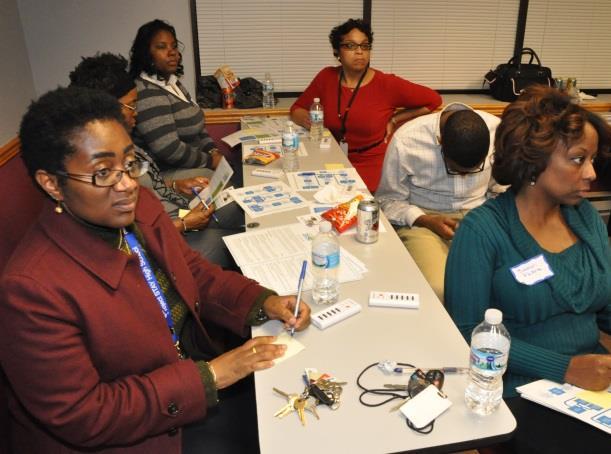
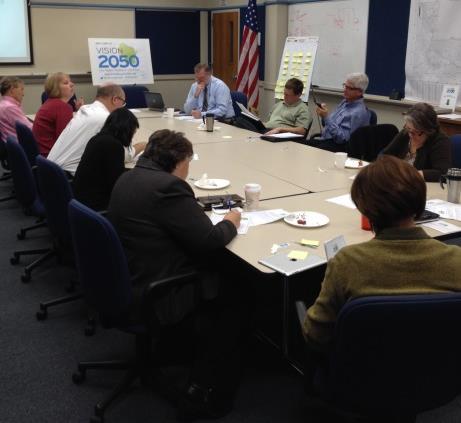
1 REVIEW AND EVALUATION OF REGIONAL LAND USE AND TRANSPORTATION SCENARIOS # Environmental Justice Task Force October 7, 2014

2 VISION 2050 Process Development of Guiding Vision for Land Use and Transportation Workshops 1 and 2 October and December 2013 Review and Evaluation of Regional Land Use and Transportation Scenarios Workshop 3 September 2014 Review and Evaluation of Alternative Regional Land Use and Transportation Plans Workshop 4 Spring/Summer 2015 Review and Evaluation of Preliminary Recommended Land Use and Transportation Plan Workshop 5 Summer/Fall 2015 Final Recommended Land Use and Transportation Plan Completed December


3 Visioning 3
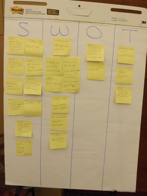
4 Visioning Visioning Workshops #1 Fall 2013 Visual Preference Survey Land Use and Transportation SWOTs Identifying Goals for Land Use and Transportation Important Places Mapping Telephone Preference Survey Fall 2013 Online Surveys Fall
5 Visioning Visioning Workshops #2 Winter 2013/2014 Overview of Preliminary Visioning Results Review and Rate Draft Vision Guiding Statements Initial Input into Sketch Scenarios Input to date used to create Guiding the Vision 5

6 VISION 2050: Guiding the Vision Released in June, Guiding the Vision expresses a preliminary vision for future land and transportation system development in the Region Based on values and priorities expressed through initial visioning activities Serves as guide for VISION 2050 process, including developing and comparing sketch scenarios 6
7 VISION 2050: Guiding the Vision Achieve a Robust, Regional Transit System Preserve Farmland Maintain Small Town Character Make Wise Infrastructure Investments Work Together Toward Common Goals Balance Jobs and Housing Provide a High-quality Network of Streets and Highways Strengthen Existing Urban Areas Ensure that Goods Move Efficiently Achieve More Compact Development Prepare for Change in Travel Preferences and Technologies Be Environmentally Responsible Develop an Integrated, Multimodal Transportation System Preserve Natural Resources and Open Spaces Develop an Expansive, Well-connected Bicycle and Pedestrian Network 7
8 SKETCH SCENARIOS FOR LAND USE AND TRANSPORTATION #217706
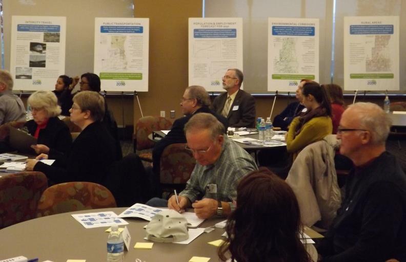
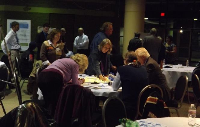
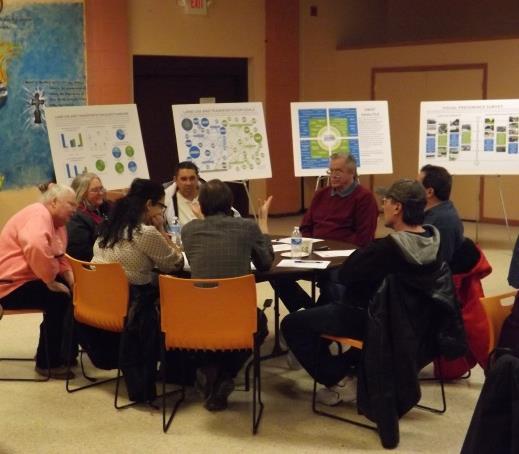
9 Activities at the Workshops Visioning Workshops #3 Fall 2014 Overview of VISION 2050 and initial visioning results Overview of Sketch Scenarios Explore the Scenarios (small group activity) 9
10 Sketch Scenarios Guiding the Vision provides direction for Sketch Land Use and Transportation Scenarios Sketch scenarios are conceptual designs Purpose is to allow residents to consider the long-term consequences of alternative paths of developing the Region s land and transportation system 10

11 Scenarios At a Glance 11


12 Development Pattern Location and density of development vary between scenarios Scenario A: more growth at lower densities large lots outside existing urban centers Scenario B: higher densities smaller lots focused within and at the edge of existing urban centers 12


13 Development Pattern Scenarios C, D, and E include more compact development than Scenario B New development/redevelopment as TOD around rapid transit and/or commuter rail stations 13

14 Healthy Communities Bicycle and pedestrian facilities also vary under the scenarios More compact development in Scenarios B/C/D/E particularly the TOD in C/D/E creates more walkable neighborhoods 14

 15")
15 Healthy Communities Well-connected bicycle facilities are an important consideration as well All five scenarios assume a regional bicycle network of on- and off-street facilities by 2050 Scenarios C/D/E include higher levels of accommodation (e.g. protected bike lanes or buffered bike lanes) 15


16 Transportation System Investment The scenarios include different investments in arterial streets and highways and transit Scenarios A and B include highway capacity additions to address traffic congestion Scenarios C/D/E limit highway improvements to modernization and preservation 16


17 Transportation System Investment Scenario A includes further transit service decline, while Scenarios B/C/D/E expand local bus service and establish express bus service Scenario C adds a system of rapid transit lines light rail and bus rapid transit in urban centers Scenario D adds a system of commuter rail lines between urban centers Scenario E adds a system of both rapid transit and commuter rail 17

18 Scenario Evaluation 18
19 Scenario A Most new development would occur as redevelopment and infill in existing cities and villages throughout the Region; however, more new development would happen on undeveloped land outside of urban service areas than under the other scenarios Including single-family homes on lots greater than 1.5 acres outside urban service areas 25% reduction in transit service Widenings of highways to address congestion Continued expansion of regional bicycle network Discussion? 19
20 Scenario B New development would occur as redevelopment and infill in existing cities and villages throughout the Region, and on undeveloped land adjacent to existing cities and villages New single-family homes would have smaller lots Doubling of transit service by 2050 Widenings of highways to address congestion Continued expansion of regional bicycle network Discussion? 20
21 Scenario C New development centered around a six line rapid transit network in the Milwaukee metro area Light rail, bus rapid transit Compact, mixed use development around transit stations (TOD) No widening of highways to address congestion Continued expansion of regional bicycle network with higher level of accommodation Discussion? 21
22 Scenario D New development centered around a four line commuter rail network connecting communities in the Region Compact, mixed use development around transit stations (TOD) No widening of highways to address congestion Continued expansion of regional bicycle network with higher level of accommodation Discussion? 22
23 Scenario E New development centered around both rapid transit and commuter rail networks Compact, mixed use development around transit stations (TOD) No widening of highways to address congestion Continued expansion of regional bicycle network with higher level of accommodation Discussion? 23
24 VISION 2050 Process Development of Guiding Vision for Land Use and Transportation Workshops 1 and 2 October and December 2013 Review and Evaluation of Regional Land Use and Transportation Scenarios Workshop 3 September 2014 Review and Evaluation of Alternative Regional Land Use and Transportation Plans Workshop 4 Spring/Summer 2015 Review and Evaluation of Preliminary Recommended Land Use and Transportation Plan Workshop 5 Summer/Fall 2015 Final Recommended Land Use and Transportation Plan Completed December
25 Alternative Plans Scenarios will be refined to develop Detailed Alternative Land Use and Transportation Plans to be further evaluated and considered Specific land development pattern Specific transportation system Will be evaluated using Objectives and Criteria based on the Guiding Statements Public review, input, and polling (spring/summer 2015) 25
26 VISION 2050 Process Development of Guiding Vision for Land Use and Transportation Workshops 1 and 2 October and December 2013 Review and Evaluation of Regional Land Use and Transportation Scenarios Workshop 3 September 2014 Review and Evaluation of Alternative Regional Land Use and Transportation Plans Workshop 4 Spring/Summer 2015 Review and Evaluation of Preliminary Recommended Land Use and Transportation Plan Workshop 5 Summer/Fall 2015 Final Recommended Land Use and Transportation Plan Completed December
27 Recommended Plan Preliminary Recommended Plan Developed based on consideration and evaluation of alternatives Will attempt to provide a consensus plan for the future of the Region Presented to the public for review (summer/fall 2015) Feedback considered as final recommended land use and transportation plan is developed 27
28 VISION 2050 Process Development of Guiding Vision for Land Use and Transportation Workshops 1 and 2 October and December 2013 Review and Evaluation of Regional Land Use and Transportation Scenarios Workshop 3 September 2014 Review and Evaluation of Alternative Regional Land Use and Transportation Plans Workshop 4 Spring/Summer 2015 Review and Evaluation of Preliminary Recommended Land Use and Transportation Plan Workshop 5 Summer/Fall 2015 Final Recommended Land Use and Transportation Plan Completed December
Implementation Guide Comprehensive Plan City of Allen
 Implementation Guide 2030 Comprehensive Plan City of Allen DRAFT 2015 Implementation Guide Allen 2030 Comprehensive Plan INTRODUCTION The Comprehensive Plan serves as a guide for the growth and development
Subregion 4 Central Avenue-Metro Blue Line Corridor Transit-Oriented Development (TOD) Implementation Project. Community Meeting April 27, 2011
 Implementation Project. Community Meeting April 27, 2011") Subregion 4 Central Avenue-Metro Blue Line Corridor Transit-Oriented Development (TOD) Implementation Project Community Meeting April 27, 2011 Overview Introduction to Subregion 4 TOD Implementation Program
Subregion 4 Central Avenue-Metro Blue Line Corridor Transit-Oriented Development (TOD) Implementation Project Community Meeting April 27, 2011 Overview Introduction to Subregion 4 TOD Implementation Program
International Blvd. TOD Plan Public Workshop #1
 International Blvd. TOD Plan Public Workshop #1 Add photos or project images September 21 and 22, 2010 Workshop Purpose Introduce the public to the Project Review and discuss the existing conditions analysis
Chapter 1.0 Introduction
 Chapter 1.0 Introduction 1.1 Background The North Metro commuter rail line is part of the RTD FasTracks regional transit system expansion program to build more than 100 miles of rail transit throughout
S C O P E O F W O R K A P R I L
 white flint 2 sector plan S C O P E O F W O R K A P R I L 2 0 1 2 MONTGOMERY COUNTY PLANNING DEPARTMENT M-NCPPC MontgomeryPlanning.org 1 white flint 2 sector plan Scope of Work abstract This scope of work
Communities Plan. Parkland-Spanaway-Midland. LUAC Review of Draft Policies
 Parkland-Spanaway-Midland Communities Plan LUAC Review of Draft Policies Presented by: Tiffany O Dell, Senior Planner Planning & Public Works Tiffany.Odell@co.pierce.wa.us 253-798-6859 November 1, 2017
12/9/2013. HOLLYWOOD/PINES CORRIDOR PROJECT AMPO 2013 Annual Conference October 24, Our Perspective. Broward.
 HOLLYWOOD/PINES CORRIDOR PROJECT AMPO 2013 Annual Conference October 24, 2013 Our Perspective Broward Fort Lauderdale 1 Broward Metropolitan Planning Organization Fort Lauderdale Fort Lauderdale Skyline
NORTH CLAYMONT AREA MASTER PLAN COMMUNITY WORKSHOP #1 FEBRUARY 3, 2016
 NORTH CLAYMONT AREA MASTER PLAN COMMUNITY WORKSHOP #1 FEBRUARY 3, 2016 1. Introduction To the team and to the Plan Planning Partners The Claymont Community WILMAPCO New Castle County Claymont Renaissance
Crofton Manor 2803 West 41st Avenue WHAT WE HEARD. Public Consultation: Phase 1
 Crofton Manor 2803 West 41st Avenue WHAT WE HEARD Public Consultation: Phase 1 Background CROFTON MANOR What s Happening The City of Vancouver is undertaking a planning and public engagement process to
City of Fort Lauderdale UPTOWN URBAN VILLAGE. Public Workshop December 7, 2016
 Public Workshop December 7, 2016 Workshop Agenda Introductions Project Presentation o o o History Project Scope/Timeline Character of Study Area o o o o Land Use Public Realm/Pedestrian Mobility Multimodal
Hillsborough County MPO Transit Study. Citizens Team Workshop Wednesday, February 28 th, 2006 Hillsborough Community College - Brandon
 Hillsborough County MPO Transit Study Citizens Team Workshop Wednesday, February 28 th, 2006 Hillsborough Community College - Brandon What is the MPO Transit Study? An effort to look at the full range
CITY OF CHARLOTTESVILLE, VIRGINIA CITY COUNCIL AGENDA
 CITY OF CHARLOTTESVILLE, VIRGINIA CITY COUNCIL AGENDA Agenda Date: December 16, 2013 Action Required: Adoption of Resolution Presenter: Staff Contacts: Title: James E. Tolbert, AICP, Director of NDS James
Urban Development Area (UDA) Process in Virginia: History & Requirements
 Process in Virginia: History & Requirements") Urban Development Area (UDA) Process in Virginia: History & Requirements J. Kelli Nash Office of Intermodal Planning and Investment VDOT Coordinating Transportation & Land Use Forum Thursday, June 2, 2016
Urban Development Area (UDA) Process in Virginia: History & Requirements J. Kelli Nash Office of Intermodal Planning and Investment VDOT Coordinating Transportation & Land Use Forum Thursday, June 2, 2016
Executive Summary. NY 7 / NY 2 Corridor
 Executive Summary NY 7 / NY 2 Corridor Transportation and Land Use Study December 2005 Prepared for: Town of Colonie Capital District Transportation Committee Prepared by: Introduction: Land use decisions
Point A Point B Point C Point D. City of Hapeville Public Meeting July 25, 2017
 City of Hapeville Public Meeting July 25, 2017 Fulton County Transit Master Plan Overview Following last year s ¾-cent TSPLOST effort, the Mayors of the 14 Cities outside of Atlanta and the Fulton County
St. Louis Park Wooddale LRT Station Site development guidelines
 St. Louis Park Wooddale LRT Station Site development guidelines November 2013 OVERVIEW St. Louis Park s convenient location as a neighbor to Minneapolis means you re only minutes away from some of the
Unique. Livable. Connected. Sustainable. Anticipate and Manage Change. Variety of Housing Choices. Enhanced Arterial Corridors
 Neighborhood Vision The Old Town Neighborhoods are Unique, Livable, Connected, and Sustainable. As mature, established neighborhoods, many of the ideas and opportunities expressed by stakeholders in support
South Davis County COMMUNITY SPOTLIGHT
 South Davis County COMMUNITY SPOTLIGHT Davis/SLC Community Connector Bus Rapid Transit line connecting SLC & Davis County RTP Phase 1 Project Generate 3,100 average weekday riders Relieve congestion on
ELK GROVE GENERAL PLAN VISION
 2-1 CHAPTER 2: 2-2 CREATING OUR The Community Vision for Elk Grove, expressed through a Vision Statement and a series of Supporting Principles, is a declaration of the kind of community that Elk Grove
Remi Mendoza City Planning Academy March 13, 2017
 Remi Mendoza City Planning Academy March 13, 2017 1 What is the General Plan? The 2030 General Plan 5-Year Update (2035 General Plan) Questions and Answers 2 Guidebook for development and growth Required
CHAPTER 7: Transportation, Mobility and Circulation
 AGLE AREA COMMUNITY Plan CHAPTER 7 CHAPTER 7: Transportation, Mobility and Circulation Transportation, Mobility and Circulation The purpose of the Transportation, Mobility and Circulation Chapter is to
495/MetroWest Development Compact Plan Citizen Planner Training Collaborative Conference. March 17, 2012
 495/MetroWest Development Compact Plan Citizen Planner Training Collaborative Conference March 17, 2012 Project Process Local and Regional Priority Areas Growth Scenarios Transportation Investment Categories
NACCED/NACo CONFERENCE JULY 10, 2015
 NACCED/NACo CONFERENCE JULY 10, 2015 Regional Growth Framework 2 Regional Growth Framework Regional Priorities Preferred Growth Concept Tools to Support Local Governments 3 Top Priorities for the CONNECT
Plano Tomorrow Vision and Policies
 Plano Tomorrow Vision and Policies PLANO TOMORROW PILLARS The Built Environment The Social Environment The Natural Environment The Economic Environment Land Use and Urban Design Transportation Housing
SCTPO Project Summary September 2014
 A1A MULTIMODAL CORRIDOR PLANNING AND ENGINEERING ANALYSIS Florida Department of Transportation SCTPO Project Summary September 2014 PRESENTATION FOOTER Meeting Agenda What We Plan To Do Project Background
Phase I Redevelopment Plan. First Community Meeting
 Hoboken Terminal and Yard Phase I Redevelopment Plan First Community Meeting May 31, 2011 One Hudson Place Phase I Redevelopment Plan Redevelopment Plan First Community Meeting Agenda 1. Redevelopment
Gary & Regional Investment Project. October 27, Creating Tomorrow Today Comprehensive Regional Plan - NIRPC
 Creating Tomorrow Today 2040 Comprehensive Regional Plan Gary & Regional Investment Project October 27, 2010 Creating Tomorrow Today - 2040 Comprehensive Regional Plan - NIRPC What is NIRPC? - Northwestern
Public Forum. Kelley s Corner: The Corner that Connects Us. The Cecil Group. March 7, Acton 2020 Town of Acton.
 Public Forum Acton 2020 Town of Acton March 7, 2013 AGENDA Purpose of Forum Kelley s Corner Project Examples of the Planning Processes Next Steps Dialogue: Questions and Answers PURPOSE Acton 2020 April
PLAN ELEMENTS WORKSHOP. April 5, 2016
 PLAN ELEMENTS WORKSHOP April 5, 2016 needs more housing. But there is no one-size fits-all solution. Every neighborhood has its own character. In some places, density is not only appropriate it is badly
Transportation Working Team Duane Diggs, Co-Chair (VOICE Buffalo) Kelly Dixon, Co-Chair (GBNRTC) Paul Ray, Facilitator (UB Regional Institute)
 Kelly Dixon, Co-Chair (GBNRTC) Paul Ray, Facilitator (UB Regional Institute)") towards a more sustainable Buffalo Niagara Transportation Working Team Duane Diggs, Co-Chair (VOICE Buffalo) Kelly Dixon, Co-Chair (GBNRTC) Paul Ray, Facilitator (UB Regional Institute) Agenda Welcome,
towards a more sustainable Buffalo Niagara Transportation Working Team Duane Diggs, Co-Chair (VOICE Buffalo) Kelly Dixon, Co-Chair (GBNRTC) Paul Ray, Facilitator (UB Regional Institute) Agenda Welcome,
Project Update. Hillsborough County 2045 Population and Employment Projections and Allocations. Board of County Commissioners February 13, 2018
 Hillsborough County 2045 Population and Employment Projections and Allocations Project Update Board of County Commissioners February 13, 2018 What will Hillsborough County look like in 25 years? Working
Broken Arrow Comprehensive Plan Update Public Workshop Meeting #3 January 23,
 Broken Arrow Comprehensive Plan Update Public Workshop Meeting #3 January 23, September 25,2018 2018 26 April 2016 AGENDA 1. Status Presentation - Charrette Recap - Proposed Vision Framework - Preliminary
Blueprint Denver Task Force Meeting #
 Blueprint Denver Task Force Meeting #1 6.23.16 1. Welcome and Introductions Your name and affiliation Name 1 thing you love about Denver Name 1 thing you d change about Denver All in 30 seconds! Ready,
Isabel Neighborhood Plan: Alternatives
 Isabel Neighborhood Plan: Alternatives Presented by: Lori Parks, Associate Planner February 2, 2015 Agenda 1. Background on BART to Livermore 2. Isabel Neighborhood Plan 3. Alternative Scenarios 4. General
178 Carruthers Properties Inc.
 178 Carruthers Properties Inc. Planning Rationale for 178 Carruthers Avenue Site Plan Control Application June 2014 Table of Contents 1.0 Introduction 2.0 Overview of Subject Property 3.0 Current Zoning
Transportation. Strategies for Action
 Transportation A major priority for the Overlake Neighborhood is to develop a multimodal transportation system. To achieve this system, a balance has to be found among travel, circulation and access needs;
Presentation of the Staff Draft. July 17, 2014 SSRVP Team, Area 3
 Presentation of the Staff Draft July 17, 2014 SSRVP Team, Area 3 Presentation Overview Introduction Plan Framework Plan Recommendations Implementation Next Steps and Request for Public Hearing on September
Northwest Rail Corridor and US 36 BRT Development Oriented Transit Analysis 4.4 STATION AREA FINDINGS
 4.4 STATION AREA FINDINGS Each station is different, and each one requires a separate set of recommendations based on the vision for the site. This section outlines an initial TOD strategy and recommendations
Prepared for the Citizens of Forsyth County by the City-County Planning Board
 Prepared for the Citizens of Forsyth County by the City-County Planning Board Bryce A. Stuart Municipal Building 100 East First Street, Winston-Salem, NC 27101 336.727.8000 www.cityofws.org/planning www.legacy2030.com
Por favor, levanten la mano si necesita traduccion en espanol Please raise your hand if you need Spanish translation
 FEDERAL BOULEVARD CORRIDOR WIDE STUDY PUBLIC MEETING #1 APRIL 27, 2016 Por favor, levanten la mano si necesita traduccion en espanol Please raise your hand if you need Spanish translation HDR DESIGN WORKSHOP
Future Proposed Development
 Future Proposed Development on and around Link light rail s Capitol Hill Station Meeting September 24, 2012 Tonight s Agenda 6:00 pm Open House 6:30 pm Introductions Richard Conlin, City of Seattle Councilmember/Sound
40 Years of Smart Growth Arlington County s Experience with Transit Oriented Development in the Rosslyn-Ballston Metro Corridor
 40 Years of Smart Growth Arlington County s Experience with Transit Oriented Development in the Rosslyn-Ballston Metro Corridor A presentation by the Arlington County Department of Community Planning,
Making Transit Oriented Development Work For Boonton, NJ
 Making Transit Oriented Development Work For Boonton, NJ Bloustein School of Planning and Public Policy Studio Dan Burton Loannie Dao Webster Slater Brandon Williams Ian Watson Maria Laham Nicola Mammes
Danvers High Street I-1 District Study
 Danvers High Street I-1 District Study Presentation of Final Recommendations Planning Board Presentation June 26 th, 2018 1 Introductions Metropolitan Area Planning Council Sam Cleaves AICP, Principal
40 Years of Smart Growth Arlington County s Experience with Transit Oriented Development in the Rosslyn-Ballston Metro Corridor
 40 Years of Smart Growth Arlington County s Experience with Transit Oriented Development in the Rosslyn-Ballston Metro Corridor A presentation by the Arlington County Department of Community Planning,
PRINCE GEORGE S PLAZA TRANSIT DISTRICT DEVELOPMENT PLAN AND TRANSIT DISTRICT OVERLAY ZONE UPDATE
 PRINCE GEORGE S PLAZA TRANSIT DISTRICT DEVELOPMENT PLAN AND TRANSIT DISTRICT OVERLAY ZONE UPDATE UNIVERSITY PARK TOWN LISTENING SESSION JUNE 12, 2014 Prince George s County Planning Department The Maryland-National
Getting and Giving the Most
 Getting and Giving the Most It s OUR meeting participate enthusiastically Focus on the future Terminology expertise is secondary There is such a thing as a bad idea! Respect (for each other and the process)
Union Station Master Plan Task 2 Briefing
 Union Station Master Plan Task 2 Briefing Goals and Organization for Tonight s Meeting Presentation Master Plan Schedule and Scope Key Findings Guiding Principles Alternatives Process Draft Alternatives
Cambie Corridor Planning Program Phase One. Standing Committee on Transportation and Traffic January 19, 2010
 Cambie Corridor Planning Program Phase One Standing Committee on Transportation and Traffic January 19, 2010 Work Program Terms of Reference approved July 2009 Land Use Transportation Energy Cambie Corridor
STAFF SUMMARY FOR S17-02 SPECIAL USE PERMIT APPLICATION
 APPLICATION SUMMARY Case Number: S17-02 Request: STAFF SUMMARY FOR S17-02 SPECIAL USE PERMIT APPLICATION SUP application in order to develop a convenience food store. Applicant: Property Owner(s): Cindee
Denver Moves: Transit Task Force
 Insert transit picture Denver Moves: Transit Task Force Meeting #8 October 5, 2017 1. Welcome & Introductions Opening remarks and housekeeping Task Force and audience introductions Upcoming events and
TOWN OF NEW CASTLE - Master Plan Update
 Our Presentation Today (1) Recap the Master Planning Process To Date (2) Present the Outline of the Master Planning Work Plan (3) Present the Calendar for the Master Plan (4) Outline the scope of a Downtown
Community Visioning Workshop Prep
 Community Visioning Workshop Prep Visioning Workshop 73 Visioning Workshop: Public Events 1 2 3 4 74 Visioning Workshop: draft Schedule 75 Visioning Workshop: draft Schedule working to schedule stakeholder
Old Town Neighborhoods Plan. Choices Event Wednesday, December 9, 2015
 Old Town Neighborhoods Plan Choices Event Wednesday, December 9, 2015 Agenda 6:00 6:10 p.m. Welcome + Sign In 6:10 6:30 p.m. Presentation 6:30 8:00 p.m. Workshop + Open House Seeking your input on: Neighborhood
GO Station Mobility Hubs: Draft Precinct Plans. Committee of the Whole July 12, 2018
 GO Station Mobility Hubs: Draft Precinct Plans Committee of the Whole July 12, 2018 Purpose of this Workshop Present Draft Precinct Plans for the 3 GO Station Mobility Hubs Continue the conversations that
Silver Line CPAM UPDATE. Transportation and Land Use Committee October 14, 2016
 Silver Line CPAM UPDATE Transportation and Land Use Committee October 14, 2016 Purpose Recap Project History and Map Changes Provide Overview of CPAM Components Discuss Transportation Impacts Discuss Fiscal
Proposed Comprehensive Plan Strategies DRAFT for discussion June 28, 2017
 Proposed Comprehensive Plan Strategies DRAFT for discussion June 28, 2017 Land Use Rural Areas Refine the Farm and Forest area (FF) Update FF boundaries to account for existing lots less than five acres
Chapter 2: Vision, Goals and Strategies
 Chapter 2: Vision, Goals and Lake Elmo Today & Tomorrow Comprehensive Plan 2040 2 VISION, GOALS & STRATEGIES - DRAFT 4-6-2018 INTRODUCTION Comprehensive Plan Purpose Perhapse the most important objective
City of Tacoma Planning and Development Services
 Agenda Item E-1 City of Tacoma Planning and Development Services To: Planning Commission From: Elliott Barnett, Planning Services Division Subject: Tacoma Mall Regional Center Subarea Plan and EIS Meeting
LAND USE MODEL UPDATE. Planning and Land Use Advisory Committee Meeting #2 September 4, 2014
 1 LAND USE MODEL UPDATE Planning and Land Use Advisory Committee Meeting #2 September 4, 2014 2 Presentation Outline Introduction and Recap Model Process Study Design Place Types Suitability Factors 3
City of Brookfield 2035 Comprehensive Plan. DRAFT #2 October 6, 2009
 City of Brookfield 2035 Comprehensive Plan DRAFT #2 October 6, 2009 Public Hearing Presentation: December 1, 2009 Process Overview Phase I: Community Visioning (2008) - Developed long-term vision to direct
S A C R A M E N T O C O U N T Y JACKSON HIGHWAY & GRANT LINE EAST VISIONING STUDY
 JACKSON HIGHWAY & GRANT LINE EAST S A C R A M E N T O C O U N T Y P L A N N I N G D E P A R T M E N T SUMMARY AND WORKBOOK November 19, 2008 History of the Visioning Study Sacramento County has two growth
South Fulton Parkway Transit Feasibility Study
 South Fulton Parkway Transit Feasibility Study Study Purpose To conduct a high level assessment of potential transit improvements in the South Fulton Parkway Corridor through the evaluation of various
JANUARY 19, 2011 CENTRAL AVENUE-METRO BLUE LINE TRANSIT-ORIENTED DEVELOPMENT IMPLEMENTATION PROJECT COMMUNITY FORUM
 CENTRAL AVENUE-METRO BLUE LINE TRANSIT-ORIENTED DEVELOPMENT IMPLEMENTATION PROJECT COMMUNITY FORUM JANUARY 19, 2011 THE MARYLAND-NATIONAL CAPITAL PARK AND PLANNING COMMISSION PRINCE GEORGE S COUNTY PLANNING
Diverse Coalition of Partners. LEGOs to Legacy. Coastal Cities Summit
 Diverse Coalition of Partners LEGOs to Legacy Coastal Cities Summit Diverse Coalition of Partners Partner Organizations Reality Check Tampa Bay May 2007 300+ regional participants 32 tables public, private,
NEC of Central Avenue and Indian School Road
 NEC of Central Avenue and Indian School Road For this location, there are two applicable plans that provide guidance on development. The two plans include the Indian School Specific Plan (1991) and the
Sacramento Area Council of Governments (SACOG)
") Sacramento Area Council of Governments (SACOG) The Blueprint Vision The SACOG Board of Directors adopted the Preferred Blueprint Scenario in December 2004, a bold vision for growth that promotes compact,
Sacramento Area Council of Governments (SACOG) The Blueprint Vision The SACOG Board of Directors adopted the Preferred Blueprint Scenario in December 2004, a bold vision for growth that promotes compact,
Key Concepts of the General Plan
 Key Concepts of the General Plan General Plan Purpose Vision for City s future Standards for City Services Land Use Plan General Plan Purpose San Jose is creating its Blueprint for the Future to become
Chapter V-Transportation
 Town of Vernon 2026 Smart Growth Plan Chapter V-Transportation DEVELOPMENT OBJECTIVES Transportation System Objective - To provide an integrated transportation system which, through its location, capacity,
Welcome. Walk Around. Talk to Us. Write Down Your Comments
 Welcome This is an information meeting introducing the applications for proposed redevelopment of the Yorkdale Shopping Centre site at 3401 Dufferin Street and 1 Yorkdale Road over the next 20+ years,
Northwest commuter rail station US 36 BRT. Westminster Station
 Northwest commuter rail station Westminster Station US 36 BRT Westminster Center US 36 & Church Ranch Broomfield Flatiron/96 th St. US 36 & McCaslin Table Mesa Boulder Junction 13-month effort that will
Municipal Development Plan Update Urban Service Area and Hamlets
 ENCLOSURE 1 Municipal Development Plan Update Urban Service Area and Hamlets Priorities Committee January 24, 2017 MUNICIPAL DEVELOPMENT PLAN UPDATE SHAPING OUR FUTURE MDP Update - Agenda MDP Update Public
TRANSPORTATION AND LAND USE
 CHAPTER 10 TRANSPORTATION AND LAND USE Transportation and land use are intimately linked. The expansion of a highway typically spurs housing, employment growth and land development in the communities that
SUMMARY. An Attractive, Competitive and Sustainable GREATER MONTREAL. Draft Metropolitan Land Use and Development Plan. April 2011
 April 2011 Draft Metropolitan Land Use and Development Plan GREATER MONTREAL An Attractive, Competitive and Sustainable SUMMARY Message from the Chair I am pleased to introduce this draft of the Metropolitan
Silver Line CPAM UPDATE. Transportation and Land Use Committee October 20, 2016
 Silver Line CPAM UPDATE Transportation and Land Use Committee October 20, 2016 Purpose General Summary of TLUC Discussion Review of TLUC Recommended Transportation Other TLUC Recommendations Next Steps
Building out the Regional Growth Strategy in Surrey: a Strong Centre & a Connected Transit City
 Building out the Regional Growth Strategy in Surrey: a Strong Centre & a Connected Transit City Surrey in the Metro Vancouver Region Regional Growth Strategy identifies Surrey as a major provider of housing
WELCOME and introduction
 1 WELCOME and introduction Mobility Hub Locations within Burlington STUDY OVERVIEW STUDY OBJECTIVES The City of Burlington is developing four Area Specific Plans, one for each of Burlington s Mobility
A community driven catalyst for an equitable, healthy, (economically viable and environmentally) sustainable corridor
 sustainable corridor") Economy Environment Equity Building Sustainability Supporting neighborhoods Preserving municipal resources A community driven catalyst for an equitable, healthy, (economically viable and environmentally)
Economy Environment Equity Building Sustainability Supporting neighborhoods Preserving municipal resources A community driven catalyst for an equitable, healthy, (economically viable and environmentally)
Tonight s Agenda. 6:00 6:30 Welcome and Tour Panels with Team 6:30 7:30 Presentation 7:30 8:45 Break Out Session 8:45 9:30 Feedback & Next Steps
 Tonight s Agenda 6:00 6:30 Welcome and Tour Panels with Team 6:30 7:30 Presentation 7:30 8:45 Break Out Session 8:45 9:30 Feedback & Next Steps Welcome Public Open House #2 Tonight s Presentation Project
DOWNTOWN GEORGETOWN PLANNING STUDY
 DOWNTOWN GEORGETOWN PLANNING STUDY Community Workshop #3 Thursday, May 4, 08 The Planning Partnership OVERVIEW OF STUDY, PROCESS & MILESTONES We are here PURPOSE OF THE STUDY To develop a clear vision
Welcome to the Oakridge Centre Open House
 Welcome to the Oakridge Centre Open House Why is the City hosting this event? This open house is to inform you of a rezoning application submitted to the City of Vancouver to amend the existing CD-1 (Comprehensive
CITY OF VAUGHAN EXTRACT FROM COUNCIL MEETING MINUTES OF JUNE 7, 2016
 Item 5, Report No. 26, of the Committee of the Whole (Working Session), which was adopted without amendment by the Council of the City of Vaughan on June 7, 2016. 5 MUNICIPAL CLASS ENVIRONMENTAL ASSESSMENT
GENERAL PLAN AND ENVIRONMENTAL IMPACT REPORT
 City of Menifee HEARING DRAFT GENERAL PLAN AND ENVIRONMENTAL IMPACT REPORT City Council November 2013 PURPOSE OF MEETING Overview of GP Process Overview of required and optional GP elements Receive direction
TO: Denver Planning Board FROM: Analiese Hock, Senior City Planner DATE: March 13, 2018 RE:
 Community Planning and Development Planning Services 201 W. Colfax Ave., Dept. 205 Denver, CO 80202 p: 720.865.2915 f: 720.865.3052 www.denvergov.org/cpd TO: Denver Planning Board FROM: Analiese Hock,
Central Oahu Sustainable Communities Plan
 Central Oahu Sustainable Communities Plan FIVE YEAR REVIEW ORIENTATION WORKSHOP THE VISION FOR CENTRAL OAHU S FUTURE: Is It Still Valid? WHAT HAPPENED SINCE 2002? THE FIVE YEAR REVIEW : SCOPE AND PROCESS
Public Open House. Yonge Street and Bernard Avenue (Bernard KDA) Planning Study Update Town of Richmond Hill. March 30, 2017
 Planning Study Update Town of Richmond Hill. March 30, 2017") Public Open House Yonge Street and Bernard Avenue (Bernard KDA) Planning Study Update Town of Richmond Hill March 30, 2017 Open House Review of Project Purpose and Process Policy Refresher Highlights of
Public Open House Yonge Street and Bernard Avenue (Bernard KDA) Planning Study Update Town of Richmond Hill March 30, 2017 Open House Review of Project Purpose and Process Policy Refresher Highlights of
TONIGHT S PURPOSE INFORMATION SESSION CANORA & WEST JASPER PLACE SIDE STREETS CONCEPT PLANNING STUDY. Share draft side streets concept plan
 TONIGHT S PURPOSE Share draft side streets concept plan INFORMATION SESSION Share information and answer questions Tuesday, December 1, 2015 Drop-In 5:30 8:00 PM West Jasper/Sherwood Community Hall TONIGHT
Eastern Gateway / 7 Corners. City of Falls Church & Fairfax County May 14, 2013
 Eastern Gateway / 7 Corners City of Falls Church & Fairfax County May 14, 2013 Eastern Gateway Concept Plan Current Conditions Vision & Goals Building Potential Transportation Circulator to East Falls
Cumberland Region Tomorrow is a private, non-profit, citizen based regional organization working with Greater Nashville Regional Council
 Cumberland Region Tomorrow is a private, non-profit, citizen based regional organization working with Greater Nashville Regional Council and others in the public and private sectors, dedicated to planning
3. ELEMENTS OF THE METRO VISION 2035 PLAN
 3. ELEMENTS OF THE METRO VISION 2035 PLAN What is Metro Vision and why does it matter? For more than 50 years, DRCOG has championed a regional perspective on key issues facing the metropolitan area and
Railyard Alternatives and I-280 Boulevard Feasibility Study. MTA Board Meeting May 6, 2014
 Railyard Alternatives and I-280 Boulevard Feasibility Study MTA Board Meeting May 6, 2014 Planned Infrastructure Major pieces of new infrastructure are planned including: Downtown Rail Extension (DTX)
BROOKLYN PARK / 85TH AVE LRT STATION CDI DEVELOPMENT GUIDELINES DRAFT
 August 2018 Page intentionally left blank The Brooklyn Park Library adjacent to the 85th Ave LRT Station Area. OVERVIEW The Blue Line LRT Extension / Bottineau corridor offers a unique opportunity to leverage
ROBBINSDALE LRT STATION CDI DEVELOPMENT GUIDELINES
 August 2018 OVERVIEW The City of Robbinsdale has a prime-opportunity site in the middle of the 13 mile stretch of the Bottineau LRT corridor / Blue Line extension. Robbinsdale offers a prominent, vital,
Urban Planning and Land Use
 Urban Planning and Land Use 701 North 7 th Street, Room 423 Phone: (913) 573-5750 Kansas City, Kansas 66101 Fax: (913) 573-5796 Email: planninginfo@wycokck.org www.wycokck.org/planning To: From: City Planning
12 AMENDMENT NO. 149, TOWN OF MARKHAM HIGHWAY 404 NORTH SECONDARY PLAN
 12 AMENDMENT NO. 149, TOWN OF MARKHAM HIGHWAY 404 NORTH SECONDARY PLAN The Planning and Economic Development Committee recommends the adoption of the recommendation contained in the following report August
Portland was a beautiful city, but in the 1960s and 1970s, its population grew very fast.
 4 Portland, Oregon, 1973 After reading Section 4, identify three challenges facing Portland in 1973. Record them in the boxes below. Draw a line from each box to the part of the city most affected by that
Coliseum Station Area Area Redevelopment Plan. Public Engagement #1 June 12, 2017
 Coliseum Station Area Area Redevelopment Plan Public Engagement #1 June 12, 2017 Welcome Engagement Purpose Introduce the project Share information Gather input Project Updates & Newsletter edmonton.ca/coliseumplan
Tyvola & Archdale Transit Station Area Plan. June 5, 2008
 Tyvola & Archdale Transit Station Area Plan Second Public Meeting June 5, 2008 Presentation Outline 1. Purpose and Process 2. Station Area Overview 3. Plan Recommendations 4. Comments Received and Proposed
Shared Principles and Emerging Plan Directions
 Shared Principles and Emerging Plan Directions Introduction Since the Fairfield Neighbourhood planning process launched in June 2016, we have heard from many residents, businesses, groups and other people
Gratigny Parkway East Extension Project Development & Environment (PD&E) Study
 Study") Gratigny Parkway East Extension Project Development & Environment (PD&E) Study Session 4: Presentation of Charrette Results December 8, 2010 MDX Work Program #: 92407 ETDM#: 11500 Project Location & Description
Gratigny Parkway East Extension Project Development & Environment (PD&E) Study Session 4: Presentation of Charrette Results December 8, 2010 MDX Work Program #: 92407 ETDM#: 11500 Project Location & Description