Village Design Statement West End GU24
|
|
|
- Gillian Merritt
- 5 years ago
- Views:
Transcription


1 Village Design Statement West End GU24
2 Table of Contents 1.Introduction A brief history of West End West End as it is today Thames Basin Heaths and the Special Protection Area River Systems Flooding and Drainage Village Design Statement Character Area Appraisals and Design Guidelines... 7 CHARACTER AREA CHARACTER AREA CHARACTER AREA CHARACTER AREA CHARACTER AREA CHARACTER AREA CHARACTER AREA CHARACTER AREA Character Area 8 Sub Area A Character Area 8 Sub Area B (Donkey Town in part) Character Area 8 Sub Area C CHARACTER AREA CHARACTER AREA Appendices Appendix A Appendix B Appendix C Bibliography... 59
3 1. Introduction Residents of West End value their village and the community within it. This has been confirmed by the results of our 2010 survey of residents opinions: over 90% of respondents agreed that West End is a good and pleasant place in which to live and there is a good community spirit in West End. Throughout the production of this Village Design Statement (VDS) consultation with residents has been paramount and an extensive study of the areas characterising West End has been undertaken. We hope that, by giving details of West End s historic past and especially the development over the last century, councillors, planners and developers will appreciate just how much of the built environment that we value today is a consequence of that past. Formation of the VDS Steering Group West End Village Society was approached by the Parish Council in late 2008 with a view to creating a VDS for West End. Lightwater had already had its VDS adopted as a Supplementary Planning Document (SPD) by Surrey Heath Borough Council (SHBC) and both Bagshot and Chobham were undergoing the process at the time. Interest in the production of a VDS was expressed at an open meeting of residents on 1st December 2008, which heard addresses by Lightwater, Chobham and an officer from SHBC. A Steering Group of interested parties was set up in March 2009, meeting on a regular basis to prepare the various sections of a document to be submitted to SHBC. The Steering Group had representatives from a range of organisations within the village, including West End Village Society and the Parish Council. Consultation: The Residents Viewpoint Consultation with residents of West End has been an important element in the preparation of this report. The principal element of consultation was the production and distribution to every household in West End of a four-page questionnaire in February The results of the survey were published in August 2010 in a report called The Future of West End. The full research report, and an earlier qualitative report, may be downloaded from the West End Village Society website, A six-week non statutory consultation exercise was undertaken. This included: The VDS was placed on the West End Village Society (WEVS) website on April 16th Invitation to view and comment letters were sent out to a total of 93 local businesses, estate agents and developers, and to West End Parish Council and Tringham Hall Management Committee. Posters were placed on Parish Council notice boards, in local shops, in the Social Club and the two public houses in West End. A notice was placed in the Parish Magazine for West End and Bisley and articles about the consultation appeared in three West End Warbler columns in the Woking edition of the Surrey Advertiser and a press release appeared in the 17th May edition of the same newspaper. Finally, the public were able to view a hard copy of the document, talk to members of the Steering Group and record their comments in person at the West End Village Fete held on Saturday, June 8th Outcomes: All comments received by telephone, or in writing have been recorded and summarised. No response was received from local businesses, estate agents and developers. Where appropriate comments have been taken and changes have been made to the VDS document. 1
4 Geographical position West End is situated in North West Surrey, more or less equidistant between Camberley to the west and Woking to the southeast. It is bisected north - south by the A322 from Bracknell to Guildford and east west by the A319/B311 from Chertsey to Camberley. In earlier times the latter had precedent, being the route connecting the Abbeys of Winchester and Chertsey. There is easy access by car to the M3, M4, M25, A3 and A4, Heathrow and Gatwick Airports and the mainline railway stations of Brookwood (3 miles) and Woking (5 miles). 2. A brief history of West End Since Neolithic times, around 6,000 years ago, the woodland in this area was believed to be predominately oak. However, over the centuries the oak was removed and deforestation resulted in erosion of topsoil and establishment of nutrient-poor, acidic lowland heath with heather, gorse and bracken. Wasteland, as the immature heath was known, was used extensively by the villagers of West End, through their commoners rights. These activities further reduced the productivity of the land and created the lowland heath we know today. This lowland heath ecosystem gives West End precious open spaces for the public to enjoy the flora and fauna. Not all the wasteland was regarded as such. With the addition of manure and deep digging to expose the clay beneath the sand, the land could be improved for farming. A most serious event for West End farmers and villagers was the purchase, from Lord Onslow by the War Department (WD) in 1879, of the greater part of West End Common. The loss of valuable common rights subsequently reduced the villagers to abject poverty. Over 2000 acres were enclosed, bounded by WD marked and numbered stones, many of which still exist. Much of the heath remains owned by the Ministry of Defence (MoD); in 1988 Surrey Heath Borough Council purchased part of the heathland now known as Brentmoor Heath Nature Reserve. The Reserve is located north of Donkey Town and is actively managed by Surrey Wildlife Trust. Over the past 200 years West End shifted from farming to more horticultural based industries. Meanwhile a considerable number of light industries have developed in Lucas Green Road, Priest Lane, Oldhouse Lane and the site of Pankhurst Farm. The demand for housing after World War II and in the latter half of the 20th century saw nurseries disappear and housing appear on these sites. Development of housing continued through the 1950 s and 1960 s and there was further expansion of Donkey Town, in addition to many other smaller projects. By 1977 the land between Streets Heath and Fellow Green was covered by houses. With the housing developments valuable amenity space was introduced in 1947 and is appreciated. This includes the Recreation Ground which now has sports facilities, the Sports Pavilion, Tringham Hall, tennis courts, children s play area and the pond. This green area is regarded as the social centre of the village where many traditional village events are held. As a result of development on the Nursery Estate a Bowls Club, another children s playground and recreational area were provided. To the north is Windlemere Golf Club. The size of the village was substantially increased with the development of the Nursery Estate, which commenced in 1988, on the site of Fellow Green Farm, Fellow Green Garage and Surrey Rose Nurseries. West End has a number of listed buildings (see Appendix B). In the 16th century several fine houses were built along the two main routes to Chobham, now Bagshot Road and Beldam Bridge/Scotts Grove Road. One of the oldest buildings remaining in West End is the barn at 2
5 Malthouse Farm, part of which dates back to The Gordon Boys Home opened in The Home, now Gordon s School, has influenced building in the village. 3. West End as it is today West End has an open leafy, character and is surrounded by open countryside, woodland and heath. A real feature of the village is that wherever one looks there are mature trees, many of which are subject to tree preservation orders and are a valued part of the landscape and character of West End and trees should continue to be considered for preservation orders. It is flanked on its northern and western sides by landscape of both historic and ecological significance. The lowland heath land is designated as part of the Thames Basin Heaths Special Protection Area (SPA). This has its own protection measures and significance for development. Other flanks of the village are surrounded by open informal green space. There are a variety of styles in the built environment, the majority are red brick with pitched, gabled pitch or hipped roofs mostly tiled, none of which exceed two storeys. West End has a diffuse structure with no obvious village centre. There were 1675 houses in West End by By 2011 there were 1737 houses, 54 of which have some order of listed building status (Appendix B). The built environment West End has grown in an ad-hoc manner, which can be summarised in the following distinct main phases: Pre 1900, 1900 to 1914, Inter War years (1920 & 1930s), 1950s &1960s, Late 1980s onwards. Retail and commercial development There has been some loss of small retail outlets in West End over the past few decades (in Character Areas 1, 4 and 8A. An office block now occupies the site of other lost retail outlets on the A322 but the saddlery business and the public house still remain. West End does have a small parade of shops, with flats above, in Gosden Road, Character Area 5: which under SHBC Core Strategy CP9 Hierarchy and role of Centres is a designated retail parade. Main open space The village is surrounded to the north and west by West End Common, the Brentmoor Heath/New England Hill Site of Special Scientific Interest (SSSI) and the Thames Basin Heaths Special Protection Area (SPA). There are open fields to the southwest bounded by Brentmoor Road, Fenns Lane, Lucas Green (bordering on Bisley) and Ford Road. On the south and east sides there are open fields between Oldhouse Lane, Kings Road and Benner Lane and behind Holy Trinity School, Fairfield Lane and Streets Heath. Within the village, the open spaces may be divided into the formal and informal areas. The main formal open spaces are Streets Heath recreation ground, with the adjacent War Memorial; the Nursery Green playground and Bowls Club area; a small play area in Boldinghouse Lane and the open green area in Fellow Green. The Gordon s School playing fields provide additional formal open space to the north of the village as does the Holy Trinity School playing field to the east. The informal areas are patches of land which are not formally maintained but which provide public access to open and undeveloped spaces. Examples include the light woodland at the north of Benner Lane, also in Brentmoor Road and the open space at the mouth of Rounce Lane. These areas are a considerable asset to, and feature of, the village. The Residents Viewpoint survey 3

6 found that 98% of respondents agree that the open areas within the village are a valuable resource, 98% agree that trees and bushes are a significant asset to counteract hard surfaces and should be protected; more should be encouraged, and 98% agree the open countryside around West End should remain open, preventing villages merging. 4. Thames Basin Heaths and the Special Protection Area The Thames Basin Heaths Special Protection Area (SPA) was designated in March 2005 and is protected from adverse impact under European and UK law. New residential development in West End cannot be granted planning permission unless the Council is satisfied that its impact upon the SPA can be mitigated. New housing that lies between 400m-5km from the SPA can often be mitigated if it can provide towards Suitable Alternative Natural Green Space (SANGS) and Strategic Access Management and Monitoring (SAMM). No new residential development will be permitted within 400m of the Thames Basin Heaths SPA as its impact cannot be mitigated. An application to replace one house with another is not likely to be affected. Surrey Heath Borough Council has an adopted Planning Policy on The Thames Basin Heaths (Policy CP14b European Sites) and has an adopted Thames Basin Heaths Special Protection Area Avoidance Strategy Supplementary Planning Document and regard will need to be given to these when considering proposals for residential development. West End Village Special Protection Area (SPA) & 400m Buffer Zone All of West End is within 2km of the SPA Buffer Zone - Thames Basin Heath Special Protection Area (SPA) under the European Union (EU) Wild Birds Directive, and much is within 400m of the Buffer Zone. 4

7 5. River Systems Flooding and Drainage River Systems In West End Parish (WEP) river flooding (fluvial) originates from the Hale Bourne and Addlestone Bourne systems. The Hale Bourne river is a continuation of Windle Brook and where this water course enters WEP it becomes Hale Bourne as it crosses Burnt Pollard Lane. The Hale Bourne flows eastwards across the most northerly part of WEP before leaving the parish at its most easterly point where the river is joined by Clappers Brook from the north west. The watercourse junction is quite close to the north side of Clappers Lane. Beyond this point it is named Mill Bourne as it continues east, crossing Chobham village High Street at Melbourne Bridge and onward to join the Addlestone Bourne southwest of Fairoaks airport. Within West End Parish to the west at Colony Bog in West End Common springheads the source of the Addlestone Bourne river. Initially named Trulley Brook this Environment Agency named main river flows alongside Priest Lane, under Priest Lane Bridge, across rural land to Lucas Green Road bridge where it becomes the Bourne. This crosses the A322 before leaving eastern West End Parish at Beldam Bridge. Flooding and Drainage West End is low lying and traversed by streams such as Trulley Brook, Hale Bourne and The Bourne as detailed above. They and flood plains are shown on the Environment Agency (EA) Flood Zones map below for 2015 and viewable at for the most up-todate version. Map - OS Licence number West End was subject to floods in 2006 and 2007 which was mainly due to pluvial flooding off Brentmoor Heath in dry summer conditions and could become common given climate change reality. 5
8 Features, where practicable, that reduce potential flood risk to and from development, should be encouraged especially as West End is virtually surrounded by flood zones and is subject to run off from soil-capped heathland. A flood risk assessment may be required for some forms of development. This reflects advice in the National Planning Policy Framework (NPPF) and Policy DM10 in the Surrey Heath Core Strategy. 6
9 6. Village Design Statement Character Area Appraisals and Design Guidelines The built form of West End is varied in character. To this end this VDS identifies 10 areas which have specific characteristics either in terms of built form, materials or layout. A series of design guidelines have been developed which add detail to existing policies in the Surrey Heath Core Strategy and Development Management. Document DPD. These guidelines and relevant DPD policies are set out below. Each character area indicates which guideline is relevant to that area. Developers and landowners should have regard to these guidelines in taking forward proposals for development. Guideline 1 - Plot to Building Ratio & Density Any development should have regard to the existing plot to building ratio. SHBC Core Strategy and Development Management Policies DPD Policy CP2: Sustainable Development & Design and DM9: Design Principles. Guideline 2 - Building Lines Any new development should seek to complement the existing building lines within this street/area, (with limited variation in set-back/projection to allow for visual interest, if appropriate to the street scene). SHBC Core Strategy and Development Management Policies DPD Policy CP2: Sustainable Development & Design and DM9: Design Principles. Guideline 3 - Materials Any new development in this area should be complementary to the existing buildings with regard to construction materials. SHBC Core Strategy and Development Management Policies DPD Policy CP2: Sustainable Development & Design and DM9: Design Principles. Guideline 4 - Building Heights Building heights should not exceed two storeys to reflect the character of the village. SHBC Core Strategy and Development Management Policies DPD Policy CP2: Sustainable Development & Design and DM9: Design Principles. Guideline 5 - Extensions Extensions should be complementary to the existing building in proportion, style and use of materials. SHBC Core Strategy and Development Management Policies DPD Policy CP2: Sustainable Development & Design and DM9: Design Principles. Guideline 6 - Infilling and Back Land Development Any infilling and back land development should be in proportion in scale and mass to surrounding buildings in order to enhance the street scene. SHBC Core Strategy and Development Management Policies DPD Policy DM9(iii): Design Principles & CP2(iv): Sustainable Development and Design. 7
10 Guideline 7 - Amenities Open space (formal and informal) trees, shrubs, hedges, grass verges, low wall, ponds, footpaths and pavements should be preserved and maintained to reflect the rural/semi-rural appearance of the Character Area, in line with current boundary treatments. SHBC Core Strategy and Development Management Policies DPD Policy DM15: Protection of Green Spaces and Recreational Facilities. Guideline 8 Pattern of Development The space, between building footprints on new development should be consistent with existing widths in order to retain the character of the area. SHBC Core Strategy and Development Management Policies DPD Policy CP2: Sustainable Development & Design and DM9: Design Principles. Guideline 9 Landscape Boundary Treatments Boundary treatments associated with any new development should be rural or semi-rural in character to reflect/complement the existing street scene, including trees, shrubs, hedges, dwarf walls and fences. SHBC Core Strategy and Development Management Policies DPD Policy DM9(iii & iv): Design Principles. Guideline 10 Traffic, Parking Any new development in this street/area should take account of the existing guidelines and policies on parking. Surrey County Council Vehicular and cycle parking Guidelines (January 2012) and SHBC Core Strategy and Development Management Policies DPD Policy DM11: Traffic Management and Highway Safety. Guideline 11 - Heritage Assets - Listed Buildings Heritage Assets such as listed buildings and their setting will be preserved. SHBC Core Strategy and Development Management Policies DPD Policy DM17: Heritage. Guideline 12 Ditches and Drainage Development adjacent to ditches and other watercourses should ensure that these are kept open to minimise the impact of flooding. SHBC Core Strategy and Development Management Policies DPD Policies CP2: Sustainable Development and Design & DM10: Development and Flood Risk. Guideline 13 - Village Assets Feature lighting and any such village features should be preserved as these are undesignated heritage assets. SHBC Core Strategy and Development Management Policies DPD Policy DM9: Design Principles. Guideline 14 Avoiding Coalescence Any development in the Countryside Beyond the Green Belt (CBGB) not identified in policy or on the Proposals Map should reflect the character of the area and should not result in the coalescence of villages. SHBC Core Strategy and Development Management Policies DPD Policies DM9: Design Principles and CP1: Spatial Strategy. 8

11 CHARACTER AREA 1 Guildford Road -High Street - Holly Bank Plot to Building Ratio Introduction This Character Area forms the central spine of the village. Approximately one and a half miles of the A322, from Junction 3 of the M3, runs north to south through West End to Guildford. It bisects the village, is called Guildford Road, and development is found on both sides. At its northern end is Gordon s School, a listed building. This Ribbon development continues down to the southern Bisley boundary with a mix of building types, detached, semi-detached and a scattering of commercial development, namely the West End, a saddler s shop, some commercial offices, car repair outlet (located in the old forge ), a petrol station with associated food outlet and a garage (car repairs and showroom) and a furniture centre at the southern end. The High Street runs at an angle to the Guildford Road and links with it at its southern end, close to Holly Bank. The convenience store/post office and a social club are located in the High Street with a row of mainly Victorian cottages. Holly Bank is set off to the left with typical 1960s bungalows. Main Design Features and Relevant Guidelines A ribbon development on the Guildford Road the A322 which bisects the village Early 1900s cottages in the High Street Feature lighting in the High Street Specimen roadside red oak tree by A322 Pavements throughout Semi-rural in character Design Guidelines Dwellings one or two-storey Design Guideline 4 Leafy open feel with boundary trees and wide grass verges Design Guideline 9 Heritage Assets e.g. Listed Buildings Design Guideline 11 Ditches and drainage Design Guideline 12 9

 A row of typical 1960s")

 Early 1900s house - gabled pitch, quoins,")
 A row of 1960s detached two-storey properties")
12 Negatives: Unsympathetic extension and alteration to Victorian houses in the High Street A mix of housing styles that do not complement each other. Architectural Features Guildford Road (A322) A row of typical 1960s detached properties, gabled front roofs in low density development. High Street A row of early 1900s cottages with quoins, brick banding, decorative chimneys and porches. Guildford Road (A322) Early 1900s house - gabled pitch, quoins, decorative chimneys and sash windows. Guildford Road (A322) A row of 1960s detached two-storey properties in a low density open-plan development. Guildford Road The late 1730s pub originally known as the Jolly Butcher. 10
 but the majority of houses are late 19th (especially in the High Street) and 20th")

13 Character Area 1 Detail Age Today the A322 is the major of two A roads intersecting at West End. There are three 16th and 17th century Grade II listed buildings (Feltons, Fellow Green Cottage and the White House) but the majority of houses are late 19th (especially in the High Street) and 20th century construction (mostly post-war and 1960 s), with 1 infill built in There is a gated development, Gordon s Reach, with nine large houses built in Building Type & Height This is typical ribbon development with most properties being two-storey detached or semidetached cottages in the High Street. Holly Bank, a cul-de-sac, comprises bungalows at the northern end. Gordon s School, housing and school buildings, some of which are Grade II listed, is set in its own grounds. Density This is very low housing density ribbon development on either side of the A322 at roughly 8 d/ha, with one small apartment block. Street Scene Guildford Road is a main A road (A322) with a 40mph speed limit through the village. Near the southern end, Gordon s Reach comprises a modern gated development of two- storey houses with habitable loft space and there is a small two-storey flatted development, Searlewood Court at the southernmost end. There have been extensions, loft conversions, often with dormer windows, infill and modernisation of the cottages in the High Street. Materials Whilst many of the houses are red brick (of various shades), there is a mix of rendered or brick with tile cladding with listed buildings of timber frame construction. The roof elevations are mostly gabled pitch with tile or occasionally slate roofs and one thatched roof. Apart from the listed properties, virtually all have double glazing, a mixture of wood, UPVC and a few aluminium. Scale & Massing The proportion of plot to building ratio is very generous giving low housing density, with wide frontages, ample front gardens and spaces between buildings. At its northern end ( Gordon s Roundabout ) the road has an open rural feel and is delightfully bordered by woodland, high hedges and wide grass verges, (with tall mature trees visible as far as the eye can see) and the open playing fields of Gordon s school. The feature street lighting in the central area enhances the rural village feel. The High Street with early 1900s houses and Holly Bank with its typical 60s bungalows are set off to the left of Guildford Road. Resident parking is all off-road. From here, there is a mix of houses on the eastern side only. They are slightly elevated, set well back from the road and separated from it by green space and/or long front gardens, some open-plan or with low walls and hedges. 11


14 There is also birch woodland opposite Gordon s School and ornamental flowering trees together with spring-flowering bulbs planted in the grass verges opposite Gosden Road. Dwellings do not exceed two storeys, are on large plots and differ in architectural style, including a Grade II listed, although some developments are of similar design. Residential parking is all off-road. From the roundabout with Fellow Green the road gradually narrows substantially until the boundary with Bisley, although there are still plenty of mature trees and vegetation there are no grass verges. The houses, all twostorey, initially on both sides, are substantial with mixed size plots, small front gardens, some of which are obscured by vegetation on a slip road. A locally listed cottage is well set back on a large plot. With the narrowing of the road and the bends this section seems more enclosed. The car showroom and small block of flats on the left-hand side have substantially less vegetation than the rest of the area. Open Space & Tree Cover In this Character Area there is plenty of open space, boundary trees, shrubs, hedges and wide grass verges in parts, especially opposite Gosden Road and the petrol station where there is a wide grass verge and fence with shrubs. There is a specimen red oak opposite The West End, which commemorates the Coronation of George VI. 12

15 CHARACTER AREA 2 Fellow Green - Fellow Green Road - Willow Green - Sefton Close Plot to Building Ratio Introduction This Character Area is large and comprises the south-eastern core of the village. It consists of Fellow Green and three small developments, which branch off it, Sefton Close, Willow Green and Fellow Green Road. All are cul-de-sacs and each has its own distinctive style. Fellow Green is a large formal open, grassed area with a small copse at its south-western corner and numerous mature oak trees. Main Design Features and Relevant Guidelines All roads are cul-de-sacs with distinctive styles Semi-rural in character-design Guidelines 1-11 Dwellings one or two-storey Design Guideline 4 Leafy open feel with boundary trees, shrubs, low walls Design Guideline 9 Open spaces (formal and informal) Design Guideline 7 Building Lines consistent in most streets Design Guideline 2 Dwellings predominantly red brick Design Guideline 3 Heritage Assets e.g. Listed Buildings Design Guideline 11 Positives: Consistent use of materials; Mixed building styles, Large formal grassed area; Wide roads; Spacious houses with a high plot to building ratio; Low density housing. 13


, both are Grade II listed.")
16 Architectural Features Fellow Green Road Large detached and semidetached houses with hipped and part front gable roofs. Sefton Close Hanging tiles and red brick are fairly typical features in this semi- rural leafy road. Willow Green Red brick houses with tiled hipped roofs, porch feature and low retaining walls. Fellow Green A mix of properties with no consistency of style/height. Fellow Green An example of hanging tiles and part render. Fellow Green An unsympathetic extension in terms of materials, scale and design. Character Area 2 Detail Age The age range of the properties in this Character Area is from the 1930s to the late 20th century, apart from two 17th century dwellings. The older properties are in Fellow Green. In Sefton Close, the age range is much narrower i.e. the late 1950s and in Willow Green and Fellow Green Road the early 1960s. There is a 17th century farmhouse in Willow Green (Fellow Green House) and a 17th century cottage in Fellow Green (Rose Cottage), both are Grade II listed. Building Type & Height This Character Area has a mixture of singlestorey detached bungalows, detached chalet bungalows, some bungalows with loft 14


17 conversions, detached and semi-detached two-storey houses. In Fellow Green there is no consistency of style or height. In Fellow Green Road and Willow Green the majority are semi-detached, whilst in Sefton Close there are predominantly larger detached twostorey houses, most of which have been considerably extended. Overall the consistency of design has been maintained Willow Green and Fellow Green Road share the same designs of houses including arched porches. Materials The predominant building material is red brick, some with red tile cladding on the front elevations. In Willow Green the brick colour of red is more or less uniform but in Sefton Close there is much more variation in the shades of red. In Fellow Green, materials include render, part render, red brick and some are pebble dashed. Roofs are pitched, gable pitched, some are hipped and most are tiled. One 17th century building has a thatched roof. Scale & Massing Plot to building ratio is lower in Sefton Close but there is more variation in Fellow Green suggestive of a more random programme of building, which is also reflected in the age range. There is an open spacious feel to this Character Area, especially as the roads lead off a wide, open green space in Fellow Green. Density All roads have relatively low housing density, between d/ha in Sefton Close and Fellow Green, and low to medium density in Willow Green at roughly 20 d/ha. Street Scene Fellow Green, situated to the east off the A322 is a wide open, visually attractive semirural area with large open formal green space (on the southern side), much like a village green, with well managed mature trees and shrubs. The houses on both sides are set back substantially from the road, bordered by walls or hedges in well stocked front gardens. They are a mix of styles built over time with little consistency of materials or building lines, which adds interest to the street scene. Sefton Close (to the north of Fellow Green) with large detached houses on substantial plots, has a open leafy rural feel with established trees and little consistency in building lines, some of which are obscured. The cul-de-sacs, Willow Green and Fellow Green Road with small front gardens have a more enclosed feel, but the roads are none the less semi-rural and leafy. There is little onroad parking in this area. 15

18 Open Space & Tree Cover Between Fellow Green and Fellow Green Road there is a wide, open formal green space. There are several mature trees growing here and most front gardens have good tree and shrub cover. 16

19 CHARACTER AREA 3 Kings Road - Rose Meadow - Beldam Bridge Road Plot to Building Ratio Introduction This Character Area forms the south-eastern corner of the village. Overall, the Character Area has an open and rural feel, as gardens are large and there is plenty of vegetation between and surrounding properties. The southern side of King s Road backs on to open meadow (currently designated Countryside beyond the Green Belt). Main Design Features and Relevant Guidelines Feeling of rural openness Informal wooded and green spaces wide mix of building styles Semi-rural in character Design Guidelines 1-14 Dwellings one or two storey Design Guideline 4 Leafy open feel with boundary trees, hedges, low walls Design Guideline 9 Ditches and drainage Design Guideline 12 Coalescence Design Guideline 14 Heritage Assets e.g. Listed Buildings Design Guideline 11 Positives: Mix of building styles Low density development reinforcing rural feel Large front gardens Meadowland visible through existing development Layout and Design of Rose Meadow Negatives Unsympathetic extensions 17


20 Architectural Features Beldam Bridge Road Bungalow with pitched tiled roofs fairly typical in West End. Rose Meadow An early 2000s development of red brick detached and semi-detached houses. Beldam Bridge Road Queens Lodge a locally listed building. Kings Road An example of mixed styles in materials and design. Kings Road A traditional pitched roof contrasts with the mix of gable pitched and hipped. Age Approaching Beldam Bridge there are two 18th century listed buildings on the right-hand side: Beldam Bridge Farm House and barn Grade II listed and Queen s Lodge locally listed. Most of the remaining houses in this road were built in the 1930s. Kings Road houses are a mix from the 1930s, some 1970s. Rose Meadow, built in 2004/2005 on previous Character Area 3 Detail nursery land consists of eight houses in a culde-sac off Kings Road. 18


21 Building Type & Height There is little consistency of building styles, roof heights and lines, except in Rose Meadow. Apart from the two listed properties, which have extensive grounds, Beldam Bridge Road comprises single-storey detached bungalows, some with loft conversions, and two-storey detached houses. Kings Road is a mixture of mostly detached bungalows and detached houses and a few semi-detached houses. Roof lines vary but none exceed twostorey. are large with low walls or hedges and are well stocked with trees/shrubs. The area has a mix of housing styles indicative of ad hoc development over time. There is adequate off-road parking for at least two cars. With front gardens of bounded by hedges or low walls and with meadow land visible between houses this road has an open rural feel. Rose Meadow has a mix of detached and semi-detached two-storey houses. Most properties have gabled pitched roofs and some are gable fronted. There have been a considerable number of extensions to properties in Kings Road. Materials Construction is of varied colour brick, including shades of red and some sand. With a few exceptions of slate, all the roofs are of tile construction. The majority of the windows are casement and have had UPVC double glazing installed. Scale & Massing Dwellings are generally set in large plots giving a feel of rural spaciousness in all three streets and there is plenty of vegetation between the properties. Density All streets have relatively low housing density, less than 12d/ha, especially in Rose Meadow and between the listed buildings in Beldam Bridge Road. Kings Road is an unadopted road which runs between the A322 and Beldam Bridge Road, with only 50 metres of paved road near the entrance to Rose Meadow. Where unpaved, the road has a considerable number of sizeable potholes. Many properties back directly onto a significant area of open meadow. Rose Meadow is rather more formal than the other roads having houses of similar design, defined roof lines and being brick paved. The properties are stepped back in a fashion to reveal the stunning view of open meadow. It has an open rural feel with houses set well back with open-plan front gardens and an open formal well stocked communal garden with trees and shrubs at its entrance. Parking is on driveways or in garages. Street Scene Beldam Bridge Road is a rural, partially residential area with an open feel, the midsection of which is in part completely overhung by foliage in season. Front gardens 19
22 Open Space & Tree Cover There are large front gardens and trees in boundaries giving a very rural appearance. The meadow, to the rear of the gardens in Kings Road, is designated as Countryside Beyond the Green Belt and is therefore subject to Guideline 14 of this Design Statement. 20

23 CHARACTER AREA 4 Benner Lane (south) Fairfield Lane Plot to Building Ratio Introduction This Character Area defines the central eastern boundary of the village. It comprises the southern section of Benner Lane and Fairfield Lane, each of which has its own characteristics. Here Benner Lane has cottages dating back to early 1900 and a primary school. It is semi-rural where it runs into Fellow Green. Fairfield Lane (east of Benner Lane) is an un-adopted road, rural throughout, with mature oak trees, hedging and open fields to its southern side and part of the northern side. Most of the dwellings are on its northern side and there are some secluded large houses at its eastern end. Main Design Features and Relevant Design Guidelines Early 1900s cottages Mature oak trees Rural and semi-rural in character Design Guidelines 1-11 Parking Design Guideline 10 Heritage Assets, Listed Buildings Design Guideline 11 Dwellings one or two-storey Design Guideline 4 Infilling and Back Land Development Design Guideline 6 Boundary Treatments Design Guideline 9 21


24 Positives Architectural detailing of Edwardian houses in Benner Lane with typical quoins, banding and chimneys add character Two-storey, low to medium density reflective of the rural location Open space, a copse and tree cover with mature native trees and hedge Benner Lane Heritage Asset- Malthouse Farm Grade II listed building Architectural Features Benner Lane Early 1900s cottages with quoins, brick banding, decorative chimneys, sash and bay windows. Fairfield Lane Mixed housing in a low housing density section of this area. Benner Lane Early 1900s cottages with sash windows. Benner Lane Modern and listed side by side - no conflict because of scale, building lines and the open situation, set back, with a grass verge. Benner Lane A non-sympathetic development alongside bungalows and opposite 1900s cottages 22


25 Age Benner Lane has three 17th century listed buildings (Malthouse Farm, its Granary and The Inglenook). Character Area 4 Detail Materials In Benner Lane the construction material is mainly red brick, some houses are part or fully rendered, others are tile clad or part tile clad. Some of the Edwardian cottages here are fine examples of the typical use of red brick with sand quoins and brick banding found throughout the village. A number of the houses date back to the early 1900s. Others were built in periods spanning the 1950s, 1960s and 1980s onwards, including some 21st century infill and rebuild. In Fairfield Lane some houses date back to the early 1900s, a few in the 1930s, others have a build range of up to the 1970s. Building Type & Height In Benner Lane there is a mix of housing types, all one or two-storey. These include detached and semi-detached mostly 1900s cottages, semi-detached bungalows, many converted into chalet bungalows. There is also a primary school (Holy Trinity) with a small car park, outbuildings and caretaker s accommodation in Benner Lane. In Fairfield Lane the houses are mainly twostorey detached and bungalows (detached and semi-detached). The roof material is mainly tile or, in the case of the 1900s cottages, slate. In some instances the slate has been replaced by tile. On the site of Sundial Cottage (demolished in the early 1990s) three houses are of timber frame construction. The roof elevations are mainly gabled pitched. All the houses in Fairfield Lane are brick built, predominantly red. Some have hanging tiles or are fully or part rendered. The majority of roofs are tiled (concrete or clay in older properties) The roofs are all pitched, with a mixture of hipped and gable. The windows are a mix of sash and casement, with UPVC white double glazing. Scale & Massing In Benner Lane scale and massing is very varied: Malthouse Farm is set in a substantial plot, the semi-detached cottages opposite Holy Trinity School have small front gardens and long rear gardens and some of the detached properties are on large plots. The houses at the western end of Fairfield Lane are more closely spaced than are the others. Density Housing density is low to medium, about 15d/ha, higher in the newer properties at the junction with Commonfields, and lower in the 23


26 bungalows with large plot sizes. The housing density is very inconsistent in Benner Lane but there is still the sense of openness. The housing density in Fairfield Lane is low about 10 d/ha, with large plot sizes. Street Scene Benner Lane follows on from Fellow Green at its southern end, shortly after which there is a sharp bend. It is a semi-rural area especially after the bend with most of the houses concentrated on one side following defined building lines. Properties are set back from the road, with small well stocked gardens, bounded by low walls or hedges with trees visible between houses giving an open leafy feel. large gardens and are well-spaced with vegetation visible between houses. There are significant hedges and mature trees on the southern side, which borders a field. At the north-eastern end there are numerous mature trees opening on to nursery land. On the other side there is a school with large playing fields and a listed building on a substantial landscaped plot. Fairfield Lane is unadopted and very rural, with most houses facing south across open fields. There are many mature oak trees bordering the Lane and field boundaries. There is no on-road parking. The Lane ends in a public footpath, a rural tree-lined area leading to Brook Place on the A319 toward Chobham. Open Spaces & Green Cover In Benner Lane the houses have small front gardens bounded by low retaining walls or hedges. The grounds of Malthouse Farm and the school playing fields with views out towards Chobham, wooded areas, a pond, a copse and the recreation ground give an open rural feel to Benner Lane. In Fairfield Lane most of the houses face south with views over open fields. They have 24

27 CHARACTER AREA 5 Gosden Road - Field End Commonfields - Boldinghouse Lane - Malthouse Lane Meadow Way - Jenner Drive - Barnsford Crescent Plot to Building Ratio Introduction This Character Area forms the eastern centre of the village lying to the east of the A322. It comprises eight distinct developments with interlinking roads and could be described as suburban in nature. Rear gardens are large and properties are set well back from the road with the exception of Malthouse and Boldinghouse Lanes. There are pavements throughout and boundary treatments including trees, shrubbery and hedging are well established. Gosden Road has a neighbourhood parade of shops with residential flats above. In Meadow Way, there is a circle of single storey cottages built in the 1940s suitable for elderly or disabled people. Jenner Drive and Barnsford Crescent have all electric houses of a distinctive style and were built by a local builder, Woodham Builders. These roads have wide grass verges with mature flowering cherry trees which give this development a distinct character. Main Design Features and Relevant Guidelines Some dwellings are chalet style, gable fronted, with steep roofs Feature windows in Jenner Drive and Barnsford Crescent Pavements throughout Suburban and semi-rural in character - Design Guidelines Building Lines consistent in each street Design Guideline 2 mall front gardens throughout open-plan or bounded Design Guideline 9 Dwellings one or two-storey - Design Guideline 4 Open Spaces (formal and informal) Design Guideline 7 25


28 Positives Recreational area for children Uniformity of buildings, mostly red brick Open-plan front gardens Low walls/hedges Grass verges and some open spaces Pavements and footpaths Negatives Unsympathetic extensions Garages in block Boldinghouse Lane Red brick two-storey houses with red hanging tiles, typical in this area. Architectural Features Commonfields A row of detached bungalows with unusual roof pitch. Commonfields Small development of Chalet style house with gabled front roofs. Jenner Drive Large feature windows to front elevation, characteristic of here and Barnsford Crescent. Gosden Road Link-detached houses in open-plan development. Gosden Road Neighbourhood Parade of shops with residential flats above. 26


29 Age The majority of houses in this Character Area were built, in separate developments, in the 1950s and 1960s, four in the 1970s and one in Malthouse Lane in The earlier phase of Meadow Way was built in the mid 1940s, with cottages for the elderly encircled by the original build. Building Type & Height Most properties in this Character Area comprise two-storey detached, semi-detached or link-detached, bungalows (detached and semi-detached) and single storey flats over the shops in Gosden Road. Gosden Road and Field End houses are of similar design twostorey detached and link-detached. Character Area 5 Detail two-storey block of maisonettes and a detached house. Meadow Way is a mixture of mostly semidetached two-storey houses, some maisonettes and single storey cottages, encircled in the earlier part of this development. Jenner Drive and Barnsford Crescent have a mixture of detached and semi-detached twostorey houses all with a large feature window at the front and no chimneys. Barnsford Crescent also has some semi-detached bungalows. Commonfields has a mixture of bungalows, detached and semi-detached and some detached large two-storey houses. There are also some houses of an unusual chalet style design with steep gabled front roofs. In Boldinghouse Lane most of the houses are two-storey with a few detached bungalows and semi-detached houses. Unlike other roads in this area there are two-storey terraced houses, in blocks of four, of similar design. A typical 1950s development. Materials Virtually all of the properties are of brick construction with tiled roofs although each development tends to have its own colour of brick, red or sand shades, and tile pattern. Gabled pitch roofs predominate in all developments. A significant number of properties in all of the developments are part tile clad. Most houses have casement windows with UPVC double-glazing. In Jenner Drive and Barnsford Crescent houses have a distinctive large glass feature window. The garages, in two separate blocks, in Boldinghouse Lane detract from the character of the area Malthouse Lane has bungalows, semi-detached two-storey houses, a small Scale & Massing Gosden Road (apart from the shops with flats above) and Field End have open-plan gardens with plenty of space between each of the houses, giving a spacious feel to the 27


30 roads. In Commonfields some of the gardens are bounded by low walls. attractive open feel with wide grass verges landscaped with trees on a curved road There is space between the houses but the feel is less spacious than the previous two roads. Malthouse Lane and Boldinghouse Lane have houses closer together including terraced housing. This, together with the narrow road width, gives a more enclosed, urban appearance. Despite the higher housing density in Meadow Way there is space between the semi-detached houses and the dwellings for the elderly are set apart in a circular formation. There are some maisonettes in small blocks. Density Gosden Road, Field End, Commonfields and Jenner Drive have low housing density. Barnsford Crescent is low to medium density. Boldinghouse Lane, Malthouse Lane and Meadow Way are medium density of 30d/ha. Street Scene This Character Area is set on an incline rising up gently from Fellow Green, Gosden Road and Field End until it levels off at Malthouse Lane and Meadow Way, near Streets Heath. The roads, especially Gosden Road wind gently with the landscape minimising the incline. Much of this Character Area has an open semi-rural feel with wide roads and gardens which are either open-plan or have low boundary walls/hedges. Jenner Drive has an The front gardens are larger than others in this area and although they are more enclosed the properties are well-spaced. The exceptions to the open feel are parts of Meadow Way, Malthouse Lane and Boldinghouse Lane which are more enclosed or suburban, with houses closer together and narrower roads. There are wide pavements throughout and although there is good off-road parking for cars in driveways or in garages, there is a lot of on-road parking, especially in Malthouse Lane. At the shops in Gosden Road, there are parking spaces in front for shoppers and space behind for residents of the flats, there is a lot of on-road parking. Open Space & Tree Cover This residential area is well stocked with vegetation. There are flowering cherry trees in verges in Jenner Drive and trees in verges in Barnsford Crescent. Mature trees are visible through gaps between houses. Meadow Way has two small grassy areas one of which has two large oak trees. Malthouse Lane has grassy areas, the largest being at its junction with Benner Lane. There are open spaces and grass verges where Commonfields meets Jenner Drive. The street scene also includes small formal open space and an amenity area. 28

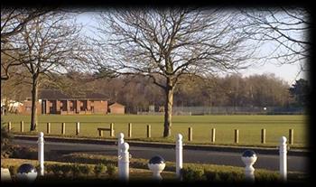
31 CHARACTER AREA 6 Streets Heath - Old Acre - Church Road - Windlesham Road Benner Lane (north) (Surrounding the recreation ground) Plot to Building Ratio Introduction This Character Area is in the northeast of the village, bounded by Windlesham Road to the west and the A319 Bagshot Road to the north. The recreation ground, with an area of approximately 8.6ha, is regarded by many residents of West End to be its social centre. There are four significant amenity buildings adjacent to the recreation grounds which play a pivotal part in village activities. It has a large pond and recreational facilities for football, cricket and tennis. There is also a basketball ring and a hard table for table tennis, a teen shelter and playground for younger children. Three of the five streets in this Character Area form the boundary of the recreation ground. This Character Area has three designated Heritage Assets: Walnut Tree Cottage, Holy Trinity Church and a War Memorial. Streets Heath is adjacent to the recreation ground on its southern side, it is bisected by the northern section of Benner Lane and then continues in a north westerly direction as an unadopted road to join Bagshot Road. Benner Lane forms the eastern boundary of the recreation ground and runs north to join the A319 Bagshot Road. Old Acre, a cul-de-sac on the south side of Streets Heath, is a small Georgian design development. In Church Road, which forms the northern boundary to this area, there is Holy Trinity Church, a locally listed property built in Windlesham Road runs north to the A319 Bagshot Road from Church Road. 29

 Design Guideline 7 Dwellings one or two-storey")


32 Main Design Features and Relevant Guidelines Streets Heath a narrow, leafy rural road with no pavements (see traffic section) Early 1800s Church Unadopted section of Streets Heath with copse The recreation ground bordered by commemorative and mature trees Amenities, including pond (fishing) and social/activity centres Rural and semi-rural in character Design Guidelines 1-13 Listed buildings, Monuments and feature lighting Design Guideline 11 Amenities - Open space (formal and informal) Design Guideline 7 Dwellings one or two-storey Design Guideline 4 Positives Large formal open green space Views over open green space Mature trees, woodland and pond Streets Heath, a narrow rural lane, Low/medium housing density Negatives Oversized developments Large extensions Streets Heath A mix of houses new and old and Tudor style maisonettes. Architectural Features Old Acre A modern development of large houses in a cul-de-sac, off Streets Heath. Streets Heath Heritage Asset Walnut Tree Cottage, a locally listed property Church Road A row of houses built in 1919, facing on to the recreation ground. 30


33 Streets Heath A modern development alongside a bungalow overpowers in this rural leafy road. Streets Heath Unadopted section mixed housing modern and late 1800s with varying roof pitches. Age The age of properties in both parts of Streets Heath ranges from 1800 to Walnut Tree Cottage in Streets Heath is a locally listed property. Some of the later developments, infill following demolition, are over-sized and out of character with the older properties. Character Area 6 Detail roof extensions. The roof material is mostly tile but some slate and concrete tiles are used in Streets Heath. Windows are mainly casement and there are bay windows in Old Acre. The dwellings, terraced and two-storey, in Windlesham Road were built in 1920/30. In Church Road, there is Holy Trinity Church, a locally listed building built in 1842 and five properties, the first Council houses in West End, built in Building Type & Height The majority of dwellings in Streets Heath are detached two-storey houses or single-storey bungalows including the two new build in The remainder are semi-detached twostorey houses, and semi-detached bungalows. There is a small two-storey block of maisonettes in the southern part of this Street. The housing in both Windlesham Road and Church Road is two-storey terraced. Materials In Streets Heath the construction material is red brick with some painted render. In Windlesham Road and Church Road all the properties are painted render with the exception of the detached property, which is dark red brick. All the buildings in Old Acre are red brick built, the roofs are gabled pitch, but some have flat Scale & Massing In parts of Streets Heath demolition of existing properties to allow for infill has resulted in buildings in close proximity to each other which do not reflect the character of the area. In Old Acre the arrangement of the houses is in pairs, separated by double driveways. Density The range is from low housing density in Streets Heath, apart from areas of infill, to medium housing density in Windlesham Road, Church Road and Old Acre. 31


34 Street Scene This Character Area is rural with large formal and informal open green spaces, leisure and recreational facilities. A pond and woodland at the eastern side of the recreation area, together with a copse on the south side near the pond enhance the open rural feel. views over the recreation ground and resident parking is off-road. However, there is on-road parking especially during church services, organised sports activities and events on the recreation ground. Old Acre is more enclosed and whilst houses have garages, there is also on-street parking. Open Space & Tree Cover The recreation ground, pond and associated boundary trees are a key formal green space feature of West End and are maintained by the Parish Council. Streets Heath is a narrow, rural, leafy, treelined lane with no pavements from its junction with Meadow Way to Benner Lane and across to where the lane is unadopted and becomes more enclosed by vegetation. There are two traffic calming humps on this road. This section of Benner Lane becomes very rural, being tree lined from the junction with Fairfield Lane to the Bagshot Road. With a pond, recreation ground, mature trees, shrubs and a copse it has a calm rural feel. Windlesham Road is rural with open land, allotments and parking is mostly off-road. Church Road has a really open rural feel with There is an avenue of mature Horse Chestnut trees surrounding the recreation ground. An old allotment area, owned by Chobham Poors Allotment Charity is surrounded by mature hedges and trees. There are functioning allotments at the north end of Windlesham Road. Wide grass verges in places, give a spacious feel. 32

35 CHARACTER AREA 7 The Nursery Estate Plot to Building Ratio Introduction The Nursery Estate lies to the west of the A322 and west of centre of the village. It is a well-laid-out residential area, developed between the 1980s and 1990s by five or six different builders. There are two main feeder roads on the estate, Rosewood Way and Kerria Way, both of which lead off the A322. Kerria Way has a further feeder road leading off it to Rugosa Road. There are spur roads leading off the feeder roads to the various parts of the estate. The roads are curved with houses built in a more informal manner which helps to minimise uniformity and being overlooked. The estate is well furnished with shrubs and trees and has mainly open-plan front gardens that give a semi-rural feel. It has green space, wide grass verges and pavements throughout. There are recreational facilities and a Bowls Club in Rosewood Way. The facilities include a large formal grassed area with specimen trees and children s playground accessible from Camellia Court and Rosewood Way. A stream runs through the estate and when above ground it has landscaped and tree-lined pathways. A small copse, mature trees and a footpath that runs alongside the stream enhance the appearance of the balancing pond on Fuchsia Way. Parts of the entrance to the estate via Kerria Way detract from the overall green feel of the estate. Main Design Features and Relevant Guidelines Curved feeder roads and courtyard settings Specimen trees/groups with TPOs Stream and balancing pond wild life corridors Mini roundabouts with planting and paving Pathways linking to other parts of the village Semi-rural in character Design Guidelines Dwellings one or two-storey Design Guideline 4 Amenities, open space formal and informal Design Guideline 7 Open-plan front gardens, trees and wide grass verges Design Guideline 9 Drainage - Design Guideline 12 33


36 Positives Negatives Well-designed, informal layout (minimises density) Mix of house styles with open-plan front gardens Courtyard settings (off feeder roads) Recreation areas for adults and children Thoughtfully landscaped and well stocked with shrubs and trees Shrub and tree lined pathways through the estate and to other parts of the village Mini roundabouts and associated feature retaining walls, paving and planting deter speeding and look attractive The lack of an active frontage, particularly along Kerria Way, Minimum landscaping in areas of smaller houses Areas of Small Houses Generally, the areas with smaller one or two bedroom houses are not as landscaped or laid out to the same degree as those with larger houses. These include Gardenia Drive, Camellia Court, Acer Drive, Bergenia Court, Viburnum Court, Oakridge and Fennscombe Court. However all front gardens are open-plan which helps to minimise the effect of higher density. All houses are twostorey with gabled pitch roofs of tiles or slate. Windows are all casement. Areas with Larger Houses The areas with the larger houses, three and four bedroom, form most of the estate, these are Kerria Way, Fuchsia Way, Rugosa Road, Rubus Close, Prunus Close, Erica Close, Damask Close, Burnet Close, Rosewood Way and Abelia Close. These houses are mainly in cul-de-sac or courtyard settings or are set back from the feeder roads. However, with the open-plan layout, landscaping and planting, scale and variety of house styles, these areas do not appear to be overcrowded. Building density is low to medium in the areas of larger houses. All houses are two-storey and most have gabled pitch roofs, some are hipped of tiles or slate. Windows are all casement. Architectural Features Rosewood Way A mix of large houses with gabled pitch roofs of tiles and wood detailing to the facade, in a leafy courtyard setting. Viburnum Court Small semi-detached two bedroom houses with low front hedges. 34


 are mainly semi-detached with some terraced or detached. Only a few have garages.")
37 Rosewood Way A mix of large houses with porches, small open-plan front gardens, grass verges and brick paving. Viburnum Court A terrace of two bedroom houses, with dormer windows, in a leafy semi-rural setting. Gardenia Drive Two and one bedroom homes in a relatively tight layout and very small gardens. Kerria Way Detached houses built on very narrow plots resulting in a cramped appearance. Age The site of the Nursery Estate was originally nursery land. It was a planned development, which had five or six builders and was built between the mid 1980s and early 1990s. Building Type & Height The use of a variety of builders has resulted in a mix of housing styles across the Nursery Estate. All the houses are two-storey. Types include detached, link-detached, semidetached and terraced, some of which are back terraced. Character Area 7 Detail Roofs are mainly gabled pitched, some hipped with tiles or slate. Some have dormer windows. The larger houses (three to five bedrooms) are mainly detached, some link-detached and all have single or double garages. The smaller houses (one, two and some three bedrooms) are mainly semi-detached with some terraced or detached. Only a few have garages. Materials Mixed materials are used throughout including brick (red or sand), render, part render, part hanging tiles, part wood cladding and many of the large houses have timber features in a mock Tudor style. Brick facades predominate. Roofs are mainly tiled, some with slate. Density The overall housing density of the Nursery Estate is varied. Areas with smaller houses are high or medium density and those with 35


38 larger houses are lower in density. Overall building density is low to medium with pockets of high density. Scale & Massing Generally, the layout, open-plan design and shrubbery help to minimise the feeling of massing. Parking is adequate in garages or off-road. Where there are smaller houses front gardens are open-plan. Street Scene The Nursery Estate is leafy, landscaped, well laid out and semi-rural in character. It was thoughtfully landscaped at the time of building with the retention of many mature trees and over time new trees and shrubs have matured giving a pleasant open green leafy appearance to the street scene. Particular features which enhance the estate are the curved feeder roads, with wide grass verges and the courtyard setting of houses. There are parking bays, but off-road is tight and does not allow space for visitors or multiple cars per house. Traffic calming measures are an intrinsic part of the estate design, with planted mini roundabouts encircled by brick paving, on the feeder roads. There are pavements throughout. Open Space & Tree Cover There is a large formal recreational area called Nursery Green off Camellia Court The Nursery Green comprises a park and childrens' playground maintained by the Parish Council and a Bowls Club with outdoor green and a clubhouse with car park in Rosewood Way. Open-plan front gardens with houses stepped or linear add interest to the street scene. The design of footpaths and planting along the stream, where it is above ground, as it crosses through the estate provides valuable green space and a nature corridor. In areas with larger houses there are generally open-plan front gardens. The boundary of the recreational area is a dense hedge with formal access areas and an additional metal fence onto the A322. Bergenia Court has a central green area with some trees that give a spacious feel to an area of small houses. This Character Area has many grass verges, a stream, mature trees, pathways and a copse by the balancing pond. 36
 Introduction This is a large and diverse area which forms the northwest sector")
39 CHARACTER AREA 8 Brentmoor Road (incorporating Westside & Hook Lane) - Rounce Lane - Birch Platt Ashley Way - Birch Lane - Broad Street - Cuckoo Lane - Cuckoo Vale - Orchard Close - Revesby Close New England Hill - Tanglewood Ride - The Folly Plot to Building Ratio of Character Area 8 (OS Licence Number ) Introduction This is a large and diverse area which forms the northwest sector of the village with Red Road B311 forming its northern boundary. This Character Area is a mix of rural and semi-rural with some sections having a pronounced rural nature. There are large areas of formal and informal open space, many gardens are large with plenty of mature vegetation. Main Design Features and Relevant Guidelines Within the 400 m of SPA Buffer Zone Mixed style housing set back from roads Rural/semi-rural in character - Design Guidelines 1-12 Dwellings one or two-storey Design Guideline 4 Open space (formal and informal) - Design Guideline 7 Boundary Treatments rural to reflect the street scene - Design Guideline - 9 Ditches and Drainage - Design Guideline 12 Heritage Assets e.g. Listed Buildings - Design Guideline 11 Positives The protection offered to wildlife through proximity to SSSI and SPA Proximity to heathland and plenty of open space and vegetation gives a rural aspect to this sub-area and provides recreational facilities Public footpaths lead off the roads to woodland and open green spaces Low-medium density Open-plan front gardens in the 1960s developments and low retaining walls and fences give a spacious feel. 37
40 Negatives Single-storey bungalows as opposed to chalet bungalows such as in Birch Lane Ad-hoc building style and little design consistency Some loss of small dwellings due to extensions Unsympathetic extensions out of character with surrounding buildings Some new build two-storey houses in Birch Lane conflict with and are out of character with the 1930s bungalows which predominate. As this Character Area is quite diverse in setting and building style we have divided it into three Sub-Areas, as follows: Sub-Area A: Brentmoor Road (east to west) Sub-Area B: Donkey Town Sub-Area C: New England Hill 38


41 Character Area 8 Sub-Area A Brentmoor Road (incorporating Westside & Hook Lane) - Rounce Lane - Birch Platt Plot to Building Ratio Introduction Brentmoor Road forms the spine of this Character Area 8. It is more than a kilometre long and in the middle third only is there development on both sides of the road. The road runs east-west parallel with the SPA, Brentmoor Heath. Birch Platt and Rounce Lane are small unadopted cul-desacs leading off Brentmoor Road, both ending in farmland. There is no consistency of design, styles and roof lines in this Sub-Area A, but none exceed two storeys. Brentmoor Road Mixed style detached bungalows and two-storey houses. In the distance mature woodland on both sides of the road. Architectural Features Brentmoor Road Houses with gabled pitch tiled roofs and extensions, opposite formal open space at entrance to Birch Platt. 39


42 Westside Semi-detached houses with hipped roofs, set back on Brentmoor Road appear tall for two-storey. Birch Platt A large detached house seen from Birch Platt across informal open green space with line of posts to deter travellers. Rounce Lane A rural lane with row of bungalows with hipped/front gabled front pitch roofs. Hook Lane Hagthorn Cottage a locally listed building with pitch roof, chimney and render. Age Brentmoor Road, including Hook Lane, has five listed buildings, built in the 17th and 18th centuries: Brentmoor Dene is Grade II listed. Brentmoor, Hagthorne Cottage, Stone Cottage and Burnstubb Farm are locally listed. The greatly extended Heath Cottage was originally an 18th century farmhouse. Sub Area A Detail The majority of properties were built in the 1970s and range from the 1800s to The dwellings in Rounce Lane range in age from the 1900s, the majority from 1930 to Dwellings in Birch Platt were built in the 1930s with one extended in the 1990 s. Building Type & Height In Brentmoor Road there is a mix of property types and styles and there have been many extensions over the years. At the western end of this road directly opposite the Heath there are substantial detached two-storey properties in extensive grounds, most of which have been greatly extended. Nearer the eastern end there are bungalows and two-storey dwellings, also a public house, the Hare & Hounds. What was a row of shops 30 years ago has been converted into private dwellings. The tyre business is the only other commercial property in the road. In the middle sector travelling east-west the twostorey dwellings of Westside are set back from the road and there is also a small block of 4 maisonettes (Westside Court). On the right-hand side there is a mixture of bungalows and two-storey dwellings. 40

43 In Rounce Lane there is a mix of bungalows, chalet bungalows and two-storey houses, all are well-spaced detached properties. The dwellings in Birch Platt are all detached, bungalows and two-storey properties of which one is a farmhouse with barns and another with an outhouse used for kennels. Hook Lane has one locally listed two-storey property. Materials Throughout this Sub-Area the construction material is of variable colour brick; a few properties have hanging tiles; the roofs are generally of assorted colour tile with a few slate. Some of the dwellings in Brentmoor Road are pebble dashed, others are painted render and some have quoins. Most dwellings have gabled pitch roofs and some are hipped. Most older (pre 1960) properties have chimneys. Despite the variety of ages most properties throughout this sub-area have replacement UPVC (mostly white, few brown wood/composite) casement windows, or from the 1980s onwards double-glazing built as standard. Scale & Massing In Brentmoor Road the larger properties are very well-spaced, others are much closer together, and some of the properties in Westside appear to be very tall, despite being only two-storey. In Rounce Lane the properties are well-spaced with vegetation in between. Birch Platt is similar but with properties on one side only. Density Throughout this Sub-Area, there is lowdensity housing and much of it is ribbon development. Most are detached properties, giving the feel of spaciousness. Street Scene The entirety of Brentmoor Road is rural in appearance, overarched in places by mature trees, mainly oak. There is a pond, open green space opposite the Hare & Hounds public house and small areas of woodland dotted along the length of the road. At Birch Platt/Rounce Lane junction, there are two formal grassed areas with mature trees. There are views to the north, through birch woodland, of heathland (Brentmoor Heath SPA) and the road is bordered by mature woodland and heath. For the last 500 metres, the road narrows at its western end, finally becoming a dirt track at Hook Lane. Hook Lane links with Priest Lane to the south but is impassable for most vehicles. The roadside here is bordered by trees, shrubs and open fields. Pavements zig zag in Brentmoor Road and only a small part, from Fenns Lane junction to Broad Street, has pavements on both sides. There are no pavements for the last 500 metres. Westside has an unadopted road, mostly set back at an angle from Brentmoor Road and fronted in part by a triangle of informal woodland. Properties along the length of Brentmoor Road are generally well set back, on both sides. They are mostly two-storey with occasional bungalows providing variety of roof lines. The scene is rural with low-medium density housing initially leading to very large properties (2-3-d/ha), set in very spacious irregular plots and often obscured by trees, towards the western end. Three properties on the northern side are set within the SPA. Boundary treatments reflect the rural feel with neat hedges, low walls and well-established tree groups. Parking is mostly off-road giving an uncluttered feel to the road. Birch Platt and Rounce Lane continue the rural theme, both are un-adopted with no pavements. Properties are single or two-storey, set back from the road and with hedges, low walls and fences. 41

44 Open Space & Tree Cover This is a very pleasant Area with plenty of formal and informal open space, woodland, mostly pine, oak and birch, a pond and in part adjoining the SPA of Brentmoor Heath. There is an open area of fenced meadowland to the north of Brentmoor Road opposite the Hare & Hounds, beyond which is pine woodland. A small stream under Brentmoor Road flows from Matchettes pond. There is largely birch copse in front of, and opposite Westside, near Fenns Lane and two small open spaces, one grass and one wooded, at the junction of Rounce Lane and Birch Platt. There are mature trees (including a large red oak) along Brentmoor Road, in gardens, verges and the wooded areas. 42


45 Character Area 8 Sub Area B (Donkey Town in part) Ashley Way - Broad Street - Cuckoo Vale - Cuckoo Lane - Orchard Close - Revesby Close - Birch Lane Plot to Building Ratio Introduction Sub-Area B of Character Area 8 is a mix of mostly semi-rural with some rural, situated in the north west of the village north of Brentmoor Road, within the 400m boundary of Brentmoor Heath. Some parts abut Brentmoor Heath others have public footpaths leading directly on to the heath. Orchard Close Consistency of design in this development of gabled front roof houses. Architectural Features Broad Street Chalet style bungalows with high gabled front roof chalet bungalows. 43


46 Birch Lane 1930s bungalows characteristic of this Sub-Area. Revesby Close Mix of houses with gabled front roofs and a wide grass verge on right of picture. Cuckoo Lane Mainly bungalows on both sides of the road in this section. Birch Lane An oversized development alongside and opposite bungalows. Birch Lane Landscaped cul de sac discreetly set off the lane, where large houses do not detract from the style of this road. Ashley Way Gable front roofs in an open-plan 1960s development. Age In Ashley Way most houses were built in the late 1960s and a couple in the 1980s. In Birch Lane the bungalows on the east side were built in the 1930s and they form a feature of this Sub-Area. These smaller bungalows retain a distinct character on this part of Birch Lane. In the early part of the 21st century some very large two-storey houses were built, which dominate the early bungalows, opposite and alongside, and are out of proportion in this narrow lane. Broad Street properties were built ad-hoc mainly in the 1950 s 1970 s. Sub Area B Detail In Cuckoo Vale and Cuckoo Lane the dwellings were built in 1930s and 1970s. In Orchard Close most houses were built in 1973 with a few others in the early 1980s and In Revesby Close the bungalows and chalet bungalows were built ad hoc in the 1960s. Building Type & Height Ashley Way properties are all two-storey, mostly detached or link-detached, with a few semi-detached. Many have been extended. 44


47 All the dwellings in Cuckoo Vale and Cuckoo Lane are detached houses, bungalows and chalet bungalows. The properties in Birch Lane are a mix of mainly detached single storey bungalows, chalet bungalows and two-storey houses; there is a pair of semi-detached bungalows and a pair of semi-detached houses (originally a two-storey house). The dwellings in Broad Street are a balanced mix of single storey bungalows, chalet bungalows, detached two-storey houses and a few semi-detached houses. Orchard Close has two-storey detached and link-detached houses, many with considerable extensions. Revesby Close has a mix of detached bungalows and chalet bungalows. Materials Throughout this Character Sub-Area the construction material is of variable colour brick including red and sand, different types of cladding such as white UVPC, assorted colour tile and occasionally slate. the 1980s onwards double-glazing as standard. Scale & Massing In Ashley Way and Orchard Close the feeling of spaciousness created by open-plan front gardens, has been decreased in places by the size of the permitted extensions. The close proximity of some of the new detached properties in Birch Lane impacts on the overall spaciousness of the lane. Other large properties in a private cul-de-sac appear more spaced out, assisted by a small landscaped strip of garden at the entrance, in keeping with the semi-rural nature of the Lane. Broad Street, has long front gardens with plenty of trees and shrubs which gives the street a spacious rural feel. This is supported by the properties having low brick walls, a feature seen also in some Birch Lane properties. Most dwellings have gabled pitch roofs. Some of the pitches are very shallow as in Ashley Way, whilst in Broad Street five chalet bungalows have steep front gabled pitch roofs. There are two bungalows with distinctive asymmetric pitch in Birch Lane. Some older (pre 1960) properties have chimneys. The new properties in Birch Lane are hipped and many have gabled pitch front roofs. Despite the variety of ages most properties throughout this Sub-Area have replacement UPVC (mostly white, few brown wood/composite) casement windows, or from In Cuckoo Lane, Cuckoo Vale and Revesby Close the properties are well-spaced with some open- plan front gardens and vegetation giving a spacious feel. Some of the properties in Cuckoo Lane have low retaining brick walls, others are open-plan. Density Throughout this Sub-Area there is low/lowmedium density housing. Most are detached properties with plenty of space between, giving the feel of spaciousness. Street Scene This Sub-Area consists of a number of smaller residential roads and lanes in a semi-rural setting. The Sub-Area consists of both 45


48 adopted and un-adopted roads which have an impact on the formality of the street scene. footpath skirting the heathland. On the eastern side of Birch Lane is a line of bungalows on long rectangular plots with small front gardens of. On the western side there are much larger, more modern, twostorey properties, the recently built ones have little space between and dominate both the roof lines and the bungalows opposite. There is a drainage ditch visible in parts on the western side of the lane and there is some on-road parking. Ashley Way and Orchard Close generally have small open-plan front gardens, whereas in Broad Street, Revesby Close, Birch Lane, Cuckoo Lane and Cuckoo Vale there are longer front gardens with fairly low brick retaining walls or low picket fencing, with wellplanted front gardens of trees and shrubs. In the un-adopted part of Cuckoo Lane, where there are no pavements, there are low walls and wide grass verges. This gives a more informal feel to these areas. Parking is generally off-road but where households have more than two cars there is on-road parking outside working hours. Properties in both Ashley Way and Orchard Close are on curved roads with houses set back equally on both sides. There is uniformity of roof lines, with all but two properties of similar design and all two-storey. Approximately one third of the houses in Ashley Way face directly onto the SPA. Broad Street is wide with pavement on both sides and wide grass verges on one side. There is a mix of houses and bungalows of very differing architectural styles, roof heights and building lines. Broad Street becomes unadopted and potholed some 100 metres from the heath, here there are properties on the eastern side only facing a lightly wooded area. Revesby Close is a small cul-de-sac off Broad Street with a wide grass verge at the entrance. Open Space & Tree Cover This is a very pleasant Sub-Area with plenty of formal and informal open space, woodland, mostly pine and birch and in part adjoining the SPA of Brentmoor Heath. All the Sub- Area lies within the 400m zone of the SPA. There is a wide grass verge in part of Cuckoo Lane where the road is unmade and also at the entrance to Revesby Close. There are mature trees either in gardens or the wooded areas. Where there are no open-plan frontages there are specimen trees and shrubs in gardens. Birch Lane is unadopted throughout. Where the properties face north to overlook trees bordering Brentmoor Heath the road is very narrow. They are mostly chalet bungalows, are on the southern side only, being separated from the heath by a drainage ditch. At the elbow of Birch Lane is a small open grass area and woodland which leads onto a tree lined public 46


49 Character Area 8 Sub Area C New England Hill - Tanglewood Ride - The Folly Plot to Building Ratio Introduction New England Hill is a rural enclave situated to the north west of the village. The properties, each of very individual design, are within the Brentmoor Heath SPA. This low density development of one and two-storey buildings is accessed by forest tracks leading off from the B311 and Gordon s roundabout. Tanglewood Ride comprises just three large properties in a cul-de-sac situated within the SPA just off Birch Lane. The Folly is a secluded enclave of five dwellings on the far north west of the village, adjacent to the SPA of Brentmoor Heath and MoD land. Architectural Features New England Hill England Hill Area of low density despite lack of Heather Hills locally listed with Dutch style gables. frontage and houses close together. Tanglewood Ride Detached 1960s house. New England Hill A cottage with a thatched roof and chimney incorporating an 18th century building. 47
50 Age The houses are much older on New England Hill than in the other streets in this Sub-Area. Two of the dwellings, Ivydene (local listed) and Chestnut Cottage, have incorporated 1750s cottages into the present houses; the original White Cottage was built in 1833, New England House in 1839; Heather Hills (local listed) was built in 1909 and the remaining properties also around this time. Sunnymede, originally on Sandpit Hill, was built in Tanglewood Ride has properties built in the 1960 s and the Folly has properties ranging in age from 1850 to Building Type & Height There is a mix of detached large bungalows and two-storey houses and one semidetached house. Materials Throughout this sub-area the construction material is variable with some red brick, different types of cladding and render, white UPVC windows predominate but some original wood frames still exist in the older properties. There are assorted colour tile and occasionally slate roofs and one thatched roof. All properties have chimney pots. Scale & Massing Although properties in New England Hill are large and close together they are low density, lack driveway and give a cluster feel. The properties in Tanglewood Ride and the Folly are set well apart in rural surroundings. Density Density in this Sub-Area is low, despite a few of the properties being in a tight cluster. Properties have large gardens and are positioned within woodland. Street Scene New England Hill is a small rural enclave of eight distinctive properties set in woodland within the SPA on the northeastern edge of the Character Area. Sub Area C Detail It is accessed solely by a potholed dirt track from Red Road or by a public footpath from Broad Street. There are no pavements and parking is off-road or in a parking area for Rangers and visitors. The properties have substantial plots but are in a row with entrances close to the track, set at the top of the hill with views over woodland and heath to front and back. Only two have a distinct front garden with trees and shrubs in boundary treatments. There are locally listed properties with entrances close to the track, set at the top of the hill with views over woodland and heath to front and back. There is no consistency of design or building lines. Some large out buildings have been built on the opposite side of the track to house cars/ office/ oil containers etc. These have generally been built to fit into the hillside and do not dominate the roofline in this very rural setting. Tanglewood Ride is a very rural development of just three large two-storey properties on irregular large plots, hidden amongst mature trees. The Ride is unadopted being built within the SPA and facing woodland on all sides. The Folly is within the parish, but far removed from the rest of the built area in a very rural setting south of Red Road. It is accessed by a potholed dirt track, with five individual properties in large gardens with mature indigenous trees such as oak, scots pine and alder, some with Tree Preservation Orders. Open Space & Tree Cover This is a delightfully rural Sub-Area surrounded by the protected Brentmoor Heath SPA heathland, woodland, mostly pine, birch and oak. 48

51 CHARACTER AREA 9 Lucas Green Road - Lucas Green - Priest Lane - Ford Road - Fenns Lane Plot to Building Ratio Introduction This Character Area forms the south-western corner of the village and marks its southern and western boundaries. The area is predominantly rural in nature, being surrounded by open fields to the north and south and by the MoD ranges on West End Common to the west. Lucas Green Road which is over a kilometre long forms the spine of the area. Ford Road is a turning off to the south, running into Bisley at its eastern end. Fenns Lane links Brentmoor Road at its northern end to Lucas Green Road at its eastern end. There is no consistency of design or building style throughout the area which reflects the nature of development in this Character Area. Apart from listed properties, most were built between 1910 and the early 1990s. The main construction materials are red brick with tiled roofing although there are some isolated examples of render, timber cladding, timber framing, and slate and thatched roofing. All properties are one or two-storey and most have gabled pitch roofs. At the western end of the area, building density is very low. Nearly all of this character area is within the Green Belt. Main Design Features and Relevant Guidelines This is green belt land with West End Common part of the SPA and also a SSSI flanking Lucas Green Road and Ford Road Semi-rural and rural in character - Design Guidelines Dwellings one or two-storey Design Guideline 4 Leafy open rural feel should reflect the existing street scene - Design Guideline 9 Open space should be preserved and maintained - Design Guideline 7 Heritage Assets e.g. Listed Buildings - Design Guideline 11 49


52 Positives Very rural area with mature trees The protection offered to wildlife by the SSSI and SPA Leafy rural feel reflecting proximity to heathland and common Public footpaths lead off the roads to woodland Low housing density reflects the rural, edge of settlement setting Heritage Assets e.g. Many listed buildings Lucas Green Road Heritage Asset - Lucas Green Manor and Barn, Grade II listed. Architectural Features Priest Lane A row of chalet and single storey bungalows built in the 1930s and 1960s. Age This area has a wide age range with four 16th and 18th century Grade II listed properties and two 19th century locally listed properties. Other properties were built between 1910 and the late 20th century. The doctors surgery at the eastern end of Lucas Green Road was built in the late 1980 s with subsequent change to the road layout and building of the roundabout at Fellow Green. There are eight dwellings in Lucas Green, built between 1910 and 1960, one being associated with commercial use. In Priest Lane there is a small development of residential bungalows, built in the 1930s and 1960s. Fenns Lane, which takes its name from Fenns Farm originally built in 1801, has a variety of properties along the eastern side including Swedish timber construction properties erected in 1946 in the raised area called Holly Ridge and a detached brick house built in the late 1990 s. There is a riding and livery business on the western side of the lane. Building Type & Height There is a mix of housing styles and size and none exceed two storeys in height. Character Area 9 Detail 50 Lucas Green Road is a kilometre in length and can be split into three sub areas. At the eastern end there is a purpose built single-storey doctors surgery and in the vicinity are terraced two-storey one-bedroom starter homes and semi-detached two-storey flat conversions. There are also large detached and semi-detached two-storey properties and two bungalows. In the middle area there is a commercial business producing herbs with associated large two-storey house and greenhouses to the rear. There is a Grade II listed 16th century manor house (Lucas Green Manor with outbuildings also listed) on the northern side and three other listed (Manor Cottage Grade II) and local listed (Glencroft


.")
53 and Furze Farm) properties on the southern side of the road. Other detached properties are two-storey, built in the mid 20 th century. Generally, this area is a mixture of single and two-storey buildings. The middle and western areas of Lucas Green Road have much more commercial development, mainly concentrated in what is known as Gregory s Yard, with a car maintenance business, a wholesale plant nursery and more recently also a coach park. Materials The general construction material on Lucas Green Road is red brick, some buildings have porches and pediments and roofs are gable pitch with tiles or slates. Some have timber cladding and there is a prefabricated building of predominantly wooden construction. In Fenns Lane, apart from the Swedish timber construction properties, the main construction material is brick, mostly dark coloured with some painted render, tile clad, whitewashed, pebble dashed or in the case of the Swedish timber houses wood /UPVC clad. The roofs are mainly very dark, small tile, of slate and one thatched (Heathermead). The houses in Lucas Green are of red brick and render with gabled pitch, tiled roofs. Those in Priest Lane are of different colour red brick, one is part white rendered with elmclad front gable. The residential properties are mainly bungalows with some two-storey houses. In Fenns Lane there are two local listed properties, Fenns Farm and Heathermead, the latter, originally two cottages, has been considerably extended but in keeping with its character. In addition to the listed houses, there is a mix of housing styles including detached and semi-detached two-storey properties, detached chalet bungalows, a small block of maisonettes and some Swedish timber construction semi-detached houses. All the properties in Lucas Green are detached, single and two-storey, including a two-storey farm conversion. One of the bungalows has an attached nursery with outbuildings. Those in Priest Lane are singlestorey or chalet style with accommodation built into the roof space. Some have gabled front roofs or are gabled pitch with some flat areas and all are tiled. Throughout the area the windows have largely been replaced with a mixture of brown and predominantly white, UPVC with various styles of window. 51

54 Scale & Massing Most of the properties in Lucas Green Road have spacious front gardens, except the flats and starter homes in the eastern section. In the middle and western sections, the houses are very well-spaced with intervening vegetation, giving a rural feel to this road. Likewise in Fenns Lane: properties on the western side are very well-spaced out, they are closer together on the eastern side, especially near the junction with Lucas Green Road. The properties in Holly Ridge, hidden behind an area of mature trees have a medium plot to building size ratio but the rural appearance is maintained. In both Lucas Green and Priest Lane the plot size to building ratio is very high giving a very spacious rural feel. Density This area has low housing density, wellspaced out, giving a very rural feel. The plot to building ratio is very generous with low density of about 15 dwellings/hectare at the start of the eastern sector. Lucas Green and Priest Lane housing density is very low at less than 1 dwelling per hectare. Street Scene This Character Area is a distinctly rural part of West End with narrow twisting roads. Lucas Green is a small rural enclave accessed from Lucas Green Road by an unadopted road, with properties set back from the road in very private grounds. Priest Lane is narrow, tree lined and paved as far as the bridge over Trully Brook. Priest Lane continues unadopted with fields and heathland on either side and SPA land eventually joining with Brentmoor Road at Hook Lane. The few properties are well set back with generally open-plan front gardens, well stocked with mature shrubs. Apart from the eastern parts of both Lucas Green Road and Fenns Lane there is very little on-road parking in this Character Area. Open Space & Tree Cover This is a very rural part of West End, adjacent to the MoD land of West End Common, which is part of the SPA and also a SSSI, with a considerable number of trees and open spaces. This is Green Belt land. There is common land, set back from the road, along half the southern side of a sector of Lucas Green Road, which is mostly birch and scrub at its western end. There are public footpaths and bridleways within this area. There is a long, open green space planted with spring bulbs, oak trees and sycamores by the doctors surgery. Apart from the early eastern end of both Lucas Green Road and Fenns Lane houses are set back from the road and there are no pavements. The area is lush with mature trees, shrubs, hedges, woodland and grass verges. This is Green Belt land with West End Common, part of the SPA and also a SSSI flanking Lucas Green Road and Ford Road. There are open fields off Fenns Lane. 52

55 CHARACTER AREA 10 Bagshot Road - Coldharbour Lane Plot to Building Ratio Introduction Bagshot Road (A319) essentially defines the northern boundary of the eastern half of the village and is the main gateway when approaching from Chobham. Coldharbour Lane is almost an extension of Benner Lane on the north of Bagshot Road and east of Windlesham Road. Development, whilst of low density, is on both sides of the Bagshot Road and apart from the many listed buildings the houses were built in the early to mid 1900s. They comprise mostly large detached dwellings, set well back from the road in extensive grounds and a few detached single storey bungalows and chalet bungalows in large plots. Coldharbour Lane is a small enclave of just six houses, built between the 1800s and 1920s, accessed from Windlesham Road. It is unadopted and narrows to a footpath as it joins the Bagshot Road. The main construction material in this Character Area is brick of varied colours and sizes, painted or with render. The roofs are pitched with a mixture of hips and gables, with either tile or slate, or very occasionally, thatch. Where visible windows are mostly casement, occasionally sash on older properties. There is no consistency of design in respect of build form in this area and it is of very low density. Main Design Features and Relevant Guidelines Large detached buildings set back in extensive grounds Gordon s School with footbridge across the road Wide grass verges and footpath on either side of road Linear in character Rural in character - Design Guidelines Open spaces (formal and informal) - Design Guideline 7 Heritage Assets e.g. Listed Buildings - Design Guideline 11 Dwellings one or two-storey Design Guideline 4 Boundary Treatments, hedges, shrubs, trees - Design Guideline 9 53
 to just past Brook Place (which forms the end of this Character Area).")


56 Positives Low density and massing reflective of the rural area Green and leafy with mature trees Green space with wide grass verges Allotment sites Bagshot Road Bagshot Road housing is linear in character from Gordon s Roundabout (junction with A322) to just past Brook Place (which forms the end of this Character Area). The main entrance to Gordon s School and its associated properties is from the Bagshot Road, as are some of its playing fields on the north side. A footbridge across the road provides a safe pathway for students. The main features of the Bagshot Road are the 13 Heritage Assets (5 Grade II listed buildings), including Gordon s School which is the major development at the western end. Most of the other houses on this road are large detached properties in extensive grounds, mostly pre-war and in a variety of styles. This is a rural area with grass verges and pavement on one or both sides and mature trees/shrubs on both sides of the road. There are allotments on both sides just after Windlesham Road and a double glazing business nearby. There is a small business park at Pankhurst Farm and a livery/riding school at Willow Farm Stud. Brook Place, in extensive landscaped grounds. Coldharbour Lane Coldharbour Lane is a leafy rural area bounded by woodland to the north and by the Bagshot Road to the south. It is fairly secluded with houses barely visible from either road and is a rural, unadopted no through road. Architectural Features Bagshot Road Linear development with large detached, listed and period houses in substantial grounds Bagshot Road Mixed housing in this linear development opposite Pankhurst Farm. Gordon s School With listed buildings and a courtyard setting. 54
.")

57 Age The A319 Bagshot Road to Chobham is an important historical route and there are some old and interesting properties here. Several properties are listed, either Grade II or Local, some being built to replace pre-existing buildings dating back to the 13th century (in the case of Pankhurst). The present Pankhurst, under a different name, was recorded in the early 17th century and Brook Place was rebuilt in 1656 from a dilapidated 14th century building. Character Area 10 Details In Coldharbour Lane all the properties are detached, a mix of older two-storey cottages, houses, a bungalow and chalet bungalow. Materials The predominant building material of the area is red brick of varied shades and size. Some are painted or with render, others feature UPVC or tile cladding. Brook Place is gabled with bricks and chimneys typical of the Tudor period. Most roofs are of tile or slate, one extended bungalow has a thatched roof and one entrance gate is thatched. In Coldharbour Lane all properties are of brick construction, mainly red brick and one is tile clad. The roof material is clay tiles and one cottage has a slate roof. Penny Fields also dates from the 17th century. Others date back to the 18th, 19th and 20th centuries although most building was post Grade II listed buildings are Bourneside, Brook Place and wall, Maltmans, Pankhurst and Penny Cottage. Locally listed buildings consist of Bramble Cottage, Cold Harbour, Gordon s School, Mulberry House, Penny Fields, Timbers, The Old Forge and White Down Cottage. There are just six dwellings in Coldharbour Lane built between the 1800s and 1960s. Building Type & Height The majority of the houses along Bagshot Road are two-storey detached properties with a few detached single-storey bungalows and chalet bungalows. Where visible, roofs are pitched with a mixture of hips and gables, often on the same property. The majority of the properties are very substantial with extensive grounds and in several instances, hidden behind high fences or hedges, which made it impossible to determine their characteristics at the time of survey. Scale & Massing With a few exceptions, the dwellings in this area are the largest in West End but in most instances with such large spaces in between them their mass is not dominant or overbearing in respect of the street scene. In Coldharbour Lane the houses are on very large plots with development concentrated at the north- west end only. Density Along the A319 there is ribbon development with low or extremely low density; in Coldharbour Lane the density is low. Street Scene This Character Area has a rural leafy feel though the two roads are quite different in character. Bagshot Road has an open rural feel with mature trees, shrubs, grass verges and pavements on both or one side. There is meadowland and open fields. The area is mainly residential but there is a Secondary School on Bagshot Road with 55

58 associated buildings and substantial recreational facilities and grounds. Coldharbour Lane is unadopted at its southeastern end. Boundary treatments in this Character Area are generally soft and rural in nature. Open Spaces & Tree Cover The playing fields of Gordon s School are adjacent to the Bagshot Road. Travelling towards Chobham, next are allotment sites (belonging to the Chobham Poors Charity) on both sides of the road and shrubs/trees line the road. There is also meadow land at Pankhurst with numerous conifers between Pankhurst and Brook Place and open fields on the left hand side beyond Brook Place. This is Green Belt land. The south-eastern end of Coldharbour Lane which adjoins the A319 is bordered on both sides by large hedges and mature trees; the north-western end has small grass verges and hedges to frontages and the entire lane which is very narrow has a very secluded atmosphere. 56
 Beldam Bridge Road")
59 7. Appendices Appendix A Map of West End Ward Appendix B Listed Buildings (Grade II Listed) Bagshot Road Bourneside Bagshot Road Brook Place Bagshot Road Wall to front of Brook Place Bagshot Road Maltmans Bagshot Road Pankhurst Bagshot Road Penny Cottage Bagshot Road Gordon's School (Assembly Hall and Reception, Chapel, Simmons Memorial Library, Statue of General Gordon) Beldam Bridge Road Beldam Bridge Farm Beldam Bridge Road Barn 20 yards east of Beldam Bridge Farm Benner Lane Malthouse Farm Benner Lane Granary 25 yards east of Malthouse Farm Blackstroud Lane East Brooklands Farm Blackstroud Lane East Barn 30 yards to south of house Brentmoor Road Brentmoor Dene, [listed under Brentmoor Lane] Fellow Green 19 Rose Cottage Guildford Road 89 Fellow Green [listed as Feltons] Guildford Road 124 & 126 [Fellow Green Cottage and the White House] Hookstone Lane Hookstone Farm 57
UPPER GORDON ROAD TO CHURCH HILL, CAMBERLEY CONSERVATION AREA
 Introduction This leaflet explains the purpose of conservation areas and the implication of their designation for residents, property owners and the Council. It provides you with a plan of the area and
2014/0590 Reg Date 26/06/2014 Chobham
 2014/0590 Reg Date 26/06/2014 Chobham LOCATION: PROPOSAL: TYPE: APPLICANT: OFFICER: ASCOT PARK POLO CLUB, WESTCROFT PARK FARM, WINDLESHAM ROAD, CHOBHAM, WOKING, GU24 8SN Erection of a two storey detached
7.1 Area 1: Haslemere Conservation Area
 7.1 Area 1: Haslemere Conservation Area Detailed map of Haslemere Town Conservation Area as of 2006 Crown copyright and database right 2011 Ordnance Survey LA100025451 27 The Conservation Area is characterised
SOUTH CAMBRIDGESHIRE DISTRICT COUNCIL. Executive Director (Operational Services) Corporate Manager (Planning and New Communities)
 Corporate Manager (Planning and New Communities)") SOUTH CAMBRIDGESHIRE DISTRICT COUNCIL REPORT TO: Planning Committee 12 January 2011 AUTHOR/S: Executive Director (Operational Services) Corporate Manager (Planning and New Communities) Notes: S/1848/10
SOUTH CAMBRIDGESHIRE DISTRICT COUNCIL REPORT TO: Planning Committee 12 January 2011 AUTHOR/S: Executive Director (Operational Services) Corporate Manager (Planning and New Communities) Notes: S/1848/10
LONGDEN VILLAGE DEVELOPMENT STATEMENT
 LONGDEN VILLAGE DEVELOPMENT STATEMENT 2017-2027 1 Longden Development Statement 2017-2027 15/01/18 1. Background 1.1 Longden Village Longden village is a very rural and traditional community first mentioned
2014/0943 Reg Date 06/11/2014 Lightwater
 2014/0943 Reg Date 06/11/2014 Lightwater LOCATION: PROPOSAL: TYPE: APPLICANT: OFFICER: LAND REAR OF 4, 6 & 8 MACDONALD ROAD, LIGHTWATER, GU18 5TN Erection of 2 linked-detached two storey dwellings with
Derry City and Strabane District Council Planning Committee Report
 Derry City and Strabane District Council Planning Committee Report COMMITTEE DATE: 23 rd March 2016 APPLICATION No: APPLICATION TYPE: PROPOSAL: LOCATION: APPLICANT: LA11/2015/0395/F Residential Development
Persimmon Homes Thames Valley Date received: 2 nd April week date(major): 2 nd July 2014 Ward: Nascot
: 2 nd July 2014 Ward: Nascot") PART A Report of: DEVELOPMENT MANAGEMENT SECTION HEAD Date of Committee: 26 th June 2014 Site address: Rounton, 28, Nascot Wood Road Reference Number: 14/00497/REM Description of Development: Reserved
PART A Report of: DEVELOPMENT MANAGEMENT SECTION HEAD Date of Committee: 26 th June 2014 Site address: Rounton, 28, Nascot Wood Road Reference Number: 14/00497/REM Description of Development: Reserved
Warren Farm, Ampthill
 1 Welcome The developers of the Warren Farm site, Bloor Homes and Connolly Homes, are holding this exhibition on the emerging Design Codes for the development prior to their formal submission to Central
5 Gratton Terrace London NW2 6QE. Reference: 17/5094/HSE Received: 4th August 2017 Accepted: 7th August 2017 Ward: Childs Hill Expiry 2nd October 2017
 Location 5 Gratton Terrace London NW2 6QE Reference: 17/5094/HSE Received: 4th August 2017 Accepted: 7th August 2017 Ward: Childs Hill Expiry 2nd October 2017 Applicant: WSD (Gratton) Ltd Proposal: The
SETTLEMENT ASSESSMENT PROFORMA
 SETTLEMENT ASSESSMENT PROFORMA Surveyors(s):Clare Sheridan Character Area: Park Estate = Midland Rd, Severn Rd, Festival Rd, Park Rd, Willow Rd, Rylands Rd. Date: Feb Weather: cloudy Look through all the
Conservation Area Designation, amendments and Review
 Conservation Area Designation, amendments and Review Location: Any area largely confined to Park Road and St. James Avenue which includes the following properties: St. James Church, St. James Road; No.
Exploring Abergavenny
 11 Majors Barn36 Ysguborwen Exploring Abergavenny 2 ysguborwen EXPLORING ABERGAVENNY For several years the Abergavenny and District Civic Society has been studying the streets, spaces and buildings of
3 Abbey View Mill Hill London NW7 4PB
 Location 3 Abbey View Mill Hill London NW7 4PB Reference: 15/03203/HSE Received: 26th May 2015 Accepted: 16th June 2015 Ward: Mill Hill Expiry 11th August 2015 Applicant: Proposal: Mr Richard Benson Alterations
Status of Supplementary Planning Guidance OLD WOKING CONSERVATION AREA Character Appraisal and design Guidance
 Status of Supplementary Planning Guidance OLD WOKING CONSERVATION AREA Character Appraisal and design Guidance Status This Planning Guidance which is supplementary to Policy BE9 of the Woking Borough Local
PDP DESIGN & ACCESS STATEMENT
 PDP The Planning & Design Partnership Planning.. Architecture.. Interiors.. Landscape The Chicory Barn Studio, The Old Brickyards, Moor Lane, Stamford Bridge York, The East Riding Of Yorkshire, YO41 1HU.
Butler s Farm, St Mary Bourne, Hampshire
 Butler s Farm, St Mary Bourne, Hampshire On the market for the first time in 47 years Lying on a quiet country lane, a 17th century Grade II listed farmhouse, beautifully maintained, with a magnificent
3 Tretawn Gardens London NW7 4NP
 Location 3 Tretawn Gardens London NW7 4NP Reference: 16/7886/HSE Received: 12th December 2016 Accepted: 19th December 2016 Ward: Mill Hill Expiry 13th February 2017 Applicant: Proposal: Mr Murray Two storey
Schedule of Planning Applications Committee Date: 23 May Reference: 06/17/0726/F Parish: Hemsby Officer: Mr J Beck Expiry Date:
 Schedule of Planning Applications Committee Date: 23 May 2018 Reference: 06/17/0726/F Parish: Hemsby Officer: Mr J Beck Expiry Date: 22-05-2018 Applicant: Proposal: Site: Mr Gillett Change of use to the
SOUTH CAMBRIDGESHIRE DISTRICT COUNCIL. Planning and New Communities Director
 SOUTH CAMBRIDGESHIRE DISTRICT COUNCIL REPORT TO: Planning Committee 5 June 2013 AUTHOR/S: Planning and New Communities Director S/0747/13/FL HISTON Construction of Car Park at Histon Baptist Church, Station
INTRODUCTION. Land south of Bishopswood Lane, Tadley
 0 INTRODUCTION THE SITE Introduction Gladman Developments Ltd. has successfully invested in communities throughout the UK over the past 0 years, developing high quality and sustainable residential, commercial
HURSTPIERPOINT SAYERS COMMON PARISH COUNCIL
 HURSTPIERPOINT SAYERS COMMON PARISH OFFICE TRINITY ROAD HURSTPIERPOINT HASSOCKS WEST SUSSEX BN6 9UY TEL: 01273 833264 FAX: 01273 834976 E-MAIL: HURSTPIERPOINT.PC@BTINTERNET.COM WEB SITE: WWW.HURSTPIERPOINT-PC.ORG.UK
DESIGN & ACCESS STATEMENT
 . DESIGN & ACCESS STATEMENT Site Adjacent to The Manor House, Upper Street,, Kingsdown, Deal, Kent. DESIGNS ARCHITECTURE + PLANNING CONTENTS Design and Access Statement Introduction Site and Location Planning
MATURE SUBURBS RESIDENTIAL DEVELOPMENT GUIDELINES
 MATURE SUBURBS RESIDENTIAL DEVELOPMENT GUIDELINES DRAFT FEBRUARY 2005 BIRMINGHAM CITY COUNCIL 1 Introduction Mature Suburbs Residential Development Guidelines - Interim Supplementary Planning Advice -
Site ref: AS06 Site Name or Address: Murreys Court, Agates Lane
 Site ref: AS06 Site Name or Address: Murreys Court, Agates Lane Proposed Land Use: Total Site Area (Ha): Housing 1.85 Ha Description: It is understood that the owner has no plans to dispose of the site
Environmental and Landscape Mapping
 Environmental and Landscape Mapping In support of the Calveley Neighbourhood Plan November 2016 Project Name and Number: Calveley Neighbourhood Plan 16-025 Document Name and Revision: Environmental and
Planning and Regulatory Committee 20 May Applicant Local Councillor Purpose of Report
 Planning and Regulatory Committee 20 May 2014 7. APPLICATION FOR PLANNING PERMISSION FOR THE CARRYING-OUT OF DEVELOPMENT PURSUANT TO PLANNING PERMISSION REFERENCE NUMBER 603451 DATED 28 FEBRUARY 2007 WITHOUT
Statement of Community Involvement LAND OFF SOUTHDOWN ROAD HORNDEAN, HAMPSHIRE
 LAND OFF SOUTHDOWN ROAD HORNDEAN, HAMPSHIRE CONTENTS Page 1. Introduction 3 2. Pre-application Discussions 4 3. The Consultation Process 5 4. Consultation Feedback 7 5. Responses to Consultation Feedback
2015/0291 Reg Date 13/04/2015 Parkside
 2015/0291 Reg Date 13/04/2015 Parkside LOCATION: PROPOSAL: TYPE: APPLICANT: OFFICER: BROOK GREEN & TINYBROOK, WAVERLEY CLOSE, CAMBERLEY, GU15 1JH Outline application for the erection of two blocks of flats
Land to West of Bessel s Way, Blewbury. Contextual Analysis. fluid
 Land to West of Bessel s Way, Blewbury Contextual Analysis fluid Contents fluid - Overview - Growth pattern - Footpath & Road connections - Landscape Character - Amenities - Agriculture - Characteristic
1 The development hereby permitted shall be carried out in accordance with the following approved plans:
 Location 59 Greenway Close London N20 8ES Reference: 16/00011/HSE Received: 30th December 2015 Accepted: 7th January 2016 Ward: Totteridge Expiry 3rd March 2016 Applicant: Mr Ankit Shah Proposal: Part
CALA HO ME S WELCOME
 WELCOME Welcome to this public consultation event for our proposed residential development of 56 high quality homes on land to the north east of Station Road in Earls Colne. Thank you for taking the time
ENVIRONMENTAL AND LANDSCAPE MAPPING
 APPENDIX IV : Environmental and Landscape Mapping ENVIRONMENTAL AND LANDSCAPE MAPPING Calveley Neighbourhood Plan November 2016 ENVIRONMENTAL AND LANDSCAPE MAPPING Calveley Neighbourhood Plan Calveley
Land Adj. 63 Sunny Bank Road, Sutton Coldfield, Birmingham, B73 5RJ
 Committee Date: 11/07/2013 Application Number: 2013/03520/PA Accepted: 20/05/2013 Application Type: Full Planning Target Date: 15/07/2013 Ward: Sutton Vesey Land Adj. 63 Sunny Bank Road, Sutton Coldfield,
STRENSALL RAILWAY BUILDINGS CONSERVATION AREA APPRAISAL. In association with Strensall with Towthorpe Parish Council
 STRENSALL RAILWAY BUILDINGS CONSERVATION AREA APPRAISAL In association with Strensall with Towthorpe Parish Council CONTENTS Page 1 Introduction 2 2 Location and Context 3 3 Topography and Setting 4 4
INTRODUCTION CURRENT APPLICATION
 05/01805/FUL & 05/01807/LBC ERECTION OF A SINGLE DWELLING HOUSE WITH ANCILLARY ACCOMMODATION AT Flamingo Zoological Gardens, Olney Road, Weston Underwood FOR Mr A J Crowther (as amended by letter dated
DESIGN & ACCESS STATEMENT
 DESIGN & ACCESS STATEMENT January 2016 Contents Introduction section 1 Section 1 - Introduction Section 2 - Assessment Section 3 - Involvement Section 4 - Evaluation Section 5 - Design Section 6 - Layout
2015/0141 Reg Date 17/02/2015 Bagshot
 2015/0141 Reg Date 17/02/2015 Bagshot LOCATION: WESTON PADDOCKS (LAND ADJACENT TO 1) WHITMOOR ROAD, BAGSHOT, GU19 5QE PROPOSAL: Outline application for the erection of 10 dwelling houses following the
Tazewell Pike. Neighborhood Conservation Overlay District Design Guidelines
 Tazewell Pike Neighborhood Conservation Overlay District Design Guidelines Knoxville Knox County Metropolitan Planning Commission November 2, 2000 These design guidelines were: Adopted by the Knoxville
Replacement Golf Course Facilities and Residential Development, Churston. Environmental Statement Non-Technical Summary
 Replacement Golf Course Facilities and Residential Development, Churston Environmental Statement Non-Technical Summary July 2011 Reproduced from the Ordnance Survey s map with the permission of the Controller
PLANNING COMMITTEE. 14 October 2014
 AGENDA ITEM NO 8 PLANNING COMMITTEE 14 October 2014 APPLICATION NUMBER : CA//14/01744/FUL PROPOSAL : Extension and conversion of roof space of an existing detached bungalow together with enhanced parking
Environment Agency Flood Risk Map for the Village of Bridge
 Environment Agency Flood Risk Map for the Village of Bridge December 2016 21 Objective F. Conserving and Enhancing the Natural Environment The National Planning Policy Framework states that the planning
Penfedw Brongest Newcastle Emlyn Ceredigion. SA38 9ES 795,000
 Penfedw Brongest Newcastle Emlyn Ceredigion. SA38 9ES 795,000 An approx. 75 acre farm Featuring a lovely 4 bed farmhouse Range of beautiful stone outbuildings More modern agricultural buildings Soil Association
DEVELOPMENT MANAGEMENT REPORT
 ITEM A08-1 DEVELOPMENT MANAGEMENT REPORT TO: BY: DATE: DEVELOPMENT: SITE: WARD: APPLICATION: APPLICANT: Development Management Committee Development Manager Proposed live/work unit in connection with existing
9 VALLEY CLOSE GORING ON THAMES F SOUTH OXFORDSHIRE
 9 VALLEY CLOSE GORING ON THAMES F SOUTH OXFORDSHIRE 9 VALLEY CLOSE GORING ON THAMES F SOUTH OXFORDSHIRE Goring (London Paddington within the hour) F Streatley High Street/River - ½ miles F Reading - 10
31 South Mardy. Exploring Abergavenny
 31 South Mardy Exploring Abergavenny Cover: St Teilo s Road 2 south mardy EXPLORING ABERGAVENNY For several years the Abergavenny and District Civic Society has been studying the streets, spaces and buildings
Conservation Area Designation, amendments and Review
 Conservation Area Designation, amendments and Review Location: No.s 37-49 (odd) Twickenham Road Date Assessed: January 2018 Adjacent Conservation Area Significance: Teddington Lock CA. The Teddington Lock
1 THE OLD VICARAGE MANOR ROAD F GORING ON THAMES F OXFORDSHIRE
 1 THE OLD VICARAGE MANOR ROAD F GORING ON THAMES F OXFORDSHIRE 1 THE OLD VICARAGE MANOR ROAD F GORING ON THAMES F OXFORDSHIRE Pangbourne on Thames 5 miles F Reading 10 miles F Newbury 13 miles F Oxford
REFERENCE: B/03745/12 Received: 02 October 2012 Accepted: 05 October 2012 WARD(S): Totteridge Expiry: 30 November 2012.
: Totteridge Expiry: 30 November 2012.") LOCATION: 15A Pyecombe Corner, London, N12 7AJ REFERENCE: B/03745/12 Received: 02 October 2012 Accepted: 05 October 2012 WARD(S): Totteridge Expiry: 30 November 2012 Final Revisions: APPLICANT: PROPOSAL:
LOCATION: 15A Pyecombe Corner, London, N12 7AJ REFERENCE: B/03745/12 Received: 02 October 2012 Accepted: 05 October 2012 WARD(S): Totteridge Expiry: 30 November 2012 Final Revisions: APPLICANT: PROPOSAL:
Ward: West Wittering. Proposal Change of use from public highway pavement to residential garden use.
 Parish: West Wittering Ward: West Wittering WW/17/03295/FUL Proposal Change of use from public highway pavement to residential garden use. Site Izora 1 Watersedge Gardens West Wittering PO20 8RA Map Ref
CA//17/02777/FUL. Scale 1:1,250. Planning Services Canterbury City Council Military Road Canterbury Kent CT1 1YW
 O CA//17/02777/FUL Scale 1:1,250 Map Dated: 15/03/2018 Planning Services Canterbury City Council Military Road Canterbury Kent CT1 1YW AGENDA ITEM NO 16 PLANNING COMMITTEE APPLICATION NUMBER: SITE LOCATION:
Public Consultation 23 January Peel Hall, Warrington Board 1. A message from Satnam... Site history...
 Board 1 A message from Satnam... Thank you for attending today s public consultation about proposals to develop a new residential neighbourhood at. The display boards show why the development is needed
Brookside Walk Children's Play Area, London, NW4
 LOCATION: Brookside Walk Children's Play Area, London, NW4 REFERENCE: H/05584/13 Received: 26 November 2013 Accepted: 11 December 2013 WARD(S): Hendon Expiry: 05 February 2014 Final Revisions: APPLICANT:
Lincoln Townscape Assessment. Boultham Park Inherited Character Area Statement
 Lincoln Townscape Assessment Boultham Park Inherited Character Area Statement January 2008 Page 2 of 12 Table of Contents Page Overview 2 Historical Development 2 Urban form 3 Views 5 Condition of Buildings
1. Objectives of this consultation
 1. Objectives of this consultation Provide an update on the results of the December 2014 consultation Provide a summary of the Pre-Submission Plan which is now out for formal consultation To ask for your
Welcome to our public exhibition
 About our development Welcome to our public exhibition This exhibition gives you the chance to view and comment on our proposals for a new residential development of 165 high-quality homes, along with
ALLERTHORPE NEIGHBOURHOOD PLAN
 Allerthorpe s Neighbourhood Plan sets out a vision for the Parish for the next 15 years (2018 2033) that builds on and reflects the opinions and views of parish residents. VISION In 2033 Allerthorpe will
DESIGN & ACCESS STATEMENT
 DESIGN & ACCESS STATEMENT Land to the South East of the A495, Bronington Erection of 31 Dwellings (27 dwellings and 4 bungalows including 4 Affordable Dwellings), Realignment and Improvements to A495 (including
PLANNING COMMITTEE DATE: 07/09/2015 REPORT OF THE SENIOR MANAGER PLANNING AND ENVIRONMENT SERVICE CAERNARFON. Number: 4
 Number: 4 Application Number: C15/0034/37/LL Date Registered: 21/05/2015 Application Type: Full - Planning Community: Llanaelhaearn Ward: Llanaelhaearn Proposal: Location: Summary of the Recommendation:
Design and Access Statement. Redevelopment of Marcris House, Coopersale Lane, Theydon Boise to provide 11 new apartments.
 Design and Access Statement for Redevelopment of Marcris House, Coopersale Lane, Theydon Boise to provide 11 new apartments Prepared by ISL Architecture For Chigwell Homes Ltd dated October 2015 1 Introduction
Reference: 16/1234/HSE Received: 25th February 2016 Accepted: 2nd March 2016 Ward: High Barnet Expiry 27th April 2016
 Location 7 Sunset View Barnet EN5 4LB Reference: 16/1234/HSE Received: 25th February 2016 Accepted: 2nd March 2016 Ward: High Barnet Expiry 27th April 2016 Applicant: Proposal: Mr & Mrs Peter & Anny Woodhams
Application Recommended for Approval Hapton with Park Ward
 Application Recommended for Approval Hapton with Park Ward APP/2017/0036 Outline Planning Application Outline application for the construction of a new 3 bedroom dwelling (with all matters reserved for
Appendix 4 - Character Assessment and Design Code. Character Assessment
 Appendix 4 - Character Assessment and Design Code Character Assessment To gain a deeper understanding of the Parish for the Neighbourhood Plan, a Character Assessment of the parish was carried out with
PART 2 SOUTH DOWNS NATIONAL PARK AUTHORITY SECTION 1 SCHEDULE OF APPLICATION RECOMMENDATIONS
 42 PART 2 SOUTH DOWNS NATIONAL PARK AUTHORITY PLANNING COMMITTEE REPORT OF THE SERVICE MANAGER PLANNING DEVELOPMENT Applications to be determined by the council on behalf of the South Downs National Park
You only need to complete the sections that are relevant to the character area. Any other comments can be completed on a separate sheet.
 Wisborough Green Village Design Statement Character Area B Estates and Wyatt House. Killingbeck comments in blue Survey Sheet Date: 2 nd December 2012 J & RM, S&PK You only need to complete the sections
Effingham Neighbourhood Plan 1. Basic Conditions Statement
 Effingham Neighbourhood Plan 1 Basic Conditions Statement Effingham Neighbourhood Plan 2016: Basic Conditions Statement 2 Contents This statement has been prepared by Effingham Parish Council to accompany
WELCOME. Olney Road, Lavendon INTRODUCTION. The Site. The Application. The Need for Housing. A Sustainable Location LAVENDON TURVEY OLNEY ROAD
 0 WELCOME INTRODUCTION Gladman Developments Ltd have successfully invested in communities throughout the UK over the past 0 years, developing high quality and sustainable residential, commercial and industrial
Development of land adjacent to Braggs Farm Lane and Rumbush Lane, Dickens Heath. Welcome. Today s exhibition. The proposal site
 Welcome Welcome to this event to discuss the development of land adjacent to Braggs Farm Lane. is currently in the preliminary stages of designing proposals to sensitively develop this site with high-quality
Ward: Southbourne. White Croft 14 Breach Avenue Southbourne West Sussex PO10 8NB
 Parish: Southbourne Ward: Southbourne Proposal Site SB/15/01827/FUL Erection of a detached chalet bungalow. White Croft 14 Breach Avenue Southbourne West Sussex PO10 8NB Map Ref (E) 477023 (N) 106593 Applicant
INTRODUCTION. Land West of Main Road, Stanton Harcourt THE SITE. Why is the Site Suitable for Development?
 0 INTRODUCTION THE SITE Application Boundary Gladman Developments Ltd has successfully invested in communities throughout the UK over the past 0 years, developing high quality and sustainable residential,
49 Broughton Avenue London N3 3EN
 Location 49 Broughton Avenue London N3 3EN Reference: 17/3448/RCU Received: 30th May 2017 Accepted: 1st June 2017 Ward: Finchley Church End Expiry 27th July 2017 Applicant: Mr P Atwal Proposal: Erection
Commenting on Planning Applications: MHPRA Policy
 Commenting on Planning Applications: MHPRA Policy millhillparkacton.org Our Area The Mill Hill Park Residents Association covers the Mill Hill Park Conservation Area in Acton, W3. Objectives We aim to
Public Consultation. Land at Monks Farm, North Grove. Welcome
 Welcome Welcome to our public exhibition for development on Land at Monks Farm, orth Grove. Gallagher Estates and Gleeson Strategic Land are preparing an outline planning application for new homes, open
Welford-on-Avon Neighbourhood Plan Consultation Event Sunday, 6 April Your name Your address
 Welford-on-Avon Neighbourhood Plan Consultation Event Sunday, 6 April 2014 Your name Your email address Please either: - complete this feedback form and put it in the box before leaving the Memorial Hall
HIGH WALL COTTAGE STREATLEY ON THAMES F BERKSHIRE.
 HIGH WALL COTTAGE STREATLEY ON THAMES F BERKSHIRE www.warmingham.com HIGH WALL COTTAGE STREATLEY ON THAMES F BERKSHIRE F Goring & Streatley Station 0.6 miles F Pangbourne 5 miles F Wallingford 6 miles
Reference: 16/1447/FUL Received: 7th March 2016 Accepted: 7th March 2016 Ward: East Finchley Expiry 2nd May 2016
 Location 374B Long Lane London N2 8JX Reference: 16/1447/FUL Received: 7th March 2016 Accepted: 7th March 2016 Ward: East Finchley Expiry 2nd May 2016 Applicant: Ms Katrin Hirsig Proposal: Single storey
To what extent do you agree or disagree with the four options?
 Issues and options questions The easiest and most effective way to respond to the consultation is by using our online consultation portal www.spelthorne.gov.uk/localplan However you can also email us at
SOUTH CAMBRIDGESHIRE DISTRICT COUNCIL. Planning and New Communities Director
 SOUTH CAMBRIDGESHIRE DISTRICT COUNCIL REPORT TO: Planning Committee 9 January 2013 AUTHOR/S: Planning and New Communities Director S/2270/12/FL FEN DRAYTON 850m long flood defence embankment ranging in
WELCOME TO THE NEW WILTON PARK
 WELCOME TO THE NEW WILTON PARK VISION HISTORY OF WILTON PARK TOWARDS A PLANNING APPLICATION Our objective is to create a truly outstanding environment at Wilton Park. At the heart of our proposals is a
Alresford Grange. a l r e s f o r d n c o lc h e s t e r n e s s e x
 Alresford Grange a l r e s f o r d n c o lc h e s t e r n e s s e x 1 2 Alresford Grange a l r e s f o r d n c o l c h e s t e r n e s s e x Superbly positioned Edwardian country house with exceptional
National Character Area 70 Melbourne Parklands
 Summary The are a landscape of rolling farmland, parkland and woodland on the northern flanks of the ridge between Burton upon Trent and Swadlincote. The land slopes down to the River Trent, which borders
Welcome. Land adjacent Sandy Lane WALTHAM CHASE THE PROPOSED SITE
 Land adjacent Sandy Lane WALTHAM CHASE Existing Linden Homes developments Welcome Welcome to Linden Homes Southern s ( Linden ) public exhibition about its proposals for a range of high-quality homes for
Introduction. Welcome to this consultation regarding the draft redevelopment proposals for the former CeramTec factory on Sidmouth Road, Colyton.
 Introduction Welcome to this consultation regarding the draft redevelopment proposals for the former CeramTec factory on Sidmouth Road, Colyton. We are currently considering options for the mixed-use redevelopment
2016/0678 Reg Date 22/08/2016 Bagshot
 2016/0678 Reg Date 22/08/2016 Bagshot LOCATION: PROPOSAL: TYPE: APPLICANT: OFFICER: BOVINGDON COTTAGE, AND CATTERY, BRACKNELL ROAD, BAGSHOT, GU19 5HX Erection of 2 x 3 bedroom and 1 x 2 bedroom dwellings
1 The development hereby permitted shall be carried out in accordance with the following approved plans:
 Location The Avenue Tennis Club The Avenue London N3 2LE Reference: 16/6509/FUL Received: 10th October 2016 Accepted: 10th October 2016 Ward: Finchley Church End Expiry 5th December 2016 Applicant: Mrs
Mr & Mrs Connolly per Pump House Designs Pump House Yard The Green SEDLESCOMBE, East Sussex. TN33 0QA
 AGENDA ITEM NO: 5 (c) Report to: PLANNING COMMITTEE Date: 03 June 2015 Report from: Head of Housing and Planning Services Application Address: Proposal: Application No: Recommendation: Ward: File No: Applicant:
2015/0216 Reg Date 12/03/2015 Windlesham
 2015/0216 Reg Date 12/03/2015 Windlesham LOCATION: UNIGATE DAIRIES LTD, 7-11 UPDOWN HILL & 2 WENTWORTH COTTAGES, WINDLESHAM, GU20 6AF PROPOSAL: Erection of 2 commercial (retail/office) units, 2 two bedroom
EAST OF ENGLAND OFFICE
 Mr Philip Isbell Direct Dial: 01223 582751 Mid Suffolk District Council 131 high Street Our ref: P00524468 Needham Market Ipswich Suffolk IP6 8DL 18 January 2017 Dear Mr Isbell T&CP (Development Management
17. Coolaney-Rockfield Mini-Plan
 County Development Plan 2017-2023 Consolidated Draft + Adopted Amendments - August 2017 17. Coolaney-Rockfield Mini-Plan Village profile Coolaney is located approximately 23 km to the south-west of Sligo
Draft Hailey Neighbourhood Plan
 Persimmon Homes (Wessex) Draft Hailey Neighbourhood Plan Representations to West Oxfordshire District Council s Regulation 16 Consultation December 2018 2 Copyright 2018 Persimmon Homes Ltd. All rights
Toddington Central Bedfordshire Stage 3 Green Belt Study December 2017
 Toddington Central Bedfordshire Stage 3 Green Belt Study December 2017 Site: ALP086 - Middle Lakes, Toddington Site size (ha): 2.83 Site: ALP086 - Middle Lakes, Toddington Site size (ha): 2.83 Site description
an Inspector appointed by the Secretary of State for Communities and Local Government
 Appeal Decision Site visit made on 23 January 2017 by Gareth Wildgoose BSc (Hons) MSc MRTPI an Inspector appointed by the Secretary of State for Communities and Local Government Decision date: 6 February
About 10% of the Borough's population lives in the seven rural parishes. Population figures from the 1991 census are given below:-
 8. THE DISTRICT VILLAGES 8.1 Population About 10% of the Borough's population lives in the seven rural parishes. Population figures from the 1991 census are given below:- Village No. of Persons Cottingham
ROSEBANK LOWER BASILDON BERKSHIRE.
 ROSEBANK LOWER BASILDON BERKSHIRE www.warmingham.com ROSEBANK LOWER BASILDON BERKSHIRE Goring 2 ½ miles Streatley High Street/River 2 miles Pangbourne 2 miles (London Paddington within the hour) Reading
LETTER OF OBJECTION LAND TO THE SOUTH WEST OF FORGE GARAGE, HIGH STREET, PENSHURST, KENT, TN11 8BU
 Senior Planning Officer Andrew Byrne Sevenoaks District Council Community & Planning Services PO Box 183 Argyle Road Sevenoaks Kent TN13 1GN 04 November 2011 Your Ref: 11/02258/FUL For the attention of
DEVELOPMENT MANAGEMENT REPORT
 ITEM A07-1 DEVELOPMENT MANAGEMENT REPORT TO: BY: Development Management Committee (South) Development Manager DATE: 21 June 2016 DEVELOPMENT: SITE: WARD: APPLICATION: APPLICANT: Outline application for
History of the Cranley Road Area. What is The Cranley Road Area
 History of the Cranley Road Area. What is The Cranley Road Area The Cranley Road Area lies to the east of Guildford. It was originally developed as large Victorian villas by the 4 th Earl of Onslow. It
Ground Floor Flat 15 Redbourne Avenue London N3 2BP
 Location Ground Floor Flat 15 Redbourne Avenue London N3 2BP Reference: 17/4160/FUL Received: 28th June 2017 Accepted: 29th June 2017 Ward: West Finchley Expiry 24th August 2017 Applicant: Proposal: Mr
Character Appraisal Zone 1: Charlotteville. i Topography, Views and Vistas
 Conservation Area Study and 3 Zone 1: Charlotteville For boundaries, please refer to Map 2 in the Appendices at the rear of this document. Charlotteville has a strong identity distinct from other parts
PLUM TREE COTTAGE COULSDON ROAD OLD COULSDON CR5 2LF
 connect4property.com AS SOLE AGENTS WE ARE DELIGHTED TO OFFER FOR SALE THIS WELL KNOWN LOCAL PERIOD PROPERTY PLUM TREE COTTAGE COULSDON ROAD OLD COULSDON CR5 2LF PRICE: 469,950 FREEHOLD Situated on completely