REGULAR MEETING OF THE LAND USE AND PLANNING COMMITTEE
|
|
|
- Rudolf Gardner
- 5 years ago
- Views:
Transcription

1 REGULAR MEETING OF THE LAND USE AND PLANNING COMMITTEE Notice is hereby given of the following Land Use and Planning Committee: April 10, 2017 at 12:00 p.m. Committee Room 2, City Hall AGENDA ADDITIONS / DELETIONS TO THE AGENDA MOTION to amend the Land Use and Planning Committee agenda. ADOPTION OF MINUTES 1. Adoption of the following minutes: a. December 5, 2016 b. March 6, 2017 PRESENTATIONS 2. No Items UNFINISHED BUSINESS 3. No Items REPORTS FOR ACTION Royal Avenue and 55 Dufferi n Street: Pre- Application Review Block Agnes Street (810 and 824 Agnes Street and 815 and 821 Victoria Street): Pre-Application Review April 10, 2017 Land Use and Planning Committee Agenda Page 1 Doc#
2 , 1110, 1116 and 1122 Salter Street: Official Community Plan Amendment and Rezoning to Allow a 78 Unit Residential Development, Park and Road Dedication - Bylaws for First and Second Readings Twelfth Street (Key West Ford): Development Permit Application - Preliminary Report DIRECTOR S / MANAGER S REPORT (Oral Report) 8. NEW BUSINESS 9. No Items CORRESPONDENCE 10. No Items ADJOURNMENT April 10, 2017 Land Use and Planning Committee Agenda Page 2 Doc#
3 There is no Report with this Item. Please see Attachment(s).
4 1a REGULAR MEETING OF THE LAND USE AND PLANNING COMMITTEE December 5, 2016 at 12:00 p.m. Committee Room 2, City Hall PRESENT: Mayor Jonathan Coté Councillor Patrick Johnstone Councillor Chuck Puchmayr MINUTES STAFF: Ms. Jackie Teed Mr. Mike Watson Ms. Lauren Blake - Manager of Planning - Senior Planning Analyst - Committee Clerk The meeting was called to order at 12:03 p.m. ADDITIONS / DELETIONS TO THE AGENDA There were no additions. ADOPTION OF MINUTES 1. Adoption of the October 17, 2016 Minutes MOVED and SECONDED THAT the October 17, 2016 Land Use and Planning Committee minutes be adopted. CARRIED. All members of the Committee present voted in favour of the motion. PRESENTATIONS 2. No Items December 5, 2016 Land Use and Planning Committee Minutes Page 1 Doc#968328
5 UNFINISHED BUSINESS 3. No Items REPORTS FOR ACTION Carnarvon Street: Proposed Heritage Revitalization Agreement and Heritage Designation - Preliminary Report Mike Watson, Senior Planning Analyst, summarized the report dated December 5, 2016 regarding a proposed Heritage Revitalization Agreement and Heritage Designation for 520 Carnarvon Street. In response to questions from the Committee, Mr. Watson advised that nearby lots have limited development potential, even if lots were to be consolidated. In addition, Jackie Teed, Acting Director of Development Services, advised that the Holy Trinity Church is currently reviewing options to redevelop their property located at 514 Carnarvon Street. The proposal for 520 Carnarvon Street would not impact any neighbouring properties ability to redevelop. MOVED and SECONDED THAT the Land Use and Planning Committee recommend that staff process the Heritage Revitalization Agreement and Heritage Designation applications for 520 Carnarvon Street as outlined in the report dated December 5, CARRIED. All members of the Committee present voted in favour of the motion. DIRECTOR S / MANAGER S REPORT (Oral Report) 5. There were no items. NEW BUSINESS 6. No Items CORRESPONDENCE 7. No Items December 5, 2016 Land Use and Planning Committee Minutes Page 2 Doc#968328
6 ADJOURNMENT ON MOTION, the meeting was adjourned at 12:12 p.m. JONATHAN COTÉ MAYOR LAUREN BLAKE COMMITTEE CLERK December 5, 2016 Land Use and Planning Committee Minutes Page 3 Doc#968328
7 There is no Report with this Item. Please see Attachment(s).
8 1b REGULAR MEETING OF THE LAND USE AND PLANNING COMMITTEE March 6, 2017 at 11:00 a.m. Committee Room 2, City Hall PRESENT: Mayor Jonathan Coté Councillor Patrick Johnstone Councillor Jaimie McEvoy MINUTES STAFF: Ms. Jackie Teed Mr. John Stark Mr. Jim Hurst Mr. Rupinder Basi Ms. Julie Schueck Ms. Carolyn Armanini Mr. Nicholas Hardy Ms. Lauren Blake - Acting Director of Development Services - Acting Manager of Planning - Development Planner - Senior Planner - Heritage Planner - Planning Analyst - Planning Assistant - Committee Clerk The meeting was called to order at 11:21 a.m. ADDITIONS / DELETIONS TO THE AGENDA There were no additions. ADOPTION OF MINUTES 1. No Items PRESENTATIONS 2. No Items UNFINISHED BUSINESS 3. No Items March 6, 2017 Land Use and Planning Committee Minutes Page 1 Doc#
9 REPORTS FOR ACTION Carnarvon Street Jim Hurst, Development Planner, summarized the report dated March 6 regarding 813 Carnarvon Street. Richard Wittstock, Domus Homes Group, Andrew Emmerson, GBL Architects, provided an on table PowerPoint presentation summarizing details of the project as outlined in the report dated March 6, Gary Glacken, Pal Vancouver, provided an overview of PAL Vancouver. In response to questions from the Committee, Mr. Wittsock, Mr. Emmerson and Mr. Glacken provided the following information: The project would not include a theatre due to the site s proximity to the Anvil Centre Theatre; however, the rooftop amenity area could include a small performance space; The Committee did not express concerns regarding the proposed density Floor Space Ratio (FSR) of In addition, the Committee noted the following comments: Support was expressed for implementing affordable housing for performers and retired performers in close proximity to the Anvil Centre Theatre; The proposal could provide positive benefit to the community and the positive impact on the New Westminster arts community; A greenway along Carnarvon Street has not been included as part of the Master Transportation Plan. New developments along the north side of Carnarvon Street could include designs to make Carnarvon Street a more friendly pedestrian experience; The project appears to conform with the existing streetscape and form; and, The project should ensure that there are no blank walls imposing on the pedestrian experience. March 6, 2017 Land Use and Planning Committee Minutes Page 2 Doc#
10 MOVED and SECONDED THAT the Land Use and Planning Committee recommend that Council provide staff with feedback on the three approaches identified in section 4.0 of this report with the goal of providing the applicant with a clear understanding of the approach that Council would consider being most appropriate. CARRIED. All members of the Committee present voted in favour of the motion Carnarvon (Holy Trinity Cathedral): Heritage Revitalization Agreement and Official Community Plan Amendment - Updated Application a. Applicant Presentation Julie Schueck, Heritage Planner, summarized the report dated March 6, 2017, regarding a pre-application for a Heritage Revitalization Agreement and Official Community Plan Amendment for 514 Carnarvon Street. Joe Carreira, Conwest Group, Ben Taddei, Conwest Group, Stefan Aepli, Francl Architecture, Donald Luxton, Donald Luxton & Associates, and Dale Yardly, Reverend, Holy Trinity Cathedral, provided a PowerPoint presentation summarizing details of the project as outlined in the report dated March 6, In response to questions from the Committee, Mr. Luxton and Mr. Taddei advised that the proposed scope would not be accomplished with a low or medium density project. The current proposal of a high density tower would be economically viable enough to complete the proposed scope, which would include seismic upgrades, heritage restoration work, the inclusion of affordable housing units, and construction of the parkade and amenity space. Discussion ensued, and the Committee noted the following comments: The Holy Trinity Church is an important heritage site in the New Westminster; A high rise tower and multifamily project would not be out of place on the site; The project s proximity to the Columbia Street SkyTrain Station makes it attractive for density; The proposal could provide benefits for the streetscape, and could provide connection from Columbia Street to Carnarvon Street via Church Street; The proposal could include clarity regarding the community use aspect of the project; It is important that the heritage asset maintain good visibility; March 6, 2017 Land Use and Planning Committee Minutes Page 3 Doc#
11 It was questioned how the proposal would follow the Standards and Guidelines for the Conservation of Historic Places in Canada, specifically with respect to the subordination of new construction to heritage buildings; A more slender massing could help the building fit into the existing streetscape; and, Secured, affordable rental housing could be considered as part of the application. MOVED and SECONDED THAT staff work with the applicant to pursue Option Three ( Residential High Rise Apartment with Affordable Housing) for 514 Carnarvon Street. CARRIED. All members of the Committee present voted in favour of the motion and 616 Sixth Street: Development Inquiry for a Proposed High-Rise, Mixed-Use Development Consisting of At-Grade Retail, Secured Market Residential Rental and Market Strata Residential Development Preliminary Report Rupinder Basi, Senior Planner, summarized the report dated March 6, 2017, regarding a development inquiry that has been received for a p roposed high-rise, mixed-use development at 640 and 616 Sixth Street. Discussion ensued, and the Committee noted the following comments: There were no concerns expressed regarding density at the site; Flexibility is required to provide increased density in Uptown to support the existing commercial and business units; The driveway could be relocated to Princess Avenue, as it is anticipated that a greenway will be implemented along Seventh Avenue; The podium massing appears large and should be reviewed; and, The inclusion of three bedroom units as per the Family Friendly Housing Policy could be considered. March 6, 2017 Land Use and Planning Committee Minutes Page 4 Doc#
12 MOVED and SECONDED THAT staff work with the applicant to pursue Option Two (Maximum Contemplated in Zoning Bylaw Plus Bonus) for 640 and 616 Sixth Street; THAT staff work with the applicant to reduce the number of podium levels; and, THAT the application be revised to provide the number of two - and three-bedroom units as required by the Family Friendly Regulations. CARRIED. All members of the Committee present voted in favour of the motion Eleventh Street: Proposed Rezoning to CD Zone to Permit Construction of a Duplex and Laneway House - Preliminary Report Jackie Teed, Acting Director of Development Services, summarized the report dated March 6, 2017, regarding a proposed rezoning for 229 Eleventh Street to permit construction of a duplex and laneway house. The Committee noted that the proposal is a good use of the site, and would be consistent with other projects in the neighbourhood. MOVED and SECONDED THAT the Land Use and Planning Committee direct staff to proceed with the processing of the rezoning application for 229 Eleventh Street as outlined in the report dated March 6, CARRIED. All members of the Committee present voted in favour of the motion. CONSENT AGENDA , 1012, 1016 and 1020 Auckland Street: Rezoning from Light Industrial Mixed Use Districts (M-5) to Comprehensive Development Districts (1002 Auckland Street) (CD-69) - Bylaw for Consideration of First and Second Readings MOVED and SECONDED THAT the Land Use and Planning Committee recommend that Council consider Zoning Amendment Bylaw 7907, 2017 for First and Second Reading and forward the Bylaw to a Public Hearing on April 24, CARRIED. All members of the Committee present voted in favour of the motion. March 6, 2017 Land Use and Planning Committee Minutes Page 5 Doc#
13 Ewen Avenue: Proposed Rezoning from (C-1) to (RQ-1) to Permit Construction of a Single Detached Dwelling- Updated Application for Consideration of Public Hearing MOVED and SECONDED THAT the Land Use and Planning Committee recommend Council forward Zoning Amendment Bylaw 7833, 2016 to rezone 518 Ewen Avenue from Local Commercial Districts (C-1) to Queensborough Neighbourhood Residential Dwelling Districts (RQ-1) to a Public Hearing on April 24, CARRIED. All members of the Committee present voted in favour of the motion Hastings Street: Rezoning for Six Unit Affordable Housing Project - Preliminary Report MOVED and SECONDED THAT the Land Use and Planning Committee direct staff to process the Rezoning, Housing Agreement Bylaw and Development Permit applications for the subject properties located at 43 Hastings Street based on the process outlined in the report dated March 6, CARRIED. All members of the Committee present voted in favour of the motion. ITEMS REMOVED FROM THE CONSENT AGENDA Twelfth Street: Development Permit for Proposed Four Storey Mixed Use Building and Development Variance Permit to Vary Building Line Setback - Preliminary Report In response to questions from the Committee, Jackie Teed, Acting Director of Development Services, and Nicholas Hardy, Planning Assistant, provided the following information: The proposal would not meet the requirements of the proposed new Official Community Plan (OCP) and Design Guidelines, which indicate that commercial units along Twelfth Street should be developed in nodes not including this site, but is consistent with the zoning on the site; The current zoning would allow a maximum height of either four storeys or 40 feet; The proposed Design Guidelines would stipulate where six storey projects would be appropriate; and, March 6, 2017 Land Use and Planning Committee Minutes Page 6 Doc#
14 Additional storeys are often linked to community benefits, such as affordable housing units. MOVED and SECONDED THAT the Land Use and Planning Committee recommend that staff process the application for the subject lots as outlined in the report dated March 6, CARRIED. All members of the Committee present voted in favour of the motion. DIRECTOR S / MANAGER S REPORT (Oral Report) 12. No Items NEW BUSINESS 13. No Items CORRESPONDENCE 14. No Items ADJOURNMENT ON MOTION, the meeting was adjourned at 1:01 p.m. JONATHAN COTÉ MAYOR LAUREN BLAKE COMMITTEE CLERK March 6, 2017 Land Use and Planning Committee Minutes Page 7 Doc#
15 4 R E P O R T Development Services To: Land Use and Planning Committee Date: 4/10/2017 From: Jackie Teed Acting Director of Development Services File: PAR01047 Item #: 20/2017 Subject: 30 Royal Avenue and 55 Dufferin Street: Pre-Application Review RECOMMENDATION THAT the Land Use and Planning Committee direct staff to include feedback to the applicant that an application consistent with either approach described in section 5.4 of this report would be considered. EXECUTIVE SUMMARY A pre-application has been submitted for a preliminary proposal which includes a twelve storey (on the south elevation) mid-rise building at a height of approximately 38 metres (125 feet), and a floor space ratio (FSR) of approximately The application anticipates 48 residential units which would be a mixture of townhouse units around the base and apartments. The application also includes 465 square metres (5,000 sq. ft.) of amenity / daycare space at the third level of the building. This report provides preliminary information to the Land Use and Planning Committee in regards to this pre-application and seeks direction related to the feedback to be provided to the applicant on density and building height. Staff has provided initial comments on other aspects of the application which are included in the draft letter attached as Appendix A.
16 City of New Westminster April 10, PURPOSE A pre-application has been received for 30 Royal Avenue and 55 Dufferin Street. This report provides preliminary information regarding this pre-application so that initial comments can be provided to the applicant from the Land Use and Planning Committee. Staff is also seeking the Committee s feedback on the proposed density and height and have provided two scenarios for comment and feedback in section 5.4 of this report. 2.0 BACKGROUND 2.1 Previous Council and Land Use and Planning Committee Direction Pre-Application Review Process On April 4, 2016, Council received a report from the Land Use and Planning Committee (LUPC) which recommended amendments to the Development Approvals Procedure Bylaw in order implement the pre-application process as a measure to further improve customer service. This report also recommended that the LUPC also provide preliminary comments on pre-applications. The pre-application stage is intended to provide applicants with high level information at an earlier stage in the process and to improve transparency and consistency. Council adopted the changes to the Development Approvals Procedure Bylaw to implement the pre-application review on April 18, Site Characteristics and Context The subject sites are located in the Downtown neighbourhood and are located at the corner of Royal Avenue and Dufferin Street. The on ramp from Royal Avenue to the Pattullo Bridge is adjacent to the site on the east side. The site slopes from the northwest corner to the southwest corner of the sites with a grade change of 6.7 metres (22 feet). To the north of the site across Royal Avenue is Queens Park and a five storey multiple unit residential rental building. To the west are mix of single detached dwellings and three and four storey multiple unit residential rental buildings. To the south of the site are two lots zoned single detached dwelling districts. To the east of the site is the on ramp for the Pattullo Bridge which is accessed from Royal Avenue. A site context map is attached in Appendix B. 2.3 Project Statistics and Proposed Relaxations The shaded cells in the table below indicate where the application does not meet zoning or policy requirements. Agenda Item 20/2017
17 City of New Westminster April 10, Site Dimensions Site Area Policy / Requirement - Proposed Width: metres (264 feet) Depth metres (132 feet) - 1, sq. metres (15,038 sq. ft.) Residential Units - 48 units Floor Space Ratio 3.0 FSR 3.75 FSR Height 30.5 metres (100 feet) 38.1 metres (125 feet) 2.4 Proximity to Transit Transit Facility Frequency Distance SkyTrain Station 720 metres (2,360 feet) Frequent Transit 720 metres (2,360 feet) Network Bus Stop (C3 Community Shuttle) minute service 160 metres (525 feet) The subject site is located 720 metres from Columbia Street SkyTrain Station and 160 metres from the nearest bus stop which is served by the C3 Community Shuttle. 3.0 PROPOSAL The pre-application proposes a 12 storey (on the south elevation) mid-rise building at a height of approximately 38 metres (125 feet), and a floor space ratio of 3.75 FSR. The application proposes 48 residential units which includes 11 townhouse units and 37 apartment units. The application also includes 465 square metres (5,000 sq. ft.) of amenity / daycare space at the third level of the building. The application does not include an indication if the daycare space would be profit or not-for-profit. Parking is proposed to be located primarily underground with some areas above grade being used for bicycle parking and residential storage. The applicant has indicated in their design rationale, that three to four storey of underground parking would be required depending on the residential unit mix provided. Draft Architectural Plans and a Letter of Intent are attached in Appendix C. Agenda Item 20/2017
18 City of New Westminster April 10, POLICY AND REGULATIONS 4.1 Downtown Community Plan Land Use Designation Residential Mid-Rise Apartment: The Downtown Community Plan notes the following details regarding the Residential Mid-Rise Apartment designation: targeted for residential; intended for mid-rise apartments; also may include low rise apartments, townhouses, stacked townhouses, row houses; community amenities such as churches, child care, libraries or community space small-scale, corner store type retail, restaurant, and service uses permitted. The form of the proposed development is generally consistent with the Residential Mid- Rise Apartment land use designation in the Downtown Community Plan. 4.2 Zoning Bylaw Single Detached Dwelling Districts (RS-2): The subject site is currently zoned Single Detached Dwelling Districts (RS-2) which allows the development of a single detached dwelling and secondary suite at a density of 0.5 FSR. 4.3 Density Bonus Amenity Zoning Phase 2 Council Policy The Density Bonus Amenity Zoning Phase 2 Council Policy anticipates a rezoning of this site to RM-6B (DB) which would allow a maximum bonus residential FSR of 3.0 and a maximum height of metres (100 feet) for the subject site. The proposed development proposes a density of 3.75 and a height of 38.1 metres (125 feet) which is not consistent with the anticipated heights and density under the Density Bonus Phase 2 Council Policy. 4.4 Downtown Building and Public Realm Design Guidelines and Master Plan The Downtown Building and Public Realm Design Guidelines and Master Plan provides guidance in achieving a high quality, cohesive Downtown that honours the historical and cultural context of New Westminster. This document serves as a toolkit to inform public realm improvements both on and off-site within the Downtown area. The subject site is located within the Albert Crescent Precinct which includes precinct specific design guidelines. The draft letter to the applicant provides information on these guidelines. Should a formal application be received it will be evaluated against these design guidelines by staff and the New Westminster Design Panel. Agenda Item 20/2017
19 City of New Westminster April 10, Family Friendly Housing Policy The Family Friendly Housing Policy provides requirements for the mix of units with two and three bedrooms as well as guidelines that ensure units are usable by families. The preliminary submission by the applicant does not provide enough information to determine if these requirements are met; however they do propose 11 townhouse units around the base of the building which represent 23% of the total units proposed which would likely provide a substantial portion of the two- and three-bedroom units needed to meet the Family Friendly Housing requirements. Should the applicant chose to proceed with a formal application, they would be required to provide the required unit mix and meet the design guidelines outlined in the Family-Friendly Housing Bylaw and Design Guidelines. 5.0 DISCUSSION 5.1 Density and Height Density Bonus Phase 2 Policy The Density Bonus Amenity Zoning Phase 2 Council Policy supports a rezoning of this site to RM-6(DB) which would allow the subject sites, based on their current Downtown Community Plan designation and in exchange for bonus density amounts set out in the Zoning Bylaw, a maximum residential FSR of 3.0 and a maximum height of metres (100 feet). The proposed development includes a density of 3.75 FSR and a height of 38.1 (125 feet). This is 0.75 FSR (25%) and 7.62 metres (25 feet) (25%) above what has been anticipated in through the Density Bonus Phase 2 Council Policy. Wood Frame and Concrete Construction and Building Heights Buildings which are constructed over six storeys in height are, through the British Columbia Building Code, not permitted to be wood frame construction. Typically buildings more than six storeys are constructed with concreate, which significantly increases the costs of construction. This cost increase usually requires a higher density and heights to have a project that is economically viable. Based on past experience, economic analysis by the City s Land Economist Consultant and discussion with developers, the threshold for economically viable buildings of concrete construction is a height of about 18 storeys. As such, it has been a number of years since an application for a residential building between seven and 17 storeys has been received (with the exception of large master planned communities where economic viability can be achieved on the larger site as a whole). Agenda Item 20/2017
20 City of New Westminster April 10, Proposed Child Care The applicant has proposed space on the third level of the building for child care use. This space, which is shared with the building s private amenity space is about 465 square metres (5,000 sq. ft.) in area. The pre-application submission does not indicate whether the proposed child care would be a for-profit or not-for-profit- operation. In regards to a location for a child care operation, the proposed site may be appropriate given the site is located 190 metres (625 feet) from Albert Crescent Park and 275 metres (900 feet) from QayQayt Elementary School. The site is also located adjacent to the Pattullo Bridge on ramp which provides vehicular access to the bridge from Royal Avenue, however externalities associated with its proximity could be mitigated through site and building design. Drop off and pickup activities associated with the day care would need to be addressed through the subsequent rezoning application. 5.3 Royal Avenue Frontage One of the design challenges an application on this site would be faced with is the design of the building frontage facing Royal Avenue. Royal Avenue is designated as an arterial road in the Master Transportation Plan and is expected to accommodate relatively large traffic volumes. While there may be a tendency to separate and screen any development from this condition, from a design perspective, this façade of the building is expected to accommodate uses which activate this frontage and which provide strong connectivity between the public and private realm. Such uses could include residential uses or residential amenity spaces such as a fitness centre or an amenity room. 5.4 Analysis of Proposed Density Based on the previous analysis, staff has identified two potential scenarios under which the application could proceed. Staff requests feedback from the Land Use and Planning Committee on these approaches. Staff recommends that both of the approaches outlined below be presented to the applicant as potential options. 1. Not-for-Profit Child Care Space: The first approach would have the child care space secured for use by a not-for-profit operator. In this scenario, the City would allow the additional floor space ratio for the child care space be provided without charge. This means that the floor space for the child care Agenda Item 20/2017
21 City of New Westminster April 10, space would be permitted in addition to the 3.0 FSR maximum currently anticipated through the policy. This would be on the conditions that: a) the child care operator would be a not-for-profit operator; and b) the location is appropriate as per discussion in section 5.2 above; Under this approach, the applicant, for providing the site for a child care, would be granted floor space equal 50% of the size of the child care space for market residential units. This space, would be subject to density bonus payment requirements. The not-for profit child care would have to be secured by appropriate legal agreements limiting the operator to non-profit organizations as well as ensuring lease rates and child care fees to nominal amounts. Attention to the location and design of the space on the site (entry locations, shared spaces) would be needed to ensure compatibility with residential uses on the site. 2. Proceed as Anticipated in the Density Bonus Phase 2 Policy: This approach would have the application revised to meet the anticipated height and density in the Density Bonus Phase 2 Policy of metres (100 feet) and 3.0 FSR respectively. 6.0 NEXT STEPS After receiving comment from staff and the Land Use and Planning Committee, the applicant will need to determine if they wish to make formal applications for Rezoning and Development Permit. These applications would follow the standard application review process. 7.0 INTERDEPARTMENTAL LIAISON 7.1 Team-Based Project Review The City has now initiated a project team based approach for reviewing development applications, including pre-applications. A staff-led project team has been assigned for reviewing this project consisting of staff from the Building, Planning (Development Services), and Engineering. Other Departments will also be included early in the process as needed. 8.0 FEEDBACK FROM LAND USE AND PLANNING COMMITTEE The primary feedback sought from the LUPC is related to the proposed density and building height and their relation to the exiting Density Bonus Phase 2 Policy. In this regard, staff requests feedback from the Land Use and Planning Committee on the approaches, identified in section 5.4 above. Agenda Item 20/2017
22 City of New Westminster April 10, OPTIONS FOR CONSIDERATON The following options are presented for the Land Use and Planning Committee s consideration: 1. That the Land Use and Planning Committee direct staff to include feedback to the applicant that an application consistent with either approach described in section 5.4 of this report would be considered. 2. That the Land Use and Planning Committee recommend that Council provide staff with feedback on the two approaches identified in section 5.4 of this report. 3. That the Land Use and Planning Committee provide alternate feedback on the preapplication to be provided to the applicant. Staff recommends Option 1. ATTACHMENTS Appendix A: Pre-Application Review Response Letter Appendix B: Site Context Map Appendix C: Draft Architectural Drawings and Letter of Intent This report has been prepared by: Mike Watson, Senior Planning Analyst This report was reviewed by: John Stark, Acting Manager of Planning For: Jackie Teed Acting Director of Development Services Agenda Item 20/2017
23 Appendix A Draft Pre-Application Letter to Applicant
24
25 April 10, Development Services Planning In general, the proposal appears consistent with City policy in regards to the general building form. However, the proposal does not comply with the Density Bonus Phase 2 Council Policy. It currently exceeds the maximum density and height outlined in that policy. More information on this policy and other items for your consideration are noted in the following comments. Downtown Community Plan The Downtown Community Plan represents the vision, policy and goals for the Downtown neighbourhood. Applications for rezoning are evaluated against these policies and goals by staff, the community and Council, and all applications for rezoning should be in general conformance to the plan. The plan contains proposed land use designations which outline where certain uses should be located as the city grows and changes. The subject sites are designated Residential Mid Rise Apartment which is described as: targeted for residential; intended for mid-rise apartments; also may include low rise apartments, townhouses, stacked townhouses, row houses; community amenities such as churches, child care, libraries or community space; small-scale, corner store type retail, restaurant, and service uses permitted. The form of your development is generally consistent with the Mixed Use High Density land use designation in the Downtown Community Plan. The Downtown Community Plan also contains Development Permit Area Guidelines which you should review in the design of any proposed building on the site. These guidelines provide critical direction on important items, including a minimum tower separation requirement of 27 metres. Density, Height and Zoning The subject sites are currently zoned Single Detached Dwelling District (RS-2) which allows the development of a single detached dwelling and secondary suite at a density of 0.5 FSR. The Density Bonus Amenity Zoning Phase 2 Council Policy anticipates a rezoning of this site to RM- 6B (DB) which contemplates a maximum residential FSR of 3.0 and a maximum height of metres (100 feet) for the subject site. The density proposed exceeds the maximum anticipated under this policy and is more in line with what is expected under a Residential Tower
26 April 10, Development Services Planning Apartment designation within the Downtown Community Plan. The proposed height also exceeds the metres (100 feet) anticipated in the policy. This application has not yet been presented to the Land Use and Planning Committee which may provide additional feedback on project density and height. Financing Growth Contributions in line with existing Financing Growth Policies are expected for all rezoning applications which include an increase in density entitlements. Depending on the approach used, amenity contributions in accordance with the Density Bonus regulations (section of the Zoning Bylaw) and Policy as well as the Voluntary Amenity Contributions Policy would be required to rezone this site. There are two approaches in which the application could be processed and through which the Financing Growth Policies would apply. The first could be an application to rezone the site into the RM-6A(DB) zoning district. This approach would require, first, negotiated amenity contributions from existing entitlement up to the base density (2.0 FSR) permitted in that zoning district. Second, density above the base density (2.0 FSR) could be purchased in accordance with applicable density bonus rates up to the maximum permitted bonus density. The second approach, you could propose would be to rezone to a comprehensive development district based on the RM-6 zoning district. This district could include a density bonus requirement which factors in the full increase in density (i.e. from 0.5 to 3.0). Or this district could establish outright entitlements following a Voluntary Amenity Contribution in accordance with the density increase. Density Bonus Rates and Update Currently, as per section of the Zoning Bylaw, the rate for bonus density for mid and high rise apartment buildings in the Downtown is set at $22.50 per square foot. Payment of this amount is required for each additional square foot of floor space above the base density identified in scenarios above. The City is also in the process of reviewing our bonus density rates. These rates are established based on market land values. Given the condition of the market over the last several years, we anticipate that the density bonus rates will increase. In-stream applications will be considered as part of the implementation of any new rates. However it is possible that Council will determine that new rates should apply to in-stream applications.
27 April 10, Development Services Planning Vehicle Parking, Bicycle Parking and Loading The provided conceptual drawings do not provide enough information to evaluate the proposed amounts of vehicles and bicycle parking and loading spaces. Any proposal on these sites will need to meet the requirements of the Zoning Bylaw in regards to these items. Please be sure to carefully read through the regulations in sections 150, 155 and 160 of the Zoning Bylaw to determine the requirements for and incentives available for this proposal. Family Friendly Housing Policy The Family Friendly Housing Regulations in the Zoning Bylaw require a minimum of 10% three-bedroom units and a minimum of 30% two- or three-bedroom units. The provided conceptual drawings do not provide enough information to evaluate whether the proposal meets these requirements, however it is noted that you have proposed eleven townhouse units which should help towards achieving this requirement. Adaptable Housing Requirements A minimum of 40% of all single-storey dwelling units in buildings that contain multiple unit residential uses must be constructed as Adaptable Dwelling Units in accordance with the British Columbia Building Code. Downtown Building and Public Realm Design Guidelines and Master Plan The Downtown Building and Public Realm Design Guidelines and Master Plan provides guidance in achieving a high quality, cohesive Downtown that honours the historical and cultural context of New Westminster. This document serves as a toolkit to inform public realm improvements both on and off-site within the Downtown area. Please review this master plan as it contains guidelines and requirements which will impact the subject site. The subject sites are located in the Albert Crescent Precinct and so special attention should be paid to the Albert Crescent Precinct Master Plan (page 98). Development Permit The subject sites are located within the #1 Downtown Development Permit Area designated within the Official Community Plan. As such an application for a Development Permit would be required. The Downtown Community Plan establishes design guidelines for sites within the designated area which you should review to ensure that building and site design are in
28 April 10, Development Services Planning conformance. The application for Development Permit would run concurrently with the required rezoning application. Child Care Our assumption on this space is that it would be privately owned space reserved for child care use. Incorporation of this space for this purpose is supported by the New Westminster Child Care Strategy and is particularly important given the relatively limited number of child care spaces within the Downtown. Further, there is always a demand for infant/toddler spaces and this demand is particularly acute in the Downtown and you should ensure that the space proposed is designed in a fashion which would accommodate all child care types. Legal agreements to secure the space for child care may be necessary. While privately owned childcare would be welcome business within the city, and could be considered on this site, the City would likely not consider it as a public amenity. The City encourages that you consider this space for non-for-profit daycare. Required outdoor play space would be required to be provided on privately on site and should be incorporated into your proposal. More comments from the LUPC are expected in relation to the proposed childcare. Proposed Amenity Spaces Our understanding is that the proposal includes a private amenity space on the third level. The size of the space is labeled at 465 square metres (5000 sq. ft.) but it is unclear if that amount is for the proposed child care space, for the private amenity space or if it a combined area for both areas. Further details on the proposed space should include in future submissions in order for staff to evaluate whether the amount of private indoor and outdoor space provided would be adequate. Additionally, location and size of storage lockers should be included in future submissions. Tree Removal Permits All existing trees are to be protected in accordance with the City s Tree Protection and Regulation Bylaw No. 7799, 2016 and any trees identified for removal will need a tree removal permit approved and in place prior to removal. For more information regarding tree removal permits, please contact Parks and Recreation at treeprotectionbylaw@newwestcity.ca or by calling It is required that the tree permit application be made at the same time as the submission of Rezoning and Development Permit applications.
29 April 10, Development Services Planning Project Design and Site Plan One of the design challenges an application on this site would be faced with is the design of the building frontage facing Royal Avenue. Royal Avenue is designated as an arterial road in the Master Transportation Plan and is expected to accommodate relatively large traffic volumes. While there may be a tendency to separate and screen any development from this condition, from a design perspective, this façade of the building is expected to accommodate uses which activate this frontage and which provide strong connectivity between the public and private realm. Such uses could include residential uses or residential amenity spaces such as a fitness centre or amenity room. External Referrals As this project is adjacent to Pattullo Bridge approaches identified in the Pattullo Bridge Replacement Project, the City will refer any formal development applications to TransLink for comment. Site Drainage All site drainage works would need to be designed and constructed in accordance with the City s Erosion and Sediment Control Bylaw 7754, The developer shall retain a qualified professional to ensure that the design and implementation of the erosion and sediment controls meets the requirements outlined in the Bylaw. Transportation Study A Transportation Study would need to be prepared by a qualified transportation consultant addressing the traffic impacts of the proposed development on the surrounding street network. Specific details would be provided by the City s Transportation Department. The plan may include on-site traffic distribution, circulation, parking and integration of access points to the surrounding transportation network. For more information, please refer to the attached document titled Guidelines for the Submission of Transportation Studies to Accompany Development Applications. Building Code Analysis A full Code Analysis is required in order for the Building Division to review the project and give any detailed comments or acceptance of the concept. Preliminary comments on this project are as follows:
30 April 10, Development Services Planning 1. Design and construction of the project must comply with the 2012 B.C. Building Code and the New Westminster Building By-law No Items which require review include: a. Fire Department access, response point, etc. b. Location of Fire Hydrants c. Location of Fire Department Connection(s) (FDC) 3. The building will need to be fully sprinklered to NFPA 13 standards 4. Emergency generators provide design and calculations showing compliance to New Westminster noise bylaw. Please note: The 2012 BCBC permits alternative solutions under Division C Section 2.3. Submissions for alternative solutions must be complete and in compliance with this section or they will not be accepted. It is important to note that the proposed solution must demonstrate to the authority having jurisdiction that it meets at least the level of performance required by Clause (1)(b) of Division A. The design team is requested to contact the Senior Building Plan Reviewer to arrange a preliminary application meeting prior to submission for Building Permit. Prior to each inspection by the City, the Building Division relies on the project s registered professionals to provide field reviews confirming that the work is complete and construction can continue. Please ensure that this project has made provisions for these field reviews. The Coordinating Registered Professional will be required to submit monthly progress reports throughout the construction. For further clarification contact the Building Division at Off-Site Works and Services Under the City s Subdivision and Development Control Bylaw No. 7142, 2007, the developer would be required to enter into a Development Agreement with the City addressing all off-site servicing requirements. The off-site services would be identified during the detailed development review and would be required prior to issuance of a building permit. These works could include but may not be limited to the off-site items identified in this letter. The Development Agreement would require the preparation of detailed design drawings by a qualified Professional Engineer for the off-site works and services to the satisfaction of the City and in accordance with the City s Design Criteria, Supplemental Specification and Detail Drawings, and Master Municipal Construction Documents. The engineering design drawings for the proposed works may include the following plans:
31 April 10, Development Services Planning Road works Storm drainage collection facilities Sanitary sewer collection facilities Water distribution facilities Street lighting Street trees, landscaping Topographical and lot grading plans Erosion and sediment control plans Electrical power supply and distribution facilities Telecommunication facilities Gas facilities Under the Development Agreement, the developer would be required to employ and retain a qualified Professional Engineer to prepare and seal the design drawings; to provide a Resident Engineer for inspection of all design and construction related problems; to prepare, certify and seal As Built drawings, including landscape and irrigation drawings and to certify that all materials supplied and works performed conform to City standards as contained within the Subdivision and Development Control Bylaw and/or the Master Municipal Construction Documents; Underground Utilities Modeling of the storm, sanitary and water main systems would be required to confirm if the available capacity is sufficient for the proposed development. In order to complete a detailed review for this project, the applicant s engineering consultant would need to submit a completed Utilities Modeling Analysis Application Form and pay a modeling fee of $4, including GST. Any capacity constraints identified in the modeling analysis may require upgrades to the existing infrastructure as a requirement of the development servicing requirements. Water mains Construction of adequate sized water mains to service the development for the fire and domestic demands would be required, co mplete with a sing le service connectio n for the proposed development, size to be determined by the deve loper s consulting engineer and approved by the City. Storm Sewer
32 April 10, Development Services Planning Construction of adequate storm sewer mains to service the development would be required, complete with single service connection with either a manhole or inspection chamber at property line. Size and location to be determined by the developer s consulting engineer and approved by the City. Onsite storm water management would be required to limit post development flows to pre-development flows. Sanitary Sewer Construction of adequate sanitary sewer mains to service the development complete with a single service connection with either a manhole or inspection chamber at property line. Size and location to be determined by the developer s engineer and approved by the City. Electrical and Telecommunication Utilities All costs associated with the design and replacement of the existing overhead electrical and telecommunication utilities on the roadways adjacent to the site with an underground system with servicing for the development would be provided by the developer. For further information please contact Arne Hannula in the City s Electrical Operations Department at (604) for electrical servicing details and Telus or Shaw directly for telecommunication details. BridgeNet BridgeNet is an initiative of the City of New Westminster to build an open access fibre network that connects buildings with commercial and multiple unit residential buildings through the city. The City does not provide telecom services, it leases the fibre strands to Internet Service Providers (ISP). It is up to the ISP to provide and sell attractive telecom packages for businesses and residents. Our website redirects to four ISP s and their offerings. As a requirement of rezoning, this proposal would be required to be designed to readily accommodate service providers other than TELUS and Shaw. To achieve this, the following are required: 1. A duct (75 mm) from the main telecom room to the property line on the street 2. A duct (50mm) from the main telecom to the secondary telecom rooms 3. 1/3 extra plywood space in each telecom room Attached is a summary of these requirements titled BridgeNet Requirements Document. Roadway Lighting
33 April 10, Development Services Planning Roadway lighting for all street frontages shall be provided for safety and to produce accurate and comfortable night-time visibility using energy efficient lighting such as LED. Design of roadway lighting would need to be in accordance with the City of New Westminster s Design Criteria Section 6 and the MMCD (Platinum Edition) Design Guidelines Section 6.0 Roadway Lighting (for LED). Boulevard Trees The boulevards would need to be prepared for street trees. This will require the use of soil cells (such as Silva Cell technology) and irrigation for the trees fronting the property, as this is a specialized installation the install of the trees may need to coincide with install of the soil cells, growing medium and root barrier. The City s Parks and Recreation Department would supply and install street trees at the developer s cost. For further information please contact Claude Ledoux, Parks Horticultural Manager at Off-Site Security The developer would be required to post a security deposit for 120% of the estimated construction cost of the off-site servicing works including GST. The security deposit would be in the form of an Irrevocable Letter of Credit or cash deposit. The security deposit would be reduced once the off-site works would completed to the satisfaction of the City less a 10% holdback. Upon issuance of a Certificate of Completion by the City, the 10% security deposit would be held for a two year maintenance period; On-Site Landscaping Security A landscaping security deposit is also required for all development permits to ensure the completion of the project landscaping. A qualified professional landscape architect will be required to submit, in addition to full landscape plans, a detailed cost estimate for installation of hard and soft landscaping, including mulch and irrigation. The cost estimate should include the cost for rehabilitation of any conserved areas should it be disturbed. The security collected will be 125% of the value of the cost estimate Sign Bylaw Should any signage be proposed on the site, your Development Permit Application must include your proposed sign permit application and should be reviewed for conformance with the City of New Westminster Sign Bylaw. The Sign Bylaw is available on the City s website. If you have any questions about the Sign Bylaw, or Sign Permits, please contact Kathleen Stevens, Planning Assistant at or kstevens@newwestcity.ca.
34 April 10, Development Services Planning Development Cost and School Site Acquisition Charges Payment of applicable Greater Vancouver Sewerage & Drainage District (GVS&DD) Development Cost Charges in accordance with Bylaw 187, 1996 would be required at Building Permit stage. Payment of applicable New Westminster Development Cost Charges in accordance with Bylaw 7311, 2009 and amendments would be required at Building Permit stage. Payment of applicable School Site Acquisition charges in accordance with School District #40 Capital Bylaw No would be required at Building Permit stage. For information in regards to the 2017 DCC Rates and School Site Acquisition Charges, please visit the City s Financing Growth Webpage. INITIAL APPLICATION PROCESS Depending on feedback received from the LUPC, it may be necessary for you to revise your proposal prior to making formal applications for Rezoning and Development Permit. Should we receive the formal applications, we would circulate them internally to other City departments so that they can begin a more detailed review. Any responses to this circulation would be forwarded to you once received. Following internal circulation, a preliminary report would be provided to Council from staff to advise them that we have received your application and outline the process the application would follow. This preliminary report to Council is generally for information purposes only. You would be required to hold at least one public open house for the proposed development. This would be an opportunity for the public and stakeholders to provide feedback on the application. You would also be required to make a presentation to the Downtown Residents Association. The rezoning application would be considered by the Advisory Planning Commission (APC) and the Development Permit application would be considered by the New Westminster Design Panel (NWDP). These two advisory bodies are appointed by Council to provide their recommendations on applications. The APC focuses on land use policy, and the NWDP is a peer review panel that comments on building and site design.
35 April 10, Development Services Planning It is expected that the applicant closely consider input from the public, Residents Associations and advisory panels and incorporate the feedback where possible. In closing, please consider the information contained in this letter and consider appropriate amendments to your proposal. I would like to invite you to meet with me to discuss these revisions as well as to elaborate on the details regarding the application process and to answer any other questions you may have. Please contact me to set up an appointment at your convenience. Kind Regards, Michael Watson Senior Planning Analyst Phone: mwatson@newwestcity.ca att: (2) cc: Jackie Teed, A/ Director of Development Services Dean Gibson, Director of Parks Culture and Recreation John Stark, A/ Manager of Planning Rupinder Basi A/Supervisor, Development Planning Hardeep Maghera, Engineering Technologist Joan Drabyk, Senior Building Inspector
36 Appendix B Site Context Map

37 Qayqayt School Subject Sites Pattullo Bridge On Ramp Albert Crescent Park
38 Appendix C Draft Architectural Plans and Letter of Intent
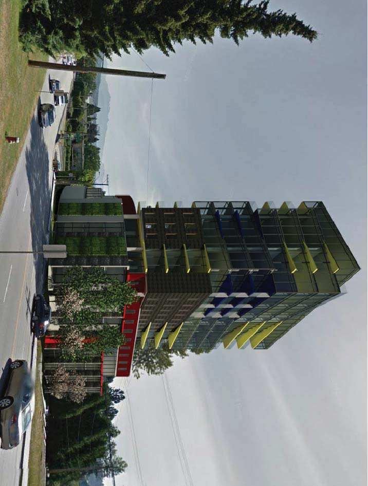
39 30 Royal Ave & 55 Dufferin - City of New Westminster Rezoning Preliminary Application DESIGN RATIONAL INTENT This application is intended to provide the City of New Westminster with enough information to assess the suitability of rezoning the present single family zoned properties at 30 Royal Avenue and 55 Dufferin Street to allow for a Mid-Rise Multi-Family building that meets the criteria of the Downtown New Westminster OCP. REZONING RATIONAL Following conversations with the Planning Department at the City of New Westminster and the goals of the client, the design has been able to incorporate all the requested aspects of the project in terms of incorporating a community component in the form of a Daycare, respecting as many of the older trees on the site, set-backs, FSR, etc. At this point the project is not asking for any variances. DESIGN RATIONAL As this site is located in a very prominent location as a gateway to New Westminster at the North end of the Pattullo Bridge and is bounded by both a very busy on ramp to the bridge from Royal Ave and a traffic controlled and quiet Dufferin Street. The design responds to these factors by wrapping the podium with townhouses along Dufferin and the green spaces adjacent to on ramp to the bridge. At Royal Ave the design amasses its service spaces such as bicycle storage, unit storage, and amenities. The Daycare component is raised to the second floor level not only to get away from the noise of the street but also to provide security for the children. This technique was used with great success at the daycare located in the Downtown Vancouver Public Library. Similarly a secure elevated outdoor play area is provided on this level. Access to the parking levels, which will be in the order of 3 to 4 floors depending on the number of units, will be off of what is technically Alice Street but in reality has been a driveway for 55 Dufferin for many years. It is the intention of the client to purchase Alice Street through negotiations with the City of New Westminster and have this combined with the project. The tower component has been angled at 9 degrees from the streets below in an effort to minimize blockages of lines of sight for neighbours along Royal of the Fraser River and the Pattullo Bridge. As there are no residences immediately North of the site, the impact to neighbours is limited. The 9 degree crank of the tower is again repeated as the tower rises while maintaining the exact same structural floor plate to not only simplify the structure but also to provide a dynamic presence that is desirable for gateway building such as this. The bold colour scheme and use of materials such as wood, stone, metal and glass as well as a potential Living Wall along Royal is an intentional response to the relatively bland palate that is seen in much of the new developments and to, again, create a striking welcome to the City of New Westminster. BILLARD ARCHITECTURE, 42 BEGBIE STREET, NEW WESTMINSTER, BC, V3M 3L9
40
41
42
43
44
45
46
47
48
49
50
51
52 5 R E P O R T Development Services To: Land Use and Planning Committee Date: 4/10/2017 From: Jackie Teed Acting Director of Development Services File: PAR01042 Item #: 17/2017 Subject: 800 Block Agnes Street (810 and 824 Agnes Street and 815 and 821 Victoria Street): Pre-Application Review RECOMMENDATION THAT the Land Use and Planning Committee direct staff to include feedback to the applicant that an application consistent with approach 2 described in section 5.4 of this report would be considered. EXECUTIVE SUMMARY A pre-application has been submitted for a preliminary proposal which includes 258 residential units, a density of 7.03 FSR and a height of 33 storeys / 100 metres (330 feet). The development proposal includes the potential purchase of City owned land at 824 Agnes Street and would involve returning the use of this land to the City for park space. Further, the pre-application includes 325 square metres (3,500 sq. ft.) of publically accessible community amenity space, 465 square metres (5,000 sq. ft.) for use as a private daycare operation and 325 square metres (3,500 sq. ft.) of amenity space for building residents. This report provides preliminary information to the Land Use and Planning Committee in regards to a pre-application and seeks direction in regards to the feedback to be provided to the applicant on density and building height. Staff has provided initial comments on other aspects of the application which are included in the draft letter attached as Appendix A.
53 City of New Westminster April 10, PURPOSE A pre-application has been received for several properties in the 800 Block of Agnes Street. This report provides preliminary information regarding this application so that initial feedback can be provided to the applicant from the Land Use and Planning Committee. Staff is also seeking the Committee s feedback on the proposed density and height and have provided three scenarios for comment and feedback in section 5.4 of this report. 2.0 BACKGROUND 2.1 Previous Council and Land Use and Planning Committee Direction Pre-Application Review Process On April 4, 2016, Council received a report from the LUPC which recommended amendments to the Development Approvals Procedure Bylaw in order implement the preapplication process as a measure to further improve customer service. This report also recommended that the LUPC also provide preliminary comments on pre-applications. The pre-application stage is intended to provide applicants with high level information at an earlier stage in the process and to improve transparency and consistency. Council adopted the changes to the Development Approvals Procedure Bylaw to implement the pre-application review on April 18, City Owned Site (824 Agnes Street) The site at 824 Agnes Street (also known as 825 Victoria Street) was formerly owned by the Chinese Benevolent Association (CBA). This site was the focal point of the Chinese community in New Westminster and was the location of the Chinese Old Man s Home, built in The site and building served for generations as an informal civic centre for the Chinese community in New Westminster and was used as a school, a hospital, a residential care facility for the elderly, and was also the home of the CBA. In 1979, immediately prior to the CBA being disbanded, the site and the building were transferred as a gift to the City. Due to disrepair and vandalism, the building was subsequently demolished. In 2009, as part of a Downtown Nuisance Abatement Strategy, this site was converted in to a temporary off leash dog enclosure. It has been included on a list of the top ten most endangered sites by the New Westminster Heritage Preservation Society and considered for Provincial recognition as a Chinese Canadian Historic Place by Heritage BC. Agenda Item 17/2017
54 City of New Westminster April 10, As part of the Chinese Reconciliation Process, there was support for exploring a more appropriate and respectful use of the CBA site. A consultation and visioning exercise for this park space was undertaken with City advisory committees, associations representing the Chinese community and the public. Based on the consultation, there was overwhelming support for a park which would commemorate Chinese history and contributions and provide a green space and refuge in the densely populated Downtown neighbourhood. A report was taken to Council regarding the visioning process on June 13, 2016 which shared the results of the visioning process for the site, sought Council approval to hire a landscape architect to work on park design and seek clarification on funding sources. 2.2 Site Characteristics and Context The subject sites are located in the Downtown neighbourhood and are adjacent to Agnes, Victoria and Blackie Streets. The subject sites are located 100 metres (328 feet) from the New Westminster SkyTrain Station. The sites slope steeply from the high point at the north east corner of the site (corner of Agnes and Blackie Streets) to the low point of the site at the south west corner. The grade change is metres (45.32 feet) from high to low point. The City owned site (824 Agnes Street) is currently occupied by a temporary off-leash dog enclosure. The other three sites are used for a variety of light industrial and service commercial type uses including automobile service and repair. To the north of the site are the two News towers which are 15 storeys and 49 metres (160 feet) in height; to the west of the site are three towers two of which are sixteen storeys and one of which is 14 storeys and with an average height of 47 metres (154 feet). To the south of the site is Victoria Street, which has a dedicated width of metres (33 feet). Victoria Street is designated as a laneway/narrow street in the Downtown Community Plan. To the west is Blackie Street which has a width of metres (33 feet). Across Blackie Street are several lots which are zoned and designated in the Downtown Community Plan for high density mixed use development. Across Victoria Street is a development site addressed as 813 Carnarvon Street. Proposed for that site is a 29 storey residential building with a height of metres (290 feet) and a seven storey residential building. That project would have a total of 245 residential units and a floor space ratio of This proposal has recently been the subject of preliminary reports to LUPC and Council. A site context map is attached in Appendix B. 2.3 Project Statistics and Proposed Relaxations The shaded cells in the table below indicate where the application does not meet zoning or policy requirements. Agenda Item 17/2017
55 City of New Westminster April 10, Site Dimensions Site Area Policy / Requirement - Proposed Width: metres (264 feet) Depth metres (132 feet) - 3,230 sq. metres (34,769 sq. ft.) Residential Units units Floor Space Ratio 5.2 FSR 7.03 FSR Height Off-street Parking metres (240 feet) 313 spaces (preliminary review) metres (330 feet) 293 spaces 2.4 Proximity to Transit Transit Facility Frequency Distance SkyTrain Station 75 metres (246 feet) Frequent Transit Network 75 metres (246 feet) The subject site is 75 metres from New Westminster SkyTrain Station. 3.0 PROPOSAL The pre-application proposes 258 residential units, a density of 7.03 FSR and a height of 33 storeys / 100 metres (330 feet). The applicant has indicated a target unit mix which includes 10% three-bedroom, 40% two-bedroom and 50% one bedroom. The development proposal includes the potential purchase of City owned land at 824 Agnes Street which was gifted to the City by the Chinese Benevolent Association in 1979 and is presently being used as a temporary off-leash dog enclosure. The applicant has proposed purchasing this property from the City and returning the use of this land to the City for park space. The applicant is interested in this arrangement as it would allow them access to the density entitlements on the site at 824 Agnes Street and to provide underground parking below the park site. Further, the pre-application includes 325 square metres (3,500 sq. ft.) of publically accessible community amenity space, 465 square metres (5,000 sq. ft.) for use as a private daycare operation and 325 square metres (3,500 sq. ft.) of amenity space for building residents. Agenda Item 17/2017
56 City of New Westminster April 10, The proposed publically accessible community amenity space is located adjacent to the park area and the Parks and Recreation Department has expressed an interest in using it for programmed space. Parking is proposed to be located primarily underground, however, given the significant slope of the site, portions of the parking structure on the Victoria Street side would be visible above grade. On the Victoria Street side, all of the P2 level, part of the P4 level and small portion of the P-5 level around the parking entrance would be visible. Vehicular access is proposed from four different locations: three entrances at the rear on Victoria Street and one entrance on Agnes Street. The preliminary number of parking spaces proposed for the development is 293 spaces. Preliminary proposed architectural plans are attached in Appendix C. 4.0 POLICY AND REGULATIONS 4.1 Downtown Community Plan Land Use Designation Mixed Use High Density: The Downtown Community Plan notes the following details regarding the Mixed Use High Density Designation: mixed-use (commercial and/or residential) throughout Downtown, outside of Columbia Historic Mixed-Use; retail, office, service or residential uses; any combination of the above (can be one use or multiple uses) Commercial development is required only in areas identified in the Downtown Community Plan and only at street level The form of the proposed development is generally consistent with the Mixed Use High Density Land Use Designation in the Downtown Community Plan. 4.2 Zoning Bylaw and Density Bonus Amenity Zoning Phase 2 Council Policy Multiple Unit Residential Districts (High Density) (RM-6): This zoning district allows a base residential density of 2.5 FSR and a maximum height of metres (70 feet). The Density Bonus Amenity Zoning Phase 2 Council Policy supports a rezoning of this site to RM-6(DB) which would allow the subject sites, based on their current Downtown Community Plan designation and in exchange for bonus density amounts set out in the Zoning Bylaw, a maximum residential FSR of 5.2 and a maximum height of metres (240 feet). 4.3 Downtown Building and Public Realm Design Guidelines and Master Plan The Downtown Building and Public Realm Design Guidelines and Master Plan provides guidance in achieving a high quality, cohesive Downtown that honours the historical and Agenda Item 17/2017
57 City of New Westminster April 10, cultural context of New Westminster. This document serves as a toolkit to inform public realm improvements both on and off-site within the Downtown area. The draft letter to the applicant provides information on these guidelines and should a formal application be received, it will be evaluated against these Design Guidelines by staff and the New Westminster Design Panel. 4.4 Family Friendly Housing Policy The Family Friendly Housing Policy provides requirements for the mix of units with two and three bedrooms as well as guidelines that ensure units are usable by families. The preliminary submission by the applicant indicates a target unit mix of 10% three bedroom units and 40% two bedroom units. Should this proposal move forward, the applicant would be required to provide the required unit mix and meet the design guidelines outlined in the Family-Friendly Housing Bylaw and Design Guidelines. 5.0 DISCUSSION 5.1 Density and Height The Density Bonus Amenity Zoning Phase 2 Council Policy supports a rezoning of this site to RM-6(DB) which would allow the subject sites, based on their current Downtown Community Plan designation and in exchange for bonus density amounts set out in the Zoning Bylaw, a maximum residential FSR of 5.2 and a maximum height of metres (240 feet). The proposed development includes a density of 7.03 FSR and a height of (330 feet). This is 1.83 FSR (35%) and 90 (37.5%) feet above what has been anticipated in the Density Bonus Phase 2 Council Policy. 5.2 Applicant Rationale for the Proposed Density The applicant has acknowledged in their letter of intent (attached with the architectural drawings in Appendix C) that there are not exceptional circumstances related to the site which warrant the addition density. They propose that the unique and exceptional benefits, including proximity to transit, park renewal and the amenity spaces proposed, do warrant the additional density. 5.3 Amenities Proposed and Relationship to Density In addition to the park space at the west end of the site, the applicant has proposed three different amenity spaces: 325 square metres (3,500 sq. ft.) of publically accessible community amenity space, 465 square metres (5,000 sq. ft.) for use as a private daycare operation and 325 square metres (3,500 sq. ft.) of amenity space for building residents. Agenda Item 17/2017
58 City of New Westminster April 10, In regards to the publically accessible space, it has been proposed in close proximity to the park space. The Parks and Recreation Department has identified the space for potential use as programmed recreation space or retail services space given the proximity to the park space. In regards to the child care space, staff assume that this space would be privately owned and would accommodate a for profit child care. Incorporation of this space for this purpose is supported by the New Westminster Child Care Strategy and would help in increasing the supply of relatively limited number of child care spaces within the Downtown, especially related to infant/toddler spaces. The various approaches outlined below will likely have impacts on the capacity of the development to provide amenities. Should the density of the development decrease a corresponding decrease in the amount and size of amenities should be expected. 5.4 Analysis of Proposed Density Based on the previous analysis, staff has identified three potential approaches for the application to proceed. Two of these approaches would require LUPC consideration of extra density, which may be supportable as the site is located within 75 metres (246 feet) of the New Westminster SkyTrain Station. Staff requests feedback from the LUPC on the following approaches with the objective of providing the applicant with a clear understanding of which approach it would consider appropriate. This feedback would be included in the pre-application letter to the applicant. 1. Proceed as outlined in the proposed application: The first approach would have the application proceed as indicated in the pre-application as described above. This would involve the applicant purchasing the former CBA site from the City and using the density from the site for the proposed tower and using the subsurface space for underground parking. The surface use of the site would be returned to the City for use as park space. This would require the applicant to submit required payment of bonus density as well as purchasing the site at 824 Agnes Street from the City at market value. These funds could be made available for the development of the 824 Agnes Street as park, with the remaining funds being allocated as per Voluntary Amenity Contribution policy and Density Bonus regulations. The fact that this site was gifted to the City by the Chinese Benevolent Association should be considered in evaluation of this approach. Further, this approach is technically complex in relation to the other approaches outlined below as it would include land sale Agenda Item 17/2017
59 City of New Westminster April 10, agreements and legal arrangements such as airspace parcels and/or covenants. However a similar approach was used with the site at 660 Quayside Drive which involved dedication of additional park space for Westminster Pier Park and the provision of private parking beneath. This approach would likely include additional funds made available to the City through the sale of 824 Agnes Street at market value. Neither of the following two approaches includes the former Chinese Benevolent Association site at 824 Agnes Street. 2. Consider Extra Density beyond the Density Bonus Phase 2 Policy: The second approach would have the City consider extra density above and beyond the 5.2 FSR anticipated in the Density Bonus Phase 2 Policy in an amount equal to the cost of park construction. In this approach, the City would receive bonus density payments as required through existing regulation and policy (i.e. bonus density up to 5.2 FSR). The City would also consider additional density beyond 5.2 FSR in amount that is directly linked to funding the development of park space at 824 Agnes Street. This approach is also based on the assumption that the necessary additional density will be relatively modest and appropriate to the development of the site. Height in this approach would be determined by a variety of factors including tower floorplate size, building and skyline sculpting, surrounding context and mitigation of impacts of views and shadows on surrounding streets, open spaces and properties. The cost of park development would be determined through a concept level design which would be costed out by staff and a consultant. The cost of the consultant would be covered by the applicant in addition to any required density bonus contributions. This approach is relatively simple when compared to the first approach, would yield funds as anticipated in the Density Bonus Phase 2 Policy and would involve the City retaining ownership of 824 Agnes Street. Given the proximity of this site to SkyTrain and the additional benefit to the community of funding the park development, this is the approach recommended by staff. 3. Proceed as anticipated in the Density Bonus Phase 2 Policy: This approach would have the application revised to meet the anticipated density and height in the Density Bonus Phase 2 Policy of 5.2 FSR and metres (240 feet) respectively. Agenda Item 17/2017
60 City of New Westminster April 10, This approach would require identifying additional sources of funding for development of park space at 824 Agnes Street. 5.5 Parking and Vehicular Access The preliminary number of parking spaces proposed for the development is 293 spaces. An initial review of the required number of parking spaces for the proposal given the proposed unit breakdown (10% three-bedroom, 40% two-bedroom and 50% one-bedroom) indicates that 313 parking spaces would be require which is a shortfall of 20 spaces. Parking reduction incentives such as coop car or shared parking spaces could reduce the requirement, but at this point the applicant has not indicated if any parking reduction incentives are being used. As part of the draft pre-application letter to the applicant (attached as Appendix A), staff have indicated that multiple accesses off of Victoria Street and an access from Agnes Street are not supported. Staff has asked the applicant to provide a single access to the underground parking from Victoria Street. 5.6 Family Friendly and Townhouses Staff note that there may be an opportunity to increase the number of townhouse units at grade which would provide more housing options for families and other demographics in New Westminster. Staff will continue to work with the applicant on the proposal to maximize the unit mix. 6.0 NEXT STEPS After receiving comment from staff and the Land Use and Planning Committee, the applicant will need to determine if they would make formal applications for Rezoning and Special Development Permit. These applications would follow the standard application review process. 7.0 INTERDEPARTMENTAL LIAISON 7.1 Team-Based Project Review The City has now initiated a project team based approach for reviewing development applications, including pre-applications. A staff-led project team has been assigned for reviewing this project consisting of staff from the Building, Planning (Development Services), Engineering, and Parks and Recreation Departments. Other Departments will also be included early in the process as needed. Agenda Item 17/2017
61 City of New Westminster April 10, FEEDBACK FROM LAND USE AND PLANNING COMMITTEE The primary feedback sought from the Land Use and Planning Committee is related to the proposed density and building height and their relation to the exiting Density Bonus Phase 2 Policy. In this regard, staff requests feedback from the LUPC on which approach, identified in section 5.4 above) that it would consider appropriate to pursue. 9.0 OPTIONS FOR CONSIDERATON The following options are presented for the Land Use and Planning Committee s consideration: 1. That the Land Use and Planning Committee direct staff to include feedback to the applicant that an application consistent with approach 2 described in section 5.4 of this report would be considered. 2. That the Land Use and Planning Committee recommend that Council provide staff with feedback on the three approaches identified in section 5.4 of this report with the goal of providing the applicant with a clear understanding of the approach that Council would consider being most appropriate. 3. That the Land Use and Planning Committee provide alternate feedback on the preapplication to be provided to the applicant. Staff recommends Option 1. ATTACHMENTS Appendix A: Pre-Application Review Response Letter Appendix B: Site Context Map Appendix C: Draft Architectural Drawings and Letter of Intent This report has been prepared by: Mike Watson, Senior Planning Analyst This report was reviewed by: John Stark, Acting Manager of Planning Agenda Item 17/2017
62 City of New Westminster April 10, For: Jackie Teed Acting Director of Development Services Agenda Item 17/2017
63 Appendix A Draft Pre-Application Letter to Applicant
64
65 March 9, Development Services Planning surface ownership of this land to the City for public park space. Further, the application includes 3,500 sq. ft. of publically accessible community amenity space, 5,000 sq. ft. for use as a private child care operation and 3,500 sq. ft. of amenity space for the building s residents. In general, the proposal appears consistent with City policy in regards to the general building form, publically accessible open space as well as private and public amenity spaces. However, the proposal does not comply with the Density Bonus Phase 2 Council Policy. It currently exceeds the maximum density and height outlined in that policy. More information on this policy and other items for your consideration are noted in the following comments. Downtown Community Plan The Downtown Community Plan represents the vision, policy and goals for the Downtown neighbourhood. Applications for rezoning are evaluated against these policies and goals by staff, the community and Council, and all applications for rezoning should be in general conformance to the plan. The plan contains proposed land use designations which outline where certain uses should be located as the city grows and changes. The subject sites are designated Mixed Use High Density which is described as: mixed-use (commercial and/or residential) throughout Downtown, outside of Columbia Street Historic Mixed-Use District; retail, office, service or residential; any combination of the above (can be one use or multiple uses). The form of your development is generally consistent with the Mixed Use High Density land use designation in the Downtown Community Plan. The Downtown Community Plan also contains Development Permit Area Guidelines which you should review in the design of any proposed building on the site. These guidelines provide critical direction on important items, including a minimum tower separation requirement of 27 metres. Zoning and Density Bonus Amenity Contributions The subject sites are currently zoned Multiple Unit Residential Districts (High Density) (RM-6B) which allows a maximum base residential density of 2.5 FSR. The Density Bonus Amenity Zoning Phase 2 Council Policy anticipates a rezoning of this site to RM-6B (DB) which contemplates a maximum residential FSR of 5.2 and a maximum height of 240 feet for the
66 March 9, Development Services Planning subject site. Bonus density payments would be required in accordance with section of the Zoning Bylaw. The proposal you have submitted includes a residential density of 7.03 FSR and a height of 330 feet. As such, the submitted proposal is not consistent with the Density Bonus Amenity Zoning Phase 2 Policy both in regards to maximum density and maximum height. In your proposal, you acknowledge section 9.0 of the policy, which describes circumstances for Council discretion, and that it does not apply to your site as you have not identified any unique and exceptional circumstances which relate to pre-existing conditions. You have instead pointed to a variety of physical amenities and project benefits. As such, the submitted proposal is not consistent with section 9.0 of the policy. This application has not yet been presented to the Land Use and Planning Committee which may provide additional feedback on project density and height. Density Bonus Rates and Update Currently, as per section of the Zoning Bylaw, the rate for bonus density for high rise apartment buildings in the Downtown is set at $22.50 per square foot. Payment of this amount is required for each additional square foot of floor space above the base density of 2.5 FSR in this zoning district. As you are aware, we are in the process of reviewing our bonus density rates. These rates are established based on market land values. Given the condition of the market over the last several years, we anticipate that the density bonus rates will increase. In-stream applications will be considered as part of the implementation of any new rates. However it is possible that Council will determine that new rates should apply to in-stream applications. Vehicle Parking, Bicycle Parking and Loading The provided conceptual drawings do not provide enough information to evaluate the proposed amounts of vehicles and bicycle parking and loading spaces. Any proposal on these sites will need to meet the requirements of the Zoning Bylaw in regards to these items. Please be sure to carefully read through the regulations in sections 150, 155 and 160 of the Zoning Bylaw to determine the requirements for and incentives available for this proposal. Family Friendly Housing Policy
67 March 9, Development Services Planning Your submission has indicated a target unit mix of 40% one bedroom units, 50% two bedroom units and 10% three bedrooms units. This unit mix is in general compliance with the Family Friendly Housing Regulations. We understand that the architectural plans are still in preliminary stages and will continue to evolve as the application moves forward and we would encourage you to review the design guidelines, bedroom composition information and affordability considerations within the Family Friendly Housing Policy. One area of note is the preliminary architectural drawings currently indicate one and two bedroom units in the base of the building at the residential podium. As per the Family Friendly Housing Policy, the City would expect to see larger family oriented units around the base of the building. Please also consider how the landscaping, open space and other onsite amenities proposed for this site would work in regards to contribution to a family friendly project. Adaptable Housing Requirements A minimum of 40% of all single-storey dwelling units in buildings that contain multiple unit residential uses must be constructed as Adaptable Dwelling Units in accordance with the British Columbia Building Code. Downtown Building and Public Realm Design Guidelines and Master Plan The Downtown Building and Public Realm Design Guidelines and Master Plan provides guidance in achieving a high quality, cohesive Downtown that honours the historical and cultural context of New Westminster. This document serves as a toolkit to inform public realm improvements both on and off-site within the Downtown area. Please review this master plan as it contains guidelines and requirements which will impact the subject site. The subject sites are located in the Tower Precinct and so special attention should be paid to the Tower Precinct Master Plan (page 90). Special Development Permit The subject sites are located within a the Special Development Permit Area designated by the New Westminster Redevelopment Act and as such an application for a Special Development Permit would be required. The Downtown Community Plan establishes design guidelines for sites within the designated area which you should review to ensure that building and site design are in conformance. The application for Special Development Permit would run concurrently with the required rezoning application.
68 March 9, Development Services Planning 824 Agnes Street Former Chinese Benevolent Association Site The City currently owns the site at 824 Agnes Street (825 Victoria Street) as it was gifted to the City in 1979 by the Chinese Benevolent Association (CBA) of New Westminster before the organization was disbanded. A consultation and visioning exercise for this park space was undertaken with City advisory committees, associations representing the Chinese community and the public. Based on the consultation, there was overwhelming support for a park which would commemorate Chinese history and contributions and provide a green space and refuge in the densely populated Downtown neighbourhood. A report was taken to Council on June 13, 2016 which shared the results of the visioning process for the site, sought Council approval to hire a landscape architect to work on park design and seek clarification on funding sources. Our understanding of the proposal is that you wish to purchase this site from the City, use the density entitlements on that site within the proposed building at the east end of the site, develop a park space, and return the surface rights to the City. Initial conversations regarding the current proposal have been initiated with the Parks and Recreation Department and with Council. However, no comment can be provided until this application has been reviewed by the Land Use and Planning Committee. Proposed Amenity Spaces Our understanding is that the proposal includes 3,500 square feet of publically accessible amenity space, 5,000 square feet of privately owned child care space and 3,500 square feet of amenity space accessible only to residents of the proposed building. Publically Accessible Amenity Space In your proposal, you outline a number of programming opportunities which could be considered for the publically accessible amenity space. This space has been discussed with the Parks and Recreation Department, and given the location in the Downtown and that it would be directly adjacent to a future park space, there is initial interest in City use of this space for civic programming or a small food service location. We would like to see the design of this space be highly transparent to the future park space. Privately Owned Child Care Space Our assumption on this space is that it would be privately owned space reserved for child care use. Incorporation of this space for this purpose is supported by the New Westminster Child Care Strategy and is particularly important given the relatively limited number of child care spaces
69 March 9, Development Services Planning within the Downtown. Further, there is always a demand for infant/toddler spaces and this demand is particularly acute in the Downtown and you should ensure that the space proposed is designed in a fashion which would accommodate all child care types. Legal agreements to secure the space for child care may be necessary. While privately owned childcare would be welcome business within the city, the City would likely not consider it as a public amenity. The City encourages that you consider this space for non-for-profit daycare. Required outdoor play space would be required to be provided on privately owned land and not on City park space. Tree Removal Permits All existing trees are to be protected in accordance with the City s Tree Protection and Regulation Bylaw No. 7799, 2016 and any trees identified for removal will need a tree removal permit approved and in place prior to removal. For more information regarding tree removal permits, please contact Parks and Recreation at treeprotectionbylaw@newwestcity.ca or by calling It is required that the tree permit application be made at the same time as the submission of Rezoning and Special Development Permit applications. Site Profile Submission Submission of a site profile would be required with the applications for Rezoning and Special Development Permit as per section 40(1)(b) of the Environmental Management Act. A fee of $100 would be required to process the site profile. Based on a cursory review of the properties, it appears that there may have been activities on the site which are identified in Schedule 2 of the Site Profile application. As such, the City would likely have to forward the Site Profile application to the Ministry of Environment. Should you have further questions regarding the Site Profile process, please contact the Ministry of Environment at siteprofiles@gov.bc.ca. Site Drainage All site drainage works would need to be designed and constructed in accordance with the City s Erosion and Sediment Control Bylaw 7754, The developer shall retain a qualified professional to ensure that the design and implementation of the erosion and sediment controls meets the requirements outlined in the Bylaw. Transportation Study A Transportation Study would need to be prepared by a qualified transportation consultant addressing the traffic impacts of the proposed development on the surrounding street network.
70 March 9, Development Services Planning Specific details would be provided by the City s Transportation Department. The plan may include on-site traffic distribution, circulation, parking and integration of access points to the surrounding transportation network. For more information, please refer to the attached document titled Guidelines for the Submission of Transportation Studies to Accompany Development Applications. Building Code Analysis A full Code Analysis is required in order for the Building Division to review the project and give any detailed comments or acceptance of the concept. Preliminary comments on this project are as follows: 1. Design and construction of the project must comply with the 2012 B.C. Building Code and the New Westminster Building By-law No Items which require review include: a. Fire Department access, response point, etc. b. Location of Fire Hydrants c. Location of Fire Department Connection(s) (FDC) 3. The building will need to be fully sprinklered to NFPA 13 standards 4. Emergency generators provide design and calculations showing compliance to New Westminster noise bylaw. Please note: The 2012 BCBC permits alternative solutions under Division C Section 2.3. Submissions for alternative solutions must be complete and in compliance with this section or they will not be accepted. It is important to note that the proposed solution must demonstrate to the authority having jurisdiction that it meets at least the level of performance required by Clause (1)(b) of Division A. The design team is requested to contact the Senior Building Plan Reviewer to arrange a preliminary application meeting prior to submission for Building Permit. Prior to each inspection by the City, the Building Division relies on the project s registered professionals to provide field reviews confirming that the work is complete and construction can continue. Please ensure that this project has made provisions for these field reviews. The Coordinating Registered Professional will be required to submit monthly progress reports throughout the construction. For further clarification contact the Building Division at Off-Site Works and Services
71 March 9, Development Services Planning Under the City s Subdivision and Development Control Bylaw No. 7142, 2007, the developer would be required to enter into a Development Agreement with the City addressing all off-site servicing requirements. The off-site services would be identified during the detailed development review and would be required prior to issuance of a building permit. These works could include but may not be limited to the off-site items identified in this letter. The Development Agreement would require the preparation of detailed design drawings by a qualified Professional Engineer for the off-site works and services to the satisfaction of the City and in accordance with the City s Design Criteria, Supplemental Specification and Detail Drawings, and Master Municipal Construction Documents. The engineering design drawings for the proposed works may include the following plans: Road works Storm drainage collection facilities Sanitary sewer collection facilities Water distribution facilities Street lighting Street trees, landscaping Topographical and lot grading plans Erosion and sediment control plans Electrical power supply and distribution facilities Telecommunication facilities Gas facilities Under the Development Agreement, the developer would be required to employ and retain a qualified Professional Engineer to prepare and seal the design drawings; to provide a Resident Engineer for inspection of all design and construction related problems; to prepare, certify and seal As Built drawings, including landscape and irrigation drawings and to certify that all materials supplied and works performed conform to City standards as contained within the Subdivision and Development Control Bylaw and/or the Master Municipal Construction Documents; Roadworks Agnes Street: Construction of Agnes Street frontage to a neighborhood road standard based on Benkelman Beam testing complete with new pavement, pavement structure, curb and gutter, minimum 2.5m wide concrete sidewalks, street lighting, boulevard trees, drainage and irrigation.
72 March 9, Development Services Planning Blackie Street: Construction of Blackie Street frontage to a neighborhood road standard based on Benkelman Beam testing complete with new pavement, pavement structure, curb and gutter, minimum 2.5m wide sidewalks, street lighting, boulevard trees, drainage and irrigation. Victoria Street (Lane): Construction of a minimum 6.0m wide lane complete with new pavement, pavement structure, sidewalk, curb and gutter, street lighting, boulevard trees, drainage and irrigation. The provision of road/lane dedication may be required in support of the proposed development; however, at this time the need for dedication has not been identified. Access and Loading The number of driveways access points to the site should be consolidated and a single access point should be provided from the lane. Loading areas would need to be provided on-site rather than from a street or lane. Underground Utilities Modeling of the storm, sanitary and water main systems would be required to confirm if the available capacity is sufficient for the proposed development. In order to complete a detailed review for this project, the applicant s engineering consultant would need to submit a completed Utilities Modeling Analysis Application Form and pay a modeling fee of $4, including GST. Any capacity constraints identified in the modeling analysis may require upgrades to the existing infrastructure as a requirement of the development servicing requirements. Water mains Construction of adequate sized water mains to service the development for the fire and domestic demands would be required, co mplete with a sing le service connectio n for the proposed development, size to be determined by the deve loper s consulting engineer and approved by the City. Storm Sewer Construction of adequate storm sewer mains to service the development would be required, complete with single service connection with either a manhole or inspection chamber at property line. Size and location to be determined by the developer s consulting engineer and approved by
73 March 9, Development Services Planning the City. Onsite storm water management would be required to limit post development flows to pre-development flows. Sanitary Sewer Construction of adequate sanitary sewer mains to service the development complete with a single service connection with either a manhole or inspection chamber at property line. Size and location to be determined by the developer s engineer and approved by the City. Electrical and Telecommunication Utilities All costs associated with the design and replacement of the existing overhead electrical and telecommunication utilities on the roadways adjacent to the site with an underground system with servicing for the development would be provided by the developer. For further information please contact Arne Hannula in the City s Electrical Operations Department at (604) for electrical servicing details and Telus or Shaw directly for telecommunication details. BridgeNet BridgeNet is an initiative of the City of New Westminster to build an open access fibre network that connects buildings with commercial and multiple unit residential buildings through the city. The City does not provide telecom services, it leases the fibre strands to Internet Service Providers (ISP). It is up to the ISP to provide and sell attractive telecom packages for businesses and residents. Our website redirects to four ISP s and their offerings. As a requirement of rezoning, this proposal would be required to be designed to readily accommodate service providers other than TELUS and Shaw. To achieve this, the following are required: 1. A duct (75 mm) from the main telecom room to the property line on the street 2. A duct (50mm) from the main telecom to the secondary telecom rooms 3. 1/3 extra plywood space in each telecom room Attached is a summary of these requirements titled BridgeNet Requirements Document. Roadway Lighting Roadway lighting for all street frontages shall be provided for safety and to produce accurate and comfortable night-time visibility using energy efficient lighting such as LED. Design of roadway lighting would need to be in accordance with the City of New Westminster s Design Criteria
74 March 9, Development Services Planning Section 6 and the MMCD (Platinum Edition) Design Guidelines Section 6.0 Roadway Lighting (for LED). Boulevard Trees The boulevards would need to be prepared for street trees. This will require the use of soil cells (such as Silva Cell technology) and irrigation for the trees fronting the property, as this is a specialized installation the install of the trees may need to coincide with install of the soil cells, growing medium and root barrier. The City s Parks and Recreation Department would supply and install street trees at the developer s cost. For further information please contact Claude Ledoux, Parks Horticultural Manager at Off-Site Security The developer would be required to post a security deposit for 120% of the estimated construction cost of the off-site servicing works including GST. The security deposit would be in the form of an Irrevocable Letter of Credit or cash deposit. The security deposit would be reduced once the off-site works would completed to the satisfaction of the City less a 10% holdback. Upon issuance of a Certificate of Completion by the City, the 10% security deposit would be held for a two year maintenance period; On-Site Landscaping Security A landscaping security deposit is also required for all development permits to ensure the completion of the project landscaping. A qualified professional landscape architect will be required to submit, in addition to full landscape plans, a detailed cost estimate for installation of hard and soft landscaping, including mulch and irrigation. The cost estimate should include the cost for rehabilitation of any conserved areas should it be disturbed. The security collected will be 125% of the value of the cost estimate Sign Bylaw Your Special Development Permit Application must include your proposed sign permit application and should be reviewed for conformance with the City of New Westminster Sign Bylaw. The Sign Bylaw is available on the City s website. If you have any questions about the Sign Bylaw, or Sign Permits, please contact Kathleen Stevens, Planning Assistant at or kstevens@newwestcity.ca. Development Cost and School Site Acquisition Charges
75 March 9, Development Services Planning Payment of applicable Greater Vancouver Sewerage & Drainage District (GVS&DD) Development Cost Charges in accordance with Bylaw 187, 1996 would be required at Building Permit stage. Payment of applicable New Westminster Development Cost Charges in accordance with Bylaw 7311, 2009 and amendments would be required at Building Permit stage. Payment of applicable School Site Acquisition charges in accordance with School District #40 Capital Bylaw No would be required at Building Permit stage. For information in regards to the 2017 DCC Rates and School Site Acquisition Charges, please visit the City s Financing Growth Webpage. INITIAL APPLICATION PROCESS Depending on feedback received from the LUPC, it may be necessary for you to revise your proposal prior to making a formal applications for Rezoning and Special Development Permit. Should we receive the formal applications, we would circulate them internally to other City departments so that they can begin a more detailed review. Any responses to this circulation would be forwarded to you once received. Following internal circulation, a preliminary report would be provided to Council from staff to advise them that we have received your application and outline the process the application would follow. This preliminary report to Council is generally for information purposes only. You would be required to hold at least one public open house for the proposed development. This would be an opportunity for the public and stakeholders to provide feedback on the application. You would also be required to make a presentation to the Downtown Residents Association. The rezoning application would be considered by the Advisory Planning Commission (APC) and the Special Development Permit application would be considered by the New Westminster Design Panel (NWDP). These two advisory bodies are appointed by Council to provide their recommendations on applications. The APC focuses on land use policy, and the NWDP is a peer review panel that comments on building and site design. It is expected that the applicant closely consider input from the public, Residents Associations and advisory panels and incorporate the feedback where possible.
76 March 9, Development Services Planning In closing, please consider the information contained in this letter and consider appropriate amendments to your proposal. I would like to invite you to meet with me to discuss these revisions as well as to elaborate on the details regarding the application process and to answer any other questions you may have. Please contact me to set up an appointment at your convenience. Kind Regards, Michael Watson Senior Planning Analyst Phone: mwatson@newwestcity.ca att: (2) cc: Jackie Teed, A/ Director of Development Services Dean Gibson, Director of Parks Culture and Recreation John Stark, A/ Manager of Planning Erika Mashig, Parks and Open Space Planner Todd Harvey, Engineering Technologist Joan Drabyk, Senior Building Inspector
77 Appendix B Site Context Map

78 City Owned Site (Former CBA Site) Subject Sites (Owned by Applicant) Application for 29 Storey Mixed Use Building New Westminster SkyTrain Station
79 Appendix C Draft Architectural Plans and Letter of Intent
80 JAGO Development Inc. # Abbott Street, Vancouver, BC V6B 2K4 Tel I Fax I admin@jdigroup.ca December 22, 2016 Development Services, Planning City of New Westminster 511 Royal Avenue New Westminster, BC RE: Letter of Intent Agnes Street & Victoria Street, New Westminster Dear Mike Watson, This letter is to outline the intent for the rezoning of 810 Agnes Street & Victoria Street. The site is currently zoned RM-6B (multiple Unit Residential District). We are applying to rezone the site to C-4 (Downtown Mixed Use District) which allows for a high-density development with an opportunity to increase density upon amenity requirements being met. The maximum bonus density in C-4 is 5.2 FSR with building height not exceeding 240 feet. We are proposing to construct a 33-storey residential tower which consist of four storey podium containing townhouse type units and 29 floors of residential units of various sizes ranging from 1-bedroom to 3-bedroom apartments. The tower sits on the multilevel underground parkade. The rooftop of the parkade is designed to become an urban park for the community. We are also proposing to purchase the density off the adjacent dog park and transferring the density to the subject site. The dog park will remain property of the City of New Westminster. Part of the new development will include an improved park for the community and an expanded park as well as per the architectural set. The small footprint of the tower and its location on the lot ensure that over 75% of the site remains open and green. The project seeks an additional density to a total of 7.0 FSR and an extra height to a maximum of 330 feet. In addition, we are asking for a relaxation on parking spaces due to the site s proximity to public transit. We acknowledge the Policy regarding exceptional circumstances required to warrant additional density as per Density Bonus Phase 2. We understand that the Policy does not apply to our site, however we are proposing the following unique and exceptional benefits (please refer to the Design Rationale for details): Transit oriented development located within 100m from New Westminster Skytrain Station 1 P a g e
81 JAGO Development Inc. # Abbott Street, Vancouver, BC V6B 2K4 Tel I Fax I admin@jdigroup.ca Renewal and expansion of park for the community 76% of site designed as open and sustainable landscaping 3,500 sf of community amenity space 5,000 sf of daycare provided High concept of architectural form Optimization of limited site views Townhouses at grade 10% family units, 60% of 2 & 3 bedroom units overall (above Family Friendly Policy Guidelines) Blackie Street frontage improvement Pedestrian and cycling experience improvement. Downtown skyline enhancement. If you require any further information regarding the intent of this rezoning application, please feel free to contact me. Regards, Kevin Chan JAGO Development Inc. 2 P a g e

82 ARCHITECTURE Rezoning Enquiry 810 Agnes Street, New Westminster, BC Submitted to the City of New Westminster by IBI Group December, 2016

83 REZONING INQUIRY: 810 AGNES STREET, NEW WESTMINSTER BC Project Information This development at 810 Agnes Street proposes a 33 story, 330 high tower with 258 residential units and an overall residential FSR of 7.0. Targeted Unit Mix: 40% 1br 50% 2br 10% 3br family The tower sits on a partially-subterranean parking structure. This structure steps up with the slope of the site towards the tower and is illed with both parking and amenity spaces. Proposed Amenities: Residents Day Care Community 3500 SF meeting rooms/ lounge itness centre 5000 SF indoor 5000 SF open play area 3500 SF Chinese Benevolent Society Community Centre (adjacent to park) 293 indoor parking spaces are proposed. Parking is spread out over ive levels. Due to the dramatic changes in grade, almost each parking level has a separate entrance from the street. DECEMBER,


84 REZONING INQUIRY: 810 AGNES STREET, NEW WESTMINSTER BC Site Context NEW WESTMINSTER SKYTRAIN STATION BUS ROUTES BICYCLE ROUTES ZONING COMMERCIAL RESIDENTIAL MIXED USE INDUSTRIAL 6 DECEMBER, 2016

85 REZONING INQUIRY: 810 AGNES STREET, NEW WESTMINSTER BC Aerial View DECEMBER,
86 REZONING INQUIRY: 810 AGNES STREET, NEW WESTMINSTER BC Beneits of Proposed Design Approach At the onset of the design process the decision was made by the owner to address community needs for an urban green space, amenities and child care. Every efort has been made through site selection, planning, landscaping, and design strategies to use land more eiciently, minimize construction impact and improve site ecology. The result is a compact but tall building with a very small footprint leaving an unprecedented 75% of the Downtown site open. The key element of maintaining the open space will be community engagement applied to rehabilitation of the existing park and providing input regarding local needs. An Urban Green Space for New Westminster The large portion of the site remains as open space and is designed to become an urban park for the community. It will provide Downtown New Westminster with a beautiful green space in the midst of the high density, tall developments. The green space which sits on the multilevel U/G parkade is split over four levels. The bottom two levels form the main park space, the third level serves the Daycare as an outdoor playground, and the top level is designed to have community gardens for both the tenants and the locals. All levels can be accessed along Agnes Street. The park is elevated above Victoria St. level from which but will be accessible thru the landscape stairs. The bottom level of the main green space is envisioned as a Chinese themed park. The west end of the 810 Agnes Street site is currently designated as a dog of leash enclosure. Historically it belonged to the Chinese Benevolent Society and was at the core of one of the two Chinatowns in New Westminster. It used to house a civic centre for the Chinese community. With its reach tradition the site has been recommended for a more appropriate use a garden or a park. The park will use motives or aspects of Chinese gardens to acknowledge their history on the site. The proposed pond will double as a calming feature and part of the storm water management strategy for the site. The intent of the design is to create an engaging public space, a popular destination, an oasis in the heart of Downtown. Activation of Agnes Street This project is located in the core pedestrian network of downtown New Westminster. The site fronts onto Agnes St, an important link that connects popular destinations in the city - Columbia Square Plaza to Douglas College, Columbia Street, and the River Market. Agnes and Victoria will also serve as an alternative corridor to connect both areas of the community which will improve and enhance the dynamic of future development of the prime City core. The proposed project rejuvenates Agnes St, making it a more pleasant and successful pedestrian path. The proposed park steps up to follow the steep slope of Agnes St. It is designed to be open and accessible from the sidewalk along its northern edge. Unlike many of the sloped streets nearby the design avoids heavy build up walls which tower over the sidewalks, focusing rather on blending the new development with the natural slope coniguration. Agnes and Victoria streets run east-west, following the contour lines. Due to being relatively less steep, the streets form a convenient pedestrian path and are a good prospect for a future bicycle lane, the natural route to take for people going between Columbia Square Plaza and Douglas College. There is a potential to include a bicycle and enhanced pedestrian path along Agnes St. or perhaps in the setback along Victoria St, which might be later extended and connected to the other sites in the City. 8 DECEMBER, 2016
87 REZONING INQUIRY: 810 AGNES STREET, NEW WESTMINSTER BC Daycare This site is an ideal location for a Daycare due to its convenient proximity to public transit - the New Westminster Skytrain station is just 100m away. The Daycare will provide a much required facility for an early education for children. The proposed design aims to follow the principles of the Living Building Challenge, to ensure the healthy environment for the children from air and light quality through application of the most sustainable building materials. The building will not only create a comfortable space for the children but will be designed for the experience and scale of a child and to encourage interaction with their environment. As the physical spaces afect the quality of learning this Daycare will place importance on natural light, openness, and beauty, the building that itself educates the children. The Approx. 5,000 sf outdoor portion of the Daycare occupies the entire middle level of the stepping green space and will be enclosed, elevated and therefore physically separated from the rest of the park. The playground is located at the higher portion of the site, has open views out to the rest of the park and receives a lot of sunlight throughout the day. Potential Community Amenities Considered 1. Artist Studios & Exhibition Spaces The project is located close to Anvil Centre, a major cultural hub in New Westminster and could provide an ideal space for a series of studios for the local artists. These studios would accommodate a variety of art forms and supplement the vibrant culture scene in the City. Together with adjacent exhibition areas the project could give independent, emerging artists a space to showcase their work. There is an opportunity for collaboration between the artists and the Daycare, which would support the Daycare s vision for diverse, hands on learning and bring together diferent groups from the community. 2. Chinese Benevolent Society Community Centre The Chinese Benevolent Society has been advocating for a Chinese park to replace the existing dog of leash area on the site. Our project goes beyond and above this concept proposing an indoor Community Centre where they can meet, educate and host events. The Centre would be accessible from the park, and open directly into the Chinese themed garden. 3. Study/Tutoring Rooms This project proposes a number of study, tutoring, and computer spaces that in conjunction with the artist studios and Daycare would enact a branch of the local public library. The main New Westminster Library is 1.5 km away from the site and a new one would be convenient addition to the community resources. DECEMBER,
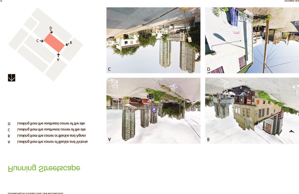
88


89 REZONING INQUIRY: 810 AGNES STREET, NEW WESTMINSTER BC Chinese Benevolent Association & The History of the Site The Chinese Benevolent Association is an organization that aims to provide mutual support and leadership within the Chinese Canadian community. The CBA works to promote equality for Chinese Canadians and to foster better understanding with other community groups. The west end of the 810 Agnes Street site is currently a dog off leash enclosure, but historically it belonged to the Chinese Benevolent Association. This site was at the core of one of the two Chinatowns in New Westminster and housed a civic centre for the Chinese community. In 1979 the CBA gifted the site to the city; the building was later demolished due to being in a state of disrepair. In 2009 the site was designated as a dog off leash area. The Chinese community has a rich history on this site, therefore the Chinese Benevolent Association is recommending that the site is used for something more appropriate - a garden. The garden would be an amenity for the whole neighbourhood. The New Westminster Heritage Preservation Society has also recognized the history on this property and marked it as an endangered site. The CBA suggested that the garden s landscaping should not copy formal Chinese Gardens, but rather relect the simple and hardworking Chinese pioneers that lived in New Westminster. This could be achieved by creating a garden of Chinese lowers and vegetables. Examples of patterns found in Chinese gardens DECEMBER,
90 REZONING INQUIRY: 810 AGNES STREET, NEW WESTMINSTER BC Statistics INFORMATION FROM NEW WESTMINSTER ZONING BYLAW ZONING AREA NEW WESTMINSTER ZONING BYLAW PROPOSED LOT AREA SF (INCLUDES 8690 SF OF CURRENT PARK) LOT COVERAGE 75% 24% (TOWER ONLY) SETBACKS NO SETBACKS REQUIRED NORTHERN SOUTHERN WESTERN EASTERN 10 ft 10 ft ft (APPROX) 10 ft BUILDING HEIGHT 240 ft 330 ft NUMBER OF RESIDENTIAL UNITS 1 BR 102 (39%) 2 BR 131 (51%) 3 BR 25 (10%) TOTAL 258 TOTAL BUILDING AREA SF DENSITY 5.2 FSR 7.0 FSR AMENITY SPACE PARKING BICYCLE STORAGE NO AMENITIES REQUIRED RESIDENTIAL 1/1BR UNIT 102 SPACES 1.35/2BR OR 3BR UNIT 210 SPACES VISITORS 0.1/UNIT 26 SPACES TOTAL 338 SPACES RAPID TRANSIT PROXIMITY INCENTIVE (-5%) -17 SPACES TOTAL 321 SPACES 1.25 SPACES/UNIT 20% STORAGE LOCKERS (16 SF/SPACE) 30% REGULAR SPACES (16 SF/SPACE) 50% VERTICAL SPACES (10.5 SF/SPACE) DAYCARE 5000 SF RESIDENT 3500 SF COMMUNITY 3500 SF 293 SPACES TOTAL = 1.25 x 258 = 323 SPACES APPROX TOTAL 4282 SF (65 SPACES) (APPROX 1040 SF) (97 SPACES) (APPROX 1552 SF) (161 SPACES) (APPROX 1690 SF) 16 DECEMBER, 2016


91 REZONING INQUIRY: 810 AGNES STREET, NEW WESTMINSTER BC Tower Study NUMBER OF FLOORS PROPERTY LINE AND PROPOSED SETBACKS PROPOSED TOWER FUTURE TOWER DECEMBER,

92 REZONING INQUIRY: 810 AGNES STREET, NEW WESTMINSTER BC Design Rationale AGNES ST BLACKIE ST VICTORIA ST 1. The site has dramatic slopes, the highest end being at the corner of Agnes and Blackie. 2. Six levels of parking and amenities step up in the same direction as the natural slope of the site. 3. Almost each level of parking has its own entry due to the sloping streets. 4. The tower is placed on the north east end of the site to maximize size of open space on the south west end of site (where the park is located). 18 DECEMBER, 2016


93 REZONING INQUIRY: 810 AGNES STREET, NEW WESTMINSTER BC Architectural Character DECEMBER,
94 REZONING INQUIRY: 810 AGNES STREET, NEW WESTMINSTER BC Elevation Studies 20 DECEMBER, 2016
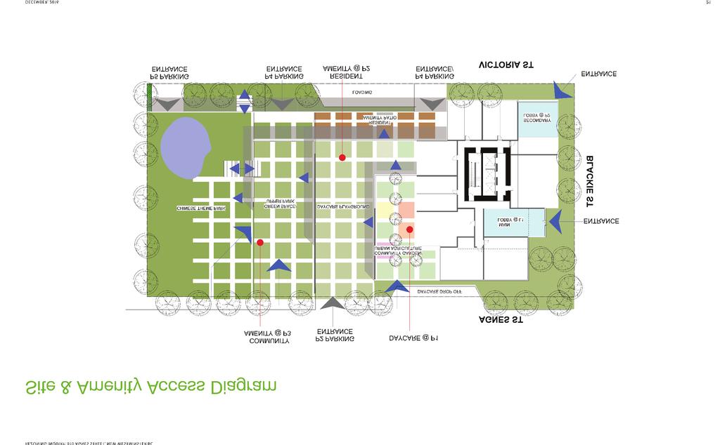
95
96 REZONING INQUIRY: 810 AGNES STREET, NEW WESTMINSTER BC P6 Level 22 DECEMBER, 2016
97 REZONING INQUIRY: 810 AGNES STREET, NEW WESTMINSTER BC P5 Level DECEMBER,

98 REZONING INQUIRY: 810 AGNES STREET, NEW WESTMINSTER BC P4 Level 24 DECEMBER, 2016
99 REZONING INQUIRY: 810 AGNES STREET, NEW WESTMINSTER BC P3 Level DECEMBER,

100 REZONING INQUIRY: 810 AGNES STREET, NEW WESTMINSTER BC P2 Level 26 DECEMBER, 2016
101 REZONING INQUIRY: 810 AGNES STREET, NEW WESTMINSTER BC P1 Level DECEMBER,
102 REZONING INQUIRY: 810 AGNES STREET, NEW WESTMINSTER BC Level 1 28 DECEMBER, 2016
103 REZONING INQUIRY: 810 AGNES STREET, NEW WESTMINSTER BC Typical Tower Level DECEMBER,

104 REZONING INQUIRY: 810 AGNES STREET, NEW WESTMINSTER BC Site Sections/ Elevations VICTORIA STREET BLACKIE STREET 32 DECEMBER, 2016

105 REZONING INQUIRY: 810 AGNES STREET, NEW WESTMINSTER BC SOUTH END OF SITE AGNES STREET DECEMBER,

106 REZONING INQUIRY: 810 AGNES STREET, NEW WESTMINSTER BC Renderings RESIDENTIAL TOWER RESIDENTIAL PODIUM DAY CARE RESIDENT AMENITY CHINESE COMMUNITY CENTRE CHINESE GARDEN/ PARK P2 PARKING ENTRANCE DECEMBER, 2016

107 REZONING INQUIRY: 810 AGNES STREET, NEW WESTMINSTER BC 1 2 RESIDENTIAL TOWER RESIDENTIAL PODIUM 3 UPPER ENTRANCE LOBBY DECEMBER,

108 REZONING INQUIRY: 810 AGNES STREET, NEW WESTMINSTER BC 1 2 RESIDENTIAL TOWER LOWER ENTRANCE LOBBY 3 P5 PARKING ENTRANCE 4 P4 PARKING ENTRANCE 5 P3 PARKING ENTRANCE DECEMBER, 2016

109


110 REZONING INQUIRY: 810 AGNES STREET, NEW WESTMINSTER BC Shadow Study MARCH 21, 10:00 MARCH 21, 12:00 MARCH 21, 14:00 SEPTEMBER 21, 10:00 SEPTEMBER 21, 12:00 SEPTEMBER 21, 14:00 38 DECEMBER, 2016

111 REZONING INQUIRY: 810 AGNES STREET, NEW WESTMINSTER BC Relaxations Beneits This project proposes FSR of 7.0 and an increased height of 330. We acknowledge the policy regarding exceptional circumstances required to warrant additional density as per Density Bonus Phase 2. We understand that the Policy does not apply to our site, however we propose the exceptional beneits listed below. Refer also to Beneits of Proposed Design Approach page. In addition we are asking for a relaxation on parking spaces due to the site s proximity to public transit. + TRANSIT ORIENTED DEVELOPMENT SITE 100M (1 MIN WALK) FROM SKYTRAIN STATION + RENEWAL AND EXPANSION OF PARK FOR THE COMMUNITY + 76% OF SITE IS OPEN SPACE (TOWER HAS SMALL FOOTPRINT) SF INDOOR AMENITY SPACE FOR THE COMMUNITY (POSSIBLE AMENITY: CHINESE COMMUNITY CENTRE) SF DAY CARE PROVIDED + HIGH CONCEPT ARCHITECTURAL FORM + OPTIMIZING LIMITED SITE VIEWS + TOWNHOUSES AT GRADE + 10% FAMILY UNITS (3BR) MAJORITY 2&3 BEDROOM UNITS OVERALL + BLACKIE ST FRONTAGE IMPROVEMENT + PEDESTRIAN AND CYCLING EXPERIENCE AND CONNECTIVITY + CITY SKYLINE IMPROVEMENT DECEMBER,
112 6 R E P O R T Development Services To: Land Use and Planning Committee Date: 4/10/2017 From: Jackie Teed Acting Director of Development Services File: OCP00015 REZ00128 Item #: 21/2017 Subject: 1102, 1110, 1116 and 1122 Salter Street: Official Community Plan Amendment and Rezoning to Allow a 78 Unit Residential Development, Park and Road Dedication - Bylaws for First and Second Readings RECOMMENDATION THAT the Land Use and Planning Committee recommend that Council consider Official Community Plan Amendment Bylaw 7916, 2017 and Zoning Amendment Bylaw 7917, 2017 for First and Second Reading and forward the Bylaws to a Public Hearing on May 29, EXECUTIVE SUMMARY An application has been received to amend the Official Community Plan Land Use Designation and rezone the properties addressed as 1102, 1110, 1116 and 1122 Salter Street to allow a development with 78 residential units. The project supports a number of important City policies and objectives: 1. It satisfies the intent of the existing Official Community Plan Land Use Designation and the density identified for the site. 2. The proposal to construct townhomes and duplex dwellings on the north half of the site is appropriate as that portion of the site will not change elevation significantly and these two forms of housing place the parking under the dwelling to elevate the residential floor space above the flood plain requirement. On the south half of the site where the elevation of the site will be raised, row houses and compact lot dwellings can be considered as they
113 City of New Westminster April 10, place parking at grade to the rear of their lot and the residential floor space is constructed near grade. 3. The application provides a variety of housing forms and tenure types. The duplex, compact lot and row houses will be fee simple ownership while the townhouses will be strata ownership. 4. All of the housing proposed is ground oriented and designed for families. 5. The site is near transit and the commercial amenities located on Ewen Avenue. 6. Both local schools and the Queensborough Community Centre and park are within a five minute walk. 7. The project satisfies all flood plain requirements. 8. The applicant has consulted with the Queensborough Residents Association and held a public Open House. The Association has supported the application. 9. The project design was supported by the New Westminster Design Panel. The project design satisfies the intent of the Official Community Plan Development Permit Area Designation. 10. The application has been supported by the Advisory Planning Commission. 1. PURPOSE The applicant proposes to amend the Official Community Plan Land Use Designation and rezone the site in order to develop 78 residential units. The purpose of this report is to request that the Land Use and Planning Committee recommend that Council consider First and Second Reading of Official Community Plan Amendment Bylaw 7916, 2017 and Zoning Amendment Bylaw 7917, 2017 and forward both bylaws to a Public Hearing on May 29, POLICY AND REGULATIONS 2.1 Official Community Plan Land Use Designation The entire site inside the dyke is designated as (RLC) Residential Compact Lot. The plan describes this designation as: (RLC) Residential Compact Lot This area will include low density residential uses including single detached houses, single detached houses on a compact lot, houses with a secondary suite, cluster houses, places of worship, and home occupations. This land use designation would allow the 10 units of compact lot dwellings proposed in this application, so that portion of the project could proceed directly to rezoning as the proposed use satisfies the land use designation. Agenda Item 21/2017
114 City of New Westminster April 10, The portion of the site that is outside of the dyke is designated as (IN) Intertidal. The plan describes this designation as: (IN) Intertidal This area will predominantly remain in a natural state in order to preserve the intertidal area of the Fraser River foreshore. Uses such as lookouts, trails, docks, and marine commercial and working river uses such as wharfs, are permitted as long as the surrounding natural habitat is enhanced. Approval from other agencies (e.g. Port Metro Vancouver) may also be required The portion of the site proposed for row houses, duplex dwellings and townhouses would require a change in the designation in the Queensborough Community Plan to (RM) Residential Medium Density. The Queensborough Community Plan defines this designation as: (RM) Residential Medium Density this area will include medium density multifamily residential uses such as rowhouses, townhouses, and low-rises. Depending on the provision of public amenities, a density bonus may be provided in order to reach the upper limits of density in this area. 2.2 Official Community Plan Development Permit Area Designation The portion of the site inside the dyke is designated as part of Residential Development Permit Area #2 Compact Lot. The Queensborough Community Plan describes this designation as: The Compact Lot intensive residential area, identified as Development Permit Area #2, is designated in order to provide an opportunity for an innovative ground oriented housing type. This Development Permit Area encourages best practices for promoting water and energy conservation and reducing greenhouse gas emissions. It also establishes guidelines for the form and character of intensive residential development. The portion of the site that is inside the dyke is also designated as part of Natural Hazard Development Permit Area #1 Flood Hazard. The Queensborough Community Plan defines this designation as: Queensborough is located at the upstream end of Lulu Island in the floodplain of the Fraser River. Development in this area of the City is protected by perimeter dykes maintained by the City, which are continuous with dykes in the City of Richmond farther downstream. However, new buildings and structures in Queensborough should be constructed at an elevation that is sufficient to minimize the potential for loss of life and property damage in the event of dyke failure, or an extreme flood event that tops the perimeter dykes. The minimum construction levels, which are based on current knowledge of flood patterns, are 3.53 metres above Geodetic Survey of Agenda Item 21/2017
115 City of New Westminster April 10, Canada (GSC) datum for Area A shown on the following map (flood construction level A), generally downstream from Derwent Way on the south side of Queensborough and Wood Street on the north side, and 4.20 metres above GSC datum (flood construction level B) for Area B upstream of Derwent Way and Wood Street. Placement of imported fill to achieve these construction levels could produce local settlement problems and undesirable diversion of flood water, so a combination of fill and structural support may be required. The portion of the site that is outside the dyke is designated as part of Industrial and Mixed Employment Development Permit Area #4 Intertidal. The Queensborough Community Plan defines this designation as: The Intertidal area, identified as Development Permit Area #4 is designated in order to provide a framework for waterfront development associated with the working river and to provide an opportunity for continued commercial and industrial development. This Development Permit Area encourages best practices for protection of the natural environment, its ecosystems and biological diversity. It also establishes guidelines for the form and character of industrial, commercial and intensive residential (e.g. float home) development in this area. 2.3 Zoning Bylaw The site is currently zoned Queensborough Residential Dwelling Districts (RQ -1). That zoning would allow the property to be subdivided into lots with a minimum lot size of 4,000 square feet (371.6 square metres). The four properties in this application have a land area inside the dyke of 202,779 square feet (18,838.9 square metres) and a land area outside of the dyke of 18,505 square feet (1,719.2 square metres). The land inside the dyke could be subdivided into approximately 30 lots with an average lot size of 4,800 square feet (445.9 square metres). This would allow 30 houses with a maximum floor space ratio of All of the houses could have a secondary suite. As part of the subdivision, a park dedication of 5 % of the area of the site, 11,069.2 square feet (102.8 square metres) The current OCP Land Use Designation would allow the entire site to be rezoned to the Single Detached Dwelling Districts (Compact Lots) (RT- 2D) zone. That would allow approximately 50 houses on lots averaging 3,000 square feet (279.1 square metres). No secondary suites would be allowed. There would be a statutory requirement for a 5 % park dedication at the time of subdivision of the site, however a larger dedication could be negotiated during the rezoning of the site. Agenda Item 21/2017
116 City of New Westminster April 10, BACKGROUND 3.1 Site Characteristics and Context The site is currently surrounded on all sides by sites that are zoned and developed with single detached residential dwellings. The Official Community Plan vision for the area is for a compact lot single detached residential neighbourhood. The site is within the Fraser River Flood Plain. Thus, habitable space and places designed for the storage of goods may not be constructed below an elevation of 11.5 feet (3.53 metres) Geodetic Survey of Canada (GSC). The site has an elevation that varies between 4 feet and 11.5 feet (1.2 and 3.53 metres) GSC. Below the flood plain elevation the only enclosed areas allowed are: A maximum of square feet (11square metres) in floor area per dwelling unit for an enclosed entrance foyer; and A maximum of square feet (42 square metres) for the parking of automobiles. There is varying soil quality across the site which limits the ability to raise the grade of the site in some locations. 4. PROJECT DESCRIPTION 4.1 Background Agent/Applicant: Architect: Bernard Decosse Architect Inc. Bernard Decosse Architect Inc. Existing Zoning: Queensborough Residential Dwelling Districts (RQ -1) Proposed Zoning Comprehensive Development Districts (1102 Salter Street) (CD 71), Single Detached Dwelling Districts (Compact Lots) (RT - 2D), Row House Districts (RT-2E) and Queensborough Townhouse Districts (RT-3A) 4.2 Project Description The applicant proposes to construct nine duplex dwelling buildings with 18 units, 14 row houses, 10 compact lot houses and 36 townhouses for a total of 78 residential units. Secondary suites would not be allowed in any of the proposed units, and a covenant would be registered to this effect. The applicant would dedicate the land on the foreshore outside of the dyke to the City for an extension of the Queensborough Perimeter Trail. Agenda Item 21/2017
117 City of New Westminster April 10, The proposed site plan would require the dedication of one new road and three lanes so that all units are provided with rear access. A significant dedication will allow South Dyke Road to be completed to a full urban cross section. The off-site works required would see the completion of the sections of Salter Street, Jardine Street and South Dyke Road adjacent to the site. 4.3 Project Statistics The site area and the dedications proposed for park and road are shown in the following table: Existing Site Area: 5.08 acres (2.06 hectares) 100% Park dedication for the 0.42 acres (0.17 hectares) 8.3 % Queensborough Perimeter Trail Site Area Dedicated for Road 1.04 acres (0.42 hectares) 20.5 % and Lane Net Site Area After Dedications 3.62 acres (1.48 hectares) 71.2 % The project statistics for the net site after dedications is shown in the following table: Housing Type Zone Lot Area Units Density Units per acre/hectare Floor Space Ratio Fee Simple Compact Lot Fee Simple Row House Fee Simple Duplex Strata Townhouse RT-2D RT-2E CD - 71 RT - 3A 0.81 acres (0.33 ha) 0.65 acres (0.28 ha.) 0.80 acres (0.32 ha) 1.36 acres (0.55 ha.) units per acre (30.5 units per hectare) units per acre (53.2 units per hectare) units per acre (55.8 units per hectare) units per acre (65.4 units per hectare) Total 3.62 acres (1.48 ha) 78 Average Parkland Dedication for Perimeter Trail The application includes a significant dedication for park that is 18,297 sq. ft. (1,699.9 sq. m.). This represents 8.3% of the gross site area. The foreshore of Annacis Channel has been identified as an important public resource. This project, in addition to other off site works, Agenda Item 21/2017
118 City of New Westminster April 10, would complete South Dyke Road to full urban standards and complete this section of the perimeter trail. 4.5 Urban Design and Open Space The project is designed so that houses front on all streets with vehicular access at the rear of the lot. This permits a front façade for the house that is free of garage doors and a front yard that is fully landscaped. This also allows the sidewalks to be pedestrian friendly on Salter Street, Jardine Street and South Dyke Road as they are free of driveway crossings. All of the row house, compact lot and duplex units have spacious yards. The townhouse units have private yards with a common open space/playground area. A new road that would be dedicated as part of this development has a section that is proposed to be developed as an open space area. 4.6 Family Friendly Housing The City s Family Friendly Housing Policy requires that 30 % of the units be two and three bedroom units, with 10% of the total units having three bedrooms. There are 12 two bedroom townhouses, and 24 three bedroom townhouses. All of the duplex dwellings, rowhouses and eight of the compact lot houses have three bedrooms. Two of the compact lot dwellings have four bedrooms. 5. CONSULTATION 5.1 New Westminster Design Panel Consideration The project was considered by the New Westminster Design panel at their meeting on November 22, The Panel supported the following motion: MOVED and SECONDED THAT the Panel recommend support of the rezoning and Official Community Plan amendment for 1101, 1110, 1116 and 1122 Salter Street subject to the comments noted at the November 22, 2016 meeting. CARRIED. All members of the Panel present voted in favor of the motion. The complete minutes of the Panels consideration of the project are attached as Attachment #4 Agenda Item 21/2017
119 City of New Westminster April 10, Public Consultation In accordance with Council direction, letters advising of the proposed change to the Land Use Designation of the properties in the Official Community Plan were sent to the Qayqayt First Nation, the Ministry of Transportation and Infrastructure, the Ministry of Environment, the Federal Department of Fisheries and Oceans, Port Metro Vancouver; and the Board of Education of School District 40. No replies have been received to date. All replies received would be included in the Public Hearing package. Staff was also directed to seek input from interested parties in the following manner: 1. Place a notice on the City Page to advise the public of this application. Should this application proceed to a Public Hearing, an advertisement will be placed in the local newspaper in addition to the normal Public Hearing notice. 2. Consult with the Queensborough Resident s Association. Complete 3. Hold a public meeting. Complete 4. Require the applicant to include notice of the proposed OCP amendment on the site signage required for the rezoning application. Complete A summary of the public consultation is attached as Attachment #5. A letter of support from the Queensborough Residents Association is attached as Attachment # Consideration by the Advisory Planning Commission The Advisory Planning Commission considered the application on January 17, The Commission provided the following comments and motion: The Commission expressed support for the proposal, noting that it is well designed and provides appropriate variety and densification. In addition, the Commission provided the following suggestions: Access could be provided from the interior of the site to South Dyke Road; A drive way apron could be implemented; and, Duplexes could be implemented along the west side of the site. MOVED and SECONDED THAT the applications for the Official Community Plan Amendment and Rezoning for 1102, 1110, 1116, and 1122 Salter Street be supported. CARRIED. All members of the Commission present voted in favour of the motion. The complete minutes of the January 17, 2017 meeting are attached as Attachment #7. Agenda Item 21/2017
120 City of New Westminster April 10, DISCUSSION 6.1 Queensborough Community Plan Considerations The existing (RLC) Residential Compact Lot land use designation of this site allows the 10 units of compact lot dwellings so that portion of the project could proceed directly to rezoning as the proposed use satisfies the current designation. The portion of the site proposed for row houses, duplex dwellings and townhouses would require a change in the designation in the Queensborough Community Plan from the existing (RLC) Residential Compact Lot to (RM) Residential Medium Density. The Queensborough Community Plan defines this designation as: (RM) Residential Medium Density this area will include medium density multifamily residential uses such as row houses, townhouses, and low-rises. Depending on the provision of public amenities, a density bonus may be provided in order to reach the upper limits of density in this area. The existing residential Development Permit Area designation of this site - #2 Compact Lot identifies this area for innovative ground oriented housing. All of the housing proposed in the Official Community Plan Amendment application is family oriented, ground oriented housing that is at a density similar to the compact lot housing identified in the current land use designation. The application provides a variety of housing forms and tenure types. The duplex, compact lot and row houses are fee simple ownership while the townhouses will be strata ownership. The compact lot designation was put in place as it is desired to raise the grade on this site adjacent to the dyke. The grade of the road and property will match the properties to the west. The proposal to construct townhomes and duplex dwellings on the north half of the site is appropriate as that portion of the site will not change elevation significantly and these two forms of housing place the parking under the dwelling to elevate the residential floor space above the flood plain requirement. On the south half of the site will be the rowhouses and compact lot dwellings that are better housing forms for the filled portion of the site as they place parking at grade to the rear of their lot and the residential floor space is constructed near grade 6.2 Consideration of the Rezoning Application Staff has brought this application forward for consideration using a Comprehensive Development Zoning Schedule for the Compact Lot Duplex Dwellings proposed as part of this development. The intent of the Comprehensive Development Districts (1102 Salter Street) (CD 71) zoning schedule is to allow two-family dwellings on compact lots in the Queensborough neighbourhood. The zone requires a minimum lot size of 3,800 square feet Agenda Item 21/2017
121 City of New Westminster April 10, ( square metres) for a corner lot and 3,600 square feet ( square metres) for an interior lot. The zone allows a building with a maximum of 3,724 square feet (345.9 square metres) of floor space. Each unit would be 1,862 square feet (172.8 square metres). A draft of the Zoning Amendment Bylaw is attached to this report as Attachment #8. The lots proposed in this application are 3,738 to 4,145 square feet ( to square metres). The proposed rezoning would provide family oriented, ground oriented housing which would be permitted under the existing RQ 1 zoning, and it is what is envisioned in the existing Official Community Plan Land Use Designation. The existing land use designation identifies a building form that does not allow secondary suites and requires a rear lane; however the compact lot building form does not do well on sites where the grade cannot be raised to near the flood plain elevation. The building bulk required to structurally elevate the habitable space makes the small houses look out of proportion and creates large flood control spaces. The site under consideration has limitations placed on it both from the elevation of the neighboring properties to the east and from the elevation of all three of the adjacent roads. Also from a geotechnical point of view large portions of the site cannot be raised to near the flood plain elevation. Thus alternate building forms that are larger and can address the additional building bulk architecturally have been proposed. These building forms the townhouses and duplex buildings will be served by rear lanes and suites are not allowed in the proposed zoning of these sites. When the grade rises on adjacent sites and roads, and given that geotechnical issues are somewhat less near the south end of the site, the grade on the subject site can be raised. Then the building forms that need to a located near the flood plain elevation can be proposed. Thus ground oriented compact lot houses and row houses are proposed. The compact lot houses and row houses are served by a lane and the zoning would not allow suites. 7. REVIEW PROCESS The review process approved by the Land Use and Planning Committee and the completion of the steps are noted below: 1. LUPC recommendation to initiate the processing of this application. July 4, Applicant provides detailed Landscape and Architectural drawings for staff review. Complete 3. The project is reviewed by all City Departments. Complete 4. Council consideration of a report on Consultation requirements for the Official Community Plan amendment as required by Sections 475 and 476 (formally sections 879 and 881) of the Local Government Act. August 29, The project is considered by the New Westminster Design Panel. November 22, The applicant will hold a public meeting. November 8, 2016 Agenda Item 21/2017
122 City of New Westminster April 10, The applicant will consult with the Queensborough Residents Association. November 8, The Official Community Plan Amendment and the rezoning of the site are considered by the Advisory Planning Commission. January 17, LUPC consideration of Official Community Plan Amendment and the rezoning. We are here. 10. LUPC recommendation to Council. 11. Council consideration of the Official Community Plan Amendment and Zoning Amendment Bylaws. 8. ADOPTION REQUIREMENTS 1. A No Build Covenant which would have attached the off-site requirements of the Engineering Department and the project plans shown at Public Hearing. In order to remove the No Build Covenant; a Building Permit which satisfies the Engineering requirements and is consistent with the registered plans must be issuable. Engineering requirements are attached to this report as Attachment # Dedication of the land proposed for Park 9. OPTIONS There are two options for LUPC s consideration; they are: 1. That the Land Use and Planning Committee recommend that Council consider Official Community Plan Amendment Bylaw 7916, 2017 and Zoning Amendment Bylaw 7917, 2017 for First and Second Reading and forward the Bylaw to a Public Hearing on May 29, That the Land Use and Planning Committee provide staff with alternative feedback. Staff recommends Option 1. ATTACHMENTS Attachment 1: Locations Map Attachment 2: OCP / DP Area Guidelines Attachment 3: Project Plans Attachment 4: NWDP Attachment 5: Public Consultation Attachment 6: Letter from QBRA Agenda Item 21/2017
123 City of New Westminster April 10, Attachment 7: APC Attachment 8: Draft CD-71 Zoning Schedule Attachment 9: Draft OCP Bylaw Attachment 10: Engineering Requirements This report has been prepared by: Jim Hurst, Planner This report was reviewed by: John Stark, Acting Manager of Planning For: Jackie Teed Acting Director of Development Services Agenda Item 21/2017
124 Attachment 1 Location Map

125 City of New Westminster 1: 2, NAD_1983_UTM_Zone_10N CNW GIS Services Kilometers This map is a user generated static output from an Internet mapping site and is for reference only. Data layers that appear on this map may or may not be accurate, current, or otherwise reliable.
126 Attachment 2 OCP and DP Area Guidelines
127 RESIDENTIAL DEVELOPMENT PERMIT AREA # 2 COMPACT LOT #2 Compact Lot The Compact Lot intensive residential area, identified as Development Permit Area #2 [see Map B], is designated in order to provide an opportunity for an innovative ground oriented housing type. This Development Permit Area encourages best practices for promoting water and energy conservation and reducing greenhouse gas emissions. It also establishes guidelines for the form and character of intensive residential development. DESIGN GUIDELINES SITING Building siting must contribute to a pedestrian scale neighbourhood character. Consider the following: Orient residential units to front all streets and/or city trails and greenways immediately adjacent to or within the development. For all corner lots and/or corner units, locate and design buildings to address all frontages, including public and internal streets, and/or city trails or greenways. Building siting must respect the existing neighbourhood and site context. Consider the following: Consider existing buildings and outdoor spaces when siting new buildings, including the location of windows and entrances, overlook of outdoor space, impacts to air circulation and light penetration, etc. Site buildings to retain and enhance heritage assets by incorporating them into the development of the site, wherever possible, including buildings, engineering works and/or cultural landscapes, as well as significant landscape features (e.g. mature vegetation and trees, distinctive landforms). Design new buildings in proximity to heritage assets to be compatible with their historical context without literally imitating older building styles. In these cases, new buildings should provide an original interpretation of the traditional building style (i.e. draw inspiration from fundamental design characteristics) while continuing to reinforce traditional development patterns and rhythms. CHARACTER All buildings and developments must be designed to have a high quality, cohesive appearance that enhances the overall quality of the community. Consider the following: Use an architectural approach (i.e. massing, facade treatment, detailing, materials and colour choice) which is harmonious with the riverfront community context. Create a cohesive streetscape. Use a similar alignment of windowsills, building and roof lines, cornices, and floor-to-floor spacing along the street block.
128 Design all principal and accessory buildings within a development and/ or all elements of an individual building, to the same architectural style. Provide enough variety (e.g. through massing, architectural detail) to avoid a monotonous appearance when the development is viewed as a whole and to reinforce individual building identity. Select project names that evoke Queensborough s riverfront community context and/or the legacy of its historically prominent citizens. Consider providing public art to help enrich outdoor spaces and provide pedestrian scale landmarks. Use art that highlights Queensborough s sense of place and is unique to each location. HERITAGE Each development must follow the Standards and Guidelines for the Conservation of Historic Places in Canada for all physical work to heritage assets. Reuse historic industrial and agricultural artefacts on redevelopment sites (e.g. as public art). FACADES The facades of all building walls that face public or internal streets, drive aisles, pedestrian pathways, parks or open space must provide visual interest. Use architectural elements (e.g. fenestration, vertical and/or horizontal design elements, secondary roof elements) and/or material or colour change. MASSING Building massing must contribute to a pedestrian scale neighbourhood character. Consider the following: Use horizontal architectural elements to define floor-to-floor transitions, roofs and cornice lines. Design the roof to minimize the overall building mass, incorporating articulation and variations in roof planes (e.g. dormers, gables, crenelated parapets) to break up roof mass and reduce building scale. Reinforce the pedestrian scale massing by designing all buildings to have a heavier base and lighter top that are visibly differentiated by use of material (e.g. masonry on the base and wood siding on the top) and details (e.g. cornice treatments at the top). Building massing must maximize natural light and ventilation. Consider the following: Organize the interior space of residential dwellings and/or units such that, wherever possible, a majority of primary living spaces (e.g. living room, family room, kitchen) have exterior walls with windows on two sides. Ensure all primary secondary living spaces (e.g. bedroom, den, office) have at least one exterior wall with a window. Use stack vents and light wells to provide additional light and ventilation to primary and secondary living spaces.
129 Take microclimate into consideration. ENTRANCES Primary pedestrian entrances into buildings must be integrated into the design of the building, yet be clearly expressed. Consider the following: Articulate massing to identify building entrances (e.g. tall voids, central mass, recessed entry). Frame with a secondary roof element (e.g. porch) to identify building entrances and protect from weather. Building entrances must be located and designed to have a strong relationship with the street. Consider the following: Make entries, including front porches, visible from, oriented toward and directly connected (via a short pathway and/or stairs) to the street onto which the building fronts. WINDOWS Windows must contribute to an interesting, pedestrian scale environment. Consider the following: Use windows which are of clear glass (e.g. not tinted, reflective or opaque). Use windows which are rectangular or square in proportion, except for accent windows which may have a unique shape. Use stack vents and light wells to provide additional light and ventilation to primary and secondary living spaces. Take microclimate into consideration when locating and sizing windows. Use strategies to facilitate passive heating in cooler months and reduce unwanted heat gain in summer months. Consider the following. Consider the following: Ensure a solar heat gain coefficient of 50% or better for south facing windows to maximize solar gain during winter. Use exterior shading devices (e.g. awnings, canopies, overhangs, light shelves, louvers) which provide shade from the high summer sun, but provide solar access to the low winter sun. Use these devices particularly on south facing windows. Provide operable windows in each residential dwelling and/or unit. Locate operable windows to take advantage of Queensborough s prevailing easterly winds (i.e. winds from the east to the west) to provide cross ventilation. SAFETY Each development must provide a Crime Prevention Through Environmental Design (CPTED) report outlining the use of CPTED strategies in the design of developments and buildings, including open space.
130 PARKING & ACCESS All garages must be at the rear of the lot and accessed from a lane. New development must not result in an increase in the number of rail line crossings which would result in an increase in train whistles. Remove or consolidate existing driveways, wherever possible, to reduce the need for trains to whistle. MATERIALS & COLOURS All principal and accessory buildings within a development must use a cohesive palette of materials and colours that is consistently applied and contributes to the overall quality of the community. Consider the following: Use a natural palette of wood, stone or brick and muted paint colour tones (e.g. Benjamin Moore s Historical Vancouver True Colours). Consistently apply materials to all sides of a building (i.e. do not emphasize the principal facade with lesser treatment on the other facades). Change building materials and/or colours at interior or reverse corners of a building, not at exterior corners or at changes in a facade plane. Use an accent colour which is harmonious with the main colours of the materials and colours palette to unify the overall palette and to highlight architectural details (e.g. eaves, window and door trim, railings). Use matte finishes or finishes with a low level of reflectivity. Reflective materials (e.g. mirrored glass, polished stone) should be avoided. Each development must use building and hardscape materials that are durable and appropriate to their use, the local climate, and the urban environment. Consider the following: Use high quality building materials (e.g. wood, stone, brick, or acceptable alternative) rather than materials that are visibly simulated (e.g. vinyl siding) or are inappropriate for an urban area (e.g. untreated or roughsawn wood). ACCESSIBILITY Endeavour to make all pathways and building entrances, public and semipublic spaces, and special features and amenities of a site accessible by people of varying ability. Consider the following: Build sidewalks and pathways a minimum 1.8 metres (5.9 feet) wide with non-skid, uniform walking surfaces. Where steps or high thresholds (e.g. related to FCL requirements) create a barrier, provide an alternative route that is easily accessible to everyone. Locate site furnishings (e.g. lighting, bollards, signage, guardrails, seating) where they will not impede easy passage for those using a mobility device (e.g. wheelchair, scooter) or people who are visually impaired Locate parking for those with ability challenges close to accessible building entrances.
131 Use light fixtures that emit white light (i.e. not orange light) in all outdoor areas. White light facilitates better visibility. TREES & PLANTING Each development must use the BC Society of Landscape Architects and BC Landscape and Nursery Association s BC Landscape Standard Guidelines (Latest Edition) in specifying, selection, site preparation, installation and maintenance of all trees and other plant materials. Each development must integrate trees, including shade trees. Consider the following: Retain existing mature trees wherever possible. Where tree removal is unavoidable, replace with a number, species and size of trees that creates equal value. Plant new trees in all private yards and along pathways. Locate deciduous trees on the south and west side of buildings to provide shade and minimize unwanted heat gain during summer and provide solar access and passive solar gain during winter. Tree species and other plant materials must be of high quality, suited to their purpose and contribute to the overall quality of the community: Choose species that are successful in the urban environment, easy to maintain, are non-invasive and suited to Queensborough s high water table. Selected tree species should also have less aggressive rooting habits. Develop and/or enhance areas of understorey vegetation using diverse, multistorey planting which will support habitat for smaller wildlife, songbirds and important pollinators such as bees, butterflies and dragonflies.
132 NATURAL HAZARD DEVELOPMENT PERMIT AREA #1 FLOOD HAZARD The Flood Hazard Development Permit Area is identified as Development Permit Area #1 [see Map E]. Queensborough is located at the upstream end of Lulu Island in the floodplain of the Fraser River. Development in this area of the City is protected by perimeter dykes maintained by the City, which are continuous with dykes in the City of Richmond farther downstream. However, new buildings and structures in Queensborough should be constructed at an elevation that is sufficient to minimize the potential for loss of life and property damage in the event of dyke failure, or an extreme flood event that tops the perimeter dykes. The minimum construction levels, which are based on current knowledge of flood patterns, are 3.53 metres above Geodetic Survey of Canada (GSC) datum for Area A shown on the following map (flood construction level A), generally downstream from Derwent Way on the south side of Queensborough and Wood Street on the north side, and 4.20 metres above GSC datum (flood construction level B) for Area B upstream of Derwent Way and Wood Street. Placement of imported fill to achieve these construction levels could produce local settlement problems and undesirable diversion of flood water, so a combination of fill and structural support may be required. EXEMPTIONS The following are exempted from the requirement for a development permit: Subdivision of land (buildings constructed on subdivided lots must still comply when applicable). Alteration of land not involving the construction or alteration of a building or structure. Buildings and structures on land in an agricultural zoning district, other than residential buildings. Buildings and structures for park and open space recreational uses. Construction and alteration of buildings authorized by a heritage alteration permit, including building additions. Detached accessory buildings and structures such as garages, tool sheds and greenhouses that are not used for human habitation. Residential building additions that would increase the habitable floor area of the building by less than 25% of the floor area that existed on February 3, 2014, unless the building has been increased in floor area since that date without a development permit and the aggregate additional floor area exceeds 25% of the floor area that existed on that date. Building alterations that do not increase the floor area of the building.
133 In addition, buildings and structures for industrial uses on parcels that are not adjacent to a dyke are exempt from the requirement for a development permit. However, owners are encouraged to construct industrial buildings used for business or the storage of goods and located in Area A at or above flood construction level A, and industrial buildings used for such purposes and located in Area B at or above flood construction level B. FLOOD CONSTRUCTION LEVEL Buildings and structures for residential and institutional uses in Area A should be constructed so that the lower surface of the floor system of the lowest storey containing habitable space is at or above flood construction level A. Buildings and structures for residential and institutional uses in Area B should be constructed so that the lower surface of the floor system of the lowest storey containing habitable space is at or above flood construction level B. Buildings and structures for industrial uses on parcels adjacent to dykes in Area A should be constructed so that the lower surface of the floor system of the lowest storey used for business or the storage of goods that could be damaged by flood is at or above flood construction level A. Buildings and structures for industrial uses on parcels adjacent to dykes in Area B should be constructed so that the lower surface of the floor system of the lowest storey used for business or the storage of goods that could be damaged by flood is at or above flood construction level B. If natural grade of a residential parcel is below the desired flood construction level, imported fill should not be used to raise the grade above 1.5 metres above GSC datum or 150 millimeters above the centre of the road abutting the property, whichever is higher. In the case of floors comprised of concrete slabs, the upper surface of the concrete slab should be at or above the applicable flood construction level. NON-HABITABLE SPACE The following building areas are not considered habitable space for the purpose of these Guidelines: Underground parking garages, provided that signs are posted and maintained at points of entry indicating that the parking area is subject to flooding of the Fraser River. Attached and enclosed garage not exceeding 42 square metres ( square feet) in floor area per dwelling unit. For the purpose of this calculation a secondary suite is not considered a unit. Manoeuvring aisles used to access compliant off-street parking spaces. Attached carports. Enclosed entrance foyers up to 11 square metres ( square feet) in floor area per dwelling unit in the building.
134 Elevator shafts, provided that operation of the elevators below the applicable flood construction level is not possible during flood events. Enclosed building areas with floor to ceiling heights of less than 1.52 metres (5 feet) measured to the underside of the floor system above. Porches. Undercrofts enclosed only by wood lattice or similar screening. No area below the required elevation shall be used for the installation of fixed equipment susceptible to damage by floodwaters, with the exception of furnaces and hot water heaters. Garbage and recycling carts may be permitted in the non-habitable space below the required elevation. Bicycle parking may be permitted in the non-habitable space below the required elevation. Site alteration and building construction should be planned and executed so as to minimize abrupt transitions from the elevations of adjacent sites and buildings and the diversion of flood waters to adjacent sites.
135 Attachment 3 Project Plans
136

137

138
139
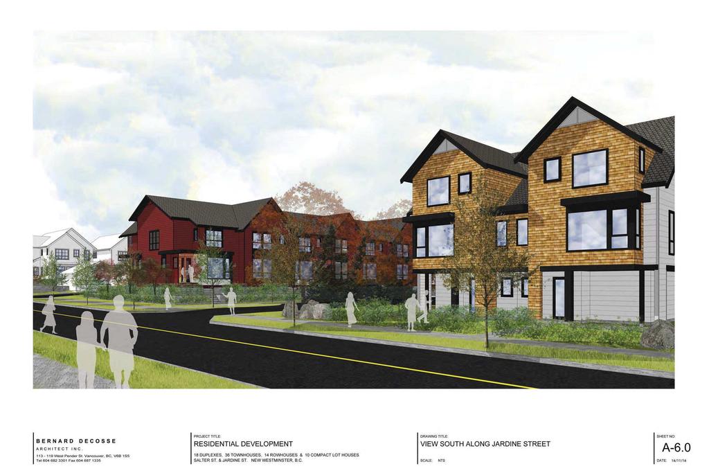
140

141
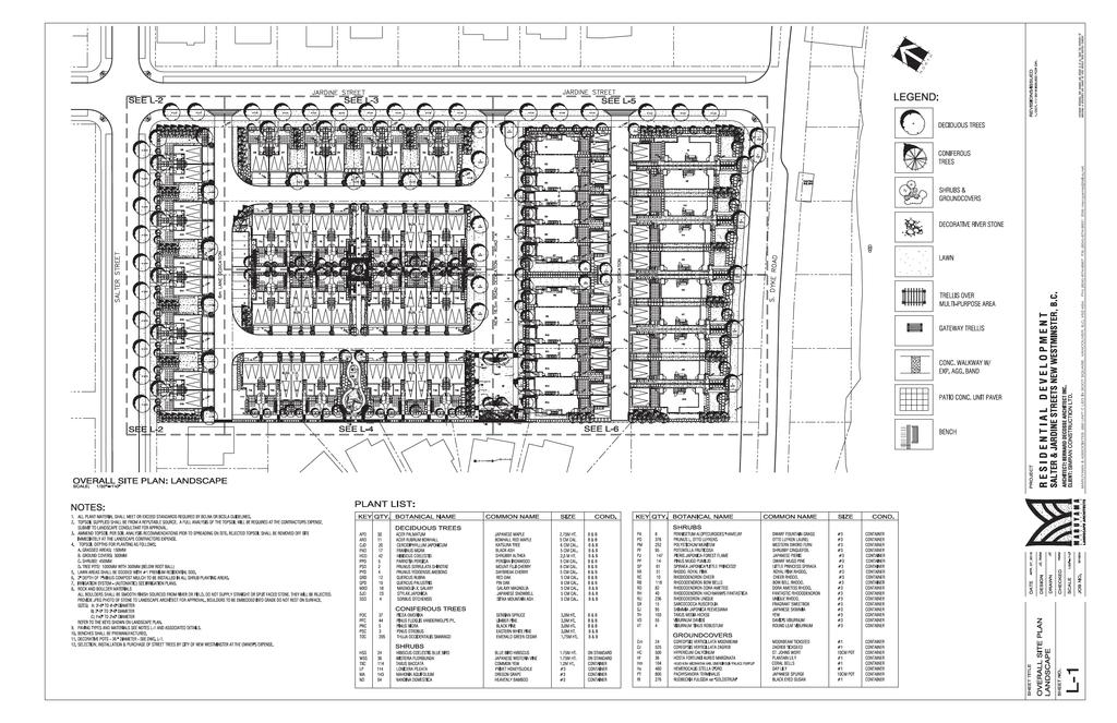
142
143 Attachment 4 New Westminster Design Panel
144 Salter Street REZ00128 OCP00015 Jim Hurst, Development Planner, summa rized the report dated November 22, 2016, regarding an application that has been received to amend the Official Community Plan designation and rezone th e properties addressed as 1102, 1110, 1116 and 1122 Salter Street in order to allow a the development of a 78 unit residential development, which would also provide a 0.42 acre (0.17 hectare) dedication to the City for an extension of the Queensborough Perimeter Trail. The purpose of this report is to provide in formation to the New Westminster Design Panel for their consideration of the proposed development. Bernard Decosse, Bernard Decosse Arch itect Inc., provided a PowerPoint presentation summarizing details of the project as outlined in the report November 22, Rod Maruyama, Maruyama & Associates Landscape Architects, spoke to the landscaping of the project as outlined in the report dated November 22, In response to questions from the Panel, Mr. Hurst provided the following information: The dyke reserve is intended to minimi ze the impact on properties if the dyke is raised; Street parking would be available along the three perimeter streets; The townhouse units provide the required visitor parking on-site; Compact homes, duplexes and row ho mes are considered to be single family homes, and are not required by law to provide visitor parking; It is not anticipated that the gr een space along the dyke will be programmed, as permanent structures are generally not permitted near the waterfront; The owners of the row homes, duplexes and compact homes would be permitted to personalize their homes. However, change s to the form and character of the townhomes would require a Development Permit; Implementing windows in garage spaces may lead to owners using that space as living area; and, The single family homes located ne xt to the project are unable to regrade their lots. In addition, Mr. Decosse and Mr. Maruyama provided the following information:
145 Backfilling is not permitted where the dyke is 3 metres. The applicant could consider raising the main floor elevation in order to accommodate a future raise to the dyke; All of the homes in the project will have a front deck; The compact homes have an eight fo ot setback between the units and would not receive much sunlight. Ther efore, it is proposed that the area would be filled with a gravel material; and, It is anticipated that the side yards of the duplexes would be utilized as a backyard space. The side yards could be programmed or implemented as a grass surface. Discussion ensued, and the Panel noted the following comments: There does not appear to be a connection to the front of the duplexes; The lane animation seems to be ve hicular. It was suggested that a pathway could be implemented to improve the lane animation; The townhouse form appears to be appropriate for the neighbourhood; The project maintains high density, however it is well thought-out; A window could be implemented on the Jardine Street and/or Salter Street side of the duplexes to provide variation on the street; A permeable paving mate rial could be utilized in the gravel space between the duplexes; Variety in the roof shingles coul d provide variety and value to the streetscape; Pavers or bands could be utilized in the internal lanes; The project utilizes a good choice of materials and color palette; Support was expressed for the location of the compact homes on South Dyke Road; The location of patios and front deck s could provi de additional street front animation, as well as addr ess some Crime Prevention Through Environmental Design (CPTED) concerns; It was suggested that public areas and flexible greenspace could be incorporated into the landscaping; It was suggested that the southeas t community garden plots could be relocated in order to receive additional sunlight; Concerns were expressed regarding th e location of the public walkway. It was suggested that a planting buffer could be implemented between the pathway and the single family homes; It was suggested that decorative pavi ng bands could be implemented to distinguish the project s parallel parking from City parking; Concerns were expressed regarding the amount of drainage from the single-family homes; and,
146 It was suggested that windows could be added to the garage. In response to the three de sign considerations that staff requested feedback on, the Panel provided the following comments: 1. Does the project provide enough architectural vari ation between the four housing types? The housing types are well incorporat ed in the project; however, the row homes and the townhomes could benefit from additional variation. 2. Do the buildings address the major streets in a suitable way? The major streets are addressed appropriately by the project. 3. Does the proposed project confor m to the Development Permit Area Designation? The project generally conforms to th e requirements and guidelines of the Development Permit Area Designation. MOVED and SECONDED THAT the Panel recommend support of the rezoning and Official Community Plan amendment for 1101, 1110, and 1122 Salter Street subject to the comments noted at the November 22, 2016 meeting. CARRIED. All members of the Panel present voted in favor of the motion.
147 Attachment 5 Summary of Public Consultation
148 November 18, 2016 Jim Hurst, RPP, MCIP Development Planner Development Services City of New Westminster 511 Royal Avenue New Westminster, BC V3L 1H9 Dear Mr. Hurst Re: 1102, 1110, 1116 and 1122 Salter Street The Arlington Group was retained to undertake public consultation by the proponents of a comprehensive residential development proposed for a 2.08 hectare site (5.08 acre) site at 1102, 1110, 1116 and 1122 Salter Street in Queensborough. This consultation consisted of notification to nearby residents and marinas of upcoming processes, organization and hosting of an Open House on November 8, 2016, attendance at a meeting of the Queensborough Residents Association, also on November 8, 2016 and follow-up discussion with the City and residents. Notification of Residents Notices were prepared documenting the proposed change in the Official Community Plan from Residential - Compact Lot (RCL) to Residential - Medium Density (RM) and the four proposed zones for the site. The notices provided a summary of the proposed land uses for the 78 housing units and an invitation to attend an Open House from 5:00-6:30 pm followed by a presentation to the Queensborough Residents Association, both on November 8, 2011 at the Queensborough Community Association. The double sided notices also included a site plan, breakdown of land uses and three sketches for the development. A total of 65 notices were hand delivered, with 59 to residents and marinas within a 100 metre radius of the development on the October weekend and the remaining 6 to residents just beyond the 100 metre radius on October 31. Notices were distributed as follows: 14 dwellings from 111 to 220 Jardine Street 17 dwellings from 1016 to 1209 Salter Street 10 dwellings and marinas from 87 to 101 and from 1183 to 1209 South Dyke Road 5 dwellings from 167 to 197 Gifford Street 13 dwellings from 1147 to 1195 Sparks Court 6 dwellings on the west side of Gifford Street (Nov 31) A copy of the notice is contained in Appendix A. Results 1. Hand Delivery of Notices Nearly two thirds of residents (42 or 65%) were home as the notices were delivered in the late afternoon and early evening. An envelope with the information package was left in the mailboxes of those not home. Awareness of the development was high due to the large area of
149 the site, its visual prominence with preload, the vacant nature of the site for a number of years and the recent placement of numerous notification signs along all abutting roads. Those at home were quite receptive to receiving information about the proposed development and a significant number indicated they appreciated someone delivering this information on their doorstep. Several persons indicated they would pass the information package onto a family member who is more conversant in English or to the property owner. Several others indicated they would not be able to attend the event on November 8 as they did not go out at night or for other reasons. Most doorstep inquiries concerned the land use mix and the specific residential use adjacent to their property. The other most common inquiry concerned vehicular access to the development. The level of interest was highest for those living opposite the site on Jardine Street or the Sparks Court cul-de-sac, which backs onto the site. Several specific questions and comments were raised by residents along Sparks Court. These concerned previous construction activity on the site (e.g. preloading, noise and vibration from heavy equipment, settlement of buildings), the width of roads and contrast between their single family lots, the smaller compact lots proposed on the development site and the size of the row houses and townhouses. 2. November 8, 2016 Open House Story boards documenting the proposed development were displayed at the Open House from 5:00 to 7:00 pm in the Queensborough Community Centre. The story boards consisted of a site plan, aerial view of the site and surrounding neighbourhood, existing and proposed streetscapes, the landscape plan and renderings of typical residential housing typologies. An architectural package was available on a table showing the design rationale, building plans and layouts, individual lot areas, and area calculations for all residential uses. Key excerpts from the Queensborough Community Plan (OCP) and the Zoning Bylaw were provided. They included OCP Schedule B - Parks, Trails and Greenway Streets, Schedule C - Land Use Designations Map, Map 6 - Queensborough Street Hierarchy, Map 7 - Priority Street Network Improvements Identified by Residents, Section Land Use Designations in the OCP, and Development Permit Area Guidelines for #2 Compact Lots and #4 Intertidal areas. From the Zoning Bylaw, the RT-3A, RT-2D and RT-2E zoning schedules were provided as well as the off-street parking requirements. A sign in sheet was provided at the door entrance. It was signed by 5 persons, all from Queensborough. Four were from the immediate area; the fifth person was a resident of Port Royal. Appendix B contains a copy of the sign in sheet. Three other persons, two adults and one child, attended the Open House. One couple indicated an interest in a duplex unit or row house and inquired about building areas, floor layouts, prices and timing of the development. Another person inquired about whether the road construction along Jardine Street would rebuild the entire street or consist of a ½ road. He was concerned about the narrow width of the existing road, its poor condition and how drainage improvements would be addressed. Finally a double sided comment sheet was provided allowing residents to comment on six aspects of the project (land uses, architectural design, landscape plan and open space, foreshore dedication, vehicular access and parking, timing of development and mitigation of construction
150 impacts). An open ended question was also included to cover any other subject area on which residents might wish to comment. Appendix C contains a copy of the survey. One person took a copy of the survey but none of the 50 available copies were filled out and deposited in the comments box that was provided. 3. Queensborough Residents Association Meeting The Queensborough Residents Association (QRA) meeting took place from 7:00 pm to 8:45 pm. There were 22 persons in attendance in addition to Jim Hurst from the Development Services Department and three persons representing the applicant. The president of the QRA, Laurie David Moore, invited Jim Hurst to provide some background to the development proposal. Jim provided information about the reason for the change in the Official Community Plan (OCP) as only the compact single family lots fit within the existing OCP. He then indicated the location of the other three ground oriented land uses in the development proposal and how they contributed to housing diversity in the OCP. Jim Hurst fielded a number of questions regarding the proposed development in in Queensborough in general. These questions concerned road construction requirements, permitted uses below the minimum Flood Construction Level of 3.53 m GSC, exemptions from habitable building areas, the use of the riparian area, the likely location of the proposed perimeter trail along the foreshore, and surveying challenges that occur in Queensborough. Graham Farstad then provided information on the consultation process leading up to the meeting and invited all those interested to fill out a comment sheet. He then circulated an 11 x 17 map of the land use designations and the parks, trails and greenways map in the OCP. He noted the presence of other OCP and Zoning Bylaw excerpts relevant to the proposal and encouraged those present to review the materials on display on the table at the back of the room. Graham Farstad then introduced the project architect Bernard Decosse. Bernard Decosse introduced and described the approximately 14 story boards on display. Issues covered consisted of a description of the different land use concepts for the project, the project mix consisting of strata townhouses and fee simple compact single family homes, row houses and duplex units. The project contains 18 duplex units (9 buildings), 10 compact single family lots with a maximum area of 3,000 square feet, 14 row houses and 36 townhouses for a total of 78 dwellings. The lot areas are similar to those in Port Royal. The lot widths vary from 29 feet for interior lots to 40 7 for exterior lots. Townhouses will have a mixture of 2 and 3 bedroom units. Typical two bedroom units will be 1,300 square feet while three bedroom units will be 1,850 square feet. Compact single family dwellings vary from 1,800 to 2,100 square feet in area. No secondary suites will be proposed in any of the residential components. The zoning will not permit secondary suites and the design will make this virtually impossible. Typical three storey units will feature an entrance foyer and double garage at grade with the living and dining areas and the kitchen on the second level. Three bedrooms are located on the third or top level. As a result there will be no opportunity for the dwellings to contain secondary suites. Habitable space is required to meet the Flood Construction Level of 3.53 metres but most of the development area will be below this elevation. The Geotechnical report recommends ground elevations of between 2.0 and 3.0 metres along the western property line and 1.5 metres adjacent to Jardine and Salter Streets. The elevations will be lower than the current elevations as the
151 existing preload will be removed. The streets, open space, areas around the buildings will be below the Flood Construction Level and well as the entrance foyer and garages of the dwelling units. Road accesses into the development will be from Jardine Street. The main access road will consist of a 16.6 metre road dedication midway between Salter Street and South Dyke Road plus two 6.0 metre wide lanes. Parking will meet all zoning requirements including visitor parking. Garbage trucks will have full access to the development. The children s play area and open space (at the end of the dedicated road) will be turned over to the City and available for community use. The community garden plots within the townhouse development will be available for use by strata owners. Perimeter roads will be reconstructed to be determined by the Engineering Department. A recent meeting was held with Engineering concerning both Jardine and Salter Streets. Traffic calming measures will be introduced for both streets. While the precise road requirements have not been determined, Jardine Street will require a significant rise from the 0.61 metre elevation at Salter Street to a high point of 4.6 metres at its intersection with South Dyke Road. Bernard Decosse presented images of typical building streetscapes and added that additional variations will be developed in the next several weeks. Johnny Zhang then provided a brief presentation covering the landscape plan prepared by Maruyama Associates Landscape Architects. He noted that 160 new trees will be provided to the currently barren site and addressed landscaping around the patios, the open space area at the western end of the dedicated road, the community gardens and other landscape features along the central townhouse courtyard and the landscaping for the raingarden along parts of the site perimeter. Questions were raised throughout the various presentations. The issues covered were identified in the aforementioned discussion. No opposition to the proposed development was expressed. Following the presentations, a brief presentation regarding a single family rezoning took place followed by a proposal by a member the QRA and other business of the QRA. Laurie Moore then closed the meeting and indicated he would write a letter to the City concerning the review of the Salter Street development by the QRA. That letter of support is included in Appendix D. 4. Follow up Contacts No follow up calls were received in response to the notices which contained a telephone number contact, or following the November 8 Open House and meeting with the Queensborough Residents Association. 5. Summary Notices were hand delivered distributed to 65 residents and businesses including all within a 100 metre radius from the proposed development. Nearly two thirds were present when the notices were delivered. Two residents on Sparkes Crescent indicated concerns about the land uses or density.
152
153
154 Attachment 6 Letter from the Queensborough Residents Association
155 Tuesday 8 November 2016 To: Mayor Jonathan Cote and Members of Council City of New Westminster Jim Hurst, Development Planner Bernard Decosse, Architect Graham Farstad, The Arlington Group RE: Application for rezoning 1102,1110,1116,1122 Salter Street to a 78 Unit Residential Development On Tuesday November 8, 2016, the Queensborough Residents Association heard a presentation from Bernard Decosse, Architect and Graham Farstad of the Arlington Group regarding 4 different zoning requirements for the above mentioned properties to allow a 76 unit Residential Development consisting of single family, row house, duplex and town homes. There are no objections to the Arlington Group moving forward with this development. Sincerely, Laurie David Moore President Queensborough Residents Association qbresidents@yahoo.ca
156 Attachment 7 Advisory Planning Commision
157 , 1110, 1116, and 1122 Salter Street OCP00015, REZ00128 Jim Hurst, Development Planner, summari zed the report dated January 17, 2017 regarding a proposed Official Commun ity Plan Amendment and Rezoning from Queensborough Residential Dwelling Districts (RQ-1) to a Mixed Residential Zone in order to allow a th e development of a 78 unit residential development, which would also provide a 0.42 acre (0.17 hectare) dedication to the City for an extension of the Queensborough Perimeter Trail. In response to questions from the Co mmission, Mr. Hurst provided the following information: This zoning is being cons idered as Council has expressed an interest in providing a variety of ownership op tions and forms for ground oriented homes; A Designated Compact Lot zoning has been considered in order to be filled to support the dyke; None of the units would be permitted to maintain a secondary suite; The Ministry of Fisheries would not provide any approval to create any permanent structures along the river fronts; The City s traffic engineers have no t indicated that traffic along South Dyke Road is busy enough to require a separated bicycle lane. A standard painted bicycle lane would be implemented; Traffic calming measures along South Dyke Road could improve the route for bicyclists and pedestrians; The greenspace located at the end of the right of way would be built by the developer and maintained by the City; There are parking requirements for th e townhomes; there are no parking requirements for the row homes, duplex es and compact homes, as they are considered single family dwellings; and, There is street parking available around the perimeter of the site. Bernard Decosse, Bernard Decosse Architect, provided a PowerPoint presentation summarizing details of the project as outlined in the report dated January 17, The Commission expressed support for the proposal, noting that it is well designed and provides appropriate va riety and densification. In addition, the Commission provided the following suggestions: Access could be provided from the interior of the site to South Dyke Road; A drive way apron could be implemented; and, Duplexes could be implemented along the west side of the site.
158 MOVED and SECONDED THAT the applications for the Official Community Plan Amendment and Rezoning for 1102, 1110, 1116, and 1122 Salter Street be supported. CARRIED. All members of the Commission present voted in favour of the motion.
159 Attachment 8 Draft of Zoning Amendment Bylaw 7917, 2017
160 THE CORPORATION OF THE CITY OF NEW WESTMINSTER BYLAW NO. 7917, 2017 A Bylaw to Amend Zoning Bylaw No. 6680, 2001 WHEREAS the Council has adopted a zoning bylaw under Part 26 of the Local Government Act, and wishes to amend the bylaw; and THE CITY COUNCIL of the Corporation of the City of New Westminster, in open meeting assembled, ENACTS AS FOLLOWS: 1. This Bylaw may be cited for all purposes as "Zoning Amendment Bylaw No. 7917, 2017." 2. Zoning Bylaw No. 6680, 2001 is amended by: (a) adding as section 1071 the regulations attached to this Bylaw as Schedule 1; (b) changing to the Comprehensive Development Districts (1102 Salter Street) (CD-71) the zoning designation of the lands shown as Block A and Block B outlined on the Plan to Accompany City of New Westminster Bylaw No. 7917, 2017 attached to this Bylaw as Schedule 2; (c) changing to the Queensborough Townhouse Districts (RT-3A) the zoning designation of the land shown as Block C outlined on the Plan to Accompany City of New Westminster Bylaw No. 7917, 2017 attached to this Bylaw as Schedule 2; (d) changing to the Row House Districts (RT-2E) the zoning designation of the land shown as Block D outlined on the Plan to Accompany City of New Westminster Bylaw No. 7917, 2017 attached to this Bylaw as Schedule 2; (e) changing to the Single Detached Dwelling District (Compact Lots) (RT- 2D) the zoning designation of the land shown as Block E outlined on the Plan to Accompany City of New Westminster Bylaw No. 7917, 2017 attached to this Bylaw as Schedule 2; (f) changing to the Parks District (P-10) the zoning designation of the land shown as Block F outlined on the Plan to Accompany City of New Westminster Bylaw No. 7917, 2017 attached to this Bylaw as Schedule 2; GIVEN TWO READINGS this day of PUBLIC HEARING held this day of GIVEN THIRD READING this day of 2017.
161 Bylaw No. 7917, ADOPTED and the Seal of the Corporation of the City of New Westminster affixed this day of MAYOR CORPORATE OFFICER
162 SCHEDULE Comprehensive Development Districts (1102 Salter Street) (CD 71) The intent of this district is to allow two-family dwellings on compact lots in the Queensborough neighbourhood. Permitted Uses The following uses and no others shall be permitted in the (CD 71) district: Single detached dwellings to (RQ-1) District standards Duplexes The keeping of not more than two boarders or lodgers or more than four foster or eight child care children within a dwelling unit Home based businesses Public utilities Accessory buildings and uses provided that all accessory buildings and uses: If detached accessory buildings, a) shall not exceed one storey and (i) in the case of a peaked roof no portion of the roof shall exceed 15 feet (4.57 metres), or (ii) in the case of a roof having a pitch of 4:12 or less, no part of the roof shall exceed 12 feet (3.6 metres); in each case measured from the finished floor of the detached accessory building b) shall not be located in the required front yard; c) shall not be located closer than twice the width of the required side yard from the window of a habitable room on an adjoining site unless such window is above the roof line of such accessory building; d) shall not be located closer to a lane than 22 feet (6.71 metres), less the width of such lane; e) shall not be closer than 5 feet (1.52 metres) from side and rear site lines where such accessory building or use is a swimming pool or an enclosure of a swimming pool; f) shall be located not closer than a distance of 15 feet (4.57 metres) from the corner of the site at an intersection of a street and lane;
163 Bylaw No. 7917, g) shall be located not closer than 4.5 feet (1.37 metres) from any rear or side site line bounded by a street; h) shall not cover more than ten percent (10%) of the site area; i) shall not be dormered; and j) shall be limited to one toilet fixture and one sink fixture and no other plumbing fixtures. If attached accessory buildings, a) that are accessory greenhouses, parking structures, swimming pool covers, decks, porches, or balconies shall be deemed to be accessory buildings; b) shall not exceed one storey nor a height of 15 feet (4.57 metres) measured from the finished floor of such accessory building; c) shall not be located in the required front yard; d) shall not be located closer than twice the width of the required side yard from the window of a habitable room on an adjoining site, unless such window is above the roof line of the accessory building; e) shall be located not closer than a distance of 15 feet (4.57 metres) from the corner of the site at an intersection of a street and lane; f) shall be located not closer than 4.5 feet (1.37 metres) from any rear or side site line bounded by a street; g) shall not cover more than ten percent (10%) of the site area. Height The height of the principal building shall not exceed 31.0 feet (9.45 metres). Yard Requirements Yards shall be provided of not less than: Property Line Front Rear Interior Side Exterior Side Requirement 13 feet (3.96 metres) 5 feet (1.52 metres) 8 feet (2.43 metres) 16 feet (4.88 metres) Site Coverage
164 Bylaw No. 7917, All principal buildings, in total, shall not cover more than fifty percent (50%) of the site area. Floor Space Despite Section , for the purpose of this Schedule, floor space shall mean the horizontal cross-sectional area of the principal building to the outside of the outer walls of the building at each storey and determining the total of all such areas, excluding any flood control area which consists of areas located at grade that are used solely for the purpose of the parking of automobiles and the provision of access to the residential unit The maximum floor space permitted for any duplex dwelling shall not exceed 3,480 square feet (323.3 square metres). Site Area and Site Frontage The minimum lot size for any interior lot shall be not less than 3,600 square feet ( square metres) with a frontage of not less than ten percent (10%) of its perimeter The minimum lot size for any corner lot shall be not less than 3,800 square feet ( square metres) with a frontage of not less than ten percent (10%) of its perimeter. Off-Street Parking Off-Street parking shall be provided in accordance with the provisions of Section 150 of this Bylaw.
165 SCHEDULE 2
166
167 Attachment 9 DRAFT OFFICAL COMMUNITY PLAN AMENDMENT BYLAW 7916, 2017
168
169
170 CORPORATION OF THE CITY OF NEW WESTMINSTER BYLAW NO. 7916, 2017 A Bylaw to Amend Official Community Plan Designation Bylaw No. 7435, 2011 WHEREAS the Local Government Act empowers a local government to adopt an Official Community Plan; AND WHEREAS the Corporation of the City of New Westminster has adopted Official Community Plan Designation Bylaw No. 7435, 2011 ; AND WHEREAS the Council has specifically considered whether consultation is required with: (a) Qayqayt First Nation; (b) Ministry of Transportation and Infrastructure; (c) Ministry of Environment; (d) Federal Department of Fisheries and Oceans; (e) Port Metro Vancouver; and (f) the Board of Education of School District 40; (g) any other persons, organizations and authorities it considers will be affected and whether such consultation, if required, should be early or ongoing; AND WHEREAS the Council has consid ered the amendment, between first and second reading of the bylaw, in conjunction with: (a) the City s Capital Expenditure Program (as contained in the Five Year Financial Plan Bylaw No. 7906, 2017 ), and (b) the Solid Waste Management Plan 1995 and the 2002 Liquid Waste Management Plan of the Greater Vancouver Regional District; AND WHEREAS the Council has consulted with the Bo ard of Trustees of Sc hool District No. 40 and has sought its input as to the matte rs set out in section 881(2) of the Local Government Act in respect of the amendment; AND WHEREAS the Council has held a Public Hearing on the amendment; (a) AND WHEREAS the City wishes to amend the Official Community Plan designated in Bylaw No. 7435, 2011 by changing the land use designation for that property shown as Document #:
171 Bylaw No. 7916, Block A outlined on the Plan to Accompany City of New Westminster Bylaw No. 7916, 2017 attached to this Bylaw as Schedule 1, from (RLC) Residential Compact Lot to Residential Medium Density (RM) ; NOW THEREFORE the Council of the Corporation of the City of New Westminster in open meeting assembled hereby enacts as follows: 1. This Bylaw may be cited as Official Community Plan (Land Use Designation Amendment) Bylaw No. 7916, The Official Community Plan designation in Bylaw No. 7435, 2011 is amended by altering the land use designation for that property sh own as Block A outlined on the Plan to Accompany City of New Westminster Bylaw No. 7916, 2017 attached to this Bylaw as Schedule 1, from (RLC) Residential Compact Lot to Residential Medium Density (RM) and by amending all associated maps to reflect such alteration. READ A FIRST TIME on an affirmative vote of a majority of all members of Council this day of, READ A SECOND TIME on an affirmative vote of a majority of all members of Council this day of, PUBLIC HEARING held this day of, 2017 READ A THIRD TIME on an affirmative vote of a majority of all members of Council this day of, ADOPTED on an affirmative vote of a majority of all members of Council this day of, Mayor City Clerk
172 Bylaw No. 7916,
173 Attachment 10 Engineering Requirements
174 Memorandum To: Jim Hurst Development Planner Date: November 22, 2016 From: Hardeep Maghera Engineering Technologist File: PRJ Subject: Off-Site Works and Services Requirements for 1102, 1110, 1116 and 1122 Salter Street REZ00128/ OCP00015 The Engineering Department has reviewed the plans prepared by Bernard Decosse Architect Inc. for the OCP Amendment and Rezoning application for the development at 1102, 1110, 1116 and 1120 Salter St reet. In order for the En gineering Department to support the proposed OCP Amendm ent and Rezoning the dev eloper will need to enter into a Works and Services Agreement and a No Build Covenant so that the lands cannot be subdivided, built upon or occupied unt il the conditions listed in this memo are met for each phase of the development to the satisfaction of the Director of Engineering. The developer shall provide a development phasing plan and ut ility phasing plan that is consistent with the works and services requirements within this memorandum. The phasing plans shall also be developed to address the Transportation review and AECOM utility report. The City understands t hat the Developer will be dedica ting the newly created foreshore lots to the City for Park use through the subdivision process. The property is located within a designated floodplain area and no areas suitable for habitation may be constructed with the bottom of a floor system or top of concrete pad elevation lower than 3.53 meters Geodetic Survey of Canada Datum the Flood Construction Level (FCL). We require a report from a qu alified professional geotechnica l engineer certifying that the site can safely meet the Flood Construc tion Level requirements. Prior to building permit approval the development must be certif ied by the geotechnical engineer that it can be safely used for the intended resi dential use. There may be additional requirements identified at the time of building permit application and the developer should discuss any plans for new construction with the Building Department. Geotechnical consideration should be given to the constructability and phasing of the development with respect to the proposed serv icing. A geotechnical engineer s report will be required to identify and address off-site preparat ion requirements for the 1
175 satisfactory performance of all roads side walks, underground utilitie s and other off-site servicing improvements. At the completion of the site preparation the geotechnical engineer will be required to cert ify the off-site works and se rvices can be built within the tolerances outlined in the Master Munici pal Specifications, the Subdivision and Development Control Bylaw and engineering best practices for the designated design life of the infrastructure. Under the Subdivision and De velopment Control Bylaw No. 7142, 2007 the proponent for the subject development will be requir ed to enter into a Works and Services Agreement with the City addressi ng the following off-site serv icing requirements prior to issuance of building permit for each phase of development: 1. The preparation of detailed design drawings by a qualifie d Professional Engineer for the off-site works and services will need to be prepared to the satisfaction of the City and accordance with the following: i. City of New Westminster Engineering Design Criteria ii. Master Municipal Cons truction Documents (MMCD) iii. City of New Westminster Supplementary Specifications and Detail Drawings. The off-site works shall include but are not necessarily limited to: a) ROADWORKS Re-construction of all road frontages includ ing new pavement stru cture, sidewalk, trees, landscaping (complete with irrigation), street light ing, curb and gutter as outlined below. i. Driveway Access No driveway accesses are permitted off of Salter Street, Jardine Street, and South Dyke Road. The proposed drivew ay accesses off of the new lanes and roads are acceptable. Exact locations will be determined through the detailed design. ii. Corner Truncations For transportation purposes provide corner truncations at the following locations: Southwest corner of the Salter Street and Jardine Street intersection. Northwest corner of the South Dyke Road and Jardine Street intersection. Both corners of the Road A and Jardine Street intersection. Both corners of the intersections where the lanes meet Jardine Street. 2
176 iii. Salter Street Construction of Salter Str eet road frontage to a collect or road standard based on Benkelman Beam testing complete with new pavement structure, curb and gutter, sidewalk, trees, landscaping (i ncluding irrigation), street lighting, underground electrical and telecommunication servici ng. The Salter Street cross section shall include (measured from the centre of the ri ght of way) as a minimum: 3.3m travel lane. 2.4m parking lane. 2.0m boulevard complete with street lighting, trees and irrigation. 1.5m sidewalk clear of obstructions. If the existing pavement structure is proven suitable the minimum requirement shall be a full depth mill and pave. iv. Jardine Street Re-construction of Jardine Street road frontage to a local road standard based on Benkelman Beam testing complete with new pavement structure, curb and gutter, sidewalk, trees, landscaping (i ncluding irrigation), street lighting, underground electrical and telecommunicati on servicing. Jardine Street shall be built to the full design road width based on a minimum: 3.0m travel lane (both sides). 2.2m parking lane (both sides). 2.0m boulevard complete with street lighting, trees and irrigation on the development frontage. 1.5m sidewalk clear of obstructions on the development frontage. Letdowns for the lane tie-ins. Fill in existing ditch and grade from new curb line to property line on east side of Jardine Street. Removal of existing culvert crossings and installing new driveway letdowns for the existing crossing on the east side of Jardine Street. If the existing pavement structure is proven suitable the minimum requirement shall be a full depth mill and pave. v. South Dyke Road Re-construction of South Dyke Road fr ontage to a local road standard based on Benkelman Beam testing complete wit h new sidewalk, trees, landscaping (including irrigation), street lighting, curb and gutter. If the pavement structure is proven suitable the minimum requirement shall be a full depth mill and pave for the full width. The South Dyke Road cross section shall include as a minimum: 3
177 3.0m travel lane 2.2m parking lane 2.0m boulevard complete with street lighting, trees and irrigation 1.5m sidewalk clear of obstructions on the development side. Traffic calming measures such as raised intersection, raised crosswalk, curb extension, speed hump, etc. should be explored and appropriate measures should be constructed as a part of traffic calming features along South Dyke Road. Construction of Queensborough Perimeter Trail along the site water frontage to the City s preferred standard in accordance with Figure 1.0 in the City of New Westminster s Queensborough Perimeter Trail Master Plan. If the existing pavement structure is proven suitable the minimum requirement shall be a full depth mill and pave. vi. Road A Construction of Road A to a 16.5m local road standard complete with new sidewalk, trees, landscaping (including irriga tion), street lighting, curb and gutter. Road A shall be built to the full design road width based on a minimum: 3.0m travel lane (both sides). 2.2m parking lane. 2.0m boulevard complete with street lighting, trees and irrigation (both sides) 1.5m sidewalk clear of obstructions (both sides). vii. Lanes Construction of 6.0m lanes as shown on the proposed plans complete with new pavement, turn around facilities, roll ov er curb and gutter and drainage for storm water runoff collection of the lanes. Lane running through the townhouse portion of the development to remain privately owned and publicly accessible through a statutory right of way. viii. Open Area Road A Design and construct open space at the en d of Road A to the satisfaction of the City Parks and Recreation De partment at the developer s cost. For further details please contact the Parks and Open Space Planner, Erika Mashig at (604)
178 ix. Boulevard Trees The boulevards shall be prepared for st reet trees complete with an 800mm deep blended growing medium for the full width of the boulevard, complete with drainage and irrigation. Parks Department will supply and install street trees at the developer s cost. Boulevard landsc aping and irrigation shall be provided in suitable locations to the satisfacti on of the Parks Department. For further information please contact Claude Ledoux, Parks Horticultural Manager at (604) x. Streetlighting All roadways, parking facilities and pedestrian walkways that are to be constructed to be illuminated for safety and to produce accurate and comfortable night time visibility and minimize energy used by using energy efficient lighting such as LED. Design of roadway li ghting shall accord to the City of New Westminster Design Criter ia Section 6 and the MMCD (Platinum Edition) Design Guidelines Section 6.0 Roadway Lighting (for LED). b) UNDERGROUND UT ILITY SERVICING i. Water Servicing Upgrade existing main on Jard ine Street to a 200mm diam eter from South Dyke Road to Salter Street. Construction of adequately sized water mains to servic e the development for the fire and domestic demands complete with single service connections for each unit and lot complete with Brookes Boxe s and meter setters at property line. Size and location to be determined by th e developer s consulting engineer and approved by the City. All watermain s shall be looped for water quality and redundancy purposes (AECOM utility report). ii. Sanitary Servicing Construction of a new forcemain for divert ing SA13. This forcemain will go from SA13 along Salter Street to the new forcemain on Jardine Street. Construction of adequately sanitary sewe r mains to service the development complete with a single service conn ection for each unit and lot with an inspection chamber at proper ty line. Size and locati on are to be determined by the developers engineer and approved by the City. 5
179 iii. Storm Servicing Construction of a single storm main al ong Jardine Street frontage from South Dyke Road to Salter Street to repl ace the existing ditches on the east side of Jardine Street. Existing storm connections to be reconnected to new main. Construction of adequately storm sewe r mains to service the development complete with single service connecti ons for each unit and lot complete with an inspection chamber at property line. Size and location to be determined by the developer s consulting engineer and approved by the City. Onsite storm water management will be required to li mit post development flows to predevelopment flows. iv. Electrical, Telephone and Cable Vision All costs associated with th e design and replacement of the existing overhead electrical, telephone and cable vision utilities with an under ground system along the development frontages. For further information please contact Arne Hannula in the City Electrical Operations Department at (604) c) WORKS AND SERVICES AGREEMENT i. The developer is requir ed to enter into a Works and Services Agreement with the City. The current cost for preparati on of the Agreement is $1, plus GST and an administration fee based on 4% of the estimated construction cost of the off-site services. ii. iii. Developer to provide Construction, Traffic Management Plan and Sediment Erosion Control Plans prepar ed by a qualifi ed Professional Engineer to the satisfaction of the Director of Engineering prior to the issuance of any Building Permit(s). Execution and registration of any nece ssary easements or right of ways over the lands. iv. The developer shall employ and retain a Professional Engineer to prepare and seal design drawings; to provide a Re sident Engineer for inspection of all design and construction related problems; to prepare, certify and seal As Built drawings, including landscape & irrigation drawings and to certify that all materials supplied and works perfo rmed conform to City standards as contained within the Subdivision and Deve lopment Control By law and/or the Master Municipal Construction Documents. v. The developer will be required to pos t a security deposit for 120% of the estimated construction cost of the off-si te works in the form of an Irrevocable Letter of Credit or cash deposit. The security deposit will be reduced once the 6
180 off-site works are completed to t he satisfaction of the City less a 10% holdback. Upon issuance of a Certificat e of Completion by the City, the 10% security deposit will be held for a two year maintenance period. vi. Under the Works and Serv ices Agreement the develo per will be required to sign Work Orders and pay deposits towards the following works: a) Watermain tie-in(s) and cap-off(s) to be done by the City. b) Storm and Sanitary connections and cap-off(s) to be done by the City. c) Emergency work and signage deposit ($5,000.00). d) Water meter (size to be determi ned by the Developer s mechanical consultant). e) Installation of underground electric al and telephone dip servicing for the proposed development acceptable to the City. Should you require any further detail or hav e any questions or concerns regarding this memo please do not hesitate to contact me. Thank you, Hardeep S. Maghera, A.Sc.T cc DOCS-# J. Lowrie, Director of Engineering E. Wat, Manager of Infrastructure Planning C. Dobrescu, Utilities and Special Projects Engineer F. Jin, Transportation Technologist J. Teed, A/ Director, Development Services C. Ledoux, Parks and Horticulture Manager E. Mashig, Parks and Open Space Planner J. Drabyk, Permit Coordinator A. Hannula, Electrical Distribution Planning Supervisor 7
181 7 R E P O R T Development Services To: Land Use and Planning Committee Date: 4/10/2017 From: Jackie Teed Acting Director of Development Services File: DPT00024 Item #: 22/2017 Subject: 302 Twelfth Street (Key West Ford): Development Permit Application - Preliminary Report RECOMMENDATION THAT the Land Use and Planning Committee recommend that staff process this application as outlined in this report. 1. PROPOSAL This applicant proposes to add to the existing building and has made a Development Permit application. 2. POLICY AND REGULATIONS 2.1 Official Community Plan Land Use Designation The site is designated (RLT) Residential Lower Twelfth Street in the Official Community Plan. The Plan describes this designation as: (RLT) Residential Lower Twelfth Street: this area will contain low and medium density multifamily residential units such as townhouses, stacked townhouses, low rise and high rise buildings. Depending on the provision of public amenities, a density bonus may be provided in order to reach the upper limits of density in this area. This area will also contain community amenities such as churches, child care, or community space.
182 City of New Westminster April 10, Small scale local commercial uses such as home based businesses or live/work studios may be permitted. 2.2 Lower Twelfth Street Area Plan The Lower Twelfth Street Area Plan identifies this site as part of the Key West character area. That area is identified to allow a base density Floor Space Ratio of 1.5 with a maximum Floor Space Ratio of 2.5. The proposed development satisfies the density identified by the Official Community Plan and the Lower Twelfth Street Neighbourhood Plan. 2.2 Official Community Plan Development Permit Area Designation The site is designated as part of Comprehensive Development Permit Area #1 Lower Twelfth Street. The purpose of this Development Permit Area is: The Lower Twelfth Street area, identified as Development Permit Area #1 is designated for a combination of service commercial and residential uses. The Lower Twelfth Street Development Permit Area is intended to encourage a mix of land uses. The existing industrial and service commercial land uses will be encouraged and will be compatible with proposed residential and commercial land uses also intended for the area. This Development Permit Area provides objectives and guidelines for the form and character of service commercial and residential development. 2.3 Zoning Bylaw The site is zoned Light Industrial Districts (M-1). The sale and repair of new and used automobiles is an allowed use in the zone. The proposed addition conforms to the use and density permitted in the Light Industrial Districts (M-1) zone. 3. BACKGROUND 3.1 Site Characteristics and Context The site is currently surrounded on all sides by commercial and industrial development. To the north, west and south are car dealerships and auto repair businesses. To the east is the Gas Works site. The Lower Twelfth Street Area Plan vision for the area is a medium density mixed use community with Twelfth Street as the spine of the neighbourhood. 3.2 Project Description The applicant proposes to expand their business by adding 7,558 square feet (702.2 square metres) of office space to the existing 27,437 square foot (2,549 square metre) building. Agenda Item 22/2017
183 City of New Westminster April 10, Project Statistics Site Area: Zoning: FSR: 0.31 Site coverage: 30.5 % Height: 4. PROCESS 87,166 square feet (8,098 square metres) Light Industrial Districts (M-1) 42 feet (12.8 meters) The next steps in the application review process are; 1. LUPC recommendation to initiate the processing of this application. 2. Application is reviewed by all City Departments. 3. The project is considered by the New Westminster Design Panel. 4. The applicant will provide information to the Brow of the Hill Residents Association. 5. Council consideration of the issuance of the Development Permit. 5. OPTIONS There are two options for the Land Use and Planning Committee s consideration; they are: 1. That the Land Use and Planning Committee recommend that staff process this rezoning application as outlined in this report. 2. That the Land Use and Planning Committee provide staff with alternative feedback. Staff recommends Option 1. ATTACHMENTS Attachment 1: Location Map Attachment 2: Project Plans This report has been prepared by: Jim Hurst, Planner Agenda Item 22/2017
184 City of New Westminster April 10, This report was reviewed by: John Stark, Acting Manager of Planning For: Jackie Teed Acting Director of Development Services Agenda Item 22/2017
185 Attachment 1 Location Map

186 City of New Westminster 1: 2, NAD_1983_UTM_Zone_10N CNW GIS Services Kilometers This map is a user generated static output from an Internet mapping site and is for reference only. Data layers that appear on this map may or may not be accurate, current, or otherwise reliable.
646 Kingston Road - Official Plan Amendment and Zoning Amendment Applications - Preliminary Report
 STAFF REPORT ACTION REQUIRED 646 Kingston Road - Official Plan Amendment and Zoning Amendment Applications - Preliminary Report Date: December 8, 2014 To: From: Wards: Reference Number: Toronto and East
1296 Kennedy Road - Zoning Amendment Application - Preliminary Report
 STAFF REPORT ACTION REQUIRED 1296 Kennedy Road - Zoning Amendment Application - Preliminary Report Date: January 15, 2016 To: From: Wards: Reference Number: Scarborough Community Council Acting Director,
Bloor St. W. Rezoning - Preliminary Report
 STAFF REPORT ACTION REQUIRED 1638-1644 Bloor St. W. Rezoning - Preliminary Report Date: April 1, 2008 To: From: Wards: Reference Number: Toronto and East York Community Council Acting Director, Community
523, 525 and 525A Adelaide Street West - Zoning Amendment Application - Preliminary Report
 STAFF REPORT ACTION REQUIRED 523, 525 and 525A Adelaide Street West - Zoning Amendment Application - Preliminary Report Date: May 12, 2012 To: From: Wards: Reference Number: Toronto and East York Community
Queen Street West - Zoning Amendment Application - Preliminary Report
 STAFF REPORT ACTION REQUIRED 944-952 Queen Street West - Zoning Amendment Application - Preliminary Report Date: February 6, 2013 To: From: Wards: Reference Number: Toronto and East York Community Council
5959 Yonge Street Rezoning Application - Preliminary Report
 STAFF REPORT ACTION REQUIRED 5959 Yonge Street Rezoning Application - Preliminary Report Date: February 23, 2011 To: From: Wards: Reference Number: North York Community Council Director, Community Planning,
R E P O R T Development Services
 4 R E P O R T Development Services To: Land Use and Planning Committee Date: 10/3/2016 From: Beverly Grieve Director of Development Services File: SDP00208 DVP00615 Item #: 66/2016 Subject: 600 to 720
NEW WESTMINSTER DESIGN PANEL Tuesday, June 27, :00p.m. Council Chamber
 NEW WESTMINSTER DESIGN PANEL Tuesday, 3:00p.m. Council Chamber MINUTES MEMBERS PRESENT: Chris Block Maranatha Coulas Meredith Mitchell David Roppel Craig West REGRETS: Maria Fish Rodney Maas GUESTS: Ross
393, 395, 397, 399, 401 and 403 Spring Garden Avenue Official Plan and Zoning By-law Amendment Application Preliminary Report
 STAFF REPORT ACTION REQUIRED 393, 395, 397, 399, 401 and 403 Spring Garden Avenue Official Plan and Zoning By-law Amendment Application Preliminary Report Date: March 29, 2010 To: From: Wards: Reference
APPLICATION BRIEFING Prepared For: Submitted by: Date: Subject:
 Planning & Development APPLICATION BRIEFING Prepared For: Submitted by: Date: Subject: Planning Advisory Committee Jason Fox, Director of Planning & Development Development Agreement application by Godfrey
1.0 Purpose of a Secondary Plan for the Masonville Transit Village
 Report to Planning and Environment Committee To: Chair and Members Planning & Environment Committee From: John M. Fleming Managing Director, Planning and City Planner Subject: Masonville Transit Village
599 Kennedy Road - Official Plan Amendment and Zoning Amendment Application - Preliminary Report
 STAFF REPORT ACTION REQUIRED 599 Kennedy Road - Official Plan Amendment and Zoning Amendment Application - Preliminary Report Date: March 7, 2017 To: From: Wards: Reference Number: Scarborough Community
1071 King Street West Zoning Amendment Application - Preliminary Report
 STAFF REPORT ACTION REQUIRED 1071 King Street West Zoning Amendment Application - Preliminary Report Date: August 9, 2012 To: From: Wards: Reference Number: Toronto and East York Community Council Director,
Request for Decision. Recommendation. Presented: Monday, Jul 07, Report Date Friday, Jun 20, Type: Public Hearings
 Presented To: Planning Committee Request for Decision Application for rezoning in order to permit a place of worship on a vacant lot zoned for C1, Local Commercial uses, Cam Street, Sudbury Sitiri Investments
NEW WESTMINSTER DESIGN PANEL
 NEW WESTMINSTER DESIGN PANEL Tuesday, 3:00p.m. Committee Room No. 2 MINUTES MEMBERS PRESENT: Ken Falk Jay Hiscox Keith Ross Steve Wong REGRETS: Cheryl Fu Doug Hamming Tom Morton GUESTS: Scott Gordon Rebecca
150 Eighth Street Zoning By-law Amendment Application Preliminary Report
 REPORT FOR ACTION 150 Eighth Street Zoning By-law Amendment Application Preliminary Report Date: March 27, 2019 To: Etobicoke York Community Council From: Director, Community Planning, Etobicoke York District
4121 Lawrence Avenue East Rezoning Application Preliminary Report
 STAFF REPORT ACTION REQUIRED 4121 Lawrence Avenue East Rezoning Application Preliminary Report Date: October 11, 2011 To: From: Wards: Reference Number: Scarborough Community Council Director, Community
280 Manse Road - Official Plan Amendment, Zoning Amendment, Draft Plan of Subdivision Applications - Preliminary Report
 STAFF REPORT ACTION REQUIRED 280 Manse Road - Official Plan Amendment, Zoning Amendment, Draft Plan of Subdivision Applications - Preliminary Report Date: March 11, 2014 To: From: Wards: Reference Number:
30 and 44 Zorra Street - Zoning By-law Amendment Application - Preliminary Report
 STAFF REPORT ACTION REQUIRED 30 and 44 Zorra Street - Zoning By-law Amendment Application - Preliminary Report Date: March 14, 2016 To: From: Wards: Reference Number: Etobicoke York Community Council Director,
Planning and Growth Management Committee. Chief Planner and Executive Director, City Planning Division. Pg12013 (File No NNY 34 OZ)
") 865 York Mills Road Official Plan Amendment Application Preliminary Report STAFF REPORT ACTION REQUIRED Date: February 28, 2012 To: From: Wards: Reference Number: Planning and Growth Management Committee
865 York Mills Road Official Plan Amendment Application Preliminary Report STAFF REPORT ACTION REQUIRED Date: February 28, 2012 To: From: Wards: Reference Number: Planning and Growth Management Committee
8 & 10 Donalda Crescent Official Plan & Rezoning Application Final Report
 STAFF REPORT ACTION REQUIRED 8 & 10 Donalda Crescent Official Plan & Rezoning Application Final Report Date: July 26, 2010 To: From: Wards: Reference Number: Scarborough Community Council Director, Community
TOURIST AREA DESIGN GUIDELINES
 TOURIST AREA DESIGN GUIDELINES INTRODUCTION The purpose of the Tourist Area Design Guidelines is to provide a comprehensive reference manual to the urban design principles that will be used to evaluate
LAND USE AMENDMENT DOWNTOWN COMMERCIAL CORE (WARD 7) MACLEOD TRAIL SE AND 5 AVENUE SE BYLAW 254D2017
 MACLEOD TRAIL SE AND 5 AVENUE SE BYLAW 254D2017") Page 1 of 10 EXECUTIVE SUMMARY This Land Use Amendment application seeks to redesignate a full downtown block (currently the YWCA site) from a Direct Control based on the CM-2 District (Land Use Bylaw
Page 1 of 10 EXECUTIVE SUMMARY This Land Use Amendment application seeks to redesignate a full downtown block (currently the YWCA site) from a Direct Control based on the CM-2 District (Land Use Bylaw
1-17 Anndale Drive, Bales Avenue and Glendora Avenue Zoning Amendment Application Preliminary Report
 STAFF REPORT ACTION REQUIRED 1-17 Anndale Drive, 31-35 Bales Avenue and 22-70 Glendora Avenue Zoning Amendment Application Preliminary Report Date: August 20, 2007 To: From: Wards: Reference Number: North
CORPORATION OF THE TOWNSHIP OF ESQUIMALT DESIGN REVIEW COMMITTEE AGENDA. WEDNESDAY, May 13, :00 P.M. ESQUIMALT COUNCIL CHAMBERS
 CORPORATION OF THE TOWNSHIP OF ESQUIMALT DESIGN REVIEW COMMITTEE AGENDA WEDNESDAY, May 13, 2015 3:00 P.M. ESQUIMALT COUNCIL CHAMBERS MEMBERS: Wendy Kay Paul Newcombe Alec Katz Jill Singleton Paul De Greeff
NEW WESTMINSTER DESIGN PANEL
 NEW WESTMINSTER DESIGN PANEL Tuesday,, 3:00 p.m. Council Chamber, City Hall MINUTES MEMBERS PRESENT: Meredith Mitchell Derek Newby David Roppel Sarah Siegel Joey Stevens Craig West REGRETS: Chris Block
ADMINISTRATION RECOMMENDATION(S) 2018 January 25. That Calgary Planning Commission recommend APPROVAL of the proposed Land Use Amendment.
 2018 January 25. That Calgary Planning Commission recommend APPROVAL of the proposed Land Use Amendment.") Page 1 of 9 EXECUTIVE SUMMARY This land use amendment proposes to redesignate a parcel from DC Direct Control District to Multi-Residential Contextual Grade-Oriented (M-CG) District to allow for multi-residential
Page 1 of 9 EXECUTIVE SUMMARY This land use amendment proposes to redesignate a parcel from DC Direct Control District to Multi-Residential Contextual Grade-Oriented (M-CG) District to allow for multi-residential
R E P O R T DEVELOPMENT SERVICES DEPARTMENT
 City of New Westminster R E P O R T DEVELOPMENT SERVICES DEPARTMENT To: From: Members of the Advisory Planning Commission Lynn Roxburgh, Planner Rupinder Basi, Senior Planner Date: August 19, 2014 File:
Official Plan Review: Draft Built Form Policies
 PG.30.1 REPORT FOR ACTION Official Plan Review: Draft Built Form Policies Date: May 15, 2018 To: Planning and Growth Management Committee From: Chief Planner and Executive Director, City Planning Division
Agenda. 7 Wright Crescent Urban Design Study. Public Meeting and Urban Design Workshop. 1 INTRODUCTION AND BACKGROUND (City of Kingston)
") Urban Design Study Public Meeting and Urban Design Workshop October 02, 2013 Agenda 1 INTRODUCTION AND BACKGROUND (City of Kingston) 2 URBAN DESIGN STUDY PRESENTATION (Antonio Gomez-Palacio, DIALOG) 3
Urban Design Study Public Meeting and Urban Design Workshop October 02, 2013 Agenda 1 INTRODUCTION AND BACKGROUND (City of Kingston) 2 URBAN DESIGN STUDY PRESENTATION (Antonio Gomez-Palacio, DIALOG) 3
POLICY AMENDMENT AND LAND USE AMENDMENT KILLARNEY/GLENGARRY (WARD 8) NW CORNER OF RICHMOND ROAD AND 33 STREET SW BYLAWS 1P2015 AND 7D2015
 NW CORNER OF RICHMOND ROAD AND 33 STREET SW BYLAWS 1P2015 AND 7D2015") Page 1 of 13 EXECUTIVE SUMMARY This application seeks to redesignate an RC-2 (Residential Contextual One/Two Dwelling) parcel to MC-Gd72 (Multi-Residential Contextual Grade-Oriented) to allow for multi-residential
Page 1 of 13 EXECUTIVE SUMMARY This application seeks to redesignate an RC-2 (Residential Contextual One/Two Dwelling) parcel to MC-Gd72 (Multi-Residential Contextual Grade-Oriented) to allow for multi-residential
240 and 242 Finch Avenue West Zoning By-law Amendment Application Preliminary Report
 REPORT FOR ACTION 240 and 242 Finch Avenue West Zoning By-law Amendment Application Preliminary Report Date: March 1, 2019 To: North York Community Council From: Director, Community Planning, North York
THE CORPORATION OF THE CITY OF NORTH VANCOUVER
 THE CORPORATION OF THE CITY OF NORTH VANCOUVER Meeting of the Held at City Hall, 141 West 14th Street, North Vancouver, B.C. in Conference Room A on Wednesday, July 20,2005 M I N U T E S Present: Staff:
Mill Woods Town Centre Proposed Rezoning LDA
 Mill Woods Town Centre Proposed Rezoning LDA15 0649 The City of Edmonton has received an application for rezoning and an amendment to the Mill Woods Station Area Redevelopment Plan (ARP) for the Mill Woods
FORMER CANADIAN FORCES BASE (CFB) ROCKCLIFFE SECONDARY PLAN. Official Plan Amendment XX to the Official Plan for the City of Ottawa
 ROCKCLIFFE SECONDARY PLAN. Official Plan Amendment XX to the Official Plan for the City of Ottawa") FORMER CANADIAN FORCES BASE (CFB) ROCKCLIFFE SECONDARY PLAN Official Plan Amendment XX to the Official Plan for the City of Ottawa 1 INDEX THE STATEMENT OF COMPONENTS PART A THE PREAMBLE PAGE Purpose...
FORMER CANADIAN FORCES BASE (CFB) ROCKCLIFFE SECONDARY PLAN Official Plan Amendment XX to the Official Plan for the City of Ottawa 1 INDEX THE STATEMENT OF COMPONENTS PART A THE PREAMBLE PAGE Purpose...
Approved: CITY OF ARDEN HILLS, MINNESOTA PLANNING COMMISSION WEDNESDAY, AUGUST 5, :30 P.M. - ARDEN HILLS CITY HALL
 Approved: CITY OF ARDEN HILLS, MINNESOTA PLANNING COMMISSION WEDNESDAY, AUGUST 5, 2015 6:30 P.M. - ARDEN HILLS CITY HALL PLANNING CASES A. Planning Case 15-016; Final Planned Unit Development Arden Plaza;
ROAD CLOSURE AND LAND USE AMENDMENT SILVER SPRINGS (WARD 1) NORTHEAST OF NOSEHILL DRIVE NW AND SILVER SPRINGS ROAD NW BYLAWS 2C2018 AND 29D2018
 NORTHEAST OF NOSEHILL DRIVE NW AND SILVER SPRINGS ROAD NW BYLAWS 2C2018 AND 29D2018") Page 1 of 19 EXECUTIVE SUMMARY This application proposes redesignating two parcels in the community of Silver Springs from Special Purpose Future Urban Development (S-FUD) District and undesignated road
Page 1 of 19 EXECUTIVE SUMMARY This application proposes redesignating two parcels in the community of Silver Springs from Special Purpose Future Urban Development (S-FUD) District and undesignated road
PORT WHITBY COMMUNITY
 PORT WHITBY COMMUNITY SECONDARY PLAN UPDATE COMMUNITY IMPROVEMENT PLAN URBAN DESIGN GUIDELINES September 2015 DRAFT PROPOSED AMENDMENT NUMBER # to the Whitby Official Plan PURPOSE: The intent of this Amendment
CONTENTS 8.0 LAND USE 8.1 GENERAL LAND USE 8.2 RESIDENTIAL 8.3 MIXED USE 8.4 COMMERCIAL 8.5 EMPLOYMENT LANDS
 8-2 Land Use 8.0 LAND USE CONTENTS 8.1 GENERAL LAND USE 8.1.1 Uses provided for in all Land Use Designations 8.1.2 Uses prohibited in Hazardous Lands, Hazardous Sites and Special Policy Areas 8.1.3 Uses
STAFF REPORT TO COUNCIL PLANNING AND DEVELOPMENT
 DATE: April 29, 2013 STAFF REPORT TO COUNCIL PLANNING AND DEVELOPMENT 1100 Patricia Boulevard, Prince George, B.C., V2L 3V9 TO: FROM: SUBJECT: MAYOR AND COUNCIL JESSE DILL, PLANNER Development Variance
Regency Developments. Urban Design Brief. Holyrood DC2 Rezoning
 Regency Developments Urban Design Brief Holyrood DC2 Rezoning Stantec Consulting Ltd. 7-31-2017 1. Overview Regency Developments intends to rezone the lands located at 8510 and 8511 93 Avenue, within the
TABLE OF CONTENTS 1.0 INTRODUCTION... 3
 TABLE OF CONTENTS 1.0 INTRODUCTION... 3 1.1. BACKGROUND... 3 1.2. THE PROPOSAL... 5 2.0 EXISTING POLICY FRAMEWORK... 5 2.1. PROVINCIAL POLICY STATEMENT (PPS)... 5 2.2. CITY OF LONDON OFFICIAL PLAN (OP)...
SECTION E. Realizing the Plan
 SECTION E Realizing the Plan 60 DESIGN REGINA - OFFICIAL COMMUNITY PLAN SECTION E Realizing the Plan Design Regina has been an ambitious plan-making exercise, with a high level of community, stakeholder,
[PLANNING RATIONALE] For Site Plan Control and Lifting of Holding Zone By-Law 101 Champagne Avenue. May 23, 2014
![[PLANNING RATIONALE] For Site Plan Control and Lifting of Holding Zone By-Law 101 Champagne Avenue. May 23, 2014](/thumbs/75/71599615.jpg "[PLANNING RATIONALE] For Site Plan Control and Lifting of Holding Zone By-Law 101 Champagne Avenue. May 23, 2014") [PLANNING RATIONALE] For Site Plan Control and Lifting of Holding Zone By-Law 101 Champagne Avenue May 23, 2014 Contents 1.0 Introduction... 2 2.0 Site Context... 2 2.1 Adjacent Uses... 2 Figure 1: Site
[PLANNING RATIONALE] For Site Plan Control and Lifting of Holding Zone By-Law 101 Champagne Avenue May 23, 2014 Contents 1.0 Introduction... 2 2.0 Site Context... 2 2.1 Adjacent Uses... 2 Figure 1: Site
Planning & Development. Background. Subject Lands
 Planning & Development APPLICATION BRIEFING Prepared For: Planning Advisory Committee Submitted by: Jason Fox, Director of Planning & Development Date: Subject: Development Agreement Application by Brentwood
PUBLIC HEARING May 18, 2010 SUMMARY AND RECOMMENDATION
 PUBLIC HEARING May 18, 2010 SUMMARY AND RECOMMENDATION 7. REZONING: 5912-5970 Oak Street Summary: To rezone from RS-1 (single-family) to Comprehensive Development (CD-1) District to permit a 27-unit townhouse
4780 Eglinton Avenue West - Zoning By-law Amendment and Draft Plan of Subdivision Applications - Preliminary Report
 STAFF REPORT ACTION REQUIRED 4780 Eglinton Avenue West - Zoning By-law Amendment and Draft Plan of Subdivision Applications - Preliminary Report Date: May 29, 2014 To: From: Wards: Reference Number: Etobicoke
John M. Fleming Managing Director, Planning and City Planner. Old East Village Dundas Street Corridor Secondary Plan Draft Terms of Reference
 Report to Planning and Environment Committee To: From: Subject: Chair and Members Planning & Environment Committee John M. Fleming Managing Director, Planning and City Planner Old East Village Dundas Street
Mark-up of the effect of the proposed Bronte Village Growth Area OPA No.18 on the text of section 24, Bronte Village, of the Livable Oakville Plan
 Mark-up of the effect of the proposed Bronte Village Growth Area OPA No.18 on the text of section 24, Bronte Village, of the Livable Oakville Plan Notes: This document is provided for information purposes
Wellington Street West - Zoning Amendment Application - Preliminary Report
 STAFF REPORT ACTION REQUIRED 485-489 Wellington Street West - Zoning Amendment Application - Preliminary Report Date: September 26, 2016 To: From: Wards: Reference Number: Toronto and East York Community
CITY OF VAUGHAN EXTRACT FROM COUNCIL MEETING MINUTES OF MAY 27, 2014
 CITY OF VAUGHAN EXTRACT FROM COUNCIL MEETING MINUTES OF MAY 27, 2014 Item 6, Report No. 21, of the Committee of the Whole, which was adopted without amendment by the Council of the City of Vaughan on May
King-Spadina Secondary Plan Community Consultation Meeting. Michelle Knieriem, City Planner October 11, 2017
 King-Spadina Secondary Plan Community Consultation Meeting Michelle Knieriem, City Planner October 11, 2017 Agenda 6:30 Welcome 6:35 Presentation 7:15 Question and Answer Session 8:15 Closing Remarks HOW
Enhanced Planning Process
 Welcome The City of Vancouver has received an application to rezone 725-747 Southeast Marine Drive from CD-1 (Comprehensive Development) District to a revised CD-1 District By-law. The proposal is for
BYLAW C A Bylaw of Rocky View County to amend Land Use Bylaw C
 BYLAW C-7720-2017 A Bylaw of Rocky View County to amend Land Use Bylaw C-4841-97. The Council of Rocky View County enacts as follows: PART 1 TITLE This Bylaw shall be known as Bylaw C-7720-2017. PART 2
REPORT TO THE CHIEF ADMINISTRATIVE OFFICER FROM THE DEVELOPMENT AND ENGINEERING SERVICES DEPARTMENT
 REPORT TO THE CHIEF ADMINISTRATIVE OFFICER FROM THE DEVELOPMENT AND ENGINEERING SERVICES DEPARTMENT ON DEVELOPMENT PERMIT APPLICATION NO. DPM00592 1393 9TH AVENUE/915 MCMURDO DRIVE OWNER/APPLICANT: 1393
THAT the attached Terms of Reference for the Thornhill Centre Street Study be approved.
 COMMITTEE OF THE WHOLE AUGUST 18, 2003 THORNHILL CENTRE STREET STUDY PLANNING FILE: 15.92 Recommendation The Commissioner of Planning recommends: THAT the attached Terms of Reference for the Thornhill
Development Permit Application Form. Property Owner Information as Registered on Legal Title Property Owner Name: Phone:
 Development Application Requirements 1 1926 Tsawwassen Drive Tel: 604-943-2112 Tsawwassen, BC V4M 4G2 www.tsawwassenfirstnation.com Canada Development Permit Application Form Name of Applicant: Address:
776 and 784 St. Laurent Boulevard City of Ottawa
 Engineering Land / Site Development Municipal Infrastructure Environmental / Water Resources Traffic / Transportation Structural Recreational 776 and 784 St. Laurent Boulevard City of Ottawa Planning Rationale
Welcome to the Oakridge Centre Open House
 Welcome to the Oakridge Centre Open House Why is the City hosting this event? This open house is to inform you of a rezoning application submitted to the City of Vancouver to amend the existing CD-1 (Comprehensive
60-64 Queen Street East and Church Street - Zoning Amendment Application - Preliminary Report
 STAFF REPORT ACTION REQUIRED 60-64 Queen Street East and 131-135 Church Street - Zoning Amendment Application - Preliminary Report Date: March 15, 2018 To: From: Wards: Reference Number: Toronto and East
and Richmond Street West - Official Plan Amendment Application - Preliminary Report
 STAFF REPORT ACTION REQUIRED 822-838 and 860-862 Richmond Street West - Official Plan Amendment Application - Preliminary Report Date: August 14, 2017 To: From: Wards: Reference Number: Toronto and East
Commercial Development Proposal Tenth Line Road. Planning Rationale Report. Minto Developments Inc.
 Commercial Development Proposal 2168 Tenth Line Road Report September 2015 Prepared for Minto Developments Inc. Paquette Planning Associates Ltd. 56 Hutchison Avenue Ottawa, Ontario K1Y 4A3 PH: 613-722-7217
Welcome. Thank you for attending our first Early Input Opportunity Meeting. The Purpose of this meeting is to: Introduce you to the project team
 Welcome Our proposal at 2050-2070 Marine Drive & 2000 Curling Road represents an exciting opportunity to contribute to the vibrancy of the Lions Gate Village area and our growing community. Thank you for
Glenborough at Easton Land Use Master Plan
 Implementation 114 9.0 IMPLEMENTATION 9.1 OVERVIEW This chapter summarizes the administrative procedures necessary to implement the proposed land use plan, infrastructure improvements, development standards,
City of Surrey PLANNING & DEVELOPMENT REPORT File:
 City of Surrey PLANNING & DEVELOPMENT REPORT File: 7916-0362-00 Planning Report Date: July 10, 2017 PROPOSAL: Development Permit Development Variance Permit to allow a truck/trailer staging area and to
220 and 234 Simcoe Street and 121 St. Patrick Street - Zoning By-law Amendment Application Final Report
 STAFF REPORT ACTION REQUIRED 220 and 234 Simcoe Street and 121 St. Patrick Street - Zoning By-law Amendment Application Final Report Date: March 22, 2018 To: From: Wards: Reference Number: Toronto and
4155 Yonge Street Official Plan Amendment and Rezoning Application Preliminary Report
 STAFF REPORT ACTION REQUIRED 4155 Yonge Street Official Plan Amendment and Rezoning Application Preliminary Report Date: May 5, 2011 To: From: Wards: Reference Number: North York Community Council Director,
CITY CLERK. Consolidated Clause in North York Community Council Report 8, which was considered by City Council on October 26, 27 and 28, 2004.
 CITY CLERK Consolidated Clause in Report 8, which was considered by City Council on October 26, 27 and 28, 2004. 28 Request for Direction Report - Site Plan Approval Application 03 200020 NNY 24 SA - Marek
1141 Bloor Street West, 980 Dufferin Street, and 90 Croatia Street Combined Official Plan and Zoning Amendment Application - Preliminary Report
 STAFF REPORT ACTION REQUIRED 1141 Bloor Street West, 980 Dufferin Street, and 90 Croatia Street Combined Official Plan and Zoning Amendment Application - Preliminary Report Date: January 30, 2018 To: From:
Land Use Amendment in Southwood (Ward 11) at and Elbow Drive SW, LOC
 at and Elbow Drive SW, LOC") 2018 November 15 Page 1 of 10 EXECUTIVE SUMMARY This land use amendment application was submitted by Rick Balbi Architect on 2017 August 31 on behalf of Sable Developments Ltd, and with authorization from
2018 November 15 Page 1 of 10 EXECUTIVE SUMMARY This land use amendment application was submitted by Rick Balbi Architect on 2017 August 31 on behalf of Sable Developments Ltd, and with authorization from
MOUNTAIN VIEW ELEMENTARY SCHOOL SITE REDEVELOPMENT OPEN HOUSE. MacPherson Room, 10 am 5 pm
 MOUNTAIN VIEW ELEMENTARY SCHOOL SITE REDEVELOPMENT OPEN HOUSE MacPherson Room, 10 am 5 pm MOUNTAIN VIEW SCHOOL SITE REDEVELOPMENT 1 WELCOME TO THE OPEN HOUSE FOR THE MOUNTAIN VIEW SCHOOL SITE WHY WE ARE
City of Surrey PLANNING & DEVELOPMENT REPORT File:
 City of Surrey PLANNING & DEVELOPMENT REPORT PROPOSAL: Development Permit Planning Report Date: July 28, 2008 Development Variance Permit to permit the construction of a concrete noise attenuation fence
Standing Committee on Policy and Strategic Priorities. Acting General Manager of Planning & Development Services
 POLICY REPORT DEVELOPMENT AND BUILDING Report Date: June 14, 2016 Contact: Susan Haid Contact No.: 604.871.6431 RTS No.: 11457 VanRIMS No.: 08-2000-20 Meeting Date: June 29, 2016 TO: FROM: SUBJECT: Standing
Minister of the Environment Representative
 Page 39 MINUTES OF THE MUNICIPAL PLANNING COMMISSION of the Town of Banff in the Province of Alberta Town Hall Council Chamber Wednesday, at 9:00 a.m. COMMISSION MEMBERS PRESENT Raymond Horyn Public Representative
URBAN DESIGN BRIEF. Terms of Reference. Purpose. When is an Urban Design Brief Required
 Purpose An Urban Design Brief (UDB) is intended to describe and illustrate proposed designs for new development projects and demonstrate how the City s Urban Design Guidelines and other City policies have
Stanley Greene District Downsview (80 Carl Hall Road) Zoning By-law Amendment and Draft Plan of Subdivision Applications Request for Direction Report
 Zoning By-law Amendment and Draft Plan of Subdivision Applications Request for Direction Report") STAFF REPORT ACTION REQUIRED Stanley Greene District Downsview (80 Carl Hall Road) Zoning By-law Amendment and Draft Plan of Subdivision Applications Request for Direction Report Date: December 16, 2011
STAFF REPORT ACTION REQUIRED Stanley Greene District Downsview (80 Carl Hall Road) Zoning By-law Amendment and Draft Plan of Subdivision Applications Request for Direction Report Date: December 16, 2011
Date: Wednesday, July 26, :00 7:00 p.m. Wesbrook Community Centre, Room 201, 3335 Webber Lane
 minutes UBC Development Permit Board Meeting Date: Wednesday, July 26, 2017 Time: Place: Members present: Members absent: Staff: Guests: Presenters: 5:00 7:00 p.m. Wesbrook Community Centre, Room 201,
MEMORANDUM. This memo deals with proposed amendments to previously issued Development Permit No for Park Royal North.
 MEMORANDUM Date: August 28, 2015 Our File: 1010-20-15-062 To: Design Review Committee From: Lisa Berg, Senior Community Planner Re: Amendment to Development Permit for Park Royal North This memo deals
From: Director, Community Planning, Etobicoke York District
 STAFF REPORT ACTION REQUIRED 4208, 4210 and 4214 Dundas Street West - Official Plan Amendment and Zoning By-law Amendment Application - Preliminary Report Date: July 22, 2014 To: Etobicoke York Community
8 Oak Street - Official Plan and Zoning By-law Amendment Application - Preliminary Report
 STAFF REPORT ACTION REQUIRED 8 Oak Street - Official Plan and Zoning By-law Amendment Application - Preliminary Report Date: March 17, 2014 To: From: Wards: Reference Number: Planning and Growth Management
CITY OF VAUGHAN EXTRACT FROM COUNCIL MEETING MINUTES OF SEPTEMBER 26, 2017
 CITY OF VAUGHAN EXTRACT FROM COUNCIL MEETING MINUTES OF SEPTEMBER 26, 2017 Item 6, Report No. 32, of the Committee of the Whole (Public Hearing), which was adopted, as amended, by the Council of the City
Yonge Street Zoning Amendment Application - Preliminary Report
 STAFF REPORT ACTION REQUIRED 341-355 Yonge Street Zoning Amendment Application - Preliminary Report Date: March 24, 2011 To: From: Wards: Reference Number: Toronto and East York Community Council Director,
The Corporation of the TOWN OF MILTON
 Report to: From: Chair & Members of the Administration & Planning Standing Committee W.F. Mann, Director of Planning and Development Date: April 16, 2012 PD 022-12 (Z19/11) Subject: Technical Report Proposed
Broadview Avenue Zoning Amendment Application Final Report
 STAFF REPORT ACTION REQUIRED 796-802 Broadview Avenue Zoning Amendment Application Final Report Date: May 26, 2017 To: From: Wards: Reference Number: Toronto and East York Community Council Director, Community
7437, 7439 and 7441 Kingston Road - Zoning By-law Amendment and Site Plan Control Applications - Preliminary Report
 STAFF REPORT ACTION REQUIRED 7437, 7439 and 7441 Kingston Road - Zoning By-law Amendment and Site Plan Control Applications - Preliminary Report Date: August 13, 2015 To: From: Wards: Reference Number:
ARLINGTON COUNTY, VIRGINIA
 ARLINGTON COUNTY, VIRGINIA County Board Agenda Item Meeting October 15, 2005 DATE: September 28, 2005 SUBJECT: Request to Advertise the adoption of the 2005 Clarendon Sector Plan C. M. RECOMMENDATION:
THE CITY OF VAUGHAN BY-LAW BY-LAW NUMBER
 THE CITY OF VAUGHAN BY-LAW BY-LAW NUMBER 123-2013 A By-law to designate the whole of the City of Vaughan as a Site Plan Control Area, and to adopt site development guidelines and rules of procedure for
Rezoning. Rezone from A-1 to RH to create 9 suburban single family residential lots. Approval to Proceed
 City of Surrey PLANNING & DEVELOPMENT REPORT Rezoning Proposal: Rezone from A-1 to RH to create 9 suburban single family residential lots. Recommendation: Approval to Proceed Location: 18712 and Portion
PLANNED UNIT DEVELOPMENT Date: April 5, 2018
 PLANNED UNIT DEVELOPMENT Date: April 5, 2018 DEVELOPMENT NAME SUBDIVISION NAME LOCATION Robert Myers Robert Myers 2955 and 2989 Dauphin Street (Southeast corner of Dauphin Street and Sage Avenue) CITY
PUBLIC HEARING December 13, 2016 SUMMARY AND RECOMMENDATION
 PUBLIC HEARING December 13, 2016 SUMMARY AND RECOMMENDATION 7. REZONING: 151-157 West 41st Avenue Summary: To rezone 151-157 West 41st Avenue from RS-1 (One-Family Dwelling) District to CD-1 (Comprehensive
URBAN DESIGN BRIEF. 2136&2148 Trafalgar Road. Town of Oakville
 URBAN DESIGN BRIEF 2136&2148 Trafalgar Road Town of Oakville Prepared By: METROPOLITAN CONSULTING INC For 2500674 Ontario Inc November 2016 TABLE OF CONTENTS Page No. 1.0 Introduction/Description of Subject
STAFF REPORT. December 20, North York Community Council. Director, Community Planning, North York District
 STAFF REPORT December 20, 2005 To: From: Subject: North York Community Council Director, Community Planning, North York District Preliminary Report Application to Amend the Official Plan and Zoning By-law
From: Director, Community Planning, Scarborough District. Ward 40 Scarborough-Agincourt
 STAFF REPORT ACTION REQUIRED 2967 Sheppard Ave E - Zoning Amendment Application - Preliminary Report Date: July 18, 2014 To: Scarborough Community Council From: Director, Community Planning, Scarborough
REPORT TO THE CALGARY PLANNING COMMISSION DP NO:
 REPORT TO THE CALGARY PLANNING COMMISSION DEVELOPMENT PERMIT ITEM NO: 05 CPC DATE: 2007 December 13 DP NO: DP2007-2006 BELTLINE (Ward 8 - Alderman Mar) Page 1 DP2007-2006 CPC 2007 December 13 PROPOSAL:
Smart Growth Development Checklist
 2004 Smart Growth Development Checklist Smart Growth Development Checklist Corporation of the City of New Westminster Guide and manage growth in a manner which is consistent with the principles of sustainable
Welcome. Walk Around. Talk to Us. Write Down Your Comments
 Welcome This is an information meeting introducing the applications for proposed redevelopment of the Yorkdale Shopping Centre site at 3401 Dufferin Street and 1 Yorkdale Road over the next 20+ years,
New Westminster Downtown Parking Strategy Public Open House #1 September 13, 2012
 New Westminster Downtown Parking Strategy Public Open House #1 September 13, 2012 The City is preparing a strategy for parking in Downtown New Westminster. The study team and a group of key stakeholders
13 THORNHILL YONGE STREET STUDY IMPLEMENTATION CITY OF VAUGHAN OPA 669 AND TOWN OF MARKHAM OPA 154
 13 THORNHILL YONGE STREET STUDY IMPLEMENTATION CITY OF VAUGHAN OPA 669 AND TOWN OF MARKHAM OPA 154 The Planning and Economic Development Committee recommends the adoption of the recommendations contained
3686 and 3688 St Clair Avene East Zoning Application Final Report
 STAFF REPORT ACTION REQUIRED 3686 and 3688 St Clair Avene East Zoning Application Final Report Date: November 12, 2007 To: From: Wards: Reference Number: Scarborough Community Council Director, Community
LAKEVIEW LOCAL ADVISORY PANEL. THE COPORATION OF THE CITY OF MISSISSAUGA THURSDAY, NOVEMBER 18, 2010
 LAKEVIEW LOCAL ADVISORY PANEL THE COPORATION OF THE CITY OF MISSISSAUGA www.mississauga.ca/lakeviewportcreditreview THURSDAY, NOVEMBER 18, 2010 MISSISSAUGA SENIORS CENTRE LUCY TURNBALL ROOM (1389 Cawthra