Population and Demographics Alternatives Development Design Criteria Stormwater Management Guidelines Alternative 1: No Build
|
|
|
- Mercy Wilcox
- 5 years ago
- Views:
Transcription


1
2 Table of Contents Executive Summary... 1 Introduction... 1 Purpose and Need... 1 Alternatives Development... 2 Impacts and Costs... 2 Next Steps... 3 Findings Report... 5 Purpose and Need... 5 Introduction... 5 Project Location... 5 Purpose of the Project... 5 Need for the Project... 8 Safety Analysis... 8 Traffic Analysis... 9 Existing Transportation Facility Traffic Operations Analysis Methodologies Existing (2013) Conditions Analyses No-Build Conditions Travel Demand Forecasts for 2035 No-Build Conditions No-Build Traffic Analyses Compliance with Jessup/Maryland City Small Area Plan and Adjacent Developments Consistency with Smart Growth, Master Plans, and Related Projects and Studies Maryland Smart Growth Law Area Master Plans Related Projects and Studies Summary of Project Purpose and Needs Environmental Inventory and Analysis Introduction Development of Project Base Mapping and Environmental Inventory Land Use Cultural Resources Natural Resources Waters of the US Forests Floodplains Threatened and Endangered Species June 10, 2015
3 Population and Demographics Alternatives Development Design Criteria Stormwater Management Guidelines Alternative 1: No Build (2035) Alternative 2: Relocation of Race Road and Implementation of Jessup Village Paper Roads.. 41 Proposed Typical Sections Proposed SWM Facilities Potential Displacements Alternative 3: Relocation of Race Road Only Proposed Typical Sections Proposed SWM Facilities Potential Displacements Potential Environmental Permitting Traffic Analyses Build Alternatives Traffic Operations Analysis Results Safety Analysis Impacts and Costs Public Involvement Summary and Conclusions Appendices Provided on CD Appendix A: Safety Analysis Appendix B: Traffic Analysis (Existing) Appendix C: Traffic Analysis (2035 No Build) Appendix D: References for Environmental Inventory Appendix E: Agency Coordination U.S. Fish and Wildlife Service Threatened and Endangered Species Database Search Appendix F: Stormwater Management Analysis Appendix G: Traffic Analysis (2035 Build) Appendix H: Cost Estimates Appendix I: Public Meeting Comments and Responses Appendix J: Project Newsletter Spring 2015 Appendix K: State Highway Administration Comments June 10, 2015
4 List of Figures Figure 1: Project Location Map... 6 Figure 2: Study Area Map... 7 Figure 3: Existing Lane Configurations Figure 4: Existing Traffic Volumes Figure 5: 2035 No Build Lane Configurations Figure 6: 2035 No Build Traffic Volumes Figure 7: Environmental Inventory Figure 8: Land Use Map Figure 9: Alternative 1: No Build (2035) Figures 10A and 10B: Alternative Figure 11: Existing Typical Section (Race Road) Figure 12: Proposed Typical Section (Race Road Relocated) Figure 13: Anne Arundel County Standard Rural Typical Section Figure 14: Proposed Typical Section (One-Way Race Road Relocated) Figures 15A and 15B: Alternative Figure 16: 2035 No Build Traffic Volumes Figure 17: 2035 Alternative 2 Traffic Volumes Figure 18: 2035 Alternative 3 Traffic Volumes Figure 19: Anne Arundel County Transportation Impact Fee Zones June 10, 2015
5 List of Tables Table ES-1: Recommended Alternative Impacts Summary... 2 Table ES-2: Recommended Alternative Cost Estimate Summary... 3 Table 1: Existing 2013 ADT Table 2: Traffic Operational Analysis for Study Area Intersections using CLA Table 3: Synchro Operational Analysis for Study Area Intersections Table 4: Existing Roadway Segment Analyses Table 5: Population, Households and Employment for Study Area Traffic Analysis Zones Table 6: Employment by Sector for Study Area Traffic Analysis Zones Table 7: Average Daily Traffic Volumes (Vehicles per Day) Table 8: Traffic Operational Analysis for Study Area Intersections (CLA) Table 9: Synchro Operational Analysis for Study Area Intersections Table 10: Roadway Segment Levels of Service Table 11: Maryland Inventory of Historic Properties in the Study Area Table 12: Demographic Distribution (2010 Census) Table 13: Median Household Income, (Jessup CDP) Table 14: Traffic Operational Analysis for Study Area Intersections (CLA) Table 15: Synchro Operational Analysis for Study Area Intersections Table 16: Preliminary Impacts Summary Table 17: Cost Estimate Summary June 10, 2015
6 Executive Summary Introduction Race Road, located in Anne Arundel County, is a parallel route to the Baltimore-Washington Parkway (MD 295) and the intersection of Race Road/Sellner Road/Jessup Road (MD 175) is located in close proximity to the MD 175/MD 295 interchange. MD 175 forms the main street for Jessup Village west of MD 295. Current traffic operations, the number and spacing of mainline access points, and future travel demand are some of the factors that have led to the need for improvements to this roadway. In addition, the short distance between the Race Road/MD 175 intersection and the MD 175/MD 295 interchange creates unsafe and congested operating conditions. Based on the MD 175 Environmental Assessment (EA)/Finding of No Significant Impact (FONSI) completed by the Maryland State Highway Administration (SHA), there was concern that even with the SHA proposed improvements, safety and operations at this location would still be impacted by the proximity of Race Road to the MD 295 ramps. The Final Environmental Document is available on the SHA website: The County has undertaken the to investigate the recommendation of the 2004 Jessup/Maryland City Small Area Plan to utilize the grid of platted paper roads within the Jessup Village to reduce turning movements along MD 175, as well as the proposed realignment of Race Road to the west in order to reduce the current congestion. The Study Team for this project consisted of staff from Anne Arundel County (Department of Public Works and Department of Planning and Zoning) and SHA (Regional and Intermodal Planning Division and District 5). Purpose and Need The purpose of this project is to improve safety for all travelers (including pedestrians and bicyclists) in the study area, implement elements of the Jessup Village Concept along MD 175 envisioned and recommended in the Jessup/Maryland City Small Area Plan, and accommodate future (2035) traffic volumes that are projected to result from planned development and employment growth in the Jessup area. Improvements to Race Road are needed to address the following factors: Vehicular, bicyclist, and pedestrian safety Traffic operations at study area intersections Compliance with Jessup/Maryland City Small Area Plan and adjacent developments Consistency with Smart Growth, master plans, and related projects and studies. June 10, 2015 Page 1
7 Alternatives Development Three conceptual alternatives were developed for the. Alternative 1 is the No-Build condition, which includes future SHA and developer improvements. Alternative 2 includes the relocation of Race Road and implementation of Jessup Village paper roads. Alternative 2 also includes a dedicated access road to Jessup Elementary School, in addition to elements of the Jessup Village Concept which relocate Race Road to the Chestnut Avenue intersection with MD 175 and utilize the paper roads/grid system depicted by the existing property lines. Alternative 3 includes the relocation of Race Road only as well as elements of the Jessup Village Concept which relocate Race Road to the Chestnut Avenue intersection with MD 175. Based on feedback received from the Project Management Team (PMT), the Recommended Alternative for this study is Alternative 3 and is shown in the Alternatives Development section, and on Figures 15A and 15B. Impacts and Costs Based on the Recommended Alternative, the Study Team identified the preliminary impacts to the socioeconomic, cultural, and natural resources documented based on readily available information. Resources such as businesses and environmental and engineering features are identified on the mapping for the Recommended Alternative. A summary of preliminary impacts associated with the Recommended Alternative is shown in Table ES-1: Table ES-1: Recommended Alternative Impacts Summary Impact Type Impact Commercial Displacements 1 Residential Displacements 3 Parcels Affected 27 Right-of-Way (Including SWM Facilities) 6.18 acres Right-of-Way (SWM Facilities Only) 1.47 acres Wetlands (Mapped and Potential) 0.15 acres Forest 4.59 acres Field Identified Ephemeral Channels 0 linear feet Stream 605 linear feet Floodplain 0 acres Parkland 0 acres Jessup Survey District 1.25 acres High Tension Power Line Towers 0 Light/Signal/Utility Poles 15 Fire Hydrants 4 June 10, 2015 Page 2
8 The relocation of the stream crossing under Race Road (south of the Citrus Avenue intersection) will most likely require some stream restoration (and associated permitting) on either side of Race Road to ensure proper stream flow, which may increase impacts at those locations. Impacts will be refined if and when the project is funded and design progresses. Preliminary cost estimates were developed for the Recommended Alternative using the SHA Highway Construction Cost Estimating Manual and recent project unit costs. Right-of-way costs were reviewed by the County s Right-of-Way Division and represents a conservative estimate. This information is summarized in Table ES-2. Preliminary engineering costs were estimated as 15 percent of the construction costs, based on SHA s recommendations. The right-of-way land cost attributed to stormwater management needs is approximately $3.3 million. Table ES-2: Recommended Alternative Cost Estimate Summary Category Cost Estimate Preliminary Engineering $1,009,000 Administrative Overhead $893,000 Right-of-Way $13,700,000 Construction $5,832,000 Total $21,434,000 Next Steps Upon completion of this study, Anne Arundel County will decide whether to pursue the reconstruction, realignment, and relocation of Race Road from north of Orchard Avenue to the new intersection with Jessup Road (MD 175) to west of the current intersection and the parallel section with MD 175 east of Jessup Elementary School as one or multiple projects. Construction of Alternative 3 could be funded through a combination of sources, including: 1. Road Impact Fees in District 4 or 6 2. Road Impact Fee Credit Agreements with future developers in the vicinity 3. A tax increment financing district, which is established by the County Council for a specific area and creates funds for a capital project that benefits the area 4. Developer contributions of construction funding and/or right-of-way and/or bond sales. The funding of construction, especially if entirely borne by the County, must compete with other projects countywide in the County s H Class list of projects through the Capital Budget process. The cost of Alternative 3 (estimated at over $21 million) is practically the equivalent of the entire annual expenditure in the County s H Class Projects in the Capital Budget, which ranges from $21 to $27 million annually. Therefore, funding of this project, even with the merits demonstrated in the Study, will involve identifying funding from several public (and likely private) sources and phasing. June 10, 2015 Page 3
9 The cost alone makes this project very likely to be constructed in phases based on funding availability and opportunities. Logical phases for this project would include: (1) relocation of the Race Road intersection with MD 175 and realignment to meet minor arterial standards to join with the existing condition of the roadway near Citrus Avenue; (2) realignment of horizontal and vertical curvature north of Citrus Avenue to a point of tangency north of Orchard Avenue; and (3) construction of a parallel facility extending from north of the realigned intersection with MD 175 west to Jessup Elementary School at Elementary School Lane and connecting to MD 175. With the selection of Alternative 3, Anne Arundel County s Office of Planning and Zoning (OPZ) will amend the Functional Classification Map of the General Development Plan (2009, Figure 9.1) to reflect the realignment and relocation of Race Road, classified as a Minor Arterial. This amendment would be included in a larger effort of amending the Functional Classification Map by ordinance. OPZ anticipates submitting the map amendments during Calendar Year June 10, 2015 Page 4
10 Findings Report Purpose and Need Introduction Race Road is a parallel route to the Baltimore-Washington Parkway (MD 295) and the intersection of Race Road/Sellner Road/Jessup Road (MD 175) is located in close proximity to the MD 175/MD 295 interchange. MD 175 forms the main street for Jessup Village west of MD 295. Current traffic operations, the number and spacing of mainline access points, and future travel demand are some of the factors that have led to the need for improvements to this roadway. In addition, the short distance between the Race Road/MD 175 intersection and the MD 175/MD 295 interchange creates unsafe and congested operating conditions. The County has undertaken the to investigate the recommendation of the 2004 Jessup/Maryland City Small Area Plan to utilize the grid of platted paper roads within the Jessup Village to reduce turning movements along MD 175, as well as the proposed realignment of Race Road to the west in order to reduce the current congestion. Project Location The Race Road/Jessup Village study area is located in Jessup, Maryland, in northwestern Anne Arundel County, just southwest of the Baltimore-Washington International (BWI) Thurgood Marshall Airport, and approximately 15 miles south of Baltimore and 30 miles north of Washington, DC. Race Road is a 2.7-mile-long parallel north-south roadway west of MD 295 that terminates in the south at MD 175 and in the north at Dorsey Road, just south of MD 100. Race Road is the only continuous County arterial west of MD 295 and serves mainly local traffic, while MD 175 is a major east-west corridor serving the Fort George G. Meade (FGGM) Military Reservation, Jessup, Odenton, and other commercial and residential traffic. The portion of the Race Road/Jessup Village study area investigated in this planning study includes Race Road from north of Orchard Avenue to just south of MD 175 and a portion of MD 175 from Wigley Avenue to MD 295. The study area boundary is shown on the Project Location Map (Figure 1) and in more detail on the Study Area Map (Figure 2). The section of Race Road in the study area is approximately 0.5 miles long with a posted speed limit of 35 mph and is functionally classified as a Minor Arterial under the Anne Arundel County Functional Classification System (2009). The section of MD 175 in the study area is approximately one mile long with a posted speed limit of 35 mph and is functionally classified as a Principal Arterial under the County Functional Classification System. Race Road and MD 175 are both open roadway sections without curb and gutter, and are lined with light/utility poles. Purpose of the Project The purpose of the proposed action is to improve safety for all travelers (including pedestrians and bicyclists) in the study area, implement elements of the Jessup Village Concept along MD 175 envisioned and recommended in the Jessup/Maryland City Small Area Plan, and June 10, 2015 Page 5

11
12
13 accommodate future (2035) traffic volumes projected to result from planned development and employment growth in the Jessup area. Need for the Project This project is needed to address the following factors: Vehicular, bicyclist, and pedestrian safety Traffic operations at study area intersections Compliance with Jessup/Maryland City Small Area Plan and adjacent developments Consistency with Smart Growth, master plans, and related projects and studies. Crash history indicates that the accident rates for locations in the study area are higher than the statewide average for similar state roadways and MD 175/Race Road/Sellner Road experienced the greatest number of crashes of any intersection in the study area. It has been noted by the Study Team that the sight distance at the intersection of Race Road and Orchard Avenue is a geometric deficiency and the Jessup/Maryland City Small Area Plan cites this intersection as hazardous. Also, although pedestrians and bicyclists share the roadway with vehicular traffic, formal sidewalks and bike paths, as well as shoulders, are not present on Race Road. Additionally, the Race Road/Jessup Village study area is expected to experience an increase in population, housing, and jobs, which will result in accompanying vehicular traffic growth. Congestion is anticipated to increase by 2035 as a result of planned development, making the existing MD 175/Race Road intersection near the MD 175/MD 295 interchange more of a safety risk, and increasing queues and delays for vehicles entering and exiting Race Road along MD 175. The Jessup/Maryland City Small Area Plan includes recommendations for a mixed-use and commercial core along with adjacent residential areas in Jessup, with improved pedestrian access to preserve and promote economic development in the area. This plan recommends an improved road pattern which reduces turning movements along MD 175, relocates Race Road to the west, and incorporates the grid street pattern along the north side of MD 175 to reduce the current congestion in the study area. Additionally, improved access to adjacent developer projects in the study area (National Business Park North and Shannon Property) would comply with some of the plan s recommendations. These and other projects will contribute to future traffic volumes, even if they occur outside of the Race Road/Jessup Village study area. More detailed information about each of these areas of need is presented below: Safety Analysis The Study Team conducted a crash history analysis for the corridor, using data provided by the SHA Office of Traffic and Safety (OOTS). Crash information along MD 175 was provided by SHA and no additional crash information was collected. For the most part, the data covered the three-year period between January 1, 2010 and November 15, For crashes which June 10, 2015 Page 8
14 occurred on ramps at the MD 295/MD 175 interchange, the data covered the three-year period of January 1, 2009 through December 31, The crash data is summarized in Appendix A. Accident rates per 100 million vehicle miles traveled and statewide average rates were provided by OOTS. Accident rates for intersection-related crashes as well as U-turn and overturn crashes were not explicitly summarized, so those rates are unavailable. No fatalities occurred during the study period; 46 percent of the crashes involved injuries. Although the total crash rate is significantly higher than the statewide average in the three year span, it should be noted that of the 98 crashes reported, 43 percent were intersection related throughout the segment. The most common type of collision of the non-intersection related crashes was rear ends (32 percent); angle accidents accounted for 21 percent of the crashes. Both of these categories were well above the statewide average. Other categories significantly exceeding the statewide average were opposite direction, sideswipe, and truck-related crashes. Particular concentrations of accidents were noted in the vicinity of Race Road/Sellner Road where 26 crashes occurred and Clark Road/Max Blob Park Road with 12 crashes. In addition, 17 crashes occurred on MD 175 in the weaving segments between the cloverleaf ramps at the MD 295 interchange. Many of the crash trends observed within the study area may be attributed to a couple of primary factors: 1. The provision of a single through lane in each direction on MD 175, and the need for left turn movements to be made from that single through lane in the presence of relatively heavy traffic volume. 2. The short distances along MD 175 between the ramps to/from MD 295 and the nearby adjacent intersections of MD 175 with Race Road / Sellner Road, to the west, and Clark Road / Max Blobs Park Road to the east. Improvements currently planned for to the MD 175 corridor and for the MD 175 / MD 295 interchange under 2035 No Build conditions are expected to address these two primary safety issues, and improve the crash rates for this section of roadway. However, while improvements to the MD 175 corridor and the MD 175/MD 295 interchange being planned by SHA are intended to improve safety, relocation of the Race Road terminus at MD 175 would further reduce conflicts with the MD 295 interchange, reduce delays, allow for consolidation of intersections along MD 175, and eliminate a potential traffic signal at the existing MD 175/Race Road intersection. Traffic Analysis The Study Team performed analyses to assess traffic operations within the study area. The analyses include an assessment of all of the intersections in the study area, both signalized and June 10, 2015 Page 9
15 unsignalized, the arterial corridor along MD 175 between intersections, and the ramp junctions along MD 175 at the interchange with MD 295. Existing Transportation Facility Existing conditions in the study area reflect lane geometry as it existed in May 2013, without the improvements currently being built along MD 175. Two signalized intersections are found on MD 175 within the study area, at Wigley Avenue and Brock Bridge Road (now known as National Business Parkway). A cloverleaf interchange with MD 295/Baltimore-Washington Parkway is located on the east side of the study area. The other intersections within the study area on MD 175 are stop-controlled, as is the intersection of Race Road/Orchard Avenue. A total of 32 unsignalized access points (commercial entrances, residential driveways, and side streets) exist along MD 175 within the study area, and although pedestrians and bicyclists share the corridor with vehicular traffic, formal sidewalks and bike paths are not present. A schematic diagram of the study area, showing lane configurations and existing intersection controls at the intersections being studied, is shown in Figure 3. Traffic Operations Analysis Methodologies The adequacy of roadway capacity is determined using a measure called the volume-to-capacity (v/c) ratio. The v/c ratio is the ratio of the peak hour volume carried by a roadway or intersection and its hourly capacity expressed in vehicles per hour. Roadways may have traffic volumes that exceed or are forecasted to exceed capacity. This would result in a v/c ratio that exceeds 1.00 and indicates the need for capacity improvements. Level of service (LOS) is a scale measuring the freedom of mobility or severity of congestion experienced by drivers. The LOS scale ranges from A to F. LOS A represents free flow movement of traffic with little or no congestion. LOS F represents failure with stop-and-go conditions and long queues of traffic. LOS D occurs near a critical boundary where traffic flows become unstable. This level is generally considered acceptable during peak hours of traffic flow on streets and highways in urban and suburban areas. At LOS E, the roadway is operating near capacity with unpredictable daily delays. LOS is normally determined for the peak hours of a typical weekday. These levels have been determined through traffic research and are related to measurable traffic characteristics such as delay, speed, traffic density, and v/c ratio. The Study Team performed LOS calculations for study area intersections using Synchro traffic analysis software as well as Critical Lane Volume Analysis (CLA). Synchro is used to model traffic operations at signalized and unsignalized intersections using the methodologies from the Highway Capacity Manual (HCM). The measures of effectiveness utilized as part of this evaluation included LOS and average delay per vehicle. LOS analyses for links between intersections were performed using the HCM. June 10, 2015 Page 10
16
17 For the Synchro analyses, the Study Team used aerial backgrounds of the study area to develop proper geometric conditions and distances between intersections. Existing signal timing data was provided by the by SHA s Office of Traffic and Safety (OOTS) for all of the signalized intersections. Existing (2013) Conditions Analyses Traffic count data for the intersections in the study area were obtained from a variety of sources including a series of counts performed for this study in March 2013, a series of counts performed by the Shannon Property developer in April 2013, and additional data from the SHA online Traffic Monitoring System (primarily used to verify the more recent count data). Using these traffic counts, the Study Team developed AM peak hour and PM peak hour volumes and Average Daily Traffic (ADT) volumes, and balanced them throughout the study area. These volumes are shown in Figure 4; the ADTs are also summarized in Table 1. Table 1: Existing 2013 ADT Segment of MD ADT (Vehicles Per Day) Wigley Avenue to Elementary School Lane 19,800 Elementary School Lane to Brock Bridge Road 20,400 Brock Bridge Road to Race Road/Sellner Road 25,300 Race Road/Sellner Road to MD ,900 MD 295 to Clark Road/Max Blobs Park Road 30,900 The peak hour volumes were then analyzed using CLA. The results of these analyses are summarized in Table 2. The analyses summarized below are provided in Appendix B. Examination of Table 2 shows that most of the intersections in the study area operate within acceptable standards during both peak hours. The lone exception is the MD 175/Brock Bridge Road intersection, which is nearly at capacity during the PM peak hour. June 10, 2015 Page 12
18
19 Table 2: Traffic Operational Analysis for Study Area Intersections using CLA Intersection AM Peak LOS (v/c) 2013 Existing PM Peak LOS (v/c) MD 175 at Wigley Avenue* B (0.67) B (0.64) MD 175 at Elementary School Lane (exit) A (0.61) B (0.63) MD 175 at Elementary School Lane (entrance) B (0.66) B (0.66) MD 175 at Brock Bridge Road* B (0.67) E (0.97) MD 175 at Race Road/Sellner Road D (0.90) B (0.64) MD 175 at Clark Road/Max Blobs Park Road A (0.59) A (0.52) Race Road at Orchard Avenue A (0.08) A (0.10) * Signalized intersections In addition to the analyses performed using CLA, which assesses each intersection as a whole, analyses were performed using Synchro, which allows an assessment of each approach to each intersection. The results of the Synchro analyses are summarized in Table 3. June 10, 2015 Page 14
20 Table 3: Synchro Operational Analysis for Study Area Intersections Intersection AM Peak LOS (Delay in seconds) 2013 Existing PM Peak LOS (Delay in seconds) MD 175 at Wigley Avenue*: Eastbound MD 175 A (4.7) A (8.1) Westbound MD 175 A (9.0) A (6.3) Southbound Wigley Avenue C (34.1) C (33.4) MD 175 at Elementary School Lane (exit): Eastbound MD 175 A (0.0) A (0.0) Westbound MD 175 A (0.0) A (0.0) Southbound School Exit E (49.5) F (--) MD 175 at Elementary School Lane (entrance): Eastbound MD 175 A (1.4) A (1.5) Westbound MD 175 A (0.0) A (0.0) MD 175 at Brock Bridge Road*: Eastbound MD 175 D (46.4) D (44.6) Westbound MD 175 B (11.8) B (15.9) Northbound Brock Bridge Road C (29.8) F (117.9) MD 175 at Race Road / Sellner Road: Eastbound MD 175 A (0.2) A (0.4) Westbound MD 175 A (0.2) A (0.1) Northbound Sellner Road C (17.0) A (9.6) Southbound Race Road C (15.7) C (15.9) * Signalized intersections June 10, 2015 Page 15
21 Table 3 (continued): Synchro Operational Analysis for Study Area Intersections Intersection AM Peak LOS (Delay in seconds) 2013 Existing PM Peak LOS (Delay in seconds) MD 175 at Clark Road / Max Blobs Park Road: Eastbound MD 175 A (0.3) A (0.8) Westbound MD 175 A (0.0) A (0.1) Northbound Max Blobs Park Road C (24.9) E (44.2) Southbound Clark Road C (24.5) C (18.3) Race Road at Orchard Avenue: Northbound Race Road A (1.7) A (2.4) Southbound Race Road A (0.0) A (0.0) Eastbound Orchard Avenue A (9.3) A (9.5) * Signalized intersections The analysis shows that the signalized intersection of MD 175 and Brock Bridge Road during the PM peak hour performs poorly, with seconds of delay per vehicle on the Brock Bridge Road northbound approach. This is consistent with the CLA results. During the PM peak hour, the northbound approach of Max Blobs Park Road to MD 175 also sustains heavy delays. Because this approach has relatively low traffic volumes, the overall intersection operates relatively well, according to CLA. Using the method of analyzing roadway segments between intersections provided in the HCM, the Study Team performed link analyses. The resulting LOS values are provided in Table 4. Table 4: Existing Roadway Segment Analyses Roadway Segment on MD 175 From Wigley Avenue To Brock Ridge Road From Brock Ridge Road To Race Road / Sellner Avenue From Race Road / Sellner Road To Clark Rd / Max Blobs Park Rd MD 175 / MD 295 Interchange Weaving Segments AM (PM) LOS Eastbound E (E) E (E) E (F) B (D) AM (PM) LOS Westbound E (E) E (E) F (E) B (B) June 10, 2015 Page 16
22 Review of the HCM analysis suggests that the links are at or beyond capacity during both peak hours based on the County acceptable standard of LOS D. The weave analysis of MD 175 at the MD 295 ramps, eastbound and westbound, suggests that traffic operations are adequate for both the AM and PM peak hours No-Build Conditions For many projects, the future No Build condition differs from the existing condition only in terms of the number of vehicles expected to be using the road. This is not the case for the Race Road / Jessup Village Planning Study. The section of MD 175 included in the study area is expected to undergo significant changes between 2013 and The approved MD 175 NEPA study conducted by SHA addresses the needs of MD 175 and, combined with other developer improvements, is identified as the No-Build condition in this study. Anticipated changes to the roadway network are described below. 1. The intersection of MD 175 and Brock Bridge Road (now National Business Parkway) is undergoing expansion as a result of additional new development at National Business Park. 2. The Shannon Property development is expected to result in consolidated access points along eastbound MD 175 between Brock Bridge Road and Sellner Road, construction of a new signalized intersection at MD 175 and Chestnut Road, and the conversion of Sellner Road at MD 175 to a right-in/right-out access point. 3. Multiple developments along Clark Road, north of MD 175 and east of MD 295, are expected to result in the expansion and signalization of the MD 175 / Clark Road / Max Blobs Park Road intersection. 4. Improvements to the MD 175 / MD 295 interchange by SHA are expected to result in the following: a. Significant widening along MD 175 from west of Race Road / Sellner Road to east of Clark Road / Max Blobs Park Road, b. Removal of two of the loop ramps at the interchange, c. Introduction of two new signalized intersections at the interchange, d. Relocation of the directional ramps at the interchange to increase the distances between the interchange ramps and the adjacent intersections of MD 175 with Race Road / Sellner Road and Clark Road / Mas Blobs Park Road, and e. Signalization of the intersection of MD 175 at Race Road / Sellner Road. Additionally, the existing shoulders on MD 175 in the study area will be removed under the 2035 No Build condition. The anticipated lane configurations and intersection controls for the study area under 2035 No Build conditions, based upon current data at the time of this report, are provided in Figure 5. While Figure 5 shows traffic signals along MD 175 at both Chestnut Avenue and Race Road / Sellner Road for the purposes of this study, it is not currently anticipated by Anne Arundel County that both of these intersection will be signalized. June 10, 2015 Page 17
23
24 Travel Demand Forecasts for 2035 No-Build Conditions 2035 No-Build traffic volumes were developed using the existing conditions traffic volumes as a base. The travel demand forecasting model maintained by the Baltimore Metropolitan Council (BMC), Round 7c, was used to determine an average annual growth rate of 1.5 percent between 2015 and This growth rate was then applied to the existing conditions traffic volumes to determine the overall traffic flow through the future network. Traffic Impact Studies (TIS) for the proposed developments within and adjacent to the study area were then used to refine the distribution of turning movement volumes into and out of the minor approaches along MD 175 throughout the study area. Primary references include the following: The Shannon Property TIS from December 2012 was used to provide trip distribution for Background Developments, which includes National Business Park North, Parkside, Shipley Homestead, and several other proposed developments. The Shannon Property TIS update from May 2013, which was used to provide trip distribution for the Shannon Property development itself. The Arundel Preserve TIS, dated March 2003, which was primarily used to develop turning movements at MD 175 and Clark Road. Planned development locations are shown on the Project Location Map (Figure 1) and are described below. National Business Park North The National Business Park North development will have a large impact to the traffic along the MD 175 corridor west of MD 295. National Business Park North is located just south of MD 175, east of Brock Bridge Road, and just north of the existing National Business Park property. The proposed development includes 1,626,440 square feet of office space, 148 mid-rise apartment units, 88,660 square feet of additional retail space, and a 150-room hotel. Access to this new development is planned from MD 175 at Brock Bridge Road (renamed National Business Parkway). This intersection is currently being reconstructed and the traffic signal is being rebuilt to accommodate the future traffic flow. The TIS for National Business Park North was completed May 2009 for Corporate Office Properties Trust (COPT). Shannon Property The Shannon Property is a housing development that will impact the traffic along MD 175 west of MD 295. The site is located on the east side of Brock Bridge Road (renamed National Business Parkway), south of MD 175. The proposed development will create 274 apartment units and 112 residential townhouse/condominium units. Access to the site is planned along MD 175 at the intersection of Brock Bridge Road (National Business Parkway), Sellner Road, and the future re-aligned Race Road. The TIS for the Shannon Property was completed December 2012 for Elm Street Development. June 10, 2015 Page 19
25 Arundel Preserve Arundel Preserve is a proposed mixed-use development creating residential, retail, and office uses. The site is located along the east side of MD 295 north of MD 175 to the south of Arundel Mills Boulevard. Access to the site is planned from both Arundel Mills Boulevard and MD 175 from Clark Road. The TIS for Arundel Preserve was originally completed in March 2003 for the Arundel Preserve developer. Parkside Parkside is a proposed mixed-use/residential development site located along the south side of MD 175, west of MD 713. The proposed development will create a total of 1,145 residential townhouse/condominiums, 300,000 gross square feet of general office space, and a 1,000-seat church which will include a 450-student K-8 school. Access to the site is planned on MD 175 and Rockenbach Road. The TIS for Parkside was completed July 2010 for BRS/Eggerl. Shipley Homestead Shipley Homestead is a proposed residential development site located in the northwest quadrant of the intersection of MD 175 and MD 713. The proposed development will create 153 single-family residential units and 310 residential townhomes. Access to the site is planned on MD 175 and MD 713. The TIS for Shipley Homestead was completed October 2012 for Koch Homes. Projected Population, Households, and Employment in Jessup The most recent population, household, and employment information from Anne Arundel County s Subarea Model 2 (SAM2) for West County, which represents a local refinement of the Baltimore Metropolitan Council s (BMC) Round 7C data were used for this study to show anticipated growth between 2010 and the project design year, These projections are based on land use and build-out zoning (in 2035) in this area. As shown in Table 5 below, total population, households, and employment were tallied for the Traffic Analysis Zone (TAZ) splits developed for the MD 175 study. These TAZ splits are numbered 278, 279, 280, 281, and a small portion of 334. Table 5: Population, Households and Employment for Study Area Traffic Analysis Zones Category Percent Change Population 21,606 29, Households , Employment 66, Source: Anne Arundel County s Subarea Model 2 Table 6 shows the number of persons working in the TAZs in four generalized employment sectors for the years 2010 and June 10, 2015 Page 20
26 Table 6: Employment by Sector for Study Area Traffic Analysis Zones Percent Change Retail 7,060 11, Office 24,241 36, Industrial 2,073 3, Other 32,947 47, Once the AM and PM peak hour traffic volumes were developed for the 2035 No Build condition, 2035 No Build ADTs were produced using the same peak-to-daily volume ratios developed for the existing traffic volume set. The resulting 2035 No Build traffic volumes are provided in Figure 6. The ADTs are also summarized in Table 7, below. Table 7: Average Daily Traffic Volumes (Vehicles per Day) Segment of MD ADT 2035 ADT Wigley Avenue to Elementary School Lane 19,800 28,400 Elementary School Lane to Brock Bridge Road 20,400 29,100 Brock Bridge Road to Race Road / Sellner Road 25,300 40,700 / 41,300 Race Road / Sellner Road to MD ,900 42,100 MD 295 to Clark Road / Max Blobs Park Road 30,900 47, No-Build Traffic Analyses The peak hour volumes were analyzed using critical lane analysis (CLA). The results of these analyses are summarized in Table 8. The 2035 No Build analyses are provided in Appendix C. Examination of Table 8 shows that under 2035 No Build conditions the AM peak hour is expected to operate at acceptable conditions, but there will be some capacity issues along MD 175 from west of Wigley Avenue to east of Chestnut Road during the PM peak hour based on the County acceptable standard of LOS D. June 10, 2015 Page 21
27
28 Table 8: Traffic Operational Analysis for Study Area Intersections (CLA) Intersection Existing (2013) AM Peak LOS (v/c) PM Peak LOS (v/c) AM Peak LOS (v/c) 2035 No Build PM Peak LOS (v/c) MD 175 at Wigley Avenue B (0.67) B (0.64) C (0.80) F (1.02) MD 175 at Elementary School Lane (exit) A (0.61) B (0.63) C (0.78) E (0.97) MD 175 at Elementary School Lane (ent.) B (0.66) B (0.66) D (0.83) F (1.01) MD 175 at Brock Bridge Road B (0.67) E (0.97) D (0.90) E (0.99) MD 175 at Chestnut Road D (0.87) E (0.98) MD 175 at Race Rd / Sellner Rd D (0.90) B (0.64) D (0.85) B (0.72) MD 175 at MD 295 Southbound Ramps B (0.71) B (0.77) MD 175 at MD 295 Northbound Ramps B (0.64) B (0.64) MD 175 at Clark Rd / Max Blobs Park Rd A (0.59) A (0.52) A (0.60) C (0.72) Race Road at Orchard Avenue A (0.08) A (0.10) A (0.10) A (0.13) In addition to the analyses performed using CLA, which assesses each intersection as a whole, analyses were performed using Synchro, which allows an assessment of each approach to each intersection. The results of the Synchro analyses are summarized in Table 9. Delay is reported as seconds per vehicle for each approach. The data presented in Table 9 shows that as traffic volumes increase between 2013 and 2035 the free movements at the stop-controlled intersections, and the intersection of Race Road and Orchard Avenue, which is outside the MD 175 corridor, are expected to experience little change in operations. The MD 175 corridor itself is expected to experience some increases in delays with the addition of new vehicles, but is still expected to function with little overall delay throughout the corridor in the AM peak hour, and east of Chestnut Avenue in the PM peak hour. Approaches to MD 175 are expected to experience more significant operational declines and worse LOSs than the MD 175 through lanes under 2035 No Build conditions. June 10, 2015 Page 23
29 Table 9: Synchro Operational Analysis for Study Area Intersections Intersection Existing (2013) AM Peak LOS (Delay) PM Peak LOS (Delay) AM Peak LOS (Delay) 2035 No Build PM Peak LOS (Delay) MD 175 at Wigley Avenue: Eastbound MD 175 A (4.7) A (8.1) B (11.5) B (13.8) Westbound MD 175 A (9.0) A (6.3) B (11.9) F (88.9) Southbound Wigley Avenue C (34.1) C (33.4) F (98.1) F (82.3) MD 175 at Elementary School Lane (exit): Eastbound MD 175 A (0.0) A (0.0) A (0.0) A (0.0) Westbound MD 175 A (0.0) A (0.0) A (0.0) A (0.0) Southbound School Exit E (49.5) F (--) F (--) F (--) MD 175 at Elementary School Lane (entrance): Eastbound MD 175 A (1.4) A (1.5) B (13.3) E (37.6) Westbound MD 175 A (0.0) A (0.0) A (0.0) A (0.0) MD 175 at Brock Bridge Road: Eastbound MD 175 D (46.4) D (44.6) D (48.4) E (59.6) Westbound MD 175 B (11.8) B (15.9) C (27.8) E (72.3) Northbound Brock Bridge Road C (29.8) F (117.9) D (43.1) F (88.6) MD 175 at Chestnut Avenue: Eastbound MD C (26.5) C (22.5) Westbound MD A (3.5) B (19.9) Northbound Chestnut Avenue E (63.6) F (84.3) MD 175 at Race Road / Sellner Road: Eastbound MD 175 A (0.2) A (0.4) A (9.9) A (2.5) Westbound MD 175 A (0.2) A (0.1) C (31.9) A (8.5) Northbound Sellner Road C (17.0) A (9.6) E (67.8) E (73.9) Southbound Race Road C (15.7) C (15.9) E (72.7) E (68.4) MD 175 at Ramps to/from SB MD 295: Eastbound MD B (15.3) A (2.9) Westbound MD B (10.8) A (3.0) Southbound MD 295 Off Ramps D (41.0) E (61.4) June 10, 2015 Page 24
30 Table 9 (continued): Synchro Operational Analysis for Study Area Intersections Intersection Existing (2013) AM Peak LOS (Delay) PM Peak LOS (Delay) AM Peak LOS (Delay) 2035 No Build PM Peak LOS (Delay) MD 175 at Ramps to/from NB MD 295: Eastbound MD A (1.9) A (6.1) Westbound MD A (2.2) A (4.4) Northbound MD 295 Off Ramps E (66.3) E (60.7) MD 175 at Clark Road / Max Blobs Park Road: Eastbound MD 175 A (0.3) A (0.8) C (23.9) C (34.5) Westbound MD 175 A (0.0) A (0.1) C (35.0) D (41.1) Northbound Max Blobs Park Road C (24.9) E (44.2) E (68.3) E (63.0) Southbound Clark Road C (24.5) C (18.3) D (39.3) D (42.9) Race Road at Orchard Avenue: Northbound Race Road A (1.7) A (2.4) A (1.7) A (2.4) Southbound Race Road A (0.0) A (0.0) A (0.0) A (0.0) Eastbound Orchard Avenue A (9.3) A (9.5) A (9.6) B (10.0) Using the method of analyzing arterial roadway segments between intersections provided in the HCM, link analyses were completed. The resulting LOS values are provided in Table 10. Table 10: Roadway Segment Levels of Service Roadway Segment on MD 175 From Wigley Avenue To Brock Bridge Road From Brock Bridge Road To Race Road / Sellner Road From Race Road / Sellner Road To Clark Rd / Max Blobs Park Rd MD 175 / MD 295 Interchange Weaving Segments Existing (2013) Eastbound AM (PM) Westbound AM (PM) Eastbound AM (PM) 2035 No Build Westbound AM (PM) E (E) E (E) E (E) E (F) E (E) E (E) B (D) D (C) E (F) F (E) B (C) C (C) B (D) B (B) Review of Table 10 suggests that under 2035 No Build conditions, widening of MD 175 east of Brock Bridge Road is expected to result in acceptable operations. However, the section of June 10, 2015 Page 25
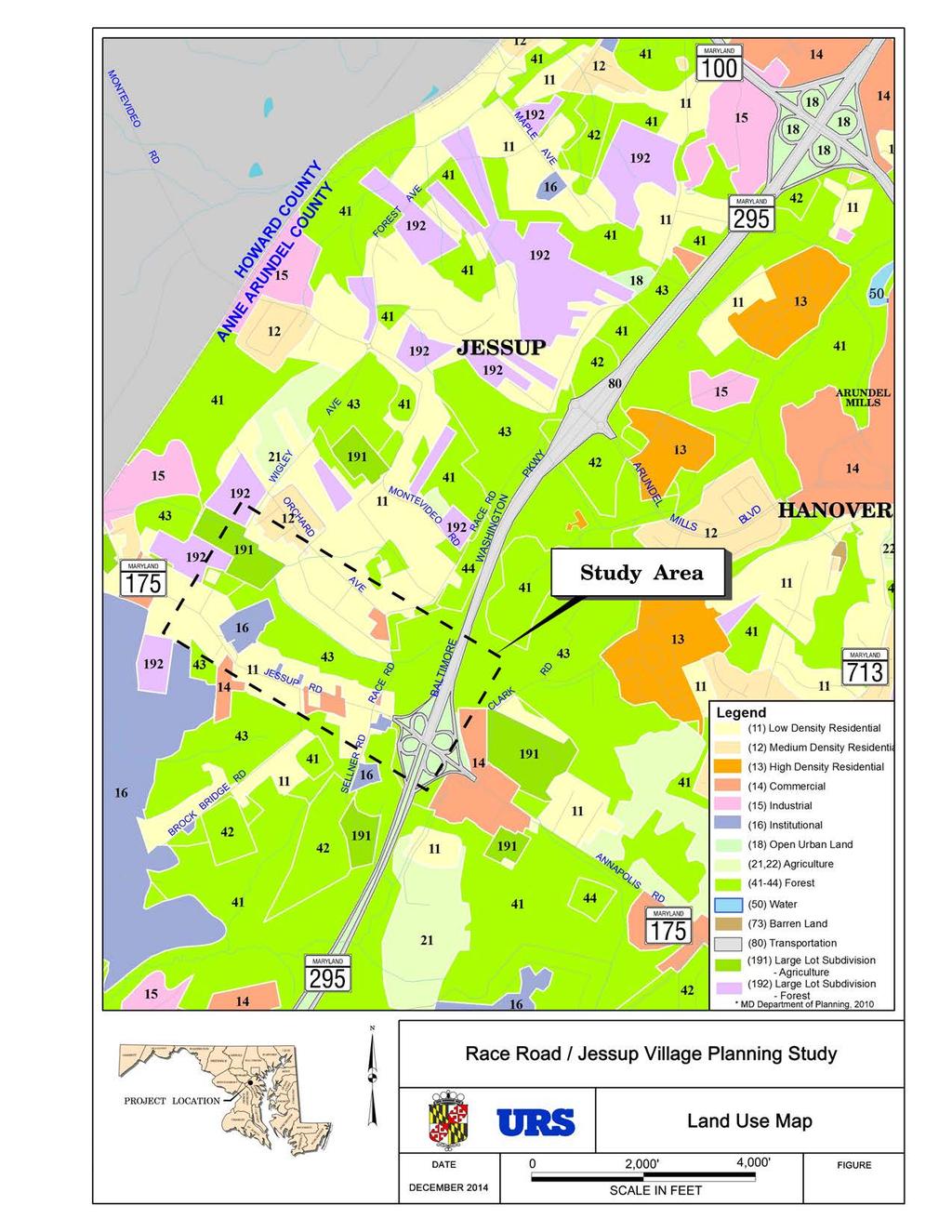
31 MD 175 to the west of Brock Bridge Road, which is expected to remain a two-lane roadway, is expected to experience gradually worsening operations through Based on the above results, and the forecasted ADTs, the road segment geometry west of Brock Bridge Road should be modified in the future to accommodate the projected demand, which will lead to increased durations of periods of congestion. Currently there is no consideration in the Long Range Plan (General Development Plan or the Jessup/Maryland City Small Area Plan) for either Anne Arundel or Howard Counties for addressing capacity constraints on MD 175 west of Brock Bridge Road. Compliance with Jessup/Maryland City Small Area Plan and Adjacent Developments The Jessup/Maryland City Small Area Plan includes recommendations for a mixed-use and commercial core along with adjacent residential areas in Jessup, with improved pedestrian access to preserve and promote economic development in the area. This plan recommends an improved road pattern which reduces turning movements along MD 175, relocates Race Road to the west, and incorporates the grid street pattern along the north side of MD 175 to reduce the current congestion in the study area. The concept plan for the Jessup Village Concept along MD 175 envisions areas for residential and commercial usage, flanked with sidewalks, landscaping, and streetscape improvements. Additionally, improved access to adjacent developer projects in the study area (National Business Park North and Shannon Property) would comply with some of the plan s recommendations. This Small Area Plan was modified from the 1997 Anne Arundel County General Development Plan with the main focus of enhancing the quality of life in the Jessup/Maryland City area by implementing goals and recommendations of the General Development Plan. The Jessup/Maryland City Small Area Plan outlines the following recommendations as they pertain to the Race Road/Jessup Village study area: Key Land Use Recommendations Designate the Clarks Hundred (National Business Park North) area for future residential mixed use development. This includes the MD 175 corridor between Brock Bridge Road and Sellner Road and extends from MD 175 south to the National Business Park. Develop a comprehensive master plan for a Jessup Village Concept along MD 175 between Old Jessup Road and MD 295. This plan should incorporate public spaces, small businesses to serve the local community, preservation of historic homes, sidewalks and streetscape improvements, and design standards that promote a village character. In keeping with the idea of preserving the semi-rural character of Jessup, assign a Low Density Residential land use designation to the portion of Jessup located west of MD 295, north of the MD 175 corridor, and south of the MD 100 corridor. This recognizes the desire of the community in general to retain the current low density zoning. As shown on the Land Use Map (Figure 8) in the Environmental Inventory and Analysis section, this area is designated as low density residential and forest. June 10, 2015 Page 26
32 Key Transportation Recommendation Request that the SHA require southbound truck traffic to exit MD 295 at MD 100 instead of MD 175. This will reduce the volume of heavy truck traffic using MD 175 through Jessup and will easier facilitate the general commute to and from the area. Consistency with Smart Growth, Master Plans, and Related Projects and Studies In the Race Road/Jessup Village study area, there are previous master plans and ongoing projects and studies. To ensure consistency between this project and previous/ongoing efforts, this section provides background information on the previous master plans and ongoing projects and studies. Maryland Smart Growth Law Subsequent to the 1992 Planning Act, Maryland established the Priority Funding Areas Act (1997) to direct State funded growth-related projects to areas designated by local jurisdictions as Priority Funding Areas (PFAs). PFAs include the land within the Baltimore and Washington beltways, established towns, cities, and rural villages, and other existing and proposed communities of sufficient residential and commercial densities. The southern section of the study area along and just north and south of MD 175 lies within a designated PFA. While the PFS designation is not critical for County-funded projects, this information would be necessary if State funds were to be used during future stages of the project. Area Master Plans In addition to the 2004 Jessup/Maryland City Small Area Plan described in the previous section, there are several Area Master Plans that include recommendations and goals for the Race Road/Jessup Village study area, which are described below: The 2009 Anne Arundel County General Development Plan The 2012 Anne Arundel County Corridor Growth Management Plan The 2012 Anne Arundel County Pedestrian and Bicycle Master Plan The 2002 Anne Arundel County Greenways Master Plan Anne Arundel County General Development Plan (April 2009): The General Development Plan, or GDP, is a comprehensive land use plan that establishes policies and recommendations to guide the County, State, and federal agencies, citizens, developers, consultants, community associations, and others in making decisions about growth and development, land preservation, resource protection, and the provision of infrastructure and services. Many significant changes have occurred in the past decade, mainly with continued growth in population and jobs. Several major developments in the western part of Anne Arundel County have brought new employment, housing, entertainment, and shopping opportunities. Examples include the Arundel Mills Mall, the Maryland Live! Casino, the National Business Park Office complex, and the Arundel Preserve mixed-use development. The General Development Plan indicates that the community growth is projected to continue to rise over the next 20 years. As growth along June 10, 2015 Page 27
33 MD 295 continues, especially in the area south of Jessup District, the traffic and therefore the demand for public facilities and services will continue to increase. Anne Arundel County Corridor Growth Management Plan (July 2012): The Corridor Growth Management Plan is a response to the 2009 General Development Plan in which it was noted that the community growth is projected to continue to rise over the next 20 years. The western part of the County faces challenges to mobility and quality of life as it continues to experience a growth in population and employment. The Corridor Growth Management Plan is intended to help develop transportation solutions for alternative modes of travel, while considering the impacts to the community and the cost to implement the projects. The goal is to enhance accessibility for residents, commuters, and businesses to preserve an economic quality of life. Improvements to Race Road are suggested as part of the MD 295 widening between MD 100 and the Baltimore Beltway (I-695), and include widening, signal coordination, and pedestrian and bicycle provisions to improve travel times for local trips and divert some traffic from MD 295 by carrying additional local traffic parallel to the Parkway. Anne Arundel County Pedestrian and Bicycle Master Plan (2009): The Anne Arundel County Pedestrian and Bicycle Master Plan focuses on identifying current facilities and amenities and showing opportunities for these accommodations. The current conditions along MD 175 from Wigley Avenue to the MD 295 interchange, as well as the Race Road corridor, include no sidewalks for pedestrians and no accommodations for bicyclists. However, the expected economic growth along and adjacent to the study area may warrant new pedestrian and bicycle facilities to support connectivity and safety. The Draft 2013 Pedestrian and Bicycle Master Plan Update lists MD 175 from the County Line to MD 295 as a low priority (Tier III) for Pedestrian/Bicycle Needs. Tier III is defined as having a Low Pedestrian/Bicycle Generator score and having No Pedestrian/Bicycle Attractor. There is no mention of Race Road or other roads in the study area; however, the expected economic growth along and adjacent to the study area may warrant new pedestrian and bicycle facilities to support connectivity and safety in the future. Anne Arundel County Greenways Master Plan (October 2002): The goal of the Anne Arundel County Greenways Master Plan is to protect ecologically valuable lands for present and future generations. Based on the map provided in the plan, there are no protected or proposed greenways that fall within the Race Road/Jessup Village study area. However there are proposed greenways indicated south of MD 175 and west of MD 295. Related Projects and Studies The following projects and studies are ongoing or planned in the vicinity of the study area. These projects will contribute traffic to and affect MD 175 with future volume and lane configurations, even if they occur outside of the Race Road/Jessup Village study area. Coordination between these projects and the Race Road/Jessup Village Study Team continued throughout this study. June 10, 2015 Page 28
34 MD 175 Project Planning Study In order to analyze the effect of increased traffic volumes due to numerous developments (Arundel Mills Mall, BWI Business district, etc.) and the large increase in employment and development expected as a result of the 2005 Base Realignment and Closure (BRAC) process, the Maryland State Highway Administration (SHA) conducted the MD 175 Project Planning Study. The limits of the MD 175 Project Planning Study were from Brock Bridge Road to MD 170, east of the current study area, and the Finding of No Significant Impact (FONSI) was signed in Ongoing traffic studies are being conducted for the MD 295/MD 175 interchange and even through the purpose of the projects differ, the results of this study were utilized for the. Developer Improvements to MD 175 Developer improvements to MD 175 at Brock Bridge Road, including widening of MD 175 and realignment of Brock Bridge Road, are ongoing to support National Business Park North and were factored into this study. County Projects The County currently has a Capital Improvement Program (CIP) project (H560900) at MD 175 to add a right turn lane from Wigley Avenue onto MD 175. Summary of Project Purpose and Needs The MD 175 corridor is one of the fastest growing areas in Anne Arundel County and is projected to grow rapidly over the next decade due to intense ongoing development throughout the corridor. Improvements to MD 175 are recommended in various local master plans, and several projects and studies are underway to improve transportation in the surrounding areas. Additionally, as overall traffic congestion on MD 295 increases, Race Road, as a parallel route to MD 295, provides a convenient alternative for local trips. A study of crash history was conducted to examine the safety characteristics of the study area, with particular focus on the intersection of MD 175 and Race Road. The crash rate for the MD 175 corridor in the vicinity of Race Road is significantly higher than the statewide average rate for the three year span reviewed. Of the 98 crashes reported, 43 percent were intersection related. The most common type of collision of the non-intersection related crashes was rear end crashes (32 percent); angle accidents accounted for 21 percent of the crashes. Both of these categories were well above the statewide average. Other categories significantly exceeding the statewide average were opposite direction, sideswipe and truck-related crashes. Additionally, 26 crashes occurred in the immediate vicinity of the MD 175 / Race Road intersection. According to current interchange design standards, there is an insufficient distance between the Race Road intersection with MD 175 and the MD 175 / MD 295 interchange ramps, which is a significant contributor to the current safety and operations in this section of MD 175. As June 10, 2015 Page 29
35 traffic volumes increase with new nearby development, the safety and operational issues experienced today at the intersection of MD 175 and Race Road are expected to worsen. The proposed redesign of the MD 175 / MD 295 interchange by SHA is expected to improve operational issues that are caused by the close proximity of Race Road to the interchange. The separation of the two access points will allow westbound MD 175 traffic to normalize prior to arriving at the Race Road intersection; similarly, in the eastbound direction, drivers will be able to clear the Race Road intersection prior to choosing their route at the MD 295 interchange. However, there will still be some potential for traffic flow conflicts between the MD 175 / Race Road intersection and the MD 175 / MD 295 interchange. Additionally, provision of a much needed traffic signal at the MD 175 / Race Road intersection, in coordination with the interchange improvements, may result in an undesirable traffic signal density along MD 175. In summary, relocation of portions of Race Road and its approach to MD 175 could: Reduce traffic conflicts between the Race Road intersection and the MD 295 interchange Improve safety and reduce delays at both locations Allow for consolidation of intersections along MD 175 Eliminate a potential traffic signal. Environmental Inventory and Analysis Introduction A baseline environmental inventory of natural and cultural resources in the study area was completed in order to describe the location, type, and disposition of resources that may be affected by the proposed roadway improvements. Environmental information from the SHA MD 175 Project Planning Study was utilized as part of this effort. The results of the environmental inventory are illustrated in Figure 7 and resources are characterized with respect to their location and potential regulatory significance with respect to their known status and potential project effects. All references for the Environmental Inventory are included in Appendix D. Development of Project Base Mapping and Environmental Inventory Anne Arundel County and SHA provided various data from available published sources for the. SHA s MD 175 Project Planning Study (2008), the Jessup/Maryland City Small Area Plan, and GIS data were used to identify natural resources June 10, 2015 Page 30


36
37 (wetlands, streams, forests, and floodplains), community features, socioeconomic information, and historic properties. A preliminary field investigation was conducted to verify published information. No detailed surveys, inventories, or delineations of waters of the U.S. (including wetlands) were conducted. Resource information was obtained from online sources including MD imap and MERLIN. Resource information obtained included National Wetland Inventory (NWI) wetlands, waterways, special habitat (GREENprint), and historic properties. The US Fish and Wildlife Service (USFWS) online database was consulted to determine the presence of any federallylisted threatened or endangered species in the study area. MERLIN was consulted for the presence of any known protected habitat for State-listed threatened or endangered species. Land use, 2010 population data, and income data was obtained from the Maryland Department of Planning (MDP) and the US Census online archives. Land Use Land use in the study area consists of low-density residential, commercial properties, and undeveloped areas located north of MD 175 to the east of Race Road and south of MD 175 (Figure 8). Forested areas are located to the east and west of MD 295 with government and institutional facilities west of Brock Bridge Road. These facilities include Jessup Elementary School and the Maryland House of Corrections. A new commercial complex, the National Business Park office complex, is located along Brock Bridge Road, south of MD 175. Community facilities in the study area include a post office, Jessup Elementary School, Jessup Community Hall, St. Lawrence Activity Center, Jessup Baptist Church, and the St. Lawrence Martyr Parish Center. Commercial establishments include Duvall s Market Place, an outdoor market, and Stiegler s Florist. According to the Jessup/Maryland City Small Area Plan, planned development in the study area includes Commercial (COM) property primarily on the north side of MD 175 between Race Road and Oak Ridge Road and a Residential-Commercial Transition (RCT) on both sides of MD 175 between Oak Ridge Road and Jessup Elementary School. The Clarks Hundred Site (now called the Shannon Property and National Business Park North) is a 210-acre residential Mixed-Use Residential (MUR) development bound by MD 175 to the north, MD 295 and Sellner Road to the east, and Brock Bridge Road to the west. The planned Shannon Property development abuts MD 175 and will include mixed-use that is expected to include 274 apartment units and 112 residential townhouse/condominium units. The National Business Park North abuts the Shannon Property and is accessed from Brock Bridge Road (renamed National Business Parkway). National Business Park North is under construction and will consist of 1,626,440 square feet (sq. ft.) office space, 88,660 sq. ft. retail space, 148 midrise apartment units and a 150-room hotel. June 10, 2015 Page 32
38
39 Cultural Resources The Anne Arundel County Office of Planning and Zoning Cultural Resources Division (CRD) is responsible for protecting historic and archaeological resources within the County pursuant to Article 17 [Subdivision and Development ( through )]. The CRD staff review site development activities for potential effects on archaeological sites, historic structures, cemeteries, and scenic and historic roads. The CRD coordinates Section 106 (National Historic Preservation Act) reviews with the Maryland Historical Trust (MHT) for projects that require federal approvals. According to the CRD, there are three (3) properties within the project study area that have been determined eligible for listing to the National Register by the MHT; Trusty Friend (AA- 123), Asa Linthicum House (AA-91), and MD House of Corrections (AA-768). The majority of the study area along MD 175 is within the Jessup Survey District (AA-991). A determination of eligibility was completed for the Jessup Survey District where it was determined not eligible for listing in the National Register. In addition, a DOE completed in 2007 for the Concrete block bungalow (AA-754) was determined not eligible. Two (2) additional resources were identified within the study area in the MHT Inventory of Historic Properies database; Saint Lawrence Catholic Church (AA-20) and Rapaport House (AA- 82). The CRD has no record that these properties were evaluated for National Register eligibility. Table 11 describes the historic resources in the study area and Figure 7 shows the locations of properties described in Table 11. June 10, 2015 Page 34
40 Table 11: Maryland Inventory of Historic Properties in the Study Area MIHP Site ID/Name AA-991 Jessup Survey District AA-768 Maryland House of Corrections AA-91 Asa Linthicum House AA-82 Rapaport House AA-123 Trusty Friend AA-754 Concrete block bungalow AA-20 Saint Lawrence Martyr Catholic Church Description This Historic District lies within a one and a half mile area along MD 175 and contains styles that were nationally popular between the mid-19 th and mid-20 th centuries. Styles include Italian Villa, Second Empire, Colonial Revival American Four-Square and Craftsman-influenced bungalows. The District was considered for listing in the NRHP in 1997 and was determined to be ineligible. During the May 1997 survey it was stated that a nomination could be revisited when elements of the WWII era became 50-years old. Designed by Baltimore architect George Frederick and built between 1874 and Italianate style with a four-story hipped roof and ornamental details remain intact. The House of Correction reflects the penal reform movement of the late 1800s. Eligible for listing on the National Register. South of Jessup Road and west of Brock Bridge Road. Circa 1860, two-story in the Italian Villa style set on native Raritan sandstone. Style similar to AA-92 and AA-123, and the former AA-82. Eligible for listing on the National Register. Located on Jessup Road. The site of a dwelling almost a twin to AA-123, razed in 1975 for a new dwelling. South side of MD 175 between Sellner and Brock Bridge Road. Circa 1870s, the only remaining structure in Jessup built in the Italian Villa style. Two-story frame dwelling with balcony. Eligible for listing on the National Register. North side of MD 175 west of MD 295. A 1 ½ story bungalow of rock-faced concrete block with a broad hipped roof. Representative of the Bungaloid style of the early 20 th century domestic architecture. (No date specified). Not eligible for listing on the National Register. Located on MD 175 west of MD 295. Built in 1866 in the Gothic Revival Style. Brick church with a gabled roof, with a simple exterior design. The interior has Victorian decoration with Italianate influence. No determination of eligibility on record. * Source: Maryland Historical Trust ( accessed May 18, 2013 Natural Resources An inventory of existing natural resources in the study area was completed using available published sources and field reconnaissance. The following describes natural resources evaluated in the study area. June 10, 2015 Page 35
41 Waters of the US The study area is located within the Patuxent River watershed and is drained by unnamed tributaries of Dorsey Run and the Little Patuxent River. The Little Patuxent River and its tributaries are designated as Use I-P waters (Water Contact Recreation, and Protection of Aquatic Life). An intermittent stream with contiguous ephemeral channels flows from east to west south of the intersection of MD 175 and MD 295. It continues west under Race Road, to its confluence with Dorsey Run located south of Citrus Avenue and east of Wigley Avenue. A new stormwater management facility associated with the widening of MD 175 is located immediately south of the intermittent stream and north of Duvall s Market Place. The general locations of these waterways and the stormwater management facility are shown in Figure 7. The MD 175 (Annapolis Road) Project Planning Study (MD SHA, 2011) identified two wetlands west of Race Road and southwest of MD-295. Preliminary field investigations identified small potential wetland areas within the floodplain of the intermittent stream (Figure 7). A field delineation of waters of the US may be required to determine the presence of these resources within the study area. If it is determined that waters of the US are present, a permit determination may be required if project impacts to regulated resources are proposed. For impacts to waters of the US and their buffers, authorization may be required from the US Army Corps of Engineers (USACE) and the Maryland Department of the Environment (MDE). Minor impacts to waters of the US may be authorized under the Maryland State Programmatic General Permit (MDSPGP-4) by MDE. Forests Forested areas exist between the developed areas along MD 175 and the residential properties along Citrus Avenue, along both the eastern and western sides of Race Road, and east to MD 295. Forested areas located west of Race Road were investigated to identify the successional stage, species composition, general health, and presence of non-native invasive species. The forest is characterized as mid-successional and is dominated by tulip poplar (Liriodendron tulipifera) and red maple (Acer rubrum) in the overstory with sweetgum (Liquidambar styraciflua) and black cherry (Prunus serotina) in the sub-canopy. This forest is classified as Yellow-Poplar eastern forest cover type (Eyre, 1980). Other observed species in this forest included red oak (Quercus rubra), white oak (Quercus alba), and black locust (Robinia pseudoacacia) in upland areas; and blackgum (Nyssa sylvatica) and elm (Ulmus spp.) along drainage swales. The forest understory is dominated by non-native invasive species including multiflora rose (Rosa multiflora), oriental bittersweet (Celastrus orbiculata), Japanese honeysuckle (Lonicera japonica); with minor coverage of native Virginia creeper (Parthenocissus quinquefolia) in the herbaceous layer. The Jessup/Maryland City Small Area Plan identifies the importance of minimizing forest impacts relative to increasing forest retention and open space to the extent possible. The Plan recognizes that protecting natural resources is a high priority to the community and that the June 10, 2015 Page 36
42 retention of buffers along waterways is necessary to prevent further degradation of local streams such as the tributaries to Dorsey Run. In addition to the broader goals employed during planning, development of forested areas is regulated pursuant to (Forest Conservation) of the County Code. Linear transportation projects are exempt from the Forest Conservation provisions as long as the project does not result in the cutting, clearing, or grading of more than 20,000 square feet of forest. Any non-exempt linear project is required to satisfy the Forest Conservation provisions of the County Code including preparation of a Forest Stand Delineation (FSD) and Forest Conservation Plan (FCP) detailing the location of proposed forest retention, afforestation, and reforestation Floodplains Development in designated 100-year floodplains is regulated pursuant to Article 16 of the Anne Arundel County Code (Floodplain Management, Erosion and Sediment Control, and Stormwater Management). According to FEMA floodplain mapping (FEMA, 2012), no floodplains are mapped within the study area. Threatened and Endangered Species Both the federal Endangered Species Act and the Maryland Nongame and Endangered Species Conservation Act provide the regulatory authority over activities affecting both federal and State listed species. Both the U.S. Fish and Wildlife Service (USFWS) and the Maryland Department of Natural Resources (DNR) maintain a database of listed rare, threatened, and endangered species and their habitats. Published DNR information, the Sensitive Species Project Review Areas (SSPRA) mapping, indicates that no threatened or endangered species or habitat occurs within the study area. Coordination with the DNR Environmental Review Unit; Fisheries Unit; and Natural Heritage Program would be necessary to obtain current information on any known State listed or protected resources within the study area. According to the USFWS (June 12, 2013) online certification, except for occasional transient individuals, no federally proposed or listed threatened or endangered species are known to exist within the study area (Appendix E). Population and Demographics The U.S. Census identifies Jessup as a Census Designated Place (CDP). Population and demographic data were obtained from the MDP State Data Center and the US Census (2010 census data accessed May 27 and June 12, 2013). The population for Jessup was 7,865 in 2000 and 7,137 in 2010, a decrease of 10 percent. Comparatively, the population for Anne Arundel County was 489,677 in 2000 and 537,656 in 2010, an increase of nine percent. Table 12 shows the demographic distribution, median income, and percent low income for Jessup and Anne Arundel County, Maryland. Approximately 65 percent of the population in Jessup is minority, as compared to 28 percent minority countywide. June 10, 2015 Page 37
43 Table 12: Demographic Distribution (2010 Census) Jessup Anne Arundel County Category Total Percent Total Percent Black or African American 4, , American Indian 11 and Alaska 0.2 1, Native alone Asian , Native Hawaiian and Other Pacific Islander alone Some Other Race alone Two or More Races , Hispanic or Latino* , Total Minority 4, , White Alone 2, , Total Population 7, , * Hispanic or Latino is a component of all races listed above. Median Household Income The median household income for the Jessup CDP, which includes a portion of Howard County, was $50,014 for the American Community Survey (U.S. Census Bureau, 2012). The median incomes for Anne Arundel County and for Maryland during the same time period were $85,690 and $72,419, respectively. Median Incomes for Jessup, Anne Arundel County, and Maryland are shown in Table 13. Table 13: Median Household Income, (Jessup CDP) Jessup $50,014 Anne Arundel County $85,690 Maryland $72,419 Source: U.S. Census Bureau, American Community Survey, December June 10, 2015 Page 38
44 Alternatives Development The proposed Build Alternatives were developed to address the factors stated in the Purpose and Need and to minimize impacts to the natural, cultural, and socioeconomic resources in the study area. The Race Road/Jessup Village Build Alternatives developed for this study include: Alternative 1: No-Build (includes the implementation of roadway and intersection improvements on MD 175 by others with no relocation of Race Road) Alternative 2: Relocation of Race Road and Implementation of Jessup Village Paper Roads Alternative 3: Relocation of Race Road Only The alternatives consist of proposed new alignments of Race Road as well as typical sections that accommodate the anticipated future (2035) traffic and the safe passage of pedestrians and bicyclists in the study area, and are described in more detail in the following sections. The design criteria and stormwater management guidelines used to develop the alternative alignments and typical sections are described below. Design Criteria Horizontal and vertical geometry for Race Road was based on Anne Arundel County design standards, the American Association of State Highway and Transportation Officials (AASHTO) Green Book, and supporting guidance materials assuming the following guidelines: Anne Arundel County functional classification: Minor Arterial AASHTO functional classification: Urban Minor Arterial Posted speed: 35 mph Design speed: 45 mph (where possible, based on County direction) The project design criteria used to develop the Build Alternatives consist of the following: Horizontal Alignment o Minimum radius 660 ft. (45 mph) (AASHTO 2001) 510 ft. (40 mph) (AASHTO 2001) 380 ft. (35 mph) (AASHTO 2001) o Maximum superelevation (e max ): 6% (County Design Manual Roads and Streets ; rural section) o Minimum tangent between curves: 100 ft. for design speed 45 mph or less June 10, 2015 Page 39
45 Vertical Alignment o Minimum grade: 1% unless otherwise approved by the County (County Design Manual Roads and Streets ) o Maximum grade 6% (40 mph) (County Design Manual Roads and Streets ) 5% (50 mph) (County Design Manual Roads and Streets ) o Stopping sight distance: 400 ft. (County Design Manual Roads and Streets ) o K value (sag curve): 90 (County Design Manual Roads and Streets ) o K value (crest curve): 61 (AASHTO 2001) Design vehicle: WB-67 Minimum curb fillet radius o Local - Minor Arterial: 20 ft. (County Design Manual Roads and Streets ) o Principal Arterial - Minor Arterial: 30 ft. (County Design Manual Roads and Streets ) Typical Section o Standard pavement cross slope: 2% (County Design Manual Paving ) o Lane widths: 11 ft. (based on County direction) o Sidewalk widths: 5 ft. minimum (County Design Manual Roads and Streets ) o Bike lane: 5 ft. (SHA Bike Policy and Design Guide, May 2013) o Clear zone widths: 1.5 ft. minimum (AASHTO 2001) o Grading Slopes: 2:1 maximum (County Design Manual Paving ). For a conservative estimate at this stage of planning, a 3:1 grading slope was utilized for the alternatives. Traffic o Use 2035 forecasted AM and PM peak hour turning movement volumes as previously presented and redirect traffic volumes as appropriate along the proposed roadway network. Stormwater Management Guidelines In addition to roadway geometry, stormwater management (SWM) needs were identified throughout the study area to assist in the identification of the potential limits of disturbance. The preliminary concepts have been prepared in accordance with the requirements and guidelines set forth in the Anne Arundel County Stormwater Management Practices and Procedures Manual, the Maryland State Highway Administration Guidelines for Preparing Stormwater Management Concept Reports and the Maryland Stormwater Design Manual. Potential SWM ponds and/or other water quality/recharge volume structures were identified based on existing low points, proposed profile, and natural features in the grade as part of this study. Potential bioswales could be located in new right-of-way outside of the proposed sidewalks. More information, including a SWM calculation summary, is included in Appendix F. June 10, 2015 Page 40
46 At the feasibility stage, and since a large amount of pavement is being added in an undeveloped area, it is assumed that there will be a requirement for some quantity control that might require a pond, or that Environmental Site Design (ESD) in the form of numerous small facilities may not be possible in all desired locations. At this stage of the study, the pond design is a conservative estimate. These calculations and SWM design will be refined during later stages of design. Additionally, it has been noted that Race Road north of the study area experiences flooding. Additional roadway drainage evaluation could be considered in future design phases. Alternative 1: No Build (2035) The purpose of the No Build Alternative is to serve as a basis of comparison of the benefits and impacts of the Build Alternatives. For many projects, the future No Build conditions differ from the existing condition only in terms of the number of vehicles expected to be using the road. This is not the case for the where the section of MD 175 included in the study area is expected to undergo significant geometric changes between 2013 and 2035 in addition to experiencing increased traffic volumes. Anticipated changes to the roadway network shown in Figure 9 include the following: 1. The intersection of MD 175 and Brock Bridge Road is expected to undergo expansion as a result of additional new development at National Business Park. 2. The Shannon Property development is expected to result in consolidated access points along eastbound MD 175 between Brock Bridge Road and Sellner Road, possible construction of a new signalized intersection at MD 175 and Chestnut Avenue, and the conversion of Sellner Road at MD 175 to a right-in/right-out access point. 3. Although not currently funded for construction, improvements to the MD 175 / MD 295 interchange by SHA are expected to result in the following: a. Significant widening along MD 175 from west of Race Road / Sellner Road to east of Clark Road / Max Blobs Park Road, b. Removal of two of the loop ramps at the interchange, c. Introduction of two new signalized intersections at the interchange, d. Relocation of the directional ramps at the interchange to increase the distances between the interchange ramps and the adjacent intersections of MD 175 with Race Road / Sellner Road and Clark Road / Max Blobs Park Road, and e. Signalization of the intersection of MD 175 at Race Road / Sellner Road. Alternative 2: Relocation of Race Road and Implementation of Jessup Village Paper Roads To address the elements of Purpose and Need, Alternative 2 is intended to improve safety in the study area by including bike lanes and sidewalks, which do not currently exist on Race Road, as well as a dedicated access road to Jessup Elementary School. Additionally, this alternative includes elements of the Jessup Village Concept envisioned and recommended in the Jessup/Maryland City Small Area Plan by relocating Race Road to the Chestnut Avenue June 10, 2015 Page 41

47
48 intersection with MD 175 and utilizing the paper roads/grid system depicted by the existing property lines. It should be noted that the County does not currently own the right-of-way associated with the platted paper roads. The alignment of Alternative 2, shown in Figures 10A and 10B, was developed to relocate Race Road to the Chestnut Avenue intersection with MD 175, while utilizing the paper roads between parcels and providing dedicated access to Jessup Elementary School and additional access from Brock Bridge Road Extended. It should be noted that at this stage of preliminary study, a conservative construction Limit of Disturbance (LOD) is assumed. The LOD will be further refined during future design, and impacts and displacements that are identified at this stage may change. Beginning at the Race Road intersection with Orchard Avenue, the existing curve is smoothed to match the design speed of other existing curves on Race Road (35 mph; 380-foot curve radii). The Orchard Avenue leg of the intersection is extended to meet the realignment of Race Road. In order to improve sight distance, the intersection of Citrus Avenue with Race Road is realigned to a perpendicular approach with a 45 mph design speed, the proposed intersection sight distance is 510 feet for left turns and 445 feet for right turns. While direct access to Old Race Road will be closed from MD 175, driveway access to the property on Old Race Road will be maintained from Race Road Relocated. The curve approaching the Race Road Relocated/Chestnut Avenue intersection utilizes a 35 mph design speed and 380- foot curve radii in order to minimize impacts. Chestnut Avenue Extended will be a two-way roadway segment that connects Race Road Relocated to MD 175. Similarly, Brock Bridge Road Extended will be a two-way roadway segment that connects Race Road Relocated to MD 175. Between Brock Bridge Road Extended and Elementary School Lane, Race Road Relocated will be a one-way roadway providing access to Jessup Elementary School. To minimize additional property impacts, where Alternative 2 follows the paper roads between parcels, the centerline of the alignment matches the center of the paper road. Alternative 2 could be implemented as phased improvements that may each be more cost effective and provide a more immediate and noticeable improvement in traffic flow and operations. These phased improvements could be constructed as independent projects that over time, as funding becomes available or as adjacent development dictates, would result in the full improvement. As depicted on Figures 10A and 10B, the three separate construction phases include the relocation of Race Road to the Chestnut Avenue Extended intersection with MD 175 (Construction Phase 1), the smoothing of the curve at Race Road / Orchard Avenue and intersection modifications at Orchard Avenue and Citrus Avenue (Construction Phase 2), and the one-way access on Race Road Relocated combined with the addition of Brock Bridge Road Extended (Construction Phase 3). These separate phases are shaded with different colors on Figures 10A and 10B and are noted with the numbered construction phase. The first phase of construction would improve safety by relocating Race Road from its current intersection with MD 175, the second phase would improve safety in the area by significantly smoothing the curve at Race Road / Orchard Avenue and realigning the Race Road / Citrus Avenue June 10, 2015 Page 43


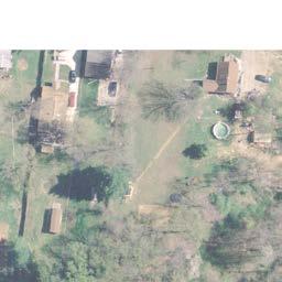


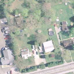


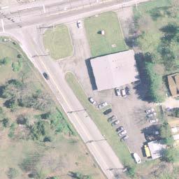


49


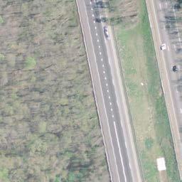


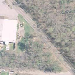


50
 with no shoulders or sidewalks.")

51 intersection, and the third phase of construction implements the paper roads and provides improved access to Jessup Elementary School. Proposed Typical Sections Race Road is functionally classified as a Minor Arterial and currently consists of two 11-foot travel lanes (typical) with no shoulders or sidewalks. To accommodate the minimal anticipated 2035 traffic volumes on Race Road and existing and future pedestrian and bicycle use, the proposed typical section for relocated Race Road includes one 11-foot travel lane, a five-foot bike lane, and a five-foot sidewalk in each direction, along with buffer areas for roadside plantings and clear zone. As shown in Figures 11 and 12 below, the existing typical section for Race Road is 22 feet wide with approximately 50 feet of County right-of-way (as identified by the County s Office of Planning and Zoning GIS data) and the proposed typical section for relocated Race Road is approximately 62 feet wide. Figure 11: Existing Typical Section (Race Road) Figure 12: Proposed Typical Section (Race Road Relocated) June 10, 2015 Page 45

52 The proposed typical section shown above applies to Race Road from approximately 500 feet north of Orchard Avenue near the property located at 7685 Race Road to the tie in at Brock Bridge Road Extended. For Chestnut Avenue Extended, the typical section was incorporated from the tie in to Race Road Relocated for a distance of approximately 350 feet, with the addition of a separate southbound right turn lane lane to westbound MD 175 and a shared through/left turn lane. For Brock Bridge Road Extended, the typical section was also incorporated from the tie in to Race Road Relocated for a distance of approximately 350 feet, with the addition of a separate southbound right turn lane to westbound MD 175 and a shared through/left turn lane. On MD 175, a separate westbound right turn lane is being proposed to access northbound Brock Bridge Road Extended and a separate eastbound left turn lane is being proposed to access northbound Chestnut Avenue Extended. If, during later stages of design, an open typical section is preferred on sections of Race Road instead of the closed section portrayed in Figure 12, additional right-of-way would be required and other impacts would be anticipated. The County s standard rural typical section is shown in Figure 13 below. Potential impacts would also increase if sidewalks and bike lanes are added to the typical section to improve pedestrian and bicyclist safety and access, as with the current alternatives. Figure 13: Anne Arundel County Standard Rural Typical Section As noted above, Alternative 2 includes a one-way roadway for Jessup Elementary School access that includes Race Road Relocated from Brock Bridge Road Extended to Elementary School Lane and from Elementary School Lane to its intersection with MD 175. The proposed typical section for these roadways, as shown in Figure 14 below, contains a 20-foot travel lane and five-foot sidewalks on each side. Traffic analyses show that the single travel lane is expected to operate well under 2035 conditions. The proposed typical section is approximately 50 feet wide. June 10, 2015 Page 46
.")
53 Figure 14: Proposed Typical Section (One-Way Race Road Relocated) Proposed SWM Facilities SWM needs were identified to provide preliminary guidance as to the number and magnitude of facilities that will be required for the construction of realigning Race Road and other associated roadway improvements. Potential SWM facility locations are shown on the Alternative 2 mapping (Figures 10A and 10B). A total surface area of 1.26 acres will be necessary to provide SWM facilities for Alternative 2 due to the large amount of impervious surface area (13.30 acres) and loss of wooded/dense cover resulting from the realignment of Race Road. Alternative 2 has four drainage areas, which are shown draining to proposed SWM ponds east of the Race Road / Citrus Avenue intersection, southeast of the Race Road / Citrus Avenue intersection, north of the Race Road Relocated / Chestnut Avenue Extended intersection, and northeast of the Race Road Relocated / Elementary School Lane intersection. Additionally, proposed bioswales for filtration and retention are shown along the roadway. SWM facilities for Alternative 2 could possibly by combined after further investigation and design and should be revisited throughout the design phase specifically after a thorough geotechnical investigation is completed. It should be noted that more detailed survey information will be necessary for future design and coordination regarding the existing SWM area north of Stieglers Florist and Duvall's Market Place for Alternative 2, where a new SWM facility is proposed adjacent to the existing facility. Potential Displacements With proposed Alternative 2, six potential commercial and residential displacements are possible based on a preliminary footprint and LOD assessment: June 10, 2015 Page 47
54 1. Jessup Baptist Church (intersection of Brock Bridge Road and MD 175) 2. Stieglers Florist (intersection of Race Road Relocated and MD 175) 3. Shed (located in paper road north of Stieglers Florist and Duvall s Market Place) 4. Shed (located in the rear of the lot at 2840 Jessup Road / MD 175) 5. Gerber Collision and Glass (Race Road between Orchard Avenue and Citrus Avenue) 6. Residence (one residence located at 7685 Race Road; two residences on the parcel) Alternative 3: Relocation of Race Road Only To address the elements of Purpose and Need, Alternative 3 is intended to improve safety in the study area by including bike lanes and sidewalks, which do not currently exist. Additionally, this alternative would implement elements of the Jessup Village Concept envisioned and recommended in the Jessup/Maryland City Small Area Plan by relocating Race Road to the Chestnut Avenue intersection with MD 175. The alignment of Alternative 3, shown in Figures 15A and 15B, is similar to the first two construction phases of Alternative 2. This alternative was developed to relocate Race Road to the Chestnut Avenue intersection with MD 175 and increase the design speed for some of the roadway curves. It should be noted that at this stage of preliminary study, a conservative construction LOD is assumed. The LOD will be further refined during future design and impacts and displacements that are identified at this stage may change. Beginning at the Race Road intersection with Orchard Avenue, the alignment contains a curve that is smoothed to meet a design speed of 40 mph (510-foot curve radii), which is greater than the design speed of this curve in Alternative 2. As a result of the increased design speed for this curve, the amount of potential right-of-way impacts also increase. The Orchard Avenue leg of the intersection is extended to meet the realignment of Race Road. In order to improve sight distance, the intersection of Citrus Avenue with Race Road is realigned to a perpendicular approach with a 45 mph design speed, the proposed intersection sight distance is 510 feet for left turns and 445 feet for right turns. While direct access to Old Race Road will be closed from MD 175, driveway access to the property on Old Race Road will be maintained from Race Road Relocated. The curve approaching the Race Road Relocated / MD 175 intersection also utilizes a 40 mph design speed (510-foot, which is also greater than the design speed of this curve in Alternative 2. While Alternative 3 does not include a separate access road for Jessup Elementary School, it could potentially become the first phase of the ultimate build out of Alternative 2, if increased design speeds are preferred. Proposed Typical Sections As with Alternative 2, the proposed Alternative 3 typical section for Race Road Relocated (Figure 12 above) includes one 11-foot travel lane, a five-foot bike lane, and a five-foot sidewalk in each direction, along with buffer areas for roadside plantings and clear zone. At the new intersection with Chestnut Avenue, the roadway section would include a separate southbound right turn lane to westbound MD 175 and a shared through/left turn lane. On MD 175, a June 10, 2015 Page 48


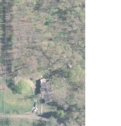


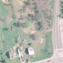


55


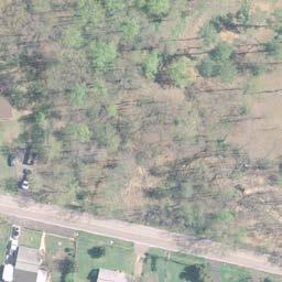


56
57 separate eastbound left turn lane is being proposed to access northbound Race Road Relocated. Proposed SWM Facilities SWM needs were developed to provide preliminary guidance as to the number and magnitude of facilities that will be required for the construction of realigning Race Road and other associated roadway improvements. Potential SWM facility locations are shown on the Alternative 3 mapping (Figures 15A and 15B). A total surface area of 0.81 acres will be necessary to provide SWM facilities for Alternative 3, due to the large amount of impervious surface area (8.59 acres) and loss of wooded/dense cover resulting from the realignment of Race Road. Alternative 3 has one drainage area, which is shown draining to a proposed SWM pond southeast of the Race Road / Citrus Avenue intersection. Additionally, proposed bioswales for filtration and retention are shown along the roadway. Any potential areas should be revisited throughout the design phase and specifically after a thorough geotechnical investigation is completed. Potential Displacements With proposed Alternative 3, four potential commercial and residential displacements are possible based on a preliminary footprint and LOD assessment: 1. Stieglers Florist (intersection of Race Road Relocated and MD 175) 2. Shed (located in paper road north of Stieglers Florist and Duvall s Market Place) 3. Two residences (two residences located at 7685 Race Road; both residences on the parcel) Potential Environmental Permitting A baseline environmental inventory of natural and cultural resources was completed for the study area in October Based on the current inventory, the following permits, approvals, and coordination may be required for implementation of both Alternatives 2 and 3: Nontidal Wetlands and Waterways Permit (MDE) Section 404 Permit (ACOE) Erosion and Sediment Control Approval Stormwater Mangement Plan Approval National Pollutant Discharge Elimination System (NPDES) Approval Section 106 NHPA Forest Conservation Plan Approval Endangered Species Act Coordination with the USFWS, MDNR, and MHT Alternative 2 would impact a portion of the Jessup Elementary School property for construction of a stormwater management facility. Since federal funds and no approvals from FHWA will be sought, Section 4(f) approvals are not required. Alternatives 2 and 3 are within portions of the June 10, 2015 Page 50
58 Jessup Survey District that may be of local or national significance and a potentially historic district. Consultation with the Anne Arundel County Office of Planning and Zoning Cultural Resources Division and the Maryland Historical Trust (MHT) will be required to determine the status of the Jessup Survey District. The baseline environmental inventory includes three potential wetlands, two delineated wetlands, and several waters of the US in the study area. Alternatives 2 and 3 may affect waters of the U.S., including wetlands. A field delineation of waters of the U.S. would confirm the presence of waters of the U.S. in the study area. If it is determined that waters of the US are present and the project impacts regulated resources, authorization may be required from the ACOE and the Maryland Department of the Environment (MDE). Alternatives 2 and 3 may require forest clearing, therefore local forest conservation approvals may be required pursuant to the Forest Conservation provisions of the County Code ( ). Preparation of a Forest Stand Delineation and Forest Conservation Plan detailing the location of proposed forest retention, afforestation, and reforestation may be required. Alternatives 2 and 3 would require coordination with the USFWS, Maryland Department of Natural Resources (Environmental Review Unit/Fisheries Unit/Natural Heritage Program) to determine the potential presence of listed threatened or endangered species or protected resources in the study area. Traffic Analyses Build Alternatives The traffic analyses of the Build Alternatives were performed in the same manner as the Existing and No Build conditions. For the Synchro analyses of the future Build conditions, the signal timings were optimized throughout the network for both peak periods. For reference, the 2035 No Build traffic volumes, as presented earlier, are provided in Figure 16. The SHA Data Services Engineering Division recently conducted an extensive study of the MD 295/MD 175 interchange, and performed VISSIM analyses as part of that study. The study area included the MD 175/Brock Bridge Road intersection. The VISSIM results of that study indicated that, due to the provision of at least one new signal at the MD 295/MD 175 interchange, traffic flow on westbound MD 175 was modified to the extent that the reduced storage for the westbound left turn lanes on MD 175 at Brock Bridge Road resulting from the proposed Chestnut Avenue signal would be adequate. Analyses for Alternative 2 assume that traffic traveling between Race Road and MD 175 could be relocated to either the new northern leg of the MD 175 / Chestnut Avenue Extended intersection, or to the new northern leg of the MD 175 / Brock Bridge Road Extended intersection. Analysis results are presented for each intersection assuming the worst-case scenario, which is that each intersection receives all of the relocated traffic. The analyses also assume that traffic wishing to access Jessup Elementary School will access the school via the new northern leg of the MD 175 / Brock Bridge Road Extended intersection, and that traffic June 10, 2015 Page 51
59
60 departing the school will use Elementary School Lane, immediately east of the school, which is proposed to be converted to a one-way westbound/southbound road. The traffic volumes for Alternative 2, including the redistributions discussed above, are provided in Figure 17. (Because the worst case scenario is shown for two intersections along MD 175, the volumes in Figure 17 will not balance between those two intersections.) Analyses for Alternative 3 assume that traffic traveling between Race Road and MD 175 will be relocated to the new northern leg of the MD 175 / Race Road Relocated / Chestnut Avenue intersection. No other changes were made to the Synchro models. The traffic volumes for Alternative 3, including the redistributions discussed above, are provided in Figure 18. Traffic Operations Analysis Results The peak hour volumes were analyzed using CLA. The results of these analyses are summarized in Table 14. The worksheets are provided in Appendix G. In addition to the analyses performed using CLA, which assesses each intersection as a whole, analyses were performed using Synchro, which allows an assessment of each approach to each intersection. The results of the Synchro analyses are summarized in Table 15. The Synchro models are provided in Appendix G. Delay is reported as seconds per vehicle for each approach. Examination of Tables 14 and 15 shows that redistribution of traffic volumes due to Alternatives 2 and 3 are expected to have a relatively small effect on traffic operations at the intersections along MD 175 compared to the 2035 No Build condition (Alternative 1). Alternative 3, in particular, is expected to result in minor changes to traffic operations due to the minor traffic volumes expected to access both Chestnut Avenue and Race Road Relocated. Alternative 2, with the addition of Brock Bridge Road Extended, may experience more significant effects due to the relatively high traffic volumes anticipated for Brock Bridge Road. Review of the Synchro analyses shows that all movements at the potential new intersections along the relocated portion of Race Road under both Alternatives 2 and 3 are expected to operate at LOS A or B during both the AM and PM peak hours in All movements at the intersection of Race Road and Orchard Avenue are expected to operate at LOS A during both the AM and PM peak hours in 2035, both with and without the geometric improvements in place. Under the conditions presented, Chestnut Avenue would intersect MD 175 within a proposed double left turn lane to Brock Bridge Road. Analyses show that if the signal timings in the MD 175 corridor from Brock Bridge Road to east of the MD 175 / MD 295 interchange are well coordinated, the system will be expected to operate well with the intersection of MD 175 and Chestnut Avenue in place. June 10, 2015 Page 53
61
62
63 Intersection Table 14: Traffic Operational Analysis for Study Area Intersections (CLA) Existing (2013) AM Peak LOS (v/c) PM Peak LOS (v/c) Alternative 1: No Build (2035) AM Peak LOS (v/c) PM Peak LOS (v/c) Alternative 2 (2035) AM Peak LOS (v/c) AM Peak LOS (v/c) Alternative 3 (2035) AM Peak LOS (v/c) AM Peak LOS (v/c) MD 175 at Elementary School Lane A (0.61) B (0.63) C (0.78) E (0.97) C (0.78) E (0.97) C (0.78) E (0.97) MD 175 at Brock Bridge Road B (0.67) E (0.97) D (0.85) E (0.99) D (0.87) E (0.99) D (0.85) E (0.99) MD 175 at Chestnut Avenue D (0.87) E (0.98) D (0.90) E (0.99) D (0.90) E (0.99) MD 175 at Sellner Road D (0.90) B (0.64) D (0.90) B (0.72) E (0.93) B (0.72) E (0.93) B (0.72) June 10, 2015 Page 56
64 Intersection Table 15 - Synchro Operational Analysis for Study Area Intersections AM Peak LOS (Delay) Existing (2013) PM Peak LOS (Delay) Alternative 1: No Build (2035) AM Peak LOS (Delay) PM Peak LOS (Delay) AM Peak LOS (Delay) Alternative 2 (2035) PM Peak LOS (Delay) AM Peak LOS (Delay) Alternative 3 (2035) PM Peak LOS (Delay) MD 175 at Elementary School Lane: Eastbound MD 175 A (0.0) A (0.0) A (0.0) A (0.0) A (0.0) A (0.0) A (0.0) A (0.0) Westbound MD 175 A (0.0) A (0.0) A (0.0) A (0.0) A (0.0) A (0.0) A (0.0) A (0.0) Southbound School Exit E (49.5) F (>99.9) F (>99.9) F (>99.9) F (52.8) F (>99.9) F (52.8) F (>99.9) Overall Intersection A (1.6) B (17.1) F (>99.9) F (>99.9) A (1.4) A (8.3) A (1.4) A (8.3) MD 175 at Brock Bridge Road: Eastbound MD 175 D (46.4) D (44.6) D (48.4) E (59.6) D (50.5) E (76.1) D (48.4) E (59.6) Westbound MD 175 B (11.8) B (15.9) C (27.8) E (72.3) C (30.3) F (>99.9) C (27.8) E (72.3) Northbound Brock Bridge C (29.8) F (>99.9) D (43.1) F (88.6) D (43.9) F (83.0) D (43.1) F (88.6) Southbound New Segment E (55.9) F (>99.9) Overall Intersection C (23.8) D (52.9) D (35.9) E (76.3) D (38.6) F (87.4) D (35.9) E (76.3) MD 175 at Chestnut Avenue: Eastbound MD C (26.5) C (22.5) B (15.8) B (18.6) B (15.8) B (18.6) Westbound MD A (3.5) B (19.9) B (18.0) B (19.4) B (18.0) B (19.4) Northbound Chestnut Ave E (63.6) F (84.3) E (77.6) F (>99.9) E (77.6) F (>99.9) Southbound New Segment E (57.6) E (64.4) E (57.6) E (64.4) Overall Intersection B (16.7) C (25.7) C (25.3) C (25.1) C (25.3) C (25.1) MD 175 at Sellner Road: Eastbound MD 175 A (0.2) A (0.4) A (9.9) A (2.5) A (0.0) A (0.0) A (0.0) A (0.0) Westbound MD 175 A (0.2) A (0.1) C (31.9) A (8.5) A (0.0) A (0.0) A (0.0) A (0.0) Northbound Sellner Road C (17.0) A (9.6) E (67.8) E (73.9) A (9.3) C (17.6) A (9.3) C (17.6) Southbound Race Road C (15.7) C (15.9) E (72.7) E (68.4) Overall Intersection A (0.8) A (0.7) C (27.4) A (7.7) A (0.3) A (0.4) A (0.3) A (0.4) June 10, 2015 Page 57
65 While one of the goals of the County is to attain and/or maintain LOS D in the AM and PM peak hours at Study Area intersections, the Build Alternatives were developed to minimize further impacts to MD 175 and do not attain LOS D at all locations. It is recognized that any improvements on MD 175 that impact the Location and Design Approval of SHA s MD 295/MD 175 interchange project may trigger a supplemental environmental assessment. The following additional improvements on MD 175 would be required to allow the intersections within the corridor to function at LOS D or better during both the AM and PM peak hours in 2035: At MD 175/Elementary School Lane, provide a second westbound through lane on MD 175 At MD 175/Brock Bridge Road, provide a second westbound through lane on MD 175 and a third eastbound through lane on MD 175 At MD 175/Chestnut Avenue/Race Road Relocated, provide a third eastbound through lane on MD 175. Safety Analysis Under the future conditions MD 175 is expected to be widened to improve capacity, thereby reducing queues and delays, and new traffic signals are expected to be added along MD 175 between Brock Bridge Road and the MD 295 interchange. The improved capacity along MD 175 would be expected to result in a corridor-wide reduction in rear end crashes and sideswipe crashes. Additionally, provision of dedicated left turn lanes into minor approaches along MD 175 would be expected to result in a reduction in angle crashes and opposite direction crashes. Increases in the distance between Race Road and ramps to and from MD 295 on MD 175 will also be expected to result in added safety for vehicles turning into and out of minor approaches along MD 175. Consolidation of intersections along MD 175 under either proposed alternative would be expected to further improve safety within the MD 175 corridor by decreasing the number of conflict points. Impacts and Costs The Study Team identified the preliminary impacts of the two build alternatives on the socioeconomic, cultural, and natural resources documented based on readily available information. Impacts will be refined in later stages of design once detailed survey information is available. Resources such as businesses and environmental and engineering features are identified on the mapping for the alternatives. A summary of preliminary impacts associated with the two alternatives is shown in Table 16: June 10, 2015 Page 58
66 Table 16: Preliminary Impacts Summary Alternative 2 Alternative 3 Impact Type Impact Commercial Displacements 3 1 Residential Displacements 3 3 Parcels Affected Right-of-Way (Including SWM Facilities) acres 6.18 acres Right-of-Way (SWM Facilities Only) 2.88 acres 1.47 acres Wetlands (Mapped and Potential) 0.22 acres 0.15 acres Forest acres 4.59 acres Field Identified Ephemeral Channels 160 linear feet 0 linear feet Stream 545 linear feet 605 linear feet Floodplain 0 acres 0 acres Parkland 1.99 acres 0 acres Jessup Survey District 5.35 acres 1.25 acres High Tension Power Line Towers 0 0 Light/Signal/Utility Poles Fire Hydrants 4 4 The relocation of the stream crossing under Race Road (south of the Citrus Avenue intersection) will most likely require some stream restoration (and associated permitting) on either side of Race Road to ensure proper stream flow, which may increase impacts at those locations. Impacts will be refined as design progresses. Preliminary cost estimates were developed for the two alternatives using the SHA Highway Construction Cost Estimating Manual and recent project unit costs. Right-of-way costs were reviewed by the County s Right-of-Way Division and represent a conservative estimate. This information is summarized in Table 17. Preliminary engineering costs were estimated as 15 percent of the construction costs, based on SHA s recommendations. The right-of-way land cost attributed to stormwater management needs is approximately $6,380,000 for Alternative 2 and $3,257,000 for Alternative 3. Detailed cost estimates for Alternatives 2 and 3 are included in Appendix H. June 10, 2015 Page 59
67 Table 17: Cost Estimate Summary Alternative 2 Alternative 3 Category Cost Estimate Preliminary Engineering $2,085,000 $1,009,000 Administrative Overhead $1,844,000 $893,000 Right-of-Way $30,742,000 $13,700,000 Construction $12,051,000 $5,832,000 Total $46,722,000 $21,434,000 It should be noted that the Alternative 2 cost estimate represents the entire project and is not split into the three construction phases which were shown on Figures 10A and 10B. If the project was split into three separate phases, the total cost would likely be higher due to combining the three independent sections together into one complete improvement. Public Involvement The Study Team attended two community meetings to share information and seek input on the : Public Workshop at the Jessup Improvement Association s Hall (November 18, 2013) Public Workshop at Jessup Elementary School (September 4, 2014) At each of these community meetings, the project background was presented, along with the purpose, scope, and schedule. The conceptual alternatives were shown and feedback on the alternatives was received from those in attendance. The public comments received, along with Study Team responses, are included in Appendix I. Additionally, a project newsletter was prepared in Spring 2015 and is included in Appendix J. Summary and Conclusions The purpose of this project is to improve safety for all travelers (including pedestrians and bicyclists) in the study area, implement elements of the Jessup Village Concept along MD 175 envisioned and recommended in the Jessup/Maryland City Small Area Plan, and accommodate future (2035) traffic volumes that are projected to result from planned development and employment growth in the Jessup area. Relocation of Race Road is needed to address the following factors: Vehicular, bicyclist, and pedestrian safety Traffic operations at study area intersections Compliance with Jessup/Maryland City Small Area Plan and adjacent developments Consistency with Smart Growth, master plans, and related projects and studies. June 10, 2015 Page 60
68 Travel demand forecasts for the future design year 2035 were produced using provided traffic data and were examined to develop improvement concepts. Three conceptual alternatives were developed for the. Alternative 1 was the No- Build condition, which included future SHA and developer improvements. Alternative 2 includes the relocation of Race Road and implementation of Jessup Village paper roads. A dedicated access road to Jessup Elementary School was proposed, in addition to elements of the Jessup Village Concept envisioned and recommended in the Jessup/Maryland City Small Area Plan relocating Race Road to the Chestnut Avenue intersection with MD 175 and utilizing the paper roads/grid system depicted by the existing property lines. Alternative 3 proposed the relocation of Race Road only and also implemented elements of the Jessup Village Concept envisioned and recommended in the Jessup/Maryland City Small Area Plan by relocating Race Road to the Chestnut Avenue intersection with MD 175. Based on feedback received from the Project Management Team (PMT), the Recommended Alternative for this study is Alternative 3. Alternative 3 provides similar traffic and safety benefits as Alternative 2, with less cost and impacts. Alternative 3 was developed such that the additional components included in Alternative 2 (the one-way Jessup Elementary access and the additional connection to Brock Bridge Road Extended) could be constructed at a later time, as funding permits. The Recommended Alternative is estimated to cost $21.4 million, including $1.0 million for preliminary engineering, $0.9 million for administrative overhead, $13.7 million for right-of-way, and $5.8 million for construction. Comments received from SHA are included in Appendix K and reflect design features that should be addressed in any follow-up work regarding this study. Upon completion of this study, Anne Arundel County will decide whether to pursue the reconstruction, realignment, and relocation of Race Road from north of Orchard Avenue to the new intersection with Jessup Road (MD 175) to west of the current intersection and the parallel section with MD 175 east of Jessup Elementary School as one or multiple projects. Construction of Alternative 3 could be funded through a combination of sources, including: 1. Road Impact Fees in District 4 or 6 (see Figure 19) 2. Road Impact Fee Credit Agreements with future developers in the vicinity 3. A tax increment financing district, which is established by the County Council for a specific area and creates funds for a capital project that benefits the area 4. Developer contributions of construction funding and/or right-of-way and/or bond sales. June 10, 2015 Page 61

69 Figure 19: Anne Arundel County Transportation Impact Fee Zones June 10, 2015 Page 62
Alternatives Development Three conceptual alternatives were developed for the Race Road/Jessup Village Planning Study and are described below:
 Race Road/Jessup Village Planning Study (H550601) Project Newsletter Spring 2015 Project Description The Study Team, consisting of staff from Anne Arundel County (Department of Public Works and Department
PROJECT BACKGROUND. Preliminary Design Scope and Tasks
 PROJECT BACKGROUND Preliminary Design Scope and Tasks The purpose of this Study is the development of preliminary designs for intersection improvements for Trunk Highway (TH) 36 at the intersections of
NORTH-SOUTH CORRIDOR STUDY EXECUTIVE SUMMARY. Executive Summary
 Executive Summary Background As congestion continues to affect mobility in the region, the Ozarks Transportation Organization (OTO) is particularly concerned with traffic movement. The North-South Corridor
The Illinois Department of Transportation and Lake County Division of Transportation. Route 173, including the Millburn Bypass
 The Illinois Department of Transportation and Lake County Division of Transportation welcome you to this Public Hearing for U.S. Route 45 from Illinois Route 132 to Illinois Route 173, including the Millburn
Capital Projects in and near Odenton Town Center
 Capital Projects in and near Odenton Town Center Map ID Anne Arundel County Department of Public Works This project provides for the design, right of way acquisition, and construction of approximately
Executive Summary. NY 7 / NY 2 Corridor
 Executive Summary NY 7 / NY 2 Corridor Transportation and Land Use Study December 2005 Prepared for: Town of Colonie Capital District Transportation Committee Prepared by: Introduction: Land use decisions
Proposed Comprehensive Plan Strategies DRAFT for discussion June 28, 2017
 Proposed Comprehensive Plan Strategies DRAFT for discussion June 28, 2017 Land Use Rural Areas Refine the Farm and Forest area (FF) Update FF boundaries to account for existing lots less than five acres
master plan of highways bus rapid transit amendment
 Scope of Work master plan of highways bus rapid transit amendment September 2011 Montgomery County Planning Department M-NCPPC MontgomeryPlanning.org 1 Scope of Work master plan of highways bus rapid transit
University Parkway Corridor Plan. Public Workshop Sept. 18, 2017
 University Parkway Corridor Plan Public Workshop Sept. 18, 2017 AGENDA 1. Overview of Process 2. Study Area 3. Components of the Plan 4. What We Know 5. What We Have Heard 6. Tonight s Input 7. Next Steps
Gold Line Bus Rapid Transit Transit Oriented Development (BRTOD) Helmo Station Area Plan
 Helmo Station Area Plan") Appendix F Gold Line Bus Rapid Transit Transit Oriented Development (BRTOD) Helmo Station Area Plan Introduction and Purpose of the Plan The Gold Line Bus Rapid Transit facility is an eleven-mile dedicated
Appendix F Gold Line Bus Rapid Transit Transit Oriented Development (BRTOD) Helmo Station Area Plan Introduction and Purpose of the Plan The Gold Line Bus Rapid Transit facility is an eleven-mile dedicated
PREPARED FOR: PLATTEVIEW ROAD CORRIDOR STUDY EXECUTIVE SUMMARY
 PREPARED FOR: PLATTEVIEW ROAD CORRIDOR STUDY EXECUTIVE SUMMARY SEPTEMBER 2016 Introduction The Platteview Road Corridor Study was led by the Metropolitan Area Planning Agency (MAPA) with assistance from
North Carolina Department of Transportation Project Development and Environmental Analysis Branch
 North Carolina Department of Transportation Project Development and Environmental Analysis Branch Citizens Informational Workshop I-85, from I-485 to NC 73 Mecklenburg and Cabarrus Counties October 30,
2.0 PURPOSE AND NEED. 2.1 Purpose. 2.2 Need Traffic Congestion in and around Downtown Derry
 2.0 PURPOSE AND NEED Taking into consideration agency and public input, the purpose and need for the Project was identified early in Project planning. As noted in Appendix A, for purposes of meeting the
Mavis Road Class Environmental Assessment
 Mavis Road Class Environmental Assessment Public Information Centre #2 Wednesday November 9, 2016 6:00 to 8:00 p.m. Please sign in and complete a comment sheet Review the displays on your own or join in
Bypass #16 - Bend Parkway (new alignment for US 97) (MP )
 (MP )") Bypass #16 - Bend Parkway (new alignment for US 97) (MP 134.76-141.83) Description: The Parkway is on new alignment for US 97 through Bend. US 97 is a Statewide Highway on the National Highway System that
Bypass #16 - Bend Parkway (new alignment for US 97) (MP 134.76-141.83) Description: The Parkway is on new alignment for US 97 through Bend. US 97 is a Statewide Highway on the National Highway System that
Southern Gateway Project and Public Green
 Southern Gateway Project and Public Green Transportation and Trinity River Project Committee May 23, 2016 Purpose of Presentation Provide the history and an overview of the Southern Gateway Project (SGP)
Capital Projects impacting Odenton Town Center
 Capital Projects impacting Odenton Town Center 1 2 E549700 W801600/ W801602 Anne Arundel County Department of Public Works Manor View Elementary School Transmission Main - MD 32 @ Meade Phase 2 $34,399,000
Issues Requiring Future Study
 Issues Requiring Future Study Transportation planning is an ongoing process that tends to identify new issues as it finds solutions for others. Some issues are so complex that a solution to one problem
PROPOSED IMPROVEMENTS
 IV. PROPOSED IMPROVEMENTS The proposed improvements for each alternative carried forward are discussed below. A. FUNCTIONAL CLASSIFICATION AND ROADWAY CROSS-SECTIONS The classifications of the roadways
Welcome. Comprehensive Plan & Transportation Plan Open House November 7, 2012
 Welcome Comprehensive Plan & Transportation Plan Open House November 7, 2012 Agenda Proposed future land use plan Comprehensive Plan strategies Traffic forecasts Future traffic operations Possible future
Public input has been an important part of the plan development process.
 Lakewood s Comprehensive Plan recognizes that transportation helps shape the community, and that the way the community provides for the safe and efficient movement of people affects the character of the
4.11 TRAFFIC Existing Conditions Existing Project Site. Existing Street System
 4.11 TRAFFIC This traffic and circulation section is based on a Traffic Impact Study conducted by Linscott Law & Greenspan Engineers, which is provided in full in Appendix F. This traffic analysis has
Project Overview. Get Involved. Public Information Meeting. Contact Information
 Get Involved VDOT representatives will review and evaluate information received as a result of this meeting. Please fill out the comment sheet provided in this brochure if you have any comments or questions.
WELCOME TO OPEN HOUSE TWO November 28, 2018
 Langstaff Road Weston Road to Highway 7 Class Environmental Assessment Study WELCOME TO OPEN HOUSE TWO November 28, 2018 Please sign in and join our mailing list Study Overview York Region is conducting
112th Avenue Light Rail Options Concept Design Report JUNE 2010 PREPARED FOR PREPARED BY TBG PGH
 112th Avenue Light Rail Options Concept Design Report JUNE 2010 PREPARED FOR PREPARED BY TBG060310124909PGH C ontents Introduction 1 Project Overview 1 Public Involvement and Technical Coordination 4 Description
ALTERNATIVES. NCDOT made an early decision to first determine how to build the project (construction method) followed by what to build (alternatives).
 followed by what to build (alternatives).") III. ALTERNATIVES A. CONSTRUCTION METHOD ALTERNATIVES NCDOT made an early decision to first determine how to build the project (construction method) followed by what to build (alternatives). One of the
III. ALTERNATIVES A. CONSTRUCTION METHOD ALTERNATIVES NCDOT made an early decision to first determine how to build the project (construction method) followed by what to build (alternatives). One of the
Public Information Centre #1
 and Highway 401 Interchange Improvements WELCOME Public Information Centre #1 Veterans Memorial Parkway Extension and Highway 401 Interchange Improvements Study May 23, 2012 4 p.m. to 7 p.m. Brief Overview
Silver Line CPAM UPDATE. Transportation and Land Use Committee October 14, 2016
 Silver Line CPAM UPDATE Transportation and Land Use Committee October 14, 2016 Purpose Recap Project History and Map Changes Provide Overview of CPAM Components Discuss Transportation Impacts Discuss Fiscal
SECTION 4(f) DE MINIMIS DOCUMENTATION
 DE MINIMIS DOCUMENTATION") SECTION 4(f) DE MINIMIS DOCUMENTATION Illinois Route 60/83 IL 176 to the intersection of IL 60 (Townline Road) Lake County P-91-084-07 Mundelein Park and Recreation District Project Limit SECTION 4(f)
SECTION 4(f) DE MINIMIS DOCUMENTATION Illinois Route 60/83 IL 176 to the intersection of IL 60 (Townline Road) Lake County P-91-084-07 Mundelein Park and Recreation District Project Limit SECTION 4(f)
MEMORANDUM. DATE: March 15, Chairman and Members Community Redevelopment Agency. Leif J. Ahnell, C.P.A., C.G.F.O. Executive Director
 MEMORANDUM DATE: March 15, 2019 TO: FROM: Chairman and Members Community Redevelopment Agency Leif J. Ahnell, C.P.A., C.G.F.O. Executive Director SUBJECT: Camino Square, IDA No. CRP-16-02, located at 171
ARGENTA TRAIL (CSAH 28/63) REALIGNMENT SOUTH PROJECT (CP 63-25)
 REALIGNMENT SOUTH PROJECT (CP 63-25)") ARGENTA TRAIL (CSAH 28/63) REALIGNMENT SOUTH PROJECT (CP 63-25) Preliminary Design Report February 2015 Prepared For: City of Inver Grove Heights Dakota County Prepared By: Kimley-Horn and Associates,
ARGENTA TRAIL (CSAH 28/63) REALIGNMENT SOUTH PROJECT (CP 63-25) Preliminary Design Report February 2015 Prepared For: City of Inver Grove Heights Dakota County Prepared By: Kimley-Horn and Associates,
A raised and landscaped median will be constructed in South College Avenue between Trilby Road and Skyway Drive.
 5.0 ACCESS CONTROL PLAN This section presents the Access Control Plan Update which has been formulated through the considerable input of the governing agencies, business owners, organized homeowner groups,
TRANSPORTATION ELEMENT GOALS, OBJECTIVES, AND POLICIES
 TRANSPORTATION ELEMENT GOALS, OBJECTIVES, AND POLICIES GOAL 2 The City shall provide a safe, convenient, effective, and energy efficient multimodal transportation system which is coordinated with the Future
4.1 Build Alternative 1 Construction Phasing
 SECTION 4 Implementation Plan This section discusses potential segmentation of the build alternatives into multiple projects for implementation of improvements to the NSH from Rabbit Creek Road to 36th
4-Town Comprehensive Plan DRAFT 7/30/07
 4-Town Comprehensive Plan DRAFT 7/30/07 Acknowledgements ning Committee Town of Harrisburg Norman Roof Randy Nicol Town of Martinsburg Terry Thisse Paul Kelly Town of Montague Jan Bagdanowicz Wendy Perry
This Review Is Divided Into Two Phases:
 Semiahmoo Town Centre Review The purpose of this review: To review the Semiahmoo Town Centre Concept Plan, originally approved in 1993, to ensure that this centre will continue to serve the needs of South
Right-of-Way Acquisitions and Relocations Technical Memorandum
 Right-of-Way Acquisitions and Relocations Technical Memorandum Southeast Extension Project Lincoln Station to RidgeGate Parkway Prepared for: Federal Transit Administration Prepared by: Denver Regional
The transportation system in a community is an
 7 TRANSPORTATION The transportation system in a community is an important factor contributing to the quality of life of the residents. Without a sound transportation system to bring both goods and patrons
IMPLEMENTATION STRATEGIES. In This Chapter. Goals & Strategies 182 Project List 183 Future Land Use 186 CHAPTER 11 IMPLEMENTATION STRATEGIES
 In This Chapter Goals & Strategies 182 Project List 183 Future Land Use 186 11 IMPLEMENTATION STRATEGIES NORTH AUGUSTA, SC 2017 COMPREHENSIVE PLAN 179 Individual commitment to a group effort that is what
Land Use Amendment in Southwood (Ward 11) at and Elbow Drive SW, LOC
 at and Elbow Drive SW, LOC") 2018 November 15 Page 1 of 10 EXECUTIVE SUMMARY This land use amendment application was submitted by Rick Balbi Architect on 2017 August 31 on behalf of Sable Developments Ltd, and with authorization from
2018 November 15 Page 1 of 10 EXECUTIVE SUMMARY This land use amendment application was submitted by Rick Balbi Architect on 2017 August 31 on behalf of Sable Developments Ltd, and with authorization from
COLVER ROAD INDUSTRIAL CONCEPT PLAN
 COLVER ROAD INDUSTRIAL CONCEPT PLAN A CONCEPTUAL LAND USE AND TRANSPORTATION PLAN FOR TA-4 AN URBAN RESERVE AREA OF THE CITY TALENT City of Talent Adopted by City Council Resolution No., June, 2015 PART
New Stanton Project Update July 3, 2012
 New Stanton Project Update July 3, 2012 The Needs BACKGROUND INFO I-70 Geometric Concerns Substandard Horizontal & Vertical Clearance at Center Ave. Bridge (The Center Avenue Bridge is Replaced in all
Eastern Terminus TECHNICAL MEMORANDUM CENTRAL BROWARD EAST-WEST TRANSIT ANALYSIS BROWARD COUNTY, FLORIDA
 Eastern Terminus TECHNICAL MEMORANDUM CENTRAL BROWARD EAST-WEST TRANSIT ANALYSIS BROWARD COUNTY, FLORIDA FINANCIAL PROJECT ID NUMBER 411189-2-22-01 FLORIDA DEPARTMENT OF TRANSPORTATION DISTRICT 4 Prepared
8 February 9, 2011 Public Hearing APPLICANT: 7-ELEVEN, INC.
 . 8 February 9, 2011 Public Hearing APPLICANT: REQUEST: Conditional Use Permit for an automobile service station with a convenience store ADDRESS / DESCRIPTION: 2448 Nimmo Parkway PROPERTY OWNER: COURTHOUSE
1.0 INTRODUCTION 1.1 TH 14 WEST STUDY AREA Project Description Functional Classification Purpose of the Project
 1.0 INTRODUCTION 1.1 TH 14 WEST STUDY AREA 1.1.1 Project Description The Trunk Highway (TH) 14 West Corridor is a two-lane roadway approximately 22 miles in length. Located in Nicollet County, the corridor
14 October 10, 2012 Public Hearing APPLICANT: MPB, INC
 14 October 10, 2012 Public Hearing APPLICANT: MPB, INC PROPERTY OWNER: MUNDEN & ASSOCIATES, LP STAFF PLANNER: Karen Prochilo REQUEST: Conditional Change of Zoning (AG-1 & AG-2 to Conditional O-2) ADDRESS
Heritage Road Improvements from Steeles Avenue to Rivermont Road
 The Corporation of the City of Brampton Heritage Road Improvements from Steeles Avenue to Rivermont Road Class Environmental Assessment Study (Schedule C) September 19, 2013 The Corporation of the City
Date: April 10, 2017 City Council Work Session April 24, 2017: Status Report on the Comprehensive Plan Update and Transportation Master Plan
 AGENDA REPORT To: From: By: Honorable Mayor and City Council Members Warren Hutmacher, City Manager Sharon Ebert, Director Community Development Date: April 10, 2017 Agenda: City Council Work Session April
Section 1. Executive Summary
 Executive Summary (This page left blank intentionally) Executive Summary Background Economic growth in southern Leavenworth County over the past decade has been strong. As both the number of business and
Transportation Research Center
 Increasing Design Flexibility in the AASHTO Green Book Your Department Name Presentation to AASHTO Subcommittee on Design Doug Harwood, MRIGlobal July 2017 Transportation Research Center Resolution of
Michigan City Alternative Analysis Realignment Study. Progress Status Update Report Presentation to City Council February 1, 2012
 Michigan City Alternative Analysis Realignment Study Progress Status Update Report Presentation to City Council Project Web Site Project Web Site is Active www. emichigancity.com Click on NICTD logo at
Transportation. Strategies for Action
 Transportation A major priority for the Overlake Neighborhood is to develop a multimodal transportation system. To achieve this system, a balance has to be found among travel, circulation and access needs;
ACCESS MANAGEMENT REPORT U.S S.H. 1 TO S.H. 14 S.H U.S. 287 TO I-25
 ACCESS MANAGEMENT REPORT U.S. 287 - S.H. 1 TO S.H. 14 S.H. 14 - U.S. 287 TO I-25 Prepared by: City of Fort Collins Transportation Planning 7951 East Maplewood Avenue, Suite 200 210 E. Olive, P.O. Box 580
BOARD OF SUPERVISORS BUSINESS MEETING ACTION ITEM. Endorsement of Design for Route 7/George Washington Boulevard Overpass. Algonkian and Broad Run
 BOARD OF SUPERVISORS BUSINESS MEETING ACTION ITEM Date of Meeting: March 7, 2017 # 14 SUBJECT: ELECTION DISTRICTS: CRITICAL ACTION DATE: STAFF CONTACTS: Endorsement of Design for Route 7/George Washington
TRANSPORTATION ELEMENT
 TRANSPORTATION ELEMENT GOAL I: To create and maintain a safe, efficient and aesthetic transportation system that encourages multi-modal transportation and promotes the mobility strategies of the Ocala
2.7 ac park. TOTAL 5,403 DU 1,297,900 sf 1,105,450 sf 3.87 ac 5,563 DU 1,121,200 sf 1,105,450 sf 3.87 ac
 PLAN AMENDMENT 2013-I-B1: SEVEN CORNERS SPECIAL STUDY Summary of Pre-staffing Comments Planner: Bernard Suchicital bsuchi@fairfaxcounty.gov (703) 324-1254 Background On October 29, 2013, the Board of Supervisors
Secrest Short Cut and Monroe Expressway Small Area Plan AUGUST 29, 2018
 Secrest Short Cut and Monroe Expressway Small Area Plan AUGUST 29, 2018 Background and Process Monroe Expressway will be open by the end of 2018 Union County and Indian Trail identified a need to revisit
MONTGOMERY COUNTY PLANNING DEPARTMENT
 MONTGOMERY COUNTY PLANNING DEPARTMENT THE MARYLAND-NATIONAL CAPITAL PARK AND PLANNING COMMISSION MCPB Item No.: Date: 5-03-18 Pike and Rose, Phase I: Site Plan Amendment No. 82012002D Rhoda Hersson-Ringskog,
Overview of Southwestern Pennsylvania Commission s (SPC) 2040 Long Range Transportation Plan (LRTP)
 2040 Long Range Transportation Plan (LRTP)") Overview of Southwestern Pennsylvania Commission s (SPC) 2040 Long Range Transportation Plan (LRTP) Presented to Pennsylvania Agency Coordination Meeting May 27, 2015 Doug Smith & Ryan Gordon 1 Southwestern
Overview of Southwestern Pennsylvania Commission s (SPC) 2040 Long Range Transportation Plan (LRTP) Presented to Pennsylvania Agency Coordination Meeting May 27, 2015 Doug Smith & Ryan Gordon 1 Southwestern
Midtown Corridor Alternatives Analysis. Appendix A - Initially Considered Alternatives Screening
 Midtown Corridor Alternatives Analysis Appendix A - Initially Considered Alternatives Screening Arterial BRT on Lake Street - Overall Rating: RATING Metropolitan Council recommendations stated in the Transportation
Lake Hazel/Gowen Relocation Alignment Study Report
 Lake Hazel/Gowen Relocation Prepared for 3775 Adams Street Garden City, Idaho 83714 And City of Boise 150 North Capitol Blvd. Boise, Idaho 83702 Prepared by Parametrix 7761 W. Riverside Dr. Suite 201 Boise,
Response: The public school use, including the SWM facility, is within the R-1 District.
 Loudoun County School Board Dulles North Elementary School (ES-31) CMPT 2017-0006 and SPMI 2017-0015 First Response to Referral Comments Zoning Administration Comments dated October 2, 2017 Comment 1:
MODEL ACCESS MANAGEMENT PLAN MINNESOTA TRUNK HIGHWAY 7 COMPREHENSIVE PLAN AMENDMENT (HUTCHINSON SEGMENT)
") MODEL ACCESS MANAGEMENT PLAN MINNESOTA TRUNK HIGHWAY 7 (HUTCHINSON SEGMENT) COMPREHENSIVE PLAN AMENDMENT INTRODUCTION. The purpose of this plan is to provide consistent access management in the Trunk
MODEL ACCESS MANAGEMENT PLAN MINNESOTA TRUNK HIGHWAY 7 (HUTCHINSON SEGMENT) COMPREHENSIVE PLAN AMENDMENT INTRODUCTION. The purpose of this plan is to provide consistent access management in the Trunk
12 January 12, 2011 Public Hearing APPLICANT: TAILWIND DEVELOPMENT GROUP,LLC PROPERTY OWNER: CITY OF VIRGINIA BEACH
 12 January 12, 2011 Public Hearing APPLICANT: TAILWIND DEVELOPMENT GROUP,LLC PROPERTY OWNER: CITY OF VIRGINIA BEACH STAFF PLANNER: Faith Christie REQUEST: Conditional Change of Zoning (from PD-H1 Planned
STATE OF TENNESSEE DEPARTMENT OF TRANSPORTATION ENVIRONMENTAL DIVISION
 STATE OF TENNESSEE DEPARTMENT OF TRANSPORTATION ENVIRONMENTAL DIVISION Suite 900 - James K. Polk Building 505 Deaderick Street Nashville, Tennessee 37243-0334 MEMORANDUM TO: FROM: Files Joe W. Matlock,
Executive Summary. The goals of the Plan are to:
 Executive Summary The Wiscasset Bath Road Master Plan (Plan) seeks to maximize development opportunities along Bath Road through the strategic coordination of traffic infrastructure improvements, land
9 CITY OF VAUGHAN OFFICIAL PLAN AMENDMENT NO BOCA EAST INVESTMENTS LIMITED
 9 CITY OF VAUGHAN OFFICIAL PLAN AMENDMENT NO. 631 - BOCA EAST INVESTMENTS LIMITED The Planning and Economic Development Committee recommends the adoption of the recommendations contained in the following
I. INTRODUCTION. Project Background and Study Area
 I. INTRODUCTION Project Background and Study Area Freedom Parkway is a key east-west corridor connecting I-25 on the west to the Town of Kersey on the east, running approximately one to two miles south
Asbury Chapel Subdivision Sketch Plan
 Asbury Chapel Subdivision Sketch Plan PART 1: PROJECT SUMMARY Applicant: NVR Inc. Project Size: +/- 76.13 acres Parcel Numbers: 02101112,02116101,02116112, 02116113 Current Zoning: Transitional Residential
Route 7/15 Norwalk. Route 7/15 Norwalk Project Project Advisory Committee Meeting #5. Wednesday, November 14 th, Norwalk City Hall
 Route 7/15 Norwalk Project Project Advisory Committee Meeting #5 Route 7/15 Norwalk PAC Meeting #5 November 14, 2018 Wednesday, November 14 th, Norwalk City Hall Route 7/15 Norwalk - AGENDA Introductions
Environmental Critical Issues Report
 Environmental Critical Issues Report May 25, 2018 DRAFT Deliverable Task 9.1 Prepared for: Prepared by: Historical Research Associates, Inc. Blank Page Pacific Avenue SR 7 Corridor HCT Feasibility Study
ARLINGTON COUNTY, VIRGINIA. County Board Agenda Item Meeting of January 28, 2017 SUPPLEMENTAL REPORT-2
 ARLINGTON COUNTY, VIRGINIA County Board Agenda Item Meeting of January 28, 2017 SUPPLEMENTAL REPORT-2 DATE: January 27, 2017 SUBJECT: The Virginia Department of Transportation s Transform I-66 Inside the
Access Management: An Overview
 Figures 1-5 Below Evolution of development along a highway. In the early stages, land along the road is used for farming with little traffic generated. As time passes, the highway corridor becomes a de
The Village of Sugar Grove, in partnership with Kane County, the Illinois Department of Transportation, and the Illinois Tollway welcomes you to the
 The Village of Sugar Grove, in partnership with Kane County, the Illinois Department of Transportation, and the Illinois Tollway welcomes you to the first Public Meeting for the proposed interchange improvement
M-11 (Wilson Avenue) Access Management Plan
 Access Management Plan") M-11 (Wilson Avenue) Access Management Plan Acknowledgements M-11 (Wilson Avenue) Corridor Advisory Committee: City of Walker Michigan Department of Transportation (MDOT) Grand Valley Metropolitan Council
M-11 (Wilson Avenue) Access Management Plan Acknowledgements M-11 (Wilson Avenue) Corridor Advisory Committee: City of Walker Michigan Department of Transportation (MDOT) Grand Valley Metropolitan Council
Existing Transportation System 5-1
 5-1 The Jackson County transportation system is served by several modes of transportation including streets and highways, multi-modal, non-motorized, rail, and aviation. While the focus of the transportation
RESOLUTION NO. R Refining the route, profile and stations for the Downtown Redmond Link Extension
 RESOLUTION NO. R2018-32 Refining the route, profile and stations for the Downtown Redmond Link Extension MEETING: DATE: TYPE OF ACTION: STAFF CONTACT: Capital Committee Board PROPOSED ACTION 09/13/2018
ARLINGTON COUNTY, VIRGINIA. County Board Agenda Item Meeting of January 28, 2017 SUPPLEMENTAL REPORT
 ARLINGTON COUNTY, VIRGINIA County Board Agenda Item Meeting of January 28, 2017 SUPPLEMENTAL REPORT DATE: January 26, 2017 SUBJECT: The Virginia Department of Transportation s Transform I-66 Inside the
On behalf of Metrolinx, in coordination with the City of Mississauga. and Presentation Materials (draft)
") On behalf of Metrolinx, in coordination with the City of Mississauga Port Credit GO Station Area Master Plan Study Advisory Panel Meeting #3 Handouts and Presentation Materials (draft) June 10, 2015 Agenda
On behalf of Metrolinx, in coordination with the City of Mississauga Port Credit GO Station Area Master Plan Study Advisory Panel Meeting #3 Handouts and Presentation Materials (draft) June 10, 2015 Agenda
3 MARKHAM NORTH-SOUTH LINK CORRIDOR PUBLIC TRANSIT IMPROVEMENTS ENVIRONMENTAL ASSESSMENT UPDATE
 3 MARKHAM NORTH-SOUTH LINK CORRIDOR PUBLIC TRANSIT IMPROVEMENTS ENVIRONMENTAL ASSESSMENT UPDATE The Rapid Transit Public/Private Partnership Steering Committee recommends the adoption of the recommendations
Project Overview. Fairfax County Parkway Widening Fairfax County. Get Involved. Public Information Meeting. Contact Information
 Get Involved VDOT representatives will review and evaluate information received as a result of this meeting. Please fill out the comment sheet provided in this brochure if you have any comments or questions.
Chapter 2 Traffic and Safety Assessment
 Paoli Road Improvement Feasibility Study and Public Participation Project Chapter 2 Traffic and Safety Assessment 2.1 Today s Transportation Setting 2 2.2 Transportation Data & Operations 5 2.3 Traffic
Rezoning Transportation Analysis Petition Number: General Location Identifier: , ,
 From: Kelsie Anderson, PE Kelsie.Anderson@charlottenc.gov 704-432-5492 Staff Reviewer: Rick Grochoske, PE rgrochoske@charlottenc.gov 704-432-1556 CDOT s review of this rezoning petition is intended to
Chapter 1 - General Design Guidelines CHAPTER 1 GENERAL DESIGN GUIDELINES
 CHAPTER 1 GENERAL DESIGN GUIDELINES 1.0 INTRODUCTION This Publication has been developed to provide current, uniform procedures and guidelines for the application and design of safe, convenient, efficient
Urban Planning and Land Use
 Urban Planning and Land Use 701 North 7 th Street, Room 423 Phone: (913) 573-5750 Kansas City, Kansas 66101 Fax: (913) 573-5796 Email: planninginfo@wycokck.org www.wycokck.org/planning To: From: City Planning
THAT the attached Terms of Reference for the Thornhill Centre Street Study be approved.
 COMMITTEE OF THE WHOLE AUGUST 18, 2003 THORNHILL CENTRE STREET STUDY PLANNING FILE: 15.92 Recommendation The Commissioner of Planning recommends: THAT the attached Terms of Reference for the Thornhill
burtonsville commercial crossroads neighborhood planning study
 Sector Plan burtonsville commercial crossroads neighborhood planning study Scope of Work Abstract This Scope of Work examines community issues in the Burtonsville Crossroads at US 29 and MD 198, outlines
DRAFT MAP AMENDMENT FLU 04-4
 DRAFT MAP AMENDMENT FLU 04-4 SW 24 TH AVENUE ROADWAY CORRIDOR The University of Florida participates with the Metropolitan Transportation Planning Organization (MTPO) in its responsibilities for the continuing,
MONTGOMERY COUNTY PLANNING DEPARTMENT THE MARYLAND-NATIONAL CAPITAL PARK AND PLANNING COMMISSION
 MONTGOMERY COUNTY PLANNING DEPARTMENT THE MARYLAND-NATIONAL CAPITAL PARK AND PLANNING COMMISSION MCPB Item No. Date: 1/15/2015 Bethesda North Marriott Hotel and Conference Center: Limited Site Plan Amendment
Creating Complete Roadway Corridors:
 Creating Complete Roadway Corridors: The AASHTO Guide to Transportation Landscape Architecture and Environmental Design NCHRP Project 15-33 Status Report AASHTO Standing Committee on Design Technical Committee
C h a p t e r 4 - L a n d U s e, T r a n s p o r t a t i o n N e t w o r k & S o c i o e c o n o m i c C h a r a c t e r i s t i c s
 C h a p t e r 4 - L a n d U s e, T r a n s p o r t a t i o n N e t w o r k & S o c i o e c o n o m i c C h a r a c t e r i s t i c s In order to properly develop a community-based transportation plan for
KEIZER STATION PLAN INTRODUCTION
 KEIZER STATION PLAN INTRODUCTION Planning for this area began in 1987 when the Keizer Comprehensive Plan established the Chemawa Activity Center and McNary Activity Center. The first Chemawa Activity Center
Transportation Improvements
 Transportation Improvements 0 0 Volume II of the Final EIS for the DHS Headquarters consolidation at St. Elizabeths includes analysis to transportation improvements for the DHS Headquarters Consolidation
MORRISVILLE TRANSPORTATION PLAN TOWN COUNCIL PRESENTATION AUGUST 22, 2017
 TOWN COUNCIL PRESENTATION AUGUST 22, 2017 SCENARIO PLANNING CORRIDORS Town Hall Drive Baseline + 2 McCrimmon Parkway Baseline + 2 NC 54 Baseline + 2 7 subregion model runs determining carrying capacity
Northwest Rail Corridor and US 36 BRT Development Oriented Transit Analysis 4.4 STATION AREA FINDINGS
 4.4 STATION AREA FINDINGS Each station is different, and each one requires a separate set of recommendations based on the vision for the site. This section outlines an initial TOD strategy and recommendations
ROAD CLOSURE AND LAND USE AMENDMENT SILVER SPRINGS (WARD 1) NORTHEAST OF NOSEHILL DRIVE NW AND SILVER SPRINGS ROAD NW BYLAWS 2C2018 AND 29D2018
 NORTHEAST OF NOSEHILL DRIVE NW AND SILVER SPRINGS ROAD NW BYLAWS 2C2018 AND 29D2018") Page 1 of 19 EXECUTIVE SUMMARY This application proposes redesignating two parcels in the community of Silver Springs from Special Purpose Future Urban Development (S-FUD) District and undesignated road
Page 1 of 19 EXECUTIVE SUMMARY This application proposes redesignating two parcels in the community of Silver Springs from Special Purpose Future Urban Development (S-FUD) District and undesignated road
Berkshire Regional Planning Commission Clearinghouse Review Report
 August 19, 2013 SUBJECT: Reconstruction of Housatonic Street, Dalton, MA EOEA#: 15083 LOCATION: Dalton ESTIMATED COST: $8.1 million REVIEW TYPE: ENF PROPONENT: MassDOT and Town of Dalton COMMENTS DUE:
Further input invited as Colchester Growth Strategy nears final phase
 IUE 3 / NOVEMBER 2015 Further input invited as Colchester Growth trategy nears final phase trathcona County is seeking public feedback as it enters the final phase of work on a Growth Management trategy
A. INTRODUCTION B. PROJECT LOCATION
 Chapter 1: Project Description A. INTRODUCTION The Lower Manhattan Development Corporation (LMDC), a subsidiary of the New York State Urban Development Corporation, doing business as the Empire State Development
Mitchell Ranch South MPUD Application for Master Planned Unit Development Approval Project Narrative. Introduction
 Mitchell Ranch South MPUD Application for Master Planned Unit Development Approval Project Narrative Introduction Mitchell Ranch South is a proposed single family (detached) residential development on